List of Publications (pdf) - Florida Department of Environmental ...
List of Publications (pdf) - Florida Department of Environmental ...
List of Publications (pdf) - Florida Department of Environmental ...

You also want an ePaper? Increase the reach of your titles
YUMPU automatically turns print PDFs into web optimized ePapers that Google loves.
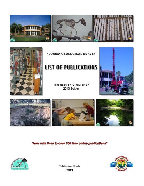
Cover-- Clockwise from top left:<br />
1. FGS Gunter Building.<br />
2. Fossil Horse.<br />
3. FGS cores from drilling operations.<br />
4. SCHRAMM Core Drilling Rig.<br />
5. Wekiwa Spring.<br />
6. Geologist teaches at the microscopes.<br />
7. Recently opened Sinkhole.<br />
8. FGS Research Library.<br />
Counties <strong>of</strong> <strong>Florida</strong>
STATE OF FLORIDA<br />
DEPARTMENT OF ENVIRONMENTAL PROTECTION<br />
Herschel T. Vinyard Jr., Secretary<br />
REGULATORY PROGRAMS<br />
Jeff Littlejohn, Deputy Secretary<br />
FLORIDA GEOLOGICAL SURVEY<br />
Jonathan Arthur, State Geologist and Director<br />
Information Circular 87<br />
<strong>List</strong> <strong>of</strong> <strong>Publications</strong><br />
Edited by: Doug Calman and Frank Rupert<br />
2013 Edition<br />
ISSN 0085-0616
CONTENTS<br />
COUNTIES OF FLORIDA .............................................................................................................................................. 2<br />
CONTENTS ................................................................................................................................................................... 4<br />
THE FLORIDA GEOLOGICAL SURVEY ....................................................................................................................... 5<br />
FLORIDA GEOLOGICAL SURVEY RESEARCH LIBRARY .......................................................................................... 5<br />
PUBLICATIONS OF THE FLORIDA GEOLOGICAL SURVEY ON THE WEB .............................................................. 5<br />
USGS TOPOGRAPHIC MAPS ...................................................................................................................................... 5<br />
FLORIDA GEOLOGICAL SURVEY LOCATION MAP ................................................................................................... 6<br />
ORDERING FLORIDA GEOLOGICAL SURVEY PUBLICATIONS ................................................................................ 7<br />
PUBLICATION ORDER FORM ...................................................................................................................................... 8<br />
ANNUAL REPORTS .................................................................................................................................................... 11<br />
BIENNIAL REPORTS .................................................................................................................................................. 13<br />
BULLETINS ................................................................................................................................................................. 15<br />
INFORMATION CIRCULARS ...................................................................................................................................... 19<br />
LEAFLETS ................................................................................................................................................................... 25<br />
MAP SERIES ............................................................................................................................................................... 26<br />
OPEN FILE MAP SERIES ........................................................................................................................................... 41<br />
OPEN FILE REPORTS ................................................................................................................................................ 51<br />
POSTERS .................................................................................................................................................................... 58<br />
REPORTS OF INVESTIGATIONS ............................................................................................................................... 59<br />
SPECIAL PUBLICATIONS ........................................................................................................................................... 67<br />
VIDEO SERIES ............................................................................................................................................................ 72<br />
INDEX .......................................................................................................................................................................... 73<br />
FLORIDA LIBRARIES RECEIVING FLORIDA GEOLOGICAL SURVEY PUBLICATIONS ......................................... 86<br />
OUT-OF STATE AND INTERNATIONAL LIBRARIES RECEIVING AT LEAST THREE FLORIDA GEOLOGICAL<br />
SURVEY PUBLICATION SERIES ............................................................................................................................... 88<br />
FGS STAFF DIRECTORY ........................................................................................................................................... 91
THE FLORIDA GEOLOGICAL SURVEY<br />
The <strong>Florida</strong> Geological Survey (FGS) is an <strong>of</strong>fice under Regulatory Programs, in the <strong>Florida</strong><br />
<strong>Department</strong> <strong>of</strong> <strong>Environmental</strong> Protection. The mission <strong>of</strong> the FGS is to collect, interpret and provide<br />
objective quality geologic information about <strong>Florida</strong>. Additional information about the programs <strong>of</strong> the FGS<br />
may be obtained from our website at: http://www.dep.state.fl.us/geology/default.htm<br />
FLORIDA GEOLOGICAL SURVEY RESEARCH LIBRARY<br />
The FGS library provides access to basic research materials, including books, state and federal<br />
documents, maps, photographs and periodicals. Materials are collected on various aspects <strong>of</strong> geology,<br />
including mining and mineral resources, environmental geology, hydrogeology, coastal geology and other<br />
related topics. The library is open to the public and is frequently used by students, private consulting firms,<br />
various governmental agencies and the general public. The library also provides detailed information on the<br />
FGS’s more than 700 published documents and reports, and oversees the distribution <strong>of</strong> those documents<br />
currently in print.<br />
PUBLICATIONS OF THE FLORIDA GEOLOGICAL<br />
SURVEY ON THE WEB<br />
Visit our website at: http://www.dep.state.fl.us/geology/publications/list<strong>of</strong>pubs.htm Publication<br />
numbers that are underlined and have a computer icon ( ) in the <strong>List</strong> <strong>of</strong> <strong>Publications</strong> indicate that the<br />
publication is available free online by clicking on the hyperlink.<br />
USGS TOPOGRAPHIC MAPS<br />
The <strong>Florida</strong> Geological Survey does not distribute <strong>Florida</strong> topographic maps. Topographic maps are<br />
prepared by the U.S. Geological Survey and information on pricing and ordering is available from the USGS<br />
at:<br />
USGS Information Services<br />
Box 25286<br />
Denver, CO 80225<br />
Phone 1-888-ASK-USGS or 1-303-202-4700 Fax: 1-303-202-4693<br />
Information on identifying and ordering topographic maps may also be obtained at the USGS website:<br />
http://www.usgs.gov/pubprod/<br />
Information regarding local <strong>Florida</strong> distributors <strong>of</strong> USGS maps may be obtained through the links provided at<br />
the site above or by consulting your local yellow pages for commercial dealers that sell USGS maps and<br />
contacting them directly for pricing and ordering information.
ORDERING FLORIDA GEOLOGICAL SURVEY<br />
PUBLICATIONS<br />
Full text <strong>of</strong> some <strong>Publications</strong> available online – FREE<br />
Hyperlinks in the online <strong>List</strong> <strong>of</strong> <strong>Publications</strong> (Information Circular 87) indicate that the full<br />
publication has been scanned into a PDF file and is available by clicking on the hyperlink. You<br />
may then read it online, or print it at no charge.<br />
Address all orders and correspondence to:<br />
<strong>Publications</strong> Office <strong>Florida</strong> Geological Survey 903 W. Tennessee Street<br />
Tallahassee, FL 32304-7700 Phone No. 850/488-9380<br />
PAYMENT TERMS: Pre-payment is required on all orders. Checks or money orders are accepted. No<br />
credit card orders. Make checks/money-orders payable to “<strong>Florida</strong> <strong>Department</strong> <strong>of</strong> <strong>Environmental</strong><br />
Protection.” Due to limited supply, orders are limited to one copy per title.<br />
SHIPPING AND HANDLING:<br />
In addition to the list price, please add shipping and handling charges as follows. Shipping charges for free<br />
posters will be a minimum <strong>of</strong> $4.00 per order to cover the cost <strong>of</strong> mailing tubes and postage.<br />
Orders <strong>of</strong>: add: Orders <strong>of</strong>: add:<br />
up to $2.00 $1.00 $12.01-20.00 $5.00<br />
2.01-4.00 2.00 20.01-50.00 7.00<br />
4.01-8.00 2.50 50.01-100.00 10.00<br />
8.01-12.00 3.00 100.01 and up 15.00<br />
TO SPEED PROCESSING:<br />
Use the order form on the next page. Specify series name and number <strong>of</strong> publications. Examples: Bulletin<br />
43, B-43. Do not order multiple copies <strong>of</strong> a document. Do not order out-<strong>of</strong>-print publications.<br />
OUT-OF-PRINT PUBLICATIONS:<br />
Out <strong>of</strong> print publications are not available for purchase. C interlibrary loan through your local public library.<br />
FGS documents are becoming increasingly available on the Internet. Check the FGS web site at<br />
http://www.dep.state.fl.us/geology/publications/list<strong>of</strong>pubs.htm<br />
to Library / <strong>Publications</strong> Office <strong>of</strong> the <strong>Florida</strong> Geological Survey at the above address if a copy <strong>of</strong> an out-<strong>of</strong>print<br />
document cannot be located.<br />
REFUNDS:<br />
Incorrect checks or money orders cannot be returned due to <strong>Department</strong> policy. All monies received by<br />
the <strong>Department</strong> must be deposited upon receipt. If a refund is necessary, arrangements will be made<br />
through the <strong>Publications</strong> Office. Following the ordering guidelines above will help eliminate delays in<br />
processing.<br />
GIFT/EXCHANGE PROGRAM:<br />
Sing on school letterhead. College, University and Public libraries are eligible to enter the <strong>Florida</strong> Geological<br />
Survey’s Gift/Exchange program. State government agencies in <strong>Florida</strong> may receive a complimentary copy<br />
<strong>of</strong> available publications.<br />
Please contact the FGS Library / <strong>Publications</strong> Office for further details <strong>of</strong> the Gift/Exchange program.
PUBLICATION ORDER FORM<br />
Name<br />
Company<br />
Address<br />
City State ZIP<br />
Telephone<br />
E-Mail<br />
Series and<br />
Qty. Number<br />
Title (abbreviate) Price<br />
1<br />
1<br />
1<br />
1<br />
1<br />
1<br />
1<br />
1<br />
1<br />
1<br />
Subtotal<br />
Shipping and Handling (see chart below)<br />
Total Amount Enclosed<br />
$<br />
$<br />
$<br />
-LIMIT ONE COPY PER DOCUMENT<br />
-PREPAYMENT REQUIRED<br />
-MAKE CHECKS/MONEY ORDERS PAYABLE TO<br />
FL DEPARTMENT OF ENVIRONMENTAL PROTECTION<br />
Address Order to :<br />
PUBLICATIONS FLORIDA GEOLOGICAL SURVEY<br />
903 W. TENNESSEE STREET<br />
TALLAHASSEE, FL 32304-7700<br />
(850)488-9380<br />
Shipping and Handling<br />
Orders <strong>of</strong>:<br />
add<br />
up to $2.00 1.00<br />
2.01-4.00<br />
2.00<br />
4.01-8.00<br />
2.50<br />
8.01-12.00 3.00<br />
12.01-20.00 5.00<br />
20.01-50.00 7.00<br />
50.01-100.00 10.00<br />
100.01 and up 15.00
ANNUAL REPORTS<br />
Annual Reports (AR) record the results <strong>of</strong> geologic investigations and include administrative<br />
information <strong>of</strong> the <strong>Florida</strong> Geological Survey, including budget, staff lists, and facilities. Annual<br />
Reports ceased to be published in 1933.<br />
AR 1<br />
First Annual Report, 1907-08, by E.H. Sellards, 1908, 114 p., 6 pl. This report contains (1) a sketch <strong>of</strong> the<br />
geology <strong>of</strong> <strong>Florida</strong>,<br />
(2) mineral industries, including phosphate, kaolin ball clay, brick-making clays, fullers earth, peat, lime,<br />
cement, and road-making materials, (3) a bibliography <strong>of</strong> <strong>Florida</strong> geology.<br />
AR 2 OUT OF PRINT<br />
Second Annual Report, 1908-09; 1909, 299 p., 19 pl., 5 fig., 1 map. This report contains (1) a preliminary<br />
report on the geology <strong>of</strong> <strong>Florida</strong>, with special reference to stratigraphy, including a topographic and<br />
geologic map <strong>of</strong> <strong>Florida</strong>, (2) mineral industries, (3) the fullers earth deposits <strong>of</strong> Gadsden County, with<br />
notes on similar deposits found elsewhere in the state.<br />
AR 3 OUT OF PRINT<br />
Third Annual Report, 1909-1910; 1910, 397 p., 30 fig. This report contains (1) Preliminary Paper on the<br />
<strong>Florida</strong> Phosphate Deposits, (2) Some <strong>Florida</strong> Lakes and Lake Basins, (3) The Artesian Water Supply <strong>of</strong><br />
Eastern <strong>Florida</strong>, (4) A Preliminary Report on the <strong>Florida</strong> Peat Deposits.<br />
AR 4 OUT OF PRINT<br />
Fourth Annual Report, 1910-11; 1912, 175 p., 16 pl., 15 fig., 1 map. This report contains (1) The Soils and<br />
Other Surface Residual Materials <strong>of</strong> <strong>Florida</strong>, (2) The Water Supply <strong>of</strong> West-Central and West <strong>Florida</strong>, (3)<br />
Production <strong>of</strong> Phosphate Rock and Fullers Earth in <strong>Florida</strong> During 1910 and 1911.<br />
AR 5 OUT OF PRINT<br />
Fifth Annual Report, 1913, 306 p., 14 pl., 17 fig., 2 maps. This report contains (1) Origin <strong>of</strong> the Hard Rock<br />
Phosphates <strong>of</strong> <strong>Florida</strong>, (2) <strong>List</strong> <strong>of</strong> Elevations in <strong>Florida</strong>, (3) Artesian Water Supply <strong>of</strong> Eastern and Southern<br />
<strong>Florida</strong>, (4) Production <strong>of</strong> Phosphate in <strong>Florida</strong> During 1912, (5) Statistics on Public Roads in <strong>Florida</strong>.<br />
AR 6 OUT OF PRINT<br />
Sixth Annual Report, 1914, 451 p., 90 fig., 1 map. This report contains (1) Mineral Industries and<br />
Resources <strong>of</strong> <strong>Florida</strong>,<br />
(2) Some <strong>Florida</strong> Lakes and Lake Basins, (3) The Relation Between the Dunnellon Formation and the<br />
Alachua Clays, (4) Geography and Vegetation <strong>of</strong> Northern <strong>Florida</strong>.<br />
AR 7 OUT OF PRINT<br />
Seventh Annual Report, 1915, 342 p., 80 fig., 4 maps. This report contains (1) Statistics on Mineral<br />
Industries <strong>of</strong> <strong>Florida</strong> for the Calendar Year, 1914, (2) The Pebble Phosphates <strong>of</strong> <strong>Florida</strong>, (3) The Natural<br />
Resources <strong>of</strong> an Area in Central <strong>Florida</strong>, Including a Part <strong>of</strong> Marion, Levy, Citrus and Sumter Counties, (4)<br />
Soil Survey <strong>of</strong> Bradford County, (5) Soil Survey <strong>of</strong> Pinellas County.<br />
AR 8 OUT OF PRINT<br />
Eighth Annual Report, 1916, 168 p., 31 pl., 14 fig. This report contains (1) Mineral Industries <strong>of</strong> <strong>Florida</strong><br />
During 1915, (2) Description <strong>of</strong> Some <strong>Florida</strong> Fossil Vertebrates, Belonging Mostly to the Pleistocene, (3)<br />
Fossil Vertebrates from <strong>Florida</strong>; A New Miocene Fauna; New Pliocene Species; The Pleistocene Fauna, (4)<br />
Human Remains and Associated Fossils from the Pleistocene <strong>of</strong> <strong>Florida</strong>.<br />
AR 9 OUT OF PRINT<br />
Ninth Annual Report, 1917, 151 p., 8 pl., 13 fig., 2 maps. This report contains (1) Mineral Industries <strong>of</strong><br />
<strong>Florida</strong> During 1916,<br />
(2) Additional Studies in the Pleistocene at Vero, <strong>Florida</strong>, (3) Geology Between the Ocklocknee (sic) and<br />
Aucilla Rivers in <strong>Florida</strong>.<br />
AR 10/11 OUT OF PRINT<br />
Tenth and Eleventh Annual Reports, 1918, 130 p., 4 pl., 9 fig., 2 maps. This report contains (1) Geology<br />
Between the Apalachicola and Ocklocknee Rivers, (2) The Skull <strong>of</strong> a Pleistocene Tapir Including Description<br />
<strong>of</strong> a new Species and a Note on the Associated Fauna and Flora, (3) Geology Between the<br />
Choctawhatchee and Apalachicola Rivers, (4) Statistics on Mineral Production in <strong>Florida</strong> During 1917, (5)<br />
Molluscan Fauna from the Calcareous Marls in the Vicinity <strong>of</strong> DeLand, Volusia County, <strong>Florida</strong>
.<br />
AR 12 OUT OF PRINT<br />
Twelfth Annual Report, 1919, 153 p., 4 maps. This report contains (1) Literature Relating to Human Remains<br />
and Artifacts at Vero, <strong>Florida</strong>, (2) Fossil Beetles from Vero, <strong>Florida</strong>, (3) Elevations in <strong>Florida</strong>, (4) Geologic<br />
Section Across the Everglades <strong>of</strong> <strong>Florida</strong>, (5) The Age <strong>of</strong> the Underlying Rocks <strong>of</strong> <strong>Florida</strong> as Shown by the<br />
Foraminifera <strong>of</strong> Well Borings, (6) Review <strong>of</strong> the Geology <strong>of</strong> <strong>Florida</strong> with Special Reference to Structural<br />
Conditions.<br />
AR 13 OUT OF PRINT<br />
Thirteenth Annual Report, 1921, 307 p., 43 fig. This report contains (1) Oil Prospecting in <strong>Florida</strong>, (2) Statistics<br />
<strong>of</strong> Mineral Production, in <strong>Florida</strong>, 1918, (3) Foraminifera from the Deep Wells <strong>of</strong> <strong>Florida</strong>, (4) Geography <strong>of</strong><br />
Central <strong>Florida</strong>.<br />
AR 14 OUT OF PRINT<br />
Fourteenth Annual Report, 1921-1922; 1922, 135 p., 10 fig., 1 map. This report contains (1) Mineral Production<br />
in <strong>Florida</strong> During 1919, (2) Statistics on Mineral Production During 1920, (3) On the Petroleum Possibilities <strong>of</strong><br />
<strong>Florida</strong>, (with a geologic map).<br />
AR 15 OUT OF PRINT<br />
Fifteenth Annual Report, 1922-1923; 1924, 266 p., 2 pl., 55 fig. This report contains (1) Statistics on Mineral<br />
Production in <strong>Florida</strong> During 1921 and 1922, (2) A Contribution to the Late Tertiary and Quaternary<br />
Paleontology <strong>of</strong> Northeastern <strong>Florida</strong>, (3) A Preliminary Report on Clays <strong>of</strong> <strong>Florida</strong>.<br />
AR 16 OUT OF PRINT<br />
Sixteenth Annual Report, 1923-1924; 1925, 203 p., 52 fig., 2 maps. This report contains (1) Statistics on Mineral<br />
Production in <strong>Florida</strong> During 1923, (2) A Preliminary Report on the Limestones and Marls <strong>of</strong> <strong>Florida</strong>.<br />
AR 17 OUT OF PRINT<br />
Seventeenth Annual Report, 1924-1925; 1926, 275 p., 5 fig., 2 maps. This report contains (1) Statistics <strong>of</strong><br />
Mineral Production in <strong>Florida</strong> During 1924, (2) History <strong>of</strong> Soil Investigation in <strong>Florida</strong> and Description <strong>of</strong> the New<br />
Soil Map, (3) Elevations in <strong>Florida</strong>,(4) Review <strong>of</strong> Structure and Stratigraphy <strong>of</strong> <strong>Florida</strong>, with Special Reference to<br />
the Petroleum Possibilities.<br />
AR 18 OUT OF PRINT<br />
Eighteenth Annual Report, 1925-1926; 1927, 206 p., 58 fig. This report contains (1) Statistics <strong>of</strong> Mineral<br />
Production in <strong>Florida</strong> During 1925, (2) Natural Resources <strong>of</strong> Southern <strong>Florida</strong>.<br />
AR 19 OUT OF PRINT<br />
Nineteenth Annual Report, 1926-1927; 1928, 183 p., 5 pl., 36 fig., 9 tables. This report contains (1) Statistics <strong>of</strong><br />
Mineral Production in <strong>Florida</strong> During 1926, (2) Sand and Gravel Deposits <strong>of</strong> <strong>Florida</strong>, (3) Beach Deposits <strong>of</strong><br />
Ilmenite, Zircon, and Rutile in <strong>Florida</strong>, (4) New Species <strong>of</strong> Operculina and Discocyclina from the Ocala<br />
Limestone, (5) New Species <strong>of</strong> Coskinolina and Dictyoconus? from <strong>Florida</strong>.<br />
AR 20 OUT OF PRINT<br />
Twentieth Annual Report, 1927-1928; 1929, 294 p., 40 pl., 4 fig., 1 map. This report contains (1) Statistics <strong>of</strong><br />
Mineral Production in <strong>Florida</strong> During 1927, (2) Geology <strong>of</strong> <strong>Florida</strong> (with geologic map), (3) The Extinct Land<br />
Mammals <strong>of</strong> <strong>Florida</strong>.<br />
AR 21/22 OUT OF PRINT<br />
Twenty-First - Twenty-Second Annual Reports, 1928-1930; 1931, 129 p., 39 fig. This report contains (1)<br />
Statistics <strong>of</strong> Mineral Production in <strong>Florida</strong> During 1928-1929, (2) Need for Conservation and Protection <strong>of</strong> Our<br />
Water Supply, with Special Reference to Waters from the Ocala Limestone, (3) The Possibility <strong>of</strong> Petroleum in<br />
<strong>Florida</strong>, (4) Beaches <strong>of</strong> <strong>Florida</strong>, (5) A Palm Nut <strong>of</strong> Attalea from the Upper Eocene <strong>of</strong> <strong>Florida</strong>.<br />
AR 23/24 OUT OF PRINT<br />
Twenty-Third - Twenty-Fourth Annual Report, 1930-1932; 1933, 227 p., fig;, 3 tables. This report contains (1)<br />
Mineral Production in <strong>Florida</strong> in 1930 and 1931, (2) Northern Disjuncts in Northern <strong>Florida</strong> (3) Cypress Domes,<br />
(4) Notes on the Geology and the Occurrence <strong>of</strong> Some Diatomaceous Earth Deposits <strong>of</strong> <strong>Florida</strong> (5)Diatoms <strong>of</strong><br />
the <strong>Florida</strong> Peat Deposits, (6) Ground Water Resources <strong>of</strong> Sarasota County, <strong>Florida</strong>.
BIENNIAL REPORTS<br />
Biennial Reports (BR) record the administrative workings <strong>of</strong> the <strong>Florida</strong> Geological Survey including<br />
descriptions <strong>of</strong> the budget, programs and personnel. Biennial Reports began in 1934 upon<br />
termination <strong>of</strong> the AR series. The BR series was not published from 1960 through 1986.<br />
BR 1 OUT OF PRINT<br />
First Biennial Report To State Board <strong>of</strong> Conservation, Biennium Ending December 31, 1934, Part IV, State<br />
Geological Survey; 1935, 25 p., 4 fig. This report includes: economic investigation <strong>of</strong> water and mineral<br />
resources.<br />
BR 2 OUT OF PRINT<br />
Second Biennial Report To State Board <strong>of</strong> Conservation, Biennium Ending December 31, 1936, Part III,<br />
State Geological Survey; 1937, 29 p., 6 fig. This report includes: review <strong>of</strong> the <strong>Florida</strong> mineral industry,<br />
1934-35;<br />
BR 3 OUT OF PRINT<br />
Third Biennial Report, Biennium Ending December 31, 1938; 1939, 28 p., 2 fig. This report includes: review<br />
<strong>of</strong> <strong>Florida</strong> mineral industry and list <strong>of</strong> producers and production for 1936<br />
37.<br />
BR 4 OUT OF PRINT<br />
Fourth Biennial Report, Biennium Ending December 31, 1940; 1941, 30 p., 1 fig. This report includes:<br />
review <strong>of</strong> the museum collection <strong>of</strong> rocks, minerals, fossils and artifacts; mineral resources, producers, and<br />
production during 1938-39;<br />
BR 5 OUT OF PRINT<br />
Fifth Biennial Report, Biennium Ending December 31, 1942; 1943, 32 p. This report includes: museum<br />
collection, oil prospecting and well drilling, mineral resources, producers, and production during 1940-41.<br />
BR 6 OUT OF PRINT<br />
Sixth Biennial Report, Biennium Ending December 31, 1944; 1945 29 p., 3 fig. This report includes: water<br />
resources, discovery <strong>of</strong> oil, mineral industry and summaries <strong>of</strong> production, 1942-1943.<br />
BR 7 OUT OF PRINT<br />
Seventh Biennial Report, Biennium Ending December 31, 1946; 1947, 22 p. This report includes: oil<br />
prospecting and production, mineral statistics and list <strong>of</strong> producers, 1944-45.<br />
BR 8 OUT OF PRINT<br />
Eighth Biennial Report <strong>of</strong> the <strong>Florida</strong> Geological Survey, Covering Period January 1, 1947, Through<br />
December 31, 1948; 1949, 30 p., 3 fig. This report includes: expanded program in cooperation with other<br />
agencies, oil prospecting and production, mineral production and producers during 1946-1947.<br />
BR 9 OUT OF PRINT<br />
Ninth Biennial Report <strong>of</strong> the <strong>Florida</strong> Geological Survey, Covering Period January 1, 1949, Through<br />
December 31, 1950; 1951, 32 p., 4 fig. This report includes: well sample library, oil exploration and<br />
development data, <strong>Florida</strong> mineral industry - summary <strong>of</strong> production and producers during 1948<br />
49.<br />
BR 10 OUT OF PRINT<br />
Tenth Biennial Report <strong>of</strong> the <strong>Florida</strong> Geological Survey, Covering Period January 1, 1951, Through<br />
December 31, 1952; 1953, 54 p., 9 fig. This report includes: rock sample and core data, cooperative<br />
activities, <strong>Florida</strong> mineral industry, production and producers during 1950-1951.<br />
BR 11 OUT OF PRINT<br />
Eleventh Biennial Report <strong>of</strong> the <strong>Florida</strong> Geological Survey, Covering Period January 1, 1953, Through
December 31, 1954; 1955, 60 p., 4 fig. This report includes: rock sample and core data, cooperative<br />
activities, <strong>Florida</strong> mineral industry production, and producers during 1952-1953.<br />
BR 12 OUT OF PRINT<br />
Twelfth Biennial Report <strong>of</strong> the <strong>Florida</strong> Geological Survey, Covering Period January 1, 1955, Through<br />
December 31, 1956; 1957, 86 p., 12 fig., 2 tables. This report includes: duties <strong>of</strong> the Survey, personnel <strong>of</strong><br />
the <strong>Florida</strong> and U.S. Geological Surveys, cooperative activities with other agencies, study <strong>of</strong> the proposed<br />
Cross-<strong>Florida</strong> Barge Canal and Sanford-Titusville Canal, <strong>Florida</strong> mineral industry and producers during<br />
1954-55.<br />
BR 13 OUT OF PRINT<br />
Thirteenth Biennial Report <strong>of</strong> the <strong>Florida</strong> Geological Survey, Covering Period January 1, 1957, Through<br />
December 31, 1958; 1959, 84 p., 14 fig., 4 tables. This report includes: personnel <strong>of</strong> the <strong>Florida</strong> and U.S.<br />
Geological Surveys, cooperative activities with other agencies, <strong>Florida</strong> mineral industry and producers<br />
during 1956-1957.<br />
BR 14 OUT OF PRINT<br />
Fourteenth Biennial Report <strong>of</strong> the <strong>Florida</strong> Geological Survey, Covering Period January 1, 1959, Through<br />
December 3, 1960; 1961, 184 p., 12 fig., 10 tables. This report includes: personnel <strong>of</strong> the <strong>Florida</strong> and<br />
U.S. Geological Surveys, cooperative activities with other agencies, <strong>Florida</strong> mineral industry and<br />
producers during 1958-1959.<br />
BR 15 FREE<br />
Biennial Report 1987-1988, by P.A. Bond, 1990, 34 p.<br />
BR 16 FREE<br />
Biennial Report 16, 1989-1990, by P.A. Bond, 1991, 40 p.<br />
BR 17 FREE<br />
Biennial Report 17, 1991-1992, by P.A. Bond, 1993, 50 p.<br />
BR 18 FREE<br />
Biennial Report 18, 1993-1994, by E. Lane, 1995, 42 p.<br />
BR 19 FREE<br />
Biennial Report 19, 1995-1996, by F.R. Rupert, 1997, 43 p.<br />
BR 20 FREE<br />
Biennial Report 20, 1997-1998, by J. M. Lloyd, 1999, 67 p.<br />
BR 21 FREE<br />
Biennial Report 21, 1999-2000, by R.C. Green and G.H. Means, 2001, 67 p.<br />
BR 22 FREE<br />
Biennial Report 22, 2001-2002, by J. H. Balsillie, 2003, 115 p.<br />
BR 23 Available online FREE<br />
Biennial Report 23, 2003-2004, by T. Greenhalgh, J. Ladner, and F. Rupert, 2005, 112 p.<br />
BR 24 Available online FREE<br />
Biennial Report 24, 2005-2006, by R.W. Hoenstine, 2009, 80 p.<br />
BR 25<br />
Not published<br />
BR 26 Available online FREE<br />
Biennial Report 26, 2009-2010, by P.A. Bond and F.R. Rupert, 2011 21 p.
BULLETINS<br />
Bulletins (B) are comprehensive reports on geologic or related studies. They generally cover a broad<br />
subject area and/or geographic location.<br />
B 1 OUT OF PRINT<br />
A Preliminary Report on the Underground Water Supply <strong>of</strong> Central <strong>Florida</strong>, by E.H. Sellards, 1908, 103 p.,<br />
6 pl., 6 text fig.<br />
B 2 OUT OF PRINT<br />
Roads and Road Materials <strong>of</strong> <strong>Florida</strong>, by E.H. Sellards, H. Gunter and N.H. Cox, 1911, 31 p., 4 pl.<br />
B 3 OUT OF PRINT<br />
Miocene Gastropods and Scaphopods <strong>of</strong> the Choctawhatchee Formation <strong>of</strong> <strong>Florida</strong>, by W.C. Mansfield,<br />
1930, 189 p., 21 pl.<br />
B 4 OUT OF PRINT<br />
The Foraminifera <strong>of</strong> the Choctawhatchee Formation <strong>of</strong> <strong>Florida</strong>, by J.A. Cushman, 1930, 93 p., 12 pl.<br />
B 5 OUT OF PRINT<br />
(1) A Fossil Teleost Fish <strong>of</strong> the Snapper Family (Lutianidae) from the Lower Oligocene <strong>of</strong> <strong>Florida</strong>, by W.K.<br />
Gregory, (2) The Foraminifera <strong>of</strong> the Marianna Limestone <strong>of</strong> <strong>Florida</strong>, by W.S. Cole and G.M. Ponton, 1930,<br />
61 p., 11 pl., 2 fig.<br />
B 6 OUT OF PRINT<br />
The Pliocene and Pleistocene Foraminifera <strong>of</strong> <strong>Florida</strong>, by W.S. Cole, 1931, 79 p., 3 fig., 2 tables.<br />
B 7 OUT OF PRINT<br />
The Pensacola Terrace and Associated Beaches and Bars <strong>of</strong> <strong>Florida</strong>, by F. Leverett, 1931, 44 p., 8 fig., 1<br />
map.<br />
B 8 OUT OF PRINT<br />
Miocene Pelecypods <strong>of</strong> the Choctawhatchee Formation <strong>of</strong> <strong>Florida</strong>, by W.C. Mansfield, 1932, 240 p., 34 pl.,<br />
3 fig.<br />
B 9 OUT OF PRINT<br />
The Foraminifera <strong>of</strong> the Upper, Middle, and Part <strong>of</strong> the Lower Miocene <strong>of</strong> <strong>Florida</strong>, by J.A. Cushman and<br />
G.M. Ponton, 1932, 147 p., 17 pl., 2 tables, 1 map.<br />
B 10 OUT OF PRINT<br />
Miocene Vertebrates from <strong>Florida</strong>, Contains: (1) Miocene Land Mammals From <strong>Florida</strong>, by G.G. Simpson,<br />
(2) New Heteromyid Rodents from the Miocene <strong>of</strong> <strong>Florida</strong>, by A.E. Wood, (3) Aphelops from the Hawthorn<br />
Formation <strong>of</strong> <strong>Florida</strong>, by E.H. Colbert, 1932, 58 p., 30 fig.<br />
B 11 OUT OF PRINT<br />
Ground Water Investigations in <strong>Florida</strong>, by V.T. Stringfield, 1933, 33 p.<br />
B 12 OUT OF PRINT<br />
New Miocene Gastropods and Scaphopods From Alaqua Creek Valley, <strong>Florida</strong>, by W.C. Mansfield, 1935,<br />
50 p., 5 pl.<br />
B 13 OUT OF PRINT<br />
Ostracoda <strong>of</strong> the Arca Zone <strong>of</strong> the Choctawhatchee Miocene <strong>of</strong> <strong>Florida</strong>, by H.V. Howe, 1935, 47 p., 4 pl.
B 14 OUT OF PRINT<br />
Additions to the Molluscan Fauna <strong>of</strong> the Alum Bluff Group <strong>of</strong> <strong>Florida</strong>, by J. Gardner, 1936, 82 p., 10 pl.<br />
B 15 OUT OF PRINT<br />
Mollusks <strong>of</strong> the Tampa and Suwannee Limestones <strong>of</strong> <strong>Florida</strong>, by W.C. Mansfield, 1937, 334 p., 21 pl.<br />
B 16 OUT OF PRINT<br />
Stratigraphy and Micropaleontology <strong>of</strong> Two Deep Wells in <strong>Florida</strong>, by W.S. Cole, 1938, 6 p., 12 pl., 3 fig.<br />
B 17 OUT OF PRINT<br />
Scenery <strong>of</strong> <strong>Florida</strong> Interpreted by a Geologist, by C.W. Cooke, 1939, 120 p., 58 fig.<br />
B 18 OUT OF PRINT<br />
Notes on the Upper Tertiary and Pleistocene Mollusks <strong>of</strong> Peninsular <strong>Florida</strong>, by W.C. Mansfield, 1939, 76<br />
p., 4 pl., 2 fig., 5 tables.<br />
B 19 OUT OF PRINT<br />
Stratigraphic and Paleontologic Studies <strong>of</strong> Wells in <strong>Florida</strong>, United Brotherhood <strong>of</strong> Carpenters and<br />
Joiners <strong>of</strong> America, Power House Well No. 2, Peninsular Oil and Refining Company’s J.W. Cory No. 1,<br />
With Description <strong>of</strong> a Species <strong>of</strong> Foraminifera From Another Well, by W.S. Cole, 1941, 94 p., 18 pl., 4 fig.,<br />
1 table.<br />
B 20 OUT OF PRINT<br />
Stratigraphic and Paleontologic Studies <strong>of</strong> Wells in <strong>Florida</strong><br />
- No. 2, Suwannee Petroleum Corporation’s Sholtz No. 1, <strong>Florida</strong> Oil Discovery Company’s Cedar Keys No.<br />
2, by W.S. Cole, 1942, 90 p., 16 pl., 4 fig.<br />
B 21 OUT OF PRINT<br />
Geology <strong>of</strong> Holmes and Washington Counties, <strong>Florida</strong>, by R.O. Vernon, 1942, 90 p., 16 pl., 4 fig.<br />
B 22 OUT OF PRINT<br />
Contributions to <strong>Florida</strong> Vertebrate Paleontology, Contains:<br />
(1) A Fossil Squirrel-Fish from the Upper Eocene <strong>of</strong> <strong>Florida</strong>, by G.M. Conrad, (2) The Rostrum <strong>of</strong><br />
Felsinotherium ossivalense, by J.T. Gregory, 1941, 47 p., 5 pl., 3 fig.<br />
B 23 OUT OF PRINT<br />
<strong>Florida</strong> Dunes and Scrub, Vegetation and Geology, by H. Kurz, 1942, 154 p., 25 pl., 24 fig., 3 tables.<br />
B 24 OUT OF PRINT<br />
<strong>Florida</strong> Mineral Industry, with Summaries <strong>of</strong> Production for 1940 and 1941, by R.O. Vernon, 1943, 207 p.,<br />
40 fig., 25 tables.<br />
B 25 OUT OF PRINT<br />
The Natural Features <strong>of</strong> Southern <strong>Florida</strong>, Especially the Vegetation and the Everglades, by J.H. Davis, Jr.,<br />
1943, 311 p., 66 fig., 5 maps, 10 tables.<br />
B 26 OUT OF PRINT<br />
Stratigraphic and Paleontologic Studies <strong>of</strong> Wells in <strong>Florida</strong> - No. 3, City <strong>of</strong> Quincy Water Well, St. Mary’s Oil<br />
Corporation, Hilliard Turpentine Company No. 1 Well, by W.S. Cole, 1944, 168 p., frontispiece, 29 pl., 5 fig.<br />
B 27<br />
OUT OF PRINT
Late Cenozoic Geology <strong>of</strong> Southern <strong>Florida</strong>, with a Discussion <strong>of</strong> the Ground Water, by G.G. Parker and<br />
C.W. Cooke, 1944, 119 p., 26 pl., 4 fig.<br />
B 28 $4.00<br />
Stratigraphic and Paleontologic Studies <strong>of</strong> Wells in <strong>Florida</strong><br />
- No. 4, City <strong>of</strong> Tallahassee Water Well no. 6, Dale Mabry Field Water Well “B”, Ravlin-Brown V.G. Phillips<br />
No. 1 Well, by W.S. Cole, 1945, 160 p., 22 pl., 8 fig., 17 tables.<br />
B 29 OUT OF PRINT<br />
Geology <strong>of</strong> <strong>Florida</strong>, by C.W. Cooke, 1945, 342 p., 1 pl., 1 map, 47 fig.<br />
B 30 OUT OF PRINT<br />
The Peat Deposits <strong>of</strong> <strong>Florida</strong>, Their Occurrence, Development, and Uses, by J.H. Davis, Jr., 1946, 250<br />
p., frontispiece, 36 fig., 27 tables.<br />
B 31 OUT OF PRINT<br />
Springs <strong>of</strong> <strong>Florida</strong>, by G.E. Ferguson, C.W. Lingham, S.K. Love, and R.O. Vernon, 1947, 198 p.,<br />
frontispiece, 1 map, 37 fig., 4 tables.<br />
B 31 (Revised) OUT OF PRINT<br />
Springs <strong>of</strong> <strong>Florida</strong> (Revised) by J.C. Rosenau, G.L. Faulkner, C.W. Hendry, Jr. and R.W. Hull, 1977, 461 p.,<br />
212 fig., 7 tables.<br />
B 32 OUT OF PRINT<br />
Elevations in <strong>Florida</strong>, by H. Gunter, 1948, 1160 p., 2 fig.<br />
B 33 OUT OF PRINT<br />
Geology <strong>of</strong> Citrus and Levy Counties, <strong>Florida</strong>, by R.O. Vernon, 1951, 256 p., frontispiece, 2 pl. 1 map, 40<br />
fig., 20 tables.<br />
B 34 $4.00<br />
Paleontologic Studies: Part I - New Tertiary Ostracode Fauna from Levy County, <strong>Florida</strong>, by H.V. Howe;<br />
Part II - The Echinoid Fauna <strong>of</strong> the Inglis Member, Moodys Branch Formation, by A.G. Fischer; 1951, 112<br />
p., 12 pl., 18 fig., 3 tables.<br />
B 35 $4.00<br />
Eocene Mollusks from Citrus and Levy Counties, <strong>Florida</strong>, by H.G. Richards and K.V.W. Palmer, 1953, 96<br />
p., 13 pl.<br />
B 36 $4.00<br />
Contribution to the Study <strong>of</strong> the Miocene <strong>of</strong> the <strong>Florida</strong> Panhandle, by H.S. Puri, 1953, 345 p., 47 pl., 21<br />
fig., 15 tables, 1 map.<br />
B 37 $4.00<br />
Geology <strong>of</strong> Jackson County, <strong>Florida</strong>, by W.E. Moore, 1955, 101 p., frontispiece, 5 pl., 27 fig., 3 tables.<br />
B 38 OUT OF PRINT<br />
Stratigraphy and Zonation <strong>of</strong> the Ocala Group, by H.S. Puri, 1957, 248 p., 3 pl., 30 fig., 3 tables.<br />
B 39 OUT OF PRINT<br />
Mining and Mineral Resources, by J.L. Calver, 1957, 132 p., 35 fig., 12 tables.<br />
B 40 $4.00<br />
Stratigraphy and Paleontology <strong>of</strong> the Late Neogene Strata <strong>of</strong> the Caloosahatchee River Area <strong>of</strong> Southern<br />
<strong>Florida</strong>, by J.R. DuBar, 1958, 267 p., 4 pl., 49 fig., 10 tables.
B 41 $4.00<br />
Some Geomorphic Features <strong>of</strong> Central Peninsular <strong>Florida</strong>, by W.A. White, 1958, 92 p., 3 pl., 14 fig.<br />
B 42 $4.00<br />
The Limestone Resources <strong>of</strong> Washington, Holmes, and Jackson Counties, <strong>Florida</strong>, by W.D. Reves,<br />
1961, 121 p., 27 fig., 9 tables.<br />
B 43 $4.00<br />
Neogene Biostratigraphy <strong>of</strong> the Charlotte Harbor Area in Southwestern <strong>Florida</strong>, by J.R. DuBar, 1962, 83<br />
p., 8 fig., 2 pl., 8 tables.<br />
B 44 $4.00<br />
Osteology and Paleontology <strong>of</strong> the Passerine Birds <strong>of</strong> Reddick, <strong>Florida</strong>, by J.H. Hamon, 1964, 209 p., 13<br />
fig., 3 tables.<br />
B 45 $4.00<br />
The Regional Lithostratigraphic Analysis <strong>of</strong> Paleocene and Eocene Rocks <strong>of</strong> <strong>Florida</strong>, by C.S. Chen, 1965,<br />
105 p., 44 fig., 1 table.<br />
B 46 $4.00<br />
Geology <strong>of</strong> Escambia and Santa Rosa Counties, Western <strong>Florida</strong> Panhandle, by O.T. Marsh, 1966, 140 p.,<br />
28 fig., 5 pl., 16 tables.<br />
B 47 OUT OF PRINT<br />
Geology and Ground-Water Resources <strong>of</strong> Leon County, <strong>Florida</strong>, by C.W. Hendry, Jr. and C.R. Sproul, 1966,<br />
178 p., 37 fig., 1 pl., 8 tables.<br />
B 48 $4.00<br />
Geology <strong>of</strong> Jefferson County, <strong>Florida</strong>, by J.W. Yon, Jr., 1966, 115 p., 2 fig., 1 pl., 9 tables.<br />
B 49 $4.00<br />
Geology <strong>of</strong> Dixie and Gilchrist Counties, <strong>Florida</strong>, by H.S. Puri,<br />
J.W. Yon, Jr., and W.R. Oglesby, 1967, 155 p., 55 fig., 2 pl., 18 tables.<br />
B 50 $4.00<br />
Mineral Resource Study <strong>of</strong> Holmes, Walton and Washington Counties, by J.W. Yon, Jr. and C.W. Hendry,<br />
Jr., 1969, 16l p., 16 fig., 11 tables.<br />
B 51 OUT OF PRINT<br />
The Geomorphology <strong>of</strong> the <strong>Florida</strong> Peninsula, by W.A. White, 1970, 164 p., 44 fig. 7 pl.<br />
B 52 $4.00<br />
Ancient Sea Level Stands in <strong>Florida</strong>, by E.C. Pirkle, W.H. Yoho, and C.W. Hendry, Jr., 1970, 61 p., 2<br />
fig., 10 tables.<br />
B 53 $4.00<br />
Corals from the Chipola and Jackson Bluff Formations <strong>of</strong> <strong>Florida</strong>, by N.E. Weisbord, 1971, 100 p., 8 fig., 15<br />
pl.
B 54 $4.00<br />
Part 1 - Suwannee Limestone in Hernando and Pasco Counties, <strong>Florida</strong>, by J.W. Yon, Jr. and C.W. Hendry, Jr.,<br />
1972, 42 p., 16 fig. 2 tables; Part 2 - Petrography <strong>of</strong> the Suwannee Limestone, by A.F. Randazzo, 1972, 13 p., 7<br />
fig., 1 table.<br />
B 55 OUT OF PRINT<br />
Igneous and Metamorphic Basement Rocks <strong>of</strong> <strong>Florida</strong>, by C. Milton, 1972, 125 p., 85 fig., 6 tables.<br />
B 56 OUT OF PRINT<br />
New and Little-Known Corals from the Tampa Formation <strong>of</strong> <strong>Florida</strong>, by N.E. Weisbord, 1973, 156 p., 35 pl.<br />
B 57 OUT OF PRINT<br />
Geology <strong>of</strong> Bay County, <strong>Florida</strong>, by W. Schmidt and M. Wiggs Clark, 1980, 96 p., 45 fig., 2 tables.<br />
B 58 $4.00<br />
Neogene Stratigraphy and Geologic History <strong>of</strong> the Apalachicola Embayment, by W. Schmidt, 1984, 146<br />
p., 64 fig., 6 pl., 7 tables. (Photocopy)<br />
B 59 $4.00 The Lithostratigraphy <strong>of</strong> the Hawthorn Group (Miocene) <strong>of</strong> <strong>Florida</strong>, by T. M. Scott, 1988, 148 p., 81<br />
fig., 1 table (Photocopy)<br />
B 60 $4.00 Geology <strong>of</strong> Wakulla County, <strong>Florida</strong>, by F. Rupert and S. Spencer, 1988, 46 p., 22 fig., 2 tables<br />
(Photocopy)<br />
B 61 $4.00 Geology and Ground-Water Resources <strong>of</strong> Madison County, <strong>Florida</strong>, by R. W. Hoenstine, S. M.<br />
Spencer, and T. O’Carroll, 1990, 98 p., 33 fig., 7 tables.<br />
B 62 OUT OF PRINT<br />
Geology <strong>of</strong> Gadsden County, <strong>Florida</strong>, by F. R. Rupert, 1990, 61 p., 30 fig., 2 tables.<br />
B 63 $4.00<br />
Geology <strong>of</strong> Gulf County, <strong>Florida</strong>, by F. R. Rupert, 1991, 51 p., 22 fig., 3 tables.<br />
B 64 $4.00<br />
Geologic Framework <strong>of</strong> the Lower <strong>Florida</strong>n Aquifer System, Brevard County, <strong>Florida</strong>, by J.G. Duncan, W.L.<br />
Evans, III, and K.L. Taylor, 1994, 90 p., 45 fig., 5 plates.<br />
B 65 $4.00<br />
Late Oligocene to Pliocene Evolution <strong>of</strong> the Central Portion <strong>of</strong> the South <strong>Florida</strong> Platform: Mixing <strong>of</strong><br />
Siliciclastic and Carbonate sediments, by T. M. Missimer, 2002, 184 p., 67 fig., 12 tables, 6 plates.<br />
B 66 $25.00 Springs <strong>of</strong> <strong>Florida</strong>, by T.M. Scott, Guy H. Means, Rebecca P. Meegan, Ryan C. Means, Sam<br />
B. Upchurch, R.E. Copeland, James Jones, Tina Roberts and Alan Willet, 2004, 377 p., 172 colr fig., 217 tables,<br />
includes CD with more spring descriptions (463 springs in all).<br />
B 67 Not yet published<br />
B 68 $8.00<br />
Hydrogeologic framework <strong>of</strong> the Southwest <strong>Florida</strong> Water Management District, by J.D. Arthur, C. Fischler, C.<br />
Kromhout, J.M. Clayton, G.M. Kelley, R.A. Lee, L. Li, M. O’Sullivan, R. C. Green, and C.L. Werner, 2008, 102 p.,<br />
175 p., 41 fig., 3 tables, 2 appendices, 59 plates.<br />
B 69rev Free and online only<br />
Regional and statewide trends in <strong>Florida</strong>’s spring and well groundwater quality (1991-2003) [revised],<br />
by R. E. Copeland, Neal A. Doran, Aaron J. White, and Sam B. Upchurch, 2011, 393 p., online appendices.
INFORMATION CIRCULARS<br />
Information Circulars (IC) a re re ports <strong>of</strong> a pre liminary or inte rim na ture, or upda te re ports on<br />
continuing investigations. They also provide compilations <strong>of</strong> large amounts <strong>of</strong> data.<br />
IC 1 OUT OF PRINT<br />
Exploration for Oil and Gas in <strong>Florida</strong>, by H. Gunter, 1948, 68 p., 2 fig., 2 tables. Revised 1949, 106 p., 3<br />
fig., 2 tables.<br />
1949 Supplement, 1950, 38 p., 2 fig., 2 tables 1950 Supplement, 1951, 25 p., 2 fig., 1 table<br />
1951 Supplement, 1952, 11 p., 1 fig., 1 table 1952 Supplement, 1953, 17 p., 1 fig., 1 table<br />
1953 Supplement, 1954, 40 p., 2 fig., 1 table 1954 Supplement, 1955, 35 p., 2 fig., 2 tables<br />
1955 Supplement, 1956, 31 p., 2 fig., 2 tables 1956 Supplement, 1957, 16 p., 2 fig., 1 table<br />
1957 Supplement, 1958, 16 p., 2 fig., 2 tables 1958 Supplement, 1959, 13 p., 2 fig., 1 table<br />
1959 Supplement, 1960, 15 p., 2 fig., 1 table 1960 Supplement, 1961, 15 p., 2 fig., 4 tables<br />
IC 2 OUT OF PRINT<br />
<strong>Florida</strong> Kaolins and Clays, by J.L. Calver, 1949, 59 p., 2 fig., 3 tables.<br />
IC 3 OUT OF PRINT<br />
Ground Water in <strong>Florida</strong>, by H.H. Cooper, Jr. and V.T. Stringfield, 1950, 6 p., 5 fig.<br />
IC 4 OUT OF PRINT<br />
The Artesian Water <strong>of</strong> the Ruskin Area <strong>of</strong> Hillsborough County, <strong>Florida</strong>, Interim Report, by H.M. Peek,<br />
1953, 22 p., 7 fig.<br />
IC 5 OUT OF PRINT<br />
Interim Report on the Ground-Water Resources <strong>of</strong> Seminole County, <strong>Florida</strong>, by R.C. Heath and J.T.<br />
Barraclough, 1954, 43 leaves, 11 fig., 2 tables.<br />
IC 6 OUT OF PRINT<br />
Interim Report on the Ground-Water Resources <strong>of</strong> Manatee County, <strong>Florida</strong>, by H.M. Peek and R.B. Anders,<br />
1955, 38 p., 10 fig.<br />
IC 7 OUT OF PRINT<br />
Interim Report on Surface Water Resources and Quality <strong>of</strong> Waters in Lee County, <strong>Florida</strong>, by W.E.<br />
Kenner and E. Brown, 1956, 69 p., 9 fig., 3 tables.<br />
IC 8 OUT OF PRINT<br />
Interim Report on Ground Water Resources <strong>of</strong> the Northeastern Part <strong>of</strong> Volusia County, <strong>Florida</strong>, by G.G.<br />
Wyrick and W.P. Leutze, 1956, 68 p., 14 fig., 4 tables.<br />
IC 9 OUT OF PRINT<br />
Interim Report on Salt-Water Encroachment in Dade County, <strong>Florida</strong>, by H. Klein, 1957, 5 p., 12 fig.<br />
IC 10 OUT OF PRINT<br />
Interim Report on the Progress <strong>of</strong> an Inventory <strong>of</strong> Artesian Wells in <strong>Florida</strong>, Leading to the Enforcement <strong>of</strong><br />
Sections 370.051-370.054, <strong>Florida</strong> Statutes, by C.W. Hendry, Jr. and<br />
J.A. Lavendar, 1957, 178 p., 27 fig., 3 tables.<br />
IC 11 OUT OF PRINT<br />
Interim Report on the Water Resources <strong>of</strong> Brevard County, <strong>Florida</strong>, With Special Reference to the Central<br />
Area, by D.W. Brown, W.E. Kenner, and E. Brown, 1957, 109 p., 30 fig., 15 tables.<br />
IC 12 OUT OF PRINT<br />
Ground-Water<br />
Resources <strong>of</strong> the Stuart Area, Martin County, <strong>Florida</strong>, by W.F. Lichtler, 1957, 47 p., 9 fig., 4<br />
tables.
IC 13 OUT OF PRINT<br />
Interim Report on the Ground-Water Resources <strong>of</strong> Flagler County, <strong>Florida</strong>, by B.J. Bermes, 1958, 32 p., 11<br />
fig., 1 table.<br />
IC 14 OUT OF PRINT<br />
Interim Report on the Ground-Water Resources <strong>of</strong> St. Johns County, <strong>Florida</strong>, by G.R. Tarver, 1958, 35 p.,<br />
13 fig., 1 table.<br />
IC 15 OUT OF PRINT<br />
Interim Report on the Ground-Water Resources <strong>of</strong> Putnam County, <strong>Florida</strong>, by G.W. Leve, 1958, 32 p., 11<br />
fig., 1 table.<br />
IC 16 OUT OF PRINT<br />
Changes in the Chloride Content <strong>of</strong> Ground Water in Pinellas County, <strong>Florida</strong>, Between 1947 and 1956, by<br />
D.W. Brown, 1958, 11 p., 4 fig., 1 table.<br />
IC 17<br />
OUT OF PRINT Flood <strong>of</strong> June 9, 1957, at Perry, <strong>Florida</strong>, by R.H. Musgrove, 1958, 12 p., 8 fig.<br />
IC 18 OUT OF PRINT<br />
Interim Report on Geology and Ground-Water Resources <strong>of</strong> Indian River County, <strong>Florida</strong>, by B.J. Bermes,<br />
1958, 74 p., 12 fig., 4 tables.<br />
IC 19 OUT OF PRINT<br />
Record <strong>of</strong> Wells in Manatee County, <strong>Florida</strong>, by H.M. Peek, 1958, 199 p., 3 fig., 1 table.<br />
IC 20<br />
OUT OF PRINT<br />
Interim Report on Surface Water Resources <strong>of</strong> Baker County, <strong>Florida</strong>, by R.W. Pride,<br />
1958, 32 p., 7 fig., 2 tables.<br />
IC 21 OUT OF PRINT<br />
Final Report on an Inventory <strong>of</strong> Flowing Artesian Wells in <strong>Florida</strong>, by C.W. Hendry, Jr. and J.A. Lavendar,<br />
1959, 30 p., 9 fig., 3 tables.<br />
IC 22 OUT OF PRINT<br />
Record <strong>of</strong> Wells in Ruskin Area <strong>of</strong> Hillsborough County, <strong>Florida</strong>, by H.M. Peek, 1959, 85 p., 2 fig., 2 tables.<br />
IC 23 OUT OF PRINT<br />
Interim Report on the Geology and Ground-Water Resources <strong>of</strong> Northwestern Polk County, <strong>Florida</strong>, by H.G.<br />
Stewart, Jr., 1959, 83 p., 19 fig., 9 tables.<br />
IC 24 OUT OF PRINT<br />
Record <strong>of</strong> Wells in Volusia County, <strong>Florida</strong>, by G.G. Wyrick, 1961, 96 p., 2 fig., 1 pl., 1 table.<br />
IC 25 OUT OF PRINT<br />
Surface Water Resources <strong>of</strong> Polk County, <strong>Florida</strong>, by R.C. Heath, 1961, 123 p., 50 fig., 9 tables.<br />
IC 26 OUT OF PRINT<br />
Interim Report on the Hydrologic Features <strong>of</strong> the Green Swamp Area in Central <strong>Florida</strong>, by R.W. Pride, F.W.<br />
Meyer, and R.N. Cherry, 1961, 96 p., 22 fig., 3 tables.<br />
IC 27 OUT OF PRINT<br />
Preliminary Investigation <strong>of</strong> the Ground-Water Resources <strong>of</strong> Northeast <strong>Florida</strong>, by G.W. Leve, 1961, 28 p.,<br />
11 fig., 2 tables.<br />
IC 28 OUT OF PRINT<br />
Reconnaissance <strong>of</strong> the Ground-Water Resources <strong>of</strong> the Fernandina Area, Nassau County, <strong>Florida</strong>, by G.W.
Leve, 1961, 24 p., 7 fig., 2 tables.<br />
IC 29 OUT OF PRINT<br />
Ground-Water Resources <strong>of</strong> Northwestern Collier County, <strong>Florida</strong>, by C.B. Sherwood and H. Klein, 1961,<br />
44 p., 17 fig., 2 tables.<br />
IC 30 OUT OF PRINT<br />
Interim Report on the Water Resources <strong>of</strong> Escambia and Santa Rosa Counties, <strong>Florida</strong>, by R.H. Musgrove,<br />
J.T. Barraclough, and O. T. Marsh, 1961, 89 p., 30 fig., 1 table.<br />
IC 31 OUT OF PRINT<br />
Stage Characteristics <strong>of</strong> <strong>Florida</strong> Lakes, by W.E. Kenner, 1961, 82 p., 62 fig.<br />
IC 32 OUT OF PRINT<br />
Water-Resource Records <strong>of</strong> Brevard County, <strong>Florida</strong>, by D.W. Brown, W.E. Kenner, J.W. Crooks, and J.B.<br />
Foster, 1962, 180 p., 7 fig., 16 tables.<br />
IC 33 OUT OF PRINT<br />
Water Levels in Artesian and Nonartesian Aquifers <strong>of</strong> <strong>Florida</strong> in 1960, by H.G. Healy, 1962, 19 p., 3 fig., 3<br />
tables.<br />
IC 34 OUT OF PRINT<br />
Ground-Water Records <strong>of</strong> Seminole County, <strong>Florida</strong>, by<br />
J.T. Barraclough, 1961, 148 p., 3 fig., 3 tables.<br />
IC 35 OUT OF PRINT<br />
Well Design as a Factor Contributing to Loss <strong>of</strong> Water from the <strong>Florida</strong>n Aquifer, Eastern Clay County,<br />
<strong>Florida</strong>, by J.B. Foster, 1962, 10 p., 4 fig.<br />
IC 36 OUT OF PRINT<br />
Interim Report on the Water Resources <strong>of</strong> Alachua, Bradford, Clay and Union Counties, <strong>Florida</strong>, by W.E.<br />
Clark,<br />
R.H. Musgrove, C.G. Menke, and J.W. Cagle, Jr., 1962, 92 p., 46 fig., 6 tables.<br />
IC 37 OUT OF PRINT<br />
Ground-Water Records <strong>of</strong> Flagler, Putnam, and St. Johns Counties, <strong>Florida</strong>, by B.J. Bermes, G.W. Leve,<br />
and G.R. Tarver, 1963, 89 p., 5 fig., 3 tables.<br />
IC 38 OUT OF PRINT<br />
Records <strong>of</strong> Wells and Other Water-Resources Data in Polk County, <strong>Florida</strong>, by H.G. Stewart, Jr., 1963,<br />
144 p., 4 fig., 9 tables.<br />
IC 39 OUT OF PRINT<br />
Surface-Water Resources <strong>of</strong> St. Johns, Flagler, and Putnam Counties, <strong>Florida</strong>, by W.E. Kenner and<br />
J.W. Crooks, 1963, 44 p., 10 fig., 16 tables.<br />
IC 40 OUT OF PRINT<br />
Maps Showing Depths <strong>of</strong> Selected Lakes in <strong>Florida</strong>, by<br />
W.E. Kenner, 1964, 82 p., 76 fig., 2 tables.<br />
IC 41 OUT OF PRINT<br />
Interim Report on the Water Resources <strong>of</strong> Orange County, <strong>Florida</strong>, by W.F. Lichtler, W. Anderson and B.F.<br />
Joyner, 1964, 50 p., 13 fig., 6 tables.<br />
IC 42 OUT OF PRINT<br />
Summary <strong>of</strong> <strong>Florida</strong> Petroleum Production and Exploration in 1962, by C. Babcock, 1964, 29 p., 4 fig., 5<br />
tables.
IC 43 OUT OF PRINT<br />
Water-Resources Data for Alachua, Bradford, Clay, and Union Counties, <strong>Florida</strong>, by W.E. Clark, R.H.<br />
Musgrove,<br />
C.G. Menke, and J.W. Cagle, Jr., 1964, 154 p., 4 fig., 8 tables.<br />
IC 44 OUT OF PRINT<br />
Water-Resources Records <strong>of</strong> Hillsborough County, <strong>Florida</strong>, by C.G. Menke, E.W. Meridith, and W.S.<br />
Wetterhall, 1964, 95 p., 4 fig., 13 tables.<br />
IC 45 OUT OF PRINT<br />
Summary <strong>of</strong> <strong>Florida</strong> Petroleum Production and Exploration in 1963, by C. Babcock, 1964, 63 p., 4 fig., 12<br />
tables, 3 pl.<br />
IC 46 OUT OF PRINT Ceramic Clay Investigations in Alachua, Clay, and Putnam Counties, <strong>Florida</strong>, by<br />
R.C. Hickman and H.P. Hamlin, 1964, 46 p., 4 fig.<br />
IC 47 OUT OF PRINT<br />
Control <strong>of</strong> Lake Levels in Orange County, <strong>Florida</strong>, by W. Anderson, W.F. Lichtler, and B.F. Joyner, 1965, 15<br />
p., 7 fig.<br />
IC 48 OUT OF PRINT<br />
Water Levels in Artesian and Nonartesian Aquifers in <strong>Florida</strong>, 1961-62, by H.G. Healy, 1966, 72 p., 45<br />
fig., 1 table.<br />
IC 49 OUT OF PRINT<br />
<strong>Florida</strong> Petroleum Exploration, Production and Prospects, 1964, by C. Babcock, 1966, 117 p., 12 fig., 11<br />
tables.<br />
IC 50 OUT OF PRINT<br />
Water Resources Records <strong>of</strong> Escambia and Santa Rosa Counties, <strong>Florida</strong>, by R.H. Musgrove, J.T.<br />
Barraclough, and R.G. Grantham, 1966, 106 p., 4 fig., 8 tables.<br />
IC 51 OUT OF PRINT<br />
Ground Water in the Immokalee Area, Collier County, <strong>Florida</strong>, by H.J. McCoy, 1967, 31 p., 11 fig., 1<br />
table.<br />
IC 52 OUT OF PRINT<br />
Water Levels in Artesian and Nonartesian Aquifers <strong>of</strong> <strong>Florida</strong>, 1963-64, by H.G. Healy, 1968, 68 p., 46<br />
fig., 1 table.<br />
IC 53 OUT OF PRINT<br />
Ground-Water Resources Data <strong>of</strong> Charlotte, DeSoto, and Hardee Counties, <strong>Florida</strong>, by M.I. Kaufman<br />
and N.P. Dion, 1968, 24 p., 4 fig., 4 tables.<br />
IC 54 OUT OF PRINT<br />
Oil and Gas Activities in <strong>Florida</strong>, 1965, by C. Babcock, 1968, 50 p., 2 fig., 2 tables.<br />
IC 55 OUT OF PRINT<br />
Oil and Gas Activities in <strong>Florida</strong>, 1966, by C. Babcock, 1968, 35 p., 3 fig., 2 tables.<br />
IC 56 OUT OF PRINT<br />
Test Well Exploration in the Myakka River Basin Area, <strong>Florida</strong>, by H. Sutcliffe, Jr. and B.F. Joyner, 1968, 61<br />
p., 15 fig., 3 tables.
IC 57 OUT OF PRINT<br />
Water Resource Records <strong>of</strong> the Econfina Creek Basin Area, <strong>Florida</strong>, by R.H. Musgrove, J.B. Foster,<br />
and L.G. Toler, 1968, 127 p., 9 fig., 14 tables.<br />
IC 58 OUT OF PRINT<br />
Production and Utilization <strong>of</strong> Water in the Metropolitan Area <strong>of</strong> Jacksonville, <strong>Florida</strong>, by G.W. Leve and<br />
D.A. Goolsby, 1969, 37 p., 9 fig., 14 tables.<br />
IC 59 OUT OF PRINT<br />
Seepage Tests in L-D1 Borrow Canal at Lake Okeechobee, <strong>Florida</strong>, by F.W. Meyer and J.E. Hull, 1969,<br />
31 p., 13 fig., 1 table.<br />
IC 60 OUT OF PRINT<br />
Geology <strong>of</strong> the Upper Cretaceous Clastic Section Northern Peninsular <strong>Florida</strong>, by C. Babcock, 1969, 44 p.,<br />
20 fig.<br />
IC 61 OUT OF PRINT Water Levels in Artesian and Nonartesian Aquifers <strong>of</strong> <strong>Florida</strong>, 1965-66, by<br />
H.G. Healy, 1970, 55 p., 47 fig., 1 table.<br />
IC 62 OUT OF PRINT<br />
A Test <strong>of</strong> Flushing Procedures to Control Salt-Water Intrusion at the W.P. Franklin Dam near Ft. Myers,<br />
<strong>Florida</strong>, 15 p., 8 fig., 3 tables; and The Magnitude and Extent <strong>of</strong> Salt-Water Contamination in the<br />
Caloosahatchee River Between LaBelle and Olga, <strong>Florida</strong>, by D.H. Boggess, 1970, p. 17-39, 8 fig., 2 tables.<br />
IC 63 OUT OF PRINT<br />
Oil and Gas Activities in <strong>Florida</strong>, 1967, by C. Babcock, 1970, 32 p., 7 fig., 3 tables.<br />
IC 64 OUT OF PRINT<br />
Report on Geophysical and Television Explorations in City <strong>of</strong> Jacksonville Water Wells, by G.W. Leve,<br />
1970, 15 p., 9 fig.<br />
IC 65 OUT OF PRINT<br />
Oil and Gas Activities in <strong>Florida</strong>, 1968, by C. Babcock, 1970, 40 p., 10 fig., 7 tables.<br />
IC 66 OUT OF PRINT<br />
Mineral Producers in <strong>Florida</strong>, 1968, by E.L. Maxwell, 1970, 40 p., 4 fig.<br />
IC 67 OUT OF PRINT<br />
Selected Water Resource Records for Okaloosa County and Adjacent Areas, by J.B. Foster and C.A.<br />
Pascale, 1971, 95 p., 4 fig., 9 tables.<br />
IC 68 OUT OF PRINT<br />
Water Levels in Artesian and Nonartesian Aquifers <strong>of</strong> <strong>Florida</strong>, 1967-68, by H.G. Healy, 1970, 78 p., 51 fig.,<br />
1 table.<br />
IC 69 OUT OF PRINT<br />
Selected Flow Characteristics <strong>of</strong> <strong>Florida</strong> Streams and Canals, Summaries <strong>of</strong> Flow Duration and <strong>of</strong> Low and<br />
High Flows at Gaging Stations, by R.C. Heath and E.T. Wimberly, 1971, 595 p., 7 fig.<br />
IC 70<br />
OUT OF PRINT<br />
The Beneficial Uses <strong>of</strong> Zones <strong>of</strong> High Transmissivities in the <strong>Florida</strong> Subsurface for<br />
Water Storage and Waste Disposal, by R.O. Vernon, 1970, 39 p., 15 fig., 1 table.
IC 71<br />
OUT OF PRINT<br />
Oil and Gas Activities in <strong>Florida</strong>, 1969, by C. Babcock, 1971, 48 p., 7 fig., 7 tables.<br />
IC 72 OUT OF PRINT<br />
Land Use Conflicts and Phosphate Mining in <strong>Florida</strong>, by<br />
J.W. Sweeney, 1971, 41 p., 6 fig., 2 tables.<br />
IC 73 OUT OF PRINT<br />
Water Levels in Artesian and Nonartesian Aquifers <strong>of</strong> <strong>Florida</strong>, 1969-70, by H.G. Healy, 1972, 73 p., 54<br />
fig., 1 table.<br />
IC 74 OUT OF PRINT<br />
Construction <strong>of</strong> Waste-Injection Monitor Wells Near Pensacola, <strong>Florida</strong>, by J.B. Foster and D.A.<br />
Goolsby, 1972, 34 p., 16 fig., 7 tables.<br />
IC 75 OUT OF PRINT<br />
Saline-Water Intrusion From Deep Artesian Sources in the McGregor Isles Area <strong>of</strong> Lee County, <strong>Florida</strong>,<br />
by C.R. Sproul, D.H. Boggess, and H.J. Woodard, 1972, 30 p., 9 fig., 3 tables.<br />
IC 76 OUT OF PRINT<br />
Hydrologic Aspects <strong>of</strong> Freshening Upper Old Tampa Bay, <strong>Florida</strong>, by J.A. Mann, 1972, 39 p., 15 fig., 2<br />
tables.<br />
IC 77 OUT OF PRINT<br />
Ground Water in the Hallandale Area, <strong>Florida</strong>, by H.W. Bearden, 1972, 32 p., 13 fig., 5 tables.<br />
IC 78 OUT OF PRINT<br />
Records <strong>of</strong> Hydrologic Data, Walton County, <strong>Florida</strong>, by<br />
C.A. Pascale, C.F. Essig, Jr., and R.R. Herring, 1972, 103 p., 5 fig., 9 tables.<br />
IC 79 OUT OF PRINT<br />
Flood <strong>of</strong> September 20-23, 1969, in the Gadsden County Area, <strong>Florida</strong>, by W.C. Bridges and D.R. Davis,<br />
1972, 37 p., 23 fig., 3 tables.<br />
IC 80 OUT OF PRINT<br />
Oil and Gas Activities in <strong>Florida</strong>, 1970, by C. Babcock, 1972, 82 p., 6 fig., 13 tables.<br />
IC 81 OUT OF PRINT<br />
Public Water Supplies <strong>of</strong> Selected Municipalities in <strong>Florida</strong>, 1970, by H.G. Healy, 1972, 213 p., 28 fig., 4<br />
tables.<br />
IC 82 $4.00<br />
Flow and Chemical Characteristics <strong>of</strong> the St. Johns River at Jacksonville, <strong>Florida</strong>, by W. Anderson and D.A.<br />
Goolsby, 1973, 33 fig.<br />
IC 83 OUT OF PRINT<br />
Estimated Use <strong>of</strong> Water in <strong>Florida</strong>, 1970, by R.W. Pride, 1973, 31 p., 6 fig., 10 tables.<br />
IC 84 OUT OF PRINT<br />
The Mineral Industry <strong>of</strong> <strong>Florida</strong>, 1971, by W.F. Stowasser, 1973, 12 p., 1 fig., 11 tables.<br />
IC 85 OUT OF PRINT<br />
Water Levels in Artesian and Nonartesian Aquifers <strong>of</strong> <strong>Florida</strong>, 1971-72, by H.G. Healy, 1974, 94 p., 54<br />
fig., 1 table.
IC 86 OUT OF PRINT<br />
Hydrogeologic Characteristics <strong>of</strong> the Surficial Aquifer in Northwest Hillsborough County, <strong>Florida</strong>, by W.C.<br />
Sinclair, 1974, 98 p., 1 fig., 4 tables.<br />
IC 87 FREE<br />
<strong>List</strong> <strong>of</strong> <strong>Publications</strong>. (Revised periodically). Available at no charge. Most recent revision available on web<br />
site.<br />
IC 88 OUT OF PRINT<br />
The Mineral Industry <strong>of</strong> <strong>Florida</strong>, 1972, by W.F. Stowasser and W.R. Oglesby, 1974, 13 p., 10 tables.<br />
IC 89 OUT OF PRINT<br />
The Mineral Industry <strong>of</strong> <strong>Florida</strong>, 1973, by W.F. Stowasser and C.W. Hendry, Jr., 1976, 13 p., 9 tables.<br />
IC 90 OUT OF PRINT<br />
The Mineral Industry <strong>of</strong> <strong>Florida</strong>, 1974, by J.W. Sweeney and C.W. Hendry, Jr., 1977, 14 p., 11 tables.<br />
IC 91 OUT OF PRINT<br />
The Mineral Industry <strong>of</strong> <strong>Florida</strong>, 1975, by J.W. Sweeney and C.W. Hendry, Jr., 1979, 16 p., 11 tables.<br />
IC 92 OUT OF PRINT<br />
The Mineral Industry <strong>of</strong> <strong>Florida</strong>, 1976, by J.W. Sweeney and C.W. Hendry, Jr., 1979, 14 p., 7 tables.<br />
IC 93 OUT OF PRINT<br />
Earthquakes and Seismic History <strong>of</strong> <strong>Florida</strong>, by E. Lane, 1983, 8 p., 5 fig., 1 table. (Updated by Open File<br />
Report 40).<br />
IC 94 OUT OF PRINT<br />
The Mineral Industry <strong>of</strong> <strong>Florida</strong>, 1977, 1978, 1979, by J.R. Boyle and C.W. Hendry, Jr., 1981, 10 p., 7 tables.<br />
IC 95 $4.00<br />
The Mineral Industry <strong>of</strong> <strong>Florida</strong>, 1980, by J.R. Boyle and C.W. Hendry, Jr., 1982, 11 p., 7 tables.<br />
IC 96 $4.00<br />
The Mineral Industry <strong>of</strong> <strong>Florida</strong>, 1981, by J.R. Boyle and C.W. Hendry, Jr., 1983, 11 p., 6 tables.<br />
IC 97 $4.00<br />
The Mineral Industry <strong>of</strong> <strong>Florida</strong>, 1982, by J.R. Boyle and C.W. Hendry, Jr., 1984, 11 p., 6 tables.<br />
IC98 OUT OF PRINT<br />
Annotated Bibliography <strong>of</strong> <strong>Florida</strong> Basement Geology and Related Regional and Tectonic Studies, Including<br />
an Appendix <strong>of</strong> <strong>Florida</strong> Deep Well Data, by J.M. Lloyd, 1985, 72 p.<br />
IC 99 OUT OF PRINT<br />
The Mineral Industry <strong>of</strong> <strong>Florida</strong>, 1983-, published by U.S. Bureau <strong>of</strong> Mines and U.S. Geological Survey.<br />
See: http://minerals.usgs.gov/minerals/pubs/state/fl.html<br />
IC 100 OUT OF PRINT<br />
Palynology and Paleoecology <strong>of</strong> a Lignitic Peat from Trail Ridge, <strong>Florida</strong>, by F.J. Rich, 1985, 15 p., 4<br />
fig., 1 pl.<br />
IC 101 OUT OF PRINT<br />
Summary <strong>of</strong> <strong>Florida</strong> Petroleum Production and Exploration Onshore and Offshore, Through 1984, by A.V.<br />
Applegate and<br />
J.M. Lloyd, 1985, 69 p., 16 fig., 2 pl.
IC 102 OUT OF PRINT<br />
The Industrial Minerals <strong>of</strong> <strong>Florida</strong>, by K.M. Campbell, 1986, 94 p., 18 fig., 1 table.<br />
IC 103 OUT OF PRINT<br />
Shallow Stratigraphic Core Tests on File at the <strong>Florida</strong> Geological Survey, compiled by R.A. Johnson, 1986,<br />
431 p., 1 fig. (Includes a copy <strong>of</strong> Map Series 111).<br />
IC 104 $4.00<br />
Part I - 1985 <strong>Florida</strong> Petroleum Production and Exploration, by<br />
J.M. Lloyd and A.V. Applegate, Part II - The Brown Dolomite Zone <strong>of</strong> the Lehigh Acres Formation (Aptian)<br />
in the South <strong>Florida</strong> Basin - A Potentially Prolific Producing Horizon Offshore, by A.V. Applegate, 1987, 66<br />
p., 15 fig., 1 table, 5 appendices.<br />
IC 105 OUT OF PRINT<br />
Part I - The Industrial Minerals Industry Directory <strong>of</strong> <strong>Florida</strong>, by S.M. Spencer, Part II - Geology, Mining<br />
and Reclamation at the Radar Hill Quarry, Citrus County, <strong>Florida</strong>, by J.W. Yon,<br />
W.R. Waite, and C.T. Williams, 1989, 51 p., 10 figures.<br />
IC 106 $4.00<br />
1986 and 1987 <strong>Florida</strong> Petroleum Production and Exploration, by J.M. Lloyd, 1989, 39 p., 16 figures.<br />
IC 107 OUT OF PRINT<br />
Part I - 1988 and 1989 <strong>Florida</strong> Petroleum Production and Exploration, by J.M. Lloyd, Including <strong>Florida</strong><br />
Petroleum Reserve Estimates, by C.H. Tootle, Part II - Petroleum Exploration and Development Policies in<br />
<strong>Florida</strong>: Response to Public Concern for Sensitive Environments, by J.M. Lloyd and J.M. Ragland, Part III -<br />
Petrology and Provenance <strong>of</strong> the Norphlet Formation, Panhandle, <strong>Florida</strong>, by G.W. Scott, 1991, 121 p.<br />
IC 108 $4.00<br />
1990 and 1991 <strong>Florida</strong> Petroleum Production and Exploration, by J.M Lloyd, Including <strong>Florida</strong> Petroleum<br />
Reserve Estimates, by C.H. Tootle, 1992, 31 p., 12 figures.<br />
IC 109 OUT OF PRINT<br />
Industrial Minerals Industry Directory <strong>of</strong> <strong>Florida</strong>, by S.M. Spencer, 1993, 30 p., 1 fig., 2 tables, 1 plate.<br />
(Includes a copy <strong>of</strong> Map Series 139).<br />
IC 110 OUT OF PRINT<br />
1992 and 1993 <strong>Florida</strong> Petroleum Production and Exploration, by J.M. Lloyd, Including <strong>Florida</strong> Petroleum<br />
Reserve Estimates, by C.H. Tootle, 1994, 30 p., 12 fig., 10 tables.<br />
IC 111 $4.00<br />
1994 and 1995 <strong>Florida</strong> Petroleum Production and Exploration, by J.M. Lloyd, 1997, 62 p.<br />
IC 112 $4.00<br />
Industrial Minerals Industry Directory <strong>of</strong> <strong>Florida</strong>, by S.M. Spencer, 1999, 26 p.<br />
= Available online
LEAFLETS<br />
Leaflets (L) are short publications related to areas <strong>of</strong> general, educational, or public interest<br />
L 1 OUT OF PRINT<br />
Your Water Resources: Storage, Origin, Needs, Uses, Movement, Conservation, prepared by <strong>Florida</strong><br />
Geological Survey, 1960, 24 p., 22 fig.<br />
L 1 (Revised) FREE<br />
Your Water Resources: Origin, Quality, Needs, Uses, Quantity, Movement, Occurrence, Conservation,<br />
prepared by <strong>Florida</strong> Geological Survey, Revised 1963, 35 p., 23 fig.<br />
L 2 FREE<br />
Water for Thirsty Industry - It’s Your Problem, prepared by <strong>Florida</strong> Geological Survey, 9 p., 7 fig.<br />
L 3 OUT OF PRINT<br />
The Pensacola Area’s Water, prepared by <strong>Florida</strong> Geological Survey, 1965, 13 p., 16 fig.<br />
L 3 (Revised) OUT OF PRINT<br />
Water in the Pensacola, <strong>Florida</strong>, Area, Revised 1979. U.S. Geological Survey Water-Resources<br />
Investigations Report 79-89.<br />
L 4 OUT OF PRINT<br />
Chronological Bibliography <strong>of</strong> Principal Published Ground-Water Reports in <strong>Florida</strong> Prepared by the U.S.<br />
Geological Survey or the <strong>Florida</strong> Geological Survey, 1908-1963, by L.W. Hyde, 1964, 18 p., 5 fig.<br />
L 5 OUT OF PRINT<br />
Water Control vs. Sea-Water Intrusion, Broward County, <strong>Florida</strong>, by C.B. Sherwood and R.G. Grantham,<br />
1965, 13 p., 9 fig.<br />
L 5 (2nd ed.) OUT OF PRINT<br />
Water Control vs. Sea-Water Intrusion, Broward County, <strong>Florida</strong>, by C.B. Sherwood and R.G.<br />
Grantham, Second Edition, 1966, 15 p., 13 fig.<br />
L 6 OUT OF PRINT<br />
Jacksonville’s Water, by G.W. Leve, 1965, 12 p., 3 fig., 2 tables.<br />
L 7 OUT OF PRINT<br />
Salt Intrusion Can Be Controlled, by H. Klein, 1965, 6 p., 3 fig.<br />
L 8 FREE<br />
Water in Orange County, <strong>Florida</strong>, by B.F. Joyner, W.F. Lichtler, and W. Anderson, 1968, 17 p., 12 fig.<br />
L 9 OUT OF PRINT<br />
Large Springs <strong>of</strong> <strong>Florida</strong>’s “Sun Coast”: Citrus and Hernando Counties, by J.A. Mann and R.N. Cherry,<br />
1969, 23 p., 15 fig., 1 table.<br />
L 10 OUT OF PRINT<br />
<strong>Florida</strong> Caverns State Park, a Nature-Made Geologic Wonderland, by W. Schmidt, 1982, 16 p., 8<br />
fig.
L 11 FREE<br />
The Geology <strong>of</strong> Torreya State Park, by K.M. Campbell and R.W. Hoenstine, 1982, 8 p.<br />
L 12 FREE<br />
A Geologic Guide to the Suwannee River, Ichetucknee Springs, O’leno and Manatee Springs State Parks,<br />
by R.W. Hoenstine and S. Weissinger, 1982, 28 p.<br />
L 13 OUT OF PRINT<br />
A Geologic Guide to the State Parks <strong>of</strong> the <strong>Florida</strong> Panhandle Coast: St. George Island, St. Joseph<br />
Peninsula, St. Andrews and Grayton Beach Parks and Recreation Areas, by K.M. Campbell, 1984, 23 p.<br />
L 14 FREE<br />
Geology <strong>of</strong> the State Parks in the <strong>Florida</strong> Keys, by E. Lane, 1986, 28 p., 21 fig.<br />
L 15 FREE<br />
The <strong>Florida</strong> Geological Survey: Geological Research Contributing to Responsible Growth in <strong>Florida</strong>, by<br />
E. Lane, 1991, 6 p., 7 fig.<br />
L 16 FREE<br />
The Geology <strong>of</strong> Falling Waters State Recreation Area, by F.R. Rupert and E. Lane, 1992, 10 p., 8 fig.<br />
L 17 FREE<br />
This is the <strong>Florida</strong> Geological Survey, by F.R. Rupert, 2004, trifold, color.<br />
L 18 FREE<br />
Timeline <strong>of</strong> Highlights and Significant Historical Events in the Evolution <strong>of</strong> the <strong>Florida</strong> Geololgical<br />
Survey, by F.R. Rupert, 2007, trifold, color.<br />
L 19 FREE<br />
<strong>Florida</strong>’s Rocks and Minerals, compiled and updated by J.M. Lloyd, P.A. Bond, and S.E. Ramdeen,<br />
2009, trifold, monochrome, 2 p.<br />
= Available online
MAP SERIES<br />
Map Series (MS) c ontain ge ologic a nd othe r re lated da ta inte rpretations pres ented in gra phic<br />
formats including maps, cross sections, and graphs, and generally include accompanying text.<br />
MS 1 OUT OF PRINT<br />
Piezometric Surface <strong>of</strong> the <strong>Florida</strong>n Aquifer in <strong>Florida</strong>: July 6-17, 1961, by H.G. Healy, 1962. Size: 15 x<br />
15 inches. Scale: approximately 30 miles to 1 inch.<br />
MS 2 OUT OF PRINT<br />
Maps Showing Mined-Out Areas and Ownership, in Parts <strong>of</strong> Polk and Hillsborough Counties, Land-Pebble<br />
Phosphate District, <strong>Florida</strong>, by J.B. Cathcart and E.L.M. Ward, 1953. In two sheets, each 22 x 17 inches.<br />
Scale: approximately 1 mile to 1 inch.<br />
MS 3 OUT OF PRINT<br />
Surface Occurrences <strong>of</strong> Geologic Formations in <strong>Florida</strong>, After Cooke, 1945, with revisions by Vernon,<br />
1951. Size 10 x 14 inches. Scale: approximately 48 miles to 1 inch.<br />
MS 3 (Revised) OUT OF PRINT<br />
Surface Occurrences <strong>of</strong> Geologic Formations in <strong>Florida</strong>, After Cooke, 1945, with revisions by Vernon and<br />
Puri, 1959. Size 10 x 14 inches. Scale: approximately 48 miles to 1 inch.<br />
MS 4 OUT OF PRINT<br />
Piezometric Surface and Areas <strong>of</strong> Artesian Flow <strong>of</strong> the <strong>Florida</strong>n Aquifer in <strong>Florida</strong>, July 6-17, 1961, by<br />
H.G. Healy, 1962. Size: 17.5 x 22 inches. Scale: approximately 30 miles to 1 inch.<br />
MS 4 (2nd ed.) $2.00<br />
Piezometric Surface and Areas <strong>of</strong> Artesian Flow <strong>of</strong> the <strong>Florida</strong>n Aquifer in <strong>Florida</strong>, July 6-17, 1961, by<br />
H.G. Healy, Second edition, 1975. Size: 17.5 x 22 inches. Scale: approximately 30 miles to 1 inch.<br />
MS 5 $2.00<br />
Hydrologic Features <strong>of</strong> the <strong>Florida</strong>n Aquifer in Seminole County, <strong>Florida</strong>, prepared by N.D. Hoy and J.R.<br />
Teel, 1963. Size: 19 x 25 inches. Scale: approximately 2 miles to 1 inch.<br />
MS 6 $2.00 ea. ($52.00 set)<br />
Oil and gas well location regional and field maps, updated continuously. Individual map sheets are listed<br />
below.<br />
These maps may be ordered individually or in complete sets. For information on current updates and<br />
ordering, contact: Administrator, Oil and Gas Section, <strong>Florida</strong> Geological Survey, 3915 Commonwealth<br />
Blvd., Tallahassee, FL 32399-3000 (850) 245-3194.<br />
Regional Maps: Field Maps:<br />
1. Pensacola 15. Jay, Mt. Carmel<br />
2. Tallahassee 16. Blackjack Creek<br />
3. Valdosta 17. Lehigh Park, Lake<br />
4. Jacksonville Trafford, Corkscrew<br />
5. Apalachicola 18. West Sunoco Felda, Mid Felda<br />
6. Gainesville 19. Sunniland,Sunoco Felda, Townsend Canal<br />
7. Daytona Beach 20. Seminole<br />
8. Plant City<br />
21. Bear Island, Pepper Hammock<br />
9. Orlando<br />
22. 40 Mile Bend<br />
10. Tampa<br />
23. Sweetwater Creek, McClellan<br />
11. Fort Pierce 24. Baxter Island<br />
12. West Palm Beach 25. Racoon Point<br />
13. Miami 26. Bluff Springs<br />
14. Key West
MS 7 OUT OF PRINT<br />
Generalized Water-Table Contours in Southern <strong>Florida</strong>, prepared by N.D. Hoy, 1964. Size: 10 x 15 inches.<br />
Scale: approximately 25 miles to 1 inch.<br />
MS 8 OUT OF PRINT<br />
Mineral Resources and Industries <strong>of</strong> <strong>Florida</strong>, 1956, by J.L. Calver. Size 9 x 12-1/2 inches. Scale:<br />
approximately 50 miles to 1 inch.<br />
MS 9 $2.00<br />
Quality <strong>of</strong> Water from the <strong>Florida</strong>n Aquifer in Hillsborough County, <strong>Florida</strong>, 1963, by D.E. Shattles, 1965.<br />
Size: 19 x 25 inches. Scale: approximately 4 miles to 1 inch.<br />
MS 10 $2.00<br />
Quality <strong>of</strong> Water from the <strong>Florida</strong>n Aquifer in the Econfina Creek Basin Area, <strong>Florida</strong>, 1962, by L.G. Toler<br />
and W.J. Shampine, 1965. Size: 19 x 25 inches. Scale: approximately 3 miles to 1 inch.<br />
MS 11 $2.00<br />
Fluoride Content <strong>of</strong> Water from the <strong>Florida</strong>n Aquifer <strong>of</strong> Northwest <strong>Florida</strong>, 1963, by L.G. Toler, 1965.<br />
Size: 19 x 25 inches. Scale: 15 miles to 1 inch.<br />
MS 12 OUT OF PRINT<br />
Chloride Concentration in Water from the Upper Part <strong>of</strong> the <strong>Florida</strong>n Aquifer in <strong>Florida</strong>, by W.J.<br />
Shampine, 1965. Size:<br />
17.5 x 22 inches. Scale: 30 miles to 1 inch.<br />
MS 12 (Revised) $2.00<br />
Chloride Concentration in Water from the Upper Part <strong>of</strong> the <strong>Florida</strong>n Aquifer in <strong>Florida</strong>, by W.J. Shampine,<br />
1965, Revised 1975. Size: 17.5 x 22 inches. Scale: approximately 30 miles to 1 inch.<br />
MS 13<br />
OUT OF PRINT<br />
Hardness <strong>of</strong> Water from the Upper Part <strong>of</strong> the <strong>Florida</strong>n Aquifer in <strong>Florida</strong>, by W.J.<br />
Shampine, 1965. Size: 17.5 x 22 inches. Scale: approximately 30 miles to 1 inch.<br />
MS 13 (Revised) $2.00<br />
Hardness <strong>of</strong> Water from the Upper Part <strong>of</strong> the <strong>Florida</strong>n Aquifer in <strong>Florida</strong>, by W.J. Shampine, 1965, Revised<br />
1975. Size: 17.5 x 22 inches. Scale: approximately 30 miles to 1 inch.<br />
MS 14 OUT OF PRINT<br />
Dissolved Solids in Water from the Upper Part <strong>of</strong> the <strong>Florida</strong>n Aquifer in <strong>Florida</strong>, by W.J. Shampine, 1965.<br />
Size:<br />
17.5 x 22 inches. Scale: approximately 30 miles to 1 inch.<br />
MS 14 (Revised) $2.00<br />
Dissolved Solids in Water from the Upper Part <strong>of</strong> the <strong>Florida</strong>n Aquifer in <strong>Florida</strong>, by W.J. Shampine,<br />
1965, Revised 1975. Size: 17.5 x 22 inches. Scale: approximately 30 miles to 1 inch.<br />
MS 15 OUT OF PRINT<br />
Sulfate Concentration in Water from the Upper Part <strong>of</strong> the <strong>Florida</strong>n Aquifer in <strong>Florida</strong>, by W.J. Shampine,<br />
1965. Size:<br />
17.5 x 22 inches. Scale: approximately 30 miles to 1 inch.
MS 15 (Revised) $2.00<br />
Sulfate Concentration in Water from the Upper Part <strong>of</strong> the <strong>Florida</strong>n Aquifer in <strong>Florida</strong>, by W.J.<br />
Shampine, 1965, Revised 1975. Size: 17.5 x 22 inches. Scale: approximately 30 miles to 1 inch.<br />
MS 16 OUT OF PRINT<br />
Principal Aquifers in <strong>Florida</strong>, by L.W. Hyde, 1965. Size:<br />
17.5 x 22 inches. Scale: approximately 30 miles to 1 inch.<br />
MS 16 (Revised) $2.00<br />
Principal Aquifers in <strong>Florida</strong>, by L.W. Hyde, 1965, Revised 1975. Size: 17.5 x 22 inches. Scale:<br />
approximately 30 miles to 1 inch.<br />
MS 17 $2.00<br />
Quality <strong>of</strong> Water from the <strong>Florida</strong>n Aquifer in Brevard County, <strong>Florida</strong>, 1963, by W.J. Shampine, 1965. Size:<br />
19 x 25 inches. Scale: approximately 10 miles to 1 inch.<br />
MS 18 OUT OF PRINT<br />
Geologic Map <strong>of</strong> <strong>Florida</strong>. Compiled by R.O. Vernon and H.S. Puri, 1964. Size: 19 x 25 inches. Scale:<br />
approximately 30 miles to 1 inch (1:1,900,800).<br />
MS 19 OUT OF PRINT<br />
Folio <strong>of</strong> South <strong>Florida</strong> Basin, A Preliminary Study, by W.R. Oglesby, 1965. Size: 9 x 14 inches. Scale:<br />
approximately 40 miles to 1 inch.<br />
MS 20 $2.00<br />
Chloride Content <strong>of</strong> Ground Water in Pinellas County, <strong>Florida</strong>, in 1950 and 1963, by R.N. Cherry, 1966.<br />
Size: 20.5 x 27 inches. Scale: approximately 4-1/2 miles to 1 inch.<br />
MS 21 $2.00<br />
Availability <strong>of</strong> Ground Water in Orange County, <strong>Florida</strong>, by<br />
W.F. Lichtler and B.F. Joyner, 1966. Size: 27-3/4 x 36-3/4 inches. Scale: approximately 2 miles to 1<br />
inch.<br />
MS 22 $2.00<br />
Run<strong>of</strong>f in <strong>Florida</strong>, by W.E. Kenner, 1966. Size: 16 x 20 inches. Scale: approximately 30 miles to 1 inch.<br />
MS 23 $2.00<br />
Fluoride Content <strong>of</strong> Water from the <strong>Florida</strong>n Aquifer in Northwestern <strong>Florida</strong>, by L.G. Toler, 1966. Size:<br />
16-3/4 x 24 inches. Scale: approximately 15 miles to 1 inch.<br />
MS 24 $2.00<br />
Availability and Quality <strong>of</strong> Surface Water in Orange County, <strong>Florida</strong>, by W. Anderson and B.F. Joyner, 1966.<br />
Size: 22-3/4 x 34-1/2 inches. Scale: approximately 3 miles to 1 inch.<br />
MS 25 $2.00<br />
Temperature and Chemical Characteristics <strong>of</strong> the St. John’s River Near Cocoa, <strong>Florida</strong>, by K.A.<br />
MacKichan, 1967. Size: 25 x 18-3/4 inches, 12 fig.<br />
MS 26 $2.00<br />
Ground-Water Features in Escambia and Santa Rosa Counties, <strong>Florida</strong>, by J.T. Barraclough, 1967.<br />
Size: 24 x 38 inches. Scale: approximately 10 miles to 1 inch.<br />
MS 27 $2.00<br />
Chemical Character <strong>of</strong> Water in the <strong>Florida</strong>n Aquifer in Southern Peace River Basin, <strong>Florida</strong>, by M.I.<br />
Kaufman and<br />
N.P. Dion, 1967. Size: 26 x 31 inches. Scale: approximately 10 miles to 1 inch.
MS 28 $2.00<br />
Drainage Basins in <strong>Florida</strong>, by W.E. Kenner, R.W. Pride, and C.S. Conover, 1967. Size: 19 x 25<br />
inches. Scale: approximately 30 miles to 1 inch.<br />
MS 29 $2.00<br />
Water in Broward County, <strong>Florida</strong>, by H.J. McCoy, and C.B. Sherwood, 1968. Size: 25 x 38 inches. Scale:<br />
approximately 3-1/2 miles to 1 inch.<br />
MS 30 $2.00<br />
Surface Drainage Characteristics in Volusia County, <strong>Florida</strong>, by D.D. Knochenmus, 1968. Size: 25.5 x 32<br />
inches. Scale: approximately 6 miles to 1 inch.<br />
MS 31 OUT OF PRINT<br />
Seasonal Variation <strong>of</strong> Streamflow in <strong>Florida</strong>, by W.E. Kenner, 1969. Size: 17.5 x 22 inches. Scale:<br />
approximately 30 miles to 1 inch.<br />
MS 31 (Updated) $2.00<br />
Seasonal Variation <strong>of</strong> Streamflow in <strong>Florida</strong>, by W.E. Kenner, 1969, Updated 1975. Size: 17.5 x 22<br />
inches. Scale: approximately 30 miles to 1 inch.<br />
MS 32 OUT OF PRINT<br />
The Difference Between Rainfall and Potential Evaporation in <strong>Florida</strong>, by F.N. Visher and G.H. Hughes,<br />
1969. Size: 17.5 x 22 inches. Scale: approximately 30 miles to 1 inch.<br />
MS 32 (2nd ed.) $2.00<br />
The Difference Between Rainfall and Potential Evaporation in <strong>Florida</strong>, by F.N. Visher and G.H. Hughes,<br />
Second edition, 1975. Size: 17.5 x 22 inches. Scale: approximately 30 miles to 1 inch.<br />
MS 33 OUT OF PRINT<br />
Generalized Distribution and Concentration <strong>of</strong> Orthophosphate in <strong>Florida</strong> Streams, by M.I. Kaufman, 1969.<br />
Size: 17.5 x 22 inches. Scale: approximately 30 miles to 1 inch.<br />
MS 33 (Revised) $2.00<br />
Generalized Distribution and Concentration <strong>of</strong> Orthophosphate in <strong>Florida</strong> Streams, by M.I. Kaufman, 1969,<br />
Revised 1975. Size: 17.5 x 22 inches. Scale: approximately 30 miles to 1 inch.<br />
MS 34 OUT OF PRINT<br />
Average Flow <strong>of</strong> Major Streams in <strong>Florida</strong>, by W.E. Kenner,<br />
E.R. Hampton, and C.S. Conover, 1969. Size: 17.5 x 22 inches. Scale: approximately 30 miles to 1 inch.<br />
MS 34 (Updated) $2.00<br />
Average Flow <strong>of</strong> Major Streams in <strong>Florida</strong>, by W.E. Kenner,<br />
E.R. Hampton, and C.S. Conover, 1969, Updated 1975. Size:<br />
17.5 x 22 inches. Scale: approximately 30 miles to 1 inch.<br />
MS 35 OUT OF PRINT<br />
Color <strong>of</strong> Water in <strong>Florida</strong> Streams and Canals, by<br />
M.I. Kaufman, 1969. Size: 17.5 x 22 inches. Scale: approximately 30 miles to 1 inch.<br />
MS 35 (Revised) $2.00<br />
Color <strong>of</strong> Water in <strong>Florida</strong> Streams and Canals, by M.I. Kaufman, 1969, Revised 1975. Size: 17.5 x 22<br />
inches. Scale: approximately 30 miles to 1 inch.<br />
MS 36 OUT OF PRINT<br />
Estimated Water Use in <strong>Florida</strong>, 1965, by R.W. Pride, 1970. Size: 17.5 x 22 inches. Scale: approximately<br />
30 miles to 1 inch.
MS 36 (2nd ed.) $2.00<br />
Estimated Water Use in <strong>Florida</strong>, 1965, by R.W. Pride, Second Edition, 1975. Size: 17.5 x 22 inches. Scale:<br />
approximately 30 miles to 1 inch.<br />
MS 37 OUT OF PRINT<br />
The pH <strong>of</strong> Water in <strong>Florida</strong> Streams and Canals, by<br />
M.I. Kaufman, 1970. Size: 17.5 x 22 inches. Scale: approximately 30 miles to 1 inch.<br />
MS 37 (Revised) $2.00<br />
The pH <strong>of</strong> Water in <strong>Florida</strong> Streams and Canals, by M.I. Kaufman, 1970, Revised 1975. Size: 17.5 x<br />
22 inches. Scale: approximately 30 miles to 1 inch.<br />
MS 38 $2.00<br />
Hydrologic Setting <strong>of</strong> Deer Point Lake Near Panama City, <strong>Florida</strong>, by G.H. Hughes, 1970. Size: 34 x 23<br />
inches. Scale: approximately 3/8 mile to 1 inch.<br />
MS 39 $2.00<br />
Hydrologic Factors Affecting the Utilization <strong>of</strong> Land for Sanitary Landfills in Northern Hillsborough County,<br />
<strong>Florida</strong>, by J.W. Stewart and R.V. Hanan, 1970. Size: 34 x 24 inches. Scale: approximately 2 miles to 1<br />
inch.<br />
MS 40 OUT OF PRINT<br />
Annual and Seasonal Rainfall in <strong>Florida</strong>, by G.H. Hughes, E.R. Hampton, and D.F. Tucker, 1971. Size: 18 x<br />
22 inches. Scale: approximately 100 miles to 1 inch.<br />
MS 41 OUT OF PRINT<br />
Bouguer Anomaly Map <strong>of</strong> South <strong>Florida</strong>, by W.R. Oglesby and<br />
M.M. Ball, 1971. Size: 23 x 26 inches. Scale: approximately 8 miles to 1 inch.<br />
MS 42 OUT OF PRINT<br />
Depth to Base <strong>of</strong> Potable Water in the <strong>Florida</strong>n Aquifer, by H. Klein, 1971. Size: 17.5 x 22 inches. Scale:<br />
approximately 30 miles to 1 inch.<br />
MS 42 (Revised) OUT OF PRINT<br />
Depth to Base <strong>of</strong> Potable Water in the <strong>Florida</strong>n Aquifer, by H. Klein, 1971, Revised 1975. Size: 17.5 x 22<br />
inches. Scale: approximately 30 miles to 1 inch.<br />
MS 43 OUT OF PRINT<br />
Temperature <strong>of</strong> <strong>Florida</strong> Streams, by W. Anderson, 1971. Size:<br />
17.5 x 22 inches. Scale: approximately 30 miles to 1 inch.<br />
MS 43 (Revised) $2.00<br />
Temperature <strong>of</strong> <strong>Florida</strong> Streams, by W. Anderson, 1971, Revised 1975. Size: 17.5 x 22 inches. Scale:<br />
approximately 30 miles to 1 inch.<br />
MS 44 $2.00<br />
Ground Water in Lake County, <strong>Florida</strong>, by D.D. Knochenmus, 1971. Size: 36 x 23 inches, 5 fig.<br />
MS 45 $2.00<br />
Streamflow Variation and Distribution in the Big Cypress Watershed During Wet and Dry Periods, by H.J.<br />
Freiberger, 1972. Size: 28 x 23 inches. Scale: approximately 7.5 miles to 1 inch.<br />
MS 46 $2.00<br />
Guide to Users <strong>of</strong> Ground Water in Bay County, <strong>Florida</strong>, by J.B. Foster, 1972, Size: 34.5 x 23 inches. Scale:<br />
approximately 7 miles to 1 inch.<br />
MS 47 OUT OF PRINT<br />
Sea-Water Intrusion in the Upper Part <strong>of</strong> the <strong>Florida</strong>n Aquifer in Coastal Pasco County, <strong>Florida</strong>, 1969, by
R.C. Reichenbaugh, 1972. Size: 36 X 22.5 inches. Scale: approximately 2 miles to 1 inch.<br />
MS 48 $2.00<br />
A Hydrologic Description <strong>of</strong> Lake Thonotosassa Near Tampa, <strong>Florida</strong>, by R.C. Reichenbaugh and J.D.<br />
Hunn, 1972. Size: 36 x 22.5 inches. Scale: approximately 625 feet to 1 inch.<br />
MS 49 $2.00<br />
A Hydrologic Description <strong>of</strong> Lake Magdalene Near Tampa, <strong>Florida</strong>, by J.D. Hunn and R.C. Reichenbaugh,<br />
1971. Size: 36 x 22 inches. Scale: approximately 500 feet to 1 inch.<br />
MS 50 $2.00<br />
Land Use in the Big Cypress Area, Southern <strong>Florida</strong>, by<br />
J.T. Armbruster, 1972. Size: 28 x 22.5 inches. Scale: approximately 4 miles to 1 inch.<br />
MS 51 OUT OF PRINT<br />
The Chemical Type <strong>of</strong> Water in <strong>Florida</strong> Streams, by<br />
M.I. Kaufman, 1972. Size: 17.5 x 28 inches. Scale: approximately 30 miles to 1 inch.<br />
MS 51 (Revised) $2.00<br />
The Chemical Type <strong>of</strong> Water in <strong>Florida</strong> Streams, by M.I. Kaufman, 1972, Revised 1975. Size: 17.5 x<br />
28 inches. Scale: approximately 30 miles to 1 inch.<br />
MS 52 $2.00<br />
Bouguer Anomaly Map <strong>of</strong> Northwest <strong>Florida</strong> and Adjacent Shelf, by S. Chaki and W.R. Oglesby, n.d.<br />
Size: 23 x 32 inches.<br />
MS 53 $2.00<br />
The Shallow Aquifer <strong>of</strong> Southwest <strong>Florida</strong>, by H. Klein, 1972. Size: 23 x 28 inches. Scale: approximately<br />
7.5 miles to 1 inch.<br />
MS 54 $2.00<br />
A Hydrologic Description <strong>of</strong> Lake Minnehaha at Clermont, <strong>Florida</strong>, by P.W. Bush, n.d. Size: 23 x 36<br />
inches. Scale: approximately 1200 feet to 1 inch.<br />
MS 55 $2.00<br />
Quantity and Quality <strong>of</strong> Surface Water in Marion County, <strong>Florida</strong>, by W. Anderson and G.L. Faulkner, 1973.<br />
Size: 24 x 36 inches. Scale: approximately 4 miles to 1 inch.<br />
MS 56 OUT OF PRINT<br />
Top <strong>of</strong> the <strong>Florida</strong>n Artesian Aquifer, by R.O. Vernon, 1973. Size: 21.5 x 18.5 inches. Scale:<br />
approximately 50 miles to<br />
1.5 inches.<br />
MS 57 $2.00<br />
Bouguer Anomaly Map <strong>of</strong> the <strong>Florida</strong> Peninsula and Adjoining Continental Shelves, by W.R. Oglesby, M.M.<br />
Ball, and S.J. Chaki, n.d. Size: 24 x 36 inches. Scale: approximately 16 miles to 1 inch.<br />
MS 58 OUT OF PRINT<br />
Specific Conductance <strong>of</strong> Water in <strong>Florida</strong> Streams and Canals, by L.J. Slack and M.I. Kaufman, 1973. Size:<br />
17.5 x 22 inches. Scale: approximately 30 miles to 1 inch.<br />
MS 58 (Revised) $2.00<br />
Specific Conductance <strong>of</strong> Water in <strong>Florida</strong> Streams and Canals, by L.J. Slack and M.I. Kaufman, 1973,<br />
Revised 1975. Size: 17.5 x 22 inches. Scale: approximately 30 miles to 1 inch.<br />
MS 59 $2.00<br />
Encroaching Salt Water in Northeast Palm Beach County, <strong>Florida</strong>, by H.G. Rodis, 1973. Size: 24 x 35<br />
inches. Scale varies.
MS 60 $2.00<br />
Hydrology <strong>of</strong> Lake Tarpon Near Tarpon Springs, <strong>Florida</strong>, by<br />
J.D. Hunn, 1974. Size: 24 x 37 inches. Scale: approximately 1400 feet to 1 inch.<br />
MS 61 $2.00<br />
The Anclote and Pithlachascotee Rivers as Water Supply Sources, by R.W. Coble, 1973. Size: 24 x 37<br />
inches. Scales: approximately 4 miles to 1 inch and 2.5 miles to 1 inch.<br />
MS 62 OUT OF PRINT<br />
Water-Level Fluctuations <strong>of</strong> Lakes in <strong>Florida</strong>, by G.H. Hughes, 1974. Size: 17.5 x 22 inches. Scale:<br />
approximately 30 miles to 1 inch.<br />
MS 63 OUT OF PRINT<br />
An Index to Springs <strong>of</strong> <strong>Florida</strong>, by J.C. Rosenau and G.L. Faulkner, 1974. Size: 17.5 x 22 inches. Scale:<br />
approximately 30 miles to 1 inch.<br />
MS 63 (Revised) $2.00<br />
An Index to Springs <strong>of</strong> <strong>Florida</strong>, by J.C. Rosenau and G.L. Faulkner, 1974, Revised 1975. Size: 17.5 x 22<br />
inches. Scale: approximately 30 miles to 1 inch.<br />
MS 64 OUT OF PRINT<br />
Low Streamflow in <strong>Florida</strong> - Magnitude and Frequency, by R.B. Stone, 1974. Size: 17.5 x 22 inches. Scale:<br />
approximately 30 miles to 1 inch.<br />
MS 65 OUT OF PRINT<br />
The Observation-Well Network <strong>of</strong> the U.S. Geological Survey in <strong>Florida</strong>, by H.G. Healy, 1974. Size: 17.5 x<br />
22 inches. Scale: approximately 30 miles to 1 inch.<br />
MS 66 OUT OF PRINT<br />
Surface Water Features <strong>of</strong> <strong>Florida</strong>, by L.J. Snell and W.E. Kenner, 1974. Size: 17.5 x 22 inches. Scale:<br />
approximately 30 miles to 1 inch.<br />
MS 67 $2.00<br />
Ground-Water Withdrawals in the Upper Peace and Upper Alafia River Basins, <strong>Florida</strong>, by A.F. Robertson<br />
and L.R. Mills, 1974. Size: 25 x 29.5 inches. Scale: approximately 7 miles to 1 inch.<br />
MS 68 $2.00<br />
Recharge Areas <strong>of</strong> the <strong>Florida</strong>n Aquifer in Seminole County and Vicinity, <strong>Florida</strong>, by C.H. Tibbals, 1975.<br />
Size: 24 x 29 inches. Scale: approximately 1 mile to 1 inch.<br />
MS 69 $2.00<br />
Hydrology <strong>of</strong> the Oklawaha Lakes Area <strong>of</strong> <strong>Florida</strong>, by P.W. Bush, 1974. Size: 24 x 37 inches. Scale:<br />
approximately 4 miles to 1 inch.<br />
MS 70 $2.00<br />
Estimated Yield <strong>of</strong> Fresh-Water Wells in <strong>Florida</strong>, by<br />
C.A. Pascale, 1975. Size: 17.5 x 22 inches. Scale: approximately 30 miles to 1 inch.<br />
MS 71 $2.00<br />
Terraces and Shorelines <strong>of</strong> <strong>Florida</strong>, by H.G. Healy, 1975. Size: 17 x 21 inches. Scale: approximately 30<br />
miles to 1 inch.<br />
MS 72 OUT OF PRINT<br />
River Basin and Hydrologic Unit Map <strong>of</strong> <strong>Florida</strong>, by C.S. Conover and S.D. Leach, 1975. Size: 17.5 x 22<br />
inches. Scale: approximately 30 miles to 1 inch.
MS 73 $2.00<br />
Potentiometric Surface and Areas <strong>of</strong> Artesian Flow <strong>of</strong> the <strong>Florida</strong>n Aquifer in <strong>Florida</strong>, May 1974, by H.G.<br />
Healy, 1975. Size: 17.5 x 22 inches. Scale: approximately 30 miles to 1 inch.<br />
MS 74 $2.00<br />
Thickness <strong>of</strong> the Potable Water Zone in the <strong>Florida</strong>n Aquifer, by L.V. Causey and G.W. Leve, 1976. Size:<br />
17.5 x 22 inches. Scale: approximately 30 miles to 1 inch.<br />
MS 75 $2.00<br />
Nitrogen Loads and Concentrations in <strong>Florida</strong> Streams, by<br />
L.J. Slack and D.A. Goolsby, 1976. Size: 17.5 x 22 inches. Scale: approximately 30 miles to 1 inch.<br />
MS 76 $2.00<br />
Program for Monitoring Surface-Water Quality in <strong>Florida</strong>, by L.J. Slack, 1977. Size: 20 x 24 inches.<br />
Scale: approximately 30 miles to 1 inch.<br />
MS 77 $2.00<br />
Dissolved-Solids Concentrations and Loads in <strong>Florida</strong> Surface Waters, by J.E. Dysart and D.A. Goolsby,<br />
1977. Size: 17 x 19 inches. Scale: 30 miles to 1 inch.<br />
MS 78 $2.00<br />
<strong>Environmental</strong> Geology Series - Pensacola Sheet, by W. Schmidt, 1978. Size: 17 x 22 inches. Scale:<br />
1:250,000.<br />
MS 79 $2.00<br />
<strong>Environmental</strong> Geology Series - Gainesville Sheet, by M.S. Knapp, 1978. Size: 22 x 36 inches. Scale:<br />
1:250,000.<br />
MS 80 OUT OF PRINT<br />
<strong>Environmental</strong> Geology Series - Ft. Pierce Sheet, by E. Lane, M.S. Knapp, and T. Scott, 1980. Size: 22<br />
x36 inches. Scale: 1:250,000.<br />
MS 81 $2.00<br />
Run<strong>of</strong>f from Hydrologic Units in <strong>Florida</strong>, by G.H. Hughes. Size: 17.5 x 22 inches. Scale: 30 miles to 1 inch.<br />
MS 82 $2.00<br />
Chemical Quality <strong>of</strong> Water Used for Municipal Supply in <strong>Florida</strong>, 1975, by G.G. Phelps, 1978. Size: 17.5<br />
x 22 inches. Scale: 30 miles to 1 inch.<br />
MS 83 $2.00<br />
Principal Uses <strong>of</strong> Freshwater in <strong>Florida</strong>, 1975, by G.G. Phelps, 1978. Size: 17.5 x 22 inches. Scale: 30<br />
miles to 1 inch.<br />
MS 84 $2.00<br />
<strong>Environmental</strong> Geology Series - Apalachicola Sheet, by W. Schmidt, 1978. Size: 22 x 36 inches. Scale:<br />
1:250,000.<br />
MS 85 $2.00<br />
<strong>Environmental</strong> Geology Series - Orlando Sheet, by T.M. Scott, 1978. Size: 22 x 36 inches. Scale:<br />
1:250,000.<br />
MS 86 $2.00<br />
Top <strong>of</strong> the <strong>Florida</strong>n Aquifer <strong>of</strong> Northwest <strong>Florida</strong>, by T. Kwader and W. Schmidt, 1978. Size: 22 x 36 inches.<br />
Scale: 1:250,000.<br />
MS 87 $2.00<br />
Freshwater Use in <strong>Florida</strong>, 1975, by S.D. Leach, 1978. Size: 22 x 17.5 inches. Scale: 30 miles to 1 inch.
MS 88 $2.00<br />
<strong>Environmental</strong> Geology Series - Valdosta Sheet, by M.S. Knapp, 1978. Size: 22 x 36 inches. Scale:<br />
1:250,000.<br />
MS 89 $2.00<br />
<strong>Environmental</strong> Geology Series - Jacksonville Sheet, by T.M. Scott, 1978. Size: 22 x 36 inches. Scale:<br />
1:250,000.<br />
MS 90 $2.00<br />
<strong>Environmental</strong> Geology Series - Tallahassee Sheet, by W. Schmidt, 1979. Size: 22 x 36 inches. Scale:<br />
1:250,000.<br />
MS 91 $2.00<br />
Quality <strong>of</strong> Untreated Water for Public Supplies in <strong>Florida</strong> with Reference to the National Primary Drinking<br />
Water Regulations, by R.W. Hull and G.A. Irwin, 1979. Size: 27 x 22 inches. Scale: 100 miles to 1 inch.<br />
MS 92 $2.00<br />
Top <strong>of</strong> the <strong>Florida</strong>n Aquifer <strong>of</strong> North Central <strong>Florida</strong>, by M.S. Knapp, 1979. Size: 35 x 23 inches. Scale:<br />
1:500,000.<br />
MS 93 $2.00<br />
<strong>Environmental</strong> Geology Series - Daytona Beach Sheet, by T.M. Scott, 1979. Size: 21 x 33 inches. Scale:<br />
1:250,000.<br />
MS 94 $2.00<br />
Potential Subsurface Zones for Liquid-Waste Storage in <strong>Florida</strong>, by J.A. Miller, 1979. Size: 22 x 18 inches.<br />
Scale: 50 miles to 1.5 inch.<br />
MS 95 $2.00<br />
Top <strong>of</strong> the <strong>Florida</strong>n Aquifer in the St. Johns River Water Management District, by T.M. Scott and M.<br />
Hajishafie, 1980. Size: 22 x 36 inches. Scale: 8 miles to 1 inch.<br />
MS 96 $2.00<br />
Water Quality <strong>of</strong> <strong>Florida</strong> Springs, by L.J. Slack and J.C. Rosenau, 1979. Size: 34 x 17.5 inches. Scale:<br />
50 miles to<br />
1.5 inch.<br />
MS 97 OUT OF PRINT<br />
<strong>Environmental</strong> Geology Series - Tampa Sheet, by M.S. Knapp, 1980. Size: 22 x 36 inches. Scale:<br />
1:250,000.<br />
MS 98 OUT OF PRINT<br />
Areas <strong>of</strong> Natural Recharge to the <strong>Florida</strong>n Aquifer in <strong>Florida</strong>, by<br />
J.W. Stewart, 1980. Size: 22 x 17.5 inches. Scale: 30 miles to 1 inch.<br />
MS 99 $2.00<br />
<strong>Environmental</strong> Geology Series - Tarpon Springs Sheet, by R. Deuerling, 1981. Size: 22 x 36 inches.<br />
Scale: 1:250,000.<br />
MS 100 OUT OF PRINT<br />
<strong>Environmental</strong> Geology Series - West Palm Beach Sheet, by<br />
E. Lane, 1980. Size: 22 x 36 inches. Scale: 1:250,000.<br />
MS 101 OUT OF PRINT<br />
<strong>Environmental</strong> Geology Series - Miami Sheet, by E. Lane, 1981. Size: 22 x 36 inches. Scale:<br />
1:250,000.
MS 102 $2.00<br />
Estimated Pumpage from Ground-Water Sources for Public Supply and Rural Domestic Use in <strong>Florida</strong>,<br />
1977, by H.G. Healy, 1981. Size: 22 x 17 inches. Scale: 30 miles to 1 inch.<br />
MS 103 $2.00<br />
Estimated Water Use in <strong>Florida</strong>, 1980, by S.D. Leach, 1982. Size: 22 x 17 inches. Scale: 30 miles to 1<br />
inch.<br />
MS 104 $2.00<br />
Potentiometric Surface <strong>of</strong> the <strong>Florida</strong>n Aquifer in <strong>Florida</strong>, May 1980, by H.G. Healy, 1982. Size: 22 x 17<br />
inches. Scale: 30 miles to 1 inch.<br />
MS 105 $2.00<br />
Consumptive Use <strong>of</strong> Freshwater in <strong>Florida</strong>, 1980, by S.D. Leach, 1982. Size: 22 x 17 inches. Scale: 30<br />
miles to 1 inch.<br />
MS 106 $2.00<br />
Estimated Irrigation Water Use in <strong>Florida</strong>, 1980, by R.M. Spechler, 1983. Size: 22 X 17 inches. Scale: 30<br />
miles to 1 inch.<br />
MS 107 $2.00<br />
Long-Term Streamflow Stations in <strong>Florida</strong>, 1980, by D.W. Foose and J.E. Sohm, 1983. Size: 22 X 17 inches.<br />
Scale: 30 miles to 1 inch.<br />
MS 108 $2.00<br />
Projected Public Supply and Rural (Self-Supplied) Water Use in <strong>Florida</strong> Through Year 2020, by S.D. Leach,<br />
1984. Size: 22 X 17 inches. Scale: 30 miles to 1 inch.<br />
MS 109 $2.00<br />
Wetlands in <strong>Florida</strong>, by P.S. Hampson, 1984. Size: 22 X 17 inches. Scale: 30 miles to 1 inch.<br />
MS 110 OUT OF PRINT Sinkhole Type, Development, and Distribution in <strong>Florida</strong>, by<br />
W.C. Sinclair and J.W. Stewart, 1985. Size: 22 X 17 inches. Scale: 30 miles to 1 inch.<br />
MS 111 $2.00<br />
Index Map <strong>of</strong> Shallow Stratigraphic Core Tests on File at the <strong>Florida</strong> Geological Survey, compiled by R.A.<br />
Johnson, 1986. Size: 22 X 17 inches. Scale: approximately 31 miles to 1 inch. (Included with IC-103).<br />
MS 112 $2.00<br />
Geology and Waste Disposal in <strong>Florida</strong>, by P. Bond, 1987. Size: 30 x 40 inches. Scale: 50 mi to 15/16<br />
inch.<br />
MS 113 $2.00<br />
Mineral Resources <strong>of</strong> Sumter County, <strong>Florida</strong>, by J.W. Yon,<br />
R.W. Hoenstine, and S.M. Spencer, 1988. Size: 29 x 19.5 inches. Scale: 2 miles to 1 inch.<br />
MS 114 $2.00<br />
Mineral Resources <strong>of</strong> Hernando County, <strong>Florida</strong>, by J.W. Yon,<br />
R.W. Hoenstine, and S.M. Spencer, 1988. Size: 19.5 x 29 inches. Scale: 2 miles to 1 inch.<br />
MS 115 $2.00<br />
Mineral Resources <strong>of</strong> Citrus County, <strong>Florida</strong>, by J.W. Yon,<br />
R.W. Hoenstine, and S.M. Spencer, 1988. Size: 19.5 x 29 inches. Scale: 2 miles to 1 inch.<br />
MS 116 $2.00<br />
Mineral Resources <strong>of</strong> Levy County, <strong>Florida</strong>, by E. Lane, R.W. Hoenstine, J.W. Yon, and S.M. Spencer,<br />
1988. Size: 27.5 x 30 inches. Scale: 2 miles to 1 inch.
MS 117 $2.00<br />
Mineral Resources <strong>of</strong> Marion County, <strong>Florida</strong>, by R.W. Hoenstine, E. Lane, F. Rupert, J.W. Yon, and S.M.<br />
Spencer, 1988. Size: 27 x 34 inches. Scale: 2 miles to 1 inch.<br />
MS 118 $2.00<br />
Long-Term Stage Records <strong>of</strong> Lakes in <strong>Florida</strong>, 1987, by D.W. Foose, 1987. Size: 18 X 21 inches. Scale: 30<br />
miles to 1 inch.<br />
MS 119 OUT OF PRINT<br />
Potentiometric Surface <strong>of</strong> the Upper <strong>Florida</strong>n Aquifer in <strong>Florida</strong>, May 1985, by G.L. Barr, 1987. Size: 18 X<br />
21 inches. Scale: 30 miles to 1 inch.<br />
MS 120 $2.00<br />
Mineral Resources <strong>of</strong> Collier County, by J.W. Yon, S.M. Spencer, R.W. Hoenstine, and E. Lane, 1988.<br />
Size: 30 x 34 inches. Scale: 2 miles to 1 inch.<br />
MS 121 $2.00<br />
Mineral Resources <strong>of</strong> Madison County, <strong>Florida</strong>, by S.M. Spencer, J.W. Yon, R.W. Hoenstine, and E. Lane,<br />
1988. Size: 19.5 x 29 inches. Scale: 2 miles to 1 inch<br />
MS 122 OUT OF PRINT<br />
Run<strong>of</strong>f to Streams in <strong>Florida</strong>, by R.P. Rumenik, 1988. Size: 21 x 18 inches. Scale: 30 miles to 1 inch.<br />
MS 123 $2.00<br />
Freshwater Withdrawals and Water-Use Trends in <strong>Florida</strong>, 1985, by R.L. Marella, 1989. Scale: 30 miles to<br />
1 inch.<br />
MS 124 $2.00<br />
Ground-Water Sources and 1985 Withdrawals in <strong>Florida</strong>, by<br />
C.S. Conover, J. Vecchioli, and D.W. Foose, 1989. Scale: 30 miles to 1 inch.<br />
MS 125 $2.00<br />
A Guide Map to Geologic and Paleontologic Sites in <strong>Florida</strong>, by F.R. Rupert, 1989. Scale: approximately 20<br />
miles to 1 inch.<br />
MS 126 $2.00<br />
Mineral Resources <strong>of</strong> St. Johns County, <strong>Florida</strong>, by R.W. Hoenstine, P. Bond, S.M. Spencer, and J.W.<br />
Yon, 1989. Scale: 2 miles to 1 inch.<br />
MS 127 $2.00<br />
Mineral Resources <strong>of</strong> Flagler County, <strong>Florida</strong> by E. Lane, P. Bond, R.W. Hoenstine, S.M. Spencer, and<br />
J.W. Yon, 1989. Scale: 2 miles to 1 inch.<br />
MS 128 $2.00<br />
Mineral Resources <strong>of</strong> Putnam County, <strong>Florida</strong>, by S.M. Spencer, R.W. Hoenstine, E. Lane, and J.W.<br />
Yon, 1989. Scale: 2 miles to 1 inch.<br />
MS 129 $2.00<br />
Mineral Resources <strong>of</strong> Jefferson County, <strong>Florida</strong>, by P. Bond,<br />
R.W. Hoenstine, and E. Lane, 1989. Scale: 2 miles to 1 inch.<br />
MS 130 $2.00<br />
Mineral Resources <strong>of</strong> Lee County, <strong>Florida</strong>, by E. Lane, T. Scott, R.W. Hoenstine, and J.W. Yon, 1990.<br />
Scale: 2 miles to 1 inch.<br />
MS 131 $2.00<br />
Mineral Resources <strong>of</strong> Alachua County, <strong>Florida</strong>, by R.W. Hoenstine, J.W. Yon, E. Lane, and S.M.<br />
Spencer, 1990. Scale: 2 miles to 1 inch.
MS 132 $2.00<br />
Transmissivity and Well Yields <strong>of</strong> the Upper <strong>Florida</strong>n Aquifer in <strong>Florida</strong>, by W.J. Andrews, 1990. Scale: 30<br />
miles to 1 inch.<br />
MS 133 $2.00<br />
Mineral Resources <strong>of</strong> Clay County, <strong>Florida</strong>, by S.M. Spencer, J.W. Yon, R.W. Hoenstine, and E. Lane,<br />
1991. Scale: 2 miles to 1 inch.<br />
MS 134 $2.00<br />
Mineral Resources <strong>of</strong> Union and Bradford Counties, <strong>Florida</strong>, by E. Lane, R.W. Hoenstine, F.R. Rupert, and<br />
S.M. Spencer, 1991. Scale: 2 miles to 1 inch.<br />
MS 135 $2.00<br />
Mineral Resources <strong>of</strong> Hamilton County <strong>Florida</strong>, by S.M. Spencer, F. Rupert, R.W. Hoenstine, and E.<br />
Lane, 1993. Scale: 2 miles to 1 inch.<br />
MS 136 $2.00<br />
Mineral Resources <strong>of</strong> Columbia County <strong>Florida</strong>, by E. Lane,<br />
R.W. Hoenstine, and S.M. Spencer, 1993. Scale: 2 miles to 1 inch.<br />
MS 137 $2.00<br />
Mineral Reources <strong>of</strong> Suwannee County, <strong>Florida</strong>, by R.W. Hoenstine, S.M. Spencer, and E. Lane, 1993.<br />
Scale: 2 miles to 1 inch.<br />
MS 138 $2.00<br />
Potentiometric Surface <strong>of</strong> the Upper <strong>Florida</strong>n Aquifer in <strong>Florida</strong>, May 1990, by G.L. Barr, 1992. Scale: 30<br />
miles to 1 inch.<br />
MS 139 $2.00<br />
Industrial Mineral Operations in <strong>Florida</strong>, by S.M. Spencer, 1993. (Included with IC-109). Scale: 25<br />
miles to 1 inch.<br />
MS 140 $2.00<br />
Potentiometric Surface <strong>of</strong> the Upper <strong>Florida</strong>n Aquifer in <strong>Florida</strong>, May and June, 1995, by G.L. Mahon, A.A.<br />
Sepulveda, and A.F. Choquette, 1997. Scale: 1:2,027,520.<br />
MS 141 $2.00<br />
Freshwater Withdrawals and Water-Use Trends in <strong>Florida</strong>, 1990, by R.L. Marella, 1997. Scale: 1:2,027,520.<br />
MS 142 $2.00<br />
Low Flow <strong>of</strong> <strong>Florida</strong> Streams, by A.F. Choquette, R.P. Rumenik, and J.W. Grubbs, 1997. Scale:<br />
1:2,027,520<br />
MS 143 $2.00<br />
Irrigated Crop Acreage and Water Withdrawals in <strong>Florida</strong>, 1990, by R.L. Marella, 1997. Scale: 1:2,027,520.<br />
MS 144 $2.00<br />
Land Uses in the Ecosystem Management Areas <strong>of</strong> <strong>Florida</strong>, by<br />
A.A. Sepulveda, 1999. Scale approx. 1:2,027,520<br />
MS 145 $2.00<br />
Freshwater Withdrawals and Water-Use Trends in <strong>Florida</strong>, 1995, by R. L. Marella, 2000. Scale: 1:2,027,520.<br />
MS 146 $7.50**<br />
Geologic Map <strong>of</strong> the State <strong>of</strong> <strong>Florida</strong> (large), by T.M. Scott, K.M. Campbell, F.R. Rupert, J.D. Arthur, R.C<br />
Green, G>H> Means, T.M. Missimer, J.M. Lloyd, J.W. Yon, J.G. Duncan, 2001. Scale: 1:750,000.<br />
**Includes OFR 80, Text to Accompany the Geologic Map <strong>of</strong> the State <strong>of</strong> <strong>Florida</strong>.
MS 147 $2.00<br />
Geologic Map <strong>of</strong> the State <strong>of</strong> <strong>Florida</strong> (small), by T.M. Scott, 2000, Scale approx. 1:4,224,000.<br />
MS 148 NOT YET PUBLISHED<br />
MS 149 $2.00<br />
Potentiometric Surface <strong>of</strong> the Upper <strong>Florida</strong>n Aquifer in <strong>Florida</strong>, May 2000, by R. L Marella and A.A.<br />
Sepulveda, 2004, Scale approx. 1:2,027,520.<br />
MS 150 $2.00<br />
State <strong>of</strong> <strong>Florida</strong> Geological Highway Map and Geoscience Resource Guide, by Jon Arthur, Paulette Bond,<br />
Harley Means, Frank Rupert, and Tom Scott. GIS graphics by David Anderson and Clint Kromhout. Includes<br />
57 sites <strong>of</strong> geologic interest plus a bibliography <strong>of</strong> selected field trip guidebooks. 2007; scale varied. Comes<br />
folded 9” x 4” and opens to flat size <strong>of</strong> 39” x 27” (2 sided).<br />
= Available online
OPEN FILE MAP SERIES<br />
Open File map Series (OFMS) present interpreted geologic and related information and provide<br />
for rapid reporting <strong>of</strong> ongoing investigations and interim data. Most <strong>of</strong> these maps are printed on demand.<br />
OFMS 1 $2.00<br />
Mines and Quarries Greater than 10 Acres in Size in the Suwannee River Water Management District,<br />
1992, by M. Macesich, N. Martinez, M. Groszos, F. Rupert, and R. White. Scale: 1:250,000.<br />
OFMS 2 $2.00<br />
An Isopach Map <strong>of</strong> the Hawthorn Group in the Suwannee River Water Management District, 1992, by M.<br />
Groszos and F. Rupert. Scale: 1:250,000.<br />
**All <strong>Florida</strong> county geologic maps may be found at:<br />
http://www.dep.state.fl.us/geology/gisdatamaps/county_maps.htm<br />
OFMS 3 2.00<br />
Geologic Map <strong>of</strong> Nassau County, <strong>Florida</strong>, by T. Scott, 1992. Scale: 1:126,720.<br />
OFMS 4 $2.00<br />
Geologic Map <strong>of</strong> Duval County, <strong>Florida</strong>, by T. Scott, 1992. Scale: 1:126,720.<br />
OFMS 5 $2.00<br />
Geologic Map <strong>of</strong> Clay County, <strong>Florida</strong>, by T. Scott, 1992. Scale: 1:126,720.<br />
OFMS 6 $2.00<br />
Geologic Map <strong>of</strong> Putnam County, <strong>Florida</strong>, by T. Scott, 1992. Scale: 1:126,720.<br />
OFMS 7 $2.00<br />
Geologic Map <strong>of</strong> Flagler County, <strong>Florida</strong>, by T. Scott, 1992. Scale: 1:126,720.<br />
OFMS 8 $2.00<br />
Geologic Map <strong>of</strong> Volusia County, <strong>Florida</strong>, by T. Scott, 1992. Scale: 1:126,720.<br />
OFMS 9 $2.00<br />
Geologic Map <strong>of</strong> Lake County, <strong>Florida</strong>, by T. Scott, 1992. Scale: 1:126,720.<br />
OFMS 10 $2.00<br />
Geologic Map <strong>of</strong> Citrus County, <strong>Florida</strong>, by K. Campbell and T. Scott, 1992. Scale: 1:126,720.<br />
OFMS 11 $2.00<br />
Geologic Map <strong>of</strong> Levy County, <strong>Florida</strong>, by K. Campbell, 1992. Scale: 1:126,720.<br />
OFMS 12 $2.00<br />
Geologic Map <strong>of</strong> Alachua County, <strong>Florida</strong>, by T. Scott and K. Campbell, 1992. Scale: 1:126,720.<br />
OFMS 13 $2.00<br />
Geologic Map <strong>of</strong> Marion County, <strong>Florida</strong>, by T. Scott, 1992. Scale: 1:126,720.<br />
OFMS 14 $2.00<br />
Geologic Map <strong>of</strong> Escambia County, <strong>Florida</strong>, by T. Scott, 1993. Scale: 1:126,720.<br />
OFMS 15 $2.00<br />
Geologic Map <strong>of</strong> Santa Rosa County, <strong>Florida</strong>, by T. Scott, 1993. Scale: 1:126,720.<br />
OFMS 16 $2.00<br />
Geologic Map <strong>of</strong> Okaloosa County, <strong>Florida</strong>, by T. Scott, 1993. Scale: 1:126,720.<br />
OFMS 17 $2.00
Geologic Map <strong>of</strong> Walton County, <strong>Florida</strong>, by T. Scott, 1993. Scale: 1:126,720.<br />
OFMS 18 $2.00<br />
Geologic Map <strong>of</strong> Washington County, <strong>Florida</strong>, by K. Campbell, 1993. Scale: 1:126,720.<br />
OFMS 19 $2.00<br />
Geologic Map <strong>of</strong> Bay County, <strong>Florida</strong>, by K. Campbell, 1993. Scale: 1:126,720.<br />
OFMS 20 $2.00<br />
Geologic Map <strong>of</strong> Calhoun County, <strong>Florida</strong>, by K. Campbell, 1993. Scale: 1:126,720.<br />
OFMS 21 $2.00<br />
Geologic Map <strong>of</strong> Franklin County, <strong>Florida</strong>, by F. Rupert, 1993. Scale: 1:126,720.<br />
OFMS 22 $2.00<br />
Geologic Map <strong>of</strong> Gadsden County, <strong>Florida</strong>, by T. Scott, 1993. Scale: 1:126,720.<br />
OFMS 23 $2.00<br />
Geologic Map <strong>of</strong> Gulf County, <strong>Florida</strong>, by F. Rupert, 1993. Scale: 1:126,720.<br />
OFMS 24 $2.00<br />
Geologic Map <strong>of</strong> Holmes County, <strong>Florida</strong>, by K. Campbell, 1993. Scale: 1:126,720.<br />
OFMS 25 $2.00<br />
Geologic Map <strong>of</strong> Jackson County, <strong>Florida</strong>, by T. Scott, 1993. Scale: 1:126,720.<br />
OFMS 26 $2.00<br />
Geologic Map <strong>of</strong> Liberty County, <strong>Florida</strong>, by F. Rupert, 1993. Scale: 1:126,720.<br />
OFMS 27 $2.00<br />
Geologic Map <strong>of</strong> Madison County, <strong>Florida</strong>, by K. Campbell, 1993. Scale: 1:126,720.<br />
OFMS 28 $2.00<br />
Geologic Map <strong>of</strong> Leon County, <strong>Florida</strong>, by T. Scott, 1993. Scale: 1:126,720.<br />
OFMS 29 $2.00<br />
Geologic Map <strong>of</strong> Taylor County, <strong>Florida</strong>, by K. Campbell, 1993. Scale: 1:126,720.<br />
OFMS 30 $2.00<br />
Geologic Map <strong>of</strong> Wakulla County, <strong>Florida</strong>, by F. Rupert, 1993. Scale: 1:126,720.<br />
OFMS 31 $2.00<br />
Geologic Map <strong>of</strong> Jefferson County, <strong>Florida</strong>, by F. Rupert and<br />
J.W. Yon, 1993. Scale: 1:126,720.<br />
OFMS 32 $2.00<br />
Geologic Map <strong>of</strong> Hamilton County, <strong>Florida</strong>, by T. Scott, 1993. Scale: 1:126,720.<br />
OFMS 33 $2.00<br />
Geologic Map <strong>of</strong> Su wannee Count y, F lorida, b y F . Rup ert, J. Llo yd, and K. Camp bell, 1 993. Sc ale:<br />
1:126,720.<br />
OFMS 34 $2.00<br />
Geologic Map <strong>of</strong> Lafayette County, <strong>Florida</strong>, by K. Campbell, 1993. Scale: 1:126,720.<br />
OFMS 35 $2.00<br />
Geologic Map <strong>of</strong> Dixie County, <strong>Florida</strong>, by K. Campbell, 1993. Scale: 1:126,720.<br />
OFMS 36 $2.00<br />
Geologic Map <strong>of</strong> Gilchrist County, <strong>Florida</strong>, by F. Rupert and K. Campbell, 1993. Scale: 1:126,720.
OFMS 37 $2.00<br />
Geologic Map <strong>of</strong> Columbia County, <strong>Florida</strong>, by T. Scott, 1993. Scale: 1:126,720.<br />
OFMS 38 $2.00<br />
Geologic Map <strong>of</strong> Baker County, <strong>Florida</strong>, by T. Scott, 1993. Scale: 1:126,720.<br />
OFMS 39 $2.00<br />
Geologic Map <strong>of</strong> Union and Bradford County, <strong>Florida</strong>, by T. Scott, 1993. Scale: 1:126,720.<br />
OFMS 40 $2.00<br />
Geologic Map <strong>of</strong> Sumter County, <strong>Florida</strong>, by K. Campbell, 1993. Scale: 1:126,720.<br />
OFMS 41 $2.00<br />
Geologic Map <strong>of</strong> Hernando County, <strong>Florida</strong>, by K. Campbell, 1993. Scale: 1:126,720.<br />
OFMS 42 $2.00<br />
Geologic Map <strong>of</strong> Pasco County, <strong>Florida</strong>, by J. Arthur, 1993. Scale: 1:126,720.<br />
OFMS 43 $2.00<br />
Geologic Map <strong>of</strong> Seminole County, <strong>Florida</strong>, by T. Scott, 1993. Scale: 1:126,720.<br />
OFMS 44 $2.00<br />
Geologic Map <strong>of</strong> Pinellas County, <strong>Florida</strong>, by J. Arthur and K. Campbell, 1993. Scale: 1:126,720.<br />
OFMS 45 $2.00<br />
Geologic Map <strong>of</strong> Hillsborough County, <strong>Florida</strong>, by K. Campbell and J. Arthur, 1993. Scale: 1:126,720.<br />
OFMS 46 $2.00<br />
Geologic Map <strong>of</strong> Polk County, <strong>Florida</strong>, by K. Campbell, 1993. Scale: 1:126,720.<br />
OFMS 47 $2.00<br />
Geologic Map <strong>of</strong> Orange County, <strong>Florida</strong>, by T. Scott, 1993. Scale: 1:126,720.<br />
OFMS 48 $2.00<br />
Geologic Map <strong>of</strong> Osceola County, <strong>Florida</strong>, by T. Scott, 1993. Scale: 1:126,720.<br />
OFMS 49 $2.00<br />
Geologic Map <strong>of</strong> Brevard County, <strong>Florida</strong>, by T. Scott, 1993. Scale: 1:126,720.<br />
OFMS 50 $2.00<br />
Geologic Map <strong>of</strong> Manatee County, <strong>Florida</strong>, by K. Campbell, 1993. Scale: 1:126,720.<br />
OFMS 51 $2.00<br />
Geologic Map <strong>of</strong> Hardee County, <strong>Florida</strong>, by T. Scott and K. Campbell, 1993. Scale: 1:126,720.<br />
OFMS 52 $2.00<br />
Geologic Map <strong>of</strong> Highlands County, <strong>Florida</strong>, by J. Arthur, 1993. Scale: 1:126,720.<br />
OFMS 53 $2.00<br />
Geologic Map <strong>of</strong> St. Lucie County, <strong>Florida</strong>, by J. Duncan and T. Scott, 1993. Scale: 1:126,720.<br />
OFMS 54 $2.00<br />
Geologic Map <strong>of</strong> Okeechobee County, <strong>Florida</strong>, by T. Scott, 1993. Scale: 1:126,720.<br />
OFMS 55 $2.00<br />
Geologic Map <strong>of</strong> Indian River County, <strong>Florida</strong>, by T. Scott, 1993. Scale: 1:126,720.<br />
OFMS 56 $2.00<br />
Geologic Map <strong>of</strong> Martin County, <strong>Florida</strong>, by J. Duncan and T. Scott, 1993. Scale: 1:126,720.<br />
OFMS 57 $2.00<br />
Geologic Map <strong>of</strong> Sarasota county, <strong>Florida</strong>, by K. Campbell and
J. Arthur, 1993. Scale: 1:126,720.<br />
OFMS 58 $2.00<br />
Geologic Map <strong>of</strong> DeSoto County, <strong>Florida</strong>, by J. Arthur, 1993. Scale: 1:126,720.<br />
OFMS 59 $2.00<br />
Geologic Map <strong>of</strong> Charlotte County <strong>Florida</strong>, by T. Scott and T. Missimer, 1993. Scale: 1:126,720.<br />
OFMS 60 $2.00<br />
Geologic Map <strong>of</strong> Glades County, <strong>Florida</strong>, by K. Campbell, 1993. Scale: 1:126,720.<br />
OFMS 61 $2.00<br />
Geologic Map <strong>of</strong> Lee County, <strong>Florida</strong>, by T. Missimer and T. Scott, 1993. Scale: 1:126,720.<br />
OFMS 62 $2.00<br />
Geologic Map <strong>of</strong> Hendry County, <strong>Florida</strong>, by T. Scott, 1993. Scale: 1:126,720.<br />
OFMS 63 $2.00<br />
Geologic Map <strong>of</strong> Collier County, <strong>Florida</strong>, by J. Duncan, 1993. Scale: 1:126,720.<br />
OFMS 64 $2.00<br />
Geologic Map <strong>of</strong> Broward County, <strong>Florida</strong>, by J. Duncan, 1993. Scale: 1:126,720.<br />
OFMS 65 $2.00<br />
Geologic Map <strong>of</strong> Palm Beach County, <strong>Florida</strong>, by T. Scott, 1993. Scale: 1:126,720.<br />
OFMS 66/1 $2.00<br />
Sheet 1 - Geologic Map <strong>of</strong> Monroe County, <strong>Florida</strong>, by J. Duncan, 1993. This map sheet includes the<br />
mainland portion <strong>of</strong> Monroe County. Scale: 1:126,720.<br />
OFMS 66/2 $2.00<br />
Sheet 2 - Geologic Map <strong>of</strong> Monroe County, <strong>Florida</strong>, by J. Duncan, 1993. This map sheet includes the<br />
Keys portion <strong>of</strong> Monroe County. Scale: 1:126,720.<br />
OFMS 67 $2.00<br />
Geologic Map <strong>of</strong> Dade County, <strong>Florida</strong>, by J. Duncan, 1993. Scale: 1:126,720.<br />
OFMS 68 $2.00<br />
Geologic Map <strong>of</strong> St. Johns County, <strong>Florida</strong> by T. Scott, 1994. Scale: 1:126,720.<br />
OFMS 69 – OFMS 82 $28.00/set<br />
Generalized Prime Recharge for Aquifers <strong>of</strong> Primary Use, by<br />
K. Campbell, J. Lloyd, and T. Scott, 1993. Scale 1:250,000. 14 map sheets, bound. Note: see individual<br />
sheets listed below. Order individual sheets or bound set.<br />
OFMS 69 $2.00<br />
Generalized Prime Recharge for Aquifers <strong>of</strong> Primary Use: Pensacola Sheet, compiled by K. Campbell. J.<br />
Lloyd, and T. Scott, 1993. Scale: 1:250,000.<br />
OFMS 70 $2.00<br />
Generalized Prime Recharge for Aquifers <strong>of</strong> Primary Use: Tallahassee Sheet, compiled by K. Campbell, J.<br />
Lloyd, and T. Scott, 1993. Scale: 1:250,000.<br />
OFMS 71 $2.00<br />
Generalized Prime Recharge for Aquifers <strong>of</strong> Primary Use: Valdosta Sheet, compiled by K. Campbell, J.<br />
Lloyd, and T. Scott, 1993. Scale: 1:250,000.<br />
OFMS 72 $2.00<br />
Generalized Prime Recharge for Aquifers <strong>of</strong> Primary Use: Jacksonville Sheet, compiled by K. Campbell, J.<br />
Lloyd, and T. Scott, 1993. Scale: 1:250,000.<br />
OFMS 73 $2.00<br />
Generalized Prime Recharge for Aquifers <strong>of</strong> Primary Use: Apalachicola Sheet, (Note: No prime recharge
to aquifers <strong>of</strong> primary use in this area), 1993. Scale: 1:250,000.<br />
OFMS 74 $2.00<br />
Generalized Prime Recharge for Aquifers <strong>of</strong> Primary Use: Gainesville Sheet, compiled by K. Campbell, J.<br />
Lloyd, and T. Scott, 1993. Scale: 1:250,000.<br />
OFMS 75 $2.00<br />
Generalized Prime Recharge for Aquifers <strong>of</strong> Primary Use: Daytona Beach Sheet, compiled by K. Campbell,<br />
J. Lloyd, and<br />
T. Scott, 1993. Scale: 1:250,000.<br />
OFMS 76 $2.00<br />
Generalized Prime Recharge for Aquifers <strong>of</strong> Primary Use: Plant City Sheet, compiled by K. Campbell, J.<br />
Lloyd, and T. Scott, 1993. Scale: 1:250,000.<br />
OFMS 77 $2.00<br />
Generalized Prime Recharge for Aquifers <strong>of</strong> Primary Use: Orlando Sheet, compiled by K. Campbell, J.<br />
Lloyd, and T. Scott, 1993. Scale: 1:250,000.<br />
OFMS 78 $2.00<br />
Generalized Prime Recharge for Aquifers <strong>of</strong> Primary Use: Tampa Sheet, compiled by K. Campbell, J.<br />
Lloyd, and T. Scott, 1993. Scale: 1:250,000.<br />
OFMS 79 $2.00<br />
Generalized Prime Recharge for Aquifers <strong>of</strong> Primary Use: Fort Pierce Sheet, compiled by K. Campbell, J.<br />
Lloyd, and T. Scott, 1993. Scale: 1:250,000.<br />
OFMS 80 $2.00<br />
Generalized Prime Recharge for Aquifers <strong>of</strong> Primary Use: West Palm Beach Sheet, compiled by K.<br />
Campbell, J. Lloyd, and T. Scott, 1993. Scale: 1:250,000.<br />
OFMS 81 $2.00<br />
Generalized Prime Recharge for Aquifers <strong>of</strong> Primary Use: Miami Sheet, compiled by K. Campbell, J. Lloyd,<br />
and T. Scott, 1993. Scale: 1:250,000.<br />
OFMS 82 $2.00<br />
Generalized Prime Recharge for Aquifers <strong>of</strong> Primary Use: Key West Sheet, (Note: No prime recharge to<br />
aquifers <strong>of</strong> primary use in this area), 1993. Scale: 1:250,000.<br />
OFMS 83-01 – 83-07 $14.00/set<br />
Surficial and Bedrock Geology <strong>of</strong> the Eastern Portion <strong>of</strong> the<br />
U.S.G.S. 1:100,000 Scale Homestead Quadrangle, by R. Green, K. Campbell, and T. Scott, 1995. 7<br />
sheets, bound. STATEMAP. Note: see individual sheets listed below. Order individual sheets or bound<br />
set.<br />
OFMS 83-01 $2.00<br />
Bedrock Geology <strong>of</strong> the Eastern Portion <strong>of</strong> the U.S.G.S. 1: 100,000 Scale Homestead Quadrangle, by<br />
R. Green, K. Campbell, and T. Scott, 1995.<br />
OFMS 83-02 $2.00<br />
Surficial Sediment Map <strong>of</strong> the Eastern Portion <strong>of</strong> the U.S.G.S. 1:100,000 Scale Homestead Quadrangle, by<br />
R. Green, K. Campbell, and T. Scott, 1995.<br />
OFMS 83-03 $2.00<br />
North-South Geologic Cross Section A-A’ Through the Eastern Portion <strong>of</strong> the U.S.G.S. 1:100,000 Scale<br />
Homestead Quadrangle, by R. Green, K. Campbell, and T. Scott, 1995.<br />
= Available online
OFMS 83-04 $2.00<br />
North-South Geologic Cross Section B-B’ Through the Eastern Portion <strong>of</strong> the U.S.G.S. 1:100,000 Scale<br />
Homestead Quadrangle, by R. Green, K. Campbell, and T. Scott, 1995.<br />
OFMS 83-05 $2.00<br />
North-South Geologic Cross Section C-C’ Through the Eastern Portion <strong>of</strong> the U.S.G.S. 1:100,000 Scale<br />
Homestead Quadrangle, by R. Green, K. Campbell, and T. Scott, 1995.<br />
OFMS 83-06 $2.00<br />
West-East Geologic Cross Section D-D’ Through the Eastern Portion <strong>of</strong> the U.S.G.S. 1:100,000 Scale<br />
Homestead Quadrangle, by R. Green, K. Campbell, and T. Scott, 1995.<br />
OFMS 83-07 $2.00<br />
West-East Geologic Cross Section E-E' Through the Eastern Portion <strong>of</strong> the U.S.G.S. 1:100,000 Scale<br />
Homestead Quadrangle, by R. Green, K. Campbell, and T. Scott, 1995.<br />
OFMS 83-08 – 83-12 $10.00<br />
Surficial and Bedrock Geology <strong>of</strong> the Western Portion <strong>of</strong> the<br />
U.S.G.S. 1:100,000 Scale Homestead Quadrangle, by R. Green, K. Campbell, and T. Scott, 1996. 5<br />
sheets, bound.<br />
Note: see individual sheets listed below. Order individual sheets or bound set.<br />
OFMS 83-08 $2.00<br />
Bedrock Geology <strong>of</strong> the Western Portion <strong>of</strong> the U.S.G.S. 1: 100,000 Scale Homestead Quadrangle, by R.<br />
Green, K. Campbell, and T. Scott, 1996.<br />
OFMS 83-09 $2.00<br />
Surficial Sediment Map <strong>of</strong> the Western Portion <strong>of</strong> the U.S.G.S. 1:100,000 Scale Homestead Quadrangle, by<br />
R. Green, and K. Campbell, 1996.<br />
OFMS 83-10 $2.00<br />
West-East Geologic Cross Section A-A’ Through the Western Portion <strong>of</strong> the U.S.G.S. 1:100,000 Scale<br />
Homestead Quadrangle, by R. Green, K. Campbell, and T. Scott, 1996.<br />
OFMS 83-11 $2.00<br />
West-East Geologic Cross Section B-B’ Through the Western Portion <strong>of</strong> the U.S.G.S. 1:100,000 Scale<br />
Homestead Quadrangle, by R. Green, K. Campbell, and T. Scott, 1996.<br />
OFMS 83-12 $2.00<br />
North-South Geologic Cross Section C-C’ Through the Western Portion <strong>of</strong> the U.S.G.S. 1:100,000 Scale<br />
Homestead Quadrangle, by R. Green, K. Campbell, and T. Scott, 1996.<br />
OFMS 84 $2.00<br />
Top <strong>of</strong> Rock <strong>of</strong> the <strong>Florida</strong>n Aquifer System in the Suwannee River Water Management District, by D.<br />
Allison, M. Groszos, and F. Rupert, 1995. Scale: 1:475,000<br />
OFMS 85 NOT PUBLISHED<br />
OFMS 86-01 – 86-08 $16.00/set<br />
Surficial and Bedrock Geology <strong>of</strong> the Western Portion <strong>of</strong> the U.S.G.S. 1:100,000 Scale Sarasota<br />
Quadrangle, by R. Green, T. Scott, K. Campbell, J. Arthur, and G.H. Means, 1997. 8 sheets, bound.<br />
STATEMAP. Note: see individual sheets listed below. Order individual sheets or bound set.<br />
OFMS 86-01 $2.00<br />
Geologic Map <strong>of</strong> the Western Portion <strong>of</strong> the U.S.G.S. 1: 100,000 Scale Sarasota Quadrangle, by R.<br />
Green, K. Campbell, J. Arthur, and T. Scott, 1997.<br />
OFMS 86-02 $2.00<br />
Surficial Sediments <strong>of</strong> the Western Portion <strong>of</strong> the U.S.G.S. 1: 100,000 Scale Sarasota Quadrangle, by<br />
G.H. Means and R. Green, 1997.
OFMS 86-03 $2.00<br />
West-East Geologic Cross Section A-A’ Through the Western Portion <strong>of</strong> the U.S.G.S. 1:100,000 Scale<br />
Sarasota Quadrangle, by R. Green, J. Arthur, K. Campbell, and T. Scott, 1997.<br />
OFMS 86-04 $2.00<br />
West-East Geologic Cross Section B-B’ Through the Western Portion <strong>of</strong> the U.S.G.S. 1:100,000 Scale<br />
Sarasota Quadrangle, by R. Green, J. Arthur, K. Campbell, and T. Scott, 1997.<br />
OFMS 86-05 $2.00<br />
West-East Geologic Cross Section C-C’ Through the Western Portion <strong>of</strong> the U.S.G.S. 1:100,000 Scale<br />
Sarasota Quadrangle, by R. Green, J. Arthur, K. Campbell, and T. Scott, 1997.<br />
OFMS 86-06 $2.00<br />
North-South Geologic Cross Section D-D’ Through the Western Portion <strong>of</strong> the U.S.G.S. 1:100,000 Scale<br />
Sarasota Quadrangle, by R. Green, J. Arthur, K. Campbell, and T. Scott, 1997.<br />
OFMS 86-07 $2.00<br />
North-South Geologic Cross Section E-E’ Through the Western Portion <strong>of</strong> the U.S.G.S. 1:100,000 Scale<br />
Sarasota Quadrangle, by R. Green, J. Arthur, K. Campbell, and T. Scott, 1997.<br />
OFMS 86-08 $2.00<br />
North-South Geologic Cross Section F-F’ Through the Western Portion <strong>of</strong> the U.S.G.S. 1:100,000 Scale<br />
Sarasota Quadrangle, by R. Green, J. Arthur, K. Campbell, and T. Scott, 1997.<br />
OFMS 87-01 – 87-08 $16.00/set<br />
Surficial and Bedrock Geology <strong>of</strong> the Eastern Portion <strong>of</strong> the<br />
U.S.G.S. 1:100,000 Scale Sarasota Quadrangle and the Western Portion <strong>of</strong> the U.S.G.S. 1:100,000<br />
Scale Arcadia Quadrangle, South-Central <strong>Florida</strong>, by R. Green, T. Scott,<br />
K. Campbell, and G.H. Means, 1998. 8 sheets, bound. STATEMAP. Note: see individual sheets listed<br />
below. Order individual sheets or bound set.<br />
OFMS 87-01 $2.00<br />
Geologic Map <strong>of</strong> the Eastern Portion <strong>of</strong> the U.S.G.S. 1: 100,000 Scale Sarasota Quadrangle and the<br />
Western Portion <strong>of</strong> the U.S.G.S. 1:100,000 Scale Arcadia Quadrangle, South-Central <strong>Florida</strong>, by R. Green,<br />
T. Scott, K. Campbell, and G.H. Means, 1998.<br />
OFMS 87-02 $2.00<br />
Surficial Sediments <strong>of</strong> the Eastern Portion <strong>of</strong> the U.S.G.S. 1: 100,000 Scale Sarasota Quadrangle and the<br />
Western Portion <strong>of</strong> the U.S.G.S. 1:100,000 Scale Arcadia Quadrangle, South-Central <strong>Florida</strong>, by G.H.<br />
Means and R. Green, 1998.<br />
OFMS 87-03 $2.00<br />
West-East Geologic Cross Section A-A’ Through the Eastern Portion <strong>of</strong> the U.S.G.S. 1:100,000 Scale<br />
Sarasota Quadrangle and the Western Portion <strong>of</strong> the U.S.G.S. 1:100,000 Scale Arcadia Quadrangle, South-<br />
Central <strong>Florida</strong>, by R. Green, G.H. Means, K. Campbell, and T. Scott, 1998.<br />
OFMS 87-04 $2.00<br />
West-East Geologic Cross Section B-B’ Through the Eastern Portion <strong>of</strong> the U.S.G.S. 1:100,000 Scale<br />
Sarasota Quadrangle and the Western Portion <strong>of</strong> the U.S.G.S. 1:100,000 Scale Arcadia Quadrangle, South-<br />
Central <strong>Florida</strong>, by R. Green, G.H. Means, K. Campbell, and T.Scott, 1998.<br />
OFMS 87-05 $2.00<br />
West-East Geologic Cross Section C-C’ Through the Eastern Portion <strong>of</strong> the U.S.G.S. 1:100,000 Scale<br />
Sarasota Quadrangle and the Western Portion <strong>of</strong> the U.S.G.S. 1:100,000 Scale Arcadia Quadrangle, South-<br />
Central <strong>Florida</strong>, by R. Green, G.H. Means, K. Campbell, and T.Scott, 1998.<br />
= Available online
OFMS 87-06 $2.00<br />
North-South Geologic Cross Section D-D’ Through the Eastern Portion <strong>of</strong> the U.S.G.S. 1:100,000 Scale<br />
Sarasota Quadrangle and the Western Portion <strong>of</strong> the U.S.G.S. 1:100,000 Scale Arcadia Quadrangle, South-<br />
Central <strong>Florida</strong>, by R. Green, G.H. Means, K. Campbell, and T.Scott, 1998.<br />
OFMS 87-07 $2.00<br />
North-South Geologic Cross Section E-E’ Through the Eastern Portion <strong>of</strong> the U.S.G.S. 1:100,000 Scale<br />
Sarasota Quadrangle and the Western Portion <strong>of</strong> the U.S.G.S. 1:100,000 Scale Arcadia Quadrangle, South-<br />
Central <strong>Florida</strong>, by R. Green, G.H. Means, K. Campbell, and T. Scott, 1998.<br />
OFMS 87-08 $2.00<br />
North-South Geologic Cross Section F-F’ Through the Eastern Portion <strong>of</strong> the U.S.G.S. 1:100,000 Scale<br />
Sarasota Quadrangle and the Western Portion <strong>of</strong> the U.S.G.S. 1:100,000 Scale Arcadia Quadrangle, South-<br />
Central <strong>Florida</strong>, by R. Green, G.H. Means, K. Campbell, and T. Scott, 1998.<br />
OFMS 88-01 – 88-08 $16.00/set Surficial and Bedrock Geology <strong>of</strong> the Eastern Portion <strong>of</strong> the<br />
U.S.G.S. 1:100,000 Scale Arcadia Quadrangle, South-Central <strong>Florida</strong>, by R. Green, G.H. Means, T. Scott, J.<br />
Arthur, and K. Campbell, 1999. 8 sheets, bound. STATEMAP. Note: see individual sheets listed below.<br />
Order individual sheets or bound set.<br />
OFMS 88-01 $2.00<br />
Geologic Map <strong>of</strong> the Eastern Portion <strong>of</strong> the U.S.G.S. 1:100,000 Scale Arcadia Quadrangle, South-Central<br />
<strong>Florida</strong>, by R. Green,<br />
G.H. Means, T. Scott, J. Arthur, and K. Campbell, 1999.<br />
OFMS 88-02 $2.00<br />
Surficial Sediments <strong>of</strong> the Eastern Portion <strong>of</strong> the U.S.G.S. 1: 100,000 Scale Arcadia Quadrangle, South-<br />
Central <strong>Florida</strong>, by<br />
G.H. Means and R. Green, 1999.<br />
OFMS 88-03 $2.00<br />
West-East Geologic Cross Section A-A’ Through the Eastern Portion <strong>of</strong> the U.S.G.S. 1:100,000 Scale<br />
Arcadia Quadrangle, South-Central <strong>Florida</strong>, by R. Green, T. Scott, and G.H. Means, 1999.<br />
OFMS 88-04 $2.00<br />
West-East Geologic Cross Section B-B’ Through the Eastern Portion <strong>of</strong> the U.S.G.S. 1:100,000 Scale<br />
Arcadia Quadrangle, South-Central <strong>Florida</strong>, by R. Green, T. Scott, and G.H. Means, 1999.<br />
OFMS 88-05 $2.00<br />
West-East Geologic Cross Section C-C’ Through the Eastern Portion <strong>of</strong> the U.S.G.S. 1:100,000 Scale<br />
Arcadia Quadrangle, South-Central <strong>Florida</strong>, by R. Green, T. Scott, and G.H. Means, 1999.<br />
OFMS 88-06 $2.00<br />
North-South Geologic Cross Section D-D’ Through the Eastern Portion <strong>of</strong> the U.S.G.S. 1:100,000 Scale<br />
Arcadia Quadrangle, South-Central <strong>Florida</strong>, by R. Green, T. Scott, and G.H. Means, 1999.<br />
OFMS 88-07 $2.00<br />
North-South Geologic Cross Section E-E’ Through the Eastern Portion <strong>of</strong> the U.S.G.S. 1:100,000 Scale<br />
Arcadia Quadrangle, South-Central <strong>Florida</strong>, by R. Green, T. Scott, and G.H. Means, 1999.<br />
OFMS 88-08 $2.00<br />
North-South Geologic Cross Section F-F’ Through the Eastern Portion <strong>of</strong> the U.S.G.S. 1:100,000 Scale<br />
Arcadia Quadrangle, South-Central <strong>Florida</strong>, by R. Green, T. Scott, and G.H. Means, 1999.<br />
OFMS 89 $4.00<br />
Surficial and Bedrock Geology <strong>of</strong> the Northern Portion <strong>of</strong> the U.S.G.S. 1:100,000 Scale Crestview<br />
Quadrangle, Northwestern <strong>Florida</strong>, by G.H. Means, R.C. Green, J.R. Bryan, T.M. Scott, K.M. Campbell,<br />
M.M. Gaboardi, and J.D. Robertson, 2000, 2 sheets. STATEMAP.
OFMS 90 $4.00<br />
Surficial and Bedrock Geology <strong>of</strong> the Southern Portion <strong>of</strong> the U.S.G.S. 1:100,000 Scale Crestview Quadrangle,<br />
Northwestern <strong>Florida</strong>, by G.H. Means, R.C. Green, J.R. Bryan, T.M. Scott, K.M. Campbell, M.M. Gaboardi, and J.D.<br />
Robertson, 2000, 2 sheets. STATEMAP.<br />
OFMS 91 $4.00<br />
Surficial and Bedrock Geology <strong>of</strong> the Western Portion <strong>of</strong> the U.S.G.S. 1:100,000 Scale Marianna Quadrangle,<br />
Northwestern <strong>Florida</strong>, by G.H. Means, R.C. Green, J.R. Bryan, T.M. Scott, K.M. Campbell, M.M. Gaboardi, and J.D.<br />
Robertson, 2000, 2 sheets. STATEMAP.<br />
OFMS 92 $4.00<br />
Surficial and Bedrock Geology <strong>of</strong> the Eastern Portion <strong>of</strong> the U.S.G.S. 1:100,000 Scale Marianna Quadrangle,<br />
Northwestern <strong>Florida</strong>, by R.C. Green, W.L. Evans, J.R. Bryan, and D.T. Paul, 2003, 2 sheets. STATEMAP.<br />
OFMS 93 $4.00<br />
Geologic Map <strong>of</strong> the Western Portion <strong>of</strong> the U.S.G.S. 1: 100,000 Scale Gainesville Quadrangle, Northern <strong>Florida</strong>, by<br />
W.L. Evans, R.C. Green, J.R. Bryan, and D. T. Paul, 2004, 2 sheets. STATEMAP.<br />
OFMS 94 $4.00<br />
Geologic Map <strong>of</strong> the Eastern Portion <strong>of</strong> the U.S.G.S.1:100,000 scale Gainesville Quadrangle, Northern <strong>Florida</strong>, by<br />
R.C. Green, W.L. Evans III, D.T. Paul, and T.M. Scott,2005, scale 1:100,000 , 2 sheets. STATEMAP.<br />
OFMS 95 $2.00<br />
<strong>Florida</strong> Springs Protection Areas, by T.H. Greenhalgh and A.E. Baker, 2005 1 sheet.<br />
OFMS 96 is not yet published<br />
OFMS 97 $4.00<br />
Geologic Map <strong>of</strong> the Western Portion <strong>of</strong> the U.S.G.S.1:100,000 scale Lake City Quadrangle, Northern <strong>Florida</strong>,by R.C.<br />
Green, D.T. Paul, W.L. Evans III, T.M. Scott,and S.B. Petrushak, 2006, scale 1:100,000, 2 sheets.STATEMAP.<br />
OFMS 98 $4.00<br />
Geologic map <strong>of</strong> the eastern portion <strong>of</strong> the U.S.G.S. Perry 30 x 60 minute quadrangle, northern <strong>Florida</strong> [3 plates], by<br />
R.C. Green, D.T. Paul, S.B. Petrushak, C. Kromhout, and T.M. Scott, 2007, scale 1:100,000, STATEMAP. Includes<br />
Open-File Report 91, Text to accompany geologic map <strong>of</strong> the eastern portion <strong>of</strong> the U.S.G.S. Perry 30 x 60 minute<br />
quadrangle, northern <strong>Florida</strong>, by R.C. Green, D.T. Paul, and T.M. Scott, 2007, 32 p.<br />
OFMS 99 $4.00<br />
Geologic map <strong>of</strong> the western portion <strong>of</strong> the U.S.G.S. Perry 30 x 60 minute quadrangle,northern <strong>Florida</strong> [3 plates], by<br />
R.C. Green, D.T. Paul, D.J. Wagner, C. Kromhout, and T. M. Scott, 2008, scale 1:100,000, STATEMAP. Includes<br />
Open-File Report 92, Text to accompany geologic map <strong>of</strong> the western portion <strong>of</strong> the U.S.G.S. Perry 30 x 60 minute<br />
quadrangle, northern <strong>Florida</strong>, by R.C. Green, D.T. Paul, and T.M. Scott, 2008, 35 p.<br />
OFMS 100 $4.00<br />
Geologic map <strong>of</strong> the eastern portion <strong>of</strong> the U.S.G.S. Ocala 30 x 60 minute quadrangle, north-central <strong>Florida</strong> [3<br />
plates], by R.C. Green, C.P. Williams, D.T. Paul, C. Kromhout, and T.M. Scott, 2009, scale 1:100,000, STATEMAP.<br />
Includes Open-File Report 93, Text to accompany geologic map <strong>of</strong> the eastern portion<br />
<strong>of</strong> the U.S.G.S. Ocala 30 x 60 minute quadrangle, north-central <strong>Florida</strong>, by R.C. Green, C.P. Williams, D.T. Paul, C.<br />
Kromhout, and T.M. Scott, 2009, 28 p.<br />
OFMS 101 $4.00<br />
Geologic map <strong>of</strong> the western portion <strong>of</strong> the USGS Ocala 30x60 minute quadrangle, north-central <strong>Florida</strong> [3 plates], by<br />
R.C. Green, C.P. Williams, A.D. Flor, D. T. Paul, C. Kromhout, and T.M. Scott, 2010. Scale 1:100,000. STATEMAP.<br />
Includes Open-File Report 94, Text to accompany geologic map <strong>of</strong> the western portion <strong>of</strong> the USGS Ocala 30x60<br />
minute quadrangle, north-central <strong>Florida</strong>, by C.P. Williams, R.C. Green, A.D. Flor, D.T. Paul, T.M. Scott, and C.<br />
Kromhout, 2010, 29 p<br />
OFMS 102 $4.00<br />
Geologic map <strong>of</strong> the eastern portion <strong>of</strong> the U.S.G.S. Inverness 30 x 60 minute quadrangle, central <strong>Florida</strong> [3 plates],<br />
by R.C. Green, C.P. Williams, K.E. Burdette, S.W. Bassett, A.D. Flor and D.T. Paul, 2011. Scale 1:100,000.<br />
STATEMAP. Includes Open-File Report 96, Text to accompany geologic map <strong>of</strong> the eastern portion <strong>of</strong> the U.S.G.S.<br />
Inverness 30 x 60 minute quadrangle, central <strong>Florida</strong>, by C.P. Williams, K.E. Burdette, R.C. Green, S.W. Bassett,<br />
A.D. Flor, and D. T. Paul, 2011, 40 p.
OFMS 103 $4.00<br />
Geologic map <strong>of</strong> the western portion <strong>of</strong> the U.S.G.S. Inverness 30 x 60 minute quadrangle, central <strong>Florida</strong> [3<br />
plates], by C.P. Williams, R.C. Green, S.W. Bassett, L.M. Hannon and A.D. Flor, 2012. Scale 1:100,000.<br />
STATEMAP. Includes Open-File Report 97, Text to accompany geologic map <strong>of</strong> the western portion <strong>of</strong> the<br />
U.S.G.S. Inverness 30 x 60 minute quadrangle, central <strong>Florida</strong>, by C.P. Williams and R.C. Green, 2012, 29 p.<br />
OFMS 104 $4.00<br />
Geologic map <strong>of</strong> the U.S.G.S. Tarpon Springs 30 x 60 minute quadrangle, central <strong>Florida</strong> [3 plates], by R.C.<br />
Green, W.L. Evans, C.P. Williams, C. Kromhout, S.W. Bassett, and L.M. Hannon, 2012. Scale 1:100,000.<br />
STATEMAP. Includes Open-File Report 98, Text to accompany geologic map <strong>of</strong> the U.S.G.S. Tarpon Springs<br />
30 x 60 minute quadrangle, central <strong>Florida</strong>, by R.C. Green, W.L. Evans III, C.P. Williams, C. Kromhout, and L.M.<br />
Hannon, 2012, 40 p.
OPEN FILE REPORTS<br />
Open File Reports (OFR) present the results <strong>of</strong> geologic investigatons in an informal format and may<br />
serve as interim reports <strong>of</strong> ongoing projects.<br />
OFR 1 OUT OF PRINT The Hawthorn Formation <strong>of</strong> Northeastern <strong>Florida</strong>, Part I: The Geology <strong>of</strong> the<br />
Hawthorn Formation <strong>of</strong> Northeastern <strong>Florida</strong>, by<br />
T.M. Scott, 1982, 45 p., 14 fig., appendix. (Updated by Report <strong>of</strong> Investigations 94)<br />
OFR 2 OUT OF PRINT Dissertations and Theses on Geology Completed at <strong>Florida</strong> Universities,<br />
compiled by M.A. Cleveland, 1983, 36 p. (Updated by Special Publication 39)<br />
OFR 3<br />
$2.00 Notes on the Geology <strong>of</strong> Walton County, by W. Schmidt, 1984, 23 p., 3 pl.<br />
OFR 4 OUT OF PRINT<br />
An Overview <strong>of</strong> Peat in <strong>Florida</strong> and Related Issues, by P. Bond, 1984, 228 p., 28 fig., 9 tables. (Updated by<br />
Special Publication 27)<br />
OFR 5<br />
$2.00 Geology <strong>of</strong> Citrus County, <strong>Florida</strong>, by S. Spencer, 1984, 18 p., 3 fig.<br />
OFR 6<br />
$2.00 Geology <strong>of</strong> Hillsborough County, <strong>Florida</strong>, by K.M. Campbell, 1984, 20 p., 3 fig.<br />
OFR 7 OUT OF PRINT<br />
Geology <strong>of</strong> Sumter County, by K.M. Campbell, 1984, 12 p., 4 fig. (Updated by Report <strong>of</strong> Investigations<br />
98)<br />
OFR 8 $2.00<br />
St. Vincent Island (St. Vincent National Wildlife Refuge), by K.M. Campbell, 1984 (rev.), 18 p., 5 fig.<br />
OFR 9<br />
$2.00 Alum Bluff, Liberty County, <strong>Florida</strong>, by K.M. Campbell, 1985, 11 p., 2 fig.<br />
OFR 10 $2.00<br />
Geology <strong>of</strong> Sarasota County, <strong>Florida</strong>, by K.M. Campbell, 1985, 15 p., 6 fig.<br />
OFR 11<br />
$2.00 Geology <strong>of</strong> DeSoto County, <strong>Florida</strong>, by K.M. Campbell, 1985, 13 p., 4 fig.<br />
OFR 12 $2.00 Geology and Groundwater <strong>of</strong> Madison County, by R.W. Hoenstine and S.M. Spencer,<br />
1986, 15 p., 4 fig.<br />
OFR 13 $2.00 Geology <strong>of</strong> Polk County, <strong>Florida</strong>, by K.M. Campbell, 1986, 14 p., 4 fig.<br />
OFR 14<br />
$2.00 Status <strong>of</strong> Phosphatic Clay Waste Disposal, by J.W. Yon, 1983, 30 p., 13 fig.<br />
OFR 15 $2.00 The Lithostratigraphy <strong>of</strong> Nassau County in Relation to the Superconducting<br />
Supercollider Site Investigation, by T.M. Scott, 1987, 56 p., 16 fig., 2 tables.<br />
OFR 16<br />
$2.00 Geology <strong>of</strong> Union County, <strong>Florida</strong> by F. Rupert, 1987, 13 p., 3 fig.<br />
OFR 17 $2.00<br />
Geology <strong>of</strong> Bradford County, <strong>Florida</strong> by F. Rupert, 1987, 14 p., 3 fig.
OFR 18 $2.00 The Geology and Geomorphology <strong>of</strong> Gilchrist County, <strong>Florida</strong>, by F. Rupert, 1988, 10<br />
p., 4 fig.<br />
OFR 19 $2.00 Geology and Geomorphology <strong>of</strong> Levy County, <strong>Florida</strong>, by<br />
F.R. Rupert, 1988, 18 p., 3 fig.<br />
OFR 20 $2.00 Leon Sinks Special Interest Area, by E. Lane, 1988, 5 p.<br />
OFR 21 $2.00 Geologic Interpretation <strong>of</strong> the Aquifer Pollution Potential in Alachua County, <strong>Florida</strong>, by<br />
M. Macesich, 1988, 25 p., 3 fig.<br />
OFR 22<br />
$2.00 The Geology <strong>of</strong> Wakulla Springs, by F.R. Rupert, 1988, 18 p., 5 fig.<br />
OFR 23<br />
$2.00 <strong>Florida</strong> Caverns State Park, Jackson County, <strong>Florida</strong>, by W. Schmidt, 1988, 7 p., 1 fig.<br />
OFR 24<br />
$2.00 The Geology <strong>of</strong> Flagler County, <strong>Florida</strong>, by J.D. Arthur, 1988, 13 p., 3 fig.<br />
OFR 25<br />
$2.00 The Geology <strong>of</strong> Collier County, <strong>Florida</strong>, by K.M. Campbell, 1988, 14 p., 4 fig.<br />
OFR 26 $2.00<br />
Stratigraphic Correlation <strong>of</strong> Outcrop Gamma Ray Pr<strong>of</strong>iles in <strong>Florida</strong>, by R.A. Johnson, 1989, 29 p., 16 fig.<br />
OFR 27 $2.00<br />
The Geology <strong>of</strong> Hamilton County, <strong>Florida</strong>, by F.R. Rupert, 1989, 5 p., 2 fig.<br />
OFR 28 $2.00<br />
Heavy-Mineral Reconnaissance <strong>of</strong>f the Gulf Coast <strong>of</strong> Northwest <strong>Florida</strong>, by the <strong>Florida</strong> Geological Survey,<br />
1988, 66 p.<br />
OFR 29 $2.00<br />
Characterization <strong>of</strong> the Sediments Overlying the <strong>Florida</strong>n Aquifer System in Alachua County, <strong>Florida</strong>, by R.<br />
Green, J. Duncan, T. Seal, J.M. Weinberg, and F. Rupert, 1989, 114<br />
p.<br />
OFR 30 $2.00<br />
Summary <strong>of</strong> the Geology <strong>of</strong> Glades County, <strong>Florida</strong>, by<br />
K.M. Campbell, 1990, 11 p., 4 figures.<br />
OFR 31 $2.00<br />
A Brief Overview <strong>of</strong> Miocene Lithostratigraphy - Northern <strong>Florida</strong> and Eastern Georgia, by T.M. Scott,<br />
1990, 6 p.<br />
OFR 32 $2.00<br />
The Geomorphology and Geology <strong>of</strong> Calhoun County, <strong>Florida</strong>, by F.R. Rupert, 1990, 7 p.<br />
OFR 33 $2.00<br />
The Geomorphology, Geology and Hydrogeology <strong>of</strong> Baker County, <strong>Florida</strong>, by P. Bond, 1990, 16 p.<br />
OFR 34 $2.00<br />
The Geology and Geomorphology <strong>of</strong> <strong>Florida</strong>’s Coastal Marshes, by F.R. Rupert and J.D. Arthur, 1990,<br />
13 p.
OFR 35 $2.00<br />
Sand, Gravel and Heavy-Mineral Resources Potential <strong>of</strong> Surficial Sediments Offshore <strong>of</strong> Cape Canaveral,<br />
<strong>Florida</strong>, by B.W. Nocita, P. Kohpina, L.W. Papetti, M.M. Olivier, A.E. Grosz, S. Snyder, K.M. Campbell, R.C.<br />
Green, and T.M. Scott, 1990, 55 p.<br />
OFR 36 $2.00<br />
The Lithostratigraphy <strong>of</strong> the Hawthorn Group <strong>of</strong> Peninsular <strong>Florida</strong>, by T.M. Scott, 1990, 12 p.<br />
OFR 37 $2.00<br />
Core Drilling Project: Lee, Hendry and Collier Counties, by<br />
R.C. Green, K.M. Campbell, and T.M. Scott, 1990, 44 p.<br />
OFR 38 $2.00<br />
Licensing <strong>of</strong> Geologists in <strong>Florida</strong>: A Result <strong>of</strong> the Population/ Development Explosion and Political<br />
<strong>Environmental</strong> Awareness, by W. Schmidt, 1990, 5 p.<br />
OFR 39 $2.00<br />
Sand, Gravel and Heavy-Mineral Resource Potential <strong>of</strong> Holocene Sediments Offshore <strong>of</strong> <strong>Florida</strong>, Cape<br />
Canaveral to the Georgia Border: Phase I, by B.W. Nocita, L.W. Papetti, A.E. Grosz, and K.M. Campbell,<br />
1991, 107 p.<br />
OFR 40 $2.00<br />
Earthquakes and Seismic History <strong>of</strong> <strong>Florida</strong>, by E. Lane, 1991, 11 p. (Updates Information Circular 93)<br />
OFR 41 $2.00<br />
Radon Potential Study, Alachua County, <strong>Florida</strong>: Near-Surface Stratigraphy and Results <strong>of</strong> Drilling, by<br />
K.M. Campbell and T.M. Scott, 1991, 42 p.<br />
OFR 42 $2.00<br />
A Gamma-Ray Pr<strong>of</strong>ile Investigation <strong>of</strong> the Upper Pleistocene Miami Limestone <strong>of</strong> South <strong>Florida</strong>, by R.A.<br />
Johnson, 1991, 15 p.<br />
OFR 43 $2.00<br />
The Geomorphology and Geology <strong>of</strong> Liberty County, <strong>Florida</strong>, by<br />
F.R. Rupert, 1991, 9 p.<br />
OFR 44 $2.00<br />
<strong>Florida</strong>’s Oil and Gas Reserves for 1991, by C.H. Tootle, 1991, 8 p.<br />
OFR 45 $2.00<br />
The Geomorphology and Geology <strong>of</strong> Dixie County, <strong>Florida</strong>, by<br />
F.R. Rupert, 1991, 6 p.<br />
OFR 46 $2.00<br />
The Geomorphology, Geology and Hydrogeology <strong>of</strong> Lafayette County, <strong>Florida</strong>, by J.D. Arthur, 1991, 10 p.<br />
OFR 47 $2.00<br />
Lithology and Palynology <strong>of</strong> Cave Floor Sediment Cores from Wakulla Spring, Wakulla County, <strong>Florida</strong>, by<br />
F. Rupert, 1991, 9 p.<br />
OFR 48 $2.00<br />
Lithologic Variation in the Miami Limestone <strong>of</strong> <strong>Florida</strong>, by R.A. Johnson, 1992, 26 p.<br />
OFR 49 NOT PUBLISHED
OFR 50 $2.00 OUT OF PRINT<br />
A Geological Overview <strong>of</strong> <strong>Florida</strong>, by T.M. Scott, 1992, 78 p.<br />
OFR 51 $2.00<br />
Geomorphology, Geology, and Hydrogeology <strong>of</strong> the Savannas State Reserve, Martin and St. Lucie<br />
Counties, <strong>Florida</strong>, by F.R. Rupert, 1992, 8 p.<br />
OFR 52 $2.00<br />
Editorial Preparation <strong>of</strong> <strong>Florida</strong> Geological Survey <strong>Publications</strong>, by E. Lane, 1992, 29 p.<br />
OFR 53 $2.00<br />
Guidelines for Authors, by E. Lane, 1992, 42 p. (Updates Special Publication 23).<br />
OFR 54 $2.00<br />
Carbonate Units <strong>of</strong> the Intermediate Aquifer System in the Suwannee River Water Management District, by<br />
M. Groszos,<br />
R. Ceryak, D. Allison, R. Cooper, M. Weinberg, M. Macesich,<br />
M.M. Enright, and F. Rupert, 1992, 22 p.<br />
OFR 55 $2.00<br />
Neutron Log Signature <strong>of</strong> the Pliocene Tamiami Formation in Brevard and Indian River Counties, East-<br />
Central Peninsular <strong>Florida</strong>, by R.A. Johnson, 1993, 22 p.<br />
OFR 56 $2.00<br />
Sarasota County Intermediate Aquifer System Core Drilling and Analysis, by K.M. Campbell, T.M. Scott,<br />
R. Green, and<br />
W.L. Evans, III, 1993, 21 p.<br />
OFR 57 $2.00<br />
An Overview <strong>of</strong> <strong>Florida</strong> Marine Mining and Marine Oil and Gas Production Regulations, by C.B. Garrett,<br />
1993, 5 p.<br />
OFR 58 $2.00<br />
<strong>Florida</strong> Sinkhole Index, by S.M. Spencer and E. Lane, 1994, 18 p.<br />
OFR 59 $2.00<br />
Geomorphology and Geology <strong>of</strong> Escambia County, <strong>Florida</strong>, by F.R. Rupert, 1993, 6 p.<br />
OFR 60 $2.00<br />
The Geology <strong>of</strong> Warm Mineral Springs, Sarasota County, <strong>Florida</strong>, by F.R. Rupert, 1994, 7 p.<br />
OFR 61 $2.00<br />
Lithostratigraphic and Hydrostratigraphic Cross Sections Through Pinellas and Hillsborough Counties,<br />
Southwest <strong>Florida</strong>, by R. Green, J.D. Arthur, and D. DeWitt, 1995, 26 p., 6 plates.<br />
OFR 62 $2.00<br />
Core Drilling and Analysis: City <strong>of</strong> Sarasota, Downtown Well Field (revised), by K.M. Campbell, T.M. Scott,<br />
and R.C. Green. 1995, 16 p.<br />
OFR 63 $2.00<br />
A Fossil Hunter’s Guide to the Geology <strong>of</strong> Panhandle <strong>Florida</strong>, by F.R. Rupert, 1994, 11 p.<br />
OFR 64 $2.00<br />
Micr<strong>of</strong>ossil Sample Preperation and Techniques, by R.W. Hoenstine, 1996, 20 p., 9 fig.<br />
OFR 65 $2.00<br />
A Fossil Hunter’s Guide to the Geology <strong>of</strong> the Northern <strong>Florida</strong> Peninsula, by F.R. Rupert, 1994, 12 p.
OFR 66 $2.00<br />
A Fossil Hunter’s Guide to the Geology <strong>of</strong> Southern <strong>Florida</strong>, by T.M. Scott and F.R. Rupert, 1994, 12 p.<br />
OFR 67 $2.00<br />
Topographic Maps: Useful Tools for the <strong>Florida</strong> Fossil Hunter, by F.R. Rupert, 1995, 11 p.<br />
OFR 68 NOT PUBLISHED<br />
OFR 69 $2.00<br />
A Geological Investigation <strong>of</strong> the Offshore Area Along <strong>Florida</strong>’s Central East Coast: Year 1, by H.<br />
Freedenberg, R. Hoenstine, Z.Q. Chen and H. Williams, 1995, 97 p.<br />
OFR 70 $2.00<br />
The Geomorphology and Geology <strong>of</strong> Taylor County, <strong>Florida</strong>, by<br />
F.R. Rupert, 1996, 7 p.<br />
OFR 71 $2.00<br />
Economic Geology <strong>of</strong> the Heavy Mineral Placer Deposits in Northeastern <strong>Florida</strong>, by H. Elsner, 1997,<br />
137 p.<br />
OFR 72 $2.00<br />
Geologic and Geotechnical Assessment for the Evaluation <strong>of</strong> Sinkhole Claims. (reprint from Insurance<br />
Study <strong>of</strong> Sinkholes, Chapters V and VI, 1992) 1997. 40 p.<br />
OFR 73 $2.00<br />
Open-Ocean Water Level Datum Planes for Monumented Coasts <strong>of</strong> <strong>Florida</strong>, by J.H. Balsillie, J.G. Carlen,<br />
and T.M. Waters, 1998, 92 p.<br />
OFR 74 $2.00<br />
Mineral Resources <strong>of</strong> Jackson County, <strong>Florida</strong>, by S.M. Spencer and J.M. Lloyd, 1999, 15 p.<br />
OFR 75 $2.00<br />
Mineral Resources <strong>of</strong> Escambia County, <strong>Florida</strong>, by S.M. Spencer, E. Lane, and R.W. Hoenstine,<br />
1999, 14 p.<br />
OFR 76 $2.00<br />
Annotated Bibliography <strong>of</strong> Mercury Studies Related to the Environment and Geologic Setting <strong>of</strong> <strong>Florida</strong>,<br />
by P. Bond, 1998, 56 p.<br />
OFR 77 NOT PUBLISHED<br />
OFR 78 $2.00<br />
Volumetric Beach and Coast Erosion Due to Storm and Hurricane Impact, by J.H. Balsillie, 1999,<br />
37 p.<br />
OFR 79 $2.00<br />
Sticky Grain Occurrences in Sieving, by J.H. Balsillie, W.F. Tanner, and H.K. Williams, 1999, 16 p.<br />
OFR 80 $2.00<br />
Text to accompany the Geologic Map <strong>of</strong> <strong>Florida</strong> (MS 146), by<br />
T.M. Scott, 2001, 29 p. Included with $7.50 price <strong>of</strong> MS 146.<br />
OFR 81 $2.00<br />
Lithostratigraphic and Hydrostratigraphic Cross Sections Through Levy-Marion to Pasco Counties,<br />
Southwest <strong>Florida</strong>, by J.D. Arthur, R.A. Lee and L. Li, 2001, 31 p.<br />
OFR 82 NOT PUBLISHED
OFR 83 $2.00<br />
<strong>Florida</strong> Aquifer Storage and Recovery Geochemical Study: Year Three Progress Report, by J.D. Arthur, J.B.<br />
Cowart, and A.A. Dabous, 2001, 52 p.<br />
OFR 84 $2.00<br />
Moment Versus Graphic Measures in Granulometry, by J.H. Balsillie, A.A. Dabous, C.T. Fischler,<br />
2002, 86 p.<br />
OFR 85 OUT OF PRINT<br />
First Magnitude Springs <strong>of</strong> <strong>Florida</strong>, by T.M. Scott, G.H. Means, R.C. Means and R.P. Meegan, 2002, 138 p.<br />
OFR 86 $2.00<br />
Geology <strong>of</strong> Suwannee County, <strong>Florida</strong>, by F.R. Rupert, 2003, 9 p.<br />
OFR 87 $2.00<br />
A New Type <strong>of</strong> Sieve Shaker: The Meinzer II, A Comparative Study with Rotap Technology, by J.H.<br />
Balsillie and A. A. Dabous, 2003, 93 p.<br />
OFR 88 $2.00<br />
A Mechanically Simple and Low Cost Subaqueous Surface Sediment Sampler, by J.H. Balsillie, 2003, 9 p.<br />
OFR 91 Free<br />
Text to accompany geologic map <strong>of</strong> the eastern portion <strong>of</strong> the U.S.G.S. Perry 30 x 60 minute quadrangle,<br />
northern <strong>Florida</strong> (Open-File Map Series 98), by R.C. Green, D.T. Paul, and T.M. Scott, 2007, 32 p.<br />
OFR 92<br />
Free<br />
Text to accompany geologic map <strong>of</strong> the western portion <strong>of</strong> the U.S.G.S. Perry 30 x 60 minute quadrangle,<br />
northern <strong>Florida</strong> (Open-File Map Series 99), by R.C. Green, D.T. Paul, and T.M. Scott, 2008, 35 p.<br />
OFR 93<br />
Free<br />
Text to accompany geologic map <strong>of</strong> the eastern portion <strong>of</strong> the U.S.G.S. Ocala 30 x 60 minute quadrangle,<br />
north-central <strong>Florida</strong> (Open-File Map Series 100), by R.C. Green, C.P. Williams, D.T. Paul, C. Kromhout,<br />
and T.M. Scott, 2009, 28 p.<br />
OFR 94 Free<br />
Text to accompany geologic map <strong>of</strong> the western portion <strong>of</strong> the USGS Ocala 30x60 minute quadrangle,<br />
north-central <strong>Florida</strong> (Open-File Map Series 101) by C.P. Williams, R. C. Green, A.D. Flor, D.T. Paul, T.M. Scott,<br />
and C. Kromhout, 2010, 29 p.<br />
OFR 95 $2.00<br />
Geology <strong>of</strong> Washington County, <strong>Florida</strong>, by F. R. Rupert and G. H. Means, 2009, 16 p.<br />
OFR 96<br />
Free<br />
Text to accompany geologic map <strong>of</strong> the eastern portion <strong>of</strong> the U.S.G.S. Inverness 30 x 60 minute quadrangle,<br />
central <strong>Florida</strong> (Open-File Map Series 102) by C.P. Williams, K.E. Burdette, R.C. Green,<br />
S.W. Bassett, A.D. Flor and D.T. Paul, 2011, 40 p.<br />
= Available online
OFR 97 Free<br />
Text to accompany geologic map <strong>of</strong> the western portion <strong>of</strong> the U.S.G.S. Inverness 30 x 60 minute<br />
quadrangle, central <strong>Florida</strong> (Open-File Map Series 103), by C.P. Williams and R.C. Green, 2012, 29 p.<br />
OFR 98 Free<br />
Text to accompany geologic map <strong>of</strong> the U.S.G.S. Tarpon Springs 30 x 60 minute quadrangle, central<br />
<strong>Florida</strong> (Open-File Map Series 104), by R.C. Green, W. L. Evans III, C.P. Williams, C. Kromhout, and<br />
S.W. Bassett, 2012, 40 p.
POSTERS<br />
There will be a minimum charge <strong>of</strong> $4.00 per order for the shipping and handling <strong>of</strong> the free posters.<br />
Charges are t o cover the survey’s cost o f mailing tubes and postage. This charge is not per<br />
poster, but per order.<br />
POSTER 1 Out <strong>of</strong> Print<br />
<strong>Florida</strong> Minerals. Nine illustrations <strong>of</strong> five <strong>Florida</strong> minerals, by FGS staff, color, 23.5” X 18.”<br />
POSTER 2 Out <strong>of</strong> Print<br />
Selected Cenozoic Benthic Foraminifera from <strong>Florida</strong>, compiled by F. Rupert. 25” X 20.”<br />
POSTER 3 Free<br />
<strong>Florida</strong>’s Fossil Mammals. Illustrates reconstructed skeletons <strong>of</strong> large Miocene-Pleistocene mammals, with<br />
text, by F. Rupert, black and white, 18.5” X 24.”<br />
POSTER 4 Out <strong>of</strong> Print<br />
Common Cenozoic Echinoids from <strong>Florida</strong>. Illustrates 22 fossil echinoid species, by R. Portell, C. Oyen and<br />
F. Rupert, black and white, 22.5” X 35.”<br />
POSTER 5 Out <strong>of</strong> Print<br />
<strong>Florida</strong>’s Hydrogeologic Environment by P. Bond, 1992. Illustrates the hydrogeology <strong>of</strong> karst terrane, with<br />
text. Color, 34” X 22.”<br />
POSTER 5 rev. Free<br />
<strong>Florida</strong>’s Hydrogeologic Environment by P. Bond, 2002. Illustrates the hydrogeology <strong>of</strong> karst terrane, with<br />
rev. text and rev. color, 34” X 22.”<br />
POSTER 6 Free<br />
Earth Systems: The Foundation <strong>of</strong> <strong>Florida</strong>’s Ecosystems, by E. Lane and F. Rupert, 1996. Color, 40” X 60.”<br />
POSTER 7 FREE<br />
Geologic History <strong>of</strong> <strong>Florida</strong>, by L. Hatchett, 2000, Color, 25” X 37.”<br />
POSTER 8 Free<br />
Protecting <strong>Florida</strong>’s Springs by P. Bond, 2002. Same artwork as Poster 5 rev., illustrating the<br />
hydrogeology <strong>of</strong> karst terrane, with different text. Color, 34” X 22.”<br />
POSTER 9 Free<br />
<strong>Florida</strong>’s Industrial Minerals: Making Modern Life Possible compiled by S. Spencer and F. Rupert, 2003,<br />
Color, 22”X37”.<br />
POSTER 10 Free<br />
Land Use and Spring Protection, by P. Bond, 2003, Color, 23” X 35 ‘.<br />
POSTER 11 Free<br />
<strong>Florida</strong>’s Sinkholes, by F. Rupert and S. Spencer, 2004, Color, 22” X 34’.<br />
POSTER 12 Free<br />
<strong>Florida</strong>’s First Magnitude Springsheds, by T. Greenhalgh, 2003, Color, 25” X 37 ‘.<br />
POSTER 13 $5.00<br />
Karst Educational Posters. 8 posters included, by Hazlett-Kincaid, Inc. Color, 2003, CD<br />
format only .<br />
POSTER 14 $5.00 Springs <strong>of</strong> Marion County, F.lorida, by G.H. Means and D.S.Anderson,<br />
color, 24 “x 36”, 2005. CD format only.
REPORTS OF INVESTIGATIONS<br />
Reports <strong>of</strong> Inv estigations (RI) a re comprehensive reports on ge ology and re lated topic s, a nd a re<br />
generally narrow in topical scope or in geographic area.<br />
RI 1 OUT OF PRINT<br />
Ground Water in Seminole County, <strong>Florida</strong>, by V.T. Stringfield, 1934, 14 p.<br />
RI 2 OUT OF PRINT<br />
Ground Water in the Lake Okeechobee Area, <strong>Florida</strong>, by V.T. Stringfield, 1933, 31 p.<br />
RI 3 OUT OF PRINT<br />
The Dolomitic Limestones <strong>of</strong> <strong>Florida</strong>, by R.H. Hopkins, 1942, 105 p.<br />
RI 4 OUT OF PRINT<br />
Interim Report on the Investigations <strong>of</strong> Water Resources in Southeastern <strong>Florida</strong> with Special Reference<br />
to the Miami Area in Dade County, by G.G. Parker, G.E. Ferguson, and<br />
S.K. Love, 1944, 39 p., 9 pl.<br />
RI 5 OUT OF PRINT<br />
Ground Water Conditions in Orlando and Vicinity, by A.G. Unklesbay, 1944, 61 p., 11 fig., 2 tables.<br />
RI 6 OUT OF PRINT<br />
Geology and Ground Water <strong>of</strong> the Fort Lauderdale Area, <strong>Florida</strong>, by R.C. Vorhis, 1948, 32 p., 12 pl.<br />
RI 7 $4.00<br />
Water Resources Studies, 1951, 84 p., 20 fig., 3 tables. (1) Potential Yield <strong>of</strong> Ground Water <strong>of</strong> the Fair<br />
Point Peninsula, Santa Rosa County, by R.C. Heath and W.E. Clark, 1951, 66 p., 10 fig., 3 tables; (2)<br />
Geology and Hydrologic Features <strong>of</strong> an Artesian Submarine Spring East <strong>of</strong> <strong>Florida</strong>, by V.T. Stringfield and<br />
H.H. Cooper, Jr., 1951, 16 p., 6 fig.; (3) Cessation <strong>of</strong> Flow <strong>of</strong> Kissengen Spring in Polk County, by<br />
H.M. Peek, 1951, 12 p., 5 fig.<br />
RI 8 $4.00<br />
Eleven Archaeological Sites in Hillsborough County, <strong>Florida</strong>, by R.B. Bullen, 1952, 84 p., frontispiece, 24<br />
fig., 6 tables.<br />
RI 9 $4.00<br />
Miscellaneous Studies, 1953. (1) Dissolved Phosphorus in <strong>Florida</strong> Waters, by H.T. Odum, 40 p., 9 fig., 7<br />
tables; (2) Petrology <strong>of</strong> Eocene Limestones In and Around the Citrus-Levy County Area, <strong>Florida</strong>, by A.G.<br />
Fischer, 70 p., 15 fig., 6 tables.<br />
RI 10 $4.00<br />
Ground Water <strong>of</strong> Central and Northern <strong>Florida</strong>, by H.H. Cooper, W.E. Kenner and E. Brown, 1953, 37 p.,<br />
23 fig.<br />
RI 11 $4.00<br />
Ground-Water Resources <strong>of</strong> the Naples Area, Collier County, <strong>Florida</strong>, by H. Klein, 1954, 64 p., 15 fig., 7<br />
tables.<br />
RI 12 $4.00<br />
Ground Water Resources <strong>of</strong> Pinellas County, <strong>Florida</strong>, by R.C. Heath and P.C. Smith, 1954, 139 p., 21 fig.,<br />
5 tables.<br />
RI 13 $4.00<br />
Water Resources <strong>of</strong> Palm Beach County, <strong>Florida</strong>, by M.C. Schroeder, D.L. Milliken, and S.K. Love, 1954, 63<br />
p., 21 fig., 10 tables.
RI 14 $4.00<br />
The Avifauna <strong>of</strong> the Bone Valley Formation, by P. Brodkorb, 1955, 59 p., 2 pl., 8 tables.<br />
RI 15 $4.00 Geology and Ground-Water Resources <strong>of</strong> Highlands County, <strong>Florida</strong>, by E.W. Bishop,<br />
1956, 115 p., 12 fig., 11 tables.<br />
RI 16 $4.00<br />
Miscellaneous Studies, 1958. (1) Geology <strong>of</strong> the Area In and Around the Jim Woodruff Reservoir, by C.W.<br />
Hendry, Jr. and<br />
J.W. Yon, Jr., 52 p., 8 fig.; (2) Phosphate Concentrations Near Bird Rookeries in South <strong>Florida</strong>, by E.H.<br />
Lund, 16 p., 1 fig., 5 tables; (3) An Analysis <strong>of</strong> Ochlockonee River Channel Sediments, by E.H. Lund and<br />
P.C. Haley, 9 p., 3 tables.<br />
RI 17 $4.00<br />
Biscayne Aquifer <strong>of</strong> Dade and Broward Counties, <strong>Florida</strong>, by<br />
M.C. Schroeder, H. Klein, and N.D. Hoy, 1958, 56 p., 24 fig.<br />
RI 18 $4.00<br />
Ground-Water Resources <strong>of</strong> Manatee County, <strong>Florida</strong>, by H.M. Peek, 1958, 99 p., 1 pl., 46 fig., 7 tables.<br />
RI 19 $4.00<br />
Hydrologic Features <strong>of</strong> the Lake Istokpoga and Lake Placid Areas, Highlands County, <strong>Florida</strong>, (1) Lake<br />
Istokpoga Area, Highlands County, <strong>Florida</strong>, by F.A. Kohout, 25 p.; (2) Lake Placid Area, Highlands<br />
County, <strong>Florida</strong>, by F.A. Kohout and<br />
F.W. Meyer, 1959, 40 p.<br />
RI 20 $4.00<br />
Ground-Water Resources <strong>of</strong> the Oakland Park Area <strong>of</strong> Eastern Broward County, <strong>Florida</strong>, by C.B. Sherwood,<br />
1959, 40 p., 23 fig., 2 tables.<br />
RI 21 $4.00<br />
The Artesian Water <strong>of</strong> the Ruskin Area <strong>of</strong> Hillsborough County, <strong>Florida</strong>, by H.M. Peek, 1959, 96 p., 47 fig.,<br />
7 tables.<br />
RI 22 $4.00<br />
The Ground-Water Resources <strong>of</strong> Volusia County, <strong>Florida</strong>, by<br />
G.G. Wyrick, 1960, 65 p., 30 fig., 3 tables.<br />
RI 23 $4.00<br />
Geology and Ground-Water Resources <strong>of</strong> Martin County, <strong>Florida</strong>, by W.F. Lichtler, 1960, 149 p.,<br />
RI 24 $4.00<br />
(1) Hydrologic Conditions in the Vicinity <strong>of</strong> Levee 30, Northern Dade County, <strong>Florida</strong>, by H. Klein and C.B.<br />
Sherwood, 1961, 24 p., 11 fig.; (2) Hydrologic Studies in the Snapper Creek Canal Area, Dade County,<br />
<strong>Florida</strong>, by C.B. Sherwood and S.D. Leach, 1962, 32 p., 18 fig.; (3) Hydrologic Studies in the Snake Creek<br />
Canal Area, Dade County, <strong>Florida</strong>, by C.B. Sherwood and S.D. Leach, 1963, 33 p., 19 fig.; (4) Salt-Water<br />
Movement Caused by Control-Dam Operation in the Snake Creek Canal, Miami, <strong>Florida</strong>, by F.A. Kohout and<br />
S.D. Leach, 1964, 49 p., 22 fig.<br />
RI 25 $4.00<br />
Water Resources <strong>of</strong> Hillsborough County, <strong>Florida</strong>, by C.G. Menke, E.W. Meredith, and W.S. Wetterhall,<br />
1961, 101 p., 52 fig., 6 tables.<br />
RI 26 $4.00<br />
The Drought <strong>of</strong> 1954-56, Its Effect on <strong>Florida</strong>’s Surface-Water Resources, by R.W. Pride and J.W. Crooks,<br />
1962, 65 p., 9 fig., 5 tables.<br />
RI 27 $4.00<br />
Ground-Water Resources <strong>of</strong> Seminole County, <strong>Florida</strong>, by J.T. Barraclough, 1962, 91 p., 45 fig., 7 tables.
RI 28 $4.00<br />
Water Resources <strong>of</strong> Brevard County, <strong>Florida</strong>, by D.W. Brown,<br />
W.E. Kenner, J.W. Crooks, and J.B. Foster, 1962, 104 p., 45 fig., 10 tables.<br />
RI 29 $4.00<br />
Aquifers and Quality <strong>of</strong> Ground Water Along the Gulf Coast <strong>of</strong> Western <strong>Florida</strong>, by J.T. Barraclough and<br />
O.T. Marsh, 1962, 28 p., 12 fig.<br />
RI 30 $4.00<br />
Reconnaissance <strong>of</strong> the Geology and Ground-Water Resources <strong>of</strong> Columbia County, <strong>Florida</strong>, by F.W. Meyer,<br />
1962, 73 p., 19 fig., 8 tables.<br />
RI 31 $4.00<br />
Ground-Water Resources <strong>of</strong> Collier County, <strong>Florida</strong>, by H.J. McCoy, 1962, 82 p., 29 fig., 5 tables.<br />
RI 32 $4.00<br />
Geology and Ground-Water Resources <strong>of</strong> Flagler, Putnam, and St. Johns Counties, <strong>Florida</strong>, by B.J.<br />
Bermes, G.W. Leve, and G.R. Tarver, 1963, 97 p., 38 fig., 7 tables.<br />
RI 33 $4.00<br />
Hydrology <strong>of</strong> Brooklyn Lake Near Keystone Heights, <strong>Florida</strong>, by W.E. Clark, R.H. Musgrove, C.G. Menke,<br />
and J.W. Cagle, Jr., 1963, 43 p., 26 fig., 2 tables.<br />
RI 34 $4.00<br />
Geohydrologic Reconnaissance <strong>of</strong> Pasco and Southern Hernando Counties, <strong>Florida</strong>, by W.S. Wetterhall,<br />
1964, 28 p., 7 fig., 5 tables.<br />
RI 35 $4.00<br />
Water Resources <strong>of</strong> Alachua, Bradford, Clay, and Union Counties, <strong>Florida</strong>, by W.E. Clark, R.H. Musgrove,<br />
C.G. Menke and J.W. Cagle, Jr., 1964, 170 p., 92 fig., 14 tables.<br />
RI 36 $4.00<br />
Hydrology <strong>of</strong> the Biscayne Aquifer in the Pompano Beach Area, Broward County, <strong>Florida</strong>, by G.R. Tarver,<br />
1964, 47 p., 24 fig., 4 tables.<br />
RI 37 $4.00<br />
Geology and Ground-Water Resources <strong>of</strong> Glades and Hendry Counties, <strong>Florida</strong>, by H. Klein, M.C.<br />
Schroeder, and W.F. Lichtler, 1964, 101 p., 33 fig., 8 tables.<br />
RI 38 $4.00<br />
Possibility <strong>of</strong> Salt-Water Leakage from Proposed Intracoastal Waterway Near Venice, <strong>Florida</strong> Well Field, by<br />
W.E. Clark, 1964, 33 p., 11 fig., 3 tables.<br />
RI 39 $4.00<br />
Reconnaissance <strong>of</strong> Springs and Sinks in West-Central <strong>Florida</strong>, by W.S. Wetterhall, 1965, 42 p., 5 fig.<br />
RI 40 $4.00<br />
Water Resources <strong>of</strong> Escambia and Santa Rosa Counties, <strong>Florida</strong>, by R.H. Musgrove, J.T. Barraclough,<br />
and R.G. Grantham, 1965, 102 p., 46 fig., 1 table.<br />
RI 41 $4.00<br />
Water Resources <strong>of</strong> the Econfina Creek Basin Area in Northwestern <strong>Florida</strong>, by R.H. Musgrove, J.B.<br />
Foster, and<br />
L.G. Toler, 1965, 51 p., 28 fig, 2 tables.<br />
RI 42 $4.00<br />
Hydrology <strong>of</strong> Green Swamp Area in Central <strong>Florida</strong>, by R.W. Pride, F.W. Meyer, and R.N. Cherry, 1966,<br />
137 p., 58 fig., 18 tables.
RI 43 $4.00<br />
Ground Water in Duval and Nassau Counties, <strong>Florida</strong>, by<br />
G.W. Leve, 1966, 91 p., 22 fig., 8 tables.<br />
RI 44 $4.00<br />
Ground-Water Resources <strong>of</strong> Polk County, by H.G. Stewart, Jr., 1966, 170 p., 36 fig., 14 tables.<br />
RI 45 $4.00<br />
Salt-Water Study <strong>of</strong> the Miami River and Its Tributaries, Dade County, <strong>Florida</strong>, by S.D. Leach and R.G.<br />
Grantham, 1966, 36 p., 21 fig.<br />
RI 46 $4.00<br />
Fluoride in Water in the Alafia and Peace River Basins, <strong>Florida</strong>, by L.G. Toler, 1967, 46 p., 20 fig., 2<br />
tables.<br />
RI 47 $4.00<br />
Hydrologic Effects <strong>of</strong> Area B Flood Control Plan on Urbanization <strong>of</strong> Dade County, <strong>Florida</strong>, by F.A.<br />
Kohout and<br />
J.H. Hartwell, 1967, 61 p., 24 fig., 7 tables.<br />
RI 48 $4.00<br />
Analysis <strong>of</strong> the Water-Level Fluctuations <strong>of</strong> Lake Jackson Near Tallahassee, <strong>Florida</strong>, by G.H. Hughes,<br />
1967, 25 p., 16 fig., frontispiece, 2 tables.<br />
RI 49 $4.00<br />
Hydrologic Effects <strong>of</strong> Ground-Water Pumpage in the Peace and Alafia River Basins, <strong>Florida</strong>, 1934-1965, by<br />
M.I. Kaufman, 1967, 32 p., 10 fig., 14 tables.<br />
RI 50 $4.00<br />
Water Resources <strong>of</strong> Orange County, <strong>Florida</strong>, by W.F. Lichtler,<br />
W. Anderson, and B.F. Joyner, 1968, 150 p., 62 fig., 14 tables.<br />
RI 51 $4.00<br />
Chemical Quality <strong>of</strong> Waters <strong>of</strong> Broward County, <strong>Florida</strong>, by<br />
R.G. Grantham and C.B. Sherwood, 1968, 52 p., 16 fig., 3 tables.<br />
RI 52 $4.00<br />
Reconnaissance <strong>of</strong> the Ground-Water Resources <strong>of</strong> Baker County, <strong>Florida</strong>, by G.W. Leve, 1968, 24 p., 9<br />
fig., 3 tables.<br />
RI 53 $4.00<br />
Low Streamflow in the Myakka River Basin Area in <strong>Florida</strong>, by<br />
H.N. Flippo, Jr. and B.F. Joyner, 1968, 34 p., 5 fig., 6 tables.<br />
RI 54 $4.00<br />
Water Resources <strong>of</strong> Northeast <strong>Florida</strong> (St. Johns River Basin and Adjacent Coastal Areas), by L.J. Snell<br />
and W. Anderson, 1970, 77 p., 34 fig., 9 tables.<br />
RI 55 $4.00<br />
Ground-Water Resources <strong>of</strong> the Lower Hillsboro Canal Area, Southeastern <strong>Florida</strong>, by H.J. McCoy and J.<br />
Hardee, 1970, 44 p., 21 fig., 3 tables.<br />
RI 56 $4.00<br />
General Hydrology <strong>of</strong> the Middle Gulf Area, <strong>Florida</strong>, by R.N. Cherry, J.W. Stewart, and J.A. Mann, 1970,<br />
96 p., 45 fig., 4 tables.<br />
RI 57 $4.00<br />
Evaluation <strong>of</strong> Quantity and Quality <strong>of</strong> the Water Resources <strong>of</strong> Volusia County, <strong>Florida</strong>, by D.D.<br />
Knochenmus and M.E. Beard, 1971, 59 p., 22 fig., 8 tables.
RI 58 $4.00<br />
Seepage Beneath Hoover Dike, Southern Shore <strong>of</strong> Lake Okeechobee, <strong>Florida</strong>, by F.W. Meyer, 1971, 98<br />
p., 41 fig., 9 tables.<br />
RI 59 $4.00<br />
The Shallow-Aquifer System in Duval County, <strong>Florida</strong>, by<br />
R.W. Fairchild, 1972, 50 p., 15 fig., 10 tables.<br />
RI 60 $4.00<br />
Hydrologic Effects <strong>of</strong> Water Control and Management <strong>of</strong> Southeastern <strong>Florida</strong>, by S.D. Leach, H. Klein,<br />
and E.R. Hampton, 1972, 115 p., 47 fig., 12 tables.<br />
RI 61 $4.00<br />
Appraisal <strong>of</strong> Water Resources in the East Central <strong>Florida</strong> Region, by W.F. Lichtler, 1972, 52 p., 11 fig.,<br />
7 tables.<br />
RI 62 $4.00<br />
Water Available in Canals and Shallow Sediments in St. Lucie County, <strong>Florida</strong>, by H.W. Bearden, 1972, 50<br />
p., 23 fig., 4 tables.<br />
RI 63 OUT OF PRINT<br />
Hydrology <strong>of</strong> Western Collier County, <strong>Florida</strong>, by J. McCoy, 1972, 32 p., 11 fig., 3 tables.<br />
RI 64 OUT OF PRINT<br />
Hydrologic Conditions in the Lakeland Ridge Area <strong>of</strong> Polk County, <strong>Florida</strong>, by A.F. Robertson, 1973, 54 p.,<br />
23 fig., 6 tables.<br />
RI 65 OUT OF PRINT<br />
Water Resources <strong>of</strong> Broward County, <strong>Florida</strong>, by C.B. Sherwood, H.J. McCoy and C.F. Galliher, 1973, 141<br />
p., 64 fig., 7 tables.<br />
RI 66 $4.00<br />
Salinity Studies in East Glades Agricultural Area, Southeastern Dade County, <strong>Florida</strong>, by J.E. Hull and<br />
F.W. Meyer, 1973, 20 fig., 2 tables.<br />
RI 67 OUT OF PRINT<br />
Appraisal <strong>of</strong> the Water Resources <strong>of</strong> Eastern Palm Beach County, <strong>Florida</strong>, by L.F. Land, H. G. Rodis and<br />
J.J. Schneider, 1973, 40 fig., 5 tables.<br />
RI 68 OUT OF PRINT<br />
Hydrogeologic Aspects <strong>of</strong> a Proposed Sanitary Landfill near Old Tampa Bay, <strong>Florida</strong>, by R.N. Cherry and<br />
D.P. Brown, 1974, 8 fig., 3 tables.<br />
RI 69 $4.00<br />
The Shallow Fresh-Water System <strong>of</strong> Sanibel Island, Lee County, <strong>Florida</strong>, with Emphasis on the Sources<br />
and Effects <strong>of</strong> Saline Water, by D.H. Boggess, 1974, 52 p., 23 fig., 2 tables.<br />
RI 70 $4.00<br />
Indicators <strong>of</strong> Organic Contamination in Plantation Canal, Broward County, <strong>Florida</strong>, 1971-72, by T.N. Russo,<br />
1974, 38 p., 18 fig., 8 tables.<br />
RI 71 OUT OF PRINT<br />
Chemical and Biological Conditions <strong>of</strong> Lake Okeechobee, <strong>Florida</strong>, 1969-72, by B.F. Joyner, 1974, 94 p., 8<br />
fig., 19 tables.<br />
RI 72 $4.00<br />
Hydrologic Concepts <strong>of</strong> Artificially Recharging the <strong>Florida</strong>n Aquifer in Eastern Orange County, <strong>Florida</strong> - A<br />
Feasibility Study, by D.D. Knochenmus, 1975, 14 fig., 2 tables.
RI 73 $4.00<br />
Water Balance <strong>of</strong> Lake Kerr - A Deductive Study <strong>of</strong> a Landlocked Lake in North-Central <strong>Florida</strong>, by G.H.<br />
Hughes, 1974, 49 p., 18 fig., 6 tables.<br />
RI 74 OUT OF PRINT<br />
Hydrologic Consequences <strong>of</strong> Using Ground Water to Maintain Lake Levels Affected by Water Wells Near<br />
Tampa, <strong>Florida</strong>, by J.W. Stewart and G.H. Hughes, 1974, 41 p., 20 fig., 2 tables.<br />
RI 75 OUT OF PRINT<br />
Evaluation <strong>of</strong> Hydraulic Characteristics <strong>of</strong> a Deep Artesian Aquifer from Natural Water-Level Fluctuations,<br />
Miami, <strong>Florida</strong>, by F.W. Meyer, 1974, 32 p., 9 fig., 2 tables.<br />
RI 76 $4.00<br />
Water Resources <strong>of</strong> Walton County, <strong>Florida</strong>, by C.A. Pascale, 1974, 65 p., 28 fig., 8 tables.<br />
RI 77 OUT OF PRINT<br />
Ground-Water Resources <strong>of</strong> the Hollywood Area, <strong>Florida</strong>, by<br />
H.W. Bearden, 1974, 35 p., 17 fig., 3 tables.<br />
RI 78 OUT OF PRINT<br />
Appraisal <strong>of</strong> the Water Resources <strong>of</strong> Charlotte County, <strong>Florida</strong>, by H. Sutcliffe, Jr., 1975, 53 p., 18 fig.,<br />
13 tables.<br />
RI 79 $4.00<br />
Summary <strong>of</strong> Hydrologic Conditions and Effects <strong>of</strong> Walt Disney World Development in the Reedy Creek<br />
Improvement District, 1966-73, by A.L. Putnam, 1975, 115 p., 30 fig., 13 tables.<br />
RI 80 OUT OF PRINT<br />
Water Resources <strong>of</strong> Indian River County, <strong>Florida</strong>, by L.J. Crain, G.H. Hughes, and L.J. Snell, 1975, 75<br />
p., 38 fig., 4 tables.<br />
RI 81 OUT OF PRINT<br />
Hydrology <strong>of</strong> Three Sinkhole Basins in Southwestern Seminole County, <strong>Florida</strong>, by W. Anderson and G.H.<br />
Hughes, 1975, 35 p., 15 fig.<br />
RI 82 OUT OF PRINT<br />
Hydrologic Effects <strong>of</strong> the Tampa Bypass Canal System, by<br />
L.H. Motz, 1975, 42 p., 22 fig., 4 tables.<br />
RI 83 OUT OF PRINT<br />
Ground-Water Resources <strong>of</strong> DeSoto and Hardee Counties, <strong>Florida</strong>, by W. E. Wilson, 1977, 102 p., 1 pl.,<br />
42 fig., 10 tables.<br />
RI 84 $4.00<br />
The Highland Heavy-Mineral Sand Deposit on Trail Ridge in Northern Peninsular <strong>Florida</strong>, by E.C. Pirkle,<br />
W.A. Pirkle, and<br />
W.H. Yoho, 1977, 50 p., 5 fig., 12 tables.<br />
RI 85 OUT OF PRINT<br />
The Geology <strong>of</strong> the Western Part <strong>of</strong> Alachua County, <strong>Florida</strong>, by K.E. Williams, D. Nicol, and A.F. Randazzo,<br />
1977, 98 p., 22 fig.<br />
RI 86 OUT OF PRINT<br />
Regional Structure and Stratigraphy <strong>of</strong> the Limestone Outcrop Belt in the <strong>Florida</strong> Panhandle, by W. Schmidt<br />
and C. Coe, 1978, 25 p., 15 fig.<br />
RI 87 $4.00<br />
The Geology and Water Resources <strong>of</strong> the Upper Suwannee River Basin, <strong>Florida</strong>, by R. Ceryak, M.S.<br />
Knapp, and T. Burnson, 1983, 165 p., 58 fig., 3 tables.
RI 88 OUT OF PRINT<br />
The Limestone, Dolomite and Coquina Resources <strong>of</strong> <strong>Florida</strong>, by W. Schmidt, R.W. Hoenstine, M.S.<br />
Knapp, E. Lane, G.M. Ogden, Jr., and T.M. Scott 1979, 64 p., 13 fig., 5 maps.<br />
RI 89 OUT OF PRINT<br />
Stratigraphy and Oil Potential <strong>of</strong> the Lower Cretaceous Sunniland Formation in South <strong>Florida</strong>, by A.V.<br />
Applegate and<br />
F.A. Pontigo, Jr., 1984, 40 p., 20 fig., 3 tables.<br />
RI 90 OUT OF PRINT<br />
The Sand and Gravel Resources <strong>of</strong> <strong>Florida</strong>, by T.M. Scott, R.W. Hoenstine, M.S. Knapp, E. Lane, G.M.<br />
Ogden, Jr., R. Deuerling, and H.E. Neel, 1980, 41 p., 6 fig., 4 tables.<br />
RI 91 OUT OF PRINT<br />
The Hawthorn Formation <strong>of</strong> Central <strong>Florida</strong> - Part I: Geology <strong>of</strong> the Hawthorn Formation in Central <strong>Florida</strong>,<br />
by T.M. Scott and P.L. MacGill; Part II: Characterization, Evaluation, and Beneficiation <strong>of</strong> Central <strong>Florida</strong><br />
Phosphate-Bearing Hawthorn Formation, by W.H. Eddy, B.E. Davis, and G.V. Sullivan, 1981, 107 p., 10<br />
fig., 12 tables.<br />
RI 92 $4.00<br />
Shallow Stratigraphy <strong>of</strong> Okaloosa County and Vicinity, <strong>Florida</strong>, by M.W. Clark and W. Schmidt, 1982, 28<br />
p., 19 fig.<br />
RI 93 $4.00<br />
Biostratigraphy <strong>of</strong> Selected Cores <strong>of</strong> the Hawthorn Formation in Northeast and East-Central <strong>Florida</strong>, by R.W.<br />
Hoenstine, 1984, 68 p., 16 fig., 1 table, 13 pl.<br />
RI 94 $4.00<br />
The Hawthorn Formation <strong>of</strong> Northeastern <strong>Florida</strong> - Part I: The Geology <strong>of</strong> the Hawthorn Formation <strong>of</strong><br />
Northeastern <strong>Florida</strong>, by T.M. Scott; Part II: Characterization and Beneficiation <strong>of</strong> the Northeastern <strong>Florida</strong><br />
Phosphate-Bearing Hawthorn Formation, by B.E. Davis, G.V. Sullivan, and T.O. Llewellyn, 1983, 90 p., 17<br />
fig., 5 tables. (Updates Open File Report 1)<br />
RI 95 $4.00<br />
Heavy Mineral Reconnaissance Off the Coast <strong>of</strong> the Apalachicola River Delta, Northwest <strong>Florida</strong>, by J.D.<br />
Arthur, J. Applegate, S. Melkote, and T.M. Scott, 1986, 61 p., 24 fig., 2 tables.<br />
RI 96 OUT OF PRINT<br />
An Investigation <strong>of</strong> the Geology, Hydrogeology, and Hydrochemistry <strong>of</strong> the Lower Suwannee River<br />
Basin, by J.J. Crane, 1986, 205 p., 74 fig., 14 tables.<br />
RI 97 OUT OF PRINT<br />
Petrogenesis <strong>of</strong> Early Mesozoic Tholeiite in the <strong>Florida</strong> Basement and An Overview <strong>of</strong> <strong>Florida</strong> Basement<br />
Geology, by<br />
J.D. Arthur, 1988, 39 p., 12 fig., 7 tables.<br />
RI 98 $4.00<br />
Geology <strong>of</strong> Sumter County, <strong>Florida</strong>, by K.M. Campbell, 1989, 28 p., 17 fig. (Updates Open File Report 7)<br />
RI 99 $4.00<br />
Reappraisal <strong>of</strong> the Geology and Hydrogeology <strong>of</strong> Gilchrist County, <strong>Florida</strong>, with Emphasis on the<br />
Wacassassa Flats, by N. Col, F. Rupert, M. Enright, and G. Horvath, 1997, 76 p.<br />
RI 100 $4.00<br />
<strong>Florida</strong> Aquifer Storage and Recovery Geochemical Study, southwest <strong>Florida</strong>: Year One & Year Two<br />
Progress Report, by H. Williams, J. B. Cowart and J. D. Arthur, 2002, 131 p.
RI 101 NOT YET PUBLISHED<br />
RI 102 NOT YET PUBLISHED<br />
RI 103 $4.00<br />
High Resolution Sea-Level History for the Gulf <strong>of</strong> Mexico Since the Last Glacial Maximum, by J.H.<br />
Balsillie and J.F. Donohue, 2004, 65 p.<br />
RI 104 $4.00<br />
Wekiva Aquifer Vulnerability Assessment, by J.R. Cichon, A.E. Baker, A.R. Wood, and J.D. Arthur,<br />
2005, 36 p.<br />
RI 105 NOT YET PUBLISHED<br />
RI 106 NOT YET PUBLISHED<br />
RI 107 $4.00<br />
A Sedimentological Analysis <strong>of</strong> Sea grass Bed Substrate from Bay County, <strong>Florida</strong>, by D.C. Phelps,<br />
M.M. Lachance, and J.G. Sparr, 2007. CD format only.<br />
RI 108 NOT YET PUBLISHED<br />
RI 109 NOT YET PUBLISHED<br />
RI 110 NOT YET PUBLISHED<br />
RI 111<br />
Demonstrating interconnection between a wastewater application facility and a first magnitude spring<br />
in a karstic watershed : Tracer study <strong>of</strong> the Southeast Farm Wastewater Reuse Facility, Tallahassee,<br />
<strong>Florida</strong>, by T.R. Kincaid, G.J. Davies, C. Werner, and R.S. DeHan, 2012, 192 p.
SPECIAL PUBLICATIONS<br />
Special <strong>Publications</strong> (SP) contain geologic and related information <strong>of</strong> significant interest to the<br />
scientific community and the general public. They may include topical compiltions from<br />
conferences or symposiums.<br />
SP 1 OUT OF PRINT<br />
A Provisional Gazeteer <strong>of</strong> <strong>Florida</strong> Place-Names <strong>of</strong> Indian Derivation Either Obsolescent or Retained<br />
Together with Others <strong>of</strong> Recent Application, by J.C. Simpson, 1956, 158 p., 5 maps.<br />
SP 2 OUT OF PRINT<br />
Contributions to <strong>Florida</strong> Vertebrate Paleontology: Paper 1 - A New Species <strong>of</strong> Osteoborus From the Bone<br />
Valley Formation <strong>of</strong> <strong>Florida</strong>, by S. J. Olsen, 1956, 5 p.; Paper 2 - The Skull <strong>of</strong> Leptarctus ancipidens From<br />
the <strong>Florida</strong> Miocene, by S.J. Olsen, 1958, 11 p.; Paper 3 - Description <strong>of</strong> a Beryciform Fish from the<br />
Oligocene <strong>of</strong> <strong>Florida</strong>, by D.H. Dunkle, and S.J. Olsen, 1959, 20 p.; Paper 4 - Fossil Birds From Alachua Clay<br />
<strong>of</strong> <strong>Florida</strong>, by P. Brodkorb,1963, 17 p.<br />
SP 3 OUT OF PRINT<br />
A <strong>List</strong>, Bibliography, and Index <strong>of</strong> the Fossil Vertebrates <strong>of</strong> <strong>Florida</strong>, by C.E. Ray, 1957, 175 p.<br />
SP 4 OUT OF PRINT<br />
Bibliography and Index <strong>of</strong> Articles Relating to the Ground-Water Resources <strong>of</strong> <strong>Florida</strong>, 1861-1955, by A.B.<br />
Unklesbay,<br />
R.C. Heath, and H.M. Peek, 1959, 104 p.<br />
SP 5 OUT OF PRINT<br />
Summary <strong>of</strong> the Geology <strong>of</strong> <strong>Florida</strong> and a Guidebook to the Classic Exposures, by H.S. Puri and R.O.<br />
Vernon, 1959, 255 p., 11 fig., 11 pl., 4 tables.<br />
SP 5 (Revised) OUT OF PRINT<br />
Summary <strong>of</strong> the Geology <strong>of</strong> <strong>Florida</strong> and a Guidebook to the Classic Exposures, by H.S. Puri and R.O.<br />
Vernon, Revised 1964, 312 p., 37 fig., 11 pl., 4 tables.<br />
SP 6 OUT OF PRINT<br />
Fossil Mammals <strong>of</strong> <strong>Florida</strong>, by S.J. Olsen, 1959, 74 p., 13 fig., 14 pl.<br />
SP 7 OUT OF PRINT<br />
An Investigation <strong>of</strong> the Darby and Hornsby Springs Sites, Alachua County, <strong>Florida</strong>, by E.M. Dolan and<br />
G.T. Allen, Jr., 1961, 124 p., 10 fig., 16 pl., 1 table.<br />
SP 8 OUT OF PRINT<br />
Rocks and Minerals <strong>of</strong> <strong>Florida</strong>, A Guide to Identification, Occurrence, Production and Use, by E.W.<br />
Bishop and L.L. Dee, Jr., 1961, 40 p., 25 fig., 1 map.<br />
SP 8 (Revised) OUT OF PRINT<br />
Guide to Rocks and Minerals <strong>of</strong> <strong>Florida</strong>, by E. Lane, (revised) 1987, 61 p., 23 fig., 13 maps.<br />
SP 9 OUT OF PRINT<br />
<strong>Florida</strong> Petroleum Exploration, Production and Prospects, by<br />
C. Babcock, 1962, 79 p., 7 fig., 9 tables.<br />
SP10 OUT OF PRINT<br />
Fossil Vertebrates <strong>of</strong> Vero, <strong>Florida</strong>, by R.D. Weigel, 1962, 58 p., 6 fig., 5 tables.<br />
SP 11 OUT OF PRINT<br />
Index to Water Resources Data-Collection Stations in <strong>Florida</strong>, 1961, prepared by the U.S. Geological Survey<br />
in cooperation with the <strong>Florida</strong> Geological Survey, 1964, 168 p., 3 fig., 2 tables.<br />
SP 12 OUT OF PRINT<br />
Vertebrate Fossil Localities in <strong>Florida</strong>, by S.J. Olsen, 1965, 28 p., 11 fig.
SP 13 OUT OF PRINT<br />
The Water Mapping, Monitoring, and Research Program in <strong>Florida</strong>, by C.S. Conover, K.A. MacKichan,<br />
and R.W. Pride, 1965, 41 p., 14 fig., 2 tables.<br />
SP 14 OUT OF PRINT<br />
Adventures in Geology at Jackson Bluff, by J.W. Yon, Jr., 1965, 14 p., 7 fig.<br />
SP 15 OUT OF PRINT<br />
The Dollar Bay Formation <strong>of</strong> Lower Cretaceous (Fredericksburg) Age in South <strong>Florida</strong>, Its Stratigraphy and<br />
Petroleum Possibilities, by G.O. Winston, 1971, 99 p., 14 fig., 20 tables.<br />
SP 16 OUT OF PRINT<br />
<strong>Environmental</strong> Geology and Hydrology, Tallahassee Area, <strong>Florida</strong>, prepared by the Bureau <strong>of</strong> Geology,<br />
1972, 61 p.<br />
SP 17 OUT OF PRINT<br />
Proceedings, Seventh Forum on Geology <strong>of</strong> Industrial Minerals, April 28-30, 1971, H.S. Puri, editor,<br />
1972, 228 p.<br />
SP 18 OUT OF PRINT<br />
Availability and Potential Utilization <strong>of</strong> Byproduct Gypsum in <strong>Florida</strong> Phosphate Operations, by J.W.<br />
Sweeney and B.J. Timmons, 1973, 9 p., 4 fig., 2 tables.<br />
SP 19 OUT OF PRINT<br />
<strong>Environmental</strong> Geology and Hydrology, Tampa Area, <strong>Florida</strong>, by A.P. Wright, 1974, 94 p.<br />
SP 20 OUT OF PRINT<br />
Geologic Framework <strong>of</strong> the High Transmissivity Zones in South <strong>Florida</strong>, by H.S. Puri and G.O. Winston,<br />
1974, 101 p.<br />
SP 21 OUT OF PRINT<br />
The Geothermal Nature <strong>of</strong> the <strong>Florida</strong>n Plateau, D.L. Smith and G.M. Griffin, editors, 1977, 161 p., 34 fig.,<br />
12 tables.<br />
SP 22 $4.00<br />
<strong>Florida</strong>: The New Uranium Producer, by J.W. Sweeney and S.R. Windham, 1979, 13 p., 2 fig., 3 tables.<br />
SP 23 OUT OF PRINT<br />
Guidelines for Authors with Comments for Editorial Reviewers, by E. Lane, 1980, 47 p., 8 fig., 2 tables.<br />
Updated by OFR 53.<br />
SP 24<br />
OUT OF PRINT<br />
Catalogue <strong>of</strong> Type Invertebrate Fossils at the Bureau <strong>of</strong> Geology, by G. Shaak, 1980, 32 p.<br />
SP 25 OUT OF PRINT<br />
Miocene <strong>of</strong> the Southeastern United States, Proceedings <strong>of</strong> a Symposium Held December 4-5, 1980,<br />
Tallahassee, <strong>Florida</strong>,<br />
T.M. Scott and S.B. Upchurch, eds., 1982, 319 p., 102 fig., 9 plates.<br />
SP 26 OUT OF PRINT<br />
The <strong>Florida</strong> Bureau <strong>of</strong> Geology, Past, Present, and Future, by R.W. Hoenstine and S. Weissinger, 1983,<br />
49 p., 8 fig., 4 tables.<br />
SP 27 $4.00<br />
An Overview <strong>of</strong> Peat in <strong>Florida</strong> and Related Issues, by P. Bond, K.M. Campbell, and T.M. Scott, 1986, 151<br />
p., 28 fig., 9 tables. (Updates Open File Report 4).
SP 28 $4.00<br />
Hydrogeological Units <strong>of</strong> <strong>Florida</strong>, compiled by SEGS Ad Hoc Committee, 1986, 8 p., 1 table. (Photocopy).<br />
SP 29 OUT OF PRINT<br />
Karst in <strong>Florida</strong>, by E. Lane, 1986, 100 p., 59 fig., 4 tables. (Photocopy).<br />
SP 30 OUT OF PRINT<br />
Geologic Descriptions <strong>of</strong> Selected Exposures in <strong>Florida</strong>, by<br />
R.A. Johnson, 1989, 175 p.<br />
SP 31 OUT OF PRINT<br />
<strong>Environmental</strong> Geology and Hydrogeology <strong>of</strong> the Ocala Area, <strong>Florida</strong>, by E. Lane and R.W. Hoenstine,<br />
1991, 71 p.<br />
SP 32 $4.00<br />
<strong>Florida</strong>’s Ground Water Quality Monitoring Program, Hydrogeological Framework, edited by T.M.<br />
Scott, J.M. Lloyd, and G.L. Maddox, 1991, 97 p., 77 fig., 2 tables.<br />
SP 33 OUT OF PRINT<br />
<strong>Environmental</strong> Geology and Hydrogeology <strong>of</strong> the Gainesville Area, <strong>Florida</strong>, by R.W. Hoenstine and E.<br />
Lane, 1991, 70 p., 41 fig., 8 tables.<br />
SP 34 OUT OF PRINT<br />
<strong>Florida</strong>’s Ground Water Quality Monitoring Program, Background Hydrogeochemistry, edited by G.L.<br />
Maddox,<br />
J.M. Lloyd, T.M. Scott, S.B. Upchurch, and R. Copeland, 1993, 364 p.<br />
SP 35 $4.00<br />
<strong>Florida</strong>’s Geological History and Geological Resources, edited by E. Lane, 1994, 76 p.<br />
SP 36 OUT OF PRINT<br />
Plio-Pleistocene Stratigraphy and Paleontology <strong>of</strong> Southern <strong>Florida</strong>, edited by T.M. Scott and W.D.<br />
Allmon, 1992, 194 p.<br />
SP 37 $4.00<br />
The Neogene <strong>of</strong> <strong>Florida</strong> and Adjacent Regions: Proceedings <strong>of</strong> the Third Bald Head Island Conference on<br />
Coastal Plains Geology, edited by V. Zullo, W.B. Harris, T.M. Scott, and R.W. Portell, 1993, 112 p.<br />
SP 38 NOT PUBLISHED<br />
SP 39 $4.00<br />
Bibliography and Index <strong>of</strong> Graduate Theses and Dissertations on <strong>Florida</strong> Geology Through 1991 Including<br />
Selected Abstracts, compiled by A.N. Jordan and D.E. Mekeel, 1995, 298 p. (Updates Open File Report 2)<br />
SP 40 OUT OF PRINT<br />
William F. Tanner on <strong>Environmental</strong> Clastic Granulometry, compiled by J.H. Balsillie, Chief editor: W.F.<br />
Tanner, 1995, 142 p.<br />
SP 41 $4.00<br />
Shore-Breaking Wave Height Transformation, by J.H. Balsillie, and Wavelength and Wave Celerity During<br />
Shore-Breaking, by J.H. Balsillie, 2000, 40 p.<br />
SP 42 $4.00<br />
The <strong>Florida</strong> Geological Survey: An Illustrated Chronicle and Brief History, by E. Lane, 1998, 70 p.
SP 43 $4.00<br />
Seasonal Variation in Sandy Beach Shoreline Position and Beach Width, by J.H. Balsillie, and Open-Ocean<br />
Water Level Datum Planes: Use and Misuse in Coastal Applications, by J.H. Balsillie, 1999, 60 p.<br />
SP 44 $4.00<br />
Geololgical Assessment: The Foundation <strong>of</strong> Understanding the “Bucket” that Contains Our Precious Water<br />
Resources, by W. Schmidt and T.M. Scott, 1999, 42 p.<br />
SP 45 $4.00<br />
On the Breaking <strong>of</strong> Nearshore Waves, by J.H. Balsillie, and Shore-Breaking Wave Energetics, by J.H.<br />
Balsillie, 1999, 183 p.<br />
SP 46 $4.00<br />
The Wakulla Springs Woodville Karst Plain Symposium Transactions, October 9, 1998, compiled by W.<br />
Schmidt, J. M. Lloyd, and C. Collier, 2000, 179 p.,<br />
SP 47 $4.00<br />
Spring Creek Submarine Springs Group, Wakulla County, <strong>Florida</strong>, by Ed Lane, 2001,34 p.<br />
SP 48 $4.00<br />
Annotated and Illustrated Bibliography <strong>of</strong> Marine Subaqueous Sand Resources <strong>of</strong> <strong>Florida</strong>’s Gulf <strong>of</strong> Mexico,<br />
1942 -1997, by J.<br />
H. Balsillie and R. R. Clark, 2001, 253 p.<br />
SP 49 $4.00<br />
Geology and Hydrology <strong>of</strong> Lee County, <strong>Florida</strong>, ed. By T.M. Missimer and T.M. Scott, 2001, 230 p.<br />
SP 50 $4.00<br />
Guidebook to the Correlation <strong>of</strong> Geophysical Well Logs within the St. Johns River Water Management<br />
District, by J. Davis,<br />
R. Johnson, D. Boniol and F. Rupert, 2001, 114 p.<br />
SP 51 $5.00<br />
Workshop to Develop Blue Prints for the Management and Protection <strong>of</strong> <strong>Florida</strong>’s Springs - Proceedings,<br />
compiled by R. DeHan, Ocala, Fl., May 8-9, 2002. CD format only.<br />
SP 52 $4.00<br />
<strong>Florida</strong> Spring Classification System and Spring Glossary, compiled by R. Copeland, 2003, 17 p.<br />
Also see insert with corrections and additions.<br />
SP 53 $5.00<br />
Significance <strong>of</strong> Caves in Watershed Management and Protection in <strong>Florida</strong> -- Workshop Proceedings,<br />
April 16-17, 2003, Ocala, FL, compiled by R. DeHan. CD format only.<br />
SP 54 $5.00<br />
Aquifer Storage Recovery IV: Science, Technology, Management and Policy - Proceedings, Tampa, FL,<br />
April 1516, 2004, CD format only..<br />
SP 55 NOT PUBLISHED YET<br />
SP 56 $5.00<br />
Wakulla Springs Scientific Symposium, May 13, 2004, Tallahassee, FL. Hosted by <strong>Florida</strong> Geological<br />
Survey and co-sponsored by Springs Initiative <strong>of</strong> DEP. CD format only.<br />
SP 57 OUT OF PRINT<br />
Geological and Geotechnical Investigation Procedures for Evaluation <strong>of</strong> the Causes <strong>of</strong> Subsidence Damage<br />
in <strong>Florida</strong>, compiled by Walt Schmidt, 2005, Online only.
SP 58 $5.00<br />
4th Annual Hydrogeology Consortium Workshop:<br />
Solving Water Pollution Problems in the Wakulla Springshed <strong>of</strong> North <strong>Florida</strong>, May 11-13, 2005,<br />
Tallahassee, FL. CD format only.<br />
= Available online
VIDEO SERIES<br />
<strong>Florida</strong> geoscience education and outreach series.<br />
VS 1 $10.00<br />
<strong>Florida</strong>’s Geology Unearthed Video Kit, includes DVD or VHS format, color, 60 mins., Educators Guide,<br />
additional resource materials. 1996.<br />
VS 2 $10.00<br />
<strong>Florida</strong>’s Aquifer Adventure. Color, DVD or VHS format, 20 mins., 2004.<br />
HOW TO OBTAIN A COPY FOR EDUCATIONAL INSTITUTION LIBRARIES<br />
<strong>Publications</strong> Office. Please send written request on institution letterhead, to place a copy<br />
<strong>of</strong> the Video Series in your school library for all teachers to use.<br />
= Available online
INDEX<br />
A<br />
KEY TO ABBREVIATIONS<br />
AR Annual Report<br />
B Bulletin<br />
BR Biennial Report<br />
IC Information Circular<br />
L Leaflet<br />
MS Map Series<br />
OFMS Open File Map Series<br />
OFR Open File Report<br />
RI Report <strong>of</strong> Investigation<br />
SP Special Report<br />
VS Video Series<br />
rev. Revised edition<br />
(#) Part number <strong>of</strong> a publication<br />
Adams, J.K.<br />
SP 17<br />
Aggregates [See: Sand and gravel]<br />
Alachua Clays<br />
AR6(3)<br />
SP 2(4)<br />
Alachua County<br />
Geology MS 79; OFMS 12;<br />
OFR 21,29,41; RI 85; SP 33<br />
Geomorphology AR 3; SP 33<br />
Mineral resources IC 46; MS 131<br />
Paleontology B 10; SP 2,7<br />
Water resources IC 36,43;<br />
OFR 21,29; RI 35; SP 7,33<br />
Alaf a River Basin<br />
MS 67<br />
RI 46,49<br />
Alaqua Creek Valley<br />
B 12<br />
Allen, G.T., Jr.<br />
SP 7<br />
Allison, D.<br />
OFMS 84<br />
OFR 54<br />
Allmon, W.D.<br />
SP 36<br />
Alum Bluff<br />
OFR 9<br />
Alum Bluff Group<br />
B 14<br />
Anclote River<br />
MS 61<br />
Anders, R.B.<br />
IC 6<br />
Anderson, W.<br />
IC 41,47,82<br />
L 8<br />
MS 24,43,43(rev.),55<br />
RI 50,54,81<br />
Andrews, W.J.<br />
MS 132<br />
Apalachicola Embayment<br />
B 58<br />
Apalachicola River<br />
AR 10/11(1),10/11(3)<br />
Apalachicola River Delta<br />
RI 95<br />
Applegate, A.<br />
IC 101,104<br />
RI 89<br />
Applegate, J.<br />
RI 95<br />
Aquifer storage and recovery (ASR)<br />
OFR 83<br />
RI 100<br />
SP 54<br />
Aquifers<br />
IC 33,86<br />
MS 16,53<br />
OFR 54,56,81<br />
SP 28,44,54<br />
Archaeological sites<br />
RI 8<br />
Armbruster, J.T.<br />
MS 50<br />
Armstrong, C.J.<br />
IC 87<br />
Artesian [See also: aquifers;<br />
groundwater;water supply]<br />
AR 3(3),5(3),23/24(6)<br />
IC 4,10,21,33,48,52,61,68,<br />
73,75,85<br />
MS 4,56,73<br />
RI 7,21,75<br />
Arthur, J.D.<br />
B 68<br />
MS 146, 150<br />
OFMS 42,44,45,52,57,58,86,88<br />
OFR 24,34,46,61,81,83<br />
RI 95, 97, 100<br />
SP 54<br />
Atlantic coast<br />
OFR 35,39,69<br />
Aucilla River AR 9(3)<br />
Avifauna [See: Birds]<br />
B<br />
Babcock, C.<br />
IC 42,45,49,54,55,60,63,65,<br />
71,80<br />
SP 9,16<br />
Back, W.<br />
SP 17<br />
Baker, A.E.<br />
OFMS 95<br />
Baker County<br />
Geology MS 88; OFMS 38;<br />
OFR 33<br />
Geomorphology OFR 33<br />
Water resources IC 20;<br />
OFR 33; RI 52,87<br />
Bald Head Island Conference<br />
SP 37<br />
Ball, M.M.<br />
MS 41,57<br />
Balsillie, J.H.<br />
BR 22<br />
OFR 73,78,79,87,88<br />
RI 103<br />
SP 40,41,43,45, 48,<br />
Banks, J.E.<br />
SP 21(2)<br />
Barr, G.L.<br />
MS 119,138<br />
Barraclough, J.T.<br />
IC 5,30,34,50<br />
L 3<br />
MS 26<br />
RI 27,29,40<br />
Basement geology<br />
B 55<br />
IC 98<br />
RI 97<br />
Bates, R.L.<br />
SP 17<br />
Bay County<br />
Geology B 57,58; L 13; MS 90;<br />
OFMS 19<br />
Mineral resources SP 48<br />
Water resources IC 57;<br />
MS 10,38,46; RI 41<br />
Beaches<br />
AR 19(3),21/22(4)<br />
B 7<br />
OFR 78<br />
RI 101<br />
SP 41,43,48<br />
Beard, M.E.<br />
RI 57<br />
Bearden, H.W.<br />
IC 77<br />
RI 62,77<br />
Beck, K.C.<br />
SP 17<br />
Bell, O.G.<br />
AR 15(3)<br />
Bermes, B.J.<br />
IC 13,18,37<br />
RI 32<br />
Berry, E.W.<br />
AR 9(2),21/22(5)<br />
Bibliographies<br />
SP 39,48<br />
Big Cypress<br />
Land use MS 50<br />
Watershed MS 45<br />
Biostratigraphy [See: Stratigraphy]<br />
Birds<br />
B 44
Biscayne Aquifer<br />
RI 11,17,36<br />
Bishop, E.W.<br />
RI 15<br />
SP 8<br />
Boggess, D.H.<br />
IC 62,75<br />
RI 69<br />
SP 49<br />
Bond, P.<br />
BR 15,16,17<br />
MS 112,126,127,129<br />
OFR 4,33,76<br />
P 5,5rev.,8,10<br />
SP 27<br />
Bone Valley Formation<br />
RI 14<br />
SP 2(1)<br />
Boniol, D.<br />
SP 50<br />
Bouguer anomaly<br />
MS 41,52,57<br />
Boulder zone<br />
SP 20<br />
Boyle, J.R.<br />
IC 94,95,96,97,99<br />
Bradford County<br />
Geology MS 79,88; OFMS 39;<br />
OFR 17<br />
Mineral resources IC 100; MS 134<br />
Soils AR7(4)<br />
Water resources IC 36,43; RI 35<br />
Bradley, W.F.<br />
SP 17<br />
Brevard County<br />
Geology B 64; MS 80,85;<br />
OFMS 49; OFR 55,69; RI 101<br />
Mineral resources OFR 35<br />
Water resources B 64;<br />
IC 11,32; MS 17,25; RI 28<br />
Bridges, W.C.<br />
IC 79<br />
SP 16<br />
Brodkorb, P.<br />
RI 14<br />
SP 2(4)<br />
Brooklyn Lake<br />
RI 33<br />
Broward County<br />
Geology MS 100; OFMS 64<br />
Water resources IC 77; L 5;<br />
MS 29; RI 6,17,20,36,51,<br />
55,65,70,77<br />
Brown, D.P.<br />
RI 68<br />
Brown, D.W.<br />
IC 11,16,32<br />
RI 28<br />
Brown, E.<br />
IC 7,11<br />
RI 10<br />
Bryan, J.R.<br />
OFMS 89,90,91,92<br />
Buie, B.F.<br />
SP 17<br />
Bullen, R.B.<br />
RI 8<br />
Burnson, T.<br />
RI 87<br />
Bush, P.W.<br />
MS 54,69<br />
Byers, W.C.<br />
AR 7(3)<br />
C<br />
Cagle, J.W., Jr.<br />
IC 36,43<br />
RI 33,35<br />
Calhoun County<br />
Geology B 58; MS 90;<br />
OFMS 20; OFR 32<br />
Geomorphology OFR 32<br />
Paleontology B 53<br />
Water resources IC 57; MS 10; RI 41<br />
Caloosahatchee River<br />
B 40; IC 62<br />
Calver, J.L.<br />
B 39<br />
IC 2<br />
MS 8<br />
Campbell, K.M.<br />
IC 102<br />
L 11,13<br />
MS 146<br />
OFMS 10,11,12,18,19,20,24,<br />
27,29,33,34,35,36,40,41,<br />
44,45,50,51,57,60,69,70,<br />
71,72,73,74,75,76,77,78,79,80,81<br />
82,83/1-7,83/8-2,86.87,88,89,<br />
90,91<br />
OFR 6,7,8,10,11,13,30,35,<br />
37,39,41,49,56,62<br />
RI 98<br />
SP 27<br />
Carlen, J.G.<br />
OFR 73<br />
Carver, R.E.<br />
SP 17<br />
Cathcart, J.B.<br />
MS 2<br />
Causey, L.V.<br />
MS 74<br />
Caverns<br />
L 10<br />
OFR 23,47<br />
SP 53<br />
Cenozoic B 27<br />
Ceryak, R.<br />
OFR 54<br />
RI 87<br />
Chaki, S.J.<br />
MS 52,57<br />
Charlotte County<br />
Geology B 43; MS 97,99,100;<br />
OFMS 59<br />
Mineral resources SP 48<br />
Paleontology B 43<br />
Water resources IC 53; RI 78<br />
Charlotte Harbor<br />
B 43<br />
Chen, C.S.<br />
B 45<br />
Chen Z.Q.<br />
OFR 69<br />
Cherry, R.N.<br />
IC 26<br />
L 9<br />
MS 20<br />
RI 42,56,68<br />
Cichon, J.R.<br />
RI 104<br />
Chipola Formation<br />
B 53<br />
Chloride concentration<br />
IC 16;MS 12,20<br />
Choctawhatchee Formation<br />
Fossils B 3,4,8,13<br />
Choctawhatchee River<br />
AR 10/11(3)<br />
Choquette, A.F.<br />
MS 140,142<br />
Citrus County<br />
Geology B 33; MS 99;<br />
OFMS 10; OFR 5,81; RI 9(2)<br />
Hydrogeology OFR 81<br />
Mineral resources IC 105;<br />
RI 9(2); MS 115<br />
Paleontology B 35<br />
Water resources L 9<br />
Clapp, F.G.<br />
AR 2(1)<br />
Clark, M.W.<br />
B 57<br />
RI 92<br />
Clark, R.R.<br />
SP 48<br />
Clark, W.E.<br />
IC 36,43<br />
RI 7(1),33,35,38<br />
Clay County<br />
Geology MS 89,93; OFMS 5<br />
Mineral resources IC 46,100; MS 133<br />
Water resources IC 35,36,43;<br />
RI 33,35<br />
Clays<br />
AR 15(3)<br />
IC 2,46<br />
OFR 14<br />
Cleveland, M.A.<br />
OFR 2<br />
Coastal studies<br />
Datum planes OFR 73;SP 43<br />
Erosion OFR 78<br />
Marshes OFR 34<br />
Plains SP 37<br />
Water resources RI 54<br />
Waves SP 41,45<br />
Coble, R.W.<br />
MS 61<br />
Coe, C.<br />
RI 86<br />
Col, N.<br />
RI 99<br />
Colbert, E.H.<br />
B 10(3)
Collier, C.<br />
SP 46<br />
Collier County<br />
Geology L 12; MS 100,101;<br />
OFMS 63; OFR 25,37<br />
Mineral resources MS 120; SP48<br />
Petroleum IC 104; RI 89<br />
Water resources IC 29,51;<br />
OFR 37; RI 11,31,63<br />
Columbia County<br />
Geology MS 88; OFMS 37; RI 30<br />
Geomorphology AR 3<br />
Mineral resources MS 136<br />
Water resources RI 30<br />
Conductance [See: Specific<br />
Conductance]<br />
MS 58<br />
Congleton, B.<br />
SP 17<br />
Conover, C.S.<br />
SP 13<br />
MS 28,34,34(rev.),72,124<br />
Conrad, G.M.<br />
B 22(1)<br />
Contamination [See: Pollution]<br />
Cooke, C.W.<br />
AR 20(2)<br />
B 17,27,29<br />
Cooper, H.H., Jr.<br />
IC 3<br />
RI 7(2),10<br />
Cooper, R.<br />
OFR 54<br />
Copeland, R.E.<br />
B 66, 69<br />
SP 32,34,52<br />
Coquina<br />
RI 88<br />
Corals<br />
B 53,56<br />
Cores<br />
IC 103<br />
MS 111<br />
OFR 37,56,62<br />
Couto, P.A.<br />
SP 17<br />
Cowart, J.B.<br />
SP 21(6)<br />
OFR 83<br />
RI 100<br />
Cox, N.H.<br />
B 2<br />
Crain, L.J.<br />
RI 80<br />
Crane, J.J.<br />
RI 96<br />
Cretaceous<br />
IC 60; RI 87; SP 15<br />
Crooks, J.W.<br />
IC 32, 39<br />
RI 26, 28<br />
Cross, B.<br />
RI 101<br />
Cushman, J.A.<br />
AR 12(5),13(3)<br />
B 4,9<br />
Cypress domes<br />
AR23/24(3)<br />
D<br />
Dabous, A. A..<br />
OFR 83,87<br />
RI 101<br />
Dade County<br />
Geology MS 101; OFMS 67,83/1-7,<br />
83/8-12; OFR 48<br />
Water resources IC 9; RI 4, 17, 24,<br />
45,47,60,66,75<br />
Darby Spring<br />
SP 7<br />
Datum planes<br />
OFR 73<br />
Davis, B.E.<br />
RI 91(2),94(2)<br />
Davis, D.R.<br />
IC 79<br />
Davis, J.<br />
SP 50<br />
Davis, J.H., Jr.<br />
B 25,30<br />
Dee, L.L., Jr.<br />
SP 8,17<br />
Deer Point Lake<br />
MS 38<br />
DeHan, R.<br />
SP 51, 53<br />
DeSoto County<br />
Geology MS 80,97; OFMS 58;87;<br />
OFR 11<br />
Water resources IC 53; RI 83<br />
DeSouza, C.H.<br />
SP 17<br />
Deuerling, R.<br />
MS 99<br />
RI 90<br />
Dever, G.R., Jr.<br />
SP 17<br />
DeWitt, D.<br />
OFR 61<br />
Diatomaceous earth<br />
AR 23/24(4)<br />
Diatoms<br />
AR 23/24(5)<br />
Dickey, J.B.R.<br />
AR 7(3)<br />
Dion, N.P.<br />
IC 53<br />
MS 27<br />
Disney World [See: Walt Disney World]<br />
Dissolved solids<br />
MS 14,77<br />
Dixie County<br />
Geology B 49; MS 79;<br />
OFMS 35; OFR 45<br />
Geomorphology OFR 45<br />
Dolan, E.M.<br />
SP 7<br />
Dollar Bay Formation<br />
SP 15<br />
Dolomite<br />
IC 104<br />
RI 3,88<br />
Donohue, J. F.<br />
RI 103<br />
Drainage basins<br />
MS 28<br />
Drought<br />
RI 26<br />
DuBar, J.R.<br />
B 40,43<br />
Duncan, J.<br />
B 64<br />
MS 146<br />
OFMS 53,56,63,64,66,67<br />
OFR 29<br />
Dunes<br />
B 23<br />
Dunkle, D.H.<br />
SP 2(3)<br />
Dunnellon Formation<br />
AR 6(3)<br />
Duval County<br />
Geology IC 64;MS 89;OFMS 4<br />
Water resources IC 58,64,82;<br />
L 6;RI 43,59<br />
Dysart, J.E.<br />
MS 77<br />
E<br />
Earthquakes<br />
IC 93<br />
OFR 40<br />
East coast [See: Atlantic coast]<br />
East Glades Agricultural Area<br />
RI 66<br />
Echinoids<br />
B 34(2)<br />
Econf na Creek basin<br />
IC 57<br />
MS 10<br />
RI 41<br />
Ecosystem management areas<br />
MS 144<br />
Eddy, W.H.<br />
RI 91(2)<br />
Electrical conductance [See:<br />
Specific conductance]<br />
Elevations<br />
AR 5(2),12(3),17(3)<br />
B 32<br />
Elsner, H.<br />
OFR 71<br />
Enright, N.M. [See also: Martinez,N.]<br />
OFR 54<br />
RI 99<br />
<strong>Environmental</strong> geology<br />
MS 78,79,80,84,85,88,89,90,<br />
93,97,99,100,101<br />
SP 16,19,31,33<br />
Eocene<br />
Fossils AR21/22(5);B35<br />
Stratigraphy B 45<br />
Petrology RI 9(2)<br />
Escambia County<br />
Geology B 46; MS 78;<br />
OFMS 14; OFR 59<br />
Geomorphology OFR 59
Mineral Resources OFR 75; SP 48<br />
Petroleum IC 107<br />
Water resources IC 30,50,74;<br />
L 3; MS 26; RI 40<br />
Essig, D.F., Jr.<br />
IC 78<br />
SP 16<br />
Evans, W.L.<br />
B 64<br />
OFR 56<br />
OFMS 92<br />
Evaporation potential<br />
MS 32<br />
Everglades [See also: South <strong>Florida</strong>]<br />
AR 12(4)<br />
B 25<br />
Exposures [See also: Outcrops]<br />
SP 5,30<br />
F<br />
Fair Point Peninsula<br />
RI 7<br />
Fairchild, R.W.<br />
RI 59<br />
Falling Waters State Recreation Area<br />
L 16<br />
Faulkner, G.L.<br />
B 31(Rev.)<br />
MS 55,63<br />
Ferguson, G.E.<br />
B 31<br />
RI 4<br />
Fields, D.W.<br />
SP 17<br />
Fischer, A.G.<br />
B 34(2)<br />
RI 9(2)<br />
Fischler, C.<br />
RI 101<br />
Fish<br />
SP 2(3)<br />
Flagler County<br />
Geology MS 93; OFMS 7;<br />
OFR 24; RI 32<br />
Mineral resources MS 127<br />
Water resources IC 13,37,39; RI 32<br />
Flippo, H.N., Jr.<br />
RI 53<br />
Flood control<br />
RI 47<br />
Floods<br />
IC 17,79<br />
<strong>Florida</strong> Bureau <strong>of</strong> Geology [See:<br />
<strong>Florida</strong> Geological Survey]<br />
<strong>Florida</strong> Caverns State Park<br />
L10<br />
OFR 23<br />
<strong>Florida</strong> Geological Survey<br />
BR 12,13,14,15,16,17,18,19,20,21<br />
L 15,17<br />
SP 26, 42<br />
<strong>Florida</strong> Keys<br />
L 14<br />
<strong>Florida</strong>n Aquifer<br />
MS 16<br />
Alachua County OFR 29<br />
Brevard County B 64;MS 17<br />
Chemical characteristics MS 27<br />
Chloride MS 12<br />
Dissolved solids MS 14<br />
Econfina Creek basin MS 10<br />
Fluoride MS 11,23<br />
Hardness <strong>of</strong> water MS 13<br />
Hillsborough County MS 9<br />
Orange County RI 72<br />
Panhandle MS 10,11,23,86<br />
Peace River basin MS 27<br />
Peninsular <strong>Florida</strong> MS 92,95<br />
Potable water MS 42,74<br />
Potentiometric surface MS 4,<br />
104,119,138,140<br />
Recharge MS 68,98;RI 72<br />
Sediments OFR 29<br />
Seminole County MS 5,68<br />
Suwannee River Water<br />
Management District OFMS 84<br />
Top <strong>of</strong> MS 56,86,92,95,149<br />
OFMS 84<br />
Water quality MS 9,10,17<br />
<strong>Florida</strong>n Plateau<br />
SP 21<br />
Fluoride<br />
MS 11,23<br />
RI 46,49<br />
Foose, D.W.<br />
MS 107,118,124<br />
Foraminifera<br />
AR 12(6),13(3)<br />
B 4,5(2),6,9,16,19<br />
Fossils [See: Paleontology]<br />
Foster, J.B.<br />
IC 32,35,57,67,74<br />
MS 46<br />
RI 28,41<br />
Fountain, R.C.<br />
SP 17<br />
Franklin County<br />
Geology B 58; L 13; MS 84;<br />
OFMS 21; OFR 8<br />
Mineral resources SP 48<br />
Freedenberg, H.<br />
OFR 69<br />
RI 101<br />
Freiberger, H.J.<br />
MS 45<br />
Freshwater<br />
MS 70,83,87,105,123,141, 145<br />
Fuller, W.R.<br />
SP 21(5)<br />
Fuller’s earth<br />
AR 2(3),4(3)<br />
Furlow, J.W.<br />
SP 17<br />
G<br />
Gaboardi, M.M.<br />
OFMS 89<br />
Gadsden County<br />
Geology B 62; MS 90; OFMS 22;<br />
RI 16<br />
Geomorphology B 10,26<br />
Mineral resources AR 2(3)<br />
Water resources IC 79<br />
Galliher, C.F.<br />
RI 65<br />
Gamma ray pr<strong>of</strong> les<br />
OFR 26,42, 81<br />
Gardner, J.<br />
B 14<br />
Garnar, T.<br />
SP 17<br />
Garrett, C.B.<br />
OFR 57<br />
Gastropods<br />
B 3,12,14,15<br />
Geochemistry<br />
RI 100<br />
SP 34<br />
Geography<br />
Central <strong>Florida</strong> AR 13(4)<br />
North <strong>Florida</strong> AR 6(4)<br />
South <strong>Florida</strong> AR 18(2)<br />
Geologic map <strong>of</strong> <strong>Florida</strong><br />
MS 18,146,147,150; OFR 80<br />
Geological cross sections<br />
OFR 61, 81<br />
Geological history<br />
SP 35<br />
Geological resources<br />
MS 125<br />
SP 35<br />
Geologists<br />
Licensing OFR 38<br />
Geology <strong>of</strong> <strong>Florida</strong><br />
B 29<br />
MS 3,18,146,147<br />
OFR 2,50, 80<br />
SP 5,39,44<br />
Geomorphology<br />
B 41,51<br />
OFR 18<br />
Geophysical explorations<br />
Gamma ray OFR 26,42<br />
Jacksonville IC 64<br />
Neutron logs OFR 55<br />
Georgia<br />
OFR 31<br />
Geothermal<br />
SP 21<br />
Gilchrist County<br />
Geology B 49; MS 79;<br />
OFMS 36; OFR 18; RI 99<br />
Geomorphology OFR 18<br />
Water resources RI 99<br />
Glades County<br />
Geology MS 80,100;<br />
OFMS 60,88; OFR 30; RI 37<br />
Water resources IC 59; RI 37,71<br />
Goolsby, D.A.<br />
IC 58,74,82<br />
MS 75,77<br />
Goudarzi, G.H.<br />
SP 17<br />
Grantham, R.G.<br />
IC 50; L 3,5<br />
RI 40,45,51
Granulometry<br />
SP 40<br />
Gravel [See: Sand and gravel]<br />
Gravity [See: Bouguer anomaly]<br />
Grayton Beach State Recreation Area<br />
L13<br />
Green, R.C.<br />
BR 21<br />
OFMS 83/01-07,83/08-12,86,87,<br />
88, 89,90,91,92,93,94,97,98,<br />
99,100<br />
OFR 91,92,93<br />
Green Swamp<br />
IC 26; RI 42<br />
Greenhalgh, T.H.<br />
BR 23<br />
OFMS 95<br />
P 12,15<br />
Gregory, J.T.<br />
B 22(2)<br />
Gregory, W.K.<br />
B 5(1)<br />
Griff n, G.M.<br />
SP 21(3)<br />
Grosz, A.E.<br />
OFR 35,39,49<br />
Groszos, M.<br />
OFMS 1,2,84<br />
OFR 54<br />
Groundwater [See also: Aquifers,<br />
Artesian, <strong>Florida</strong>n Aquifer, Water]<br />
B 11;IC 3;L 4;SP 4; RI 100<br />
Ala f a River basin MS 67; RI 49<br />
Baker County RI 52<br />
Bay County MS 46<br />
Broward County IC 77; RI 6,20,77<br />
Charlotte County IC 53<br />
Chloride IC 16;MS 20<br />
Collier County IC 29,51; RI 11,31<br />
Columbia County RI 30<br />
DeSoto County IC 53;RI83<br />
Duval County RI 43<br />
Escambia County MS26<br />
Flagler County IC 13,37;RI 32<br />
Glades County RI 37<br />
Hardee County IC 53;RI 83<br />
Hendry County RI 37<br />
Highlands County RI 15<br />
Hillsborough County RI 74,100<br />
Lake County MS 44<br />
Lake Okeechobee RI 2<br />
Leon County B 47<br />
Indian River County IC 18<br />
Madison County B 61<br />
Manatee County IC 6;RI 18<br />
Martin County IC 12;RI 23<br />
Nassau County IC 28;RI 43<br />
Orange County MS21;RI 5<br />
Panhandle RI 29<br />
Peace River basin MS 67; RI 49<br />
Peninsular <strong>Florida</strong> B 1; IC 27;RI 10<br />
Pinellas County IC 16; MS 20;RI 12<br />
Polk County IC 23;RI 44<br />
Public supply MS 102<br />
Putnam County IC 15,37;RI32<br />
Quality RI 29;SP 32,34<br />
Saint Johns County IC 14,27; RI 32<br />
Santa Rosa County MS 26; RI 7(1)<br />
Sarasota County AR23/24(6)<br />
Seminole County IC 5,34; RI 1,27<br />
Sources MS 124<br />
South <strong>Florida</strong> B 27;RI 55<br />
Volusia County IC 8;RI 22<br />
Withdrawals MS 124; RI 49<br />
Grubbs, J.W.<br />
MS 142<br />
Gulf coast<br />
OFR 28<br />
RI 29,56,95<br />
SP 48<br />
Gulf County<br />
Geology B 58,63; L 13; MS84,90;<br />
OFMS 23<br />
Mineral resources SP 48<br />
Paleontology B 16<br />
Water resources IC 57;<br />
MS 10; RI 41<br />
Gunter, H.<br />
AR 2(3),3(3),4(2),5(3),7(2),<br />
10/1 1(1),12(3), 13(1,2),<br />
14(1,2),15(1),16(1),<br />
17(1,5),18(1),19(1),20(1),<br />
21/22(1-3),23/24(1,3)<br />
BR 1,2,3,4,5,6,7,8,9,10,11,12<br />
B 2,32<br />
IC 1<br />
Gypsum<br />
SP 18<br />
H<br />
Hajishaf e, M.<br />
MS 95<br />
Haley, P.C.<br />
RI 16(3)<br />
Hamilton County<br />
Geology L 12; MS 88; OFMS 32;<br />
OFR 27; RI 87<br />
Mineral resources MS 135<br />
Water resources RI 87<br />
Hamlin, H.P.<br />
IC 46<br />
Hamon, J.H.<br />
B 44<br />
Hampson, P.S.<br />
MS 109<br />
Hampton, E.R.<br />
RI 60<br />
MS 34,34(rev.),40<br />
Hanan, R.V.<br />
MS 39<br />
Hanna, G.D.<br />
AR 23/24(3)<br />
Hanshaw, B.B.<br />
SP 17<br />
Hard rock phosphate [See also:<br />
Phosphate]<br />
AR 5(1)<br />
Hardee County<br />
Geology MS 80,97; OFMS 51,87<br />
Water resources IC 53; RI 83<br />
Hardee, J.<br />
RI 55<br />
Harper, R.M.<br />
AR 3(4),6(4),7(2),13(4),17(2), 18(2)<br />
Harris, W.B.<br />
SP 37<br />
Hartwell, J.H.<br />
RI 47<br />
Harvey, R.D.<br />
SP 17<br />
Hatchett, L.<br />
P 7<br />
Hawthorn (Group and Formation)<br />
B 10(3),59<br />
OFMS 2<br />
OFR 1,36<br />
RI 91,93,94<br />
Hay, O.P.<br />
AR 8(2),9(2)<br />
Hazlett-Kincaid, Inc.<br />
SP 54<br />
Healy, H.G.<br />
IC 33,48,52,61,68,73,81,85<br />
MS 1,4,4(rev.),65,71,73,102, 104<br />
Heath, Ralph C.<br />
IC 5<br />
RI 7(1),12<br />
SP 4<br />
Heath, Richard C.<br />
IC 25,69<br />
Heavy minerals<br />
OFR 28,35,39,71<br />
RI 84,95<br />
Hendry, C.W., Jr.<br />
B 31(Rev.),47,50,52,54(1)<br />
IC 10,21,89,90,91,92,94,95,96,97,99<br />
RI 16(1)<br />
SP 16,21<br />
Hendry County<br />
Geology MS 100; OFMS 62;<br />
OFR 37; RI 37<br />
Petroleum RI 89<br />
Water resources OFR 37; RI 37,58<br />
Henry, H.R.<br />
SP 21(2)<br />
Hernando County<br />
Geology B 54; MS 99; OFMS 41;<br />
OFR 81; RI 34<br />
Hydrogeology OFR 81<br />
Mineral resources B 54; MS 114<br />
Water resources IC 26; L 9; RI 34,42<br />
Herring, R.R.<br />
IC 78<br />
Hickman, R.C.<br />
IC 46<br />
Highlands County<br />
Geology MS 80; OFMS 52,88; RI 15<br />
Water resources RI 15,19<br />
Hillsboro Canal<br />
RI 55<br />
Hillsborough County<br />
Archeology RI 8<br />
Geology IC 86; MS 97,99;<br />
OFMS 45; OFR 6,61; SP 19<br />
Mineral resources MS 2<br />
Water resources IC 4,22,44,<br />
76,86; MS 9,39,48,49; OFR 61;<br />
RI 21,25,68,74,82,100; SP 19
Hoenstine, R.W.<br />
B 61<br />
BR 24<br />
L 11,12<br />
MS 113,114,115,116,117,120,<br />
121,126,127,128,129,130,<br />
131,133,134,135,136,137<br />
OFR 12,64,69,75<br />
RI 88,90,93,101<br />
SP 26,31,33<br />
Hollywood<br />
RI 77<br />
Holmes County<br />
Geology B 21; MS 90; OFMS 24<br />
Mineral resources B 42,50<br />
Hoover Dike<br />
RI 58<br />
Hopkins, R.H.<br />
RI 3<br />
Hornsby Springs<br />
SP 7<br />
Horvath, G.<br />
RI 99<br />
Howe, H.V.<br />
B 13,34(1)<br />
Hoy, N.D.<br />
MS 5,7<br />
RI 17<br />
HUC units [See: Hydrologic units]<br />
Hughes, G.H.<br />
MS 32,32(rev.),38,40,62,81<br />
RI 48,73,74,80,81; SP 16<br />
Hull, J.E.<br />
IC 59<br />
RI 66<br />
Hull, R.W.<br />
B 31(Rev.)<br />
MS 91<br />
Hunn, J.D.<br />
MS 48,49,60<br />
Hurricane impact<br />
OFR 78<br />
Hyde, L.W.<br />
L 4<br />
MS 16,16(rev.)<br />
Hydrogeological units<br />
SP 28<br />
Hydrologic units<br />
MS 72,81<br />
I<br />
Ichetucknee Springs State Park<br />
L12<br />
Indian River County<br />
Geology IC 18; MS 80;<br />
OFMS 55; OFR 55,69; RI 101<br />
Paleontology AR 9,10,11,12; SP 10<br />
Water resources IC 18; RI 80<br />
Industrial minerals<br />
IC 102,105,109,112<br />
MS 139<br />
SP 17<br />
Inglis Member<br />
B 34<br />
Injection wells<br />
B 64;IC 74; OFR 83<br />
Intracoastal waterway<br />
RI 38<br />
Invertebrates<br />
SP 24<br />
Irrigation<br />
MS 106,143<br />
Irwin, G.A.<br />
MS 91<br />
J<br />
Jackson Bluff<br />
SP 14<br />
Jackson Bluff Formation<br />
B 53<br />
Jackson County<br />
Geology B 37; L 10; MS 90;<br />
OFMS 25; OFR 23; RI 16(1)<br />
Geomorphology OFR 23<br />
Mineral resources B 42; OFR 74<br />
Paleontology B 16,22; SP 2<br />
Water resources IC 57; MS 10; RI 41<br />
Jefferson County<br />
Geology B 48; MS 88; OFMS 31<br />
Geomorphology AR 3<br />
Mineral resources MS 129<br />
Jim Woodruff Reservoir<br />
RI 16(1)<br />
Johnson, R.A.<br />
IC 103<br />
MS 111<br />
OFR 26,42,48,55<br />
SP 30,50<br />
Jones, G.B.<br />
AR 7(4)<br />
Jones, G.P.<br />
SP 17<br />
Jones, James<br />
B 66<br />
Jordan, A.N.<br />
SP 39<br />
Joyner, B.F.<br />
IC 41,47,56<br />
L 8<br />
MS 21,24<br />
RI 50,53,71<br />
K<br />
Kaolin<br />
IC 2<br />
Karst [See also: Caverns; Sinkholes;<br />
Springs]<br />
SP 29,46,53<br />
Kaufman, M.I.<br />
IC 53<br />
MS 27,33,33(rev.),35,35(rev.),<br />
37,37(rev .),51,51(rev.),<br />
58,58(rev .)<br />
RI 49<br />
Kenner, W.E.<br />
IC 7,11,31,32,39,40<br />
MS 22,28,31,31(rev.),34, 34(rev.),66<br />
RI 10,28<br />
Keys [See: <strong>Florida</strong> Keys]<br />
Keystone Heights<br />
RI 33<br />
Kirk, N.M.<br />
AR 7(3)<br />
Kirkland, R.T., Jr.<br />
L 2<br />
Kissengen Spring<br />
RI 7(3)<br />
Klein, H.<br />
IC 9,29<br />
L 7<br />
MS 42,53<br />
RI 11,17,24(1),37,60<br />
Knapp, M.S.<br />
MS 79,80,88,92,97<br />
RI 87,88,90<br />
Knochenmus, D.D.<br />
MS 30,44<br />
RI 57,72<br />
Kohout, F.A.<br />
RI 19(1,2),24(4),47<br />
SP 21(2)<br />
Kohpina, P.<br />
OFR 35<br />
Kurz, H.<br />
AR 23/24(2)<br />
B 23<br />
Kwader, T.<br />
MS 86<br />
L<br />
Laboratory methods<br />
OFR 64,79<br />
Lachance, M.<br />
RI 101<br />
Lafayette County<br />
Geology MS 79,88; OFMS 34;<br />
OFR 46<br />
Geomorphology OFR 46<br />
Water resources OFR 46<br />
Lake basins<br />
AR 3(2),6(2)<br />
Lake County<br />
Geology MS 85,93; OFMS 9; OFR 81<br />
Hydrogeology OFR 81<br />
Water resources IC 26; MS 44,54;<br />
RI 42<br />
Lake Istokpoga<br />
RI 19(1)<br />
Lake Jackson<br />
RI 48<br />
Lake Kerr<br />
RI 73<br />
Lake Magdalene<br />
MS 49<br />
Lake Minnehaha<br />
MS 54<br />
Lake Okeechobee<br />
IC 59;RI 2,58,71<br />
Lake Placid<br />
RI 19(2)<br />
Lake Tarpon<br />
MS 60<br />
Lake Thonotosassa<br />
MS 48
Lakeland Ridge<br />
RI 64<br />
Lakes [See also: names <strong>of</strong> individual<br />
lakes]<br />
AR3(2),6(2)<br />
Depth IC 40<br />
Stage characteristics IC 31<br />
Water level MS 62,118; RI 74<br />
Land, L.F.<br />
RI 67<br />
Land, L.S.<br />
SP 17<br />
Land pebble phosphates [See: Pebble<br />
phosphates]<br />
Land use<br />
IC 72<br />
MS 39,50,144<br />
RI 47<br />
Landf ll [See: Sanitary landfill]<br />
Lane, (B.)E.<br />
BR 18<br />
IC 93<br />
L 14,15,16<br />
MS 80,100,101,116,117,120,121,127<br />
128,129,130,131,133,134,135,136,13<br />
OFR 20,40,52,53,58,75<br />
P 6<br />
RI 88,90<br />
SP 8(rev.),23,29,31,33,35,42,47<br />
LaPlace, N.<br />
OFR 49<br />
Latimer, W.J.<br />
AR 7(2)<br />
Lavender, J.A.<br />
IC 10,21<br />
Leach, S.D.<br />
MS 72,87,103,105,108<br />
RI 24(2,3,4),45,60<br />
Lee, R.A.<br />
OFR 81<br />
Lee County<br />
Geology MS 97,99,100;<br />
OFMS 61; OFR 37; SP 49<br />
Mineral resources MS 130; SP 48<br />
Petroleum RI 89<br />
Water resources IC 7,62,75;<br />
RI 69; OFR 37; SP 49<br />
Lehigh Acres Formation<br />
IC 104<br />
Leon County<br />
Geology B 47; MS 90;<br />
OFMS 28; OFR 20;<br />
SP 14,16<br />
Geomorphology AR 3,4;<br />
OFR 20<br />
Water resources B 47;<br />
RI 48;SP 16<br />
Leon Sinks Special Interest Area<br />
OFR 20<br />
Leutze, W.P.<br />
IC 8<br />
Leve, G.W.<br />
IC 15,27,28,37,58,64<br />
L 6<br />
MS 74<br />
RI 32,43,52<br />
Leverett, F.<br />
B 7<br />
Levy County<br />
Geology B 33; L 12; MS 79;<br />
OFMS 11; OFR 19, 81; RI 9(2)<br />
Geomorphology OFR 19<br />
Hydrogeology OFR 81<br />
Mineral resources MS 116; RI 9(2)<br />
Paleontology B 34,35<br />
Li, L.<br />
OFR 81<br />
Liberty County<br />
Geology B 58; L 11; MS 90;<br />
OFMS 26; OFR 9,43<br />
Geomorphology OFR 43<br />
Lichtler, W.F.<br />
IC 12,41,47<br />
L 8<br />
MS 21<br />
RI 23,37,50,61<br />
Limestone<br />
B 42,50,54<br />
OFR 42<br />
RI 3,9(2),86,88<br />
Lingham, C.W.<br />
B 31<br />
Lithology<br />
OFR 47<br />
Lithostratigraphy [See: Stratigraphy]<br />
Llewellyn, T.O.<br />
RI 94(2)<br />
Lloyd, J.M.<br />
BR 20<br />
IC 98,101,104,106,107,108,110,111<br />
L 19<br />
MS 146<br />
OFMS 33,69,70,71,72,73,74,<br />
75,76,77,78,79,80,81,82<br />
OFR 74<br />
SP 32,34,46<br />
Long, L.T.<br />
SP 21(7)<br />
Love, S.K.<br />
B 31<br />
RI 4,13<br />
Lowe, D.R.<br />
SP 17<br />
Lowell, R.P.<br />
SP 21(7)<br />
Lund, E.H.<br />
RI 16(2,3)<br />
M<br />
Macesich, M.<br />
OFMS 1<br />
OFR 21<br />
MacGill, P.<br />
RI 91(1)<br />
MacKichan, K.A.<br />
L 2<br />
MS 25<br />
SP 13<br />
Maddox, G.<br />
SP 32,34<br />
Madison County<br />
Geology B 61; MS 88; OFMS 27;<br />
OFR 12<br />
Mineral resources MS 121<br />
Water resources B 61;OFR 12<br />
Mahon, G.L.<br />
MS 140<br />
Mammals<br />
AR 20(3)<br />
B 10(1)<br />
SP 6<br />
Manatee County<br />
Geology MS 97,99; OFMS 50,86,87<br />
Mineral resources SP 48<br />
Water resources IC 6,19; RI 18<br />
Manatee Springs State Park<br />
L12<br />
Mann, J.A.<br />
IC 76<br />
L 9<br />
RI 56<br />
Mansf eld, W.C.<br />
AR 10/11(5),15(2)<br />
B 3,8,12,15,18<br />
Marella, R.L.<br />
MS 123, 141,143, 145,149<br />
Marianna Limestone<br />
Fossils B 5(2), 6<br />
Marine resources<br />
Atlantic coast OFR 35,39,69<br />
Mining OFR 57<br />
Gulf coast RI 95<br />
Heavy minerals OFR 35,39; RI 95<br />
Petroleum IC 101,104;OFR 57<br />
Sand and Gravel OFR 35,39<br />
Marion County<br />
Geology MS 79,93; OFMS 13;<br />
OFR 81; SP 31<br />
Geomorphology SP 31<br />
Hydrogeology OFR 81<br />
Mineral resources MS 117<br />
Paleontology B 44<br />
Water resources MS 55; RI 73; SP 31<br />
Marls<br />
AR 16(2)<br />
Marsh, O.T.<br />
B 46<br />
IC 30<br />
RI 29<br />
Marshes<br />
OFR 34<br />
Martens, J.H.C.<br />
AR 19(2)(3),21/22(4)<br />
Martin County<br />
Geology MS 80,100; OFMS 56;<br />
OFR 51,69; RI 23, 101<br />
Geomorphology OFR 51<br />
Water resources IC 12; MS 80;<br />
RI 23,71; OFR 51<br />
Martin, J.B.<br />
SP 16<br />
Martinez, N. [See also: Enright, N.M.]<br />
OFMS 1<br />
Matson, G.C.<br />
AR 2(1)<br />
Maxwell, E.L.<br />
IC 66<br />
Maul, T.<br />
OFR 49
May, J.P.<br />
SP 16<br />
McCoy, H.J.<br />
IC 51<br />
MS 29<br />
RI 31,55,63,65<br />
McDonald, H.<br />
SP 17<br />
McGrain, P.<br />
SP 17<br />
Means, G.H.<br />
B 66<br />
BR 21<br />
OFMS 86,87,88,89,90,91<br />
OFR 85<br />
Means, R.C.<br />
B 66<br />
OFR 85<br />
Meegan, R.P.<br />
B 66<br />
OFR 85<br />
Mekeel, D.E.<br />
SP 39<br />
Melkote, S.<br />
RI 95<br />
Menke, C.G.<br />
IC 36,43,44<br />
RI 25,33,35<br />
Mercury<br />
OFR 76<br />
Meredith, E.W.<br />
IC 44<br />
RI 25<br />
Meyer, F.W.<br />
IC 26,59<br />
RI 19(2),30,42,58,66,75<br />
Miami Limestone<br />
OFR 42,48<br />
Miami River<br />
RI 45<br />
Miller, J.A.<br />
MS 94<br />
Milliken, D.L.<br />
RI 13<br />
Mills, L.R.<br />
MS 67<br />
Milton, C.<br />
B 55<br />
Mineral industries<br />
AR 1(2),2(2),6(1),7(1),8(1),<br />
9(1),10/1 1(4),13(2),14(1),<br />
15(1),16(1),17(1),18(1),<br />
19(1),20(1),21/22(1), 23/24(1)<br />
B 24,39<br />
IC 66,84,88,89,90,91,92,94,<br />
95,96,97,99,102,105,109,1 12<br />
MS 8,139<br />
SP 17<br />
Mining and mineral resources<br />
B 30,39,50<br />
IC 46,88,89,90,91,92,94,95,96,<br />
97,99,102,105,109,1 12<br />
MS 8,113,114,115,116,117,120,121,<br />
126,127,128,129,130,131,133,<br />
134,135,136,137,139<br />
OFMS 1<br />
OFR 28,35,39,57,71,74,75<br />
RI 84,86,88<br />
SP 8,18,22<br />
Miocene<br />
Choctawhatchee Formation<br />
B 3,8,13<br />
Fossils B 3,8,9,10,12,13; SP 2(2)<br />
Hawthorn Group B 59<br />
Lithostratigraphy OFR 31<br />
Panhandle B 36<br />
Southeastern U.S. SP 25<br />
Missimer, T.<br />
B 65<br />
MS 146<br />
OFMS 59,61<br />
SP 49<br />
Moberg, M.W.<br />
AR 19(5)<br />
Mollusks<br />
AR 10/11(5)<br />
B 14,15,18,35<br />
Monitor wells<br />
IC 74<br />
Monroe County<br />
Geology L 14; MS 101; OFMS 66/1,<br />
66/2,83/1-7,83/8-12<br />
Mineral resources SP 48<br />
Paleontology B 19<br />
Moodys Branch Formation<br />
B 34(2)<br />
Mooney, C.N.<br />
AR 7(2)<br />
Moore, W.E.<br />
B 37<br />
Morrison, T.M.<br />
AR 7(2)<br />
Mossom, S.<br />
AR 16(2),17(4),20(2)<br />
Motz, L.H.<br />
RI 82<br />
Musgrove, R.H.<br />
IC 17,30,36,43,50,57<br />
L 3<br />
RI 33,35,40,41<br />
Mutis, E.<br />
SP 17<br />
Myakka River Basin<br />
IC 56<br />
RI 53<br />
N<br />
Naples<br />
RI 11<br />
Nassau County<br />
Geology MS 89; OFMS 3; OFR 15<br />
Paleontology B 26<br />
Water resources IC 28; RI 43<br />
Natural resources [See also:<br />
Geography]<br />
AR 18(2)<br />
B 17,25<br />
Neel, H.E.<br />
RI 90<br />
Neogene<br />
B 40,43,58<br />
SP 37<br />
Neutron Logs<br />
OFR 55<br />
Nicol, D.<br />
RI 85<br />
Nitrogen<br />
MS 75<br />
Nocita, B.W.<br />
OFR 35,39,49<br />
Norphlet Formation<br />
IC 107<br />
O<br />
Oakland Park<br />
RI 20<br />
Observation wells<br />
MS 65<br />
Ocala Group<br />
B 38<br />
O’Carroll, T.<br />
B 61<br />
Ochlockonee River<br />
AR 9(3),10/11(1)<br />
RI 16(3)<br />
Odum, H.T.<br />
RI 9(1)<br />
Offshore [See: Marine resources]<br />
Ogden, G.M., Jr.<br />
RI 88,90<br />
Oglesby, W.R.<br />
B 49<br />
IC 88<br />
MS 19,41,52,57<br />
SP 16<br />
Oil [See: Petroleum]<br />
Oil well locations<br />
MS 6<br />
Okaloosa County<br />
Geology MS 78; OFMS 16,89; RI 92<br />
Mineral resources SP 48<br />
Petroleum IC 107<br />
Water resources IC 67<br />
Okeechobee County<br />
Geology MS 80; OFMS 54,88<br />
Water resources RI 71<br />
Oklawaha Lakes area<br />
MS 69<br />
Old Tampa Bay<br />
IC76<br />
RI 68<br />
O’Leno State Park<br />
L12<br />
Oligocene<br />
Fossils B 5(1);SP2(3)<br />
Oliver, M.M.<br />
OFR 35<br />
Olsen, S.J.<br />
SP 2(1),(2)(3);6,12<br />
Olson, N.K.<br />
SP 17<br />
Orange County<br />
Geology MS 85; OFMS 47<br />
Water resources IC 41,47; L 8;<br />
MS 21,24; RI 5,50,72,79
Orthophosphate<br />
MS 33<br />
Osceola County<br />
Geology MS 80,85; OFMS 48<br />
Osmond, J.K.<br />
SP 21(6)<br />
Ostracods<br />
B 13,34<br />
Outcrops [See also: Exposures]<br />
OFR 26<br />
RI 86<br />
Oyen, C.<br />
P 4<br />
P<br />
Paleocene<br />
Stratigraphy B 45<br />
Paleoecology<br />
IC 100<br />
Paleontology<br />
Alachua County SP 2(4)<br />
Birds B 44;SP 2<br />
Bone Valley Formation SP 2(1)<br />
Caloosahatchee River B 40<br />
Echinoids B 34(2)<br />
Eocene B 22(1)<br />
Fish SP 2(3)<br />
Hawthorn (Group and Formation)<br />
B 10(3)<br />
Invertebrates SP 24<br />
Mammals B 10;SP 6<br />
Micr<strong>of</strong>ossils OFR 64<br />
Miocene AR 8(3);B 10; SP 2(2)<br />
Mollusks AR 10/11(5)<br />
Moodys Branch Formation B34(2)<br />
Neogene B 40<br />
Ocala Limestone AR 19(4)<br />
Oligocene SP 2(3)<br />
Ostracods B 13,34(1)<br />
Pleistocene AR 8(2),8(3),8(4),<br />
9(2),10/1 1(2);SP 36<br />
Pliocene AR 8(3);SP 36<br />
Quaternary AR 15(2)<br />
Sample preparation OFR 64<br />
Sites MS 125;OFR 63,65,66; SP 12<br />
South <strong>Florida</strong> B 40,65; SP 36<br />
Tertiary AR 15(2); B 34<br />
Topographic map use OFR 67<br />
Vero site AR 8(4),9(2);SP 10<br />
Vertebrates AR8(2),8(3); B 10,22;<br />
SP 2,6,10,12<br />
Volusia County AR 10/11(5)<br />
Paleozoic<br />
IC 98<br />
Palm Beach County<br />
Geology MS 100; OFMS 65<br />
Water resources MS 59;<br />
RI 13,55,58,67,71<br />
Palmer, K.V.W.<br />
B 35<br />
Palynology<br />
IC 100<br />
OFR 47<br />
Panhandle [See also: individual<br />
county names]<br />
Apalachicola Embayment B58<br />
Bouguer anomaly MS 52<br />
Econ f na Creek basin RI 41<br />
<strong>Florida</strong>n Aquifer MS 11,86<br />
Fossil hunter’s guide OFR 63<br />
Heavy minerals OFR 28<br />
Limestone RI 86<br />
Marine resources OFR 28<br />
Papetti, L.W.<br />
OFR 35,39,49<br />
Parker, G.G.<br />
B 27<br />
RI 4<br />
Pascale, C.A.<br />
IC 67,78<br />
MS 70<br />
RI 76<br />
SP 16<br />
Pasco County<br />
Geology B 54; MS 99; OFMS 42;<br />
OFR 81; RI 34<br />
Hydrogeology OFR 81<br />
Mineral resources B 54<br />
Water resources IC 26; MS 47,61;<br />
RI 34,42<br />
Passerine birds<br />
B 44<br />
Patterson, S.<br />
SP 17<br />
Paul, D. T.<br />
OFMS 92<br />
Peace River Basin<br />
MS 27,67<br />
RI 46,49<br />
Peat<br />
AR 3(4),23/24(5)<br />
B 30<br />
IC 100<br />
OFR 4<br />
SP 27<br />
Pebble phosphate [See also:<br />
Phosphate]<br />
AR 7(2)<br />
MS 2<br />
Peek, H.M.<br />
IC 4,6,19,22<br />
RI 7(3),18,21<br />
SP 4<br />
Peninsular <strong>Florida</strong> [See also:<br />
individual county names]<br />
Biostratigraphy RI 93<br />
Bouguer anomaly MS 57<br />
Cretaceous IC 60<br />
<strong>Florida</strong>n Aquifer MS 92,95<br />
Fossil hunter’s guide OFR 65<br />
Hawthorn (Group and Formation)<br />
B 59;OFR 36; RI 91,93,94<br />
Geomorphology B 41,51;SP 5<br />
Green Swamp area RI 42<br />
Heavy minerals OFR 71;RI 84<br />
Lithostratigraphy OFR 31,36<br />
Trail Ridge RI 84<br />
Water resources IC 27; RI 10,54,<br />
56,61<br />
Petroleum<br />
Activities IC 54,55,63,65,71,80<br />
Dollar Bay Formation SP 15<br />
Exploration IC 1,42,45,49,101,<br />
106,107,108,1 10,111; SP9<br />
Field maps MS 6<br />
Lehigh Acres Formation<br />
IC 104<br />
Norphlet Formation IC 107<br />
Offshore IC 101,104;ORF 57<br />
Policies IC 107<br />
Production IC 42,45,49,101,<br />
104,106,107,108,1 10,111;SP 9<br />
Prospects AR 13(1),14(3),<br />
21/22(3);IC 49;RI 89; SP 9,15<br />
Regulations OFR 57<br />
Reserves IC 107,108,110; OFR 44<br />
Sunniland Formation RI 89<br />
pH, Streams & canals<br />
MS 37<br />
Phelps, D.C.<br />
RI 107<br />
Phelps, G.G.<br />
MS 82,83<br />
Phosphate<br />
AR 3(1),4(3),5(1),5(4),7(2)<br />
IC 72<br />
MS 33<br />
OFR 14<br />
RI 16(2),91,94<br />
SP 18,22<br />
Phosphorus<br />
RI 9(1)<br />
Piezometric surface [See also:<br />
Potentiometric surface]<br />
MS 1,4<br />
Pinellas County<br />
Geology MS 97,99; OFMS 44;<br />
OFR 61<br />
Mineral resources SP 48<br />
Soils AR 7(5)<br />
Water resources IC 16; MS 20,60;<br />
OFR 61; RI 12,68<br />
Pirkle, E.C.<br />
B 52<br />
RI 84<br />
Pirkle, W.A.<br />
RI 84<br />
Pithlachascotee River<br />
MS 61<br />
Place names<br />
SP 1<br />
Plantation Canal<br />
RI 36,70<br />
Pleistocene<br />
Fossils AR8(1-4),9(2),10/11(2);<br />
B 6,18<br />
SP 6<br />
Miami Limestone OFR 42<br />
Tamiami Formation OFR 55<br />
Pliocene<br />
Fossils B6<br />
Plio-Pleistocene<br />
B 43<br />
SP 36
Polk County<br />
Geology MS 80,85,97;<br />
OFMS 46; OFR 13,81<br />
Hydrogeology OFR 81<br />
Mineral resources MS 2;SP 18<br />
Paleontology B 19,22; RI 14; SP 2<br />
Water resources IC 23,35,<br />
36,38; RI 7,42,44,64<br />
Pollen [See: Palynology]<br />
Pollution<br />
OFR 21,RI 70<br />
Pontigo, F.<br />
RI 89<br />
Ponton, G.M.<br />
AR 21/22(2,3),23/24(3)<br />
B 5(2),9<br />
Potable water<br />
MS 42,74<br />
Portell, R.W.<br />
P 4<br />
SP 37<br />
Potentiometric surface [See also:<br />
Piezometric surface]<br />
MS 73,104,119,138,140,149<br />
Pratt, R.W.<br />
SP 21(3)<br />
Pride, R.W.<br />
IC 20,26,83<br />
MS 28,36,36(rev.)<br />
RI 26,42<br />
SP 13<br />
Public water supply<br />
IC 81<br />
MS 91,102,108<br />
<strong>Publications</strong><br />
Authoring OFR 53;SP23<br />
Editing OFR 52<br />
<strong>List</strong> IC 87<br />
Pumpage, Groundwater<br />
RI 49<br />
Puri, H.S.<br />
B 36,38,49<br />
MS 3,18<br />
SP 5,5(Rev.),16,17,20<br />
Putnam, A.L.<br />
RI 79<br />
Putnam County<br />
Geology MS 93; OFMS 6; RI 32<br />
Mineral resources IC 46; MS 128<br />
Water resources IC 15,37,39; RI 32<br />
R<br />
Radon<br />
OFR 41<br />
Ragland, J.<br />
IC 107<br />
Rainfall<br />
Annual and seasonal MS 40<br />
Evaporation MS 32<br />
Randazzo, A.F.<br />
B 54(2)<br />
RI 85<br />
Ray, C.E.<br />
SP 3<br />
Recharge<br />
MS 68,98<br />
OFMS 69,70,71,72,73,74,75,76,77,<br />
78,79,80<br />
RI 72<br />
Reclamation<br />
IC 105<br />
Reedy Creek Improvement Dist.<br />
RI 79<br />
Reel, D.A.<br />
SP 21(3)<br />
Reeves, W.D.<br />
B 42<br />
Reichenbaugh, R.C.<br />
MS 47,48,49<br />
Rich, F.J.<br />
IC 100<br />
Richards, H.G.<br />
B 35<br />
River basins<br />
MS 28<br />
River pebble phosphates [See:Pebble<br />
phosphates]<br />
Roads<br />
AR 5(5),B 2<br />
Roberts, Tina<br />
B 66<br />
Robertson, A.F.<br />
MS 67<br />
RI 64<br />
Robertson, J.D.<br />
OFMS 89<br />
Rocks and minerals<br />
SP 8,8 (rev.)<br />
Basement B 55<br />
Igneous and metamorphic B 55<br />
Paleocene and Eocene B 45<br />
Rodis, H.G.<br />
MS 59<br />
RI 67<br />
Rosenau, J.C.<br />
B 31(Rev.)<br />
MS 63,63(rev.),96<br />
SP 16<br />
Rumenik, R.P.<br />
MS 122,142<br />
SP 16<br />
Run<strong>of</strong>f<br />
MS 22,81,122<br />
Rupert, F.R.<br />
B 60,62,63<br />
BR 19<br />
L 16, 17, 18<br />
MS 117,125,134,135, 146<br />
OFMS 1,2,21,23,26,30,31,33,36,84<br />
OFR 16,17,18,19,22,27,29,32,<br />
34,43,45,47,51,54,59,60,<br />
63,65,66,67,70,86,95<br />
P 2,3,4,6,9,11<br />
RI 99<br />
SP 50<br />
Ruskin<br />
RI 21<br />
Russo, T.N.<br />
RI 70<br />
S<br />
Saint Andrews State Recreation Area<br />
L13<br />
Saint George Island State Park<br />
L13<br />
Saint Johns County<br />
Geology OFMS 68; MS 89,93; RI 32<br />
Mineral resources MS 126<br />
Water resources IC 14,37,39;<br />
MS 89,93; RI 32<br />
Saint Johns River<br />
IC 82<br />
MS 25<br />
Saint Johns River basin<br />
RI 54<br />
Saint Johns River Water Management<br />
District<br />
SP 50<br />
Saint Joseph Peninsula State Park<br />
L13<br />
Saint Lucie County<br />
Geology MS 80; OFMS 53;<br />
OFR 51,69<br />
Geomorphology OFR 51<br />
Water resources MS 80; RI 62;<br />
OFR 51<br />
Saint Vincent Island<br />
OFR 8<br />
Salt water intrusion<br />
IC 9,62,75<br />
L 5,7<br />
MS 47,59<br />
RI 24(4),38,45,66,69<br />
Sample preparation<br />
OFR 64<br />
Sand<br />
RI 101<br />
Sand and gravel<br />
AR 19(2)<br />
OFR 35,39,49<br />
RI 84,90<br />
Sanford, S.<br />
AR 2<br />
Sanibel Island<br />
RI 69<br />
Sanitary landf ll<br />
MS 39<br />
RI 68<br />
Santa Rosa County<br />
Geology B 46; MS 78; OFMS 15,89<br />
Mineral resources SP 48<br />
Petroleum IC 107<br />
Water resources IC 30,50; MS 26;<br />
RI 7(1),40<br />
Sarasota County<br />
Geology B 43; MS 97,99; OFMS 57,<br />
86, 87; OFR 10,56,60,62<br />
Mineral resources SP 48<br />
Paleontology B 43<br />
Water resources AR 23/24(6),<br />
23/24(7); OFR 56; RI 38;<br />
Savannas State Reserve<br />
OFR 51<br />
Scaphopods<br />
B 3,12
Schmidt, W.<br />
B 57,58<br />
L 10<br />
MS 78,84,86,90<br />
OFR 3,9,23,38<br />
RI 86,88,92<br />
SP 44,46,57<br />
Schneider, J.J.<br />
RI 67<br />
Schroeder, M.C.<br />
RI 13,17,37<br />
Scott, G.W.<br />
IC 107<br />
Scott, T.M.<br />
B 59, 66<br />
MS 80,85,89,93,95,130, 146<br />
OFMS 3,4,5,6,7,8,9,10,12,13,<br />
14,15,16,17,22,25,28,32,<br />
37,38,39,43,47,48,49,51,<br />
53,54,55,56,59,61,62,65,<br />
68,69,70,71,72,73,74,75,<br />
76,77,78,79,80,81,82,<br />
83/1-7,83/8-12,86,87,88,89,91,92<br />
OFR 1,15,31,35,36,37,41,50,<br />
56,62,66,80,85<br />
RI 88,90,91(1),94(1),95<br />
SP 25,27,32,34,36,37,44,49<br />
Sea level [See also:<br />
Shorelines;Terraces]<br />
B 52<br />
RI 103<br />
Sea water intrusion [See: Salt water<br />
intrusion]<br />
Seal, J.M.<br />
OFR 29<br />
Sediment sampler<br />
OFR 88<br />
Sedimentology<br />
SP 40,48<br />
Seismicity<br />
IC 93<br />
OFR 40<br />
Sellards, E.H.<br />
AR 1,2(2,3),3(1-3),4,5,<br />
6(1-3),7(1,2),8,9,<br />
10/1 1(1-3),12(1,4,6),14(2)<br />
B 1,2<br />
Seminole County<br />
Geology MS 85; OFMS 43<br />
Water resources IC 5,34; MS 5,68;<br />
RI 1,27,81<br />
Sepulveda, A.A.<br />
MS 140,144,149<br />
Shaak, G.<br />
SP 24<br />
Shallow aquifer<br />
MS 53<br />
RI 59<br />
Shampine, W.J.<br />
MS 10,12,12(rev.),13,13(rev.),<br />
14,14(rev .),15,17<br />
Shattles, D.E.<br />
MS 9<br />
Sherwood, C.B.<br />
IC 29<br />
L 5<br />
MS 29<br />
RI 20,24(1-3),51,65<br />
Shorelines [See also: Sea level]<br />
MS 71<br />
Shores [See also: Beaches, Waves]<br />
SP 41,43,54<br />
Shufeldt, R.W.<br />
AR 9(2)<br />
Sieving<br />
OFR 79,87<br />
Simpson, G.G.<br />
AR 20(3)<br />
B 10(1)<br />
Simpson, J.C.<br />
SP 1<br />
Sinclair, W.C.<br />
IC 86<br />
MS 110<br />
Sinkholes [See also: Karst]<br />
Development MS 110; SP 57<br />
Geologic assessment OFR 72; SP 57<br />
Index OFR 58<br />
Leon Sinks OFR 20<br />
Seminole County RI 81<br />
Types MS 110<br />
West-central <strong>Florida</strong> RI 39<br />
Slack, L.J.<br />
MS 58,58(rev.),75,76,96<br />
SP 16<br />
Smith, D.L.<br />
SP 21<br />
Smith, P.C.<br />
RI 12<br />
Snake/Snapper Creeks<br />
RI 24<br />
Snell, L.J.<br />
RI 54,80<br />
MS 66<br />
Snyder, S.<br />
OFR 35<br />
Sohm, J.E.<br />
MS 107<br />
SP 16<br />
Soils [See also individual county<br />
names]<br />
AR 4(1),7(4),7(5),17(2)<br />
South <strong>Florida</strong> [See also: individual<br />
county names]<br />
MS 19<br />
Ala f a River basin RI 46<br />
Arcadia quadrangle OFMS 87,88<br />
Bouguer anomaly MS 41<br />
Brown Dolomite Zone IC 104<br />
Caloosahatchee River area B 40<br />
Cenozoic B 27<br />
Charlotte Harbor B 43<br />
Dollar Bay Formation SP 15<br />
Everglades B 25<br />
Fossil hunter’s guide OFR 66<br />
Homestead Quadrangle OFMS 83<br />
Lake Okeechobee RI 2<br />
Lehigh Acres Formation IC 104<br />
Miami Limestone OFR 42<br />
Miocene SP 36<br />
Natural resources AR 18(2);B25<br />
Paleontology B 40,43,65; SP 36<br />
Peace River basin SP 27; RI 46<br />
Phosphates RI 16(2)<br />
Sarasota quadrangle OFMS 86,87<br />
Stratigraphy B 40,43, 65;RI 89; SP 36<br />
Sunniland Formation RI 89<br />
Transmissivity SP 20<br />
Vegetation B 25<br />
Water control RI 60<br />
Water quality MS 27;RI 46<br />
Water resources B 27;MS 7,53;<br />
RI 2,4,55<br />
Spechler, R.M.<br />
MS 106<br />
Specif c conductance<br />
MS 58<br />
Spencer, S.<br />
B 60,61<br />
IC 105,109, 112<br />
MS 114,115,116,117,120,121,126,<br />
127, 128,131,133,134,135,136,<br />
137,139<br />
OFR 5,12,58,74,75<br />
P 9,11<br />
Springs [See also: Karst]<br />
B 31,31(Rev.), 66; OFR 85; OFMS<br />
95; SP 51<br />
Alachua County SP 7<br />
Citrus County L 9<br />
Darby Spring SP 7<br />
Hernando County L 9<br />
Hornsby Springs SP 7<br />
Index MS 63<br />
Kissengen Spring RI 7(3)<br />
Polk County RI 7(3)<br />
Sarasota County OFR 60<br />
Submarine springs RI 7(2); SP 47<br />
Wakulla Springs OFR 22,47<br />
Warm Mineral Springs OFR 60<br />
Water quality MS 96<br />
West-central <strong>Florida</strong> RI 39<br />
Sproul, C.R.<br />
B 47<br />
IC 75<br />
SP 21<br />
STATEMAP Project<br />
OFMS 83,86,87,88,89,90,91,92<br />
Steinmetz, J.C.<br />
SP 17<br />
Stewart, H.G., Jr.<br />
IC 23,38<br />
RI 44<br />
Stewart, J.W.<br />
MS 39,98,110<br />
RI 56,74<br />
Stone, R.B.<br />
MS 64<br />
SP 16<br />
Storms<br />
OFR 78<br />
Stowasser, W.F.<br />
IC 84,88,89<br />
Stratigraphy<br />
AR 17(4); B 65; OFR 26<br />
Alachua County OFR 41<br />
Apalachicola embayment B 58<br />
Biostratigraphy B 43;RI 93<br />
Caloosahatchee River B 40<br />
Dollar Bay Formation SP 15
Hawthorn B 59; RI 93<br />
Hillsborough County OFR 61<br />
Hydrostratigraphy OFR 61<br />
Lithostratigraphy B 45;IC 103; MS<br />
1 11; OFR 15,31,36,61<br />
Ocala Group B 38<br />
Okaloosa County RI 92<br />
Panhandle B58;RI 86<br />
Pinellas County OFR 61<br />
South <strong>Florida</strong> SP 36<br />
Sunniland Formation RI 89<br />
Streams<br />
Chemical type MS 51<br />
Color MS 35<br />
Flow IC 69;MS 31,34,45,64,107,142;<br />
RI 53<br />
Nitrogen MS 75<br />
Orthophosphate MS 33<br />
pH MS 37<br />
Run<strong>of</strong>f MS 122<br />
Speci f c conductance MS 58<br />
Temperature MS 43<br />
Stringf eld, V.T.<br />
AR 23/24(4)<br />
B 11<br />
IC 3<br />
RI 1,2,7(2)<br />
Structure<br />
AR 12(),17(4)<br />
Submarine springs [See also: Springs]<br />
RI 7(2)<br />
SP 47<br />
Sulfate concentrations<br />
MS 15<br />
Sullivan, G.V.<br />
RI 91(2),94(2)<br />
Sumter County<br />
Geology MS 99; OFMS 40; OFR 7,<br />
81; RI 98<br />
Hydrogeology OFR 81<br />
Mineral resources MS 113<br />
Water resources IC 26; RI 42<br />
Sunniland Formation<br />
RI 89<br />
Superconducting supercollider<br />
OFR 15<br />
Surface water<br />
IC 7,20,25,39<br />
MS 24,55,66,76,77<br />
RI 26<br />
Surf cial aquifer<br />
IC 86<br />
RI 59<br />
Sutcliffe, H., Jr.<br />
IC 56<br />
RI 78<br />
Suwannee County<br />
Geology L 12; MS 88; OFMS 33;<br />
OFR 86,RI 87<br />
Mineral resources MS 137<br />
Water resources RI 87<br />
Suwannee Limestone<br />
B 15,54<br />
Suwannee River<br />
RI 87,96<br />
Suwannee River Basin<br />
Upper RI 87<br />
Lower RI 96<br />
Suwannee River State Park<br />
L12<br />
Suwannee River Water Management<br />
District<br />
OFMS 1,2,84<br />
OFR 54<br />
Sweeney, J.W.<br />
IC 72,90,91,92<br />
SP 17,18,22<br />
T<br />
Tamiami Formation<br />
OFR 55<br />
Tampa Bay<br />
IC 76<br />
RI 68<br />
Tampa Bay Bypass Canal System<br />
RI 82<br />
Tampa Formation (Tampa Limestone)<br />
B 15,56<br />
Tanner, W.F.<br />
OFR 79<br />
SP 40,<br />
Tarver, G.R.<br />
IC 14,37<br />
RI 32,36<br />
Taylor, A.E.<br />
AR 7(3)<br />
Taylor County<br />
Geology MS 79,88; OFMS 29;<br />
OFR 70<br />
Geomorphology OFR 70<br />
Water resources IC 17<br />
Taylor, K.L.<br />
B 64<br />
Tectonics<br />
IC 98<br />
Teel, J.R.<br />
MS 5<br />
Terraces [See also: Sea level]<br />
MS 71<br />
Pensacola Terrace B 7<br />
Tertiary<br />
Fossils B 18,34(1)<br />
Tholeiite<br />
RI 97<br />
Tibbals, C.H.<br />
MS 68<br />
Tidal datums<br />
OFR 73; SP 43<br />
Timmons, B.J.<br />
SP 16,17,18<br />
Toler, L.G.<br />
IC 57<br />
MS 10,11,23<br />
RI 41,46<br />
Tootle, C.H.<br />
IC 107,108,110<br />
OFR 44<br />
Top <strong>of</strong> <strong>Florida</strong>n Aquifer<br />
MS 56,86,92,95<br />
OFMS 84<br />
Topographic maps<br />
OFR 67<br />
Ordering [See page iv in this list]<br />
Torreya State Park<br />
L1 1<br />
Trail Ridge<br />
IC 100<br />
RI 84<br />
Transmissivity zones<br />
IC 70<br />
MS 132<br />
SP 20<br />
Trapp, H., Jr.<br />
L 3(Rev.)<br />
Tucker, D.F.<br />
MS 40<br />
U<br />
Union County<br />
Geology MS 88; OFMS 39; OFR 16<br />
Mineral resources MS 134<br />
Water resources IC 36,43; RI 35<br />
Unklesbay, A.G.<br />
RI 5<br />
SP 4<br />
Upchurch, S.B.<br />
B 66<br />
SP 25,34<br />
Uranium<br />
SP 22<br />
RI 100<br />
V<br />
Vaughan, T.W.<br />
AR 2(1),19(4)<br />
Vecchioli, J.<br />
MS 124<br />
Vegetation<br />
B 23<br />
North <strong>Florida</strong> AR 6(4)<br />
South <strong>Florida</strong> B 25<br />
Vernon, R.O.<br />
BR 13,14<br />
B 21,24,31,33<br />
IC 70<br />
MS 3,18,56<br />
SP 5,5(Rev.),16,17<br />
Vero site<br />
AR 8(4),9(2),12(1),12(2)<br />
SP 10<br />
Vertebrates<br />
B 10,22<br />
SP 2,3,10,12,<br />
Visher, F.N.<br />
MS 32,32(rev.)<br />
Volusia County<br />
Geology MS 85,93; OFMS 8<br />
Paleontology AR 10/11(5)<br />
Water resources IC 8,24; MS 30;<br />
RI 22,57<br />
Vorhis, R.C.<br />
RI 6
W<br />
Wacassassa Flats<br />
RI 99<br />
Wahl, F.M.<br />
SP 17<br />
Waite, W.R.<br />
IC 105<br />
Wakulla County<br />
Geology B 58,60; MS 90;<br />
OFMS 30; OFR 20,22,47<br />
Water resources B 28; OFR 47,22;<br />
SP 47<br />
Wakulla Springs<br />
OFR 22,47<br />
Wakulla Springs Scientif c Symposium<br />
SP 56<br />
Walt Disney World<br />
RI 79<br />
Walton County<br />
Geology B 58; L 13; MS 78,90;<br />
OFMS 17,89; OFR 3<br />
Mineral resources B 50; SP 48<br />
Paleontology B 12<br />
Water resources IC 78; RI 76<br />
Ward, E.L.M.<br />
MS 2<br />
Warm Mineral Springs<br />
OFR 60<br />
Washington County<br />
Geology B 21; L 16; MS 90;<br />
OFMS 18; OFR 95<br />
Mineral resources B 42,50<br />
Water resources IC 57; MS 10; RI 41<br />
Waste disposal<br />
IC 70<br />
MS 112<br />
OFR 14<br />
Waste, Liquid, Storage [See also:<br />
Injection wells]<br />
MS 94<br />
Water<br />
Biological characterics RI 71,SP 53<br />
Chemical characteristics MS 25, 27,<br />
51; RI 51,71,96<br />
Color MS 35<br />
Control RI 60<br />
Data collection SP 11,13<br />
Hardness MS 13<br />
Levels IC 48,52,61,68,73,85; MS 62;<br />
OFR 73; RI 48,74,75<br />
pH MS 37<br />
Phosphorus RI 9(1)<br />
Potable MS 42,74<br />
Quality IC 7;MS 9,10,17,51,55,76,82,<br />
91,96; RI 9(1),29, 51,57;<br />
SP 32,34,53<br />
Resources<br />
L 1,2;RI 26;SP 4,11,44<br />
Central and Northern B 61; RI 10<br />
East Central RI 61<br />
Middle Gulf RI 56<br />
Northeast RI 54<br />
Southeastern RI 4,60<br />
Western Gulf Coast RI 29<br />
Storage IC 70<br />
Supply AR 4(2),5(3),21/22(2)<br />
MS 16,61,81,82,91,102<br />
Surface water MS 24,55,66,76,77<br />
Temperature MS 25,43<br />
Use MS 6,36,83,87,102,103,<br />
105,106,108,123,124,141,145<br />
Withdrawals MS 67,123,124,141,143,<br />
145<br />
Water-table contours<br />
MS 7<br />
Waters, T.M.<br />
OFR 73<br />
Waves<br />
Breaking SP 41,45<br />
Celerity SP 41<br />
Height SP 41<br />
Length SP 41<br />
Weaver, C.E.<br />
SP 17<br />
Weaver, J.L.<br />
SP 17<br />
Weigel, R.D.<br />
SP 10<br />
Weinberg, J.M.<br />
OFR 29,54<br />
Weisbord, N.E.<br />
B 53,56<br />
Weissinger, S.<br />
L 12<br />
SP 26<br />
Well Logs<br />
SP 50<br />
Wells<br />
Design IC 35<br />
Freshwater MS 70<br />
Monitor IC 74<br />
Observation MS 65<br />
Paleontology B16,19,20,26,28<br />
Petroleum MS 6<br />
Stratigraphy B 16,19,20,26,28;<br />
OFR 81<br />
West coast [See: Gulf coast]<br />
Wetlands<br />
MS 109<br />
Wetterhall, W.S.<br />
IC 44<br />
RI 25,34,39<br />
White, R.<br />
OFMS 1<br />
White, W.A.<br />
B 41,51<br />
Wickham, H.F.<br />
AR 12(2)<br />
Willet, Alan<br />
B 66<br />
Williams, C.T.<br />
IC 105<br />
Williams, H.<br />
OFR 69,79<br />
RI 100<br />
Williams, K.E.<br />
RI 85<br />
Wilson, W.E.<br />
RI 83<br />
Wimberly, E.T.<br />
IC 69<br />
Windham, S.<br />
SP 16,21,22<br />
Winston, G.O.<br />
SP 15,20<br />
Wood, A.E.<br />
B 10(2)<br />
Woodard, H.J.<br />
IC 75<br />
Woodville Karst Plain<br />
SP 46<br />
Wright, A.P.<br />
SP 16,19<br />
Wyrick, G.G.<br />
IC 8, 24<br />
RI 22<br />
Y<br />
Yoho, W.H.<br />
B 52<br />
RI 84<br />
Yon, J.W., Jr.<br />
B 48,49,50,54(1)<br />
IC 105<br />
MS 113,114,115,116,117,120,121<br />
126,127,128,130,131,133,<br />
146<br />
OFMS 31<br />
OFR 14<br />
RI 16(1)<br />
SP 14,16<br />
Z<br />
Zarillo, G.<br />
OFR 49<br />
Zellars, M.E.<br />
SP 17<br />
Zullo, V.A.<br />
SP 37
FLORIDA LIBRARIES RECEIVING FLORIDA<br />
GEOLOGICAL SURVEY PUBLICATIONS<br />
Bartow <strong>Florida</strong> Institute <strong>of</strong> Phosphate Research (FIPR) Library<br />
Boca Raton <strong>Florida</strong> Atlantic University Library<br />
Brooksville<br />
Southwest <strong>Florida</strong> Water Management District Library<br />
Clearwater<br />
St. Petersburg Jr. College<br />
Coral Gables University <strong>of</strong> Miami Library<br />
Dania Nova Southeastern University Library<br />
Daytona Beach -Volusia County Library System<br />
DeFuniak Springs Walton County Public Library System<br />
Deland Stetson University Library<br />
Fort Lauderdale -Broward County Library System<br />
Fort Myers Lee County Library System<br />
Fort Pierce<br />
St. Lucie County Library<br />
Gainesville<br />
University <strong>of</strong> <strong>Florida</strong> Library <strong>Florida</strong> Museum <strong>of</strong> Natural History - Simpson Library<br />
Havana Northwest <strong>Florida</strong> Water Management District Library<br />
Jacksonville Jacksonville Public Library Jacksonville University - Swisher Library Museum <strong>of</strong> Science and<br />
History University <strong>of</strong> North <strong>Florida</strong> Library<br />
Lake Placid -Archbold Biological Station Library<br />
Lakeland Lakeland Public Library Southeastern College - Steelman Media Center Live Oak -Suwanee<br />
River Water Management District<br />
Miami<br />
<strong>Florida</strong> International University Library Miami-Dade Public Library University <strong>of</strong> Miami - RSMAS Library<br />
Niceville -<br />
Okaloosa Walton Community College<br />
North Miami <strong>Florida</strong> International University - Biscayne Bay Campus<br />
Ocala<br />
Marion County Public Library<br />
Orlando Orange County Library District University <strong>of</strong> Central <strong>Florida</strong> Library<br />
Palatka
St. Johns River Water Management District Library<br />
Pensacola<br />
University <strong>of</strong> West <strong>Florida</strong><br />
Punta Gorda -<br />
Edison Community College<br />
St. Petersburg <strong>Florida</strong> Marine Research Institute Library St. Petersburg Public Library<br />
Sarasota<br />
Sarasota County Public Library University <strong>of</strong> South <strong>Florida</strong> - Sarasota Campus<br />
Tallahassee<br />
<strong>Florida</strong> State University Library State Library <strong>of</strong> <strong>Florida</strong> Tallahassee Community College Library<br />
Tampa -<br />
Tampa-Hillsborough County Library University <strong>of</strong> South <strong>Florida</strong> Library<br />
West Palm Beach<br />
West Palm Beach Public Library South <strong>Florida</strong> Water Management District<br />
Winter Park<br />
Rollins College Library
OUT-OF STATE AND INTERNATIONAL<br />
LIBRARIES RECEIVING AT LEAST THREE<br />
FLORIDA GEOLOGICAL SURVEY<br />
PUBLICATION SERIES<br />
OUT-OF-STATE LIBRARIES<br />
Alabama<br />
The University <strong>of</strong> Alabama, Tuscaloosa<br />
Arkansas<br />
University <strong>of</strong> Arkansas, Fayetteville<br />
California -<br />
Humboldt State University, Arcata University <strong>of</strong> California, Berkeley University <strong>of</strong> California, Davis<br />
Natural History Museum <strong>of</strong> Los Angeles Co. University <strong>of</strong> California, Los Angeles<br />
U.S. Geological Survey, Menlo Park California Academy <strong>of</strong> Science, San Francisco University <strong>of</strong><br />
California, Santa Barbara Stanford University, Stanford<br />
Colorado -<br />
Colorado State University, Fort Collins<br />
Colorado School <strong>of</strong> Mines, Golden<br />
Georgia -<br />
Fernbank Science Center, Atlanta Georgia State University, Atlanta <strong>Environmental</strong> Protection<br />
Agency, Atlanta University <strong>of</strong> Georgia Libraries, Athens Thomas University, Thomasville<br />
Illinois<br />
University <strong>of</strong> Chicago, Chicago<br />
Northern Illinois University, DeKalb<br />
Iowa<br />
Iowa State University, Ames<br />
University <strong>of</strong> Iowa, Iowa City<br />
Kansas<br />
Kansas Geological Survey, Lawrence<br />
Kentucky<br />
Kentucky Geological Survey, Lexington<br />
Louisiana<br />
University <strong>of</strong> Louisiana, Lafayette University <strong>of</strong> New Orleans, New Orleans Tulane University, New<br />
Orleans<br />
Maryland<br />
Maryland Geological Survey, Baltimore<br />
Massachusetts<br />
University <strong>of</strong> Massachusetts, Amherst Harvard University, Cambridge Massachusetts Institute <strong>of</strong><br />
Technology, Cambridge Smith College, Northampton<br />
Michigan<br />
University <strong>of</strong> Michigan, Ann Arbor<br />
Minnesota
University <strong>of</strong> Minnesota, Minneapolis<br />
Mississippi<br />
<strong>Department</strong> <strong>of</strong> <strong>Environmental</strong> Quality, Jackson Mississippi State University, Mississippi State<br />
Missouri<br />
Linda Hall Library, Kansas City Washington University, St. Louis<br />
Nebraska –<br />
Chadron State College, Chadron University <strong>of</strong> Nebraska, Lincoln<br />
Nevada –<br />
University <strong>of</strong> Nevada, Reno<br />
New York<br />
State University <strong>of</strong> New York, Binghamton Cornell University, Ithaca American Museum <strong>of</strong> Natural<br />
History, New York State University <strong>of</strong> New York, Stoney Brook<br />
North Carolina<br />
University <strong>of</strong> North Carolina, Chapel Hill<br />
Ohio<br />
Ohio University, Athens Cleveland Public Library, Cleveland Ohio <strong>Department</strong> <strong>of</strong> Natural Resources,<br />
Columbus Ohio State University, Columbus Miami University Library, Oxford<br />
Oklahoma<br />
Oklahoma State University, Stillwater<br />
Oregon<br />
Oregon State University, Corvallis<br />
Pennsylvania<br />
Franklin & Marshall College, Lancaster The Academy <strong>of</strong> Natural Sciences, Philadelphia Carnegie Library,<br />
Pittsburgh University <strong>of</strong> Pittsburgh, Pittsburgh Pennsylvania State University, University Park<br />
Rhode Island<br />
Sweden<br />
Brown University, Providence<br />
Sveriges Geologiska Undersokning, Uppsala<br />
South Carolina -<br />
Clemson University, Clemson<br />
Texas –<br />
University <strong>of</strong> Texas, Austin<br />
Texas A & M University, College Station<br />
Dallas Public Library, Dallas<br />
Utah -<br />
Brigham Young University, Provo<br />
Virginia<br />
American Geological Institute, Alexandria<br />
Virginia Tech., Blacksburg<br />
Virginia <strong>Department</strong> <strong>of</strong> Mines, Minerals & Energy,<br />
Charlottesville<br />
U.S. Geological Survey, Reston<br />
College <strong>of</strong> William and Mary, Williamsburg<br />
Washington, DC
Library <strong>of</strong> Congress<br />
Wisconsin<br />
University <strong>of</strong> Wisconsin, Madison<br />
Milwaukee Public Museum, Milwaukee<br />
University <strong>of</strong> Wisconsin, Milwaukee<br />
Wyoming<br />
Geological Survey <strong>of</strong> Wyoming /<br />
University <strong>of</strong> Wyoming, Laramie<br />
INTERNATIONAL LIBRARIES<br />
Australia<br />
University <strong>of</strong> Queensland, St. Lucia,<br />
Queensland<br />
Canada<br />
Geological Survey <strong>of</strong> Canada, Ottawa,<br />
Geological Survey <strong>of</strong> Canada, Vancouver,<br />
B.C.<br />
England<br />
British Geological Survey, Nottingham<br />
British Library, West Yorkshire<br />
France<br />
Bureau de Recherches Geologiques et<br />
Italy -<br />
Minieres, Bibliotheque Centrale, Orleans<br />
Presidenza del Consiglio del Ministri, Rome<br />
Philippines<br />
Mines & Geosciences Bureau, Surigao City<br />
Puerto Rico<br />
Puerto Rico Bureau <strong>of</strong> Geology, Puerta de Tierra
FLORIDA GEOLOGICAL SURVEY<br />
STAFF DIRECTORY<br />
Main phone 850.617.0300. Last four-digits <strong>of</strong> main-<strong>of</strong>fice staff phone numbers shown below.<br />
Full numbers are provided for satellite-<strong>of</strong>fice staff.<br />
Jonathan D. Arthur, State Geologist and Director 0342<br />
ADMINISTRATION SECTION<br />
Jacqueline M. Lloyd, Assistant State Geologist 0333<br />
Sarah Allen, Administrative Assistant 0336 Jan Delaney, <strong>Environmental</strong> Supervisor 0329<br />
Traci Billingsley, Business Manager 0339 Eric Harrington, Administrative Secretary 0321<br />
GEOLOGICAL INVESTIGATIONS SECTION<br />
Guy H. Means, Assistant State Geologist 0312<br />
Seth Bassett, <strong>Environmental</strong> Specialist 0327 Clint Kromhout, Pr<strong>of</strong>essional Geologist 0332<br />
Bob Cleveland, Engineering Specialist Dave Paul, Pr<strong>of</strong>essional Geologist 850.245.3131<br />
Will Evans, Pr<strong>of</strong>essional Geologist 0308 Dan Phelps, Pr<strong>of</strong>essional Geologist 0313<br />
Andy Flor, Geologist (N/A) Guy Richardson, Engineering Technician 850.245.3129<br />
Rick Green, Pr<strong>of</strong>essional Geologist 0318 Wade Stringer, Engineering Specialist 850.245.3133<br />
Levi Hannon, <strong>Environmental</strong> Specialist 0328 Eric Thomas, Engineering Technician 850.245.3132<br />
Jesse Hurd, Laboratory Technician 850.245.3124 Christopher Williams, Pr<strong>of</strong>essional Geologist 0317<br />
APPLIED GEOSCIENCE SERVICES SECTION<br />
Rodney DeHan, <strong>Environmental</strong> Administrator 0324<br />
Alan Baker, Pr<strong>of</strong>essional Geologist 0337 Paul Hansard, Pr<strong>of</strong>essional Geologist 0322<br />
Scott Barrett Dyer, <strong>Environmental</strong> Specialist 0326 Chantel Iacoviello, <strong>Environmental</strong> Specialist 0331<br />
Doug Calman, Librarian Specialist 0316 Michelle Ladle, Geologist 0314<br />
Jim Cichon, <strong>Environmental</strong> Specialist 0335 Frank Rupert, Pr<strong>of</strong>essional Geologist 0334<br />
Katy Etheridge, Laboratory Technician 0323 Andy Smith, Pr<strong>of</strong>essional Geologist 850.245.3115<br />
Cindy Fischler, Pr<strong>of</strong>essional Geologist 0319 Keith Wood, <strong>Environmental</strong> Specialist 0325<br />
Tom Greenhalgh, Pr<strong>of</strong>essional Geologist 0330