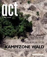
Endangered Waters - Greenpeace
Endangered Waters - Greenpeace
Endangered Waters - Greenpeace

Create successful ePaper yourself
Turn your PDF publications into a flip-book with our unique Google optimized e-Paper software.
<strong>Endangered</strong> <strong>Waters</strong><br />
<strong>Greenpeace</strong> India<br />
37<br />
04<br />
WATER AVAILABILITY IN RIVER WARDHA:<br />
NEW STUDY BY IIT DELHI<br />
There is no evidence that the cumulative<br />
impact of existing development on water<br />
resources is taken into consideration when<br />
setting capacity targets, or granting water<br />
allocations and environmental clearances to<br />
thermal plants and other similar development<br />
projects.<br />
The Department of Civil Engineering of Indian<br />
Institute of Technology, Delhi, has analysed<br />
the present and future water demands to<br />
be placed upon the river Wardha in western<br />
Vidarbha, including 552.52 million cubic metres<br />
(MCM) of water per year from 27 thermal<br />
power plants. The study, titled Impact of Water<br />
Resources Projects - a case study of Wardha,<br />
is authored by Prof. A. K. Gosain, Dr. Rakesh<br />
Khosa and Mr. Jatin Anand.<br />
The study focuses on the hydrology of Wardha<br />
sub-basin of Godavari river basin, which<br />
occupies the area between latitudes 19° 18’N<br />
and 21° 58’N and longitudes 77° 20’E and 79°<br />
45’E.<br />
A hydrologic modeling-based approach is<br />
followed to assess the overall water resources<br />
potential of Wardha sub-basin and, additionally,<br />
to evaluate the impacts of various development<br />
schemes that fall in the following categories:<br />
• Schemes currently in operation<br />
• Virgin basin condition<br />
• Schemes under implementation<br />
• Schemes already approved but yet to be<br />
implemented (including proposed water<br />
requirements for thermal power plants in<br />
the River basin).<br />
The hydrologic model of the study area was<br />
developed using the SWAT n application<br />
platform and simulations obtained for the four<br />
aforementioned development scenarios.<br />
4.1 Weather and land data<br />
The model analyses the river basin using<br />
information about watershed boundaries,<br />
elevation of the land from satellite topography<br />
pictures available from CIAT, o land use data<br />
from the Global Land Cover Facility and<br />
soil-related information from the Digital Soil<br />
Map prepared by the FAO. Weather data<br />
from stations within the region including IMD<br />
gridded precipitation data are incorporated<br />
to provide the most representative hydrometeorological<br />
history available. Other<br />
meteorological data required by SWAT (solar<br />
radiation, wind speed, and relative humidity)<br />
are estimated using the SWAT weather<br />
generator.<br />
4.2 Flow measurements<br />
The flow in Wardha is observed at the Central<br />
Water Commission’s Gauge & Discharge<br />
(G&D) site at Ghugus where it drains an area<br />
of 19,759.95 square kilometres. The site is<br />
located upstream of the confluence of Wardha<br />
with Penganga.<br />
4.3 Virgin, present and future scenarios<br />
The simulations were done for three scenarios:<br />
virgin, present and future. The virgin scenario<br />
has no man-made constraints on the river: no<br />
reservoirs, canals nor any water diverted for<br />
irrigation, domestic or industrial purposes.<br />
The present scenario is assumed as of 2009,<br />
incorporating information on the various<br />
reservoirs and irrigation projects from the<br />
National Register of Large Dams p , as well<br />
as water accounts data received from the<br />
Maharashtra Water Resources Development<br />
Centre. These water accounts also provide the<br />
n<br />
http://swatmodel.tamu.edu/.<br />
o<br />
http://srtm.csi.cgiar.org/.<br />
p<br />
http://www.cwc.nic.in/main/downloads/National%20Register%20of%20Large%20Dams%202012.pdf