The Uganda Atlas - GRID-Arendal
The Uganda Atlas - GRID-Arendal
The Uganda Atlas - GRID-Arendal

Create successful ePaper yourself
Turn your PDF publications into a flip-book with our unique Google optimized e-Paper software.
NEMA 2008<br />
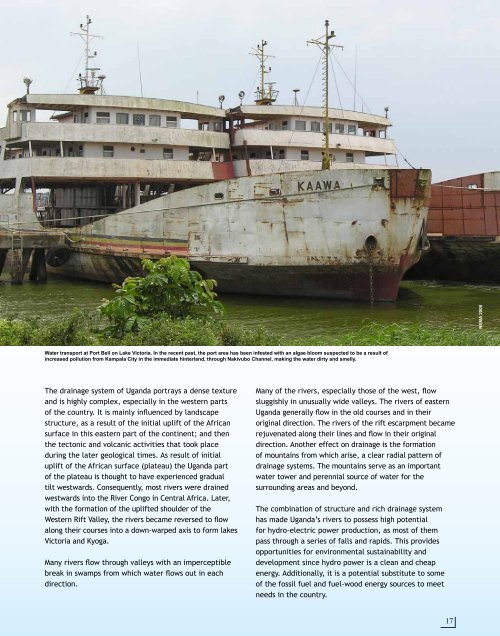
Water transport at Port Bell on Lake Victoria. In the recent past, the port area has been infested with an algae bloom suspected to be a result of<br />
increased pollution from Kampala City in the immediate hinterland, through Nakivubo Channel, making the water dirty and smelly.<br />
<strong>The</strong> drainage system of <strong>Uganda</strong> portrays a dense texture<br />
and is highly complex, especially in the western parts<br />
of the country. It is mainly influenced by landscape<br />
structure, as a result of the initial uplift of the African<br />
surface in this eastern part of the continent; and then<br />
the tectonic and volcanic activities that took place<br />
during the later geological times. As result of initial<br />
uplift of the African surface (plateau) the <strong>Uganda</strong> part<br />
of the plateau is thought to have experienced gradual<br />
tilt westwards. Consequently, most rivers were drained<br />
westwards into the River Congo in Central Africa. Later,<br />
with the formation of the uplifted shoulder of the<br />
Western Rift Valley, the rivers became reversed to flow<br />
along their courses into a down-warped axis to form lakes<br />
Victoria and Kyoga.<br />
Many rivers flow through valleys with an imperceptible<br />
break in swamps from which water flows out in each<br />
direction.<br />
Many of the rivers, especially those of the west, flow<br />
sluggishly in unusually wide valleys. <strong>The</strong> rivers of eastern<br />
<strong>Uganda</strong> generally flow in the old courses and in their<br />
original direction. <strong>The</strong> rivers of the rift escarpment became<br />
rejuvenated along their lines and flow in their original<br />
direction. Another effect on drainage is the formation<br />
of mountains from which arise, a clear radial pattern of<br />
drainage systems. <strong>The</strong> mountains serve as an important<br />
water tower and perennial source of water for the<br />
surrounding areas and beyond.<br />
<strong>The</strong> combination of structure and rich drainage system<br />
has made <strong>Uganda</strong>’s rivers to possess high potential<br />
for hydro-electric power production, as most of them<br />
pass through a series of falls and rapids. This provides<br />
opportunities for environmental sustainability and<br />
development since hydro power is a clean and cheap<br />
energy. Additionally, it is a potential substitute to some<br />
of the fossil fuel and fuel-wood energy sources to meet<br />
needs in the country.<br />
17