OM 13 - 3.1 ROA FAP 2010 v2-1.pdf - ICPDR
OM 13 - 3.1 ROA FAP 2010 v2-1.pdf - ICPDR
OM 13 - 3.1 ROA FAP 2010 v2-1.pdf - ICPDR

Create successful ePaper yourself
Turn your PDF publications into a flip-book with our unique Google optimized e-Paper software.
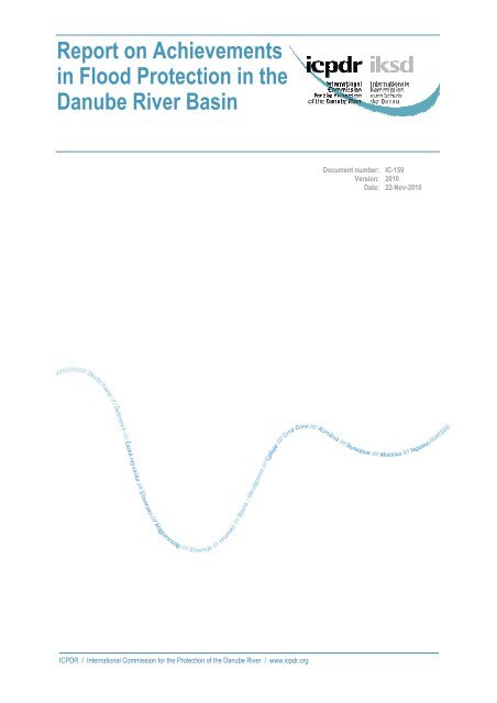
Report on Achievements<br />
in Flood Protection in the<br />
Danube River Basin<br />
Document number: IC-159<br />
Version: <strong>2010</strong><br />
Date: 22-Nov-<strong>2010</strong><br />
<strong>ICPDR</strong> / International Commission for the Protection of the Danube River / www.icpdr.org
Imprint<br />
Published by:<br />
<strong>ICPDR</strong> – International Commission for the Protection of the Danube River<br />
© <strong>ICPDR</strong> <strong>2010</strong><br />
Contact<br />
<strong>ICPDR</strong> Secretariat<br />
Vienna International Centre / D0412<br />
P.O. Box 500 / 1400 Vienna / Austria<br />
T: +43 (1) 26060-5738 / F: +43 (1) 26060-5895<br />
icpdr@unvienna.org / www.icpdr.org<br />
<strong>ICPDR</strong> / International Commission for the Protection of the Danube River / www.icpdr.org
Table of content<br />
1 Introduction 4<br />
2 Development and Improvement of Flood Forecasting and Early Warning System 6<br />
2.1Danube EFAS 6<br />
2.2Report on Assessment of Flood Monitoring And Forecasting in the Danube River Basin 6<br />
3 Preparation of flood action plans in sub-basins 7<br />
4 Major achievements in flood risk management in Danube countries 7<br />
4.1Existing framework for transboundary cooperation 7<br />
4.2Major developments in flood risk management 9<br />
4.2.1Germany – Bavaria & Baden-Wuerttemberg 9<br />
4.2.2Austria 10<br />
4.2.3Czech Republic 12<br />
4.2.4Slovakia 18<br />
4.2.5Hungary 22<br />
4.2.6Slovenia 24<br />
4.2.7Croatia 26<br />
4.2.8Serbia 29<br />
4.2.9Bosnia and Herzegovina 31<br />
4.2.10Romania 35<br />
4.2.11Bulgaria 37<br />
4.2.12Ukraine 39<br />
5 Creating Forums for Exchange of Expert Knowledge 42<br />
5.1Document on Coordination aspects of EFD implementation in the Danube River Basin 42<br />
5.2Other information sources 43<br />
6 Recommendation for a common approach in assessment of flood-prone areas and evaluation of<br />
flood risk 43<br />
6.1Status review and report of flood mapping and flood risk evaluation in the sub-basins and<br />
countries of the Danube River Basin 43<br />
6.2Minimum recommendations for flood risk mapping in the Danube River Basin 44<br />
6.3FLOODRISK project 44<br />
7 Other activities 45<br />
7.1Danube 2006 floods report 45<br />
7.2Flood factsheet <strong>2010</strong> 46<br />
8 Conclusions 47<br />
<strong>ICPDR</strong> / International Commission for the Protection of the Danube River / www.icpdr.org
Report on Achievements in FP 4<br />
1 Introduction<br />
In response to the danger of flooding and in line with its Joint Action Programme, the <strong>ICPDR</strong> decided<br />
in 2000 to establish the long-term Action Programme for Sustainable Flood Prevention in the Danube<br />
River Basin. The whole process was accelerated after disastrous floods in 2002 and resulted in<br />
adoption of the Action Programme at the <strong>ICPDR</strong> Ministerial Meeting on <strong>13</strong> December 2004.<br />
This Action Programme is based on the sustainable flood protection programmes developed in the<br />
various Danube countries as well as on networking existing structures and using the future-oriented<br />
knowledge base accumulated through a wide range of activities over the past decade. The overall goal<br />
of the Action Programme is to achieve a long term and sustainable approach for managing the risks of<br />
floods to protect human life and property, while encouraging conservation and improvement of water<br />
related ecosystems. Given the area, the complexity and the internal differences in the Danube River<br />
Basin, the Action Programme represents an overall framework, which needs to be specified in further<br />
detail for sub-basins. The Action Programme is based on UN-ECE Guidelines on Sustainable Flood<br />
Prevention, EU Best Practices on Flood Prevention, Protection and Mitigation and on EU<br />
Communication on flood risk management, C<strong>OM</strong>(2004)472. The major principles advocated are: (i)<br />
the shift from defensive action against hazards to management of the risk and living with floods (ii)<br />
the river basin approach taking into account the Water Framework Directive, (iii) joint action of<br />
government, municipalities and stakeholders towards flood risk management and awareness raising,<br />
(iv) reduction of flood risks via natural retention, structural flood protection and hazard reduction, and<br />
(v) solidarity.<br />
Targets of the Action Programme are set on a basin-wide and a sub-basin level taking into account the<br />
above-mentioned principles. There are four major basin-wide targets, which are currently under<br />
implementation:<br />
(i) Improvement of flood forecasting and early flood warning system<br />
Interlinking of the national and/or regional systems aims to improve the overall coordination<br />
and transboundary coherence of flood monitoring and forecasting systems. In parallel to<br />
interlinking of national systems a Danube Flood Alert System was developed by the EC JRC<br />
and was launched in December 2007.<br />
(ii) Support for the preparation of and coordination between sub-basin-wide flood action plans<br />
The <strong>ICPDR</strong> is a coordination platform for preparation of flood action plans for the river subbasins.<br />
Steps towards linking of flood risk management with the river basin management have<br />
been done in cooperation with the river basin managers in the Danube countries.<br />
(iii) Creating forums for exchange of expert knowledge<br />
Measures should be taken towards sharing of experience and coordinated development and<br />
promotion of best practices on flood risk management. Exchange of relevant information on<br />
flood protection, prevention and mitigation with the other international river commissions is<br />
foreseen.<br />
(iv) Recommendation for a common approach in assessment of flood-prone areas and evaluation of<br />
flood risk<br />
The overall approach of the EU Directive on the assessment and management of flood risks<br />
towards flood risk mapping is coherent with the basic principles described in the <strong>ICPDR</strong> Action<br />
Programme on Sustainable Flood Protection in the Danube River Basin.<br />
<strong>ICPDR</strong> / International Commission for the Protection of the Danube River / www.icpdr.org
Report on Achievements in FP 5<br />
In September 2007 a Directive of the European parliament and of the Council on the assessment and<br />
management of flood risks was finally adopted by the European Council. The aim of the Directive is<br />
to reduce and manage the risks that floods pose to human health, the environment, cultural heritage<br />
and economic activity. The Directive requires Member States to first carry out a preliminary flood risk<br />
assessment by 2011 to identify areas at risk of flooding. For such areas they would then need to draw<br />
up flood risk maps by 20<strong>13</strong> and establish flood risk management plans focused on prevention,<br />
protection and preparedness by 2015. The Directive applies to inland waters as well as all coastal<br />
waters across the whole territory of the EU. The Directive shall be carried out in coordination with the<br />
Water Framework Directive, notably by flood risk management plans and river basin management<br />
plans being coordinated, and through coordination of the public participation procedures in the<br />
preparation of these plans. All assessments, maps and plans prepared shall be made available to the<br />
public. Member States shall furthermore coordinate their flood risk management practices in shared<br />
river basins, including with third counties, and shall in solidarity not undertake measures that would<br />
increase the flood risk in neighbouring countries. Member States shall take into consideration long<br />
term developments, including climate change, as well as sustainable land use practices in the flood risk<br />
management cycle addressed in this Directive.<br />
The adoption of the EU Directive on the assessment and management of flood risks (EFD) has its<br />
impact also on the implementation of the <strong>ICPDR</strong> Action Programme on Sustainable Flood Protection<br />
in the Danube River Basin both in terms of technical content and the implementation time plan, given<br />
that the <strong>ICPDR</strong> Action Programme itself foresees incorporating the future developments of the EU<br />
flood policy.<br />
In 2009 the <strong>ICPDR</strong> published 17 sub-basin flood action plans covering the entire Danube catchment.<br />
This was a key milestone set in the <strong>ICPDR</strong> Action Programme for Sustainable Flood Prevention but<br />
also an important step in a harmonized implementation of the EFD in the Danube River Basin<br />
District.<br />
This Report provides the stakeholders and public with an overview of the achievements in<br />
implementation of the targets of the <strong>ICPDR</strong> Action Programme on Sustainable Flood Protection in the<br />
Danube River Basin with a particular attention given to the progress made in the sub-basins in<br />
implementation of the action plans as well as of the EU Directive on the assessment and management<br />
of flood risks. Report on Achievements in Flood Protection in the Danube River Basin is structured<br />
according to the four basin-wide targets of the <strong>ICPDR</strong> Flood Action Programme and it is a living<br />
document, which will be updated regularly with a view of demonstrating to the wide target audience<br />
the efforts made and the progress achieved in the Danube River Basin in the field of flood risk<br />
management.<br />
<strong>ICPDR</strong> / International Commission for the Protection of the Danube River / www.icpdr.org
Report on Achievements in FP 6<br />
2 Development and Improvement of Flood Forecasting<br />
and Early Warning System<br />
2.1 Danube EFAS<br />
The European Flood Alert System (EFAS) is being developed at the EC Joint Research Centre (JRC)<br />
with support of the national meteorological services and national hydrological services (NHS). As to<br />
date, around 25 operational authorities across Europe, all together responsible for more than 85% of<br />
the major trans-national river basins, are receiving EFAS information as early flood warning reports<br />
for floods in the next 3-10 days. As for the Danube countries EFAS Memoranda of Understanding<br />
(MoU) have been signed with DE, AT, CZ, SK, HU, SI, RS, RO, BG and MD. Recently HR joined as<br />
well. Negotiations on membership are ongoing with UA and BA. EFAS-Danube members have 24/7<br />
access to a protected web-server where the twice-daily EFAS forecasts can be examined and viewed<br />
(http://efas-is.jrc.ec.europa.eu/efas-forecasting.html ).<br />
In <strong>2010</strong>, using further data received from several institutes within the Danube, the calibration of the<br />
5km grid hydrological model version has been redone. Furthermore, EFAS uses now also ensemble<br />
weather forecasts from COSMO-LEPS, which enables higher-resolution forecasts until 5 days before a<br />
flood event, more focussed towards flash flood forecasting. Also, using near-realtime river discharge<br />
data received from Danube water authorities, corrected flood forecasts are currently provided (called<br />
realtime hydrographs on EFAS website). At present, these realtime hydrographs are available for<br />
selected stations in the Upper Danube in Germany, Austria, Czech Republic and Slovakia. Using the<br />
realtime discharge data, also an overview is made where actual flooding is in the Danube as well as<br />
Europe: http://floods.jrc.ec.europa.eu/ongoing-floods.html<br />
Further improvements under development are the use of realtime satellite snow cover data, biascorrection<br />
of rainfall forecasts, use of satellite derived rainfall data, and the use of satellite derived soil<br />
moisture data.<br />
Discussions for the transfer of EFAS to an operational entity are in a final stage with DG ECHO<br />
(Humanitarian Aid) and DG ENTR (Enterprise) in Brussels. EFAS is expected to go into full<br />
operation in Autumn 2011.<br />
2.2 Report on Assessment of Flood Monitoring And Forecasting in the Danube River Basin<br />
The national flood forecasting and warning systems in the Danube River Basin differ in the frequency,<br />
methods and techniques used for monitoring and also in data collection and processing. In some<br />
countries the outdated and advanced methodologies are running in parallel. Therefore the <strong>ICPDR</strong><br />
Action Programme on Sustainable Flood Protection in the Danube River Basin aims to develop the<br />
methodology and tools of data collection, processing, forecasting and dissemination where necessary<br />
and also to interlink the regional and national agencies on sub-basin and basin level to facilitate and<br />
promote the exchange of source data and forecasting and warning in transboundary sub-basins.<br />
The first step in this activity was preparation of the Report on Assessment of Flood Monitoring And<br />
Forecasting in the Danube river basin, which was finalized in 2009. The report reviews:<br />
• Climatic and hydrological conditions in the DRB<br />
• Flood monitoring system<br />
o<br />
o<br />
Description of the meteorological network<br />
Description of the hydrological monitoring network<br />
• Development of the flood information service for the Danube river basin<br />
<strong>ICPDR</strong> / International Commission for the Protection of the Danube River / www.icpdr.org
Report on Achievements in FP 7<br />
• The role of the European Flood Alert System<br />
3 Preparation of flood action plans in sub-basins<br />
In 2009 the <strong>ICPDR</strong> published 17 sub-basin flood action plans, based on 45 national planning<br />
documents, and covering the entire Basin. These action plans provide the first ever comprehensive<br />
overview of actions to reduce flood risk in the Danube Basin. In drawing up the plans, measures were<br />
first elaborated at the national level in each of the <strong>13</strong> <strong>ICPDR</strong> states. Joint discussions between<br />
countries sharing particular sub-basins then took place to create a harmonized plan for the entire area<br />
of each sub-basin.<br />
The finalised action plans review the current situation and set targets and respective measures for<br />
reducing adverse impacts and the likelihood of floods, increasing awareness and level of preparedness<br />
and improving flood forecasting. The targets and measures are based on the regulation of land use and<br />
spatial planning; increase of retention and detention capacities; technical flood defences; preventive<br />
actions (e.g. flood forecasting and flood warning systems); capacity building; awareness and<br />
preparedness raising and prevention and mitigation of water pollution due to floods. The sub-basin<br />
action plans detail comprehensive information on hundreds of concrete actions to reduce flooding<br />
throughout the region, including re-naturalisation of water bodies, creation of flood polders, upgrading<br />
of dykes and improvement of alarm and forecasting systems. As a follow up to the action plans, the<br />
development of flood hazard and flood risk maps is crucial. Decisions related to the implementation of<br />
the action plans are a task and responsibility of the individual countries, according to their national<br />
legislation and bilateral and multilateral agreements.<br />
4 Major achievements in flood risk management in<br />
Danube countries<br />
This chapter provides an overview of the developments in flood risk management on the national<br />
level.<br />
4.1 Existing framework for transboundary cooperation<br />
Bilateral discussions between Germany and Austria are held in a working group under the standing<br />
water commission according to the “Regensburger Vertrag” (Regensburg Treaty). The working group<br />
agreed to establish the flood action plans for the sub-basins in temporal, organizational and<br />
contentwise coordination with the EU flood directive.<br />
In the Czech Republic bilateral cooperation framework with Slovakia is based on Treaty between the<br />
Government of the Czech Republic and the Government of the Slovak Republic on cooperation on<br />
transboundary watercourses from the year 1999. Cooperation with Austria is based on treaty between<br />
Czechoslovak Socialist Republic and the Austrian Republic on regulation of water management issues<br />
related to border waters from the year 1967.<br />
<strong>ICPDR</strong> / International Commission for the Protection of the Danube River / www.icpdr.org
Report on Achievements in FP 8<br />
There is an ongoing cooperation of experts involved in the Bilateral commissions on the cooperation<br />
on the border waters in Slovakia. A cooperation framework is established with the Czech Republic,<br />
Austria, Hungary, Ukraine and Poland.<br />
Cooperation framework in Hungary was established in the Pannonian Central Danube sub-basin in the<br />
frame of HU-AT, HU-SK, HU-HR and HU-RS bilateral commissions and in the Drava-Mura subbasin<br />
in the frame of HU-AT, HU-SI, HU-HR bilateral commissions. In the Tisza River Basin there<br />
is a developing cooperation in the frame of the <strong>ICPDR</strong> Tisza Working Group, also utilising the<br />
outcomes of the Tisza Forum.<br />
There is an intensive cooperation in the frame of bilateral commissions in place in Slovenia. These<br />
include cooperation on Mura and Drava with Austria, cooperation with Croatia on Drava, Mura and<br />
Sotla-Sava-Kolpa) and the work of bilateral Commission with Hungary.<br />
Transboundary flood protection issues in Croatia are dealt with by the respective sub commissions<br />
established under the umbrella of the bilateral commissions with Slovenia, Hungary and Bosnia and<br />
Herzegovina. Serbia has ongoing bilateral cooperation with Romania and Hungary based on the<br />
existing bilateral agreements, covering the Danube, the Tisa and the Banat regions.<br />
The Permanent Expert Group for Flood Protection (PEG FP) has been established within the<br />
International Sava River Basin Commission (ISRBC), and all Sava countries (Croatia, Slovenia,<br />
Serbia and Bosnia and Herzegovina) participate in its work. This group is now preparing Protocol on<br />
Flood Protection, which will be a ground for future cooperation in flood risk management in the Sava<br />
River basin.<br />
Since its independence in 1991 Ukraine has signed agreements on water management issues related to<br />
transboundary watercourses with Hungary, Romania, Slovakia and Moldova.<br />
DE AT CZ SK HU SI HR BA RS BG RO MD UA<br />
DE x x<br />
AT x x x x x<br />
CZ x x x<br />
SK x x x x<br />
HU x x x x x x x<br />
SI x x x<br />
HR x x x<br />
BA<br />
x<br />
RS x x<br />
BG<br />
x<br />
RO x x x x x<br />
MD x x<br />
UA x x x x<br />
Table 1: The existing bilateral agreements creating a framework for transboundary cooperation<br />
<strong>ICPDR</strong> / International Commission for the Protection of the Danube River / www.icpdr.org
Report on Achievements in FP 9<br />
4.2 Major developments in flood risk management<br />
4.2.1 Germany – Bavaria & Baden-Wuerttemberg<br />
Improvements in flood forecasting and warning<br />
Both in Baden-Wuerttemberg ( www.hvz.baden-wuerttemberg.de/ ) and in Bavaria<br />
(www.hnd.bayern.de/ ) flood early warning systems and flood forecast models are in use for all larger<br />
river catchment areas.<br />
Structural flood protection projects<br />
In Baden-Wuerttemberg and in Bavaria number of projects focussed on building new flood protection<br />
structures as well as on the improvement of existing flood protection facilities. Based on the Flood<br />
protection action programme 2020 in Bavaria every year approximately 115 million € are invested in<br />
flood protection (in the years 2006 - 2008 the annual budget stretched up to 150 million €).<br />
Approximately 75% of that budget is invested in the Danube catchment area. As a consequence, in<br />
the Danube catchment area in Bavaria, more than 200 000 additional inhabitants were protected<br />
sufficiently against floods during 2001-2005. In 2007 the polder “Weidachwiesen” at the river Iller<br />
was completed as the first controlled flood polder in Bavaria (retention volume approximately 6,3<br />
millions m 3 ). In addition, the reactivation of natural retention areas was forced. In the Bavarian part of<br />
the Danube catchment area between 2001 and at the end of 2005 approximately 16 km of dykes were<br />
set back and approximately 5 million m 3 retention volume were re-activated.<br />
Capacity building, preparedness & flood mitigation<br />
Baden-Wuerttemberg: in conjunction with the development of the flood action plan for the Danube in<br />
Baden-Wuerttemberg. Bavaria: relevant improvement after floods 2005. At the river Mangfall a new<br />
hydraulic model for simulating the impacts of breeched levees during a flood event was established.<br />
Progress in implementation of EFD<br />
On the 1 st of March <strong>2010</strong>, the new Federal Water Management Act came into effect. On the same day,<br />
the State of Bavaria enacted the Bavarian Water Act. Therefore all necessary legal steps for the<br />
implementation of the EFD have been made.<br />
<strong>ICPDR</strong> / International Commission for the Protection of the Danube River / www.icpdr.org
Report on Achievements in FP 10<br />
By May, 26 th <strong>2010</strong>, the Competent Authorities and the Units of Management had to be reported to the<br />
European Commission. Competent Authorities are the Ministry of the Environment, Nature<br />
Conservation and Transport in Baden-Wurttemberg and the State Ministry for the Environment and<br />
Public Health in Bavaria. Due to the commitment of the Danube Declaration (no. 32), adopted at the<br />
IPCDR Ministerial Meeting <strong>2010</strong>, the same sub-basins were reported as Units of Management to EC<br />
which defined for the Flood Action Plans in the <strong>ICPDR</strong> Action Programme for Sustainable Flood<br />
Protection. That means that the Upper Danube and the Inn sub-basins are regarded as separate Units of<br />
Management.<br />
The next step will be the preparation of Preliminary Flood Risk Assessment (PFRA) for the areas of<br />
potential significant flood risk (APSFR). In Bavaria, this will be finished by the end of <strong>2010</strong>, making<br />
use of Art. <strong>13</strong> of the EFD. In Baden-Württemberg the same activity will be finished by the end of<br />
2011. The applied method is based on an intersection of stream courses and spatial planning data.<br />
Based on the results of the PFRA, flood hazard maps and flood risk maps will be designed up to<br />
December 22 nd 20<strong>13</strong>. These maps are the source for the Flood Risk Management Plans which have to<br />
be established up to 2015. All steps have to be coordinated between the neighbours in a sub-basin. For<br />
this reason, Baden-Wurttemberg and Bavaria are in close contact to ensure a common process.<br />
4.2.2 Austria<br />
Improvements in flood forecasting and warning<br />
Austria has a federal structure with nine provincial states. According to this structure the responsibility<br />
for the flood forecasting was assigned to the local Hydrological Services.<br />
The Hydrological Service in Austria operates a modern hydrometrical network for the quantification<br />
of the water cycle in Austria. The network for monitoring water quantity consists of about 600<br />
discharge measuring points, 1000 precipitation measuring points (air temperature) and 3000<br />
groundwater measuring points. All data on the water cycle in Austria are collected, prepared and<br />
disseminated by this organisation.<br />
no flood- forcast available<br />
be planned<br />
in test operation<br />
in operation<br />
forecasting measures in Austria<br />
Overview of flood –<br />
The 2002 and 2005 flood events triggered activities regarding flood forecast and started any new<br />
activities related to flood forecasting in Austria. A new generation of flood - forecast models<br />
<strong>ICPDR</strong> / International Commission for the Protection of the Danube River / www.icpdr.org
Report on Achievements in FP 11<br />
(conceptual water-balance rainfall-runoff models combined with flood routing models) was developed<br />
after this flooding. The discharge forecast results for the river Danube in Austria are published on the<br />
internet. The precipitation forecasts come exclusively from the Meteorological Service in Austria –<br />
ZAMG (http://www.zamg.ac.at).<br />
Discharge forecasting gauges on the river<br />
Danube in Lower Austria (http://www.noel.gv.at)<br />
Links for further information:<br />
1. http://www.noel.gv.at/Externeseiten/wasserstand/htm/wndcms.htm (discharge-forecast<br />
information for the Danube and for other gauges in the Danube river basin in Lower Austria)<br />
2. http://gis.lebensministerium.at/ehyd (historical hydrographical data, available for download)<br />
3. http://pegel-aktuell.lfrz.at/ (Overview about the online discharge and water level gauges in<br />
Austria)<br />
Structural flood protection projects<br />
In Austria the “Flood programme 2016” was adopted. Main goals are to improve the existing or to<br />
build new flood protection measures (structural as well as non-structural) and to accelerate the making<br />
of hazards maps. Based on the programme Austria invests approximately about 400 million € per year<br />
in flood protection measures (financed by the Federal State, the Provinces and the communities with<br />
an average percentage of 50 : 35 : 15).<br />
There is a clear hierarchy in the implementation of flood protection measures (laid down in the<br />
Austrian water act and the hydraulic engineering assistance act) as followed:<br />
o Non-structural measures have priority over structural measures<br />
o Measures in the catchment area have priority over measures at the main channel<br />
o Retention measures have priority over linear structural measures<br />
o (Near) natural methods of building have priority over methods that are less so<br />
o Area used for agriculture and forestry are not be specifically protected<br />
<strong>ICPDR</strong> / International Commission for the Protection of the Danube River / www.icpdr.org
Report on Achievements in FP 12<br />
o<br />
Avoidance of those measures that would increase erosion and the discharge of drain water<br />
Capacity building, preparedness & flood mitigation<br />
To increase preparedness and awareness the Ministry published a series of brochures (e.g. for house<br />
owners) and updated the public appearance on the internet constantly.<br />
An Austria-wide internet platform for natural hazards with the focus on floods has been developed,<br />
(www.hochwasserrisiko.at), in which all inundation areas (flood affected areas) and the hazard maps<br />
(if available) are shown.<br />
Progress in implementation of EFD<br />
The first intended step for the implementation of the Flood Directive, the Preliminary Floodrisk<br />
Assessment (PFRA), will be finalized in mid 2011 and presented to the public probably in October<br />
2011. A technical guideline from the Federal Ministry of Agriculture, Forestry, Environment and<br />
Water Management (BMLFUW), coordinated with the Provinces about the technical requirements and<br />
contents of the following flood hazard and flood risk maps is finalized.<br />
4.2.3 Czech Republic<br />
Improvements in flood forecasting and warning<br />
In the Czech part of the Morava river basin the Czech Hydrometeorological Institute (CHMI) is<br />
responsible for the both meteorological and hydrological forecasting and warning. In the Czech<br />
Republic, Central Forecasting Office (CFO) and six Regional Forecasting Offices (RFO) have<br />
meteorological and hydrological departments cooperating closely together. Forecasting methodology<br />
<strong>ICPDR</strong> / International Commission for the Protection of the Danube River / www.icpdr.org
Report on Achievements in FP <strong>13</strong><br />
has been improved by introducing hydrological models into the forecasting service mainly after the<br />
extreme flood in 1997.<br />
The hydrological forecasting system is connected to the meteorological forecasting system. The flood<br />
forecasting system regularly provides hydrological forecast to the River Basin Authorities and other<br />
stakeholders and public them on the CHMI web site. In case of flood it informs the flood protection<br />
authorities and other participants involved in the flood protection about actual flood danger and flood<br />
development. Warning messages are disseminated if extreme meteorological or hydrological<br />
conditions are being forecasted and during floods are accompanied by information on the flood<br />
evolution and its further prediction.<br />
The forecasting system HYDROG has been set up for the whole Morava river basin containing 25<br />
forecasting profiles. The lead time of the forecast is 24 and 48 hours. It includes also reservoir<br />
operation routines for optimalization of the possible future operations. The model is running every<br />
day. There is a close cooperation with Austria in place: in the regional Brno office of the Czech<br />
Hydrometerological Institute every day a discharge forecast for the Austrian gauge stations Raabs and<br />
Schwarzenau in the Dyje river basin is computed. In return Austria provides extended meteorological<br />
data for Austrian part of the Dyje/Thaya river basin.<br />
Continuous data on water courses and reservoirs are available at following web services partly<br />
provided in English and other languages:<br />
http://www.pmo.cz/portal/sap/en/index.htm<br />
(partly provided in English, Slovak, German, Hungarian, Polish language)<br />
<strong>ICPDR</strong> / International Commission for the Protection of the Danube River / www.icpdr.org
Report on Achievements in FP 14<br />
Within the frame of the European Territorial Co-operation 2007 – 20<strong>13</strong> (AT, CZ) a project on Flood<br />
forecasting in the confluence area of the rivers Morava and Dyje has been launched. As a result of this<br />
project the extended upgrade of the forecasting model HYDROG for the Morava river basin has been<br />
prepared. Since February <strong>2010</strong> the upgraded model is in test operation and the forecasts for the profile<br />
Hohenau (A) and Moravský Sv. Ján (SK) on the Morava River have been disseminated daily. Work on<br />
this project will continue also in 2011.<br />
Following improvements of flood forecasting and early warning system have been recorded:<br />
- interlinking regional and national agencies to facilitate and promote the exchange of source data;<br />
- routing of the information downstream as the basis of improving efficiency and lead time of flood<br />
forecasting and warning ;<br />
- improving the methodology and tools for data collection, processing, forecasting and<br />
dissemination - nowcasting and flash flood forecasting is in place;<br />
- end-users training accomplished and feedback collected.<br />
Thanks to the European Structural and Cohesion funds the Ministry of the Environment provides<br />
subsidies for elimination of the flood risk thorough the Operational Programme Environment<br />
(www.opzp.cz). One of the objectives is support of building local flood alert systems for<br />
municipalities and regional authorities. In line with this simple local systems are built in Morava river<br />
basin having a simple design for obtaining the data from ultrasonic water stage indicators and<br />
pluviometers connected with modern wireless public address system and with regional web pages.<br />
Structural flood protection projects:<br />
The new flood protection measures have been prepared since the extreme flood in 1997. They include<br />
the construction of new retention storages as dry polders with the aim to reduce and delay the flood<br />
wave, to further protect the local settlement areas and to revitalize the floodplains. Preventive<br />
measures focus primarily on technical proposals where their realization provides tangible benefits as<br />
<strong>ICPDR</strong> / International Commission for the Protection of the Danube River / www.icpdr.org
Report on Achievements in FP 15<br />
well as the opportunities for the land-use changes. In 1999 – 2001, 14 flood protection measures were<br />
built with total costs of about 177 mill. of CZK.<br />
In the years 2002 – 2007 the Ministry of Agriculture started the programme “Flood Prevention” and<br />
during this programme about 75 structural flood protection measures were built in the Morava river<br />
basin by all river administrators (Morava River Board, s.e., Agricultural Water Management Authority<br />
and the Forests of the Czech Republic, s.e.). The total costs for these measures were about 1518 mill.<br />
of CZK.<br />
The preparation of flood protection measures continues in the Czech Republic with the programme<br />
“Flood prevention II” in the years 2008 – 20<strong>13</strong>, where about 10 bill. of CZK is allocated for the flood<br />
prevention measures.<br />
The flood protection measures finished till the end of 2009 in the Morava river basin:<br />
Period Programme No. of flood protection Total<br />
costs<br />
measures<br />
(mill. of CZK)<br />
1999 - 2001 - 14 177<br />
2002 - 2007 Flood Prevention 75 1 518<br />
2008 - 200<strong>13</strong> Flood Prevention II 47 487<br />
Thanks to the Structural and Cohesion funds of EU the Ministry of the Environment provides<br />
subsidies for elimination of the flood risk through the Operational Programme Environment<br />
(www.opzp.cz) allocating about 100 mil. EUR for projects in 2007-20<strong>13</strong>.<br />
Capacity building, preparedness & flood mitigation<br />
Water Management Information Portal “Water” was established by the Ministry of the Agriculture and<br />
Ministry of the Environment where the latest information about water in the Czech Republic,<br />
including floods, is available to the public.<br />
<strong>ICPDR</strong> / International Commission for the Protection of the Danube River / www.icpdr.org
Report on Achievements in FP 16<br />
Information about available flood zones is also available to the public through the web service HEIS<br />
VÚV and by POVIS – Flood information service:<br />
Examples of the flood zones at Morava and Drevnice rivers junction:<br />
Ministry of the Environment organizes training for the members of the flood committees and state<br />
administrations in the Morava river basin. Flood information system POVIS together with Digital<br />
flood management plan of the Czech Republic was established by Ministry of the Environment. This<br />
information platform has been developing since 2006 and provides now important information to<br />
flood committees and to public, runs shared databases of contacts, digital flood management plans,<br />
hydrological characteristics, flood plains, objects in flood risk and object of flood risk and so on.<br />
Development of information system is funded by the Operational Programme Environment as well as<br />
by local alert systems. About hundred of municipal or regional projects have been launched since<br />
2008. The adopted projects will primarily address the vulnerability of small catchments and local<br />
floods.<br />
River Basin Authorities together with the Czech Hydrometeorological Institute re-established the<br />
“dispatcher games”, where teams from dispatching centres for dam and hydraulic structure<br />
manipulation come together to compete with flood simulations in the real catchment.<br />
New transnational initiative to tackle flooding in transboundary area shared by Czech Republic,<br />
Austria, Hungary and Slovakia is project CEframe - Central European Flood Risk Assessment and<br />
Management, supported from the European programme Central Europe 20<strong>13</strong>. The scope of the project<br />
is:<br />
• Sustainable integrated flood risk management<br />
• Joint Assessment of Flood Management<br />
• Harmonization of methodologies for flood protection, keeping compliance to EU Flood<br />
Directive<br />
Ceframe results will increase protection capacities of areas particularly affected by danger of flooding.<br />
In these areas flood damages have had significant negative impacts on settlement and economy. The<br />
reduction of risk will lead to higher safety for people living there and to investments in new<br />
enterprises. CEframe will strongly consider the common interests and goals of project partners<br />
<strong>ICPDR</strong> / International Commission for the Protection of the Danube River / www.icpdr.org
Report on Achievements in FP 17<br />
following their national regulations in the respective countries and their will to seek a balanced and<br />
constructive approach to existing problems.<br />
Starting with setup of the basic data bases, the current state of flood protection and flood risk will be<br />
assessed. A comprehensive inventory of all currently applied strategies completes the basic analysis,<br />
with objective of building the ground for future-oriented activities and for gathering best practices out<br />
of the partner pool. Further influencing factors - land use activities - are identified. Interactions<br />
between land uses and flooding are assessed. The driving forces and different influences will be<br />
merged, and their impacts on danger of flooding will be analyzed.<br />
The concluding step is development of appropriate measures and exclusion of their possible negative<br />
effects, together with a web-based information and communication site, to reach a sustainable flood<br />
protection management. All measures concerning flood prevention and protection will be compiled<br />
in an action plan. The contributions of the partners, cooperating in the activities by using jointly<br />
developed methodologies, will be processed in form of reports, maps, guidelines, common tools and<br />
management proposals. One of the project aim is also harmonization flood risk management in frame<br />
of the Directive 2007/60/ES.<br />
Progress in implementation of EFD<br />
Transposition and implementation of floods directive is under the competences of Ministry of the<br />
Environment and Ministry of Agriculture. Transposition into Water Act and related legislation is<br />
supposed to be finished in <strong>2010</strong>. The Act No. 150/<strong>2010</strong> Coll. updates the Czech Water Act according<br />
to the requirements of European Flood Directive since August <strong>2010</strong>.<br />
The EFD implementation is coordinated by the national expert group “Implementation of EFD”. In<br />
2009 the suitable methodology for preparation of flood hazard maps and flood risks maps was<br />
developed based on available data sources in the Czech Republic. The preparation of the preliminary<br />
flood risk assessment is underway and it is expected to be finished in <strong>2010</strong>. A methodology for<br />
identification of the areas with potential significant flood risk, which covers risk of fluvial floods, has<br />
been finished this year. First outcomes of identification of the areas with potential significant flood<br />
risk in 2009 are shown in the figure below (river stretches in red color are those identified as having<br />
significant risk from fluvial floods). Work is still ongoing on methodology covering flash and pluvial<br />
floods.<br />
The projects of flood mapping were launched in 2009 with co-financing from the Operational<br />
Programme Environment and are expected to be finished by the deadline given by EFD. Flood hazard<br />
and flood risk maps will be prepared for about 2500 kilometers of river stretches.<br />
<strong>ICPDR</strong> / International Commission for the Protection of the Danube River / www.icpdr.org
Report on Achievements in FP 18<br />
In the Czech Republic the flood protection is also an integral part of the first River Basin Management<br />
Plan. The Morava and Dyje river basin management plans were finished in 2009 and the plans were<br />
adopted by the regional authorities. The WFD programme of measures includes flood protection<br />
measures as well. Ministry of the Environment allocated 2 bil. CZK in the Operational Programme<br />
Environment to support realization of some structural measures planned in RBMPs.<br />
4.2.4 Slovakia<br />
Improvements in flood forecasting and warning<br />
A key issue is the implementation of a national project POVAPSYS – Flood warning and forecasting<br />
system of the Slovak Republic. The system consists of 12 main subsystems – Integrated system of<br />
operation, Network of terrestrial meteorological stations, Network of terrestrial hydrological stations,<br />
Telecommunication technologies and telecommunication computer, Transmission and processing of<br />
meteorological satellite data, Network of meteorological radio locators, Other appliances of remote<br />
sensing, Information technologies, data processing and storage, Meteorological forecasting methods<br />
and models, Hydrological forecasting methods and models, Information dissemination to users,.<br />
Existing networks, instruments and appliances were in the frame of the project upgraded, modernized<br />
and extended.<br />
Trilateral cooperation (Czech Republic – Austria – Slovakia) which focuses on the improvement of<br />
flood forecasting in the whole Morava river basin is under testing. On-line information on the actual<br />
development of hydrological situation is available at<br />
http://www.shmu.sk/sk/?page=1&id=hydro_vod_all#tab<br />
Structural flood protection projects:<br />
The relevant projects are listed in the following table:<br />
<strong>ICPDR</strong> / International Commission for the Protection of the Danube River / www.icpdr.org
Report on Achievements in FP 19<br />
reporting unit river basin river project timeplan funding description<br />
Pannonian<br />
Central Danube<br />
Danube Danube Reconstruction of flood protection line in<br />
Bratislava - Flood Protection 2007 - <strong>2010</strong> 85 % Cohesion Fund, 15 %<br />
national sources<br />
Reconstruction of left-side flood protection<br />
dyke of the Danube river and its underground<br />
and the Kosihy pumping station<br />
Sturovo<br />
2003 - 2005 80 % Structural Funds, 20 %<br />
national sources<br />
2007 - 2008 80 % Structural Funds, 20 %<br />
national sources<br />
Construction of a new and reconstruction of existing flood<br />
protection lines and measures at 8 partial localities between<br />
Devin and Sap, pumping stations, mobile flood protection<br />
elements, flood protection walls and dykes, sealing of<br />
underground<br />
Sealing of flood protection dyke underground by means of<br />
cut-off walls<br />
Construction of a new flood protection wall in combination<br />
with mobile elements, sealing of underground<br />
Morava Morava Morava Dykes and flood lines reconstruction, Morava<br />
River rkm 89,5 – 97,05<br />
Suchohrad - Reconstruction of flood protection<br />
line<br />
Malina Malina River training, rkm 4,453 – 11,5 , and<br />
its tributary Zohorsky creek<br />
2007 - 2008 national sources Raised crest of dykes at several sections, sealing of dykes<br />
underground by means of cut-off walls, construction of<br />
flood protection walls in selected sites<br />
2009 - <strong>2010</strong> 80,75 % Cohesion Fund,<br />
19,25 % national sources<br />
2006 - 2008 national sources<br />
Vah – Hron -<br />
Ipel<br />
Vah<br />
several rivers<br />
Floods at the territory of Slovakia in the period<br />
1997-1999, removal of consequences and<br />
preventive measures<br />
2000 - 2005 national sources Reconstruction of flood protection dykes in the section<br />
Piestany-Horna Streda, river training works Suciansky<br />
potok<br />
Swiss Aid – DEZA Directorate for<br />
Development and Cooperation, Ministry of<br />
Foreign Affairs<br />
2004 - 2005 majority from Swiss funds Polders in Lehota pod Vtacnikom, Sučany – flood<br />
protection,<br />
Vah<br />
Kralova hydraulic structure - removal of 1997<br />
flood consequences<br />
2005 - 2007 80 % Structural Funds, 20 %<br />
national sources<br />
removal of 1997 flood consequences, protection dyke<br />
stabilization<br />
Kralova hydraulic structure - left-side flood<br />
protection dyke stabilization<br />
2001 - 2009 national sources<br />
Rieka Čadca – Rieka river regulation 2007 - 2009 national sources<br />
Nitra Nové Zámky town – left-side flood protection<br />
dyke increasing, rkm 6,466 – 7,795<br />
2005 - 2009 national sources<br />
<strong>ICPDR</strong> / International Commission for the Protection of the Danube River / www.icpdr.org
Report on Achievements in FP 20<br />
Komjatna Komjatna – Komjatna river training 2005 - 2009 national sources<br />
Trnovka Žilina – Trnove - river training of Trnovka<br />
water course<br />
2007 - 2009 national sources<br />
Maly Dunaj<br />
(Small Danube)<br />
Trstice – Cierna voda, Maly Dunaj, flood<br />
protection I. phase, Cierna voda river rightside<br />
flood protection dyke<br />
2006 - 2009 national sources<br />
Hron<br />
Podluzianka Floods at the territory of Slovakia in the period<br />
1997-1999, removal of consequences and<br />
preventive measures<br />
2000 - 2005 national sources Flood protection lines reconstruction in Levice<br />
several streams Swiss Aid – DEZA Directorate for<br />
Development and Cooperation, Ministry of<br />
Foreign Affairs<br />
2004 - 2005 majority from Swiss funds Polders in Brezno, Lubietova<br />
Kabatovsky creek Brezno – modification of outflow regime of<br />
Kabátovský creek, rkm 1,182 – 1,583<br />
2008 - 2009 national sources<br />
Ipel<br />
Ipel, Stiavnica Floods at the territory of Slovakia in the period<br />
1997-1999, removal of consequences and<br />
preventive measures<br />
2000 - 2005 national sources River training works at the rivers Ipel, Stiavnica,<br />
Ipel Kalinovo – Ipel river training, rkm 174,854 –<br />
175,325<br />
2009 - <strong>2010</strong> 80,75 % Cohesion Fund,<br />
19,25 % national sources<br />
Krupinica Krupina – Krupinica river training, rkm 43,009<br />
– 43,690<br />
2005 - 2007 80 % Structural Funds, 20 %<br />
national sources<br />
River training works at partial sections<br />
Tisa Bodrog several rivers Floods at the territory of Slovakia in the period 2000 - 2005 national sources 35 partial structures – 12 pumping stations, 7<br />
1997-1999, removal of consequences and<br />
preventive measures<br />
reconstructions of flood protection dykes, 2 canal training<br />
works, 12 river training works, reconstruction of hydraulic<br />
structures at Laborec river in Petrovce<br />
Kamenec, Sverzovka Swiss Aid – DEZA Directorate for<br />
Development and Cooperation, Ministry of<br />
2004 - 2006 majority from Swiss funds Polders in Fricka – on Kamenec stream, in Vysny Tvarozec<br />
on Sverzovka stream<br />
Foreign Affairs<br />
Sibska voda Bardejov - river training of Sibska voda 2005 - 2006 80 % Structural Funds, 20 % River training of Sibska voda channel, which endangered<br />
national sources<br />
during floods town of Bardejov and its valuable culturalhistorical<br />
monuments<br />
Stary jarok Bystre – reconstruction of Stary jarok stream, 2005 - 2006 80 % Structural Funds, 20 % Construction of a new flood channel<br />
II. phase<br />
national sources<br />
Laborec Koskovce - right-side flood protection dyke 2008 - 2009 national sources Reconstruction of flood protection dyke<br />
<strong>ICPDR</strong> / International Commission for the Protection of the Danube River / www.icpdr.org
econstruction<br />
Ondava Velka Domasa hydraulic structure 2007 - 2008 80 % Structural Funds, 20 %<br />
national sources<br />
Hornad<br />
Nr. 309 stream Dacov – Nr. 309 stream training 2005 - 2007 national sources<br />
Velky potok Sarisske Sokolovce – Velky potok stream<br />
training<br />
2008 - 2008 national sources<br />
Niznoklatoviansk<br />
y<br />
potok<br />
Nizny Klatov – Niznoklatoviansky stream<br />
training<br />
2005 - 2008 national sources<br />
Slana<br />
Stankovicka Rudna – flood protection measures 2008 - 2008 national sources<br />
Rimavica Kokava nad Rimavicou – river training of<br />
Rimavica river<br />
2007 - 2008 80 % Structural Funds, 20 %<br />
national sources<br />
<strong>ICPDR</strong> / International Commission for the Protection of the Danube River / www.icpdr.org<br />
Report on Achievements in FP 21<br />
Raise of the level of dam sealing core<br />
River training works at partial sections
Report on Achievements in FP 22<br />
Capacity building, preparedness & flood protection<br />
• Development of numerical models and GIS applications for the purposes of flood forecasting<br />
and warning systems, operation of hydraulic structures, design of flood protection measures,<br />
flood hazard and flood risk mapping, crisis management (long river sections and parts of river<br />
basins);<br />
• Improvement of public involvement in the processes of flood risk awareness and preparedness<br />
raising;<br />
• Coordination of spatial planning with flood management.<br />
Progress in implementation of EFD<br />
• The EU Directive on the assessment and management of flood risks was transposed into<br />
legislation of the Slovak Republic (new Flood Protection Act Nr. 07/<strong>2010</strong>).<br />
• The Slovak Water Management Enterprise, state owned enterprise has prepared project which<br />
will ensure execution of all EFD goals on the territory of the Slovak Republic. It should be cofinanced<br />
by EU Cohesion Fund.<br />
• The objectives of EFD were fulfilled (completely or partially) in following locations:<br />
• Danube, Morava Rivers – produced flooding lines in Bratislava, its centre, parts and<br />
suburbs Devin, Devinska Nova Ves, Petrzalka, Zitny ostrov.<br />
• Within the framework of “Danube FLOODRISK” international project, managed by<br />
Romania, will be produced the flood risk maps of Danube River (up to 2012),<br />
• Pilot project on flood risk assessment in the Myjava river basin – project approved,<br />
financing secured, project in implementation,<br />
• Within the framework of “CEframe” international project will be produced the flood risk<br />
maps of Morava and Myjava Rivers (up to 20<strong>13</strong>),<br />
• Vah River (hydrodynamic modelling, flood maps) in section Trencin- Kralova (project in<br />
implementation), sections of Kysuca and Domanizanka Rivers (hydrodynamic modelling,<br />
flood maps),<br />
• Hron River (hydrodynamic modelling, flood maps) in section Rudno nad Hronom-Velke<br />
Kozmalovce and in town residential area of Banska Bystrica,<br />
• Ipel River (hydrodynamic modelling, flood maps) in section Trenc-Sahy, Podlužianka<br />
River in town residential area of Levice (project in implementation),<br />
• The sections of Bodrog River, Latorica, Uh, Ondava and Laborec Rivers (hydrodynamic<br />
models),<br />
• The sections of Hornad River, Torysa, Svinka, Mala Svinka, Lutinka and Sekcov Rivers<br />
(hydrodynamic modelling, flood maps) - project in implementation<br />
4.2.5 Hungary<br />
Improvements in flood forecasting and warning<br />
Before 2004, using a € 2 million aid of the Hungarian government, an automated hydrometeorological<br />
and hydrological monitoring system has been established in Transcarpathia, UA, including USW data<br />
transmission system, extending to the whole territory of Transcarpathia, data procession centre in<br />
Uzhgorod, 15 automated stations, microwave connection between Uzhgorod and Nyíregyháza, HU.<br />
Maintenance of the system is undertaken by Hungary.<br />
<strong>ICPDR</strong> / International Commission for the Protection of the Danube River / www.icpdr.org
Report on Achievements in FP 23<br />
Extension and upgrade of the Hungarian automated monitoring network is continuously going on,<br />
there are 15 regional hydrographical remote monitoring networks with more than 200 stations in<br />
operation. These stations regularly measure 15 parameters including those of water quality. A new<br />
Doppler S-band radar station near Nyíregyháza has been put into operation, aim of which is detecting<br />
the Upper-Tisza catchment.<br />
A new WEB site (http://www.hydroinfo.hu/) has been launched to replace the former HYDROINFO.<br />
It is in Hungarian at this moment but the translation is in progress. Water level time series of the last<br />
30 days can be seen from the Danube and Tisza valley upstream of their confluence<br />
(http://www.hydroinfo.hu/Html/hidinfo/hidinfo_map.html#). Hydrological forecasts are available at<br />
http://www.hydroinfo.hu/Html/hidelo/hidelo_graf_duna.html for the Hungarian Danube and at<br />
http://www.hydroinfo.hu/Html/hidelo/hidelo_graf_tisza.html for the Hungarian Tisza stretches.<br />
Further information on gauges and water levels of Hungary and the Danube Basin can be found at<br />
http://www.ovisz.hu/index.php?module=map.<br />
Structural flood protection projects:<br />
Reinforcement of existing flood embankments: 94.8 km (91.6 km in the Tisza Valley and 3.2 km<br />
along the Danube and tributaries);<br />
New flood embankments: 8.2 km (3.4 km in the Tisza Valley and 4.8 km along the Danube and<br />
tributaries);<br />
Repair and reconstruction of flood defences damaged during the extreme floods: 44.9 km (all in the<br />
Tisza Valley);<br />
In the frame of the ‘Upgrade of the Vásárhelyi Plan’ (Tisza) project (information in Hungarian at<br />
http://www.vizugy.hu/vtt/index.html# ):<br />
• improvement of the flood conveyance capacity in the vicinity of the Tivadar bridge on the<br />
Upper-Tisza. Along the Middle-Tisza between Kisköre and Szolnok similar project will start<br />
in the next year, with the help of the EU Structural Funds;<br />
• construction of two flood retention basins (Cigánd-Tiszakarádi and Tiszaroffi) with a total<br />
volume of 191millions m 3 has been finished by the end of 2008 and 2009;<br />
• experimental operation of the Tiszaroff flood retention reservoir has proved the efficiency of<br />
it, during the <strong>2010</strong> spring flood.<br />
• construction of flood gate at the mouth of the Lónyay principal canal was finished in 2007<br />
(substituting the reinforcement of the dikes of the Lónyay principal in a total length of 100<br />
km);<br />
• dike relocation and 600 ha floodplain restoration at the Bivalytó bottleneck upstream the<br />
Vezseny bend ; (finished in 2008, but the final removal of the old dike happened only during<br />
the <strong>2010</strong> spring flood);<br />
• The construction of two new flood retention basins has started in 2009. The Hany-Tiszasüly<br />
(247 million m 3 ) and the Nagykunsági (99 million m 3 ). The deadline for them is in the first<br />
half of 2012.<br />
Capacity building, preparedness & flood mitigation<br />
Continuous development of the Lotus Notes based flood emergency information system, digitisation<br />
and upgrade of the contingency and confinement plans.<br />
Progress in implementation of EFD<br />
At present the maps showing flood extent of 1% and 0,1% probability flood are available. This will be<br />
one of the bases for the preliminary flood risk assessment. The methodological project was finished in<br />
<strong>ICPDR</strong> / International Commission for the Protection of the Danube River / www.icpdr.org
Report on Achievements in FP 24<br />
<strong>2010</strong>. National guideline on this issue has been prepared and is subject to upgrading. GIS based digital<br />
flood hazard maps are being developed for several smaller flood areas, covering approx. 5% of the<br />
total floodplains. A budget for the implementation of the EU Flood Directive has been allocated for<br />
2007-20<strong>13</strong> in the Energy and Environment Operative Programme of the National Development Plan.<br />
The data collection for the flood risk and flood hazard maps will start this year.<br />
4.2.6 Slovenia<br />
Improvements in flood forecasting and warning<br />
The Environmental Agency of the Republic of Slovenia, Hydrology Forecasting Department is<br />
responsible for forecasting hydrological events on the national level and launching flood warnings to<br />
the Notification Centre of the Republic of Slovenia. The Agency's mission is to monitor, analyse and<br />
forecast natural phenomena and processes in the environment, and to reduce natural threats to people<br />
and property.<br />
Since 2005 the operative practises in national forecasting department improved with forecasting tools<br />
based on international cooperation. In the time period from 2005 to 2007 The National hydrological<br />
forecasting service has become a full member of EFAS (European Flood Alert System) and MAP D-<br />
Phase (Mesocsale Alpine Program), covering forecasts up to 10 days ahead. Within bilateral<br />
cooperation between Land Steiermark (Austria) and Slovenia in 2006 a common operative Flood<br />
Forecasting System for the river Mura was established.<br />
In 2009 the most extensive project titled "Upgrading the system for monitoring and analysing the state<br />
of the water environment in Slovenia" has launched. The project is financed by the EU Cohesion Fund<br />
and the share of Slovenia’s co-funding. The purpose of the project is to increase the capacity of the<br />
Environmental Agency of the Republic of Slovenia to monitor, examine and forecast water cycle<br />
factors. The particular important is balanced spatial planning and thus improved water management<br />
and the setting up of representative grids of measuring points for evaluating the state of water bodies.<br />
The protection of human health and life against the consequences of natural disasters (protection<br />
against floods and droughts) is another very important aspect, which should be based on correct and<br />
timely meteorological and hydrological forecasts and the provision of data in real time.<br />
The expected results of the project by 2015:<br />
• 248 upgraded and new measuring points throughout Slovenia;<br />
• replacement of equipment at 33 measuring points;<br />
• installation of an additional weather radar;<br />
• new equipment for periodic hydrological measurements and sea dynamics measurements;<br />
• provision of conditions for the operation of the Maritime Meteorological and Oceanographic<br />
Service;<br />
• upgrading the computer infrastructure in the Computer Centre;<br />
• upgrading and enlarging chemical, analytical, biological and calibration laboratories;<br />
• setting up systems to forecast the hydrological state of the Sava and the Soča rivers, sea<br />
dynamics, state of the underground water in alluvial aquifers and drought monitoring.<br />
Structural flood protection projects:<br />
Repair and reconstruction of water infrastructure, damaged during the extreme (flash) floods 2007, is<br />
continued.<br />
<strong>ICPDR</strong> / International Commission for the Protection of the Danube River / www.icpdr.org
Report on Achievements in FP 25<br />
Spatial planning of flood protection measures in two significant flood risk areas are finishing in<br />
<strong>2010</strong>/2011 and construction starting are planed for 2012/20<strong>13</strong>. Spatial planning of flood protection<br />
measures for at least two significant flood risk areas planed to be started at 2011.<br />
Ongoing project of construction of hydropower stations on lower section of river Sava involved<br />
maintenance, restoration, improvement and the construction of new structural flood defences (dikes,<br />
detention reservoirs) for flood protection of existing settlements.<br />
Capacity building, preparedness & flood mitigation<br />
New legislation was adopted, which defined the national methodology for flood hazard and flood risk<br />
mapping, and also the legislation which sets the preventive rules for urban planning and construction<br />
of buildings in flood hazard areas. The preparation of hazard maps started on local scale and the local<br />
administration, investors and general public in local communities are participating in process of spatial<br />
planning with grater awareness of flood danger.<br />
Progress in implementation of EFD<br />
In connection to Flood Directive Slovenia started an important changes in flood risk prevention<br />
practices. New legislation was adopted, which defined the national methodology for flood hazard and<br />
flood risk mapping, and also the legislation which sets the preventive rules for urban planning and<br />
construction of buildings in flood hazard areas. Transposition of EFD to Slovenian legal system was<br />
concluded on time and National Work Programme for preparation of flood risk management plans was<br />
signed in May 2009. A first hazard indication map (HIM) was published in 2007 and is now under<br />
review. This map will also be a basis for Preliminary Flood Risk Assessment, finalization of which is<br />
planed for <strong>2010</strong>/11. The indicative flood map, which is a subject of updating, is public available:<br />
http://gis.arso.gov.si/atlasokolja/profile.aspx?id=Atlas_Okolja_AXL@Arso .<br />
Based on the new legislation new principles were introduced in flood risk reduction planning:<br />
• precautionary principle (information on flood hazard, awareness of direct and indirect flood<br />
risks);<br />
<strong>ICPDR</strong> / International Commission for the Protection of the Danube River / www.icpdr.org
Report on Achievements in FP 26<br />
• high priority on non-structural measures (protection of non urbanized flood plains, limitations<br />
for urban planning in flood areas, intervention and preparedness planning, early warning<br />
systems, building standards for flood areas);<br />
• structural measures: measures for flood management in the catchment (retention) should have<br />
priority over structural changes of main river morphology and should take into account other<br />
objectives (water ecology, biodiversity);<br />
• planning priorities for risk reduction measures are focused on existing risks to human health,<br />
important economic activities, environment and cultural heritage;<br />
• level of protection should be based on cost-benefit analysis.<br />
4.2.7 Croatia<br />
Improvements in flood forecasting and warning<br />
Currently, a national-wide hydrological monitoring network consolidation project is under way,<br />
aiming at further standardization, improvement and optimisation of data collection and dissemination.<br />
At present, 142 hydrological stations are available on line. Number of automatic hydrologic stations is<br />
shown in the following table:<br />
NUMBER OF AUT<strong>OM</strong>ATIC HYDROLOGICAL STATIONS<br />
DANUBE SUB BASINS 142<br />
SAVA RIVER BASIN 116<br />
DANUBE AND DRAVA RIVER BASINS 26<br />
Basic information on water levels and flood warnings is available for public on a redesigned webpage<br />
of Hrvatske vode (http://isite.voda.int/Default.aspx?sec=191 ), webpage of State Hydrometeorological<br />
Service (http://hidro.hr/hidro.php?id=hidro¶m=Podaci ), on WAP mobile phones and on teletext<br />
of Croatian Radio Television.<br />
For an internal use by Hrvatske vode a more comprehensive hydrologic data collection and<br />
dissemination system is being built taking in consideration not only flood monitoring and warnings<br />
but other requirements of water management as well.<br />
Hydrologic data collection and dissemination system of Hrvatske vode<br />
In cooperation with State Hydrometeorological Service, online meteorological data as well as weather<br />
forecasts (Aladin and ECMWF models) are integrated in it.<br />
<strong>ICPDR</strong> / International Commission for the Protection of the Danube River / www.icpdr.org
Report on Achievements in FP 27<br />
Precipitation forecast (ECMWF model) and comparison of results of Aladin and ECMWF models aggregated<br />
on the level of watershed.<br />
In the next phases, an improvement of existing flood forecasting models and integration of their results<br />
is expected. After the test phase, selected products will be available for other users (National<br />
Protection And Rescue Directorate) and for public.<br />
Progress in implementation of EFD<br />
The principles of EFD and Action Programme for Sustainable Flood Protection in the Danube River<br />
Basin are included in the National water management strategy which was adopted in the Croatian<br />
Parliament in 2009. As a consequence, a new Water Act, fully in compliance with WFD and EFD,<br />
which sets the legal basis for the implementation of EFD was adopted in the beginning of <strong>2010</strong>. Flood<br />
protection related bylaws of the new Water Act are being prepared and most of them have been<br />
already adopted. Three flood risk mapping pilot projects have been finished for Krapina (1.240 km 2 ),<br />
Karašica - Vučica (2.350 km 2 ) and Orljava (1.620 km 2 ) Česma (<strong>3.1</strong>00 km 2 ),and Ilova (1.816 km 2)<br />
basins. Additional projects aiming to methodology testing, but also to data collection and preliminary<br />
flood risk analysis are under way (Kupa River Basin -8.412 km 2 ).<br />
In 2007, a project to improve spatial planning data interpretation for RBM and flood risk management<br />
purposes was launched. It has been extended with an additional project starting in <strong>2010</strong>, which will<br />
deliver more detailed data required for flood risk mapping.<br />
For IPA funding, a Twinning project on “Development of flood hazard maps and flood risk maps”<br />
is nominated. Some of expected results of this project are definition and testing of methodologies for<br />
flood risk mapping, development of guidances for flood risk management planning and capacity<br />
building.<br />
Large alluvial wetlands have been preserved until today in the Central Sava Basin, in order to reduce<br />
the maximum peaks of the Sava and Kupa rivers during high water. This concept has proved very<br />
effective and it is an excellent model for flood-control systems: not only are retention areas preserved<br />
as safety-features, they also maintain a high biological diversity in the region. The system, only partlycompleted<br />
so far, has proved to be very effective in recent years, protecting important towns such as<br />
Zagreb, Karlovac and Sisak, and large agricultural areas, against flooding.. With 109 000 hectares<br />
extent, it is the largest floodplain ecosystem in the Danube River Basin and an important nutrient-sink<br />
for the Upper and Central Sava Basin. Further development of established flood retention vs.<br />
protection strategy will be an outcome of the ongoing activities in the Middle Posavina project.<br />
<strong>ICPDR</strong> / International Commission for the Protection of the Danube River / www.icpdr.org
Report on Achievements in FP 28<br />
Česma River Basin –– Land use andf lood extent map for RP of 100 years<br />
Česma River Basin - potential damages for RP of 100 years<br />
<strong>ICPDR</strong> / International Commission for the Protection of the Danube River / www.icpdr.org
Report on Achievements in FP 29<br />
Central Sava flood protection system<br />
Lonjsko polje during dry and wet season<br />
4.2.8 Serbia<br />
Improvements in flood forecasting and warning<br />
Automatization of a national real-time hydrological information and forecasting system is ongoing.<br />
The upgrade of the system will include adding of 25 new automatic acquisition stations and digital<br />
registering of water levels with the GSM connection.<br />
<strong>ICPDR</strong> / International Commission for the Protection of the Danube River / www.icpdr.org
Report on Achievements in FP 30<br />
Structural flood protection projects<br />
Flood in spring 2006 tested the sufficiency of the flood defense by structural measures along the<br />
Danube and the Tisa in Serbia, which was proved to be successful in most of the locations. However,<br />
it revealed that protection of several towns along the Danube River (Novi Sad, Belgrade, Smederevo,<br />
Veliko Gradište and Golubac) is not adequate, because flood protection structures have insufficient<br />
freeboard above the 100-year flood level. After 2006 flood, preparation of construction/reconstruction<br />
projects started, both for the Danube and the Tisza rivers. Also, protection of the Macva region from<br />
the Sava and the Drina floods will be improved within the large infrastructural project partially<br />
financed by World bank.<br />
There are many structural flood protection projects on other large rivers in Serbia. These projects are<br />
mostly of local significance, and aimed at reconstruction/rehabilitation of existing structures.<br />
Nevertheless, repeated severe floods in 2009 and <strong>2010</strong> revealed that some urgent new flood protection<br />
structures and measures should be introduced in the following period.<br />
Capacity building, preparedness & flood mitigation<br />
State Hydro-meteorological Service provides actual water stage and discharge data and 2-4 days<br />
hydrological forecasts for Danube, Tisa, Sava, Morava and other rivers in Serbia<br />
(http://www.hidmet.sr.gov.yu/eng/hidrologija).<br />
Once a year, the Serbian Directorate for Water issues the Annual plan for flood defense (presently it is<br />
the 2008 plan). It is a public document (http://www.minpolj.sr.gov.yu), which contains data on flood<br />
managers, control water gauges, and criteria for proclaiming regular and emergency flood defense –<br />
for all rivers and flood cells. Local communities have to produce the Action plans for flood protection<br />
on their territories, and distribute them publicly.<br />
After the adoption of Law in 2009, the Sector for Emergency Situations within the Ministry of Interior<br />
was created with the following five departments as part of the new organization: fire and rescue units,<br />
risk management, civil protection, and the National Training Centre for Emergency Situations. It had a<br />
very important role in rescue operations during torrent floods, and involved mass media and wider<br />
public in flood risk management problems.<br />
<strong>ICPDR</strong> / International Commission for the Protection of the Danube River / www.icpdr.org
Report on Achievements in FP 31<br />
Progress in implementation of EFD<br />
New Water law adopted in May <strong>2010</strong> includes provisions of Floods directive i.e. obligations to<br />
undertake PFRA, prepare flood maps and FRMPs. Preliminary flood risk assessment for the territory<br />
of Republic of Serbia started in 2009, and will be finished in 2011. All available national GIS<br />
databases are used for PFRA, as well as a database of indicative flood maps, made in 2006. Two types<br />
of floods are recognized: external (river and torrent floods) and internal (pluvial and groundwater<br />
floods). 1 st PFRA (2011) will deal only with floods on large and smaller rivers, while torrents and<br />
internal floods will be left for the 2 nd PFRA (2017).<br />
The project between the Serbian Directorate for Water and the Swedish Rescue Services Agency<br />
(financed by Swedish EPA) ”Development of a first draft Flood Risk Management Plan for Tamnava<br />
River Basin, Serbia” was finished in June <strong>2010</strong>. All phases of Flood risk management planning were<br />
successfully accomplished, involving many stakeholders at national and local level.<br />
Flood hazard and flood risk maps are being produced within a few international projects. The EU<br />
financed Study of flood prone areas in Serbia – phase 1 will produce maps for the Velika Morava river<br />
basin and the Danube downstream of Belgrade, while within the Danube Floodrisk maps are prepared<br />
for the upstream reach of the Danube in Serbia. Production of maps for the Sava river corridor<br />
(coordinated by Sava Commission) started with preparation of a HEC RAS hydraulic model.<br />
Flood hazard map for the Tamnava river<br />
4.2.9 Bosnia and Herzegovina<br />
Improvements in flood forecasting and warning<br />
Improvement of early warning system against accidental pollution together with continuous water<br />
level monitoring is completed (<strong>13</strong> automatic monitoring stations on Sava River, and its tributaries, are<br />
in final phase of installation). There are two automatic hydrological monitoring stations in operation<br />
on the Sava River and 15 hydrological, hydro meteorological and meteorological automatic<br />
monitoring stations on the main Sava tributaries.<br />
<strong>ICPDR</strong> / International Commission for the Protection of the Danube River / www.icpdr.org
Report on Achievements in FP 32<br />
Capacity building, preparedness & flood mitigation<br />
Following achievements have been reported during last two years:<br />
• Framework Plan of Water Sector Development in Republika Srpska has been adopted<br />
(October 2006)<br />
• Action Plan for Implementation of Water Sector Development in Republika Srpska has been<br />
adopted (June 2007)<br />
• Improvement of Erosion Map for Republika Srpska. Project started in 2004, end of project is<br />
planed for <strong>2010</strong>. Beginning of site testing for erosion processes is planed for 2008-2009.<br />
• Preparation of Study for Sustainable Development of Irrigation Systems in Republika Srpska<br />
for 50.000 ha (end of activity 2007)<br />
• Preparation of activities for Water Balance Analyse in BiH - Republika Srpska<br />
• Flood Protection Plan for Odžak and Orašje Posavina (in Federation of Bosnia and<br />
Herzegovina)<br />
• Regulation on Flood Protection plans (in Federation of Bosnia and Herzegovina)<br />
• Decision on Flood Protection Operational Plan (in Federation of Bosnia and Herzegovina)<br />
• Flood Protection Main Prevention Plan (in Federation of Bosnia and Herzegovina)<br />
Progress in implementation of EFD - Federation of Bosnia and Herzegovina.<br />
According to the provisions of Water Law ("Official Gazette of Federation BiH", No. 70/06), the<br />
government of Federation BiH upon the proposal of Minister of Federal Ministry of Agriculture,<br />
Water Management and Forestry has passed the Regulation on types and content of plans for<br />
protection against the harmful impacts of water ("Official Gazette of Federation BiH ", No. 26/09).<br />
The regulation is completely harmonized with EFD (Directive 2007/60/EC). Since Bosnia and<br />
Herzegovina still is not the member of the European Union, deadlines for performing of the activities<br />
defined by Directive 2007/60/EC are postponed according to the implementation of provisions of the<br />
Water Law and international obligations from Water Sector, as follows:<br />
• Preliminary assessment of flood risk will be done within 5 years from coming into force of the<br />
Regulation (2014).<br />
• Maps of flood danger and flood risk will be prepared within 6 years from coming into force of<br />
the Regulation (2015).<br />
• First Flood risk management plans will be adopted not later than 8 years from coming into<br />
force of the Regulation (2017).<br />
By Article 5 of the Regulation it was envisaged that for each watershed which lies within the territory<br />
of Federation the preliminary flood risk assessment will be done. "Agency for Watershed of Sava<br />
River" Sarajevo (AVP Sava) developed the map of watershed of the Sava River in a digital form, with<br />
delineated boundaries of river basins and sub-basins and with presented topography and land use. All<br />
mentioned data are available in a GIS format in the Water Information System of BiH.<br />
In order to make the preliminary assessment of flood risk in watershed of the River Sava in Federation<br />
BiH, AVP Sava has started, by the end of 2009, activities on preparation of methodology for<br />
watercourses of first category which belong to the competence of the Federation. In order to collect<br />
the data on floods, which occurred in the past and which have caused significant impacts to human<br />
health, environment, cultural heritage and economic activities, and for which the probability of similar<br />
future occurrences is still high, the questionnaire was prepared which was delivered to all<br />
municipalities in FBiH which are located along watercourses of the first category. Based on the<br />
<strong>ICPDR</strong> / International Commission for the Protection of the Danube River / www.icpdr.org
Report on Achievements in FP 33<br />
preliminary assessment of flood risk the areas will be identified for which the existence of significant<br />
flood risks is assumed (flooding areas).<br />
It is necessary to mention that already in 2000 the study on “Assessment of the present level of flood<br />
protection in Federation of Bosnia and Herzegovina and making of improvement program” was<br />
produced. The tasks of the Study were:<br />
• Identification of areas subject to floods,<br />
• Preparation of maps of areas endangered by floods,<br />
• Development of topographic layers for hydrological and hydraulic analyses and<br />
implementation of these analyses,<br />
• Preparation of cadastre of existing systems for flood protection,<br />
• Assessment of the present risk in flooding areas,<br />
• Selection of technical alternatives for each area,<br />
• Economic and financial analyses.<br />
Based on the collected data from the available project documentation, site visits and terrain<br />
recognition as well as the analysis of hydrological data, the following areas in the watershed of Sava<br />
river in FBiH were identified as being endangered by floods:<br />
No. Watercourse Area<br />
1. Sava Wider area of Odžak (from Šamac to Svilaj)<br />
2. Sava Wider area of Orašje (from Domaljevac to Vučilovac)<br />
3. Una Area of town Kulen Vakuf<br />
4. Una Wider area of Bihać (from Ripače to Pokoj)<br />
5. Una Area of town Bosanska Krupa<br />
6. Una Area of place Bosanska Otoka<br />
7. Vrbas Area of town Gornji Vakuf<br />
8. Vrbas Area of town Donji Vakuf<br />
9. Bosna Part of Sarajevsko polje from Plandište to Reljevo<br />
10. Bosna Coastal area of lower part of river Bosna downstream from<br />
Modriča – to Šamac<br />
11. Drina Area of town Goražde<br />
12. Glina Coastal area of Glina in FBiH and lower parts of Glinica<br />
and Kladušnica<br />
<strong>13</strong>. Korana Coastal area of Korana in FBiH and lower part of Mutnica<br />
14. Spreča Valley downstream from reservoir Modrac (from Lukavac<br />
to Brijesnica)<br />
15. Spreča Valley upstream from reservoir Modrac (from Osmaci to<br />
mouth of Spreča into reservoir)<br />
16. Tinja Wider area of town Srebrenik<br />
17. Tinja Wider area of settlement Tinja<br />
18. Usora Valley of Usora in FBiH from Kaloševići to the inflow in<br />
river Bosna<br />
19. Sana Wider area of town Sanski Most<br />
20. Lašva Town Travnik and area of Dolac<br />
21. Lašva Vitez area<br />
As it can be seen in the table, the areas most endangered by floods are the valleys of significant<br />
watercourses.<br />
<strong>ICPDR</strong> / International Commission for the Protection of the Danube River / www.icpdr.org
Report on Achievements in FP 34<br />
Hydraulic models were prepared for the relevant parts of the watercourses. Geodetic and hydrological<br />
elements were used as input data. The modeling provided the relevant flows and levels for occurrence<br />
of characteristic return periods (20-years, 100-years and 500-years). The calculated levels helped to<br />
define three flooding lines which were presented on the maps with scale of 1:25000.<br />
In order to fulfill the EFD obligations the activities were conducted on surveying of different<br />
watercourses in Federation BiH in the watershed of Sava River. The survey is mainly conducted by<br />
combination of ortho-photo shots of the terrain, DTM and classic geodetic recording of beds of<br />
watercourses and it will lead to development of hydraulic models of watercourses which will, with use<br />
of adequate software (Mike 11, Hec-Ras), enable the making of flood hazard maps and flood risk<br />
maps and simulation of occurrence of flooding waves.<br />
Progress in implementation of EFD - Republika Srpska<br />
According to the provisions of the Water Law (Official Journal of Republika Srpska, No. 50/06, from<br />
May 31, 2006), the Government of Republika Srpska adopted the Action Plan on sustainable<br />
management of flood risk in the basin of the river Danube with an application to the sub-basin of the<br />
river Sava for the area of Republika Srpska – planning period <strong>2010</strong>-2021 (163 rd session of the<br />
Government of Republika Srpska from March 04, <strong>2010</strong>). The Action Plan identified the following<br />
deadlines for the realization of activities according to the European Floods Directive:<br />
Preliminary flood risk assessment<br />
Deadline: Dec. 22, 2012, updating by Dec. 22, 2018 and every six years after that.<br />
Maps of flood damages and flood risks<br />
Deadline: Dec. 22, 20<strong>13</strong>, updating by Dec. 22, 2019 and every six years after that.<br />
Flood risk management plans<br />
Deadline: Dec. 22, 2015, updating by Dec. 22, 2021 and every six years after that.<br />
In Republika Srpska the strategic document „Framework plan for development of water management<br />
of Republika Srpska for the planning period 2007-2016 “ was prepared. By the decision of the<br />
Government of RS, on the session held on October 20, 2006, No. 04/1-012-2258/06, the Framework<br />
Plan of development of water management of Republika Srpska was adopted. Its implementation is<br />
managed by the Ministry of Agriculture, Forestry and Water Management RS aiming to prepare the<br />
Action Plan for realization of the Framework Plan. The Government of RS adopted the Action Plan<br />
for the realization of Framework Plan of development of water management of Republika Srpska on<br />
June 14, 2007.<br />
According to the Water Law RS and Framework Plan RS for Sava River basin district and Water<br />
protection the following activities are planned to be realized:<br />
• Protection form flooding from watercourses:<br />
o Revitalization of the existing systems in the Sava basin in the length of 204 km,<br />
o Construction of new systems in the length of 30.60 km.<br />
• Protection from flooding by internal waters:<br />
o Revitalization of the existing systems:<br />
• 21 pumping stations, Qmin= 124 m3/s,<br />
• 1150 km drainage canals.<br />
o Construction of new systems:<br />
• 2 pumping stations, Qmin= 12.40 m3/s,<br />
<strong>ICPDR</strong> / International Commission for the Protection of the Danube River / www.icpdr.org
Report on Achievements in FP 35<br />
• 115 km of drainage canals.<br />
• Protection from flooding by inflowing waters, Edge canals:<br />
o Revitalization of the existing systems in the length of 192 km,<br />
o Construction of new systems in the length of 35 km.<br />
• Regulation of river flows/rivers:<br />
o Revitalization of the existing systems (partial regulations 26 km, bank fortifications<br />
38 km)<br />
o Construction of new systems (River Una, 20 km, River Vrbas, 50 km, River Bosna,<br />
75 km, River Drina, 40 km.)<br />
• Protection from erosion and torrents:<br />
o Revitalization of the existing torrent partitions and regulation of the significant<br />
torrents,<br />
o Implementation of protection measures (biological, bio-technical and technical<br />
measures).<br />
The following catchment areas were identified for which the Flood Risk Management Plans according<br />
to EFD will be prepared:<br />
DANUBE<br />
BASIN<br />
TRIBUTARIES<br />
IN BiH<br />
LENGTH<br />
(km)<br />
SURFACE (km 2 )<br />
RS FBiH BiH<br />
PERCENTAGE<br />
OF SURFACES<br />
OF TRIBUTARIES<br />
OF r. SAVA (%)<br />
UNA 507 3.698 5.432 9.<strong>13</strong>0 23.58<br />
VRBAS 419 3.989 2.397 6.386 16.49<br />
UKRINA 373 1.500 0.00 1.500 3.88<br />
RIVER<br />
SAVA<br />
BOSNA 306 2.872 7.585 10.457 27.00<br />
TINJA 93 321 644 965 2.49<br />
DRINA 175 6.415 825 7.240 18.70<br />
DIRECT<br />
SAVA<br />
CATCHMENT<br />
332 2.108 933 3.041 7.86<br />
TOTAL: 2.205 20.903 17.816 38.719 100<br />
4.2.10 Romania<br />
<strong>ICPDR</strong> / International Commission for the Protection of the Danube River / www.icpdr.org
Report on Achievements in FP 36<br />
Improvements in flood forecasting and warning<br />
Ongoing projects:<br />
• Hydrologic information-decision system (DESWAT). Goals: construction at the national level<br />
of an integrated information-decision system for prevention and mitigation of disaster effects<br />
caused by floods. Project is supported by the Programme of the United States Agency for<br />
International Development (USAID);<br />
• Information System for Integrated Water Management (WATMAN). Goals: increase of<br />
reaction and preparedness by the central public administration in case of floods, accidents at<br />
hydraulic structures and accidental pollution; development of a system for evaluation of flood<br />
damages. Project is supported by USAID.<br />
• Flood-Wise - a project in which the European water managers exchange experiences with<br />
flood risk management. The objective is to improve the cross border flood risk management in<br />
European river basins (in Someş-Tisa area in Romania).<br />
• Improving flood-defense and environmental sanitation on the Tisa River border between<br />
Romania and Ukraine.<br />
Recently finalized projects<br />
• FLIWAS – FLood Information and WArning System (in Banat area), finalized in February<br />
<strong>2010</strong>;<br />
• Flood Prevention and Mitigation through an integrated information- decision system (Hajdu-<br />
Bihar county in Hungary and Bihor county in Romania, in Crişuri basin), finalized in February<br />
<strong>2010</strong>;<br />
• Hydrometeorological data resources and technologies for effective flash flood forecasting<br />
HYDRATE, finalized in August 2009;<br />
• Improving of capacity management and reaction of the transboundary region in case of natural<br />
calamities (in Jiu basin);<br />
• Assistance to develop a flood damage prevention strategy for Romania’s transport, finalized in<br />
March 2009;<br />
• WIMS - Investment supporting the information system and database for water management<br />
(in all basins) finalized in November 2008.<br />
Structural flood protection projects.<br />
In November 2009 the PHARE project “Trotuş and Tazlău river and tributaries improvement<br />
(Harghita and Bacău county)” was finalized in the Siret basin.<br />
The Annual National Investment Programme of Romanian Waters includes structural flood protection<br />
projects for rehabilitation after flooding events and for improving the protection degree of the existing<br />
hydraulic works in each major river basin.<br />
Capacity building, preparedness & flood mitigation<br />
Each four years the flood protection plans and records on hazardous weather, accidents at hydraulic<br />
structures and pollution incidents are updated. These plans are prepared at the local, hydrotechnical<br />
system, basin and county levels. In March <strong>2010</strong> the plans have been finalized for the period <strong>2010</strong>-<br />
20<strong>13</strong>. The flood protection plans at the county level include for the first time the inundation areas<br />
presented in GIS format They use the historical data and show floods with different probabilities.<br />
Public consultation and information<br />
The Ministry of Environment and Sustainable Development initiated public information/consultation<br />
campaign regarding status of elaboration of a guidance on hydrographic basin improvement and<br />
management. The guidance is developed at the basin level with the support of Romanian Waters<br />
National Administration.<br />
<strong>ICPDR</strong> / International Commission for the Protection of the Danube River / www.icpdr.org
Report on Achievements in FP 37<br />
Progress in implementation of EFD<br />
The Ministry of Transportation and Infrastructure develops a project for “Identification and<br />
delimitation of natural hazards (earthquakes, landslides and floods) having following objectives:<br />
localization and delimitation of zones exposed to natural hazards, earthquakes, landslides and floods;<br />
elaboration of hazard maps for these areas, phenomena description at the county level and<br />
establishment of programme of measures for prevention and mitigation of consequences of natural<br />
hazards. It will include the first assessment of natural hazards in Romania (earthquakes, landslides and<br />
floods). The study will be finished by the end of <strong>2010</strong>.<br />
The Government Ordinance <strong>13</strong>09/2005 established the National Programme for prevention, protection<br />
and mitigation of flood effects. The National Strategy for Flood Risk Management on mid and longterm<br />
basis was adopted by the Romanian Government in August <strong>2010</strong>. The necessity for a long-term<br />
national strategy is considered as a top priority given the recent flood events in the country. There is a<br />
need to move from the defensive actions to the flood risk management focusing on the<br />
implementation of the EFD. In <strong>2010</strong>, a Master Plan for Prut-Bârlad hydrographic space was<br />
elaborated. In February <strong>2010</strong> a new and fully revised Water Law was approved.<br />
A new institution was established in July <strong>2010</strong> under the Ministry of Environment and Forests named<br />
The National Authority for Inundation and Water Management. The main objective is the National<br />
Strategy for Flood Risk Management implementation.<br />
4.2.11 Bulgaria<br />
Improvements in flood forecasting and warning<br />
Assessment and forecasts of water quantity are carried out on a national level by the Ministry of<br />
Environment and Water. The main provider of the data, scientific research and operational activities in<br />
the field of meteorology and hydrology is the National Institute for Meteorology and Hydrology at<br />
BAS (Bulgarian Academy of Science). Thе institute performs monitoring of rainfall, groundwater and<br />
surface water. National Institute of Meteorology and Hydrology is a member of EFAS (European<br />
Flood Alert System), covering forecasts up to 10 days ahead.<br />
The Executive Agency for Exploration and Maintenance of the Danube River performs the monitoring<br />
of water quantity the of the Danube River.<br />
A PHARE project on automatization of monitoring stations with the view of improving a national<br />
real-time hydrological information and forecasting system is finalized. The supply component<br />
included an upgrade of the surface monitoring system i.e. new automatic acquisition stations and<br />
digital registering of water levels with the GSM connection. By the end of 2009 eight automatic<br />
monitoring stations on the major tributaries and the Danube River in Bulgaria are in place. Six of them<br />
have the capacity to register water level. Two of the automatic stations are on the Danube stretch –<br />
near Novo selo and Silistra. Currently the available data needs to be further verified and validated and<br />
has a low level of confidence.<br />
Structural flood protection projects<br />
In reaction to the flood events 2005-2006, a large number of structural projects were initiated. Most of<br />
them are at the local level and are focused on the improvement of the existing or building of new flood<br />
protection structures.<br />
In 2009, а project on „Rehabilitation And Strengthening of River and Coastal Banks on the Black Sea<br />
and the Danube” was completed, financed through government investment loan from the European<br />
<strong>ICPDR</strong> / International Commission for the Protection of the Danube River / www.icpdr.org
Report on Achievements in FP 38<br />
Investment Bank (EIB) and Development Bank Council Europe, and co-financed by the Bulgarian<br />
government. Part of this project was a Component on Protection of the Danube banks against erosion,<br />
which main purpose is to stop the river erosion on the Bulgarian bank of the river and prevent areas<br />
from possible flood risk. In 2008 a project on Construction of a protective device in the Danube reach<br />
between rkm 702 to rkm 699.5 was started.<br />
Capacity building, preparedness & flood mitigation<br />
To increase preparedness public information meetings, training courses and risk studies describing<br />
different flood scenarios were organized for certain pilot areas. In addition, two projects are<br />
implemented in Bulgaria aiming to strengthen the administrative capacity, to improve the information<br />
dissemination and to support the improvement of flood management.<br />
BulgaRisk is a Bulgarian-French project aiming at the integration of satellite imageries in the<br />
operational procedures of risk management in Bulgaria. The specific objectives of the project are to<br />
prepare a report on the status and the needs of the governmental institutions in Bulgaria and on the<br />
needs of geographic data during all stages of disaster management - prior, during and after their<br />
occurrence. The project also aims to demonstrate to the decision makers and to other interested parties<br />
the usefulness of satellite imageries as a source for natural hazards information and as a key<br />
instrument for their management. The project will create three data base prototypes for three pilot<br />
regions considering three types of disasters (floods, forest fires and water pollution). Experts from<br />
Danube River Basin Directorate take part in the training programme of the project.<br />
The main goal of the SAFER project is to provide a rapid mapping capacity in response to disastrous<br />
events. Such information is based on satellite images of the affected area and on reference maps,<br />
which SAFER prepares in advance for areas facing an elevated risk of emergencies. From 2008,<br />
SAFER delivers services at full scale in response to real events as well as during specific exercises.<br />
The project's main performance criterion is the response time: with SAFER, reference mapping will be<br />
made available to users within just six hours after an emergency situation arises. Assessment maps of<br />
the disaster area will be available within 24 hours. 55 companies and institutions are from all over the<br />
Europe, including the National Institute of Meteorology and Hydrology are part of the project's<br />
consortium. Pilot areas are chosen within the Danube river basin in Bulgaria and the Danube River<br />
Basin Directorate is identified as beneficiary of the project results in connection with flood<br />
management.<br />
Progress in implementation of EFD<br />
European Floods Directive is transposed into national law by the Water Act. Introducing the<br />
requirements of the Directive provides legal adoption of the principles embodied in it, and long-term<br />
planning approach to reduce flood risk. The adopted amendment to the Water Act, established the<br />
competent authority for implementing the requirements of the Directive – the Ministry of Environment<br />
and Water. For the operating protection in case of flooding the competent authority is the Ministry of<br />
Interior.<br />
For the implementation of specific stages of implementation of the Directive a schedule for<br />
implementation has been approved based on which a roadmap for specific actions, responsibilities and<br />
deadlines for implementation of the Schedule is being prepared.<br />
Preparation of preliminary flood risk assessment, flood hazard maps and flood risk maps and flood<br />
risk management plans of areas at risk of flooding is a very complex task. Bulgaria does not have<br />
available methods and procedures for assessing the risk of flooding, and for establishing the criteria<br />
for significant adverse consequences of flooding. For these reasons, the needs of development of the<br />
respective methodologies were defined addressing all reporting requirements of EFD and taking into<br />
account the opportunities and resources available. These methodologies will have to reflect the<br />
<strong>ICPDR</strong> / International Commission for the Protection of the Danube River / www.icpdr.org
Report on Achievements in FP 39<br />
generally accepted scientific and computational methods as well as the technical means for carrying<br />
out basic research, computing and other activities to assess the risk of flooding. A common<br />
methodology for assessing the flood risk will enable the implementation of a common approach in<br />
performing preliminary risk assessment for each river basin and the outcomes are expected to meet the<br />
same criteria across the country.<br />
4.2.12 Ukraine<br />
Improvements in flood forecasting and warning<br />
Tisza sub-basin<br />
Since 2000 an Automated Information Measuring System for flood forecasting and water resources<br />
management in the Tisza River basin (AIMS-Tisza) was established and is being further developed.<br />
The main aims of AIMS-Tisza are:<br />
• forecasting online flood hydrographs;<br />
• preparing reliable forecasting information about flood parameters and transmitting the<br />
information in the automatic mode to the corresponding warning services and flood protection<br />
divisions;<br />
• making recommendations for taking management decisions.<br />
At present AIMS Tisza consists of the following elements:<br />
• Data collection center in Uzhgorod with modern hardware and software;<br />
• System of digital ultra-short wave radio connection for data transmission, covering majority of<br />
Zakarpattya;<br />
• Satellite Data Collection Platform (DCP) and GIS-database;<br />
• Automatic hydrological monitoring network with 43 stations;<br />
• Line of microwave radio connection with the Data collection center in Uzhgorod and<br />
Nyirigyhaza (Hungary), providing one Internet channel and two telephone channels;<br />
• Crisis Center in TIAWM office that is equipped with modern technique and can provide<br />
necessary information and support specialists during flood periods.<br />
<strong>ICPDR</strong> / International Commission for the Protection of the Danube River / www.icpdr.org
Report on Achievements in FP 40<br />
On-line data on water levels and precipitation at automatic gauging stations in the Upper Tisza river<br />
basin are available on the web site http://vodhosp.uzhgorod.ua/ and updated every 2 hours.<br />
Prut and Siret sub-basins<br />
Until present there is no modern digital river water level forecast model. The hydrometerological<br />
observations are done using the network of State Hydrometerological Service manually. Complex<br />
Flood Protection Scheme for Dnister, Prut and Siret river basin (2008) envisaged the improvement and<br />
automatization of monitoring network as well as the development of river water level and precipitation<br />
forecast model.<br />
Danube delta sub-basin<br />
The Centre for Analysis of Flood Situation in the Danube Area, Flood Warning and Information was<br />
established in November 2006 in Izmail. It is a platform for a better emergency planning,<br />
improvement of early flood warning and public access to information on flood situation in the<br />
Ukrainian Danube Region. The centre is closely cooperating with Local Authorities and the Danube<br />
Hydrometeorological Observatory responsible for flood forecasting in the Ukrainian Danube Region.<br />
In 2009 three OTT Orpheus Mini automatic hydrological stations were installed along the Ukrainian<br />
bank of the Danube at the Danube Hydrometeorological Observatory’s (DHMO) hydrological stations<br />
of Izmail, Vilkovo and Bystriy. These automatic stations consist of a combined sensor measuring<br />
water level and temperature and a data-logger. The results of observations automatically transmit via<br />
SMS with a pre-set frequency. OTT Hydras3 Rx software in installed at the DHMO’s server in order<br />
to automatically receive the data. Data quality is controlled with OTT Hydras3 Basic software. The<br />
network of these 3 stations was successfully integrated into the existing system of hydrological<br />
monitoring and is intensively used in DHMO’s regular observations. A system of Ukrainian-<br />
Romanian communication and cooperation to respond to emergency situations and extreme events<br />
(flood) in the Lower Danube EuroRegion is under preparation.<br />
<strong>ICPDR</strong> / International Commission for the Protection of the Danube River / www.icpdr.org
Report on Achievements in FP 41<br />
Structural flood protection projects<br />
The flood protection programmes were prepared for all sub-basins of the Ukrainian Danube catchment<br />
and they include diverse structural measures for flood protection.<br />
Tisza sub-basin<br />
In 2006-2009 in the framework of the Complex Program on Flood Protection in the Tysa River Basin<br />
in Transcarpathia until 2015 431 mln. UAH. was spent to implement measures: 104,8 km of<br />
protective dikes were reconstructed and 44,8 km of bank protection structures were constructed. This<br />
has enable the protection of 73 settlements and 52,3 thous. ha of agricultural lands.<br />
Prut and Siret sub-basins<br />
The flood protection system on the rivers Prut and Siret includes 70 km of protective dikes, 60 km<br />
of bank protection and <strong>13</strong>5 hydrotechnical objects. They protect against flooding and damaging<br />
about 11 600 households in 60 settlements, more than 20 000 hectares of agricultural lands, <strong>13</strong>,5<br />
km engineering structures of the state border with Romania and other objects. Existing complex<br />
of the flood protection constructions are insufficient and need to be reconstructed.<br />
In 2006-2009 177,773 mln UaH was spent to reinforce and construct 11,773 km of flood protection<br />
dykes, 6,07 km bank protection structures and 79 dike dams.<br />
Danube delta sub-basin<br />
The existing flood protection complex along the Ukrainian part the Danube includes 255 km of flood<br />
protection dykes and <strong>13</strong> sluices. The complex is protecting 12 settlements with a total of 12.000<br />
inhabitants as well as the ports of Reni and Izmail, fishing farms, agricultural areas, drinking water<br />
inlets; highways of international importance; boundary check-points; and international transit gas<br />
pipelines Russia-Romania-Turkey. Existing complex do not guarantee protection of territories against<br />
flooding in case of high and catastrophic floods. More than 30 km of the dykes and 8 sluices need<br />
urgent reparation and reconstruction.<br />
In 2006-2009 6 mln. UAH for reinforcement of the most endangered parts of the flood protection<br />
dykes and reconstruction of a sluice. It is planned that 67 mln UAH will be spent by the end of <strong>2010</strong> to<br />
reinforce 25 km flood protection dykes near Reni town and 3 sluices.<br />
Capacity building, preparedness & flood mitigation<br />
A number of international projects on capacity building have been implemented such as an<br />
INTERREG Neighbourhood project on transboundary waters with Hungary and Romania (2008) or<br />
EU-funded project on “Flood Risk Assessment and Management in Zakarpatska Oblast” (2003-2006).<br />
A number of brochures and videos were prepared and disseminated. To increase preparedness and<br />
awareness, the local branches of the State Committee of Ukraine for Water Management constantly<br />
update flood-related information at their internet pages (http://www.scwm.gov.ua/).<br />
To increase public preparedness and awareness the Odessa Regional Water Management Department<br />
in cooperation with Regional Department of the Ministry of Emergency Management of Ukraine and<br />
the Centre for Regional Studies issued an information booklet “Attention: flood! What you have to do<br />
when get a flood warning”. The Recommendations on Wetland Restoration in the Ukrainian part of<br />
the Danube Floodplain were developed as a tool for flood mitigation an assessment of the Ukrainian<br />
Danube Delta wetlands’ flood-storage.<br />
In <strong>2010</strong> in the frame of the Ukrainian-Flemish project “Building capacities for effective flood risk<br />
management in the Ukrainian part of the Danube Delta” an information brochure for local people<br />
“What you have to do in flood risk” was prepared, published and disseminated in the region.<br />
<strong>ICPDR</strong> / International Commission for the Protection of the Danube River / www.icpdr.org
Report on Achievements in FP 42<br />
Progress in implementation of EFDPreliminary Flood Risk Assessment has been prepared for the<br />
Tisza and Danube delta; but its complete approaching to the requirements of EU Flood Directive is<br />
still needed. Flood hazard maps of the scale 1:10 000 for the floods of 1, 5 and 10 % probability were<br />
prepared for the part of Tisza basin (596 km) within the national program of Complex Flood<br />
Protection in Tysa River Basin in 2009.<br />
The Complex Flood Protection scheme for Dnister, Prut and Siret envisages automatization of the<br />
monitoring network and creation of flood hazard maps in 2009.<br />
Based upon the results of Preliminary Flood Risk Assessment the GIS for flood risk management in<br />
the Ukrainian part of the Lower Danube Area has been developed. It includes 10 layers at present. The<br />
following maps have been created: 1) flood zone map; 2) the map of potentially dangerous objects<br />
lying within the flood zone; 3) the map of dyke sections in critical condition (including those arising<br />
after the 2006 flood).<br />
In <strong>2010</strong> hydrological modeling and flesh flood risk mapping of the Reni Town has been done in line<br />
with the EU Flood Risk Directive as a step to an integrated flood risk management plan for the<br />
Danube-Liman Sub-basin. The study was prepared in the framework of the Ukrainian-Flemish project<br />
“Building capacities for effective flood risk management in the Ukrainian part of the Danube Delta”<br />
(http://crs.org.ua/en/projects/current/114.html).<br />
Reni flash flood 2005<br />
5 Creating Forums for Exchange of Expert Knowledge<br />
5.1 Document on Coordination aspects of EFD implementation in the Danube River Basin<br />
The <strong>ICPDR</strong> has commenced the work on preparation of a Concept paper in support of the<br />
implementation of the Directive 2007/60/EC in the Danube River Basin. The aim of this document is<br />
to address the fundamental tasks of the implementation of EFD at the Danube River Basin-wide level<br />
<strong>ICPDR</strong> / International Commission for the Protection of the Danube River / www.icpdr.org
Report on Achievements in FP 43<br />
(level A) and to describe the key aspects of a coordinated approach to be applied during this joint<br />
implementation exercise. The <strong>ICPDR</strong> Contracting Parties will follow the principles and methodologies<br />
described in the concept paper to make sure that a harmonized reporting is provided at the level A.<br />
The Concept Paper is a living document to be regularly updated based on the experience of the<br />
Danube countries in EFD implementation and also using the outcomes from the WFD CIS Working<br />
Group on Floods of the European Commission.<br />
5.2 Other information sources<br />
A web-based info exchange platform has been developed on DANUBIS, covering<br />
• thematic collection of information related to DRB <strong>FAP</strong> targets<br />
• links to Rhine, Elbe/Labe and Oder/Odra Commission web-site<br />
• links to EU flood related R&D projects websites<br />
• links to national websites – given in the Floods fact sheet<br />
• DRB List of the online discharge/stage gauging stations’ web-pages<br />
The EU flood related R&D projects websites can serve as an additional information source. The 6 th EU<br />
Framework project FLOODSITE on Integrated Flood Risk Analysis and Management Methodologies<br />
(http://www.floodsite.net) provides interdisciplinary integrating expertise from across the physical,<br />
environmental and social sciences, as well as spatial planning and management related to flood<br />
protection and mitigation.<br />
The hydrological co-operation of the countries sharing the Danube Catchment under the auspices of<br />
the International Hydrological Programme (IHP) of UNESCO resulted in 1986 in issuing the Danube<br />
Monograph and additional eleven thematic follow-up volumes have been compiled and issued until<br />
2005. All these published documents contain valuable hydrological data that can be used in planning,<br />
drafting and designing the structural and non-structural flood protection measures.<br />
6 Recommendation for a common approach in<br />
assessment of flood-prone areas and evaluation of<br />
flood risk<br />
6.1 Status review and report of flood mapping and flood risk evaluation in the sub-basins and<br />
countries of the Danube River Basin<br />
In 2005 the <strong>ICPDR</strong> cooperated with the EEA in frame of the Neighbourhood project developing a<br />
questionnaire on flood mapping methodologies in the Danube River Basin. The questionnaires were<br />
completed by the FP EG members and using these results Hungary prepared a summary/status review<br />
on flood mapping and flood risk evaluation in the sub-basins and countries of the Danube River Basin,<br />
which is available on the <strong>ICPDR</strong> website.<br />
<strong>ICPDR</strong> / International Commission for the Protection of the Danube River / www.icpdr.org
Report on Achievements in FP 44<br />
6.2 Minimum recommendations for flood risk mapping in the Danube River Basin<br />
Development of flood risk maps is one of key prerequisites to an efficient flood risk management.<br />
Risk maps provide essential information to the public but are also important tools for planning<br />
authorities and the insurance industry. The flood risk maps should increase public awareness of the<br />
areas at risk of flooding, should provide information of areas at risk by defining flood risk zones to<br />
give input to spatial planning and should support the processes of prioritising, justifying and targeting<br />
investments in order to manage and reduce the risk to people, property and the environment.<br />
That is why the <strong>ICPDR</strong> decided to organize a Flood Risk Mapping Workshop on 12-<strong>13</strong> September<br />
2007 in Budapest, which provided an overview of the flood risk mapping methodologies currently in<br />
use in the Danube River Basin and formulated the minimum recommendations for flood risk mapping<br />
in the Danube River Basin. The objectives of the workshop were to:<br />
• receive a substantial input to the process of achieving a common approach on flood hazard<br />
and risk assessment and mapping in the Danube River Basin with due regard to Flood<br />
Directive requirements: preliminary flood risk assessment – flood hazard mapping – flood<br />
risk mapping.<br />
• focus on a comparative overview of available methodologies, harmonisation of the outcomes<br />
and provision of a kind of guide for preparation of terms of references to support elaboration<br />
of tender documents which will be needed in the public procurement processes at the<br />
national/regional level.<br />
• bring an information on survey and mapping techniques providing digital maps and elevation<br />
models, on the individual and combined impact of uncertainties of mapping methodologies,<br />
river and overland flow modelling in flood hazard mapping as well as in modelling the<br />
elements of flood risks (population, land uses and economic activities, ecologic and cultural<br />
values and the vulnerability of all these elements, etc.)<br />
Participants of the Workshop highly appreciated the quality of the workshop that has substantially<br />
contributed even to the finalization of the EXCIMAP Guide of good practices in flood mapping as<br />
well. Based on the discussion at the workshop the FP EG formulated the minimum recommendations<br />
for flood risk mapping in the Danube River Basin, which were adopted by the <strong>ICPDR</strong> in December<br />
2007 and are available on the <strong>ICPDR</strong> website.<br />
6.3 FLOODRISK project<br />
The Danube FLOODRISK is a three-year project focusing on the most cost-effective measures for<br />
flood risk reduction: risk assessment, risk mapping, involvement of stakeholders, risk reduction by<br />
adequate spatial planning. The project brings together scientists, public servants, NGOs and<br />
stakeholders who develop jointly a scalable system of flood risk maps for the Danube River<br />
floodplains. Transnational methodology and models will be defined and implemented for flood risk<br />
assessment and mapping. This results in proposals for flood mitigation measures, adjustments of<br />
spatial development plans, assessment tools for economic development in flood plains and raised<br />
awareness of flood risk of stakeholders, politicians, planners and the public. Infrastructures at risk like<br />
industry, power stations and supply infrastructure will be considered in the project.<br />
The overall objective of the FLOODRISK project is to develop and produce high quality, stakeholder<br />
oriented flood risk maps for the transnational Danube river floodplains to provide adequate risk<br />
information for spatial planning and economic requests. Risk information is the basis for sustainable<br />
development along the Danube River. The key objective will only be reached by intensive<br />
transnational cooperation and stakeholder integration. The goal is to link scientific progress in<br />
harmonization of approaches and data with practically oriented stakeholder and end user involvement.<br />
<strong>ICPDR</strong> / International Commission for the Protection of the Danube River / www.icpdr.org
Report on Achievements in FP 45<br />
Vertical and horizontal cooperation are the two pillars of the project. The project’s single objectives<br />
are:<br />
• Development of a joint mapping method for flood risk and harmonization of data sources.<br />
• Production and provision of risk maps and risk information.<br />
• Integration of relevant stakeholders and users on different levels into the definition and<br />
realization processes.<br />
• Involvement of different economic aspects of land use in the river basin like spatial planning,<br />
recreation and agriculture as well as energy supply or health service.<br />
• Linkage of flood risk mapping and provision of maps as basis for planning, e.g. within the EU<br />
Floods Directive.<br />
• Development and distribution of exemplary procedures within the Danube countries and<br />
beyond.<br />
• Reflection of the EU Directives, e.g. WFD, Floods Directive, providing feedback based on the<br />
experiences of the project cooperation by using the platform of the <strong>ICPDR</strong> Flood Protection<br />
Expert Group.<br />
The project contributes with these objectives to the improvement of the institutional cooperation of the<br />
<strong>ICPDR</strong> and further towards the realization of measures within the existing international cooperation<br />
structure. It supports decisions for investments on political and administrative levels by allowing the<br />
assessment of investments and land use decisions taking into account the Joint Program of Measures,<br />
based on the risk reduction aspects.<br />
7 Other activities<br />
7.1 Danube 2006 floods report<br />
The winter 2005/2006 in the Danube River Basin was exceptional with the temperatures from<br />
November to March being below a multiannual average. In addition, large water amounts had been<br />
accumulated in the snow cover in the Danube region as a result of several cycles of an intense<br />
snowfall. A rapid increase of daily air temperatures in the end of March 2006 caused snowmelt, which<br />
along with an intensive rainfall and still frozen soil cover caused a fast surface runoff. In consequence,<br />
massive springtime floods occurred in a large area of the Danube River basin including certain parts of<br />
the Upper Danube (e.g. Morava river basin) and, primarily, the Central (Tisza, Sava) and Lower<br />
Danube. A very rare coincidence of relatively large floods in the sub-basins of Upper Danube as well<br />
as those of Tisza, Sava and Velika Morava caused a very serious 100-year flood situation along more<br />
than thousand kilometers of the Danube River starting from the Morava mouth to the southern tip of<br />
the Csepel Island in Hungary, downstream the Tisza mouth in Serbia and on the whole Romanian part<br />
of the Danube, where historical flows and water levels were registered. The extent of floods in<br />
Romania was the largest in the last hundred years. During the period of April 12-25 the registered<br />
flows in Romania recorded maximum values of 15,600-15,800 m3/s, similar to those in the year 1895.<br />
Rather unusual was a long duration of a high flood alert on the Danube downstream of the Iron Gate<br />
lasting more than 6 weeks.<br />
<strong>ICPDR</strong> / International Commission for the Protection of the Danube River / www.icpdr.org
Report on Achievements in FP 46<br />
The following sub basins were very seriously affected by the floods: Paar (Bavaria), Morava (Austria,<br />
Czech Republic), Vah (Slovakia), Tisza (Hungary, Romania, Serbia), Jiu (Romania) and Danube in<br />
Hungary, Croatia, Serbia, Romania and Bulgaria.<br />
Spring floods in 2006 caused minimum casualties mostly thank to efficient flood protection,<br />
preparedness and mitigation. Thousands of people were involved in the emergency operations. Flood<br />
warning and forecasting proved to be one of the key factors of an integral flood protection and<br />
provided valuable information both on the national level as well as on the basin-wide scale (Danube<br />
EFAS). The estimated total costs of damages and related emergency operations exceeded 600 millions<br />
EUR.<br />
The 2006 flood defence actions however revealed also a number of general and operational<br />
deficiencies and served as a good test of warning, protection, preparedness and mitigation actions.<br />
Therefore, the <strong>ICPDR</strong> agreed to evaluate this flood event not only with the aim to assess its specific<br />
hydrological characteristics, but also to analyze the overall preparedness and the measures taken at the<br />
national level with the view of highlighting the lessons that could be learned to prevent or minimize<br />
the extent of damages in future. A result of this evaluation is a report providing an overview of<br />
different aspects of the spring 2006 flood event including the lessons learned, which are a good and<br />
useful source of hints for improvement of flood risk management in the Danube River Basin. The<br />
report has been published in 2008.<br />
7.2 Flood factsheet <strong>2010</strong><br />
A fact sheet for public informing on publishing<br />
of the action plans for 17 sub-basins of the<br />
Danube was published by the Secretariat. The<br />
document highlights the importance of the plans<br />
in the context of the <strong>ICPDR</strong> activities<br />
concerning the implementation of the <strong>ICPDR</strong><br />
Action Programme on Sustainable Flood<br />
Protection in the Danube River Basin as well as<br />
of the European Floods Directive.<br />
<strong>ICPDR</strong> / International Commission for the Protection of the Danube River / www.icpdr.org
Report on Achievements in FP 47<br />
8 Conclusions<br />
The implementation of <strong>ICPDR</strong> Action Programme on Sustainable Flood Protection in the Danube<br />
River Basin reached the key milestone – publishing of flood action plans for 17 sub-basins of the<br />
Danube. The set of 17 plans represents a unique technical planning document that provides, for the<br />
first time, a broad overview of the measures all Danube countries will be taking to keep their citizens<br />
safe against the danger of floods. They are a major contribution to the finalising of flood risk<br />
management plans by 2015 as required by the EFD and signify the excellent basin-wide cooperation<br />
that exists in flood protection, prevention and mitigation.<br />
The Danube part of the European Flood Alert System (EFAS) has been developed at the EC Joint<br />
Research Centre (JRC) with support of the national meteorological services and national hydrological<br />
services. The Danube EFAS was launched into operation in December 2007. Operation of the system<br />
enables the Danube countries receiving EFAS information in form of early flood warning reports for<br />
floods in the next 3-10 days. This tool complements the national forecasting systems and provides the<br />
forecasters with an additional information helpful for decision-making on issuing a flood warning.<br />
EFAS-Danube members have 24/7 access to a protected web-server where the twice-daily EFAS<br />
forecasts can be examined and viewed.<br />
Development of flood risk maps is one of key prerequisites to an efficient flood risk management.<br />
Risk maps provide essential information to the public but are also important tools for planning<br />
authorities and the insurance industry. In 2007 the <strong>ICPDR</strong> formulated the minimum recommendations<br />
for flood risk mapping in the Danube River Basin. At present, the EU funded project “Danube<br />
FLOODRISK” aims to develop uniform flood risk maps that define flood hazards and vulnerability<br />
will form the basis for targeting measures and reducing flood damage in the Danube Basin. Begun as<br />
an initiative of the Romanian <strong>ICPDR</strong> Presidency in 2007, the project will meet requirements of the EU<br />
European Flood Risk Directive to draw up flood risk maps for areas at risk by 20<strong>13</strong>. The<br />
FLOODRISK project will be completed by the end of 2012 under the leadership of the Romanian<br />
Environment Ministry, with the involvement of all Danube countries.<br />
Having completed the flood action plans in sub-basins the <strong>ICPDR</strong> now concentrates fully on the<br />
concerted implementation of the European Floods Directive on the basin-wide level. The next step<br />
will be reporting on the preliminary flood risk assessment according to the Article 4 EFD in 2011-<br />
2012.<br />
The efforts taken by the <strong>ICPDR</strong> in the sector of flood protection are an efficient response to the flood<br />
events frequently occurring in the Danube River Basin in recent years. Taking into account the<br />
expected impacts of the climate change in future the need for a close cooperation of the <strong>ICPDR</strong><br />
Contracting Parties in flood protection, prevention and mitigation is essential for ensuring the safety<br />
for human health and property and for the sustainable development in the Danube River Basin in line<br />
with the Danube Strategy.<br />
<strong>ICPDR</strong> / International Commission for the Protection of the Danube River / www.icpdr.org