IL-NOVI-SAD-report-2012-06-27.pdf - Iiinstitute.nl
IL-NOVI-SAD-report-2012-06-27.pdf - Iiinstitute.nl
IL-NOVI-SAD-report-2012-06-27.pdf - Iiinstitute.nl

You also want an ePaper? Increase the reach of your titles
YUMPU automatically turns print PDFs into web optimized ePapers that Google loves.
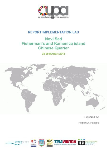
REPORT IMPLEMENTATION LAB<br />
Novi Sad<br />
Fisherman’s and Kamenica island<br />
Chinese Quarter<br />
28-30 MARCH <strong>2012</strong><br />
Prepared by:<br />
Huibert A. Haccoû
1 Table of content<br />
Preface<br />
1. Introduction 1<br />
The Novi Sad case study area Chinese Quarter and Fisherman’s Island<br />
2. The Implementation Lab Programme 2<br />
3. Questions and answers clarifying the problem statement 6<br />
4. The Implementation Lab findings 19<br />
5. Closing remarks 41<br />
Appendices<br />
A List of participants 43<br />
B<br />
Presentations<br />
- Introduction Novi Sad Implementation Lab by Huibert A Haccoû and Volkmar Pamer. 46<br />
- Novi Sad Implementation Lab Chinese district; Fisherman’s and Kamenica island by<br />
Dr. Aleksandar Jevtic & Darko Polic. 50<br />
- Chinese Quarter a M.F.A.M. vision by Alexandar Llic. 55<br />
- Regional Spatial Planning and Sustainable Territorial and Regional Development in<br />
Vojvodina by Vladimir Philer. 57<br />
- Rescaling Novi Sad a regional perspective on riparian development in Europe<br />
by Christopher de Vries. 62<br />
- Broad Spatial Strategies by Sascha Glasl. 70<br />
- Bratislava case by Vladimir Hrdy & Marek Dinka. 73<br />
- Revitalisation and Activation Program for the post industrial area of Zabtocie<br />
in Krakow by Gaja Stelmachowcz-Dziech. 75<br />
- Schwech at by Daniela Patti. 81<br />
- Oslo examples by Brede Norderud. 83<br />
C Dossier information and maps 85<br />
D Format of an Implementation Lab 95<br />
E Photo gallery 98
0 Preface<br />
The Implementation Lab in Novi Sad is the forth in a series of the project called Cooperative Urban Planning<br />
Approaches (CUPA). As part of the Co-operative Urban Planning Approaches (CUPA) project, partner cities will<br />
organize a series of workshops to discuss specific urban planning problems. These workshops intend to provide<br />
participants with an opportunity to analyze these problems in a structured manner and develop appropriate<br />
solutions. The methodology and structure to be used is derived from the INTERREG IIIc project M<strong>IL</strong>Unet<br />
(Multifunctional and Intensive Land Use network).<br />
The CUPA project was initiated by the Municipal Department 21 B - District Planning and Land use and the<br />
Municipal Department 27 EU Strategy and Economic Development of the city of Vienna. These two Municipal<br />
Departments worked closely with the TINA VIENNA Urban technologies and Strategies GmbH and have<br />
embedded this initiative in the city network DonauHanse to the aims of which it also intends to contribute. In terms<br />
of the strategy for sharing Vienna’s Urban Technologies with other cities, this project covers the area of city<br />
development and planning. The project makes use of the expertise of Vienna city departments in the workshops<br />
and organization.<br />
The project will be well publicized, thus providing wide knowledge of the project in cities and countries facing<br />
similar problems and showcasing technical expertise and know-how.<br />
Workshop partner cities:<br />
0 Vienna, Austria<br />
1 Bratislava, Slowakia<br />
2 Lviv, Ukraine<br />
3 Krakow, Poland<br />
4 Novi Sad, Serbia<br />
5 Lublin Poland<br />
6 Odessa, Ukraine<br />
To create comparability and develop a common body of knowledge, the workshops follow a standardized<br />
structure. Each workshop lasts 3 days and has approximately 25 participants. The participants include 1-2 experts<br />
from each of the cities participating in the project and 50% local experts from the city in which the workshop is<br />
being held.<br />
In the workshop preparation phase each city prepares an analysis of the specific problem area to be discussed in<br />
their workshop, and distributes this information (as well as additional supporting documentation) to the other<br />
participating cities in advance.<br />
The International Intervision Institute is invited to assist the Viennese initiating departments with the organisation,<br />
facilitation and <strong>report</strong>ing of the Implementation Lab’s results, drawing on the expertise that was developed in the<br />
EU Interreg IIIc project M<strong>IL</strong>Unet.<br />
Typical Workshop Agenda<br />
Day 1: Site visit, lecture(s) from expert(s) on topics relevant to the issue being discussed in the workshop (e.g.<br />
best practices, bad practices, basic themes, etc.).<br />
Day 2: Implementation Labs (<strong>IL</strong>): these consist of 2- 4 small groups with 5 - 10 persons per group. The small<br />
groups will exchange observations and suggestions in terms of: identity, connections, critical mass, marketing,<br />
human scale, promotion and marketing, process. Each group will be led by a facilitator who will be responsible for<br />
moderating the discussion and keeping it on track.<br />
Each working group will consider the problems in terms of the workshop objectives and then will formulate<br />
suggestions for improvement. During the day these suggestions will be clustered and refined by the group and
linked to suggestions developed by the other groups. This process will lead to the formation of a well focused set<br />
of tasks to work on in the last round.<br />
Day 3: On the third day the groups will develop recommendations for local decision-makers based on the tasks<br />
identified in Day 2 and prepare a summary presentation of these recommendations. The summary presentation<br />
will outline the workshop recommendations and be targeted to decision-makers. Local media (e.g. newspapers,<br />
television) will be invited to attend the summary presentation.
1 Introduction<br />
The preparatory visit that was made November 2011 let to the selection of the area that is formed by the<br />
Fisherman’s and Kamenica island and the Chinese Quarter for the CUPA Implementation Lab that was held in<br />
Novi Sad.The area selected for the CUPA Implementation Lab is the Fisherman’s and Kamenica island and the<br />
neighbouring Chinese Quarter. Development here has come to a stand still and despite the enormous potential of<br />
the waterfront at the River Danube, the cohesion of the present functions in the area does not match this potential.<br />
Entrepreneurship gets lost in bureaucracy. And bureaucracy seems uncomfortable in having to deal with private<br />
initiative and entrepreneurship. Especially on the two islands in the Danube many small buildings were built<br />
without building permission or technical infrastructure. This seems to be a problem all over Serbia. There seems<br />
to be little caring identification with the area. The upkeep of the public space shows signs of neglect. Low cost<br />
cleaning up activities would improve the quality of space substantially and would help to gain an atmosphere of<br />
identification with the area. O<strong>nl</strong>y the newly build promenade between the Chinese Quarter and the Danube with its<br />
cycling lanes, Walking lanes, running lanes which normally are used in stadiums, dustbins and lights every 25 - 50<br />
meters, seems to be very clean but somewhat oversized and expensive. However this could be a good value to<br />
build on.The participants of the workshop were encouraged to identify different aspects of such decisions and to<br />
suggest possible spatial proposals.<br />
Questions, amongst others, are:<br />
• what would be beneficial for the city in terms of spatial development ?<br />
• what kind of functions may become new attractions for developers and city residents ?<br />
• what and where should new structures be build in order to provide best possible access to the site ?<br />
• how will redevelopment of an area influence the society in terms of sociological, economic and cultural<br />
aspects ?<br />
• how to make the most of river in terms of water sports, recreational facilities, leisure, etc.?<br />
The Novi Sad Implementation Lab came to observations and suggestions. After having studied the study case<br />
dossier intensively and after having received the input of the source persons that presented their views on the<br />
study case and after having visited the area by bus and on foot. All this enabled the participating international<br />
practitioners from seven different nationalities to develop their own judgement on the problem statement as put<br />
forward by the host.<br />
The first round of discussions about the problem statements led to a rephrasing the originally formulated problem<br />
statement into two questions (see also Chapter 3):<br />
The what question<br />
What mix of functions in the area’s: Fisherman’s and Kamenica island and the Chinese Quarter endorses the<br />
municipal policy aims of stimulating tourism, agriculture and ICT ?<br />
The how question<br />
How do we create public-public and public private partnerships that contribute to the spatial concept we would like<br />
to recommend?<br />
The recommendation the international group of practitioners arrived at, were presented in the power point<br />
presentation that will be explained in more detail in the next paragraph<br />
1
2 The Implementation Lab Programme<br />
Day 0<br />
The day before the beginning of the workshop all international participants were given the opportunity to meet and<br />
join in an informal gathering after a guided tour to an adventurous place to have an enjoyable informal dinner.<br />
Day 1 Wednesday 28 th of March <strong>2012</strong><br />
09.00 Official welcome by Ms. Jelena Atanacković Jeličić city councilor for urban planning Novi Sad at<br />
the Novi Sad city hall at the Slobode Square nr 1 Novi Sad<br />
09.45 Introduction to the study case area by experts working on the study case and related<br />
developments on higher level of scale that bears relevance to the study case, by Dr. Alexander<br />
Jevtic, Planning director<br />
Formulation of the problem statements and short discussion<br />
General introduction to the programme and introduction of participants by drs. Huibert A. Haccoû<br />
chair - and Volkmar Pamer, facilitator of the CUPA Implementation.<br />
10.30 Walk to the Implementation Lab venue: The cultural centre of Novi Sad, 3 Katolička porta<br />
(Католичка порта)<br />
11.15 Reference cases: presentations from the in CUPA Participating Cities<br />
13.15-14:30 Lunch at the Novi Sad city hall<br />
14.30-17.00 Site visit to the study case area Chinese Quarter- Fishermen Island guided by source persons<br />
from Novi Sad<br />
18.30 Return to the hotels in the centre of Novi Sad<br />
19.00 Dinner<br />
21.30 End of day 1<br />
2
Day 2 Thursday 29 th of March <strong>2012</strong><br />
09.00 Introduction and Q&A;<br />
Plenary assessment of the problem statement and if appropriate reformulation of the problem<br />
statement/key areas of concern<br />
10.30 Coffee break<br />
11.00 Working sessions subgroups starting with Observations<br />
12.30-14.00 Lunch at the council<br />
14.00 Working sessions continued with Suggestions<br />
17.30 End workshop sessions<br />
19.30 Dinner with regional “slow food”<br />
21.30 End of day 2<br />
Day 3 Friday 30 th of March <strong>2012</strong><br />
08.30 Introduction formation and instruction of task forces<br />
09.00-11.00 Working groups exchange and finalize their recommendations Coffee breaks during working<br />
session<br />
12.00 Presentation of ppt of recommendations and discussion in the presence of the city mayor Mr. Igor<br />
Pavličić and representatives of the press<br />
13.30 Leaving for lunch (optional)<br />
15.00 End of program<br />
3
Workshop format<br />
As the programme shows, an Implementation Lab consists of a reference seminar (day 1), study visit (day 1),<br />
Implementation Lab(oratory) (day 2) and policy recommendation meeting (day 2 and 3).<br />
Each Implementation Lab workshop is the result of carefully co-ordinated efforts between the host organisation<br />
and the International Institute Intervision (III) .<br />
Core of the three days workshop about the development of the study case is the Implementation Lab itself; a<br />
series of interactive sessions in which stakeholders of the host partner work together on the spot, with the III<br />
partners and experts. To maximize interactivity, the <strong>IL</strong>’s are typically organised as open panel discussions<br />
involving planners from the host city/region.<br />
Main purpose of a Implementation Lab is to investigate as a group, both new and persistent urban/regional<br />
problems as they relate to - intended - land use. It is the intention that each workshop leaves both participants and<br />
hosts with new insights as well as shared learning experiences. Each workshop aims at providing the host useful<br />
and practical suggestions and recommendations on dealing with the problem case(s) discussed.<br />
With all the inputs of the first day, participants are invited to brainstorm according to the format of the<br />
Implementation Lab, in two subgroups. One focusing on the what and how questions of the Chinese Quarter and<br />
another subgroup dealing with the what and how questions regarding Fisherman’s Island.<br />
First, the subgroups work on common observations regarding their area. This created the bases for the second<br />
round of brainstorm sessions that generated suggestions for the area development. To provide the subgroups a<br />
common frame of reference six considerations were proposed as a structure for the brainstorm session.<br />
These six issues considered are:<br />
• Quality and identity: Does the project area have its own identity, socially, functionally and visually? How<br />
can this be enhanced? How can a living-green life style be supported ? Are there local aspiration that we<br />
can built on?<br />
• Critical Mass: Does the site have enough development, infrastructure and resident population to maintain<br />
a coherent community or support a desired mix of amenities with sufficient carrying capacity?<br />
• Connectivity: What link does each site have with its surrounding natural and man - made environment?<br />
Can these connections be enhanced?<br />
• Human scale: Do the existing developments relate in scale and proportion to diverse human scale<br />
activities such as, walking, biking, congregation, social interaction? Does the scale and relationships of<br />
public spaces support and attract their use?<br />
• Promotion and marketing: How are existing uses promoted ? How effective are these efforts and what<br />
types of promotion would be useful, necessary of possible to improve a better sense of place?<br />
• Process architecture: In developing a spatial development strategy, when should stakeholders be<br />
involved and how? What are the various interests and interdependencies between stakeholders? How do<br />
we handle opposing interests? How do we organise an effective planning and implementation process?<br />
After these brainstorm session the participants were invited to focus on the development of recommendations and<br />
present these preferably in visualised form.<br />
4
The format can be summarized by the following matrix<br />
Considerations/ Areas of concern<br />
Identity<br />
Critical<br />
Mass<br />
Connections<br />
Human<br />
scale<br />
P&M<br />
Process<br />
Observations<br />
Suggestions<br />
Recommendations<br />
5
3 Questions and answers clarifying the problem statement<br />
By Martijn Kramer<br />
The case study areas and their context<br />
By Darko Polic<br />
Short history of Novi Sad<br />
Novi Sad is the capital of the autonomous province of Vojvodina. It has a population of slightly more than 225.000<br />
inhabitants, while the greater metropolitan area has 335.000 inhabitants.<br />
The city was founded in 1694, when Serb merchants formed a colony across the Danube from the Petrovaradin<br />
fortress, a Habsburg strategic military post. In the 18th and 19th centuries, it became an important trading and<br />
manufacturing centre, as well as a centre of Serbian culture of that period, earning the nickname Serbian Athens.<br />
The city was heavily devastated in the 1848 Revolution, but it was subsequently restored. During the city's long<br />
history, it has maintained its multi-cultural identity, with Serbs, Hungarians and Germans being the main ethnic<br />
groups. Today, Novi Sad is an industrial and financial centre of the Serbian economy, as well as a major cultural<br />
hub (source Wikipedia)<br />
The city grew strongly after the second world war, for which in the 1950s an urban plan was made.<br />
During the socialist period, new blocks with wide streets and multi-story buildings were built around the city core.<br />
However, not many communist-style high-rise buildings were built, and the total number of 10+ floor buildings<br />
remained at 40-50, most of the rest being 3-6 floor Apartment buildings. City's new boulevard (today's Bulevar<br />
Oslobođenja) was cut through the old housings in 1962-1964, establishing major communication lines. Several<br />
more boulevards were subsequently built in a similar manner, creating an orthogonal network over what used to<br />
be mostly radial structure of the old town. Those interventions paved the way for a relatively unhampered growth<br />
of the city, which almost tripled its population since the 1950s, and traffic congestions (except on a few critical<br />
points) are still relatively mild despite the huge boost of car numbers, especially in later years (source Wikipedia).<br />
This plan is now coming to its limits, most planned housing areas are used as well as areas for industrial<br />
purposes.<br />
The case study area and its context<br />
The case study area consists of the Fisherman’s and Kamenica island and the Chinese Quarter. These areas are<br />
situated on south of the city centre along the Danube. The north side of the Case Study Area connects to a large<br />
housing area while north east from the area the University campus is situated.<br />
Both islands in our case study area are subject to flooding at least once in 10 years.<br />
A second problem on the islands (and on the brownfield areas in Novi Sad) is illegal building of mostly single<br />
family houses.<br />
The Fisherman Island is meant for recreational purposes, it mai<strong>nl</strong>y consists of woods at the moment, with legal<br />
recreational housing, illegal housing and clubs along the shores. A pedestrian bridge (over the i<strong>nl</strong>et) will be<br />
constructed next year, connecting the Fisherman Island to the Chinese Quarter, providing a short cut to the beach<br />
and the city centre.<br />
The Kamenica island is o<strong>nl</strong>y lightly populated, the island is flooded significant times of the year. The island was<br />
used as a water well for the city and protected as such. It lost its function and is now used for sports and<br />
recreation. In the vision of the city three recreational zones will be developed here.<br />
The Chinese district is a former industrial area, newer outlays were realised in the northern parts of the city.<br />
6
Also in the Chinese Quarter illegal occupation is present, especially by small companies, but flooding is less of a<br />
problem, because of the fact that it is situated inside the water defended area; however flooding occurs every<br />
once in a while.<br />
The housing areas adjacent to our case study areas have more than 50.000 inhabitants.<br />
The city of Novi Sad will develop a ring of pedestrian paths around the centre. Our case study area is situated<br />
along this ring.(See also the case study dossier in the annex to this <strong>report</strong>)<br />
7
The ambition of ‘The Manual Company’ with the study area Chinese Quarter<br />
By Alexandar Llic<br />
(See for the full powerpoint presentation the annex to this <strong>report</strong>)<br />
The leather company ‘The Manual Company’ manufactures leather products, such as bags and wallets. It rents a<br />
complex of halls in the Chinese Quarter in which they will realise their production facilities in the near future.<br />
Additionally the company wishes to incorporate a museum with artefacts from the early to mid 20 th century in<br />
those halls.<br />
The company wishes to function as a generator in the Chinese Quarter by the establishment of this museum.<br />
The idea of the company consists of a multifunctional centre and a museum in which the manufacturing of the<br />
products is shown together with the historical artefacts.<br />
The establishment of the museum should attract different arts and crafts activities like glass blowing, patisserie<br />
and chocolate production, attached outdoor events can be organised. There is even a natural space foreseen for<br />
an outdoor amphitheatre.<br />
The company wishes to invest € 2 million in this project. The hall is rented now from the city. The company wishes<br />
to obtain the building to be able to invest in it.<br />
In the socialistic tradition there was no place for private museums, which makes the establishment difficult and<br />
time consuming. However the museum is now registered, it has been presented within the Danube towns<br />
cooperation, a business plan has been developed and a sustainable vision is worked out in the generator<br />
approach.<br />
To promote the area, the company has already organised about 15 events in the past 3 years with good results.<br />
The company also made efforts to attract other enterprises to invest in the area.<br />
8
Facts and figures of the province of Vojvodina<br />
By Vladimir Pihler<br />
(See for the full powerpoint presentation the annex to this <strong>report</strong>)<br />
The province of Vojvodina contains of 6 cities and 39 other municipalities, it is structured along the rivers Danube<br />
and Tisa which flow together in the province.<br />
Main motorway connections are the axes Budapest – Belgrade and Zagreb – Belgrade.<br />
The province has 2 million inhabitants, while Serbia as a whole has about 10 million inhabitants, GDP of Serbia is<br />
about 45 billion US Dollars (2011).<br />
Main resource of the region is agricultural use (76%).<br />
There is o<strong>nl</strong>y 6,5% of forest area, an ambition is to come to 14% in 2020, however there is no set plan,<br />
discussions with stakeholders are going on, but no consensus has been achieved, 83 % of the current forest is<br />
state-owned.<br />
The province has a quite well spread of major towns. But there is a tendency of people to go towards Novi Sad,<br />
while the borders get depopulated.<br />
Villages tend to run empty, the agricultural sector is up scaling with larger plots, resulting in larger companies. The<br />
small scale social cohesion is under pressure.<br />
On several levels spatial plans are developed and implemented. The hierarchy in planning in Serbia is:<br />
1. National plans<br />
2. The regional spatial plans for the whole province<br />
3. Special purpose plans: transportation corridors and natural areas<br />
4. Municipal spatial plans<br />
Regional spatial plans are o<strong>nl</strong>y a recent development. The gap between municipal plans and the regional plans is<br />
large and therefore they are not well attuned.<br />
Additionally trans border cooperation is established with the neighbouring states.<br />
9
Reference cases<br />
Novi Sad and the river<br />
Christopher de Vries<br />
(See for the full powerpoint presentation the annex to this <strong>report</strong> )<br />
Novi Sad in the regional context<br />
Although rivers and the use of them often has been subject of war, also lots of joint activities took place in history<br />
with rivers as the spine for cooperation.<br />
Since in 1992 the rivers Danube and Rhine are connected by a channel an important symbolic connection of East<br />
and West Europe has been realised. Its practical function is less important because of the large number of<br />
barriers in the routes, which are slowing down the shipping traffic.<br />
A river can be used as a connection between local and global economy. Cities along the rivers can use and<br />
structure their planning based on the opportunities of situation along the river. To create better opportunities,<br />
Christopher suggests to set up a network of cities, aiming at strengthening the bonds between the cities along the<br />
Rhine and Danube, by making the waterway better accessible. A mutual regional planning approach could help to<br />
reach collaboration between the different entities.<br />
Looking at Novi Sad and its situation in between of Zagreb, Belgrade and Budapest, cooperation is an<br />
opportunity, but might also be a threat. Connecting Novi Sad better by the river in this proposed network, might<br />
strengthen the local economy but also might cause a danger of letting the economic prosperity go to those other<br />
main economic centres. This needs to be researched.<br />
An opportunity for the case study area<br />
In Novi Sad the harbours and industrial sites are connected to rail and roads. Their situation in the city is in the<br />
periphery, mostly in the Northern part.<br />
The case study area is situated along the river but not connected to the present harbour and industrial sites.<br />
There fore it could be used to trigger collaboration between institutions concerned with different uses, such as<br />
agriculture, fishery, tourism and hydraulic engineering. It could be an example for other areas.<br />
The fact that a large part of the area suffers from flooding can be dealt with in a natural way. In the Netherlands<br />
there is experience with such approach:<br />
In the Netherlands the larger tides resulted in another way of looking at water. Instead of keeping the water out,<br />
room has and will be reserved to buffer water in times of high tides. Those temporary flooded low lands can be<br />
used for aquaculture, like oyster cultivation.<br />
10
Dealing with competing interests<br />
By Sacha Glasl<br />
(See for the full powerpoint presentation the annex to this <strong>report</strong>)<br />
Sacha Glasl shows and explains a few examples of his work that could bare relevance to the study cases in Novi<br />
Sad:<br />
North Holland<br />
The company Space and Matter made a plan for the incorporation of 200.000 dwellings in the province of North<br />
Holland. During the planning process they envisaged that there was also a need for 2000 hectares for water<br />
buffering to provide for consequences of climate change. The area in view is now occupied by expanding<br />
agricultural use.<br />
Space and Matter proposed to combine the housing assignment with the need for additional space for water<br />
buffering. The development of the present agricultural sector is that the land is being acquired by 5 main investing<br />
farmers while buying out the others.<br />
Space and Matter proposes a trust for cooperation where the small farmers will become developers, producing<br />
energy and housing.<br />
Maastricht<br />
Another project was in Maastricht. The motorway is currently be placed underneath the surface in a tunnel. A<br />
competition was won by West 8 to connect both sides of the city along the existing motorway. In a large workshop<br />
a map was made for 10 years in which all parties are involved to actually make this connection. So here the<br />
process working together with stakeholders, originated the successful development of this part of the city of<br />
Maastricht.<br />
Utrecht<br />
In Utrecht a transferium will be developed. It is easily connected to the road network and has a waterfront. Space<br />
and Matter wants to set up a programme and strategy to work with stakeholders to make development possible.<br />
A contaminated site in Amsterdam<br />
Despite the crisis cities need to develop. Smart temporary solutions should trigger further development. This can<br />
be done in cooperation with all involved parties. In Amsterdam first a small initiative of a secret garden was<br />
initiated, in this garden a landscape architect designed a plan with plants to clean the soil in 10 years in a natural<br />
way. Second hand boats can be obtained by artists and be placed near the secret garden. The tenants of the<br />
boats rent a water place for this period for a relative low price.<br />
11
Heathrow<br />
In Heathrow an idea for a grave yard was proposed for dying activists against a new runway, to even block it for<br />
the future.<br />
Vacant office space in Amsterdam<br />
An idea of using vacant office space was made by Space and Matter to occupy it by hotel rooms, in the same way<br />
as the bridge houses were developed for hotel use.<br />
An Amsterdam newspaper presented the idea in the right moment and this helped to make the plan become a<br />
reality.<br />
Recommendation<br />
Useful for the study case area: first you should map the occupancies and the interests of the parties. Then you<br />
should focus on one specific project. That could trigger the development of the whole area.<br />
12
Green islands in the Danube in Bratislava<br />
By Vladimir Hrdy and Marek Dinka<br />
(See for the full powerpoint presentation the annex to this <strong>report</strong>)<br />
In Bratislava a similar situation as in Novi Sad exists, also along the Danube. The case in Bratislava is to develop<br />
the right bank of the river. This is the opposite bank of where the city centre is situated. In the past the right bank<br />
has been an overflow area where the Danube had a lot of branches.<br />
Since a flood protective embankment has been constructed the right bank could be developed. On part of the right<br />
bank, in the 70s, a new outlay of Bratislava was build, o<strong>nl</strong>y remaining one branch for water storage purposes. The<br />
lower and larger part of the right bank is still quite undeveloped with o<strong>nl</strong>y some small scale houses. However the<br />
recent effects of climate change causes the right bank to be in danger of flooding again.<br />
The right bank of the river is an interesting place in the sense of ecological system and nature. The city of<br />
Bratislava feels the need to intervene and find a solution for the danger of flooding. One of the propositions was to<br />
give the river more room and in that way to protect the right bank area against flooding. To give the river more<br />
space, a bypass was proposed. A bypass creates green islands between the main branch of the river and the new<br />
branch along the existing dike. Digged soil can be used to fill out the land along the dike.<br />
With bringing back the island structure, the city wants to preserve the green area on the right bank. The area<br />
therefore should mai<strong>nl</strong>y have a sports and leisure function.<br />
Bratislava envisages a problem with the protected status of parts of the green bank. It may not be accessed, while<br />
the vicinity to the city centre makes it subject to accessibility.<br />
The time frame for realisation is 20 years.<br />
13
Examples of development in Oslo<br />
By Brede Norderud<br />
(See for the full powerpoint presentation the annex to this <strong>report</strong>)<br />
Oslo is a growing city, growing mai<strong>nl</strong>y because of immigration, from all over the world.<br />
It has now 600.000 inhabitants, in 25 years this will be 800.000. There is a need for housing and private<br />
developers obtain land to develop those.<br />
In Norway most of the grounds are privately owned and private owners have the right to present their plans to the<br />
city. In order to make decisions the city has a master plan with a structure to assess those plans. To avoid<br />
unintentional sprawl, the master plan of Oslo indicates a very strict borders, especially between the built up zone<br />
and the forest.<br />
The area of Breivoll is situated on the border of the city and will soon be connected to the city centre by the metro<br />
system. The Breivoll area is in transformation from brownfield into an urban area. The larger investment<br />
companies are presently obtaining land. In Breivoll there is a conflict between infrastructure and built up area. The<br />
city needs to define the metro line trajectory and the stops, the second is to develop the public spaces and<br />
neighbourhood scale connections taking into account the many barriers.<br />
In the area called ‘the Necklace’ you see lots of logistics, infrastructure and mono-functional housing areas. In the<br />
Necklace you see lots of vacant shops and offices and its inhabited by immigrants mostly. The strategy for<br />
improvement and development is to provide free spaces for persons with good ideas .<br />
A major project in Oslo is the sea front promenade. It is about 7 km long stretch of waterfront in on former<br />
industrial areas. This area is being transformed into a multifunctional urban area, in which housing is the most<br />
important function. The area is now being developed in several characters. It is privately developed and the<br />
question is who pays for the quality of this public area.<br />
Backing of the City council is needed for all projects to be successful. Small incentives can help to support big<br />
plans.<br />
14
Programme for Zablocie - Krakow<br />
By Gaja Stelmachowicz-Dziech<br />
(See for the full powerpoint presentation the annex to this <strong>report</strong>)<br />
Zablocie is a former industrial area close to the centre of Krakow but on the other bank of the river. The area was<br />
based along the river and used for industry and for storage of salt from the mines.<br />
The river is an opportunity to be used and is now underused. In 2002 a new bridge was build and connects the<br />
area better to the centre. Because of this connection a private University decided to locate their campus close to<br />
the bridge. First they used the existing buildings, later they developed a new building. The use of ‘the story of the<br />
lift factory’, a well know tale in Krakow, and its connection with the famous movie ‘Schindlers List’ helped to<br />
develop en promote the area.<br />
The redevelopment of Zablocie was in the same time and in connection with the development of the overall spatial<br />
plan. This resulted in a good attuning of both and supported the realisation.<br />
Flagship projects are (see the presentation):<br />
• Ghetto Heroes: won a price for good urban space<br />
• Schindlers Factory<br />
• Museum of Contemporary Art - MOCAK<br />
• Centre of Documentation of Art<br />
• Bernatka Footbridge<br />
• Barge Project<br />
• Adaptation of a Seed Mill for lofts – private initiative<br />
• Garden Residents<br />
The University is now used for promotion of this area for attraction of new inhabitants and functions. The<br />
investment for the city was one bridge, the offspring was a new University, now generating new investments.<br />
Success factor was public participation, including future city game method. A result was to clean up the gate to<br />
the area and make it more attractive.<br />
Now a tramline is being built, making the area a real part of the town.<br />
Recommendation: Do a smart investment and capitalise on that.<br />
15
Transformation of a hub<br />
By Daniela Patti<br />
(See for the full powerpoint presentation the annex to this <strong>report</strong>)<br />
Schwechat houses the International Airport of Vienna and transformed from a transport hub o<strong>nl</strong>y towards a<br />
knowledge hub as well. Schwechat managed to implement some new developments in the past year, like a<br />
multifunctional centre and a research centre.<br />
Identification of the right stakeholders at the start of a process, working closely together dealing with the different<br />
interest is most important for success.<br />
Short recommendations for development of the Novi Sad Case Study area<br />
The presenters of the reference cases and introductions gave as a kind of overall summary their<br />
recommendations in the form of an “elevator pitch”.<br />
Christopher<br />
Develop the islands combining flooding, recreation and aquaculture. Deal with temporary use and make use of in<br />
your development plans. Try to trigger collaboration between existing institutions.<br />
Sacha<br />
Integrate stakeholders and map the activities. Map the ownership and interest.<br />
Make first a great vision with a good story., then make a development strategy with small steps.<br />
Zoom out for a moment and look if this strategy is helpful for other places too.<br />
Brede<br />
A plan for public space structure should be made containing all aspects. The plan for public space must hit<br />
relevant connections.<br />
Gaja<br />
Define the real problem and set goals. The city must break the first barrier to start up activities.<br />
Marek<br />
Develop the Fisherman island and leave the other for nature.<br />
Make plans that will not make barriers for the future.<br />
Vladimir<br />
Use of innovative forms of partnerships, e.g. public private partnerships.<br />
Use the order vision - policy - partnership.<br />
16
Alexandar<br />
The area needs multi functionality.<br />
Darko<br />
For the question to develop a sound recreational system on the island, try to set up a public-public-public<br />
partnership, involving the Watermanagement board, Ministry of Defence and the city of Novi Sad.<br />
Novi Sad has problems to manage the area, but Novi Sad manages to create quality. The city should research<br />
how they managed to do so.<br />
Clarifications and rephrasing the problem statement<br />
Flooding<br />
The Kamenica island floods every 5 to 7 years. The Fisherman island less often.<br />
The Chinese Quarter suffers from under capacity of the sewage system when flooding of the islands takes place.<br />
Unused public space<br />
The main questions for Novi Sad are:<br />
• What kind of spatial concept is needed.<br />
• How to structure a process with different partnerships.<br />
Development opportunities and threats in Novi Sad<br />
Facts<br />
• Presently the development along the motorway is the most important, the sites are already owned by<br />
private parties. There are 50-70% of infra structured for industries.<br />
• There are several other sites in Novi Sad which should be developed, but it lacks investors.<br />
• The spine of development is Novi Sad - Belgrade. A city just in between made perfect use of that,<br />
providing land for free. Other cities make in one way or another better be use of available funding,<br />
they probably made better use of promotion etc.<br />
• The gravity point is at the location of the university campus and the area around the motorway is in<br />
development.<br />
Priorities in the development vision of Novi Sad:<br />
1. Tourism<br />
2. Bio organic agriculture<br />
3. ICT<br />
Tourism<br />
Novi Sad is seen as a tourist centre and has a lot to offer in sense of historical values. There was an idea to built a<br />
multimodal hub, this is still considered.<br />
About 50.000 people visit Novi Sad by boat, there is a terminal close to the centre.<br />
There are festivals. The Conference markets are under developed.<br />
People from Novi Sad tend to stay in the city during holidays. They really use the Danube area for recreation.<br />
Novi Sad is known for its special atmosphere, especially amongst Bosnian people.<br />
Bio organic agriculture and ICT<br />
The most important faculties of the University are Electronics and Agriculture.<br />
In Novi Sad the fact that there are so many students helps to attract companies. The companies look in the first<br />
place for human resources.<br />
17
Novi Sad wishes to attract companies by emphasizing its University. Each faculty of the University wants to<br />
develop a research centre. At the campus there is lack of space, the University has (after negotiation) access to<br />
investment money. A partnership could be formed, but in reality the faculties are actually working quite isolated.<br />
However the feeling is that there is not a climate to set up ppp’s, it’s too new for the foreseen private partners.<br />
Many students wish to stay in Novi Sad, however there is not a vision how to create jobs. But actually Novi Sad is<br />
not really loosing people to Belgrade, it really functions as the capital of Vojvodina.<br />
In the village of Indija (between Belgrade and Novi Sad) a plot for ICT was reserved for an Indian company, with<br />
as o<strong>nl</strong>y facility the connection to the highway and the airport. This seems sufficient for this ICT company. But this<br />
is not what Novi Sad would like to aim at.<br />
The problem statement for this workshop<br />
What multifunctional solutions could be developed (and how), which support the vision on the three main issues,<br />
being:<br />
1. Tourism<br />
2. Bio organic agriculture<br />
3. ICT<br />
What are the innovative powers and where are they situated?<br />
18
4 Implementation Lab findings<br />
Introduction<br />
The participants of the Implementation Lab session were split up in two subgroups one focussing on the area of<br />
the Chinese Quarter and a second subgroup dealing with the area of the Fisherman’s and Kamenica island.<br />
Chinese Quarter session<br />
Photo Impression of the workgroup sessions (4-6)<br />
OBSERVATIONS CHINESE QUARTER<br />
Chinese Quarter - Observations<br />
• Peripheral area but surely part of the city<br />
• Daytime production nighttime entertainment<br />
• Intimate ambiance but also unsafe<br />
• Interesting heritage contrast to the environment<br />
• Easy to reach but not easy and inviting to access<br />
• In between dorms and university<br />
Chinese Quarter - Observations<br />
• Will be transit area after realisation of the bridge<br />
• Weakly connected to the water<br />
• High potential because of many people around<br />
• Economic activities, craftsmanship, nautical centre<br />
• Sports and youth<br />
• Industrial breeding place<br />
• Known in the city<br />
Observations Identity and Human Scale<br />
The identity of the Chinese Quarter is one of different faces; this is especially present in the eastern side of the<br />
quarter. The word Chinese does however not reflect the people using or living in the area but reflects to goods<br />
from China stored here in earlier days. The present main identity is that of a community of entrepreneurs, each of<br />
them runs a small company with a light industrial character, such as car repair workshops and small maritime<br />
businesses (mostly boat construction and maintenance). The narrow streets give you the feeling of a small village<br />
with even some interesting industrial heritage buildings. There is also the identity of a place to party; several clubs<br />
and bars are present in between of the workshops. As the student dorms are close-by this identity surely comes to<br />
life during the weekends and nights. But there is also the identity of an unsafe place due to the dereliction of the<br />
place, the limited access to its surroundings and the illegal occupations of some of the buildings. The central site<br />
of the Chinese Quarter consists of the students’ dorms, which are of good quality and look very well taken care of,<br />
with the interesting derelict Czech Depot as a contradictory element. The western side is a military area, which<br />
was not accessible. The southern edge of the quarter is the riverbank with a recreational identity of biking (bike<br />
track), jogging (running track), boating (several private marinas) and swimming (large public beach).<br />
Observations Critical Mass, Promotion and Marketing<br />
The area is well known in Novi Sad, especially because of its recreational facilities. The beach next to the Chinese<br />
Quarter is densely visited by the Novi Sadians during the summer months. The bicycle road and running lane is<br />
also well used. The pubs and clubs seem to be visited by people form all over the town. In the direct vicinity of the<br />
Chinese Quarter three large housing areas are situated in which 60.000 people live. It also seems that the<br />
enterprises in the Chinese Quarter are doing well, it seems ground for development of new activities.<br />
19
Observations Connectivity<br />
The eastern part of the quarter is surrounded by old buildings and has o<strong>nl</strong>y few access-lanes to the neighbouring<br />
areas. The connection to the dike with the bike and running lane is easy but not attractive because of the fallow<br />
land in between. The public access to the river is blocked from this dike because of the marinas with a private<br />
character; o<strong>nl</strong>y at the beach a direct connection to the water is possible.<br />
An asset of the eastern Chinese Quarter is its situation in between of the student dorms and the university. The<br />
area as a whole is sufficiently connected by road to the centre of Novi Sad. The nearby roads are quiet, however<br />
this seems to change in the near future with the construction of a new bridge for transit traffic in the southern<br />
direction. Then the area will be in between of two bridges with a possible increase of inner city transit traffic.<br />
Connection to the centre by public transport is provided at several places in the area, by frequent buses of the<br />
city’s public transport company.<br />
SUGGESTIONS CHINESE QUARTER<br />
Chinese Quarter - Suggestions<br />
• Better connection with Liman<br />
• Make use of the university’s vicinity<br />
• Generator for starting entrepeneurs<br />
• Define public space and improve it<br />
• Keep Czech Depot and English factory for the identity<br />
Chinese Quarter - Suggestions<br />
• Present tissue could be kept<br />
• Improve acces to the water<br />
• Keep and strenghten the mixed use<br />
• Increase density in student dormitory area<br />
• Incorporate the boulevard in the plans<br />
• Use the cultural identity<br />
Suggestions Identity and Human Scale<br />
The present diversity in identity of the Chinese Quarter gives a lot of opportunities. Improving the overall quality of<br />
the area should strengthen all identities. Derelict structures in the eastern part should be demolished and<br />
replaced, the o<strong>nl</strong>y building worth to keep is the old factory with the shed roof. The mixed-use character of small<br />
companies with bars, clubs and student housing should also be kept. The area could function as a generator for<br />
new small companies.<br />
In the eastern part the tissue should be kept as it provides a good human scale. In the central part a densification<br />
of the student dorms can be realised by building additional dorms and with that shaping better defined public<br />
spaces, which should be of good quality. The Czech Depot can have a more central function related to the<br />
university such a research centre, library or centre for development of small enterprises.<br />
Suggestions Connectivity and Critical Mass<br />
The Chinese Quarter should be better connected to the Liman quarter (housing area) opposite of the boulevard,<br />
which is planned to be in between both quarters. For the eastern part this means more access lanes to the Liman<br />
side of the area. For the total area this means that the both sides of boulevard should be incorporated in the<br />
plans, including densification and unification in architectural appearance of both sides.<br />
On the south side of the area the connection with the water must be improved. A better-defined public space of<br />
better quality is a necessary in the fallow land between the Chinese Quarter and the dike. The marinas could be<br />
slightly re-arranged providing two or three public accesses to the river. Public landing stages could be built to<br />
enable approaching the water.<br />
Suggestions Process<br />
Cooperation with the university is necessary to be able to develop new small enterprises in the area. This might<br />
cause a shift toward more knowledge related entrepreneurs instead of light industrial use, however the water<br />
related companies should be able to keep or find a place in the area.<br />
20
Chinese district recommendations<br />
By Daniela Patti and Christopher de Vries<br />
Novi Sad – Serbia<br />
Urban context<br />
Infrastructure and institutions<br />
Combine Spatial and Institutional Opportunities<br />
BUDAPEST<br />
OPPORTUNITIES<br />
€<br />
EMERGING<br />
INDUSTRIES<br />
BELGRADE<br />
RECRUITMENT<br />
EXPOSURE<br />
RESEARCH<br />
INVESTMENT<br />
€<br />
UNIVERSITY<br />
€<br />
EMERGING<br />
INDUSTRIES<br />
BELGRADE<br />
BELGRADE<br />
ZAGREB<br />
FOREIGN AND<br />
NATIONAL<br />
INVESTMENT<br />
BUDAPEST<br />
21
Flagship of Novi Sad’s knowledge economy<br />
PUBLIC<br />
SPACES<br />
- RECREATION<br />
- TOURISM<br />
- CULTURE<br />
€<br />
UNIVERSITY<br />
- RESEARCH AND DEVELOPMENT<br />
- CAMPUS<br />
- ENTREPRENEUR START-UPS<br />
EMERGING INDUSTRIES<br />
- DISTRIBUTION & LOGISTICS INDUSTRY<br />
- INNOVATIVE AGRI/AQUACULTURE<br />
- INFORMATION TECHNOLOGY<br />
UNCLEAR ACCESS - UN-POROUS - FENCED<br />
HYDROLOGIC BOUNDARY - CONNECT TO CITY<br />
ARMY<br />
?<br />
LIGHT<br />
INDUSTR<br />
Y<br />
DORMS<br />
LIGHT<br />
INDUSTR<br />
Y<br />
PROTECTED<br />
ZONE<br />
TIDAL<br />
INFLUENCE<br />
LEVEE/DIKE<br />
The Chinese Quarter is an area that can become the new face of the city towards the Danube.<br />
Due to its position this area should become the connecting space between the Limen Neighbourhood and the<br />
Fisherman’s and Kamenica islands.<br />
From a functional point of view, the presence of the University and the existing small activities and informal<br />
business can trigger a process towards a ‘knowledge society’, if the Municipality were to support the start-up of<br />
small business maybe connected to the main development target areas of Novi Sad: IT, Agriculture and Tourism.<br />
22
Physically, the existing longitudinal axis of the Boulevard Despota Stefana could be consolidated by infilling with<br />
low-rise buildings and creating an urban street with functions, both on a local and metropolitan level.<br />
At the same time the connection with the rest of the city must be given by transversal connections with a strongly<br />
pedestrian character, which lead to the public spaces along the river.<br />
The pathway along the river should have better connections to the water, some public spaces and some activities.<br />
Proposal<br />
FACULTYRESEARC<br />
H<br />
CONFERE<br />
NCE<br />
BU<strong>IL</strong>DING<br />
START-UP<br />
FACULTY<br />
LABS<br />
MIXED USE INCUBATO<br />
R<br />
FACULTY<br />
STUDENT<br />
HOUSNG<br />
CAFE<br />
INNOVATIV<br />
E SME CLUBS/BA<br />
RS<br />
TEMPORA<br />
RY<br />
PAV<strong>IL</strong>IONS<br />
LEGEND<br />
NEW BU<strong>IL</strong>DING<br />
EXISTING BU<strong>IL</strong>DING<br />
PAV<strong>IL</strong>ION (TEMP)<br />
PUBLIC MARINA<br />
CAMPUS<br />
RECREATION<br />
FLOODPLAIN<br />
MAIN CONNECTION<br />
WALKING PATH<br />
PRIVATE MARINA<br />
STRAND<br />
Campus = Private/public porosity<br />
The concept of a porous campus aims at creating a strategy where private investment is channelled via the<br />
university to create to produce high quality public space.<br />
The institutional appropriation of the campus is beneficial for maintenance and safety. It also gives a clear address<br />
and identity to an educational institutions, thereby clearly demonstrating Novi Sad’s ambitious future plans.<br />
23
porous references<br />
HARVARD YARD OXFORD MIT<br />
As for the Chinese district, this can be kept with its authentic tissue, opening the perimeter in some strategic<br />
points to improve connectivity and replacing fabric in poor condition. This could become a space with small<br />
enterprises, maybe opened up by young entrepreneurs.<br />
The Student Dormitories could be surrounded by other building bringing services to the students, such as<br />
cafeterias, show rooms, etc.<br />
The area closest to the military base has the potential to be mixed-use University Campus with research labs,<br />
expo areas and public space.<br />
Last but not the least, from an implementation point of view it can be important to think of the process along the<br />
time line.<br />
Two temporalities are foreseen: one has a seasonal character and could consist of kiosks with services along the<br />
pedestrian lane close to the water, the other is along the Boulevard Despota Stefana, where buildings could be<br />
initially put up with the use of impermanent materials, such as prefabricated, in order to quickly and efficiently<br />
modify the space, and could be replaced with more permanent constructions in a second phase.<br />
This second possibility could be the chance for the Municipality to take advantage of the existing habit of building<br />
informal and illegal constructions, by making it a guided process with related policy, which would have the<br />
advantage to quickly and cost-effectively build without having to wait for greater investments.<br />
24
References of temporal structures<br />
AA STUDENT PROJECT<br />
LONDON<br />
OXFORD<br />
SERPENTINE GALLERY<br />
Session on Fisherman’s and Kamenica island<br />
25
OBSERVATIONS<br />
Kamenica-Fisherman Island - Observations<br />
• Unshaped gem right in the City<br />
• Area for everyone<br />
• Lot of identities<br />
• Nature with a lot of faces<br />
• High recreation potential<br />
• Positive development as a germ cell of optimism<br />
Kamenica-Fisherman Island - Observations<br />
• DDD - Dirty, deprived, disgusting<br />
• Unsafe<br />
• Fences everywhere<br />
• Badly connected<br />
• Anarchic conditions<br />
• No co-operation (water management – city – citizens)<br />
Observations Identity<br />
Novi Sad, the New Garden. The city has the identity in her name. The university is next to the ICT also specialized<br />
in agriculture. The city can become the New Garden of the future.<br />
The islands have a lack of identity. The o<strong>nl</strong>y strong image is the water of the Danube, the nature and the marina/<br />
ship wharf industry on the edges of the islands. But all these identities do not have quality. There is no sign of<br />
taking care or being involved in the islands. O<strong>nl</strong>y the new floating bars and clubs invest in their boats. The public<br />
area is poor maintained and even neglected.<br />
Observations Critical mass<br />
The areas of Adice, Telep and Liman, which are over 60.000 people live are directly connected to the two islands<br />
in the Danube River. These people are using the area as leisure islands already.<br />
Next to that Novi Sad is a vibrant city with a lot of young people/students. These people are the future investors in<br />
the city. The play a great role in the attraction of Novi Sad.<br />
Observations Connectivity<br />
Novi Sad as a city is well connected to roads, railway and by river Danube. The river walk from the city of Novi<br />
Sad towards the Kamenica area is a great asset. Public transport in Novi Sad is by bus. It was not clear if the bus<br />
connection between the area and the city was good or not. There are a lot of young people that move by bike and<br />
that is a big plus! It is the basis of a healthy city.<br />
The visual connection is very nice between the two edges of the Danube River. The castle is a very nice<br />
landmark!<br />
Observations Human Scale<br />
Novi Sad is a city which is built on a human scale. Walkable distances, the running strip along the Danube, the<br />
vibrant of the people are all a part of this image. The area of Fisherman’s and Kamenica island is on the other<br />
hand are more on a River Scale.<br />
26
SUGGESTIONS<br />
Kamenica-Fisherman Island - Suggestions<br />
• Informal to formal<br />
• One area<br />
• Park area<br />
• Crowded part<br />
• Quiet part<br />
• Money earning component<br />
• Maintainance component<br />
Suggestions Identity<br />
The Fisherman’s and Kamenica island must be merged. It can be one area, it has one identity. Like a park with a<br />
more cultural area and a more natural area. But still it has one identity. Main theme’s Leisure, Nature and<br />
Science. Try to make the people carry out the identity with their own property as well.<br />
Suggestions Critical mass<br />
Make use of the people that are living, working, recreating in Novi Sad. Create a platform where people can speak<br />
about the area and facilitate a few fun and short term initiatives. This creates community building on the spot.<br />
Suggestions Connectivity<br />
The city of Novi Sad is a centre for the agricultural region. This economical connection can be shown better in the<br />
city. Public markets with local products make connection between the city and its hinterland. Exploit this!<br />
Direct and recreational attractive connections are available but there are possibilities to expand this network.<br />
The Castle on the other side of the Danube is a very nice landmark always to take in to consideration as a viewing<br />
point from lots of riverbank sites.<br />
Suggestions Human scale<br />
Use the human scale that is in Novi Sad. Be careful to make to large scaled projects that destroy the nice setting<br />
which is in Novi Sad.<br />
Suggestions Promotion and Marketing<br />
Make people aware where they can be proud off. Give people/ students the space to show where they are proud<br />
off. Involve the knowledge industry, university and research companies. Make them work together in PPS<br />
construction with the city. If they take care of their surroundings they can be a part of the new development. The<br />
city can give their promise to promote the area, local, national and international. To show companies that if they<br />
invest in their surroundings the investments are increasing and people are willing to stay in Novi Sad to work and<br />
live there, it will be an attraction for economy. Investing in surroundings in the area of Fisherman’s and Kamenica<br />
island is means investing in ecology/nature. Together with private investors the leisure/eco-tourism sector can<br />
help out to make the area a healthy/natural and vital area for the city, the people and the fauna.<br />
27
Recommendations Fisherman’s and Kamenica island<br />
After the brainstorm phase that resulted in observations and suggestions, the participants were invited to work in<br />
separate groups on four separate tasks. These tasks are:<br />
• Develop a process architecture that embraces the spatial programme for both the study case area<br />
Chinese Quarter and Fisherman’s and Kamenica island that involves public-public and public-private<br />
partnerships and present this in a PowerPoint presentation.<br />
• Provide detailed maps indicating where what mix of functions should be developed in the area’s<br />
Chinese Quarter and Fisherman’s and Kamenica island, that endorses the policy aims of stimulating<br />
tourism agriculture and ICT in a sustainable manner.<br />
High Tech AgriCulture.<br />
High tech nature is the future of the islands. This seems like a utopia but in Novi Sad this is a possibility! The<br />
islands in the Danube, Fisherman’s and Kamenica island are in potential the exposure fields of that where Novi<br />
Sad is best in. High tech AgriCulture! With the dynamics of the young people and students in the city and the<br />
knowledge and expertise in entertainment this area can be an experimental zone for the city of Novi Sad.<br />
Fisherman’s and Kamenica island are now both unidentified places of the city of Novi Sad. Never the less a lot of<br />
people of the city know the place by heart. Because in summer time it is a good starting point to enjoy the<br />
weekend. The marina, the running strip on the boulevard, the floating bars are point out that entertainment in the<br />
weekend is a necessity for this area of the city.<br />
Entertainment is both, natural and quiet area’s to relax in summer which is seen on Kamenica island as well as<br />
cultural and loud with the example of the EXIT festival.<br />
Developments in Novi Sad, the transformation of the Chinese Quarter, the wish to make a University Campus and<br />
to show the people of Novi Sad what there is to be proud of make it an interesting place to identity.<br />
Three main actors can stimulate the development of the Fisherman’s<br />
and Kamenica islands.<br />
1. The university and research centre of Novi Sad, with the focus<br />
on high tech agriculture<br />
2. Leisure and tourist sector<br />
3. Nature conservation organization<br />
The idea is to make this part of the city a relaxing natural area but at the<br />
same time an entertaining knowledge area where the university can<br />
show the people were they are good at. High tech Agriculture and a<br />
vibrant and entertaining student life. The government can stimulate this<br />
area to make it a project where these three actors can benefit from each<br />
other.<br />
28
Existing informal island<br />
Potentialtobethe<br />
frontside of the city<br />
To start the transformation, it is important to make one island park with one identity. The Fisherman’s and<br />
Kamenica island can be referred to as one park with a more natural site and a more leisure orientated site.<br />
Develop a new identity<br />
Interacting with the key players of the area is important. To make use of the University and of the knowledge that<br />
is situated inside the buildings is a great opportunity. Kamenica island can be the show case for the state of the<br />
art in high tech agriculture. To see, feel, touch and may be even eat the knowledge that is produced in the<br />
Science centre and at the university is a key quality.<br />
Like every park The Islands have a certain zoning. The site that is more close to the city of Novi Sad is more<br />
science and leisure/entertainment oriented and the Kamenica area is more nature and weekend activity<br />
orientated.<br />
29
Zones<br />
To make it work that people will come and not just visit the area but also to take good care of the area. There<br />
need to be some rules for example in parking and where to drive and where not to drive. And to make sure it the<br />
area is accessible.<br />
The high dynamic roads (cars) and the low dynamic roads (pedestrian and bike ways) need to be clear and at the<br />
same time nice to be at. It is an leisure area, so also the road itself must be a nice one.<br />
Car & parking infrastructure<br />
Pedestrian and bicycle paths<br />
The edges of the island need to be defined. Which part is private and which part is public. Where can you look to<br />
the river front and where green structures are more important.<br />
30
Green and water structure<br />
To realize such an area it will cost a lot of money. There for it is important to arrange a financial strategy to<br />
compensate for low yielding parts with high yielding parts of the area. The science centre will therefore pay for the<br />
maintenance of the more natural part.<br />
Arrange a financial strategy to compensate for low yielding parts with high yielding parts of the area.<br />
31
Illustrating vision<br />
The result of these ideas are a vibrant park of the city Novi Sad along the River site. With daily activities and<br />
weekend activities. With economical vivid activities and ecological vivid attractions. All are flexible, as the tide<br />
comes all the islands can be flooded, except for the existing buildings. The relation between the university/science<br />
centre and the recreational area is one with great potential. A show case and study site in agriculture that can<br />
experiment with flooded crops and really dry crops. Aquaculture and Agriculture can be exposed. This area will be<br />
an important part of town. For science and leisure!<br />
Illustrating vision nature park<br />
References nature park<br />
32
Illustrating vision recreation and camping<br />
33
Illustrating vision agricultural park<br />
Vision<br />
References<br />
34
Illustrating vision nature park<br />
References<br />
35
Illustrating vision event park<br />
Reference<br />
36
PROCESS RECOMMENDATIONS<br />
By Elsbeth van Hijlkama- Vlieg<br />
After the Implementation Lab proceedings having defined the benefits in terms of urban development potential,<br />
the attractiveness for developers and urban users of space, the connectivity and accessibility to adjacent urban<br />
quarters such as the city centre and the areas of Liman and Adice, a subgroup of the Implementation Lab<br />
concentrated on the possibilities for an effective process architecture. Its intention was to set up a flowchart of<br />
actions over a period of approximately two years that would enable the city government to develop and implement<br />
a comprehensive plan for the three distinct parts of the whole area, the Chinese Quarter or District, the<br />
Fisherman’s and Kamenica island.<br />
A few principles were supposed to be leading in this process: redevelopment should be based on a general<br />
recognition by inhabitants, local owners and current users of the area itself, as well as on a general support for the<br />
planned interventions by the Novi Sad city council and its political leaders.<br />
Both content and process should eventually be joining valid topical policies.<br />
Provided that the Chinese Quarter is seen as ideally suited for a public private cooperation. As the upgrading of<br />
the city marina and the green parts of the area are to remain a public responsibility, it is evident that the city<br />
government should take the lead in the process, in close consultation with the provincial authorities and the<br />
national institutions governing the Danube River as route for goods transport from North Sea to Black Sea.<br />
In order to differentiate between three types of activities the flowchart was divided in three columns: the plan<br />
making, the political decisions and the financing, each containing the relevant steps in time order and in their<br />
relationships, in the course of the developments from the beginning till the first actual improvements of the area. It<br />
was the intention to describe o<strong>nl</strong>y the basic planning actions and leave enough flexibility to adapt content, timing<br />
and substantiation during the further development without losing focus or functionality.<br />
First of all, more research is needed concerning the current uses, the ownership and the rental of buildings, the<br />
quality of the buildings and their surroundings, the sustainability of recent and current investments in both<br />
buildings and public space.<br />
Looking at the observations and suggestions for the three distinct areas, it should be possible to include the<br />
results of this research in a more elaborated definition of the role of the total area containing also the Liman<br />
District, the University area, the Telep and Adice areas.<br />
This role definition should support the start of a master plan development. Therefore we advise making this the<br />
subject of an urban debate, including the responsible politicians, civil society, local expertise and entrepreneurship<br />
and inhabitants. The results of this debate should be put down in a <strong>report</strong> reflecting the main issues for social<br />
support or rejection. Both old and new media could be of help at this point: <strong>report</strong>ing by local writing press, radio<br />
and TV, Youtube, Facebook and Twitter.<br />
At this point in time, fairly at the beginning of the process, the city government can appoint a political responsible<br />
Alderman, a financial responsible person within its own ranks, who will take care of preparation and control of a<br />
development budget, and a project leader directly responsible to the city government for the whole process.<br />
From here the master plan elaboration could be set in motion, starting by building up from four layers: 1: soil and<br />
water, 2: ecology and nature, 3: infrastructure and built environment, and 4: the identification of the special<br />
features that make the area specifically interesting as part of Novi Sad.<br />
For each of these layers it should be made clear whether changes need to be made, existing quality needs to be<br />
enhanced, and how interrelatedness will provide surplus value.<br />
The result of this phase will be a plan on broad lines, indicating possible directions for development, in a number<br />
of variants, sufficiently elaborated to be roughly calculated in terms of public and private investments needed. This<br />
should be subject to a second discussion with the city government, the city council, and possibly be put before a<br />
37
larger audience of expert and social representatives, investors and local stakeholders. An urban event, a city<br />
conference, aimed at putting the area in the spotlights and creating an awareness of the development potency of<br />
the area.<br />
This is the moment when the project should be institutionalised as urban project and be given an inspiring name.<br />
A special website and a contact address should be set up in order to receive spontaneous reactions and input<br />
from the Novi Sad community. By this time there should be a view on financial feasibility and risks.<br />
This plan on broad lines will be suitable for further investigations of separate elements. Therefore we suggest<br />
dividing the plan into the three parts, Chinese Quarter, Fisherman’s and Kamenica island, and treat them<br />
separately from this moment on, while keeping their interrelatedness in mind. Separately in terms of time<br />
scheduling, managing further elaborations, political responsibility, financing and connecting to stakeholders.<br />
We advise starting with the Chinese Quarter, because of its more complicated nature, its social and political<br />
urgency, and also because we expect it to contain elements that could produce profit, to be transferred to<br />
elements that could not be made feasible without. We foresee therefore a system of value transfer within the<br />
context of the land use operative plan for this area.<br />
Starting with the Chinese Quarter implies taking the plan on broad lines to a more detailed level and turning it into<br />
a frame of reference, for various specifically defined land uses, the character and functional definition of the<br />
connecting public spaces, all on the basis of the originating four layers mentioned earlier but brought further by<br />
adding a spatial structure.<br />
This exercise will result in a functional programme for the area of the Chinese Quarter. Again a moment for further<br />
debate, for a third discussion on the political level, with the responsible Alderman and city council. By this time it<br />
should be possible to calculate the public and private investments needed, as well assessing the interest of local<br />
or national development firms and the tension strength of public means. This stage of the discussion should<br />
enable city government to formulate a strict mandate for further negotiations with other parties, public and private.<br />
An inventory and selection of possible direct stakeholders in the development scheme for the Chinese Quarter will<br />
then follow, on the basis of a functional programme, leading to the first intentional commitments, and a further<br />
elaborated draft proposal for public-private cooperation. This part of the process will take some time and will have<br />
to be worked out in a rather closed circuit. This is necessary in order to avoid improper infringement from outside.<br />
Since the political conditions have been captured well in advance, the outcome should prove not to be<br />
controversial. On the contrary, it will gain in feasibility and support by the parties that are to be involved directly in<br />
the implementation of the plan.<br />
The public-private cooperation proposal will fix quality criteria and functions, while in addition the spatial structure<br />
and the connectivity to the adjacent areas and city centre will be determined.<br />
This is reason for a fourth meeting with Alderman and city council, resulting in possible adjustments and final<br />
agreement on the concrete ambitions for the area. This all is to be put down in a letter of intent signed by all<br />
parties.<br />
Now there is a basis for the making of the real business case and a consolidated business plan for the land use.<br />
This should be considered a major step towards the development of this area as new part of the city, and<br />
celebrated with public hearings, a website, TV and radio exposure and a press conference.<br />
The legal translation of the business plan for the land use is still to be done then. The formal procedures<br />
according to the national laws for urban restructuring, building permits and public participation will have to be<br />
scheduled and followed, leading to final checks and adaptations of the plan and an implementation schedule.<br />
After this final stage it is essential that the city government gives the formal GO signal for starting the realisation<br />
process.<br />
38
A communication plan will accompany the further execution of the plan, and should pay special attention to the<br />
first steps in order to show the reality value of it all. Frequent social or cultural activities in the district will keep a<br />
positive focus on this important development for the whole city.<br />
The same flow chart as this one could be used for the other parts of the studied area, the Fisherman’s and<br />
Kamenica island. Al though perhaps not necessarily all together simultaneously, it is recommended however that<br />
the two islands that are so comparable are investigated as one plan, and are kept in close relation with the<br />
progress of the Chinese Quarter plan. Implementation could be run in different stages.<br />
The resulting recommendation were encompassed in a power point presentation that was presented at a public<br />
meeting on Friday 30 th of March at 12.00 hours in the presence of the Mayor of Novi Sad Mr. Igor Pavličić. This<br />
rounded off the implementation lab about the Novi Sad study cases.<br />
Do research<br />
Define role of area<br />
•Liman district<br />
•University<br />
•Telep<br />
•Adice<br />
Plan Political Decisions Financing<br />
First debate of aldermen and province Appoint financial responsible person<br />
Prepare masterplan development<br />
Project leader with delegated power<br />
Devide in 3<br />
Indicate layers:<br />
•soil = water<br />
•ecology = nature<br />
•built up / infrastructure<br />
•special spots<br />
Plan on broadlines • Second discussion with aldermen<br />
• Council discussion<br />
• City conference<br />
Rough calculation of plan on broad<br />
lines<br />
Devide in 3 parts:<br />
1.Chinese quarter<br />
2.Fisherman island<br />
3.Kamenica island<br />
39
Start with 1. Chinese quarter<br />
Frame of reference for:<br />
•landuse<br />
•public space<br />
•on basis of defined layers above<br />
•urban structure<br />
Functional programm for the area<br />
Inventory of stakeholders<br />
Public Private Cooperation proposal<br />
•quality criteria<br />
•functions<br />
•elaborated structure<br />
•connectivity to surrounding area<br />
Third meeting with the alderman<br />
and council<br />
Fourth meeting with the<br />
alderman and council<br />
First calculation indicative for public<br />
money and private money<br />
Business plan of the land use<br />
Consolidated plan • Public hearing<br />
• Website<br />
• TV / radio / PR conference<br />
Legal landuse plan<br />
•legal procedure<br />
Communication plan<br />
First improvements of the area<br />
Final check and adaptations<br />
GO for implementation<br />
40
5 Closing remarks<br />
Novi Sad impressions:<br />
By Brede Norderud<br />
A town with a long proud readable history in a region dense with conflicts on several levels, a fertile landscape,<br />
growing western oriented modernity, university, a beautiful situation along Danube, - and an interesting<br />
competitive size (as cities/regions are competing for investments/Saskia Sassen) !<br />
Our lab concept has to sum up after a limited time, and our message has to be put into an expected grammar, the<br />
more or less classic western idea of a linear rational process. I felt we took very well care of our possibilities within<br />
the framework of a short week. And the planners from Vojvodina/Novi Sad have the professional knowledge and<br />
perspective around this, but are coloured by “what ideas are considered relevant in this issue”, - like anywhere.<br />
From the Preparatory visit November 2011 we have learned that :<br />
“bureaucracy seems uncomfortable in having to deal with private initiative and entrepreneurship.” .…”In general,<br />
there is a kind of ‘no future’ mood.” … “… a lack of fantasy to deal with the crisis.”<br />
Novi Sad seems to be within, but nevertheless (because of history) in the outskirts of, economic modernity. This<br />
forms a degree of barrier in the communication of accessible tools towards the city leadership.<br />
It also made an impression that participation from neighbours (Liman 1 – 4: 34.000 inhabitants(!) owning their<br />
apartments, but not the ground?) and enthusiastic local stakeholders with resources, (amongst them: The Leather<br />
Factory, and an American-Serbian drum-maker(!) living 50/50 in New York/Novi Sad), where seemingly not very<br />
visible on the agenda of processes in Novi Sad.<br />
QUESTIONS<br />
So one of the questions that made curious is: How to re-establish the courage in the city council to dare to<br />
cooperate with private stakeholders (selling estates/shared responsibility/PPP etc). Novi Sad has potential.<br />
How to legitimate and establish confidence between decision makers and stakeholders?<br />
This always demands thorough processes and patience, and is nevertheless outside the frames of a one week<br />
Implementation Lab, which also has to fill in other perspectives.<br />
My hang up on this issue is of course on the background of The Norwegian Building Act, where the necessity of<br />
participation is stated as a premise for any planning process.<br />
If I were a planner in Novi Sad I would be conscious of existing statements from city council focusing on the<br />
necessity of Novi Sad being competitive (economical sustainability).<br />
For instance: What are protocols telling about the city council in Novi Sad concerning strategies in urban<br />
development, - strategic statements for the role of the city council in<br />
- Participation/involvement as a strategy for development of local entrepreneurship,<br />
- Participation/involvement in urban development on township level.<br />
41
Reflections on the result of the Novi Sad Implementation Lab<br />
By Dr. Aleksandar Jevtić*<br />
We had the great pleasure to organize and conduct this workshop in Novi Sad, as one in a series of<br />
implementation laboratories that enhance the quality of urban development in the cities of the Danube region.<br />
Developmental concepts for the areas of the Chinese district, Fisherman’s and Kamenica island prove previous<br />
urban solutions, proposed by the PE for Urban Planning during the last few decades, largely successful.<br />
Fisherman’s and Kamenica island developmental proposals in particular conform to the existing planning<br />
documents, as it has recently been confirmed in four case studies of sustainable development conducted by the<br />
PE for Urban Planning.<br />
New developmental solutions for the Chinese district area are particularly interesting. Existing facilities and the<br />
relative proximity of the University complex indicate further development potential. Our current problem is the lack<br />
of space to meet growing needs of the University of Novi Sad. Therefore, the proposed Chinese district<br />
developmental solution should provide incentives for entrepreneurs, especially those from the IT sector which is<br />
poised for continued growth in our city.<br />
The implementation of the proposed area development is of great importance. For us, it represents the most<br />
important result of this workshop. Serbian legislation is currently being harmonized to the legal framework of the<br />
European Union. However, we have not yet had the opportunity to put this sort of urban development into<br />
practice.<br />
This workshop is a confirmation of our success and the ideas proposed here challenge us to continue the dynamic<br />
development of Novi Sad.<br />
* Address at the Implementation Lab Novi Sad Seminar, 28-30 March, <strong>2012</strong><br />
42
A<br />
List of participants and résumé’s<br />
Participants<br />
INTERNATIONAL PARTICIPANTS<br />
Lastname Name Institute Position e-mail Address<br />
Haccoû, H.A. Huibert International<br />
Intervision Institute<br />
Kramer Martijn The International<br />
Institute for<br />
the Urban<br />
Environment<br />
(IIUE).<br />
Hylckama<br />
Vlieg<br />
Elsbeth<br />
consultant urban<br />
development,<br />
former Secretary<br />
General IFHP<br />
Haccoû, F Femke City of<br />
Amsterdam;<br />
Spatial Planning<br />
Department<br />
Managing director<br />
of the International<br />
Intervision<br />
Institute,<br />
Associate<br />
professor Saxion<br />
University School<br />
of the Build<br />
Environment.<br />
Managing director<br />
of the International<br />
Institute<br />
for the Urban<br />
Environment Delft<br />
(NL)<br />
Former Secretary<br />
General of the<br />
IFHP<br />
The Hague (NL)<br />
Landscape<br />
Architect; City of<br />
Amsterdam,<br />
Department for<br />
Spatial Planning<br />
(NL)<br />
Glasl Sascha Space&Matter architect (cofounder/director)<br />
De Vries Christopher European<br />
Infrastructure<br />
Laboratory<br />
- CDV design<br />
Norderud Brede Oslo Municipality,<br />
Planning<br />
department<br />
haccou@iiinstitute.<strong>nl</strong> Nieuwstraat 7, 6981<br />
AH Doesburg,<br />
Netherlands<br />
kramer@urban.<strong>nl</strong> P.O. Box 2959<br />
(Menninckstraat 256),<br />
2601 CZ<br />
(2583 BW) Delft, The<br />
Netherlands (Den<br />
Haag, The<br />
Netherlands)<br />
hijlckama@xs4all.<strong>nl</strong> Badhuisweg 157,<br />
2597 JN Den Haag,<br />
The Netherlands<br />
femke@haccoudesign.<strong>nl</strong><br />
femke.haccou@gmail.com<br />
James Cookstraat<br />
24/HS, 1056 SB<br />
Amsterdam, The<br />
Netherlands<br />
glasl@spaceandmatter.<strong>nl</strong> Kraanspoor 36, 1033<br />
SE Amsterdam, The<br />
Netherlands<br />
Urbanist / Architect cdevries@eufralab.eu Keizersgracht 644-4,<br />
1017 ES Amsterdam,<br />
The Netherlands<br />
Chief architect brede.norderud@vikenfiber.no Ringstabekkvn. 10c,<br />
1358 - JAR Oslo,<br />
Norway<br />
43
From the Municipality of Novi Sad and international partner cities the following persons have taken part in the<br />
CUPA <strong>IL</strong> Novi Sad: these are urban planners, traffic expert, landscape planners, developers, architects and<br />
district representatives.<br />
CUPA PARTICIPANTS<br />
Lastname Name Institute Position e-mail Address<br />
Pamer Volkmar Municipal<br />
Administration of the<br />
City of Vienna<br />
Damm Markus TINA VIENNA, Urban<br />
Technologies &<br />
Strategies<br />
Architect and<br />
Urban<br />
planner, City<br />
of Vienna,<br />
AUSTRIA<br />
Project<br />
Manager<br />
volkmar.pamer@wien.gv.at Rathausstraße 14-<br />
16, 1082 Vienna,<br />
Austria<br />
markus.damm@tinavienna.at Anschuetzgasse 1,<br />
1150, Vienna,<br />
Austria<br />
Patti Daniela CEIT Alanova Researcher d.patti@ceit.at Am Concorde<br />
Business Park 2F,<br />
A-2320 Austria<br />
Dinka Marek Bratislava city<br />
administration<br />
Hrdý Vladimír Territorial Systems<br />
Coordination<br />
Department, City of<br />
Bratislava,SLOVAKIA<br />
Manasijevic<br />
Radojevic<br />
Mirela<br />
JP „Urbanizam”<br />
Zavod za urbanizam<br />
Novi Sad<br />
Polic Darko JP „Urbanizam”<br />
Zavod za urbanizam<br />
Novi Sad<br />
Stelmachowicz-<br />
Dziech<br />
Gaja<br />
Municipality of<br />
Krakow<br />
Department of<br />
territorial<br />
systems<br />
coordination<br />
marek.dinka@bratislava.sk<br />
Primaciálne<br />
námestie 1<br />
(Laurinská 7 3.<br />
posch., č. dv. 313),<br />
81499 (81101),<br />
Bratislava,<br />
Slovakia<br />
Ing. arch. hrdy@bratislava.sk Hlavné mesto<br />
Slovenskej<br />
republiky<br />
Bratislava, 814 99<br />
Slovak republic<br />
Architectplanner<br />
Architectplanner<br />
Chief<br />
Specialist at<br />
Investor<br />
Support<br />
Center<br />
mirela.manasijevic@nsurbanizam.rs<br />
darko.polic@nsurbanizam.rs<br />
darko.polic@gmail.com<br />
gaja.stelmachowiczdziech@um.krakow.pl<br />
Bulevar cara<br />
Lazara 3/III, 21000<br />
Novi Sad Serbia<br />
Bulevar cara<br />
Lazara 3/III, 21000<br />
Novi Sad Serbia<br />
Pl. Wszystkich<br />
Swietych 3-4,<br />
31-004 Kraków<br />
Poland<br />
44
PARTICIPANTS <strong>NOVI</strong> <strong>SAD</strong><br />
Lastname Name Institute Position e-mail Address<br />
Srdjan Zoric Novi Sad - Public<br />
Enterprise for City<br />
Construction and<br />
Development<br />
Bede Aleksandar New media<br />
center_kuda.org<br />
Urban planner srdjan.zoric@zigns.rs Stevana<br />
Branovackog 3,<br />
21000 Novi Sad<br />
Serbia<br />
Urban research<br />
collaborator<br />
aleksandar.bede@gmail.com<br />
Novi Sad, Nikole<br />
Tesle 20 , 21000<br />
Novi Sad Serbia<br />
Berc Dafne Organization: Urban researcher basauri.berc@gmail.com Medvescak 42<br />
Analog<br />
Pihler Vladimir Urban and spatial<br />
planning institute<br />
of Novi Sad<br />
Associate urban<br />
planner<br />
pihlervladimir@yahoo.com Zeleznicka 6/III ,<br />
21000 Novi Sad<br />
Serbia<br />
Reba Darko Faculty of<br />
Technical<br />
Science,<br />
Department<br />
Director of<br />
Department<br />
rebad@uns.ac.rs<br />
Trg Dositeja<br />
Obradovica 6,<br />
21000 Novi Sad<br />
Serbia<br />
of Architecture<br />
and Urbanism<br />
Peric Ana Faculty of<br />
Architecture,<br />
University of<br />
Belgrade /<br />
Teaching assistant,<br />
PhD candidate<br />
anaperric@yahoo.com<br />
Bulevar kralja<br />
Aleksandra 73/II,<br />
11000 Belgrade<br />
Serbia<br />
Department of<br />
Urban Planning<br />
Ilić Aleksandar Manual Brand manager aleksandar@manual.rs Zmaj Jovina 18,<br />
21000 Novi Sad<br />
Serbia<br />
Grčić Marija Manual Public relations office@manual.rs Zmaj Jovina 18,<br />
21000 Novi Sad<br />
Serbia<br />
Erdeljan Bogdan Manual Architect berdeljan@gmail.com Zmaj Jovina 18,<br />
21000 Novi Sad<br />
Serbia<br />
Đujić Tamara STUDIO K Architect tamaradjujic@gmail.com Bulevar cara<br />
Lazara 86, 21000<br />
Novi Sad Serbia<br />
Lovric Drazen European Affairs<br />
Office<br />
Markovic Dusko URBAN<br />
CENTRE, <strong>NOVI</strong><br />
<strong>SAD</strong><br />
Head of department lovricdrazen@gmail.com Hajduk Veljkova<br />
11, 21000 Novi<br />
Sad Serbia<br />
Associate<br />
economist<br />
dusan.markovic@nsurbanizam.rs<br />
Bulevar cara<br />
Lazara 3, 21000<br />
Novi Sad Serbia<br />
Kulacin Bojana Kulacin Sociologist bojana.kulacin@gmail.com Bulevar Cara<br />
Lazara 3/III, 21000<br />
Novi Sad Serbia<br />
45
B<br />
The presentations<br />
Huibert Haccoû<br />
46
B<br />
The presentations<br />
Darco Polic<br />
50
B<br />
The presentations<br />
Alexander Llic<br />
55
B<br />
The presentations<br />
Vladimir Philer<br />
57
B<br />
The presentations<br />
Christopher de Vries<br />
62
B<br />
The presentations<br />
Sascha Glasl<br />
70
B<br />
The presentations<br />
Marek Dinka<br />
73
B<br />
The presentations<br />
Gaja Stelmachowcz-Dziech<br />
75
B<br />
The presentations<br />
By Daniela Patti<br />
81
B<br />
The presentations<br />
Brede Norderud<br />
83
C<br />
The case study dossier<br />
The case study area of Novi Sad:<br />
By Darko Polic<br />
85
The Concept of Spatial Planning and Landscaping<br />
• According to the concept of spatial development of Novi Sad, retention of existing and introduction of new<br />
compatible functions is planned for the urban area along the left Danube river bank, with respect for the<br />
ecological, environmental and sustainable development aspects.<br />
• Sport, recreation and tourism are the functions that can provide a better quality of life for the citizens,<br />
economic development and further spatial planning for the river bank.<br />
• The planned construction of the city river marine and accompanying facilities shall provide Novi Sad a<br />
place on the maps of nautical tourism of the Danube region.<br />
• By dislocating existing industrial functions, we create new possibilities for the river bank area, identify<br />
desirable form of sports and physical activities and tourist attractions, new business and cultural facilities,<br />
as well as conditions for their realizations. Accessibility and attractiveness of the area to all residents of<br />
Novi Sad are recognized as the major urban and social quality of this concept.<br />
• The plan retains functions implemented in accordance with the existing documentation: student dorms<br />
complex, hospitality facilities and cottage resort on the Fisherman Island, the city beach and more.<br />
• The causeway in the form of a quay functions as a promenade, running parallel to the cycling and jogging<br />
trails. The causeway connects the entire coastal area of Novi Sad to the centre of the city.<br />
• New sports, recreational and cultural content planning is a part of a revitalization project for the Danube<br />
river bank aimed at increasing the attractiveness of the area, mai<strong>nl</strong>y for sports and recreation, cultural and<br />
other non-residential functions supposed to complement predominantly residential area of the adjacent<br />
neighborhoods of Liman, Telep and Adice.<br />
• Business and cultural facilities, planned within the complex of the former `Petar Drapšin` factory or the<br />
Chinese district, should also provide public space accessible to a large number of users.<br />
• The city river marina construction is planned in the area between Kamenica River Island and Fisherman<br />
Island and it would become a part of nautical tourism offer on this part of the Danube river flow.<br />
• Fisherman’s and Kamenica island are planned as forested green areas designated for sports and<br />
recreational activities, but primarily for preservation of the specific micro-climate of Fruška gora mountain<br />
and Panonian plain. The area will be forested with indigenous species (white poplar, willow, alder, elm,<br />
ash, oak, plane tree, etc).<br />
Urban Areas With Predominant Gree<strong>nl</strong>and Function<br />
The planned construction area is divided into three spatial units within the regulatory lines.<br />
Kamenica River Island, Adice and Telep Settlements along the Bank<br />
• The area of the complex is approximately 171 ha<br />
• Its revitalization would directly contribute to the realization of programs intended for the people of Adice<br />
and Telep. Indirectly, however, it would contribute to the whole city and its touristic potentials.<br />
• Maximal allowed floor space index is 10 %.<br />
• In order to protect the area from flooding, it is necessary to fill causeways, which would enable utilization<br />
of the facilities the whole-year-round.<br />
• The access to the area for cars, pedestrians and bicycles is through the existing causeway.<br />
• In the half-closed i<strong>nl</strong>et of Šodroš, an artificial lake with water-filtration is planned. Moreover, a rowing track<br />
is also planned along the Šodroš, as well as a resort on its northern side, with all the accompanying<br />
hospitality and touristic resort facilities.<br />
• In the central part of the Kamenica River Island, a recreational and sport facility is planned (open courts<br />
with the accompanying facilities, tennis court, etc.), a beach along the Danube with a parking lot.<br />
87
• In the eastern part of the Kamenica River Island, a business and cultural facility is planned, a city marina,<br />
tourist and sport facilities, parking lots, green belt area, as well as a docking facility for smaller tourist<br />
vessel.<br />
In the eastern part of the Kamenica River Island, a business and cultural facility is planned, a city marina, tourist<br />
and sport facilities, parking lots, green belt area, as well as a docking facility for smaller tourist vessels.<br />
1- Sodros I<strong>nl</strong>et swans 2- Sodros i<strong>nl</strong>et vessels<br />
3- Sodros I<strong>nl</strong>et channel 4- Kamenica island - Danube bank<br />
Fisherman Island<br />
The area of the complex is approximately 32.4 ha.<br />
The whole comprises of the Fisherman Island and the defunct shipyard. The whole area is connected with the city<br />
traffic route. The shipyard premises has a quite specific position and is strategically much better located than any<br />
other surrounding area. By altering its purpose, the now defunct shipyard area is to be transformed into a tourist,<br />
sport, recreational and commercial facility, all of which should functionally connect the coastal area with the city<br />
through the Liman neighborhood.<br />
Fisherman Island is a natural resource soon to be classified as a protected area. Its area is to be developed into<br />
various recreational and sport grounds, as well as tourist facilities.<br />
88
Maximal allowed floor space index is 10 %.<br />
The Western part of the Fisherman Island, the area along the Šodroš i<strong>nl</strong>et, will serve as a part of the city marina<br />
(whose major part will be on Kamenica River Island) the accompanying facilities will be commercial, trade,<br />
hospitality, parking and sport complexes.<br />
The central part of Fisherman Island is planned as a tourist and hospitality facility, as well as urban forest, mai<strong>nl</strong>y<br />
for recreational purposes (hiking, bicycle and jogging lanes, various sporting grounds, retreat zone, etc.).<br />
A small-scale cabin and cottage settlement is located in the eastern part of the Island.<br />
On its northern side, various docking areas are planned: for houseboats, fishing-boats marina, naturally observing<br />
the free passage and navigation regulations.<br />
A pedestrian-bicycle bridge connecting Fisherman Island and the Sunny Quay is also planned.<br />
5- Danube - Fisherman Island<br />
6- Fisherman Island Liberty Bridge<br />
89
7- Fisherman Island Liberty Bridge<br />
8- Fisherman Island<br />
9- Fisherman Island - city beach Štrand<br />
90
Chinese district, Liman neighborhood with the Danube i<strong>nl</strong>et<br />
• The area of the complex is approximately 65.6 ha.<br />
• The plan maintains the currently functioning city beach Štrand and the nearby public parking lot.<br />
• Within the lot dominated by the three student dorms is the so-called Czech Depot facility.<br />
• A pedestrian and bicycle lanes are planned along the Danube causeway.<br />
• Due to its potential and appeal, the location of the Chinese district is planned to house future commercial<br />
and cultural facilities (culture centre, cinema, a department of the Contemporary Arts Museum, concert<br />
hall, administration facilities, hotel with the accompanying hospitality and commercial facilities, etc.)<br />
• Chinese district has 114 business and commercial units with the total area of 16240.08 m2.<br />
10- Danube - I<strong>nl</strong>et docks 11- Danube - I<strong>nl</strong>et future pedestrian bridge<br />
12- Danube - I<strong>nl</strong>et housing pontoon<br />
91
13- Danube – Pontoons<br />
14- Causeway by the city beach Štrand 15- Sunny quay future pedestrian bridge<br />
16- Czech depot<br />
92
Statistics and function indicators<br />
93
Identity<br />
Easiest and safest public connection to Novi Sad Danube. Nearby city beach "Štrand", which has a daily visit up<br />
to 50 000 people during summer, one of the most famous points in Novi Sad, Chinese district neglected ex<br />
industrial area with a high potential, naval river base. an obstacle for any kind of spatial development, Fisherman<br />
houses on the (Fisherman) island, Pontoon houses and docks for all types of vessels in Danube i<strong>nl</strong>et, cafés<br />
pontoons on Danube 'summer night's industry', the best wedding parties in the restaurants on the Fisherman<br />
island. Danube island forests, Šodroš i<strong>nl</strong>et; fishing and rowing area in the summer and place for sliding and swan<br />
resort in winters, Spooky Kamenica island for people of 'easy virtue'.<br />
Human scale<br />
Chinese district is a vibrant night clubs area. Beside that a student culture centre (which includes exhibition area<br />
and theatre performances) has shown some creative impulses. The rest of the area is neglected and un(der)used.<br />
Fisherman island is a summertime area for: the owners of pontoon or fishermen houses, restaurants are for<br />
celebrations (weddings especially), night club on pontoons are among the best in Novi Sad in a long SE Europe<br />
summers. The rest is a neglected and potentially dangerous forest, in which small area will be a place for a<br />
campsite (mostly during the EXIT festival 1 ). Kamenica island has no human scale; almost nobody uses it.<br />
Connectivity<br />
Chinese district is easily reachable on foot through the Liman park, by public transport, bicycle etc. Fisherman<br />
island is not well connected (except by car), but that will improve because of a newly designed pedestrian way.<br />
A cycling bridge is to be built this year <strong>2012</strong>. Kamenica island is badly connected and almost impossible to reach<br />
and it is far away in Novi Sad's terms. Naval River Base and shipyard are obstacles for all communications It is<br />
blocking the quay causeway etc.<br />
Critical Mass<br />
As a contrast to the "Štrand", the Chinese district and the rest of the area by the Danube i<strong>nl</strong>et are not very much<br />
living and looked after areas. It is not conceived as a friendly surrounding for any kind of activity. Fisherman’s and<br />
Kamenica island are remotely situated from Nov Sad. Fisherman island, since reachable by the car and by bicycle<br />
(all the way around Naval base and shipyard) are perceived as positive places. This in contrast to the Kamenica<br />
island which is not perceived as a place to be for mass consumption (which explains why the illegal weekend<br />
housing development is taken for granted)<br />
Promotion and Marketing<br />
The Chinese district is considered to be a creative quarter of Novi Sad; the city marina is a new nautical tourist<br />
amenity of Novi Sad; Fisherman island: is a camping site, with a fisherman village, providing nightlife on pontoons.<br />
Promotion strengthens the public awareness for the value of green spaces and of the natural ecological resources<br />
of the 2 islands Recreation/sport and leisure on and by Danube are promoted all year long<br />
Process Architecture<br />
Public/private partnership in the Chinese district, city marina could be: public/public= city/provincial authority<br />
partnership. All green places at both river islands should remain in public domain (city or province) and be used as<br />
a main city green space, park, urban forest etc. There is an unsuccessful project of Eco park 2 planned at<br />
Petrovaradin island (downstream, by the Petrovaradin fortress) which might be used as a model for Kamenica<br />
island. The ideas, the owner of a shipyard is developing are a mystery at the moment.<br />
1 http://www.exitfest.org/en<br />
2<br />
The idea was to make an Eco park, camp area and especial recreational park for the citizens of Novi Sad and all visitors keen on camping.<br />
The idea failed due to strict regime of the City's water supply company which uses Petrovaradin island as a mayor source of water fro greater<br />
Novi Sad area. http://m.exitfest.org/en/news.php?id=1642<br />
94
D<br />
Format of an Implementation Lab<br />
Workshop format<br />
A Implementation Lab (3 days workshop) consists of a reference seminar (day 1), study visit (day 1),<br />
Implementation Lab(oratory) (day 2) and policy recommendation meeting (day 3).<br />
In its efforts, the Implementation Lab format will serve the following aims:<br />
• Increase awareness of the consequences (both positive and negative) of the concentration and/or mix of<br />
activities, or: multifunctional and intensive uses of space (urban land, water and green areas)<br />
• Examine the extent to which such concentrated land use interventions contribute to social quality as well<br />
as the economic value and the quality and climate robustness of the physical structure of areas<br />
• Consider appropriate containment strategies for cities using multifunctional and intensive land use<br />
mechanisms to preserve open space, nature, valuable landscape and water systems, while balancing<br />
regional development.<br />
Each Implementation Lab workshop is the result of carefully co-ordinated efforts between the host organisation<br />
and the International Institute Intervision.(III) .<br />
Implementation Lab (<strong>IL</strong>)<br />
Core of the three days workshop is the Implementation Lab.<br />
The <strong>IL</strong> is an interactive session in which stakeholders of the host partner will work together on the spot with the III<br />
partners and experts. To maximize interactivity, the <strong>IL</strong>’s are typically organised as open panel discussions<br />
involving planners from the host city/region. The Implementation Lab is meant to give momentum to a<br />
local/regional project, by implementing concepts like Multifunctional and Intensive Landuse (M<strong>IL</strong>U) into practice.<br />
The Implementation Lab is a ‘Laboratory’ or ‘Pressure Cooker’. All partners work together with the host partner on<br />
one or two local and/or regional cases, for which the host partner is responsible. The ‘real problem’ situation will<br />
seduce the III partners to produce the best of their knowledge relevant to the case under study. The need to help<br />
solve a practice problem will tap off the maximum of the partnerships know how. The case area(s) are located in<br />
the region of the host partner that will go through a (re)development process with special opportunities for for<br />
instance M<strong>IL</strong>U solutions.<br />
Main purpose of a III Implementation Lab is to investigate as a group, both new and persistent urban/regional<br />
problems as they relate to land use. It is the intention that each workshop leaves both participants and hosts with<br />
new insights as well as a shared and learning experiences. It is highly desirable that each workshop provides the<br />
host useful and practical suggestions on dealing with the problem case(s) discussed.<br />
The main goal is to go a step forward in the process of realisation and come to recommendations for the case<br />
area(s). This includes spatial solutions, environmental risk management concepts, architectural ideas, solutions<br />
for social problems and crime prevention, process organisation, financing and policy strategies.<br />
Cases<br />
The host organisation identifies one or two problem sites and assembles detailed information on them for the<br />
attendees to deliberate over. In addition, a third site can be presented as a case study to demonstrate an<br />
innovative approach. Supporting presentations can be made by host officials to inform participants to the full about<br />
the idiosyncrasies of the cases under study. In addition to that, selected participants as arranged by the<br />
programme organisers can present also input for the deliberations by means of cases that are of interest; this is<br />
based on their own experiences.<br />
95
Focus of an <strong>IL</strong><br />
III partners represent a wide variety of fields including urban and regional planning, architecture, ecology,<br />
landscape planning, aerial survey, urbanism, environmental management, construction, water management, risk<br />
and safety management, traffic and transport engineering, economics, social, community and health sciences,<br />
systems analysis, and law as well as public policy and administration.<br />
The focus is however on the integration of sectoral policies and specialised expert know how, emphasising crosscutting<br />
issues:<br />
• Governance (effective planning and implementation, finance, regulations partnerships, etc.).<br />
• Technology (systems management, construction technologies, architectural concepts, etc.).<br />
• People and environment (participation, quality of life, risks, resource use, etc.).<br />
• Spatial quality and identity of place.<br />
Five issues of concern<br />
While selecting one ore two projects for consideration, the host city or institution identifies issues related to five<br />
issues of common concern. Manifesting themselves differently in each site, these five types of issues provide the<br />
means to both orient participants to the preferred nature of debate, as well as be a basis for organising meeting’s<br />
panel discussions.<br />
The six issues considered are:<br />
• Quality and identity: Does the project area have its own identity, socially functionally and visually? How<br />
can this be enhanced? How can a livinggreen life style be supported? Are there local aspiration that we<br />
can built on?<br />
• Critical Mass: Does each site have enough development, infrastructure and resident population to<br />
maintain a coherent community or support a desired mix of amenities with sufficient carrying capacity.<br />
• Connectivity: What link does each site have with its surrounding natural and man made environment?<br />
Can these connection be enhanced?<br />
• Human scale: Do the existing developments relate in scale and proportion to diverse human scale<br />
activities such as walking, biking, congregation, social interaction? Do de scale and relationships of public<br />
spaces support and attract their use?<br />
• Promotion and marketing: How are existing uses promoted ? How effective are these efforts and what<br />
types of promotion would be useful, necessary of possible to improve a better sense of place?<br />
• Process Architecture: In developing a spatial development strategy, when should stakeholders be<br />
involved and how? What are the various interests and interdependencies between stakeholders? How do<br />
we handle opposing interests? How do we organise an effective planning and implementation process?<br />
Preparation and procedure of an Implementation Lab<br />
An <strong>IL</strong> is organised according to the following scheme.<br />
Pre-meeting preparations:<br />
• Identification of problem sites by host organisation.<br />
• Identification of key areas of concern.<br />
• Preparation of dossiers with background material for each site.<br />
• Distribution of background material to registered attendees several weeks prior to arrival.<br />
Procedure of an Implementation lab:<br />
• Site visits to establish context.<br />
• Plenary sessions (including invited speakers).<br />
• Working sessions to formulate concrete suggestions for the case study areas, as well as observations on<br />
how to develop (regional) policies.<br />
• Concluding plenary session.<br />
96
To avoid misunderstanding: an <strong>IL</strong> forms the core of a workshop.<br />
Work method<br />
The <strong>IL</strong>’s working sessions are conducted by dividing attendees into teams depending on the number of attendees,<br />
to distribute professional expertise as eve<strong>nl</strong>y as possible. There will be moderators for each team. Experts are<br />
available as resource persons. They come from the host organisation, and are familiar with each project. There<br />
role is to help maintain focus as well as to facilitate concise compilation of issues and concerns.<br />
Issues and concerns identified for each project are placed within the six areas of concern, mentioned before.<br />
Discussions and observations are conducted in an open panel discussion format. Each moderators objective is to<br />
have their project’s comprehensive lists of concerns categorised halfway the <strong>IL</strong>.<br />
Finally, the deliberations will focus on simplifying the various comments produced by each team. The process is<br />
organised in such way that it is ensured that all participants will understand and agree with the ideas generated for<br />
the case study projects.<br />
To wrap up the work done, theme co-ordinators and the hosts deliver summary comments in plenary.<br />
Reporting<br />
The host organisation produces a <strong>report</strong>, the content of which is in agreement with the III. this <strong>report</strong> highlights the<br />
results of the Implementation Lab. The host organisation disseminates the <strong>report</strong> in its region. It is recommended<br />
to organise a press conference is to present the results.<br />
97
E<br />
Photo collage<br />
98
100
101
102
The International Intervision Institute is a product of many years of<br />
experience in the IFHP Working Party M<strong>IL</strong>U, Multifunctional and Intensive Land Use<br />
(2000-2004) and the Interreg IIIc Operation M<strong>IL</strong>Unet (2004-2007). M<strong>IL</strong>Unet developed<br />
into a network of experts dedicated to the generation, collection, exchange and transfer<br />
of knowledge on the subject of multifunctional intensive land use as a means to realise<br />
more sustainable urban development in Europe. The members of M<strong>IL</strong>Unet were<br />
European cities and leading European Research Institutions.<br />
The experiences showed that urban and regional planning professionals are usually<br />
closely involved with their own region or city and often miss an objective evaluation of<br />
their work. All the cities involved in the M<strong>IL</strong>U projects greatly appreciated the added<br />
value of an impartial, non-competitive and professional appraisal of planning problems<br />
and potential solutions.<br />
After termination of the Interreg IIIc project, the initiators of M<strong>IL</strong>U decided to continue<br />
working with the theoretical framework and the format of the Implementation Lab, that<br />
proved to be most productive for the solution of local development problems and for the<br />
implementation of strategies focused on multifunctionality, variety, differentiation and<br />
intensification.<br />
III is a new initiative, aimed at a continuation of the M<strong>IL</strong>U experience, and at building<br />
further on the added value of past experiences of analysis in four continents, 20<br />
countries, and 30 specifically analyzed urban areas.<br />
The goal of the IIInstitute is to accelerate the development and acquisition of<br />
knowledge and competences for sustainable area development in:<br />
urban areas, such as city centres, neighbourhoods, industrial areas, docklands,<br />
waterfronts, urban networks and suburbs;<br />
rural areas, including urban/rural fringes, brownfield land, valuable cultural and<br />
historical land<br />
The overall aim is to increase sustainable spatial quality. To this end we work from the<br />
following principles:<br />
An integrated approach - through interdisciplinary working.<br />
Meeting social needs - by generating support and consolidating interests.<br />
Effectiveness - by interpreting and addressing the problems of each area in its own<br />
right.<br />
Upgrading and renewing policies and policy measures - through comparison<br />
and evaluation of problem definitions with best practices elsewhere.<br />
The added value provided by III consists of:<br />
Enhanced professional skills.<br />
A stronger elected administration and improved relations.<br />
Accelerated and improved processes.<br />
Optimized outcomes.<br />
Reduced risks<br />
Fresh insights and renewed working methods.<br />
A productive return on the use of resources.<br />
For more detailed information see www.iiinstitute.<strong>nl</strong>.<br />
International<br />
Intervision Institute is<br />
an initiative of<br />
Haccoû-Consulting &<br />
Design BV<br />
Nieuwstraat 7<br />
6981 AH Doesburg<br />
The Netherlands<br />
T +31 (0) 313 484948<br />
F +31 (0) 313 484936<br />
info@iiinstitule.<strong>nl</strong>