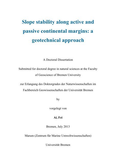
Slope stability along active and passive continental margins ... - E-LIB
Slope stability along active and passive continental margins ... - E-LIB
Slope stability along active and passive continental margins ... - E-LIB

Create successful ePaper yourself
Turn your PDF publications into a flip-book with our unique Google optimized e-Paper software.
<strong>Slope</strong> <strong>stability</strong> <strong>along</strong> <strong>active</strong> <strong>and</strong><br />
<strong>passive</strong> <strong>continental</strong> <strong>margins</strong>: a<br />
geotechnical approach<br />
A Doctoral Dissertation<br />
Submitted for doctoral degree in natural sciences at the Faculty<br />
of Geoscience of Bremen University<br />
zur Erlangung des Doktorgrades der Naturwissenschaften im<br />
Fachbereich Geowissenschaften der Universität Bremen<br />
by<br />
vorgelegt von<br />
Ai, Fei<br />
Bremen, July 2013<br />
Marum (Zentrum für Marine Umweltwissenschaften)<br />
Universität Bremen
PRÜFUNGSAUSSCHUSS<br />
---Gutachter---<br />
Prof. Dr. Achim J. Kopf<br />
Prof. Dr. Tobias Mörz<br />
---Tag des öffentlichen Kolloquiums---<br />
16, September 2013<br />
---Mitglieder der Kommission---<br />
Prof. Dr. Achim J. Kopf<br />
Prof. Dr. Tobias Mörz<br />
Prof. Dr. Katrin Huhn<br />
Prof. Dr. Gerhard Bohrmann<br />
Dr. Stefen Kreiter<br />
Sebastian Trütner
Name: Ai, Fei Datum: 15-07-2013<br />
Anschrift: Beethoven Strasser 38 28209 Bremen<br />
E r k l är u n g<br />
Hiermit versichere ich, dass ich<br />
1. die Arbeit ohne unerlaubte fremde Hilfe angefertigt<br />
habe,<br />
2. keine <strong>and</strong>eren als die von mir angegebenen Quellen<br />
und Hilfsmittel benutzt habe, und<br />
3. die den benutzten Werken wörtlich oder inhaltlich<br />
entnommenen Stellen als solche kenntlich gemacht<br />
habe.<br />
___________________, den .....................................<br />
---------------------------------------------------------------<br />
(Unterschrift)
Table of Contents<br />
Abstract ................................................................................................................................................... 1<br />
Zusammenfassung .................................................................................................................................. 3<br />
1 Introduction ......................................................................................................................................... 7<br />
1.1 Motivation ...................................................................................................................................... 7<br />
1.2 Submarine slope <strong>stability</strong> processes ............................................................................................... 9<br />
1.2.1 Types of submarine mass movements .................................................................................... 9<br />
1.2.2 Preconditioning factors <strong>and</strong> triggering mechanisms of submarine mass movements ........... 11<br />
1.2.3 Geotechnical study of submarine mass movements ............................................................. 13<br />
1.3 Regional setting of case studies: <strong>passive</strong> vs. <strong>active</strong> <strong>continental</strong> <strong>margins</strong> ..................................... 16<br />
1.3.1 Uruguayan <strong>and</strong> northern Argentine margin: <strong>passive</strong> margin ................................................ 18<br />
1.3.2 Gela basin, central Mediterranean <strong>continental</strong> margin: forel<strong>and</strong> basin-<strong>active</strong> margin .......... 20<br />
1.3.3 Ligurian basin, southeastern French <strong>continental</strong> margin: back-arc basin-<strong>active</strong> margin ...... 22<br />
1.4 Methods ........................................................................................................................................ 24<br />
1.4.1 Geophysical methods ............................................................................................................ 24<br />
1.4.2 Coring <strong>and</strong> sedimentological methods .................................................................................. 24<br />
1.4.3 Geotechnical methods ........................................................................................................... 26<br />
1.5 Outline of the thesis ..................................................................................................................... 31<br />
References .......................................................................................................................................... 32<br />
2 Geotechnical characteristics <strong>and</strong> slope <strong>stability</strong> <strong>along</strong> the Uruguayan <strong>and</strong> northern Argentine<br />
margin ................................................................................................................................................... 41<br />
2.1 Introduction .................................................................................................................................. 42<br />
2.2 Regional geological, morphological <strong>and</strong> oceanographic settings ................................................. 42<br />
2.3 Material <strong>and</strong> methods ................................................................................................................... 45<br />
2.3.1 Shipboard tests ...................................................................................................................... 46<br />
2.3.2 Laboratory tests .................................................................................................................... 46<br />
2.3.3 Overpressure estimation ....................................................................................................... 46<br />
2.3.4 <strong>Slope</strong> <strong>stability</strong> assessment ..................................................................................................... 47<br />
2.3.5 Prediction of peak ground acceleration (PGA) ..................................................................... 48<br />
2.4 Results .......................................................................................................................................... 49<br />
2.4.1 Physical <strong>and</strong> geotechnical properties of sediments ............................................................... 49<br />
2.4.2 <strong>Slope</strong> <strong>stability</strong> analysis ......................................................................................................... 54<br />
2.5 Discussion .................................................................................................................................... 56<br />
2.5.1 Preconditioning factors ......................................................................................................... 56<br />
2.5.2 Triggering mechanisms ........................................................................................................ 57<br />
2.5.3 <strong>Slope</strong> failure modes between open slope versus canyon .................................................... 58<br />
2.5.4 <strong>Slope</strong> failures <strong>along</strong> the Uruguayan <strong>and</strong> northern Argentine margin versus slope failures on<br />
other <strong>passive</strong> <strong>margins</strong> .................................................................................................................. 59<br />
2.6 Conclusions .................................................................................................................................. 60<br />
Acknowledgements ............................................................................................................................ 60<br />
References .......................................................................................................................................... 60
3 Submarine slope <strong>stability</strong> assessment of the central Mediterranean <strong>continental</strong> margin: the<br />
Gela Basin ............................................................................................................................................. 65<br />
3.1 Introduction .................................................................................................................................. 65<br />
3.2 Geological setting ......................................................................................................................... 66<br />
3.3 Material <strong>and</strong> methods ................................................................................................................... 66<br />
3.3.1 Shipboard <strong>and</strong> laboratory analysis ........................................................................................ 66<br />
3.3.2 Overpressure estimation ....................................................................................................... 68<br />
3.3.3 <strong>Slope</strong> <strong>stability</strong> analysis ......................................................................................................... 68<br />
3.4 Results .......................................................................................................................................... 69<br />
3.4.1 Physical <strong>and</strong> geotechnical properties .................................................................................... 69<br />
3.4.2 <strong>Slope</strong> <strong>stability</strong> analysis ......................................................................................................... 70<br />
3.5 Discussion .................................................................................................................................... 71<br />
3.5.1 Preconditioning factors ......................................................................................................... 71<br />
3.5.2 Triggering factors ................................................................................................................. 72<br />
3.6 Conclusions .................................................................................................................................. 73<br />
Acknowledgements ............................................................................................................................ 73<br />
References .......................................................................................................................................... 73<br />
4 Geotechnical characteristics <strong>and</strong> slope <strong>stability</strong> analysis on the deeper slope of the Ligurian<br />
margin, Southern France ..................................................................................................................... 77<br />
4.1 Introduction .................................................................................................................................. 78<br />
4.2 Regional geological, morphological <strong>and</strong> oceanographic settings ................................................. 78<br />
4.3 Material <strong>and</strong> methods ................................................................................................................... 80<br />
4.3.1 Laboratory tests .................................................................................................................... 80<br />
4.3.2 <strong>Slope</strong> <strong>stability</strong> analysis ......................................................................................................... 80<br />
4.4 Results .......................................................................................................................................... 81<br />
4.4.1 Physical <strong>and</strong> geotechnical properties .................................................................................... 81<br />
4.4.2 <strong>Slope</strong> <strong>stability</strong> analysis ......................................................................................................... 84<br />
4.5 Discussion .................................................................................................................................... 85<br />
4.5.1 Preconditioning factors of WS <strong>and</strong> ES: superficial failure vs. deep-seated failure............... 85<br />
4.5.2 The influence of earthquake to the slope <strong>stability</strong> ................................................................ 86<br />
4.6 Conclusions .................................................................................................................................. 87<br />
Acknowledgements ............................................................................................................................ 87<br />
References .......................................................................................................................................... 87<br />
5 Conclusion <strong>and</strong> outlook ..................................................................................................................... 89<br />
5.1 Conclusion ................................................................................................................................... 89<br />
5.2 Outlook ......................................................................................................................................... 90<br />
References .......................................................................................................................................... 91<br />
Acknowledgements ............................................................................................................................... 93<br />
Appendix A: Core descriptions, physical <strong>and</strong> geotechnical properties of Uruguayan <strong>and</strong> northern<br />
Argentine margin ......................................................................................................................... 95<br />
Appendix B: Core descriptions, physical <strong>and</strong> geotechnical properties of Gela Basin .................. 113
Abstract<br />
Submarine mass movements are widespread at submarine slopes <strong>and</strong> play an important role in<br />
transporting sediments across the <strong>continental</strong> slope to the deep basin, as well as potential danger to both<br />
offshore infrastructures (e.g., pipeline, cables <strong>and</strong> platforms) <strong>and</strong> coastal areas (e.g., slope<br />
failure-induced tsunamis). Sliding of the sediments on <strong>continental</strong> slope takes place when the shear<br />
stress within sediments exceeds the shear strength thereby causing slope failure. <strong>Slope</strong> failures are<br />
generally controlled by long-term preconditioning factors (e.g., high sedimentation rate, weak layer <strong>and</strong><br />
oversteepening) <strong>and</strong> short-term triggering mechanisms (e.g., earthquake, anthropogenic activity).<br />
However, the exact causes for the different slope failure styles are still poorly understood.<br />
In summary, this thesis investigates preconditioning factors <strong>and</strong> triggering mechanisms governing slope<br />
instabilities of three distinct submarine l<strong>and</strong>slides areas in <strong>passive</strong> <strong>and</strong> <strong>active</strong> <strong>continental</strong> margin<br />
settings. Geotechnical properties of sediments from undeformed, headwall <strong>and</strong> deposits present<br />
different stress histories <strong>and</strong> shear strengths (undrained <strong>and</strong> drained shear strength). Geotechnical<br />
results are used for infinite slope <strong>stability</strong> of undeformed sediments under various conditions<br />
(undrained <strong>and</strong> drained, each static <strong>and</strong> earthquake conditions) to identify the preconditioning factors<br />
<strong>and</strong> quantify the influence of earthquakes as a key factor in slope failing mechanisms. The three<br />
distinct case studies are located at: (1) the <strong>passive</strong> <strong>continental</strong> slope of Uruguay <strong>and</strong> north of Argentina,<br />
(2) the low seismic <strong>and</strong> tectonically <strong>active</strong> Gela forel<strong>and</strong> basin, central Mediterranean <strong>continental</strong><br />
margin, <strong>and</strong> (3) the moderate seismic <strong>and</strong> tectonically <strong>active</strong> back-arc basin, deeper slope of the<br />
Ligurian margin, Southern France.<br />
1) On the Uruguayan <strong>and</strong> northern Argentine slope, submarine mass movements are common primarily<br />
because of high fluvial discharge by the Rio de la Plata River <strong>and</strong> strong bottom current forces within<br />
the Brazil-Malvinas Current Confluence (BMC) zone. Sedimentological, physical <strong>and</strong> geotechnical<br />
results of core samples were investigated to quantatively assess slope <strong>stability</strong> for two distinct study<br />
areas: mass movements dominated area off Uruguayan slope called Northern Slide area (NS) <strong>and</strong><br />
canyons dominated area off the Rio de la Plata River mouth of Northern Argentine slope called<br />
Southern Canyon area (SC). NS mainly consists of clayey silt with interbedded s<strong>and</strong> layers with wide<br />
changes of physical <strong>and</strong> geotechnical properties from surficial (0-3 m) to deeper sediments (> 3 m):<br />
bulk density (1.5-2.1 g/cm 3 ), water content (20-95%), void ratio (0.6-3.0) <strong>and</strong> undrained shear strength<br />
(5-200 kPa from 0 to 16 m below seafloor (mbsf)). In contrast, SC mainly contains silty s<strong>and</strong> with high<br />
bulk density (1.7-2.4 g/cm 3 ), low water content (20-40%), low void ratio (0.6-1.2) <strong>and</strong> low undrained<br />
shear strength (5-20 kPa from 0 to 20 mbsf). Oedometer tests of both sites show overconsolidated<br />
(overconsolidation ratio, OCR: 1.5-12.7) near the seafloor <strong>and</strong> underconsolidated (OCR: 0.13-0.2) at<br />
depths of 20-30 mbsf <strong>and</strong> direct shear tests indicate that NS materials have a lower angle of internal<br />
friction (30.3-34.3°) compared to those of SC (36.9-41.3°). <strong>Slope</strong> <strong>stability</strong> analysis suggest that NS is<br />
sufficiently stable <strong>and</strong> is unlikely to experience repeated small-scale slope failures under the current<br />
conditions, but may experience unstable conditions if external triggers (e.g., earthquakes) are strong<br />
enough to trigger slope failure. In contrast, low <strong>stability</strong> of SC’s steep slopes is reflected by repeated<br />
small-scale slope failures both during static conditions <strong>and</strong> certainly during seismic events.<br />
2) On the low seismic <strong>and</strong> tectonic <strong>active</strong> <strong>continental</strong> slope of the Gela Basin in the Sicily Channel,<br />
central Mediterranean, high sedimentation rates <strong>and</strong> seismic loading seem to be the most important<br />
factors to initiate submarine l<strong>and</strong>slides in Holocene. One relative small scale (5.7 km 2 , 0.6 km 3 ), 8 kyr<br />
1
Abstract<br />
old l<strong>and</strong>slide named Northern Twin Slide (NTS) was studied through geotechnical measurements of<br />
sediments from undeformed upper slope recovered by MeBo corer (MARUM seafloor drill rig). The<br />
NTS region is characterized by two prominent failure scars that form two morphological steps of 110 m<br />
<strong>and</strong> 70 m height. Sediments show fine grain size (high clay content), high water content, low undrained<br />
shear strength <strong>and</strong> low internal friction angle, all of which suggests a weak layer around 28-45 mbsf<br />
that may act as potential slip surface in a future failure event. Oedometer tests attest the sediments are<br />
highly underconsolidated <strong>and</strong> the average overpressure ratio λ* is ~0.7. <strong>Slope</strong> <strong>stability</strong> analyses<br />
indicate that the slope is stable under both static undrained <strong>and</strong> drained conditions. It suggests that<br />
moderate seismic triggers may have been responsible for the Northern Twin Slide formation <strong>and</strong> could<br />
also cause mass wasting in the future.<br />
3) On the moderate seismic <strong>and</strong> tectonic <strong>active</strong> <strong>continental</strong> slope of Ligurian margin, northwestern<br />
Mediterranean Sea, submarine slope failures of various types <strong>and</strong> sizes are prevalent primarily because<br />
of seismicity up to ~M6, rapid sediment deposition in the Var fluvial system, <strong>and</strong> steepness of the<br />
<strong>continental</strong> slope (average 11°). Geophysical, sedimentological <strong>and</strong> geotechnical results of two distinct<br />
slides in water depth >1500 m: one located on the flank of the Upper Var Valley called Western Slide<br />
(WS), another located at the base of <strong>continental</strong> slope called Eastern Slide (ES) were studied to<br />
quantitatively assess slope <strong>stability</strong>. WS is a superficial slide characterized by a slope angle of ~4.6°<br />
<strong>and</strong> shallow scar (~30 m) whereas ES is a deep-seated slide with a lower slope angle (~3°) <strong>and</strong> deep<br />
scar (~100 m). Both areas mainly comprise clayey silt with intermediate plasticity, low water content<br />
(30-75 %) <strong>and</strong> under-consolidation to strong overconsolidation. Upslope undeformed sediments have<br />
low undrained shear strength (0-20 kPa) increasing gradually with depth, whereas an abrupt increase in<br />
strength up to 200 kPa occurs at a depth of ~3.6 m in the headwall of WS <strong>and</strong> ~1.0 m in the headwall of<br />
ES. These boundaries are interpreted as earlier failure planes that have been covered by hemipelagite or<br />
talus from upslope after l<strong>and</strong>slide emplacement. Infinite slope <strong>stability</strong> analyses indicate both sites are<br />
stable under static conditions; however, slope failure may occur in undrained earthquake condition.<br />
Different failure styles include rapid sedimentation on steep canyon flanks with undercutting causing<br />
superficial slides in the west <strong>and</strong> an earthquake on the adjacent Marcel fault to trigger a deep-seated<br />
slide in the east.<br />
Overall, the geotechnical investigations of these three case studies imply that (i) grain size of sediments<br />
seems to be the main factor affecting the physical <strong>and</strong> geotechnical properties, (ii) seismic loading is an<br />
important trigger mechanism even on <strong>passive</strong> <strong>and</strong> low seismic <strong>active</strong> <strong>continental</strong> margin, (iii) different<br />
slope failure types in adjacent areas are mainly controlled by grain size variation, sedimentation rate,<br />
rework of bottom currents <strong>and</strong> distance to the epicenter of earthquake. Geotechnical investigation<br />
combined with slope <strong>stability</strong> <strong>and</strong> earthquake analysis have well applied on quantitative estimation the<br />
preconditioning factors <strong>and</strong> triggering mechanisms of slope failure on both <strong>passive</strong> <strong>and</strong> <strong>active</strong><br />
<strong>continental</strong> <strong>margins</strong>, <strong>and</strong> this method can be applied to other <strong>continental</strong> <strong>margins</strong> worldwide as well.<br />
An implementation of this geotechnical approach may require the basic geotechnical parameters of<br />
sediments such as bulk density, grain density, shear strengths under both drained <strong>and</strong> undrained<br />
conditions with the slope geometric parameters (slope angle <strong>and</strong> slope failure depth). Once the right<br />
parameters are chosen, the slope <strong>stability</strong> analysis can be used for evaluation of the stable states of<br />
slope under various scenarios at present <strong>and</strong> prediction potential slope failure modes in future.<br />
2
Zusammenfassung<br />
Submarine Massenbewegungen sind weit verbreitet entlang submariner Hänge. Sie spielen eine<br />
wichtige Rolle beim Sedimenttransport über den Kontinentalhang in die Tiefsee, stellen aber auch eine<br />
potentielle Gefahr für offshore Infrastrukturen (z.B. Pipelines, Kabel und Plattformen) und<br />
Küstenregionen (z.B. durch Hangrutschungen verursachte Tsunamis) dar. Ein Abrutschen von<br />
Sediment vom Kontinentalhang findet dann statt, wenn die Scherspannung im Sediment dessen<br />
Scherfestigkeit übersteigt und so ein Hangversagen verursacht. Hangversagen wird im Allgemeinen<br />
von Langzeit-Faktoren (z.B. hohe Sedimentationsraten, schwache Schichten, Übersteilung) und<br />
auslösenden Kurzzeit-Mechanismen, auch Trigger, (z.B. Erdbeben, anthropogene Aktivitäten)<br />
kontrolliert. Die genauen Ursachen für die unterschiedlichen Arten von Hangrutschungen sind jedoch<br />
bislang unzureichend verst<strong>and</strong>en.<br />
Diese Doktorarbeit untersucht die Langzeit-Faktoren und Trigger von Hangrutschungen entlang<br />
<strong>passive</strong>r und aktiver Kontinentalränder in drei unterschiedlichen Erkundungsgebieten. Geotechnische<br />
Eigenschaften von oberhalb (z.B. ungestörten Sedimentproben) und unterhalb (z.B. gestörten<br />
Sedimentproben) der Abrisskante abgelagerten Sedimenten spiegeln verschiedene Spannungspfade<br />
(Belastungsgeschichten) und Scherfestigkeiten (dräniert und undräniert) wider. Die geotechnischen<br />
Ergebnisse fließen in infinite Hangstabilitätsanalysen von undeformierten Sedimenten unter<br />
verschiedenen Bedingungen (undräniert und dräniert, jeweils unter statischen und<br />
Erdbebenbedingungen) ein, um die bedingenden Langzeit-Faktoren zu identifizieren und den Einfluss<br />
von Erdbeben als Schlüsselfaktor von Mechanismen, die zu Hangversagen führen zu quantifizieren.<br />
Die drei unterschiedlichen Studien liegen entlang des: (1) <strong>passive</strong>n Kontinentalhangs von Uruguay und<br />
Nord-Argentinien, (2) schwach seismischen und tektonisch aktiven Gela-Beckens, zentral gelegen am<br />
Kontinentalr<strong>and</strong> im Mittelmeer und (3) moderat seismischen und tektonisch aktiven back-arc Beckens<br />
am tieferen Hang des Ligurischen Kontinentalr<strong>and</strong>s, Süd-Frankreich.<br />
1) Entlang des uruguayischen und nord-argentinischen Kontinentalhang kommen submarine<br />
Massenbewegungen aufgrund des hohen Abflusses des Rio de la Plata und der starken Kräfte der<br />
Bodenströmung in der Brazil-Malvinas Current Confluence (BMC) Zone häufig vor.<br />
Sedimentologische, physikalische und geotechnische Ergebnisse aus Kernproben wurden untersucht<br />
um die Hangstabilität zweier unterschiedlicher Studiengebiete zu quantifizieren: ein von<br />
Hangrutschungen dominiertes Gebiet auf dem uruguayischen Kontinentalhang, das<br />
Northern-Slide-Gebiet (NS), und ein von Canyons dominiertes Gebiet vor der Rio de la Plata Mündung<br />
auf dem nord-argentinischen Kontinentalhang, das Southern-Canyon-Gebiet (SC). Das NS besteht<br />
hauptsächlich aus tonigem Silt mit eingebetteten S<strong>and</strong>lagen, dessen physikalische und geotechnischen<br />
Eigenschaften sich stark von oberflächlichen (0-3 m) zu tieferen Sedimenten (> 3 m) hin verändern.<br />
Folgende Wertebereiche für Teufen von 0-16 m unterhalb des Meeresbodens ließen sich für die<br />
unterschiedlichen Indexparameter ermitteln: 1) Dichte. 1.5-2.1 g/cm³, 2) Wassergehalt: 20-95%, 3)<br />
Porenzahl: 0.6-3.0 und 4) undränierte Scherfestigkeit: 5-200 kPa. Im Gegensatz dazu besteht das SC<br />
hauptsächlich aus siltigem S<strong>and</strong> mit höherer Dichte (1.7-2.4 g/cm³), geringerem Wassergehalt<br />
(20-40%), geringerer Porenzahl (0.6-1.2) und geringerer undränierter Scherfestigkeit (5-20 kPa) für<br />
eine Teufebis 20 m. Ödometertests an Sedimenten aus beiden Gebieten zeigen eine Überkonsolidierung<br />
(Konsolidierungsgrad OCR 1.5-12.7) in Meeresbodennähe und eine Unterkonsolidierung (OCR<br />
0.13-0.2) in Teufen von 20-30 m. Direktscherversuche ergeben, dass Material aus dem NS einen<br />
3
Zussamenfassung<br />
geringeren inneren Reibungswinkel (30.3-34.3°) besitzt als Sedimente des SC (36.9-41.3°). Analysen<br />
der Hangstabilität ergeben, dass das NS stabil genug ist und wiederholte kleinskalige Hangrutschungen<br />
unter gegenwärtigen Verhältnissen unwahrscheinlich sind, aber instabile Verhältnisse eintreten können,<br />
sollten externe Trigger (z.B. Erdbeben) stark genug sein. Im Gegensatz dazu wird die geringe Stabilität<br />
der steilen Hänge des SCs durch wiederholte kleinskalige Hangrutschungen sowohl während statischer,<br />
auf jeden Fall aber während seismischer Ereignisse widergespiegelt.<br />
2) Entlang des gering seismisch und tektonisch aktiven Kontinentalhangs des Gela-Beckens im Kanal<br />
von Sizilien im zentralen Mittelmeer, scheinen-hohe Sedimentationraten und seismische Belastung die<br />
Hauptauslöser für submarine Hangrutschungen im Holozän zu sein. Eine relativ kleinskalige (5.7 km²,<br />
0.6 km³), 8000 Jahre alte Hangrutschung, die Northern-Twin-Rutschung (NTS), wurde anh<strong>and</strong><br />
geotechnischer Untersuchungen an Sediment des unverformten oberen Hangabschnitts, das mit dem<br />
Meeresboden-Bohrgerät MeBo gewonnen wurde, studiert. Die NTS-Region wird von zwei<br />
ausgeprägten Rutschungsnarben charakterisiert, die zwei morphologische Stufen von 110 m und 70 m<br />
bilden. Die Sedimente zeigen einen hohen Tongehalt, hohen Wassergehalt, geringe undränierte<br />
Scherfestigkeit und geringen inneren Reibungswinkel, was zusammengenommen auf eine schwache<br />
Schicht in 28-45 mbsf deutet, die bei einem zukünftiges Versagen als potentielle Gleitfläche fungieren<br />
kann. Ödometertests bestätigen, dass die Sedimente deutlich unterkonsolodiert (OCR: ~0.7) sind.<br />
Analysen der Hangstabilität deuten darauf hin, dass der Hang sowohl unter statischen undränierten als<br />
auch statisch dränierten Verhältnissen stabil ist. Moderat seismische Trigger könnten verantwortlich für<br />
die Northern-Twin-Rutschung gewesen sein und auch zukünftige Massenbewegungen verursachen.<br />
3) Entlang des moderat seismisch und tektonisch aktiven Ligurischen Kontinentalhangs im<br />
nordwestliches Mittelmeer sind Hangrutschungen unterschiedlicher Art und Ausmaße aufgrund<br />
seismischer Aktivität bis ~M6, rascher Sedimentation im fluvialen System der Var und der großen<br />
Neigung des Kontinentalhangs (durchschnittlich 11°) weit verbreitet. Es wurden geophysikalische,<br />
sedimentologische und geotechnische Ergebnisse von zwei unterschiedlichen Rutschungen in<br />
Wassertiefen > 1500 m untersucht, um die Hangstabilität quantitativ zu erfassen. Die Westliche<br />
Rutschung (WS) liegt an der Flanke des oberen Var-Tals, die Östliche Rutschung (ES) liegt am Fußdes<br />
Kontinentalhangs. Die WS ist eine oberflächliche Rutschung, die durch eine Hangneigung von ~4.6°<br />
und einer flachen Narbe von ~30 m charakterisiert wird, während die ES eine tiefsitzende Rutschung<br />
mit einer flacheren Hangneigung von ~3°und einer tiefen Narbe von ~100 m ist. Beide Gebiete werden<br />
hauptsächlich aus tonigem Silt aufgebaut, der eine mittlere Plastizität und geringen Wassergehalt<br />
(30-75 %) besitzt und unter- bis stark überkonsolidiert ist. Hangaufwärts liegende, undeformierte<br />
Sedimente besitzen eine geringe undränierte Scherfestigkeit (0-20 kPa), die mit der Tiefe zunimmt. In<br />
einer Tiefe von ~3.6 m unterhalb der Abrisskante beim WS und ~1.0 m unterhalb der Abrisskante beim<br />
ES nimmt die Scherfestigkeit plötzlich auf über 200 kPa zu. Interpretiert werden diese Übergänge als<br />
frühere Gleitflächen, die nach der Rutschung durch hemipelagische Sedimente oder Hangschutt<br />
bedeckt wurden. Infinite Hangstabilitätsanalysen ergeben, dass beide Gebiete unter statischen<br />
Verhältnissen stabil sind; unter undränierten Verhältnissen könnte jedoch während Erdbeben ein<br />
Hangversagen eintreten. Unterschiedliche Arten des Versagens schließen im Westen rasche<br />
Sedimentation auf den steilen Flanken des Canyon ein, wo Unterspülungen zu oberflächlichen<br />
Rutschungen führen und im Osten Erdbeben entlang der angrenzenden Marcel-Verschiebung, die<br />
tiefsitzende Rutschungen auslösen.<br />
Im Gesamten implizieren die geotechnischen Untersuchungen der drei Fallstudien, dass (i) die<br />
Korngröße der Sedimente der Hauptfaktor zu sein scheint, der die physikalischen und geotechnischen<br />
4
Zussamenfassung<br />
Eigenschaften bestimmt, (ii) Belastung durch Erdbeben sogar entlang <strong>passive</strong>r und gering seismisch<br />
aktiver Kontinentalränder wichtige Trigger darstellen und (iii) die unterschiedlichen Arten von<br />
Hangversagen in angrenzenden Gebieten hauptsächlich durch Korngrößenvarianz, Sedimentationsraten,<br />
Aufarbeitung durch Bodenströmung und Entfernung zum Epizentrum eines Erdbebens kontrolliert<br />
werden. Geotechnische Untersuchungen, zusammen mit Hangstabilitäts- und Erdbebenanalysen stellen<br />
eine geeignete Methode dar, um bedingende Faktoren und Triggermechanismen für Hangversagen<br />
sowohl an <strong>passive</strong>n als auch an aktiven Kontinentalrändern quantitativ abzuschätzen. Diese Methode<br />
kann für Kontinentalränder weltweit angew<strong>and</strong>t werden. Die Anwendung dieser geotechnischen<br />
Näherung benötigt geotechnische Basisparameter wie Dichte, Korndichte, Scherfestigkeiten unter<br />
dränierten und undränierten Bedingungen zusammen mit Parametern zur Hanggeometrie wie<br />
Neigungswinkel und Tiefe der Gleitfläche. Nach Wahl der richtigen Parameter, kann eine Analyse der<br />
Hangstabilität dafür verwendet werden, um stabile Zustände eines Hanges während unterschiedlicher<br />
gegenwärtiger Szenarien zu bewerten und potentielle Hangversagen für die Zukunft vorherzusagen.<br />
(Translated by Franziska Hellmich, Alois Steiner <strong>and</strong> Andre Hüpers)<br />
5
1 Introduction<br />
1.1 Motivation<br />
In recent years, increasing use of state-of-the-art technologies in geophysical exploration <strong>and</strong> in-situ<br />
measurements have significantly advanced our underst<strong>and</strong>ing of the phenomena of submarine mass<br />
movements <strong>and</strong> their consequences (Chiocci et al 2011; Masson et al. 2010; Sultan et al. 2004).<br />
However, the interplay between the various geological factors controlling submarine mass movements<br />
is still not fully understood (Locat <strong>and</strong> Lee 2002). Submarine slope failures are one of the main<br />
processes for long distance sediment transport from l<strong>and</strong> to deep sea <strong>and</strong> for shaping seafloor<br />
morphology. In addition, submarine l<strong>and</strong>slides are gained wide attention because of their catastrophic<br />
impacts on both coastal areas (e.g., slope failure-induced tsunamis) <strong>and</strong> also offshore infrastructures<br />
(e.g., pipeline, cables <strong>and</strong> platforms) (Locat <strong>and</strong> Lee 2002).<br />
In marine environments, the major geological hazards include earthquakes, volcanic eruptions,<br />
submarine l<strong>and</strong>slides <strong>and</strong> secondary effects such as tsunamis (either triggered by earthquakes or<br />
l<strong>and</strong>slides) (Chiocci et al. 2011; Fig. 1.1). Given 30% of World’s population lives with 60 km of the<br />
coast, the hazard posed by submarine l<strong>and</strong>slide generated tsunamis may cause several consequences<br />
(Yamada et al. 2012). The role of submarine l<strong>and</strong>slide in producing tsunamis has been more recognized<br />
over the last 30 years following the studies of the 1929 Gr<strong>and</strong> Banks event (Piper et al. 1999), the 1998<br />
M 7.0 Sissano earthquake that occurred off the northern coast of Papua New Guinea (Bardet et al. 2003)<br />
<strong>and</strong> the tsunami induced by the 8150-year BP Storegga Slide (Bondevik et al. 2005). Offshore industry<br />
activities such as the Ormen Lange study have improved the underst<strong>and</strong>ing of the submarine l<strong>and</strong>slide<br />
generated tsunami (Solheim et al. 2005). The tsunami is most likely to have been generated by<br />
rotational slides where a thick slide block with steep headwall can move rapidly downwards (Masson et<br />
al. 2006).<br />
As one of important marine geological hazard, submarine mass movements have severe impact on<br />
human lives <strong>and</strong> offshore infrastructures (Fig. 1.1). Just for the offshore hydrocarbon industry, the cost<br />
of damage to pipelines caused by submarine mass movements is ~$400 million each year (Mosher et al.<br />
2010). One of most famous examples is the 1929 Gr<strong>and</strong> Banks event on the <strong>continental</strong> slope south of<br />
the isl<strong>and</strong> of St Pierre. An M 7.2 earthquake located 250 km south of Newfoundl<strong>and</strong> led to a series of<br />
small regressive slumps which resultant turbidity current broken twelve submarine transatlantic cables<br />
(Piper et al. 1999). Following the event, the scientific community began to discuss what caused the<br />
cable breaks <strong>and</strong> how the transformation of mass movements after earthquake loading (Heezen <strong>and</strong><br />
Ewing 1952). Another famous example is the Nice Airport slide which also generated a debris flow <strong>and</strong><br />
turbidity current downslope that broke several telecommunication cables (Mulder et al. 1997). The<br />
slide was caused by a sudden overloading from l<strong>and</strong>filling operation <strong>and</strong> static liquefaction of loose<br />
s<strong>and</strong> layers present below the harbor embankment (Seed et al. 1988). With more new submarine<br />
l<strong>and</strong>slides are discovered after the 1929 gr<strong>and</strong> Banks event, many new models of submarine slope<br />
failure initiation were developed (e.g., Morgenstern 1967; Lee <strong>and</strong> Edwards 1986; Hampton et al. 1996;<br />
Dugan <strong>and</strong> Flemings 2000; Sultan et al. 2004; Kvalstad et al. 2005; Stegmann et al. 2007; Stigall <strong>and</strong><br />
Dugan 2010; Strasser et al. 2011).<br />
7
1 Introduction<br />
Fig 1.1 Cartoon summarizing the <strong>continental</strong> margin features linked to geological hazard processes<br />
<strong>and</strong> main anthropogenic structures lying on the seafloor (taken from Chiocci et al. 2011).<br />
Underst<strong>and</strong>ing geological processes that govern <strong>and</strong> formation of submarine slope failures <strong>and</strong><br />
subsequent potential hazards thus is a fundamental <strong>and</strong> societal relevant task of geologists <strong>and</strong><br />
geotechnical engineers. To date, many questions about the complex mechanisms of slope <strong>stability</strong> on<br />
<strong>continental</strong> <strong>margins</strong> are still unresolved (Leynaud et al. 2009). It is well known that excess pore<br />
pressure within the sediment is a key parameter controlling consolidation <strong>and</strong> the shear strength of the<br />
deposited sediments, however, the evolution of excess pore pressure <strong>and</strong> how it relates to slope failure<br />
on <strong>continental</strong> margin is still no clearly understood. It is assumed that the internal structure of<br />
sediments plays an important role during slope stabilization. For instance, high porous ash layers have<br />
large potential of liquefaction <strong>and</strong> treat as potential slide planes (Harders et al. 2010), so that<br />
appropriate geotechnical measurements are needed to reliably determine the physical properties leading<br />
to failure. Many studies suggest seismic loading as a likely ultimate trigger mechanism, but<br />
quantitatively the effect of earthquake to slope in<strong>stability</strong> is not well understood. To answer these<br />
questions, sediments of different types of mass movements were analyzed with laboratory geotechnical<br />
measurements to constrain the mechanics of mass movements. The geotechnical approach is proved to<br />
be a valuable tool to assess submarine mass movements in different tectonic areas (<strong>passive</strong> <strong>and</strong> <strong>active</strong><br />
<strong>continental</strong> <strong>margins</strong>).<br />
8
1 Introduction<br />
1.2 Submarine slope <strong>stability</strong> processes<br />
1.2.1 Types of submarine mass movements<br />
Sediments transport processes in marine environments are more complicated than those on l<strong>and</strong><br />
because of different driven forces including gravity, suspension, geostrophic circulation <strong>and</strong> so on (Fig.<br />
1.2). Among them, submarine mass movements are the dominant processes transporting large amounts<br />
of sediment across <strong>continental</strong> slope to the deep ocean. Submarine mass movements are classified as<br />
slide (brittle deformation), slump (plastic deformation), debris flow (plastic or laminar flow) <strong>and</strong><br />
turbidity current (fluid turbulent flow) according to the mechanical behavior of process (Mulder <strong>and</strong><br />
Cochonat 1996; Mulder 2011; Fig. 1.2).<br />
Submarine slides <strong>and</strong> slumps involve the movement of coherent masses of sediments bounded on all<br />
sides by distinct failure planes (Mulder et al. 1996). Differentiation of slides <strong>and</strong> slumps is based on the<br />
value of the Skempton ratio D/L (where D is the maximum depth of the slip surface, <strong>and</strong> L is the total<br />
length of the slump). Slides are translational with a D/L ratio generally < 0.15, whereas slumps are<br />
rotational <strong>and</strong> deep-seated with a D/L ratio between 0.15-0.33 (Skempton <strong>and</strong> Huchinson 1969). Most<br />
submarine slides appear to be translational <strong>and</strong> are characterized by a flat, slope-parallel basal failure<br />
surfaces (Canal et al. 2004). The failure surface is predetermined <strong>and</strong> corresponds to a discrete layer<br />
with low shear strength, such as permeable s<strong>and</strong> layers (e.g., Afen slide; Wilson et al. 2004), high<br />
porous tephra layers (e.g., submarine slide <strong>along</strong> the Middle American Trench; Harders et al. 2010) or<br />
s<strong>and</strong> <strong>and</strong> clay interbeds (e.g., hemipelagic <strong>and</strong> contouritic deposits offshore Norway; Laberg <strong>and</strong><br />
Camerlenghi 2008). Submarine slides are commonly associated with a variety of extensional <strong>and</strong><br />
compressional features. Extensional features are common in the upper part of the slide, especially in<br />
the headwall area, where listric faults are predominantly orientated perpendicular to the transport<br />
direction (Martinsen <strong>and</strong> Bakken 1990). In contrast, compression features are common at the front of<br />
the slide deposit where dominated by imbricate thrust slices of chaotically deformed strata (Martinsen<br />
2005). Slides <strong>and</strong> slumps are not isolated processes <strong>and</strong> often form multiple phases of failures.<br />
Retrogressive slides are one of most common multiple phases of failure, which form because of<br />
upslope propagation of the failure (Mulder 2011).<br />
Slides <strong>and</strong> slumps can transform to debris flows or turbidity currents through gradually increasing<br />
ambient water <strong>and</strong> disintegration of coherent blocks. Debris flows are flows in which the sediment is<br />
heterogeneous <strong>and</strong> may include lager clasts supported by a matrix of fine sediment (Lee et al. 2007).<br />
Turbidity currents involve the downslope transport of a relatively dilute suspension of sediment grains<br />
that are supported by an upward component of fluid turbulence (Parson et al. 2007). Turbidity currents<br />
are often formed by the disintegration of slides of debris flows, although they also may be generated<br />
independently of other gravity-driven processes (Mulder 2011).<br />
Different types of submarine mass movements are represented different degrees of material<br />
transformation. To achieve it, sufficient energy was needed to reach a given degree of remolding (Fig.<br />
1.3; Locat <strong>and</strong> Lee 2009). When the remolded energy available (E rA ) is larger than the remolded energy<br />
needed (E rN ), it is easily transferred to debris flows <strong>and</strong> turbidity currents. When smaller, it may tend to<br />
generate slides or slumps. However, the exact cause of transformation from slides to debris flows then<br />
to turbidity currents is still not fully understood. It is, however, out of the scope of this thesis, which<br />
focuses on the precondition factors <strong>and</strong> triggering mechanisms of initiation of submarine slope failure.<br />
9
1 Introduction<br />
Fig. 1.2 Schematic diagram showing end-member types of gravity-driven, suspension-driven <strong>and</strong><br />
geostrophic circulation-driven processes transporting sediments to the deep sea <strong>and</strong> their mechanical<br />
behaviors (Modified after McHugh et al. 2002; Madof et al. 2009)<br />
Fig. 1.3 Conceptual relationships between submarine sediment geotechnical properties, triggering<br />
mechanisms, <strong>and</strong> failure mechanisms (modified after Locat <strong>and</strong> Lee 2009; Locat <strong>and</strong> Lee 2002).<br />
10
1 Introduction<br />
1.2.2 Preconditioning factors <strong>and</strong> triggering mechanisms of submarine mass<br />
movements<br />
Sliding of the material downslope <strong>continental</strong> <strong>margins</strong> takes place when the shear stress within<br />
sediments exceeds the shear strength of the material thereby causing failure, which initiates the<br />
movement of materials downwards. <strong>Slope</strong> failure is generally controlled by long-term preconditioning<br />
factors <strong>and</strong> short-term triggering mechanisms (Leroueil 2001; Locat <strong>and</strong> Lee 2002; Sultan et al. 2004).<br />
Preconditioning factors are defined as the physical <strong>and</strong> geotechnical properties of sediments resulting<br />
from initial deposition <strong>and</strong> post-depositional alteration, which promote slopes susceptible to in<strong>stability</strong><br />
(Ercilla <strong>and</strong> Casas 2012). Preconditioning factors include the mass movement history, rapid sediment<br />
accumulation <strong>and</strong> under consolidation, the slope angle, the existence of a weak layer deposited over<br />
time <strong>and</strong> climate change over hundreds of years (Masson et al. 2006). The factors that cause submarine<br />
l<strong>and</strong>slides, known as triggering mechanisms, are crucial to advancing the knowledge of processes of<br />
submarine l<strong>and</strong>slides. Sultan et al. (2004) clearly defines a triggering mechanism as “an external<br />
stimulus that initiates the slope in<strong>stability</strong> process.” The triggering mechanisms include slope<br />
oversteepening, seismic loading, storm-wave loading, gas charging, gas hydrate dissociation, low tides,<br />
seepage, glacial loading <strong>and</strong> volcanic isl<strong>and</strong> processes (Locat <strong>and</strong> Lee 2002). Only a few submarine<br />
l<strong>and</strong>slides exist for which exact trigger mechanisms are known with certainty (Mienert et al. 2003).<br />
High sedimentation rates<br />
Among various factors leading to a decrease in shear resistance of the sediments, the most important<br />
one is overpressure which can be generated by different mechanisms such as high sedimentation rates,<br />
gas charging, cyclic strength degradation, etc. Rapid sedimentation rates can generate overpressure in<br />
sediments <strong>and</strong> reduce the effective stress. Permeability, grain size, <strong>and</strong> structural arrangement of the<br />
sediment affect dissipation of overpressure in the sediments (Laberg <strong>and</strong> Camerlenghi 2008). In high<br />
latitudes, the climatic induced variability between glacial <strong>and</strong> interglacial situations seems to have been<br />
the main preconditioning factor for slope failure of northwestern European <strong>continental</strong> margin.<br />
Sedimentation rates are highest during glacial periods, with 36 <strong>and</strong> 65 m/kyr for Trænadjupet slide <strong>and</strong><br />
Storegga slide, respectively (Laberg et al. 2003; Hjelstuen et al. 2004) whereas sedimentation rates are<br />
common less than 1 m/kyr during interglacials. Rapid loading of the deposits by unsorted glacial<br />
diamictons interlayered with high clay contents of 30-50% <strong>and</strong> low permeability of interglacial<br />
sediment resulted in build-up of overpressure <strong>and</strong> formation of an unstable sediment layer (Solheim et<br />
al. 2007). In low latitude, rivers discharge large quantities of sediment to relatively localized areas on<br />
the <strong>continental</strong> <strong>margins</strong> (Lee 2005). These thick, often underconsolidated sediments can fail even on<br />
very gentle slope angles (< 1°). High sedimentation rate is a primary mechanism of overpressure that<br />
facilitates large-scale slope failure in the Gulf of Mexico (Dugan <strong>and</strong> Sheahan 2012). <strong>Slope</strong> <strong>stability</strong><br />
calculations for the Ursa region suggest that when sedimentation rates were 15 m/kyr, overpressures<br />
were generated but were still not driving the slope failures. When sedimentation rates were 30 m/kyr,<br />
high overpressures <strong>and</strong> flow focusing initiated failure in the upper 10 meter below sea floor (mbsf)<br />
(Dugan <strong>and</strong> Sheahan 2012).<br />
11
1 Introduction<br />
Weak layers<br />
Submarine l<strong>and</strong>slides are often found to be rooted at one or more parallel-bedded sequences. These<br />
sequences likely represent a weak layer that plays an important role in l<strong>and</strong>slide initiation. Weak layers<br />
as sedimentary units, which may fail under certain conditions include: sediment sequences able to<br />
maintain overpressure, high sensitivity, strain softening, clay-rich, high water content, <strong>and</strong> contactant<br />
behaviour (Solheim et al. 2007). In glaciated <strong>margins</strong>, weak layers have been identified in contouritic<br />
deposits that formed during interglacial periods <strong>and</strong> were rapidly buried under thick glacial marine<br />
deposits (Bryn et al. 2005). One or more slip planes of the Nyk slide offshore Norway are located<br />
within the contourite drift <strong>and</strong> parallel to the original acoustic lamination (Laberg et al. 2001).<br />
Geotechnical analysis suggests the clayey contouritic sediments have a high clay content, water content,<br />
plasticity index <strong>and</strong> liquidity index, resulting in a lower strength <strong>and</strong> higher sensitivity than the glacial<br />
sediments (Kvalstad et al. 2005). Compared to the clayey contouritic sediments, well sorted contouritic<br />
s<strong>and</strong>s are inferred to have acted as detachment surfaces for the Afen slide on the <strong>continental</strong> slope in<br />
the Faroe-Shetl<strong>and</strong> channel (Wilson et al. 2004). The Afen slide was initiated likely by liquefaction of<br />
the contouritic s<strong>and</strong>s following seismic shaking (Wilson et al. 2004). Ash layers intercalated in the<br />
terrigenous or hemipelagic sediment sequences are also important for slope in<strong>stability</strong>. During<br />
earthquake shaking, the grain framework of high permeable ash layer was collapsed which could<br />
produce overpressure <strong>and</strong> liquefaction of the layer. So, the ash layer has been suggested to serve as a<br />
detachment plane for translational sliding (Harders et al. 2010).<br />
Earthquakes<br />
Among the different possible driving forces, earthquake shaking is considered as the most important<br />
triggering mechanism for submarine l<strong>and</strong>slide. Over 40% of submarine l<strong>and</strong>slides were reported to be<br />
triggered by earthquakes (Hance 2003). Earthquakes can increase the driving stress by seismic<br />
accelerations <strong>and</strong> also may trigger sediment liquefaction of coarse-grained, cohesionless sediments<br />
(Sultan et al. 2004). Nadim (2012) presented three scenarios of earthquake-induced slope failure: (1)<br />
failure occurs during the earthquake, where the excess pore pressure generated by cyclic stresses that<br />
degrade the shear strength so much that the slope is not able to carry the static shear stress, (2) failure<br />
occurs post of earthquake, the excess pore pressures generated by the cyclic stresses migrate from<br />
deeper layer into critical areas leading to slope in<strong>stability</strong>, (3) failure due to creep after earthquake, it is<br />
believed to be the most common mechanism for clay slopes. Earthquake is not only common to trigger<br />
submarine l<strong>and</strong>slides in <strong>active</strong> <strong>continental</strong> <strong>margins</strong>, but also may play a critical role in initiating slope<br />
failure even in <strong>passive</strong> <strong>continental</strong> <strong>margins</strong>. The well-known Gr<strong>and</strong> Banks submarine l<strong>and</strong>slide was<br />
triggered by a magnitude 7.2 earthquake south of Newfoundl<strong>and</strong> in 1929 (Fine et al. 2005). Postglacial<br />
earthquake activity due to glacio-isostatic rebound was considered the most likely triggering<br />
mechanism for Storegga slide offshore Norway (Kvalstad et al 2005). A simple method to account for<br />
earthquake on slope <strong>stability</strong> analysis will be presented following paragraphs assuming pseudostatic<br />
earthquake acceleration.<br />
12
1 Introduction<br />
1.2.3 Geotechnical study of submarine mass movements<br />
Geotechnical investigation of submarine mass movements is a direct approach to characterize physical<br />
<strong>and</strong> geotechnical properties of sediments for better underst<strong>and</strong> causes <strong>and</strong> dynamics of slope failures.<br />
Sliding takes place when driving stress within sediments exceeds the resisting strength of the sediments<br />
(Fig. 1.4; Hampton et al. 1996). To underst<strong>and</strong> the mechanics involved in slope failure, it is necessary<br />
to consider resisting strength <strong>and</strong> driving stress.<br />
Fig. 1.4 (A) Schematic diagram showing infinite slope <strong>stability</strong> analysis. (B) Schematic diagram<br />
showing how different geological processes affect the slope in<strong>stability</strong> (taken from Strozyk 2009).<br />
Resisting <strong>and</strong> driving stress<br />
The shear strength of sediment represents its ability to resist shear stress. As the shear stress applied to<br />
a sediment element steadily increases, the shear strain of the sediment element increase as well. At<br />
some point a limiting shear stress is reached which is taken as shear strength. If stresses are applied so<br />
rapidly that water cannot drain out, conditions are considered as undrained. In contrast, if stresses are<br />
applied so slowly that no excess pore pressures are developed, conditions are considered as drained.<br />
For drained condition, shear strength is expresses as a linear envelope obtained from the shear strength<br />
versus applied normal stress (Craig 2004):<br />
<br />
<br />
c'<br />
u tan '<br />
(1.1)<br />
f<br />
n<br />
Where τ f is the shear strength, c’ is the effective cohesion, σ n is gravitational stress acting on the failure<br />
surface, Δu is overpressure, ϕ’ is the effective angle of friction. Assuming slope angle is θ, σ n is<br />
expressed as:<br />
<br />
(1.2)<br />
2 2<br />
n<br />
'<br />
vh<br />
cos ' z cos<br />
Where σ’ vh is vertical effective overburden stress in hydrostatic condition (σ’ vh = γ’z), γ’ is buoyant<br />
weigh, z is overburden depth. For undrained conditions, the undrained shear strength is represented by:<br />
S<br />
S<br />
u<br />
u<br />
' S (for normally consolidated sediment) (1.3)<br />
v<br />
<br />
<br />
m<br />
' S OCR (for overconsolidated sediment) (1.4)<br />
v<br />
S u is the undrained shear strength, σ’ v is the vertical effective overburden stress, S is a sediment<br />
13
1 Introduction<br />
constant (often equal to ~0.3 for fine-grained marine sediments, Lee <strong>and</strong> Edwards 1986), OCR is<br />
overconsolidation ratio, <strong>and</strong> m is a sediment constant commonly equal to ~0.8. The vertical effective<br />
stress is expressed following Terzaghi et al. (1996):<br />
<br />
' u u u gz u ' z u<br />
(1.5)<br />
v v 0<br />
b w<br />
Where σ v is total overburden stress, ρ b is bulk density, ρ w is water density, γ is unit weight of the bulk<br />
sample, γ w is unit weight of water, <strong>and</strong> g is gravity acceleration.<br />
From above equations of shear strength in drained <strong>and</strong> undrained conditions, it is found that<br />
overpressure is an important parameter to reduce the shear strength of the sediment. Overpressure can<br />
be generated in various ways, such as rapid sedimentation rates, gas hydrate dissociation, <strong>and</strong> cyclic<br />
stresses by earthquakes or storm waves. Overpressure is common to be generated by rapid<br />
sedimentation rates. Since insitu pore pressure of deep-sea sediment is difficult to measure, two<br />
methods were used to estimate overpressure generated by rapid sedimentation rates. Preconsolidation<br />
stress (σ’ pc ) interpreted from oedometer tests is a simple approach for first-order estimation of<br />
overpressure (Casagr<strong>and</strong>e 1936):<br />
u '<br />
'<br />
(1.6)<br />
vh<br />
Overpressure due to sedimentation also can be evaluated with Gibson’s (1958) one-dimensional<br />
solution under the assumption that a constant sedimentation rate <strong>and</strong> no flow at underlying strata occurs.<br />
The modeled overpressure is controlled by Gibson’s time factor (T g ) (Flemings et al. 2008):<br />
pc<br />
T<br />
g<br />
(1.7)<br />
2<br />
m t cv<br />
Where m is sedimentation rate, t is time, <strong>and</strong> c v is coefficient of consolidation (c v = k/(m v γ w )), the latter<br />
of which depends on coefficient of permeability (k) <strong>and</strong> coefficient of volume compressibility (m v ),<br />
both being obtained from oedometer tests.<br />
In an infinite surface, the downslope gravitational shear stress (τ s ) at any point below the seafloor is<br />
given by:<br />
' zsin<br />
(1.8)<br />
s<br />
Infinite slope <strong>stability</strong> analysis<br />
According to the low average slope angles (~2°) of submarine slopes <strong>and</strong> the low ratio between failure<br />
depth <strong>and</strong> spatial extent for submarine l<strong>and</strong>slide, the infinite slope <strong>stability</strong> is assumed to be appropriate<br />
using to calculate the factor of safety (FS). Within this model, the seafloor is represented by a long,<br />
wide ramp with a uniform slope gradient (θ) <strong>and</strong> failure is assumed to occur <strong>along</strong> planes parallel to the<br />
slope surface. The factor of safety determines whether a given slope is stable (FS > 1) or susceptible to<br />
failure (FS ≤ 1). The shear strength of sediments depends on the conditions <strong>and</strong> time of drainage<br />
during shear. It is essential to consider long-term factors such as overpressure induced by sedimentation<br />
(drained condition) <strong>and</strong> short-term factors (undrained condition) such as forces induced by earthquakes.<br />
<strong>Slope</strong> <strong>stability</strong> was evaluated for four different scenarios:<br />
(1) Static undrained conditions can be affected by rapid change in slope geometry or fluctuation of pore<br />
pressure. The factor of safety calculation after Morgenstern (1967) <strong>and</strong> Løseth (1999) follows:<br />
14
1 Introduction<br />
S u<br />
FS ' z sin cos<br />
(Undrained static) (1.9)<br />
(2) Static drained conditions respond to long-term steady state pore pressure (Dugan <strong>and</strong> Flemings<br />
2002):<br />
<br />
<br />
2<br />
c' ' z cos * tan '<br />
FS (Drained static) (1.10)<br />
' z sin cos<br />
Where λ* is overpressure ratio (λ* = Δu/σ’ vh ).<br />
(3) Earthquake undrained conditions use pseudostatic analysis for a simplified evaluation of the seismic<br />
factor of safety of a slope. In order to simplify the slope <strong>stability</strong> analysis, it is common to assume that<br />
only horizontal ground motion contributes to the slope failure. The earthquake force is represented by a<br />
horizontal force <strong>and</strong> a pseudostatic seismic coefficient (k e ). The pseudostatic acceleration (a) is k e times<br />
the gravitational acceleration g (a = k e g), which is assumed to be applied over a time period long<br />
enough for the induced shear stress to be considered being constant (Hampton et al 1996). The<br />
undrained pseudostatic factor of safety is given by the following expression (ten Brink et al. 2009):<br />
Su<br />
FS <br />
2<br />
' z<br />
sin cos ke<br />
' cos<br />
<br />
<br />
(Undrained earthquake) (1.11)<br />
(4) Earthquake drained conditions only include pre-earthquake pore pressure (not considering the<br />
overpressure developed during seismic shaking) under the assumption that shear strength does not<br />
decrease during seismic shaking (Mulder et al. 1994):<br />
FS <br />
c<br />
<br />
<br />
<br />
2<br />
' ' cos * tan<br />
<br />
2<br />
' z sin cos ke<br />
' cos <br />
<br />
<br />
<br />
<br />
<br />
(Drained earthquake) (1.12)<br />
Prediction of Peak ground acceleration<br />
The critical pseudostatic acceleration (a c ) is the earthquake acceleration at which earthquake induced<br />
stress just equals the shear strength (FS = 1 of Equations 1.11 <strong>and</strong> 1.12). Critical pseudostatic<br />
acceleration as the average equivalent uniform shear stress imposed by seismic shaking represents ~65%<br />
of the effective seismic peak ground acceleration (PGA = a c /65%) (Seed <strong>and</strong> Idriss 1971; Seed 1979;<br />
Strasser et al. 2011). The median ground motion of peak ground acceleration was estimated using<br />
empirical seismic attenuation relationships according to different areas (Bindi et al. 2011; Campbell<br />
<strong>and</strong> Bozorgnia 2008). The absolute value of PGA depends on magnitude, source distance, style of<br />
faulting of the earthquake, hanging-wall, site response <strong>and</strong> basin response.<br />
15
1 Introduction<br />
1.3 Regional setting of case studies: <strong>passive</strong> vs. <strong>active</strong> <strong>continental</strong><br />
<strong>margins</strong><br />
Submarine l<strong>and</strong>slides occur frequently on both <strong>passive</strong> <strong>and</strong> <strong>active</strong> <strong>continental</strong> <strong>margins</strong>, especially on<br />
the <strong>continental</strong> slopes, where earthquakes <strong>and</strong> rapid deposition of sediments are the major causes of<br />
l<strong>and</strong>sliding (Nelson et al. 2011; Locat <strong>and</strong> Lee. 2009). Figure 1.5 shows the distribution of the main<br />
known submarine mass movements of <strong>passive</strong> <strong>and</strong> <strong>active</strong> <strong>continental</strong> <strong>margins</strong> around world oceans.<br />
Passive <strong>continental</strong> <strong>margins</strong> refer to tectonically divergent or tailing <strong>margins</strong> which are generally<br />
characterized by a smooth relief with wide <strong>continental</strong> shelves, low <strong>continental</strong> slope angles, moderate<br />
to high sedimentation rates <strong>and</strong> just local tectonic activities. The accumulation of thick sediments on<br />
flat <strong>continental</strong> slope is potentially hosting large volume <strong>and</strong> long run-out distance l<strong>and</strong>slides. Offshore<br />
Norway, rapid loading by glacial sediments <strong>and</strong> weak layers related to interglacial contouritic drifts<br />
lead to many large submarine l<strong>and</strong>slides, such as Storegga slide <strong>and</strong> Trænadjupet slide (Bryn et al. 2005;<br />
Laberg et al. 2002). In Gulf of Mexico, the rapidly deposited <strong>and</strong> organic-rich muddy deltaic sediments<br />
from the Mississippi River results in oversteepened, gas-charged <strong>and</strong> unstable slopes (Coleman 1988;<br />
Sawyer et al. 2009). Continental margin off northwestern Africa is characterized by oceanic upwelling<br />
as well as locally focused aeolian input resulting in relatively high sedimentation rates which leads to<br />
sediment instabilities (Krastel et al. 2006). In contrast, the <strong>continental</strong> margin off Uruguay <strong>and</strong> northern<br />
Argentina is dominated by strong contour currents in different depths <strong>and</strong> a high amount of fluvial<br />
sediment resulting in widespread contouritic deposits which potentially lead to small-scale <strong>and</strong> but<br />
more frequent l<strong>and</strong>slides (Krastel et al. accepted; Krastel et al. 2011). In the western Mediterranean Sea,<br />
Messinian sea level lowst<strong>and</strong> caused deep erosion of many submarine canyons <strong>and</strong> resulted in slope<br />
instabilities on the flanks of canyon (Nelson et al. 2011).<br />
Active <strong>continental</strong> <strong>margins</strong> refer to tectonically <strong>active</strong> convergent <strong>and</strong> transform-fault <strong>margins</strong> which<br />
commonly have narrow <strong>continental</strong> shelves, steep <strong>continental</strong> slopes <strong>and</strong> deep trenches. Submarine<br />
l<strong>and</strong>slides on <strong>active</strong> <strong>margins</strong> generally have short run-out distances <strong>and</strong> small volumes of sediments. It<br />
is mainly because sediments become dense with time by frequent shaking of great earthquakes in <strong>active</strong><br />
<strong>margins</strong> which resulting in seismic strengthening (Lee et al. 2004). Relatively dense sediments due to<br />
seismic strengthening of <strong>active</strong> margin also seldom mobilize into debris flows or turbidity currents<br />
compared to under-consolidated sediments of <strong>passive</strong> <strong>margins</strong> (Lee et al. 1991). Great earthquakes (><br />
M8) <strong>along</strong> Cascadia <strong>and</strong> northern California cause seismic strength of the sediment resulting in minor<br />
mass transport deposits compared but not turbidites-system deposits (Nelson et al. 2011).<br />
Here, geological settings of three case studies in this thesis are presented in detail: (1) Uruguayan <strong>and</strong><br />
northern Argentine margin: <strong>passive</strong> margin, (2) Gela basin, central Mediterranean <strong>continental</strong> margin:<br />
forel<strong>and</strong> basin-<strong>active</strong> margin, (3) Ligurian basin, Southeastern French <strong>continental</strong> margin: back-arc<br />
basin-<strong>active</strong> margin.<br />
16
1 Introduction<br />
Fig. 1.5 Location map of worldwide distribution of submarine mass movements. Black numbers<br />
indicate mass movements occurred in <strong>passive</strong> margin. Red numbers indicate mass movements occurred<br />
in <strong>active</strong> margin.<br />
17
1 Introduction<br />
1.3.1 Uruguayan <strong>and</strong> northern Argentine margin: <strong>passive</strong> margin<br />
The Uruguayan <strong>and</strong> northern Argentine margin is considered as an extensive volcanic <strong>passive</strong> margin<br />
which formed during the opening of the South Atlantic in the early Cretaceous <strong>and</strong> is underlain by<br />
seaward dipping reflector (Hinz et al. 1999; Franke et al. 2007). Post-Cretaceous sedimentary<br />
sequences display major units separated by conspicuous seismic horizons (Hinz et al. 1999; Violante et<br />
al. 2010). Early Cenozoic was characterized by a high vertical accretion of the slope. Antarctic water<br />
masses began to play a significant role in forming prograding-retrograding sedimentary sequences <strong>and</strong><br />
forming of submarine canyons in Eocene-Mid Miocene. Mid-Late Miocene was dominated by<br />
progradation <strong>and</strong> formation of the Ewing Terrace. Intensive contouritic <strong>and</strong> turbiditic activity final<br />
excavated the Mar del Plata Submarine Canyon in Late-Pliocene-Quaternary. The Argentine margin<br />
can be divided in four tectonic segments separated by transfer fracture zones (Franke et al. 2007). Our<br />
study area is located in the northernmost segment separated by the Salado transfer zone. Current<br />
tectonic activity in the study area is mainly characterized by <strong>active</strong> subsidence, which resulted in some<br />
intraplate seismic activities aligned <strong>along</strong> the Salado transfer zone (Sosa 1998). Recent documented<br />
earthquakes occurred in the years of 1849, 1888, <strong>and</strong> 1988 A.D. (for locations of epicenters, see Fig.<br />
1.6, Sosa 1998). The epicenter <strong>and</strong> magnitude of the 1988 earthquake is not conclusively defined.<br />
Seismological observatory of the University of Brazil showed the epicenter located 36.5°S, 53.5°W,<br />
+/- 100 km with the regional magnitude of 3.9, whereas, NEIC (National Earthquake Information<br />
Center) recorded the epicenter of 36.27°S, 52.73°W with a body wave magnitude of 5.1 mb (Sosa<br />
1998). Here we choose the seismic parameters as the epicenter of 36.27°S, 52.73°W with a body wave<br />
magnitude of 5.2 mb following Assumpção (1998).<br />
The Uruguayan <strong>and</strong> northern Argentine margin is located in a key region of the world ocean that<br />
surface <strong>and</strong> deep Antarctic-sourced water masses interact with North Atlantic-sourced water masses<br />
(Piola et al. 2001). The oceanographic regime in the upper water column is characterized by the<br />
confluence of the Brazil <strong>and</strong> Malvinas Currents. The Malvinas Current (MC), a narrow branch of the<br />
Antarctic Circumpolar Current, flows northward <strong>along</strong> the Argentine margin up to approximately 37°S<br />
with volume transport range between 40-70Sv (1Sv=10 6 m 3 /s) (Fig. 1.6; Matano et al. 2010). The<br />
Brazil Current (BC) is the western limb of the subtropical gyre that transports warm <strong>and</strong> salty waters<br />
towards the pole with a volume transport range between 25 to 40Sv at water depth to 500m (Matano et<br />
al., 2010). Both currents collide near the Rio de la Plata River estuary at 37°S; the merger of which<br />
creates the Brazil Malvinas Confluence (BMC). BMC turns southeast to transport warm water<br />
poleward <strong>and</strong> strongly governs sedimentary processes <strong>and</strong> morphology of the upper slope (Matano et al.<br />
2010). Intermediate circulation below the confluence zone at 500-4000m water depth includes<br />
northward-flowing Antarctic Intermediate water (AAIW) <strong>and</strong> Upper <strong>and</strong> Lower Circum Polar Deep<br />
Water (CDW), as well as southward flowing North Atlantic Deep Water (NADW). At water depths<br />
below 4000 m, the deep circulation is dominated by Antarctic Bottom Water (AABW), which generates<br />
a strong cyclonic gyre trapped in the Argentine Basin (Flood <strong>and</strong> Shor 1988).<br />
From Pliocene to Holocene, sedimentation <strong>along</strong> the Uruguayan <strong>and</strong> Argentine margin is strongly<br />
influenced by interaction of downslope <strong>and</strong> <strong>along</strong>slope transport processes as indicated by the<br />
evolution of canyons, slope plastered drifts <strong>and</strong> channels (Krastel et al. 2011; Bozzano et al. 2011; Preu<br />
et al. 2012; Preu et al. 2013). The slope of Uruguayan margin is characterized by a smooth topography<br />
<strong>and</strong> gentle slopes (1-3°) typical of <strong>margins</strong> where deposition prevails over erosion (Ewing <strong>and</strong> Lonardi<br />
1971). Several scarps <strong>and</strong> mass transport deposits (MTDs) at 1200-2800 m were found in NS (Krastel<br />
18
1 Introduction<br />
et al. 2011). The slope of the Northern Argentine margin is characterized by the flat Ewing terrace,<br />
which is dissected by canyons at ~1400 m (e.g., Mar del Plata Canyon <strong>and</strong> Querendi Canyon). The<br />
slope below the Ewing terrace is steep (3-7°), suggesting that erosion has been the main process<br />
shaping the slope (Ewing <strong>and</strong> Lonardi 1971). No clear MTDs were found in the sedimentary sequences<br />
upper slope <strong>and</strong> flanks of the Querendi Canyon. However, MTDs were imaged in the thalweg of the<br />
Querendi Canyon, which suggests headward erosion is common in this canyon (Krastel et al. 2011).<br />
The sediments of the study area are generally divided into a fine-grained dominated Uruguayan<br />
<strong>continental</strong> slope <strong>and</strong> coarse-grained dominated northern Argentine slope divided by the Brazil<br />
Malvinas confluence (BMC, ~37°S). North of the BMC, high quantities of terrigenous sediments<br />
(~80×10 6 ton/yr) discharged by Rio de la Plata River, containing 75% coarse to medium silt, 15% fine<br />
to very fine silt <strong>and</strong> 10% clay (Giberto et al. 2004), are swept northwards by <strong>along</strong>shore currents <strong>and</strong><br />
deposited at the Uruguayan <strong>continental</strong> shelf <strong>and</strong> slope (Piola et al. 2005). South of the BMC, coarse<br />
fluvial sediments are trapped with the estuary <strong>and</strong> occasionally carried directly down slope by turbidity<br />
current (Garming et al. 2005). On the deeper slope, Sediment transport on Uruguayan <strong>continental</strong> slope<br />
in water depth between 2000-4000 m is dominated by southward flow of North Atlantic Deep Water<br />
(NADW) whereas most of the surficial sediments at the northern Argentine slope have been carried <strong>and</strong><br />
reworked northward by water masses in different depths (more details, see Piola <strong>and</strong> Matano 2001).<br />
Fig. 1.6 Map showing the location of study area <strong>and</strong> the oceanographic setting <strong>along</strong> the Uruguayan<br />
<strong>and</strong> northern Argentine margin. Red dots indicate the epicenters of the 1848, 1888 <strong>and</strong> 1988<br />
earthquakes. MC: Malvinas Current, AAIW: Antarctic Intermediate Water, CDW: Circum Polar Deep<br />
Water, AABW: Antarctic Bottom Water, BC: Brazil Confluence, <strong>and</strong> NADW: North Atlantic Deep Water.<br />
19
1 Introduction<br />
1.3.2 Gela basin, central Mediterranean <strong>continental</strong> margin: forel<strong>and</strong><br />
basin-<strong>active</strong> margin<br />
The Gela Basin represents a Plio-Quaternary foredeep located at the front of the Maghrebian fold <strong>and</strong><br />
thrust belt <strong>and</strong> is filled with 2.5 km of shallowing-upward marine sediments (Argnani 1990). In the<br />
north, the evolution of Gela Basin was connected to the emplacement of the Gela nappe, the southwest<br />
migrating outermost thrust wedge of the Maghrebian chain (Bulter et al. 1992 <strong>and</strong> Fig. 1.7). A general<br />
uplift has characterized the late Quaternary evolution of the thrust front area after the emplacement of<br />
the Gela nappe <strong>and</strong> volcanic activity has been widespread inside <strong>and</strong> outside the foredeep basin (Keller<br />
et al. 1978). Towards the south, the Gela foredeep has been affected by Plio-Quaternary extensional<br />
faulting related to an episode of crustal thinning which originated the NW-SE Trending Sicily channel<br />
rift zone (Reuther 1987). Compared with other Mediterranean area, Gela Basin is characterized in<br />
relatively low seismicity from historical records (USGS). Since 1970, at least seven epicenters of<br />
earthquakes, magnitude ranging 2.8 to 4, were registered in the study area (Fig. 1.7).<br />
The marine circulation in the Sicily Channel is mainly driven by the water exchange between the<br />
Eastern <strong>and</strong> Western Mediterranean Sea. Sicily Channel is characterized by a two-layer system which<br />
maintained by excess evaporation in the Eastern Mediterranean. In the upper layer, the modified<br />
Atlantic water (MAW) flows from west to east whereas in the intermediate <strong>and</strong> deep layer, the<br />
Levantine Intermediate water (LIW) flows from east to west. Controlled by topographic features, the<br />
circulation in the channel forms me<strong>and</strong>ers <strong>and</strong> eddies in variable strength, size <strong>and</strong> shape (Martorelli et<br />
al. 2011; Verdicchio <strong>and</strong> Trincardi 2008). The LIW forms a pair of subsurface eddies in Gela Basin, one<br />
cyclonic <strong>and</strong> the other anticyclonic, which reach velocities greater than 13 m/s (Lermusiaux <strong>and</strong><br />
Robinson 2001 <strong>and</strong> Fig. 1.7).<br />
The Messinian unconformity defines the base of the Plio-Quaternary sedimentary succession <strong>and</strong> is<br />
overlain by a ~250 m thick late-to-middle Pliocene sedimentary succession generally draping the basin<br />
floor (Minisini <strong>and</strong> Trincardi 2009). The uplift of the mainl<strong>and</strong> region northeast of the Gela Basin<br />
generated strong erosion <strong>and</strong> nourished the westward dipping Quaternary progradational wedge during<br />
the mid-Pliocene to Quaternary (Gardiner et al. 1995). Sequence stratigraphic interpretation on the<br />
shelf <strong>and</strong> upper slope area of the Gela Basin (Minisini <strong>and</strong> Trincardi 2009) identify, from bottom to top:<br />
(1) A deep erosional unconformity (erosional surface ES2) truncating the seismic reflectors on the<br />
upper slope <strong>and</strong> becoming conformable in the deeper basin. The erosional surface ES2 has been<br />
interpreted as the shelf-wide erosional unconformity associated with the sea level lowst<strong>and</strong> during<br />
Marine Isotope Stage 6 (MIS6), (2) A sequence boundary (SB1), corresponding to MIS2 sea level fall,<br />
cutting through MIS3 deposits on the shelf, (3) A progradational wedge on the upper slope (Lowst<strong>and</strong><br />
System Track, LST) interpreted as been formed during the last falling sea level leading to the glacial<br />
low st<strong>and</strong>, (4) A pronounced erosional surface (ES1) testifying subaerial exposure of the shelf <strong>and</strong><br />
subsequent onset of the postglacial sea level rise in the basin. ES1 cuts the glacial progradational<br />
wedge <strong>and</strong> merge with SB1 on the shelf, while become conformable toward the basin, (5) A<br />
transgressive wedge (Transgressive System Track, TST), deposited during the drowning of the<br />
<strong>continental</strong> shelf, (6) A progradational wedge (Highst<strong>and</strong> System Track, HST) that started<br />
accumulating once the present sea level was reached, at around 5.5 kyr BP, (7) On the upper slope the<br />
youngest post-glacial sequence further is characterized by sediment drifts <strong>and</strong> associated slope-parallel<br />
moats, located <strong>along</strong> the 200 m contour (shelf-edge muddy contourite deposits) (Verdicchio <strong>and</strong><br />
Trincardi 2008). The growth of contourite deposits on the slope of Gela Basin is consistent with the<br />
20
1 Introduction<br />
occurrence of a subsurface cyclonic gyre that flows <strong>along</strong> slope (Lermusiaux <strong>and</strong> Robinson 2001).<br />
Gela basin is characterized by widespread occurrence of repeated submarine mass movements. The<br />
gradually steeper of the progradational sequences of the Plio-Quaternary succession showed evidence<br />
of increasing slope in<strong>stability</strong> as progradation proceeds (Minisini <strong>and</strong> Trincardi 2009). Gela Slide is the<br />
largest mass transport complex occurred at the base of the progradational units which has affected the<br />
northern margin of the basin mobilizing a volume of sediment in the order of 1000 km 3 in<br />
mid-Pleistocene times (Trincardi <strong>and</strong> Argnani 1990). Following this major basin-wide event, several<br />
small-scales slope failure events are exposed by fresh headwalls <strong>and</strong> a set of failed sediments up to the<br />
Holocene (Minisini et al. 2007) with recurrence intervals in the order of 3-4 ky since the Last Glacial<br />
Maximum (Minisini <strong>and</strong> Trincardi 2009). The main preconditioning factors of high recurrence of slope<br />
failure in the Gela Basin include: (1) an inherited westward dipping Mesozoic ramp, (2) increasing<br />
slope angles by rapid deposition of Quaternary units, (3) slope oversteepening induced by Father Slide,<br />
(4) rapid deposition of water-saturated <strong>and</strong> underconsolidated sediments by contour currents (Minisini<br />
et al. 2007; Verdicchio <strong>and</strong> Trincardi 2008).<br />
Fig. 1.7 Map showing the location of the Gela Basin in the Sicily Channel, Central Mediterranean Sea.<br />
Blue lines indicate the bottom current in the central Mediterranean Sea (revised after Verdicchio <strong>and</strong><br />
Trincardi 2008). Black lines indicate the position of frontal thrusts of Gela nappe <strong>and</strong> Maghrebides<br />
chain (taken from Catalano et al. 1996). Red circles indicate magnitude level of earthquakes recorded<br />
since 1970 (USGS database).<br />
21
1 Introduction<br />
1.3.3 Ligurian basin, Southeastern French <strong>continental</strong> margin: back-arc<br />
basin-<strong>active</strong> margin<br />
Over the past 100 Myr, Ligurian Basin opened with the convergence between Africa <strong>and</strong> Eurasia plates<br />
(Dewey et al. 1989). Between 34 <strong>and</strong> 28 Myr, the <strong>continental</strong> started rifting <strong>and</strong> ended at around 21<br />
Myr. Between 21 <strong>and</strong> 16 Myr, the <strong>continental</strong> Corsica-Sardinia block started counterclockwise rotation<br />
(Gattacceca et al. 2007). The Ligurian Basin is considered as a back-arc basin that formed by<br />
<strong>continental</strong> rifting <strong>and</strong> drifting during the late Oligocene from the southeastward rollback of the<br />
Apennines-Maghrebides subduction zone. This complex past geological history produced a particular<br />
complex topographic <strong>and</strong> structural domain on the southwestern Alps-Ligurian Basin junction at<br />
present (Larroque et al. 2012). The Alps-Ligurian Basin junction is one of the most seismically <strong>active</strong><br />
areas in Western Europe. Currently, <strong>active</strong> basin deformation occurs offshore at a slow rate of ~1.1<br />
m/ka NNW-SSE (Bethoux et al. 1998), which involves moderate seismic activity with common<br />
earthquake magnitudes of M2.2 to M4.5 (Rehault <strong>and</strong> Bethoux 1984; Fig. 1.8A). The focal depths of<br />
the earthquake are generally shallow with depth ranging 5 to 20 km (Courboulex et al. 1998). However,<br />
earthquake magnitudes up to M6.8 (e.g., 1887 Ligurian earthquake M w 6.0; 1963 earthquake M w 6.0)<br />
are documented in at the Ligurian margin (Larroque et al. 2012). The Marcel Fault shows evidence of<br />
present activity that three moderate earthquakes (M3.8-M4.6) took place around this fault over the last<br />
30 years (Larroque et al. 2012 <strong>and</strong> Fig. 1.8).<br />
The northern Ligurian margin is also one of the tsunamigenic zones of the northern Mediterranean Sea<br />
(Tinti et al. 2004). Two of the tsunamis that have occurred there are suspected to have been earthquake<br />
inducted: the 1887 event, <strong>and</strong> potentially the 1564 event (Larroque et al. 2012). Some other tsunamis<br />
have been generated by submarine slope failures, such as the 1979 Nice event (Labbéet al. 2012; Sahal<br />
et al. 2011).<br />
Along the northern margin of the Ligurian Basin, the <strong>continental</strong> shelf is very narrow (2-3 km) or even<br />
absent offshore of Nice <strong>and</strong> in the Baie des Anges. The <strong>continental</strong> slope is steep, with a slope gradient<br />
of about 11°. The slope gradient decreases to ~3°at the boundary between <strong>continental</strong> slope <strong>and</strong><br />
oceanic basin. The upper <strong>continental</strong> slope is eroded by two major canyons (Var canyon <strong>and</strong> Paillon<br />
canyon), which coalesce at a depth of 1650 m (Cochonat et al. 1993 <strong>and</strong> Fig. 1.8). A single channel was<br />
formed at the confluence of the two canyons <strong>and</strong> divided into three parts: upper, middle <strong>and</strong> lower<br />
valleys (Savoye et al. 1993). The During the Messinian crises, the Var paleocanyon was shaped <strong>and</strong><br />
filled on the slope by a sea-level lowering of ~1500 m in the early Pliocene (~5.96-5.32 Ma) <strong>and</strong> the<br />
base of the slope was deposited of transgressive conglomerates <strong>and</strong> marls (Savoye et al. 1993). In the<br />
deep basin, it was responsible for the deposition of thick evaporate layers (Hsüet al. 1973). In the early<br />
Pliocene, hemipelagic clay was accumulated while coarse-grained sediment was trapped in the river<br />
Var area due to sea level high st<strong>and</strong>. In the middle Pliocene, Var canyon prograded in a steep<br />
Gilbert-type delta to the slope break <strong>and</strong> corresponded to the modern coastline (Savoye <strong>and</strong> Piper 1991).<br />
During the Quaternary, coarse-grained material was supplied to the slope by the braided river Var<br />
related to the coastal uplift <strong>and</strong> sediment transport from the glaciated Alps (Savoye et al. 1993).<br />
At present, the Var <strong>and</strong> Paillon canyons are both link to the fluvial systems, which represent the most<br />
important erosive features (Klaucke et al. 2000) The Var river carries approximately 1.5 × 10 6 tons of<br />
particles per year that might generate high sedimentation rate (6.3-54 cm/yr) on the upper slope around<br />
the river mouth (Mulder et al. 1996). As a result, the sedimentary deposits on the upper slope are<br />
underconsolidated <strong>and</strong> likely to slide (Cochonat et al. 1993). Three major slope failures are observed:<br />
22
1 Introduction<br />
(1) superficial slope failure, which occurs in area of low slope angles on the upper slope resulting from<br />
high sedimentation rate (Migeon et al. 2011), (2) canyon wall gullying by undercutting currents <strong>and</strong><br />
debris flows at higher slope gradients resulting from oversteepening (Klaucke <strong>and</strong> Cochonat 1999;<br />
Klauke et al. 2000), <strong>and</strong> (3) deep-seated failures characterized by pronounced headwalls may resulting<br />
from seismic loading (Migeon et al. 2011). Large-scale slope failures are located at the base of<br />
<strong>continental</strong> slope. An impressive scar called Cirque Marcel is located at the base of the slope ,between<br />
1300 <strong>and</strong> 2000 m of water depth <strong>and</strong> affect slope deposits over 100-300 m (Migeon et al. 2011; Fig.<br />
1.8).<br />
My study focuses on the deeper slope of Ligurian margin (Fig. 1.8). The walls of Upper Valley are<br />
highly dissected by small retrogressive failure events (Migeon et al., 2011) such as that west of Cap<br />
Ferrat Ridge called Western Slide (WS). It is characterized by shallow headwalls (< 30 m) with high<br />
slope gradients of ~4.6°(Förster et al. 2010; Kopf et al. 2008). A slope failure east of Cap Ferrat Ridge<br />
is termed Eastern slide (ES) <strong>and</strong> shows deep slide scars (80-120 m) <strong>and</strong> a lower slope gradient of ~3°<br />
(Förster et al. 2010; Kopf et al. 2008). The lithostratigraphic succession of Western Slide is<br />
characterized by homogenous, fine-grained hemipelagic clayey silt with some coarse-grained s<strong>and</strong><br />
intervals (Kopf et al. 2008). Areas east of Cap Ferrat Ridge are not connected to major fluvial input of<br />
the Var system <strong>and</strong> receive only hemipelagic sediments (Klaucke et al. 2000). The sediments are<br />
generally composed of well-bioturbated, homogenous, fine-grained hemipelagic deposits (Kopf et al.<br />
2008).<br />
Fig. 1.8 (A) Map showing the location of the study area, red circles indicate earthquake records of the<br />
Ligurian margin from 1980 to 2010 (catalogue from the Bureau Central Sismologique Français). (B)<br />
Bathymetric map of deeper slope of Ligurian margin with focal mechanisms of the moderate<br />
earthquakes associated with the Marcel Fault (taken from Larroque et al., 2012).<br />
23
1 Introduction<br />
1.4 Methods<br />
Underst<strong>and</strong>ing submarine l<strong>and</strong>slide preconditioning factors <strong>and</strong> triggering mechanisms requires<br />
integrated investigations that include seafloor surface morphology <strong>and</strong> undersurface sedimentary<br />
sequences by geophysical methods, sediment lithology by core recovery, <strong>and</strong> physical <strong>and</strong> geotechnical<br />
parameters of sediment by geotechnical methods. The necessity for multidisciplinary approaches to<br />
accurately recognize the submarine l<strong>and</strong>slide processes arises from their societal threat.<br />
1.4.1 Geophysical methods<br />
The main devices used for geophysical investigation include bathymetric multibeam echo sounder (e.g.,<br />
Kongsberg EM120), parametric sediment echo sounder (e.g., Atlas Parasound), <strong>and</strong> high-resolution<br />
multichannel seismic systems. The Kongsberg EM 120 bathymetric multibeam system operates at a<br />
frequency of 12 kHz to characterize the surface morphology of the working areas. It uses 191 beams<br />
with a maximal opening angle of 140°, corresponding to a swath width of 5.5 times the water depth<br />
(used in Cruise M78/3, Krastel et al. 2012). A 50-m grid spacing was chosen for the data presented in<br />
this thesis. Atlas Parasound system is a hull-mounted high-frequency sediment echo sounder used to<br />
image the sedimentary sequences in the sub-seafloor. It utilizes the so-called parametric effect to<br />
generate an operational signal of 4 kHz focused within a cone of 4°opening angle (used in Cruise<br />
M78/3, Krastel et al. 2012). Multichannel seismic profiles were acquired using a 1.71-1 GI-Gun served<br />
as source. A wavelet with main frequencies between 100 <strong>and</strong> 500 Hz was recorded by a 600 m-long,<br />
96-channel streamer (used in Cruise M78/3, Krastel et al. 2012). The processing procedure of seismic<br />
profiles includes trace editing, setting up geometry, static corrections, velocity analysis, normal<br />
moveout corrections, b<strong>and</strong>pass frequency filtering stacking, <strong>and</strong> time migration. A common midpoint<br />
spacing of 10 m was applied for the data presented (for more details see Krastel et al. 2012).<br />
1.4.2 Coring <strong>and</strong> sedimentological methods<br />
Sediment cores were taken based on the acoustic results. Two coring techniques had been deployed in<br />
the study areas <strong>and</strong> allow sampling both the slide areas <strong>and</strong> the nearby non-failed areas. Gravity corer<br />
is the most basic of all the sediment core samplers because it is merely a tube that is weighted at the top.<br />
The corer penetrated under the influence of its own weigh using free-fall method (Fig. 1.9). Due to the<br />
simple design, the gravity corer can sample nearly any depth of water. Unfortunately, recovered<br />
samples tend to be shorter due to the restricted penetration depth. So the newly designed MeBo<br />
seafloor drill rig (Marum) is deployed to recover sediment core down to deeper below seafloor. MeBo<br />
corer is an electro-hydraulically driven robotic drill rig that is deployed on the seafloor <strong>and</strong> remotely<br />
operated from the research vessel (Fig. 1.10). Up to 70-m long core from soft sediments to hard rocks<br />
in water depths of up to 2 km can be drilled with MeBo using a wire-line coring technique (Freudenthal<br />
<strong>and</strong> Wefer 2009). Such deeper core may then provide a geotechnical characterization of slide plane<br />
material.<br />
After recovery, the gravity cores were cut into segments of 1 m length. Then the segments were split in<br />
two halves: the archiving half for sedimentological description (macroscopically <strong>and</strong> using smear slide<br />
techniques; Rothwell 1989) <strong>and</strong> MSCL (GeoTek Multi Sensor core logger; see next section)<br />
24
1 Introduction<br />
measurements; the working half for geotechnical tests.<br />
Grain size distribution analysis was performed using a Beckmann Coulter Counter LS 13320 particle<br />
size analyzer, which covers a size range from 0.04 μm to 2 mm. The percent of s<strong>and</strong>, silt <strong>and</strong> clay size<br />
grains in the samples is based on the classification scheme of Craig (2004).<br />
Fig. 1.9 (A) Principle of core recovery with a gravity corer (modified after Mulder et al. 2011). (B) The<br />
picture of gravity corer.<br />
Fig. 1.10 Schematic diagram showing the MeBo drill rig (left) <strong>and</strong> its deployment from a research<br />
vessel (right) (taken from http://www.marum.de/en/MARUM-MeBo_drill_rig.html).<br />
25
1 Introduction<br />
1.4.3 Geotechnical methods<br />
MSCL analysis<br />
Magnetic susceptibility was divided by the volume magnetization M (A/m) to the magnetizing field H<br />
(A/m). Magnetic susceptibility is a dimension physical quantity that represent the amount to which a<br />
material is magnetized by an external field. Magnetic susceptibility was measured at 2 cm intervals<br />
down core using a GeoTek Multi Sensor core logger (MSCL) (Blum 1997). Other physical parameters<br />
such as P-wave velocity, Gamma-ray density can also be obtained using MSCL (for more details see<br />
Cruise report M73/1; Kopf et al. 2008).<br />
MAD analysis<br />
Water content, the ratio of the mass of water to the mass of solids in the soil, was measured on discrete<br />
samples taken every 50 cm core depth immediately after core splitting, by weighing 10 cm 3 of<br />
sediment before <strong>and</strong> after drying in the oven at 105°C. The volume of a specimen can be measured by<br />
Pentapycnometry. Then the bulk density, grain density, porosity <strong>and</strong> void ratio can be determined using<br />
two-phase relationships assuming sediments are saturated (Craig 2004).<br />
Atterberg limits<br />
The Atterberg limits are a basic measure of the nature of a fine-grained soil <strong>and</strong> serve to mechanically<br />
distinguish between different types of silts <strong>and</strong> clays. The liquid limit (w L ) of samples was determined<br />
via the Casagr<strong>and</strong>e apparatus (Casagr<strong>and</strong>e 1932). The plastic limit (w P ) was determined by rolling a<br />
thread of soil without crumbling. The range over which the soil remains plastic is defined by the<br />
plasticity index (I P ):<br />
IP wL wP<br />
(1.13)<br />
The natural water content (w) of a soil relative to the liquid <strong>and</strong> plastic limits can be represented by<br />
means of the liquidity index (I L ):<br />
I<br />
w<br />
w<br />
P<br />
L<br />
(1.14)<br />
IP<br />
Oedometer test<br />
Consolidation test simulate how porosity evolves with effective stress under one-dimensional<br />
gravitational compaction caused by sedimentation. The transition from recompression to virgin<br />
compression behavior provides an estimate of the maximum in situ effective stress the sample has<br />
undergone (Casagr<strong>and</strong>e 1936). The general sample preparation <strong>and</strong> testing procedures followed the<br />
guidelines set out by the ASTM 2435-04 st<strong>and</strong>ard (ASTM 2004b). Incremental loading consolidation<br />
test was conducted by an odometer (Fig. 1.11A). Before testing, the sample was trimmed to a height<br />
1.48 cm <strong>and</strong> a diameter of 7.14 cm. A consolidation test was performed by applying 10 incremental<br />
loading steps from 4.9 kPa to 1962 kPa normal stress onto the sample <strong>and</strong> each load step was<br />
maintained for 24 h to allow complete pore pressure dissipation such that the applied vertical stress is<br />
26
1 Introduction<br />
equal to the vertical effective stress.<br />
Plots of consolidation data show void ratio at the end of loads steps against the logarithm of the vertical<br />
effective stress (Fig. 1.11B). A pre-consolidated sample undergoes a recompression phase, a primary<br />
consolidation phase, <strong>and</strong> an unloading phase. For the different phases of the consolidation test, the<br />
recompression index (C r ), the compression index (C c ) <strong>and</strong> the expansion index (C e ) were determined<br />
respectively. Among them, the compression index (C c ) is the slope of a linear potion in the plot given<br />
by<br />
<br />
<br />
C e log '<br />
(1.15)<br />
c<br />
The Casagr<strong>and</strong>e method was used to estimate the value of the maximum past effective stress (σ’ pc )<br />
experienced by the sediment (i.e. its former maximum overburden), which is termed preconsolidation<br />
stress (Casagr<strong>and</strong>e 1936). The stress history of sediments is often described using the overconsolidation<br />
ratio (OCR), which is a ratio of σ’ pc <strong>and</strong> in situ effective stress σ’ vh under hydrostatic conditions.<br />
v<br />
OCR '<br />
'<br />
(1.16)<br />
pc<br />
The vertical hydrostatic effective stress is calculated by integrating the sediment’s bulk density from<br />
MAD or MSCL measurements <strong>and</strong> sample depth below the seafloor.<br />
'<br />
vh<br />
( b w)<br />
z<br />
g<br />
(1.17)<br />
Where ρ b is bulk density of the depth interval (g/cm 3 ), ρw is density of water (g/cm 3 ), z is depth<br />
interval (m), g is gravity acceleration (m/s 2 ). If OCR = 1, the sediment is considered to be normally<br />
consolidated. For OCR < 1, it is referred to as underconsolidated while OCR > 1means that the<br />
sediment is overconsolidated. Overconsolidation typically results from sediment erosion which leads to<br />
overburden loading of the sediment experiencing at present lower than it has experienced.<br />
Consolidation tests can provide information on the degree of maximum past burial or how much<br />
previously overlying sedimentary column has been eroded from a section of sediment (Silva et al.<br />
2001). The estimated maximum erosion depth (d e ) in meters can be calculated as follows:<br />
e<br />
<br />
<br />
vh<br />
d OCR d d<br />
(1.18)<br />
Where d is the sample depth in meters below the seafloor (mbsf). In most marine deposits, the<br />
uppermost sediments have strength attributed to cohesion higher than the pre-consolidation stress, <strong>and</strong><br />
therefore are in a state of apparent overconsolidation resulting from weak interparticle bonds or<br />
bioturbation (Lee <strong>and</strong> Baraza 1999).<br />
Oedometer test results also can reflect the disturbance of sediments. Two methods were used to<br />
quantitatively evaluate the amount of disturbance in samples from consolidation test (Fig. 1.11C). The<br />
first method was proposed by Silva (1974). Silva (1974) defined a disturbance index (I D ) as;<br />
I e e<br />
(1.19)<br />
D<br />
0<br />
Where Δe is the change in void ratio from the initial void ratio (e 0 ) to the void ratio corresponding to<br />
the laboratory compression line. Δe 0 is the change in void ratio from the laboratory compression line to<br />
the void ratio to the idealized remolded baseline. The categories of disturbance based on the values of<br />
I D (Fig. 1.11C). The second method for assessing sample quality was proposed by Lunne et al. (1997).<br />
These authors suggested Δe/e 0 was more systematically influenced by sample disturbance. The<br />
different levels of disturbance were shown in Fig. 1.11C.<br />
27
1 Introduction<br />
Furthermore, consolidation results also can be used to estimate the overpressure in sediments (more<br />
detail is found in section 1.1.2) <strong>and</strong> estimate permeability of sediments (more detail sees following<br />
part).<br />
Fig. 1.11 (A) Consolidation test arrangement (taken from Craig 2004). (B) Void ratio-effective stress<br />
relationship <strong>and</strong> determination of preconsolidation stress (σ’ pc ). (C) Disturbance criteria proposed by<br />
Silva (1974) <strong>and</strong> Lunne et al. (1997).<br />
Permeability test<br />
Permeability is an important property of porous sediments that controls fluid flow. The constant-flow<br />
permeability test was used to estimate vertical <strong>and</strong> horizontal hydraulic conductivity values for core<br />
samples from study areas. The constant-flow approach pumps fluid into <strong>and</strong> out the sample, <strong>and</strong> the<br />
resulting hydraulic gradient is measured (Fig. 1.12). Using specified flow rate Q (m 3 /s) <strong>and</strong> the<br />
pressure difference across the sample for each flow rate (dP) monitored by the testing equipment, the<br />
hydraulic conductivity k (or coefficient of permeability) (m/s) was calculated for each sample using<br />
Darcy’s Law,<br />
<br />
<br />
Q k A dh / dl<br />
(1.20)<br />
Where k is hydraulic conductivity (m/s), A is the area of the sample (m 2 ), <strong>and</strong> dl is the length of the<br />
sample (m), dh is the difference in head across the sample (m),<br />
dP<br />
dh <br />
g<br />
w<br />
(1.21)<br />
Where γ w represents unit weight of water (9.81 kN/m 3 ) <strong>and</strong> g is the gravitational constant (9.81 m/s 2 ).<br />
28
1 Introduction<br />
The conductivity value was then converted to permeability K (m 2 ) using the following equation:<br />
Where μ is viscosity (0.0008Pa×s), ρ is density of water (1.02 g/cm 3 ).<br />
k <br />
K (1.22)<br />
g<br />
Permeability anisotropy r k is commonly defined as the ratio of the hydraulic conductivity parallel to the<br />
bedding plane (i.e., horizontal flow), k h , to the hydraulic conductivity in the direction perpendicular to<br />
the bedding plane (i.e., vertical flow), k v .<br />
rk kh kv<br />
(1.23)<br />
The samples were trimmed to a height of about 7 cm <strong>and</strong> a diameter of 3.57 cm. ASTM 5084-03<br />
st<strong>and</strong>ard was used as guidelines for general procedures (ASTM 2003). Different effective stress values<br />
up to 140 kPa were applied on the samples to monitor the change of the coefficient of permeability at<br />
different depth levels.<br />
Through Terzaghi’s theory of one-dimensional consolidation, the coefficient of permeability (k) can<br />
also be calculated by equation following using consolidation test results:<br />
k cv mv <br />
w<br />
(1.24)<br />
Where m v is the coefficient of volume compressibility (m 2 /MN), defined as the volume change per unit<br />
volume per unit increase in effective stress. If, for an increase in effective stress form σ’ 0 to σ’ 1 , the<br />
void ratio decrease from e 0 to e 1 , then<br />
m<br />
1<br />
<br />
e<br />
e<br />
0 1<br />
v<br />
<br />
1 e0 '<br />
1<br />
'<br />
0<br />
<br />
<br />
<br />
(1.25)<br />
c v is the coefficient of consolidation (m 2 /year). Since k <strong>and</strong> mv are assumed as constants, c v is constant<br />
during consolidation. The log time method (Casagr<strong>and</strong>e method) was used to determine c v (Craig<br />
2004):<br />
2<br />
0.196<br />
d<br />
cv<br />
(1.26)<br />
t<br />
Where d is half of the average thickness of the specimen for the particular pressure increment, t 50 is the<br />
time consuming when arriving at the half point for primary consolidation (more detail see Craig 2004).<br />
50<br />
Fig. 1.12 Schematic diagram showing the high pressure constant-flow permeameter, 1: Air pressure<br />
booster, 2: Air pressure tank, 3: Air pressure regulating proportional valve, 4: Air pressure Regulator, 5:<br />
Tailwater burette, 6: Triaxial Test Cell, 7: Test Specimen inside flexible membrane, 8: Medium<br />
decollator, 9: Headwater burette (left) <strong>and</strong> picture of test apparatus (right).<br />
29
1 Introduction<br />
Undrained <strong>and</strong> drained shear tests<br />
The undrained shear strength (S u ) of the sediment was estimated using a Wykeham Farrance cone<br />
penetrometer at 10 cm intervals (Wood 1985) <strong>and</strong> a Mennerich Geotechnik (Germany) vane shear<br />
apparatus (rotation 90 °/min) at 50 cm intervals (Boyce 1977; Blum 1997). Remoulded undrained shear<br />
strength (S ur ) <strong>and</strong> strength sensitivity (S u /S ur ) were determined from vane shear tests (Fig.1.13A). Vane<br />
shear test is one of the most versatile <strong>and</strong> widely used devices used for investigating undrained shear<br />
strength (S u ) <strong>and</strong> sensitivity of soft clays. The two independently measured undrained shear strength<br />
data sets are considered for first-order comparison of magnitude <strong>and</strong> used to identify characteristic<br />
strength versus depth trends. Since the test is very fast, unconsolidated undrained (UU) can be<br />
expected.<br />
Consolidated drained (CD) shear strength is used to evaluate long-term slope <strong>stability</strong>. The cohesion (c')<br />
<strong>and</strong> angle of internal friction (ϕ') were derived from direct shear test on discrete undisturbed samples to<br />
complement the undrained shear-strength shipboard measurements (see above). The shear strength (τ)<br />
of a soil at a point on a particular plane was expressed based on Coulomb theory as a linear function of<br />
the effective normal stress at failure (σ’) on the plane at the same point (Craig 2004):<br />
c' ' tan '<br />
(5)<br />
The ASTM 3080-04 (ASTM 2004a) st<strong>and</strong>ard was used as guideline for the general procedures.<br />
Consolidated drained direct shear tests (CD) were performed using a displacement-controlled direct<br />
shear device built by Giesa GmbH (Germany) (Fig. 1.13B). The samples were trimmed to a height of 2<br />
cm <strong>and</strong> a diameter of 5.05 cm. Vertical loads was applied to consolidate the sample for at least 24 h or<br />
until consolidation settlement ceased. After complete dissipation of the excess pore pressure, the shear<br />
test was performed. The shear rates are 0.002 mm/min for clay <strong>and</strong> 0.008 mm/min for silt. From the<br />
plot of the shear stress versus the horizontal displacement, the peak shear stress (shear strength τ f ) was<br />
obtained for a specific vertical confining stress (σ'). The experiment was run several times (at least<br />
three times) for various σ' (from 50 kPa to 300 kPa), <strong>and</strong> a plot of the σ' versus τ f for each test was<br />
derived. Then the Mohr-Coulomb failure envelope curve can be drawn <strong>and</strong> c' <strong>and</strong> ϕ' can be determined.<br />
Fig. 1.13 (A) Shear displacement-shear stress relationship <strong>and</strong> determinations of peak shear strength<br />
<strong>and</strong> residual shear strength. (B) Schematic diagram of direct shear apparatus.<br />
30
1 Introduction<br />
1.4 Outline of the thesis<br />
This thesis contributes to underst<strong>and</strong> the preconditioning factors <strong>and</strong> trigger mechanisms of submarine<br />
l<strong>and</strong>slides in different <strong>continental</strong> margin settings: the <strong>passive</strong> margin (Northern Argentina <strong>and</strong><br />
Uruguay Margin) <strong>and</strong> tectonically <strong>active</strong> <strong>margins</strong> (Mediterranean <strong>continental</strong> <strong>margins</strong>: the Gela Basin<br />
<strong>and</strong> the Ligurian margin). To achieve this aim, three manuscripts that make up the core chapters of this<br />
thesis are described briefly in the following:<br />
Chapter 2, submitted to L<strong>and</strong>slides, deals with small-scale l<strong>and</strong>slide features on the open slope <strong>and</strong><br />
canyon area off the Uruguayan <strong>and</strong> Argentine margin using geophysical, sedimentological <strong>and</strong><br />
geotechnical data. Infinite slope <strong>stability</strong> analysis <strong>and</strong> the pseudostatic earthquake approach allow us to<br />
determine the most likely condition for slope failure initiation <strong>and</strong> influence of earthquake on slope<br />
in<strong>stability</strong>. Geotechnical investigations of sediments from undeformed sediments upslope of the<br />
l<strong>and</strong>slide allow a reconstruction of the sedimentological processes acting on the slope <strong>and</strong> discussion of<br />
their influence on physical <strong>and</strong> geotechnical properties that affect slope failure initiation <strong>and</strong> slide<br />
modes.<br />
Chapter 3, accepted by 6th International Symposium on Submarine Mass Movements <strong>and</strong> Their<br />
Consequences <strong>and</strong> to be published in the Springer Conference Proceedings book, presents a case study<br />
of a relatively small scale, 8 kyr old l<strong>and</strong>slide named Northern Twin Slide (NTS) on the slope of the<br />
Gela Basin in the Sicily Channel (central Mediterranean). Sedimentological <strong>and</strong> geotechnical data of a<br />
MeBo core taken from undeformed upslope of headwall of NTS allows for assessment current state of<br />
slope <strong>stability</strong>, the plausible controls for past failure, <strong>and</strong> potential causes for future failures.<br />
Chapter 4, submitted to the World L<strong>and</strong>slide Forum 3, presents geotechnical measurements <strong>and</strong> infinite<br />
slope <strong>stability</strong> analysis of small-scale l<strong>and</strong>slides on the deeper slope of the Ligurian margin offshore<br />
Southern France. Sedimentological <strong>and</strong> geotechnical properties of sediments from the undeformed,<br />
headwall <strong>and</strong> deformed deposit areas of two distinct l<strong>and</strong>slides allow us to assess the influences of<br />
sedimentological processes <strong>and</strong> earthquakes on slope failure initiation <strong>and</strong> style.<br />
31
1 Introduction<br />
References<br />
ASTM (2003) St<strong>and</strong>ard test method for measurement of hydraulic conductivity of saturated porous<br />
materials using a flexible wall permeameter (St<strong>and</strong>ard D5084-03). Annual Book of ASTM<br />
St<strong>and</strong>ards: Philadelphia (Am. Soc. Testing <strong>and</strong> Mater.). ASTM International, West Conshohocken,<br />
United States.<br />
ASTM (2004a) St<strong>and</strong>ard test method for direct Shear test of soils under consolidated drained<br />
conditions. ASTM International, Pennsylvania, United States.<br />
ASTM (2004b) St<strong>and</strong>ard test methods for one-dimensional consolidation properties of soils using<br />
incremental loading ASTM International, West Conshohocken, United States.<br />
Argnani A (1990) The strait of sicily rift zone: Forel<strong>and</strong> deformation related to the evolution of a<br />
back-arc basin. Journal of Geodynamics 12 (2-4): 311-331.<br />
Bethoux N, Ouillon G, Nicolas M (1998) The instrumental seismicity of the western Alps:<br />
spatio-temporal patterns analysed with the wavelet transform. Geophysical Journal International<br />
135 (1): 177-194.<br />
Bindi D, Pacor F, Luzi L, Puglia R, Massa M, Ameri G, Paolucci R (2011) Ground motion prediction<br />
equations derived from the Italian strong motion database. Bulletin of Earthquake Engineering 9<br />
(6): 1899-1920.<br />
Blum P (1997) Physical Properties H<strong>and</strong>book: A guide to the shipboard measurement of physical<br />
properties of deep-sea cores. ODP Technical Notes 26: 118.<br />
Bondevik S, Løvholt F, Harbitz C, Mangerud J, Dawson A, Inge Svendsen J (2005) The Storegga Slide<br />
tsunami—comparing field observations with numerical simulations. Marine <strong>and</strong> Petroleum<br />
Geology 22 (1–2): 195-208.<br />
Boyce RRE (1977) Deep Sea Drilling Project procedures for shear strength measurement of clayey<br />
sediment using modified Wykeham Farrance laboratory vane apparatus. Initial Reports DSDP, vol<br />
36. U.S. Government Printing Office, Washington.<br />
Bozzano G, Violante R, Cerredo M (2011) Middle slope contourite deposits <strong>and</strong> associated sedimentary<br />
facies off NE Argentina. Geo-Marine Letters 31 (5-6): 495-507.<br />
Bryn P, Berg K, Stoker MS, Haflidason H, Solheim A (2005) Contourites <strong>and</strong> their relevance for mass<br />
wasting <strong>along</strong> the Mid-Norwegian Margin. Marine <strong>and</strong> Petroleum Geology 22 (1-2): 85-96.<br />
Butler RWH, Grasso M, Lamanna F (1992) Origin <strong>and</strong> deformation of the Neogene–Recent<br />
Maghrebian foredeep at the Gela Nappe, SE Sicily. Journal of the Geological Society 149 (4):<br />
547-556.<br />
Campbell KW, Bozorgnia Y (2008) NGA ground motion model for the geometric mean horizontal<br />
component of PGA, PGV, PGD <strong>and</strong> 5% damped linear elastic response spectra for periods ranging<br />
from 0.01 to 10 s. Earthquake Spectra 24: 139-171.<br />
Canals M, Lastras G, Urgeles R, Casamor JL, Mienert J, Cattaneo A, De Batist M, Haflidason H, Imbo<br />
Y, Laberg JS, Locat J, Long D, Longva O, Masson DG, Sultan N, Trincardi F, Bryn P (2004)<br />
<strong>Slope</strong> failure dynamics <strong>and</strong> impacts from seafloor <strong>and</strong> shallow sub-seafloor geophysical data: case<br />
studies from the COSTA project. Marine Geology 213 (1-4): 9-72.<br />
Casagr<strong>and</strong>e A (1932) Research on the Atterberg limits of soils. Public roads 13 (8): 121-136.<br />
Casagr<strong>and</strong>e A The determination of the pre-consolidation load <strong>and</strong> its practical significance. In:<br />
Proceedings of the 1st International Conference of Soil Mechanics <strong>and</strong> Foundation Engineering,<br />
32
1 Introduction<br />
1936. pp 60-64.<br />
Cochonat P, Bourillet JF, Savoye B, Dodd L (1993) Geotechnical characteristics <strong>and</strong> in<strong>stability</strong> of<br />
submarine slope sediments, the nice slope (N-W Mediterranean Sea). Marine Georesources &<br />
Geotechnology 11 (2): 131-151.<br />
Coleman JM (1988) Dynamic changes <strong>and</strong> processes in the Mississippi River delta. Geological Society<br />
of America Bulletin 100 (7): 999-1015.<br />
Courboulex F, Deschamps A, Cattaneo M, Costi F, Déverchère J, Virieux J, Augliera P, Lanza V,<br />
Spallarossa D (1998) Source study <strong>and</strong> tectonic implications of the 1995 Ventimiglia (border of<br />
Italy <strong>and</strong> France) earthquake (ML=4.7). Tectonophysics 290 (3-4): 245-257.<br />
Craig RF (2004) Craig's soil mechanics. Taylor & Francis.<br />
Dewey JF, Helman ML, Knott SD, Turco E, Hutton DHW (1989) Kinematics of the western<br />
Mediterranean. Geological Society, London, Special Publications 45 (1): 265-283.<br />
Dugan B, Flemings PB (2000) Overpressure <strong>and</strong> fluid flow in the New Jersey <strong>continental</strong> slope:<br />
Implications for slope failure <strong>and</strong> cold seeps. Science 289 (5477): 288-291.<br />
Dugan B, Flemings PB (2002) Fluid flow <strong>and</strong> <strong>stability</strong> of the US <strong>continental</strong> slope offshore New Jersey<br />
from the Pleistocene to the present. Geofluids 2 (2): 137-146.<br />
Dugan B, Sheahan TC (2012) Offshore sediment overpressures of <strong>passive</strong> <strong>margins</strong>: Mechanisms,<br />
measurement, <strong>and</strong> models. Rev Geophys 50 (3): RG3001.<br />
Ercilla G, Casas D (2012) Submarine Mass Movements: Sedimentary Characterization <strong>and</strong> Controlling<br />
Factors. Earth Sciences.<br />
Ewing M, Lonardi AG (1971) Sediment transport <strong>and</strong> distribution in the Argentine Basin. 5.<br />
Sedimentary structure of the Argentine margin, basin, <strong>and</strong> related provinces. Physics <strong>and</strong><br />
Chemistry of The Earth 8: 123-251.<br />
Fine IV, Rabinovich AB, Bornhold BD, Thomson RE, Kulikov EA (2005) The Gr<strong>and</strong> Banks<br />
l<strong>and</strong>slide-generated tsunami of November 18, 1929: preliminary analysis <strong>and</strong> numerical modeling.<br />
Marine Geology 215 (1-2): 45-57.<br />
Flemings PB, Long H, Dugan B, Germaine J, John CM, Behrmann JH, Sawyer D, Scientists IE (2008)<br />
Pore pressure penetrometers document high overpressure near the seafloor where multiple<br />
submarine l<strong>and</strong>slides have occurred on the <strong>continental</strong> slope, offshore Louisiana, Gulf of Mexico.<br />
Earth <strong>and</strong> Planetary Science Letters 269 (3-4): 309-325.<br />
Flood RD, Shor AN (1988) Mud waves in the Argentine Basin <strong>and</strong> their relationship to regional bottom<br />
circulation patterns. Deep Sea Research Part A Oceanographic Research Papers 35 (6): 943-971.<br />
Förster A, SpießV, Kopf AJ, Dennielou B (2010) Mass Wasting Dynamics at the Deeper <strong>Slope</strong> of the<br />
Ligurian Margin (Southern France). In: Mosher DC, Shipp C, Moscardelli L et al. (eds)<br />
Submarine Mass Movements <strong>and</strong> Their Consequences. Andvances in Natural <strong>and</strong> Technological<br />
Hazard Research Springer, Dordrecht, Heidelberg, London, New York, pp 66-77.<br />
Freudenthal T, Wefer G Shallow drilling in the deep sea: The sea floor drill rig MeBo. In: OCEANS<br />
2009 - EUROPE, 11-14 May 2009 2009. pp 1-4.<br />
Franke D, Neben S, Ladage S, Schreckenberger B, Hinz K (2007) Margin segmentation <strong>and</strong><br />
volcano-tectonic architecture <strong>along</strong> the volcanic margin off Argentina/Uruguay, South Atlantic.<br />
Marine Geology 244 (1-4): 46-67.<br />
Gardiner W, Grasso M, Sedgeley D (1995) Plio-pleistocene fault movement as evidence for<br />
mega-block kinematics within the Hyblean-Malta Plateau, Central Mediterranean. Journal of<br />
Geodynamics 19 (1): 35-51.<br />
33
1 Introduction<br />
Garming JFL, Bleil U, Riedinger N (2005) Alteration of magnetic mineralogy at the sulfate-methane<br />
transition: Analysis of sediments from the Argentine <strong>continental</strong> slope. Physics of the Earth <strong>and</strong><br />
Planetary Interiors 151 (3-4): 290-308.<br />
Gattacceca J, Deino A, Rizzo R, Jones DS, Henry B, Beaudoin B, Vadeboin F (2007) Miocene rotation<br />
of Sardinia: New paleomagnetic <strong>and</strong> geochronological constraints <strong>and</strong> geodynamic implications.<br />
Earth <strong>and</strong> Planetary Science Letters 258 (3-4): 359-377.<br />
Giberto DA, Bremec CS, Acha EM, Mianzan H (2004) Large-scale spatial patterns of benthic<br />
assemblages in the SW Atlantic: the Río de la Plata estuary <strong>and</strong> adjacent shelf waters. Estuarine,<br />
Coastal <strong>and</strong> Shelf Science 61 (1): 1-13.<br />
Gibson R (1958) The progress of consolidation in a clay layer increasing in thickness with time.<br />
Geotechnique 8 (4): 171-182.<br />
Hampton MA, Lee HJ, Locat J (1996) Submarine l<strong>and</strong>slides. Reviews of Geophysics 34 (1): 33-59.<br />
Hance JJ (2003) Submarine <strong>Slope</strong> Stability. The University of Texas at Austin, Austin.<br />
Harders R, Kutterolf S, Hensen C, Moerz T, Brueckmann W (2010) Tephra layers: A controlling factor<br />
on submarine translational sliding? Geochemistry, Geophysics, Geosystems 11 (5): Q05S23.<br />
Heezen BC, Ewing M (1952) Turbidity currents <strong>and</strong> submarine slumps, <strong>and</strong> the 1929 Gr<strong>and</strong> Banks<br />
Earthquake. American Journal of Science 250: 849-873.<br />
Hinz K, Neben S, Schreckenberger B, Roeser HA, Block M, Souza KGd, Meyer H (1999) The<br />
Argentine <strong>continental</strong> margin north of 48°S: sedimentary successions, volcanic activity during<br />
breakup. Marine <strong>and</strong> Petroleum Geology 16 (1): 1-25.<br />
Hjelstuen BO, Sejrup HP, Haflidason H, Berg K, Bryn P (2004) Neogene <strong>and</strong> Quaternary depositional<br />
environments on the Norwegian <strong>continental</strong> margin, 62°N-68°N. Marine Geology 213 (1-4):<br />
257-276.<br />
Hsü KJ, W.B.F.Ryan, M.B.Cita (1973) Late Miocene desiccation of the Mediterranean. Nature 242<br />
(5395): 240-244.<br />
Keller J, Ryan WBF, Ninkovich D, Altherr R (1978) Explosive volcanic activity in the Mediterranean<br />
over the past 200,000 yr as recorded in deep-sea sediments. Geological Society of America<br />
Bulletin 89 (4): 591-604.<br />
Klaucke I, Cochonat P (1999) Analysis of past seafloor failures on the <strong>continental</strong> slope off Nice (SE<br />
France). Geo-Marine Letters 19 (4): 245-253.<br />
Klaucke I, Savoye B, Cochonat P (2000) Patterns <strong>and</strong> processes of sediment dispersal on the<br />
<strong>continental</strong> slope off Nice, SE France. Marine Geology 162 (2-4): 405-422.<br />
Kopf A, Participants C (2008) Report <strong>and</strong> Preliminary Results of Meteor Cruise M 73/1: LIMA-LAMO<br />
(Ligurian Margin L<strong>and</strong>slide Measurements & Observatory). vol 264. Berichte Fachbereich<br />
Geowissenschaften, Universität Bremen.<br />
Krastel S, Lehr J, Winkelmann D, Schwenk T, Preu B, Strasser M, Wynn RB, Georgiopoulou A,<br />
Hanebuth T Mass wasting <strong>along</strong> Atlantic <strong>continental</strong> <strong>margins</strong>: a comparison between NW-Africa<br />
<strong>and</strong> the de la Plata River region (northern Argentina <strong>and</strong> Uruguay). In: Krastel et al. (ed)<br />
Submarine Mass Movements <strong>and</strong> Their Consequences Advances in Natural <strong>and</strong> Technological<br />
Hazard Research, Kiel, accepted.<br />
Krastel S, Wefer G, Hanebuth TJ, Antobreh A, Freudenthal T, Preu B, Schwenk T, Strasser M, Violante<br />
R, Winkelmann D (2011) Sediment dynamics <strong>and</strong> geohazards off Uruguay <strong>and</strong> the de la Plata<br />
River region (northern Argentina <strong>and</strong> Uruguay). Geo-Marine Letters 31 (4): 271-283.<br />
Krastel S, Wefer G, participants c (2012) Report <strong>and</strong> preliminary results of RV METEOR Cruise<br />
34
1 Introduction<br />
M78/3. Sediment transport off Uruguay <strong>and</strong> Argentina: from the shelf to the deep sea; 19.05.<br />
2009-06.07. 2009, Montevideo (Uruguay)-Montevideo (Uruguay). vol No. 285. Berichte,<br />
Fachbereich Geowissenschaften, Universität Bremen.<br />
Krastel S, Wynn RB, Hanebuth TJJ, Henrich R, Holz C, Meggers H, Kuhlmann H, Georgiopoulou A,<br />
Schulz HD (2006) Mapping of seabed morphology <strong>and</strong> shallow sediment structure of the<br />
Mauritania <strong>continental</strong> margin, Northwest Africa: some implications for geohazard potential.<br />
Norwegian Journal of Geology 86 (3): 163-176.<br />
Kvalstad TJ, Nadim F, Kaynia AM, Mokkelbost KH, Bryn P (2005) Soil conditions <strong>and</strong> slope <strong>stability</strong><br />
in the Ormen Lange area. Marine <strong>and</strong> Petroleum Geology 22 (1-2): 299-310.<br />
LabbéM, Donnadieu C, Daubord C, Hébert H (2012) Refined numerical modeling of the 1979 tsunami<br />
in Nice (French Riviera): Comparison with coastal data. J Geophys Res 117 (F1): F01008.<br />
Laberg J, Dahlgren T, Vorren T, Haflidason H, Bryn P (2001) Seismic analyses of Cenozoic contourite<br />
drift development in the Northern Norwegian Sea. Marine Geophysical Researches 22 (5-6):<br />
401-416.<br />
Laberg JS, Camerlenghi A (2008) The Significance of Contourites for Submarine <strong>Slope</strong> Stability. In:<br />
Rebesco M, Camerlenghi A (eds) Developments in Sedimentology, vol Volume 60. Elsevier, pp<br />
537-556.<br />
Laberg JS, Vorren TO, Mienert J, Evans D, Lindberg B, Ottesen D, Kenyon NH, Henriksen S (2002)<br />
Late Quaternary palaeoenvironment <strong>and</strong> chronology in the Trænadjupet Slide area offshore<br />
Norway. Marine Geology 188 (1–2): 35-60.<br />
Laberg JS, Vorren TO, Mienert J, Haflidason H, Bryn P, Lien R (2003) Preconditions Leading to the<br />
Holocene Trænadjupet Slide Offshore Norway. In: Locat J, Mienert J, Boisvert L (eds) Submarine<br />
Mass Movements <strong>and</strong> Their Consequences, vol 19. Advances in Natural <strong>and</strong> Technological<br />
Hazards Research. Springer Netherl<strong>and</strong>s, pp 247-254.<br />
Larroque C, Scotti O, Ioualalen M (2012) Reappraisal of the 1887 Ligurian earthquake (western<br />
Mediterranean) from macroseismicity, <strong>active</strong> tectonics <strong>and</strong> tsunami modelling. Geophysical<br />
Journal International 190 (1): 87-104.<br />
Lee HJ, (2005) Undersea l<strong>and</strong>slides: extent <strong>and</strong> significance in the Pacific Ocean, an update. Natural<br />
Hazards <strong>and</strong> Earth System Sciences 5 (6): 877-892.<br />
Lee H, Baraza J (1999) Geotechnical characteristics <strong>and</strong> slope <strong>stability</strong> in the Gulf of Cadiz. Marine<br />
Geology 155 (1-2): 173-190.<br />
Lee HJ, Edwards BD (1986) Regional Method to Assess Offshore <strong>Slope</strong> Stability. Journal of<br />
Geotechnical Engineering 112 (5): 489-509.<br />
Lee HJ, Locat J, Desgagnés P, Parsons JD, McAdoo BG, Orange D, Puig P, Wong FL, Dartnell P,<br />
Boulanger E (2007) Submarine mass movements on <strong>continental</strong> <strong>margins</strong>. In: Nittrouer CA, Austin<br />
JA, Field ME, Kravitz JH, Syvitski JPM, Wiberg PL (eds) Continental Margin Sedimentation:<br />
From Sediment Transport to Sequence Stratigraphy. pp 213-273.<br />
Lee HJ, Orzech K, Locat J, Boulanger E, Konrad J Seismic strengthening, a conditioning factor<br />
influencing submarine l<strong>and</strong>slide development. In: 57th Canadian Geotechnical Conference, 2004.<br />
Lee HJ, Schwab WC, Edwards BD, Kayen RE (1991) Quantitative controls on submarine slope failure<br />
morphology. Marine Geotechnology 10 (1-2): 143-157.<br />
Lermusiaux PFJ, Robinson AR (2001) Features of dominant mesoscale variability, circulation patterns<br />
<strong>and</strong> dynamics in the Strait of Sicily. Deep Sea Research Part I: Oceanographic Research Papers 48<br />
(9): 1953-1997.<br />
35
1 Introduction<br />
Leroueil S (2001) Natural slopes <strong>and</strong> cuts: movement <strong>and</strong> failure mechanisms. Géotechnique 51 (3):<br />
197-243.<br />
Leynaud D, Mienert J, Vanneste M (2009) Submarine mass movements on glaciated <strong>and</strong> non-glaciated<br />
European <strong>continental</strong> <strong>margins</strong>: A review of triggering mechanisms <strong>and</strong> preconditions to failure.<br />
Marine <strong>and</strong> Petroleum Geology 26 (5): 618-632.<br />
Locat J, Lee H (2009) Submarine Mass Movements <strong>and</strong> Their Consequences: An Overview. In: Sassa<br />
K, Canuti P (eds) L<strong>and</strong>slides-Disaster Risk Reduction. Springer-Verlag Berlin Heidelberg, pp<br />
115-142.<br />
Locat J, Lee HJ (2002) Submarine l<strong>and</strong>slides: advances <strong>and</strong> challenges. Canadian Geotechnical Journal<br />
39 (1): 193-212.<br />
Lunne T, Berre T, Str<strong>and</strong>vik S Sample disturbance effects in soft low plastic Norwegian clay. In:<br />
Symposium on Recent Developments in Soil <strong>and</strong> Pavement Mechanics, 1997.<br />
Madof AS, Christie-Blick N, Anders MH (2009) Stratigraphic controls on a salt-withdrawal intraslope<br />
minibasin, north-central Green Canyon, Gulf of Mexico: Implications for misinterpreting sea level<br />
change. AAPG Bulletin 93 (4): 535-561.<br />
Martinsen JO, Bakken B (1990) Extensional <strong>and</strong> compressional zones in slumps <strong>and</strong> slides in the<br />
Namurian of County Clare, Irel<strong>and</strong>. Journal of the Geological Society 147 (1): 153-164.<br />
Martinsen OJ (2005) Deep-water sedimentary systems of Arctic <strong>and</strong> North Atlantic <strong>margins</strong>: An<br />
introduction. Norwegian Journal of Geology 85: 161-166.<br />
Martorelli E, Petroni G, Chiocci F (2011) Contourites offshore Pantelleria Isl<strong>and</strong> (Sicily Channel,<br />
Mediterranean Sea): depositional, erosional <strong>and</strong> biogenic elements. Geo-Marine Letters 31 (5-6):<br />
481-493.<br />
Masson DG, Harbitz CB, Wynn RB, Pedersen G, Løvholt F (2006) Submarine l<strong>and</strong>slides: processes,<br />
triggers <strong>and</strong> hazard prediction. Philosophical Transactions of the Royal Society A: Mathematical,<br />
Physical <strong>and</strong> Engineering Sciences 364 (1845): 2009-2039.<br />
Masson DG, Wynn RB, Talling PJ (2010) Large L<strong>and</strong>slides on Passive Continental Margins: Processes,<br />
Hypotheses <strong>and</strong> Outst<strong>and</strong>ing Questions. In: Mosher DC, Shipp C, Moscardelli L et al. (eds)<br />
Submarine Mass Movements <strong>and</strong> Their Consequences. Andvances in Natural <strong>and</strong> Technological<br />
Hazard Research Springer, pp 153-165.<br />
Matano RP, Palma ED, Piola AR (2010) The influence of the Brazil <strong>and</strong> Malvinas Currents on the<br />
Southwestern Atlantic Shelf circulation. Ocean Science 6 (4): 983-995.<br />
McHugh CMG, Damuth JE, Mountain GS (2002) Cenozoic mass-transport facies <strong>and</strong> their correlation<br />
with relative sea-level change, New Jersey <strong>continental</strong> margin. Marine Geology 184 (3-4):<br />
295-334.<br />
Mienert J, Berndt C, Laberg JS, Vorren TO (2003) <strong>Slope</strong> In<strong>stability</strong> of Continental Margins. In: Wefer<br />
G, Billett D, Hebbeln D (eds) Ocean Margin Systems. Springer Verlag, New York, pp 179-193.<br />
Migeon S, Cattaneo A, Hassoun V, Larroque C, Corradi N, Fanucci F, Dano A, Mercier de Lepinay B,<br />
Sage F, Gorini C (2011) Morphology, distribution <strong>and</strong> origin of recent submarine l<strong>and</strong>slides of the<br />
Ligurian Margin (North-western Mediterranean): some insights into geohazard assessment.<br />
Marine Geophysical Research 32 (1-2): 225-243.<br />
Minisini D, Trincardi F (2009) Frequent failure of the <strong>continental</strong> slope: The Gela Basin (Sicily<br />
Channel). Journal of Geophysical Research 114 (F03014).<br />
Minisini D, Trincardi F, Asioli A, Canu M, Foglini F (2007) Morphologic variability of exposed<br />
mass-transport deposits on the eastern slope of Gela Basin (Sicily channel). Basin Research 19:<br />
36
1 Introduction<br />
217-240.<br />
Morgenstern N (1967) Submarine slumping <strong>and</strong> the initiation of turbidity currents. Marine<br />
geotechnique: 189-220.<br />
Mosher DC, Moscardelli L, Baxter CDP, Urgeles R, Shipp RC, Chaytor JD, Lee HJ, Mosher DC,<br />
Moscardelli L, Shipp RC, Chaytor JD, Baxter CDP, Lee HJ, Urgeles R (2010) Submarine Mass<br />
Movements <strong>and</strong> Their Consequences. In: Submarine Mass Movements <strong>and</strong> Their Consequences,<br />
vol 28. Advances in Natural <strong>and</strong> Technological Hazards Research. Springer Netherl<strong>and</strong>s, pp 1-8.<br />
Mulder T (2011) Gravity Processes <strong>and</strong> Deposits on Continental <strong>Slope</strong>, Rise <strong>and</strong> Abyssal Plains.<br />
Deep-Sea Sediments 63: 25-148.<br />
Mulder T, Cochonat P (1996) Classification of offshore mass movements. Journal of Sedimentary<br />
Research 66 (1): 43-57.<br />
Mulder T, Hüneke H, Van Loon A (2011) Progress in Deep-Sea Sedimentology. Deep-Sea Sediments<br />
63:1-24.<br />
Mulder T, Savoye B, Syvitski JPM (1997) Numerical modelling of a mid-sized gravity flow: The 1979<br />
Nice turbidity current (dynamics, processes, sediment budget <strong>and</strong> seafloor impact). Sedimentology<br />
44 (2): 305-326.<br />
Nadim F (2012) Risk Assessment for Earthquake-Induced Submarine Slides. Submarine Mass<br />
Movements <strong>and</strong> Their Consequences: 15-27.<br />
Nelson CH, Escutia C, Damuth JE, Twichell DC (2011) Interplay of mass-transport <strong>and</strong><br />
turbidtite-system deposits in different activie tectonic <strong>and</strong> <strong>passive</strong> <strong>continental</strong> margin settings. In:<br />
Mass-Transport Deposits in Deep water Settings, vol SEPM Special Publication. SEPM (Society<br />
for Sedimentary Geology), pp 39-66.<br />
Parsons JD, Friedrichs CT, Traykovski PA, Mohrig D, Imran J, Syvitski JPM, Parker G, Puig P, Buttles<br />
JL, García MH (2007) The Mechanics of Marine Sediment Gravity Flows. Continental Margin<br />
Sedimentation. Blackwell Publishing Ltd.<br />
Piola AR, Matano RP (2001) Brazil And Falkl<strong>and</strong>s (malvinas) Currents. In: Editor-in-Chief: John HS<br />
(ed) Encyclopedia of Ocean Sciences. Academic Press, Oxford, pp 340-349.<br />
Piola AR, Matano RP, Palma ED, Möller OO, Jr., Campos EJD (2005) The influence of the Plata River<br />
discharge on the western South Atlantic shelf. Geophysical Research Letters 32 (1): L01603.<br />
Piper DJW, Cochonat P, Morrison ML (1999) The sequence of events around the epicentre of the 1929<br />
Gr<strong>and</strong> Banks earthquake: initiation of debris flows <strong>and</strong> turbidity current inferred from sidescan<br />
sonar. Sedimentology 46 (1): 79-97.<br />
Preu B, Hernández-Molina FJ, Violante R, Piola AR, Paterlini CM, Schwenk T, Voigt I, Krastel S,<br />
Spiess V (2013) Morphosedimentary <strong>and</strong> hydrographic features of the northern Argentine margin:<br />
The interplay between erosive, depositional <strong>and</strong> gravitational processes <strong>and</strong> its conceptual<br />
implications. Deep Sea Research Part I: Oceanographic Research Papers 75 (0): 157-174.<br />
Preu B, Schwenk T, Hernández-Molina FJ, Violante R, Paterlini M, Krastel S, Tomasini J, SpießV<br />
(2012) Sedimentary growth pattern on the northern Argentine slope: The impact of North Atlantic<br />
Deep Water on southern hemisphere slope architecture. Marine Geology 329–331 (0): 113-125.<br />
Rehault J-P, Bethoux N (1984) Earthquake relocation in the Ligurian Sea (western Mediterranean):<br />
Geological interpretation. Marine Geology 55 (3–4): 429-445.<br />
Reuther C (1987) Extensional tectonics within the central Mediterranean segment of the Afro-European<br />
zone of convergence. Mem Soc Geol It 38: 69-80.<br />
Rothwell RG (1989) Minerals <strong>and</strong> mineraloids in marine sediments: an optical identification guide.<br />
37
1 Introduction<br />
Elsevier Applied Science. London.<br />
Sahal A, Lemahieu A (2011) The 1979 nice airport tsunami: mapping of the flood in Antibes. Natural<br />
Hazards 56 (3): 833-840.<br />
Savoye B, Piper DJW (1991) The Messinian event on the margin of the Mediterranean Sea in the Nice<br />
area, southern France. Marine Geology 97 (3–4): 279-304.<br />
Savoye B, Piper DJW, Droz L (1993) Plio-Pleistocene evolution of the Var deep-sea fan off the French<br />
Riviera. Marine <strong>and</strong> Petroleum Geology 10 (6): 550-571.<br />
Sawyer DE, Flemings PB, Dugan B, Germaine JT (2009) Retrogressive failures recorded in mass<br />
transport deposits in the Ursa Basin, Northern Gulf of Mexico. J Geophys Res 114 (B10): B10102.<br />
Seed HB (1979) Considerations in the earthquake-resistance design of earth <strong>and</strong> rockfill dams.<br />
Geotechnique 29 (3): 215-263.<br />
Seed HB, Idriss IM (1971) Simplified procedure for evaluation soil liquefaction potential Soil<br />
Mechanics <strong>and</strong> Foundation Engineering SM 9: 1249-1273.<br />
Seed HB, Seed RB, Schlosser F, Blondeau F, Juran I (1988) The l<strong>and</strong>slide at the Port of Nice on<br />
October 16, 1979, vol 88. vol 10. Earthquake Engineering Research Center, University of<br />
California.<br />
Silva AJ (1974) Marine geomechnics: overview <strong>and</strong> projections. In: Inderbitzen AL (ed) Deep sea<br />
sediments.<br />
Silva AJ, LaRosa P, Brausse M, Baxter CD, Bryant WR (2001) Stress states of marine sediments in<br />
plateau <strong>and</strong> basin slope areas of the northwestern Gulf of Mexico. Offshore Technology<br />
Conference.<br />
Skempton AW, Hutchinson J (1969) Stability of natural slopes <strong>and</strong> embankment foundations. Paper<br />
presented at the Soil mechanical <strong>and</strong> foundation conference, Mexico.<br />
Solheim A, Bryn P, Sejrup HP, Mienert J, Berg K (2005) Ormen Lange-an integrated study for the safe<br />
development of a deep-water gas field within the Storegga Slide Complex, NE Atlantic<br />
<strong>continental</strong> margin; executive summary. Marine <strong>and</strong> Petroleum Geology 22 (1-2): 1-9.<br />
Solheim A, Forsberg CF, Yang S, Kvalstad TJ (2007) The Role of Geological Setting <strong>and</strong> Depositional<br />
History in Offshore <strong>Slope</strong> In<strong>stability</strong>. Offshore Technology Conference.<br />
Sosa AB (1998) Sismicidad y sismotectónica en Uruguay. Física de la tierra (10): 167-186.<br />
Stegmann S, Strasser M, Kopf A, Anselmetti FS (2007) Geotechnical in situ characterisation of<br />
subaquatic slopes: The role of pore pressure transients versus frictional strength in l<strong>and</strong>slide<br />
initiation. Geophysical Research Letter: L07607.<br />
Stigall J, Dugan B (2010) Overpressure <strong>and</strong> earthquake initiated slope failure in the Ursa region,<br />
northern Gulf of Mexico. J Geophys Res 115 (B4): B04101.<br />
Strasser M, Hilbe M, Anselmetti F (2011) Mapping basin-wide subaquatic slope failure susceptibility<br />
as a tool to assess regional seismic <strong>and</strong> tsunami hazards. Marine Geophysical Research 32 (1-2):<br />
331-347.<br />
Strozyk F (2009) Submarine l<strong>and</strong>slides in <strong>active</strong> margin environments slope <strong>stability</strong> vs. neotectonic<br />
activity on the northeastern margin of Crete, eastern Mediterranean. University of Bremen,<br />
Bremen.<br />
Sultan N, Cochonat P, Canals M, Cattaneo A, Dennielou B, Haflidason H, Laberg JS, Long D, Mienert<br />
J, Trincardi F, Urgeles R, Vorren TO, Wilson C (2004) Triggering mechanisms of slope in<strong>stability</strong><br />
processes <strong>and</strong> sediment failures on <strong>continental</strong> <strong>margins</strong>: a geotechnical approach. Marine Geology<br />
213 (1-4): 291-321.<br />
38
1 Introduction<br />
ten Brink US, Barkan R, Andrews BD, Chaytor JD (2009) Size distributions <strong>and</strong> failure initiation of<br />
submarine <strong>and</strong> subaerial l<strong>and</strong>slides. Earth <strong>and</strong> Planetary Science Letters 287 (1-2): 31-42.<br />
Terzaghi K, Peck RB, Mesri G (1996) Soil mechanics in engineering practice. Wiley.<br />
Tinti S, Maramai A, Graziani L (2004) The New Catalogue of Italian Tsunamis. Natural Hazards 33 (3):<br />
439-465.<br />
Trincardi F, Argnani A (1990) Gela submarine slide: A major basin-wide event in the plio-quaternary<br />
foredeep of Sicily. Geo-Marine Letters 10 (1): 13-21.<br />
Verdicchio G, Trincardi F (2008) Mediterranean shelf-edge muddy contourites: examples from the Gela<br />
<strong>and</strong> South Adriatic basins. Geo-Marine Letters 28 (3): 137-151.<br />
Violante RA, Paterlini CM, Costa IP, Hernández-Molina FJ, Segovia LM, Cavallotto JL, Marcolini S,<br />
Bozzano G, Laprida C, García Chapori N, Bickert T, Spieß V (2010) Sismoestratigrafia y<br />
evolución geomorfológica del talud <strong>continental</strong> adyacente al litoral del este bonaerense, Argentina.<br />
Latin American journal of sedimentology <strong>and</strong> basin analysis 17: 33-62.<br />
Wilson CK, Long D, Bulat J (2004) The morphology, setting <strong>and</strong> processes of the Afen Slide. Marine<br />
Geology 213 (1–4): 149-167.<br />
Wood DM (1985) Some fall-cone tests. Géotechnique 38: 64-68.<br />
Yamada Y, Kawamura K, Ikehara K, Ogawa Y, Urgeles R, Mosher D, Chaytor J, Strasser M (2012)<br />
Submarine Mass Movements <strong>and</strong> Their Consequences. In: Yamada Y, Kawamura K, Ikehara K et<br />
al. (eds) Submarine Mass Movements <strong>and</strong> Their Consequences, vol 31. Advances in Natural <strong>and</strong><br />
Technological Hazards Research. Springer Netherl<strong>and</strong>s, pp 1-12.<br />
39
2 Geotechnical characteristics <strong>and</strong> slope <strong>stability</strong> <strong>along</strong> the<br />
Uruguayan <strong>and</strong> northern Argentine margin<br />
Fei Ai 1※ , Benedict Preu 1 , Till Hanebuth 1 , Sebastian Krastel 2 , Michael Strasser 3 <strong>and</strong> Achim Kopf 1<br />
1 MARUM-Center for Marine Environmental Sciences, <strong>and</strong> Faculty of Geosciences University of<br />
Bremen, Leobener Straße, 28359 Bremen, Germany<br />
2 Institute for Geosciences, Kiel University, Germany<br />
3 Geological Institute, ETH Zurich, Sonneggstrasse 5, 8092 Zurich, Switzerl<strong>and</strong><br />
※<br />
Corresponding author: aifei@uni-bremen.de<br />
(Submitted to L<strong>and</strong>slides)<br />
Abstract<br />
Submarine mass movements are common <strong>along</strong> the Uruguayan <strong>and</strong> northern Argentine slope, primarily<br />
because of high fluvial discharge by Rio de la Plata River <strong>and</strong> strong bottom current forces within the<br />
Brazil-Malvinas Current Confluence (BMC) zone. This study combines sedimentological, physical <strong>and</strong><br />
geotechnical results of core samples to quantitatively assess slope <strong>stability</strong> for two distinct study areas:<br />
mass movements dominated area <strong>along</strong> the Uruguayan slope called Northern Slide area (NS) <strong>and</strong><br />
canyons dominated area off the Rio de la Plata River mouth of Northern Argentine slope called<br />
Southern Canyon area (SC). NS mainly consists of clayey silt with interbedded s<strong>and</strong> layers with wide<br />
changes of physical <strong>and</strong> geotechnical properties from surficial (0-3 m) to deeper sediments (> 3 m):<br />
bulk density (1.5-2.1 g/cm 3 ), water content (20-95%), void ratio (0.6-3.0) <strong>and</strong> undrained shear strength<br />
(5-200 kPa from 0 to 16 m below seafloor (mbsf)). SC mainly contains silty s<strong>and</strong> with high bulk<br />
density (1.7-2.4 g/cm 3 ), low water content (20-40%), low void ratio (0.6-1.2) <strong>and</strong> low undrained shear<br />
strength (5-20 kPa from 0 to 20 mbsf). Oedometer tests of both sites show overconsolidated<br />
(overconsolidation ratio, OCR: 1.5-12.7) near the seafloor <strong>and</strong> underconsolidated (OCR: 0.13-0.2) at<br />
depths of 20-30 mbsf. Direct shear tests indicate that NS materials have a lower angle of internal<br />
friction (30.3-34.3°) compared to those of SC (36.9-41.3°).<br />
<strong>Slope</strong> <strong>stability</strong> analyses in different scenarios (undrained static, drained static, undrained earthquake<br />
<strong>and</strong> drained earthquake) indicate both sites are stable under static conditions. SC is vulnerable in the<br />
undrained static case (factor of safety (FS) = 1-2 at slope angle 3-5°). Overpressure is unlikely to<br />
trigger slope failure at both sites in the drained static case. Under earthquake loading, SC requires low<br />
peak ground acceleration (PGA: ~0.043 g) to experience slope failure in the undrained earthquake case,<br />
while moderate PGA (0.125-0.13 g) is needed at NS to trigger slope failure in the drained earthquake<br />
case. We propose that NS is sufficiently stable <strong>and</strong> is unlikely to experience repeated small-scale slope<br />
failures under the current conditions, but may experience unstable conditions if external triggers (e.g.,<br />
earthquakes) are strong enough to trigger slope failure. In contrast, low <strong>stability</strong> of SC’s steep slopes is<br />
reflected by repeated small-scale slope failures both during static conditions <strong>and</strong> certainly during<br />
seismic events.<br />
Keywords <strong>Slope</strong> <strong>stability</strong>, Submarine l<strong>and</strong>slide, Geotechnical characteristics, Uruguayan <strong>and</strong><br />
41
2 Geotechnical characteristics <strong>and</strong> slope <strong>stability</strong> <strong>along</strong> the Uruguayan <strong>and</strong> northern Argentine margin<br />
northern Argentine margin<br />
2.1 Introduction<br />
Submarine mass movements are widespread on submarine slopes which play an important role in<br />
transporting sediments across the <strong>continental</strong> slope to the deep basin, as well as potential endangering<br />
seabed infrastructure (Masson et al. 2006). For most of submarine l<strong>and</strong>slides, the exact mechanisms of<br />
slope in<strong>stability</strong> are not well understood certainly. Preconditioning factors of sediments, such as<br />
overpressure leading to decrease frictional resistance <strong>and</strong> the existence of mechanical weak layers,<br />
promote slopes susceptible to in<strong>stability</strong> (Flemings et al. 2008; Harders et al. 2010). Triggering<br />
mechanisms such as earthquake forces imposing on the slope sediments <strong>and</strong> rapid changes in slope<br />
geometry by undercutting or oversteepening ultimately trigger slope failure (Sultan et al. 2004;<br />
Leynaud et al. 2009).<br />
The <strong>continental</strong> margin off Uruguay <strong>and</strong> northern Argentina is located within the Brazil-Malvinas<br />
Current Confluence (BMC) zone (35-38°S). This area is also characterized by high fluvial discharge<br />
by the Rio de la Plata River <strong>and</strong> strong bottom current forces by different water masses. As a result, this<br />
area is an excellent site to study interaction between gravitational downslope <strong>and</strong> contour<br />
current-driven <strong>along</strong>slope sediment transports <strong>along</strong> with their influences on seabed morphology<br />
(Krastel et al. 2011). Mass movements are common on open slope <strong>and</strong> canyon areas off the Uruguayan<br />
<strong>and</strong> Argentine margin (Lonardi <strong>and</strong> Ewing 1971; Klaus <strong>and</strong> Ledbetter 1988; Krastel et al. 2011). Our<br />
study area actually comprises two survey subareas: a northern one called Northern Slide area (NS)<br />
northeast off the Rio de la Plata River mouth between 35.7-36.4°S on the Uruguayan slope, a southern<br />
one called Southern Canyon area (SC) close to Mal de la Plata canyon between 37.4-37.7°S on the<br />
northern Argentine slope. For NS, Krastel et al. (2011) used geophysical <strong>and</strong> sedimentological methods<br />
to study the morphology owing to mass movements. Henkel et al. (2011) applied geochemical <strong>and</strong><br />
geotechnical methods on surficial mass transport deposits (MTDs) to reconstruct recent submarine<br />
l<strong>and</strong>slide scenarios. For SC, Preu et al. (2012, 2013) used seismic data to explain the evolution of<br />
contourite terraces. Bozzano et al. (2011) described sedimentary facies to reconstruct contourite<br />
deposition. These studies provide a strong background for further quantitative slope <strong>stability</strong> analyses.<br />
Here we present physical <strong>and</strong> geotechnical results of core samples taken from undisturbed slopes of NS<br />
<strong>and</strong> SC adjacent to scarps in order to simulate slope <strong>stability</strong> under various conditions. The main<br />
objective of this study is to investigate how geometrical <strong>and</strong> geotechnical parameters affect seabed<br />
morphology <strong>and</strong> predict future failure modes of slopes.<br />
2.2 Regional geological, morphologic <strong>and</strong> oceanographic settings<br />
The Uruguayan <strong>and</strong> northern Argentine margin is considered an extensive volcanic <strong>passive</strong> margin<br />
which formed during the opening of the South Atlantic in the early Cretaceous (Hinz et al. 1999). The<br />
Argentine margin has been subdivided into four tectonic segments separated by transfer fracture zones<br />
(Franke et al. 2007). The study area is located in the northernmost segment separated by the Salado<br />
transfer zone (Fig. 2.1A). Current tectonic activity in the study area is characterized by <strong>active</strong><br />
subsidence, which resulted in some intraplate seismic activities aligned <strong>along</strong> the Salado transfer zone<br />
42
2 Geotechnical characteristics <strong>and</strong> slope <strong>stability</strong> <strong>along</strong> the Uruguayan <strong>and</strong> northern Argentine margin<br />
(Sosa 1998). Recent documented earthquakes occurred in the years of 1849, 1888, <strong>and</strong> 1988 A.D. (for<br />
locations of epicenters, see Fig. 2.1A, Sosa 1998). The epicenter <strong>and</strong> magnitude of the 1988 earthquake<br />
is not conclusively defined. Seismological observatory of the University of Brazil showed the epicenter<br />
located 36.5°S, 53.5°W, +/- 100 km with the regional magnitude of 3.9, whereas, NEIC (National<br />
Earthquake Information Center) recorded the epicenter of 36.27°S, 52.73°W with a body wave<br />
magnitude of 5.1 m b (Sosa 1998). Here we choose the seismic parameters as the epicenter of 36.27°S,<br />
52.73°W with a body wave magnitude of 5.2 m b following Assumpção (1998).<br />
Based on the seabed morphology, our study area is separated into two distinct subareas: northern mass<br />
movements dominated area (NS) on the Uruguayan slope <strong>and</strong> southern canyons dominated area (SC)<br />
on the northern Argentine slope. Krastel et al. (2011) refer to NS as the “northern slide area” <strong>and</strong><br />
“drift-<strong>and</strong>-scarp area”. NS is characterized by a smooth topography <strong>and</strong> gentle slopes (1-3°) typical of<br />
<strong>margins</strong> where deposition prevails over erosion (Ewing <strong>and</strong> Lonardi 1971). Several scarps (Fig. 2.1B,<br />
C) <strong>and</strong> mass transport deposits (MTDs) (Figs. 2.2A, A’, B, B’) at 1200-2800 m were found in NS<br />
(detail descriptions see Krastel et al. 2011). SC is characterized by the flat Ewing terrace, which is<br />
dissected by canyons at ~1400 m (e.g., Mar del Plata Canyon <strong>and</strong> Querendi Canyon, Fig 2.1D). The<br />
slope below the Ewing terrace is steep (3-7°), suggesting that erosion has been the main process<br />
shaping the slope of SC (Ewing <strong>and</strong> Lonardi 1971). No clear MTDs were found in the sedimentary<br />
sequences upper slope <strong>and</strong> flanks of the Querendi Canyon (Fig. 2.2C, D). However, MTDs were<br />
imaged in the thalweg of the Querendi Canyon, which suggests headward erosion is common in this<br />
canyon (Fig. 9 of Krastel et al. 2011)<br />
At present, sedimentation in the study area is strongly influenced by high fluvial discharge of the Rio<br />
de la Plata River <strong>and</strong> strong bottom current forces. The sediments of the study area are generally<br />
divided into a clayey silt NS part <strong>and</strong> s<strong>and</strong> SC part (Huppertz 2011). The boundary between the two<br />
environments is located at the position of the Brazil Malvinas confluence (BMC, ~37°S). North of the<br />
BMC, high quantities of terrigenous sediments (~80×10 6 ton/yr) discharged by Rio de la Plata River,<br />
containing 75% coarse to medium silt, 15% fine to very fine silt <strong>and</strong> 10% clay (Giberto et al. 2004), are<br />
swept northwards by <strong>along</strong>shore currents <strong>and</strong> deposited at the Uruguayan <strong>continental</strong> shelf <strong>and</strong> slope<br />
(Piola et al. 2005); sediment transport is dominated by the southward flow of North Atlantic Deep<br />
Water (NADW) at the Uruguayan slope in water depths between 2000-4000 m. South of the BMC,<br />
coarse fluvial sediments are trapped with the estuary <strong>and</strong> occasionally carried directly down slope by<br />
turbidity current (Garming et al. 2005); most of the surficial sediments at the northern Argentine slope<br />
have been carried <strong>and</strong> reworked northward by water masses in different depths including the Antarctic<br />
Intermediate Water (AAIW, ~500-1000 m), the Circumpolar Deep Water (~1000-3500 m) <strong>and</strong> the<br />
Antarctic Bottom Water (AABW, >3500 m) (more details, see Piola <strong>and</strong> Matano 2001).<br />
43
2 Geotechnical characteristics <strong>and</strong> slope <strong>stability</strong> <strong>along</strong> the Uruguayan <strong>and</strong> northern Argentine margin<br />
Fig. 2.1 (A) Map showing the location of the study area <strong>and</strong> the oceanographic setting <strong>along</strong> the<br />
Uruguayan <strong>and</strong> northern Argentine margin. Red dots indicate the epicenters of the 1848, 1888 <strong>and</strong><br />
1988 earthquakes. MC: Malvinas Current, AAIW: Antarctic Intermediate Water, CDW: Circum Polar<br />
Deep Water, AABW: Antarctic Bottom Water, BC: Brazil Confluence, <strong>and</strong> NADW: North Atlantic Deep<br />
Water. (B) <strong>and</strong> (C) Bathymetric contour maps of NS. Red lines indicate the position of Parasound <strong>and</strong><br />
seismic profiles. Black dots indicate core locations. Black dashed lines indicate the distances to the<br />
epicenter of the 1988 earthquake. D) Bathymetric map of SC. Modified after Krastel et al. (2011).<br />
44
2 Geotechnical characteristics <strong>and</strong> slope <strong>stability</strong> <strong>along</strong> the Uruguayan <strong>and</strong> northern Argentine margin<br />
Fig. 2.2 (A) <strong>and</strong> (B) Parasound profiles of the NS area; (A’) <strong>and</strong> (B’) Seismic profiles of NS; (C) <strong>and</strong><br />
(D) Parasound profiles of SC. Modified after Krastel et al. (2011)<br />
2.3 Material <strong>and</strong> methods<br />
The database comprising sediment gravity cores <strong>and</strong> MeBo (German for seafloor drill rig) cores was<br />
gained during Meteor Cruise M78/3 that took place from 19 May to 6 July 2009 offshore northern<br />
Argentina <strong>and</strong> Uruguay. This study focuses on one gravity core (GeoB13854-1: drill depth of 5.52 m at<br />
~2120 mbsf) <strong>and</strong> one MeBo core (GeoB13860-1: drill depth of 35.6 m at ~1220 mbsf with 82%<br />
recovery) recovered in undisturbed upperslope sediments adjacent to the scars of NS, <strong>and</strong> one MeBo<br />
core (GeoB13868-1: drill depth of 21.5 m at ~1140 mbsf with 34% recovery) recovered in the<br />
upperslope sediment of SC (core locations see Fig. 2.1). The sedimentological <strong>and</strong> physical properties<br />
of sediments were obtained by shipboard tests, <strong>and</strong> further geotechnical parameters were gained in the<br />
45
2 Geotechnical characteristics <strong>and</strong> slope <strong>stability</strong> <strong>along</strong> the Uruguayan <strong>and</strong> northern Argentine margin<br />
laboratory tests.<br />
2.3.1 Shipboard tests<br />
Visual core decription was carried out shortly after core recovery on the split core. GeoTeK Multi<br />
Sensor Core Logger (MSCL) was used to measure bulk density (by Gamma ray attenuation) <strong>and</strong><br />
magnetic susceptibility on the archive halves at 2 cm intervals. Discrete samples at 50 cm intervals<br />
were taken on the working halves to measure water content (moisture content), bulk density, void ratio<br />
using oven drying method <strong>and</strong> pycnometre (Moisture <strong>and</strong> Density, MAD; Blum 1997). The undrained<br />
shear strength (S u ) of the sediment was estimated using a Wykeham Farrance cone penetrometer at 10<br />
cm intervals (Wood 1985) <strong>and</strong> a Mennerich Geotechnik (Germany) vane shear apparatus (rotation<br />
90 °/min) at 50 cm intervals (Boyce 1977; Blum 1997). Remoulded undrained shear strength (S ur ) <strong>and</strong><br />
strength sensitivity (S u /S ur ) were determined from vane shear tests. The two independently measured<br />
undrained shear strength data sets are considered for first-order comparison of magnitude <strong>and</strong> used to<br />
identify characteristic strength versus depth trends.<br />
2.3.2 Laboratory tests<br />
Grain size distribution analysis was performed using a Beckmann Coulter Counter LS 13320 particle<br />
size analyzer, which covers a size range from 0.04 μm to 2 mm. The percent of s<strong>and</strong>, silt <strong>and</strong> clay size<br />
grains in the samples is based on the classification scheme of Craig (2004). Atterberg limits including<br />
liquid limit (w L ), plastic limit (w P ) <strong>and</strong> plasticity index (I P = w L -w P ) served to distinguish between<br />
different types of silts <strong>and</strong> clays. Liquid limit was determined with a Casagr<strong>and</strong>e apparatus <strong>and</strong> plastic<br />
limit was determined using the rolling thread method (Casagr<strong>and</strong>e 1932). For evaluating the<br />
consolidation history of the sediments, one dimensional incremental loading oedometer tests were<br />
conducted on whole-round samples taken at different subbottom depths. Specimens of 1.5 cm height<br />
<strong>and</strong> 5 cm in diameter were trimmed <strong>and</strong> incrementally subjected to normal loads from 4.9 kPa to 1962<br />
kPa (ASTM 2004b). Consolidated-drained direct shear strength tests were performed using a<br />
displacement-controlled direct shear apparatus built by Giesa GmbH (Germany) in order to obtain the<br />
drained shear strength of the sediments. Specimens of 2 cm height <strong>and</strong> 5 cm in diameter were<br />
consolidated at a specified normal load for at least 24 h. After complete dissipation of the excess pore<br />
pressure, the specimens were sheared with shear rate of 0.002 mm/min for clay <strong>and</strong> 0.008 mm/min for<br />
silt <strong>and</strong> s<strong>and</strong> (ASTM 2004a).<br />
2.3.3 Overpressure estimation<br />
Effective stress is an important parameter for slope <strong>stability</strong> analysis. Overpressure impacts effective<br />
stress as seen in Terzaghi et al. (1996). Overpressure (Δu) is defined as fluid pressure (u) in excess of<br />
hydrostatic equilibrium (u 0 ).Terzaghi’s effective stress relationship follows:<br />
<br />
' u u u gz u z u ' z u (1)<br />
v v v 0<br />
b w w<br />
Where σ’ v is vertical effective stress, σ v is total overburden stress, ρ b is bulk density, ρ w is water density,<br />
46
2 Geotechnical characteristics <strong>and</strong> slope <strong>stability</strong> <strong>along</strong> the Uruguayan <strong>and</strong> northern Argentine margin<br />
γ is unit weight of the bulk sample, γ w is unit weight of water, γ’ is buoyant weight, z is overburden<br />
depth, <strong>and</strong> g is gravity acceleration. Since insitu pore pressure of deep sea sediment is difficult to<br />
measure, two methods were used to estimate overpressure in this study. Preconsolidation stress (σ’ pc )<br />
interpreted from oedometer tests are used to estimate overpressure (Casagr<strong>and</strong>e 1936):<br />
u '<br />
'<br />
(2)<br />
vh<br />
pc<br />
Where σ’ vh is vertical effective stress for hydrostatic conditions (σ’ vh = γ’z). Overpressure due to<br />
sedimentation can be evaluated with Gibson’s (1958) one dimensional solution under the assumption<br />
that a constant sedimentation rate <strong>and</strong> no flow at underlying strata occurs. The modeled overpressure is<br />
controlled by Gibson’s time factor (T g ) (Flemings et al. 2008):<br />
T<br />
g<br />
2<br />
mt<br />
(3)<br />
c<br />
v<br />
Where m is sedimentation rate, t is time, <strong>and</strong> c v is coefficient of consolidation (c v = k/(m v γ w )), the latter<br />
of which depends on coefficient of permeability (k) <strong>and</strong> coefficient of volume compressibility (m v ),<br />
both being obtained from oedometer tests.<br />
2.3.4 <strong>Slope</strong> <strong>stability</strong> assessment<br />
According to the low average slope angles (~2°) of submarine slope <strong>and</strong> the low ratio between failure<br />
depth <strong>and</strong> spatial extent for submarine l<strong>and</strong>slide <strong>along</strong> <strong>passive</strong> <strong>continental</strong> margin, the infinite slope<br />
<strong>stability</strong> is assumed to be appropriate using to calculate the factor of safety (FS). The factor of safety<br />
determines whether a given slope is stable (FS > 1) or susceptible to failure (FS ≤ 1). <strong>Slope</strong> failure<br />
occurs when the failure-inducing stresses acting on the slope exceed the failure-resisting strength of the<br />
sediment (Hampton et al. 1996). The shear strength of sediments depends on the conditions <strong>and</strong> time of<br />
drainage during shear. It is essential to consider long-term factors such as overpressure induced by<br />
sedimentation (drained condition) <strong>and</strong> short-term factors (undrained condition) such as forces induced<br />
by earthquakes. <strong>Slope</strong> <strong>stability</strong> was evaluated for four different scenarios:<br />
(1) Static undrained conditions can be affected by rapid change in slope geometry or fluctuation of pore<br />
pressure. The factor of safety calculation after Morgenstern (1967) <strong>and</strong> Løseth (1999) follows:<br />
S u<br />
FS (Undrained static) (4)<br />
' z sin cos<br />
Where θ is slope angle (also the assumed angle for slip surface).<br />
(2) Static drained conditions respond to long-term steady state pore pressure (Dugan <strong>and</strong> Flemings<br />
2002):<br />
<br />
<br />
2<br />
c' ' z cos * tan '<br />
FS (Drained static) (5)<br />
' z sin cos<br />
47
2 Geotechnical characteristics <strong>and</strong> slope <strong>stability</strong> <strong>along</strong> the Uruguayan <strong>and</strong> northern Argentine margin<br />
Where c’ is cohesion, ϕ’ is angle of internal friction (both gained from drained direct shear tests), <strong>and</strong><br />
λ* is overpressure ratio (λ* = Δu/σ’ vh ).<br />
(3) Earthquake undrained condition uses pseudostatic analysis for a simplified evaluation of the seismic<br />
factor of safety of a slope. The earthquake force is represented by a horizontal force <strong>and</strong> a pseudostatic<br />
seismic coefficient (k e ). The pseudostatic acceleration (a) is k e times the gravitational acceleration g (a<br />
= k e g), which is assumed to be applied over a time period long enough for the induced shear stress to<br />
be considered being constant (Hampton et al 1996). The undrained pseudostatic factor of safety is<br />
given by the following expression (ten Brink et al. 2009):<br />
Su<br />
FS <br />
2<br />
' z<br />
sin cos ke<br />
' cos<br />
<br />
<br />
(Undrained earthquake) (6)<br />
(4) Earthquake drained conditions only include pre-earthquake pore pressure (not considering the<br />
overpressure developed during seismic shaking) under the assumption that shear strength does not<br />
decrease during seismic shaking:<br />
FS <br />
c<br />
<br />
<br />
<br />
2<br />
' ' cos * tan<br />
<br />
2<br />
' z sin cos ke<br />
' cos <br />
<br />
<br />
<br />
<br />
<br />
(Drained earthquake) (7)<br />
2.3.5 Prediction of peak ground acceleration (PGA)<br />
The critical pseudostatic acceleration (a c ) is the earthquake acceleration at which earthquake induced<br />
stress just equals the shear strength (FS = 1 of Equations 6 <strong>and</strong> 7). Critical pseudostatic acceleration as<br />
the average equivalent uniform shear stress imposed by seismic shaking represents ~65% of the<br />
effective seismic peak ground acceleration (PGA = a c /65%) (Seed <strong>and</strong> Idriss 1971; Seed 1979; Strasser<br />
et al. 2011). The median ground motion of peak ground acceleration was estimated using an empirical<br />
seismic attenuation relationship by Campbell <strong>and</strong> Bozorgnia (2008) in this study. The absolute value of<br />
PGA depends on magnitude, source distance, style of faulting of the earthquake, hanging-wall, site<br />
response <strong>and</strong> basin response. Here we only take into account the well-known parameters of magnitude<br />
<strong>and</strong> source distance for PGA determination using equation following:<br />
<br />
c c M c c M ln R c <br />
M 5.5<br />
<br />
<br />
ln( PGA) c c M c M 5.5 c c M ln R c <br />
5.5 M<br />
6.5<br />
<br />
<br />
<br />
c c M c M 5.5 c ( M 6.5) c c M ln R c <br />
<br />
M 6.5<br />
<br />
<br />
<br />
2 2<br />
0 1 <br />
4 5 RUP 6 <br />
2 2<br />
0 1 2 4 5 RUP 6<br />
<br />
<br />
2 2<br />
0<br />
<br />
1 <br />
2 <br />
3<br />
4<br />
<br />
5 RUP<br />
<br />
6 <br />
Where M is the earthquake magnitude, R RUP is the epicentral distance <strong>and</strong> c 0-6 are empirical coefficients:<br />
c 0 = -1.715, c 1 = 0.5, c 2 = -0.53, c 3 = -0.262, c 4 = -2.118, c 5 = 0.17, c 6 = 5.6 (Campbell <strong>and</strong> Bozorgnia<br />
2008).<br />
(8)<br />
48
2 Geotechnical characteristics <strong>and</strong> slope <strong>stability</strong> <strong>along</strong> the Uruguayan <strong>and</strong> northern Argentine margin<br />
2.4 Results<br />
2.4.1 Physical <strong>and</strong> geotechnical properties of sediments<br />
One gravity core GeoB13854-1 comes from the upper slope of the scar S2 of NS at a water depth of<br />
~2120 m (Fig. 2.2B). Two MeBo cores were also used: Core GeoB13860-1 is located upslope of a<br />
scour ~60 km southwest of the scar S2 of NS at water depths of ~1220 m (Fig. 2.2C) <strong>and</strong> core<br />
GeoB13868-1 is located at the nearly flat portion of the middle <strong>continental</strong> slope (the Ewing terrace)<br />
~20 km north of the Querendi Canyon of SC at water depths of ~1140 m (Fig. 2.2C). Sediment<br />
lithofacies were defined on the basis of visual core description (see Fig. 2.3) <strong>and</strong> quantitative<br />
parameters such as magnetic susceptibility (see Fig. 2.3), grain size distribution (see Fig. 2.4A) <strong>and</strong><br />
Atterberg limits (see Fig. 2.4B). Visual core description shows that sediments of NS (cores<br />
GeoB13854-1 <strong>and</strong> GeoB13860-1) mainly consist of fine-grained materials (silt <strong>and</strong> clay) with<br />
interbedded s<strong>and</strong> layers, while the sediments of SC (GeoB13868-1) consist of very fine s<strong>and</strong> to<br />
medium s<strong>and</strong> (Fig. 2.3). Magnetic susceptibility provides a first order estimate of ferromagnetic<br />
mineral abundance in sediments <strong>and</strong> is sensitive to grain size variations, with higher grain size resulting<br />
in higher magnetic susceptibility of our cores (Fig. 2.3) (Bozzano et al. 2011). Grain size distribution<br />
<strong>and</strong> Atterberg limits from whole round samples give a more refined classification for sediments (Fig.<br />
2.4). The representative grain size of sediments from NS is clayey silt (~20% clay, 10-20% s<strong>and</strong>) to<br />
s<strong>and</strong>y silt (core GeoB13854-1 at 4.71 m) with intermediate to high plasticity. The representative grain<br />
size of sediments from SC is silty s<strong>and</strong> (2-8% clay, 18-38% silt).<br />
The key physical properties of sediments from NS <strong>and</strong> SC are compared in Figure 2.3. Physical<br />
properties such as bulk density, water content, <strong>and</strong> void ratio have close association with grain size<br />
distribution. The bulk density values obtained from MAD are slightly lower than the values obtained<br />
from MSCL. Silty sediments from NS show lower bulk density (1.5-2.1 g/cm 3 ) comparing to s<strong>and</strong>y<br />
sediments from SC (1.7-2.4 g/cm 3 ). Silty sediments from NS show high water content (65-95%) at<br />
surficial depth (GeoB13854-1 at 5 m) <strong>and</strong> lower water content (~20%) at deep depth (GeoB13860-1 at<br />
35 m). S<strong>and</strong>y sediments (GeoB13868-1) from SC show low water content between 20 <strong>and</strong> 50%. Void<br />
ratio has similar trends as water content showing highest void ratios (1.6-3.0) in core GeoB13854-1 <strong>and</strong><br />
lowest void ratios (0.6-1.2) in core GeoB13868-1.<br />
The values of the undisturbed <strong>and</strong> remoulded shear strength are presented in Figure 2.3. Undrained<br />
shear strengths from vane shear tests are lower than the values from cone penetrometer measurements<br />
at the same depth. Sediments of core GeoB13854-1 have high undrained strength (~20 kPa) near the<br />
top of the core <strong>and</strong> gradually increase to ~30 kPa at 5 m core depth. Coarse-grained sediments in the<br />
top 1.5 m of core GeoB13860-1 have low shear strength (0-20 kPa) <strong>and</strong> increase rapidly up to ~200<br />
kPa at 16 m bsf (below sea floor). Undrained shear tests were not carried out below 16 mbsf because<br />
the sediments were found stiff to hard. The strength sensitivity of the sediments from NS obtained from<br />
vane shear test is low (1.0-2.7). Vane shear test were not conducted on the s<strong>and</strong>y sediments from SC.<br />
The values of shear strength obtained from cone penetrometer are in range of 0-30 kPa. The ratio of the<br />
undrained shear strength to vertical effective stress (S u /σ v ) gives an indication of the consolidation state<br />
of sediment. Typical values of S u /σ v for normally consolidated sediments range between 0.2-0.4 (Locat<br />
<strong>and</strong> Lee 2002). It is indicated from the stiffness of the sediments at a given depth that materials from<br />
NS are highly overconsolidated, while the sediments from SC are underconsolidated to normally<br />
49
2 Geotechnical characteristics <strong>and</strong> slope <strong>stability</strong> <strong>along</strong> the Uruguayan <strong>and</strong> northern Argentine margin<br />
consolidated.<br />
Results of oedometer test are presented in Table 2.1 <strong>and</strong> Figure 2.5A as plots of void ratio versus the<br />
logarithm of applied vertical effective stress. Samples from core GeoB13854-1 of NS show a large<br />
amount of compression (decrease in void ratio from 2 to 0.6), while the samples from core<br />
GeoB13868-1 of SC show a small amount of compression (decrease in void ratio from 1 to 0.6). The<br />
preconsolidation stress, which is the maximum effective stress the sediments have ever been subjected<br />
to, was determined by the classical graphic method of Casagr<strong>and</strong>e (1936). The overconsolidation ratio,<br />
OCR (ratio of the preconsolidation stress to the present overburden effective stress) has been calculated<br />
to range between 12.73 <strong>and</strong> 0.14 for sediments from NS <strong>and</strong> between 1.49 <strong>and</strong> 0.13 for deposits from<br />
SC. The compression index (C c ), a measure of the compressibility of the sediment, shows an<br />
intermediate compressibility (C c = 0.30-0.39) for surficial 5 mbsf sediments (core GeoB13854-1) <strong>and</strong><br />
low compressibility (C c = 0.12-0.26) for sediments down to 35 mbsf (core 13860-1) in the NS area,<br />
which is dominated by silty material. In contrast, very low compressibility (C c = 0.014-0.039) is found<br />
for the s<strong>and</strong>y sediments from area SC. Values of coefficient of consolidation (c v ), a measure of the rate<br />
at which sediment consolidates, are relative low (c v = 1.1e -8 -2.2e -7 m 2 /s) for NS materials <strong>and</strong> higher (c v<br />
= 6.0e -8 -2.9e -6 m 2 /s) for SC materials. The result of vertical coefficient of permeability (k), which was<br />
back-calculated from c v , is presented as plots of coefficient of permeability versus void ratio (Fig.<br />
2.5B). Results lie in the range of 3.6e -10 -2.3e -9 (m/s) for sediments from NS <strong>and</strong> 2.6e -10 -3.0e -9 (m/s) for<br />
SC deposits.<br />
Overpressure results estimated from preconsolidation stress appear to show overpressure ratios of<br />
0.8-0.86 in NS <strong>and</strong> ~0.87 in SC, suggesting that non-equilibrium consolidation occurs in both areas.<br />
Using Gibson’s analytical solution for consolidation, the degree of overpressure controlled by Gibson’s<br />
time factor (Eq. 3) for both study areas is shown in Table 2.2. Though previous studies show high<br />
sediment rate (0.8-1.8 m/kyr) in recent deposits of NS (Henkel et al. 2011) <strong>and</strong> high sedimentation rate<br />
(up to 1m/kyr) at the thalweg of the canyon of SC during the Holocene (Voigt 2013), a reliable<br />
long-term sedimentation rate for study area is missing. Here, we assume average sedimentation rate of<br />
0.1 m/kyr, time span for sedimentation is 500 kyr (estimation the overpressure at 50 mbsf) of both sites.<br />
Average coefficients of consolidation were obtained by oedometer tests. The results of overpressure<br />
ratio estimated by contour plots of Gibson’s time factor with depth an overpressure show overpressure<br />
ratio range of 0.5-0.6 in NS <strong>and</strong> ~0.3 in SC.<br />
Drained direct shear test results (Tab. 2.3) are presented as plots of shear stress versus horizontal<br />
displacement (Fig. 2.6A), <strong>and</strong> shear strength versus effective normal stress to construct the<br />
Mohr-Coulomb failure envelope (Fig. 2.6B). The stress-displacement curves of the sediments from NS<br />
are characterized by smooth peaks without a later drop of shear stress, while the sediments from SC are<br />
characterized by clear peaks with further drop of shear stress. Values of the effective cohesion intercept<br />
(c’) range from 1.5-20.1 kPa in the sediments from NS <strong>and</strong> 12.9 kPa in the sediments from SC. Lower<br />
values (30.3-34.3°) of angle of internal friction (ϕ’) are found in the fine-grained sediments from NS,<br />
while higher values (36.9-41.3°) are observed in coarse-grained sediments from SC.<br />
50
2 Geotechnical characteristics <strong>and</strong> slope <strong>stability</strong> <strong>along</strong> the Uruguayan <strong>and</strong> northern Argentine margin<br />
Fig. 2.3 Physical <strong>and</strong> geotechnical properties of the sediments from NS (A) GeoB13854-1 <strong>and</strong> (B)<br />
GeoB13860-1 <strong>and</strong> from SC (C) GeoB13868-1. The dashed lines in the undrained shear strength plot<br />
are ratios for S u /σ’ vh , which show trends of underconsolidation, normal consolidation, <strong>and</strong><br />
overconsolidation (≤ 0.2, 0.2-0.4, <strong>and</strong> ≥ 0.4, respectively), typical for fine-grained marine sediments<br />
(Locat <strong>and</strong> Lee 2002). Magnetic susceptibility <strong>and</strong> bulk density of GeoB13860-1 measured with the<br />
GeoTek MSCL are presented as mean average value per recovered core section, because the drilling<br />
process was highly destructive in the s<strong>and</strong>y material <strong>and</strong> fractionation/settling of heavy minerals<br />
towards the bottom of each segment was a result of fluidization during coring.<br />
51
2 Geotechnical characteristics <strong>and</strong> slope <strong>stability</strong> <strong>along</strong> the Uruguayan <strong>and</strong> northern Argentine margin<br />
Fig. 2.4 (A) Grain size distribution for sediments from NS (GeoB13854-1 <strong>and</strong> GeoB13860-1) <strong>and</strong> SC<br />
(GeoB13868-1). (B) Plasticity charts for classification of fine-grained sediments of NS (Classification<br />
chart modified after Craig 2004). The A-line separates the clays (C) from silts (M), the U-line<br />
represents the approximate upper limit of w L <strong>and</strong> w P combinations for natural soils, CH: inorganic<br />
clays of high plasticity, MH: inorganic silts of medium to high plasticity, CI: inorganic clays of medium<br />
plasticity, MI: inorganic silts of medium plasticity, CL: inorganic clays of low plasticity, ML: inorganic<br />
silts of low plasticity.<br />
Tab. 2.1 Summary of laboratory oedometer test results. ρ b : bulk density, σ’ vh : hydrostatic vertical<br />
effective stress, σ’ pc : preconsolidation stress, OCR: overconsolidation rate, C c : compression index, c v :<br />
coefficient of consolidation, k: coefficient of permeability.<br />
Area Core Depth<br />
(m)<br />
ρ b σ’ vh σ’ pc<br />
OCR C c c v k<br />
(g/cm 3 ) (kPa) (kPa)<br />
(m 2 /s) (m/s)<br />
NS GeoB13854-1 2.74 1.57 15.32 195 12.73 0.389 8.8e-08 8.9e-10<br />
4.71 1.56 25.92 45 1.74 0.304 1.1e-08 3.6e-10<br />
GeoB13860-1 8.4 1.82 67.32 75 1.11 0.148 5.7e-08 5.2e-10<br />
12.11 1.86 102.29 20 0.20 0.143 2.2e-07 2.3e-09<br />
19.33 1.83 157.20 190 1.21 0.256 7.1e-08 5.0e-10<br />
26.5 1.84 217.85 32 0.15 0.125 5.2e-08 4.7e-10<br />
33.7 1.84 279.02 40 0.14 0.145 4.9e-08 2.8e-10<br />
SC GeoB13868-1 6.23 1.88 53.60 80 1.49 0.039 6.0e-08 2.6e-10<br />
14.45 1.96 135.52 18 0.13 0.014 2.9e-06 3.0e-09<br />
52
2 Geotechnical characteristics <strong>and</strong> slope <strong>stability</strong> <strong>along</strong> the Uruguayan <strong>and</strong> northern Argentine margin<br />
Fig. 2.5 (A) e-log (σ’ vh ) curves from oedometer tests with calculated σ’ pc of NS (GeoB13854-1 <strong>and</strong><br />
GeoB13860-1) <strong>and</strong> SC (GeoB13868-1). (B) e-k curves from oedometer tests.<br />
Fig. 2.6 (A) Direct shear test protocols shown as shear stress versus horizontal displacement of NS<br />
(GeoB13854-1 <strong>and</strong> GeoB13860-1) <strong>and</strong> SC (GeoB13868-1). (B) Mohr-Coulomb failure planes of<br />
samples obtained from peak shear strength values.<br />
53
2 Geotechnical characteristics <strong>and</strong> slope <strong>stability</strong> <strong>along</strong> the Uruguayan <strong>and</strong> northern Argentine margin<br />
Tab. 2.2 Gibson parameters for overpressure estimation. c v : coefficient of consolidation, m:<br />
sedimentation rate, t: duration of consolidation, T g : Gibson time factor, λ*: overpressure ratio.<br />
Area Core c v<br />
m<br />
t<br />
T g λ*<br />
(m 2 /s)<br />
(m/kyr) (kyr)<br />
NS GeoB13854-1 1.57e -08 0.1 500 10.07 0.6<br />
GeoB13860-1 4.17e -08 0.1 500 3.80 0.5<br />
SC GeoB13868-1 1.30e -07 0.1 500 1.22 0.3<br />
Tab. 2.3 Summary of direct shear test results. c’: cohesion, ϕ’: angle of internal friction.<br />
Area<br />
NS<br />
SC<br />
Core<br />
GeoB13854-1<br />
GeoB13860-1<br />
GeoB13868-1<br />
Depth<br />
(m)<br />
c'<br />
(kPa)<br />
φ'<br />
(°)<br />
0.74 1.52 34.25<br />
4.71 7.59 31.72<br />
2.55 6.33 33.34<br />
19.33 11.53 30.55<br />
33.7 20.07 30.31<br />
6.23 12.91 36.89<br />
14.45 12.92 41.30<br />
2.4.2 <strong>Slope</strong> <strong>stability</strong> analysis<br />
For the slope <strong>stability</strong>, both undrained <strong>and</strong> drained analyses were performed <strong>and</strong> ranges of factor of<br />
safety values were obtained. Factors of safety for four different scenarios were calculated using<br />
Equations 4-7 with two parameters changing within a certain range <strong>and</strong> other parameter keeping at<br />
constant value (Tab. 2.4; Fig. 2.7). According to the parameters defining the current situation, the<br />
factors of safety for undrained <strong>and</strong> drained static cases can be constrained. The slopes appear to be<br />
presently stable under both undrained <strong>and</strong> drained static conditions. Since slope geometry plays an<br />
important role in slope in<strong>stability</strong>, variable slope angles (ranging from 1-5°) <strong>and</strong> variable failure depth<br />
levels (10-100 m) were used to calculate FS for the undrained static case. The undrained shear<br />
strength-depth relation was obtained using cone penetrometer data with linear regression. The results<br />
indicate that slope failure depth has less influence on slope <strong>stability</strong> than slope angle. For other<br />
scenarios with an assumed slope failure depth of 50 mbsf, slopes are stable in the undrained static case.<br />
SC is vulnerable with FS in the order of 1-2. For the drained static case, different overpressure ratios<br />
(0-0.9) <strong>and</strong> different slope angles (1-5°) were chosen for FS calculations. The results indicate<br />
overpressure is still unlikely to trigger slope failure in static scenarios. Factors of safety for NS tend to<br />
be lower compared to the undrained situation, while for SC it tends to be higher than that for the<br />
undrained scenario.<br />
Pseudostatic infinite slope <strong>stability</strong> analysis represents a first order estimation of seismic ground<br />
accelerations that affect a given slope. The minimum horizontal acceleration coefficient required to<br />
trigger slope failure (FS = 1) was back-calculated based on Equations 6 <strong>and</strong> 7. For the undrained<br />
earthquake case, high values of horizontal acceleration ratio (k e = 0.081-0.34) are needed to trigger<br />
slope failure for NS, while a low value of horizontal acceleration ratio (k e = 0.34) is needed to trigger<br />
54
2 Geotechnical characteristics <strong>and</strong> slope <strong>stability</strong> <strong>along</strong> the Uruguayan <strong>and</strong> northern Argentine margin<br />
slope failure for SC. Given the scatter of results of overpressure estimation, a value of 0.5 is assumed in<br />
the drained earthquake case for both areas. The results for SC indicate a higher value of horizontal<br />
acceleration ratio (k e = 0.20) is required in the drained case compared to the undrained case. For NS,<br />
two different trends are observed. For the shallow sediments (GeoB13854-1), the horizontal<br />
acceleration ratio gets slightly higher values (k e = 0.125), while for the deeper sediments<br />
(GeoB13860-1), the horizontal acceleration ratio shows a substantial decrease (from 0.36 to 0.128).<br />
Fig. 2.7 <strong>Slope</strong> <strong>stability</strong> analyses <strong>and</strong> back-calculations of pseudostatic horizontal acceleration ratio<br />
showing FS as a function of slope angle <strong>and</strong> pseudostatic horizontal acceleration ratio under four<br />
55
2 Geotechnical characteristics <strong>and</strong> slope <strong>stability</strong> <strong>along</strong> the Uruguayan <strong>and</strong> northern Argentine margin<br />
scenarios (undrained <strong>and</strong> drained, each static <strong>and</strong> earthquake conditions) for NS (GeoB13854-1 <strong>and</strong><br />
GeoB13860-1) <strong>and</strong> SC (GeoB13868-1). Contour plots indicate FS values. Dashed white lines indicate<br />
current mean values of the parameters for static analyses <strong>and</strong> the values of pseudostatic horizontal<br />
acceleration required to trigger slope failure (FS = 1) at current mean value of the slope angle for<br />
pseudostatic analyses.<br />
Tab. 2.4 Parameters used for slope <strong>stability</strong> calculations. US: undrained static, DS: drained static, UE:<br />
undrained earthquake, DE: drained earthquake; numbers in red colour indicate variable parameters.<br />
Area<br />
Parameters<br />
s u (kPa)<br />
NS<br />
SC<br />
GeoB13854-1 GeoB13860-1 GeoB13868-1<br />
US DS UE DE US DS UE DE US DS UE DE<br />
0.99z+<br />
71.17 5.33z+<br />
21.67<br />
45.57<br />
312.07 0.92z+<br />
51.92<br />
5.92<br />
z (m) 10-100 50 10-100 50 10-100 50<br />
β (°) 1-5 1-5 1-5<br />
c’ (kPa) - 4.5 - 4.5 - 12.5 - 12.5 - 13.0 - 13.0<br />
φ’ (°) - 32.5 - 32.5 - 30.5 - 30.5 - 40.0 - 40.0<br />
λ* - 0-0.9 - 0.5 - 0-0.9 - 0.5 - 0-0.9 - 0.5<br />
γ (kN/m 2 ) - - 15.21 - - 18.05 - - 19.23<br />
k e - - 0-0.09 0-0.15 - - 0-0.36 0-0.15 - - 0-0.06 0-0.21<br />
γ’ (kN/m 2 ) 5.21 8.05 9.23<br />
g (m/s 2 ) 9.81 9.81 9.81<br />
FS/k e 7.2/- 8.8/- 1/0.08 1/0.125 26/- 10/- 1/0.34 1/0.13 4.9/- 19.5/- 1/0.043 1/0.20<br />
2.5 Discussion<br />
2.5.1 Preconditioning factors<br />
Preconditioning factors are defined as the physical <strong>and</strong> geotechnical properties of sediments resulting<br />
from initial deposition <strong>and</strong> post-depositional alteration, which promote slopes to be susceptible to<br />
in<strong>stability</strong>. Physical <strong>and</strong> geotechnical properties depend to a large extent on lithology <strong>and</strong> grain size of<br />
the deposits. The grain size determines the value of pore volume-controlled properties (e.g., bulk<br />
density, water content, void ratio) (Baraza <strong>and</strong> Ercilla 1994). For undrained analysis, shear strength<br />
mainly depends on grain size <strong>and</strong> stress history of sediments. Slightly increasing s<strong>and</strong> contents could<br />
contribute a noted decrease in undrained shear strength (Lee et al. 1987). High overconsolidation ratio<br />
commonly results in higher undrained strength (Hampton et al. 1996). When translating those findings<br />
to our study, undrained analyses attest that SC is vulnerable because of its lower undrained shear<br />
strength due to coarse-grained sediments whereas NS is more stable because of higher undrained shear<br />
strength due to fine-grained sediments with overconsolidation (see Fig. 2.3).<br />
For drained analysis, the shear strength is governed by cohesion (c’), angle of internal friction (ϕ’) <strong>and</strong><br />
effective vertical stress (σ’ v ). Cohesion is regarded as a physico-chemical component of the shear<br />
strength, which is independent of the effective stress (Lamb <strong>and</strong> Whitman 1969). In general,<br />
56
2 Geotechnical characteristics <strong>and</strong> slope <strong>stability</strong> <strong>along</strong> the Uruguayan <strong>and</strong> northern Argentine margin<br />
fine-grained materials have higher cohesion comparing to coarse-grained materials. By contrast, the<br />
presence of fine-grained materials could be an important controlling parameter for a lower angle of<br />
internal friction of sediments (Huhn et al. 2006). The lowest ϕ’ was measured for clayey sediments<br />
whereas s<strong>and</strong>y sediments show stronger frictional strength from the direct shear test. Effective vertical<br />
stress σ’ v is determined by pore pressure in the sediment. Some factors (e.g., high sedimentation rate,<br />
presence of bubble-phase gas, dissociation of gas hydrate, or fluid seepage) could result in overpressure<br />
(Sultan et al. 2004). Overpressure induced by sedimentary processes depends on permeability <strong>and</strong><br />
sedimentation rate. Drained analysis show SC is more stable with higher angle of internal friction<br />
(~40°) <strong>and</strong> lower overpressure ratio (~0.3) whereas NS is more vulnerable with lower angle of internal<br />
friction (30.5-32.5°) <strong>and</strong> higher overpressure ratios (0.5-0.6). Sediments of NS have lower permeability<br />
than those of SC mainly due to grain size differences. It is assumed that sedimentation rate in the order<br />
of 0.1 m/kyr suffice to cause overpressure that could lower effective stresses by a magnitude that<br />
triggers slope <strong>stability</strong>.Our slope <strong>stability</strong> analysis results for both study areas suggest that the slopes<br />
appear to be stable under both undrained <strong>and</strong> drained static situation at present. Hence additional<br />
triggers are needed to cause slope failure.<br />
2.5.2 Triggering mechanisms<br />
Triggering mechanisms are termed the external stimuli that initiate the slope in<strong>stability</strong> processes<br />
(Sultan et al. 2004). Compared to the preconditioning factors, they occur at shorter time scales. For<br />
instance, earthquakes are known to trigger large submarine mass movements as imposing the horizontal<br />
acceleration, which is usually confined to undrained analysis (Locat <strong>and</strong> Lee 2002). When considering<br />
acceleration induced earthquakes as a static parameter, it is reasonable to assume a drained pseudostatic<br />
model (Mulder et al. 1994). From our study sites, SC is more vulnerable in an undrained scenario<br />
where a 0.066 g value of effective earthquake peak ground acceleration (PGA = 0.043 g/0.65) is<br />
sufficient to trigger the slope failure. For NS, PGA in the order of 0.12-0.19 (k e = 0.08-0.125) is<br />
required to trigger the slope failure under undrained as well as drained conditions. In order to explore<br />
plausible scenarios for such earthquake events that might induce seismic shaking in this intensity range<br />
<strong>along</strong> the Argentine-Uruguay margin, PGA is estimated using an empirical attenuation equation after<br />
Campbell <strong>and</strong> Bozorgnia (2008) that depend on the combination of magnitude <strong>and</strong> source distance of<br />
earthquake. In general, the study area shows low seismic activity (Fig. 2.1A). Over the past 160 y, only<br />
one earthquake with magnitude 5.2 is reported in 1988 in the NS area, having distances of 20 km to<br />
GeoB13860-1 <strong>and</strong> 80 km to GeoB13854-1. PGA induced by the 1988 earthquake (0.06 g) is still too<br />
low to trigger in<strong>stability</strong> of GeoB13860-1 though it is nearest to the epicenter of 1988 earthquake (20<br />
km) (Fig. 2.8). The attenuation relationship indicates that moderate M 4 near-field events in epicenter<br />
distances < 6 km or strong earthquakes (e.g., M = 7) in the far-field in epicentral distances < 45 km are<br />
required to trigger slope failure for SC. In the NS area, moderate earthquakes with M 4 adjacent to NS<br />
or strong earthquakes (e.g., M = 7) with epicentral distances < 15 km are required to trigger slope<br />
failure there.<br />
Oversteepening plays a secondary role in slope in<strong>stability</strong> with respect to external triggering<br />
mechanisms (e.g., earthquake) (McAdoo et al. 2000). Since FS decreases with increasing slope angle,<br />
one possible mechanism for slope failure could be rapid sediment accumulation on the slope<br />
oversteepening the upper of slope, or bottom currents undercutting the toe of slope. With the combined<br />
action of high sedimentation rate up to 1 m/kyr during the Holocene found at the thalweg of the<br />
57
2 Geotechnical characteristics <strong>and</strong> slope <strong>stability</strong> <strong>along</strong> the Uruguayan <strong>and</strong> northern Argentine margin<br />
Querendi Canyon (Voigt et al., 2013) <strong>and</strong> contour currents continuously reworking the base of the<br />
canyon flanks, SC is vulnerable with respect to oversteepening under undrained static situation (Figs.<br />
2.1D, 2.2D).<br />
Fig. 2.8 (A) PGA estimation using empirical attenuation equations after Campbell <strong>and</strong> Bozorgnia<br />
(2008) that depend on a combination of magnitude (M4-M7) <strong>and</strong> source distance (0-100 km) of the<br />
earthquake. Contour plots indicate the PGA. Dashed white line indicates the 1988 earthquake. Dashed<br />
red lines indicate the distances between the two slopes in NS (GeoB13854-1 <strong>and</strong> GeoB13860-1) to the<br />
epicenter the 1988 earthquake. (B) PGA estimation for source distance within 20 km.<br />
2.5.3 <strong>Slope</strong> failure modes between open slope versus canyon<br />
From the above, the geotechnical analysis of two distinct areas on the <strong>continental</strong> slope of Uruguay <strong>and</strong><br />
Argentina provides some valuable insights into the differences in slope failure mode between open<br />
slope <strong>and</strong> canyon.<br />
Physical <strong>and</strong> geotechnical parameters of sediments as well as slope gradient are determined to a<br />
significant extent by grain size distribution. It is hence a product of the combined effects of<br />
sedimentological <strong>and</strong> oceanographic conditions that act on transport, sorting <strong>and</strong> accumulation of<br />
source materials (Adam et al. 1998). These processes then also control what precondition factors are<br />
met in a given depositional environment (slope, terrace <strong>and</strong> canyon sites; Fig. 2.1). Low gradient<br />
<strong>margins</strong> tend to have high sediment input <strong>and</strong> only a few modern canyons whereas high gradient<br />
<strong>margins</strong> tend to have lower sediment input but more modern canyons (O’Grady et al. 2000). Low<br />
gradient scenarios are likely promoting infrequent large-scale slope failures which support thick<br />
unstable sediment accumulation to build over long time in large area. In contrast, high gradient<br />
scenarios likely promote regular small-scale failure events which prevent thick unstable sediment<br />
accumulation to build through time (Migeon et al. 2011). Since canyons are important conduits for<br />
turbidity currents, the absence of major canyon systems on open slopes also promotes a depositional<br />
environment to form that allows rapid <strong>and</strong> widespread sediment accumulation (Locat <strong>and</strong> Lee 2009).<br />
The <strong>continental</strong> slope between 1200-2800 m of NS is characterized by low slope gradient (1-3°),<br />
fine-grained sediments deposited at large areas, large-scale slope failure complex with high headwalls<br />
58
2 Geotechnical characteristics <strong>and</strong> slope <strong>stability</strong> <strong>along</strong> the Uruguayan <strong>and</strong> northern Argentine margin<br />
(up to 100 m) <strong>and</strong> acoustically transparent sediment bodies deposited at the foot of scarps. Northward<br />
bottom currents, which have carried the fine-grained sediments from the Rio de la Plata River, decrease<br />
in velocity in northward flowing direction so that clayey contourites are favored on the slope of NS.<br />
The geometry <strong>and</strong> structures of the NS slope failure complex is explained as retrogressive slide system<br />
with subsequent failures having progressively migrated farther upslope (Winkelmann et al. 2011).<br />
<strong>Slope</strong> <strong>stability</strong> analyses suggest that NS is currently stable <strong>and</strong> is unlikely to experience repeated<br />
small-scale failure but may reach unstable conditions if external triggers (e.g., earthquake) are strong<br />
enough to trigger large-scale failure. These results thus are consistent with general model of low<br />
gradient <strong>continental</strong> slope characterized by high sedimentation of fine-grained sediments <strong>and</strong><br />
infrequent large-scale failures. In contrast, the <strong>continental</strong> slope between 1400-2500 m of SC is<br />
characterized by steep slopes (3-7°) <strong>and</strong> more abundant coarse-grained sediment on the flat Ewing<br />
terrace, which in the upper slope is dissected by the Querendi Canyon. In this area, here-in presented<br />
slope <strong>stability</strong> analyses attest the generally low <strong>stability</strong>, where steep slopes reflect repeated small-scale<br />
slope failures both during static conditions <strong>and</strong> certainly during infrequent seismic events. It is<br />
interpreted that high current velocities are responsible for deposition of s<strong>and</strong>y layers on the surface of<br />
upper slope of the canyon. Mass transport deposits are found in the mouth of the canyon but no distinct<br />
scars <strong>and</strong> mass transport deposits were found on the upper slope of the canyon (Krastel et al. 2011).<br />
This suggests that small slope failures continuously occur on the steep headwall, as also reveals in the<br />
slope <strong>stability</strong> calculation. Thereby the flanks of the canyon are constantly shaped by canyon wall<br />
incision <strong>and</strong> laterally retrograding into the open slope.<br />
2.5.4 <strong>Slope</strong> failures <strong>along</strong> the Uruguayan <strong>and</strong> northern Argentine margin versus<br />
slope failures on other <strong>passive</strong> <strong>margins</strong><br />
An important result from this study is the findings that the investigated slopes <strong>along</strong> the Uruguayan <strong>and</strong><br />
northern Argentine margin are mostly stable under static loading conditions <strong>and</strong> that slope failure can<br />
be initiated by additional driving forces during earthquake shaking. These findings suggest that<br />
earthquakes may play a critical role in initiating slope failure even on <strong>passive</strong> margin characterized by<br />
generally low seismicity levels. Similar conclusions have been reached from infinite slope <strong>stability</strong> <strong>and</strong><br />
pseudostatic earthquake analysis on the slope instabilities of <strong>passive</strong> <strong>margins</strong> worldwide, such as upper<br />
slope of northeastern Australia (Puga-Bernabéu et al. 2013), <strong>continental</strong> slope off Uruguay (Henkel et<br />
al. 2011), northern Gulf of Mexico (Stigall <strong>and</strong> Dugan 2010), <strong>and</strong> Norwegian <strong>continental</strong> slope<br />
(Storegga slide; Leynaud et al. 2009; Leynaud et al. 2004). According to different precondition factors<br />
in different study areas (such as slope gradient, overpressure, grain size, weak layer etc.), critical peak<br />
ground acceleration generated by earthquake needed to initiate slope failure range between 0.02 g (Gulf<br />
of Mexico; Stigall <strong>and</strong> Dugan 2010), 0.1-0.2 g (Storegga slide; Kvalstad et al. 2005). These case<br />
studies further attest that overpressure generated by rapid sedimentation rates is important to<br />
precondition the slope towards low <strong>stability</strong> (e.g., Sultan et al. 2004), but in most cases overpressure<br />
alone would not have driven slope failure (Stigall <strong>and</strong> Dugan 2010; Kvalstad et al. 2005). Assuming<br />
overpressure ratios are 0.5-0.6 (estimated using Gibson’s equation integrated consideration of<br />
sedimentation rate <strong>and</strong> permeability) on the upper 50 mbsf in the NS area of our study, PGAs<br />
exceeding 0.19-0.2 g is required to trigger sediment failure, suggesting comparable “triggering<br />
conditions” as for the Storegga l<strong>and</strong>slide. In the Storegga region, weak layers have been identified in<br />
contouritic deposits that formed during interglacial periods <strong>and</strong> were rapidly buried under thick glacial<br />
59
2 Geotechnical characteristics <strong>and</strong> slope <strong>stability</strong> <strong>along</strong> the Uruguayan <strong>and</strong> northern Argentine margin<br />
marine deposits (Bryn et al. 2005). These fine-grained contouritic deposits are likely responsible for<br />
staircase appearance of headwalls <strong>and</strong> retrogressive behavior of the Storegga l<strong>and</strong>slide. In our study<br />
area offshore Uruguay <strong>and</strong> northern Argentina, bottom currents are also responsible for the distinct<br />
morphologies between NS <strong>and</strong> SC. Currents also control sedimentation pattern, which in turn exert key<br />
control on slope <strong>stability</strong> precondition (see more detail in 2.5.3; Preu et al. 2013).<br />
2.6 Conclusions<br />
This paper presents sedimentological, physical <strong>and</strong> geotechnical results of the slope <strong>and</strong> canyon areas<br />
<strong>along</strong> the Uruguayan <strong>and</strong> Northern Argentine slope, which were used to compare the differences of<br />
preconditioning factors, triggering mechanisms <strong>and</strong> slope failure modes between open slope <strong>and</strong><br />
canyon.<br />
The NS region is characterized by a pattern of steep scarps on the gentle slope. With joint roles of<br />
fluvial discharge of the Rio de la Plata River <strong>and</strong> low-energy contour current, the sedimentary<br />
succession of NS is dominated by fine-grained material. Due to high undrained shear strength <strong>and</strong><br />
moderate drained shear strength parameters, the slope <strong>along</strong> NS is stable <strong>and</strong> slope failure is unlikely<br />
under the current conditions. <strong>Slope</strong> failures are expected to occur for moderate earthquakes (M 4) in the<br />
NS are or strong events (e.g., M = 7) in epicentral distances < 15 km.<br />
The SC region is characterized by slope failure at the canyon headwall <strong>and</strong> flanks with mass transport<br />
deposits stacked at the canyon mouth. Strong contour currents induced by the BMC are extensive<br />
reworking the downslope driven sediments <strong>and</strong> incorporating them into the s<strong>and</strong>y contourites. With<br />
low undrained shear strength, the slope of SC has a low <strong>stability</strong> under current conditions. Small-scale<br />
slope failures occur both during static conditions <strong>and</strong> certainly during infrequent seismic events such as<br />
moderate earthquakes in the near-field or strong earthquake (e.g., M = 7) in the far-field (epicentral<br />
distance < 45 km).<br />
A comparison with submarine l<strong>and</strong>slide studies on other <strong>passive</strong> <strong>continental</strong> <strong>margins</strong> reveals that<br />
different oceanographic <strong>and</strong> sedimentary settings result in different styles submarine mass movements<br />
in different <strong>passive</strong> <strong>continental</strong> <strong>margins</strong> (Krastel et al. accepted), while earthquake as additional<br />
triggering mechanism might be considerable for various settings. It is thus vital important that<br />
integration of geological, sedimentological, physical <strong>and</strong> geotechnical information to better<br />
underst<strong>and</strong>ing of submarine mass movements is approached by means of combined slope <strong>stability</strong> <strong>and</strong><br />
earthquake analysis, as proposed in this study for the Uruguayan <strong>and</strong> northern Argentine margin.<br />
Acknowledgements<br />
We thank the captain <strong>and</strong> crew of the RV Meteor for their support during the cruise M78/3. Matthias<br />
Lange is thanked for outst<strong>and</strong>ing technical assistance with the geotechnical laboratory devices. This<br />
study is funded through DFG-Research Center/Cluster of Excellence “The Ocean in the Earth System”<br />
as well as the Chinese Scholarship Council.<br />
60
2 Geotechnical characteristics <strong>and</strong> slope <strong>stability</strong> <strong>along</strong> the Uruguayan <strong>and</strong> northern Argentine margin<br />
References<br />
Adams EW, Schlager W, Wattel E (1998) Submarine slopes with an exponential curvature. Sedimentary<br />
Geology 117 (3–4): 135-141.<br />
Assumpção M (1998) Seismicity <strong>and</strong> stresses in the Brazilian <strong>passive</strong> margin. Bulletin of the<br />
Seismological Society of America 88 (1): 160-169.<br />
ASTM (2004a) St<strong>and</strong>ard test method for direct Shear test of soils under consolidated drained<br />
conditions. ASTM International, Pennsylvania, United States.<br />
ASTM (2004b) St<strong>and</strong>ard test methods for one-dimensional consolidation properties of soils using<br />
incremental loading ASTM International, West Conshohocken, United States.<br />
Baraza J, Ercilla G (1994) Geotechnical properties of near-surface sediments from the Northwestern<br />
Alboran Sea slope (SW mediterranean): Influence of texture <strong>and</strong> sedimentary processes. Marine<br />
Georesources & Geotechnology 12 (2): 181-200.<br />
Blum P (1997) Physical Properties H<strong>and</strong>book: A guide to the shopboard measurment of physical<br />
porperties of dee-sea cores. ODP Technical Notes 26: 118 pp.<br />
Boyce RRE (1977) Deep Sea Drilling Project procedures for shear strength measurement of clayey<br />
sediment using modified Wykeham Farrance laboratory vane apparatus. InitIal Reports DSDP, vol<br />
36. U.S. Government Printing Office, Washington.<br />
Bozzano G, Violante R, Cerredo M (2011) Middle slope contourite deposits <strong>and</strong> associated sedimentary<br />
facies off NE Argentina. Geo-Marine Letters 31 (5-6): 495-507.<br />
Campbell KW, Bozorgnia Y (2008) NGA ground motion model for the geometric mean horizontal<br />
component of PGA, PGV, PGD <strong>and</strong> 5% damped linear elastic response spectra for periods ranging<br />
from 0.01 to 10 s. Earthquake Spectra 24: 139.<br />
Casagr<strong>and</strong>e A (1932) Research on the Atterberg limits of soils. Public roads 13 (8):121-136.<br />
Casagr<strong>and</strong>e A The determination of the pre-consolidation load <strong>and</strong> its practical significance. In:<br />
Proceedings of the 1st International Conference of Soil Mechanics <strong>and</strong> Foundation Engineering,<br />
1936. pp 60-64.<br />
Craig RF (2004) Craig's soil mechanics. Taylor & Francis.<br />
Dugan B, Flemings PB (2002) Fluid flow <strong>and</strong> <strong>stability</strong> of the US <strong>continental</strong> slope offshore New Jersey<br />
from the Pleistocene to the present. Geofluids 2 (2): 137-146.<br />
Flemings PB, Long H, Dugan B, Germaine J, John CM, Behrmann JH, Sawyer D, Scientists IE (2008)<br />
Pore pressure penetrometers document high overpressure near the seafloor where multiple<br />
submarine l<strong>and</strong>slides have occurred on the <strong>continental</strong> slope, offshore Louisiana, Gulf of Mexico.<br />
Earth <strong>and</strong> Planetary Science Letters 269 (3-4): 309-325.<br />
Franke D, Neben S, Ladage S, Schreckenberger B, Hinz K (2007) Margin segmentation <strong>and</strong><br />
volcano-tectonic architecture <strong>along</strong> the volcanic margin off Argentina/Uruguay, South Atlantic.<br />
Marine Geology 244 (1-4): 46-67.<br />
Garming JFL, Bleil U, Riedinger N (2005) Alteration of magnetic mineralogy at the sulfate-methane<br />
transition: Analysis of sediments from the Argentine <strong>continental</strong> slope. Physics of the Earth <strong>and</strong><br />
Planetary Interiors 151 (3-4): 290-308.<br />
Giberto DA, Bremec CS, Acha EM, Mianzan H (2004) Large-scale spatial patterns of benthic<br />
assemblages in the SW Atlantic: the Río de la Plata estuary <strong>and</strong> adjacent shelf waters. Estuarine,<br />
Coastal <strong>and</strong> Shelf Science 61 (1): 1-13.<br />
61
2 Geotechnical characteristics <strong>and</strong> slope <strong>stability</strong> <strong>along</strong> the Uruguayan <strong>and</strong> northern Argentine margin<br />
Gibson R (1958) The progress of consolidation in a clay layer increasing in thickness with time.<br />
Geotechnique 8 (4): 171-182.<br />
Hampton MA, Lee HJ, Locat J (1996) Submarine l<strong>and</strong>slides. Reviews of Geophysics 34 (1): 33-59.<br />
Harders R, Kutterolf S, Hensen C, Moerz T, Brueckmann W (2010) Tephra layers: A controlling factor<br />
on submarine translational sliding? Geochem Geophys Geosyst 11 (5): Q05S23.<br />
Henkel S, Strasser M, Schwenk T, Hanebuth TJJ, Hüsener J, Arnold GL, Winkelmann D, Formolo M,<br />
Tomasini J, Krastel S, Kasten S (2011) An interdisciplinary investigation of a recent submarine<br />
mass transport deposit at the <strong>continental</strong> margin off Uruguay. Geochem Geophys Geosyst 12 (8):<br />
Q08009.<br />
Hinz K, Neben S, Schreckenberger B, Roeser HA, Block M, Souza KGd, Meyer H (1999) The<br />
Argentine <strong>continental</strong> margin north of 48°S: sedimentary successions, volcanic activity during<br />
breakup. Marine <strong>and</strong> Petroleum Geology 16 (1): 1-25.<br />
Huhn K, Kock I, Kopf A (2006) Comparative numerical <strong>and</strong> analogue shear box experiments <strong>and</strong> their<br />
implications for the mechanics <strong>along</strong> the failure plane of l<strong>and</strong>slides. Norwegian Journal of<br />
Geology 86: 209-220.<br />
Huppertz TJ (2011) Styles of <strong>continental</strong> margin sedimentation: comparing glaciated <strong>and</strong> non-glaciated<br />
slope systems using case studies on the southeast Canadian <strong>and</strong> northern Argentine <strong>and</strong> Uruguay<br />
<strong>continental</strong> slope. University of Bremen, Bremen.<br />
Klaus A, Ledbetter MT (1988) Deep-sea sedimentary processes in the Argentine Basin revealed by<br />
high-resolution seismic records (3.5 kHz echograms). Deep Sea Research Part A Oceanographic<br />
Research Papers 35 (6):899-917.<br />
Krastel S, Lehr J, Winkelmann D, Schwenk T, Preu B, Strasser M, Wynn RB, Georgiopoulou A,<br />
Hanebuth T Mass wasting <strong>along</strong> Atlantic <strong>continental</strong> <strong>margins</strong>: a comparison between NW-Africa<br />
<strong>and</strong> the de la Plata River region (northern Argentina <strong>and</strong> Uruguay). In: Krastel et al. (ed)<br />
Submarine Mass Movements <strong>and</strong> Their Consequences Advances in Natural <strong>and</strong> Technological<br />
Hazard Research, Kiel, accepted.<br />
Krastel S, Wefer G, Hanebuth TJ, Antobreh A, Freudenthal T, Preu B, Schwenk T, Strasser M, Violante<br />
R, Winkelmann D (2011) Sediment dynamics <strong>and</strong> geohazards off Uruguay <strong>and</strong> the de la Plata<br />
River region (northern Argentina <strong>and</strong> Uruguay). Geo-Marine Letters 31 (4): 271-283.<br />
Lamb TW, Whitman RV (1969) Soil mechanics. Massachusetts Institute of Technology.<br />
Lee HJ, Chough SK, Jeong KS, Han SJ (1987) Geotechnical properties of sediment cores from the<br />
southeastern yellow sea: Effects of depositional processes. Marine Geotechnology 7 (1): 37-52.<br />
Leynaud D, Mienert J, Nadim F (2004) <strong>Slope</strong> <strong>stability</strong> assessment of the Hell<strong>and</strong> Hansen area offshore<br />
the mid-Norwegian margin. Marine Geology 213 (1-4): 457-480.<br />
Leynaud D, Mienert J, Vanneste M (2009) Submarine mass movements on glaciated <strong>and</strong> non-glaciated<br />
European <strong>continental</strong> <strong>margins</strong>: A review of triggering mechanisms <strong>and</strong> preconditions to failure.<br />
Marine <strong>and</strong> Petroleum Geology 26 (5): 618-632.<br />
Locat J, Lee H (2009) Submarine Mass Movements <strong>and</strong> Their Consequences: An Overview. In: Sassa<br />
K, Canuti P (eds) L<strong>and</strong>slides – Disaster Risk Reduction. Springer-Verlag Berlin Heidelberg, pp<br />
115-142.<br />
Locat J, Lee HJ (2002) Submarine l<strong>and</strong>slides: advances <strong>and</strong> challenges. Canadian Geotechnical Journal<br />
39 (1): 193-212.<br />
Lonardi AG, Ewing M (1971) Sediment transport <strong>and</strong> distribution in the Argentine Basin. 4.<br />
Bathymetry of the <strong>continental</strong> margin, Argentine Basin <strong>and</strong> other related provinces. Canyons <strong>and</strong><br />
62
2 Geotechnical characteristics <strong>and</strong> slope <strong>stability</strong> <strong>along</strong> the Uruguayan <strong>and</strong> northern Argentine margin<br />
sources of sediments. Physics <strong>and</strong> Chemistry of The Earth 8: 79-121.<br />
Løseth TM (1999) Submarine massflow sedimentation: computer modelling <strong>and</strong> basin-fill stratigraphy.<br />
Springer.<br />
Masson DG, Harbitz CB, Wynn RB, Pedersen G, Løvholt F (2006) Submarine l<strong>and</strong>slides: processes,<br />
triggers <strong>and</strong> hazard prediction. Philosophical Transactions of the Royal Society A: Mathematical,<br />
Physical <strong>and</strong> Engineering Sciences 364 (1845): 2009-2039.<br />
McAdoo BG, Pratson LF, Orange DL (2000) Submarine l<strong>and</strong>slide geomorphology, US <strong>continental</strong><br />
slope. Marine Geology 169 (1-2): 103-136.<br />
Migeon S, Cattaneo A, Hassoun V, Larroque C, Corradi N, Fanucci F, Dano A, Mercier de Lepinay B,<br />
Sage F, Gorini C (2011) Morphology, distribution <strong>and</strong> origin of recent submarine l<strong>and</strong>slides of the<br />
Ligurian Margin (North-western Mediterranean): some insights into geohazard assessment.<br />
Marine Geophysical Research 32 (1-2): 225-243.<br />
Morgenstern N (1967) Submarine slumping <strong>and</strong> the initiation of turbidity currents. Marine<br />
geotechnique: 189-220.<br />
Mulder T, Tisot J-P, Cochonat P, Bourillet J-F (1994) Regional assessment of mass failure events in the<br />
Baie des Anges, Mediterranean Sea. Marine Geology 122 (1-2): 29-45.<br />
O’Grady DB, Syvitski JPM, Pratson LF, Sarg JF (2000) Categorizing the morphologic variability of<br />
siliciclastic <strong>passive</strong> <strong>continental</strong> <strong>margins</strong>. Geology 28 (3): 207-210.<br />
Piola AR, Matano RP (2001) Brazil <strong>and</strong> Falkl<strong>and</strong>s (malvinas) Currents. In: Editor-in-Chief: John HS<br />
(ed) Encyclopedia of Ocean Sciences. Academic Press, Oxford, pp 340-349.<br />
Piola AR, Matano RP, Palma ED, Möller OO, Jr., Campos EJD (2005) The influence of the Plata River<br />
discharge on the western South Atlantic shelf. Geophysical Research Letters 32 (1): L01603.<br />
Preu B, Hernández-Molina FJ, Violante R, Piola AR, Paterlini CM, Schwenk T, Voigt I, Krastel S,<br />
Spiess V (2013) Morphosedimentary <strong>and</strong> hydrographic features of the northern Argentine margin:<br />
The interplay between erosive, depositional <strong>and</strong> gravitational processes <strong>and</strong> its conceptual<br />
implications. Deep Sea Research Part I: Oceanographic Research Papers 75 (0): 157-174.<br />
Preu B, Schwenk T, Hernández-Molina FJ, Violante R, Paterlini M, Krastel S, Tomasini J, SpießV<br />
(2012) Sedimentary growth pattern on the northern Argentine slope: The impact of North Atlantic<br />
Deep Water on southern hemisphere slope architecture. Marine Geology 329–331 (0): 113-125.<br />
Puga-Bernabéu Á, Webster J, Beaman R (2013) Potential collapse of the upper slope <strong>and</strong> tsunami<br />
generation on the Great Barrier Reef margin, north-eastern Australia. Natural Hazards 66 (2):<br />
557-575.<br />
Seed HB (1979) Considerations in the earthquake-resistance design of earth <strong>and</strong> rockfill dams.<br />
Geotechnique 29 (3): 215-263.<br />
Seed HB, Idriss IM (1971) Simplified procedure for evaluation soil liquefaction potential Soil<br />
Mechanics <strong>and</strong> Foundation Engineering SM 9: 1249-1273.<br />
Sosa AB (1998) Sismicidad y sismotectónica en Uruguay. Física de la tierra (10): 167-186.<br />
Stigall J, Dugan B (2010) Overpressure <strong>and</strong> earthquake initiated slope failure in the Ursa region,<br />
northern Gulf of Mexico. J Geophys Res 115 (B4): B04101.<br />
Strasser M, Hilbe M, Anselmetti F (2011) Mapping basin-wide subaquatic slope failure susceptibility<br />
as a tool to assess regional seismic <strong>and</strong> tsunami hazards. Marine Geophysical Research 32 (1-2):<br />
331-347.<br />
Sultan N, Cochonat P, Canals M, Cattaneo A, Dennielou B, Haflidason H, Laberg JS, Long D, Mienert<br />
J, Trincardi F, Urgeles R, Vorren TO, Wilson C (2004) Triggering mechanisms of slope in<strong>stability</strong><br />
63
2 Geotechnical characteristics <strong>and</strong> slope <strong>stability</strong> <strong>along</strong> the Uruguayan <strong>and</strong> northern Argentine margin<br />
processes <strong>and</strong> sediment failures on <strong>continental</strong> <strong>margins</strong>: a geotechnical approach. Marine Geology<br />
213 (1-4): 291-321.<br />
ten Brink US, Barkan R, Andrews BD, Chaytor JD (2009) Size distributions <strong>and</strong> failure initiation of<br />
submarine <strong>and</strong> subaerial l<strong>and</strong>slides. Earth <strong>and</strong> Planetary Science Letters 287 (1-2): 31-42.<br />
Terzaghi K, Peck RB, Mesri G (1996) Soil mechanics in engineering practice. Wiley.<br />
Voigt I (2013) Ocean circulation variability in the western South Atlantic during the Holocene.<br />
University of Bremen, Bremen.<br />
Winkelmann D, Schwab J, Strasser M, Preu B, Schwenk T, Krastel S (2011) Large-Scale Submarine<br />
Mass-Wasting offshore Uruguay. EGU General Assembly 2011 Vol. 13 (Geophysical Research<br />
Abstracts):EGU2011-4603-2011.<br />
Wood DM (1985) Some fall-cone tests. Géotechnique 38:64-68.<br />
64
3 Submarine slope <strong>stability</strong> assessment of the central<br />
Mediterranean <strong>continental</strong> margin: the Gela Basin<br />
F. Ai 1※ , J. Kuhlmann 1 , K. Huhn 1 , M. Strasser 2 <strong>and</strong> A. Kopf 1<br />
1 MARUM-Center for Marine Environmental Sciences, <strong>and</strong> Faculty of Geosciences University of<br />
Bremen, Leobener Straße, 28359 Bremen, Germany.<br />
2 Geological Institute, ETH Zurich, Sonneggstrasse 5, 8092 Zurich, Switzerl<strong>and</strong>.<br />
※<br />
Corresponding author: aifei@uni-bremen.de<br />
(Accepted by 6th International Symposium on Submarine Mass Movements <strong>and</strong> Their Consequences)<br />
Abstract<br />
This study investigates slope <strong>stability</strong> for a relatively small scale (5.7 km 2 , 0.6 km 3 ), 8 kyr old l<strong>and</strong>slide<br />
named Northern Twin Slide (NTS) at the slope of the Gela Basin in the Sicily Channel (central<br />
Mediterranean). The NTS is characterized by two prominent failure scars, forming two morphological<br />
steps of 110 m <strong>and</strong> 70 m height. Geotechnical data from a drill core upslope the failure scar<br />
(GeoB14403) recovered sediments down to ~53 m below seafloor (mbsf). The deposits show fine grain<br />
size (high clay content), high water content, low undrained shear strength <strong>and</strong> low internal friction<br />
angle, all of which suggests a weak layer around 28-45 mbsf that may act as potential slip surface in a<br />
future failure. Oedometer tests attest the sediments are highly underconsolidated <strong>and</strong> the average<br />
overpressure ratio λ* is ~0.7. <strong>Slope</strong> <strong>stability</strong> analyses carried out for different scenarios indicate that the<br />
slope is stable both under static undrained <strong>and</strong> drained conditions. A relatively small horizontal<br />
acceleration of 0.03-0.08 g induced by an earthquake may be sufficient to cause failure. We propose<br />
that moderate seismic triggers may have been responsible for the twin slide formation <strong>and</strong> could also<br />
cause mass wasting in the future.<br />
Keywords <strong>Slope</strong> <strong>stability</strong>, Submarine l<strong>and</strong>slide, Geotechnical characteristics, Central Mediterranean<br />
3.1 Introduction<br />
Submarine l<strong>and</strong>slides are ubiquitous on the <strong>continental</strong> <strong>margins</strong>. Overpressure near the seafloor plays a<br />
significant role in the occurrence of submarine l<strong>and</strong>slides (Flemings et al. 2008). Seismic activity is<br />
considered as an important triggering mechanism of submarine l<strong>and</strong>slides (Masson et al. 2006).<br />
Evaluating the effects of overpressure as a preconditioning factor <strong>and</strong> seismic shaking as trigger for<br />
submarine slope in<strong>stability</strong> in earthquake-prone regions is compulsory for underst<strong>and</strong>ing the<br />
mechanisms of l<strong>and</strong>slide initiation.<br />
The study area is located between 200 <strong>and</strong> 800 m water depth <strong>along</strong> the eastern margin of the Gela<br />
Basin, of the Sicily Channel, central Mediterranean. There, the <strong>continental</strong> slope has a general gradient<br />
(appx. 3°) <strong>and</strong> steep slide head scarps (up to 32°in places) (Fig. 3.1A). Two recent slides (termed<br />
Northern twin slide <strong>and</strong> Southern twin slide) show subrounded scars on the upper slope <strong>and</strong> are<br />
65
3 Submarine slope <strong>stability</strong> assessment of the central Mediterranean <strong>continental</strong> margin: the Gela Basin<br />
characterized by bathymetric bulges at the base of the slope (Minisini et al. 2007). These l<strong>and</strong>slides are<br />
described as multiple failures likely controlled by specific stratigraphic surfaces acting as glide planes<br />
(Minisini <strong>and</strong> Trincardi 2009; Trincardi <strong>and</strong> Argnani 1990).<br />
In order to provide a possibility to assess future slope instabilities due to overpressure <strong>and</strong> seismic<br />
shaking, undrained <strong>and</strong> drained 1D infinite slope <strong>stability</strong> models are here introduced to model slope<br />
<strong>stability</strong> under both static <strong>and</strong> pseudostatic conditions.<br />
3.2 Geological setting<br />
The Gela Basin is the most recent (Plio-Quaternary) foredeep of the Maghrebian fold-<strong>and</strong>-thrust belt<br />
(Argnani et al. 1986). The extensional basin originated in the late Miocene to early Pliocene with the<br />
emplacement of the Gela nappe, which lasted until the early Pleistocene (Grasso 1993). Sequence<br />
stratigraphic interpretation on the shelf <strong>and</strong> upper slope area on the Gela Basin (Minisini <strong>and</strong> Trincardi<br />
2009; Kuhlmann et al. this volume) identify, from top to bottom (Fig. 3.1B): (I) deposits resting on top<br />
of erosive unconformity ES1, (II) a progradational wedge pinching out towards NE <strong>and</strong> (III) deposits<br />
beneath sequence boundary SB1. In general, the studied northern slope of the Gela Basin shows high<br />
sedimentation rates are due to the interplay between abundant supply of fine-grained material <strong>and</strong> rapid<br />
subsidence (Emeis et al. 1996).<br />
The NTS is characterized by two prominent failure scars forming two morphological steps of 110 m<br />
<strong>and</strong> 70 m height (Fig. 1B). The slope angle of the slide headwall is around 16°, while the surfaces of<br />
the displaced masses dip at 1.5-4.5°(Minisini et al. 2007). The accumulation area of the NTS is<br />
characterized by a morphologic bulge at the seafloor which extends 7 km downslope <strong>and</strong> 1.5 km in<br />
width. The source area of the NTS is 5.7 km 2 <strong>and</strong> the average height of the failure section is appx. 100<br />
m. The runout of the NTS is 11.7 km (Minisini et al. 2007).<br />
3.3 Material <strong>and</strong> Methods<br />
3.3.1 Shipboard <strong>and</strong> laboratory analysis<br />
The principal data set for this study is based on a MeBo (MARUM seafloor drill rig) core <strong>and</strong> a<br />
co-located gravity short core, both acquired during Cruise MSM15/3 in 2010. A 53 m-long succession<br />
from the undisturbed slope apron upslope the NTS scar was recovered. Visual core description was<br />
carried out on board shortly after core recovery on the split core. Discrete samples were taken on board<br />
to measure water content, density, porosity <strong>and</strong> void ratio using oven drying method <strong>and</strong> pycnometer<br />
(Blum 1997). Undrained shear strength (s u ) was estimated using a Mennerich Geotechnik (Germany)<br />
vane shear apparatus <strong>and</strong> Wykeham Farrance cone penetrometer (Wood 1985).<br />
Laboratory experiments consisted of grain size distribution analysis using the Beckman Coulter LS<br />
13320 particle size analyzer <strong>and</strong> Atterberg limits using the Casagr<strong>and</strong>e apparatus <strong>and</strong> rolling thread<br />
method (Casagr<strong>and</strong>e 1932). Consolidation tests were performed using uniaxial incremental loading<br />
oedometer system (ASTM 2004a), with permeability being estimated from the consolidation test<br />
results (Hüpers <strong>and</strong> Kopf 2012). The drained sediment strength parameters (cohesion c’ <strong>and</strong> internal<br />
friction angle θ’) were determined using drained direct shear tests (ASTM 2004b).<br />
66
3 Submarine slope <strong>stability</strong> assessment of the central Mediterranean <strong>continental</strong> margin: the Gela Basin<br />
Fig. 3.1 (A) Overview map showing the morphology of the Twin Slides in the Gela Basin offshore Sicily<br />
(Italy). Red dot indicates the location of core GeoB14403. Red dashed lines indicate the scarps of the<br />
Twin Slides. Red lines indicate the locations of parasound profiles presented in Fig. 1 B. (B) Parasound<br />
sub-bottom profile crossing the NTS. Red rectangle shows the location of the core GeoB14403. Green<br />
dashed lines indicate the Erosion surface 1 (ES1) <strong>and</strong> the sequence boundary 1 (SB1). Red dashed<br />
lines indicate the boundaries of different Marine Oxygen Isotope Stages (MIS) (Minisini et al. 2007;<br />
Kuhlmann et al. this volume). Black dashed line indicates the slip surface of the upper retrogressive<br />
l<strong>and</strong>slide.<br />
67
3 Submarine slope <strong>stability</strong> assessment of the central Mediterranean <strong>continental</strong> margin: the Gela Basin<br />
3.3.2 Overpressure estimation<br />
Overpressure (Δu) is defined as fluid pressure (u) in excess of hydrostatic equilibrium (u 0 ) (Dugan <strong>and</strong><br />
Sheahan 2012). The role of overpressure is explained through Terzaghi’s effective stress relationship:<br />
<br />
' u u u gz u z u ' z u (1)<br />
v v v 0<br />
b w w<br />
Where σ v ’ is vertical effective stress, σ v is total overburden stress, ρ b is bulk density, ρ w is density of<br />
water, γ is unit weight, γ w is unit weight of water, γ’ is buoyant weight, z is overburden depth, <strong>and</strong> g is<br />
the acceleration due to gravity.<br />
Preconsolidation stress (σ pc ’) interpreted from consolidation test is an approach to evaluate<br />
overpressure (Casagr<strong>and</strong>e 1936):<br />
u ' '<br />
(2)<br />
vh<br />
Where σ vh ’ is vertical effective stress for hydrostatic conditions (σ vh ’ = σ v -ρ w gz). The overpressure was<br />
used to perform back analysis of slope <strong>stability</strong> under drained condition.<br />
pc<br />
3.3.3 <strong>Slope</strong> <strong>stability</strong> analysis<br />
The 1D infinite slope <strong>stability</strong> analysis is used to calculate the factor of safety (FS). In the infinite slope<br />
approximation FS ≥ 1 represents <strong>stability</strong> <strong>and</strong> FS ≤ 1 represents in<strong>stability</strong>. For static conditions the FS<br />
calculation after Morgenstern (1967) <strong>and</strong> Løseth (1999) follows:<br />
s u<br />
FS ' z sin cos <br />
(Undrained) (3)<br />
2 <br />
c' r ' z(cos ) tan '<br />
FS (Drained) (4)<br />
' z sin cos <br />
Where β is slope angle <strong>and</strong> λ* is overpressure ratio (λ* = Δu/σ vh ’). The evaluation of slope <strong>stability</strong><br />
under earthquake loading is commonly based on pseudostatic analysis (ten Brink et al. 2009;<br />
Morgenstern 1967). The overpressure that may be generated during an earthquake is not taken into<br />
account for the slope <strong>stability</strong> analysis. The seismic response included in the FS calculation is the<br />
integrated horizontal ground acceleration k g (where k is seismic coefficient <strong>and</strong> g is the acceleration<br />
due to gravity), which is assumed to be applied over a time period long enough for the induced shear<br />
stress can to be considered constant.<br />
S u<br />
' z[sin cos k( 2<br />
')cos ]<br />
FS <br />
<br />
2 <br />
c' r ' z(cos ) tan '<br />
2<br />
' z[sin cos k( ')cos ]<br />
FS <br />
<br />
(Undrained) (5)<br />
(Drained) (6)<br />
The aim of the <strong>stability</strong> back-analysis is to estimate the static FS of the slope <strong>and</strong> the minimum seismic<br />
acceleration required to trigger a slope failure under undrained <strong>and</strong> drained conditions, respectively.<br />
68
3 Submarine slope <strong>stability</strong> assessment of the central Mediterranean <strong>continental</strong> margin: the Gela Basin<br />
3.4 Results<br />
3.4.1 Physical <strong>and</strong> geotechnical properties<br />
The physical properties <strong>and</strong> geotechnical results are presented in Fig. 3.2. The dominant lithology is<br />
homogeneous silty clay to clayey silt with a narrow range of particle sizes. The sediment’s plastic limit<br />
is ~28%, while the liquid limit ranges from 55 to 74%. Natural water content is close to liquid limit <strong>and</strong><br />
gradually decreases with depth, while bulk density gradually increases with depth. Undrained shear<br />
strength values range from a few kPa near the seafloor to ~50 kPa at depth, where the pocket<br />
penetrometer shows generally slightly higher values than vane shear. The undrained shear<br />
strength-depth relation obtained from linear regression is: s u = 0.6z+3.7. The sediment appears to be<br />
underconsolidated as inferred from low ratios between the undrained shear strength <strong>and</strong> vertical<br />
effective stress at static condition (S u /σ vh ’ ≈ 0.1) (Locat <strong>and</strong> Lee 2002).<br />
Consolidation tests indicate sediments are slightly underconsolidated (OCR = σ pc ’/σ vh ’= 0.76 at 4.08<br />
mbsf) in shallow subsurface depth <strong>and</strong> trend to strongly underconsolidated at the deeper depth (OCR =<br />
0.23 at 49 mbsf). Overpressures estimated from consolidation test results using Eq. 2 indicate that<br />
overpressure increases with depth <strong>and</strong> λ* ranges from 0.24 to 0.77. Drained direct shear tests indicate<br />
that sediments from 28-45 mbsf have somewhat lower angle of internal friction (appx. 20°) compared<br />
to one sample from shallow depth (appx. 30°). Values of the effective cohesion intercept (c’), range<br />
from 0 to 30 kPa for granular to clay-rich sediments.<br />
Fig. 3.2 Lithological, physical properties <strong>and</strong> geotechnical properties profile of core GeoB14403 for<br />
slope <strong>stability</strong> assessment.<br />
69
3 Submarine slope <strong>stability</strong> assessment of the central Mediterranean <strong>continental</strong> margin: the Gela Basin<br />
3.4.2 <strong>Slope</strong> <strong>stability</strong> analysis<br />
The back-analysis was carried out with two variables while the other parameters were kept at constant<br />
values (Tab. 3.1). Results of various scenarios of slope <strong>stability</strong> analysis have been tested (Tab. 3.1 <strong>and</strong><br />
Figs. 3.3, 3.4). The slope appears to be presently stable both under static undrained <strong>and</strong> drained<br />
conditions. The depth of the failure surface shows less influence on FS compared to slope angle in the<br />
undrained slope <strong>stability</strong> analysis. Overpressure ratios of ≥ 0.93 are required to fail a drained slope at<br />
an angle of 5.5°. Pseudo-static analysis indicate that higher horizontal acceleration (k = 0.053) is<br />
required to trigger slope failure (FS = 1) at current mean values of the slope angle (β = 3°) in drained<br />
condition.<br />
Fig. 3.3 <strong>Slope</strong> <strong>stability</strong> analysis under undrained (A) <strong>and</strong> drained (B) conditions for the NTS. Contour<br />
plots indicate FS values. Dashed white lines indicate current mean values of the parameters in the<br />
NTS.<br />
70
3 Submarine slope <strong>stability</strong> assessment of the central Mediterranean <strong>continental</strong> margin: the Gela Basin<br />
Fig. 3.4 Back-analysis of slope <strong>stability</strong> showing FS as a function of slope angle <strong>and</strong> pseudostatic<br />
horizontal acceleration under undrained (A) <strong>and</strong> drained (B) conditions for the NTS. Contour plots<br />
indicate FS values. Dashed white lines indicate the value of pseudostatic horizontal acceleration<br />
required to trigger slope failure (FS = 1) at current mean value of the slope angle.<br />
Tab. 3.1 Parameters used for slope <strong>stability</strong> calculations (data derived from Fig. 2)<br />
Input parameters<br />
Static or variable/value (in different scenarios)<br />
Undrained static Drained<br />
static<br />
Undrained<br />
seismic<br />
Drained<br />
seismic<br />
Undrained shear strength (kPa) Static/0.6z+3.7 Static/33.7<br />
Depth of the failure surface, z (m) Variable/10-100 Static/50<br />
<strong>Slope</strong> angle, β (°)<br />
Variable/1-5.5<br />
Cohesion, c’ (kPa) - Static/23.5 - Static/23.5<br />
Internal friction angle, θ’ (°) - Static/21 - Static/21<br />
Overpressure ratio, λ* - Variable/0.4-1.0 - Static/0.7<br />
Unit weight, γ (kN/m 2 ) - - Static/16.4<br />
Horizontal acceleration, k - - Variable/0-0.09<br />
Buoyant weight, γ’ (kN/m 2 ) 6.6<br />
Gravitational acceleration, g (m/s 2 ) 9.81<br />
FS/k 1.9/0 3.6/0 1/0.02 1/0.053<br />
3.5 Discussion<br />
3.5.1 Preconditioning factors<br />
Generally factors such as high sedimentation rate, slope steepening <strong>and</strong> the presence of intrinsically<br />
weak layer can greatly reduce the factor of safety of slope under static loading conditions. High<br />
71
3 Submarine slope <strong>stability</strong> assessment of the central Mediterranean <strong>continental</strong> margin: the Gela Basin<br />
sedimentation (≥ m/kyr) of low permeability sediments can generate overpressure, a condition known<br />
as underconsolidated (Dugan <strong>and</strong> Sheahan 2012). Undrained shear tests <strong>and</strong> consolidation tests<br />
presented here suggest the sediments are strongly underconsolidated. The state of overpressure in the<br />
Gela basin most likely results from deposition of fine-grained sediments with high sedimentation rates.<br />
Based on seismostratigraphic interpretation <strong>and</strong> shallow cores in the greater extremely high<br />
sedimentation rate (2.5-3.3 m/kyr) were proposed since the Last Glacial Maximum at 18-24 kyr B.P.<br />
(Minisini <strong>and</strong> Trincardi 2009). Kuhlmann et al. (this volume) estimates the sedimentation rate ranged<br />
~0.5 m/kyr during MIS 1 <strong>and</strong> ~1 m/kyr during MIS 3 according to the MeBo core recovered from the<br />
undisturbed slope apron of the NTS. Based on our oedometer experiments, the coefficient of<br />
permeability of sediment is in the order of 10 -10 m/s (permeability ≤ 10 -16 m 2 ). Such a low permeability<br />
may inhibit fluid seepage <strong>and</strong> thereby induce the overpressure buildup (Dugan <strong>and</strong> Sheahan 2012).<br />
The slope <strong>stability</strong> analysis suggests the slope angle has a larger influence on the FS compared to depth<br />
of failure plane in study area. Since FS decreases with increasing slope angle, one possible mechanism<br />
for failure could be rapid wedge-shaped sediment accumulation during sea level low st<strong>and</strong> (Minisini et<br />
al. 2007) or bottom currents leading to net erosion <strong>and</strong> undercutting the toe of slope (Bennett <strong>and</strong><br />
Nelsen 1983). Both mechanisms have been hypothesis to occur in the study area (Minisini et al. 2007;<br />
Verdicchio <strong>and</strong> Trincardi 2008). Based on low internal friction angle derived from direct shear test,<br />
sediments ranged 28-45 mbsf appear to be weaker, potentially forming a preferential slip plane for<br />
future slope failure. <strong>Slope</strong> <strong>stability</strong> analysis further suggests the slope is stable in static conditions. To<br />
reach FS = 1 or lower, an overpressure ratio of 0.93 at slope angle of 5.5°would be required, which is<br />
not observed at present. Hence additional triggers are needed to generate slope failure.<br />
3.5.2 Triggering factors<br />
Pseudostatic analysis suggests that pseudostatic horizontal acceleration in the order of 0.02-0.053 g is<br />
required to fail the slope (FS = 1) in undrained as well as drained conditions. Strasser et al. (2011),<br />
based on the principles by Seed <strong>and</strong> Idriss (1971) <strong>and</strong> Seed (1979) suggested that the pseudostatic<br />
horizontal acceleration only represent ~65% of the effective earthquake peak ground acceleration (PGA<br />
= 0.03-0.08 g). In order to explore plausible scenarios for earthquake events, which might induce<br />
seismic shaking in this intensity range <strong>and</strong> thus could trigger retrogressive failure of the NTS, PGA is<br />
estimated using empirical attenuation equations after Bindi et al. (2011) that depend on combination of<br />
magnitude <strong>and</strong> source distance of earthquake (Fig. 3.5).<br />
72
3 Submarine slope <strong>stability</strong> assessment of the central Mediterranean <strong>continental</strong> margin: the Gela Basin<br />
Fig. 3.5 (A) Earthquake record of the Sicily channel since 1970 (USGS database). Dashed black circles<br />
indicate the distance to the study area. Red circles indicate magnitude levels of earthquakes. (B) PGA<br />
estimation using empirical attenuation equations after Bindi et al. (2011) that depend on combination<br />
of magnitude <strong>and</strong> source distance of earthquake. Contour plots indicate the PGA. Red lines indicate<br />
the PGA values are required to trigger slope failure. Dashed white lines indicate the largest <strong>and</strong> closest<br />
earthquake in the study area during last 40 yr.<br />
The Sicily channel shows less seismic activity (Fig. 3.5A). Over the last 40 yr, only small earthquakes<br />
occurred, which are too low to trigger instabilities (Fig. 3.5B). The attenuation relationship combined<br />
with the critical threshold condition for in<strong>stability</strong>, as revealed from our analysis, indicates that<br />
moderate earthquakes with magnitudes of 4.0-4.8 near or at the location of the study area, or strong<br />
(M7), far-field events in epicentral distance < 20-80 km are required to trigger the slope failure. The<br />
presence of slope failure at the study area in the past indicates that over a longer time scale, larger<br />
magnitude earthquakes than those recorded during the instrumental period may have occurred. We<br />
propose that moderate seismic triggers may have been responsible for NTS formation <strong>and</strong> could also<br />
cause mass wasting in the future.<br />
3.6 Conclusions<br />
In summary, we have demonstrated geotechnical properties of sediments <strong>and</strong> slope <strong>stability</strong> analysis of<br />
the Gela Basin. Strongly underconsolidated of the sediments in the study area mainly attribute to rapid<br />
sedimentation in fine sediments. Despite of the high overpressure presented in the sediments, the<br />
<strong>stability</strong> analysis suggest the slope is stable under static conditions. <strong>Slope</strong> failure may be triggered by<br />
moderate earthquake (M4.0-M4.8) in the study area, or even strong events if farther away. Additional<br />
studies of in-situ pore pressure measurement <strong>and</strong> pore pressure change during the seismic loading are<br />
needed in order to further investigate the dynamic response <strong>and</strong> better assess the slope <strong>stability</strong>.<br />
Acknowledgments<br />
We thank the captain <strong>and</strong> crew of the RV Meteor for their support during the cruise MSM 15/3.<br />
Matthias Lange is thanked for outst<strong>and</strong>ing technical assistance with the geotechnical laboratory devices.<br />
This study is funded through DFG-Research Center/Cluster of Excellence “The Ocean in the Earth<br />
System” as well as the Chinese Scholarship Council. We also like to acknowledge the reviewers,<br />
Br<strong>and</strong>on Dugan <strong>and</strong> Vasilios Lykousis, for their constructive remarks.<br />
References<br />
Argnani A, Cornini S, Torelli L, Zitellini N (1986) Neogene-Quaternary foredeep system in the Strait<br />
of Sicily. Mem Soc Geol It 36: 123-130.<br />
ASTM (2004a) St<strong>and</strong>ard test methods for one-dimensional consolidation properties of soils using<br />
incremental loading (St<strong>and</strong>ard D2435-04). ASTM International, West Conshohocken, United<br />
States p. 10.<br />
73
3 Submarine slope <strong>stability</strong> assessment of the central Mediterranean <strong>continental</strong> margin: the Gela Basin<br />
ASTM (2004b) St<strong>and</strong>ard test method for direct shear test of soils under consolidated drained conditions<br />
(St<strong>and</strong>ard D3080-04). ASTM International, West Conshohocken, United States p. 7.<br />
Bennett RH, Nelsen TA (1983) Seafloor characteristics <strong>and</strong> dynamics affecting geotechnical properties<br />
at shelfbreaks. SEPM special publication 33: 333-355.<br />
Bindi D, Pacor F, Luzi L, Puglia R, Massa M, Ameri G, Paolucci R (2011) Ground motion prediction<br />
equations derived from the Italian strong motion database. Bulletin of Earthquake Engineering 9<br />
(6): 1899-1920.<br />
Blum P (1997) Physical Properties H<strong>and</strong>book: A guide to the shipboard measurement of physical<br />
properties of deep-sea cores. ODP Technical Notes 26: 118.<br />
Casagr<strong>and</strong>e A (1932) Research on the Atterberg Limits of soil. Public Roads 13(8): 121-136.<br />
Casagr<strong>and</strong>e A (1936) The determination of the pre-consolidation load <strong>and</strong> its practical significance.<br />
Proceedings of the 1st International Conference of Soil Mechanics <strong>and</strong> Foundation Engineering 3:<br />
60-64.<br />
Dugan B, Sheahan TC (2012) Offshore sediment overpressures of <strong>passive</strong> <strong>margins</strong>: Mechanisms,<br />
measurement, <strong>and</strong> models. Rev Geophys 50 (3): RG3001.<br />
Emeis K, Robertson A, Richter C (1996) Site 963. Proceedings ODP, Initial Report 160: 55-84.<br />
Flemings PB, Long H, Dugan B, Germaine J, John CM, Behrmann JH, Sawyer D, Scientists IE (2008)<br />
Pore pressure penetrometers document high overpressure near the seafloor where multiple<br />
submarine l<strong>and</strong>slides have occurred on the <strong>continental</strong> slope, offshore Louisiana, Gulf of Mexico.<br />
Earth <strong>and</strong> Planetary Science Letters 269 (3-4): 309-325.<br />
Grasso M (1993) Pleistocene structures <strong>along</strong> the Ionian side of the Hyblean Plateau (SE Sicily):<br />
implications for the tectonic evolution of the Malta Escarpment. In: Proc. Int. Sc. Meeting: 49-54.<br />
Hüpers A, Kopf AJ (2012) Data report: consolidation properties of silty claystones <strong>and</strong> s<strong>and</strong>stones<br />
sampled seaward of the Nankai Trough subduction zone, IODP Sites C0011 <strong>and</strong> C0012. In: Proc.<br />
IODP Volume 322.<br />
Løseth TM (1999) Submarine massflow sedimentation: computer modelling <strong>and</strong> basin-fill stratigraphy.<br />
Springer.<br />
Locat J, Lee HJ (2002) Submarine l<strong>and</strong>slides: advances <strong>and</strong> challenges. Canadian Geotechnical Journal<br />
39 (1): 193-212.<br />
J. Kuhlmann, A. Asioli, M. Strasser, F. Trincardi, K. Huhn (this volume) Integrated stratigraphic <strong>and</strong><br />
morphological investigation of the Twin Slide complex offshore southern Sicily.<br />
Masson DG, Harbitz CB, Wynn RB, Pedersen G, Løvholt F (2006) Submarine l<strong>and</strong>slides: processes,<br />
triggers <strong>and</strong> hazard prediction. Philosophical Transactions of the Royal Society A: Mathematical,<br />
Physical <strong>and</strong> Engineering Sciences 364 (1845): 2009-2039.<br />
Minisini D, Trincardi F (2009) Frequent failure of the <strong>continental</strong> slope: The Gela Basin (Sicily<br />
Channel). J Geophys Res 114 (F3): F03014.<br />
Minisini D, Trincardi F, Asioli A, Canu M, Foglini F (2007) Morphologic variability of exposed<br />
mass-transport deposits on the eastern slope of Gela Basin (Sicily channel). Basin Research 19 (2):<br />
217-240.<br />
Morgenstern N (1967) Submarine slumping <strong>and</strong> the initiation of turbidity currents. Marine<br />
geotechnique: 189-220.<br />
Seed HB (1979) Considerations in earthquake-resistant design of earth <strong>and</strong> rock-fill dams.<br />
Géotechnique 29: 215-263.<br />
Seed HB, Idriss IM (1971) Simplified procedure for evaluating soil liquefaction potential. J Soil Mech<br />
74
3 Submarine slope <strong>stability</strong> assessment of the central Mediterranean <strong>continental</strong> margin: the Gela Basin<br />
Found Div Proc Am Soc Civil Eng 97: 1249-1273.<br />
Strasser M, Hilbe M, Anselmetti F (2011) Mapping basin-wide subaquatic slope failure susceptibility<br />
as a tool to assess regional seismic <strong>and</strong> tsunami hazards. Marine Geophysical Research 32:<br />
331-347.<br />
ten Brink US, Lee HJ, Geist EL, Twichell D (2009) Assessment of tsunami hazard to the U.S. East<br />
Coast using relationships between submarine l<strong>and</strong>slides <strong>and</strong> earthquakes. Marine Geology 264<br />
(1-2): 65-73.<br />
Trincardi F, Argnani A (1990) Gela submarine slide: A major basin-wide event in the plio-quaternary<br />
foredeep of Sicily. Geo-Marine Letters 10 (1): 13-21.<br />
Wood DM (1985) Some fall-cone tests. Géotechnique 38: 64-68.<br />
Verdicchio G, Trincardi F (2008) Mediterranean shelf-edge muddy contourites: examples from the Gela<br />
<strong>and</strong> South Adriatic basins. Geo-Marine Letters 28 (3): 137-151.<br />
75
4 Geotechnical characteristics <strong>and</strong> slope <strong>stability</strong> analysis on<br />
the deeper slope of the Ligurian margin, Southern France<br />
Fei Ai 1※ , Annika Förster 2 , Sylvia Stegmann 1 <strong>and</strong> Achim Kopf 1<br />
1 MARUM-Center for Marine Environmental Sciences, <strong>and</strong> Faculty of Geosciences University of<br />
Bremen, Leobener Straße, 28359 Bremen, Germany<br />
2 Institute of Geosciences <strong>and</strong> Geography, Martin-Luther-University Halle-Wittenberg, von Seckendorff<br />
Platz 3, 06120 Halle (Saale), Germany<br />
※<br />
Corresponding author: aifei@uni-bremen.de<br />
(Submitted to the World L<strong>and</strong>slide Forum 3)<br />
Abstract<br />
Submarine slope failures of various types <strong>and</strong> sizes are common <strong>along</strong> the tectonic <strong>and</strong> seismically<br />
<strong>active</strong> Ligurian margin, northwestern Mediterranean Sea, primarily because of seismicity up to ~M6,<br />
rapid sediment deposition in the Var fluvial system, <strong>and</strong> steepness of the <strong>continental</strong> slope (average<br />
11°). We present geophysical, sedimentological <strong>and</strong> geotechnical results of two distinct slides in water<br />
depth >1500 m: one located on the flank of the Upper Var Valley called Western Slide (WS), another<br />
located at the base of <strong>continental</strong> slope called Eastern Slide (ES). WS is a superficial slide<br />
characterized by a slope angle of ~4.6°<strong>and</strong> shallow scar (~30 m) whereas ES is a deep-seated slide<br />
with a lower slope angle (~3°) <strong>and</strong> deep scar (~100 m). Both areas mainly comprise clayey silt with<br />
intermediate plasticity, low water content (30-75 %) <strong>and</strong> under-consolidation to strong<br />
overconsolidation. Upslope undeformed sediments have low undrained shear strength (0-20 kPa)<br />
increasing gradually with depth, whereas an abrupt increase in strength up to 200 kPa occurs at a depth<br />
of ~3.6 m in the headwall of WS <strong>and</strong> ~1.0 m in the headwall of ES. These boundaries are interpreted as<br />
earlier failure planes that have been covered by hemipelagite or talus from upslope after l<strong>and</strong>slide<br />
emplacement.<br />
Infinite slope <strong>stability</strong> analyses indicate both sites are stable under static conditions; however, slope<br />
failure may occur in undrained earthquake condition. Peak earthquake acceleration from 0.09 g on WS<br />
<strong>and</strong> 0.12 g on ES, i.e. M5-5.3 earthquakes on the spot, would be required to induce slope in<strong>stability</strong>.<br />
Different failure styles include rapid sedimentation on steep canyon flanks with undercutting causing<br />
superficial slides in the west <strong>and</strong> an earthquake on the adjacent Marcel fault to trigger a deep-seated<br />
slide in the east.<br />
Keywords submarine slope failure, geotechnical characteristics, slope <strong>stability</strong> analysis, Ligurian<br />
margin<br />
77
4 Geotechnical characteristics <strong>and</strong> slope <strong>stability</strong> analysis on the deeper slope of the Ligurian margin<br />
4.1 Introduction<br />
Submarine slope failures represent the main agents of sediment transport from <strong>continental</strong> slope to<br />
deep ocean, <strong>and</strong> one of the most common geohazards impacting on both offshore infrastructures (e.g.,<br />
pipeline, cables <strong>and</strong> platforms) <strong>and</strong> coastal areas (e.g., slope failure-induced tsunamis) (Locat <strong>and</strong> Lee<br />
2002). <strong>Slope</strong> failures are generally controlled by long-term preconditioning factors (e.g., high<br />
sedimentation rate, weak layer <strong>and</strong> oversteepening) <strong>and</strong> short-term triggering mechanisms (e.g.,<br />
earthquake, anthropogenic activity) (Sultan et al. 2004). However, the exact causes for the different<br />
slope failure styles are still poorly understood.<br />
The Ligurian margin, northwestern Mediterreanean Sea, is one of most intensely studied natural<br />
laboratories for l<strong>and</strong>slide initiation in seismically <strong>active</strong> areas because of its steep topography with<br />
numerous l<strong>and</strong>slide scars of different size. Previous slope <strong>stability</strong> analyses in the region mainly<br />
focused on the 1979 Nice Airport Slide or the upper slope of Ligurian margin (Cochonat et al. 1993;<br />
Mulder et al. 1994; Sultan et al. 2004; Dan et al. 2007; Leynaud <strong>and</strong> Sultan 2010; Stegmann et al.<br />
2011). This study presents two distinct slides (WS <strong>and</strong> ES) <strong>along</strong> the deeper slope of Ligurian margin<br />
(1500-2000 m below seaflow (mbsf)). Klaucke <strong>and</strong> Cochonat (1999) <strong>and</strong> Migeon et al. (2011)<br />
concentrated on the mophologies of slope failure <strong>and</strong> qualitatively identified their triggering<br />
mechanisms. Kopf et al. (2008) <strong>and</strong> Förster et al. (2010) charatererized the architecture <strong>and</strong> evolution<br />
of the slope failures. Our study presents geotechnical properties of sediments from undeformed,<br />
headwall <strong>and</strong> deposit areas of WS <strong>and</strong> ES. Those results are used for infinite slope <strong>stability</strong> of<br />
undeformed sediments under various conditions to (i) identify the preconditioning factors <strong>and</strong> (ii)<br />
quantify the influence of earthquakes as a key factor in slope failing mechanisms in this densely<br />
populated area.<br />
4.2 Geological, geomorphological <strong>and</strong> lithological setting<br />
The Ligurian Basin is considered as a back-arc basin that formed by <strong>continental</strong> rifting <strong>and</strong> drifting<br />
during the late Oligocene from the southeastward rollback of the Apennines-Maghrebides subduction<br />
zone (Larroque et al. 2012 <strong>and</strong> references therein). Currently, <strong>active</strong> basin deformation occurs offshore<br />
at a slow rate of ~1.1 m/ka NNW-SSE, which involves moderate seismic activity with common<br />
earthquake magnitudes of M2.2 to M4.5 (Fig. 4.1A). However, earthquake magnitudes up to M6.8 (e.g.,<br />
1887 Ligurian earthquake) are documented at the Ligurian margin (Larroque et al. 2012). The Marcel<br />
Fault shows evidence of present activity that three moderate earthquakes (M3.8-M4.6) took place<br />
around this fault over the last 30 years (Larroque et al. 2012 <strong>and</strong> Fig. 4.1B).<br />
The northern upper <strong>continental</strong> slope of the Ligurian Basin is eroded by two major canyons (Var<br />
canyon <strong>and</strong> Paillon canyon), which coalesce at a depth of 1650 m (Cochonat et al. 1993 <strong>and</strong> Fig. 4.1B).<br />
A single channel was formed at the confluence of the two canyons <strong>and</strong> divided into three parts: upper,<br />
middle <strong>and</strong> lower valleys. The walls of Upper Valley are highly dissected by small retrogressive failure<br />
events (Migeon et al., 2011) such as that west of Cap Ferrat Ridge called Western Slide (WS). It is<br />
characterized by shallow headwalls (< 30 m) with high slope gradients of ~4.6°(Fig. 14.C <strong>and</strong> Fig.<br />
4.2A). A slope failure east of Cap Ferrat Ridge is termed Eastern slide (ES) <strong>and</strong> shows deep slide scars<br />
(80-120 m) <strong>and</strong> a lower slope gradient of ~3°(Fig. 4.1C <strong>and</strong> Fig. 4.2B).<br />
78
4 Geotechnical characteristics <strong>and</strong> slope <strong>stability</strong> analysis on the deeper slope of the Ligurian margin<br />
Recent processes of sediment transport <strong>and</strong> deposition in the Var Upper Valley were mainly dominated<br />
by hyperpycnal-flow activity, failure-induced turbidity currents, <strong>and</strong> hemipelagite emplacement<br />
(Migeon et al. 2011). The lithostratigraphic succession of WS is characterized by homogenous,<br />
fine-grained hemipelagic clayey silt with some coarse-grained s<strong>and</strong> intervals (Kopf et al. 2008 <strong>and</strong> Fig.<br />
4.3A). Areas east of Cap Ferrat Ridge are not connected to major fluvial input of the Var system <strong>and</strong><br />
receive only hemipelagic sediments (Klaucke et al. 2000). The sediments are generally composed of<br />
well-bioturbated, homogenous, fine-grained hemipelagic deposits (Kopf et al. 2008 <strong>and</strong> Fig. 4.3B).<br />
Fig. 4.1 (A) Map showing the location of the study area, red circles indicate earthquake records of the<br />
Ligurian margin from 1980 to 2010 (catalogue from the Bureau Central Sismologique Français). (B)<br />
Bathymetric map of deeper slope of Ligurian margin with focal mechanisms of the moderate<br />
earthquakes associated with the Marcel Fault (taken from Larroque et al., 2012). (C) Gradient map of<br />
WS <strong>and</strong> ES. Circles indicate core locations. Dashed red lines mark the headwalls of both slides (revised<br />
after Förster et al. 2010). Black lines indicate the locations of seismic profiles shown in Fig. 4.2A <strong>and</strong><br />
Fig. 4.2B.<br />
79
4 Geotechnical characteristics <strong>and</strong> slope <strong>stability</strong> analysis on the deeper slope of the Ligurian margin<br />
Fig. 4.2 Seismic profiles of WS (A) <strong>and</strong> ES (B) (modified after Förster et al. 2010). Note that the bulge<br />
in panel B does not show the real morphology of the headwall but is an artefact because the profile<br />
crosses the flank of slope.<br />
4.3 Materials <strong>and</strong> Methods<br />
4.3.1 Laboratory tests<br />
The principal data set for this study is based on six gravity cores from undeformed slope, headwall <strong>and</strong><br />
deposit areas of the WS <strong>and</strong> ES events. Water content was measured by GeoTeK Multi Sensor Core<br />
Logger (MSCL) on the archive halves at 2 cm intervals. Undrained shear strength (S u ) was estimated<br />
using a Mennerich Geotechnik (Germany) vane shear apparatus <strong>and</strong> Wykeham Farrance cone<br />
penetrometer. Grain size distribution analysis using the Beckman Coulter LS 13320 particle size<br />
analyzer <strong>and</strong> Atterberg limits using the Casagr<strong>and</strong>e apparatus <strong>and</strong> rolling thread method were carried out.<br />
Oedometer tests were performed using a GIESA uniaxial incremental loading oedometer system. The<br />
drained sediment strength parameters (cohesion c’ <strong>and</strong> internal friction angle ϕ’) were determined using a<br />
displacement-controlled direct shear apparatus built by GIESA (Germany).<br />
4.3.2 <strong>Slope</strong> <strong>stability</strong> analysis<br />
The 1D infinite slope <strong>stability</strong> analysis is used to calculate the factor of safety (FS). For static<br />
conditions the FS calculation after Morgenstern (1967) follows:<br />
80
4 Geotechnical characteristics <strong>and</strong> slope <strong>stability</strong> analysis on the deeper slope of the Ligurian margin<br />
S u<br />
FS ' zsin cos<br />
(undrained) (1)<br />
<br />
<br />
2<br />
c' ' z cos * tan '<br />
FS (drained) (2)<br />
' zsin cos<br />
Where θ is slope angle <strong>and</strong> λ* is overpressure ratio (λ* = Δu/σ’ vh ), Δu is overpressure, σ’ vh is vertical<br />
effective stress for hydrostatic conditions (σ’ vh = γ’z). γ’ is buoyant weight, z is overburden depth.<br />
Pseudostatic analysis was used for evaluation of slope <strong>stability</strong> under earthquake, which is assumed the<br />
integrated horizontal ground acceleration k g (where k is the seismic coefficient <strong>and</strong> g is the<br />
acceleration due to gravity) to be applied over a time period long enough for the induced shear stress to<br />
be considered constant while the overpressure that may be generated during an earthquake is not taken<br />
into account for the slope <strong>stability</strong> analysis (see Mulder et al. 1994):<br />
Where γ is unit weight.<br />
S u<br />
FS <br />
(undrained) (3)<br />
2<br />
' z<br />
sin cos k ' cos<br />
<br />
<br />
FS <br />
c<br />
<br />
2<br />
' ' z cos * tan '<br />
<br />
<br />
2<br />
' z sin cos k ' cos <br />
<br />
<br />
<br />
(drained) (4)<br />
<br />
<br />
4.4 Results<br />
4.4.1 Physical <strong>and</strong> geotechnical properties<br />
Water content <strong>and</strong> undrained shear strength of sediments are presented in Figure 4.3. Sediments from<br />
undeformed slopes have high values of water content (~60 %), while lower values (~30 %) are seen in<br />
deeper parts of sediment cores from the headwall. Sediments from the ES deposit area have similar<br />
water content as sediments from the undeformed upslope region. Low water content (~30 %) of<br />
sediments from the deposit area of WS is attributed to coarse-grained materials. Undrained shear<br />
strength of sediments from undeformed slope gradually increase with depth to ~20 kPa at 5 m core<br />
depth with value of S u /σ’ vh ranging between 0.2-0.4 which indicate normal consolidated state for<br />
marine sediments. Sediments from headwall have low shear strength (0-20 kPa) <strong>and</strong> increase rapidly up<br />
to ~200 kPa at 3.65 m for WS <strong>and</strong> 1.0 m for ES.<br />
The dominant lithology is clayey silt (with ~20% clay) with an intermediate plasticity according to our<br />
Atterberg limit measurements. Oedometer tests indicate sediment from the undeformed slope of WS is<br />
underconsolidated (overconsolidation ratio (OCR) = σ’ pc /σ’ vh ) = 0.62, λ*= 1 - OCR = 0.38) <strong>and</strong><br />
normally consolidated (OCR = 0.99, λ* = 0) for ES whereas sediments below the slip surface near the<br />
headwall are strongly overconsolidated (OCR = 9.6 for WS, OCR= 72.2 for ES) (Fig. 4.4). The<br />
calculated thickness of removed overburden material are 31 m for WS <strong>and</strong> 100 m for ES using the<br />
equation of Silva et al. (2001). This is consistent with the depth estimates based on seismic profiles<br />
(Fig. 4.2). Drained direct shear test results are presented in Figure 4.5. Values of c’ are lower in<br />
sediments from WS (1.8-7.7 kPa) than in ES (6.7-10.7 kPa) whereas values of ϕ’ are slightly higher in<br />
sediments from WS (30.9-33.8°) than in ES (29.5-31.9°).<br />
81
4 Geotechnical characteristics <strong>and</strong> slope <strong>stability</strong> analysis on the deeper slope of the Ligurian margin<br />
Fig. 4.3 Lithology, Water content as represntive for physical properties <strong>and</strong> undrained shear strength of<br />
the sediments from WS (A) <strong>and</strong> ES (B).<br />
82
4 Geotechnical characteristics <strong>and</strong> slope <strong>stability</strong> analysis on the deeper slope of the Ligurian margin<br />
Fig. 4.4 e-log (σ’v) curves from oedometer tests with calculated preconsolidation stress (σ’pc) <strong>and</strong><br />
overconsolidation ratio (OCR).<br />
Fig. 4.5 (A) Direct shear test protocols shown as shear stress versus horizontal displacement. (B)<br />
Mohr-Coulomb failure planes obtained from peak shear strength values.<br />
83
4 Geotechnical characteristics <strong>and</strong> slope <strong>stability</strong> analysis on the deeper slope of the Ligurian margin<br />
4.4.2 <strong>Slope</strong> <strong>stability</strong> analysis<br />
Factors of safety for four different scenarios were calculated using Equations 1-4 with two parameters<br />
changing within a certain range while all others were kept constant (for details see Tab. 4.1). The<br />
undrained shear strength-depth relation was obtained using fall cone tests data with linear regression.<br />
We assume λ* of WS is 0.38 due to underconsolidated state <strong>and</strong> no overpressure in ES because of its<br />
normal consolidation state. Our data suggest that both slopes appear to be presently stable under both<br />
undrained <strong>and</strong> drained static conditions. The results further indicate that the slope angle has a stronger<br />
influence on slope <strong>stability</strong> than slope failure depth (Fig. 4.6). Pseudostatic infinite slope <strong>stability</strong><br />
analysis represents a first-order estimation of seismic ground accelerations that affect a given slope.<br />
The minimum horizontal acceleration coefficient required to trigger slope failure (FS = 1) was<br />
back-calculated based on Equations 3 <strong>and</strong> 4. For the undrained earthquake case, a value of k = 0.08 is<br />
needed to trigger slope failure for ES, while a lower value of k = 0.06 is needed to fail the WS slope.<br />
Fig. 4.6 Undrained slope <strong>stability</strong> analyses <strong>and</strong> back-calculations of pseudostatic horizontal<br />
acceleration ratio for WS (GeoB12044) <strong>and</strong> ES (GeoB12060). Dashed white lines indicate current<br />
mean values of the parameters for static analysis <strong>and</strong> values of pseudostatic horizontal acceleration<br />
required to trigger slope failure (FS = 1).<br />
84
4 Geotechnical characteristics <strong>and</strong> slope <strong>stability</strong> analysis on the deeper slope of the Ligurian margin<br />
Tab. 4.1 Parameters used for slope <strong>stability</strong> calculations (US-Undrained Static, DS-Drained Static,<br />
UE-Undrained Earthquake, DE-Drained Earthquake).<br />
Parameter WS GeoB12044 ES GeoB12060<br />
US DS UE DE US DS UE DE<br />
S u (kPa) 1.46z+3.3 32.5 1.7z+5.0 260.0<br />
z (m) 1-50 30 1-300 100<br />
θ(°) 1-10 1-10<br />
c’ (kPa) - 5 - 5 - 9 - 9<br />
φ’ (°) - 32 - 32 - 30 - 30<br />
γ(kN/m 2 ) - 17.1 - - 17.4<br />
λ* - 0.38 - 0.38 - 0 - 0<br />
k - 0-0.1 0-0.3 - - 0-0.1 0-0.3<br />
γ’ (kN/m 2 ) 7.31 7.62<br />
g (m/s 2 ) 9.81 9.81<br />
FS/k 2.8/- >7/- 1/0.06 1/0.14 4.5/- >7/- 1/0.08 1/0.23<br />
4.5 Discussion<br />
4.5.1 Preconditioning factors of WS <strong>and</strong> ES: superficial failure vs. deep-seated<br />
failure<br />
Bathymetric data, seismic profiles <strong>and</strong> consolidation test results indicate WS is affected by superficial<br />
failures with shallow headwall (~30 m vertical displacement) while ES shows deep-seated failure with<br />
deeper scars (~100 m). Previous studies in the Ligurian margin have shown that the slope angle is a<br />
governing factor for sediment failure (e.g., Cochonat et al. 1993; Migeon et al. 2011). High slope<br />
angles promote regular small-volume failure events, which prevent the area to build a thick, potentially<br />
unstable sediment package. Sedimentation rates are assumed to be higher near WS on the flank of Var<br />
Upper Valley than in the ES region due to regular sediment supply by hyperpycnal flows (Klaucke et al.<br />
2000). On the other h<strong>and</strong>, hyperpycnal flows are also involved in the gradual undercutting at the base<br />
of canyon walls leading to local oversteepening (Migeon et al. 2011). High slope angles with high<br />
sedimentation rates <strong>and</strong> effect of hyperpycnal flows promote superficial failure in WS whereas relative<br />
lower slope angle, lower sedimentation rates <strong>and</strong> without reworking by bottom currents promote the<br />
accumulation of a thick but more stable sediment succession in the ES region. The latter then serves as<br />
a prerequisite <strong>and</strong> sufficient material resource for deep-seated failure <strong>and</strong> larger volumes of slid<br />
material.<br />
4.5.2 The influence of earthquake to the slope <strong>stability</strong><br />
Superficial failures frequently occur in oversteepened, underconsolidated sediments resulting from high<br />
sedimentation rates, while deep-seated failures probably require external constraints such as seismic<br />
loading on the sediments to induce slope in<strong>stability</strong>. When considering acceleration-induced<br />
earthquakes as a static parameter, it is reasonable to assume a drained pseudostatic model (Mulder et al.,<br />
85
4 Geotechnical characteristics <strong>and</strong> slope <strong>stability</strong> analysis on the deeper slope of the Ligurian margin<br />
1994). Critical pseudostatic acceleration as the average equivalent uniform shear stress imposed by<br />
seismic shaking represents ~65% of the effective seismic peak ground acceleration (PGA) (Strasser et<br />
al. 2011). WS is more vulnerable in undrained conditions where a PGA of 0.09 g (PGA = 0.06 g/0.65)<br />
is sufficient to fail the slope. In our study, PGA has been estimated using an empirical attenuation<br />
equation after Bindi et al. (2011) (Fig. 4.7). Over the past 30 years, earthquakes with magnitudes<br />
3.8-4.6 have occurred around the Marcel Fault in distances as small as 10 km to WS <strong>and</strong> 5.6 km to ES<br />
(Larroque et al. 2012 <strong>and</strong> Fig. 4.1B). Despite this short epicentral distance, PGA induced by the M4.6<br />
2001 earthquake (0.03 g for WS <strong>and</strong> 0.05 g for ES) is still insufficiently strong to trigger in<strong>stability</strong> in<br />
either WS or ES. The attenuation relationship indicates that moderate earthquake activity of M5.0 on<br />
the spot or stronger earthquakes (e.g., M = 6.1) in epicentral distances < 15 km are required to fail the<br />
WS slope. In the ES area, moderate earthquakes with M 5.3 on the spot or > M6.5 earthquakes at<br />
distances < 15 km are required to trigger slope failure. From Mulder et al. 1994, PGA ranging from<br />
0.095 g to 0.26 g could be expected for earthquakes with return periods ranging from 100 to 1000 years,<br />
respectively. We propose that seismic triggers may have been required for the deep-seated failure in the<br />
ES area, but certainly also affected the in<strong>stability</strong> of superficial failure in the WS region.<br />
Fig. 4.7 PGA estimates using an empirical attenuation equation after Bindi et al. (2009). Dashed white<br />
lines indicate the 2001 earthquake <strong>and</strong> the distances between the slope scarps of WS <strong>and</strong> ES to the<br />
epicenter of the 2001 earthquake. Red lines indicate the PGA needed to currently trigger slope failure<br />
at WS <strong>and</strong> ES.<br />
86
4 Geotechnical characteristics <strong>and</strong> slope <strong>stability</strong> analysis on the deeper slope of the Ligurian margin<br />
4.6 Conclusions<br />
In summary, we have demonstrated how geotechnical properties of sediments <strong>and</strong> slope <strong>stability</strong><br />
analysis of two distinct types of slope failure (superficial failure <strong>and</strong> deep-seated failure) control the<br />
Ligurian Margin. Consolidation test results can be used to calculate the amount of sediment removed<br />
by slope failure, which is consistent with depth estimates from seismic profiles. The slope angle seems<br />
to have a stronger influence on slope in<strong>stability</strong> than slope failure depth below seafloor. For better<br />
assessment the potential in<strong>stability</strong> in this tectonic <strong>active</strong> area, dating of different failure events is<br />
m<strong>and</strong>atory to correlate these data to real seismic events. However, the risk assessment shows that a<br />
large-size failure only requires moderate earthquake magnitudes, similar to (or even lower than) those<br />
of the 1887 historical event. Given the societal loss associated with a tsunamigenic l<strong>and</strong>slide at the<br />
French Riviera, more detailed work has to be carried out in this direction.<br />
Acknowledgments<br />
We thank the captain <strong>and</strong> crew of the RV Meteor for their support during the cruise M 73/1. This study<br />
is funded through DFG-Research Center/Cluster of Excellence “The Ocean in the Earth System” as<br />
well as the Chinese Scholarship Council. We also like to acknowledge the anonymous reviewers for<br />
their constructive remarks.<br />
References<br />
Bindi D, Pacor F, Luzi L, Puglia R, Massa M, Ameri G, Paolucci R (2011) Ground motion prediction<br />
equations derived from the Italian strong motion database. Bulletin of Earthquake Engineering. 9<br />
(6): 1899-1920.<br />
Cochonat P, Bourillet JF, Savoye B, Dodd L (1993) Geotechnical characteristics <strong>and</strong> in<strong>stability</strong> of<br />
submarine slope sediments, the nice slope (N-W Mediterranean Sea). Marine Georesources &<br />
Geotechnology. 11 (2): 131-151.<br />
Dan G, Sultan N, Savoye B (2007) The 1979 Nice harbour catastrophe revisited: Trigger mechanism<br />
inferred from geotechnical measurements <strong>and</strong> numerical modelling. Marine Geology. 245 (1-4):<br />
40-64.<br />
Förster A, SpießV, Kopf AJ, Dennielou B (2010) Mass Wasting Dynamics at the Deeper <strong>Slope</strong> of the<br />
Ligurian Margin (Southern France). Submarine Mass Movements <strong>and</strong> Their Consequences<br />
Advances in Natural <strong>and</strong> Technological Hazard Research. Springer, Dordrecht, Heidelberg,<br />
London, New York. pp. 66-77.<br />
Locat J, Lee HJ (2002) Submarine l<strong>and</strong>slides: advances <strong>and</strong> challenges. Canadian Geotechnical Journal.<br />
39 (1): 193-212.<br />
Klaucke I, Cochonat P (1999) Analysis of past seafloor failures on the <strong>continental</strong> slope off Nice (SE<br />
France). Geo-Marine Letters. 19 (4): 245-253.<br />
Klaucke I, Savoye B, Cochonat P (2000) Patterns <strong>and</strong> processes of sediment dispersal on the<br />
<strong>continental</strong> slope off Nice, SE France. Marine Geology. 162 (2-4): 405-422.<br />
87
4 Geotechnical characteristics <strong>and</strong> slope <strong>stability</strong> analysis on the deeper slope of the Ligurian margin<br />
Kopf A, Cruise Participants (2008) Report <strong>and</strong> Preliminary Results of Meteor Cruise M 73/1:<br />
LIMA-LAMO (Ligurian Margin L<strong>and</strong>slide Measurements & Observatory). Berichte Fachbereich<br />
Geowissenschaften, Universität Bremen, 264. 161p.<br />
Larroque C, Scotti O, Ioualalen M (2012) Reappraisal of the 1887 Ligurian earthquake (western<br />
Mediterranean) from macroseismicity, <strong>active</strong> tectonics <strong>and</strong> tsunami modelling. Geophysical<br />
Journal International. 190 (1): 87-104.<br />
Leynaud D, Sultan N (2010) 3-D slope <strong>stability</strong> analysis: A probability approach applied to the nice<br />
slope (SE France). Marine Geology. 269 (3-4): 89-106.<br />
Migeon S, Cattaneo A, Hassoun V, Larroque C, Corradi N, Fanucci F, Dano A, Mercier de Lepinay B,<br />
Sage F, Gorini C (2011) Morphology, distribution <strong>and</strong> origin of recent submarine l<strong>and</strong>slides of the<br />
Ligurian Margin (North-western Mediterranean): some insights into geohazard assessment.<br />
Marine Geophysical Research. 32 (1-2): 225-243.<br />
Morgenstern N (1967) Submarine slumping <strong>and</strong> the initiation of turbidity currents. Marine<br />
geotechnique. 189-220.<br />
Mulder T, Tisot J-P, Cochonat P, Bourillet J-F (1994) Regional assessment of mass failure events in the<br />
Baie des Anges, Mediterranean Sea. Marine Geology. 122 (1-2): 29-45.<br />
Silva AJ, LaRosa P, Brausse M, Baxter CD, Bryant WR (2001) Stress states of marine sediments in<br />
plateau <strong>and</strong> basin slope areas of the northwestern Gulf of Mexico. Offshore Technology<br />
Conference.<br />
Stegmann S, Sultan N, Kopf A, Apprioual R, Pelleau P (2011) Hydrogeology <strong>and</strong> its effect on slope<br />
<strong>stability</strong> <strong>along</strong> the coastal aquifer of Nice, France. Marine Geology. 280 (1-4): 168-181.<br />
Strasser M, Hilbe M, Anselmetti F (2011) Mapping basin-wide subaquatic slope failure susceptibility<br />
as a tool to assess regional seismic <strong>and</strong> tsunami hazards. Marine Geophysical Research. 32 (1-2):<br />
331-347.<br />
Sultan N, Cochonat P, Canals M, Cattaneo A, Dennielou B, Haflidason H, Laberg JS, Long D, Mienert<br />
J, Trincardi F, Urgeles R, Vorren TO, Wilson C (2004) Triggering mechanisms of slope in<strong>stability</strong><br />
processes <strong>and</strong> sediment failures on <strong>continental</strong> <strong>margins</strong>: a geotechnical approach. Marine Geology.<br />
213 (1-4): 291-321.<br />
88
5 Conclusion <strong>and</strong> outlook<br />
5.1 Conclusion<br />
This thesis aimed to improve our underst<strong>and</strong>ing of the initiation of submarine l<strong>and</strong>slides in different<br />
geological settings. Different slope failures events from <strong>passive</strong> <strong>continental</strong> margin (Uruguayan <strong>and</strong><br />
northern Argentine margin) <strong>and</strong> <strong>active</strong> <strong>continental</strong> <strong>margins</strong> (Gela Basin <strong>and</strong> Ligurian margin) were<br />
chosen to analyze preconditioning factors <strong>and</strong> triggering mechanisms of submarine l<strong>and</strong>slides. The<br />
thesis demonstrates the integration of geological, geophysical, sedimentological, physical <strong>and</strong><br />
geotechnical information with combination of infinite slope <strong>stability</strong> <strong>and</strong> pseudostatic earthquake<br />
analysis studying the submarine l<strong>and</strong>slide. On the basis of the results from this study the following<br />
major conclusions can be drawn:<br />
Uruguayan <strong>and</strong> northern Argentine margin: <strong>passive</strong> <strong>continental</strong> margin<br />
The Uruguayan <strong>and</strong> northern Argentine margin is characterized by a pattern of steep scarps on the<br />
gentle slope (slope angle: ~1.7-2.2°) offshore Uruguay <strong>and</strong> slope failure at the steep canyon headwall<br />
<strong>and</strong> flanks (slope angle: ~ 22°) with mass transport deposits stacked at the canyon mouth. The slope<br />
offshore Uruguay is stable under the present sedimentary condition which dominated by clayey silt<br />
material with joint roles of fluvial discharge of the Rio de la Plata River <strong>and</strong> low-energy contour<br />
current. <strong>Slope</strong> failures are expected to occur for moderate earthquakes (M 4) in the NS are or strong<br />
events (e.g., M = 7) in epicentral distances < 15 km. In contrast, the slope offshore northern Argentina<br />
has a low <strong>stability</strong> under present sedimentary condition which characterized by silty s<strong>and</strong> material with<br />
downslope driven processes <strong>and</strong> extensive reworking of strong contour currents. Small-scale slope<br />
failures occur both during static conditions <strong>and</strong> certainly during infrequent seismic events such as<br />
moderate earthquakes in the near-field or strong earthquake (e.g., M = 7) in the far-field (epicentral<br />
distance < 45 km). The comparison of slope failure modes between open slope area (the slope offshore<br />
Uruguay) <strong>and</strong> adjacent canyon area (the slope offshore northern Argentina) reveals that different<br />
oceanographic <strong>and</strong> sedimentary settings result in different styles submarine mass movements, while<br />
earthquake as additional triggering factor are important to be considered even in <strong>passive</strong> margin<br />
settings.<br />
Gela Basin, the central Mediterranean <strong>continental</strong> margin: <strong>active</strong> margin<br />
The Gela Basin is characterized by widespread occurrence of repeated submarine mass movements.<br />
Two small-scales slope failure events (Northern Twin Slide <strong>and</strong> Southern Twin slide) are exposed by<br />
fresh headwalls <strong>and</strong> a set of failed sediments dipping at 1.5-4.5°. Strongly underconsolidated of the<br />
sediments in the upslope of Northern Twin Slide mainly attribute to rapid sedimentation in fine<br />
sediments. Despite of the high overpressure presented in the sediments, the <strong>stability</strong> analysis suggest<br />
the slope is stable under present conditions. <strong>Slope</strong> failure may be triggered by moderate seismic<br />
shaking (M4.0-M4.8) in the study area, or even strong events if farther away. Geotechnical<br />
investigation reveals that overpressure generated by rapid sedimentation rates is important to<br />
precondition the slope towards low <strong>stability</strong>, thus combining with external triggering mechanisms (e.g.,<br />
89
5 Conclusions <strong>and</strong> forwards<br />
earthquake), it could finally initiate slope failure.<br />
Ligurian margin, Southern France: <strong>active</strong> margin<br />
The deeper slope of Ligurian margin is characterized two distinct types of slope failure: superficial<br />
slope failures on the steep flank (slope angle: ~4.6°) of Upper Var Canyon <strong>and</strong> deep-seated failures on<br />
the less steep slope (slope angle: ~3°) eastward Upper Var Canyon. High sedimentation rates <strong>and</strong> effect<br />
of hyperpycnal flows promote superficial failure on the flank of Upper Var Canyon, while lower<br />
sedimentation rates <strong>and</strong> without reworking by bottom currents promote the accumulation of a thick but<br />
more stable sediment succession on the slope eastward Upper Var Canyon. <strong>Slope</strong> <strong>stability</strong> <strong>and</strong><br />
earthquake analysis reveals that seismic triggers, i.e. M5.3 earthquakes on the spot, may have been<br />
required for the deep-seated failure, but certainly also affected the in<strong>stability</strong> of superficial failure on<br />
the flank of Upper Var Canyon.<br />
5.2 Outlook<br />
Although this thesis contributed to a better answering the question: “why do some areas fail whereas<br />
adjacent areas do not?” using multi-methodological approach on different types of slope failure in<br />
adjacent areas both on the <strong>passive</strong> margin <strong>and</strong> <strong>active</strong> <strong>continental</strong> <strong>margins</strong>, some questions remain<br />
unsolved <strong>and</strong> more new questions arose. Some key questions, which have been only partially being<br />
answered, are briefly outlined following:<br />
How overpressure changes in the dynamic loading (e.g., Seismic shaking)?<br />
Overpressure is recognized as a key parameter for the assessment of slope <strong>stability</strong>. In this study,<br />
overpressure generated by rapid sedimentation rates is only considered, while other processes to induce<br />
overpressure (e.g., dynamic loading, gas charging sediments) are not taken into account. Further studies<br />
of in-situ pore pressure measurement, ideally in long-term observations (Stegmann et al. 2011, 2012)<br />
<strong>and</strong> pore pressure change during the seismic loading are needed in order to further investigate the<br />
dynamic response <strong>and</strong> better assess the slope <strong>stability</strong>.<br />
What is the role of weak layers in slope <strong>stability</strong>?<br />
Mechanically weak layers are well known to decrease the shear strength of sediments <strong>and</strong> play<br />
important roles in l<strong>and</strong>slide initiation, but this knowledge is often restricted to the shallow sub-seafloor<br />
where such layer can be sampled with common coring techniques (e.g., gravity <strong>and</strong> piston cores).<br />
However, it is hard to unambiguously determine where the weak layers are geophysically or to recover<br />
them from large depth below seafloor (generally slip surfaces located in scale of ~100 mbsf; McAdoo<br />
et al 2000; Urlaub et al. 2012). It is necessary to use advanced geophysical <strong>and</strong> coring tools to reach the<br />
weak layers for better underst<strong>and</strong>ing slope failure processes.<br />
When did submarine slope failures occur <strong>and</strong> what is the frequency of recurrence?<br />
90
5 Conclusions <strong>and</strong> forwards<br />
For better underst<strong>and</strong>ing the influence of earthquake to submarine l<strong>and</strong>slide, age dating of different<br />
(ideally multiple) events <strong>and</strong> estimation of the recurrence frequency of slope failures are vital to<br />
correlate these data to e.g., seismic events, so that a better prediction of future submarine mass<br />
movements is possible to build resilient societies.<br />
References<br />
McAdoo BG, Pratson LF, Orange DL (2000) Submarine l<strong>and</strong>slide geomorphology, US <strong>continental</strong><br />
slope. Marine Geology 169 (1-2): 103-136.<br />
Stegmann S, Sultan N, Garziglia S, Pelleau P, Apprioual R, Kopf A, Zabel M A Long-term Monitoring<br />
Array for L<strong>and</strong>slide Precursors: A Case Study at the Ligurian <strong>Slope</strong> (Western Mediterranean Sea).<br />
In: Offshore Technology Conference, 2012.<br />
Stegmann S, Sultan N, Kopf A, Apprioual R, Pelleau P (2011) Hydrogeology <strong>and</strong> its effect on slope<br />
<strong>stability</strong> <strong>along</strong> the coastal aquifer of Nice, France. Marine Geology 280 (1-4): 168-181.<br />
Urlaub M, Zervos A, Talling PJ, Masson DG, Clayton CI (2012) How do∼ 2°slopes fail in areas of<br />
slow sedimentation? s sensitivity study on the influence of accumulation rate <strong>and</strong> permeability on<br />
submarine slope <strong>stability</strong>. In:Yamada Y et al. (eds) Submarine Mass Movements <strong>and</strong> Their<br />
Consequences. Andvances in Natural <strong>and</strong> Technological Hazard Research: 277-287.<br />
91
Acknowledgements<br />
This four-year Ph.D. project can be carried out with the fund through DFG-Research Center/Cluster of<br />
Excellence “The Ocean in the Earth System” as well as the financial support from Chinese Scholarship<br />
Council. I would like thanks to all those who help <strong>and</strong> support throughout the process of completing<br />
my Ph.D. thesis.<br />
First, I would like to express my highest gratitude to my supervisor Prof. Dr. Achim Kopf for offering<br />
me the opportunity to study in Marine Geotechnics group, MARUM, University of Bremen. With<br />
persistent support of Achim <strong>and</strong> influence of his personality charm, I learn how to be a good researcher<br />
<strong>and</strong> a good man. I am also extremely grateful to my co-supervisor Prof. Dr. Michael Strasser for<br />
inspiring me so many ideas <strong>and</strong> giving me the most immediate support on my thesis. I want to thank<br />
my supervisor Prof. Dr. Xiang Wei in China University of Geosciences (Wuhan) for encouraging me in<br />
pursuit of knowledge abroad.<br />
I also would like to thank Prof. Dr. Tobias Mörz who agreed to evaluate this thesis. Many thanks also<br />
go to all Professors <strong>and</strong> colleagues of my Ph.D. thesis defense committee.<br />
I would like to thank my co-authors, Dr. Benedict Preu, Prof. Dr. Sebastian Krastel, Dr. Till Hanebuth,<br />
Jannis Kuhlmann, Prof. Dr. Katrin Huhn, Dr. Annika Förster, Dr. Sylvia Stegmann, Prof. Dr. Michael<br />
Strasser, Prof. Dr. Achim Kopf for inspiring discussions <strong>and</strong> constructive revisions that great<br />
improvement the quality of the manuscripts in this thesis.<br />
I am extremely grateful to all my colleagues in the groups of Marine Geotechnics <strong>and</strong> Marine<br />
Engineering Geology. A special thank goes to Alois Steiner for the scientific discussions. I am obliged<br />
to Matthias Lange, Daniel Otto, Andre Hüppers, Matt Ikari <strong>and</strong> Guvain Wiemer for the technical<br />
support <strong>and</strong> quick help for laboratory tests. Many thanks for Ina Schulz, Anna Reusch, Maria Belke<br />
Brea <strong>and</strong> Johannes Hüsener for help on geotechnical tests. I would like to thank Petra Renken, Chritian<br />
Zollner <strong>and</strong> Marc Huhndorf, Franziska Hellmich for their help making my life as an international<br />
student easier <strong>and</strong> enjoyable.<br />
I would like to thank all the friends for the fantastic time we had in Bremen.<br />
And last but not least I would like express my deep gratitude to my parents, my brother, my wife <strong>and</strong><br />
my son for their never ending love, support <strong>and</strong> encouragement.<br />
93
Appendix A: Core descriptions, physical <strong>and</strong> geotechnical<br />
properties of Uruguayan <strong>and</strong> northern Argentine margin<br />
Fig. A1 (A) Map showing the location of the study area <strong>along</strong> the Uruguayan <strong>and</strong> northern Argentine<br />
margin. (B) <strong>and</strong> (C) Bathymetric contour maps of Northern slide(NS). Black lines indicate the position<br />
of Parasound <strong>and</strong> seismic profiles. Black dots indicate core locations. (D) Bathymetric map of<br />
Southern Canyon (SC). Black line indicates the position of seismic profiles. Black dots indicate core<br />
locations.<br />
95
Appendix A: Core descriptions, physical <strong>and</strong> geotechnical properties of Uruguayan <strong>and</strong> northern Argentine margin<br />
Fig. A2 (A), (B), (C) <strong>and</strong> (E) Seismic profiles of NS. (D) Parasound profile of the NS. (F) Seismic<br />
profiles of SC.<br />
96
Appendix A: Core descriptions, physical <strong>and</strong> geotechnical properties of Uruguayan <strong>and</strong> northern Argentine margin<br />
Fig. A3 Core descriptions, sediment physical <strong>and</strong> geotechnical properties of GeoB13802-1.<br />
97
Appendix A: Core descriptions, physical <strong>and</strong> geotechnical properties of Uruguayan <strong>and</strong> northern Argentine margin<br />
Fig. A4 Core descriptions, sediment physical <strong>and</strong> geotechnical properties of GeoB13804-1.<br />
98
Appendix A: Core descriptions, physical <strong>and</strong> geotechnical properties of Uruguayan <strong>and</strong> northern Argentine margin<br />
Fig. A5 Core descriptions, sediment physical <strong>and</strong> geotechnical properties of GeoB13805-2.<br />
99
Appendix A: Core descriptions, physical <strong>and</strong> geotechnical properties of Uruguayan <strong>and</strong> northern Argentine margin<br />
Fig. A6 Core descriptions, sediment physical <strong>and</strong> geotechnical properties of GeoB13806-1.<br />
100
Appendix A: Core descriptions, physical <strong>and</strong> geotechnical properties of Uruguayan <strong>and</strong> northern Argentine margin<br />
Fig. A7 Core descriptions, sediment physical <strong>and</strong> geotechnical properties of GeoB13807-1.<br />
101
Appendix A: Core descriptions, physical <strong>and</strong> geotechnical properties of Uruguayan <strong>and</strong> northern Argentine margin<br />
Fig. A8 Core descriptions, sediment physical <strong>and</strong> geotechnical properties of GeoB13808-1.<br />
102
Appendix A: Core descriptions, physical <strong>and</strong> geotechnical properties of Uruguayan <strong>and</strong> northern Argentine margin<br />
Fig. A9 Core descriptions, sediment physical <strong>and</strong> geotechnical properties of GeoB13809-1.<br />
103
Appendix A: Core descriptions, physical <strong>and</strong> geotechnical properties of Uruguayan <strong>and</strong> northern Argentine margin<br />
Fig. A10 core descriptions, sediment physical <strong>and</strong> geotechnical properties of GeoB13810-1.<br />
104
Appendix A: Core descriptions, physical <strong>and</strong> geotechnical properties of Uruguayan <strong>and</strong> northern Argentine margin<br />
Fig. A11 Core descriptions, sediment physical <strong>and</strong> geotechnical properties of GeoB13851-1.<br />
105
Appendix A: Core descriptions, physical <strong>and</strong> geotechnical properties of Uruguayan <strong>and</strong> northern Argentine margin<br />
Fig. A12 Core descriptions, sediment physical <strong>and</strong> geotechnical properties of GeoB13854-1.<br />
106
Appendix A: Core descriptions, physical <strong>and</strong> geotechnical properties of Uruguayan <strong>and</strong> northern Argentine margin<br />
Fig. A13 Core descriptions, sediment physical <strong>and</strong> geotechnical properties of GeoB13855-1.<br />
107
Appendix A: Core descriptions, physical <strong>and</strong> geotechnical properties of Uruguayan <strong>and</strong> northern Argentine margin<br />
Fig. A14 Core descriptions, sediment physical <strong>and</strong> geotechnical properties of GeoB13860-1.<br />
108
Appendix A: Core descriptions, physical <strong>and</strong> geotechnical properties of Uruguayan <strong>and</strong> northern Argentine margin<br />
Fig. A15 Core descriptions, sediment physical <strong>and</strong> geotechnical properties of GeoB13864-1.<br />
109
Appendix A: Core descriptions, physical <strong>and</strong> geotechnical properties of Uruguayan <strong>and</strong> northern Argentine margin<br />
Fig. A16 Core descriptions, sediment physical <strong>and</strong> geotechnical properties of GeoB13865-1.<br />
110
Appendix A: Core descriptions, physical <strong>and</strong> geotechnical properties of Uruguayan <strong>and</strong> northern Argentine margin<br />
Fig. A17 Core descriptions, sediment physical <strong>and</strong> geotechnical properties of GeoB13868-1.<br />
111
Appendix B: Core descriptions, physical <strong>and</strong> geotechnical<br />
properties of Gela Basin<br />
Fig. B1 Bathymetric map of the Twins slides in the Gela Basin offshore Sicily. Black dots indicate core<br />
locations. Black lines indicate the locations of Parasound profiles presented in Fig. B2.<br />
113
Appendix B: Core descriptions, physical <strong>and</strong> geotechnical properties of Gela Basin<br />
Fig. B2 Parasound profiles of the Twins Slides. (A) Parasound profile crosses the upslopes of NTS<br />
(Northern Twin Slide) <strong>and</strong> STS (Southern Twin Slide). (B) Parasound profile crosses the upslope of<br />
NTS <strong>and</strong> the headwall of STS. (C) Parasound profile crosses the deposit areas of NTS <strong>and</strong> STS. (D)<br />
Parasound profile crosses <strong>along</strong> NTS. (E), (F), (G) Parasound profile crosses <strong>along</strong> STS.<br />
114
Appendix B: Core descriptions, physical <strong>and</strong> geotechnical properties of Gela Basin<br />
Fig. B3 Core descriptions, physical <strong>and</strong> geotechnical properties of cores in Gela Basin.<br />
115
Appendix B: Core descriptions, physical <strong>and</strong> geotechnical properties of Gela Basin<br />
Fig. B4 Core descriptions, physical <strong>and</strong> geotechnical properties of GeoB14401.<br />
116
Appendix B: Core descriptions, physical <strong>and</strong> geotechnical properties of Gela Basin<br />
Fig. B5 Core descriptions, physical <strong>and</strong> geotechnical properties of GeoB14403.<br />
117
Appendix B: Core descriptions, physical <strong>and</strong> geotechnical properties of Gela Basin<br />
Fig. B6 Core descriptions, physical <strong>and</strong> geotechnical properties of GeoB14404-1.<br />
118
Appendix B: Core descriptions, physical <strong>and</strong> geotechnical properties of Gela Basin<br />
Fig. B7 Core descriptions, physical <strong>and</strong> geotechnical properties of GeoB14405-1.<br />
119
Appendix B: Core descriptions, physical <strong>and</strong> geotechnical properties of Gela Basin<br />
Fig. B8 Core descriptions, physical <strong>and</strong> geotechnical properties of GeoB14406-1.<br />
120
Appendix B: Core descriptions, physical <strong>and</strong> geotechnical properties of Gela Basin<br />
Fig. B9 Core descriptions, physical <strong>and</strong> geotechnical properties of GeoB14414.<br />
121
Appendix B: Core descriptions, physical <strong>and</strong> geotechnical properties of Gela Basin<br />
Fig. B10 Core descriptions, physical <strong>and</strong> geotechnical properties of GeoB14401.<br />
122