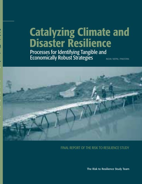
Catalyzing Climate and Disaster Resilience: Processes for Identifying
Catalyzing Climate and Disaster Resilience: Processes for Identifying
Catalyzing Climate and Disaster Resilience: Processes for Identifying

You also want an ePaper? Increase the reach of your titles
YUMPU automatically turns print PDFs into web optimized ePapers that Google loves.
<strong>Catalyzing</strong> <strong>Climate</strong> <strong>and</strong><br />
<strong>Disaster</strong> <strong>Resilience</strong><br />
<strong>Processes</strong> <strong>for</strong> <strong>Identifying</strong> Tangible <strong>and</strong><br />
Economically Robust Strategies<br />
INDIA: NEPAL: PAKISTAN<br />
FINAL REPORT OF THE RISK TO RESILIENCE STUDY<br />
The Risk to <strong>Resilience</strong> Study Team
PIEDAR<br />
<strong>Catalyzing</strong> <strong>Climate</strong> <strong>and</strong><br />
<strong>Disaster</strong> <strong>Resilience</strong><br />
<strong>Processes</strong> <strong>for</strong> <strong>Identifying</strong> Tangible <strong>and</strong><br />
Economically Robust Strategies<br />
INDIA: NEPAL: PAKISTAN<br />
FINAL REPORT OF THE RISK TO RESILIENCE STUDY<br />
The Risk to <strong>Resilience</strong> Study Team<br />
March 2009
Please use the following reference <strong>for</strong> this report:<br />
The Risk to <strong>Resilience</strong> Study Team (2009): <strong>Catalyzing</strong> <strong>Climate</strong> <strong>and</strong> <strong>Disaster</strong> <strong>Resilience</strong>: <strong>Processes</strong><br />
<strong>for</strong> <strong>Identifying</strong> Tangible <strong>and</strong> Economically Robust Strategies: Final Report of the Risk to<br />
<strong>Resilience</strong> Study, eds. Moench, M., Fajber, E., Dixit, A., Caspari, E., & Anil Pokhrel, ISET, ISET-Nepal,<br />
Kathm<strong>and</strong>u, Nepal, 328 pp.<br />
© Copyright, 2009<br />
Institute <strong>for</strong> Social <strong>and</strong> Environmental Transition &<br />
Institute <strong>for</strong> Social <strong>and</strong> Environmental Transition-Nepal.<br />
This publication is made possible by the support of United Kingdom's Department <strong>for</strong><br />
International Development (DFID). The research programme is supported through DFID grant<br />
number OHM0837, NOAA award number NA06OAR4310081 <strong>and</strong> the Canadian International<br />
Development Research Centre (IDRC) Centre file 103232-001. Views <strong>and</strong> opinions expressed<br />
within do not necessarily reflect the positions of DFID, NOAA <strong>and</strong> IDRC. The findings,<br />
interpretations <strong>and</strong> conclusions expressed in this paper are those of the authors alone.<br />
Any part of this publication may be cited, copied, translated into other languages or adapted to<br />
meet local needs without prior permission from ISET or ISET-Nepal provided that the source is<br />
clearly stated.<br />
First Edition: 1000<br />
March 2009<br />
ISBN: 978-9937-2-12748<br />
Editors: Marcus Moench, Elizabeth Fajber, Ajaya Dixit, Elisabeth Caspari & Anil Pokhrel<br />
Published by: Institute <strong>for</strong> Social <strong>and</strong> Environmental Transition & Institute <strong>for</strong> Social <strong>and</strong><br />
Environmental Transition-Nepal.<br />
Cover: Temporary bamboo bridge south of Gaur in Nepal Tarai used during non-rainy season.<br />
The Bairgania embankment with a dysfunctional sluice is seen in background.<br />
Photo by Ram Adhar Yadav.<br />
DESIGN AND TYPESETTING<br />
Digiscan Pre-press, Kathm<strong>and</strong>u, Nepal.<br />
PRINTED AT<br />
Format Printing Press, Kathm<strong>and</strong>u, Nepal.
THE RISK TO RESILIENCE STUDY TEAM & THEIR INSTITUTIONS<br />
Institute <strong>for</strong> Social <strong>and</strong> Environmental Transition (ISET), USA<br />
Marcus Moench<br />
Sarah Opitz-Stapleton<br />
ISET Associates-Pakistan<br />
Fawad Khan<br />
Atta-ur Rehman<br />
ISET Associates-India<br />
Sara Ahmed<br />
Eva Saroch<br />
International Institute of Applied Systems Analysis (IIASA), Austria<br />
Reinhard Mechler<br />
Daniel Kull<br />
Stefan Hochrainer<br />
Joanne Linnerooth-Bayer<br />
Unmesh Patnaik<br />
King’s College London, UK<br />
Daanish Mustafa<br />
NEPAL<br />
Institute <strong>for</strong> Social <strong>and</strong> Environmental Transition-Nepal (ISET-N), Nepal<br />
Ajaya Dixit<br />
Anil Pokhrel<br />
Nepal Water Conservation Foundation (NWCF), Nepal<br />
Madhukar Upadhya<br />
Kanchan Dixit<br />
PAKISTAN<br />
Pakistan Institute <strong>for</strong> Environment-Development Action Research (PIEDAR), Pakistan<br />
Syed Ayub Qutub<br />
INDIA<br />
Winrock International India (WII), India<br />
Shashikant Chopde<br />
Praveen Singh<br />
Sun<strong>and</strong>an Tiwari<br />
Mamta Borgoyary<br />
Sharmistha Bose<br />
Gorakhpur Environmental Action Group (GEAG), India<br />
Shiraz A. Wajih<br />
Abhilash Srivastav<br />
Gyaneshwar Singh
iv<br />
Publications from the Risk to <strong>Resilience</strong> Study<br />
A number of different publications have been produced <strong>for</strong> the Risk to <strong>Resilience</strong><br />
project. The first report, a qualitative analysis of the case study areas, is the book<br />
Working with the Winds of Change: Toward Strategies <strong>for</strong> Responding to the Risks<br />
Associated with <strong>Climate</strong> Change <strong>and</strong> other Hazards published in 2007. Following<br />
that, the series of nine working papers listed below <strong>and</strong> titled From Risk to<br />
<strong>Resilience</strong>, was published in 2008. This publication is the final report <strong>for</strong> the project.<br />
All these publications are available <strong>for</strong> download at www.i-s-e-t.org or<br />
www.climate-transitions.org.<br />
From Risk to <strong>Resilience</strong> Working Paper Series<br />
Working Paper<br />
Number<br />
Title<br />
Lead Authors<br />
Focus<br />
WP 1<br />
The Cost-Benefit Analysis Methodology<br />
Reinhard Mechler (IIASA)<br />
CBA methods<br />
WP 2<br />
Pinning Down Vulnerability: From<br />
Narratives to Numbers<br />
Daanish Mustafa (KCL); Sara Ahmed, Eva Saroch<br />
(ISET-India)<br />
VCI methods<br />
WP 3<br />
Downscaling: Potential <strong>Climate</strong> Change<br />
Impacts in the Rohini Basin, Nepal <strong>and</strong><br />
India<br />
Sarah Opitz-Stapleton (ISET);<br />
Subhrendu Gangopadhyay (University of<br />
Colorado, Boulder)<br />
<strong>Climate</strong> downscaling<br />
methods<br />
WP 4<br />
Evaluating Costs <strong>and</strong> Benefits of Flood<br />
Reduction Under Changing Climatic<br />
Conditions:<br />
Case of the Rohini River Basin, India<br />
Daniel Kull (IIASA); Praveen Singh,<br />
Shashikant Chopde (WII); Shiraz A. Wajih (GEAG)<br />
India floods<br />
WP 5<br />
Uttar Pradesh Drought Cost-Benefit<br />
Analysis, India<br />
Reinhard Mechler, Stefan Hochrainer, Daniel Kull<br />
(IIASA); Praveen Singh, Shashikant Chopde<br />
(WII); Shiraz A. Wajih (GEAG)<br />
India drought<br />
WP 6<br />
Costs <strong>and</strong> Benefits of Flood Mitigation in<br />
the Lower Bagmati Basin: Case of Nepal<br />
Tarai <strong>and</strong> North Bihar, India<br />
Ajaya Dixit, Anil Pokhrel (ISET-Nepal);<br />
Marcus Moench (ISET)<br />
Nepal Tarai <strong>and</strong> North<br />
Bihar floods<br />
WP 7<br />
Pakistan Case Study: Evaluating the<br />
Costs <strong>and</strong> Benefits of <strong>Disaster</strong> Risk<br />
Reduction under Changing Climatic<br />
Conditions<br />
Fawad Khan (ISET-Pakistan); Daanish Mustafa<br />
(KCL); Daniel Kull (IIASA)<br />
Pakistan (urban) floods<br />
WP 8<br />
Moving from Concepts to Practice: A<br />
Process <strong>and</strong> Methodology Summary <strong>for</strong><br />
<strong>Identifying</strong> Effective Avenues <strong>for</strong> Risk<br />
Management Under Changing Climatic<br />
Conditions<br />
Marcus Moench (ISET); Sara Ahmed (ISET-India);<br />
Reinhard Mechler (IIASA); Daanish Mustafa (KCL);<br />
Ajaya Dixit (ISET-Nepal); Sarah Opitz-Stapleton<br />
(ISET); Fawad Khan (ISET-Pakistan); Daniel Kull<br />
(IIASA)<br />
Methodology summary<br />
WP 9<br />
Underst<strong>and</strong>ing the Costs <strong>and</strong> Benefits of<br />
<strong>Disaster</strong> Risk Reduction under Changing<br />
Climatic Conditions<br />
Marcus Moench (ISET)<br />
Summary report
v<br />
Acknowledgements<br />
This report provides insights from an evaluation of the costs <strong>and</strong> benefits of<br />
disaster risk reduction <strong>and</strong> adaptation to climate change in South Asia. The report<br />
is based on fieldwork undertaken in the Nepal Tarai; Eastern Uttar Pradesh, India;<br />
<strong>and</strong> Rawalpindi, Pakistan. The study as a whole was financed by DFID. Related<br />
activities financed by IDRC on adaptation to climate change, NOAA on the use of<br />
climate in<strong>for</strong>mation products <strong>and</strong> ProVention on disaster risk reduction have also<br />
been undertaken in conjunction with the study <strong>and</strong> have contributed in a<br />
substantive manner to the results presented here. The support of all these<br />
organizations is gratefully acknowledged.<br />
The Risk to <strong>Resilience</strong> project was highly collaborative. All partner organizations<br />
played central field, analytical <strong>and</strong> conceptual roles. This said, specific<br />
organizations did lead different components. Research in each location was<br />
conducted by core project partners: ISET-Nepal <strong>and</strong> Nepal Water Conservation<br />
Foundation led activities in Nepal; Winrock International India led all activities in<br />
India, working in close coordination with the Gorakhpur Environmental Action<br />
Group <strong>and</strong> the ISET Associates in India; <strong>and</strong> PIEDAR <strong>and</strong> ISET Associates worked<br />
closely together in Pakistan. The International Institute of Applied Systems<br />
Analysis (IIASA) <strong>and</strong> King’s College London led respectively on the technical costbenefit<br />
<strong>and</strong> vulnerability components of the project. All activities were coordinated<br />
<strong>and</strong> supported by ISET.<br />
In addition to the financial support <strong>and</strong> the involvement of all members of the Risk<br />
to <strong>Resilience</strong> Study Team, several individuals have made important contributions to<br />
this report. These included Subhrendu Gangopadhyay of Environmental Studies<br />
Program, University of Colorado, Boulder <strong>for</strong> his contribution on downscaling of<br />
climate scenarios <strong>and</strong> Sonam Bennett-Vasseux from ISET <strong>for</strong> much appreciated<br />
editorial support. Substantive inputs from field research were also contributed in<br />
Nepal, India <strong>and</strong> Pakistan by numerous dedicated field staff <strong>and</strong> individuals in<br />
government <strong>and</strong> non-government organizations as well as the local communities<br />
that they interacted with. The intensive, highly professional, work by Suresh<br />
Shrestha <strong>and</strong> all the others at Format Graphics in the publication of this report<br />
under difficult conditions is gratefully acknowledged.
vii<br />
Table of Contents<br />
CHAPTER 1:<br />
RETHINKING THE COSTS AND BENEFITS OF DISASTER RISK REDUCTION UNDER<br />
CHANGING CLIMATE CONDITIONS 1<br />
Key Messages 3<br />
Introduction 7<br />
The Project on Risk to <strong>Resilience</strong> 9<br />
Critical Issues 11<br />
The Case Studies 14<br />
Flooding in the Nepal Tarai 14<br />
Rawalpindi, Pakistan 18<br />
Eastern Uttar Pradesh, India 20<br />
Policy Issues 26<br />
The Use <strong>and</strong> Abuse of Cost-Benefit Analysis 27<br />
Data Dependence 28<br />
Assumptions 29<br />
Negative Consequences 29<br />
Discount Rates 30<br />
Distributional Issues 30<br />
Lack of Transparency 31<br />
Conclusions 32<br />
Bibliography 34<br />
CHAPTER 2: METHODS FOR IDENTIFYING TANGIBLE STRATEGIES FOR RISK REDUCTION 35<br />
Introduction 37<br />
<strong>Processes</strong> & Qualitative Methodologies 39<br />
The Importance of ‘Soft’ Process Approaches 39<br />
<strong>Processes</strong> <strong>for</strong> Working with Communities 40<br />
Scoping 41<br />
Shared Learning Dialogues (SLDs) 43<br />
Vulnerability Analysis 46<br />
<strong>Processes</strong> <strong>for</strong> Qualitative Evaluation <strong>and</strong> Prioritization of Risk Reduction Measures 51<br />
Quantitative Methodologies 56<br />
<strong>Climate</strong> Downscaling 56<br />
Cost-Benefit Analysis: Quantitative Decision Support <strong>for</strong> Assessing the Costs<br />
<strong>and</strong> Benefits of <strong>Disaster</strong> Risk Management 57<br />
Conclusions 67<br />
Bibliography 69
viii<br />
CHAPTER 3:<br />
DOWNSCALING CLIMATE INFORMATION IN DATA LIMITED CONTEXTS: POTENTIAL<br />
CHANGES IN THE ROHINI BASIN, NEPAL AND INDIA 71<br />
Introduction 73<br />
The Rohini Basin 76<br />
Datasets <strong>and</strong> Assumptions 78<br />
Methodology 81<br />
Forecasting Results 88<br />
<strong>Climate</strong> Change Scenario Uncertainty 93<br />
Conclusion 97<br />
Bibliography 98<br />
CHAPTER 4:<br />
QUALITATIVE ASSESSMENT OF THE COSTS AND BENEFITS OF FLOOD MITIGATION:<br />
LOWER BAGMATI BASIN - NEPAL AND INDIA 101<br />
Key Messages 103<br />
Introduction of the Lower Bagmati Basin: Location, Issues <strong>and</strong> Responses 105<br />
Administrative Characteristics 106<br />
Social <strong>and</strong> Economic Characteristics 107<br />
Hydrologic <strong>and</strong> Geologic Characteristics 108<br />
<strong>Climate</strong> Change Impacts 111<br />
Evaluating Alternative Flood Management Strategies 112<br />
The Qualitative CBA Methodology using Shared Learning Dialogues 113<br />
Example of the Methodology Employed 115<br />
Results along the Transect 119<br />
Transect I: Villages along the Bagmati River 119<br />
Transect II: Villages along the Lal Bakaiya River 122<br />
Transect III: Gaur Municipality - Bairgania Ring Embankment - Pipradi Sultan 124<br />
Analysis: Findings from the Transects 127<br />
Issues Encountered in Conducting CBA 129<br />
Conclusions 130<br />
Bibliography 132<br />
CHAPTER 5:<br />
COMPARING URBAN FLOOD MITIGATION OPTIONS: COSTS AND<br />
BENEFITS IN RAWALPINDI, PAKISTAN 133<br />
Introduction 135<br />
The Lai Flood Basin 135<br />
Methods 137<br />
The Contextual Environment,from Community to Policy 139<br />
Strategies 139<br />
What is being Done ? 140<br />
What are the Policies ? 145<br />
Disjuncture between Community <strong>and</strong> Government Perceptions 149<br />
Identification of Main Strategies Selected <strong>for</strong> Evaluation 149<br />
Evaluating Tradeoffs 150<br />
Who is Vulnerable ? 150<br />
Methodology: Qualitative 150<br />
Methodology: Quantitative 155<br />
Conclusions 164<br />
Bibliography 166
ix<br />
CHAPTER 6:<br />
QUANTITATIVE COST-BENEFIT ASSESSMENT OF FLOOD MITIGATION OPTIONS:<br />
UTTAR PRADESH, INDIA 169<br />
Introduction 171<br />
Historic Political <strong>and</strong> Policy Environments 171<br />
Lack of Learning 171<br />
Disjuncture between Groups, Institutions, Levels of Activity <strong>and</strong> Analysis 172<br />
Major Changes due to <strong>Climate</strong> Change (to 2050) 172<br />
Analysis of Strategies <strong>for</strong> Flood Risk Reduction 173<br />
Utility of Cost-Benefit Analysis 173<br />
Study Background 175<br />
Geographical Setting 175<br />
Agro-ecological Setting 177<br />
Flood Hazard 178<br />
An Introduction to Methods 179<br />
Who is Vulnerable ? 181<br />
Socio-economic Conditions 181<br />
Socio-economic Vulnerability 182<br />
Financial Vulnerability 183<br />
Spatial Vulnerability 184<br />
Summary 185<br />
Community to Policy Context 186<br />
Flood Risk Reduction Programmes 186<br />
Disjuncture between Institutions <strong>and</strong> Communities 188<br />
<strong>Identifying</strong> Flood Risk Reduction Strategies 190<br />
Evaluating Tradeoffs 191<br />
Qualitative Analysis 191<br />
Quantitative Analysis 201<br />
Conclusions 218<br />
Flood Risk Reduction Strategies 218<br />
<strong>Disaster</strong> Risk Reduction Policy 218<br />
Supporting Decision-Making <strong>and</strong> Policy Development 219<br />
Bibliography 221<br />
CHAPTER 7:<br />
COMBINING INNOVATIVE STRATEGIES FOR EFFECTIVE DROUGHT RISK<br />
MANAGEMENT: COSTS AND BENEFITS OF INSURANCE AND IRRIGATION IN<br />
UTTAR PRADESH, INDIA 223<br />
Introduction 225<br />
The Issue: Drought <strong>and</strong> Rural Livelihoods 226<br />
The Methodology <strong>and</strong> Key Findings 226<br />
The Case Location, Issues <strong>and</strong> Responses 228<br />
The Risks 229<br />
Who is Affected <strong>and</strong> How ? 229<br />
The Main Strategies <strong>for</strong> Risk Reduction that are being Implemented 230<br />
Assessing Risk: The Modelling Approach 232<br />
Exposure 234<br />
Hazard 235<br />
Vulnerability 236<br />
Monetary Crop Yield Risk 237<br />
Economic Vulnerability <strong>and</strong> Risk 237<br />
Risk Management Interventions: Identification <strong>and</strong> Costs 240<br />
Overview 240<br />
Irrigation 241<br />
Insurance 241<br />
Risk Management Interventions - Assessment of Benefits 244<br />
Irrigation 244<br />
Crop Insurance 244<br />
Stochastic Representation of Interventions 245<br />
Economic Efficiency of Risk Management 246<br />
Constant <strong>Climate</strong> 246<br />
Changing <strong>Climate</strong> 247<br />
Conclusions 248<br />
Bibliography 250
x<br />
CHAPTER 8:<br />
MOVING FROM POLICY TO PRACTICE: THE ROLE OF COST-BENEFIT<br />
ANALYSIS IN PRO-ACTIVE DISASTER RISK REDUCTION 251<br />
Key Issues at the Policy Level 253<br />
National Cases 255<br />
India 255<br />
Key Characteristics of the Indian Context 255<br />
Key Features of the Policy Environment 257<br />
Current Operational Environment 262<br />
Potential Role of Cost-Benefit Analysis in DRR Ef<strong>for</strong>ts in a Flood Context 265<br />
Pakistan 265<br />
Key Characteristics of the Pakistan Context 265<br />
Policy History <strong>and</strong> Key Features of the Policy Environment 268<br />
Current Operating Environment 270<br />
<strong>Climate</strong> Change <strong>and</strong> <strong>Disaster</strong>s in Pakistan 275<br />
Can Cost-Benefit Analysis Help DRR in Pakistan? 276<br />
Nepal 277<br />
Actors <strong>and</strong> Activities: Fragmentation <strong>and</strong> Dysfunction 278<br />
Building <strong>Resilience</strong> 285<br />
Summary <strong>and</strong> Key Findings 293<br />
India 295<br />
Pakistan 296<br />
Nepal 297<br />
Bibliography 298<br />
CHAPTER 9: REFLECTIONS ON THE VALUE OF THE COST-BENEFIT ANALYSIS PROCESS 303<br />
Conclusions 305<br />
The Value of the Cost-Benefit Analysis Process 306<br />
Challenges <strong>and</strong> Limitations of Cost-Benefit Analysis <strong>for</strong> Assessing DRR 308<br />
Vulnerability <strong>and</strong> Distributional Analysis 309<br />
The Policy Context 310<br />
Pakistan 310<br />
India 311<br />
Nepal 313<br />
Insights from Cases 315<br />
Uttar Pradesh Flood Management 315<br />
Uttar Pradesh Drought Management 316<br />
Rawalpindi – Lai Basin Flood Management 317<br />
Nepal Qualitative Case Study 318<br />
Evaluating the Impacts of <strong>Climate</strong> Change 319<br />
Summary 322
1<br />
CHAPTER<br />
Rethinking the Costs <strong>and</strong> Benefits of<br />
<strong>Disaster</strong> Risk Reduction under<br />
Changing <strong>Climate</strong> Conditions<br />
Marcus Moench (ISET) &<br />
The Risk to <strong>Resilience</strong> Study Team
2<br />
<strong>Catalyzing</strong> <strong>Climate</strong> <strong>and</strong> <strong>Disaster</strong> <strong>Resilience</strong>: <strong>Processes</strong> <strong>for</strong><br />
<strong>Identifying</strong> Tangible <strong>and</strong> Economically Robust Strategies
3<br />
Key Messages<br />
The economic benefits to society of investing in disaster risk management substantially<br />
exceed the costs. Appropriately designed risk reduction strategies represent a sound<br />
investment that is central both to alleviating poverty <strong>and</strong> to responding to the expected<br />
impacts of climate change on lives <strong>and</strong> livelihood systems. This core finding emerges<br />
from detailed analysis of avenues <strong>for</strong> reducing flood <strong>and</strong>, to a lesser extent, drought<br />
risks in India, Nepal <strong>and</strong> Pakistan. As the sample benefit cost ratios contained in<br />
Table 1 indicate, in most cases investigated, benefit/cost ratios are positive <strong>and</strong> in<br />
some instances well above those achieved through other common development<br />
investments. This finding holds true <strong>for</strong> an array of interventions that include<br />
insurance, early warning systems, local village-level responses, <strong>and</strong> large-scale<br />
infrastructure. Return rates are often higher when the impacts of climate change are<br />
considered, particularly <strong>for</strong> strategies that are resilient in the face of uncertainty. Return<br />
rates appear particularly robust <strong>for</strong> the often lower-cost so called people centred<br />
interventions that reduce the risks associated with high frequency, low magnitude<br />
events rather than those associated with large disasters. Such events, which can occur<br />
annually, result in chronic losses that can erode the wealth of the affected populations.<br />
In contrast, the economic benefits that result from interventions that require high<br />
initial investments <strong>and</strong> are targeted at less frequent but more extreme events are less<br />
robust. These are particularly vulnerable to assumptions regarding the appropriate<br />
discount rate to use, <strong>and</strong> to uncertainties regarding the frequency <strong>and</strong> magnitude of<br />
extreme events as climate conditions change. Indeed, investing in low-cost <strong>for</strong>ms of<br />
risk reduction that are designed to increase the resiliency of livelihoods, housing <strong>and</strong><br />
other infrastructure at the household <strong>and</strong> community levels may be among the most<br />
cost-effective avenues <strong>for</strong> reducing risks <strong>and</strong> thereby <strong>for</strong> supporting adaptation to<br />
climate change. This does not, however, imply that investments should be directed<br />
away from lower frequency-higher magnitude disasters that can set individuals,<br />
households <strong>and</strong> regions back <strong>for</strong> many years. Instead, it implies the need <strong>for</strong> a balanced<br />
approach that combines sustained attention to small disasters that receive little public<br />
or policy attention in addition to extreme events with a large-scale, higher-profile impact.<br />
Rethinking the Costs <strong>and</strong> Benefits of <strong>Disaster</strong> Risk Reduction<br />
under Changing <strong>Climate</strong> Conditions<br />
There are three major exceptions to our core finding that risk reduction pays. First,<br />
risk reduction may not pay where strategies have major externalities <strong>and</strong>/or depend<br />
heavily on precise knowledge regarding the magnitude <strong>and</strong> probability of specific<br />
events. In the case of embankments <strong>for</strong> flood control, <strong>for</strong> example, accurate evaluation<br />
of externalities related to drainage, l<strong>and</strong> use <strong>and</strong> disease may reduce or offset any
4<br />
<strong>Catalyzing</strong> <strong>Climate</strong> <strong>and</strong> <strong>Disaster</strong> <strong>Resilience</strong>: <strong>Processes</strong> <strong>for</strong><br />
<strong>Identifying</strong> Tangible <strong>and</strong> Economically Robust Strategies<br />
benefits from risk reduction. Second, risk reduction also may not pay in high cost<br />
specialized systems that are designed to respond to individual rather than multiple<br />
hazards. This is particularly true if such systems are over-designed or depend on<br />
institutions or technical maintenance that are difficult to sustain in the interval between<br />
hazard events. Third, unless the value of life is monetized, risk reduction may not<br />
generate economic returns in cases where the main benefit is in terms of lives, rather<br />
than assets, saved. In this case, however, rather than undertaking an economic costbenefit<br />
analysis it is probably more appropriate to compare investments on the basis<br />
of cost per life saved rather than attempt to monetize the value of life. Aside from these<br />
three exceptions, in most cases appropriately designed risk reduction strategies do<br />
represent a sound investment that, as already noted above, is central both to alleviating<br />
poverty <strong>and</strong> to responding to the expected impacts of climate change on lives <strong>and</strong><br />
livelihood systems.<br />
| TABLE 1 | Sample results from cost-benefit analysis of risk management measures in specific case contexts*<br />
Sample interventions<br />
Estimated<br />
B/C Ratio**<br />
Change in B/C ratio with<br />
<strong>Climate</strong> Change<br />
UTTAR PRADESH FLOOD MANAGEMENT<br />
Construction of embankments <strong>for</strong> flood control (existing programme).<br />
Ratio shown reflects indirect costs <strong>and</strong> benefits. A strict engineering<br />
analysis that excludes indirect costs <strong>and</strong> benefits would, under current<br />
climatic conditions, give a B/C ratio of 4.6.<br />
Maintenance of existing embankments<br />
Distributed mix of community based interventions<br />
1<br />
2<br />
2.5<br />
Likely to decline<br />
Stable<br />
Increases<br />
UTTAR PRADESH DROUGHT MANAGEMENT<br />
Groundwater irrigation (risk reduction alone)<br />
Index based insurance programme<br />
Combination of insurance <strong>and</strong> irrigation<br />
RAWALPINDI URBAN FLOOD MANAGEMENT<br />
Expressway/Channel<br />
Community pond<br />
River improvement by removing blockages at key choke points<br />
Early warning system as currently installed. This is a dedicated early<br />
warning system that was installed following a major flood event in 2002.<br />
The benefit-cost ratio is not representative of other early warning systems.<br />
Relocation of population <strong>and</strong> restoration of the flood plain<br />
NEPAL QUALITATIVE COST BENEFIT ANALYSIS<br />
Flood control embankments along Bagmati River: Evaluation included<br />
indirect benefits <strong>and</strong> costs as well as their distribution<br />
Distributed mix of community level interventions: Note benefit <strong>and</strong> cost<br />
characteristics are qualitatively different from those associated with<br />
embankments <strong>and</strong> in many cases can't be directly compared.<br />
1.6<br />
2<br />
2.2<br />
1.88<br />
8.55<br />
25<br />
0.96<br />
Cost per life saved<br />
approximately USD 44,000<br />
1.34<br />
Costs appear to exceed benefits<br />
Benefits appear to exceed costs<br />
Increases to 2<br />
Declines to 1.2<br />
Stable<br />
Not analyzed<br />
Likely to be robust<br />
Likely to be robust or increase<br />
Benefits would increase with<br />
anticipated increases in flooding -<br />
but the greatest increases would<br />
come with improvements in design<br />
Likely to increase<br />
Appears likely to decline<br />
Appears likely to increase<br />
* All B/C ratios shown are <strong>for</strong> 10% discount rates. Assumptions <strong>and</strong> details underlying all ratios are discussed extensively in the relevant chapters below.<br />
** A note <strong>for</strong> non-economists: a B/C ratio above 1.0 indicates benefits outweighing costs. The higher the number, the higher the benefit.<br />
The above said it is essential to recognize that returns from investment in risk<br />
management depend both on the specific details or design of a given intervention <strong>and</strong><br />
on the resilience of the underlying strategy. While risk management does in a generic<br />
sense pay, the returns <strong>and</strong> effectiveness of many guiding strategies <strong>and</strong> specific<br />
interventions depend heavily on projections regarding future conditions <strong>and</strong> on other<br />
factors where uncertainty is high. Some strategies <strong>and</strong> interventions deliver robust
5<br />
returns under a wide range of conditions while others depend heavily on the specific<br />
nature of hazards. The range in the resilience of different strategies <strong>and</strong> interventions<br />
also has implications <strong>for</strong> our ability to evaluate their returns in contexts where limited<br />
amounts of data are available <strong>and</strong> numerous assumptions must be made. Specifically:<br />
1. The rates of return between different types of investments in risk reduction vary greatly<br />
in how robust they are under different sets of assumptions <strong>and</strong> different projections of<br />
climate change. In many cases, lower levels of investment can generate rates of<br />
return that are both greater <strong>and</strong> much more robust than higher cost investments.<br />
This appears to be particularly true of investments that provide annual benefits by<br />
improving the ability of populations to live with frequent floods <strong>and</strong> droughts,<br />
rather than investments focused on larger but less frequent extreme events. The<br />
<strong>for</strong>mer types of investment may also be more socially <strong>and</strong> institutionally sustainable<br />
than ones directed at infrequent larger events (Gunderson <strong>and</strong> Holling, 2002;<br />
Holling, Gunderson et al., 2002).<br />
Rethinking the Costs <strong>and</strong> Benefits of <strong>Disaster</strong> Risk Reduction<br />
under Changing <strong>Climate</strong> Conditions<br />
2. Even with the best scientific in<strong>for</strong>mation the ability to project future event<br />
probabilities will be highly uncertain. Nowhere is this more evident than in the<br />
data limited environments that characterize much of the developing world <strong>and</strong><br />
where hazards are influenced by changing climatic conditions. As a result, any<br />
attempt to project the future costs <strong>and</strong> benefits of climate related disaster risk reduction<br />
investments using probabilistic approaches is subject to high levels of uncertainty. It is<br />
particularly inappropriate to treat projections of future climate conditions as providing<br />
an accurate representation of future event probabilities. Techniques such as those<br />
developed in this project to down-scale the results of global circulation models to<br />
local areas can provide key insights but it is essential to acknowledge their<br />
limitations. They provide indications of potential future climate conditions but<br />
cannot be relied on as accurate projections. Furthermore, in many cases the absence<br />
of basic location-specific historical data limits the ability to translate downscaled<br />
results from circulation models into streamflows or the other types of changes<br />
required <strong>for</strong> local impact evaluation.<br />
3. In virtually all of the cases we investigated, we discovered that approaches to risk<br />
reduction that combine a mix of “hard” infrastructure <strong>and</strong> “soft” institutional or<br />
financial measures are more robust than approaches that focus on one or the other<br />
alone. In addition, many of the most resilient avenues <strong>for</strong> risk reduction may involve<br />
strengthening of underlying communication, transport, economic, banking <strong>and</strong><br />
other systems rather than on targeted responses to specific hazards (Moench <strong>and</strong><br />
Dixit, 2007).<br />
4. Evaluations of the rates of return of large-scale infrastructure may be misleadingly<br />
positive because of assumptions made about discount rates, investment costs,<br />
event frequencies <strong>and</strong>, very significantly, because negative consequences<br />
(“disbenefits” or externalities) tend not to be considered. In the case of embankments,<br />
inclusion of realistic l<strong>and</strong> values, crop <strong>and</strong> other losses associated with water logging <strong>and</strong><br />
increases in disease fundamentally reduce the benefit/cost ratio. Returns from such<br />
large investments are, furthermore, highly vulnerable to climate change projections.<br />
5. How the costs <strong>and</strong> benefits of disaster risk reduction are evaluated <strong>and</strong> how the<br />
results of such analyses are interpreted needs to be carefully assessed. In many
6<br />
<strong>Catalyzing</strong> <strong>Climate</strong> <strong>and</strong> <strong>Disaster</strong> <strong>Resilience</strong>: <strong>Processes</strong> <strong>for</strong><br />
<strong>Identifying</strong> Tangible <strong>and</strong> Economically Robust Strategies<br />
analyses, the data required to conduct an accurate evaluation are not available or<br />
are difficult to generate. As a result, such analyses depend very heavily on the<br />
assumptions <strong>and</strong> estimates of project staff <strong>and</strong> other experts. Because these<br />
assumptions often are hidden deeply in models <strong>and</strong> technical discussions they are<br />
unlikely to be evident to any but the most engaged of users.<br />
6. Given the high levels of data required along with the uncertainties inherent in relation<br />
to climate change, in most contexts limited financial <strong>and</strong> project analyses are likely to<br />
be more useful than attempts to conduct full cost-benefit analyses. Simplified<br />
methodologies that enable analysts to identify key cost <strong>and</strong> benefit areas along with<br />
their general magnitudes, coupled with methods <strong>for</strong> comparing the cost effectiveness<br />
of different strategies <strong>for</strong> reaching similar risk reduction outcomes are essential<br />
complements to less frequently applicable full cost-benefit methodologies. In many<br />
cases, the costs of a full cost-benefit analysis will exceed the benefits.<br />
Overall, the case studies in this volume demonstrate both the high economic returns<br />
that can be achieved by investing in risk reduction <strong>and</strong> the importance of methodologies<br />
<strong>for</strong> analyzing the viability of different approaches under often highly uncertain future<br />
conditions. Cost-benefit analysis is one such methodology. In many cases, however,<br />
more simplified approaches that identify, but do not fully quantify, major costs <strong>and</strong><br />
benefits <strong>and</strong> also highlight key externalities, uncertainties <strong>and</strong> assumptions may generate<br />
as much in<strong>for</strong>mation as a full cost-benefit analysis.<br />
In addition to the role of cost-benefit analysis in evaluating the economic returns from<br />
investments in risk management, the cases in this volume also demonstrate the importance<br />
of process. The process of conducting a cost-benefit analysis encourages individuals <strong>and</strong><br />
organizations to move beyond rhetoric <strong>and</strong> identify very tangible sets of interventions. It<br />
also helps them to evaluate the relationship between perceived risks, vulnerable groups<br />
<strong>and</strong> proposed responses in ways that can highlight underlying assumptions <strong>and</strong> hidden<br />
social or other consequences. Where climate change is concerned, conducting a costbenefit<br />
analysis of risk management measures also <strong>for</strong>ces organizations to translate, as<br />
far as possible, global scientific in<strong>for</strong>mation into local contexts. Finally, when conducted<br />
in an open, transparent <strong>and</strong> participatory manner, the process can serve as a major tool<br />
<strong>for</strong> bringing diverse groups of stakeholders <strong>and</strong> perspectives together, thus generating<br />
broad-based ownership <strong>and</strong> underst<strong>and</strong>ing of proposed strategies.<br />
The processes outlined in this volume proceed from qualitative engagement <strong>and</strong> analysis<br />
through quantitative analysis <strong>and</strong> then back to qualitative. Risks are first identified<br />
through qualitative shared learning processes. These are then quantified <strong>and</strong> evaluated<br />
where possible in economic terms. The results of this evaluation are, however, recognized<br />
as inherently partial; they reflect the factors that can be quantified <strong>and</strong> not the numerous<br />
social or other considerations that cannot. As a result, the final step in the process, a<br />
return to qualitative evaluation, is central to its accuracy. This qualitative-quantitativequalitative<br />
sequence enables stakeholders to underst<strong>and</strong> not just the overall economic<br />
returns from a risk management intervention but also its distributional <strong>and</strong> other<br />
potential consequences. This, we believe, is central to underst<strong>and</strong>ing who bears the<br />
costs <strong>and</strong> who benefits from interventions to manage disaster <strong>and</strong> other risks. As a result,<br />
the process is of far more utility <strong>for</strong> both the identification of effective strategies <strong>for</strong> risk<br />
management <strong>and</strong> the targeting of such strategies in ways that address the needs of poor<br />
or particularly vulnerable communities than the <strong>for</strong>mal results of the economic evaluation.
7<br />
Introduction<br />
At a global level, evidence regarding the economic impacts of climate change <strong>and</strong><br />
disasters is accumulating rapidly. It is now widely recognized that recurrent disasters<br />
undermine the ability of regions, nations <strong>and</strong> the global community to meet basic<br />
development goals. Roughly 75% of disasters are related to storms, floods, droughts<br />
<strong>and</strong> other climate-related causes (Hoyois <strong>and</strong> Guha-Sapir, 2004). The intensity <strong>and</strong><br />
possibly the frequency of such events are likely to be exacerbated by climate change<br />
(IPCC, 2007). As a result, disaster risk reduction (DRR) is central both to meeting<br />
global development objectives <strong>and</strong> to any attempt to adapt to climate change. This is<br />
recognized globally in key agreements <strong>for</strong> action such as the Hyogo Framework <strong>for</strong><br />
Action (ISDR, 2005).<br />
Rethinking the Costs <strong>and</strong> Benefits of <strong>Disaster</strong> Risk Reduction<br />
under Changing <strong>Climate</strong> Conditions<br />
While broad consensus exists on the need <strong>for</strong> DRR, little in<strong>for</strong>mation is available on<br />
the economics of investment in alternative risk reduction strategies <strong>and</strong> the spectrum<br />
of potential strategies ranges greatly from the design of physical structures to the<br />
growth of social networks <strong>and</strong> institutions. This makes directing investment to specific<br />
DRR activities difficult to justify relative both to alternatives available <strong>and</strong> to other<br />
social investments that contribute toward similar development objectives. National<br />
<strong>and</strong> local governments, international financing agencies <strong>and</strong> NGOs have limited<br />
resources <strong>and</strong>, furthermore, investments in DRR draw resources away from other<br />
areas where investment may be equally important. Hence, there is both a need <strong>and</strong> a<br />
dem<strong>and</strong> <strong>for</strong> analytical frameworks, such as cost-benefit analysis, that can support<br />
decision-making. This need <strong>and</strong> the pressure to provide solid justification <strong>for</strong><br />
investments are likely to grow. While constraints on the absolute availability of<br />
financing to address the impacts of climate change may decline if innovative<br />
mechanisms <strong>for</strong> funding climate adaptation are implemented, the current global<br />
financial crisis suggests that scrutiny <strong>and</strong>, in some cases, opposition to such funds will<br />
increase. A solid evaluation of the economic costs <strong>and</strong> benefits of alternative strategies<br />
will be essential to address the opposition <strong>and</strong> concern that will inevitably grow if the<br />
scale of investments increases.<br />
The challenge is not, however, just to demonstrate the economic returns from<br />
investments. Perceptions of both disaster risks <strong>and</strong> avenues <strong>for</strong> addressing them vary<br />
greatly between individuals <strong>and</strong> groups. This is particularly true in the context of
8<br />
<strong>Catalyzing</strong> <strong>Climate</strong> <strong>and</strong> <strong>Disaster</strong> <strong>Resilience</strong>: <strong>Processes</strong> <strong>for</strong><br />
<strong>Identifying</strong> Tangible <strong>and</strong> Economically Robust Strategies<br />
climate change where historical experience may have limited relevance <strong>for</strong> future<br />
conditions. It is also the case where disasters affect social or economic groups differently.<br />
Women, <strong>for</strong> example, often face fundamentally different types of impacts than men do<br />
during disasters due to the nature <strong>and</strong> location of their day-to-day activities <strong>and</strong> the<br />
different types of social networks <strong>and</strong> economic opportunities to which they have<br />
access. As a result, approaches that reduce or alter the nature of risk <strong>for</strong> one group<br />
may not address the needs of other groups.<br />
In this context, simply documenting an economic justification <strong>for</strong> investment in risk<br />
reduction is insufficient. More wide-reaching analytical frameworks <strong>and</strong> approaches<br />
that help to identify who gains, who loses, <strong>and</strong> whether or not the costs of disasters -<br />
particularly those associated with climate change - are equitably addressed are also<br />
essential. Global ef<strong>for</strong>ts to address climate change recognize that those benefiting<br />
from high carbon lifestyles are not the large poor populations in developing countries<br />
who will bear much of the cost. Consequently, issues of equity <strong>and</strong> the ability to target<br />
resources <strong>for</strong> adaptation in ways that actually target the most vulnerable groups are<br />
central to all ef<strong>for</strong>ts to respond to the impacts of climate change. Analytical frameworks<br />
exploring the distribution of both impacts from climate related disasters <strong>and</strong> benefits<br />
from risk reduction strategies are, as a result, essential.<br />
At a pragmatic level, the great diversity of approaches to managing disaster risk requires<br />
the identification of what specifically should be done to reduce risks <strong>and</strong> <strong>for</strong> whom in<br />
different contexts. Terms such as “disaster risk reduction” or “climate adaptation <strong>and</strong><br />
resilience” only acquire real meaning when they can be translated into tangible courses<br />
of action that have impacts at the ground level. At present, systematic processes <strong>for</strong><br />
identifying courses of action to reduce risk <strong>for</strong> vulnerable communities are rare.<br />
Generally, actions to reduce disaster risk focus on proximate causes-such as poor<br />
building construction or the lack of protective infrastructure <strong>and</strong> points of refugerather<br />
than the deeper systemic factors that create or ameliorate risk within society<br />
(Moench <strong>and</strong> Dixit, 2007). In contrast, this report focuses primarily on the costs <strong>and</strong><br />
benefits of specific strategies <strong>for</strong> reducing flood <strong>and</strong> drought related disaster risk both<br />
currently <strong>and</strong> under scenarios designed to illustrate the future effects of climate change.
9<br />
The Project on Risk to <strong>Resilience</strong><br />
The purpose of the project on Risk to <strong>Resilience</strong> was to evaluate the costs <strong>and</strong> benefits of<br />
disaster risk reduction in case study areas in India, Nepal <strong>and</strong> Pakistan. We focused on<br />
water related disasters <strong>and</strong> the manner in which they may change as a consequence of<br />
climate change. Our objective was to develop a suite of methods <strong>and</strong> analytical cases<br />
that both illustrate methods <strong>and</strong> evaluate the costs <strong>and</strong> benefits of specific risk reduction<br />
strategies under different climate scenarios. Our approach consisted of the following<br />
key elements:<br />
Rethinking the Costs <strong>and</strong> Benefits of <strong>Disaster</strong> Risk Reduction<br />
under Changing <strong>Climate</strong> Conditions<br />
1. Scoping: An intensive scoping process to identify locations <strong>and</strong> risks that <strong>for</strong>med a<br />
representative basis <strong>for</strong> detailed cases.<br />
2. Vulnerability <strong>and</strong> capacity analysis: A systematic process within case areas, including<br />
the development of quantitative vulnerability indices, to identify vulnerable groups<br />
<strong>and</strong> disaggregate different dimensions of vulnerability.<br />
3. Shared learning dialogues within identified case areas: Iterative meetings with<br />
communities <strong>and</strong> key actors that enabled moving from the analysis of vulnerability<br />
to the clear identification of alternative strategies <strong>for</strong> disaster risk reduction that<br />
key actors in the government <strong>and</strong> affected communities believed will address risk<br />
under current <strong>and</strong> projected climate conditions.<br />
4. Systematic qualitative approaches <strong>for</strong> evaluating trade-offs (broad costs <strong>and</strong> benefits)<br />
between alternative strategies <strong>for</strong> risk reduction: Who benefits? Who loses? <strong>and</strong> Why?<br />
5. Cost-benefit analysis using quantitative probabilistic techniques <strong>for</strong> evaluating different<br />
approaches to disaster risk reduction. This economic <strong>and</strong> hazard-modelling<br />
component included techniques <strong>for</strong> down-scaling <strong>and</strong> evaluating the impacts of<br />
climate change in data limited contexts.<br />
The above methods are discussed in detail in the following chapter. This summary<br />
focuses on core insights emerging from the application of this suite of methods to<br />
flood-related disaster risks in case study sites in the Nepal Tarai (the plains adjacent to<br />
India), Rawalpindi, Pakistan, <strong>and</strong> Eastern Uttar Pradesh, India. Examples of their
10<br />
<strong>Catalyzing</strong> <strong>Climate</strong> <strong>and</strong> <strong>Disaster</strong> <strong>Resilience</strong>: <strong>Processes</strong> <strong>for</strong><br />
<strong>Identifying</strong> Tangible <strong>and</strong> Economically Robust Strategies<br />
application have also been discussed in a preliminary manner in Working With the<br />
Winds of Change, an earlier ISET publication (Moench <strong>and</strong> Dixit, 2007). The sites <strong>and</strong><br />
locations where research was conducted are shown in Figure 1.<br />
| FIGURE 1 | Research locations<br />
Islamabad/Rawalpindi<br />
PAKISTAN<br />
Gorakhpur<br />
EASTERN UTTAR<br />
PRADESH, INDIA<br />
Rautahat/Bairgania<br />
NEPAL TARAI & INDIA
11<br />
Critical Issues<br />
Research on the costs <strong>and</strong> benefits of disaster risk reduction in the context of climate<br />
change is, in many ways, a window into complexity. The political <strong>and</strong> social context of<br />
South Asia is dynamic <strong>and</strong> fluid. Risks evolve rapidly as emergent properties of<br />
development <strong>and</strong> settlement processes in different contexts. In conjunction with preexisting<br />
patterns of social, economic <strong>and</strong> gender differentiation, such processes create<br />
a kaleidoscope in which patterns of vulnerability appear or disappear in ways that<br />
depend as much on interactions within livelihood systems (which span the spectrum<br />
from local to global) as they do on exposure to location-specific hazards.<br />
Rethinking the Costs <strong>and</strong> Benefits of <strong>Disaster</strong> Risk Reduction<br />
under Changing <strong>Climate</strong> Conditions<br />
As some of our earlier research has clearly documented, changes in vulnerability to<br />
disaster often depend as much, if not more, on systemic factors that may have little to<br />
do with actions taken under the rubric of “disaster risk reduction” per se (Moench <strong>and</strong><br />
Dixit, 2007). Changing access to communications, financial systems, transport, utilities,<br />
health services, <strong>and</strong> local to global social networks heavily influence where people live,<br />
their overall mobility <strong>and</strong> the vulnerability of their livelihood systems to disruption<br />
during floods, droughts or other climate related events. They also influence the viability<br />
of targeted strategies <strong>for</strong> risk reduction. At the national level, in highly dynamic<br />
political environments, institutional memories tend to be short. However well planned<br />
or conceived, the resolve to implement strategies to en<strong>for</strong>ce building codes or l<strong>and</strong> use<br />
plans or to maintain early warning systems tends to dissipate rapidly following disaster<br />
events. Unless the “dem<strong>and</strong>” underpinning such strategies remains constant, the<br />
dynamic set of urgent issues facing government actors will drive disaster risk reduction<br />
activities into the background - at least until the next disaster.<br />
Similar challenges exist at the community level unless risk reduction measures respond<br />
to frequently recurring events. The institutional memory within communities <strong>and</strong><br />
the organizational foundations of many community based organizations depend<br />
heavily on the degree to which a community is a relatively stable <strong>and</strong> unified entity. If<br />
the types of events that cause disaster occur infrequently, then the institutional memory<br />
of <strong>and</strong> the organizational capacity to reduce risk will decrease. The ephemeral nature<br />
of institutional memories significantly undermines the ability of societies to organize<br />
in response to long-term challenges (Gunderson <strong>and</strong> Holling, 2002). The situation is<br />
further complicated by fundamental differences in the perceptions of hazard risks by
12<br />
<strong>Catalyzing</strong> <strong>Climate</strong> <strong>and</strong> <strong>Disaster</strong> <strong>Resilience</strong>: <strong>Processes</strong> <strong>for</strong><br />
<strong>Identifying</strong> Tangible <strong>and</strong> Economically Robust Strategies<br />
various groups within hazard prone areas. In the case of the Lai Basin in Rawalpindi,<br />
Pakistan, <strong>for</strong> example, men focus on the direct flood risk to assets, structures <strong>and</strong> lives,<br />
while women emphasized the disease <strong>and</strong> health problems associated with increases<br />
in liquid <strong>and</strong> solid waste pollution during floods.<br />
Given the complexity inherent in the cases, our analysis of the costs <strong>and</strong> benefits of<br />
disaster risk reduction focused on a range of risk response measures implemented by<br />
governments. Many of these interventions are structural: they involve the construction<br />
of water control structures, such as embankments, <strong>and</strong> other physical measures. In<br />
addition, we also identified alternative portfolios of realistic local-level interventions<br />
that could contribute to disaster risk reduction. These include a spectrum of activities,<br />
ranging from the establishment of protected locations (the raising of houses <strong>and</strong><br />
schools above flood levels) to the establishment of grain banks, local warning systems,<br />
self help groups <strong>for</strong> micro-credit <strong>and</strong> more diversified livelihood systems. As far as<br />
possible, we evaluated the costs <strong>and</strong> benefits of these alternatives <strong>and</strong> contrasted them<br />
to those of larger structural interventions. The implications of climate change were<br />
considered in these analyses through a combination of published in<strong>for</strong>mation on<br />
climate impacts <strong>and</strong> new techniques, partially developed by the ISET team, <strong>for</strong> downscaling<br />
the outputs of general circulation models.<br />
While the above approach is realistic, it highlights, once again, the complexity inherent<br />
in evaluating the costs <strong>and</strong> benefits of disaster risk reduction in applied contexts.<br />
Often the only real “data” that shed light on the costs <strong>and</strong> benefits of disaster risk<br />
reduction relate to large-scale structural interventions that have been implemented<br />
by governments. These data are often partial <strong>and</strong> biased. In most situations, costs are<br />
underestimated <strong>and</strong> data on externalities are unavailable. As a result, evaluation of<br />
other strategies depends on projections <strong>and</strong> assumptions that may or may not be<br />
fully justified or accurately represent future conditions.<br />
The use of climate projections illustrates this well. Accurately evaluating the benefits<br />
from disaster risk reduction activities requires in<strong>for</strong>mation regarding the probability<br />
of future events. Unless such probabilistic in<strong>for</strong>mation is available, losses likely within<br />
a specific time frame cannot be estimated <strong>and</strong>, as a result, neither can the benefits of<br />
loss reduction. While existing data on climate change does provide in<strong>for</strong>mation on<br />
broad trends, current climate models are unable to generate in<strong>for</strong>mation on conditions<br />
likely to be experienced in specific local areas. Techniques <strong>for</strong> down-scaling in<strong>for</strong>mation<br />
to these areas involve, in essence, generating scenarios of future climatic conditions.<br />
However, our ability to evaluate or test the accuracy of future scenarios is very limited.<br />
Uncertainty is equally high regarding other factors or courses of action that could<br />
contribute to disaster risk reduction. As the case studies presented in this volume<br />
clearly illustrate, data on assets at risk, hazard characteristics, losses <strong>for</strong> differing<br />
hazard intensities, externalities <strong>and</strong> the sustainability of interventions are often<br />
unavailable or inaccessible, yet such data are of fundamental importance <strong>for</strong> any<br />
systematic evaluation of the costs <strong>and</strong> benefits of DRR measures. While addressing<br />
such gaps is possible, any scientifically defensible cost-benefit analysis will require<br />
substantial investment in basic data collection. Even if this investment is undertaken,<br />
however, considerable uncertainties will remain.
13<br />
The challenge goes well beyond that just mentioned. The dynamic political <strong>and</strong> social<br />
context of South Asia generates questions about the sustainability of interventions<br />
requiring long-term institutional support, particularly where there are long time lags<br />
between disaster events. This is, of course, a critical question <strong>for</strong> the evaluation of<br />
costs <strong>and</strong> benefits. Unless measures are in place <strong>and</strong> functional when events occur, any<br />
investment will be wasted. While the costs <strong>and</strong> benefits of, <strong>for</strong> example, improving<br />
house design may be high, the costs <strong>and</strong> benefits of a programme designed to achieve<br />
this through building regulations depend on whether or not those regulations can be<br />
en<strong>for</strong>ced over the long term. Prior experience, as documented in the history of policy<br />
responses to prior earthquakes in Pakistan, is less than encouraging (Chapter 6 in this<br />
volume). Relatively little data currently exist to evaluate such questions in a systematic<br />
way within a cost-benefit framework.<br />
Finally, questions regarding strategies <strong>for</strong> risk reduction often exist that are not well<br />
addressed within the framework of cost-benefit analysis. Vulnerability to disasters<br />
often varies greatly between groups, <strong>and</strong> distributional issues exist in relation to risk<br />
reduction interventions. The distributional consequences of different strategies heavily<br />
influence whether or not risk reduction contributes to larger societal goals such as<br />
poverty alleviation.<br />
Rethinking the Costs <strong>and</strong> Benefits of <strong>Disaster</strong> Risk Reduction<br />
under Changing <strong>Climate</strong> Conditions<br />
Overall, the broad array of challenges inherent in conducting scientifically defensible<br />
analyses of the costs <strong>and</strong> benefits of disaster risk reduction highlights both the strengths<br />
<strong>and</strong> the limitations of the approach. On one h<strong>and</strong>, the systematic exploration of factors<br />
that contribute to the costs <strong>and</strong> benefits of different strategies represents a powerful<br />
process <strong>for</strong> identifying <strong>and</strong> evaluating key issues. On the other, the final numbers<br />
generated through a full economic analysis depend heavily on numerous assumptions<br />
<strong>and</strong>, as a result, can mislead decision-making. Consequently, in many cases, the process<br />
of conducting the systematic set of evaluations required <strong>for</strong> a cost-benefit analysis is<br />
more important than the ratios ultimately produced. The process can serve as a<br />
transparent framework <strong>for</strong> the identification <strong>and</strong> analysis of trade-offs among<br />
approaches, particularly if it starts with qualitative evaluation, utilizes quantitative<br />
techniques where possible but then returns <strong>and</strong> evaluates quantitative results through<br />
a wider qualitative lens. Benefit-cost ratios, however attractive they may seem to<br />
decision-makers or those advocating specific strategies, require intimate knowledge<br />
of the data <strong>and</strong> assumptions on which they are based in order to be interpreted<br />
accurately. The potential <strong>for</strong> misleading interpretations is high unless decision-makers<br />
are intimately involved in the qualitative-quantitative-qualitative analytical process.
14<br />
<strong>Catalyzing</strong> <strong>Climate</strong> <strong>and</strong> <strong>Disaster</strong> <strong>Resilience</strong>: <strong>Processes</strong> <strong>for</strong><br />
<strong>Identifying</strong> Tangible <strong>and</strong> Economically Robust Strategies<br />
The Case Studies<br />
Analyses of the costs <strong>and</strong> benefits of disaster risk reduction were undertaken in case<br />
study areas in Rawalpindi, Pakistan; Eastern Uttar Pradesh, India; <strong>and</strong> the Nepal<br />
Tarai. In each case, the avenues <strong>for</strong> risk reduction identified included existing risk<br />
management interventions implemented by the respective governments <strong>and</strong> the<br />
alternative strategies identified during intensive dialogues with local communities,<br />
NGOs, risk management experts <strong>and</strong> local government entities. In the Nepal case,<br />
strategies were evaluated using qualitative approaches to identify major costs <strong>and</strong><br />
benefits. In Pakistan <strong>and</strong> India the research combined qualitative <strong>and</strong> varying degrees<br />
of quantitative analysis. The cases in India involved a full quantitative cost-benefit<br />
analysis coupled with extensive modelling to down-scale results from climate change<br />
projections. All cases focused on flood risks, except in India, where drought risks were<br />
also analyzed. The methodologies used <strong>and</strong> the cases investigated are detailed in the<br />
chapters that follow.<br />
Flooding in the Nepal Tarai<br />
The Tarai region of Nepal, the narrow belt of plains between India <strong>and</strong> the Himalayan<br />
foothills, is subject to regular flooding. In order to limit the negative impacts of flooding,<br />
embankments have been constructed both within Nepal <strong>and</strong> across the border in<br />
India. In addition, local groups, NGOs <strong>and</strong> government entities have supported<br />
communities to take a variety of actions to limit flood impacts at the local level. This<br />
has included construction of small spurs <strong>and</strong> embankments to stabilize riverbanks,<br />
establishment of raised locations <strong>and</strong> buildings that provide refuge from floods,<br />
building secure water supply systems <strong>and</strong> sanitation facilities, <strong>and</strong> reducing flood<br />
exposure through <strong>for</strong>est buffers on stream banks.<br />
A qualitative systematic “cost-benefit” assessment of the main avenues <strong>for</strong> flood risk<br />
reduction was undertaken by the Risk to <strong>Resilience</strong> team in the Lower Bagmati Basin.<br />
This location is close to the base of the Himalayan foothills in contrast to the more<br />
central Ganga Basin location of the India case study areas. The costs <strong>and</strong> benefits<br />
identified by local populations <strong>for</strong> specific risk mitigation measures were systematically<br />
documented along a series of transects across flood-affected areas (Figure 2). At regular
15<br />
points along transects, shared learning dialogues (SLDs) were held to identify the<br />
major costs <strong>and</strong> benefits associated with each risk reduction measure. Local groups<br />
weighted each of the costs <strong>and</strong> benefits using plus <strong>and</strong> minus symbols to indicate their<br />
views. This enabled the development of a systematic qualitative picture of the costs<br />
<strong>and</strong> benefits of each set of interventions <strong>for</strong> the region as a whole. The approach also<br />
established a foundation that could be used <strong>for</strong> a quantitative evaluation of costs <strong>and</strong><br />
benefits in the future if desired.<br />
The picture emerging from the analysis is of clear tradeoffs. According to local<br />
populations, when embankments <strong>and</strong> other major structural measures are used as<br />
the primary mechanisms <strong>for</strong> flood control the negative impacts outweigh many of the<br />
benefits. Embankments, while protecting some areas, shift flooding to other areas <strong>and</strong><br />
block drainage. In addition, the failure of an embankment can cause a major disaster,<br />
a fact clearly illustrated by the breach of the Kosi embankment in eastern Nepal in<br />
August 2008 (see Box 1). The failure was not related to an extreme flood event after<br />
prolonged rainfall in the upper basin as in the past; it failed when river flows were<br />
below the average <strong>for</strong> August. The Kosi River broke through a poorly maintained<br />
embankment section <strong>and</strong> flowed across the Nepal-India border in channels that it had<br />
ab<strong>and</strong>oned decades ago. Over 50,000 people in Nepal <strong>and</strong> over 3,500,000 in India were<br />
affected. In contrast to the large structural measures, the same communities perceive<br />
smaller-scale more “people centred” interventions—ranging from the provision of<br />
Rethinking the Costs <strong>and</strong> Benefits of <strong>Disaster</strong> Risk Reduction<br />
under Changing <strong>Climate</strong> Conditions<br />
| FIGURE 2 | Cost <strong>and</strong> benefit identification transect used in the Nepal–North Bihar case
16<br />
<strong>Catalyzing</strong> <strong>Climate</strong> <strong>and</strong> <strong>Disaster</strong> <strong>Resilience</strong>: <strong>Processes</strong> <strong>for</strong><br />
<strong>Identifying</strong> Tangible <strong>and</strong> Economically Robust Strategies<br />
BOX 1<br />
The Kosi Embankment Breach<br />
On August 18, 2008 a flood control embankment along the Kosi River in Nepal Tarai breached. The failure occurred when flow in that river was below<br />
the long-term average flow <strong>for</strong> the month of August. Over the following weeks a disaster slowly unfolded as the Kosi River began flowing along one of<br />
its old courses east of its previous one.<br />
The Kosi drains an area of 60,000 km 2 in Tibet, Nepal <strong>and</strong> North Bihar (India). In one year the river transfers an estimated 95 million m 3 of sediment<br />
derived from l<strong>and</strong>slides <strong>and</strong> mass wasting to the Ganga. Much of the sediment is deposited in a huge fan where the river exits from the mountains to<br />
the plains. This exceptionally high load of sediment is brought down to Chatara in the Tarai <strong>and</strong> is dumped on the riverbed as the river slope levels off.<br />
In the past, as its main channel aggraded, the Kosi had naturally shifted its course. In the preceding 220 years the river had oscillated over a stretch of<br />
115 kilometres. In 1959 this natural process was interrupted when the river was jacketed between two embankments following an agreement between<br />
the governments of Nepal <strong>and</strong> India that had taken place in 1954.<br />
Following completion of the Kosi Barrage in 1964, the river gradient changed <strong>and</strong> sediment deposition in the river section upstream of the barrage<br />
increased rapidly. Over time, this raised the level of the riverbed above the surrounding l<strong>and</strong>, a factor that contributed to the 2008 breach. When that<br />
occurred, the main river discharge began flowing along a course that had been blocked by the eastern embankment. Instead of permanently<br />
protecting the surrounding area from floods, the embankments had changed the morphology of the river, raising the jacketed channel above the level<br />
of the surrounding l<strong>and</strong>. Other factors leading to the breach include poor maintenance <strong>and</strong> institutional corruption <strong>and</strong> dysfunction in the aftermath of<br />
Nepal-India treaty on the river. The resulting flood caused widespread inundation <strong>and</strong> concomitant adverse effects on the social <strong>and</strong> economic systems<br />
dependent on the river.<br />
Once the embankments were completed in 1959, the area to the east of the river was largely protected from major flooding <strong>and</strong> in the subsequent<br />
four decades roads, irrigation channels, railways <strong>and</strong> other features were constructed. These developments blocked the natural drainage <strong>and</strong> divided<br />
the region into a series of enclosed basins. When the Kosi embankment breached, the waters no longer flowed in one or a few clearly defined<br />
channels, but instead spread out across a width of 30-40 kilometres seeking the path of least resistance <strong>and</strong> filling the enclosed basins, low-lying l<strong>and</strong>s<br />
<strong>and</strong> ponds. Low points were scoured <strong>and</strong> trans<strong>for</strong>med into new main channels <strong>for</strong> the river, <strong>and</strong> s<strong>and</strong> <strong>and</strong> sediment were deposited across fields <strong>and</strong> in<br />
irrigation channels, drainage ditches <strong>and</strong> other structures. In addition, approximately 50,000 people in Nepal <strong>and</strong> more than three million in India were<br />
displaced <strong>and</strong> lives were lost.<br />
| FIGURE 3 | Flood inundation map of part of North Bihar state<br />
<strong>and</strong> part of Nepal Tarai, satellite image of<br />
September 3, 2008<br />
| FIGURE 4 | Changes in the course of the Kosi,<br />
1700 - 2000<br />
Source: Gole <strong>and</strong> Chitale, 1966<br />
Adapted from: NRSA, Dept. of Space, Govt. of India<br />
(Based on the analysis of Radarsat-2 data of September 3, 2008)
17<br />
Breaches are an inherent risk of any flood-control embankment but even more so in a river such as the Kosi where the riverbed aggrades rapidly<br />
because of high sediment load. Topographic maps indicate that the riverbed within the embankment is now about four metres higher than the<br />
adjoining l<strong>and</strong>; in other words the elevation of the bed has increased approximately 1 metre per decade since the embankments were put in<br />
place. This August 2008 breach was the eighth major one since the embankment was constructed. No matter how well embankments are<br />
maintained,<br />
whether the breach occurs during a high flow or, as in this case, a normal one, breaches are inevitable. Furthermore, when such breaches occur it<br />
is next to impossible to permanently return the river to a bed that is, in many cases, well above the adjacent l<strong>and</strong> without substantial input of<br />
resources <strong>and</strong> technology.<br />
An embankment can provide relatively high levels of flood protection immediately following construction but its ability to protect declines at rates<br />
that depend primarily on sedimentation <strong>and</strong>, to a lesser extent, on how well it is constructed <strong>and</strong> maintained. Unless some way of addressing the<br />
massive amount of sediment deposition can be found, the river channel will breach <strong>and</strong> new channels will be established across l<strong>and</strong>s that have<br />
been settled <strong>for</strong> decades.<br />
What are the costs <strong>and</strong> benefits of an embankment? In the Kosi case, a large section of l<strong>and</strong> in East Bihar was protected from recurrent flooding<br />
<strong>for</strong> about 50 years. However, protection has encouraged <strong>for</strong>ms of development that are poorly adapted to flooding. As illustrated in the Nepal<br />
Tarai <strong>and</strong> Eastern Uttar Pradesh (India) flood case studies (Chapters 4 <strong>and</strong> 6 in this volume), while flood protection does generate clear benefits,<br />
it also entails major costs. In the Eastern Uttar Pradesh case study, the combined costs associated with l<strong>and</strong> loss, poor drainage <strong>and</strong> water<br />
logging brought the benefit/cost ratio close to 1 suggesting that the economics of investment in embankments is highly questionable. This<br />
calculation does not even consider the potential <strong>for</strong> breaches.<br />
Rethinking the Costs <strong>and</strong> Benefits of <strong>Disaster</strong> Risk Reduction<br />
under Changing <strong>Climate</strong> Conditions<br />
What are the costs of the Kosi breach? The true costs may never be known. The most evident costs include the loss of l<strong>and</strong>, assets <strong>and</strong><br />
livelihoods—<strong>and</strong> of course the loss of lives. They also include losses associated with current <strong>and</strong> future agricultural production. In addition, the<br />
social cost associated with disruption of over three million people in one of the most politically unstable areas of India must be recognized. Some<br />
families may never be able to live on their now submerged l<strong>and</strong>. Bihar is one of the poorest <strong>and</strong> least developed regions of India <strong>and</strong> is a focal<br />
point <strong>for</strong> insurgent activities. The loss of lives, livelihoods <strong>and</strong>, in many ways, hope <strong>for</strong> the future among its population may well exacerbate<br />
existing frustration <strong>and</strong> conflict, generating costs that spread across much of South Asian society, not just India. A systematic cost-benefit<br />
analysis that includes the potential <strong>for</strong> massive disruptions such as the one of August 2008 might assist in identifying strategies with lower levels<br />
of inherent risk.<br />
| FIGURE 5 | August 18, 2008 Kosi embankment breach site at Paschim Kusaha, Nepal<br />
© A. Pokhrel
18<br />
<strong>Catalyzing</strong> <strong>Climate</strong> <strong>and</strong> <strong>Disaster</strong> <strong>Resilience</strong>: <strong>Processes</strong> <strong>for</strong><br />
<strong>Identifying</strong> Tangible <strong>and</strong> Economically Robust Strategies<br />
boats to the construction of raised areas—as having relatively large benefits in relation<br />
to their costs. They also are not subject to the types of catastrophic failure that largescale<br />
structural measures are. These types of catastrophic failure can, as described in<br />
the accompanying box on the breach in the Kosi embankment, cause major disasters.<br />
The risk reduction interventions that were identified <strong>and</strong> evaluated included large<br />
structural measures such as embankments as well as local interventions such as boats,<br />
bamboo bridges, raised community plinths <strong>and</strong> houses, sanitation facilities <strong>and</strong> early<br />
warning systems. The SLDs <strong>and</strong> plus-minus system gave a general overview of major<br />
cost <strong>and</strong> benefit streams (See Chapters 2 <strong>and</strong> 4 <strong>for</strong> detailed examples). Many of the<br />
people centred approaches involved far fewer trade-offs than did the large structural<br />
measures. The costs involved were primarily initial capital investments <strong>and</strong> there<br />
were few, if any, major externalities to take into consideration. Such measures also<br />
appear to be relatively resilient under a wide variety of climate change scenarios.<br />
Unlike the embankments, where the negative consequences appear likely to increase<br />
more rapidly than the benefits as climate change proceeds, the benefits of “people<br />
centred” interventions will increase.<br />
Qualitative cost-benefit analyses, such as the one conducted in Nepal, provide many<br />
of the same insights that are generated by a quantitative approach in that they highlight<br />
both the direct <strong>and</strong> indirect costs <strong>and</strong> benefits associated with different types of risk<br />
reduction intervention. They do not, however, accurately pinpoint the magnitude of<br />
those costs <strong>and</strong> benefits identified remain difficult to compare. As a result, the qualitative<br />
analysis lay the groundwork <strong>for</strong> quantitative evaluations but do not replace them.<br />
Rawalpindi, Pakistan<br />
The Pakistani case study focuses on flood risk reduction options along the Lai River<br />
(also called the Lai Nullah) in urban Rawalpindi (see Figure 6). The Lai is a short river<br />
basin that, as is the case in many similar urban areas, creates a high risk of flooding in<br />
a very densely populated area where many physical assets, from houses to businesses,<br />
are concentrated.<br />
The striking conclusion of the Lai study is that, given the high value of assets in urban<br />
areas, almost any initiative to reduce risks will be cost effective. This said it also became<br />
clear that the benefit-cost ratio varies greatly from approach to approach, as does the<br />
viability of different approaches in relation to the likely impacts of climate change.<br />
Table 2 presents the range of interventions<br />
| TABLE 2 | Benefits <strong>and</strong> costs of interventions in the Lai Basin considered <strong>and</strong> their respective benefit-cost ratios.<br />
Strategy/<br />
Intervention<br />
Expressway/channel<br />
JICA options (both)<br />
- Community pond<br />
- River improvement<br />
Early warning<br />
Relocation/restoration<br />
* Pakistan Rupees in Million<br />
Net Present Value of<br />
Investment*<br />
24,800<br />
3,593<br />
2,234<br />
1,359<br />
412<br />
15,321<br />
Benefit Cost Ratio<br />
1.88<br />
9.25<br />
8.55<br />
25.00<br />
0.96<br />
1.34<br />
Project’s duration = 30 years<br />
Social discount rate = 12%<br />
The options listed in this table reflect a crosssection<br />
of “realistic” interventions that have either<br />
been implemented or are actively being considered<br />
in the basin. The early warning system was<br />
implemented following a major flood in 2001 that<br />
took 74 lives <strong>and</strong> caused damage exceeding 1 billion<br />
USD. In response to this flood, the Japanese
19<br />
International Cooperation Agency (JICA) identified<br />
three options <strong>for</strong> reducing flood risks, specifically<br />
developing a large community pond as a buffering<br />
reservoir, improving (widening) the river in key<br />
bottleneck points, <strong>and</strong> establishing the early warning<br />
system that was later completed with their assistance.<br />
The urban expressway option was promoted by<br />
sections of the government in 2008. It essentially<br />
involved canalizing the river <strong>and</strong> using the corridor as<br />
an avenue <strong>for</strong> road construction to ease urban traffic<br />
congestion. Relocation <strong>and</strong> restoration of the river is<br />
the main avenue <strong>for</strong> reducing flood risks. They propose<br />
eliminating illegal settlements, controlling sewage <strong>and</strong><br />
other waste disposal, <strong>and</strong> creating an urban park that<br />
could also serve a flood control function.<br />
| FIGURE 6 | Map of Lai Basin, Rawalpindi<br />
Rethinking the Costs <strong>and</strong> Benefits of <strong>Disaster</strong> Risk Reduction<br />
under Changing <strong>Climate</strong> Conditions<br />
Interestingly, although the environmental community<br />
whose members dominated the case study team,<br />
favoured the restoration option, analysis revealed that<br />
it had the highest up-front capital costs <strong>and</strong> the lowest<br />
benefit-cost ratio because the costs of relocating<br />
existing settlements <strong>and</strong> controlling waste <strong>and</strong> sewage<br />
are very high, a common challenge in urban areas. Equally interestingly, the early<br />
warning system-the only option actually implemented-also had a low benefit-cost<br />
ratio relative to some of the other options. This is due to two factors; the system is<br />
high cost <strong>and</strong> “over-built” <strong>and</strong> the advance warning time is limited to only 15 minutes<br />
because the river is so short. This short a warning does save lives, but not assets.<br />
Projections suggest that the cost of the early warning system works out to three million<br />
Pakistani rupees ($44,000) per life saved. Since no attempt was made to value lives,<br />
however, this figure was not included in the cost-benefit analysis. It does, however,<br />
represent an appropriate metric <strong>for</strong> comparison to investments in other arenas, such<br />
as public health, where the cost of saving lives is relatively well documented.<br />
Unlike the other case studies, substantial data were available <strong>for</strong> the Lai case. This was<br />
possible in large part because of detailed advance work done by JICA <strong>and</strong> by the large<br />
amounts of secondary data available through government agencies. It was also due to<br />
the high capacity of NGOs working with poor urban populations that permitted<br />
extensive surveys <strong>and</strong> enabled greater use of external capacities <strong>for</strong> modelling <strong>and</strong><br />
remote data collection. Despite this, however, it was not possible to accurately evaluate<br />
some hazard vectors or response options identified by local communities. In specific:<br />
1. Although extensive work was done to downscale results from global climate models<br />
<strong>and</strong> produce future rainfall estimates <strong>for</strong> the Eastern Uttar Pradesh case that could,<br />
in theory, be used as inputs to rainfall-runoff models at the basin level <strong>for</strong> estimating<br />
changes in flood hazards under climate change, this proved to be impossible in the<br />
Lai Basin. Existing rainfall data showed essentially no correlation with flood flows<br />
in the basin. As a result, there was no basis <strong>for</strong> projecting future changes in flooding<br />
based on projected changes in rainfall.
20<br />
<strong>Catalyzing</strong> <strong>Climate</strong> <strong>and</strong> <strong>Disaster</strong> <strong>Resilience</strong>: <strong>Processes</strong> <strong>for</strong><br />
<strong>Identifying</strong> Tangible <strong>and</strong> Economically Robust Strategies<br />
2. Women in the basin identified dispersal of solid waste <strong>and</strong> sewage into residential<br />
areas along with the diseases this causes as the main concern associated with<br />
flooding. The Lai flood plain is a major site <strong>for</strong> the dumping of solid waste <strong>and</strong><br />
many sewers also drain into it. The perspective of women contrasts distinctly with<br />
the focus of the government <strong>and</strong> most men on the physical damages associated<br />
with flooding. Un<strong>for</strong>tunately, due to lack of in<strong>for</strong>mation on increases in disease<br />
<strong>and</strong> how this might change with control over waste disposal, it was not possible to<br />
evaluate the costs <strong>and</strong> benefits of improved solid waste <strong>and</strong> sewage management.<br />
Overall, the Lai Basin study highlights the cost-effectiveness of most risk reduction<br />
projects in urban areas <strong>and</strong> the critical role a systematic cost-benefit analysis can play<br />
in their evaluation. Although it was impossible to generate direct estimates of changes<br />
in magnitudes of flood events likely to occur as a consequence of climate change, these<br />
are expected to increase. As a result, the economic efficiency of all proposed measures<br />
to reduce such risks should increase as well.<br />
The case of the Lai illustrates the substantial impact the availability <strong>and</strong> accessibility<br />
of data has on the ability to evaluate the costs <strong>and</strong> benefits of different options. It also<br />
highlights the fact that in some cases low-cost approaches can generate the same<br />
benefits as high-cost approaches <strong>and</strong>, as a result, have substantially better benefitcost<br />
ratios. In this case, simple channel improvements would generate much the same<br />
benefits as major structural measures at a fraction of the cost. Similarly, if they are<br />
poorly or over-designed, interventions that tend to be effective in most cases (early<br />
warning in this instance) can have very low return rates <strong>and</strong> may have a relatively high<br />
cost in relation to non-market objectives such as lives saved.<br />
Eastern Uttar Pradesh, India<br />
The Eastern Uttar Pradesh case studies (Chapters 6 <strong>and</strong> 7 in this volume) focused on<br />
measures to respond to both floods <strong>and</strong> droughts. Both cases were located in the<br />
Rohini Basin, as shown on the map below. They involved conducting detailed<br />
quantitative analyses of the costs <strong>and</strong><br />
| FIGURE 7 | Rohini (India case) <strong>and</strong> Bagmati (Nepal case) basins location map benefits <strong>for</strong> different response measures<br />
<strong>and</strong> the implications of various climate<br />
change scenarios. Qualitative analysis<br />
was conducted to complement the<br />
results of quantitative analysis. Despite<br />
extensive data collection to support<br />
quantitative modelling, major<br />
uncertainties in data <strong>and</strong> driving<br />
assumptions mean that the results of<br />
cost-benefit analyses are themselves<br />
uncertain. The final cost-benefit ratios<br />
must there<strong>for</strong>e be viewed as order-ofmagnitude<br />
indicators, especially when<br />
climate change projections are<br />
considered. Nonetheless, the process of
21<br />
conducting the quantitative analysis highlighted an array of costs <strong>and</strong> benefits <strong>and</strong><br />
their relative magnitudes that would not have been identified in a less systematic<br />
approach. As a result, the process itself, rather than the final quantitative outputs,<br />
should be seen as having major advantages in support of in<strong>for</strong>med decision-making.<br />
Flood Risk Reduction<br />
As was the case in Nepal, analyses of flood mitigation strategies in Eastern Uttar<br />
Pradesh contrasted a diverse package of people centred, resilience-driven interventions<br />
with the conventional embankment-focused infrastructure strategy that has<br />
characterized government initiatives in the recent past. The “people centred approach”<br />
involved actions at the household level (raising house plinths, raising fodder storage<br />
units, <strong>and</strong> introducing a clean a water <strong>and</strong> sanitation package); actions at the<br />
community level (establishing an early warning system, raising community<br />
h<strong>and</strong>pumps <strong>and</strong> toilets, building village flood shelters, developing community grain<br />
banks, developing community seed banks, locally maintaining of key drainage points,<br />
developing self help groups, <strong>and</strong> purchasing community boats); <strong>and</strong> societal-level<br />
interventions (promoting of flood-adapted agriculture <strong>and</strong> strengthening the overall<br />
health care system). These local-level, people centred interventions tended to have low<br />
up-front capital costs <strong>and</strong> to generate good returns both <strong>for</strong> the low-magnitude, highfrequency<br />
flood events that characterize life in the plains of the Ganga Basin, as well as<br />
<strong>for</strong> the larger events that cause “disaster.” These characteristics, as discussed further<br />
below, made these interventions far more resilient than those involving high levels of<br />
investment <strong>and</strong> designed to respond to less frequent extreme events.<br />
Rethinking the Costs <strong>and</strong> Benefits of <strong>Disaster</strong> Risk Reduction<br />
under Changing <strong>Climate</strong> Conditions<br />
The analysis on which the above conclusions were based involved the use of innovative<br />
statistical techniques to down-scale results from the Canadian Third-Generation<br />
Coupled <strong>Climate</strong> Model (CGCM3). The scenarios analyzed (the A2 <strong>and</strong> B1 scenarios)<br />
contrast continued growth in carbon emissions levels (A2) with stabilization at around<br />
550 ppm (B1). Outputs from down-scaling were coupled with rainfall-runoff <strong>and</strong><br />
hydraulic river modelling to produce flooded area estimates with <strong>and</strong> without<br />
embankments <strong>for</strong> use in loss estimation. The modelled changes in flooded areas <strong>for</strong><br />
the climate change scenarios were then used to adapt the current condition lossfrequency<br />
curves developed during the backwards-looking analysis to projected future<br />
climate conditions. Figure 8 shows the<br />
resulting best estimates of current <strong>and</strong><br />
future financial flood risk. It can be seen that<br />
climate change is projected to have a greater<br />
impact on frequent, small events than on<br />
infrequent, large events. In other words,<br />
what is now a 10-year flood loss will, in the<br />
future, be a 5-year loss, while a current 100-<br />
year flood loss will become a 60-year loss.<br />
Results from the modelling suggest that<br />
losses from small but more frequent events<br />
will increase considerably as climate change<br />
proceeds. As this occurs, the annual average<br />
loss burden will increase to the point where<br />
| FIGURE 8 | Flood loss-frequency curves <strong>for</strong> current conditions <strong>and</strong> future<br />
climate scenarios (2007-2050) Eastern Uttar Pradesh<br />
30,000<br />
Total Losses (INR Millions)<br />
25,000<br />
20,000<br />
15,000<br />
10,000<br />
5,000<br />
0<br />
0.00 0.05 0.10 0.15 0.20<br />
Exceedance Frequency<br />
Current Conditions Future A2R1 Future A2R5 Future B1R3 Future B1R4
22<br />
<strong>Catalyzing</strong> <strong>Climate</strong> <strong>and</strong> <strong>Disaster</strong> <strong>Resilience</strong>: <strong>Processes</strong> <strong>for</strong><br />
<strong>Identifying</strong> Tangible <strong>and</strong> Economically Robust Strategies<br />
such “small” floods become more important than large extreme events in terms of<br />
long-term economic impacts. The loss data available, however, were only <strong>for</strong> the large<br />
floods of in 1998 <strong>and</strong> 2007. The lack of data on losses <strong>for</strong> smaller events represents a<br />
major limitation <strong>for</strong> the analysis of risk reduction measures. The above caveats aside,<br />
results of the cost-benefit analysis indicates that there are fundamental differences in<br />
the per<strong>for</strong>mances of structural measures on the one h<strong>and</strong> <strong>and</strong> a package people centred<br />
interventions on the other.<br />
As Figure 9 indicates, while strict engineering analysis of structural measures suggests<br />
that structural measures should have a positive benefit/cost ratio of about 4.6, more<br />
realistic inclusion of “disbenefits” often ignored in economic analyses makes the<br />
economic efficiency of investing in such structures highly questionable. Furthermore,<br />
because of the high up-front capital cost of such investments, returns depend heavily<br />
on the choice of discount rates used. Although this is not shown in the figure, when<br />
climate change is considered, the economic efficiency of simply maintaining existing<br />
embankments declines. Even so, it does remain<br />
above 1, suggesting that the maintenance of<br />
existing structures is economically efficient.<br />
| FIGURE 9 | Results of CBA <strong>for</strong> historical embankments per<strong>for</strong>mance<br />
| FIGURE 10 | Results of CBA <strong>for</strong> people centred flood risk reduction<br />
3.00<br />
2.50<br />
In contrast to the embankments, returns on<br />
the array of people centred risk reduction<br />
interventions proved to be both resilient<br />
under different climate change scenarios <strong>and</strong><br />
relatively insensitive to discount rates. This is<br />
because although annual costs may be high,<br />
annual benefits are always greater making the<br />
weight given to current versus future benefit<br />
streams less important. Considering that<br />
most components in the people centred<br />
strategy are likely to generate an array of<br />
indirect benefits <strong>and</strong> that these were not<br />
incorporated in the analysis (the only nonflood<br />
related benefits explicitly considered<br />
were those resulting from adapted agricultural<br />
practices), the true economic efficiency of this<br />
strategy is likely to be higher than that shown<br />
in Figure 10.<br />
Benefit/Cost Ratio<br />
2.00<br />
1.50<br />
1.00<br />
0.50<br />
0% 2% 4% 6% 8% 10% 12% 14% 16% 18% 20%<br />
Discount Rate<br />
Current Conditions Future A2R1 Future A2R5 Future B1R3<br />
Future B1R4 Ecomomic efficiency threshold<br />
People centred, resilience-based flood risk<br />
reduction approaches tend to provide annual<br />
benefits (many of which were not captured in<br />
this study) regardless of whether a flood<br />
occurs or not. As costs are primarily annual<br />
(as opposed to one-time initial costs), it is safe<br />
to say that if annual benefits are greater than<br />
annual costs, then the project is “worth it.”<br />
This also holds true <strong>for</strong> embankments, but<br />
such threshold-driven benefits are
23<br />
probabilistic (they may or may not be realized in any given year), while resiliencebased<br />
approaches tend to yield at least some benefits every year.<br />
<strong>Resilience</strong>-based approaches there<strong>for</strong>e reduce some of the cost-benefit uncertainty, or<br />
at least the dependence of the strategy’s per<strong>for</strong>mance on known risk, because their<br />
benefits do not depend on the occurrence of certain events. In terms of projected<br />
climate change, the people centred approach per<strong>for</strong>ms well even as flood risk increases<br />
<strong>and</strong> embankments lose efficiency.<br />
Results of the above analyses have major policy implications. In particular, they suggest<br />
that investments to reduce the impact of low-magnitude but frequent events are likely to<br />
generate far more assured returns than investments in large infrastructure where upfront<br />
costs are high <strong>and</strong> returns depend on both discount rates <strong>and</strong> unknown future<br />
events. This does not necessarily imply that investments should be directed away<br />
from the sort of low-frequency/high-magnitude disasters that can set individuals,<br />
households <strong>and</strong> regions back <strong>for</strong> many years. On the contrary, it implies that a balanced<br />
approach is needed, one that combines sustained attention to the small disasters that<br />
receive little public or policy attention as well as to extreme events <strong>and</strong> their largescale,<br />
high-profile impact.<br />
Rethinking the Costs <strong>and</strong> Benefits of <strong>Disaster</strong> Risk Reduction<br />
under Changing <strong>Climate</strong> Conditions<br />
Drought Risk Reduction<br />
The Uttar Pradesh case site is highly vulnerable not just to floods but also to drought.<br />
The primary risk from drought relates to agricultural production in the rice-wheat<br />
system on which most rural livelihoods in the Ganga Basin are based. As a result,<br />
interventions are not as wideranging<br />
as they are in the case of<br />
floods. The Uttar Pradesh<br />
drought analysis focused on two<br />
strategies: using insurance<br />
mechanisms to spread drought<br />
risk <strong>and</strong> developing groundwater<br />
irrigation <strong>for</strong> reducing such risk.<br />
The approach to the case is<br />
summarized in Table 3.<br />
In order to systematically assess<br />
the costs <strong>and</strong> benefits of these<br />
two risk reduction strategies<br />
(insurance <strong>and</strong> irrigation), we<br />
developed a risk-analytic<br />
modelling approach. This is<br />
illustrated in Figure 11 <strong>and</strong><br />
discussed in more detail in<br />
Chapter 7. This stochastic model<br />
made use of Monte-Carlo<br />
simulation (the r<strong>and</strong>omized<br />
simulation of an underlying<br />
statistical distribution) to<br />
| TABLE 3 | Key characteristics of the Uttar Pradesh drought CBA<br />
Risks assessed<br />
Drought risk affecting small-scale farmers in UP in terms<br />
of rice <strong>and</strong> wheat production <strong>and</strong> related income<br />
Type of CBA<br />
Forward looking, risk based methodology using projected<br />
climate <strong>and</strong> corresponding probabilistic outcomes<br />
Utility<br />
Pre-project appraisal or project appraisal <strong>for</strong> detailed<br />
evaluation of accepting, modifying or rejecting projects<br />
Focus <strong>and</strong> options of analysis Risk mitigation <strong>and</strong> sharing options considered:<br />
1. Irrigation: Construction of boreholes <strong>for</strong> groundwater<br />
pumping - pumping to be paid <strong>for</strong> by household<br />
2. Subsidized micro crop insurance<br />
3. Integrated package of the options above<br />
Benefits considered<br />
Stabilization of income <strong>and</strong> consumption<br />
Unit of analysis<br />
Representative farmer household of 7 comprising 80% of<br />
the survey sample with income/person of up to INR 6,570<br />
(national poverty line in 2008: INR 4,400).<br />
Resource <strong>and</strong> time commitment<br />
<strong>for</strong> the analysis<br />
Key findings<br />
Several man months of professional input due to<br />
statistical analysis, stochastic modelling, <strong>and</strong> explicit<br />
modelling of the household income generation process<br />
• All options seem economically efficient<br />
• Irrigation benefits increase with climate change as low<br />
intensity droughts increase<br />
• Insurance benefits reduced, as high intensity events<br />
becomes less frequent with climate change<br />
• Integrated package delivers similar benefits at lower costs<br />
• For harnessing the benefits of integrated packages,<br />
cross-sectoral cooperation between different public <strong>and</strong><br />
private actors is essential.
24<br />
| FIGURE 11 | Model algorithm<br />
<strong>Catalyzing</strong> <strong>Climate</strong> <strong>and</strong> <strong>Disaster</strong> <strong>Resilience</strong>: <strong>Processes</strong> <strong>for</strong><br />
<strong>Identifying</strong> Tangible <strong>and</strong> Economically Robust Strategies<br />
| FIGURE 12 | B/C ratios <strong>for</strong> interventions considered given constant<br />
climate<br />
3.5<br />
Irrigation<br />
3.0<br />
Insurance<br />
Combined intervention<br />
2.5<br />
B/C Ratio<br />
2.0<br />
1.5<br />
1.0<br />
0% 5% 10% 15% 20%<br />
Discount Rate<br />
| FIGURE 13 | B/C ratios <strong>for</strong> interventions considered given a<br />
changing climate<br />
40<br />
Irrigation<br />
3.5<br />
Insurance<br />
Combined intervention<br />
3.0<br />
B/C Ratio<br />
2.5<br />
2.0<br />
1.5<br />
1.0<br />
0% 5% 10% 15% 20%<br />
Discount Rate<br />
generate probabilistic drought shocks to<br />
farmers. <strong>Climate</strong> changes were incorporated via<br />
statistical down-scaling <strong>for</strong> different climate<br />
change scenarios as well as <strong>for</strong> different models.<br />
Based on the above modelling approach, the<br />
main benefits of identified disaster risk<br />
management interventions involved reduction<br />
in average losses <strong>and</strong> the variability of income.<br />
The detailed quantitative results indicated that<br />
investment in both insurance <strong>and</strong> irrigation are<br />
economically efficient <strong>and</strong> generate real benefits.<br />
As Figure 12 indicates, benefit/cost ratios are<br />
positive <strong>and</strong> robust under different discount rate<br />
assumptions.<br />
As these strategies address different elements of<br />
the drought risk, they should be considered as<br />
complements rather than as alternatives to each<br />
other. This said, it is important to recognize that<br />
the relative effectiveness of both strategies is likely<br />
to change <strong>and</strong> climate conditions evolve. In<br />
specific, our analysis suggests that the benefits of<br />
insurance-based strategies are likely to decline in<br />
relation to their costs as chronic variability<br />
increases with climate change, while the economic<br />
efficiency of irrigation is likely to increase.
25<br />
Our analysis indicates that a strategic combination of irrigation <strong>and</strong> insurance has<br />
higher return rates than either technique practiced individually, although all three<br />
approaches (irrigation, insurance or irrigation-insurance combined) are economically<br />
efficient. Insurance is not very dependent on discount rate assumptions, as it offers a<br />
secure, guaranteed payout, while irrigation <strong>and</strong> its benefits depend on the ability of a<br />
household to pay to pump water. A typical household as modelled in our case study<br />
is financially vulnerable. Multiple adverse shocks over time lead to accumulation of<br />
debt <strong>and</strong> to a declining ability to af<strong>for</strong>d pumping in the future (leading to higher<br />
discount rates). With a changing climate, irrigation benefits increase as average rainfall<br />
<strong>and</strong> rainfall variability increase, while insurance benefits decline, as the incidence of<br />
high intensity events decreases. Integrated physical (irrigation) <strong>and</strong> financial<br />
(insurance) intervention packages yield greater benefits at similar costs than either<br />
strategy alone. This is a result of strategically targeting high frequency events with<br />
irrigation <strong>and</strong> low frequency events with insurance with a package approach to disaster<br />
risk management. Consequently, it seems important to explore the development of<br />
such integrated packages in a process involving different public <strong>and</strong> private actors.<br />
Rethinking the Costs <strong>and</strong> Benefits of <strong>Disaster</strong> Risk Reduction<br />
under Changing <strong>Climate</strong> Conditions
26<br />
<strong>Catalyzing</strong> <strong>Climate</strong> <strong>and</strong> <strong>Disaster</strong> <strong>Resilience</strong>: <strong>Processes</strong> <strong>for</strong><br />
<strong>Identifying</strong> Tangible <strong>and</strong> Economically Robust Strategies<br />
Policy Issues<br />
The policy context across South Asia highlights the importance of processes that<br />
foster the transparent evaluation of the costs <strong>and</strong> benefits of alternative approaches<br />
<strong>and</strong> their distributional implications.<br />
Detailed analysis of the policy context in India, Nepal <strong>and</strong> Pakistan clearly shows that<br />
the policy environment where disasters <strong>and</strong> climate change are concerned is highly<br />
centralized. Substantial rhetoric exists regarding the need <strong>for</strong> community participation<br />
in reducing the risk of disasters but, in most cases, actual participation is limited.<br />
Initiatives to reduce disaster risk, particularly when implemented in response to specific<br />
disaster events, are often influenced by populist or other considerations rather than<br />
by their true role in risk reduction. In addition, the policy environment in all three<br />
countries limits learning. As discussed below, cost-benefit analysis could, if<br />
implemented in a transparent <strong>and</strong> participatory manner, play a major role in<br />
addressing some of the above limitations.
27<br />
The Use <strong>and</strong> Abuse of<br />
Cost-Benefit Analysis<br />
The case studies illustrate both the importance of correctly evaluating the costs <strong>and</strong><br />
benefits of different strategies <strong>for</strong> disaster risk reduction <strong>and</strong> the inherent limitations<br />
of existing methodologies <strong>for</strong> doing so. In many ways, cost-benefit analysis is more an<br />
organizing framework <strong>and</strong> process <strong>for</strong> underst<strong>and</strong>ing trade-offs than a fully “scientific”<br />
method <strong>for</strong> evaluating the economic returns from a specific investment. Even if they<br />
are produced through a comprehensive analysis, benefit-cost ratios depend heavily<br />
on the array of factors considered, the types <strong>and</strong> the accuracy of the data available,<br />
<strong>and</strong> the assumptions incorporated in the analysis. Furthermore, unless cost-benefit<br />
analysis is implemented in a transparent manner, the results can easily be manipulated<br />
to produce any outcome the analyst desires. As a result, benefit-cost ratios are<br />
meaningless <strong>and</strong> subject to misinterpretation in the absence of a full underst<strong>and</strong>ing of<br />
the factors on which they are based.<br />
Rethinking the Costs <strong>and</strong> Benefits of <strong>Disaster</strong> Risk Reduction<br />
under Changing <strong>Climate</strong> Conditions<br />
At present, most cost-benefit analyses are done on a one-off basis using approaches<br />
<strong>and</strong> frameworks tailored to specific local contexts. Although a number of guidelines<br />
exist (H<strong>and</strong>mer <strong>and</strong> Thompson, 1997; FEMA, 2001 <strong>for</strong> guidance on CBA <strong>for</strong> DRM <strong>and</strong><br />
Navarro, 2005—the ILPES Manual <strong>for</strong> assessing the economic impacts of disasters),<br />
neither the manuals nor the results in the literature are fully consistent. As a result, in<br />
major areas such as drought risk reduction, there are no fully accepted <strong>and</strong><br />
institutionalized methods <strong>for</strong> determining what a cost is, what a benefit is or how to<br />
discount the future. Furthermore, while many economists agree on the value of a<br />
statistical life or where <strong>and</strong> how discounting should be applied, such calculations are<br />
often quite contentious in public policy <strong>and</strong> stakeholder environments. The marked<br />
differences in the values of different groups are often difficult to show transparently in<br />
existing cost-benefit frameworks. Furthermore, as conventionally structured, costbenefit<br />
analysis is intended to determine the overall returns to society of a given<br />
intervention, not how those costs <strong>and</strong> benefits are distributed. Distributional issues<br />
are, however, of central importance in many contexts, particularly where risk reduction<br />
interventions are justified on the basis of their implications <strong>for</strong> poverty alleviation or<br />
<strong>for</strong> the needs of specific vulnerable communities.<br />
The above issues <strong>and</strong> their implications <strong>for</strong> the use of cost-benefit analysis are explored<br />
in more detail below. The methodology can provide key insights but the inherent<br />
limitations <strong>and</strong> subjective nature of many components are essential to underst<strong>and</strong>.
28<br />
Data Dependence<br />
<strong>Catalyzing</strong> <strong>Climate</strong> <strong>and</strong> <strong>Disaster</strong> <strong>Resilience</strong>: <strong>Processes</strong> <strong>for</strong><br />
<strong>Identifying</strong> Tangible <strong>and</strong> Economically Robust Strategies<br />
Accurate estimation of the costs <strong>and</strong> benefits of disaster risk reduction in any context<br />
depends heavily on the availability of data <strong>and</strong> the ability to project returns over the<br />
lifetime of any given intervention. Two elements are central to this. The first concerns<br />
the availability of basic data on the costs of a project or intervention <strong>and</strong> the specific<br />
benefits it is likely to generate. The second concerns the ability to project the frequency<br />
of future events. Both issues are of particular concern in developing countries, where<br />
existing data tend to be limited or difficult to access <strong>and</strong> the collection of additional<br />
data is time consuming <strong>and</strong> often expensive.<br />
In most situations, the costs of projects to reduce disaster risk are perceived as relatively<br />
easy to document with the important exception of any negative consequences<br />
(“disbenefits” or “externalities”) they may generate. However, even the relatively easily<br />
documented “costs” can be far from clear. In project evaluation, <strong>for</strong> example,<br />
governments often count the “cost” of l<strong>and</strong> or other requirements at the rate they offer<br />
to displaced people when they exercise the principle of eminent domain rather than at<br />
the rate in the market. As illustrated in the flood case from Uttar Pradesh, the difference<br />
can be so huge as to fundamentally alter the results of the evaluation. Similar issues<br />
exist with other costs.<br />
Issues related to the monetizing of benefits from investing in disaster risk reduction<br />
are even more complex. These benefits are, in essence, avoided costs; the costs that<br />
would have been incurred due to disasters in the absence of any investments in risk<br />
reduction. Actual data on the costs of disasters are, of course, only available <strong>for</strong><br />
historical events. In many cases, these data consist only of what governments or<br />
insurance agencies actually paid out in compensation, not the real losses. Estimating<br />
the real losses, even from historical events, requires a variety of data of types that are<br />
not generally collected. In the case of floods, <strong>for</strong> example, important losses occur when<br />
people are unable to work either because of the flood itself or due to the increase in<br />
illness that generally accompanies flooding. Such data is not generally available <strong>and</strong> it<br />
is even more difficult to accurately determine the degree to which a specific risk reduction<br />
intervention would reduce such losses. Furthermore, conceptually it would be<br />
important to assess the income <strong>and</strong> livelihood consequences (indirect risks) <strong>and</strong> their<br />
distributional consequences in addition to the loss of assets <strong>and</strong> structure (direct<br />
risks) of disasters. For example, a loss of INR 10,000 has very different implications <strong>for</strong><br />
a poor labourer than <strong>for</strong> a large-scale farmer. Such a loss could result in severe<br />
malnutrition <strong>and</strong> deprivation <strong>for</strong> the labourer (a major societal cost), but the largescale<br />
farmer would absorb the loss <strong>and</strong> avoid the indirect societal costs. Normally,<br />
indirect risks cannot be assessed easily, as this involves conducting surveys <strong>and</strong><br />
statistical <strong>and</strong> economic analyses. As a result, analysts (even those in this study) tend<br />
to focus primarily on direct risks, which, in a development context, often understate<br />
the “real” impacts.<br />
The limitations on data available also determine what strategies can be evaluated. In<br />
the Pakistan case, the lack of data on the indirect risks to health essentially eliminated<br />
our ability to estimate the costs <strong>and</strong> benefits of the main risk reduction intervention<br />
identified by women in the affected communities.
29<br />
The lack of data needed to project event probabilities is particularly challenging in the<br />
case of climate related events. In many contexts, historical data regarding basic<br />
hydrologic parameters (rainfall, streamflows, flooded areas, etc.) are extremely limited<br />
or their access is restricted in the interests of national security. Such data, however, are<br />
required to down-scale results from general circulation models <strong>and</strong> translate them<br />
into future flood or drought event probabilities in specific localities. When limited<br />
historical data are coupled with the inherent uncertainties in data generated through<br />
down-scaling techniques, projections regarding the probability of future events are<br />
inherently highly uncertain. This uncertainty is of fundamental importance <strong>for</strong><br />
everything from the structure of insurance programmes to the design of physical<br />
infrastructure. Insurance programmes that are designed, <strong>for</strong> example, to pay out once<br />
every twenty-five years will not be financially viable if payments of a similar magnitude<br />
must be made more frequently. Similarly, structures that are designed to withst<strong>and</strong><br />
floods occurring every hundred years will fail if larger floods occur.<br />
Rethinking the Costs <strong>and</strong> Benefits of <strong>Disaster</strong> Risk Reduction<br />
under Changing <strong>Climate</strong> Conditions<br />
Assumptions<br />
The limited availability of basic data <strong>for</strong>ces analysts to rely heavily on assumptions in<br />
order to estimate the costs <strong>and</strong> benefits of different interventions. This is an arena<br />
where seasoned judgment is essential. It is also an arena where lack of transparency<br />
can seriously compromise the legitimacy of the results of cost-benefit analysis. As<br />
illustrated in the Uttar Pradesh flood case, differences in assumptions that seem<br />
relatively minor can often alter cost-benefit estimates in fundamental ways<br />
(Chapter 6). The benefit-cost ratios estimated depend significantly on the value of<br />
l<strong>and</strong> assumed <strong>and</strong> the average width of the area affected by drainage problems behind<br />
embankments. Similarly in the Lai Basin case in Pakistan cost-benefit ratios depended<br />
on assumptions regarding the extent of assets that could be moved out of harm’s way<br />
using the fifteen-minute warning provided by the early warning system.<br />
Academic journals rely on peer review processes to validate both the assumptions<br />
<strong>and</strong> data on which analyses of all types are based. In applied cost-benefit analyses, a<br />
framework enabling stakeholders to see key assumptions <strong>and</strong> test their impact on the<br />
benefit-cost ratios generated would serve a similar purpose. At present, however,<br />
in<strong>for</strong>mation on assumptions made tends to be buried in the technical details of analyses.<br />
Negative Consequences<br />
The negative consequences (“externalities” or “disbenefits”) associated with<br />
investments are often ignored in cost-benefit analyses. These frequently relate to<br />
environmental or other values that are difficult to identify <strong>and</strong> even more difficult to<br />
quantify. The Nepal case illustrates a clear mechanism <strong>for</strong> identifying the negative<br />
consequences of different risk reduction strategies <strong>and</strong> whom they affect. Quantifying<br />
disbenefits can have a fundamental impact on the overall social cost-benefit assessment<br />
of an intervention <strong>and</strong>, even if the activity generates positive returns, may indicate the<br />
need <strong>for</strong> compensation of affected groups or areas. In the Uttar Pradesh flood case, <strong>for</strong><br />
example, the negative consequences of embankments include (1) the loss of substantial
30<br />
<strong>Catalyzing</strong> <strong>Climate</strong> <strong>and</strong> <strong>Disaster</strong> <strong>Resilience</strong>: <strong>Processes</strong> <strong>for</strong><br />
<strong>Identifying</strong> Tangible <strong>and</strong> Economically Robust Strategies<br />
areas of agricultural l<strong>and</strong> (2) the loss of the soil moisture <strong>and</strong> fertility benefits of small<br />
floods; (3) actual embankment per<strong>for</strong>mance that is substantially below design criteria;<br />
(4) losses in crop production caused by the water-logging behind embankments; <strong>and</strong><br />
(5) increases in disease vectors. Taken together these negative consequences shift the<br />
benefit-cost ratios calculated at a 10% discount rate <strong>for</strong> embankments from above 4 in<br />
a purely engineering analysis to 1 or below. The consideration of externalities changes<br />
the evaluation of the project from one with very high social rates of return to one<br />
where it is unlikely that the benefits substantially exceed the cost.<br />
In general, where interventions to address disaster risks have negative consequences,<br />
they must be included in order to identify real return rates. Interventions that do not<br />
have such negative consequences are likely to have far more robust returns.<br />
Discount Rates<br />
As with any investment intended to generate benefits over an extended time period,<br />
the choice of discount rate has a major impact on the present value of investments in<br />
disaster risk reduction. This is particularly true where up-front investment costs are<br />
large <strong>and</strong> the costs avoided depend heavily on large-magnitude, low-frequency events<br />
rather than benefits that accrue each year. In this case, the choice of discount rates can<br />
heavily affect the economic efficiency of an investment. In contrast, where benefits<br />
accrue from high-frequency low magnitude events, return rates tend to be more<br />
economically robust under a variety of discount rate assumptions. Both of these<br />
issues are clearly illustrated in the contrasting returns <strong>for</strong> flood risk mitigation using<br />
embankments versus more distributed “people centred” measures in the Eastern Uttar<br />
Pradesh case.<br />
The choice of discount rates often is socially sensitive since it inherently raises ethical<br />
questions regarding the tradeoff between current benefits (which benefit current<br />
populations) <strong>and</strong> future benefits (which may benefit future generations). Hence,<br />
transparency in the analysis is critical.<br />
Distributional Issues<br />
Conventional cost-benefit analysis is concerned primarily with the overall economic<br />
returns to society <strong>and</strong> not with their distribution. In situations where poverty is a<br />
major concern such as is the case in studied the areas <strong>and</strong> where justification <strong>for</strong> any<br />
intervention depends heavily on the implications <strong>for</strong> vulnerable sections of society,<br />
distributional issues are of central importance. In many cases, the benefits from<br />
investments in risk reduction accrue to dominant sections of society <strong>and</strong> not to women,<br />
children, the poor or other socially excluded groups.<br />
This issue is particularly evident in the examples of major infrastructure projects as<br />
discussed earlier, but is likely to also be a concern <strong>for</strong> other interventions. In the case<br />
of embankments in Nepal <strong>and</strong> Uttar Pradesh, the largest beneficiaries tend to be wealthy<br />
individuals living in towns while the most vulnerable groups, who live between a river
31<br />
<strong>and</strong> its embankment, just outside embankments or in locations where flow is<br />
concentrated, tend to bear many of the negative consequences. Even with distributed<br />
<strong>for</strong>ms of risk reduction, the most vulnerable groups are often the least likely to benefit.<br />
This is not always the case, however. Interventions such as the fodder <strong>and</strong> food banks<br />
established by self help groups in Uttar Pradesh are of particular benefit to the poor<br />
<strong>and</strong> can also have extremely high benefit-cost ratios.<br />
Targeting benefits toward vulnerable groups highlights the importance of linking<br />
cost-benefit analysis with vulnerability analysis. The process of conducting the analysis<br />
conveys more “real” insights on the viability <strong>and</strong> desirability of DRR measures than<br />
do the numbers estimated. While traditional cost-benefit techniques do not consider<br />
distribution, their use in conjunction with qualitative techniques (such as those<br />
described in the Nepal case) can generate key insights into distributional issues.<br />
Rethinking the Costs <strong>and</strong> Benefits of <strong>Disaster</strong> Risk Reduction<br />
under Changing <strong>Climate</strong> Conditions<br />
Lack of Transparency<br />
All of the above issues point toward the importance of transparency. In complex topic<br />
areas such as disaster risk reduction <strong>and</strong> climate change, the validity <strong>and</strong> accuracy of<br />
cost-benefit analyses depend heavily on a wide range of factors that include data<br />
availability <strong>and</strong> quality, assumptions <strong>and</strong> model design. In most analyses, these factors<br />
are buried in technical details. As a result, decision-makers <strong>and</strong> other users of the results<br />
have little underst<strong>and</strong>ing regarding the numerous - <strong>and</strong> often heavily debatable -<br />
assumptions that determine the numbers generated. The risks of this are clearly<br />
illustrated in the case of embankments in Uttar Pradesh, where an economic analysis<br />
that draws on official figures <strong>and</strong> engineering st<strong>and</strong>ards alone inaccurately suggest a<br />
high social return.<br />
Unless the analytical frameworks <strong>and</strong> the processes used to collect data <strong>and</strong> make<br />
assumptions are transparent, the real meaning of any cost-benefit analysis will be<br />
uncertain <strong>and</strong> the technique will remain highly vulnerable to abuse when used to<br />
generate criteria <strong>for</strong> decision-making.
32<br />
<strong>Catalyzing</strong> <strong>Climate</strong> <strong>and</strong> <strong>Disaster</strong> <strong>Resilience</strong>: <strong>Processes</strong> <strong>for</strong><br />
<strong>Identifying</strong> Tangible <strong>and</strong> Economically Robust Strategies<br />
Conclusions<br />
The case studies in this volume clearly demonstrate that disaster risk reduction pays<br />
<strong>and</strong> that it can make a substantive contribution towards helping people adapt to the<br />
impacts of climate change. Our conclusion confirms the results of numerous other<br />
studies on the costs <strong>and</strong> benefits of disaster risk reduction. At the same time, however,<br />
the case studies also clearly demonstrate that not all <strong>for</strong>ms of disaster risk reduction are<br />
good investments. They show that attention needs to be given to the manner in which<br />
cost-benefit analyses are framed <strong>and</strong> conducted. Unless correctly framed <strong>and</strong> conducted<br />
in a transparent <strong>and</strong> highly participatory manner, the results of cost-benefit analysis<br />
can be highly misleading.<br />
Results of the qualitative <strong>and</strong> quantitative analyses, experiences in the region, along<br />
with climatic projections indicating variability will increase suggest that much more<br />
attention needs to be paid to the consequences of inter-<strong>and</strong> intra-annual variability<br />
<strong>and</strong> strategies <strong>for</strong> reducing the risks related to it. At present, most attention is paid to<br />
high profile “extreme events” that generate large disasters. While responding to such<br />
events is important, recurrent smaller events have the potential to generate large<br />
aggregate economic impacts. These events may be of particular importance to the<br />
ability of populations to move out of poverty <strong>and</strong> adapt to climate change. As a result,<br />
low unit cost distributed approaches to risk reduction that respond to recurrent<br />
events often may be more economically <strong>and</strong> socially effective than large investments<br />
in embankments <strong>and</strong> major flood control measures which are targeted toward lower<br />
frequency but higher magnitude events. Results from the current project are insufficient<br />
to demonstrate this conclusively but do point toward areas where additional research<br />
could provide critical guidance to policy-making.<br />
A critical area requiring additional evaluation is the costs <strong>and</strong> benefits of integrated<br />
approaches involving a mix of financial, small-scale distributed <strong>and</strong> carefully targeted<br />
larger scale interventions <strong>for</strong> risk sharing <strong>and</strong> risk reduction. As illustrated in the<br />
Uttar Pradesh drought case, this combined approach may generate substantially more<br />
benefits than any single approach could on its own.<br />
Cost-benefit analysis is extremely dependent on process <strong>and</strong> methods if it is to have<br />
any real relevance as a decision support tool. Open transparent processes that utilize
33<br />
both qualitative <strong>and</strong> quantitative methodologies are essential to produce results that<br />
are robust under different conditions <strong>and</strong> different sets of assumptions. In some cases,<br />
<strong>for</strong> example, the results of a cost-benefit analysis are not sensitive to assumptions<br />
concerning data or discount rates; in others the level of sensitivity is high. In Uttar<br />
Pradesh, <strong>for</strong> example, the cost-benefit analysis clearly demonstrated that distributed<br />
interventions delivering benefits annually with low initial costs are less sensitive to<br />
discount rates or climate change scenarios. In more complicated cases, if cost-benefit<br />
analysis is to be used as a major tool <strong>for</strong> supporting decision-making, it must be<br />
combined with qualitative <strong>and</strong> open processes of analysis.<br />
Providing <strong>for</strong> transparency of data <strong>and</strong> data sources, assumptions, <strong>and</strong> externalities -<br />
including how these were identified - is critical in any cost-benefit analysis as these<br />
factors greatly influence the results. Transparency enables stakeholders to better<br />
evaluate the validity of the results <strong>and</strong>/or come to their own conclusions. In addition,<br />
consistent frameworks <strong>and</strong> methods <strong>for</strong> evaluating different types of interventions<br />
are required to better enable comparison of benefit <strong>and</strong> cost estimates. This is<br />
particularly important <strong>for</strong> sensitivity analysis <strong>and</strong> <strong>for</strong> displaying the implications <strong>for</strong><br />
the resulting benefit-cost ratios. Transparency is also required in order to identify the<br />
factors that have the largest impact on whether or not investments in risk reduction<br />
deliver robust returns under the wide array of possible climate <strong>and</strong> other conditions<br />
likely to occur in the future.<br />
Rethinking the Costs <strong>and</strong> Benefits of <strong>Disaster</strong> Risk Reduction<br />
under Changing <strong>Climate</strong> Conditions<br />
Cost-benefit analysis has the potential to become a useful tool <strong>for</strong> decision-makers to<br />
evaluate strategies <strong>for</strong> responding to disasters <strong>and</strong> reducing the impact of climate<br />
change. Particularly in highly centralized policy environments such as those found in<br />
South Asia (see Chapter 8) participatory processes <strong>for</strong> conducting cost-benefit analysis<br />
could, by highlighting their often high returns relative to more centralized structural<br />
measures, enable much more serious focus on distributed community based<br />
approaches. However, <strong>for</strong> it to evolve from a “special purpose” technique <strong>for</strong> the oneoff<br />
evaluation of DRR projects into a major decision-making support tool, substantial<br />
improvements in methodologies <strong>and</strong> the processes through which they are applied<br />
are essential.
34<br />
<strong>Catalyzing</strong> <strong>Climate</strong> <strong>and</strong> <strong>Disaster</strong> <strong>Resilience</strong>: <strong>Processes</strong> <strong>for</strong><br />
<strong>Identifying</strong> Tangible <strong>and</strong> Economically Robust Strategies<br />
Bibliography<br />
FEMA (2001) ‘Guidance on Cost-Benefit Analysis of Hazard Mitigation Projects.’ Draft<br />
report, revision 2.0. Washington, D.C.<br />
Gunderson, L. H. <strong>and</strong> C. S. Holling (eds) (2002) Panarchy: Underst<strong>and</strong>ing Trans<strong>for</strong>mations<br />
in Human <strong>and</strong> Natural Systems. Washington, D.C.: Isl<strong>and</strong> Press.<br />
H<strong>and</strong>mer, J. <strong>and</strong> P. Thompson (1997) Economic Assessment of <strong>Disaster</strong> Mitigation: A<br />
Summary Guide. Resource <strong>and</strong> Environmental Studies 13. Canberra: Centre<br />
<strong>for</strong> Resource <strong>and</strong> Environmental Studies, Australian National University.<br />
Holling, C. S., L. H. Gunderson, <strong>and</strong> G. D. Peterson (2002) ‘Sustainability <strong>and</strong><br />
panarchies’, in L. H. Gunderson <strong>and</strong> C. S. Holling (eds) Panarchy:<br />
underst<strong>and</strong>ing trans<strong>for</strong>mations in human <strong>and</strong> natural systems, pp. 63-102.<br />
Washington, D.C.: Isl<strong>and</strong> Press.<br />
Hoyois, P. <strong>and</strong> D. Guha-Sapir (2004) ‘<strong>Disaster</strong>s caused by flood: Preliminary data <strong>for</strong><br />
a 30 year assessment of their occurrence <strong>and</strong> human impact’. Paper<br />
presented at the Health <strong>and</strong> Flood Risk Workshop; A Strategic Assessment<br />
of Adaptation <strong>Processes</strong> <strong>and</strong> Policies, International workshop, Tyndall<br />
Centre <strong>for</strong> <strong>Climate</strong> Change Research, University of East Anglia, Norwich<br />
(18-20 July).<br />
IPCC (2007) <strong>Climate</strong> Change 2007: The Physical Science Basis, Summary <strong>for</strong><br />
Policymakers. Geneva: Intergovernmental Panel on <strong>Climate</strong> Change.<br />
ISDR (2005) Hyogo Framework <strong>for</strong> Action 2005-2015: Building the <strong>Resilience</strong> of Nations<br />
<strong>and</strong> Communities to <strong>Disaster</strong>s. Extract from the final report of the World<br />
Conference on <strong>Disaster</strong> Reduction, Hyogo, Japan (18-22 January). Geneva:<br />
United Nations International Strategy <strong>for</strong> <strong>Disaster</strong> Reduction, A/<br />
CONF.206/6<br />
Moench, M. <strong>and</strong> A. Dixit (eds) (2007) Working with the Winds of Change: Toward<br />
Strategies <strong>for</strong> Responding to the Risks Associated with <strong>Climate</strong> Change <strong>and</strong><br />
other Hazards. Boulder: Institute <strong>for</strong> Social <strong>and</strong> Environmental Transition;<br />
Kathm<strong>and</strong>u: ISET-Nepal; Geneva: the ProVention Consortium.<br />
Navarro, H. (2005) Manual para la evaluacion de impacto de proyectos y programas de<br />
lucha contra la pobreza. Manuales. Santiago, Chile: Instituto<br />
Latinoamericano y del Caribe de Planificacion Economica y Social (ILPES),<br />
Area de Proyectos y programacion de inversiones.
2<br />
CHAPTER<br />
Methods <strong>for</strong> <strong>Identifying</strong><br />
Tangible Strategies <strong>for</strong> Risk Reduction<br />
Marcus Moench (ISET)<br />
Sara Ahmed (ISET)<br />
Daanish Mustafa (King’s College London)<br />
Fawad Khan (ISET)<br />
Reinhard Mechler (IIASA)<br />
Daniel Kull (IIASA)<br />
Ajaya Dixit (ISET-Nepal)<br />
Sarah Opitz-Stapleton (ISET) &<br />
The Risk to <strong>Resilience</strong> Study Team
36<br />
<strong>Catalyzing</strong> <strong>Climate</strong> <strong>and</strong> <strong>Disaster</strong> <strong>Resilience</strong>: <strong>Processes</strong> <strong>for</strong><br />
<strong>Identifying</strong> Tangible <strong>and</strong> Economically Robust Strategies
37<br />
Introduction<br />
“More effective prevention strategies would not only save tens of<br />
billions of dollars, but tens of thous<strong>and</strong>s of lives. Funds currently<br />
spent on intervention <strong>and</strong> relief could be devoted to enhancing<br />
equitable <strong>and</strong> sustainable development instead, which would further<br />
reduce the risk of war <strong>and</strong> disaster. Building a culture of prevention is<br />
not easy. While the costs of prevention have to be paid in the present,<br />
their benefits lie in a distant future. Moreover, the benefits are not<br />
tangible; they are the disasters that did not happen,”<br />
(Kofi Annan, Annual Report on the Work of the Organisation of the United Nations, 1999).<br />
Methods <strong>for</strong> <strong>Identifying</strong> Tangible Strategies <strong>for</strong> Risk Reduction<br />
The role of disasters in building <strong>and</strong> maintaining the cycle of poverty <strong>and</strong> undermining<br />
development progress is increasingly recognized as a major global challenge. While<br />
many recent disasters are related to geophysical events (earthquakes, tsunamis, etc.),<br />
approximately 70% are weather related <strong>and</strong> this proportion is likely to grow as climate<br />
change processes increase the variability <strong>and</strong> intensity of weather events (Hoyois <strong>and</strong><br />
Guha-Sapir, 2004). As a result, cost-effective strategies <strong>for</strong> reducing disaster risk are<br />
central both to meeting development goals <strong>and</strong> responding to the challenges climate<br />
change will present all sectors of society, particularly the poor, women <strong>and</strong> other<br />
vulnerable groups.<br />
The purpose of this chapter on methodologies is to present practical approaches <strong>for</strong><br />
identifying, prioritizing <strong>and</strong> ultimately demonstrating the costs <strong>and</strong> benefits of tangible<br />
interventions to reduce disaster risks, particularly those likely to emerge as a<br />
consequence of climate change. Such practical approaches are essential if governments,<br />
humanitarian organizations, the private sector <strong>and</strong> local communities are going to<br />
invest substantial resources in reducing both current disaster risks <strong>and</strong> those<br />
anticipated as a consequence of climate change.<br />
Cost-benefit analysis on its own is often a double-edge sword. Many of the costs <strong>and</strong><br />
benefits associated with potential interventions to reduce risk are difficult to identify<br />
or quantify objectively. In many cases, perceptions regarding the nature of risks <strong>and</strong><br />
the array of potential strategies <strong>for</strong> reducing them may differ greatly both within <strong>and</strong><br />
between communities. As a result, while the concept of risk reduction may be
38<br />
<strong>Catalyzing</strong> <strong>Climate</strong> <strong>and</strong> <strong>Disaster</strong> <strong>Resilience</strong>: <strong>Processes</strong> <strong>for</strong><br />
<strong>Identifying</strong> Tangible <strong>and</strong> Economically Robust Strategies<br />
understood, what it means in practical terms is often unclear in the absence of detailed<br />
analyses that address location specific conditions <strong>and</strong> the impacts of hazards on<br />
different groups. In addition, the overall economic returns from investments in risk<br />
reduction do not reflect their distribution across vulnerable groups in society. As a<br />
result, cost-benefit analysis needs to be part of a larger package of methodologies that<br />
include:<br />
1. Clear <strong>and</strong> transparent processes with extensive stakeholder engagement that enable<br />
development of a common underst<strong>and</strong>ing regarding the nature of risk <strong>and</strong> the<br />
potential strategies <strong>for</strong> reducing it;<br />
2. Detailed analysis of the factors contributing to vulnerability within exposed<br />
communities;<br />
3. Quantitative <strong>and</strong> qualitative methods <strong>for</strong> evaluating the impacts of climate change;<br />
<strong>and</strong><br />
4. <strong>Processes</strong> <strong>for</strong> quantitative <strong>and</strong> qualitative data collection <strong>and</strong> cost-benefit analysis<br />
that are transparent, inclusive <strong>and</strong> clearly identify the assumptions on which the<br />
analysis is based.<br />
This methodological summary outlines key elements <strong>and</strong> methodologies <strong>for</strong><br />
underst<strong>and</strong>ing risk <strong>and</strong> vulnerability within communities, identifying potential<br />
response strategies <strong>and</strong> evaluating related qualitative <strong>and</strong> quantitative costs <strong>and</strong><br />
benefits. The approach is based on a shared learning process that moves iteratively<br />
from initial scoping to systematic vulnerability analysis, to identification of potential<br />
risk reduction options, <strong>and</strong> to qualitative <strong>and</strong> quantitative evaluation of their costs<br />
<strong>and</strong> benefits as a basis <strong>for</strong> decision-making. In order to consider impacts of climate<br />
change on the economics of risk reduction strategies, the approach includes<br />
downscaling of results from global circulation models <strong>for</strong> incorporation in the<br />
quantitative evaluation of costs <strong>and</strong> benefits. Be<strong>for</strong>e detailing these methodologies,<br />
however, it is essential to underst<strong>and</strong> the underlying reasons behind our emphasis on<br />
process rather than quantitative outcomes alone.
39<br />
The Importance of ‘Soft’ Process Approaches<br />
<strong>Processes</strong> & Qualitative<br />
Methodologies<br />
Methods <strong>for</strong> <strong>Identifying</strong> Tangible Strategies <strong>for</strong> Risk Reduction<br />
Most investment decisions concerning disaster risk reduction (DRR) in South Asia<br />
have focused on hard prevention or structural measures <strong>for</strong> which data are more<br />
readily available <strong>and</strong> costs <strong>and</strong> benefits more tangible making them easier to quantify.<br />
In India, <strong>for</strong> example, the government <strong>for</strong> decades has invested heavily in building<br />
dams <strong>and</strong> embankments as the cornerstone of flood mitigation ef<strong>for</strong>ts. Similarly, <strong>for</strong><br />
drought mitigation, investments have focused on the development of irrigation systems<br />
<strong>and</strong> on watershed management (where most of the investment goes into water<br />
harvesting structures <strong>and</strong> physical l<strong>and</strong> management activities such as contour<br />
bunding). Despite the dominance of hard structural approaches in DRR, increasingly<br />
attention is being devoted to a wide variety of softer measures. These include a range<br />
of interventions to support community capacity building, develop disaster<br />
management policies <strong>and</strong> planning, spread risks through financial or other mechanisms<br />
<strong>and</strong> support adaptation. Such largely community or individual (household) based<br />
measures, both autonomous <strong>and</strong> planned, can contribute to systemic changes that in<br />
the long run may not only support the sustainability of targeted interventions but<br />
also build more enduring <strong>and</strong> resilient communities.<br />
Community based strategies can either complement or conflict with more centralized<br />
strategies. In the case of floods, <strong>for</strong> example, large-scale programmes to regulate river<br />
flows through embankments <strong>and</strong> dams can fundamentally change both the nature of<br />
risk <strong>and</strong> the incentives facing individuals, households <strong>and</strong> communities to respond to<br />
risk. If, <strong>for</strong> example, river regulation eliminates small-scale annual flood events, then<br />
communities may feel insulated from flood impacts <strong>and</strong> have little incentive to invest<br />
time or resources in risk reduction. In addition, if the remaining risk relates only to<br />
large-scale events (<strong>for</strong> example, when control structures breach) then the scale of<br />
events may be beyond the capacity of communities to mitigate. A prime example is the<br />
embankment breach along the Kosi River in August 2008 that affected over three<br />
million people in Nepal <strong>and</strong> the Indian state of Bihar. Similar conflicts between<br />
community incentives <strong>and</strong> larger-scale initiatives may occur in cases of drought where<br />
irrigation through large systems can provide a buffer—thus eliminating the incentive<br />
of communities to reduce the dependency of livelihoods on agriculture—until the<br />
source of water itself is affected.
40<br />
<strong>Catalyzing</strong> <strong>Climate</strong> <strong>and</strong> <strong>Disaster</strong> <strong>Resilience</strong>: <strong>Processes</strong> <strong>for</strong><br />
<strong>Identifying</strong> Tangible <strong>and</strong> Economically Robust Strategies<br />
Although it is well recognized that the most effective points of entry <strong>for</strong> risk reduction<br />
tend to be local (Wisner et al., 2004), community based strategies often depend on<br />
enabling conditions at higher levels including:<br />
• Dependency on data: Localized early warning systems often depend on weather<br />
in<strong>for</strong>mation issued by state or national weather agencies.<br />
• Risk spreading: The viability of micro-insurance generally requires mechanisms<br />
<strong>for</strong> reinsurance that spread risk beyond local communities, i.e. beyond groups who<br />
are likely to all be affected by any given event <strong>and</strong> where simultaneous requirements<br />
would overwhelm local insurance pools.<br />
• Institutions: Establishment of organizations <strong>for</strong> DRR may require enabling<br />
legislation <strong>and</strong> sources of finance from national levels.<br />
<strong>Processes</strong> <strong>for</strong> Working with Communities<br />
Working with communities necessitates investing time <strong>and</strong> resources to determine:<br />
1. Who faces risk <strong>and</strong> what <strong>for</strong>m that risk takes <strong>for</strong> different groups within an area<br />
vulnerable to specific hazard events; <strong>and</strong><br />
2. What courses of action might best address the specific risks faced by different<br />
groups.<br />
In many situations, disaster risks <strong>and</strong> the groups that should have interest in reducing<br />
risk may seem self-evident. The reality, however, is often different. In urban Rawalpindi,<br />
Pakistan, <strong>for</strong> example, urban flood control programmes that have attracted massive<br />
donor funding focus on early warning <strong>and</strong> control of flows. Research by ISET-Pakistan<br />
<strong>and</strong> partners in the flood affected area indicates, however, that health problems created<br />
when floods deposit municipal waste across large areas are of much more significance<br />
to women in local communities than the direct flow impacts (see Chapter 5 this volume).<br />
Women represent a key group of stakeholders <strong>and</strong> the strategies they support are<br />
different from the structural measures implemented by governments.<br />
Thus, processes that enable the integration of knowledge from different sources are<br />
essential. Our ISET partners <strong>and</strong> field teams used a combination of methods including<br />
broad scoping activities <strong>and</strong> shared learning dialogues (SLDs) with a range of<br />
stakeholders to identify different DRR interventions, their broad cost <strong>and</strong> benefit<br />
areas, <strong>and</strong> potential disbenefits. These initial activities can serve as the basis <strong>for</strong> more<br />
detailed capacity <strong>and</strong> vulnerability analyses, qualitative techniques <strong>for</strong> ranking <strong>and</strong><br />
prioritizing alternative DRR activities, <strong>and</strong> if desired, <strong>for</strong> a full quantitative cost-benefit<br />
analysis. Ideally the SLD process should continue beyond the initial phase as a<br />
mechanism to feed insights from more detailed vulnerability <strong>and</strong> cost-benefit<br />
assessments back to communities <strong>and</strong> other key actors as a basis <strong>for</strong> final decisionmaking.<br />
As a result, although the process below is presented sequentially<br />
(scoping>shared learning>vulnerability analysis>qualitative <strong>and</strong> quantitative<br />
assessment of costs <strong>and</strong> benefits>ultimate implementation decisions) as diagrammed<br />
in Figure 1 should be recognized as iterative.
41<br />
| FIGURE 1 | The Shared Learning Dialogue (SLD) process<br />
More generally, SLDs <strong>for</strong> climate <strong>and</strong> DRR grow<br />
out of iterative learning <strong>and</strong> action research<br />
processes that have been applied <strong>for</strong> decades in<br />
many research <strong>and</strong> implementation fields. These<br />
action-learning processes are diagrammed in<br />
Figure 2 following Lewin (1946). At each phase,<br />
action iterates with planning, monitoring,<br />
documentation <strong>and</strong> reflection so that experience<br />
<strong>and</strong> knowledge accumulate. This is exactly the type<br />
of process required to respond to the uncertainty<br />
<strong>and</strong> gradual accumulation of scientific <strong>and</strong> other<br />
knowledge regarding hazards, particularly those<br />
related to climate change.<br />
| FIGURE 2 | Iterative learning <strong>and</strong> action research<br />
Learning<br />
Local experience<br />
Scientific study<br />
Plan <strong>and</strong> implement<br />
Review lessons<br />
Revise plan<br />
Act<br />
Review lessons<br />
Revise plan<br />
Act<br />
Monitor, document<br />
<strong>and</strong> reflect<br />
Monitor, document<br />
<strong>and</strong> reflect<br />
Act<br />
Monitor, document<br />
<strong>and</strong> reflect<br />
Time<br />
Following Lewin (1946)<br />
Methods <strong>for</strong> <strong>Identifying</strong> Tangible Strategies <strong>for</strong> Risk Reduction<br />
Scoping<br />
Initial scoping is a critical first step to structure subsequent processes <strong>for</strong> identifying<br />
points of leverage to reduce disaster risks. Where external actors are unfamiliar with<br />
conditions <strong>and</strong> communities in target areas, scoping is essential to gain basic<br />
underst<strong>and</strong>ing of the region, the communities involved <strong>and</strong> the hazards they face.<br />
Even where organizations have been working with communities over an extended<br />
period, revisiting the objectives <strong>and</strong> data collected through scoping processes can<br />
help cross-check assumptions <strong>and</strong> in<strong>for</strong>mation.<br />
Objectives<br />
What are the objectives of scoping? Based on our experience they need to include:<br />
1. Outlining the array of hazards present in a region. This can be particularly complex<br />
in areas that recently have been affected by high-profile disasters such as<br />
earthquakes. In these situations, attention tends to focus on the recent event rather<br />
than the hazards most likely to be of consequence in the future. As a result, scoping<br />
processes may need to explicitly counterbalance attention to recent events by<br />
including activities <strong>and</strong> reports directed at other hazards. In addition, in the case of<br />
hazards that could be exacerbated by climate change, evaluation of recent overview<br />
assessments (IPCC reports) <strong>and</strong> scientific literature, particularly any available <strong>for</strong><br />
the specific region under consideration, is essential. It also requires a focus as
42<br />
<strong>Catalyzing</strong> <strong>Climate</strong> <strong>and</strong> <strong>Disaster</strong> <strong>Resilience</strong>: <strong>Processes</strong> <strong>for</strong><br />
<strong>Identifying</strong> Tangible <strong>and</strong> Economically Robust Strategies<br />
much on levels of uncertainty regarding future conditions as on the results of<br />
specific future scenarios. A large part of the uncertainty in climate change<br />
projections is due to an increase in variability away from the previous long-term<br />
climatological mean. The systems literally are transitioning into a new climate<br />
state that we cannot completely know. Underst<strong>and</strong>ing the implications of<br />
uncertainty in hazard evaluation is as important as attempts to narrow such<br />
uncertainty.<br />
2. <strong>Identifying</strong> communities that are particularly vulnerable to different hazard<br />
events. The degree of exposure to different hazards often differs greatly between<br />
communities residing in the same area. As our research in Eastern Uttar Pradesh<br />
has documented, people living in traditional (kuccha) houses face far higher flood<br />
losses than those residing in adjacent brick (pukka) houses (Chapter 6 this volume).<br />
3. Beginning the process of exploring how hazards translate into different types of<br />
risk. Underst<strong>and</strong>ing different patterns of vulnerability serves as a basis <strong>for</strong> initial<br />
analytical activities to map the relationship between hazards <strong>and</strong> risks faced by<br />
different communities. This needs to be addressed at the outset as it is central to<br />
identifying both community interest in risk reduction <strong>and</strong> the interventions that<br />
could reduce such risk. Some of these dimensions are relatively obvious. Fisherfolk,<br />
<strong>for</strong> example, may face a very different type of risk from cyclones than other coastal<br />
communities due to the nature of their work. Similarly, high-rise office workers<br />
face different types of vulnerability to earthquakes than poor farmers living in<br />
ground-level traditional houses. Some key differences, however, are far less obvious.<br />
Such differences define what might be called “communities of vulnerability” that<br />
face similar risks <strong>and</strong> may have similar interests in approaches to risk reduction.<br />
4. <strong>Identifying</strong> existing projects <strong>and</strong> programmes. In many regions, existing or recent<br />
projects <strong>and</strong> programmes have responded to specific hazards <strong>and</strong> increasingly the<br />
potential consequences of climate change. However, these experiences are rarely<br />
considered in the development of new programmes <strong>and</strong> policies. As a result, regions<br />
often “reinvent the wheel.” Some level of underst<strong>and</strong>ing regarding what has or has<br />
not worked in the past <strong>and</strong> why should be a central part of scoping exercises.<br />
5. <strong>Identifying</strong> major alternative avenues <strong>for</strong> addressing risk. Although identification<br />
of strategies <strong>for</strong> addressing risk must remain preliminary at the scoping phase, it is<br />
critical to develop initial ideas on practical avenues as a basis <strong>for</strong> discussion with<br />
key actors. It is important to think through how different types of hard versus soft,<br />
or direct (targeted) versus systemic interventions, might influence the risk faced by<br />
different communities of vulnerability. In most cases, key actors tend to move<br />
rapidly toward “tangible” hard interventions that directly control the physical<br />
impact of specific hazards. Such interventions may not, however, be particularly<br />
effective in relation to the risks faced by different communities of vulnerability. In<br />
flood affected regions, <strong>for</strong> example, development of basic health care systems might<br />
have far greater impact on disease morbidity generally associated with flood events<br />
than structural control measures. Initial exploration of how different dimensions<br />
of vulnerability relate to risk <strong>and</strong> how those relate, in turn, to broad categories of<br />
potential risk reduction strategies is essential during the scoping phase in order to
43<br />
create a basis <strong>for</strong> future dialogue <strong>and</strong> shared learning with key actors <strong>and</strong><br />
communities at later phases.<br />
Core Elements<br />
To meet the above objectives, scoping processes need, at minimum, to contain the<br />
following core elements:<br />
1. Collection <strong>and</strong> review of existing published <strong>and</strong> secondary in<strong>for</strong>mation on hazards<br />
<strong>and</strong> their impacts: This should include the type of hazard, its frequency <strong>and</strong> intensity as<br />
well as basic in<strong>for</strong>mation available on impacts <strong>and</strong> their distribution (deaths, economic<br />
losses, communities affected, etc.). It should also include in<strong>for</strong>mation available on the<br />
changing nature of regional hazards whether due to global processes such as climate<br />
change, demographic <strong>and</strong> economic changes (urbanization, shifts out of, or into,<br />
agriculture or other sectors) or other factors. Geo-referenced in<strong>for</strong>mation (maps or<br />
the data bases required <strong>for</strong> creating them) can be useful <strong>for</strong> all of the above.<br />
Methods <strong>for</strong> <strong>Identifying</strong> Tangible Strategies <strong>for</strong> Risk Reduction<br />
2. Review of policy <strong>and</strong> programmes: Targeted reviews of disaster related policies<br />
<strong>and</strong> programmes are essential in order to underst<strong>and</strong> the institutional l<strong>and</strong>scape.<br />
Where possible, such reviews should consider the wider policy environment that<br />
may contribute to hazard exposure. For example, policies supporting agriculture<br />
in drought prone regions or encouraging coastal development, if they exist, could<br />
be important factors contributing to hazard exposure.<br />
3. Collection of basic in<strong>for</strong>mation on conditions in exposed communities: This<br />
should include basic in<strong>for</strong>mation on demographics, economic systems, livelihoods,<br />
etc. that may be available from secondary sources such as research publications,<br />
official government reports, <strong>and</strong> project documents.<br />
4. Interviews with key in<strong>for</strong>mants: This is one of the most important elements I<br />
scoping processes. Carefully targeted key in<strong>for</strong>mant interviews can facilitate<br />
underst<strong>and</strong>ing both perceptions regarding the nature of hazards, patterns of<br />
vulnerability <strong>and</strong> potential response elements. It is important to interview key<br />
actors representing a wide array of social perspectives <strong>and</strong> knowledge.<br />
The above in<strong>for</strong>mation provides a basic starting point <strong>for</strong> the more intensive learning<br />
dialogue processes that we believe are essential in order to develop broadly shared<br />
underst<strong>and</strong>ing of risks <strong>and</strong> the potential avenues <strong>for</strong> addressing them.<br />
Shared Learning Dialogues (SLDs)<br />
Moving beyond the level of underst<strong>and</strong>ing that can be achieved through initial scoping<br />
requires iterative processes in which analysts <strong>and</strong> different communities of actors<br />
(local “communities”, sector specialists, governmental actors, NGOs, etc.) can share<br />
insights <strong>and</strong> come to a common underst<strong>and</strong>ing. This is particularly true in the case of<br />
complex hazards—such as those associated with climate change—where highly<br />
specialized in<strong>for</strong>mation from high-level scientific research must be brought together<br />
with the equally specialized, location specific, insights of communities.
44<br />
<strong>Catalyzing</strong> <strong>Climate</strong> <strong>and</strong> <strong>Disaster</strong> <strong>Resilience</strong>: <strong>Processes</strong> <strong>for</strong><br />
<strong>Identifying</strong> Tangible <strong>and</strong> Economically Robust Strategies<br />
The nature of hazards <strong>and</strong> the process through which highly variable vulnerability<br />
attributes create different patterns of risk within communities is complex. No single<br />
group, whether at the community level or within the government, is likely to have a<br />
comprehensive underst<strong>and</strong>ing of risks, particularly <strong>for</strong> hazards with long recurrence<br />
periods. Instead, different groups tend to have partial but key insights <strong>and</strong> perspectives<br />
that relate to their position within society or the specific vulnerabilities they face.<br />
Also, local groups often lack the insights that specialized groups from the international<br />
scientific or risk management communities can bring.<br />
Furthermore, where responses are concerned, knowledge is also fragmentary. Local<br />
communities often have key insights about types of activities that could reduce the<br />
risks they currently face—but they frequently lack underst<strong>and</strong>ing of processes <strong>and</strong><br />
limitations at levels beyond their immediate community. Government officials may<br />
have larger perspectives <strong>and</strong> certainly underst<strong>and</strong> the operation of the <strong>for</strong>mal systems<br />
within which they work—but they tend to lack underst<strong>and</strong>ing of the different<br />
dimensions of vulnerability within communities. As a result, the solutions they propose<br />
rarely respond to diverse priorities at the community level. This is also the case with<br />
global scientific communities. The scientific community may have unique insights<br />
into emerging hazards but generally lack underst<strong>and</strong>ing of both risk patterns at the<br />
community level <strong>and</strong> the strengths or limitations of government <strong>and</strong> other institutions.<br />
As a result, effective solutions rarely emerge from any one set of actors.<br />
Ultimately, all <strong>for</strong>ms of knowledge on hazards <strong>and</strong> risk tend to be partial <strong>and</strong> unless<br />
these can be integrated, risks cannot be addressed effectively. Shared Learning Dialogues<br />
are the mechanism we have developed <strong>for</strong> this purpose. SLDs are essentially iterative<br />
multi-stakeholder or focus group meetings with the following key attributes:<br />
1. In<strong>for</strong>mation sharing should be multi-directional: the goal is <strong>for</strong> external actors to<br />
learn from the communities (local groups, government actors, etc.) they are<br />
interacting with <strong>and</strong> vice versa;<br />
2. The processes should be iterative: People at all levels have time to absorb <strong>and</strong><br />
think about the in<strong>for</strong>mation <strong>and</strong> perspectives of different groups be<strong>for</strong>e they interact<br />
again <strong>and</strong> work towards the development of specific mechanisms <strong>for</strong> responding<br />
to hazards <strong>and</strong> the risks they create;<br />
3. The processes should cross scale, community, organizational <strong>and</strong> disciplinary<br />
boundaries: They bring together local, regional, national <strong>and</strong> global scientific<br />
perspectives; <strong>and</strong><br />
4. The processes should involve participants reflecting different socio-economic,<br />
gender, geographic, <strong>and</strong> cultural groupings: Because patterns of vulnerability<br />
often differ between such groupings, the goal is to ensure, as far as possible, that<br />
shared learning processes capture these different patterns <strong>and</strong> the response<br />
strategies they suggest.<br />
In the SLD process we have developed, each meeting starts with a presentation outlining<br />
key issues. Other participants are then invited to provide critical comments, insights,
45<br />
in<strong>for</strong>mation, data <strong>and</strong> suggestions drawn from their own organizations <strong>and</strong> activity<br />
areas. Particular attention is paid to identifying areas where all participants agree on<br />
key points, knowledge gaps or the need <strong>for</strong> specific research or pilot activities. In many<br />
cases, the regular meetings lead to sharing of in<strong>for</strong>mation or further dialogue in<br />
electronic <strong>for</strong>ums. Holding SLDs throughout the duration of a project encourages the<br />
engagement of external counterparts <strong>and</strong> decision-makers in project activities. Such<br />
dialogues also provide an immediate mechanism <strong>for</strong> feedback <strong>and</strong> help to ‘close the<br />
loop’ between knowledge generation, testing, dissemination <strong>and</strong> application.<br />
The primary goal of shared learning processes is common underst<strong>and</strong>ing regarding<br />
the nature of hazards <strong>and</strong> the potential avenues <strong>for</strong> responding to them. This takes<br />
time <strong>and</strong> requires a process in which insights from communities (<strong>and</strong> often different<br />
groups within communities) can be brought together with insights from groups <strong>and</strong><br />
organizations working at other levels. To achieve this, iteration <strong>and</strong> interaction with<br />
multiple groups across scales <strong>and</strong> disciplinary boundaries are essential.<br />
Methods <strong>for</strong> <strong>Identifying</strong> Tangible Strategies <strong>for</strong> Risk Reduction<br />
On a practical level, what does a SLD process involve?<br />
1. Iterative meetings among diverse groups that bring together different perspectives<br />
on vulnerability, the factors that contribute to social resilience, <strong>and</strong> potential<br />
avenues <strong>for</strong> responding to disaster risks;<br />
2. Provision of key technical <strong>and</strong> analytical inputs to support the joint underst<strong>and</strong>ing<br />
of hazards, risks <strong>and</strong> potential response strategies;<br />
3. Mechanisms to evaluate <strong>and</strong> prioritize alternative response strategies.<br />
The ultimate outcome of SLD processes should be the identification of avenues <strong>for</strong><br />
responding to the specific risks faced by different communities that are:<br />
1. Practical - they have a clear mechanism reducing risk <strong>for</strong> vulnerable communities<br />
<strong>and</strong> can be implemented with the capacities <strong>and</strong> social or financial resources<br />
available;<br />
2. Broadly owned - they should be understood <strong>and</strong> supported by key actors (whether<br />
at the community level, the government or the private sector) that need to be<br />
involved in implementation;<br />
3. Sustainable - they have a clear operational or business model that will ensure risk<br />
mitigation interventions remain effective until hazard events occur;<br />
4. Technically effective - the activities should reduce the potential <strong>for</strong> damage when<br />
hazard events occur or mitigate them (as discussed further in the section on<br />
qualitative evaluation this can be an issue when measures depend on threshold<br />
values related to the magnitude of events); <strong>and</strong><br />
5. Economically <strong>and</strong> financially cost effective - investments in DRR should be<br />
economically justifiable relative to other potential uses of public funds.<br />
Although the ultimate objective of SLDs is to identify avenues <strong>for</strong> responding to risk,<br />
this will occur over a process of iterative engagement <strong>and</strong> may not be an output of<br />
initial meetings. Prior to more detailed work on vulnerability or the prioritization<br />
<strong>and</strong> economic evaluation of potential options <strong>for</strong> responding to risks, SLDs should<br />
produce:
46<br />
<strong>Catalyzing</strong> <strong>Climate</strong> <strong>and</strong> <strong>Disaster</strong> <strong>Resilience</strong>: <strong>Processes</strong> <strong>for</strong><br />
<strong>Identifying</strong> Tangible <strong>and</strong> Economically Robust Strategies<br />
1. A detailed underst<strong>and</strong>ing of hazards, including those likely to emerge as a<br />
consequence of climate change, <strong>and</strong> their likely implications <strong>for</strong> different groups<br />
(communities, gender <strong>and</strong> economic groupings, geographic regions);<br />
2. A detailed underst<strong>and</strong>ing of the factors that local groups view as mediating the<br />
impact of hazard events <strong>and</strong> strengthening the resilience of society when events<br />
occur;<br />
3. An indication of groups where additional vulnerability analysis will be required;<br />
4. Broad underst<strong>and</strong>ing among key actors (local, regional <strong>and</strong> external) of potential<br />
risk response strategies that reflects distinctions between hard versus soft, targeted<br />
versus systemic, community versus centralized, <strong>and</strong> risk spreading versus risk<br />
reduction concepts; <strong>and</strong><br />
5. Initial identification of potential response strategies <strong>for</strong> more detailed evaluation.<br />
The above initial outcomes should provide a sufficient degree of shared underst<strong>and</strong>ing<br />
to support more detailed vulnerability analyses as well as qualitative <strong>and</strong> quantitative<br />
evaluations of avenues <strong>for</strong> responding to risk, as discussed in the following sections.<br />
Vulnerability Analysis<br />
Why is vulnerability analysis important? In virtually all situations, different groups<br />
face different levels of risk in relation to specific hazards. A tangible example is the<br />
tendency of poor populations to cluster in high-risk areas such as urban <strong>and</strong> rural<br />
flood plains. As a result, they have a far higher level of vulnerability to flooding than<br />
groups living in less hazard prone areas. Interventions to mitigate flooding can be<br />
designed that meet the needs of such groups. However, in many cases interventions<br />
that might “benefit” the larger society as a whole actually increase the risk some groups<br />
face. The fact that interventions often have differential effects or may not reach specific<br />
groups is common across most hazards <strong>and</strong> contexts. In many situations the factors<br />
causing vulnerability are not as direct or immediately evident as in the flooding example<br />
given above. Instead, vulnerability may be related to culturally based gender differences<br />
(women can be more vulnerable to floods due to cultural inhibitions on swimming or<br />
clothing styles), differential access to basic services (you cannot call <strong>for</strong> help as effectively<br />
if you do not own a phone), <strong>and</strong> a host of other factors. As a result, clear underst<strong>and</strong>ing<br />
of patterns of vulnerability is essential to identifying effective risk reduction strategies.<br />
This underst<strong>and</strong>ing needs to move beyond the immediately evident exposure to specific<br />
hazards <strong>and</strong> address deeper systemic factors that shape risk <strong>for</strong> different groups.<br />
Furthermore, we believe it is important <strong>for</strong> approaches to vulnerability analysis to be<br />
based on common metrics—indices, maps <strong>and</strong> disaggregated data—in order to<br />
provide an effective basis <strong>for</strong> planning <strong>and</strong> decision-making. At present most<br />
approaches to vulnerability analysis are narrative based. Because of this they are<br />
difficult to map in ways that illustrate the concentration or diffusion of vulnerable<br />
groups. They are also difficult to aggregate <strong>and</strong> disaggregate in ways that assist in<br />
identifying common factors contributing to vulnerability across large areas or<br />
multiple groups. For these reasons, we have developed the semi-quantitative<br />
vulnerability index developed as part of the Risk to <strong>Resilience</strong> Project (<strong>for</strong> more detail<br />
see Risk to <strong>Resilience</strong> Working Paper No. 2).
47<br />
The concept of vulnerability has been one of the most insightful <strong>and</strong> influential additions<br />
to hazards <strong>and</strong> climate change research during the last three decades. Although<br />
vulnerability is a contested term, partly because of different epistemological roots<br />
which are beyond this summary, we define vulnerability as a “set of conditions<br />
determined by physical, social, economic <strong>and</strong> environmental factors or processes which<br />
increase the susceptibility of a community to the impact of hazards,” (the Hyogo<br />
Framework, 2005-2015, adopted by the UN at the World Conference on <strong>Disaster</strong>s in<br />
2005).<br />
While vulnerability analyses from varying intellectual <strong>and</strong> theoretical perspectives<br />
have enriched the conceptual <strong>and</strong> analytical underst<strong>and</strong>ing of the patterns of damage<br />
from environmental extremes, their contribution to the policy realm has been<br />
peripheral at best. Some of the reasons <strong>for</strong> the lack of integration of vulnerability in<br />
policy include:<br />
Methods <strong>for</strong> <strong>Identifying</strong> Tangible Strategies <strong>for</strong> Risk Reduction<br />
• The dissonance between policy-makers’ concerns with aggregate populations at<br />
the meso <strong>and</strong> macro national scales <strong>and</strong> vulnerability analysts’ general biases<br />
towards socially differentiated household <strong>and</strong> community levels at the micro <strong>and</strong><br />
meso scale (Mustafa, 2002 <strong>and</strong> 2004);<br />
• Policy-makers’ social positions as representatives of the prevailing political <strong>and</strong><br />
economic structures <strong>and</strong> many vulnerability analysts’ concerns with fundamental<br />
inequities of the social structures <strong>and</strong> the need <strong>for</strong> systemic change (Hewitt, 1983;<br />
Wisner et al., 2004);<br />
• Policy-makers’ need <strong>for</strong> simpler, generalized, actionable, preferably quantitative<br />
in<strong>for</strong>mation <strong>for</strong> input into policy process, <strong>and</strong> the spatially <strong>and</strong> temporally nuanced,<br />
complex, generally qualitative in<strong>for</strong>mation directed towards underst<strong>and</strong>ing<br />
causation rather than prescribing action generated by vulnerability analyses (e.g.<br />
see Swift, 1989; Bohle <strong>and</strong> Watts, 1993).<br />
Not surprisingly, measuring vulnerability has been an ongoing challenge <strong>for</strong><br />
researchers. Anderson <strong>and</strong> Woodrow (1989) proposed the largely qualitative<br />
Capacities <strong>and</strong> Vulnerability Analysis (CVA) matrix, which came to be one of the<br />
more influential schemas <strong>for</strong> monitoring the vulnerability of communities <strong>and</strong><br />
households, primarily used by many influential NGOs (ActionAid, 2005; Davis, 2004).<br />
Drawing on this, we developed a quantitative Vulnerability <strong>and</strong> Capacities Index<br />
(VCI) applicable at household <strong>and</strong> community levels, with slight modifications <strong>for</strong><br />
application in rural or urban areas.<br />
The VCI identifies eleven most critical drivers of vulnerability <strong>and</strong> its converse,<br />
capacities, from the universe of drivers of social vulnerability identified in the literature.<br />
The index is not comprehensive, but rather indicative. Because it is concerned with<br />
persistent conditions that drive vulnerability, the index does not measure them relative<br />
to any thresholds of damage from specific hazards as some other vulnerability indices<br />
(see, <strong>for</strong> example, Luers et al., 2003 <strong>and</strong> Luers, 2005). The main thematic areas in the<br />
VCI are consistent with the thematic areas mentioned by Twigg (2007) under the<br />
theme of risk management <strong>and</strong> vulnerability reduction <strong>for</strong> resilient communities, in<br />
addition to similar quantification exercises by others (e.g., Bosher<br />
et al., 2007). The overall weight distribution of vulnerability drivers between the three
48<br />
| TABLE 1 | A composite vulnerabilities <strong>and</strong> capacities index <strong>for</strong> the household level in rural areas (RHH-VCI)<br />
<strong>Catalyzing</strong> <strong>Climate</strong> <strong>and</strong> <strong>Disaster</strong> <strong>Resilience</strong>: <strong>Processes</strong> <strong>for</strong><br />
<strong>Identifying</strong> Tangible <strong>and</strong> Economically Robust Strategies<br />
1<br />
2<br />
3<br />
4<br />
Types of Vulnerability <strong>and</strong> Indicators<br />
Material Vulnerability<br />
Income Source: If 100 per cent dependent on a local level productive asset, e.g., fishing, l<strong>and</strong>, shop, etc.<br />
• Lower vulnerability score by 1 <strong>for</strong> every 10 per cent of non-local income reported<br />
• Subtract 2 if the income source is stable <strong>and</strong> insensitive to local hazard.<br />
• Add 2 to the score if the income source is unstable, e.g., day labour.<br />
Educational Attainment: If no member of the household is literate<br />
• Lower vulnerability score by 1 <strong>for</strong> every 5 years of schooling of the most educated male member of the<br />
household.<br />
• Lower the score by 2 <strong>for</strong> every female member’s 5 year schooling.<br />
Assets: If none of the assets are immediately fungible, e.g., farm implements, household items<br />
• Lower the score by 1 <strong>for</strong> every Rs. 20,000 of fungible assets, e.g., tractor, animals, savings, jewellery (to be<br />
calibrated empirically).<br />
Exposure: Distance from the source of prime hazard, e.g., river, coastline, l<strong>and</strong>slide zone. If within the<br />
equivalent of 10-yr. flood plain<br />
• Lower the score by 1 <strong>for</strong> the equivalent of every 10-yr. flood plain residence <strong>and</strong> or assets.<br />
• Lower the score by 1 <strong>for</strong> every piece of evidence of hazard proofing, e.g., building of a house on higher<br />
plinth <strong>for</strong> floods, light construction, low cost construction which could be rebuilt with local resources.<br />
Vul.<br />
35<br />
10/12<br />
5<br />
8<br />
10<br />
Cap.<br />
5<br />
Institutional Vulnerability<br />
Social Networks: Membership of ethnic, caste, professional or religious organization or grouping. If none, then<br />
• Lower vulnerability score by 2 <strong>for</strong> every instance of past assistance by a group/organization in adversity.<br />
• Lower multiple times if multiple organizations.<br />
• Lower score by proportion of respondents reporting the organization to be efficacious.<br />
50<br />
10<br />
6<br />
Extra-local kinship ties: If no extra-local kinship or other ties which could be source of shelter <strong>and</strong> assistance<br />
during adversity<br />
• Lower the score by 2 <strong>for</strong> every immediate family member living extra-locally<br />
• Lower the score by 1 <strong>for</strong> every non-immediate family member living outside<br />
5<br />
7<br />
Infrastructure:<br />
Lack of an all-weather road<br />
If seasonal road then<br />
Lack of electricity<br />
Lack of clean drinking water<br />
Lack of robust telecommunications (mobile coverage)<br />
Lack of local medical facility<br />
4<br />
2<br />
2<br />
4<br />
4<br />
-4<br />
-2<br />
-2<br />
-2<br />
-4<br />
-4<br />
8<br />
Proportion of dependents in a household:<br />
If the proportion is greater than 50 per cent<br />
• Lower the number by 1 <strong>for</strong> every additional earning member<br />
If a single parent headed household<br />
5<br />
or<br />
10<br />
9<br />
Warning Systems:<br />
Lack of a warning system<br />
Warning system exists but people are not aware of it or don’t trust it<br />
4<br />
or<br />
4<br />
-4<br />
or<br />
-4<br />
10<br />
Membership of disadvantaged lower caste, religious or ethnic minority<br />
5<br />
11<br />
Attitudinal Vulnerability<br />
Sense of Empowerment:<br />
Self declared community leadership<br />
or<br />
Proximity to community leadership<br />
Proximity to regional leadership structure<br />
or<br />
Access to national leadership structure<br />
Lack of access to community or regional leadership<br />
Lack of knowledge about potential hazards (lower score by 1 <strong>for</strong> every type of hazard <strong>and</strong> its intensity<br />
accurately listed by respondents)<br />
Total Possible Vulnerability Score<br />
15<br />
10<br />
5<br />
100<br />
-10<br />
or<br />
-10<br />
-15<br />
or<br />
-15
49<br />
categories of material, institutional <strong>and</strong> attitudinal vulnerabilities is 35, 50 <strong>and</strong> 15%,<br />
respectively. This distribution is roughly consistent with the weights used by Vincent<br />
(2004) <strong>for</strong> measuring vulnerability of African countries: 20% <strong>for</strong> economic wellbeing<br />
<strong>and</strong> stability, 20% to demographic structure, 40% to institutional stability <strong>and</strong> strength<br />
of public infrastructure, 10% to global interconnectivity; <strong>and</strong> 10% to natural resource<br />
dependence. Since we are operating at the micro scale of households <strong>and</strong> communities,<br />
our material vulnerabilities category encompasses the first <strong>and</strong> the last two of her<br />
categories, while the demographic structure category is not as applicable. Furthermore,<br />
general distribution varies slightly as we go from household to community level <strong>and</strong><br />
from rural to urban area VCI indices. Table 1 outlines the VCI used <strong>for</strong> households in<br />
rural areas. The scoring of categories would be different <strong>for</strong> urban areas <strong>and</strong> <strong>for</strong><br />
assessments as the community level.<br />
For details on scoring <strong>and</strong> more in<strong>for</strong>mation on rationale <strong>for</strong> the different indicators<br />
as well as examples of its use in different contexts, rural/urban <strong>and</strong> at the household<br />
or community level in each context, see Risk to <strong>Resilience</strong> Working Paper No. 2. Brief<br />
descriptions of the categories are given below.<br />
Methods <strong>for</strong> <strong>Identifying</strong> Tangible Strategies <strong>for</strong> Risk Reduction<br />
Material Vulnerabilities<br />
A diverse livelihood strategy, rather than the quantum of income, is one of the key elements<br />
of resilience against environmental hazards (Moench <strong>and</strong> Dixit, 2004). There<strong>for</strong>e, the<br />
diversity <strong>and</strong> stability of livelihoods is listed as a key component contributing to capacity<br />
<strong>and</strong> its converse to vulnerability in this case. In urban areas, however, diversity of income<br />
sources is a little less important than the absolute magnitude of them, because of the<br />
service <strong>and</strong> industrial based monetized economies of urban areas.<br />
Formal education, as a driver of vulnerability, is considered as this may be a factor <strong>for</strong><br />
gaining access to livelihood opportunities <strong>and</strong> facilities both in rural <strong>and</strong> urban areas,<br />
although the degree of importance may differ.<br />
Fungible assets can be important in terms of helping recovery. For example, maintenance<br />
<strong>and</strong> selling of farm animals to recover from flood damage is often an important<br />
component of recovery (Mustafa, 1998). It may also include sale of valuable items, e.g.,<br />
jewelry, scooters, l<strong>and</strong>, etc. However, sale of these assets in some cases can seriously<br />
undermine the resource picture <strong>and</strong> mobility of the household.<br />
Exposure to specific hazards is a component of material vulnerability, but only a<br />
component <strong>and</strong> not the whole picture (Cutter, 2000). Attention has to be on the social<br />
in addition to the physical component as well.<br />
Institutional Vulnerability<br />
Social networks <strong>and</strong> social capital have been deemed to be important contributors to<br />
building resilience <strong>and</strong> helping recovery from hazards (Fussel, 2007; Bosher<br />
et al., 2007; Twigg, 2007), particularly since they can be conduits <strong>for</strong> in<strong>for</strong>mation,<br />
preparedness, relief <strong>and</strong> recovery.<br />
Extra-local kinship ties, although important, are difficult to assess in terms of their<br />
quality. In the case of the recent earthquake in Pakistani administered Kashmir (PAK),
50<br />
<strong>Catalyzing</strong> <strong>Climate</strong> <strong>and</strong> <strong>Disaster</strong> <strong>Resilience</strong>: <strong>Processes</strong> <strong>for</strong><br />
<strong>Identifying</strong> Tangible <strong>and</strong> Economically Robust Strategies<br />
there is considerable evidence that extra-local kinship ties were important in terms of<br />
moral <strong>and</strong> material support to earthquake affected areas (Khan <strong>and</strong> Mustafa, 2007).<br />
However, there is also evidence that sometimes, extra-local family members are either<br />
unable or unwilling to extend significant help to disaster victims, possibly because of<br />
their own precarious livelihood situations, <strong>and</strong> can at times become a burden in terms<br />
of social obligations rather than an asset (e.g., see Mustafa, 2004).<br />
The proportion of dependents in the household is similarly considered to be an<br />
institutional vulnerability because the effects of it are institutionally mediated. Having<br />
a large family by itself is not a bad thing, because of the extra labour that comes with<br />
large families in rural settings. But dependents, particularly young children <strong>and</strong> the<br />
elderly, in the absence of social systems <strong>for</strong> taking care of them, can be a drain on<br />
family resources.<br />
The infrastructural measures are similarly listed as institutional vulnerability, because<br />
they are a function of the quality of governance in a society. Warning systems are a<br />
special case where just the existence of a warning system is not sufficient, but rather its<br />
credibility <strong>and</strong> awareness is just as important.<br />
The last category of belonging to an ethnic minority <strong>and</strong>/or a lower caste can be an<br />
important factor in determining vulnerability. Bosher et al. (2007), while investigating<br />
the impact of caste on vulnerability in India, found that the contribution of caste<br />
towards vulnerability was much more complex <strong>and</strong> mediated by many other factors,<br />
e.g., the characteristics of the community they lived in <strong>and</strong> the lower caste people’s<br />
access to specialized social networks. Similarly, <strong>for</strong> ethnic or religious minorities,<br />
sometimes specialized networks can facilitate access to resources <strong>for</strong> relief <strong>and</strong> recovery<br />
in addition to employment <strong>and</strong> education opportunities, e.g., the Aga Khan network<br />
primarily catering to the Ismaili religious community in South Asia <strong>and</strong> Africa, various<br />
church groups helping minority Christian communities in South Asia, as well as<br />
schedule caste politicians directing state resources towards their constituencies.<br />
Attitudinal Vulnerability<br />
Among the attitudinal vulnerabilities, sense of empowerment is considered to be the<br />
key category (Delica-Willison <strong>and</strong> Willison, 2004). Proximity to local <strong>and</strong> regional<br />
power structures in addition to a personal sense of efficacy—all self perceived—is<br />
evidence of a sense of empowerment in the face of adversity. Proximity to power<br />
structures can be very effective in terms of channeling relief <strong>and</strong> recovery in the aftermath<br />
of disasters <strong>and</strong> even gaining access to government services in addition to critical<br />
productive resources which otherwise may not be possible <strong>for</strong> disadvantaged poor,<br />
minority or low caste groups (Mustafa, 2002; Bosher et al., 2007). Furthermore,<br />
knowledge about <strong>and</strong> attitude towards potential hazards can also be critical in<br />
determining behaviour <strong>and</strong> vulnerability to hazards (e.g., see Crozier et al., 2006;<br />
Burton et al., 1993).<br />
Data to compile the VCI can be drawn either from primary sources (e.g. household<br />
surveys or focus group discussions <strong>for</strong> the community level VCI), or from secondary<br />
data sources (existing surveys). All data collection tools that we developed <strong>and</strong> used
51<br />
were simple enough <strong>for</strong> community researchers to adopt; the idea being that they could<br />
repeat this exercise six months or one year down the line to look at the impact of the<br />
various adaptation or DRR interventions. Be<strong>for</strong>e undertaking data collection, there<br />
must be thorough discussion of the scoring technique amongst field team members.<br />
Scoring should be done by at least two field researchers, particularly <strong>for</strong> some of the<br />
more difficult calibrations on livelihoods, assets <strong>and</strong> exposure. We also recommend<br />
that scores <strong>and</strong> their rationale are discussed in the group be<strong>for</strong>e being finalized, <strong>and</strong> the<br />
discussions thoroughly documented be<strong>for</strong>e being shared with a wider audience.<br />
In sum, <strong>for</strong>mulation of an index of anything is invariably an exercise in generalization;<br />
one is bound to exclude what many may consider important variables, <strong>and</strong> present a<br />
static snapshot of a dynamic reality particularly when it comes to such a concept as<br />
vulnerability. While the impact of the full conceptual <strong>and</strong> analytical weight of<br />
vulnerability may indeed be reduced by a quantitative measure, the communicative<br />
impact of the VCI, particularly in a comparative sense <strong>and</strong> in terms of relaying critical<br />
in<strong>for</strong>mation <strong>for</strong> non-expert policy-makers, cannot be underestimated. The VCI as it<br />
has been developed <strong>and</strong> field-tested here, can be used by NGO teams <strong>and</strong> community<br />
animators to collect baseline in<strong>for</strong>mation on vulnerability in a village or urban<br />
community so as to not only target specific interventions <strong>and</strong> limited resources at<br />
vulnerable households, but also to later monitor impacts <strong>and</strong> outcomes of the same.<br />
In looking at vulnerability at both the household <strong>and</strong> community level in a given<br />
context, whether urban or rural, the VCI provides an objective underst<strong>and</strong>ing of the<br />
differential dimensions of vulnerability. However, as with all quantitative indicators,<br />
the VCI is only an approximate measurement of reality <strong>and</strong> not the reality. Hence, its<br />
use ideally must be supported by narrative exploring the complex social <strong>and</strong><br />
institutional context underlying the measurement of vulnerability.<br />
Methods <strong>for</strong> <strong>Identifying</strong> Tangible Strategies <strong>for</strong> Risk Reduction<br />
Results from a comprehensive vulnerability analysis using the above index can be<br />
mapped using geographic in<strong>for</strong>mation systems or statistically analyzed in order to<br />
identify groups where vulnerability is concentrated. They can also be disaggregated to<br />
show the mix of factors why groups are identified as more or less vulnerable than<br />
others. When used in SLDs, the results from this type of analysis provide a solid basis<br />
<strong>for</strong> identifying specific factors that appear to contribute to risk as well as their relative<br />
importance or weight. This, in turn, provides a tangible basis <strong>for</strong> identifying <strong>and</strong><br />
justifying specific intervention strategies to address risk.<br />
<strong>Processes</strong> <strong>for</strong> Qualitative Evaluation <strong>and</strong> Prioritization<br />
of Risk Reduction Measures<br />
Once an array of potential avenues <strong>for</strong> responding to risk have been identified through<br />
a combination of scoping, SLDs <strong>and</strong> vulnerability analysis, these options need to be<br />
evaluated in a systematic manner to underst<strong>and</strong> tradeoffs <strong>and</strong> potential costs <strong>and</strong><br />
benefits <strong>for</strong> different vulnerable groups. At a minimum, the types of qualitative<br />
evaluation described in this section should be undertaken. If it is viewed as important<br />
<strong>and</strong> sufficient resources (data, financial <strong>and</strong> human) are available this can provide the<br />
basis <strong>for</strong> a full cost-benefit analysis.
52<br />
<strong>Catalyzing</strong> <strong>Climate</strong> <strong>and</strong> <strong>Disaster</strong> <strong>Resilience</strong>: <strong>Processes</strong> <strong>for</strong><br />
<strong>Identifying</strong> Tangible <strong>and</strong> Economically Robust Strategies<br />
Initial Evaluation<br />
The qualitative evaluation should subject specific interventions to a number of critical<br />
questions:<br />
1. Can the relationship between the proposed intervention <strong>and</strong> the risks faced by<br />
communities be clearly demonstrated? This may seem obvious but in practice the<br />
connection between implementation activities <strong>and</strong> risks is often not clear or direct.<br />
Key questions to consider include:<br />
• Does the strategy affect risk by directly targeting the impact of a hazard event<br />
(e.g. by reducing damage to buildings or keeping flooding out of an area) or<br />
through systemic changes in vulnerability (e.g. by encouraging livelihood<br />
diversification or improving communications)?<br />
• If the strategy directly targets specific hazard events, are they the most important<br />
hazards? Will targeted interventions be sustainable given the anticipated<br />
frequency of events? (e.g. will changes in building regulations “last” if earthquakes<br />
are extremely rare?)<br />
• If the strategy focuses on systemic changes, do interventions relate to specific<br />
risks? (e.g. do improvements in general communications systems actually<br />
improve early warning capacities?)<br />
2. Does the proposed strategy have major distributional implications? When DRR<br />
strategies are implemented there are often clear winners <strong>and</strong> losers. For example,<br />
in the case of embankments <strong>for</strong> flood protection, those living in areas between the<br />
levies “lose” (i.e. they are subject to more flooding) while those living in areas<br />
protected by the levies “gain”. Similar differential impacts also exist with<br />
mechanisms such as insurance or zoning that tend to benefit wealthy groups, in<br />
some cases at the expense of those less well off.<br />
3. Is the strategy accessible to the intended beneficiaries? Insurance, <strong>for</strong> example,<br />
may not be af<strong>for</strong>dable <strong>for</strong> the poorest sections of society, or <strong>for</strong> women who may<br />
lack collateral, however much they might benefit from it. Similarly, early warning<br />
systems may only serve that portion of the population that has regular access to<br />
specific technologies such as cell phones or radios.<br />
4. Is the proposed strategy based on a sustainable operational model? In many<br />
situations, interventions to reduce risk are not sustainable over the indeterminate,<br />
<strong>and</strong> often long period, between events. In Pakistan, <strong>for</strong> example, building codes were<br />
established following the 1975 Quetta earthquake. These codes existed only on paper<br />
<strong>and</strong> in the memory of a few actors by the time the earthquake in Muzafarabad/<br />
Kashmir occurred in 2005. Similar challenges exist with other types of interventions<br />
as well. Expensive “high-tech” interventions (such as tsunami warning systems) often<br />
suffer from lack of maintenance between events. Unless a clear operational model<br />
ensures risk responses remain alive between events, then the viability of such responses<br />
is highly questionable. Here, systemic interventions may have a substantial advantage<br />
over interventions targeted at specific hazards. Many systemic interventions (such as<br />
the improvement of communication, transport, education <strong>and</strong> financial systems)<br />
serve multiple immediate purposes <strong>and</strong> are maintained by the business models<br />
associated with those services. This is a distinct contrast to more targeted
53<br />
interventions (such as flood warning systems or earthquake building codes) that<br />
may need public funding <strong>for</strong> ongoing maintenance.<br />
5. Is the strategy consistent with emerging <strong>and</strong> projected social or other trends? As<br />
illustrated in the cases in this volume, climate change may reduce or increase the<br />
effectiveness of different strategies. However, the effectiveness of strategies also can<br />
be affected by social trends. Community based risk reduction strategies, <strong>for</strong> example,<br />
may face major challenges where migration or other major economic or<br />
demographic shifts increase mobility <strong>and</strong> reduce the links <strong>and</strong> commonalities<br />
between individuals living in vulnerable regions. Similarly, strategies reliant on<br />
government inputs may not be viable in regions where <strong>for</strong>mal institutions are<br />
weak, disrupted or limited by declining financial, technical <strong>and</strong> other resources.<br />
6. Is the effectiveness of the proposed strategy dependent on key assumptions or<br />
threshold values that may be incorrect or change? In the case of flood control, the<br />
viability of embankments <strong>and</strong> other protective structures depends heavily on the<br />
specific frequency <strong>and</strong> magnitude of projected flood events. If flood events exceed<br />
embankment design criteria then the partial protection provided by such<br />
embankments may actually increase the ultimate scale of disasters by providing an<br />
illusion of protection <strong>and</strong> encouraging settlement <strong>and</strong> investment in the “protected”<br />
areas. The effectiveness of some types of interventions depends heavily on specific<br />
assumptions while others are much more robust under uncertainty. This is<br />
particularly important in the case of weather related disasters since climate change<br />
processes undermine the reliability of many basic projections regarding flood,<br />
storm <strong>and</strong> drought frequency, intensity <strong>and</strong> duration.<br />
Methods <strong>for</strong> <strong>Identifying</strong> Tangible Strategies <strong>for</strong> Risk Reduction<br />
7. Are the capacities <strong>for</strong> implementing a given strategy readily available or can they<br />
be easily developed? In many situations, strategies are developed based on the<br />
assumption that either technical or institutional resources are available. This may<br />
range, <strong>for</strong> example, from data availability to law en<strong>for</strong>cement. However, these<br />
resources or capacities may not exist or be developed easily.<br />
8. Are there additional questions beyond the above that relate to the viability of<br />
proposed strategies in the specific region of concern? All risks are ultimately<br />
inherently local. In all situations, additional criteria should be added.<br />
The evaluation process involves direct input from participants in SLDs. It is through<br />
discussions of different perspectives on potential options with community members,<br />
technical specialists <strong>and</strong> other key actors, that key advantages <strong>and</strong> constraints<br />
associated with each option—i.e. the answers to the above test criteria—become clear.<br />
This qualitative comparison of potential strategies can be facilitated by constructing<br />
a matrix listing potential interventions on the vertical axis, <strong>and</strong> responses to the<br />
above test criteria on the horizontal axis. In the example below, clear answers supporting<br />
the strategy are green, answers not supporting a viable strategy are red, <strong>and</strong> major<br />
questions are blue. This evaluation provides a fairly robust, although preliminary,<br />
indication of strategies that are likely to be viable, others where significant questions<br />
remain to be resolved, <strong>and</strong> a final set where problems are known to exist that are likely<br />
to undermine the strategies effectiveness.
54<br />
| TABLE 2 | Qualitative comparison matrix<br />
<strong>Catalyzing</strong> <strong>Climate</strong> <strong>and</strong> <strong>Disaster</strong> <strong>Resilience</strong>: <strong>Processes</strong> <strong>for</strong><br />
<strong>Identifying</strong> Tangible <strong>and</strong> Economically Robust Strategies<br />
Potential Implementation Strategies<br />
(examples)<br />
Embankments <strong>for</strong> flood control<br />
Early warning system as part of cell network<br />
Dedicated flood early warning system<br />
Encouraging drainage <strong>and</strong> maintaining flood plains<br />
Building small protected areas <strong>and</strong> structures<br />
Improve banking <strong>and</strong> financial systems<br />
.............<br />
............. (More strategies can be added)<br />
Answers to test criteria<br />
(numbers in relation to bulleted criteria above)<br />
1 2 3 4 5 6 7 8<br />
Y Y ? ? Y Y ? ?<br />
Y N Y Y Y N ? ?<br />
Y N ? N ? N ? ?<br />
Y N Y ? ? N N ?<br />
Y N Y ? Y N N ?<br />
? ? ? Y Y ? ? ?<br />
Prioritization <strong>and</strong> Ranking<br />
Simple matrix-based ranking techniques in focus group <strong>and</strong> SLD processes can also<br />
be used to prioritize alternative strategies reflecting social perceptions of their relative<br />
costs <strong>and</strong> benefits. Groups rank the relative costs <strong>and</strong> benefits of each response measure<br />
in relation to their impacts on both hazard specific <strong>and</strong> more general risks. Discussions<br />
on the reasons <strong>for</strong> their ranking rapidly lead to identification of benefits that are highbenefit<br />
<strong>and</strong> low-cost. Because perceptions of costs <strong>and</strong> benefits will differ among <strong>and</strong><br />
between communities, these ranking exercises should be conducted along transects of<br />
communities with diverse stakeholders.<br />
Example of Cost <strong>and</strong> Benefit Matrix Exercise<br />
1. List possible actions to reduce climate risks in the first column. Suggestions should<br />
emerge from the SLD participants, then facilitators may also list potential<br />
interventions.<br />
2. The group ranks options on a scale of 1 to 10 in relation to how effective they might<br />
be in reducing climate risk <strong>and</strong> impacts (1 = low effectiveness; 10 = high)<br />
3. The group ranks interventions on a scale of 1 to 5 in terms of cost (1 = low cost,<br />
10 = high cost). This cost should include not just the financial cost of the intervention<br />
but also any negative impacts or “disbenefits” it may have.<br />
4. Questions to the group to probe reasons behind ranking: Why are certain<br />
interventions likely to be more or less effective? Why do you think they will be<br />
more or less cost?<br />
While ranking ratios between benefits <strong>and</strong> costs do not actually reflect economic<br />
returns, they do indicate social perceptions of the types of intervention that are likely<br />
to be most effective in relation to the level of investment required. In combination<br />
with the other analyses <strong>and</strong> SLD outputs, this may provide sufficient in<strong>for</strong>mation to<br />
choose effective strategies. For large investments, however, more systematic<br />
quantitative evaluation of costs <strong>and</strong> benefits are important as these may differ from<br />
community perceptions. In the Pakistan case study (Chapter 5 this volume) the specific<br />
early warning system implemented was shown to have a very low benefit/cost ratio,<br />
quite different from the ranking ratio shown in Table 3.<br />
This approach can be complemented by other qualitative ranking methods. For<br />
example, in the Nepal case study (Chapter 4 this volume) a simple +/- system was used<br />
along a series of transects to assist local populations in identifying the costs <strong>and</strong>
55<br />
| TABLE 3 | Qualitative ranking (illustrative)<br />
Potential Intervention<br />
Effectiveness/Benefits<br />
Ranking Ratio<br />
Embankments <strong>for</strong> flood control 5 10 0.5<br />
Early warning system as part of cell network 8 4 2.0<br />
Dedicated flood early warning system 4 8 0.5<br />
Encouraging drainage <strong>and</strong> maintaining flood plains 9 10 0.9<br />
Building small protected areas <strong>and</strong> structures 8 6 1.3<br />
Improve banking <strong>and</strong> financial systems 6 3 2.0<br />
benefits of specific risk mitigation measures across flood-affected areas. SLDs were<br />
held at regular points along the transect where local groups weighed each of the costs<br />
<strong>and</strong> each of the benefits as small, medium, or large, using between one <strong>and</strong> three +/-<br />
symbols to indicate relative magnitudes. Discussions emphasized both direct costs<br />
(e.g. amount invested to construct embankments, to buy a boat or raise the level of<br />
houses) <strong>and</strong> indirect costs (e.g. losses due to water logging outside embankments). In<br />
addition, costs <strong>and</strong> benefits related to both tangible indicators of wellbeing (e.g. secure<br />
drinking water, food <strong>and</strong> shelter) as well as those less tangible indicators (e.g. livelihood<br />
resilience, social equity, clean environment). Implementing this approach along several<br />
communities with different actors enabled development of a systematic picture of<br />
perceived benefits <strong>and</strong> costs of each set of interventions <strong>for</strong> the region as a whole.<br />
Cost<br />
Methods <strong>for</strong> <strong>Identifying</strong> Tangible Strategies <strong>for</strong> Risk Reduction<br />
In sum, qualitative evaluations result in:<br />
a) a list of potential strategies that respond to hazards or contribute to strengthening<br />
the resilience of individuals <strong>and</strong> communities;<br />
b) a list of direct <strong>and</strong> indirect benefits <strong>and</strong> costs associated with each strategy; <strong>and</strong><br />
c) relative weighting of costs <strong>and</strong> benefits of various strategies indicating societal<br />
perceptions of those interventions that may be the most viable.<br />
Results should be discussed with key actors through SLDs in order to identify next<br />
steps <strong>and</strong> <strong>for</strong>ward directions based on the analysis. Particular attention may be paid<br />
to the viability of strategies under projected climate change scenarios. This qualitative<br />
evaluation provides a foundation <strong>for</strong> quantitative cost-benefit analysis if desired.
56<br />
<strong>Catalyzing</strong> <strong>Climate</strong> <strong>and</strong> <strong>Disaster</strong> <strong>Resilience</strong>: <strong>Processes</strong> <strong>for</strong><br />
<strong>Identifying</strong> Tangible <strong>and</strong> Economically Robust Strategies<br />
Quantitative Methodologies<br />
Moving beyond qualitative approaches to evaluation, such those described in the<br />
preceding section, represents a significant shift in the level of data, analysis <strong>and</strong><br />
in<strong>for</strong>mation required. As a result, time <strong>and</strong> analytical capacity requirements—<strong>and</strong><br />
consequently cost—increase. Whether or not to proceed with quantitative analysis<br />
requires careful evaluation of the degree to which the analysis will in<strong>for</strong>m the choice of<br />
risk management strategies <strong>and</strong> whether or not the types of in<strong>for</strong>mation desired can<br />
actually be produced. As the Pakistan <strong>and</strong> India case studies (Chapters 5, 6 <strong>and</strong> 7 this<br />
volume) illustrate, even with substantial quantitative data, cost-benefit analyses <strong>for</strong><br />
risk reduction often require numerous assumptions <strong>and</strong> estimates. Furthermore many<br />
of the costs <strong>and</strong> benefits associated with disasters <strong>and</strong> alternative risk reduction<br />
strategies cannot be easily measured. Consequently, despite substantial data collection,<br />
such analyses are not complete. This said, quantification <strong>and</strong> the process required to<br />
do so, can fundamentally alter underst<strong>and</strong>ing of the effectiveness <strong>and</strong> the underlying<br />
factors affecting cost <strong>and</strong> benefit magnitudes.<br />
Many types of quantitative analysis can generate in<strong>for</strong>mation required <strong>for</strong> evaluating<br />
the costs <strong>and</strong> benefits of climate <strong>and</strong> disaster risk. These range from basic hydrologic<br />
modelling (essential <strong>for</strong> projecting flood impacts) to extensive field surveys designed<br />
to collect basic data on assets, demographic characteristics, disease, etc. Cataloguing<br />
<strong>and</strong> discussing all these methodologies is beyond the scope of this summary. Instead,<br />
we briefly introduce methods <strong>for</strong> projecting future climate conditions (discussed in<br />
more detail in the following chapter), <strong>and</strong> focus discussion on quantitative cost-benefit<br />
analysis. <strong>Climate</strong> change, although highly technical, needs to be considered in analysis<br />
of risk reduction to different potential climate futures with regard to weather-related<br />
hazards.<br />
<strong>Climate</strong> Downscaling<br />
In order to underst<strong>and</strong> the manner in which floods, droughts, storms or other weather<br />
related disasters may change as climatic conditions evolve, analysis is limited by the<br />
current state of scientific underst<strong>and</strong>ing. Projections, such as those synthesized by the<br />
IPCC in its reports, are very general discussing trends <strong>and</strong> broad patterns of change.<br />
Also, there is a lack of scientific consensus about models <strong>and</strong> future projections,
57<br />
resulting in uncertainty. Moving beyond general projections requires familiarity with<br />
the scientific literature on climate change <strong>and</strong> the ability to scale the scenarios that can<br />
be generated using large-scale General Circulation Models (GCMs) to the specific<br />
area <strong>and</strong> hazard of concern. Still, the resolution of the GCMs (100km-200km) is too<br />
broad to be of use in developing specific disaster risk reduction <strong>and</strong> adaptation<br />
measures. In the India cases (Chapters 6 <strong>and</strong> 7), a climate downscaling model was<br />
used to project conditions under different climate scenarios. The flood <strong>and</strong> drought<br />
models used <strong>for</strong> estimating weather related hazards within river basins require climate<br />
in<strong>for</strong>mation at a much smaller geographic scale. Hence, the ability of cost-benefit<br />
analysis <strong>and</strong> other techniques to assess the economic viability of DRR investments<br />
requires probabilistic in<strong>for</strong>mation (frequencies <strong>and</strong> magnitudes) of potential events<br />
such as floods <strong>and</strong> droughts.<br />
The climate downscaling model employed in the project involved a statistical technique<br />
to relate large-scale climate in<strong>for</strong>mation, such as wind or atmospheric pressure, to<br />
rainfall patterns in the Rohini basin in Uttar Pradesh, India. The model produced<br />
potential future climate scenarios against which cost <strong>and</strong> benefits of interventions <strong>for</strong><br />
disaster risk reduction were assessed. Details of the methods <strong>and</strong> results of this climate<br />
downscaling method are described in the following chapter. However, it is important<br />
to highlight that the downscaling method:<br />
Methods <strong>for</strong> <strong>Identifying</strong> Tangible Strategies <strong>for</strong> Risk Reduction<br />
a) provides evidence that realities likely to be experienced in specific basins or locations<br />
differ greatly from broad climate projections. This is critical <strong>for</strong> discussing specific<br />
response strategies; <strong>and</strong><br />
b) generates a range of scenarios in which cost-benefit analysis <strong>for</strong> interventions may<br />
help determine robustness of the strategy. If cost-benefit results are positive under<br />
all future scenarios, then confidence is much higher than if they are positive under<br />
only a portion of scenarios.<br />
However, given that uncertainty inherent in projections of future climate conditions<br />
is very high, probabilistic approaches to cost-benefit analysis can be used to generate<br />
scenarios but not <strong>for</strong>ecast probable returns. As a result, while still reflecting estimates<br />
of potential economic returns from DRR investments, the inherent uncertainty <strong>and</strong><br />
scenario characteristics of such cost-benefit analyses must be transparently reported.<br />
Cost-Benefit Analysis: Quantitative Decision Support <strong>for</strong> Assessing the Costs<br />
<strong>and</strong> Benefits of <strong>Disaster</strong> Risk Management<br />
Why Cost-Benefit Analysis?<br />
Cost-benefit analysis is an economic technique used to organize, appraise <strong>and</strong> present<br />
the costs <strong>and</strong> benefits, <strong>and</strong> inherent tradeoffs of public investment projects <strong>and</strong> policies<br />
taken by governments <strong>and</strong> public authorities in order to increase public welfare.<br />
Broadly speaking, if benefits exceed costs, then an investment/project should be<br />
undertaken. The task of cost-benefit analysis is to systematically assess the costs <strong>and</strong><br />
benefits <strong>and</strong> check whether social welfare is indeed maximized. Its main strength is its<br />
explicit <strong>and</strong> rigorous accounting of gains <strong>and</strong> losses that can be effectively monetized,<br />
<strong>and</strong> in so doing, making decisions more transparent.
58<br />
<strong>Catalyzing</strong> <strong>Climate</strong> <strong>and</strong> <strong>Disaster</strong> <strong>Resilience</strong>: <strong>Processes</strong> <strong>for</strong><br />
<strong>Identifying</strong> Tangible <strong>and</strong> Economically Robust Strategies<br />
In the context of DRR, two important issues deserve additional attention when<br />
undertaking a cost-benefit analysis:<br />
1. Risk: The analysis should be per<strong>for</strong>med in a stochastic manner in order to account<br />
<strong>for</strong> the specific nature of natural hazards <strong>and</strong> associated disaster impacts. That is,<br />
analyses must take into account the probability of future disaster events occurring.<br />
As discussed above, the substantial uncertainty inherent in most projections of<br />
climate change complicates such an analysis.<br />
2. Benefit: The core benefits generated by investments in disaster risk management<br />
are the avoidance <strong>and</strong> reduction in impacts <strong>and</strong> losses. Consequently, assessments<br />
focus on the downside risk (i.e. adverse outcomes) to benefits created by prior<br />
investments.<br />
BOX 1<br />
Surveying floods <strong>and</strong> risk reduction in Uttar Pradesh, India<br />
For the cost-benefit analysis these aspects are ultimately needed in financial<br />
values, with social <strong>and</strong> environmental factors often being difficult to monetize.<br />
Despite intense data acquisition ef<strong>for</strong>ts, data availability <strong>and</strong> quality often<br />
become key issues in determining not only the analysis structure, but also<br />
the robustness of the results. This is especially true when possible climate<br />
change impacts are considered. For example, in the Uttar Pradesh flood<br />
analysis (Chapter 6 this volume), data shortfalls greatly affected the final<br />
cost-benefit analysis. Table 5 summarizes key data elements required just <strong>for</strong><br />
the flood risk analysis in the Rohini Basin, highlighting the issues that arose.<br />
In many cases, assumptions need to be made to account <strong>for</strong> insufficient data.<br />
These should be based on some real in<strong>for</strong>mation, whether direct or proxy<br />
data, <strong>and</strong> transparent in the analysis.<br />
Data Collection<br />
By definition, quantitative cost-benefit analysis<br />
requires data to sufficiently reflect current <strong>and</strong><br />
future risk, as well as the costs <strong>and</strong> benefits of<br />
the strategy being analyzed. Data are usually<br />
acquired primarily from secondary sources,<br />
such as government agencies, NGOs <strong>and</strong> other<br />
organizations working or monitoring in the<br />
area. If insufficient, data can also be collected<br />
through direct surveying of stakeholders, but<br />
as described in Box 1, gathering appropriate<br />
<strong>and</strong> sufficient data through surveys can be a<br />
resource-intensive undertaking.<br />
| TABLE 5 | Data requirements <strong>and</strong> issues <strong>for</strong> the Rohini Basin flood risk analysis<br />
Key Data Required<br />
Past flood losses<br />
Maps of flooded areas<br />
Basin topography<br />
Hydrometeorologic time-series<br />
Embankment details including past<br />
per<strong>for</strong>mance<br />
Demographic in<strong>for</strong>mation<br />
Ongoing flood risk reduction activities<br />
(explicit <strong>and</strong>/or autonomous)<br />
<strong>Climate</strong> change projections<br />
Issues<br />
Secondary data incomplete, survey data likely not representative of full<br />
basin. Only two events available.<br />
Some satellite photos available, insufficient resolution <strong>for</strong> analysis.<br />
Topographical maps of insufficient <strong>and</strong> mismatched resolution. Only one<br />
cross-section available <strong>for</strong> the entire river.<br />
Rainfall data was available only <strong>for</strong> the Nepali side of the Rohini Basin, but<br />
its validity was unknown. Significant gaps exist in the streamflow data of the<br />
Rohini River <strong>and</strong> the record is short. Both rainfall <strong>and</strong> streamflow datasets<br />
had to be corrected <strong>and</strong> estimates used to fill significant gaps.<br />
Failure data limited, specific maintenance in<strong>for</strong>mation not available.<br />
Recent census at village level but projected future trends only available at<br />
state level.<br />
Very limited in<strong>for</strong>mation, some trends on autonomous risk reduction could be<br />
inferred from surveys (primarily housing dynamics).<br />
Downscaling of regional climate model results <strong>and</strong> trans<strong>for</strong>mation into<br />
changes in flood regime highly uncertain.
59<br />
Quantitative data are needed to describe all aspects of disaster risk reduction:<br />
• Current hazard <strong>and</strong> vulnerability<br />
• In<strong>for</strong>mation to support estimates of future hazard <strong>and</strong> vulnerability<br />
• Costs (capital <strong>and</strong> recurring annual) of disaster reduction strategies<br />
• Benefits of disaster reduction strategies<br />
• Possible disbenefits (negative impacts) of disaster reduction strategies<br />
For the cost-benefit analysis these aspects are ultimately needed in financial values, with<br />
social <strong>and</strong> environmental factors often being difficult to monetize. Despite intense data<br />
acquisition ef<strong>for</strong>ts, data availability <strong>and</strong> quality often become key issues in determining<br />
not only the analysis structure, but also the robustness of the results. This is especially<br />
true when possible climate change impacts are considered. For example, in the Uttar<br />
Pradesh flood analysis (Chapter 6 this volume), data shortfalls greatly affected the final<br />
cost-benefit analysis. Table 5 summarizes key data elements required just <strong>for</strong> the flood<br />
risk analysis in the Rohini Basin, highlighting the issues that arose.<br />
Methods <strong>for</strong> <strong>Identifying</strong> Tangible Strategies <strong>for</strong> Risk Reduction<br />
In many cases, assumptions need to be made to account <strong>for</strong> insufficient data. These<br />
should be based on some real in<strong>for</strong>mation, whether direct or proxy data, <strong>and</strong><br />
transparent in the analysis.<br />
Analysis<br />
In this project, the cost-benefit analysis has<br />
been operationalized in four steps<br />
(see Figure 3):<br />
1. Risk analysis: risk in terms of potential<br />
impacts without risk management was<br />
estimated. This entailed estimating<br />
<strong>and</strong> combining hazard(s) <strong>and</strong><br />
vulnerability.<br />
2. Identification of risk management<br />
measures <strong>and</strong> associated costs: based<br />
on the assessment of risk, potential risk<br />
management projects <strong>and</strong> alternatives<br />
<strong>and</strong> their costs were identified.<br />
| FIGURE 3 | Framework <strong>for</strong> operationalizing risk-based cost-benefit analysis<br />
Hazard<br />
- Intensity<br />
- Recurrence<br />
Vulnerability<br />
- exposure<br />
- fragility<br />
1<br />
Risk analysis:<br />
Potential impacts<br />
without risk<br />
management<br />
2<br />
Identification of risk<br />
management project<br />
<strong>and</strong> cost<br />
3. Analysis of risk reduction: benefits of reducing risk were estimated.<br />
4. Calculation of economic efficiency: economic efficiency was assessed by comparing<br />
benefits <strong>and</strong> costs.<br />
These four steps are now reviewed in greater detail.<br />
STEP 1: Risk analysis<br />
Risk is commonly defined as the probability of potential impacts affecting people,<br />
assets or the environment. Natural disasters may cause a variety of effects that are<br />
usually classified into social, economic, <strong>and</strong> environmental impacts, as well as<br />
according to whether they are triggered directly by the event or occur over time as<br />
indirect or macroeconomic effects.<br />
4<br />
Calculation of net benefits:<br />
Reduction of potential impacts<br />
Costs of risk management project<br />
3<br />
Analysis of risk<br />
reduction:<br />
Potential impacts with<br />
risk management
60<br />
<strong>Catalyzing</strong> <strong>Climate</strong> <strong>and</strong> <strong>Disaster</strong> <strong>Resilience</strong>: <strong>Processes</strong> <strong>for</strong><br />
<strong>Identifying</strong> Tangible <strong>and</strong> Economically Robust Strategies<br />
The st<strong>and</strong>ard approach <strong>for</strong> estimating natural disaster risk <strong>and</strong> potential impacts is<br />
to analyze natural disaster risk as a function of hazard, exposure <strong>and</strong> vulnerability:<br />
• Hazard analysis involves determining the type of hazards affecting a certain area<br />
with specific intensities <strong>and</strong> recurrence periods in order to derive a statistical<br />
representation of the hazard.<br />
• The exposure of people <strong>and</strong> property to a certain hazard needs to be identified next.<br />
This involves assessing quantities <strong>and</strong> locations of people, property, assets,<br />
infrastructure, natural resources <strong>and</strong> any other items of utility possibly impacted by<br />
the given hazard future. Accounting <strong>for</strong> changes in exposure is important, such as<br />
those based on socio-economic trends, as reductions in future damages <strong>and</strong> losses<br />
often may be compensated by the sheer increase in people <strong>and</strong> assets in harm’s way.<br />
• In order to operationalize <strong>and</strong> quantify vulnerability <strong>for</strong> cost-benefit analysis, it<br />
can be defined more narrowly as the degree of impact observed on people <strong>and</strong><br />
exposed elements as a function of the intensity of a hazard.<br />
• <strong>Resilience</strong> plays a key role in defining vulnerability, but it is difficult to capture the<br />
numerous contributing factors in quantitative terms (such as availability of<br />
organizational structure <strong>and</strong> knowledge to prevent <strong>and</strong> deal with disasters). As a<br />
result, in quantitatively oriented assessments, resilience often is not addressed<br />
effectively. This is, again, a major reason <strong>for</strong> coupling quantitative techniques with<br />
more qualitative assessment measures <strong>and</strong> processes.<br />
Combining hazard, exposure <strong>and</strong> vulnerability leads to risk <strong>and</strong> the potential impacts<br />
a natural disaster may trigger. Risk is commonly defined as the probability of a certain<br />
event <strong>and</strong> associated impacts occurring. While potentially there are a large number of<br />
impacts, in practice, only a limited number of those can be, <strong>and</strong> are, usually assessed.<br />
Table 6 presents the main indicators <strong>for</strong> which at least some data usually can be found.<br />
| TABLE 6 | Summary of quantifiable disaster impacts/benefits<br />
Social<br />
Household<br />
Economic<br />
Private Sector<br />
Household<br />
Direct<br />
Housing damaged or<br />
destroyed<br />
Monetary<br />
Non–monetary<br />
Indirect Direct Indirect<br />
Loss of wages,<br />
reduced purchasing power<br />
Number of casualties<br />
Number of injured<br />
Number affected<br />
Increase of diseases<br />
Stress symptom<br />
Increase in poverty<br />
Public Sector<br />
Education<br />
Health<br />
Water <strong>and</strong> sewage<br />
Electricity<br />
Transport<br />
Emergency spending<br />
Economic Sectors<br />
Agriculture<br />
Industry<br />
Commerce<br />
Services<br />
Environmental<br />
Total<br />
Assets destroyed or<br />
damaged:<br />
building, roads,<br />
machinery, etc.<br />
Assets destroyed or<br />
damaged:<br />
building,<br />
machinery, crops, etc.<br />
Loss of infrastructure<br />
services<br />
Losses Due to reduced<br />
production<br />
Loss of natural habitats Effects of biodiversity
61<br />
| TABLE 7 | Categories <strong>and</strong> characteristics of disaster impacts<br />
Categories of impacts<br />
Direct<br />
Indirect<br />
Monetary<br />
Non-monetary<br />
Characteristics<br />
Due to direct contact with disaster, immediate effect<br />
Occur as a result of the direct impacts, medium-long term effect<br />
Impacts that have a market value <strong>and</strong> will be measured in monetary terms<br />
Non-market impacts, such as health or environmental impacts<br />
The list of indicators is structured around the three broad categories: social, economic<br />
<strong>and</strong> environmental, whether the effects are direct or indirect <strong>and</strong> whether they are<br />
originally described in monetary or non-monetary terms (Table 7).<br />
<strong>Disaster</strong> risk so far has been defined as the probability of potential impacts affecting<br />
people, assets or the environment. If the probability of events <strong>and</strong> impacts can be<br />
determined, one talks of risk (“measured uncertainty”); if probabilities cannot be<br />
attached to such events, this is the case of uncertainty.<br />
Methods <strong>for</strong> <strong>Identifying</strong> Tangible Strategies <strong>for</strong> Risk Reduction<br />
A st<strong>and</strong>ard statistical concept <strong>for</strong> the representation of natural disaster risk is the<br />
loss-frequency curve, which indicates the probability of an event not exceeding a certain<br />
level of damages (exceedance probability). Another important concept is the inverse of<br />
the exceedance probability, the recurrence period. For example, an event with a<br />
recurrence period of 100 years will on average only occur every 100 years. This is a<br />
st<strong>and</strong>ard statistical concept allowing calculation of events <strong>and</strong> their consequences in<br />
a probabilistic manner. A 100 year event could also occur twice or three times in a<br />
century, the probability of such occurrences however being low. In order to avoid<br />
misinterpretation, the exceedance probability is often a better concept than the<br />
recurrence period. Figure 4 shows an example of a loss-frequency curve <strong>for</strong> floods in<br />
the Lai River in Rawalpindi, Pakistan.<br />
An important property of loss-frequency<br />
curves is the area under the curve. This area<br />
(the sum of all damages weighted by its<br />
probabilities) represents the expected annual<br />
value of damages, i.e. the annual amount of<br />
damages that can be expected to occur over a<br />
longer time horizon. This concept helps<br />
translate infrequent events <strong>and</strong> their<br />
potential damages into an annual number<br />
that can be used <strong>for</strong> planning purposes. In a<br />
typical stochastic cost-benefit analysis,<br />
benefits reflect the potential reduction of<br />
expected annual value of damages every year.<br />
| FIGURE 4 | Loss-frequency curve <strong>for</strong> floods on the Lai River in<br />
Rawalpindi, Pakistan<br />
STEP 2: Identification of risk management<br />
project <strong>and</strong> costs<br />
The selection <strong>and</strong> design of appropriate risk management options are discussed in the<br />
processes <strong>and</strong> qualitative methodologies sections of this report. The costs in a costbenefit<br />
analysis are the specific costs of conducting a project. There are the financial
62<br />
<strong>Catalyzing</strong> <strong>Climate</strong> <strong>and</strong> <strong>Disaster</strong> <strong>Resilience</strong>: <strong>Processes</strong> <strong>for</strong><br />
<strong>Identifying</strong> Tangible <strong>and</strong> Economically Robust Strategies<br />
costs, the monetary amount that has to be spent <strong>for</strong> the project. There are also<br />
opportunity costs, which are the benefits <strong>for</strong>egone from not being able to use these funds<br />
<strong>for</strong> other important objectives. These opportunity costs, generally captured within the<br />
discount rate, are discussed later.<br />
Key in<strong>for</strong>mation on risk management measures required <strong>for</strong> quantitative cost-benefit<br />
analysis includes:<br />
• the exact type <strong>and</strong> design of the DRR intervention under consideration,<br />
• its planned lifetime,<br />
• the costs including investment/capital costs, maintenance/operations costs, planned<br />
funding sources <strong>and</strong><br />
• possibly in<strong>for</strong>mation on planned funding sources, <strong>and</strong><br />
• potential additional (non-DRR) benefits <strong>and</strong> negative impacts.<br />
| FIGURE 5A | Mechanics of irrigation in the UP case<br />
Monetary Loss<br />
Usually there are major initial or capital outlays <strong>for</strong> the investment ef<strong>for</strong>t (e.g. building<br />
embankments), followed by smaller maintenance <strong>and</strong> operational expenses that occur<br />
over time (e.g. maintaining embankments). Alternatively, risk transfer measures usually<br />
dem<strong>and</strong> a constant annual payment (e.g. insurance premium guaranteeing financial<br />
protection in case of an event.) These costs normally can be determined in a<br />
straight<strong>for</strong>ward manner as market prices exist <strong>for</strong> cost items such as labour, material<br />
<strong>and</strong> other inputs. Some uncertainty in these estimates usually remains as prices <strong>for</strong><br />
inputs <strong>and</strong> labour may be subject to fluctuations. Often, project appraisal documents<br />
make allowance <strong>for</strong> such possible fluctuations by varying cost estimates by a certain<br />
percentage when appraising the costs.<br />
STEP 3: Analysis of risk reduction: Potential impacts with risk management<br />
Next, the benefits of reducing risk are estimated. Whereas in conventional cost-benefit<br />
analyses of investment projects, benefits are additional outcomes generated by the<br />
project compared to the situation without the project, in the DRR case, benefits are the<br />
risks that are reduced, avoided or transferred.<br />
current loss-frequency curve<br />
with disaster reduction<br />
Area between curves<br />
= annual reduction of losses<br />
0%<br />
10% Exceedance Probability<br />
0 500<br />
530<br />
Rainfall in mm (June)<br />
10% = "10-year event" associated with 500 mm rainfall<br />
The effect of interventions on risk needs to be<br />
evaluated <strong>and</strong> represented as a new, changed lossfrequency<br />
curve. To assess potential returns from<br />
the intervention, this new “with intervention”<br />
loss-frequency function must be compared to<br />
that of the original “without intervention”. Risks<br />
may be completely avoided, reduced, or<br />
transferred. As an illustrative example, we<br />
consider the Uttar Pradesh case on drought risks<br />
to farmer livelihoods (Chapter 7 this volume).<br />
<strong>Disaster</strong> risk reduction interventions considered<br />
in this case study involve irrigation <strong>and</strong> insurance.<br />
As can be seen in Figure 5A <strong>and</strong> 5B, the mechanics<br />
of how these interventions reduce the area under<br />
the loss-frequency curve differ. The ultimate benefits are computed as the green areas in<br />
Figure 5A & 5B, representing the expected average annual reduction in losses.
63<br />
In addition to benefits, DRR options may also create<br />
negative impacts, or “disbenefits.” For example,<br />
water logging caused by flood control<br />
embankments, resulting in losses of productive<br />
agricultural l<strong>and</strong> <strong>and</strong> increases in waterborne health<br />
problems. These negative benefits need to factored<br />
in computations of benefits. While they can be<br />
calculated as costs (<strong>and</strong> as they represent negative<br />
monetary flows it may appear more appropriate to<br />
do so) in order not to confuse disbenefits with the<br />
fixed <strong>and</strong> variable costs of an intervention, it is more<br />
appropriate to treat disbenefits as negative benefits.<br />
| FIGURE 5B | Mechanics of insurance intervention in the UP case<br />
current loss-frequency curve<br />
with disaster reduction<br />
Area between curves<br />
= annual reduction of losses<br />
0% 2% 5% Exceedance Probability<br />
STEP 4: Calculation of economic efficiency<br />
The final step is to assess economic efficiency by<br />
comparing the benefits <strong>and</strong> costs associated with<br />
interventions to reduce risk. Costs <strong>and</strong> benefits<br />
arising over time need to be discounted to render current <strong>and</strong> future effects comparable.<br />
From an economic point of view, $1 today has more value than $1 in 10 years. Thus,<br />
future values need to be discounted by a discount rate representing the preference <strong>for</strong><br />
the present over the future. Last, costs <strong>and</strong> benefits are compared under a common<br />
economic efficiency decision criterion to assess whether benefits exceed costs. Generally,<br />
three decision criteria are of major importance in cost-benefit analyses:<br />
Monetary Loss<br />
0 300 400<br />
Rainfall in mm (June)<br />
530<br />
Insurance may protect from 20-year (5% probability) to 50 year<br />
(2% probability) drought<br />
Methods <strong>for</strong> <strong>Identifying</strong> Tangible Strategies <strong>for</strong> Risk Reduction<br />
• Net Present Value (NPV): costs <strong>and</strong> benefits arising over time are discounted <strong>and</strong><br />
the difference taken, which is the net discounted benefit in a given year. The sum of<br />
the net benefits is the NPV. A fixed discount rate is used to represent the opportunity<br />
costs of using the public funds <strong>for</strong> the given project. If the NPV is positive (benefits<br />
exceed costs), then a project is considered desirable.<br />
• Benefit/Cost Ratio: The B/C ratio is a variant of the NPV. The benefits are divided<br />
by the costs. If the ratio is larger than 1, i.e. benefits exceed costs, a project is considered<br />
to add value to society.<br />
• Internal Rate of Return (IRR): Whereas the <strong>for</strong>mer two criteria use a fixed discount<br />
rate, this criterion calculates the interest rate internally, representing the return on<br />
investments of the given project. A project is rated desirable if this IRR surpasses the<br />
average return of public capital determined be<strong>for</strong>eh<strong>and</strong> (<strong>for</strong> example, 12%).<br />
In most circumstances, the three methods are equivalent. In this project, due to its<br />
intuitive appeal, we mostly focus on the benefit/<br />
cost (B/C) ratio.<br />
| TABLE 8 | Cost-benefit analysis of river channel improvements<br />
in the Lai Basin, Rawalpindi, Pakistan<br />
Table 8 shows the cost-benefit calculations <strong>for</strong> a<br />
river channel improvement project on the Lai River<br />
in Rawalpindi, Pakistan. In this engineering-driven<br />
project, initial capital costs (i.e. construction) were<br />
large, followed by lesser annual maintenance <strong>and</strong><br />
operations costs. Benefits begin to accrue only in<br />
the second year, after completion of construction,<br />
Strategy/<br />
Intervention<br />
Expressway/channel<br />
JICA options (both)<br />
- Community pond<br />
- River improvement<br />
Early warning<br />
Relocation/restoration<br />
* Pakistan Rupees in Million<br />
Net Present Value of<br />
Investment*<br />
24,800<br />
3,593<br />
2,234<br />
1,359<br />
412<br />
15,321<br />
Benefit Cost Ratio<br />
1.88<br />
9.25<br />
8.55<br />
25.00<br />
0.96<br />
1.34<br />
Projects duration = 30 years<br />
Social discount rate = 12%
64<br />
<strong>Catalyzing</strong> <strong>Climate</strong> <strong>and</strong> <strong>Disaster</strong> <strong>Resilience</strong>: <strong>Processes</strong> <strong>for</strong><br />
<strong>Identifying</strong> Tangible <strong>and</strong> Economically Robust Strategies<br />
<strong>and</strong> increase over time due to increases in exposure (in this case based on population<br />
projections). In other words, as more people move <strong>and</strong> property develops in the area<br />
under protection, benefits increase because greater potential losses are being reduced.<br />
The effects of the discount rate can be most clearly seen in the costs; in this case 12%<br />
was used. When discounted, the constant maintenance cost from 2009 reduces to<br />
negligible values over time (compare “Costs” with “Discounted costs” columns).<br />
It can be seen that with a net present value of PKR 10,976 million (greater than 0),<br />
benefit/cost ratio of 1.88 (greater than 1.0) <strong>and</strong> internal rate of return of 27.6% (greater<br />
than the chosen discount rate of 12%), the project is considered economically efficient<br />
by all decision criteria. The discount rate has a key influence on the results: if a discount<br />
rate of 0% is applied, the B/C ratio increases to 3.87, while with a discount rate of 20%,<br />
the B/C ratio is 1.30.<br />
Given the many uncertainties inherent in a quantitative cost-benefit analysis, it is<br />
prudent to per<strong>for</strong>m a sensitivity analysis. By varying the assumed costs <strong>and</strong> benefits<br />
as well as the discount rate over a range, the robustness of the results can be tested. In<br />
the example above, if under a “worst case” assumption the benefits are reduced by 25%<br />
<strong>and</strong> the costs increased by 25%, the B/C ratio at a 12% discount rate becomes 1.13, <strong>and</strong><br />
at a discount rate of 20% it is 0.78, below the economic efficient threshold. As the B/Cratio<br />
is near the threshold of 1.0, it should be concluded that the confidence in potential<br />
efficient economic per<strong>for</strong>mance, is not too high. Results of stochastic cost-benefit<br />
analysis should be viewed in terms of orders of magnitude rather than exact values.<br />
Limitations of Cost-Benefit Analysis<br />
Experience has shown that cost-benefit analysis faces major limitations, particularly<br />
in the context of disaster risk management (Benson <strong>and</strong> Twigg, 2004; Mechler, 2005):<br />
• Cost-benefit analysis requires some assessment of non-market values, such as health<br />
<strong>and</strong> the environment. Although methods exist <strong>for</strong> quantifying these in economic terms,<br />
this often involves making difficult ethical decisions, particularly regarding the value of<br />
human life <strong>for</strong> which cost-benefit analysis should be used with great caution.<br />
• The issue of discounting. In economic calculations, future benefits are discounted in<br />
relation to current benefits to reflect the cost of capital (generally the equivalent of<br />
long-term interest rates). This is justified on the assumption that the current value of<br />
future benefits from investments should be compared to existing secure investment<br />
alternatives <strong>for</strong> the same funds. Applying high discount rates expresses a strong<br />
preference <strong>for</strong> the present while potentially shifting large burdens to future generations.<br />
• It is difficult to quantify some of the benefits that DRR interventions have on the<br />
community. For example, collective mobilization to reduce risk through village<br />
disaster management committees, building confidence in dealing with external<br />
government agencies, <strong>and</strong> empowering women are all important benefits of DRR.<br />
While in the long run they reduce the vulnerability of communities <strong>and</strong> strengthen<br />
their capacity to deal with disasters, they are not easily quantifiable or given financial<br />
values.<br />
• Cost-benefit analysis relies on the best available in<strong>for</strong>mation, which in developing<br />
countries is often problematic with data being non-existent, unreliable or simply
65<br />
difficult to access. It is particularly difficult to access data viewed by the state as<br />
“confidential” <strong>and</strong> affecting national security.<br />
• Cost-benefit analysis depends on a number of assumptions, some of which can be<br />
tested through sensitivity analysis, while others are driven by possibly diverging<br />
opinions <strong>and</strong> can significantly affect the results. This is particularly evident in the<br />
case of climate change, where high levels of uncertainty exist regarding future<br />
conditions.<br />
• The lack of accounting <strong>for</strong> the distribution of benefits <strong>and</strong> costs in cost-benefit analysis.<br />
In calculations, benefits <strong>and</strong> costs are considered of society as a whole rather than<br />
differences among individuals. A focus on maximizing welfare, rather than optimizing<br />
its distribution is a consequence (Dasgupta <strong>and</strong> Pearce, 1978). Changes in outcomes<br />
of “winners” are lumped together with those of “losers”, <strong>and</strong> compensation between<br />
those two groups is not required. Moreover, as often perceptions on who “loses” or<br />
“wins” is subjective, cost-benefit analysis cannot resolve strong differences in value<br />
judgments that are often present in controversial projects (e.g., nuclear power, biotechnology,<br />
river management, etc.). This issue has been a major reason that the<br />
project ensured distributional factors were incorporated in the qualitative analyses<br />
<strong>and</strong> SLDs. Generally, it is advisable to use cost-benefit analysis in conjunction with<br />
other decision support methods, such as cost-efficiency analysis or multi-criteria<br />
analysis.<br />
Methods <strong>for</strong> <strong>Identifying</strong> Tangible Strategies <strong>for</strong> Risk Reduction<br />
Despite the above challenges, cost-benefit analysis can be a useful tool in DRR if a<br />
number of issues related to its conduct <strong>and</strong> use of results are properly taken into<br />
consideration.<br />
Clarify objectives of conducting a cost-benefit analysis on DRM<br />
It is necessary at the outset to clarify the objective(s), <strong>for</strong>eseen process, in<strong>for</strong>mation<br />
requirements <strong>and</strong> data situation among the different potential stakeholders, <strong>and</strong> the<br />
analysis <strong>and</strong> process should be closely linked to its potential users. A cost-benefit<br />
analysis may be conducted <strong>for</strong> in<strong>for</strong>mational purposes (such as in the Lai Basin case<br />
Chapter 5), <strong>for</strong> a pre-project appraisal (similar to the India Uttar Pradesh flood study<br />
Chapter 6), as a full-blown project appraisal (the India Uttar Pradesh drought Chapter<br />
7) or as an ex-post evaluation (presented in the India Uttar Pradesh flood study as<br />
well). Necessary resources, time commitments <strong>and</strong> expertise required differ<br />
significantly <strong>for</strong> these products. At a very early stage of the process, it is critical to<br />
achieve consensus among the interested <strong>and</strong> involved parties on the scope of the costbenefit<br />
analysis to be undertaken.<br />
Acknowledge complexities of estimating risk<br />
Estimating disaster risk <strong>and</strong> the costs <strong>and</strong> benefits of risk management is inherently<br />
complex, with climate change adding more uncertainty or “noise” to the system.<br />
<strong>Disaster</strong>s are inherently stochastic <strong>and</strong>, as a consequence, benefits from risk reduction<br />
are probabilistic, arising only in case of an event occurring. Accordingly, benefits<br />
should be assessed in probabilistic risk terms, requiring estimates of hazard,<br />
vulnerability <strong>and</strong> exposure. While great progress has been made in better<br />
underst<strong>and</strong>ing <strong>and</strong> modelling disaster risks, climate change will affect the nature <strong>and</strong><br />
frequency of many hazards (such as rainfall, cyclone occurrence <strong>and</strong> intensity). This<br />
adds both complexity <strong>and</strong> uncertainty to any cost-benefit analysis of weather-driven
66<br />
<strong>Catalyzing</strong> <strong>Climate</strong> <strong>and</strong> <strong>Disaster</strong> <strong>Resilience</strong>: <strong>Processes</strong> <strong>for</strong><br />
<strong>Identifying</strong> Tangible <strong>and</strong> Economically Robust Strategies<br />
risk management, due to the inherent difficulties of modelling the climatic system <strong>and</strong><br />
anthropogenic interventions.<br />
Probabilistic estimates of future disaster risk incorporating climate change<br />
considerations may sometimes not be possible due to a lack of reliable in<strong>for</strong>mation.<br />
Even with sound underst<strong>and</strong>ing of the system as a whole, analysis relevant <strong>for</strong> DRR<br />
<strong>and</strong> cost-benefit analysis can also be difficult due to lack of expertise <strong>and</strong> operational<br />
resources. Methodological shortcuts often have to be applied to arrive at a broader<br />
underst<strong>and</strong>ing of key risks <strong>and</strong> benefits of DRR. These specific challenges <strong>and</strong><br />
characteristics of DRR need to be transparently communicated <strong>and</strong> clearly understood<br />
in order to properly interpret results derived in a cost-benefit analysis.<br />
Process-orientation<br />
Given the complexities involved in estimating the costs <strong>and</strong> benefits of DRR <strong>and</strong> the<br />
historical <strong>and</strong> current usage of cost-benefit analysis as a decision support tool, it<br />
seems appropriate to conclude that the focus should be strongly on process rather<br />
than outcome. Cost-benefit analysis is a useful tool <strong>for</strong> organizing, assessing <strong>and</strong><br />
finally presenting the cost <strong>and</strong> benefits, <strong>and</strong> pros <strong>and</strong> cons of interventions, <strong>and</strong> it<br />
dem<strong>and</strong>s a coherent methodological, transparent approach. Yet, given the difficulties<br />
of properly accounting <strong>for</strong> extreme event risk <strong>and</strong> climate change, cost-benefit analysis<br />
is likely not as well suited to be employed as a purely outcome-oriented tool in DRR,<br />
at least in environments where data are limited—a common case in development<br />
cooperation. The evaluative process involved in conducting a cost-benefit analysis is<br />
generally more important <strong>and</strong> more reliable as a basis <strong>for</strong> decision-making than the<br />
final computed benefit-cost ratios.<br />
If this is properly understood, the key role it can play in DRR becomes clear. In many<br />
ways, cost-benefit analysis represents a process <strong>for</strong> organizing <strong>and</strong> evaluating<br />
in<strong>for</strong>mation on interventions to reduce risk in ways that can lead to common<br />
underst<strong>and</strong>ing <strong>and</strong> provide a basis <strong>for</strong> decision-making. To achieve this, however,<br />
organization of the process is as important as the analytical results it generates. SLDs<br />
facilitate this process, by bringing together the perspectives of diverse community,<br />
expert <strong>and</strong> government groups, <strong>and</strong> can be used to assess uncertainties <strong>and</strong> build<br />
awareness <strong>and</strong> ownership of the results from the analysis. SLDs can also be used to<br />
refine <strong>and</strong> bound assumptions of disaster impacts, valuations, <strong>and</strong> utility of<br />
interventions. SLDs provide perhaps the best avenue of assessing many of the variables<br />
where quantitative data are lacking or insufficient.
67<br />
Conclusions<br />
The steps outlined in this methodology summary represent a systematic process <strong>for</strong><br />
translating broad concepts of disaster risk reduction into tangible strategies where<br />
their economic viability can be evaluated. As highlighted here, cost-benefit analysis<br />
should be viewed not as a “st<strong>and</strong> alone” activity but rather as part of a larger process<br />
of decision-making. The numerical results from cost-benefit analysis can be misleading<br />
<strong>and</strong> inappropriate to utilize <strong>for</strong> decision-making unless they emerge from such a<br />
process. That is, in cost-benefit analyses of disaster risk management, assumptions<br />
must be made, data must be evaluated <strong>and</strong> uncertainties are likely to be high. This is<br />
particularly true in the case of weather related disasters where the impacts of climate<br />
change at a local level are poorly known <strong>and</strong> inherently have high levels of uncertainty.<br />
In addition, ethical decisions must often be made regarding who benefits <strong>and</strong> who<br />
bears the cost of interventions. As a result, utilizing the results of cost-benefit analysis<br />
as a basis <strong>for</strong> decision-making requires underst<strong>and</strong>ing <strong>and</strong> appreciation <strong>for</strong> the nuances<br />
inherent in the analysis. Overall, cost-benefit analysis needs to involve a larger process<br />
involving extensive stakeholder involvement that moves from initial assessment, to<br />
analysis of vulnerability <strong>and</strong> initial qualitative evaluation of potential risk management<br />
strategies, to more quantitative techniques. To put this in another way, the process<br />
involved in conducting a cost-benefit analysis is of more utility as a basis <strong>for</strong> decisionmaking<br />
than the final computed benefit-cost ratios or rates of return.<br />
Methods <strong>for</strong> <strong>Identifying</strong> Tangible Strategies <strong>for</strong> Risk Reduction<br />
That said, it is important to emphasize that the suite of methods presented here,<br />
including quantitative cost-benefit analysis, represent powerful tools <strong>for</strong> translating<br />
broad concepts <strong>for</strong> DRR into practical strategies that can be justified on a combination<br />
of economic <strong>and</strong> other grounds. Shared learning dialogues provide a framework <strong>for</strong><br />
incrementally building shared underst<strong>and</strong>ing of the nature of risk <strong>and</strong> the types of<br />
interventions that might be undertaken to reduce it. Supporting this type of dialogue<br />
with inputs that move progressively from qualitative to more quantitative <strong>for</strong>ms of<br />
evaluation enables learning <strong>and</strong> the gradual evolution of shared underst<strong>and</strong>ing.<br />
Furthermore, particularly when systematic approaches to vulnerability analysis are<br />
used, strategies can be targeted at the communities that are most at risk <strong>and</strong> most<br />
likely to benefit from different interventions. Qualitative evaluation methods can<br />
enhance underst<strong>and</strong>ing of societal perceptions of disaster risk strategies, <strong>and</strong><br />
distributional effects within <strong>and</strong> among communities. Quantitative techniques <strong>for</strong>
68<br />
<strong>Catalyzing</strong> <strong>Climate</strong> <strong>and</strong> <strong>Disaster</strong> <strong>Resilience</strong>: <strong>Processes</strong> <strong>for</strong><br />
<strong>Identifying</strong> Tangible <strong>and</strong> Economically Robust Strategies<br />
climate downscaling <strong>and</strong> cost-benefit analysis scenario generation can enable groups<br />
to underst<strong>and</strong> the implications of different strategies even given the high levels of<br />
uncertainty that exist concerning future conditions. This is absolutely central if society<br />
is to develop approaches to risk reduction <strong>and</strong> adaptation that are robust in relation<br />
to the wide arrange of directions in which climate conditions can evolve. As a result,<br />
the methodologies outlined in this summary can be critical in developing effective<br />
<strong>and</strong> equitable responses to hazards including those emerging as a consequence of<br />
climate change.
69<br />
Bibliography<br />
ActionAid (2005) Participatory Vulnerability Analysis: A Step by Step Guide <strong>for</strong> Field Staff. London:<br />
ActionAid International.<br />
Anderson, M. <strong>and</strong> P. Woodrow (1989) Rising from the Ashes: Development Strategies in Times of<br />
<strong>Disaster</strong>s. London: Westview Press.<br />
Benson, C. <strong>and</strong> J. Twigg (2004) “Measuring Mitigation”: Methodologies <strong>for</strong> Assessing Natural Hazard<br />
Risks <strong>and</strong> the Net Benefits of Mitigation - A Scoping Study. Geneva: International<br />
Federation of the Red Cross <strong>and</strong> Red Crescent Societies, ProVention Consortium.<br />
Christensen, J.H., et al. (2007) ‘Regional <strong>Climate</strong> Projections’ in S. Solomon, D. Qin, M. Manning,<br />
Z. Chen, M. Marquis, K.B. Avery, M. Tignor <strong>and</strong> H.L. Miller (eds), <strong>Climate</strong> Change<br />
2007: The Physical Science Basis, Contribution of Working Group I to the Fourth<br />
Assessment Report of the Intergovernmental Panel on <strong>Climate</strong> Change. Cambridge,<br />
UK: Cambridge University Press.<br />
Gangopadhyay, S., et al. (2005) ‘Statistical downscaling using K-nearest neighbors’, Water Resources<br />
Research 41: W0204.<br />
Gosain, A.K., et al. (2006) ‘<strong>Climate</strong> change impact assessment on hydrology of Indian river basins’,<br />
Current Science 90(3): 346-353.<br />
Hewitt, K. (ed.) (1983) Interpretations of Calamity. Winchester, MA: Allen & Unwin Inc.<br />
Hoyois, P. <strong>and</strong> D. Guha-Sapir (2004) ‘<strong>Disaster</strong>s caused by flood: Preliminary data <strong>for</strong> a 30 year<br />
assessment of their occurrence <strong>and</strong> human impact’. Paper presented at the Health<br />
<strong>and</strong> Flood Risk Workshop; A Strategic Assessment of Adaptation <strong>Processes</strong> <strong>and</strong><br />
Policies, International workshop, Tyndall Centre <strong>for</strong> <strong>Climate</strong> Change Research,<br />
University of East Anglia, Norwich (18-20 July).<br />
IPCC (2000) Special Report on Emissions Scenarios. Nakicenovic, N. <strong>and</strong> Stuart, R. (eds). Cambridge,<br />
UK: Cambridge University Press.<br />
IPCC Working Group II (2007) <strong>Climate</strong> Change 2007: Impacts, Adaptation <strong>and</strong> Vulnerability.<br />
Contribution of Working Group II to the Fourth Assessment Report of the<br />
Intergovernmental Panel on <strong>Climate</strong> Change. Cambridge, UK: Cambridge University<br />
Press.<br />
Kalnay, E., et al. (1996) ‘The NCEP/NCAR reanalysis 40-year project’, Bulletin of the American<br />
Meteorological Society 77: 437-471.<br />
Methods <strong>for</strong> <strong>Identifying</strong> Tangible Strategies <strong>for</strong> Risk Reduction
70<br />
<strong>Catalyzing</strong> <strong>Climate</strong> <strong>and</strong> <strong>Disaster</strong> <strong>Resilience</strong>: <strong>Processes</strong> <strong>for</strong><br />
<strong>Identifying</strong> Tangible <strong>and</strong> Economically Robust Strategies<br />
Kripilani, R.H., et al. (2007) ‘South Asian summer monsoon precipitation variability: Coupled<br />
climate model simulations <strong>and</strong> projections under IPCC AR4’, Theoretical <strong>and</strong> Applied<br />
Climatology 90: 133-159.<br />
Kumar, K.R., et al. (2006) ‘High-resolution climate change scenarios <strong>for</strong> India <strong>for</strong> the 21st century’,<br />
Current Science 90(3): 334-346.<br />
Lewin, K. (1946) ‘Action Research <strong>and</strong> Minority Problems’, Journal of Social Issues 2(4): 34-46.<br />
Luers, A.L. (2005) ‘The surface of vulnerability: An analytical framework <strong>for</strong> examining<br />
environmental change’, Global Environmental Change 15: 214-223.<br />
Luers, A.L., D.B. Lobell, L.S. Sklar, C.L. Addams, <strong>and</strong> P.A. Matson (2003) ‘A method <strong>for</strong> quantifying<br />
vulnerability, applied to the agricultural system of the Yaqui Valley, Mexico’, Global<br />
Environmental Change 13, 255-267.<br />
Mechler, R. (2005) ‘Cost-benefit analysis of natural disaster risk management in developing<br />
countries’. GTZ Working paper. Eschborn, Germany: Deutsche Gesellschaft fuer<br />
Technische Zusammenarbeit (GTZ).<br />
Mustafa, D. (2004) ‘Rein<strong>for</strong>cing vulnerability? The disaster relief, recovery <strong>and</strong> response to the<br />
2001 flood Rawalpindi/Islamabad, Pakistan’, Environmental Hazards: Human <strong>and</strong><br />
Policy Dimensions 5(3/4): 71-82.<br />
Mustafa, D. (2002) ‘To each according to his power? Access to irrigation water <strong>and</strong> vulnerability to<br />
flood hazard in Pakistan’, Environment <strong>and</strong> Planning D: Society <strong>and</strong> Space 20(6): 737-<br />
752.<br />
Osborn, T.J., et al. (1999) ‘Evaluation of the North Atlantic Oscillation as simulated by a climate<br />
model’, <strong>Climate</strong> Dynamics 15, 685-702.<br />
Trigo, R.M. <strong>and</strong> J.P. Palutikof (2001) ‘Precipitation Scenarios over Iberia: A Comparison between<br />
Direct GCM Output <strong>and</strong> Different Downscaling Techniques’, Journal of <strong>Climate</strong> 14:<br />
4422-4446.<br />
Vincent, K. (2004) ‘Creating an index of social vulnerability to climate change in Africa’. Tyndall<br />
Centre <strong>for</strong> <strong>Climate</strong> Research Working Paper 56. Norwich, UK: University of East<br />
Anglia.<br />
von Storch, H., B. Hewitson <strong>and</strong> L. Mearns (2000) ‘Review of Empirical Downscaling Techniques’,<br />
in Regional <strong>Climate</strong> Development under Global Warming, General Technical Report<br />
No. 4., Conference Proceedings, Torbjornrud, Norway.<br />
Wisner, B., P. Blaikie, T. Cannon, <strong>and</strong> I. Davis (eds) (2004) At Risk: Natural Hazards, People’s<br />
Vulnerability <strong>and</strong> <strong>Disaster</strong>. London <strong>and</strong> New York: Routledge.<br />
Yates, D., et al. (2003) ‘A technique <strong>for</strong> generating regional climate scenarios using a nearestneighbor<br />
algorithm’, Water Resources Research 39(7): 1199.
3<br />
CHAPTER<br />
Downscaling <strong>Climate</strong> In<strong>for</strong>mation<br />
in Data Limited Contexts:<br />
Potential Changes in the Rohini Basin,<br />
Nepal <strong>and</strong> India<br />
Sarah Optiz-Stapleton (ISET)<br />
Subhrendu Gangopadhyay (University of Colorado, Boulder) &<br />
The Risk to <strong>Resilience</strong> Study Team
72<br />
<strong>Catalyzing</strong> <strong>Climate</strong> <strong>and</strong> <strong>Disaster</strong> <strong>Resilience</strong>: <strong>Processes</strong> <strong>for</strong><br />
<strong>Identifying</strong> Tangible <strong>and</strong> Economically Robust Strategies
73<br />
Introduction<br />
Floods, droughts <strong>and</strong> other weather related disasters are major factors contributing<br />
to endemic poverty in regions such as South Asia, <strong>and</strong> this is likely to increase as<br />
climate change proceeds. <strong>Disaster</strong> risk reduction interventions represent a major<br />
avenue <strong>for</strong> responding to both existing flood <strong>and</strong> drought hazards <strong>and</strong> the increases<br />
in these hazards likely to emerge as a consequence of climate change. Investments in<br />
risk reduction are, however, difficult to economically justify unless their returns can<br />
be assessed. Cost-benefit techniques are the primary set of economic tools through<br />
which such assessments are currently made. The ability to make such assessments<br />
depends on the availability of probabilistic in<strong>for</strong>mation. We need to know the frequency<br />
with which events such as floods <strong>and</strong> droughts will occur <strong>and</strong> we need to know the<br />
magnitude of such events. Such natural hazard in<strong>for</strong>mation is generally not available<br />
or is sparse, particularly at the local level in developing countries where the resources<br />
<strong>and</strong> abilities to collect weather <strong>and</strong> hydrologic data are limited. Yet, populations in<br />
developing countries are particularly vulnerable to weather related hazards <strong>and</strong> are<br />
likely to be more negatively impacted by climate change than populations in developed<br />
countries. Thus, it is critical to attempt to quantify the impacts of disaster risk<br />
reduction interventions in such areas as much as is possible.<br />
Downscaling <strong>Climate</strong> In<strong>for</strong>mation in Data Limited Contexts:<br />
Potential changes in the Rohini Basin, Nepal <strong>and</strong> India<br />
The Rohini Basin, part of the larger Ganga Basin <strong>and</strong> straddling the border of India<br />
<strong>and</strong> Nepal (Figure 1), is home to some of the poorest populations in the world.<br />
Populations in the Nepal Tarai <strong>and</strong> in the Indian state of Uttar Pradesh are particularly<br />
affected by weather related disasters (Moench <strong>and</strong> Dixit, 2004). Social, political <strong>and</strong><br />
economic factors, in combination with geography, make this basin vulnerable to<br />
flooding during the monsoon months. During the 2007 monsoon, over 2 million in<br />
Uttar Pradesh were adversely affected by floods through habitat loss, destruction of<br />
villages, inundation of cropl<strong>and</strong> <strong>and</strong> livelihood disruption. Likewise, droughts in the<br />
region are equally detrimental to agriculture <strong>and</strong> livelihoods. The combination of the<br />
two weather related hazards, almost on an annual basis, steadily erodes assets <strong>and</strong><br />
livelihoods in the basin <strong>and</strong> contributes to endemic poverty. This chapter highlights<br />
the challenges of accessing hydrometeorological data <strong>for</strong> a data-poor region (the<br />
Rohini Basin) <strong>and</strong> the strengths <strong>and</strong> limitations of climate downscaling <strong>for</strong> assessing<br />
potential climate change impacts in the basin.
74<br />
<strong>Catalyzing</strong> <strong>Climate</strong> <strong>and</strong> <strong>Disaster</strong> <strong>Resilience</strong>: <strong>Processes</strong> <strong>for</strong><br />
<strong>Identifying</strong> Tangible <strong>and</strong> Economically Robust Strategies<br />
Little published in<strong>for</strong>mation exists on the hydrometeorological cycle of the Rohini<br />
Basin <strong>and</strong> none at all on potential basin-specific climate change impacts. Broadly, the<br />
Intergovernmental Panel on <strong>Climate</strong> Change (Christensen et al., 2007) estimates that<br />
average June-August precipitation throughout South Asia (defined as the region 5 0 N,<br />
64 0 E to 50 0 N, 100 0 E – a region bordered by India in the south <strong>and</strong> Kazakhstan in the<br />
North, Pakistan in west <strong>and</strong> Burma in the east) will increase approximately 11%, as<br />
will heavy precipitation events by 2099. This is an extremely large area (marked by<br />
diverse precipitation <strong>and</strong> temperature regimes), with some areas dominated by the<br />
monsoon <strong>and</strong> others not experiencing the monsoon. The general circulation models’<br />
(GCMs) projections do not say how the precipitation will be spread throughout the<br />
area or give consistent projections in changes to the timing of the precipitation. Actual<br />
climate change impacts at smaller geographic scales, such as river basins like the<br />
Rohini, are likely to be different than those aggregated at larger scales. This is due to<br />
the fact that precipitation patterns vary greatly, even within small areas. Furthermore,<br />
such in<strong>for</strong>mation is often not specific enough to be used in planning <strong>and</strong> implementing<br />
adaptation <strong>and</strong> disaster risk reduction measures. In order to effectively support such<br />
measures, in<strong>for</strong>mation about potential climate change impacts is needed at smaller<br />
geographic scales. Quantifying climate change impacts at smaller scales requires<br />
translating results from general circulation models.<br />
General circulation models are complex computer models that simulate global weather<br />
(timescales under 10 days) <strong>and</strong> climate (anything over 10 days) patterns by modelling<br />
the physical processes <strong>and</strong> interactions between the l<strong>and</strong>, ocean, <strong>and</strong> the atmosphere.<br />
The horizontal grid resolution of GCMs is typically on the order of 100-200 km,<br />
insufficient to capture trends or make projections of potential climate change impacts<br />
at smaller scales, such as river basins. Furthermore, there are large discrepancies<br />
among precipitation estimates derived from the various GCMs utilized by the IPCC<br />
(Kripalani et al., 2007; Tolika et al., 2006). However, GCMs generally simulate largescale<br />
climate fields, such as wind <strong>and</strong> humidity (Trigo <strong>and</strong> Palutikof, 2001; Osborn et<br />
al., 1999) quite well. Thus, the climate fields simulated by GCMs can be used to drive<br />
downscaling models that simulate climate change impacts at smaller geographic scales.<br />
Various downscaling techniques have been developed that attempt provide <strong>for</strong>ecasts<br />
of potential climate change impacts at smaller scales, guided by output scenarios<br />
from GCMs (Dibike <strong>and</strong> Coulibaly, 2005; Gangopadhyay et al., 2005). The techniques<br />
range from numerical methods (<strong>for</strong> example, PRECIS developed by the UK Hadley<br />
Centre) <strong>and</strong> statistical techniques. Numerical methods <strong>for</strong>ecast the physical responses<br />
of an area (from regional-scale to global-scale) to various sets of inputs (e.g., soil<br />
moisture or greenhouse gas concentrations). Numerical climate models run at any<br />
geographic scale require large sets of reliable data; data that may not exist in developing<br />
country contexts such as the border region of Nepal <strong>and</strong> India. Statistical downscaling<br />
techniques attempt to establish a statistical relationship between point source or<br />
smaller, area-averaged (weather station) weather variables, such as precipitation or<br />
streamflow, <strong>and</strong> large-scale climate fields such as wind or air pressure at different<br />
atmospheric levels. The quantity that we are trying to predict (rainfall in the case of<br />
the Rohini Basin) is known as the predict<strong>and</strong>. The variables used to <strong>for</strong>ecast the rainfall<br />
are known as predictors. We will use these definitions throughout the chapter.
75<br />
The choice of which method, numerical or statistical, to use is determined by the<br />
quality <strong>and</strong> quantity of historical climate data available <strong>for</strong> the region <strong>for</strong> which<br />
downscaling will be attempted. Numerical methods model the physical processes that<br />
govern an area’s climate, but require significant amounts of quality data <strong>and</strong><br />
computational time. There are many statistical methods, ranging from neural<br />
networks, weather generation schemes <strong>and</strong> non-parametric, K-nearest neighbor<br />
schemes, to name a few. All of the downscaling methods are complex <strong>and</strong> are usually<br />
chosen based on data availability <strong>and</strong> computational resources. It is not possible to<br />
discuss the myriad of downscaling techniques in great detail here. There<strong>for</strong>e, we focus<br />
only on the one downscaling method developed <strong>for</strong> the Rohini Basin. We used a nonparametric,<br />
K-nn analog model to generate future rainfall ensemble 1 scenarios <strong>for</strong> the<br />
Rohini Basin conditioned on climate change scenarios.<br />
The method we developed is general however, <strong>and</strong> can<br />
be used to downscale climate change scenarios <strong>for</strong> many<br />
areas of the world other than the Rohini Basin.<br />
| FIGURE 1 | The Rohini Basin <strong>and</strong> its location along the<br />
Nepali-Indian border<br />
Downscaling <strong>Climate</strong> In<strong>for</strong>mation in Data Limited Contexts:<br />
Potential changes in the Rohini Basin, Nepal <strong>and</strong> India<br />
The Rohini Basin straddles the border of Nepal <strong>and</strong> India<br />
(Figure 1) <strong>and</strong> is a data poor region, precluding the use<br />
of numerical downscaling techniques. There<strong>for</strong>e, a<br />
robust stochastic technique was developed to generate<br />
precipitation ensembles that can be utilized to test<br />
climate change scenarios at the river basin scale. The<br />
potential effects of climate change on the precipitation<br />
patterns of the basin generated by this downscaling<br />
technique were then used by other partners to calculate<br />
possible changes in the severity <strong>and</strong> frequency of<br />
droughts <strong>and</strong> floods in the area <strong>and</strong> assess the costs <strong>and</strong><br />
benefits of various DRR measures.<br />
1<br />
Ensemble <strong>for</strong>ecasting is a way of generating multiple estimates of, say rainfall, <strong>for</strong> an area to give an idea of the possible range of rainfall<br />
values that might occur under a given set of climate conditions.
76<br />
<strong>Catalyzing</strong> <strong>Climate</strong> <strong>and</strong> <strong>Disaster</strong> <strong>Resilience</strong>: <strong>Processes</strong> <strong>for</strong><br />
<strong>Identifying</strong> Tangible <strong>and</strong> Economically Robust Strategies<br />
We must caution, however, that while the downscaling method here is robust <strong>and</strong> the<br />
results can provide key insights into potential climate change impacts, the predictions<br />
are just that, predictions. Our confidence in the climate change projections is limited<br />
by the quality <strong>and</strong> quantity of historical data available <strong>for</strong> the Rohini Basin. We can<br />
present the probabilities with which we think various amounts of rain might fall <strong>and</strong><br />
describe the amount of variability that we might see in the future. Quantifying our<br />
confidence in the projections is a little more difficult. Nonetheless, we are extremely<br />
confident that climate change is impacting <strong>and</strong> will continue to impact the<br />
hydrometeorological cycle of the Rohini Basin. While we cannot be certain which of<br />
our climate change projections will come true, the collection of projections point to<br />
specific trends in the timing <strong>and</strong> amount of precipitation in the basin that can be used<br />
in disaster risk <strong>and</strong> cost-benefit analysis.<br />
The chapter is organized in the following manner: First we describe the Rohini Basin’s<br />
hydrometeorological characteristics. We then discuss the data collected, the process<br />
through which data were collected <strong>and</strong> analyzed, <strong>and</strong> the limitations to our datasets.<br />
We then present the model methodology <strong>and</strong> assess the skill of the model over a<br />
training period. Finally, we make the climate change projections <strong>and</strong> interpret the<br />
projections within the limitations of the historical data. The majority of the chapter is<br />
slightly technical in nature, as it describes data characteristics, the physical<br />
relationships that govern the Rohini’s precipitation <strong>and</strong> the model. The discussion of<br />
the climate change projections <strong>and</strong> their limitations is not as technical.<br />
The Rohini Basin<br />
The Rohini Basin is relatively small, with a catchment area of 2701 km 2 that straddles<br />
the borders of Nepal <strong>and</strong> India (1943 km 2 in India <strong>and</strong> 758 km 2 in Nepal). The basin lies<br />
just south of the Himalayan Range, which rises to 8000 m in less than 100 km from the<br />
basin. Precipitation patterns in the basin are strongly linked with the seasons <strong>and</strong> falls<br />
always as rain (as opposed to snow). While only 30% of the total catchment area lies<br />
within Nepal, the majority of the rain that feeds the basin falls within the headwater<br />
reaches in Nepal (Dixit et al., 2007; NWCF, 2006). There are strong geographic rainfall<br />
gradients in the basin, largely controlled by orography <strong>and</strong> the angle at which<br />
monsoon storm tracks impinge upon l<strong>and</strong> features. Evidence suggests that even across<br />
small scales (>100 km) areas on the upwind side of l<strong>and</strong> features (e.g. hills <strong>and</strong> ridges)<br />
will receive considerably more precipitation than areas on the downwind side (Barros<br />
<strong>and</strong> Lang, 2003). The average annual precipitation <strong>for</strong> the Nepali portion of the basin<br />
is approximately 2100 mm compared with 1000-1200 mm in Gorakhpur district on<br />
the Indian side of the basin (India Water Portal, 2008).<br />
Nearly 90% of the basin’s annual precipitation falls from roughly mid-June through<br />
mid-September (Figure 2) <strong>and</strong> is associated with the larger South Asian Monsoon.<br />
The South Asian Monsoon is an annual pattern of increased rainfall over South Asia,<br />
typically beginning around late May <strong>and</strong> ending in September 2 . The monsoon is a<br />
2<br />
The exact timing of monsoon onset <strong>and</strong> termination depends on the location. For the Rohini Basin, the monsoon typically begins around<br />
mid-June <strong>and</strong> ends mid-September. There is, however, considerable variation each year.
77<br />
highly complex system, <strong>and</strong> we provide<br />
only a basic description of its physical<br />
mechanisms. The monsoon develops<br />
when a low-pressure system <strong>for</strong>ms over<br />
the Tibetan Plateau <strong>and</strong> the winterspring<br />
upper-level westerly jet stream<br />
over the southern Himalayas disappears.<br />
The low-pressure system induces the<br />
winds to shift direction <strong>and</strong> blow from<br />
the southwest over the Indian<br />
subcontinent, bringing moisture from<br />
the northward-shifted Intertropical<br />
Convergence Zone. The temperature<br />
difference between the l<strong>and</strong> <strong>and</strong> the<br />
| FIGURE 2 | Average monthly precipitation in the Rohini Basin<br />
700.00<br />
600.00<br />
500.00<br />
400.00<br />
300.00<br />
200.00<br />
100.00<br />
0.00<br />
0<br />
1 2 3 4 5 6 7 8 9 10 11 12<br />
Month<br />
Upper Rohini Gorakhpur<br />
Annual average precipitation cycle in the Nepali side of the Rohini Basin (blue) <strong>and</strong> <strong>for</strong> the<br />
Gorakhpur District 3 (red). The monsoon season occurs during the months of June-September<br />
<strong>and</strong> corresponds with the peak seen in the figure.<br />
Indian Ocean contributes to the <strong>for</strong>mation of monsoon thunderstorms, in conjunction<br />
with the orographic uplift induced by the Himalayas. Tropical cyclones <strong>and</strong> depressions<br />
moving pthrough the Bay of Bengal or other parts of the Indian Ocean enhance extreme<br />
rainfall events during the monsoon <strong>and</strong> contribute to severe flooding in the Rohini<br />
Basin. The monsoon ends when the Tibetan low pressure breaks down <strong>and</strong> the upperlevel<br />
westerly jet resumes, generally during September (Torrence <strong>and</strong> Webster, 1999;<br />
Fasullo <strong>and</strong> Webster, 2003; Meehl <strong>and</strong> Arblaster, 2002). Post-monsoon atmospheric<br />
conditions are not completely re-established <strong>and</strong> stabilized until mid to late October.<br />
Occasionally, weak depressions beginning in the Mediterranean bring rainfall to the<br />
area during December <strong>and</strong> January, but this does not happen every year.<br />
Precipitation (mm)<br />
Downscaling <strong>Climate</strong> In<strong>for</strong>mation in Data Limited Contexts:<br />
Potential changes in the Rohini Basin, Nepal <strong>and</strong> India<br />
The primary weather related hazards in the basin are drought <strong>and</strong> flood. The timing<br />
<strong>and</strong> amount of precipitation is important to the agricultural activities that are the<br />
primary sources of income. There are three crop seasons: rabi, zaid <strong>and</strong> kharif. Much<br />
of the agriculture is rain fed, although those with the financial means are able to<br />
provide supplemental <strong>and</strong> timely irrigation to their crops. Insufficient, untimely or<br />
lack of rainfall can lead to drought conditions in the basin <strong>and</strong> significantly impact<br />
agricultural yields. Drought impacts are slow-creep impacts that gradually erode the<br />
economic <strong>and</strong> food bases of many households <strong>and</strong> contribute to endemic poverty in<br />
the region. The impacts of floods are much more dramatic: loss of life, increases in<br />
waterborne illness, destruction of houses <strong>and</strong> household items <strong>and</strong> long-term<br />
waterlogging of crop l<strong>and</strong>s. Being able to provide possible projections of precipitation<br />
patterns conditioned on climate change scenarios <strong>for</strong> the Rohini Basin is key to<br />
planning, justifying <strong>and</strong> implementing various disaster risk reduction measures that<br />
can help mitigate flood <strong>and</strong> drought risk.<br />
3<br />
The Gorakhpur District rainfall data were sourced from the India Water Portal (2008). The India Water Portal data are derived from<br />
interpolated global monthly rainfall data from the Tyndall Centre’s CRU TS 2.1 dataset. The TS 2.1 dataset is a grid interpolation of available<br />
weather station data. As will be explained in the next section, weather station spacing in this region of India is extremely sparse, <strong>and</strong> the data<br />
incomplete. There<strong>for</strong>e, the TS 2.1 dataset can be used to give a rough estimate of annual behavior on the Indian side of the Rohini Basin, but<br />
should not be used in this downscaling ef<strong>for</strong>t.
78<br />
Datasets <strong>and</strong> Assumptions<br />
<strong>Catalyzing</strong> <strong>Climate</strong> <strong>and</strong> <strong>Disaster</strong> <strong>Resilience</strong>: <strong>Processes</strong> <strong>for</strong><br />
<strong>Identifying</strong> Tangible <strong>and</strong> Economically Robust Strategies<br />
Rainfall Data<br />
The most important aspect of downscaling climate change scenarios to smaller scales<br />
is the selection of relevant data. As mentioned in the introduction, the IPCC projections<br />
cover an extremely large geographic area encompassing the highest mountain range<br />
in the world, deserts <strong>and</strong> rain<strong>for</strong>est. The Rohini Basin, though tiny in comparison,<br />
still has a remarkable north-south rainfall gradient in which small perturbations in<br />
precipitation can have large effects. Thus, selecting data that captures the long-term<br />
historical variability of an area is critical to making confident projections of potential<br />
climate changes. However, in many parts of the world, data records are of insufficient<br />
length <strong>and</strong> are incomplete with little to no in<strong>for</strong>mation on how the data are collected<br />
<strong>and</strong> verified. This implies that downscaled models <strong>for</strong> certain regions are compromised<br />
from the beginning of the ef<strong>for</strong>t. Despite these limitations, it is still possible to make<br />
projections about general trends in precipitation <strong>and</strong> temperature that can be useful<br />
in DRR ef<strong>for</strong>ts.<br />
Obtaining daily precipitation data of sufficient historical length <strong>for</strong> the basin was<br />
extremely difficult. ISET-Nepal was able to purchase complete, primary rainfall data<br />
<strong>for</strong> five weather stations in the basin <strong>for</strong> the period 1976-2006. The validity of the<br />
datasets cannot, however, be verified. The Nepal Department of Hydrology <strong>and</strong><br />
Meteorology in<strong>for</strong>med us that significant sets of missing rainfall data had been backestimated.<br />
Thus, there are potential flaws in the Nepali datasets that cannot be verified<br />
or corrected because of lack of in<strong>for</strong>mation.<br />
There are only two weather stations on the Indian side, one at Gorakhpur Airport <strong>and</strong><br />
one in the Nautanwa Block. Purchasing datasets <strong>for</strong> Nautanwa <strong>and</strong> Gorakhpur Airport<br />
from the Indian Government was beyond the scope of the budget allocated <strong>for</strong> this<br />
project. The Nautanwa station data, even though an extremely incomplete record,<br />
would have cost INR 50,000 or roughly USD 1,600 (at the time) to access. In the end,<br />
due to cost limitations, no datasets <strong>for</strong> India were purchased or utilized in the<br />
downscaling model.<br />
We attempted to acquire Indian rainfall data <strong>and</strong> to verify the Nepali data from other<br />
sources. Supplemental data was acquired <strong>for</strong> Bhairhawa Airport (Nepal) <strong>and</strong><br />
Gorakhpur Airport (India) from the National <strong>Climate</strong> Data Center (NCDC) <strong>for</strong> the<br />
periods of 1977-2006 <strong>and</strong> 1954-2006. Roughly 35% (excluding the 1960’s <strong>and</strong> ‘70’s,<br />
which were almost completely missing) of the NCDC dataset <strong>for</strong> Gorakhpur Airport<br />
was missing <strong>and</strong> could not be filled using traditional hydrology methods because we<br />
had no other datasets <strong>for</strong> stations on the Indian side. Nor were we willing to backfill<br />
the Gorakhpur data using a weather generator because the spotty sample we had did<br />
not capture the long-term climatological variability possible at that location. The<br />
NCDC dataset <strong>for</strong> Bhairhawa Airport was used to fill gaps in the Bhairhawa Airport<br />
set compiled by ISET-Nepal <strong>and</strong> to check the validity of the dataset. The two datasets<br />
were strongly correlated at 0.98, which is to be expected as NCDC relies on the<br />
government reported data as well. Thus, no Indian rainfall stations were included in
79<br />
this modelling ef<strong>for</strong>t, which makes it difficult to project potential climate change impacts<br />
on the Indian side of the basin. The lack of Indian rainfall data presents a severe<br />
limitation of the model’s ability to accurately make predictions of potential climate<br />
change impacts in the Rohini Basin.<br />
All of the Nepali stations, except Dumakauli, lie within the catchment area of the river.<br />
Dumakauli is not in the basin, but it is extremely close <strong>and</strong> its precipitation patterns<br />
are similar to the other stations in the basin both in amount <strong>and</strong> timing. Due to the<br />
limited amount of rainfall data <strong>and</strong> the geographic distribution of raingauges in the<br />
basin, we felt it necessary to include Dumakauli in model predictions. Less than 3% of<br />
the data were missing <strong>for</strong> any given year from each of the Nepali stations over the<br />
period of 1976-2006. Daily precipitation values were aggregated to obtain monthly<br />
rainfall totals <strong>for</strong> each of the five stations <strong>for</strong> the 31-year timeframe. While 31years of<br />
data might seem sufficient, this cannot be discerned until the model is run <strong>for</strong> a test<br />
period <strong>and</strong> the results verified over the test period.<br />
Downscaling <strong>Climate</strong> In<strong>for</strong>mation in Data Limited Contexts:<br />
Potential changes in the Rohini Basin, Nepal <strong>and</strong> India<br />
The model was run <strong>for</strong> two separate time periods, 1976 to 2006 <strong>and</strong> 2007 to 2050. The<br />
first time period <strong>for</strong>med the testing phase of the model, during which we could see how<br />
well the model was able to replicate past precipitation patterns <strong>and</strong> quantify the model’s<br />
strengths <strong>and</strong> weaknesses. It is through the testing phase that we were also able to<br />
verify the data limitations. While there are some differences in the precipitation patterns<br />
between the stations on the Nepal side, the five stations’ rainfalls were correlated well<br />
enough to justify using the five station-averaged monthly rainfall to test the model.<br />
The actual downscaling of climate change scenarios <strong>for</strong> the period 2007-2050 was<br />
done separately <strong>for</strong> each station.<br />
Large-scale climate data<br />
Once rainfall data were collected <strong>for</strong> the basin, we began searching <strong>for</strong> the appropriate<br />
large-scale climate features that relate to the basin’s rainfall. Large-scale climate field<br />
predictors <strong>for</strong> this study were obtained from the NCEP/NCAR reanalysis archive<br />
(Kalnay et al., 1996). Much of the rainfall associated with the monsoon is due to<br />
thunderstorm (convective) activity over the basin embedded within the extra-tropical<br />
monsoon waves moving off the Bay of Bengal. The processes governing convective<br />
activity are complex <strong>and</strong> we chose a simplified set of physical mechanisms that give<br />
rise to convection. Selection of large-scale climate fields is governed by two sets of<br />
assumptions that determine the physical relationship between the local variable<br />
(rainfall) <strong>and</strong> the large-scale variables. The first set is based on the necessary<br />
atmospheric conditions that allow <strong>for</strong> convective activity on which most of the Rohini’s<br />
rainfall is based:<br />
1) changes in air pressure that lead to atmospheric instability (measured through<br />
geopotential height)<br />
2) moist air (measured through specific humidity)<br />
3) warm air (measured through air temperature)<br />
4) a transport mechanism to move the warm, moist air (measured through meridional<br />
<strong>and</strong> zonal winds)
80<br />
<strong>Catalyzing</strong> <strong>Climate</strong> <strong>and</strong> <strong>Disaster</strong> <strong>Resilience</strong>: <strong>Processes</strong> <strong>for</strong><br />
<strong>Identifying</strong> Tangible <strong>and</strong> Economically Robust Strategies<br />
The second set of conditions is governed by their climate change relevance (von Storch<br />
et al., 2000):<br />
1) The large-scale climate predictors have a direct physical relationship with the local<br />
variable <strong>and</strong> are realistically modelled by the GCMs<br />
2) The physical relationship between the large-scale predictors <strong>and</strong> the rainfall is<br />
expected to remain relevant in the future, regardless of climate change<br />
3) The large-scale climate predictors reflect the climate change signal<br />
We obtained monthly mean large-scale climate variables – geopotential height, zonal<br />
or meridional winds, specific humidity <strong>and</strong> air temperature at different vertical levels<br />
<strong>for</strong> the years 1976-2006. The variables cover the geographic region of 25-30°N <strong>and</strong> 80-<br />
90°E <strong>and</strong> represent area averaged data over fifteen grid spaces with a 2.5° x 2.5° (latitudelongitude)<br />
resolution. These datasets can be accessed <strong>and</strong> analyzed from the National<br />
Oceanic <strong>and</strong> Atmospheric Administration (NOAA) online database at:<br />
http://www.cdc.noaa.gov/Timeseries.<br />
The final step in choosing data <strong>for</strong> a statistical downscaling model is figuring out<br />
which GCMs’ output to use. An extensive literature review was conducted in order to<br />
compare the GCMs’ capabilities over South Asia. The IPCC report synthesizes climate<br />
change projections from 22 different GCMs operated by various universities <strong>and</strong><br />
research centres from around the world. Kripilani et al. (2007) analyzed each of the<br />
GCMs to see how well each could replicate important features of the South Asian<br />
Monsoon. They investigated each model’s ability to reproduce historic inter-annual<br />
behaviour, intra-seasonal variability <strong>and</strong> historic mean precipitation. Only 6 out of<br />
the 22 models were able to reproduce historic observations of monsoons from the 20 th<br />
century. We selected one of these six, the Canadian Third Generation Coupled <strong>Climate</strong><br />
Model (CGCM3) because of its ability to replicate the South Asian Monsoon <strong>and</strong> the<br />
ease of acquiring climate change output data from this model. Lack of time prevented<br />
investigating <strong>and</strong> using data from the remaining five GCMs c<strong>and</strong>idates.<br />
For this project, we agreed to use the climate change scenarios A2 <strong>and</strong> B1. The choice<br />
of these scenarios was arbitrary. The A2 scenario assumes that population growth<br />
<strong>and</strong> fossil fuel usage will continue to be quite high <strong>for</strong> a number of years to come,<br />
whereas the B1 scenario assumes that the amount of carbon dioxide in the atmosphere<br />
will stabilize at around 550ppm. The IPCC (2007) reports typically present results<br />
from a climate change scenario known as A1B, which is in between A2 <strong>and</strong> B1. In the<br />
A1B scenario, carbon dioxide stabilizes at around 720ppm. For a more detailed<br />
explanation about the IPCC scenarios, refer to the IPCC (2000) special report on<br />
Emissions Scenarios. Due to the rapidity with which the climate is already changing<br />
(<strong>for</strong> example, the faster melting of the Artic <strong>and</strong> Greenl<strong>and</strong> ice sheets) <strong>and</strong> the GCMs’<br />
current inability to capture these rapid changes, we felt potential climate change<br />
scenarios are not likely to be valid beyond 2050. Furthermore, while these scenarios<br />
were created using the best knowledge available about societal structure <strong>and</strong> energy<br />
consumption, it is difficult to know how quickly we will or even if we will transition<br />
away from fossil fuel dominated economies. Thus, the downscaling model projects<br />
climate change impacts on precipitation in the Rohini Basin only <strong>for</strong> the period 2007-<br />
2050, even though the IPCC scenarios are available to 2099.
81<br />
Data <strong>for</strong> the four large-scale climate predictors mentioned above were obtained from<br />
the CGCM3 <strong>for</strong> the period of 2007-2050 over the same geographic range as the NCEP<br />
data. The resolution of the CGCM3 data is coarser, with grid divisions of 3.75°x3.75°<br />
or only 9 grid squares over the same geographic domain as the NOAA data. The<br />
CGCM3 model is run in ensemble mode, that is, the model is run five times <strong>for</strong> a<br />
scenario (say A2) using slightly different starting conditions, to generate a small range<br />
of possible climate change conditions <strong>for</strong> a particular scenario <strong>and</strong> provide a better<br />
sense of what variability exists in the model. Thus, we collected CGCM3 output data<br />
<strong>for</strong> 10 different ensemble runs: five runs from A2 <strong>and</strong> five runs from B1. For the<br />
remainder of this chapter, we refer to these ensemble runs as either A2R# or B1R#,<br />
with the # sign indicating runs 1 to 5.<br />
The NOAA datasets <strong>and</strong> the CGCM3 datasets have different grid spacing, which had<br />
to be resolved be<strong>for</strong>e selection of the final predictor set <strong>for</strong> the model. In each dataset,<br />
the variable (e.g. wind) is measured at the centre of the grid space. The NOAA dataset<br />
is comprised of fifteen measurements–one per grid space, <strong>and</strong> the CGCM3 has nine<br />
values, one per grid space. Thus, the NOAA dataset needed to be reduced to nine grid<br />
points that are spatially matched with the CGCM3 grid spacing. We used the great<br />
circle distancing method 4 to map the NOAA dataset grid points onto the CGCM3<br />
grid spacing.<br />
Downscaling <strong>Climate</strong> In<strong>for</strong>mation in Data Limited Contexts:<br />
Potential changes in the Rohini Basin, Nepal <strong>and</strong> India<br />
The final NOAA <strong>and</strong> CGCM3 datasets contain data from four variables (wind,<br />
geopotential height, specific humidity <strong>and</strong> air temperature). The final data matrix <strong>for</strong><br />
both contains thirty-six columns (9 columns corresponding to the measurements at<br />
9 grid points per variable). The NOAA dataset contains values from 1976-2006. The<br />
CGCM3 dataset is actually comprised of 10 different datasets, five runs from each<br />
climate change scenario A2 <strong>and</strong> B1 <strong>for</strong> the years 2007-2050.<br />
Methodology<br />
<strong>Climate</strong> Diagnostics<br />
The physical relationships between the large-scale climate indices <strong>and</strong> the basin rainfall<br />
are established using correlation analysis. While correlation does not imply causation,<br />
it is well established in meteorology that certain physical processes contribute to the<br />
<strong>for</strong>mation of thunderstorms <strong>and</strong> the monsoon. We per<strong>for</strong>med correlation analysis<br />
between each month’s rainfall <strong>and</strong> various large-scale climate features at different<br />
height levels (geopotential height, specific humidity, air temperature, <strong>and</strong> meridional<br />
<strong>and</strong> zonal winds). A correlation was deemed to be significant at the 95 th percentile in a<br />
two-tailed test. Each month was per<strong>for</strong>med separately because we chose to model<br />
each month separately. This allows us to better capture the seasonal <strong>and</strong> intra-annual<br />
variability that are characteristic of rainfall patterns in the Rohini Basin. See Figure 3<br />
<strong>for</strong> an example of the correlation analysis. The correlations were tested <strong>for</strong> significance<br />
<strong>and</strong> the features that had the highest correlation with the month’s rainfall were<br />
identified <strong>and</strong> used to <strong>for</strong>m the predictor set.<br />
4<br />
Great circle distancing can be found in any st<strong>and</strong>ard geometry book.
82<br />
<strong>Catalyzing</strong> <strong>Climate</strong> <strong>and</strong> <strong>Disaster</strong> <strong>Resilience</strong>: <strong>Processes</strong> <strong>for</strong><br />
<strong>Identifying</strong> Tangible <strong>and</strong> Economically Robust Strategies<br />
While historically the monsoon has been strongly correlated with snowfall amounts<br />
over the Tibetan Plateau <strong>and</strong> the El Niño Southern Oscillation (ENSO), these<br />
relationships are changing <strong>and</strong> it is not certain what the nature of the relationship will<br />
be in the future due to climate change. Furthermore there is strong disagreement<br />
amongst the GCMs on the evolution of ENSO under differing climate change scenarios<br />
(Saji et al., 2006; de Szoeke <strong>and</strong> Xie, 2008). There<strong>for</strong>e, we decide not to use these largescale<br />
climate indices in our modelling ef<strong>for</strong>ts.<br />
| FIGURE 3 | Spatial correlations of July's (1976-2006) rainfall with zonal wind <strong>and</strong> specific humidity.<br />
The correlation analysis revealed that the most important large-scale climate variables<br />
in all months are specific humidity <strong>and</strong> wind. Physically, this is logical, as there cannot<br />
be precipitation without sufficient moisture in the air. And, as established earlier, the<br />
monsoons are marked by a shift in winds that transport the moist air from several<br />
centres of convergence over the Indian sub-continent. During the non-monsoon<br />
months, the primary transport mechanisms are meridional (north-south) winds at<br />
upper levels. The southwesterly shift of the winds is strongly signaled in the low-level<br />
(925mb <strong>and</strong> 850mb) zonal winds that dominate the monsoon season. The signal<br />
propagates through multiple height levels.<br />
The direction of the winds is modulated by centres of low <strong>and</strong> high-pressure, hence the<br />
correlation with geopotential heights at various levels. In all months except <strong>for</strong> January,<br />
September <strong>and</strong> October, significant relationships existed between the basin’s rainfall<br />
<strong>and</strong> geopotential heights. In monsoon months, the low-level (925mb <strong>and</strong> 850mb)<br />
Tibetan low-pressure system is a consistent feature in the correlation analysis. The<br />
lack of strong relationships between geopotential height <strong>and</strong> rainfall in certain months<br />
later proved critical in the ability of the model to accurately <strong>for</strong>ecast rainfall in these<br />
months during the testing period of 1976-2006.<br />
Finally, correlations were calculated <strong>for</strong> air temperature at various height levels <strong>and</strong><br />
the rainfall. During the monsoon months of June-August, the l<strong>and</strong>-ocean temperature<br />
difference contributes greatly to the <strong>for</strong>mation <strong>and</strong> sustenance of the monsoon <strong>and</strong>
83<br />
correlations were indeed significant. Correlations with air temperature at various levels<br />
were also found to be significant <strong>for</strong> the months of February-May <strong>and</strong> December<br />
although with an inverse relationship to that seen in the monsoon months. No<br />
significant relationships were seen in January <strong>and</strong> September-November.<br />
Statistical Downscaling Model<br />
The goal of the statistical downscaling model is to project how various climate change<br />
scenarios will alter precipitation patterns in the Rohini Basin <strong>for</strong> the years 2007-2050.<br />
The modelling method utilized <strong>for</strong> this study is a robust, simple analog method run in<br />
ensemble mode (Gangopadhyay et al., 2005; Opitz-Stapleton et al., in press). Ensembles<br />
are multiple <strong>for</strong>ecasts made <strong>for</strong> a particular time period. Ensembles allow us to see<br />
how well the model is able to capture the long-term variability in rainfall <strong>and</strong> quantify<br />
the probability of (how frequently occurring) different rainfall amounts. Since we have<br />
no way of testing the validity of the model’s projections in the future, we assess the<br />
model’s per<strong>for</strong>mance by how well it is able to replicate each month’s historical<br />
precipitation <strong>for</strong> 1976-2007. This is termed the model “testing period”.<br />
Downscaling <strong>Climate</strong> In<strong>for</strong>mation in Data Limited Contexts:<br />
Potential changes in the Rohini Basin, Nepal <strong>and</strong> India<br />
During the model “testing period” of 1976-2006, the model is run in drop-one, crossvalidation<br />
mode. There are several cross-validation schemes in common use in climate<br />
downscaling. In the particular variation we used, the model drops the year we are<br />
trying to predict (say May, 1980) from the overall dataset <strong>and</strong> tries to make the prediction<br />
<strong>for</strong> that month/year using only the remaining data. If the dataset of observed rainfalls<br />
is of sufficient length <strong>and</strong> captures the full long-term variability of the basin, then<br />
drop-one cross-validation techniques work well. However, if the datasets are<br />
insufficient the method will not work so well <strong>and</strong> it might be necessary to include all<br />
years of the dataset to make the prediction.<br />
The model steps <strong>for</strong> the testing period are laid out below, with a translation of each<br />
step following. We use the example of trying to <strong>for</strong>ecast May 1980 in describing the<br />
model steps.<br />
STEP 1: Let [X] represent the data matrix of large-scale climate indices <strong>for</strong> n years<br />
(rows), <strong>and</strong> M grid boxes (columns). The NCEP reanalysis dataset contains<br />
variables from nine grid squares (9 columns). Matrix [X] represents data <strong>for</strong><br />
the entire period of record (1976-2006), which is equal to 31 rows.<br />
STEP 2: For feature year <strong>and</strong> month i (the year <strong>and</strong> month <strong>for</strong> which reconstruction<br />
is sought, say May 1980) select the corresponding climate variables of year<br />
<strong>and</strong> month i. The x i<br />
variables of the feature year i represent the feature vector<br />
{F} (row vector of length x i<br />
). For example, {F} is a vector containing the largescale<br />
climate indices <strong>for</strong> May 1980.<br />
STEP 3: Obtain a subset of data matrix [X], say [S] of order t × m i<br />
. [S] contains the<br />
large-scale climate variables from all years of [X], except the feature year i. t<br />
is one year less than the order of n years. [S] is a matrix consisting of all the<br />
large-scale climate variables <strong>for</strong> all Mays 1976-2006, except <strong>for</strong> May 1980.<br />
STEP 4: Estimate the correlation matrix [C] (order m i<br />
× m i<br />
) from the data matrix [S].
84<br />
<strong>Catalyzing</strong> <strong>Climate</strong> <strong>and</strong> <strong>Disaster</strong> <strong>Resilience</strong>: <strong>Processes</strong> <strong>for</strong><br />
<strong>Identifying</strong> Tangible <strong>and</strong> Economically Robust Strategies<br />
STEP 5: Per<strong>for</strong>m PCA (Principal Component Analysis; see von Storch <strong>and</strong> Zwiers<br />
2001; Wilks 2006) using matrix [C] to obtain the m i<br />
eigen values<br />
λ( 1)<br />
, K ... , λ(<br />
m i ) , <strong>and</strong> the eigen matrix (matrix of eigen vectors as columns) [E]<br />
(order, m i<br />
× m i<br />
).<br />
STEP 6: Project the feature vector {F} <strong>for</strong> feature year i onto the eigen vectors in<br />
matrix [E]. The projected feature vector, { F ' } is given by,<br />
STEP 7:<br />
'<br />
{ F }<br />
1× m<br />
= { F}<br />
i 1×<br />
m<br />
[ E]<br />
i mi<br />
× mi<br />
Calculate the m i<br />
principal components. The principal component matrix<br />
[Z] is obtained from,<br />
[Z] n×mi<br />
= [S] t×mi<br />
[E] mi ×m i<br />
(2)<br />
(1)<br />
STEP 8:<br />
For each element m (m=1, …, n) compute the weighted Euclidian distance<br />
(d t<br />
) between the projected feature vector, { F<br />
' }(Step 7), <strong>and</strong> the principal<br />
components contained in matrix [Z] (Step 8).<br />
d<br />
t<br />
⎡<br />
⎢<br />
nret<br />
⎢<br />
j<br />
=<br />
⎢∑ mi<br />
j = 1<br />
⎢ ∑ λ<br />
p<br />
p = 1<br />
⎣<br />
λ<br />
'<br />
( f − z )<br />
j<br />
tj<br />
2<br />
⎤<br />
⎥<br />
⎥<br />
⎥<br />
⎥<br />
⎦<br />
1/ 2<br />
where, nret is the number of principal components retained such that<br />
(3)<br />
nret<br />
∑<br />
j=<br />
1<br />
λ<br />
( j)<br />
≈ 0. 90 ; z tj<br />
are the elements of [Z], <strong>and</strong><br />
'<br />
f<br />
j are the elements of<br />
the projected feature vector { F<br />
' }. This gives a set of n distances as<br />
possible neighbours from the overlap period to feature year i.<br />
STEP 9: Sort the distances d t<br />
in ascending order, <strong>and</strong> retain only the first K-<br />
neighbours (Gangopadhyay et al., 2005). The prescribed choice <strong>for</strong> K is<br />
n ≈ 6 in this case. The K-nearest neighbours represent the K most similar<br />
years from the dataset to the feature year i.<br />
STEP 10:<br />
STEP 11:<br />
Select the observed rainfall <strong>for</strong> each of the K neighbour years from the<br />
subset period, this represents the set of possible rainfall magnitudes <strong>for</strong><br />
feature year i.<br />
Assign weights to each of the K rainfall values. Several weighting schemes<br />
based on either K (Lall <strong>and</strong> Sharma, 1996; Rajagopalan <strong>and</strong> Lall, 1999) or<br />
distance such as the bi-square weight function (Gangopadhyay et al., 2005)<br />
<strong>and</strong> inverse distance weighting (Chow et al., 1988) are available. We utilized
85<br />
the bi-square weighting (BSW) scheme in the final modeling ef<strong>for</strong>t. The<br />
bi-square weight, w k<br />
, <strong>for</strong> neighbour k is given by,<br />
w<br />
k<br />
=<br />
2<br />
⎡ ⎛ d ⎤<br />
( k )<br />
⎞<br />
⎢1<br />
− ⎜ ⎟ ⎥<br />
⎢<br />
⎥<br />
⎣ ⎝ d<br />
( K ) ⎠ ⎦<br />
2<br />
K ⎡ ⎛ d ⎞<br />
= ⎥ ⎥ ⎤<br />
( k )<br />
⎢1<br />
− ⎜ ⎟<br />
⎢<br />
1<br />
⎣ ⎝ d<br />
( K ) ⎠ ⎦<br />
∑<br />
k<br />
2<br />
2<br />
In essence, steps 6 through 12 involve a comparison of the climate variables of the<br />
feature vector {F} to all the other climate variables from the matrix [S]. In these steps,<br />
we find the years in [S] which have the most similar large-scale climate conditions to<br />
{F}. We then keep only the years that are most similar to {F} <strong>and</strong> call these years the<br />
“K-nearest neighbours” (K-nn). We then take the rainfall values from each of the K-nn<br />
years as the set of possible rainfall values <strong>for</strong> the year we are trying to predict. Each of<br />
these rainfall “neighbours” is then assigned a weight depending on how close its<br />
corresponding climate variables are to the climate variables of [F].<br />
(4)<br />
Downscaling <strong>Climate</strong> In<strong>for</strong>mation in Data Limited Contexts:<br />
Potential changes in the Rohini Basin, Nepal <strong>and</strong> India<br />
STEP 12:<br />
STEP 13:<br />
Bootstrap (Venables <strong>and</strong> Ripley, 2002) the K rainfall values (Step 11) using<br />
the weights w k<br />
, k = 1, … K (Step 12) to generate an ensemble of rainfalls<br />
<strong>for</strong> year i (May 1980). In essence, this means that the model makes multiple<br />
rainfall predictions <strong>for</strong> May 1980 by resampling from the weighted K-nn<br />
rainfall values.<br />
For each of the years 1976-2006, repeat Steps 3 through 13 to obtain an<br />
ensemble rainfall reconstruction.<br />
<strong>Climate</strong> Change Downscaling<br />
The model steps <strong>for</strong> generating rainfall predictions <strong>for</strong> the years 2007-2050, conditioned<br />
on climate change scenarios are slightly different from the above steps <strong>for</strong> the test<br />
period. The major difference is that drop-one cross-validation is not used. When<br />
<strong>for</strong>ecasting rainfall <strong>for</strong> this period, the feature vector {F} is <strong>for</strong>med from the CGCM3<br />
dataset, that is, the variables from A2R1-A2R5 <strong>and</strong> B1R1-B1R5. For example, if we are<br />
trying to predict rainfall <strong>for</strong> May 2020 under the A2R3 scenario, {F} is <strong>for</strong>med from the<br />
May 2020 A2R3 large-scale climate indices. {F} is then compared directly with the<br />
entire matrix [X], which contains the entire set of large-scale climate indices from the<br />
period of 1976-2006. The K-nn rainfalls in the historic set are found <strong>and</strong> resampled to<br />
generate estimates of rainfall conditioned on the particular climate change scenario<br />
selected. Bootstrapping is done <strong>and</strong> the whole process repeated <strong>for</strong> each month, each<br />
year of 2007-2050 to generate ensembles.<br />
The final step involves disaggregating the monthly rainfall projections to daily time<br />
steps. The flood <strong>and</strong> drought models created <strong>for</strong> the Rohini Basin require daily rainfall<br />
data. Disaggregation to a daily time step was achieved through use of the daily rainfall
86<br />
<strong>Catalyzing</strong> <strong>Climate</strong> <strong>and</strong> <strong>Disaster</strong> <strong>Resilience</strong>: <strong>Processes</strong> <strong>for</strong><br />
<strong>Identifying</strong> Tangible <strong>and</strong> Economically Robust Strategies<br />
percentage distributions from the historical record. For example, say May 2020 had<br />
six K-nn: 1978, 1987, 1992, 1995, 2001 <strong>and</strong> 2003 <strong>and</strong> that in May 1978, rain fell on six<br />
days throughout the month, with each day receiving some percentage of the total<br />
monthly rainfall. The daily rainfall percentages of each K-nn were then multiplied by<br />
May 2020’s monthly rainfall projections to produce hypothetical, but probable daily<br />
rainfall distributions.<br />
Model Verification<br />
Each ensemble <strong>for</strong>ecast is equally probable <strong>for</strong> the period 2007-2050. We will not<br />
know until the future has become the past which <strong>for</strong>ecast was the most accurate. We<br />
can only test the model’s accuracy, <strong>and</strong> whether or not we chose the correct large-scale<br />
climate variables, by seeing how well the model could replicate the historical rainfalls<br />
<strong>for</strong> 1976-2006. There are several methods used to verify ensemble <strong>for</strong>ecast skill (testing<br />
the <strong>for</strong>ecast per<strong>for</strong>mance). We used four verification measures that are subsequently<br />
described: boxplots, correlation analysis, the Ranked Probability Skill Score, <strong>and</strong><br />
reliability diagrams. For the remainder of this chapter, we only discuss the monthly<br />
ensemble rainfall projections <strong>and</strong> all verification of the <strong>for</strong>ecasts’ skill is over the<br />
monthly <strong>for</strong>ecasts.<br />
One method is to visually compare the ensemble rainfalls with the historical rainfalls,<br />
such as seen in Figure 4. Boxplots provide a pictorial comparison of the historical<br />
rainfall with the model’s ensemble rainfalls. Each box represents the interquartile<br />
(25 th -75 th percentile) range of the rainfall ensembles generated by the model. The bottom<br />
“whisker” coming out of the box presents some of the lowest rainfall ensembles <strong>and</strong><br />
the top “whisker” represents approximately the highest rainfall projections. Open<br />
circles signify values greater than the 95 th percentile or less than the 5 th percentile <strong>and</strong><br />
are outliers. The box represents the spread of the majority of the rainfall ensembles.<br />
The black line in the middle of the box represents the middle value ensemble rainfall.<br />
The red triangle represents the actual, historically observed rainfall.<br />
The second method involves correlating the median rainfall ensemble value with the<br />
observed, historical rainfall. This allows us to test how close the median prediction<br />
was to the actual value. A strong correlation (significant above the 95 th percentile)<br />
indicates that the median prediction was consistently similar to the historical<br />
observation over the test period.<br />
The final two methods (Ranked Probability Skill Score <strong>and</strong> reliability diagrams) were<br />
designed specifically by meteorologists <strong>and</strong> climatologists to test the per<strong>for</strong>mance of<br />
ensemble <strong>for</strong>ecasts. If there were only one <strong>for</strong>ecast value, it would be easy to see how<br />
close it came to the actual value. However, we needed to run the model in ensemble<br />
mode in order to test the characteristics of our historical rainfall dataset: 1) was it<br />
long enough? <strong>and</strong> 2) even if it is not of the ideal length, are the model’s <strong>for</strong>ecasts still<br />
reliable enough to give us confidence in making climate change projections?<br />
The Ranked Probability Skill Score (RPSS) tests how reliable the ensemble <strong>for</strong>ecasts<br />
actually were in predicting the observed rainfall in comparison with the per<strong>for</strong>mance<br />
of a <strong>for</strong>ecast based on chance. The RPSS is based on the ranked probability score (RPS)<br />
(Murphy, 1972), which measures the ability of the <strong>for</strong>ecasts to predict the actual
87<br />
category, such as above or below the historical median, into which the historical<br />
observation fell. It is calculated by finding the squared Euclidean distance between the<br />
ensemble <strong>for</strong>ecast probabilities <strong>and</strong> the observation’s probability of being in a certain<br />
category. The RPS is defined as follows <strong>for</strong> “n” equally probable categories (Kumar<br />
et al., 2001; Wilks, 2006):<br />
n<br />
2<br />
RPS = (Y m<br />
− O m<br />
)<br />
(5)<br />
∑<br />
m=1<br />
where Y m<br />
is the cumulative probability that a particular ensemble member falls into<br />
one category <strong>and</strong> O m<br />
represents the cumulative probability of the observed values.<br />
The probability distribution of the observation is one <strong>for</strong> the category that was<br />
observed <strong>and</strong> is zero <strong>for</strong> other categories. We chose two 5 categories to test our <strong>for</strong>ecasts,<br />
above the historical median <strong>and</strong> below the historical median. The RPSS is then<br />
calculated as:<br />
RPSS =1- RPS <strong>for</strong>ecast<br />
(6)<br />
RPS climatology<br />
For the two-category situation, by chance we would expect that approximately half of<br />
the time our estimate would be above the median observation <strong>and</strong> half of the time it<br />
would be below. This is known as the climatological or reference <strong>for</strong>ecast against<br />
which we compare our actual ensemble <strong>for</strong>ecast’s per<strong>for</strong>mance. The RPSS values range<br />
from +one to -8. An RPSS value greater than zero indicates that the ensemble <strong>for</strong>ecasts<br />
per<strong>for</strong>med better than chance. A score of zero or less indicates that the <strong>for</strong>ecasts had<br />
no skill. If the <strong>for</strong>ecasts had perfect skill, the score would be one, but in reality no<br />
<strong>for</strong>ecast can be perfect because it is only a model of reality. The RPSS is not reliable <strong>for</strong><br />
really small datasets <strong>and</strong> the score will oscillate widely between positive <strong>and</strong> negative<br />
values if the historical observation set does not capture the long-term variability<br />
(Stanski et al., 1989). Thus, if the score exhibits oscillatory behaviour, it has little value as<br />
a reliable indicator of the true skill of the <strong>for</strong>ecasts. However, it does provide a concrete<br />
way of quantifying whether the historical datasets were of sufficient length or not.<br />
Downscaling <strong>Climate</strong> In<strong>for</strong>mation in Data Limited Contexts:<br />
Potential changes in the Rohini Basin, Nepal <strong>and</strong> India<br />
Finally, another common metric of <strong>for</strong>ecast verification is the reliability diagram<br />
(Wilks, 2006; Stanski et al., 1989). Reliability diagrams compare the <strong>for</strong>ecast probability<br />
distribution with the historical observation’s probability distribution by plotting the<br />
two distributions. This means that if 30% of the <strong>for</strong>ecasts predicted rainfall amounts<br />
less than, say 15 mm, <strong>and</strong> exactly 30% of the historical observations actually were <strong>for</strong><br />
rainfall amounts of less than 15 mm, then the <strong>for</strong>ecasts are extremely reliable. A oneto-one<br />
relationship indicates that the <strong>for</strong>ecast probability is the same as the historical<br />
probability. If the plot line deviates away the one-to-one diagonal line, the direction of<br />
the deviation indicates that the <strong>for</strong>ecast was biased to either underprediction (deviation<br />
above the diagonal) or overprediction (deviation above the diagonal). The slope of<br />
the plot line provides in<strong>for</strong>mation on the ability of the <strong>for</strong>ecasts to sort the observed<br />
events into different groups (e.g., the 30 th percentile or 60 th percentile), which is also<br />
known as resolution. A <strong>for</strong>ecast with good resolution will have a slope close to one. A<br />
<strong>for</strong>ecast based on climatology (the long-term average behaviour) has no resolution<br />
<strong>and</strong> a slope of zero. The sharpness of the <strong>for</strong>ecast, or its ability to more frequently<br />
measure an event is displayed as a histogram inset to the reliability diagram.<br />
5<br />
Having only two categories <strong>for</strong> our RPSS test actually reduces it to another type of test called the Brier Skill Score. Both the Brier Skill Score<br />
<strong>and</strong> the RPSS are unstable <strong>for</strong> small datasets.
88<br />
Forecasting Results<br />
<strong>Catalyzing</strong> <strong>Climate</strong> <strong>and</strong> <strong>Disaster</strong> <strong>Resilience</strong>: <strong>Processes</strong> <strong>for</strong><br />
<strong>Identifying</strong> Tangible <strong>and</strong> Economically Robust Strategies<br />
Testing Phase: 1976-2006<br />
Each month was modelled separately to try to account the different large-scale climate<br />
processes that cause rainfall in each month. Consequently, the model’s rainfall<br />
predictions are better in some months than in others. If a box (seen in Figure 4) is<br />
really narrow <strong>and</strong> centred around the red triangle, this indicates that the model was<br />
relatively “certain” about its rainfall predictions. If the box is relatively wide or the red<br />
triangle falls in a whisker, this indicates that there was a wide range in the large-scale<br />
climate conditions <strong>and</strong> that there is a lot of variability in the ensemble projections.<br />
For all months except the transition months of January, September <strong>and</strong> October, the<br />
model replicates the historical precipitation values quite well. The historical<br />
observations generally fall inside the interquartile range (the box) or the marginal<br />
spread (the whiskers) of the ensembles.<br />
| FIGURE 4 | Boxplots of the ensemble <strong>for</strong>ecasts <strong>for</strong> the months of August <strong>and</strong> December during the test period of 1976-2006. The<br />
dotted horizontal line represents the 50th percentile of the historical rainfall.<br />
Precipitation (mm)<br />
200 400 600 800 1000<br />
August<br />
Precipitation (mm)<br />
0 50 100 150 200 250<br />
December<br />
1976 1979 1982 1985 1988 1991 1994 1997 2000 2003 2006<br />
1976 1979 1982 1985 1988 1991 1994 1997 2000 2003 2006<br />
The model does have a tendency to underpredict the above normal (50 th percentile or<br />
higher) rainfall amounts in most months, especially during the monsoon months of<br />
June-August. This means that model has a dry bias <strong>and</strong> is not likely to capture the full<br />
magnitude of possible large-magnitude rainfall events in the future. This bias toward<br />
dryness is also apparent in the reliability diagrams (see Figure 5).<br />
The reliability diagrams provide in<strong>for</strong>mation on the reliability, resolution <strong>and</strong><br />
sharpness of the <strong>for</strong>ecasts. For all months of the year, the <strong>for</strong>ecasts are quite reliable in<br />
predicting the correct distribution the correct rainfall distribution frequencies. The<br />
model bias in each month is also apparent in the diagrams. If the model line deviates<br />
below the one-to-one line, the model is exhibiting a wet bias <strong>for</strong> that category of<br />
rainfall event. The opposite behaviour is seen when the model has a dry bias. During<br />
the two driest months of November <strong>and</strong> December, the model is not reliable <strong>for</strong> rainfall<br />
events below the 40 th percentile, but is quite reliable <strong>for</strong> events above this threshold.<br />
The low reliability <strong>for</strong> minuscule rainfall amounts is demonstrated by the extreme<br />
deviation from the one-to-one curve in the November <strong>and</strong> December diagrams. For<br />
the period of 1976-2006 <strong>for</strong> which we have data, the median monthly rainfalls in
89<br />
November <strong>and</strong> December are close to zero <strong>and</strong> in many years, these months received no<br />
rain at all. In the monsoon months of June-August, the model’s dry bias is apparent in<br />
its deviation above the one-to-one diagonal line <strong>for</strong> events greater than the 60 th percentile.<br />
Figure 5 displays the reliability diagrams <strong>for</strong> the months of August <strong>and</strong> December.<br />
Furthermore, the sharpness of the model varies from month to month. The sharpness is<br />
displayed as the histogram inset. In some months, such as August, the model tends to<br />
predict the climatological mean with greater frequency but still breaks down the rainfall<br />
categories <strong>and</strong> is somewhat sharp.<br />
| FIGURE 5 | Reliability diagrams <strong>for</strong> the months of August <strong>and</strong> December. The red line is the actual diagram <strong>and</strong> tells about the model's<br />
reliability <strong>and</strong> resolution. The histogram inset displays the sharpness (relative frequency) of the model's predictions.<br />
Observed relative freqency .01<br />
0.0 0.2 0.4 0.6 0.8 1.0<br />
August<br />
0.0 0.2 0.4 0.6 0.8 1.0<br />
Forecast probability. y<br />
Observed relative freqency .01<br />
0.0 0.2 0.4 0.6 0.8 1.0<br />
December<br />
Model 1 Model 1<br />
0.00 0.10 0.20<br />
0.0 0.2 0.4 0.6 0.8 1.0<br />
Forecast probability. y<br />
0.00 0.10 0.20<br />
Downscaling <strong>Climate</strong> In<strong>for</strong>mation in Data Limited Contexts:<br />
Potential changes in the Rohini Basin, Nepal <strong>and</strong> India<br />
In addition to the reliability diagrams <strong>and</strong> boxplots, we per<strong>for</strong>med correlation analysis<br />
between the mean <strong>and</strong> median ensemble members <strong>and</strong> the observed rainfall. Table 1<br />
presents the correlation coefficients <strong>for</strong> each month. The two coefficients were calculated<br />
to provide further insight into the skew that exists in the ensemble projections. The<br />
difference in correlation values in some months indicates a higher amount of skew in<br />
the ensemble projections <strong>for</strong> those months than in other months. Much of the skew<br />
seen in the correlation analysis <strong>and</strong> in the boxplots<br />
comes from the original rainfall datasets, which<br />
also contained a high amount of skew (the analysis<br />
of which is not shown here). In order to be<br />
considered a significant correlation <strong>for</strong> the 31-year<br />
record, the correlation coefficient had to be at least<br />
0.366 (95 th percentile) or 0.311 (90 th percentile).<br />
Ideally, the correlations should be greater than the<br />
95 th percentile significance level, as even this<br />
indicates a 1 in 20 chance of r<strong>and</strong>omly choosing<br />
the correct <strong>for</strong>ecast.<br />
From the correlation analysis, we conclude that<br />
we have high confidence in our ability to project<br />
rainfall <strong>for</strong> the months of February-May, August,<br />
| TABLE 1 | Correlation of the mean <strong>and</strong> median ensemble<br />
members with the observed rainfall <strong>for</strong> each<br />
month over the period of 1976-2006<br />
Month<br />
January<br />
February<br />
March<br />
April<br />
May<br />
June<br />
July<br />
August<br />
September<br />
October<br />
November<br />
December<br />
Correlation -Mean<br />
-0.17<br />
0.39*<br />
0.65*<br />
0.47*<br />
0.62*<br />
0.33**<br />
0.33**<br />
0.53*<br />
0.22<br />
-0.23<br />
0.43*<br />
0.48*<br />
* is significant at the 95 th percentile.<br />
** is significant at the 90 th percentile.<br />
Correlation -Median<br />
-0.11<br />
0.36*<br />
0.65*<br />
0.49*<br />
0.63*<br />
0.31**<br />
0.31**<br />
0.50*<br />
0.17<br />
-0.20<br />
0.53*<br />
0.42*
90<br />
<strong>Catalyzing</strong> <strong>Climate</strong> <strong>and</strong> <strong>Disaster</strong> <strong>Resilience</strong>: <strong>Processes</strong> <strong>for</strong><br />
<strong>Identifying</strong> Tangible <strong>and</strong> Economically Robust Strategies<br />
| FIGURE 6 | Oscillatory behaviour of the RPSS <strong>for</strong> the months of March <strong>and</strong><br />
April. This indicates that the historical rainfall datasets were not of<br />
sufficient length.<br />
RPSS<br />
1.00<br />
0.50<br />
0.00<br />
-0.05<br />
-1.00<br />
-1.50<br />
-2.00<br />
-2.50<br />
-3.00<br />
-3.50<br />
March<br />
April<br />
November <strong>and</strong> December. Our<br />
confidence in projecting rainfall is<br />
slightly lower <strong>for</strong> the months of June<br />
<strong>and</strong> July, but still significant. Our<br />
confidence in the <strong>for</strong>ecasts is<br />
conditional however, based on the fact<br />
that we know the historical rainfall<br />
datasets are not long enough. We have<br />
very little confidence in predicting<br />
rainfall <strong>for</strong> the months of January,<br />
September <strong>and</strong> October. However, this<br />
lack of confidence in these three months<br />
is not surprising, due to the lack of<br />
significant relationships with largescale<br />
climate indices. We’ll discuss the<br />
possible physical mechanisms of why<br />
it is difficult to <strong>for</strong>ecast in these three<br />
months in the concluding section.<br />
The final skill test that we per<strong>for</strong>med was the RPSS. If the historical rainfall datasets<br />
are of sufficient length, the test measures how close the <strong>for</strong>ecasts came to the observed<br />
rainfalls in comparison with how well a dummy <strong>for</strong>ecast based on climatology<br />
per<strong>for</strong>med. If the historical rainfall datasets were not long enough to capture the<br />
long-term climatology of the basin, the test behaves erratically. In either case, the<br />
RPSS is a useful indicator of <strong>for</strong>ecast skill or the sufficiency of the historical dataset.<br />
Given the shortness of our historical dataset, we chose only two categories <strong>for</strong> the<br />
test: wet (above the historical median) <strong>and</strong> dry (below the historical median). For<br />
each category, this effectively reduces the dataset to about fifteen years in length.<br />
Upon calculating the RPSS <strong>for</strong> each month, it was quickly apparent that the test<br />
proved that the historical rainfall datasets were not long enough. In each month,<br />
including those months <strong>for</strong> which we established that the <strong>for</strong>ecasts did have skill,<br />
the RPSS value oscillated widely between positive <strong>and</strong> negative values. Figure 6<br />
displays the oscillatory behaviour <strong>for</strong> the months of March <strong>and</strong> April. Plots of the<br />
RPSS <strong>for</strong> the other months display almost identical behaviour, moving from near<br />
+one to negative numbers.<br />
Based on the outcomes of each of the four skill tests, we can say with confidence that<br />
the downscaling model developed here is robust <strong>and</strong> can generate skillful rainfall<br />
projections <strong>for</strong> most months. However, we can also say with confidence, that the<br />
model’s per<strong>for</strong>mance <strong>and</strong> ability is constrained by a historical rainfall record of<br />
insufficient length. The model is skillful in reproducing historical rainfall patterns in<br />
all months except January, September <strong>and</strong> October <strong>for</strong> the period of 1976-2006. The<br />
model’s skill <strong>and</strong> our confidence in its projections would likely be higher if we had<br />
longer rainfall datasets, beginning in at least 1950. Given the now quantified limitations<br />
of the model, we conclude that we have greater confidence in the model’s projections of<br />
rainfall under different climate change scenarios <strong>for</strong> the months of February-May,<br />
August, November <strong>and</strong> December. We have some confidence in the model’s projections<br />
<strong>for</strong> June <strong>and</strong> July <strong>and</strong> little confidence in the remaining months.
91<br />
<strong>Climate</strong> Change Scenarios: 2007-2050<br />
We per<strong>for</strong>med the climate change scenario downscaling after running the model <strong>for</strong><br />
the testing phase of 1976-2006 <strong>and</strong> verifying the model’s strengths <strong>and</strong> weaknesses. We<br />
actually downscaled ten different climate change scenarios, the A2 Runs 1-5 <strong>and</strong> B1<br />
Runs 1-5. These various runs are generated because the CGCM3 is run in ensemble<br />
mode, with five ensemble members per climate change scenario A2 <strong>and</strong> B1. We used<br />
each ensemble member’s projection of large-scale climate features to drive the<br />
downscaling model, which itself is run in ensemble mode. The downscaling model<br />
generates thirty ensemble members per climate change scenario (A2 or B1) per<br />
ensemble run (Runs 1-5). Thus, our model generates 150 ensemble members <strong>for</strong> the<br />
A2 climate scenario <strong>and</strong> 150 ensemble members <strong>for</strong> the B1 climate scenario.<br />
Furthermore, we ran the model separately <strong>for</strong> each rainfall station (Belwa, Dumakauli,<br />
etc.) rather than as an aggregate as we did <strong>for</strong> the testing period. The model was run<br />
this way so that each station’s rainfall contribution could be added into the flood <strong>and</strong><br />
drought models described in Chapters 6 <strong>and</strong> 7.<br />
Downscaling <strong>Climate</strong> In<strong>for</strong>mation in Data Limited Contexts:<br />
Potential changes in the Rohini Basin, Nepal <strong>and</strong> India<br />
There is a great deal of uncertainty in future projections of climate change impacts on the<br />
precipitation patterns of the Rohini Basin, as seen in Figure 7. There is also large variability<br />
in the precipitation patterns between months. The uncertainty of the climate change<br />
projections is due to a number of factors, which are described in greater detail in the<br />
next section. The boxes in the plots are not narrow <strong>and</strong> the whiskers (dotted lines)<br />
extend beyond the boxes, indicating potentially enhanced variability, particularly in<br />
| FIGURE 7 | August's rainfall projections under the A2R1 <strong>and</strong> B1R1 climate change scenarios. The red line displays the median<br />
historical (1976-2006) rainfall. The blue line indicates the new, projected median rainfall.<br />
| TABLE 2 | Comparison of the interquartile IPCC projections <strong>for</strong> the entire South Asia region with the<br />
downscaling interquartile projections <strong>for</strong> the Rohini Basin.<br />
A1B B1 A2<br />
Season<br />
Dec - Feb<br />
March – May<br />
June – Aug<br />
Sept – Nov<br />
Annual<br />
25 th<br />
-9<br />
-2<br />
4<br />
8<br />
4<br />
50 th<br />
-5<br />
9<br />
11<br />
15<br />
11<br />
75 th<br />
1<br />
18<br />
16<br />
20<br />
15<br />
25 th<br />
-104<br />
-59<br />
-4<br />
-19<br />
-12<br />
50 th<br />
-89<br />
-52<br />
1<br />
-13<br />
-7<br />
75 th<br />
-59<br />
-28<br />
11<br />
-1<br />
4<br />
25 th<br />
-37<br />
-60<br />
-3<br />
-15<br />
-10<br />
50 th<br />
-24<br />
-55<br />
0.5<br />
-9<br />
-6<br />
There are significant differences in the methodology between the IPCC projections <strong>and</strong> the Rohini Basin projections <strong>and</strong> the meaning of the<br />
projections, which are explained in the paragraph preceding the table.<br />
75 th<br />
-1<br />
-35<br />
10<br />
2<br />
5
92<br />
<strong>Catalyzing</strong> <strong>Climate</strong> <strong>and</strong> <strong>Disaster</strong> <strong>Resilience</strong>: <strong>Processes</strong> <strong>for</strong><br />
<strong>Identifying</strong> Tangible <strong>and</strong> Economically Robust Strategies<br />
the monsoon months. During the non-monsoon months, the boxplots are tighter<br />
<strong>and</strong> less variability in rainfall is seen. It is better to utilize the ensemble projections as<br />
a range of possible precipitation, <strong>and</strong> not try to expect a single rainfall value, which no<br />
climate model could give. The best way to acquire a sense of how rainfall might change<br />
is to compare the 25 th , median <strong>and</strong> 75 th percentile ensemble projections (A2: runs 1-5<br />
<strong>and</strong> B1: runs 1-5) with the historical median to figure out, on average, if the month is<br />
likely to be wetter or dryer than the historical period. The comparison of the<br />
interquartile range with the historical rainfall is displayed in Table 2.<br />
The IPCC (Christensen et al., 2007) projections <strong>for</strong> the entire South Asia region are<br />
broad, indicating a general decrease in precipitation in non-monsoon months <strong>and</strong> an<br />
increase in precipitation during the monsoon months. Table 2 provides a comparison<br />
between the IPCC’s projections <strong>for</strong> the entire region <strong>and</strong> the downscaled projections<br />
<strong>for</strong> the Rohini Basin. There are caveats to the IPCC’s projections:<br />
1) Their projections are run <strong>for</strong> the period of 2010-2099 <strong>and</strong> our downscaled<br />
projections are <strong>for</strong> 2007-2050. Furthermore, their projections take a longer time to<br />
converge (reach agreement between models).<br />
2) IPCC projections are based on a summary of results from a minimum of 14 out of<br />
22 different GCMs. Our downscaled projections are based on the output of a single<br />
GCM. The GCMs are numerical models taking into account physical processes<br />
between the l<strong>and</strong>, ocean <strong>and</strong> atmosphere. Our downscaling model looks at the<br />
statistical relationship between large-scale climate features <strong>and</strong> rainfall.<br />
3) The IPCC projections are <strong>for</strong> an extremely large geographic area. Ours are basin<br />
specific <strong>and</strong> there are significant differences of scale.<br />
4) The most crucial difference is that the IPCC projections mentioned in the report<br />
are <strong>for</strong> the scenario A1B, which is different from our choice of scenarios A2 <strong>and</strong> B1.<br />
The A1B scenario is based on carbon dioxide emissions stabilizing at about<br />
720ppm, which is different than the A2 <strong>and</strong> B2 scenarios.<br />
Overall, the IPCC (Christensen, 2007) projections <strong>for</strong> the entire South Asian region<br />
indicate a slight drying of the area <strong>for</strong> the December-February season under the A1B<br />
scenario. In other seasons of the year, the IPCC broadly projects an increase in<br />
precipitation. Our basin specific projections are different, <strong>and</strong> a little more extreme<br />
than the IPCC projections. Given the dry bias of the downscaling model <strong>and</strong> the<br />
limitations of the historical rainfall dataset, we believe the projections toward dryness<br />
are a bit extreme. There<strong>for</strong>e, we recommend the 75 th percentiles rainfall projections<br />
under both the A2 <strong>and</strong> B1 climate change scenarios. In all seasons except the monsoon<br />
season, there is a general tendency toward drying, which we believe to be accurate.<br />
During the monsoon season, there is potentially a significant increase in the overall<br />
seasonal precipitation. Given the nature of monsoon rainfall as intense, localized<br />
events lasting only a day or two, a wetter monsoon season indicates more extreme,<br />
high intensity rainfall events. These projections point to increased precipitation<br />
variability throughout the year, with a greater chance of both floods <strong>and</strong> droughts<br />
depending on the season.<br />
The seasonal aggregation of climate change projections masks the variability between<br />
months. For the A2 <strong>and</strong> B1 scenarios, the Rohini Basin appears to be drying out in all
93<br />
months except <strong>for</strong> the monsoon months of June-September. Under the B1 scenario,<br />
July is projected to be dryer than the historical record. For the both A2 <strong>and</strong> B1 scenarios,<br />
there is strong agreement amongst all the model runs (i.e. the median ensemble member<br />
from A2R1 is very similar to all the other runs of A2). The implication of a wetter<br />
monsoon season is the potential <strong>for</strong> increased flooding. Furthermore, because the<br />
model had a tendency to underpredict very high precipitation events during the<br />
monsoon, it is likely that these future projections are lower than their potential in the<br />
A2 or B1 scenarios. The drying of the other months has potentially negative<br />
implications on the agricultural seasons, reducing the ability to plant certain types of<br />
crops. Dryer Julys under the B1 scenario would negatively affect the crucial nursery<br />
stage of paddy crop. Nonetheless, the magnitude of the projected drying is likely to be<br />
too large <strong>and</strong> an artifact of the model bias <strong>and</strong> short, historical rainfall dataset. We are<br />
fairly confident in the projections <strong>for</strong> the month of August, though, as the model was<br />
able to per<strong>for</strong>m well over the test period. This is likely due to well established, stable<br />
atmospheric conditions sustaining the monsoon during August, that are not as well<br />
established in other monsoon months. The ensemble spread (the range of rainfall<br />
values either replicated or projected) is much smaller in non-monsoon months than<br />
in monsoon months, indicating smaller less variability in rainfall.<br />
Downscaling <strong>Climate</strong> In<strong>for</strong>mation in Data Limited Contexts:<br />
Potential changes in the Rohini Basin, Nepal <strong>and</strong> India<br />
As noted earlier, it is the degree of uncertainty<br />
<strong>and</strong> variability in the rainfall projections that is<br />
extremely important. While we might say with<br />
confidence that during the monsoon month of<br />
August, both the A2 <strong>and</strong> B1 scenarios are<br />
projecting an average precipitation increase of<br />
6% from the historical mean, the spread of the<br />
ensembles is also critical. Even though the<br />
average increase might be 6%, there is large yearto-year<br />
<strong>and</strong> inter-month variability, as seen in<br />
the boxplots. The increased variability implies<br />
the potential <strong>for</strong> more frequent, low-magnitude<br />
flood <strong>and</strong> drought events in the basin. The ability<br />
to predict high magnitude events (say, the 100-<br />
year flood or drought) is difficult with this model.<br />
However, the greater variability in small events<br />
indicates that effective climate adaptation <strong>and</strong><br />
disaster risk reduction measures need to account<br />
<strong>for</strong> increased variability.<br />
| TABLE 3 | Major sources of uncertainty in projecting potential<br />
climate change impacts <strong>for</strong> South Asia <strong>and</strong> the rest of<br />
the world<br />
<strong>Climate</strong> Change Uncertainty<br />
Sources<br />
Rohini Basin rainfall datasets too short<br />
Temporal resolution<br />
Ability to model the Himalayas' effect on global<br />
weather <strong>and</strong> climate patterns<br />
Incomplete underst<strong>and</strong>ing of the physical monsoon<br />
processes<br />
General lack of quality data <strong>for</strong> the South Asia region<br />
Inability to reach consensus on how ENSO will change<br />
under various climate change scenarios<br />
Uncertainty in society's ability to transition away from<br />
fossil fuel, energy intensive economies <strong>and</strong> high<br />
population growth<br />
Uncertainty in how Asia will pursue the process of<br />
development, poverty alleviation <strong>and</strong> l<strong>and</strong> use change.<br />
DS = this study's downscaling model<br />
GCMs = general circulation models<br />
Model<br />
DS<br />
DS & GCMs<br />
DS & GCMs<br />
DS & GCMs<br />
DS & GCMs<br />
GCMs<br />
DS & GCMs<br />
DS & GCMs<br />
<strong>Climate</strong> Change Scenario Uncertainty<br />
Our certainty in the model projections is constrained by the length of the historical<br />
rainfall dataset, upon which this model is based. Quantifying our uncertainty, <strong>and</strong><br />
hence our confidence, in the projections is a little more difficult, as it is compounded<br />
uncertainty from several different sources. Table 3 outlines the major sources of<br />
uncertainty in our climate downscaling projections <strong>for</strong> the Rohini Basin. Several of<br />
these sources of uncertainty are discussed in greater detail below.
94<br />
<strong>Catalyzing</strong> <strong>Climate</strong> <strong>and</strong> <strong>Disaster</strong> <strong>Resilience</strong>: <strong>Processes</strong> <strong>for</strong><br />
<strong>Identifying</strong> Tangible <strong>and</strong> Economically Robust Strategies<br />
Data Limitations<br />
The primary source of uncertainty in our downscaling methodology is the lack of<br />
rainfall data of sufficient length <strong>and</strong> of the Indian side of the Rohini Basin. In a more<br />
ideal climate modelling situation, such as seen in the developed world, datasets of<br />
weather <strong>and</strong> climate indices (such as rainfall or temperature), are available <strong>for</strong> fifty<br />
years or more. The longer datasets give climatologists greater confidence in their<br />
ability to make <strong>for</strong>ecasts because longer records provide better insight into the range<br />
of weather events that are possible in an area. The number or weather stations per<br />
area <strong>and</strong> the methodology used to collect data are also very important. For instance,<br />
Boulder County, in the state of Colorado in the United States, is roughly half the size<br />
of the Rohini Basin <strong>and</strong> has twenty weather stations in which data has been collected<br />
since 1948. The measurements of temperature, rainfall <strong>and</strong> wind speed, amongst other<br />
variables are fully automated <strong>and</strong> recorded hourly. Moreover, the weather data from<br />
the Boulder County stations are easily accessible online <strong>for</strong> a minimal fee.<br />
The situation is not so <strong>for</strong>tunate in the Rohini Basin. On the Nepali side, data were<br />
only available from five weather stations located primarily on the upper, western edge<br />
of the basin. Weather records <strong>for</strong> points in the middle of the basin do not exist. Given<br />
the sometimes highly localized nature of cloudbursts <strong>and</strong> heavy rainfall events during<br />
the monsoon months, we cannot be certain that the geographic distribution of the<br />
weather stations <strong>for</strong> which we do have data are really representative of average rainfall<br />
conditions in the basin. Furthermore, Nepal has been experiencing civil unrest <strong>for</strong> a<br />
number of years. The Nepal Tarai, in which the Rohini Basin is partially located, has<br />
experienced significant instability, hindering the ability of the individuals in charge of<br />
the weather stations to collect data. The government official (anonymous) who<br />
provided the weather data indicated that gaps of daily data had been filled in from<br />
memory.<br />
The Nepali rainfall records only extend back to 1976, which is not a statistically long<br />
period <strong>for</strong> recording if there have already been climate shifts in the basin or <strong>for</strong><br />
capturing the full range of potential rainfall behaviour. The precipitation patterns of<br />
the basin are associated with the larger South Asian Monsoon (SAM) phenomenon,<br />
although the nature of the monsoon is different in Nepal than in India, largely due to<br />
the proximity to the Himalayas. The SAM has historically been strongly related to the<br />
El Niño Southern Oscillation (ENSO) pattern, although this relationship is not<br />
completely understood. Over the period of record of the all-India monsoon rainfall<br />
index (IMR) <strong>and</strong> ENSO indices, ~1870-present, the general relationship has been noted;<br />
El Niño (La Niña) events tend to correspond with dryer (wetter) IM conditions (Reason<br />
et al., 2000; Kumar et al., 1999; Ihara et al., 2006; Lau <strong>and</strong> Wu, 2001). Scientists have<br />
noted that ENSO changed around 1976 (Wolter <strong>and</strong> Timlin, 1998; Federov <strong>and</strong><br />
Phil<strong>and</strong>er, 2000). After ENSO changed, the relationship between ENSO <strong>and</strong> the SAM<br />
has also begun shifting (Kumar et al., 2006; Douville, 2006). These important shifts in<br />
ENSO <strong>and</strong> how they affect the rainfall patterns of the Rohini Basin are not known<br />
because the rainfall records only extend to the year of the approximate shift. We have<br />
no idea what rainfall conditions existed in the basin prior to the shift, which is an<br />
important missing link <strong>for</strong> a model based on historic statistical relationships between<br />
rainfall <strong>and</strong> large-scale climate patterns.
95<br />
On the Indian side of the Rohini Basin, which encompasses 1943 km 2 , only two weather<br />
stations are/were in existence: one at Nautanwa <strong>and</strong> another at Gorakhpur Airport.<br />
The Nautanwa station collected data only <strong>for</strong> a brief period in 1978 <strong>and</strong> at sporadic<br />
intervals until 2003. The Gorakhpur Airport weather station began collecting data in<br />
1954, with several decades completely missing. For the period of 1976-2006, nearly<br />
35% of the Gorakhpur dataset was missing, rendering it useless <strong>for</strong> this modelling<br />
ef<strong>for</strong>t. Furthermore, we procured these datasets from the World Meteorological<br />
Organization (WMO). The price <strong>for</strong> the Indian government’s Nautanwa dataset alone<br />
was 50,000 rupees <strong>and</strong> their version proved to be almost identical to the WMO version.<br />
We did not inquire about the price of the Gorakhpur Airport dataset. Thus, we have<br />
no idea about the true rainfall distribution in the majority of the area of the basin. The<br />
lack of Indian rainfall data is a major gap in the model, as nearly 70% of the l<strong>and</strong> area<br />
of the basin lies in India.<br />
We can say with certainty that the model’s ability to project rainfall is severely limited<br />
by the data constraints under which we had to operate. The Nepali saying “Ké garné?–<br />
What to do?” is particularly apropos. The reality of the weather data available <strong>for</strong> the<br />
Rohini Basin is the same reality in the majority of the developing world. It is in<br />
developing nations that individuals are more vulnerable to current climate hazards <strong>and</strong><br />
likely the most vulnerable to climate change impacts. Without a better sense of potential<br />
climate change impacts at smaller geographic scales than 100-200km, it is difficult to<br />
begin planning <strong>and</strong> implementing adaptation or disaster risk reduction measures.<br />
Downscaling <strong>Climate</strong> In<strong>for</strong>mation in Data Limited Contexts:<br />
Potential changes in the Rohini Basin, Nepal <strong>and</strong> India<br />
Changing Nature of ENSO <strong>and</strong> the Monsoon<br />
The changing relationship between monsoon rainfall <strong>and</strong> large-scale climate predictors<br />
such as ENSO or the snow cover over the Tibetan Plateau, hinders confidence in the<br />
ability of all climate models to project how climate change will impact the monsoon.<br />
For many years, there was a strong relationship between the monsoon <strong>and</strong> ENSO:<br />
during El Niño years the monsoon tended to be weaker <strong>and</strong> drought was widespread;<br />
during La Niña years, the monsoon was stronger. Over the past fifteen to twenty years,<br />
however, the relationship between ENSO <strong>and</strong> the monsoon has been breaking down<br />
(Ihara et al., 2006; Kumar et al., 2006; Douville, 2006). Furthermore, none of the GCMs<br />
can reliably replicate all the features (sea surface temperature, cloudiness, pressure<br />
changes, etc.) of ENSO <strong>and</strong> all of the projections of ENSO under climate change<br />
scenarios are different (de Szoeke <strong>and</strong> Xie, 2008). Due to the breakdown in the<br />
relationship between ENSO <strong>and</strong> the monsoon, the inability of the GCMs to project<br />
ENSO, we did not incorporate ENSO into our downscaling model.<br />
Orography<br />
The incomplete underst<strong>and</strong>ing of the physical interactions between the l<strong>and</strong>, ocean<br />
<strong>and</strong> atmosphere that give rise to the SAM is influenced by scientists’ incomplete<br />
knowledge of how mountains affect weather <strong>and</strong> climate patterns. There is a fair<br />
amount of evidence that the SAM would not exist in its current state without the<br />
presence of the Himalayas. The Himalayas are the highest mountain range in the<br />
world <strong>and</strong> the area extent of their weather/climate influence is quite large (Barros <strong>and</strong><br />
Lang, 2003). Atmospheric processes are affected by heating, pressure, moisture<br />
transport <strong>and</strong> wind changes around mountain peaks. The very height <strong>and</strong> extent of
96<br />
<strong>Catalyzing</strong> <strong>Climate</strong> <strong>and</strong> <strong>Disaster</strong> <strong>Resilience</strong>: <strong>Processes</strong> <strong>for</strong><br />
<strong>Identifying</strong> Tangible <strong>and</strong> Economically Robust Strategies<br />
the Himalayas has an incompletely understood influence on the weather <strong>and</strong> climate<br />
of Asia. All climate models, whether numerical or statistical, have difficulty in<br />
replicating historical weather patterns <strong>for</strong> areas near or in the major mountain ranges<br />
of the world. Every GCM from which the IPCC compiles climate change projects has<br />
difficulty in modelling the physical weather <strong>and</strong> climate processes over the Himalayan,<br />
Rocky Mountains, Alps, <strong>and</strong> Andean mountain ranges. Furthermore, as our<br />
downscaling method relies on statistical relationships between rainfall <strong>and</strong> climate,<br />
the influence of the Himalayas is only indirectly captured in our model. The actual<br />
physical effects of the Himalayas are not represented in our model.<br />
Temporal Resolution of Models<br />
Our downscaling model was run on a monthly time step. A monthly time step is too<br />
long to capture the important weekly-scale to daily-sale atmospheric dynamics that<br />
influence rainfall in all months in the Rohini Basin. There can be significant day-night<br />
differences in the amount <strong>and</strong> distribution of rainfall during the monsoon. The<br />
monsoon also undergoes active (strong rainfall) <strong>and</strong> break (no rainfall) periods that<br />
occur at several timescales from a few days <strong>and</strong> to weeks. Breaks <strong>and</strong> active periods<br />
occurring on a 30-60 day timescale are often associated with the Madden Julian<br />
Oscillation (Webster et al., 1998; Saith <strong>and</strong> Slingo, 2006). Atmospheric phenomena<br />
occurring at timescales of less than a month, or incompletely span months, are not<br />
captured in the monthly time step of our model. The temporal resolution of our<br />
model might contribute, in addition to the other factors described, to its difficulty in<br />
replicating rainfall during the months of January, September <strong>and</strong> October. These<br />
months are transitional months. In some years, but not all, depressions <strong>for</strong>ming over<br />
the Mediterranean on a weekly timescale bring moisture to Nepal <strong>and</strong> contribute to<br />
rainfall in January. These weekly-scale disturbances are not captured in the January<br />
models. In September <strong>and</strong> October, the atmospheric features that give rise to the<br />
monsoon are falling apart <strong>and</strong> the monsoon ends. However, the timeframes of the<br />
stabilization of the atmosphere <strong>and</strong> the re-establishment of the upper-level westerly<br />
jet are beyond the temporal resolution of our model.<br />
Social Uncertainty<br />
Finally, we have to caution about treating the climate change projections of GCMs as<br />
completely certain. The IPCC climate change scenarios were developed by a consortium<br />
of scientists, after careful analysis of social, economic, <strong>and</strong> energy use trends. Despite<br />
the detailed scientific analysis, the IPCC climate change scenarios are only educated<br />
guesses of future energy use <strong>and</strong> how societies will evolve in the next century. The<br />
climate change projections by the GCMs are conditioned on these best-guess climate<br />
change scenarios. The lack of certainty in climate change scenarios, coupled with lack<br />
of complete underst<strong>and</strong>ing about the relationships between various physical l<strong>and</strong>,<br />
ocean <strong>and</strong> atmospheric processes warrants caution in relying upon traditional<br />
engineering solutions as adaptation measures. The lack of complete certainty in climate<br />
change scenarios does not imply that we should not believe in climate change. Indeed,<br />
the effects of climate change are already beginning to be felt around the world. Some<br />
effects, such as the rapid melting of the Artic <strong>and</strong> Greenl<strong>and</strong> ice sheets is more profound<br />
than that being projected by the GCMs, indicating that climate change processes<br />
might be occurring faster <strong>and</strong> be more severe than we can guess.
97<br />
Conclusion<br />
In summary, the analog, statistical downscaling method just discussed provides a<br />
robust method <strong>for</strong> translating large-scale climate change scenarios generated by GCMs<br />
to potential scenarios at river basin scales. The accuracy <strong>and</strong> skill of the downscaled<br />
outputs is constrained by the quality <strong>and</strong> quantity of the data available <strong>for</strong> the Rohini<br />
Basin. We have concretely demonstrated that the Nepali datasets were too short to<br />
capture the full range of historical climate variability in the basin. We did not have any<br />
data <strong>for</strong> the Indian side of the basin. The incompleteness of the data is an important<br />
source of uncertainty that propagates into the climate change scenarios. Lack of data<br />
<strong>and</strong> the inability to establish large-scale climate feature relationships in certain months<br />
made it difficult <strong>for</strong> the model to replicate historic rainfall <strong>for</strong> the months of January,<br />
September <strong>and</strong> October. Nonetheless, the model is skillful in replicating rainfall in the<br />
months of February-May, August, November <strong>and</strong> December. The model has a little<br />
less skill in the months of June <strong>and</strong> July, but is still useful. During the driest months of<br />
November <strong>and</strong> December, the model does not do well in capturing years without rain<br />
<strong>and</strong> is biased toward being too wet. In other months, including the monsoon months,<br />
the model is biased toward being too dry.<br />
Downscaling <strong>Climate</strong> In<strong>for</strong>mation in Data Limited Contexts:<br />
Potential changes in the Rohini Basin, Nepal <strong>and</strong> India<br />
This bias toward dryness in most months influences the climate change projections<br />
under the A2 <strong>and</strong> B1 scenarios. During the monsoon months, both the A2 <strong>and</strong> B1<br />
downscaled scenarios indicate an increase in precipitation in the Rohini Basin. As<br />
much of the monsoon rainfall occurs as intense, short duration (less than a few days)<br />
events, an overall increase in monsoon rainfall indicates an increased probability<br />
extreme rainfall events <strong>and</strong> flooding. The model projects a decrease in precipitation in<br />
non-monsoon months. In all months, precipitation variability will increase. Given<br />
the model’s dry bias in all months except November <strong>and</strong> December, the climate change<br />
projections are likely too dry. Thus, while we do believe that there will be less rainfall<br />
in the Rohini Basin during the non-monsoon months, the magnitude of the dry<br />
projections is likely too high. Conversely, the magnitude of rainfall during the monsoon<br />
months is likely underestimated. However, there are many sources of uncertainty that<br />
could be contributing to the model bias <strong>and</strong> the variability in the rainfall projections.
98<br />
<strong>Catalyzing</strong> <strong>Climate</strong> <strong>and</strong> <strong>Disaster</strong> <strong>Resilience</strong>: <strong>Processes</strong> <strong>for</strong><br />
<strong>Identifying</strong> Tangible <strong>and</strong> Economically Robust Strategies<br />
Bibliography<br />
Barros, A.P. <strong>and</strong> T.J. Lang (2003) ‘Monitoring the Monsoon in the Himalayas:<br />
Observations in Central Nepal, June 2001’, Monthly Weather Review 131:<br />
1408-1427.<br />
Christensen, J.H., et al. (2007) ‘Regional <strong>Climate</strong> Projections’ in S. Solomon, D. Qin, M.<br />
Manning, Z. Chen, M. Marquis, K.B. Avery, M. Tignor <strong>and</strong> H.L. Miller<br />
(eds), <strong>Climate</strong> Change 2007: The Physical Science Basis, Contribution of<br />
Working Group I to the Fourth Assessment Report of the<br />
Intergovernmental Panel on <strong>Climate</strong> Change. Cambridge, UK: Cambridge<br />
University Press.<br />
De Szoeke, S.P. <strong>and</strong> S.P. Xie (2008) ‘The Tropical Eastern Pacific Seasonal Cycle:<br />
Assessment of Errors <strong>and</strong> Mechanisms in the IPCC AR4 Coupled Ocean-<br />
Atmosphere General Circulation Models’, Journal of <strong>Climate</strong> 21: 2573-2590.<br />
Dibike, Y.B. <strong>and</strong> P. Coulibaly (2005) ‘Hydrologic impact of climate change in the<br />
Saguenay watershed: comparison of downscaling methods <strong>and</strong> hydrologic<br />
models’, Journal of Hydrology 307: 145-163.<br />
Dixit, A., et al. (2007) ‘Flood <strong>Disaster</strong> Impacts <strong>and</strong> Responses in Nepal Tarai’s<br />
Marginalised Basins’, in M. Moench <strong>and</strong> A. Dixit (eds) Working with the<br />
Winds of Change: Toward Strategies <strong>for</strong> Responding to the Risks Associated<br />
with <strong>Climate</strong> Change <strong>and</strong> Other Risks, pp. 119-157. Boulder: Institute <strong>for</strong><br />
Social <strong>and</strong> Environmental Transition; Kathm<strong>and</strong>u: ISET-Nepal; Geneva:<br />
the ProVention Consortium.<br />
Douville, H. (2006) ‘Impact of Regional SST Anomalies on the Indian Monsoon<br />
Response to Global Warming in the CNRM <strong>Climate</strong> Model’, Journal of<br />
<strong>Climate</strong> 19: 2008-2024.<br />
Fasullo, J. <strong>and</strong> P.J. Webster (2003) ‘A Hydrologic Definition of Indian Monsoon Onset<br />
<strong>and</strong> Withdrawal’ Journal of <strong>Climate</strong> 16: 3200-3211.<br />
Fedorov, A.V. <strong>and</strong> S.G. Phil<strong>and</strong>er (2000) ‘Is El Niño Changing?’ Science 288: 1997-2002.<br />
Gangopadhyay, S., et al. (2005) ‘Statistical downscaling using K-nearest neighbors’,<br />
Water Resources Research 41: W0204.
99<br />
Ihara, C., et al. (2006) ‘Indian Summer Monsoon Rainfall <strong>and</strong> its Link with ENSO <strong>and</strong><br />
Indian Ocean <strong>Climate</strong> Indices’, International Journal of Climatology 27(2):<br />
179-187. DOI: 10.1002/joc.1394.<br />
India Water Portal (2008) ‘Meterological Data’. http://www.indiawaterportal.org/data/<br />
metdata/ [accessed September, 2008].<br />
IPCC (2000) Special Report on Emissions Scenarios. Nakicenovic, N. <strong>and</strong> Stuart, R.<br />
(eds). Cambridge, UK: Cambridge University Press.<br />
Kalnay, E., et al. (1996) ‘The NCEP/NCAR reanalysis 40-year project’, Bulletin of the<br />
American Meteorological Society 77: 437-471.<br />
Kripalani, R.H., et al. (2007) ‘South Asian summer monsoon precipitation variability:<br />
Coupled climate model simulations <strong>and</strong> projections under IPCC AR4’,<br />
Theoretical <strong>and</strong> Applied Climatology 90: 133-159.<br />
Kumar, A., et al. (2001) ‘Seasonal predictions, probabilistic verifications, <strong>and</strong> ensemble<br />
size’, Journal of <strong>Climate</strong> 14: 1671-1676.<br />
Kumar, K.K., et al. (2006) ‘Unravelling the Mystery of Indian Monsoon Failure During<br />
El Niño’, Science 90(12): 115-119.<br />
Kumar, K.K., et al. (1999) ‘Epochal changes in Indian monsoon-ENSO precursors’,<br />
Geophysical Research Letters 26(1): 75-78.<br />
Lall, U. <strong>and</strong> A. Sharma (1996) ‘A Nearest Neighbor Bootstrap <strong>for</strong> Resampling<br />
Hydrologic Time Series’, Water Resources Research 32(3): 679-693.<br />
Lau, K.M. <strong>and</strong> H.T. Wu (2001) ‘Principal Modes of Rainfall-SST Variability of the<br />
Asian Summer Monsoon: A Reassessment of the Monsoon-ENSO<br />
Relationship’, Journal of <strong>Climate</strong> 14: 2880-2895.<br />
Littlewood, I.G., et al. (2007) ‘Predicting daily streamflow using rainfall <strong>for</strong>ecasts, a<br />
simple loss module <strong>and</strong> unit hydrographs: Two Brazilian catchments’,<br />
Environmental Modelling & Software 22: 1229-1239.<br />
Meehl, G.A. <strong>and</strong> J.M. Arblaster (2002) ‘The Tropospheric Biennial Oscillation <strong>and</strong><br />
Asian-Australian Monsoon Rainfall’, Journal of <strong>Climate</strong> 15: 722-44.<br />
Moench, M. <strong>and</strong> A. Dixit (eds) (2004) Adaptive Capacity <strong>and</strong> Livelihood <strong>Resilience</strong>:<br />
Adaptive Strategies <strong>for</strong> Responding to Floods <strong>and</strong> Droughts in South Asia.<br />
Boulder: Institute <strong>for</strong> Social <strong>and</strong> Environmental Transition; Kathm<strong>and</strong>u:<br />
ISET-Nepal.<br />
Nepal Water Conservation Foundation (2006) Reconceptualizing flood mitigation in<br />
Tarai. Kathm<strong>and</strong>u: Nepal Water Conservation Foundation.<br />
Opitz-Stapleton, S., et al. (in press) ‘Developing Monthly Precipitation Ensembles from<br />
Large-scale <strong>Climate</strong> Fields Using a Non-Parametric Statistical<br />
Downscaling Algorithm with an Application to the Rohini River Basin,<br />
Nepal’, submitted to Journal of Hydrology.<br />
Osborn, T.J., et al. (1999) ‘Evaluation of the North Atlantic Oscillation as simulated by<br />
a climate model’, <strong>Climate</strong> Dynamics 15: 685-702.<br />
Rajagopalan, B. <strong>and</strong> U. Lall (1999) ‘A k-nearest-neighbor simulator <strong>for</strong> daily<br />
precipitation <strong>and</strong> other weather variables’, Water Resources Research 35(10):<br />
3089-3101.<br />
Downscaling <strong>Climate</strong> In<strong>for</strong>mation in Data Limited Contexts:<br />
Potential changes in the Rohini Basin, Nepal <strong>and</strong> India
100<br />
<strong>Catalyzing</strong> <strong>Climate</strong> <strong>and</strong> <strong>Disaster</strong> <strong>Resilience</strong>: <strong>Processes</strong> <strong>for</strong><br />
<strong>Identifying</strong> Tangible <strong>and</strong> Economically Robust Strategies<br />
Reason, C.J.C., et al. (2000) ‘ENSO <strong>and</strong> Climatic Signals across the Indian Ocean Basin<br />
in the Global Context: Part 1, Interannual Composite Patterns’,<br />
International Journal of Climatology 20: 1285-327.<br />
Saith, N. <strong>and</strong> J. Slingo (2006) ‘The Role of the Madden-Julian Oscillation in the El Niño<br />
<strong>and</strong> Indian Drought of 2002’, International Journal of Climatology 26: 1361-<br />
1378.<br />
Saji, N.H, et al. (2006) ‘Tropical Indian Ocean Variability in the IPCC Twentieth-Century<br />
<strong>Climate</strong> Simulations’, Journal of <strong>Climate</strong> 19: 4397-4417.<br />
Stanski, H.R., et al. (1989) Survey of Common Verification Methods in Meteorology.<br />
Research Report No. MSRB 89-5, Environment Canada, Atmospheric<br />
Environment Service. Ottawa: Environment Canada.<br />
Tolika, K., et al. (2006) ‘An Evaluation of a General Circulation Model (GCM) <strong>and</strong> the<br />
NCEP-NCAR Reanalysis Data <strong>for</strong> Winter Precipitation in Greece’,<br />
International Journal of Climatology 26: 935-955.<br />
Torrence, C. <strong>and</strong> P.J. Webster (1999) ‘Interdecadal Changes in the ENSO-Monsoon<br />
System’, Journal of <strong>Climate</strong> 12: 2679-2690.<br />
Trigo, R.M. <strong>and</strong> J.P. Palutikof (2001) ‘Precipitation Scenarios over Iberia: A Comparison<br />
between Direct GCM Output <strong>and</strong> Different Downscaling Techniques’,<br />
Journal of <strong>Climate</strong> 14: 4422-4446.<br />
Venables, W.N. <strong>and</strong> B.D. Ripley (2002) Modern Applied Statistics with S. 4 th Ed. London:<br />
Springer.<br />
von Storch, H. <strong>and</strong> F.W. Zwiers (2001) Statistical Analysis in <strong>Climate</strong> Research.<br />
Cambridge, UK: Cambridge University Press.<br />
Webster, P.J., et al. (1998) ‘Monsoons: <strong>Processes</strong>, predictability, <strong>and</strong> the prospects <strong>for</strong><br />
prediction’, Journal of Geophysical Research 103(C7): 14451-14510.<br />
Wilks, D. (2006) Statistical Methods in the Atmospheric Sciences. New York: Elsevier.<br />
Wolter, K. <strong>and</strong> M.S. Timlin (1998) ‘Measuring the strength of ENSO events: How does<br />
1997/98 rank?’ Weather 53(9): 315-324.
4<br />
CHAPTER<br />
Qualitative Assessment of the Costs<br />
<strong>and</strong> Benefits of Flood Mitigation:<br />
Lower Bagmati Basin – Nepal <strong>and</strong> India<br />
Ajaya Dixit (ISET-Nepal)<br />
Anil Pokhrel (ISET-Nepal)<br />
Marcus Moench (ISET) &<br />
The Risk to <strong>Resilience</strong> Study Team
102<br />
<strong>Catalyzing</strong> <strong>Climate</strong> <strong>and</strong> <strong>Disaster</strong> <strong>Resilience</strong>: <strong>Processes</strong> <strong>for</strong><br />
<strong>Identifying</strong> Tangible <strong>and</strong> Economically Robust Strategies<br />
Country:<br />
Location:<br />
Issue:<br />
Nepal, India<br />
Lower Bagmati River Basin: Rautahat <strong>and</strong> Sarlahi districts in the Nepal Tarai, <strong>and</strong><br />
Sitamarhi District in Bihar, India.<br />
Flood hazards in the Bagmati Basin arise both because of the monsoon <strong>and</strong> because<br />
of flood events <strong>and</strong> l<strong>and</strong> use changes in the headwater reaches of the river. The high<br />
concentration of sediment <strong>and</strong> the flatness of the terrain in the region of the study<br />
cause the Bagmati River to shift course regularly <strong>and</strong> contributes to the regular flooding<br />
that inundates agricultural l<strong>and</strong> <strong>and</strong> villages. In an attempt to control flooding,<br />
embankments were constructed on both banks of the Bagmati from Bihar upstream<br />
to the Nepal border. Within Nepal, embankments along the river are partial <strong>and</strong><br />
discontinuous.<br />
Key Concepts<br />
• Rautahat <strong>and</strong> Sarlahi districts receive nearly 80% of their annual rainfall during the monsoon<br />
months of June through September, with the majority of that rain falling during July <strong>and</strong> August.<br />
Most of the monsoon precipitation is associated with thunderstorm (convective) activity, in<br />
which large amounts of rain falls in high intensity, short-duration events.<br />
• As seen in the Uttar Pradesh case, low <strong>and</strong> moderate levels of flooding were historically beneficial,<br />
restoring soil fertility through deposition of micro-nutrients <strong>and</strong> silt. Major floods, both<br />
historical <strong>and</strong> recent, however, tend to destroy agricultural l<strong>and</strong>s by removing productive topsoil,<br />
destroying assets, <strong>and</strong> causing fields to become water logged. Major floods also contribute to<br />
significant loss of life <strong>and</strong> increases in waterborne disease. Flood control was attempted through<br />
patchwork <strong>and</strong> piecemeal construction <strong>and</strong> maintenance of embankments in both the Nepal<br />
Tarai <strong>and</strong> in Bihar.<br />
• Given lack of sufficient (<strong>and</strong> quality controlled) data, only a qualitative cost-benefit analysis of<br />
various flood risk reduction measures could be undertaken. Nonetheless, this study provides<br />
key insights into the challenges, limitations <strong>and</strong> opportunities <strong>for</strong> disaster risk reduction in the<br />
Bagmati Basin.<br />
• Embankments are a cost effective flood mitigation strategy only if they are properly maintained<br />
<strong>and</strong> if constructed in a planned manner considering upstream <strong>and</strong> downstream effects. Given<br />
the reality that they are not maintained, embankments are likely to become more of a flood<br />
liability, especially in the future, when climate change is likely to exacerbate the frequency <strong>and</strong><br />
intensity of rainfall events in the basin.<br />
• People-centred flood risk reduction interventions, such as raising the plinth heights of houses,<br />
early warning systems <strong>and</strong> <strong>for</strong>est buffer zones, are also cost effective strategies. People-centred<br />
interventions have the additional advantage that they provide benefits in all years, not just<br />
those in which floods occur.<br />
• Cost-benefit analysis is a useful tool, when used in conjunction with social assessments, <strong>for</strong><br />
assessing whether to pursue an intervention or a suite of interventions, but is limited by data<br />
availability, people-hours <strong>and</strong> should not be used as the sole tool <strong>for</strong> deciding a project’s efficacy.<br />
Cost-benefit analysis does not answer the questions of Who benefits? <strong>and</strong> Who pays?
103<br />
Key Messages<br />
In the northern Ganga plains floods are common <strong>and</strong> constitute a major cause of the<br />
poverty endemic to the region. The largest investment governments have made in<br />
response to the risk of flooding has been in structural measures such as embankments<br />
<strong>and</strong> spurs. The relative costs <strong>and</strong> benefits of building embankments are widely debated<br />
but have never been systematically evaluated. Alternative strategies <strong>for</strong> managing<br />
floods also exist, but no cost-benefit analysis of such interventions has been undertaken<br />
either.<br />
Qualitative Assessment of Costs <strong>and</strong> Benefits of Flood<br />
Mitigation: Lower Bagmati Basin - Nepal <strong>and</strong> India<br />
The purpose of this paper is to present the results of a systematic qualitative analysis<br />
of the costs <strong>and</strong> benefits of constructing embankments in the lower Bagmati River<br />
basin, which stretches across the Nepal Tarai <strong>and</strong> into northern Bihar. The<br />
methodology we employed provides insight into the trade-offs among strategies that<br />
are similar to, but more transparent than, those used in a full cost-benefit analysis. In<br />
particular this methodology also reveals the differences in costs <strong>and</strong> benefits <strong>for</strong><br />
different sections of the population, in<strong>for</strong>mation not generated by conventional<br />
approaches to quantitative cost-benefit analysis which focus primarily on the aggregate<br />
benefits <strong>and</strong> costs to society as a whole. Our methodology also enriches conventional<br />
approaches because it includes many costs, benefits <strong>and</strong> dis-benefits that are often<br />
excluded as externalities. The method is useful in a data-deficient environment.<br />
Our analysis suggests that constructing embankments <strong>and</strong> spurs <strong>for</strong> flood control in<br />
the Ganga Basin has different implications <strong>for</strong> different groups. In particular, while<br />
some people do benefit from embankment many also lose. Embankments <strong>and</strong> other<br />
similar structures provide short-term benefits to the communities nearest them but<br />
have negative consequences downstream <strong>and</strong> in other locations not directly protected.<br />
In addition, in a region where rivers <strong>and</strong> their tributaries transport high sediment<br />
loads, embankments play only a limited role in flood alleviation. In many cases, they<br />
block tributaries from draining into main rivers, impede the drainage of precipitation<br />
within basins, <strong>and</strong> cause sediment deposition in river beds, thereby raising their level<br />
above the surrounding l<strong>and</strong>. As they age, embankments become highly vulnerable to<br />
breaching even during normal-flow stages. The embankment breach <strong>and</strong> subsequent<br />
flooding of North Bihar <strong>and</strong> the Nepal Tarai by the Kosi River, which occurred as this<br />
paper was being written, was devastating.
104<br />
<strong>Catalyzing</strong> <strong>Climate</strong> <strong>and</strong> <strong>Disaster</strong> <strong>Resilience</strong>: <strong>Processes</strong> <strong>for</strong><br />
<strong>Identifying</strong> Tangible <strong>and</strong> Economically Robust Strategies<br />
The role embankments play in flood mitigation provides a useful vantage point <strong>for</strong><br />
exploring the link between the impacts of climate change <strong>and</strong> disaster risk reduction.<br />
As climate change alters regional weather patterns <strong>and</strong> hydrological systems, the<br />
frequency <strong>and</strong> magnitude of extreme storms <strong>and</strong> the incidence of the floods they<br />
generate are likely to increase. These changes, in turn, are likely to trigger higher rates<br />
of erosion <strong>and</strong> sediment transport within river systems. As flow variability <strong>and</strong><br />
sediment loads increase, the technical effectiveness of structural measures designed to<br />
control flood flows declines <strong>and</strong> the frequency of floods <strong>and</strong> flood related disasters is<br />
likely to increase. In data-limited environments common across much of the developing<br />
world, it is often impossible to conduct quantitative assessments of the characteristics<br />
of such hazards. Much of the data required are unavailable <strong>and</strong> even recorded trends<br />
are too short to yield meaningful analysis. As a result, it is necessary to turn to<br />
qualitative approaches in order to evaluate the costs <strong>and</strong> benefits of embankments<br />
<strong>and</strong> of alternative risk management strategies <strong>for</strong> local populations <strong>and</strong> <strong>for</strong> society as<br />
a whole.<br />
In this paper we analyze the costs <strong>and</strong> benefits of both structural flood control measures,<br />
<strong>and</strong> a wide array of local, "people-centred" strategies. These strategies range from the<br />
planting of <strong>for</strong>est buffers to the raising of houses <strong>and</strong> villages. They also include the<br />
development of early warning systems <strong>and</strong> the expansion of existing local strategies<br />
(such as the provision of boats) <strong>for</strong> coping with floods. Our analysis indicates that the<br />
costs of current structural approaches have exceeded their benefits. Reliance on such<br />
measures should be reduced, <strong>and</strong> instead a combination of people-centred <strong>and</strong><br />
appropriately designed <strong>and</strong> maintained structures adopted. If they are designed<br />
carefully <strong>and</strong> accompanied by measures to improve drainage <strong>and</strong> address locationspecific<br />
effects, structural approaches can <strong>for</strong>m part of a package of complementary<br />
interventions.<br />
Where climate change impacts are concerned, the effectiveness of the approaches to<br />
flood risk management will change significantly. Increases in flow peaks <strong>and</strong> sediment<br />
loads appear almost certain to undermine the efficacy of existing embankments, spurs<br />
<strong>and</strong> other structural interventions. In particular, the associated water logging <strong>and</strong><br />
embankment breaches are likely to increase. As a result, structural measures cannot<br />
be an effective primary strategy <strong>for</strong> responding to the increased flood risk anticipated<br />
as a consequence of climate change. In contrast, the benefits of people-centred<br />
interventions appear relatively resilient to the impacts of climate change.
105<br />
Introduction of the Lower Bagmati<br />
Basin: Location, Issues <strong>and</strong><br />
Responses<br />
Our study area is the lower Bagmati basin, which straddles the two districts of Rautahat<br />
<strong>and</strong> Sarlahi in the Nepal Tarai, as well as the adjacent Bairgania block in the state of<br />
Bihar in India. It falls in the doab (inter-river zone) between the Bagmati <strong>and</strong> the Lal<br />
Bakaiya rivers. It lies in the northern Ganga plain, which extends across eastern Uttar<br />
Pradesh, Bihar <strong>and</strong> parts of West Bengal.<br />
Qualitative Assessment of Costs <strong>and</strong> Benefits of Flood<br />
Mitigation: Lower Bagmati Basin - Nepal <strong>and</strong> India<br />
From a modern developmental perspective, the region is one of the poorest <strong>and</strong> most<br />
densely settled in the world. It represents a microcosm of other regions in the Ganga<br />
plain. As table 1 below demonstrates, the region's physical characteristics exacerbate<br />
the social vulnerability of its people. Currently, the risks of hazards are augmented by<br />
human-built infrastructure systems <strong>and</strong> the institutional, social <strong>and</strong> political context<br />
of the region <strong>and</strong> these risks will only increase as the climate continues to change.<br />
| TABLE 1 | Hazards <strong>and</strong> their intersection with human built <strong>and</strong> social, institutional, <strong>and</strong> political systems<br />
Hazards<br />
Dynamic physical context that<br />
will alter due to impacts of<br />
climate change<br />
Intense in-basin rainfall<br />
Flash floods from Chure rivers<br />
Flood<br />
Changing plan-<strong>for</strong>m<br />
Regional sedimentation: erosion,<br />
transportation <strong>and</strong> deposition<br />
Human Built Systems<br />
Ring embankments<br />
Partial embankments<br />
Spur<br />
Revetment<br />
Irrigation canal<br />
Road <strong>and</strong> highways<br />
Buildings<br />
Impacts due to climate change<br />
Social, Institutional <strong>and</strong> Political<br />
Poor data institutional base<br />
High social vulnerability<br />
Political restructuring<br />
Inappropriate conventional methods<br />
Conflict<br />
Poor governance<br />
Substantial investments have been made in the construction of large-scale infrastructure,<br />
specifically irrigation systems <strong>and</strong> flood protection embankments in the Ganga plains<br />
since the 1950s. While irrigation systems have promoted agricultural growth,<br />
embankments have not been beneficial <strong>and</strong> many social activists argue that these
106<br />
<strong>Catalyzing</strong> <strong>Climate</strong> <strong>and</strong> <strong>Disaster</strong> <strong>Resilience</strong>: <strong>Processes</strong> <strong>for</strong><br />
<strong>Identifying</strong> Tangible <strong>and</strong> Economically Robust Strategies<br />
structures have not had significant benefits in comparison to the environmental, social<br />
<strong>and</strong> other costs. Despite the debate, however, embankments are still the primary<br />
mechanism <strong>for</strong> flood control that state agencies pursue.<br />
| TABLE 2 | Status of road system<br />
Type of road<br />
Rautahat<br />
Sarlahi<br />
Gravel<br />
41.0<br />
279.4<br />
Earthen<br />
83.5<br />
102.3<br />
Source: Road Statistics, 2004<br />
Total<br />
200.3<br />
446.3<br />
National<br />
Highway<br />
26.4<br />
30.2<br />
Our purpose in analyzing the<br />
per<strong>for</strong>mance of embankments<br />
along the Bagmati River is to as<br />
systematically <strong>and</strong>, as<br />
objectively as possible, evaluate<br />
the costs, benefits <strong>and</strong> impacts<br />
of both existing flood control infrastructures <strong>and</strong> potential alternative "people-centred"<br />
flood risk management strategies. Be<strong>for</strong>e we discuss these strategies in detail, we<br />
describe the regional context into which they fit.<br />
Administrative Characteristics<br />
Bairgania is one of the seventeen bocks in Sitamarhi District of North Bihar. The town<br />
of Bairgania lies in this block. According to 2001 census, Bairgania has a population of<br />
34,821. A metre gauge or narrow railway line to Raxaul running parallel to the Nepal-<br />
India border passes from Bairgania. Since no in<strong>for</strong>mation on Bairgania Block, in<br />
Bihar is available, the following section focuses on Nepal. Besides, the two regions are<br />
similar. In Nepal, the Bagmati Basin lies in Rautahat <strong>and</strong> Sarlahi districts, which<br />
extend from the Chure hills (the foothills of the Himalaya) in the north to the Nepal-<br />
Bihar border in the south. Rautahat is one of 11 districts in the central development<br />
region of Nepal <strong>and</strong> lies in the Narayani Zone south of the capital Kathm<strong>and</strong>u. The<br />
district has 97 village development committees (VDCs), which are the lowest<br />
administrative level of government. Rautahat covers an area of 1,126 km 2 <strong>and</strong>, according<br />
to the 2001 census, has a population of 545,132 living in 88,162 households. Sarlahi<br />
District, which falls within the large administrative region of Janakpur Zone, is located<br />
east of Rautahat District. It contains 100 VDCs <strong>and</strong> covers an area of 1,259 km 2 . As of<br />
2001, Sarlahi District had a population of 635,701 living in 111,076 households.<br />
Large portions of both districts were covered by <strong>for</strong>est until the 1960s. This <strong>for</strong>est was<br />
part of an area known as the Char Kose Jhadi, where, until the 1960s, malaria was<br />
endemic. After malaria was eradicated, the inflow of people increased gradually. At the<br />
same time, the government investments in water development projects, including<br />
flood control. Be<strong>for</strong>e the construction of the East-West Highway (the main transport<br />
corridor extending right across Nepal <strong>and</strong> lying in the northern bhabar1 region of<br />
Rautahat <strong>and</strong> Sarlahi districts), Gaur, the district headquarters of Rautahat, had to be<br />
| TABLE 3 | Status of l<strong>and</strong> ownership<br />
River Basin<br />
Bagmati<br />
L<strong>and</strong>holding in flood affected area<br />
HH having l<strong>and</strong> (%) Average holding size (ha)<br />
49.7<br />
0.91<br />
L<strong>and</strong>holding outside flood affected area<br />
HH having l<strong>and</strong> (%) Average holding size (ha)<br />
24.0<br />
0.86<br />
1<br />
Bhabar - a narrow, but deep zone of boulders, gravel <strong>and</strong> coarse sediment deposited at the base of the Chure hills – the southernmost range<br />
of hills be<strong>for</strong>e the Ganga plains.
107<br />
accessed via the town of Bairgania<br />
in Bihar. After 1969, however, Gaur<br />
became accessible through<br />
Ch<strong>and</strong>ranigahapur, which lies on<br />
the highway about 40 kilometres<br />
north of the district centre. Once the<br />
region had been opened still more<br />
roads were built. Development in<br />
Sarlahi District followed a similar<br />
| TABLE 4 | Household's average annual income<br />
Source<br />
Agriculture<br />
Livestock<br />
Service<br />
Income (NPR)<br />
17,862<br />
3,334<br />
8,633<br />
%<br />
41.3<br />
7.7<br />
19.9<br />
Trade/Business<br />
Cottage Industry<br />
Other (Specify)<br />
Total<br />
4,279<br />
445<br />
8,729<br />
43,282<br />
9.9<br />
1.0<br />
20.2<br />
100.0<br />
Source: Survey 2003<br />
pattern. Still this region is less developed than other parts of the Nepal Tarai. More<br />
specifically, the length of roads in Rautahat <strong>and</strong> Sarlahi districts is much lower than<br />
the national average in 2004 of 11.7 kilometres per 100 km 2 . Most l<strong>and</strong> in both districts<br />
is cultivated; the second most common l<strong>and</strong> use is <strong>for</strong>est.<br />
Qualitative Assessment of Costs <strong>and</strong> Benefits of Flood<br />
Mitigation: Lower Bagmati Basin - Nepal <strong>and</strong> India<br />
Social <strong>and</strong> Economic Characteristics<br />
Despite rapid increase in settlements in recent decades, the area is not developed.<br />
Large sections of the population face social <strong>and</strong> economic hardships, particularly<br />
during the monsoon season, because they lack access to safe drinking water supplies,<br />
sanitation, basic health services <strong>and</strong> nutritious food. As is common throughout most<br />
of Nepal, the literacy rate is highly skewed: the rate <strong>for</strong> males is 45%; <strong>for</strong> females, 24%.<br />
Just 35% of households have access to water supplies <strong>and</strong> only 20% to sanitary toilets.<br />
| TABLE 5 | Population distribution of panchayats within Bairgania Block<br />
S.N.<br />
Grampanchayat<br />
Villages<br />
SC<br />
ST<br />
Population<br />
Others<br />
Total<br />
1<br />
Bairgania<br />
(Municipality)<br />
Asogi, Senduriya, Baluwatole, Bhakurahar,<br />
Nuniyatola, Dumarwana, Shivanagar, Sekhauna<br />
<strong>and</strong> Chikana Tola<br />
NA<br />
NA<br />
NA<br />
NA<br />
2<br />
Pastaki Jadu<br />
Pastaki Jaddu, Pastakki Ram, Barahi<br />
951<br />
8,378<br />
9,329<br />
3<br />
Mushachak<br />
Musachak, Adambaan, Masaha Nawaratan,<br />
Masaha Aalam<br />
1,064<br />
5,020<br />
6,084<br />
4<br />
N<strong>and</strong>bara<br />
N<strong>and</strong>abara, Bengahi, Adambaan, Masaha<br />
Aalam, Bel Bengahi<br />
1,489<br />
6,622<br />
8,111<br />
5<br />
Belgunj<br />
Bakhari, Bel, Gunj, Bakhari Tola<br />
533<br />
6,551<br />
7,084<br />
6<br />
Parsauni<br />
Jodiyahi, Bhatauliya, Parsauni<br />
816<br />
8,574<br />
9,330<br />
7<br />
Patahi<br />
Bahiri, Chhoti Bahiri, Patahi, Marpa, Kudhwa,<br />
Dhangar Tola<br />
1,580<br />
7,076<br />
8,656<br />
8<br />
Jamua<br />
Jamuwa, Pakadiya, Bilardeh, Hasima,<br />
Madhuchhapara<br />
848<br />
9,726<br />
10,574<br />
9<br />
Akta paschim<br />
Akta Paschim, Chakwa, Barwa Tola, Takiya<br />
Tola, Lohari Tola, Satparuwa, Pipradi Sultan<br />
55<br />
7,554<br />
7,609<br />
Total<br />
7,336<br />
59,441<br />
66,777<br />
Source: Field Study, 2008
108<br />
<strong>Catalyzing</strong> <strong>Climate</strong> <strong>and</strong> <strong>Disaster</strong> <strong>Resilience</strong>: <strong>Processes</strong> <strong>for</strong><br />
<strong>Identifying</strong> Tangible <strong>and</strong> Economically Robust Strategies<br />
Rautahat <strong>and</strong> Sarlahi are inhabited by various groups, including Yadhavs, Tharus,<br />
Rajputs, Brahmins, Chhetris, Kurmis, Baniyas, Musahars, Telis, Dhobis, Malis <strong>and</strong><br />
Muslims. A similar ethnic <strong>and</strong> caste structure is present in Bairgania block of Bihar.<br />
Agriculture is the mainstay of the region's economy. Table 5 shows the population <strong>and</strong><br />
caste distribution within the Bairgania ring embankment portion of our study area.<br />
According to the district agriculture office (DAO) of Rautahat, 79% of the population<br />
depends on agriculture to earn a livelihood. The remaining 21% are engaged in nonagriculture<br />
livelihood like service, trade <strong>and</strong> business. Some households also work as<br />
agricultural labourers. Twenty-six per cent of households are l<strong>and</strong>less. Female <strong>and</strong> child<br />
labourers also work as labourers in agriculture. Paddy is the main crop; but sugarcane,<br />
mustard, wheat <strong>and</strong> potato are also commonly cultivated. Because l<strong>and</strong>holdings are<br />
small (an average of 1.06 ha in Rautahat <strong>and</strong> similar in Sarlahi), very little surplus is<br />
generated. Most production is merely subsistence level; only a few wealthy farmers<br />
practice commercial farming. Opportunities <strong>for</strong> livelihood diversification are limited.<br />
Hydrologic <strong>and</strong> Geologic Characteristics<br />
The hydrologic <strong>and</strong> geologic context of the Nepal Tarai <strong>and</strong> the adjacent area in<br />
northern Bihar, is dynamic. The region lies in the northern Indo-Ganga plain, which<br />
extends from the base of the Himalayan mountain range across the Nepal-India border<br />
into Bihar. Its large alluvial fans, which have been deposited at the base of the mountains<br />
by rivers originating in the Himalaya <strong>and</strong> in Tibet, include alluvium dating back to the<br />
Pleistocene Era. The average thickness of these sediment deposits in the Tarai is<br />
approximately 1,500 metres, but their nature varies across north south. Immediately<br />
south of the Chure range (the unconsolidated foothills at the southern base of the<br />
Himalaya), are alluvial fans composed of boulders, gravel <strong>and</strong> coarse sediment. They<br />
create what is known as the bhabar zone, a narrow but deep b<strong>and</strong> of boulders <strong>and</strong><br />
course gravel, where water infiltrates rapidly to contribute substantially to overall<br />
recharge of the Ganga Basin.<br />
At Karmaiya, where the Bagmati River enters the Tarai, sediment is about the size of<br />
gravel but changes to s<strong>and</strong>, then to silt <strong>and</strong> finally to clay along the downstream. This<br />
reduction in sediment size is a result of progressive decline in the capacity of rivers to<br />
transport materials as topographic gradients flattens once rivers exit the mountains<br />
<strong>and</strong> flow on the Tarai. All alluvial deposits right across the Tarai, regardless of the size<br />
of their sediment, <strong>for</strong>m good aquifers. Groundwater is generally available although it<br />
is found at different depths <strong>and</strong>, in some locations, only in pockets.<br />
The study area is drained by numerous large <strong>and</strong> small rivers, including the Bagmati,<br />
Lal Bakaiya, Ch<strong>and</strong>i, Manusmara <strong>and</strong> Jhanjh, all of which are tributaries of the Kosi<br />
River <strong>and</strong>, ultimately, of the Ganga. The Bagmati River originates in the Mahabharat<br />
hills (the middle range of the Himalaya below those areas fed by snow or glaciers). Its<br />
headwaters are in the Shivapuri range about 16 kilometres northeast of Kathm<strong>and</strong>u<br />
at an elevation of 2,800 metres. The river merges with the Kosi River at Badlaghat in<br />
Bihar after travelling a distance of 195 kilometres in Nepal <strong>and</strong> 402 kilometres in India.<br />
Its total catchment area is about 13,400 km 2 of which about 7,000 km 2 are in Nepal.
109<br />
For the first 154 km from its headwaters, the river catchment is mountainous. The<br />
average slope of the Bagmati River between Teku Dovan in Kathm<strong>and</strong>u <strong>and</strong> the<br />
confluence with the Kokhajhor Khola, a stream at the base of the Mahabharat<br />
mountains, drops 10 metres in a kilometre. Further south, the slope within Nepal<br />
declines to approximately to a drop of one metre in a kilometre. At Karmaiya, where<br />
the river debouches onto the plains, the elevation is about 140 metres above sea level<br />
<strong>and</strong> the river slope begins to reduce further. From Karmaiya to its confluence with the<br />
Kosi River, the Bagmati flows in the low-gradient Tarai plain. At Karmaiya the<br />
maximum flood with a return period of 100 years is estimated to be 10,500 m3/s, but<br />
the peak flood ever recorded was 16,000 m 3 /s in 1993.<br />
After the river exits Nepal <strong>and</strong> enters the Indian state of Bihar, the slope of Bagmati<br />
decreases to a drop of 0.87 metres per kilometre. In contrast with the upper reaches of<br />
the basin, where the river drops 1,000 metres in a 100 kilometres stretch, the much<br />
flatter gradients of the lower basin give the Bagmati a highly dynamic character. In<br />
our study region in Nepal <strong>and</strong> in Bihar, the Bagmati <strong>and</strong> its tributary rivers deposit<br />
s<strong>and</strong> on large areas of the flood plains. The deposition of s<strong>and</strong> is a regular process <strong>and</strong><br />
one which damages agricultural l<strong>and</strong>. The regional sedimentation pattern of the rivers<br />
is a product of both the fragility of <strong>for</strong>mations in the upper catchment (a consequence<br />
of the rapid tectonic uplift that created the Himalaya) <strong>and</strong> the intense rainfall in the<br />
middle hills <strong>and</strong> Chure range. In the upper catchment, the geology is unstable <strong>and</strong><br />
prone to natural weathering. Erosion continually provides sediment to the Bagmati<br />
River; l<strong>and</strong>slides <strong>and</strong> bank cutting also make regular contributions. All this sediment<br />
is then transported downstream. Much of it is deposited rapidly as the Bagmati flows<br />
from the mountains to the plains.<br />
Qualitative Assessment of Costs <strong>and</strong> Benefits of Flood<br />
Mitigation: Lower Bagmati Basin - Nepal <strong>and</strong> India<br />
The stream channel in the Nepal Tarai is mostly braided until it reaches the Nepal-<br />
India border <strong>and</strong> enters Bihar, from where it me<strong>and</strong>ers extensively as is common <strong>for</strong><br />
rivers within the central Ganga plains. The high concentration of sediment <strong>and</strong> the<br />
flatness of the terrain cause the Bagmati River to shift course regularly <strong>and</strong> contributes<br />
to the regular flooding that inundates the agricultural l<strong>and</strong> <strong>and</strong> villages along its<br />
banks. In an attempt to control flooding, embankments were constructed on both<br />
banks of the Bagmati from Bihar upstream to the Nepal border. Within Nepal,<br />
embankments along the river are partial <strong>and</strong> discontinuous.<br />
One of four major tributaries of the Bagmati, the Lal Bakaiya River joins the Bagmati<br />
downstream of the Bairgania ring embankment south of Pipradi Sultan. Of its total<br />
length of 109 kilometres, 80 kilometres are in Nepal <strong>and</strong> 29 kilometres in Bihar. The<br />
river has a total catchment area of 896 km 2 . The Lal Bakaiya's maximum discharge<br />
having a 100-year return period is estimated to be 500 m 3 /s. The river is dynamic,<br />
highly mobile; it cuts its banks regularly, affecting settlements <strong>and</strong> cultivated l<strong>and</strong><br />
abutting it. Flooding is common too. During the monsoon, both the left <strong>and</strong> the right<br />
banks of the river flood in both Nepal <strong>and</strong> Bihar. The other three tributaries of the<br />
Bagmati are also dynamic <strong>and</strong>, depending on the volume <strong>and</strong> nature of rainfall in their<br />
catchments, can become hazardous. In particular, intense rainfall can cause damaging<br />
flash floods.
110<br />
<strong>Catalyzing</strong> <strong>Climate</strong> <strong>and</strong> <strong>Disaster</strong> <strong>Resilience</strong>: <strong>Processes</strong> <strong>for</strong><br />
<strong>Identifying</strong> Tangible <strong>and</strong> Economically Robust Strategies<br />
| TABLE 6 | Impacts of 2007 floods in Rautahat District<br />
Category<br />
Severely affected<br />
Highly affected<br />
Moderately affected<br />
Total affected<br />
Population<br />
10,048<br />
8,732<br />
13,150<br />
31,930<br />
Source: Compiled from Nepal Red Cross Data, 2007<br />
Households<br />
1,421<br />
1,158<br />
2,331<br />
4,910<br />
Flood hazards in the Bagmati<br />
River <strong>and</strong> its tributaries are<br />
heavily influenced by both the<br />
monsoon, which lasts from June<br />
to September, as well as by events<br />
in upstream tributaries. In<br />
particular, cloudbursts, mud<br />
flows, debris flows, flash floods <strong>and</strong> bishyari (major floods caused when l<strong>and</strong>slides<br />
that dam rivers breach) are common in the mountains. The lower Bagmati region<br />
receives a substantial amount of rainfall during the monsoon season <strong>and</strong> it is this<br />
precipitation which serves as a primary trigger <strong>for</strong> most flood events. After the<br />
monsoon, in contrast, conditions are often drought-like. The characteristic alternation<br />
of flood-drought in the region is a natural outcome of the region's climate.<br />
What is the impact of flooding? Moderate flood events benefit agriculture but can<br />
result in three types of hazards: inundation, the erosion of banks <strong>and</strong> loss of l<strong>and</strong>, <strong>and</strong><br />
the deposition of sediment on l<strong>and</strong>. Floods carry mirco-nutrients, fine silt <strong>and</strong> loam<br />
<strong>and</strong>, after waters recede are deposited on fields, where they improve soil fertility <strong>and</strong><br />
productivity. During major flood events, however, no such benefits accrue. In 1954, <strong>for</strong><br />
example, a major flood deposited so much s<strong>and</strong> on agricultural l<strong>and</strong> in Brahmapuri<br />
VDC that the entire paddy crop was destroyed. The l<strong>and</strong> could not be cultivated again<br />
| TABLE 7 | Loss of life <strong>and</strong> property during 1993 floods in Bagmati Basin, Nepal (in NPR)<br />
District loss<br />
Kathm<strong>and</strong>u<br />
Lalitpur<br />
Makwanpur<br />
Kavre<br />
Sindhuli<br />
Rautahat<br />
Sarlahi<br />
HHs<br />
10<br />
0<br />
14,748<br />
2,958<br />
11,051<br />
14,644<br />
15,560<br />
Note * Generated data<br />
** Missing data<br />
Affected<br />
Popn. Death<br />
58*<br />
0<br />
101,482<br />
10,642<br />
59,142<br />
89,146<br />
53,265<br />
2<br />
6<br />
242<br />
20<br />
52<br />
111<br />
687<br />
Houses damaged<br />
Completely Partially<br />
8<br />
57<br />
1,732<br />
914<br />
1,206<br />
2,003<br />
7,066<br />
0<br />
51<br />
1,879<br />
92<br />
1,314<br />
4,541<br />
8,494<br />
L<strong>and</strong> Loss<br />
(area in ha)<br />
3<br />
135<br />
4,656<br />
1,030<br />
4,061<br />
1,366<br />
25,966<br />
Livestock<br />
loss<br />
(Km)<br />
159<br />
0<br />
665<br />
159<br />
1,930<br />
3,211<br />
17,736<br />
Infrastructures<br />
FMIS<br />
Road Bridge Dam building Public<br />
0<br />
0<br />
8<br />
0<br />
26<br />
40<br />
266<br />
0<br />
1<br />
16<br />
0<br />
41<br />
13<br />
81<br />
until 1961, when a low-intensity flood deposited a layer of silty loam, restoring its<br />
fertility. In the seven years between these flood events, the residents of Brahmapuri<br />
faced food shortages. Wealthy households bought food in the local market while the<br />
poor migrated to India <strong>and</strong> to neighboring villages in search of jobs.<br />
Although monsoon rains <strong>and</strong> the floods they create are crucial <strong>for</strong> sustaining<br />
agriculture in the region, they also pose a major hazard. Sediment eroded from the<br />
upper regions of rivers is transported to their lower reaches <strong>and</strong> deposited on the<br />
flood plains of the Tarai. Rivers cut their banks <strong>and</strong> shift laterally, creating serious<br />
problems as they erode l<strong>and</strong> <strong>and</strong> destroy crops. In 2007, when this study was being<br />
conducted, 93 out of the 97 VDCs of Rautahat District were affected by floods (Table<br />
2) <strong>and</strong> in some section of the study area, farmers were unable to cultivate kharif<br />
(monsoon) crops. In some years, as was the case in 1993, the loss of life <strong>and</strong> property<br />
can be extensive.<br />
0<br />
0<br />
1<br />
0<br />
5<br />
0<br />
4<br />
0<br />
1<br />
251<br />
0<br />
6<br />
1<br />
117<br />
0<br />
0<br />
118<br />
0<br />
24<br />
37<br />
184<br />
Food<br />
grain loss<br />
0<br />
0<br />
0<br />
1,186<br />
31,673<br />
0<br />
Total<br />
Worth (NPR)<br />
867,274,750<br />
**<br />
119,864,381<br />
86,274,750<br />
86,349,764<br />
899,680,261<br />
1,118,918,500<br />
Source: Developed from Photo Album, <strong>Disaster</strong> of July 1993 in Nepal, December DPTC (1993)
<strong>Climate</strong> Change Impacts<br />
111<br />
Relatively little scientific in<strong>for</strong>mation is available on the implications of global climate<br />
change <strong>for</strong> the Nepal Tarai <strong>and</strong> what is available is general <strong>and</strong> does not capture local<br />
dynamics. Projections by the Intergovernmental Panel on <strong>Climate</strong> Change (IPCC) <strong>for</strong><br />
the Himalyan region indicate that overall precipitation is likely to increase by<br />
approximately 20%. Variability is also projected to increase, as is the frequency <strong>and</strong><br />
intensity of extreme storms. In general, increases in the variability <strong>and</strong> intensity of<br />
climatic events are likely to increase by existing natural features such as the dynamics<br />
of the monsoon <strong>and</strong> the orographic impacts of the Himalayan range. As air moves<br />
northward <strong>and</strong> encounters the Himalayan uplift during the hot summer pre-monsoon<br />
<strong>and</strong> humid monsoon seasons, intense storms are generated within the Ganga Basin,<br />
especially in the middle <strong>and</strong> lower hills of the mountain range. Although no<br />
quantitative scientific studies are available, logic suggests that this phenomenon is<br />
likely to be intensified by the anticipated increases in the volume <strong>and</strong> variability of<br />
precipitation.<br />
Qualitative Assessment of Costs <strong>and</strong> Benefits of Flood<br />
Mitigation: Lower Bagmati Basin - Nepal <strong>and</strong> India<br />
If the volume <strong>and</strong> variability of precipitation <strong>and</strong> the intensity <strong>and</strong> frequency of extreme<br />
events do increase, the hydrology of the region is likely to become more dynamic as<br />
well. Extreme events often trigger erosion <strong>and</strong> large-scale sediment transport as well<br />
as bank cutting <strong>and</strong> the natural migration of rivers as across alluvial fans. For this<br />
reason, mechanisms <strong>for</strong> managing flood risk can still function effectively as sediment<br />
loads <strong>and</strong> flood flows increase need to be a core element of any strategy <strong>for</strong> adapting to<br />
climate change in the basin.<br />
© A. Pokhrel<br />
Embankment along Bagmati River at Brahmapuri, Rautahat District, Nepal.
112<br />
<strong>Catalyzing</strong> <strong>Climate</strong> <strong>and</strong> <strong>Disaster</strong> <strong>Resilience</strong>: <strong>Processes</strong> <strong>for</strong><br />
<strong>Identifying</strong> Tangible <strong>and</strong> Economically Robust Strategies<br />
Evaluating Alternative Flood<br />
Management Strategies<br />
Given the dynamic nature of the Bagmati River <strong>and</strong> its tributaries, the adverse impact<br />
that existing patterns of flooding already wreak on with region's population <strong>and</strong> the<br />
likelihood that such impacts will worsen as climate change makes the regional<br />
hydrological systems more erratic, there is an urgent need to identify effective<br />
mechanisms <strong>for</strong> flood risk management. As discussed above, the current approaches<br />
to flood management implemented by the governments of India <strong>and</strong> Nepal rely<br />
primarily on embankments <strong>and</strong> other structural measures. In addition to such <strong>for</strong>mal<br />
interventions, local populations have developed an array of strategies <strong>for</strong> coping with<br />
or adapting to the dynamic nature of the region's hydrology.<br />
There is little data on the effectiveness of either these structural measures or the in<strong>for</strong>mal<br />
self-initiated responses of individuals or communities. There is a dearth of even the<br />
most basic of data, such as precipitation within the basin, river flow levels, areas of<br />
flooding, <strong>and</strong> investment in the construction of flood control structures, whatever<br />
data is available is often incomplete or of uncertain quality. With so little in<strong>for</strong>mation,<br />
making effective decisions regarding flood control strategies is difficult.<br />
Because there is so little quantitative in<strong>for</strong>mation, it is essential to turn to qualitative<br />
approaches to identifying <strong>and</strong> evaluating alternative strategies as a first most basic<br />
step towards making in<strong>for</strong>med decisions. What sort of in<strong>for</strong>mation is needed? At the<br />
very least, an underst<strong>and</strong>ing of the potential strategies <strong>for</strong> responding to floods is<br />
essential. Beyond this, developing an underst<strong>and</strong>ing of the effectiveness of such<br />
strategies as well as benefits they generate <strong>and</strong>, the costs they entail, who benefits <strong>and</strong><br />
who loses is central to strategic decision-making. Qualitative approaches to costbenefit<br />
identification <strong>and</strong> evaluation, such as the methodology outlined below, can<br />
provide much of this insight. If necessary, such approaches can also provide a<br />
foundation <strong>for</strong> quantitative approaches to evaluating the costs <strong>and</strong> benefits of specific<br />
strategies <strong>for</strong> flood risk management.
113<br />
The Qualitative CBA<br />
Methodology using Shared<br />
Learning Dialogues<br />
How does one evaluate the potential gains <strong>and</strong> losses associated with a flood or other<br />
disasters. Gains help meet basic societal goals such as those listed in Box 1, while<br />
losses reduce the ability of society to reach them. Reaching these indicators of wellbeing<br />
is central to development ef<strong>for</strong>ts, but far beyond the<br />
capacity of disaster risk reduction interventions to achieve<br />
on their own. Besides, only the first four objectives are<br />
tangible enough to be directly identified <strong>and</strong> measured. It<br />
is these four objectives that our methodology assesses to<br />
estimate the costs <strong>and</strong> benefits of flood risk management<br />
strategies though it could also be used to identify these<br />
strategies influence a society's ability to reach some of the<br />
other goals as well.<br />
To assess cost <strong>and</strong> benefits, we followed the relatively simple<br />
set of steps listed below though the process was not as<br />
linear or smooth as the step suggests. Indeed, lines dividing<br />
steps became evident only in retrospect <strong>and</strong> the order<br />
sometimes varied. That said, the overall process of<br />
evaluation did move through the phases identified below.<br />
BOX 1<br />
Indicators of wellbeing<br />
A society is doing well when its members enjoy<br />
Qualitative Assessment of Costs <strong>and</strong> Benefits of Flood<br />
Mitigation: Lower Bagmati Basin - Nepal <strong>and</strong> India<br />
• Secure access to food, clothes, shelter, drinking water<br />
<strong>and</strong> energy<br />
• Af<strong>for</strong>dable health services, hygiene <strong>and</strong> sanitation<br />
• Access to education<br />
• Access to reliable communication systems<br />
• A reliable source of livelihoods, i.e. livelihood resilience<br />
• Social harmony<br />
• Individual <strong>and</strong> collective security<br />
• A clean environment<br />
• Harmonious cultural <strong>and</strong> religious identity<br />
• Voice <strong>and</strong> representation<br />
• Social equity<br />
Adapted from Kuiper (1971)<br />
STEP 1:<br />
coping <strong>and</strong> initial engagement: Since ISET-Nepal <strong>and</strong> its partners have been<br />
working in the region <strong>for</strong> several years, our initial scoping activities focused<br />
on reviewing the relevant in<strong>for</strong>mation (maps, background documents, etc.)<br />
already available as well as on making a series of visits to the region. During<br />
these visits team members discussed flood-related issues with existing contacts,<br />
identified new contacts <strong>and</strong> met with local communities. In addition, we<br />
gathered published <strong>and</strong> other in<strong>for</strong>mation related to the region's hydrology<br />
<strong>and</strong> the impacts of climate change that ISET-Nepal had not collected earlier.<br />
This step identified areas affected by <strong>and</strong> vulnerable to floods as well as local<br />
perceptions about existing governmental, community <strong>and</strong> individual strategies<br />
<strong>for</strong> responding to floods <strong>and</strong>, in effect, set the stage <strong>for</strong> more detailed<br />
discussions with local communities regarding the specific nature of flood<br />
hazards <strong>and</strong> response strategies. In addition, our review of global <strong>and</strong> regional
114<br />
<strong>Catalyzing</strong> <strong>Climate</strong> <strong>and</strong> <strong>Disaster</strong> <strong>Resilience</strong>: <strong>Processes</strong> <strong>for</strong><br />
<strong>Identifying</strong> Tangible <strong>and</strong> Economically Robust Strategies<br />
climate <strong>and</strong> water-related literature identified key issues that did not emerge<br />
in discussions at the local level.<br />
STEP 2: Intensive shared learning dialogues to identify key risks <strong>and</strong> potential<br />
response strategies: The next step was to hold a series of focused group<br />
<strong>and</strong> one-to-one discussions in local communities in order to outline flood<br />
hazards <strong>and</strong> responses to them. The discussions focused specifically on the<br />
nature, condition <strong>and</strong> location of the flood mitigation measures the<br />
government had implemented as well as on systematically identifying what<br />
people do during floods <strong>and</strong> what measures they take to meet their key<br />
needs, including how they protect their lives, livelihoods <strong>and</strong> assets. Using<br />
in<strong>for</strong>mation from global scientific literature on climate change, study team<br />
members asked individuals <strong>and</strong> groups what they thought the major issues<br />
<strong>and</strong> challenges would be if climate change projections became a reality <strong>and</strong><br />
if floods <strong>and</strong> drought impacts become more intense <strong>and</strong> more frequent.<br />
STEP 3:<br />
STEP 4:<br />
Intervention-specific evaluations to identify the benefits <strong>and</strong> costs associated<br />
with each response strategy. The results of the shared learning dialogues<br />
were used to identify key risk management measures <strong>for</strong> evaluation. In the<br />
lower Bagmati River Basin these measures consisted of (a) structural<br />
interventions, specifically the network of flood control embankments that<br />
has been constructed over recent decades; <strong>and</strong> (b) an array of alternative<br />
measures, undertaken by individuals, communities <strong>and</strong> NGOs to minimize<br />
the risks they face. In the case of embankments, the evaluation involved<br />
mapping existing structures <strong>and</strong> then holding a series of shared learning<br />
dialogues with communities along a series of transects cutting across the<br />
region. The purpose of this exercise was to identify <strong>and</strong> discuss local<br />
perceptions of the benefits of these interventions <strong>and</strong> if the negative impacts<br />
associated with them. Since alternative measures do not cut right across the<br />
l<strong>and</strong>scape, discussions were not organized along the transects.<br />
Ranking <strong>and</strong> related techniques to assign relative weights to perceived<br />
benefits <strong>and</strong> costs: In consultation with local communities, we ranked the<br />
relative costs <strong>and</strong> benefits of each response measure identified. People were<br />
asked to identify all the benefits associated with each measure <strong>and</strong> then weight<br />
each benefit on a simple scale from small to medium to large. In the case of<br />
embankments, the ranking of both benefits <strong>and</strong> costs was done along transects<br />
that cut across protected <strong>and</strong> unprotected areas both up <strong>and</strong> downstream<br />
from the protected locations. During the shared learning dialogues process<br />
we listened to the perspectives <strong>and</strong> insights of local communities but also had<br />
them consider in<strong>for</strong>mation that they had not previously known. Discussions<br />
emphasized both direct costs (like how much was invested to construct<br />
embankments, what it costs to buy a boat or raise the level of houses) <strong>and</strong><br />
indirect costs (like the losses due to water logging outside embankments). The<br />
end result of this process was (a) a list of strategies that either had been<br />
implemented to respond to floods or that contribute to the ability of<br />
individuals <strong>and</strong> communities to manage flood risks; (b) a list of the direct <strong>and</strong><br />
indirect benefits <strong>and</strong> costs associated with each strategy; <strong>and</strong> (c) a weighting
115<br />
of those costs <strong>and</strong> benefits using a simple plus-minus system. Examples of<br />
how this worked in practice are outlined in the next section.<br />
STEP 5: Shared learning dialogues to identify directions of change in perceived<br />
benefits <strong>and</strong> costs as climate <strong>and</strong> other processes of change proceed: In<br />
this final step discussions were held with communities to consider the<br />
implications of climate change would have on the direct <strong>and</strong> indirect benefits<br />
<strong>and</strong> costs currently associated with each of the main response strategies.<br />
The focus was on whether or not the strategies would remain effective in the<br />
projected climate change scenarios. Participants were asked, <strong>for</strong> example,<br />
whether or not they thought water logging <strong>and</strong> the tendency of embankments<br />
to breach would increase. They were also asked whether or not the benefits<br />
of the community <strong>and</strong> household-based strategies listed of Box 2 (such as<br />
the traditional practices of using boats, raising the level of plinths <strong>and</strong><br />
constructing silos to protect grains in locations safe from inundation) would<br />
still be generated. Other questions brought out peoples' perception of the<br />
changes in the direct <strong>and</strong> indirect costs associated with each strategy.<br />
Qualitative Assessment of Costs <strong>and</strong> Benefits of Flood<br />
Mitigation: Lower Bagmati Basin - Nepal <strong>and</strong> India<br />
After all five steps had been carried out, we had generated a list of hazards <strong>and</strong> response<br />
strategies as well as the costs <strong>and</strong> benefits associated with each strategy <strong>and</strong> their relative<br />
weights. The costs <strong>and</strong> benefits related to the tangible indicators of wellbeing identified<br />
in the first four bullets in Box 1 (secure drinking water, food <strong>and</strong> shelter, energy, <strong>and</strong><br />
health <strong>and</strong> education <strong>and</strong> communication services). The methodology also enabled us<br />
to identify <strong>and</strong> weight the impacts of various strategies on some of the less tangible<br />
indicators of wellbeing, such as livelihood resilience, social equity <strong>and</strong> harmony, a clean<br />
environment, <strong>and</strong> so on. How this worked in practice is illustrated in the example below.<br />
Example of the Methodology Employed<br />
The five-step sequential process described above was over the qualitative yet systematic<br />
cost-benefit assessment. It involved conducting shared learning dialogues with local<br />
people, local governments <strong>and</strong> NGOs about specific risk mitigation measures, both<br />
conventional <strong>and</strong> alternative. This assessment was conducted in villages located along<br />
a series of transects selected to cut across a spectrum of conditions from those in the<br />
lower sections of the basin in Bihar to those in the adjacent upstream areas in Nepal<br />
(see Figure 1). For each transect, costs <strong>and</strong> benefits were compiled according to the<br />
type of intervention. For some local interventions, such as early warning systems,<br />
raising the plinth of houses <strong>and</strong> providing boats <strong>for</strong> use during floods, the use of<br />
transects that cut across the region was less essential than <strong>for</strong> other interventions,<br />
such as embankments, whose upstream-downstream relationships strongly influence<br />
costs, benefits <strong>and</strong> their distribution. Even in terms of community based responses,<br />
however, strategies do differ substantially in different areas because the nature of the<br />
flood hazards people face change. The use of transects enabled the evaluators to do<br />
two things:<br />
a) capture the local nuances of the interventions carried out in various villages <strong>and</strong><br />
their relation to the various characteristics of the flood hazard; <strong>and</strong>
116<br />
<strong>Catalyzing</strong> <strong>Climate</strong> <strong>and</strong> <strong>Disaster</strong> <strong>Resilience</strong>: <strong>Processes</strong> <strong>for</strong><br />
<strong>Identifying</strong> Tangible <strong>and</strong> Economically Robust Strategies<br />
b) zoom out <strong>for</strong> a wider <strong>and</strong> there<strong>for</strong>e more complete picture of the issues that is not<br />
possible if interventions carried out in just one village are the sole focus.<br />
The shared learning dialogues conducted in villages along transects were combined<br />
with a systematic assessment of vulnerability. Other dialogues were carried out with<br />
local government agencies such as the VDCs, district development committees (DDCs),<br />
local <strong>and</strong> International NGOs as well as with sector-specific high-level institutions<br />
such as the Department of Irrigation <strong>and</strong> the Department of Agriculture. Dialogues<br />
moved through a typical sequence, beginning with a discussion of the specific local<br />
characteristics of flooding to government, NGO <strong>and</strong> community responses to it. Then<br />
discussions shifted to the advantages <strong>and</strong> disadvantages of those responses <strong>and</strong> ended<br />
with the identification of those advantages <strong>and</strong> disadvantages as specific benefits or<br />
costs. The evolution of the nature of the discussion, which often occurred over several<br />
meetings, enabled researchers to develop a disaggregated list identifying the specific<br />
direct <strong>and</strong> indirect benefits <strong>and</strong> costs associated with each individual strategy.<br />
The costs <strong>and</strong> benefits identified differed <strong>for</strong> each type of intervention. Discussions of<br />
the benefits of embankments, <strong>for</strong> example, typically started with the direct flood<br />
protection they provide <strong>and</strong> then moved on to consider their role, as areas of relatively<br />
high elevations serving as points of refuge to secure lives <strong>and</strong> assets after villages are<br />
inundated. The costs identified often focused first on the construction <strong>and</strong> maintenance<br />
of the embankments but then moved on to consider impacts such as water logging <strong>and</strong><br />
the increased incidence of disease due to stagnant water, impacts which are typically<br />
treated as externalities in conventional economic analysis. Finally, as discussions of<br />
such tangible costs <strong>and</strong> benefits proceeded, other benefits <strong>and</strong> costs related to gender,<br />
social cohesion, <strong>and</strong> other factors emerged. A similar evolution in the nature of<br />
discussions also took place in the case of community based strategies, but most of them<br />
had no major costs to consider aside from the initial direct financial <strong>and</strong> maintenance<br />
costs (like the cost of purchasing <strong>and</strong> maintaining a boat or installing, operating <strong>and</strong><br />
maintaining a flood warning system).<br />
Along each transect, each cost <strong>and</strong> each benefit was initially marked with a minus (-)<br />
or plus (+) sign respectively following dialogues with different groups selected to<br />
reflect various geographic contexts, gender, poverty <strong>and</strong> other factors that affect the<br />
level of exposure <strong>and</strong> vulnerability to floods. Once impacts were identified as plus or<br />
minus, ranking <strong>and</strong> other techniques were used to assign each cost or benefit a relative<br />
magnitude ranging from one three, plusses (+++) or minuses (- - -).<br />
We selected three transects in the lower Bagmati basin to capture the diversity in<br />
social <strong>and</strong> natural context <strong>and</strong> in past interventions (see Figure 1). A snapshot of the<br />
main villages engaged in the shared learning dialogues along each transect is given<br />
table below. The transects crossed through the following areas:<br />
1. The main channel of the Bagmati River<br />
2. The Lal Bakaiya tributary to the Bagmati; <strong>and</strong><br />
3. The Bagmati-Lal Bakaiya doab across the Gaur municipality, through the Bairgania<br />
ring embankment <strong>and</strong> to Pipradi Sultan.
117<br />
During the scoping phase, villages along these three transects were selected using<br />
topographic maps, Google Earth images <strong>and</strong> discussions with local stakeholders. Our<br />
earlier adaptive study project (Moench <strong>and</strong> Dixit, 2004) <strong>and</strong> the adaptation pilot activities<br />
being planned in the region gave us access to substantial background in<strong>for</strong>mation.<br />
The existing strategies <strong>for</strong> responding to floods that were ranked are listed below:<br />
• Embankments along the Bagmati <strong>and</strong> Lal Bakaiya rivers<br />
• The Bairgania ring embankment<br />
• Raised plat<strong>for</strong>ms <strong>and</strong> flood shelters (community level strategy)<br />
• Raised houses (household level strategy)<br />
• Flexible bridges<br />
• The Bagmati, Ch<strong>and</strong>i <strong>and</strong> G<strong>and</strong>ak irrigation canal <strong>and</strong> the Bagmati barrage head works.<br />
• Basic services: water, sanitation, health <strong>and</strong> irrigation (using mechanized pumps,<br />
including treadle pumps)<br />
• Forests as buffer zones <strong>for</strong> bank protection, including plantations <strong>and</strong> small<br />
embankments located at a distance from flood plains, <strong>and</strong><br />
• Spurs <strong>and</strong> revetments<br />
Qualitative Assessment of Costs <strong>and</strong> Benefits of Flood<br />
Mitigation: Lower Bagmati Basin - Nepal <strong>and</strong> India<br />
The above responses can be categorized into two major strategies <strong>for</strong> responding to<br />
floods: (1) government-led strategies that rely primarily on structural measures such<br />
| FIGURE 1 | The three transects in lower Bagmati Basin<br />
Mahabharat<br />
Chure<br />
Bhabar<br />
To Nijgadh<br />
East West Highway<br />
Bagmati barrage<br />
Transect II:<br />
Settlements along<br />
RAUTAHAT<br />
DISTRICT<br />
Ch<strong>and</strong>ranigahpur<br />
To Dhalkebar<br />
Bagmati bridge<br />
Lal Bakaiya River Bhasedwa<br />
Rajghat<br />
Transect I:<br />
NEPAL<br />
Banjarhawa<br />
Lal Bakaiya<br />
River<br />
Gaur<br />
Bagmati Irrigation Canal<br />
Settlements along<br />
Bagmati River<br />
Brahmapuri<br />
Bagmati River<br />
Manusmara River<br />
Embankment<br />
Bairgania<br />
Bairgania<br />
Ring Embankment<br />
SARLAHI DISTRICT<br />
Transect III:<br />
The Bairgania<br />
Embankment<br />
Pipradi Sultan<br />
Bagmati River<br />
Embankment<br />
Railway line on<br />
embankment<br />
Border<br />
Pillars<br />
BIHAR<br />
INDIA
118<br />
| TABLE 8 | Snapshot of the main villages engaged in SLDs along the three transects<br />
<strong>Catalyzing</strong> <strong>Climate</strong> <strong>and</strong> <strong>Disaster</strong> <strong>Resilience</strong>: <strong>Processes</strong> <strong>for</strong><br />
<strong>Identifying</strong> Tangible <strong>and</strong> Economically Robust Strategies<br />
Bagmati River<br />
1. Brahmapuri is situated on the<br />
banks of Bagmati River. The<br />
Bagmati <strong>and</strong> Bairgania<br />
embankments together<br />
compound the inundation<br />
problem.<br />
2. Sedhawa village lies east of<br />
Brahmapuri <strong>and</strong> is impacted by<br />
the floods of the Bagmati River<br />
along with the backwaters of<br />
Bairgania embankment. The<br />
village is situated upstream of the<br />
railway bridge that constricts<br />
downstream flow of Bagmati.<br />
3. Rajghat. A <strong>for</strong>est buffer along<br />
with a stretch of embankment of<br />
smaller heights compared to that<br />
of Brahmapuri <strong>and</strong> Bairgania<br />
works as flood protection. The<br />
embankment begins from the<br />
headworks of Bagmati irrigation<br />
barrage.<br />
Lal Bakaiya River<br />
1. Banjarhawa - A new<br />
embankment has recently been<br />
built. Many pukka (cement)<br />
houses have been constructed<br />
after the embankment was<br />
constructed. L<strong>and</strong> prices have<br />
soared following the construction<br />
of the embankment.<br />
2. Bhasedwa. Series of spurs <strong>and</strong><br />
revetment walls constructed by<br />
the Bagmati Irrigation Project <strong>and</strong><br />
Oxfam <strong>for</strong>ms the predominant<br />
DRR strategy.<br />
3. Phatwa Harsa. This village lies<br />
west of Lal Bakaiya <strong>and</strong><br />
downstream of Bhasedwa. The<br />
water from Lal Bakaiya is redirected<br />
by spurs <strong>and</strong> pitched<br />
embankment (revetment). The<br />
embankment in Bhasedwa village<br />
is built to protect the Bagmati<br />
Canal.<br />
Bairgania-Gaur Municipality<br />
1. Gaur: The drainage of this<br />
municipality is affected by<br />
Bairgania ring embankment.<br />
2. Mahadev Patti is a village<br />
situated around one kilometre<br />
west of Gaur Municipality. The<br />
Bairgania embankment obstructs<br />
the drainage.<br />
3. Bairgania Block: Ring<br />
embankment, raised plat<strong>for</strong>m<br />
<strong>and</strong> settlements on the top of<br />
embankment.<br />
4. Pipradi Sultan lies upstream of<br />
the confluence of Lal Bakaiya<br />
<strong>and</strong> Bagmati Rivers.<br />
as embankments <strong>and</strong> spurs; <strong>and</strong> (2) people-centred strategies that emerge from the<br />
autonomous responses of households <strong>and</strong> communities at the local level <strong>and</strong> involve<br />
a broad mix of relatively location-specific, small-scale interventions. It should be noted<br />
that this is not a comprehensive listing of alternative interventions being practiced in<br />
the communities. A set of additional interventions is identified <strong>and</strong> evaluated in "Risk<br />
to <strong>Resilience</strong> Working Paper No. 4".
119<br />
Transect I: Villages along the Bagmati River<br />
Results along the Transect<br />
Qualitative Assessment of Costs <strong>and</strong> Benefits of Flood<br />
Mitigation: Lower Bagmati Basin - Nepal <strong>and</strong> India<br />
As Figure 1 indicates, the Bagmati transect begins downstream of the Bagmati irrigation<br />
barrage <strong>and</strong> continues to the Nepal-India border. The northern stretches of the Bagmati<br />
River have a greater gradient than sections five kilometres downstream, where the flood<br />
plains are much wider <strong>and</strong> the slope much less. As a result, in upper areas like Rajghat<br />
VDC (the site of some SLDs) flood waters recede much faster than they do in villages in<br />
southern portions of Rautahat District. In upstream areas, the period of inundation<br />
associated with flooding is short, generally less than<br />
a day. Major floods can, however, generate longer<br />
periods of inundation, but even during the major<br />
flood of 1993, water remained <strong>for</strong> just two days. Longterm<br />
inundation is not the major issue facing upper<br />
areas. Instead, flash flood damage, bank cutting <strong>and</strong><br />
migration of the stream channel are a greater direct<br />
concern. In the lower region (Figure 2), in contrast,<br />
the primary concern is long-term inundation that<br />
frequently lasts weeks or even months.<br />
Response strategies along this transect reflect the<br />
different natures of the flood hazard in different<br />
locations. In upper northern areas (Figure 3), <strong>for</strong>est<br />
buffers <strong>and</strong> small embankments along the river are a<br />
key strategy. In the middle <strong>and</strong> southern portion of<br />
the transect, the core strategy implemented by the<br />
government involves the construction of major<br />
infrastructure <strong>for</strong> flood control, specifically<br />
embankments, spurs <strong>and</strong> revetment walls. There are<br />
four sets of embankments in the middle <strong>and</strong> southern<br />
reaches of this transect. All four are illustrated in<br />
Figure 2 <strong>and</strong> further described below.<br />
1. The Bairgania ring embankment was constructed<br />
in 1973/74 in order to safeguard the Bairgania block<br />
| FIGURE 2 | Southern areas of Transect I: Bagmati River with<br />
embankment numbers
120<br />
<strong>Catalyzing</strong> <strong>Climate</strong> <strong>and</strong> <strong>Disaster</strong> <strong>Resilience</strong>: <strong>Processes</strong> <strong>for</strong><br />
<strong>Identifying</strong> Tangible <strong>and</strong> Economically Robust Strategies<br />
| FIGURE 3 | Northern areas of Transect I: First buffer<br />
<strong>and</strong> embankments along Bagmati River<br />
<strong>and</strong> the adjoining regions of north Bihar. The northern<br />
portion of this embankment runs east-west about 200 to<br />
400 metres south, <strong>and</strong> parallel to, the Nepal-India border. It<br />
starts at Majorgunj, a market centre in Bara District, <strong>and</strong><br />
ends north of Muzzafarpur. Except <strong>for</strong> a gap to the south of<br />
Bairgania, the embankment <strong>for</strong>ms a complete ring. Although<br />
this 18 foot high embankment successfully protects the<br />
northern part of the area it encircles, it also obstructs most<br />
southward drainage. Drainage is further impeded because<br />
the sill level of the four sluices intended to allow nonmonsoon<br />
waters to pass are at least two feet higher than the<br />
adjoining drain in Gaur, Nepal, <strong>and</strong> because these sluices<br />
are shut down during floods. Part of an adjoining railway<br />
embankment (described below) <strong>and</strong> the main road are also<br />
linked to <strong>and</strong> <strong>for</strong>m part of this embankment system. These<br />
structures also greatly impede drainage in areas outside <strong>and</strong><br />
upstream of the ring embankment, creating a backwater effect<br />
that causes extensive flooding in villages <strong>and</strong> in Gaur<br />
municipality, the headquarters of Nepal's Rautahat District,<br />
which lies north <strong>and</strong> outside the ring embankment.<br />
| TABLE 9 | Benefits <strong>and</strong> negative consequences of embankment<br />
1 <strong>and</strong> 2 as listed by communities engaged in SLDs<br />
Benefits<br />
These embankments stop flood<br />
waters from damaging the<br />
houses in the village<br />
When houses are not damaged,<br />
the cost of maintenance <strong>and</strong><br />
repair are negligible<br />
Men who have gone <strong>for</strong> jobs in<br />
various states of India (seasonal<br />
migration) do not have to come<br />
back during monsoon. The fear<br />
factor of loosing members of<br />
family <strong>and</strong> assets are low<br />
The chance of losing cattle is<br />
lower<br />
Accessibility will not be<br />
hampered<br />
Chances <strong>for</strong> establishment of<br />
small industries will be higher<br />
Negative consequences<br />
The silt deposit is checked by<br />
the embankment <strong>and</strong> this<br />
results in declined agricultural<br />
productivity<br />
Soil fertility declining fast<br />
The l<strong>and</strong> situated between<br />
the river <strong>and</strong> the<br />
embankment is rendered<br />
useless as floods deposit s<strong>and</strong><br />
The problem of bank cutting<br />
intensifies as flood water<br />
returns back to river<br />
More problem of inundation<br />
<strong>and</strong> water logging as there<br />
are no drainage facilities<br />
Employment opportunities<br />
decrease<br />
2. The railway embankment that connects Raxaul to<br />
Darbhanga runs east-west <strong>and</strong> intercepts the worth-south<br />
drainage channels. The section connecting Ghodasahan (in<br />
eastern Champaran District <strong>and</strong> Sitamarhi, the district<br />
capital of Sitamarhi District, falls within the lower<br />
Bagmati–Lal Bakaiya catchments <strong>and</strong> is connected to the<br />
Bairgania ring embankment. The railway bridge which<br />
crosses the Bagmati River further south constricts flood<br />
flows <strong>and</strong>, as a result, contributes to flooding in northern<br />
areas. The 15 five-foot-wide piers of the 500 foot-long<br />
railway bridge over the Bagmati River reduce the waterway<br />
by 75 feet. Four hundred metres downstream of the existing<br />
bridge a new bridge is now being built following the failure<br />
of earlier ef<strong>for</strong>ts.<br />
3. The third embankment starts at Harpurba in Manpur<br />
VDC in Nepal <strong>and</strong> joins the railway line near the Bagmati<br />
bridge at Rout-Chanki Tola. This incomplete embankment<br />
lies completely within Nepali territory. The existing segment<br />
extends up to the village of Sareh, west of Sedhawa. It is 30<br />
metres wide <strong>and</strong> five metres high.<br />
4. The fourth embankment runs along the west bank of<br />
the Bagmati entirely within Nepali territory. It runs<br />
adjacent to Brahmapuri village <strong>and</strong> begins at Samanpur, north of Brahmapuri. There<br />
are plans to connect this embankment with the Bairgania ring embankment near<br />
Musachak in Bihar <strong>and</strong> to further extend it to the northern reaches of the Bagmati.<br />
Construction of this fourth embankment was started in the year 1999/2000.
121<br />
The outcomes of shared learning dialogues revealed that these four embankments<br />
have substantial negative impacts on the villages of Rautahat District of Nepal. These<br />
impacts include:<br />
• Water logging: This harms crops, reduces the value of l<strong>and</strong>, fosters mosquito<br />
breeding <strong>and</strong> exacerbates the spread of vector-borne diseases such as malaria.<br />
• Increase in inundation <strong>and</strong> severe flooding: This impact damages household assets<br />
<strong>and</strong> reduces agricultural production. Kuchha houses made of locally available mud<br />
<strong>and</strong> other materials collapse <strong>and</strong> become unlivable. Stored food grains <strong>and</strong> fodder<br />
are also destroyed.<br />
• Restricted mobility: Boats are the only means to get to or leave villages during<br />
floods. This is a serious problem, especially in the case of health emergencies.<br />
| TABLE 10 | Assessment of costs <strong>and</strong> benefits identified during SLDs along the Bagmati River transect<br />
Interventions<br />
Plusses & Details<br />
minuses<br />
EMBANKMENT<br />
Embankment along Bagmati<br />
River: 14.2 Km long<br />
Initial cost<br />
L<strong>and</strong> lost<br />
L<strong>and</strong> protected<br />
L<strong>and</strong> affected by s<strong>and</strong> deposition<br />
due to embankments<br />
Crop protected<br />
Use as roads<br />
Crop losses<br />
Houses protected<br />
L<strong>and</strong> under bank cutting <strong>and</strong><br />
s<strong>and</strong> deposition downstream<br />
ALTERNATIVE INTERVENTIONS<br />
Bagmati, Ch<strong>and</strong>i <strong>and</strong> Manusmara<br />
Irrigation systems<br />
Mechanized pumps including<br />
treadle pumps<br />
Forest buffers<br />
L<strong>and</strong> protected<br />
Agricultural l<strong>and</strong> lost<br />
Houses protected<br />
Timber produced<br />
Fuel <strong>and</strong> fodder produced<br />
Raised community shelter<br />
L<strong>and</strong> lost<br />
- - -<br />
+ +<br />
- - -<br />
+ +<br />
+ +<br />
- - -<br />
+ +<br />
- - -<br />
+ + +<br />
+ + +<br />
+ + +<br />
+ + +<br />
- -<br />
+ +<br />
+ +<br />
+ +<br />
+ +<br />
-<br />
The Government of India's full contribution to the construction of<br />
embankments along the Bagmati will have been NPR 215 million.<br />
The Embassy of India gave NPR 44 million to the Department of<br />
Water-Induced <strong>Disaster</strong> Prevention, as the third installment of<br />
India's contribution towards construction of marginal<br />
embankments along the right <strong>and</strong> left banks of the Bagmati River.<br />
The first installment of NPR 42.7 million was released in October<br />
2003 <strong>and</strong> the second installment of NPR 54 million was released<br />
in July 2004. The amount to be given in July 2008 is not known at<br />
time of writing.<br />
426 ha<br />
980 ha (agricultural l<strong>and</strong> rendered non productive)<br />
1,200 ha<br />
Rajdevi VDC uses embankment <strong>for</strong> day to day commuting<br />
1,600 ha<br />
350 metre wide, 13 Km long strip of <strong>for</strong>est adjacent to the river.<br />
Partly owned <strong>and</strong> managed by government, partly by community.<br />
Timber, fodder <strong>and</strong> fuel are all products of this <strong>for</strong>est.<br />
3,250 ha<br />
1,650 houses<br />
Revenue from selling hard wood goes to the government.<br />
Community managed portion is new growth so will only provide<br />
timber income after10 to 15 years.<br />
20 households of Laxmipur plan to take refuge <strong>for</strong> 15 days during<br />
three months of June-August.<br />
L<strong>and</strong> provided free of cost<br />
Value (in NPR)<br />
188,604,049<br />
14,700,000<br />
Numbers not available<br />
Qualitative Assessment of Costs <strong>and</strong> Benefits of Flood<br />
Mitigation: Lower Bagmati Basin - Nepal <strong>and</strong> India
122<br />
<strong>Catalyzing</strong> <strong>Climate</strong> <strong>and</strong> <strong>Disaster</strong> <strong>Resilience</strong>: <strong>Processes</strong> <strong>for</strong><br />
<strong>Identifying</strong> Tangible <strong>and</strong> Economically Robust Strategies<br />
Both affluent <strong>and</strong> poor households in Sedhawa believe that the embankments built<br />
along <strong>and</strong> across the border have great costs through the populations of other<br />
locations believe embankments generate some benefits as well as entailing large costs.<br />
The costs <strong>and</strong> benefits of embankments, as well of other response strategies identified<br />
along the transect, are listed in Table 11.<br />
Transect II: Villages along the Lal Bakaiya River<br />
This transect runs through villages along the Lal Bakaiya River, beginning at Bhasedwa<br />
VDC <strong>and</strong> ending at the Nepal-India border. Bank cutting is a major problem <strong>for</strong> these<br />
settlements: each year it destroys many acres of l<strong>and</strong>. Occasional s<strong>and</strong> deposition also<br />
takes place. The Lal Bakaiya River is embanked along its southern reaches just be<strong>for</strong>e<br />
it enters northern Bihar. In the upper reaches, spurs, small stretches of embankments<br />
<strong>and</strong> revetment walls have been constructed to protect villages against floods. Table 11<br />
describes the types of spurs constructed <strong>and</strong> some of their impacts in <strong>and</strong> around<br />
Bhasedwa VDC. The railway bridge constructed over the Lal Bakaiya also constricts<br />
| TABLE 11 | Spurs <strong>and</strong> other physical interventions made along Lal Bakaiya River in Bhasedwa VDC<br />
Year Constructed<br />
Spur, 1987<br />
Type<br />
DDC <strong>and</strong> Department of Irrigation placed gabionboxes<br />
packed with s<strong>and</strong> bags. The total cost was<br />
NPR 400,000.<br />
Results<br />
Unsuccessful<br />
The entire village<br />
had to be resettled<br />
Type<br />
Did not check any bank cutting. Floods in the<br />
same year did not leave any trace of the spur.<br />
Spur, 1995<br />
Plastic nets packed with s<strong>and</strong> bags.<br />
Unsuccessful<br />
The structure washed away in the same week it<br />
was constructed.<br />
Spur, 2000<br />
The building of the spur was initiated by the local<br />
people at the same location where attempts to<br />
build a spur in 1987 was unsuccessful. The river<br />
course was changed using bamboo piling <strong>and</strong><br />
spur constructed out of gabion boxes filled with<br />
boulders. The total cost was estimated as 1.2<br />
million (out of this, cash support of NPR 100,000<br />
was provided by Oxfam GB-Nepal). Other<br />
support through DDC, DoI <strong>and</strong> DWIDP was in<br />
kind, equipments <strong>and</strong> fuel <strong>for</strong> vehicles.<br />
Very Successful<br />
The spur stopped bank cutting <strong>for</strong> five years. This<br />
helped save more than 25 bigha of l<strong>and</strong> <strong>and</strong><br />
around 60 households.<br />
Embankment-425<br />
metres, 2004<br />
A s<strong>and</strong> embankment was being constructed by<br />
Bagmati Irrigation Project at a total cost of NPR<br />
1,100,000. The work was not completed.<br />
Unsuccessful<br />
Embankment caused more harm. While it was<br />
being constructed, the floods deposited s<strong>and</strong> over<br />
50 bigha l<strong>and</strong> rendering it useless.<br />
2005 (Spur I, II<br />
<strong>and</strong> III)<br />
To protect the canals of Bagmati Irrigation<br />
System the project built three spurs. The cost of<br />
each spur was around NPR 2,400,000 with a total<br />
cost of NPR 7,300,000.<br />
Further in the year 2007, NPR 100,000 invested<br />
to repair <strong>and</strong> strengthen spur.<br />
Spur I was very<br />
successful. Spur II<br />
was not even<br />
completed <strong>and</strong><br />
Spur III did more<br />
harm than good.<br />
Spur I checked further bank cutting, saved l<strong>and</strong><br />
<strong>and</strong> private houses.<br />
Spur II was washed away while being constructed.<br />
Its construction was never completed. There is no<br />
trace of this spur today.<br />
Spur III helped prevent bank cutting. Instead of<br />
repelling the flow, it attracted flow towards the village.<br />
The result was flooding <strong>and</strong> deposition of s<strong>and</strong>.<br />
Embankment 2005<br />
725 metres long embankment made out of clay.<br />
The clay embankment is strengthened using<br />
gabion boxes packed with boulders.<br />
Successful<br />
Initial plan was to build 1,125 metre long<br />
embankment. Completion of remaining 400<br />
metres will prevent l<strong>and</strong> cutting, s<strong>and</strong> deposition<br />
<strong>and</strong> flooding in Bhasedwa.
123<br />
| TABLE 12 | Spurs <strong>and</strong> other physical interventions made at Phatuwa Harsa<br />
Year Constructed<br />
Spur, 1987<br />
Spur, 1995<br />
Spur <strong>and</strong> bamboo<br />
piling, 2000<br />
Spur, 2005<br />
Type<br />
Gabion boxes, sacks filled with s<strong>and</strong> <strong>and</strong> bamboo piles in a stretch of 1<br />
Km.<br />
Plastic nets <strong>and</strong> sacks filled with s<strong>and</strong>.<br />
Bamboo piles, gabion boxes filled with boulders. The river channel<br />
straightened.<br />
Boulders <strong>and</strong> stones spur.<br />
Results<br />
Unsuccessful<br />
Unsuccessful<br />
Partly successful<br />
Successful<br />
river flow. This area receives irrigation waters from the Bagmati irrigation project<br />
<strong>and</strong> the tail-end canals of the Narayani irrigation project. The costs <strong>and</strong> benefits <strong>and</strong><br />
the relative magnitudes of various flood risk management strategies identified along<br />
this transect are listed in the table below.<br />
Qualitative Assessment of Costs <strong>and</strong> Benefits of Flood<br />
Mitigation: Lower Bagmati Basin - Nepal <strong>and</strong> India<br />
| TABLE 13 | Assessment of costs <strong>and</strong> benefits identified during SLDs along the Lal Bakaiya River transect<br />
Interventions<br />
Plusses &<br />
minuses<br />
Details<br />
Value (in NPR)<br />
EMBANKMENT<br />
10.8 Km long<br />
Initial cost<br />
The Government of India has contributed NPR 41 million to the<br />
construction of embankments along the Lal Bakaiya.<br />
L<strong>and</strong> lost<br />
- - -<br />
32.4 ha<br />
NPR 14,344,533. Based on<br />
NPR 15,000 per kattha<br />
L<strong>and</strong> protected<br />
Crops protected<br />
+ + +<br />
+ + +<br />
1,116 ha<br />
670 ha (60% of the area protected)<br />
NPR 16,740,000<br />
Crop losses<br />
- - -<br />
187.5 ha (only during kharif season)<br />
Agricultural productivity losses<br />
- - -<br />
1,116 ha<br />
Houses protected<br />
+ + +<br />
1,500<br />
ALTERNATIVE INTERVENTIONS<br />
Spurs<br />
L<strong>and</strong> lost<br />
-<br />
Houses protected<br />
+ + +<br />
60 households <strong>for</strong> five years.<br />
L<strong>and</strong> protected<br />
+ +<br />
120 ha of agriculture l<strong>and</strong>. The earthen embankment was not<br />
completed be<strong>for</strong>e the monsoon of 2004.<br />
Downstream bank cutting <strong>and</strong><br />
s<strong>and</strong> deposition<br />
- -<br />
In the near by downstream area more than 100 ha of agriculture<br />
l<strong>and</strong> comes under bank cutting every year as spur III attracts river<br />
flow. The 2004 floods washed an embankment under construction<br />
<strong>and</strong> spread s<strong>and</strong> over 50 bigha adjacent agricultural l<strong>and</strong>.<br />
Boats<br />
Flexible bamboo bridges<br />
Bagmati <strong>and</strong> G<strong>and</strong>aki Irrigation<br />
system<br />
+ + +<br />
+ + +<br />
+ + +<br />
There are three boats in the area. Each boat costs NPR 20,000.<br />
Three bamboo bridges connect Bhasedwa along with three other<br />
VDCs to Birgunj.<br />
NPR 60,000<br />
NPR 15,000 (NPR 5,000 per<br />
bamboo bridge)<br />
Mechanized pumps including<br />
treadle pumps<br />
+ + +<br />
Raised toilets<br />
+ +<br />
NPR 8,250,000 (NPR 5,500<br />
per HH toilet)
124<br />
Transect III: Gaur Municipality - Bairgania Ring Embankment - Pipradi Sultan<br />
<strong>Catalyzing</strong> <strong>Climate</strong> <strong>and</strong> <strong>Disaster</strong> <strong>Resilience</strong>: <strong>Processes</strong> <strong>for</strong><br />
<strong>Identifying</strong> Tangible <strong>and</strong> Economically Robust Strategies<br />
This transect begins at Gaur Municipality of Rautahat District of Nepal <strong>and</strong> extends<br />
to the confluence of the Bagmati <strong>and</strong> Lal Bakaiya rivers in Bihar crossing the Bairgania<br />
embankment built in 1973 to protect the Bairgania Block of north Bihar. The 30<br />
kilometre long, 6 foot-high embankment occupies the doab between the two rivers<br />
within Bihar. Its base is 132 feet wide <strong>and</strong> top 25 feet wide. An additional<br />
20 feet of l<strong>and</strong> on each side of the Bairgania embankment has been acquired by the<br />
Bihar government. Although the structure is called a 'ring embankment' two portions<br />
in the southern end, one 100 metres <strong>and</strong> one 50 metres long are unconnected.<br />
The 12.7 kilometres long eastern Bagmati embankment begins at the East-West Railway<br />
while the western embankment along the Lal Bakaiya River is about 20 kilometres<br />
long. The Lal Bakaiya River flows along west of the ring embankment in Bihar. Although<br />
the embankment continues further downstream along both sides of the Bagmati River,<br />
only its length up to the confluence of the Bagmati <strong>and</strong> Lal Bakaiya rivers was evaluated.<br />
Next to Jamuwa village in Bihar, its lower reaches are jacketed by two embankments<br />
spaced less than 400 metres apart: the Lal Bakaiya River has to flow through this<br />
constricted channel at this section. As mentioned above, in the northern side of the<br />
Bairgania embankment consists of four sluices.<br />
| FIGURE 4 | Transect III: Gaur Municipality – Bairgania Ring<br />
Embankment – Pipradi Sultan<br />
During the 1993 floods, the Bairgania ring embankment<br />
breached in three different locations <strong>and</strong> flooded all the<br />
villages within the embankment. Even when there are no<br />
breaches, the villages in the southern section of the<br />
embankment are inundated by up to 10 feet of water<br />
because of the two unconnected sections totaling 150<br />
metres in length. In addition, neither of the two spillways<br />
operates. One sluice constructed in 2005 has a water way<br />
width of three metres <strong>and</strong> a gate five metres high. Local<br />
people say that it is too small. In addition, water does not<br />
flow out of the sluice when water level increases during<br />
the monsoon at the confluence of the Lal Bakaiya <strong>and</strong> the<br />
Bagmati rivers.<br />
In 2000, a raised plat<strong>for</strong>m with an area of 17 acres was<br />
built 200 metres north of the southern side of the<br />
Bairgania ring embankment. This plat<strong>for</strong>m is paved<br />
with bricks <strong>and</strong> was recently surfaced with bitumen. Only<br />
two acres are in use, though, as the rest has subsided <strong>and</strong> is submerged during floods.<br />
Around 15 Muslim families have built thatched huts on the raised plat<strong>for</strong>m.<br />
After the Bairgania ring embankment was built, the area affected by water logging<br />
increased, particularly inside <strong>and</strong> adjacent to the southern section. Almost all of the<br />
musahar families living in the village of Marpa say that up to 150 acres of l<strong>and</strong> is water<br />
logged throughout the year <strong>and</strong> that water levels can reach more than 15 feet deep. In<br />
2007 October a local boy drowned while trying to cross the water logged section. It is<br />
not just water logging that has reduced the l<strong>and</strong> available to the people of Marpa; 55
125<br />
acres was acquire to build the embankment <strong>and</strong> another 17 acres purchased to build<br />
the raised plat<strong>for</strong>m. As a result of this acquisition most of the population of Marpa<br />
has become l<strong>and</strong>less. The Bihar government compensated the l<strong>and</strong>owners INR 6,000<br />
per acre, a rate far below the market rate at that time.<br />
Maintenance work on the embankment has been contracted, but though it was supposed<br />
to commence in 2006 it started only a year later. The work is to be completed in 2009.<br />
| TABLE 14 | Assessment of costs <strong>and</strong> benefits identified during SLDs along Gaur Municipality – Bairgania Ring Embankment–<br />
Pipradi Sultan<br />
Interventions<br />
EMBANKMENT<br />
26.5 Km long ring<br />
Plusses &<br />
minuses<br />
Details (Regional terminology)<br />
Basis through which value could be<br />
established (local units)<br />
Qualitative Assessment of Costs <strong>and</strong> Benefits of Flood<br />
Mitigation: Lower Bagmati Basin - Nepal <strong>and</strong> India<br />
Initial cost of embankment<br />
INR 1,885, 552,941 <strong>for</strong> 26.5 Km length<br />
Total cost <strong>for</strong> 85 Km of embankment from<br />
Dheng near the Indo-Nepal border to Runni<br />
Saidpur, including the 26.5 Km, was INR 60.48<br />
crores (1975-77)<br />
L<strong>and</strong> lost<br />
- - -<br />
Around 125 ha (26.5 Km of l<strong>and</strong> of width 40.4<br />
metres width plus 6 metres additional space<br />
both inside <strong>and</strong> outside of the embankment)<br />
INR 10,887,677 as per 1973/74 values. (The<br />
values used are based on the compensation<br />
received by some villagers. INR 3,000 per kattha<br />
of l<strong>and</strong> was provided in 1973/74)<br />
L<strong>and</strong> protected<br />
+ + +<br />
1,000 ha<br />
INR 2,954,501,618 @ INR 10,000 per kattha<br />
Crop protected<br />
Crop losses<br />
+ +<br />
- - -<br />
400 ha is protected within the ring embankment.<br />
Kharif crop not possible in 3,500 ha due to<br />
inundation caused by the ring embankment.<br />
INR 9,444,960 per annum<br />
INR 82,643,401 per annum<br />
Houses protected<br />
+ + +<br />
5,000 households of Bairgania municipality &<br />
twelve villages<br />
Houses inundated at least four<br />
months of the year<br />
L<strong>and</strong> under permanent water<br />
logging<br />
Increase in malarial incidences<br />
Increased human diseases during<br />
inundation/flooding<br />
Mobility restricted due to<br />
inundation<br />
Use as roads<br />
- - -<br />
- - -<br />
- -<br />
- - -<br />
- -<br />
+ +<br />
2,700 households<br />
50 ha<br />
Kalazar, malaria <strong>and</strong> japanese encephalitis are<br />
frequently mentioned by the villagers during SLDs<br />
People drink flood waters.<br />
People from about 2,700 households are unable<br />
to travel during monsoon.<br />
All dirt roads connecting Bairgania bazaar to the<br />
villages in the southern part of the ring<br />
embankment are inundated during monsoon<br />
season. The only way is walking on the<br />
embankment.<br />
INR 1,350,000. Each household spends around<br />
INR 500 to repair their house after every<br />
monsoon.<br />
INR 14,760,000. Priced at INR 10,000 per kattha<br />
of l<strong>and</strong>.<br />
Numbers not available<br />
Numbers not available<br />
INR 6,075,000 as lost wages. Priced at INR 50 a<br />
day <strong>for</strong> 90 days of a year <strong>for</strong> 50% of the houses<br />
affected.<br />
Numbers not available<br />
Houses on top including that on<br />
railway embankments<br />
Human lives lost<br />
+<br />
- - -<br />
About 600 houses. Counting done using Google<br />
Earth map. People have built their houses,<br />
though illegal.<br />
Marpa villagers mention that at least 2 to 4 people<br />
die annually due to floods in Marpa alone. The<br />
embankment directs flows towards this village.<br />
INR 600,000. Valued at INR 10,000 per<br />
household.<br />
Numbers not available
126<br />
Cattle lost<br />
- - -<br />
Marpa villagers mention that at least one dozen<br />
cattle die due to floods created by<br />
embankments in Marpa. The embankment<br />
directs flows towards this village.<br />
Numbers not available.<br />
<strong>Catalyzing</strong> <strong>Climate</strong> <strong>and</strong> <strong>Disaster</strong> <strong>Resilience</strong>: <strong>Processes</strong> <strong>for</strong><br />
<strong>Identifying</strong> Tangible <strong>and</strong> Economically Robust Strategies<br />
Agricultural productivity losses<br />
Cattle productivity losses<br />
ALTERNATIVE INTERVENTIONS<br />
Boat serving 300 households of Pipradi<br />
Sultan<br />
Initial cost of boat<br />
Cost of operation, repair &<br />
maintenance<br />
- -<br />
-<br />
-<br />
-<br />
900 ha. Despite use of chemical fertilizers the<br />
productivity is about half of areas not protected<br />
by embankments.<br />
Cattle do not get enough fodder during inundation<br />
<strong>and</strong> they are further prone to diseases.<br />
Cost includes the cost of wooden log , cost of<br />
transporting log to the village <strong>and</strong> the skilled labour<br />
required to build. One wooden boat lasts <strong>for</strong> around<br />
five years. There is one boat serving 300 households.<br />
Requires no operation cost as every person in the<br />
household can row it.<br />
IRS 5,312,790/year. Productivity losses are<br />
estimated at 20 kilogrammes per kattha compared<br />
to areas not protected by embankments. And price<br />
of paddy is 10 per kilogramme.<br />
Numbers not available.<br />
IRS 20,000<br />
IRS 1,000 <strong>for</strong> annual repair & maintenance<br />
Increased mobility<br />
Flexible bamboo bridge<br />
+ + +<br />
Males from all 300 households are able to commute<br />
<strong>for</strong> daily labour without having to swim long<br />
distances. The boat is used <strong>for</strong> commuting required<br />
<strong>for</strong> marketing <strong>and</strong> also <strong>for</strong> medical treatments.<br />
IRS 48,000. Mobility is valued as 80 trips per<br />
family <strong>for</strong> 3 months <strong>for</strong> all 300 households.<br />
Initial cost of bridge<br />
-<br />
Connects Mahadev Patti village in Rautahat to<br />
Bairgania ring embankment<br />
NPR 5,000<br />
Increased mobility<br />
Raised community plinth<br />
+ + +<br />
People from about 1,000 households use it <strong>for</strong><br />
commuting. Motorcycles are charged NPR 5 per<br />
trip <strong>and</strong> bicycles NPR 2 per trip.<br />
NPR 50,000<br />
Initial cost<br />
- -<br />
The total cost also includes the cost of relocation<br />
<strong>and</strong> l<strong>and</strong> provided 8 decimal or 1 kattha 12 dhur <strong>for</strong><br />
relocation.<br />
IRS 5,300,000<br />
Houses protected<br />
+ + +<br />
15 Musahar families of Marpa Village live<br />
permanently on the raised plinth. Another 30<br />
households take shelter during 4 months of the<br />
monsoon.<br />
IRS 186,000. Valued at IRS 10,000 per household<br />
permanently living on the plat<strong>for</strong>m <strong>and</strong> at IRS<br />
1,200 per household <strong>for</strong> 30 households living 4<br />
months of the year.<br />
L<strong>and</strong> <strong>and</strong> crop loss<br />
Raised houses<br />
- -<br />
L<strong>and</strong> was compensated @ IRS 6,000 per acre.<br />
Only the Rabi harvest is lost as the area is subjected<br />
to 8 feet of inundation in the monsoon.<br />
IRS 102,000<br />
Houses protected<br />
Sanitation facilities<br />
+ + +<br />
300 households of Piparadi Sultan are built on an<br />
average of 6 feet high earthen mounds. Some<br />
houses are built on 8 to 10 foot mounds.<br />
IRS 1,500,000. Estimated as IRS 5,000 per<br />
household <strong>for</strong> 300 households.<br />
Improved health<br />
Early warning systems (using cell<br />
phone, radio & telephones)<br />
++<br />
Most of the villages in the southern region of the<br />
embankment <strong>and</strong> in Laxmipur village of Rautahat<br />
had no sanitation units.<br />
NPR 120,000,000. Community sanitation costs<br />
NPR 20,000 per unit (e.g the unit build by<br />
Oxfam). Assumed to build 6,000 sanitation units.<br />
Life <strong>and</strong> assets saved<br />
Inundation adapted water points<br />
+ +<br />
Bairgania <strong>and</strong> 4 villages have access to cell phones<br />
<strong>and</strong> l<strong>and</strong> line telephone connections. With additional<br />
input, the system can be made a multi-functional.<br />
Tentative cost NPR 1,200,000<br />
Savings from medical expenses,<br />
minimizing wages lost<br />
+ + +<br />
Though only 5 raised water points have been observed<br />
in the villages, such water points would substantially<br />
reduce the occurrences of water borne diseases<br />
IRS 24,000,000. Estimated as USD 10 per person<br />
to serve a population of 60,000.<br />
Note: The costs discussed here relate to the ring embankment around Bairgania block, not the other embankments along the Bagmati <strong>and</strong> Lal Bakaiya. These have<br />
not been included because these embankments have not been systematically studied.
127<br />
Analysis: Findings from<br />
the Transects<br />
As transects along the lower Bagmati River illustrate, flood control measures have<br />
many trade-offs. Where embankments are concerned, the wide variety of major costs<br />
appears to overwhelm unquestionably considerable benefits. Furthermore, the<br />
distribution of benefits <strong>and</strong> costs is highly skewed. In the case of the ring embankment,<br />
<strong>for</strong> example, those who live or own l<strong>and</strong> in regions that are protected, but located at a<br />
distance from water logged area benefit, while those who live north of the embankment<br />
or in the southern water logged area bear much of the cost. All embankments have<br />
similar distributional effects.<br />
Qualitative Assessment of Costs <strong>and</strong> Benefits of Flood<br />
Mitigation: Lower Bagmati Basin - Nepal <strong>and</strong> India<br />
The identification of the major indirect costs of embankments <strong>and</strong> other floodmanagement<br />
strategy using qualitative analysis can serve as a first step toward<br />
quantifying them. Many of the costs are related to backwater effects <strong>and</strong> the blockage<br />
of natural drainage. Investments in drainage <strong>and</strong> in re-designing structural measures<br />
to reduce such costs could <strong>for</strong>m part of a solution, but, at heart, there is no easy<br />
solution to many of the costs identified. Sedimentation, <strong>for</strong> example, will remain high<br />
no matter what measures are implemented. As a result, any sort of structural<br />
protection will always have a limited lifetime.<br />
Qualitative analysis also highlights the substantial benefits that can be achieved by<br />
implementing an array of individual <strong>and</strong> community interventions ranging from the<br />
provision of boats <strong>and</strong> flexible bridges to the construction of raised plat<strong>for</strong>ms. While<br />
such approaches do not provide as much direct protection from floods as<br />
embankments do, they do generate major benefits <strong>and</strong> appear to involve far fewer<br />
trade-offs. The costs involved are largely just initial capital investments; there are few,<br />
if any, major externalities to take into consideration.<br />
While the above differences between structural <strong>and</strong> people-centred categories of<br />
strategies are significant, it is important to recognize that comparisons between the<br />
two are somewhat misleading. First, in many ways, the types of benefits <strong>and</strong> costs<br />
generated by each are difficult to compare directly. Furthermore, while some of the<br />
costs of structural measures are a built-in feature of the technology itself, at least<br />
some of the associated indirect costs are due to poor initial design <strong>and</strong> maintenance.<br />
Finally, embankments have benefit unique to themselves. they can be used to protect<br />
clearly defined areas (such as towns) where high-value investments are concentrated
128<br />
<strong>Catalyzing</strong> <strong>Climate</strong> <strong>and</strong> <strong>Disaster</strong> <strong>Resilience</strong>: <strong>Processes</strong> <strong>for</strong><br />
<strong>Identifying</strong> Tangible <strong>and</strong> Economically Robust Strategies<br />
<strong>and</strong> can serve as points of refuge during flood events. None of the people-centred<br />
measures evaluated in this study can provide either of these benefits on their own.<br />
If designed carefully <strong>and</strong> accompanied by technically effective measures to improve<br />
drainage <strong>and</strong> socially effective measures to address the distributional impacts,<br />
structural approaches can <strong>for</strong>m part of a package of interventions that complement<br />
people-centred measures. Our analysis indicates that the costs of current structural<br />
approaches exceed their benefits <strong>and</strong> that, as a result, reliance on such measures should<br />
be reduced. A combination of people-centred <strong>and</strong> appropriately designed <strong>and</strong><br />
maintained structures that help populations to live with floods is more effective than<br />
either strategy on its own.<br />
The effectiveness of the two different approaches to flood risk management will change<br />
significantly due to climate change. Structural approaches will probably prove to be<br />
increasingly less effective while people-centred strategies will sustain. Higher flow<br />
peaks <strong>and</strong> sediment loads will almost certainly make existing embankments, spurs<br />
<strong>and</strong> other structural interventions ineffective. As result water logging, breaches <strong>and</strong><br />
other costs will increase further. This means, reliance on structural measures as a<br />
strategy <strong>for</strong> responding to the increased flood risk anticipated as a consequence of<br />
climate change will not be effective. In contrast, the benefits from people-centred<br />
interventions appear relatively resilient to the impacts of climate change. The benefits<br />
from boats, early warning systems <strong>and</strong> raised plinth levels on houses, <strong>for</strong> example, are<br />
likely to grow if floods increase though their benefits may not be sufficient to respond<br />
adequately to the impacts of climate change on local populations. A combination of<br />
strategies may ultimately prove more effective than reliance on one response alone.<br />
Given that governments continue to emphasis on importance of embankments<br />
construction to alleviate the impact of flooding, we must consider the large-scale<br />
implication of our qualitative cost-benefit analysis. State reliance on embankment was<br />
markedly evident in the conclusions of many meetings between government of Nepal<br />
<strong>and</strong> India. According to Dixit (2008) the St<strong>and</strong>ing Committee on Inundation Problems<br />
Along the Border Regions of the Nepal Tarai has repeatedely recommended that new<br />
embankments be built even though the problem is itself created by obstruction of<br />
natural drainage caused by an embankment built in northern Uttar Pradesh <strong>and</strong> Bihar.<br />
The existing political <strong>and</strong> institutional dynamics have meant that state agencies<br />
strongly support the construction of embankments to serve as the primary mechanism<br />
<strong>for</strong> flood protection despite the fact that these structures have had more negative than<br />
positive impacts. A more balanced regional approach that emphasizes people-centred<br />
interventions, limited structural protection measures in conjunction with specific<br />
investments in drainage <strong>and</strong> maintenance to reduce the embankment-created costs of<br />
water logging, disease transmission <strong>and</strong> breaching, could be effective both now <strong>and</strong> in<br />
the future under changed climatic conditions.<br />
Such ef<strong>for</strong>ts are likely to yield more dividends than will total reliance on relief. In 2007<br />
the representatives of communities affected by flooding in the region themselves<br />
expressed severe dissatisfaction with relief ef<strong>for</strong>ts, especially the use of high-cost
129<br />
helicopters to distribute food <strong>and</strong> materials. They suggested that measures that focus<br />
on preparedness <strong>and</strong> incremental support are likely to be much more effective in the<br />
long run. The same criticism was made during the floods of 2008.<br />
Issues Encountered in Conducting CBA<br />
Although the qualitative estimate of costs <strong>and</strong> benefits was conducted in a systematic<br />
way, it has certain limitations primarily because the data available in the region is<br />
very limited. In many cases data <strong>for</strong> the last decade is not even available. In<strong>for</strong>mation<br />
on the direct costs of most interventions (<strong>for</strong> example, embankments <strong>and</strong> irrigation<br />
projects) is also lacking. The challenge of locating data is illustrated well in the case of<br />
the regional profiles produced by Nepal's Department of Agriculture). While the<br />
district offices of the Department do publish annual district profiles which record<br />
agricultural inputs <strong>and</strong> outputs, total food surpluses <strong>and</strong> deficits <strong>and</strong> the prevailing<br />
market prices <strong>for</strong> agricultural produce, they are rarely available <strong>for</strong> any year be<strong>for</strong>e<br />
2003. In addition, district offices lack institutional memories because personnel are<br />
transferred frequently. Furthermore, although district offices do <strong>for</strong>ward their annual<br />
profiles to regional offices, when these offices were moved from Hetauda to Kathm<strong>and</strong>u<br />
<strong>and</strong> back again, most data were lost.<br />
Qualitative Assessment of Costs <strong>and</strong> Benefits of Flood<br />
Mitigation: Lower Bagmati Basin - Nepal <strong>and</strong> India<br />
Major difficulties also exist in obtaining reliable demographic data <strong>and</strong> maps. Officials<br />
in Bairgania block, <strong>for</strong> one, were hesitant to provide such data until letters <strong>and</strong> the<br />
scope of research were presented. Only then was the researchers directed to Sitamarhi,<br />
the district headquarters. There the local maps available at Sitamarhi Cadastral Section<br />
proved very difficult to obtain. At the Bairgania block office, even the 2001 census data<br />
was unavailable <strong>and</strong> there are no civil society actors like NGOs which could provide<br />
that in<strong>for</strong>mation.<br />
In addition to challenges in collecting data, assessing the losses avoided <strong>and</strong> the often<br />
non-market nature of the benefits of many disaster risk reduction investments, is<br />
complex. As a result, many indirect costs <strong>and</strong> benefits associated with interventions<br />
might be unintentionally overlooked. The political uncertainty <strong>and</strong> unrest in the Nepal<br />
Tarai that began in 2007 <strong>and</strong> has continued to date was another major impediment.<br />
Surprise strikes <strong>and</strong> protests hindered the mobility of the study team <strong>and</strong> events like<br />
beating to death 30 people in the third week of March 2007 in Gaur the headquarters<br />
were acts of political violence.<br />
In addition to limitations in the conduction of the analysis, the very idea of using costbenefit<br />
analysis to evaluate flood risk management strategies is a relatively new one.<br />
Most donors <strong>and</strong> government departments <strong>and</strong> their field staff are unfamiliar with<br />
this approach. Advocating use of cost-benefit analysis as a tool <strong>for</strong> evaluating flood<br />
management interventions in the policy-making process is a hurdle. To overcome<br />
such challenges, points of entry need to be identified as a part of a continuous process<br />
<strong>and</strong> attempted by engaging with agencies such as the Ministry of Finance <strong>and</strong><br />
introducing the insights of analysis into the process of preparing the country's National<br />
Adaptation Plan of Action (NAPA).
130<br />
<strong>Catalyzing</strong> <strong>Climate</strong> <strong>and</strong> <strong>Disaster</strong> <strong>Resilience</strong>: <strong>Processes</strong> <strong>for</strong><br />
<strong>Identifying</strong> Tangible <strong>and</strong> Economically Robust Strategies<br />
Conclusions<br />
Our assessment clearly reveals that current investments in constructing embankments<br />
to address flood risks produce both winners <strong>and</strong> losers. Structural measures provide<br />
short-term benefits to a few communities but generate negative consequences<br />
downstream <strong>and</strong> in unprotected areas when they prevent flood water within the basin<br />
from draining quickly. Furthermore, when embankments breach, the devastation in,<br />
<strong>and</strong> cost to the protected areas will be extremely high. The flooding caused by the<br />
breach of the Kosi embankment in Nepal's Sunsari District on 18 August, 2008, is a<br />
case in point. The resulting inundation affected over 50,000 people in Nepal <strong>and</strong> as<br />
many as 3,500,000 in North Bihar.<br />
Analysis in the case study region suggests that the number of families benefiting from<br />
structural measures, such as embankments, as they are currently designed, is relatively<br />
few if one keeps the costs in mind. Our analysis also suggests that in a dynamic<br />
hydrologic context where rivers move laterally <strong>and</strong> transfer large sediment loads, the<br />
role of embankments is limited <strong>and</strong> that their effectiveness may decline further as<br />
hydrological dynamics become more erratic due to the impacts of global climate<br />
change. People-centred investments such as early warning systems, raising the plinth<br />
level of houses <strong>and</strong> providing boats, in contrast, have fewer costs than benefits. They<br />
also appear far more resilient to the expected uncertainty associated with climate<br />
change impacts. This said, however, it is unclear that such strategies will be able to<br />
mitigate flood risks sufficiently to reduce losses as the impact of climate change on the<br />
hydrological cycle increases.<br />
In a context where embankments, spurs <strong>and</strong> other structural measures are the focus<br />
of government <strong>and</strong> policy-making organizations, the qualitative methodology of this<br />
study provides new insights <strong>and</strong> helps evaluate alternatives. By systematically<br />
identifying the costs <strong>and</strong> benefits of embankments <strong>and</strong> other alternatives in this method<br />
could be a useful tool <strong>for</strong> planning <strong>and</strong> implementing disaster risk reductions strategies.<br />
Our qualitative cost-benefit analysis helped to identify (a) the types of costs <strong>and</strong> benefits<br />
associated with various flood management techniques; (b) the relative magnitudes of<br />
these costs <strong>and</strong> benefits; <strong>and</strong> (c) their distribution. While this method does not provide<br />
sufficient in<strong>for</strong>mation <strong>for</strong> us to be able to evaluate the overall economic viability of the
131<br />
various strategies, it does provide critical insights, which are, at the least, sufficient to<br />
indicate major areas where work is needed on drainage <strong>and</strong> sediment management,<br />
<strong>for</strong> example, if structural measures are to be part of future flood risk mitigation<br />
strategies. The analysis also provides key insights into people-centred measures that<br />
could serve as a core element in the design of future strategies to manage flood risks<br />
<strong>and</strong> adapt to climate change impacts.<br />
The in<strong>for</strong>mation generated by this qualitative benefit-cost assessment can serve as a<br />
foundation <strong>for</strong> many of the similar insights that would be generated by a quantitative<br />
approach. It highlights both the direct <strong>and</strong> indirect costs <strong>and</strong> benefits associated with<br />
each type of risk reduction intervention. In addition, the methodology enables an<br />
evaluation of the differential distribution of costs <strong>and</strong> benefits to different sections of<br />
the population in a data-deficient environment. Quantitative cost-benefit techniques,<br />
in contrast, are inadequate <strong>for</strong> estimating the magnitude of the costs <strong>and</strong> benefits<br />
identified <strong>and</strong> <strong>for</strong> comparing them meaningfully. In many ways, this qualitative analysis<br />
lays the groundwork <strong>for</strong> a quantitative evaluation without replacing it. If a full costbenefit<br />
analysis is needed to assess structural options, this methodology would<br />
strongly complement it because it identifies <strong>and</strong> includes many costs <strong>and</strong> benefits that<br />
are often excluded as externalities in st<strong>and</strong>ard economic evaluations.<br />
Qualitative Assessment of Costs <strong>and</strong> Benefits of Flood<br />
Mitigation: Lower Bagmati Basin - Nepal <strong>and</strong> India
132<br />
<strong>Catalyzing</strong> <strong>Climate</strong> <strong>and</strong> <strong>Disaster</strong> <strong>Resilience</strong>: <strong>Processes</strong> <strong>for</strong><br />
<strong>Identifying</strong> Tangible <strong>and</strong> Economically Robust Strategies<br />
Bibliography<br />
Department of Roads (2004) ‘Road Statistics’. Kathm<strong>and</strong>u: Government of Nepal http://<br />
www.dor.gov.np/road_statistics.php [accessed June 5, 2008].<br />
Gyawali, D. <strong>and</strong> A. Dixit (1994) ‘The Himalaya Ganga: Contending with Interlinkages in a Complex<br />
System’, Water Nepal 4(1): 1-6.<br />
Hufschmidt M. M., D.E. James, A.D. Meister, B.T. Bowler, <strong>and</strong> J.A. Dixon (1983) Environment,<br />
Natural systems, <strong>and</strong> Development: An Economic Valuation Guide. Baltimore,<br />
Maryl<strong>and</strong>: John Hopkins University Press.<br />
IPCC (2007) ‘Summary <strong>for</strong> Policymakers’, in M.L. Parry, O.F. Canziani, J.P. Palutikof, P.J. van der<br />
Linden <strong>and</strong> C.E. Hanson (eds) <strong>Climate</strong> Change 2007: Impacts, Adaptation <strong>and</strong><br />
Vulnerability, Contribution of Working Group II to the Fourth Assessment Report<br />
of the Intergovernmental Panel on <strong>Climate</strong> Change, pp 7-22. Cambridge, UK:<br />
Cambridge University Press.<br />
Kuiper, E. (1971) Water Resources Project Economics. London: Butterworths.<br />
MoWR (1993) Report on Floods in Bagmati River Basin July 19-21, 1993. Kathm<strong>and</strong>u: Ministry of<br />
Water Resources, Government of Nepal.<br />
Moench, M. <strong>and</strong> A. Dixit (eds) (2007) Working with the Winds of Change: Toward Strategies <strong>for</strong><br />
Responding to the Risks Associated with <strong>Climate</strong> Change <strong>and</strong> Other Risks. Boulder:<br />
Institute <strong>for</strong> Social <strong>and</strong> Environmental Transition; Kathm<strong>and</strong>u: ISET-Nepal; Geneva:<br />
the ProVention Consortium.<br />
Moench, M. <strong>and</strong> A. Dixit (eds) (2004) Adaptive Capacity <strong>and</strong> Livelihood <strong>Resilience</strong>: Adaptive<br />
Strategies <strong>for</strong> Responding to Floods <strong>and</strong> Droughts in South Asia. Boulder: Institute <strong>for</strong><br />
Social <strong>and</strong> Environmental Transition; Kathm<strong>and</strong>u: ISET-Nepal.<br />
Nepal Red Cross Society (2007) ‘Impacts of 2007 floods’. Unpublished report.
5<br />
CHAPTER<br />
Comparing Urban Flood Mitigation Options:<br />
Costs <strong>and</strong> Benefits in Rawalpindi, Pakistan<br />
Fawad Khan (ISET)<br />
Syed Ayub Qutub (PIEDAR)<br />
Daanish Mustafa (King’s College London)<br />
Atta-ur Rehman (ISET)<br />
Daniel Kull (IIASA) &<br />
The Risk to <strong>Resilience</strong> Study Team
134<br />
<strong>Catalyzing</strong> <strong>Climate</strong> <strong>and</strong> <strong>Disaster</strong> <strong>Resilience</strong>: <strong>Processes</strong> <strong>for</strong><br />
<strong>Identifying</strong> Tangible <strong>and</strong> Economically Robust Strategies<br />
Country:<br />
Location:<br />
Issue:<br />
Key Concepts<br />
Pakistan<br />
The Rawalpindi/Islamabad conurbation: Areas subject to flooding by the Lai River<br />
Urban flooding along the river corridor exacerbates poor living conditions in densely<br />
populated areas with severe drinking water, sanitation <strong>and</strong> solid waste<br />
problems. The study investigated the efficacy of four disaster risk reduction measures<br />
that sought to reduce flood impacts.<br />
• The Lai River basin is prone to flooding, particularly during the monsoon season, but is not<br />
considered important enough by national-level actors to invest in disaster risk reduction<br />
measures.<br />
• Different actors at various scales have unique views of the hazards facing the basin <strong>and</strong> how<br />
to address them. National <strong>and</strong> regional level government actors want structural remediation<br />
measures <strong>and</strong> an early warning system. Local residents identify a wider range of strategies<br />
<strong>for</strong> strengthening resiliency, including clean drinking water <strong>and</strong> solid waste management.<br />
Both of these issues, <strong>and</strong> others, are exacerbated in flood situations. Yet the government<br />
rarely consults the public when conceiving <strong>and</strong> implementing projects.<br />
• The study utilized a qualitative-quantitative-qualitative analysis of the efficacy of four DRR<br />
measures: the Lai Expressway <strong>and</strong> Channel Improvement Project, early warning systems,<br />
flood retention ponds <strong>and</strong> channel section straightening, <strong>and</strong> the hypothetical construction<br />
of a wetl<strong>and</strong> flood plain buffer on 100m of either side of the Lai River.<br />
• Sectoral competition between government agencies <strong>and</strong> across scales hampers dialogue<br />
<strong>and</strong> action in the basin. Data problems are rife, mainly caused by secrecy, unwillingness to<br />
share “public” data with the public or other government sectors, <strong>and</strong> simple lack of data or<br />
outdated data.<br />
• A fluid political environment transitioning toward a parliamentary democracy is causing<br />
uncertainty in disaster risk reduction (DRR) policies <strong>and</strong> lack of consistency in policies<br />
between one government <strong>and</strong> the next. This hinders the development <strong>and</strong> implementation<br />
of coherent, multi-hazard plans at any level from local to national, whether they are in<br />
response to man-made hazards, such as improper sewage disposal, or natural hazards such<br />
as floods.<br />
• Given the data limitations <strong>and</strong> shifting political l<strong>and</strong>scapes, a full cost-benefit analysis of<br />
the four selected DRR measures proved difficult to per<strong>for</strong>m. There<strong>for</strong>e, the more important<br />
results of this study are the processes <strong>and</strong> steps taken, such as shared learning dialogues<br />
(SLDs) <strong>and</strong> flood mapping exercises, than any of the numbers produced by the cost-benefit<br />
analysis.
135<br />
The Lai Flood Basin<br />
Introduction<br />
Comparing Urban Flood Mitigation Options: Costs <strong>and</strong> Benefits<br />
in Rawalpindi, Pakistan<br />
The Lai Basin offers some interesting comparisons that are relevant to underst<strong>and</strong>ing<br />
the geography of exposure <strong>and</strong> vulnerability to flood hazard in an urban context. The<br />
Lai’s story can be found in almost any urban metropolis in the developing world. At its<br />
heart is a growing urban poor population in a growing economy that is (mis-)managed<br />
by institutional structures incompatible with the geographical <strong>and</strong> spatial realities. The<br />
Asian Development Bank <strong>and</strong> JICA have made large investments in the Lai Basin <strong>and</strong><br />
conducted elaborate technical studies creating a wealth of quantitative in<strong>for</strong>mation on<br />
hydrology, weather, <strong>and</strong> some social aspects. Findings <strong>and</strong> tools developed in the course<br />
of the Risk to <strong>Resilience</strong> study are expected to be highly replicable <strong>and</strong> relevant to urban<br />
hazardscapes that have traditionally received little attention in the academic world.<br />
The Lai 1 Basin drains a total area of 244 km 2 south of the<br />
Margalla hills, with 55% of the watershed falling within<br />
the Islamabad Capital Territory <strong>and</strong> the remaining<br />
portion within the downstream Rawalpindi Municipal<br />
<strong>and</strong> Cantonment limits (Figure 1). The stream has five<br />
major tributaries: Saidpur Kas, Kanitanwali Kas,<br />
Tenawali Kas, Bedranwali Kas, <strong>and</strong> Niki Lai, in addition<br />
to twenty other minor tributaries. The maximum length<br />
of the Lai from beginning to its final confluence with the<br />
Soan River does not exceed 45 km, thereby allowing very<br />
little time <strong>for</strong> any flood warning in its middle reaches<br />
within the Rawalpindi municipal limits. The Rawalpindi/<br />
Islamabad conurbation is the fifth most populous urban<br />
area in Pakistan with a combined population of 2.1<br />
million, with 1.5 million of the residents in Rawalpindi<br />
<strong>and</strong> the remaining in Islamabad (Government of Pakistan,<br />
2003). The conurbation is an important economic <strong>and</strong><br />
transportation node connecting southern <strong>and</strong> eastern<br />
Pakistan with the Northern Areas, Azad Kashmir<br />
| FIGURE 1 | Map of the Lai flood plain in the Rawalpindi/<br />
Islamabad conurbation in Pakistan<br />
1<br />
This spelling comes closest to the phonetic pronunciation of the name<br />
<strong>and</strong> is most widely used. Other spellings, e.g., Leh <strong>and</strong> Lei are also in use.
136<br />
<strong>Catalyzing</strong> <strong>Climate</strong> <strong>and</strong> <strong>Disaster</strong> <strong>Resilience</strong>: <strong>Processes</strong> <strong>for</strong><br />
<strong>Identifying</strong> Tangible <strong>and</strong> Economically Robust Strategies<br />
(Pakistani Administered Kashmir), <strong>and</strong> the Northwest Frontier Province (NWFP). As<br />
the capital of Pakistan, Islamabad has all of the administrative structures of the federal<br />
government, while Rawalpindi is the headquarters of the Pakistan Army, the most<br />
important institution in Pakistan.<br />
The history of the twin cities offers some interesting comparisons that are relevant to<br />
underst<strong>and</strong>ing the geography of exposure <strong>and</strong> vulnerability to flood hazard in the<br />
conurbation. In the pre-Independence era, Rawalpindi was the headquarters of the<br />
British Indian Army’s Northern Comm<strong>and</strong>, the largest of the British Indian Army<br />
Comm<strong>and</strong>s in United India. The Pakistan Army inherited the site as its headquarters<br />
after Independence. The military dominates the social <strong>and</strong> economic life in the city,<br />
where more than 50% of jobs are associated either directly or indirectly with the armed<br />
<strong>for</strong>ces. Overall, 64% of those employed in the city hold jobs in the public sector, 36% are<br />
in the private sector, <strong>and</strong> 23% are self-employed (JICA, 2003). There are really two cities<br />
within the legal boundaries of Rawalpindi city: the Rawalpindi cantonments under the<br />
Ministry of Defense, <strong>and</strong> the city of Rawalpindi, governed by the civilian-elected Tehsil<br />
Municipal Administration (TMA) <strong>and</strong> various arms of the Provincial Government such<br />
as the Rawalpindi Development Authority (RDA) <strong>and</strong> the Water <strong>and</strong> Sanitation Agency<br />
(WASA). The cantonment lies on a high ridge on the western edge of Rawalpindi city <strong>and</strong><br />
is relatively safe from Lai floods, except in the southernmost part of the basin (Figure 1).<br />
Rawalpindi city, on the other h<strong>and</strong>, is highly exposed to flooding from the Lai. The 100-<br />
year flood inundation zone of the Lai is primarily occupied by lower middle-class <strong>and</strong><br />
working-class neighborhoods.<br />
Lying upstream, Islamabad is a preplanned modern city. Its grid pattern with wide, treelined<br />
boulevards <strong>and</strong> relatively low urban density presents a sharp contrast to the<br />
mostly curving, narrow streets of older Rawalpindi. The rationalist, militarist urban<br />
design of Islamabad symbolizes the military ethos of order <strong>and</strong> rank hierarchy. Field<br />
Marshall M. Ayub Khan, president of Pakistan from 1958-1969, commissioned the<br />
building of Islamabad city to provide a modernist model <strong>for</strong> the future of Pakistan.<br />
A Greek architect, Constantinos A. Doxiadis, designed the city. According to Spaulding<br />
(1996), Doxiadis was an idealist who planned the city based on his conceptions of what an<br />
ideal modern city should look like rather than the material reality of how the urban<br />
geography of Islamabad might be experienced <strong>and</strong> lived by its inhabitants. The idealistic<br />
urban planning did not change social <strong>and</strong> environmental realities, but rather exacerbated<br />
them. Doxiadis projected that the lowest ranking government servants would reside in<br />
working-class neighborhoods, while the poorest—garbage collectors, street sweepers,<br />
domestic helpers, day labourers, road hawkers, etc.—were not catered <strong>for</strong> in Doxiadis’<br />
plans at all. His idealism, played out on sketches, diagrams, <strong>and</strong> scale models, overlooked<br />
the impact that local topography had on the social geography of the absolute poor in the city.<br />
European concepts of social class <strong>and</strong> distinctions based on civil service rank manifest<br />
themselves poignantly in the geography of the city (Meier, 1985). 2 The neighborhoods in<br />
Islamabad are called sectors, which run alphabetically from northwest to southeast <strong>and</strong><br />
numerically from northeast to southwest (Figure 1). The E <strong>and</strong> F sectors are <strong>for</strong> high<br />
2<br />
European sense means the relatively recognizable division of economic classes in the industrialized societies of Europe, e.g., the working<br />
class, the petit bourgeoisie, the bourgeoisie, <strong>and</strong> the ruling classes.
137<br />
ranking officials, corporate elites, <strong>and</strong> diplomats, <strong>and</strong> they are separated by a commercial<br />
<strong>and</strong> green area, called ‘Blue Area’, from the more middle class G <strong>and</strong> I sectors. The industrial<br />
<strong>and</strong> agricultural H sectors are s<strong>and</strong>wiched between the two middle class G <strong>and</strong> I sectors.<br />
It is little surprise, then, that in those areas by the banks of the tributaries of the Lai where<br />
the topography dips below the plains on which the city is built, one finds unplanned<br />
shantytowns called katchi abadis (Spaulding, 1996). More than 3% of Islamabad’s<br />
population, or about 3,000 households, lives in these katchi abadis <strong>and</strong> are the only<br />
neighborhoods that repeatedly suffer damage from floods, <strong>and</strong> especially the 2001 floods.<br />
Moreover, the city was designed with very little regard <strong>for</strong> the hydrology <strong>and</strong><br />
geomorphology of the basin in which it is located. The physical location of Islamabad<br />
creates special problems <strong>for</strong> Rawalpindi downstream. The decreased water absorption<br />
capacity of an exp<strong>and</strong>ing Islamabad, with significant amounts of impervious surface,<br />
further accentuates flood peaks downstream, in addition to reducing the groundwater<br />
recharge upon which much of Rawalpindi’s poorer population depends <strong>for</strong> water (Malik,<br />
2000a; Malik, 2000b).<br />
Comparing Urban Flood Mitigation Options: Costs <strong>and</strong> Benefits<br />
in Rawalpindi, Pakistan<br />
The institutional hazardscape of the Lai is characterized by equally complex multiple,<br />
fragmented jurisdictions. At the macro-scale, the upper basin is under the federally<br />
controlled Capital Development Authority (CDA) <strong>and</strong> its various directorates, <strong>for</strong> example<br />
water supply, sanitation, <strong>and</strong> environmental management. The middle basin falls under<br />
the local Rawalpindi Tehsil Municipal Administration (TMA), as well as the provincially<br />
controlled Rawalpindi Development Authority (RDA). The lower basin is again under the<br />
federally controlled Rawalpindi <strong>and</strong> Chaklala Cantonment Boards (RCB <strong>and</strong> CCB) <strong>and</strong><br />
their various departments. The assorted stakeholder institutions within the Lai Basin<br />
display all the specialized bureaucratic structures <strong>and</strong> disciplinary backgrounds, from<br />
public administrator to civil engineers, particular to a modernist state apparatus. Where<br />
Islamabad’s urban geography may be the poster child <strong>for</strong> the high modernist ideology<br />
inherent to “seeing like a state” (Scott, 1998), the state institutions operating within the Lai<br />
Basin also manifest what Dove <strong>and</strong> Kammen (2001) call the disconnect between the fluid<br />
<strong>and</strong> diverse ‘vernacular models of development’ <strong>and</strong> the ‘official models of development.’<br />
Bureaucratic objectives are disconnected <strong>and</strong> uncoordinated: the sanitation directorate<br />
of the CDA is preoccupied with solid <strong>and</strong> liquid waste disposal, while the Relief<br />
Commissioner of Rawalpindi focuses solely on floods. The messy interlinkages between<br />
issue areas, although widely recognized, do not <strong>and</strong> supposedly must not distract the<br />
public servants from their assigned tasks.<br />
Methods<br />
For this case study, the team utilized a qualitative-quantitative-qualitative (3Q)<br />
approach 3 . The study was framed by a qualitative analysis in the scoping stage. The first<br />
stage included a literature review of disaster risk reduction in the region, in Pakistan <strong>and</strong><br />
specific interventions in the two areas scoped <strong>for</strong> the study–Muzaffarabad Tehsil in the<br />
3<br />
This term was coined by the study team. The usual conceptualization (qualitative) <strong>and</strong> subsequent analysis (quantitative) was not deemed to<br />
be sufficient <strong>for</strong> drawing meaningful conclusions <strong>and</strong> hence another qualitative assessment of the results was imperative <strong>for</strong> advocacy <strong>and</strong><br />
decision making.
138<br />
<strong>Catalyzing</strong> <strong>Climate</strong> <strong>and</strong> <strong>Disaster</strong> <strong>Resilience</strong>: <strong>Processes</strong> <strong>for</strong><br />
<strong>Identifying</strong> Tangible <strong>and</strong> Economically Robust Strategies<br />
aftermath of the 2005 earthquake <strong>and</strong> the Lai Basin in Rawalpindi that is prone to frequent<br />
flooding. Initial stakeholder analysis <strong>and</strong> the subsequent first round of shared learning<br />
dialogues (SLDs) were held by ISET-Pakistan’s team at the institutional/organizational<br />
level <strong>and</strong> by PIEDAR at the community level. King’s College London supported both<br />
teams in conceptual issues <strong>and</strong> orientation <strong>for</strong> fieldwork. A transect walk helped identify<br />
communities selected <strong>for</strong> the iterative SLD process. This process allowed the study team<br />
to rank the hazards in the area <strong>and</strong> evaluate a wide range of options that were not<br />
considered in the <strong>for</strong>mal policy circles.<br />
At the institutional level, three rounds of SLDs were organized by ISET-Pakistan’s team.<br />
Initially, a stakeholder list of relevant organizations was drawn up <strong>and</strong> reviewed through out<br />
the SLD process. One-on-one interviews were conducted with key officials involved in risk<br />
reduction <strong>and</strong> disaster management. These included stakeholders from all tiers of government,<br />
civil society, media, the private sector <strong>and</strong> individuals with interest in Lai issues.<br />
In parallel, a comprehensive literature review was conducted, including gray literature,<br />
such as project planning documents. A thorough historical review of newspapers was<br />
undertaken to underst<strong>and</strong> the context of the evolution of the Lai’s problems <strong>and</strong> solutions<br />
discussed over the last couple of decades.<br />
The study team was then able to shortlist a number of options to be evaluated<br />
quantitatively. A CBA analysis of four options was carried out using the available<br />
secondary data with additional in<strong>for</strong>mation obtained from contour maps <strong>and</strong> satellite<br />
imagery. The four disaster risk reduction options selected <strong>for</strong> analysis were: the Lai<br />
Expressway <strong>and</strong> Channel Improvement Project, an early warning project, the strategic<br />
construction of flood retention ponds <strong>and</strong> channel segment straightening, <strong>and</strong> the<br />
hypothetical construction of wetl<strong>and</strong> flood plain buffers on 100m either side of the river.<br />
Initially, consideration was given to options that demonstrated a soft versus structural<br />
approach; the final decision on options evaluated, however, also depended on the<br />
availability of the necessary data to carry out a full cost-benefit analysis. The<br />
comprehensive flood mitigation plan prepared by JICA provided a wealth of in<strong>for</strong>mation.<br />
Although collecting primary data was beyond the scope of this study, a cost-effective<br />
method of more accurately assessing assets at risk was devised by using contour mapping<br />
<strong>and</strong> Google Earth pictures to manually identify <strong>and</strong> count existing structures that might<br />
be impacted in flood damage <strong>for</strong> various flood return periods.<br />
In order to estimate flood damage further into the future, the Lai’s flood depths were<br />
calculated <strong>and</strong> projections <strong>for</strong> various flood return periods of between 5 to 200 years<br />
were calculated. In addition, a simple statistical rainfall runoff model was developed to<br />
predict flooding patterns <strong>for</strong> various climate change scenarios in the region.<br />
In parallel, an index based vulnerability analysis was conducted in some of the worst<br />
affected areas of the Lai flood plain. Following an economic analysis of the various<br />
options, the strategies were once again evaluated with the policy <strong>and</strong> political<br />
environment in mind to assess how disaster risk reduction could be best advocated at<br />
various levels. An evaluation of the usefulness of CBA <strong>for</strong> various points of leverage in<br />
academic, policy <strong>for</strong>mulation <strong>and</strong> implementation of various developmental <strong>and</strong> risk<br />
reduction activities was also undertaken, thus adding a third layer of qualitative<br />
assessment to assess the distribution of costs, benefits <strong>and</strong> vulnerability in the area.
139<br />
Strategies<br />
The Contextual Environment,<br />
from Community to Policy<br />
Comparing Urban Flood Mitigation Options: Costs <strong>and</strong> Benefits<br />
in Rawalpindi, Pakistan<br />
The newly appointed chairman of the National <strong>Disaster</strong> Management Authority<br />
admitted, in his first contact with the research team, that the Lai was too small to be<br />
considered <strong>for</strong> risk reduction at present (Khan <strong>and</strong> Mustafa, 2007). In the past, there<br />
had been announcements about various measures to control flooding, including ideas<br />
such as covering the Lai with concrete which would be paid <strong>for</strong> with proceeds from<br />
shopping plazas built over the top. In our newspaper research, we discovered that the<br />
idea of straightening <strong>and</strong> deepening the Lai river channel had been debated since the<br />
seventies. Discussions of the encroachment along the river’s flood channel <strong>and</strong> of<br />
removing these illegal settlements had also been ongoing. In reality, however, not<br />
much has been accomplished. Garbage dumping, new encroachments <strong>and</strong> continued<br />
flooding have undone whatever little channel improvement activities have been carried<br />
out. One participant at a local level institutional SLD commented, “I have seen<br />
bulldozers move up <strong>and</strong> down the Lai ever since I was child but the flooding <strong>and</strong> other<br />
problems remain unresolved.” (SLD with District Government organizations, 2007).<br />
A project on early warning was announced as an urgent project implemented as the<br />
Flood Forecasting <strong>and</strong> Warning System <strong>for</strong> Lai Nullah Project, with the technical <strong>and</strong><br />
financial assistance of JICA. The exorbitant cost of the project, initially estimated at<br />
PKR 16 billion (about USD 260 million at the time), was only announced years later,<br />
however, in early 2007, quoted in the press as the ‘Lai Expressway’.<br />
External support agencies have also promoted mitigation programmes <strong>for</strong> the Lai<br />
that largely comprise structural measures. For example, after the flood of 2001, JICA<br />
funded a mitigation programme <strong>for</strong> the Lai that included check dams in the catchment,<br />
a lake upstream of the flood prone area, <strong>and</strong> diversion of its three main tributaries to<br />
another river. This so called “comprehensive flood mitigation strategy” was <strong>for</strong>mulated<br />
with little consultation with communities living along the Lai or the proposed diversion<br />
channel. In the end, the large engineering components were not implemented despite<br />
the laborious technical preparation owing to the prohibitive cost. There was, however,<br />
a degree of improvement with removal of some of the illegal settlers along the banks of<br />
the riverbed, some removal of garbage <strong>and</strong> opening of the river channel following each
140<br />
<strong>Catalyzing</strong> <strong>Climate</strong> <strong>and</strong> <strong>Disaster</strong> <strong>Resilience</strong>: <strong>Processes</strong> <strong>for</strong><br />
<strong>Identifying</strong> Tangible <strong>and</strong> Economically Robust Strategies<br />
Box 1<br />
Newspaper Review – Old wine in a new bottle<br />
The dem<strong>and</strong> <strong>for</strong> straightening, deepening, diverting, building check<br />
dams <strong>and</strong> lining with concrete the Lai Nullah has been a major<br />
recurrent theme among the residents <strong>and</strong> managers of the city,<br />
particularly whenever there is a high flood in the Lai. The Daily<br />
Jang newspaper offers numerous news items, editorials, <strong>and</strong><br />
statements on the subject wherein people have been dem<strong>and</strong>ing<br />
<strong>for</strong> decades that these activities be carried out to manage floods in<br />
the Lai. In the 4 th September 1971 issue of the paper, <strong>for</strong> example,<br />
a meeting of the Commissioner, Rawalpindi Division was reported<br />
on. The article states: “Commissioner, Rawalpindi Division,<br />
Mr. Inayat Mirza, has directed the Irrigation Department <strong>and</strong> the<br />
Town Planners to straighten the Lai, particularly the me<strong>and</strong>er near<br />
Gawalm<strong>and</strong>i bridge. ‘These me<strong>and</strong>ers are as a matter of fact the<br />
real cause of surge in Lai’, he stated.” In the same article, the<br />
newspaper quotes a scheme put <strong>for</strong>ward by a retired engineer<br />
<strong>and</strong> town planner of the Rawalpindi Improvement Trust, in which a<br />
number of small check dams would be built near Golra village,<br />
which is at the origin of the Lai. According to him, a pipe of<br />
sizeable diametre should be laid down in the Lai <strong>and</strong> covered with<br />
earth, over which a couple of bazaars could be raised.<br />
In the wake of the 1974 floods, a news report says, “the Deputy<br />
Commissioner of the district has instructed the city municipality<br />
<strong>and</strong> the Rawalpindi Improvement Trust to clean the Lai <strong>and</strong><br />
straighten it to avert floods on urgent basis”. The Deputy<br />
Commissioner allocated PKR 70,000 <strong>for</strong> this purpose. In the same<br />
news report, residents of the city had dem<strong>and</strong>ed a permanent<br />
solution to the floods in the Lai <strong>and</strong> suggested that it should be<br />
lined <strong>and</strong> covered with concrete. In another news article published<br />
in the 23 rd August 1975 issue, the president of a local community<br />
based organization who is also an architect states: “both sides of<br />
Lai should be lined with concrete <strong>and</strong> banks of it may be raised<br />
high.” He also suggested a road be built on either bank of the<br />
nullah, which would not only prevent floods but ease the pressure<br />
of traffic in the city <strong>and</strong> improve the surroundings of the nullah at<br />
the same time.<br />
In 1981, the then president of Pakistan was quoted as saying that<br />
a comprehensive plan should be <strong>for</strong>mulated to prevent floods in<br />
the Lai <strong>and</strong> that the Federal Government would provide funds <strong>for</strong><br />
the project. A committee headed by the Minister <strong>for</strong> Housing was<br />
set up to look into the various flood mitigation options. These<br />
included, amongst others, concrete lining of the river channel <strong>and</strong><br />
diversion of the Lai Nullah into the Korang River.<br />
An editorial of August 1982 says, “Either Lai is diverted or a high<br />
concrete wall may be raised on its sides to contain the flood<br />
water”. In yet another editorial of June 1985, diversion of the Lai<br />
Nullah was again emphasized as a possible measure to control<br />
floods. During the 90s, particularly the 1994, 1995 <strong>and</strong> 1996 floods,<br />
dem<strong>and</strong>s to prevent flooding in the Lai were yet again brought up.<br />
In the aftermath of the unusually high floods of 2001, all these<br />
dem<strong>and</strong>s <strong>and</strong> ideas surfaced again <strong>and</strong> an urgent project was<br />
launched <strong>for</strong> cleaning, deepening <strong>and</strong> straightening the river<br />
channel as well as removing encroachments to make way <strong>for</strong><br />
flood waters under the Lai Nullah Improvement Project funded by<br />
the Asian Development Bank.<br />
flood. Most of the gains were lost within a year due to<br />
lack of en<strong>for</strong>cement bringing the situation back to the<br />
pre-flood levels as population moved back <strong>and</strong> garbage<br />
dumping resumed.<br />
What is being Done?<br />
The local authorities make an annual flood preparation<br />
plan be<strong>for</strong>e each monsoon (SLD with Fire Department,<br />
2007; EDO Health, 2007) to prepare <strong>for</strong> flooding. Due<br />
to scant financial allocations, the plans are nominal <strong>and</strong><br />
include a couple of buildings designated as shelters <strong>and</strong><br />
meager funds allocated <strong>for</strong> food <strong>and</strong> basic necessities<br />
<strong>for</strong> flood relief. What happens in practice is that the<br />
firemen monitor the water levels during the monsoons<br />
<strong>and</strong> when these reach a certain level (a 20 foot rise), they<br />
sound their sirens <strong>and</strong> urge settlers in the flood plain to<br />
evacuate. The designated shelters were only ever used<br />
during the 2001 floods, when even the homes of those<br />
who provided shelter to friends <strong>and</strong> families living on<br />
lower ground got inundated. The only proactive<br />
disaster management ef<strong>for</strong>ts come from local level<br />
authorities, but the bulk of disaster related funds <strong>and</strong><br />
resources lie at a much higher level in the institutional<br />
hierarchy <strong>and</strong> do not filter down.<br />
Early Warning System<br />
Due to the high cost of JICA’s comprehensive flood<br />
mitigation plan, only one component of the plan has<br />
been implemented. From the array of soft resilience<br />
options proposed, an intricate flood warning system<br />
<strong>for</strong> the Lai was chosen to be implemented. Although the<br />
risk reduction operational arrangements, which involve<br />
communication <strong>and</strong> monitoring are in place, they are<br />
yet to be tested in a real disaster situation.<br />
The operation control room is located in the Tehsil<br />
Municipal Administration. The flood warning alarm<br />
activation is entrusted with the 1122 emergency service<br />
while the overall control of the early warning system<br />
lies with the district cordination officer (DCO). The<br />
actual relief <strong>and</strong> rescue organizations at the local<br />
level—the fire department <strong>and</strong> the voluntary civil<br />
defence—belong to yet a different tier of the local<br />
government. Communication between these<br />
organizations <strong>and</strong> with other backup control stations with the Pakistan Meteorological<br />
Department, the implementation agency <strong>for</strong> the project, is in<strong>for</strong>mal <strong>and</strong> unreliable.<br />
Source: Daily Jang archives, 1970-2006.
141<br />
Most government projects, not just those with<br />
a high political profile such as the early warning<br />
system or the Lai Expressway described above,<br />
focus on investment <strong>and</strong> physical works with<br />
little consideration <strong>for</strong> operational aspects or<br />
provision <strong>for</strong> maintenance, let alone<br />
sustainability. For example, a recently<br />
completed project of the Rawalpindi Water<br />
Supply <strong>and</strong> Sanitation Agency augmented<br />
water supplies while cross contamination with<br />
sewage in the distribution network remains a<br />
persistent problem.<br />
Rawalpindi Environmental Improvement<br />
Project (REIP)<br />
Under this project (see Box 3) <strong>for</strong> the<br />
improvement of the sewage system, existing<br />
drains will be remodelled <strong>and</strong> new drains<br />
constructed at selected locations. The sewage<br />
treatment plant, the project’s major<br />
component, is proposed to be built on the left<br />
bank of the River Soan. Additionally, <strong>for</strong> better<br />
solid waste management, in terms of collection<br />
<strong>and</strong> disposal, a 75 acre sanitary l<strong>and</strong>fill site has<br />
been proposed near a village some 30<br />
kilometres outside the main city. Relocation of<br />
a slaughterhouse, located in the city centre, to<br />
a more hygienic <strong>and</strong> environmentally<br />
acceptable facility at the existing Sihala<br />
Slaughterhouse will improve environmental<br />
quality. Construction of 15 public toilets is also<br />
part of the project. Forty contaminated or<br />
inefficient tube wells will be replaced <strong>and</strong> 35<br />
tube wells rehabilitated to improve water<br />
quality <strong>and</strong> its distribution.<br />
Box 2<br />
Project <strong>for</strong> the Improvement of the Flood Forecasting <strong>and</strong> Warning<br />
System <strong>for</strong> the Lai Basin in Islamabad <strong>and</strong> Rawalpindi.<br />
In the wake of exceptionally high floods in the Lai Nullah in 2001, the<br />
Government of Pakistan requested the Government of Japan to extend<br />
technical assistance <strong>for</strong> a study on ‘Comprehensive Flood Mitigation <strong>and</strong><br />
Environmental Improvement Plan of Lai Nullah Basin’. The Japan<br />
International Cooperation Agency (JICA) decided to conduct the study,<br />
mutually agreed on between the two governments. The study began in<br />
August 2002 <strong>and</strong> was completed in September 2003. Its objectives included<br />
the <strong>for</strong>mulation of a master plan <strong>for</strong> comprehensive flood mitigation <strong>and</strong><br />
environmental improvement in the study area, <strong>and</strong> capacity building—the<br />
transfer of skills <strong>and</strong> technology in these domains to counterpart personnel<br />
of concerned government agencies.<br />
Non-structural measures recommended in the study included a flood<br />
<strong>for</strong>ecasting <strong>and</strong> warning system <strong>and</strong> creating flood risk maps. Both these<br />
measures were proposed <strong>for</strong> implementation through an urgent project.<br />
Other non-structural measures related to environmental improvement<br />
included l<strong>and</strong> use control, control of solid-waste dumped into the river,<br />
improvement of drainage <strong>and</strong> sewerage <strong>and</strong> institutional strengthening in<br />
the implementation of the flood mitigation project, which included capacity<br />
building <strong>and</strong> <strong>for</strong>mulating the institutional framework with clear roles <strong>and</strong><br />
responsibilities.<br />
The following structural measures were recommended <strong>for</strong> flood mitigation<br />
<strong>for</strong> the Lai Nullah:<br />
1. Improvement of the river channel by deepening <strong>and</strong> protecting the sides<br />
of the Lai Nullah <strong>and</strong> its tributaries;<br />
2. Creating a flood retarding basin at F-9 Park;<br />
3. Creating a flood diversion channel;<br />
4. Building a flood control dam; <strong>and</strong><br />
5. Creating on-site flood detention facilities.<br />
Following extensive discussions on the different options <strong>and</strong> their pros <strong>and</strong><br />
cons, the flood <strong>for</strong>ecasting <strong>and</strong> warning system were undertaken as an<br />
urgent project. The overall goal of the project is to mitigate flood damage,<br />
particularly death <strong>and</strong> injury to residents in the capital region through prompt<br />
evacuation of residents to safer locations. The project aims to provide early<br />
<strong>and</strong> accurate <strong>for</strong>ecasting <strong>and</strong> flood warning with a lead-time of one to two<br />
hours. The Government of Pakistan requested the Government of Japan <strong>for</strong><br />
aid in procuring equipment as well as in the construction <strong>and</strong> installation of<br />
the facilities, which included a real time observation system of rainfall <strong>and</strong><br />
river water level gauge stations, a data processing system <strong>for</strong> flood<br />
prediction, <strong>and</strong> a flood warning system. The project also included drawing up<br />
a flood hazard map <strong>and</strong> designing a flood evacuation plan <strong>and</strong> a flood risk<br />
management plan.<br />
Comparing Urban Flood Mitigation Options: Costs <strong>and</strong> Benefits<br />
in Rawalpindi, Pakistan<br />
From its inception, the project has been slow<br />
in implementing different components <strong>and</strong> is<br />
delayed. For the sewage treatment plant, <strong>for</strong><br />
example, 6,000 canals of l<strong>and</strong> are required but<br />
only 2,000 have been acquired. The preliminary<br />
design of the plan has, however, been prepared.<br />
Remodelling of existing drains (nullahs) is<br />
impeded owing to limited access to those<br />
nullahs with people having encroached on them<br />
by building houses or markets near <strong>and</strong> over<br />
them. There is no route <strong>for</strong> machinery <strong>and</strong><br />
equipment to have access to the nullahs. For<br />
The total cost of the project was PKR 360,000 million. The costs borne by<br />
Japan <strong>and</strong> Pakistan respectively were PKR 337,000 <strong>and</strong> PKR 23,000 million.<br />
The project was to be completed in 21 months.<br />
The departments <strong>and</strong> agencies involved in the project include the Pakistan<br />
Meteorological Department (PMD), the Federal Flood Commission (FFC), the<br />
Water <strong>and</strong> Sanitation Authority (WASA) <strong>and</strong> the Tehsil Municipal<br />
Administration (TMA). An elaborate system of flood <strong>for</strong>ecasting <strong>and</strong> warning<br />
has been established, which comprises six raingauge stations (automatic<br />
rainfall data observation), two water level gauge stations <strong>and</strong> ten floodwarning<br />
posts. A master control room is set up in the PMD headquarters in<br />
Islamabad, <strong>and</strong> two monitoring stations are set up at the Federal Flood<br />
Commission office in Islamabad <strong>and</strong> at the Water <strong>and</strong> Sanitation Authority’s<br />
office in Rawalpindi. A Flood Warning Control Centre is established at the<br />
TMA office in Rawalpindi. The early warning system became functional in<br />
2007 <strong>and</strong> a full drill was carried out be<strong>for</strong>e the monsoon of that year.<br />
Source: PC-I, JICA Study, various newspapers.
142<br />
<strong>Catalyzing</strong> <strong>Climate</strong> <strong>and</strong> <strong>Disaster</strong> <strong>Resilience</strong>: <strong>Processes</strong> <strong>for</strong><br />
<strong>Identifying</strong> Tangible <strong>and</strong> Economically Robust Strategies<br />
Box 3<br />
Rawalpindi Environmental Improvement Project (REIP)<br />
REIP is a five years project launched in 2006. Total cost of the project is estimated to be PKR 5.142 billion, out of<br />
which Asian Development Bank, Government of the Punjab <strong>and</strong> District Government Rawalpindi has contributed<br />
70%, 25% <strong>and</strong> 5% of the total cost respectively. It aims to improve living conditions <strong>and</strong> quality of life of the people<br />
of Rawalpindi by improving water supply, sanitation facilities, solid waste management, wastewater treatment, <strong>and</strong><br />
slaughterhouse. It also includes strengthening of institutional capacities of the Tehsil Municipal Administration<br />
(TMA) <strong>and</strong> Water <strong>and</strong> Sanitation Agency (WASA). The project components comprised environmental sanitation,<br />
water supply services <strong>and</strong> institutional development including financial management, database development, asset<br />
management project implementation support <strong>and</strong> incremental administration support.<br />
Source: ADB, 2008<br />
this component of the project, five major drains were planned to be remodelled. The<br />
project <strong>for</strong> one of these drains was awarded to a contractor, but this contractor has<br />
not been able to start work because of the lack of physical access to the drain. The<br />
contractor entered into litigation to get the project revoked. Another of the five drains<br />
is currently being remodelled by the Public Works Department, while projects <strong>for</strong> the<br />
three remaining drains have yet to be awarded. Replacement of the sewage network in<br />
the most populated localities of the city is in progress. Replacement of drinking water<br />
pipes is also in progress, as is the construction of public toilets <strong>and</strong> rehabilitation of<br />
tube wells. Approximately 20% of the project’s work is complete so far (SLD with<br />
WASA, 2008).<br />
Lai Expressway <strong>and</strong> Flood Channel Project<br />
Rawalpindi was the constituency of the <strong>for</strong>mer Federal Minister <strong>for</strong> Railways. In March<br />
2007, he sought <strong>and</strong> obtained the endorsement of the president of Pakistan <strong>for</strong> the Lai<br />
Expressway Project along both banks of the Lai Nullah to provide another arterial<br />
connection between Rawalpindi <strong>and</strong> Islamabad. The project was also marketed as a<br />
flood protection project. Sheikh Rashid Ahmed, Minister <strong>for</strong> Railways, said in a<br />
newspaper interview that about 300,000 people living in the vicinity of the Lai would<br />
no longer have to face the threat of floods, as the Expressway would elevate the banks<br />
of the river (Dawn, 2007a). The then Director General of the Rawalpindi Development<br />
Authority clarified in a newspaper interview that this was not a road development<br />
project <strong>and</strong> that the full name of the project was the Lai Nullah Expressway <strong>and</strong> Flood<br />
Channel Project (Dawn, 2007b). The project was inaugurated even be<strong>for</strong>e it was <strong>for</strong>mally<br />
approved by the Planning Commission.<br />
Government departments <strong>and</strong> executing agencies also have vested interests in<br />
promoting politically motivated projects that are aligned with or exp<strong>and</strong> their<br />
m<strong>and</strong>ates. The Frontier Works Organization, <strong>for</strong> example, proudly displayed<br />
billboards boasting the Lai Expressway as the largest turnkey infrastructure project<br />
in Rawalpindi. Such departmental engagement is frequently the reason that projects<br />
survive a change of government.<br />
The project was first reported in the press in early February of 2007, when a presentation<br />
was made to the President of Pakistan, General Pervez Musharraf, who expressed keen<br />
interest in the project. He directed to <strong>for</strong>m a steering committee, comprising the Deputy<br />
Chairman of the Planning Commission, the Chief Secretary of the Punjab <strong>and</strong> the Chief<br />
Engineer at the Army General Headquarters, to work out details of the project.
143<br />
Sheikh Rashid Ahmed, the then Minister <strong>for</strong> Railways <strong>and</strong> a long time resident <strong>and</strong><br />
politician of the city, publicly claimed that the Lai Expressway Project was a result of<br />
his ef<strong>for</strong>ts. In the public gathering on 27 March in Rawalpindi, he said that the<br />
Expressway was his dream that had been materialized by the President (Dawn, 2007b).<br />
This was confirmed by one of the officials of the RDA (implementing agency of the<br />
project) that he floated the idea during 2002-2004 to the President <strong>for</strong> his consideration.<br />
In 2007, he began to mobilize his election campaign around this mega project. On 27<br />
March 2007, a big public gathering was organized in Liaquat Bagh, where the President<br />
made the announcement <strong>and</strong> inaugurated the project claiming that the Lai Expressway<br />
will change the face of the city (Dawn, 2007b). At the time, the project had not been<br />
approved by the Planning Commission. The President also announced that people<br />
relocated by the project should be given a better deal than their present housing,<br />
which was also endorsed through the directive issued by the then Prime Minister the<br />
same month. The President also announced an elevated expressway on Murree Road,<br />
widening of Airport Road, a Rawalpindi bypass from Rawat, <strong>and</strong> in recognition of<br />
the ef<strong>for</strong>ts of Sheikh Rashid Ahmed, the Lai Expressway was renamed as the Sheikh<br />
Rashid Expressway.<br />
Comparing Urban Flood Mitigation Options: Costs <strong>and</strong> Benefits<br />
in Rawalpindi, Pakistan<br />
On the other h<strong>and</strong>, the Government of the Punjab, which was sharing 50% of the cost<br />
of the project, did not seem to be in favor of this project because of its high cost,<br />
estimated at PKR 16 billion at that time. There were numerous smaller or mediumscale<br />
development projects that could be launched in different districts to mobilize<br />
voters <strong>for</strong> the upcoming election across the province, rather than investing so much<br />
money in one city. The dispute over costs <strong>and</strong> cost-sharing were also reflected in the<br />
minutes of the proceedings of the first Steering Committee meeting held on 15 May<br />
2007, where the Deputy Chairman of the Planning Commission emphasized that the<br />
Government of Punjab should own the project <strong>and</strong> release the required amount at<br />
the earliest possible date. The Federal Government made a commitment to allocate<br />
200 million in Public Sector Development Programme, 2007-2008 <strong>and</strong> the<br />
Government of Punjab was asked to make equivalent allocation in the Annual<br />
Development Programme, 2007-2008.<br />
Given the personal interest of the President, the project processing <strong>and</strong> preparatory<br />
studies were completed in record time. The feasibility study was carried out in 15<br />
days by National Engineering Services Pakistan (NESPAK), while approval from<br />
ECNEC (the highest body to approve the project above PKR 500 million) came<br />
immediately. The Expressway was declared a special scheme <strong>and</strong> the governmentowned<br />
NESPAK was entrusted with the tasks of design <strong>and</strong> research, while the Frontier<br />
Works Organization (FWO, a subsidiary of Pakistan Army) was named the executing<br />
organization. The Rawalpindi Development Authority was supposed to act as<br />
coordinating agency. Contracts were awarded to NESPAK <strong>and</strong> FWO without<br />
competitive bidding, which is required <strong>for</strong> any development project. Additionally,<br />
the unit rates quoted by FWO <strong>for</strong> the project were higher by 25% compared to the<br />
st<strong>and</strong>ard approved unit rates by the Government of Punjab. According to the contract<br />
submitted to <strong>and</strong> approved by the Punjab Government, FWO was supposed to design,<br />
execute <strong>and</strong> commission the project within a stipulated period of two years’<br />
turnaround time.
144<br />
<strong>Catalyzing</strong> <strong>Climate</strong> <strong>and</strong> <strong>Disaster</strong> <strong>Resilience</strong>: <strong>Processes</strong> <strong>for</strong><br />
<strong>Identifying</strong> Tangible <strong>and</strong> Economically Robust Strategies<br />
When the project was submitted to the Planning Commission <strong>for</strong> final approval, the<br />
Deputy Chairman challenged the competency of FWO to complete the project within<br />
the given timeframe. He said that funds should not be released until FWO could<br />
provide assurances that the project would be completed <strong>and</strong> fully operational within<br />
two years. At this point, the FWO expressed reservations in undertaking the project<br />
based on the time condition. Prior to the <strong>for</strong>mal award of project, the Director General<br />
of the RDA (a retired brigadier) signed an agreement, through which RDA was to<br />
provide FWO PKR 200 million as an ‘initial advance’ apart from the mobilization<br />
advance, which was not yet processed. The cheque was issued <strong>for</strong> payment to FWO by<br />
the RDA. The treasury refused to honor the cheque because there was no provision in<br />
the original project agreement to pay a contractor an initial advance.<br />
The struggle to award the project to FWO continued <strong>and</strong> after many delays, the<br />
Planning Commission awarded the project to FWO divided into several smaller work<br />
packages without a stipulated period to complete the project.<br />
An assistant director of the RDA was of the view that the project might take five years<br />
to complete, as mega projects routinely face continuous delays. Similarly, the project<br />
cost was projected escalate from PKR 18 billion to PKR 30 billion. Responding to<br />
environmental implications of the project, he said that as far as groundwater recharge<br />
is concerned, the water of Lai is too contaminated to use <strong>for</strong> any purpose. He also<br />
indicated that trunk sewers <strong>for</strong> sewage water on the side of Lai <strong>and</strong> the lining of the Lai<br />
bed <strong>and</strong> slopes with RCC would not only increase the velocity of the water, which<br />
would prevent recurrent floods, but also improve the environment. The assistant<br />
director also indicated that the project would incur high costs, but it would be selfsustaining,<br />
as toll would be charged from the users. (SLD with RDA, 2008)<br />
The main aim of the project was to share the ever-increasing pressure <strong>and</strong> burden of<br />
the traffic load of the city. It would have been a traffic-signal free road with an average<br />
speed of 50 kmph. The project road was to start at the Chaklala Bridge <strong>and</strong> end at the<br />
Katarian Bridge. The total length of the two carriageways would have been 22.2 km.<br />
Three interchanges were proposed, at Chaklala bridge, Murree Road <strong>and</strong> Katarian<br />
bridge <strong>and</strong> eight flyovers would be constructed on eight major crossings.<br />
The secondary objective of the project was to avert floods in Lai. For this purpose, the<br />
Lai’s bed would be deepened by about one metre <strong>for</strong> reasonable flow velocities. The<br />
bed widths were so selected as to accommodate 100 years discharge levels within an 8<br />
metres flow depth, with 0.5 m freeboard (the height difference between the water surface<br />
<strong>and</strong> the top of the channel walls). The side slopes of the nullahs would have been<br />
straightened <strong>and</strong> maintained through rein<strong>for</strong>ced earthen walls <strong>and</strong> RCC box structures<br />
to create the roadway space. The nullahs then would be properly lined with RCC.<br />
(Government of Punjab, 2007; SLD with RDA, 2008)<br />
Originally, the project cost was PKR 14.7 billion, a breakdown of PKR 8.0 billion <strong>for</strong><br />
remodelling the Lai <strong>and</strong> PKR 6.7 billion <strong>for</strong> the expressway. The Deputy Chairman of<br />
the Planning Commission made a suggestion in the Steering Committee meeting to<br />
have fully separate <strong>and</strong> independent trunk sewers <strong>for</strong> sewage water along the Lai<br />
Nullah, which were capable of conveying projected sewage flow <strong>for</strong> the next 100 years.
145<br />
The sewer construction further escalated the cost by over PKR 1 billion. The final<br />
project cost was projected to reach PKR 17.77 billion. Originally, 50% of the sewage<br />
water was to flow through the channel <strong>and</strong> 50% through the trunk sewers, to be laid<br />
down under the Rawalpindi Environment Improvement Project (Government of<br />
Punjab 2007a).<br />
The expressway would have given a direct route from the current military <strong>and</strong> joint<br />
comm<strong>and</strong> headquarters to new headquarters planned near the headwaters of the Lai.<br />
This factor may explain the heavy lobbying from the military headed government <strong>and</strong><br />
its deputies at various levels in the government. The original JICA flood mitigation<br />
study had recommended channel improvement of the Lai downstream from the<br />
expressway portion, as this area was identified as a “bottle-neck” <strong>for</strong> flood water<br />
flows. However, increasing the slope <strong>and</strong> capacity of channel upstrean would only<br />
aggravate the flooding downstream, which incidentally is occupied by military housing<br />
including the Army House <strong>for</strong> the Chief of the Armed Forces.<br />
Comparing Urban Flood Mitigation Options: Costs <strong>and</strong> Benefits<br />
in Rawalpindi, Pakistan<br />
The expressway also proposed lining of the channel, which would seriously affect<br />
groundwater recharge in a basin where water tables are declining. In 2008, some<br />
newspapers reported that, due to lack of infiltration in built-up Islamabad <strong>and</strong><br />
groundwater drafting <strong>for</strong> drinking water, the water tables have declined up to a depth<br />
of 400 feet from a historical level of 80 feet. Municipal tube wells <strong>for</strong> drinking water<br />
have to be augmented with water from nearby dams <strong>and</strong> still do not fulfill total dem<strong>and</strong>.<br />
A new project <strong>for</strong> drinking water supply to the twin cities (Rawalpindi–Islamabad)<br />
has already been planned, but has awaited approval <strong>for</strong> funding <strong>for</strong> the past two years.<br />
This drinking water project, the Ghazi Barotha Water Supply System, is estimated to<br />
cost PKR 47 billion. The project will have massive pumping requirements because it is<br />
slated to transport 200 million gallons of water per day (MGD) from the Indus River<br />
to Islamabad through a 60 km long pipeline (APP, 2008). Additionally, the Expressway’s<br />
design assumes that the clay soil would allow construction of a channel. The soil type<br />
has already caused problems as the walls of the river start crumbling after a small<br />
rain. The instability has already brought down a road <strong>and</strong> the boundary walls of some<br />
houses (The News, 2007; SLD with the residents of Kumhar Road, 2007).<br />
What are the Policies?<br />
In Pakistan, government policy remains focused on infrastructure development, especially<br />
mega-projects, <strong>and</strong> technology driven solutions to natural hazards. <strong>Disaster</strong> risk<br />
reduction is a growing buzzword, but it is little understood outside specialized agencies<br />
<strong>and</strong> civil society groups working on disaster risk management. There is little appreciation<br />
that human activities, including inappropriate development, contribute to natural<br />
hazards <strong>and</strong> vulnerability. DRR is not an explicit part of mainstream government planning<br />
documents, including the latest Vision 2030 <strong>and</strong> Poverty Reduction Strategy Paper-II.<br />
In addition, the focus of disaster related activities is mostly on response rather than<br />
proactive programming (see Chapter 8 <strong>for</strong> further discussion).<br />
Continuous build-up areas are divided into multiple jurisdictions, each reporting to<br />
different levels of government. On the other h<strong>and</strong>, <strong>for</strong>ums <strong>for</strong> basin-wide cooperation
146<br />
<strong>Catalyzing</strong> <strong>Climate</strong> <strong>and</strong> <strong>Disaster</strong> <strong>Resilience</strong>: <strong>Processes</strong> <strong>for</strong><br />
<strong>Identifying</strong> Tangible <strong>and</strong> Economically Robust Strategies<br />
are weaker than in the past, or completely absent. In such a hierarchical organizational<br />
culture, it is not a surprise that Islamabad’s Capital Development Authority takes no<br />
account of the downstream streamflow <strong>and</strong> flooding impacts of its l<strong>and</strong> development<br />
projects (Mustafa, 2005).<br />
In absence of a tacit policy <strong>and</strong> implementation of the newly drafted National <strong>Disaster</strong><br />
Management Framework the implicit policy is dictated by the consistently applied<br />
practices. This means that lack of a policy or institutional framework <strong>for</strong> risk reduction<br />
leaves a de facto practice that is not necessarily a well thought out strategy, but rather<br />
a product of various influences. In the scoping stage of this research project, a few<br />
dominant issues were recorded <strong>for</strong> further exploration. They have influenced the de<br />
facto strategy to manage the risk in the Lai flood plain <strong>and</strong> include:<br />
Technological versus institutional approach to DRR<br />
In this aspect we found that technology was far more dominant than an institutional<br />
perspective to manage disasters. Both the hard resilience highway project <strong>and</strong> the<br />
elaborate early warning rely on exclusive technologies that are the <strong>for</strong>te of the<br />
implementation agencies. Frontier Works Organization’s claim to fame is the building<br />
of the Karakoram Highway to China along the silk route. The Meteorology Department<br />
holds the monopoly on raingauges <strong>and</strong> weather stations. Such influences have farreaching<br />
implications <strong>for</strong> disaster management <strong>and</strong> coordination of various actors<br />
required <strong>for</strong> disaster management. Lack of an institutional mechanism or planning<br />
<strong>for</strong> DRR prevents mainstreaming of tools like CBA <strong>for</strong> risk reduction (SLD with GOs,<br />
2007). These may be employed voluntarily by those who oppose the approaches or<br />
possibly as a precondition from <strong>for</strong>eign funding agencies. In the Lai’s case, we found<br />
that even the <strong>for</strong>eign funding agency was reluctant to have such an analysis conducted<br />
<strong>for</strong> fear of hindering the investments already jeopardized by the previously described<br />
fluid political conditions. They denied the research team data by saying that they did<br />
not have any more copies of the studies conducted.<br />
The actual actors that could be useful in risk reduction <strong>and</strong> response are completely<br />
disenfranchized from the process. The Fire Department, which was m<strong>and</strong>ated to deal<br />
with all calamities, remains under-resourced as mentioned by the fire chief, <strong>and</strong> does<br />
not even posses a 30 foot ladder. Responding to the shrinking role in disaster<br />
management, the Deputy Fire Officer responded by saying, “Their attitude seems to<br />
be, “Extinguish the fire if you can, otherwise let it be” (SLD with Fire Department,<br />
2008). Similarly, the Civil Defence organization is being ignored <strong>and</strong> is a weakening<br />
institution (SLD with Non-government <strong>and</strong> local organization, 2007). Parallel<br />
departments, like rescue 1122 have been established. The concepts of incident <strong>and</strong><br />
operational control are no longer followed, as these departments belong to different<br />
tiers of local government <strong>and</strong> do not have effective coordination mechanisms <strong>for</strong><br />
various disasters.<br />
Perception of Linkages between DRR an broader programmatic goals<br />
From the highest policy to local governments, the underst<strong>and</strong>ing of risk reduction as<br />
a part of everyday disaster management is simply nonexistent. Even the I/NGOs have<br />
separated DRR activities their regular activities. In the SLD with the Town Planner, he<br />
clearly stated, “We have nothing to do with disaster management.” According to him,
147<br />
they were only concerned with building control <strong>and</strong> compliance to building codes!<br />
(SLD with Rowal Town TMA, 2007). Sitting on the bank of the Lai with the early<br />
warning system in his premises, he did not realize how building st<strong>and</strong>ards in terms of<br />
plinth levels <strong>and</strong> control are an essential part of risk reduction in a flood plain.<br />
He did admit that building controls were not en<strong>for</strong>ced <strong>and</strong> that only after the collapse<br />
of a shopping plaza, the municipality woke up to the lack of en<strong>for</strong>cement. In addition,<br />
we realize that contour or flood maps of the Lai are not publicly available, as somehow<br />
this in<strong>for</strong>mation is sensitive to national security. Lack of such basic in<strong>for</strong>mation<br />
precludes the local government from taking proactive steps. Similarly, almost all of<br />
the other service providers in the Lai area, like health, education, water <strong>and</strong> sanitation,<br />
claimed that risk reduction was not their m<strong>and</strong>ate <strong>and</strong> some external structural<br />
measure was the only solution to avert risk in the Lai flood plain. However, appropriate<br />
building codes, zoning <strong>and</strong> en<strong>for</strong>cement may be the most cost effective measures <strong>for</strong><br />
risk reduction, which would not require any extra resource beyond what the local<br />
authorities are m<strong>and</strong>ated to do in their day-to-day responsibilities.<br />
Comparing Urban Flood Mitigation Options: Costs <strong>and</strong> Benefits<br />
in Rawalpindi, Pakistan<br />
Political versus techno-administrative underst<strong>and</strong>ing of DRR<br />
While DRR is considered strictly a technical <strong>and</strong> sectoral issue, the impetus <strong>for</strong> risk<br />
reduction comes from political <strong>for</strong>ces. The politicized nature of DRR is so well<br />
established in the area that some of the Civil Defence volunteers complained that the<br />
communities would sometimes not cooperate with them. The locals assumed that the<br />
Civil Defence was there to further some political motive <strong>and</strong> not help in reality. Despite<br />
the concrete risk reduction measure, Lai flooding has been used by politicians as<br />
means of gaining support from communities as they are photographed wading in<br />
knee-deep waters while making statements about providing relief to the affected<br />
communities (Daily Jang archives, 2007).<br />
The launch of “Lai Expressway” which was later renamed “Sheikh Rashid Expressway”<br />
was a maneuver in electioneering <strong>and</strong> pork barrel politics. Such large-scale intervention<br />
could not have been proposed by any single organization because of their sectoral<br />
m<strong>and</strong>ates <strong>and</strong> interests. It by-passed all the regular project preparation <strong>and</strong> approval<br />
stages as a “fast-track” investment made through the directive of the President of<br />
Pakistan. To get financial allocations, some documentation such as a Feasibility Report<br />
<strong>and</strong> an Environmental Impact Assessment were hastily prepared <strong>and</strong> missed critical<br />
issues like groundwater recharge due to paving of the riverbed with concrete. Expecting<br />
a governmental CBA of various options would have been unrealistic in this case, as it<br />
may have highlighted alternate options that were more cost effective. There<strong>for</strong>e, no<br />
government CBA was conducted to evaluate the Expressway project.<br />
Underst<strong>and</strong>ing concept of vulnerability <strong>and</strong> its nuances<br />
Vulnerability is a growing buzzword in the NGO circles, but often used more in relation<br />
to gender debates <strong>and</strong> the consequences of patriarchic systems. In government<br />
planning circles, vulnerability is equated to poverty. At the local level, although the<br />
communities may not be able to realistically fathom costs, they have a very good idea<br />
of vulnerabilities <strong>and</strong> their causes. What is clearly missing from the debate at various<br />
policy levels is the concept of building resilience in communities by addressing the<br />
root causes of vulnerability to reduce risk. As a result, provision of basic infrastructure
148<br />
<strong>Catalyzing</strong> <strong>Climate</strong> <strong>and</strong> <strong>Disaster</strong> <strong>Resilience</strong>: <strong>Processes</strong> <strong>for</strong><br />
<strong>Identifying</strong> Tangible <strong>and</strong> Economically Robust Strategies<br />
<strong>and</strong> services never enters the debate on risk reduction. Cost-benefit analysis of such<br />
strategies, if possible, would be a great tool <strong>for</strong> advocating more innovative thinking<br />
about adaptation to an uncertain environment.<br />
Linkages between theory <strong>and</strong> practices in organizational planning<br />
Although the technical, hierarchical structure is good in delivering st<strong>and</strong>ardized services,<br />
more nuanced <strong>and</strong> flexible approaches have a hard time taking root in such systems.<br />
Besides the old m<strong>and</strong>ates, inclusion of cross-cutting issues such as gender, environment<br />
<strong>and</strong> risk reduction get little more than lip service. In one of the largest reconstruction<br />
ef<strong>for</strong>ts of Pakistan, backed but multi-lateral agencies <strong>and</strong> manpower, ERRA still does<br />
not have gender disaggregated data on casualties or compensations (SLD with ERRA,<br />
2007). However, like the supporting agencies, it does have a well-written gender policy<br />
document. As a result, when its benevolent donors flaunt the physical progress <strong>and</strong><br />
quick disbursements as a great success story, the comparatively meager allocation <strong>for</strong><br />
risk reduction policy research <strong>and</strong> other measures remains under-utilized.<br />
Use of CBA or qualitative indices <strong>for</strong> vulnerability identification would have been<br />
extremely useful <strong>for</strong> choosing strategies <strong>for</strong> reconstruction; however, no such measures<br />
were used to make priorities. Reconstruction ef<strong>for</strong>ts provide great opportunities to<br />
utilize <strong>and</strong> incorporate such cost-benefit analysis in reconstruction <strong>and</strong> development<br />
work, but once again, physical progress <strong>and</strong> disbursement seemed to be the leading<br />
principles <strong>for</strong> implementation.<br />
Geographical scales of programming <strong>and</strong> perceptions of<br />
linkages between different levels<br />
There is strong hierarchy at different scales <strong>and</strong> a trend towards centralization,<br />
especially in better-funded risk reduction activities. The local aspects <strong>and</strong> comm<strong>and</strong><br />
<strong>and</strong> control systems are being diluted <strong>and</strong> becoming weaker. Measures such as risk<br />
insurance, which could actually benefit from the small scale are yet to surface in the<br />
debate of risk reduction <strong>and</strong> adaptation.<br />
Reliance on technology <strong>and</strong> the large financing required tends to work against local<br />
institutional strengthening. Instead of delegating human <strong>and</strong> financial resources <strong>for</strong><br />
greater programmatic activity at local level, the tendency is to usurp the functions <strong>and</strong><br />
whatever meager resources exist at the local level. This further weakens local mechanisms<br />
<strong>for</strong> risk reduction, as we can see from the cases of the Civil Defence organization, the Fire<br />
Department <strong>and</strong> the town planning department of the Tehsil Municipal Administration.<br />
Relationship between actors, sectors <strong>and</strong> organizations<br />
There is fierce competition <strong>for</strong> resources among various organizations <strong>and</strong> sectoral<br />
actors. <strong>Disaster</strong> risk reduction is based on competing technologies <strong>and</strong> the monopolies<br />
that various organizations hold <strong>for</strong> such technology. Even the NGOs have resorted to<br />
the “community participation conquers all” mantra. Within the Lai area, the erstwhile<br />
Rawalpindi Development Authority (provincial) <strong>and</strong> the City District Government<br />
competed to become the implementing agency <strong>for</strong> various disaster projects. As a<br />
result, if <strong>and</strong> when these projects are completed the final operations <strong>and</strong> maintenance<br />
will fall with the local Tehsil Municipal Administration who neither has the resources<br />
nor ownership of the project. In our SLD, a TMA operative said outright “I am against
149<br />
this project because if the rationale is traffic improvement, then existing roads (under<br />
TMA) should be improved.” He said that the project cost was too high <strong>and</strong> involved<br />
displacement of many people. Besides he did not think it was possible to raise such<br />
high concrete walls with only PKR 16 billion <strong>and</strong> even then, the walls could do nothing<br />
against 650mm of rain.<br />
Disjuncture between Community <strong>and</strong> Government Perceptions<br />
Among the affected communities, some men <strong>and</strong> women think of the Lai Expressway<br />
as a miracle cure that will tame the Lai <strong>for</strong>ever. The deepening of the bed of the Lai is<br />
ranked second <strong>and</strong> fifth in the list of measures proposed by men <strong>and</strong> women<br />
respectively, <strong>for</strong> the protection of seven neighbouring Union Councils from floods.<br />
The men give first preference to replacement of outworn water pipes, <strong>and</strong> the women<br />
prefer solid waste management, widening of streets, better health <strong>and</strong> education<br />
facilities ahead of deepening of Lai riverbed. Based on their grounded experiences,<br />
communities typically consider a wider range of choices than politicians <strong>and</strong><br />
government officials. They appreciate that the Lai Expressway will entail clearing <strong>and</strong><br />
paving over graveyards, demolitions of buildings, <strong>and</strong> eviction of people.<br />
Compensations <strong>for</strong> l<strong>and</strong> acquisition under the antiquated L<strong>and</strong> Acquisition Act, 1894,<br />
are often delayed <strong>for</strong> decades <strong>and</strong> benefit only titled l<strong>and</strong>owners. So communities on<br />
the banks of Lai trade off the temptations of improved access between metropolitan<br />
centres, higher l<strong>and</strong> values, <strong>and</strong> flood resistance against the pain of displacement.<br />
Comparing Urban Flood Mitigation Options: Costs <strong>and</strong> Benefits<br />
in Rawalpindi, Pakistan<br />
Identification of Main Strategies Selected <strong>for</strong> Evaluation<br />
The research team wanted to evaluate disaster risk reduction strategies of hard versus<br />
soft resilience. Lack of data (mentioned earlier) left few choices of strategies <strong>for</strong><br />
evaluation. The strategies being evaluated are: construction of the Expressway <strong>and</strong><br />
Channel Improvement Project, the early warning systems, <strong>and</strong> a hypothetical solution<br />
of wetl<strong>and</strong> restoration through relocation on communities on the banks of Lai. The<br />
first solution was given a go-ahead by the previous government, but its fate currently<br />
lies in doldrums with the change of the government <strong>and</strong> not likely to be resurrected<br />
any time soon. The second one, the early warning system, is almost implemented <strong>and</strong><br />
in the pilot testing stage. The third one, while hypothetical, would have large ecological<br />
benefits <strong>and</strong> will be analyzed to give us a sense of the cost of taking such non-structural,<br />
eco-friendly policies. The third option does not preclude the Lai from being used as a<br />
transportation corridor, but we suggest an elevated light rail instead of as a motorway.<br />
It is an environmentally friendly option that serves both the rich <strong>and</strong> the poor.<br />
There are further DRR strategies <strong>and</strong> basic infrastructure services like health, clean<br />
water <strong>and</strong> solid waste management, which would contribute greatly to the resilience<br />
of the communities around Lai. However, there is not sufficient data available to<br />
determine the benefits <strong>and</strong> the costs saved to communities of these other strategies.<br />
There<strong>for</strong>e, these options were not explored in the quantitative analyses. Yet, these<br />
options have been addressed in the qualitative analysis, which includes a capacity <strong>and</strong><br />
vulnerability index.
150<br />
<strong>Catalyzing</strong> <strong>Climate</strong> <strong>and</strong> <strong>Disaster</strong> <strong>Resilience</strong>: <strong>Processes</strong> <strong>for</strong><br />
<strong>Identifying</strong> Tangible <strong>and</strong> Economically Robust Strategies<br />
Who is Vulnerable ?<br />
Evaluating Tradeoffs<br />
After the 2001 flood, the re-settlement of vulnerable populations at highest risk in the Lai<br />
flood plain had some justification in DRR terms, but was mish<strong>and</strong>led. An arrogant<br />
encroachment removal project has left the vulnerable people with little trust in government<br />
intentions. Similarly, an inadequate underst<strong>and</strong>ing of the Lai’s dynamic hydrology <strong>and</strong><br />
geomorphology has bedevilled engineering interventions. The anti-encroachment <strong>and</strong><br />
compensation programmes were acutely flawed because officials ignored the l<strong>and</strong> tenure<br />
situation in the flood plain. A sizeable number of people who were thrown out of their homes<br />
did not own them, but rather rented them from the notorious l<strong>and</strong> grabbers. In certain<br />
neighbourhoods, up to 75% of the residents were tenants, according to the local property<br />
dealers <strong>and</strong> councillors. According to the rules of the project, compensation could only be<br />
granted to those who could produce legal papers in support of their claim to the property.<br />
Consequently, l<strong>and</strong>lords collected the compensation that was meant to assist those<br />
made homeless by the anti-encroachment programme. The residents of the katchi abadi,<br />
the poorest of the poor, rarely received compensation. Members of the l<strong>and</strong> mafia, who<br />
defrauded the people by settling them in the Lai Nullah flood zone, were the main<br />
beneficiaries of the compensation programme. They either held titles or power of attorney<br />
<strong>for</strong> properties from their multiple renters. Urban l<strong>and</strong> records in Pakistan have become<br />
a legal labyrinth with a multiplication of owners after each generation. In addition, total<br />
compensation paid was reduced considerably from what had been projected. The RDA<br />
originally earmarked PKR 880 million (US $15.2 million) <strong>for</strong> compensation, but only<br />
disbursed about half of that amount, PKR 445 million (US $7.7 million). Of the total of<br />
1,200 households that were affected by the project, 200 were not paid any compensation at<br />
all, because they were located on government l<strong>and</strong> in the channel of the Lai. Yet, some of<br />
these people had been living in the flood plain <strong>for</strong> more than thirty years. (Mustafa, 2004)<br />
Methodology: Qualitative<br />
The Lai Basin area was selected after a scoping study on a set of criteria that include<br />
relevance in multi-hazard <strong>and</strong> risk reduction issues; availability <strong>and</strong> accessibility of
151<br />
relevant data sources <strong>and</strong> means to collect further in<strong>for</strong>mation; <strong>and</strong> familiarity <strong>and</strong><br />
experience of the partners through previous work <strong>and</strong> personal exposure to the local<br />
cultural <strong>and</strong> institutional environment. Finally, the ability to generate case scenarios<br />
to highlight the benefits <strong>and</strong> cost of risk reduction <strong>and</strong> to contribute to a broader<br />
regional <strong>and</strong> global knowledge base was considered in the selection process.<br />
In order to gain indigenous data from the Lai’s most hazard prone community on<br />
their perceptions of their prioritized hazards <strong>and</strong> prioritized common solutions shared<br />
learning dialogues (SLDs) were considered the most effective methodology. Shared<br />
learning dialogues represent a direct system of feedback <strong>and</strong> facilitate to “close the<br />
loop between knowledge generation, testing, dissemination <strong>and</strong> application” (Moench<br />
<strong>and</strong> Dixit, 2007). SLDs are crucial <strong>for</strong> generating a common underst<strong>and</strong>ing of<br />
opportunities <strong>and</strong> constraints without bias towards preconceived notions of what<br />
constitutes disaster risk reduction. They essentially involve semi-structured dialogues<br />
with groups of key actors at regular periods throughout a research project. Each<br />
meeting starts with a brief summary <strong>and</strong> presentation of critical issues by the<br />
organizers. The other participants are then invited to provide vital comments, insights,<br />
in<strong>for</strong>mation, data <strong>and</strong> proposals drawn from their own experience <strong>and</strong> activity areas.<br />
Particular attention is paid to classifying points of entry where all participants agree<br />
on key points, knowledge gaps or the need <strong>for</strong> specific research or action required in<br />
order to improve the current risk situation. Holding shared learning dialogues through<br />
the duration of this research project aimed to encourage the enhancement of knowledge<br />
on DRR among disaster prone communities, relating existing indigenous knowledge<br />
on disasters to relevant authorities in order to bring about a positive change from the<br />
grass root level. In essence, SLD meetings ensure that results <strong>and</strong> suggestions found at<br />
the community level are shared with local <strong>and</strong> national government authorities.<br />
Comments of the authorities will be related to the community in order to facilitate<br />
communication between the previously unrelated groups.<br />
Comparing Urban Flood Mitigation Options: Costs <strong>and</strong> Benefits<br />
in Rawalpindi, Pakistan<br />
A research team trained by PIEDAR <strong>and</strong> experts from King’s College London conducted<br />
shared learning dialogues (SLDs) along the flood prone Lai Basin in Rawalpindi. SLDs<br />
were carried out based on the assumption that there is a certain amount of knowledge<br />
within the sphere of experts <strong>and</strong> there is a certain amount of indigenous knowledge in<br />
disaster prone communities. SLDs aimed to increase the overlap between the two spheres.<br />
SLDs are an iterative process of mutual learning. In the Lai Basin, a series of SLDs were<br />
conducted with each flood prone community, sharing with them the concepts of <strong>Disaster</strong><br />
Risk Reduction, learning about their perceptions of hazards <strong>and</strong> proposed solutions,<br />
<strong>and</strong> facilitating reflection on livelihood resilience, response to disasters, effectiveness<br />
<strong>and</strong> costs of hazard management, <strong>and</strong> effects of climate change.<br />
Methods <strong>and</strong> Tools Used in the Field<br />
Urban communities are diverse <strong>and</strong> complex. An overall appreciation of the Lai Basin<br />
communities was required be<strong>for</strong>e SLDs could be undertaken with particular<br />
communities. One guiding principle was to give the most attention to areas along the<br />
banks of Lai that are most affected by floods. Another principle was to have<br />
representation of all the reaches of the Lai as it traverses Rawalpindi city. Third, areas<br />
with varying levels of social, economic <strong>and</strong> geographical vulnerability were selected in<br />
order to obtain a mix of circumstances.
152<br />
<strong>Catalyzing</strong> <strong>Climate</strong> <strong>and</strong> <strong>Disaster</strong> <strong>Resilience</strong>: <strong>Processes</strong> <strong>for</strong><br />
<strong>Identifying</strong> Tangible <strong>and</strong> Economically Robust Strategies<br />
Transect Walk<br />
PIEDAR trained its field researchers in the key concepts of <strong>Disaster</strong> Risk Reduction, in<br />
the use of Participatory Rural Appraisal tools, <strong>and</strong> in documentation of qualitative<br />
data. The team took transect walks along the Lai <strong>and</strong> in different Union Councils of<br />
Rawalpindi city. Economic, social, geographical, ethnic <strong>and</strong> political vulnerabilities<br />
were noted, comprising both of levels of exposure <strong>and</strong> capacities to deal with the<br />
aftermath of floods. The following seven areas which were identified as SLD sites:<br />
Dhok Najju, Dhok Dalaal, Gunj Mundi, Gawal Mundi, Ratta Amraal, Khayaban-e-<br />
Sir Syed <strong>and</strong> Pir Wadahi.<br />
Shared Learning Dialogues<br />
Shared learning dialogues were conducted in an iterative manner building on previous<br />
dialogues. In the initial rounds, the team explained their research purposes, shared<br />
in<strong>for</strong>mation on disasters, climate change <strong>and</strong> its causes, <strong>and</strong> on building resilience<br />
through income diversification <strong>and</strong> hazard insurance options. Also during the first<br />
round, hazard mapping <strong>and</strong> problem trees were used to steer communities towards<br />
identifying their priorities. The participants raised h<strong>and</strong>s to validate the results as<br />
transcribed by the facilitators. Back in the office, the results were aggregated across<br />
communities to arrive at their collective ranking. The prioritized problems <strong>and</strong> their<br />
solutions are given in Table 1.<br />
| TABLE 1 | Prioritized common hazards<br />
Prioritized<br />
Hazards<br />
1<br />
2<br />
3<br />
4<br />
5<br />
6<br />
7<br />
8<br />
Male Population<br />
Flooding<br />
Contaminated water supplies<br />
Solid waste dumping<br />
Lack of healthcare facilities<br />
Blocked drains<br />
Narrow streets severance<br />
Rats<br />
Air Pollution<br />
| TABLE 2 | Prioritized common solutions<br />
Prioritized<br />
Solutions<br />
1<br />
2<br />
3<br />
4<br />
5<br />
6<br />
7<br />
8<br />
Male Population<br />
Gender disaggregated data shows that problems <strong>and</strong> solutions are perceived<br />
differently by men <strong>and</strong> women. The men viewed lack of services as a major hazard. The<br />
women on the other h<strong>and</strong> viewed unfulfilled social services needs as the key contributor<br />
to their myriad problems.<br />
The data have been aggregated <strong>for</strong> all the communities <strong>and</strong> there were locational<br />
variations. These priorities also changed over time as the communities were revisited<br />
Replacement of water supply pipes<br />
Deepening bed of Lai Nullah<br />
Solid waste management<br />
Additional bridge across Lai Nullah<br />
Widening of streets<br />
Diversion of Lai<br />
Better healthcare facilities<br />
Better educational facilities<br />
Female Population<br />
Flooding<br />
Solid waste dumping<br />
Contaminated water supplies<br />
Lack of healthcare facilities<br />
Narrow streets, severance<br />
Blocked drains<br />
Rats<br />
Air Pollution<br />
Female Population<br />
Solid waste management<br />
Widening of streets<br />
Better healthcare facilities<br />
Better educational facilities<br />
Deepening bed of Lai Nullah<br />
Replacement of water supply pipes<br />
<strong>and</strong> discussions took place over various<br />
issues. Their proposed solutions <strong>for</strong><br />
various hazards, however, show a distinct<br />
trend across genders. Males tended to<br />
prefer solutions that were more<br />
infrastructure related <strong>and</strong> women<br />
focused on social services, as shown in<br />
Table 2.<br />
With regard to the flooding problem, the<br />
community participants had all<br />
somehow agreed, by the third round of<br />
SLDs, on deepening of the river to prevent<br />
flooding. The main reason <strong>for</strong> concensus<br />
on this issue seems to be the nonintrusiveness<br />
of this solution <strong>for</strong> the<br />
residents along the Lai. It basically means<br />
that there would be no relocation, as the<br />
width of the channel will not be changed.<br />
The cost of this physical measure, whose
153<br />
scale the communities could not fathom, would there<strong>for</strong>e be borne completely by the<br />
government.<br />
The reason of mistrust of the government has a history. In the previous floods, the<br />
residents were dissatisfied with how relief was distributed. Among the common<br />
complaints was that of local leaders only helping their kin, kith <strong>and</strong> political supporters.<br />
There are other issues in the system of how relief is distributed. For physical damges<br />
to structures, only the owners of the houses are paid. From our field visits, we found<br />
that a large portion of the affected residents rented their premises <strong>and</strong> hence none of<br />
the losses to contents of their houses were compensated. Also the most vulnerable<br />
<strong>and</strong> consequently those who suffered the most losses, lived in illegal houses that were<br />
not on the record of the local authorities <strong>and</strong> hence did not even figure in the relief<br />
distribution. It is difficult to imagine how these houses can be constructed <strong>and</strong> habitated<br />
without active connivance of the local authourities <strong>and</strong> service providers. Even <strong>for</strong><br />
the house owners there were issues with relocation. The procedure <strong>for</strong> relocation in<br />
its implementation is far from fair <strong>and</strong> has since long caused serious problems with<br />
donors who dem<strong>and</strong> a reasonable resettlement policy <strong>for</strong> all. Widening or vacating<br />
the banks of Lai <strong>for</strong> the residents is, there<strong>for</strong>e, potentially a more uncertain <strong>and</strong><br />
hazardous process than the floods themselves.<br />
Comparing Urban Flood Mitigation Options: Costs <strong>and</strong> Benefits<br />
in Rawalpindi, Pakistan<br />
The second round of SLDs consisted of sharing further in<strong>for</strong>mation on resilient<br />
communities <strong>and</strong> reconfirmed the in<strong>for</strong>mation from the <strong>for</strong>mer SLD along with some<br />
interesting new nuances. The communities were given feedback on the views of federal<br />
<strong>and</strong> local government authorities on their alleged complaints in an ef<strong>for</strong>t to bridge the<br />
the knowledge gap between communities <strong>and</strong> government. A backlash on government<br />
views was recorded during this round as both sides persisted on blame shifting <strong>and</strong><br />
displaying helplessness without mutual cooperation. During an SLD held with local<br />
authorities, the Rawalpindi Development Authority did not participate. Many<br />
questions of the community on their ineffective <strong>and</strong> even non-existent solid waste<br />
management policy were left unanswered. The general view recorded in the second<br />
round was that the government is far removed from ground reality, but at the same<br />
time area improvements are impossible without government help.<br />
Upon revisiting the list of hazards <strong>and</strong> their possible solutions, there was a convergence<br />
of ideas <strong>and</strong> it seemed that within the iterative process, a sense of focus was developed.<br />
This may have been caused by conscientization of concepts or also may be a deliberate<br />
move by the communities to focus their dem<strong>and</strong>s on issues that they perceived the<br />
survey team to be most likely to influence <strong>and</strong> alter in their favor. The newspapers <strong>and</strong><br />
electioneering had focused on flood hazards <strong>and</strong> the construction of a signal-free<br />
highway on the banks of Lai. It seems a rational response from the communities to<br />
put flooding on the top of their list, as they knew that the governement was leaning<br />
towards investing in a solution <strong>for</strong> this problem.<br />
Vulnerability/Capacity Index<br />
During the third round, Capacity <strong>and</strong> Vulnerability Assessments <strong>and</strong> a Capacity <strong>and</strong><br />
Vulnerability Index were recorded with the cooperation of the seven communities.<br />
These portray an image of varying vulnerabilities <strong>and</strong> capacities in the areas were<br />
SLDs were undertaken. Table 3 provides quantitative assessment of the vulnerabilities
154<br />
<strong>Catalyzing</strong> <strong>Climate</strong> <strong>and</strong> <strong>Disaster</strong> <strong>Resilience</strong>: <strong>Processes</strong> <strong>for</strong><br />
<strong>Identifying</strong> Tangible <strong>and</strong> Economically Robust Strategies<br />
| TABLE 3 | Vulnerability <strong>and</strong> capacity index<br />
Ratta<br />
Type of Vulnerability Amraal<br />
Material (35 Max.)<br />
35<br />
Institutional (50 Max.)<br />
34<br />
Attitudinal (20 Max.)<br />
11<br />
Total (100 Max.)<br />
80<br />
Ranking<br />
1<br />
Note: * Negative vulnerability denotes capacity.<br />
Dhok<br />
Najju<br />
14<br />
27<br />
20<br />
61<br />
2<br />
Gunj<br />
M<strong>and</strong>i<br />
31<br />
10<br />
10<br />
51<br />
3<br />
Site<br />
Khayabane-Sir<br />
Syed<br />
14<br />
8<br />
20<br />
42<br />
4<br />
Pir<br />
Wadhai<br />
31<br />
0<br />
10<br />
41<br />
5<br />
Gawal<br />
M<strong>and</strong>i<br />
28<br />
-3<br />
10<br />
35<br />
6<br />
Dhok<br />
Dallal<br />
14<br />
-8*<br />
20<br />
26<br />
7<br />
<strong>and</strong> capacities of the affected communities. It also provides an assessment of whether<br />
communities are improving, coping or declining in term of physical, institutional <strong>and</strong><br />
motivational factors. Common results across all seven communities were vulnerability<br />
of livelihoods <strong>and</strong> poor motivation.<br />
Most of the localities selected <strong>for</strong> the analysis were physically exposed to flooding<br />
hazards <strong>and</strong> were victims of the previous floods. Despite this bias, a huge differential<br />
in vulnerabilities was noticed among the communities, showing how vulnerability is a<br />
complex <strong>and</strong> subjective construct. The community visited in Ratta Amraal was judged<br />
to be the most vulenrable <strong>and</strong> the one in Dhok Dallal, was although somewhat more<br />
vulnerable on average in Rawalpindi, the most resilient among those selected. The<br />
community in Ratta Amraal owed their predicament to the fact that they had been living<br />
in illegal housing <strong>for</strong> last the three decades along the banks of Lai. The origin of the<br />
community could not be confirmed, but they were living as migrants on Railway property.<br />
They still do not even have asylum cards or ration provisions that were sanctioned.<br />
Since their status is still as migrants, they cannot get national identity cards or avail of<br />
any social services, nor can their children be issued identity cards to become future<br />
citizens. Having no opportunity in <strong>for</strong>mal markets <strong>and</strong> social services, people in Ratta<br />
Amraal are the poorest of the poor <strong>and</strong> ranked highest on material vulnerability.<br />
The least vulnerable group hailed from Dhok Dallal where the riverbanks are relatively<br />
higher, compared to most of the other areas. Most people living there are local with<br />
kinship ties in the rest of the city. The better off business <strong>and</strong> shop owners live on inner<br />
streets, away from the river. A stronger sense of community was observed in the area, as<br />
evidenced by a religion based group <strong>and</strong> active Civil Defence volunteers. Social services<br />
were better than most areas, with six tube wells <strong>for</strong> drinking water <strong>and</strong> a hospital.<br />
The community shared the lack of trust in government with the other investigated<br />
communities <strong>and</strong> faced most of the same hazards such as solid waste dumping <strong>and</strong><br />
rodent infestation. Yet, they were attitudinally more resilient <strong>and</strong> actively sought<br />
solutions to local problems. People living in Dhok Dallal also felt that despite the<br />
dismal per<strong>for</strong>mance of the local government partnership with the communities, help<br />
from the government was the only way <strong>for</strong>ward. The optimism may be based on the<br />
fact that one of the members of the community was active in local politics <strong>and</strong> thus felt<br />
more empowered.<br />
Weaknesses of the Qualitative Methods <strong>and</strong> Concepts<br />
Communities have a fair idea of hazards <strong>and</strong> their solutions. However, a cost <strong>and</strong><br />
benefit ranking of prioritized common solutions by the communities in the SLDs
155<br />
failed as a method, as the communities confused unit <strong>and</strong> total costs. They also did<br />
not have a fair idea of the cost of some projects.<br />
Shared learning dialogues need not necessarily float ideas that will be accepted or even<br />
be considered important by the communities. A pertinent example of an unacceptable<br />
idea was “Hazard Insurance”. Despite facilitating meetings with insurance experts <strong>and</strong><br />
explaining the benefits of hazard insurance, the communities all proved reluctant to<br />
buy insurance. The reasons were lack of trust in institutions providing insurance <strong>and</strong><br />
the inability to af<strong>for</strong>d insurance owing to continuous price hikes <strong>and</strong> inflation. The<br />
impacts of climate change were acceptable <strong>and</strong> even considered already visible by<br />
most communities. However, learning about climate change was considered<br />
unimportant, as people feel powerless to reverse the impacts <strong>and</strong> are too busy struggling<br />
to survive to do anything else.<br />
Another weakness of the process is that to obtain data from SLDs (that may represent<br />
the entire study area of Lai) requires large amounts of inputs in terms of money, time<br />
<strong>and</strong> resource persons. At the same time, the value of the process is such that with even<br />
very little investment, one can identify cross-cutting issues that are common to most<br />
localities, which may not surface in discussions at other levels. For example, the<br />
unequivocal identification of basic infrastructure <strong>and</strong> services as a key component of<br />
resilience by all communities is an important insight that the disaster risk related<br />
organizations have yet to consider in their strategies <strong>for</strong> building resilience.<br />
Comparing Urban Flood Mitigation Options: Costs <strong>and</strong> Benefits<br />
in Rawalpindi, Pakistan<br />
As mentioned be<strong>for</strong>e, the SLDs in this instance ended with alignment to the current<br />
discourse at an organizational level. People dem<strong>and</strong>ed structural measures in risk<br />
reduction, as they were aware that chances of getting input from the governement<br />
were higher than those <strong>for</strong> asking <strong>for</strong> basic services such as clean drinking water,<br />
health etc. This falls much in line with Sameul Paul’s (1990) assertion that citizens use<br />
voice in proportion to their perception of its effectiveness. Since electioneering was at<br />
its peak during the SLD period, the communities may have used the SLDs as a <strong>for</strong>um<br />
to voice their dem<strong>and</strong>s <strong>for</strong> invesments that the government may be considering to<br />
make <strong>for</strong> different reasons.<br />
Methodology: Quantitative<br />
As discussed previously, the Pakistan case study was limited to using secondary data<br />
<strong>for</strong> conducting a cost-benefit analysis of various options <strong>for</strong> disaster risk reduction.<br />
This restricted analysis to strategies <strong>for</strong> which there was enough data available. Such<br />
interventions included the channel improvement/expressway project, which has been<br />
put on the back burner because of the political motivations behind it <strong>and</strong> the subsequent<br />
change of governments. The second is a recently completed Early Warning System<br />
installed with the help of grants from JICA <strong>and</strong> a retention pond, also funded with<br />
JICA’s help, <strong>and</strong> the third option, <strong>for</strong> which a CBA was attempted, is a hypothetical<br />
example of wetl<strong>and</strong> restoration by relocation of people in the flood plane. For all<br />
three of these scenarios it was essential to assess the assets at risk, which was done<br />
using a somewhat generalized estimation because of lack of specific data be<strong>for</strong>e the<br />
2001 flood. Now with cheap (actually free) technologies, such as satellite imagery with
156<br />
<strong>Catalyzing</strong> <strong>Climate</strong> <strong>and</strong> <strong>Disaster</strong> <strong>Resilience</strong>: <strong>Processes</strong> <strong>for</strong><br />
<strong>Identifying</strong> Tangible <strong>and</strong> Economically Robust Strategies<br />
resolution high enough to count building units, it is much easier to precisely measure<br />
assets at risk. Conversely, finding usable data on health, sanitation <strong>and</strong> effects of<br />
drinking water issues was next to impossible without extensive primary research.<br />
Following is step by step description of the CBA process, which will make explicit not<br />
just the specific methodology <strong>for</strong> this analysis, but also the assumptions <strong>and</strong> limitations<br />
which are a part of the process.<br />
The Cost-Benefit Analysis<br />
This section describes the parameters <strong>and</strong> relevant data used <strong>for</strong> risk reduction in all<br />
three scenarios, namely: concrete lining of the channel, the warning system/<br />
construction of a retention pond in the upper reaches of the stream, <strong>and</strong> relocation of<br />
the most exposed population to higher ground. Along with the general assumptions<br />
<strong>and</strong> limitations, which are a part of the process of conducting a CBA, issues specific to<br />
each strategy are described individually under that approach. Following is an overview<br />
of the process adopted <strong>for</strong> conducting the CBA.<br />
Risk<br />
Flooding was the primary risk identified by the communities <strong>and</strong> in institutional<br />
shared learning dialogues (SLDs). The JICA study on comprehensive flood mitigation<br />
conducted after the 2001 floods proved to be a wealth of in<strong>for</strong>mation. However,<br />
most of the data going into it were provided neither by JICA nor the local counterpart<br />
authorities (i.e. the Federal Flood Commission) who remained skeptical of the<br />
analysis.<br />
The flood hazard, return periods <strong>and</strong> depths have been based on JICA’s estimation of<br />
various return periods (i.e. 5, 25, 50 <strong>and</strong> 100-year periods). Since JICA consultants had<br />
left accessible neither the software nor the data <strong>for</strong> its analysis, the research team<br />
decided to use its own model to fit the results that JICA had estimated based on the<br />
actual data from the 2001 flood. The team used a simple steady-state hydraulic model<br />
fine-tuned with critical, on the ground measurements, such as those at bridges, etc. As<br />
a result, the estimations came within acceptable range <strong>for</strong> a cost-benefit analysis based<br />
primarily on secondary data. For a more <strong>for</strong>ward looking analysis, the team tried<br />
various commonly used statistical distributions <strong>for</strong> flood modelling such as Gumbel<br />
<strong>and</strong> Pareto, finding the best fit with Log Pearson 3 <strong>and</strong> used it to extrapolate flood<br />
levels up to the 200-year return period.<br />
Vulnerability<br />
The basic vulnerability analysis was conducted using assets at risk <strong>and</strong> damage data<br />
from the flood of 2001. Since there was a three-fold difference between the official<br />
government figures <strong>and</strong> what JICA had calculated, it was deemed necessary to review<br />
both studies’ processes of estimation. The government had calculated damage using<br />
compensation data <strong>and</strong> hence did not include huge losses that were not compensated.<br />
The JICA study did approximate the number of structures <strong>and</strong> assigned values taking<br />
citywide averages rather than look at the specific assets that were affected. It is reasonable<br />
to assume that the pattern of settlement <strong>and</strong> distribution of different types of<br />
infrastructure would be different from the city average on the banks of Lai. The area<br />
inhabited by lower income groups <strong>and</strong> the nature of the l<strong>and</strong> is likely to be different<br />
because of its exposure to flood risk. There<strong>for</strong>e, a triangulation of property values was
157<br />
conducted through interviews with real estate agents along the entire stretch of the<br />
flood plain to estimate realistic figures.<br />
According to the real estate agents, around 80% of the properties within 100 metres of<br />
the banks of the Lai are illegal <strong>and</strong> hence, it was necessary to reconfirm the number of<br />
units along the river’s banks. Readily available Google Earth imagery was used to<br />
ascertain actual assets at risk rather than estimations or official figures. Contour<br />
maps of flood depths <strong>for</strong> various return periods were superimposed on the Google<br />
Earth images to calculate the number of structures likely to be affected at different<br />
flood levels.<br />
Procuring reasonable contour maps <strong>for</strong> this analysis was extremely difficult. Official<br />
maps are considered classified because the Lai is close to the General Headquarters of<br />
the Pakistan military. The minimum size of maps required <strong>for</strong> a visual count of assets<br />
at risk was 1:50,000. The research team used the surveys done <strong>for</strong> a detailed design of<br />
the Lai expressway to make a raster <strong>and</strong> vector analysis of flood depth using ArcMap,<br />
ArcInfo <strong>and</strong> Adobe Illustrator software. These data were useful <strong>for</strong> plotting the damage<br />
estimations <strong>for</strong> floods below the 100-year return periods as there are no historical<br />
damage data <strong>for</strong> these scenarios.<br />
Comparing Urban Flood Mitigation Options: Costs <strong>and</strong> Benefits<br />
in Rawalpindi, Pakistan<br />
Depth-Damage Analysis<br />
As there was no local data on depth-damage ratios, the team used data from various<br />
studies in the region <strong>and</strong> globally <strong>and</strong> then used what seemed to be reasonable estimates<br />
from Rawalpindi <strong>and</strong> corroborated them with anecdotal evidence found in qualitative<br />
surveys on the area. Average depths of the 2001 flood were used as the estimator <strong>for</strong><br />
median damage figures <strong>and</strong> applied to other return periods.<br />
Economic Effects<br />
The impact of the 2001 flood is the only event that is well documented <strong>for</strong> damage<br />
caused. These figures were used to interpolate <strong>and</strong> extrapolate damages <strong>for</strong> other<br />
return periods using flood depths from hydraulic modelling, area of inundation <strong>and</strong><br />
satellite imagery of the area.<br />
The historical data on flood damage in 2001 had huge variations. The official<br />
government estimates were several times lower than those estimated through the<br />
JICA survey, which reached a figure of PKR 53 billion as opposed to PKR 10-15 billion<br />
by the official estimates. The reason <strong>for</strong> this discrepancy may be that the official estimate<br />
is based on a flat compensation on the basis of whether the houses damaged or<br />
destroyed were of katcha (mud) or pukka (brick <strong>and</strong> cement) construction only <strong>and</strong><br />
not by the extent of actual damage. Also, there is a flat compensation <strong>for</strong> death depending<br />
on whether the person was the family breadwinner or not <strong>and</strong> <strong>for</strong> heads of cattle lost<br />
that can be verified through official documents only. There<strong>for</strong>e, the study team used<br />
the JICA survey results rather than the official figures.<br />
The surveys in the JICA study measured some indirect damage, estimated from<br />
r<strong>and</strong>om surveys. This analysis tried to measure the damage caused by the disruption<br />
of business due to the closing of markets <strong>and</strong> factories <strong>and</strong> also that caused by damage<br />
to productive assets. The figures <strong>for</strong> these “flow” damages turned out to be to the tune
158<br />
<strong>Catalyzing</strong> <strong>Climate</strong> <strong>and</strong> <strong>Disaster</strong> <strong>Resilience</strong>: <strong>Processes</strong> <strong>for</strong><br />
<strong>Identifying</strong> Tangible <strong>and</strong> Economically Robust Strategies<br />
of 35% of the total damages. Although the survey sample was not well designed <strong>and</strong><br />
the results are not statistically significant, the value derived seems to be an<br />
underestimate when compared to the generic flood damage figures in other cases of<br />
flood damage estimates in the literature. There<strong>for</strong>e, it was decided to use this figure as<br />
long as the analysis did not overestimate the benefits of risk reduction, since not using<br />
indirect costs of floods would have been a gross underestimation of damage.<br />
Environmental <strong>and</strong> ecological effects of floods were not included in the analysis due to<br />
lack of data. Nevertheless, the qualitative assessments <strong>and</strong> the SLD process clearly<br />
indicated that diseases <strong>and</strong> illnesses due to lack of sanitation <strong>and</strong> clean drinking water<br />
are some of the major costs to the local populations. There is also anecdotal evidence<br />
that some families had to stop sending their children to school or sent them to less<br />
expensive schools as a part of a coping strategy due to long-term losses to family<br />
incomes.<br />
The environmental <strong>and</strong> social benefits of certain risk reduction strategies can be<br />
immense <strong>and</strong> there<strong>for</strong>e it is imperative to include these <strong>for</strong> better analysis of the<br />
alternatives. These are opportunity costs or benefits that are often overlooked in<br />
analyses <strong>for</strong> project selection. In the new expressway design <strong>for</strong> channel improvement,<br />
the base of the deepened river bed was also to be paved. This would have had dire<br />
consequences to groundwater recharge in the city. For drinking water alone, the lack<br />
of recharge will exacerbate the current falling of the average water tables from under<br />
40 feet in 1980 to over 150 feet in 2003 due to groundwater overdraft (ADB, 2005).<br />
There<strong>for</strong>e, important issues that were not quantified are described in the following<br />
sub-sections which describe how the analysis <strong>for</strong> the four given options was structured.<br />
Besides the generic approach described above, these subsections detail the particular<br />
assumptions <strong>and</strong> challenges <strong>for</strong> using CBA in different scenarios.<br />
Sheikh Rashid Expressway<br />
The Sheikh Rashid expressway was the most likely option <strong>for</strong> implementation until<br />
the recent elections, after which the political <strong>for</strong>ces behind the project were thrown<br />
out of power. This project was a hastily designed, dual-purpose project that would<br />
have provided flood protection through deepening <strong>and</strong> paving with concrete the section<br />
of the Lai that passes through the most densely populated areas of Rawalpindi. The<br />
second purpose of this project was to provide an expressway that joined Rawalpindi<br />
<strong>and</strong> Islamabad to ease the traffic burden between the two cities. The highway would<br />
also connect the old Army headquarters of the country with the new one being<br />
constructed upstream in Islamabad.<br />
There were several issues with this project. First, there was little experience of<br />
maintaining a paved channel in a perennial river prone to flooding without additional<br />
measures <strong>for</strong> water diversion. Second, although the middle section of the river was<br />
being designed to carry a 100-year return period flood, there was no modeling done<br />
<strong>for</strong> the effects on the section downstream from the project area, which has a much<br />
lower carrying capacity <strong>and</strong> already causes backwater effects in the river. Third, since<br />
this was a multi-purpose project, the benefits from transportation <strong>and</strong> an increase in<br />
property value would have accrued as additional benefits that were not attributable<br />
to just flood prevention.
159<br />
The issue of limiting channel enhancements to the expressway section as opposed to the<br />
whole river, has three implications <strong>for</strong> flood hazard:<br />
• Due to higher carrying capacity in the intervention reach there may be increased<br />
flooding downstream;<br />
• Due to downstream backwater effects, the enhanced channel will likely not be able to<br />
carry the designed flow, thus reducing its flood reduction impacts; <strong>and</strong>,<br />
• Slowing the water flow in the channel due to backwater effects mentioned above could<br />
cause heavy deposition in the channel area, reducing its depth <strong>and</strong> slope <strong>and</strong> ultimately<br />
bringing it back to its current gradient.<br />
These effects were reflected in the analysis by reducing the risk reduction capacity of the<br />
channel to a 50-year return period from 100 years <strong>and</strong> incorporating a higher maintenance<br />
cost <strong>for</strong> upkeep of the channel than that suggested in the design documents (Figure 2).<br />
Comparing Urban Flood Mitigation Options: Costs <strong>and</strong> Benefits<br />
in Rawalpindi, Pakistan<br />
To separate the flood prevention from<br />
transportation <strong>and</strong> other benefits, we<br />
incorporated the costs <strong>for</strong> the flood<br />
protection portion only <strong>and</strong> treated the<br />
road as a separate, st<strong>and</strong>alone project,<br />
although its construction is dependent on<br />
stabilization of the riverbanks with<br />
concrete. Taking this approach still leaves<br />
the opportunity cost of having the road,<br />
<strong>for</strong> which there may not be an alternative.<br />
The study team strongly recommends<br />
using much more environmentally<br />
friendly elevated mass transit in the Lai<br />
corridor, which will not restrict the<br />
channel capacity <strong>and</strong> can also be used by<br />
poorer people living along the Lai, most<br />
of whom do not own cars.<br />
| FIGURE 2 | The loss-frequency curve <strong>for</strong> the planned expressway<br />
140,000<br />
Damage/Loss (in PKR 1000)<br />
120,000<br />
100,000<br />
80,000<br />
60,000<br />
40,000<br />
20,000<br />
0<br />
0.00 0.02 0.04 0.06 0.08 0.10 0.12 0.14 0.16 0.18 0.20<br />
Cumulative Frequency<br />
Current conditions With planned expressway<br />
| FIGURE 3 | Typical people transport along Lai<br />
| FIGURE 4 | Typical goods transport along Lai<br />
Figure Need<br />
© F. Khan<br />
© F. Khan
160<br />
<strong>Catalyzing</strong> <strong>Climate</strong> <strong>and</strong> <strong>Disaster</strong> <strong>Resilience</strong>: <strong>Processes</strong> <strong>for</strong><br />
<strong>Identifying</strong> Tangible <strong>and</strong> Economically Robust Strategies<br />
Social benefits of flood prevention in terms of disease burden, psycho-social effects of<br />
trauma <strong>and</strong> long-term effects, such as children dropping out of school because of post<br />
flood poverty, were not included in the analysis because of lack of credible data <strong>for</strong><br />
analysis. These benefits of risk reduction are also omitted in all the other scenarios <strong>and</strong><br />
hence do not affect comparative analysis too much when it comes to selecting options.<br />
There were some alarming ecological effects of this project as it was designed because<br />
it would have stopped groundwater recharge in the areas of the river to be paved.<br />
Although not included in the mitigation strategy <strong>for</strong> reducing environmental damage,<br />
the design of the channel can be altered to allow infiltration of water without a<br />
substantial cost increase. There<strong>for</strong>e, the cost of loss of groundwater recharge was not<br />
added to the analysis.<br />
Despite all the issues, the “hard resilience” technical measure still yields a positive<br />
benefit-cost ratio of 1.88 at a commonly used discount rate of 12%. With lack of<br />
comparative strategies, a project like this would easily be approved in policy circles<br />
<strong>and</strong> it indeed was approved by the last government.<br />
JICA river improvement options/retention pond<br />
Among the options recommended by a JICA study <strong>for</strong> flood mitigation after the 2001<br />
flood were some comparable options <strong>for</strong> channel improvement. Two of these<br />
recommendations were the construction of a pond upstream of Rawalpindi in a park,<br />
<strong>and</strong> the straightening of a river bottleneck downstream of the densely populated area<br />
to increase flood flow <strong>and</strong> reduce backwater effects.<br />
Since the modelling software was not available to the study team <strong>and</strong> the JICA country<br />
office was reluctant to provide the data, the following parameters shown in Table 4<br />
were used to estimate the risk reduction strategy.<br />
The risk reduction <strong>for</strong> various flood intensities was calculated through the decrease in<br />
flooded area <strong>and</strong> subsequent reduction in damage (Figure 5). This strategy yields the<br />
best benefit-cost ratio of the four strategies reviewed <strong>and</strong> is higher by several orders of<br />
magnitude.<br />
| TABLE 4 | Estimated discharge by return period (m 3 /s)<br />
Reference Point<br />
Kattarian<br />
Gawal M<strong>and</strong>i<br />
Channel Capacity 5-yr 10-yr 25-yr 50-yr 100-yr<br />
With Pond (Peak reduction of 190 m 3 /sec <strong>for</strong> 25-yr <strong>and</strong> 240 m 3 /sec <strong>for</strong> 100-yr)<br />
Kattarian<br />
Gawal M<strong>and</strong>i<br />
River Improvement (Increment flow capacity of 260 m 3 /sec)<br />
Kattarian<br />
Gawal M<strong>and</strong>i<br />
Both measures (450 m 3 /sec)<br />
640<br />
820<br />
Kattarian<br />
Gawal M<strong>and</strong>i<br />
Source: JICA, 2003 <strong>and</strong> interpolation by authors<br />
640<br />
820<br />
640<br />
820<br />
640<br />
820<br />
960<br />
1,320<br />
890<br />
1,250<br />
700<br />
1,060<br />
640<br />
820<br />
1,450<br />
1,970<br />
1,210<br />
1,920<br />
1,190<br />
1,710<br />
640<br />
820<br />
2,030<br />
1,840<br />
2,010<br />
2,700<br />
1,770<br />
2,460
161<br />
There are several reasons <strong>for</strong> this outcome.<br />
First, the analysis appeared technically sound<br />
<strong>and</strong> took into consideration the river<br />
morphology <strong>for</strong> optimization. Second, the<br />
approach makes interventions in sparsely or<br />
non-populated areas of the city, which are<br />
either government owned or of low value.<br />
Third, due to the nature of the analysis <strong>and</strong><br />
availability of more accurate data, the CBA<br />
process is very well suited to measure the<br />
tangible benefits from engineering based<br />
solutions. This does not mean that other<br />
measures cannot give better ratios but that<br />
there must be considerable investment in<br />
measuring the benefits<br />
| FIGURE 5 | Loss-frequency curve <strong>for</strong> JICA river improvement options<br />
Damage/Loss (in PKR 1000)<br />
140,000<br />
120,000<br />
100,000<br />
80,000<br />
60,000<br />
40,000<br />
20,000<br />
0<br />
0.00 0.02 0.04 0.06 0.08 0.10 0.12 0.14 0.16 0.18 0.20<br />
Current conditions<br />
With additional channel improvements<br />
Cumulative Frequency<br />
With retention pond<br />
With combined pond & improvements<br />
Comparing Urban Flood Mitigation Options: Costs <strong>and</strong> Benefits<br />
in Rawalpindi, Pakistan<br />
Early Warning System<br />
An early warning system was proposed as a “soft resilience” or non-structural<br />
intervention. Although the cost of this measure is considerable, the ensuing benefits<br />
are low because of the short response time of the Lai River in which only lives <strong>and</strong><br />
perhaps some movable property can be saved. Unlike physical damage data, loss of<br />
life in various flood periods is well documented in newspapers. We carried out a<br />
newspaper research on the number of lives lost during various floods <strong>and</strong> plotted<br />
them against return periods estimated by the flood heights or discharges reported in<br />
various sources. This resulted in the following curve fitted to a Gumbel distribution,<br />
shown in Figure 6.<br />
Integration of the curve yielded an average of 3.34 lost lives per annum due to floods.<br />
The cost of saving lives came out to be around PKR 3 million (USD 44,000) per life.<br />
This does not mean much in absolute values, as putting an estimate on the value of a<br />
life is a matter of much debate <strong>and</strong> raises moral issues. However, <strong>for</strong> comparing risk<br />
reduction strategies this number can be very useful in making decisions. For example,<br />
one may compare this number to the number of lives saved through investment in<br />
basic services such as neo-natal healthcare<br />
<strong>and</strong> the provisioning of clean drinking water | FIGURE 6 | Loss of life frequency curve <strong>for</strong> Lai floods<br />
<strong>and</strong> sanitation. Although such data were not<br />
120<br />
available <strong>for</strong> the Lai area population, there<br />
was a strong dem<strong>and</strong> <strong>for</strong> basic services from<br />
100<br />
the poorer communities as a major risk<br />
80<br />
reduction strategy.<br />
For further analysis, we also included an<br />
upper limit on household <strong>and</strong> business<br />
contents that can be removed. For this<br />
purpose, we assumed that 20% of the value of<br />
all household contents <strong>and</strong> 2% of the value of<br />
warehouse stocks can be removed in the short<br />
warning time provided by the system. With<br />
Number of Lives Lost<br />
60<br />
40<br />
20<br />
0<br />
0.00 0.02 0.04 0.06 0.08 0.10 0.12 0.14<br />
Exceedance Frequency<br />
Recorded events Gumbel fit
162<br />
<strong>Catalyzing</strong> <strong>Climate</strong> <strong>and</strong> <strong>Disaster</strong> <strong>Resilience</strong>: <strong>Processes</strong> <strong>for</strong><br />
<strong>Identifying</strong> Tangible <strong>and</strong> Economically Robust Strategies<br />
these assumptions, the benefit-cost ratio became marginally positive, although it is<br />
still very low. Although this was a “soft” strategy, the main thrust of the project was on<br />
sophisticated telemetric hardware <strong>and</strong> expensive technology. It was learned during<br />
field visits that despite multiple sophisticated control stations, communication <strong>and</strong><br />
evacuation strategies were still not developed, indicating the strong focus on equipment<br />
alone. Moreover, the institutional setup <strong>for</strong> the system is highly complex <strong>and</strong> the<br />
front-end response agencies, such as the fire department <strong>and</strong> the voluntary civil service,<br />
have very low capacity compared to the requirements <strong>for</strong> such an evacuation.<br />
A simpler, lesser high-tech system reliant on a short messaging service to all cell<br />
phone holders would have had significantly lower costs <strong>and</strong> much higher<br />
communication outreach. Such strategies have already proved highly effective in many<br />
similar countries (Aditya, 2007).<br />
Relocation <strong>and</strong> restoration of flood plain (hypothetical)<br />
One of the more unconventional strategies <strong>for</strong> Lai flooding that has been discussed,<br />
though never examined, is the ecological restoration of the Lai flood plain. This strategy<br />
would entail the relocation of people out of the flood plain <strong>and</strong> opening up space<br />
around the river <strong>for</strong> vegetation growth <strong>and</strong> creation of recreation areas. For a stylistic<br />
economic analysis, the study team decided to per<strong>for</strong>m a CBA on clearing all housing<br />
within 100 metres of both banks of the Lai. The cost of this measure was calculated<br />
based on market value of building units <strong>and</strong> the benefits from the reduction in flood<br />
damage. The damage is reduced by buildings <strong>and</strong> people being moved out of harm’s<br />
way, but also by the associated clearing of part of the flood plain flow area such that<br />
water levels <strong>and</strong> thus, flooded areas are reduced.<br />
| FIGURE 7 | Loss-frequency curve with relocation<br />
140,000<br />
Damage/Loss (in PKR 1000)<br />
120,000<br />
100,000<br />
80,000<br />
60,000<br />
40,000<br />
20,000<br />
0<br />
0.00 0.02 0.04 0.06 0.08 0.10 0.12 0.14 0.16 0.18 0.20<br />
Cumulative Frequency<br />
Current Conditions With Relocation<br />
This approach also yielded a very low benefitcost<br />
ratio compared to river improvement<br />
measures, as seen in Figure 7. The main<br />
damage averted was that to the houses that<br />
were removed while the increased channel<br />
capacity actually had little effect on the<br />
reduction of the flood plain area. The high<br />
cost <strong>and</strong> density of urban infrastructure once<br />
again was driving the results of the analysis.<br />
There are ecological benefits to river<br />
restoration, but relocation alone will not be<br />
enough <strong>and</strong> enormous investment <strong>and</strong><br />
coordination will be required. It would entail
163<br />
the provisioning of piped sanitation to all households in Islamabad <strong>and</strong> Rawalpindi<br />
<strong>and</strong> convincing the Capital Development Authority to treat all its sewage be<strong>for</strong>e<br />
dumping it into the Lai. A complete solid waste management collection <strong>and</strong> disposal<br />
system would also be needed in the twin cities.<br />
Another issue with this approach is its implementation. Pakistan still follows outdated<br />
<strong>and</strong> unjust resettlement laws from the colonial period framed in the 1890s. Because of<br />
this, resettlement has been a money minting business <strong>for</strong> bureaucracy <strong>and</strong> works<br />
against the poor <strong>and</strong> powerless. For example, around the Lai, 80% of the most floodexposed<br />
housing is illegal. Hence, the most physically vulnerable would not be<br />
compensated. Moreover, most of the people living in these houses are tenants rather<br />
than owners, which further lowers the chance of reducing the vulnerability of those<br />
who deserve the most assistance.<br />
Limitations of Quantitative Methods<br />
Secondary data availability precluded analysis of health <strong>and</strong> related services in this<br />
study, although they were termed high priority risks <strong>and</strong> among the key targets of risk<br />
reduction strategies identified by the community (Khan <strong>and</strong> Mustafa, 2007).<br />
Comparing Urban Flood Mitigation Options: Costs <strong>and</strong> Benefits<br />
in Rawalpindi, Pakistan<br />
The analysis also does not consider distributional aspects of costs <strong>and</strong> benefits because<br />
of the aggregate treatment of costs <strong>and</strong> benefits in CBA methodology. Qualitative<br />
analysis based on vulnerability indices showed varying level of resilience within<br />
communities living along Lai. There<strong>for</strong>e, any decision based purely on CBA analysis<br />
would be misguided without qualitative assessments of the winners <strong>and</strong> losers in Lai<br />
flood basin, particularly if poverty reduction in the face of climate change <strong>and</strong><br />
variability is the objective of the risk reduction strategy. However, pinpointing high<br />
vulnerability within the area would allow much more cost effective approaches to<br />
resilience building strategies than those evaluated generically in this study.
164<br />
<strong>Catalyzing</strong> <strong>Climate</strong> <strong>and</strong> <strong>Disaster</strong> <strong>Resilience</strong>: <strong>Processes</strong> <strong>for</strong><br />
<strong>Identifying</strong> Tangible <strong>and</strong> Economically Robust Strategies<br />
Conclusions<br />
Our analysis based on secondary data show that all four interventions <strong>for</strong> flood risk<br />
reduction have a favourable benefit-cost ratio, indicating economic efficiency (see<br />
Table 5). There is a wide difference between these ratios, however, with some of the<br />
interventions proposed by JICA having by far the greatest impact on flood peak<br />
reduction. The CBA tool is extremely useful in comparing two similar, technologybased<br />
strategies, showing that the concrete paving of the channel in the midsection is far<br />
less economically beneficial than channel improvement in the lower reaches of the river.<br />
| TABLE 5 | Benefits <strong>and</strong> costs of interventions in the Lai Basin<br />
Strategy/<br />
Intervention<br />
Expressway/channel<br />
JICA options (both)<br />
- Community pond<br />
- River improvement<br />
Early warning<br />
Relocation/restoration<br />
* Pakistan Rupees in Million<br />
Net Present Value of<br />
Investment*<br />
24,800<br />
3,593<br />
2,234<br />
1,359<br />
412<br />
15,321<br />
Benefit Cost Ratio<br />
1.88<br />
9.25<br />
8.55<br />
25.00<br />
0.96<br />
1.34<br />
Project’s duration = 30 years<br />
Social discount rate = 12%<br />
Due to the short length of the Lai <strong>and</strong> the overdesign<br />
of the project in terms of equipment, the<br />
early warning system does not have a favourable<br />
benefit-cost ratio. In terms of cost per life saved,<br />
it would not compare with improvement of basic<br />
services such as health, water <strong>and</strong> sanitation. The<br />
use of newer technologies <strong>for</strong> outreach such as<br />
Short Messaging Services on cell phones <strong>and</strong> fewer<br />
telemetry stations offers a very cost effective<br />
system that could be developed. Despite the lack<br />
of cost effectiveness, the lower scale of investment made early warning the most viable<br />
project, <strong>and</strong> it was implemented.<br />
Many conservationists <strong>and</strong> locals of Rawalpindi would like to see the Lai restored to<br />
its natural state. The CBA analysis shows that although the results are still positive,<br />
the cost of restoration (through relocation) is the highest of all the strategies. There<br />
are also other multiple issues of untreated sewage from both Islamabad <strong>and</strong> Rawalpindi<br />
<strong>and</strong> solid waste from the localities around the Lai being dumped in the river that need<br />
to be looked into. Installing <strong>and</strong> en<strong>for</strong>cing water treatment in so many administrative<br />
jurisdictions is a task which is yet to be achieved in South Asia. Moreover, the archaic<br />
relocation laws tend to benefit the richer <strong>and</strong> work against the poor. Most of the<br />
people living along the Lai rent their houses, but it is the l<strong>and</strong>lords who are compensated<br />
<strong>for</strong> damage. In addition, a large portion of the houses encroach on public property<br />
making them illegal. Hence, the owners are unable to claim benefits. In terms of cost of
165<br />
l<strong>and</strong>, the Capital Development Authority has the m<strong>and</strong>ate to develop new housing<br />
<strong>and</strong> owns large tracts of l<strong>and</strong> <strong>for</strong> low cost housing. If the houses along the Lai were to<br />
be exchanged <strong>for</strong> units upstream the prospect of relocation would become highly<br />
feasible as the authorities would have to pay <strong>for</strong> l<strong>and</strong> development only <strong>and</strong> not <strong>for</strong><br />
the cost of the l<strong>and</strong>. However, this would have to be done under a special project with<br />
more pro-poor policies <strong>and</strong> procedures.<br />
The CBA process has made it possible to compare similar approaches <strong>for</strong> cost<br />
effectiveness <strong>and</strong> has lent a sense of proportion to softer approaches in risk reduction<br />
that tend to focus more on people rather than the hazard. The process has also<br />
highlighted the shortcomings of the tool in assessing people-centred, resilience<br />
building. Due to the lack of distributional aspects in the analysis, it is extremely<br />
important to use more qualitative tools that focus on the differential effects of various<br />
approaches on the poor <strong>and</strong> the vulnerable. If one were to focus on resilience building<br />
<strong>and</strong> number of people helped rather than the amount of capital, then such an analysis<br />
would yield even better results.<br />
Comparing Urban Flood Mitigation Options: Costs <strong>and</strong> Benefits<br />
in Rawalpindi, Pakistan<br />
Despite its shortcomings, this CBA has established that one <strong>for</strong>m of river improvement<br />
is much better than the other <strong>and</strong> also that the early warning system could have been<br />
made much more cost effective had a CBA been carried out. Use of CBA with its known<br />
limitations leads to a tangible decision support system in some cases <strong>and</strong> calls <strong>for</strong><br />
further analysis in others.
166<br />
<strong>Catalyzing</strong> <strong>Climate</strong> <strong>and</strong> <strong>Disaster</strong> <strong>Resilience</strong>: <strong>Processes</strong> <strong>for</strong><br />
<strong>Identifying</strong> Tangible <strong>and</strong> Economically Robust Strategies<br />
Bibliography<br />
Aditya, V. (2007) ‘In<strong>for</strong>mation, Communication Systems, Early Warning: Building<br />
“Alive” Systems <strong>for</strong> Last Mile Communities’. Paper presented at<br />
LIRNEasia workshop, Sharing Knowledge on <strong>Disaster</strong> Warning, New<br />
Delhi 19 November 2007. http://www.lirneasia.net/wp-content/uploads/<br />
2007/11/aditya-delhi-workshop.pdf [accessed 6 Aug 2008].<br />
Asian Development Bank (2008). ‘Rawalpindi Environmental Improvement Project’.<br />
www.adb.org/Business/Opportunities/not/pak/gpn2211 pak.asp<br />
[accessed June 8, 2008].<br />
Asian Development Bank (2005). ‘Summary Environmental Impact Assessment,<br />
Rawalpindi Environmental Improvement Project in the Islamic Republic<br />
of Pakistan.’ http://www.adb.org/Documents/Environment/PAK/<br />
Rawalpindi-Environmental-Improvement.pdf [accessed 6 Aug 2008].<br />
Associated Press of Pakistan (2008) ‘Water Supply, Sewerage on Top Priority in next<br />
CDA Budget’. www.app.com.pk/en_/<br />
index.php?option=com_content&task=view&id=40001&Itemid=2<br />
[accessed June 8, 2008].<br />
Dove, M. R., <strong>and</strong> D. M. Kammen (2001) ‘Vernacular models of Development: An<br />
Analysis of Indonesia under the ‘‘New Order’’’, World Development 29 (4):<br />
619-639.<br />
Government of Pakistan (2008) Vision 2030. Islamabad: Government of Pakistan<br />
http://202.83.167.93/pcportal/vision2030.htm [accessed May 22, 2008]<br />
Government of Pakistan (2007) National <strong>Disaster</strong> Risk Management Framework,<br />
Pakistan. Islamabad: National <strong>Disaster</strong> Management Authority,<br />
Government of Pakistan.<br />
Government of Pakistan (2005) ‘PC-I, Flood Forecasting <strong>and</strong> Warning System <strong>for</strong> Lai<br />
Nullah Basin in Islamabad-Rawalpindi’.<br />
Government of Pakistan (2003) Rawalpindi: Population <strong>and</strong> Housing Census 1998.<br />
Islamabad: Population Census Organization, Government of Pakistan.<br />
Government of Punjab (2007a) ‘PC-I, Sheikh Rashid Expressway <strong>and</strong> Flood Channel<br />
Project’.
167<br />
Government of Punjab (2007b) ‘Environmental Impact Assessment, Lai Expressway<br />
<strong>and</strong> Flood Channel Project’. Draft Report.<br />
Government of Punjab (2001) Punjab Local Government Ordinance 2001. 4 th ed.<br />
Lahore: the Consultax Pakistan 2007.<br />
Global Change Impact Study Centre (2008) ‘Underst<strong>and</strong>ing <strong>Climate</strong> Change in<br />
Pakistan’. Presentation made by Dr. Arshad M. Khan at the Roundtable on<br />
<strong>Climate</strong> Change Adaptation, ISET, Islamabad, Pakistan, 3 April, 2008.<br />
Japan International Cooperation Agency (JICA) (2003) ‘The Study on Comprehensive<br />
Flood Mitigation <strong>and</strong> Environmental Improvement Plan of Lai Nullah<br />
Basin in the Islamic Republic of Pakistan’.<br />
Japan International Cooperation Agency (JICA) (2002) ‘Study <strong>for</strong> Social Environment:<br />
Comprehensive Flood Mitigation <strong>and</strong> Environmental Improvement Plan<br />
of Lai Nullah Basin in the Islamic Republic of Pakistan’.<br />
Khan, F. <strong>and</strong> Mustafa, D. (2007). Navigating the Contours of the Pakistani<br />
Hazardscape: <strong>Disaster</strong> Experience versus Policy. In Moench, M. <strong>and</strong> A.<br />
Dixit (eds.), Working with the winds of change: towards strategies <strong>for</strong><br />
responding to the risks associated with climate change <strong>and</strong> other hazards.<br />
ISET-Nepal <strong>and</strong> ProVention: Kathm<strong>and</strong>u, Nepal; pp. 193-234<br />
Malik, A. H. (2000a) ‘Integrated Urban Lei River (North Pakistan)Water Resources<br />
Management’, International Journal of Water Resources Development 16(1):<br />
97 117.<br />
Malik. A. H. (2000b) ‘Lei Drainage Basin (Rawalpindi-Islamabad): An Example of<br />
Sustainable Groundwater Exploitation’, Science Vision 5(4): 27-38.<br />
Meier, R. (1985) ‘Islamabad Is Already Twenty-five’, Ekistics 52: 212-216.<br />
Moench, M. <strong>and</strong> A. Dixit (eds) (2007) Working with the Winds of Change: Toward<br />
Strategies <strong>for</strong> Responding to the Risks Associated with <strong>Climate</strong> Change <strong>and</strong><br />
Other Risks. Boulder: Institute <strong>for</strong> Social <strong>and</strong> Environmental Transition;<br />
Kathm<strong>and</strong>u: ISET-Nepal; Geneva: the ProVention Consortium.<br />
Moench, M. <strong>and</strong> A. Dixit (eds) (2004) Adaptive Capacity <strong>and</strong> Livelihood <strong>Resilience</strong>:<br />
Adaptive Strategies <strong>for</strong> Responding to Floods <strong>and</strong> Droughts in South Asia.<br />
Boulder: Institute <strong>for</strong> Social <strong>and</strong> Environmental Transition; Kathm<strong>and</strong>u:<br />
ISET-Nepal.<br />
Mustafa, D. (2005) ‘The production of an Urban Hazardscape in Pakistan: Modernity,<br />
Vulnerability <strong>and</strong> the Range of Choice’, The Annals of the Association of<br />
American Geographers 95(3): 566-586.<br />
Mustafa, D. (2004) ‘Rein<strong>for</strong>cing Vulnerability? The <strong>Disaster</strong> relief, recovery <strong>and</strong><br />
response to the 2001 flood Rawalpindi/Islamabad, Pakistan’,<br />
Environmental Hazards: Human <strong>and</strong> Policy Dimensions, 5(3/4): 71-82.<br />
NDMA (2008) http://www.ndma.gov.pk/8octeq.html [accessed 18 February 2008].<br />
Paul, Samuel (2003) Holding the State to Account. Bangalore: Books <strong>for</strong> Change.<br />
Spaulding, F. (1996) ‘Architecture <strong>and</strong> Islamabad’. Paper presented at Workshop on<br />
State of Pakistan Studies, Washington DC.<br />
Scott, J. C. (1998) Seeing like a state. New Haven, CT: Yale University Press.<br />
Comparing Urban Flood Mitigation Options: Costs <strong>and</strong> Benefits<br />
in Rawalpindi, Pakistan
168<br />
<strong>Catalyzing</strong> <strong>Climate</strong> <strong>and</strong> <strong>Disaster</strong> <strong>Resilience</strong>: <strong>Processes</strong> <strong>for</strong><br />
<strong>Identifying</strong> Tangible <strong>and</strong> Economically Robust Strategies<br />
Shared learning dialogue with Government Organizations, Islamabad, 22 March 2007.<br />
Shared learning dialogue with Zafar Iqbal, Assistant Director, Survey of Pakistan, 22<br />
March 2007.<br />
Shared learning dialogue with Fareeha Omar, Gender Expert Earthquake Rehabilitation<br />
<strong>and</strong> Reconstruction Authority, 24 April, 2007<br />
Shared learning dialogue with non-government <strong>and</strong> local organizations, Rawalpindi, 13<br />
September 2007.<br />
Shared learning dialogue with G. M. Naz, Deputy Fire Officer, Fire Services, Rawalpindi, 5<br />
October 2007.<br />
Shared learning dialogue with Rifaqat Iqbal, Assistant Director, Rawalpindi<br />
Development Authority, 13 February 2008.<br />
Shared learning dialogue with Amir Bashir, Director Engineering, Rawalpindi<br />
Development Authority, 13 February 2008.<br />
Shared learning dialogue with Iqtidar Yaqoob, Town Officer Planning, Rawal Town Town<br />
Municipal Authority, 21 May 2007.<br />
Shared learning dialogue with Zahoor Dogar, Deputy Project Director, Rawalpindi<br />
Environmental Improvement Project, WASA, 21 June 2008.<br />
Shared learning dialogue with Dr. Tahir Ahmed, Medical Officer, EDO Health, 17 July 2007.<br />
Shared learning dialogue with Riaz Ahmed, Chief Draftman, Small Dams Organization, 8<br />
March 2007.<br />
Shared learning dialogue with Azmat Hayat Khan, Director R&D, PMD, 20 January 2007.<br />
Shared learning dialogue with the Residents of Kumhar Road, Rawalpindi, 15 September<br />
2007.<br />
Shared learning dialogue with Akhtar Mehmood, Assistant Met Officer, Flood<br />
Forecasting Division, 30 January 2007.<br />
The Dawn (2007a), Press Report, 10 March 2007<br />
The Dawn (2007b) Press Report, 27 March 2007<br />
The Dawn (2007c) Press Report, 20 September 2007<br />
The News (2007), Press Report, 9 September 2007<br />
The News (2008), Press Report, 23 March 2008)
6<br />
CHAPTER<br />
Quantitative Cost-Benefit Assessment of<br />
Flood Mitigation Options:<br />
Uttar Pradesh, India<br />
Praveen Singh (WII)<br />
Daniel Kull (IIASA)<br />
Shashikant Chopde (WII)<br />
Shiraz A. Wajih (GEAG) &<br />
The Risk to <strong>Resilience</strong> Study Team
170<br />
<strong>Catalyzing</strong> <strong>Climate</strong> <strong>and</strong> <strong>Disaster</strong> <strong>Resilience</strong>: <strong>Processes</strong> <strong>for</strong><br />
<strong>Identifying</strong> Tangible <strong>and</strong> Economically Robust Strategies<br />
Country:<br />
Location:<br />
Issue:<br />
India<br />
Select villages in Maharajganj <strong>and</strong> Gorakhpur districts in the Rohini River Basin, eastern Uttar<br />
Pradesh<br />
The annual monsoon during the months of June through September, brings significant rainfall<br />
to the area. Low-level flooding associated with the monsoon historically was beneficial to crops.<br />
Recent widespread construction of embankments, roads <strong>and</strong> other infrastructure have seriously<br />
altered the nature of the floods, leading to higher flood water depths, persistent water logging<br />
<strong>and</strong> occasional flash floods as poorly maintained embankments burst. These types of floods<br />
now destroy crops, households <strong>and</strong> livelihoods <strong>and</strong> contribute to endemic poverty. This study<br />
assesses the costs <strong>and</strong> benefits of embankment maintenance <strong>and</strong> more ‘people centered’<br />
disaster risk reduction strategies.<br />
Key Concepts<br />
• The two districts receive nearly 80% of their annual rainfall during the monsoon months of June<br />
through September, with the majority of that rain falling during July <strong>and</strong> August. Most of the monsoon<br />
precipitation is associated with thunderstorm (convective) activity, in which large amounts of rain<br />
falls in high intensity, short-duration events. A simple climate downscaling model <strong>for</strong> the area indicates<br />
that monsoon rainfall is likely to increase by up to 11%. It is also very likely that variability within the<br />
monsoon will increase, as will the intensity <strong>and</strong> frequency of heavy precipitation events.<br />
• The changing nature of agriculture in the area, coupled with lack of coherent government agency<br />
coordination <strong>and</strong> practice, has led to widespread, haphazard <strong>and</strong> ill-conceived embankment<br />
construction. Ill-placed embankments frequently route flood waters to downstream villages <strong>and</strong> trap<br />
water, creating water logged agricultural fields behind the embankments. Downstream villages then<br />
request help constructing their own embankments, further exacerbating flood <strong>and</strong> water logging<br />
situations. Improper maintenance of existing embankments also contributes to the floods. <strong>Climate</strong><br />
change is likely to worsen this largely man-made situation.<br />
• Most households are extremely vulnerable to the now almost annually occurring floods, which destroy<br />
crops <strong>and</strong> can permanently destroy agricultural l<strong>and</strong>s. Mud (kuccha) houses often erode in the floods<br />
<strong>and</strong> household resources (seeds, livestock, etc.) are lost. Households are then driven further into poverty<br />
by assuming debt to replace lost homes <strong>and</strong> resources.<br />
• Embankments are a cost effective flood mitigation strategy only if they are properly maintained <strong>and</strong> if<br />
constructed in a planned manner considering upstream <strong>and</strong> downstream effects. Embankments have<br />
no benefits in non-flood years.<br />
• People centered flood risk reduction interventions, such as raising the plinth heights of houses, early<br />
warning systems <strong>and</strong> community seed <strong>and</strong> grain banks, are also cost effective strategies. People centered<br />
interventions have the additional advantage in that they provide benefits in all years, not just those in<br />
which floods occur.<br />
• Cost-benefit analysis is a useful tool, when used in conjunction with social assessments, <strong>for</strong> assessing<br />
whether to pursue an intervention or a suite of interventions, but is limited by data availability, peoplehours<br />
<strong>and</strong> should not be used as the sole tool <strong>for</strong> deciding a project’s efficacy. Cost-benefit analysis<br />
does not answer the questions of Who benefits? <strong>and</strong> Who pays? Due to the limitations described in the<br />
study, the numbers produced by the cost-benefit analysis should be considered only in terms of their<br />
magnitude, not by their actual value.
171<br />
Historic Political <strong>and</strong> Policy Environments<br />
Introduction<br />
Quantitative Cost-Benefit Assessment of Flood Mitigation<br />
Options: Uttar Pradesh, India<br />
Strategies <strong>for</strong> flood protection within the Rohini Basin have been heavily influenced by<br />
the fluid political <strong>and</strong> policy environment of the region. The political leadership of<br />
newly independent India believed that flood control was the best way to protect people<br />
<strong>and</strong> secure agriculture. Embankments there<strong>for</strong>e gradually became the dominant flood<br />
risk reduction strategy, alongside a focus on growing crops requiring specific inputs<br />
<strong>and</strong> production techniques which are dependent on large-scale flood control <strong>and</strong><br />
irrigation schemes <strong>and</strong> the bureaucracies created <strong>for</strong> their management.<br />
Initial construction of embankments in the Rohini Basin created a self-propagating<br />
dynamic. Embankment construction started during the 1970s <strong>and</strong> evolved in a piecemeal<br />
<strong>and</strong> uncoordinated manner over the following 3-4 decades. Since embankments on one<br />
stretch of a river have adverse impacts on other areas, this partial approach generated<br />
further dem<strong>and</strong>s <strong>for</strong> embankment construction. Thus, the basin witnessed a competitive<br />
construction of embankments, with political leaders driven by short-term populist<br />
agendas often propagating the strategy when in a position of power.<br />
Presently, any major flood event is followed the allocation of massive funds <strong>for</strong> construction<br />
of new embankments <strong>and</strong> repair of old ones. The situation is further complicated by the<br />
transboundary nature of the Rohini basin, which crosses the Nepal-India border. Both<br />
sides of the border have experienced political turmoil at various points of time <strong>and</strong> the<br />
level of cooperation on everything from data collection <strong>and</strong> sharing, to actual joint<br />
management of smaller shared rivers such as the Rohini has been minimal. Under these<br />
circumstances, relatively little attention is given to the effectiveness of existing strategies<br />
<strong>for</strong> flood control or the potential availability of alternative approaches.<br />
Lack of Learning<br />
Despite recommendations from several expert committees <strong>and</strong> other knowledge<br />
plat<strong>for</strong>ms, there has yet to be a paradigm shift from flood control to flood management.<br />
Studies conducted by the Planning Commission have questioned the role of<br />
embankments, <strong>and</strong> a number of donors <strong>and</strong> NGOs also have highlighted their adverse
172<br />
<strong>Catalyzing</strong> <strong>Climate</strong> <strong>and</strong> <strong>Disaster</strong> <strong>Resilience</strong>: <strong>Processes</strong> <strong>for</strong><br />
<strong>Identifying</strong> Tangible <strong>and</strong> Economically Robust Strategies<br />
impacts. The political leadership, however, continues to place faith in control<br />
structures that also help gain political support in their constituencies. And while<br />
most high-level committees <strong>and</strong> task <strong>for</strong>ces have flagged the importance of maintaining<br />
flood control structures such as embankments, this is seldom undertaken due to<br />
political <strong>and</strong> budgetary constraints.<br />
The bureaucratization <strong>and</strong> centralization of water resource development in India has<br />
led to a lack of transparency of in<strong>for</strong>mation. Most data, including river discharges, are<br />
classified. As a result, water resource management has become confined to specialists,<br />
rather than discussed openly in political <strong>and</strong> public spheres. This has reduced the<br />
ability to learn from experiences, such as those emerging from work on decentralized<br />
risk reduction strategies in other parts of the Sub-Continent, <strong>for</strong> example, Bangladesh<br />
<strong>and</strong> to some extent the Nepal Tarai.<br />
Disjuncture between Groups, Institutions, Levels of Activity <strong>and</strong> Analysis<br />
There is a lack of inter-sectoral coordination amongst the various government agencies<br />
involved in different aspects of flood management. Each has its own independent<br />
agenda, without taking in to account common concerns. Furthermore, administrative<br />
<strong>and</strong> physical boundaries often do not match. Flood management must be at the basin<br />
level, but most river basins fall within several administrative boundaries. Most actions<br />
directly concerned with floods thus are designed <strong>and</strong> implemented at the administrative<br />
level, but their implications are felt at the basin level.<br />
There appears to be a disjuncture between community needs <strong>and</strong> government<br />
programmes. While a cross-sectoral approach is required to address the basic needs<br />
of communities in flood prone areas, especially on issues of communications <strong>and</strong><br />
livelihood resilience, government flood management plans generally do not focus on<br />
the entire range of needs <strong>and</strong> potential interventions. Livelihood promotion, with the<br />
potential to address the root cause of flood vulnerability, is often not considered.<br />
Community mobilization <strong>and</strong> capacity building require a strong network of NGOs<br />
with a long-term focus on development. In the Rohini Basin, however, very few NGOs<br />
are operating in flood-affected areas <strong>and</strong> those that are present primarily provide<br />
relief. Furthermore, long-term programmes require substantial resources.<br />
Most rural development activities are designed at the national-level <strong>and</strong> common<br />
across the country, lacking mechanisms to respond to local contexts <strong>and</strong> specificities.<br />
There are no specific features <strong>for</strong> flood prone areas. Despite the requirement <strong>for</strong><br />
participatory bottom-up planning approaches when preparing official disaster<br />
management plans, this is rarely realized in practice.<br />
Major Changes due to <strong>Climate</strong> Change (to 2050)<br />
Downscaled climate change projections to the year 2050 indicate monsoon (June to<br />
September) rainfall in the Rohini Basin will increase. Translated into potential changes
173<br />
in flooding, the frequency of smaller less intense events will increase, while rarer but<br />
more intense floods will remain relatively constant. What is now a 10-year flood loss<br />
in the future will be a 5-year loss, while a current 100-year flood loss will become a 60-<br />
year loss.<br />
The embankment-driven notion of ‘keeping away floods’ becomes difficult to implement<br />
successfully when the thresholds needed <strong>for</strong> design, <strong>for</strong> instance flood frequencies <strong>and</strong><br />
magnitudes, are dynamic <strong>and</strong> highly uncertain. As a result, alternative strategies such<br />
as those designed to strengthening the resilience of livelihoods <strong>and</strong> communities in<br />
flood prone areas <strong>and</strong> the ability of people to ‘live with floods’ need to be explored as<br />
potential alternative or complementary strategies as climate change proceeds.<br />
Analysis of Strategies <strong>for</strong> Flood Risk Reduction<br />
Quantitative Cost-Benefit Assessment of Flood Mitigation<br />
Options: Uttar Pradesh, India<br />
Detailed evaluation of the costs <strong>and</strong> benefits of alternative strategies <strong>for</strong> flood risk<br />
management along the Rohini Basin in Eastern Uttar Pradesh, India, highlight<br />
substantial differences in economic returns.<br />
Construction of embankments <strong>for</strong> flood control has been the primary strategy <strong>for</strong><br />
risk management over the last half century. Detailed analysis undertaken through the<br />
project demonstrates that this investment cannot be concluded to have been<br />
economically beneficial. When analyzed from a social welfare perspective in which all<br />
costs <strong>and</strong> benefits are considered, the benefit/cost ratio from past investments is about<br />
1; that is the costs have equaled the benefits. Projected impacts from climate change<br />
would reduce returns further probably driving the benefit/cost ratio <strong>for</strong> new<br />
embankment construction in the future below 1. Given that investments in existing<br />
embankments represent sunk costs, investments in proper maintenance of those<br />
embankments would, however, generate high economic returns (benefit/cost ratios in<br />
the range of 2) under both current <strong>and</strong> future climate change scenarios.<br />
In contrast to historical reliance on major structural measures <strong>for</strong> flood control,<br />
scenarios based on a more “people centered” resilience-driven flood risk reduction<br />
approach per<strong>for</strong>m more economically efficiently. Benefit/cost ratios <strong>for</strong> such strategies<br />
range from 2 to 2.5 under both current <strong>and</strong> future climate change scenarios.<br />
Furthermore, since such strategies have low initial investment costs in relation to<br />
annual operation <strong>and</strong> maintenance, these returns are not sensitive to discount rates<br />
or assumptions regarding future climate conditions. Projected increases in flood risk<br />
due to climate change are unlikely to erode the overall returns from people centered<br />
strategies. Overall, economic returns from portfolios of people centered strategies<br />
appear highly resilient under a wide variety of conditions <strong>and</strong> assumptions.<br />
Utility of Cost-Benefit Analysis<br />
Cost-benefit analysis provides a useful support tool <strong>for</strong> decision-making <strong>and</strong> policy<br />
development <strong>for</strong> disaster risk reduction. However, the limitations in applying costbenefit<br />
analysis need to be considered. Limitations on data availability <strong>and</strong> quality
174<br />
<strong>Catalyzing</strong> <strong>Climate</strong> <strong>and</strong> <strong>Disaster</strong> <strong>Resilience</strong>: <strong>Processes</strong> <strong>for</strong><br />
<strong>Identifying</strong> Tangible <strong>and</strong> Economically Robust Strategies<br />
constrained the analysis. Such limitations are inherent in most risk management<br />
contexts, particularly in the developing world. As a consequence, however, the<br />
outcomes from cost-benefit analyses depend heavily on key assumptions <strong>and</strong> data.<br />
Testing the accuracy of available data <strong>and</strong> any assumptions that must be made through<br />
extensive stakeholder involvement in the analytical process is, as a result, essential.<br />
Benefit/cost ratios <strong>and</strong> other quantitative outputs are most meaningful as order of<br />
magnitude estimates rather than absolute values, especially when the inherent<br />
uncertainties in climate change projections are considered.<br />
To complement this approach, qualitative evaluation provides insights about the<br />
perceptions <strong>and</strong> needs of diverse stakeholders, as well as varied benefits <strong>and</strong> impacts<br />
of potential disaster risk reduction strategies on different locations <strong>and</strong> communities.<br />
If undertaken in an inclusive stakeholder-based manner, the process of undertaking a<br />
cost-benefit analysis <strong>for</strong>ces participants to systematically evaluate the details of risk<br />
management strategies <strong>and</strong> the assumptions underpinning them. This analytical<br />
process can ensure that the strategies ultimately selected are socially <strong>and</strong> technically<br />
viable, broadly owned <strong>and</strong> likely to generate solid economic returns. It can also ensure<br />
that the distributional consequences of strategies–who benefits <strong>and</strong> who pays–are<br />
addressed; a factor not incorporated in conventional cost-benefit analysis. Without<br />
inclusiveness, debate <strong>and</strong> iterative learning among stakeholders, cost-benefit analysis<br />
can easily be manipulated <strong>and</strong> thus misused.
175<br />
Study Background<br />
The Rohini Basin, a part of the Ganga Basin, has its headwaters in the Nepal Tarai,<br />
but is located primarily in the northeastern region of Uttar Pradesh, India. The<br />
basin is prone to annual monsoon floods, the intensity <strong>and</strong> frequency of which seem<br />
to have increased during the past 10 years. In this case study, the costs <strong>and</strong> benefits<br />
of different flood risk reduction approaches under potential climate change were<br />
analyzed <strong>and</strong> compared. In addition, the utility, applicability <strong>and</strong> limitations of<br />
cost-benefit analysis <strong>for</strong> supporting disaster risk reduction decision-making under<br />
a changing climate were investigated.<br />
Quantitative Cost-Benefit Assessment of Flood Mitigation<br />
Options: Uttar Pradesh, India<br />
The economic per<strong>for</strong>mance of embankments, reflecting a historically dominant<br />
centralized flood risk reduction approach, was analyzed in comparison to a more<br />
egalitarian “people centered” basket of interventions implemented at individual,<br />
community <strong>and</strong> societal levels. These flood risk reduction strategies were evaluated<br />
through both qualitative <strong>and</strong> quantitative frameworks.<br />
The subsequent section introduces the geographic context of the Rohini Basin study<br />
area <strong>and</strong> methodology of the study, followed by a section detailing various<br />
dimensions of vulnerability of the flood affected population. A fourth section outlines<br />
relevant policy issues <strong>for</strong> disaster risk reduction, <strong>and</strong> the process of selecting the<br />
flood risk reduction strategies <strong>for</strong> analysis. Details of the qualitative <strong>and</strong> quantitative<br />
analyses of these two contrasting approaches (embankments <strong>and</strong> people centered<br />
options) are detailed in section five. The final section summarizes key conclusions<br />
<strong>and</strong> reviews the robustness <strong>and</strong> utility of the cost-benefit analysis within the policy<br />
context.<br />
Geographical Setting<br />
The Rohini River is part of the Ganga Basin, located in Gorakhpur <strong>and</strong> Maharajganj<br />
Districts in the northeast Tarai region of Uttar Pradesh, India, in what is also known<br />
as the trans-Sarayu plains. Starting in Nepal, the river flows approximately north<br />
to south with a catchment area in India of about 872 km 2. The Rohini ends at its
176<br />
<strong>Catalyzing</strong> <strong>Climate</strong> <strong>and</strong> <strong>Disaster</strong> <strong>Resilience</strong>: <strong>Processes</strong> <strong>for</strong><br />
<strong>Identifying</strong> Tangible <strong>and</strong> Economically Robust Strategies<br />
junction with the Rapti River near Gorakhpur City. The basin location <strong>and</strong> its features<br />
are shown in Figure 1. Villages from a number of tehsils (sub-distirct) in both<br />
Gorakhpur <strong>and</strong> Maharaganj Districts were included in this study.<br />
| FIGURE 1 | Location <strong>and</strong> features of the Rohini Basin
Agro-ecological Setting<br />
177<br />
Within India, the Rohini Basin covers elevations from 107 m in the northeast to 76 m<br />
above sea level in the southeast, resulting in a gentle slope from north to south. With<br />
a very small slope, even the smallest disruption in the natural flow of water can cause<br />
large-scale <strong>and</strong> long-term flooding.<br />
The Rohini <strong>and</strong> Piyas Rivers traverse the case study area <strong>and</strong> merge in the middle of<br />
the basin. Many other hill streams <strong>and</strong> drainage channels join the Rohini River,<br />
which itself is a tributary of the Rapti River. These rivers <strong>and</strong> streams swell with<br />
water <strong>and</strong> debris during the monsoon, <strong>and</strong> with poorly <strong>for</strong>med banks, are prone to<br />
overflowing <strong>and</strong> erosion. This leads to frequent changes in the course of the rivers,<br />
more often in the northern reaches of the basin.<br />
A large number of permanent water bodies (charans) cover the area; these developed<br />
over time due to changing river courses <strong>and</strong> ab<strong>and</strong>oned channels blocked by silt.<br />
The basin also contains a vast expanse of temporary swamps <strong>and</strong> jhils (local water<br />
bodies), which vary from broad sheets of water during the rains to shallow marshes<br />
or even arable l<strong>and</strong> during the dry season. Historically, these water bodies played<br />
an important role in flood management <strong>and</strong> provided livelihoods to a large<br />
population. In the last two decades, however, the water bodies have been heavily<br />
encroached upon.<br />
Quantitative Cost-Benefit Assessment of Flood Mitigation<br />
Options: Uttar Pradesh, India<br />
The climate of the area is monsoonal. The temperature ranges between 5 0 C to 46 0 C<br />
<strong>and</strong> average rainfall is approximately 1200-1400 mm/annum, over 80% of which falls<br />
during the monsoon months of June through September. July <strong>and</strong> August are the<br />
wettest months, receiving about 60% of the monsoon season rainfall.<br />
Numerous rivers <strong>and</strong> drainage channels transport soil <strong>and</strong> silt from the hills of Nepal.<br />
This soil plays a vital role in crop production. The low-lying l<strong>and</strong>s usually have clayey<br />
soil well suited <strong>for</strong> rice paddy, while the higher l<strong>and</strong>s have loam or a clay <strong>and</strong> s<strong>and</strong><br />
mixture well suited <strong>for</strong> wheat, pulses <strong>and</strong> oilseeds. About 80% of the area is under<br />
cultivation. There are two main crop seasons: kharif (monsoon) <strong>and</strong> rabi (winter), with<br />
a third during the summer (zaid) in places where suitable irrigation exists. The main<br />
crops of the region are paddy in kharif, wheat in rabi <strong>and</strong> vegetables <strong>and</strong> maize in zaid.<br />
About 50-60 years ago, the copping pattern was quite different. 1 Paddy was the main<br />
crop, particularly in areas having older alluvium (clayey) soil, with only a few minor<br />
rabi crops like pulses <strong>and</strong> oilseeds. Madua, kerav, kodo, chana, jau, savan (millet <strong>and</strong><br />
legume crops) <strong>and</strong> a little bit of wheat, sugarcane <strong>and</strong> bajra (pearl millet) were also<br />
grown. With increasing irrigation through canals <strong>and</strong> private tube wells, wheat<br />
became more popular than minor crops. Many of the kharif crops like madua <strong>and</strong><br />
kodo (millets), which had been either grown separately or inter-cropped with paddy,<br />
have almost disappeared.<br />
1<br />
This summary of agricultural changes is based on interviews <strong>and</strong> surveys.
178<br />
<strong>Catalyzing</strong> <strong>Climate</strong> <strong>and</strong> <strong>Disaster</strong> <strong>Resilience</strong>: <strong>Processes</strong> <strong>for</strong><br />
<strong>Identifying</strong> Tangible <strong>and</strong> Economically Robust Strategies<br />
The growing popularity of ‘green revolution’ methods, while relatively recent in the<br />
region compared to other parts of India, has substantially changed agriculture in<br />
the area. High yield variety (HYV) seeds have replaced indigenous varieties <strong>and</strong> the<br />
use of chemical fertilizers has increased, along with groundwater irrigation. While<br />
agricultural productivity in the region has increased, it still remains low by national<br />
or state averages, primarily due to small l<strong>and</strong> holdings, lack of irrigation <strong>and</strong> an<br />
absence of extension services. A lack of infrastructure <strong>for</strong> food storage <strong>and</strong><br />
processing, communication, <strong>and</strong> electricity further limits agricultural income. There<br />
is potential <strong>for</strong> families to strengthen incomes through agricultural diversification,<br />
off-farm <strong>and</strong> non-farm employment opportunities. However, these opportunities<br />
are limited to date, <strong>and</strong> there are only some small industries in the region, primarily<br />
agriculture based, such as rice <strong>and</strong> flour mills.<br />
Flood Hazard<br />
Like all of eastern India, the Rohini Basin is prone to floods during the four monsoon<br />
months. About one third of its catchment lies in the Nepal Tarai where cloudbursts<br />
cause intense rainfall events. There is always some annual flooding, with major<br />
floods occurring in 1954, 1961, 1974 <strong>and</strong> 1993. In the last 10 years the intensity <strong>and</strong><br />
frequency of floods appear to have increased <strong>and</strong> three major floods have occurred<br />
within a decade: 1998, 2001 <strong>and</strong> 2007.<br />
In the upper part of the basin, piyas, or small hill streams <strong>and</strong> drainage channels, are<br />
prone to erosion <strong>and</strong> sudden course changes. In the lower part, the very low gradient<br />
causes the Rohini to me<strong>and</strong>er sluggishly through the plains.<br />
Since the 1970s, embankments (currently totalling over 113 km in length) <strong>and</strong> some<br />
spurs have been constructed <strong>for</strong> flood control. However, these embankments have<br />
frequently breached, causing more damage than if they had not been built. The<br />
structures fail primarily because they are not maintained properly, or in some cases<br />
their hydraulic designs are exceeded. Embankments have also caused the river bed<br />
to rise, decreasing the river’s carrying capacity <strong>and</strong> increasing chances of flooding.<br />
Water logging occurs because of drainage congestion caused mainly by<br />
embankments <strong>and</strong> other linear developments (roads, railways, canals, urbanization,<br />
etc.). In certain areas, including Maharajganj, the water logged area increased by<br />
65-95% during 1971 to 1991. In many cases waterways developed across road <strong>and</strong><br />
railway embankments drain insufficiently. Excessive rainfall can cause overflowing<br />
of low <strong>and</strong> poorly <strong>for</strong>med riverbanks, <strong>and</strong> drainage congestion is a serious problem.<br />
Siphons are either closed during high floods or do not function due to silting <strong>and</strong><br />
clogging. The flood hazard is pronounced where drainage channels merge into the<br />
Rohini, especially lower in the basin above the confluence of the Rohini <strong>and</strong> Rapti<br />
Rivers. The overall nature of flooding there<strong>for</strong>e has changed; inundation depths<br />
have become higher <strong>and</strong> more unpredictable (embankment failures), with constant<br />
water logging in certain areas. While earlier floods were considered to have done<br />
more good than harm, they now cause immense damage to life <strong>and</strong> property, <strong>and</strong><br />
have become an obstacle to development in the region.
An Introduction to Methods<br />
179<br />
Two contrasting approaches <strong>for</strong> risk reduction were selected <strong>for</strong> comparison:<br />
(1) the historical centralized approach of construction <strong>and</strong> maintenance of<br />
embankments <strong>and</strong><br />
(2) a decentralized “people centered” basket of interventions at individual,<br />
community <strong>and</strong> societal levels.<br />
In order to evaluate these disaster risk reduction strategies, a mix of qualitative<br />
<strong>and</strong> quantitative methodologies were used.<br />
The team first identified data required <strong>for</strong> analyzing multiple factors that contribute<br />
to hazard exposure, vulnerability <strong>and</strong> effectiveness of risk reduction strategies.<br />
This in<strong>for</strong>mation was sought from secondary sources such as publications,<br />
government official documents, <strong>and</strong> grey literature such as project planning<br />
documents. In order to triangulate this data, <strong>and</strong> to address gaps in in<strong>for</strong>mation,<br />
a comprehensive survey was conducted in sample households <strong>and</strong> villages at<br />
different points in the basin. Seventeen survey villages <strong>and</strong> 208 households were<br />
selected within zones at varying distances from the river <strong>and</strong> existing embankments.<br />
Focusing on flood affected villages, about 50% of the households were below<br />
poverty line (BPL). Table 1 summarizes the zonal village distribution within the<br />
basin.<br />
Quantitative Cost-Benefit Assessment of Flood Mitigation<br />
Options: Uttar Pradesh, India<br />
Data collected during the survey includes in<strong>for</strong>mation on household profiles,<br />
livelihoods, assets, flood coping strategies, <strong>and</strong> perceptions of potential risk<br />
reduction interventions.<br />
The team also employed qualitative methods included focus group discussions<br />
(FGDs) with various groups, key in<strong>for</strong>mant interviews, <strong>and</strong> shared learning<br />
dialogues (SLDs) 2 in survey villages in order to better underst<strong>and</strong> perceptions of<br />
diverse stakeholders about potential impacts <strong>and</strong> benefits of various disaster risk<br />
reduction strategies. This approach helped capture non-tangible <strong>and</strong> nonmonetary<br />
aspects of related costs <strong>and</strong> benefits.<br />
| TABLE 1 | Zonal distribution of villages in the Indian portion of the Rohini Basin<br />
Zone<br />
1<br />
2<br />
3<br />
4<br />
5<br />
Total<br />
Description<br />
Between river <strong>and</strong> embankment<br />
0-1 km behind embankment<br />
1-3 km behind embankment<br />
3-5 km behind embankment<br />
>5 km behind embankment<br />
All villages<br />
Villages<br />
13<br />
48<br />
75<br />
88<br />
613<br />
837<br />
% of Total<br />
1.6<br />
5.7<br />
9.0<br />
10.5<br />
73.2<br />
100.0<br />
2<br />
Shared learning dialogues (SLDs) are iterative discussions with multiple stakeholders described in more detail in chapter 2 of this volume.
180<br />
<strong>Catalyzing</strong> <strong>Climate</strong> <strong>and</strong> <strong>Disaster</strong> <strong>Resilience</strong>: <strong>Processes</strong> <strong>for</strong><br />
<strong>Identifying</strong> Tangible <strong>and</strong> Economically Robust Strategies<br />
The quantitative evaluation framework applied a combination of backwards- <strong>and</strong><br />
<strong>for</strong>wards-looking risk analyses to drive a stochastic cost-benefit analysis. Past flood<br />
impacts <strong>and</strong> hydrometeorological data were adapted to current conditions to<br />
determine risk, while climate <strong>and</strong> flood modelling estimated potential future risk.<br />
Field experience <strong>and</strong> estimations were used to quantify <strong>and</strong> monetize costs, benefits<br />
<strong>and</strong> disbenefits (potential negative consequences of interventions). Details of<br />
methodologies <strong>for</strong> these evaluations are provided in the section titled “Evaluating<br />
Tradeoffs” in this chapter. Finally, the methodology, experiences <strong>and</strong> results of the<br />
analysis process were reviewed <strong>for</strong> robustness <strong>and</strong> utility within the policy context.
181<br />
Who is Vulnerable ?<br />
The combination of focus group discussions, interviews, survey results <strong>and</strong> official<br />
data, provides an overview of human vulnerability in the Rohini Basin. The study<br />
specifically targeted people at flood risk.<br />
Quantitative Cost-Benefit Assessment of Flood Mitigation<br />
Options: Uttar Pradesh, India<br />
Socio-economic Conditions<br />
High population densities—of over 1000 persons per km 2 in<br />
some areas—puts many people at risk in these flood affected<br />
areas (see Table 2). This is significantly higher than the national<br />
average of 250 persons per km 2 in rural areas. Increasing<br />
population density is placing additional pressures on already<br />
stressed environmental <strong>and</strong> economic resources in the region.<br />
| TABLE 2 | Population density in the study area<br />
Area<br />
Uttar Pradesh State<br />
Gorakhpur District<br />
Maharajganj District<br />
Density 1991<br />
548<br />
923<br />
568<br />
Density 2001<br />
689<br />
1140<br />
734<br />
Source: Based on the 2001 national census (Office of Registrar, 2001)<br />
Human development indicators in the two study districts in the Rohini Basin are<br />
much lower than both national <strong>and</strong> state averages (Uttar Pradesh itself is lower than<br />
most of India). In Maharajganj <strong>and</strong> Gorakhpur, official figures report 30.8% <strong>and</strong> 28.2%<br />
of the population live below the poverty line (BPL), as compared to 25.5% <strong>for</strong> Uttar<br />
Pradesh <strong>and</strong> 21.8% <strong>for</strong> India (Singh, 2007). The incidence of poverty is even higher in<br />
scheduled caste (SC) <strong>and</strong> scheduled tribe (ST) households, with over 40% scheduled<br />
caste households BPL in 2007 (Singh, 2007). While less than 5% of the surveyed<br />
households were scheduled tribe, they were extremely poor with limited l<strong>and</strong> or other<br />
assets, have low levels of literacy, <strong>and</strong> generally remain socially disempowered.<br />
Primary sources of income are farming (65%), agricultural labour (14%), non-farm<br />
wages (14%), service (2%), business (4%) <strong>and</strong> animal husb<strong>and</strong>ry (1%). While 60% of<br />
the population derive household income from local opportunities, 22% migrate to<br />
compensate <strong>for</strong> lost household income. In a significant number of cases (30%) distress<br />
migration occurs due to livelihood <strong>and</strong> productive asset losses.<br />
It is generally accepted that a strong correlation exists between educational attainment<br />
<strong>and</strong> poverty. In India, poverty levels are almost four times higher among illiterates as<br />
compared to those with higher education (Office of Registrar, 2001). Literacy rates in
182<br />
<strong>Catalyzing</strong> <strong>Climate</strong> <strong>and</strong> <strong>Disaster</strong> <strong>Resilience</strong>: <strong>Processes</strong> <strong>for</strong><br />
<strong>Identifying</strong> Tangible <strong>and</strong> Economically Robust Strategies<br />
| TABLE 3 | Literacy rate at state, district <strong>and</strong> survey scales<br />
(Office of Registrar, 2001 <strong>and</strong> survey)<br />
Data scale<br />
Uttar Pradesh<br />
Gorakhpur<br />
Maharajganj<br />
Survey All<br />
Survey BPL<br />
| TABLE 4 | Household income, l<strong>and</strong> owned, debt <strong>and</strong><br />
savings (from survey)<br />
Sample<br />
ALL<br />
BPL<br />
Average Annual<br />
Household<br />
Income<br />
$712<br />
$550<br />
Total<br />
57.4%<br />
61.0%<br />
47.7%<br />
56.0%<br />
48.7%<br />
L<strong>and</strong><br />
owned<br />
(in ha)<br />
0.32<br />
0.22<br />
Literacy<br />
Male<br />
70.2%<br />
76.7%<br />
65.4%<br />
n/a<br />
n/a<br />
Source: Office of Registrar, 2001 <strong>and</strong> Survey 2008<br />
Source: Survey 2008<br />
Total<br />
outst<strong>and</strong>ing<br />
loan(s)<br />
$76<br />
$51<br />
Female<br />
43.0%<br />
44.5%<br />
28.6%<br />
n/a<br />
n/a<br />
Savings<br />
$29<br />
$24<br />
the study area are low, particularly among women, as<br />
illustrated in Table 3.<br />
A typical household in the rural Rohini Basin consists<br />
of 6 to 7 people (average 3 of 6.2 with st<strong>and</strong>ard deviation<br />
of 2.0), <strong>and</strong> earns an average annual income of USD<br />
712 4 . Annual household income ranges from USD 90<br />
to USD 15,300, though most household incomes are<br />
at the lower end of this range. In rural areas, poverty is<br />
strongly associated with l<strong>and</strong> ownership, which is the<br />
main productive asset. On average, households own<br />
less than a third of a hectare of l<strong>and</strong> (see Table 4).<br />
Savings are generally very small <strong>for</strong> all classes. Most<br />
of the household income is used <strong>for</strong> consumption,<br />
especially food. Only a fraction is saved, or used <strong>for</strong><br />
other purchases, as shown in Table 5.<br />
| TABLE 5 | Consumption <strong>and</strong> savings in per cent of annual income<br />
Sample<br />
ALL<br />
BPL<br />
Consumption<br />
food<br />
63%<br />
67%<br />
Consumption<br />
medical<br />
5%<br />
6%<br />
Consumption<br />
other<br />
18%<br />
16%<br />
Savings<br />
4%<br />
4%<br />
Remainder<br />
10%<br />
7%<br />
Socio-economic Vulnerability<br />
Due to flooding <strong>and</strong> poor drainage,<br />
large expanses of l<strong>and</strong> remain water<br />
logged <strong>and</strong> fallow <strong>for</strong> long periods,<br />
sometimes permanently. Breaches in<br />
embankments occur regularly, causing immense <strong>and</strong> often irreversible damage to<br />
agricultural l<strong>and</strong> <strong>and</strong> property, resulting in lost livelihoods <strong>for</strong> those dependent on<br />
the farming sector.<br />
Over the past 10 years, 45% of households have had at least one death in the family<br />
due to floods, <strong>and</strong> in 65% of these households, victims were an earning member.<br />
While a significant percentage (24%) of casualties was caused by drowning, flood<br />
related deaths are caused also by other factors such as snakebites, malaria, diarrhoea<br />
<strong>and</strong> viral infection.<br />
The type of housing structure not only determines the extent a house is damaged<br />
during floods, but also affects the risk faced by assets inside the house. According to<br />
the survey, 55% of houses in the Rohini are pukka (brick), which, of the common local<br />
building types, offers the greatest resilience to floods; 16% are semi-pukka <strong>and</strong> 29%<br />
kuchha (mud). During the 1998 flood, 43% of surveyed houses were devastated,<br />
while the 2007 flood destroyed 21% of houses. Housing thus provides limited<br />
protection during floods, with only 16% of people taking shelter on their own or a<br />
neighbour’s roof.<br />
3<br />
“Average” is reported either as the mean or the median, depending on the data. If the mean is reported, then the st<strong>and</strong>ard deviation is also<br />
provided.<br />
4<br />
Monetary values are reported in United States Dollars (USD). Indian Rupees (INR) is converted using the average exchange rate during the<br />
period of survey (i.e. 39.5 INR/USD).
183<br />
Most of the population does not have access to potable water, exacerbating their<br />
vulnerability to waterborne <strong>and</strong> gastro-intestinal diseases especially during floods. A<br />
majority of households (71%) fetch drinking water from open dug wells, which are not<br />
well maintained. Many of the un-lined kuchha wells cave in due to excess moisture.<br />
Privately owned h<strong>and</strong>pumps provide poor water quality, especially during <strong>and</strong> after<br />
floods, because of their shallow nature <strong>and</strong> tendency to become submerged.<br />
Government h<strong>and</strong>pumps generally deliver potable water during non-flood periods<br />
but they are rare.<br />
Private sanitation facilities are limited with only 17% of households owning a toilet,<br />
<strong>and</strong> very few people use them due to cultural/religious habits. Furthermore, none of<br />
these toilets are built on elevated l<strong>and</strong> or with higher plinth levels, rendering them<br />
inoperable during floods. Poor sanitation leads to an increase in cholera <strong>and</strong><br />
gastrointestinal diseases, exacerbated during floods. Water logging leads to increases<br />
in vector borne diseases such as malaria affecting both humans <strong>and</strong> livestock.<br />
Quantitative Cost-Benefit Assessment of Flood Mitigation<br />
Options: Uttar Pradesh, India<br />
Floods cause enormous hardships to all people, but especially to women, children<br />
<strong>and</strong> the aged. Women suffer from reproductive health problems arising from flood<br />
conditions. Their workloads are increased <strong>and</strong> they are challenged to meet basic<br />
needs of their families, such as obtaining water or food. Additionally, situations <strong>for</strong><br />
women’s personal hygiene <strong>and</strong> sanitation are compromised during flood situations.<br />
Financial Vulnerability<br />
The average financial losses of surveyed households due to<br />
the floods of 1998 <strong>and</strong> 2007 are shown in Table 6.<br />
Comparing total household losses with average income<br />
reveals that income loss due to floods are most dramatic<br />
<strong>for</strong> people below the poverty line, but also significantly<br />
high <strong>for</strong> all households. Recurring droughts (among other<br />
economic shocks) also cause significant financial losses,<br />
<strong>and</strong> the impacts of the 2004 drought are included in Figure<br />
2 <strong>for</strong> comparison to those of the 1998 <strong>and</strong> 2007 floods.<br />
The percentage of household losses compared to average<br />
annual income were significantly less in the 2007 flood than<br />
in that of 1998. Households may have increased their<br />
resilience with improved housing (pukka construction),<br />
better access to early warning systems through<br />
communication technologies, <strong>and</strong> improved transport<br />
infrastructure enabling residents to move assets to safety.<br />
Financial means to cope with floods are limited <strong>for</strong> the<br />
average household in the Rohini Basin. The initial <strong>and</strong><br />
| TABLE 6 | Household average financial losses in<br />
USD due to floods in 1998 <strong>and</strong> 2007<br />
Crop Losses<br />
Total Wage Losses<br />
Additional Expenditures 5<br />
House Damages<br />
Asset Damages<br />
TOTAL<br />
1998 Flood<br />
101<br />
39<br />
13<br />
160<br />
96<br />
410<br />
2007 Flood<br />
76<br />
37<br />
15<br />
22<br />
11<br />
161<br />
| FIGURE 2 | Recent flood <strong>and</strong> drought household losses<br />
as compared to average annual income<br />
70%<br />
60%<br />
50%<br />
40%<br />
30%<br />
20%<br />
10%<br />
0%<br />
Full sample<br />
‘98 Flood<br />
’07 Flood<br />
‘04 Drought<br />
Below Poverty Line<br />
5<br />
This includes expenses <strong>for</strong> fodder, fuelwood <strong>and</strong> medical needs.
184<br />
<strong>Catalyzing</strong> <strong>Climate</strong> <strong>and</strong> <strong>Disaster</strong> <strong>Resilience</strong>: <strong>Processes</strong> <strong>for</strong><br />
<strong>Identifying</strong> Tangible <strong>and</strong> Economically Robust Strategies<br />
obvious source of disaster risk financing during <strong>and</strong> after an event is a household’s<br />
own assets <strong>and</strong> income. However, only 15% of the lowest wealth classes <strong>and</strong> 50% of the<br />
highest report income sufficient to cope with flood impacts.<br />
Livelihood diversification is generally believed to be an effective risk reduction strategy<br />
<strong>and</strong> in the Rohini Basin, 38% of households changed employment after floods. There<br />
are, however, only limited diversification opportunities in this predominantly<br />
agricultural region. Currently, only non-farm wage labour <strong>and</strong> service industries<br />
provide more income than agriculture, 10% <strong>and</strong> 83% more than farming one’s own<br />
l<strong>and</strong>, respectively. Agricultural wage labour (37%), business (sales kiosks, 75%), animal<br />
husb<strong>and</strong>ry (33%), artisanal crafts (33%) <strong>and</strong> other income sources (25%) provide far<br />
less income than farming. As a result, most households (80%) earn their living through<br />
farming-related livelihoods, at risk to floods.<br />
Relief, primarily governmental <strong>and</strong> not dependable, is often perceived as the primary<br />
source of disaster risk financing <strong>for</strong> poor <strong>and</strong>/or marginalized communities. Despite<br />
this, in the Rohini Basin, only 29% of households received relief after floods, <strong>and</strong> 19%<br />
receiving compensation payments after<br />
droughts. In both cases, payments were made<br />
| FIGURE 3 | Sources of household funding during floods<br />
long after the event (on average 1 month <strong>for</strong><br />
0% 10% 20% 30% 40% 50% flood relief, <strong>and</strong> 4 months <strong>for</strong> drought).<br />
Money Lenders<br />
Other community members<br />
Family members<br />
Government<br />
Others<br />
Savings<br />
No response<br />
As household savings are insufficient to cope<br />
with disasters, the primary sources of funding<br />
during <strong>and</strong> after floods are local money lenders<br />
(who charge extremely high rates of interest),<br />
followed by other community members <strong>and</strong><br />
family (Figure 3). Repayment of these debts adds<br />
significantly to households’ financial burdens<br />
during disasters, with only 6% reporting that<br />
loan providers show some flexibility in<br />
repayments during droughts.<br />
Spatial Vulnerability<br />
Villages located close to the Rohini River or the embankments are vulnerable to<br />
erosion, s<strong>and</strong> deposition, river flooding <strong>and</strong> water logging. Thirteen villages are trapped<br />
between the river <strong>and</strong> the embankment, suffering increased flooding <strong>and</strong> s<strong>and</strong><br />
deposition. It is generally the poor <strong>and</strong> low caste whose l<strong>and</strong> <strong>and</strong> homes are situated in<br />
low-lying areas close to the rivers, especially in flood prone areas. People in these<br />
villages tend to shift their houses onto the embankments during floods, living in<br />
temporary shelters that sometimes become permanent housing. These villages lack<br />
the most basic infrastructure, such as roads, <strong>and</strong> due to water logging <strong>and</strong>/or regular<br />
deep flooding, most of their l<strong>and</strong>s have become unfit <strong>for</strong> cultivation.<br />
There are 48 villages located within 1 km behind the embankments. Here, large tracts<br />
of l<strong>and</strong> remain water logged due to flow <strong>and</strong> drainage obstructions caused by
185<br />
embankments. The embankments block water from local rainfall from flowing into<br />
the river. In addition, water seeps through the embankments, inundating or causing<br />
water logging in adjacent l<strong>and</strong>. Kharif paddy is either partially or fully destroyed <strong>and</strong><br />
even rabi wheat cannot be sown or suffers from lower productivity. Incidence of vector<br />
borne diseases has also increased in these villages. An additional 75 villages, 1–3 km<br />
from the embankments also suffer in years of high floods, especially when embankments<br />
breach in the vicinity or inundation is caused by water backing up from blocked<br />
drains. Siphons are frequently either closed during high floods or have become useless<br />
due to silting <strong>and</strong> clogging. There<strong>for</strong>e about 136 out of 837 villages in the basin are<br />
directly affected by flooding, which is often exacerbated by the embankments. Another<br />
267 villages lie within 2 km of the river, mostly in the upper reaches of the basin. Here<br />
numerous hill streams <strong>and</strong> drainage channels cause much flooding <strong>and</strong> s<strong>and</strong><br />
deposition, <strong>and</strong> the villages are unprotected by embankments or other structures.<br />
Quantitative Cost-Benefit Assessment of Flood Mitigation<br />
Options: Uttar Pradesh, India<br />
Summary<br />
Eighty per cent of survey respondents consider flood<br />
impacts on their families to be high. 6 The greatest<br />
natural disaster risks in the Rohini Basin are<br />
perceived as flood <strong>and</strong> drought; however, the<br />
importance of commodity price shocks should not<br />
be ignored (Figure 4). The high dependence of the<br />
population on agriculture <strong>and</strong> the sensitivity of this<br />
livelihood to external factors are clear, as is currently<br />
being experienced with global price rise impacts in<br />
India 7 .<br />
| FIGURE 4 | Greatest perceived disaster risk in the Rohini Basin<br />
80%<br />
70%<br />
60%<br />
50%<br />
40%<br />
30%<br />
20%<br />
10%<br />
0%<br />
Flood Drought Price rise Death of income<br />
earning member<br />
Combined Surveys Flood Survey Drought Survey<br />
Other accident<br />
The entire population in the Rohini Basin is vulnerable to floods, with certain locations<br />
<strong>and</strong> villages at higher risk than others. As this is one of the poorest areas in India with<br />
approximately 50% of the population below the poverty line, the population does not<br />
have the financial means to cope with floods, <strong>and</strong> barely any resources to spend on<br />
livelihood investments, much less flood risk reduction. Centralized flood risk reduction<br />
approaches have led to a strong dependency on the government <strong>for</strong> disaster<br />
management. Over 90% of those surveyed feel that the government should have primary<br />
responsibility <strong>and</strong> is the most trusted entity <strong>for</strong> preventing <strong>and</strong> responding to hazards.<br />
6<br />
Considering the thematic nature of the surveys <strong>and</strong> associated discussions, these results could be biased. On the other h<strong>and</strong>, losses in terms<br />
of income indicate that impacts of hazards are indeed very high.<br />
7<br />
The high rate of inflation in India is a recent phenomenon <strong>and</strong> from the beginning of 2008, there has been a dramatic rise in the price of rice<br />
<strong>and</strong> other food staples, as in other parts of the world. However, the survey was completed be<strong>for</strong>e this increase; hence, it is likely the<br />
perceived risk is based on past experience.
186<br />
<strong>Catalyzing</strong> <strong>Climate</strong> <strong>and</strong> <strong>Disaster</strong> <strong>Resilience</strong>: <strong>Processes</strong> <strong>for</strong><br />
<strong>Identifying</strong> Tangible <strong>and</strong> Economically Robust Strategies<br />
Community to Policy Context<br />
Recognizing the intensive <strong>and</strong> negative impacts of floods in the Rohini Basin, <strong>and</strong><br />
elsewhere in India, various organizations <strong>and</strong> agencies have developed strategies <strong>and</strong><br />
actions to reduce flood risk. Some involve national-level policy <strong>and</strong> institutional<br />
development, while others specifically target communities <strong>and</strong> households at risk. In<br />
most cases, programmes have been developed in response to flood hazards <strong>and</strong> impacts,<br />
as opposed to addressing the underlying factors such as poverty <strong>and</strong> marginalization<br />
that contribute to risk <strong>and</strong> vulnerability.<br />
BOX 1<br />
Responsibilities of the NDMA<br />
• Approve plans of central government ministries/<br />
departments as per the national plan.<br />
• Establish guidelines <strong>for</strong> SDMAs <strong>for</strong> drawing state<br />
Action Plans,<br />
• Establish guidelines <strong>for</strong> central government<br />
ministries/departments <strong>for</strong> integrating, prevention<br />
<strong>and</strong> mitigation measures as part of their<br />
developmental plan <strong>and</strong> projects,<br />
• Coordinate en<strong>for</strong>cement <strong>and</strong> implementation of<br />
policy <strong>and</strong> plan <strong>for</strong> disaster management,<br />
• Recommend provision of funds <strong>for</strong> disaster<br />
management, <strong>and</strong><br />
• Establish policies <strong>and</strong> plans <strong>for</strong> National Institute of<br />
<strong>Disaster</strong> Management (NIDM) which is m<strong>and</strong>ated<br />
with research, capacity building <strong>and</strong> creation of<br />
in<strong>for</strong>mation repository on disaster management.<br />
Flood Risk Reduction Programmes<br />
Initiatives of the Government of India (GoI)<br />
The 2005 <strong>Disaster</strong> Management Act guides national government risk reduction<br />
activities. This Act represented a paradigm shift from an approach of “disaster relief ”<br />
to a more proactive strategy of prevention, mitigation <strong>and</strong><br />
preparedness. A National <strong>Disaster</strong> Management Authority<br />
(NDMA) was constituted as the apex body under the Ministry<br />
of Home Affairs (MHA) <strong>for</strong> establishing policies, plans <strong>and</strong><br />
guidelines <strong>for</strong> disaster management, particularly of central<br />
government ministries <strong>and</strong> departments. The Prime Minister<br />
chairs the NDMA, <strong>and</strong> corollary state (SDMA) <strong>and</strong> District<br />
(DDMA) level authorities also have high-level leadership, chaired<br />
by a Chief Minster <strong>and</strong> District Magistrate, respectively.<br />
In the Eleventh Plan 8 of the Government of India, INR 80 billion<br />
have been allocated <strong>for</strong> flood management (Government of<br />
India, 2008). After extensive consultations with a wide range of<br />
stakeholders, the NDMA recently issued guidelines <strong>for</strong> flood<br />
management (NDMA, 2008) to assist government bodies, from<br />
national to district levels, to develop flood management plans.<br />
The guidelines outline both structural <strong>and</strong> non-structural<br />
8<br />
The Indian Government issues plans <strong>for</strong> the Indian economy on a five-year basis. They are currently on the 11 th five year economic plan.
187<br />
measures <strong>for</strong> flood management. Structural measures include embankments, drainage<br />
<strong>and</strong> channel improvement, while non-structural measures include flood plain zoning,<br />
flood proofing of public utility structures such as hospitals, early warning <strong>and</strong> adoption<br />
of integrated water resources management (IWRM). The guidelines also highlight<br />
building capacities <strong>and</strong> raising awareness of various stakeholders.<br />
Uttar Pradesh was one of the initial states to implement the Act (third after Gujarat<br />
<strong>and</strong> Madhya Pradesh), constituting the SDMA <strong>and</strong> DDMAs. However, state flood<br />
management in Uttar Pradesh continues to concentrate on the structural measures of<br />
embankments <strong>and</strong> siphons <strong>for</strong> drainage, <strong>and</strong> relief programmes. The Central Water<br />
Commission (CWC) has begun issuing early warnings of floods based on inflows to<br />
reservoirs. However, these <strong>for</strong>ecasts are based on manual observation, i.e. rivergauge<br />
stations, which do not function effectively during floods <strong>and</strong> are of insufficient number<br />
to adequately gauge probable flood inflows to the reservoirs. As a result, the CWC<br />
often releases water suddenly from the reservoirs, causing floods in downstream areas.<br />
Quantitative Cost-Benefit Assessment of Flood Mitigation<br />
Options: Uttar Pradesh, India<br />
In the past, several committees, high-level working groups <strong>and</strong> task <strong>for</strong>ces 9 have been<br />
appointed to investigate flooding problems <strong>and</strong> suggest remediation measures.<br />
Un<strong>for</strong>tunately, few of the recommendations have been implemented, due to a range of<br />
social, financial, administrative <strong>and</strong> political reasons. The main areas identified <strong>for</strong><br />
action requiring compliance by the Government of Uttar Pradesh (GoUP) are:<br />
• Undertaking realistic <strong>and</strong> scientific assessments of flood damage at basin or subbasin<br />
levels (the reported damage data by GoUP currently is not by basin or subbasin).<br />
• Assessment of existing <strong>and</strong> future flood control measures, including collection of<br />
quantitative data on per<strong>for</strong>mance <strong>and</strong> long-term socio-economic conditions.<br />
(GoUP has accepted the recommendations to per<strong>for</strong>m such studies).<br />
• Flood plain zoning be legislated <strong>and</strong> en<strong>for</strong>ced.<br />
• Water storage as part of flood management, including flood space in reservoirs to<br />
the extent feasible against competing uses of irrigation <strong>and</strong> hydropower. (GoUP<br />
has agreed to this recommendation).<br />
• Funds made available <strong>for</strong> construction <strong>and</strong> maintenance of structural measures.<br />
(A lack of funds has led to poor maintenance in Uttar Pradesh)<br />
• Implementation of flood proofing measures such as raising villages <strong>and</strong><br />
construction of appropriate flood shelters. (The per<strong>for</strong>mance of GoUP has not<br />
been satisfactory).<br />
Overall, the Government of India has renewed its ef<strong>for</strong>ts to mainstream flood<br />
management in development initiatives. It has developed stronger mechanisms <strong>for</strong><br />
coordination (including monitoring <strong>and</strong> review) amongst central ministries/<br />
departments <strong>and</strong> state governments. It has also stepped up scientific assessments of<br />
flood risk using advanced modelling, remote sensing <strong>and</strong> GIS <strong>and</strong> of the per<strong>for</strong>mance<br />
9<br />
Policy statement, 1954; High Level Committee on Floods, 1957; Policy statement, 1958; Ministers’ Committee on Flood Control, 1964;<br />
Working Group on Flood Control <strong>for</strong> Five-Year Plans; Rashtriya Barh Ayog, 1980; Pritam Singh Committee Report, 1980; Report of Flood<br />
Management in the States of Bihar, Uttar Pradesh, West Bengal <strong>and</strong> Orissa, 1988; Regional Task Forces, 1996; Expert Group on Flood<br />
Management in Uttar Pradesh <strong>and</strong> Bihar, 1999; Report of the Committee on Silting of Rivers in India, 2002; Expert Committee to Review<br />
Recommendations of Rashtriya Barh Ayog, 2003; <strong>and</strong>, the Task Force on Flood Management/ Erosion Control, 2004.
188<br />
<strong>Catalyzing</strong> <strong>Climate</strong> <strong>and</strong> <strong>Disaster</strong> <strong>Resilience</strong>: <strong>Processes</strong> <strong>for</strong><br />
<strong>Identifying</strong> Tangible <strong>and</strong> Economically Robust Strategies<br />
of flood control measures. However, political, social, administrative <strong>and</strong> financial<br />
challenges continue to constrain the implementation of flood management plans at<br />
state levels.<br />
Programmes of other organizations/agencies<br />
The United Nations (UN) system<br />
The United Nations in India has dedicated resources to disaster risk reduction. This<br />
has included incorporating disaster risk reduction into the Millennium Development<br />
Goal (MDG) plans; developing analytical tools <strong>for</strong> identifying vulnerable groups <strong>and</strong><br />
targeting development cooperation funds; <strong>and</strong> addressing the underlying factors<br />
contributing to disaster impacts. A flagship initiative is the UNDP <strong>Disaster</strong> Risk<br />
Management (UNDP-DRM) programme described in Box 2.<br />
BOX 2 GoI-UNDP <strong>Disaster</strong> Risk Management (DRM) Programme<br />
A comprehensive programme to reduce vulnerability to all types of<br />
hazards is being implemented in 169 districts in 17 multi-hazard prone<br />
states, including Uttar Pradesh, with assistance from UNDP, USAID <strong>and</strong><br />
the European Union. The project has implemented prevention <strong>and</strong><br />
mitigation measures <strong>and</strong> preparedness <strong>for</strong> rapid response to disasters,<br />
<strong>and</strong> focused on building the capabilities of communities, voluntary<br />
organizations <strong>and</strong> government functionaries at all levels.<br />
The project is assisting Uttar Pradesh (<strong>and</strong> other states) to develop<br />
state, district <strong>and</strong> block level disaster management plans. Village<br />
disaster management plans are being developed in conjunction with<br />
the Panchayati Raj Institutions, or PRIs (local governing bodies). The<br />
UNDP-DRM programme is training institutions <strong>and</strong> disaster<br />
management teams consisting of village volunteers in preparedness<br />
<strong>and</strong> response such as search <strong>and</strong> rescue, first aid, relief coordination,<br />
<strong>and</strong> shelter management; establishing multi-hazard resistant<br />
Emergency Operation Centres at state <strong>and</strong> district levels; <strong>and</strong> training<br />
masons, engineers <strong>and</strong> architects in disaster resistant technologies <strong>and</strong><br />
construction.<br />
International humanitarian organizations<br />
Organizations such as the Indian Red Cross Society,<br />
OXFAM, CARE-India, CARITAS-India, Christian<br />
Aid, World Vision India, CASA <strong>and</strong> ECHO provide<br />
disaster aid in the flood affected areas of Uttar<br />
Pradesh. These relief agencies supply food, clothing,<br />
<strong>and</strong> medicine, <strong>and</strong> increasingly are supporting<br />
preparedness programmes. However, most of these<br />
initiatives do not yet link to long-term development<br />
programmes.<br />
Private sector<br />
Although private sector organizations are<br />
increasing support to disaster management<br />
activities nationally, this private support remains<br />
limited in Uttar Pradesh. In addition, they have<br />
focused primarily on emergency relief, recovery, <strong>and</strong><br />
reconstruction, but not on addressing underlying<br />
causes of risk. ICICI Lombard <strong>and</strong> TATA AIG have<br />
provided general crop insurance. There is potential<br />
<strong>for</strong> the business sector to invest in monitoring <strong>and</strong><br />
surveillance of hazards through promotion of<br />
technologies (such as cell phones) as well as mechanisms <strong>for</strong> sharing risk (such as<br />
insurance).<br />
The programme seeks to institutionalize DRM planning <strong>and</strong><br />
interventions widely throughout the country, thereby reducing<br />
vulnerability <strong>and</strong> ultimately make disaster prevention <strong>and</strong> mitigation a<br />
part of normal day-to-day life.<br />
Details of other people centered flood risk reduction strategies at the individual <strong>and</strong><br />
community levels are discussed in the section “Evaluating Tradeoffs”.<br />
Disjuncture between Institutions <strong>and</strong> Communities<br />
A number of challenges exist, however, with current disaster risk reduction <strong>and</strong> flood<br />
management activities. One prominent issue is the lack of inter-sectoral coordination<br />
among the various government agencies/departments involved in different aspects of
189<br />
flood management, which is hindered by a lack of communication <strong>and</strong> competition<br />
<strong>for</strong> budgetary allocations. For example, the state irrigation department constructs<br />
<strong>and</strong> maintains flood control <strong>and</strong> drainage projects, while central agencies manage<br />
rain <strong>and</strong> discharge observation stations. Each department follows its own independent<br />
agenda without consideration of how its activities may affect those of other<br />
departments, or influence flood management. Also, administrative <strong>and</strong> physical<br />
boundaries do not match. Flood management must be at the river basin level, but<br />
most major basins fall within many different administrative boundaries. Thus, most<br />
actions directly concerned with floods are designed <strong>and</strong> implemented at the<br />
administrative level, but their implications are felt at the basin level.<br />
While there appears to be flood risk reduction ef<strong>for</strong>ts at many different levels, it is not<br />
clear if these are meeting the needs of those most vulnerable, i.e. poor <strong>and</strong> marginalized<br />
people at high risk to flood impacts. Top-down programmes often are driven by the<br />
assumption that broad based risk reduction <strong>and</strong>/or economic growth will contribute<br />
to the resilience of individual households, which may or may not be the case. Instead,<br />
there appears to be a disjuncture between community needs <strong>and</strong> government<br />
programmes. While a cross-sectoral approach is required to address the basic needs<br />
of communities in flood prone areas, especially on issues of communications <strong>and</strong><br />
livelihood resilience, government flood management plans generally do not focus on<br />
the entire gamut of needs <strong>and</strong> potential interventions. Livelihood promotion, with the<br />
potential to address the root cause of flood vulnerability, is often not considered by<br />
governmental agencies.<br />
Quantitative Cost-Benefit Assessment of Flood Mitigation<br />
Options: Uttar Pradesh, India<br />
Most rural development activities are designed at the national-level <strong>and</strong> common<br />
across the country, thus lacking mechanisms to respond to local contexts <strong>and</strong><br />
specificities. There are no locale-specific features <strong>for</strong> flood prone areas. Furthermore,<br />
despite the requirement <strong>for</strong> participatory bottom-up planning approaches when<br />
preparing official disaster management plans, this is rarely realized in practice, due to<br />
constraints in budgets <strong>and</strong> capacities. As noted by Dr. NC Saxena, Former Secretary,<br />
Planning Commission (GoI):<br />
The other implication of sectoral scheme orientation is that the concept<br />
of district planning has remained a non-starter, despite several ef<strong>for</strong>ts<br />
since the V Plan period to operationalize it. The fact that states have<br />
little discretionary funds to allocate to the districts <strong>and</strong> most plan<br />
funds to the districts originate from the central Ministries have further<br />
worsened prospects <strong>for</strong> decentralized multi-sectoral planning<br />
emerging out of the felt needs of the local bodies <strong>and</strong> the people. 10<br />
The local governing bodies, the Panchayati Raj Institutions (PRIs), have been<br />
underutilized <strong>and</strong> completely left out of planning <strong>and</strong> implementation of most<br />
government initiatives <strong>for</strong> disaster management. While concerns have been raised<br />
about their limited capacities, there is an urgent need to involve PRIs in environmental<br />
governance (Ramakrishnan et al., 2002).<br />
10<br />
N.C. Saxena’s inputs on Solution Exchange (an egroup run by UNDP, New Delhi)
190<br />
<strong>Catalyzing</strong> <strong>Climate</strong> <strong>and</strong> <strong>Disaster</strong> <strong>Resilience</strong>: <strong>Processes</strong> <strong>for</strong><br />
<strong>Identifying</strong> Tangible <strong>and</strong> Economically Robust Strategies<br />
Community mobilization <strong>and</strong> capacity building require a strong network of NGOs<br />
with a long-term focus on development. In the Rohini Basin, however, very few NGOs<br />
operate in flood-affected areas <strong>and</strong> those that are present primarily provide disaster<br />
relief, rather than focusing on risk resilient development. Furthermore, long-term<br />
programmes require substantial resources <strong>and</strong> time that the few locally operating<br />
NGOs cannot currently provide.<br />
<strong>Identifying</strong> Flood Risk Reduction Strategies<br />
The reviewed vulnerabilities <strong>and</strong> disjunctures in current flood risk reduction ef<strong>for</strong>ts<br />
provided insight in identifying disaster risk reduction strategies in the Rohini Basin.<br />
Specific different risk reduction approaches <strong>for</strong> evaluation were identified <strong>and</strong> selected<br />
through shared learning dialogues with various community stakeholders. The<br />
traditional highly centralized <strong>and</strong> hierarchical (in terms of decision-making <strong>and</strong><br />
implementation processes) strategy to control rivers through embankments was<br />
analyzed <strong>for</strong> its past as well as projected future economic per<strong>for</strong>mance. A contrasting<br />
decentralized <strong>and</strong> more egalitarian “people centered” basket of interventions, was<br />
also analyzed. Interventions in this strategy at the household, community <strong>and</strong> wider<br />
societal level that were evaluated included:<br />
At the individual level:<br />
• raising of house plinths,<br />
• raising of fodder storage units,<br />
• a water <strong>and</strong> sanitation package (rainwater harvesting, raising existing private<br />
h<strong>and</strong>pumps, toilets).<br />
At the community level:<br />
• an early warning system,<br />
• raising community h<strong>and</strong>pumps <strong>and</strong> toilets,<br />
• building of village flood shelters,<br />
• establishing community grain banks,<br />
• establishing community seed banks,<br />
• local maintenance of key drainage bottlenecks,<br />
• development of self help groups, <strong>and</strong><br />
• purchasing of community boats.<br />
At the societal level:<br />
• promotion of flood adapted agriculture (pre-flood cultivation, deep water crops,<br />
post-flood cultivation)<br />
• strengthening overall health care system (immunization of people <strong>and</strong> livestock,<br />
distribution of mosquito nets, increased access to medical services)
191<br />
Qualitative Analysis<br />
Evaluating Tradeoffs<br />
Quantitative Cost-Benefit Assessment of Flood Mitigation<br />
Options: Uttar Pradesh, India<br />
The qualitative evaluation aimed to better underst<strong>and</strong> diversity within the basin <strong>and</strong><br />
assess the varied impacts of existing <strong>and</strong> potential disaster risk reduction strategies at<br />
different locations. The quantitative analysis (reviewed later), driven by stochastic<br />
cost-benefit analysis, viewed the basin as a single homogenous “community.” Little<br />
attempt was made to capture distributional aspects of who “benefits” <strong>and</strong> who “pays”.<br />
The qualitative evaluation explored these issues, as well as the finer nuances of the<br />
perceptions of diverse stakeholders, disaster risk reduction ef<strong>for</strong>ts at the local level,<br />
<strong>and</strong> local capacity to adapt. Non-quantifiable elements like issues related to equity<br />
<strong>and</strong> gender, as well as historical perspectives, also are better understood through<br />
qualitative methods.<br />
Methods used were focus group discussions (FGDs) with various groups (small <strong>and</strong><br />
big farmers, women) <strong>and</strong> key in<strong>for</strong>mant interviews with panchayat leaders <strong>and</strong> village<br />
elders. At least two FGDs were conducted in each selected village, not only with different<br />
social <strong>and</strong> economic groups, but also at different locations to underst<strong>and</strong> how<br />
vulnerability varied within the villages. Social <strong>and</strong> resource maps, as well as seasonality<br />
charts, were created in collaboration with villagers, <strong>and</strong> transect walks implemented.<br />
Care was taken to include one woman in each team of researchers to facilitate the<br />
capture of women’s perspectives.<br />
Embankments<br />
At present the entire reach of the Rohini River—from its confluence with the Piyas to<br />
its junction with the Rapti—has been surrounded either by river embankments or<br />
roads. While these 113 km of embankments provide some protection to the area, they<br />
also contribute to adverse impacts. As more embankments were added, drainage<br />
congestion increased <strong>and</strong> the basin continues to experience disastrous floods.<br />
Embankment breaches, due to limitations in design <strong>and</strong> poor maintenance, have<br />
exacerbated floods. The nature of floods has changed with this artificial re-structuring<br />
of the basin: floods come suddenly <strong>and</strong> with <strong>for</strong>ce (especially when embankments<br />
breach), their duration <strong>and</strong> intensity has increased, <strong>and</strong> heavier s<strong>and</strong> rather than fine<br />
silt is deposited in the flooded areas. 11 The change in river regime has also led to
192<br />
<strong>Catalyzing</strong> <strong>Climate</strong> <strong>and</strong> <strong>Disaster</strong> <strong>Resilience</strong>: <strong>Processes</strong> <strong>for</strong><br />
<strong>Identifying</strong> Tangible <strong>and</strong> Economically Robust Strategies<br />
changes in habitation (newer tolas–small clusters of habitations–have developed closer<br />
to the river) <strong>and</strong> in cropping patterns (kharif paddy is now grown in areas protected<br />
by embankments), which have further increased the risk to people living in the area.<br />
The impacts of floods are different depending on location within the basin. Table 7<br />
summarizes local perceptions about flood impacts <strong>and</strong> embankments of villages<br />
located at varying distances from embankments. More detailed discussion of<br />
viewpoints in each area follows.<br />
The livelihoods <strong>and</strong> agriculture of villages trapped between the river <strong>and</strong> embankments<br />
have been completely destroyed. While only a few villages along the Rohini River fall<br />
in this category as the embankments are not very far from the river <strong>and</strong> most villages<br />
have shifted to other locations, in the case of the Kosi River, about two million people<br />
remain trapped between the embankments <strong>and</strong> the river (Mishra, 2008a).<br />
Embankments constrict floods to smaller cross-sectional areas, resulting in higher<br />
| TABLE 7 | Perceptions about flood impacts <strong>and</strong> embankments<br />
Location of village<br />
Villages trapped between the<br />
river <strong>and</strong> embankments<br />
Stretches where there are no<br />
embankments<br />
Villages close to the river<br />
(within 3 kilometres) <strong>and</strong><br />
behind embankments<br />
Villages living far (more than 3<br />
to 4 km) from the<br />
embankments<br />
Upper reaches of the basin,<br />
especially in the area between<br />
the Rohini <strong>and</strong> Piyas Rivers,<br />
where there are no<br />
embankments<br />
Confluence of streams <strong>and</strong><br />
rivers<br />
Impacts<br />
Higher <strong>and</strong> longer duration floods;<br />
agriculture completely destroyed; s<strong>and</strong><br />
deposition; shifting of houses<br />
permanently or temporary<br />
Higher <strong>and</strong> longer duration floods;<br />
s<strong>and</strong> deposition in some places <strong>and</strong><br />
good silt deposit in others; no kharif<br />
crop, except early variety; constant<br />
danger to life <strong>and</strong> property during<br />
flood<br />
Acreage under paddy crop increased<br />
due to protection; increase in water<br />
logged area; no silt, hence decline in<br />
l<strong>and</strong> productivity; increase in vector<br />
borne disease; bad sanitation; large<br />
damage to life <strong>and</strong> property when<br />
embankments breach<br />
No major impact except in villages<br />
close to a drainage channel; there is<br />
backflow in these channels because of<br />
the obstruction by embankments<br />
causing higher floods, water logging<br />
Flash floods <strong>and</strong> sudden change in<br />
course of rivers; s<strong>and</strong> deposition<br />
Higher <strong>and</strong> longer floods; waterlogging<br />
problem serious; complete<br />
destruction of life <strong>and</strong> assets when<br />
embankments breach; unprotected<br />
villages suffer<br />
Perception about embankments<br />
Embankments should be shifted<br />
closer to the river so that their<br />
villages also get protection<br />
Embankments should be built to<br />
protect their villages<br />
Embankments should be maintained<br />
properly <strong>and</strong> drainage siphons<br />
constructed <strong>for</strong> water to drain off<br />
quickly<br />
No apparent concerns about<br />
embankments<br />
Some protection (embankments <strong>and</strong><br />
spurs) should be provided<br />
Strengthening of embankments <strong>and</strong><br />
construction of drainage mechanisms<br />
(siphons)<br />
11<br />
The recent floods in north Bihar due to breaches in Kosi River embankments are a testimony to the devastation that can be caused by<br />
embankment failures (Mishra, 2008 b).
193<br />
water levels. Trapped villages are submerged completely, st<strong>and</strong>ing crops destroyed,<br />
agricultural l<strong>and</strong>s suffer s<strong>and</strong> deposition, <strong>and</strong> houses collapse. This occurs almost<br />
every year, even during “normal” flood years.<br />
Most villagers have shifted their houses to safer locations, primarily on top of the<br />
embankments. They seek alternative livelihoods to cover the losses from abnormal<br />
floods. In the two tolas of Sona Tikar, the people were rehabilitated after the floods of<br />
1984: each household received about 3 decimals (roughly 0.012 ha) 12 of homestead<br />
l<strong>and</strong> elsewhere. But most of their agricultural l<strong>and</strong> remains uncultivable due to s<strong>and</strong><br />
deposition or water logging. Further, the health <strong>and</strong> sanitation conditions in these<br />
villages (or in the new locations over the embankment) are poor due to an absence of<br />
latrines, proper drinking water supply <strong>and</strong> water logging. These problems become<br />
worse during <strong>and</strong> after floods.<br />
Strikingly, the people in these villages want the embankments shifted closer to the river so<br />
that their l<strong>and</strong> <strong>and</strong> habitation is protected from river floods. This is not very surprising<br />
considering the disproportionate dependence of the majority of the households on<br />
agriculture, <strong>and</strong> an absence of alternate livelihoods <strong>and</strong> places <strong>for</strong> rehabilitation.<br />
Quantitative Cost-Benefit Assessment of Flood Mitigation<br />
Options: Uttar Pradesh, India<br />
Embankments may cause higher <strong>and</strong> more destructive floods in stretches where there<br />
are no embankments. For example, the two tolas of Aaraji <strong>and</strong> Suvain on the right<br />
bank of the river suffer because of embankments on the opposite side. Last year<br />
temporary spurs constructed on the left bank to prevent bank erosion—although<br />
saving habitation on that side—diverted floods to the right bank, leading to the<br />
destruction of the two tolas. Though they have permanently shifted their huts <strong>and</strong><br />
kuccha houses on top of the embankments, most of their agricultural l<strong>and</strong> is<br />
uncultivable due to s<strong>and</strong> deposition. Rehabilitation requires high investment in order<br />
to level the l<strong>and</strong>, which the inhabitants cannot af<strong>for</strong>d, nor would it be worthwhile due<br />
to continued flood risk. Some villages do not even have high ground to take shelter<br />
during floods; they move with their valuables <strong>and</strong> some necessities to other locations<br />
(roads, relatives in other villages, etc.). Poverty levels are higher in these locations,<br />
evident in the prevalent housing construction (mostly kuchha).<br />
Sanitation in these villages is poor, becoming even worse during <strong>and</strong> after floods. The<br />
only places to defecate above water level are the embankments <strong>and</strong> road, <strong>and</strong> these are<br />
the places where they live. A lack of privacy <strong>and</strong> security makes it more difficult <strong>for</strong><br />
women. Potable drinking water is limited during floods.<br />
The people in these villages want the embankments on their side of the river to be extended<br />
further upstream so that they too are protected from river floods. Additionally they<br />
desire better roads <strong>and</strong> drinking water. They feel the government should not only<br />
compensate them <strong>for</strong> house damage, but also build pukka houses <strong>for</strong> them. Further, they<br />
complained that because of their relative inaccessibility during floods, they do not receive<br />
relief.<br />
12<br />
A decimal (also spelled decimel) is an obsolete unit of area in India <strong>and</strong> Bangladesh approximately equal to 1/100 acre (40.46 m ). After<br />
metrication in the mid-20 th century by both countries, the unit became obsolete.
194<br />
<strong>Catalyzing</strong> <strong>Climate</strong> <strong>and</strong> <strong>Disaster</strong> <strong>Resilience</strong>: <strong>Processes</strong> <strong>for</strong><br />
<strong>Identifying</strong> Tangible <strong>and</strong> Economically Robust Strategies<br />
Embankments are mostly beneficial <strong>for</strong> villages close to the river (within 3 kilometres)<br />
<strong>and</strong> behind embankments. Earlier, these villages had to bear with the disruption of life<br />
during floods, with the intense period lasting only a few days be<strong>for</strong>e the flood subsided<br />
<strong>and</strong> rain water drained back into the river. River floods deposited silt on agricultural<br />
l<strong>and</strong>s, helping to reduce the need <strong>for</strong> fertilizers, as well as improving soil moisture<br />
content. An early kharif variety, followed by a rabi crop was normally grown. In addition,<br />
the embankments have enabled the cultivation of crops that could not be grown earlier,<br />
such as long duration paddy.<br />
However, in some areas very close to the river, water logging disrupts agriculture. For<br />
instance in Aaraji Suvain, the embankment does not allow draining of rainwater to<br />
the river. This not only destroys st<strong>and</strong>ing kharif crops, but also delays sowing of rabi<br />
crops, reducing productivity. Over 10 ha of agricultural l<strong>and</strong> have become uncultivable<br />
in the village. Similar agricultural impacts occurred in Sona Tikar, where a siphon on<br />
the embankment was blocked by silt, <strong>and</strong> most of the village was water logged <strong>for</strong><br />
about three months during the floods of 2007. An old drainage channel has also been<br />
blocked by silt <strong>and</strong> encroached upon some l<strong>and</strong>holders. 13 In some places, <strong>for</strong> instance<br />
in the two western tolas of Satguru, excessive moisture delays sowing of the rabi crops;<br />
the villagers believe that this will reduce wheat productivity by at least half.<br />
Interestingly, in Brahmapurwa, a<br />
| FIGURE 5 | Example of water logging on the Kosi River, upstream of Bhaptiahi,<br />
Bihar, India. While the embankment (running from bottom left to top<br />
right) protects the village, the water logged fields—area encircled with<br />
a white dotted line—can be seen just behind the embankment.<br />
village situated next to the<br />
embankment, people reported that in<br />
low rainfall years their paddy crop is<br />
saved because embankments obstruct<br />
drainage, thereby providing water<br />
storage <strong>and</strong> irrigation. An example of<br />
water logging is shown in Figure 5.<br />
People in these villages desire the<br />
continuation of embankments but with<br />
drainage schemes. They also wish <strong>for</strong><br />
higher compensation <strong>for</strong> their crop<br />
losses due to water logging, as existing<br />
compensation covers less than 10% of<br />
productivity losses.<br />
Source: Google Earth, accessed July 2008<br />
When embankments breach (every<br />
few years), the devastation is<br />
enormous even in villages 2 to 3 km<br />
away from the embankments. 14 The<br />
high intensity floods arrive due to<br />
breaches, quickly <strong>and</strong> without<br />
warning, not allowing the inhabitants<br />
13<br />
A local NGO, GEAG (a part of this consortium), mobilized the people to clear the channel. The funds <strong>for</strong> this ‘food <strong>for</strong> work’ program were<br />
routed through the NREGA scheme (a poverty alleviation scheme of the Governmnet of India). The water logging situation has improved as<br />
water drains off more quickly. The villagers now desire another siphon to be constructed to eliminate all water logging.<br />
14<br />
Breaches in embankments can cause huge devastation, as again witnessed in the Kosi Basin in August 2008. These can reach catastrophic<br />
proportions if rivers shift their course, which is normal in eastern India, as they carry large water <strong>and</strong> silt loads (Mishra, 2008b).
195<br />
enough time to save their property or even lives. This occurred in the western tolas of<br />
Satguru, which flooded a through drainage channel when embankments breached in<br />
2007. Lives were saved in these tolas only because people received news of the breach<br />
by mobile phone. While natural floods come gradually <strong>and</strong> left a thick layer of fertile<br />
silt, floods caused by breaches arrive quickly <strong>and</strong> lead to s<strong>and</strong> deposition <strong>and</strong> physical<br />
disruptions in agricultural fields. Large investments are required to render the l<strong>and</strong><br />
cultivable again.<br />
Though these villages appreciate the benefits of floods from earlier times (no<br />
embankments), they desire embankments to be strengthened <strong>and</strong> raised in order to<br />
reduce the chances of breaching. Cropping patterns have changed in these villages; they<br />
now grow mostly long duration paddy <strong>and</strong> wheat. Banana cultivation has also increased<br />
because of the artificial protection provided by the embankments.<br />
For villages living far (more than 3 to 4 km) from embankments, there has been no<br />
major flood impact except <strong>for</strong> villages close to a tributary of the Rohini, which takes<br />
longer to drain because of embankments <strong>and</strong> failures of siphons. Thus, l<strong>and</strong> in these<br />
villages near the tributary is flooded <strong>for</strong> longer periods.<br />
Quantitative Cost-Benefit Assessment of Flood Mitigation<br />
Options: Uttar Pradesh, India<br />
In the upper reaches of the basin, especially in the area between the Rohini <strong>and</strong> Piyas<br />
Rivers, where there are no embankments, flash floods in the hill streams <strong>and</strong> drainage<br />
channels occur frequently. These streams do not have well <strong>for</strong>med banks <strong>and</strong> often<br />
overflow during intense rainfall events. They carry heavier s<strong>and</strong> loads, which deposit<br />
on the river bed, resulting in frequent <strong>and</strong> sudden changes in stream courses. Bank<br />
erosion is also a serious problem in the area. Stagnant pools in the ab<strong>and</strong>oned stream<br />
beds make the area prone to malaria <strong>and</strong> other vector borne diseases. While floods<br />
are typically short, lasting only until the end of the rainfall event, they cause heavy<br />
losses to st<strong>and</strong>ing crops <strong>and</strong> agricultural l<strong>and</strong>s.<br />
People living far from embankments appear to feel little impacts from them, positive or<br />
negative, while those in the upper reaches of the basin suffer from flash floods.<br />
The problem is more intense <strong>and</strong> slightly different at the confluence of streams <strong>and</strong><br />
rivers, where floods are higher <strong>and</strong> of longer duration. In some cases, embankments<br />
have been constructed to channel rivers <strong>and</strong> protect areas between them. Unprotected<br />
villages in this area face more intense flooding <strong>and</strong> damage because of the combined<br />
sedimentation loads <strong>and</strong> water backing up on l<strong>and</strong> from the rivers. Embankments in<br />
these locations are most prone to fail, <strong>and</strong> the destruction in the ‘protected’ villages is<br />
immense when this happens. The devastation is because of not only the higher intensity<br />
of flooding, but also due to increases in exposure <strong>and</strong> vulnerability as people have<br />
started living with a false sense of security, despite past breaches.<br />
People living at stream <strong>and</strong> river confluences generally experience high flood impacts,<br />
<strong>and</strong> although frequent breaches occur, continue to feel a false sense of security created by<br />
embankments.<br />
Figure 6 summarizes household perceptions of embankment per<strong>for</strong>mance, depending<br />
on household location. While overall there is a tendency <strong>for</strong> people to feel that
196<br />
<strong>Catalyzing</strong> <strong>Climate</strong> <strong>and</strong> <strong>Disaster</strong> <strong>Resilience</strong>: <strong>Processes</strong> <strong>for</strong><br />
<strong>Identifying</strong> Tangible <strong>and</strong> Economically Robust Strategies<br />
| FIGURE 6 | Household perceptions of embankment per<strong>for</strong>mance, depending on household location<br />
(from the survey)<br />
100%<br />
90%<br />
80%<br />
70%<br />
60%<br />
50%<br />
40%<br />
30%<br />
20%<br />
10%<br />
0%<br />
All Locations Between river & Not protected 0-1 km behind 1-3 km behind 3-5 km behind > 5 km behind<br />
combined embankment<br />
embankment embankment embankment embankment<br />
Reduced Flooding Increased Flooding No Impact<br />
embankments have actually increased flooding, perceptions depend heavily on the<br />
individual experiences <strong>and</strong> location.<br />
Embankments have changed not only the nature of floods but also the manner in<br />
which people live in the region. While in some areas, embankments certainly provide<br />
flood protection, this often is negated by water logging <strong>and</strong> drainage congestion in<br />
large areas, rendering agricultural l<strong>and</strong> uncultivable. In embankment ‘protected’ areas,<br />
people feel a sense of security that has led them to change their lifestyle <strong>and</strong> agricultural<br />
practices, increasing their exposure <strong>and</strong> vulnerability. However, past experience has<br />
demonstrated that this protection is not guaranteed <strong>and</strong> the devastation caused in<br />
‘protected’ areas after breaches or overflows likely cancels out any benefits.<br />
Furthermore, embankments that provide protection <strong>and</strong> benefit some areas may come<br />
at the cost of other areas that become more exposed to higher intensity floods <strong>and</strong><br />
erosion.<br />
While the presence of embankments has led to increased acreage of higher value crops<br />
<strong>and</strong> thus increased incomes, this has been negated by increases in fallow l<strong>and</strong> due to<br />
water logging. Water logging has also led to a higher incidence of vector borne diseases,<br />
increasing health expenditure.<br />
People centered flood risk reduction<br />
Governments <strong>and</strong> NGOs in flood prone areas have also implemented decentralized<br />
<strong>and</strong> non-structural flood risk reduction measures. The effectiveness <strong>and</strong> reach of some<br />
of these were evaluated through qualitative methods with the villages.<br />
NGO facilitated risk reduction activities<br />
While there are many NGOs working in this basin on issues such as HIV/AIDS, human<br />
trafficking, education, <strong>and</strong> women’s empowerment, very few focus specifically on disasters<br />
(floods <strong>and</strong> drought) or sustainable agriculture. Of those NGOs concentrating on<br />
disasters, most focus more on relief than on decentralized risk reduction. A few NGOs<br />
work on promoting <strong>and</strong> demonstrating long-term adaptation activities, but their reach
197<br />
<strong>and</strong> impact is minimal. <strong>Climate</strong> change <strong>and</strong> its link to natural disasters <strong>and</strong> livelihoods<br />
are poorly understood among most of these NGOs <strong>and</strong> development workers. However,<br />
given the poor reach of government programmes in the study area, some of the NGOs<br />
do provide needed relief to a large population. Table 8 lists the work of some of the more<br />
prominent NGOs <strong>and</strong> the areas they operate in the basin.<br />
| TABLE 8 | Activities <strong>and</strong> areas of operation of certain NGOs in the Rohini Basin<br />
NGO (headquarter location)<br />
Vikalp<br />
Grameen Development Services<br />
(Pharenda, Maharajganj)<br />
Operational Area<br />
Village/Block/District<br />
42 villages in Laxmipur <strong>and</strong><br />
Nautanwa blocks of Maharajganj,<br />
Campierganj block of Gorakhpur<br />
115 villages in Dhani, Pharenda,<br />
Brijmanganj blocks of<br />
Maharajganj<br />
Nature of Activity<br />
L<strong>and</strong> rights, relief, health <strong>and</strong> sanitation,<br />
agricultural activities, promotion of nonfarm<br />
based livelihood activities<br />
Agricultural activities: promoting new crops,<br />
techniques etc.; promotion of SHGs; health<br />
<strong>and</strong> sanitation, drinking water<br />
Quantitative Cost-Benefit Assessment of Flood Mitigation<br />
Options: Uttar Pradesh, India<br />
Shree Bhardwaj Gramodyog<br />
Sewa Sansthan (Belwa Quazi,<br />
Maharajganj)<br />
SHASHWAT,<br />
Vill.-N<strong>and</strong>ana, Post-Belwa<br />
Khurd, Maharajganj<br />
Gorakhpur Environmental<br />
Action Group (Gorakhpur City)<br />
GNK Plan<br />
10 villages in Nautanwa block of<br />
Maharajganj<br />
15 villages in Pharenda block of<br />
Maharajganj<br />
4 villages in Campierganj block of<br />
Gorakhpur <strong>and</strong> 15 villages in<br />
Paniyara block of Maharajganj<br />
Some villages in Nautanwa<br />
Education, advocacy, liaising with<br />
government departments <strong>for</strong> relief,<br />
sanitation<br />
Agricultural activities, advocacy, liaising<br />
with government departments, women<br />
empowerment<br />
Eco-agricultural activities: promoting new<br />
crops, techniques etc.; promotion of SHGs;<br />
advocacy of rights of small, marginal <strong>and</strong><br />
women farmers; liaising with government<br />
departments on related issues; promotion<br />
of non-farm based livelihood activities <strong>for</strong><br />
farmers; developing adaptive capacities <strong>for</strong><br />
floods, climate change <strong>and</strong> sustainable<br />
agriculture<br />
Training children on rearing goats,<br />
sanitation (building latrines), health,<br />
environment, organic composting,<br />
<strong>for</strong>mation of babu bahini manch, running a<br />
balwadi; non-farm livelihoods; relief<br />
distribution; SHGs<br />
The project did not attempt to evaluate the work of each NGO, but rather aimed to<br />
develop a picture of the types <strong>and</strong> reach of interventions implemented. A rapid survey<br />
in some of the villages revealed that the NGOs generally employ participatory<br />
methods, <strong>and</strong> in some cases supported long-term development activities. For instance,<br />
emphasis on raising awareness about disasters <strong>and</strong> how to manage them through<br />
relevant community institutions has helped people better deal with flood risk. In an<br />
innovative initiative, GNK Plan, an NGO working in Trilokpur village, has trained<br />
children on life skills <strong>and</strong> disaster preparedness.<br />
People in the villages argued that local disaster management committees could better<br />
co-ordinate <strong>and</strong> implement government activities, especially in selecting beneficiaries<br />
of relief <strong>and</strong> its distribution. However, currently few community groups <strong>for</strong> disaster<br />
management exist, <strong>and</strong> existing groups are not mobilized <strong>for</strong> this purpose. For example,<br />
SHGs, mainly facilitated by NGOs, are designed mainly as savings <strong>and</strong> lending groups,
198<br />
<strong>Catalyzing</strong> <strong>Climate</strong> <strong>and</strong> <strong>Disaster</strong> <strong>Resilience</strong>: <strong>Processes</strong> <strong>for</strong><br />
<strong>Identifying</strong> Tangible <strong>and</strong> Economically Robust Strategies<br />
which are able to access loans from public sector banks, providing women from poor<br />
households with credit at lower interest rates (than from money lenders, <strong>for</strong> example).<br />
However, there seems to be little attempt to use these institutions as vehicles <strong>for</strong><br />
entrepreneurial promotion or to raise sanitation <strong>and</strong> health issues, as has been<br />
experimented with in parts of Bangladesh (Singh <strong>and</strong> Paranjape, 2007).<br />
NGOs also support livelihoods through promotion <strong>and</strong> training of innovative<br />
agricultural strategies. For instance, the Farmer’s School facilitated by GEAG has<br />
helped farmers access in<strong>for</strong>mation <strong>and</strong> management practices on different crop<br />
varieties. The promotion of a number of early harvesting varieties of crops has helped<br />
farmers avoid having st<strong>and</strong>ing crops during floods. GEAG also introduced a new<br />
higher value variety of banana in Satguru after farmers had already started shifting to<br />
this crop.<br />
Other NGOs in the region have tried to popularize late rice varieties (bodo) in areas<br />
perennially waterlogged. Though these new varieties are of lower value than the usual<br />
kharif rice, it has helped farmers cultivate l<strong>and</strong> that would otherwise be permanently<br />
fallow. For farmers with small l<strong>and</strong> holdings, this might also aid in food security<br />
(GEAG/Novib, 2008).<br />
Innovative practices implemented in other flood prone regions such as grain <strong>and</strong> seed<br />
banks, community flood shelters <strong>and</strong> rainwater harvesting have not yet been<br />
introduced in the Rohini Basin. Local NGOs hopefully will apply lessons learned from<br />
these experiences to design <strong>and</strong> implement new programmes.<br />
Though these decentralized DRR interventions—together or individually—cannot<br />
greatly reduce flood hazard, they can decrease the socioeconomic vulnerability of a large<br />
section of the population. Through participatory approaches, these interventions<br />
promote more equitable access to options that may reduce flood risk. However, only<br />
one or two interventions in a few villages will not generate large-scale impact. <strong>Processes</strong><br />
to widen the reach <strong>and</strong> accessibility of these options are needed. This cannot be done by<br />
NGOs alone (Menon et al 2007). State <strong>and</strong> civil society organizations need to use lessons<br />
learned from these pilot interventions to support effective replication over a larger area.<br />
Government supported risk reduction activities<br />
Although the primary focus of the government has been on structural measures <strong>for</strong><br />
flood control, the state has initiated some decentralized programmes in flood prone<br />
areas. Many of these programmes, however, have been relatively ineffective, <strong>for</strong> reasons<br />
discussed in the next sections.<br />
Latrines, drinking water <strong>and</strong> health<br />
Although the government has provided sanitary latrines, housing to the poor, <strong>and</strong><br />
drinking water supply, there have been several limitations in the way these interventions<br />
are conceived <strong>and</strong> implemented. Insufficient subsidies <strong>and</strong> lack of awareness raising<br />
activities has resulted in very few people taking advantage of the programmes.<br />
Furthermore, these programmes do not involve any special design <strong>for</strong> flood prone<br />
areas. Elevated toilets <strong>and</strong> h<strong>and</strong>pumps or higher plinth levels <strong>for</strong> houses potentially<br />
could reduce many of the health <strong>and</strong> sanitation problems <strong>for</strong> people affected by floods.
199<br />
This requires not only higher subsidies <strong>for</strong> people living in flood prone areas, but also<br />
a change of the mindset of both policy makers <strong>and</strong> implementers.<br />
Some government programmes have limited reach because of st<strong>and</strong>ard problems of<br />
delivery through a large bureaucracy. For instance, although budgets exist, villages<br />
often do not have access to health care. In Brahmapurwa, a village of extremely poor<br />
households seriously affected by floods <strong>and</strong> water logging, no health camps were<br />
organized <strong>and</strong> the nearest primary health centre was 15 km away.<br />
Key weaknesses in these government programmes are insufficient subsidies, lack of<br />
transparency in delivery, <strong>and</strong> limited reach. The same set of challenges plagues<br />
agricultural extension services, although state scientific <strong>and</strong> agricultural research<br />
institutes invest in the development of improved varieties of crops that give higher<br />
yields <strong>and</strong> are more resilient in flood conditions.<br />
Quantitative Cost-Benefit Assessment of Flood Mitigation<br />
Options: Uttar Pradesh, India<br />
Relief<br />
Relief during <strong>and</strong> after floods is helpful if appropriate quantities of quality material<br />
are delivered quickly. However, this rarely occurs in the Rohini Basin, particularly<br />
with relief distributed by the government. Assessing the extent <strong>and</strong> level of damage,<br />
selecting beneficiaries <strong>and</strong> distributing relief are the responsibility of the revenue branch<br />
of the district administration. However, the process becomes delayed due to<br />
bureaucratic processes at local <strong>and</strong> district levels.<br />
Key issues that arose during the evaluation of relief include:<br />
i. Lack of representation of the panchayat or civil society in any stage of the assessment<br />
or distribution. As a result, relief seldom reaches those most in need,<br />
ii. Extensive time required delays arrival of relief. For example, one may have to open<br />
a bank account just to receive relief in the amount of 1 USD,<br />
iii. The high level of poverty in the Rohini Basin has already stressed existing budgets,<br />
hence funds available at times of disaster are less than that required, <strong>and</strong><br />
iv. State level politicians often use their clout to have their electoral constituency<br />
declared as “disaster affected”. Because of this, the most affected areas in need of<br />
support—but politically weak <strong>and</strong> under-represented—are unable to obtain<br />
assistance.<br />
Early warning<br />
Though public early warning mechanisms such as flood <strong>for</strong>ecasts exist, these frequently<br />
do not reach local populations because of inadequate communication or translation<br />
of this in<strong>for</strong>mation in <strong>for</strong>mats accessible to local villages. Alternatively, private warnings<br />
of impending disasters have been facilitated by the popularity. For instance, some<br />
people reported that relatives in the upper part of the basin (Nautanwa) warned them<br />
of heavy rainfall <strong>and</strong> rising water levels. Similarly, people living in the low-lying eastern<br />
tolas of Satguru (about 2 km from the embankments) received calls from friends living<br />
close to the river about an embankment breach. This provided them with about an<br />
hour to get to a safer location; they were still, however, not able to save many of their<br />
assets.
200<br />
<strong>Catalyzing</strong> <strong>Climate</strong> <strong>and</strong> <strong>Disaster</strong> <strong>Resilience</strong>: <strong>Processes</strong> <strong>for</strong><br />
<strong>Identifying</strong> Tangible <strong>and</strong> Economically Robust Strategies<br />
Raising homestead l<strong>and</strong><br />
After the floods of 1981, the government raised homestead l<strong>and</strong> in villages close to the<br />
river, by as much as 1.8 m in some places. However, during large events such as the<br />
2007 flood, this elevation increase was still not enough to rise above the flood waters<br />
in many locations. In Manoharchak, floods caused by an embankment breach entered<br />
homes built on raised l<strong>and</strong>, which was only a small area occupied by houses <strong>and</strong> cattle<br />
sheds. Thus, all cropped areas, including crop nurseries <strong>and</strong> vegetable gardens, are<br />
still exposed to flooding <strong>and</strong> water-logging. 15 In the Rohini Basin, the total number of<br />
villages <strong>and</strong> area of l<strong>and</strong> raised is quite low.<br />
Household flood risk reduction <strong>and</strong> adaptation activities<br />
Households employ a number of adaptation <strong>and</strong> risk reduction activities, which appear<br />
not to be driven by external factors, but rather evolve over a period of time in response<br />
to adversity. Some of the more prominent actions include:<br />
Migration: A cursory look at labour <strong>and</strong> semi-skilled workers in any urban area in<br />
north <strong>and</strong> west India will reveal that many come from eastern Indian states like Uttar<br />
Pradesh. In most of the surveyed households in the Rohini Basin, one or more members<br />
migrate to urban or agricultural rural areas to supplement income. The type of<br />
migration <strong>and</strong> its duration is broad: those from higher caste backgrounds or artisanal<br />
castes have better employment prospects in urban areas; those from lower <strong>and</strong><br />
agriculture-based castes obtain mostly low paying manual work, dependent on the<br />
agricultural season.<br />
Rehan is a very common practice in villages in this region. The poor must give l<strong>and</strong> as<br />
collateral when borrowing money. While no interest is charged, the borrower must<br />
give crops from this l<strong>and</strong> until the debt is paid, or at times work in the field or household<br />
of the lender.<br />
Share-cropping, locally known as adhiya, is not very common as there are not many<br />
farmers with large l<strong>and</strong> holdings. However, adhiya is very common in goat-rearing: a<br />
poor person manages a goat <strong>for</strong> a better well off person <strong>for</strong> 1 to 2 years, <strong>and</strong> they share<br />
the proceeds when it is sold.<br />
A number of people have raised plinth levels of newly constructed houses. Many feel<br />
it is worth the higher cost, <strong>and</strong> this generally occurs more in villages where people<br />
have been able to save. In villages close to the river where the depths of floods are<br />
higher, people do not see any advantage of raising plinths, although some poor<br />
households raise levels of kuccha houses <strong>and</strong> cattle-sheds. Unlike other flood prone<br />
areas, there is no raising of latrines <strong>and</strong> h<strong>and</strong>pumps in the Rohini Basin.<br />
Conclusions<br />
Embankments clearly have provided flood protection benefits to some communities,<br />
while increasing flood impacts on others. When embankments are constructed, they<br />
block flood waters from entering low-lying areas that, in natural systems, buffer flood<br />
15<br />
In some parts of Bangladesh enough l<strong>and</strong>s are raised to accommodate houses, latrines, cattle sheds, nurseries <strong>and</strong> vegetable gardens. This<br />
has ensured not only the safety of the people, but also protects income generating activities (Singh & Paranjape 2007).
201<br />
levels by serving as storage areas within the flood plain. As a result, the waters that<br />
would have been stored in such areas are diverted to any areas that remain unprotected;<br />
thus increasing flood levels in those areas. Overall, partial embankment systems create<br />
inherent tradeoffs; reduced flooding in protected areas comes at the cost of increased<br />
flooding in those areas that are unprotected. Some communities have even been trapped<br />
between the river <strong>and</strong> embankments, rendering them uninhabitable during the<br />
monsoon season. Embankments have increased water logging, with local rainfall <strong>and</strong><br />
tributary flows unable to properly drain. This makes certain areas unusable <strong>for</strong><br />
monsoon (kharif) crops, <strong>and</strong> often delays planting of winter (rabi) crops, reducing<br />
yields. In some areas, the l<strong>and</strong> has become totally unusable <strong>and</strong> is now a source of<br />
waterborne diseases.<br />
The benefit of embankments to households <strong>and</strong> communities depends on location.<br />
Although central agencies bear the costs of embankments (construction <strong>and</strong>, in theory,<br />
maintenance), many communities experience “disbenefits”, or negative impacts. The<br />
communities themselves have no input in embankment design or implementation,<br />
<strong>and</strong> are disempowered from decision-making processes.<br />
Quantitative Cost-Benefit Assessment of Flood Mitigation<br />
Options: Uttar Pradesh, India<br />
People-centred flood risk reduction interventions so far are limited in the Rohini<br />
Basin. Whether implemented by government, NGOs, SHGs or households themselves,<br />
their impacts (in terms of costs <strong>and</strong> benefits) are difficult to quantify. These<br />
interventions contribute to overall resilience, reducing household vulnerability not<br />
only to floods, but also to other economic shocks (droughts, commodity price<br />
fluctuations, etc.). However, these approaches are piece-meal <strong>and</strong> not coordinated<br />
within an integrated flood risk reduction approach.<br />
As the name would suggest, people centered approaches have included more stakeholder<br />
involvement in their design <strong>and</strong> implementation. Yet there appears to be a general<br />
inconsistency between those most in need <strong>and</strong> those able to access benefits. While some<br />
programmes specifically target the poor <strong>and</strong> marginalized, others only are accessible to<br />
better off or well-connected households. Adaptive actions that may reduce risk such as<br />
changing cropping patterns, building more resilient housing, <strong>and</strong> early warning through<br />
mobile phones, are more accessible to those with resources. Hence, better designed<br />
flood risk reduction programmes are needed to reach those who are most in need of the<br />
benefits, but who can pay only very little or none of the costs.<br />
Quantitative Analysis<br />
Cost-benefit analysis was per<strong>for</strong>med to quantitatively evaluate under several potential<br />
changing climate scenarios, two contrasting flood risk management approaches in<br />
the Rohini Basin, based on existing as well as potential interventions. In addition, the<br />
use of cost-benefit analysis under complex <strong>and</strong> dynamic conditions was investigated.<br />
By applying a highly data–<strong>and</strong> resource-intensive stochastic cost-benefit approach, a<br />
detailed modelling approach was reviewed <strong>and</strong> evaluated <strong>for</strong> applicability, robustness<br />
(especially under uncertain conditions), <strong>and</strong> utility <strong>for</strong> the disaster risk reduction<br />
decision-making process.
202<br />
<strong>Catalyzing</strong> <strong>Climate</strong> <strong>and</strong> <strong>Disaster</strong> <strong>Resilience</strong>: <strong>Processes</strong> <strong>for</strong><br />
<strong>Identifying</strong> Tangible <strong>and</strong> Economically Robust Strategies<br />
As described in the methodology chapter of this volume, a combination of backwards<strong>and</strong><br />
<strong>for</strong>wards-looking risk analyses was applied to assess current <strong>and</strong> future flood<br />
risk. Review of past flood impacts <strong>and</strong> hydrometeorological data provided estimates<br />
<strong>for</strong> current risk, while climate/weather <strong>and</strong> flood modelling, combined with projected<br />
changes in exposure <strong>and</strong> vulnerability, were used to estimate risk <strong>for</strong> the period 2007-<br />
2050. Current <strong>and</strong> projected Rohini Basin-wide loss frequency relationships were<br />
developed. Benefits of flood risk reduction options were quantified through their<br />
differing impacts on the loss frequency relationships <strong>and</strong> ultimately included in the<br />
cost-benefit analysis as reductions in annual expected losses. Intervention costs were<br />
estimated from past <strong>and</strong> current projects, <strong>and</strong> potential disbenefits were also quantified<br />
<strong>and</strong> incorporated in the analysis.<br />
Despite considerable data collection <strong>and</strong> modelling ef<strong>for</strong>ts, the ultimate cost-benefit<br />
analysis is considered to be of a “pre-project appraisal” level of complexity. The past<br />
per<strong>for</strong>mance of Rohini Basin embankments were also analyzed through a<br />
post-completion evaluation. This work represents a middle level of resource <strong>and</strong><br />
time commitments in the range of potential complexities of cost-benefit analysis (see<br />
Chapter 2).<br />
<strong>Climate</strong> <strong>and</strong> weather modelling<br />
This section summarizes the weather <strong>and</strong> climate change analysis relevant <strong>for</strong> the flood<br />
risk analysis in the Rohini Basin; a more detailed review is provided in Chapter 3.<br />
<strong>Climate</strong> change is projected to influence river flow patterns through changes in the<br />
amount <strong>and</strong> timing of rainfall in the basin. The IPCC (Christensen et al., 2007) projects<br />
an approximate 11% increase in precipitation during the monsoon months <strong>for</strong> the<br />
entire Ganga Basin. The IPCC projections, however, are based on the geographic<br />
resolution of the general circulation models synthesized on the order of 100 to 200 km,<br />
which is too large a geographic range to support targeted climate change adaptation<br />
interventions in the Rohini Basin. There<strong>for</strong>e, a statistical downscaling model was<br />
developed to investigate potential climate change impacts on precipitation patterns<br />
in the Rohini Basin <strong>and</strong> to be used in flood models.<br />
Statistical downscaling models work by finding a relationship between large-scale<br />
climate variables (e.g. wind, pressure or air temperature) <strong>and</strong> a local variable, such as<br />
the rainfall in the Rohini Basin. The particular downscaling method used is a robust,<br />
analogue method that looks <strong>for</strong> similarities in large-scale climate variables across a<br />
period <strong>for</strong> which historical observations are available (1976-2006) to replicate historical<br />
rainfalls. Projections of potential climate change impacts on precipitation are made<br />
by comparing future projections of large-scale climate variables (in this study obtained<br />
from the Canadian Third Generation Coupled <strong>Climate</strong> Model or CGCM3) with<br />
historical observations of large-scale climate variables <strong>and</strong> then resampling the<br />
rainfalls of the most similar historic years.<br />
<strong>Climate</strong> change projections <strong>for</strong> the Rohini Basin are based upon two climate change<br />
scenarios: A2 <strong>and</strong> B1. The A2 scenario refers to a world with continued high reliance<br />
on fossil fuels <strong>and</strong> high population growth. The B1 scenario assumes that carbon<br />
dioxide levels in the atmosphere stabilize around 550 ppm. The A2 <strong>and</strong> B1 scenarios
203<br />
were each comprised of five<br />
simulations, resulting ultimately in<br />
10 different scenarios.<br />
Rainfall projections were fairly<br />
similar <strong>for</strong> the runs within each<br />
scenario. Each of the model runs is<br />
equally probable under that given<br />
climate change scenario, <strong>and</strong> due to<br />
flood modelling resource limitations,<br />
4 representative scenarios were<br />
chosen. The results are shown in<br />
Table 9. Each model run of scenario<br />
A2 or B1 indicates the potential <strong>for</strong><br />
| TABLE 9 | Median rainfall projections under select A2 <strong>and</strong> B1 scenarios, in<br />
mm of rainfall<br />
January<br />
February<br />
March<br />
April<br />
May<br />
June<br />
July<br />
August<br />
September<br />
October<br />
November<br />
December<br />
Historic<br />
18<br />
16<br />
21<br />
41<br />
127<br />
367<br />
648<br />
476<br />
322<br />
87<br />
8<br />
19<br />
an increase in drought conditions the majority of the year, which might lead to<br />
overpumping of groundwater resources <strong>and</strong> greater crop failure. During the monsoon<br />
months, rainfall amounts are projected to increase, leading to increased flooding <strong>and</strong><br />
water logging. There is also a shift in the timing of rainfall, with smaller amounts<br />
happening in July <strong>and</strong> greater rainfall in August <strong>and</strong> September.<br />
A2R1<br />
9<br />
6<br />
3<br />
4<br />
87<br />
410<br />
569<br />
503<br />
347<br />
36<br />
1<br />
117<br />
A2R5<br />
5<br />
6<br />
5<br />
4<br />
153<br />
410<br />
512<br />
503<br />
353<br />
27<br />
2<br />
9<br />
B1R3<br />
8<br />
6<br />
6<br />
4<br />
82<br />
389<br />
568<br />
505<br />
365<br />
20<br />
1<br />
9<br />
B1R4<br />
7<br />
6<br />
3<br />
4<br />
188<br />
471<br />
604<br />
501<br />
293<br />
24<br />
2<br />
8<br />
Quantitative Cost-Benefit Assessment of Flood Mitigation<br />
Options: Uttar Pradesh, India<br />
Flood modelling<br />
Flood modelling utilized common methods <strong>for</strong> statistical analysis, rainfall-runoff<br />
assessment <strong>and</strong> flood inundation modelling to estimate flooded areas, both with the<br />
current embankments <strong>and</strong> assuming no embankments. In order to test the potential<br />
impacts of climate change on flooding, rainfall projections were run through the flood<br />
model, which took several days of computing<br />
time per rainfall projection. It was there<strong>for</strong>e<br />
decided to use only the runs from each climate<br />
change scenario A2 <strong>and</strong> B1 representing the<br />
highest <strong>and</strong> lowest annual rainfall projections:<br />
A2Run1, A2Run5, B1Run3 <strong>and</strong> B1Run4. These<br />
results are shown in Tables 10 <strong>and</strong> 11, given as<br />
percentages of the Indian portion of the Rohini<br />
Basin flooded during different return period<br />
events.<br />
It can be seen that more frequent floods are<br />
expected to increase substantially in magnitude<br />
due to projected climate change impacts. Less<br />
frequent floods will also increase in magnitude,<br />
however not as drastically. People at risk<br />
there<strong>for</strong>e will have to contend with more<br />
frequent flooding, with larger events still<br />
occurring but only on a somewhat increased<br />
scale. When comparing Tables 10 <strong>and</strong> 11, it can<br />
also been seen that the embankments only have<br />
a limited impact in reducing overall flood hazard<br />
risk at the basin level.<br />
| TABLE 10 | Portion of Rohini Basin area inundated with existing<br />
embankments<br />
Return<br />
Period<br />
(years)<br />
2<br />
5<br />
10<br />
25<br />
50<br />
100<br />
200<br />
Historical<br />
(1978-2006)<br />
0.8%<br />
2.0%<br />
3.5%<br />
6.2%<br />
7.4%<br />
11.7%<br />
14.8%<br />
Flooded Area (km 2 )<br />
Future (2007-2050)<br />
A2R1 A2R5 B1R3<br />
12.5%<br />
13.4%<br />
13.9%<br />
15.6%<br />
16.1%<br />
16.6%<br />
17.1%<br />
12.2%<br />
12.9%<br />
13.4%<br />
13.9%<br />
14.2%<br />
15.7%<br />
16.1%<br />
12.0%<br />
13.1%<br />
13.6%<br />
15.2%<br />
15.7%<br />
16.2%<br />
17.0%<br />
B1R4<br />
12.2%<br />
14.0%<br />
15.7%<br />
16.4%<br />
16.9%<br />
17.3%<br />
17.8%<br />
| TABLE 11 | Portion of Rohini Basin area inundated assuming no<br />
embankments<br />
Return<br />
Period<br />
(years)<br />
2<br />
5<br />
10<br />
25<br />
50<br />
100<br />
200<br />
Historical<br />
(1978-2006)<br />
0.0%<br />
3.9%<br />
8.9%<br />
11.6%<br />
14.0%<br />
16.5%<br />
19.1%<br />
Flooded Area (km 2 )<br />
Future (2007-2050)<br />
A2R1 A2R5 B1R3<br />
14.4%<br />
15.6%<br />
17.9%<br />
19.1%<br />
19.9%<br />
21.3%<br />
24.1%<br />
15.0%<br />
15.3%<br />
16.3%<br />
17.4%<br />
18.5%<br />
19.8%<br />
20.8%<br />
15.6%<br />
16.3%<br />
17.2%<br />
19.1%<br />
19.8%<br />
20.4%<br />
21.7%<br />
B1R4<br />
16.6%<br />
18.3%<br />
19.0%<br />
20.2%<br />
20.7%<br />
24.5%<br />
25.8%
204<br />
Data collection<br />
<strong>Catalyzing</strong> <strong>Climate</strong> <strong>and</strong> <strong>Disaster</strong> <strong>Resilience</strong>: <strong>Processes</strong> <strong>for</strong><br />
<strong>Identifying</strong> Tangible <strong>and</strong> Economically Robust Strategies<br />
Overview<br />
Data was collected from secondary sources <strong>and</strong> through a detailed survey. Listing <strong>and</strong><br />
prioritisation of data required <strong>for</strong> a stochastic cost-benefit analysis of disaster risk<br />
reduction, including in<strong>for</strong>mation on spatial <strong>and</strong> temporal data specifications <strong>and</strong><br />
sources, guided the data collection. Secondary data sources included official documents<br />
<strong>and</strong> published data from various ministries <strong>and</strong> departments of the Governments of<br />
India <strong>and</strong> Uttar Pradesh. The spatial resolution was limited to the district level<br />
(Gorakhpur <strong>and</strong> Maharajganj districts), <strong>and</strong> the temporal resolution varied from a<br />
one-off data point to time-series of years. It quickly become clear that the available<br />
secondary data would not be sufficient <strong>for</strong> a detailed stochastic cost-benefit analysis,<br />
hence great investment in collecting primary data (through the survey) was made.<br />
There are over 837 villages with over 200,000 households in the study area. Survey<br />
villages were selected across zones of different distances from embankments, <strong>and</strong> in<br />
upper, middle, <strong>and</strong> lower reaches of the basin. 28 villages were initially selected <strong>and</strong><br />
basic social-resource maps 16 were generated. Preliminary visits were used to verify the<br />
distance of villages from embankments <strong>and</strong> collect in<strong>for</strong>mation on decentralized,<br />
community driven interventions implemented by NGOs. The final 17 villages were<br />
selected in consultation with local governing officials, with 10% of households in each<br />
village surveyed, resulting in a total of 208 households surveyed. Households were<br />
selected to capture diversity across l<strong>and</strong>holding size, caste, women-headed households<br />
<strong>and</strong> engagement in different risk reduction activities. Drawn up through extensive<br />
consultation with field teams during a pre-survey visit <strong>and</strong> testing, the survey<br />
questionnaire was designed to collect specific disaster-related loss, coping, exposure,<br />
vulnerability, preference <strong>and</strong> cost-benefit data.<br />
| TABLE 12 | Data requirements <strong>and</strong> issues <strong>for</strong> the Rohini Basin flood risk analysis<br />
Key Data Required<br />
Past flood losses<br />
Maps of flooded areas<br />
Basin topography<br />
Hydrometeorologic time-series<br />
Embankment details including past<br />
per<strong>for</strong>mance<br />
Demographic in<strong>for</strong>mation<br />
Ongoing flood risk reduction activities<br />
(explicit <strong>and</strong>/or autonomous)<br />
<strong>Climate</strong> change projections<br />
Issues<br />
Secondary data incomplete, survey data likely not representative of full<br />
basin. Only two events available.<br />
Some satellite photos available, insufficient resolution <strong>for</strong> analysis.<br />
Topographical maps of insufficient <strong>and</strong> mismatched resolution. Only one<br />
cross-section available <strong>for</strong> the entire river.<br />
Rainfall data was available only <strong>for</strong> the Nepali side of the Rohini Basin, but<br />
its validity was unknown. Significant gaps exist in the streamflow data of the<br />
Rohini River <strong>and</strong> the record is short. Both rainfall <strong>and</strong> streamflow datasets<br />
had to be corrected <strong>and</strong> estimates used to fill significant gaps.<br />
Failure data limited, specific maintenance in<strong>for</strong>mation not available.<br />
Recent census at village level but projected future trends only available at<br />
state level.<br />
Very limited in<strong>for</strong>mation, some trends on autonomous risk reduction could be<br />
inferred from surveys (primarily housing dynamics).<br />
Downscaling of regional climate model results <strong>and</strong> trans<strong>for</strong>mation into<br />
changes in flood regime highly uncertain.<br />
16<br />
These maps show general physical features (roads, schools, etc.), natural features (river, drains, etc.) <strong>and</strong> spatial settlements of various caste groups
205<br />
Limitations<br />
Despite this intensive data acquisition ef<strong>for</strong>t, data availability <strong>and</strong> quality remained key<br />
issues in determining not only the specific analysis structure, but also the robustness of<br />
the results. Table 12 summarizes the key data elements required <strong>for</strong> a stochastic costbenefit<br />
analysis, <strong>and</strong> issues that arose specifically in the Rohini Basin.<br />
Stochastic cost-benefit analysis<br />
A combined backwards-looking <strong>and</strong> <strong>for</strong>wards-looking approach was applied to assess<br />
current <strong>and</strong> future flood risk. Review of past flood impacts provided estimates <strong>for</strong><br />
current risk, while projected climate <strong>and</strong> exposure changes were used to estimate risk<br />
<strong>for</strong> the period 2007-2050.<br />
Backwards-looking risk analysis<br />
Past flood losses<br />
Data on past flood impacts <strong>and</strong> losses were collected from surveys <strong>and</strong> secondary sources,<br />
focusing on the 1998 <strong>and</strong> 2007 flood events. Comparison of basin-wide loss estimates<br />
from the data indicated that the secondary in<strong>for</strong>mation was incomplete <strong>for</strong> the 2007<br />
flood, <strong>and</strong> under-estimated real impacts <strong>for</strong> the 1998 flood in Maharajganj District. In<br />
both cases, considering that data had been collected shortly after the event, it is not<br />
surprising that the full impacts had not yet been captured.<br />
Quantitative Cost-Benefit Assessment of Flood Mitigation<br />
Options: Uttar Pradesh, India<br />
Basin-wide flood losses <strong>for</strong> the large 1998 <strong>and</strong> 2007 floods were estimated primarily<br />
using household averages from the survey, calibrated with secondary data. However,<br />
these losses were not calculated simply by pro-rating the survey results since the survey<br />
focused on high flood risk areas, <strong>and</strong> was not representative of average basin conditions.<br />
Rather, differences between the average risk profile of the survey sample <strong>and</strong> the overall<br />
basin population (determined by location in the basin <strong>and</strong> losses over embankment<br />
zones) were thus taken into account. It was assumed that crop losses were the most<br />
accurate secondary data, as this requires primarily estimates of flooded area <strong>and</strong> average<br />
crop values, as opposed to specific location <strong>and</strong> damage ratios of other loss categories<br />
such as private housing. Basin-wide loss calibration was thus driven by Gorakhpur<br />
District crop losses in 1998.<br />
Cost-benefit analysis of different risk reduction interventions requires in<strong>for</strong>mation on<br />
various categories of household financial losses due to floods. The survey yielded direct<br />
loss in<strong>for</strong>mation <strong>for</strong> housing, assets, crops, livestock, wages <strong>and</strong> health/medical<br />
expenditures. Fodder losses were estimated indirectly based on crop damages <strong>and</strong> normal<br />
fodder purchases, while food <strong>and</strong> grain losses were developed from household’s reported<br />
flood food aid needs. Increased debt-servicing loads due to floods were estimated by<br />
computing total interest paid <strong>for</strong> loans covering consumption losses <strong>and</strong> at high postdisaster<br />
interest rates. Due to the static nature of the analysis, multi-year reconstruction<br />
loans could not be considered. Seed losses were assumed based on local expert assumptions.<br />
Secondary data were used to estimate public infrastructure losses including public<br />
buildings. While it is hoped that these data are robust, there are concerns about accuracy<br />
given different capacities in state, district, <strong>and</strong> local governing units to estimate losses.<br />
Further complications arise when attempting to isolate data solely <strong>for</strong> the Rohini Basin,<br />
considering the non-alignment of administrative zones <strong>and</strong> basin boundaries.
206<br />
<strong>Catalyzing</strong> <strong>Climate</strong> <strong>and</strong> <strong>Disaster</strong> <strong>Resilience</strong>: <strong>Processes</strong> <strong>for</strong><br />
<strong>Identifying</strong> Tangible <strong>and</strong> Economically Robust Strategies<br />
It should be noted that while data on relief were available, relief is a response to losses<br />
in the above categories (<strong>for</strong> example crops, livestock, fodder, health, food, etc.) <strong>and</strong><br />
there<strong>for</strong>e is not considered a loss category in its own right.<br />
Update <strong>for</strong> current conditions<br />
As cost-benefit analysis must be per<strong>for</strong>med under present conditions, losses from<br />
past floods were adapted to present conditions. Observed regional population<br />
dynamics were used to account <strong>for</strong> changes in exposure. Due primarily to a trend of<br />
switching from mud (kuccha) to brick (pukka) construction, housing vulnerability<br />
has decreased by about 40% over the past 10 years. Enhanced rural communication<br />
(particularly the advent <strong>and</strong> rapid expansion of mobile telephones) has also led to<br />
better early warning, allowing <strong>for</strong> increased evacuation response time. After considering<br />
these exposure <strong>and</strong> vulnerability dynamics, as well as economic inflation, the estimated<br />
total flood losses in present value terms <strong>for</strong> the 1998 <strong>and</strong> 2007 events were INR 3.3<br />
billion <strong>and</strong> INR 2.0 billion respectively.<br />
Loss-frequency relationships<br />
Stochastic cost-benefit analysis requires loss-frequency estimates <strong>for</strong> a full range of<br />
return periods. Based on anecdotal evidence, overall monsoon descriptors <strong>and</strong> general<br />
loss trends, it was estimated that the 1998 flood was approximately a 50-year event,<br />
<strong>and</strong> 2007 a 25-year event. Using these two events, as well as an assumption that floods<br />
up to 2-year return periods do not cause losses, statistical distributions <strong>for</strong> each of the<br />
loss categories were developed. These three points (1998, 2007 <strong>and</strong> “no loss”) were<br />
used to fit truncated Pareto distributions to each of the loss categories (“truncated”<br />
meaning all losses below the 2-year event were set to zero). In some loss categories,<br />
particularly wage <strong>and</strong> infrastructure, the fit Pareto distribution resulted in<br />
unrealistically high losses <strong>for</strong> high frequency events. Based on field observations,<br />
these distributions were set to no loss below 10-year event. Figure 7 shows the lossfrequency<br />
curves <strong>for</strong> current conditions in the Rohini Basin.<br />
Final outcomes of the cost-benefit analysis are highly sensitive to recurrency periods<br />
(exceedance probabilities) assigned to the two flood events. If the 1998 flood were<br />
considered a 25-year instead of a 50-year event, <strong>and</strong> the 2007 flood a 10-year instead of<br />
a 25-year event, the curve in Figure 7 would shift up <strong>and</strong> to the right. The area under<br />
the curve, representing average annual<br />
| FIGURE 7 | Loss-frequency curves <strong>for</strong> current conditions in Rohini Basin<br />
18,00<br />
16,00<br />
14,00<br />
12,00<br />
10,00<br />
8,000<br />
6,000<br />
4,000<br />
2,000<br />
0<br />
0.00 0.02 0.04 0.06 0.08 0.10 0.12 0.14 0.16 0.18 0.20<br />
Exceedance Frequency<br />
INR Millions<br />
Housing Assets Crops Seeds Livestock Fodder Debt Servicing<br />
Wages Health & medical Food & grain infrastructure Total Known points<br />
expected losses, would approximately<br />
double, thereby changing annual benefits.<br />
Depending on the way a specific intervention<br />
impacts the loss frequency relationship,<br />
annual benefits could be halved, drastically<br />
reducing the economic efficiency of the<br />
intervention.<br />
Considering the uncertainty of recurrency<br />
periods assigned to past floods due to lack<br />
of sufficient historic flood data, <strong>and</strong> the high<br />
sensitivity of annual losses <strong>and</strong> potential<br />
benefits, an inherent uncertainty in the
207<br />
results of the cost-benefit analysis must be<br />
acknowledged. This is, however, only one of<br />
many uncertainties challenging such an<br />
assessment. Sensitivity analysis, as reviewed<br />
later, helps to determine the robustness of the<br />
results.<br />
Forwards-looking (risk-based) risk analysis<br />
Modelled changes in flooded areas <strong>for</strong> the<br />
climate change scenarios were used to adapt<br />
the current condition, loss-frequency curves<br />
developed during the backwards-looking<br />
analysis to project future climate conditions.<br />
Figure 8 shows the results, representing best<br />
| FIGURE 8 | Flood loss-frequency curves <strong>for</strong> current conditions <strong>and</strong><br />
future climate scenarios (2007-2050)<br />
Total Losses (INR Millions)<br />
30,000<br />
25,000<br />
20,000<br />
15,000<br />
10,000<br />
5,000<br />
0<br />
0.00 0.05 0.10 0.15 0.20<br />
Exceedance Frequency<br />
Current Conditions Future A2R1 Future A2R5 Future B1R3Future B1R4<br />
estimates of current <strong>and</strong> future monetary flood risk. It can be seen that climate change<br />
is projected to have a greater impact on frequent smaller events than rarer but, larger<br />
events. In other words, while what is now a 10-year loss in the future will be about a 5-<br />
year event, a current 100-year loss will become a 60-year loss.<br />
Quantitative Cost-Benefit Assessment of Flood Mitigation<br />
Options: Uttar Pradesh, India<br />
Forwards-looking risk analysis focused primarily on hazards resulting from climate<br />
change. Changes in vulnerability were captured during the actual cost-benefit analysis;<br />
where appropriate, benefits <strong>and</strong> costs in future years were adjusted to reflect changes<br />
in the population exposed based on projected population growth. Changes in future<br />
fragility, 17 another aspect of vulnerability, are considered explicitly only in the future<br />
scenario loss-frequency curves <strong>for</strong> changes in mud to brick housing. Reduced fragility<br />
is the main objective of the people centered flood risk reduction strategy <strong>and</strong> there<strong>for</strong>e<br />
considered in the assumptions made by the analysts regarding how much this strategy<br />
would reduce losses (loss-reduction assumptions).<br />
The primary outputs of the risk analysis <strong>for</strong> the static cost-benefit analysis are the<br />
expected annual losses <strong>for</strong> the different loss categories <strong>and</strong> climate scenarios. These<br />
are determined by integrating under the developed loss-frequency curves, the results<br />
of which are shown in Table 13.<br />
| TABLE 13 | Total annual expected flood losses <strong>for</strong> the Rohini Basin (INR million)<br />
Item<br />
Housing<br />
Assets<br />
Crops<br />
Seeds<br />
Livestock<br />
Fodder<br />
Debt servicing<br />
Wages<br />
Health & medical<br />
Food & grain<br />
Infrastructure<br />
TOTAL<br />
Current Conditions<br />
113<br />
94<br />
164<br />
10<br />
17<br />
24<br />
8<br />
46<br />
15<br />
25<br />
47<br />
564<br />
Future A2R1<br />
192<br />
151<br />
386<br />
23<br />
42<br />
57<br />
18<br />
108<br />
34<br />
53<br />
106<br />
1169<br />
Future A2R5<br />
175<br />
139<br />
344<br />
21<br />
37<br />
51<br />
16<br />
97<br />
30<br />
48<br />
94<br />
1052<br />
Future B1R3<br />
188<br />
148<br />
376<br />
23<br />
41<br />
55<br />
18<br />
106<br />
33<br />
52<br />
103<br />
1141<br />
Future B1R4<br />
201<br />
158<br />
406<br />
25<br />
44<br />
60<br />
19<br />
114<br />
35<br />
55<br />
111<br />
1226<br />
17<br />
The impact an event of any given magnitude has on structures, systems or assets. In this case, mud houses are much fragile when subjected to<br />
flooding than brick houses.
208<br />
<strong>Catalyzing</strong> <strong>Climate</strong> <strong>and</strong> <strong>Disaster</strong> <strong>Resilience</strong>: <strong>Processes</strong> <strong>for</strong><br />
<strong>Identifying</strong> Tangible <strong>and</strong> Economically Robust Strategies<br />
Annual expected flood losses are projected to approximately double during the next<br />
50 years due to climate change. This massive impact is again due to projections that<br />
losses from smaller, but more frequent events will greatly increase. As this occurs, the<br />
annual average loss burden increases, such that these “small” floods become more<br />
important in terms of long-term economic impacts. With this increasing importance,<br />
the lack of real loss data <strong>for</strong> such events becomes more prominent. Estimates of small<br />
event losses based on statistical distributions could over- or under-estimate reality,<br />
greatly impacting the final results.<br />
Key Assumptions<br />
Review of the risk analysis has identified a number of key assumptions driving the<br />
cost-benefit analysis design <strong>and</strong> results, summarized in Table 14. Further key<br />
assumptions in terms of costs, benefits <strong>and</strong> disbenefits are also listed in Table 14, <strong>and</strong><br />
discussed in the following section.<br />
| TABLE 14 | Key assumptions driving the cost-benefit analysis<br />
Assumption<br />
District level secondary data<br />
representative of basin<br />
Survey data representative of<br />
entire basin<br />
Return periods of past events<br />
Pareto distribution best represents<br />
loss frequencies<br />
Rainfall <strong>and</strong> large-scale climate<br />
data are valid <strong>and</strong> accurate<br />
Relationships between rainfall <strong>and</strong><br />
large-scale climate will remain<br />
valid in future<br />
Basis<br />
Can pro-rate based on per cent of area<br />
in basin<br />
Secondary data incomplete, no other<br />
choice<br />
Anectodal, overall monsoon descriptors<br />
<strong>and</strong> general loss trends<br />
Commonly used extreme value<br />
distribution, based on two loss events<br />
<strong>and</strong> no loss below 2-year event<br />
St<strong>and</strong>ard practice–no other choice.<br />
St<strong>and</strong>ard practice–no other choice.<br />
Issues<br />
District outside basin includes other rivers, regional major city.<br />
Although upscaling considered risk profiles, could still<br />
misrepresent basin.<br />
Inconsistent with hydrologic analysis, has major impact on<br />
estimated loss frequencies.<br />
Statistical fit based on 3 points is weak, has major impact on<br />
estimated loss frequencies. Estimates of high frequency flood<br />
losses a driving factor.<br />
Significant gaps <strong>and</strong> uncertainty in the geographically limited<br />
historic rainfall data adds uncertainty.<br />
Monsoon rainfall has historically been linked to ENSO (El Niño)<br />
<strong>and</strong> other large-scale climate features. These relationships are<br />
changing <strong>and</strong> breaking down.<br />
GCM (General Circulation Models)<br />
climate change projections are<br />
sufficiently dependable<br />
Basic hydrologic <strong>and</strong> hydraulic<br />
analysis sufficiently dependable.<br />
Flood losses linearly related to<br />
flooded area<br />
Future exposure represented by<br />
projected populations<br />
Shifting of larger loss frequencies<br />
to reflect embankment failures<br />
Intervention costs<br />
Intervention benefits<br />
Intervention disbenefits<br />
Discount rate<br />
St<strong>and</strong>ard practice–no other choice.<br />
Data limitations <strong>and</strong> desire to keep<br />
analysis simple.<br />
Simplification of modelling<br />
Nothing else available<br />
1998 <strong>and</strong> 2007 floods<br />
Field experience<br />
Modelling, field experience, expert<br />
judgement<br />
Modelling, field experience, expert judgment<br />
St<strong>and</strong>ard “best practice”<br />
<strong>Climate</strong> change appears to be happening much faster than the<br />
GCMs predict, e.g. the melting of Arctic <strong>and</strong> Greenl<strong>and</strong> icesheets<br />
is faster than predicted. Actual climate change could be much<br />
different than model projections.<br />
In relatively flat basins with large anthropogenic alterations like<br />
the Rohini (embankments, l<strong>and</strong> use changes, etc.), hydrology<br />
<strong>and</strong> hydraulics become dynamic <strong>and</strong> multi-dimensional.<br />
Over-simplifies a complex issue, particularly <strong>for</strong> small events <strong>and</strong><br />
economic flow (versus stock) losses.<br />
Does not consider all autonomous adaptation.<br />
Not calibrated with observations of flooded areas.<br />
May not be appropriate <strong>for</strong> basin/programme specifics.<br />
Monetized values generally unproven, based on multiple small<br />
assumptions.<br />
Monetized values often unproven.<br />
Has major impact on results.
209<br />
While the uncertainty inherent in each of the above assumptions is ultimately reflected<br />
in the uncertainty of the cost-benefit analysis results, it is difficult, if not impossible to<br />
quantify. Although there is likely some “cancelling” of errors by various components<br />
pulling the results in opposite directions, it is unclear what inherent biases may<br />
dominate. In any case, this cost-benefit analysis is considered complete, <strong>and</strong> followed<br />
the best practices possible given time <strong>and</strong> resource constraints.<br />
Embankment analysis<br />
Estimated costs<br />
Available historical construction cost <strong>and</strong> timing data <strong>for</strong> the 113 km of embankments<br />
present in the Rohini Basin was limited, while state <strong>and</strong> national-level cost data proved<br />
inconsistent. As such, costs from an embankment project 18 completed in 2003 in<br />
Maharajganj District were used as a basis. When distributed over the 5.2 km of the<br />
project <strong>and</strong> inflated to 2007 values, embankment capital costs are approximately INR<br />
5 million per kilometre.<br />
Quantitative Cost-Benefit Assessment of Flood Mitigation<br />
Options: Uttar Pradesh, India<br />
These project costs, however, were not reflective of the real societal costs. In project<br />
calculations, the area lost to the embankments themselves (a strip of l<strong>and</strong><br />
approximately 25 m wide) was compensated at about INR 250,000/ha in 2007 values,<br />
while conservative estimates of real, current l<strong>and</strong> prices are double this amount. Further,<br />
the l<strong>and</strong> lost to borrow pits (where material was removed to construct the<br />
embankments) was compensated only <strong>for</strong> one year of crop loss, at about half of normal<br />
paddy production <strong>and</strong> price. The reality is, however, that the area of the borrow pits<br />
is permanently lost; crops can never again be grown on them, at least not without<br />
great reclamation ef<strong>for</strong>ts. To reflect this in project costs, all l<strong>and</strong> <strong>and</strong> crop<br />
reimbursement costs were removed from the original estimate <strong>and</strong> replaced by full<br />
compensation of l<strong>and</strong> lost to embankments <strong>and</strong> borrow pits at the above market<br />
price, effectively doubling the estimated capital cost per kilometre of embankment.<br />
Furthermore, while the project estimates annual operations <strong>and</strong> maintenance costs<br />
as 4% of capital costs, historical data shows actual spending in the basin was only<br />
about one quarter of this.<br />
Estimated benefits<br />
The benefit of embankments is determined as the difference between expected annual<br />
losses with <strong>and</strong> without embankments. The backwards-looking risk analysis provided<br />
estimates of these <strong>for</strong> the with-embankment or “real life” situation. The hydrologic/<br />
| TABLE 15 | Theoretical reduction of flood losses by embankments (in per cent)<br />
Flood Return<br />
Period (years)<br />
5<br />
10<br />
25<br />
50<br />
100<br />
200<br />
Annual Average<br />
Current Conditions<br />
47<br />
61<br />
46<br />
48<br />
29<br />
22<br />
17.2<br />
Future A2R1<br />
20<br />
40<br />
18<br />
19<br />
22<br />
29<br />
8.5<br />
Future A2R5<br />
21<br />
42<br />
20<br />
23<br />
21<br />
23<br />
9.0<br />
Future B1R3<br />
22<br />
42<br />
20<br />
20<br />
20<br />
22<br />
9.0<br />
Future B1R4<br />
20<br />
40<br />
19<br />
19<br />
29<br />
31<br />
8.6<br />
18<br />
Bhagwanpur embankment in Pharenda tehsil (Maharajgunj District)
210<br />
<strong>Catalyzing</strong> <strong>Climate</strong> <strong>and</strong> <strong>Disaster</strong> <strong>Resilience</strong>: <strong>Processes</strong> <strong>for</strong><br />
<strong>Identifying</strong> Tangible <strong>and</strong> Economically Robust Strategies<br />
hydraulic analysis produced flooded areas with <strong>and</strong> without embankments <strong>for</strong> the<br />
historical time period as well as future scenarios. Assuming losses to be linearly<br />
dependent on flooded areas, theoretical, without-embankment expected annual losses<br />
were determined by pro-rating the with-embankment losses by the ratio of without<strong>and</strong><br />
with-embankment modelled, flooded areas (Table 15). While a st<strong>and</strong>ard practice,<br />
the assumption that flood losses are linearly dependent on flooded areas is an oversimplification,<br />
but are, however, often due to data <strong>and</strong> time restrictions necessary.<br />
Cost-benefit analysis compares situations with <strong>and</strong> without a given project or<br />
intervention. The <strong>for</strong>ward-looking cost-benefit analysis of existing embankments in<br />
the Rohini Basin must there<strong>for</strong>e consider the current reality that the embankments<br />
have already been built. As the immediate removal of all embankments is not realistic,<br />
the comparison is there<strong>for</strong>e not with versus without-embankments, but rather with<br />
versus without proper maintenance (thus impacting per<strong>for</strong>mance). Under the withoutmaintenance<br />
scenario, the embankments lose effectiveness over time. Utilizing a typical<br />
engineering project lifespan of 30 years, the analysis assumes an annual decrease in<br />
per<strong>for</strong>mance leading to complete failure after 30 years. Benefits over time are expected<br />
to further increase due to increased exposure based on demographic trends.<br />
Disbenefits<br />
While costs specifically reflect the financial investments necessary <strong>for</strong> implementation<br />
of an intervention, the concept of “disbenefits” refers to the possible negative<br />
consequences of an intervention. Low intensity flood events, while causing damage,<br />
are also beneficial because they provide nutrients <strong>and</strong> water to the flood plains. With<br />
the construction of embankments, however, this natural nutrient <strong>and</strong> soil water<br />
recharge cannot occur. Hence, in the analysis, it was assumed that up to the 5-year<br />
flood, the benefits of crop flood protection are approximately equal to the disbenefits<br />
of cutting off nutrient <strong>and</strong> soil water recharge. There are there<strong>for</strong>e no benefits <strong>for</strong><br />
embankments in reducing crop losses up to the 5-year flood event.<br />
It is also well known that embankments cause water logging on l<strong>and</strong> immediately<br />
behind them, due to the inability of local rainfall <strong>and</strong> tributary flows to adequately<br />
drain into the main river. This water logging causes both losses in crop production<br />
<strong>and</strong> increases in waterborne, vector-based diseases. These disbenefits were monetized<br />
<strong>and</strong> included in the analysis.<br />
Crop disbenefits due to water logging were calculated based on the assumption of<br />
50% annual paddy production loss <strong>for</strong> a 200 m wide strip of l<strong>and</strong> behind the<br />
embankments <strong>and</strong> borrow pits, using average annual paddy production rates <strong>and</strong><br />
prices. It also was assumed that 50% of malaria incidence in the Rohini Basin is due to<br />
water logging caused by embankments. Using conservative Uttar Pradesh estimates<br />
of average annual malaria incidence (3% of population) <strong>and</strong> the assumption that<br />
households experiencing malaria lose 20 days of work, annual average days of work<br />
lost due to malaria were estimated. These were multiplied by surveyed average wage<br />
rates (about 32.5 INR/day) to estimate lost wages per year. Combined with secondary<br />
data on the costs of waterborne, vector medical programmes, it was estimated that in<br />
the Rohini Basin about INR 5.5 million was lost to waterborne vector diseases caused<br />
by embankment water logging.
211<br />
People-centred disaster risk reduction analysis<br />
Costs <strong>and</strong> benefits of the various interventions comprising the people centered flood<br />
risk reduction strategy were determined on a per-serviced (“benefiting”) household<br />
level, then scaled up <strong>for</strong> the full Rohini Basin. Final costs <strong>and</strong> benefits accumulations<br />
consider the portion of the population serviced by each intervention.<br />
Estimated costs<br />
Table 16 lists cost estimates <strong>for</strong> the people centered interventions <strong>for</strong> the entire basin,<br />
reflecting assumptions as described in the annex (e.g. plinth raising only occurs after a<br />
house has been destroyed by floods, hence no initial costs in the first year). For given<br />
interventions, costs are probabilistic depending on flood intensity <strong>and</strong> frequency. In<br />
these cases, an average annual value was computed. Annually recurring costs are<br />
relatively high, about two-thirds of capital costs (as opposed to 4% <strong>for</strong> embankments).<br />
This reflects the more systemic resilience-driven approach of the strategy, which requires<br />
constant <strong>and</strong> consistent resources rather than massive up-front investments. Ideally,<br />
financial management of people centered interventions should be left to local<br />
communities, with a focus on activities that generate returns on investments. These<br />
activities would be more sustainable over the long term <strong>and</strong> not require external support.<br />
Quantitative Cost-Benefit Assessment of Flood Mitigation<br />
Options: Uttar Pradesh, India<br />
| TABLE 16 | Cost estimates <strong>for</strong> implementing people centered flood risk reduction interventions in the Rohini Basin<br />
Type<br />
Individual<br />
Community<br />
Intervention<br />
Raise plinth, build kuccha house<br />
Raise plinth, build pukka house (previously pukka house)<br />
Raise plinth, build pukka house (previously pukka house)<br />
Raise fodder storage unit<br />
Water <strong>and</strong> sanitation package<br />
Early warning<br />
Elevated h<strong>and</strong>pumps <strong>and</strong> toilets<br />
Flood shelters<br />
Community grain bank<br />
Community seed bank<br />
Maintain key drainage points<br />
Self help groups<br />
Purchase community boat<br />
Capital Costs<br />
(INR million)<br />
0<br />
0<br />
0<br />
88<br />
148<br />
6<br />
28<br />
419<br />
5<br />
2<br />
151<br />
5<br />
46<br />
Annual O&M<br />
(INR million)<br />
11<br />
102<br />
19<br />
44<br />
0<br />
2<br />
20<br />
1<br />
2<br />
1<br />
10<br />
2<br />
4<br />
Society<br />
Flood adapted agriculture<br />
Strengthen overall healthcare<br />
0<br />
56<br />
440<br />
24<br />
TOTAL<br />
954<br />
684<br />
Estimated benefits<br />
Benefits <strong>for</strong> each intervention were considered individually <strong>for</strong> each loss category<br />
defined in the risk analysis. Table 15 provides an overview of the assumed loss categories<br />
reduced by each intervention.<br />
In many cases an intervention provides benefits only <strong>for</strong> one or two loss categories. At<br />
the other extreme, the maintenance of key drainage points was considered to reduce<br />
losses <strong>for</strong> all categories, as it would reduce the actual flooding hazard.
212<br />
<strong>Catalyzing</strong> <strong>Climate</strong> <strong>and</strong> <strong>Disaster</strong> <strong>Resilience</strong>: <strong>Processes</strong> <strong>for</strong><br />
<strong>Identifying</strong> Tangible <strong>and</strong> Economically Robust Strategies<br />
| TABLE 17 | Financial loss categories reduced by the various people centered interventions<br />
Interventions<br />
Individual Level<br />
Raise house plinth<br />
Raise fodder storage unit<br />
WatSan package<br />
Community Level<br />
Early warning<br />
Elev. h<strong>and</strong>pumps & toilets<br />
Flood shelters<br />
Community grain bank<br />
Community seed bank<br />
Maintain key drainage points<br />
Self help groups<br />
Purchase community boat<br />
Societal Level<br />
Flood adapted agriculture<br />
Strengthen overall healthcare<br />
Housing<br />
Assets<br />
Crops<br />
Seeds<br />
Livestock<br />
Fodder<br />
Debt servicing<br />
Wages<br />
Health/medical<br />
Food & Grain<br />
Infrastructure<br />
Ultimately the various<br />
interventions combine to<br />
reduce losses. As a simple<br />
modelling approach, loss<br />
reductions from different<br />
interventions are added, but<br />
not allowed to exceed full loss<br />
prevention. In some cases, the<br />
total sum would far exceed<br />
total flood losses, indicating<br />
that there are either benefits<br />
beyond flood reduction, or<br />
inefficiencies in the strategy<br />
design. Benefits beyond flood<br />
reduction, such as an increase<br />
agricultural productivity, are<br />
considered separately in the<br />
cost-benefit analysis, but the<br />
issue of strategy design<br />
efficiency (avoiding<br />
duplication of ef<strong>for</strong>ts) must be<br />
considered during planning.<br />
Disbenefits<br />
Disbenefits identified <strong>for</strong> the people centered strategy include:<br />
• Lower economic value of some flood adapted crops;<br />
• Community toilets becoming disease sources because of difficulties in maintenance<br />
due to social pressures,<br />
• Self help groups on group loans, leading to financial burdens on their members,<br />
• Shifting to 100% reliance on groundwater <strong>for</strong> drinking, a source which could also<br />
become contaminated, <strong>for</strong> example by improper private toilets, <strong>and</strong><br />
• The question of how the poorest really benefit from community interventions.<br />
Such disbenefits were not considered in the cost-benefit analysis, however, as they<br />
were considered unlikely to occur. Most flood adapted agriculture crop values are<br />
higher than st<strong>and</strong>ard crops, hence it was assumed that households will optimize<br />
their use.<br />
Discount rate<br />
In economic calculations, future benefits are discounted in relation to current benefits<br />
to reflect the cost of capital. This is justified on the assumption that the current value<br />
of future benefits from investments should be compared to existing secure alternative<br />
investment alternatives <strong>for</strong> the same funds. Applying high discount rates expresses a<br />
strong preference <strong>for</strong> the present while potentially shifting large burdens to future<br />
generations. St<strong>and</strong>ard practice in developing countries assumes a discount rate of<br />
10-12%, while sensitivity analysis covering the full range of 0-20% is useful to<br />
underst<strong>and</strong> the implications of the chosen rate.
Benefit/Cost Ratio<br />
Main results<br />
213<br />
Historical embankment per<strong>for</strong>mance<br />
In the cost-benefit analysis of the<br />
Rohini Basin’s embankments’ historical<br />
per<strong>for</strong>mance from the beginning of<br />
development (1973) to present, costs <strong>and</strong><br />
benefits develop over time based on the<br />
previously described embankment<br />
construction pattern. At the same time<br />
annual benefits, based on the<br />
difference between the 2007 with–<strong>and</strong><br />
without–embankment loss-frequency<br />
curves, were adapted to exposure dynamics.<br />
Travelling backwards in time, benefits were<br />
there<strong>for</strong>e reduced based on historically<br />
lower populations in the basin.<br />
| FIGURE 9 | Results of CBA <strong>for</strong> historical per<strong>for</strong>mance of embankments<br />
12.00<br />
10.00<br />
8.00<br />
6.00<br />
4.00<br />
2.00<br />
0.00<br />
0% 2% 4% 6% 8% 10% 12% 14% 16% 18% 20%<br />
Strict engineering estimate<br />
More realistic l<strong>and</strong> compensation<br />
More realistic embankment per<strong>for</strong>mance<br />
Economic efficiency threshold<br />
Discount Rate<br />
Consider disbenefits of eliminating small floods<br />
Consider disbenefits of water logging crop losses<br />
Considering disbenefits of water logging disease increase<br />
Quantitative Cost-Benefit Assessment of Flood Mitigation<br />
Options: Uttar Pradesh, India<br />
Inconsistencies arise in that, while the current with-embankment loss-frequency curves<br />
are based on actual embankment per<strong>for</strong>mance, the adaptation of the curves to the<br />
theoretical, without-embankment situation is based on technically modelled flooded<br />
areas. Although the without-embankments modelling can be considered relatively<br />
accurate, the with-embankments modelling assumes perfect embankment per<strong>for</strong>mance<br />
(sufficient maintenance <strong>and</strong> no breaches/failures during floods), which historically has<br />
not been the case. The with-embankment model there<strong>for</strong>e underestimates the reality<br />
experienced in terms of areas flooded.<br />
Since theoretical, without-embankment losses are simply with-embankment losses prorated<br />
based on modelled, without–verses with-embankment flooded areas, an increase<br />
in modelled with-embankment flooded areas results in a decrease in theoretical withoutembankment<br />
losses. This in turn decreases embankment benefits, as they are the<br />
difference between without- <strong>and</strong> with-embankment losses. Logically, embankment<br />
breaches <strong>and</strong> failures lead to reduced embankment benefits.<br />
To capture this, based on observed embankment per<strong>for</strong>mance during the 1998 <strong>and</strong><br />
2007 events, it was assumed that, historically <strong>for</strong> the with-embankment condition, a 50-<br />
year flood actually experienced 100-year losses. Further shifting the loss-frequency<br />
relationship to reflect realistic embankment per<strong>for</strong>mance, it then follows that a 100-<br />
year flood actually would have experienced 200-year losses, <strong>and</strong> a 200-year flood would<br />
have experienced 250-year losses.<br />
Maintenance costs were set based on real practices (as opposed to 4% of capital costs)<br />
as previously discussed. Figure 9 shows the results of the analysis, in the <strong>for</strong>m of the<br />
benefit/cost ratio, under multiple modelling assumptions <strong>and</strong> a range of discount rates.<br />
Traditional engineering analysis of infrastructure projects tends to ignore disbenefits<br />
<strong>and</strong> often does not capture all societal costs. Such an approach based on official<br />
embankment costs <strong>and</strong> hydrologic engineering analysis yielded, at a discount rate of
214<br />
<strong>Catalyzing</strong> <strong>Climate</strong> <strong>and</strong> <strong>Disaster</strong> <strong>Resilience</strong>: <strong>Processes</strong> <strong>for</strong><br />
<strong>Identifying</strong> Tangible <strong>and</strong> Economically Robust Strategies<br />
Benefit/Cost Ratio<br />
7.0<br />
6.0<br />
5.0<br />
4.0<br />
3.0<br />
2.0<br />
1.0<br />
0.0<br />
10%, a benefit/cost ratio of about 4.6, indicating high economic efficiency. It could<br />
there<strong>for</strong>e be concluded that the embankments have been “worth it.” When refining the<br />
analysis, however, the economic efficiency reduces greatly. By considering real l<strong>and</strong><br />
compensation costs, the benefit/cost ratio is about halved. Further adding to the<br />
analysis a better reflection of real embankment per<strong>for</strong>mance, that is insufficient<br />
maintenance (as also reflected in the costs) leading to failures, the benefit/cost ratio<br />
further reduces to about 1.6 (again at discount rate 10%). When these disbenefits are<br />
explicitly taken into account, the embankments become economically inconclusive<br />
(benefit/cost ratio of 1.0 at discount rate of 10%). Considering that all disbenefit<br />
assumptions <strong>and</strong> computations were conservative, <strong>and</strong> reflecting on the many<br />
uncertainties within this stochastic analysis, it cannot be concluded with any<br />
confidence that the embankments of the Rohini Basin have been economically effective<br />
since 1973.<br />
Also to be observed in Figure 9, due to the high level of capital costs versus annual<br />
costs <strong>and</strong> benefits, the chosen discount rate can be seen to have a large influence on the<br />
overall results.<br />
| FIGURE 10 | Results of CBA <strong>for</strong> future embankments maintenance<br />
0% 5% 10% 15% 20%<br />
Discount Rate<br />
Current Conditions Future A2R1 Future A2R5<br />
Future B1R3Future B1R4 Economic efficiency threshold<br />
Future embankment per<strong>for</strong>mance<br />
Figure 10 shows the results of the costbenefit<br />
analysis of proper embankment<br />
maintenance under different climate<br />
projections.<br />
Not surprisingly, the benefit/cost ratios <strong>for</strong><br />
practicing proper embankment maintenance<br />
are above 1.0. Even with their disbenefits, it<br />
is economically efficient to maintain existing<br />
embankments. The benefit/cost ratios <strong>for</strong> all<br />
scenarios are however not greatly above 1.0.<br />
Considering that already incurred capital<br />
costs are not included in this analysis, a<br />
much higher benefit/cost ratio <strong>for</strong> simply maintaining the embankments may be<br />
expected. Maintenance costs were set at 4% of the revised capital costs, taking into<br />
account real l<strong>and</strong> compensation, resulting in annual maintenance costs of just over<br />
INR 400,000 per km of embankment. If original capital costs were used, reducing<br />
annual maintenance costs to INR 200,000 per km, the benefit/cost ratios shown in Fig.<br />
4 double. These not-too high benefit/cost ratios point to the importance of proper<br />
embankment maintenance, which implies higher costs but also more effective<br />
per<strong>for</strong>mance.<br />
Projected climate change impacts lead to reduced embankment per<strong>for</strong>mance. While<br />
the embankment designs <strong>and</strong> implementation remain the same, with an increasing<br />
intensity of floods, they become less effective.<br />
People-centred strategy<br />
The results of the cost-benefit analysis of the people centered strategy <strong>for</strong> 2007-2050<br />
considering different climate change projections are shown in Figure 11.
215<br />
Benefit/cost ratios <strong>for</strong> the people centered<br />
strategy are above the economic efficiency<br />
threshold of 1.0. The discount rate has a<br />
limited impact on the results, with benefit/<br />
cost ratios barely changing over the<br />
spectrum of tested discount rates. This is<br />
because although annual costs may be<br />
high, annual benefits are still always<br />
greater, such that the weight given to<br />
current versus future years is less<br />
important. Considering that the only<br />
non-flood related benefits explicitly<br />
considered were those resulting from<br />
adapted agricultural practices, it must be<br />
Benefit/Cost Ratio<br />
| FIGURE 11 | Results of CBA <strong>for</strong> people centered flood risk reduction<br />
3.00<br />
2.50<br />
2.00<br />
1.50<br />
1.00<br />
0.50<br />
0% 2% 4% 6% 8% 10% 12% 14% 16% 18% 20%<br />
Current Conditions<br />
Discount Rate<br />
Future A2R1 Future A2R5 Future B1R3<br />
Future B1R4<br />
Ecomomic efficiency threshold<br />
assumed that the true economic efficiency of the strategy, when considering other<br />
direct <strong>and</strong> indirect benefits, may well be higher than what is shown in Figure 11.<br />
Quantitative Cost-Benefit Assessment of Flood Mitigation<br />
Options: Uttar Pradesh, India<br />
As opposed to the embankments, the economic efficiency of the people centered strategy<br />
increases when climate change is considered. Due to the resilience-driven approach of<br />
the strategy, increases in flooding result in increases in benefits (while the flooding<br />
may be greater, their impacts are still reduced, leading to greater benefits). The actual<br />
flood risk reduction of the people centered strategy, in light of climate change is<br />
admittedly difficult to quantify. However, even if the current assumptions of future<br />
risk reduction are overly optimistic, sensitivity analysis shows that with a 50%<br />
reduction in the assumed benefits, the benefit/cost ratios under climate change<br />
projections are still around 1.2. While due to uncertainties <strong>and</strong> the probabilistic nature<br />
of the analysis a benefit/cost ratio of just over 1.0 does not guarantee economic efficiency,<br />
considering that this represents a worst-case scenario, a certain robustness of the<br />
results can be inferred.<br />
Comparison of Strategies<br />
While cost-benefit analysis of classical engineering solutions like embankments is<br />
considerably easier than <strong>for</strong> more community/household based approaches, the results<br />
appear to be less robust. People centered, resilience based, flood risk reduction<br />
approaches tend to provide benefits (many not even captured in this study) that occur<br />
every year, regardless of if a flood occurs or not. As costs are also primarily annual (as<br />
opposed to one-time initial), it is safe to say that if annually, benefits are greater than<br />
costs, than the project is “worth it.” This holds true also <strong>for</strong> embankments, but such<br />
threshold-driven benefits are probabilistic (they may or may not be realized in any<br />
given year), while resilience-based approaches tend to yield at least some benefits<br />
every year.<br />
<strong>Resilience</strong> based approaches there<strong>for</strong>e reduce some of the cost-benefit uncertainty, or<br />
at least the dependence of the strategy’s per<strong>for</strong>mance on known risk, because they do<br />
not depend on certain events happening to be beneficial. This further manifests itself<br />
also in light of projected climate change: the people centered approach continues to<br />
per<strong>for</strong>m well even though flood risk increases, while embankments clearly lose efficiency<br />
with increased flood risk.
216<br />
<strong>Catalyzing</strong> <strong>Climate</strong> <strong>and</strong> <strong>Disaster</strong> <strong>Resilience</strong>: <strong>Processes</strong> <strong>for</strong><br />
<strong>Identifying</strong> Tangible <strong>and</strong> Economically Robust Strategies<br />
Estimating the costs <strong>and</strong> benefits of the embankment strategy proved more<br />
straight<strong>for</strong>ward than the people centered strategy. Embankments are engineering<br />
constructions with specific dimensions <strong>and</strong> thus costs, as well as threshold driven<br />
designs that make it relatively easy to estimate benefits. These are, however, challenged<br />
by the primary assumptions that embankments will always be perfectly maintained<br />
<strong>and</strong> subsequently per<strong>for</strong>m as planned, <strong>and</strong> that all flood losses including those<br />
involving financial flows <strong>and</strong> regional supplies, are reduced proportionally to the<br />
reduced area of flooding.<br />
People centered benefits are more difficult to assess. Assumptions must be made on<br />
intervention impacts at the household level, also varying by flood intensity. Further,<br />
the combining of benefits of multiple interventions, while per<strong>for</strong>med linearly in this<br />
study, is in reality, likely not a simple sum of benefits. As different interventions provide<br />
benefits, behaviours <strong>and</strong> risk choices may change, leading to dynamic starting points<br />
<strong>for</strong> other benefits. Non-flood related benefits, while clearly of importance to people<br />
centered strategies, may also be difficult to quantify.<br />
In theory, the resource management of a people centered strategy, defined by relatively<br />
high annual costs, should be left to the served communities <strong>and</strong> include<br />
self propagating resource mobilization (return on investments). It also, however, begs<br />
the question of securing guaranteed long-term outside support as opposed to one-off<br />
“donations.”<br />
Cost-Benefit Analysis Issues<br />
Evaluation<br />
Intense data collection ef<strong>for</strong>ts in the Rohini Basin provided very useful insights into<br />
household flood impacts <strong>and</strong> coping strategies, particularly through the survey. At<br />
the same time, however, the collected data still provided only an incomplete picture of<br />
flood losses <strong>for</strong> two large <strong>and</strong> recent events. Broad assumptions were needed to estimate<br />
various categories of losses, both at the household <strong>and</strong> basin levels. In light of the<br />
multitude of uncertainties introduced during other stages of the cost-benefit analysis,<br />
the data collection ef<strong>for</strong>t, while indeed increasing confidence in assumptions, cannot<br />
be considered to have been worthwhile in terms of improving the cost-benefit analysis<br />
results.<br />
Given the vast uncertainties in the collected data, risk analysis <strong>and</strong> cost, benefit <strong>and</strong><br />
disbenefit estimations, the results of cost-benefit analyses are racked with compounded<br />
uncertainty. Final numbers must there<strong>for</strong>e be treated in terms of order of magnitude<br />
to draw reasonable conclusions, <strong>and</strong> a benefit/cost ratio of over 1.0 cannot without<br />
hesitation be accepted as an indicator that an intervention is “worth it.”<br />
While the absolute results may not always be robust, the process of developing the<br />
analysis itself was quite useful. Beyond the fundamental challenge of risk analysis,<br />
assumptions about disaster reduction strategies were developed in a transparent <strong>and</strong><br />
logical manner. Particularly <strong>for</strong> people centered approaches, the compounding of<br />
benefits had to be considered, possibly also contributing to the optimization of limited<br />
resources. Without transparent <strong>and</strong> detailed discussions between the involved
217<br />
stakeholders, however, cost-benefit analysis can be easily manipulated <strong>and</strong> thus<br />
misused.<br />
For the people centered, flood risk reduction strategy, cost-benefit analysis was used<br />
to provide an aggregated economic analysis of the full strategy. It could just as easily<br />
be applied individually to each intervention to provide component evaluations. This<br />
would, however, lead to incomplete results as some more coordination driven actions,<br />
while contributing to the overall strategy impacts, may on their own provide little<br />
monetizable risk reduction benefits (<strong>for</strong> example, the development of self help groups).<br />
A known drawback of cost-benefit analysis is that it does not consider distributional<br />
aspects, that is “who pays?” <strong>and</strong> “who benefits?” This continues to be a challenge<br />
when analyzing centralized disaster reduction strategies like embankments, but is<br />
somewhat better h<strong>and</strong>led through the inherent designs of people centered risk<br />
reduction strategies.<br />
Quantitative Cost-Benefit Assessment of Flood Mitigation<br />
Options: Uttar Pradesh, India<br />
Possibilities <strong>for</strong> improvement<br />
Provided the necessary data were available, the hydroclimatologic hazard analysis<br />
could well be refined by utilizing more complex analysis methods. Given the intense<br />
data acquisition required <strong>for</strong> this, as well as current limitations on climate modelling,<br />
such an ef<strong>for</strong>t is likely not worth the ef<strong>for</strong>t in terms of improving overall results. This<br />
conclusion is further supported by the identified analysis limitations: results should<br />
be considered in terms of orders of magnitude with the process being more important<br />
than the exact values.<br />
As discussed, the cost-benefit analysis did not explicitly consider who loses <strong>and</strong> who<br />
benefits from disaster reduction interventions (“distributional aspects”). Such<br />
in<strong>for</strong>mation is particularly critical <strong>for</strong> specifically targeting assistance to the poor<br />
<strong>and</strong> vulnerable. It is thus important to simultaneously consider more qualitative<br />
vulnerability, preference <strong>and</strong> risk reduction analyses. These should help guide not<br />
only strategy design, but also support assumptions used within the cost-benefit<br />
analysis. Less tangible <strong>and</strong> there<strong>for</strong>e difficult to monetize costs, benefits <strong>and</strong> disbenefits<br />
would be given due consideration, unlike in the current approach.<br />
The analysis as per<strong>for</strong>med has captured only benefits with regards to reductions in<br />
immediate asset losses. Flow effects, such as dynamic impacts on household income,<br />
savings <strong>and</strong> consumption over many years, are better indicators <strong>for</strong> individual <strong>and</strong><br />
societal welfare <strong>and</strong> changes therein, due to shocks such as disasters. In our case, asset<br />
effects were used as a proxy <strong>for</strong> the flow effects, which may be sufficient given the scope<br />
of the analysis. A more comprehensive, yet more complex analysis such as conducted<br />
in the Uttar Pradesh Drought case (Chapter 7) in this volume, would better reflect<br />
long-term welfare issues.
218<br />
<strong>Catalyzing</strong> <strong>Climate</strong> <strong>and</strong> <strong>Disaster</strong> <strong>Resilience</strong>: <strong>Processes</strong> <strong>for</strong><br />
<strong>Identifying</strong> Tangible <strong>and</strong> Economically Robust Strategies<br />
Flood Risk Reduction Strategies<br />
Conclusions<br />
This study projects that flood impacts in the Rohini Basin will increase in the future<br />
(to 2050) due to climate change. Smaller floods will occur more frequently (about<br />
twice as often as they are now experienced), while rarer but more intense floods will<br />
remain relatively consistent. This will result in a twofold increase in future average<br />
annual economic loss due to floods.<br />
Historical analysis of embankments following a strict engineering cost-benefit analysis<br />
shows a high benefit/cost ratio, indicating economically efficient per<strong>for</strong>mance.<br />
However, when conservative estimates of disbenefits, more realistic costs <strong>and</strong> actual<br />
structural per<strong>for</strong>mance are incorporated, the ratio reduces substantially. Given the<br />
many uncertainties involved, it cannot be concluded that the Rohini River<br />
embankments have been, in overall economic terms, cost-effective. Future analysis<br />
indicates that proper embankment maintenance, even under climate change<br />
projections, is economically efficient. Projected climate change, however, will reduce<br />
embankment economic per<strong>for</strong>mance.<br />
The benefit/cost ratio <strong>for</strong> the people centered strategy indicates economic efficiency<br />
<strong>for</strong> all climate change scenarios. Moreover, the results are less dependent on the<br />
discount rate because benefits are greater than costs every year, even accruing in nonflood<br />
years. In contrast to embankments, the economic efficiency of the people centered<br />
strategy does not reduce due to projected climate change impacts. The resiliencedriven<br />
approach of the strategy means increased flood risk does not reduce overall<br />
benefits, whereas the threshold-driven embankments depend upon certain design floods<br />
to optimize benefits.<br />
<strong>Disaster</strong> Risk Reduction Policy<br />
Pilot projects that demonstrate optimal design, implementation <strong>and</strong> per<strong>for</strong>mance of<br />
a decentralized, resilience-driven package of interventions need to be initiated. While<br />
proper maintenance of existing embankments is important, additional state resources
219<br />
should be directed towards piloting <strong>and</strong> scaling up “softer” flood risk reduction<br />
strategies that enhance the resilience of vulnerable populations.<br />
In order to ensure local relevance <strong>and</strong> applicability, a people centered approach requires<br />
decentralized approaches, with local level stakeholder participation in the development<br />
of disaster management plans, including identification <strong>and</strong> implementation of the<br />
most appropriate interventions. Most of the financial management of these<br />
interventions should be left to communities. Interventions providing sufficient returns<br />
on investments will likely be the most viable <strong>and</strong> sustainable over the long term.<br />
Decentralized management however, is difficult to put into practice, particularly given<br />
limited local capacities <strong>and</strong> inflexibility of a highly bureaucratic state.<br />
As a result, there is a need to strengthen the capacity of local level institutions. State<br />
institutions are often ill-equipped, or potentially unsuitable to implement these local<br />
level options. While civil society organisations have experience of working with<br />
communities <strong>and</strong> facilitating innovative approaches, they may not have the reach or<br />
capacity to operate at a larger scale. Furthermore, these organizations must shift<br />
from the existing “relief ” focus, to one of long-term sustainable development.<br />
Quantitative Cost-Benefit Assessment of Flood Mitigation<br />
Options: Uttar Pradesh, India<br />
Local governing bodies (such as the Panchayat Raj Institutions), in part because of<br />
financial dependence, are sometimes more accountable to higher levels of state than<br />
to the people they represent. This may hinder their ability to respond to local<br />
stakeholder priorities <strong>and</strong> needs. These local level bodies also generally lack capacity<br />
<strong>for</strong> planning <strong>and</strong> implementation of large-scale interventions. Local level resource<br />
management (e.g. water user groups) <strong>and</strong> credit institutions (e.g. self help groups)<br />
may facilitate implementation of interventions, but lack political legitimacy. Ideally,<br />
processes that bring together Panchayat Raj Institutions <strong>and</strong> NGOs to facilitate people<br />
centered risk reduction activities will be most effective.<br />
Supporting Decision-Making <strong>and</strong> Policy Development<br />
Cost-benefit analysis provides a useful support tool <strong>for</strong> decision-making <strong>and</strong> policy<br />
development <strong>for</strong> disaster risk reduction. However, the limitations in applying costbenefit<br />
analysis should also be considered. In this study, a simplified estimation of the<br />
costs <strong>and</strong> benefits of embankments was relatively straight<strong>for</strong>ward, but challenged by<br />
issues of proper embankment maintenance <strong>and</strong> vast loss assumptions. People centered<br />
cost <strong>and</strong> benefits are even more difficult to assess, with assumptions required not only<br />
at the household level, but also with regards to compound impacts of multiple<br />
interventions. Add to this vast uncertainty in the risk data, assumptions <strong>and</strong> analysis,<br />
as well as intervention disbenefits, the results of cost-benefit analyses themselves are<br />
highly uncertain. This is even more pronounced when climate change is taken into<br />
consideration. To draw reasonable <strong>and</strong> reliable conclusions, final numbers must be<br />
treated in terms of order of magnitude.<br />
Furthermore, quantitative cost-benefit analysis does not capture distributional (Who<br />
benefits? Who loses?) <strong>and</strong> non-monetizable aspects of disaster risk reduction<br />
interventions. It should thus not be used as a st<strong>and</strong>alone decision-making metric, but
220<br />
<strong>Catalyzing</strong> <strong>Climate</strong> <strong>and</strong> <strong>Disaster</strong> <strong>Resilience</strong>: <strong>Processes</strong> <strong>for</strong><br />
<strong>Identifying</strong> Tangible <strong>and</strong> Economically Robust Strategies<br />
rather in conjunction with vulnerability-based, stakeholder-driven processes. To<br />
complement this approach, qualitative evaluation provides insights about diverse<br />
stakeholder perceptions <strong>and</strong> needs, as well as varied benefits <strong>and</strong> impacts of potential<br />
disaster risk reduction strategies on different locations <strong>and</strong> communities. Nonquantifiable<br />
elements such as issues related to equity <strong>and</strong> gender, as well as historical<br />
perspectives, are best understood through qualitative methods.<br />
The real benefit from cost-benefit analysis lies in the framework <strong>and</strong> process used.<br />
The approach provides a logical <strong>and</strong> transparent framework <strong>for</strong> organizing <strong>and</strong><br />
reviewing assumptions. It also provides a clear basis that key stakeholders can utilize<br />
to evaluate tradeoffs <strong>and</strong> implications of their own assumptions. As a result, it can<br />
help operationalize <strong>and</strong> promote dialogue <strong>and</strong> integration of policies <strong>and</strong> programmes<br />
across ministries, departments <strong>and</strong> organizations.
221<br />
Bibliography<br />
Agarwal, A. <strong>and</strong> Chak, A. (eds) (1991) Floods, Flood Plain <strong>and</strong> Environmental Myths,<br />
State of India’s Environment: A Citizen’s Report. New Delhi: Centre <strong>for</strong><br />
Science <strong>and</strong> Environment.<br />
Barh Mukti Abiyan (1998) Proceedings of the Seminar on River Crisis in South Asia,<br />
21-22 June. Patna, India: Bar Mukti Abiyan.<br />
Barh Mukti Abiyan (1997) Proceedings of the Second Delegates Conference, 5-6 April.<br />
Patna, India: Barh Mukti Abiyan.<br />
Christensen, J.H., et al. (2007) ‘Regional <strong>Climate</strong> Projections’ in S. Solomon, D. Qin,<br />
M. Manning, Z. Chen, M. Marquis, K.B. Avery, M. Tignor <strong>and</strong> H.L. Miller<br />
(eds), <strong>Climate</strong> Change 2007: The Physical Science Basis, Contribution of<br />
Working Group I to the Fourth Assessment Report of the<br />
Intergovernmental Panel on <strong>Climate</strong> Change. Cambridge, UK: Cambridge<br />
University Press.<br />
Government of India (May 3, 2008) ‘Flood Management Programme’. Press release,<br />
http://pib.nic.in/release/release.asp?relid=38419 [accessed June 5, 2008].<br />
Kumar, A., C. Bhanu, C. Maji, D. Banerji, D.K. Mishra <strong>and</strong> H. Takkar (1999) The<br />
Troubled Waters: A report on the 1998 Floods in Eastern Uttar Pradesh.<br />
The Independent People’s Commission on Floods in Uttar Pradesh. New<br />
Delhi: Oxfam (India) Trust.<br />
Manor, J. (2004) ‘User Committees: A Potentially Damaging Second Wave of<br />
Decentralization?’ European Journal of Development Research 16(1): 194-213.<br />
Menon, A., P. Singh, E. Shah, S. Paranjape, <strong>and</strong> J.J. Joy (2007) Community-based Natural<br />
Resource Management: Issues <strong>and</strong> Cases from South Asia. New Delhi: SAGE.<br />
Mishra, D.K. (2008a) Trapped! Between the Devil <strong>and</strong> Deep Waters: The Story of Bihar’s<br />
Kosi River. New Delhi: SANDRP <strong>and</strong> People’s Science Institute.<br />
Mishra, D.K. (2008b) ‘Bihar Floods: The Inevitable Has Happened’, Economic <strong>and</strong><br />
Political Weekly, 43(46): 47-52.<br />
Mishra, D.K. (1997)‘The Bihar Flood Story’, Economic <strong>and</strong> Political Weekly 32(35):<br />
2206-2217.<br />
Quantitative Cost-Benefit Assessment of Flood Mitigation<br />
Options: Uttar Pradesh, India
222<br />
<strong>Catalyzing</strong> <strong>Climate</strong> <strong>and</strong> <strong>Disaster</strong> <strong>Resilience</strong>: <strong>Processes</strong> <strong>for</strong><br />
<strong>Identifying</strong> Tangible <strong>and</strong> Economically Robust Strategies<br />
Mishra, D.K. (1994) Barh Se Trast, Sinchai Se Past: Uttar Bihar ki Vyatha Katha (Hindi).<br />
Patna, India: Barh Mukti Abhiyan.<br />
National <strong>Disaster</strong> Management Authority (NDMA) (2008) National <strong>Disaster</strong><br />
Management Guidelines: Management of Floods. New Delhi: Government<br />
of India.<br />
Office of the Registrar General of India (2001) Census of India. New Delhi: Registrar<br />
General <strong>and</strong> Census Commissioner. http://www.censusindia.gov.in/<br />
[accessed June 5, 2008].<br />
PFI <strong>and</strong> PRB (2007) ‘The Future Population of India: A Long-range Demographic<br />
View’. Report Brochure, August 2007. New Delhi: Population Foundation<br />
of India <strong>and</strong> Population Reference Bureau.<br />
Programme Evaluation Organisation (1979) Evaluation of the Kosi Embankment: A<br />
Case Study. New Delhi: Planning Commission, Government of India.<br />
Ramakrishnan, R., M. Dubey, R. Raman, P. Baumann, <strong>and</strong> J. Farrington. (2002)<br />
Panchayati Raj <strong>and</strong> Natural Resource Management: How to Decentralise<br />
Management over National Resources. London: Overseas Development<br />
Institute.<br />
Seminar, 1999. 478 (June)<br />
Singh, A.K. (2007) ‘Poverty Trends <strong>and</strong> Correlates in Uttar Pradesh’. Discussant Note<br />
<strong>for</strong> the International Seminar on Revisiting the Poverty Issue: Measurement,<br />
Identification <strong>and</strong> Eradication Strategies, A N Sinha Institute of Social<br />
Studies (ANSISS), Patna, India (20-22 July).<br />
Singh, P. <strong>and</strong> S. Paranjape, S. (2007) ‘Sustainable Livelihoods in Riverine Charl<strong>and</strong>:<br />
The Case of Gono Chetona’, in Ajit Menon et al. (eds) Community-based<br />
Natural Resource Management: Issues <strong>and</strong> Cases from South Asia. New<br />
Delhi: SAGE.<br />
Thornthwaite, C.W. <strong>and</strong> J.R. Mather (1955) ‘The Water Balance’, Climatology 8(8): 1-<br />
104.<br />
Todini, E. (1996) ‘The ARNO Rainfall-Runoff Model’, Journal of Hydrology 175: 339–382.<br />
USACE (2006) HEC-RAS River Analysis System: User’s Manual. U.S. Army Corps of<br />
Engineers, Institute <strong>for</strong> Water Resources, Hydrologic Engineer Center,<br />
Davis, USA, Version 4.0 Beta, November 2006. http://<br />
www.hec.usace.army.mil/software/hec-ras/ [accessed June 5, 2008].<br />
Wajih, S.A. <strong>and</strong> V. Kumar (1992) Impact of Degrading Ecosystem on Health: A Study in<br />
Chronically Flood Prone <strong>and</strong> Waterlogged Areas of Eastern U.P. Gorakhpur,<br />
India: Gorakhpur Environmental Action Group.
7<br />
CHAPTER<br />
Combining Innovative Strategies <strong>for</strong><br />
Effective Drought Risk Management:<br />
Costs <strong>and</strong> Benefits of Insurance <strong>and</strong> Irrigation<br />
in Uttar Pradesh, India<br />
Reinhard Mechler (IIASA)<br />
Stefan Hochrainer (IIASA)<br />
Praveen Singh (WII)<br />
Shashikant Chopde (WII)<br />
Shiraz A. Wajih (GEAG)<br />
Daniel Kull (IIASA) &<br />
The Risk to <strong>Resilience</strong> Study Team<br />
This chapter is a joint product of the above mentioned authors. We further gratefully acknowledge critical assistance by Sun<strong>and</strong>an Tiwari,<br />
Mamta Borgoyary <strong>and</strong> Sharmistha Bose (WII), who all provided extensive input <strong>for</strong> designing the surveys- both the quantitative <strong>and</strong> qualitative<br />
assessments- <strong>and</strong> were also involved in field work <strong>for</strong> the qualitative survey. Abhilash Srivastav <strong>and</strong> Gyaneshwar Singh (GEAG) provided<br />
important support <strong>for</strong> collecting the necessary secondary data <strong>and</strong> co-ordinating the survey operation. The quantitative <strong>and</strong> qualitative<br />
assessment would not have been possible without the vital support of many field team members of GEAG <strong>for</strong> conducting the actual field survey.
224<br />
<strong>Catalyzing</strong> <strong>Climate</strong> <strong>and</strong> <strong>Disaster</strong> <strong>Resilience</strong>: <strong>Processes</strong> <strong>for</strong><br />
<strong>Identifying</strong> Tangible <strong>and</strong> Economically Robust Strategies<br />
Country:<br />
Location:<br />
Issue:<br />
Key Concepts<br />
India<br />
Nautanwa tehsil, Maharajganj district, eastern Uttar Pradesh<br />
High frequency, low intensity drought contributes to endemic poverty in the area.<br />
High intensity, low frequency droughts also have significant negative impacts on<br />
the economic bases <strong>and</strong> livelihoods of households. Boreholes <strong>for</strong> groundwater<br />
irrigation <strong>and</strong> micro-insurance are cost effective strategies that can reduce the<br />
financial risk drought poses to poor households<br />
• The study area receives only 20-30% of its total annual rainfall outside the monsoon months<br />
of June through September. Most households support themselves through agricultural<br />
activities <strong>and</strong> are vulnerable to droughts. When rain fails, is deficient, or is untimely, crops<br />
planted during the months of October through the end of May can fail.<br />
• Many households lack protective buffers against climate variability. A simple climate<br />
downscaling model <strong>for</strong> the area reveals that climate variability is likely to increase in all<br />
months of the year by 2050. It is very likely that rainfall during the non-monsoon months<br />
will decrease, with possible rainfall reductions ranging from -1% to -50% of the historic<br />
average (1976-2006), depending on the season <strong>and</strong> the climate change scenario.<br />
• The study assessed the costs <strong>and</strong> benefits of two drought adaptation strategies <strong>for</strong><br />
households below the poverty line: constructing boreholes with public resources <strong>for</strong><br />
groundwater irrigation <strong>and</strong> risk spreading through subsidized crop micro-insurance. Both<br />
strategies yield benefit cost ratios greater than one. A combination of the two strategies<br />
provides a better cost benefit ratio than either intervention alone. The benefits of the two<br />
strategies increase when potential climate change impacts are considered.<br />
• Pumping groundwater from boreholes <strong>for</strong> irrigation is best suited <strong>for</strong> reducing drought<br />
risk associated with high frequency, low intensity droughts. Access to groundwater irrigation<br />
is currently constrained by inadequate <strong>and</strong> insufficient electricity to drive the pumps. Instead<br />
households rely on diesel pumps, which are expensive to operate <strong>and</strong> can stretch budgets if<br />
irrigation is necessary several times a year or <strong>for</strong> long periods of time. Households below<br />
the poverty line can ill af<strong>for</strong>d pumping <strong>for</strong> regular irrigation. Thus, borehole pumping is<br />
only a suitable drought risk reduction measure <strong>for</strong> a short-duration, low intensity drought.<br />
• Crop micro-insurance, when subsidized, is an effective risk <strong>and</strong> poverty reduction strategy<br />
<strong>for</strong> poor households against high-intensity, infrequently occurring drought events. If the<br />
premium is not subsidized by at least half, poor households are, however, unable to af<strong>for</strong>d<br />
this protection. The insurance scheme considers households at or below the poverty line<br />
<strong>and</strong> hence the subsidy is justified as a poverty reduction investment. Additionally, if we<br />
consider the cost of post disaster relief spending, the cost of the premium paid by the<br />
government is comparable in magnitude.<br />
• Although theoretical in nature <strong>and</strong> somewhat simplistic in assumptions, this study<br />
demonstrates the need <strong>for</strong> ingenuity in disaster risk reduction strategies <strong>and</strong> targeting<br />
them according to specific needs <strong>for</strong> economic efficiency.
225<br />
Introduction<br />
Drought related disasters are a major factor contributing to endemic poverty,<br />
particularly in developing countries, where a large proportion of the population<br />
depends on agricultural livelihoods. Such disasters, <strong>and</strong> the associated<br />
impoverishment of large populations, are likely to grow if climate variability increases<br />
as a consequence of global change processes. Furthermore, while large-scale droughts<br />
may have the sufficient, immediate impact to draw the attention <strong>and</strong> concern of<br />
global actors, the increases in incremental losses associated with changes in the<br />
variability <strong>and</strong> unpredictability of climate conditions may have an equally great<br />
impact on vulnerable populations. Strategies <strong>for</strong> reducing this impact are, as a result,<br />
central to poverty alleviation <strong>and</strong> adaptation to climate change.<br />
Combining Innovative Strategies <strong>for</strong> Effective Drought Risk<br />
Management: Costs <strong>and</strong> Benefits of Insurance <strong>and</strong> Irrigation in<br />
Uttar Pradesh, India<br />
The case study presented here analyzes the costs <strong>and</strong> benefits of alternative strategies<br />
<strong>for</strong> mitigating the impact of drought on rural livelihoods in Uttar Pradesh, India.<br />
The case study explores both insurance mechanisms <strong>for</strong> spreading drought risk <strong>and</strong>,<br />
as an alternative, the development of groundwater irrigation <strong>for</strong> reducing such risk.<br />
The study draws attention toward approaches to drought mitigation that are based<br />
on integrated combinations of strategies, which may per<strong>for</strong>m better than a single set<br />
of techniques or mechanisms. While the study is based on analysis within a relatively<br />
narrow case area, the results have more general implications <strong>for</strong> the development of<br />
effective strategies <strong>for</strong> responding to drought <strong>and</strong> other challenges associated with<br />
global climate change.<br />
Our analysis indicates that a strategic combination of irrigation, plus an insurance<br />
strategy, has higher return rates than either technique practiced on its own.<br />
Specifically, the study suggests that the benefits of insurance are likely to decline in<br />
relation to the costs if climatic variability increases substantially because of climate<br />
change, thereby necessitating its use in combination with a more conventional<br />
strategy.
226<br />
The Issue: Drought <strong>and</strong> Rural Livelihoods<br />
<strong>Catalyzing</strong> <strong>Climate</strong> <strong>and</strong> <strong>Disaster</strong> <strong>Resilience</strong>: <strong>Processes</strong> <strong>for</strong><br />
<strong>Identifying</strong> Tangible <strong>and</strong> Economically Robust Strategies<br />
Drought poses a considerable risk to rural livelihoods in rural Uttar Pradesh. In a<br />
survey conducted during 2007 <strong>for</strong> the Risk to <strong>Resilience</strong> project, farmers reported<br />
significant impacts on their livelihoods in the 2004 drought (see Figure 1 <strong>for</strong> reported<br />
effects <strong>for</strong> the full sample <strong>and</strong> those below the poverty line, as well as in comparison to<br />
the 1998 <strong>and</strong> 2007 floods).<br />
| FIGURE 1 | Drought <strong>and</strong> flood impacts as reported in survey (losses as per cent of income)<br />
In this study, using cost-benefit analysis (CBA), we assess the impact of drought on<br />
rural livelihoods <strong>and</strong> the benefits of reducing <strong>and</strong> sharing risk, thus stabilizing income<br />
<strong>and</strong> consumption. A focus on livelihoods denotes an analysis at the microeconomic<br />
level (focus on households) as compared to a macroeconomic level study (focus on<br />
economic aggregates). The unit of analysis is a farming household which mostly derives<br />
income from subsistence farming.<br />
The Methodology <strong>and</strong> Key Findings 1<br />
For this case study, we conducted a detailed CBA analysis <strong>for</strong> assessing the drought<br />
risk small-scale farmers in Uttar Pradesh are exposed to <strong>and</strong> risk management<br />
interventions that can help them to reduce or share those risks. We adopted a detailed<br />
approach, which may be used <strong>for</strong> a pre-project appraisal, project appraisal, or <strong>for</strong><br />
evaluating of accepting, modifying or rejecting projects. For this purpose, we adopted<br />
a <strong>for</strong>ward looking methodology assessing risk explicitly in a risk-based modelling<br />
framework. The resource <strong>and</strong> time commitment <strong>for</strong> the analysis was large due to the<br />
need <strong>for</strong> conducting statistical analysis, stochastic modelling, <strong>and</strong> economic modelling<br />
of the household income generation process.<br />
We assessed the costs <strong>and</strong> benefits of donor disaster risk management (DRM) support<br />
<strong>for</strong> helping farmers better deal with drought risk to rice <strong>and</strong> wheat crops <strong>and</strong><br />
1<br />
For a more in depth discussion of the CBA methodology refer to From Risk to <strong>Resilience</strong> Working Paper No.1 on cost-benefit analysis.
227<br />
| TABLE 1 | Key characteristics of the Uttar Pradesh drought CBA<br />
Risks assessed<br />
Type of CBA<br />
Utility<br />
Focus <strong>and</strong> options of analysis<br />
Benefits considered<br />
Unit of analysis<br />
Drought risk affecting small-scale farmers in Uttar Pradesh in terms of rice<br />
<strong>and</strong> wheat production <strong>and</strong> related income<br />
Forward looking, risk based methodology using projected climate <strong>and</strong><br />
corresponding probabilistic outcomes<br />
Pre-project appraisal or project appraisal <strong>for</strong> detailed evaluation of<br />
accepting, modifying or rejecting projects<br />
Risk mitigation <strong>and</strong> sharing options considered:<br />
1. Irrigation: Construction of boreholes <strong>for</strong> groundwater pumping -<br />
pumping to be paid <strong>for</strong> by household<br />
2. Subsidized micro crop insurance<br />
3. Integrated package of the options above<br />
Stabilization of income <strong>and</strong> consumption<br />
Representative farmer household of 7 comprising 80% of the survey<br />
sample with income/person of up to INR 6570 (national poverty line in<br />
2008: INR 4,400).<br />
Combining Innovative Strategies <strong>for</strong> Effective Drought Risk<br />
Management: Costs <strong>and</strong> Benefits of Insurance <strong>and</strong> Irrigation in<br />
Uttar Pradesh, India<br />
Resource <strong>and</strong> time commitment <strong>for</strong> the<br />
analysis<br />
Key findings<br />
Several man months of professional input due to statistical analysis,<br />
stochastic modelling, <strong>and</strong> explicit modelling of the household income<br />
generation process<br />
• All options seem economically efficient<br />
• Irrigation benefits increase with climate change as low intensity<br />
droughts increase<br />
• Insurance benefits reduced, as high intensity events becomes less<br />
frequent with climate change<br />
• Integrated package delivers similar benefits at lower costs<br />
• For harnessing the benefits of integrated packages, cross-sectoral<br />
cooperation between different public <strong>and</strong> private actors is essential.<br />
subsequent income effects. DRM interventions considered were (i) irrigation via the<br />
implementation of a borehole <strong>for</strong> groundwater pumping, with pumping costs paid<br />
<strong>for</strong> by the affected household, (ii) subsidized micro crop insurance, <strong>and</strong> (iii) an<br />
integrated package. Table 1 summarizes the characteristics of the Uttar Pradesh drought<br />
CBA.<br />
The benefits evaluated in our analysis consisted of the reduction in average losses <strong>and</strong><br />
the variability of income due to DRM interventions. As key findings of the CBA, we<br />
found that all of the interventions, including the integrated package, are economically<br />
efficient given the assumptions taken. Insurance seemed less dependent on discount<br />
rate assumptions, which can be explained by the fact that it offers a secure, guaranteed<br />
payout, while irrigation <strong>and</strong> its benefits are dependent on the ex-post ability of the<br />
household to pay <strong>for</strong> pumping water. As the household is generally constrained in its<br />
financial ability, multiple events over the study period lead to accumulation of debt<br />
<strong>and</strong> an inability to pursue pumping ef<strong>for</strong>ts in later periods (which are more heavily<br />
discounted than the present). With a changing climate, groundwater irrigation benefits<br />
are likely to increase as average rainfall <strong>and</strong> rainfall variability increases, while insurance<br />
benefits are likely to decline as volatility is reduced. Finally, integrated physical<br />
(irrigation) <strong>and</strong> financial (insurance) packages return higher benefits at similar costs,<br />
as interventions <strong>for</strong> higher (irrigation) <strong>and</strong> lower frequency events (insurance) are<br />
combined. As a consequence, it seems highly important to explore such integrated<br />
packages in a process involving diverse public <strong>and</strong> private actors.
228<br />
<strong>Catalyzing</strong> <strong>Climate</strong> <strong>and</strong> <strong>Disaster</strong> <strong>Resilience</strong>: <strong>Processes</strong> <strong>for</strong><br />
<strong>Identifying</strong> Tangible <strong>and</strong> Economically Robust Strategies<br />
The Case Location,<br />
Issues <strong>and</strong> Responses<br />
A large part of India is located within the semi-arid tropics characterized by low <strong>and</strong><br />
erratic rainfall. The areas of India with high to very high climate sensitivity are located<br />
in semi-arid regions, including major parts of the states of Uttar Pradesh, Madhya<br />
Pradesh, Rajasthan, Gujarat, Punjab <strong>and</strong> Haryana. Villages in the Rohini Basin, in the<br />
state of Uttar Pradesh, face dual climate hazards of both drought <strong>and</strong> flood. The<br />
majority (70-80%) of rainfall in the basin falls during the monsoon months of June-<br />
September. The average rainfall in the Gorakhpur <strong>and</strong> Maharajganj districts has been<br />
approximately 1400 mm per annum. When rains are delayed, insufficient or sporadic,<br />
drought-like conditions harm the livelihoods of many. The recurrence period of highly<br />
deficient rainfall in East Uttar Pradesh has been calculated to be 6 to 8 years whereas<br />
in Western Uttar Pradesh it is 10 years.<br />
The study was conducted in the Nautanwa tehsil (administrative sub-district), which<br />
lies in the northernmost part of the Maharajganj district of Uttar Pradesh, India (see<br />
Figure 2).<br />
The tehsil falls under the Tarai region which is characterized by small undulations in<br />
the terrain, <strong>and</strong> crossed by numerous streams <strong>and</strong> drainage channels. Two rivers, the<br />
Rohini <strong>and</strong> Piyas, traverse the study area, the latter<br />
merging with the <strong>for</strong>mer somewhere in the middle<br />
| FIGURE 2 | Case study location<br />
portion of the Rohini basin. There are many other<br />
hill streams <strong>and</strong> drainage channels which also<br />
merge with the Rohini.<br />
The climate of the area is strongly influenced by<br />
the monsoon, with the majority of precipitation<br />
during the monsoon months from June-<br />
September. Average rainfall is approximately 1,200-<br />
1,400 mm/annum. July <strong>and</strong> August are the wettest<br />
months receiving about 60% of the rainfall of the<br />
monsoon season. For a more in depth discussion<br />
of the basin’s hydrometeorology refer to From Risk<br />
to <strong>Resilience</strong> Working Paper No. 3.
229<br />
About 80% of the area is under cultivation. There are two main cropping seasons - the<br />
monsoon kharif <strong>and</strong> the winter rabi season. A third crop, zaid, during the summers is<br />
also sown where artificial irrigation facilities exist. The main crops of the region are<br />
rice in kharif, wheat in rabi <strong>and</strong> vegetables <strong>and</strong> maize in zaid. Despite its late adoption,<br />
the ‘green revolution’ has changed agricultural practices. High Yield Variety (HYV)<br />
seeds have replaced the indigenous varieties of seeds <strong>and</strong> the use of chemical fertilizers<br />
has increased, along with groundwater irrigation. Although this has increased cropping<br />
intensity <strong>and</strong> crop productivity in the region, productivity still remains low by national<br />
or state averages. 2 The main causes of low productivity are small l<strong>and</strong> holdings, lack of<br />
irrigation facilities <strong>and</strong> absence of extension services. Absence of infrastructure <strong>for</strong><br />
food storage, processing, communication, electricity etc. all add to the poor gains in<br />
agricultural income. There is ample scope <strong>for</strong> agricultural diversification <strong>and</strong><br />
development of off-farm <strong>and</strong> non-farm activities.<br />
Combining Innovative Strategies <strong>for</strong> Effective Drought Risk<br />
Management: Costs <strong>and</strong> Benefits of Insurance <strong>and</strong> Irrigation in<br />
Uttar Pradesh, India<br />
The Risks<br />
Although predominantly flood prone, the basin also experiences drought-like<br />
conditions which cause widespread distress. Drought occurs due to below normal,<br />
untimely or poorly distributed rainfall. Considering that rain fed agriculture is practiced<br />
in large parts of the basin, even a slight deviation in the quantity or timing of rainfall<br />
causes distress. The areas relatively more vulnerable to drought are the Nautanwa <strong>and</strong><br />
Laxmipur tehsils. These tehsils are particularly vulnerable because large parts are located<br />
in the upl<strong>and</strong>s where the soil is of an inter-mixture of clay <strong>and</strong> s<strong>and</strong> (domat)—which<br />
retains less water—<strong>and</strong> canal networks are limited. Although irrigation from tube<br />
wells is increasing in this area, it is not economical to use groundwater to save the rice<br />
crop, especially if rains fail during the crucial flowering stage of rice. Drought also<br />
affects rabi crops in the case of an early cessation of rain; this reduces the moisture<br />
content of the soil thereby decreasing the productivity of wheat.<br />
Who is Affected <strong>and</strong> How ?<br />
When drought hits this region, the entire population, except that falling in the canal<br />
comm<strong>and</strong> area, is affected, but the extent of population effected varies according to<br />
location. Those living in upl<strong>and</strong>s are hit hardest as there is no moisture in their l<strong>and</strong>. A<br />
number of people whose l<strong>and</strong> is closer to a stream or drainage channel frequently put<br />
an obstruction in the water <strong>and</strong> pump it to their fields, while others use groundwater<br />
over a small area to protect their crops. Small <strong>and</strong> marginal farmers <strong>and</strong> l<strong>and</strong>less<br />
labourers, the most vulnerable groups, suffer the effects of drought the most. They not<br />
only lose the investments they made in the sowing <strong>and</strong> other operations but also lose<br />
the food grain they rely upon <strong>for</strong> subsistence. The l<strong>and</strong>less are also heavily affected as<br />
there is no agricultural work available locally <strong>and</strong> they lose employment opportunities.<br />
Households where one or more members have migrated outside can survive the effects<br />
of drought if they receive income from remittances, but others have to suffer malnutrition<br />
<strong>and</strong> exploitation at the h<strong>and</strong>s of local moneylenders.<br />
2<br />
The crop production is quite low as compared to national averages <strong>and</strong> the grain production is 21.4 <strong>and</strong> 25.6 quintals/ha in Gorakhpur <strong>and</strong><br />
Maharajganj districts respectively.
230<br />
The Main Strategies <strong>for</strong> Risk Reduction that are being Implemented<br />
<strong>Catalyzing</strong> <strong>Climate</strong> <strong>and</strong> <strong>Disaster</strong> <strong>Resilience</strong>: <strong>Processes</strong> <strong>for</strong><br />
<strong>Identifying</strong> Tangible <strong>and</strong> Economically Robust Strategies<br />
Historically, the main strategy employed to deal with drought <strong>and</strong> rainfall variability<br />
has been surface irrigation. Parts of this tehsil fall under the comm<strong>and</strong> of various<br />
perennial canal networks—G<strong>and</strong>ak canals, the Rohini canal <strong>and</strong> the D<strong>and</strong>a canal. The<br />
Rohini canal is the oldest. It was built in 1954 to irrigate a narrow strip of l<strong>and</strong> on the<br />
right bank of the river. Although it was built to irrigate the kharif rice crop, it has also<br />
helped in the extension of the area under wheat cultivation. The G<strong>and</strong>ak <strong>and</strong> D<strong>and</strong>a<br />
canals were built during the 1970s. Although these canals are important, only a small<br />
area of the study tehsil benefits from canal waters while large stretches of it are outside<br />
the comm<strong>and</strong> area.<br />
In the 1980s, <strong>and</strong> even more in the 1990s, there was an increase in the use of groundwater<br />
irrigation through borewells. Earlier, open dugwells were used only to irrigate a small<br />
area under some valuable rabi crops <strong>and</strong> <strong>for</strong> summer (zaid) vegetables. The development<br />
of groundwater irrigation started very late in eastern India (compared to north, west<br />
<strong>and</strong> south India). Although this region has about one-fourth of India’s usable<br />
groundwater resources, only about one-fifth of the groundwater potential has been<br />
exploited (Shah, 2001). The growth of groundwater irrigation in the region is mainly<br />
due to private sector initiative rather than government policies. Apart from private<br />
borewells, some government group tube well schemes do exist. However, these have<br />
not been good models of efficiency or equity, <strong>and</strong> have mostly failed to deliver the<br />
expected benefits.<br />
Whatever little groundwater irrigation exists is further constrained by the inadequate<br />
<strong>and</strong> insufficient electricity supply in the region. Tube wells have to be run on diesel<br />
pumps <strong>and</strong> the cost of irrigation is significant. This has put a limit not only on the<br />
total area irrigated but also on securing the main crop—kharif rice—from rainfall<br />
variability. 3 On the other h<strong>and</strong>, groundwater irrigation does help save the rabi wheat<br />
<strong>and</strong> also gives an option of growing vegetable crops during zaid. A water market has<br />
developed in this region: those who do not have tube wells buy water from neighbouring<br />
wells <strong>and</strong> rent the diesel pumps required to deliver the purchased water to their fields.<br />
Generally, the cost of irrigation from a 5 horsepower pump comes to about INR 80 per<br />
hour. So the issue is not of irrigation availability but of af<strong>for</strong>dability.<br />
Aside from irrigation, a key strategy of the government to deal with drought is the expost<br />
distribution of relief to the affected population. For instance, after the drought of<br />
2004, Nautanwa was declared drought affected. All the l<strong>and</strong>holders received cash relief<br />
<strong>for</strong> crops lost on the basis of their l<strong>and</strong>holding size. In some cases, the relief amount<br />
was as little as INR 50. The relief amount hardly covered one-tenth of the cost of<br />
sowing the fields. The timing <strong>and</strong>/or delay in relief distribution also make it more of a<br />
politically driven event rather than a sincere attempt to cover the losses of the drought<br />
affected people. In most cases, the state level politicians use their clout to get their<br />
electoral constituency declared as disaster affected to gain popularity. Because of this<br />
areas that are affected <strong>and</strong> need support are often left out.<br />
3<br />
Further, tube well irrigation <strong>for</strong> rice is possible only in the nursery preparation stage; if drought occurs anytime in the post transplantation<br />
stage then it becomes unviable to save the entire rice crop.
231<br />
In contrast to relying on humanitarian relief, crop insurance could serve as an<br />
important strategy <strong>for</strong> helping farmers address drought risk. Crop insurance has not<br />
yet, however, become very common in this area. Only a few big farmers have access to<br />
financial services such as Kisan Credit Cards (KCC) <strong>and</strong> historically only some of<br />
them have taken loans <strong>for</strong> agriculture. According to responses in the survey conducted<br />
<strong>for</strong> this project, none of those surveyed are aware of the crop insurance that KCC<br />
holders have access to. They are only aware of the built-in life insurance benefit of the<br />
KCC. This is surprising, considering that in some villages, <strong>for</strong> instance Satguru, farmers<br />
are growing high investment, high-risk banana crops. In the canal irrigated villages,<br />
e.g. Koharwal, about 100 households have KCC. They all consider that it is a good<br />
scheme as the loans are provided at low interest rates (7-9%). But even here none of the<br />
KCC holders, including the village pradhan (the elected village leader), or are aware of<br />
the crop insurance aspect of the KCC. Obviously banks <strong>and</strong> extension agencies of the<br />
government have not done enough <strong>for</strong> raising awareness on this issue.<br />
Combining Innovative Strategies <strong>for</strong> Effective Drought Risk<br />
Management: Costs <strong>and</strong> Benefits of Insurance <strong>and</strong> Irrigation in<br />
Uttar Pradesh, India
232<br />
<strong>Catalyzing</strong> <strong>Climate</strong> <strong>and</strong> <strong>Disaster</strong> <strong>Resilience</strong>: <strong>Processes</strong> <strong>for</strong><br />
<strong>Identifying</strong> Tangible <strong>and</strong> Economically Robust Strategies<br />
Assessing Risk:<br />
The Modelling Approach<br />
In order to systematically assess the costs <strong>and</strong> benefits of risk management, we<br />
developed a risk-analytic modelling approach. The following steps, in line with the<br />
general methodology, are taken in the model (Figure 3). This involves:<br />
1. Assessment of direct physical <strong>and</strong> monetary risk to crop yield as a function of<br />
rainfall<br />
2. Assessment of economic risk to farmers’ livelihoods<br />
3. Evaluation of the costs of risk management interventions<br />
4. Evaluation of the benefits of interventions<br />
5. Computation of the economic efficiency of different risk management options<br />
The model is stochastic in nature making use of Monte-Carlo simulation to generate<br />
probabilistic drought shocks to farmers.<br />
| FIGURE 3 | Model algorithm
233<br />
Monetary risk due to drought is modelled as a function of hazard, vulnerability <strong>and</strong><br />
exposure. Hazard is defined as the lack of rainfall over given time periods, vulnerability<br />
is determined through a statistical model which relates total rainfall over specific<br />
dates with average crop yields in tonnes per hectare, <strong>and</strong> exposure is determined<br />
through the average area over different households’ consumptions groups <strong>and</strong> different<br />
prices of crops due to drought events. Economic risk is income risk due to drought as<br />
amplified or mediated by the financial vulnerability of the household.<br />
In Table 2, specific risks (impacts commonly incurred as a consequence of drought)<br />
are identified which, when avoided or reduced, create benefits. These risks, along with<br />
important changes in the future, are explicitly modelled in our analysis. Climatic<br />
changes are incorporated via a statistical downscaling model <strong>for</strong> different climate<br />
change scenarios. Changes in the variance of total rainfall over given time periods are<br />
also explicitly modelled with the help of ensemble runs. This assisted in estimating the<br />
uncertainty of climate related changes within this integrated modelling approach. In<br />
general, the uncertainties in the integrated modelling approach are substantial. These<br />
uncertainties are addressed in the ensuing discussion whenever they are considered<br />
important.<br />
Combining Innovative Strategies <strong>for</strong> Effective Drought Risk<br />
Management: Costs <strong>and</strong> Benefits of Insurance <strong>and</strong> Irrigation in<br />
Uttar Pradesh, India<br />
| TABLE 2 | Potential impacts of drought assessed in the case<br />
Category<br />
Direct/financial<br />
Monetary Impacts<br />
Indirect/economic<br />
Non-monetary Impacts<br />
Direct<br />
Indirect<br />
Social<br />
Households<br />
Farmers<br />
Farm workers<br />
Community<br />
Health<br />
Education<br />
Stability<br />
Cohesion<br />
affected people<br />
Food security<br />
Malnutrition<br />
Migration<br />
Economic<br />
Private sector<br />
Households<br />
Economic sectors<br />
Agriculture<br />
Industry<br />
Commerce<br />
Services<br />
Public sector<br />
Education<br />
Health<br />
Water <strong>and</strong> sewerage<br />
Electricity<br />
Transport<br />
Emergency spending<br />
Crops affected or<br />
destroyed<br />
Livelihood income<br />
Poverty<br />
Debt<br />
Production<br />
Market activity<br />
Trade with outside<br />
markets<br />
Relief expenses<br />
Drinking water<br />
(people & livestock)<br />
Environmental<br />
Natural habitats<br />
Fodder<br />
L<strong>and</strong> degradation<br />
Groundwater<br />
Water levels<br />
Water quality<br />
Fuelwoods<br />
Biodiversity
234<br />
| TABLE 3 | Data <strong>and</strong> model sources<br />
<strong>Catalyzing</strong> <strong>Climate</strong> <strong>and</strong> <strong>Disaster</strong> <strong>Resilience</strong>: <strong>Processes</strong> <strong>for</strong><br />
<strong>Identifying</strong> Tangible <strong>and</strong> Economically Robust Strategies<br />
Module<br />
Drought hazard <strong>and</strong> climate change<br />
Vulnerability<br />
Exposure<br />
Risk<br />
Economic vulnerability <strong>and</strong> risk<br />
DRM interventions <strong>and</strong> benefits<br />
Data/Model source<br />
Observations, SRES model runs<br />
Observations<br />
Survey<br />
Combination of above<br />
Survey, national statistics<br />
Shared learning dialogues<br />
Approach<br />
GCM downscaling, statistical relationship<br />
Statistical relationship<br />
Survey analysis<br />
Stochastic modelling<br />
Microeconomic livelihood model<br />
Scenario-type simulation analysis<br />
In the following sections, we discuss the drivers of risk in more detail. Our analysis starts<br />
with the level of exposure to the hazard; that is, the lack of precipitation over given areas<br />
<strong>and</strong> time horizons based on past precipitation data as well as climate modelling results<br />
coupled with an analysis of rainfall-crop yield relationships. We have done this utilizing<br />
past crop yields over two districts in Uttar Pradesh, supplemented by the outputs from<br />
statistical models <strong>for</strong> rice <strong>and</strong> wheat crop production <strong>and</strong> rainfall characteristics. The<br />
resulting rainfall-crop production relationships are translated into monetary<br />
production values (the market value of estimated crop yields), which then serve as input<br />
to the economic livelihood model. The components of the modelling approach <strong>and</strong> the<br />
sources of data utilized in the analysis are shown in Table 3.<br />
Exposure<br />
The level of economic exposure to drought hazards in an agricultural region is<br />
primarily a function of the cropping system. As a result, the unit of analysis is a<br />
farming household that mainly derives income from the subsistence farming of rice<br />
<strong>and</strong> wheat crops. 4 We define a representative household as characteristic of the lower<br />
80% income stratum of the survey sample. We consider such households to be the sole<br />
beneficiaries of the DRM interventions evaluated in this study. More wealthy<br />
households would thus not be eligible <strong>for</strong> the donor supported DRM interventions<br />
evaluated here. Table 4 shows the characteristics of an average farm household<br />
according to the survey.<br />
| TABLE 4 | Farm household characteristics<br />
Household characteristics Values reported in 2008 INR, <strong>for</strong> year 2008<br />
Household size<br />
Income from farming<br />
L<strong>and</strong> owned<br />
Total household farming income from<br />
crop production<br />
National poverty line <strong>for</strong> household<br />
Debt<br />
Savings<br />
7<br />
92%<br />
0.8 ha<br />
31,000.00 (average). The top of the sampled income range was<br />
45,000.00 (about 1.6 times the poverty line)<br />
28,500.00<br />
2,500.00<br />
600.00<br />
Data source: Survey conducted by project team.<br />
4<br />
In order to estimate poverty of subsistence farmers, the poverty line is measured in terms of the caloric intake necessary to sustain a living,<br />
<strong>and</strong> the monetized value of the food consumed. The income metric measures a potential income to be achieved when selling crops in the<br />
market after the minimum nutritional requirement has been met (here defined by the national government of India as the national poverty<br />
line).
Hazard<br />
A large part of India is located within the semi-arid<br />
tropics characterized by low <strong>and</strong> erratic rainfall. The<br />
areas with high to very high climate sensitivity are<br />
located in the semi-arid regions, including major parts<br />
of the states of Uttar Pradesh, Madhya Pradesh,<br />
| TABLE 5 | Projected seasonal per cent changes in median<br />
precipitation <strong>for</strong> the years 2007-2050<br />
Season<br />
Pre-monsoon (JFMAM)<br />
Monsoon (JJAS)<br />
Post-monsoon (OND)<br />
Rajasthan, Gujarat, Punjab <strong>and</strong> Haryana. Villages in the Rohini Basin face the both<br />
the climate hazards of drought <strong>and</strong> flood. The majority (70-80%) of rainfall in the<br />
basin falls during the monsoon months of June-September. The average rainfall in the<br />
Gorakhpur <strong>and</strong> Maharajganj districts has been approximately 1,200-1,400 mm per<br />
annum. When the rains are delayed, insufficient or sporadic, drought-like conditions<br />
harm the livelihoods of many. The recurrence period of highly deficient rainfall in<br />
Eastern Uttar Pradesh at present has been calculated to be six to eight years whereas<br />
in Western Uttar Pradesh it is ten years.<br />
A2<br />
- 46%<br />
1%<br />
- 40%<br />
B1<br />
- 45%<br />
2%<br />
- 71%<br />
235<br />
Combining Innovative Strategies <strong>for</strong> Effective Drought Risk<br />
Management: Costs <strong>and</strong> Benefits of Insurance <strong>and</strong> Irrigation in<br />
Uttar Pradesh, India<br />
The IPCC (Christensen et al., 2007) broadly projects an overall change in annual<br />
precipitation range of -15% to +20% <strong>for</strong> South Asia by 2099. This projection though,<br />
is <strong>for</strong> an extremely large geographic area, long time scale, <strong>and</strong> too broad to be of use in<br />
deciding the benefits <strong>and</strong> costs of specific disaster risk reduction <strong>and</strong> adaptation<br />
strategies “on the ground.” Furthermore, there are large discrepancies in the amount<br />
<strong>and</strong> timing of rainfall in many areas of South Asia that simply are not captured in the<br />
IPCC projections. To this end, a statistical downscaling model was developed <strong>for</strong> the<br />
Rohini Basin to project potential climate change impacts on rainfall patterns in the<br />
basin. Using a statistical downscaling method, we estimated the distribution <strong>and</strong><br />
probability of rainfall in the study area <strong>for</strong> current <strong>and</strong> expected future climates. We<br />
utilized two representative climate change scenarios (A2 <strong>and</strong> B1) run by the Canadian<br />
Third Generation Coupled <strong>Climate</strong> Model (CGCM3) (see Flato, 2005). In terms of<br />
possible rainfall conditions <strong>for</strong> the basin, the downscaling climate model made the<br />
following broad projections (Table 5). We considered a total of 5 different model runs<br />
<strong>for</strong> the A2 <strong>and</strong> the B1 scenarios each, <strong>and</strong> picked the two most representative, the<br />
A2R1 <strong>and</strong> B1R3 scenarios. A complete description of the downscaling model<br />
methodology <strong>and</strong> its limitations can be found in From Risk to <strong>Resilience</strong> (Working<br />
Paper No. 3).<br />
Predictions of median rainfall <strong>for</strong> the A2 <strong>and</strong> B1 scenarios indicate significant drying<br />
<strong>for</strong> the pre-<strong>and</strong> post-monsoon seasons <strong>and</strong> a slight increase in monsoon rainfall. The<br />
B1 scenario would lead to stronger post-monsoon drying. <strong>Climate</strong> projections do not<br />
estimate daily, weekly or monthly weather variability. As a result, the next step in our<br />
analysis involved examining observed “on the ground” data on local rainfall patterns<br />
in order to link to the climate predictions. We assessed observed rainfall data <strong>for</strong> 5<br />
different stations <strong>for</strong> 1976-2006, <strong>and</strong> finally picked the station of Bhairhawa Airport<br />
in Nepal as the only station leading to satisfying relationships with average crop<br />
production in our two study districts.<br />
We examined accumulated rainfall over dekads (10 day periods, which is the st<strong>and</strong>ard<br />
time period used <strong>for</strong> studying crop phenology). On the top panel of Figure 4, we show
236<br />
<strong>Catalyzing</strong> <strong>Climate</strong> <strong>and</strong> <strong>Disaster</strong> <strong>Resilience</strong>: <strong>Processes</strong> <strong>for</strong><br />
<strong>Identifying</strong> Tangible <strong>and</strong> Economically Robust Strategies<br />
| FIGURE 4 | Observed <strong>and</strong> projected mean precipitation of<br />
dekads based on observed data <strong>and</strong> climate<br />
change projections <strong>for</strong> the years 2030 <strong>and</strong> 2050<br />
(Top panel), <strong>and</strong> fitted Gamma probability<br />
distributions (Bottom panel)<br />
Rainfall (mm)<br />
Probability<br />
300<br />
250<br />
200<br />
150<br />
100<br />
50<br />
0<br />
0 5 10 15 20 25 30 35<br />
dekads<br />
Observed Projected 2030 Projected 2050<br />
0.020<br />
0.018<br />
0.016<br />
0.014<br />
0.012<br />
0.010<br />
0.008<br />
0.006<br />
0.004<br />
0.002<br />
0 0 50 100 150 200 250 300<br />
Rainfall (mm)<br />
2030 2050 Baseline<br />
mean rainfall <strong>for</strong> each dekad <strong>for</strong> observed as well as future<br />
rainfall in the years 2030 <strong>and</strong> 2050 <strong>for</strong> the A2 model<br />
scenario run. The possible effects of climate change are<br />
evident. Compared to the historical trend, the timing of<br />
heavy precipitation shifts from dekad 20 (middle of June)<br />
to dekad 17 (end of May) in 2030. There are also shifts in<br />
the magnitude <strong>and</strong> variance of precipitation.<br />
Furthermore, in other months, rainfall totals are<br />
projected to decline in 2030 in comparison to the<br />
historical period of record. For the more distant future,<br />
e.g. 2050, the magnitude of precipitation during the<br />
monsoon months is projected by the model to be higher.<br />
The model also suggests that heavy precipitation would<br />
be more likely at the end of December, while in other<br />
dekads mean rainfall totals would decline in relation to<br />
the past.<br />
As a next step, we fitted probability distributions <strong>for</strong><br />
each of the dekads to the empirical <strong>and</strong> projected rainfall<br />
data. Generally <strong>for</strong> rainfall totals, a heavy tailed<br />
probability distribution like the gamma distribution is<br />
used. Based on the given data, we estimated gamma<br />
distributions using maximum likelihood techniques <strong>for</strong><br />
each dekad <strong>for</strong> current conditions, 2030 <strong>and</strong> 2050. The<br />
top panel on Figure 4 shows distributions <strong>for</strong> dekad 16<br />
(beginning of June). These distributions served as the<br />
basis <strong>for</strong> representing the risk due to lack of rainfall in the study period 2008-2022. We<br />
used one distribution <strong>for</strong> each of the years of our study period. We find effects <strong>for</strong> B1<br />
similar to A2, yet especially in the non-monsoon months, rainfall effects in B1 are<br />
more pronounced than in the A2 scenario. As a result, <strong>for</strong> the drought analysis we use<br />
the A2 scenario leading to a more conservative estimated climate effect as the modelled<br />
drying effect is less pronounced.<br />
| FIGURE 5 | Observed <strong>and</strong> estimated curve <strong>for</strong> rice<br />
production in June<br />
Rice Production (Tonnes)<br />
2.40<br />
2.20<br />
2.00<br />
1.80<br />
1.60<br />
1.40<br />
100 200 300 400 500<br />
Rainfall (mm)<br />
Observed Linear Quadratic<br />
Cubic Compound<br />
Vulnerability<br />
In a next <strong>and</strong> important step, we assessed physical<br />
vulnerability in terms of crop production <strong>and</strong> loss due to<br />
lack of rainfall. We used a nonlinear statistical model based<br />
on the rainfall data <strong>and</strong> time series <strong>for</strong> wheat <strong>and</strong> rice<br />
production <strong>for</strong> the two districts <strong>for</strong> 1990-2006. Only two<br />
types of crops were considered, wheat <strong>and</strong> rice. While there<br />
are two growing seasons <strong>for</strong> rice there is only one growing<br />
season <strong>for</strong> wheat. For rice the most important growing season<br />
is during the monsoon months from June to October, the<br />
other season from March <strong>and</strong> June is less important <strong>and</strong> it is<br />
not included in the analysis. Winter wheat is usually grown<br />
between October <strong>and</strong> March. The values <strong>for</strong> rice <strong>and</strong> wheat
237<br />
are normalized according to the total l<strong>and</strong> area used <strong>for</strong> the crop. To determine<br />
drought vulnerability of the crops, data on production <strong>and</strong> rainfall are correlated<br />
using multi-variate regressions. Various curves were used to represent the distribution<br />
of historical data. Curves with quadratic <strong>and</strong> cubic fit showed good fit <strong>and</strong> hence we<br />
used the quadratic function. Figure 5 shows the scatter-plot <strong>and</strong> the fitted curves <strong>for</strong><br />
rice as estimated using maximum likelihood techniques. 5<br />
Monetary Crop Yield Risk<br />
Combining exposure, vulnerability <strong>and</strong> hazard leads to an estimate of monetary risk<br />
in terms of crop production lost. The monetary risk is determined by multiplying the<br />
crop yields <strong>for</strong> rice <strong>and</strong> wheat in tonnes by the average market price, which is fixed by<br />
the government. We calculated loss-frequency distributions (representing direct risk)<br />
indicating the probability of monetary crop losses <strong>for</strong> current climate conditions (as<br />
well <strong>for</strong> future scenarios).<br />
Combining Innovative Strategies <strong>for</strong> Effective Drought Risk<br />
Management: Costs <strong>and</strong> Benefits of Insurance <strong>and</strong> Irrigation in<br />
Uttar Pradesh, India<br />
Figure 6 displays the loss-frequency schedule <strong>for</strong> rice <strong>for</strong> 2008<br />
(baseline) <strong>and</strong> future A2R1 <strong>and</strong> B1R3 climate scenarios with<br />
year 2020 chosen <strong>for</strong> illustration purposes. It indicates that<br />
probabilities of a given loss ratio (such as a 10% yield loss)<br />
increase under future scenarios; i.e. events that cause losses<br />
occur more frequently. According to our analysis, losses of<br />
this type have a probability of about 40% today, <strong>and</strong> this<br />
probability may increase respectively to more than 60% or<br />
70% in the future under the two climate scenarios. As the A2R1<br />
<strong>and</strong> B1R3 climate scenarios appear to be rather similar (the<br />
signal being stronger <strong>for</strong> the latter scenario), in the following<br />
we only focus on the A2R1 scenario <strong>and</strong> we use this as a<br />
“marker” scenario <strong>for</strong> future climatic changes in the study area.<br />
Economic Vulnerability <strong>and</strong> Risk<br />
| FIGURE 6 | Loss-frequency curve <strong>for</strong> crop yield <strong>for</strong><br />
baseline (2008) <strong>and</strong> future A2R1, B1R3<br />
climate scenarios<br />
Loss ratio in % (loss in crop yield)<br />
100<br />
90<br />
80<br />
70<br />
60<br />
50<br />
40<br />
30<br />
20<br />
10<br />
0<br />
0 10 20 30 40 50 60 70 80 90 100<br />
Exceedance probability in %<br />
Baseline A2 B1<br />
We now turn to assessing the livelihood <strong>and</strong> income consequences of crop risk to<br />
households. As discussed, the unit of analysis is one representative of a subsistence<br />
farming household.<br />
The “livelihood” model<br />
Livelihoods <strong>and</strong> income are generated <strong>and</strong> determined by a host of factors. For example,<br />
the sustainable livelihoods framework, a well known conceptual framework, defines<br />
assets, policies, institutions, as well as vulnerabilities, to critically determine livelihood<br />
outcomes such as income, wellbeing <strong>and</strong> improvements in these outcomes (DFID,<br />
2000). Our model <strong>and</strong> approach focuses on vulnerability to drought (<strong>and</strong> flood) <strong>and</strong><br />
physical, natural <strong>and</strong> financial assets. Particularly, the latter is a key determinant of<br />
5<br />
Using a quadratic function, rainfall in June approximately explains 83% of the annual variation of rice yields, <strong>and</strong> rainfall in October 65% of<br />
wheat yield variation.
238<br />
| FIGURE 7 | Direct <strong>and</strong> indirect drought risks <strong>and</strong> risk management interventions<br />
<strong>Catalyzing</strong> <strong>Climate</strong> <strong>and</strong> <strong>Disaster</strong> <strong>Resilience</strong>: <strong>Processes</strong> <strong>for</strong><br />
<strong>Identifying</strong> Tangible <strong>and</strong> Economically Robust Strategies<br />
the analysis, which is based on dynamic debt, investment <strong>and</strong> income relationships.<br />
Conceptually the relation between crop risk (direct) <strong>and</strong> economic risk to income <strong>and</strong><br />
consumption (indirect risk) is shown in Figure 7.<br />
BOX 1<br />
Model algorithm<br />
Mechanics of the model are illustrated here <strong>for</strong> any of the 15 years of the<br />
time horizon.<br />
1. At the beginning of the year, given household’s initial savings <strong>and</strong><br />
debt, a minimum savings buffer is determined <strong>for</strong><br />
• smoothing income in case of an event to guarantee a minimum<br />
level of consumption;<br />
• to be used in a drought to implement the backstop option of<br />
water pumping.<br />
2. The residual savings may be invested<br />
• in income generation: seeds, technology etc., or<br />
• into risk management in order to stabilize income.<br />
3. Stochastic rainfall is calculated determining a possible crop loss<br />
• Pumping mediates crop loss during event,<br />
• Income is derived from selling yield,<br />
• Income in drought event is derived from the insurance claim payment.<br />
4. With total income obtained, a critical subsistence consumption level<br />
determined by the poverty line needs to be achieved (<strong>for</strong> 2008 INR<br />
28,470 per household)<br />
5. If income falls below this level, a loan needs to be taken out with local<br />
money lenders creating debt dynamics, as the loan has to be paid<br />
back in following years. This reduces savings <strong>and</strong> thus the ability<br />
invest <strong>and</strong> conduct risk management.<br />
6. Pumping has additional benefits by increasing productivity during the<br />
non-monsoon rabi <strong>and</strong> zaid seasons.<br />
The model is based on dynamic debt, investment<br />
<strong>and</strong> income relationships, is in<strong>for</strong>med by our<br />
survey <strong>and</strong> refers to the literature on debt-poverty<br />
dynamics (see, <strong>for</strong> example, Carter <strong>and</strong> Barret et<br />
al., 2006). Crop yield (rice <strong>and</strong> wheat) is a major<br />
source of a farmer’s income <strong>and</strong> is a function of<br />
weather <strong>and</strong> prior investment decisions. The<br />
model assumes a critical subsistence level (caloriebased)<br />
that needs to be achieved with annual<br />
income or additional debt if income falls below<br />
this critical level.<br />
Given initial debt <strong>and</strong> wealth, the farmer faces the<br />
following investment decision:<br />
1. Invest into income generation: Farmer increases<br />
income by investing into l<strong>and</strong>, labour,<br />
technological progress (fertilizers), or buying<br />
improved seeds; or<br />
2. Invest into income stabilization: Physical <strong>and</strong>/<br />
or financial risk management, of which a large<br />
portion is sponsored/subsidized by donor or<br />
government.<br />
7. Finally savings <strong>and</strong> debt are determined <strong>for</strong>ming the initial conditions<br />
<strong>for</strong> the next year.<br />
This is the key trade-off <strong>for</strong> assessing the viability<br />
of risk management. The costs <strong>and</strong> benefits of risk<br />
management are<br />
• Cost: Due to limited savings <strong>and</strong> the need to consume the necessary calories, risk<br />
management done by the farmer takes away from income generating investment,<br />
thus depressing income;<br />
• Benefit: Risk management reduces the losses <strong>and</strong> stabilizes income.
239<br />
This trade-off may be fully relaxed or weakened by donor<br />
or government intervention. For example, donors may<br />
sponsor a borehole, subsidize insurance or support any<br />
other development or DRM intervention. The trade-off<br />
is not a complete one, e.g. water pumping may be used<br />
in normal, i.e. non-drought, years as well. The costs <strong>and</strong><br />
benefits of risk management examined in this report are<br />
the costs of an outside sponsor <strong>for</strong> this risk<br />
management. Benefits arise due to an increase in income<br />
<strong>and</strong> increased stability (reduced volatility) in income<br />
<strong>and</strong> consumption. Additionally, benefits arise to the<br />
government due to a reduction in relief payments<br />
required (this only in the insurance case). The endpoint<br />
in our analysis is indirect risk <strong>and</strong> changes in investment<br />
<strong>and</strong> consumption <strong>and</strong> we model the dynamics over a 15<br />
year time horizon based on the assumed viability of the<br />
irrigation borehole.<br />
Ideally, a model would be comprised of detailed assetflow<br />
relationships using a production function<br />
relationship. This would require the representation of<br />
technology, l<strong>and</strong>, labour <strong>and</strong> capital use, as they<br />
determine the generation of income. Yet, similarly to<br />
the crop modelling, we take a reduced <strong>for</strong>m approach,<br />
<strong>and</strong> relate income statistically to crop yields, then study<br />
the financial consequences of crop risk on households.<br />
| FIGURE 8 | Income <strong>and</strong> debt dynamics with <strong>and</strong> without a<br />
drought shock<br />
60,000<br />
INR<br />
INR<br />
50,000<br />
40,000<br />
30,000<br />
20,000<br />
10,000<br />
-<br />
2008 2009 2010 2011 2012 2013 2014 2015 2016 2017<br />
Income with drought event Income without drought event<br />
50,000<br />
45,000<br />
40,000<br />
35,000<br />
30,000<br />
25,000<br />
20,000<br />
15,000<br />
10,000<br />
5,000<br />
-<br />
2008 2009 2010 2011 2012 2013 2014 2015 2016 2017<br />
Debt outst<strong>and</strong>ing with event Debt outst<strong>and</strong>ing without event<br />
Combining Innovative Strategies <strong>for</strong> Effective Drought Risk<br />
Management: Costs <strong>and</strong> Benefits of Insurance <strong>and</strong> Irrigation in<br />
Uttar Pradesh, India<br />
Figure 8 illustrates the effects of a drought on farm income <strong>and</strong> debt with <strong>and</strong> without<br />
a loss of crop production of 30% in 2010 <strong>for</strong> a time horizon of 10 years. Starting from<br />
initial income <strong>and</strong> debt levels in 2008, without a drought event, the household would<br />
achieve modest income growth <strong>and</strong>, as a priority, be able to slowly repay debt with the<br />
savings generated. After repaying debt, productive investments would be fostered <strong>and</strong><br />
income would increase over time.<br />
In contrast, a drought event would severely affect crop income <strong>and</strong> hamper the ability<br />
of the household to achieve the critical income level defined. This would cause income<br />
to fall below the critical consumption level. Per model assumption, the remedy chosen<br />
would be <strong>for</strong> the household to incur debt quickly post-event from local money lenders<br />
at high rates. This substantial debt would have to be paid back consequently over time<br />
with savings otherwise earmarked <strong>for</strong> productive investment. Thus, in our model—as<br />
in the survey—ex post coping with the drought to maintain subsistence consumption<br />
levels diverts from future consumption opportunities. The key question we address in<br />
this study is how <strong>and</strong> whether those future income, debt <strong>and</strong> consumption effects can<br />
be avoided <strong>and</strong> reduced by DRM interventions.
240<br />
<strong>Catalyzing</strong> <strong>Climate</strong> <strong>and</strong> <strong>Disaster</strong> <strong>Resilience</strong>: <strong>Processes</strong> <strong>for</strong><br />
<strong>Identifying</strong> Tangible <strong>and</strong> Economically Robust Strategies<br />
Overview<br />
Risk Management Interventions:<br />
Identification <strong>and</strong> Costs<br />
Based on shared learning dialogues conducted with local populations under the Risk<br />
to <strong>Resilience</strong> project we identified two DRM interventions <strong>for</strong> the purposes of<br />
quantitative evaluation.<br />
• Risk reduction with irrigation via groundwater pumping: Construction of a<br />
borehole that can be used by drought-affected farmers <strong>for</strong> pumping water <strong>and</strong><br />
reducing the water deficit.<br />
• Risk financing via (micro) crop insurance: Crop insurance can be used to transfer<br />
crop risk <strong>for</strong> a premium payment. We examine the establishment of a new micro<br />
scheme by a sponsor including technical assistance <strong>and</strong> premium subsidies.<br />
Table 6 summarizes the costs <strong>and</strong> benefits of the interventions.<br />
| TABLE 6 | Summary of costs <strong>and</strong> benefits of groundwater irrigation <strong>and</strong> insurance interventions<br />
Categories of impacts<br />
Activity<br />
Irrigation<br />
Groundwater imigation<br />
Insurance<br />
Parametric micro-insurance<br />
Costs to government<br />
Construction of borehole<br />
Premium subsidies<br />
Costs to farmer<br />
Costs of pumping water<br />
Non-subsidized premium portion<br />
Direct Benefits<br />
Reduces hazard<br />
Compensates direct losses<br />
Indirect Benefits<br />
• Smoothes food supply, consumption<br />
& income (farmer)<br />
• Reduces relief expenses<br />
(government)<br />
• Smoothes consumption & income,<br />
reduces variability (farmer)<br />
• Reduces relief expenses<br />
(government)
241<br />
Irrigation<br />
BOX 2<br />
Key assumptions <strong>for</strong> irrigation<br />
• Construction of borehole by a sponsor,<br />
• to be used in drought years as an option <strong>for</strong> pumping water to alleviate the water deficit,<br />
• reduces water deficiency, thus rice <strong>and</strong> wheat crop loss risk is reduced.<br />
• In normal, non-drought years additional benefits due to increased productivity during non-monsoon harvests in<br />
rabi <strong>and</strong> zaid seasons (productivity increases by 1%/year.<br />
• Total cost of drilling a borewell (60 feet deep): INR 10.000, no maintenance assumed<br />
• Lifetime 15 years<br />
• One such borewell can irrigate about 10 acres or 4 hectares<br />
• Average l<strong>and</strong> owned by farmer households: 0.8 hectares, so borehole serves 5 families <strong>and</strong> cost/family is INR<br />
2,000<br />
• Cost of pumpset is INR 22,000. Poor households do not have pumps. The cost of renting the services (including<br />
diesel) are INR 80 per hour<br />
• 10 mm of water can be pumped per hour<br />
Combining Innovative Strategies <strong>for</strong> Effective Drought Risk<br />
Management: Costs <strong>and</strong> Benefits of Insurance <strong>and</strong> Irrigation in<br />
Uttar Pradesh, India<br />
The lack of large- or small-scale irrigation is a key constraint to agriculture in Uttar<br />
Pradesh <strong>and</strong> in India more generally. As groundwater depletion is not an issue in this<br />
study area, we identified groundwater irrigation using boreholes <strong>and</strong> pumps as an<br />
intervention to reduce risk. The borehole would be drilled by the sponsor (fixed costs),<br />
<strong>and</strong> the pumping would be undertaken during a drought by the affected farmer (variable<br />
costs). Key assumptions used to evaluate this intervention<br />
are listed in Box 2 <strong>and</strong> a schematic illustration of these | FIGURE 9 | Mechanics of irrigation intervention<br />
benefits is shown in Figure 9. The purple line is the<br />
unmitigated drought loss curve without pumping <strong>and</strong> the<br />
green line shows risk <strong>and</strong> risk reduced with pumping.<br />
In this illustrative example, pumping would help to mitigate<br />
up to a 10-year drought event (probability 10%) associated<br />
with an accumulated rainfall in June of 500 mm, which is a<br />
deficit of 30mm. For providing the additional 30 mm<br />
required, about 3 hours of pumping would be necessary at a<br />
total cost of INR 240. Given the establishment of a borehole,<br />
risks could thus be reduced assuming sufficient savings are<br />
available <strong>for</strong> pumping water.<br />
Insurance<br />
In contrast to irrigation, insurance does not reduce risk, but it spreads out risk by<br />
pooling it across a larger population in exchange <strong>for</strong> a premium payment, <strong>and</strong> thus<br />
providing indemnification against losses. People affected by a disaster benefit from<br />
the contributions of the many others who are not affected <strong>and</strong> thus, receive<br />
compensation that is greater than their premium payments. Micro-insurance is<br />
distinguished from other types of insurance by its provision of af<strong>for</strong>dable cover to<br />
low-income clients. By providing timely financial assistance following extreme-event<br />
shocks, it helps to reduce the long-term consequences of disasters. Af<strong>for</strong>dable insurance<br />
can provide low-income farm households with access to post-disaster liquidity, thus
242<br />
<strong>Catalyzing</strong> <strong>Climate</strong> <strong>and</strong> <strong>Disaster</strong> <strong>Resilience</strong>: <strong>Processes</strong> <strong>for</strong><br />
<strong>Identifying</strong> Tangible <strong>and</strong> Economically Robust Strategies<br />
BOX 3<br />
Calculating the insurance premium<br />
Generally, the basis <strong>for</strong> the premium calculation is the expected losses,<br />
the losses that can be expected to occur on an annual basis. These are<br />
also called the pure premium. On top of the expected losses a risk<br />
premium will be charged by the insurer consisting of transaction costs,<br />
profit margin <strong>and</strong> loading factor as follows:<br />
Insurance premium = Expected losses + risk premium (loading factor +<br />
transaction costs + profit margin)<br />
Natural disasters are low-frequency, but high-consequence events, <strong>and</strong><br />
the volatility of losses is also taken into account by insurance companies<br />
in order to be properly prepared <strong>for</strong> an event. This is done by charging a<br />
loading factor accounting <strong>for</strong> the variability of losses. Transaction costs<br />
arise such as personnel costs <strong>for</strong> risk assessment <strong>and</strong> contract delivery.<br />
These have to be included in estimating premiums. Last but not least,<br />
insurance companies will also charge a profit surcharge.<br />
securing their livelihoods. Moreover, insurance<br />
can improve their creditworthiness <strong>and</strong> allows<br />
smallholder farmers access the capital required<br />
to engage in higher-return crop practices. (See<br />
Box 3 <strong>for</strong> a description of calculation of<br />
insurance premiums).<br />
Insurance does not reduce the average losses<br />
to be expected, but helps with the variance.<br />
Another way of paraphrasing this is that<br />
insurance helps with the larger, yet more<br />
infrequent events, which potentially may have<br />
debilitating consequences; it is not a useful<br />
mechanism to reduce frequent or even<br />
annually-occurring losses.<br />
Uptake of insurance in developing countries has been miniscule owing to its high cost<br />
in relation to the low incomes of those at risk, as well as a lack of “insurance culture.”<br />
Recently, novel micro-insurance instruments have been emerging to address these<br />
problems <strong>and</strong> cater to the poor <strong>and</strong> vulnerable. Innovation is related to product<br />
delivery <strong>and</strong> claim settling (Hess et al., 2005). Based on achievements <strong>and</strong> institutional<br />
structures set up <strong>for</strong> providing microfinance, donor supported, public-private<br />
partnerships <strong>for</strong> providing sustainable <strong>and</strong> af<strong>for</strong>dable insurance are emerging,<br />
involving insurers, rural development banks, NGOs, public authorities <strong>and</strong><br />
international sponsors. A key aim is to<br />
provide insurance catered to the needs of the<br />
BOX 4<br />
Key assumptions <strong>for</strong> insurance<br />
• A novel micro-insurance scheme is set up potentially involving an<br />
insurance company, NGO, local or state government or a donor, <strong>and</strong><br />
the insured<br />
• Technical assistance <strong>for</strong> risk <strong>and</strong> premium calculation <strong>and</strong> scheme<br />
set-up is assumed to amount to INR 5,000 per household (assuming<br />
1000 farmers are insured, the technical cost would be INR 5 million<br />
which corresponds with anecdotal in<strong>for</strong>mation.<br />
• Based on a survey of micro crop insurance, the (unsubsidized)<br />
premium is ca. 3.4 times the expected losses. Given expected losses<br />
<strong>for</strong> the baseline of 1.8%, the full premium would amount to 6.4% of<br />
insured value (i.e. monetary crop production).<br />
• The premium subsidy is 50%<br />
• The scheme is based on rainfall, with a claim layer defined by lower<br />
(exit point) <strong>and</strong> upper (exit point) thresholds <strong>for</strong> rainfall<br />
• Reinsurance is not considered explicitly, but considered to be<br />
organized by the insurance scheme<br />
• The government will prorate relief payments in proportion to its<br />
premium subsidy provided; maximum relief according to Uttar<br />
Pradesh statistics was INR 400. For example, If the subsidy is 50%,<br />
then maximum relief would be INR 200 per year. We are studying<br />
this scenario.<br />
vulnerable <strong>and</strong> poor at low costs using<br />
established delivery channels. The second<br />
innovation is related to the claims settling<br />
process, where the claim payment is based on<br />
physical parameters, such as rainfall measured<br />
at a local weather station. This compares with<br />
indemnity-based insurance, where the actual<br />
loss experience establishes the basis <strong>for</strong> a claim<br />
payment. By using representative indexes <strong>for</strong><br />
a group of people, the transaction costs of<br />
issuing contracts <strong>and</strong> settling claims can be<br />
drastically reduced. The downside to index<br />
insurance is the potential lack of correlation<br />
of the index with the actual loss (“basis risk”).<br />
Insurance can be costly <strong>and</strong> the premium<br />
charged may be considerably higher than<br />
expected losses, sometimes amounting to<br />
several times the expected losses.<br />
In order to simplify the analysis, we have made the insurance assumptions shown in<br />
Box 4 based on a review of crop insurance in India <strong>and</strong> elsewhere (see Manuamorn,<br />
2005; Mechler et al., 2006).
243<br />
Table 7 lists the costs <strong>and</strong> benefits of the insurance intervention considered.<br />
| TABLE 7 | Insurance intervention considered<br />
Scenario<br />
Costs to Government<br />
(=costs in CBA) Costs to HH Benefits in CBA<br />
50% subsidy 50% of premium,<br />
technical assistance<br />
50% of premium, leads<br />
to substantial diversion<br />
of income<br />
Reduced income diversion by the<br />
farmer from productive activities,<br />
reduced relief expenditure<br />
In the following illustrative example shown below, insurance may protect from losses<br />
from 20 year (5% probability) to 50 year (2% probability) droughts, <strong>and</strong> there would<br />
be no compensation <strong>for</strong> smaller (more probable) or<br />
bigger (less probable) events. Generally, it will not be | FIGURE 10 | Mechanics of insurance interventions<br />
cost-efficient to cover all possible events <strong>and</strong> purchase<br />
full insurance, particularly <strong>for</strong> disaster risk, due to a high<br />
current loss-frequency curve<br />
premium mark-up, which can be multiples of the annual<br />
with disaster reduction<br />
average losses.<br />
Combining Innovative Strategies <strong>for</strong> Effective Drought Risk<br />
Management: Costs <strong>and</strong> Benefits of Insurance <strong>and</strong> Irrigation in<br />
Uttar Pradesh, India<br />
Compared to pumping, where risk reduction (<strong>and</strong> the<br />
income loss effect) would be limited by savings available<br />
to meet the cost of pumping, an insurance claim would<br />
guarantee a certain payout. This payout would be<br />
determined by the entry <strong>and</strong> exit points, here the 20 <strong>and</strong><br />
50 year droughts respectively. On the other h<strong>and</strong>, <strong>for</strong><br />
insurance an annual premium payment would be<br />
required, while with pumping <strong>for</strong> irrigation, costs are<br />
only incurred (i.e. the pump is switched on) when a<br />
drought or water deficit is actually experienced.<br />
Monetary Loss<br />
Area between curves<br />
= annual reduction of losses<br />
0% 2% 5% Exceedance Probability<br />
0 300 400<br />
Rainfall in mm (June)<br />
530<br />
Insurance may protect from 20-year (5% probability) to 50 year<br />
(2% probability) drought
244<br />
<strong>Catalyzing</strong> <strong>Climate</strong> <strong>and</strong> <strong>Disaster</strong> <strong>Resilience</strong>: <strong>Processes</strong> <strong>for</strong><br />
<strong>Identifying</strong> Tangible <strong>and</strong> Economically Robust Strategies<br />
Irrigation<br />
Risk Management Interventions -<br />
Assessment of Benefits<br />
Figure 11 illustrates the mechanics of the two interventions by modelling a 30% crop<br />
income shock in 2010. This is a shock of the size of the drought that actually occurred<br />
in 2004 <strong>and</strong> is considered to be about a 50 year event. Based on our approach, such a<br />
shock would cause income to fall <strong>for</strong> both scenarios. Yet, <strong>for</strong> a household with the<br />
ability to pump, the risk could be partially reduced depending on the (limited) savings<br />
| FIGURE 11 | Effects of irrigation intervention on income <strong>and</strong> debt<br />
streams <strong>for</strong> a farming household<br />
60,000<br />
INR<br />
50,000<br />
40,000<br />
30,000<br />
20,000<br />
10,000<br />
-<br />
2008 2009 2010 2011 2012 2013 2014 2015 2016 2017<br />
Income with RM<br />
Income without RM<br />
available <strong>for</strong> pumping. While pumping comes at<br />
a cost <strong>for</strong> the household in terms of drawing down<br />
<strong>and</strong> diverting savings from investment into<br />
production improvements, the effect here would<br />
be that the debt burden to be taken out to<br />
guarantee the subsistence level of income is<br />
smaller with irrigation. Additionally, there are<br />
benefits to irrigation in normal years. For<br />
example, during the non-monsoon, rainfalldeficient<br />
seasons, irrigation in the early cropping<br />
stages would increase productivity. Overall, over<br />
time, in this deterministic illustration with one<br />
drought event occurring, there would be a small<br />
increment to income.<br />
INR<br />
50,000<br />
45,000<br />
40,000<br />
35,000<br />
30,000<br />
25,000<br />
20,000<br />
15,000<br />
10,000<br />
5,000<br />
-<br />
2008 2009 2010 2011 2012 2013 2014 2015 2016 2017<br />
Year<br />
Debt outst<strong>and</strong>ing with RM Debt outst<strong>and</strong>ing without RM<br />
Crop Insurance<br />
Similarly we now deterministically illustrate the<br />
benefits of financially managing risk via<br />
insurance. In case of insurance, the risk is not<br />
reduced, but a claim is received post event in<br />
exchange <strong>for</strong> a fixed annual premium payment.<br />
The benefit of insurance is the extra income<br />
received after the event <strong>and</strong> the income stream is
245<br />
| FIGURE 12 | Effects of insurance option on income <strong>and</strong> debt streams with full insurance<br />
INR<br />
60,000<br />
50,000<br />
40,000<br />
30,000<br />
20,000<br />
10,000<br />
-<br />
2008 2009 2010 2011 2012 2013 2014 2015 2016 2017<br />
Income without RM<br />
Income with RM full subsidy<br />
Income with RM<br />
INR<br />
50,000<br />
45,000<br />
40,000<br />
35,000<br />
30,000<br />
25,000<br />
20,000<br />
15,000<br />
10,000<br />
5,000<br />
-<br />
| FIGURE 13 | Comparison of stochastic income trajectories without <strong>and</strong> with risk insurance<br />
With Risk Insurance<br />
30,000<br />
2008 2009 2010 2011 2012 2013 2014 2015 2016 2017<br />
Debt outst<strong>and</strong>ing without RM Debt outst<strong>and</strong>ing with RM<br />
Debt outst<strong>and</strong>ing with RM full subsidy<br />
Combining Innovative Strategies <strong>for</strong> Effective Drought Risk<br />
Management: Costs <strong>and</strong> Benefits of Insurance <strong>and</strong> Irrigation in<br />
Uttar Pradesh, India<br />
25,000<br />
20,000<br />
INR<br />
15,000<br />
10,000<br />
5,000<br />
-<br />
2008 2009 2010 2011 2012 2013 2014 2015 2016 2017<br />
Year<br />
smoothed out; also, no new additional debt is necessary. In the less subsidized case,<br />
however, premium payments are large <strong>and</strong> future income stagnates in a similar manner<br />
as in the uninsured case, where livelihoods are affected by the large debt repayments.<br />
For the case of full premium subsidy, there is no income effect of the premium payment<br />
<strong>and</strong> income can increase (although there are no relief payments by the government).<br />
Stochastic Representation of Interventions<br />
Nature is not deterministic <strong>and</strong> droughts may occur frequently or may not occur at<br />
all. Accordingly, benefits of DRM will materialize only in a drought <strong>and</strong> those benefits<br />
are probabilistic. In order to capture the vagaries of nature, we had to simulate the<br />
system stochastically <strong>and</strong> ran a large number of possible “futures.” For example, when<br />
conducting stochastic analysis <strong>for</strong> insurance <strong>and</strong> running the simulation 1,000 times<br />
<strong>for</strong> a time horizon of 10 years (2008-2017), the income stream is smoothed out as its<br />
variability is reduced.<br />
Essentially, insurance cuts out a large number of bad “years” with severe income<br />
effects, as the income loss is reduced due to the claim payment received. Although this<br />
is difficult to see visually, the effect is illustrated in the greater variability of income<br />
stream trajectories shown in the top panel in Figure 13 in contrast to the lower panel.
246<br />
<strong>Catalyzing</strong> <strong>Climate</strong> <strong>and</strong> <strong>Disaster</strong> <strong>Resilience</strong>: <strong>Processes</strong> <strong>for</strong><br />
<strong>Identifying</strong> Tangible <strong>and</strong> Economically Robust Strategies<br />
Economic Efficiency of<br />
Risk Management<br />
As a last step in our analysis, we calculate economic efficiency of the interventions<br />
using CBA. We present results <strong>for</strong> the interventions discussed under baseline (constant)<br />
climate <strong>and</strong> changing climate conditions, as well as <strong>for</strong> different discount parameter<br />
assumptions.<br />
| FIGURE 14 | B/C ratios <strong>for</strong> interventions considered given constant Constant <strong>Climate</strong><br />
climate<br />
3.5<br />
All interventions were considered economically<br />
efficient given the assumptions taken (see Figure<br />
3.0<br />
2.5<br />
2.0<br />
14). The B/C ratio <strong>for</strong> irrigation, which mainly<br />
helps to reduce the impact on income of highfrequency,<br />
low-magnitude events, is well above<br />
the threshold of 1 <strong>for</strong> the range of discount rates<br />
considered. The total cost calculated per<br />
1.5<br />
household, is assumed to be financed by the<br />
government or development bank as the sponsor,<br />
1.0<br />
0% 5% 10% 15% 20% would be about 0.4% of a farmer’s income <strong>for</strong><br />
Irrigation Insurance<br />
Discount rate<br />
Combined intervention<br />
baseline <strong>and</strong> future climates. In contrast,<br />
insurance helps to reduce the variability of<br />
income when higher magnitude, but less frequent<br />
events occur. We find B/C ratios to be high <strong>for</strong> the 50% subsidy scenario. For a less<br />
subsidized premium (not shown here), benefits are reduced, as more household income<br />
is necessary to pay <strong>for</strong> the premium by diverting income from productive investments.<br />
Compared to the model farm household’s income, the total cost to a sponsor (including<br />
technical assistance–the fixed costs <strong>for</strong> setting up the system as well as the 50% subsidy)<br />
<strong>for</strong> funding insurance over the time period considered would sum up to a value in the<br />
range of 1.5% of the farmer’s income, while the household’s own cost <strong>for</strong> paying the<br />
other 50% of the insurance premium would amount to 0.9% of farmer’s income. 6<br />
Insurance is less dependent on discount rate assumptions, which can be explained by<br />
the fact that it offers a secure, guaranteed payout over the whole time horizon, while<br />
B/C ratio<br />
6<br />
As explained, in order to avoid double-counting these private costs do not figure in the CBA, as they are already included via the investmentincome<br />
relationship, where the premium payment diverts money from productive investment <strong>and</strong> thus reduces income.
247<br />
irrigation <strong>and</strong> its benefits are dependent on the ex-post ability of the household to pay<br />
<strong>for</strong> pumping water. As the low-income household is generally constrained in its<br />
financial ability, multiple events over the study period can lead to accumulation of<br />
debt over time <strong>and</strong> the inability to conduct the pumping ef<strong>for</strong>ts in later periods (which<br />
are further more heavily discounted than the present).<br />
According to our analysis, the greatest benefits would be achieved with an integrated<br />
strategy combining both irrigation <strong>and</strong> insurance. In such an adaptive strategy, a<br />
more efficient insurance layer structure could be implemented; as irrigation reduces<br />
the higher-frequency events (irrigation, in effect, cuts off the initial portion of the risk<br />
curve), insurance could be adapted to cover more of the lower frequency events. We<br />
studied different interventions while keeping the premium constant, <strong>and</strong> found that a<br />
20 to 80 year event insurance layer, instead of a 10 to 50 year event insurance coverage<br />
would cost the same if the 0 to 20 year layer were to be covered by irrigation. There<strong>for</strong>e,<br />
combination of the two risk management strategies could offer more protection at the<br />
same cost.<br />
Combining Innovative Strategies <strong>for</strong> Effective Drought Risk<br />
Management: Costs <strong>and</strong> Benefits of Insurance <strong>and</strong> Irrigation in<br />
Uttar Pradesh, India<br />
Changing <strong>Climate</strong><br />
In a changing climate with low-magnitude, highfrequency<br />
drought events increasing, (as modelled<br />
by the A2R1 scenario) the benefits of irrigation<br />
would increase, while the insurance benefits would<br />
be reduced when low-frequency/high-magnitude<br />
events become less common (see Figure 15). Again,<br />
a combined package, where the insurance contract<br />
is linked to the irrigation intervention <strong>and</strong> adapted<br />
to changing conditions, would reap the highest<br />
benefits.<br />
| FIGURE 15 | B/C ratios <strong>for</strong> interventions considered given a<br />
changing climate<br />
40<br />
B/C ratio<br />
3.5<br />
3.0<br />
2.5<br />
2.0<br />
1.5<br />
1.0<br />
0% 5% 10% 15% 20%<br />
Discount rate<br />
Irrigation Insurance Combined intervention
248<br />
<strong>Catalyzing</strong> <strong>Climate</strong> <strong>and</strong> <strong>Disaster</strong> <strong>Resilience</strong>: <strong>Processes</strong> <strong>for</strong><br />
<strong>Identifying</strong> Tangible <strong>and</strong> Economically Robust Strategies<br />
Conclusions<br />
We conducted a detailed <strong>for</strong>ward looking, risk based cost-benefit analysis on the<br />
economic benefits of two risk management interventions suitable <strong>for</strong> a typical poor,<br />
farming household exposed to drought in rural Uttar Pradesh. Benefits were assessed<br />
in terms of income <strong>and</strong> consumption smoothing <strong>for</strong> current <strong>and</strong> future climates. Cost<br />
of both risk reducing (irrigation) as well as risk-sharing instruments (micro crop<br />
insurance) were evaluated.<br />
We found that both of the options <strong>and</strong> the integrated package are economically efficient<br />
within the assumptions. Insurance seems less dependent on discount rate assumptions,<br />
as it offers a secure, guaranteed payout, while irrigation <strong>and</strong> its benefits are dependent<br />
on the ex-post ability of the household to pay <strong>for</strong> pumping water. A typical household<br />
as modeled in our case study is financially vulnerable. Multiple adverse shocks over<br />
time lead to accumulation of debt <strong>and</strong> to an inability to af<strong>for</strong>d pumping in the future<br />
(leading to higher discount rate).<br />
With a changing climate, irrigation benefits increase as average rainfall <strong>and</strong> rainfall<br />
variability increases, while insurance benefits are reduced, as high intensity events<br />
decrease. Finally, integrated physical (irrigation) <strong>and</strong> financial (insurance) intervention<br />
packages return higher benefits at similar costs. This is a result of strategically targeting<br />
higher frequency events (with irrigation) <strong>and</strong> lower frequency events (with insurance)<br />
with different approaches to disaster risk management. Consequently, it seems highly<br />
important to foster the exploration of such integrated packages in a process involving<br />
different public <strong>and</strong> private actors.<br />
Using this data <strong>and</strong> model intensive framework, we encountered a host of<br />
methodological hurdles, which introduced considerable uncertainty into the<br />
assessment process. One of the biggest challenges was to incorporate the different<br />
types of in<strong>for</strong>mation <strong>and</strong> estimation methods within one comprehensive modelling<br />
approach. For example, rainfall variation pattern analysis requires statistical methods,<br />
while the generation of future scenarios has to be dealt within a simulation<br />
programming framework. Further, while assessing the risk <strong>and</strong> the net benefits of risk<br />
management, results should be based on many possible risk factors, which also involves<br />
considerable mathematical complexity. For example, our crop yield model is based<br />
on rainfall only. Detailed crop simulation modelling (accounting <strong>for</strong> soil conditions,
249<br />
cropping patterns etc.) was not used in this analysis due to significant data <strong>and</strong> resource<br />
limitations <strong>and</strong> unsatisfactory calibration of results.<br />
Like any CBA, in<strong>for</strong>mation on the costs <strong>and</strong> benefits of risk management strategies by<br />
itself is not sufficient <strong>for</strong> decision makers to make an in<strong>for</strong>med decision. Use of CBA is<br />
often useful as a key input within a more process-oriented framework. There are always<br />
limitations to using a modelling approach <strong>for</strong> determining <strong>and</strong> assessing risk <strong>and</strong> risk<br />
management strategies, <strong>and</strong> finally calculating the desirability of interventions, as<br />
done <strong>for</strong> example, by a cost-benefit analysis. Models do not <strong>and</strong> cannot capture<br />
everything. Systematic assessment <strong>and</strong> estimation of risks, however, provide important<br />
decision-making support, as it requires a process of identification <strong>and</strong> quantification<br />
of the effects of various DRM strategies in reducing <strong>and</strong> sharing those risks. Such<br />
analysis conducted in collaboration with stakeholders <strong>and</strong> decision makers is likely<br />
to lead to better-in<strong>for</strong>med, equitable <strong>and</strong> eventually decisions that are acceptable to<br />
wide array of stakeholders.<br />
Combining Innovative Strategies <strong>for</strong> Effective Drought Risk<br />
Management: Costs <strong>and</strong> Benefits of Insurance <strong>and</strong> Irrigation in<br />
Uttar Pradesh, India<br />
The study conducted may be useful <strong>for</strong> promoting stakeholder dialogue on investments<br />
<strong>and</strong> the design of schemes. Departments, agencies <strong>and</strong> NGOs working on groundwater<br />
irrigation, crop insurance <strong>and</strong> drought relief in Uttar Pradesh <strong>and</strong> India can initiate a<br />
transparent <strong>and</strong> coordinated dialogue with the results of this case study. We suggest<br />
the DRM strategies discussed can be put to use <strong>for</strong> the following applications:<br />
• Organizing data <strong>for</strong> assessing <strong>and</strong> monitoring the evaluated DRM strategies by the<br />
Crop Weather Watch Group (CWWG) <strong>and</strong> State Planning Department of<br />
Government of Uttar Pradesh;<br />
• Systematically assessing investments needs <strong>and</strong> tradeoffs in crop insurance <strong>and</strong><br />
groundwater irrigation management by Grameen (Rural) Banks, primary<br />
agriculture cooperatives (PACs), Agriculture Insurance Company of India, private<br />
bodies such as Birla Sunlife; departments of rural development—watershed<br />
development, agriculture <strong>and</strong> minor irrigation—groundwater recharge);<br />
• Promoting micro-finance activities through non-government organizations with<br />
government support (NABARD) in the <strong>for</strong>m of matching funds;<br />
• The Uttar Pradesh government may consider shifting its existing focus <strong>and</strong><br />
investment away from minor (surface) irrigation to funding <strong>and</strong> supporting an<br />
intensive groundwater programme because of the huge groundwater potential. It<br />
may also benefit from experience from other states (<strong>for</strong> example, the Jyotirgram<br />
scheme in Gujarat), which provide a dedicated electricity connection at nonsubsidized<br />
rates <strong>for</strong> groundwater pumping.
250<br />
<strong>Catalyzing</strong> <strong>Climate</strong> <strong>and</strong> <strong>Disaster</strong> <strong>Resilience</strong>: <strong>Processes</strong> <strong>for</strong><br />
<strong>Identifying</strong> Tangible <strong>and</strong> Economically Robust Strategies<br />
Bibliography<br />
Carter, M. <strong>and</strong> Barrett, C. (2006). The economics of poverty traps <strong>and</strong> persistent poverty: An asset-based<br />
approach. Journal of Development Studies, 42 (2): 178 – 199<br />
Christensen, J.H., et al. (2007) ‘Regional <strong>Climate</strong> Projections’ in S. Solomon, D. Qin, M. Manning, Z. Chen,<br />
M. Marquis, K.B. Avery, M. Tignor <strong>and</strong> H.L. Miller (eds), <strong>Climate</strong> Change 2007: The Physical<br />
Science Basis, Contribution of Working Group I to the Fourth Assessment Report of the<br />
Intergovernmental Panel on <strong>Climate</strong> Change. Cambridge, UK: Cambridge University Press.<br />
Department of Agriculture <strong>and</strong> Cooperatives (DAC) (2004) ‘Annual Report 2003-04’. New Delhi:<br />
Directorate of Economics <strong>and</strong> Statistics, Department of Agriculture <strong>and</strong> Cooperatives,<br />
Government of India.<br />
Department of Agriculture <strong>and</strong> Cooperatives (DAC) (2007) ‘Report of the Workshop on Setting up a<br />
Mechanism <strong>for</strong> Continuous <strong>and</strong> Integrated Drought Management’, NASC, Pusa, Ministry<br />
of Agriculture, New Delhi (21 September). http://agricoop.nic.in/<br />
Drought%20Workshop%20new%20reportn.pdf<br />
DFID (2000) Sustainable Livelihoods: current thinking <strong>and</strong> practice. London: UK Department <strong>for</strong><br />
International Development.<br />
FAO (2001) ‘Report of the Asia-Pacific conference on early warning, prevention, <strong>and</strong> preparedness <strong>and</strong><br />
management of disasters in floods <strong>and</strong> agriculture’, Chiang Mai, Thail<strong>and</strong>, 12-15 June 2001.<br />
Bangkok: FAO Regional Office <strong>for</strong> Asia <strong>and</strong> the Pacific (RAP), Publication No. 2001/14.<br />
Flato, G. M. (2005) The Third Generation Coupled Global <strong>Climate</strong> Model (CGCM3). http://<br />
www.cccma.bc.ec.gc.ca/models/cgcm2.shtml.<br />
Hess, U. (2003) Innovative Financial Services <strong>for</strong> Rural India. Monsoon-Indexed Lending <strong>and</strong> Insurance <strong>for</strong><br />
Smallholders. Washington, D.C.: World Bank.<br />
Government of India (various issues) Economic Survey. New Delhi: Planning Commission, Government<br />
of India.<br />
Manuamorn, O.P. (2005) Scaling-Up Micro Insurance. Washington, D.C.: World Bank.<br />
Mechler, R., J. Linnerooth-Bayer <strong>and</strong> D. Peppiatt (2005) <strong>Disaster</strong> Insurance <strong>for</strong> the Poor? A Review of<br />
Microinsurance <strong>for</strong> Natural <strong>Disaster</strong> Risks in Developing Countries. Geneva: Provention/<br />
IIASA.<br />
PACS (Poorest Areas Civil Society Programme) (2004) Drought in India: Challenges & Initiatives. New<br />
Delhi: The PACS Programme.<br />
Shah, T. (2001) ‘Wells <strong>and</strong> Welfare in the Ganga Basin: Public Policy <strong>and</strong> Private Initiative in Eastern Uttar<br />
Pradesh, India’. Research Report 54. Colombo, Sri Lanka: International Water Management<br />
Institute.<br />
World Food Programme (2005) ‘Pilot Development Project – Ethiopia Drought Insurance 10486.0’,<br />
Projects <strong>for</strong> Executive Board approval. Rome: World Food Programme, WFP/EB.2/2005/<br />
8-A.
8<br />
CHAPTER<br />
Moving from Policy to Practice:<br />
The Role of Cost-Benefit Analysis in<br />
Pro-active <strong>Disaster</strong> Risk Reduction<br />
Fawad Khan (ISET)<br />
Ajaya Dixit (ISET-Nepal)<br />
Syed Ayub Qutub (PIEDAR)<br />
Mamta Borgoyary (WII)<br />
Sun<strong>and</strong>an Tiwari (WII) &<br />
The Risk to <strong>Resilience</strong> Study Team
252<br />
<strong>Catalyzing</strong> <strong>Climate</strong> <strong>and</strong> <strong>Disaster</strong> <strong>Resilience</strong>: <strong>Processes</strong> <strong>for</strong><br />
<strong>Identifying</strong> Tangible <strong>and</strong> Economically Robust Strategies
253<br />
Key Issues at the Policy Level<br />
It has been mostly in the wake of large disasters that disaster management policy has<br />
developed in India, Pakistan <strong>and</strong> Nepal. All three countries have had a reactive approach<br />
to natural disasters in which rescue <strong>and</strong> relief has been the key objective. Over time,<br />
various concerned government departments such as irrigation, water <strong>and</strong> power, as well<br />
as local government have become involved in devising approaches to disaster management<br />
as a part of their larger m<strong>and</strong>ate. In recent years, <strong>and</strong> especially after the massive<br />
earthquakes of 2001 <strong>and</strong> 2005 in Gujarat <strong>and</strong> Kashmir, very specialized apex level<br />
institutions have been set up <strong>for</strong> disaster management in India <strong>and</strong> Pakistan.<br />
Moving from Policy to Practice: Role of Cost-Benefit<br />
Analysis in Proactive <strong>Disaster</strong> Risk Reduction<br />
Both India <strong>and</strong> Pakistan have constituted national disaster management authorities under<br />
the aegis of their prime ministers. Nepal adopted the National Action Plan on <strong>Disaster</strong><br />
Management in Nepal in 1996. These apex agencies are entrusted with all that is related to<br />
disaster management, including the establishment of disaster management agencies at the<br />
regional <strong>and</strong> local levels. Despite elaborate plans <strong>and</strong> documentation, no disaster<br />
management framework has, however, reached the local or even the regional level pervasively<br />
enough to have effective risk reduction potential. Although there are elements of risk<br />
reduction, the thrust of their activities is on post-disaster relief. Although all of these<br />
agencies are placed high in the government <strong>and</strong> have access to resources, their ability to<br />
per<strong>for</strong>m during disasters is questionable. Communities in all three countries still believe<br />
that they have to fend <strong>for</strong> themselves <strong>and</strong> are solely responsible <strong>for</strong> risk reduction <strong>and</strong> relief.<br />
These specialized hierarchical agencies, with little downward accountability, are not well<br />
suited to reducing vulnerability. They have little contact with communities at risk <strong>and</strong><br />
specialize in providing large structural solutions, solutions that suit the political economy<br />
of countries with weak governance. The case studies reveal that the causes of vulnerability<br />
span many sectors. Building resilience, then, means changing the way we use water, practice<br />
agriculture, build houses <strong>and</strong> provide other social services. These changes are best done<br />
by responsible local authorities with access to communities. <strong>Disaster</strong> risk reduction needs<br />
to filter down into the everyday working of local authorities. The sectoral policies<br />
currently practiced seem to be untouched by such concerns <strong>and</strong> sometimes even undermine<br />
vulnerability reduction. As an example, the Drought Emergency Recovery Assistance<br />
programme in Pakistan was designed to reduce drought-induced poverty through public<br />
works <strong>and</strong> by providing diesel pumps <strong>for</strong> irrigation. In the long run, however, such a<br />
water management practice will contribute to the lowering of water tables, which will in<br />
turn increase vulnerability during future droughts. There is a great need to evaluate such<br />
sectoral policies to underst<strong>and</strong> their contribution to risk reduction.
254<br />
<strong>Catalyzing</strong> <strong>Climate</strong> <strong>and</strong> <strong>Disaster</strong> <strong>Resilience</strong>: <strong>Processes</strong> <strong>for</strong><br />
<strong>Identifying</strong> Tangible <strong>and</strong> Economically Robust Strategies<br />
In particular, there is a need to determine which package or combinations of strategies are<br />
most effective <strong>for</strong> disaster risk reduction. The expected climate change complicates this<br />
demarcation. The cost-benefit analysis method, with its probabilistic risk, is well suited <strong>for</strong><br />
this purpose, but there do not seem to be enough resources or skills or wide enough m<strong>and</strong>ates<br />
to compare strategies that span many sectors <strong>for</strong> it to be effectively utilized at the local level.<br />
Complete cost-benefit analyses, like those per<strong>for</strong>med <strong>for</strong> India’s flood <strong>and</strong> drought cases, need<br />
to be undertaken <strong>and</strong> advocated by apex level institutions such as planning commissions <strong>and</strong><br />
other economic policy-making agencies.<br />
Cost-benefit analyses are particularly effective if they started at the local level using shared<br />
learning dialogues to identify both the array of less commonly quantified benefits <strong>and</strong> costs<br />
from strategies that have been implemented by governments <strong>and</strong> are already known as well<br />
potential local risk reduction strategies to evaluate. Shared learning dialogues were used in<br />
this Risk to <strong>Resilience</strong> study both specific new strategies to evaluate (many of which had not<br />
been recognized as playing a role in risk management) <strong>and</strong> also key factors to evaluate within<br />
existing strategies. For example, where new strategies are concerned, in several locations local<br />
authorities that establish <strong>and</strong> en<strong>for</strong>ce building codes had not realized that they play a concrete<br />
role in disaster risk reduction. They also need to be involved in the process of developing<br />
strategies. Similarly, where identification of potential costs <strong>and</strong> benefits are concerned although<br />
communities in the Lai River basin could not fathom the massive infrastructure costs associated<br />
with government flood control projects, the communities in Nepal were able to use pluses <strong>and</strong><br />
minuses to rank the risks <strong>and</strong> benefits of both flood control structures <strong>and</strong> community level<br />
approaches. Qualitative methods used to measure vulnerability are also necessary to target<br />
interventions, as cost-benefit analysis alone does not capture distributional aspects. Yet costbenefit<br />
analysis can be one of the criteria <strong>for</strong> choosing risk reduction strategies.<br />
Generally, a major risk with cost-benefit analysis lies in the fact that analyses conducted <strong>for</strong><br />
project preparation are not of great quality <strong>and</strong> do not capture many of the external social<br />
<strong>and</strong> environmental costs. Cost-benefit analyses are usually pieced together as a <strong>for</strong>mality<br />
<strong>for</strong> project approval <strong>and</strong> can only rarely be challenged by the affected populations. Unless<br />
the process is inclusive <strong>and</strong> transparent <strong>and</strong> project developers are held accountable, a costbenefit<br />
analysis is not an effective tool <strong>for</strong> policy development. It is also difficult to undertake<br />
cost-benefit analyses of risk reduction strategies that are affected by climate change due to<br />
lack of solid data on the implications of such change at local levels. In some cases, such as<br />
donor-sponsored risk reduction programmes where both financing <strong>and</strong> global technical<br />
support can be made available, it may be possible to have all the conditions present to<br />
undertake a properly designed probabilistic cost-benefit analysis using future climate change<br />
scenarios as a starting point <strong>for</strong> identifying strategies. Since a lot of adaptation related<br />
activities are externally funded, cost-benefit analyses can be used extensively <strong>for</strong> such<br />
strategies.<br />
The case studies also indicate that <strong>for</strong>mal mechanisms <strong>for</strong> continuous learning are either<br />
very weak or missing in India, Pakistan <strong>and</strong> Nepal. Academic institutions <strong>and</strong> public <strong>and</strong><br />
non-profit research organizations do not seem to be prepared to undertake research. Not<br />
only do current policies <strong>and</strong> practices need to be analyzed <strong>and</strong> compared but ingenious<br />
mechanisms <strong>for</strong> risk reduction also need investigation. The study of drought responses in<br />
Uttar Pradesh (Chapter 7), <strong>for</strong> example, showed that providing a combination subsidized<br />
micro-insurance <strong>and</strong> boreholes <strong>for</strong> irrigation during periods of drought can have<br />
economically beneficial outcomes <strong>for</strong> vulnerable populations living at the poverty line.<br />
More research into such mechanisms is needed <strong>and</strong> climate-based cost-benefit analysis is a<br />
good tool to start with.
255<br />
National Cases<br />
The following sections delineate the development <strong>and</strong> practice of disaster risk reduction<br />
policies in India, Pakistan <strong>and</strong> Nepal. The history <strong>and</strong> development of the various<br />
institutions involved in disaster risk management <strong>and</strong> the current practices <strong>and</strong> key<br />
issues in their implementation are discussed in some detail.<br />
Moving from Policy to Practice: Role of Cost-Benefit<br />
Analysis in Proactive <strong>Disaster</strong> Risk Reduction<br />
India<br />
This section sketches the l<strong>and</strong>scape of policies <strong>and</strong> institutions with specific reference<br />
to disaster management in the flood context in India in order to determine how to<br />
undertake the cost-benefit analysis of flood risk reduction strategies. The aim is to<br />
underst<strong>and</strong> the role of various institutions <strong>and</strong> sectoral programmes of relevant<br />
ministries in flood risk reduction <strong>and</strong> to identify effective points of entry <strong>for</strong> catalyzing<br />
disaster risk management. We begin with the general national context <strong>and</strong> follow it<br />
with descriptions of key programmes <strong>and</strong> institutions. Then we examine the<br />
underst<strong>and</strong>ing, potential use <strong>and</strong> application of cost-benefit analysis. The findings<br />
are based solely on secondary literature <strong>and</strong> on the results of the scoping exercises<br />
undertaken <strong>for</strong> a detailed cost-benefit analysis of risk reduction strategies in India<br />
(see Chapters 6 <strong>and</strong> 7).<br />
Key Characteristics of the Indian Context<br />
The “Top-down” Planning Process<br />
India is one of the largest democracies in the world. Though the Planning Commission<br />
promotes a bottom-up planning process, it is often constrained by the inability of<br />
low-level agencies to address local development concerns. The process is further<br />
constrained by a lack of comprehensive data on ground realities, <strong>and</strong> by budgets <strong>and</strong><br />
time. As a result, planning is, in fact, often top-down. This situation holds true <strong>for</strong><br />
disaster management too.<br />
Disjointed Institutions: Lack of Coordination<br />
The government accords great importance to large-scale disaster management. Its<br />
<strong>Disaster</strong> Management Act of 2005 represented a paradigm shift from a “relief centric”<br />
to a proactive approach of prevention, mitigation <strong>and</strong> preparedness. This act provided
256<br />
<strong>Catalyzing</strong> <strong>Climate</strong> <strong>and</strong> <strong>Disaster</strong> <strong>Resilience</strong>: <strong>Processes</strong> <strong>for</strong><br />
<strong>Identifying</strong> Tangible <strong>and</strong> Economically Robust Strategies<br />
<strong>for</strong> the constitution of the National <strong>Disaster</strong> Management Authority (NDMA) as<br />
apex body <strong>for</strong> laying down policies, plans <strong>and</strong> guidelines <strong>for</strong> disaster management<br />
under the aegis of the Ministry of Home Affairs (MHA) with the prime minister as<br />
chair. State <strong>and</strong> district-level disaster management authorities are chaired by the chief<br />
minister <strong>and</strong> district magistrates respectively. Although various central ministries<br />
<strong>and</strong> departments <strong>and</strong> state governments should function in a coordinated manner<br />
under the NDMA, budget constraints <strong>and</strong> entrenched sectoral approaches have<br />
hampered their ef<strong>for</strong>ts, resulting in a disjointed approach overall.<br />
Mismatch between Physical <strong>and</strong> Administrative Boundaries<br />
Administrative <strong>and</strong> physical boundaries seldom match. Flood control management<br />
has to be dealt with at the basin level, but each basin, especially the bigger ones, lies<br />
within many different administrative boundaries (block/tehsil, district, state <strong>and</strong><br />
national). As a result, most actions with a direct impact, especially on floods, are taken<br />
at the administrative level but their implications are at the basin level.<br />
Mismatch between Community Needs <strong>and</strong> Government Programmes<br />
There is a disjuncture between community needs <strong>and</strong> government programmes.<br />
Community needs <strong>for</strong> prevention, mitigation, communication, <strong>and</strong> resilient<br />
livelihoods are cross-sectoral <strong>and</strong> interventions combine individual, community, <strong>and</strong><br />
higher-level actions, but the government’s flood management plans generally do not<br />
focus on entire gamut of interventions. In particular, they neglect livelihood promotion,<br />
despite its potential to address the root cause of flood vulnerability.<br />
Capacity Gaps at the Local Level<br />
Community mobilization <strong>and</strong> capacity building programmes dem<strong>and</strong> long time<br />
frames. Government-supported programmes of this nature are difficult to sustain,<br />
partly because of inadequate resources or time constraints. The mobilization, educating<br />
<strong>and</strong> training of community institutions, including gram panchayats (the lowest level<br />
of government), requires a strong network of NGOs with a long-term commitment to<br />
area development. Un<strong>for</strong>tunately very few NGOs work in flood-affected areas <strong>and</strong><br />
most of them provide only relief.<br />
Ineffective Follow-up <strong>and</strong> Integration of Learning into Practice<br />
Several committees, high-level working groups <strong>and</strong> task <strong>for</strong>ces 1 have been appointed<br />
to look into flood-related problems <strong>and</strong> suggest remedial measures. The<br />
implementation of recommendations has been rather slow <strong>and</strong> <strong>for</strong> social, financial,<br />
administrative <strong>and</strong> political reasons at best partial action has been taken on the<br />
majority of them. Some areas the government of Uttar Pradesh needs to follow-up on<br />
are listed below:<br />
• Undertake a realistic <strong>and</strong> scientific assessment of flood damage at the basin <strong>and</strong><br />
sub-basin level. Currently available data is not by basin <strong>and</strong> sub-basin.<br />
• Assess the per<strong>for</strong>mance of existing <strong>and</strong> future flood control works. The expert<br />
committee which reviewed the implementation of the recommendations of the<br />
1<br />
Policy statement of 1954, High Level Committee on Floods-1957 <strong>and</strong> policy statement-1958, Ministers’ Committee on Flood Control-1964,<br />
The Working Group on Flood Control <strong>for</strong> Five-Year Plans, Rashtriya Barh Ayog-1980, The Pritam Singh Committee report-1980, Report of<br />
FM in the state of Bihar, Uttar Pradesh (UP), West Bengal <strong>and</strong> Orissa-1988, The Regional Task Forces -1996, The Expert Group on FM in UP<br />
<strong>and</strong> Bihar – 1999, Report of the Committee on Silting of Rivers in India-2002, Expert Committee to Review Recommendations of Rashtriya<br />
Barh Ayog-2003, <strong>and</strong> the Task Force on Flood Management/ Erosion Control-2004.
257<br />
Rashtriya Barh Ayog (National Flood Commission) <strong>and</strong> produced its report in<br />
2003 recommended collecting data systematically so that there will be quantitative<br />
<strong>and</strong> dependable in<strong>for</strong>mation on per<strong>for</strong>mance <strong>and</strong> long-term socio-economic<br />
factors. The state government has accepted this recommendation.<br />
• Legislate <strong>and</strong> en<strong>for</strong>ce flood plain zoning. The government considers the legislation<br />
necessary <strong>and</strong> is taking administrative measures.<br />
• Provide storage in various <strong>for</strong>ms, like flood space in reservoirs as far as it is feasible<br />
given the competing uses of irrigation <strong>and</strong> hydropower. The government has agreed<br />
to this recommendation.<br />
• Make available the requisite funds <strong>for</strong> the construction of new works <strong>and</strong><br />
maintenance. Maintenance suffers because of a lack of funds.<br />
• Implement flood-proofing measures such as raising villages <strong>and</strong> constructing<br />
appropriate flood shelters. The per<strong>for</strong>mance of some of the state governments has<br />
not been satisfactory.<br />
Moving from Policy to Practice: Role of Cost-Benefit<br />
Analysis in Proactive <strong>Disaster</strong> Risk Reduction<br />
Key Features of the Policy Environment<br />
<strong>Disaster</strong>s in India 2<br />
India is vulnerable to multiple disasters on account of its unique geo-climatic<br />
conditions. Floods, droughts, cyclones, earthquakes <strong>and</strong> l<strong>and</strong>slides are recurrent<br />
phenomena. Perhaps the most telling measure of India’s exposure <strong>and</strong> vulnerability is<br />
the human death toll, defined as killed <strong>and</strong> missing people in a disaster. Over the<br />
period 1996 to 2000, various catastrophes claimed more than 45,000 victims across<br />
South Asia, with the majority of these fatalities occurring in India. 3<br />
About 55% of India’s l<strong>and</strong> is vulnerable to earthquakes, 8% is vulnerable to cyclones <strong>and</strong><br />
5% is vulnerable to flooding. The long coastline of India, especially the eastern coast, is<br />
exposed to tropical cyclones almost every year. Around 85 cyclones from the Bay of<br />
Bengal <strong>and</strong> the Arabian Sea have affected the country over the past 35 years. In November<br />
1996 over seven million people were displaced when a major cyclone hit Andhra Pradesh.<br />
Over the past five decades, the frequency of disasters in India has increased. About<br />
twice as many events were reported in the 15 years from 1981 to 1995 (181 events, or 15<br />
per year) as in the preceding 15 years (1965-1980). Just in the more recent five-year<br />
period between 1996 <strong>and</strong> 2001, 75 events causing approximately US$ 14 billion worth<br />
of losses occurred (see Table 1).<br />
| TABLE 1 | <strong>Disaster</strong> losses by major hazard in India, 1996-2001<br />
Hazard<br />
Windstorm<br />
Flood<br />
Earthquake<br />
Drought<br />
Other<br />
Total<br />
No. of reported<br />
events<br />
15<br />
29<br />
3<br />
4<br />
24<br />
75<br />
No. of reported<br />
deaths<br />
(thous<strong>and</strong>s)<br />
14.6<br />
8.9<br />
20.1<br />
5.9<br />
People affected<br />
(thous<strong>and</strong>s)<br />
25,213.7<br />
150,980.3<br />
16,367.0<br />
90,000.0<br />
356.9<br />
282,917.9<br />
Reported losses<br />
($million)<br />
5,619<br />
2,928<br />
4,707<br />
588<br />
No. of loss<br />
reports<br />
submitted<br />
15<br />
18<br />
6<br />
Per cent<br />
reported<br />
100<br />
62<br />
200<br />
Average loss per<br />
report ($million)<br />
374.6<br />
162.7<br />
784.5<br />
3<br />
13<br />
13,842<br />
56<br />
329.6<br />
Source: CRED, International disaster database, Université catholique de Louvain, Belgium<br />
2<br />
This section draws heavily from World Bank Report 2003, <strong>Disaster</strong> Management Status, Ministry of Home Affairs<br />
3<br />
Sources: Swiss Re, Natural catastrophes <strong>and</strong> man-made disasters 1996-2000; CRED, International disaster database, Universite Catholique<br />
de Louvain, Belgium; World Factbook.
258<br />
<strong>Catalyzing</strong> <strong>Climate</strong> <strong>and</strong> <strong>Disaster</strong> <strong>Resilience</strong>: <strong>Processes</strong> <strong>for</strong><br />
<strong>Identifying</strong> Tangible <strong>and</strong> Economically Robust Strategies<br />
| FIGURE 1 | Number of disaster events <strong>and</strong> total population<br />
affected from 1960-2006. 4<br />
Number of Events<br />
Adapted from: Swiss Re, Natural catastrophes <strong>and</strong> man-made disasters 1996-2000;<br />
CRED, International disaster database, Universite Catholique de Louvain, Belgium;<br />
World Factbook.<br />
Losses<br />
200<br />
180<br />
160<br />
140<br />
120<br />
100<br />
80<br />
60<br />
40<br />
20<br />
0<br />
5,000<br />
4,500<br />
4,000<br />
3,500<br />
3,000<br />
2,500<br />
2,000<br />
1,500<br />
1,000<br />
500<br />
0<br />
1,060.67<br />
708.66<br />
175<br />
1965<br />
1968<br />
1971<br />
1974<br />
1977<br />
1971 1983198619891992<br />
19951992<br />
2001<br />
Years<br />
1,200.00<br />
1,000.00<br />
800.00<br />
600.00<br />
400.00<br />
200.00<br />
84.20<br />
11<br />
0.65 2<br />
0.00<br />
Droughts Floods Wind Storms Wave/ Surge<br />
Natural <strong>Disaster</strong>s<br />
Total events Total affected<br />
| FIGURE 2 | Reported Catastrophe Losses in India, 1965-2001<br />
Nominal US$ Million adjusted <strong>for</strong> changes in<br />
exchange rates<br />
Adapted from: CRED, International <strong>Disaster</strong> Database, Université catholique de Louvain,<br />
Belgium<br />
118<br />
Total Affected (in millions)<br />
These recurrent disasters have caused huge direct<br />
losses of public <strong>and</strong> private economic infrastructure<br />
in India. It is estimated that on an average direct<br />
losses attributable to disasters constituted about<br />
2% of India’s GDP <strong>and</strong> consumed up to 12% of the<br />
central government’s revenues between 1996 <strong>and</strong><br />
2001. It is alarming that the reported direct losses<br />
from natural catastrophes during the 15-year period<br />
from 1981to 1995 ($13.4 billion) were more than four<br />
times those registered during the previous 15 years<br />
($2.9 billion).<br />
<strong>Disaster</strong> Management Policies <strong>and</strong> Programmes in<br />
India<br />
The government’s response to disaster has<br />
traditionally been limited to calamity relief <strong>and</strong> has<br />
largely been implemented through the five-year fiscal<br />
planning cycle. This more or less reactive response<br />
to disaster management can be broadly categorized<br />
into three types: 5<br />
Rescue <strong>and</strong> relief: The disaster management plans<br />
developed by state <strong>and</strong> national authorities have<br />
emphasized the prevention of loss of lives through<br />
rescue <strong>and</strong> relief ef<strong>for</strong>ts <strong>and</strong> the provision of food,<br />
clothes, safe water <strong>and</strong> proper medical treatment.<br />
Infrastructure restoration: The government<br />
accords priority to the restoration to normal<br />
operating conditions of basic infrastructure, like<br />
roads, public buildings, airfields, ports, <strong>and</strong><br />
communication networks.<br />
Communication: Government authorities<br />
communicate the impact of the disaster <strong>and</strong> the specific activities that are being (or need<br />
to be) undertaken to the larger community.<br />
<strong>Disaster</strong> management has been the responsibility of the state, with funding support<br />
from the central government. Three distinct categories of support have been provided<br />
from the centre: direct relief (including emergency water, food <strong>and</strong> shelter, drainage<br />
works <strong>and</strong> seed); relief coupled with productive activities, such as work on planned<br />
projects; <strong>and</strong> the repair <strong>and</strong> reconstruction of government assets.<br />
While there have been numerous ad hoc changes in the government’s approach to<br />
disaster funding over the last five decades, particularly with regard to the nature of<br />
central supplementary transfers, the primary mechanisms <strong>for</strong> disaster funding, which<br />
4<br />
CRED database<br />
5<br />
WII- Review of Policies, 2005
259<br />
are gradually shifting now as the paradigm shift outlined in the next section proceeds,<br />
can be briefly summarized as:<br />
• The Calamity Relief Fund (CRF) meets the immediate relief needs of the victims of<br />
cyclone, drought, earthquake, fire, flood <strong>and</strong> hailstorms. Under this arrangement<br />
each state receives funds, 75% of which come from the central level in the <strong>for</strong>m of<br />
non-planned grants. The state has to provide the remaining 25%. States may also<br />
draw on up to 25% of the central funds due in the following year, subject to<br />
subsequent adjustment.<br />
• State CRFs are administered by committees of officials associated with relief work<br />
or experience in the natural calamity field. CRF funds may be applied to existing<br />
capital works, but only if required <strong>for</strong> the provision of immediate relief, such as the<br />
restoration of drinking water <strong>and</strong> shelter.<br />
• Following a severe disaster, the central National Calamity Contingency Fund<br />
(NCCF) meets relief expenditures in excess of a state’s CRF fund, subject to oversight<br />
by the National Centre <strong>for</strong> Calamity Management (NCCM) constituted by the<br />
Ministry of Home Affairs.<br />
Moving from Policy to Practice: Role of Cost-Benefit<br />
Analysis in Proactive <strong>Disaster</strong> Risk Reduction<br />
The Paradigm Shift in <strong>Disaster</strong> Management in India<br />
The last decade has witnessed a paradigm shift in the government’s approach to disaster<br />
management. The calamity relief approach has been replaced by a disaster preparedness<br />
approach integrated into the development process itself. This new strategy proceeds<br />
from the conviction that development cannot be sustainable unless disaster mitigation<br />
is built into development strategies. This new approach also stems from the belief that<br />
investments in mitigation are much more cost effective than expenditure on relief <strong>and</strong><br />
rehabilitation. 6 The Tenth Plan (2002 to 2007) included a number of schemes that deal<br />
with the prevention <strong>and</strong> mitigation of the impact of natural disasters.<br />
The new approach has been translated into a<br />
national disaster management framework that<br />
serves as a broad guide to be referred to at the state<br />
<strong>and</strong> district levels. In this framework, the Ministry<br />
of Home Affairs is the apex body <strong>for</strong> disaster<br />
management <strong>for</strong> all natural disasters except<br />
droughts <strong>for</strong> which the Ministry of Agriculture is<br />
the apex body. The central government provides<br />
financial <strong>and</strong> logistical support to state<br />
governments. The new approach has involved:<br />
BOX 1<br />
Community Involvement in <strong>Disaster</strong> Management<br />
The tsunami of 26 December 2004, which hit Samiyarpettai village in<br />
Cuddalore District of Tamil Nadu, showed that adopting a strategy of<br />
community involvement is very effective in saving lives. Villagers from<br />
Samiyarpettai were trained under the UNDP-GoI <strong>Disaster</strong> Risk Management<br />
Programme that includes developing survival skills, establishing search <strong>and</strong><br />
rescue teams, conducting mock drills, <strong>and</strong> promoting general disaster<br />
awareness. Only 22 lives were lost in the disaster, while in neighbouring<br />
villages, like Pudukuppam, the death toll was much higher.<br />
Source: Comprehensive <strong>Disaster</strong> Risk Management Framework, End of the Course<br />
Project, Aanchal Garg 5/8 6/14/2005<br />
1. The set-up of a national disaster management authority (NDMA) at the central level<br />
2. Promotion of the integration of disaster preparedness <strong>and</strong> mitigation into the<br />
development process though the reorientation of existing rural development schemes<br />
3. Development of early warning systems, vulnerability maps, safe building by-laws,<br />
<strong>and</strong> other preventive measures<br />
4. Promotion of community participation in designing <strong>and</strong> implementing<br />
programmes <strong>and</strong> building the skills of communities<br />
6<br />
Source: GoI Status Paper
260<br />
<strong>Catalyzing</strong> <strong>Climate</strong> <strong>and</strong> <strong>Disaster</strong> <strong>Resilience</strong>: <strong>Processes</strong> <strong>for</strong><br />
<strong>Identifying</strong> Tangible <strong>and</strong> Economically Robust Strategies<br />
BOX 2<br />
NDMA’s Approach to <strong>Disaster</strong> Management<br />
5. Increasing awareness by using in<strong>for</strong>mation <strong>and</strong> communication technologies <strong>and</strong><br />
targeting the education sector<br />
6. Exploration of new mechanisms such as crop insurance <strong>for</strong> disaster risk reduction<br />
In the following sections, we examine key institutional developments that demonstrate<br />
the existing approach to disaster management in India.<br />
National <strong>Disaster</strong> Management Authority<br />
The NDMA is the nodal agency <strong>for</strong> disaster management in India. It’s establishment<br />
was m<strong>and</strong>ated under the 2005 National <strong>Disaster</strong> Management Act. It is m<strong>and</strong>ated to<br />
coordinate policies <strong>and</strong> relief <strong>and</strong> rehabilitation programmes on disaster management<br />
<strong>and</strong> to promote disaster preparedness at all levels<br />
from state to district. NDMA is responsible <strong>for</strong> all<br />
Institutional capital<br />
• Develop a multi-disaster surveillance system<br />
• Liaise with the Ministry of Home Affairs/Emergency Operations<br />
Centre<br />
• Conduct vulnerability assessment through multi-hazard risk<br />
zonation<br />
• Develop guidelines <strong>for</strong> earthquakes, flood <strong>and</strong> warning manuals<br />
• Produce a safety housing atlas<br />
Human/social capital<br />
• Conduct social mobilization <strong>and</strong> awareness campaigns<br />
• Increase participation in decentralized planning<br />
• Enhance community capacity in multi-hazard prone districts<br />
(through DMCs <strong>and</strong> DMTs by training communities to prepare<br />
village inventories, build safe shelters, stockpile relief materials<br />
<strong>and</strong> make evacuation plans<br />
Physical capital<br />
• Build cyclone shelters, dams, barrages <strong>and</strong> flood shelters<br />
kinds of disasters. It is responsible <strong>for</strong> coordinating<br />
five areas:<br />
1. Policies <strong>for</strong> <strong>and</strong> approaches to disaster<br />
reduction<br />
2. The promotion of preparedness at all levels -<br />
state, district <strong>and</strong> block<br />
3. Response<br />
4. Relief <strong>and</strong> rehabilitation<br />
5. The amendment of existing laws <strong>and</strong> procedure<br />
In its approach to pre-disaster activities the<br />
government puts an equal ef<strong>for</strong>t into developing<br />
institutional <strong>and</strong> human capital <strong>and</strong> investing in<br />
the strengthening of physical infrastructure (see<br />
Box 2)<br />
Mainstreaming <strong>Disaster</strong> Management into the Development <strong>Processes</strong><br />
The government of India has adopted mitigation <strong>and</strong> prevention as essential components<br />
of its development strategy <strong>and</strong> each state is supposed to prepare a plan <strong>for</strong> disaster<br />
mitigation in accordance with this central-level strategy. Existing development schemes<br />
are being reoriented in order to mainstream disaster preparedness either by preparing<br />
communities to cope with disasters by enhancing their ability to use available resources<br />
to meet basic needs during times of adversity or to adapt to disasters through bringing<br />
about long-term changes in livelihood <strong>and</strong> economic systems, such as changing cropping<br />
pattern or l<strong>and</strong> use. The main institutions responsible <strong>for</strong> mainstreaming disaster<br />
preparedness into the development process are described here:<br />
Ministry of Agriculture (MoA): Endorses projects focusing primarily on the technical<br />
aspects of developing rain fed agriculture. These include the National Watershed<br />
Development Project <strong>for</strong> Rain fed Areas (NWDPRA), the Indian Council of Agricultural<br />
Research’s model watershed projects, <strong>and</strong> the World Bank-assisted pilot project <strong>for</strong><br />
watershed development in rainfed areas.<br />
Ministry of Rural Development (MoRD): Oversees projects focusing on water<br />
harvesting through the construction of percolation tanks, contour bunds, <strong>and</strong> other
261<br />
structures. These fall under the Department of Soil <strong>and</strong> Water Conservation’s Projects<br />
(Jal S<strong>and</strong>haran) <strong>and</strong> the Drought Prone Area Project (DPAP).<br />
Non-government organizations (NGOs): Implement projects, which typically place greater<br />
emphasis on social organization than on technology compared to government programmes.<br />
NGO-government collaboration: refers to projects operated jointly by government<br />
<strong>and</strong> non-government organizations (like the Indo-German Watershed Development<br />
Programme (IGWDP) <strong>and</strong> Adarsh Gaon Yojana (AGY)) that combine the technical<br />
approach of government projects with the orientation toward social organization<br />
generally found in NGOs.<br />
Agriculture Insurance Company Limited<br />
The Agriculture Insurance Company Ltd. (AICL) was <strong>for</strong>med by the government of<br />
India, to offset the impact of crop losses due to uncertain risks, including droughts <strong>and</strong><br />
floods, by strengthening the financial base of agriculturists to recover from the shock of<br />
natural disasters. AICL has a national agriculture insurance scheme that covers both<br />
farmers who have taken a loan <strong>and</strong> those who have not. The new insurance scheme<br />
covers food crops <strong>and</strong> oilseeds, as well as annual commercial <strong>and</strong> horticulture crops<br />
such as sugarcane, potato <strong>and</strong> cotton. The coverage is compulsory <strong>for</strong> farmers who have<br />
taken a loan <strong>and</strong> optional <strong>for</strong> those without. It<br />
provides a 50% subsidy to farmers as an incentive<br />
<strong>for</strong> adopting the scheme. It is clearly a social scheme<br />
with no profit orientation. As payments are made<br />
only to bank accounts, the scheme encourages<br />
farmers to open bank accounts, thus providing them<br />
with opportunities to save. Premium rates are<br />
decided based on the coefficient of variation in the<br />
yields of a particular crop over 10 years. The greater<br />
the fluctuations are the higher the premium. AICL<br />
has a rainfall insurance scheme, too, but few farmers<br />
have adopted it (see Figure 3)<br />
| FIGURE 3 | NAIS - Business statistics of 12 seasons from rabi<br />
1999-2000 to kharif 2005<br />
140000000<br />
120000000<br />
100000000<br />
80000000<br />
60000000<br />
4000000<br />
2000000<br />
0<br />
Farmers Area Sum Farmers<br />
Covered covered insured benefitted<br />
Moving from Policy to Practice: Role of Cost-Benefit<br />
Analysis in Proactive <strong>Disaster</strong> Risk Reduction<br />
AICL is also trying to develop schemes tailor-made <strong>for</strong> farmers (e.g. to cope with<br />
fluctuating prices) as well as package insurance schemes that simultaneously insure life,<br />
livestock <strong>and</strong> crops. The company has recently come up with new products that will help<br />
cope with natural disasters. (see Box 3).<br />
BOX 3<br />
New Products Offered by Agriculture Insurance<br />
Company Limited<br />
• Sookha Suraksha Kavach. This is a rainfall index <strong>for</strong> guar, bajra, maize, jowar, soyabean <strong>and</strong> groundnut crops in Rajasthan.<br />
• Coffee rainfall index <strong>and</strong> area yield insurance <strong>for</strong> Karnataka. This covers damage due to a shortfall in the actual rainfall index <strong>and</strong>/or yield<br />
losses due to other non-preventable natural factors.<br />
• Poppy insurance <strong>for</strong> Madhya Pradesh, Rajasthan <strong>and</strong> Uttar Pradesh <strong>for</strong> licensed growers by the Bureau of Narcotics.<br />
• Wheat crop vigor <strong>and</strong> temperature insurance <strong>for</strong> a few districts of Haryana <strong>and</strong> Punjab, a risk-combination insurance based on biomass crop<br />
vigor <strong>and</strong> temperature.<br />
• Mango weather insurance. For a few districts of Andhra Pradesh, Maharashtra <strong>and</strong> Uttar Pradesh.<br />
• Micro-level marketing strategy. Though rural entrepreneurs to market crop insurance products.<br />
• Re-insurance. Provided on a quota share basis <strong>for</strong> all new products by the General Insurance Corporation of India <strong>and</strong> other public sector units<br />
general insurance companies.
262<br />
Current Operational Environment<br />
<strong>Catalyzing</strong> <strong>Climate</strong> <strong>and</strong> <strong>Disaster</strong> <strong>Resilience</strong>: <strong>Processes</strong> <strong>for</strong><br />
<strong>Identifying</strong> Tangible <strong>and</strong> Economically Robust Strategies<br />
Key Actors in Government<br />
The Planning Commission is evolving a long-term strategic vision <strong>and</strong> deciding on<br />
priorities <strong>for</strong> the country. It also envisages playing a key role in policy <strong>for</strong>mulation<br />
in critical areas of human <strong>and</strong> economic development in an integrated manner. It<br />
plans to focus on increasing the efficiency <strong>and</strong> utilization of allocations.<br />
In January 2008, as m<strong>and</strong>ated, the NDMA issued guidelines <strong>for</strong> flood management<br />
prepared though extensive consultations with various stakeholders, including<br />
representatives from the government, international humanitarian organizations,<br />
multilateral <strong>and</strong> bilateral organizations, academics <strong>and</strong> private organizations. These<br />
guidelines will help both central government ministries <strong>and</strong> departments <strong>and</strong> state<br />
governments draw up flood management plans under the nodal agencies <strong>for</strong> flood<br />
management, the Ministry of Home Affairs, the Ministry of Water Resource <strong>and</strong> the<br />
Central Water Commission. These plans will be <strong>for</strong>mulated <strong>and</strong> implemented by<br />
central government bodies, state governments <strong>and</strong> local bodies, including panchayats<br />
<strong>and</strong> urban bodies, while compliance <strong>and</strong> en<strong>for</strong>cement of the same will be ensured by<br />
communities <strong>and</strong> other organizations. The plans will be reviewed <strong>and</strong> monitored by<br />
the State <strong>Disaster</strong> Management Authorities (SDMAs) <strong>and</strong> the NDMA at the state<br />
<strong>and</strong> national levels, respectively.<br />
BOX 4<br />
GoI-UNDP DRM Programme<br />
With the assistance of UNDP, USAID <strong>and</strong> the European Union, a<br />
comprehensive programme has been introduced in 169 districts in 17<br />
multi-hazard prone states: Assam, Arunachal Pradesh, Bihar, Delhi,<br />
Gujarat, Maharashtra, Meghalaya, Mizoram, Manipur, Nagal<strong>and</strong>, Orissa,<br />
Sikkim, Tamil Nadu, Tripura, Uttar Pradesh, Uttarakh<strong>and</strong> <strong>and</strong> West Bengal.<br />
The states are assisted in drawing up state, district <strong>and</strong> block-level<br />
disaster management plans. Village disaster management plans are being<br />
developed in conjunction with Panchayati Raj Institutions <strong>and</strong> disaster<br />
management teams consisting of village volunteers are being trained in<br />
preparedness <strong>and</strong> response functions such as search <strong>and</strong> rescue, first aid,<br />
relief coordination <strong>and</strong> shelter management. State <strong>and</strong> district-level multihazard<br />
resistant Emergency Operation Centres (EOCs) are also being set<br />
up under the programme state nodal agencies have identified equipment<br />
district <strong>and</strong> state EOCs need <strong>and</strong> are in the process of providing them.<br />
Orientation trainings <strong>for</strong> masons, engineers <strong>and</strong> architects in disaster<br />
resistant technologies have been initiated in these districts.<br />
The mission of the programme is to reduce vulnerability to all types of<br />
hazards, be they natural or man-made. Significant steps towards<br />
vulnerability reduction have already been taken, including putting in place<br />
prevention <strong>and</strong> mitigation measures <strong>and</strong> preparing <strong>for</strong> a rapid <strong>and</strong><br />
professional response. With its massive awareness-generation campaign<br />
<strong>and</strong> its capacity building as well as the institutionalization of the entire<br />
mechanism through a techno-legal <strong>and</strong> techno-financial framework, the<br />
programme is gradually moving in the direction of sustainable<br />
development. The various prevention <strong>and</strong> mitigation measures outlined<br />
above are aimed at building up the capabilities of communities, voluntary<br />
organizations <strong>and</strong> government functionaries at all levels.<br />
Particular stress is being laid on ensuring that these measures are<br />
institutionalized in a manner appropriate <strong>for</strong> h<strong>and</strong>ling the vast population<br />
<strong>and</strong> the geographical area of the country. This is a major task. The<br />
ultimate goal is to make prevention <strong>and</strong> mitigation a part of everyday life.<br />
The UN system in India<br />
A major emphasis of the UN in India has been<br />
on incorporating drought risk reduction into<br />
the Millennium Development Goal plan<br />
developing an underst<strong>and</strong>ing of the analytical<br />
tools necessary <strong>for</strong> identifying vulnerable<br />
groups <strong>and</strong> targeting drought risk reduction,<br />
development cooperation funds as well as<br />
addressing the immediate, underlying <strong>and</strong> root<br />
causes of the impacts of disasters.<br />
Simultaneously, the focus is on increasing credit<br />
in order to disaster-proof livelihoods <strong>and</strong> on<br />
livelihood diversification in order to protect<br />
against disaster losses. An illustrative example<br />
is the GoI-UNDP-<strong>Disaster</strong> Risk Management<br />
programme (see Box 4).<br />
International Humanitarian Organizations<br />
Organizations such as the Indian Red Cross<br />
Society, Tearfund, Oxfam, CARE-India, Eficor,<br />
Caritas-India, Christian Aid, World Vision<br />
India, CASA <strong>and</strong> ECHO have focused on<br />
providing disaster aid in flood affected areas.<br />
These relief agencies provide food, clothing,<br />
medicine <strong>and</strong> other necessary items to affected<br />
populations but they are increasingly
263<br />
supporting preparedness programmes. As of yet, however, these programmes are not<br />
linked to long-term development programmes.<br />
Private Organizations<br />
In the recent past, especially after the 2005 tsunami, private organizations have shown<br />
greater interest in disaster management activities, but their role has focused primarily<br />
on emergency relief, recovery <strong>and</strong> reconstruction but not on addressing the underlying<br />
<strong>and</strong> root causes of disaster impacts. Private organizations already play a significant<br />
role with respect to insurance <strong>and</strong> catastrophe bonds. By providing technological<br />
support, they have the potential to also invest in the monitoring <strong>and</strong> surveillance of<br />
hazards <strong>and</strong> preparedness programmes. <strong>Catalyzing</strong> substantial investment in risk<br />
reduction by the private sector, however, requires improved underst<strong>and</strong>ing of the<br />
associated costs <strong>and</strong> benefits. Such assessments can, as a result play a critical role<br />
toward involving the private sectors. In addition, the assessment process can assist<br />
private organizations in underst<strong>and</strong>ing the trade-offs involved between alternative<br />
interventions <strong>and</strong> thus assist them in prioritizing <strong>and</strong> targeting the disaster risk<br />
reduction activities they undertake more effectively.<br />
Moving from Policy to Practice: Role of Cost-Benefit<br />
Analysis in Proactive <strong>Disaster</strong> Risk Reduction<br />
Perceptions & Behavior of Communities in Flood Areas<br />
In addition to government interventions <strong>and</strong> those by the private sector, communities<br />
often undertake a variety of actions to reduce their risk from floods. These actions<br />
<strong>and</strong> the perceptions could <strong>for</strong>m a cost-effective basis <strong>for</strong> strengthening <strong>for</strong>mal risk<br />
management programs if, using CBA, they were consistently incorporated in the overall<br />
development <strong>and</strong> economic evaluation of such programs. While the range of strategies<br />
<strong>and</strong> perceptions is too great to discuss in detail here, the examples below illustrate the<br />
value they could add:<br />
• Historically, people in eastern Uttar Pradesh <strong>and</strong> in other parts of India stored<br />
seeds to barter <strong>for</strong> grain after a disaster. Currently, however, only small farmers<br />
store seeds, whereas large farmers purchase seeds from the market. Improvements<br />
in seed storage at the local level could be a very cost-effective strategy <strong>for</strong> reducing<br />
flood risks.<br />
• The people of Lakshmipur village in Maharajganj District of Uttar Pradesh believe<br />
that if they receive in<strong>for</strong>mation about water levels during the flood season then<br />
they can take preventive actions. The in<strong>for</strong>mation newspapers <strong>and</strong> the radio<br />
currently provide is not specific enough <strong>for</strong> them to gauge if their village is likely to<br />
be affected or not, so they monitor water levels on their own. As a result, devolving<br />
early warning systems <strong>for</strong> floods from the region, district or block-level to the<br />
village level could be a cost-effective DRR strategy.<br />
• Farmers in eastern Uttar Pradesh were interested in learning about suitable<br />
alternative crops that they could cultivate in order to minimize crop damage due<br />
to floods <strong>and</strong> droughts. These could include:<br />
• Early-sowing, short duration crops that can be harvested be<strong>for</strong>e the onset of<br />
the flood prone season (July-August)<br />
• Crops that can survive in waterlogged conditions<br />
• Seasonal migration is a common strategy that helps local communities that are<br />
regularly affected by floods to cope with the losses they incur. Strategies <strong>for</strong> supporting<br />
migrants could be a highly cost-effective approach to flood risk mitigation.
264<br />
<strong>Catalyzing</strong> <strong>Climate</strong> <strong>and</strong> <strong>Disaster</strong> <strong>Resilience</strong>: <strong>Processes</strong> <strong>for</strong><br />
<strong>Identifying</strong> Tangible <strong>and</strong> Economically Robust Strategies<br />
Stakeholders’ Perceptions of Insurance Issues<br />
Perceptions are also highly important in the evaluation of new strategies. In eastern<br />
Uttar Pradesh, <strong>for</strong> example, local perceptions regarding insurance raise fundamental<br />
questions that need to be evaluated in order to determine the effectiveness <strong>and</strong> benefits<br />
such schemes might have. Key perceptions that require evaluation include:<br />
• Farmers in eastern Uttar Pradesh <strong>and</strong> Orissa know little about crop insurance. A<br />
few farmers take loans against their Kisan Credit Cards, which have an in-built<br />
crop insurance mechanism, but they are more interested in the amounts of these<br />
loans than the insurance component<br />
• Payment <strong>for</strong> insured crop loans is made to farmers through often very politically<br />
driven official declarations. Compensation <strong>and</strong> exemptions from loans are not<br />
often provided to those farmers who have been most affected by floods or droughts<br />
• Because insurance agencies are generally unwilling to insure assets in areas that<br />
are highly prone to disasters, the risk-spreading capabilities of communities in<br />
these areas are minimal.<br />
• Changing climatic scenarios throw related insurance mechanisms out of gear because<br />
it is difficult to estimate event probabilities <strong>and</strong> thus either losses or appropriate<br />
premiums. It is problematic <strong>for</strong> insurance agencies to keep rescheduling their schemes.<br />
• Dem<strong>and</strong>-side structures <strong>and</strong> mechanisms <strong>for</strong> managing credit <strong>and</strong> insurance need<br />
to be promoted more than supply side structures <strong>and</strong> mechanisms.<br />
• Existing insurance companies have not taken the initiative to raise the level of<br />
awareness<br />
• Payment procedures are complicated: It requires numerous investigations <strong>and</strong><br />
farmers have to present certificates, which consumes time <strong>and</strong> money, <strong>and</strong> they<br />
sometimes have to mobilize influence to get the papers required.<br />
• People interviewed were reluctant to go continue paying premiums without any<br />
interim benefits against their premium.<br />
Data gaps<br />
There are gaping holes in the data needed to do a complete hydrological analysis <strong>and</strong><br />
a cost-benefit analysis of flood risk reduction strategies, though rainfall data can be<br />
bought by any agency in India. Because the density of rainfall stations is very low, it is<br />
impossible to develop a true picture of the distribution of rainfall at the basin level.<br />
Individuals or non-governmental agencies cannot access river discharge data; the<br />
Central Water Commission fiercely guards these. Even when one does get this data, it<br />
is not very useful as it is collected in just one point in the entire basin <strong>and</strong>, in the case<br />
of the Rohini basin of Uttar Pradesh the only discharge gauging station has been<br />
closed since July 2006. Because relevant data from various agencies <strong>and</strong> departments<br />
is not available all in one place or in a usable <strong>for</strong>m, the cost <strong>and</strong> time required to<br />
conduct a cost-benefit analysis is high.<br />
Lack of Holistic Framework <strong>for</strong> Integration, Decision-making <strong>and</strong> Advocacy<br />
In the current context, when all primary stakeholders seem to be in favour of<br />
embankments, the attempts of some civil society groups to <strong>for</strong>ce a re-think of the<br />
strategies adopted to deal with floods have had little success. The reasons <strong>for</strong> this<br />
failure are many. Such groups are unable to show convincingly the disaggregated<br />
impacts of embankments <strong>and</strong> other disaster risk reduction strategies, they cannot
265<br />
engage effectively with relevant government departments, they are very critical of the<br />
government strategy but have no scientific baseline study to prove their assertions<br />
<strong>and</strong> they promote a single disaster risk reduction option rather than a package of<br />
options. There is a need <strong>for</strong> an overarching framework that can highlight the tradeoffs<br />
<strong>for</strong> each disaster risk reduction option, (or a package of them) <strong>and</strong> allows <strong>for</strong><br />
clear-headed policy <strong>for</strong>mulation.<br />
Potential Role of Cost-Benefit Analysis in <strong>Disaster</strong> Risk Reduction Ef<strong>for</strong>ts in a Flood Context<br />
A comprehensive cost-benefit analysis can help address many of the problems <strong>and</strong><br />
constraints outlined above. It can serve as a framework <strong>for</strong> organizing <strong>and</strong> analyzing<br />
data in a manner that promotes a multi-stakeholder process in identifying <strong>and</strong><br />
prioritizing various disaster risk reduction strategies. In particular, it has potential<br />
<strong>for</strong> being used in making decisions about investments in ministries <strong>and</strong> departments<br />
working on flood management.<br />
Moving from Policy to Practice: Role of Cost-Benefit<br />
Analysis in Proactive <strong>Disaster</strong> Risk Reduction<br />
A cost-benefit analysis can also help international humanitarian <strong>and</strong> private<br />
organizations in making decisions about appropriate disaster risk reduction options<br />
by promoting dialogue with stakeholders.<br />
Pakistan<br />
This section reviews Pakistan’s policies <strong>for</strong> disaster risk reduction in order to ascertain<br />
the potential application of in<strong>for</strong>mation from risk-based cost-benefit analysis.<br />
Key Characteristics of the Pakistan Context<br />
Fluid Politics<br />
More than sixty years after Independence, Pakistan still does not have a stable<br />
democratic political system characterized by multi-party representation, <strong>and</strong> smooth<br />
successions of leaders <strong>and</strong> changes of governments. The government that took office<br />
after the general elections of 2008 has initiated a constitutional re<strong>for</strong>m package that<br />
seeks to restore the supremacy of the Parliament. In the previous eight years of militarydominated<br />
government, a number of institutions were set up <strong>for</strong> disaster management,<br />
such as the National <strong>Disaster</strong> Management Authority (NDMA) <strong>and</strong> the Earthquake<br />
Relief <strong>and</strong> Reconstruction Authority (ERRA). The m<strong>and</strong>ates <strong>and</strong> roles of these<br />
organizations will change under the new regime, but at present it is uncertain precisely<br />
how. As a result, the context is extremely fluid.<br />
Disjointed Institutionally<br />
Progressive Centralization of <strong>Disaster</strong> Management<br />
Pakistan is a federation of four provinces – Punjab, Sindh, North West Frontier<br />
Provinces (NWFP) <strong>and</strong> Balochistan - <strong>and</strong> three federally administered territories –<br />
Islamabad Capital Territory, Federally Administered Tribal Areas, <strong>and</strong> Northern<br />
Areas. Azad Kashmir has its own state government.<br />
For the first few decades after Independence, disaster management was considered a<br />
provincial subject. The army was called in to carry out emergency flood protection
266<br />
<strong>Catalyzing</strong> <strong>Climate</strong> <strong>and</strong> <strong>Disaster</strong> <strong>Resilience</strong>: <strong>Processes</strong> <strong>for</strong><br />
<strong>Identifying</strong> Tangible <strong>and</strong> Economically Robust Strategies<br />
<strong>and</strong> rescue, <strong>for</strong> example, but operational comm<strong>and</strong> remained in the h<strong>and</strong>s of the<br />
deputy commissioner (district chief executive) <strong>and</strong> supervisory comm<strong>and</strong> was largely<br />
with the provincial relief commissioner. The centralization of disaster management<br />
started in the 1960s <strong>and</strong> accelerated in the 1970s. A federal Kohistan Development<br />
Board (KDB) was established to absorb the huge international donor assistance after<br />
the Kohistan earthquake of December 1974. The government of NWFP was deemed<br />
not to have the capacity to undertake the scale of rehabilitation that was made possible<br />
by donor support (Nadir, 1983). After the large floods of 1973 <strong>and</strong> 1976 in Punjab <strong>and</strong><br />
Sindh provinces respectively, the Federal Flood Commission (FFC) was created<br />
With the establishment of the FFC, flood mitigation planning was centralized, but<br />
relief operations remained at the district <strong>and</strong> provincial levels. In 1983 the NWFP<br />
Cabinet rejected a proposal to replicate the KDB model as it implied a continued<br />
upward delegation of rehabilitation functions (Nadir, 2007), but two decades later,<br />
after the catastrophic earthquake of October 2005 in Azad Kashmir <strong>and</strong> NWFP, relief<br />
<strong>and</strong> rehabilitation planning <strong>and</strong> operations were centralized under the ERRA.<br />
Operational rescue comm<strong>and</strong> has moved from the deputy commissioner in the field<br />
to the Chairman of the NDMA in the federal capital. To an extent, the centralized<br />
management of all the stages of disasters - from preparedness to rehabilitation - has<br />
been made possible by more <strong>and</strong> better communications <strong>and</strong> transport. Some would<br />
argue the scale of recent disasters has also necessitated it. But these institutional<br />
arrangements are out of joint with a de jure federal state. Researchers have documented<br />
the disempowering impact of federal government <strong>and</strong> army interventions on provincial<br />
<strong>and</strong> local disaster management capacities (Khan et al., 2007).<br />
Sector-Based Institutions in a Multi-Hazard Reality<br />
Although people face multiple hazards, only some of which are natural, over the past<br />
several decades, separate organizations have emerged <strong>for</strong> each main type of natural<br />
disaster <strong>and</strong> specific disaster events, such as the FFC <strong>for</strong> flood management <strong>and</strong> the<br />
ERRA <strong>for</strong> the 2005 earthquake in Azad Kashmir <strong>and</strong> NWFP. Furthermore, sector<br />
agencies <strong>and</strong> territorial units manage the preparedness, mitigation, relief <strong>and</strong><br />
rehabilitation aspects of disaster management separately. Realizing that such<br />
arrangements are flawed the government established the National <strong>Disaster</strong><br />
Management Authority (NDMA) in 2006. The NDMA however is a new organization,<br />
which exists largely on paper. At the field level, disaster response is still organized by<br />
sectors <strong>and</strong> segments.<br />
There are different organizational entities to manage different aspects of a single<br />
natural hazard. For example, <strong>for</strong> rainstorms <strong>and</strong> <strong>for</strong> floods, both water-related<br />
disasters there are two separate organizations <strong>for</strong> early warning <strong>and</strong> <strong>for</strong> preparedness<br />
<strong>and</strong> mitigation planning. The Pakistan Meteorological Department (PMD), the Water<br />
<strong>and</strong> Power Development Authority (WAPDA) <strong>and</strong> the FFC all have distinct<br />
institutional histories <strong>and</strong> m<strong>and</strong>ates, but only the FFC has a mission that focuses<br />
directly on disaster management.<br />
On paper, there are adequate protocols <strong>for</strong> cooperation between the involved<br />
organizations, but deficiencies have been repeatedly exposed when a heavy rainstorm
267<br />
causes a fast-rising flood, particularly in minor catchments.<br />
Such flaws were clear the case of the Lai River basin flood in<br />
2001 <strong>and</strong> also more recently in the 2006 <strong>and</strong> 2007 floods in<br />
several hill torrents in the North West Frontier Province.<br />
The PMD radar in Sialkot is useful <strong>for</strong> <strong>for</strong>ecasting rainfall<br />
<strong>and</strong> run-off events in the watersheds of the main tributaries<br />
of the Indus River but not <strong>for</strong> the hill torrents in the<br />
northwest. Pakistan Space <strong>and</strong> Upper Atmosphere Research<br />
Commission (SUPARCO) satellite imagery is useful only<br />
<strong>for</strong> <strong>for</strong>ecasting large sea storms. While the Meteorological<br />
Department does issue flood-warning circulars on the basis<br />
of more general in<strong>for</strong>mation, the UNDP <strong>and</strong> Rural<br />
Development Policy Institute (RDPI) <strong>for</strong>um in Jhang<br />
District documented in 2003, there are several conceptual<br />
gaps in district flood fighting plans (Box 5).<br />
BOX 5<br />
Critique of District Jhang, Flood Fighting Plan<br />
2003<br />
A paper, “Alternative Perspective of <strong>Disaster</strong><br />
Management: A Policy Framework <strong>for</strong> District<br />
Government Jhang”, by Amjad Bhatti, Journalists<br />
Resource Centre Islamabad was presented at the<br />
UNDP <strong>and</strong> RDPI <strong>for</strong>um. The author presented critical<br />
observations on the Flood Fighting Plan of Jhang<br />
district which included dominance of an emergency<br />
<strong>and</strong> relief management approach. The paper<br />
recommended that disaster management, particularly<br />
flood management in the district should be linked<br />
with the process of annual district development<br />
planning within the ambit of district assembly. The<br />
author recommended capacity building training<br />
workshops <strong>for</strong> flood prone communities <strong>and</strong> district<br />
departments <strong>and</strong> suggested preparation of five-year<br />
disaster preparedness plans <strong>for</strong> Jhang district.<br />
Moving from Policy to Practice: Role of Cost-Benefit<br />
Analysis in Proactive <strong>Disaster</strong> Risk Reduction<br />
Old Flood-Fighting Plans <strong>for</strong> <strong>Disaster</strong>s that Cross<br />
Jurisdictions<br />
Source: District policy workshop on disaster management, Jhang<br />
District, Punjab, Pakistan<br />
District Flood-Fighting Plans (FFPs) are better on paper than in reality. Frequently,<br />
FFPs are just routine revisions on the previous year’s plans, merely updating the<br />
names of contact officials, <strong>for</strong> example. This approach can result in serious omissions.<br />
For example, the WAPDA commissioned the major Chashma Right Bank Canal<br />
(CRBC) in D.I. Khan District in 2001. This canal cuts across the paths of several major<br />
seasonal streams <strong>and</strong> has resulted in flooding along its west bank in several years<br />
since 2001 but WAPDA is not a part of the district’s flood-fighting plan sponsored by<br />
the FFC (ADB, 2006). Overall, the FFP is just a reproduction of a document produced<br />
routinely on an annual basis since the 1980s.<br />
A similar issue exists with relief. The territorial units <strong>for</strong> rescue <strong>and</strong> relief are returned<br />
to their bases when flood waters pass to the downstream district or province. The<br />
responsibility <strong>for</strong> relief then passes to the NDMA which then commissions other<br />
organizations <strong>for</strong> the actual delivery. This was demonstrated in the case of flooding<br />
after cyclone Yemyeni in 2007, as the huge flood passed from Balochistan province to<br />
wreck havoc in Sindh. The NDMA only complicated matters by quite arbitrarily<br />
allocating districts <strong>for</strong> relief operations to designated NGOs.<br />
Absence of Learning Environment<br />
Formal Institutions Are Highly Hierarchical<br />
In theory, a highly hierarchical culture is neither a necessary nor sufficient impediment<br />
to learning. Witness the lack of learning in some markets. On the other h<strong>and</strong>, quite a<br />
lot of learning goes on in some universities, colleges <strong>and</strong> schools, most of which are<br />
hierarchically arranged. In the government of Pakistan, however, with its strict<br />
procedures <strong>and</strong> hierarchy, there is very little scope <strong>for</strong> inter-disciplinary or intersectoral<br />
learning as any interaction between departments has to be initiated at the<br />
apex level <strong>and</strong> all communication has to be conducted along the same “proper channel.”<br />
As a result, various organs remain airtight <strong>and</strong> there is little room <strong>for</strong> the crossfertilization<br />
of knowledge <strong>and</strong> experience at the operational level.
268<br />
<strong>Catalyzing</strong> <strong>Climate</strong> <strong>and</strong> <strong>Disaster</strong> <strong>Resilience</strong>: <strong>Processes</strong> <strong>for</strong><br />
<strong>Identifying</strong> Tangible <strong>and</strong> Economically Robust Strategies<br />
Infrastructure Led Development<br />
The idea that development is good in each <strong>and</strong> every way <strong>and</strong> its corollary that<br />
investment in infrastructure is the key to development, have been successfully sold in<br />
Pakistan. Leading political <strong>and</strong> executive decision-makers accept it as fact that megaprojects<br />
yield the most bang <strong>for</strong> the buck. In this paradigm, there is little room <strong>for</strong><br />
learning. Conservation is seen as an impediment to development. Institutional<br />
development is neglected or thought to emerge naturally from the process of change.<br />
Mega-projects that mesh well with a comm<strong>and</strong>-<strong>and</strong>-control style of management do<br />
have their opponents, but the motives of those opponents are questioned.<br />
Opportunities <strong>for</strong> corruption align well with this pattern of thinking.<br />
Corruption <strong>and</strong> Avoiding Documentation<br />
Corruption is pervasive <strong>and</strong> entrenched in Pakistan. Corrupt institutions have<br />
developed policies <strong>and</strong> instruments that rein<strong>for</strong>ce <strong>and</strong> perpetuate corruption. Low<br />
government salaries, lavish perks <strong>and</strong> privileges <strong>for</strong> selected elites, a plethora of directly<br />
regulating rules <strong>for</strong> industry <strong>and</strong> commerce (many of which are mutually inconsistent),<br />
<strong>and</strong> non-transparent tendering processes are just some elements of this tainted system,<br />
while bribery <strong>and</strong> nepotism are its products. In this setting, managers avoid consistent<br />
documentation in order to escape accountability. It is nearly impossible to find maps<br />
that depict Pakistan’s entire developed infrastructure. Since each project has its own<br />
separate plan, questions like why the same drain has been built so many times are<br />
avoided. Without objective documentation, there can be little learning.<br />
There are no systems <strong>for</strong> monitoring the outcomes or <strong>for</strong> evaluating the impacts of<br />
projects. In fact, traditional systems of supervision have decayed. For example, the use<br />
of the Planning Commission <strong>for</strong>m (PC-IV) <strong>for</strong> project completion <strong>and</strong> satisfactory<br />
operation has largely been ab<strong>and</strong>oned.<br />
Weak Universities <strong>and</strong> Research Institutes with little Knowledge Management<br />
Capacity<br />
In the first half-century after independence, Pakistani universities decayed as places of<br />
learning <strong>for</strong> several reasons. Recently, however, along with a growth in the number of<br />
universities <strong>and</strong> research institutions, there has been a concerted government <strong>and</strong><br />
private sector ef<strong>for</strong>t to revive excellence in some universities. Some NGOs, such as<br />
FOCUS Humanitarian, PATTAN, RDPI <strong>and</strong> SCOPE, are working in disaster<br />
management <strong>and</strong> drawing lessons from their experiences, but there is still no research<br />
institution with an explicit mission <strong>for</strong> disaster risk research or a university with the<br />
subject of disaster management as part of its curriculum.<br />
<strong>Disaster</strong> management agencies need to acquire a knowledge management orientation.<br />
There are a number of requirements <strong>for</strong> capitalizing on experiential learning. These<br />
include establishing linkages between university departments <strong>and</strong> research institutions<br />
<strong>for</strong> database development, monitoring outcomes, evaluating impacts, <strong>and</strong><br />
documenting institutional histories.<br />
Policy History <strong>and</strong> Key Features of the Policy Environment<br />
Pakistan has a well established macro-economic <strong>and</strong> development planning tradition.<br />
Prospective <strong>and</strong> medium term development frameworks are approved at the highest
269<br />
levels of government with the intent of providing the basis <strong>for</strong> all development<br />
planning in the country. Currently, the long-term Vision 2030 released in 2007 <strong>and</strong> the<br />
Medium-Term Development Framework (MTDF) 2005-2010 are the key macro-policy<br />
documents of the government in power. Pakistani’s Poverty Reduction Strategy Paper-<br />
II (PRSP-II) is being finalized. These macro-policy documents make little mention of<br />
disaster management in general, <strong>and</strong> disaster preparedness <strong>and</strong> resilience in particular.<br />
Pakistan has also framed policies <strong>for</strong> specific sectors, such as communications, education,<br />
energy, <strong>and</strong> environment, <strong>and</strong> health <strong>and</strong> water, which have implications <strong>for</strong> disaster<br />
management, but the linkages are not explicit in most cases. For example, the policy of<br />
subsidizing tube well operations through a flat rate electricity charge has lead to the<br />
lowering of the water table in desertification-prone areas. Sector policies <strong>and</strong> legislation<br />
need to be reviewed in order to align them with National <strong>Disaster</strong> Management Ordinance<br />
(NDMO) 2006, <strong>and</strong>, more generally, with sustainable development.<br />
Moving from Policy to Practice: Role of Cost-Benefit<br />
Analysis in Proactive <strong>Disaster</strong> Risk Reduction<br />
Cost-Benefit Analysis in Project Formulation<br />
Pakistan’s public sector development policy has become increasingly project-driven<br />
over time. In fact, has been observed that the MTDF <strong>and</strong> the Association <strong>for</strong> the<br />
Development of Pakistan are no more than bundles of projects (Hunnam <strong>and</strong> Saeed,<br />
2007). Projects that cost more than a stipulated amount are required to prepare costbenefit<br />
analyses, but this component of the PC-1 <strong>for</strong>m is met quite mechanically.<br />
Costs are narrowly defined in terms of direct financial outlays. Externalities such as<br />
social <strong>and</strong> environmental costs are ignored. The estimated outlays on a project are<br />
compared with notional benefits down the years at a st<strong>and</strong>ard discount rate (usually<br />
12%), <strong>and</strong> a crude benefit-cost ratio is presented to decision-makers. Any ratio over 1<br />
is taken as a signal that the public sector project in question is feasible. There is a tacit<br />
underst<strong>and</strong>ing that most of the benefit numbers are developed in the absence of (any<br />
intention to levy) user charges.<br />
History of <strong>Disaster</strong> Management Institutions & Policies<br />
Be<strong>for</strong>e the October 2005 earthquake, the government was not organized in a manner<br />
<strong>for</strong> addressing prevention <strong>and</strong> response to disasters. The Calamity Act of 1958 was<br />
the first significant piece of Pakistani legislation designed to address disasters, but in<br />
practice it only addressed disaster response, not the prevention of disasters, <strong>and</strong> no<br />
systematic plan or organization was created to tackle a host of other issues concerned<br />
with disaster management. In addition, the authority to respond to disasters was<br />
assigned to the provincial level since it was believed that disasters primarily created<br />
problems at that level <strong>and</strong> below. Until 1970, Pakistan Civil Defence was assigned the<br />
task of responding to disasters, but this institution 7 consisted only of volunteers who<br />
received limited training a mere two times each year. 8 Following a cyclone in 1970 an<br />
Emergency Relief Cell (ERC) in the Cabinet Secretariat became responsible <strong>for</strong><br />
organizing the federal response to disasters. 9 However, little change actually occurred<br />
in the management, preparation or planning <strong>for</strong> disasters.<br />
7<br />
NDMA National <strong>Disaster</strong> Risk Management Framework Pakistan, Government of Pakistan, March 2007.<br />
8<br />
Qazi, Muhammed Usman, UNDP, personal communication, August 2, 2007.<br />
9<br />
National <strong>Disaster</strong> Management Authority, National <strong>Disaster</strong> Risk Management Framework Pakistan, National <strong>Disaster</strong> Management<br />
Authority, Government of Pakistan, March 2007.
270<br />
<strong>Catalyzing</strong> <strong>Climate</strong> <strong>and</strong> <strong>Disaster</strong> <strong>Resilience</strong>: <strong>Processes</strong> <strong>for</strong><br />
<strong>Identifying</strong> Tangible <strong>and</strong> Economically Robust Strategies<br />
Current Operating Environment<br />
This section seeks to relate policies concerning what is actually happening on the<br />
ground: Who are the key actors? What really makes a difference in terms of disaster<br />
risk reduction implementation <strong>and</strong> flow of funds? It looks at large-scale government<br />
institutions <strong>and</strong> the role cost-benefit analysis could play as a decision-making tool<br />
within them.<br />
National <strong>Disaster</strong> Management Commission <strong>and</strong> Authority<br />
Following the 2005 earthquake, the government of Pakistan passed the National<br />
<strong>Disaster</strong> Management Ordinance 2006 to be implemented by a National <strong>Disaster</strong><br />
Management Commission (NDMC). This body was established in February 2006. It<br />
has made a five year plan to address disaster preparation <strong>and</strong> management, with an<br />
indicative budget of $15 million. 10 In addition, the NDMC published a National <strong>Disaster</strong><br />
Risk Management Framework to guide the system of disaster risk management. It<br />
envisages coordinating the national response to national-level disasters via a National<br />
Emergency Operations Centre (NEOC) <strong>and</strong> requires that the government make<br />
available people <strong>and</strong> resources to engage in emergency responses.<br />
The National <strong>Disaster</strong> Management Authority (NDMA) is assigned the task of<br />
implementing this framework. This m<strong>and</strong>ate includes the establishment of disaster<br />
management authorities at the provincial, regional, district <strong>and</strong> municipal levels. 11<br />
While the document itself is commendable, the current focus on the ground remains<br />
on response <strong>and</strong> relief after disasters. The plans <strong>for</strong> vulnerability mapping have yet to<br />
be implemented.<br />
The NDMC <strong>and</strong> NDMA are attached to the Prime Minister’s Secretariat. The NDMA’s<br />
powers <strong>and</strong> functions duplicate to some extent the duties previously assigned to the<br />
Emergency Relief Cell of the Cabinet Division <strong>and</strong> the National Crisis Management<br />
Cell in the Ministry of Interior. These units have not been disb<strong>and</strong>ed nor their residual<br />
functions been specified. Indeed, the actual operational framework <strong>for</strong> disaster<br />
management is not transparent at all. The allocation of long-range responsibilities<br />
<strong>for</strong> the programming <strong>and</strong> coordination of disaster management capacity building<br />
<strong>and</strong> extension across the country is even more unclear.<br />
What is NDMA doing on the Ground?<br />
NDMA is a “small outfit” with 17 staff members, including a chairman, senior officer,<br />
advisor, In<strong>for</strong>mation Technology <strong>and</strong> Communications expert <strong>and</strong> technical advisor.<br />
It does not have any disaster risk reduction experts. The Chairman of NDMA insisted<br />
on a “small outfit” as, according to him, there is no need of NDMA during “normal<br />
times”. NDMA has a huge m<strong>and</strong>ate <strong>for</strong> a h<strong>and</strong>ful of technical staff. NDMA <strong>and</strong> its<br />
associated organizations need to adopt a highly pragmatic <strong>and</strong> efficient (nonbureaucratic)<br />
management style to accomplish their mission.<br />
Provincial disaster management authorities (PDMAs), district <strong>and</strong> municipal disaster<br />
management authorities (DDMAs) <strong>and</strong> tehsil (sub-district) <strong>and</strong> town management<br />
10<br />
Abbas, Hyder, “When <strong>Disaster</strong> Strikes,” Dawn Islamabad, Sci-tech World, August 4, 2007, p. 1.<br />
11<br />
National <strong>Disaster</strong> Management Authority, National <strong>Disaster</strong> Risk Management Framework Pakistan, National<br />
<strong>Disaster</strong> Management Authority, Government of Pakistan, March 2007.
271<br />
authorities (TMAs) have been conceptualized, but they have not been made operational<br />
in the two years since the launch of NDMA. In Sindh, a PDMA was set up without first<br />
creating a provincial disaster management committee (PDMC) <strong>for</strong> legislation. The<br />
consequence is an ineffective <strong>and</strong> dormant PDMA unable to design <strong>and</strong> implement<br />
provincial disaster risk management policy. All sub-authorities are linked to NDMA<br />
through a linear chain of comm<strong>and</strong>. The federal government, subject to approval of<br />
their disaster risk reduction plans, grants funds <strong>for</strong> these sub-authorities. Only the<br />
lowest tiers of DDMAs <strong>and</strong> TMAs have been conceptualized in a framework of multistakeholder<br />
partnerships. No multi-stakeholder partnership has materialized yet.<br />
Other elements of NDMA’s mission include capacity building, training <strong>and</strong> awareness<br />
sessions at the community, district, provincial <strong>and</strong> national levels. A few workshops<br />
on urban search <strong>and</strong> rescue (USAR), <strong>and</strong> pre-flood preparedness have been conducted<br />
<strong>and</strong> some PDMA staff trained, but NDMA has not managed to train a single rescue<br />
team in two years. (Source: www.ndma.gov.pk)<br />
Moving from Policy to Practice: Role of Cost-Benefit<br />
Analysis in Proactive <strong>Disaster</strong> Risk Reduction<br />
NDMA is developing projects in each of its nine policy areas. One of the projects is<br />
titled “Vulnerability Mapping of Pakistan”. For this <strong>and</strong> some other projects, riskbased<br />
cost-benefit analysis could provide an important tool <strong>for</strong> analysis <strong>and</strong> policy<br />
communications.<br />
Can Risk-Based Cost-Benefit Analysis Help NDMA?<br />
The NDMA Framework does not explore the multiple dimensions of vulnerability<br />
such as social <strong>and</strong> political marginalization, lack of communication infrastructure,<br />
gender <strong>and</strong> ethnic discrimination, l<strong>and</strong>lessness, all of which exacerbate the risks <strong>for</strong><br />
vulnerable communities. Nor does it have space <strong>for</strong> the concept of developmentinduced<br />
disaster (RDPI, 2006). NDMA focus is on major national disasters <strong>and</strong>, either<br />
deliberately or through oversight, it ignores emerging threats, such as climate change,<br />
saline water intrusion in the Indus Delta, <strong>and</strong><br />
urban flooding (Comments during NDMA<br />
Launch Event, December 2006).<br />
At present, NDMA has little use <strong>for</strong> a risk-based<br />
cost-benefit analysis approach. It does not have<br />
the in-house capacity to undertake or to absorb<br />
the outputs of a cost-benefit analysis exercise.<br />
The fact that its m<strong>and</strong>ate <strong>for</strong> major natural<br />
hazards risk reduction ignores social<br />
vulnerability could bias the terms of reference<br />
<strong>for</strong> an outsourced risk-based cost-benefit<br />
analysis assignment. It is not required to share<br />
the results of a cost-benefit analysis with<br />
community stakeholders either.<br />
BOX 6<br />
Observations of Auditor-General, ERRA<br />
Communities are having trouble reconstructing their houses owing to the<br />
absence of proper construction guidelines the complexity of the building<br />
methods specified <strong>and</strong> the rising prices of construction materials. In an<br />
interview with the Risk to <strong>Resilience</strong> Study Team, the Auditor General of ERRA<br />
said, “Millions of dollars are presented to ERRA presuming that work will be<br />
done. It is not being done! There is an absence of disaster risk reduction<br />
capacity building through media. The DIY (do-it-yourself) Policy of ERRA is<br />
good. However, there is an urgent need <strong>for</strong> a toll-free helpline <strong>for</strong> selfconstruction<br />
to be successful. A call centre with facilitators giving advice in<br />
Pashto or Kashmiri is necessary. Many ERRA schemes have failed <strong>and</strong> several<br />
million rupees of funds have lapsed owing to the lack of co-ordination among<br />
experts, implementers <strong>and</strong> end users.”<br />
Source: PIEDAR Shared learning dialogue, 22/8/2007<br />
The Earthquake Relief <strong>and</strong> Reconstruction Authority (ERRA)<br />
The mission of ERRA is to plan, coordinate, monitor <strong>and</strong> regulate activities <strong>for</strong> the<br />
reconstruction <strong>and</strong> rehabilitation of earthquake-affected areas; encourage self-reliance<br />
via private public partnerships <strong>and</strong> community participation; <strong>and</strong> ensure financial
272<br />
<strong>Catalyzing</strong> <strong>Climate</strong> <strong>and</strong> <strong>Disaster</strong> <strong>Resilience</strong>: <strong>Processes</strong> <strong>for</strong><br />
<strong>Identifying</strong> Tangible <strong>and</strong> Economically Robust Strategies<br />
transparency. ERRA is primarily relief-focused. Since its charter does not include<br />
reducing vulnerabilities <strong>and</strong> building capacities it cannot “build back better”.<br />
The eleven sectors that ERRA has chosen to “build back better” are housing,<br />
livelihoods, health care, environment, tourism, telecommunications, education,<br />
transportation, agriculture, water supply <strong>and</strong> sanitation, <strong>and</strong> governance. But its<br />
focus is on cash grants <strong>and</strong> compensation rather than on building capacity <strong>and</strong><br />
developing resilience. For example, five billion Pakistani rupees have been disbursed<br />
as compensation <strong>for</strong> the loss of livelihoods, but little attention has been given to<br />
building linkages to markets <strong>and</strong> providing training in livelihood opportunities.<br />
(Source: ERRA Progress Report, www.erra.gov.pk, 2007)<br />
Could ERRA use Risk-Based Cost-Benefit Analysis?<br />
Given ERRA’s focus on the construction of quakeproof houses, schools <strong>and</strong> other<br />
physical infrastructure, there was an opportunity to establish construction st<strong>and</strong>ards<br />
based on a risk assessment of costs <strong>and</strong> benefits, but this opportunity has been missed.<br />
Over-designed structural specifications have been imposed, <strong>and</strong> environmental issues<br />
<strong>and</strong> challenges ignored.<br />
Financial transparency <strong>and</strong> accountability have not been maintained at the st<strong>and</strong>ards<br />
promised when international donors pledged over six billion U.S. dollars (Box 6).<br />
Rather, the charter of ERRA states: “…no suit, prosecution, {or} other legal proceedings<br />
shall lie against the authority, the council, the board, the Chairperson, or any member,<br />
officer, advisors, experts or consultants in respect of anything done in good faith”. For<br />
the financial provisions of ERRA, internal audit control has been adopted to ensure<br />
financial accountability. Nonetheless, NGOs <strong>and</strong> communities have made charges of<br />
corruption <strong>and</strong> poor administration. Some 80,000 applications were received in the<br />
offices of deputy commissioners from claimants who had failed to receive even the<br />
first instalment of building compensation grants (Cheema. M, 2006).<br />
ERRA has no m<strong>and</strong>ate <strong>for</strong> effective disaster risk reduction. It missed the opportunity<br />
<strong>for</strong> l<strong>and</strong> use planning <strong>and</strong> urban planning in Muzaffarbad, Bagh <strong>and</strong> Balakot based on<br />
environmental factors <strong>and</strong> risk-based analysis of economic choices. There is no<br />
requirement <strong>for</strong> it to a present the economic rationale of its decision-making to the<br />
public. As a result, it has no need <strong>for</strong> a <strong>for</strong>ward-looking risk-based cost-benefit analysis<br />
tool. (ERRA Progress Report, www.erra.gov.pk, 2007)<br />
Drought <strong>and</strong> Drought Emergency Recovery Authority (DERA)<br />
Pakistan does not have institutions dedicated to drought monitoring <strong>and</strong> drought<br />
risk reduction. The government has focused on crisis management <strong>and</strong> relief-based<br />
policies <strong>for</strong> coping with droughts. Dr. Shahid Ahmed argues <strong>for</strong> <strong>for</strong>mal, effective,<br />
efficient <strong>and</strong> transparent linkages between drought monitoring <strong>and</strong> mitigation agencies<br />
(Ahmad, 2007). In his report, “Institutional Arrangement <strong>and</strong> Policies <strong>for</strong> Drought<br />
Mitigation in Pakistan,” he identifies drought-monitoring institutions (such as the<br />
Pakistan Metrological Department (PMD), the Drought <strong>and</strong> Environment Monitoring<br />
Centre, the Water <strong>and</strong> Power Development Authority <strong>and</strong> the Provincial Irrigation<br />
Drainage Authorities), drought research <strong>and</strong> development institutions (such as the<br />
Arid-Zone Research Centre <strong>and</strong> the Pakistan Agriculture Research Centre) <strong>and</strong>
273<br />
drought-implementation agencies (such as the Department of Agriculture in Sindh<br />
<strong>and</strong> the Irrigation <strong>and</strong> Power Department in Balochistan). At present, their linkages<br />
are in<strong>for</strong>mal, reactive, <strong>and</strong> unaccountable. Actions materialize long after drought<br />
impacts have become irreversible, at least during any realistic planning horizon.<br />
Pakistan launched a federally administered drought mitigation programme called<br />
The Drought Emergency Recovery Authority (DERA) in 2001 in response to the severe<br />
drought of the late 1990s. From its inception DERA has been a reactive, relief-oriented<br />
programme which focuses on infrastructure development, temporary employment,<br />
<strong>and</strong> irrigation. It has not worked as a national apex organization <strong>for</strong> coordinating<br />
drought risk reduction activities with a clear vision <strong>and</strong> strategies <strong>for</strong> building drought<br />
resilience by focusing on reducing vulnerability <strong>and</strong> developing the capacities of<br />
livestock grazers although the loans from international financial institutions did<br />
request that such an authority be set up.<br />
Moving from Policy to Practice: Role of Cost-Benefit<br />
Analysis in Proactive <strong>Disaster</strong> Risk Reduction<br />
Even the most basic elements of drought risk reduction, such as the consequences of<br />
lowering of the water table have not been considered by DERA (IWRM, 2004).<br />
Balochistan Resource Management Programme (BRMP) has concluded that the<br />
current programme of DERA is environmentally unsustainable owing to the mining<br />
of groundwater <strong>and</strong> the lowering of the water table; technically unsound owing to<br />
inappropriately designed <strong>and</strong> located delay action dams; operationally unviable owing<br />
to the lack of participation of water users <strong>and</strong> financially costly owing to the high<br />
overhead <strong>and</strong> management costs of its schemes (IWRM, 2004).<br />
The draft final report of BRMP recommends that any long-term strategy must include<br />
the key disaster risk reduction practices listed below:<br />
• Water harvesting <strong>and</strong> conservation through traditional methods, such as karezes<br />
(lateral underground channels that tap the groundwater table), sailaba (flood water<br />
conservation), <strong>and</strong> khuskhaba (rainwater harvesting).<br />
• The establishment of year-round drought monitoring <strong>and</strong> early warning systems,<br />
the building of community awareness <strong>and</strong> the active participation at all levels of<br />
NGOs <strong>and</strong> water users in drought mitigation schemes.<br />
• Herd management <strong>and</strong> livestock extension services <strong>for</strong> adaptation.<br />
• Soil <strong>and</strong> water conservation.<br />
• Insurance, re-insurance <strong>and</strong> income diversification schemes.<br />
Can DERA Benefit from Risk-Based Cost-Benefit Analysis?<br />
Risk-based cost-benefit analysis can help in<strong>for</strong>m a holistic, integrated <strong>and</strong> well-defined<br />
disaster risk reduction policy. The results could be used as a policy advocacy tool <strong>for</strong><br />
setting up an organization dedicated to drought preparedness, mitigation <strong>and</strong><br />
adaptation. A well-conducted series of cost-benefit analysis exercises could be used to<br />
demonstrate the risks of groundwater mining to both decision-makers <strong>and</strong><br />
communities. Such cost-benefit analysis exercises could be a component of an integrated<br />
water resource management (IWRM) toolkit <strong>and</strong> programme. They could also help<br />
create links with private insurance <strong>and</strong> re-insurance sectors. They could be adapted to<br />
run with downscaled climate models <strong>for</strong> the drought-affected regions of Pakistan.
274<br />
<strong>Catalyzing</strong> <strong>Climate</strong> <strong>and</strong> <strong>Disaster</strong> <strong>Resilience</strong>: <strong>Processes</strong> <strong>for</strong><br />
<strong>Identifying</strong> Tangible <strong>and</strong> Economically Robust Strategies<br />
Flood <strong>and</strong> the Federal Flood Commission (FFC)<br />
The FFC was <strong>for</strong>med in response to the massive floods of 1973 <strong>and</strong> 1976. It prepares<br />
<strong>and</strong> plays a major role in coordinating, financing <strong>and</strong> implementing the National<br />
Flood Protection Plans (NFPP). NFPP-IV, <strong>for</strong> the decade from 2007 to 2016, is being<br />
reviewed by the Ministry of Water <strong>and</strong> Power (MOWP).<br />
The government, ADB loans <strong>and</strong> project-based donor contributions fund the FFC.<br />
It has a highly centralized decision-making structure with a uni<strong>for</strong>m template <strong>for</strong><br />
district flood-fighting plans. Having evolved from the Office of the Chief Engineering<br />
Advisor, it has a technical <strong>and</strong> engineering approach to flood management. Most of<br />
the professionals in FFC are engineers. There are no disaster specialists,<br />
geomorphologists or hydrologists.<br />
The mission of the FFC is “effective flood management on a country wide basis with<br />
reference to main river systems of Pakistan” (Kamal, A. Superintending Engineer<br />
FFC). The aim is to develop integrated <strong>and</strong> st<strong>and</strong>ardized flood management plans.<br />
Most of its plans are structural <strong>and</strong> based on increasing flood resistance through<br />
technological improvements. Chief Meteorologist Shaukat Ali Awan, FFD, PMD,<br />
thinks that FFC does not possess a complete flood hazard assessment of Pakistan.<br />
FFC has never carried out vulnerability <strong>and</strong> capacity assessments. In fact, Pakistan<br />
does not even possess mechanisms <strong>for</strong> risk monitoring <strong>and</strong> risk mapping. Systematic<br />
socio-economic <strong>and</strong> environmental loss analysis is not carried out after major or<br />
minor flood disasters. There are no educational programmes related to disaster<br />
risk reduction in government schools <strong>and</strong> flood protection training programmes<br />
are not provided to the public. Large government organizations behave as though<br />
there is no indigenous knowledge about flood coping mechanisms (interview by<br />
ISDR accessed on 6/16/2008).<br />
Since 2004, there has been some realization of the importance of community<br />
participation <strong>and</strong> awareness in the <strong>for</strong>mulation <strong>and</strong> implementation of flood<br />
protection plans. A national NGO named PATTAN serves as a countrywide link<br />
between communities living in the flood plains of Punjab <strong>and</strong> the FFC. However,<br />
multi-stakeholder partnerships in the NFPP are negligible. In fact, all provincial<br />
flood plans are approved or rejected at the discretion of FFC (Bari, S., personal<br />
communication, 4/7/2007).<br />
Can Risk-Based Cost-Benefit Analysis Help FFC?<br />
The government should review the mission <strong>and</strong> strategy of FFC in view of the annual<br />
recurrence of flood disasters <strong>and</strong> the massive havoc caused by cyclone Yemyeni in<br />
July <strong>and</strong> August 2007. The change must centre on developing a disaster risk reduction<br />
policy. FFC could follow up by making action plans which bridge the gaps between<br />
policy <strong>and</strong> practice, create better linkages among flood management institutions,<br />
<strong>and</strong> develop <strong>and</strong> implement best practices <strong>for</strong> flood risk resilience with the active<br />
participation of communities at risk. The concept of risk-based choices has a role in<br />
the <strong>for</strong>mulation of policy, while cost-benefit analysis could be used to refine the action<br />
plans.
<strong>Climate</strong> Change <strong>and</strong> <strong>Disaster</strong>s in Pakistan<br />
275<br />
Comparative Assessment of <strong>Disaster</strong>s in Pakistan<br />
The records of natural disaster events since 1926 that have killed more than ten or<br />
affected more than one hundred people are relatively complete. A UN Technical Working<br />
Group using the EM-DAT database of Center <strong>for</strong> Research on the Epidemiology of<br />
<strong>Disaster</strong> (CRED), Belgium, has attempted to collate the number of people killed or<br />
otherwise affected by natural disasters <strong>and</strong> the monetary damage caused by them.<br />
These estimates are conservative, controversial <strong>and</strong> incomplete. For our purposes, it<br />
is sufficient to use the estimates to rank natural disasters by frequency, deaths, number<br />
of affected persons <strong>and</strong> damage.<br />
<strong>Climate</strong> Change <strong>and</strong> Variability: Adaptation <strong>and</strong> <strong>Resilience</strong><br />
For Pakistan, GCM models <strong>for</strong>ecast increased flooding, rock avalanches, <strong>and</strong> water<br />
resource disruptions as Himalayan glaciers melt. Floods could destroy the capacityconstrained<br />
irrigation infrastructure on which agriculture depends. The risk of hunger<br />
will also increase because of the decline in crop productivity owing to heat stress.<br />
Other areas of concern include more saline water intrusion in the Sindh coastal zone<br />
owing to the acceleration in the rise of sea-levels; more <strong>and</strong> stronger cyclones owing to<br />
rising sea surface temperatures <strong>and</strong> impacting Karachi <strong>and</strong> other coastal settlements;<br />
heat stress during summer temperature spikes, <strong>and</strong> the spread of disease vectors<br />
because of stagnant water ponds <strong>and</strong> mild winters (ADB, 1994).<br />
Moving from Policy to Practice: Role of Cost-Benefit<br />
Analysis in Proactive <strong>Disaster</strong> Risk Reduction<br />
It is possible to adapt to climate change by devising anticipatory response strategies<br />
to minimize adverse impacts. The challenge begins with underst<strong>and</strong>ing just how climate<br />
change may affect Pakistan’s upl<strong>and</strong>s <strong>and</strong> rivers, its agro-ecological zones <strong>and</strong> subzones<br />
in the Indus Plain, <strong>and</strong> its coastal l<strong>and</strong>s. A starting point <strong>for</strong> more regional <strong>and</strong><br />
ecological-zone specific analysis is improved in<strong>for</strong>mation on the dynamics of climate<br />
change at the regional level.<br />
Over the past decade, there has been significant advancement in the development of<br />
regional climate models (RCMs). They provide data with greater spatial resolution<br />
than GCMs. They take general in<strong>for</strong>mation from GCMs <strong>and</strong> refine its precision at the<br />
regional level. RCMs are full climate models based on the physical processes, interactions<br />
<strong>and</strong> feedback of the climate system, but provide climate change in<strong>for</strong>mation on a 50<br />
km grid <strong>for</strong> domains of 5000 km by 5000 km rather than on a global scale. As a result,<br />
impact <strong>and</strong> adaptation researchers have a great interest in the results of RCMs.<br />
| TABLE 2 | Comparative Assessment of Natural <strong>Disaster</strong>s in Pakistan (1926-2006)<br />
Frequency<br />
Ext. temp. events<br />
L<strong>and</strong>slides<br />
Floods<br />
Windstorms<br />
Epidemics<br />
Droughts<br />
Earthquakes<br />
Deaths<br />
Earthquakes<br />
Floods<br />
Windstorms<br />
Ext. temp. events<br />
L<strong>and</strong>slides<br />
Epidemics<br />
Droughts<br />
Persons Affected<br />
Floods<br />
Earthquakes<br />
Droughts<br />
Epidemics<br />
Windstorms<br />
L<strong>and</strong>slides<br />
Ext. temp. events<br />
Economic Damage<br />
Earthquakes<br />
Floods<br />
Droughts<br />
Windstorms<br />
Epidemics<br />
L<strong>and</strong>slides<br />
Ext. temp. events<br />
Note: Ext. temp. events = Extreme temperature events<br />
Source: UN TWG on DRM, 17 May 2007 derived from EM-DAT, CRED
276<br />
<strong>Catalyzing</strong> <strong>Climate</strong> <strong>and</strong> <strong>Disaster</strong> <strong>Resilience</strong>: <strong>Processes</strong> <strong>for</strong><br />
<strong>Identifying</strong> Tangible <strong>and</strong> Economically Robust Strategies<br />
| TABLE 3 | Frequency & Magnitude of Natural Hazards by 2040-49<br />
Natural Hazards<br />
Extreme temperature events<br />
L<strong>and</strong>slides<br />
Floods<br />
Windstorms<br />
Epidemics<br />
Droughts<br />
Earthquakes<br />
Frequency<br />
More frequent<br />
More frequent in northern Pakistan<br />
More frequent<br />
More frequent<br />
More frequent<br />
More frequent in southern Pakistan<br />
No change<br />
Magnitude<br />
Higher summer peak temperatures<br />
More hillsides or bigger l<strong>and</strong>slides<br />
Higher peak flows<br />
Stronger winds<br />
Variety/virulence<br />
Longer duration<br />
No change<br />
Source: Thought-experiment based on climate scenarios <strong>for</strong> 2040–49 using Model RegCM3<br />
What are the implications of climate change <strong>for</strong> natural hazards? We conducted a scoping<br />
thought-experiment with model outputs <strong>for</strong> changes in the frequencies <strong>and</strong> magnitudes<br />
of the main natural hazards in Pakistan. The results are presented in Table 3.<br />
Table 3 suggests that the natural hazards that already occur frequently in Pakistan are<br />
likely to become even more frequent <strong>and</strong> more intense. This hypothesis needs to be<br />
tested <strong>and</strong> validated by detailed empirical studies. Nonetheless, it indicates the need<br />
<strong>for</strong> a national review of disaster risk reduction policy.<br />
The review should re-assess the changing risks from natural hazards over the coming<br />
decades. It should assess who is likely to be more vulnerable. It should provide direction<br />
to national climate change adaptation <strong>and</strong> resilience building strategies. A probabilistic<br />
cost-benefit analysis could be a tool in the studies leading to such a policy review. The<br />
cost-benefit analysis component may play an important role in communicating to the<br />
global community the risks <strong>and</strong> costs of climate change to Pakistan <strong>and</strong> also <strong>for</strong>cing<br />
regional institutions to evaluate alternative approaches to risk management much<br />
more systematically.<br />
Can Cost-Benefit Analysis Help in DRR in Pakistan?<br />
Can probabilistic cost-benefit analysis serve as a credible tool in the Pakistan context?<br />
This depends, in essence, on whether or not it is used as part of an open participatory<br />
process of evaluation or, as un<strong>for</strong>tunately has historically been the case, by small<br />
groups of experts as an easily abused tool to justify projects where decisions to proceed<br />
have already been made.<br />
In Pakistan, a large federal country with multiple social realities <strong>and</strong> multi-dimensional<br />
hazards, the question of process has no ready answer. In some cases, participatory<br />
approaches to cost-benefit analysis could easily be implemented. In other cases,<br />
however, such processes could with equal ease be captured <strong>and</strong> used to justify the<br />
desires of a specific group. As a result, a key question concerns the scaling up of costbenefit<br />
analysis <strong>for</strong> disaster risk reduction. Major questions exist regarding how micro<br />
to macro connections could be made <strong>and</strong> how cost-benefit analysis would meet the<br />
needs of potential users. Cost-benefit analysis could, in theory, be used to promote<br />
negotiation, involve people in the political debate, <strong>and</strong> build consensus. Whether or<br />
not this can be achieved in practice requires the development <strong>and</strong> testing of simplified<br />
methodologies in a wide variety of contexts with different groups of users. While<br />
there are no ready answers, the potential applications are widespread.
Nepal<br />
277<br />
<strong>Climate</strong> induced disasters are a regular phenomenon in Nepal. In 2008, Nepal<br />
experienced two major water related disasters. The first was the breach of Kosi<br />
embankments that affected 70,000 Nepalis <strong>and</strong> 3.5 million Biharis. Monsoon floods<br />
led to massive devastation in the Mid <strong>and</strong> Far Western region. In both these <strong>and</strong> past<br />
flood events, individuals <strong>and</strong> households adjusted to the hazards in several ways<br />
depending on their economic conditions, education levels <strong>and</strong> social st<strong>and</strong>ings. The<br />
impacts on marginalized groups, including low-income families, widows, women<br />
headed households, the elderly, children, the disabled, families dependent on daily<br />
wages, those in debt <strong>and</strong> communities who were without access to basic services <strong>and</strong><br />
infrastructure, were largely negative. Their responses were similar to those made by<br />
many other communities who have faced similar hazards. Their ef<strong>for</strong>ts at coping were<br />
aimed at diversifying sources of income, including migrating, drawing upon a common<br />
pool of resources, using social networks, drawing upon household savings of food<br />
<strong>and</strong> fuel, <strong>and</strong> exploiting other assets.<br />
Moving from Policy to Practice: Role of Cost-Benefit<br />
Analysis in Proactive <strong>Disaster</strong> Risk Reduction<br />
On August 18, 2008 the eastern embankment of the Kosi River in Nepal Tarai was<br />
breached. Notably, the failure occurred when flow in that river was lower than the<br />
long-term average flow <strong>for</strong> the month of August. Over the following weeks a disaster<br />
slowly unfolded as the Kosi River began flowing along one of its old courses east of its<br />
present one (See Box 1 in Chapter 1). According to the preliminary results of the interagency<br />
Kosi River Flood Impact assessment, a total of 66,500 individuals were displaced<br />
by the flood of which 42% were Indian nationals. 12 The detailed damage assessment of<br />
the Kosi 2008 disaster was not available at the time of writing this report.<br />
In another example, flash floods generated by monsoon rains between the 19 th <strong>and</strong> 21 st<br />
of September, 2008, affected more than 200,000 people in Nepal’s Mid <strong>and</strong> Far western<br />
Regions. More than 40 persons died <strong>and</strong> three months after the disaster more than<br />
half of the population remains displaced. Though the flood water receded in a few<br />
days, irreversible damages to crops, houses <strong>and</strong> cattle resulted. Families joined h<strong>and</strong>s<br />
to carryout those repairs that were within their capacity. They helped each other to<br />
repair houses <strong>and</strong> roofs <strong>and</strong> to improve drainage around the settlements. The response<br />
of the state remained negligible. A few non-governmental organizations provided relief.<br />
In both cases, hardships continued even five months after the disaster. Most of the<br />
affected families from Kosi floods live in tents in relief camps established on<br />
embankments, canals banks <strong>and</strong> roads because these spaces were dry. Some people<br />
also lived on neighbour’s rooftops. In many cases people sought help from local leaders,<br />
but support provided by such leaders was far too little. The response was better in<br />
Kosi flood compared to that in the Mid <strong>and</strong> Far western floods.<br />
Our research shows that in response to these events some families migrated to other<br />
places in search of employment <strong>and</strong> some came back having developed skills like<br />
carpet weaving; making plastic bags, buttons, brooms, switches or bangles; <strong>and</strong><br />
repairing bicycles. A few acquired skills in h<strong>and</strong>ling machines. Although local conditions<br />
did not encourage it, they also established local units <strong>and</strong> tried to earn a livelihood<br />
12<br />
OCHA situation report No. 5, 19 December 2008
278<br />
<strong>Catalyzing</strong> <strong>Climate</strong> <strong>and</strong> <strong>Disaster</strong> <strong>Resilience</strong>: <strong>Processes</strong> <strong>for</strong><br />
<strong>Identifying</strong> Tangible <strong>and</strong> Economically Robust Strategies<br />
outside of agriculture. Many others who were unable to obtain jobs ended up borrowing<br />
money <strong>and</strong> falling into the debt trap. Individuals in low-income brackets <strong>and</strong> those<br />
without education were particularly vulnerable. Because of a lack of education <strong>and</strong> a low<br />
level of awareness, many individuals develop fatalistic tendencies—jasto parchha testai<br />
tarchha (whatever happens in the course of time will be tackled as per one’s capacity).<br />
Some families suggest that God will protect them from the scourge of floods.<br />
People point to the following four causes of flooding: (1) the disturbance of natural<br />
drainage by roads <strong>and</strong> canals (2) the breaching of embankments <strong>and</strong> spurs (3) the<br />
increase in river discharge, including changes in river course <strong>and</strong> (4) the use of specific<br />
local measures that do not take the larger picture into consideration. Villagers consider<br />
frequent <strong>and</strong> prolonged rainfall, thunderstorms <strong>and</strong> strong winds as signs of potential<br />
flooding. Those living along riverbanks watch flow <strong>and</strong> water levels. When early<br />
monsoon floods wash away crops or damage farml<strong>and</strong>, farmers replant. Unless there<br />
is substantial harm to the st<strong>and</strong>ing crops, farmers do not worry about st<strong>and</strong>ing water<br />
in their plots. They consider the fine sediment deposited by the river to be beneficial.<br />
Bank erosion <strong>and</strong> l<strong>and</strong> cutting on the other h<strong>and</strong> are harmful <strong>and</strong> s<strong>and</strong> casting severely<br />
reduces l<strong>and</strong> quality <strong>and</strong> agricultural productivity.<br />
A family that loses its house normally takes shelter with a neighbour or relative.<br />
During floods many affected families shift to schools or Village Development<br />
Committee (VDC) offices, which are built on higher l<strong>and</strong>s. To earn a livelihood they<br />
work on others’ farms. Some families remain in their villages waiting <strong>for</strong> external help.<br />
When flood waters do not drain quickly, villagers dig ditches to drain the stagnant<br />
water. They even take drastic measures like breaching embankments <strong>and</strong> sections of<br />
roads. Such a response is not unique. In North Bihar too, communities affected by water<br />
logging occasionally cut embankments to drain stagnant water. In August 1998, some<br />
villagers in Parasi deliberately breached the Nepal-G<strong>and</strong>ak canal <strong>and</strong> a section of the<br />
road along the canal because both had constrained drainage <strong>and</strong> prolonged inundation.<br />
Safe storage of food, fuel <strong>and</strong> fodder be<strong>for</strong>e the onset of the monsoon is a common<br />
precautionary measure. The lack of safe drinking water <strong>and</strong> proper sanitation is a<br />
major problem during <strong>and</strong> immediately after floods. To cope, families keep water in<br />
pots <strong>and</strong> store them in a place safe from flood water. Because the vessels are small <strong>and</strong><br />
only a little water can be stored, difficulties arise even so. Women often refrain from<br />
eating to avoid defecation.<br />
Actors <strong>and</strong> Activities: Fragmentation <strong>and</strong> Dysfunction<br />
Families face many difficulties due to floods. Responses by state agencies are still<br />
relief-based <strong>and</strong> similar to those during earlier flood hazards. This is especially true in<br />
Nepal because of the institutional vacuum <strong>and</strong> dysfunction it has faced in recent times.<br />
Indeed, the state is conspicuous by its absence <strong>and</strong> its policies do not cater to individual<br />
needs. The institutional erosion following the Maoist insurgency has worsened the<br />
situation even since this study began. As of the end of 2004, the insurgency had caused<br />
the deaths of more than 10,000 people. Violence, along with a political vacuum, has<br />
undermined the social context as the national parliament, VDCs, District Development<br />
Committees (DDCs) <strong>and</strong> municipalities were dissolved. Even after the Constituent<br />
Assembly Election in 2008, uncertainty remains.
279<br />
Three types of organizations are involved in flood disaster<br />
mitigation: governments, NGOs <strong>and</strong> funding agencies <strong>and</strong><br />
donors. The first type includes governmental departments,<br />
whether central of district-based. These departments can<br />
be classified into those that are directly involved in with<br />
disaster mitigation <strong>and</strong> those that have policy roles. They<br />
provide financial, material <strong>and</strong> technical support <strong>and</strong> also<br />
implement projects. Those directly involved in disasters<br />
provide relief <strong>and</strong> distribute materials <strong>and</strong> funds<br />
voluntarily contributed to the affected communities.<br />
Central departments dominate the terrain; the role of both<br />
local governments <strong>and</strong> community based institutions is<br />
limited.<br />
| FIGURE 3 | <strong>Disaster</strong> response structure Nepal<br />
Central Natural <strong>Disaster</strong> Relief Committee<br />
Working Committee<br />
Supply, Shelter <strong>and</strong><br />
Rehabilitation<br />
Sub-committee<br />
Regional Natural<br />
<strong>Disaster</strong> Relief Committee<br />
District <strong>Disaster</strong> Relief Committee<br />
Local <strong>Disaster</strong> Relief Committee<br />
Government<br />
The most important actor in flood disaster mitigation is the government. Ministry of<br />
Home Affairs (MoHA) is at the apex as m<strong>and</strong>ated by the Natural Calamity Relief Act<br />
(NCRA) promulgated in 1982. A section within this ministry is the Daibi Prakop Uddhar<br />
Sakha, which co-ordinates the activities of the various task <strong>for</strong>ce groups <strong>for</strong>med to<br />
advise ministerial level committees. The ministry produces data <strong>and</strong> records of those<br />
affected by eight different kinds of disasters: earthquakes, floods, fire, storm, l<strong>and</strong>slides,<br />
heavy rains, drought, famine <strong>and</strong> epidemics. This data gathering process began in<br />
1983. In each district there is a district disaster relief committee, which is chaired by<br />
the chief district officer (CDO), <strong>and</strong> includes the highest-ranking army officer in the<br />
vicinity, as well as representatives of other governmental departments. Such a<br />
committee is <strong>for</strong>med or activated when monitoring <strong>and</strong> supervision of disasters relief<br />
work is needed.<br />
Relief <strong>and</strong> Treatment<br />
Sub-committee<br />
Moving from Policy to Practice: Role of Cost-Benefit<br />
Analysis in Proactive <strong>Disaster</strong> Risk Reduction<br />
While the MoHA has direct responsibility <strong>for</strong> providing relief, many other departments<br />
are directly or indirectly concerned with flooding <strong>and</strong> the amelioration of its impact.<br />
The framework of operation <strong>for</strong> governmental agencies is the National Development<br />
Council (NDC), which was constituted in 1993: it approves the country’s development<br />
goals, including its plans <strong>and</strong> programmes (including the water resource development<br />
plan <strong>and</strong> the disaster mitigation plan). The Prime Minister heads the council, on which<br />
representatives from all sectors serve. Though created to discuss national development<br />
issues <strong>and</strong> secure a consensus on national development, the council has not met. 13<br />
In 1993, Nepal Environmental Policy <strong>and</strong> Action Plan (NEPAP) was promulgated.<br />
This plan focuses on the following five areas: (1) sustainable management of natural<br />
resources; (2) population, health <strong>and</strong> sanitation, <strong>and</strong> poverty alleviation; (3)<br />
safeguarding national heritage; (4) mitigating adverse environmental impact <strong>and</strong> (5)<br />
legislation, institutions, education <strong>and</strong> public awareness. The plan brings in the notion<br />
of sustainability in to the development agenda.<br />
13<br />
In 1993, the government <strong>for</strong>med the National Water Resources Development Council (NWRDC) under the chairmanship of the prime<br />
minister with the objectives of developing a national policy framework <strong>for</strong> the development <strong>and</strong> management of water resources <strong>and</strong> of<br />
securing consensus among various political parties about its utilization. The committee has an inherent institutional limitation: the Prime<br />
Minister, who heads the council, is also the executive head presiding over the delivery function. The same person is designated to provide<br />
oversight on the policy that he/she is to implement. The situation creates moral hazards.
280<br />
<strong>Catalyzing</strong> <strong>Climate</strong> <strong>and</strong> <strong>Disaster</strong> <strong>Resilience</strong>: <strong>Processes</strong> <strong>for</strong><br />
<strong>Identifying</strong> Tangible <strong>and</strong> Economically Robust Strategies<br />
With support from UNDP <strong>and</strong> other donors the government is working on earthquake<br />
disasters mitigation. The UN agency also provided support to strengthen disaster<br />
preparedness capacities in the Kathm<strong>and</strong>u valley. The project’s major objective was to<br />
build capacity of the valley’s communities <strong>and</strong> municipalities to cope with earthquake<br />
risk, <strong>and</strong> thus reducing the impact of a potential disaster.<br />
In February 2008 a disaster management policy <strong>for</strong> Nepal was proposed. The ‘National<br />
Strategy <strong>for</strong> <strong>Disaster</strong> Risk Management’ (NSDRM) 14 was submitted to the MoHA <strong>for</strong><br />
approval. Based on the Hyogo Framework <strong>for</strong> Action (HFA) <strong>and</strong> the Millennium<br />
Development Goals NSDRM proposes a road map until 2015.<br />
In the water sector, the policy <strong>for</strong>mulating body is the Water <strong>and</strong> Energy Commission<br />
(WEC) <strong>and</strong> its Secretariat (WECS), which are together meant to provide policy input<br />
to the Ministry of Water Resources. The WEC’s m<strong>and</strong>ate was defined in January 1999,<br />
when it was entrusted with a wide range of policy tasks. WECS was designated the<br />
central water planning <strong>and</strong> coordinating agency. The Water Resources Strategy of<br />
2001 suggested that ‘the WEC/WECS m<strong>and</strong>ate needs to be further strengthened <strong>and</strong><br />
the organizational set up changed’.<br />
Two departments of GoN are concerned with water-related activities, including floods:<br />
the Department of Hydrology <strong>and</strong> Meteorology (DHM), <strong>and</strong> the Department of<br />
Electricity Development (DoED). DHM plays an important role in mitigating flood<br />
disasters: it maintains a network of rainfall <strong>and</strong> flow gauging stations. The database<br />
compiled serves as a basis <strong>for</strong> the analysis of hazards. The department helped to coordinate<br />
a project supported by the Dutch government that lowered the water level of<br />
the Tsho Rolpa Glacier Lake to minimize the possibility of its breach. The lack of<br />
sophisticated instruments needed to collect hydro-climatic data, <strong>and</strong> an insufficient<br />
budget, are the main problems the department faces. The DoED issues licenses to<br />
hydropower projects <strong>and</strong> is concerned with their safety. Another concerned agency is<br />
the para-statal Nepal Electricity Authority (NEA), which repaired the Kulekhani<br />
hydropower plant, damaged by the 1993 flood. Apart from this specific responsibility,<br />
the NEA plays no role in disaster mitigation.<br />
The Department of Soil Conservation <strong>and</strong> Watershed Management (DSCWM) within<br />
the Ministry of Forest <strong>and</strong> Soil Conservation (MFSC) is also involved in disaster<br />
mitigation. Its main objective is ‘to maintain the ecological balance by conserving the<br />
important watershed areas by reducing the incidence of natural disaster such as soil<br />
erosion, l<strong>and</strong>slides <strong>and</strong> floods.’ 15 The DSCWM has a m<strong>and</strong>ate to help people manage<br />
watershed resources <strong>and</strong> meet their basic needs <strong>for</strong> <strong>for</strong>est <strong>and</strong> food products through<br />
enhancing l<strong>and</strong> <strong>and</strong> agricultural productivity. The programme’s aim is to integrate<br />
<strong>for</strong>estry, agriculture, livestock, water, <strong>and</strong> l<strong>and</strong> use practices in its ef<strong>for</strong>t to help<br />
communities conserve <strong>and</strong> manage l<strong>and</strong> <strong>and</strong> water. Its policy of <strong>for</strong>ming user groups<br />
accords importance to mobilizing local communities <strong>and</strong> raising their level of<br />
awareness about the need to implement conservation measures. Since its inception in<br />
14<br />
http://www.undp.org.np/pdf/NSDRMFinalDraft.pdf<br />
15<br />
For discussions about the m<strong>and</strong>ate of this department, see HMG (1991).
281<br />
1974, the Department has implemented many water conservation projects. Their<br />
contribution to flood mitigation, however, has not been examined.<br />
The Ministry of Local Development (MLD) is responsible <strong>for</strong> <strong>for</strong>mulating strategies<br />
regarding local development <strong>and</strong> <strong>for</strong> assisting in the institutional development of<br />
local governments. The MLD coordinates with the Rural Community Infrastructure<br />
Works (RCIW) Programme, which provides technical, financial, <strong>and</strong> material support<br />
to selected communities in twenty districts to build small-scale infrastructure. The<br />
MLD does not directly implement disaster mitigation activities but development local<br />
governments in infrastructure provisions, including river training activities.<br />
Activities related to water issues are of the Ministry of Water Resources. At the<br />
operational level, it is m<strong>and</strong>ated as the agency <strong>for</strong> carrying out planning <strong>and</strong> policymaking<br />
<strong>and</strong> projects related to the country’s water resources strategies. Two<br />
departments under its aegis are concerned with mitigating flood disaster: the<br />
Department of Irrigation (DoI) <strong>and</strong> the Department of Water-Induced <strong>Disaster</strong><br />
Prevention (DWIDP).<br />
Moving from Policy to Practice: Role of Cost-Benefit<br />
Analysis in Proactive <strong>Disaster</strong> Risk Reduction<br />
Department of Irrigation (DoI): Nepal’s DoI celebrated its fiftieth anniversary in<br />
2003. The Department consists of five divisions, six central-level project offices, five<br />
regional directorates <strong>and</strong> 75 district-level offices. The DoI’s five major divisions are<br />
the Planning, Design, Monitoring <strong>and</strong> Evaluation Division; the Surface Water<br />
Irrigation Division; the Groundwater Irrigation Division; the Irrigation Management<br />
Division; <strong>and</strong> the Flood Control, Environmental <strong>and</strong> Mechanical Division (FEMD).<br />
The DoI manages its river training activities through the last. The organization has<br />
two types of river training projects: national-level ones h<strong>and</strong>led by the FEMD <strong>and</strong><br />
local-level projects that district irrigation offices h<strong>and</strong>le. 16 The River Training Division<br />
of DOI undertakes flood control works such as the construction of small embankments<br />
<strong>and</strong> riverbank protection using gabion the mattress.<br />
The DoI implements local-level flood mitigation activities through the District River<br />
Training Coordination Committee (DRTCC). This committee used to be headed by<br />
the District Development Committee (DDC) chairman, <strong>and</strong> its members include<br />
representatives of major political parties as well as district-level representatives of the<br />
Ministry of Local Development (local development officer), <strong>and</strong> the Ministry of Home<br />
(chief district officer). The director-general of the DoI serves as a member-secretary of<br />
the DRTCC. Under this arrangement, local communities are expected to submit their<br />
requests to the DRTCC, which then considers supporting them, so that the DoI’s<br />
resources can be linked to local dem<strong>and</strong>s <strong>and</strong> activities suitably prioritized.<br />
Establishing such a link is essential because one feature of the monsoon season is<br />
lobbying <strong>for</strong> implementing river training works: delegations from many flood-affected<br />
villages lobby government agencies be<strong>for</strong>e the onset of the monsoon, asking to have<br />
river control activities implemented in their locality. In response, district irrigation<br />
offices (DIOs) survey stretches of river proposing rudimentary river training works<br />
16<br />
As of 1998, the Department of Irrigation had executed six river training projects: a) Rajapur Irrigation Project, b) East Rapti Irrigation<br />
Project, c) Bagmati River Training Project, d) Banganga, e) Extension of Right Embankment along Lalbakeya <strong>and</strong> f) Bakra Flood Protection<br />
Project. They all involved construction activities. See JICA (1999) <strong>for</strong> details.
282<br />
<strong>Catalyzing</strong> <strong>Climate</strong> <strong>and</strong> <strong>Disaster</strong> <strong>Resilience</strong>: <strong>Processes</strong> <strong>for</strong><br />
<strong>Identifying</strong> Tangible <strong>and</strong> Economically Robust Strategies<br />
that use gabion nets. Because these structures are built without a proper underst<strong>and</strong>ing<br />
of local hydraulics, the end result is often failure <strong>and</strong> unhelpful changes in river regimes.<br />
In 1999 the DoI proposed a draft River Training Policy to serve as a basis <strong>for</strong> the<br />
MoWR to take <strong>for</strong>ward its flood mitigation strategies. The policy emphasized the<br />
need <strong>for</strong> a more comprehensive approach to flood mitigation through (a) the use of<br />
local materials instead of gabion wire boxes, (b) the incorporation of bio-engineering<br />
in river training facilities (c) a combination of structural <strong>and</strong> non-structural measures,<br />
<strong>and</strong> (d) capacity building of community organizations <strong>for</strong> flood mitigation. The draft<br />
policy stresses the need to adopt a more systematic approach to river training in the<br />
Tarai, to specify design criteria, <strong>and</strong> to prepare a database. However, the policy has yet<br />
to be reviewed within the MoWR <strong>for</strong> <strong>for</strong>mal approval. Furthermore, detailed damage<br />
<strong>and</strong> inundation surveys are not carried out <strong>and</strong> plans focus on structures.<br />
Department of Water-Induced <strong>Disaster</strong> Prevention (DWIDP): In 1992, the <strong>Disaster</strong><br />
Prevention Technical Centre (DPTC) was established as a joint undertaking of various<br />
concerned government agencies. The MoWR was named the lead agency. The centre<br />
received technical <strong>and</strong> financial assistance from the Japanese government. DPTC was<br />
reorganized as a Department in 1999 <strong>and</strong> its new objectives set to strengthen the<br />
capability of the government to respond to water-induced disasters. DWIDP focuses<br />
on conducting research on disasters, including study of l<strong>and</strong>slides, as its contribution<br />
to strengthening the country’s capacity <strong>for</strong> flood disaster mitigation. It also organizes<br />
training, conducts experiments with developing technology, <strong>and</strong> maintains a database<br />
in the fields of l<strong>and</strong> erosion control, l<strong>and</strong>slide prevention, <strong>and</strong> river training. 17<br />
| TABLE 4 | Support agencies <strong>and</strong> types of assistance provided<br />
Agencies<br />
District Development Committee<br />
Status<br />
Elected body<br />
Nature of support<br />
Activates <strong>Disaster</strong> Relief Committee <strong>and</strong> mobilizes<br />
government resources following the disaster.<br />
District Administration Office Lead government office Coordinates government offices including police <strong>and</strong><br />
mobilizes them as recommended by the <strong>Disaster</strong><br />
Relief Committee.<br />
District Irrigation Office<br />
Government<br />
Identifies water logging <strong>and</strong> submerged areas <strong>and</strong><br />
keeps its records. Also builds very limited drainage<br />
works. Undertakes river training activities.<br />
District Drinking Water Supply<br />
Office<br />
Municipality <strong>and</strong> Village<br />
Development Committees<br />
Nepal Red Cross Society<br />
Reyuikai Nepal<br />
Action Aid, Oxfam, Lutheran<br />
world Service, Practical Action,<br />
CARE, Mercy Corps<br />
Water Users’ Association<br />
Nepal Food Corporation (NFC)<br />
Government<br />
Elected body<br />
INGO<br />
INGO<br />
INGO<br />
CBOs<br />
Parastatal<br />
Rehabilitation of damaged drinking water supply<br />
systems.<br />
Re-construction <strong>and</strong> rehabilitation works within their<br />
jurisdictions.<br />
Provides emergency <strong>and</strong> technical help with food,<br />
shelter <strong>and</strong> clothes.<br />
Mobilizes volunteers <strong>for</strong> rehabilitation works as <strong>and</strong><br />
when needed.<br />
Works with partner organisations <strong>for</strong> awareness <strong>and</strong><br />
capacity building <strong>for</strong> local people in disaster prone<br />
areas.<br />
Rehabilitation of damaged canals <strong>and</strong> irrigation<br />
management.<br />
Distributes food as per the quota of government.<br />
17<br />
The DWIDP has prepared a draft mitigation policy, but it has not been <strong>for</strong>malized.
283<br />
Local Level Institutions<br />
In the past the State’s interests were expressed, realized <strong>and</strong> maintained through<br />
statutory decrees, most of which provided <strong>for</strong> the utilization of l<strong>and</strong> resources as the<br />
main source of revenue. 18 Embedded within this practice was the culture of “rent<br />
seeking,” wherein the state used its authority to maintain order by creating scarcity<br />
<strong>and</strong> continued to enhance its patronage-dispensing function. Its approach to<br />
decentralization <strong>and</strong> popular participation was bureaucratic. It perpetuated feudal<br />
practices rather than fostering elements of good governance, a democratized society,<br />
decentralized economic (<strong>and</strong> consequently political) power, <strong>and</strong> uplifting the<br />
productive features of society. The 1991 Constitution, while it provided a framework<br />
<strong>for</strong> democratic governance at the macro level, was silent about many aspects of local<br />
governance <strong>and</strong> the devolution of political power (HDR, 1998). Following the principles<br />
set <strong>for</strong>th in that Constitution, the parliament passed the Local Self-Governance Act of<br />
2055 (1999), which devolves power to local bodies so that they can mobilize local resources<br />
<strong>for</strong> development. 19 This act authorized DDCs, VDCs <strong>and</strong> municipalities to plan, make<br />
policies concerning, <strong>and</strong> implement local-level projects <strong>and</strong> programmes 20 <strong>and</strong> made<br />
them responsible <strong>for</strong> coordinating development activities in their own jurisdictions.<br />
Moving from Policy to Practice: Role of Cost-Benefit<br />
Analysis in Proactive <strong>Disaster</strong> Risk Reduction<br />
Despite this provision, many district offices still function as extensions of central<br />
ministries <strong>and</strong> departments, which implement activities mostly through project offices.<br />
Externally funded projects are h<strong>and</strong>led directly by donors or by central government<br />
agencies. The various organizations at the district level have no effective mechanism<br />
to come together, discuss issues, share experiences <strong>and</strong> provide each other the assistance<br />
<strong>and</strong> co-operation needed <strong>for</strong> implementation of flood disaster management. As<br />
indicated by MLD’s experiences in small-scale infrastructure development, local<br />
institutions can play a significant role in facilitating community mobilization <strong>and</strong> in<br />
coordinating different organizations operating within their jurisdiction. Water user<br />
associations, community based organizations, INGO <strong>and</strong> NGOs are other types of<br />
organizations involved at the local level.<br />
18<br />
Be<strong>for</strong>e the unification of Nepal, all l<strong>and</strong> belonged to the state, <strong>and</strong> farmers had to pay one half of the produce they grew to the government.<br />
After the rise of Gorkha, l<strong>and</strong> was distributed as jagir <strong>and</strong> birta to maintain the army <strong>and</strong> revenue offices. After the advent of the Ranas, the<br />
distribution of l<strong>and</strong> to private individuals became commonplace. By 1950 about one third of the total <strong>for</strong>est <strong>and</strong> cultivated l<strong>and</strong> was under<br />
birta tenure, <strong>and</strong> of that, 75% belonged to members of the Rana family. L<strong>and</strong> is still in the h<strong>and</strong>s of those who control the state <strong>and</strong> its<br />
bureaucracy. Since 1950, it has been this group which exercises control over resources made available through <strong>for</strong>eign aid.<br />
19<br />
The 1990 Constitution of the Kingdom of Nepal included directive principles of the State in Article 25. Clause 4 states that it shall be the main<br />
responsibility of the State to maintain conditions suitable <strong>for</strong> enjoying the fruits of democracy through the wider participation of the people<br />
in the country’s governance <strong>and</strong> decentralization. But the Constitution did not include provisions <strong>for</strong> decentralization; <strong>for</strong> this, the Local<br />
Self-Governance Act was promulgated only in 2055 BS. According to this act, the government shall pursue the following principles <strong>and</strong><br />
policies <strong>for</strong> the development of a system of local self-governance.<br />
a) Devolution of such powers, responsibilities, <strong>and</strong> means <strong>and</strong> resources as are required to make local bodies capable <strong>and</strong> efficient in local<br />
self-governance;<br />
b) Building <strong>and</strong> development of institutional mechanisms <strong>and</strong> functional structures in local bodies capable of considering local people <strong>and</strong><br />
bearing responsibilities;<br />
c) Devolution of powers to collect <strong>and</strong> mobilize such means <strong>and</strong> resources as are required to discharge the functions, duties, responsibility<br />
<strong>and</strong> accountability conferred on local bodies;<br />
d) Having local bodies oriented towards establishing a civil society based on democratic process, transparent practice, public<br />
accountability, <strong>and</strong> people’s participation, in carrying out the functions devolved on them;<br />
e) For the purpose of developing local leadership, arrangement of effective mechanisms <strong>for</strong> making local bodies accountable to the people<br />
in their own area; <strong>and</strong><br />
f) Encouraging the private sector to participate in local self-governance in the task of providing basic services <strong>for</strong> sustainable development.<br />
20<br />
There are 75 districts, 3,912 villages <strong>and</strong> 58 municipalities. Elected representatives, who <strong>for</strong>m development committees at each level, namely,<br />
district development committees (DCCs), village development committees (VDC), <strong>and</strong> municipalities, head these units.
284<br />
<strong>Catalyzing</strong> <strong>Climate</strong> <strong>and</strong> <strong>Disaster</strong> <strong>Resilience</strong>: <strong>Processes</strong> <strong>for</strong><br />
<strong>Identifying</strong> Tangible <strong>and</strong> Economically Robust Strategies<br />
Civil Society Groups<br />
In this milieu the experience of citizens <strong>and</strong> citizen groups in collective civic <strong>and</strong> political<br />
actions has been limited. Consequently, Nepali society’s response to mitigating<br />
hardships caused by natural hazards was <strong>and</strong> still is limited to kinship arrangements;<br />
in<strong>for</strong>mal institutions provide immediate relief in the aftermath of a disaster. 21 The<br />
engagement of non-state actors such as NGOs did not flourish in the aftermath of the<br />
1951 political change. In fact, the Panchayat system of the 1960s focused on<br />
centralization though decentralization was one of its tenets. A limited number of<br />
social service organizations began functioning, but individuals close to the ruling<br />
establishment headed them. 22 A few citizen organizations played the role of civil<br />
dissent but these groups were perceived to be a political threat to the Panchayat polity. 23<br />
Most NGOs are involved in the fields of education, health, income generation <strong>and</strong> skill<br />
development, <strong>and</strong> help provide drinking water <strong>and</strong> sanitation, promote agriculture,<br />
<strong>and</strong> uplift children <strong>and</strong> disabled persons (Hossain, 1998). Though local NGOs did not<br />
work in disaster mitigation, international non-governmental organizations such as<br />
the Red Cross Society, Oxfam, Action Aid <strong>and</strong> the Lutheran World Service did. Initially,<br />
these agencies focused on relief <strong>and</strong> rehabilitation because of the immediate needs in<br />
the aftermath of a natural hazard. They have now recognized that their focus needs to<br />
shift to events between disasters rather than to the events after a disaster. This<br />
recognition is reflected in the fact that Oxfam was one of the members of the regional<br />
initiative Duryog Nivaran that began in 1994 as a network of individuals <strong>and</strong><br />
organizations in Bangladesh, Nepal, India, Pakistan, <strong>and</strong> Sri Lanka which focus on<br />
research on <strong>and</strong> the dissemination <strong>and</strong> advocacy of disaster-related themes promoting<br />
an alternative perspective on disasters <strong>and</strong> vulnerability. 24<br />
At present, a few indigenous NGOs work in the field of disaster mitigation in Nepal.<br />
Agencies such as Oxfam, Practical Action <strong>and</strong> ActionAid have begun emphasizing the<br />
importance of underst<strong>and</strong>ing linkages between societal vulnerability <strong>and</strong> natural<br />
hazards. 25 In 1995, Oxfam began supporting NGOs based in the Nepal Tarai to begin<br />
working at the interface between vulnerability <strong>and</strong> natural hazards. This support<br />
coincided with the inception of its River Basin Programme that aims at flood disaster<br />
mitigation. In 2001, the <strong>Disaster</strong> Preparedness Network (DPNet), a network of<br />
organizations involved in community based disaster relief was <strong>for</strong>med. 26 The member<br />
21<br />
One characteristic of Nepalis is a sense of voluntarism in providing support to people affected by natural disasters. Man<strong>and</strong>har (1985)<br />
recounts two instances of voluntary action by local groups who responded to communities affected by l<strong>and</strong>slides in Hyumat, Kathm<strong>and</strong>u,<br />
<strong>and</strong> by a fire in a village in Gorkha. Other institutional arrangements include guthis. While humanitarian support is crucial in the immediate<br />
aftermath of a hazardous event, long-term support needs to be based on organized institutional input.<br />
22<br />
Some INGOs, like the T. B. Eradication Association, Rotary Club, Nepal Family Planning Association, Nepal Red Cross Society <strong>and</strong> Nepal<br />
Children Association began working in Nepal during the panchayat years (Hossain, 1998). For a detailed <strong>and</strong> critical discussion of the role<br />
<strong>and</strong> responsibilities of NGOs, see Bhattachan et al. (2001)<br />
23<br />
The proceedings of the seminar in 1983 provide interesting insight into this particular line of thinking. Banskota (1983) suggested that ‘local<br />
non-governmental bodies <strong>and</strong> organizations are major alternative…. They will not only help the panchayat to get more done, but will help<br />
them to function more effectively in other activities like identifying needs, planning <strong>and</strong> managing other local affairs.’ His paper seemed to<br />
hint that NGOs could serve as catalysts <strong>and</strong> social auditors. But in the discussion session following the presentation, among the many<br />
questions raised was, “Are the NGOs, however, envisaged as a countervailing <strong>for</strong>ce to the panchayat bodies?’ See floor discussion, pp. 92,<br />
Foreign Aid <strong>and</strong> Development in Nepal, Proceeding of a Seminar October 4-5, 1983, Integrated Development System, Kathm<strong>and</strong>u.<br />
24<br />
The five themes are: underst<strong>and</strong>ing linkages with society, myths of science <strong>and</strong> technology, accountability, regional co-operation, <strong>and</strong><br />
underst<strong>and</strong>ing vulnerability <strong>and</strong> capacity (Duryog Nivaran, 1995). The National Society <strong>for</strong> Earthquake Technology (NSET) has been<br />
engaged in earthquake disaster mitigation since 1997. It produces scenarios, helps retrofit schools, <strong>and</strong> increase public awareness about<br />
safety during earthquakes.
285<br />
organizations of the network attempt to address the causes of vulnerability <strong>and</strong> come<br />
to a better underst<strong>and</strong>ing of natural hazards <strong>and</strong> preparedness.<br />
Multi Lateral <strong>and</strong> Bilateral Agencies<br />
The 1951 political change in Nepal marked a change in the function of the centralized<br />
authority. Though the decades of 1950 <strong>and</strong> 1960 were marked by uncertainty in internal<br />
politics, the period did see the emergence of the institution of <strong>for</strong>eign aid in a world<br />
polarized between two ideological camps led on one side by the United States <strong>and</strong> on<br />
the other by the <strong>for</strong>mer Soviet Union. The government of Nepal worked in cooperation<br />
with the institution of <strong>for</strong>eign aid to dole out development projects—a task necessary<br />
to neutralize the political dissatisfaction stemming from the aftermath of the 1960<br />
coup, to buy loyalties <strong>and</strong> to gain political mileage. The result was the usurping of the<br />
customary l<strong>and</strong> <strong>and</strong> water management practices of Nepali villages on the one h<strong>and</strong><br />
<strong>and</strong> the erosion of the state as an institutional resource on the other. The influence of<br />
donors increased over time.<br />
Moving from Policy to Practice: Role of Cost-Benefit<br />
Analysis in Proactive <strong>Disaster</strong> Risk Reduction<br />
Many donor agencies are involved in disaster mitigation within sectoral development<br />
programmes. The UNDP, <strong>for</strong> instance, co-ordinated distribution of international relief<br />
to victims in the aftermath of 1993 floods. More precisely it is the UN <strong>Disaster</strong><br />
Management Secretariat (UNDMS) located within the UNDP country office that assists<br />
in coordinating the international response to disasters, including floods. During<br />
emergencies, the UNDMS acts as an in<strong>for</strong>mation clearing house, receiving <strong>and</strong><br />
disseminating situation reports, needs assessments, donor pledges, <strong>and</strong> other pertinent<br />
in<strong>for</strong>mation, to facilitate the coordination of emergency operations by different<br />
government agencies <strong>and</strong> donors. The Japanese government has provided support to<br />
the DWIDP. In addition, the Office of Foreign <strong>Disaster</strong> Relief (OFDA), under the aegis<br />
of USAID, has provided support <strong>for</strong> some disaster mitigation activities since 1999.<br />
Building <strong>Resilience</strong><br />
The earliest state organized response to flood disaster mitigation in Nepal was in<br />
1954, when families affected by l<strong>and</strong>slides <strong>and</strong> floods in the mid-hills were encouraged<br />
to resettle in the Chitwan valley. The same year, the Chitwan Valley Development<br />
Board was created to establish an institutional basis <strong>for</strong> resettling the affected families.<br />
This response was the outcome of several factors, not simply the occurrence of<br />
l<strong>and</strong>slides <strong>and</strong> floods in 1954. The government had already identified the valley as<br />
ideal <strong>for</strong> major l<strong>and</strong> reclamation <strong>and</strong> development ef<strong>for</strong>ts. In 1953, one year be<strong>for</strong>e the<br />
l<strong>and</strong>slides, USAID had planned to conduct aerial, topographical, <strong>and</strong> soil surveys of<br />
the Rapti Valley (Skerry et al., 1991). The 1954 initiative fitted well into this plan.<br />
The three decades from 1950 to 1980 were marked by the absence of an organized<br />
response to mitigating disasters, including those caused by l<strong>and</strong>slides <strong>and</strong> floods. As<br />
early as 1954, academic <strong>and</strong> journalistic writings recognized l<strong>and</strong>slides <strong>and</strong> floods as<br />
a major problem <strong>for</strong> Nepal. Gurung (1993) cites an expatriate <strong>for</strong>ester working in<br />
Department of Forest who wrote that sediment-laden rivers washed away the basis of<br />
life-soil in Nepal. According to Khanal (1991), from 1955 to 1981, the national<br />
25<br />
Duryog Nivaran (1995) Ibid.<br />
26<br />
DPNET receives support from agencies such as Action Aid, Care Nepal, Caritas, Japan Medical Association <strong>and</strong> Oxfam.
286<br />
<strong>Catalyzing</strong> <strong>Climate</strong> <strong>and</strong> <strong>Disaster</strong> <strong>Resilience</strong>: <strong>Processes</strong> <strong>for</strong><br />
<strong>Identifying</strong> Tangible <strong>and</strong> Economically Robust Strategies<br />
vernacular newspaper Gorakhpatra reported that 156 l<strong>and</strong>slides had result in the loss<br />
of property <strong>and</strong> human lives. 27 Although this 30 year period coincided with six of the<br />
government’s national plans, none contained any programme to mitigate flood<br />
disasters. Instead, a committee <strong>for</strong> disaster mitigation was constituted after each event,<br />
treating disasters on a case-by-case basis. 28 The DoI did implement river training<br />
works in response to mitigating flood, but these ef<strong>for</strong>ts involved the building of river<br />
structures like spurs <strong>and</strong> embankments <strong>and</strong> made little attempt to mitigate flood<br />
disasters. It was not until the Ninth Plan that disaster relief was incorporated <strong>and</strong><br />
country’s first disaster-related act was promulgated only in 1982.<br />
The period from the early 1970s to early 1980s also coincided with the emergence <strong>and</strong><br />
consolidation of the theory of Himalayan environmental degradation, which suggested<br />
that upl<strong>and</strong> de<strong>for</strong>estation was the reason behind lowl<strong>and</strong> flooding. During this period<br />
the government focused on mitigating the harmful impacts of erosion by implementing<br />
watershed conservation projects. The first ef<strong>for</strong>t in this respect began in 1968, when,<br />
with support from UNDP <strong>and</strong> FAO, the government began the pilot-scale Torrent<br />
Control Project in Trishuli watershed in central Nepal. 29 Six years later, in 1974, the<br />
government established the Department of Soil Conservation with the objective of<br />
minimizing the degradation of watersheds. Although the department focused on<br />
minimizing the impacts of l<strong>and</strong>slides <strong>and</strong> floods, disaster mitigation did not figure<br />
into its responses. Furthermore, its ef<strong>for</strong>ts were biased towards the building of check<br />
dams <strong>for</strong> controlling hill torrents. 30<br />
In the 1980s the social <strong>and</strong> economical challenges that Nepal was facing began to<br />
receive greater academic attention. Blaikie et al’s Nepal in Crisis published in 1980<br />
highlighted this crisis. The book implicitly referred to disasters thus: “There are<br />
frequent famines <strong>and</strong> the processes of erosion <strong>and</strong> ecological decline, coupled with<br />
continuing population growth will contribute to an increase in apparently ‘natural’<br />
disaster in the future.” Two years later, in 1982, the Natural Calamity <strong>and</strong> Relief Act<br />
was promulgated in order <strong>for</strong> the government to be more organized in its ef<strong>for</strong>ts to<br />
mitigate the impacts of disasters. Though it is difficult to pinpoint the exact reason <strong>for</strong><br />
its promulgation, it seems clear that several events including the earthquake of 1980<br />
led to its <strong>for</strong>mulation.<br />
In the years immediately preceding the passage of the National Calamity <strong>and</strong> Relief<br />
Act Nepal had faced a number of disasters. In 1980, there was a major earthquake in<br />
Bajhang in the Far-West. One year later in 1981, south Kathm<strong>and</strong>u faced a cloudburst<br />
that devastated the Lele Valley, <strong>and</strong> floods washed over Dauretol Butwal. Though<br />
many communities all over the country were hit by disasters, the response of the state<br />
was at best ad hoc <strong>and</strong> sporadic. An indication of how the government in Kathm<strong>and</strong>u<br />
responded to disasters in far away parts of the country is captured in geographer<br />
Harka Gurung’s account in Vignettes of Nepal published in 1980. Gurung reminisces<br />
27<br />
Karmachrya (1989) found that from 1970 to 1990 an average of 78 l<strong>and</strong>slides occurred annually in the Central <strong>and</strong> Western development<br />
regions<br />
28<br />
According to Russel et al. (1991) ‘no in<strong>for</strong>mation is available on how much has been spent on disaster mitigation. No single authority is<br />
responsible <strong>for</strong> monitoring disaster mitigation activities.’<br />
29<br />
See Toutscher O. G. (1970) Erosion Control Surveys <strong>and</strong> Demonstration <strong>for</strong> the Management <strong>and</strong> Development of Trishuli Watershed,<br />
Project Report No 13, HMG/UBDP/FAO<br />
30<br />
An indication of this focus is reflected in a paper by Toutscher (1979) that deals mainly with the science of dealing with the design of torrent<br />
control measures.
287<br />
| TABLE 5 | Five Year Plans: Objectives, policies <strong>and</strong> programmes on disaster mitigation<br />
Plan Period<br />
Seventh (1955-1990)<br />
Eighth (1992-1997)<br />
Ninth (1997-2002)<br />
Objective<br />
No specific objective on the issue<br />
Not specifically stated regarding the<br />
disaster issue<br />
To protect developmental<br />
infrastructure <strong>and</strong> national heritage<br />
<strong>and</strong> provide security to life <strong>and</strong><br />
property of the public by minimizing<br />
effects of natural calamities; <strong>and</strong><br />
To promote national capacity in<br />
disaster control <strong>and</strong> management by<br />
developing necessary institutional<br />
infrastructure <strong>for</strong> the management of<br />
natural calamities.<br />
Policy<br />
None<br />
Measures will be undertaken to preserve<br />
the <strong>for</strong>est in Chure range <strong>and</strong> bhabhar<br />
region <strong>for</strong> controlling ecological<br />
conservation, <strong>and</strong> controlling l<strong>and</strong>slide <strong>and</strong><br />
river cuttings. Incentives will be provided<br />
<strong>for</strong> promoting community or leasehold<br />
<strong>for</strong>ests in marginal l<strong>and</strong> of all citizens.<br />
Coordination policy will be adopted by<br />
reviewing existing legal provisions related<br />
with national resource protection.<br />
A Natural <strong>Disaster</strong> Management<br />
In<strong>for</strong>mation System will be developed.<br />
National <strong>and</strong> international resources will<br />
be mobilized <strong>for</strong> mapping of areas prone<br />
to earthquake, flood, l<strong>and</strong>slide, etc., <strong>for</strong><br />
integrated disaster mitigation, control <strong>and</strong><br />
management.<br />
Programme<br />
None<br />
Not available<br />
In order to control the heavy loss of<br />
l<strong>and</strong> by erosion <strong>and</strong> l<strong>and</strong>slide in hilly<br />
areas <strong>and</strong> by flood in lower flat l<strong>and</strong><br />
of hills <strong>and</strong> Tarai, watershed will be<br />
protected, after identifying such areas.<br />
Existing laws <strong>and</strong> regulations relating<br />
to l<strong>and</strong> use will be amended. New<br />
regulations will be en<strong>for</strong>ced, where<br />
necessary.<br />
Moving from Policy to Practice: Role of Cost-Benefit<br />
Analysis in Proactive <strong>Disaster</strong> Risk Reduction<br />
Tenth (2002-2006)<br />
Formulate Policy, Act, Rules <strong>and</strong><br />
Guidelines on water induced disaster<br />
management.<br />
Point out <strong>and</strong> categorize the disaster<br />
prone area, <strong>and</strong> draw map <strong>and</strong><br />
sketch of them.<br />
Operate sample projects <strong>for</strong><br />
minimizing/preventing damages of<br />
flood, l<strong>and</strong>slide, sediment flow <strong>and</strong><br />
erosion, <strong>and</strong> develop appropriate<br />
technology.<br />
Provide disaster management training<br />
to technicians of concerned<br />
government agencies.<br />
Operate appropriate programs to<br />
collect <strong>and</strong> transmit in<strong>for</strong>mation, <strong>and</strong><br />
to increase public awareness, about<br />
flood <strong>and</strong> water flow.<br />
Provide assistance to rehabilitate<br />
damaged infrastructures (by water<br />
induced disaster), <strong>and</strong> provide<br />
emergency relief to affected persons.<br />
Maintain coordination among<br />
concerned bodies engaged in disaster<br />
management.<br />
Make Nepal-India Committee/Subcommittee<br />
on Inundation Problems<br />
more effective.<br />
National <strong>and</strong> international in<strong>for</strong>mation<br />
about water-induced disaster will be<br />
collected <strong>and</strong> exchanged.<br />
Risk map of possible flood, l<strong>and</strong>slide,<br />
sediment flow <strong>and</strong> GLOF will be prepared,<br />
<strong>and</strong> disaster prone area categorized.<br />
Nepal-India Committee/Sub-committee<br />
on Inundation Problems will be made<br />
effective.<br />
Action plans will be <strong>for</strong>mulated <strong>for</strong><br />
controlling flood <strong>and</strong> l<strong>and</strong>slide.<br />
Concerned bodies engaged in water<br />
induced disaster management will be<br />
strengthened.<br />
Capacity of resettlement <strong>and</strong><br />
rehabilitation activities will be increased<br />
making coordination among government<br />
agencies, NGOs <strong>and</strong> communities.<br />
Flood control activities will be operated<br />
coordinating with agriculture, <strong>for</strong>est <strong>and</strong><br />
soil conservation activities.<br />
Formulate policy, acts, rules <strong>and</strong><br />
guidelines.<br />
Prepare maps <strong>and</strong> sketches of<br />
disaster prone area.<br />
Continue <strong>Disaster</strong> Management<br />
Support Program.<br />
Develop <strong>and</strong> exp<strong>and</strong> appropriate<br />
technology through constructing <strong>and</strong><br />
operating sample projects.<br />
Make public in<strong>for</strong>med about damages<br />
to be triggered by flood <strong>and</strong> l<strong>and</strong>slide<br />
providing them prior in<strong>for</strong>mation, <strong>and</strong><br />
increase public awareness on disaster<br />
minimization.<br />
Provide relief materials to disasteraffected<br />
area <strong>and</strong> rehabilitate<br />
damaged infrastructures.<br />
Maintain coordination among related<br />
agencies that are engaged in disaster<br />
management.<br />
Make Nepal-India Committee/Subcommittee<br />
on Inundation Problems<br />
effective, <strong>and</strong> implement action plans<br />
to minimize disaster effects.<br />
about his travel to the country’s Far-West development region to provide relief to the<br />
victims of the 1966 earthquake thus: “It was a Pilatus Porter plane chartered by Nepal<br />
Red Cross Society <strong>for</strong> the delivery of medicine <strong>and</strong> clothes that took me <strong>and</strong> Ramesh<br />
Sharma, as members of the [Red Cross] Society’s <strong>Disaster</strong> Relief Committee, to the Far<br />
West on 26 th January 1967”. Gurung goes on: “The worst affected areas by the previous<br />
year’s earthquake were in the hills <strong>and</strong> we left… <strong>for</strong> Doti…We had the task of estimating<br />
the requirements of food aid to the affected population in addition to what had already
288<br />
<strong>Catalyzing</strong> <strong>Climate</strong> <strong>and</strong> <strong>Disaster</strong> <strong>Resilience</strong>: <strong>Processes</strong> <strong>for</strong><br />
<strong>Identifying</strong> Tangible <strong>and</strong> Economically Robust Strategies<br />
been airdropped the previous autumn”. This, the first visit of the Red Cross, took place<br />
a full year after the disaster.<br />
Typically, the support in 1967 was relief based, <strong>and</strong> the practice had not changed 13<br />
years later when a major earthquake hit the region again in 1980. According to<br />
Man<strong>and</strong>har (1985), “the first cartel of help in the <strong>for</strong>m of food, clothing, <strong>and</strong> tents had<br />
arrived with the help of the Red Cross. The local officials <strong>and</strong> the politicians were given<br />
the responsibility of these materials. While relief itself was received with support of<br />
the Society, the challenge was more with distribution of the materials to the needy.”<br />
Man<strong>and</strong>har continues: “Favouritism was perhaps unavoidable <strong>and</strong> those who sided<br />
with the local politicians received the gift h<strong>and</strong>somely than others.… The poor, of<br />
course, almost always got the worst deal.” Citing a local resident, the author notes,<br />
“We found some blankets, received as a <strong>for</strong>m of relief <strong>for</strong> the victims, being sold across<br />
the border in India.” The relief was used to solicit political <strong>and</strong> other types of support.<br />
This practice continues. It could be hypothesized that news of the embezzling of relief<br />
materials did reach the corridors of powers in the capital, thereby creating incentives<br />
to make more organized arrangements <strong>for</strong> distributing relief. The 1982 Act mentions<br />
both disaster relief <strong>and</strong> disaster preparedness <strong>and</strong> provided <strong>for</strong> the establishment of<br />
the Central <strong>Disaster</strong> Relief Committee under the Home Ministry. It was amended<br />
three times, in 1986, 1989 <strong>and</strong> in 1992. The amended version covers the preparedness<br />
<strong>and</strong> rehabilitation aspects of disaster management <strong>and</strong> broadens its scope to include<br />
all disasters, including industrial accidents. The Act has envisaged an organizational<br />
hierarchy <strong>for</strong> dealing with natural disasters: a central level committee consisting of<br />
the Home Minister, Defence Minister, Supplies Minister, Finance Minister, the<br />
secretaries of these ministries, representatives from the army, NGOs, <strong>and</strong><br />
representatives from affected districts. The hierarchy of committees included a regional<br />
committee, a district committee, <strong>and</strong> an ilaka-level committee. In its vision, depending<br />
upon where a disaster occurs, committees at appropriate levels are activated. The Act<br />
can be operationalized be<strong>for</strong>e or during a calamity to prevent or mitigate its effect or<br />
to provide relief <strong>and</strong> rehabilitation after a disaster occurs. A special disaster unit was<br />
created to function as the committee’s secretariat <strong>and</strong> long-term plans <strong>for</strong> disaster<br />
mitigation were prepared. At the same time, a Natural Calamities Assistance Fund<br />
was established under the chairmanship of the Home Minister.<br />
A major earthquake that struck Nepal in the mid-1980s underscored the need <strong>for</strong> a<br />
comprehensive disaster mitigation policy. In 1988 the heads of state <strong>and</strong> governments<br />
of the SAARC countries at their meeting in Islamabad decided to undertake two studies,<br />
‘The Causes <strong>and</strong> Consequences of Natural <strong>Disaster</strong>’ <strong>and</strong> ‘The Protection <strong>and</strong><br />
Preservation of the Environment’. As a part of this study, Nepal’s national report was<br />
published in 1990. Two years later, in 1992, Nepal’s revised Relief Act was amended<br />
again. Following the United Nation’s declaration of the International Decade <strong>for</strong><br />
Natural <strong>Disaster</strong> Reduction (IDNDR) in 1994, Nepal established a national committee<br />
<strong>for</strong> the IDNDR under the convenership of the Home Minister. Subsequently, a national<br />
action plan <strong>for</strong> disaster mitigation was <strong>for</strong>mulated but the lack of consistent coordination<br />
in its implementation suggested that it had serious teething troubles.<br />
A year later, in 1995, the plan was modified. The following year, the government<br />
approved it, naming it the ‘National Action Plan on <strong>Disaster</strong> Management in Nepal’.
289<br />
The plan actually comprised four plans: a disaster preparedness action plan, a disaster<br />
response plan, a disaster reconstruction <strong>and</strong> rehabilitation plan, <strong>and</strong> a disaster<br />
mitigation plan (Rana, 1996). Each prioritized activities, delineated responsibilities,<br />
<strong>and</strong> stipulated time frames <strong>for</strong> monitoring <strong>and</strong> evaluation. Overall, the action plan<br />
specified (a) priority activities to be undertaken in the field of disaster management<br />
(including flood mitigation), (b) responsible agencies, <strong>and</strong> (c) time periods <strong>for</strong><br />
completion.<br />
In theory, Nepal has laws, policies, <strong>and</strong> departments to respond to floods <strong>and</strong> their<br />
impact, although its approach is the dominant, reactive one, executed only after an<br />
event has occurred. There are two str<strong>and</strong>s of response to flood disaster mitigation: the<br />
provision of relief <strong>and</strong> water resource development <strong>and</strong> management. By <strong>and</strong> large<br />
both occur within the rubric of political governance <strong>and</strong> public policy <strong>for</strong>mulation.<br />
Responses to flood disaster mitigation are top-down, bureaucratic <strong>and</strong> ad hoc.<br />
Conventional approaches have failed to deliver: because they fail to acknowledge<br />
differences in social, economic, administrative, cultural, legal, <strong>and</strong> technological<br />
environments. Until the Ninth Plan (1997-2002), the government was silent on flood<br />
disaster mitigation, as Table 5 shows.<br />
Moving from Policy to Practice: Role of Cost-Benefit<br />
Analysis in Proactive <strong>Disaster</strong> Risk Reduction<br />
There is a discrepancy between the stated <strong>and</strong> actual roles of departments <strong>and</strong> between<br />
the promised <strong>and</strong> provided support that victims receive in the aftermath of a flood. At<br />
a fundamental level, these responses conceive of relationships among social, economic,<br />
administrative, cultural, legal, <strong>and</strong> technological environments in a linear <strong>and</strong><br />
mechanistic sense, though in reality interactions among knowledge, resource bases<br />
<strong>and</strong> social organizations are equally important because the context itself is changed<br />
by their interactions. Recognizing these dynamics leads to a broader underst<strong>and</strong>ing<br />
of institutions as distinct from organizations. 31 Institutions, in contrast to<br />
organizations, demonstrate a pattern of values <strong>and</strong> behaviour within a socio-system<br />
<strong>and</strong> their functioning is sustained over a period of time. In other words, human<br />
institutions <strong>and</strong> physical components interact <strong>and</strong> influence each other through<br />
feedback loops over time. 32<br />
Conceiving of institutions in a broad sense results in a better underst<strong>and</strong>ing of the<br />
social dynamics that underlie responses to mitigating flood disasters. This is because<br />
institutions increase of benefits communities <strong>and</strong> families affected by floods by building<br />
on internal societal reliance <strong>and</strong> by negotiating with external support organizations<br />
or the market. The success of communities also depends on how they collectively<br />
exercise civil power, <strong>and</strong> that, in turn, depends on their access to in<strong>for</strong>mation,<br />
knowledge, <strong>and</strong>, above all, the availability of alternative courses of actions. Access to<br />
in<strong>for</strong>mation or knowledge is crucial, but much work is needed to trans<strong>for</strong>m in<strong>for</strong>mation<br />
into usable <strong>for</strong>ms of knowledge <strong>and</strong> to make it available to communities.<br />
The combined result of the processes described above is that responses to flooding<br />
have not been effective. Flood-affected families, especially the poor, are left to fend <strong>for</strong><br />
themselves in the aftermath of floods. At the same time, the failure of governance has<br />
31<br />
This approach to institutional study acknowledges the interrelationship among knowledge, values, social organization, technology <strong>and</strong> the<br />
natural resource base. For detailed discussions see Gyawali, et al. (1993)<br />
32<br />
Pelling (2003) refers to the concept of co-evolution by Norgard (1994) while discussing paradigms of risk in natural disaster discourse.
290<br />
<strong>Catalyzing</strong> <strong>Climate</strong> <strong>and</strong> <strong>Disaster</strong> <strong>Resilience</strong>: <strong>Processes</strong> <strong>for</strong><br />
<strong>Identifying</strong> Tangible <strong>and</strong> Economically Robust Strategies<br />
further exacerbated vulnerability. The response of state agencies to the 1998 disaster<br />
was predictable: it was a one time, relief-based response. The ongoing political crisis<br />
in Nepal has made the challenges of flood disaster mitigation even more daunting.<br />
Responses need to bring synergy between the macro <strong>and</strong> the micro. Flood disaster<br />
mitigation ef<strong>for</strong>ts must be anchored on the processes of empowering rural poor to<br />
move beyond poverty. In this ef<strong>for</strong>t, the issues to consider are (a) a blend of political<br />
devolution <strong>and</strong> actions <strong>for</strong> ensuring that there will be participatory decision-making<br />
about flood disaster mitigation measures; b) a mechanism <strong>for</strong> delivering services to<br />
poor families to enable them to access <strong>and</strong> rebuild household assets after a flood; (c)<br />
initiatives <strong>for</strong> natural resource management; <strong>and</strong> (d) the development of linkages with<br />
social auditors <strong>and</strong> catalysts who can facilitate <strong>and</strong> empower a community, building<br />
its capacity to dem<strong>and</strong> services from state agencies <strong>and</strong> negotiate with the market to<br />
its advantage.<br />
The devolution of responsibility <strong>for</strong> the management of common property resources<br />
to local levels is a key component of this process. Local participation must be fostered<br />
so that the social capital created, particularly among poor families, is linked to the<br />
dynamic sectors of the economy. Participation needs to create space <strong>for</strong> the poor to<br />
express themselves, <strong>and</strong> the devolution of decision-making authority to give them the<br />
power to determine ways to improve their lives. Empowering the poor is the foundation<br />
of rural poverty alleviation <strong>and</strong>, by extension, of overcoming the ills of flood disasters<br />
in a meaningful way. By engaging with civil society institutions, communities can<br />
access in<strong>for</strong>mation that will be crucial to help them build their assets in the long-term.<br />
Decentralization may reduce poverty where there is a reasonable level of concurrence<br />
between local leaders <strong>and</strong> their community as a whole in setting goals to raise incomes<br />
<strong>and</strong> build assets. These initiatives can be effective if social auditors actively question<br />
the role of the market <strong>and</strong> the approaches of state agencies. In the absence of<br />
contestation, however, the ability of poor rural families to overcome hardships is<br />
limited because the bureaucratic exigencies of state agencies hinder responsive<br />
mitigation. The dominant approach to flood disaster mitigation has serious problems<br />
with accountability. And unless the state introduces favourable policy measures, market<br />
institutions will have a very limited role in disaster mitigation.<br />
Institutional innovations are prerequisites to helping the poor; but introducing a<br />
shift in approach is a daunting task. One challenge comes from the fact that the nonpoor<br />
may monopolize institutions designed to meet the needs of the poor <strong>and</strong> influence<br />
the policies of the state of the market <strong>and</strong> even of NGOs to their benefit, at the cost of<br />
the poor. Often, those who control one institution also control others. For instance,<br />
even after l<strong>and</strong> redistribution, large l<strong>and</strong>holding farmers may continue to enjoy better<br />
access than the ex-l<strong>and</strong>less not only to l<strong>and</strong> but also to production, credit facilities,<br />
in<strong>for</strong>mation <strong>and</strong> marketing networks, <strong>and</strong> because their livelihoods are more developed<br />
they have more insurance against disaster risks. 33 The central question is how the<br />
poor <strong>and</strong> the weak can benefit from institutional processes in the first place <strong>and</strong> sustain<br />
those benefits in the long-term.<br />
33<br />
See IFAD (2000)
291<br />
This question is a part of a long-term problem: even when decentralization <strong>and</strong> local<br />
governance structures do exist, political exigencies threaten to dismantle them <strong>and</strong><br />
leave political voids. The dissolution of Nepal’s elected local bodies (DDCs, VDCs<br />
<strong>and</strong> municipalities) has had serious political as well as procedural ramifications <strong>for</strong><br />
resource management approaches, including flood disaster mitigation. On May 22,<br />
2002, the government of Sher Bahadur Deuba dissolved both district <strong>and</strong> local-level<br />
governments because their terms had expired. The dissolution of elected local bodies<br />
was one of several quagmires Nepal faced at the time: a constitutional crisis, no<br />
possibility of immediate elections to the national parliament <strong>and</strong> the ongoing<br />
insurgency of the Maoists. In the absence of elected local bodies, even the relatively<br />
straight<strong>for</strong>ward distribution of relief was seriously hampered during the floods of the<br />
2002 monsoon. 34<br />
In 2003, the government of Prime Minister Surya Bahadur Thapa nominated mayors,<br />
chairpersons of DDC <strong>and</strong> other officials. Though it brought politicians in the place of<br />
bureaucrats to manage local bodies, these representations lacked the democratic<br />
legitimacy elections provide, 35 the process reflects deep challenges <strong>for</strong> institutionalizing<br />
representative local democracy in the country. Unlike the central government, which<br />
faced major dysfunctions in the decade following the restoration of democracy in<br />
1990, local-level institutions had seen two cycles of elections <strong>and</strong> seemed, until they<br />
were dissolved, to have acquired some stability. Though the term of the local bodies<br />
expired in 2002, a provision to extend their tenure by one year did exist, but it was not<br />
used. Whatever the outcome of the impasse, Nepal must make provisions <strong>for</strong> devolving<br />
political <strong>and</strong> administrative powers to local institutions if governance is to be<br />
accountable <strong>and</strong> representative.<br />
Moving from Policy to Practice: Role of Cost-Benefit<br />
Analysis in Proactive <strong>Disaster</strong> Risk Reduction<br />
Decentralization can make access to in<strong>for</strong>mation easier, <strong>and</strong> turn the institution more<br />
suitable to the local context <strong>and</strong> more sensitive to the needs of the community. As a<br />
result, decision-making comes closer to local communities. Un<strong>for</strong>tunately, in<strong>for</strong>mation<br />
is very context specific.<br />
In an ideal situation, as decentralized institutions become attuned to local needs, they<br />
become more transparent <strong>and</strong> accountable. In actual practice, however, the things<br />
play out very differently: the outcome of decentralization depends upon its context.<br />
Be<strong>for</strong>e 1990, <strong>for</strong> example, during the Panchayat Period, decentralization became<br />
synonymous with administrative de-concentration, a process that saw a several-fold<br />
expansion of the central bureaucracy rather than devolution of political power. 36<br />
Massive amounts of external funds were channelled through DDCs <strong>and</strong> VDCs, but<br />
the majority of such interventions did not deliver, <strong>and</strong> their sustainability was<br />
fundamentally in question. Politically, the Constitution of 1990 is silent on the critical<br />
domains of the devolution of power <strong>and</strong> local self-governance. As a result, local<br />
government bodies such as DDCs <strong>and</strong> VDCs existed as extensions of the central<br />
34<br />
In the monsoon of 2002, many hill districts of Nepal faced disaster due to cloudburst. The print media reported shortcomings in the<br />
provision of support to the victims beyond a one-time relief package See NWCF (2003) <strong>for</strong> a compilation of news reports about the relief<br />
provided.<br />
35<br />
The Ambassador of the Federal Republic of Germany to Nepal in a public speech said that in the absence of elected representatives, <strong>for</strong>eign<br />
aid could not be utilized. He added that nominated members are not true representatives of the people ‘Prajatantrik Soonyata ma sahayog ko<br />
auchitya chhaina” See Kantipur Daily November, 22, 2003.<br />
36<br />
See Martinussen (1993) <strong>and</strong> Blaikie et al. (1980) <strong>for</strong> discussions on the growth of bureaucracy in Nepal in the post 1950 period.
292<br />
<strong>Catalyzing</strong> <strong>Climate</strong> <strong>and</strong> <strong>Disaster</strong> <strong>Resilience</strong>: <strong>Processes</strong> <strong>for</strong><br />
<strong>Identifying</strong> Tangible <strong>and</strong> Economically Robust Strategies<br />
administration rather than as autonomous institutions of local self-government<br />
accountable to the electorate (HRD, 1998).<br />
Nepal’s Local Self-Governance Act (LSGA) promulgated in 1999 did include a<br />
discussion of local responsibilities, but is lack of political institutionalization, because<br />
continuity has been broken, the question of how to institutionalize local bodies<br />
question is particularly stark in the aftermath of the dissolution of the local<br />
governments. 37 Despite the break in the electoral process, there are ongoing initiatives<br />
in managing <strong>for</strong>ests, irrigation systems, community-level micro hydro plants, drinking<br />
water supply systems <strong>and</strong>, more recently, electricity distribution that bring to the <strong>for</strong>e<br />
certain aspects of substantive democracy. In a theoretical sense, these initiatives provide<br />
a basis <strong>for</strong> pursuing community based flood disaster mitigation.<br />
The involvement of flood-affected people, particularly the poor <strong>and</strong> marginalized, in<br />
local decision-making can make a difference in the distributional outcomes of flood<br />
mitigation activities within a village. Perhaps even the otherwise double-edged sword,<br />
relief, can become more humane <strong>and</strong> more effective, as arrangements <strong>for</strong> preparedness<br />
against floods can become responsive to local needs. While decentralization does<br />
have many benefits, local bodies will not necessarily be more accountable to the poor<br />
than centralized ones because the relationship between a local-level government <strong>and</strong><br />
the community is a difficult one. 38 If centralized agencies are removed from the poor,<br />
decentralized organizations face the risk of being taken over by local elites unless<br />
safeguards are introduced. Independent social auditors can serve as vanguards, hence<br />
the emphasis that they contest the policy terrain <strong>and</strong> help mediate a balance of power<br />
in society.<br />
While conceiving of institutional measures to mitigate flood disasters, it is necessary<br />
to examine interactions among governments, social auditors <strong>and</strong> markets as well as<br />
their proposals <strong>for</strong> interventions. The key questions are whether the suggested<br />
arrangements <strong>for</strong> mitigation reach, benefit <strong>and</strong> empower the poor <strong>and</strong> the affected<br />
communities, <strong>and</strong>, in the process, enhance their capacity to benefit from macro-level<br />
policies <strong>and</strong> whether participation in local institutions enables local communities to<br />
increase their general wellbeing <strong>and</strong> acquire the capacity to negotiate with external<br />
actors, whether they be NGOs, departments of state or the market. The role of such<br />
inter-linkages has not been investigated systematically or woven into approaches to<br />
flood disaster mitigation. Doing so is the new challenge.<br />
37<br />
The government headed by Surya Bahadur Thapa in 2003 began nominating past elected representatives to the posts of mayor <strong>and</strong> district<br />
government chair. Though nominating political figures may have circumvented the void in local governance, it reflects a deep crisis facing<br />
Nepal’s body politics as elected representation is non-existent.<br />
38<br />
The following arguments by Iyer (2003) encapsulate this difficulty: “In a parliamentary democracy people elect their representative to local<br />
level bodies, legislative assemblies, <strong>and</strong> parliament <strong>and</strong> their interest can be presumed to be taken care by these representatives. In this case,<br />
there is no question of any conflict between the state <strong>and</strong> the people, <strong>and</strong> there would be no need at all <strong>for</strong> any movement to empower the<br />
people.” But reality is main different. On a reflective note it can be suggested that parliamentary governance approaches focus on balancing<br />
power among the executive, judicial <strong>and</strong> legislative functions. In South Asia, however this structural triad has not been successful in yielding<br />
a power balance among social relations <strong>and</strong> particularly between the state <strong>and</strong> civil society (Moench et al., 2003). This contradiction is<br />
particularly clear in the case of providing water-related services <strong>and</strong> flood mitigation. Only by introducing a balance of power among<br />
different interests as a key feature of governance will the process of flood mitigation become effective.
293<br />
Summary <strong>and</strong> Key Findings<br />
The above sections elaborated the trajectory of institutional development in India,<br />
Pakistan <strong>and</strong> Nepal with regard to disaster management. All three countries are<br />
currently susceptible to natural disasters, <strong>and</strong> climate change scenarios predict that<br />
the incidence of natural disasters in the region will increase. Although the three share<br />
a geographical area, the political scenario in each country is quite different. India is<br />
the world’s largest democracy, Pakistan has just returned to civilian democratic rule<br />
after a long spell of military dictatorship, while Nepal has just put an end to its<br />
monarchy <strong>and</strong> is moving towards democracy. Despite these huge political differences,<br />
the countries’ approaches towards natural disaster management are quite similar.<br />
Their similarities are highlighted in the key findings arranged by country in the next<br />
<strong>and</strong> the last sub-section.<br />
Moving from Policy to Practice: Role of Cost-Benefit<br />
Analysis in Proactive <strong>Disaster</strong> Risk Reduction<br />
Most of the disaster-related institutions in each country were <strong>for</strong>med in the wake of<br />
large events. Being home to the world’s largest river basins has <strong>for</strong>ced each to address<br />
the risk of flooding. Departments such as irrigation, water <strong>and</strong> power are at the<br />
<strong>for</strong>efront of disaster reduction activities <strong>and</strong> have focused on constructing large<br />
infrastructure to harness the natural risk. Pakistan did devise specialized provinciallevel<br />
organizations <strong>for</strong> flood control, but with time, these were converted to the Federal<br />
Flood Commission. With each progressive disaster, there was a tendency to create<br />
new organizations with even more centralized power <strong>and</strong> funding.<br />
At the same time there was a realization that calamity acts that dealt with the postdisaster<br />
situation needed to be replaced with policies that also help avert disaster <strong>and</strong><br />
mitigate their impact. Nepal started developing such legislation after a massive<br />
earthquake in the early 1980s. In 2005, with the help of international agencies, India<br />
<strong>and</strong> Pakistan established agencies, national disaster management acts, <strong>and</strong><br />
frameworks. These institutions are still nascent <strong>and</strong> it will take some time be<strong>for</strong>e they<br />
can be effective on the ground.<br />
In the meantime, the strict departmental/sectoral focus regarding various <strong>for</strong>ms of<br />
disasters continues. There is a general disjunction between the functions of these<br />
departments <strong>and</strong> the need <strong>for</strong> risk reduction. Issues remain in terms of administrative<br />
<strong>and</strong> geographic jurisdictions, sectoral approaches to multi-hazard scenarios <strong>and</strong> the
294<br />
<strong>Catalyzing</strong> <strong>Climate</strong> <strong>and</strong> <strong>Disaster</strong> <strong>Resilience</strong>: <strong>Processes</strong> <strong>for</strong><br />
<strong>Identifying</strong> Tangible <strong>and</strong> Economically Robust Strategies<br />
general lack of coordination of disaster risk reduction. A rising sense of political <strong>and</strong><br />
humanitarian urgency with regard to disasters is leading towards a centralization of<br />
disaster risk management. For policy <strong>and</strong> resources, this may be the correct action,<br />
but to be effective, disaster risk reduction has to be managed at the local level.<br />
There is also a shared lack of mechanisms <strong>for</strong> incorporating learning from experiences<br />
into future policies. Whenever there are lessons to be learnt, they are conveniently<br />
ignored. Government institutions at the planning level <strong>and</strong> other public, private or<br />
non-profit organizations of learning have not yet turned their attention towards<br />
research into proactive risk reduction.<br />
Our cost-benefit analysis of some of the common risks across India, Pakistan <strong>and</strong><br />
Nepal shows key lessons that can be learnt by making such an analysis. One needs to<br />
be able to identify <strong>and</strong> compare different approaches to risk reduction <strong>and</strong> recognize<br />
that each case is unique. In one case we found that soft community based approaches<br />
can be more cost effective than hard, structural approaches. This is primarily due to<br />
the side effects associated with embankments, such as loss of l<strong>and</strong> due to water logging.<br />
When such costs are included in the analysis, it substantially reduces estimates of the<br />
net economic benefit. In contrast, in that case many of the softer measures generate<br />
consistent benefits <strong>and</strong> have few negative side effects. Net returns can also be low with<br />
softer measures. For example, in the case of early warning on the Lai River in Pakistan,<br />
the existing investment in early warning has a low economic return because it provides<br />
insufficient advanced warning (about 15 minutes) to enable people to move or<br />
otherwise protect economic assets <strong>and</strong> the system was designed with a heavy focus on<br />
expensive hardware.<br />
We found that both the process <strong>and</strong> the results were very useful in deriving costeffective,<br />
pro-active disaster risk reduction activities. <strong>Identifying</strong> <strong>and</strong> analyzing options<br />
with all stakeholders not only increased the range of options but also lent transparency<br />
<strong>and</strong> trust to the process. It allows <strong>for</strong> inter-sectoral dialogue <strong>and</strong> drew attention to<br />
strategies that were not traditionally discussed. In one hypothetical case we discovered<br />
that the costs <strong>and</strong> benefits of the combination of a micro-insurance scheme <strong>and</strong><br />
borehole irrigation would be more cost-effective than either one of them alone.<br />
The new national frameworks of all three countries do include national disaster<br />
management institutions that could easily incorporate cost-benefit analysis <strong>and</strong> thus<br />
devise effective pro-active disaster management. In fact, these institutions could<br />
become home to such methods <strong>and</strong> tools. There is a dire need to evaluate the current<br />
sectoral strategies to make sure they do not actually increase vulnerability. In particular,<br />
increasing use of groundwater in parts of Pakistan <strong>and</strong> constructing embankments in<br />
India <strong>and</strong> Nepal may actually be reducing the resilience of communities. On the other<br />
h<strong>and</strong>, introducing some innovative financial products <strong>and</strong> decentralized householdlevel<br />
strategies may be economical than providing the traditional hard resilience to<br />
everyone.<br />
With climate change impending <strong>and</strong> the frequency of natural hazards projected to<br />
increase there is a great need to further explore risk reduction strategies. In the<br />
discussion at international level, policies related to climate change are increasingly
295<br />
emphasizing adaptation, <strong>and</strong> new funding is being allocated to developing countries<br />
<strong>for</strong> this purpose. With this new development, there is an increasing need to collectively<br />
<strong>and</strong> transparently devise strategies that will help poor nations deal with future<br />
scenarios. Risk-based probabilistic cost-benefit analysis just may be one important<br />
tool <strong>for</strong> making headway in this new field.<br />
Very few mainstream interventions are being made to help countries cope with impacts<br />
of climate change <strong>and</strong> the inherent risks that it may bring. All three countries have<br />
nevertheless managed to move toward disaster management from reactive disaster<br />
relief, at least in the policy arena. Below are the key policy findings about each country:<br />
India<br />
• India passed the National <strong>Disaster</strong> Management Act in 2005 in the wake of the<br />
Gujarat earthquake <strong>and</strong> other natural disasters in the recent decades. It is in the<br />
process of rolling out different components of this framework, but is still far from<br />
reaching any degree of functionality at the local level.<br />
• This act calls <strong>for</strong> pro-active disaster management instead of the relief-centric<br />
approaches in practice. It <strong>for</strong>esees that the central apex body <strong>and</strong> sectoral state<br />
departments work make a coordinated ef<strong>for</strong>t in risk management. To implement<br />
this approach will require massive resources, especially as even the sectoral approach<br />
to relief provision currently employed finds it difficult to work across administrative<br />
boundaries <strong>and</strong> the new approach requires much more coordination.<br />
• At the local level, it is important to develop the capacity <strong>for</strong> disaster risk reduction<br />
through NGOs, local institutions by pursuing capacity building programmes. With<br />
the exception of a few areas the means to build local capacity are lacking.<br />
• There have been <strong>for</strong>mal government led ef<strong>for</strong>ts to review past practices in flood<br />
control <strong>and</strong> to improve disaster management approaches, but the findings <strong>and</strong><br />
recommendations of such exercises have not been incorporated <strong>and</strong> business<br />
proceeds as usual.<br />
• The Agricultural Insurance Company of India Limited has started weather-related<br />
risk pooling through a crop insurance scheme that is m<strong>and</strong>atory <strong>for</strong> farmers who<br />
take out agricultural loans <strong>and</strong> optional <strong>for</strong> others. Since the premium is subsidized<br />
at 50%, it is more a social security scheme than a market based instrument.<br />
Knowledge about <strong>and</strong> uptake of this risk-sharing instrument seemed very low in<br />
our project areas because of a lack of awareness about such opportunities.<br />
• Foreign actors such as UNDP have started massive disaster risk reduction activities<br />
at the local level. One such programme covers 169 districts in 17 states. Although<br />
good results are expected from this programme there is no indication who will<br />
continue this programme in these states <strong>and</strong> replicate it in other state in the future.<br />
• The weather-related data needed to project climate change is rarely available as<br />
weather stations are so sparsely placed. In additions, state policy puts restriction<br />
on non-governmental individuals <strong>and</strong> entities from accessing river discharge <strong>and</strong><br />
other data.<br />
• There is no framework <strong>for</strong> integrating <strong>and</strong> evaluating various approaches to disaster<br />
management. For example, there is no plat<strong>for</strong>m <strong>for</strong> promoting alternative to the<br />
current infrastructure-based solutions.<br />
Moving from Policy to Practice: Role of Cost-Benefit<br />
Analysis in Proactive <strong>Disaster</strong> Risk Reduction
296<br />
<strong>Catalyzing</strong> <strong>Climate</strong> <strong>and</strong> <strong>Disaster</strong> <strong>Resilience</strong>: <strong>Processes</strong> <strong>for</strong><br />
<strong>Identifying</strong> Tangible <strong>and</strong> Economically Robust Strategies<br />
• A comprehensive cost-benefit analysis can help address many of the problems <strong>and</strong><br />
constraints outlined above. It can serve as a framework <strong>for</strong> data organization <strong>and</strong><br />
analysis that can promote a multi-stakeholder process in identifying <strong>and</strong><br />
prioritizing various disaster risk reduction strategies across ministries,<br />
departments <strong>and</strong> international humanitarian <strong>and</strong> private organizations. A processoriented<br />
approach can also promote dialogue among stakeholders.<br />
Pakistan<br />
• Pakistan has undergone a progressive centralization of disaster risk reduction due<br />
to the creation of national level bodies such as the Federal Flood Commission<br />
(FFC), the Drought Emergency Recovery Authority <strong>and</strong> the National <strong>Disaster</strong><br />
Management Authority. The latter is to be established at the provincial <strong>and</strong> local<br />
levels in the future but remains focused on the national level <strong>for</strong> now. The role of<br />
existing disaster-related organizations <strong>and</strong> linkages at the local level is still not<br />
clear <strong>for</strong> effective DRM.<br />
• Pakistan has followed a sectoral approach to disaster management although<br />
hazards are multi-dimensional <strong>and</strong> often require multi-sectoral solutions. For<br />
example, in the Lai basin it is as important to prevent health risks from polluted<br />
waters as it is to manage the flood risk. Un<strong>for</strong>tunately, hierarchical government<br />
structures prevent cross-sectoral approaches from being adopted.<br />
• Devolved risk management organizations face jurisdictional issues, as disasters<br />
do not follow administrative boundaries, whether we refer to large floods that<br />
cross provinces or to those that occur at a very local level. To cite an example,<br />
storm water drainage from Islamabad floods the old city of Rawalpindi few<br />
kilometres downstream, but the well-resourced Capital Development Authority<br />
does not consider it a local issue <strong>and</strong> the municipalities in Rawalpindi do not have<br />
the wherewithal to deal with such large-scale hazards. There are no mechanisms to<br />
overcome such jurisdictional overlaps <strong>and</strong> decide on an appropriate scale of<br />
management depending on the nature of the risk.<br />
• For several reasons, Pakistan has not developed a learning environment <strong>and</strong> simply<br />
continues to implement past practices regardless of their ineffectiveness. First,<br />
there is little exchange or analysis of the limited in<strong>for</strong>mation <strong>and</strong> data available.<br />
Data <strong>and</strong> development planning documents are kept well guarded to prevent public<br />
censure. Second, few organizations have the ability to carry out research on the<br />
effectiveness of various approaches to <strong>and</strong> competing strategies <strong>for</strong> disaster<br />
management. No university <strong>and</strong> no public, private or non-profit research institute<br />
caters to multi-disciplinary research into disaster management though the National<br />
<strong>Disaster</strong> Management Framework of 2005 envisages this.<br />
• The result of the above gap is that Pakistan continues to focus on mega projects,<br />
whether they cater to overall development activities or those focused on disaster<br />
risk reduction. The concept of soft, resilience-enhancing non-structural strategies<br />
<strong>for</strong> vulnerability reduction has yet to enter the <strong>for</strong>mal planning process or<br />
documents of Pakistan.<br />
• In the wake of the 2005 earthquake <strong>and</strong> growing awareness about the impacts of<br />
climate change at the global level, future planning documents like Pakistan’s Poverty
297<br />
Reduction Strategy Paper (PRSP) <strong>and</strong> other prospective plans are likely to include<br />
disaster risk reduction as an explicit part of programming.<br />
• There is much scope <strong>for</strong> the application of probabilistic cost-benefit analysis in<br />
disaster risk reduction in Pakistan. With climate change likely to result in chains of<br />
impacts within <strong>and</strong> across sectors of the economy <strong>and</strong> society, there is a need to<br />
prioritize impacts <strong>and</strong> risk management strategies to address them. Various policy<br />
options can benefit from using cost-benefit analysis to decide on their prioritization<br />
<strong>and</strong> adoption.<br />
Nepal<br />
• Although disaster relief is organized down to the district level, the management of<br />
risk is spread across various line agencies, these ranging from the DoI to the DWIDP<br />
to local governments. At the policy level, the Water <strong>and</strong> Energy Commission (WEC)<br />
is meant to provide policy guidance, but the Water Resource Strategy (2001) that<br />
the WEC needs to be strengthened <strong>and</strong> reorganized if it is to play an effective role in<br />
water resource <strong>and</strong> risk management.<br />
• Although the Local Governance Act of 2055 (1999) provides <strong>for</strong> the devolution of<br />
the power to plan <strong>and</strong> <strong>for</strong>mulate policies to local bodies, most local offices act as<br />
subsidiaries of the central government because of the abundance of vertical<br />
programmes that are financed locally <strong>and</strong> through donors. Previous experience in<br />
the local governance of natural resources show that there is a great potential <strong>for</strong><br />
effective disaster risk management at the local level.<br />
• International NGOs such as Oxfam, Practical Action <strong>and</strong> ActionAid have started<br />
working in disaster risk reduction. Their ef<strong>for</strong>ts led to the development of a <strong>Disaster</strong><br />
Preparedness Network, which involves local organizations in disaster relief<br />
activities.<br />
• In times of disaster, the UNDP’s in-house <strong>Disaster</strong> Management Secretariat has<br />
served as an in<strong>for</strong>mation clearinghouse, undertaking needs assessments, seeking<br />
donor pledges, <strong>and</strong> coordinating of relief operations between government <strong>and</strong><br />
donor agencies.<br />
• The Natural Calamity <strong>and</strong> Relief Act was promulgated in 1982 <strong>and</strong> revised in 1986,<br />
1989, 1992 <strong>and</strong> 1996 because of problems in its implementation. In 1995, it was<br />
renamed the National Action Plan on <strong>Disaster</strong> Management in Nepal. This plan<br />
includes disaster preparedness <strong>and</strong> mitigation along with plans <strong>for</strong> monitoring<br />
<strong>and</strong> evaluation. In reality, disaster became part of national planning <strong>for</strong> the first<br />
time only in the Tenth Plan (2002-2006).<br />
• Decentralization <strong>and</strong> local governance of natural resources, especially common<br />
pool resources, is essential <strong>for</strong> reducing the vulnerability of poor communities<br />
affected by disasters. These steps will not only result in better management <strong>and</strong><br />
growth in non-disaster situations but also lay the foundation <strong>for</strong> making risk<br />
reduction policies that protect those who are most affected.<br />
• Further stronger linkages need to be <strong>for</strong>ged with state departments, the market<br />
<strong>and</strong> NGOs so communities can benefit from their activities.<br />
Moving from Policy to Practice: Role of Cost-Benefit<br />
Analysis in Proactive <strong>Disaster</strong> Risk Reduction
298<br />
<strong>Catalyzing</strong> <strong>Climate</strong> <strong>and</strong> <strong>Disaster</strong> <strong>Resilience</strong>: <strong>Processes</strong> <strong>for</strong><br />
<strong>Identifying</strong> Tangible <strong>and</strong> Economically Robust Strategies<br />
Bibliography<br />
Ahmed S. et al. (2007) ‘Institutional Arrangement <strong>and</strong> Policies <strong>for</strong> Drought Mitigation’.<br />
http://www.iwmi.cgiar.org/droughtassessment/files [accessed June 15,<br />
2007].<br />
Asian Development Bank (2005) ‘Completion Report on Pakistan Emergency<br />
Assistance <strong>and</strong> DIMRC’. http://www.adb.org [accessed December 2006].<br />
Asian Development Bank (1994) <strong>Climate</strong> Change: Pakistan Case Study. Manila: Asian<br />
Development Bank.<br />
Awan, Shaukat Ali (2007) Interview at www.isdr.org/eng/mdgs-drr/nation [accessed<br />
June 16, 2008].<br />
Banskota, M., 1983: Foreign Aid <strong>and</strong> the Poor: Some Observations on Nepal’s<br />
Experience, in Foreign Aid <strong>and</strong> Development in Nepal, Proceedings of a<br />
seminar, October, Integrated Development Systems, Kathm<strong>and</strong>u.<br />
Benson, C <strong>and</strong> E.J. Clay (2004) ‘Underst<strong>and</strong>ing the Economic <strong>and</strong> Financial Impacts of<br />
Natural <strong>Disaster</strong>s’. <strong>Disaster</strong> Risk Management Series Paper No. 4.<br />
Washington, D.C.: World Bank.<br />
Bhattachan, K. B., et al. (eds.), 2001: NGO, Civil Society <strong>and</strong> Government in Nepal,<br />
Critical Examination of Their Roles <strong>and</strong> Responsibilities, Central<br />
Department of Sociology <strong>and</strong> Anthropology, Tribhuvan University,<br />
Kathm<strong>and</strong>u <strong>and</strong> Friedrich-Ebert-Stiftung, Germany.<br />
Blaikie, P., et al., 1980: Nepal in Crisis, Growth <strong>and</strong> Stagnation at the Periphery, Delhi<br />
Ox<strong>for</strong>d University Press, Bombay, Calcutta, Madras.<br />
Cheema. M. (2006) ‘Relief Ef<strong>for</strong>t <strong>and</strong> Structural Problems’. http://www.risepak.com<br />
[accessed October 21, 2007].<br />
Duryog Nivaran (2005) Tackling the Tide <strong>and</strong> Tremors: South Asia <strong>Disaster</strong> Report<br />
2005. Islamabad: RDPI.<br />
Earthquake Reconstruction <strong>and</strong> Rehabilitation Authority (2007) ‘Progress Report’.<br />
Islamabad: Government of Pakistan. http://www.erra.gov.pk [accessed<br />
November 2007]<br />
Earthquake Reconstruction <strong>and</strong> Rehabilitation Authority (2007) ‘ERRA<br />
Organizational Chart’. http://www.erra.gov.pk [accessed November 2007].
299<br />
Federal Flood Commission (2007) ‘Annual Report’. http://www.pakistan.gov.pk<br />
[accessed October 2007].<br />
Gurung, C. B., 1993: Engineering Geological Studies of Sildhunga L<strong>and</strong>slide in Lamjung<br />
District, Western Nepal, A Dissertation Submitted to Central Department<br />
of Geology Institute of Science <strong>and</strong> Technology, Tribhuvan University,<br />
Kathm<strong>and</strong>u.<br />
Gyawali, D. et al., 1993: Rural-Urban Interlinkages: A Challenge <strong>for</strong> Swiss Development<br />
Cooperation, A Case Study Based on Nepalese-Swiss Development<br />
Experiences, Interdisciplinary Consulting Group <strong>for</strong> Natural Resources<br />
<strong>and</strong> Infrastructure Management, Zurich <strong>and</strong> Interdisciplinary Analysis,<br />
Kathm<strong>and</strong>u.<br />
HDR, 1998: Nepal Human Development Report 1998, Nepal South Asia Centre,<br />
Kathm<strong>and</strong>u.<br />
HMG of Nepal Water <strong>and</strong> Energy Commission Secretariat, 2002: Water Resources<br />
Strategy Nepal, January, Water <strong>and</strong> Energy Commission Secretariat,<br />
Kathm<strong>and</strong>u.<br />
Human Rights Commission of Pakistan (2005) ‘State of Human Rights in Azad Jammu<br />
<strong>and</strong> Kashmir’. Fact Finding Mission. Lahore: Human Rights Commission<br />
of Pakistan.<br />
Hussain, A., 1997: Overcoming Poverty, May, The Report of the Task Force on Poverty<br />
Eradication.<br />
IFAD, 2001: Rural Poverty Report 2001, Published <strong>for</strong> International Fund For<br />
Agricultural Development, Ox<strong>for</strong>d University Press, Ox<strong>for</strong>d New York.<br />
IFRC (2002) World <strong>Disaster</strong>s Report 2002: Focus on Reducing Risk. Geneva: International<br />
Federation of the Red Cross <strong>and</strong> Red Crescent.<br />
Integrated Water Resources Management (2004) ‘Balochistan Resource Management<br />
Programme’. Final Draft Report. http://www.waterinfo.net.pk/pdf/<br />
[accessed November 28, 2007].<br />
International Crisis Group (2006) ‘Pakistan: Political Impact of Earthquake’. Policy<br />
Briefing, Islamabad, Brussels: ICG. http://www.crisisgroup.org [accessed<br />
February 2007].<br />
IWRM, 2004: Crossing Boundaries, Regional Capacity Building on IWRM <strong>and</strong> Gender<br />
<strong>and</strong> Water in South Asia, Project Document, 29 September, Prepared by<br />
Saci Waters, Hyderabad, CWR, Chennai, IRMA, India, Postgraduate<br />
Institute of Agriculture, University of Peradeniya, Sri Lanka, BCAS, IWFM,<br />
Dhaka <strong>and</strong> IWE, Netherl<strong>and</strong>, Submitted to DCO/OZ <strong>and</strong> Water Support<br />
Unit, Directorate General <strong>for</strong> International Cooperation, Ministry of<br />
Foreign Affairs, The Hague, The Netherl<strong>and</strong>s.<br />
Iyer, R.R., 2003: Water Perspectives, Issues, Concerns: Sage Publishers, New Delhi.<br />
JICA, 1999: The Study on Flood Mitigation Plan <strong>for</strong> Selected Rivers in the Terai Plain in<br />
the Kingdom of Nepal, Draft Final Report, Vol. II, Main Report, February,<br />
Japan International Cooperation Agency, Department of Irrigation,<br />
Ministry of Water Resources, The Kingdom of Nepal, Nippon, Koei Co.<br />
Ltd. Nepal.<br />
Moving from Policy to Practice: Role of Cost-Benefit<br />
Analysis in Proactive <strong>Disaster</strong> Risk Reduction
300<br />
<strong>Catalyzing</strong> <strong>Climate</strong> <strong>and</strong> <strong>Disaster</strong> <strong>Resilience</strong>: <strong>Processes</strong> <strong>for</strong><br />
<strong>Identifying</strong> Tangible <strong>and</strong> Economically Robust Strategies<br />
Kale, V. S. (ed.), 1998: Memoir 41, Flood Studies in India, Geological Society of India,<br />
Bangalore.<br />
Kamal.A (2005) ‘Pakistan: Lai Nullah Basin Flood Problem Islamabad-Rawalpindi<br />
Cities’. http://www.apfm.info [accessed July 2007].<br />
Kantipur Daily November, 22, 2003.<br />
Karmachrya, M., 1989: L<strong>and</strong>slides in Nepal in the Period 1970-1080, Submitted to<br />
Central Department of Geology, Faculty of Science, TU, In Partial<br />
Fulfilment of the Requirements For Master’s Level in Geology, Kathm<strong>and</strong>u.<br />
Khan F., et al. (2007) ‘From Risk to <strong>Resilience</strong> in Pakistani Hazardscapes: Lai Basin <strong>and</strong><br />
Muzaffarabad Tehsil’. Scoping Paper, July 2007<br />
Khan S., et al. (2007) ‘The Army’s Role in Humanitarian Assistance’. SDPI Research<br />
<strong>and</strong> News Bulletin 14(1).Khanal, R.K., 1991: Historic L<strong>and</strong>slides of Nepal<br />
During 1902-1990 A.D. Extent <strong>and</strong> Economic Significance, December,<br />
Thesis submitted to Central Department of Geology, Faculty of Science<br />
<strong>and</strong> echnology, Tribhuvan University, Kathm<strong>and</strong>u..<br />
Local Self-Governance Act 1993<br />
Loureiro M. (2006) ‘Social Safety Nets: Be<strong>for</strong>e <strong>and</strong> After October 2005’, The Friday<br />
Times. http://www.risepak.com/ [accessed October 13, 2007].<br />
Man<strong>and</strong>har, R. <strong>and</strong> Ryl<strong>and</strong>er, R., 1985: Pokernomics Essaays on Economics, Development<br />
<strong>and</strong> Self-Reliance, Perspectives On Nepal, East West Publishers, Denison,<br />
Texas <strong>and</strong> Kathm<strong>and</strong>u, Nepal.<br />
Martinussen, J., 1993: Local Authorities in Nepal, An Assessment of their Present Position<br />
<strong>and</strong> Proposals <strong>for</strong> Strengthening of Democracy at the Local Level, Prepared<br />
<strong>for</strong> Ministry of Local Development, National Planning Commission, HMG<br />
of Nepal <strong>and</strong> Danish Ministry of Foreign Affairs/DANIDA, Local<br />
Development Training Academy, Kathm<strong>and</strong>u.<br />
Moench, M., et al., 2003: The Fluid Mosaic, Water Governance in the Context of<br />
Variability, Uncertainty <strong>and</strong> Change, A Synthesis Paper, Nepal Water<br />
Conservation Foundation, Kathm<strong>and</strong>u, Nepal <strong>and</strong> the Institute <strong>for</strong> Social<br />
<strong>and</strong> Environmental Transition, Boulder, Colorado, USA.<br />
Moench, M. <strong>and</strong> A. Dixit (eds) (2004) Adaptive Capacity <strong>and</strong> Livelihood <strong>Resilience</strong>:<br />
Adaptive Strategies <strong>for</strong> Responding to Floods <strong>and</strong> Droughts in South Asia.<br />
Boulder: Institute <strong>for</strong> Social <strong>and</strong> Environmental Transition; Kathm<strong>and</strong>u:<br />
ISET-Nepal.<br />
Nadir Khan, Jan (1983) ‘Kohistan Development Board: Project Completion Report’<br />
National <strong>Disaster</strong> Management Authority (2007) ‘Overview of the 8th October<br />
Earthquake’. http://www.ndma.gov.pk/8octeq.html [accessed January 28,<br />
2007].<br />
National <strong>Disaster</strong> Management Authority (2007) ‘Organizational Chart’ http://<br />
www.ndma.gov.pk [accessed November 2007].<br />
Norgaard, R. B., 1994: Development Betrayed, The End of Progress <strong>and</strong> A Coevolutionary<br />
Revisioning of the Future, Routledge, London <strong>and</strong> New York.<br />
NWCF, 2003: Reconceptualising Flood Mitigation in Tarai, Nepal Water Conservation<br />
Foundation, Kathm<strong>and</strong>u.
301<br />
Pelling, M. (ed.), 2003: Natural <strong>Disaster</strong>s <strong>and</strong> Development in A Globalising World,<br />
Routledge, Taylor <strong>and</strong> Francis Group, London <strong>and</strong> New York.<br />
Rana, S. J. B., 1995: Towards a Safer World in the 21 st Century- Nepalese Context, in<br />
Annual <strong>Disaster</strong> Review 1994, Ministry of Water Resources, Water Induced<br />
<strong>Disaster</strong> Prevention Technical Centre, Lalitpur.<br />
Rural Development Policy Institute (RDPI) (2005) ‘Earthquake Relief <strong>and</strong> Recovery<br />
<strong>Processes</strong> <strong>and</strong> Principles’. Technical Brief. Islamabad, Pakistan: Rural<br />
Development Policy Institute Russel, N. et al., 1991: Nepal Country Study,<br />
in <strong>Disaster</strong> Mitigation in Asia <strong>and</strong> the Pacific, Asian Development Bank,<br />
Manila, Philippines.<br />
Sahni P. <strong>and</strong> M. Ariyab<strong>and</strong>u (eds) (2003) <strong>Disaster</strong> Risk Reduction in South Asia. New<br />
Delhi: Prentice-Hall of India Private Limited.<br />
Sarewitz <strong>and</strong> Pielke (2005) ‘Rising Tide’, The New Republic Online, 17 January http://<br />
sciencepolicy.colorado.edu/admin/publication_files/resource-1694-<br />
2005.01.pdf [accessed November 17, 2007].<br />
Shared learning dialogue with FFC Superintending Engineer Kamal A. on 4 July 2007<br />
Shared learning dialogue by Risk to <strong>Resilience</strong> Team with Federal Government on 22<br />
August 2007.<br />
Shared learning dialogue by Risk to <strong>Resilience</strong> Team with District Government on 27<br />
August 2007.<br />
Shared learning dialogue with Brigadier (retired) Jan Nadir Khan, <strong>for</strong>mer Chairman,<br />
Kohistan Development Project on 29 August 2007.<br />
SIWI, 2000: European Parliament, Directorate General <strong>for</strong> Research, Water <strong>and</strong><br />
Development in the Developing Countries, Working Paper, Development<br />
Series, DEVE 100 EN, Stockholm International Water Institute, Sweden.<br />
Skerry, C. A., et al., 1991: Four Decades of Development, The History of U. S. Assistance<br />
to Nepal 1951-1991, The United States Agency <strong>for</strong> International<br />
Development, Kathm<strong>and</strong>u.<br />
Syed, Faisal S., S. Mehmood, N. Rehman, M. M. Sheikh, A. M. Khan (2007) ‘<strong>Climate</strong><br />
Change Scenarios <strong>for</strong> 2050s <strong>and</strong> 2080s over South Asia using Regional<br />
<strong>Climate</strong> Model RegCM3’. Draft DR-8. Islamabad, Pakistan: Global Change<br />
Impact Studies Centre.<br />
Tautscher, O. G., 1970: Surveys <strong>and</strong> Demonstration <strong>for</strong> the Management <strong>and</strong> Development<br />
of the Trisuli Watershed, Report on Erosion Control, Project Report No.<br />
13, June, Kathm<strong>and</strong>u.<br />
Tautscher, O., 1979: Torrent <strong>and</strong> Erosion Control, in Journal of the Nepal Research<br />
Centre, Vol. 2-3, Sciences, Nepal Research Centre, Kathm<strong>and</strong>u.<br />
Tearfund (2003) ‘Natural <strong>Disaster</strong> Risk Reduction: The policy <strong>and</strong> practice of selected<br />
institutional donors’. Tearfund Research Report.<br />
The Kashmir Earthquake, A Quick Look Report (2005) Mid-America Earthquake<br />
Center. http://www.reliefweb.int/rw/RWB.NSF/db900SID/ [accessed July<br />
2007].<br />
Twigg, J. (2004) ‘<strong>Disaster</strong> Risk Reduction: Mitigation <strong>and</strong> Preparedness in Development<br />
<strong>and</strong> Emergency Programming’. Good Practice Review No. 9. London:<br />
Overseas Development Institute.<br />
Moving from Policy to Practice: Role of Cost-Benefit<br />
Analysis in Proactive <strong>Disaster</strong> Risk Reduction
302<br />
<strong>Catalyzing</strong> <strong>Climate</strong> <strong>and</strong> <strong>Disaster</strong> <strong>Resilience</strong>: <strong>Processes</strong> <strong>for</strong><br />
<strong>Identifying</strong> Tangible <strong>and</strong> Economically Robust Strategies<br />
UNDP (2004) Reducing <strong>Disaster</strong> Risk: a challenge <strong>for</strong> development. Geneva: UNDP.<br />
UN-ISDR (2004) Living with Risk: A global review of disaster reduction initiatives.<br />
Geneva: United Nations International Strategy <strong>for</strong> <strong>Disaster</strong> Reduction.<br />
Wisner, B., P. Blaikie, T. Cannon, <strong>and</strong> I. Davis (eds) (2004) At Risk: Natural Hazards,<br />
People’s Vulnerability <strong>and</strong> <strong>Disaster</strong>. London <strong>and</strong> New York: Routledge.<br />
World <strong>Disaster</strong> Report (2000) Geneva: International Federation of Red Cross <strong>and</strong><br />
Red Crescent Societies. http://www.ifrc.org/docs [accessed February<br />
2007].<br />
World <strong>Disaster</strong>s Report (2003) Geneva: International Federation of Red Cross <strong>and</strong><br />
Red Crescent Societies. http://www.ifrc.org/docs [accessed February<br />
2007].
9<br />
CHAPTER<br />
Reflections on the Value of<br />
the Cost-Benefit Analysis Process<br />
Marcus Moench (ISET) &<br />
The Risk to <strong>Resilience</strong> Study Team
304<br />
<strong>Catalyzing</strong> <strong>Climate</strong> <strong>and</strong> <strong>Disaster</strong> <strong>Resilience</strong>: <strong>Processes</strong> <strong>for</strong><br />
<strong>Identifying</strong> Tangible <strong>and</strong> Economically Robust Strategies
305<br />
Conclusions<br />
The analyses presented in the chapters above clearly document that disaster risk<br />
reduction can generate economic returns that are both positive <strong>and</strong> competitive with<br />
other channels <strong>for</strong> public investment. All <strong>for</strong>ms of risk reduction do not generate<br />
equally high returns, however. In fact, when indirect costs <strong>and</strong> negative impacts<br />
(disbenefits) are considered, some <strong>for</strong>ms of risk management, such as the construction<br />
of embankments <strong>for</strong> flood control, may not be economically efficient at all. The fact<br />
that the cost of an embankment may outweigh its benefits does not imply that<br />
infrastructure-based flood control strategies are inherently inappropriate. Instead, it<br />
points toward the need <strong>for</strong> selecting strategies carefully <strong>and</strong> <strong>for</strong> implementing them in<br />
ways that both respond to local conditions <strong>and</strong> reflect the costs, benefits <strong>and</strong> disbenefits<br />
associated with them. As the Pakistan case study demonstrates, even strategies that<br />
generally have high benefit-cost ratios, such as early warning systems, can generate<br />
negative returns if they are not carefully designed in ways that minimize costs <strong>and</strong><br />
account <strong>for</strong> the maintenance <strong>and</strong> operational inputs required to ensure sustainability.<br />
Reflections on the Value of the Cost-Benefit Analysis Process
306<br />
<strong>Catalyzing</strong> <strong>Climate</strong> <strong>and</strong> <strong>Disaster</strong> <strong>Resilience</strong>: <strong>Processes</strong> <strong>for</strong><br />
<strong>Identifying</strong> Tangible <strong>and</strong> Economically Robust Strategies<br />
The Value of the Cost-Benefit<br />
Analysis Process<br />
As many of the chapters in this report have emphasized, much of the value in<br />
conducting a cost-benefit analysis lies in the process. If a cost-benefit analysis is<br />
carried out appropriately (that is in a transparent <strong>and</strong> participatory manner) the<br />
process of conducting it <strong>for</strong>ces analysts, policy-makers <strong>and</strong> other actors involved to<br />
do two things: first, specify the precise links between an intervention <strong>and</strong> the reductions<br />
in risk it is intended to generate; <strong>and</strong>, second, to evaluate whether or not the data<br />
available substantiates those links. Furthermore, because the data on hazards <strong>and</strong> the<br />
benefits of risk reduction are generally insufficient to fully quantify those links, the<br />
process of conducting a cost-benefit analysis makes participants consider <strong>and</strong> reach a<br />
common underst<strong>and</strong>ing about the assumptions made. These points highlight the<br />
fundamental importance of the process of the cost-benefit analysis.<br />
A second key value in conducting a cost-benefit analysis relates to the identification of<br />
tangible interventions <strong>and</strong> their relationship to specific risks. Groups, such as policymakers,<br />
development actors, <strong>and</strong> academics, often talk in broad terms of the need <strong>for</strong><br />
“adaptation” to climate change or of the role of “disaster risk reduction” without<br />
really considering the complex relationship between an intervention or set of<br />
interventions on the ground <strong>and</strong> the risks they are intended to mitigate. The technical<br />
<strong>and</strong> economic effectiveness of a project designed to control flooding by constructing<br />
embankments, <strong>for</strong> example, depends heavily on a wide variety of factors including: (1)<br />
the frequency <strong>and</strong> magnitude of actual flood events <strong>and</strong> how they relate to the types of<br />
events anticipated in the project design; (2) the operational lifetime of the embankments<br />
<strong>and</strong> its relationship to the design lifespan; (3) the actual cost of constructing the<br />
system <strong>and</strong> how it relates to the cost projected at the time the system is designed; (4)<br />
the degree to which externalities, such as water-logging behind embankments, were<br />
effectively identified <strong>and</strong> addressed in the design; (5) the nature <strong>and</strong> cost of the systems<br />
of maintenance <strong>and</strong> whether or not they are implemented regularly; (6) the nature of<br />
the assets in both protected <strong>and</strong> otherwise affected areas <strong>and</strong> how they evolve; <strong>and</strong> (7)<br />
what reductions in assets <strong>and</strong> other losses are actually incurred with the embankment<br />
system in place as opposed to what losses would have been incurred had the system<br />
not been constructed.
307<br />
Evaluating the technical <strong>and</strong> economic effectiveness of an embankment system requires<br />
underst<strong>and</strong>ing <strong>and</strong> evaluating each of the above seven factors. Since, in virtually all<br />
cases, particularly in developing country contexts, there simply is not enough data to<br />
accomplish such an evaluation in a fully quantitative manner, important assumptions<br />
must be made. How accurate these assumptions eventually prove to be determines the<br />
validity of the analysis <strong>and</strong>, ultimately, the technical <strong>and</strong> economic effectiveness of the<br />
intervention.<br />
In general there will be no basis <strong>for</strong> underst<strong>and</strong>ing cost-benefit relationships—<strong>and</strong><br />
thus <strong>for</strong> in<strong>for</strong>med decision-making—unless these assumptions are transparent <strong>and</strong><br />
subject to intense scrutiny. Conducting cost-benefit analyses in an open <strong>and</strong><br />
transparent manner enables assumptions to be evaluated <strong>and</strong> helps lay out clearly the<br />
relationship between proposed interventions <strong>and</strong> their intended impacts. This is<br />
fundamental to in<strong>for</strong>med decision-making.<br />
Reflections on the Value of the Cost-Benefit Analysis Process<br />
A closely related point is the need early in the process to clarify <strong>and</strong> agree upon the<br />
objectives, in<strong>for</strong>mation needs <strong>and</strong> data situation among the stakeholders. The type of<br />
envisaged product is closely linked to its potential users. A cost-benefit analysis may<br />
be conducted <strong>for</strong> in<strong>for</strong>mational purposes, as a pre-project appraisal, as a full-blown<br />
project appraisal or as an ex-post evaluation. Purposes, resource <strong>and</strong> time<br />
commitments <strong>and</strong> expertise required differ significantly <strong>for</strong> these products. For<br />
example, in<strong>for</strong>mation required is substantially different between cases involving a<br />
development bank or a municipality, between small-scale <strong>and</strong> large-scale investments,<br />
planning physical infrastructure or capacity building measures, <strong>and</strong> between<br />
mainstreaming risk in cost-benefit analysis versus cost-benefit analysis <strong>for</strong> disaster<br />
risk management. At a very early stage, interested parties need to achieve consensus<br />
on the scope <strong>and</strong> breadth of the cost-benefit analysis to be undertaken. In our project,<br />
we pursued this <strong>for</strong> our case studies through a combination of scoping exercises,<br />
shared learning dialogues <strong>and</strong> qualitative assessment prior to any decision on<br />
undertaking a more comprehensive cost-benefit analysis. Furthermore, even after<br />
quantitative analyses were completed, it was essential to review results in the light of<br />
qualitative in<strong>for</strong>mation that cost-benefit analysis is not designed to consider. Such<br />
in<strong>for</strong>mation may relate to cultural values or the distribution of benefits between<br />
different groups within society. As a result, approaches that start with qualitative<br />
<strong>for</strong>ms of evaluation be<strong>for</strong>e proceeding to more quantitative <strong>for</strong>ms <strong>and</strong> then return to<br />
qualitative analysis are, we believe, central the role cost-benefit analysis could play as<br />
a decision support tool.
308<br />
<strong>Catalyzing</strong> <strong>Climate</strong> <strong>and</strong> <strong>Disaster</strong> <strong>Resilience</strong>: <strong>Processes</strong> <strong>for</strong><br />
<strong>Identifying</strong> Tangible <strong>and</strong> Economically Robust Strategies<br />
Challenges <strong>and</strong> Limitations of Cost-<br />
Benefit Analysis <strong>for</strong> Assessing<br />
<strong>Disaster</strong> Risk Reduction<br />
Estimating risk <strong>and</strong> the costs <strong>and</strong> benefits of disaster risk reduction is inherently<br />
complex. <strong>Disaster</strong> events are in essence probabilistic events; consequently, benefits<br />
due to risk management arise only when disasters occur. Benefits should be assessed<br />
in terms of probability multiplied by the consequences, leading to an estimate of risk.<br />
However, the treatment of risk in cost-benefit analysis (<strong>and</strong> disaster risk management<br />
generally) is often ad-hoc <strong>and</strong> assessments focus on past events rather than potential<br />
future disasters, possibly resulting in an underestimation of damages <strong>and</strong> an<br />
underinvestment in preventive measures.<br />
The need to account <strong>for</strong> climate change when assessing future hazard intensity <strong>and</strong><br />
frequency adds considerable complexity <strong>and</strong> resource dem<strong>and</strong>s. <strong>Climate</strong> modelling<br />
<strong>and</strong> downscaling are key input requirements but the results of models are inherently<br />
uncertain <strong>and</strong> depend on numerous assumptions. In many cases, this may make<br />
projections of future event probabilities highly uncertain, undermining the analytical<br />
basis <strong>for</strong> estimating the costs <strong>and</strong> benefits of investments in risk reduction. At<br />
minimum, assumptions <strong>and</strong> uncertainties must be sufficiently communicated <strong>and</strong><br />
understood in order to properly interpret results derived in a cost-benefit analysis.<br />
Furthermore, general methodological challenges affect the analysis. Valuation of health,<br />
environmental, cultural <strong>and</strong> many other aspects is extremely difficult. In some cases,<br />
such as human life, challenges in the assignment of monetary values are compounded<br />
by inherent ethical issues. An additional challenge is accounting <strong>for</strong> indirect impacts<br />
of disaster (e.g. increased prevalence of diseases post-disaster, higher transport costs<br />
due to loss of infrastructure, increased costs due to business interruption) <strong>and</strong> how<br />
they may be reduced through interventions. Indirect damages can be substantial <strong>and</strong><br />
sometimes even exceed direct impacts, yet due to methodological limitations, social<br />
<strong>and</strong> indirect economic effects are rarely included in the analysis. As a result,<br />
assessments primarily focus only on direct impacts, leading to a partial picture of<br />
potential disaster impacts to be avoided <strong>and</strong> an incomplete cost-benefit analysis.
309<br />
Vulnerability <strong>and</strong> Distributional Analysis<br />
The fact that conventional approaches to cost-benefit analysis do not address distributional<br />
issues is an additional significant limitation in the cost-benefit analyses of disaster risk<br />
reduction options conducted <strong>for</strong> this report. As Chapter 5 on the qualitative analysis of the<br />
costs <strong>and</strong> benefits of different strategies <strong>for</strong> flood risk reduction in Nepal illustrates, some<br />
strategies have major distributional implications. In the case of flood control structures, <strong>for</strong><br />
example, individuals living within protected areas often benefit while those who live in adjacent<br />
unprotected areas suffer. In fact, such discrepant impacts are part <strong>and</strong> parcel of flooding<br />
since water prevented from flowing in one area still needs to drain somewhere. While, in<br />
some cases, the benefits may still exceed the costs, clear winners <strong>and</strong> losers generally exist.<br />
Reflections on the Value of the Cost-Benefit Analysis Process<br />
Similar, although somewhat more subtle, distributional effects may be present with other<br />
disaster risk reduction strategies as well. In the case of drought mitigation strategies, <strong>for</strong><br />
example, it has often been argued that constructing wells <strong>for</strong> groundwater irrigation<br />
disproportionately benefits the relatively affluent because they have more l<strong>and</strong> <strong>and</strong> can af<strong>for</strong>d<br />
to purchase pumps <strong>and</strong> fuel. The case of insurance is similar. The history of financial service<br />
institutions in India suggests that skill in negotiating with bureaucracies <strong>and</strong> knowledge of<br />
rights are critical factors in obtaining insurance payouts. Such subtle distributional impacts<br />
were not documented in the case studies conducted <strong>for</strong> this report but the potential is<br />
important to recognize <strong>and</strong> highlights the inadequacies of conventional cost-benefit analyses.<br />
It is necessary to introduce complementary processes that address the differential dimensions<br />
of vulnerability <strong>and</strong> the distributional implications of strategies in order to generate a more<br />
holistic basis <strong>for</strong> decision-making.<br />
The vulnerability analyses conducted as part of the case studies documented in this report,<br />
along with the vulnerability index developed by several of the project participants as part of<br />
our overall methodology (see Chapter 2 in this volume <strong>and</strong> Risk to <strong>Resilience</strong> Working Paper<br />
Number 2), represent an initial step in this direction. However, additional research is needed<br />
to develop tools that enable us to integrate vulnerability <strong>and</strong> economic analysis. Since the<br />
objective of most investments in disaster risk reduction <strong>and</strong> adaptation to climate change is<br />
to assist vulnerable communities, tools that clearly identify who benefits <strong>and</strong> who bears the<br />
cost of interventions to reduce or spread risk are critical to in<strong>for</strong>m decision-making. Such tools<br />
may enable decision-makers to underst<strong>and</strong> how the costs <strong>and</strong> benefits of different strategies<br />
are distributed in relation to any key target group (women-headed households, wealthy,<br />
hazard exposed, etc.). Consideration of distributional issues requires a substantial expansion<br />
beyond the conventional focus of cost-benefit analysis, which is only on the economic returns<br />
of an intervention to society as a whole.
310<br />
<strong>Catalyzing</strong> <strong>Climate</strong> <strong>and</strong> <strong>Disaster</strong> <strong>Resilience</strong>: <strong>Processes</strong> <strong>for</strong><br />
<strong>Identifying</strong> Tangible <strong>and</strong> Economically Robust Strategies<br />
The Policy Context<br />
The policy context across South Asia highlights the importance of processes that<br />
enable the costs <strong>and</strong> benefits of alternative approaches <strong>and</strong> their distributional<br />
implications to be evaluated transparently.<br />
Detailed analysis of the policy context in India, Nepal <strong>and</strong> Pakistan clearly shows the<br />
centralized policy-making environment as far as disasters <strong>and</strong> climate change are<br />
concerned. There is substantial rhetoric about the need <strong>for</strong> community participation<br />
in disaster risk reduction but, in most cases, actual participation is limited. Initiatives<br />
to reduce disaster risk, particularly when implemented in response to specific disaster<br />
events, are often influenced by populist or other considerations rather than by their<br />
true role in risk reduction. Another limitation is that the policy environments in all<br />
three countries limit learning. As discussed in more detail below, key points from<br />
analysis of policies in each of the involved countries confirm these observations <strong>and</strong><br />
point toward the role participatory approaches to cost-benefit analysis could play.<br />
Pakistan<br />
Pakistan’s approach to disaster risk reduction has become progressively centralized<br />
since it created several national-level bodies such as the Federal Flood Commission,<br />
the Earthquake Rehabilitation <strong>and</strong> Reconstruction Authority, <strong>and</strong> the National<br />
<strong>Disaster</strong> Management Authority. The latter is eventually to be established at the<br />
provincial <strong>and</strong> local levels, but it remains focused on the national level <strong>for</strong> now. A lack<br />
of clarity regarding the role of existing disaster-related organisations <strong>and</strong> their linkages<br />
at the local level still exists <strong>and</strong> needs to be resolved if disaster risk management is to<br />
be effective. The effects of centralization are compounded by the government’s sectoral<br />
approach to disaster management despite the fact that hazards are multi-dimensional<br />
<strong>and</strong> often require multi-sectoral solutions. The Lai Basin case study highlighted the<br />
importance of preventing the health risks associated with polluted flood waters rather<br />
than simply managing the direct risk of flooding. However, since cross-sectoral<br />
approaches are not implemented, doing so has proved difficult. With devolved risk<br />
management organisations, jurisdictional issues arise as disasters do not follow<br />
administrative boundaries. This applies to floods across provinces <strong>and</strong> as well to
311<br />
those that occur at a very local level. For example, storm-water drainage from<br />
Islamabad floods the old city of Rawalpindi just a few kilometers downstream, but the<br />
well resourced Capital Development Authority does not consider it a local issue <strong>and</strong><br />
the Rawalpindi municipality does not have the wherewithal to deal with such largescale<br />
hazards. Mechanisms to overcome such jurisdictional issues are limited, so rarely<br />
is there an appropriate scale of management, reflecting the nature of the risk.<br />
Where Pakistan is concerned, several factors contribute to the lack of learning <strong>and</strong> the<br />
continuation of past practice, however flawed. First, there is little exchange or analysis<br />
of in<strong>for</strong>mation <strong>and</strong> data, whatever little is available. Data <strong>and</strong> even future development<br />
planning documents are kept well-guarded to prevent public censure. Second, few<br />
organisations have the capacity to carry out research on the effectiveness of various<br />
approaches or on competing strategies <strong>for</strong> disaster management. No university <strong>and</strong> no<br />
public, private or non-profit research institute caters to multi-disciplinary research on<br />
disaster management. A National Institute <strong>for</strong> <strong>Disaster</strong> Management is envisaged in the<br />
National <strong>Disaster</strong> Management Framework of 2005, but has yet to be established <strong>and</strong> it<br />
is far from clear how it would effectively transmit learning across sectors <strong>and</strong> scales.<br />
Consequently, Pakistan continues to emphasize mega projects, whether they promote<br />
overall development activities or focus on disaster risk reduction. The concepts of soft<br />
resilience <strong>and</strong> non-structural strategies <strong>for</strong> vulnerability reduction are limited in the<br />
<strong>for</strong>mal planning process or documents of Pakistan. There have been some recent ef<strong>for</strong>ts<br />
towards risk pooling of farmers through the “Crop Loan Insurance Scheme” approved<br />
by the Government in July 2008. This plan supports small farmers to mitigate risk from<br />
natural disaster-related damage to major crops including wheat, rice, sugarcane <strong>and</strong><br />
cotton. However, this initiative is recent, <strong>and</strong> has yet to yield results.<br />
Reflections on the Value of the Cost-Benefit Analysis Process<br />
In the wake of the 2005 earthquake <strong>and</strong> growing awareness on climate change at the<br />
global level, there is potential <strong>for</strong> Pakistan to include disaster risk reduction as an<br />
explicit part of its national planning <strong>and</strong> related documents, such as the Poverty<br />
Reduction Strategy Paper. The application of probabilistic cost-benefit analysis may<br />
support this fiscal planning. At the same time, as discussed extensively above, it may<br />
also contribute to learning <strong>and</strong> provide a framework <strong>for</strong> cross-sectoral <strong>and</strong> crossscale<br />
learning. With climate change likely to result in chains of impacts within <strong>and</strong><br />
across sectors of the economy <strong>and</strong> society, it is necessary to prioritize impacts <strong>and</strong> risk<br />
management strategies.<br />
India<br />
In the wake of the Gujarat earthquake <strong>and</strong> other recent natural disasters, India passed<br />
a National <strong>Disaster</strong> Management Act in 2005. It is slightly ahead of Pakistan in rolling<br />
out different components of the framework, but still far from functioning adequately<br />
at the local level. The Act calls <strong>for</strong> proactive disaster management instead of the reliefcentric<br />
approaches that have dominated past practice. It <strong>for</strong>esees coordination of risk<br />
management by its central apex body <strong>and</strong> sectoral state departments. Implementation<br />
of this approach will require massive ef<strong>for</strong>t <strong>and</strong> resources. Even with the current<br />
practice of sectoral approaches to relief provision, it has been difficult to work across
312<br />
<strong>Catalyzing</strong> <strong>Climate</strong> <strong>and</strong> <strong>Disaster</strong> <strong>Resilience</strong>: <strong>Processes</strong> <strong>for</strong><br />
<strong>Identifying</strong> Tangible <strong>and</strong> Economically Robust Strategies<br />
administrative boundaries. At the local level, it is important to have developed the<br />
capacity <strong>for</strong> disaster risk reduction through NGOs, local institutions <strong>and</strong> capacity<br />
building programs but, with the exception of few areas, little ef<strong>for</strong>t has been made to<br />
scale up or replicate. One exception is the work of the UNDP: the global agency has<br />
started major local level disaster risk reduction activities in 169 districts in 17 states.<br />
Although good results are expected from this initiative there is no indication of who<br />
will continue this programme in these states <strong>and</strong> replicate it elsewhere in the future.<br />
Decentralisation is being attempted but the ability to sustain the ef<strong>for</strong>t is open to<br />
question.<br />
India has made some progress in fostering a learning environment. The National<br />
Institute of <strong>Disaster</strong> Management (NIDM) established over a decade ago has played a<br />
major role in training disaster managers at the state <strong>and</strong> central levels, but it is relatively<br />
small in relation to the scale of training <strong>and</strong> knowledge management needed.<br />
Furthermore, its main focus is on disaster management organisations rather than on<br />
the many organisations in other sectors whose activities are equally central to disaster<br />
risk reduction. Limitations of state ef<strong>for</strong>ts toward learning in disaster risk reduction<br />
are evident in the case of floods. There have been <strong>for</strong>mal government-led ef<strong>for</strong>ts to<br />
review past practices in flood control <strong>and</strong> to improve disaster management approaches,<br />
but the findings <strong>and</strong> recommendations of such exercises have not been incorporated.<br />
It generally has been “business as usual”, particularly within sector-specific agencies.<br />
Furthermore, there is a lack of framework <strong>for</strong> integrating <strong>and</strong> evaluating different<br />
approaches to disaster management.<br />
Organizations working in India have identified <strong>and</strong> are working with the government<br />
to pilot major alternative approaches to disaster risk management. The UNDPsupported<br />
programme mentioned above is a case in point. A variety of programmes<br />
to manage risk through the development of innovative financial mechanisms are also<br />
emerging. The Agricultural Insurance Company of India Limited, <strong>for</strong> example, has<br />
started weather-related risk pooling through a crop insurance scheme that is<br />
m<strong>and</strong>atory <strong>for</strong> farmers who take out agricultural loans <strong>and</strong> optional <strong>for</strong> others. The<br />
premium is subsidized up to 80%, <strong>and</strong> as such, it may be considered more of a social<br />
security scheme than a market based instrument. The uptake of <strong>and</strong> knowledge about<br />
this risk-sharing instrument seemed very low in the Uttar Pradesh case study area.<br />
Even in these pilot ef<strong>for</strong>ts, the ability to learn is hindered by the absence of a plat<strong>for</strong>m<br />
<strong>and</strong> framework <strong>for</strong> promoting or systematically evaluating alternatives to current<br />
approaches. Learning is also affected by the limited availability of <strong>and</strong> access to data.<br />
Weather-related data to be used <strong>for</strong> predicting climate change, <strong>for</strong> example, is rarely<br />
available at the local level in vulnerable areas such as eastern Uttar Pradesh because it<br />
is sparsely recorded. In addition, non-governmental individuals <strong>and</strong> entities are<br />
restricted from accessing river discharge <strong>and</strong> other data.<br />
In addition to inadequate attention to learning, the Uttar Pradesh flood case study<br />
also highlights a number of other limitations in the policy environment. First, there is<br />
a lack of coordination amongst the sectoral government agencies involved in different<br />
aspects of flood management. Each has its own independent agenda which does not<br />
take into account common concerns. Second, administrative <strong>and</strong> physical boundaries<br />
often do not match: flood management must be at the basin level, but most river
313<br />
basins fall within several administrative boundaries. Most actions directly concerned<br />
with floods thus are designed <strong>and</strong> implemented at the administrative level though<br />
their implications are felt at the basin level. Third, there appears to be a disjuncture<br />
between community needs <strong>and</strong> government programmes. While a cross-sectoral<br />
approach is required to address the basic needs of communities in flood prone areas,<br />
government flood management plans generally do not focus on the entire gamut of<br />
needs <strong>and</strong> potential interventions. In particular, livelihood promotion, which has the<br />
potential to address root causes of flood vulnerability, is often not considered. Most<br />
rural development activities are designed at the national level <strong>and</strong> are common across<br />
the country, lacking mechanisms to respond to local contexts <strong>and</strong> specificities. For<br />
example, there are no specific features of rural development activities <strong>for</strong> flood prone<br />
areas. Despite the need <strong>for</strong> employing participatory bottom-up planning approaches<br />
when preparing official disaster management plans, in practice local people are rarely<br />
involved. Fourth, capacity of local level institutions is weak <strong>and</strong> needs to be<br />
strengthened. State institutions are often ill-equipped to implement local-level options<br />
<strong>and</strong> may not always be the most appropriate body. While civil society organisations<br />
have experience of working with communities <strong>and</strong> facilitating innovative approaches,<br />
they may not have the reach or the capacity to operate at large scales. Both civil society<br />
organizations <strong>and</strong> state must shift from their existing “relief ” focus to a focus on longterm<br />
sustainable development.<br />
Reflections on the Value of the Cost-Benefit Analysis Process<br />
A comprehensive participatory approach to cost-benefit analysis can help address<br />
many of the problems <strong>and</strong> constraints outlined above. It can serve as a framework <strong>for</strong><br />
data organisation <strong>and</strong> analysis that can promote a multi-stakeholder process in<br />
identifying <strong>and</strong> prioritizing various disaster risk reduction strategies across ministries,<br />
departments <strong>and</strong> international humanitarian <strong>and</strong> private organizations. A processoriented<br />
approach can also promote dialogue among stakeholders.<br />
Nepal<br />
Although disaster relief in Nepal is organized down to the district level, the management<br />
of risk is scattered across various line agencies which range from the Department of<br />
Irrigation to Soil Conservation <strong>and</strong> Water Management to local governments.<br />
National policies have been revised to better consider disaster risk management. For<br />
instance, the Water Resource Strategy (2001) called <strong>for</strong> strengthening <strong>and</strong> reorganizing<br />
the Water <strong>and</strong> Energy Commission (WEC), which is supposed to provide policy<br />
guidance, so that it can play a more effective role in water resource <strong>and</strong> risk<br />
management. The Natural Calamity <strong>and</strong> Relief Act was promulgated in 1982 <strong>and</strong><br />
revised in 1986, 1989, 1992 <strong>and</strong> 1996. After many implementation problems, it was<br />
renamed in 1995 as the National Action Plan on <strong>Disaster</strong> Management in Nepal. This<br />
plan includes disaster preparedness <strong>and</strong> mitigation, along with plans <strong>for</strong> activities<br />
including monitoring <strong>and</strong> evaluation. Despite these acts, disasters have not received<br />
substantial attention at the highest policy levels until relatively recently. <strong>Disaster</strong>related<br />
issues were incorporated <strong>for</strong> the first time in the Tenth Plan (2002-2006).<br />
Where implementation of disaster risk management <strong>and</strong> related activities is concerned,<br />
the Local Governance Act of 2055 (1999) provides <strong>for</strong> the devolution of powers to
314<br />
<strong>Catalyzing</strong> <strong>Climate</strong> <strong>and</strong> <strong>Disaster</strong> <strong>Resilience</strong>: <strong>Processes</strong> <strong>for</strong><br />
<strong>Identifying</strong> Tangible <strong>and</strong> Economically Robust Strategies<br />
local bodies to plan <strong>and</strong> <strong>for</strong>mulate policies. Despite this legislation, most local offices<br />
act as subsidiaries of the central government because programmes are financed<br />
vertically whether financed by the government or donors. The role of international<br />
organizations in supporting disaster risk management in Nepal is much larger than it<br />
is in either India or Pakistan. International NGOs such as OXFAM <strong>and</strong> Action Aid<br />
have established a <strong>Disaster</strong> Preparedness Network involving local organisations in<br />
disaster relief activities. In times of disaster the UNDP’s in-house <strong>Disaster</strong> Management<br />
Secretariat has served as an in<strong>for</strong>mation clearinghouse by undertaking needs<br />
assessments, seeking donor pledges, <strong>and</strong> coordinating relief operations.<br />
Experience in the local governance of natural resources shows that there is a great<br />
potential <strong>for</strong> effective disaster risk management at the local level but at present this<br />
potential is not effectively reflected in the policy environment. As the array of strategies<br />
<strong>for</strong> risk management documented in the Nepal case study illustrate, decentralisation<br />
<strong>and</strong> the local governance of natural resources, especially common resources, is essential<br />
<strong>for</strong> reducing the vulnerability of poor communities affected by natural disasters. Local<br />
governance will not only result in good management <strong>and</strong> growth in non-disaster<br />
situations but also lay the foundations <strong>for</strong> making risk reduction policies that protect<br />
those who are most affected.<br />
At present, consistent frameworks <strong>for</strong> evaluating alternative approaches to disaster<br />
risk management are limited in Nepal. As in the India <strong>and</strong> Pakistan contexts, the<br />
adoption of participatory processes <strong>for</strong> the cost-benefit analysis of different risk<br />
management strategies could contribute substantially to strengthening the policy<br />
environment at both local <strong>and</strong> national levels in several ways. For instance, the results<br />
generated will highlight returns to different strategies in ways that draw attention at<br />
policy levels. In addition, the process of conducting participatory cost-benefit analysis<br />
should in itself draw actors together <strong>and</strong> help to identify points of entry <strong>for</strong> action at<br />
different levels in ways that help organisations cross sector boundaries <strong>and</strong> encourage<br />
the devolution of responsibility to those levels with the greatest comparative advantage<br />
<strong>for</strong> actual implementation.
315<br />
Insights from Cases<br />
Each of the case studies conducted <strong>for</strong> this project generated key insights that are<br />
directly relevant to the management of disaster risks under changing climatic<br />
conditions. These insights are summarized briefly below.<br />
Reflections on the Value of the Cost-Benefit Analysis Process<br />
Uttar Pradesh Flood Management<br />
The Uttar Pradesh case study on flood management suggests that decentralized, peoplecentred<br />
approaches to managing flood risk are likely to be more economically robust<br />
<strong>and</strong> to generate more widespread benefits <strong>for</strong> local populations than centralized flood<br />
control structures. While flood control structures will remain important in some<br />
contexts, the core need is to invest much more heavily in decentralized, people-centred<br />
approaches <strong>and</strong> in the maintenance of existing structures rather than to construct<br />
new ones.<br />
The case study projects that flood impacts in the Rohini Basin will increase in the<br />
future (to 2050) due to climate change. Small floods will occur more frequently (about<br />
twice as frequent than present), while the rare but intense floods may remain relatively<br />
consistent. These changes will result in a two-fold increase in future average annual<br />
economic loss due to floods.<br />
An historical analysis of embankments following a cost-benefit analysis based<br />
primarily on direct structural engineering costs shows a high benefit-cost ratio,<br />
indicating economically efficient per<strong>for</strong>mance. When conservative estimates of<br />
disbenefits, more realistic costs <strong>and</strong> actual structural per<strong>for</strong>mance are incorporated,<br />
however, the ratio decreases substantially. Given the many uncertainties involved, it<br />
cannot be concluded that the Rohini River embankments have been cost-effective.<br />
Furthermore, the benefits from constructing new embankments depend heavily on<br />
the accuracy of future climate change projections. If the floods that actually occur<br />
exceed the maximum threshold flows <strong>for</strong> which embankments are designed, then major<br />
disasters are likely to occur. Since with climate change the magnitude of future floods<br />
is highly uncertain, the economic efficiency of embankments <strong>and</strong> other strategies that<br />
depend on similar design thresholds is equally uncertain. This said, analysis indicates
316<br />
<strong>Catalyzing</strong> <strong>Climate</strong> <strong>and</strong> <strong>Disaster</strong> <strong>Resilience</strong>: <strong>Processes</strong> <strong>for</strong><br />
<strong>Identifying</strong> Tangible <strong>and</strong> Economically Robust Strategies<br />
that proper embankment maintenance, even under climate change projections, is<br />
economically efficient although economic per<strong>for</strong>mance will decline.<br />
In contrast to embankments, the economic efficiency of the people-centred strategy<br />
does not decline due to projected climate change impacts. Moreover, due to the lack of<br />
a large upfront investment as is necessary <strong>for</strong> embankments, the results are not<br />
particularly dependent on the discount rate because benefits are greater than costs<br />
every year <strong>and</strong> even accrue in non-flood years. The resilience-focused approach of the<br />
people-centred strategy means that the increased flood risk projected as a consequence<br />
of climate change does not reduce overall benefits.<br />
Uttar Pradesh Drought Management<br />
Key conclusions from the study on drought management in Uttar Pradesh indicate<br />
that climate change may cause an increase in the frequency of droughts. In Uttar<br />
Pradesh, the non-monsoon eight months receive only 20-30% of the total annual<br />
rainfall. Model result suggests that non-monsoon rainfall will decline by as much as<br />
40% as climate change proceeds. This change in rainfall will likely have significant<br />
adverse consequences on the rural livelihoods in the state.<br />
Our analysis shows that reducing drought risk by constructing borewells <strong>for</strong><br />
groundwater irrigation <strong>and</strong> by spreading risk through the introduction of a<br />
hypothetical subsidized crop micro-insurance programme both yield benefit-cost<br />
ratios of greater than one. Although most groundwater development in India has<br />
been through private sector initiatives, in the case we evaluated, borewell construction<br />
would be subsidized by public resources in order to target particularly poor <strong>and</strong><br />
vulnerable communities, yet pumping activities, as is current practice, would be paid<br />
by the households themselves. However, the lack of disposable income on the part of<br />
poor households reduces the benefits of groundwater irrigation as people cannot<br />
af<strong>for</strong>d to pump regularly; they only irrigate if rain fails at critical stages of crop growth.<br />
The hypothetical insurance scheme is hardly af<strong>for</strong>dable by those at risk <strong>and</strong> would be<br />
beneficial only if about half of the premium is subsidized. However, if we look at the<br />
substantial cost of government disaster relief post event vis-à-vis the cost of insurance<br />
premium to be paid by the government <strong>for</strong> both household <strong>and</strong> state level financial<br />
security, it is comparable in magnitude. Since the insurance scheme considers<br />
households close to the poverty line, the subsidy is justified as a poverty reduction<br />
investment.<br />
Returns would be particularly high if a combination of both the evaluated strategies<br />
were implemented simultaneously reducing <strong>and</strong> transferring risk. In this case, borewells<br />
would cover the risk of high-frequency, low-intensity droughts while insurance would<br />
cover part of the losses from crop failures caused by large, less frequent droughts.<br />
This combination gives a better cost-benefit ratio than either of the two interventions<br />
alone. In the case of climate change, when drought becomes more frequent, this third<br />
strategy will intensify benefits. It is, however, important to recognize that the benefits<br />
of insurance (relative to the cost) decline under the climate change scenarios evaluated.
317<br />
That is, because of difficulties in projecting the probability of loss events <strong>and</strong> the<br />
likelihood that such events will increase in frequency, the viability of insurance as a<br />
mechanism <strong>for</strong> addressing drought risks appears likely to decline as climate change<br />
proceeds.<br />
Although complex in nature due to a fully probabilistic approach <strong>and</strong> the requirement<br />
<strong>for</strong> numerous simplifying assumptions, the Uttar Pradesh drought study reveals two<br />
main conclusions. First, achieving economically efficient returns to investments requires<br />
ingenuity in <strong>for</strong>mulating disaster risk reduction strategies. Second, strategies must be<br />
targeted according to specific needs.<br />
Rawalpindi–Lai Basin Flood Management<br />
All four interventions considered <strong>for</strong> flood risk reduction in the Lai Basin generate<br />
favorable benefit-cost ratios. This finding reflects the high value of almost any<br />
intervention to reduce disaster risks in urban contexts. Even so, different strategies<br />
generate very different returns. For instance, concrete paving of the channel in the<br />
midsection is far less beneficial than channel improvement in the lower reaches of the<br />
Lai. Because the Lai is short <strong>and</strong> the equipment expensive, the early warning system<br />
implemented is less beneficial than improving basic services such as health, water <strong>and</strong><br />
sanitation. Although it is not cost effective, the low level of investment required made<br />
the early warning system the most viable project <strong>for</strong> the government. A more effective<br />
<strong>and</strong> cheaper strategy might be to provide early warnings using short messaging services<br />
on cell phones.<br />
Reflections on the Value of the Cost-Benefit Analysis Process<br />
Many conservationists <strong>and</strong> Rawalpindi locals would like to see the Lai River restored<br />
to its natural state. The cost-benefit analysis shows that although the results are<br />
positive, the cost of ecological restoration of the Lai flood plain (which would require<br />
relocation of people out of the flood plain <strong>and</strong> opening up space around the river <strong>for</strong><br />
vegetation growth) is the most expensive of all four strategies. The issues of untreated<br />
sewage from both Islamabad <strong>and</strong> Rawalpindi <strong>and</strong> solid waste from the localities around<br />
the Lai also need to be investigated. Moreover, Pakistan’s archaic l<strong>and</strong> acquisition<br />
laws tend to benefit the rich <strong>and</strong> discriminate against the poor. Most people living<br />
along the Lai rent their houses, but tenants are not compensated <strong>for</strong> flood-related<br />
damages. In addition, many of the houses encroach on public property, making them<br />
illegal; the owners of these houses cannot claim benefits. In terms of the cost of l<strong>and</strong>,<br />
the Capital Development Authority has a m<strong>and</strong>ate to develop new housing <strong>and</strong>, in<br />
fact, owns large tracts of l<strong>and</strong> <strong>for</strong> low-cost housing. If the houses along the Lai were<br />
exchanged <strong>for</strong> units upstream, the prospect of relocation would become very feasible<br />
as the authorities would only have to pay <strong>for</strong> l<strong>and</strong> development <strong>and</strong> not <strong>for</strong> the cost of<br />
the l<strong>and</strong>. This would have to be done, though, under a special project with more propoor<br />
policies <strong>and</strong> procedures.<br />
Overall, the Lai Basin case study documents the economic value of most interventions<br />
to reduce risks in urban contexts. Such investments generate strong returns due to<br />
the high density of people <strong>and</strong> assets found in urban areas.
318<br />
Nepal Qualitative Case Study<br />
<strong>Catalyzing</strong> <strong>Climate</strong> <strong>and</strong> <strong>Disaster</strong> <strong>Resilience</strong>: <strong>Processes</strong> <strong>for</strong><br />
<strong>Identifying</strong> Tangible <strong>and</strong> Economically Robust Strategies<br />
The assessment conducted in the Nepal case study area along the lower Bagmati River<br />
clearly demonstrates that there are both winners <strong>and</strong> losers from current investments<br />
in addressing flood risks by constructing embankments. Structural measures such as<br />
embankments <strong>and</strong> spurs provide short-term benefits to a few communities but have<br />
negative consequences downstream <strong>and</strong> in other unprotected areas. People-centred<br />
investments such as early warning, raising the plinth level of housing, boats, <strong>and</strong> so on<br />
have fewer costs to offset benefits they generate <strong>and</strong> appear far more resilient to changes<br />
anticipated as a consequence of climate change. It is unclear, however, if these strategies<br />
will be able to mitigate flood risks sufficiently to reduce losses as climate change<br />
proceeds.<br />
In a context where embankments, spurs <strong>and</strong> other structural measures are the focus<br />
of government <strong>and</strong> policy-making organisations, our qualitative methodology <strong>for</strong><br />
evaluating the costs <strong>and</strong> benefits of alternative strategies provides new insights. It<br />
helped to identify (1) the types of costs <strong>and</strong> benefits associated with different flood<br />
management techniques; (2) the relative magnitudes of these costs <strong>and</strong> benefits; <strong>and</strong><br />
(3) their distribution. While the method does not provide sufficient in<strong>for</strong>mation to<br />
evaluate the overall economic viability of different strategies, it does provide critical<br />
in<strong>for</strong>mation to indicate major areas where additional analysis is needed <strong>for</strong> in<strong>for</strong>med<br />
decision-making.<br />
The in<strong>for</strong>mation generated while conducting a qualitative benefit-cost assessment<br />
provides many of the same insights that would be generated by a more quantitative<br />
approach. It highlights both the direct <strong>and</strong> indirect costs <strong>and</strong> the benefits associated<br />
with each type of risk reduction intervention. In addition, unlike the quantitative costbenefit<br />
analysis, this methodology allows us to evaluate the differential distribution<br />
of costs <strong>and</strong> benefits to different sections of the population in a data-deficient<br />
environment. However, the magnitude of the costs <strong>and</strong> benefits identified are difficult<br />
to compare. In many ways, a qualitative analysis can lay the groundwork <strong>for</strong> a more<br />
quantitative evaluation without replacing it. If a full cost-benefit analysis is required<br />
<strong>for</strong> project purposes, this methodology strongly complements it by identifying <strong>and</strong><br />
thus enabling the inclusion of many costs <strong>and</strong> benefits that are often excluded as<br />
externalities in st<strong>and</strong>ard economic techniques.
319<br />
Evaluating the Impacts of<br />
<strong>Climate</strong> Change<br />
Down-scaling outputs from general circulation models (GCM) as a basis <strong>for</strong> estimating<br />
the costs <strong>and</strong> benefits of different risk reduction strategies under different climate<br />
change scenarios is a challenging process. It is, however, essential <strong>for</strong> any approach to<br />
cost-benefit analysis that requires probabilistic in<strong>for</strong>mation on the frequency <strong>and</strong><br />
intensity of future drought, storm or flood events. Chapter 3 outlines the innovative<br />
methodology developed under this programme <strong>for</strong> down-scaling GCM scenarios to<br />
local basins in South Asia where data are limited. We employed a simple, analoguetype<br />
statistical down-scaling technique to examine potential precipitation changes in<br />
the Rohini Basin up to 2050. We utilized output from the Canadian Third Generation<br />
Coupled Global <strong>Climate</strong> Model (CGCM3-T47), because a study by Kripilani et al.<br />
(2007) found this model to be one of six that proved capable of replicating key historical<br />
features of the South Asian monsoon system <strong>and</strong> because accessing data from this<br />
model was relatively easy. We chose the A2 <strong>and</strong> B1 scenarios to drive our downscaling<br />
model because these represent the upper <strong>and</strong> lower boundaries of estimates of<br />
greenhouse gas emissions. The CGCM3 is run in ensemble mode, with a total of five<br />
model runs each <strong>for</strong> the A2 <strong>and</strong> <strong>for</strong> the B1 scenarios publicly available, <strong>and</strong> we utilized<br />
output from each run to drive our model. The outputs were used in both the Uttar<br />
Pradesh drought <strong>and</strong> flood analyses. Down-scaling was also attempted in the Lai<br />
Basin. Data at the local level, however, were insufficient <strong>and</strong> of too uncertain quality<br />
to allow <strong>for</strong> the results to be incorporated in the cost-benefit analysis in this case.<br />
Reflections on the Value of the Cost-Benefit Analysis Process<br />
Incorporating down-scaled results from different climate change scenarios in<br />
analysing the costs <strong>and</strong> benefits of different risk management strategies has both<br />
major advantages <strong>and</strong> major limitations. In general, our model’s down-scaling<br />
projections show similar trends to the broad IPCC (2007) projections <strong>for</strong> the South<br />
Asian region. We project an increase in precipitation during the monsoon months<br />
from June to August <strong>and</strong> a decrease in precipitation from December to February. Our<br />
projections differ from the IPCC projections <strong>for</strong> the periods from March to May <strong>and</strong><br />
from September to November in that we see decreases in precipitation in these seasons<br />
while IPCC projections <strong>for</strong>esee increase. The scenario of increase in climate variability<br />
we generate is consistent with IPCC projections. Table 1 summarizes our down-scaling<br />
scenarios.
320<br />
<strong>Catalyzing</strong> <strong>Climate</strong> <strong>and</strong> <strong>Disaster</strong> <strong>Resilience</strong>: <strong>Processes</strong> <strong>for</strong><br />
<strong>Identifying</strong> Tangible <strong>and</strong> Economically Robust Strategies<br />
| TABLE 1 | Comparison of the interquartile IPCC projections <strong>for</strong> the South Asia with the down-scaled<br />
interquartile projections <strong>for</strong> the Rohini Basin<br />
IPCC - South Asia<br />
Rohini Basin<br />
Season<br />
Dec - Feb<br />
March – May<br />
June – Aug<br />
Sept – Nov<br />
Annual<br />
25 th<br />
-9<br />
-2<br />
4<br />
8<br />
4<br />
A1B<br />
50 th<br />
-5<br />
9<br />
11<br />
15<br />
11<br />
75 th<br />
1<br />
18<br />
16<br />
20<br />
15<br />
25 th<br />
-104<br />
-59<br />
-4<br />
-19<br />
-12<br />
There are significant differences in the methodologies <strong>and</strong> resultant meanings of the<br />
IPCC projections <strong>and</strong> the Rohini Basin projections, as explained below.<br />
We stress that caution be exercised when utilising our downscaling projections. While<br />
we do believe the precipitation trends (up or down) to be correct <strong>for</strong> all seasons, the<br />
magnitudes of our projections are probably high. We recommend utilising the 75 th<br />
percentile ensemble member as more representative of probable future conditions. We<br />
also recommend caution in comparing the IPCC projections with our projections <strong>for</strong> the<br />
following reasons:<br />
B1<br />
50 th<br />
-89<br />
-52<br />
1<br />
-13<br />
-7<br />
75 th<br />
-59<br />
-28<br />
11<br />
-1<br />
4<br />
25 th<br />
-37<br />
-60<br />
-3<br />
-15<br />
-10<br />
A2<br />
50 th<br />
-24<br />
-55<br />
0.5<br />
-9<br />
-6<br />
75 th<br />
-1<br />
-35<br />
10<br />
2<br />
5<br />
1. The IPCC projections run <strong>for</strong> the period from 2010 to 2099 <strong>and</strong> our down-scaled<br />
projections are <strong>for</strong> the period from 2007 to 2050. Furthermore, the IPCC projections<br />
take a longer time to converge (reach agreement between models);<br />
2. IPCC projections are based on a summary of results from a minimum of 14 out of<br />
22 different GCMs, while ours are based on the output of a single GCM. GCMs are<br />
numerical models that take into account physical processes between the l<strong>and</strong>, ocean<br />
<strong>and</strong> atmosphere, but downscaling models look at the statistical relationship<br />
between large-scale climate features <strong>and</strong> rainfall;<br />
3. The IPCC projections cover an extremely large geographic area. Ours are basin<br />
specific <strong>and</strong> there are significant differences of scale; <strong>and</strong><br />
4. The most crucial difference is that the IPCC projections mentioned in the report<br />
are <strong>for</strong> the scenario A1B, while we chose A2 <strong>and</strong> B1. The A1B scenario is based on<br />
carbon dioxide emissions stabilizing at about 720ppm.<br />
The primary source of uncertainty in our down-scaling methodology is the lack of<br />
rainfall data of a sufficient duration <strong>for</strong> the basin, particularly on the Indian side.<br />
Through verification of the testing phase of the model, we were able to quantify that<br />
our data sets are of insufficient duration. During the testing phase, the model exhibited<br />
a slight wet bias during the months of November <strong>and</strong> December <strong>and</strong> a slight dry bias<br />
during the monsoon period. This is one reason <strong>for</strong> our recommendation to utilize the<br />
75 th percentile 2008-2050 projections. Despite the model bias, the agreement of trends<br />
of the interquartile spread point to drier conditions much of the year except during<br />
the monsoon season. In addition, variability is expected to increase. Both of these<br />
factors will have significant impact on the cropping patterns, weather-related<br />
vulnerability, <strong>and</strong> livelihoods of the people living in the basin.<br />
Despite the uncertainties involved <strong>and</strong> the limited amount of data available at the<br />
local level, the results of down-scaling helped estimate the costs <strong>and</strong> benefits of risk
321<br />
reduction in the Rohini Basin, with implications <strong>for</strong> the identification of appropriate<br />
strategies. In the Rohini Basin drought case, the economic viability of insurance<br />
mechanisms appears likely to decline as climate change proceeds. Hence, other<br />
strategies such as increasing reliance on groundwater irrigation or other physical<br />
courses of action <strong>for</strong> risk reduction are likely to be increasingly important. In addition,<br />
when incorporated in cost-benefit analyses of flood management options, down-scaling<br />
scenario results suggest that people-centred strategies are more likely to generate<br />
robust economic returns than long-term structural measures <strong>for</strong> flood control.<br />
Reflections on the Value of the Cost-Benefit Analysis Process
322<br />
<strong>Catalyzing</strong> <strong>Climate</strong> <strong>and</strong> <strong>Disaster</strong> <strong>Resilience</strong>: <strong>Processes</strong> <strong>for</strong><br />
<strong>Identifying</strong> Tangible <strong>and</strong> Economically Robust Strategies<br />
Summary<br />
As the cases presented in this report clearly illustrate, disaster risk reduction can<br />
“pay”. Whether or not disaster risk management generates returns that justify public<br />
investment, however, depends on the details of the specific strategy implemented. In<br />
order to generate positive economic returns at a level that competes effectively with<br />
other avenues <strong>for</strong> public investment, risk management strategies need to be tailored<br />
to specific contexts. They also need to reflect the best possible knowledge regarding<br />
the impacts of climate change on regions. These impacts can fundamentally change<br />
the returns to different strategies <strong>and</strong> their resilience as conditions change. As a<br />
result, despite the inherent uncertainties in projecting the impacts of climate change<br />
at local levels, evaluation is essential.<br />
Overall, when conducted though an open <strong>and</strong> transparent process cost-benefit analysis<br />
provides a useful tool <strong>for</strong> supporting decision-making <strong>and</strong> policy development <strong>for</strong><br />
disaster risk reduction. However, the limitations <strong>and</strong> complexities in applying costbenefit<br />
analysis should also be considered. This is particularly true <strong>for</strong> weather related<br />
disasters where climate change processes make it difficult to characterize future<br />
conditions.<br />
In the Uttar Pradesh flood study, the simplified estimation of the costs <strong>and</strong> benefits of<br />
embankments seemed relatively straight<strong>for</strong>ward, but it was challenged by issues of<br />
lack of proper embankment maintenance <strong>and</strong> assumptions needed to estimate<br />
categories of losses (e.g. housing, crops, wages) under changing climatic conditions.<br />
The costs <strong>and</strong> benefits of people-centred strategies are very difficult to assess, as<br />
assumptions are made not only at the household level but also with regard to<br />
compound impacts of multiple interventions. Add to this the great uncertainty in the<br />
data, in the assumptions <strong>and</strong> analysis, as well as in the intervention disbenefits, <strong>and</strong> it<br />
is clear that results of cost-benefit analyses are themselves highly uncertain. This<br />
uncertainty is even more pronounced when climate change is taken into consideration.<br />
To draw reasonable <strong>and</strong> reliable conclusions, final numbers must be treated in terms<br />
of order of magnitude.
323<br />
In addition to helping evaluate the economic returns to different strategies, if conducted<br />
in a participatory transparent manner, cost-benefit analysis can make a substantive<br />
contribution to the identification, the evaluation <strong>and</strong> ultimately to the implementation<br />
of approaches to disaster risk management under changing climatic conditions. In<br />
particular, the process of conducting an open <strong>and</strong> transparent cost-benefit analysis<br />
can enable the organisations involved to clearly identify the assumptions underlying<br />
proposed strategies <strong>and</strong> the degree to which available data actually substantiate their<br />
effectiveness. By bringing multiple stakeholders to the table around a tangible, policy<br />
relevant activity, the process can also serve as a catalyst <strong>and</strong> provide a framework <strong>for</strong><br />
different organisations <strong>and</strong> sectors to contribute substantively to the evaluation of<br />
different strategies. This process begins to address the challenges inherent in<br />
coordinating activities across sectors <strong>and</strong> scales. It could also contribute to the creation<br />
of a learning environment particularly because cost-benefit analysis outcomes—that<br />
is, the returns estimated <strong>for</strong> different strategies—have direct relevance <strong>for</strong> the<br />
allocation of public finances either at a national level or within organisations. As a<br />
result, unlike in many other arenas where coordination is needed, organisations <strong>and</strong><br />
sectors should have a strong incentive to participate <strong>and</strong> to learn from past experience.<br />
Reflections on the Value of the Cost-Benefit Analysis Process<br />
A major limitation of conventional approaches to cost-benefit analysis is that it<br />
historically has not been designed to capture distributional issues of who benefits <strong>and</strong><br />
who loses, nor non-monetisable aspects of disaster risk reduction interventions. For<br />
this reason, it should not be viewed as a st<strong>and</strong>-alone decision-making metric, but<br />
instead be used in conjunction with vulnerability-based stakeholder-driven processes.<br />
Conventionally, cost-benefit analysis focuses on evaluating the overall economic<br />
returns to an investment at a societal level. It does not assist in the targeting of activities<br />
toward particularly vulnerable or at-risk communities. As a result, to complement<br />
conventional approaches, qualitative evaluation provides insights into the perceptions<br />
<strong>and</strong> needs of diverse stakeholders as well as the varied benefits <strong>and</strong> impacts of potential<br />
disaster risk reduction strategies on different locations <strong>and</strong> communities. Elements<br />
such as equity, gender, <strong>and</strong> historical perspectives are best understood through<br />
qualitative methods. The inclusion of vulnerability analysis in our methodology <strong>and</strong><br />
in each of the case studies presented here represents an initial step in this direction.<br />
However, the development of techniques that clearly illustrate the distribution of<br />
costs <strong>and</strong> benefits according to wealth, hazard exposure, gender <strong>and</strong> other factors is<br />
essential if cost-benefit analysis is to become more generally useful as a tool to support<br />
decision-making.<br />
The real benefit from cost-benefit analysis <strong>for</strong> the analysis of disaster risk reduction<br />
<strong>and</strong> climate adaptation options lies in the framework <strong>and</strong> the open, transparent,<br />
participatory process used. The approach provides a logical <strong>and</strong> transparent framework<br />
<strong>for</strong> organizing <strong>and</strong> reviewing assumptions. It also provides a way <strong>for</strong> key stakeholders<br />
to evaluate trade-offs <strong>and</strong> the implications of their own assumptions. This is<br />
particularly important <strong>for</strong> evaluating the implications of climate change <strong>for</strong> local<br />
areas. Cost-benefit analysis combined with the down-scaling of results from climate<br />
change scenarios can help operationalize <strong>and</strong> promote dialogue between ministries,
324<br />
<strong>Catalyzing</strong> <strong>Climate</strong> <strong>and</strong> <strong>Disaster</strong> <strong>Resilience</strong>: <strong>Processes</strong> <strong>for</strong><br />
<strong>Identifying</strong> Tangible <strong>and</strong> Economically Robust Strategies<br />
departments <strong>and</strong> organisations to promote the integration of their policies <strong>and</strong><br />
programmes. The process of conducting a cost-benefit analysis is particularly effective<br />
when it proceeds systematically from initial qualitative evaluation to quantification<br />
<strong>and</strong> then returns to qualitative analysis. This sequence enables: First the identification<br />
of potential risk management strategies <strong>and</strong> the likely cost <strong>and</strong> benefit areas: Second,<br />
the production of detailed quantitative estimates of those costs <strong>and</strong> benefits; <strong>and</strong><br />
Third, the systematic evaluation of quantitative estimates in the light of the often<br />
many <strong>and</strong> important factors where the data required <strong>for</strong> quantification are lacking or<br />
where quantification is inherently impossible.
<strong>Disaster</strong> <strong>Resilience</strong><br />
Economically Robust Strategies<br />
9 789937 212748