Draft Study Plan Vol 1 (PDF) - Alaska Power and Telephone Company
Draft Study Plan Vol 1 (PDF) - Alaska Power and Telephone Company
Draft Study Plan Vol 1 (PDF) - Alaska Power and Telephone Company

Create successful ePaper yourself
Turn your PDF publications into a flip-book with our unique Google optimized e-Paper software.
DRAFT DOCUMENT<br />
5.1 PREVIOUS STUDIES<br />
5.0 DRAFT STUDY PLAN<br />
Previous Studies Conducted<br />
Stream gaging – the USGS installed a stream gage at the outlet of Connelly Lake<br />
in July 1993 <strong>and</strong> collected data for slightly over one year. ADF&G is currently<br />
gaging at or near the outlet of Chilkoot Lake for the past several years; which will<br />
end in 2013. GLH installed a stream gage at the Connelly Lake outlet in<br />
September 2011 <strong>and</strong> a stream gage just above the Connelly Creek confluence with<br />
the Chilkoot River in May 2012.<br />
<br />
<br />
<br />
<br />
<br />
Water temperature – a temperature datalogger was placed in the Chilkoot River<br />
below Connelly Creek’s confluence with the river <strong>and</strong> with the stream gage at the<br />
Connelly Lake outlet.<br />
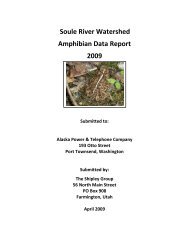
Fish habitat survey – conducted by ADF&G in 1995 through a contract with<br />
Haines Light & <strong>Power</strong>, the utility at that time. No fish were found in Connelly<br />
Lake or in the outlet stream down to the Chilkoot River. Fish surveys were<br />
conducted between September 25 <strong>and</strong> September 28, 2011, by The Shipley<br />
Group, a contractor for GLH. The surveys took place along the access road<br />
streams <strong>and</strong> above Chilkoot Lake. At the time of these surveys ADF&G was also<br />
surveying the Chilkoot River Valley above Chilkoot Lake.<br />
Geotechnical survey – a preliminary geotech survey was conducted in 1993 <strong>and</strong><br />
found that:<br />
o The dam axis is characterized by massive, relatively solid diorite bedrock<br />
at each abutment. Between the abutments, an overburden of boulders,<br />
peat, <strong>and</strong> s<strong>and</strong> were found to a depth of up to 36-inches.<br />
o The powerhouse site (upper riverside site [Northerly]) is situated on an<br />
inactive floodplain terrace. The upper 2’ of soil consists of clean s<strong>and</strong>,<br />
which is underlain by s<strong>and</strong>y gravel <strong>and</strong> the terrace as seen in a riverbank<br />
cut consists of dense course gravel in a s<strong>and</strong> matrix. The terrace soil abuts<br />
steeply sloping diorite bedrock which would be a good source of borrow<br />
for rip rap <strong>and</strong> embankment construction.<br />
Hydrology evaluation – a preliminary evaluation to determine average annual<br />
<strong>and</strong> average monthly stream flow for energy production was made in 1993.<br />
Figure 8 above shows the difference between the Chilkoot River drainage <strong>and</strong><br />
Connelly Lakes drainage, which is significantly smaller. The PAD also contains a<br />
table comparing the Connelly Lake USGS gage data with ADF&G gage data at<br />
the river mouth <strong>and</strong> correlation with other nearby drainages. The hydrology<br />
evaluation will continue until more gage data is collected.<br />
Baseline environmental assessment – The USF&WS, 29 helped us narrow down<br />
the TEC species we need to evaluate for this document. We were advised to<br />
29 Personal e-mail communication with Steve Brockman, USF&WS, on March 8, 2012.<br />
<strong>Draft</strong> <strong>Study</strong> <strong>Plan</strong> – June 2012 p. 40 Connelly Lake Hydroelectric Project