Draft Study Plan Vol 1 (PDF) - Alaska Power and Telephone Company
Draft Study Plan Vol 1 (PDF) - Alaska Power and Telephone Company
Draft Study Plan Vol 1 (PDF) - Alaska Power and Telephone Company

Create successful ePaper yourself
Turn your PDF publications into a flip-book with our unique Google optimized e-Paper software.
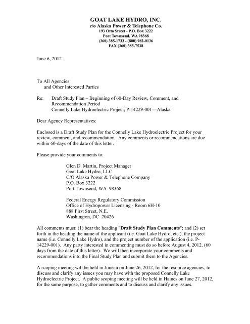
June 6, 2012<br />
To All Agencies<br />
<strong>and</strong> Other Interested Parties<br />
Re:<br />
<strong>Draft</strong> <strong>Study</strong> <strong>Plan</strong> – Beginning of 60-Day Review, Comment, <strong>and</strong><br />
Recommendation Period<br />
Connelly Lake Hydroelectric Project; P-14229-001—<strong>Alaska</strong><br />
Dear Agency Representatives:<br />
Enclosed is a <strong>Draft</strong> <strong>Study</strong> <strong>Plan</strong> for the Connelly Lake Hydroelectric Project for your<br />
review, comment, <strong>and</strong> recommendation. Any comments or recommendations are due<br />
within 60-days of the date of this letter.<br />
Please provide your comments to:<br />
Glen D. Martin, Project Manager<br />
Goat Lake Hydro, LLC<br />
C/O <strong>Alaska</strong> <strong>Power</strong> & <strong>Telephone</strong> <strong>Company</strong><br />
P.O. Box 3222<br />
Port Townsend, WA 98368<br />
Federal Energy Regulatory Commission<br />
Office of Hydropower Licensing - Room 6H-10<br />
888 First Street, N.E.<br />
Washington, DC 20426<br />
All comments must: (1) bear the heading "<strong>Draft</strong> <strong>Study</strong> <strong>Plan</strong> Comments"; <strong>and</strong> (2) set<br />
forth in the heading the name of the applicant (i.e. Goat Lake Hydro, etc.), the project<br />
name (i.e. Connelly Lake Hydro), <strong>and</strong> the project number of the application (i.e. P-<br />
14229-001). Any party interested in commenting must do so before August 4, 2012. (60<br />
days from the date of this letter). We will then incorporate your comments <strong>and</strong><br />
recommendations into the Final <strong>Study</strong> <strong>Plan</strong> <strong>and</strong> submit them to the Agencies.<br />
A scoping meeting will be held in Juneau on June 26, 2012, for the resource agencies, to<br />
discuss <strong>and</strong> clarify any issues you may have with the proposed Connelly Lake<br />
Hydroelectric Project. A public scoping meeting will be held in Haines on June 27, 2012,<br />
for the same purpose, to gather comments <strong>and</strong> to discuss <strong>and</strong> clarify any issues.
All Agencies <strong>and</strong> Other Interested Parties p. 2 Connelly Lake Hydroelectric Project<br />
June 6, 2012<br />
P-14229-001<br />
The June 26 scoping meeting will be held at:<br />
Federal Building<br />
NOAA Sustainable Fisheries Conference Room<br />
709 W. 9th St.,<br />
Juneau, <strong>Alaska</strong><br />
Tuesday, June 26, 9 a.m. – Noon<br />
The teleconference line for those unable to attend is 907-585-7060. When you call in<br />
please wait for a roll call so that we can record who is in attendance.<br />
The June 27 scoping meeting in Haines will be held at the:<br />
Borough of Haines<br />
Assembly Chambers<br />
213 Haines Highway<br />
Haines, <strong>Alaska</strong><br />
6 p.m. – 8 p.m.<br />
There will be no teleconference line for this meeting.<br />
If you have any questions, please call me at (360) 385-1733 x122.<br />
Sincerely,<br />
Glen D. Martin<br />
Project Manager<br />
(360) 385-1733 x122<br />
(360) 385-7538 fax<br />
glen.m@aptalaska.com<br />
Enc. (as stated)
All Agencies <strong>and</strong> Other Interested Parties p. 3 Connelly Lake Hydroelectric Project<br />
June 6, 2012<br />
P-14229-001<br />
CONNELLY LAKE HYDROELECTRIC PROJECT<br />
P-14229-001<br />
AGENCY MEETING AGENDA FOR JUNE 26, 2012<br />
Meeting Time: 9 a.m. – Noon<br />
Teleconference Line: 907-586-7060<br />
Location: Federal Building, 709 W. 9th St., Sustainable Fisheries Conference Room,<br />
4th Floor, Juneau, <strong>Alaska</strong><br />
AGENDA<br />
1. Roll Call & Sign in Sheet<br />
2. Opening Remarks about <strong>Draft</strong> <strong>Study</strong> <strong>Plan</strong><br />
3. <strong>Power</strong>Point Presentation about the Project<br />
4. Discussion <strong>and</strong> Questions<br />
5. Adjournment
All Agencies <strong>and</strong> Other Interested Parties p. 4 Connelly Lake Hydroelectric Project<br />
June 6, 2012<br />
P-14229-001<br />
CONNELLY LAKE HYDROELECTRIC PROJECT<br />
P-14229-001<br />
PUBLIC MEETING AGENDA FOR JUNE 27, 2012<br />
Meeting Time: 6 p.m. – 8 p.m.<br />
Location: Haines Borough Assembly Chambers, 213 Haines Highway, Haines,<br />
<strong>Alaska</strong><br />
AGENDA<br />
1. Roll Call & Sign in Sheet<br />
2. Opening Remarks about <strong>Draft</strong> <strong>Study</strong> <strong>Plan</strong><br />
3. <strong>Power</strong>Point Presentation about the Project<br />
4. Discussion <strong>and</strong> Questions<br />
5. Adjournment
DRAFT DOCUMENT<br />
CONNELLY LAKE HYDROELECTRIC PROJECT<br />
P – 14229 – 000 – ALASKA<br />
DRAFT STUDY PLAN<br />
FOR<br />
GOAT LAKE HYDRO, INC.<br />
c/o ALASKA POWER & TELEPHONE COMPANY<br />
P.O. BOX 3222<br />
PORT TOWNSEND, WA 98368<br />
(360) 385-1733<br />
June 2012
DRAFT DOCUMENT<br />
CONNELLY LAKE HYDROELECTRIC PROJECT<br />
DRAFT STUDY PLAN<br />
TABLE OF CONTENTS<br />
Page<br />
1. INTRODUCTION........................................................................................ 1<br />
2. PROJECT DESIGN ………………………………….................….……… 1<br />
3. PROJECT OPERATIONS ……………………………………………...... 10<br />
4. EXISTING ENVIRONMENT …………………………………………...... 12<br />
5. DRAFT STUDY PLAN ………………………………………………......... 40<br />
APPENDICES<br />
A. 11x17 Project Diagrams<br />
B. Flow Duration Curves<br />
C. 2011 <strong>Draft</strong> Fish Survey Report (incomplete without 2012 survey)<br />
D. 2011 Geotechnical Reconnaissance <strong>Study</strong> / plus the 1995 HL&P Report<br />
E. 1994-1997 USGS Gage Record for Connelly Lake<br />
F. Water Quality Sampling Results (2011-2012)<br />
G. Stream gaging Connelly Lake Outlet (GLH started September 2011)<br />
H. Connelly Lake, Outlet Stream, <strong>and</strong> Chilkoot River Fish Habitat Survey,<br />
(ADF&G, 1995)<br />
I. Catalog of Waters Important for the Spawning, Rearing or Migration of<br />
Anadromous Fishes (ADF&G – 2005)<br />
J. Connelly Lake Reconnaissance Photos, (GLH – 2008)<br />
K. <strong>Draft</strong> <strong>Study</strong> <strong>Plan</strong> Consultation<br />
L. References<br />
M. Mailing List<br />
LIST OF FIGURES<br />
Figure 1: Project Location <strong>and</strong> Features Map .................................................................... 2<br />
Figure 2: Project Alternatives being considered ................................................................ 3<br />
Figure 3: Alternative Design 1 (PAD-2) ............................................................................ 4<br />
Figure 4: Alternative Design 2 (PAD-3) ............................................................................ 5<br />
Figure 5: Alternative Design 3 (PAD-4) ........................................................................... 7<br />
Figure 6: Alternative Design 4 (PAD-5) ........................................................................... 8<br />
Figure 7: Photo – Cruise Ships Docked in Skagway Creating Blue Smog ......................11<br />
Figure 8: Comparison of Drainage Areas ....................................................... .................14<br />
Figure 9: Chilkoot River Valley Wetl<strong>and</strong>s .................. ....................................................16<br />
Figure 10: Photo Collage of Upper Chilkoot River Valley ..............................................18<br />
Figure 11: Logging Road <strong>and</strong> Fish Sampling Locations ..................................................20
DRAFT DOCUMENT<br />
Figure 12: New bridge for Field Studies ...........................................................................21<br />
Figure 13: Chilkoot River Valley Wetl<strong>and</strong>s with Important Fish Habitat Overlay ..........22<br />
Figure 14: USF&WS Map of Bald Eagle Nests................................................................26<br />
Figure 15: Photo – Stereoscopic view of Connelly Lake; North Facing Cliffs ................30<br />
Figure 16: Photo – View Across Connelly Lake at North Facing Cliffs ..........................30<br />
Figure 17: Major Stellar Sea Lion Haulouts of Lynn Canal .............................................33<br />
Figure 18: L<strong>and</strong> Management <strong>and</strong> Ownership Map .........................................................35<br />
Figure 19: Photo – View North of Chilkoot Lake from State Campground .....................37<br />
Figure 20: Photo – View North of Chilkoot Lake from State Campground .....................37<br />
LIST OF TABLES<br />
Table 1: Dam Height Options ........................................................................................... 6<br />
Table 2: Reservoir Size .................................................................................................... 9<br />
Table 3: Transmission Line Segment Lengths ................................................................ 10<br />
Table 4: Mean & Correlated Recorded Average Daily Flows.......................................... 15<br />
Table 5: Subunit 1-D Annual Moose Harvest By Community ........................................ 24<br />
ACRONYMS AND TERMINOLOGY<br />
ACY<br />
ACMP<br />
ADCA<br />
ADEC<br />
ADF&G<br />
ADNR<br />
AEA<br />
AMHS<br />
ANB/ANS<br />
ANILCA<br />
ANCSA<br />
B.C.<br />
BLM<br />
BMP<br />
CFR<br />
Cfs<br />
DGGS<br />
DPOR<br />
DOTPF<br />
EIS<br />
FAA<br />
FEMA<br />
FERC<br />
GIS<br />
GLH<br />
acre-feet per year<br />
<strong>Alaska</strong> Coastal Management Program<br />
<strong>Alaska</strong> Division of Community Advocacy<br />
<strong>Alaska</strong> Department of Environmental Conservation (DEC)<br />
<strong>Alaska</strong> Department of Fish & Game<br />
<strong>Alaska</strong> Department of Natural Resources (DNR)<br />
<strong>Alaska</strong> Energy Authority<br />
<strong>Alaska</strong> Marine Highway System<br />
<strong>Alaska</strong> Native Brotherhood/<strong>Alaska</strong> Native Sisterhood<br />
<strong>Alaska</strong> National Interest L<strong>and</strong> Conservation Act<br />
<strong>Alaska</strong> Native Claims Settlement Act<br />
British Columbia<br />
Bureau of L<strong>and</strong> Management<br />
Best Management Practices<br />
Code of Federal Regulations<br />
cubic feet per second<br />
Division of Geological <strong>and</strong> Geophysical Services<br />
Department of Parks <strong>and</strong> Outdoor Recreation<br />
Department of Transportation <strong>and</strong> Public Facilities<br />
Environmental Impact Statement<br />
Federal Aviation Administration<br />
Federal Emergency Management Agency<br />
Federal Energy Regulatory Commission (a.k.a. “Commission”)<br />
geographical information system<br />
Goat Lake Hydro, Inc.
DRAFT DOCUMENT<br />
GWh<br />
HCMP<br />
HL&P<br />
ILP<br />
IPEC<br />
IRA<br />
KWh<br />
MBF<br />
mg/L<br />
MHW<br />
MLLW<br />
NMFS<br />
NOAA<br />
MWh<br />
NRCS<br />
NSRAA<br />
ppm<br />
TLP<br />
TMDL<br />
TWC<br />
USACE<br />
USEPA<br />
USF&WS<br />
USGS<br />
gigawatt-hour (1,000 megawatt-hours)<br />
Haines Coastal Management <strong>Plan</strong><br />
Haines Light & <strong>Power</strong> <strong>Company</strong><br />
Integrated Licensing Process<br />
Inside Passage Electric Cooperative<br />
Indian Reorganization Act (Federally recognized Tribal entities)<br />
kilowatt-hour (1,000 watt-hours)<br />
Million Board Feet<br />
milligrams per liter<br />
mean high water<br />
Mean Lower Low Water<br />
National Marine fisheries Service<br />
National Oceanographic <strong>and</strong> Atmospheric Administration<br />
megawatt-hour (1,000 kilowatt-hours)<br />
National Resource Conservation Service<br />
Northern Southeast Regional Aquaculture Association<br />
parts per million<br />
Traditional Licensing Process<br />
total maximum daily load<br />
Takshanuk Watershed Council<br />
U.S. Army Corps of Engineers<br />
U.S. Environmental Protection Agency<br />
U.S. Fish & Wildlife Service<br />
U.S. Geological Survey
DRAFT DOCUMENT<br />
CONNELLY LAKE HYDROELECTRIC PROJECT<br />
P-14229<br />
DRAFT STUDY PLAN<br />
1.0 INTRODUCTION<br />
The proposed Connelly Lake Hydroelectric Project (Project) will be located in<br />
Southeast <strong>Alaska</strong>, approximately 14 miles northwest of the City of Haines <strong>and</strong> 10 miles<br />
southwest of the City of Skagway, as shown in Figure 1. Connelly Lake (formerly<br />
known as Upper Chilkoot Lake) is a 90 acre alpine lake that drains into the Chilkoot<br />
River. The project will be on state <strong>and</strong> private l<strong>and</strong>, including the Haines State Forest<br />
<strong>and</strong> Chilkat Bald Eagle Preserve. 1<br />
2.0 PROJECT DESIGN<br />
Four different project designs are currently being considered, listed below. Field<br />
studies including economic <strong>and</strong> geotechnical analysis will influence the choice of the<br />
final design. The project designs being considered are as follows (a more complete<br />
description can be found in the Preliminary Application Document (PAD):<br />
Alternative 1 – No dam, siphon intake, surface penstock, upstream powerhouse location.<br />
This alternative, shown in Figure 3, would be a project similar in design to Goat<br />
Lake Hydro (GLH) existing Goat Lake <strong>and</strong> Black Bear Lake Hydroelectric Projects. The<br />
active storage would be limited to that available from the existing lake with a siphon<br />
intake. Due to the limited storage, the project would not be able to serve either Haines or<br />
cruise ship loads with 100% reliability.<br />
Access Road<br />
The existing access road (RS 2477) would be rebuilt along the west side of<br />
Chilkoot Lake <strong>and</strong> above the lake. This road would be a built for long term use with a<br />
better surface <strong>and</strong> appurtenances, i.e. culverts, bridges, than a logging road.<br />
A section of new access road about 1/4 mile long would be constructed to connect<br />
the existing road to the powerhouse, including a bridge across the Chilkoot River. The<br />
Chilkoot River in that area is quite dynamic, <strong>and</strong> the road design would need to allow for<br />
channel migration, probably by including multiple bridge spans.<br />
Dam<br />
The existing lake storage would be utilized through construction of a siphon<br />
intake, rather than use a dam. The active storage would be limited to the 1,250 acre-feet<br />
available with a drawdown of 20 feet (from the existing lake level at El 2278 to El 2258).<br />
Work at the lake would be limited to excavation of a 1,500-foot-long drawdown trench<br />
for the siphon pipe through a saddle in the ground at the south end of the lake, installation<br />
of the intake screen structure in the lake <strong>and</strong> the siphon pipe in the trench, installation of<br />
1 Chilkat Bald Eagle Preserve is managed by DNR Parks <strong>and</strong> Outdoor Recreation.<br />
<strong>Draft</strong> <strong>Study</strong> <strong>Plan</strong> – June 2012 p. 1 Connelly Lake Hydroelectric Project
DRAFT DOCUMENT<br />
the siphon pump <strong>and</strong> control house, <strong>and</strong> construction of a small dam in the drawdown<br />
trench to prevent flow through that cut when the lake level is high. The saddle dam<br />
would be about 10 feet high <strong>and</strong> constructed of rock fill with an upstream concrete face.<br />
All equipment, materials, <strong>and</strong> personnel for the intake <strong>and</strong> saddle dam construction would<br />
be transported by helicopter to the intake site from a staging area near the powerhouse.<br />
Figure 1: Project Location <strong>and</strong> Features<br />
<strong>Draft</strong> <strong>Study</strong> <strong>Plan</strong> – June 2012 p. 2 Connelly Lake Hydroelectric Project
DRAFT DOCUMENT<br />
Figure 2: Project Alternatives being evaluated<br />
Penstock<br />
Buried 36-54 inch pipe in drawdown trench. The uppermost section of<br />
penstock would be about 2,300 feet long; of that length, 300 feet would be submerged in<br />
the lake, 1500 feet would be buried in the drawdown trench, <strong>and</strong> 500 feet would be<br />
buried on a bench cut into the hillside at the southern end of the drawdown trench.<br />
Surface penstock in cleared corridor. From the end of the uppermost penstock<br />
section described above (at about El 2250), the penstock would drop straight down the<br />
hillside for about 3,500 feet to about El 350. The pipe would be supported by fabricated<br />
steel saddles spaced about 40 feet apart. The ground would be excavated to bedrock at<br />
the saddle locations, <strong>and</strong> in a few areas a trench might be required for the pipe where<br />
there is a deep layer of soils or loose rock. Clearing width for the penstock corridor<br />
would be about 100 feet to decrease the risk to the pipe from falling trees. Penstock<br />
installation would be by a highline system.<br />
Buried penstock on excavated bench. From the end of the middle penstock<br />
section described above, the penstock would be located on a bench excavated into the<br />
hillside in a valley cut by a small tributary of the Chilkoot River referred to as <strong>Power</strong><br />
Creek. This section of penstock would be about 900 feet long, <strong>and</strong> would end at the<br />
<strong>Draft</strong> <strong>Study</strong> <strong>Plan</strong> – June 2012 p. 3 Connelly Lake Hydroelectric Project
DRAFT DOCUMENT<br />
powerhouse at the base of the hillside. After installation, this section would be buried to<br />
protect the pipe from falling trees <strong>and</strong> rocks.<br />
Figure 3: Alternative Design 1<br />
<strong>Power</strong>house<br />
The powerhouse would be a pre-engineered metal building with a reinforced<br />
concrete foundation, <strong>and</strong> would house either one or two generating units, depending on<br />
the installed capacity. With one unit, the powerhouse dimensions would be<br />
approximately 50 feet by 70 feet by 40 feet high above the top of the surrounding<br />
backfill. With two units, the powerhouse dimensions would be approximately 50 feet by<br />
100 feet by 40 feet high. The floor level of the powerhouse would be at about El 170.<br />
The powerhouse would be located on the east side of the Chilkoot valley<br />
approximately 1100 feet downstream of the confluence of Connelly Creek <strong>and</strong> the<br />
Chilkoot River <strong>and</strong> approximately 300 feet upstream of <strong>Power</strong> Creek. There is a<br />
floodplain terrace of varying width between the base of the hillside <strong>and</strong> the river channel.<br />
The powerhouse would be located partially on this terrace <strong>and</strong> partially on an excavation<br />
into the hillside. There are isolated bedrock exposures on the hillside, <strong>and</strong> GLH<br />
anticipates founding the major portion of the powerhouse on bedrock.<br />
Spoils from the powerhouse excavation would be used for backfill around the<br />
powerhouse. The fill would be as much as 20 feet deep. The fill slopes would be<br />
armored with riprap to protect it from erosion by floodwaters of the Chilkoot River.<br />
<strong>Draft</strong> <strong>Study</strong> <strong>Plan</strong> – June 2012 p. 4 Connelly Lake Hydroelectric Project
DRAFT DOCUMENT<br />
Tailrace<br />
The tailrace would be an excavated <strong>and</strong> riprap-lined channel from the powerhouse<br />
to the main channel of the Chilkoot River that runs near the base of the hillside. The<br />
tailrace would be about 200 feet long with a base width of 50 feet. The tailrace would<br />
not discharge into <strong>Power</strong> Creek, as was proposed by Haines Light & <strong>Power</strong> (HL&P) in<br />
their proposal for the project in the 1990s.<br />
Switchyard<br />
A switchyard would be located on the powerhouse fill over the existing floodplain<br />
terrace described above. The switchyard would have plan dimensions of approximately<br />
60 feet by 100 feet. The toe of the fill for the switchyard would be a minimum of 75 feet<br />
from <strong>Power</strong> Creek.<br />
Alternative 2 – Dam at Connelly Lake outlet, siphon intake, surface penstock, upstream<br />
powerhouse location.<br />
Alternative 2, shown in Figure 4, would be the same as Alternative 1 except that a<br />
dam would be constructed at the outlet of Connelly Lake to provide additional storage.<br />
Figure 4: Alternative Design 2<br />
<strong>Draft</strong> <strong>Study</strong> <strong>Plan</strong> – June 2012 p. 5 Connelly Lake Hydroelectric Project
DRAFT DOCUMENT<br />
Dam<br />
Dam Type: Because there would not be a road to the Connelly Lake dam site,<br />
GLH believes the most economical type of dam would be a rockfill dam, with the rockfill<br />
derived from a quarry near the dam site.<br />
GLH believes that the most suitable dam types would be either a concrete-faced<br />
rockfill dam or a rockfill dam with an upstream geomembrane protected by riprap; both<br />
options will be evaluated. Rockfill volumes would not be significantly different between<br />
the two types, <strong>and</strong> GLH does not expect any significantly differing environmental<br />
impacts. Both types can be developed with acceptable levels of safety for the seismic<br />
environment of the site.<br />
Dam Height: Compared to a low dam, a higher dam would provide more storage<br />
<strong>and</strong> greater generation, but at greater cost. GLH will evaluate the costs <strong>and</strong> benefits of<br />
four dam heights to provide a basis for the final selection, as shown in the following<br />
Table I. The highest dam (75 feet high with the crest at El 2350) is about the maximum<br />
that can be constructed using a rockfill type of dam with appropriate face slopes. GLH<br />
recommends that the highest dam option be the basis for study requests.<br />
Table I: Dam Height Options<br />
Dam height, feet 0 (1) 25 50 75<br />
Dam crest elevation, feet N.A. 2300 2325 2350<br />
Normal maximum water<br />
surface elevation, feet<br />
2278 (2) 2290 2315 2340<br />
Active storage, acre-feet (3) 1,250 2,640 6,380 10,630<br />
(1) Use existing lake only (no dam, i.e. Alternative 1)<br />
(2) Approximate existing lake elevation<br />
(3) Between El 2258 <strong>and</strong> the normal maximum water surface elevation<br />
Transportation: Construction materials, equipment, <strong>and</strong> personnel would need<br />
to be transported to the dam site from the powerhouse area. Initially, this would need to<br />
be accomplished by helicopter; a heavy-lift helicopter would be necessary for large<br />
pieces of equipment on a one-time basis, but personnel, materials, <strong>and</strong> tools would<br />
require only a smaller machine on a daily basis.<br />
GLH will also evaluate the feasibility of using the highline system for<br />
transportation to the dam site. Note that with the proposed rockfill type of dam,<br />
construction materials to be brought up to the dam site would be mostly cement,<br />
reinforcing steel, form plywood, diesel fuel, <strong>and</strong> explosives; rock, s<strong>and</strong>, <strong>and</strong> gravel would<br />
be derived from excavations up at the dam site.<br />
Spillway<br />
For reliability <strong>and</strong> ease of maintenance, GLH would use an ungated spillway with<br />
a concrete control weir. GLH believes that it would be appropriate to size the spillway to<br />
pass the Probable Maximum Flood (PMF) with the water level at or below the dam crest.<br />
<strong>Draft</strong> <strong>Study</strong> <strong>Plan</strong> – June 2012 p. 6 Connelly Lake Hydroelectric Project
DRAFT DOCUMENT<br />
The concrete control weir would discharge into an excavated channel parallel to<br />
the toe of the dam, ultimately discharging into the existing stream channel below the<br />
dam.<br />
Intake <strong>and</strong> Outlet Works<br />
For all dam height options, GLH would construct a siphon intake to allow use of<br />
the storage volume of the existing lake.<br />
GLH also expects to install an outlet works facility to allow lowering of the lake<br />
level (in addition to the release through the power facilities) for dam inspection <strong>and</strong><br />
maintenance.<br />
Alternative 3 – Dam at Connelly Lake outlet, siphon intake, tunnel <strong>and</strong> raise bore<br />
penstock, upstream powerhouse location.<br />
Alternative 3, as shown in Figure 5, is similar to Alternative 2 with regard to the<br />
dam, powerhouse, <strong>and</strong> access road, however the penstock would be replaced with a nearhorizontal<br />
tunnel into the hillside from the powerhouse <strong>and</strong> a near-vertical shaft (“raise<br />
bore”) to the dam site. The tunnel would be about 10-12 feet in horseshoe diameter, <strong>and</strong><br />
5,000 feet long.<br />
Figure 5: Alternative Design 3<br />
With this arrangement for the penstock, the drawdown trench can be located<br />
through a lower small saddle closer to the lake outlet. The drawdown trench can end at<br />
the spillway channel, which would decrease its length significantly. Also, the outlet<br />
works could be located in the drawdown trench, <strong>and</strong> discharge into the spillway channel.<br />
<strong>Draft</strong> <strong>Study</strong> <strong>Plan</strong> – June 2012 p. 7 Connelly Lake Hydroelectric Project
DRAFT DOCUMENT<br />
Alternative 4 – Dam at Connelly Lake outlet, siphon intake, surface penstock,<br />
downstream powerhouse location.<br />
In the 1990’s, HL&P considered an alternative that placed the powerhouse about<br />
2 miles downstream of the confluence of Connelly Creek <strong>and</strong> the Chilkoot River, with a<br />
road <strong>and</strong> adjacent penstock up the hillside to the lake. They concluded that a road was<br />
possible up to a bench at about the 1500 feet elevation, but that steep cliffs <strong>and</strong> boulder<br />
fields precluded a road all the way to the lake. GLH has reviewed that information <strong>and</strong><br />
agrees that road access to the lake is not possible with the route considered by HL&P.<br />
However, GLH believes that a different alignment for a road to the dam area may be<br />
feasible, as shown in Figure 6.<br />
Note that much of this alignment is based on the rather crude topography of the<br />
USGS 15 minute quadrangles. GLH will obtain more detailed topographic mapping of<br />
the proposed alignment if an initial evaluation <strong>and</strong> field reconnaissance determines there<br />
is significant economy to be gained. GLH underst<strong>and</strong>s that the road may have a<br />
substantial environmental impact.<br />
Figure 6: Alternative Design 4<br />
The preliminary road alignment shown in Figure 6 is 3.5 miles long, including 0.3<br />
miles at a nearly level grade in the Chilkoot Valley from the existing road to the<br />
powerhouse, 2.5 miles up the hillside at a nearly constant grade of 16%, <strong>and</strong> 0.7 miles at<br />
a nearly level grade to the dam area. The penstock would be similar to Alternatives 1<br />
<strong>and</strong> 2, with buried HDPE, ductile iron, or steel pipe in the upper section (about 6,000 feet<br />
<strong>Draft</strong> <strong>Study</strong> <strong>Plan</strong> – June 2012 p. 8 Connelly Lake Hydroelectric Project
DRAFT DOCUMENT<br />
long), <strong>and</strong> saddle supported steel pipe from the upper section to the powerhouse<br />
(about 4,100 feet long). The lower section of penstock would be installed with a highline<br />
system.<br />
The powerhouse would be similar in design to that described previously.<br />
Mapping by HL&P indicates there is a suitable terrace on which to locate the<br />
powerhouse. Aerial photography <strong>and</strong> the mapping indicates the Chilkoot River channel<br />
may be more stable in this area than the upper powerhouse location of Alternatives 1, 2,<br />
<strong>and</strong> 3, <strong>and</strong> thus a bridge over the river at this location may be more suitable. Other<br />
advantages to this downstream powerhouse location are the 1) a slightly higher head, 2)<br />
shorter length of transmission line, 3) shorter length of existing road rehabilitation,<br />
including avoidance of one particularly bad section that has all but been washed out by<br />
the river.<br />
Impoundment<br />
As noted above, GLH recommends that for the purposes of this PAD, the largest<br />
possible impoundment should be considered for study planning purposes:<br />
Table 2: Reservoir Size<br />
Normal maximum water<br />
surface elevation, feet<br />
Normal maximum water<br />
surface area, acres<br />
Gross storage capacity,<br />
acre-feet<br />
Normal minimum water<br />
surface elevation, feet<br />
Existing Lake<br />
Proposed Reservoir<br />
2278 2340<br />
90 183<br />
2140 11,520<br />
2278 2258<br />
Active storage, acre-feet NA 10,630<br />
Turbines <strong>and</strong> Generators<br />
Turbines<br />
As noted above, GLH has not yet determined the appropriate installed capacity,<br />
<strong>and</strong> is considering 6 MW <strong>and</strong> 12 MW installations. GLH recommends that for the<br />
purposes of this <strong>Draft</strong> <strong>Study</strong> <strong>Plan</strong>, that a 12 MW installation should be considered. If one<br />
or two generators are installed, both would have a minimum hydraulic capacity of 5 cfs<br />
<strong>and</strong> a maximum hydraulic capacity of 45 cfs.<br />
Primary Transmission Line<br />
With the upper powerhouse location (Alternatives 1, 2, <strong>and</strong> 3), the transmission<br />
line would be 12.8 miles long from the substation to an interconnection with GLH<br />
existing system approximately 4 miles north of Haines. With the lower powerhouse<br />
location (Alternative 4), the transmission line would be 10.9 miles long. Transmission<br />
voltage would be 34.5 kV. GLH expects that all of the line will be buried power cable<br />
<strong>Draft</strong> <strong>Study</strong> <strong>Plan</strong> – June 2012 p. 9 Connelly Lake Hydroelectric Project
DRAFT DOCUMENT<br />
due to the proximity to the Chilkoot Bald Eagle Preserve <strong>and</strong> avalanche chutes<br />
along Chilkoot Lake. Estimated lengths of various line segments are indicated below:<br />
Table 3<br />
Transmission Line Segment Lengths, miles<br />
Line Type<br />
Upper <strong>Power</strong>house Lower <strong>Power</strong>house<br />
(Alts. 1, 2, <strong>and</strong> 3) (Alternative 4)<br />
Buried cable adjacent to new<br />
road in Chilkoot Valley.<br />
0.3 0.1<br />
Buried cable adjacent to<br />
rehabilitated road in Chilkoot<br />
8.8 7.1<br />
Valley.<br />
Buried cable adjacent to<br />
highway along Lutak Inlet in<br />
existing conduit<br />
3.7 3.7<br />
Total 12.8 10.9<br />
Mode of Operation<br />
3.0 PROJECT OPERATIONS<br />
GLH expects to operate the Project solely for power generation, subject to the<br />
constraints to be determined during licensing. Because GLH’s Upper Lynn Canal (ULC)<br />
system is isolated with most existing generation from existing hydro units, the actual<br />
mode of operation would depend on the system loads. The Connelly Lake Project would<br />
be operated similarly to the Goat Lake project, with their generation varied as necessary<br />
to maintain comparable storage levels. Either Goat Lake or Connelly Lake could be<br />
operated in the lead position, with the other in lag if operated during the winter solely for<br />
Haines <strong>and</strong> Skagway power.<br />
If for some reason the submarine cable linking Haines <strong>and</strong> Skagway was out of<br />
service, the mode of operation would be similar to that described above, except that the<br />
Goat Lake <strong>and</strong> possibly the Kasidaya projects would not be available to meet Haines<br />
loads. The Connelly Lake Project would be in lead position, supplying all Haines loads<br />
in excess of those supplied by the Lutak, 10-Mile, <strong>and</strong> (possibly) Kasidaya projects.<br />
During the summer months, Haines <strong>and</strong> Skagway are destinations for large cruise<br />
ships. Currently, those ships run their on-board fossil-fuel generation systems to meet<br />
their ship loads, which are substantial (7-12 MW, depending on the size of the ship). If<br />
the installed capacity of the Project is sized appropriately, it would be possible to supply<br />
power to at least one ship, as is currently done in Juneau. The Applicant will investigate<br />
the feasibility of this type of operation, as it could have substantial benefits, as follows:<br />
<br />
It would supply a revenue stream for the Project during the early years of<br />
its operation when the native loads are modest.<br />
<strong>Draft</strong> <strong>Study</strong> <strong>Plan</strong> – June 2012 p. 10 Connelly Lake Hydroelectric Project
DRAFT DOCUMENT<br />
<br />
<br />
If priced appropriately, the cost of power to the cruise lines would be less<br />
than on-board generation, enhancing the cruise line’s economics <strong>and</strong><br />
helping to maintain Haines <strong>and</strong> Skagway as desirable destinations.<br />
Air quality would improve, particularly in Skagway, where the stack<br />
exhaust from cruise ships frequently creates a smoggy condition <strong>and</strong> is<br />
adversely affecting hillside vegetation.<br />
Figure 7: Cruise Ships Docked in Skagway Creating Blue Smog<br />
The mode of operation in this scenario would be similar to that described above,<br />
except the loads would be increased. The cruise ship load itself is relatively constant, but<br />
intermittent. Therefore, there would be increased fluctuations of the power plant<br />
discharge compared to serving on the existing loads. Note though that the cruise ship<br />
load would occur during the summer months when streamflows are highest <strong>and</strong> the<br />
Project discharge would usually be only a small part of the overall flow of the Chilkoot<br />
River.<br />
Ramping Rates<br />
Ramping rates are likely to be a requirement for protection of the anadromous fish<br />
in the Chilkoot River. It is too early to define the exact ramping rates, typically they are<br />
in the range of 2-4 inches per hour. Preliminarily, GLH expects that the maximum plant<br />
discharge of 90 cfs (for a 12 MW installed capacity) represents about 3” of stage change<br />
in the Chilkoot River at low flows <strong>and</strong> less than 1” of stage change during high flows.<br />
<strong>Draft</strong> <strong>Study</strong> <strong>Plan</strong> – June 2012 p. 11 Connelly Lake Hydroelectric Project
DRAFT DOCUMENT<br />
Flushing Flows<br />
GLH does not expect that flushing flows will be a requirement of the license. The<br />
drainage area of the Project is only about 4% of the drainage area of the Chilkoot River.<br />
Thus, any flushing releases from the Project would have little effect.<br />
4.0 EXISTING ENVIRONMENT<br />
HL&P, which was purchased by <strong>Alaska</strong> <strong>Power</strong> & <strong>Telephone</strong> <strong>Company</strong> (AP&T),<br />
initiated field work on Connelly Lake, Chilkoot Lake, <strong>and</strong> along the access road, RS<br />
2477, in the 1990’s. A fish survey was conducted in 1995 by ADF&G (report enclosed)<br />
that found no fish in Connelly Lake or in its outlet stream (anadromous barrier found near<br />
its confluence with the Chilkoot River).<br />
The project boundary with project features is shown above in Figure 1. Figure 1<br />
also shows topography of Chilkoot Lake <strong>and</strong> Connelly Lake <strong>and</strong> the surrounding area, all<br />
of which are in the Haines State Forest.<br />
Below is background information about the Chilkoot River Valley <strong>and</strong> Chilkoot<br />
Lake.<br />
Geography of the <strong>Study</strong> Area<br />
The Skagway (B-2) Quadrangle, as shown in part in Figure 1, lies north of Haines<br />
<strong>and</strong> west of Skagway at the upper end of Lynn Canal. The region is very steep <strong>and</strong><br />
rugged, with high dissected mountains, numerous high-gradient streams that discharge<br />
into rivers occupying broad glaciated valleys with an array of glaciers <strong>and</strong> glacier-related<br />
erosional <strong>and</strong> depositional features; at least eight major glacial cycles have occurred,<br />
carving out valleys, grinding down rock <strong>and</strong> depositing moraines <strong>and</strong> layers of glacial till.<br />
A warming of the climate caused a general retreat of late Pleistocene ice that ended<br />
approximately 6-7 thous<strong>and</strong> years ago. At that time <strong>Alaska</strong>'s glaciers were reduced to<br />
their present size or smaller.<br />
Post-glacial rebound, the uplift of terrain after the weight of glaciation is<br />
removed, causes measurable elevation increases, especially along shorelines, mud flats,<br />
<strong>and</strong> riverine basins. The presence of emergent marine deposits several hundred feet<br />
above sea level demonstrates that the l<strong>and</strong> has been uplifted relative to sea level since the<br />
last major deglaciation of the region about 10,000 years ago. The rate of rebound has<br />
been constant in this century <strong>and</strong> has been recorded at as high as 1.6 inches per year in<br />
the region <strong>and</strong> 0.9 inches in the Haines townsite area. 2<br />
Small glaciers are common on the higher peaks of the quadrangle, <strong>and</strong> glacial<br />
processes have been important in its recent history. Peaks below 4,000 feet show<br />
distinctively rounded summits <strong>and</strong> ridges that are indicative of burial by glacial ice, <strong>and</strong><br />
rocks along the shore of Taiya Inlet have been well carved, scalloped, <strong>and</strong> polished by ice<br />
movement. The Takshanuk Mountain Range bordering the southwest side of the<br />
2 Information courtesy of the Haines Borough Comprehensive <strong>Plan</strong> – 2004.<br />
<strong>Draft</strong> <strong>Study</strong> <strong>Plan</strong> – June 2012 p. 12 Connelly Lake Hydroelectric Project
DRAFT DOCUMENT<br />
Chilkoot River Valley also shows this carving. Chilkoot Lake <strong>and</strong> the nearby<br />
Taiyasanka Harbor (visible at right on Figure 1 at the mouth of the Ferebee River) both<br />
formed behind terminal moraines.<br />
The Takshanuk Mountains, immediately northeast of Haines, constitute a steepsided<br />
northwest-trending ridge, which rises 3,000-6,000 feet above the Chilkoot River to<br />
the northeast. The Chilkoot River flows into Chilkoot Lake, which in turn empties into<br />
Lutak Inlet. Lutak Inlet is one of the northerly continuations of Chilkoot Inlet <strong>and</strong> the<br />
north end of Lynn Canal.<br />
Timberline is at approximately 2,000 feet; except on extensive gravel bars along<br />
the broad river valleys, areas below 2,000 feet support interspersed dense brush <strong>and</strong> lush<br />
forests, which are locally logged. Outcrops generally are good in the snow- or ice-free<br />
terrains above altitudes of 2,500 or 3,000 feet. The peaks in the Takshanuk Mountains<br />
range from 3,500 feet to 5,600 feet. Elsewhere, rock exposures are restricted largely to<br />
roadcuts <strong>and</strong> steep-walled valleys. The long, linear river valleys <strong>and</strong> inlets of the region<br />
divide the quadrangle into four topographic blocks, one of which is the Chilkoot River<br />
Valley. These topographic blocks are also related to linear fault lines in the area, of<br />
which the Chilkoot River Valley is a subsidiary fault. For the most part, these faults are<br />
concealed by water or valley floor deposits <strong>and</strong> their exact location can only be<br />
estimated.<br />
There are no known earthquake epicenters within the Project area; however, in<br />
November, 1987, an earthquake registering 5.3 on the Richter scale epicentered near<br />
Haines. This earthquake had several preliminary <strong>and</strong> after-shocks. 3 The linear river<br />
valleys <strong>and</strong> marine inlets of the region are controlled by major faults that are splays of the<br />
Lynn Canal-Chatham Strait fault, a major tectonic element in southeastern <strong>Alaska</strong> that<br />
connects the Fairweather-Queen Charlotte Isl<strong>and</strong>s fault with the Denali fault.<br />
The U.S. Army Corps of Engineers has assigned the Haines area as seismic zone<br />
3, a zone where the largest expectable earthquakes would have magnitudes greater than<br />
6.0, where major damage to man-made structures could be expected.<br />
Ecology of the <strong>Study</strong> Area<br />
Chilkoot River <strong>and</strong> Lake<br />
When discussing the Chilkoot River Valley, it is often divided into three principal<br />
geographic features: (1) Lower Chilkoot River; (2) Chilkoot Lake; (3) Upper Chilkoot<br />
River. The Upper Chilkoot River flows about 20 miles southeast from its glacial source<br />
before entering the north end of Chilkoot Lake, which is 3.5 miles in length <strong>and</strong> 1.5 mile<br />
wide. The Lower Chilkoot River is the continuation of the river from the south end of<br />
Chilkoot Lake; flowing about 1.5 miles to Lutak Inlet. The Chilkoot River has no major<br />
tributaries; fed by runoff <strong>and</strong> glacial melt. 4<br />
The Upper Chilkoot River Valley bottom is a patchwork of many forest types<br />
above <strong>and</strong> around wetl<strong>and</strong>s of grasses, sedges, ponds <strong>and</strong> riparian habitat of shrubs.<br />
Spruce woods dominate above the floodplain of the river with willow, alder, <strong>and</strong><br />
3 Information courtesy of the Haines Borough Comprehensive <strong>Plan</strong> – 2004.<br />
4 Ibid.<br />
<strong>Draft</strong> <strong>Study</strong> <strong>Plan</strong> – June 2012 p. 13 Connelly Lake Hydroelectric Project
DRAFT DOCUMENT<br />
cottonwood occurring in areas subject to flooding. The wetl<strong>and</strong>s are most predominating<br />
in the area just above Chilkoot Lake.<br />
Flow in the Chilkoot River is fed by 129 sq. miles of drainage area down to the<br />
south end of Chilkoot Lake. Connelly Lake has a drainage area of approximately 3.4 sq.<br />
miles; see Figure 8 below. The river is at its lowest <strong>and</strong> clearest in the winter months<br />
with heavy snow accumulating in the valley. When warmer temperatures arrive the<br />
glaciers melt <strong>and</strong> the clear river <strong>and</strong> lake water become clouded with silt; the river<br />
becomes opaque <strong>and</strong> the lake turns an aquamarine color.<br />
Figure 8: Comparison of drainage areas<br />
The Chilkoot River Valley serves as a migration route <strong>and</strong> spawning ground for<br />
coho, sockeye, chum <strong>and</strong> pink salmon, <strong>and</strong> Dolly Varden char. It is a waterfowl nesting<br />
area <strong>and</strong> a bald eagle feeding ground during salmon runs. Eagle nests are found along the<br />
river. Chilkoot Lake <strong>and</strong> its tributaries support large runs of sockeye, pink <strong>and</strong> coho<br />
salmon. There is a small tributary stream near the north end of the lake that contains a<br />
salmon spawning area known as the Glory Hole.<br />
<strong>Draft</strong> <strong>Study</strong> <strong>Plan</strong> – June 2012 p. 14 Connelly Lake Hydroelectric Project
DRAFT DOCUMENT<br />
The salmon have a significant impact on the wildlife present (bear, eagle) <strong>and</strong> the<br />
vegetation that receives nutrition from fish carcasses by enriching the soil.<br />
Bear, moose, mountain goats <strong>and</strong> furbearers are distributed throughout the<br />
Chilkoot River Valley.<br />
Water Resources<br />
All fresh water in the Haines area drains into Lynn Canal. Stream flow is<br />
lowest in winter when precipitation at higher elevations is stored as snow, <strong>and</strong> greatest in<br />
summer when melting snow <strong>and</strong> glacier ice augment flow. Springs <strong>and</strong> groundwater<br />
seeps flowing from alluvial fans contribute to stream flow year-round. As is typical with<br />
snowmelt-fed drainages, a strong seasonal fluctuation in discharge, not strongly<br />
correlated with precipitation, occurs. Peak runoff occurs in the summer months <strong>and</strong><br />
lowest flows in January, February <strong>and</strong> March.<br />
The Chilkoot River flows about 20 miles southeast from its source before entering<br />
Chilkoot Lake, which is 3.5 miles in length <strong>and</strong> 1.5 mile wide. The Chilkoot River<br />
continues its course from Chilkoot Lake for about 1.5 miles to Lutak Inlet. The Chilkoot<br />
River has no major tributaries; fed by runoff <strong>and</strong> glacial melt. 5<br />
The Project would be located on the outlet stream of Connelly Lake, a tributary of<br />
the Chilkoot River. Connelly Lake, at the outlet, has a drainage area of 4.4 sq. miles, as<br />
shown in Figure 8, according to the USGS gage 15056280. The USGS gage was in<br />
operation at the lake outlet from August 1, 1993, to September 30, 1997. Average mean<br />
<strong>and</strong> correlated flow is shown in Table 4. The Chilkoot River has a drainage area of 129.1<br />
square miles, including Chilkoot Lake. The drainage area of the Chilkoot River at the<br />
tailrace discharge is about 90 square miles for the upper powerhouse location <strong>and</strong> 93<br />
square miles for the downstream powerhouse location. The Connelly Lake drainage is<br />
3.4% of the total drainage in this basin.<br />
Table 4<br />
Mean <strong>and</strong> Correlated Recorded Average Daily Flows Comparison, cfs<br />
Connelly Creek<br />
(recorded)<br />
Flows, cfs (1)<br />
Connelly Creek<br />
Correlated Flows,<br />
cfs (2)<br />
Chilkoot River<br />
(recorded) Flows, cfs<br />
(3)<br />
Mean Mean Mean<br />
January 2.7 3.7 138<br />
February 3.0 3.4 117<br />
March 2.9 2.6 124<br />
April 3.1 2.5 194<br />
May 27.1 22.6 1062<br />
June 87.2 93.0 1777<br />
5 Information courtesy of the Haines Borough Comprehensive <strong>Plan</strong>.<br />
<strong>Draft</strong> <strong>Study</strong> <strong>Plan</strong> – June 2012 p. 15 Connelly Lake Hydroelectric Project
DRAFT DOCUMENT<br />
July 102 118 1898<br />
August 106 119 1667<br />
September 78.5 77.4 1112<br />
October 32.9 28.9 727<br />
November 8.3 7.6 296<br />
December 4.9 6.4 170<br />
Annual 38.6 40.7 778<br />
(1) USGS Gage 15056280 (Upper Chilkoot Lake outlet near Haines), for Water Years (WY) 1994-97<br />
(2) Average flows for WY 1987-2002 by correlation with USGS Gage 15039900 (Dorothy Lake outlet<br />
near Juneau)<br />
(3) ADF&G Gage 11901, for WY 2008-10<br />
Surface waters in the Chilkoot River Valley in the form of wetl<strong>and</strong>s are shown in<br />
Figure 9. This wetl<strong>and</strong> delineation is from the USF&WS website. Further wetl<strong>and</strong><br />
delineation will be necessary for more complete information. Beaver dams have had a<br />
significant influence in the creation of wetl<strong>and</strong>s above the ‘Glory Hole’ above Chilkoot<br />
Lake.<br />
Figure 9: Chilkoot River Valley Wetl<strong>and</strong>s 6<br />
6 Wetl<strong>and</strong>s map courtesy of USF&WS Website: Wetl<strong>and</strong> Mapper.
DRAFT DOCUMENT<br />
In addition to stream gaging, GLH installed a water temperature datalogger<br />
between Hydro <strong>and</strong> <strong>Power</strong> creeks in September 2011. Water temperatures were also<br />
periodically recorded in the mid-90s when this site was previously considered for<br />
hydropower development. Water quality sampling also began in September 2011 with a<br />
second quarterly sample taken in February 2012.<br />
Impacts to Affected Waters<br />
The waters affected or potentially affected by the Project are Connelly Lake <strong>and</strong><br />
its outlet stream, the lower part of the Upper Chilkoot River (3.5-4.0 miles), <strong>and</strong> Chilkoot<br />
Lake. Water from Connelly Lake will be diverted through a penstock or power tunnel to<br />
the powerhouse, run through a turbine <strong>and</strong> discharged into the Chilkoot River; wetl<strong>and</strong>s<br />
along the lake outlet stream on a bench midway between the lake <strong>and</strong> river (approximate<br />
El. 1425), could be impacted by reduced spill from the lake <strong>and</strong>/or placing a penstock<br />
saddle in it. Until water temperature data is collected <strong>and</strong> comparisons can be made<br />
between river temps <strong>and</strong> Connelly Lake outflow temps, affects by the Project on river<br />
water temperatures at different times of the year below the point of discharge will not be<br />
known. However, based on the above gage data this project could make a considerable<br />
contribution to the river flow during the winter months compared to the average monthly<br />
flow <strong>and</strong> therefore water temperature will be an important factor.<br />
Project construction <strong>and</strong> operation may redirect some surface flows above<br />
Chilkoot Lake where beaver ponds have flooded large areas, including the access road<br />
corridor. The Project also has the potential to contribute sediment to these waters.<br />
A more site specific wetl<strong>and</strong>s delineation will be conducted in the summer of<br />
2012, as described below in the study plan. Water temperatures will be recorded for 1<br />
year <strong>and</strong> water quality samples will be collected for a total of one year (two quarters<br />
already completed).<br />
Fisheries Resources<br />
The Chilkoot River is listed as Anadromous Stream No. 115-33-10200 <strong>and</strong> is<br />
known to have Chum, Coho, Pink, Sockeye, Cutthroat Trout, Dolly Varden, <strong>and</strong><br />
Eulachon. Only Coho, Sockeye, Pinks, Chum, <strong>and</strong> Dolly Varden are listed as being<br />
above Chilkoot Lake. Only Coho, Sockeye, Dolly Varden <strong>and</strong> Cutthroat Trout are listed<br />
as using Chilkoot Lake. All other species come up the lower Chilkoot River, but do not<br />
enter the lake. Coho, Sockeye, <strong>and</strong> Dolly Varden go beyond the Chilkoot River <strong>and</strong><br />
Connelly Creek (Connelly Lake outlet stream) confluence.<br />
Salmon from the Chilkoot River system are harvested by commercial fishermen,<br />
sports fishermen, <strong>and</strong> for subsistence. All three methods of take are an important part of<br />
the areas economy <strong>and</strong> lifestyle.<br />
As described previously, the Chilkoot River has significant salmon runs. This<br />
project when previously considered by Haines <strong>Power</strong> <strong>and</strong> Light <strong>Company</strong>, Inc. in the<br />
1990’s contracted with the <strong>Alaska</strong> Department of Fish & Game to completed a fishery<br />
survey of the upper Chilkoot Valley during the summer <strong>and</strong> fall of 1995 in anticipation of<br />
licensing <strong>and</strong> developing the Connelly Lake Hydro project. A report was completed<br />
entitled “Fish <strong>and</strong> fish habitat surveys conducted in the upper Chilkoot Valley near<br />
<strong>Draft</strong> <strong>Study</strong> <strong>Plan</strong> – June 2012 p. 17 Connelly Lake Hydroelectric Project
DRAFT DOCUMENT<br />
Haines <strong>Alaska</strong>, during 1995 (R<strong>and</strong>y Ericksen, Mike Gaede, <strong>and</strong> Eric Holle,<br />
ADF&G, Division of Sport Fish). The study was completed to gather fishery data related<br />
to the potential development of the Connelly Lake Hydro project. However, there has<br />
been no additional fisheries fieldwork done in the upper drainage since this original<br />
report in 1995.<br />
The ADF&G report substantiated that Connelly Lake is fishless, <strong>and</strong> that<br />
Connelly Creek also does not support fish; a fish barrier exists just upstream of the<br />
confluence of this creek with the Chilkoot River. Of the remaining 11 streams <strong>and</strong> water<br />
bodies sampled, nine contained fish, eight contained juvenile fish, <strong>and</strong> two appeared to be<br />
fishless. However, in the intervening 15 years the drainage has changed in character due<br />
to vegetation regrowth after logging <strong>and</strong> beaver activity on the river valley floor, which<br />
has also had an effect on local fisheries. There is anecdotal information that some<br />
streams have changed course, <strong>and</strong> there has been a substantial increase in beaver activity<br />
altering stream courses <strong>and</strong> creating backwater ponded areas. It is likely that there is<br />
substantially more rearing habitat now in the Chilkoot River valley just above Chilkoot<br />
Lake than when the original fishery survey was conducted in 1995. The area as it<br />
appears today is shown in Figure 10.<br />
Figure 10: View from head of Chilkoot Lake up the Upper Chilkoot River drainage<br />
in the left photo; View down the Upper Chilkoot River drainage looking south<br />
towards Chilkoot Lake in upper right photo (Lutak Inlet is in the distance); <strong>and</strong><br />
View of the <strong>Power</strong>house site proposed in Alternatives 1, 2, <strong>and</strong> 3 in the lower<br />
right photo.<br />
<strong>Draft</strong> <strong>Study</strong> <strong>Plan</strong> – June 2012 p. 18 Connelly Lake Hydroelectric Project
DRAFT DOCUMENT<br />
The logging road is only partially, or intermittently, visible from the air. A<br />
homestead that existed near Reeves Creek has completely collapsed <strong>and</strong> is no longer<br />
occupied. Beaver dams, above Chilkoot Lake, have flooded sections of the logging road<br />
<strong>and</strong> inundated several of the bridges. In other sections beaver dams have redirected<br />
stream flows across the river valley floor. And near the Alternative 1, 2, <strong>and</strong> 3<br />
powerhouse site a major side channel has developed on the west side of the river that<br />
extends at least a ½ mile through the woods before reentering the main channel of the<br />
Chilkoot River. Bear Creek now empties into this side channel of the Chilkoot River.<br />
Fish Surveys<br />
Part of GLH efforts to evaluate the project includes updating information on the<br />
fisheries of the Upper Chilkoot River Valley with the exception of Connelly Lake <strong>and</strong><br />
Connelly Creek (Called Hydro Creek in the report), which were documented to be<br />
fishless in the original survey work. GLH contractor, Shipley, initiated a fisheries study<br />
in the fall of 2011 to repeat to the extent practical the fisheries survey conducted in 1995,<br />
as well as to sample other streams <strong>and</strong> beaver ponds that may not have been present in<br />
1995, but would be potentially valuable fisheries habitat today. 7 The objectives of the<br />
fishery studies were to:<br />
• Update the fisheries study results originally conducted by ADF&G in 1995;<br />
• Extend that fisheries database to cover both spring <strong>and</strong> fall timeframes;<br />
• Collect data on rearing habitat not surveyed in 1995, <strong>and</strong> new rearing habitat<br />
that may have developed in the drainage since the 1995 survey;<br />
• Assess the potential of adult salmon spawning within the lower 4 miles of the<br />
Upper Chilkoot River; <strong>and</strong><br />
• Establish an energy profile for potential spawning <strong>and</strong> over-wintering habitat<br />
in the Chilkoot River.<br />
The logging road system that was in place in 1995 had degraded substantially<br />
since that time <strong>and</strong> no longer provided access to the streams sampled in 1995. Initial<br />
field work by Shipley <strong>and</strong> GLH staff involved reestablishing access along the logging<br />
road above Chilkoot Lake; shown in Figure 11. A total of 4.2 miles of ab<strong>and</strong>oned<br />
logging road from the head of Chilkoot Lake to a washed out bridge on a stream on the<br />
west side of the Chilkoot River opposite Connelly Lake, was cleared of brush so that it<br />
was drivable on an ATV.<br />
There were three locations along the old logging road that may not be capable of<br />
supporting ATV traffic. The first was a large beaver dam complex that had flooded the<br />
old road. However, local residents were able to drive the beaver dam so it is passable<br />
under certain conditions. Another stream channel was too deep to cross with ATV’s so a<br />
bridge was built (see Figure 11 ‘New Bridge’) to span this stream crossing near Reeves<br />
Creek; see Figure 12. A side channel of the Chilkoot River directly across from the<br />
proposed powerhouse site had grown considerably in size since 1995. This stream<br />
7 For complete record, see the Connelly Lake Hydro Fisheries Report for Field survey work conducted<br />
September 20 through October 1, 2011. The Shipley Group. March 2012. Located in the PAD Appendix.<br />
<strong>Draft</strong> <strong>Study</strong> <strong>Plan</strong> – June 2012 p. 19 Connelly Lake Hydroelectric Project
DRAFT DOCUMENT<br />
channel blocks ATV travel to the end of the road under high flow conditions.<br />
However, the roadbed was cleared up to stream #13 across from Connelly Creek, which<br />
is now an easy 20 minute walk after wading across this side channel. 8 Following this<br />
side channel for approximately 200 yards will bring you to the Chilkoot River across<br />
from the powerhouse site in Alternatives 1, 2, <strong>and</strong> 3.<br />
Figure 11: Logging Road <strong>and</strong> Fish Sampling Locations 9<br />
8 Roadway was cleared during the 2011 field studies.<br />
9 <strong>Draft</strong> 2011 Fish Survey Report by The Shipley Group.<br />
<strong>Draft</strong> <strong>Study</strong> <strong>Plan</strong> – June 2012 p. 20 Connelly Lake Hydroelectric Project
DRAFT DOCUMENT<br />
Figure 12: Bridge made for Field Studies at stream crossing noted in Figure 12 10<br />
Fish Survey Results<br />
Both Coho Salmon <strong>and</strong> Dolly Varden show a similar distribution within the<br />
lower Upper Chilkoot River drainage. Both species occur within specific locations, or<br />
high value habitat, within the lower Upper Chilkoot drainage; these areas are shown in<br />
Figure 13. The flooded lake wetl<strong>and</strong>s adjacent to the Glory Hole area were particularly<br />
important for juvenile Coho Salmon.<br />
A total of eight days were spent sampling fish habitat within the lower Upper<br />
Chilkoot River drainage by ADF&G <strong>and</strong> Shipley field teams. This effort resulted in the<br />
capture of 2,357 fish, of which 75% were Coho Salmon, 15% were Dolly Varden, <strong>and</strong><br />
10% were three-spined Sticklebacks. In addition, adult Coho <strong>and</strong> Sockeye salmon were<br />
observed within the Chilkoot River, the Glory Hole area <strong>and</strong> the lower reaches of Reeves<br />
Creek. Carcasses were rarely seen in the drainage possibly due to the number of bears<br />
moving throughout the drainage.<br />
The sampling effort by ADF&G identified a total of seven areas of important fish<br />
habitat between Chilkoot Lake <strong>and</strong> Connelly Creek at Connelly Lake (Figure 13). Two<br />
of these sites were discovered during the September survey by the ADF&G field crew on<br />
the east side of the river. In addition, Takshanuk Watershed Council has identified an<br />
area of important fish habitat (noted in yellow in Figure 13) that was under-sampled in<br />
our September field effort. Juvenile Coho Salmon <strong>and</strong> Dolly Varden were present at all<br />
of the important fish habitat areas. Tatshanuk Watershed Council also reported juvenile<br />
Sockeye Salmon present at the yellow area, Reeves Creek, <strong>and</strong> the new Chilkoot River<br />
side slough across from Connelly Creek, as well as Sockeye Salmon spawning at sites<br />
further upstream beyond our survey area. The Tatshanuk Watershed Council also<br />
10 Activity was permitted by Haines State Forest. Source: <strong>Draft</strong> 2011 Fish Survey Report by Shipley Group.<br />
<strong>Draft</strong> <strong>Study</strong> <strong>Plan</strong> – June 2012 p. 21 Connelly Lake Hydroelectric Project
DRAFT DOCUMENT<br />
recorded the presence of Chum <strong>and</strong> Pink Salmon at the Glory Hole area <strong>and</strong> Pink Salmon<br />
at the Beaver Pond complex near Chilkoot Lake. These two species appear to be absent<br />
from important habitat sites further up river.<br />
Figure 13: Chilkoot River Valley Wetl<strong>and</strong>s with Important Fish Habitat Overlay 11<br />
Both ADF&G <strong>and</strong> Shipley sampled within the mainstem <strong>and</strong> side channels of the<br />
Chilkoot River. Our results show that both Dolly Varden <strong>and</strong> Coho Salmon are found<br />
within this habitat type wherever it was sampled.<br />
Shipley attempted to find <strong>and</strong> trap at all of the locations that had been surveyed in<br />
1995 by ADF&G (Ericksen, et. al. 1995). We were able to relocate eight of the eleven<br />
sites. Stream number 13 was not found. Both Bear Creek <strong>and</strong> the stream above # 13<br />
were not specifically identified with respect to the sampling locations used in 1995, but<br />
our sampling was believed to be close to the original sites. Stream flows had changed in<br />
these areas sufficiently, due to the development of a major side slough on the Chilkoot<br />
River, that the original sites are no longer recognizable. Sampling results for these<br />
11 Wetl<strong>and</strong>s map courtesy of USF&WS Website: Wetl<strong>and</strong> Mapper. Fish data from <strong>Draft</strong> 2011 Fish Survey<br />
Report by The Shipley Group.<br />
<strong>Draft</strong> <strong>Study</strong> <strong>Plan</strong> – June 2012 p. 22 Connelly Lake Hydroelectric Project
DRAFT DOCUMENT<br />
locations are summarized in Table 1 of the fish survey report that can be found in<br />
Appendix C along with the original results obtained by ADF&G in 1995; Appendix H.<br />
In general our results were similar to their original findings.<br />
Impacts to Fish Resources<br />
Impacts to fish habitat could occur for the following reasons:<br />
<br />
<br />
<br />
Sediment from erosion of the access road<br />
Dewatering of important fish habitat by diverting flow<br />
Project discharge changes winter water temperature at river confluence<br />
Fish surveys will continue this spring as described in the study plan below.<br />
Terrestrial Resources<br />
Wildlife habitats in the Haines State Forest support species as small as the red<br />
back vole to those as large as moose. The most important species to the local economy<br />
<strong>and</strong> personal use are moose, mountain goat, brown <strong>and</strong> to lesser extent black bear, fur<br />
bearers, <strong>and</strong> eagles. These species are important for wildlife viewing, sport hunting,<br />
subsistence, recreation, <strong>and</strong> trapping. Also, beaver activity in the Haines State Forest has<br />
increased dramatically in recent years. 12<br />
Bears<br />
During the reporting period for the 2009 Brown Bear Management Report,<br />
approximately 42% of the Game Management Unit (GMU) 1 brown bear harvest<br />
occurred in Subunit 1-D (Haines area). The remainder of the harvest taken in other areas<br />
included 23% in Subunit 1-A (Ketchikan area), 19% in Subunit 1-B (Petersburg area),<br />
<strong>and</strong> 16% in Subunit 1-C (Juneau area); these harvest percentages were similar to the last<br />
reporting period <strong>and</strong> the long-term averages. 13<br />
A larger percentage of bears are probably harvested along the Haines Highway<br />
system in the adjacent Chilkat River Valley because of easier access.<br />
Moose<br />
Most Subunit 1-D moose inhabit the Chilkat River watershed <strong>and</strong> the Chilkat<br />
Peninsula. Within this area there is an estimated 200-250 sq. mi. of winter range,<br />
including 80 sq. mi. of preferred winter range. Small areas of moose habitat are also<br />
located in the Chilkoot, Katzehin, <strong>and</strong> Warm Pass valleys, <strong>and</strong> along the western shore of<br />
Lynn Canal (ADF&G 1990). In Subunit 1-D, the residents of Haines harvest the most<br />
moose annually, as shown below in Table 5.<br />
12 <strong>Alaska</strong> Department of Natural Resources, Haines State Forest Management <strong>Plan</strong>, Division of Mining,<br />
L<strong>and</strong> & Water, Resource Assessment & Development Section, Division of Forestry, August 2002.<br />
13 Brown Bear Management Report of Survey Inventory Activities 1 July 2006-30 June 2008, ADF&G,<br />
Funded through Federal Aid in Wildlife Restoration Grants W-33-5 <strong>and</strong> W-33-6.<br />
<strong>Draft</strong> <strong>Study</strong> <strong>Plan</strong> – June 2012 p. 23 Connelly Lake Hydroelectric Project
DRAFT DOCUMENT<br />
Table 5: Subunit 1-D annual moose harvest by community of residence,<br />
1995-2008 14<br />
Year 1995 1996 1997 1998 1999 2000 2001 2002 2003 2004 2005 2006 2007 2008<br />
Total 27 22 17 19 21 17 17 22 21 19 17 27 22 30<br />
Harvest<br />
Haines 26 22 16 18 19 16 16 21 18 18 15 25 20 30<br />
Skagway 0 0 0 0 0 0 0 1 0 1 0 0 0 0<br />
Juneau 1 0 1 1 2 1 0 0 3 0 2 1 1 0<br />
Sitka 0 0 0 0 0 0 1 0 0 0 0 1 1 0<br />
Mountain Goat<br />
In the Haines/Skagway area, GMU Subunit 1-D, goat populations are estimated to<br />
be stable <strong>and</strong> capable of additional harvesting pressure (ADFG survey report, 1998).<br />
Mountain goat habitat includes coniferous forests, brushy slopes, alpine tundra,<br />
permanent ice <strong>and</strong> snow, <strong>and</strong> cliffs.<br />
Subsistence harvest of mountain goats is long established <strong>and</strong> includes the taking<br />
of animals for their meat, wool, <strong>and</strong> parts that are used for a variety of traditional native<br />
purposes including blanket making, utensils, <strong>and</strong> ornamentation.<br />
Mountain goat hunting is very popular in Subunit 1-D. Unlike many areas of<br />
<strong>Alaska</strong> where goats are hunted as a trophy species, the majority of goats harvested in Unit<br />
1-D are for consumption. An extensive road system in the Haines area provides access to<br />
goat hunting areas <strong>and</strong> the majority of the remaining hunting occurs from boats. 15<br />
Harvest was 30 goats in 2005 <strong>and</strong> 31 in 2006 for Haines. Aerial surveys are conducted<br />
by ADF&G as permitted given resources. Helicopter activity – flight-seeing <strong>and</strong> heliskiing<br />
– has increased, raising concerns about goat responses to disturbances.<br />
Impacts to Large Mammals<br />
Large mammals in the Project area will likely temporarily avoid the construction<br />
area due to noise. Habitat fragmentation or loss may occur if the species avoids roads.<br />
Down in the valley, species likely to be present are brown <strong>and</strong> black bears, moose, <strong>and</strong><br />
occasionally wolves. Moose could be affected by the access road <strong>and</strong> avoid the area<br />
altogether. Bears will use road corridors for access <strong>and</strong> should only be temporarily<br />
impacted due to construction. During operations interruptions will be intermittent,<br />
perhaps once or twice a week for inspections <strong>and</strong> maintenance by a single vehicle.<br />
Mountain goats likely use the Connelly Lake area, at least intermittently as a part<br />
of their range. Construction at the lake will most likely cause them to avoid the Connelly<br />
Lake basin during the summer for the duration of construction at the lake only.<br />
Operations will rarely impact mountain goats; infrequent helicopter noise when on<br />
inspections <strong>and</strong> maintenance trips to the lake; which would be less frequent than visits to<br />
the powerhouse. If Alternative 4 project design is implemented, helicopters would rarely<br />
14 Moose Management Report of Survey Inventory Activities 1 July 2003-30 June 2005 <strong>and</strong> Report 1 July<br />
2007-30 June 2009, ADF&G. Numbers adjusted to only include SE <strong>Alaska</strong> communities.<br />
15 2010 Mountain Goat Management Report of Survey Inventory Activities, ADF&G.<br />
<strong>Draft</strong> <strong>Study</strong> <strong>Plan</strong> – June 2012 p. 24 Connelly Lake Hydroelectric Project
DRAFT DOCUMENT<br />
be used because a road would exist for hiking or ATV up to the lake for<br />
maintenance <strong>and</strong> inspections.<br />
Impacts to Small Mammals<br />
Access for trappers <strong>and</strong> hunters is likely to improve with the Projects<br />
improvement of RS 2477. The Department of Natural Resources, Division of Parks <strong>and</strong><br />
Outdoor Recreation (DNR-DPOR) <strong>and</strong> the DNR-Haines State Forest will need to address<br />
what type of public access they want to allow once the Project is in place. Project<br />
construction will remove some preferential habitat for small furbearers, such as beaver, as<br />
some of the damming that has flooded the RS 2477 right-of-way (ROW) may be<br />
removed. The deciduous forest that has grown around <strong>and</strong> on the RS 2477 ROW may<br />
also have become preferred habitat for certain small furbearers, but only a small portion<br />
of the deciduous forest habitat will be removed for clearing the ROW <strong>and</strong> potentially a<br />
staging area near the bridge crossing of the river. Noise from construction may<br />
temporarily disrupt small mammal movement. The narrow ROW corridor of the Project<br />
should not create any significant fragmentation of small mammal habitat.<br />
Due to the unlikelihood of this project having a significant impact on small<br />
mammal species within the Chilkoot River Valley, due to the small access corridor, a<br />
finding of no significant impact is recommended <strong>and</strong> no studies of small mammals is<br />
proposed.<br />
Avian Species<br />
Lynn Canal <strong>and</strong> the Chilkat <strong>and</strong> Klehini River Valleys provide a major migration<br />
route to <strong>and</strong> from the Interior of <strong>Alaska</strong> <strong>and</strong> Canada. Dabbling ducks including mallards,<br />
green winged teal, American widgeon <strong>and</strong> pintail, <strong>and</strong> Canada or occasional snow geese<br />
are most commonly found in the marshes, ponds, <strong>and</strong> sloughs in the Chilkat River valley<br />
<strong>and</strong> therefore may occasionally be present in the adjacent Chilkoot River valley.<br />
Common diving ducks, sea ducks, mergansers, trumpeter swans <strong>and</strong> s<strong>and</strong> hill<br />
cranes also utilize the Chilkat River basin during migrations. Loons, grebes, cormorants,<br />
gulls, terns, murres, <strong>and</strong> murrelets are the most common seabirds observed along the<br />
coastlines of the inlets. Great blue herons are also common. These species may also<br />
migrate through the Chilkoot River watershed <strong>and</strong> seasonally use its aquatic habitat.<br />
However, more noteworthy to Haines is the Bald Eagle. Bald Eagles commonly<br />
nest along the coastline of the inlets in upper Lynn Canal <strong>and</strong> the major river valleys.<br />
Each fall, major concentrations of eagles gather in the lower Klehini River <strong>and</strong> the<br />
Chilkat River near the confluence with the Tsirku River to feed on the carcasses of the<br />
late fall chum salmon run. This is the largest known concentration of Bald Eagles in the<br />
world. Although the greatest numbers occur in the late fall, many eagles remain along the<br />
Chilkat River throughout the winter. Bald Eagles are also present in the Chilkoot River<br />
Valley during the fall <strong>and</strong> possibly during the winter months as well [at least through<br />
December for the Coho run].<br />
Bald Eagles<br />
This project is partially located in the Chilkat Bald Eagle Preserve (Preserve), part<br />
of which is in the Chilkoot River Valley at the north end of Chilkoot Lake. Of the 49,000<br />
acres in the Preserve, only approximately 9,000 acres are in the Chilkoot River Valley<br />
<strong>Draft</strong> <strong>Study</strong> <strong>Plan</strong> – June 2012 p. 25 Connelly Lake Hydroelectric Project
DRAFT DOCUMENT<br />
portion. A small portion of the northern part of Chilkoot Lake is also included<br />
within this part of the Preserve. The Chilkoot River has an important run of salmon,<br />
which also supports a significant bald eagle population. The Haines State Forest,<br />
similarly, surrounds this portion of the Preserve.<br />
The USF&WS last surveyed the Chilkoot River valley on May 8, 2012, for eagle<br />
nests, as shown in Figure 14. They identified four (4) bald eagle nests in the Upper<br />
Chilkoot River Valley; 2 of which were active <strong>and</strong> two were not. Avoidance of forest<br />
st<strong>and</strong>s with an existing eagle nest will be foremost in our consideration of the access<br />
route <strong>and</strong> construction activity will stay a minimum of 600 feet from an active nest.<br />
Figure 14: USF&WS Identified Bald Eagle Nests in May 2012 Survey<br />
Many of the previous eagle nests no longer exist; evidently due to avalanches, the<br />
weight of snow on tree limbs <strong>and</strong> eagle nests, <strong>and</strong> the dynamic valley in general.<br />
<strong>Draft</strong> <strong>Study</strong> <strong>Plan</strong> – June 2012 p. 26 Connelly Lake Hydroelectric Project
DRAFT DOCUMENT<br />
Impacts to Avian Species<br />
Utilizing RS 2477, an existing corridor, for the access road will reduce potential<br />
impacts to avian species. Many avian species may migrate through the river valley <strong>and</strong><br />
possibly nest as well. Bald Eagles presently have only four nests <strong>and</strong> they are above<br />
Chilkoot Lake in the river valley. Only two nests are in use in 2012. A survey for active<br />
eagle nests <strong>and</strong> existing eagle nest trees would take place again just before construction<br />
starts to make sure an active nest is not disturbed. Bald Eagle roosting trees will also be<br />
noted in order to avoid impacting them.<br />
Four project designs are presently under consideration, some of which reduce the<br />
length of the road, which would reduce the amount of clearing necessary <strong>and</strong> thus less<br />
habitat removal. Avoidance of Bald Eagle nests will be a priority as well as retaining tree<br />
st<strong>and</strong>s their nests are present in. If nesting activity is observed, construction within 600<br />
feet may not be allowed until they have left the nest.<br />
Due to the unlikelihood of this project having a significant impact on avian<br />
species, a finding of no significant impact is recommended <strong>and</strong> no studies for avian<br />
species other than the Bald eagle are proposed.<br />
Marine Mammals<br />
Humpback <strong>and</strong> killer whales, dolphin, seals <strong>and</strong> sea lions are often seen in the<br />
region. Two of the most relevant marine mammals to be mentioned here are the Harbor<br />
seal <strong>and</strong> Harbor porpoise.<br />
Harbor seal (Phoca vitulina richardsi)<br />
Because of a significant population decline of seals in the Gulf of <strong>Alaska</strong> versus<br />
the stable population in Southeast <strong>Alaska</strong> <strong>and</strong> the apparent stability of the population in<br />
the Bering Sea, three separate stocks are recognized in <strong>Alaska</strong>n waters: Southeast <strong>Alaska</strong>,<br />
Gulf of <strong>Alaska</strong>, <strong>and</strong> Bering Sea. In the 1900’s, fur traders hunted harbor seal pups for the<br />
fine coats they have when they are less then four weeks old. They were also hunted by<br />
salmon fisherman because of fishing competition. Hunting was so extensive that many<br />
harbor seal populations ab<strong>and</strong>oned traditional haul-out areas. Indigenous Arctic peoples<br />
legally hunt harbor seals for food, clothing, <strong>and</strong> other raw materials. For centuries,<br />
hunting harbor seals has been an important part of their culture <strong>and</strong> traditions. In<br />
addition, marine debris is a threat to harbor seals, they can become entangled in nylon<br />
fishing nets or plastic packaging materials, causing severe injury or drowning. Harbor<br />
seals are preyed upon by killer whales, sharks, polar bears, Stellar sea lions, walruses,<br />
coyotes, <strong>and</strong> eagles.<br />
Harbor seals are present in Lynn Canal, Chikoot Inlet, <strong>and</strong> up Taiya Inlet to<br />
Skagway. Harbor seals also likely come into Lutak Inlet in pursuit of salmon.<br />
Harbor Porpoises (Phocoena phocoena)<br />
In the eastern North Pacific Ocean, the harbor porpoise ranges from Point Barrow,<br />
along the <strong>Alaska</strong>n coast, <strong>and</strong> down the West Coast of North America to southern<br />
California (Gaskin 1984). The harbor porpoise is basically an inshore species,<br />
frequenting coastal waters <strong>and</strong> the mouths of large rivers, harbors, <strong>and</strong> bays, sometimes<br />
ascending freshwater streams. Relatively high densities of harbor porpoise have been<br />
recorded along the coast of Washington, <strong>and</strong> Northern Oregon <strong>and</strong> California; yet,<br />
<strong>Draft</strong> <strong>Study</strong> <strong>Plan</strong> – June 2012 p. 27 Connelly Lake Hydroelectric Project
DRAFT DOCUMENT<br />
distinct seasonal changes in abundance in these areas have been noted, possibly<br />
due to a shift in distribution to deeper offshore waters during winter (Barlow 1987, Dohl<br />
et al. 1983).<br />
The <strong>Alaska</strong>n stocks of harbor porpoises are distinct from the stocks present along<br />
the Pacific coast of the continental U.S. The minimum population estimate for the<br />
<strong>Alaska</strong>n stock is 24,635. 16 The fisheries for which the majority of incidental take<br />
occurred were the salmon gillnet fisheries in Southeast <strong>Alaska</strong>, Copper <strong>and</strong> Bering River<br />
district, Kodiak, <strong>and</strong> <strong>Alaska</strong> Peninsula. The estimated annual mortality rate incidental to<br />
commercial fisheries is greater than 10% of the Potential Biological Removal (PBR) 17 ,<br />
<strong>and</strong>, therefore, can not be considered insignificant. There are no reports of subsistence<br />
take of harbor porpoise in <strong>Alaska</strong>.<br />
Harbor porpoises are known to be present in Lynn Canal, though the Canal is not<br />
considered critical habitat.<br />
Impacts to Marine Mammals<br />
Marine mammals would only be indirectly impacted if the Project has an impact<br />
on salmon sustainability for the Chilkoot River watershed.<br />
Botanical Resources<br />
Most of the forests in the Haines area are in the sub-climax stage of ecological<br />
succession <strong>and</strong> consist of old growth, uneven aged hemlock <strong>and</strong> spruce st<strong>and</strong>s, with trees<br />
averaging 100-150 feet in height <strong>and</strong> 2 to 3 feet in diameter. The project area was logged<br />
in the 1990’s <strong>and</strong> now has a fair amount of deciduous second growth. In Figure 9 above<br />
is the wetl<strong>and</strong> delineation from the USF&WS website. Further wetl<strong>and</strong> delineation will<br />
be necessary that would include a rare plant survey.<br />
Impacts to Botanical Resources<br />
Impacts to vegetation by the Project can be minimized by utilizing the existing RS<br />
2477 corridor on the west side of Chilkoot Lake, which is already established, although in<br />
poor shape along certain segments. Similarly, following the existing RS 2477 corridor<br />
above the lake will primarily only remove second growth of various deciduous species.<br />
Old growth st<strong>and</strong>s will be avoided, if practical. Floodplain vegetation will be the primary<br />
class of vegetation removed with small areas of hemlock/spruce forest where necessary.<br />
Their removal should not have a significant impact on the biological diversity of the<br />
forest because of the Projects small footprint <strong>and</strong> because it was previously logged.<br />
Threatened, Endangered, <strong>and</strong> C<strong>and</strong>idate Species<br />
Below is a preliminary list of Endangered (E), Threatened (T), or C<strong>and</strong>idate (C)<br />
species that may need to be addressed during investigations into project feasibility.<br />
16 Source: www.nmfs.gov/tmcintryr/mammals/sa_rep/alaska/harbporp.html, November 18, 1997.<br />
17 The PBR is defined as the product of the minimum population estimate (NMIN), one-half the maximum<br />
theoretical net productivity rate, <strong>and</strong> a recovery factor: PBR=NMIN x 0.5RMAX x FR. The recovery<br />
factor (FR) for this stock is 0.5, the value for cetacean stocks with unknown population status. Thus, for<br />
the <strong>Alaska</strong> stock of harbor porpoise, PBR=(24,635 x 0.02 x 0.5), or 246 animals.<br />
<strong>Draft</strong> <strong>Study</strong> <strong>Plan</strong> – June 2012 p. 28 Connelly Lake Hydroelectric Project
DRAFT DOCUMENT<br />
The USF&WS, 18 help us narrow down the TEC species we need to evaluate for<br />
this document. We were advised to review potential project impacts to the Kittlitz’s<br />
murrelet <strong>and</strong> Yellow-billed loon, both C<strong>and</strong>idate species.<br />
Status<br />
C<br />
C<br />
U.S. FISH & WILDLIFE SERVICE SPECIES LIST<br />
Species/Listing Name<br />
Kittlitz's Murrelet (Brachyramphus brevirostris)<br />
Yellow-billed Loon (Gavia adamsii)<br />
Waterfowl <strong>and</strong> shorebirds are abundant in the marine environments <strong>and</strong> the lakes,<br />
marshes, <strong>and</strong> streams of Southeast <strong>Alaska</strong>. Millions of waterfowl <strong>and</strong> shorebirds<br />
migrating to <strong>and</strong> from their northern <strong>Alaska</strong> <strong>and</strong> Canadian breeding grounds use parts of<br />
southeast <strong>Alaska</strong> as staging <strong>and</strong> stop-over areas. Approximately 20 species of falcons,<br />
hawks, eagles, <strong>and</strong> owls inhabit Southeast <strong>Alaska</strong> (USFS, 1990).<br />
Below are descriptions of the avian species listed as Threatened, Endangered, <strong>and</strong><br />
C<strong>and</strong>idate Species by the USF&WS.<br />
Yellow-billed Loon (Gavia adamsii)<br />
The USFWS listed yellow-billed loons as a C<strong>and</strong>idate species under the<br />
Endangered Species Act in 2009 due to concerns that subsistence harvest of this species<br />
was unsustainable. Subsistence harvest surveys continue to be redesigned in an effort to<br />
more accurately estimate the numbers of yellow-billed loons taken annually.<br />
Loons are harvested for subsistence purposes by <strong>Alaska</strong> Natives. The loons are<br />
taken during their seasonal migrations, mostly in the Bering Strait region <strong>and</strong> the North<br />
Slope. Though they are not generally used for food, their feathers <strong>and</strong> skin are used for<br />
ceremonial purposes. Their eggs, however, are collected for food.<br />
Because yellow-billed loons breed on the North Slope <strong>and</strong> Bering Strait regions<br />
they are unlikely to be impacted by this project. Yellow-billed loons may over-winter in<br />
some areas around Haines, however Chilkoot <strong>and</strong> Connolly Lakes freeze over, making<br />
them unlikely locations for the loon.<br />
Due to the unlikelihood of this project impacting the yellow-billed loon, <strong>and</strong><br />
therefore a finding of no significant impact, no studies of the yellow-billed loon are<br />
proposed.<br />
Kittlitz's Murrelet (Brachyramphus brevirostris)<br />
This species is closely associated with glacially influenced marine habitats.<br />
During the past 50 years, glaciers have been melting at rates that cannot be explained by<br />
recent historical trends, likely due to increases in temperature caused by increased<br />
concentration of greenhouse gasses in the atmosphere. They nest on steep unvegetated<br />
mountainsides or slopes above the timberline near glaciers <strong>and</strong> cirques. It is thought that<br />
they are monogamous <strong>and</strong> lay one egg in June. The eggs hatch in July, <strong>and</strong> the young<br />
fledge in August. They nest in solitary pairs in low densities <strong>and</strong> may exhibit site fidelity<br />
for their nesting grounds.<br />
18 Personal e-mail communication with Steve Brockman, USF&WS, on March 8, 2012.<br />
<strong>Draft</strong> <strong>Study</strong> <strong>Plan</strong> – June 2012 p. 29 Connelly Lake Hydroelectric Project
DRAFT DOCUMENT<br />
The Chilkoot Valley’s proximity to Glacier Bay could mean the Kittlitz murrelet<br />
utilize the general area for nesting; although perhaps more the Chilkat River Valley,<br />
which is larger, than the Chilkoot. There are also many north facing slopes near glaciers<br />
in northern Southeast <strong>Alaska</strong>, of which Connelly Lakes is a small sample. The Project<br />
could temporarily disturb potential Kittlitz’s murrelet nesting during the construction<br />
phase in the Connelly Lake basin; see Figure 15 below that shows the north facing cliffs<br />
at the lake, which are just at timberline. However, the area between the Project <strong>and</strong><br />
Glacier Bay (which they are thought to use) has plentiful alpine habitat, glaciers, <strong>and</strong><br />
cliffs or slopes facing north <strong>and</strong> the potential impact at Connelly Lake will be short term<br />
related to noise <strong>and</strong> activity. If the Kittlitz’s murrelet uses the north facing cliffs at<br />
Connelly Lake, the Project construction activity could temporarily displace them.<br />
The USF&WS advised GLH to review potential project impacts to the Kittlitz’s<br />
murrelet, a C<strong>and</strong>idate species under the Endangered Species Act. The species is closely<br />
associated with glacially-influenced marine habitats, <strong>and</strong> has been observed in marine<br />
environments in the region. Six opportunistic observations have been recorded by<br />
USF&WS between the late 1980s <strong>and</strong> March 2012. 19 Of these observations, all were on<br />
or flying above the water in a marine environment. USF&WS surveys in Lynn Canal in<br />
1994 <strong>and</strong> Berner’s Bay in 2000-2001 did not identify any Kittlitz’s murrelet individuals.<br />
Nesting may also occur on unvegetated glacial moraines, grassy ledges of isl<strong>and</strong><br />
sea cliffs, <strong>and</strong> barren ground on coasts (Ehrlich et al. 1988).” 20<br />
Figure 15: Stereoscopic View of Connelly Lake; North Facing Cliffs at bottom of<br />
photo<br />
19 Michelle L. Kissling, U.S. Fish <strong>and</strong> Wildlife Service (USF&WS) – “Kittlitz’s Murrelets in Lynn Canal.”<br />
May 2012.<br />
20 Polk Inlet Timber Sale Final Environmental Impact Statement, <strong>Vol</strong>.. III, Appendix J - Biological<br />
Assessment <strong>and</strong> Biological Evaluation, U.S. Department of Agriculture, U.S. Forest Service, Tongass<br />
National Forest, R10-MB-292c, April, 1995.<br />
<strong>Draft</strong> <strong>Study</strong> <strong>Plan</strong> – June 2012 p. 30 Connelly Lake Hydroelectric Project
DRAFT DOCUMENT<br />
As seen in Figures 15-16, the project site at Connelly Lake offers some north<br />
facing cliffs, but they predominantly face west, or northwest.<br />
Figure 16: View Across Connelly Lake at a few North Facing Cliffs (majority<br />
facing west)<br />
Project biologists attempting to plan a field survey contacted several resource<br />
agencies to determine the most effective manner to conduct the survey. Agency<br />
biologists have had difficulty finding nests <strong>and</strong> confirming the presence or absence of<br />
Kittlitz’s murrelets due to their scarcity, similarity to marbled murrelets, <strong>and</strong> cryptic<br />
physical appearance. 21 USF&WS biologists suggested that a foot survey would not be<br />
productive or cost-effective. 22 Academic research at the University of Victoria, Canada<br />
has attempted radar surveys <strong>and</strong> vocalization recordings to attempt to identify Kittlitz’s<br />
murrelet presence. These studies are not recommended for the Connelly Lake Project.<br />
GLH will continue to communicate with USF&WS regarding this C<strong>and</strong>idate species <strong>and</strong><br />
potential project impacts. No field surveys are planned at this time due to the<br />
unavailability of a reasonable, scale-appropriate survey methodology to determine the<br />
presence or absence of Kittlitz’s murrelet.<br />
The NMFS, 23 help us narrow down the TEC species we need to evaluate for this<br />
document. We were advised to review potential project impacts to Humpback whales,<br />
<strong>and</strong> the Eastern <strong>and</strong> Western Stellar sea lions.<br />
21 Personal communication with Tom Van Pelt, former USGS Kittlitz’s Murrelet Coordinated Observation<br />
Program Contact, May 16, 2012, by HDR, Inc.<br />
22 Personal communication with Kathy Kuletz, USFWS, May 3, 2012, by HDR, Inc.<br />
23 Personal e-mail communication with Sue Walker, NMFS on February 9, 2012.<br />
<strong>Draft</strong> <strong>Study</strong> <strong>Plan</strong> – June 2012 p. 31 Connelly Lake Hydroelectric Project
DRAFT DOCUMENT<br />
NATIONAL MARINE FISHERIES SERVICE SPECIES LIST<br />
Status<br />
Species/Listing Name<br />
T Sea-lion, Steller eastern pop. (Eumetopias jubatus)<br />
E Sea-lion, Steller western pop. (Eumetopias jubatus)<br />
E Whale, humpback (Megaptera novaeangliae)<br />
Humpback whales, seals <strong>and</strong> sea lions are often seen in the Haines region. Part of<br />
their food source, all five species of pacific salmon (kings, pink, sockeye, chum, <strong>and</strong><br />
coho [silver]) <strong>and</strong> eulachon <strong>and</strong> herring are found in Haines area waters.<br />
Humpback Whale (Megaptera novaeangliae)<br />
The local distribution of humpbacks in Southeast <strong>Alaska</strong> appears to be correlated<br />
with the density <strong>and</strong> seasonal availability of prey, particularly herring <strong>and</strong> euphausiids.<br />
Important feeding areas include Glacier Bay <strong>and</strong> adjacent portions of Icy Straight,<br />
Stephens Passage/Frederick Sound, Seymour Canal, <strong>and</strong> Sitka Sound. Other areas of<br />
Southeast <strong>Alaska</strong> may also be important for humpbacks. These include: Cape<br />
Fairweather, Lynn Canal, Sumner Strait, Dixon Entrance, the west coast of Prince of<br />
Wales Isl<strong>and</strong>, <strong>and</strong> off-shore banks such as the Fairweather Grounds. 24<br />
Humpback whales inhabit shallow coastal areas <strong>and</strong> are known to use Lynn Canal<br />
<strong>and</strong> Taiya Inlet <strong>and</strong> may enter Lutak Inlet in pursuit of food. However, this project<br />
should not impact critical habitat for Humpback’s, food sources, or impact their use of<br />
the surrounding marine waters because this project is away from the marine environment<br />
<strong>and</strong> should have no significant impacts on herring <strong>and</strong> euphausiids.<br />
Due to the unlikelihood of this project impacting the Humpback whale, <strong>and</strong><br />
therefore a finding of no significant impact, no studies of the Humpback whale are<br />
proposed.<br />
Steller Sea Lion (Eumetopias jubatus)<br />
Steller sea lions forage predominantly in near-shore areas <strong>and</strong> over the continental<br />
shelf. Important sea lion food resources include wallage, pollock, salmon, eulachon, <strong>and</strong><br />
cephalopod mollusks.<br />
The NMFS provides a summary of factors affecting the Steller sea lion (Federal<br />
Register April 5, 1991). These factors include reductions in the availability of food<br />
resources, especially pollock, which is the most important prey species for sea lions;<br />
commercial harvests of sea lion pups; harvests for subsistence <strong>and</strong> for public display <strong>and</strong><br />
scientific research purposes; predation by shark, killer whales, <strong>and</strong> brown bears; disease;<br />
the inadequacy of existing regulations regarding quotas on the incidental harvesting of<br />
sea lions during commercial fishing operations; <strong>and</strong> other natural or human incidences<br />
such as shooting adult sea lions at rookeries, haulout sites, <strong>and</strong> in the water near boats.<br />
24 Polk Inlet Timber Sale Final Environmental Impact Statement, <strong>Vol</strong>.. III, Appendix J - Biological<br />
Assessment <strong>and</strong> Biological Evaluation, U.S. Department of Agriculture, U.S. Forest Service, Tongass<br />
National Forest, R10-MB-292c, April, 1995.<br />
<strong>Draft</strong> <strong>Study</strong> <strong>Plan</strong> – June 2012 p. 32 Connelly Lake Hydroelectric Project
DRAFT DOCUMENT<br />
The Steller sea lion is the only sea lion species known to exist in the Haines area.<br />
The eastern Steller sea lion is the species expected to be found in the Haines area. The<br />
western species are unlikely to be in the Haines area, <strong>and</strong> therefore should not be<br />
impacted by this project. This project also will not have any impacts on Pollock<br />
populations, the sea lions main food source.<br />
The Stellar sea lion is found year round but most commonly during the spring <strong>and</strong><br />
fall in the mouths of anadromous fish streams. During April <strong>and</strong> May when pupping<br />
takes place, female sea lions seek isolated locations. An important sea lion use area is the<br />
haul-out at the "Sea Lion Rocks" on the east shore of the Lynn Canal at the latitude of<br />
Flat Bay, where hundreds of sea lions are known to congregate especially during the<br />
spring <strong>and</strong> summer.<br />
Figure 17: Major Stellar Sea Lion Haulouts of Lynn Canal 25<br />
According to the NMFS website, the Steller sea lion has two major haulouts on<br />
Lynn Canal, but no major rookery; see Figure 17. The closest major haulout is<br />
approximately 35 miles away from the project. Because the Chilkoot River supports<br />
salmon species, which is a part of the sea lions diet, it will be important that fish habitat is<br />
25 Map courtesy of NMFS; cut <strong>and</strong> pasted to focus on the Project area.<br />
<strong>Draft</strong> <strong>Study</strong> <strong>Plan</strong> – June 2012 p. 33 Connelly Lake Hydroelectric Project
DRAFT DOCUMENT<br />
not impacted or that impacts are kept to a minimum. The use of Best Management<br />
Practices in road construction will help prevent the potential to impact critical salmon<br />
habitat.<br />
Due to the unlikelihood of this project having a direct impact <strong>and</strong> a low<br />
probability of an indirect impact on the Stellar sea lion, <strong>and</strong> therefore a finding of no<br />
significant impact, no studies of the Stellar sea lion are proposed.<br />
Recreation <strong>and</strong> L<strong>and</strong> Use<br />
Recreation<br />
The Haines Borough’s spectacular setting has made it a popular destination as<br />
visitors come to see <strong>and</strong> experience the mountains, fjords, glaciers, fishing, eagle viewing<br />
<strong>and</strong> other abundant sea <strong>and</strong> l<strong>and</strong> wildlife in the area. The Chilkat Bald Eagle Preserve,<br />
Haines State Forest, Chilkat State Park, Chilkat Lake State Recreation Site, <strong>and</strong> the<br />
Chilkoot State Park are all within the Haines Borough boundaries. History enthusiasts<br />
enjoy the Fort William Seward, <strong>Alaska</strong>’s first permanent army post constructed in <strong>Alaska</strong><br />
in 1903. The post was decommissioned following World War II <strong>and</strong> was designated a<br />
National Historic L<strong>and</strong>mark in 1973. Of additional historic interest are the mining<br />
district of Porcupine, Pleasant Camp (Dalton Trail Post) at the Canadian border,<br />
Government Indian School, Eldred Rock Lighthouse, the Charlie Anway Cabin, <strong>and</strong><br />
original historic buildings located in the center of Haines business district. The Sheldon<br />
Museum is dedicated to the history of Haines <strong>and</strong> its rich Tlingit native cultures.<br />
Although the Haines Borough is considered remote in some aspects, it is fully accessible<br />
by l<strong>and</strong> via the Haines Highway, by air service from Juneau, <strong>and</strong> by water through its<br />
deep water, year-round port.<br />
It is clear that the recreational opportunities for the area are focused on the more<br />
easily assessable Chilkat River Valley <strong>and</strong> the area around Haines. However, Lutak has<br />
already experienced a growth in both personal <strong>and</strong> commercial tourism <strong>and</strong> recreation.<br />
An emphasis on increased access to the more remote areas around Chilkoot Lake has<br />
been suggested as well as exp<strong>and</strong>ed visitor opportunities in the form of fishing <strong>and</strong> higher<br />
alpine access. A possible trail from Chilkoot to Skagway has also been proposed. 26<br />
Haines Borough residents <strong>and</strong> visitors participate in many varied forms of<br />
recreation. Just some of these activities are fishing, camping, hiking, hunting, rafting,<br />
kayaking, boating, photography, cross county skiing, snow-shoeing, snow-machining,<br />
dog-mushing, heli-skiing, snowboarding, golf, rock climbing, <strong>and</strong> mountaineering. A<br />
challenge is balancing the dem<strong>and</strong> for areas where either personally or for their business,<br />
people seek a semi-remote or wilderness experience, versus the dem<strong>and</strong> for areas where<br />
literally hundreds of visitors a day can be given a glimpse of the ‘remote’ <strong>and</strong> ‘wild’<br />
country <strong>and</strong> resources in the Borough. These large, so called ‘industrial’ recreational<br />
enterprises occur in the Chilkat Bald Eagle Preserve, the Chilkoot River, Chilkat Lake,<br />
Davidson Glacier, <strong>and</strong> other locations. Attitude surveys show broad support (68%) for<br />
tourism growth among Borough residents, but l<strong>and</strong> use must be carefully managed to<br />
ensure this support continues. 27<br />
26 Haines Borough Comprehensive <strong>Plan</strong> March 30, 2004, p. 63.<br />
27 Ibid, p. 63-64.<br />
<strong>Draft</strong> <strong>Study</strong> <strong>Plan</strong> – June 2012 p. 34 Connelly Lake Hydroelectric Project
DRAFT DOCUMENT<br />
L<strong>and</strong> Use<br />
The Project will be on l<strong>and</strong>s managed by the Department of Natural Resources<br />
(DNR) <strong>and</strong> private l<strong>and</strong> parcels. The DNR l<strong>and</strong>s are managed by several subdepartments:<br />
<br />
<br />
Haines State Forest<br />
Dept. of Parks <strong>and</strong> Outdoor Recreation, which includes the Chilkat Bald Eagle<br />
Preserve<br />
Figure 18: L<strong>and</strong> Management <strong>and</strong> Ownership<br />
The portion of the Chilkat Bald Eagle Preserves total acreage (49,000 acres) that<br />
is in the Chilkoot River Valley consists of approximately 9,000 acres. This includes the<br />
Chilkoot River, its adjoining floodplain, <strong>and</strong> a small portion of the northern part of<br />
Chilkoot Lake. The Chilkoot River has an important run of salmon, which also supports<br />
significant bald eagle <strong>and</strong> bear populations. The Haines State Forest, similarly, surrounds<br />
this portion of the Preserve. An un-maintained road (RS 2477) provides access to a<br />
<strong>Draft</strong> <strong>Study</strong> <strong>Plan</strong> – June 2012 p. 35 Connelly Lake Hydroelectric Project
DRAFT DOCUMENT<br />
number of private in-holdings. Conveyance by BLM to the state for l<strong>and</strong>s in the<br />
Chilkoot Watershed occurred in 2010. 28<br />
Figure 18 shows the boundaries to the Haines State Forest (dark green), Chilkat<br />
Bald Eagle Preserve (light green), private l<strong>and</strong> holdings (yellow), <strong>and</strong> RS 2477, the<br />
access route into the Chilkoot River Valley. The Project would make improvements to<br />
the right-of-way of RS 2477 to get up the valley <strong>and</strong> to the river across from the<br />
powerhouse site where a bridge would span the river.<br />
Impacts to Recreation <strong>and</strong> L<strong>and</strong> Use<br />
Rehabilitating RS 2477 as the Project access road may increase use of the Upper<br />
Chilkoot River Valley, putting more pressure on private l<strong>and</strong> owners as well as the<br />
natural resources. The flip side is that this access improvement may provide significantly<br />
more recreation, subsistence, <strong>and</strong> commercial activity by the viewing, trapping, fishing,<br />
or hunting of these natural resources; which could be to the area communities’ benefit.<br />
The private l<strong>and</strong> owners may also appreciate easier access to their holdings. Until we<br />
know what the Haines State Forest <strong>and</strong>/or the DNR Department of Parks <strong>and</strong> Outdoor<br />
Recreation would prefer to do with this improved access, we can not fully appreciate the<br />
degree of impact this access may have on recreation <strong>and</strong> l<strong>and</strong> use.<br />
Aesthetic Resources<br />
The Chilkoot River Valley, including Chilkoot Lake, falls under Unit 8 of the<br />
Haines State Forest Management <strong>Plan</strong>. This unit includes state l<strong>and</strong> in the Chilkoot River<br />
Valley <strong>and</strong> contains a variety of identified resources including scenic values.<br />
The Chilkoot River valley is a scenic valley with limited access. Currently,<br />
because access to the river valley is limited to either a boat using Chilkoot Lake, a drive<br />
out on the dilapidated FS 2477 roadway, or occasional helicopters taking tourist through<br />
the valley on their way to Glacier Bay or the Chilkat River Valley, not many view the<br />
river valley above the lake. Views from the State campground at the south end of<br />
Chilkoot Lake show a forested l<strong>and</strong>scape in the background with snowcapped mountain<br />
ranges beyond; see Figures 19-20. The valley has a combination of forest, wetl<strong>and</strong>s,<br />
river, subalpine <strong>and</strong> alpine, <strong>and</strong> steep slopes <strong>and</strong> sheer cliffs of bedrock. Scenic wildlife<br />
in the valley includes moose, both brown <strong>and</strong> black bears, bald eagles, <strong>and</strong> spawning<br />
salmon.<br />
This Project would have limited impacts to the views shown in Figures 19-20 due<br />
primarily to the distance from project features, the natural vegetation that will screen<br />
project features, <strong>and</strong> the topography of the l<strong>and</strong>. The Project bridge, powerhouse,<br />
tailrace, penstock, <strong>and</strong> dam will all be around the topography from the view in Figures<br />
19-20. Due to the distance involved in the views in Figures 19-20 to the Project, i.e. 3.5<br />
miles, the clearing for the access road may or may not be slightly visible, <strong>and</strong> if so, due to<br />
the flat valley floor the clearing for the road would only be visible as a narrow point. The<br />
access road along the west side of the lake may show more of a linear feature than<br />
currently exists because of road improvements, which will include removing some<br />
hazardous trees; however, this linear feature has existed for two or more decades. With<br />
the transmission line buried in the roadbed, the clearing along the road will only be<br />
28 Haines State Forest Resource Management Area in 1982.<br />
<strong>Draft</strong> <strong>Study</strong> <strong>Plan</strong> – June 2012 p. 36 Connelly Lake Hydroelectric Project
DRAFT DOCUMENT<br />
required for vehicular traffic rather than a wider space that includes an overhead<br />
transmission line.<br />
Figure 19: View North of Chilkoot Lake from State campground<br />
Figure 20: View North of Chilkoot Lake from State campground<br />
Unless recreational opportunities are improved for the Upper Chilkoot River<br />
Valley, aesthetic resource impacts are primarily limited to what would be visible from the<br />
State park <strong>and</strong> campground at the south end of Chilkoot Lake. At present, due to the<br />
poor access presently available to the Upper Chilkoot River Valley, guided tours for<br />
wildlife <strong>and</strong> scenic viewing most likely either do not occur or are limited in nature.<br />
However, the design of our projects typically includes consideration for aesthetics, <strong>and</strong><br />
therefore, whether tourism comes to the Upper Chilkoot River Valley or not, the project<br />
will be designed with aesthetics in mind as much as possible.<br />
The Project impacts to the aesthetic resources if present in the Upper Chilkoot<br />
River valley potentially include:<br />
<strong>Draft</strong> <strong>Study</strong> <strong>Plan</strong> – June 2012 p. 37 Connelly Lake Hydroelectric Project
DRAFT DOCUMENT<br />
Access road – would create a linear clearing through vegetation; however, by<br />
using the existing FS 2477 right-of-way, the amount of clearing will be<br />
significantly reduced. The road clearing has existed for two or more decades <strong>and</strong><br />
has been a feature of the l<strong>and</strong>scape, although time has reduced evidence of its<br />
presence; but the road improvement should have minimal visual impacts. If DNR<br />
determines that improved access into the Upper Chilkoot River Valley is in the<br />
local community’s best interest, this would help counterbalance any aesthetic<br />
impacts.<br />
<strong>Power</strong>house – will require clearing vegetation <strong>and</strong> rock excavation for its<br />
placement; the building can be colored to blend in <strong>and</strong> will likely be placed<br />
behind some vegetation to screen from view as much as possible.<br />
Tailrace – will require clearing vegetation for its placement, although because of<br />
the flow of water it may be considered somewhat aesthetically neutral.<br />
Bridge – will be a visible feature crossing the river, but only observable from<br />
close by due to trees in the area preventing long unobstructed views of the valley.<br />
Due to the scale of the l<strong>and</strong>scape, the bridge should appear fairly small from<br />
higher elevations across the valley that are only available after a difficult hike or<br />
by helicopter.<br />
Penstock – if on the surface all the way down the slope, there would be a linear<br />
opening through the vegetation that would be visible from points around the<br />
Upper Chilkoot River Valley; would be the most visible feature of the project.<br />
The penstock corridor would also be evident from the Takshanuk Mountain east<br />
facing alpine slope. However, due to natural features of this valley having long<br />
vertical lines, this clearing would mimic natural lines of the valley walls to some<br />
degree. If the penstock is placed in a tunnel, there would be no visual impacts;<br />
except for the excavated rock which would likely find a use in other parts of the<br />
project as fill, reducing its potential visual impact. Geology <strong>and</strong> economics will<br />
be determining factors in this decision.<br />
Aerial tramway – would have temporary visibility during project construction <strong>and</strong><br />
would require temporary clearing for some aspects, i.e. ROW down at river <strong>and</strong><br />
tower location(s). The tramway would only be visible from above Chilkoot Lake<br />
<strong>and</strong> Takshanuk Mountain alpine views east.<br />
Dam – the dam would be visible from the air <strong>and</strong> possibly some alpine locations<br />
from across the valley on the Takshanuk Mountains range, but would be small<br />
<strong>and</strong> similar to rock in color. The dam would not be visible from within the river<br />
valley due to the areas topography, vegetation, <strong>and</strong> the dam color that will be<br />
faced with rock.<br />
Transmission Line – the transmission line will be buried in the access road bed<br />
<strong>and</strong> therefore should not present any additional aesthetic impacts other than what<br />
the access road will cause.<br />
The main factor as to whether this project will have aesthetic resource impacts<br />
will be determined by what the future use of the Upper Chilkoot River Valley will be. If<br />
the Projects access road will become an open corridor for others to use the valley, then<br />
<strong>Draft</strong> <strong>Study</strong> <strong>Plan</strong> – June 2012 p. 38 Connelly Lake Hydroelectric Project
DRAFT DOCUMENT<br />
there will be a heightened concern for aesthetics. We will be looking for<br />
guidance from the Haines State Forest <strong>and</strong> the Department of Parks <strong>and</strong> Outdoor<br />
Recreation on this issue.<br />
Based on the Upper Chilkoot River Valley’s current uses, or lack thereof, we do<br />
not believe the project will have a significant impact on the aesthetics of the valley.<br />
However, aesthetics will be taken into account when sitting <strong>and</strong> coloring certain project<br />
features.<br />
Cultural Resources<br />
The Haines Borough’s long <strong>and</strong> rich native <strong>and</strong> military history as well as the<br />
former City’s status as one of the first cities established in <strong>Alaska</strong> (Incorporated 1910),<br />
ensure the presence of a number of important cultural, historic <strong>and</strong> prehistoric places of<br />
significance.<br />
The State of <strong>Alaska</strong> defines cultural resources as historic, prehistoric, <strong>and</strong><br />
archaeological remains, from existing buildings to fossils, which provide information<br />
about the culture of people or the natural history of the state. According to the State,<br />
cultural resources can include the traditions <strong>and</strong> memories of the longtime residents of an<br />
area, <strong>and</strong>, in fact, can be thought to include the people themselves.<br />
In general, there are three types of cultural sites: archaeological sites, historic sites<br />
(both native <strong>and</strong> non-native) from the period of exploration <strong>and</strong> early settlement, <strong>and</strong> sites<br />
corresponding with the period of U.S. influence.<br />
It is expected that cultural resources are focused around the Haines community<br />
<strong>and</strong> at the south end of Chilkoot Lake. However, due to the history of the Haines area<br />
going back thous<strong>and</strong>s of years, a cultural resource survey will be conducted along the<br />
right-of-way for Project features. If cultural or historical artifacts were discovered during<br />
construction, activity would stop in that area <strong>and</strong> a Cultural Resource Management <strong>Plan</strong><br />
would be developed in coordination with the SHPO, local Native <strong>Alaska</strong>n organizations,<br />
<strong>and</strong> the Haines Borough.<br />
<strong>Draft</strong> <strong>Study</strong> <strong>Plan</strong> – June 2012 p. 39 Connelly Lake Hydroelectric Project
DRAFT DOCUMENT<br />
5.1 PREVIOUS STUDIES<br />
5.0 DRAFT STUDY PLAN<br />
Previous Studies Conducted<br />
Stream gaging – the USGS installed a stream gage at the outlet of Connelly Lake<br />
in July 1993 <strong>and</strong> collected data for slightly over one year. ADF&G is currently<br />
gaging at or near the outlet of Chilkoot Lake for the past several years; which will<br />
end in 2013. GLH installed a stream gage at the Connelly Lake outlet in<br />
September 2011 <strong>and</strong> a stream gage just above the Connelly Creek confluence with<br />
the Chilkoot River in May 2012.<br />
<br />
<br />
<br />
<br />
<br />
Water temperature – a temperature datalogger was placed in the Chilkoot River<br />
below Connelly Creek’s confluence with the river <strong>and</strong> with the stream gage at the<br />
Connelly Lake outlet.<br />
Fish habitat survey – conducted by ADF&G in 1995 through a contract with<br />
Haines Light & <strong>Power</strong>, the utility at that time. No fish were found in Connelly<br />
Lake or in the outlet stream down to the Chilkoot River. Fish surveys were<br />
conducted between September 25 <strong>and</strong> September 28, 2011, by The Shipley<br />
Group, a contractor for GLH. The surveys took place along the access road<br />
streams <strong>and</strong> above Chilkoot Lake. At the time of these surveys ADF&G was also<br />
surveying the Chilkoot River Valley above Chilkoot Lake.<br />
Geotechnical survey – a preliminary geotech survey was conducted in 1993 <strong>and</strong><br />
found that:<br />
o The dam axis is characterized by massive, relatively solid diorite bedrock<br />
at each abutment. Between the abutments, an overburden of boulders,<br />
peat, <strong>and</strong> s<strong>and</strong> were found to a depth of up to 36-inches.<br />
o The powerhouse site (upper riverside site [Northerly]) is situated on an<br />
inactive floodplain terrace. The upper 2’ of soil consists of clean s<strong>and</strong>,<br />
which is underlain by s<strong>and</strong>y gravel <strong>and</strong> the terrace as seen in a riverbank<br />
cut consists of dense course gravel in a s<strong>and</strong> matrix. The terrace soil abuts<br />
steeply sloping diorite bedrock which would be a good source of borrow<br />
for rip rap <strong>and</strong> embankment construction.<br />
Hydrology evaluation – a preliminary evaluation to determine average annual<br />
<strong>and</strong> average monthly stream flow for energy production was made in 1993.<br />
Figure 8 above shows the difference between the Chilkoot River drainage <strong>and</strong><br />
Connelly Lakes drainage, which is significantly smaller. The PAD also contains a<br />
table comparing the Connelly Lake USGS gage data with ADF&G gage data at<br />
the river mouth <strong>and</strong> correlation with other nearby drainages. The hydrology<br />
evaluation will continue until more gage data is collected.<br />
Baseline environmental assessment – The USF&WS, 29 helped us narrow down<br />
the TEC species we need to evaluate for this document. We were advised to<br />
29 Personal e-mail communication with Steve Brockman, USF&WS, on March 8, 2012.<br />
<strong>Draft</strong> <strong>Study</strong> <strong>Plan</strong> – June 2012 p. 40 Connelly Lake Hydroelectric Project
DRAFT DOCUMENT<br />
review potential project impacts to the Kittlitz’s murrelet <strong>and</strong> Yellow-billed loon,<br />
both C<strong>and</strong>idate species. The NMFS, 30 also helped us narrow down the TEC<br />
species we need to evaluate for this document. We were advised to review<br />
potential project impacts to Humpback whales, <strong>and</strong> the Eastern <strong>and</strong> Western<br />
Stellar sea lions. These TEC species were evaluated above. Only the Kittlitz’s<br />
murrelet has the potential to be impacted; which would potentially be for the 1-2<br />
construction seasons at Connelly Lake.<br />
5.2 DRAFT STUDY PLAN<br />
Studies begun in 2011:<br />
1. Water Quality Testing – Water temperature monitoring will occur for<br />
approximately one year to determine seasonal variations. Three water quality<br />
samples have been collected to-date (Sept., Feb., <strong>and</strong> March). Water quality<br />
sampling will continue on a quarterly basis for one year. Water quality samples<br />
were also collected in the mid-90s. No unusual water quality is expected due to<br />
the remote location; however, this sampling will help determine if there are any<br />
unique chemical characteristics of the water in this basin before construction<br />
begins as well as for use as a baseline to measure potential project impacts.<br />
2. Stream Gaging – Stream gaging began in September 2011 with a gage installed<br />
at the Connelly Lake outlet. A stream gage was also installed in May 2012 just<br />
above the Connelly Creek confluence with the river. Stream gaging is expected to<br />
continue until construction begins.<br />
3. Fish Habitat survey – Fish surveys first began in September 2011. Fish surveys<br />
consisted of habitat mapping <strong>and</strong> presence / absence surveys, with the use of<br />
minnow traps.<br />
4. Geotechnical analysis – A geotech contractor was hired to conduct a feasibility<br />
analysis of the project sites geology. A draft report was completed in March<br />
2012, which is included in Appendix D.<br />
The following are the resource studies we propose to conduct in 2012:<br />
1. Geotechnical Survey (seismic refraction)<br />
2. Water Quantity <strong>and</strong> Quality including Temperature (continued<br />
from 2011)<br />
3. Wetl<strong>and</strong>s Delineation Survey & Botanical Survey<br />
4. Fish Habitat Survey (continued from 2011)<br />
5. Bald Eagle Survey (conducted by USF&WS on May 8, 2012)<br />
6. Mountain Goat Survey (contract with ADF&G)<br />
7. Wildlife Habitat Survey<br />
8. Botanical Survey (description can be found under Wetl<strong>and</strong> Survey)<br />
9. Recreation <strong>and</strong> Subsistence Use Survey of Haines Residents<br />
10. Timber Inventory<br />
30 Personal e-mail communication with Sue Walker, NMFS on February 9, 2012.
DRAFT DOCUMENT<br />
The following are the resource studies we propose to conduct in 2013:<br />
1. Cultural Resource Survey<br />
2. Complete any unfinished surveys from 2012<br />
<strong>Study</strong> Descriptions:<br />
1. Geotechnical Survey<br />
GLH will hire a qualified geology firm to evaluate the geology <strong>and</strong> dam design.<br />
Such studies would include geologic mapping in the dam <strong>and</strong> powerhouse areas,<br />
geophysical surveys of the powerhouse, spillway, <strong>and</strong> dam abutment areas, <strong>and</strong> office<br />
studies to provide preliminary design parameters for the project structures.<br />
Seismic Refraction: Seismic refraction studies will be conducted in 2012 to<br />
better define the bedrock surface in the dam <strong>and</strong> powerhouse locations. Seismic<br />
refraction studies involve: 1) placing a string of geophones along straight lines of interest,<br />
2) setting off small explosive charges at certain points along the line, 3) recording the<br />
time that the energy waves from the explosions reach each geophone, 4) measuring the<br />
elevations along the line at each geophone, <strong>and</strong> 5) analyzing the results to determine<br />
characteristics of the subsurface layers. A brief description of the mathematics involved<br />
<strong>and</strong> the location of charge placement is included in Appendix D; as well as the 2011<br />
Geotechnical Survey report.<br />
Each seismic line is generally a few hundred feet long, with 24 geophones<br />
uniformly spaced along the line (230 feet long with 10’ spacing, 345 feet long with 15’<br />
spacing, etc.). Each geophone consists of a metal probe about 6 inches long <strong>and</strong> a fistsized<br />
head. The probe is inserted into the ground so that it makes firm contact with soil<br />
or rock, which may require a small amount of digging in loose or peaty soils or where<br />
there are tree roots. Undergrowth is cleared as required along the line for ease of access.<br />
On average, a crew can complete 1-2 complete profiles each day.<br />
The explosive charges are generally 1/3 lb ANFO (ammonium nitrate fuel oil),<br />
but in some deep soil conditions 1 lb charges are used. All charges are h<strong>and</strong>led strictly in<br />
conformance with applicable state <strong>and</strong> Federal laws by certified technicians. Each line<br />
requires 5-7 separate shots (at each end of the line, the middle of the line, an off-end shot<br />
at each end, <strong>and</strong> possibly shots at the ¼ <strong>and</strong> ¾ points along the line). Each charge is set<br />
off in a hole 2-3 feet deep wedged into the ground, repacked with suitable soil material so<br />
that as much energy as possible is directed into the ground. Depending on the ground<br />
conditions <strong>and</strong> size of charges used, each shot disturbs a circular area from 1 to 5 feet in<br />
diameter, with the disturbance ranging from just a small hump in the ground to a shallow<br />
crater. In rocky or peaty soils, some material may be ejected up to 50 feet away from the<br />
shot location.<br />
The proposed studies for the Connelly Lake Project will include the 10 seismic<br />
refraction profiles listed below. Because of the expected shallow bedrock conditions, the<br />
Applicant expects that 1/3 lb charges will be used to minimize ground disturbance, with<br />
the possible exception of lines at the powerhouse location that may be on deep alluvial<br />
soils.<br />
<strong>Draft</strong> <strong>Study</strong> <strong>Plan</strong> – June 2012 p. 42 Connelly Lake Hydroelectric Project
DRAFT DOCUMENT<br />
These studies will include the following seismic refraction profiles:<br />
<br />
<br />
<br />
<br />
<br />
<br />
<br />
<br />
<br />
<br />
Along the main dam axis (460’ length)<br />
Along the saddle dam axis (230’ length)<br />
Along the upstream toe of the main dam near the lake outlet (230’ length)<br />
Along the alignment of the drawdown trench (345’ length approximately<br />
perpendicular to the dam axis)<br />
Along the alignment of the outlet works (345’ length)<br />
Along the axis of the spillway channel (345’ length)<br />
Along the long axis of the powerhouse at the upper location (230’ length)<br />
Along the short axis of the powerhouse at the upper location (230’ length)<br />
Along the long axis of the powerhouse at the lower location (230’ length)<br />
Along the short axis of the powerhouse at the lower location (230’ length)<br />
The 2011 geotechnical reconnaissance did not include the lower powerhouse area<br />
or the potential road to the dam, described in Alternative 4. An additional reconnaissance<br />
will be conducted in 2012 to address those areas.<br />
Core Drilling Program: If a preliminary economic evaluation of the tunnel-<strong>and</strong>shaft<br />
penstock arrangement indicates that is preferable, GLH will conduct a limited core<br />
drilling program. At this time, GLH expects only a single core hole at the dam site at the<br />
location of the top of the shaft. A core hole at that location will also provide<br />
confirmation of the results of the seismic refraction studies at the dam. The core hole<br />
will be a minimum of 100 feet deep, or until cores with a Rock Quality Designation<br />
(RQD) greater than 90% are obtained. Depending on the results of the seismic refraction<br />
studies in the powerhouse areas, GLH may also have core holes drilled at the intersection<br />
of the seismic lines to provide confirmation. The core drilling program will be conducted<br />
in 2013.<br />
2. Water Quantity <strong>and</strong> Quality<br />
a. Quantify Flow<br />
i. Continue stream gaging at Connelly Lake outlet channel with trips<br />
to the lake to calibrate the recorded flow<br />
ii. Install stream gage above Connelly Creek confluence with river<br />
iii. Use data from ADF&G Gaging station at Chilkoot River mouth<br />
b. Water Quality Sampling on a quarterly basis<br />
1. Connelly Lake outlet stream<br />
2. Chilkoot River above lake outlet stream confluence<br />
Hydrology: In order to accurately depict the amount of energy this site will<br />
provide <strong>and</strong> what amount of water would potentially be discharged <strong>and</strong> when, a stream<br />
gage was installed at the Connelly Lake outlet in September 2011. This data along with<br />
the previous Connelly Lake USGS gage data (1994-1997) will be correlated with data<br />
<strong>Draft</strong> <strong>Study</strong> <strong>Plan</strong> – June 2012 p. 43 Connelly Lake Hydroelectric Project
DRAFT DOCUMENT<br />
from ADF&G’s stream gage at the mouth of the Chilkoot River as well as with gage data<br />
from Lake Dorothy (1987-2002) to provide a 16-year record of stream flows. This will<br />
be used to determine how seasonal operational changes in stream flow from Connelly<br />
Lake would affect the Chilkoot River flow <strong>and</strong> potentially fish habitat down stream.<br />
Flood Magnitudes: GLH will conduct studies to determine appropriate flood<br />
magnitudes for the preliminary design. Probabilistic floods (e.g. the 100-year flood) will<br />
be determined from regional correlation studies as well as factoring <strong>and</strong> transposition of<br />
the flood frequency curve of the Dorothy Lake outlet. The Probable Maximum Flood<br />
(PMF) will be determined according to Hydrometeorological Report No. 54, Probable<br />
Maximum Prescription <strong>and</strong> Snowmelt Criteria for Southeast <strong>Alaska</strong>, 1983.<br />
Water Quality: Water quality samples will be taken on a quarterly basis from<br />
the Chilkoot River, above its confluence with Connelly Creek <strong>and</strong> also from Connelly<br />
Creek. This will provide a baseline on the seasonal characterization of the watershed.<br />
Water quality sampling began in September 2011, was repeated in February 2012, 31 <strong>and</strong><br />
in March 2012, <strong>and</strong> will continue quarterly for one year.<br />
Water Temperature: Water temperature is also being recorded in the river. An<br />
additional temperature datalogger was installed in Connelly Creek along with the stream<br />
gage near the lake to compare with river temps. Water temperatures will also be<br />
measured in Connelly Lake for comparison with the river to determine what impacts a<br />
winter discharge could have on the river temperature regime.<br />
3. Wetl<strong>and</strong>s Delineation Survey & Botanical Survey (including rare <strong>and</strong> sensitive<br />
plants)<br />
The wetl<strong>and</strong>s delineation will be conducted by a qualified botanist (the same one<br />
conducting the botanical survey for vegetation habitat mapping, <strong>and</strong> rare plants) <strong>and</strong> will<br />
cover all the right-of-ways of the project. The wetl<strong>and</strong>s survey will be of the potential<br />
road routes, road corridor to Connelly Lake (Alternative 4), surface penstock right-ofway,<br />
powerhouse site <strong>and</strong> tailrace, <strong>and</strong> area to be flooded by the dam. The survey will be<br />
suitable for permitting the project with the US Army Corps of Engineers.<br />
Wetl<strong>and</strong> scientists <strong>and</strong> botanists will identify plants on-site or collect unknown<br />
plants encountered incidentally during surveys focused on wetl<strong>and</strong>s, vegetation, <strong>and</strong><br />
habitat; identify (at least to genus) collected plants in the office; prepare a full list of<br />
plants identified during the surveys; <strong>and</strong> determine whether any of the species is shown<br />
on the <strong>Alaska</strong> Natural Heritage Program’s tracked plants list.<br />
4. Fish Habitat Survey of Chilkoot River above Chilkoot Lake (continuation of<br />
2011 survey) in Spring (May) <strong>and</strong> Fall 2012<br />
Fish Survey<br />
In 2011, an exp<strong>and</strong>ed version of the 1995 ADF&G fish habitat survey was<br />
conducted during September to check for presence, absence, <strong>and</strong> distribution.<br />
The objectives of the fishery studies are to:<br />
Update the fisheries study results originally conducted by ADF&G in 1995;<br />
31 Due to heavy snow, the samples were taken from the river about ½ mile below previous water sample in<br />
Sept. 2011.<br />
<strong>Draft</strong> <strong>Study</strong> <strong>Plan</strong> – June 2012 p. 44 Connelly Lake Hydroelectric Project
DRAFT DOCUMENT<br />
<br />
<br />
<br />
<br />
<br />
Extend that fisheries database to cover both spring <strong>and</strong> fall timeframes;<br />
Collect data on rearing habitat not surveyed in 1995, <strong>and</strong> new rearing habitat that<br />
may have developed in the drainage since the 1995 survey;<br />
Assess the potential of adult salmon spawning within the lower 4 miles of the<br />
Chilkoot River; <strong>and</strong><br />
Establish an energy profile for potential spawning <strong>and</strong> over-wintering habitat in<br />
the Chilkoot River.<br />
During the spring 2012 survey (occurred in May), using a qualified fishery<br />
biologist (The Shipley Group), the sampling effort was intensified in the<br />
mainstem of the Chilkoot River as compared to tributary streams <strong>and</strong> beaver<br />
ponds. The survey had to be completed as early in the spring as possible. The<br />
intent was to establish the value of mainstem over-wintering versus that available<br />
in tributaries for Coho Salmon <strong>and</strong> Dolly Varden. We have a good picture of<br />
summer/fall; now we needed to get the late winter/spring distribution.<br />
Specific changes were incorporated into the study plan for this spring, <strong>and</strong> for fall:<br />
Add fyke net sampling at two locations for migrating juvenile sockeye salmon<br />
Sample <strong>Power</strong> Creek<br />
o Below forks to mouth in <strong>Power</strong> Creek<br />
o At least one trap in each fork of <strong>Power</strong> Creek<br />
Sample Chilkoot River at lower powerhouse site (Alternative 4) on both banks of<br />
river for spawning activity (redds/eggs) in the late fall at low water<br />
Conduct a sediment armor <strong>and</strong> particle size survey of the downstream reach at<br />
Alternative 4<br />
Conduct an adult sockeye salmon survey in late summer to determine where<br />
spawning occurs<br />
Sample more locations along Chilkoot River for over-wintering fish<br />
o Near the mouths of tributaries<br />
o Away from tributaries in good habitat<br />
Repeat Chilkoot Lake stations, but extend to overnight sampling<br />
Sample Chilkoot Lake tributaries at road crossing as well<br />
Repeat fall survey to extent practical to determine if there is a different abundance<br />
<strong>and</strong> location of fish.<br />
During the Preliminary Permit Public Notice period, there were concerns raised<br />
about sockeye salmon. The only data collected in the fall of 2011 for Sockeye was the<br />
use of the Glory Hole area for spawning, <strong>and</strong> the sighting of schools of sockeyes in the<br />
river migrating upstream. There was no evidence of spawning or dead sockeye salmon<br />
elsewhere in the tributaries surveyed. This is because the Sockeye salmon are spawning<br />
in the drainage, but young of the year migrate into Chilkoot Lake <strong>and</strong> rear there. In order<br />
to collect data on Sockeye salmon, we will look at juvenile sockeye migration<br />
downstream into Chilkoot Lake as an extra study component.<br />
<br />
Use small Fyke nets to trap emergent juvenile sockeye smolt that are moving<br />
down to Chilkoot Lake. Establish one station above the hydro project, <strong>and</strong><br />
<strong>Draft</strong> <strong>Study</strong> <strong>Plan</strong> – June 2012 p. 45 Connelly Lake Hydroelectric Project
DRAFT DOCUMENT<br />
another near the lake. It will be necessary to determine the run timing in order to<br />
be there at the right time for sampling <strong>and</strong> then sample throughout that window to<br />
catch migrating juvenile fish. If we compare the catch rates from the two<br />
locations we should be able to establish relative value of habitat for sockeye<br />
salmon above <strong>and</strong> below the power site. This sampling would be conducted<br />
intermittently over several weeks to be close to the peak migration.<br />
During the Preliminary Permit Public Notice period, there were concerns raised<br />
about the potential for increased sediment in Chilkoot Lake <strong>and</strong> its impact on spawning<br />
<strong>and</strong> rearing sockeye salmon along the lakes west shore. In order to address this concern,<br />
GLH proposes to:<br />
<br />
<br />
<br />
<br />
Conduct a biomass sampling survey on a quarterly basis (or as close to this as we<br />
can) (June, July, September, winter) for one year to provide a baseline of plankton<br />
in the lake for comparison during <strong>and</strong> after construction, if required.<br />
A lab would be asked to conduct a total biomass analysis of the samples.<br />
Some samples would be archived for possible later use.<br />
GLH personnel would be trained by the projects fish biologist to take samples<br />
with a plankton net, Imhoff cones, Cline meter, Rose Bengal stain, <strong>and</strong><br />
preservative. Samples would be stored in plastic bottles. Two hours per day for<br />
three consecutive days would be spent collecting these samples each quarter.<br />
Access will be a combination of helicopter, ATV, boat <strong>and</strong> walking to complete<br />
the survey.<br />
5. Bald Eagle Survey along west side of Chilkoot Lake, along the Upper Chilkoot<br />
River, <strong>and</strong> along the access road paralleling the river<br />
A Bald eagle survey for nesting <strong>and</strong> roosting trees occurred on May 8, 2012, by<br />
the USF&WS; May was chosen because it is before trees fully leaf out so that nests are<br />
more visible; nesting activity should be occurring by this time. A helicopter was used to<br />
fly along the west side of Chilkoot Lake <strong>and</strong> then multiple times up <strong>and</strong> down the Upper<br />
Chilkoot River corridor. Four existing nests were found, but only two were active.<br />
There locations were marked using a GPS unit to be uploaded into GIS mapping<br />
software. This information can be overlaid onto the Project design to determine if any<br />
project features need to be realigned. Part of the analysis will be to assess the potential<br />
impacts of the project on the Chilkat Bald Eagle Preserve. A final bald eagle nesting <strong>and</strong><br />
roosting tree location survey will take place near the beginning of construction to make<br />
sure there are no new locations that could be impacted.<br />
6. Mountain Goat Survey (contract with ADF&G)<br />
GLH will contract with ADF&G to conduct a mountain goat survey of the<br />
Connelly Lake basin.<br />
<strong>Draft</strong> <strong>Study</strong> <strong>Plan</strong> – June 2012 p. 46 Connelly Lake Hydroelectric Project
DRAFT DOCUMENT<br />
7. Wildlife Habitat Survey<br />
A wildlife habitat survey of the access road corridor <strong>and</strong> valley above Chilkoot<br />
Lake will be conducted by a qualified biologist. The purpose of the survey will be to<br />
determine the quality, size, <strong>and</strong> different habitat types in the project area to determine<br />
what impacts the project would have. The survey will initially consist of high resolution<br />
aerial photograph analysis of the vegetation types present, which will then be groundtruth<br />
by foot surveys.<br />
8. Botanical Survey (including rare <strong>and</strong> sensitive plants)<br />
See Wetl<strong>and</strong> Survey above. The survey will include timber, understory<br />
vegetation, rare <strong>and</strong> endangered plants, habitat/community types, dominant species <strong>and</strong><br />
mapping to support impact assessment.<br />
9. Recreation <strong>and</strong> Subsistence Use Survey of Haines Residents<br />
Indications are that residents of Haines, Lutak, Upper Chilkat River Valley, <strong>and</strong><br />
Canada utilize the Chilkoot River fishery for sport <strong>and</strong> subsistence fishing. Commercial<br />
fishermen harvest the Chilkoot River stocks up <strong>and</strong> down Lynn Canal. We plan to<br />
consult with the Haines State Forest <strong>and</strong> Dept. of Parks <strong>and</strong> Outdoor Recreation for help<br />
in developing a good recreation <strong>and</strong> subsistence questionnaire.<br />
The purpose of the questionnaire is to determine where the current recreation <strong>and</strong><br />
subsistence use is taking place <strong>and</strong> how significant the use is as compared to other areas<br />
around Haines. The goal is to determine if the project will impact current use of the<br />
Upper Chilkoot River Valley <strong>and</strong> if the greater public sentiment is to increase access, or<br />
keep it limited.<br />
10. Timber Inventory<br />
A timber cruise will be conducted to determine that quality <strong>and</strong> market value of<br />
timber that would be removed during construction. The timber inventory will be based<br />
on the requirements of the Haines State Forest for this area. The actual field survey will<br />
be designed after consultation with the Haines State Forest to determine the level of<br />
accuracy required for the assessment. The survey is expected to take 10-14 days to<br />
complete. However, actual field time will depend on variability of timber in the area <strong>and</strong><br />
requirements of the Haines State Forest. Most of the valuable timber on the west side of<br />
the Chilkoot River was removed 20-25 years ago.<br />
11. Cultural Resource Survey<br />
A cultural resource survey will be conducted to determine the likelihood of<br />
artifacts being present in the Upper Chilkoot River Valley. An archaeologist will discuss<br />
with SHPO what areas will require surveying, past surveys in the area, <strong>and</strong> other<br />
pertinent information prior to surveying the project site.<br />
<strong>Draft</strong> <strong>Study</strong> <strong>Plan</strong> – June 2012 p. 47 Connelly Lake Hydroelectric Project
CONNELLY LAKE HYDROELECTRIC PROJECT<br />
A. 11x17 Project Diagrams<br />
B. Flow Duration Curves<br />
DRAFT STUDY PLAN<br />
APPENDIX<br />
TABLE OF CONTENTS<br />
C. 2011 <strong>Draft</strong> Fish Survey Report (incomplete without 2012 survey)<br />
D. 2012 Seismic Refraction Survey Charge Locations; Mathematics for<br />
Seismic Refraction; 2011 Geotechnical Reconnaissance <strong>Study</strong> / plus<br />
the 1990 HL&P Survey<br />
E. 1994-1997 USGS Gage Record for Connelly Lake<br />
F. Water Quality Sampling Results (2011-2012)<br />
G. Stream gaging Connelly Lake Outlet (GLH started September 2011)<br />
H. Connelly Lake, Outlet Stream, <strong>and</strong> Chilkoot River Fish Habitat<br />
Survey, (ADF&G, 1995)<br />
I. Catalog of Waters Important for the Spawning, Rearing or Migration<br />
of Anadromous Fishes (ADF&G – 2005)<br />
J. Connelly Lake Reconnaissance Photos, (GLH – 2008)<br />
K. <strong>Draft</strong> <strong>Study</strong> <strong>Plan</strong> Consultation<br />
L. References<br />
M. Mailing List
APPENDIX A<br />
11 x 17 PROJECT DIAGRAMS
APPENDIX B<br />
FLOW DURATION CURVES
MONTHLY FLOW DURATION CURVES<br />
(PRELIMINARY)
APPENDIX C<br />
2011 FINAL FISH SURVEY REPORT<br />
(INCOMPLETE WITHOUT 2012 SPRING/FALL SURVEY)
Connelly Lake Hydro Fisheries Report<br />
for Field survey work conducted<br />
September 20 through October 1, 2011<br />
Submitted to:<br />
<strong>Alaska</strong> <strong>Power</strong> & <strong>Telephone</strong> <strong>Company</strong><br />
Post Office box 3222<br />
193 Otto Street<br />
Port Townsend, Washington 98368<br />
Attn: Glen Martin<br />
Submitted by:<br />
The Shipley Group<br />
56 North Main Street<br />
Post Office Box 908<br />
Farmington, Utah 84025<br />
February 23, 2012<br />
1
Table of Contents<br />
INTRODUCTION ……………………………………………………………………………………. 1<br />
FIELD WORK ……………………………………………………………………………………. 7<br />
RESULTS …………………………………………………………………………………………….. 7<br />
DISCUSSION …………………………………………………………………………………… 12<br />
REFERENCES …………………………………………………………………………………… 15<br />
APPENDIX I ………………………………………………………………………………….. 18<br />
FIELD SURVEY PHOTOGRAPHS ……………………………………………. 18<br />
GLORY HOLE …………………………………………………………………………. 21<br />
BEAVER POND COMPLEX ………………………………………………………. 22<br />
FLOODED ROADBED ALONG OLD LOGGING ROAD ………………… 25<br />
REEVES CREEK ………………………………………………………………………….. 26<br />
POWER CREEK ………………………………………………………………………….. 28<br />
NEW CHILKOOT RIVER SIDE SLOUGH …………………………………………….. 30<br />
HELIPADS ……………………………………………………………………………………. 33<br />
APPENDIX II ……………………………………………………………………………………. 38<br />
FISHERIES DATA FOR THE PERIOD SEPTEMBER 20 TO OCTOBER<br />
1, 2011 FOR THE CHILKOOT RIVER DRAINAGE ………………………….. 38<br />
2 i
LIST OF TABLES<br />
Table 1. Comparison of fish sampling results from 2011 with the original data<br />
from ADF&G in 1995 ……………………………………………………………………………………… 16<br />
LIST OF FIGURES<br />
Figure 1. A. View from head of Chilkoot Lake up the Chilkoot River drainage; B. View down<br />
the Chilkoot River drainage towards Chilkoot Lake; <strong>and</strong> C. View of the <strong>Power</strong>house<br />
site <strong>and</strong> <strong>Power</strong> Creek. …………………………………………………………………………………………. 2<br />
Figure 2. Project vicinity, features, <strong>and</strong> boundary. The red line shows the distance cleared<br />
along the old logging road in 2011. ……………………………………………………………………………… 4<br />
Figure 3. Approximate locations of major features, <strong>and</strong> the old logging road <strong>and</strong> that was<br />
Cleared of brush during the field survey. …………………………………………………………………… 5<br />
Figure 4. Locations of streams sampled by ADF&G in 1995 in the lower Chilkoot River<br />
drainage (Ericksen, et. al. 1995). ……………………………………………………………………………… 6<br />
Figure 5. Locations sampled by ADF&G <strong>and</strong> Shipley Group between September 22 nd <strong>and</strong><br />
29 th , 2011. …………………………………………………………………………………………………………………. 8<br />
Figure 6. Distribution of fish species captured in Chilkoot Lake in September 2011 ……….. 9<br />
Figure 7. Distribution of fish species captured in the lower Chilkoot River in September<br />
2011 …………………………………………………………………………………………………………………………… 10<br />
Figure 8. Coho Salmon distribution at sampling sites in the Chilkoot River drainage,<br />
September 2011. ……………………………………………………………………………………………………. 12<br />
Figure 9. Dolly Varden distribution at sampling sites in the Chilkoot River drainage,<br />
September 2011. …………………………………………………………………………………………………….. 13<br />
Figure 10. Important fish rearing areas identified within the Chilkoot River watershed.<br />
Orange colored areas identified by Shipley Group <strong>and</strong> Takshanuk Watershed Council;<br />
Yellow colored area identified by Takshanuk Watershed Council; white colored areas<br />
identified by ADF&G. (CO= Coho Salmon; CH= Chum Salmon; PS= Pink Salmon;<br />
SS= Sockeye Salmon; DV= Dolly Varden) …………………………………………………………………… 15<br />
3<br />
ii
INTRODUCTION<br />
In the summer <strong>and</strong> fall of 1995 the <strong>Alaska</strong> Department of Fish & Game (ADF&G) completed a fishery survey of<br />
the upper Chilkoot Valley for Haines Light <strong>and</strong> <strong>Power</strong> <strong>Company</strong>, Inc. in anticipation of licensing <strong>and</strong> developing<br />
the Connelly Lake Hydro project. A report was completed entitled “Fish <strong>and</strong> fish habitat surveys conducted in<br />
the upper Chilkoot Valley near Haines <strong>Alaska</strong>, during 1995 (R<strong>and</strong>y Ericksen, Mike Gaede, <strong>and</strong> Eric Holle,<br />
ADF&G, Division of Sport Fish). The study was completed to gather fishery data related to the potential<br />
development of the Connelly Lake Hydro project. However, there has been no additional fisheries fieldwork<br />
done in the upper drainage since this original report in 1995. The ADF&G report substantiated that Connelly<br />
Lake is fishless, <strong>and</strong> that Hydro Creek (outlet stream from Connelly Lake) also does not support fish. A fish<br />
barrier exists just upstream of the confluence of this creek with the Chilkoot River. Of the remaining 11<br />
streams <strong>and</strong> water bodies sampled, nine contained fish, eight contained juvenile fish, <strong>and</strong> two appeared to be<br />
fishless. However, in the intervening 15 years the drainage has changed in character due to vegetation<br />
regrowth after logging <strong>and</strong> beaver activity on the river valley floor, which has also had an effect on local<br />
fisheries. There is anecdotal information that some streams have changed course, <strong>and</strong> there has been a<br />
substantial increase in beaver activity altering stream courses <strong>and</strong> creating backwater ponded areas. It is likely<br />
that there is substantially more rearing habitat in the lower Chilkoot River valley now than when the original<br />
fishery survey was conducted in 1995. The area as it appears today is shown in figure 1. The logging road is<br />
no longer visible from the air. A homestead that existed near Reeves Creek has completely collapsed <strong>and</strong> is no<br />
longer occupied. Beaver dams have flooded sections of the logging road <strong>and</strong> inundated several of the bridges.<br />
In other sections beaver dams have redirected stream flows across the river valley floor. And near the<br />
<strong>Power</strong>house site a major side channel has developed on the west side of the river that extends at least a ½<br />
mile through the woods before reentering the main channel of the Chilkoot River. Bear Creek now empties<br />
into this side channel of the Chilkoot River.<br />
‐ 1 ‐
B<br />
<strong>Power</strong>house<br />
A<br />
Chilkoot Lake<br />
C<br />
<strong>Power</strong><br />
Creek<br />
Figure 1. A. View from head of Chilkoot Lake up the Chilkoot River drainage; B. View down the Chilkoot River<br />
drainage towards Chilkoot Lake; <strong>and</strong> C. View of the <strong>Power</strong>house site <strong>and</strong> <strong>Power</strong> Creek.<br />
<strong>Alaska</strong> <strong>Power</strong> & <strong>Telephone</strong> <strong>Company</strong> (AP&T) is currently considering development of the Connelly Lake Hydro<br />
project to provide additional renewable energy to the City of Haines. <strong>Plan</strong>ned project features are shown in<br />
Figure 2. Part of their efforts to evaluate the project includes updating information on the fisheries of the<br />
upper Chilkoot Valley with the exception of Connelly Lake <strong>and</strong> Hydro Creek which were documented to be<br />
fishless in the original survey work. Shipley initiated a fisheries study in the fall of 2011 to repeat to the extent<br />
practical the fisheries survey conducted in 1995, as well as to sample other streams <strong>and</strong> beaver ponds that<br />
may not have been present in 1995, but would be potentially valuable fisheries habitat today. The objectives<br />
of the fishery studies were to:<br />
Update the fisheries study results originally conducted by ADF&G in 1995;<br />
Extend that fisheries database to cover both spring <strong>and</strong> fall timeframes;<br />
<br />
Collect data on rearing habitat not surveyed in 1995, <strong>and</strong> new rearing habitat that may have<br />
developed in the drainage since the 1995 survey;<br />
‐ 2 ‐
Assess the potential of adult salmon spawning within the lower 4 miles of the Chilkoot River;<br />
<strong>and</strong><br />
Establish an energy profile for potential spawning <strong>and</strong> overwintering habitat in the Chilkoot<br />
River.<br />
The logging road system that was in place in 1995 had degraded substantially since that time <strong>and</strong> no longer<br />
provided access to the streams sampled in 1995. Initial field work by Shipley <strong>and</strong> AP&T staff involved<br />
reestablishing access along the logging road. A total of 4.2 miles of ab<strong>and</strong>oned logging road from the head of<br />
Chilkoot Lake to a washed out bridge on a stream on the west side of the Chilkoot River opposite Connelly<br />
Lake, was cleared of brush so that it was drivable on an ATV (Figure 3). There were three locations along the<br />
old logging road that may not be capable of supporting ATV traffic. The first was a large beaver dam complex<br />
that had flooded the old road. However, local residents were able to drive the beaver dam so it is passable<br />
under certain conditions. Another stream channel was too deep to cross with ATV’s so a bridge was built to<br />
span this stream crossing near Reeves Creek (see cover photo). A side channel of the Chilkoot River directly<br />
across from the proposed powerhouse site had grown considerably in size since 1995. This stream channel<br />
blocks ATV travel to the end of the road under high flow conditions. However, the roadbed was cleared up to<br />
stream #13 across from Hydro Creek, which is now an easy 20 minute walk after wading across this side<br />
channel. Following this side channel for approximately 200 yards will bring you to the Chilkoot River across<br />
from the powerhouse site.<br />
‐ 3 ‐
Figure 2. Project vicinity, features, <strong>and</strong> boundary. The red line<br />
shows the distance cleared along the old logging road in 2011.<br />
‐ 4 ‐
Connelly Lake<br />
<strong>Power</strong>house site<br />
New Chilkoot River<br />
side channel<br />
<strong>Power</strong> Creek<br />
Stream gage<br />
location<br />
Old logging road<br />
Chilkoot River<br />
New Bridge<br />
Beaver Pond<br />
Complex<br />
Figure 3. Approximate locations of major<br />
features, <strong>and</strong> the old logging road that was<br />
cleared of brush during the field survey.<br />
Glory Hole<br />
Chilkoot<br />
Lake<br />
‐ 5 ‐
The area within the Chilkoot River drainage sampled by ADF&G in 1995 is shown in Figure 4 (Ericksen, et. al.<br />
1995). They sampled 11 locations in the summer <strong>and</strong> fall along a distance of 4 miles in the lower drainage<br />
<strong>and</strong> found anadromous fish (Coho, Sockeye, Dolly Varden) in nine of the streams. Results from their survey<br />
have been included in Table 1 (See Discussion section).<br />
Figure 4. Locations of streams sampled by ADF&G in 1995 in the lower Chilkoot River drainage (Ericksen, et.<br />
al. 1995).<br />
‐ 6 ‐
FIELD WORK<br />
Fish sampling under permit SF2011‐279 was conducted from September 25 through 28, 2011 from the mouth<br />
of Chilkoot Lake to a point upstream approximately 6 miles above the lake in the Chilkoot River drainage, ¼<br />
mile above Hydro Creek (outlet of Connelly Lake). ADF&G personnel also sampled the drainage in the same<br />
area from approximately September 22 nd through 28 th using electro‐shocking, dip nets <strong>and</strong> minnow traps.<br />
ADF&G personnel included Tess Quinn <strong>and</strong> Matt Kearn from the Douglas ADF&G regional Office. AP&T<br />
provided helicopter support to them for their concurrent survey work in the Chilkoot River drainage. Shipley<br />
conducted survey work using small <strong>and</strong> medium sized minnow traps, baited with betadyne‐treated salmon egg<br />
skeins, obtained from a hatchery on Prince of Wales Isl<strong>and</strong>. Traps were fished overnight at all stations on the<br />
Chilkoot River <strong>and</strong> tributaries. Streams flowing into Chilkoot Lake were fished only for 3‐6 hours during the<br />
day using baited minnow traps. We attempted to locate all of the streams that were sampled in 1995.<br />
However, we were not sure that Bear Creek was sampled at the same location due to the changes in water<br />
flows in that area of the drainage. Also stream #13 was not found <strong>and</strong> may no longer be identifiable due to<br />
the changed flow regime in this area. All fish captured were identified, measured <strong>and</strong> released where they<br />
were captured. In a few cases fish were identified <strong>and</strong> then released without measurement of length. This<br />
accounted for approximately 10% of the total catch during the sampling period. Data has been reported in the<br />
fish permit data report for Fish Resources permit SF2011‐279 (separate attachment).<br />
RESULTS<br />
Shipley trapped a total of 67 locations during the field survey; with 61 locations on tributaries or the mainstem<br />
of the Chilkoot River, <strong>and</strong> 6 locations within tributaries to Chilkoot Lake (Figure 5). In addition, the ADF&G<br />
fished at 82 locations within the Chilkoot River <strong>and</strong> its tributaries (Figure 4). Both Shipley <strong>and</strong> ADF&G were<br />
targeting likely habitat for salmonids within the drainage. In addition Shipley was concentrating its efforts on<br />
sampling previously sampled streams from the ADF&G 1995 survey (Ericksen, et. al. 1995). Of the 143<br />
combined locations fished by Shipley <strong>and</strong> ADF&G above Chilkoot Lake no fish were captured at 60 of them<br />
(42%). Catches at the remaining 83 stations consisted of Coho Salmon, Dolly Varden <strong>and</strong> three‐spined<br />
stickleback.<br />
ADF&G captured a total of 1,847 fish using baited traps, dip nets <strong>and</strong> electro‐shocking. A total of 1,410<br />
juvenile Coho salmon were captured, along with 212 juvenile Dolly Varden, <strong>and</strong> 225 stickleback. Coho salmon<br />
were captured at 32 locations by ADF&G, with fish ranging in size from 40 to 130 mm. Dolly Varden were<br />
captured at 30 locations by ADF&G, with fish ranging in size from 40 – 180 mm. Coho salmon catch numbers<br />
per location ranged from 1 to 180, with an average catch rate of 44 fish per location. Dolly Varden catch<br />
numbers ranged from 1 to 37 per location, with an average catch rate of 7 fish per location.<br />
In contrast, Shipley, using only baited minnow traps, captured a total of 510 fish. A total of 362 Coho Salmon<br />
(71%), 143 Dolly Varden (28%) <strong>and</strong> 5 three‐spine Stickleback (1%) were captured at 38 locations. The average<br />
catch rate for Coho salmon was 13 fish, but ranged from a low of 1 to a high of 86 fish per trap. Coho Salmon<br />
ranged from 40 to 140 mm in total length, with the average size being 86.4 mm. The average catch rate for<br />
‐ 7 ‐
Dolly Varden was 3 fish, but ranged from 1 to a high of 24 fish per trap. Dolly Varden ranged in size from 70 to<br />
203 mm total length, with the average size being 111 mm.<br />
Connelly Lake<br />
Chilkoot River<br />
Chilkoot<br />
Lake<br />
Figure 5. Locations sampled by ADF&G <strong>and</strong> Shipley Group between September 22 nd <strong>and</strong> 29 th , 2011.<br />
‐ 8 ‐
The distribution of fish captured by ADF&G <strong>and</strong> Shipley in the fall 2011 survey within the Chilkoot drainage is<br />
shown in Figures 6 <strong>and</strong> 7. Both Coho Salmon <strong>and</strong> Dolly Varden show a similar distribution within the lower<br />
drainage.<br />
Chilkoot<br />
Lake<br />
Figure 6. Distribution of fish species captured in Chilkoot Lake in September 2011.<br />
‐ 9 ‐
Connelly Lake<br />
Chilkoot River<br />
Figure 7. Distribution of fish species captured in the lower Chilkoot River in September 2011.<br />
‐ 10 ‐
Both species occur within specific locations, or high value habitat, within the lower drainage. These areas are<br />
shown in Figures 8 <strong>and</strong> 9 for Coho Salmon <strong>and</strong> Dolly Varden, respectively. The flooded lake wetl<strong>and</strong>s adjacent<br />
to the Glory Hole area were particularly important for juvenile Coho Salmon.<br />
‐ 11 ‐
Connelly Lake<br />
Chilkoot River<br />
Figure 8. Coho Salmon distribution at sampling sites in the Chilkoot River drainage, September 2011.<br />
‐ 12 ‐
Connelly Lake<br />
Chilkoot River<br />
Figure 9. Dolly Varden distribution at sampling sites in the Chilkoot River drainage, September 2011.<br />
‐ 13 ‐
The mainstem of the Chilkoot river yielded a total catch of 66 fish of which 18 (27%) were Coho salmon, while<br />
the remaining 48 fish (73%) were Dolly Varden. The total catch in tributaries to the Chilkoot River was 444<br />
fish, with Reeves Creek yielding 227 (51%) of the total catch. Coho salmon accounted for 77% of the catch in<br />
tributary streams, with Dolly Varden accounting for 21%. Stickleback accounted for 1% of the catch. The<br />
percentage ratio of Dolly Varden to Coho salmon was similar throughout all of the tributaries to the Chilkoot<br />
River.<br />
Only one Dolly Varden was caught in the Chilkoot Lake tributary sampling effort. However, the sampling effort<br />
was limited to only 3‐6 hours during daylight hours.<br />
DISCUSSION<br />
A total of eight days were spent sampling fish habitat within the lower Chilkoot River drainage by ADF&G <strong>and</strong><br />
Shipley field teams. This effort resulted in the capture of 2,357 fish, of which 75% were Coho Salmon, 15%<br />
were Dolly Varden, <strong>and</strong> 10% were three‐spined Sticklebacks. In addition, adult Coho <strong>and</strong> Sockeye salmon were<br />
observed within the Chilkoot River, the Glory Hole area <strong>and</strong> the lower reaches of Reeves Creek. Carcasses<br />
were rarely seen in the drainage possibly due to the number of bears moving throughout the drainage. Bears<br />
were seen on numerous occasions, as well as destroying several traps that had been set overnight in the Glory<br />
Hole area. Bear tracks <strong>and</strong> bear sign was frequently encountered throughout the lower watershed.<br />
The sampling effort by ADF&G identified a total of seven areas of important fish habitat between Chilkoot<br />
Lake <strong>and</strong> Hydro Creek at Connelly Lake (Figure 9). Two of these sites were discovered during the September<br />
survey by the ADF&G field crew (Sites A <strong>and</strong> B, Figure 9). In addition Takshanuk Watershed Council has<br />
identified an area of important fish habitat (Site C, Figure 9) that was under‐sampled in our September field<br />
effort. Juvenile Coho Salmon <strong>and</strong> Dolly Varden were present at all of the important fish habitat areas.<br />
Takshanuk Watershed Council also reported juvenile Sockeye Salmon present at Site C, Reeves Creek, <strong>and</strong> the<br />
new Chilkoot River side slough, as well as Sockeye Salmon spawning at sites further upstream beyond our<br />
survey area. The Takshanuk Watershed Council also recorded the presence of Chum <strong>and</strong> Pink Salmon at the<br />
Glory Hole area <strong>and</strong> Pink Salmon at the Beaver Pond complex near Chilkoot Lake. These two species appear<br />
to be absent from important habitat sites further up river. Both ADF&G <strong>and</strong> Shipley sampled within the<br />
mainstem <strong>and</strong> side channels of the Chilkoot River. Our results show that both Dolly Varden <strong>and</strong> Coho Salmon<br />
are found within this habitat type wherever it was sampled.<br />
Shipley attempted to find <strong>and</strong> trap at all of the locations that had been surveyed in 1995 by ADF&G (Ericksen,<br />
et. al. 1995). We were able to relocate eight of the eleven sites. Stream number 13 was not found. Both Bear<br />
Creek <strong>and</strong> the stream above # 13 were not specifically identified with respect to the sampling locations used in<br />
1995, but our sampling was believed to be close to the original sites. Stream flows had changed in these<br />
areas, due to the development of a major side slough on the Chilkoot River, sufficiently that the original sites<br />
are no longer recognizable. Our sampling results for these locations are summarized in Table 1, along with the<br />
original results obtained by ADF&G in 1995. In general our results were similar to their original findings.<br />
‐ 14 ‐
New Chilkoot<br />
River side slough<br />
– CO, DV, SS<br />
<strong>Power</strong> Creek – CO, DV<br />
Chilkoot River<br />
Site C – CO, DV, SS<br />
Site A – CO, DV<br />
Reeves Creek<br />
<strong>and</strong> meadow ‐<br />
CO, DV, SS<br />
Site B – CO, DV<br />
Beaver Pond Complex –<br />
CO, PS, SS, DV<br />
Glory Hole/Marsh Complex –<br />
CO, CH, PS, SS, DV<br />
Figure 10. Important fish rearing areas identified within the Chilkoot River watershed. Orange colored areas<br />
identified by Shipley Group <strong>and</strong> Takshanuk Watershed Council; Yellow colored area identified by Takshanuk<br />
Watershed Council; white colored areas identified by ADF&G. (CO= Coho Salmon; CH= Chum Salmon; PS=<br />
Pink Salmon; SS= Sockeye Salmon; DV= Dolly Varden)<br />
‐ 15 ‐
However, we did not catch Coho Salmon in the Glory Hole. But ADF&G sampling in the flooded wetl<strong>and</strong>s<br />
adjacent to the Glory Hole captured large numbers of juvenile Coho Salmon. This is obviously an important<br />
rearing area for this species. Also notable is the difference in catch within Reeves Creek. This result was due<br />
to a more extensive sampling effort conducted by Shipley throughout this stream than was conducted by<br />
ADF&G in 1995.<br />
Table 1. Comparison of fish sampling results from 2011 with the original data from ADF&G in 1995.<br />
ADFG 1995<br />
stream<br />
designation<br />
# 10 – Glory<br />
Hole outlet<br />
(# 2009)<br />
Tributary to<br />
outlet<br />
(# 2009)<br />
Glory Hole<br />
(#2009)<br />
# 11<br />
(# 2008)<br />
Stream<br />
below # 12<br />
(#2011)<br />
#12 Reeves<br />
Creek<br />
(#2011)<br />
Bear Creek<br />
(#2013)<br />
Species/life<br />
stages<br />
present<br />
1995<br />
Coho – R<br />
DV‐R<br />
Stickleback<br />
Adult fish<br />
count 1995<br />
Juvenile<br />
fish count<br />
1995<br />
1 stickleback 181 Coho<br />
10 DV<br />
R = rearing; DV = Dolly Varden; Coho = Coho salmon<br />
‐ 16 ‐<br />
Species/life<br />
stages<br />
present<br />
2011<br />
Adult fish<br />
count 2011<br />
Juvenile<br />
fish count<br />
2011<br />
No fish<br />
caught<br />
DV‐R 1 DV No fish<br />
caught<br />
Coho – R<br />
DV – R<br />
Sockeye ‐<br />
Spawning<br />
Coho – R<br />
DV ‐ R<br />
Coho – R<br />
DV ‐ R<br />
Coho – R<br />
DV – R<br />
Sockeye ‐<br />
spawning<br />
171 64 Coho<br />
2 DV<br />
12 Coho<br />
12 DV<br />
6 Coho<br />
3 DV<br />
151 16 Coho<br />
9 DV<br />
Sockeye ‐<br />
Spawning<br />
Coho – R<br />
DV ‐ R<br />
Coho – R<br />
Coho – R<br />
DV – R<br />
stickleback<br />
Coho – R<br />
DV – R<br />
(location<br />
changed)<br />
# 13 (Not found)<br />
Stream<br />
above #13<br />
#14 end of<br />
road<br />
<strong>Power</strong> Creek<br />
Coho –R<br />
DV ‐ R<br />
15 Coho<br />
3 DV<br />
Coho – R<br />
DV – R<br />
(Location<br />
changed)<br />
151 No fish<br />
caught<br />
5<br />
Stickleback<br />
58 Coho<br />
15 DV<br />
9 Coho<br />
185 Coho<br />
24 DV<br />
14 Coho<br />
5 DV<br />
4 Coho<br />
28 DV<br />
adult 1 DV ‐ R 6 DV<br />
Coho – R<br />
DV ‐ R<br />
40 Coho<br />
44 DV<br />
Coho – R<br />
DV ‐ R<br />
25 Coho<br />
25 DV
REFERENCES<br />
Ericksen, R, M. Gaede, <strong>and</strong> E. Holle. 1995. Fish <strong>and</strong> fish habitat surveys conducted in the upper Chilkoot Valley<br />
near Haines, <strong>Alaska</strong>, during 1995. <strong>Alaska</strong> Department of fish <strong>and</strong> Game, Division of Sport Fish. 37 pp.<br />
‐ 17 ‐
APPENDIX I<br />
FIELD SURVEY PHOTOGRAPHS<br />
Brush clearing along the old logging road.<br />
18
Sockeye Salmon along banks of the Chilkoot River.<br />
Sockeye Salmon carcass on banks of the Chilkoot River.<br />
19
Juvenile Dolly Varden captured in Reeves Creek.<br />
Juvenile Coho /salmon from Reeves Creek.<br />
20
Glory Hole<br />
21
Beaver pond complex<br />
Site of<br />
helipad #1<br />
Aerial view of beaver pond complex.<br />
Backside of beaver pond complex.<br />
22
Beaver pond complex<br />
Backside of beaver pond complex looking towards Chilkoot River.<br />
Bridge on the old logging road at outlet of the beaver pond complex.<br />
23
Beaver pond complex<br />
Downstream view of the outlet from the beaver pond complex.<br />
Flooded wetl<strong>and</strong>s below the beaver pond complex.<br />
24
Flooded road bed along old logging road<br />
25
Reeves Creek<br />
Lower end of Reeves Creek.<br />
Reeves Creek flowing through the meadow area.<br />
26
Reeves Creek<br />
Small side channel of Reeves Creek flowing through the meadow.<br />
Upper end of Reeves Creek in the woods.<br />
27
<strong>Power</strong> Creek<br />
Mouth of <strong>Power</strong> Creek<br />
Levelogger location just upstream of the mouth of <strong>Power</strong> Creek.<br />
28
<strong>Power</strong> Creek<br />
<strong>Power</strong> Creek at the end of the brushed trail from the powerhouse site.<br />
29
New Chilkoot River side slough<br />
Upstream view of the entrance to the new Chilkoot River side slough directly across from Helipad #4.<br />
Downstream view of the new Chilkoot River side slough<br />
30
New Chilkoot River side slough<br />
Further downstream along the new side slough.<br />
a). View of New Chilkoot River side slough from north bank at end of logging road.<br />
31
New Chilkoot River side slough<br />
View of New Chilkoot River side slough from north bank slightly upstream of view shown in [a)].<br />
Bridge over new Chilkoot River side slough thought to be remnants of Bear Creek Location.<br />
32
Helipads<br />
# 5<br />
# 4<br />
# 3<br />
Chilkoot<br />
River<br />
# 2<br />
Homestead<br />
# 1<br />
#1 – ¼ mile north of Glory Hole on old logging road<br />
Homestead – on old logging road at ab<strong>and</strong>oned homestead<br />
#2 – Near Reeves Creek at lower end of meadow (log platform at site)<br />
#3 – At bend on Chilkoot River (cleared s<strong>and</strong>y bank)<br />
#4 – On tip of isl<strong>and</strong> at powerhouse site (trail cleared to powerhouse site; rope crossing in place)<br />
# 5 – On creek at end of road, above forks <strong>and</strong> old bridge crossing<br />
33
Helipads<br />
Helipad #1 on road north of Glory Hole.<br />
Helipad #2 at edge of meadow on Reeves Creek.<br />
34
Helipads<br />
Helipad #2 log platform<br />
Homestead helipad next to road.<br />
35
Helipads<br />
Helipad #3 on west bank of Chilkoot River.<br />
Helipad #4 on Chilkoot River isl<strong>and</strong> adjacent to powerhouse site.<br />
36
Helipads<br />
Helipad #5 above fork in creek at end of road above old bridge.<br />
Old bridge crossing on logging road immediately below Helipad # 5.<br />
37
Appendix II<br />
Fisheries data for the period September 20 to October 1, 2011 from the Chilkoot River drainage<br />
<strong>Alaska</strong> Department of Fish & Game survey results<br />
waypoint Latitude Longitude<br />
stickle<br />
back<br />
juvenile<br />
coho<br />
salmon<br />
Juvenile<br />
dolly<br />
Varden<br />
adult<br />
pink<br />
salmon<br />
47 59.37451182 ‐135.6381059 1 13 0<br />
48 59.37295211 ‐135.6364143 81 38 0<br />
49 59.37297139 ‐135.6363037 0 0<br />
50 59.37308019 ‐135.636085 31 109 3<br />
51 59.37370766 ‐135.6355716 40 180 0<br />
56 59.37552117 ‐135.634129 x spawn<br />
60 59.37595912 ‐135.6373038 0 2<br />
63 59.37748563 ‐135.6399225 13 4<br />
64 59.37793851 ‐135.6407851 16 2<br />
69 59.37288531 ‐135.6363185 0 0<br />
70 59.37310835 ‐135.6368808 0 0<br />
71 59.37311766 ‐135.6369581 38 14<br />
72 59.37327683 ‐135.637242 9 0<br />
73 59.37338931 ‐135.6374443 0 0<br />
38<br />
adult<br />
coho<br />
salmon<br />
adult<br />
sockeye<br />
salmon<br />
unknown<br />
fish<br />
2 59.41898083 ‐135.6936773 0 0<br />
3 59.42051648 ‐135.6877325 0 0<br />
5 59.39402162 ‐135.6557401 0 1<br />
7 59.39427056 ‐135.6568893 0 0<br />
8 59.39419638 ‐135.6559164 7 1<br />
9 59.39318343 ‐135.6548949 7 1<br />
10 59.39339113 ‐135.6548141 0 5<br />
11 59.39348233 ‐135.6549221 5 5<br />
12 59.39363555 ‐135.6549362 5 5<br />
13 59.39369104 ‐135.6547919 0 5<br />
14 59.39384661 ‐135.654824 0 25<br />
15 59.39404098 ‐135.6550589 1 36<br />
16 59.39429169 ‐135.6549809 1 11<br />
17 59.39438825 ‐135.655069 0 24<br />
18 59.39456762 ‐135.6553021 0 24<br />
32 59.39639554 ‐135.6567504 0 1<br />
33 59.39655279 ‐135.6565655 0 1<br />
43 59.3975494 ‐135.6542715 1<br />
44 59.39760975 ‐135.6543791 0 8<br />
45 59.39761125 ‐135.6545251 0 0<br />
46 59.37579785 ‐135.6383253 0 0<br />
30+<br />
spawn
74 59.37352133 ‐135.6378164 x spawn<br />
75 59.37373389 ‐135.6381001 x spawn<br />
76 59.37393917 ‐135.6379277 47 37<br />
78 59.37429884 ‐135.6381454 25 46 18 x spawn<br />
79 59.37431342 ‐135.6386659 1 9 5<br />
80 59.37445608 ‐135.6389782 1 14 3<br />
81 59.37458399 ‐135.6379589 1 12 3<br />
82 59.37441719 ‐135.6382482 14 0<br />
83 59.37434225 ‐135.6375365 66 9 0<br />
84 59.37400371 ‐135.637105 23 3 0<br />
85 59.37396456 ‐135.6368898 2 72 7<br />
91 59.3715572 ‐135.6201199 0 0<br />
92 59.37283142 ‐135.617827 0 0<br />
93 59.37297667 ‐135.6177018 0 0<br />
98 59.38846903 ‐135.6400023 77 2<br />
99 59.38880028 ‐135.6404562 1 97 6<br />
100 59.38940261 ‐135.641545 140 0<br />
102 59.38973763 ‐135.6422581 164 5<br />
103 59.39001155 ‐135.6428926 27 0<br />
105 59.39003259 ‐135.6434072 6 0<br />
106 59.38977552 ‐135.6455083 0 0<br />
107 59.38918434 ‐135.6462513 11 0<br />
108 59.38997199 ‐135.6459785 0 0<br />
110 59.3897673 ‐135.6488432 0 0<br />
111 59.38988322 ‐135.6462974 1 0<br />
113 59.39031313 ‐135.6463566 0 0<br />
114 59.39063181 ‐135.6470818 0 0<br />
116 59.39064573 ‐135.6474802 0 0<br />
119 59.39101914 ‐135.6471655 0 0<br />
120 59.39138367 ‐135.6478792 0 0<br />
122 59.39140563 ‐135.6483637 0 0<br />
124 59.39097614 ‐135.648552 0 0<br />
125 59.39045252 ‐135.6482757 0 0<br />
126 59.3915187 ‐135.6487986 0 0<br />
128 59.39190209 ‐135.6492339 0 0<br />
129 59.39296558 ‐135.6500133 0 0<br />
130 59.3930163 ‐135.6510271 0 0<br />
131 59.39341427 ‐135.6499158 0 0<br />
140 59.38881638 ‐135.6496635 63 3<br />
143 59.38865905 ‐135.6491699 0 0<br />
144 59.38863566 ‐135.6496542 0 0<br />
145 59.388895 ‐135.6498252 18 1<br />
147 59.38891788 ‐135.651126 32 3<br />
39
148 59.38892995 ‐135.6527002 78 3<br />
149 59.3890447 ‐135.6532264 0 0<br />
153 59.38904772 ‐135.6560167 1 0<br />
161 59.38993863 ‐135.653473 8 spawn<br />
Shipley Group survey results<br />
waypoint Latitude Longitude<br />
1 59.413207 ‐135.685936<br />
stickle<br />
back<br />
juvenile<br />
coho<br />
salmon<br />
40<br />
Juvenile<br />
dolly<br />
Varden<br />
adult<br />
pink<br />
salmon<br />
adult<br />
coho<br />
salmon<br />
adult<br />
sockeye<br />
salmon<br />
unidentifi<br />
ed fish<br />
fry<br />
observed<br />
2 59.392989 ‐135.656916 X X<br />
164 59.374583 ‐135.637941 150+ 1 carcass<br />
3 59.375785 ‐135.638193 0 0<br />
166 59.376285 ‐135.638853 0 0<br />
169 59.378722 ‐135.641785 0 0<br />
fry<br />
observed<br />
4 59.375793 ‐135.638457 0 0<br />
178 59.376074 ‐135.637864 0 0<br />
179 59.376366 ‐135.638731 0 0<br />
180 59.376321 ‐135.638871 0 0<br />
7 59.390361 ‐135.658027 0 0<br />
24 59.418605 ‐135.677164 0 0<br />
19 59.375219 ‐135.612031 0 0<br />
229 59.375405 ‐135.612668 0 0<br />
230 59.375618 ‐135.613112 0 0<br />
231 59.365897 ‐135.62534 0 0 1 carcass<br />
232 59.364708 ‐135.624227 0 0<br />
234 59.364034 ‐135.624268 0 0<br />
235 59.359754 ‐135.618015 0 0<br />
236 59.359948 ‐135.618652 0 0<br />
239 59.349584 ‐135.607437 0 0<br />
240 59.350004 ‐135.607744 0 0<br />
243 59.336737 ‐135.590808 0 0<br />
244 59.331688 ‐135.58724 0 0<br />
246 59.331642 ‐135.587661 0 0<br />
15 59.418567 ‐135.672318 0 0<br />
16 59.418605 ‐135.677164<br />
23 59.337145 ‐135.589971 0 0<br />
20 59.404245 ‐135.675416 0 0<br />
5a 59.377541 ‐135.640918 3 0<br />
25 59.405017 ‐135.677298 0 0<br />
5b 59.37754 ‐135.64092 10 0<br />
182 59.37816 ‐135.64241 15 0
187 59.37769 ‐135.63957 33 6<br />
188 59.37785 ‐135.6405 12 8<br />
6 59.378 ‐135.64054 13 1<br />
190 59.37883 ‐135.64177 2 0<br />
191 59.3778 ‐135.64205 12 0<br />
192 59.38915 ‐135.65519 9 0<br />
193 59.38921 ‐135.65616 5 3 0<br />
194 59.39017 ‐135.65831 5 0<br />
195 59.38982 ‐135.65471 37 0<br />
196 59.39001 ‐135.65519 12 0<br />
198 59.39018 ‐135.65841 5 0<br />
200 59.3895 ‐135.66014 62 24<br />
201 59.39033 ‐135.65929 44 0<br />
202 59.39017 ‐135.66663 8 0<br />
203 59.38891 ‐135.66397 21 0<br />
204 59.3821 ‐135.64424 9 3<br />
205 59.38176 ‐135.64427 5 2<br />
8 59.41439 ‐135.68445 8 13<br />
9 59.41211 ‐135.68297 1 2<br />
10 59.41266 ‐135.68318 4 0<br />
11 59.41265 ‐135.68228 4 7<br />
12 59.41322 ‐135.68224 9 12<br />
13 59.41301 ‐135.68236 8 6<br />
14 59.41558 ‐135.68352 2 1<br />
219 59.41765 ‐135.68715 2 8<br />
220 59.41332 ‐135.68719 2 16<br />
221 59.41242 ‐135.68761 0 4<br />
222 59.41294 ‐135.68554 1 2<br />
224 59.40449 ‐135.67452 1 2<br />
17 59.41878 ‐135.6944 0 2<br />
18 59.41905 ‐135.69324 0 4<br />
242 59.33715 ‐135.58997 0 1<br />
21 59.40478 ‐135.67721 3 17<br />
22 59.40441 ‐135.67553 11 3<br />
41
APPENDIX D<br />
2012 SEISMIC REFRACTION SURVEY<br />
1. LOCATIONS OF CHARGES<br />
2. MATHMATICS FOR SEISMIC REFRACTION<br />
2011 GEOTECHNICAL RECONNAISSANCE STUDY<br />
(PLUS THE 1990 HL&P SURVEY)
ATTACHMENT A<br />
SEISMIC REFRACTION METHODOLOGY<br />
Overview<br />
The seismic refraction method is used to evaluate numerous subsurfrce conditions; including d"pth to <strong>and</strong> strargth<br />
(rippability) ofrock, deeth to water, <strong>and</strong> general subsurface stratigraphy.<br />
The seismic refraction method uses an induced shock wave. As the shock wave propagates through the earttL it is affected<br />
by the materials through urtrich it passes. Geophones placod on the groturd surhce record the grund motiur caused by<br />
the resultant wave. A seismograph measures the time required for the raultant wave to arrive at each geophore. These<br />
geophones are located at selected distances from the wave sour@. Analysis ofthe data (travel times <strong>and</strong> distances)<br />
provides seismic velocities of zubsurfrce material <strong>and</strong> depths to significant velocity interfices.<br />
Geologic conditions yielding higher seismic velocities include increased amounts ofwater, clay, cobbles, <strong>and</strong> rock<br />
fragnents, greater cornpaction of overburden materials, <strong>and</strong> greater competency of rock. Several frctas can affect the<br />
effectiveness ofthe seismic mdhod including the proximity ofcultural interferences (zuch as powerlines <strong>and</strong> traffic noise),<br />
srfrce conditions (such as loose soil), the size <strong>and</strong> depth ofthe target, <strong>and</strong> the seismic wave velocrty contrast between<br />
stratigraphic units. Seismic velocities must increase with depth for a reliable interpretation ofthe data.<br />
Calculations<br />
The description ofthe favel of seismic retaction waves through the earth uses the same equation that describes the<br />
refraction of light: Snell's Law. The following is a brief summary ofthe basic theory for a simple twolayer geologic<br />
model as discussed by Redpath (Redpath, 1973).<br />
Snell's Law is stated as:<br />
SINa :V,<br />
SINQ V z<br />
<strong>and</strong> at the critical angle of incidence lor a refracted<br />
seismic wave (9:90o), it becunes:<br />
SIl,{a -Y:<br />
Vz<br />
o<br />
.E<br />
t--<br />
Intercept t ime ,<br />
T.<br />
I<br />
Sfope :l/Y<br />
I<br />
Slope =l/Yz<br />
Criticol distonce, X<br />
Dirtonce X<br />
where V1 <strong>and</strong> Vz are the seismic wave velocities<br />
for the upper <strong>and</strong> lower layers, respectively.<br />
The seismic refraction method measures the amount of<br />
time it takes the seismic en€rS/ to travel from the<br />
energy sour@ to the geophones placed along the ground<br />
surhce. The arrival time for the seismic wave at each<br />
geophone is plotted corresponding to the distance ofthe<br />
geophone from the energy source, creating a time<br />
distance gaph (Figure l).<br />
Figure l:l'wolayer geologic model <strong>and</strong> associated<br />
timedistance<br />
t973<br />
The time required for the energy to reach the geophones<br />
near the source (direct wave arrivals) is based only on the seismic velocity of the enerry traveling though the upper (low<br />
velocity) layer. At a certain distance lrom the sourre, called the critical distance, the first seismic waves to reach the
geophones will be those that have refracted frorn a deeper, higher velocity layer. Although these waves have traveled a<br />
greater distance than the direct waves, they have kaveled at a grater velocity over most of their pattL <strong>and</strong> thus arrive<br />
befoe the slower direct arrivals to the geophones frrttrer<br />
frun the source. Successively deeper layers with higher<br />
velocities affect dretime"distance graph in a similar<br />
Using the timedistane gaph, the velocities ofthe<br />
layers can be calqrlated (basd on the slope ofthe<br />
arival times), <strong>and</strong> dre layer thicknesses can be<br />
calculated using the intercept times. The equation used<br />
in the time-intercept method to deennine thiclcresses<br />
is:<br />
Zt=<br />
ffi*<br />
TrVt<br />
SHOT DEPTH<br />
z<br />
Figure 2 is a skech of a multiple layer case <strong>and</strong> the<br />
ing time distance curye showing the intercept<br />
times.<br />
Fu more cunplex geologic models, as is usualty<br />
observed, additionl en€rgy source locations are<br />
required at both ends ofa seisrnic line as was done for<br />
this survey. The layer velocities are calculated using the<br />
data frwr all of the time'distance curv€s (delay-time<br />
method).<br />
Limitations<br />
Two gpes ofgeologic conditions can cause a hidden zorrc<br />
problem. One ffi ofhidden zure is alzyer with a lower<br />
velocitythan the layer above it. Energy approaching the<br />
layer at the criticat angle will pass through the layer, <strong>and</strong><br />
will not be refracted back to the surfrce until it encounters a deeper layer with a higher velocity, so no first arrivals are<br />
observed from the low-velocity layer. The presence ofan urknown low-velocity layer will cause the calculated depths to<br />
be greter than the actual depths.<br />
The ottrer fpe of hidden zone is a layer with a gr.errter- velocity than the layer above it, but one that is too thin <strong>and</strong>/or does<br />
nd have a large enough velocity contrast. The effect of a thin layer will cause the calculated depths to be shatlower than<br />
the acfiral depths.<br />
In areas with hidden zones, the amurnt oferru can be determined basd on direct observations (zuch as test pits u<br />
boreholes), <strong>and</strong> can be cornpensated for over the rest ofthe seismic lines.<br />
Refqences<br />
Redpath, Bruce B. (1973). "seismic Refraction Exploration for Engineering Site Investigations." Tech. Report E-73-4,<br />
I,j.S. Army Engineer Waterways Experiment Station Explosive Excavation Research Laboratory, Livermore, CA
2011 GEOTECHNICAL RECONNAISSANCE STUDY
8410 154 th Avenue NE<br />
Redmond, Washington 98052<br />
425.861-6000<br />
April 18, 2012<br />
<strong>Alaska</strong> <strong>Power</strong> & <strong>Telephone</strong> <strong>Company</strong><br />
P.O. Box 3222<br />
193 Otto Street<br />
Port Townsend, Washington 98368<br />
Attention: Larry Coupe, Project Engineer<br />
Subject: Proposed Connolly Lake Hydroelectric Project<br />
Chilkoot River Basin<br />
Haines, <strong>Alaska</strong><br />
File No. 18436-007-00<br />
INTRODUCTION<br />
This report summarizes the results of our preliminary engineering geologic evaluation of the proposed<br />
Connolly Lake Hydroelectric project near Lutak, in the Haines Borough of <strong>Alaska</strong>. Our underst<strong>and</strong>ing of<br />
the project is based on conversations with, <strong>and</strong> material provided to us by Larry Coupe from<br />
mid-September 2011 through to early December 2011. We underst<strong>and</strong> that <strong>Alaska</strong> <strong>Power</strong> <strong>and</strong><br />
<strong>Telephone</strong> <strong>Company</strong> (AP&T) is evaluating the feasibility of the Connolly Lake Hydroelectric project in<br />
comparison with another possible hydroelectric project. The selected hydropower project will replace the<br />
power presently supplied to Haines by a transmission line from Skagway. The new power generating<br />
facility would also alleviate the need to use an existing diesel-powered generation plant located within the<br />
town limits of Haines during power outages.<br />
Craig Erdman of GeoEngineers visited the Connolly Lake site on September 27, 2011, along with<br />
Larry Coupe (AP&T) <strong>and</strong> other scientists. The purpose of the site visit was to observe the surface<br />
conditions of the project area <strong>and</strong> to assess the potential feasibility of constructing a new hydroelectric<br />
facility at the site.<br />
Connolly Lake site is located at approximate Elevation 2,280 feet at the crest of the east valley wall of the<br />
Chilkoot River. The project would include construction of a rock-fill dam with an upstream membrane<br />
along the west side of the lake, ultimately increasing the pool to maximum Elevation 2,340 feet<br />
(see Figures 1 <strong>and</strong> 2). As presently proposed, flow from the pool would be routed through an unlined rock<br />
penstock to a power plant located along a slightly elevated terrace adjacent to the Chilkoot River<br />
(see Figure 3). The project would have a hydraulic head of approximately 2,200 feet.
<strong>Alaska</strong> <strong>Power</strong> & <strong>Telephone</strong> | April 18, 2012 Page 2<br />
REGIONAL GEOLOGY<br />
A number of geologic maps, reports <strong>and</strong> documents were reviewed to underst<strong>and</strong> the local geology.<br />
These documents are listed in the bibliography section. The bedrock geology of the region is mapped in<br />
greatest detail by Dusel-Bacon et al. (1996). March (1982) provides photointerpretive mapping of the<br />
surficial geology of the project area <strong>and</strong> vicinity. A summary of the engineering geology of the<br />
Haines, <strong>Alaska</strong> area is provided by Yehle <strong>and</strong> Lemke (1972).<br />
According to Dusel-Bacon et al. (1996), the Connolly Lake area is underlain by igneous intrusive bedrock<br />
consisting of late Cretaceous to early Tertiary granitic rocks. Gehrels <strong>and</strong> Berg (1992) describe the rocks<br />
as tonalite, though others have referred to similar rocks as quartz diorite or granodiorite (Barker, 1952;<br />
Beikman, 1975). Also mapped in the area by Dusel-Bacon <strong>and</strong> others are metamorphic rocks mapped as<br />
migmatites, a strongly foliated (a rock with minerals aligned in the same direction) metamorphic rock.<br />
Surficial geology of the area by March (1982) indicates that most of the area is mapped as bedrock, with<br />
colluvium (loose soil <strong>and</strong> rock transported down slope by gravity) mapped along the steep rock bluffs<br />
around Connolly Lake <strong>and</strong> along a portion of the west-facing slopes of the Chilkoot River, west of<br />
Connolly Lake. March also maps deltaic deposits on the east side of Connolly Lake at the mouth of the<br />
stream that flows into the lake. The west side of the Chilkoot River valley bottom <strong>and</strong> slope are mapped<br />
as covered by glacial till, inactive alluvial deposits <strong>and</strong> colluvial fan deposits.<br />
The engineering geologic study (Yehle <strong>and</strong> Lemke, 1972) does not appear to have extended to<br />
Connolly Lake, though a lineament (l<strong>and</strong>scape scale linear feature on the ground surface) was mapped<br />
along the west side of the Chilkoot River valley. This lineament is discussed further below.<br />
SEISMICITY<br />
The site is located in an area that is considered seismically active. According to Plafker et al. (1993), the<br />
Denali fault is mapped to the west trending north along the Chilkat River valley. The Denali fault is<br />
mapped as connecting with the Chatham Strait fault in the Lynn Canal south-southeast of Haines, <strong>Alaska</strong>.<br />
At that time, the Denali <strong>and</strong> Chatham Strait faults were considered to be “suspicious” with the possibility<br />
of displacement in the Neogene (within approximately the last 24 million years). This appears to be<br />
supported by recent seismicity along the Denali fault trace from 1982 <strong>and</strong> 1987 reported by Rogers <strong>and</strong><br />
Horner (1991) <strong>and</strong> 2002 earthquake activity along the Denali fault to the north.<br />
As referenced in the Regional Geology section, Yehle <strong>and</strong> Lemke (1972) identified a lineament that was<br />
inferred to be a potential fault that trends up the west side of the Chilkoot River valley. Neither Plafker<br />
et al. (1993), Rogers <strong>and</strong> Horner (1991) or Wesson et al. (2007) indicate a fault in the Chilkoot River<br />
valley, but the possibility remains that the Chilkoot lineament is seismically active.<br />
Wesson et al. (2007) consider the Chatham Strait – Denali fault system to be active. They provide an<br />
update to ground motions in <strong>Alaska</strong> <strong>and</strong> anticipate peak ground accelerations with a 2 percent probability<br />
of exceedance in 50 years of greater than about 0.4 to 0.6 g (estimated from a small scale map).<br />
Peak ground accelerations having a 10 percent chance of exceedance in 50 years are greater than about<br />
0.14 to 0.17 g.<br />
File No. 18436-007-00
<strong>Alaska</strong> <strong>Power</strong> & <strong>Telephone</strong> | April 18, 2012 Page 3<br />
PREVIOUS STUDIES<br />
At least three separate geotechnical reports were completed in the early to mid-1990s for the Haines<br />
Light & <strong>Power</strong> <strong>Company</strong> in support of developing a hydroelectric power project using Connolly Lake.<br />
The dam axis for the project was being developed with a dam axis proposed in the early 1990s was<br />
located just west of the currently proposed dam. These reports include:<br />
R&M Engineering Inc., 1993, “Haines Hydro Project, Reconnaissance Level Geotechnical Report,”<br />
prepared for Haines Light & <strong>Power</strong>. R&M Project No. 931758.<br />
R&M Engineering Inc., 1994, “Upper Chilkoot <strong>Power</strong> Project, Preliminary Geotechnical<br />
Reconnaissance,” prepared for Haines Light & <strong>Power</strong>. R&M Project No. 941172.<br />
R&M Engineering Inc., 1995, “1995 Haines Light & <strong>Power</strong> Geotechnical Investigation, Connolly<br />
Lake Alternative Dam Site & Drawdown Trench,” prepared for Haines Light & <strong>Power</strong>. R&M Project<br />
No. 951124.<br />
The 1993 report summarizes the results of three site reconnaissance visits to observe surface <strong>and</strong><br />
shallow subsurface (less than 3 feet below the ground surface) conditions along the (previously) proposed<br />
dam axis, the proposed overl<strong>and</strong> penstock alignment, two options for siting the power plant, <strong>and</strong> to<br />
identify potential borrow areas. H<strong>and</strong> tools were used to evaluate the near surface soil conditions.<br />
The report copy we were provided included only Sheet 1 of 5 that showed the topographic map for the<br />
lake area with a plan view of the proposed dam. The results of the first visit to look at the downslope<br />
portion of the approximate alignment for the southerly penstock option was summarized in a short letter,<br />
dated August 16, 1993, <strong>and</strong> attached to the report. A reconnaissance of the southerly alternative for the<br />
powerhouse was completed during the second visit. A reconnaissance of the dam, the delta at the inlet<br />
of Connolly Lake for a borrow source, <strong>and</strong> the northerly powerhouse alternative were also completed.<br />
The ground surface upslope from the Chilkoot River along the southerly penstock alignment was<br />
described as covered with boulders. Bedrock is described as diorite with a medium to coarse texture.<br />
Where observed, the soil horizon is described as being less than 6 inches thick <strong>and</strong> composed of organic<br />
rich s<strong>and</strong> <strong>and</strong> gravel. The boulders were “separate” (we infer they mean “isolated”) <strong>and</strong> up to 20 feet in<br />
diameter from approximate Elevation 250 feet to approximate Elevation 750 feet. From approximate<br />
Elevation 250 feet to approximate Elevation 1,000 feet, the boulders were described as being stacked<br />
2 to 3 boulders high with boulders up to 10 feet in diameter.<br />
Between approximate Elevation 1,000 feet <strong>and</strong> approximate Elevation 1,600 feet, there were reported to<br />
be about four cliffs up to 150 feet high with boulder fields at the toe of the cliffs <strong>and</strong> a ground surface<br />
inclined at gradients of 30 to 40 percent. A muskeg was present at approximate Elevation 1,600 feet,<br />
with a steeply inclined rock slope upslope to the east.<br />
Jointing was reported in the rock with spacing of 10 to 20 feet. In the upper rock slope, the jointing is<br />
reported to strike N20°–30°W <strong>and</strong> dip 70° to 80°SW.<br />
File No. 18436-007-00
<strong>Alaska</strong> <strong>Power</strong> & <strong>Telephone</strong> | April 18, 2012 Page 4<br />
Geologic conditions along the previously proposed dam axis were described as consisting of diorite<br />
bedrock at each proposed abutment. Overburden was reported as consisting of boulders, peat <strong>and</strong> s<strong>and</strong><br />
up to 36 inches deep between the abutments. High areas were inferred to be bedrock “knobs” with a<br />
thin (10 to 18 inches) soil layer consisting of peat <strong>and</strong> s<strong>and</strong>.<br />
The inlet delta was described as being composed of rounded to subrounded well graded gravel with fine<br />
to coarse s<strong>and</strong>. The material was reported as a good concrete aggregate source.<br />
Both powerhouse sites were described as being on an “inactive floodplain terrace” that abuts a steeply<br />
sloping surface composed of diorite bedrock. The terrace deposits observed in h<strong>and</strong>-dug holes were<br />
reported to consist of clean s<strong>and</strong>. Cobbles <strong>and</strong> gravelly layers were encountered below the upper s<strong>and</strong><br />
horizons or observed in the river bank.<br />
In the 1994 <strong>and</strong> 1995 studies, a total of nine borings were completed in the vicinity of the dam <strong>and</strong><br />
intake structure. Two h<strong>and</strong>-dug test pits were excavated in 1994 to a maximum depth of 7 feet.<br />
Eight shallow h<strong>and</strong> holes were completed in 1995 to maximum depths of 36 inches below the ground<br />
surface.<br />
The four borings completed in 1994 (CD-1, CD-2, CD-3A <strong>and</strong> CD-3B) were completed in material<br />
described as diorite bedrock to a maximum depth of 15 feet below the ground surface. Glacial deposits<br />
encountered in the explorations ranged from less than 1 to approximately 9 feet thick before terminating<br />
at the bedrock surface. Two excavated test pits were completed on the right bank abutment to a<br />
maximum depth of 3.5 feet. Glacial deposits consisting of silty s<strong>and</strong>, gravel, cobbles <strong>and</strong> boulders were<br />
encountered before reaching practical refusal <strong>and</strong> without encountering bedrock (A-Pit <strong>and</strong> B-Pit as<br />
shown on Figure 2). Bedrock was described as diorite.<br />
Five borings completed in 1995 by R&M Engineering were completed to a maximum of 16 feet below the<br />
ground surface or the bottom of the lake. Five feet of silty s<strong>and</strong> was encountered in boring DH-1,<br />
completed near a deep hole near the outlet of the lake. About 6.5 feet of silty s<strong>and</strong>, silt or cobbles were<br />
encountered in DH-2 before encountering bedrock. The boring was advanced a maximum of 4.5 feet into<br />
bedrock. About 15 feet of soil, including material described as “Glacial Till” or “S<strong>and</strong> with Glacial Till,”<br />
was encountered in boring DH-3. The boring advanced about 1.5 feet into bedrock described as diorite.<br />
In boring DH-4, about 4.6 feet of s<strong>and</strong>y silt was encountered overlying about 1.6 feet of “Glacial Till”<br />
before terminating on bedrock. There was 1 foot of organic soil overlying bedrock encountered in DH-5.<br />
The boring was advanced 1.5 feet into bedrock.<br />
SITE RECONNAISSANCE<br />
General<br />
A site reconnaissance was completed by GeoEngineers on September 27, 2011. The weather was sunny<br />
with temperatures ranging from the low 40s to upper 50s (F). Travel to the site was accomplished by<br />
helicopter, which allowed us to complete an aerial reconnaissance of the lake perimeter, the slope<br />
between the powerhouse <strong>and</strong> the dam site <strong>and</strong> provided access to the dam <strong>and</strong> powerhouse sites.<br />
File No. 18436-007-00
<strong>Alaska</strong> <strong>Power</strong> & <strong>Telephone</strong> | April 18, 2012 Page 5<br />
Dam <strong>and</strong> Lake Area<br />
The proposed dam site is located on the west side of Connolly Lake. The ground surface is irregular <strong>and</strong><br />
covered by moss, grasses, shrubs <strong>and</strong> generally widely spaced, low growing conifers. Boulders are<br />
present across most of the surface, although bedrock crops out along the banks of the outlet stream <strong>and</strong><br />
along portions of the lake at the water level. The rock consists of a coarse-grained igneous rock<br />
composed of feldspar, quartz, hornblende <strong>and</strong> mica, consistent with mapped diorite or granodiorite.<br />
Steep rock bluffs adjacent to the lake typically have significant accumulations of talus consisting primarily<br />
of boulder-sized rock, consistent with mapping by March (1982). These are primarily located along the<br />
east <strong>and</strong> south sides of the lake.<br />
<strong>Power</strong>house Site<br />
The proposed powerhouse site is located on an elevated terrace about 10 feet above the existing channel<br />
(see Figure 3). The terrace is tree covered with an understory of consisting of ferns, devils club <strong>and</strong><br />
shrubs. The upstream edge of the terrace is presently on the inside bend of the Chilkoot River, but<br />
towards the downstream end, the main channel is directed into <strong>and</strong> along the terrace. A high flow<br />
channel, occupied by water at the time of our visit, was present along the toe of the terrace on the inside<br />
of the point bar.<br />
Based on available topographic mapping, aerial imagery <strong>and</strong> published geologic mapping, the terrace has<br />
been located along a relatively straight segment to a transition between the inside <strong>and</strong> the outside of a<br />
bend. The channel can be characterized as a braided, sediment rich system that is prone to avulsion <strong>and</strong><br />
channel migration. The power house site could potentially be affected by either or both processes <strong>and</strong><br />
mitigation alternatives to address those issues should be evaluated.<br />
The river has shifted since the late 1940s when the main channel of the river was flowing parallel to the<br />
left (east) bank where the terrace was located. Based on aerial photographs in the early 1970s (U.S. Air<br />
Force, 1972), the left bank was fairly linear, though it appears that a bend in the channel was developing<br />
such that flows would directly impinge on the terrace.<br />
In the photographs from the 1990s provided to us by AP&T, the edge of the terrace has a curvilinear<br />
shape in plan view. It appears that perhaps tens of feet of erosion has occurred along the bank, <strong>and</strong> the<br />
downstream edge of the terrace is located along the outside of a bend.<br />
Based on review of historical maps <strong>and</strong> aerial photographs, it appears that the river has migrated<br />
significantly <strong>and</strong> is likely to continue shifting due to the influx of sediment from valley walls <strong>and</strong> eroded by<br />
the river from older alluvial <strong>and</strong> colluvial deposits. The bedrock that crops out in the area will resist<br />
erosion, but the terrace deposits are susceptible to erosion. The western side of the valley appears to be<br />
underlain by older alluvium, colluvium <strong>and</strong> alluvial fan deposits, consistent with general mapping by<br />
March (1982) that can be eroded <strong>and</strong> contribute to the bedload.<br />
Granitic rock with veins or possible inclusions of metamorphic rock was observed east of the powerhouse<br />
site. The outcrops were observed in along bluffs at the slope break <strong>and</strong> at or upslope of the toe of the<br />
slope that descends to the terrace. The slope ascending to the east is inclined at 50 to 70 percent, with<br />
prominent rock outcrops projecting from the slope. It was not possible to identify bedrock outcrops in the<br />
aerial photographs taken of the site in the early 1990s.<br />
File No. 18436-007-00
<strong>Alaska</strong> <strong>Power</strong> & <strong>Telephone</strong> | April 18, 2012 Page 6<br />
Penstock<br />
The proposed penstock alignment underlies the steep valley wall that has at least two prominent benches<br />
as can be seen in the plan view in Figure 1 <strong>and</strong> the profile shown in Figure 4. Bedrock observed during<br />
the aerial reconnaissance appears to be granitic rock, similar to that seen at the dam site <strong>and</strong> in the<br />
vicinity of the powerhouse. Steep boulder covered slopes were also observed, consistent with reporting<br />
by R&M Engineering.<br />
CONCLUSIONS AND RECOMMENDATIONS<br />
GENERAL<br />
From a preliminary engineering geologic perspective, the proposed Connolly Lake project appears to be<br />
feasible for hydropower development. Geologic conditions we observed appear to be consistent with<br />
those reported by R&M Engineering. The possibility of a fault or shear zone that crosses the penstock<br />
alignment will need to be evaluated, as described below. Bedrock appears to be present at or near the<br />
ground surface along the proposed alignment of the dam. Bedrock is also present at or near the ground<br />
surface in the slope ascending from the river terrace to the east. The river system is actively migrating<br />
<strong>and</strong> has, in our opinion, a high potential during the anticipated life of the project to cause erosion of the<br />
terrace where the powerhouse <strong>and</strong> switchyard are planned, <strong>and</strong> could affect the fill for the planned bridge<br />
on the west (right) bank of the river.<br />
Preliminary Recommendations for the Dam<br />
Overburden consisting of soil <strong>and</strong> boulders will need to be removed to prepare the bedrock subgrade for<br />
the dam fill. Borings completed by others are located near the southern end of the currently planned<br />
dam location <strong>and</strong> encountered bedrock at relatively shallow depths. Overall, the overburden appears to<br />
be less than 10 feet thick, with an estimated average of about 5 feet in areas where glacial deposits are<br />
present. The boulders range from 1 to potentially 10 feet or more in diameter <strong>and</strong> may need to be<br />
broken into manageable sizes using mechanical means, non-explosive methods or by blasting.<br />
Once broken, it may be possible to re-use the material for fill. It is anticipated that a keyway will need to<br />
be excavated into the stripped bedrock surface to key in backfill. Excavation of the keyway will require<br />
controlled blasting to loosen the rock.<br />
Preliminary Recommendation for the <strong>Power</strong>house<br />
Depending on anticipated bearing loads, the life cycle of the proposed plant <strong>and</strong> the subsurface<br />
conditions at the terrace, it may be possible to found the power plant on alluvial deposits where it is<br />
presently planned (see Figure 3). Siting of the powerhouse will also need to consider the potential for<br />
migration of the Chilkoot River. From that perspective, it may be desirable to found the powerhouse on<br />
bedrock. It may also be feasible to construct the power plant in the horizontal gallery planned for the<br />
penstock (as has been completed at a number of installations in Norway). It is anticipated that armoring<br />
the bank adjacent to the powerhouse will be required to protect the powerhouse <strong>and</strong> switchyard as well<br />
access <strong>and</strong> other facilities.<br />
File No. 18436-007-00
<strong>Alaska</strong> <strong>Power</strong> & <strong>Telephone</strong> | April 18, 2012 Page 7<br />
Preliminary Recommendation for the Penstock<br />
It is anticipated that the nearly horizontal portion of the penstock will be constructed using conventional<br />
drill <strong>and</strong> blast methods or perhaps by using a tunnel boring machine (see Figure 4).<br />
The alignment of the inclined portion of the penstock completed with unlined rock will need to consider<br />
the gradient of the Connolly Creek valley in combination with other factors using the guidance developed<br />
by Bergh-Christensen <strong>and</strong> Dannevig (1971):<br />
∙∙<br />
∙ cos<br />
Where:<br />
■ = the shortest distance between the surface <strong>and</strong> the point studied,<br />
■ = the static water head at the point studied,<br />
■ = the density of water,<br />
■ = the factor of safety,<br />
■ = the density of rock, <strong>and</strong><br />
■ = the average slope of the valley wall.<br />
Profiles should be constructed perpendicular to the contour lines <strong>and</strong> protrusions in the valley slope<br />
should be ignored (Broch, 1982).<br />
We have completed a preliminary evaluation of the overburden requirements for the project based on the<br />
profile shown in Figure 4. We ignored protrusions <strong>and</strong> roughness in the valley wall <strong>and</strong> assumed an<br />
average slope of approximately 25 degrees for the valley wall, a unit weight of water of 62.4 pounds per<br />
cubic foot (pcf), a unit weight of rock of 170 pcf <strong>and</strong> a factor of safety of 1.5 for planning purposes.<br />
This results in a penstock inclined steeper than 45 degrees <strong>and</strong> a minimum distance of approximately<br />
1,330 feet from the average slope for the valley wall at the tie-in between the raised bore <strong>and</strong> the tunnel<br />
(see Figure 4).<br />
We underst<strong>and</strong> that the lower gallery will be tied to the outlet from Connolly Lake using raised bore<br />
method. Since the pilot hole will be drilled at an angle, the sag of the drill stem in the hole should be<br />
considered during design <strong>and</strong> construction of the penstock.<br />
Depending on the dimensions of the raised bore, an enclosed air surge chamber could be constructed to<br />
mitigate rapid changes in hydrostatic pressures in the penstock. This would likely be constructed using<br />
conventional drill <strong>and</strong> blast methods.<br />
The granitic rock excavated from the gallery using drill <strong>and</strong> blast methods should be suitable for use as<br />
riprap or processed <strong>and</strong> used for road surfacing or structural fill.<br />
File No. 18436-007-00
<strong>Alaska</strong> <strong>Power</strong> & <strong>Telephone</strong> | April 18, 2012 Page 8<br />
Future Work<br />
The following are geotechnical studies that should be completed to address feasibility issues with respect<br />
to the project:<br />
1. Complete geophysical studies to evaluate the potential presence of a shear or fault zone near<br />
Station 48+00 along the penstock alignment. We suggest using seismic refraction along a line<br />
approximately 1,000 feet long. This line would also be used to evaluate the thickness of sediments<br />
overlying bedrock along the ridge top.<br />
2. Complete geophysical studies to evaluate the depth to bedrock in the vicinity of the proposed<br />
powerhouse. We suggest using seismic refraction along a line approximately 500 feet long.<br />
3. Complete a geophysical study along the axis <strong>and</strong> upstream (lake) side of the proposed dam to help<br />
identify potential undulations in the bedrock surface underlying the glacial deposits. Three to four<br />
lines would be completed totaling about 1,850 lineal feet.<br />
4. Complete one boring approximately 400 feet deep angled down to the east at an inclination of about<br />
45 degrees to evaluate the potential for a shear zone near Station 48+00 along the penstock<br />
alignment. This could be completed after the geophysical survey is performed <strong>and</strong> the data is<br />
reduced to optimize location <strong>and</strong> depth.<br />
5. Complete one boring approximately 50 feet below the ground surface to evaluate subsurface<br />
conditions of the terrace deposits in the vicinity of the powerhouse.<br />
6. Complete at least one boring up to 50 feet below the ground surface along the axis of the dam <strong>and</strong><br />
one up to 50 feet below the ground surface near the toe of fill on the upstream (lake) side,<br />
7. Complete one vertical boring to a depth of 200 feet circa Station 54+00 along the penstock<br />
alignment to evaluate thickness of any overburden <strong>and</strong> to help characterize the rock.<br />
8. Complete packer tests to evaluate permeability of rock <strong>and</strong> for hydraulic jacking.<br />
9. Revise the overburden requirements of the raised bore, taking into consideration irregularities in the<br />
valley wall slope along Connolly Creek.<br />
Additional efforts for final design should include:<br />
1. Complete subsurface evaluations for thickness of soil deposits in low-lying areas (e.g. in muskegs)<br />
where fill for the dam is proposed. This may consist of peat probes or shallow h<strong>and</strong> auger<br />
explorations.<br />
2. Complete additional borings in the vicinity of the proposed dam to facilitate design.<br />
3. Complete an oriented camera survey of the pilot bore hole to confirm geologic conditions.<br />
4. Complete hydraulic jacking testing to evaluate the in-situ stress <strong>and</strong> susceptibility for hydraulic<br />
fracturing. It may be possible to complete this in the pilot bore hole. This requires installing packers<br />
<strong>and</strong> pressurizing the sealed segment of pipe. Pressures are typically increased to greater than the<br />
anticipated in-situ stresses to evaluate how the rock responds to pressurization <strong>and</strong> depressurization<br />
<strong>and</strong> to gain a better underst<strong>and</strong>ing of the in-situ stresses to evaluate the bore path.<br />
5. Develop geotechnical criteria for construction of the siphon.<br />
File No. 18436-007-00
<strong>Alaska</strong> <strong>Power</strong> & <strong>Telephone</strong> | April 18, 2012 Page 9<br />
6. Complete laboratory analyses of rock samples to evaluate strength, Cherchar hardness <strong>and</strong><br />
petrographic analyses for use in selection of bits for boring equipment.<br />
7. Evaluate the development of seiche from seismically induced failure of colluvial (boulder) slopes<br />
along the margin of Connolly Lake.<br />
8. Evaluate the potential for channel migration in the vicinity of the powerhouse, switchyard, the bridge,<br />
other facilities <strong>and</strong> in areas where the access road may be impacted.<br />
9. Complete hydraulic analyses for scour in the vicinity of the bridge in support of design.<br />
10. Design bank stabilization for the powerhouse area, bridge <strong>and</strong> access road areas.<br />
11. Evaluate bracing for the steel liner for the penstock tunnel.<br />
12. Evaluate site-specific seismic design criteria.<br />
LIMITATIONS<br />
The opinions <strong>and</strong> preliminary recommendations presented in this report are based on review of limited<br />
information <strong>and</strong> on a relatively brief reconnaissance of portions of the project area. The information<br />
presented herein is intended for feasibility assessment only <strong>and</strong> is not adequate for design.<br />
Further geotechnical site studies <strong>and</strong> subsurface explorations will be needed before developing final<br />
design recommendations.<br />
REFERENCES<br />
Beikman, H.M., comp., 1975, Preliminary geologic map of southeastern <strong>Alaska</strong>: U.S. Geological Survey<br />
Miscellaneous Field Studies Map 673, 2 sheets, scale 1:1,000,000.<br />
Bergh-Christensen, I., <strong>and</strong> Dannevig, N.T., 1971, “Engineering Geological Consideration for an Unlined<br />
Pressure Shaft at Mauranger Hydro <strong>Power</strong> Station”, Unpublished report in Norwegian, Geoteam A/S,<br />
Oslo, Norway; 1971.<br />
Broch, Einar, 1982, “The Development of Unlined Pressure Shafts <strong>and</strong> Tunnels in Norway”, Wittke, W.<br />
(ed): “Rock Mechanics: Caverns <strong>and</strong> Pressure Shafts”, A. A. Balkema, Rotterdam, Netherl<strong>and</strong>s; 1982.<br />
Dusel-Bacon, Cynthia, Brew, D.A., <strong>and</strong> Douglass, S.L., 1996, Metamorphic facies map of Southeastern<br />
<strong>Alaska</strong>; distribution, facies, <strong>and</strong> ages of regionally metamorphosed rocks: U.S. Geological Survey<br />
Professional Paper 1497-D, p. 1-42, 2 sheets, scale 1:1,000,000.<br />
March, G.D., 1982. Photointerpretive map of the surficial geology of the Skagway B-2 quadrangle, <strong>Alaska</strong>.<br />
1:63,360. <strong>Alaska</strong> Division of Geological <strong>and</strong> Geophysical Surveys, Open-File Report 161.<br />
Plafker, George, Gilpin, L.M., <strong>and</strong> Lahr, J.C., 1994. Neotectonic map of <strong>Alaska</strong>, (Plate 12) in Plafker,<br />
George, <strong>and</strong> Berg, H.C., eds., Geology of <strong>Alaska</strong>, <strong>Vol</strong>ume G-1 of the Geology of North America. Geological<br />
Society of America. Boulder, Colorado.<br />
File No. 18436-007-00
<strong>Alaska</strong> <strong>Power</strong> & <strong>Telephone</strong> | April 18, 2012 Page 10<br />
Rogers, Garry C., <strong>and</strong> Horner, Robert B., 1991. An overview of western Canadian seismicity, in Slemmons,<br />
D.B, Endahl, E.R., Zoback, M.D., <strong>and</strong> Blackwell, D.D., eds., Neotectonics of North America. Decade Map<br />
<strong>Vol</strong>ume 1. Geological Society of America. Boulder, Colorado.<br />
U.S. Air Force, 1972. Aerial photograph, Frame AF-71-40-1E R-2 194. 30,000 ft above sea level. July 3,<br />
1972.<br />
Wesson, R.L., Boyd, O.S., Mueller, C.S., Bufe, C.G., Frankel, A.D., <strong>and</strong> Petersen, M.D., 2007. Revision of<br />
time-independent probabilistic seismic hazard maps for <strong>Alaska</strong>. U.S. Geological Survey Open-File Report<br />
2007-1043, 33 p.<br />
Yehle, Lynn A., <strong>and</strong> Lemke, Richard W., 1972. Reconnaissance engineers geology of the Skagway area,<br />
<strong>Alaska</strong>, with emphasis on evaluation of earthquake <strong>and</strong> other geologic hazards. Open-File Report 72-<br />
0454, 108 p.<br />
BIBLIOGRAPHY<br />
Brew, D.A., <strong>and</strong> Ford, A.B., 1998, The Coast Mountains structural zones in Southeastern <strong>Alaska</strong>;<br />
descriptions, relations, <strong>and</strong> lithotectonic terrane significance, in Gray, J.E., <strong>and</strong> Riehle, J.R., eds., Geologic<br />
studies in <strong>Alaska</strong> by the U.S. Geological Survey, 1996: U.S. Geological Survey Professional Paper 1595, p.<br />
183-192.<br />
Brew, D.A., 1995, The Coast Mountains Complex of Southeastern <strong>Alaska</strong> <strong>and</strong> adjacent regions, in U.S.<br />
Geological Survey, Stratigraphic notes, 1994: U.S. Geological Survey Bulletin 2135, p. 21-28.<br />
Brew, D.A., 1988, Latest Mesozoic <strong>and</strong> Cenozoic igneous rocks of southeastern <strong>Alaska</strong>; a synopsis: U.S.<br />
Geological Survey Open-File Report 88-405, 29 p.<br />
Brew, D.A., <strong>and</strong> Ford, A.B., 1985, Preliminary reconnaissance geologic map of the Juneau, Taku River,<br />
Atlin, <strong>and</strong> part of the Skagway 1:250,000 quadrangles, southeastern <strong>Alaska</strong>: U.S. Geological Survey<br />
Open-File Report 85-395, 23 p., 1 sheet, scale 1:2,500,000.<br />
Brew, D.A., <strong>and</strong> Morrell, R.P., 1980, Intrusive rocks <strong>and</strong> plutonic belts of southeastern <strong>Alaska</strong>, U.S.A.: U.S.<br />
Geological Survey Open-File Report 80-78, 34 p<br />
Brew, D.A., <strong>and</strong> Morrell, R.P., 1980, Preliminary map of intrusive rocks in southeastern <strong>Alaska</strong>: U.S.<br />
Geological Survey Miscellaneous Field Studies Map 1048, 1 sheet, scale 1:1,000,000.<br />
Buddington, A.F., <strong>and</strong> Chapin, Theodore, 1929, Geology <strong>and</strong> mineral deposits of southeastern <strong>Alaska</strong>:<br />
U.S. Geological Survey Bulletin 800, 398 p., 2 sheets, scale 1:500,000.<br />
Combellick, R.A., <strong>and</strong> Long, W.E., 1983, Geologic hazards in southeastern <strong>Alaska</strong>: an overview: <strong>Alaska</strong><br />
Division of Geological & Geophysical Surveys Report of Investigation 83-17, 17 p.<br />
Gehrels, G.E., <strong>and</strong> Berg, H.C., 1992, Geologic map of southeastern <strong>Alaska</strong>: U.S. Geological Survey<br />
Miscellaneous Investigations Series Map I-1867, 24 p., 1 sheet, scale 1:600,000.<br />
File No. 18436-007-00
<strong>Alaska</strong> <strong>Power</strong> & <strong>Telephone</strong> | April 18, 2012 Page 11<br />
Gray, J.E., <strong>and</strong> Riehle, J.R., eds., 1998, Geologic studies in <strong>Alaska</strong> by the U.S. Geological Survey, 1996:<br />
U.S. Geological Survey Professional Paper 1595, 200 p.<br />
U.S. Geological Survey, 1995, Stratigraphic notes, 1994: U.S. Geological Survey Bulletin 2135, 28 p.<br />
We appreciate the opportunity to be of service to you on this project <strong>and</strong> look forward to working with you<br />
on this <strong>and</strong> future projects. Please contact Craig Erdman or Galan McInelly at 425.861.6000 if you have<br />
questions or comments regarding this report.<br />
Sincerely,<br />
GeoEngineers, Inc.<br />
Craig F. Erdman<br />
Senior Engineering Geologist<br />
Galan W. McInelly<br />
Principal, Engineering Geologist<br />
CFE:GWM:lc<br />
Copyright© 2012 by GeoEngineers, Inc. All rights reserved.<br />
List of Figures:<br />
Figures 1 through 3. Site <strong>Plan</strong><br />
Figure 4. Penstock Profile<br />
Disclaimer: Any electronic form, facsimile or hard copy of the original document (email, text, table, <strong>and</strong>/or figure), if provided, <strong>and</strong> any attachments are only a<br />
copy of the original document. The original document is stored by GeoEngineers, Inc. <strong>and</strong> will serve as the official document of record.<br />
File No. 18436-007-00
N<br />
W<br />
E<br />
S<br />
120 0<br />
120<br />
FEET<br />
Notes<br />
1. The locations of all features shown are approximate.<br />
2. This drawing is for information purposes. It is intended to assist in<br />
showing features discussed in an attached document.<br />
GeoEngineers, Inc. can not guarantee the accuracy <strong>and</strong> content of<br />
electronic files. The master file is stored by GeoEngineers, Inc.<br />
<strong>and</strong> will serve as the official record of this communication.<br />
Reference: CAD files "OG R&M.dwg, General arrangement.dwg <strong>and</strong><br />
Topo Supplemental.dwg, ga3.dwg provided by<br />
Site <strong>Plan</strong><br />
Connolly Lake Hydro Project<br />
Connolly Lake, <strong>Alaska</strong><br />
Figure 3
Notes<br />
1. The locations of all features shown are approximate.<br />
2. This drawing is for information purposes. It is intended to assist in<br />
showing features discussed in an attached document.<br />
GeoEngineers, Inc. can not guarantee the accuracy <strong>and</strong> content of<br />
electronic files. The master file is stored by GeoEngineers, Inc.<br />
<strong>and</strong> will serve as the official record of this communication.<br />
Reference: CAD files "OG R&M.dwg, General arrangement.dwg <strong>and</strong><br />
Topo Supplemental.dwg, ga3.dwg provided by<br />
HORIZONTAL SCALE: 1"= 500'<br />
VERTICAL SCALE: 1"= 500'<br />
VERTICAL EXAGGERATION: 1X<br />
500 0<br />
500<br />
FEET<br />
Penstock Profile<br />
Connolly Lake Hydro Project<br />
Connolly Lake, <strong>Alaska</strong><br />
Figure 4
APPENDIX E<br />
1994-1997 USGS GAGE RECORD FOR CONNELLY LAKE
APPENDIX F<br />
WATER QUALITY SAMPLING RESULTS<br />
(2011-2012)
Analytica Anchorage<br />
4307 Arctic Boulevard<br />
Anchorage, AK 99503<br />
Phone: 907-258-2155<br />
Fax: 907-258-6634<br />
Environmental Laboratories<br />
4/3/2012<br />
Shipley Group<br />
56 North Main Street<br />
PO Box 908<br />
Farmington, UT 84025-0908<br />
Attn: Paul Rusanowski<br />
Work Order #: A1203250<br />
Date: 4/3/2012<br />
Work ID: Connelly Lake Hydro 2012<br />
Date Received: 3/21/2012<br />
Proj #: None<br />
Sample Identification<br />
Lab Sample Number<br />
Client Description<br />
A1203250-01 Chilkoot Lake Outlet<br />
Lab Sample Number<br />
Client Description<br />
Enclosed are the analytical results for the submitted sample(s). Please review the CASE NARRATIVE<br />
for a discussion of any data <strong>and</strong>/or quality control issues. Listings of data qualifiers, analytical codes,<br />
key dates, <strong>and</strong> QC relationships are provided at the end of the report.<br />
Sincerely,<br />
Claire Toon<br />
Project Manager<br />
"The Science of Analysis, The Art of Service"
Case Narrative<br />
Analytica <strong>Alaska</strong> Inc.<br />
Work Order: A1203250<br />
Samples were prepared <strong>and</strong> analyzed according to EPA or equivalent methods outlined in the<br />
following references:<br />
Methods for the Determination of Metals in Environmental Samples, EPA/600/R-94/111, May<br />
1994.<br />
St<strong>and</strong>ard Methods for the Examination of Water <strong>and</strong> Wastewater, 20th Edition, 1998.<br />
SAMPLE RECEIPT:<br />
One (1) sample was received on 3/21/2012 8:10:00 AM, at a temperature of 2.1°C, at<br />
Analytica-Anchorage. The samples were received in good condition. The Chain of Custody<br />
form was filled out by the lab based on the sample container information.<br />
The sample was transferred for various analyses to Analytica Environmental Laboratories<br />
(AEL), 12189 Pennsylvania St., Thornton, Colorado 80241, where it was received at a<br />
temperature of 3.8°C, in good condition <strong>and</strong> in order per chain of custody on 3/23/2012.<br />
REVIEW FOR COMPLIANCE WITH ANALYTICA QA PLAN<br />
A summary of our review is shown below.<br />
All analytical results contained in this report have been reviewed under Analytica's<br />
internal quality assurance <strong>and</strong> quality control program. Any deviations in quality control<br />
parameters for specific analyses are noted in the following text. A complete quality<br />
assurance report, including laboratory control, matrix spike, <strong>and</strong> sample duplicate<br />
recoveries is kept on file in our office <strong>and</strong> is available upon request.<br />
All method specifications were met for the following tests, unless otherwise noted:<br />
Test Method: 200.7 - Metals by ICP - Total Metals ug/L - Aqueous<br />
Test Method: Hardness, Hardness by Calculation - Total Hardness - Aqueous<br />
Test Method: SM 2320B - Total Alkalinity - Aqueous<br />
Test Method: SM2130B - Turbidity, Nephelometric Method - Turbidity - Aqueous<br />
Test Method: SM2510B - Conductivity - Aqueous<br />
Test Method: SM2540C - Total Dissolved Solids dried at 180°C - TDS - Aqueous<br />
Test Method: SM2540D - Solids, Total Suspended Solids Dried at 103-105 C - TSS - Aqueous<br />
Test Method: SM2540F Imhoff cone volumetric solids - Settleable Solids - Aqueous<br />
Test Method: SM4500-NH3C - Titrimetric Method - Ammonia, Dist./Titrati - Aqueous<br />
Test Method: SM4500-NO3E - Nitrogen (Nitrate), Cadmium Reduction Method - Nitrate+Nitrite<br />
pres - Aqueous<br />
Test Method: SM4500-PE - Total Phos - Aqueous
Case Narrative<br />
Analytica <strong>Alaska</strong> Inc.<br />
Work Order: A1203250<br />
(continued)<br />
Test Method: SM4500-H-B Electrometric pH Method - pH - Aqueous<br />
HOLDING TIMES:<br />
pH is a field test requiring immediate analysis. This analysis was performed as soon as<br />
possible upon laboratory receipt.<br />
HOLD TIMES MISSED:<br />
Sample Chilkoot Lake Outlet,A1203250-01B<br />
Sampled: 3/20/2012 10:25:00 AM, Prepped: 3/21/2012 10:15:00 AM<br />
Sampled: 3/20/2012 10:25:00 AM, Analyzed: 3/21/2012 10:15:00 AM<br />
Regulatory hold time: 0 Hrs
Workorder (SDG):<br />
Project:<br />
Client:<br />
Detailed Analytical Report<br />
Client Project Number:<br />
Report Section:<br />
Client Sample Name:<br />
Matrix:<br />
A1203250<br />
Connelly Lake Hydro 2012<br />
Shipley Group<br />
None<br />
Aqueous<br />
Client Sample Report<br />
Chilkoot Lake Outlet<br />
Analytica <strong>Alaska</strong> Inc.<br />
Collection Date:<br />
3/20/2012 10:25:00AM<br />
The following test was conducted by: Analytica - Anchorage<br />
Lab Sample Number: A1203250-01A<br />
Analysis Date: 3/21/2012 9:00:00AM<br />
Prep Date: 3/21/2012<br />
Instrument: SCALE<br />
Analytical Method ID: SM2540F Imhoff cone volumetric solids - Settleable Solids File Name:<br />
Prep Method ID: 2540F<br />
Dilution Factor: 1<br />
Prep Batch Number: A120330006<br />
Report Basis: As Received<br />
Analyst Initials: KM<br />
Sample prep wt./vol: 1,000.00 ml<br />
Prep Extract <strong>Vol</strong>: 1,000.00 ml<br />
Analyte CASNo Result Flags Units PQL MDL<br />
run #:<br />
Total settleable solids ND<br />
mL/L 0.10 0.10<br />
1<br />
The following test was conducted by: Analytica - Anchorage<br />
Lab Sample Number: A1203250-01D<br />
Analysis Date: 3/26/2012 11:05:00AM<br />
Prep Date: 3/26/2012<br />
Instrument: Thermospectr<br />
Analytical Method ID: SM4500-NO3E - Nitrogen (Nitrate), Cadmium Reduction Method - NFile Name:<br />
Prep Method ID: Dilution Factor: 1<br />
Prep Batch Number:<br />
Report Basis:<br />
Sample prep wt./vol:<br />
A120327002<br />
As Received<br />
Analyst Initials: MC<br />
25.00 ml<br />
Prep Extract <strong>Vol</strong>: 25.00<br />
Analyte CASNo Result Flags Units PQL MDL<br />
run #:<br />
Nitrate-Nitrite as Nitrogen ND<br />
mg/L 0.10 0.015<br />
1<br />
The following test was conducted by: Analytica - Anchorage<br />
Lab Sample Number: A1203250-01B<br />
Analysis Date: 3/28/2012 3:25:00PM<br />
Prep Date: 3/28/2012<br />
Instrument: Probe<br />
Analytical Method ID: SM2510B - Conductivity<br />
File Name:<br />
Prep Method ID: Dilution Factor: 1<br />
Prep Batch Number:<br />
Report Basis:<br />
Sample prep wt./vol:<br />
A120329001<br />
As Received<br />
Analyst Initials: MC<br />
50.00 ml<br />
Prep Extract <strong>Vol</strong>: 50.00<br />
Analyte CASNo Result Flags Units PQL MDL<br />
run #:<br />
Conductivity 54.1<br />
umhos/cm 5.0 1.0<br />
1<br />
The following test was conducted by: Analytica - Anchorage<br />
Lab Sample Number: A1203250-01B<br />
Analysis Date: 3/21/2012 1:35:00PM<br />
Prep Date: 3/21/2012<br />
Instrument: Turbidometer<br />
Analytical Method ID: SM2130B - Turbidity, Nephelometric Method - Turbidity File Name:<br />
Prep Method ID: 2130B<br />
Dilution Factor: 1<br />
Prep Batch Number: A120322003<br />
Report Basis: As Received<br />
Analyst Initials: MC<br />
Sample prep wt./vol: 1.00 ml<br />
Prep Extract <strong>Vol</strong>: 1.00 ml<br />
Analyte CASNo Result Flags Units PQL MDL<br />
run #:<br />
Turbidity 0.853<br />
NTU 0.20 0.050<br />
1<br />
Page 4 of 12<br />
ml<br />
ml
Workorder (SDG):<br />
Project:<br />
Client:<br />
Detailed Analytical Report<br />
Client Project Number:<br />
Report Section:<br />
Client Sample Name:<br />
Matrix:<br />
A1203250<br />
Connelly Lake Hydro 2012<br />
Shipley Group<br />
None<br />
Aqueous<br />
Client Sample Report<br />
Chilkoot Lake Outlet<br />
Analytica <strong>Alaska</strong> Inc.<br />
Collection Date:<br />
3/20/2012 10:25:00AM<br />
The following test was conducted by: Analytica - Anchorage<br />
Lab Sample Number: A1203250-01B<br />
Analysis Date: 3/26/2012 11:00:00AM<br />
Prep Date: 3/26/2012<br />
Instrument: SCALE<br />
Analytical Method ID: SM2540D - Solids, Total Suspended Solids Dried at 103-105 C - TS File Name:<br />
Prep Method ID: 2540D<br />
Dilution Factor: 0<br />
Prep Batch Number: A120402001<br />
Report Basis: As Received<br />
Analyst Initials: KM<br />
Sample prep wt./vol: 1.00 ml<br />
Prep Extract <strong>Vol</strong>: 1.00 ml<br />
Analyte CASNo Result Flags Units PQL MDL<br />
run #:<br />
Total Suspended Solids ND<br />
mg/L 10 5.0<br />
1<br />
The following test was conducted by: Analytica - Anchorage<br />
Lab Sample Number: A1203250-01B<br />
Analysis Date: 3/27/2012 2:50:00PM<br />
Prep Date: 3/27/2012<br />
Instrument: SCALE<br />
Analytical Method ID: SM2540C - Total Dissolved Solids dried at 180°C - TDS File Name:<br />
Prep Method ID: 2540C<br />
Dilution Factor: 1<br />
Prep Batch Number: A120329003<br />
Report Basis: As Received<br />
Analyst Initials: MC<br />
Sample prep wt./vol: 80.00 ml<br />
Prep Extract <strong>Vol</strong>: 1.00 ml<br />
Analyte CASNo Result Flags Units PQL MDL<br />
run #:<br />
Total Dissolved Solids 35.0<br />
mg/L 20 6.0<br />
1<br />
The following test was conducted by: Analytica - Anchorage<br />
Lab Sample Number: A1203250-01B<br />
Analysis Date: 3/21/2012 10:15:00AM<br />
Prep Date: 3/21/2012<br />
Instrument: Probe<br />
Analytical Method ID: SM4500-H-B Electrometric pH Method - pH<br />
File Name:<br />
Prep Method ID: 4500-H-B<br />
Dilution Factor: 1<br />
Prep Batch Number: A120322005<br />
Report Basis: As Received<br />
Analyst Initials: MC<br />
Sample prep wt./vol: 1.00 ml<br />
Prep Extract <strong>Vol</strong>: 1.00 ml<br />
Analyte CASNo Result Flags Units PQL MDL<br />
run #:<br />
pH 7.1<br />
pH 0.0 0.0<br />
1<br />
The following test was conducted by: Analytica - Anchorage<br />
Lab Sample Number: A1203250-01B<br />
Analysis Date: 3/30/2012 2:50:00PM<br />
Prep Date: 3/30/2012<br />
Instrument: Titrametric<br />
Analytical Method ID: SM 2320B - Total Alkalinity<br />
File Name:<br />
Prep Method ID: 2320B<br />
Dilution Factor: 1<br />
Prep Batch Number: A120402004<br />
Report Basis: As Received<br />
Analyst Initials: MC<br />
Sample prep wt./vol: 50.00 ml<br />
Prep Extract <strong>Vol</strong>: 50.00 ml<br />
Analyte CASNo Result Flags Units PQL MDL<br />
run #:<br />
Alkalinity, Total 9.60<br />
mg/L CaCO 4.0 0.77<br />
1<br />
Page 5 of 12
Workorder (SDG):<br />
Project:<br />
Client:<br />
Detailed Analytical Report<br />
Client Project Number:<br />
Report Section:<br />
Client Sample Name:<br />
Matrix:<br />
A1203250<br />
Connelly Lake Hydro 2012<br />
Shipley Group<br />
None<br />
Aqueous<br />
Client Sample Report<br />
Chilkoot Lake Outlet<br />
Analytica <strong>Alaska</strong> Inc.<br />
Collection Date:<br />
3/20/2012 10:25:00AM<br />
The following test was conducted by: Analytica - Thornton<br />
Lab Sample Number: A1203250-01C<br />
Analysis Date: 3/29/2012 12:30:06PM<br />
Prep Date: 3/28/2012<br />
Instrument: ICP_2<br />
Analytical Method ID: 200. 7 - Metals by ICP - Total Metals ug/L<br />
File Name:<br />
032912<br />
Prep Method ID: 200.7<br />
Dilution Factor: 1<br />
Prep Batch Number: T120328005<br />
Report Basis: As Received<br />
Analyst Initials: TE<br />
Sample prep wt./vol: 50.00 ml<br />
Prep Extract <strong>Vol</strong>: 50.00 ml<br />
Analyte CASNo Result Flags Units PQL MDL<br />
run #:<br />
Aluminum 7429-90-5 ND<br />
ug/L 50 14<br />
2<br />
Arsenic 7440-38-2 ND<br />
ug/L 100 15<br />
Barium 7440-39-3 13.0<br />
ug/L 10 0.16<br />
Beryllium 7440-41-7 ND<br />
ug/L 1.0 0.060<br />
Cadmium 7440-43-9 ND<br />
ug/L 6.0 0.51<br />
Calcium 7440-70-2 7,060<br />
ug/L 100 13<br />
Chromium 7440-47-3 ND<br />
ug/L 10 1.8<br />
Iron 7439-89-6 ND<br />
ug/L 50 2.7<br />
Lead 7439-92-1 ND<br />
ug/L 50 11<br />
Magnesium 7439-96-4 410<br />
ug/L 100 12<br />
Manganese 7439-96-5 ND<br />
ug/L 10 0.66<br />
Molybdenum 7439-98-7 ND<br />
ug/L 10 1.8<br />
Nickel 7440-02-0 ND<br />
ug/L 40 2.7<br />
Potassium 7440-09-7 ND<br />
ug/L 1,000 310<br />
Silver 7440-22-4 ND<br />
ug/L 15 0.66<br />
Sodium 7440-23-5 ND<br />
ug/L 3,000 28<br />
Tin 7440-31-5 ND<br />
ug/L 50 13<br />
The following test was conducted by: Analytica - Thornton<br />
Lab Sample Number: A1203250-01C<br />
Analysis Date: 4/2/2012 2:30:00PM<br />
Prep Date: 4/2/2012<br />
Instrument: N/A<br />
Analytical Method ID: Hardness, Hardness by Calculation - Total Hardness<br />
File Name:<br />
Prep Method ID: 2340B<br />
Dilution Factor: 1<br />
Prep Batch Number: T120402014<br />
Report Basis: As Received<br />
Analyst Initials: TE<br />
Sample prep wt./vol: 1.00 ml<br />
Prep Extract <strong>Vol</strong>: 1.00 ml<br />
Analyte CASNo Result Flags Units PQL MDL<br />
run #:<br />
Hardness, Total 19<br />
mg/L 1.0 1.0<br />
1<br />
The following test was conducted by: Analytica - Thornton<br />
Page 6 of 12
Workorder (SDG):<br />
Project:<br />
Client:<br />
Detailed Analytical Report<br />
Client Project Number:<br />
Report Section:<br />
Client Sample Name:<br />
Matrix:<br />
A1203250<br />
Connelly Lake Hydro 2012<br />
Shipley Group<br />
None<br />
Aqueous<br />
Client Sample Report<br />
Chilkoot Lake Outlet<br />
Analytica <strong>Alaska</strong> Inc.<br />
Collection Date:<br />
3/20/2012 10:25:00AM<br />
Lab Sample Number: A1203250-01E<br />
Analysis Date: 3/23/2012 5:30:00PM<br />
Prep Date: 3/23/2012<br />
Instrument: Hach 2500 Col<br />
Analytical Method ID: SM4500-PE - Total Phos<br />
File Name:<br />
Prep Method ID: 4500-PB<br />
Dilution Factor: 1<br />
Prep Batch Number: T120326001<br />
Report Basis: As Received<br />
Analyst Initials: JKK<br />
Sample prep wt./vol: 10.00 ml<br />
Prep Extract <strong>Vol</strong>: 10.00 ml<br />
Analyte CASNo Result Flags Units PQL MDL<br />
run #:<br />
Phosphorus, Total <strong>and</strong> Ortho ND<br />
mg/L 0.051 0.026<br />
1<br />
The following test was conducted by: Analytica - Thornton<br />
Lab Sample Number: A1203250-01E<br />
Analysis Date: 3/30/2012 11:00:45AM<br />
Prep Date: 3/30/2012<br />
Instrument: Bubbles K370<br />
Analytical Method ID: SM4500-NH3C - Titrimetric Method - Ammonia, Dist./Titrati File Name:<br />
Prep Method ID: 4500-NH3B<br />
Dilution Factor: 1<br />
Prep Batch Number: T120330007<br />
Report Basis: As Received<br />
Analyst Initials: TL<br />
Sample prep wt./vol: 100.00 ml<br />
Prep Extract <strong>Vol</strong>: 100.00 ml<br />
Analyte CASNo Result Flags Units PQL MDL<br />
run #:<br />
Ammonia as N 7664-41-7 ND<br />
mg/L 0.40 0.11<br />
1<br />
Page 7 of 12
Workorder (SDG):<br />
Project:<br />
Client:<br />
Detailed Analytical Report<br />
Client Project Number:<br />
A1203250<br />
Connelly Lake Hydro 2012<br />
Shipley Group<br />
None<br />
Analytica <strong>Alaska</strong> Inc.<br />
QC BATCH ASSOCIATIONS - BY METHOD BLANK<br />
Lab Project ID: 136,145 Lab Project Number: A1203250<br />
Lab Method Blank Id:<br />
Prep Batch ID:<br />
Method:<br />
SampleNum<br />
A120322003-MB<br />
A120322003<br />
SM2130B - Turbidity, Nephelometric Method - Turbidity<br />
This Method blank <strong>and</strong> sample preparation batch are associated with the following samples, spikes, <strong>and</strong> duplicates:<br />
ClientSampleName<br />
DataFile<br />
Prep Date:<br />
AnalysisDate<br />
3/21/2012<br />
A1203250-01B Chilkoot Lake Outlet 3/21/2012 1:35:00PM<br />
A120322003-LCS LCS 3/21/2012 1:35:00PM<br />
A120322003-LCSD LCSD 3/21/2012 1:35:00PM<br />
A1203250-01B-DUP DUP<br />
3/21/2012 1:35:00PM<br />
Lab Method Blank Id:<br />
Prep Batch ID:<br />
Method:<br />
SampleNum<br />
T120326001-MB<br />
T120326001<br />
SM4500-PE - Total Phos<br />
This Method blank <strong>and</strong> sample preparation batch are associated with the following samples, spikes, <strong>and</strong> duplicates:<br />
ClientSampleName<br />
DataFile<br />
Prep Date:<br />
AnalysisDate<br />
3/23/2012<br />
A1203250-01E Chilkoot Lake Outlet 3/23/2012 5:30:00PM<br />
T120326001-LCS LCS 3/23/2012 5:30:00PM<br />
A1203250-01E-DUP DUP 3/23/2012 5:30:00PM<br />
A1203250-01E-MS MS 3/23/2012 5:30:00PM<br />
Lab Method Blank Id:<br />
Prep Batch ID:<br />
Method:<br />
SampleNum<br />
A120327002-MB<br />
A120327002<br />
SM4500-NO3E - Nitrogen (Nitrate), Cadmium Reduction Method -<br />
This Method blank <strong>and</strong> sample preparation batch are associated with the following samples, spikes, <strong>and</strong> duplicates:<br />
ClientSampleName<br />
DataFile<br />
Prep Date:<br />
AnalysisDate<br />
3/26/2012<br />
A1203227-02G Batch QC 3/26/2012 11:05:00AM<br />
A1203250-01D Chilkoot Lake Outlet 3/26/2012 11:05:00AM<br />
A120327002-LCS LCS 3/26/2012 11:05:00AM<br />
A1203227-02G-DUP DUP<br />
3/26/2012 11:05:00AM<br />
A1203227-02G-MS MS 3/26/2012 11:05:00AM<br />
Page 8 of 12
Workorder (SDG):<br />
Project:<br />
Client:<br />
Detailed Analytical Report<br />
Client Project Number:<br />
A1203250<br />
Connelly Lake Hydro 2012<br />
Shipley Group<br />
None<br />
Analytica <strong>Alaska</strong> Inc.<br />
QC BATCH ASSOCIATIONS - BY METHOD BLANK<br />
Lab Project ID: 136,145 Lab Project Number: A1203250<br />
Lab Method Blank Id:<br />
Prep Batch ID:<br />
Method:<br />
SampleNum<br />
T120328005-MB<br />
T120328005<br />
200. 7 - Metals by ICP - Total Metals ug/L<br />
This Method blank <strong>and</strong> sample preparation batch are associated with the following samples, spikes, <strong>and</strong> duplicates:<br />
ClientSampleName<br />
DataFile<br />
B1203146-01A Batch QC<br />
032812<br />
T120328005-LCS LCS<br />
032812<br />
B1203146-01A-DUP DUP<br />
032812<br />
B1203146-01A-MS MS<br />
032812<br />
B1203146-01A-MSD MSD<br />
032812<br />
A1203250-01C Chilkoot Lake Outlet<br />
032912<br />
T120328005-LCS LCS<br />
032912<br />
Lab Method Blank Id:<br />
Prep Batch ID:<br />
Method:<br />
SampleNum<br />
A120329001-MB<br />
A120329001<br />
SM2510B - Conductivity<br />
This Method blank <strong>and</strong> sample preparation batch are associated with the following samples, spikes, <strong>and</strong> duplicates:<br />
ClientSampleName<br />
DataFile<br />
Prep Date:<br />
AnalysisDate<br />
3/28/2012<br />
3/28/2012 1:27:55PM<br />
3/28/2012 12:28:13PM<br />
3/28/2012 1:32:30PM<br />
3/28/2012 1:37:04PM<br />
3/28/2012 1:41:39PM<br />
3/29/2012 12:30:06PM<br />
3/29/2012 12:25:32PM<br />
Prep Date:<br />
AnalysisDate<br />
3/28/2012<br />
A1203250-01B Chilkoot Lake Outlet 3/28/2012 3:25:00PM<br />
A120329001-LCS LCS 3/28/2012 3:25:00PM<br />
A1203250-01B-DUP DUP<br />
3/28/2012 3:25:00PM<br />
Lab Method Blank Id:<br />
Prep Batch ID:<br />
Method:<br />
SampleNum<br />
A120329003-MB<br />
A120329003<br />
SM2540C - Total Dissolved Solids dried at 180°C - TDS<br />
This Method blank <strong>and</strong> sample preparation batch are associated with the following samples, spikes, <strong>and</strong> duplicates:<br />
ClientSampleName<br />
DataFile<br />
Prep Date:<br />
AnalysisDate<br />
3/27/2012<br />
A1203250-01B Chilkoot Lake Outlet 3/27/2012 2:50:00PM<br />
A120329003-LCS LCS 3/27/2012 2:50:00PM<br />
A1203250-01B-DUP DUP<br />
3/27/2012 2:50:00PM<br />
A1203250-01B-MS MS 3/27/2012 2:50:00PM<br />
Page 9 of 12
Workorder (SDG):<br />
Project:<br />
Client:<br />
Detailed Analytical Report<br />
Client Project Number:<br />
A1203250<br />
Connelly Lake Hydro 2012<br />
Shipley Group<br />
None<br />
Analytica <strong>Alaska</strong> Inc.<br />
QC BATCH ASSOCIATIONS - BY METHOD BLANK<br />
Lab Project ID: 136,145 Lab Project Number: A1203250<br />
Lab Method Blank Id:<br />
Prep Batch ID:<br />
Method:<br />
SampleNum<br />
T120330007-MB<br />
T120330007<br />
SM4500-NH3C - Titrimetric Method - Ammonia, Dist./Titrati<br />
This Method blank <strong>and</strong> sample preparation batch are associated with the following samples, spikes, <strong>and</strong> duplicates:<br />
ClientSampleName<br />
DataFile<br />
Prep Date:<br />
AnalysisDate<br />
3/30/2012<br />
A1203250-01E Chilkoot Lake Outlet 3/30/2012 11:00:45AM<br />
B1203178-01B Batch QC 3/30/2012 11:00:45AM<br />
T120330007-LCS LCS 3/30/2012 11:00:45AM<br />
B1203178-01B-DUP DUP 3/30/2012 11:00:45AM<br />
B1203178-01B-MS MS 3/30/2012 11:00:45AM<br />
Lab Method Blank Id:<br />
Prep Batch ID:<br />
Method:<br />
SampleNum<br />
A120402001-MB<br />
A120402001<br />
SM2540D - Solids, Total Suspended Solids Dried at 103-105 C - T<br />
This Method blank <strong>and</strong> sample preparation batch are associated with the following samples, spikes, <strong>and</strong> duplicates:<br />
ClientSampleName<br />
DataFile<br />
Prep Date:<br />
AnalysisDate<br />
3/26/2012<br />
A1203250-01B Chilkoot Lake Outlet 3/26/2012 11:00:00AM<br />
A1203288-04A Batch QC 3/26/2012 11:00:00AM<br />
A120402001-LCS LCS 3/26/2012 11:00:00AM<br />
A1203288-04A-DUP DUP<br />
3/26/2012 11:00:00AM<br />
Lab Method Blank Id:<br />
Prep Batch ID:<br />
Method:<br />
SampleNum<br />
A120402004-MB<br />
A120402004<br />
SM 2320B - Total Alkalinity<br />
This Method blank <strong>and</strong> sample preparation batch are associated with the following samples, spikes, <strong>and</strong> duplicates:<br />
ClientSampleName<br />
DataFile<br />
Prep Date:<br />
AnalysisDate<br />
3/30/2012<br />
A1203240-01B Batch QC 3/30/2012 2:50:00PM<br />
A1203250-01B Chilkoot Lake Outlet 3/30/2012 2:50:00PM<br />
A120402004-LCS LCS 3/30/2012 2:50:00PM<br />
A1203250-01B-DUP DUP<br />
3/30/2012 2:50:00PM<br />
A1203240-01B-MS MS 3/30/2012 2:50:00PM<br />
Page 10 of 12
Workorder (SDG):<br />
Project:<br />
Client:<br />
Detailed Analytical Report<br />
Client Project Number:<br />
A1203250<br />
Connelly Lake Hydro 2012<br />
Shipley Group<br />
None<br />
Analytica <strong>Alaska</strong> Inc.<br />
DATA FLAGS AND DEFINITIONS<br />
The PQL is the Method Quantitation Limit as defined by USACE.<br />
Reporting Limit: Limit below which results are shown as "ND". This may be the PQL, MDL, or a value between. See<br />
the report conventions below.<br />
Result Field:<br />
ND = Not Detected at or above the Reporting Limit<br />
NA = Analyte not applicable (see Case Narrative for discussion)<br />
Qualifier Fields:<br />
LOW = Recovery is below Lower Control Limit<br />
HIGH = Recovery , RPD, or other parameter is above Upper Control Limit<br />
E = Reported concentration is above the instrument calibration upper range<br />
Organic Analysis Flags:<br />
B = Analyte was detected in the laboratory method blank<br />
J = Analyte was detected above MDL or Reporting Limit but below the Quant Limit (PQL)<br />
Inorganic Analysis Flags:<br />
J = Analyte was detected above the Reporting Limit but below the Quant Limit (PQL)<br />
W = Post digestion spike did not meet criteria<br />
S = Reported value determined by the Method of St<strong>and</strong>ard Additions (MSA)<br />
Several ways of defining the limit of detection <strong>and</strong> quantitation are prevalent in the laboratory industry <strong>and</strong> may appear in Analytica reports. These<br />
include the following:<br />
MRL = "minimum reporting level", from the EPA Safe Drinking Water program (SDW)<br />
PQL = "practical quantitation limit", from SW-846<br />
EQL = "estimated quantitation limit", from SW-846<br />
LOQ = "limit of quantitation", from a number of authoritative sources<br />
In Analytica's work, all of these terms have the same meaning, equivalent to the EPA definition of the MRL. This reporting level is supported by a<br />
satisfactory calibration data point which is at that level or lower, <strong>and</strong> also is supported by a method detection limit (MDL) determined by the<br />
procedure in 40CFR. The MDL is lower than the MRL <strong>and</strong> represents an estimate of the level where positive detections have a 99% probability of<br />
being real, but where quantitation accuracy is unknown.<br />
The MRL as defined by Analytica is the lowest demonstrated point of known quantitation accuracy.<br />
The MRL should not be confused with the MCL, which is the EPA-defined "maximum contaminant level" allowed for certain regulated targets<br />
under specific regulations, such as the National Primary Drinking Water Regulations. Normally, the MRL is set at a level which is much lower than<br />
the MCL in order to ensure that levels are well below those limits. Not all target analytes have MCL levels established.<br />
Other Flags may be applied. See Case Narrative for Description<br />
Page 11 of 12
Workorder (SDG):<br />
Project:<br />
Client:<br />
Detailed Analytical Report<br />
Client Project Number:<br />
A1203250<br />
Connelly Lake Hydro 2012<br />
Shipley Group<br />
None<br />
Analytica <strong>Alaska</strong> Inc.<br />
REPORTING CONVENTIONS FOR THIS REPORT<br />
A1203250<br />
TestPkgName<br />
Basis<br />
# Sig Figs<br />
200.7/200.7 (Aqueous) - Total Metals ug/L As Received 3<br />
2130B/2130B (Aqueous) - Turbidity As Received 3<br />
2320B/2320B (Aqueous) - Total Alkalinity As Received 3<br />
2340B/2340B (Aqueous) - Total Hardness As Received 2<br />
2510B (Aqueous) - Conductivity As Received 3<br />
2540C/2540C (Aqueous) - TDS As Received 3<br />
2540D/2540D (Aqueous) - TSS As Received 3<br />
2540F/2540F (Aqueous) - Settleable Solids As Received 3<br />
4500-H-B/4500-H-B (Aqueous) - pH As Received 2<br />
4500-NH3C/4500-NH3B (Aqueous) - Ammonia, Dist./TAs Received 2<br />
4500-NO3E (Aqueous) - Nitrate+Nitrite pres As Received 3<br />
4500-PE/4500-PB (Aqueous) - Total Phos As Received 2<br />
Reporting Limit<br />
Report to PQL<br />
Report to PQL<br />
Report to PQL<br />
Report to PQL<br />
Report to PQL<br />
Report to PQL<br />
Report to PQL<br />
Report to PQL<br />
Report to PQL<br />
Report to PQL<br />
Report to PQL<br />
Report to PQL<br />
Page 12 of 12
Analytica Anchorage<br />
4307 Arctic Boulevard<br />
Anchorage, AK 99503<br />
Phone: 907-258-2155<br />
Fax: 907-258-6634<br />
Environmental Laboratories<br />
3/16/2012<br />
Shipley Group<br />
56 North Main Street<br />
PO Box 908<br />
Farmington, UT 84025-0908<br />
Attn: Paul Rusanowski<br />
Work Order #: A1203026<br />
Date: 3/16/2012<br />
Work ID: Connelly Lake Hydro 2012<br />
Date Received: 3/2/2012<br />
Proj #: None<br />
Sample Identification<br />
Lab Sample Number<br />
Client Description<br />
Lab Sample Number<br />
Client Description<br />
A1203026-01 Upper Chilkoot River A1203026-02 Chilkoot Lake<br />
Enclosed are the analytical results for the submitted sample(s). Please review the CASE NARRATIVE<br />
for a discussion of any data <strong>and</strong>/or quality control issues. Listings of data qualifiers, analytical codes,<br />
key dates, <strong>and</strong> QC relationships are provided at the end of the report.<br />
Sincerely,<br />
Claire Toon<br />
Project Manager<br />
"The Science of Analysis, The Art of Service"
Case Narrative<br />
Analytica <strong>Alaska</strong> Inc.<br />
Work Order: A1203026<br />
Samples were prepared <strong>and</strong> analyzed according to EPA or equivalent methods outlined in the<br />
following references:<br />
Methods for the Determination of Metals in Environmental Samples, EPA/600/R-94/111, May<br />
1994.<br />
St<strong>and</strong>ard Methods for the Examination of Water <strong>and</strong> Wastewater, 20th Edition, 1998.<br />
SAMPLE RECEIPT:<br />
Two (2) samples were received on 3/2/2012 4:30:00 PM, at a temperature of 0.9°C, at<br />
Analytica-Anchorage. The samples were received in good condition <strong>and</strong> in order per chain<br />
of custody.<br />
The samples were transferred for various analyses to Analytica Environmental Laboratories<br />
(AEL), 12189 Pennsylvania St., Thornton, Colorado 80241, where they were received in two<br />
coolers, at temperatures of 1.9°C <strong>and</strong> 16.3°C (metals), in good condition <strong>and</strong> in order per<br />
chain of custody on 3/6/2012.<br />
REVIEW FOR COMPLIANCE WITH ANALYTICA QA PLAN<br />
A summary of our review is shown below.<br />
All analytical results contained in this report have been reviewed under Analytica's<br />
internal quality assurance <strong>and</strong> quality control program. Any deviations in quality control<br />
parameters for specific analyses are noted in the following text. A complete quality<br />
assurance report, including laboratory control, matrix spike, <strong>and</strong> sample duplicate<br />
recoveries is kept on file in our office <strong>and</strong> is available upon request.<br />
All method specifications were met for the following tests, unless otherwise noted:<br />
Test Method: 200.7 - Metals by ICP - Total Metals ug/L - Aqueous<br />
Test Method: Hardness, Hardness by Calculation - Total Hardness - Aqueous<br />
Test Method: SM 2320B - Total Alkalinity - Aqueous<br />
Test Method: SM2510B - Conductivity - Aqueous<br />
Test Method: SM2540C - Total Dissolved Solids dried at 180°C - TDS - Aqueous<br />
Test Method: SM2540D - Solids, Total Suspended Solids Dried at 103-105 C - TSS - Aqueous<br />
Test Method: SM4500-NH3C - Titrimetric Method - Ammonia, Dist./Titrati - Aqueous<br />
Test Method: SM4500-NO3E - Nitrogen (Nitrate), Cadmium Reduction Method - Nitrate+Nitrite<br />
pres - Aqueous<br />
Test Method: SM4500-PE - Total Phos - Aqueous<br />
Test Method: SM2130B - Turbidity, Nephelometric Method - Turbidity - Aqueous
Case Narrative<br />
Analytica <strong>Alaska</strong> Inc.<br />
Work Order: A1203026<br />
(continued)<br />
HOLDING TIMES:<br />
The samples shown below were received <strong>and</strong> analyzed for Turbidity outside the method<br />
specified holding time, per client request.<br />
HOLD TIMES MISSED:<br />
Sample Upper Chilkoot River,A1203026-01A<br />
Sampled: 2/29/2012 1:00:00 PM, Prepped: 3/2/2012 6:00:00 PM<br />
Sampled: 2/29/2012 1:00:00 PM, Analyzed: 3/2/2012 6:00:00 PM<br />
Regulatory hold time: 48 Hrs<br />
Sample Chilkoot Lake,A1203026-02A<br />
Sampled: 2/29/2012 3:30:00 PM, Prepped: 3/2/2012 6:00:00 PM<br />
Sampled: 2/29/2012 3:30:00 PM, Analyzed: 3/2/2012 6:00:00 PM<br />
Regulatory hold time: 48 Hrs<br />
Test Method: SM2540F Imhoff cone volumetric solids - Settleable Solids - Aqueous<br />
HOLDING TIMES:<br />
The samples shown below were received <strong>and</strong> analyzed for Settleable Solids outside the<br />
method specified holding time, per client request.<br />
HOLD TIMES MISSED:<br />
Sample Upper Chilkoot River,A1203026-01E<br />
Sampled: 2/29/2012 1:00:00 PM, Prepped: 3/2/2012 4:30:00 PM<br />
Sampled: 2/29/2012 1:00:00 PM, Analyzed: 3/2/2012 4:30:00 PM<br />
Regulatory hold time: 48 Hrs<br />
Sample Chilkoot Lake,A1203026-02E<br />
Sampled: 2/29/2012 3:30:00 PM, Prepped: 3/2/2012 4:30:00 PM<br />
Sampled: 2/29/2012 3:30:00 PM, Analyzed: 3/2/2012 4:30:00 PM<br />
Regulatory hold time: 48 Hrs<br />
Test Method: SM4500-H-B Electrometric pH Method - pH - Aqueous<br />
HOLDING TIMES:<br />
The samples shown below were received <strong>and</strong> analyzed for pH outside the method specified<br />
holding time, per client request.<br />
HOLD TIMES MISSED:<br />
Sample Upper Chilkoot River,A1203026-01A<br />
Sampled: 2/29/2012 1:00:00 PM, Prepped: 3/5/2012 3:10:00 PM<br />
Sampled: 2/29/2012 1:00:00 PM, Analyzed: 3/5/2012 3:10:00 PM<br />
Regulatory hold time: 0 Hrs<br />
Sample Chilkoot Lake,A1203026-02A<br />
Sampled: 2/29/2012 3:30:00 PM, Prepped: 3/5/2012 3:10:00 PM<br />
Sampled: 2/29/2012 3:30:00 PM, Analyzed: 3/5/2012 3:10:00 PM<br />
Regulatory hold time: 0 Hrs
Workorder (SDG):<br />
Project:<br />
Client:<br />
Detailed Analytical Report<br />
Client Project Number:<br />
Report Section:<br />
Client Sample Name:<br />
Matrix:<br />
A1203026<br />
Connelly Lake Hydro 2012<br />
Shipley Group<br />
None<br />
Aqueous<br />
Client Sample Report<br />
Upper Chilkoot River<br />
Analytica <strong>Alaska</strong> Inc.<br />
Collection Date:<br />
2/29/2012 1:00:00PM<br />
The following test was conducted by: Analytica - Anchorage<br />
Lab Sample Number: A1203026-01E<br />
Analysis Date: 3/2/2012 4:30:00PM<br />
Prep Date: 3/2/2012<br />
Instrument: SCALE<br />
Analytical Method ID: SM2540F Imhoff cone volumetric solids - Settleable Solids File Name:<br />
Prep Method ID: 2540F<br />
Dilution Factor: 1<br />
Prep Batch Number: A120314002<br />
Report Basis: As Received<br />
Analyst Initials: KM<br />
Sample prep wt./vol: 1,000.00 ml<br />
Prep Extract <strong>Vol</strong>: 1,000.00 ml<br />
Analyte CASNo Result Flags Units PQL MDL<br />
run #:<br />
Total settleable solids ND<br />
mL/L 0.10 0.10<br />
1<br />
The following test was conducted by: Analytica - Anchorage<br />
Lab Sample Number: A1203026-01D<br />
Analysis Date: 3/8/2012 10:05:00AM<br />
Prep Date: 3/8/2012<br />
Instrument: Thermospectr<br />
Analytical Method ID: SM4500-NO3E - Nitrogen (Nitrate), Cadmium Reduction Method - NFile Name:<br />
Prep Method ID: Dilution Factor: 1<br />
Prep Batch Number:<br />
Report Basis:<br />
Sample prep wt./vol:<br />
A120309002<br />
As Received<br />
Analyst Initials: MC<br />
25.00 ml<br />
Prep Extract <strong>Vol</strong>: 25.00<br />
Analyte CASNo Result Flags Units PQL MDL<br />
run #:<br />
Nitrate-Nitrite as Nitrogen 0.151<br />
mg/L 0.10 0.015<br />
1<br />
The following test was conducted by: Analytica - Anchorage<br />
Lab Sample Number: A1203026-01A<br />
Analysis Date: 3/15/2012 4:10:00PM<br />
Prep Date: 3/15/2012<br />
Instrument: Probe<br />
Analytical Method ID: SM2510B - Conductivity<br />
File Name:<br />
Prep Method ID: Dilution Factor: 1<br />
Prep Batch Number:<br />
Report Basis:<br />
Sample prep wt./vol:<br />
A120316015<br />
As Received<br />
Analyst Initials: MC<br />
50.00 ml<br />
Prep Extract <strong>Vol</strong>: 50.00<br />
Analyte CASNo Result Flags Units PQL MDL<br />
run #:<br />
Conductivity 74.6<br />
umhos/cm 5.0 1.0<br />
1<br />
The following test was conducted by: Analytica - Anchorage<br />
Lab Sample Number: A1203026-01A<br />
Analysis Date: 3/2/2012 6:00:00PM<br />
Prep Date: 3/2/2012<br />
Instrument: Turbidometer<br />
Analytical Method ID: SM2130B - Turbidity, Nephelometric Method - Turbidity File Name:<br />
Prep Method ID: 2130B<br />
Dilution Factor: 1<br />
Prep Batch Number: A120316007<br />
Report Basis: As Received<br />
Analyst Initials: MC<br />
Sample prep wt./vol: 1.00 ml<br />
Prep Extract <strong>Vol</strong>: 1.00 ml<br />
Analyte CASNo Result Flags Units PQL MDL<br />
run #:<br />
Turbidity ND<br />
NTU 0.20 0.050<br />
1<br />
Page 4 of 16<br />
ml<br />
ml
Workorder (SDG):<br />
Project:<br />
Client:<br />
Detailed Analytical Report<br />
Client Project Number:<br />
Report Section:<br />
Client Sample Name:<br />
Matrix:<br />
A1203026<br />
Connelly Lake Hydro 2012<br />
Shipley Group<br />
None<br />
Aqueous<br />
Client Sample Report<br />
Upper Chilkoot River<br />
Analytica <strong>Alaska</strong> Inc.<br />
Collection Date:<br />
2/29/2012 1:00:00PM<br />
The following test was conducted by: Analytica - Anchorage<br />
Lab Sample Number: A1203026-01A<br />
Analysis Date: 3/7/2012 12:30:00PM<br />
Prep Date: 3/7/2012<br />
Instrument: SCALE<br />
Analytical Method ID: SM2540D - Solids, Total Suspended Solids Dried at 103-105 C - TS File Name:<br />
Prep Method ID: 2540D<br />
Dilution Factor: 0<br />
Prep Batch Number: A120312006<br />
Report Basis: As Received<br />
Analyst Initials: KM<br />
Sample prep wt./vol: 1.00 ml<br />
Prep Extract <strong>Vol</strong>: 1.00 ml<br />
Analyte CASNo Result Flags Units PQL MDL<br />
run #:<br />
Total Suspended Solids ND<br />
mg/L 10 5.0<br />
1<br />
The following test was conducted by: Analytica - Anchorage<br />
Lab Sample Number: A1203026-01A<br />
Analysis Date: 3/7/2012 3:10:00PM<br />
Prep Date: 3/7/2012<br />
Instrument: SCALE<br />
Analytical Method ID: SM2540C - Total Dissolved Solids dried at 180°C - TDS File Name:<br />
Prep Method ID: 2540C<br />
Dilution Factor: 1<br />
Prep Batch Number: A120316011<br />
Report Basis: As Received<br />
Analyst Initials: MC<br />
Sample prep wt./vol: 80.00 ml<br />
Prep Extract <strong>Vol</strong>: 1.00 ml<br />
Analyte CASNo Result Flags Units PQL MDL<br />
run #:<br />
Total Dissolved Solids 53.8<br />
mg/L 20 6.0<br />
1<br />
The following test was conducted by: Analytica - Anchorage<br />
Lab Sample Number: A1203026-01A<br />
Analysis Date: 3/5/2012 3:10:00PM<br />
Prep Date: 3/5/2012<br />
Instrument: Probe<br />
Analytical Method ID: SM4500-H-B Electrometric pH Method - pH<br />
File Name:<br />
Prep Method ID: 4500-H-B<br />
Dilution Factor: 1<br />
Prep Batch Number: A120316017<br />
Report Basis: As Received<br />
Analyst Initials: MC<br />
Sample prep wt./vol: 1.00 ml<br />
Prep Extract <strong>Vol</strong>: 1.00 ml<br />
Analyte CASNo Result Flags Units PQL MDL<br />
run #:<br />
pH 7.4<br />
pH 0.0 0.0<br />
1<br />
The following test was conducted by: Analytica - Anchorage<br />
Lab Sample Number: A1203026-01A<br />
Analysis Date: 3/13/2012 2:45:00PM<br />
Prep Date: 3/13/2012<br />
Instrument: Titrametric<br />
Analytical Method ID: SM 2320B - Total Alkalinity<br />
File Name:<br />
Prep Method ID: 2320B<br />
Dilution Factor: 1<br />
Prep Batch Number: A120316016<br />
Report Basis: As Received<br />
Analyst Initials: MC<br />
Sample prep wt./vol: 50.00 ml<br />
Prep Extract <strong>Vol</strong>: 50.00 ml<br />
Analyte CASNo Result Flags Units PQL MDL<br />
run #:<br />
Alkalinity, Total 11.2<br />
mg/L CaCO 4.0 0.77<br />
1<br />
Page 5 of 16
Workorder (SDG):<br />
Project:<br />
Client:<br />
Detailed Analytical Report<br />
Client Project Number:<br />
Report Section:<br />
Client Sample Name:<br />
Matrix:<br />
A1203026<br />
Connelly Lake Hydro 2012<br />
Shipley Group<br />
None<br />
Aqueous<br />
Client Sample Report<br />
Upper Chilkoot River<br />
Analytica <strong>Alaska</strong> Inc.<br />
Collection Date:<br />
2/29/2012 1:00:00PM<br />
The following test was conducted by: Analytica - Thornton<br />
Lab Sample Number: A1203026-01C<br />
Analysis Date: 3/7/2012 4:25:27PM<br />
Prep Date: 3/7/2012<br />
Instrument: ICP_2<br />
Analytical Method ID: 200. 7 - Metals by ICP - Total Metals ug/L<br />
File Name:<br />
030712<br />
Prep Method ID: 200.7<br />
Dilution Factor: 1<br />
Prep Batch Number: T120307011<br />
Report Basis: As Received<br />
Analyst Initials: TE<br />
Sample prep wt./vol: 50.00 ml<br />
Prep Extract <strong>Vol</strong>: 50.00 ml<br />
Analyte CASNo Result Flags Units PQL MDL<br />
run #:<br />
Aluminum 7429-90-5 ND<br />
ug/L 50 14<br />
1<br />
Arsenic 7440-38-2 ND<br />
ug/L 100 15<br />
Barium 7440-39-3 21.4<br />
ug/L 10 0.16<br />
Beryllium 7440-41-7 ND<br />
ug/L 1.0 0.060<br />
Cadmium 7440-43-9 ND<br />
ug/L 6.0 0.51<br />
Calcium 7440-70-2 10,700<br />
ug/L 100 13<br />
Chromium 7440-47-3 ND<br />
ug/L 10 1.8<br />
Iron 7439-89-6 93.5<br />
ug/L 50 2.7<br />
Lead 7439-92-1 ND<br />
ug/L 50 11<br />
Magnesium 7439-96-4 608<br />
ug/L 100 12<br />
Manganese 7439-96-5 ND<br />
ug/L 10 0.66<br />
Molybdenum 7439-98-7 ND<br />
ug/L 10 1.8<br />
Nickel 7440-02-0 ND<br />
ug/L 40 2.7<br />
Potassium 7440-09-7 ND<br />
ug/L 1,000 310<br />
Silver 7440-22-4 ND<br />
ug/L 15 0.66<br />
Sodium 7440-23-5 ND<br />
ug/L 3,000 28<br />
Tin 7440-31-5 ND<br />
ug/L 50 13<br />
The following test was conducted by: Analytica - Thornton<br />
Lab Sample Number: A1203026-01C<br />
Analysis Date: 3/8/2012 8:57:23AM<br />
Prep Date: 3/8/2012<br />
Instrument: N/A<br />
Analytical Method ID: Hardness, Hardness by Calculation - Total Hardness<br />
File Name:<br />
Prep Method ID: 2340B<br />
Dilution Factor: 1<br />
Prep Batch Number: T120308002<br />
Report Basis: As Received<br />
Analyst Initials: TE<br />
Sample prep wt./vol: 1.00 ml<br />
Prep Extract <strong>Vol</strong>: 1.00 ml<br />
Analyte CASNo Result Flags Units PQL MDL<br />
run #:<br />
Hardness, Total 29<br />
mg/L 1.0 1.0<br />
1<br />
The following test was conducted by: Analytica - Thornton<br />
Page 6 of 16
Workorder (SDG):<br />
Project:<br />
Client:<br />
Detailed Analytical Report<br />
Client Project Number:<br />
Report Section:<br />
Client Sample Name:<br />
Matrix:<br />
A1203026<br />
Connelly Lake Hydro 2012<br />
Shipley Group<br />
None<br />
Aqueous<br />
Client Sample Report<br />
Upper Chilkoot River<br />
Analytica <strong>Alaska</strong> Inc.<br />
Collection Date:<br />
2/29/2012 1:00:00PM<br />
Lab Sample Number: A1203026-01B<br />
Analysis Date: 3/9/2012 4:45:00PM<br />
Prep Date: 3/9/2012<br />
Instrument: Hach 2500 Col<br />
Analytical Method ID: SM4500-PE - Total Phos<br />
File Name:<br />
Prep Method ID: 4500-PB<br />
Dilution Factor: 1<br />
Prep Batch Number: T120308013<br />
Report Basis: As Received<br />
Analyst Initials: JKK<br />
Sample prep wt./vol: 10.00 ml<br />
Prep Extract <strong>Vol</strong>: 10.00 ml<br />
Analyte CASNo Result Flags Units PQL MDL<br />
run #:<br />
Phosphorus, Total <strong>and</strong> Ortho ND<br />
mg/L 0.051 0.026<br />
1<br />
The following test was conducted by: Analytica - Thornton<br />
Lab Sample Number: A1203026-01B<br />
Analysis Date: 3/13/2012 2:00:09PM<br />
Prep Date: 3/13/2012<br />
Instrument: Bubbles K370<br />
Analytical Method ID: SM4500-NH3C - Titrimetric Method - Ammonia, Dist./Titrati File Name:<br />
Prep Method ID: 4500-NH3B<br />
Dilution Factor: 1<br />
Prep Batch Number: T120313013<br />
Report Basis: As Received<br />
Analyst Initials: TL<br />
Sample prep wt./vol: 100.00 ml<br />
Prep Extract <strong>Vol</strong>: 100.00 ml<br />
Analyte CASNo Result Flags Units PQL MDL<br />
run #:<br />
Ammonia as N 7664-41-7 4.1<br />
mg/L 0.40 0.11<br />
1<br />
Page 7 of 16
Workorder (SDG):<br />
Project:<br />
Client:<br />
Detailed Analytical Report<br />
Client Project Number:<br />
Report Section:<br />
Client Sample Name:<br />
Matrix:<br />
A1203026<br />
Connelly Lake Hydro 2012<br />
Shipley Group<br />
None<br />
Aqueous<br />
Client Sample Report<br />
Chilkoot Lake<br />
Analytica <strong>Alaska</strong> Inc.<br />
Collection Date:<br />
2/29/2012 3:30:00PM<br />
The following test was conducted by: Analytica - Anchorage<br />
Lab Sample Number: A1203026-02E<br />
Analysis Date: 3/2/2012 4:30:00PM<br />
Prep Date: 3/2/2012<br />
Instrument: SCALE<br />
Analytical Method ID: SM2540F Imhoff cone volumetric solids - Settleable Solids File Name:<br />
Prep Method ID: 2540F<br />
Dilution Factor: 1<br />
Prep Batch Number: A120314002<br />
Report Basis: As Received<br />
Analyst Initials: KM<br />
Sample prep wt./vol: 1,000.00 ml<br />
Prep Extract <strong>Vol</strong>: 1,000.00 ml<br />
Analyte CASNo Result Flags Units PQL MDL<br />
run #:<br />
Total settleable solids ND<br />
mL/L 0.10 0.10<br />
1<br />
The following test was conducted by: Analytica - Anchorage<br />
Lab Sample Number: A1203026-02D<br />
Analysis Date: 3/8/2012 10:05:00AM<br />
Prep Date: 3/8/2012<br />
Instrument: Thermospectr<br />
Analytical Method ID: SM4500-NO3E - Nitrogen (Nitrate), Cadmium Reduction Method - NFile Name:<br />
Prep Method ID: Dilution Factor: 1<br />
Prep Batch Number:<br />
Report Basis:<br />
Sample prep wt./vol:<br />
A120309002<br />
As Received<br />
Analyst Initials: MC<br />
25.00 ml<br />
Prep Extract <strong>Vol</strong>: 25.00<br />
Analyte CASNo Result Flags Units PQL MDL<br />
run #:<br />
Nitrate-Nitrite as Nitrogen ND<br />
mg/L 0.10 0.015<br />
1<br />
The following test was conducted by: Analytica - Anchorage<br />
Lab Sample Number: A1203026-02A<br />
Analysis Date: 3/15/2012 4:10:00PM<br />
Prep Date: 3/15/2012<br />
Instrument: Probe<br />
Analytical Method ID: SM2510B - Conductivity<br />
File Name:<br />
Prep Method ID: Dilution Factor: 1<br />
Prep Batch Number:<br />
Report Basis:<br />
Sample prep wt./vol:<br />
A120316015<br />
As Received<br />
Analyst Initials: MC<br />
50.00 ml<br />
Prep Extract <strong>Vol</strong>: 50.00<br />
Analyte CASNo Result Flags Units PQL MDL<br />
run #:<br />
Conductivity 53.9<br />
umhos/cm 5.0 1.0<br />
1<br />
The following test was conducted by: Analytica - Anchorage<br />
Lab Sample Number: A1203026-02A<br />
Analysis Date: 3/2/2012 6:00:00PM<br />
Prep Date: 3/2/2012<br />
Instrument: Turbidometer<br />
Analytical Method ID: SM2130B - Turbidity, Nephelometric Method - Turbidity File Name:<br />
Prep Method ID: 2130B<br />
Dilution Factor: 1<br />
Prep Batch Number: A120316007<br />
Report Basis: As Received<br />
Analyst Initials: MC<br />
Sample prep wt./vol: 1.00 ml<br />
Prep Extract <strong>Vol</strong>: 1.00 ml<br />
Analyte CASNo Result Flags Units PQL MDL<br />
run #:<br />
Turbidity 0.901<br />
NTU 0.20 0.050<br />
1<br />
Page 8 of 16<br />
ml<br />
ml
Workorder (SDG):<br />
Project:<br />
Client:<br />
Detailed Analytical Report<br />
Client Project Number:<br />
Report Section:<br />
Client Sample Name:<br />
Matrix:<br />
A1203026<br />
Connelly Lake Hydro 2012<br />
Shipley Group<br />
None<br />
Aqueous<br />
Client Sample Report<br />
Chilkoot Lake<br />
Analytica <strong>Alaska</strong> Inc.<br />
Collection Date:<br />
2/29/2012 3:30:00PM<br />
The following test was conducted by: Analytica - Anchorage<br />
Lab Sample Number: A1203026-02A<br />
Analysis Date: 3/7/2012 12:30:00PM<br />
Prep Date: 3/7/2012<br />
Instrument: SCALE<br />
Analytical Method ID: SM2540D - Solids, Total Suspended Solids Dried at 103-105 C - TS File Name:<br />
Prep Method ID: 2540D<br />
Dilution Factor: 0<br />
Prep Batch Number: A120312006<br />
Report Basis: As Received<br />
Analyst Initials: KM<br />
Sample prep wt./vol: 1.00 ml<br />
Prep Extract <strong>Vol</strong>: 1.00 ml<br />
Analyte CASNo Result Flags Units PQL MDL<br />
run #:<br />
Total Suspended Solids ND<br />
mg/L 10 5.0<br />
1<br />
The following test was conducted by: Analytica - Anchorage<br />
Lab Sample Number: A1203026-02A<br />
Analysis Date: 3/7/2012 3:10:00PM<br />
Prep Date: 3/7/2012<br />
Instrument: SCALE<br />
Analytical Method ID: SM2540C - Total Dissolved Solids dried at 180°C - TDS File Name:<br />
Prep Method ID: 2540C<br />
Dilution Factor: 1<br />
Prep Batch Number: A120316011<br />
Report Basis: As Received<br />
Analyst Initials: MC<br />
Sample prep wt./vol: 80.00 ml<br />
Prep Extract <strong>Vol</strong>: 1.00 ml<br />
Analyte CASNo Result Flags Units PQL MDL<br />
run #:<br />
Total Dissolved Solids 38.8<br />
mg/L 20 6.0<br />
1<br />
The following test was conducted by: Analytica - Anchorage<br />
Lab Sample Number: A1203026-02A<br />
Analysis Date: 3/5/2012 3:10:00PM<br />
Prep Date: 3/5/2012<br />
Instrument: Probe<br />
Analytical Method ID: SM4500-H-B Electrometric pH Method - pH<br />
File Name:<br />
Prep Method ID: 4500-H-B<br />
Dilution Factor: 1<br />
Prep Batch Number: A120316017<br />
Report Basis: As Received<br />
Analyst Initials: MC<br />
Sample prep wt./vol: 1.00 ml<br />
Prep Extract <strong>Vol</strong>: 1.00 ml<br />
Analyte CASNo Result Flags Units PQL MDL<br />
run #:<br />
pH 7.3<br />
pH 0.0 0.0<br />
1<br />
The following test was conducted by: Analytica - Anchorage<br />
Lab Sample Number: A1203026-02A<br />
Analysis Date: 3/13/2012 2:45:00PM<br />
Prep Date: 3/13/2012<br />
Instrument: Titrametric<br />
Analytical Method ID: SM 2320B - Total Alkalinity<br />
File Name:<br />
Prep Method ID: 2320B<br />
Dilution Factor: 1<br />
Prep Batch Number: A120316016<br />
Report Basis: As Received<br />
Analyst Initials: MC<br />
Sample prep wt./vol: 50.00 ml<br />
Prep Extract <strong>Vol</strong>: 50.00 ml<br />
Analyte CASNo Result Flags Units PQL MDL<br />
run #:<br />
Alkalinity, Total 10.0<br />
mg/L CaCO 4.0 0.77<br />
1<br />
Page 9 of 16
Workorder (SDG):<br />
Project:<br />
Client:<br />
Detailed Analytical Report<br />
Client Project Number:<br />
Report Section:<br />
Client Sample Name:<br />
Matrix:<br />
A1203026<br />
Connelly Lake Hydro 2012<br />
Shipley Group<br />
None<br />
Aqueous<br />
Client Sample Report<br />
Chilkoot Lake<br />
Analytica <strong>Alaska</strong> Inc.<br />
Collection Date:<br />
2/29/2012 3:30:00PM<br />
The following test was conducted by: Analytica - Thornton<br />
Lab Sample Number: A1203026-02C<br />
Analysis Date: 3/7/2012 4:30:48PM<br />
Prep Date: 3/7/2012<br />
Instrument: ICP_2<br />
Analytical Method ID: 200. 7 - Metals by ICP - Total Metals ug/L<br />
File Name:<br />
030712<br />
Prep Method ID: 200.7<br />
Dilution Factor: 1<br />
Prep Batch Number: T120307011<br />
Report Basis: As Received<br />
Analyst Initials: TE<br />
Sample prep wt./vol: 50.00 ml<br />
Prep Extract <strong>Vol</strong>: 50.00 ml<br />
Analyte CASNo Result Flags Units PQL MDL<br />
run #:<br />
Aluminum 7429-90-5 ND<br />
ug/L 50 14<br />
1<br />
Arsenic 7440-38-2 ND<br />
ug/L 100 15<br />
Barium 7440-39-3 13.7<br />
ug/L 10 0.16<br />
Beryllium 7440-41-7 ND<br />
ug/L 1.0 0.060<br />
Cadmium 7440-43-9 ND<br />
ug/L 6.0 0.51<br />
Calcium 7440-70-2 7,070<br />
ug/L 100 13<br />
Chromium 7440-47-3 ND<br />
ug/L 10 1.8<br />
Iron 7439-89-6 59.7<br />
ug/L 50 2.7<br />
Lead 7439-92-1 ND<br />
ug/L 50 11<br />
Magnesium 7439-96-4 396<br />
ug/L 100 12<br />
Manganese 7439-96-5 ND<br />
ug/L 10 0.66<br />
Molybdenum 7439-98-7 ND<br />
ug/L 10 1.8<br />
Nickel 7440-02-0 ND<br />
ug/L 40 2.7<br />
Potassium 7440-09-7 1,160<br />
ug/L 1,000 310<br />
Silver 7440-22-4 ND<br />
ug/L 15 0.66<br />
Sodium 7440-23-5 ND<br />
ug/L 3,000 28<br />
Tin 7440-31-5 ND<br />
ug/L 50 13<br />
The following test was conducted by: Analytica - Thornton<br />
Lab Sample Number: A1203026-02C<br />
Analysis Date: 3/8/2012 8:57:23AM<br />
Prep Date: 3/8/2012<br />
Instrument: N/A<br />
Analytical Method ID: Hardness, Hardness by Calculation - Total Hardness<br />
File Name:<br />
Prep Method ID: 2340B<br />
Dilution Factor: 1<br />
Prep Batch Number: T120308002<br />
Report Basis: As Received<br />
Analyst Initials: TE<br />
Sample prep wt./vol: 1.00 ml<br />
Prep Extract <strong>Vol</strong>: 1.00 ml<br />
Analyte CASNo Result Flags Units PQL MDL<br />
run #:<br />
Hardness, Total 19<br />
mg/L 1.0 1.0<br />
1<br />
The following test was conducted by: Analytica - Thornton<br />
Page 10 of 16
Workorder (SDG):<br />
Project:<br />
Client:<br />
Detailed Analytical Report<br />
Client Project Number:<br />
Report Section:<br />
Client Sample Name:<br />
Matrix:<br />
A1203026<br />
Connelly Lake Hydro 2012<br />
Shipley Group<br />
None<br />
Aqueous<br />
Client Sample Report<br />
Chilkoot Lake<br />
Analytica <strong>Alaska</strong> Inc.<br />
Collection Date:<br />
2/29/2012 3:30:00PM<br />
Lab Sample Number: A1203026-02B<br />
Analysis Date: 3/9/2012 4:45:00PM<br />
Prep Date: 3/9/2012<br />
Instrument: Hach 2500 Col<br />
Analytical Method ID: SM4500-PE - Total Phos<br />
File Name:<br />
Prep Method ID: 4500-PB<br />
Dilution Factor: 1<br />
Prep Batch Number: T120308013<br />
Report Basis: As Received<br />
Analyst Initials: JKK<br />
Sample prep wt./vol: 10.00 ml<br />
Prep Extract <strong>Vol</strong>: 10.00 ml<br />
Analyte CASNo Result Flags Units PQL MDL<br />
run #:<br />
Phosphorus, Total <strong>and</strong> Ortho ND<br />
mg/L 0.051 0.026<br />
1<br />
The following test was conducted by: Analytica - Thornton<br />
Lab Sample Number: A1203026-02B<br />
Analysis Date: 3/13/2012 2:00:09PM<br />
Prep Date: 3/13/2012<br />
Instrument: Bubbles K370<br />
Analytical Method ID: SM4500-NH3C - Titrimetric Method - Ammonia, Dist./Titrati File Name:<br />
Prep Method ID: 4500-NH3B<br />
Dilution Factor: 1<br />
Prep Batch Number: T120313013<br />
Report Basis: As Received<br />
Analyst Initials: TL<br />
Sample prep wt./vol: 100.00 ml<br />
Prep Extract <strong>Vol</strong>: 100.00 ml<br />
Analyte CASNo Result Flags Units PQL MDL<br />
run #:<br />
Ammonia as N 7664-41-7 ND<br />
mg/L 0.40 0.11<br />
1<br />
Page 11 of 16
Workorder (SDG):<br />
Project:<br />
Client:<br />
Detailed Analytical Report<br />
Client Project Number:<br />
A1203026<br />
Connelly Lake Hydro 2012<br />
Shipley Group<br />
None<br />
Analytica <strong>Alaska</strong> Inc.<br />
QC BATCH ASSOCIATIONS - BY METHOD BLANK<br />
Lab Project ID: 135,615 Lab Project Number: A1203026<br />
Lab Method Blank Id:<br />
Prep Batch ID:<br />
Method:<br />
SampleNum<br />
T120307011-MB<br />
T120307011<br />
200. 7 - Metals by ICP - Total Metals ug/L<br />
This Method blank <strong>and</strong> sample preparation batch are associated with the following samples, spikes, <strong>and</strong> duplicates:<br />
ClientSampleName<br />
DataFile<br />
A1203019-03A Batch QC<br />
030712<br />
A1203026-01C Upper Chilkoot River<br />
030712<br />
A1203026-02C Chilkoot Lake<br />
030712<br />
T120307011-LCS LCS<br />
030712<br />
A1203019-03A-DUP DUP<br />
030712<br />
A1203019-03A-MS MS<br />
030712<br />
A1203019-03A-MSD MSD<br />
030712<br />
Lab Method Blank Id:<br />
Prep Batch ID:<br />
Method:<br />
SampleNum<br />
T120308013-MB<br />
T120308013<br />
SM4500-PE - Total Phos<br />
This Method blank <strong>and</strong> sample preparation batch are associated with the following samples, spikes, <strong>and</strong> duplicates:<br />
ClientSampleName<br />
DataFile<br />
Prep Date:<br />
AnalysisDate<br />
3/7/2012<br />
3/7/2012 3:47:54PM<br />
3/7/2012 4:25:27PM<br />
3/7/2012 4:30:48PM<br />
3/7/2012 3:37:12PM<br />
3/7/2012 3:53:15PM<br />
3/7/2012 3:58:36PM<br />
3/7/2012 4:03:57PM<br />
Prep Date:<br />
AnalysisDate<br />
3/9/2012<br />
A1202330-01C Batch QC 3/9/2012 4:45:00PM<br />
A1203026-01B Upper Chilkoot River 3/9/2012 4:45:00PM<br />
A1203026-02B Chilkoot Lake 3/9/2012 4:45:00PM<br />
T120308013-LCS LCS 3/9/2012 4:45:00PM<br />
A1202330-01C-DUP DUP<br />
3/9/2012 4:45:00PM<br />
A1202330-01C-MS MS 3/9/2012 4:45:00PM<br />
Lab Method Blank Id:<br />
Prep Batch ID:<br />
Method:<br />
SampleNum<br />
A120309002-MB<br />
A120309002<br />
SM4500-NO3E - Nitrogen (Nitrate), Cadmium Reduction Method -<br />
This Method blank <strong>and</strong> sample preparation batch are associated with the following samples, spikes, <strong>and</strong> duplicates:<br />
ClientSampleName<br />
DataFile<br />
Prep Date:<br />
AnalysisDate<br />
3/8/2012<br />
A1203026-01D Upper Chilkoot River 3/8/2012 10:05:00AM<br />
A1203026-02D Chilkoot Lake 3/8/2012 10:05:00AM<br />
A120309002-LCS LCS 3/8/2012 10:05:00AM<br />
A1203026-01D-DUP DUP<br />
3/8/2012 10:05:00AM<br />
A1203026-01D-MS MS 3/8/2012 10:05:00AM<br />
Page 12 of 16
Workorder (SDG):<br />
Project:<br />
Client:<br />
Detailed Analytical Report<br />
Client Project Number:<br />
A1203026<br />
Connelly Lake Hydro 2012<br />
Shipley Group<br />
None<br />
Analytica <strong>Alaska</strong> Inc.<br />
QC BATCH ASSOCIATIONS - BY METHOD BLANK<br />
Lab Project ID: 135,615 Lab Project Number: A1203026<br />
Lab Method Blank Id:<br />
Prep Batch ID:<br />
Method:<br />
SampleNum<br />
A120312006-MB<br />
A120312006<br />
SM2540D - Solids, Total Suspended Solids Dried at 103-105 C - T<br />
This Method blank <strong>and</strong> sample preparation batch are associated with the following samples, spikes, <strong>and</strong> duplicates:<br />
ClientSampleName<br />
DataFile<br />
Prep Date:<br />
AnalysisDate<br />
3/7/2012<br />
A1203026-01A Upper Chilkoot River 3/7/2012 12:30:00PM<br />
A1203026-02A Chilkoot Lake 3/7/2012 12:30:00PM<br />
A1203071-02A Batch QC 3/7/2012 12:30:00PM<br />
A120312006-LCS LCS 3/7/2012 12:30:00PM<br />
A1203071-02A-DUP DUP<br />
3/7/2012 12:30:00PM<br />
Lab Method Blank Id:<br />
Prep Batch ID:<br />
Method:<br />
SampleNum<br />
T120313013-MB<br />
T120313013<br />
SM4500-NH3C - Titrimetric Method - Ammonia, Dist./Titrati<br />
This Method blank <strong>and</strong> sample preparation batch are associated with the following samples, spikes, <strong>and</strong> duplicates:<br />
ClientSampleName<br />
DataFile<br />
Prep Date:<br />
AnalysisDate<br />
3/13/2012<br />
A1203026-01B Upper Chilkoot River 3/13/2012 2:00:09PM<br />
A1203026-02B Chilkoot Lake 3/13/2012 2:00:09PM<br />
B1203031-01B Batch QC 3/13/2012 2:00:09PM<br />
T120313013-LCS LCS 3/13/2012 2:00:09PM<br />
B1203031-01B-DUP DUP 3/13/2012 2:00:09PM<br />
B1203031-01B-MS MS 3/13/2012 2:00:09PM<br />
Lab Method Blank Id:<br />
Prep Batch ID:<br />
Method:<br />
SampleNum<br />
A120316007-MB<br />
A120316007<br />
SM2130B - Turbidity, Nephelometric Method - Turbidity<br />
This Method blank <strong>and</strong> sample preparation batch are associated with the following samples, spikes, <strong>and</strong> duplicates:<br />
ClientSampleName<br />
DataFile<br />
Prep Date:<br />
AnalysisDate<br />
3/2/2012<br />
A1203026-01A Upper Chilkoot River 3/2/2012 6:00:00PM<br />
A1203026-02A Chilkoot Lake 3/2/2012 6:00:00PM<br />
A120316007-LCS LCS 3/2/2012 6:00:00PM<br />
A120316007-LCSD LCSD 3/2/2012 6:00:00PM<br />
A1203026-01A-DUP DUP<br />
3/2/2012 6:00:00PM<br />
Page 13 of 16
Workorder (SDG):<br />
Project:<br />
Client:<br />
Detailed Analytical Report<br />
Client Project Number:<br />
A1203026<br />
Connelly Lake Hydro 2012<br />
Shipley Group<br />
None<br />
Analytica <strong>Alaska</strong> Inc.<br />
QC BATCH ASSOCIATIONS - BY METHOD BLANK<br />
Lab Project ID: 135,615 Lab Project Number: A1203026<br />
Lab Method Blank Id:<br />
Prep Batch ID:<br />
Method:<br />
SampleNum<br />
A120316011-MB<br />
A120316011<br />
SM2540C - Total Dissolved Solids dried at 180°C - TDS<br />
This Method blank <strong>and</strong> sample preparation batch are associated with the following samples, spikes, <strong>and</strong> duplicates:<br />
ClientSampleName<br />
DataFile<br />
Prep Date:<br />
AnalysisDate<br />
3/7/2012<br />
A1203026-01A Upper Chilkoot River 3/7/2012 3:10:00PM<br />
A1203026-02A Chilkoot Lake 3/7/2012 3:10:00PM<br />
A120316011-LCS LCS 3/7/2012 3:10:00PM<br />
A1203026-02A-DUP DUP<br />
3/7/2012 3:10:00PM<br />
A1203026-02A-MS MS 3/7/2012 3:10:00PM<br />
Lab Method Blank Id:<br />
Prep Batch ID:<br />
Method:<br />
SampleNum<br />
A120316015-MB<br />
A120316015<br />
SM2510B - Conductivity<br />
This Method blank <strong>and</strong> sample preparation batch are associated with the following samples, spikes, <strong>and</strong> duplicates:<br />
ClientSampleName<br />
DataFile<br />
Prep Date:<br />
AnalysisDate<br />
3/15/2012<br />
A1203026-01A Upper Chilkoot River 3/15/2012 4:10:00PM<br />
A1203026-02A Chilkoot Lake 3/15/2012 4:10:00PM<br />
A120316015-LCS LCS 3/15/2012 4:10:00PM<br />
A1203026-01A-DUP DUP<br />
3/15/2012 4:10:00PM<br />
Lab Method Blank Id:<br />
Prep Batch ID:<br />
Method:<br />
SampleNum<br />
A120316016-MB<br />
A120316016<br />
SM 2320B - Total Alkalinity<br />
This Method blank <strong>and</strong> sample preparation batch are associated with the following samples, spikes, <strong>and</strong> duplicates:<br />
ClientSampleName<br />
DataFile<br />
Prep Date:<br />
AnalysisDate<br />
3/13/2012<br />
A1203026-01A Upper Chilkoot River 3/13/2012 2:45:00PM<br />
A1203026-02A Chilkoot Lake 3/13/2012 2:45:00PM<br />
A1203145-01H Batch QC 3/13/2012 2:45:00PM<br />
A120316016-LCS LCS 3/13/2012 2:45:00PM<br />
A1203145-01H-DUP DUP<br />
3/13/2012 2:45:00PM<br />
A1203145-01H-MS MS 3/13/2012 2:45:00PM<br />
Page 14 of 16
Workorder (SDG):<br />
Project:<br />
Client:<br />
Detailed Analytical Report<br />
Client Project Number:<br />
A1203026<br />
Connelly Lake Hydro 2012<br />
Shipley Group<br />
None<br />
Analytica <strong>Alaska</strong> Inc.<br />
DATA FLAGS AND DEFINITIONS<br />
The PQL is the Method Quantitation Limit as defined by USACE.<br />
Reporting Limit: Limit below which results are shown as "ND". This may be the PQL, MDL, or a value between. See<br />
the report conventions below.<br />
Result Field:<br />
ND = Not Detected at or above the Reporting Limit<br />
NA = Analyte not applicable (see Case Narrative for discussion)<br />
Qualifier Fields:<br />
LOW = Recovery is below Lower Control Limit<br />
HIGH = Recovery , RPD, or other parameter is above Upper Control Limit<br />
E = Reported concentration is above the instrument calibration upper range<br />
Organic Analysis Flags:<br />
B = Analyte was detected in the laboratory method blank<br />
J = Analyte was detected above MDL or Reporting Limit but below the Quant Limit (PQL)<br />
Inorganic Analysis Flags:<br />
J = Analyte was detected above the Reporting Limit but below the Quant Limit (PQL)<br />
W = Post digestion spike did not meet criteria<br />
S = Reported value determined by the Method of St<strong>and</strong>ard Additions (MSA)<br />
Several ways of defining the limit of detection <strong>and</strong> quantitation are prevalent in the laboratory industry <strong>and</strong> may appear in Analytica reports. These<br />
include the following:<br />
MRL = "minimum reporting level", from the EPA Safe Drinking Water program (SDW)<br />
PQL = "practical quantitation limit", from SW-846<br />
EQL = "estimated quantitation limit", from SW-846<br />
LOQ = "limit of quantitation", from a number of authoritative sources<br />
In Analytica's work, all of these terms have the same meaning, equivalent to the EPA definition of the MRL. This reporting level is supported by a<br />
satisfactory calibration data point which is at that level or lower, <strong>and</strong> also is supported by a method detection limit (MDL) determined by the<br />
procedure in 40CFR. The MDL is lower than the MRL <strong>and</strong> represents an estimate of the level where positive detections have a 99% probability of<br />
being real, but where quantitation accuracy is unknown.<br />
The MRL as defined by Analytica is the lowest demonstrated point of known quantitation accuracy.<br />
The MRL should not be confused with the MCL, which is the EPA-defined "maximum contaminant level" allowed for certain regulated targets<br />
under specific regulations, such as the National Primary Drinking Water Regulations. Normally, the MRL is set at a level which is much lower than<br />
the MCL in order to ensure that levels are well below those limits. Not all target analytes have MCL levels established.<br />
Other Flags may be applied. See Case Narrative for Description<br />
Page 15 of 16
Workorder (SDG):<br />
Project:<br />
Client:<br />
Detailed Analytical Report<br />
Client Project Number:<br />
A1203026<br />
Connelly Lake Hydro 2012<br />
Shipley Group<br />
None<br />
Analytica <strong>Alaska</strong> Inc.<br />
REPORTING CONVENTIONS FOR THIS REPORT<br />
A1203026<br />
TestPkgName<br />
Basis<br />
# Sig Figs<br />
200.7/200.7 (Aqueous) - Total Metals ug/L As Received 3<br />
2130B/2130B (Aqueous) - Turbidity As Received 3<br />
2320B/2320B (Aqueous) - Total Alkalinity As Received 3<br />
2340B/2340B (Aqueous) - Total Hardness As Received 2<br />
2510B (Aqueous) - Conductivity As Received 3<br />
2540C/2540C (Aqueous) - TDS As Received 3<br />
2540D/2540D (Aqueous) - TSS As Received 3<br />
2540F/2540F (Aqueous) - Settleable Solids As Received 3<br />
4500-H-B/4500-H-B (Aqueous) - pH As Received 2<br />
4500-NH3C/4500-NH3B (Aqueous) - Ammonia, Dist./TAs Received 2<br />
4500-NO3E (Aqueous) - Nitrate+Nitrite pres As Received 3<br />
4500-PE/4500-PB (Aqueous) - Total Phos As Received 2<br />
Reporting Limit<br />
Report to PQL<br />
Report to PQL<br />
Report to PQL<br />
Report to PQL<br />
Report to PQL<br />
Report to PQL<br />
Report to PQL<br />
Report to PQL<br />
Report to PQL<br />
Report to PQL<br />
Report to PQL<br />
Report to PQL<br />
Page 16 of 16
Analytica Anchorage<br />
4307 Arctic Boulevard<br />
Anchorage, AK 99503<br />
Phone: 907-258-2155<br />
Fax: 907-258-6634<br />
Environmental Laboratories<br />
10/18/2011<br />
Shipley Group<br />
56 North Main Street<br />
PO Box 908<br />
Farmington, UT 84025-0908<br />
Attn: Paul Rusanowski<br />
Work Order #: A1110017<br />
Date: 10/18/2011<br />
Work ID: Connelly Lake Hydro<br />
Date Received: 10/3/2011<br />
Proj #: None<br />
Sample Identification<br />
Lab Sample Number<br />
Client Description<br />
Lab Sample Number<br />
Client Description<br />
A1110017-01 CHIL R-1 A1110017-02 CON LK-1<br />
Enclosed are the analytical results for the submitted sample(s). Please review the CASE NARRATIVE<br />
for a discussion of any data <strong>and</strong>/or quality control issues. Listings of data qualifiers, analytical codes,<br />
key dates, <strong>and</strong> QC relationships are provided at the end of the report.<br />
Sincerely,<br />
Claire Toon<br />
Project Manager<br />
"The Science of Analysis, The Art of Service"
Case Narrative<br />
Analytica <strong>Alaska</strong> Inc.<br />
Work Order: A1110017<br />
Samples were prepared <strong>and</strong> analyzed according to EPA or equivalent methods outlined in the<br />
following references:<br />
Methods for the Determination of Metals in Environmental Samples, EPA/600/R-94/111, May<br />
1994.<br />
St<strong>and</strong>ard Methods for the Examination of Water <strong>and</strong> Wastewater, 20th Edition, 1998.<br />
SAMPLE RECEIPT:<br />
Two (2) samples were received on 10/3/2011 1:20:00 PM, at a temperature of 5.6°C, at<br />
Analytica-Anchorage. The samples were received in good condition <strong>and</strong> in order per chain<br />
of custody.<br />
The samples were transferred for various analyses to Analytica Environmental Laboratories<br />
(AEL), 12189 Pennsylvania St., Thornton, Colorado 80241, where they were received at a<br />
temperature of 1.9°C, in good condition <strong>and</strong> in order per chain of custody on 10/5/2011.<br />
REVIEW FOR COMPLIANCE WITH ANALYTICA QA PLAN<br />
A summary of our review is shown below.<br />
All analytical results contained in this report have been reviewed under Analytica's<br />
internal quality assurance <strong>and</strong> quality control program. Any deviations in quality control<br />
parameters for specific analyses are noted in the following text. A complete quality<br />
assurance report, including laboratory control, matrix spike, <strong>and</strong> sample duplicate<br />
recoveries is kept on file in our office <strong>and</strong> is available upon request.<br />
All method specifications were met for the following tests, unless otherwise noted:<br />
Test Method: Hardness, Hardness by Calculation - Total Hardness - Aqueous<br />
Test Method: SM 2320B - Total Alkalinity - Aqueous<br />
Test Method: SM2510B - Conductivity - Aqueous<br />
Test Method: SM2540C - Total Dissolved Solids dried at 180°C - TDS - Aqueous<br />
Test Method: SM2540D - Solids, Total Suspended Solids Dried at 103-105 C - TSS - Aqueous<br />
Test Method: SM4500-NH3D - Ammonia, Selective Electrode Method - Ammonia - Aqueous<br />
Test Method: SM4500-NO3E - Nitrogen (Nitrate), Cadmium Reduction Method - Nitrate+Nitrite<br />
pres - Aqueous<br />
Test Method: SM4500-PE - Total Phos - Aqueous<br />
Test Method: 200.7 - Metals by ICP - Total Metals ug/L - Aqueous<br />
CLOSING CONTINUING CALIBRATIONS:<br />
There are BC flags applied to some of the metals results due to the fact that associated
Case Narrative<br />
Analytica <strong>Alaska</strong> Inc.<br />
Work Order: A1110017<br />
(continued)<br />
continuing calibration blanks had detections above the MDL, but below the PQL. The<br />
reported results for samples flagged with BC could be biased slightly high.<br />
Test Method: SM2130B - Turbidity, Nephelometric Method - Turbidity - Aqueous<br />
HOLDING TIMES:<br />
The samples shown below were received <strong>and</strong> analyzed for turbidity outside the method<br />
specified holding time, per client request.<br />
HOLD TIMES MISSED:<br />
Sample CHIL R-1,A1110017-01B<br />
Sampled: 9/29/2011 11:15:00 AM, Prepped: 10/6/2011 5:45:00 PM<br />
Sampled: 9/29/2011 11:15:00 AM, Analyzed: 10/6/2011 5:45:00 PM<br />
Regulatory hold time: 48 Hrs<br />
Sample CON LK-1,A1110017-02B<br />
Sampled: 9/29/2011 11:00:00 AM, Prepped: 10/6/2011 5:45:00 PM<br />
Sampled: 9/29/2011 11:00:00 AM, Analyzed: 10/6/2011 5:45:00 PM<br />
Regulatory hold time: 48 Hrs<br />
Test Method: SM2540F Imhoff cone volumetric solids - Settleable Solids - Aqueous<br />
HOLDING TIMES:<br />
The samples shown below were received <strong>and</strong> analyzed for settleable solids outside the<br />
method specified holding time, per client request.<br />
HOLD TIMES MISSED:<br />
Sample CHIL R-1,A1110017-01E<br />
Sampled: 9/29/2011 11:15:00 AM, Prepped: 10/4/2011 1:00:00 PM<br />
Sampled: 9/29/2011 11:15:00 AM, Analyzed: 10/4/2011 1:00:00 PM<br />
Regulatory hold time: 48 Hrs<br />
Sample CON LK-1,A1110017-02E<br />
Sampled: 9/29/2011 11:00:00 AM, Prepped: 10/4/2011 1:00:00 PM<br />
Sampled: 9/29/2011 11:00:00 AM, Analyzed: 10/4/2011 1:00:00 PM<br />
Regulatory hold time: 48 Hrs<br />
Test Method: SM4500-H-B Electrometric pH Method - pH - Aqueous<br />
HOLDING TIMES:<br />
pH is a field test requiring immediate analysis. This analysis was performed as soon as<br />
possible upon laboratory receipt.<br />
HOLD TIMES MISSED:<br />
Sample CHIL R-1,A1110017-01B<br />
Sampled: 9/29/2011 11:15:00 AM, Prepped: 10/3/2011 3:40:00 PM<br />
Sampled: 9/29/2011 11:15:00 AM, Analyzed: 10/3/2011 3:40:00 PM<br />
Regulatory hold time: 0 Hrs<br />
Sample CON LK-1,A1110017-02B
Case Narrative<br />
Analytica <strong>Alaska</strong> Inc.<br />
Work Order: A1110017<br />
(continued)<br />
Sample CON LK-1,A1110017-02B<br />
Sampled: 9/29/2011 11:00:00 AM, Prepped: 10/3/2011 3:40:00 PM<br />
Sampled: 9/29/2011 11:00:00 AM, Analyzed: 10/3/2011 3:40:00 PM<br />
Regulatory hold time: 0 Hrs
Workorder (SDG):<br />
Project:<br />
Client:<br />
Detailed Analytical Report<br />
Client Project Number:<br />
Report Section:<br />
Client Sample Name:<br />
Matrix:<br />
A1110017<br />
Connelly Lake Hydro<br />
Shipley Group<br />
None<br />
Aqueous<br />
Client Sample Report<br />
CHIL R-1<br />
Analytica <strong>Alaska</strong> Inc.<br />
Collection Date:<br />
9/29/2011 11:15:00AM<br />
The following test was conducted by: Analytica - Anchorage<br />
Lab Sample Number: A1110017-01E<br />
Analysis Date: 10/4/2011 1:00:00PM<br />
Prep Date: 10/4/2011<br />
Instrument: SCALE<br />
Analytical Method ID: SM2540F Imhoff cone volumetric solids - Settleable Solids File Name:<br />
Prep Method ID: 2540F<br />
Dilution Factor: 1<br />
Prep Batch Number: A111014004<br />
Report Basis: As Received<br />
Analyst Initials: KM<br />
Sample prep wt./vol: 1,000.00 ml<br />
Prep Extract <strong>Vol</strong>: 1,000.00 ml<br />
Analyte CASNo Result Flags Units PQL MDL<br />
run #:<br />
Total settleable solids 0.200<br />
mL/L 0.10 0.10<br />
1<br />
The following test was conducted by: Analytica - Anchorage<br />
Lab Sample Number: A1110017-01D<br />
Analysis Date: 10/12/2011 11:00:00AM<br />
Prep Date: 10/12/2011<br />
Instrument: Thermospectr<br />
Analytical Method ID: SM4500-NO3E - Nitrogen (Nitrate), Cadmium Reduction Method - NFile Name:<br />
Prep Method ID: Dilution Factor: 1<br />
Prep Batch Number:<br />
Report Basis:<br />
Sample prep wt./vol:<br />
A111013001<br />
As Received<br />
Analyst Initials: MC<br />
25.00 ml<br />
Prep Extract <strong>Vol</strong>: 25.00<br />
Analyte CASNo Result Flags Units PQL MDL<br />
run #:<br />
Nitrate-Nitrite as Nitrogen ND<br />
mg/L 0.10 0.015<br />
1<br />
The following test was conducted by: Analytica - Anchorage<br />
Lab Sample Number: A1110017-01B<br />
Analysis Date: 10/4/2011 11:57:00AM<br />
Prep Date: 10/4/2011<br />
Instrument: Probe<br />
Analytical Method ID: SM2510B - Conductivity<br />
File Name:<br />
Prep Method ID: Dilution Factor: 1<br />
Prep Batch Number:<br />
Report Basis:<br />
Sample prep wt./vol:<br />
A111016004<br />
As Received<br />
Analyst Initials: MC<br />
50.00 ml<br />
Prep Extract <strong>Vol</strong>: 50.00<br />
Analyte CASNo Result Flags Units PQL MDL<br />
run #:<br />
Conductivity 31.2<br />
umhos/cm 5.0 1.0<br />
1<br />
The following test was conducted by: Analytica - Anchorage<br />
Lab Sample Number: A1110017-01B<br />
Analysis Date: 10/6/2011 5:45:00PM<br />
Prep Date: 10/6/2011<br />
Instrument: Turbidometer<br />
Analytical Method ID: SM2130B - Turbidity, Nephelometric Method - Turbidity File Name:<br />
Prep Method ID: 2130B<br />
Dilution Factor: 1<br />
Prep Batch Number: A111016003<br />
Report Basis: As Received<br />
Analyst Initials: MC<br />
Sample prep wt./vol: 1.00 ml<br />
Prep Extract <strong>Vol</strong>: 1.00 ml<br />
Analyte CASNo Result Flags Units PQL MDL<br />
run #:<br />
Turbidity 4.29<br />
NTU 0.20 0.050<br />
1<br />
Page 5 of 17<br />
ml<br />
ml
Workorder (SDG):<br />
Project:<br />
Client:<br />
Detailed Analytical Report<br />
Client Project Number:<br />
Report Section:<br />
Client Sample Name:<br />
Matrix:<br />
A1110017<br />
Connelly Lake Hydro<br />
Shipley Group<br />
None<br />
Aqueous<br />
Client Sample Report<br />
CHIL R-1<br />
Analytica <strong>Alaska</strong> Inc.<br />
Collection Date:<br />
9/29/2011 11:15:00AM<br />
The following test was conducted by: Analytica - Anchorage<br />
Lab Sample Number: A1110017-01B<br />
Analysis Date: 10/6/2011 5:00:00PM<br />
Prep Date: 10/6/2011<br />
Instrument: SCALE<br />
Analytical Method ID: SM2540D - Solids, Total Suspended Solids Dried at 103-105 C - TS File Name:<br />
Prep Method ID: 2540D<br />
Dilution Factor: 0<br />
Prep Batch Number: A111017001<br />
Report Basis: As Received<br />
Analyst Initials: KM<br />
Sample prep wt./vol: 1.00 ml<br />
Prep Extract <strong>Vol</strong>: 1.00 ml<br />
Analyte CASNo Result Flags Units PQL MDL<br />
run #:<br />
Total Suspended Solids 12.0<br />
mg/L 10 5.0<br />
1<br />
The following test was conducted by: Analytica - Anchorage<br />
Lab Sample Number: A1110017-01B<br />
Analysis Date: 10/6/2011 3:50:00PM<br />
Prep Date: 10/6/2011<br />
Instrument: SCALE<br />
Analytical Method ID: SM2540C - Total Dissolved Solids dried at 180°C - TDS File Name:<br />
Prep Method ID: 2540C<br />
Dilution Factor: 1<br />
Prep Batch Number: A111014001<br />
Report Basis: As Received<br />
Analyst Initials: MC<br />
Sample prep wt./vol: 80.00 ml<br />
Prep Extract <strong>Vol</strong>: 1.00 ml<br />
Analyte CASNo Result Flags Units PQL MDL<br />
run #:<br />
Total Dissolved Solids 26.3<br />
mg/L 20 6.0<br />
1<br />
The following test was conducted by: Analytica - Anchorage<br />
Lab Sample Number: A1110017-01B<br />
Analysis Date: 10/3/2011 3:40:00PM<br />
Prep Date: 10/3/2011<br />
Instrument: Probe<br />
Analytical Method ID: SM4500-H-B Electrometric pH Method - pH<br />
File Name:<br />
Prep Method ID: 4500-H-B<br />
Dilution Factor: 1<br />
Prep Batch Number: A111013008<br />
Report Basis: As Received<br />
Analyst Initials: MC<br />
Sample prep wt./vol: 1.00 ml<br />
Prep Extract <strong>Vol</strong>: 1.00 ml<br />
Analyte CASNo Result Flags Units PQL MDL<br />
run #:<br />
pH 6.9<br />
pH 0.0 0.0<br />
1<br />
The following test was conducted by: Analytica - Anchorage<br />
Lab Sample Number: A1110017-01B<br />
Analysis Date: 10/4/2011 9:45:00AM<br />
Prep Date: 10/4/2011<br />
Instrument: Titrametric<br />
Analytical Method ID: SM 2320B - Total Alkalinity<br />
File Name:<br />
Prep Method ID: 2320B<br />
Dilution Factor: 1<br />
Prep Batch Number: A111005001<br />
Report Basis: As Received<br />
Analyst Initials: MC<br />
Sample prep wt./vol: 50.00 ml<br />
Prep Extract <strong>Vol</strong>: 50.00 ml<br />
Analyte CASNo Result Flags Units PQL MDL<br />
run #:<br />
Alkalinity, Total 5.80<br />
mg/L CaCO 4.0 0.77<br />
1<br />
Page 6 of 17
Workorder (SDG):<br />
Project:<br />
Client:<br />
Detailed Analytical Report<br />
Client Project Number:<br />
Report Section:<br />
Client Sample Name:<br />
Matrix:<br />
A1110017<br />
Connelly Lake Hydro<br />
Shipley Group<br />
None<br />
Aqueous<br />
Client Sample Report<br />
CHIL R-1<br />
Analytica <strong>Alaska</strong> Inc.<br />
Collection Date:<br />
9/29/2011 11:15:00AM<br />
The following test was conducted by: Analytica - Thornton<br />
Lab Sample Number: A1110017-01C<br />
Analysis Date: 10/17/2011 1:58:51PM<br />
Prep Date: 10/14/2011<br />
Instrument: ICP_2<br />
Analytical Method ID: 200. 7 - Metals by ICP - Total Metals ug/L<br />
File Name:<br />
101711<br />
Prep Method ID: 200.2<br />
Dilution Factor: 1<br />
Prep Batch Number: T111014007<br />
Report Basis: As Received<br />
Analyst Initials: TE<br />
Sample prep wt./vol: 50.00 ml<br />
Prep Extract <strong>Vol</strong>: 50.00 ml<br />
Analyte CASNo Result Flags Units PQL MDL<br />
run #:<br />
Aluminum 7429-90-5 228<br />
ug/L 50 14<br />
1<br />
Arsenic 7440-38-2 ND<br />
ug/L 100 15<br />
Barium 7440-39-3 13.6 BC ug/L 10 0.16<br />
Beryllium 7440-41-7 ND<br />
ug/L 1.0 0.060<br />
Cadmium 7440-43-9 8.27 BC ug/L 6.0 0.51<br />
Calcium 7440-70-2 4,020<br />
ug/L 100 13<br />
Chromium 7440-47-3 ND<br />
ug/L 10 1.8<br />
Iron 7439-89-6 250<br />
ug/L 50 2.7<br />
Lead 7439-92-1 ND<br />
ug/L 50 11<br />
Magnesium 7439-96-4 263<br />
ug/L 100 12<br />
Manganese 7439-96-5 ND<br />
ug/L 10 0.66<br />
Molybdenum 7439-98-7 ND<br />
ug/L 10 1.8<br />
Nickel 7440-02-0 ND<br />
ug/L 40 2.7<br />
Potassium 7440-09-7 ND<br />
ug/L 1,000 310<br />
Silver 7440-22-4 ND<br />
ug/L 15 0.66<br />
Sodium 7440-23-5 ND<br />
ug/L 3,000 28<br />
Tin 7440-31-5 ND<br />
ug/L 50 13<br />
The following test was conducted by: Analytica - Thornton<br />
Lab Sample Number: A1110017-01C<br />
Analysis Date: 10/18/2011 9:16:30AM<br />
Prep Date: 10/18/2011<br />
Instrument: N/A<br />
Analytical Method ID: Hardness, Hardness by Calculation - Total Hardness<br />
File Name:<br />
Prep Method ID: 2340B<br />
Dilution Factor: 1<br />
Prep Batch Number: T111018002<br />
Report Basis: As Received<br />
Analyst Initials: TE<br />
Sample prep wt./vol: 1.00 ml<br />
Prep Extract <strong>Vol</strong>: 1.00 ml<br />
Analyte CASNo Result Flags Units PQL MDL<br />
run #:<br />
Hardness, Total 11<br />
mg/L 1.0 1.0<br />
1<br />
The following test was conducted by: Analytica - Thornton<br />
Page 7 of 17
Workorder (SDG):<br />
Project:<br />
Client:<br />
Detailed Analytical Report<br />
Client Project Number:<br />
Report Section:<br />
Client Sample Name:<br />
Matrix:<br />
A1110017<br />
Connelly Lake Hydro<br />
Shipley Group<br />
None<br />
Aqueous<br />
Client Sample Report<br />
CHIL R-1<br />
Analytica <strong>Alaska</strong> Inc.<br />
Collection Date:<br />
9/29/2011 11:15:00AM<br />
Lab Sample Number: A1110017-01A<br />
Analysis Date: 10/14/2011 11:45:00AM<br />
Prep Date: 10/13/2011<br />
Instrument: Hach 2500 Col<br />
Analytical Method ID: SM4500-PE - Total Phos<br />
File Name:<br />
Prep Method ID: 4500-PB<br />
Dilution Factor: 1<br />
Prep Batch Number: T111017009<br />
Report Basis: As Received<br />
Analyst Initials: KG<br />
Sample prep wt./vol: 10.00 ml<br />
Prep Extract <strong>Vol</strong>: 10.00 ml<br />
Analyte CASNo Result Flags Units PQL MDL<br />
run #:<br />
Phosphorus, Total <strong>and</strong> Ortho ND<br />
mg/L 0.051 0.026<br />
1<br />
The following test was conducted by: Analytica - Thornton<br />
Lab Sample Number: A1110017-01A<br />
Analysis Date: 10/6/2011 3:00:00PM<br />
Prep Date: 10/6/2011<br />
Instrument: Probe<br />
Analytical Method ID: SM4500-NH3D - Ammonia, Selective Electrode Method - Ammonia File Name:<br />
Prep Method ID: 4500-NH3D<br />
Dilution Factor: 1<br />
Prep Batch Number: T111007004<br />
Report Basis: As Received<br />
Analyst Initials: KG<br />
Sample prep wt./vol: 40.00 ml<br />
Prep Extract <strong>Vol</strong>: 40.00 ml<br />
Analyte CASNo Result Flags Units PQL MDL<br />
run #:<br />
Ammonia as N 7664-41-7 ND<br />
mg/L 0.050 0.0069<br />
1<br />
Page 8 of 17
Workorder (SDG):<br />
Project:<br />
Client:<br />
Detailed Analytical Report<br />
Client Project Number:<br />
Report Section:<br />
Client Sample Name:<br />
Matrix:<br />
A1110017<br />
Connelly Lake Hydro<br />
Shipley Group<br />
None<br />
Aqueous<br />
Client Sample Report<br />
CON LK-1<br />
Analytica <strong>Alaska</strong> Inc.<br />
Collection Date:<br />
9/29/2011 11:00:00AM<br />
The following test was conducted by: Analytica - Anchorage<br />
Lab Sample Number: A1110017-02E<br />
Analysis Date: 10/4/2011 1:00:00PM<br />
Prep Date: 10/4/2011<br />
Instrument: SCALE<br />
Analytical Method ID: SM2540F Imhoff cone volumetric solids - Settleable Solids File Name:<br />
Prep Method ID: 2540F<br />
Dilution Factor: 1<br />
Prep Batch Number: A111014004<br />
Report Basis: As Received<br />
Analyst Initials: KM<br />
Sample prep wt./vol: 1,000.00 ml<br />
Prep Extract <strong>Vol</strong>: 1,000.00 ml<br />
Analyte CASNo Result Flags Units PQL MDL<br />
run #:<br />
Total settleable solids 0.100<br />
mL/L 0.10 0.10<br />
1<br />
The following test was conducted by: Analytica - Anchorage<br />
Lab Sample Number: A1110017-02D<br />
Analysis Date: 10/12/2011 11:00:00AM<br />
Prep Date: 10/12/2011<br />
Instrument: Thermospectr<br />
Analytical Method ID: SM4500-NO3E - Nitrogen (Nitrate), Cadmium Reduction Method - NFile Name:<br />
Prep Method ID: Dilution Factor: 1<br />
Prep Batch Number:<br />
Report Basis:<br />
Sample prep wt./vol:<br />
A111013001<br />
As Received<br />
Analyst Initials: MC<br />
25.00 ml<br />
Prep Extract <strong>Vol</strong>: 25.00<br />
Analyte CASNo Result Flags Units PQL MDL<br />
run #:<br />
Nitrate-Nitrite as Nitrogen ND<br />
mg/L 0.10 0.015<br />
1<br />
The following test was conducted by: Analytica - Anchorage<br />
Lab Sample Number: A1110017-02B<br />
Analysis Date: 10/4/2011 11:57:00AM<br />
Prep Date: 10/4/2011<br />
Instrument: Probe<br />
Analytical Method ID: SM2510B - Conductivity<br />
File Name:<br />
Prep Method ID: Dilution Factor: 1<br />
Prep Batch Number:<br />
Report Basis:<br />
Sample prep wt./vol:<br />
A111016004<br />
As Received<br />
Analyst Initials: MC<br />
50.00 ml<br />
Prep Extract <strong>Vol</strong>: 50.00<br />
Analyte CASNo Result Flags Units PQL MDL<br />
run #:<br />
Conductivity 13.9<br />
umhos/cm 5.0 1.0<br />
1<br />
The following test was conducted by: Analytica - Anchorage<br />
Lab Sample Number: A1110017-02B<br />
Analysis Date: 10/6/2011 5:45:00PM<br />
Prep Date: 10/6/2011<br />
Instrument: Turbidometer<br />
Analytical Method ID: SM2130B - Turbidity, Nephelometric Method - Turbidity File Name:<br />
Prep Method ID: 2130B<br />
Dilution Factor: 1<br />
Prep Batch Number: A111016003<br />
Report Basis: As Received<br />
Analyst Initials: MC<br />
Sample prep wt./vol: 1.00 ml<br />
Prep Extract <strong>Vol</strong>: 1.00 ml<br />
Analyte CASNo Result Flags Units PQL MDL<br />
run #:<br />
Turbidity 13.5<br />
NTU 0.20 0.050<br />
1<br />
Page 9 of 17<br />
ml<br />
ml
Workorder (SDG):<br />
Project:<br />
Client:<br />
Detailed Analytical Report<br />
Client Project Number:<br />
Report Section:<br />
Client Sample Name:<br />
Matrix:<br />
A1110017<br />
Connelly Lake Hydro<br />
Shipley Group<br />
None<br />
Aqueous<br />
Client Sample Report<br />
CON LK-1<br />
Analytica <strong>Alaska</strong> Inc.<br />
Collection Date:<br />
9/29/2011 11:00:00AM<br />
The following test was conducted by: Analytica - Anchorage<br />
Lab Sample Number: A1110017-02B<br />
Analysis Date: 10/6/2011 5:00:00PM<br />
Prep Date: 10/6/2011<br />
Instrument: SCALE<br />
Analytical Method ID: SM2540D - Solids, Total Suspended Solids Dried at 103-105 C - TS File Name:<br />
Prep Method ID: 2540D<br />
Dilution Factor: 0<br />
Prep Batch Number: A111017001<br />
Report Basis: As Received<br />
Analyst Initials: KM<br />
Sample prep wt./vol: 1.00 ml<br />
Prep Extract <strong>Vol</strong>: 1.00 ml<br />
Analyte CASNo Result Flags Units PQL MDL<br />
run #:<br />
Total Suspended Solids 13.0<br />
mg/L 10 5.0<br />
1<br />
The following test was conducted by: Analytica - Anchorage<br />
Lab Sample Number: A1110017-02B<br />
Analysis Date: 10/6/2011 3:50:00PM<br />
Prep Date: 10/6/2011<br />
Instrument: SCALE<br />
Analytical Method ID: SM2540C - Total Dissolved Solids dried at 180°C - TDS File Name:<br />
Prep Method ID: 2540C<br />
Dilution Factor: 1<br />
Prep Batch Number: A111014001<br />
Report Basis: As Received<br />
Analyst Initials: MC<br />
Sample prep wt./vol: 80.00 ml<br />
Prep Extract <strong>Vol</strong>: 1.00 ml<br />
Analyte CASNo Result Flags Units PQL MDL<br />
run #:<br />
Total Dissolved Solids ND<br />
mg/L 20 6.0<br />
1<br />
The following test was conducted by: Analytica - Anchorage<br />
Lab Sample Number: A1110017-02B<br />
Analysis Date: 10/3/2011 3:40:00PM<br />
Prep Date: 10/3/2011<br />
Instrument: Probe<br />
Analytical Method ID: SM4500-H-B Electrometric pH Method - pH<br />
File Name:<br />
Prep Method ID: 4500-H-B<br />
Dilution Factor: 1<br />
Prep Batch Number: A111013008<br />
Report Basis: As Received<br />
Analyst Initials: MC<br />
Sample prep wt./vol: 1.00 ml<br />
Prep Extract <strong>Vol</strong>: 1.00 ml<br />
Analyte CASNo Result Flags Units PQL MDL<br />
run #:<br />
pH 6.4<br />
pH 0.0 0.0<br />
1<br />
The following test was conducted by: Analytica - Anchorage<br />
Lab Sample Number: A1110017-02B<br />
Analysis Date: 10/4/2011 9:45:00AM<br />
Prep Date: 10/4/2011<br />
Instrument: Titrametric<br />
Analytical Method ID: SM 2320B - Total Alkalinity<br />
File Name:<br />
Prep Method ID: 2320B<br />
Dilution Factor: 1<br />
Prep Batch Number: A111005001<br />
Report Basis: As Received<br />
Analyst Initials: MC<br />
Sample prep wt./vol: 50.00 ml<br />
Prep Extract <strong>Vol</strong>: 50.00 ml<br />
Analyte CASNo Result Flags Units PQL MDL<br />
run #:<br />
Alkalinity, Total ND<br />
mg/L CaCO 4.0 0.77<br />
1<br />
Page 10 of 17
Workorder (SDG):<br />
Project:<br />
Client:<br />
Detailed Analytical Report<br />
Client Project Number:<br />
Report Section:<br />
Client Sample Name:<br />
Matrix:<br />
A1110017<br />
Connelly Lake Hydro<br />
Shipley Group<br />
None<br />
Aqueous<br />
Client Sample Report<br />
CON LK-1<br />
Analytica <strong>Alaska</strong> Inc.<br />
Collection Date:<br />
9/29/2011 11:00:00AM<br />
The following test was conducted by: Analytica - Thornton<br />
Lab Sample Number: A1110017-02C<br />
Analysis Date: 10/17/2011 2:04:12PM<br />
Prep Date: 10/14/2011<br />
Instrument: ICP_2<br />
Analytical Method ID: 200. 7 - Metals by ICP - Total Metals ug/L<br />
File Name:<br />
101711<br />
Prep Method ID: 200.2<br />
Dilution Factor: 1<br />
Prep Batch Number: T111014007<br />
Report Basis: As Received<br />
Analyst Initials: TE<br />
Sample prep wt./vol: 50.00 ml<br />
Prep Extract <strong>Vol</strong>: 50.00 ml<br />
Analyte CASNo Result Flags Units PQL MDL<br />
run #:<br />
Aluminum 7429-90-5 613<br />
ug/L 50 14<br />
1<br />
Arsenic 7440-38-2 ND<br />
ug/L 100 15<br />
Barium 7440-39-3 15.6<br />
ug/L 10 0.16<br />
Beryllium 7440-41-7 ND<br />
ug/L 1.0 0.060<br />
Cadmium 7440-43-9 ND<br />
ug/L 6.0 0.51<br />
Calcium 7440-70-2 1,430<br />
ug/L 100 13<br />
Chromium 7440-47-3 ND<br />
ug/L 10 1.8<br />
Iron 7439-89-6 1,150<br />
ug/L 50 2.7<br />
Lead 7439-92-1 ND<br />
ug/L 50 11<br />
Magnesium 7439-96-4 398<br />
ug/L 100 12<br />
Manganese 7439-96-5 35.1<br />
ug/L 10 0.66<br />
Molybdenum 7439-98-7 ND<br />
ug/L 10 1.8<br />
Nickel 7440-02-0 ND<br />
ug/L 40 2.7<br />
Potassium 7440-09-7 1,440<br />
ug/L 1,000 310<br />
Silver 7440-22-4 ND<br />
ug/L 15 0.66<br />
Sodium 7440-23-5 5,650<br />
ug/L 3,000 28<br />
Tin 7440-31-5 ND<br />
ug/L 50 13<br />
The following test was conducted by: Analytica - Thornton<br />
Lab Sample Number: A1110017-02C<br />
Analysis Date: 10/18/2011 9:16:30AM<br />
Prep Date: 10/18/2011<br />
Instrument: N/A<br />
Analytical Method ID: Hardness, Hardness by Calculation - Total Hardness<br />
File Name:<br />
Prep Method ID: 2340B<br />
Dilution Factor: 1<br />
Prep Batch Number: T111018002<br />
Report Basis: As Received<br />
Analyst Initials: TE<br />
Sample prep wt./vol: 1.00 ml<br />
Prep Extract <strong>Vol</strong>: 1.00 ml<br />
Analyte CASNo Result Flags Units PQL MDL<br />
run #:<br />
Hardness, Total 5.2<br />
mg/L 1.0 1.0<br />
1<br />
The following test was conducted by: Analytica - Thornton<br />
Page 11 of 17
Workorder (SDG):<br />
Project:<br />
Client:<br />
Detailed Analytical Report<br />
Client Project Number:<br />
Report Section:<br />
Client Sample Name:<br />
Matrix:<br />
A1110017<br />
Connelly Lake Hydro<br />
Shipley Group<br />
None<br />
Aqueous<br />
Client Sample Report<br />
CON LK-1<br />
Analytica <strong>Alaska</strong> Inc.<br />
Collection Date:<br />
9/29/2011 11:00:00AM<br />
Lab Sample Number: A1110017-02A<br />
Analysis Date: 10/14/2011 11:45:00AM<br />
Prep Date: 10/13/2011<br />
Instrument: Hach 2500 Col<br />
Analytical Method ID: SM4500-PE - Total Phos<br />
File Name:<br />
Prep Method ID: 4500-PB<br />
Dilution Factor: 1<br />
Prep Batch Number: T111017009<br />
Report Basis: As Received<br />
Analyst Initials: KG<br />
Sample prep wt./vol: 10.00 ml<br />
Prep Extract <strong>Vol</strong>: 10.00 ml<br />
Analyte CASNo Result Flags Units PQL MDL<br />
run #:<br />
Phosphorus, Total <strong>and</strong> Ortho 0.059<br />
mg/L 0.051 0.026<br />
1<br />
The following test was conducted by: Analytica - Thornton<br />
Lab Sample Number: A1110017-02A<br />
Analysis Date: 10/6/2011 3:00:00PM<br />
Prep Date: 10/6/2011<br />
Instrument: Probe<br />
Analytical Method ID: SM4500-NH3D - Ammonia, Selective Electrode Method - Ammonia File Name:<br />
Prep Method ID: 4500-NH3D<br />
Dilution Factor: 1<br />
Prep Batch Number: T111007004<br />
Report Basis: As Received<br />
Analyst Initials: KG<br />
Sample prep wt./vol: 40.00 ml<br />
Prep Extract <strong>Vol</strong>: 40.00 ml<br />
Analyte CASNo Result Flags Units PQL MDL<br />
run #:<br />
Ammonia as N 7664-41-7 ND<br />
mg/L 0.050 0.0069<br />
1<br />
Page 12 of 17
Workorder (SDG):<br />
Project:<br />
Client:<br />
Detailed Analytical Report<br />
Client Project Number:<br />
A1110017<br />
Connelly Lake Hydro<br />
Shipley Group<br />
None<br />
Analytica <strong>Alaska</strong> Inc.<br />
QC BATCH ASSOCIATIONS - BY METHOD BLANK<br />
Lab Project ID: 131,272 Lab Project Number: A1110017<br />
Lab Method Blank Id:<br />
Prep Batch ID:<br />
Method:<br />
SampleNum<br />
A111005001-MB<br />
A111005001<br />
SM 2320B - Total Alkalinity<br />
This Method blank <strong>and</strong> sample preparation batch are associated with the following samples, spikes, <strong>and</strong> duplicates:<br />
ClientSampleName<br />
DataFile<br />
Prep Date:<br />
AnalysisDate<br />
10/4/2011<br />
A1109238-01B Batch QC 10/4/2011 9:45:00AM<br />
A1110017-01B CHIL R-1 10/4/2011 9:45:00AM<br />
A1110017-02B CON LK-1 10/4/2011 9:45:00AM<br />
A111005001-LCS LCS 10/4/2011 9:45:00AM<br />
A1109238-01B-DUP DUP<br />
10/4/2011 9:45:00AM<br />
A1109238-01B-MS MS 10/4/2011 9:45:00AM<br />
Lab Method Blank Id:<br />
Prep Batch ID:<br />
Method:<br />
SampleNum<br />
T111007004-MB<br />
T111007004<br />
SM4500-NH3D - Ammonia, Selective Electrode Method - Ammoni<br />
This Method blank <strong>and</strong> sample preparation batch are associated with the following samples, spikes, <strong>and</strong> duplicates:<br />
ClientSampleName<br />
DataFile<br />
Prep Date:<br />
AnalysisDate<br />
10/6/2011<br />
A1110017-01A CHIL R-1 10/6/2011 3:00:00PM<br />
A1110017-02A CON LK-1 10/6/2011 3:00:00PM<br />
B1109156-01B Batch QC 10/6/2011 3:00:00PM<br />
T111007004-LCS LCS 10/6/2011 3:00:00PM<br />
B1109156-01B-DUP DUP 10/6/2011 3:00:00PM<br />
B1109156-01B-MS MS 10/6/2011 3:00:00PM<br />
Lab Method Blank Id:<br />
Prep Batch ID:<br />
Method:<br />
SampleNum<br />
A111013001-MB<br />
A111013001<br />
SM4500-NO3E - Nitrogen (Nitrate), Cadmium Reduction Method -<br />
This Method blank <strong>and</strong> sample preparation batch are associated with the following samples, spikes, <strong>and</strong> duplicates:<br />
ClientSampleName<br />
DataFile<br />
Prep Date:<br />
AnalysisDate<br />
10/12/2011<br />
A1110017-01D CHIL R-1 10/12/2011 11:00:00AM<br />
A1110017-02D CON LK-1 10/12/2011 11:00:00AM<br />
A1110095-02C Batch QC 10/12/2011 11:00:00AM<br />
A111013001-LCS LCS 10/12/2011 11:00:00AM<br />
A1110095-02C-DUP DUP<br />
10/12/2011 11:00:00AM<br />
A1110095-02C-MS MS 10/12/2011 11:00:00AM<br />
Page 13 of 17
Workorder (SDG):<br />
Project:<br />
Client:<br />
Detailed Analytical Report<br />
Client Project Number:<br />
A1110017<br />
Connelly Lake Hydro<br />
Shipley Group<br />
None<br />
Analytica <strong>Alaska</strong> Inc.<br />
QC BATCH ASSOCIATIONS - BY METHOD BLANK<br />
Lab Project ID: 131,272 Lab Project Number: A1110017<br />
Lab Method Blank Id:<br />
Prep Batch ID:<br />
Method:<br />
SampleNum<br />
T111014007-MB<br />
T111014007<br />
200. 7 - Metals by ICP - Total Metals ug/L<br />
This Method blank <strong>and</strong> sample preparation batch are associated with the following samples, spikes, <strong>and</strong> duplicates:<br />
ClientSampleName<br />
DataFile<br />
A1110017-01C CHIL R-1<br />
101711<br />
A1110017-02C CON LK-1<br />
101711<br />
B1110058-01A Batch QC<br />
101711<br />
T111014007-LCS LCS<br />
101711<br />
B1110058-01A-DUP DUP<br />
101711<br />
B1110058-01A-MS MS<br />
101711<br />
B1110058-01A-MSD MSD<br />
101711<br />
Lab Method Blank Id:<br />
Prep Batch ID:<br />
Method:<br />
SampleNum<br />
A111014001-MB<br />
A111014001<br />
SM2540C - Total Dissolved Solids dried at 180°C - TDS<br />
This Method blank <strong>and</strong> sample preparation batch are associated with the following samples, spikes, <strong>and</strong> duplicates:<br />
ClientSampleName<br />
DataFile<br />
Prep Date:<br />
AnalysisDate<br />
10/14/2011<br />
10/17/2011 1:58:51PM<br />
10/17/2011 2:04:12PM<br />
10/17/2011 2:47:06PM<br />
10/17/2011 1:53:29PM<br />
10/17/2011 2:52:27PM<br />
10/17/2011 2:57:48PM<br />
10/17/2011 3:03:09PM<br />
Prep Date:<br />
AnalysisDate<br />
10/6/2011<br />
A1110017-01B CHIL R-1 10/6/2011 3:50:00PM<br />
A1110017-02B CON LK-1 10/6/2011 3:50:00PM<br />
A111014001-LCS LCS 10/6/2011 3:50:00PM<br />
A1110017-01B-DUP DUP<br />
10/6/2011 3:50:00PM<br />
A1110017-01B-MS MS 10/6/2011 3:50:00PM<br />
Lab Method Blank Id:<br />
Prep Batch ID:<br />
Method:<br />
SampleNum<br />
A111016003-MB<br />
A111016003<br />
SM2130B - Turbidity, Nephelometric Method - Turbidity<br />
This Method blank <strong>and</strong> sample preparation batch are associated with the following samples, spikes, <strong>and</strong> duplicates:<br />
ClientSampleName<br />
DataFile<br />
Prep Date:<br />
AnalysisDate<br />
10/6/2011<br />
A1110017-01B CHIL R-1 10/6/2011 5:45:00PM<br />
A1110017-02B CON LK-1 10/6/2011 5:45:00PM<br />
A111016003-LCS LCS 10/6/2011 5:45:00PM<br />
A111016003-LCSD LCSD 10/6/2011 5:45:00PM<br />
A1110017-01B-DUP DUP<br />
10/6/2011 5:45:00PM<br />
Page 14 of 17
Workorder (SDG):<br />
Project:<br />
Client:<br />
Detailed Analytical Report<br />
Client Project Number:<br />
A1110017<br />
Connelly Lake Hydro<br />
Shipley Group<br />
None<br />
Analytica <strong>Alaska</strong> Inc.<br />
QC BATCH ASSOCIATIONS - BY METHOD BLANK<br />
Lab Project ID: 131,272 Lab Project Number: A1110017<br />
Lab Method Blank Id:<br />
Prep Batch ID:<br />
Method:<br />
SampleNum<br />
A111016004-MB<br />
A111016004<br />
SM2510B - Conductivity<br />
This Method blank <strong>and</strong> sample preparation batch are associated with the following samples, spikes, <strong>and</strong> duplicates:<br />
ClientSampleName<br />
DataFile<br />
Prep Date:<br />
AnalysisDate<br />
10/4/2011<br />
A1110017-01B CHIL R-1 10/4/2011 11:57:00AM<br />
A1110017-02B CON LK-1 10/4/2011 11:57:00AM<br />
A111016004-LCS LCS 10/4/2011 11:57:00AM<br />
A1110017-01B-DUP DUP<br />
10/4/2011 11:57:00AM<br />
Lab Method Blank Id:<br />
Prep Batch ID:<br />
Method:<br />
SampleNum<br />
T111017009-MB<br />
T111017009<br />
SM4500-PE - Total Phos<br />
This Method blank <strong>and</strong> sample preparation batch are associated with the following samples, spikes, <strong>and</strong> duplicates:<br />
ClientSampleName<br />
DataFile<br />
Prep Date:<br />
AnalysisDate<br />
10/13/2011<br />
A1110017-01A CHIL R-1 10/14/2011 11:45:00AM<br />
A1110017-02A CON LK-1 10/14/2011 11:45:00AM<br />
T111017009-LCS LCS 10/14/2011 11:45:00AM<br />
A1110017-01A-DUP DUP<br />
10/14/2011 11:45:00AM<br />
A1110017-01A-MS MS 10/14/2011 11:45:00AM<br />
Lab Method Blank Id:<br />
Prep Batch ID:<br />
Method:<br />
SampleNum<br />
A111017001-MB<br />
A111017001<br />
SM2540D - Solids, Total Suspended Solids Dried at 103-105 C - T<br />
This Method blank <strong>and</strong> sample preparation batch are associated with the following samples, spikes, <strong>and</strong> duplicates:<br />
ClientSampleName<br />
DataFile<br />
Prep Date:<br />
AnalysisDate<br />
10/6/2011<br />
A1110017-01B CHIL R-1 10/6/2011 5:00:00PM<br />
A1110017-02B CON LK-1 10/6/2011 5:00:00PM<br />
A111017001-LCS LCS 10/6/2011 5:00:00PM<br />
A1110017-02B-DUP DUP<br />
10/6/2011 5:00:00PM<br />
Page 15 of 17
Workorder (SDG):<br />
Project:<br />
Client:<br />
Detailed Analytical Report<br />
Client Project Number:<br />
A1110017<br />
Connelly Lake Hydro<br />
Shipley Group<br />
None<br />
Analytica <strong>Alaska</strong> Inc.<br />
DATA FLAGS AND DEFINITIONS<br />
The PQL is the Method Quantitation Limit as defined by USACE.<br />
Reporting Limit: Limit below which results are shown as "ND". This may be the PQL, MDL, or a value between. See<br />
the report conventions below.<br />
Result Field:<br />
ND = Not Detected at or above the Reporting Limit<br />
NA = Analyte not applicable (see Case Narrative for discussion)<br />
Qualifier Fields:<br />
LOW = Recovery is below Lower Control Limit<br />
HIGH = Recovery , RPD, or other parameter is above Upper Control Limit<br />
E = Reported concentration is above the instrument calibration upper range<br />
Organic Analysis Flags:<br />
B = Analyte was detected in the laboratory method blank<br />
J = Analyte was detected above MDL or Reporting Limit but below the Quant Limit (PQL)<br />
Inorganic Analysis Flags:<br />
J = Analyte was detected above the Reporting Limit but below the Quant Limit (PQL)<br />
W = Post digestion spike did not meet criteria<br />
S = Reported value determined by the Method of St<strong>and</strong>ard Additions (MSA)<br />
Several ways of defining the limit of detection <strong>and</strong> quantitation are prevalent in the laboratory industry <strong>and</strong> may appear in Analytica reports. These<br />
include the following:<br />
MRL = "minimum reporting level", from the EPA Safe Drinking Water program (SDW)<br />
PQL = "practical quantitation limit", from SW-846<br />
EQL = "estimated quantitation limit", from SW-846<br />
LOQ = "limit of quantitation", from a number of authoritative sources<br />
In Analytica's work, all of these terms have the same meaning, equivalent to the EPA definition of the MRL. This reporting level is supported by a<br />
satisfactory calibration data point which is at that level or lower, <strong>and</strong> also is supported by a method detection limit (MDL) determined by the<br />
procedure in 40CFR. The MDL is lower than the MRL <strong>and</strong> represents an estimate of the level where positive detections have a 99% probability of<br />
being real, but where quantitation accuracy is unknown.<br />
The MRL as defined by Analytica is the lowest demonstrated point of known quantitation accuracy.<br />
The MRL should not be confused with the MCL, which is the EPA-defined "maximum contaminant level" allowed for certain regulated targets<br />
under specific regulations, such as the National Primary Drinking Water Regulations. Normally, the MRL is set at a level which is much lower than<br />
the MCL in order to ensure that levels are well below those limits. Not all target analytes have MCL levels established.<br />
Other Flags may be applied. See Case Narrative for Description<br />
Page 16 of 17
Workorder (SDG):<br />
Project:<br />
Client:<br />
Detailed Analytical Report<br />
Client Project Number:<br />
A1110017<br />
Connelly Lake Hydro<br />
Shipley Group<br />
None<br />
Analytica <strong>Alaska</strong> Inc.<br />
REPORTING CONVENTIONS FOR THIS REPORT<br />
A1110017<br />
TestPkgName<br />
Basis<br />
# Sig Figs<br />
200.7/200.7 (Aqueous) - Total Metals ug/L As Received 3<br />
2130B/2130B (Aqueous) - Turbidity As Received 3<br />
2320B/2320B (Aqueous) - Total Alkalinity As Received 3<br />
2340B/2340B (Aqueous) - Total Hardness As Received 2<br />
2510B (Aqueous) - Conductivity As Received 3<br />
2540C/2540C (Aqueous) - TDS As Received 3<br />
2540D/2540D (Aqueous) - TSS As Received 3<br />
2540F/2540F (Aqueous) - Settleable Solids As Received 3<br />
4500-H-B/4500-H-B (Aqueous) - pH As Received 2<br />
4500-NH3D/4500-NH3D (Aqueous) - Ammonia As Received 2<br />
4500-NO3E (Aqueous) - Nitrate+Nitrite pres As Received 3<br />
4500-PE/4500-PB (Aqueous) - Total Phos As Received 2<br />
Reporting Limit<br />
Report to PQL<br />
Report to PQL<br />
Report to PQL<br />
Report to PQL<br />
Report to PQL<br />
Report to PQL<br />
Report to PQL<br />
Report to PQL<br />
Report to PQL<br />
Report to PQL<br />
Report to PQL<br />
Report to PQL<br />
Page 17 of 17
APPENDIX G<br />
STREAM GAGING CONNELLY LAKE OUTLET<br />
(GLH STARTED IN SEPTEMBER 2011)
Although a stream gage was installed at the outlet of Connelly Lake in<br />
September 2011, no stream gage data has not been collected up to this<br />
point <strong>and</strong> is therefore unavailable.
APPENDIX H<br />
CONNELLY LAKE, OUTLET STREAM, AND CHILKOOT RIVER<br />
FISH HABITAT SURVEY (ADF&G – 1995)
(<br />
Connolly Lake showing the inflatable raft used for survey work.<br />
11
The main (glacial) inlet stream to Connolly Lake.<br />
Clear water inlet stream at south end of Connolly Lake.<br />
12
Typical stream reach of Hydro Creek, looking upstream near confluence with the <br />
Chilkoot River. <br />
14
Trap catches in the lower section of <strong>Power</strong> Creek.<br />
16
Upper limits of fish habitat on <strong>Power</strong> Creek.<br />
17
Outlet to Glory Hole, looking upstream toward bridge.<br />
20
Minnow trap set in the Glory Hole.<br />
22
Culvert crossing at the tributary to the Glory Hole outlet.<br />
24
View of stream # 11, looking upstream toward the bridge.<br />
Off channel rearing pool on stream #11, immediately upstream of bridge. <br />
26
Slough below stream #12.<br />
28
View of Reeves Creek looking downstream from bridge.<br />
Setting a minnow trap in Reeves Creek just above the bridge. <br />
30
View of Bear Creek looking downstream toward confluence with Chilkoot River.<br />
Upwelling spring area of Bear Creek, spawning sockeye are visible in foreground. <br />
32
View of stream #13 from road.<br />
34
Stream above stream # 13 flowing across the road.<br />
36
Glacial stream at the end of the existing road.<br />
38