

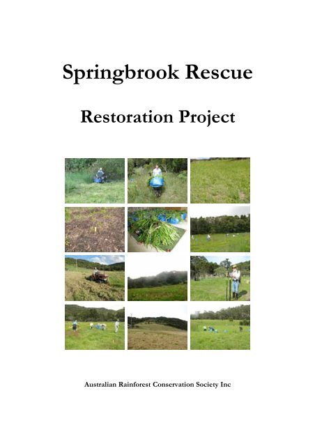
Springbrook Rescue Restoration Project - Department of National ...
Springbrook Rescue Restoration Project - Department of National ...
Springbrook Rescue Restoration Project - Department of National ...

You also want an ePaper? Increase the reach of your titles
YUMPU automatically turns print PDFs into web optimized ePapers that Google loves.
<strong>Springbrook</strong> <strong>Rescue</strong><br />
<strong>Restoration</strong> <strong>Project</strong><br />
Australian Rainforest Conservation Society Inc
<strong>Springbrook</strong> <strong>Rescue</strong><br />
<strong>Restoration</strong> <strong>Project</strong><br />
Performance Story Report<br />
2008–2009<br />
Aila Keto & Keith Scott<br />
A Report to the <strong>Department</strong> <strong>of</strong> Environment and<br />
Resource Management
Contents<br />
Part 1: The <strong>Project</strong> ....................................................................................................1<br />
1. The <strong>Project</strong>.........................................................................................................1<br />
1.1 Background and overview <strong>of</strong> the <strong>Project</strong> ................................................................ 1<br />
1.2 The Site ...................................................................................................................2<br />
1.2.1 Identification............................................................................................................................................2<br />
1.2.1.1 Location ...........................................................................................................................................2<br />
1.2.1.2 Ownership .......................................................................................................................................2<br />
1.2.1.3 Brief description .............................................................................................................................3<br />
Topography ..................................................................................................................................................................... 3<br />
Geology ............................................................................................................................................................................4<br />
Climate..............................................................................................................................................................................5<br />
Vegetation ........................................................................................................................................................................ 5<br />
1.3 Ecological restoration ........................................................................................... 10<br />
1.3.1 The <strong>Springbrook</strong> <strong>Rescue</strong> context.......................................................................................................10<br />
1.3.2 <strong>Restoration</strong> goals...................................................................................................................................10<br />
1.3.2.1 Overall goal....................................................................................................................................10<br />
1.3.2.2 Sub-goals........................................................................................................................................11<br />
1.3.3 Need for ecological restoration ..........................................................................................................12<br />
1.3.3.1 Significance <strong>of</strong> the restoration sites...........................................................................................12<br />
1.3.3.2 Current condition .........................................................................................................................12<br />
1.3.3.3 Benefits from restoration............................................................................................................14<br />
Ecological benefits .......................................................................................................................................................14<br />
Economic benefits .......................................................................................................................................................14<br />
Cultural benefits............................................................................................................................................................15<br />
Educational and scientific benefits ...........................................................................................................................16<br />
1.3.3.4 Ecosystems to be restored..........................................................................................................16<br />
1.3.4 Key threats and barriers to ecological restoration at <strong>Springbrook</strong>...............................................18<br />
1.3.4.1 Probability <strong>of</strong> success in reaching Biodiversity Goals ...........................................................22<br />
1.3.5 Reference sites .......................................................................................................................................26<br />
1.3.6 Timeframe ..............................................................................................................................................26<br />
1.4 Program Logic ...................................................................................................... 27<br />
1.5 Desired outcomes ................................................................................................. 28<br />
1.6 Assumptions and risk assessment ........................................................................ 30<br />
1.7 Evaluation questions............................................................................................. 33<br />
1.8 Science Framework............................................................................................... 37<br />
1.8.1 Conceptual Models ...............................................................................................................................37<br />
1.8.1.1 Introduction ..................................................................................................................................37<br />
1.8.1.2 Biodiversity-stability model ........................................................................................................37<br />
1.8.1.3 Patch–Matrix Functional Types.................................................................................................38<br />
1.8.1.4 Successional Models (Continuum versus Threshold Dynamics).........................................38<br />
1.8.1.5 A Practical Framework for assessing system stability or resilience — integrating science<br />
and restoration practice.............................................................................................................40<br />
1.8.1.6 A Framework for assessing Threshold Dynamics by restoration practitioners ................47<br />
1.8.2 Data Collection......................................................................................................................................70<br />
1.8.2.1 Introduction ..................................................................................................................................70<br />
1.8.2.2 Key Scientific Questions .............................................................................................................72<br />
1.8.2.3 Scale issues.....................................................................................................................................72<br />
1.8.2.4 Sampling strategy..........................................................................................................................74<br />
1.8.2.5 Parameters and leading indicators for controlling and response variables ........................75<br />
1.8.2.6 Data Analysis (methods) .............................................................................................................82<br />
1.9 Resources .............................................................................................................. 83<br />
1.10 Budget ................................................................................................................. 84
1.11 Results for 2008–2009 ........................................................................................... 85<br />
Notes additional to Results for 2008–2009...............................................................................................97<br />
1.12 Review and improvements .................................................................................. 99<br />
Part 2: The <strong>Restoration</strong> Properties........................................................................101<br />
2. The restoration properties ..............................................................................101<br />
2.1 The properties......................................................................................................101<br />
2.2 Summary Asset Document Sheets.......................................................................106<br />
Part 3: Property <strong>Restoration</strong> Plans ........................................................................118<br />
3. Property restoration plans...............................................................................118<br />
3.1 Warblers in the Mist.............................................................................................118<br />
3.1.1 The property ....................................................................................................................................... 118<br />
3.1.2 Summary Asset Document Sheet.................................................................................................... 119<br />
3.1.3 Original ecosystems ........................................................................................................................... 120<br />
3.1.4. Historical information...................................................................................................................... 120<br />
3.1.5 Current condition............................................................................................................................... 121<br />
3.1.5.1 Vegetation................................................................................................................................... 121<br />
3.1.5.2 Flora and fauna .......................................................................................................................... 122<br />
3.1.6 Ecosystem models and management requirements ..................................................................... 123<br />
3.1.7 Management activities 2008–2009 .................................................................................................. 124<br />
3.1.8 Data collection and analysis ............................................................................................................. 125<br />
3.2 Pallida (formerly ‘The Winery’) ...........................................................................126<br />
3.2.1 The property ....................................................................................................................................... 126<br />
3.2.2 Summary Asset Document Sheet.................................................................................................... 127<br />
3.2.3 Original ecosystems ........................................................................................................................... 128<br />
3.2.4 Historical information....................................................................................................................... 128<br />
3.2.5 Current condition............................................................................................................................... 129<br />
3.2.5.1 Vegetation................................................................................................................................... 129<br />
3.2.5.2 Flora and fauna .......................................................................................................................... 130<br />
3.2.6 Ecosystem models and management requirements ..................................................................... 133<br />
3.2.7 Management activities 2008–2009 .................................................................................................. 135<br />
3.2.8 Data collection and analysis ............................................................................................................. 135<br />
3.3 Ashmiha ...............................................................................................................136<br />
3.3.1 The property ....................................................................................................................................... 136<br />
3.3.2 Summary Asset Document Sheet.................................................................................................... 137<br />
3.3.3 Original ecosystems ........................................................................................................................... 138<br />
3.3.4 Historical information....................................................................................................................... 138<br />
3.3.5 Current condition............................................................................................................................... 139<br />
3.3.5.1 Vegetation................................................................................................................................... 139<br />
3.3.5.2 Flora and fauna .......................................................................................................................... 140<br />
3.3.6 Ecosystem models and management requirements ..................................................................... 141<br />
3.3.7 Management activities 2008–2009 .................................................................................................. 143<br />
3.3.8 Data collection and analysis ............................................................................................................. 143<br />
3.4 Ankuna.................................................................................................................144<br />
3.4.1 The property ....................................................................................................................................... 144<br />
3.4.2 Summary Asset Document Sheet.................................................................................................... 145<br />
3.4.3 Original ecosystems ........................................................................................................................... 146<br />
3.4.4 Historical information....................................................................................................................... 146<br />
3.4.5 Current condition............................................................................................................................... 147<br />
3.4.5.1 Vegetation................................................................................................................................... 147<br />
3.4.5.2 Flora and fauna .......................................................................................................................... 148<br />
3.4.6 Ecosystem models and management requirements ..................................................................... 149<br />
3.4.7 Management activities 2008–2009 .................................................................................................. 150<br />
3.4.8 Data collection and analysis ............................................................................................................. 150
Part 4: References ...............................................................................................151<br />
Tables<br />
Table 1.1. Regional Ecosystem descriptions and special values. Species highlighted in bold have been recorded at<br />
<strong>Springbrook</strong>. ................................................................................................................................................................................8<br />
Table 1.1. (Cont.) Regional Ecosystem descriptions and special values. Species highlighted in bold have been recorded<br />
at <strong>Springbrook</strong>. ............................................................................................................................................................................9<br />
Table 1.2. Implications <strong>of</strong> climate change for the Gondwana Rainforest <strong>of</strong> Australia World Heritage Area (from<br />
Australian <strong>National</strong> University 2009)....................................................................................................................................14<br />
Table 1.3. Threatening processes affecting the <strong>Springbrook</strong> restoration properties ...............................................................18<br />
Table 1.4. Barriers to achieving goals and corresponding mitigation measures .......................................................................22<br />
Table 1.5 Three basic ecosystem model types as heuristic frameworks to guide restoration (based on Suding and<br />
Hobbs 2009) ..............................................................................................................................................................................39<br />
Table 1.6. An explanation <strong>of</strong> key terms relating to resilience theory and practice...................................................................46<br />
Table 1.7. Relationships between Drivers and State Variables ....................................................................................................56<br />
Table 1.8. Summary <strong>of</strong> possible generic responses to Questions 3–5 (Step 2).........................................................................60<br />
Table 1.9 A Practical Framework for identifying Alternative Stable States, Drivers, Thresholds, and Stability<br />
(feedback interactions or loops).............................................................................................................................................66<br />
Table 1.10. Comparison <strong>of</strong> potentially useful generic stability surrogates applied to three Archetypal Models <strong>of</strong><br />
threshold dynamics ± tipping points ....................................................................................................................................68<br />
Table 1.11. Plant Traits and Trait States affecting competition for environmental resources...............................................78<br />
Table 1.12. Monitoring approaches for assessing ecosystem recovery after disturbance.......................................................82<br />
Table 2.1. The <strong>Restoration</strong> Properties ............................................................................................................................................102<br />
Table 2.2. Structural and functional (abiotic/biotic) attributes <strong>of</strong> properties being restored ..............................................103<br />
Table 3.1.1. Flora and fauna recorded from Warblers and adjoining forest............................................................................122<br />
Table 3.1.2. Ecosystem condition and required management actions......................................................................................123<br />
Table 3.2.1. Flora and fauna recorded from Pallida and adjoining forest................................................................................130<br />
Table 3.2.2. Ecosystem condition and required management actions......................................................................................133<br />
Table 3.3.1. Flora and fauna recorded from Ashmiha and adjoining forest............................................................................140<br />
Table 3.3.2. Ecosystem condition and required management actions......................................................................................141<br />
Table 3.4.1. Flora and fauna recorded from Ankuna and adjoining forest..............................................................................148<br />
Table 3.4.2. Ecosystem condition and required management actions......................................................................................149<br />
Figures<br />
Figure 1.1. The <strong>Springbrook</strong> Area. Properties purchased by the Queensland Government are shaded blue. <strong>Springbrook</strong><br />
<strong>National</strong> Park is shaded green. The three properties that are the main focus <strong>of</strong> the restoration project at this<br />
time are shown outlined. ...........................................................................................................................................................1<br />
Figure 1.2. The <strong>Springbrook</strong> area viewed from the north. The southern extent <strong>of</strong> the view is the Queensland–New<br />
South Wales border. ................................................................................................................................................................... 2<br />
Figure 1.3. <strong>Springbrook</strong> Plateau is outlined in red............................................................................................................................2<br />
Figure 1.4. The Tweed Caldera. The rim <strong>of</strong> the erosion caldera is indicated by the dashed line............................................ 3<br />
Figure 1.5. <strong>Springbrook</strong> Plateau terrain ..............................................................................................................................................3<br />
Figure 1.6. Geology <strong>of</strong> <strong>Springbrook</strong> Plateau (based on Willmott & Hayne 2001)..................................................................... 4<br />
Figure 1.7. Mean annual rainfall in the Caldera region. ...................................................................................................................5<br />
Figure 1.8. Pre-clearing (pre-1906) Regional Ecosystem mapping by Queensland Herbarium. Regional Ecosystems<br />
relevant to the restoration project are —...............................................................................................................................6<br />
Figure 1.9. Remnant (2006) Regional Ecosystem mapping by Queensland Herbarium. Regional Ecosystems relevant to<br />
the restoration project are — ...................................................................................................................................................7<br />
Figure 1.10. <strong>Restoration</strong> properties (outlined in yellow) in the high country towards the southern end <strong>of</strong> <strong>Springbrook</strong><br />
Plateau. The national park is shaded green..........................................................................................................................10<br />
Figure 1.11. <strong>Springbrook</strong> Plateau is outlined in yellow, the World Heritage Area in red and the national park shaded<br />
green ............................................................................................................................................................................................12<br />
Figure 1.12. Vegetation map <strong>of</strong> restoration areas. The properties to be restored are outlined in red. ................................16<br />
Figure 1.13. Outcrops <strong>of</strong> rock on restoration properties commonly support heath vegetation ...........................................17<br />
Figure 1.14 Biodiversity-Stability Model <strong>of</strong> Ecosystem Processes:...................................................................................37<br />
Figure 1.15. Patch-Matrix Functional Classes....................................................................................................................38<br />
Figure 1.16. Ecosystem Stability Model (shorthand version <strong>of</strong> Figure 1.14) ...........................................................................43<br />
Figure 1.17. Patch-Scale Stability Conceptual Diagram based on plant functional groups (woody, herbaceous) .............43<br />
Figure 1.18. Partitioning <strong>of</strong> rainfall into its various components affecting water balance and availability <strong>of</strong> water for<br />
photosynthesis and plant growth...........................................................................................................................................45<br />
Figure 1.19. Tipping Point Model......................................................................................................................................................65<br />
Figure 1.20. Shifting Tipping Point Model.......................................................................................................................................65
Figure 1.21. State–Transition Conceptual Model ...........................................................................................................................69<br />
Figure 1.22. Critical Scale Units for abiotic and biotic processes affecting biological productivity .....................73<br />
Figure 1.23. A randomised complete block design (power 9) with a block constraint. ..........................................................74<br />
Figure 1.24. Covarying Plant Traits. ..................................................................................................................................................81<br />
Figure 1.25. Near confluent infestation <strong>of</strong> Aristea ecklonii at Warblers. ......................................................................................97<br />
Figure 2.1. The high country at the southern end <strong>of</strong> <strong>Springbrook</strong> Plateau, viewed from the north. The ‘skyline’<br />
coincides with the Queensland–New South Wales border ...........................................................................................101<br />
Figure 2.2. The high country at the southern end <strong>of</strong> <strong>Springbrook</strong> Plateau showing aspect. ...............................................101<br />
Figure 2.1 Bioclimatic envelopes for the restoration properties...........................................................................................104<br />
Figure 2.2 Digital elevation model, <strong>Springbrook</strong> Plateau hight country .............................................................................105<br />
Figure 3.1.1. Warblers in the Mist showing the monitoring and experimental plot grid. .....................................................118<br />
Figure 3.1.2. Pre-clearing vegetation mapping, Queensland Herbarium..................................................................................120<br />
Figure 3.1.3. Aerial photography showing Warblers. Left, 1930; Right, 1961 ........................................................................120<br />
Figure 3.1.4. Aerial photography 2005 showing current vegetation. ........................................................................................121<br />
Figure 3.1.5. Two-metre high Setaria sphacelata var. sericea on Warblers....................................................................................124<br />
Figure 3.1.6. Regenerating native plants marked with a pink plant marker.............................................................................125<br />
Figure 3.1.7. Soil moisture pr<strong>of</strong>ile. Dark blue indicates the wettest areas and dark brown, the driest areas. ...................125<br />
Figure 3.2.1. Pallida showing the monitoring and experimental plot grid. ..............................................................................126<br />
Figure 3.2.2. Pre-clearing vegetation mapping, Queensland Herbarium..................................................................................128<br />
Figure 3.2.3. Aerial photography showing Pallida. Left to right, 1930, 1989, 1995. ..............................................................128<br />
Figure 3.2.4. Aerial photography 2005 showing current vegetation. ........................................................................................129<br />
Figure 3.2.5. Soil moisture levels measured over 63 cells on the northern part <strong>of</strong> Pallida. Values ranged from 27.7%<br />
(brown) to 90.7% (blue). .......................................................................................................................................................135<br />
Figure 3.3.1. Ashmiha showing the monitoring and experimental plot grid...........................................................................136<br />
Figure 3.3.2. Pre-clearing vegetation mapping, Queensland Herbarium..................................................................................138<br />
Figure 3.3.3. Aerial photography showing Ashmiha. Left, 1930; Right, 1998. .......................................................................138<br />
Figure 3.3.4. Aerial photography 2005 showing current vegetation. ........................................................................................139<br />
Figure 3.4.1. Ankuna showing the monitoring and experimental plot grid.............................................................................144<br />
Figure 3.4.2. Pre-clearing vegetation mapping, Queensland Herbarium..................................................................................146<br />
Figure 3.4.3. Aerial photography: Left to Right — 1961, 1989, 1993, 2005 ...........................................................................146<br />
Figure 3.4.4. Aerial photography 2005 showing current vegetation. ........................................................................................147
Report Structure<br />
This Performance Story is structured as far as practicable to meet guidelines indicated by<br />
the following sources:<br />
Australian Government (2009). NRM MERI Framework. Australian Government<br />
Natural Resource Management, Monitoring, Evaluation, Reporting and Improvement<br />
Framework.<br />
Pannell, D.J. (2009) INFFER: Investment Framework for Environmental Resources<br />
http://www.inffer.org<br />
SER (2004) The SER International Primer on Ecological <strong>Restoration</strong>. Society for<br />
Ecological <strong>Restoration</strong> International, Science & Policy Working Group (Version 2:<br />
October, 2004)
Part 1: The <strong>Project</strong><br />
1. The <strong>Project</strong><br />
1.1 Background and overview <strong>of</strong> the <strong>Project</strong><br />
The Queensland Government has allocated major funding to the acquisition <strong>of</strong> freehold<br />
properties in the <strong>Springbrook</strong> area for the purposes <strong>of</strong> conservation.<br />
The current national park, the southern section <strong>of</strong> which is included in the Gondwana<br />
Rainforests <strong>of</strong> Australia World Heritage Area, is small and has boundary configuration<br />
inconsistent with long-term conservation.<br />
The overall aim <strong>of</strong> <strong>Springbrook</strong> <strong>Rescue</strong> is to restore rainforest on cleared areas and recreate<br />
links between sections <strong>of</strong> the national park, thus creating a more viable World<br />
Heritage Area and one which provides a greater potential for its flora and fauna,<br />
especially ancient lineages underlying criteria for listing, to survive the impacts <strong>of</strong> future<br />
climate change.<br />
The Australian Rainforest<br />
Conservation Society Inc (ARCS) has<br />
enthusiastically accepted<br />
responsibility for managing the<br />
restoration program for properties<br />
purchased by the Queensland<br />
Government. This will be done in the<br />
overall context <strong>of</strong> restoring World<br />
Heritage values and integrity across<br />
the <strong>Springbrook</strong> Plateau and<br />
surrounding areas with a focus on<br />
restoring whole catchments wherever<br />
possible. This objective coincides<br />
with that <strong>of</strong> the ARCS project,<br />
‘<strong>Springbrook</strong> <strong>Rescue</strong>’.<br />
Figure 1.1. The <strong>Springbrook</strong> Area. Properties<br />
purchased by the Queensland Government are shaded<br />
blue. <strong>Springbrook</strong> <strong>National</strong> Park is shaded green. The<br />
three properties that are the main focus <strong>of</strong> the<br />
restoration project at this time are shown outlined.<br />
Boundaries<br />
Whereas the <strong>Springbrook</strong> <strong>Rescue</strong><br />
project encompasses the whole <strong>of</strong><br />
<strong>Springbrook</strong> Plateau and adjoining<br />
areas, the restoration project is<br />
limited to properties purchased by the<br />
Queensland Government or owned<br />
by the Australian Rainforest<br />
Conservation Society and, in the first<br />
instance, will focus on those<br />
properties that will restore the highcountry<br />
linkage between sections <strong>of</strong><br />
the national park that are part <strong>of</strong> the<br />
World Heritage Area.<br />
1
1.2 The Site<br />
1.2.1 Identification<br />
1.2.1.1 Location<br />
The site is defined broadly as <strong>Springbrook</strong>, an area <strong>of</strong> roughly 20 square kilometres (~ 12<br />
km long and 3 km wide at the widest point), located largely on the <strong>Springbrook</strong> plateau,<br />
between 28˚15' S and 28˚08' S, and 153˚14' E and 153˚18' E, and approximately 500 km<br />
south <strong>of</strong> the Tropic <strong>of</strong> Capricorn and 38 km south <strong>of</strong> the nearest town, Nerang,<br />
Queensland, Australia.<br />
<strong>Springbrook</strong> Plateau Lamington Plateau<br />
Numinbah Valley<br />
Figure 1.2. The <strong>Springbrook</strong> area viewed from the north. The southern extent<br />
<strong>of</strong> the view is the Queensland–New South Wales border.<br />
Figure 1.3. <strong>Springbrook</strong> Plateau is outlined in red.<br />
1.2.1.2 Ownership<br />
A major part <strong>of</strong> the <strong>Springbrook</strong> area is owned by the Queensland Government within<br />
protected area and Crown freehold tenures. The remainder includes conservation areas<br />
owned by Gold Coast City Council and privately owned freehold land.<br />
<strong>Restoration</strong> activities will be undertaken on land owned by the Queensland Government<br />
and property owned by the Australian Rainforest Conservation Society.<br />
2
1.2.1.3 Brief description<br />
Topography<br />
<strong>Springbrook</strong> lies on the northern flanks <strong>of</strong> the Tweed Volcano which, with its welldeveloped<br />
radial drainage, is easily recognizable as a shield volcano, despite its age (23.5–<br />
20.5 million years). Erosion has left a core, Mt Warning, isolated from a horseshoeshaped<br />
arc <strong>of</strong> precipitous cliffs — the Mt<br />
Warning or Tweed Caldera. This erosion<br />
caldera, about 30 km across, is one <strong>of</strong> the<br />
major examples <strong>of</strong> this landform in the<br />
world, notable for its size and central<br />
mountain mass (Figure 1.4).<br />
<strong>Springbrook</strong><br />
Plateau<br />
The Springbook precinct is effectively a<br />
biogeographic island isolated by fluvial<br />
processes typically associated with volcanic<br />
landforms, preserving extremely compressed<br />
environmental gradients (climatic,<br />
hydrological, physiographic, historical)<br />
including the wettest, most nutrient rich<br />
environments nationally outside its sister<br />
area, the Wet Tropics.<br />
Mount Warning<br />
Figure 1.4. The Tweed Caldera. The rim <strong>of</strong> the<br />
erosion caldera is indicated by the dashed line.<br />
Altitudinal gradients encompass lowlands (less than 400<br />
m), through uplands (400–800 m) to highlands (800–1051<br />
m)(See Figure 1.5.). Each altitudinal zone shows further<br />
segmentation <strong>of</strong> microenvironments on the basis <strong>of</strong><br />
altitude, geology, rainfall and aspect — these are the key<br />
present-day determinants <strong>of</strong> plant and animal<br />
distributions, abundances and movements since they<br />
determine availability <strong>of</strong> energy, moisture, nutrients, the<br />
essential factors for life.<br />
The highest points in the area are Mt Mumdjin (1010 m)<br />
in the south-west corner <strong>of</strong> the plateau and Mt Bilbrough<br />
(960 m) 2 km to the east along the McPherson Range.<br />
The lower limit <strong>of</strong> the plateau’s elevation gradient was set<br />
at ~600 m, as this generally marks the transition between<br />
the flatter topography <strong>of</strong> the plateau and the near vertical,<br />
rhyolite-derived cliff faces.<br />
Over the past 23 million years geomorphological<br />
processes have isolated the <strong>Springbrook</strong> plateau<br />
biogeographically from the rest <strong>of</strong> the Caldera precinct<br />
and the McPherson Range to the west. Erosion reduced<br />
the crater from a maximum height <strong>of</strong> 2000 m to 1150 m,<br />
with typical radial drainage reducing the conical surface to<br />
complex, stepped valleys and more erosion resistant<br />
scarps and cliff lines. Currumbin and Tallebudgera valleys<br />
drain the plateau to the north east, and<br />
Numinbah/Nerang to the north and north west.<br />
3<br />
Figure 1.5. <strong>Springbrook</strong> Plateau terrain
Catchments are the basic unit <strong>of</strong> management on any scale (Magnusson 2001; Margules<br />
and Pressey 2000) since it is almost impossible to effectively protect parts <strong>of</strong> a catchment<br />
if threats spread from ridgelines or watershed regions. Most ridgelines on the<br />
<strong>Springbrook</strong> plateau are roaded, facilitating urbanization and associated infrastructure<br />
development which fragment ecosystems and act as conduits for alien invasions, aiding<br />
the spread <strong>of</strong> weeds and feral animals. Riparian areas with their dendritic structure and<br />
connectivity throughout the landscape reinforce the need for a catchment approach to<br />
management.<br />
The plateau proper (above ~600 m) comprises 10 subcatchments flowing into the<br />
Nerang River and Little Nerang Creek (both East and West branches), which supply<br />
water to the Hinze and Little Nerang dams that service the needs <strong>of</strong> the Gold Coast. The<br />
subcatchments vary in size between 20 and 290 hectares each, as well as in altitude,<br />
topographic diversity, aspect, radiation and rainfall regimes, soils and geological<br />
substrates.<br />
Lower plateau (600–750 m) catchments with a combined area on the plateau <strong>of</strong> 422<br />
hectares, are drained by Camp, Kuralboo, Purling Brook and Carrick Creeks via<br />
spectacular waterfalls (Purling Brook Falls) over steep rhyolite cliffs into Little Nerang<br />
Creek (West Branch). Cleared areas within these catchments are virtually contiguous and<br />
total about 150 hectares. Purling Brook catchment is the only meso-scale catchment on<br />
the lower plateau.<br />
The higher plateau (750–1010 m) catchments with a combined area on the plateau <strong>of</strong><br />
about 350 ha are comprised <strong>of</strong> Mundora, Ee-jung, Boy-ull and Rush Creeks draining<br />
northwards into Little Nerang Creek (East Branch). Boy-ull Creek Catchment is the only<br />
meso-scale catchment on the higher plateau, and the second largest on the entire plateau.<br />
Geology<br />
The area represents the northern flank <strong>of</strong><br />
the now extinct Tweed Shield Volcano,<br />
active between about 23 and 20 Million<br />
years ago. It is the best preserved <strong>of</strong> its kind<br />
and size in the world. Five major eruption<br />
episodes <strong>of</strong> varying intensities and<br />
durations produced as many lava flows<br />
differing in composition, density, areal<br />
extent and depth. The oldest and most<br />
extensive flows (Beechmont Basalts) range<br />
in thickness from 300 m to 150 m, south to<br />
north. The two succeeding basalt flows are<br />
interleaved by harder, less erodible rhyolites<br />
(Binna Burra Rhyolite and <strong>Springbrook</strong><br />
Rhyolite), with Hobwee Basalts the last<br />
overtopping layer restricted to the highest,<br />
southernmost parts <strong>of</strong> the plateau.<br />
<strong>Springbrook</strong> Rhyolite forms the upper cliff<br />
line <strong>of</strong> this plateau (Figure 1.6).<br />
4<br />
Figure 1.6. Geology <strong>of</strong> <strong>Springbrook</strong> Plateau (based on<br />
Willmott & Hayne 2001)
Climate<br />
The climate is subtropical, moist maritime, characterized by hot, wet summers and cool<br />
dry winters. The climate is strongly seasonal with two main air masses alternating during<br />
the year. Dominant influences are unstable moist air masses flowing from the east in<br />
summer and dry westerlies in winter.<br />
Mean annual temperature is ~ 15 ˚C. Seasonal variation in air temperatures is high. The<br />
monthly average maximum temperature is ~ 27 °C and the monthly average minimum<br />
temperature is ~ 3 °C. January is the hottest month and August the coldest month. Daily<br />
temperatures fluctuate enough to make frosts possible at any time <strong>of</strong> the year.<br />
On the slopes <strong>of</strong> plateau, temperature decreases an average <strong>of</strong> 0.65 ˚C per 100 m increase<br />
in elevation. Occasional snow has been recorded on the plateau in 1948 and 1985 (Hall<br />
1990). Hailstorms are an annual occurrence.<br />
<strong>Springbrook</strong> Plateau is the wettest area<br />
on the Australian mainland outside the<br />
Wet Tropics. Mean annual precipitation<br />
exceeds 3500 mm at higher altitudes,<br />
with marked interannual variation both<br />
in seasonal and annual levels<br />
corresponding to El Niño Southern<br />
Oscillation (ENSO) events. Most <strong>of</strong> the<br />
rain falls between December and April<br />
with February the wettest month, with<br />
an average <strong>of</strong> 475 mm <strong>of</strong> precipitation,<br />
and August/September are the driest,<br />
with generally less than 100 mm <strong>of</strong><br />
precipitation per month. In 1974,<br />
<strong>Springbrook</strong> Forestry Station received<br />
5648 mm with 2323 mm falling in<br />
January. With respect to rainfall, the significance <strong>of</strong> <strong>Springbrook</strong> in the Tweed Caldera<br />
region can be seen in Figure 1.7.<br />
The annual 1600-mm isohyet skirts the base <strong>of</strong> the plateau, while precipitation reaches<br />
>3100 mm at higher altitudes. Dry season length (number <strong>of</strong> months with
microphyll fern forest with Noth<strong>of</strong>agus moorei, 12.8.8 — Eucalyptus saligna or E. grandis tall<br />
open forest and 12.8.9 — Lophostemon confertus open forest.<br />
Figure 1.8. Pre-clearing (pre-1906) Regional Ecosystem mapping by Queensland Herbarium. Regional<br />
Ecosystems relevant to the restoration project are —<br />
12.8.1 Eucalyptus campanulata tall open forest on Cainozoic igneous rocks<br />
12.8.2 Eucalyptus oreades tall open forest on Cainozoic igneous rocks<br />
12.8.3 Complex notophyll vine forest on Cainozoic igneous rocks. Altitude 600m<br />
12.8.6 Simple microphyll fern forest with Noth<strong>of</strong>agus moorei on Cainozoic igneous rocks<br />
12.8.8 Eucalyptus saligna or E. grandis tall open forest on Cainozoic igneous rocks<br />
12.8.9 Lophostemon confertus open forest on Cainozoic igneous rocks<br />
6
Figure 1.9. Remnant (2006) Regional Ecosystem mapping by Queensland Herbarium. Regional<br />
Ecosystems relevant to the restoration project are —<br />
12.8.1 Eucalyptus campanulata tall open forest on Cainozoic igneous rocks<br />
12.8.2 Eucalyptus oreades tall open forest on Cainozoic igneous rocks<br />
12.8.3 Complex notophyll vine forest on Cainozoic igneous rocks. Altitude 600m<br />
12.8.6 Simple microphyll fern forest with Noth<strong>of</strong>agus moorei on Cainozoic igneous rocks<br />
12.8.8 Eucalyptus saligna or E. grandis tall open forest on Cainozoic igneous rocks<br />
12.8.9 Lophostemon confertus open forest on Cainozoic igneous rocks<br />
‘Disturbed’ ecosystems are generally rainforest regenerating after clearing<br />
‘Non-remnant’ ecosystems are generally introduced pasture grasses<br />
7
Table 1.1 provides more details <strong>of</strong> the Regional Ecosystems as described by the<br />
Queensland Herbarium.<br />
Table 1.1. Regional Ecosystem descriptions and special values. Species highlighted in bold have been<br />
recorded at <strong>Springbrook</strong>.<br />
RE Description Special values<br />
12.8.1 Eucalyptus campanulata tall open-forest<br />
with shrubby to grassy understorey. Other<br />
canopy species include Eucalyptus<br />
microcorys, Syncarpia glomulifera subsp.<br />
glomulifera, E. acmenoides, Corymbia<br />
intermedia, E. carnea and E. resinifera.<br />
Patches <strong>of</strong> Eucalyptus pilularis sometimes<br />
present on ridges and crests. Occurs in high<br />
rainfall areas above 580 metres altitude on<br />
Cainozoic igneous rocks especially rhyolite.<br />
Habitat for rare and threatened flora species<br />
including Acacia acrionastes, A. saxicola,<br />
Arundinella montana, Gahnia insignis, Hibbertia<br />
hexandra, H. monticola, Pandorea baileyana<br />
and Rulingia salviifolia.<br />
12.8.2 Eucalyptus oreades ± E. campanulata tall<br />
open-forest. Occurs on Cainozoic igneous<br />
rocks<br />
12.8.3 Complex notophyll vine forest.<br />
Characteristic species include<br />
Argyrodendron trifoliolatum,<br />
Argyrodendron sp. (Kin Kin W.D.Francis<br />
AQ81198), Olea paniculata,<br />
Castanospermum australe, Cryptocarya<br />
obovata, Ficus macrophylla forma<br />
macrophylla, Syzygium francisii, Diploglottis<br />
australis, Pseudoweinmannia lachnocarpa,<br />
Podocarpus elatus, Beilschmiedia<br />
obtusifolia, Neolitsea dealbata and<br />
Archontophoenix cunninghamiana. Occurs<br />
on Cainozoic igneous rocks, especially basalt<br />
600m altitude.<br />
Habitat for rare and threatened flora species<br />
including Hibbertia monticola, Olearia<br />
heterocarpa, Petermannia cirrosa , Banksia<br />
spinulosa var. cunninghamii and Prostanthera<br />
phylicifolia<br />
Habitat for endemic and rare and threatened flora<br />
species including Niemeyera whitei, Austromyrtus<br />
fragrantissima, A. inophloia, Baloghia marmorata,<br />
Cassia brewsteri var. marksiana, Choricarpia<br />
subargentea, Corynocarpus rupestris subsp.<br />
arborescens, Cupaniopsis newmanii,<br />
Davidsonia johnsonii, Dendrobium schneiderae,<br />
Diploglottis campbellii, Endiandra globosa,<br />
Floydia praealta, Lepiderema pulchella,<br />
Macadamia integrifolia, M. tetraphylla,<br />
Muellerina myrtifolia, Ochrosia moorei, Owenia<br />
cepiodora, Pandorea baileyana, Papillilabium<br />
beckleri, Plectranthus nitidus (rocky outcrops),<br />
Pouteria eerwah, Randia moorei, Rhodamnia<br />
maideniana, Romnalda strobilacea, Sarcochilus<br />
dilatatus, S. weinthalii, S. fitzgeraldii, S.<br />
hartmannii, Syzygium hodgkinsoniae, S. moorei,<br />
Marsdenia hemiptera and Triunia robusta.<br />
Habitat for endemic and rare and threatened flora<br />
species including Acacia orites, Acronychia<br />
baeuerlenii, Austromyrtus inophloia,<br />
Austrobuxus swainii, Clematis fawcettii,<br />
Cordyline congesta, Cyathea cunninghamii,<br />
Dendrobium schneiderae, Euphrasia bella,<br />
Helmholtzia glaberrima, Lastreopsis<br />
silvestris, Muellerina myrtifolia, Nothoalsomitra<br />
suberosa, Pandorea baileyana, Pittosporum<br />
oreillyanum, Sarcochilus fitzgeraldii, S.<br />
hartmannii, S. weinthalii, Solanum callium,<br />
Symplocos baeuerlenii and Uromyrtus sp.<br />
(McPherson Range G.P. Guymer 2000), and cool<br />
subtropical species at limits <strong>of</strong> climatic range.<br />
8
Table 1.1. (Cont.) Regional Ecosystem descriptions and special values. Species highlighted in<br />
bold have been recorded at <strong>Springbrook</strong>.<br />
RE Description Special values<br />
12.8.6 Simple microphyll fern forest with<br />
Noth<strong>of</strong>agus moorei and/or Doryphora<br />
sassafras, Caldcluvia paniculosa, Orites<br />
excelsus. Occurs on Cainozoic igneous<br />
rocks at high altitudes<br />
Habitat for rare and threatened flora species<br />
including Pararistolochia laheyana and<br />
Parsonsia tenuis, and range limits <strong>of</strong> temperate<br />
adapted species<br />
12.8.8 Eucalyptus saligna or E. grandis tall openforest<br />
<strong>of</strong>ten with vine forest understorey<br />
('wet sclerophyll'). Other species include<br />
Eucalyptus microcorys, E. acmenoides,<br />
Lophostemon confertus, Syncarpia<br />
glomulifera subsp. glomulifera. Occurs on<br />
Cainozoic igneous rocks and areas subject to<br />
local enrichment from Cainozoic igneous<br />
rocks.<br />
Habitat for rare and threatened flora species<br />
including Lepidozamia per<strong>of</strong>fskyana<br />
12.8.9 Lophostemon confertus open-forest <strong>of</strong>ten<br />
with vine forest understorey ('wet<br />
sclerophyll') Occurs on Cainozoic igneous<br />
rocks. Tends to occur mostly in gullies and<br />
on exposed ridges on basalt.<br />
The standard descriptions <strong>of</strong> 12.8.3 and 12.8.5 include as characteristic species<br />
Argyrodendron trifoliolatum below 600 m (12.8.3) and A. actinophyllum above 600 m (12.8.5).<br />
At <strong>Springbrook</strong>, however, RE 12.8.5 is unusual in that A. trifoliolatum is more common<br />
than A. actinophyllum above 600 m.<br />
RE 12.8.2, Eucalyptus oreades tall open forest on Cainozoic igneous rocks, is ‘Of Concern’<br />
being a very rare ecosystem having a pre-clearing extent <strong>of</strong>
1.3 Ecological restoration<br />
1.3.1 The <strong>Springbrook</strong> <strong>Rescue</strong> context<br />
<strong>Springbrook</strong> <strong>Rescue</strong> is a broad project that incorporates acquisition, protection and<br />
restoration <strong>of</strong> land at <strong>Springbrook</strong> with the overall objective <strong>of</strong> providing secure, longterm<br />
habitat for flora and fauna contributing to World Heritage values.<br />
There remains a range <strong>of</strong> policies and management practices that need to be aligned with<br />
the vision <strong>of</strong> <strong>Springbrook</strong> as a World Heritage precinct. This matter is addressed in the<br />
Program Logic for the overall project.<br />
Within the overall project, restoration <strong>of</strong> rainforest habitat is a central component, with<br />
the initial focus being restoration <strong>of</strong> habitat linkage in the high country at the southern<br />
end <strong>of</strong> the plateau (Figure 1.10).<br />
Figure 1.10. <strong>Restoration</strong> properties (outlined in yellow) in the high country towards the southern end <strong>of</strong><br />
<strong>Springbrook</strong> Plateau. The national park is shaded green.<br />
1.3.2 <strong>Restoration</strong> goals<br />
1.3.2.1 Overall goal<br />
The overall restoration goal is stated as follows:<br />
An expanded, protected and self-sustaining World Heritage rainforest ecosystem providing secure habitat<br />
for flora and fauna contributing to World Heritage values.<br />
10
1.3.2.2 Sub-goals<br />
The sub-goals or desired attributes for the restored ecosystems are listed below.<br />
1. The restored ecosystem contains the characteristic assemblage <strong>of</strong> species with<br />
community composition, structure and functions analogous with reference<br />
ecosystems<br />
2. The restored ecosystem provides habitat for rare, threatened and significant<br />
species<br />
3. The restored ecosystem comprises only indigenous species<br />
4. All functional groups necessary for continued development, viability, health,<br />
resilience and evolutionary capacity, are present or able to colonize naturally.<br />
5. The abiotic environment can sustain reproductively viable populations <strong>of</strong> those<br />
species required for stability and resilience and continued ecosystem development<br />
along the desired trajectory.<br />
6. The restored ecosystems are suitably integrated into a larger ecological matrix or<br />
landscape with which it interacts through abiotic and biotic flows and exchanges.<br />
7. Potential threats to the health and integrity <strong>of</strong> the restored ecosystems from the<br />
surrounding landscape have been eliminated or reduced as much as possible.<br />
8. The restored ecosystems are sufficiently resilient to endure the normal periodic<br />
stress events in the local environment that serve to maintain the integrity <strong>of</strong> the<br />
ecosystem.<br />
9. The restored ecosystems are self-sustaining to the same degree as their reference<br />
ecosystems and have the potential to persist indefinitely under existing<br />
environmental conditions. Nevertheless, aspects <strong>of</strong> their biodiversity, structure<br />
and functioning may change as part <strong>of</strong> normal ecosystem development and may<br />
fluctuate in response to normal periodic stress and occasional disturbance events<br />
<strong>of</strong> greater consequence. As in any intact ecosystem, the species composition and<br />
other attributes <strong>of</strong> a restored ecosystem may evolve as environmental conditions<br />
change.<br />
10. The restored ecosystems are self-sustaining to the same degree as their reference<br />
ecosystems and have the potential to persist indefinitely under existing<br />
environmental conditions.<br />
Note: In regard to Subgoal 9 in particular:<br />
(a) aspects <strong>of</strong> the biodiversity, structure and function will change during normal<br />
ecosystem development (succession), and may fluctuate in response to normal<br />
periodic stress and disturbance regimes;<br />
(b) the species composition and other ecosystem attributes may evolve as<br />
environmental conditions change, e.g. under predicted climate change, to produce<br />
novel or “no-analog” communities that are compositionally unlike any found today<br />
(Jump and Penuelas 2005; Williams and Jackson 2007)<br />
11
1.3.3 Need for ecological restoration<br />
1.3.3.1 Significance <strong>of</strong> the restoration sites<br />
<strong>Springbrook</strong> is the central core for values underpinning the Gondwana Rainforests <strong>of</strong><br />
Australia World Heritage Area which was listed in 1995. It is part <strong>of</strong> 15 nationally<br />
proclaimed Biodiversity Hotspots representing “the most threatened and biodiverse<br />
centres in Australia” (Commonwealth <strong>of</strong> Australia 2003) and part <strong>of</strong> the scientifically<br />
famous “Macleay–McPherson Overlap” (Burbidge 1960).<br />
As part <strong>of</strong> the Tweed volcanic province <strong>Springbrook</strong> is a recognised refugium and<br />
contains outstanding levels <strong>of</strong> biodiversity, narrow-range endemism and relict<br />
disjunctions <strong>of</strong> phylogenetically significant lineages. It is home to nearly 1100 species <strong>of</strong><br />
native plants contained within 537 genera in 159 families, and more than 220 species <strong>of</strong><br />
native animals including 20 species <strong>of</strong> frogs, 30 reptiles, 148 birds and 24 mammals.<br />
The current <strong>National</strong> Park is too small (2,500 ha at the time <strong>of</strong> World Heritage Listing in<br />
1995), unrepresentative, fragmented and dysfunctionally configured to viably protect the<br />
region’s biodiversity and World Heritage values. The current <strong>National</strong> Park fails to<br />
represent the core World Heritage values that occur on the plateau, very little <strong>of</strong> which is<br />
included within the park estate (Figure 1.11).<br />
The World Heritage Area is currently too<br />
small, fragmented, unrepresentative and<br />
poorly configured to be viable or resilient<br />
against climate change, with the largest area<br />
<strong>of</strong> cloud forests in subtropical Australia<br />
critically threatened.<br />
1.3.3.2 Current condition<br />
As can be seen from Figure 1.9, the plateau<br />
area has been strongly affected by humans.<br />
Over the past 100 years, settlement,<br />
encouraged by <strong>of</strong>ficial government settlement<br />
programs, resulted in forests being selectively<br />
logged for timber and cleared for farmland<br />
and, more recently, for urban development to<br />
meet increasing population demands (Hall<br />
1990). Most <strong>of</strong> the area was cleared prior to<br />
the 1930s, including almost all <strong>of</strong> the plateau<br />
area above 600 m totalling nearly 2000<br />
hectares. Historical aerial photography shows<br />
extensive rainforest regeneration since the<br />
1930s as various farming ventures failed.<br />
Clearing, however, continued and continues<br />
Figure 1.11. <strong>Springbrook</strong> Plateau is outlined in<br />
yellow, the World Heritage Area in red and the<br />
national park shaded green<br />
today for residential purposes. Whilst about 65 per cent <strong>of</strong> the originally cleared area is in<br />
varying stages <strong>of</strong> regeneration, population pressures are escalating and current planning<br />
and management guidelines and practices are not consistent with obligations under the<br />
World Heritage Convention for “protection, conservation, presentation and transmission<br />
to future generations” <strong>of</strong> areas <strong>of</strong> outstanding universal value wherever they occur.<br />
12
The areas <strong>of</strong> regeneration can be seen in Figure 1.9 where they are mapped as ‘disturbed’<br />
ecosystems.<br />
The Queensland Government has purchased about 57 parcels <strong>of</strong> land between 2004 and<br />
2009 comprising a total area <strong>of</strong> almost 840 hectares, including about 120 hectares (14 per<br />
cent) in need <strong>of</strong> ecological restoration. The remainder <strong>of</strong> the purchased land is in varying<br />
stages <strong>of</strong> natural regeneration requiring little or no active intervention. Of the 840<br />
hectares purchased 444 ha (53 per cent) occur on the <strong>Springbrook</strong> plateau with the<br />
balance on the western escarpment.<br />
There remain over 720 hectares <strong>of</strong> land within private ownership or within <strong>National</strong> Park<br />
on the <strong>Springbrook</strong> plateau, outside the <strong>Springbrook</strong> <strong>Rescue</strong> program, but in urgent need<br />
<strong>of</strong> ecological restoration. These lands occur primarily on the lower plateau within the<br />
Purling Brook, Camp, Kuralboo and Carrick Creek catchments.<br />
The primary industries such as dairying, grazing and banana growing for which clearing<br />
originally occurred have all declined leaving ecotourism virtually the sole economic base<br />
for the small local community. However, significant areas <strong>of</strong> the plateau remain cleared<br />
for rural activities which, whilst not economically viable in their own right, provide tax<br />
benefits for some <strong>of</strong> the large landholders. Existing planning instruments such as the<br />
South East Queensland Regional Plan at the State level, and the Gold Coast City<br />
Council’s Local Area Plan, contain many deficiencies and loopholes, are essentially static<br />
conceptually, and entrench the status quo. Much <strong>of</strong> the land is still formally classified as<br />
“Good Quality Agricultural Land” legally binding local government planning instruments<br />
to consistency with this obsolete objective. The protection, presentation and restoration<br />
<strong>of</strong> World Heritage Values is not provided for by any existing statutory or policy<br />
instruments. It is noted that responsibilities <strong>of</strong> State Parties under the World Heritage<br />
Convention include “adopt general policies to give the heritage a function in the life <strong>of</strong><br />
the community” and “integrate heritage protection into comprehensive planning<br />
programmes”.<br />
Impacts<br />
The cumulative legacy from past agricultural and settlement activities include habitat loss,<br />
modification and fragmentation, invasions by feral animals and weeds, abnormal fire<br />
regimes, altered hydrological regimes and altered bio-geochemical cycles including<br />
significant soil erosion and degradation, such that the viability <strong>of</strong> biodiversity and World<br />
Heritage values are now critically threatened by these impacts.<br />
Superimposed on threatening processes associated with land-use change, global warming<br />
is emerging as the most serious and pervasive <strong>of</strong> all the threats to the planet’s biodiversity<br />
given its potential to affect even areas far from human habitation. Cloud forests and<br />
restricted-range endemic species in “hotspots” are especially vulnerable to climate change<br />
impacts (Malcolm et al. 2006).<br />
A recent report on the implications <strong>of</strong> climate change for Australia’s World Heritage<br />
Properties summarised threats and impacts for the Gondwana Rainforests <strong>of</strong> Australia<br />
World Heritage Area (Australian <strong>National</strong> University 2009). They are listed in Table 1.2.<br />
13
Table 1.2. Implications <strong>of</strong> climate change for the Gondwana Rainforest <strong>of</strong> Australia World Heritage Area<br />
(from Australian <strong>National</strong> University 2009)<br />
Potential climate threats<br />
Potential impacts<br />
• Higher temperatures<br />
• Increased carbon dioxide concentrations<br />
• Periods <strong>of</strong> prolonged drought<br />
• A rise in the orographic cloud layer<br />
• Exacerbation <strong>of</strong> fire regimes that are<br />
inappropriate to maintenance <strong>of</strong> rainforest<br />
species<br />
• Further habitat fragmentation<br />
• Frequent fires may threaten fauna and flora populations and<br />
result in habitat loss<br />
• The cool upland subtropical rainforest are at greatest risk from<br />
higher temperatures and lower rainfall<br />
• There are two groups <strong>of</strong> Gondwanan rainforests under threat<br />
from climate change: the microphyll fern forests, typically<br />
dominated by Noth<strong>of</strong>agus moorei (Antarctic Beech); and the<br />
simple notophyll evergreen vine forests, generally dominated by<br />
Ceratopetalum apetalum (coachwood)<br />
• Loss <strong>of</strong> species with low dispersal ability and/or specific habitat<br />
preferences<br />
Fragmentation from clearing alters critical genetic and demographic processes potentially<br />
threatening long-term persistence <strong>of</strong> both rare and common and widespread species<br />
(Broadhurst and Young 2007). All aspects <strong>of</strong> the plant reproductive cycle may be<br />
impacted including flowering, pollination, fertilisation, seed set and quality and<br />
probability <strong>of</strong> reaching reproductive adulthood.<br />
Clearing destroys the buffering conditions created by intact forest canopies critical for<br />
the persistence <strong>of</strong> palaeo-climatic refugia (Fjeldsa and Lovett 1997a,b; Fjeldsa et al.<br />
1997). The high concentrations <strong>of</strong> phylogenetically significant endemic species (old or<br />
basal lineages) are especially at risk from the combined effects <strong>of</strong> fragmentation and<br />
climate change. Biomass that accumulates in these refugial areas normally buffers<br />
extrinsic changes in the physical environment through feedback loops with soil, water<br />
and climate. Intact, extensive forest canopies increase the frequency <strong>of</strong> cloud immersion<br />
in high altitude forests which may be critical to the survival <strong>of</strong> many <strong>of</strong> the relictual<br />
species.<br />
1.3.3.3 Benefits from restoration<br />
Ecological benefits<br />
Biodiversity representing major stages <strong>of</strong> the earth’s evolutionary history and formally<br />
recognised as having outstanding universal value will receive greater protection with<br />
improved prospects for viability, resilience and capacity for ongoing evolution.<br />
Specifically, the area when restored will contribute to:<br />
(a) protecting biodiversity — a hotspot for species richness, rarity, ad endemism;<br />
(b) conserving phylogenetic diversity — habitat for ancient plant and animal lineages<br />
representing major changes in the earth’s evolutionary history, that contribute to<br />
viability and resilience <strong>of</strong> World Heritage values significantly threatened by<br />
climate change<br />
Economic benefits<br />
Economic benefits are three-fold. Benefits can be predicted to accrue from increased<br />
quality and sustainability <strong>of</strong> (1) ecotourism, (2) water catchment values, and (3)<br />
restoration practice.<br />
14
Long-term sustainability <strong>of</strong> ecotourism will depend on the availability <strong>of</strong> increasingly rare<br />
experiences <strong>of</strong> “overwhelming” naturalness, outstanding natural beauty, grandeur and<br />
intrinsic curiosity in a “living museum”.<br />
The <strong>Project</strong> area is part <strong>of</strong> the water source for the Hinze Dam, a vital water supply for<br />
the Gold Coast City. <strong>Restoration</strong> <strong>of</strong> forest cover is likely to improve the quality <strong>of</strong> water<br />
and the evenness <strong>of</strong> water flows.<br />
Improved cost-effectiveness <strong>of</strong> restoration techniques will enable restoration to be<br />
carried out at more ecologically meaningful scales at a range <strong>of</strong> other biologically<br />
significant areas.<br />
To 2006, less than 0.5 per cent <strong>of</strong> previously cleared rainforest in the Wet Tropics or 0.3<br />
per cent in the subtropics had been restored at a cost <strong>of</strong> $525 Million (Catterall and<br />
Harrison 2006). The cost <strong>of</strong> restoring previously rainforested land on the <strong>Springbrook</strong><br />
plateau (800 hectares) could therefore be projected to be $40–80 million. Clearly,<br />
traditional restoration practices are not tenable at ecologically meaningful scales.<br />
If land is to be reforested at ecologically meaningful scales, revolutionary changes are<br />
needed (Catterall and Harrison 2006): either (a) there is greater financial commitment by<br />
governments and the community, or (b) methods are developed enabling restoration <strong>of</strong><br />
greater areas at lower unit cost. Calls have been made for more case studies enabling<br />
restorationists to reduce costs, time and effort by avoiding mistakes <strong>of</strong> others, and<br />
implement proven strategies or generic decision rules (Jenkinson et al. 2006).<br />
Clearly, better, more cost-effective restoration practices would be <strong>of</strong> immense economic<br />
benefits to society, enabling biodiversity conservation and restoration at meaningful<br />
scales so critically needed today.<br />
Cultural benefits<br />
World Heritage obligations include ensuring that World Heritage plays a meaningful role<br />
in the community (Bentrupperbäumer and Reser 2006).<br />
Environmental degradation is both caused by human behaviour and affects human<br />
health and wellbeing. There is mounting concern over unparalleled threats to the world’s<br />
biodiversity and human welfare (World Commission on Environment and Development<br />
1987; Union <strong>of</strong> Concerned Scientists 1992, 1997; World Resources Institute 2002,<br />
Millennium Ecosystem Assessment 2003, Kennedy 2006; World Wildlife Fund 2006).<br />
The natural environment is a defining and formative part <strong>of</strong> the Australian character,<br />
lifestyle and sense <strong>of</strong> place (Australian Psychologists Society Position Statement on<br />
Psychology and the Natural Environment, April 2007). Australia is richly endowed with<br />
World Heritage Areas (15) listed for their outstanding universal values to all current and<br />
future human generations. Their protection, restoration and presentation, is clearly <strong>of</strong><br />
immense cultural benefit both locally and globally.<br />
<strong>Springbrook</strong> has been selected as a State Icon. This year, Queensland’s 150th, the State<br />
Government wished to celebrate the people, places and stories that define the State. All<br />
Queenslanders had the opportunity to vote for their favourite icons from a short-list <strong>of</strong><br />
300 between 2 March and 30 April 2009. These votes ultimately made up the list <strong>of</strong><br />
Queensland’s top 150 icons. <strong>Springbrook</strong> <strong>National</strong> Park was voted as one <strong>of</strong> the 15 top<br />
15
icons in the ‘Natural Attractions’ category. Hence there are significant cultural benefits in<br />
ensuring the ongoing viability <strong>of</strong> the area.<br />
Educational and scientific benefits<br />
Ecological restoration is increasingly considered an “acid test for ecology”. It provides<br />
ideal experimental settings for tests <strong>of</strong> ecological theory (Lake 2001, Young et al. 2005,<br />
Halle 2007, Temperton 2007), but equally the practice <strong>of</strong> restoration is becoming<br />
critically dependent on the scientific understanding <strong>of</strong> ecosystem processes. <strong>Springbrook</strong><br />
provides exceptional opportunities for restoration informing ecological theory because <strong>of</strong><br />
the compressed nature <strong>of</strong> ecological gradients within a relatively small, readily accessible<br />
area.<br />
1.3.3.4 Ecosystems to be restored<br />
Figure 1.12 shows regional ecosystems and other vegetation on the properties that are<br />
the main focus <strong>of</strong> restoration.<br />
Figure 1.12. Vegetation map <strong>of</strong> restoration areas. The properties to be restored are outlined in red.<br />
The required restoration falls mainly in the category <strong>of</strong> creation <strong>of</strong> a new ecosystem to<br />
replace the existing ecosystem dominated by grasses. There may also be some repair <strong>of</strong><br />
damaged ecosystems where regenerating rainforest has been invaded by shade-tolerant<br />
weeds.<br />
The preclearing vegetation map (Figure 1.12) suggests that the original ecosystem over<br />
virtually all <strong>of</strong> the restoration properties was subtropical rainforest — complex notophyll<br />
vine forest (>600 metres)(RE 12.8.5). However, there are indications that the Eucalyptus<br />
oreades tall open forest (RE 12.8.2) may have extended further south than is shown on the<br />
preclearing map and may have covered the northern parts <strong>of</strong> two <strong>of</strong> the properties.<br />
Because <strong>of</strong> the scale <strong>of</strong> regional ecosystem mapping, some smaller occurrences <strong>of</strong> other<br />
vegetation types are not shown. Figure 1.13 shows occurrences <strong>of</strong> outcrops <strong>of</strong> rock<br />
which in some cases support montane heath vegetation. Where these outcrops occur,<br />
there is <strong>of</strong>ten evidence <strong>of</strong> extensive occurrence <strong>of</strong> rock beneath a very thin soil cover.<br />
16
The regenerating rainforest has generally not yet regained the original species<br />
composition as judged by the composition <strong>of</strong> appropriate reference ecosystems.<br />
Figure 1.13. Outcrops <strong>of</strong> rock on restoration properties commonly support heath vegetation<br />
17
1.3.4 Key threats and barriers to ecological restoration at <strong>Springbrook</strong><br />
The main threatening processes occurring on the asset are listed in Table 1.3. Those<br />
threats considered to be most likely to occur are highlighted.<br />
It is noted that a recent report (Australian <strong>National</strong> University 2009) has identified<br />
implications <strong>of</strong> climate change for the Gondwana Rainforests <strong>of</strong> Australia World<br />
Heritage Area.<br />
Table 1.3. Threatening processes affecting the <strong>Springbrook</strong> restoration properties<br />
Threat category Threatening/key processes Details <strong>of</strong> key process if required<br />
Altered<br />
biogeochemical<br />
processes<br />
Detrimental<br />
regimes <strong>of</strong><br />
physical<br />
disturbance events<br />
Hydrological processes (eg acidification,<br />
inappropriate hydroperiod, salinisation,<br />
sedimentation, diversion, soil erosion, compaction)<br />
Altered nutrient cycles<br />
o linked to soil moisture availability<br />
o impacts on photosynthesis, biomass<br />
accumulation and competitive abilities<br />
Altered climate processes<br />
— Rainfall, cloud immersion, temperature, wind<br />
regimes, incident radiation<br />
Fire regimes<br />
— dependent on climate or weather conditions<br />
and ecosystem type and condition<br />
Cyclone or wind storm regimes<br />
— changes in regimes related to climate change<br />
— impact intensity affected by aerodynamic texture<br />
<strong>of</strong> sites (cleared, modified, canopy architecture) and<br />
topographic location<br />
Drought regimes<br />
— changes related to climate change, altered<br />
hydrological processes<br />
— impacts related to intensity/duration <strong>of</strong> soil<br />
water and vapour pressure deficits<br />
Erosion (caused by wind, water)<br />
— exacerbated by loss <strong>of</strong> vegetation cover, soil<br />
compaction, slope, associated fire regimes,<br />
intensity, duration and frequency <strong>of</strong> rain events<br />
Clearing changes water balances, soil<br />
organic matter and porosity affecting<br />
plant water availability; dams and<br />
diversions alter normal land surface<br />
flows; compaction <strong>of</strong> thin soils from<br />
machinery and cattle increases<br />
compaction, reduces macroporosity,<br />
hydraulic conductivity and increases<br />
overland flows and erosion<br />
Nutrient enrichment (past fertilizer<br />
use; cattle grazing), changed soil<br />
organic content and microorganisms,<br />
may significantly influence<br />
productivity and competitive<br />
interactions that affect likely<br />
achievement <strong>of</strong> the long-term goal<br />
Altered evapotranspiration levels,<br />
microclimate loss from clearing and<br />
edge effects<br />
Triggers include arson, arcing <strong>of</strong><br />
electric fencing, lightning strikes (less<br />
probable; normally associated with<br />
rain events, but underground<br />
rhizomes <strong>of</strong> grasses can catalyse<br />
delayed fire response)<br />
Increased exposure to high intensity<br />
winds causing windthrow <strong>of</strong> remnant,<br />
regrowth or biological legacies in<br />
exposed areas. Fragmented forests<br />
and forest edges inherently vulnerable<br />
to wind damage (Laurance and<br />
Curran 2008)<br />
Duration <strong>of</strong> conditions where<br />
evapotranspiration exceeds<br />
precipitation or biologically available<br />
soil water for long enough to cause<br />
carbon starvation or cavitation (Dyer<br />
2009)<br />
High erosion proneness (sheet, gully)<br />
due to thin compacted soils with<br />
diminished infiltration rates and<br />
increased overland flows<br />
18
Threat category Threatening/key processes Details <strong>of</strong> key process if required<br />
Impacts <strong>of</strong><br />
introduced plants<br />
and animals<br />
Impacts <strong>of</strong><br />
problem natives<br />
Impacts <strong>of</strong> disease<br />
Insufficient<br />
ecological<br />
resources to<br />
restore and<br />
maintain viable<br />
populations<br />
Impacts <strong>of</strong><br />
pollution<br />
Flood<br />
Frost and hail events<br />
Lightning strikes — affected by topographic<br />
position and exposure; especially relevant where<br />
few relict trees remain as biological legacies<br />
Environmental weed invasion<br />
Predation/herbivory by introduced species<br />
Habitat destruction/damage/competition<br />
Expansion <strong>of</strong> native plant species or fauna (e.g.<br />
Bell Miner associated dieback)<br />
Expansion <strong>of</strong> native fauna species<br />
Predation/herbivory by native species<br />
Dieback (e.g. Phytophthora spp., Favolachia calocera,<br />
Armillaria luteobubalina, Puccina psidii (Eucalypt Rust)<br />
and other wood-, root- or shoot-rot fungi)<br />
Viral wildlife diseases (e.g. IBD, Inclusion Body<br />
Disease)<br />
Fungal animal pathogens (e.g. Chytrid fungus)<br />
Flora — Decreasing (or loss <strong>of</strong>) species pool,<br />
pollinators, dispersal agents, or other vital<br />
mutualists<br />
Fauna — Decreasing food, water, shelter, oxygen,<br />
‘nest’ sites, access to mates (eg from vegetation<br />
clearing, urban development, other habitat<br />
degradation)<br />
Chemical — herbicide/pesticide use and direct<br />
impacts<br />
High overland flows in high rainfall<br />
zone and waterlogging impacting on<br />
land substrate and natural<br />
regenerative capacity<br />
Frequent or long-lasting frost:<br />
differential mortality <strong>of</strong> frost-sensitive<br />
plants in exposed areas<br />
Vulnerability higher in regions with<br />
few tall trees in lightning prone areas<br />
Competitive exclusion from Aristea<br />
ecklonii, Kahili Ginger, Plectranthus<br />
ciliatus, Montbretia, pasture grasses,<br />
exotic cypress and smothering vines<br />
(major problem invasives)<br />
Domestic dogs and cats, feral dogs,<br />
cats, foxes, cane toads killing wildlife<br />
Large domestic dogs damaging<br />
regeneration; exotic ants competing<br />
with native species (key roles in<br />
ecosystem processes)<br />
Hoop Pine, and garden escapees not<br />
indigenous to the asset<br />
Expansion <strong>of</strong> disturbance-loving<br />
species (increasers) at the expense <strong>of</strong><br />
those typifying low-disturbance<br />
regimes<br />
Pademelon & insect herbivory;<br />
predation <strong>of</strong> native fauna by elevated<br />
numbers <strong>of</strong> dingoes<br />
Fungal pathogens affecting live wood,<br />
roots or shoots with potential lethal<br />
imacts. Both Phytophthora and<br />
Favolachia have been recorded at<br />
<strong>Springbrook</strong><br />
Recent unconfirmed reports at<br />
<strong>Springbrook</strong> <strong>of</strong> IBD, lethal to carpet<br />
pythons, a key component <strong>of</strong> the<br />
food chain; tests are being carried out<br />
Unconfirmed but possible risk <strong>of</strong><br />
infection to frogs<br />
Loss <strong>of</strong> biological legacy including<br />
coarse woody debris, rocks for<br />
thermal mass, inadequate species<br />
pool, lowered propagule availability,<br />
disrupted, diminished or destroyed<br />
mutualisms (mycorrhizal associations,<br />
pollinators, dispersers)<br />
persistent herbicides/pesticides —<br />
impacting on rare herpet<strong>of</strong>auna,<br />
aquatic biota, residual effects on<br />
plants and soil microorganisms<br />
19
Threat category Threatening/key processes Details <strong>of</strong> key process if required<br />
Impacts <strong>of</strong><br />
competing uses<br />
Chemical/physical — spillage <strong>of</strong> oil and other<br />
chemical spills<br />
Physical — entanglement in, collision with or<br />
ingestion <strong>of</strong> anthropic structures or debris<br />
Photopollution (polarized light pollution) — linear<br />
polarization by reflection <strong>of</strong>f smooth, dark<br />
buildings, or other human-made objects or by<br />
scattering in the atmosphere or hydrosphere at<br />
unnatural times or locations (Stratford & Robinson<br />
2005, Horvath et al. 2009)<br />
Noise pollution — detrimental impacts on faunal<br />
survival and reproduction (Buckley and Pannell<br />
1989, Patricelli and Blickley 2006); examples: motor<br />
vehicles, helicopters, gun firing ranges, high-decibel<br />
music, persistent dog barking etc<br />
Recreation management — impacts on native<br />
fauna include loss <strong>of</strong> fitness (Amo et al. 2006);<br />
impacts on flora from trampling, compaction<br />
(Komatsu et al. 2007)<br />
Urbanization impacts<br />
Agricultural impacts (other than as already dealt<br />
with above)<br />
Consumptive uses (water extraction); domestic and<br />
commercial very prevalent<br />
Illegal activities<br />
Discarded barbed wire, plastic bags.<br />
Physical hazards capable <strong>of</strong><br />
endangering or injuring wildlife, e.g.<br />
Barbed-wire Fencing, electric fencing,<br />
large glass reflective panels resulting<br />
in bird kills<br />
Maladaptive responses in<br />
polarization-sensitive taxa and<br />
ecological interactions — increased<br />
mortality and reproductive failure;<br />
understorey birds adapted to low light<br />
conditions (lyrebirds, logrunners)<br />
especially sensitive<br />
Acoustic communication a key role in<br />
avian sexual selection and social<br />
integration — noisy environments<br />
result in severe energetic costs and<br />
behavioural penalties to animals<br />
Car parks and associated landscaping<br />
with exotic garden plants (altered<br />
food, shelter, habitat, “perceived<br />
threat”, acoustic environments);<br />
introduction <strong>of</strong> pathogens<br />
Increased access corridors<br />
(fragmentation impacts, road kills,<br />
alteration <strong>of</strong> hydrology, loss <strong>of</strong> rare<br />
ridge habitats); increased weed<br />
invasions from road conduits and<br />
exotic gardens; exotic fish escape into<br />
streams; light and sound pollution;<br />
altered fire regimes favouring<br />
protection <strong>of</strong> life and property at the<br />
expense <strong>of</strong> biodiversity; clearing,<br />
waste disposal<br />
Use <strong>of</strong> fertilizers/chemicals<br />
associated with cattle dips may have<br />
occurred on the properties prior to<br />
government acquisition with potential<br />
residual contamination<br />
Water extraction from aquifers<br />
changing recharge, flow and discharge<br />
rates affecting soil water availability to<br />
dependent flora and soil fauna (flow<br />
on effects to ground-dwelling avian<br />
insectivores)<br />
Trespass for vandalism, poaching (<strong>of</strong><br />
native orchids, rare plants, fungi,<br />
seeds, foliage, rare butterflies, frogs),<br />
firewood collection, tree harvesting,<br />
dumping <strong>of</strong> refuse<br />
20
Threat category Threatening/key processes Details <strong>of</strong> key process if required<br />
Socio-political<br />
processes<br />
Mining and quarrying (including exploration)<br />
Hunting and collecting<br />
Harvesting <strong>of</strong> native species for production or<br />
consumption<br />
Infrastructure management (powerlines, roads)<br />
Impacts <strong>of</strong> community values<br />
Legal quarry for ilmenite on western<br />
escarpment <strong>of</strong> plateau; dust, noise<br />
pollution; nucleus for weed invasions,<br />
fragmentation impacts<br />
Firewood collection leading to loss <strong>of</strong><br />
natural coarse woody debris as critical<br />
habitat component<br />
Native edible fruits and fungi<br />
Overhead powerlines traverse<br />
properties and if retained will cause<br />
fragmentation, edge effects,<br />
impairment <strong>of</strong> restoration, weed<br />
invasions<br />
Road are conduits for weeds, feral<br />
animals (especially toads) and<br />
Opposition from local minority<br />
groups impacting broader support for<br />
restoration and underlying acquisition<br />
program, vandalism, poaching<br />
Other Climate change Atmospheric CO 2 levels the highest<br />
in more than 650,000 years<br />
(preceding the last ice ages) (Bradley<br />
and Pretziger 2007). A predicted 2˚C<br />
temperature change results in<br />
latitudinal range shifts <strong>of</strong> ~ 300 km or<br />
altitudinal range shifts <strong>of</strong> ~ 300 m;<br />
other multidimensional, simultaneous<br />
changes expected including degree<br />
day length or photoperiod, water<br />
balance, phenological changes,<br />
species interactions, nutrient cycling<br />
(Alzinga et al. 2007, Jump and<br />
Penuelas 2005, Memmott et al. 2007,<br />
Pinay et al. 2007)<br />
High-altitude assemblages,<br />
particularly associated with cloud<br />
forests, are especially vulnerable<br />
(Benzing 1998, Wilson et al. 2007,<br />
Warman and Moles 2009)<br />
The incidence or significance <strong>of</strong> each threat varies across the various sites. For example,<br />
Aristea ecklonii is a major barrier to natural regeneration on Warblers whereas Kikuyu is<br />
the major barrier on Pallida.<br />
21
1.3.4.1 Probability <strong>of</strong> success in reaching Biodiversity Goals<br />
Table 1.4 lists barriers to achieving goals and corresponding mitigation measures. These<br />
correlate with the identified threatening processes listed in the Table 1.3.<br />
Table 1.4. Barriers to achieving goals and corresponding mitigation measures<br />
Goal Goal description Barrier to achieving Goal Mitigation measures<br />
1 The restored ecosystems<br />
contain the characteristic<br />
assemblage <strong>of</strong> species<br />
with community<br />
composition, structure<br />
and functions analogous<br />
with reference ecosystems<br />
2 The restored ecosystems<br />
comprise only indigenous<br />
species<br />
(1) Almost complete clearing <strong>of</strong> the plateau in the<br />
last 100 years may have resulted in species<br />
extinctions. The extent is unknowable.<br />
(2) Abiotic conditions may have changed irreversibly<br />
as a result <strong>of</strong> past land use practices (nutrient loss<br />
from clearing, nutrient enrichment as a result <strong>of</strong><br />
grazing and fertilizer applications, stream<br />
diversions impacting on hydroecology, loss <strong>of</strong><br />
microhabitats, e.g., stones providing critical<br />
thermal mass for fauna that are food resources<br />
for Albert’s Lyrebird (past farming practices<br />
involved systematic removal <strong>of</strong> “floaters”)<br />
(3) Natural pollinators and dispersers may have<br />
declined or been replaced by less efficient or<br />
ineffectual exotic species, e.g. domestic bees;<br />
(4) Genetic diversity may be impoverished by<br />
reduction <strong>of</strong> remnant populations below critical<br />
levels.<br />
(5) Climate change may make it impossible for some<br />
species to establish successfully and survive<br />
(Harris et al. 2006)<br />
(1) The likelihood <strong>of</strong> meeting this goal will depend<br />
on the effectiveness <strong>of</strong> policy, planning and onround<br />
management practices within and outside<br />
the immediate project area<br />
(2) Alien species invasions are unlikely to be<br />
prevented if populations are continually reintroduced<br />
or rejuvenated through slashing<br />
practices along access or essential service<br />
corridors, through garden escapes or failure to<br />
eliminate source populations elsewhere in<br />
<strong>Springbrook</strong> for those species spread by wind,<br />
overland flow or animal vectors (Macleay 2004,<br />
Hierro et al. 2005)<br />
(3) Success will depend on an understanding <strong>of</strong> the<br />
underlying ecological processes associated with<br />
invasive species (Hierro et al. 2005)<br />
Land-use practices on private<br />
land changed through public<br />
education and assistance with<br />
funding<br />
Policy deficiencies at an<br />
institutional level that allows<br />
continuing threatening<br />
processes along road verges<br />
and power-line easements<br />
rectified<br />
Landscape-scale change<br />
through ensuring appropriate<br />
infrastructure policies, Local<br />
Area and Regional Plans<br />
Science-based elimination <strong>of</strong><br />
non-indigenous species<br />
within the project area<br />
prioritised on basis <strong>of</strong> threat<br />
and effected through<br />
intervention or services <strong>of</strong><br />
nature<br />
22
Goal Goal description Barrier to achieving Goal Mitigation measures<br />
3 The restored ecosystem<br />
provides habitat for<br />
rare, threatened and<br />
significant species<br />
(1) There are 10 endangered, 21 vulnerable and 40<br />
rare pant species recorded from the <strong>Project</strong> area<br />
Group E V R Total<br />
Plants 10 21 40 71<br />
Frogs 2 1 4 7<br />
Reptiles 1 3 4<br />
Birds 5 5 10<br />
Mammals 3 3<br />
(3<br />
cont.)<br />
The restored ecosystem<br />
provides habitat for<br />
rare, threatened and<br />
significant species<br />
4 All functional groups<br />
necessary for continued<br />
development, stability<br />
and resilience are present<br />
or able to colonize<br />
naturally<br />
(2) “Habitat” not synonymous with “native<br />
vegetation”; resources and conditions for<br />
restoring or maintaining occupancy and dispersal<br />
capacity <strong>of</strong> species, populations or individuals<br />
(Lindenmayer and Fischer 2006, Miller and<br />
Hobbs 2007) may not be known or possible<br />
because <strong>of</strong> lack <strong>of</strong> data or irreversible changes in<br />
abiotic or biotic environment.<br />
(3) Lack <strong>of</strong> functional landscape connectivity<br />
(Chetkiewicz et al. 2006, Awade and Metzger<br />
2008)<br />
(4) Lack <strong>of</strong> knowledge different ecological habitat<br />
preferences for different life stages <strong>of</strong> plants or<br />
animals (Comita et al. 2007)<br />
(5) Land management practices in adjoining lands<br />
non-conducive to habitat restoration at scale<br />
required, e.g. <strong>National</strong> Parks management retain<br />
high-usage, high-pr<strong>of</strong>ile visitor walking tracks<br />
through prime Rufous Scrub Bird habitat where<br />
understorey managed for visitor comfort and<br />
visibility rather than habitat retention<br />
(6) Lack <strong>of</strong> community understanding <strong>of</strong> the<br />
significance <strong>of</strong> habitat components, e.g. vines<br />
seen as undesirable, to be eradicated elements,<br />
but Pale-yellow Robins’ nests built almost<br />
exclusively in lawyer-vine (Hindwood 1966)<br />
(1) Widespread clearing and fragmentation on<br />
<strong>Springbrook</strong> Plateau may have resulted in<br />
irreversible loss or severe depletion <strong>of</strong> whole<br />
functional groups (e.g. specialized pollinators and<br />
dispersal vectors, avian frugivores, mycorrhizal<br />
symbionts, soil microorganisms)<br />
(2) Changed abiotic conditions (e.g. climate,<br />
hydrological regimes, nutrient cycling) may be<br />
inimical to recovery <strong>of</strong> particular functional<br />
groups (e.g. epiphytes with keystone role in<br />
hydrological fluxes)<br />
Functional diversity and ecosystem processes are<br />
closely linked (Ernst et al. 2006, Thuiller et al. 2006).<br />
Functional diversity is positively correlated with<br />
productivity (efficient resource capture conferring<br />
invasion resistance), complex trophic structures and<br />
feedback interactions fundamental to stabilizing<br />
ecosystem structure and function within narrow,<br />
historical bounds (Hosack et al. 2009)<br />
Improve autecological data,<br />
life history attributes,<br />
understanding <strong>of</strong> natural<br />
disturbance regimes and<br />
resource fluxes across<br />
multiple temporal and spatial<br />
scales<br />
Restore functional landscape<br />
connectivity<br />
Restore canopy cover and<br />
vegetation structure and<br />
composition (restore<br />
microclimates,<br />
biogeochemical cycling)<br />
Monitor recovery <strong>of</strong> key<br />
functional groups that include<br />
foundation, keystone species<br />
Assist recovery where<br />
naturally inadequate (through<br />
comparison with reference<br />
sites) by direct seeding or<br />
replanting from ex situ stock<br />
maximising local genetic<br />
diversity<br />
23
Goal Goal description Barrier to achieving Goal Mitigation measures<br />
5 The abiotic environment<br />
can sustain<br />
reproductively viable<br />
populations <strong>of</strong> those<br />
species required for<br />
stability and resilience<br />
and continued ecosystem<br />
development along the<br />
desired trajectory<br />
6 The restored ecosystems<br />
function normally for<br />
their ecological stage <strong>of</strong><br />
development; signs <strong>of</strong><br />
dysfunction absent<br />
7 The restored ecosystems<br />
are integrated into the<br />
larger ecological matrix<br />
or landscape with which<br />
it interacts through<br />
abiotic and biotic flows<br />
and exchanges<br />
Normal biogeochemical processes and disturbance<br />
regimes may have been changed beyond historical<br />
limits <strong>of</strong> variation such that biotic interactions and<br />
positive feedback cycles necessary for normal<br />
successional processes and negative feedback cycles<br />
for stability and resilience <strong>of</strong> restored ecosystems<br />
may not be achievable (Halpern et al. 2007, Jentsch<br />
2007)<br />
(1) Inability to distinguish between a normal<br />
successional trajectory and shifts via threshold<br />
dynamics to alternative stable states (Hobbs and<br />
Norton 1996)<br />
Lack <strong>of</strong> a regional management plan, strategies and<br />
controls directed at restoring landscape-wide health<br />
and integrity to a World Heritage Precinct, the<br />
deficiency allowing:<br />
(1) local opposition to acquisition strategy designed<br />
to restore landscape integrity<br />
(2) land-use practices on private land (clearing,<br />
slashing, cattle grazing, forestry, water extraction,<br />
fencing, light and noise pollution)<br />
(3) institutional policies and practices responsible for<br />
ongoing threatening processes (infrastructure<br />
management, inadequate development controls)<br />
Cattle grazing ceased on all<br />
acquired properties<br />
potentially allowing autogenic<br />
recovery in the long-term<br />
Routine slashing <strong>of</strong> exotic<br />
pasture grasses ceased to<br />
allow natural regeneration<br />
processes (where possible) to<br />
re-establish<br />
Observe/monitor adequacy<br />
<strong>of</strong> natural recovery processes<br />
for initial years <strong>of</strong> project<br />
Develop indicators able to<br />
distinguish between normal<br />
successional (linear) and<br />
threshold dynamics<br />
Compare type, intensity,<br />
extent and frequency <strong>of</strong><br />
disturbance regimes and<br />
resource fluxes with reference<br />
sites and selected<br />
chronosequence sites and<br />
other historical records<br />
<strong>Project</strong> likely forest structure<br />
using an ecosystem growth<br />
model (EDS)<br />
Identify policy deficiencies<br />
Seek institutional,<br />
organisational and policy<br />
change to rectify policy<br />
deficiencies and facilitate<br />
control <strong>of</strong> landscape-wide<br />
threatening processes<br />
24
Goal Goal description Barrier to achieving Goal Mitigation measures<br />
8 Potential threats to the<br />
stability and resilience <strong>of</strong><br />
the restored ecosystems<br />
from the surrounding<br />
landscape have been<br />
eliminated<br />
9 The restored ecosystems<br />
are sufficiently resilient<br />
to endure normal<br />
periodic stress events in<br />
the local environment<br />
that serve to maintain<br />
integrity <strong>of</strong> the ecosystem<br />
(1) local opposition to acquisition strategy designed<br />
to restore landscape integrity<br />
(2) land-use practices on private land (clearing,<br />
slashing, cattle grazing, forestry, water extraction,<br />
fencing, light and noise pollution)<br />
(3) institutional policies and practices responsible for<br />
ongoing threatening processes (infrastructure<br />
management, inadequate development controls)<br />
(4) inadequate funding allocated to acquisition <strong>of</strong><br />
land for ensuring landscape integrity <strong>of</strong> the<br />
expanded <strong>National</strong> Park<br />
(1) Alternative stable states are more intractable<br />
(stable and resilient) than expected or resources<br />
allow<br />
(2) Key functional groups missing (e.g. large trees<br />
capable <strong>of</strong> hydraulic redistribution to maintain<br />
soil moisture during dry periods)<br />
(3) Genetic fitness adapted to local conditions<br />
insufficient to maintain resilience<br />
(Risk increases where intervention planting<br />
carried out to initiate succession — “year effects”<br />
can be important<br />
(1) A community support<br />
strategy that<br />
encompasses:<br />
• extension (website, field<br />
days, brochures and<br />
displays, Scenario Based<br />
Learning (SBL) aimed at<br />
improved understanding<br />
<strong>of</strong> World Heritage Values<br />
and vulnerabilities<br />
resulting from land-use<br />
and climate change;<br />
• financial assistance to<br />
facilitate better land-use<br />
practices<br />
(2) Identification <strong>of</strong> policy,<br />
strategic and<br />
coordination deficiencies<br />
at the institutional level<br />
aimed at threat<br />
mitigation and<br />
facilitation <strong>of</strong> restoration<br />
(3) Seek additional funding<br />
for strategic acquisition<br />
<strong>of</strong> land consistent with<br />
the regional and local<br />
planning framework<br />
Secure additional resources to<br />
ensure essential science-based<br />
interventions restart<br />
autogenic succession at the<br />
expense <strong>of</strong> alternative stable<br />
states<br />
Focus on reversing the more<br />
intractable effects <strong>of</strong> stressors<br />
on the resource base and<br />
ability <strong>of</strong> biota to capture<br />
these resources (Hobbs and<br />
Norton 1996)<br />
Last resort interventions<br />
include direct seeding or<br />
planting <strong>of</strong> genetically diverse<br />
stock <strong>of</strong> missing canopy<br />
species (Argyrodendron, Sloanea,<br />
Syzygium etc)<br />
10 The restored ecosystems<br />
are self-sustaining to the<br />
same degree as their<br />
reference ecosystems and<br />
have the potential to<br />
persist indefinitely under<br />
existing environmental<br />
conditions<br />
(1) Functional diversity inadequate to ensure<br />
required feedback loops and species interactions<br />
that dampen oscillations in ecosystem structure,<br />
function and productivity<br />
Assess diversity <strong>of</strong> functional<br />
groups associated with<br />
recovery trajectory against<br />
reference and<br />
chronosequence sites<br />
Intervene where necessary<br />
with direct seeding/planting<br />
<strong>of</strong> required genetically diverse<br />
stock likely to engender<br />
resilience<br />
25
1.3.5 Reference sites<br />
Reference sites will be determined by a combination <strong>of</strong> visual inspection <strong>of</strong> historical<br />
aerial photography (back to 1930) and on-the-ground assessments. The intention is to<br />
establish a chronosequence <strong>of</strong> reference sites covering a timescale from preclearing to<br />
recent clearing and therefore a sequence <strong>of</strong> ecosystem development from ‘original’<br />
rainforest ecosystem through various stages <strong>of</strong> regeneration to recent regeneration.<br />
The location <strong>of</strong> reference sites will take account <strong>of</strong> altitude, aspect, slope, rainfall and<br />
geology in order to match, as far as practicable, the range <strong>of</strong> these attributes on the<br />
restoration properties.<br />
1.3.6 Timeframe<br />
<strong>Springbrook</strong> <strong>Rescue</strong> is a long-term project with an initial timeframe <strong>of</strong> 10 years.<br />
Provision has been made in the <strong>Restoration</strong> Agreement between the Queensland<br />
Government and the Australian Rainforest Conservation Society for an extension for a<br />
further 10 years.<br />
Because <strong>of</strong> this timeframe, restoration will rely as far as possible on natural regeneration.<br />
This factor, together with the dependence on volunteer labour which in turn is more<br />
readily achievable over a longer timeframe, is expected to make the project significantly<br />
more cost-effective.<br />
26
<strong>Springbrook</strong> — a thriving community <strong>of</strong> residents and visitors<br />
sustaining and sustained by the World Heritage values <strong>of</strong> a mainly<br />
natural landscape that inspires and revives the human spirit<br />
Aspirational goal<br />
supported by the<br />
community<br />
Reference<br />
sites<br />
selected and<br />
attributes<br />
documented<br />
Community<br />
understands the<br />
project and its<br />
significance for<br />
World Heritage<br />
Web site designed and<br />
online; brochures designed<br />
and printed; display designed<br />
and installed; 3 field days<br />
held; Scenario Based<br />
Learning (SBL) Tool started<br />
Community<br />
support strategy<br />
designed<br />
Policy and management<br />
practices consistent with a<br />
World Heritage precinct<br />
Landscape-scale threats<br />
abating by harmonising<br />
infrastructure policies, Local<br />
Area and Regional Plans<br />
Institutional, organisational<br />
and policy change<br />
facilitating control <strong>of</strong><br />
threatening processes<br />
Road verges, powerline<br />
easements managed to<br />
restore microclimate,<br />
protect habitat and<br />
reduce spread <strong>of</strong> weeds<br />
Policy deficiencies<br />
that allow continuing<br />
threatening processes<br />
notified to relevant<br />
authorities<br />
1.4 Program Logic<br />
Aspirational<br />
program goal<br />
Vision for the asset<br />
An expanded, protected and self-sustaining World Heritage rainforest<br />
ecosystem at <strong>Springbrook</strong> providing secure habitat for flora and fauna<br />
contributing to World Heritage values<br />
A successful test case<br />
able to be applied<br />
more broadly<br />
Biodiversity conservation<br />
Native vegetation covering all previously<br />
cleared land and the trajectory <strong>of</strong> ecosystem<br />
change moving in the desired direction<br />
Minimal managemnt inputs<br />
required beyond normal<br />
protected area demands<br />
Conceptual and growth<br />
models for ecological<br />
restoration verified or refined<br />
and published<br />
Improvement in state <strong>of</strong><br />
biophysical asset<br />
Policy & social change<br />
and<br />
Intermediate activities<br />
Barriers to ecosystem<br />
restoration eliminated;<br />
Aristea ecklonii<br />
eradicated from all sites<br />
Results <strong>of</strong><br />
monitoring reviewed<br />
and incorporated<br />
into adaptive<br />
management<br />
Community skills,<br />
knowledge and<br />
engagement<br />
increased; SBL<br />
Tool completed<br />
(0–3 years<br />
Initial activities and outcomes<br />
(3–9 years)<br />
Intermediate activities and outcomes<br />
Longer-term<br />
outcomes<br />
(≥10 years)<br />
80-100% Canopy cover<br />
achieved on 50% <strong>of</strong> cleared<br />
areas on all sites;<br />
‘significant’ species utilising<br />
newly restored habitats<br />
Supplementary planting in<br />
selected areas unable to<br />
regenerate naturally (by<br />
direct seeding, transplanting<br />
or growing nursery stock)<br />
Aristea ecklonii declared a<br />
Class 2 weed; nurseries<br />
cease selling it; local<br />
landholders participate in<br />
removing it from their land<br />
More projects<br />
using wireless<br />
sensor networks<br />
for monitoring <strong>of</strong><br />
restoration<br />
Forest structure consistent<br />
with model predictions for<br />
their age and<br />
environmental conditions<br />
Biophysical outputs<br />
Non-biophysical outputs<br />
Threats and barriers to<br />
ecological restoration under<br />
active control based on<br />
observation and monitoring<br />
Threats and barriers to<br />
ecological restoration<br />
identified and described<br />
for each asset<br />
Extent <strong>of</strong> invasion by<br />
Aristea ecklonii and other<br />
priority weeds identified;<br />
control options assessed<br />
and measures underway<br />
<strong>Restoration</strong><br />
equipment<br />
purchased<br />
Volunteers recruited;<br />
training, safety,<br />
insurance and<br />
accommodation in<br />
place<br />
Sensor system<br />
installed for<br />
recording <strong>of</strong><br />
environmental<br />
parameters<br />
Funding<br />
sources<br />
established<br />
Long-term monitoring<br />
plots set up; growth<br />
rate, soil moisture and<br />
other measurements<br />
initiated; trials started<br />
Monitoring<br />
equipment<br />
purchased<br />
Natural<br />
regeneration<br />
identified,<br />
evaluated and<br />
mapped<br />
Flora and fauna<br />
surveys carried<br />
out in adjoining<br />
rainforest<br />
(species pool)<br />
GIS mapping resources<br />
established; grid-based<br />
monitoring and reporting<br />
adopted and cells (16.67 m<br />
square) permanently marked<br />
Foundational<br />
activities<br />
<strong>Project</strong> activities<br />
Program logic<br />
defined using<br />
INFFER &<br />
SER<br />
Guidelines;<br />
Goals set<br />
Potential threats and<br />
barriers to ecosystem<br />
restoration described,<br />
risk factors identified,<br />
mitigation options<br />
evaluated<br />
Resource<br />
requirements<br />
identified<br />
and costed;<br />
feasibility<br />
determined<br />
Monitoring,<br />
evaluation<br />
and reporting<br />
processes<br />
defined<br />
Conceptual<br />
and growth<br />
models <strong>of</strong><br />
ecological<br />
restoration<br />
selected<br />
Assets defined<br />
and described;<br />
significant<br />
species<br />
selected and life<br />
history attributes<br />
completed<br />
Policy<br />
deficiencies that<br />
allow continuing<br />
threatening<br />
processes<br />
identified<br />
27
1.5 Desired outcomes<br />
Outcome hierarchy Outcome description Associated target<br />
Vision for<br />
the asset<br />
• An expanded, protected and self-sustaining World Heritage rainforest ecosystem at<br />
<strong>Springbrook</strong> providing secure habitat for flora and fauna contributing to World Heritage<br />
values<br />
Aspirational<br />
program goal<br />
• A successful test case for ecological restoration able to be applied more broadly<br />
• <strong>Springbrook</strong> — a thriving community <strong>of</strong> residents and visitors sustaining and sustained by<br />
the World Heritage values <strong>of</strong> a mainly natural landscape that inspires and revives the<br />
human spirit<br />
Longer term outcomes<br />
Biodiversity<br />
conservation<br />
• Native vegetation covering all previously cleared land and the trajectory <strong>of</strong> ecosystem<br />
change moving in the desired direction compared with reference sites and modelling<br />
projections<br />
• Minimal management inputs required beyond normal protected area demands<br />
• Conceptual and growth models for ecological restoration verified or refined and published<br />
• Aspirational goal supported by the community<br />
• Policy and management practices consistent with a World Heritage precinct<br />
• <strong>Restoration</strong> <strong>of</strong><br />
rainforest and World<br />
Heritage values<br />
Improvement<br />
in state <strong>of</strong><br />
biophysical<br />
assets<br />
• 80–100% canopy cover achieved on at least 50% <strong>of</strong> cleared areas on all sites; ‘significant’<br />
species utilising newly restored habitats<br />
• Barriers to ecosystem restoration eliminated; Aristea ecklonii eradicated from all sites.<br />
• Forest structure consistent with model predictions for the age and environmental<br />
conditions<br />
• Natural regeneration<br />
progressing<br />
adequately on 120<br />
hectares <strong>of</strong> land<br />
within 10 years<br />
• Landscape threats abating by harmonising infrastructure policies, Local Area and Regional<br />
Plans<br />
Intermediate activities and outcomes<br />
Policy and<br />
social change<br />
• Supplementary planting in selected areas unable to regenerate naturally (by direct seeding,<br />
transplanting or growing nursery stock)<br />
• Aristea ecklonii declared a Class 2 weed and nurseries cease selling it; local landholders<br />
participating in removing it from their land<br />
• More projects using wireless sensor networks for monitoring restoration stimulated<br />
• Results <strong>of</strong> monitoring reviewed and incorporated into adaptive management<br />
• Community skills, knowledge and engagement increased; SBL Tool completed<br />
• Community understands the project and its significance for World Heritage (social survey)<br />
• Institutional, organisational and policy change facilitating control <strong>of</strong> threatening processes.<br />
• Policy and<br />
management<br />
practice consistent<br />
with a World<br />
Heritage precinct<br />
Initial activities and outcomes<br />
Biophysical<br />
outputs<br />
• Threats and barriers to ecological restoration under active control based on observation<br />
and monitoring.<br />
• Extent <strong>of</strong> invasion by Aristea ecklonii and other priority weeds identified; control options<br />
assessed and measures underway.<br />
• Sensor system installed for recording environmental parameters<br />
• Long-term monitoring plots set up; growth rate, soil moisture and other measurements<br />
initiated; restoration trials started<br />
• Natural regeneration identified, evaluated & mapped.<br />
• Flora & fauna surveys carried out in adjoining rainforest (species pool)<br />
• Reference sites selected and attributes documented (chronosequence)<br />
• Road verges and powerline easements managed to restore microclimate, protect habitat<br />
and reduce spread <strong>of</strong> weeds<br />
• Facilitate natural<br />
regeneration on 120<br />
hectares <strong>of</strong> land<br />
• Aristea ecklonii, and<br />
Class 1 and Class 2<br />
weeds (QLD) and<br />
WONS<br />
(Commonwealth)<br />
eliminated or<br />
controlled<br />
28
Outcome hierarchy Outcome description Associated target<br />
Nonbiophysical<br />
outputs<br />
• Threats and barriers to ecological restoration identified and described for each asset<br />
• <strong>Restoration</strong> equipment purchased<br />
• Volunteers recruited; training, safety, insurance, accommodation in place<br />
• Funding sources secured, identified or indicated<br />
• Monitoring equipment purchased<br />
• GIS mapping resources established; grid-based monitoring and reporting adopted and cells<br />
(16.67 m square) permanently marked<br />
• <strong>Springbrook</strong> <strong>Rescue</strong> web site designed and online; brochures designed and printed; display<br />
designed and installed; 3 field days held; Scenario-Based Learning (SBL) Tool started<br />
• Adequate volunteer<br />
program established<br />
within 3 years<br />
• Public information<br />
resources established<br />
in second year<br />
• State and Local<br />
Government<br />
Agencies modifying<br />
infrastructure<br />
policies<br />
• Policy deficiencies that allow continuing threatening processes notified to authorities<br />
Foundational activities<br />
<strong>Project</strong><br />
activities<br />
• Program logic defined using INFFER & SER Guidelines 1<br />
• Potential threats and barriers to ecological restoration described; risk factors identified;<br />
mitigation options evaluated<br />
• Resources requirements identified and costed; feasibility determined.<br />
• Monitoring, evaluation and reporting processes defined.<br />
• Conceptual and growth models <strong>of</strong> ecological restoration selected<br />
• Assets defined and described; significant species selected and life history attributes<br />
completed<br />
• Community support strategy defined<br />
• Policy deficiencies that allow continuing threatening processes identified<br />
• Foundations in place<br />
for cost-effective<br />
restoration <strong>of</strong><br />
rainforest<br />
ecosystems at<br />
<strong>Springbrook</strong><br />
29
1.6 Assumptions and risk assessment<br />
Assumptions about how change will occur through implementation <strong>of</strong> the program<br />
strategies and activities to achieve the outcomes outlined in 1.5 are documented in the<br />
following table. Assumptions are based on currently available evidence and the risks <strong>of</strong><br />
these assumptions being incorrect are indicated.<br />
Outcome level<br />
Outcome statements<br />
An expanded, protected and self-sustaining<br />
World Heritage rainforest ecosystem at<br />
<strong>Springbrook</strong> providing secure habitat for<br />
flora and fauna contributing to World<br />
Heritage Values<br />
Assumptions<br />
(underlying basis <strong>of</strong> change)<br />
Risk<br />
(a) assumptions invalid<br />
(b) implications<br />
(a)<br />
Low<br />
Medium<br />
High<br />
Stable climatic conditions or species track changes M–H Major<br />
<strong>National</strong> Park tenure established L Major<br />
Critical biotic viability thresholds not passed<br />
irreversibly as a result <strong>of</strong> past threatening processes<br />
L<br />
(b)<br />
Insignificant<br />
Minor<br />
Moderate<br />
Major<br />
Extreme<br />
Extreme<br />
Essential habitat elements identified and<br />
recoverable<br />
L–M<br />
Major<br />
Aspirational goal<br />
Longer term outcomes<br />
(longer than 10 years)<br />
A successful test case <strong>of</strong> ecological<br />
restoration able to be applied more broadly<br />
<strong>Springbrook</strong> — a thriving community <strong>of</strong><br />
residents and visitors sustaining and<br />
sustained by the World Heritage values <strong>of</strong> a<br />
mainly natural landscape that inspires and<br />
revives the human spirit<br />
Naïve vegetation covering all previously<br />
cleared land and the trajectory <strong>of</strong> ecosystem<br />
change moving in the desired direction.<br />
Minimal management inputs required<br />
beyond normal protected area demands<br />
Data are available L Moderate<br />
Conceptual models & decision trees validly<br />
applicable from site specific levels to the generic<br />
Functional group approach valid; leading indicators<br />
validly selected<br />
L–M<br />
L<br />
Moderate<br />
Moderate<br />
Greater reliance on free ecosystem services feasible L Major<br />
Wireless sensor network technology can overcome<br />
constraints on effective monitoring and<br />
characterization <strong>of</strong> ecohydrological and other vital<br />
abiotic processes tightly linked to ecosystem<br />
processes (productivity, stability, resilience)<br />
Significant numbers <strong>of</strong> people do not adequately<br />
value biodiversity<br />
L<br />
L–M<br />
Moderate<br />
People prepared to change their values L Major<br />
The international and national community<br />
increasingly value diminishing natural areas<br />
L<br />
Insignificant<br />
Major<br />
Stable climatic conditions M–H Major<br />
Stable land tenure status guaranteed (<strong>National</strong> Park) L Major<br />
Conceptual succession models correctly applied and<br />
alternative stable states identifiable and changeable<br />
EDS Growth model correctly parameterised and<br />
designed to adequately project ecosystem<br />
development<br />
L–M<br />
M–H<br />
Major<br />
Minor<br />
Autogenic succession achievable within 10 years L–M Moderate<br />
Functional diversity enough in ≥10 years to repel<br />
invasive species<br />
M<br />
Moderate<br />
30
Outcome level<br />
Longer term outcomes<br />
(longer than 10 years)<br />
Outcome statements<br />
Conceptual and growth models for<br />
ecological restoration verified or refined<br />
and published<br />
Aspirational goal supported by the<br />
community<br />
Assumptions<br />
(underlying basis <strong>of</strong> change)<br />
Risk<br />
(a) assumptions invalid<br />
(b) implications<br />
(a)<br />
Low<br />
Medium<br />
High<br />
(b)<br />
Insignificant<br />
Minor<br />
Moderate<br />
Major<br />
Extreme<br />
Conceptual models and science questions valid L–M Major?<br />
The assessment scale, sampling strategy and<br />
analytical methods able to distinguish between Type<br />
I and II errors<br />
L–M<br />
Insignificant<br />
or<br />
Major?<br />
The EDS growth model correctly parameterised M–H Minor<br />
People do not adequately value biodiversity L–M Insignificant<br />
People are prepared to change their values M Major<br />
People are prepared to participate in field days L Moderate<br />
Content and style <strong>of</strong> public information is<br />
appropriate (website design and content, brochures,<br />
displays) as evidenced by attendances and web visits<br />
L<br />
Moderate<br />
World Heritage has a meaningful community role L–M Major<br />
Policy and management practices consistent<br />
with a World Heritage precinct<br />
Policy enshrined in regional planning legislation or<br />
state World Heritage legislation; regulations and<br />
local planning instruments amended for consistency<br />
L–M<br />
Major<br />
MOU between State agencies in place that<br />
harmonise on-ground management practices<br />
M<br />
Major<br />
80-100% Canopy cover achieved on 50%<br />
<strong>of</strong> cleared areas on all sites; ‘significant’<br />
species utilising newly restored habitats<br />
Distinction between threshold dynamics with<br />
alternative stable states and normal successional<br />
dynamics correct<br />
L–M<br />
Major?<br />
Growth rates are accurately predicted from study<br />
plots; historical air photos reflect regrowth capacity<br />
L–M<br />
Major<br />
High canopy cover initiates autogenic succession L Moderate<br />
New vegetation structure, microclimate, litter<br />
production, soil moisture conditions induce return<br />
<strong>of</strong> (1) invertebrate food resources for ground<br />
dwelling avifauna; (2) shelter and possible nest sites<br />
L–M<br />
Major<br />
Intermediate activities and outcomes (3-9 years)<br />
Barriers to ecosystem restoration<br />
eliminated; Aristea ecklonii eradicated from<br />
all sites<br />
Forest structure consistent with model<br />
predictions for their age and environmental<br />
conditions<br />
Microclimate conditions increase seedling survival<br />
<strong>of</strong> increasing number <strong>of</strong> plant functional types<br />
L–M<br />
Major<br />
Abiotic barriers are not intractable M Extreme<br />
Biotic barriers can be overcome cost-effectively L–M Major<br />
Resources available for management L–M Major<br />
All aspects <strong>of</strong> invasion theory re. Aristea considered M Major<br />
Chronosequence plots a valid alternative to<br />
permanent plots measured successively in time for<br />
determining successional structure and composition<br />
Ecosystem dynamics simulator (EDS) program<br />
correctly parameterised<br />
M<br />
M<br />
Moderate<br />
Minor<br />
Structure a valid surrogate for biodiversity H Minor<br />
31
Risk<br />
(a) assumptions invalid<br />
Outcome level<br />
Outcome statements<br />
Assumptions<br />
(underlying basis <strong>of</strong> change)<br />
(b) implications<br />
(a)<br />
Low<br />
Medium<br />
High<br />
(b)<br />
Insignificant<br />
Minor<br />
Moderate<br />
Major<br />
Extreme<br />
Landscape-scale threats abating by<br />
harmonising infrastructure policies, Local<br />
Area and Regional Plans<br />
State Government committed to (a) creating or<br />
amending legislation for policy direction with<br />
required head <strong>of</strong> power and (b) useing that power<br />
L–M<br />
Major<br />
Line agencies <strong>of</strong> government committed to the<br />
required on-ground practices<br />
Local Government (a) responsive to State Interests,<br />
(b) prepared to remove ambiguities and loopholes<br />
in statutory instruments, and (c) willing to act<br />
M<br />
M–H<br />
Major<br />
Major<br />
Threats and barriers to ecological<br />
restoration under active control based on<br />
observation and monitoring<br />
Abiotic threats and barriers (resource constraints &<br />
altered disturbance regimes) adequately identified<br />
L–M<br />
Major<br />
Biotic threats and barriers correctly identified L–M Major<br />
Monitoring parameters and period sufficient L–M Moderate<br />
Science underpinning control measures is sound L–M Major<br />
Resources for management adequate L Major<br />
Initial activities and outcomes (1-3 years)<br />
Extent <strong>of</strong> invasion by Aristea ecklonii and<br />
other priority weeds identified: control<br />
options assessed and measures underway<br />
Sensor system installed for recording <strong>of</strong><br />
environmental parameters<br />
Aristea still is in early establishment phase L–M Major<br />
Extent <strong>of</strong> Aristea invasion can be accurately<br />
assessed<br />
L<br />
Major<br />
Biotic dispersal mode for Aristea unlikely M–H Major<br />
Integrated physical and chemical control methods<br />
are necessary for Aristea based on life-history<br />
attributes (seed mass, specific leaf area SLA, plant<br />
height, reproductive modes)<br />
Invasiveness and control measures for traditional<br />
weeds already known and able to be applied in<br />
sensitive environments<br />
L<br />
L<br />
Major<br />
Major<br />
Adequate resources for at least 10 years L–M Major<br />
Adequate resources and skills for establishment,<br />
maintenance, data archival and analysis<br />
Sensor type and spatial distribution adequately<br />
measures parameters reflecting key resource fluxes<br />
(energy, water, nutrients) that determine<br />
competition and survival<br />
L<br />
L–M<br />
Major<br />
Moderate<br />
Audio-sensors and cameras usefully reflect habitat<br />
suitability for selected faunal ‘indicator species’<br />
L<br />
Moderate<br />
Long-term monitoring plots set up; growth<br />
rate, soil moisture and other measurements<br />
initiated; trials started<br />
Sampling strategy adequate to deal with<br />
autocorrelation and spatial heterogeneity in areas <strong>of</strong><br />
compressed environmental gradients<br />
L–M<br />
Major<br />
Resources adequate for set-up and ongoing<br />
measurement (financial and human) analysis and<br />
reportiong<br />
L<br />
Major<br />
Natural regeneration identified, evaluated<br />
and mapped<br />
Resources available L Major<br />
32
Outcome level<br />
Outcome statements<br />
Flora and fauna surveys carried out in<br />
adjoining rainforest (species pool)<br />
Assumptions<br />
(underlying basis <strong>of</strong> change)<br />
Risk<br />
(a) assumptions invalid<br />
(b) implications<br />
(a)<br />
Low<br />
Medium<br />
High<br />
Skills and resources available L Major<br />
(b)<br />
Insignificant<br />
Minor<br />
Moderate<br />
Major<br />
Extreme<br />
Reference sites selected and attributes<br />
documented<br />
Attributes for identifying sites suitable<br />
Sufficient reference sites survived clearing<br />
Sufficient resources available<br />
L<br />
L<br />
L<br />
Moderate<br />
Major<br />
Major<br />
Road verges, powerline easements managed Management conditions correctly prescribed M Major<br />
to restore microclimate, protect habitat and<br />
reduce spread <strong>of</strong> weeds Policies, programs and on-ground works in place M Major<br />
1.7 Evaluation questions<br />
Evaluation questions for three levels <strong>of</strong> the Outcomes hierarchy are listed below.<br />
Evaluation questions for the ‘Foundational activities’ and ‘Initial activities and outcomes’<br />
levels <strong>of</strong> the hierarchy are implicit in the Results section (1.10).<br />
The MERI Framework (Australian Government 2009) suggests evaluations address five<br />
categories.<br />
Evaluation categories<br />
Impact<br />
In what ways and to what extent has the program contributed to changing<br />
asset condition and management practices and institutions?<br />
What, if any, unanticipated positive or negative changes or other outcomes<br />
have resulted?<br />
To what extent were the changes directly or indirectly produced by the<br />
program interventions?<br />
Appropriateness<br />
To what extent is the program aligned with the needs <strong>of</strong> the intended<br />
beneficiaries?<br />
To what extent is the program compliant with recognised best practice<br />
processes in the field—e.g. the type, level and context <strong>of</strong> investment and<br />
associated activities?<br />
How time critical is the program?<br />
Effectiveness<br />
To what extent have the planned activities and outputs been achieved?<br />
Are current activities the best way to maximise impact or are there other<br />
strategies that might be more effective?<br />
33
To what extent is the program attaining, or expected to attain, its objectives<br />
efficiently and in a way that is sustainable?<br />
Efficiency<br />
To what extent has the program attained the highest value out <strong>of</strong> available<br />
resources?<br />
How could resources be used more productively and efficiently?<br />
What could be done differently to improve implementation, and thereby<br />
maximise impact, at an acceptable and sustainable cost?<br />
Legacy<br />
Will the program’s impacts continue over time and after the program ceases?<br />
How and by whom should the legacy be managed?<br />
The Key evaluation question is: To what extent has the long-term viability <strong>of</strong> World<br />
Heritage rainforest at <strong>Springbrook</strong> and <strong>of</strong> habitat for flora and fauna contributing to<br />
World Heritage values been secured?<br />
Outcome Evaluation question Category<br />
Outcome<br />
level<br />
Impact (real outcomes)<br />
Appropriateness (needs)<br />
Effectiveness (methods)<br />
Efficiency (cost-effective)<br />
Legacy (sustainable)<br />
Vision for<br />
<strong>Springbrook</strong><br />
achieved<br />
To what extent are rainforest ecosystems at <strong>Springbrook</strong> providing<br />
secure habitat for flora and fauna contributing to World Heritage<br />
values?<br />
Impact<br />
Aspirational goal<br />
Is the expanded <strong>National</strong> Park sufficiently stable and resilient to<br />
threatening processes, especially climate change?<br />
Were the ecological restoration strategies cost-effective?<br />
Can the test case be applied more broadly?<br />
How and by whom will the restored areas be managed when the<br />
project finishes?<br />
Appropriateness<br />
Effectiveness<br />
Legacy<br />
Longer term outcomes (≥10 years)<br />
Improvement<br />
in biodiversity<br />
conservation<br />
Is native vegetation covering all previously cleared land on the<br />
restoration properties?<br />
Is the trajectory <strong>of</strong> ecosystem change moving in the desired direction?<br />
Are policy and management practices consistent with a World Heritage<br />
precinct?<br />
Are required management inputs now minimal?<br />
Were the management inputs cost-effective<br />
Are conceptual and growth models for ecological restoration helpful?<br />
Does the community support the aspirational goal?<br />
Is the project capable <strong>of</strong> being continued and by whom<br />
Impact<br />
Appropriateness<br />
Effectiveness<br />
Efficiency<br />
Effectiveness<br />
Appropriateness<br />
Legacy<br />
34
Outcome Evaluation question Category<br />
Outcome<br />
level<br />
Impact (real outcomes)<br />
Appropriateness (needs)<br />
Effectiveness (methods)<br />
Efficiency (cost-effective)<br />
Legacy (sustainable)<br />
Improvement<br />
in the state <strong>of</strong><br />
the asset<br />
Is 80–100% canopy cover achieved over 50% <strong>of</strong> cleared areas on all<br />
restoration properties?<br />
Are ‘significant’ species utilising newly restored habitats?<br />
Impact<br />
Impact<br />
Has Aristea ecklonii been eradicated from all project sites?<br />
Impact<br />
Are local landholders participating in removing it from their land?<br />
Impact<br />
Has Aristea ecklonii been declared a Class 2 weed?<br />
Impact<br />
Have all barriers to ecosystem restoration been eliminated at each site?<br />
Impact<br />
Intermediate activities and outcomes (3–9 years)<br />
Policy and<br />
social change<br />
Were supplementary plantings or direct seeding necessary over<br />
significant areas?<br />
Is forest structure consistent with model predictions for same age and<br />
environmental conditions?<br />
Are landscape-scale threats abating?<br />
Have results to date been reviewed and incorporated into adaptive<br />
management?<br />
Have community skills, knowledge and engagement increased?<br />
Has community understanding <strong>of</strong> the project and its significance for<br />
World Heritage increased?<br />
Has there been any policy change at the institutional level that will<br />
facilitate control <strong>of</strong> threatening processes?<br />
Has Aristea ecklonii been declared a Class 2 weed?<br />
Effectiveness<br />
Effectiveness<br />
Impact<br />
Efficiency<br />
Effectiveness<br />
Impact<br />
Appropriateness<br />
Impact<br />
Effectiveness<br />
Immediate activities and outcomes<br />
(0–3 years)<br />
Improvement<br />
in the state <strong>of</strong><br />
the asset<br />
Improvement<br />
in<br />
Organisational<br />
capacity to<br />
implement the<br />
program<br />
Are threats and barriers to ecological restoration under active control<br />
and based on best science and practice?<br />
Is the extent <strong>of</strong> Aristea ecklonii infestation identified; control options<br />
assessed, and control measures under way?<br />
Are appropriate control measures for all priority weeds under way?<br />
Are landscape-wide measures being applied to control weeds and<br />
restore habitat (e.g. along road verges and powerline easements)?<br />
Were the threats and barriers to ecological restoration identified and<br />
described for each asset?<br />
Were sufficient funding sources secured?<br />
Was all equipment necessary for restoration and monitoring acquired?<br />
Were identified data acquisition, storage, analysis and reporting<br />
requirements set in place?<br />
Effectiveness<br />
Effectiveness<br />
Effectiveness<br />
Effectiveness<br />
Effectiveness<br />
Effectiveness<br />
Effectiveness<br />
Effectiveness<br />
Was a volunteer program successfully established?<br />
Effectiveness<br />
35
1.8 Science Framework<br />
1.8.1 Conceptual Models<br />
1.8.1.1 Introduction<br />
1.8.1.2 Ecosystem stability model<br />
1.8.1.3 Patch-Matrix Functional Types<br />
1.8.1.4 Succession Models (Continuum vs Threshold dynamics)<br />
1.8.1.5 Integration <strong>of</strong> science with restoration practice<br />
1.8.1.6 A Framework for assessing Threshold Dynamics by restoration practitioners<br />
1.8.1.1 Introduction<br />
The following statements, conceptual models and diagrams reflect the underlying science<br />
framework for the project. They provide heuristic tools for understanding observed<br />
patterns, predicting outcomes, testing assumptions and making adaptive improvements.<br />
Conceptual models are a vital tool to help determine whether a damaged or destroyed<br />
ecosystem will recover unaided or whether and what type <strong>of</strong> specific interventions are<br />
required. A range <strong>of</strong> published models will be considered for their respective usefulness.<br />
Without an understanding <strong>of</strong> the ecological processes involved, one can erroneously do<br />
nothing when action was required and end up with a permanently degraded state, or one<br />
can take positive and costly actions when none were required — inadvertently ending up<br />
with something different from what was intended and extremely difficult to remedy.<br />
1.8.1.2 Biodiversity-stability model<br />
Figure 1.14 represents a biodiversity-stability model <strong>of</strong> ecosystem processes that appears<br />
useful. It recognises ecosystems as complex, dynamic, spatially heterogeneous, and<br />
potentially exhibiting non-linear threshold dynamics with alternative stable states, driven<br />
and maintained by bi-directional<br />
Disturbance<br />
interactions and feedback loops<br />
between species, resource fluxes and<br />
disturbance regimes (Anand and<br />
Stability<br />
Orlóci 1996, Chapin et al. 1996a,<br />
Biodiversity<br />
Regional Species Pool<br />
Productivity<br />
Resource supply<br />
Climate<br />
Worm and Duffy 2003). Negative<br />
feedback loops are the key to<br />
ecosystem stability providing<br />
resistance or resilience to<br />
environmental change (DeAngelis et<br />
al. 1986, DeAngelis and Post 1991,<br />
Worm and Duffy 2003, Duffy 2009).<br />
Figure 1.14 Biodiversity-Stability Model <strong>of</strong> Ecosystem Processes:<br />
Bi-directional relationships between biodiversity, productivity (potential and realized carbon gain) and community stability<br />
(resistance; resilience) with feed-back loops and indirect effects mediated by trophic interactions and other ecological<br />
processes including competition, facilitation, mutualism, herbivory and predation. Biodiversity includes species richness (number<br />
<strong>of</strong> species), composition (identity <strong>of</strong> species) and functional diversity. Richness influences energy and nutrient fluxes (including<br />
carbon) through increased facilitation and niche complementarity at high species richness. Composition may affect productivity<br />
though functionally dominant species. These may represent a small number <strong>of</strong> species out <strong>of</strong> the total species pool.<br />
Productivity refers to both biomass production and potential productivity which reflects gradients in resource supply<br />
(energy, water, nutrients). Increasing resource supply increases potential productivity to which local diversity adjusts.<br />
Stability refers to community stability with respect to destabilizing influences on community biomass. Diversity increases<br />
stability because <strong>of</strong> a greater range <strong>of</strong> adaptive functional traits within the species pool that keep productivity stable under a<br />
range <strong>of</strong> conditions. By contrast, stability <strong>of</strong> the environment adjusts local richness within a species pool. A diverse rainforest<br />
community can stabilize the abiotic environment by ameliorating fluctuations in water availability and ambient temperature to<br />
influence disturbance regimes, thence diversity.<br />
Based on Worm and Duffy 2003, Duffy 2009<br />
37
Sustainability (stability) <strong>of</strong> ecosystems implies that over the normal cycle <strong>of</strong> disturbance<br />
events, an ecosystem can maintain its characteristic diversity <strong>of</strong> major functional groups,<br />
productivity, soil fertility, and rates <strong>of</strong> biogeochemical cycling within stable bounds<br />
(Chapin et al. 1996b). Figure 1.14 can equally represent patch-matrix functional dynamics<br />
where the outer box (fawn) represents the resource-disturbance matrix and potential<br />
species pool contributing colonising species to the patch by dispersal, and the inner box<br />
(white) the patch that responds to loss <strong>of</strong> biomass (productivity, and possibly<br />
biodiversity) after disturbance (e.g. clearing). The ability <strong>of</strong> a patch to recover unassisted<br />
after major disturbance such as clearing (and fragmentation) will be limited by the extent<br />
to which either the species pool, resource supply and disturbance regimes, or all three<br />
components have changed outside these bounds. Significant change in any or all <strong>of</strong> these<br />
parameters may constitute absolute barriers to unassisted recovery. A broad functional<br />
assessment <strong>of</strong> sites is the first stage in determination <strong>of</strong> restoration barriers and priorities.<br />
1.8.1.3 Patch–Matrix Functional Types<br />
Figure 1.15 represents nine patch-matrix classes used in the project to classify the current<br />
condition <strong>of</strong> assets described in Section 2.2. This is a functional classification only.<br />
1<br />
a<br />
b<br />
c<br />
2<br />
a<br />
b<br />
c<br />
3<br />
a<br />
b<br />
c<br />
Figure 1.15. Patch-Matrix Functional Classes.<br />
Patches (inner squares) represent the average status <strong>of</strong> biodiversity, productivity and stability at the local scale within a matrix<br />
(outer squares) comprising the broader landscape. The matrix represents the integrity <strong>of</strong> the species pool that contributes<br />
propagules, and the integrity <strong>of</strong> resource and disturbance regimes. Nine broad functional classes are defined representing<br />
combinations <strong>of</strong> both patch and matrix ranging from undisturbed fully functional ecosystems (1, dark green) though<br />
moderately disturbed ecosystems (2, pale green) to cleared or severely disturbed land (3, white) in either the patch or matrix.<br />
Three functional classes exist for both patch and matrix.<br />
1, a Reference sites comprising undisturbed ecosystems that are structurally and functionally intact<br />
2 Biotic factors are dysfunctional: (a) depleted species pool, potentially replenished from remote Class 1 areas or metapopulations<br />
by long-distance dispersal; or (b) modified species pool (invasive species present and requiring removal)<br />
3 Abiotic and biotic primary processes are severely impaired. Biotic losses may be total (cleared areas) or functionally<br />
significant (loss <strong>of</strong> foundation, keystone species etc) requiring replacement by active intervention. Abiotic<br />
impairment may involve changes to disturbance regimes and/or resource fluxes which may or may not be reversible<br />
b Functional impairment is restricted to biodiversity or biotic processes (competition, dispersal, herbivory, mutualism)<br />
c Abiotic and biotic processes severely impaired: productivity–resource interactions and stability (feedback loops)<br />
1.8.1.4 Successional Models (Continuum versus Threshold Dynamics)<br />
The detailed degree and type <strong>of</strong> restoration intervention requires an understanding <strong>of</strong><br />
successional dynamics underpinned by the basic interactions in Figure 1.15. Conceptual<br />
models adopted in this study to aid distinguishing between options are shown in Table 1.5.<br />
38
ECOSYSTEM MODEL PATTERNS PROCESSES<br />
Arrival Order<br />
Matters<br />
(Priority Effects)<br />
Feedbacks;<br />
Degradation<br />
Spiral<br />
Sometimes Positive<br />
feedbacks;<br />
Yes<br />
Yes, priority effects<br />
possible<br />
No No?<br />
Positive<br />
feedbacks;<br />
Yes<br />
Table 1.5 Three basic ecosystem model types as heuristic frameworks to guide restoration (based on Suding and Hobbs 2009)<br />
Environmental<br />
Relationship 1<br />
Spatial Pattern Temporal Pattern 2 State-Transition<br />
Diagram 3<br />
Disturbance<br />
Response 4<br />
1. Gradual continuous Linear Gradual boundary,<br />
or sharp if<br />
underlying<br />
environmental<br />
boundary (e.g.,<br />
different prior land<br />
use)<br />
Linear with no<br />
hysteresis<br />
(collapse path<br />
same as recovery<br />
path)<br />
Continuous states;<br />
A-AB-B<br />
Gradual No Less strong<br />
feedbacks<br />
New Models<br />
2a. Threshold or<br />
dynamic regime<br />
2b. Threshold with<br />
alternative<br />
stable states<br />
(ASS)<br />
Sigmoid Sharp boundary,<br />
with less sharp<br />
environmental<br />
boundary<br />
Various; S-shaped<br />
curve; ≥2<br />
alternative states 5<br />
Sharp boundary,<br />
with less sharp<br />
environmental<br />
boundary<br />
Sigmoid with or<br />
without hysteresis<br />
Sigmoid with<br />
hysteresis; collapse<br />
recovery<br />
A to B;<br />
discrete states,<br />
thresholds,<br />
transitions<br />
A to B;<br />
discrete states,<br />
thresholds,<br />
transitions<br />
Resilient, then<br />
small disturbance<br />
causes large<br />
change in state<br />
variables<br />
As in threshold;<br />
but non-recovery<br />
or hysteresis<br />
3. Stochastic No pattern None, random No temporal<br />
trend<br />
None No consistent<br />
response<br />
1<br />
The relationship between the ecosystem ‘state’ variable (y axis) — fast-changing, e.g. dominant vegetation, diversity, or ecosystem function — and a slow-changing or external<br />
‘controlling’ variable (x axis), such as climate, nutrient inputs, disturbance etc.<br />
2<br />
How the restoration ‘state’ variable changes over time (e.g. stochastic — linked with divergent, cyclic, or arrested trajectories with no common states)<br />
3<br />
The existence and classification <strong>of</strong> ‘states’ determined by either multivariate analysis (site groupings based on vegetation components), multi-model distributions (most frequent<br />
vegetation conditions in a landscape), variance (Martens et al. 2000, Breshears 2006) or qualitatively based on direct knowledge <strong>of</strong> the system and its history<br />
4<br />
Assumes manipulation <strong>of</strong> or changes in the controlling variable (e.g., the x axis)<br />
5<br />
A 2-threshold model where one state may result from changed abiotic conditions, and another (later in a restoration pathway) denotes changed biotic interactions. The concept<br />
was first introduced by Holling (1973).<br />
39
The models depicted in Table 1.5 represent the range between deterministic and stochastic<br />
models <strong>of</strong> ecosystem dynamics and successional processes following the loss <strong>of</strong> biomass after<br />
disturbance. Any site may display dynamic behaviour consistent with all three major models at<br />
any one time, or any single site may change from stochastic to deterministic processes with<br />
time as the number <strong>of</strong> functional groups and feedback interactions between species (and<br />
functional groups) and their environment increases.<br />
The Gradual Continuum Model (a deterministic model) describes classical autogenic<br />
succession where recovery after disturbance follows a steady predictable path towards a single<br />
stable climax or equilibrium state. One could intervene to accelerate progress, but the end<br />
point is the same regardless <strong>of</strong> the initial condition or disturbances to the recovery trajectory<br />
(Clements 1916, Young et al. 2001). The most cost-effective strategy in this case is to do<br />
nothing, unless the need to recover critical habitat for threatened species or recovery <strong>of</strong><br />
buffering mechanisms against climate change demands otherwise.<br />
Threshold models <strong>of</strong> successional dynamics, on the other hand, imply abrupt, large changes in<br />
ecosystem structure, function and feedback interactions with relatively small changes in<br />
environmental conditions past a critical point or threshold. These regime shifts are frequently<br />
described by thresholds (criticality, rapid transitions or tipping points). Key subsets <strong>of</strong> threshold<br />
models, <strong>of</strong> critical significance to restoration, are alternative stable state models. Minor changes in<br />
environmental conditions can lead to rapid and essentially irreversible change (collapse) in<br />
ecosystem structure and/or function to alternative stable states. Positive feedbacks are<br />
responsible for rapid transitions, and negative feedbacks for stability or resilience <strong>of</strong> the new<br />
equilibrium state. Invasive species, for example, may modify environmental conditions to give<br />
a competitive advantage to the invading species (positive feedback, aut<strong>of</strong>acilitation). Priority<br />
and year (contingent) effects are common. These terms are described in detail in the next<br />
section.<br />
The challenge remains as to how to satisfactorily determine the end point <strong>of</strong> succession or, for<br />
long time-frames, if succession is following the model predictions. The ecological and<br />
biodiversity costs <strong>of</strong> not anticipating or preventing unwanted regime shifts are high because<br />
the survival or resilience <strong>of</strong> the outstandingly significant mesic core <strong>of</strong> the Gondwana<br />
Rainforests <strong>of</strong> Australia World Heritage Area is unlikely.<br />
Currently, a major barrier to forecasting shifts in stability <strong>of</strong> ecosystems is the absence <strong>of</strong><br />
practical, measurable tests suitable for restoration practitioners.<br />
1.8.1.5 A Practical Framework for assessing system stability or resilience — integrating<br />
science and restoration practice<br />
To move from a conceptual framework for understanding ecosystem stability (“resistance”<br />
and/or “resilience”) to a practical one, one needs to understand and be able to measure<br />
stability in the field, i.e. one needs an operational definition <strong>of</strong> stability (Carpenter et al. 2005).<br />
Resistance implies the stability <strong>of</strong> system components to disturbance or stress, whilst resilience<br />
encompasses both (a) the time taken for recovery after a disturbance (a mechanistic concept<br />
associated with equilibrium dynamics) and (b) the intensity <strong>of</strong> disturbance required to push the<br />
system past a threshold from one stable state to another (an ecological concept associated<br />
with threshold dynamics), or the capacity <strong>of</strong> the system to resist change to another regime.<br />
Direct measurements <strong>of</strong> resilience are difficult as they require measurement <strong>of</strong> thresholds<br />
between alternative states and the only sure way to detect a threshold in complex systems is to<br />
cross it. However, the use <strong>of</strong> surrogates to represent key features <strong>of</strong> resilience promises to<br />
40
provide useful, transparent, and measurable predictive tools for restoration practitioners who<br />
do not have the resources or time for detailed scientific experiments.<br />
The challenge for practitioners wishing to underpin restoration by sound science, is to be able<br />
to determine whether current vegetation ‘states’ are transient or stable, i.e. whether<br />
continuum, stochastic or threshold dynamics apply, and, in the latter case, what feed-back<br />
loops (positive and negative) stabilise a current ‘undesirable’ state that can be manipulated to<br />
effect a transition towards the ‘desired’ state via ‘normal’ autogenic succession. In other<br />
words, what minimum interventions are required to ‘kickstart’ succession and let nature<br />
recover independently or with minimal intervention.<br />
Since virtually all <strong>of</strong> the <strong>Springbrook</strong> plateau was cleared and burnt (<strong>of</strong>ten repeatedly) over the<br />
last 100 years, the present-day mosaics <strong>of</strong> vegetated and cleared areas represent responses to<br />
past anthropic disturbances such as clearing, logging, grazing, water extraction, stream<br />
diversion, fire, lifestyle horticulture and infrastructure development or management relating to<br />
urbanization or visitor management.<br />
Landscapes are thus a mosaic <strong>of</strong> vegetation types and conditions, dominated by different<br />
species (native or invasive), controlled by different ecological processes (e.g. dispersal,<br />
competition for resources, facilitation, predation, herbivory, mutualism, biogeochemical<br />
cycling, other species interactions and feedback loops), and with different responses to<br />
environmental drivers (e.g. climate, resource fluxes, disturbance regimes) at different stages <strong>of</strong><br />
plant growth or ecological succession (e.g. seedling, sapling, mature plant; or early- to latesuccession).<br />
Some states and processes (species pool, biogeochemical cycling) may be<br />
irreparably harmed. A broad classification <strong>of</strong> each situation can be achieved using the<br />
conceptual models illustrated in Figures 1.14 and 1.15. To identify the controlling elements<br />
and feedback loops in order to understand successional dynamics requires a more detailed<br />
look at the interacting components.<br />
However, a full accounting <strong>of</strong> ecosystem elements and their interactions is confounding.<br />
What is considered here is a simplification — an identification <strong>of</strong> only those ecosystem<br />
elements whose changes influence key ecological processes at relevant scales sufficient to<br />
guide restoration management decisions.<br />
The proposed approach integrates three conceptual models <strong>of</strong> system components and<br />
threshold dynamics:<br />
(a) the broad scale or highest order conceptual biodiversity–stability model <strong>of</strong> Worm and<br />
Duffy (2003);<br />
(b) a fine-scale conceptual model <strong>of</strong> patch-level ecological processes based on plant functional<br />
types (Breshears and Barnes 1999; Martens et al. 2000; House et al. 2003; Breshears<br />
2006); and<br />
(c) a conceptual framework for identification <strong>of</strong> resilience surrogates relating to transition<br />
thresholds and feedback processes (Bennett et al. 2005).<br />
The construction <strong>of</strong> simplified systems models <strong>of</strong> feedback based on basic archetypes<br />
involving plant functional groups that can be built up to reflect increasing complexity <strong>of</strong>fers a<br />
practical framework for unravelling, in the field, the dynamics <strong>of</strong> complex ecosystems outlined<br />
in Figure 1.14 and Table 1.5. It facilitates, through a series <strong>of</strong> four steps comprising 15 key<br />
questions, the identification <strong>of</strong> the contributors to stability (resilience) within the system model<br />
depicted in Figure 1.14 and simplified in Figure 1.16.<br />
41
The systems model is intended to identify:<br />
(a) potential stable states (‘undesirable’ and ‘desirable’) if any;<br />
(b) the feedback loops or interactions responsible for their stability if stable states exist;<br />
(c) possible thresholds (tipping points) between the stable states; and<br />
(d) possible disturbance regimes (including restoration interventions) favouring preferred<br />
positive feedback interactions that may shift thresholds thereby facilitating more rapid<br />
transitions to desirable stable states.<br />
This approach is a modification <strong>of</strong> that published by Bennett et al. 2005. The restoration<br />
project at <strong>Springbrook</strong> should provide a useful test <strong>of</strong> its practical value with possible<br />
feedback for improvement. A summary <strong>of</strong> the framework is shown in Box 1 (1.8.1.6).<br />
The procedure adopted for developing relevant systems models involves four steps. These are<br />
intended to reduce the complexity referred to in previous sections to only those key or focal<br />
elements that are critically relevant to the dynamics <strong>of</strong> stability (feedback loops). It relies<br />
heavily on reducing the large diversity <strong>of</strong> species involved to plant functional types that are<br />
described in more detail in section 1.8.2. The models should be, as Albert Einstein reputedly<br />
has said “as simple as possible, but no simpler” (Bennett et al. 2005).<br />
In this project the term “stability” encompasses both “resistance” and “resilience” (Figure<br />
1.14). In some <strong>of</strong> the literature (Holling 1973, 1986), “resilience” includes the concept <strong>of</strong><br />
resistance (engineering resilience), but for mountainous refugia both aspects need to be<br />
considered.<br />
The “resistance” component <strong>of</strong> stability is especially relevant to refugial areas in complex<br />
mountainous terrain that harbours high concentrations <strong>of</strong> surviving ancient lineages <strong>of</strong> flora<br />
and fauna. Buffering mechanisms (feedbacks) that preserve moisture and nutrient regimes<br />
comparable to paleoclimatic conditions are likely to be (a) intact forest canopies (that can<br />
stabilize internal microclimates) including the absence <strong>of</strong> anthropically caused gaps that act as<br />
‘chimneys’ venting moist understorey air (Miller et al. 2007), (b) large, long-lived foundational<br />
canopy tree species providing storage effects (Beckage et al. 2005) and capable <strong>of</strong> hydraulic<br />
redistribution, (c) a low cloud base (frequent, extensive immersion in dense cloud seeded by<br />
biogenic, volatile organic aerosols from intact forest canopies; Meir et al. 2006), (d) cold air<br />
drainage characteristic <strong>of</strong> steep mountainous watersheds producing significant diurnal changes<br />
in wind speed and direction, temperatures, and carbon dioxide concentrations (Pypker et al.<br />
2007, de Araujo et al. 2008), (e) intact underground aquifers and seepage areas associated with<br />
fractured basalt layers characteristic <strong>of</strong> large shield volcanoes, and (f) intact nutrient cycling<br />
regimes involving feedbacks within the historical soil-plant-atmosphere continuum.<br />
Concerns have been raised that, if tropical–subtropical cloud forests require higher than<br />
present-day moisture levels, comparable to those under palaeoclimates and achievable only<br />
though buffering mechanisms which include cloud stripping, restoration may be unsuccessful<br />
because conditions after clearing may be too dry for the species adapted to wetter conditions<br />
to regenerate (Wilson and Agnew 1992). The mechanism for achieving stability involves the<br />
accumulation <strong>of</strong> biomass (productivity) that modifies the environment (resources <strong>of</strong> water,<br />
nutrients and light) through positive feedback loops to enhance ‘stability’ structured by<br />
negative feedback loops (Fjeldsa and Lovett 1997).<br />
In this project, productivity, reflecting biomass accumulation, encompasses two facets <strong>of</strong> the<br />
bi-directional diversity–productivity relationship shown in Figure 1.14 (Section 1.8.1.2).<br />
Productivity potential or ‘environmental’ productivity reflects resource availability. Biodiversity<br />
increases to a maximum with increasing resource availability, thereafter decreasing at higher<br />
42
esource concentrations due to competitive exclusion by a limited number <strong>of</strong> dominant,<br />
strong competitors (Grime 1973, de Lafontaine and Houle 2007, Worm and Duffy 2003,<br />
Duffy 2009). Hence variance in resource availability (environmental productivity) determines<br />
biodiversity, not vice versa. Conversely, rate <strong>of</strong> aggregate biomass production (‘species’ productivity)<br />
at fixed resource levels is determined by biodiversity. Productivity (carbon accumulation) can<br />
thus be affected by plant traits and disturbance which alters either biomass or nutrient levels at<br />
a range <strong>of</strong> scales.<br />
Productivity, the dynamics <strong>of</strong> carbon accumulation (growth and mortality as affected by<br />
resource availability and capture, and disturbance), may provide a practical means <strong>of</strong><br />
evaluating the presence or absence <strong>of</strong> stable states, thresholds, and appropriate restoration<br />
strategies. Figures 1.16 and 1.17 are important conceptual diagrams to illustrate the<br />
fundamental dynamics <strong>of</strong> change from broad ecosystem- to patch-scale dimensions.<br />
D<br />
Fine- or patch-scale heterogeneity and connectivity in resource<br />
availability (environmental productivity) are vital for<br />
understanding vegetation dynamics following disturbance,<br />
particularly at the earliest stages.<br />
RSP<br />
B<br />
S<br />
Figure 1.16. Ecosystem Stability Model<br />
(shorthand version <strong>of</strong> Figure 1.14)<br />
P<br />
R<br />
Bi-directional feedback interactions between individual plants and<br />
available resources at the patch scale can be represented twodimensionally<br />
by above- and below-ground arenas <strong>of</strong> feedback<br />
influence by ‘shoots’ and ‘roots’ <strong>of</strong> woody plants (Figure 1.17).<br />
The main factors determining changes at the local level are<br />
resource availability and responses to environmental variables that<br />
(A)<br />
Deep-rooted<br />
Woody Plants<br />
(B)<br />
Shallow-rooted<br />
Woody Plants<br />
(C)<br />
Herbaceous &<br />
woody plants<br />
Above<br />
Ground<br />
Upper<br />
Soil<br />
Lower<br />
Soil<br />
Inter-canopy<br />
Canopy<br />
Inter-canopy<br />
Canopy<br />
Inter-canopy<br />
Canopy<br />
Figure 1.17. Patch-Scale Stability Conceptual Diagram based on plant functional groups (woody, herbaceous)<br />
43
have a direct physiological impact on plant growth, i.e. productivity (Sanchez-Gonzalez and<br />
Lopez-Mata 2006). Woody plants can have a dominant and disproportionately greater effect<br />
on key ecosystem processes and structure than herbaceous plants by virtue <strong>of</strong> their greater<br />
biomass and distinctive physiological traits. These effects are mediated directly and indirectly<br />
through changes to the distribution <strong>of</strong> energy (photons, temperature), water and nutrients,<br />
thus influencing microclimate and localized biogeochemical cycles both beneath and beyond<br />
the vertical projection <strong>of</strong> the canopy. Seed germination and seedlings are critical stages<br />
affected.<br />
Woody plants can spatially redistribute and attenuate key resources creating heterogeneity in<br />
resource availability thereby micro-disturbance regimes affecting the productivity <strong>of</strong> other plants,<br />
amplified by feedback effects. This patch-scale heterogeneity results from redistribution and<br />
attenuation <strong>of</strong> light, moisture and nutrients both horizontally and vertically as shown in Figure<br />
1.17. The patch-scale conceptual model involves six resource compartments, two above<br />
ground (canopy and intercanopy) and four belowground representing upper and lower soil<br />
compartments for both canopy and intercanopy patches. This is to accommodate the spheres<br />
<strong>of</strong> influence <strong>of</strong> shoots and roots <strong>of</strong> woody plant functional types. The upper soil layer is<br />
defined by the predominant rooting depth <strong>of</strong> herbaceous and shallow-rooted woody plants.<br />
The lower soil layer reflects the additional area <strong>of</strong> soil penetrated by deep-rooted woody plants<br />
(Breshears and Barnes 1999). Avenues for woody plant impacts on fundamental plant<br />
resources are described.<br />
Energy<br />
Woody canopies intercept light so that near-ground solar radiation in both “canopy” and<br />
“intercanopy” patches is reduced, the degree <strong>of</strong> shading depending on sun angle, leaf area<br />
index (LAI) and the density and height <strong>of</strong> the woody plants. This shading is equivalent to a<br />
micro-disturbance if it eliminates biomass (productivity) <strong>of</strong> competing herbs in canopy and<br />
intercanopy spaces, thus creating new favourable sites for colonisation by more woody,<br />
comparatively shade-tolerant plants. The mechanism may involve carbon starvation via<br />
reduction in photosynthesis due to reduced light levels. Changes in distribution <strong>of</strong> nearground<br />
incoming solar radiation can be large, non-linear, exhibiting threshold behaviour with<br />
peak variance occurring at substantially lower woody plant densities than 50 per cent, which<br />
may be manipulated to accelerate recovery.<br />
Moisture<br />
Plants can only access water from soils, not directly from rainfall. Woody plants can<br />
significantly influence spatial variability in plant water availability. The canopy intercepts<br />
rainfall, as a function <strong>of</strong> biomass, leaf area index, and canopy architecture, redistributing it via<br />
evaporation, stemflow, canopy drip, infiltration, run<strong>of</strong>f and transpiration to change spatial<br />
patterns <strong>of</strong> plant available water (Loik et al. 2004, Newman et al. 2006, Roth et al. 2007). This<br />
partitioning is shown in a conceptual diagram (Figure 1.18). Shading (insulation) by canopy<br />
and leaf litter also reduces evaporation <strong>of</strong> soil moisture through reduced soil temperatures,<br />
thereby increasing plant-available water. Increased soil carbon under canopies increases water<br />
infiltration rates, soil storage capacity and conductivity (by improving aggregate stability)<br />
compared with corresponding values for intercanopy soils. Some woody plants with deep<br />
roots can access deep soil moisture stores unavailable to most herbaceous plants, and through<br />
hydraulic redistribution further increase horizontal and vertical soil moisture gradients. Thus<br />
changes in variance <strong>of</strong> plant available water, as measured by soil water potential differences<br />
between canopy and intercanopy patches, can display non-linear threshold behaviour as a<br />
function <strong>of</strong> woody plant density and size, and provide pre-warning <strong>of</strong> tipping points between<br />
44
grassy and woody vegetation cover. Alternatively, variance in the ratio <strong>of</strong> transpiration to total<br />
evapotranspiration would be expected to similarly exhibit threshold dynamics.<br />
Biogeochemical cycling (carbon and nutrients)<br />
Nutrient cycling and availability to plants is inextricably linked to water availability. Both may<br />
co-limit productivity. Complex feedback loops linking plants, soil moisture availability and<br />
nutrient cycling involving soil macro-and micro-fauna can mediate shifts between alternative<br />
stable states (Bradley and Pregitzer 2007). Canopy patches under woody plants tend to have a<br />
higher below-ground root mass, soil carbon and microbial biomass levels, potentially<br />
differentially affecting feedbacks (Schenk 2006), relative rates and balance <strong>of</strong> nitrification and<br />
mineralization processes (Ehrenfeld et al. 2005, Hawkes et al. 2005) and levels <strong>of</strong> plantavailable<br />
phosphorus (Lavelle and Spain 2001, Lawrence et al. 2007).<br />
Precipitation<br />
Evapotranspiration<br />
Evaporation<br />
Photosynthesis / Transpiration<br />
Direct throughfall<br />
Canopy drip<br />
Stemflow<br />
Uptake<br />
Evaporation<br />
Run<strong>of</strong>f<br />
Infiltration<br />
Figure 1.18. Partitioning <strong>of</strong> rainfall into its various components affecting water balance and availability <strong>of</strong> water<br />
for photosynthesis and plant growth.<br />
To be consistent, as far as possible, with terminology about resilience and threshold behaviour in<br />
published literature, a number <strong>of</strong> terms need to be described (Table 1.6).<br />
45
Table 1.6. An explanation <strong>of</strong> key terms relating to resilience theory and practice<br />
Term Similar terms Explanation<br />
System Regime All the elements that interact to form a more complex entity with<br />
characteristic structure, function, dynamics and feedbacks.<br />
All systems are dynamic (Carpenter and Turner 2001, Levin 2000) (See Figure<br />
1.14.)<br />
The focus here is only on key system components that critically affect the<br />
dynamics <strong>of</strong> the system with regard to resilience and thresholds.<br />
State and<br />
state<br />
variables<br />
Land condition<br />
Ecosystem response<br />
variables<br />
A system ‘state’ is described in terms <strong>of</strong> its structure (species richness, i.e. the<br />
number <strong>of</strong> species or functional groups; composition, i.e. the identity <strong>of</strong> the<br />
species, and their relative abundances; biomass, soil organic matter etc),<br />
function — productivity (biomass accumulation) and the nature and intensity <strong>of</strong><br />
feedback interactions between the components that provide stability from<br />
disturbances; and dynamics — the rate and direction <strong>of</strong> change in system<br />
variables (trajectory). The concept <strong>of</strong> Alternative Stable States was first<br />
introduced by Holling (1973). The focus is on responses to disturbance.<br />
Feedback Loops A signal within a system that loops back to control the system. A feedback<br />
loop exists when the output <strong>of</strong> a process influences the input <strong>of</strong> the same<br />
process. Positive feedback amplifies the process; negative feedback dampens<br />
or stabilises the process by cancelling out change.<br />
Disturbance<br />
Transitions<br />
Threshold<br />
Drivers<br />
Causal variables<br />
Slow variables<br />
Triggers<br />
Shocks<br />
Stresses<br />
Stressors<br />
Pressures<br />
Regulators<br />
Factors<br />
Regime change,<br />
switches, flips,<br />
ecosystem collapse<br />
Tipping point<br />
Switch point,<br />
switchover<br />
A disturbance is anything that changes (or can trigger a change in) the state <strong>of</strong><br />
the system or its trajectory (dynamics). In more helpful practical terms a<br />
disturbance is any process that removes or reduces biomass from the<br />
community (Grime 1977, Hughes et al. 2007). The severity <strong>of</strong> disturbance can<br />
be measured by the fraction <strong>of</strong> biomass removed.<br />
It can be continuous (‘press’) or a relatively discrete event in time (‘pulse’). It<br />
can originate externally at broad scales, or internally at fine patch-level scales.<br />
It can change (a) biomass — the composition, abundance and interactions <strong>of</strong><br />
ecosystems, communities or populations; (b) resources — substrates (soils)<br />
and/or resource availability; and (c) space — niches or empty spaces, i.e. new<br />
opportunities for more individuals or colonies to become established.<br />
“Pulse” or “press” disturbances will have different impacts.<br />
“Pulse” disturbances are characterized in terms if their frequency, extent and<br />
intensity. If the frequency and intensity are greater than the time taken by the<br />
system to recover from the previous disturbance, the system can cross a<br />
threshold to an alternative state. Pulse disturbances include cyclones, floods,<br />
fires, frosts, slashing (or other forms <strong>of</strong> biomass removal), disease outbreaks.<br />
“Press” disturbances are more or less continuous, e.g. grazing pressure, plant<br />
propagule pressure, climate change etc.<br />
Parameters to characterize disturbance regimes include: disturbance nature,<br />
type (pulse or press), frequency, system recovery time, system variable or<br />
component most affected by the disturbance, magnitude <strong>of</strong> impact, trends<br />
(change in disturbance regimes over time, i.e days, months, years, decade, or<br />
longer). There is a distinction between natural and anthropic disturbances (e.g.<br />
active management <strong>of</strong> fire, slashing)<br />
A “transition” represents a large change in the dominant plant functional type<br />
or vegetation type and associated stabilizing feedback loops, marked by sharp<br />
boundaries or ‘discontinuities’ unrelated to underlying environmental factors.<br />
A threshold is a clear breakpoint between two alternative states <strong>of</strong> a system,<br />
which when passes results in a change in vegetation and system feedbacks.<br />
Thresholds are extremely difficult to detect or predict.<br />
Resilience Stability A system’s ability to maintain structure, function & feedback after shock<br />
46
1.8.1.6 A Framework for assessing Threshold Dynamics by restoration practitioners<br />
A generic framework for assessing factors contributing to potential stable states and<br />
transitions observable at the various restoration sites at <strong>Springbrook</strong> is summarised in Box 1.<br />
The framework<br />
Box 1<br />
A Framework for Assessing Feedback Systems<br />
Step 1: Problem definition and setting <strong>of</strong> boundaries<br />
1. What aspect <strong>of</strong> the system should be or become resilient?<br />
2. What kind(s) <strong>of</strong> change or disturbance should the system to be resilient to or absorb?<br />
Step 2: Identifying feedback processes<br />
3. What state variables are changing, if any?<br />
4. What processes and drivers are producing these changes? And how are they connected?<br />
5. What forces control the processes that are generating change?<br />
Step 3: Designing a Systems Model<br />
6. What are the key elements and how are they connected?<br />
7. What positive and negative feedback loops exist and which variables do they connect?<br />
8. What, if any, are the intervening factors that influence or control these feedback loops?<br />
9. What, if anything, moves the system from being controlled by one feedback loop to another?<br />
Step 4: Identification <strong>of</strong> Stability Surrogates<br />
10. What is the threshold value <strong>of</strong> the relevant state variable<br />
11. How far is that state variable from the threshold value?<br />
12. How fast is the state variable moving toward or away from the threshold?<br />
13. How do outside shocks and controls affect state variables and how likely are those shocks and<br />
controls?<br />
14. How are slow variables changing in ways that affect the threshold location?<br />
15. What factors control the changing <strong>of</strong> these slow variables?<br />
Based on Bennett et al. 2005<br />
A more detailed elaboration <strong>of</strong> the steps in the Framework follows.<br />
47
STEP 1: PROBLEM DEFINITION AND SCOPING<br />
The first step in solving a restoration problem is defining or framing the problem — the<br />
spatial and temporal boundaries. Another way <strong>of</strong> describing this step is asking “Resilience <strong>of</strong><br />
what ecosystem to what pressures?”. All ecosystems are dynamic but a large range in turnover<br />
times <strong>of</strong> ecosystem components exists from days to millennia. What appears stable over the<br />
short term (e.g. topography) is not in the longer term. So one has to clearly specify the spatial<br />
and temporal scales <strong>of</strong> concern. Setting the context in space and time clearly allows one to<br />
treat very slow millennial processes as fixed parameters and focus on key processes (slow or<br />
fast variables) in management timeframes (Carpenter and Turner 2001). The answers to this<br />
question determine the design <strong>of</strong> the entire project.<br />
1. What aspect <strong>of</strong> the system should be ‘resilient?<br />
At each <strong>of</strong> the <strong>Springbrook</strong> restoration sites dealt with in this report, the desired ultimate<br />
“stable” state refers to specific native ecosystems described in Part 1, Section 1.3.2 (Goals).<br />
These woody plant systems range from montane heath, through wet sclerophyll forests to<br />
rainforest. The spatial scales are restricted to areas <strong>of</strong> cleared land requiring restoration<br />
(patch level) and the matrix area that influences patch level dynamics, and are described<br />
and mapped for each property listed in Table 2.1. The time scale is a management<br />
timeframe <strong>of</strong> decades, generally expected to be <strong>of</strong> the order <strong>of</strong> about 10–15 years being the<br />
period during which native species could be expected to have captured the sites so as to<br />
allow normal successional processes to proceed without significant further management<br />
inputs. It is recognised that the longer-term trajectories will take centuries.<br />
The current state <strong>of</strong> the system, as opposed to the ultimate state, requires a description <strong>of</strong><br />
all states present:<br />
— are two or more ecosystems or dominant plant functional types present that can potentially transition<br />
between one another?<br />
— has the naturally occurring ecosystem been completely destroyed and replaced by another?<br />
— which ecosystem requires restoration?<br />
— what elements <strong>of</strong> ‘structure’ (composition) and ‘function’ are most relevant to restoration?<br />
The recommended focus is primarily on the state one wishes to be or become resilient<br />
(Carpenter et al. 2001). Where disturbance has already resulted in an alternative non-native<br />
state, the focus is still on identifying factors that prevent or retard native species from<br />
establishing and gaining competitive advantage. The feedback loops stabilizing such nonnative<br />
grass- or other herb-dominated legacies <strong>of</strong> past clearing or ongoing management<br />
practices need to be understood in order to destabilize and replace them with new sets<br />
favouring the native ecosystems. Some existing non-native ecosystems will represent stable<br />
states, others may be unstable (resulting from cessation <strong>of</strong> management practices) and<br />
already transitioning naturally and predictably towards the desired ecosystems.<br />
The focus here is specifically to determine what, if any, interventions may be necessary to<br />
recover former, ecologically stable or resilient native vegetation.<br />
It is assumed that restoring ecosystem function helps conserve biological diversity. This<br />
ecosystem approach aims to restore and conserve all species characteristic <strong>of</strong> an ecosystem<br />
including those not yet known (Walker 1995) through an understanding <strong>of</strong> the<br />
relationships between biodiversity, productivity and stability and the controlling influence<br />
<strong>of</strong> the available species pool, resources and disturbance regimes (Figure 1.14).<br />
48
2. What kind(s) <strong>of</strong> change should the ‘desired’ system be able to resist or absorb?<br />
Of all the threatening processes listed in Table 1.3 (Section 1.3.4), the most serious longterm<br />
threats to the remnant, restored or regenerating ecosystems are likely to be the<br />
interacting threatening processes <strong>of</strong> climate change, fragmentation, species invasions,<br />
disease or pest outbreaks and anthropic fire regimes.<br />
However, restoration in the short term has to deal with the legacy <strong>of</strong> past anthropic<br />
disturbances superimposed on continuing climate variability which may have already<br />
resulted in stable, intractable states.<br />
The need for interventions to facilitate restoration <strong>of</strong> a native ecosystem will be determined<br />
by the degree to which the integrity <strong>of</strong> the species pool, biogeochemical cycles and<br />
disturbance regimes have been altered so as to affect site biodiversity, productivity and<br />
normal species interactions and feedbacks essential for stability. Examples include:<br />
Dispersal limitation — Disruption <strong>of</strong> dispersal processes<br />
Do seeds arrive? If not, invasive alien species or cultivated exotic grasses have an<br />
unfettered opportunity to saturate available sites. Interventions would be unavoidable.<br />
Disruption <strong>of</strong> dispersal processes from an intact and sufficiently close native species<br />
pool must be rectified for any chance <strong>of</strong> the desired ecosystems to be fully functional.<br />
Previous clearing may have depleted the available species pool, fragmentation effects<br />
may prevent propagules reaching suitable and available sites because <strong>of</strong> distance, or<br />
dispersal agents may be missing or depleted. Absence <strong>of</strong> ‘nurse plants’ may alter<br />
aerodynamics affecting trajectories <strong>of</strong> wind-dispersed seeds. Appropriate assessments <strong>of</strong><br />
the status <strong>of</strong> dispersal processes include the following actions to determine if seeds do<br />
arrive at suitable or available sites:<br />
• Survey adjoining forests, if any, in comparison with reference sites, and prepare an<br />
inventory <strong>of</strong> species with a specific focus on distance from colonisable patches,<br />
developmental status w.r.t. reproductive maturity, and dispersal mode.<br />
• Document life history attributes <strong>of</strong> candidates for colonization including seed type, size<br />
and longevity, dispersal mode (gravity, wind, water, endozoochory, exozoochory;<br />
mass effects), and flowering and fruiting phenology. When, and how <strong>of</strong>ten are seeds<br />
likely to arrive at a site? Over what distances? Small seed size characterise early<br />
colonisers in light-rich environments. Their small nutritional reserves require<br />
photosynthetic self-sufficiency shortly after germination by rapid growth. Conversely<br />
larger seeds with greater reserves can generate a larger leaf surface area before selfsufficiency,<br />
tolerate lower light levels but grow more slowly.<br />
• If necessary, initiate a longitudinal survey <strong>of</strong> flowering and fruiting phenology for<br />
selected species under local conditions to provide assistance with interpreting ‘year<br />
effects’ or seasonality. Plot fruiting time by number <strong>of</strong> species with a particular<br />
dispersal mode. To facilitate consistency prepare pr<strong>of</strong>orma data sheets.<br />
• Assess likely dispersal distances under prevailing conditions (topography, wind<br />
behaviour) based on observations over a range <strong>of</strong> sites and evidence from the<br />
literature; dispersal distance for wind dispersed species is likely to ≤~50 m.<br />
• Conduct dispersal limitation trials including the use <strong>of</strong> seed traps or the creation <strong>of</strong><br />
suitable germination sites to test if seed actually arrives but fails to survive.<br />
49
Resource limitation (or niche limitation) — sites are no longer suitable or available. Do seeds arrive<br />
but fail to establish? (Orrock et al. 2006). This aspect relates to seedling establishment<br />
(demographic) processes determined by physiological traits. The period between seed<br />
germination and seedling establishment represents one <strong>of</strong> the most vulnerable<br />
transitions in the life cycle <strong>of</strong> plants potentially affecting ecosystem structure and<br />
function in the long-term (Gomez-Aparicio et al. 2005). These processes relate to<br />
suitability and availability <strong>of</strong> habitat (niche limitation). Quality <strong>of</strong> microhabitats, above<br />
and below ground, is normally spatially heterogeneous and temporally variable<br />
(seasonally and inter-annually). It is important to recognise that temporal variability in<br />
seedling establishment may be important for long-term ecosystem stability (Beckage et<br />
al. 2005). For example, because <strong>of</strong> inter-annual variation in seed production, predator<br />
abundance, climate and disturbance regimes, a diverse range <strong>of</strong> species can capture<br />
vacant sites in different years rather than the available sites always being captured by the<br />
same best competitor. In addition, inter-annual variation in climatic conditions allows<br />
selection from within-population genetic variation across micro-gradients to perpetuate<br />
long-term resilience (Jump and Penuelas 2005). This is a strong argument for<br />
facilitating natural regeneration rather than restoration through one-<strong>of</strong>f mass plantings.<br />
Disturbance limitation. Different disturbance regimes will apply to mature forests<br />
compared with those affecting colonization <strong>of</strong> cleared or severely disturbed sites.<br />
Cleared areas will have many long-term pressures that are a legacy <strong>of</strong> the original<br />
disturbance(s) that removed biomass and changed biogeochemical processes.<br />
Appropriate preliminary assessments to determine which aspects <strong>of</strong> seedling establishment<br />
processes may be limiting include the following:<br />
— establishment failure: absence <strong>of</strong> suitable or available niches can be assessed via seed<br />
traps to test for seed limitation and by direct seeding experiments that monitor<br />
germination success and survival; essential field surveys to determine prevailing<br />
baseline abiotic conditions include assessment <strong>of</strong> underlying geology, soil type, depth,<br />
spatial and temporal variation in soil moisture and plant available water levels, and<br />
changes in soil organic matter;<br />
— competition exclusion by (a) competitively superior non-native or non-indigenous<br />
species (a competitive hierarchy for essential resources could exist due to differences in<br />
resource-use efficiencies under limiting conditions) or (b) by priority effects for<br />
competitively equivalent species — which species arrived first, wins;<br />
— competitive displacement by species that modify microclimates or soil conditions to<br />
enhance their own growth and remove biomass <strong>of</strong> competing stress-intolerant plants<br />
(stress tolerance factors). Detection <strong>of</strong> clumped distributions across a range <strong>of</strong><br />
environmental gradients may indicate competitive displacement via feedbacks;<br />
— absence <strong>of</strong> facilitation (Franks 2003, Padilla and Pugnaire 2006): e.g. absence <strong>of</strong><br />
physical structures (live or dead) that facilitate dispersal, establishment or growth <strong>of</strong> a<br />
species, its cohorts, or like members <strong>of</strong> a functional group. Artificial structures as bird<br />
perches could be trialled to detect some facilitation effects; other trials are described<br />
later;<br />
— missing mutualists, e.g. mycorrhizal symbionts, tested through inoculations from<br />
neighbouring forest soils (Stampe and Daehler 2003);<br />
— Changed disturbance regimes: e.g. greater (a) frost or fire risk, greater daily variance in<br />
light, temperature or moisture conditions; (b) herbivory or predation <strong>of</strong><br />
seedlings/saplings — testable by exclosure experiments.<br />
50
STEP 2: IDENTIFYING FEEDBACK PROCESSES<br />
Feedback processes (as shown in 1.8.1.2, Figure 1.14) between biodiversity and productivity,<br />
the species pool, resource fluxes, climate and disturbance regimes are the key processes<br />
determining stability (resistance or resilience) <strong>of</strong> or transitions between alternative states<br />
within a dynamic system (Worm and Duffy 2003, Duffy 2009, Agrawal et al. 2007).<br />
Feedback loops exist when the output <strong>of</strong> a process influences the input <strong>of</strong> the same process<br />
(Wilson and Agnew 1997). Negative feedback results when feedback dampens the process<br />
pushing it to equilibrium. Positive feedback is ‘destabilizing’ and acts to amplify a process<br />
away from an equilibrium. Competing positive feedbacks can limit each other and result in<br />
alternative stable states. Most systems have complex networks <strong>of</strong> both negative and positive<br />
feedbacks the balance <strong>of</strong> which determine stable states or transitioning between them.<br />
Generally, thresholds are crossed when stabilizing negative feedback loops amongst one<br />
system’s components are lost and replaced by new positive feedback loops leading to a new<br />
state (King and Whisenant 2009). Identifying the specific interactions involving feedback<br />
loops provides potential opportunities for manipulation in restoration strategies.<br />
The following questions help identify which key variables are changing, the internal and<br />
external processes causing those changes and the key feedback loops connecting them either<br />
above- or below-ground or both (Van der Putten et al. 2009).<br />
3. What state variables are changing? (or have already changed?)<br />
This question relates primarily to the Biodiversity and Productivity aspects <strong>of</strong> the<br />
Biodiversity–Stability Model in Figure 1.14 and its abbreviated version, Figure 1.16.<br />
State variables are variously also known as ‘response variables’ or ‘fast variables’ (Suding<br />
and Hobbs 2009). They are the characteristics that describe the ecosystems’ responses to<br />
changes in propagule pressure, resource availability or disturbance in terms <strong>of</strong> their<br />
structure (composition, abundance, extent), function (establishment, growth, mortality) or<br />
dynamics (rates <strong>of</strong> change in community elements or their impacts on resources).<br />
All the <strong>Springbrook</strong> sites involve mainly terrestrial ecosystems (including streams), but no<br />
natural lakes. Figure 1.14 (1.8.1.2) and Figure 1.16 (1.8.1.5) provide a guide to potential<br />
state variables. The focus here is on the ‘composition’ aspects <strong>of</strong> biodiversity within the<br />
area directly affected by anthropic disturbance, particularly if it is a good indicator <strong>of</strong><br />
function or ecosystem processes.<br />
The ‘composition’ variable may currently exist or be desired (recovered). It may be part <strong>of</strong><br />
an ‘undesirable’ state (i.e. presence <strong>of</strong> an invasive species) or a ‘desirable’ (native) state.<br />
For example, a site that was previously cleared, probably several times, then planted with<br />
pasture grasses for cattle grazing followed by abandonment, may represent an ‘undesirable’<br />
alternative stable state — the changes have already occurred and may only be reversed with<br />
difficulty. Answers to the question relate to characteristics <strong>of</strong> the existing and desired<br />
alternative state that can ‘potentially’ be changed, i.e. grass versus woody plant density<br />
characteristic <strong>of</strong> the original ecosystem.<br />
Alternatively the grassy ecosystem may already be open to invasion by native species from<br />
a nearby intact native species pool and trending to that state. The variables then represent<br />
the key structuring, or strongly influencing, components <strong>of</strong> each actual state present.<br />
51
Each state may comprise many species. It is not helpful to list all the components (species)<br />
that are changing. This framework aims to reduce complexity to the minimum number <strong>of</strong><br />
variables that characterize or strongly influence change, i.e. leading indicators <strong>of</strong> change.<br />
The number <strong>of</strong> variables considered should be restricted to at least three, but not more<br />
than five (Holling and Gunderson 2002).<br />
Species can be assigned to functional groups on the basis <strong>of</strong> physical/morphological or<br />
ecophysiological characteristics which determine their fitness (establishment, growth,<br />
mortality, reproductive success) in a given environment (varying resource and disturbance<br />
constraints) (Bucci et al. 2004, Edwards et al. 2007, Pendry et al. 2007).<br />
Plant functional types (PFTs) are defined as groups <strong>of</strong> plants that have similar responses to<br />
environmental conditions and/or similar effects on ecosystem processes (Muller et al.<br />
2007). Based on the assumption <strong>of</strong> a relationship between form and function (Barkman<br />
1988), this structural-functional approach potentially enables structural and physiological<br />
plant traits to be selected as surrogates for functional patterns and processes at the<br />
ecosystem level. Plant functional types as surrogates for species composition are discussed<br />
in more detail in Section 1.8.2.5.<br />
Useful plant functional types as integrative surrogates <strong>of</strong> both structural and functional<br />
aspect <strong>of</strong> the states <strong>of</strong> interest occurring soon after major disturbance are likely to be<br />
higher order categories <strong>of</strong> plant form, i.e. herbs, woody plants, or vines. Table 1.11 and<br />
Figure 1.23 in Section 1.8.2.5 summarize these attributes in more detail.<br />
Changes in the proportions and spatial distribution <strong>of</strong> plant functional groups that<br />
dominate alternative stable states, e.g. the extent, distribution and density <strong>of</strong> herbs versus<br />
woody plants versus bare ground may be potentially useful leading indicators.<br />
Below-ground biotic and abiotic state variables may be crucial but are more difficult to<br />
measure, e.g.:<br />
— plant rooting depth and lateral extension;<br />
— composition and abundance <strong>of</strong> soil micro-organisms and soil organic matter;<br />
— soil physical and chemical properties.<br />
Useful initial guiding questions to identify state variables in the field include:<br />
• what dominant plant functional types exist on the site?<br />
• which PFTs are changing in their density and distribution over at least a two year period?<br />
• are boundaries between PFTs sharp and changing?<br />
• are herbivore or predator species present and their levels changing?<br />
• are soil properties changing (compaction, moisture, pH, organic carbon, mineral nutrient levels)?<br />
• are water tables changing?<br />
• are light conditions changing near ground level?<br />
• are patterns <strong>of</strong> bare or exposed soil changing with time?<br />
Sources <strong>of</strong> information include historical aerial and ground photographs, anecdotal reports<br />
from previous owners or community members as well as direct qualitative observations<br />
and/or quantitative measurements.<br />
52
Whilst the key structural/functional elements <strong>of</strong> all the native ecosystems <strong>of</strong> interest<br />
involve woody plants as a functional group, the individual elements <strong>of</strong> biodiversity must be<br />
considered later in the project in order to restore and protect World Heritage values and<br />
their resistance or resilience to climate change (Duffy 2009).<br />
4. What processes and drivers are producing these changes?<br />
This question relates primarily to the Disturbance, Resource Availability, and Species Pool<br />
variables in the Biodiversity-Stability Model illustrated in Figure 1.14 and the abbreviated<br />
version, Figure 1.16. Figure 1.17 represents patch-level processes and drivers.<br />
Traditionally, restoration has focussed on site preparation (ameliorating disturbance<br />
impacts on soil properties by tilling, fertilising, mulching), weeding (improving resource<br />
availability by removing competition), and direct seeding or planting (compensating for<br />
species pool and dispersal deficiencies). The focus here is trying to understand how natural<br />
ecosystem processes and disturbance regimes can be coopted to influence state variables in<br />
desirable directions with minimal human ‘mechanical’ interventions. Recognising<br />
‘facilitation’ as a key process that regulates the assembly <strong>of</strong> communities provides a<br />
promising new avenue or tools for restoring forest ecosystems (Callaway 2007, Brooker et<br />
al. 2008, Maestre et al. 2009, Gomez-Aparicio 2009).<br />
The processes and drivers producing changes in the ‘state variables’ referred to in the<br />
above question are also known as ‘controlling variables’, ‘controlling factors, ‘slow<br />
variables’, or simply ‘drivers’ in the scientific literature (Suding and Hobbs 2009). At broad<br />
scales, at least in the short term, the drivers are not affected by the changes produced in<br />
‘state’ or ‘response’ variables. However, at finer scales so-called ‘fast variables’ or state<br />
variables can also act as drivers, especially where feedback loops are involved. For example,<br />
any plant that gains a height advantage can potentially shade out its neighbours, reducing<br />
competition for light, thereby enhancing its own growth in a positive feedback loop.<br />
Differences in light compensation points between species (shade tolerance) as well as<br />
structural attributes and growth rates (productivity) affecting intensity and extent <strong>of</strong><br />
shading are key factors (Poorter et al. 2005, Domingues et al. 2007, Myers and Kitajima<br />
2007, Bonan 2008).<br />
Drivers can be spatially or temporally continuous (press) effects or discrete (pulse) triggers,<br />
historical conditions (resulting from anthropic clearing), or novel pressures (climate<br />
change) and may have direct (proximate) or indirect (ultimate or distal) effects (Briske et al.<br />
2006, King and Whisenant 2009). This full range <strong>of</strong> potential drivers (external and internal)<br />
to consider for relevance to specific sites are depicted in Figure 1.21. The drivers produce<br />
impacts on biodiversity (richness, composition), productivity (biomass accumulation) and<br />
stability (feedback interactions). Responses by organisms are determined by their aggregate<br />
life-history traits (resource-use efficiency and stress tolerance trade<strong>of</strong>fs) representing<br />
potentially multiple alternative optima for a given environment (Marks and Lechowicz<br />
2006, Marks 2007). Primary resources come down to light, carbon, water and nutrients —<br />
the essentials <strong>of</strong> life for primary producers. Carbon dioxide changes matter mainly at<br />
geological timescales except in steep mountainous watersheds where cold air drainage can<br />
produce significant localized diurnal changes in carbon dioxide concentrations (Pypker et al.<br />
2007, de Araujo et al. 2008). Space is <strong>of</strong>ten considered as a resource but here is considered<br />
synonymous with resource availability.<br />
53
Species Pool Effects<br />
These are partly described in Step 1, Question 2 under Disruption <strong>of</strong> dispersal processes (p. 49).<br />
This represents the first filter that affects biodiversity and stability (Uriarte et al. 2004). If<br />
species cannot arrive at a site because they are missing from species pool or dispersal<br />
processes are dysfunctional, long-term impacts on restoration can be severe and must be<br />
addressed by direct seeding, seedling translocation or planting <strong>of</strong> ex situ grown nursery<br />
stock. However, climate variability can have significant impacts on timing <strong>of</strong> seed<br />
availability and dispersal, and these impacts are likely to escalate with climate change. Seeds<br />
arriving at a site are subsequently filtered by resource suitability/availability and disturbance<br />
regimes operating at a range <strong>of</strong> spatial and temporal scales.<br />
Resource Availability — primary resources<br />
Resource availability (light, carbon, water, nutrients) acts as a critical environmental filter<br />
directly affecting which species are able to establish at a site and their overall productivity.<br />
Light and temperature are primary drivers <strong>of</strong> productivity or carbon gain. It is<br />
axiomatic that plant survival and productivity depend absolutely upon light-driven<br />
carbon gain. Solar irradiance is controlled at a broader landscape scale by topography<br />
and geologic landforms through aspect and slope (Barrett and Ash 1992, Bennie et al.<br />
2008). At a patch scale, vegetation itself controls the light and temperature<br />
environment horizontally and vertically to create micro-gradients affecting seedlinglevel<br />
dynamics (response variables also become drivers at these scales). Morphological<br />
and physiological traits and trade<strong>of</strong>fs as part <strong>of</strong> integrated life-history traits govern<br />
responses to light and other resource gradients (Baraloto and Forget 2007, Myers and<br />
Kitajima 2007). Photosynthesis ceases outside a critical range <strong>of</strong> light levels. Below the<br />
lower range limit (light compensation point) there is insufficient ATP and NADPH<br />
from light reactions to fuel the dark reactions <strong>of</strong> photosynthesis. Above the upper<br />
range limit (light saturation point), photosynthesis is limited by CO 2 and the enzyme<br />
responsible for carbon fixation (Rubisco). Excess irradiance can also irreversibly<br />
damage the sites for photosynthesis. Temperature affects metabolic rates, hence<br />
transpiration rates, soil volumetric water content, evaporation rates and overall water<br />
stress levels, especially in areas and during periods experiencing negative water<br />
balance. Photosynthetic carbon gain is restricted to a specific temperature range<br />
beyond which it ceases. The optimum range varies with plant functional groups (e.g.<br />
C3 and C4 plants) and across species, and will influence relative competitive abilities<br />
affected by resource use efficiencies, hence community composition.<br />
Rainfall is also a primary driver setting limits to productivity (carbon gain) and hence<br />
aboveground biomass able to be supported at any one particular site. Photosynthesis<br />
reduces sharply when leaf water content falls below a minimum value and stomata<br />
close. Stomatal regulation involves trade<strong>of</strong>fs between maximising carbon gain and<br />
minimizing water loss. Prolonged periods <strong>of</strong> soil water deficit exacerbated by<br />
atmospheric vapour pressure deficits lead irreversibly to wilting and death due to<br />
cavitation or carbon starvation (Adams et al. 2009). Variations in water deficit interannually<br />
and intra-seasonally are generally more directly influential than total annual<br />
precipitation — particularly dry season length or number <strong>of</strong> days with little or no<br />
rainfall (Loik et al. 2004). However plants derive their moisture almost solely from<br />
soils, thus it is important to determine if and why soil moisture may be limiting. The<br />
amount reaching soils is determined by the net balance between interception by foliage<br />
and litter, evaporation, throughfall and infiltration (Loik et al. 2004, Newman et al.<br />
2006, Cuartas et al. 2007, Roth et al. 2007). The likely above-ground partitioning<br />
54
depends on many factors (Holder 2004) — hillslope, canopy height and architecture,<br />
foliar surfaces, foliage and branch orientation, epiphyte loading etc. Below-ground, soil<br />
texture regulates infiltration, percolation and plant-available water (Newman et al.<br />
2006) and soil texture is determined by vegetation through a range <strong>of</strong> feedbacks.<br />
Mineral nutrients are the third group <strong>of</strong> primary vital resources. They are essential for<br />
life, limited in supply and integrally linked to carbon and hydrological cycles through<br />
complex feedback loops and <strong>of</strong>ten exhibiting threshold behaviour (Manzoni and<br />
Porporato 2007). They are universally accessed from soils by roots <strong>of</strong> higher plants in<br />
soluble form, thus water limitation compounds effects <strong>of</strong> altered nutrient cycling<br />
(Lawrence et al. 2007).<br />
Feedback controls over phosphorus availability over management timescales involve:<br />
(i) influences over its solubility in soils mediated by plant, microorganism and<br />
arbuscular mycorrhizal exudates, and pH changes associated with nitrogen<br />
cycles;<br />
(ii)<br />
canopy trapping (Lawrence et al. 2007), and<br />
(iii) recycling back to soils via biomass decomposition (Smil 2000, Vitousek 2006).<br />
Members <strong>of</strong> the Proteaceae (e.g. Persoonia, Lomatia) with cluster or proteoid roots that<br />
release copious organic acids may have a distinct competitive advantage where<br />
phosphorus is limiting (Pate et al. 2001; Eviner and Chapin 2003). Phosphorus is most<br />
likely to be limiting in Ferrosols (Oxisols) and Dermosols (Ultisols) (Smil 2000).<br />
Feedback controls affect nitrogen cycling. Microbial mineralization <strong>of</strong> ammonium ion<br />
from soil organic matter is the principal source <strong>of</strong> plant-available nitrogen and may<br />
limit productivity in many forest ecosystems (Vernimmen et al. 2007). Plants feed<br />
microbes with dead plant matter, which in return provide plants with essential<br />
inorganic nitrogen. Cation-exchange capacity <strong>of</strong> soils (high organic colloidal and clay<br />
content) maintains nitrogen stocks in a readily exchangeable form. Nitrification to<br />
more labile, soluble nitrates, exposes the nitrogen cycle to severe losses under human<br />
disturbance regimes, especially land-use change and dysfunctional fire regimes (Burton<br />
et al. 2007, Huygens et al. 2007). Exotic grasses may change the composition <strong>of</strong> soil<br />
microbial communities, shifting the balance from mineralization to nitrification<br />
thereby increasing their own nitrogen uptake to maintain the dominance <strong>of</strong> grasses as<br />
an alternative stable state (Hawkes et al. 2005). Species-specific, feedback loops may<br />
exist between nutrient availability, nutrient use efficiency and nutrient cycling (Chapin<br />
et al. 2006; Vitousek 2006) with the potential for stabilising or destabilising particular<br />
plant communities.<br />
Disturbance regimes<br />
Disturbance is any process that removes biomass from the community directly, or indirectly<br />
through restricting essential resources (Grime 1977, Hughes et al. 2007). Disturbance and<br />
resource availability jointly determine the variety <strong>of</strong> life-history traits that can be expressed<br />
in a system (Cardinale et al. 2006). Clearly, recruitment is only possible if sites are<br />
unoccupied (unsaturated) and suitable (resource requirements met), or disturbance creates<br />
new spaces and resources.<br />
Typical abiotic and biotic examples <strong>of</strong> drivers that directly remove biomass include:<br />
(a) land-cover change and land-use change, e.g. grazing, slashing, logging, impoundments,<br />
fire, pollution, use <strong>of</strong> herbicides, or possibly nutrient loadings;<br />
55
(b) climate variability (drought, frosts, intense wind- and hail-storms, heatwaves);<br />
(c) herbivores and predators (natural enemies) — trophic interactions;<br />
(c) soil disturbance, litter removal (digging by bandicoots etc);<br />
(d) plants with allelopathic effects.<br />
Disturbance increases or decreases post-dispersal establishment limitations posed by<br />
factors such as space limitation, competition for limiting resources, recruitment from soil<br />
seed banks, and low environmental micro-heterogeneity or low local niche dimensionality<br />
(Myers and Harms 2009).<br />
Drivers involving land-cover change can leave long-lasting legacies that indirectly continue<br />
to destroy biomass or affect recruitment <strong>of</strong> colonising species through changed<br />
environmental conditions, e.g. exposure to greater extremes in irradiance, temperatures,<br />
moisture, or nutrient levels, or through fragmentation. This is <strong>of</strong>ten referred to as “path<br />
dependence” associated with lags (Chapin et al. 2006).<br />
If the drivers are ‘external’ to the focal system and unchanged by changes in the ‘state<br />
variables’, they are referred as ‘slow variables’ or ‘cross-scale interactions’.<br />
The controlling variable can also be internal as when the response variable itself acts as a<br />
‘driver’ thereby creating feedback loops. Plants that limit light availability to competitors<br />
through shading by particular foliage architecture (density, spread and height) have a<br />
powerful influence on community assembly processes at critical ontogenic stages <strong>of</strong> plant<br />
development. Shading can also directly affect below-ground resources through changes in<br />
temperature and moisture, indirectly affecting composition and/or productivity <strong>of</strong><br />
microorganisms, thereby nutrient cycling.<br />
The connections between changing state variables and drivers most <strong>of</strong>ten relate to a change<br />
in shared limiting resources (light or lack <strong>of</strong> it, moisture, mineral nutrients), or a specific<br />
disturbance that differentially affects the biomass (productivity) <strong>of</strong> one species compared<br />
to another. These factors are summarised in Table 1.7.<br />
Table 1.7. Relationships between Drivers and State Variables<br />
State Variables that are changing<br />
Biodiversity<br />
Relative proportions <strong>of</strong><br />
key functional groups<br />
Species productivity (resource utilization)<br />
Loss <strong>of</strong> biomass<br />
Drivers<br />
• Differences in propagule pressure from native versus invasive<br />
species due to differences in life history traits, order <strong>of</strong> arrival<br />
from respective species pools, composition <strong>of</strong> and distance<br />
from respective species pools and presence and effectiveness <strong>of</strong><br />
suitable dispersal agents<br />
• Differences in resource use efficiency or stress tolerance traits<br />
between native and invasive species<br />
Anthropic land-cover and or land-use change (mainly clearing for<br />
agriculture, grazing, urban infrastructure and development)<br />
Gain <strong>of</strong> biomass Planting <strong>of</strong> pasture grasses, maintenance <strong>of</strong> grass cover by<br />
continued grazing or regular slashing regimes, or pasture<br />
abandonment<br />
Environmental Productivity (resource availability)<br />
Changes in light,<br />
moisture and nutrient<br />
levels or availability<br />
Changed bioeochemical cycles via compaction erosion, fertiliser<br />
application, cattle excretions, loss <strong>of</strong> soil organic content.<br />
Cessation <strong>of</strong> grazing can still leave a legacy <strong>of</strong> abiotic changes that<br />
last many decades, potentially impacting on successional dynamics<br />
56
5. What forces or factors control the processes that are generating change?<br />
This question relates to potentially complex systems <strong>of</strong> feedback loops linking the<br />
controlling (species pool, resource availability, disturbance) and response (biodiversity,<br />
productivity) variables which fundamentally affect the stability <strong>of</strong> an ecosystem and which<br />
potentially determine threshold behaviour.<br />
Feedback loops amplify or dampen the direct effects <strong>of</strong> one system variable on another<br />
and are the mechanisms for achieving either resilience <strong>of</strong> a particular regime or its<br />
transition to another. These feedback loops involve biotic and abiotic factors.<br />
Biotic factors can critically control restoration dynamics. These factors can range from loss<br />
<strong>of</strong> native seed sources (species pool effects through clearing and fragmentation), increased<br />
propagule pressure and competition from invasive species that can also change<br />
biogeochemical cycling, and changes in trophic interactions (herbivory and predation)<br />
(Suding et al. 2004). Feedbacks between these biotic factors and abiotic factors can operate<br />
and interact at multiple scales in space and time.<br />
The existence <strong>of</strong> or potential for alternative stable states and transition thresholds<br />
separating them can be difficult to detect, particularly at small scales, and rigorous scientific<br />
pro<strong>of</strong> is generally beyond the capacity <strong>of</strong> restoration practitioners (Suding et al. 2004).<br />
However, useful initial questions directed at determining the possibility <strong>of</strong> alternative stable<br />
states stabilised by feedback loops and demarked by transition thresholds, from patterns<br />
and processes observed in the field include:<br />
• are Plant Functional Types distributed randomly or sharply aggregated?<br />
• are the changes affecting (a) plant height (biomass per unit area) and/or (b) boundaries (extent)?<br />
• are sharply aggregated patterns correlated with measurable environmental patterns or not?<br />
Feedback Interactions<br />
Feedback loops where “response” or state variables also act as “internal” drivers are<br />
fundamental to threshold behaviour. External drivers (slow variables) do not generally have<br />
feedback loops involving the ‘state’ or ‘response’ variables. Feedback loops fit into four<br />
basic categories (Suding et al. 2004; King and Whisenant 2009) involving biotic and abiotic<br />
processes:<br />
Biotic<br />
(1) productivity effects — through species composition shifts which change<br />
productivity<br />
(2) biodiversity effects — through changes in trophic interactions and other species<br />
interactions involving competition and/or facilitation processes<br />
(3) Species pool effects — via landscape connectivity loss<br />
Abiotic<br />
(4) abiotic long-term, broad-scale or short-term, local scale changes in disturbance<br />
regimes and/or climate and resource fluxes.<br />
57
Feedback loops operate both above and below ground in what is referred to as the soil-plantatmosphere<br />
continuum (SPAC) (Eamus et al. 2006). Resource fluxes (energy, water, carbon,<br />
need to be considered within this integrative context.<br />
All terrestrial ecosystems are founded on soil. Plants rely solely on soil for water and nutrients,<br />
but plants also supply organic matter to the soil affecting water and nutrient holding capacity<br />
<strong>of</strong> soils, thus creating the potential for multiple and complex feedback interactions (Lambers et<br />
al. 2009). These soil-plant feedback interactions are responsible at different spatial and time<br />
scales for the genesis <strong>of</strong> soil, the evolution <strong>of</strong> terrestrial floras (Ehrenfeld et al. 2005),<br />
enhancing biological invasions and stabilizing or destabilising alternative ecosystem states.<br />
Ehrenfeld et al. (2005) suggest a range <strong>of</strong> criteria for assessing potential feedback mechanisms<br />
involving soils — complexity, specificity, relative strength and the temporal and spatial scales<br />
over which feedback interactions may operate. They further elaborate broad soil components<br />
or variables that may be involved — physical (structure, water, temperature), biogeochemical<br />
(organic matter, nutrients and cations), and biotic (microbiota and macrobiota), but emphasise<br />
the complexity and difficulty <strong>of</strong> confirming conclusively the existence <strong>of</strong> plant-soil feedback<br />
interactions responsible for regime stabilisation or destabilisation (Ehrenfeld et al. 2005). For<br />
example, within the complexity <strong>of</strong> soil sub-pools, turnover rates can range from days<br />
(microbes, fungi, some roots) to years, decades or even millennia (Fitter 2004; Pendall et al.<br />
2004).<br />
In summary (based on previous sections), the structure and dynamics <strong>of</strong> a community over<br />
the timescale <strong>of</strong> interest are sensitive to variables ranging from those that are relatively<br />
constant (fixed parameters or state variables), to those that are slowly changing (slow<br />
variables) to those that are rapidly changing (fast variables) (Chapin et al. 2006). The fixed<br />
parameters constrain slow variables, which constrain the fast variables. For example,<br />
geological substrate, climate and topography constrain the water-holding and cation exchange<br />
capacities <strong>of</strong> soil (slow variables), which constrain short-term water and nutrient supplies to<br />
vegetation (fast variables). The effects <strong>of</strong> these variables can range from strong (critical<br />
controls) to weak (undetectable or difficult to detect against background variability <strong>of</strong> other<br />
factors). The reciprocal interactions and feedbacks between fixed parameters, slow variables<br />
and fast variables become more pronounced going from larger to smaller scales (from state<br />
factors through to fast variables. Changes in a community (or regime) depend on the<br />
magnitude <strong>of</strong> change in critical slow variables, the sensitivity <strong>of</strong> the regime to these changes,<br />
and the internal feedbacks that modify these sensitivities (Turner et al. 2003).<br />
Plant functional types play a key role in feedback loops that stabilize or destabilize critical slow<br />
variables such as the supply <strong>of</strong> soil resources or disturbance frequency. Change in the<br />
abundance <strong>of</strong> a species or a plant functional type that maintains key feedback loops thus is<br />
likely to lead to disproportionately large (threshold) changes in control variables and therefore<br />
community composition (Chapin et al. 2006).<br />
Plant functional types significantly and differentially affect soil texture (aggregate stability,<br />
organic content) and chemistry which in turn modifies plant-available water (i.e., soil water<br />
potential) and nutrient retention which together regulate the relative competitive abilities<br />
(productivities) <strong>of</strong> woody and herbaceous species. Underlying parent materials interact with<br />
plant functional types to affect soil composition including pH differences which affect<br />
nutrient cycling (Plowman 1979). On acidic metamorphic soils the pH <strong>of</strong> open forest is higher<br />
than that under rainforest. On less acidic basalt derived soils, the differences are greater than<br />
those observed on metamorphics. All these factors are acutely relevant at the seedling stage<br />
which represents the most vulnerable stage <strong>of</strong> the plant life cycle (Hanle and Sykes 2009). Soil<br />
58
organic matter (SOM) (quantity and quality) critically determines soil aggregate stability and<br />
nutrient availability. The balance <strong>of</strong> mineralization (release) <strong>of</strong> nutrients from SOM by<br />
microbes and immobilization (uptake) <strong>of</strong> nutrients into microbial biomass is key for nutrient<br />
availability to plants, because neither nutrients in SOM nor mineral nutrients immobilized in<br />
microbial biomass are immediately available for plant root uptake.<br />
Dominant species (representing most <strong>of</strong> the biomass through greater resource use efficiencies<br />
or stress/disturbance tolerances) and keystone species (with ecological impacts<br />
disproportionate to their biomass) (Power et al. 1996) are more likely to have key roles in<br />
feedback interactions either stabilising or destabilising regimes.<br />
Figure 1.21 represents a simplified, generalised conceptual model representing states and<br />
transitions likely to be observed both at <strong>Springbrook</strong> restoration sites.<br />
The ecosystems involved in the project can be abstracted into a small number <strong>of</strong> structural<br />
and functional components that vary in canopy cover, stature, spatial pattern (random, regular,<br />
or clumped) and interactions. These components are trees, shrubs, herbs, vines, grasses,<br />
grazers, browsers and humans. Vegetation can be shifted between structural/functional states<br />
by drivers (or ‘controlling’ variables such as climate, soil parent material) which impact on<br />
response variables (or ‘state’ variables relating to composition, abundance or ecosystem<br />
function). The stability <strong>of</strong> particular stable states is determined by the balance between<br />
positive and negative feedback loops.<br />
Figure 1.21 draws together all the above possible interacting components <strong>of</strong> a system that<br />
could affect the need for intervention and the possible outcomes <strong>of</strong> restoration work.<br />
Table 1.8 illustrates a practical framework for identifying system elements (state variables,<br />
drivers, feedback interactions and threshold) likely to apply specifically at <strong>Springbrook</strong>.<br />
Critical to this project is the issues <strong>of</strong> scale, in both space and time. Interaction dynamics<br />
between species, resources and disturbance across both these scales is a core focus <strong>of</strong> this<br />
project — the outcomes <strong>of</strong> coupled slow and fast cycles in an ecosystem drives the restoration<br />
strategies.<br />
59
Table 1.8. Summary <strong>of</strong> possible generic responses to Questions 3–5 (Step 2)<br />
Q. 3: What variables are<br />
changing<br />
Q. 4: What processes and drivers<br />
are producing these changes<br />
Q. 5: What forces (factors) control the<br />
processes that are generating change<br />
State or response variables Controlling variables Possible Feedback loops<br />
Biodiversity<br />
1. The extent and<br />
density <strong>of</strong> different<br />
components <strong>of</strong><br />
biota at the site,<br />
either or both above<br />
(plants) and below<br />
ground (e.g.<br />
microorganisms)<br />
Productivity<br />
2. Resource variables<br />
(light levels, soil<br />
moisture etc)<br />
3. Biomass<br />
accumulation<br />
(relative<br />
establishment,<br />
growth and<br />
mortality rates)<br />
Disturbance (destroys carbon)<br />
External anthropic drivers:<br />
past clearing, grazing, logging,<br />
fire, pasture establishment,<br />
slashing regimes have residual<br />
long-term impacts on species<br />
pools and resource availability<br />
External non-anthropic drivers<br />
Cyclones, floods, droughts,<br />
fires (from lightning strikes),<br />
heatwaves, frosts, intense<br />
wind- and hail-storm events<br />
Internal proximal drivers<br />
Herbivory, predation,<br />
parasitism, disease,<br />
allelochemicals, shading a<br />
Management responsible for<br />
• biomass removal by clearing which created<br />
new opportunities for non-native species<br />
to establish; there are no feedback loops<br />
associated with these past management<br />
interventions<br />
• biomass removals through restoration<br />
interventions which destroy carbon<br />
(herbicides, physical means such as<br />
slashing, mowing, shearing, tarping etc); no<br />
feedback loops other than management<br />
inputs are determined by outcomes<br />
Climate Change is increasingly responsible<br />
for changing frequency and intensity <strong>of</strong><br />
disturbance events (no feedback loops<br />
from local to global)<br />
Biotic interactions<br />
Potential positive or negative feedback<br />
loops exist between plant biomass<br />
changes and trophic interactions (e.g.<br />
levels <strong>of</strong> herbivory, predation, parasitism)<br />
and other biomass destroying factors such<br />
as disease outbreaks, fire, allelopathy and<br />
shading thereby differentially affecting<br />
plant functional types<br />
Resource Availability (Stressors)<br />
External drivers:<br />
• climate/weather variability<br />
(drought, rainfall patterns,<br />
temperature regimes)<br />
• soil disturbance (erosion,<br />
compaction, earthworks)<br />
affecting nutrient cycling and<br />
biogeochemical cycling and<br />
hydrological processes<br />
Internal drivers:<br />
• microclimate changes involving<br />
light, temperature, moisture,<br />
mediated by changes in<br />
vegetation<br />
• rainfall variability independent <strong>of</strong> or<br />
resulting from past clearing, e.g. at large<br />
scales, ENSO related events (floods,<br />
droughts, cyclones) has a major<br />
influence; local clearing affects local<br />
rainfall and water balance<br />
• resource availability will change as soil<br />
condition and chemistry changes<br />
(compaction, erosion, nutrient loading)<br />
in response to revegetation after clearing<br />
a<br />
Species Pool Effects<br />
External biotic drivers<br />
• a depauperate species pool <strong>of</strong><br />
native species due to past<br />
clearing and fragmentation will<br />
limit establishment options<br />
• changes to dispersal processes<br />
from an external species pool<br />
to the site affects relative<br />
propagule pressures<br />
• A depauperate or immature native species<br />
pool resulting from clearing and<br />
fragmentation may result in an imbalance<br />
in propagule pressure from native versus<br />
non-native species; feedback loops<br />
associated with the non-native species<br />
will dominate<br />
• An absence <strong>of</strong> dispersal agents for native<br />
species may favour complete site capture<br />
by exotics through self-augmenting<br />
positive feedback loops<br />
shading is controlled by above ground processes, e.g. differences in plant growth rates, height, leaf type and area, canopy density,<br />
and in some cases, which plant arrives first (priority effects). The latter may be due to stochastic effects or species pool effects<br />
(proximity, dispersal, soil seed stores)<br />
60
STEP 3: DESIGNING A SYSTEMS MODEL<br />
This section involves selecting a subset <strong>of</strong> the most critical and rate controlling elements<br />
considered in the previous section.<br />
6. What are the key elements and how are they connected?<br />
The key elements at sites considered to date are mostly the varying proportions <strong>of</strong> key<br />
plant functional groups, e.g. introduced grasses or herbs, and native woody plants.<br />
These can be further subdivided into subgroups based on their resource use modes<br />
and efficiencies, e.g. C4 versus C3 grasses etc. In some cases, herbivores (both insects<br />
and mammals) are additional key elements. Under some circumstances, fire may also<br />
be a key element. Grasses may develop high, flammable biomass levels that determine<br />
community composition due to differential sensitivity <strong>of</strong> species to fire.<br />
The key elements are connected mainly by trophic interactions, facilitation processes<br />
(Callaway 1996) or by competition for resources (space, light, moisture and potentially<br />
nutrients) resulting in changes in the proportions <strong>of</strong> the key elements.<br />
Facilitation interactions are most likely where there is habitat heterogeneity with<br />
respect to resources (light, water, nutrients). If water is limiting at microsites,<br />
vegetation is likely to facilitate survival by moderating the microclimate (Kirkman et al.<br />
2004) or below-ground conditions.<br />
Competition can be variously described based on the mechanisms involved and the<br />
relative strengths <strong>of</strong> interactions resulting in competitive hierarchies — contingent<br />
versus asymmetric; scramble versus contest (Schenk 2006).<br />
Contingent competition (or symmetric competition) is a major factor where species<br />
are competitively equal — neighbouring individuals utilise available resources equally<br />
efficiently or proportionally to their respective sizes. Priority effects are important.<br />
The species arriving first in empty niches can gain a growth advantage and, through<br />
shading, either exclude the other from nearby sites (inter-canopy spaces) or eliminate it<br />
through ‘carbon starvation’ (photosynthesis rates unable to support the metabolic cost<br />
<strong>of</strong> maintaining tissues). Shading is equivalent to creating a disturbance (biomass removal) at a<br />
micro-scale. Through shading, the successful species provides further growth<br />
advantage to itself via increasing availability to itself <strong>of</strong> moisture and nutrients. These<br />
represent ‘priority’ or ‘founder’ effects. The species that arrives first gains the<br />
advantage. Contingent competition, if the strength <strong>of</strong> shading is high, will result in a<br />
system with multiple stable states (Levin 2000, 2005).<br />
Asymmetric competition is one-sided, where, for example, taller plants suppress<br />
smaller ones (Grabarnik and Sarkka 2009) or one species has a much greater resource<br />
use efficiencies than those <strong>of</strong> its competitions. The result is competitive dominance<br />
by one or a small number <strong>of</strong> species. Certain C4 grasses notoriously such as Kikuyu<br />
outcompete more slow growing C3 woody plant species resulting in grass dominated<br />
ecosystems difficult to reverse.<br />
61
Scramble competition occurs when resources are coopted by one species. In contest<br />
(interference) competition, access to resources is blocked by allelopathy or<br />
mycorrhizal effects.<br />
7. What positive and negative feedback loops exist and which variables do they<br />
connect?<br />
Vegetation patterns and regime changes arise through positive feedbacks on short<br />
time scales and local spatial scales and are stabilized by negative feedbacks on longer<br />
time scales and broader spatial scales (Levin 2000).<br />
Both herbaceous and woody plants involve positive (+) feedback loops, particularly in<br />
sites that are unsaturated (patch occupancy low to medium). At longer timescales and<br />
wider spatial scales, these loops become negative (-), thereby stabilizing populations<br />
through carrying capacity (resource availability) effects.<br />
Negative feedback loops are likely to exist between grass or forb functional types on<br />
the one hand and woody plants on the other, regulated primarily by shading and<br />
possible priority effects. Shading has positive (+) feedback loop in relation to the<br />
abundance <strong>of</strong> woody plants if they arrive first and establish, and a negative (-)<br />
feedback loop in relation to the abundance <strong>of</strong> grasses and forbs.<br />
8. What, if any, are the intervening factors that influence or control these feedback<br />
loops?<br />
Intervening factors are likely to be below-ground interactions in the rhizosphere<br />
involving facilitation or competition between and among microorganisms and plant<br />
roots roots (Ehrenfeld et al. 2005; Dijkstra and Cheng 2007). These are likely to be<br />
complex and difficult to define and identify.<br />
9. What, if anything, moves the system from being controlled by one feedback loop<br />
to another?<br />
Disturbance either at the broader or local scale which affects biomass (productivity)<br />
or resource availability is the major factor causing regime change where different<br />
feedback loops operate and stabilise the different regimes.<br />
At a microsite scale relevant to seedling regeneration processes shading is likely to<br />
have a major differential impact on different plant functional groups. Shading (canopy<br />
and litter effects) is equivalent to a disturbance if it is a means to displace/remove a<br />
competitor by causing the death <strong>of</strong> an individual plant (biomass is removed).<br />
Where shading at the micro- or local-scale is the means by which one species gains a<br />
competitive advantage over the other, the relative strength <strong>of</strong> shading (plant height,<br />
canopy density and spread) and shade tolerance <strong>of</strong> either plant functional type will<br />
potentially move the system past a threshold density after which transition to the<br />
alternative stable state with a different set <strong>of</strong> feedback loops is likely to occur.<br />
62
STEP 4: IDENTIFICATION OF STABILITY SURROGATES<br />
No single surrogate is likely to capture all the elements <strong>of</strong> stability or resilience<br />
(Carpenter et al. 2001). Surrogates are context-dependent and need to be transparent,<br />
consistent and repeatable. Stability assessments require a range <strong>of</strong> surrogates to address<br />
multiple aspects <strong>of</strong> stability and resilience (Carpenter et al. 2005).<br />
10. What is the threshold value <strong>of</strong> the relevant state variable?<br />
Thresholds are normally only possible to determine after they have been passed. One<br />
<strong>of</strong> the greatest practical challenges is to identify the threshold value which when<br />
passed rapidly results in a regime change.<br />
In the context <strong>of</strong> this framework, the threshold value would be the woody plant<br />
density at which shading is sufficient for the woody plants to outcompete grasses or<br />
other herbs.<br />
11. How far is that state variable from the threshold value?<br />
When considering possible changes from a desirable regime to an undesirable one, a<br />
key question is how soon must a regime shift be detected in order to prevent it?<br />
(Contamin and Ellison 2009). The closer one is initially to the threshold, the harder<br />
it will be for the indicator to detect the regime shift with ample warning time, since<br />
changes occur rapidly nearest the thresholds.<br />
In the context <strong>of</strong> restoration however, one is interested in potential interventions to<br />
move the system closer to thresholds that would lead to a regime change dominated<br />
by woody plants.<br />
Thus the resilience surrogate within this framework is likely to be the difference<br />
between the current density <strong>of</strong> woody plants and the threshold density after which<br />
woody plants would rapidly outcompete grasses or other herbs.<br />
12. How fast is the state variable moving toward or away from the threshold?<br />
The rate <strong>of</strong> change in woody plant density (or some measure reflecting resultant<br />
changes in resource supply, e.g. <strong>of</strong> shading) is likely to be an indicator <strong>of</strong> how fast<br />
the state variable is moving toward a threshold.<br />
A useful simple comparative scale for assessing likely timeframes for reaching such a<br />
threshold that would assist management planning could be (Contamin and Ellison<br />
2009):<br />
• rapid (2 years);<br />
• intermediate (5 years); and<br />
• slow (≥ 10 years).<br />
13. How do outside shocks and controls affect state variables and how likely are<br />
those shocks and controls?<br />
This question helps define whether the system is resilient or how resilient the system<br />
is to external shocks. Outside shocks or controls refer to disturbances likely to affect<br />
63
productivity (biomass) or the resource fluxes on which productivity <strong>of</strong> system<br />
components depend. These could include changes in climate (which influence storm<br />
frequency or rainfall and temperature regimes which affect water balance etc),<br />
disturbance regimes (herbivory, fires, frosts etc) (Adams et al. 2009) and nutrient<br />
fluxes. Local history and climate records will indicate the types and probabilities <strong>of</strong><br />
disturbance regimes likely to affect the proportions <strong>of</strong> species present.<br />
Management is easier when only one slow variable causes the regime shift and when<br />
that variable can be controlled. When several slow variables interact to cause a regime<br />
shift, some <strong>of</strong> which cannot be controlled, management is more difficult (Contamin<br />
and Ellison 2009).<br />
14. How are slow variables changing in ways that affect the threshold location?<br />
The answer to this questions helps define whether slow changes are decreasing or<br />
increasing the resilience <strong>of</strong> the system being considered. Refer to Adams et al. 2009<br />
(temperature increases with climate change the threshold at which a plant species<br />
(functional group) become more vulnerable to temperature-dependent mortality from<br />
carbon starvation). The dynamics here are dominated by slow variables.<br />
15. What factors control the changing <strong>of</strong> these slow variables?<br />
The answers to this questions help pinpoint the controls that affecting the position <strong>of</strong><br />
thresholds, the factors that result in reaching or passing thresholds sooner than<br />
expected. These controls may or may not be amenable to local management<br />
interventions (e.g. climate change). The dynamics here are dominated by slow<br />
variables.<br />
DEVELOPMENT OF GENERAL SYSTEM MODELS<br />
General system models attempt to integrate the key state variables, drivers and feedbacks<br />
between the various system elements, and in so doing, help in identifying rapidly- and<br />
slowly-changing variables and stabilizing and destabilizing feedback forces associated<br />
with regimes (Bennett et al. 2005).<br />
Two such general system models (tipping point and shifting tipping point models)<br />
potentially exhibiting alternative stable states and likely to be relevant to those at<br />
<strong>Springbrook</strong> include the following:<br />
1. Tipping Point Model<br />
In this case the growth (productivity) <strong>of</strong> two state variables, e.g. woody plants and herbs,<br />
is each inhibited by one another. When considered in isolation, both exist in positive<br />
feedback loops limited by space and resources (Figure 1.19). However, in the real world,<br />
the growth <strong>of</strong> one limits the growth <strong>of</strong> the other. Disturbance <strong>of</strong> some type (e.g. fire,<br />
shading) mediates this relationship. The nature <strong>of</strong> the disturbance is affected by the scales<br />
involved. Fine scales are relevant to seedling establishment and survival. Shading at<br />
microsites caused by taller woody plants facilitates further establishment <strong>of</strong> shadetolerant<br />
woody plants which in turn suppress the growth <strong>of</strong> less shade-tolerant herbs<br />
such as most grasses.<br />
64
+ Grass - Shade + Woody +<br />
-<br />
Space<br />
-<br />
Figure 1.19. Tipping Point Model.<br />
Growth <strong>of</strong> two state variables (grass and woody plant functional types) each have positive<br />
feedback loops limited by space and each are each inhibited by the other. Shade associated<br />
with taller woody plants mediates this relationship.<br />
The system is organised by either <strong>of</strong> two alternative sets <strong>of</strong> feedback processes<br />
characterising each regime, with a threshold or tipping point representing a sudden<br />
transition from one set <strong>of</strong> controlling feedback processes to another. It is critical to<br />
identify the systems attributes that change in detectable ways as the system approaches or<br />
passes a tipping point.<br />
2. Shifting Tipping Point Model<br />
The addition <strong>of</strong> a third set <strong>of</strong> processes to the above model can result in a shift <strong>of</strong> the<br />
tipping point over time (Figure 1.20). For example climate change could result in a higher<br />
density <strong>of</strong> woody plants, if any, required to reach a tipping point in the woody plant–<br />
grassland model. Alternatively, the presence <strong>of</strong> herbivores such as pademelons<br />
dependent on both grass and woody plant ecosystems but inhibit the survival <strong>of</strong> woody<br />
plant seedlings as numbers <strong>of</strong> pademelons increase.<br />
+<br />
+<br />
Herbivore<br />
-<br />
+ Grass - Shade + Woody +<br />
-<br />
Space<br />
-<br />
Figure 1.20. Shifting Tipping Point Model.<br />
Growth <strong>of</strong> two state variables (grass and woody plant functional types) each have positive<br />
feedback loops limited by space and each are each inhibited by the other. Shade associated<br />
with taller wood plants and herbivore impacts on woody plants mediates this relationship.<br />
Herbivore numbers such as pademelons are increased by availability <strong>of</strong> grass as an<br />
additional food resource. The impact <strong>of</strong> the herbivores on woody plants (reduced foliage<br />
density) means that higher densities <strong>of</strong> woody plants are needed for shading levels to impact<br />
on grass viability and regeneration.<br />
65
Table 1.9 A Practical Framework for identifying Alternative Stable States, Drivers, Thresholds, and Stability (feedback interactions or loops)<br />
Based on Bennett et al. 2005 EXAMPLES OF DIFFERENT POSSIBLE FOCAL SYSTEMS<br />
Step Question Answer Defines C4 mat-forming grasses dominate<br />
alternative states<br />
3. Systems Model Design<br />
(producing systems diagram)<br />
2. Feedback loops<br />
All key elements, feedbacks and links<br />
[Spp composition, trophic, landscape<br />
connectivity, climate /abiotic changes]<br />
1 Problem<br />
definition<br />
What to What?<br />
1. What aspect <strong>of</strong> the system<br />
should be resilient?<br />
2. What kind(s) <strong>of</strong> change<br />
would we like the system to be<br />
resilient to?<br />
Describing the ‘desirable’ state<br />
System boundaries, criteria<br />
for building system model<br />
Resilience to What?<br />
External drivers,<br />
disturbances<br />
3. What variables are changing? System elements<br />
4. What processes and drivers<br />
are producing these changes?<br />
5. What forces control the<br />
processes that are generating<br />
change?<br />
6. What are the key elements<br />
and how are they connected?<br />
7. What positive and negative<br />
feedback loops exist and which<br />
variables do they connect?<br />
8. What, if any, intervening<br />
factors could influence or<br />
control these feedback loops?<br />
9. What could move the system<br />
from being controlled by one<br />
feedback loop to another?<br />
(Response variables)<br />
— biodiversity<br />
— productivity<br />
System drivers<br />
(Controlling variables)<br />
Connection among processes<br />
and elements<br />
Editing and refining<br />
connections among elements<br />
and processes<br />
Identifying loops in the<br />
model<br />
Identifying mediating<br />
feedback loops (feedback<br />
complexity)<br />
Identifying threshold and<br />
management leverage points<br />
in loops<br />
Woody plants (trees, shrubs, vines) and<br />
herbs indigenous to the original local<br />
community<br />
(1) Invasive species<br />
(2) Climate change<br />
(3) Fire<br />
(4) Droughts or low water balance<br />
1. The relative proportions <strong>of</strong> C4 matforming<br />
pasture grasses and C3 native<br />
woody species (e.g. Figures 1.19 & 1.20)<br />
2. Local light & soil conditions (resources)<br />
1 Disturbance: clearing, grazing, chemicals<br />
2. Resource availability (external/internal)<br />
3. Species Pool Effects<br />
1. Management practices<br />
2. Biotic interactions<br />
• Grasses and woody plants<br />
• Compete for same resources/space<br />
(-) grass and woody plant functional types<br />
compete for space and resources<br />
(+) woody plant growth increases shading,<br />
allowing more woody plant seedlings to<br />
establish and grow<br />
(+) both herb & woody plant populations<br />
but affected by priority effects<br />
1. Allelopathy augments competition effects<br />
2. Below ground feedbacks involving fauna<br />
3. Fire enhanced by grasses, 4. Herbivores<br />
Management intervention to strategically<br />
remove grass biomass in selected patches to<br />
act as regeneration nuclei for woody plants<br />
C4 bunch grasses dominate<br />
alternative states<br />
Indigenous woody plants<br />
(trees, shrubs, vines), herbs<br />
(1) invasive species<br />
(2) Climate change<br />
(3) Fire<br />
(4) Droughts (- water balance)<br />
1. relative proportions <strong>of</strong> C4<br />
bunch grasses and C3 native<br />
woody plants<br />
2. local light & soil conditions<br />
1. Disturbance clearing, grazing<br />
2. Resource availability<br />
3. Species Pool Effects<br />
1. Management practices<br />
2. Biotic interactions<br />
• Grasses and woody plants<br />
• compete for same resources<br />
(+) Increased woody plant<br />
height & density enhances<br />
niche space for woody plants;<br />
(-) decreased availability <strong>of</strong><br />
light, soil moisture and<br />
nutrients to competing<br />
grasses<br />
1. Cloud stripping effects<br />
2. Below-ground feedbacks<br />
3. Fire regimes; 4. Herbivores<br />
Possibly no threshold<br />
behaviour; may be example <strong>of</strong><br />
linear continuum dynamics<br />
C3 shade-tolerant forbs<br />
dominate alternative states<br />
Indigenous woody plants<br />
(trees, shrubs, vines), herbs<br />
(1) Invasive species<br />
(2) climate change<br />
(3) Droughts (low or - water<br />
balance)<br />
1. relative proportions <strong>of</strong> C3<br />
shade tolerant herbs and<br />
native woody plants<br />
1. Disturbance<br />
2. Resource availability<br />
3. Species Pool Effects<br />
1. Management practices<br />
2. Biotic interactions<br />
• Herbs and woody plants<br />
• compete for same resources<br />
(+) Herb growth, woody plant<br />
growth (space not limiting)<br />
(-) Herb growth shades out<br />
woody plant seedlings and<br />
captures available light,<br />
moisture and nutrients<br />
(-) possible allelopathic effects<br />
1. Allelopathic effects<br />
2. Mycorrhizal links<br />
3. Avian dispersal agents<br />
Only total biomass removal <strong>of</strong><br />
shade tolerant herb can shift<br />
feedback loop favouring it<br />
66
Based on Bennett et al. 2005 EXAMPLES OF DIFFERENT POSSIBLE FOCAL SYSTEMS<br />
Step Question Answer Defines C4 mat-forming grasses dominate<br />
alternative states<br />
4. Resilience surrogates<br />
Changing thresholds<br />
Distance from threshold<br />
10. As indicated by the<br />
feedback loops what is the<br />
threshold value <strong>of</strong> the state<br />
variable?<br />
11. How far is the state variable<br />
from the threshold value?<br />
12. How fast is the variable<br />
moving toward or away from<br />
the threshold?<br />
13. How do external controls<br />
and shocks affect the state<br />
variable and how likely are<br />
those shocks and controls?<br />
14. How are slow variables<br />
changing in ways that affect the<br />
threshold location?<br />
15. What factors control<br />
changes to the slow variables?<br />
Threshold conditions<br />
(where is the threshold?)<br />
Compare current state to<br />
threshold level<br />
(how close to the threshold?)<br />
Whether system is becoming<br />
more vulnerable or more<br />
resilient<br />
(how fast is the change?)<br />
Whether system is resilient;<br />
how resilient is the system to<br />
external shocks<br />
(relative sensitivities <strong>of</strong><br />
localized resource fluxes to<br />
changes in density or the<br />
state variables (herb/wood)<br />
Whether slow changes in the<br />
organization <strong>of</strong> the system<br />
are decreasing or increasing<br />
the resilience <strong>of</strong> the system<br />
Controls <strong>of</strong> the resilience <strong>of</strong><br />
the system<br />
Unknown, as yet, percentage <strong>of</strong> woody<br />
cover and height (a functional attribute) at<br />
which resources for mat grasses are limiting<br />
their competitive advantage<br />
Determined by measuring (a) variance in e.g.<br />
LAI across focal sites; or (b) extent <strong>of</strong><br />
coverage by each plant functional type<br />
Rate <strong>of</strong> change in woody plant density<br />
(successional pioneer native species) to be<br />
measured<br />
Outside shocks and slowly-changing<br />
variables include (A): climate, which<br />
influences storm frequency, fire frequency<br />
and extent, temperatures, soil moisture and<br />
light levels (cloud immersion frequency,<br />
intensity and extent); herbivory, predation<br />
and disease levels; and (B) the actions <strong>of</strong><br />
humans — biomass removal (grazing<br />
pressure, slashing, herbicide); moisture and<br />
shading controls (mulching etc)<br />
Changing length <strong>of</strong> dry season (negative<br />
water balance) decreases resilience <strong>of</strong><br />
drought sensitive grasses, increases<br />
competitive advantage <strong>of</strong> adapted natives<br />
Climate (not able to be controlled by<br />
management);<br />
67<br />
C4 bunch grasses dominate<br />
alternative states<br />
Definitions based on Glossary at the Resilience Alliance Web page (http://www.resalliance.org) and Hobbs and Suding 2009, Box 1.1, pp 5–6):<br />
C3 shade-tolerant forbs<br />
dominate alternative states<br />
n/a n/a since no property <strong>of</strong><br />
woody plants can impede<br />
growth <strong>of</strong> shade tolerant herb<br />
n/a n/a but relative site capture<br />
indicative <strong>of</strong> the size <strong>of</strong> the<br />
problem<br />
n/a Measured by annual levels <strong>of</strong><br />
management inputs to control<br />
residual infestations<br />
n/a Wet season greatly increases<br />
C3 herb growth but retards<br />
timely use <strong>of</strong> herbicides<br />
n/a<br />
n/a<br />
Associated prolifiration <strong>of</strong> C4<br />
bunch grasses (e.g. Setaria<br />
spp.) increases difficulty <strong>of</strong><br />
various controls<br />
State (or fast) response variables: characteristics that describe ecosystem responses in terms <strong>of</strong> their structure (e.g. composition, abundance) or function (growth, mortality etc).<br />
Controlling (or slow) variables: the factor(s) that drive changes in state response variables (e.g. land-cover change, grazing intensity, logging, fire frequency, pollution, nutrient loading, species<br />
invasions, trophic interactions, species effects, ). These are mostly external to the system and unchanged by changes in the response variables. Controlling variables external to the system are<br />
also called “cross-scale interactions”. Alternatively, control variables can be internal when the response (state) variables also act as drivers creating feedback loops. Slow variable are <strong>of</strong>ten also referred<br />
to as “drivers”. Drivers (causal or “controlling” variables) can be spatially or temporally continuous effects, or discrete triggers, historic conditions, or novel pressures. They can have direct<br />
(proximate) or indirect (ultimate or distal) effects (King and Whisenant 2009). Disturbances: changes in the system state variable (perturbations or stresses) or in the controlling variable<br />
external shocks (either is potentially affected by management). Feedback loops: when the output <strong>of</strong> a process influences the input <strong>of</strong> the same process. Positive feedback amplifies the process;<br />
negative feedback dampens it towards an equilibrium. Threshold: the clear breakpoint between two states <strong>of</strong> a system characterised by a change in system feedbacks. <strong>Restoration</strong> threshold<br />
need to be addressed in order for recovery to occur.
Q.15. Factors controlling changes<br />
in slow variables<br />
Table 1.10. Comparison <strong>of</strong> potentially useful generic stability surrogates applied to three Archetypal Models <strong>of</strong> threshold dynamics ± tipping points<br />
The state <strong>of</strong> the system<br />
relative to the location <strong>of</strong> the<br />
threshold:<br />
Stability Surrogates: Generic descriptions<br />
Position <strong>of</strong> the Threshold unchanged Changing position <strong>of</strong> Threshold<br />
The sensitivity <strong>of</strong> the system<br />
to further movement:<br />
The rate at which the system<br />
is moving toward or away<br />
from a fixed threshold:<br />
Sensitivity <strong>of</strong> the threshold<br />
to changes in slow variables<br />
The rate <strong>of</strong> change in the<br />
movement <strong>of</strong> the threshold<br />
Archetypical Models<br />
exhibiting Alternative<br />
Stable States (ASS)<br />
Q11. The distance <strong>of</strong> the state<br />
variable from the threshold<br />
Q12. The rate at which the state<br />
variable is moving toward or<br />
away from the threshold<br />
Q13. The outside controls or<br />
shocks that may change the<br />
direction or rate <strong>of</strong> change <strong>of</strong> this<br />
state variable & their likelihood<br />
Q.14. the ways in which slow<br />
variables are changing to affect<br />
threshold locations<br />
Limits to growth with a<br />
threshold<br />
(e.g. eutrophic lakes)<br />
Stable Tipping Point<br />
e.g. Mesic forests vs pasture grass<br />
systems<br />
Shifting Tipping point<br />
e.g. mesic forest–pasture systems<br />
with herbivores<br />
Dominated by fast<br />
variables<br />
P concentration <strong>of</strong> lake<br />
relative to P concentration at<br />
which the rate <strong>of</strong> P recycling<br />
increases<br />
Woody plant density relative<br />
to threshold density at which<br />
woody plants out-compete<br />
grassy or other herb<br />
communities for limiting<br />
resources (light, moisture<br />
etc)<br />
Woody plant density relative<br />
to threshold density at which<br />
woody plants out-compete<br />
grass or other herb<br />
regeneration<br />
Dominated by feedback<br />
strength, internal to the<br />
system<br />
Amount <strong>of</strong> P recycling<br />
relative to lake P dynamics<br />
• Relative sensitivity <strong>of</strong><br />
grass productivity and<br />
spread to changes in<br />
woody plant density<br />
• Relative propagule<br />
pressure <strong>of</strong> woody plants<br />
and grasses<br />
• Relative sensitivity <strong>of</strong> e.g.<br />
shading impact on grasses<br />
to changes in woody plant<br />
density; and<br />
• Relative mortality <strong>of</strong><br />
woodlands to fire<br />
Dominated by shocks or<br />
controls imposed from<br />
outside the system<br />
Rate <strong>of</strong> terrestrial input <strong>of</strong> P<br />
and factors that influence<br />
that rate, such as fertilizer<br />
use<br />
• Management control <strong>of</strong><br />
pasture grasses to reverse<br />
priority effects etc<br />
• Incidence <strong>of</strong> fire (arson or<br />
lightning strikes)<br />
• Incidence <strong>of</strong> fire<br />
• Climate variation (e.g.<br />
ENSO related): relative<br />
wet and dry periods<br />
• Exclusion <strong>of</strong> herbivores<br />
Dominated by changes in<br />
the slow variables<br />
N/A N/A<br />
N/A N/A<br />
Relative balance between<br />
woody plant growth, fire<br />
incidence, and herbivoremediated<br />
woody seedling<br />
elimination<br />
Stable threshold (columns 1–3): systems dominated by the fast variables in the system and relate to the state <strong>of</strong> the system relative to the location <strong>of</strong> the threshold.<br />
Moving threshold (columns 4–5): systems dominated by slowly-changing variables<br />
Dominated by changes in<br />
the slow variables<br />
• Intensity <strong>of</strong> herbivory<br />
impacts on woody plant<br />
growth<br />
68
External Drivers<br />
Macro-climate:<br />
rainfall, wind, T°C<br />
(latitude, altitude)<br />
Soil parent<br />
material, depth<br />
Topograpy<br />
(slope, aspect,<br />
water table depth)<br />
Vegetation<br />
(structure)<br />
Species Pool<br />
Resource availability<br />
Energy balance<br />
Water balance<br />
Nutrients<br />
High<br />
Internal Drivers<br />
Distal<br />
Proximal<br />
Microclimate<br />
PAR, T°C<br />
VP deficit<br />
Wind speed<br />
& direction<br />
Soils:<br />
water potential<br />
bulk density<br />
depth, porosity<br />
organic content<br />
soil pH<br />
Dispersal:<br />
Propagules<br />
Vectors<br />
Fire<br />
Frosts<br />
Shading<br />
Flooding,<br />
waterlogging<br />
Compaction<br />
Predators<br />
Herbivores<br />
Allelopathy<br />
State variables<br />
Structural shifts<br />
Functional shifts<br />
Feedback shifts<br />
Woody<br />
Vegetation<br />
Herbaceous<br />
Vegetation<br />
Bare patches<br />
<strong>of</strong> soil<br />
Low<br />
Productivity (biomass /<br />
resources)<br />
Resources use efficiency (Seedling stage) — useful plant traits for surrogates<br />
Physiognomic<br />
Life form, Specific leaf Area (SLA) ; root mass & depth<br />
Physiological<br />
Photosynthetic pathway: C4 (NAD-ME>NADP-ME); C3<br />
Resources use efficiency (adult stage) — useful plant functional traits for surrogates<br />
Physiognomic<br />
Physiological<br />
Height, foliage projective cover (FPC), plant density, Leaf<br />
Area Index (LAI), wood density, root depth & density<br />
Life form (See 1.8.2 for more detailed lists and explanations)<br />
Figure 1.21. State–Transition Conceptual Model<br />
Vegetation structure and function are closely linked to rainfall. Height, FPC and tree density increase with<br />
increasing rainfall. Water balance (balance between rainfall, evaporative demand, and soil storage capacity<br />
determine tree density, standing biomass, leaf area index (productivity). A dense stand <strong>of</strong> tall trees uses<br />
more water than any other vegetation type. Water storage by soils and movement between soils, plants and<br />
the atmosphere (the Soil-Plant-Atmospheric-Continuum, SPAC) is relevant to understanding transitions<br />
between state variables.<br />
Slow drivers (variables)<br />
Atmospheric conditions regulate timing, intensity and amount <strong>of</strong> precipitation, as well as vapour pressure<br />
deficits; the length <strong>of</strong> time when potential evapotranspiration exceeds precipitation must be considered in<br />
association with plant differences in water use efficiencies and stress tolerance. The frequency, duration<br />
and magnitude <strong>of</strong> temperature decline below freezing point need to be correlated with relative frost<br />
tolerance <strong>of</strong> different plants.<br />
Soil parent material and depth affect nutrient availability, soil water storage potential, and rooting depth.<br />
Topography and geologic landforms control (1) solar irradiance through aspect and slope; and (2) water<br />
table depth (Newman et al. 2006).<br />
Vegetation structure at a landscape level determines water balance<br />
Species Pool determines propagule availability and propagule pressure<br />
Internal drivers<br />
Internal drivers (abiotic or biotic) exist when changes in these drivers caused by a vegetation type (plant<br />
functional type) feeds back to enhance the productivity <strong>of</strong> a plant functional type causing the change,<br />
and/or disadvantage the productivity <strong>of</strong> a competing plant functional type.<br />
69
1.8.2 Data Collection<br />
Important issues relating to data collection can be considered under the following<br />
headings:<br />
1.8.2.1 Introduction<br />
1.8.2.2 Key scientific questions<br />
1.8.2.3 Scale issues<br />
1.8.2.4 Sampling strategy<br />
1.8.2.5 Leading indicators for controlling (species pool/resources/disturbance)<br />
and response variables (biodiversity/productivity)<br />
1.8.2.6 Data analysis (or analytical methods)<br />
1.8.2.1 Introduction<br />
The scientific literature as summarised in Section 1.8.1 leads one to acknowledge that<br />
ecosystems are complex and frequently unpredictable in their dynamic behaviour, but<br />
fundamentally involve competition between species for finite resources in order for<br />
individual species to establish, grow and persist. Resource-use efficiencies <strong>of</strong> species<br />
(fitness traits) are determined by evolutionary processes. Individual species may<br />
continually modify resource availability (energy, water, nutrients) to co-occurring species<br />
through plant form, height, canopy and root architecture. Disturbance regimes change<br />
dynamics by either affecting biomass (creating empty niches) or abiotic conditions<br />
(resource supply). If positive and negative feedbacks between species, resources and<br />
disturbance regimes are in balance, an ecosystem effectively occurs in a stable state. If<br />
disturbance, especially that caused by humans, is outside the normal bounds regarding<br />
type, frequency, intensity or extent <strong>of</strong> occurrence, the feedback loops that control key<br />
ecosystem processes can change with new equilibria establishing — a regime shift to a<br />
new stable state (Scheffer and Carpenter 2003).<br />
Key common characteristics <strong>of</strong> regime change also include ‘priority effects’ — changes<br />
in competitive interactions between species depend on timing <strong>of</strong> arrival. A species may<br />
be able to competitively exclude another only if it arrives first. For example, if highly<br />
competitive grasses invade a degraded area first, they may be able to exclude native<br />
species through limiting access to light, soil moisture or nutrients. However, woody<br />
plants, if established first, may be able to exclude invasive species including grasses<br />
through positive feedbacks — shading or changes in soil moisture or nutrient regimes<br />
that favour recruitment <strong>of</strong> woody plants. History <strong>of</strong> a site must be considered as it is<br />
likely to have crucial implications for restoration (Carpenter and Turner 2001).<br />
However, regimes shifts are difficult to study because they occur in large, spatially<br />
heterogeneous systems, have multiple causes, and usually involve processes operating at<br />
many spatial and temporal scales (Carpenter and Brock 2006). Whilst threshold<br />
behaviour associated with regime shifts is rapid in comparison with normal successional<br />
dynamics, it can be slow compared with human or project lifetimes, and thus difficult to<br />
detect. Most practical restoration projects are unable to afford complex long-term<br />
monitoring or stringent empirical testing. In the absence <strong>of</strong> statistically rigorous tests,<br />
dynamics may be inferred using suitable indicators coupled with expert knowledge.<br />
Inference requires several lines <strong>of</strong> evidence such as from long-term observations <strong>of</strong><br />
different ecosystems across gradients <strong>of</strong> key drivers and from appropriately scaled<br />
experiments (Carpenter and Brock 2006)<br />
70
A useful framework for determining which variables (response and controlling variables)<br />
in these complex systems and which methods will be most helpful to the understanding<br />
<strong>of</strong> system behaviour, are based on seven criteria (Lovett et al. 2007).<br />
(1) The program is designed around clear and compelling science questions<br />
These determine the variables measured, spatial extent <strong>of</strong> sampling, intensity and<br />
duration <strong>of</strong> measurements, and usefulness <strong>of</strong> data.<br />
(2) Review, feedback, and adaptation is included in the design<br />
The key science questions and data collected need to be continually reviewed for<br />
relevance and validity without compromising continuity <strong>of</strong> core measurements.<br />
(3) Measurements need to be efficient, cost-effective and amenable to long-term sustainability<br />
Core measurements should provide statistically valid, basic measures <strong>of</strong> system<br />
function and dynamics. Power analysis should assist in determining replication<br />
requirements. Costs <strong>of</strong> measurements should not jeopardise the long term<br />
viability <strong>of</strong> the project. Photopoint monitoring, where used, should adhere to<br />
established guidelines (O’connor and Bond 2007).<br />
(4) Quality and consistency <strong>of</strong> date is maintained<br />
Quality assurance protocols need to be established at the outset. Sample<br />
collections and measurements must be rigorous, repeatable, well documented and<br />
employ accepted methods. Changes in methods should be rare and should<br />
involve overlap periods to ensure comparability.<br />
(5) Long-term data accessibility and sample archiving is ensured<br />
Metadata should provide all relevant details <strong>of</strong> survey, collection, analysis and<br />
data reduction. Raw data should be stored in accessible form for reanalysis. Raw<br />
data, metadata and descriptions <strong>of</strong> procedures should be stored in multiple<br />
locations.<br />
Policies <strong>of</strong> confidentiality, data ownership, and data hold-back times should be<br />
established at the outset. Archiving <strong>of</strong> samples (soils, water, plant voucher<br />
specimens and animal materials) can be valuable resources for future analysis.<br />
(6) Monitoring data is continually examined, interpreted and presented<br />
Error and trend detection is optimised by frequent external review through<br />
publishing or sharing <strong>of</strong> data and results.<br />
Adequate resources need to be committed to managing data and evaluating,<br />
interpreting, and publishing results. Often these are given low priority compared<br />
to actual data collection.<br />
(7) Monitoring is part <strong>of</strong> an integrated research program<br />
An integrated program may include qualitative observation, experimentation,<br />
modelling and cross-site comparisons.<br />
71
1.8.2.2 Key Scientific Questions<br />
Scientific questions determine experimental design: the type <strong>of</strong> data to be collected, the<br />
scale at which it is collected, the sampling strategy to be used and the analytical methods<br />
to test reliability and meaningfulness <strong>of</strong> results (Queensborough et al. 2007).<br />
The following scientific questions are posed to frame assessment and monitoring<br />
programs relating to the establishment phase that could significantly guide early<br />
restoration activities in this project from seedling to later stages. The questions pertain to<br />
geomorphic units and are consistent with questions articulated in Section 1.8.16 :<br />
1. Are spatial distributions <strong>of</strong> species clumped, random, even, or absent (i.e. no<br />
native species present on the site)?<br />
2. Are spatiotemporal distributions and abundances <strong>of</strong> species associated with<br />
specific environmental conditions (niche specificity, e.g relating to availability<br />
<strong>of</strong> light, water or nutrients), dispersal parameters (species pool, vectors,<br />
timing, e.g. priority and year effects) or disturbance regimes?<br />
3. Are recruitment, growth and mortality rates <strong>of</strong> species (productivity) related<br />
to specific environmental associations or gradients, or to something else?<br />
4. Are temporal changes in vegetation or functional groups at the site behaving<br />
according to normal linear successional dynamics or do threshold or other<br />
dynamics apply?<br />
5. Is the system already in or heading towards a desirable or undesirable stable<br />
state?<br />
6. What specific system parameters or leading indicators can give early warning<br />
<strong>of</strong> impending regime change?<br />
7. What specific interventions (e.g. mowing, herbicide applications, removal <strong>of</strong><br />
plants, direct seeding, planting etc) could most effectively impact on system<br />
parameters — the species pool, species interactions and feedbacks, resource<br />
availability, disturbance regimes — and hence the stability or resilience <strong>of</strong> a<br />
current stable state or the dynamics <strong>of</strong> successional processes? How will the<br />
interventions restart, redirect or speed-up the trajectory <strong>of</strong> succession?<br />
8. What system parameters will suffice to indicate autogenic succession has<br />
been achieved?<br />
9. What parameters (re. structure, function, stability) best define the desired<br />
end point <strong>of</strong> successional processes that are initiated by restoration activities?<br />
1.8.2.3 Scale issues<br />
The spatial scale (extent and resolution or ‘grain’) <strong>of</strong> assessments must match the scale at<br />
which ecological (abiotic and biotic) processes that influence plant and animal<br />
distributions operate. Extent refers to the size <strong>of</strong> the entire study area and grain, the size<br />
<strong>of</strong> each observational unit (Wiens 1989). The extent <strong>of</strong> each more intensively studied<br />
area ranges between 1.5 and 35 hectares. These are imbedded within sub-catchments that<br />
range in size between 60 and 124 ha. The chosen resolution <strong>of</strong> sampling must also be<br />
able to capture fine-scale spatial variation that may represent boundaries between<br />
alternative stable states, which if dealing with controls at the seedling stage, may require<br />
resolutions at a scale <strong>of</strong> 1–5 m 2 .<br />
Figure 1.22 defines critical scale units (domains) based on scale-dependent abiotic and<br />
biotic processes delivering primary environmental resources (light, heat, water, nutrients)<br />
that control biological productivity. These critical scale units each represent a major<br />
72
change in the dominant processes controlling the distribution and availability <strong>of</strong> primary<br />
environmental resources at each level <strong>of</strong> biodiversity, or biological organisation.<br />
SCALE UNITS or DOMAINS (GRAIN and EXTENT)<br />
ENVIRONMENTAL VARIABLES<br />
Scale<br />
Resolution<br />
Grain<br />
Extent<br />
Biodiversity level<br />
Macro-climate<br />
Weather<br />
Elevation<br />
Lithology<br />
Topography (local)<br />
Vegetation Canopy<br />
Biotic interaction<br />
Global<br />
>10000 km<br />
continental<br />
higher taxon level<br />
Meso Scale<br />
1–5 km<br />
10–200 km<br />
(landscape/regional)<br />
species level (range)<br />
Topo<br />
10–30-m<br />
(1–10
1.8.2.4 Sampling strategy<br />
Given the multiple spatial and temporal scales <strong>of</strong> ecosystem patterns and processes, the<br />
likelihood <strong>of</strong> autocorrelation at some scales, and the need for sufficient replication to<br />
account for confounding effects <strong>of</strong> spatial heterogeneity unrelated to successional<br />
processes, a flexible, scaleable sampling strategy is essential.<br />
A versatile approach therefore involves a nested, randomised complete block design for<br />
permanent plots. The basic configuration is a 150 m x 150 m grid (2.25 ha) aligned in the<br />
cardinal directions, comprised <strong>of</strong> 3 x 3 blocks, each block being 50 m x 50 m (0.25 ha)<br />
containing 3 x 3 cells each 16.67 m x 16.67 m (278 m 2 ). Cell are defined by their northwest<br />
corner, permanently marked and located using a differential GPS (Figure 1.23).<br />
This is a variant <strong>of</strong> the Latin square <strong>of</strong> order nine with a block constraint (no repeated<br />
digits in each block, row or column). Latin squares are a standard method <strong>of</strong> statistical<br />
sampling in ecological studies. A Latin square <strong>of</strong> order n is an n x n array <strong>of</strong> cells<br />
containing the numbers 1–n in such a way that each number (or symbol) occurs once in<br />
each row and column <strong>of</strong> the array. A ‘gerechte’ variant further partitions the array into<br />
regions (blocks) with the constraint that each number occurs once in each column, row<br />
and block. Control for bias is by randomisation <strong>of</strong> the numbers within each row, column<br />
and block. The Sudoku variant (n = 9) has the potential for a more even coverage <strong>of</strong><br />
sampling space. The grids are extended in space as required by adding more grids. Finer<br />
sampling is achieved through nested subsets <strong>of</strong> the grids by repeating the same<br />
randomised block design within cells. This flexibility allows the study design to be<br />
adjusted to suit the scale <strong>of</strong> the heterogeneity (response and control variables) <strong>of</strong> the<br />
system being studied, deal with bias and spatial autocorrelation (Legendre et al. 2004) as<br />
well as test for the presence or absence <strong>of</strong> orthogonal gradients (Bailey et al. 2008,<br />
Andersen 2007). Line and belt transects (with or without quadrats), and stratified<br />
sampling are compatible with the block design. Sampling resolution can match<br />
environmental grain by scaling to a 450-m x 450 x grid (20.25 ha) with 50- x 50-m cells.<br />
50 m<br />
6 7<br />
9<br />
3<br />
8<br />
4<br />
2<br />
1<br />
5<br />
16.67 m<br />
cell<br />
BLOCK<br />
50 m<br />
3<br />
8<br />
5<br />
9<br />
1<br />
2<br />
4<br />
7<br />
6<br />
4<br />
1<br />
2<br />
5<br />
7<br />
6<br />
3<br />
9<br />
8<br />
7<br />
2<br />
3<br />
8<br />
9<br />
1<br />
6<br />
5<br />
4<br />
9<br />
1<br />
5 4 6 3 7 1 8 2<br />
6 8 4 2 5 7 3 9<br />
5 4 7 1 6 8 9 2 3<br />
2<br />
3<br />
6<br />
7<br />
5<br />
9<br />
8<br />
4<br />
1<br />
8<br />
9 1 2 4 3 5 6 7<br />
150 m<br />
Figure 1.23. A randomised complete block design (power 9) with a block constraint.<br />
74
1.8.2.5 Parameters and leading indicators for controlling and response variables<br />
It is accepted that vegetation patterns and processes result from the bi-directional<br />
interactions between abiotic processes (resource availability, disturbance regimes) and<br />
biotic processes (dispersal, competition, mutualism etc) as described in 1.8.1, Fig. 1.14).<br />
Diversity (richness, composition and abundance) results from a dynamic equilibrium<br />
between productivity, i.e. biomass production (or more accurately, the availability <strong>of</strong><br />
resources that limit production) that increases competitive exclusion, and the frequency<br />
or magnitude <strong>of</strong> disturbance that reduces the impact <strong>of</strong> competition by selective removal<br />
<strong>of</strong> either biomass directly (competitors) or indirectly by changing the resource supply.<br />
If the existing community is in an equilibrium stable state (positive and negative feedback<br />
loops in balance), disturbance is required to create new niche opportunities. The new<br />
conditions allow species to differentially express life history trade-<strong>of</strong>fs, such as between<br />
their ability to compete for limiting resources, colonize empty niches, or specialize on the<br />
exploitation <strong>of</strong> resource rich patches. The expression <strong>of</strong> life-history traits is a function <strong>of</strong><br />
productivity, which influences the rate <strong>of</strong> biomass accumulation in open patches,<br />
dispersal <strong>of</strong> propagules across patches, and the speed <strong>of</strong> successional displacement <strong>of</strong><br />
inferior by superior competitors. Thus disturbance and resource availability jointly<br />
determine the variety <strong>of</strong> life-history traits expressible in a system (Cardinale et al. 2006).<br />
To summarise, the key concepts are:<br />
1. biomass production increases competitive exclusion by co-option <strong>of</strong> resources;<br />
2. disturbance creates new niche opportunities through increased or decreased<br />
resource availability or removal or reduction <strong>of</strong> competition for resources;<br />
3. the life history traits expressible in a community change across disturbance–<br />
productivity continua;<br />
4. the spatial distribution <strong>of</strong> life history traits (or functional groups) can be even,<br />
random or clumped;<br />
5. clumping may reflect intrinsic or emergent spatial heterogeneity in resources,<br />
differences in dispersal, localized differences in disturbance regimes;<br />
6. small changes in resources and or disturbance can result in dramatic shifts in<br />
species composition through threshold dynamics and phase shifts;<br />
7. phase shifts may not be reversible by an equally small reverse change in external<br />
conditions (i.e., hysteresis exists);<br />
8. the resilience <strong>of</strong> a ‘stable’ state changes with changes along the disturbance–<br />
resources continua depending on the balance between positive and negative<br />
feedback interactions or loops.<br />
To detect possible phase shifts in time to act (given short project timeframes), indicators<br />
need to give sufficient advance warning even with incomplete information about<br />
underlying ecosystem processes (Contamin and Ellison 2009).<br />
Hence there is a need for leading indicators that are both sensitive and integrative.<br />
Desirable attributes for indicators include (1) low cost and ease <strong>of</strong> measurement, (2)<br />
sensitivity to stress factors, (3) short response times, (4) low spatiotemporal variability,<br />
and (5) capacity to provide an integrative, predictive measure <strong>of</strong> ecosystem change<br />
(Grabherr and Pauli 2004; Abreu et al. 2008).<br />
75
Leading indicators — Controlling Variables<br />
A range <strong>of</strong> candidate variables, both continuous and categorical will be selected for<br />
potential multivariate analyses <strong>of</strong> the influence <strong>of</strong> resource availability and disturbance<br />
regimes within sampling units across large environmental gradients. The variables will be<br />
appropriate to relevant landscape processes and ecosystem perturbations described for<br />
conceptual models in earlier sections.<br />
1. Resource Availability<br />
Key variables affecting resource availability that will be measured at varying sampling<br />
densities and frequencies include, altitude, topographic position, catchment position,<br />
aspect, slope, soil type and depth, soil moisture (content and plant available moisture),<br />
soil temperature, soil organic content (quantitatively or qualitatively), soil compaction,<br />
direct and transmitted solar radiation (total and photosynthetically active radiation),<br />
rainfall, relative humidity and temperature, leaf wetness, wind speed and direction.<br />
2. Disturbance<br />
Disturbance is defined as any process leading to loss <strong>of</strong> biomass directly or through<br />
changes in resource supply. Disturbances at relevant scales will be described by type,<br />
frequency, intensity or extent <strong>of</strong> occurrence, path dependence and lags.<br />
3. Species Pool Effects<br />
Assessments <strong>of</strong> Species Pool integrity as affected by past clearing and fragmentation<br />
will involve comparisons <strong>of</strong> species present and reproductively mature within<br />
reasonable dispersal distance <strong>of</strong> particular sites. Suitable deficiency measures by<br />
successional status will be established.<br />
Dispersal processes involves evaluating dispersal syndromes <strong>of</strong> candidate species,<br />
their known phenology and hence probability <strong>of</strong> arrival seasonally and inter-annually.<br />
More work on suitable integrative measures <strong>of</strong> species pool effects is needed.<br />
Leading indicators — Response Variables<br />
Leading indicators <strong>of</strong> response variables range from distribution and abundance <strong>of</strong><br />
vegetation in alternative regimes using integrative traits such as plant functional types, to<br />
specific measures <strong>of</strong> plant fitness or productivity (establishment, growth, mortality).<br />
Successional processes at <strong>Springbrook</strong> can generally be broadly envisaged as lying<br />
somewhere within a continuum between exposed soil (initial clearing), grassland (invaded<br />
or cultivated pasture grasses), and mature forest or associated vegetation.<br />
Functional groups<br />
Species can be assigned to functional groups on the basis <strong>of</strong> physical/morphological or<br />
ecophysiological characteristics which determine their fitness (establishment, growth,<br />
mortality, reproductive success) in a given environment (varying resource and<br />
disturbance constraints) (Bucci et al. 2004, Edwards et al. 2007, Pendry et al. 2007). The<br />
functional classification selected depends on the science questions asked, and the scale<br />
(spatial and temporal) involved — e.g. whole plant or part <strong>of</strong> a plant or groups <strong>of</strong> plants;<br />
microsite, stand, or catchment.<br />
76
Plant functional types (PFTs) are here defined as groups <strong>of</strong> plants that have similar<br />
responses to environmental conditions and/or similar effects on ecosystem processes<br />
(Muller et al. 2007). Based on the assumption <strong>of</strong> a relationship between form and<br />
function (Barkman 1988), this structural-functional approach potentially enables<br />
structural and physiological plant traits to be selected as surrogates for functional<br />
patterns and processes at the ecosystem level. Caution is needed.<br />
Plant functional traits reflect plant evolutionary adaptations to (a) specific historical<br />
environments (resource fluxes, disturbance regimes) and (b) resource use efficiencies,<br />
thus are informative regarding community assembly processes, ecosystem functioning<br />
and feedback loops (Ackerly and Cornwell 2007, Díaz et al. 2007, McGill et al. 2006,<br />
Shipley et al. 2006). It is thus assumed that functional groups can provide links between<br />
life history strategies at the level <strong>of</strong> plants and ecosystem processes (Pokorny et al. 2005).<br />
It is recognised that a universal functional classification <strong>of</strong> plants is impossible and that<br />
the functional classification must fit the purpose, e.g. understanding successional<br />
processes and dynamics, response to disturbance, or the effect <strong>of</strong> environmental resource<br />
gradients and be applied with caution.<br />
It is also recognised, however, that competitive ability or resource use efficiencies can<br />
also be the result <strong>of</strong> allelopathic interactions, flexibility in mycorrhizal partners or<br />
selective modification <strong>of</strong> soil microbial communities (Broz et al. 2008).<br />
Further, it is recognised that trait-state shifts do occur within a species during<br />
developmental stages from seedlings to adults (Cornelissen et al. 2003). Also plant species<br />
may have different responses to environmental factors when growing in different<br />
habitats (Bellingham and Sparrow 2000, Vesk and Westoby 2004).<br />
It is thus important to select locally relevant traits for determining plant functional<br />
groups in relation to local resource gradients and disturbance pressures, i.e. a contextdependent<br />
evaluation <strong>of</strong> plant functional groups (Lavorel et al. 1997, Mueller et al. 2007).<br />
Table 1.11 summarises a selection <strong>of</strong> plant functional traits known to be strongly<br />
associated with colonization, growth, survival and reproduction across broad scales<br />
(Westoby et al. 2002, Wright et al. 2005).<br />
For the purposes <strong>of</strong> discerning successional dynamics and potential ‘alternative’ stable<br />
states, those functional groups that most efficiently reflect plant competitive responses to<br />
variation in the key resources <strong>of</strong> light (and temperature), water and nutrients, or<br />
responses to disturbance regimes at initial stages <strong>of</strong> succession will be considered initially.<br />
For example, growth form, seed size, rooting depth and photosynthetic pathways are key<br />
functional traits significantly affecting competition for light, water and nutrients in early<br />
succession. For an initial assessment broad morphological traits relating to growth form<br />
(woody plants versus herbs (grasses, forbs) will be trialled.<br />
Productivity Assessments<br />
Productivity measures related to fitness traits will directly measure establishment, growth<br />
and mortality together with the distal and proximal factors influencing these measures.<br />
77
Table 1.11. Plant Traits and Trait States affecting competition for environmental resources<br />
Trait and Trait States Competitive advantage Disadvantage (Trade-<strong>of</strong>fs)<br />
Growth Form<br />
Forb<br />
Rapid growth and seed set<br />
between frequent disturbance<br />
events; large output <strong>of</strong> small<br />
seeds<br />
Advantage in disturbed habitats<br />
Low maximum height (can be<br />
shaded out by woody plants);<br />
low rooting depth — smaller<br />
pool <strong>of</strong> available soil moisture<br />
(vulnerable to drying out)<br />
Grass<br />
Woody<br />
plant<br />
Vines<br />
Rapid growth (under high<br />
irradiance) and seed set between<br />
frequent disturbance events;<br />
large output <strong>of</strong> small seeds<br />
Below ground meristems: survive<br />
fire better than forbs and woody<br />
plants<br />
Height advantage, hence<br />
potential light capture advantage,<br />
Height and growth advantage<br />
(hence light capture advantage)<br />
without heavy structural support<br />
costs<br />
Low maximum height (may be<br />
shaded out by woody plants);<br />
Greater moisture requirement,<br />
higher cavitation risk<br />
Lower survival rates<br />
Morphological<br />
Maximum<br />
canopy height<br />
High<br />
Prior access to light than shorter<br />
plants. A strategy for maximising<br />
carbon gain via light capture<br />
(Weiher et al. 1999, Westoby et al.<br />
2002); capacity to dominate light<br />
resources; Taller plants shade<br />
shorter plants<br />
Low (a) woody plants — lower<br />
water demand, lower<br />
allocation cost for stem<br />
growth; greater allocation<br />
to shade tolerance and<br />
longevity<br />
(b) Herbs — Prostrate or<br />
rosette traits reduce accessibility<br />
to browsers<br />
Trade-<strong>of</strong>f re cost <strong>of</strong> investment<br />
in stem growth and maintenance,<br />
water transport higher; high<br />
allocation cost for roots (nutrient<br />
and water absorption), shoots<br />
(photosynthetic and transpiring<br />
tissues) (Chapin et al. 1996)<br />
Lower competitive ability in high<br />
light environments<br />
Leaf Mass<br />
per unit Area<br />
(LMA)<br />
High<br />
High strength and durability; a<br />
measure <strong>of</strong> leaf construction<br />
costs per area (Posada et al.<br />
2009);<br />
High shade tolerance<br />
Low photosynthetic capacity<br />
(low leaf nitrogen)<br />
Low<br />
High photosynthetic capacity;<br />
low shade tolerance<br />
Low strength and longevity; low<br />
shade tolerance; high leaf N leads<br />
to high herbivory rates<br />
Specific Leaf<br />
Area:<br />
[Area per unit<br />
Mass]<br />
(SLA)<br />
(light-capturing<br />
area/dry mass)<br />
High<br />
Correlates with high<br />
photosynthetic capacity, leaf<br />
Nitrogen content, higher relative<br />
growth rates, shorter time to<br />
reproductive maturity, advantage<br />
in more disturbed environments<br />
(Westoby 1998; Kyle &<br />
Leishman 2009);<br />
Or with higher soil nutrients<br />
• Lower leaf longevity<br />
• Greater moisture loss per unit<br />
leaf area (Niinemets 2001)<br />
78
Trait and Trait States Competitive advantage Disadvantage (Trade-<strong>of</strong>fs)<br />
(Wright et al. 2002), e.g. nitrate;<br />
higher conductivity and % clay &<br />
silt (Kyle and Leishman 2009)<br />
Low Lower water loss in dry areas Reverse <strong>of</strong> above<br />
Leaf margin<br />
Entire<br />
Advantage in mesic habitats with<br />
high mean annual temperature<br />
Disadvantage in wet habitats at<br />
low mean annual temperatures<br />
Serrated<br />
Improves photosynthetic<br />
capacity (competitive advantage<br />
at low temperatures but nonlimiting<br />
moisture and nutrient<br />
availability) (Royer and Wilf<br />
2006)<br />
Disadvantage in dry<br />
environments (low water use<br />
efficiency, high transpiration<br />
rates) (compensated by leaf<br />
trichomes in xerophytic plants<br />
(Carpenter 2006)<br />
Wood density<br />
High<br />
Positive correlation with shade<br />
tolerance; maximises carbon gain<br />
under low light, higher survival<br />
rate (Aiba and Nakashizuka<br />
2009)<br />
Longer time to reproductive<br />
maturity<br />
Low<br />
Faster growth to outcompete<br />
others for light resources<br />
Higher risk <strong>of</strong> mortality<br />
(structural failure or cavitation<br />
risk)<br />
Rooting depth<br />
Shallow<br />
High density <strong>of</strong> roots in upper<br />
soil layers enhances ability to<br />
capture available surface soil<br />
water and nutrients in early<br />
succession<br />
Sensitive to water deficits,<br />
particularly in thin soils and<br />
seasonally dry environments;<br />
sensitive to vertically stratified<br />
nutrient distributions<br />
Deep<br />
Extends water resources<br />
available to the plant<br />
Capacity for hydraulic<br />
redistribution: water transferred<br />
to deep soil stores during<br />
abundant supplies; returned to<br />
soil surface during dry periods to<br />
maintain more temporally<br />
equitable regimes<br />
High construction and<br />
maintenance costs, slower<br />
growth rates (vulnerable to being<br />
outcompeted at seedling stage by<br />
shallow rooted species)<br />
Seed size<br />
Small<br />
• higher fecundity advantage<br />
(more seeds per year)<br />
• Lower cost per propagule <strong>of</strong><br />
germination failures (Westoby et<br />
al. 1996)<br />
• increased colonizing<br />
opportunities; fast initial growth<br />
• increased seed bank persistence<br />
High germination and<br />
establishment failure (Westoby et<br />
al. 2002, Baraloto et al. 2005);<br />
greater proneness to herbivory<br />
Large<br />
• higher probability <strong>of</strong><br />
establishment due to storage<br />
effects (Westoby et al. 2002):<br />
• enhanced shade and stress<br />
tolerance <strong>of</strong> seedlings (higher<br />
survival rates <strong>of</strong> seedlings w.r.t.<br />
shade, drought, deep litter,<br />
damage), but may still be<br />
outgrown by small-seeded<br />
individuals when resoures not<br />
• fecundity disadvantage (less<br />
seeds per year), but may have<br />
greater lifetime seed production<br />
due to greater canopy area and<br />
more reproductive years (Moles<br />
et al. 2004)<br />
• higher cost per propagule <strong>of</strong><br />
germination failure (Westoby et<br />
al. 1996). Limited ability to<br />
colonise new patches; low seed<br />
79
Trait and Trait States Competitive advantage Disadvantage (Trade-<strong>of</strong>fs)<br />
Physiological<br />
Photosynthetic<br />
pathway<br />
[light<br />
resources]<br />
Stomatal<br />
conductance<br />
(g s )<br />
[gas exchange]<br />
Leaf water<br />
potential (Ψ)<br />
(pre-dawn)<br />
Leaf water<br />
potential (at<br />
end <strong>of</strong> dry<br />
season)<br />
Hydraulic<br />
conductance<br />
(water<br />
transport)<br />
Growth rates<br />
C3<br />
C4<br />
(three<br />
subtypes)<br />
High<br />
Low<br />
High<br />
Low<br />
High<br />
Low<br />
High<br />
Low<br />
High<br />
Slow<br />
limiting (Baraloto et al. 2005).<br />
Competitive advantage in shaded<br />
or colder environments; greater<br />
frost tolerance in some<br />
Higher photosynthetic, water<br />
and nutrient use efficiencies in<br />
hotter (>30°C), drier<br />
environments<br />
High rates <strong>of</strong> photosynthesis<br />
(high levels <strong>of</strong> gas exchange) for<br />
carbon capture and growth;<br />
maximum light-saturated CO2<br />
exchange rate per unit leaf area<br />
(Gifford and Evans 1981); high<br />
growth rates<br />
Low transpirational losses,<br />
higher water use efficiency<br />
Indicative <strong>of</strong> high soil water<br />
availability to vegetation<br />
Useful indicator <strong>of</strong> rooting<br />
depth, hence tolerance <strong>of</strong> water<br />
deficits<br />
Supports fast growth rates (high<br />
photosynthetic activity) (a longterm<br />
adaptive trait)<br />
Greater tolerance <strong>of</strong> low leaf<br />
water status (higher drought<br />
resistance); high photosynthetic<br />
water-use efficiency<br />
Dominate areas with high<br />
availability <strong>of</strong> aboveground<br />
(light) and below-ground soil<br />
resources (water, nutrients) and<br />
low stresses<br />
• higher survival rates in high<br />
stress environments:<br />
• can dominate shady, dry or<br />
infertile environments (Grime<br />
1977, Chapin 1980, Lambers and<br />
Poorter 1992)<br />
bank persistence, slow growth<br />
Disadvantage in open, hotter and<br />
drier environments; and at low<br />
CO 2 levels; wastes up to 40% <strong>of</strong><br />
absorbed energy in<br />
photorespiration<br />
Higher frost sensitivity, lower<br />
shade tolerance; advantage lost<br />
below 20 °C (Ibrahim et al. 2008)<br />
High transpiration losses<br />
Low growth rates<br />
Low maximal stomatal<br />
conductance to reduce water<br />
use at a time <strong>of</strong> declining water<br />
availability<br />
• Risk <strong>of</strong> embolism higher<br />
• Low tolerance to low leaf water<br />
status (low drought resistance)<br />
• Low photosynthetic water-use<br />
efficiency<br />
Slower growth rates;<br />
• Need high levels <strong>of</strong> soil<br />
nutrients, high rates <strong>of</strong><br />
photosynthesis, high water<br />
requirements, large leaf area<br />
• lower survival rates<br />
• lower survival rates in high<br />
resource, low abiotic stress<br />
environments due to competitive<br />
inferiority c.f grasses and<br />
invasive species (Baraloto et al.<br />
2005)<br />
80
Covariation <strong>of</strong> traits is common, aiding use <strong>of</strong> integrative traits for specific purposes (Figure 1.24).<br />
STEM ROOT LEAF WHOLE PLANT<br />
STRUCTURE<br />
FUNCTION<br />
HEIGHT VASCULAR WOODINESS ROOT<br />
TRANSPORT<br />
Type, Depth<br />
Spread<br />
Light<br />
capture<br />
Water &<br />
nutrient<br />
capture<br />
Embolism<br />
resistance<br />
Support<br />
for vascular<br />
system<br />
Water &<br />
nutrient<br />
capture;<br />
mechanical<br />
support<br />
LEAF<br />
Area<br />
Mass<br />
Width<br />
Gas exchange<br />
Coupling<br />
(CO2/H2O)<br />
Construction<br />
maintenance<br />
costs<br />
LEAF<br />
Margin<br />
Hairs<br />
(trichomes)<br />
Temperature<br />
and moisture<br />
range<br />
extreme<br />
adaptations<br />
Bundle<br />
sheath cells:<br />
• large (C4)<br />
• small (C3)<br />
Resource<br />
use<br />
efficiency<br />
• light<br />
• water<br />
• nutrients<br />
Cumulative<br />
Leaf or Root<br />
Area Index<br />
(LAI, RAI a )<br />
or RAI<br />
Overall<br />
Competitive<br />
abilities<br />
LIFE FORM<br />
Optimal trait<br />
trade<strong>of</strong>fs for<br />
specific resource<br />
niche<br />
Tall<br />
Very<br />
Large<br />
Vessels<br />
Large<br />
Vessels<br />
Low<br />
density<br />
Low<br />
density<br />
Shallow<br />
roots<br />
Deep<br />
roots<br />
Low LMA<br />
High SLA<br />
Short LL<br />
Low LMA<br />
High SLA<br />
Short LL<br />
Toothed<br />
lobed or<br />
entire<br />
Toothed<br />
lobed or<br />
entire<br />
C3<br />
C3<br />
Very High<br />
High<br />
Vines b<br />
Tall Trees<br />
• fast growth<br />
• light demanding<br />
• shorter lived<br />
Small<br />
Vessels<br />
High<br />
Density<br />
Shallow<br />
roots<br />
High LMA<br />
Low SLA<br />
Long LL<br />
Toothed<br />
lobed or<br />
entire<br />
C3<br />
Lower<br />
Shorter Trees<br />
• slow growth<br />
• shade tolerant<br />
• longer lived<br />
Deep roots<br />
Low LMA<br />
High SLA<br />
Short LL<br />
C3<br />
Higher<br />
Shrubs<br />
• fast growth<br />
• light demanding<br />
• shorter lived<br />
TRAITS<br />
Woody<br />
Shallow roots<br />
High LMA<br />
Low SLA<br />
Long LL<br />
C3<br />
Lower<br />
Shrubs<br />
• slow growth<br />
• shade tolerant<br />
• long lived<br />
No roots<br />
±CAM c<br />
Epiphytes<br />
Short<br />
Vascular<br />
Herbaceous<br />
Nonaerenchymatous<br />
± rhizomatous<br />
Broad leaf<br />
Narrow leaf<br />
Annual<br />
Perennial<br />
Perennial<br />
Annual<br />
C4 high<br />
C3 low<br />
C4 high<br />
C3 low<br />
Higher<br />
Lower<br />
Higher<br />
Lower<br />
Forbs<br />
(flat)<br />
Forbs<br />
(Erect)<br />
Grasses<br />
Mat-forming<br />
Grasses<br />
Clumped<br />
Herbs<br />
Aerenchymatous<br />
C4/C3<br />
Sedges<br />
Non-vascular<br />
Mosses<br />
Lichens<br />
Figure 1.24. Covarying Plant Traits. a Root Area Index (RAI) denotes the below-ground resource capture capacity <strong>of</strong> roots<br />
in the same way as Leaf Area Index (LAI) denotes above-ground light capture capacity. b Vines: large diameter vessels; abundant<br />
s<strong>of</strong>t parenchyma tissue in xylem; high conducting, high sap flow, high transpiration rates c.f. trees; larger total leaf area than<br />
trees, higher growth rates; can quickly exploit disturbed areas. c CAM plants use a biochemical ‘idle’ function to save energy and<br />
water under resource stress in exposed positions<br />
81
1.8.2.6 Data Analysis (methods)<br />
Assessment methods will be both qualitative (long-term observations across a range <strong>of</strong><br />
environmental and disturbance gradients) and quantitative to the extent that is feasible<br />
and appropriate for restoration practitioners.<br />
Early work will involve the accurate laying out <strong>of</strong> sampling grids and marking all new<br />
regeneration in selected grid cells using permanent markers.<br />
Where quantitative assessments are appropriate a range <strong>of</strong> analytic tools will be used.<br />
Power analysis will underpin replication requirements where specific interventions<br />
involve a range <strong>of</strong> treatment options.<br />
Analytical methods for interpreting resulting patterns and trends will involve ordination<br />
techniques and statistical analyses, particularly analysis <strong>of</strong> variance (ANOVA<br />
etc)(Carpenter and Brock 2006).<br />
The details <strong>of</strong> methods used and results will be reported in successive years as data over a<br />
sufficient period <strong>of</strong> time to be statistically valid become available.<br />
Reference sites<br />
Selecting suitable reference plots with similar environmental conditions is very difficult<br />
due to continuous variations in altitude, slope, aspect, stoniness, geomorphology,<br />
topography, and land use history particularly in montane environments (Abreu et al.<br />
2008).<br />
The advantages and disadvantages <strong>of</strong> two main approaches to monitoring ecosystem<br />
recovery after human disturbance (chronosequence versus permanent monitoring plots)<br />
are elaborated in Table 1.12:<br />
Table 1.12. Monitoring approaches for assessing ecosystem recovery after disturbance<br />
Monitoring Description Advantages Disadvantages<br />
approach<br />
Chronosequence Synchronic analysis —<br />
plots established in<br />
different seral stages are<br />
monitored<br />
simultaneously (time is<br />
substituted by space)<br />
Results can be achieved<br />
over shorter experimental<br />
time scales<br />
Confounding effects <strong>of</strong><br />
spatial heterogeneity<br />
especially in mountain<br />
environments that may<br />
be unrelated to<br />
successional processes<br />
Permanent Plot Diachronic analysis —<br />
individual plots are<br />
monitored over time<br />
Avoids confounding effects<br />
<strong>of</strong> spatial heterogeneity;<br />
Potentially an advantage in<br />
mountain environments<br />
where spatial heterogeneity<br />
is high<br />
High between-plot<br />
variability requires large<br />
replications and hence<br />
costs<br />
Requires longer study<br />
periods (less sensitive to<br />
ecosystem changes over<br />
short periods that<br />
characterise project time<br />
frames)<br />
82
1.9 Resources<br />
Resources required for the project are described and costed in the Results section (1.10)<br />
where resources acquired in 2008–2009 are also described.<br />
ARCS Inc has acquired two accommodation businesses at <strong>Springbrook</strong> to support<br />
<strong>Springbrook</strong> <strong>Rescue</strong>. The businesses are <strong>Springbrook</strong> Lyrebird Retreat<br />
(www.lyrebirdspringbrook.com.au) and Koonjewarre (www.koonjewarre.com). Both are<br />
proving pr<strong>of</strong>itable and all pr<strong>of</strong>its are directed to restoration <strong>of</strong> rainforest at <strong>Springbrook</strong>.<br />
A budget for the first 10 years is provided in section 1.10.<br />
83
Program Year 1 Year 2 Year 3 Year 4 Year 5 Year 6 Year 7 Year 8 Year 9 Year 10 TOTAL<br />
2008–09 2009–10 2010–11 2011–12 2012–13 2013–14 2014–15 2015–16 2016–17 2017–18<br />
Management $80,000.00 $80,000.00 $60,000.00 $60,000.00 $60,000.00 $60,000.00 $60,000.00 $60,000.00 $60,000.00 $60,000.00 $640,000.00<br />
Supervision $50,000.00 $50,000.00 $50,000.00 $50,000.00 $50,000.00 $50,000.00 $50,000.00 $50,000.00 $50,000.00 $50,000.00 $500,000.00<br />
Volunteers $68,600.00 $68,600.00 $68,600.00 $68,600.00 $51,000.00 $51,000.00 $51,000.00 $42,500.00 $42,500.00 $42,500.00 $554,900.00<br />
<strong>Restoration</strong> $50,000.00 $20,000.00 $10,000.00 $10,000.00 $10,000.00 $10,000.00 $10,000.00 $10,000.00 $10,000.00 $10,000.00 $150,000.00<br />
Science & monitoring $95,000.00 $60,000.00 $30,000.00 $10,000.00 $10,000.00 $10,000.00 $10,000.00 $10,000.00 $10,000.00 $10,000.00 $255,000.00<br />
Data acquisition (in-kind) $120,000.00 $120,000.00 $120,000.00 $360,000.00<br />
Reporting $50,000.00 $15,000.00 $15,000.00 $15,000.00 $15,000.00 $15,000.00 $15,000.00 $15,000.00 $15,000.00 $15,000.00 $185,000.00<br />
Scholarships $10,000.00 $20,000.00 $20,000.00 $20,000.00 $20,000.00 $20,000.00 $20,000.00 $20,000.00 $20,000.00 $170,000.00<br />
Community support program $2,810.00 $18,750.00 $33,855.00 $8,855.00 $8,855.00 $8,855.00 $8,855.00 $8,855.00 $8,855.00 $8,855.00 $117,400.00<br />
Administration $1,500.00 $1,200.00 $1,200.00 $1,200.00 $1,200.00 $1,200.00 $1,200.00 $1,200.00 $1,200.00 $1,200.00 $12,300.00<br />
Vehicle expenses $7,400.00 $60,400.00 $4,400.00 $4,400.00 $4,400.00 $4,400.00 $4,400.00 $4,400.00 $4,400.00 $4,400.00 $103,000.00<br />
Equipment maintenance & fuel $3,000.00 $3,000.00 $3,000.00 $3,000.00 $3,000.00 $3,000.00 $3,000.00 $3,000.00 $3,000.00 $3,000.00 $30,000.00<br />
Insurance $10,000.00 $10,000.00 $10,000.00 $10,000.00 $10,000.00 $10,000.00 $10,000.00 $10,000.00 $10,000.00 $10,000.00 $100,000.00<br />
TOTAL $538,310.00 $383,950.00 $413,055.00 $248,055.00 $230,455.00 $230,455.00 $350,455.00 $221,955.00 $221,955.00 $221,955.00 $3,177,600.00<br />
1.10 Budget<br />
84
Potential<br />
threats and<br />
barriers to<br />
ecological<br />
restoration are<br />
described in<br />
Section 1.3<br />
ARCS has<br />
prepared a set<br />
<strong>of</strong> Fact Sheets<br />
covering all<br />
significant<br />
weeds<br />
1.11 Results for 2008–2009<br />
Program<br />
Logic Steps<br />
Expected results 2008–2009 Results statement in<br />
summary<br />
Detailed results Additional<br />
data<br />
Foundational<br />
activities<br />
Program logic defined Program logic has been defined In designing the Program Logic, the following sources were used:<br />
• Developing and Using Program Logic in Natural Resource Management — User<br />
Guide (Commonwealth <strong>of</strong> Australia 2009)<br />
• NRM Framework — Australian Government Natural Resource Management<br />
Monitoring, Evaluation, Reporting And Improvement Framework<br />
(Commonwealth <strong>of</strong> Australia 2009)<br />
• INFFER: Investment Framework for Environmental Resources (David J. Pannell<br />
2009; http://www.inffer.org)<br />
• Using INFFER to develop and assess projects for "Caring for our Country", the<br />
Australian Government program (David J. Pannell and Anna M. Roberts 2009;<br />
www.inffer.org)<br />
• The SER International Primer on Ecological <strong>Restoration</strong>. Society for Ecological<br />
<strong>Restoration</strong> International, Science & Policy Working Group (Version 2: October,<br />
2004)<br />
• Guidelines for Developing and Managing Ecological <strong>Restoration</strong> <strong>Project</strong>s, 2nd<br />
Edition. Andre Clewell, John Rieger, and John Munro. December 2005.<br />
http://www.ser.org and Tucson: Society for Ecological <strong>Restoration</strong> International<br />
Potential threats and barriers to<br />
ecological restoration described; risk<br />
factors; identified; mitigation options<br />
evaluated<br />
Potential threats and barriers to<br />
ecological restoration have been<br />
described<br />
Risk factors have been assessed using<br />
the INFFER process<br />
Mitigation options have been evaluated<br />
Potential threats and barriers to ecological restoration are summarised below:<br />
• Altered biogeochemical cycles<br />
• Altered climate processes (climate change)<br />
• Impacts <strong>of</strong> introduced plants and animals (especially environmental weed<br />
invasion)<br />
• Impacts <strong>of</strong> problem natives<br />
• Impacts <strong>of</strong> disease<br />
• Detrimental regimes <strong>of</strong> physical disturbance events (especially frost and<br />
hailstorms)<br />
• Impacts <strong>of</strong> pollution<br />
85
Future costs<br />
will largely<br />
relate to<br />
equipment<br />
maintenance,<br />
chemicals, fuel<br />
Program<br />
Logic Steps<br />
Expected results 2008–2009 Results statement in<br />
summary<br />
Detailed results Additional<br />
data<br />
• Impacts <strong>of</strong> competing land uses<br />
• Socio-political processes<br />
• Insufficient ecological resources to restore and maintain viable populations<br />
(especially decreasing or loss <strong>of</strong> species pool, pollinators, dispersal agents, other<br />
vital mutualists)<br />
Risk factors (See Table 1.6)<br />
Four principal threats have been identified as indicated above. Mitigation options for<br />
these threats have been evaluated:<br />
• Climate change<br />
o A central objective <strong>of</strong> the project is to restore canopy cover and expand the<br />
extent <strong>of</strong> rainforest on <strong>Springbrook</strong>, in particular on land adjoining the<br />
World Heritage area, with the expectation that this will reduce the threat<br />
posed by climate change.<br />
• Environmental weed invasion<br />
o Mitigation options include biomass removal by hand and herbicide<br />
treatment. Removal by hand is time-consuming and must be carried out<br />
before fruiting to be <strong>of</strong> maximum value. It may also be less than fully<br />
effective if roots or rhizomes are left behind. Whereas herbicide treatment<br />
may be more effective, there is concern about the potential impact on fauna<br />
(e.g. frogs) and regenerating native plants.<br />
• Insufficient ecological resources<br />
o It is considered that there will be circumstances where planting will be<br />
necessary to establish nuclei in areas distant from remnant rainforest<br />
(species pools, etc.). A key prerequisite step involves identifying those areas<br />
in need <strong>of</strong> active intervention.<br />
occurring at<br />
<strong>Springbrook</strong><br />
Resources requirements identified and<br />
costed; feasibility determined.<br />
Resources requirements were identified<br />
and costed<br />
Given available funds and human<br />
resources, together with donations and<br />
an assessment <strong>of</strong> likely future support,<br />
the project was determined to be<br />
feasible with a low risk <strong>of</strong> failure<br />
The total value <strong>of</strong> required resources<br />
for 2008–09 has been estimated at<br />
The following restoration resources have been identified and costed (Costs are shown<br />
in parentheses.):<br />
• Brushcutters (2) ($1200)<br />
• Ride-on mowers (2) ($16,000)<br />
• Chainsaw ($400)<br />
• Chipper ($2400)<br />
86
Program<br />
Logic Steps<br />
Expected results 2008–2009 Results statement in<br />
summary<br />
Detailed results Additional<br />
data<br />
$538,310 <strong>of</strong> which $338,600 is an inkind<br />
contribution. A proportion <strong>of</strong> the<br />
$95,000 for science and monitoring<br />
was spent over the 2006–07 period in<br />
preparation for this project.<br />
The total value <strong>of</strong> the project over 10<br />
years is estimated to be $3,177,600.<br />
• Honda Blower (mower cleaning) ($420)<br />
• Herbicide back-pack spraying equipment (2) ($500)<br />
• Herbicide splatter gun equipment ($900)<br />
• Hand tools (various) ($1800)<br />
• Safety equipment ($1400)<br />
• Compost bins (3) ($1100)<br />
• Chemicals (herbicides, etc) ($600)<br />
• Tarpaulins ($300)<br />
• Fuel containers ($350)<br />
• Weed mats (650)<br />
• Trailer ($1700)<br />
• Fuel ($2500)<br />
Required monitoring resources have been identified and costed:<br />
• Differential GPS ($11,500 + annual licence fee $3800)<br />
• Environmental sensors, data loggers, transmitters ($14,000)<br />
• Star pickets for marking grid-cell corners ($1400)<br />
• Hand-held weather station (Kestrel 4500<br />
Pocket Weather Meter and computer interface) ($840)<br />
• Plant markers (20,000) to mark regeneration ($5000)<br />
• Equipment to measure plant growth ($500)<br />
• Audio- and video-recording equipment to<br />
identify and monitor significant species ($22,000)<br />
• Photographic equipment to monitor regeneration<br />
at fixed photopoints and record wildlife for<br />
identification and reporting ($7300)<br />
• Soil augurs and colour charts to sample and<br />
characterise soil and condition ($950)<br />
Data acquisition, storage, analysis and reporting requirements have been identified and<br />
87
Volunteers will be recruited from within ARCS membership, the local community,<br />
interested groups including naturalists, bushwalkers, bird watchers, etc. The in-kind<br />
contribution <strong>of</strong> volunteers over the first 10 years has been valued at $554,900.<br />
Program<br />
Logic Steps<br />
Expected results 2008–2009 Results statement in<br />
summary<br />
Detailed results Additional<br />
data<br />
costed:<br />
• Computer hardware ($8,500)<br />
• Database s<strong>of</strong>tware upgrade ($500)<br />
• ArcGIS s<strong>of</strong>tware upgrade ($2000)<br />
• Aerial photography (high resolution) &<br />
digital terrain model (5-metre) ($120,000;<br />
donated by Gold Coast City Council)<br />
• Aerial photographs for land-use history (1930,<br />
1961, 1989, 1993, 2005) ($1000)<br />
• Regional Ecosystem data<br />
• Flora and fauna records<br />
Monitoring, evaluation and reporting<br />
processes defined.<br />
Monitoring, evaluation and reporting<br />
processes have been defined<br />
Monitoring<br />
• A 50-metre grid, subdivided into 16.67-metre cells, will be established on all<br />
major restoration sites. Regular evaluation <strong>of</strong> regeneration progress and control <strong>of</strong><br />
barriers to ecological restoration is planned. GIS mapping and a detailed database<br />
will be used to record changes temporally and spatially.<br />
Evaluation<br />
• Progress will be evaluated using criteria indicated by guidelines developed by the<br />
Australian Government for Natural Resource Management programs and those<br />
indicated by INFFER and SER.<br />
Reporting<br />
• An initial report format has been devised, consistent with guidelines developed by<br />
the Australian Government for Natural Resource Management programs<br />
(MERI).<br />
Conceptual and growth models <strong>of</strong><br />
ecological restoration selected<br />
Conceptual and growth models <strong>of</strong><br />
ecological restoration have been<br />
Three conceptual models <strong>of</strong> ecological restoration — stochastic, gradual continuum<br />
and threshold — have been selected for evaluation.<br />
88
selected The chosen growth model is Ecosystem Dynamics Simulator produced by Nature<br />
Refuges Branch, Sustainable Communities, <strong>Department</strong> <strong>of</strong> Environment and Resource<br />
Management. An alternative model, MUSE, has ceased to be supported.<br />
Relevant<br />
planning<br />
instruments are<br />
Program<br />
Logic Steps<br />
Expected results 2008–2009 Results statement in<br />
summary<br />
Detailed results Additional<br />
data<br />
Assets defined and described;<br />
significant species selected and life<br />
history attributes completed<br />
Assets have been defined and<br />
described<br />
Significant species have been selected<br />
Life history attributes for 62 species <strong>of</strong><br />
birds and 25 species <strong>of</strong> frogs have been<br />
completed<br />
The various sites that make up the overall asset are described in Chapter 2<br />
The following significant species have been selected:<br />
• Menura alberti (Albert’s Lyrebird)<br />
• Atrichornis rufus (Rufous Scrub-bird)<br />
• Orthonyx temminckii (Logrunner)<br />
• Ptiloris paradiseus (Paradise Riflebird)<br />
• Ptilinopus magnificus (Wompoo Fruit-dove)<br />
• Mixophyes fasciolatus (Great Barred Frog)<br />
• Mixophyes fleayi (Fleay’s Barred Frog)<br />
• Kyrranus loveridgei (Philoria loveridgei)<br />
• Argyrodendron trifoliolatum (Booyong)<br />
• Syzygium ingens (Red Apple)<br />
• Sloanea australis (Maiden’s Blush)<br />
• Sloanea woolsii (Yellow Carabeen)<br />
• Duboisia myoporoides (Corkwood)<br />
• Acacia melanoxylon<br />
Fact sheets incorporating life history attributes have been prepared for 62 bird species<br />
and 25 species <strong>of</strong> frogs<br />
Community support strategy defined Elements <strong>of</strong> a community support<br />
strategy have been defined<br />
The following <strong>of</strong> elements <strong>of</strong> a community support strategy have been considered at<br />
this stage:<br />
• Web site & blog<br />
• On-site displays incorporating appropriate conceptual diagrams<br />
• Field days<br />
• Signage on two or more sites<br />
• Brochures for local distribution<br />
•<br />
Policy deficiencies that allow<br />
continuing threatening processes<br />
A number <strong>of</strong> policy deficiencies have<br />
been identified<br />
Policy deficiencies that allow continuing threatening processes include the following:<br />
• Lack <strong>of</strong> a unified policy within the Queensland Government; while two agencies<br />
89
identified were coordinating the acquisition <strong>of</strong> land including cleared land with the intention<br />
<strong>of</strong> restoring the rainforest landscape, another agency was advising Gold Coast<br />
City Council to ensure that all cleared land remained cleared<br />
• Changes to the SEQ Regional Plan Regulatory Provisions that came into effect<br />
on 7 December 2008 provide for development with 50 cabins on one site within<br />
the Regional Landscape and Rural Production Area without impact assessment;<br />
with impact assessment, 150 cabins could be possible on a single property.<br />
• Road verge management by Main Roads and Gold Coast City Council maintain<br />
canopy opening, encourage weed growth and spread weeds; heavy pruning is<br />
apparently intended to prevent damage to large buses which are arguably<br />
inappropriate for the <strong>Springbrook</strong> setting<br />
• Energex contractors are required to clear vegetation around powerlines; the<br />
existence <strong>of</strong> powerlines and the associated clearing along roads such as Repeater<br />
Station Road maintain canopy openings with associated impacts on rainforest; a<br />
number <strong>of</strong> powerlines traverse properties that are the subject <strong>of</strong> restoration and<br />
this is a source <strong>of</strong> conflict that will be exacerbated as regeneration proceeds<br />
the State<br />
Government’s<br />
SEQ Regional<br />
Plan and Gold<br />
Coast City<br />
Council’s Local<br />
Area Plan.<br />
Program<br />
Logic Steps<br />
Expected results 2008–2009 Results statement in<br />
summary<br />
Detailed results Additional<br />
data<br />
Initial<br />
activities<br />
(Nonbiophysical)<br />
0–3 years<br />
Threats and barriers to ecological<br />
restoration identified and described for<br />
each asset<br />
Threats and barriers to ecological<br />
restoration have been identified and<br />
described for each asset<br />
<strong>Restoration</strong> equipment purchased Identified restoration equipment has<br />
been purchased at a total cost <strong>of</strong><br />
$32,220.<br />
EPA (DERM) has contributed a<br />
brushcutter, ride-on mower and trailer<br />
at a total cost <strong>of</strong> $10,300..<br />
The threats and barriers for each asset are described in the individual property reports<br />
in Part 3.<br />
The following restoration equipment has been acquired in 2008–2009:<br />
• Brushcutters (2) ($1200)<br />
• Ride-on mowers (2) ($16,000)<br />
• Chainsaw ($400)<br />
• Chipper ($2400)<br />
• Honda Blower (mower cleaning) ($420)<br />
• Herbicide back-pack spraying equipment (2) ($500)<br />
• Herbicide splatter gun equipment ($900)<br />
• Hand tools (various) ($1800)<br />
• Safety equipment ($1400)<br />
90
• Compost bins (3) ($1100)<br />
• Chemicals (herbicides, etc) ($600)<br />
• Tarpaulins ($300)<br />
• Fuel containers ($350)<br />
• Weed mats ($650)<br />
• Trailer ($1700)<br />
• Fuel ($2500)<br />
• Tractor with slasher attachment (acquired by ARCS as a<br />
result <strong>of</strong> purchasing the accommodation business, Koonjewarre)<br />
Program<br />
Logic Steps<br />
Expected results 2008–2009 Results statement in<br />
summary<br />
Detailed results Additional<br />
data<br />
Volunteers recruited An initial team <strong>of</strong> volunteers has been<br />
established and contacts have been<br />
made with other groups with the view<br />
to obtaining an ongoing commitment<br />
<strong>of</strong> volunteers<br />
Volunteer recruitment has involved the following:<br />
• Volunteers from within ARCS<br />
• Volunteers from the <strong>Springbrook</strong> community<br />
• Volunteers from Community <strong>of</strong> Christ with an ongoing commitment <strong>of</strong> 22<br />
person-days per year for 3 years<br />
• Approaches to birdwatching, naturalist and bushwalking groups<br />
• A commitment to regular field surveys by the Queensland Mycological Society<br />
Funding sources secured, identified or<br />
indicated<br />
A number <strong>of</strong> funding sources have<br />
been secured and others identified or<br />
indicated<br />
ARCS has purchased two accommodation businesses at <strong>Springbrook</strong> with the<br />
commitment that all pr<strong>of</strong>its would be directed to <strong>Springbrook</strong> <strong>Rescue</strong>. Both are run by<br />
experienced managers and are performing very well.<br />
A number <strong>of</strong> ARCS members are making annual or monthly donations and two<br />
businesses have indicated future donations.<br />
The <strong>Springbrook</strong> <strong>Rescue</strong> website will be set up to attract donations and sponsorship.<br />
Monitoring equipment purchased Identified monitoring equipment was<br />
purchased in 2008–09 at a total cost <strong>of</strong><br />
$53,290. In addition, a range <strong>of</strong> sensors<br />
(temperature, humidity, soil moisture,<br />
photosynthetically active radiation),<br />
data loggers and data transmitters was<br />
Monitoring resources acquired to 2008–2009 include:<br />
• Differential GPS ($11,500 + annual licence fee $3800)<br />
• Star pickets for marking grid-cell corners ($1400)<br />
• Hand-held weather station (Kestrel 4500<br />
91
Program<br />
Logic Steps<br />
Expected results 2008–2009 Results statement in<br />
summary<br />
Detailed results Additional<br />
data<br />
ordered at a cost <strong>of</strong> $14,000 and<br />
delivery occurred in July 2009.<br />
Pocket Weather Meter and computer interface) ($840)<br />
• Plant markers (20,000) to mark regeneration ($5000)<br />
• Equipment to measure plant growth ($500)<br />
• Audio- and video-recording equipment to<br />
identify and monitor significant species ($22,000)<br />
• Photographic equipment to monitor regeneration<br />
at fixed photopoints and record wildlife for<br />
identification and reporting ($7300)<br />
• Soil augurs and colour charts to sample and<br />
characterise soil and condition ($950)<br />
GIS mapping resources established,<br />
grid-based monitoring and reporting<br />
adopted and cells permanently marked<br />
GIS mapping resources are established<br />
Grid-based monitoring has been<br />
initiated and cells marked.<br />
GIS mapping resources have been acquired, including —<br />
• ArcsGIS 9.2<br />
• High-resolution aerial photography (donated by Gold Coast City Council)<br />
• High-resolution digital terrain model (donated by Gold Coast City Council)<br />
• Rainfall data<br />
• Regional Ecosystem layers (pre-clearing and remnant)<br />
• Flora and fauna records<br />
• Digitised geology layers<br />
Using the GIS, a 50-metre grid has been mapped and subdivided into 16.67-metre cells<br />
To June 2009, 206 cells have been marked on the ground (113 on Warblers, 13 on<br />
Ashmiha, 80 on Pallida) using a Differential GPS with sub-metre accuracy.<br />
<strong>Springbrook</strong> <strong>Rescue</strong> web site designed<br />
and online; brochures designed and<br />
printed; display designed and installed;<br />
3 field days held; Scenario-Based<br />
Learning (SBL) Tool started<br />
These actions are planned for the<br />
second and third year<br />
A web designer has been commissioned to produce the web site and will begin work<br />
on it within the next two months. A grant has been sought to cover the costs.<br />
92
Program<br />
Logic Steps<br />
Expected results 2008–2009 Results statement in<br />
summary<br />
Detailed results Additional<br />
data<br />
Policy deficiencies that allow<br />
continuing threatening processes<br />
identified and notified<br />
Policy deficiencies that allow<br />
continuing threatening processes have<br />
been identified and notified<br />
Policy deficiencies have been notified to the Queensland Government and ongoing<br />
discussions are occurring<br />
Initial<br />
activities<br />
(Biophysical)<br />
Threats and barriers to ecological<br />
restoration under active control based<br />
on observation and monitoring<br />
Threats and barriers to ecological<br />
restoration are being assessed based on<br />
observation and monitoring<br />
Two likely barriers to restoration are smothering growth <strong>of</strong> the weed, Aristea ecklonii,<br />
and the grass, Kikuyu.<br />
Frost damage has been recorded during winter months on Warblers, Ashmiha and<br />
Pallida.<br />
0–3 years<br />
Extent <strong>of</strong> invasion by Aristea ecklonii<br />
and other priority weeds identified;<br />
control options assessed and measures<br />
underway<br />
Extent <strong>of</strong> invasion by Aristea ecklonii<br />
and other priority weeds has been<br />
identified on the majority <strong>of</strong> sites;<br />
fact sheets for 50 <strong>of</strong> the most<br />
significant weed species have been<br />
completed;<br />
a comprehensive database for 225<br />
weed species relevant to <strong>Springbrook</strong><br />
has been developed with parameters<br />
including flowering and fruiting times,<br />
controls and ecological characteristics;<br />
an excel spreadsheet has been prepared<br />
listing all species by property, ranking<br />
(degree <strong>of</strong> infestation or potential<br />
impacts) and flowering times;<br />
control options for priority weeds have<br />
been assessed and control measures<br />
are underway<br />
Extent <strong>of</strong> invasion<br />
Aristea ecklonii: The occurrence <strong>of</strong> Aristea ecklonii has been identified on the<br />
following properties:<br />
• Warblers — major infestation covering almost all <strong>of</strong> the property<br />
• Ashmiha — not widespread at this time, but dense in a few sections<br />
• Pallida — mainly confined to the road verge and the northern boundary but one<br />
isolated plant found recently about 200 metres from other occurrences<br />
• Ankuna — significant occurrences on the southern part <strong>of</strong> the property<br />
Hedychium gardnerianum (Kahili Ginger): Kahili Ginger represents a major weed<br />
problem at <strong>Springbrook</strong> being capable <strong>of</strong> growing in shade and having the potential to<br />
invade rainforest and dominate the understorey. It occurs on numerous properties and<br />
along <strong>Department</strong> <strong>of</strong> Transport and Main Roads property (<strong>Springbrook</strong> Road):<br />
• Warblers — a few plants were identified in garden beds and within a clump <strong>of</strong><br />
native vegetation where it was apparently dispersed from the garden bed plants by<br />
birds<br />
• Pallida — a few plants occur on the road verge outside the northern boundary<br />
Senecio madagascariensis (Fireweed): this annual (generally) is spread across many<br />
cleared areas on <strong>Springbrook</strong>; it is not considered to be a threat to rainforest<br />
regeneration but is a Class 2 declared weed:<br />
• Warblers — Fireweed appears extensively across the property each Autumn but<br />
isolated plants can appear at any time <strong>of</strong> the year<br />
• Pallida — Fireweed appears extensively across the property each Autumn but<br />
isolated plants can appear at any time <strong>of</strong> the year<br />
93
Crocosmia x crocosmiiflora (Montbretia): Montbretia is a vigorously growing<br />
perennial, tolerates full sun or shade, wet or dry environments, displacing other ground<br />
layer plants; reported to be a significant threat in the Blue Mountains World Heritage<br />
Area. Recorded from several <strong>of</strong> the government properties and along roadsides:<br />
• Warblers — several sites mainly in shaded patches; not extensive<br />
• Ankuna — several dense patches on the southern half <strong>of</strong> the property on lowerlying<br />
moist sites<br />
Kahili Ginger: This plant has large rhizomes up to a metre thick and is difficult to<br />
remove by cutting and digging. It can be treated by applying herbicide to freshly cut<br />
stems or to new shoots after cutting stems.<br />
Montbretia: Grows from rhizomes, so pulling out plants may not be very effective;<br />
digging up requires attention to removing rhizomes; glyphosate is reported to be<br />
effective but has not been systematically trialed here.<br />
Program<br />
Logic Steps<br />
Expected results 2008–2009 Results statement in<br />
summary<br />
Detailed results Additional<br />
data<br />
Control options<br />
Aristea ecklonii: hand weeding and glyphosate application; as an immediate action<br />
flowers and fruiting heads should be removed; advanced plants develop rhizomes that<br />
produce new ‘plants’ vegetatively; it is essential that the rhizome is dug out when hand<br />
weeding<br />
Control measures<br />
Aristea ecklonii: control measures are described in detail in the Notes section<br />
following this table<br />
Kahili Ginger: occurrences on the restoration properties are small. All have been cut<br />
back to ground level and treated with glyphosate. Follow up may be required.<br />
Montbretia: the majority <strong>of</strong> plants occurring on restoration properties have been<br />
removed by hand; follow up will be essential<br />
94
Program<br />
Logic Steps<br />
Expected results 2008–2009 Results statement in<br />
summary<br />
Detailed results Additional<br />
data<br />
Sensor system installed for recording<br />
environmental parameters<br />
A range <strong>of</strong> sensors has been installed<br />
and the network will be expanded in<br />
2009–2010.<br />
The wireless sensor network (WSN) project initiated by ARCS and being implemented<br />
in conjunction with CSIRO and DERM is underway. Nine nodes have been installed<br />
on the Pallida site and one at Logunners on Repeater Station Road. In the pilot stage,<br />
sensors are measuring temperature, humidity, wind speed and direction, soil moisture<br />
and leaf wetness. Data collected by the nodes are transmitted wirelessly to a base<br />
station in the main building on the site and then via the wireless 3G network to<br />
CSIRO. The data are then processed for graphical presentation on the CSIRO<br />
Sensornets web site.<br />
A workshop was held at <strong>Springbrook</strong> to discuss monitoring requirements including<br />
acoustic and video monitoring to assess habitat recovery.<br />
In the next stage, the number <strong>of</strong> nodes will be increased and rainfall and radiation will<br />
be added to the measurements.<br />
In addition to the WSN project, ARCS has purchased a range <strong>of</strong> sensors (temperature,<br />
humidity, soil moisture, photosynthetically active radiation), data loggers and data<br />
transmitters. These will be installed at Warblers over the coming months.<br />
Long-term monitoring plots set up;<br />
growth rate, soil moisture and other<br />
measurements initiated<br />
The establishment <strong>of</strong> long-term<br />
monitoring plots is underway and<br />
growth rate and soil moisture<br />
measurements initiated.<br />
Growth study involving measurement<br />
<strong>of</strong> establishment, growth and mortality<br />
seasonally have been instituted.<br />
The grid cells described above represent the long-term monitoring plots. To date, 206<br />
cells have been marked on the ground (113 on Warblers, 13 on Ashmiha, 80 on<br />
Pallida) using a Differential GPS with<br />
sub-metre accuracy. Within 13 cells on<br />
Warblers, Pallida and Ashmiha, heights<br />
<strong>of</strong> regenerating native plants have been<br />
measured.<br />
Soil moisture measurements have been<br />
made at a range <strong>of</strong> points on Warblers<br />
and Pallida. The soil moisture pr<strong>of</strong>ile<br />
across the 3-ha Warblers property is<br />
shown graphically here (Blue represents<br />
higher moisture and brown, lower<br />
moisture.).<br />
95
Pink plant markers locate regenerating native plants to prevent accidental damage and<br />
allow monitoring and analysis.<br />
Program<br />
Logic Steps<br />
Expected results 2008–2009 Results statement in<br />
summary<br />
Detailed results Additional<br />
data<br />
Natural regeneration identified,<br />
evaluated and mapped<br />
About 20,000 native plants<br />
regenerating in cleared areas have been<br />
marked with pink plant markers.<br />
Within 8 grid cells on Warblers, the<br />
regenerating plants have been<br />
individually located using the dGPS<br />
and mapped using the GIS. A similar<br />
exercise has been conducted on 4 cells<br />
on Ashmiha.<br />
Plant demography (e.g. establishment,<br />
growth, mortality) to be analysed by<br />
species and environmental gradients.<br />
Ecosystem Dynamic Simulator<br />
s<strong>of</strong>tware has been acquired and<br />
parameters for modelling are being<br />
analysed.<br />
Flora and fauna surveys carried out in<br />
adjoining rainforest (species pool)<br />
Flora and fauna surveys have been<br />
carried out in adjoining rainforest<br />
Flora surveys have been carried out in rainforest adjoining those properties that have<br />
been the main focus for restoration in 2008–2009 (Warblers, Ashmiha and Pallida).<br />
Fauna surveys have been carried out in rainforest adjoining Pallida and Ashmiha.<br />
Incidental records have been compiled for Warblers.<br />
Reference sites selected and attributes<br />
documented (chronosequence)<br />
Reference sites will be established in<br />
2009–2010.<br />
Historical aerial photography has been studied to locate remnant rainforest<br />
occurrences and gain an understanding <strong>of</strong> the age <strong>of</strong> the various regenerating forests.<br />
This information will allow reference sites to be selected to provide a chronosequence.<br />
Road verges, powerline easements<br />
managed to restore microclimate,<br />
protect habitat and control weeds<br />
No progress has been made to date. Road verges, roadside vegetation and powerline easements continue to be managed in<br />
a manner that destroys native vegetation, maintains or expands canopy openings,<br />
damages habitat and spreads weeds.<br />
96
Notes additional to Results for 2008–2009<br />
Weed invasion<br />
Aristea ecklonii<br />
The first inspection <strong>of</strong> the Warblers property by ARCS occurred a few months after the property was purchased by the<br />
Government. It had been observed that the property had been slashed immediately prior to the sale. That first<br />
inspection revealed the extensive presence <strong>of</strong> a lily. The plant was subsequently identified as Aristea ecklonii. Figure 1.25<br />
shows an example <strong>of</strong> the density <strong>of</strong> the weed.<br />
Figure 1.25. Near confluent infestation <strong>of</strong> Aristea ecklonii at Warblers.<br />
Control measures<br />
Removing flowers and fruiting heads is intended to prevent<br />
establishment <strong>of</strong> a soil seed source that would produce a wave<br />
<strong>of</strong> new plants in Spring. It will not in itself lead to eradication<br />
as the plants can reproduce vegetatively from rhizomes (Figure<br />
1.26). Another stop-gap measure is mowing (after removing<br />
fruiting heads) to set back growth and future flowering and<br />
fruiting and buy time for application <strong>of</strong> more permanently<br />
effective measures.<br />
In addition to removing flowers and fruiting heads, herbicide<br />
treatment has been used on Warblers. A solution <strong>of</strong> 1–2 %<br />
glyphosate (Roundup), 0.2 % penetrant (Pulse) and 0.2 % dye<br />
(Herbidye) has been applied directly to plants using a backpack Figure 1.26. Aristea ecklonii plants showing rhizomes<br />
spray with finely controlled nozzle such that spray drift is<br />
negligible. This has been reasonably successful in that the overall density <strong>of</strong> Aristea has been reduced. However, some<br />
plants survive especially where they occur among a large clump. The tentative conclusion is that the clump represents<br />
multiple individual plants some <strong>of</strong> which escape the herbicide application. Further investigation is required to establish<br />
97
whether the rhizomes are killed by the herbicide. In addition to plants surviving herbicide treatment, there are numerous<br />
outbreaks <strong>of</strong> ‘lawns’ <strong>of</strong> small plants. Some <strong>of</strong> these appear to have grown from seed, others have sprouted from<br />
rhizomes.<br />
Follow-up herbicide application has been carried out on some areas. In others, plants have been dug out by hand by<br />
volunteers. When new shoots appeared following digging out, it became clear that rhizomes were not being thoroughly<br />
removed. Subsequent volunteers have been trained to check for rhizomes and make every effort to remove them<br />
entirely.<br />
Aristea ecklonii after treatment with herbicide. Images on the left were taken about 3 weeks after treatment and those on the<br />
right about 8 weeks after treatment. In the image at the bottom right, new shoots can be seen appearing in the treated area.<br />
98
1.12 Review and improvements<br />
This section <strong>of</strong> the report is intended to provide ongoing review and the basis for adaptive<br />
management. In this, the first year <strong>of</strong> the project, little review is possible.<br />
The preceding Results section (1.11) provides details <strong>of</strong> work carried out and observations <strong>of</strong> the<br />
processes that are occurring in favour <strong>of</strong>, and as barriers to, restoration.<br />
In summary, a conceptual model has been determined to guide restoration, an extensive grid system<br />
has been established for sampling and monitoring; all regeneration is being marked to facilitate<br />
protection and monitoring; establishment growth and mortality measurements have been carried out<br />
seasonally on several 280 square metre sample plots and shown to be feasible over wider areas covering<br />
a broader range <strong>of</strong> environmental gradients, and soil moisture measurements have been carried out<br />
over extensive areas on two properties showing predictable and significant micro-environmental<br />
variation.<br />
Aristea ecklonii (Iridaceae) eradication is proving a challenge as a result <strong>of</strong> its fecundity, dispersal abilities,<br />
and rhizomatous habit. Herbicide control is challenging in a very wet environment with rare frogs and<br />
uncertainty regarding biochemistry or mode and timing <strong>of</strong> herbicide translocation to rhizomes.<br />
Regeneration is progressing well over significant areas consistent with conceptual model predictions.<br />
Impediments to regeneration in other areas have been identified and intervention trials coupled with<br />
sensor network monitoring will progress in the coming year.<br />
Social factors influencing social-ecological systems will need to be further elaborated within a systems<br />
framework in the coming year.<br />
Assumptions underlying the project appear to be valid and not requiring change at this stage.<br />
Risk factors identified at the outset appear to be reasonable.<br />
After the first year, budget projections also appear to be reasonable and likely to total $3.2 million over<br />
10 years. Grant funding will be required to complement pro bono contributions and those from the<br />
<strong>Springbrook</strong> <strong>Rescue</strong> Fund.<br />
The evaluation questions set out in Section 1.7 for ‘Immediate activities and outcomes’ are addressed<br />
below.<br />
Outcome Evaluation question Answer (as at July 2009)<br />
Improvement<br />
in the state <strong>of</strong><br />
the asset<br />
Are threats and barriers to ecological restoration under<br />
active control and based on best science and practice?<br />
Is the extent <strong>of</strong> Aristea ecklonii infestation identified;<br />
control options assessed, and control measures under way?<br />
Control measures are in place but ongoing<br />
monitoring will be essential; consultations with<br />
scientists ongoing regarding herbivide mode <strong>of</strong><br />
action for optimal effectiveness; ecological<br />
conceptual model for restoration constructed.<br />
The extent <strong>of</strong> A. ecklonii infestation has been<br />
identified though the possibility <strong>of</strong> new<br />
outbreaks can not be excluded. Control options<br />
(herbicide, digging up) have been assessed and<br />
control measures are underway. Further<br />
investigation <strong>of</strong> the impact <strong>of</strong> herbicide on<br />
rhizomes is required.<br />
99
Outcome Evaluation question Answer (as at July 2009)<br />
Improvement<br />
in<br />
Organisational<br />
capacity to<br />
implement the<br />
program<br />
Are appropriate control measures for all priority weeds<br />
under way?<br />
Are landscape-wide measures being applied to control<br />
weeds and restore habitat (e.g. along road verges and<br />
powerline easements)?<br />
Were the threats and barriers to ecological restoration<br />
identified and described for each asset?<br />
Were sufficient funding sources secured?<br />
Was all equipment necessary for restoration and monitoring<br />
acquired?<br />
Were identified data acquisition, storage, analysis and<br />
reporting requirements set in place?<br />
Was a volunteer program successfully established?<br />
Control measures are generally underway.<br />
Further attention may be required for kahili<br />
ginger and montbretia.<br />
Landscape-wide measures involve government<br />
agencies and are not yet in place. Negotiations<br />
are progressing. ARCS members have been<br />
removing kahili ginger along road verges.<br />
Yes<br />
Yes<br />
Yes<br />
Yes<br />
Around 40 volunteers have been involved to<br />
date. One community group has provided a<br />
team <strong>of</strong> volunteers on a number <strong>of</strong> occasions<br />
and is committed to continuing. Three other<br />
organizations have indicated an intention to<br />
become involved. One scientific association<br />
has begun a regular survey program on the<br />
restoration properties.<br />
100
Part 2: The <strong>Restoration</strong> Properties<br />
2. The restoration properties<br />
2.1 The properties<br />
As noted in Section 1.3.1, the initial restoration focus is on properties within the high country<br />
linkage between sections <strong>of</strong> the national park. The main three properties are Warblers, in the<br />
Mundora Creek catchment, Ashmiha in the Ee-jung Creek catchment and Pallida (formerly known<br />
as The Winery) in the Boy-ull Creek catchment. The landscape is illustrated in Figure 2.1.<br />
Mundora Creek<br />
Warblers<br />
Ee-Jung Creek<br />
Mt <strong>Springbrook</strong><br />
Ashmiha Pumilo<br />
Boy-Ull Creek<br />
Pallida<br />
Koonjewarre<br />
Figure 2.1. The high country at the southern end <strong>of</strong> <strong>Springbrook</strong> Plateau, viewed from the north. The ‘skyline’ coincides<br />
with the Queensland–New South Wales border<br />
Legend<br />
Aspect<br />
North<br />
Northeast<br />
East<br />
Southeast<br />
South<br />
Southwest<br />
West<br />
Northwest<br />
Figure 2.2. The high country at the southern end <strong>of</strong> <strong>Springbrook</strong> Plateau showing aspect.<br />
101
Table 2.1. The <strong>Restoration</strong> Properties<br />
No Name Lot on Plan Address Catchment<br />
1 Warblers in the<br />
Mist<br />
2 Ashmiha 9RP150877;<br />
10RP201032<br />
1RP150877 17 Bilbrough Court Mundora Creek<br />
18 Bilbrough Court Ee-Jung Creek<br />
3 Pumilo 14RP221033 2884 <strong>Springbrook</strong> Road Ee-Jung Creek<br />
4 Barimbar 15RP889011 2844 <strong>Springbrook</strong> Road Boy-ull Creek<br />
5 Pallida 12RP201032 2824 <strong>Springbrook</strong> Road Boy-ull Creek<br />
6 Koonjewarre 26RP139816 2806 <strong>Springbrook</strong> Road Boy-ull Creek<br />
7 Logrunners 30RP139816 329 Repeater Station Road Boy-ull Creek<br />
8 Kyarranus 1–14RP102950 375-333 Repeater Station<br />
Road<br />
Boy-ull Creek<br />
9 Springers 1RP224325 74 Repeater Station Road Purling Brook<br />
10 Kanimbla 4RP160167 387 Lyrebird Ridge Road Purling Brook<br />
11 Ankuna 1SP100210 2666 <strong>Springbrook</strong> Road Little Nerang Creek (East)<br />
12 Quolls 3RP100199 Repeater Station Road Cave Creek<br />
13 Lyrebird Retreat 1RP56663 418 Lyrebird Ridge Road Cave Creek<br />
102
Table 2.2. Structural and functional (abiotic/biotic) attributes <strong>of</strong> properties being restored<br />
Attributes <strong>Restoration</strong> Properties in 5 different Sub-catchments<br />
Property WAR ASH PUM BAR PAL KOO LOG KYR LYR KAN SPR ANKU<br />
Tl: Unknown Basalts (3 rd youngest); Tls: <strong>Springbrook</strong> Rhyolites (2 nd youngest); Tlh: Hobwee Basalts (youngest). CWD: coarse woody debris. P: potentially. Topographic classes: 1 (valley or flat base <strong>of</strong> slopes);<br />
Sub-Catchment Mundora Ee-jung Ee-jung Ee-jung Boy-ull Boy-ull Boy-ull Boy-ull Cave Purling Purling Little<br />
Rainfall gradient: (mm) 100 100 500 700 900 200 100 600 Brook 200 Brook 200 Nerang 100<br />
Min (mm) 3000 3000 3000 2800 2200 2800 3000 2500 2100 2200 2300 2100<br />
Max (mm) 3100 3100 3500 3500 3100 3000 3100 3500 2700 2400 2500 2300<br />
Altitudinal range (m) 5 65 60 150 130 40 120 40 100 110 100 10<br />
Min (m) 800 795 800 790 790 790 830 950 710 690 690 750<br />
Max (m) 805 860 860 940 920 830 950 990 810 800 790 760<br />
Geological substrate Tls Tls Tls Tlh Tls Tlh Tls Tlh Tls Tlh Tlh Tlh Tls Tlh Tl Tls Tlh Tl Tls Tlh Tlh<br />
Topographic classes (1–5) 1 1, 2 1–5 1–5 1–5 1, 2 2–5 5 26.1 5.9 1.6<br />
Asset Area (ha) 3 12 8.2 28.1 32.7 5.4 4.1 1.1 14.4 26.1 5.9 1.6<br />
Habitat loss and degradation (%) [Species Pool Effect]<br />
Loss 95 95 27 28 78.6 80 0.4 41 14 10 20 77<br />
Disturbed: includes loss <strong>of</strong> hollows, CWD, rocks 25 25 63 67.5 16.4 20 99.6 49 36 36 76 23<br />
Remnant (based on aerial photos) 0 0??? 4.5 5 0 0 0 50 44 4 0<br />
Altered biogeochemical processes (Y/N)<br />
Energy y y y y y<br />
Water y y y y y y<br />
Nutrients y y y y y y<br />
Altered disturbance regimes (Y/N)<br />
Storm (wind, hail, electrical) y y y (?) y<br />
Fire y (p) y (p) Y(p) y (p)<br />
Flood or waterlogging y y y y y y<br />
Drought (evapotranspiration>>rainfall) y y y<br />
Frost y y y y y y<br />
Pollution (e.g. fertilizers, pesticides, Al 3+ levels) ± y y y<br />
Invasive species (native/non-native) y y y y y y y y y<br />
Dysfunctional Biological interactions (Y/N)<br />
Seed availability y y y y y y<br />
Dispersal ± y y(?) y y y y<br />
Competition y y y y y y y y<br />
Mutualism ± y ±<br />
Herbivory y y y y y y y y y<br />
Predation y y y y<br />
Allelopathy ? y? y ±<br />
Pathogens<br />
Trophic webs y y y y y y y y y<br />
Dysfunctional Landscape — cross-scalar (Figure 1.15)<br />
Patch-Matrix Class (dominant) — property level 2c 2c 2b: 2c 2b 1c 2b 2b: 2c 2c 1b: 2c 2b 1c<br />
Patch-Matrix Class (dominant) — cell level 3c 3c 3c<br />
2 (lower slopes); 3 (mid-slopes); 4 (upper slopes); 5 (ridges). Abbreviations for property names are explained in Figure 2.1.<br />
103<br />
A / B<br />
Biotic<br />
Function<br />
Abiotic<br />
Biotic<br />
Structure<br />
Abiotic
Figure 2.1 Bioclimatic envelopes for the restoration properties<br />
ASH L Ashmiha — Lower property MIS Misthaven<br />
ASH H Ashmiha — Higher property SPR Springers<br />
BAR Barimbar (was Mt <strong>Springbrook</strong>) WAR Warblers<br />
JEN Jendar (now Ankuna) WIN Winery (now Pallida)<br />
KAN Kanimbla<br />
KOO Koonjewarre<br />
KYR1 Kyarranus<br />
LOG Logrunners<br />
LYR Lyrebird<br />
104
Figure 2.2 Digital elevation model, <strong>Springbrook</strong> Plateau hight country<br />
(Data courtesy <strong>of</strong> Gold Coast City Council)<br />
105
2.2 Summary Asset Document Sheets<br />
Summary Asset Document Sheet — Warblers<br />
Name <strong>of</strong> asset<br />
“Warblers in the Mist”<br />
Context <strong>of</strong> asset<br />
One <strong>of</strong> 46 properties (705 ha; 104 ha cleared) bought by the QLD government<br />
Location Description <strong>of</strong> asset Current condition <strong>of</strong> asset<br />
17 Bilbrough Court<br />
Lot 1 on Plan RP150877<br />
In the Mundora Creek<br />
subcatchment<br />
• Formerly contained RE12.8.2 (still<br />
exists on boundaries), 12.8.5 (southern<br />
boundary), 12.8.18, 12.8.19 (on edges<br />
and small inlier)<br />
• 3 ha in size<br />
• relatively flat (800–805 ha) but at base<br />
<strong>of</strong> steep gradient to 955 m at caldera<br />
edge<br />
• rainfall gradient 3000–3100 mm/a;<br />
frequently immersed in cloud<br />
• Acquired by government for inclusion<br />
in future NP and WHA<br />
Mainly (95%) cleared and condition<br />
declining due to aggressive weeds<br />
(Aristea ecklonii and pasture<br />
grasses), roaming domestic and wild<br />
dogs<br />
Environmental values Community/social values Economic values<br />
Recovery <strong>of</strong> WHV and integrity<br />
Habitat for significant spp.<br />
Lyrebirds, logrunners, bowerbirds,<br />
bowerbirds, thornbills (brown),<br />
scrubwrens (yellow throated, white<br />
browed), robins (eastern yellow) &<br />
Bassian Thrush visit or inhabit the<br />
site)<br />
Rare and vulnerable flora species<br />
present (3)<br />
Intrinsic and future WHV<br />
Linkage (connectivity)<br />
Links with Ashmiha (15 ha) to west,<br />
NP to east, acquired Ostwald (3 ha)<br />
to south<br />
Threats to the asset<br />
Aesthetic value <strong>of</strong> tall open forests and<br />
rainforest when restored<br />
Scientific value as model ecological<br />
restoration site (test <strong>of</strong> ecological theory<br />
and cost/effective methods <strong>of</strong><br />
restoration)<br />
Other notes and key info<br />
Water supply contributed to Hinze<br />
Dam<br />
Future ecotourism value in the<br />
region as part <strong>of</strong> an essentially<br />
natural WH precinct<br />
Altered hydrological, nutrient,<br />
climate regimes<br />
Loss, fragmentation, modification <strong>of</strong><br />
habitat through clearing and edge<br />
effects<br />
Depleted species pool in<br />
surrounding regrowth<br />
Potential loss <strong>of</strong> mutualisms (soil<br />
mycorrhizal associations)<br />
Invasive plants & animals (includes<br />
foxes, noisy miners, pied<br />
currawongs)<br />
Exposure to frosts and frequent<br />
high intensity winds<br />
Fire risk from dry grass during 3–4<br />
months <strong>of</strong> the year<br />
There are two earth dams and several trenches and benches on the site to catch<br />
or divert water<br />
Small-scale grazing occurred on the site (visible from air photos)<br />
A c<strong>of</strong>fee shop with compacted gravel parking areas, exotic gardens and Biocycle<br />
waste disposal system existed on the site<br />
Powerline easements (2) traverse the site east-west and diagonally<br />
Local road easements on two sides infested with threatening weeds<br />
Barbed-wire fencing encloses property on all sides<br />
Almost 100% cover with Aristea ecklonii<br />
Locals visit the dams with their dogs which kill wildlife (pademelons, native<br />
ducks, masked lapwings, lyrebirds)<br />
106
Summary Asset Document Sheet — “Pallida” formerly known as The Winery<br />
Name <strong>of</strong> asset<br />
“Pallida”<br />
Context <strong>of</strong> asset<br />
One <strong>of</strong> 46 properties (705 ha; 104 ha cleared) bought by the QLD government<br />
Major part <strong>of</strong> Boy-ull Creek Catchment, the largest on upper <strong>Springbrook</strong>; forms<br />
the western flank <strong>of</strong> Mt <strong>Springbrook</strong>, the third highest elevation at <strong>Springbrook</strong><br />
Location Description <strong>of</strong> asset Current condition <strong>of</strong> asset<br />
2824 <strong>Springbrook</strong> Road<br />
Lot 12 on RP201032 (32.7 ha)<br />
The largest single property in the<br />
Boy-ull Creek sub-catchment<br />
• remnant and regrowth <strong>of</strong> RE12.8.1 or<br />
12.8.2 (on northern boundaries), 12.8.5<br />
(southern boundary), RE12.8.18<br />
(coachwood), 12.8.19 (montane heath)<br />
and an un-named regional ecosystem<br />
dominated by Melaleuca pallida on a<br />
spring-fed water-logged site.<br />
• 32.72 ha in size (25.7 ha cleared)<br />
• flat in northern half (790–800 m); steep<br />
in southern half — 120 m N–S over<br />
300 m (800–920 m) to within 50 m <strong>of</strong><br />
Mt <strong>Springbrook</strong> (947 m)<br />
• rainfall gradient 2200–3100 mm/a;<br />
frequently immersed in cloud<br />
• eastern half <strong>of</strong> Boy-ull Creek<br />
catchment<br />
• Geology: most recent 2 <strong>of</strong> the 5 Tweed<br />
Volcano lava flows — Hobwee basalts<br />
(Tlh) on upper slopes; <strong>Springbrook</strong><br />
Rhyolite (Tls) on lower slopes<br />
Largely cleared (25.7 ha; 78.6%);<br />
condition improving in parts due to<br />
natural regeneration after repeated,<br />
full clearing <strong>of</strong> the property, the last<br />
in 1992, and cessation <strong>of</strong> grazing in<br />
2005; condition declining in lower<br />
half dominated by kikuyu; biological<br />
legacies <strong>of</strong> older regrowth in steeply<br />
dissected and/or bouldery areas<br />
appear steadily recovering<br />
Infrastructure<br />
• old tin & timber house and garage,<br />
5 sheds <strong>of</strong> assorted sizes, large<br />
underground concrete sewerage<br />
storage tank, 1 concrete water<br />
storage tank, 6 earth dams, barbedwire<br />
boundary & paddock fencing;<br />
wooden yard and paddock fencing;<br />
hardened, gravel and bitumen<br />
paved access and parking areas<br />
Environmental values Community/social values Economic values<br />
Habitat for significant species<br />
Lyrebirds, logrunners, bowerbirds,<br />
thornbills (brown), scrubwrens<br />
(yellow throated, white browed),<br />
robins (eastern yellow), Bassian<br />
Thrush, eastern spinebill and tawny<br />
frogmouth visit or inhabit the site)<br />
Rare, vulnerable and<br />
phylogenetically significant flora<br />
species present<br />
Linkage (connectivity)<br />
Links <strong>Springbrook</strong> NP with<br />
Numinbah Nature Reserve (NSW)<br />
Threats to the asset<br />
Aesthetic value <strong>of</strong> rainforest-clad ridges<br />
including along the caldera edge.<br />
Scientific value as one <strong>of</strong> two major sites<br />
testing conceptual models <strong>of</strong> ecological<br />
restoration using advanced sensor<br />
network monitoring technologies and<br />
dynamic ecosystem models<br />
Other notes and key information<br />
Water supply from Boy-ull Creek<br />
contributes to Hinze Dam<br />
Sustainable ecotourism in the region<br />
depends upon an essentially natural,<br />
intact World Heritage precinct<br />
Abiotic barriers (hydrological,<br />
nutrient cycling, climatic) significant<br />
Invasive plants & animals (includes<br />
foxes, wild dogs, kikuyu, mistflower)<br />
Loss, fragmentation, modification <strong>of</strong><br />
habitat (majority cleared)<br />
Depleted species pool in regrowth<br />
re. fleshy-fruited canopy species<br />
(vital resource for avian frugivores)<br />
~Total removal <strong>of</strong> rocks (floaters)<br />
— thermal mass for reptiles key<br />
potential food resource for lyrebirds<br />
Totally cleared areas (25.7 ha) represent 78.6 % <strong>of</strong> the total area. Most regrowth<br />
patches are in the upper half (deep rocky gullies, steep slopes). Smothering<br />
Kikuyu a problem for natural regeneration in flat, lower half. Pasture grass<br />
dominating in upper half is whiskey grass.<br />
Powerline easements (2) traverse the site east-west, north-south, with substantial<br />
and regular clearing and pruning <strong>of</strong> vegetation by Energex contractors. Poor<br />
Codes <strong>of</strong> Practice. Represents a major impediment in the future for achieving<br />
integrity <strong>of</strong> regenerating forest.<br />
Pugging from cattle is deeply eroding in steeper parts (causing escalating gully<br />
erosion)<br />
Erosion from last clearing in 1992 led to major loss <strong>of</strong> top soil into the <strong>National</strong><br />
Park.<br />
Pallida refers to Melaleuca pallida which occurs on the site as one <strong>of</strong> the most significant occurrences in Queensland<br />
107
Summary Asset Document Sheet — Ashmiha<br />
Name <strong>of</strong> asset<br />
“Ashmiha”<br />
Context <strong>of</strong> asset<br />
One <strong>of</strong> 46 properties (705 ha; 104 ha cleared) bought by the QLD government<br />
80% <strong>of</strong> a contiguous 15-ha cleared area in the Ee-jung/Mundora Ck catchments<br />
Location Description <strong>of</strong> asset Current condition <strong>of</strong> asset<br />
18 Bilbrough Court<br />
Lot 9 on RP150877 (3 ha)<br />
Lot 10 on RP201032 (9 ha)<br />
In the Ee-jung Creek subcatchment<br />
• Formerly contained RE18.8.2 (still<br />
exists on boundaries), 12.8.5 (southern<br />
boundary), 12.8.18, 12.8.19 (on edges<br />
and small inlier)<br />
• 12 ha in size<br />
• moderately flat (795–860 ha) but<br />
increases in steepness at the southern<br />
boundary; adjoins steeper gradient to<br />
955 m at caldera edge<br />
• rainfall gradient 3000–3100 mm/a;<br />
frequently immersed in cloud<br />
• traversed by a major part <strong>of</strong> Ee-jung<br />
Creek before flowing over cliffs into<br />
the <strong>National</strong> Park<br />
• geology: 1 <strong>of</strong> the 5 Mt Warning lava<br />
flows represented: <strong>Springbrook</strong><br />
Rhyolites (Tls); thin soils, low nutrients<br />
Mainly (95%) cleared and condition<br />
declining due to<br />
• early infestation by aggressive<br />
weeds (Aristea ecklonii and pasture<br />
grasses),<br />
• roaming domestic and wild dogs<br />
• cattle grazing impacts<br />
• residual impacts <strong>of</strong> tree clearing<br />
using the persistent herbicide<br />
Grazon within the riparian area<br />
• redundant infrastructure — house,<br />
sheds, concrete driveway and<br />
parking areas, yard fence, small<br />
over-grown shade house, boundary<br />
and paddock fencing<br />
Environmental values Community/social values Economic values<br />
Habitat for significant spp.<br />
Lyrebirds, logrunners, bowerbirds,<br />
bowerbirds, thornbills (brown),<br />
scrubwrens (yellow throated, white<br />
browed), robins (eastern yellow) &<br />
Bassian Thrush visit or inhabit the<br />
site)<br />
Rare and vulnerable flora species<br />
present (4)<br />
Intrinsic and future WHV<br />
Linkage (connectivity)<br />
Links with Warblers (3 ha) to east,<br />
the NP to north via a narrow band<br />
<strong>of</strong> road reserve and private<br />
properties, with Pumilio (8.2 ha) and<br />
Barrow (28 ha) properties to the<br />
west and south<br />
Threats to the asset<br />
Aesthetic value <strong>of</strong> tall open forests and<br />
rainforest when restored<br />
Scientific value as model ecological<br />
restoration site (test <strong>of</strong> ecological theory<br />
and cost/effective methods <strong>of</strong><br />
restoration)<br />
Other notes and key information<br />
Water supply to Hinze Dam<br />
Sustainable ecotourism in the region<br />
is dependent upon an essentially<br />
natural WH precinct<br />
Altered hydrological, nutrient,<br />
climate regimes<br />
Invasive plants & animals (includes<br />
foxes, noisy miners)<br />
Loss, fragmentation, modification <strong>of</strong><br />
habitat<br />
Depleted species pool in<br />
neighbouring regrowth<br />
Exposure to frosts and frequent<br />
high intensity winds<br />
Fire risk from dry grass during 3–4<br />
months <strong>of</strong> the year<br />
There is one earth/concrete dam and several trenches (quite deep) on the site to<br />
store water (for cattle) or divert overland flow from the house<br />
Small scale grazing (~15 head <strong>of</strong> cattle) occurred on the site (until November<br />
2008) — trampling, compaction, pollution from excreta everywhere<br />
Powerline easements (1) traverses the north-east corner <strong>of</strong> the site<br />
Local road easements on two sides, Bilbrough Court thick with Aristea ecklonii<br />
Barbed-wire boundary fencing encloses property and paddock fencing within<br />
Aristea ecklonii beginning to invade; Fireweed the other major weed<br />
Exposed Leptospermum polygalifolium var. montanum growing on skeletal soils and<br />
rock pavements uprooted by high intensity winds<br />
108
Summary Asset Document Sheet — Ankuna<br />
Name <strong>of</strong> asset<br />
Ankuna<br />
Meaning: Aboriginal for “flowing<br />
waters”<br />
Context <strong>of</strong> asset<br />
One <strong>of</strong> 46 properties (705 ha; 104 ha cleared) bought by the QLD government<br />
The two headwaters tributaries <strong>of</strong> Little Nerang Creek (East Branch) converge<br />
on Ankuna before leaving the plateau via Blackfellow Falls to Canyon Gorge.<br />
Location Description <strong>of</strong> asset Current condition <strong>of</strong> asset<br />
2666 <strong>Springbrook</strong> Road<br />
Lot 1 on SP100210 (1.6 ha)<br />
Little Nerang Creek (East Branch)<br />
sub-catchment<br />
• Regrowth <strong>of</strong> RE12.8.5 (0.4 ha) mainly<br />
dominated by Callicoma serratifolia<br />
• 1.6 ha in size (1.2ha cleared)<br />
• flat (750–760 m); valley bottom<br />
• rainfall gradient 2100–2300 mm/a<br />
• junction <strong>of</strong> the headwater tributaries <strong>of</strong><br />
Little Nerang Creek (East Branch)<br />
• Geology: most recent <strong>of</strong> the 5 Tweed<br />
Volcano lava flows — Hobwee basalts<br />
(Tlh) — close to its northern limit and<br />
on the boundary with <strong>Springbrook</strong><br />
Rhyolite (Tls) on the eastern side.<br />
Summary<br />
Low topographic diversity and narrow<br />
bioclimatic envelope representing<br />
moderate rainfall on mid-altitude<br />
basalts<br />
Fully cleared in 1930 airphotos;<br />
regeneration progressing in southern<br />
half and riparian corridor by 1961–<br />
1975; road realigned by 1961;<br />
significant re-clearing in ~1989<br />
(regrowth ~20 years); Currently 1.2<br />
ha (77%) remains cleared; northern<br />
section dominated by bracken,<br />
grasses and Cobbler’s Pegs) has high<br />
regenerative capacity due to low soil<br />
disturbance, absence <strong>of</strong> kikuyu; midsection<br />
dominated by aristea,<br />
mistflower, cr<strong>of</strong>ton weed, groundsel,<br />
persicaria, creeping buttercup,<br />
columbian waxweed and Japanese<br />
honeysuckle.<br />
• Creek diversions (by neighbouring<br />
landowner)<br />
• traversed N–S by an overgrown<br />
track once the main <strong>Springbrook</strong><br />
Road thoroughfare before<br />
realignment in 1960-61.<br />
Infrastructure<br />
• a double-door garage with short<br />
access track; guttering and old<br />
timber refuse behind shed needs<br />
removal<br />
• small concrete ford across creek<br />
• powerline crosses diagonally<br />
Environmental values Community/social values Economic values<br />
Habitat for significant species<br />
Fauna: Logrunners, bowerbirds<br />
(satin), thornbills (brown),<br />
scrubwrens (yellow throated, white<br />
browed), robins (eastern yellow);<br />
Assa darlingtonii,<br />
Linkage (connectivity)<br />
A stepping stone link between<br />
eastern and western core habitats<br />
Threats to the asset<br />
Aesthetic value <strong>of</strong> rainforest-clad plateau<br />
undiminished by .<br />
Scientific value as a reference site<br />
representing 20-year regeneration within<br />
a chronosequence <strong>of</strong> succession since<br />
clearing.<br />
Other notes and key information<br />
Water supply from Little Nerang<br />
Creek (East Branch) contributes to<br />
Hinze Dam<br />
Sustainable ecotourism in the region<br />
depends upon an essentially natural,<br />
intact World Heritage precinct<br />
Invasive plants & animals<br />
Loss, fragmentation, modification <strong>of</strong><br />
habitat (majority cleared)<br />
Depleted species pool in regrowth<br />
re. fleshy-fruited canopy species<br />
(vital resource for avian frugivores)<br />
28 Weed species: 2 vines, 3 shrubs, and 23 herbs – Araceae (1), Asteraceae (8),<br />
Iridaceae (2), Liliaceae (1), Lythraceae (1), Onagraceae (1), Poaceae (5),<br />
Polygonaceae (2), Ranunculaceae (1), Scrophulariaceae (1)<br />
Heavy aristea ecklonii infestation will require quarantine for at least 5 years <strong>of</strong><br />
more.<br />
Low to absent grazing pressure (compaction, herbivory, erosion, pugging,<br />
pollution) for considerable periods<br />
109
Summary Asset Document Sheet — Barimbar formerly known as “Barrow”<br />
Name <strong>of</strong> asset<br />
Barimbar<br />
Ancient Sumerian for “could- covered”<br />
Context <strong>of</strong> asset<br />
One <strong>of</strong> 46 properties (705 ha; 104 ha cleared) bought by the QLD government<br />
Major watershed/headwaters for upland catchments; vital north-south<br />
vegetation corridor linking <strong>Springbrook</strong> <strong>National</strong> Park with Numinbah Nature<br />
Reserve<br />
Location Description <strong>of</strong> asset Current condition <strong>of</strong> asset<br />
2844 <strong>Springbrook</strong> Road<br />
Lot 15 on RP889011 (28.1 ha)<br />
In the Ee-jung and Boy-ull Creek<br />
subcatchments<br />
• Formerly contained RE18.8.2 (still<br />
exists on boundaries), 12.8.5 (southern<br />
boundary), 12.8.18, 12.8.19 ()<br />
• 28.1 ha in size (7.8 ha cleared)<br />
• steeply dissected; 150 m gradient<br />
north-south over 700 m (790–940 m)<br />
to Mt <strong>Springbrook</strong> ( 947 m) at caldera<br />
edge<br />
• rainfall gradient 2800–3500 mm/a;<br />
frequently immersed in cloud<br />
• headwaters <strong>of</strong> Boy-ull, Ee-jung Creeks<br />
in QLD and Crystal Creek in NSW<br />
• Acquired for inclusion in future NP<br />
and World Heritage Area<br />
Partly cleared (7.8 ha 28%);<br />
condition improving in parts due to<br />
natural regeneration after almost<br />
complete clearing <strong>of</strong> the property by<br />
1930; condition declining in areas<br />
dominated by kikuyu; remnant<br />
rainforest (1.25 ha) that survived<br />
>100 year history <strong>of</strong> clearing<br />
remarkably free <strong>of</strong> invasive species<br />
Infrastructure<br />
• large brick house, swimming pool,<br />
1 large shed, 4 water tanks in 1,900<br />
m 2 clearing at summit <strong>of</strong> Mt<br />
<strong>Springbrook</strong>, barbed-wire<br />
boundary fencing; 800 m bitumen<br />
road (deeply eroding channels<br />
developing)<br />
• powerline easements<br />
Environmental values Community/social values Economic values<br />
Habitat for significant species<br />
Lyrebirds, logrunners, bowerbirds,<br />
bowerbirds, thornbills (brown),<br />
scrubwrens (yellow throated, white<br />
browed), robins (eastern yellow),<br />
Bassian Thrush, rifle birds<br />
(paradise), and plumed frogmouth<br />
visit or inhabit the site)<br />
Rare (7) and vulnerable (1) flora<br />
species present<br />
Linkage (connectivity)<br />
Links with Ashmiha (12 ha) to east,<br />
the NP to north via vegetated<br />
private land, with Numinbah NR in<br />
NSW to the south (beyond caldera);<br />
and Pallida (to the west)<br />
Threats to the asset<br />
Aesthetic value <strong>of</strong> tall open forests,<br />
montane heaths and rainforest when<br />
restored<br />
Scientific values (two reference sites):<br />
— RE12.8.5 remnant unaffected<br />
by past clearing (total area <strong>of</strong><br />
regrowth 1.25 ha; 150 m x ~83<br />
m); plot size 20 m x 20 m<br />
— RE12.8.6 regrowth on summit<br />
(recent clearing, part <strong>of</strong><br />
chronosequence)<br />
Other notes and key information<br />
Water supply from Ee-jung Creek<br />
contributes to Hinze Dam<br />
Sustainable ecotourism in the region<br />
depends upon an essentially natural<br />
WH precinct<br />
Contains historical cultural sites:<br />
— Read’s Lookout<br />
— Mt <strong>Springbrook</strong> (947 m), one <strong>of</strong><br />
the 3 highest points on <strong>Springbrook</strong><br />
plateau<br />
Abiotic barriers minimal<br />
Invasive plants & animals (includes<br />
foxes, kikuyu, cr<strong>of</strong>ton weed,<br />
groundsel, montbretia, kahili ginger,<br />
formosan lily, mistflower, purple<br />
top)<br />
Loss, fragmentation, modification <strong>of</strong><br />
habitat (clearings remain)<br />
Depleted species pool in regrowth<br />
re. fleshy-fruited mature phase<br />
species (key to restoration <strong>of</strong><br />
frugivorous avifaunal guilds)<br />
Cleared areas (7.8 ha) representing 28 % <strong>of</strong> the total area, in 13 separate patches<br />
the largest being 2.6 ha and 2.5 ha respectively, with the smallest, 110 square<br />
metres. The maximum width <strong>of</strong> any clearing is 100 metres (surrounded by<br />
regrowth on all sides) and should not represent a barrier to natural seed dispersal<br />
processes. Smothering Kikuyu a problem for natural regeneration.<br />
Powerline easements (2) traverse the site east-west, north-south, with substantial<br />
and regular clearing and pruning <strong>of</strong> vegetation by Energex contractors. Poor<br />
Codes <strong>of</strong> Practice<br />
110
Summary Asset Document Sheet — “Pumilo” formerly Pumpkin Pottery<br />
Name <strong>of</strong> asset<br />
“Pumilo”<br />
Context <strong>of</strong> asset<br />
One <strong>of</strong> 46 properties (705 ha; 104 ha cleared) bought by the QLD government<br />
Part <strong>of</strong> the second largest contiguous extent <strong>of</strong> cleared land on the upper plateau<br />
Location Description <strong>of</strong> asset Current condition <strong>of</strong> asset<br />
2884 <strong>Springbrook</strong> Road<br />
Lot 14 on RP221033 (8.2 ha)<br />
Middle reaches <strong>of</strong> the Ee-jung Creek<br />
subcatchment<br />
• Formerly contained RE18.8.2 (still<br />
exists on boundaries), 12.8.5 (southern<br />
boundary), 12.8.18, 12.8.19 (on edges<br />
and small inlier)<br />
• 8.2 ha in size<br />
• moderately flat (800–860 m altitude<br />
over 300 m distance) but increases in<br />
steepness at the southern boundary;<br />
adjoins steeper gradient to 955 m at<br />
caldera edge<br />
• rainfall gradient 3000–3500 mm/a;<br />
frequently immersed in cloud<br />
• geology: the 2 most recent <strong>of</strong> the 5 Mt<br />
Warning lava flows represented —<br />
Hobwee basalts (Tlh) on upper slopes;<br />
<strong>Springbrook</strong> Rhyolite (Tls) on lower<br />
slopes<br />
• traversed (in SE corner) by Ee-jung<br />
Creek which flows through Ashmiha<br />
Partly (2.1 ha; 27%) cleared but<br />
condition improving due to natural<br />
regeneration after complete clearing<br />
<strong>of</strong> the property by 1930, largely due<br />
to sympathetic management by the<br />
most recent owner (resident for last<br />
17 years).<br />
Infrastructure and Past history<br />
• residual impacts <strong>of</strong> neighbour’s use<br />
<strong>of</strong> the persistent herbicide Grazon<br />
upstream along Ee-jung Creek<br />
• redundant infrastructure — a very<br />
small yurt-style cottage, 3 small<br />
sheds, a small commercial pottery<br />
(closed), and linking gravel<br />
driveway<br />
Environmental values Community/social values Economic values<br />
Habitat for significant spp.<br />
Lyrebirds, logrunners, bowerbirds,<br />
thornbills (brown), scrubwrens<br />
(yellow throated, white browed),<br />
robins (eastern yellow), Bassian<br />
Thrush, rifle birds (paradise), and<br />
plumed frogmouth visit or inhabit<br />
the site)<br />
Rare, vulnerable and<br />
phylogenetically significant flora<br />
species present<br />
Linkage (connectivity)<br />
Links with Ashmiha (12 ha) to east<br />
and south, the NP to north via a<br />
narrow band involving the road<br />
reserve and private properties,<br />
acquired Barrow (28 ha) properties<br />
to the west and south<br />
Threats to the asset<br />
Aesthetic value <strong>of</strong> tall open forests,<br />
montane heaths and rainforest when<br />
restored<br />
Scientific value as model ecological<br />
restoration site (test <strong>of</strong> ecological theory<br />
and cost/effective methods <strong>of</strong><br />
restoration); the montane heath<br />
represents a reference site given it has<br />
survived clearing since 1906.<br />
Other notes and key information<br />
Water supply from Ee-jung Creek<br />
contributes to Hinze Dam<br />
Sustainable ecotourism in the region<br />
depends upon an essentially natural,<br />
intact WH precinct<br />
Altered hydrological regime<br />
Invasive plants & animals (includes<br />
foxes, noisy miners, kahili ginger)<br />
Loss, fragmentation, modification <strong>of</strong><br />
habitat<br />
Depleted species pool in regrowth<br />
re. fleshy-fruited mature phase<br />
species (key to restoration <strong>of</strong><br />
frugivorous avifaunal guilds)<br />
Cleared areas (2.1 ha) representing 27.2% <strong>of</strong> the total area, in 7 separate patches<br />
the largest being 1 ha in size and the smallest, 70 square metres. The maximum<br />
width <strong>of</strong> any clearing is 90 metres (surrounded by regrowth on all sides) and<br />
should not represent a barrier to natural seed dispersal processes.<br />
A powerline easement (1) traverses the site with substantial regular clearing and<br />
pruning <strong>of</strong> vegetation by Energex contractors. Poor Codes <strong>of</strong> Practice<br />
Natural flows <strong>of</strong> Ee-jung Creek affected by clearing upstream on Ashmiha.<br />
Bounded along half the northern side by a residential inlier with exotic gardens<br />
(including aggressively invasive weeds) cultivated and large domestic dogs kept.<br />
“Pumilo”: from ‘pumilio’ referring to low ‘dwarf-like’ stature <strong>of</strong> vegetation within a significant patch <strong>of</strong> montane heath on the<br />
property<br />
111
Summary Asset Document Sheet — Koonjewarre<br />
Name <strong>of</strong> asset<br />
“Koonjewarre”<br />
Meaning: Aboriginal for “meeting place on<br />
high ground”<br />
Context <strong>of</strong> asset<br />
One <strong>of</strong> 46 properties (705 ha; 104 ha cleared) bought by the QLD government<br />
Strategically significant as high altitude cloud forest on rhyolite<br />
Location Description <strong>of</strong> asset Current condition <strong>of</strong> asset<br />
2806 <strong>Springbrook</strong> Road<br />
Lot 26 on RP 139816 (5.4 ha)<br />
Boy-ull Creek sub-catchment<br />
• Pre-clearing vegetation mapped as RE<br />
12.8.5 but clearly elements <strong>of</strong><br />
RE12.8.19, 12.8.18, 12.8.2 present<br />
depending on underlying geology,<br />
soils, hydrology and local climate as<br />
affected by topography and aspect<br />
• 5.4 ha (4.3 ha cleared, or 79.4%)<br />
• small altitudinal gradient (790–830 m)<br />
for the major part <strong>of</strong> the property with<br />
steeper slopes at higher altitudes.<br />
• rainfall gradient (2800–3000 mm/a);<br />
• cloud immersion frequent<br />
• Boy-ull Creek tributary traverses the<br />
property (dammed)<br />
• geology: contains two <strong>of</strong> the 5 Mt<br />
Warning lava flows represented here<br />
by the youngest, Hobwee basalts (Tlh)<br />
and <strong>Springbrook</strong> Rhyolites (Tls)<br />
Summary: Relatively narrow bioclimatic<br />
envelope (high rainfall, relatively flat,<br />
i.e. 810±20 m, rhyolite dominant<br />
The entire property was cleared<br />
(1930–1993 airphotos) with<br />
regeneration advancing over 20% <strong>of</strong><br />
the property, at higher altitudes, by<br />
2009. The remainder had been<br />
maintained as a cleared area until the<br />
time <strong>of</strong> government purchase.<br />
• The eastern boundary fronts<br />
<strong>Springbrook</strong> Road the alignment<br />
<strong>of</strong> which is entirely cleared.<br />
• foxes, wild dogs, feral cats, invasive<br />
plants (especially kahili ginger) have<br />
been recorded. Domestic dogs<br />
have been kept by the managers <strong>of</strong><br />
the accommodation and activities<br />
centre.<br />
• infrastructure — several<br />
accommodation buildings (180-<br />
person capacity), sheds, sullage<br />
trenches associated with septic<br />
waste disposal, an artificial lake,<br />
sporting fields including ropes<br />
courses; helipad for SES training,<br />
overhead power lines<br />
Environmental values Community/social values Economic values<br />
Habitat for significant spp.<br />
Avifauna: Currently reflects highly<br />
disturbed state<br />
Flora: Currently reflects highly<br />
disturbed state<br />
Linkage (connectivity)<br />
Key high-altitude linkage between<br />
plateau vegetation in <strong>Springbrook</strong><br />
<strong>National</strong> Park to the east and the<br />
higher altitude forests on the ridges<br />
within the Boy-ull Creek subcatchment<br />
Threats to the asset<br />
Aesthetic value <strong>of</strong> tall wet scelrophyll<br />
forests, and the springtime floral shows<br />
<strong>of</strong> the montane heaths<br />
Scientific value as a high-altitude, high<br />
rainfall, low-nutrient study site for costeffective,<br />
evidence-based ecological<br />
restoration.<br />
Other notes and key information<br />
Water supply to Hinze Dam (mid<br />
reaches <strong>of</strong> Boy-ull Creek)<br />
Sustainable ecotourism in the region<br />
is dependent upon an essentially<br />
natural World Heritage precinct<br />
Altered hydrological, nutrient,<br />
climate regimes (as a result <strong>of</strong><br />
clearing in a high rainfall zone)<br />
Invasive plants & animals<br />
(introduced exotic fishes in lake)<br />
Loss, fragmentation, modification <strong>of</strong><br />
habitat (clearing, re-contouring <strong>of</strong><br />
land surface, removal <strong>of</strong> rocks)<br />
Complete clearing initiated in the early 1900’s and maintained for almost 100<br />
years. Managed as a dairy farm until 1970 when an accommodation and activity<br />
centre was built by the Community <strong>of</strong> Christ. Extensive erosion from the cleared<br />
basaltic ridges is likely to have enriched the skeletal rhyolite-derived soils on the<br />
majority <strong>of</strong> the property. Significant changes have likely to have resulted in<br />
hydrological and nutrient regimes, as well as soil condition.<br />
The species pool in the surrounding vegetation will be significantly depleted<br />
112
Summary Asset Document Sheet — Springers<br />
Name <strong>of</strong> asset<br />
“Springers”<br />
Context <strong>of</strong> asset<br />
One <strong>of</strong> 46 properties (705 ha; 104 ha cleared) bought by the QLD government<br />
Occurs in the highest reaches <strong>of</strong> Purling Brook, the largest plateau catchment<br />
Location Description <strong>of</strong> asset Current condition <strong>of</strong> asset<br />
74 Repeater Station Road<br />
Lot 1 on RP224325 (5.9 ha)<br />
In the Upper Purling Brook subcatchment<br />
• Rainforest: RE12.8.5 mixed with<br />
elements <strong>of</strong> RE12.8.3<br />
• 5.9 ha in size (1.4 ha cleared) (together<br />
with adjoining Stone and Kanimbla<br />
properties, comprise 36 ha , i.e. half<br />
the upper Purling Brook catchment<br />
area<br />
• altitudinal gradient 690–790 m<br />
• rainfall gradient 2300–2500 mm/a<br />
• headwaters <strong>of</strong> Purling Brook<br />
• 3 <strong>of</strong> the 5 Mt Warning lava flows<br />
represented: Unnamed basalts (Tl),<br />
<strong>Springbrook</strong> Rhyolites (Tls), Hobwee<br />
Basalts (Tlh)<br />
Partially cleared (1.4 ha; 23.8%);<br />
condition improving in parts due to<br />
natural regeneration <strong>of</strong> small<br />
clearings, after almost complete<br />
clearing <strong>of</strong> the property by 1930;<br />
succession appears locked in parts by<br />
smothering native raspberry<br />
Infrastructure<br />
• 5 cabins and 1 ‘restaurant’ to be<br />
used in association with Lyrebird<br />
Retreat; hardened access (and large<br />
parking) area to cabins traverses<br />
property full width north-south<br />
Environmental values Community/social values Economic values<br />
Habitat for significant species<br />
Lyrebirds, logrunners, bowerbirds,<br />
thornbills (brown), scrubwrens<br />
(yellow throated, white browed),<br />
robins (eastern yellow), Bassian<br />
Thrush, rifle birds (paradise), and<br />
plumed frogmouth visit or inhabit<br />
the site)<br />
Rare and vulnerable flora species<br />
present (6)<br />
Intrinsic and future WH Value<br />
Linkage (connectivity)<br />
Links with Kanimbla (26.1 ha) to<br />
north, with Stone property (4 ha) to<br />
the west together comprising half<br />
the upper Purling Brook catchment<br />
Threats to the asset<br />
Aesthetic value <strong>of</strong> tall cathedral-like<br />
subtropical rainforest with very large,<br />
majestic mature phase trees, ferns,<br />
epiphytes and abundant avifauna<br />
(western edge)<br />
Other notes and key information<br />
Water supply from Purling Brook<br />
contributes to Hinze Dam<br />
Sustainable ecotourism in the region<br />
depends on an essentially natural<br />
World Heritage precinct<br />
No serious abiotic barriers<br />
preventing regeneration apart from<br />
some bare soils and erosion in the<br />
north-west corner.<br />
Invasive plants & animals (includes<br />
foxes, wild dogs, cr<strong>of</strong>ton weed,<br />
tobacco, morning glory, rubus,<br />
plectranthus, lantana, kahili ginger,<br />
american elder, occasional camphor<br />
laurel and many non-indigenous<br />
garden species)<br />
Possibly depleted species pool in<br />
regrowth re. fleshy-fruited mature<br />
phase species (key to restoration <strong>of</strong><br />
frugivorous avifaunal guilds)<br />
Cleared areas (1.4 ha) representing 23.8 % <strong>of</strong> the total area, in 27 separate small<br />
patches the largest being 0.15 ha, with most being no more than 15–30 m wide.<br />
The maximum width <strong>of</strong> any clearing is 100 metres (surrounded by regrowth on<br />
all sides) and should not represent a barrier to natural seed dispersal processes.<br />
Smothering native rubus (Rubus rosifolius) appears a problem for natural<br />
regeneration in the lower precincts. Otherwise remarkably free <strong>of</strong> weeds outside<br />
the access road corridor.<br />
Powerline easement (1) traverses the site north-south, with substantial and<br />
regular clearing and pruning <strong>of</strong> vegetation by Energex contractors. Codes <strong>of</strong><br />
Practice currently are poor.<br />
Assisted natural regeneration appears the most feasible restoration option with<br />
removal <strong>of</strong> exotics and direct seeding (transferring parking area mulch) the main<br />
interventions needed.<br />
113
Summary Asset Document Sheet — Lyrebird Retreat<br />
Name <strong>of</strong> asset<br />
“Lyrebird”<br />
Context <strong>of</strong> asset<br />
One <strong>of</strong> 46 properties (705 ha; 104 ha cleared) bought by the QLD government<br />
Strategically significant<br />
Location Description <strong>of</strong> asset Current condition <strong>of</strong> asset<br />
418 Lyrebird Ridge Road<br />
Lot 1 on RP 56663 (14.4 ha)<br />
Cave Creek (North) sub-catchment<br />
• Pre-clearing vegetation mapped as RE<br />
12.8.5 but clearly elements <strong>of</strong> RE12.8.3<br />
present<br />
• 14.4 ha (2 ha cleared, or 14%)<br />
• steep altitudinal gradients (710–810 m)<br />
sloping down from a small relatively<br />
flat plateau area at the watershed <strong>of</strong><br />
three sub-catchments (Cave Creek<br />
(North), Purling Brook and Little<br />
Nerang Creek (East Branch)) to the<br />
steep cliff lines demarcating the<br />
plateau boundary<br />
• rainfall gradient (2100–2700 mm/a);<br />
• contains the headwaters <strong>of</strong> Cave Creek<br />
(North)<br />
• geology: contains two <strong>of</strong> the 5 Mt<br />
Warning lava flows represented here<br />
by the youngest, Hobwee basalts (Tlh)<br />
and <strong>Springbrook</strong> Rhyolites (Tls)<br />
Only about 4 hectares appeared to<br />
have been cleared by 1930 with<br />
regeneration advancing by 1961 to<br />
leave only 2 ha (14%) which has<br />
been maintained as a cleared area<br />
since that time. The remainder <strong>of</strong> the<br />
property appears to be relatively<br />
undisturbed with mature forest.<br />
In the last decade, previous owners<br />
established an arboretum <strong>of</strong> mainly<br />
exotic conifers, drawn from around<br />
the world, within ~ 2 ha.<br />
• The northern boundary fronts<br />
Lyrebird Ridge Road which is<br />
progressively being widened and<br />
slashed for large bus traffic<br />
• foxes, wild dogs, feral cats, invasive<br />
plants (including lantana) recorded<br />
• infrastructure — house, four<br />
within-forest commercial cabins,<br />
large greenhouse, ‘garden’<br />
landscaping with concrete<br />
structures and paving<br />
Environmental values Community/social values Economic values<br />
Habitat for significant spp.<br />
Avifauna: Lyrebirds, logrunners,<br />
bowerbirds, thornbills (brown),<br />
scrubwrens (yellow throated, white<br />
browed), robins (eastern yellow),<br />
birds <strong>of</strong> paradise (paradise riflebird)<br />
Flora: Rare (12) and vulnerable (2)<br />
species (2 EPBC listed species),<br />
large numbers <strong>of</strong> phylogenetically<br />
significant species<br />
Linkage (connectivity)<br />
Key link between mid-altitude<br />
rainforests <strong>of</strong> Cave Creek (North),<br />
Purling Brook and Little Nerang<br />
Creek (East Branch) sub-catchments<br />
Aesthetic value <strong>of</strong> cathedral-like mature<br />
rainforests, waterfalls and scenic vistas<br />
<strong>of</strong> Numinbah valley.<br />
Scientific value as a mid-altitude study<br />
site for cost-effective, evidence-based<br />
ecological restoration.<br />
Water supply to Hinze Dam<br />
(headwaters <strong>of</strong> Cave Creek (North))<br />
Sustainable ecotourism in the region<br />
is dependent upon an essentially<br />
natural World Heritage precinct<br />
Threats to the asset<br />
Other notes and key information<br />
Altered hydrological, nutrient,<br />
climate regimes (clearing)<br />
Invasive plants & animals<br />
Loss, fragmentation, modification <strong>of</strong><br />
habitat (clearing, re-contouring <strong>of</strong><br />
land surface, removal <strong>of</strong> rocks)<br />
Minimal clearing in the early- to mid-1900s <strong>of</strong> the upper reaches <strong>of</strong> the Cave<br />
Creek (North) catchment restricted to mainly a single, medium-sized clearing<br />
(~4 ha). Some changes are likely to hydrological and nutrient regimes as a result<br />
<strong>of</strong> the biomass loss (and burning), erosion and compaction.<br />
The species pool appears largely intact, within the property and in the landscape<br />
context with the land opposite having remained relative intact historically<br />
Road verge management (by Gold Coast City Council) is altering the ridgeline<br />
ecosystem and increasing edge effects.<br />
114
Summary Asset Document Sheet — Kanimbla<br />
Name <strong>of</strong> asset<br />
“Kanimbla”<br />
Aboriginal word for “tribal fighting<br />
ground”<br />
Context <strong>of</strong> asset<br />
One <strong>of</strong> 46 properties (705 ha; 104 ha cleared) bought by the QLD government<br />
Contains some <strong>of</strong> the few remaining remnant vegetation relicts left in the Purling<br />
Brook catchment after early settlement in 1906<br />
Location Description <strong>of</strong> asset Current condition <strong>of</strong> asset<br />
387 Lyrebird Ridge Road<br />
Lot 4 on RP160167 (26.1 ha)<br />
Within the upper Purling Brook<br />
subcatchment<br />
• Pre-clearing vegetation mapped as RE<br />
12.8.5 although at finer scales RE<br />
12.8.3 present as well<br />
• 26.1 ha in size (largest Lot in the upper<br />
Purling Brook catchment)<br />
• altitudinal gradient (690–800 ha)<br />
encompasses plateau surface steeply<br />
dissected by ridges, ridge flanks and<br />
deep gullies<br />
• rainfall gradient 2200–2400 mm/a; but<br />
topographic diversity increases niches<br />
• upper headwaters <strong>of</strong> Purling Brook<br />
between ridge lines at western,<br />
northern and southern boundaries<br />
• geology: 3 <strong>of</strong> the 5 Mt Warning lava<br />
flows represented: the youngest<br />
Hobwee basalts (Tlh), <strong>Springbrook</strong><br />
Rhyolites (Tls) with thin soils and low<br />
nutrient levels, and Unnamed basalts<br />
(Tl) exposed at the lowest levels<br />
Almost half (11.7 ha; 45.9%) still<br />
cleared but condition slowly<br />
improving; was essentially all cleared<br />
by 1930 except for remnants on<br />
western watershed and steep gullies;<br />
significant regeneration by 1961;<br />
consolidating further by 1975, 1989<br />
etc. to 2009; 12 cleared areas are<br />
mainly along the ridgelines none <strong>of</strong><br />
which exceed 50 metres in width.<br />
• Western boundary (mature forest)<br />
fronts Lyrebird Ridge Road<br />
• Power lines (2) traverse the<br />
property for full 600 meter width<br />
(aggressive clearing by Energex)<br />
• small dam on northern boundary<br />
• foxes, wild dogs and toads; small<br />
exotic plantation <strong>of</strong> cypress<br />
• redundant infrastructure —<br />
rundown house, one shed, bitumen<br />
driveway (eroding)<br />
Environmental values Community/social values Economic values<br />
Habitat for significant spp.<br />
Avifauna: Lyrebirds, logrunners,<br />
bowerbirds, thornbills (brown),<br />
scrubwrens (yellow throated, white<br />
browed), robins (eastern yellow),<br />
birds <strong>of</strong> paradise (paradise riflebird)<br />
(33 birds in total)<br />
Rare (5) and vulnerable (2) flora<br />
species present<br />
Linkage (connectivity)<br />
Key link between eastern and<br />
western mid-altitude rainforests <strong>of</strong><br />
the upper Purlingbrook catchment<br />
and <strong>Springbrook</strong> NP<br />
Threats to the asset<br />
Aesthetic value <strong>of</strong> cathedral-like remnant<br />
rainforest with tall canopies and diversity<br />
<strong>of</strong> epiphytes, treeferns, and understory<br />
vines and shrubs.<br />
Scientific value as a mid-altitude study<br />
site for cost-effective, evidence-based<br />
ecological restoration<br />
Other notes and key information<br />
Water supply to Hinze Dam<br />
(headwaters <strong>of</strong> Purling Brook)<br />
Sustainable ecotourism in the region<br />
is dependent upon an essentially<br />
natural WH precinct<br />
Altered hydrological, nutrient,<br />
climate regimes (dams, erosion,<br />
microclimate change from clearing)<br />
Invasive plants & animals (includes<br />
wild dogs, foxes, toads, small exotic<br />
cypress plantations)<br />
Loss, fragmentation, modification <strong>of</strong><br />
habitat (minor scale). Depleted<br />
species pool in regrowth<br />
Disturbance regimes normal (hail &<br />
wind storms)<br />
There is one small earth dam on the eastern boundary altering hydrological<br />
flows, species pool and species interactions (major increase in lentic breeders<br />
among frog species, hence elevated snake populations); permanent water ideal<br />
breeding ground for toads<br />
All ridgelines affected by clearing for roads or views. The most recent clearings<br />
carried out prior to 1987 along the full 630-metre width. An internal access road<br />
follows this ridge line for almost half its length (remainder overgrown). A 4-<br />
wheel drive loop road around the property is now overgrown.<br />
Road verge management (Gold Coast City Council) altering ridgeline ecosystem.<br />
Powerline easements (2) traverse the site over its 600 m length; Energex<br />
management policy inconsistent with achieving canopy closure<br />
115
Summary Asset Document Sheet — Logrunners<br />
Name <strong>of</strong> asset<br />
“Logrunners”<br />
Meaning: based on abundance <strong>of</strong> Logrunners<br />
(Orthonyx temminckii)<br />
Context <strong>of</strong> asset<br />
One <strong>of</strong> 46 properties (705 ha; 104 ha cleared) bought by the QLD government<br />
Strategically significant as high value, high altitude cloud forest on basalt<br />
Location Description <strong>of</strong> asset Current condition <strong>of</strong> asset<br />
329 Repeater Station Road<br />
Lot 30 on RP 139816 (4.1 ha)<br />
Boy-ull Creek sub-catchment<br />
• Pre-clearing vegetation mapped as RE<br />
12.8.5; stands <strong>of</strong> regrowth Callicomadominated<br />
forest in significant patches<br />
• 150 m 2 cleared, or 0.4% (minimal)<br />
• altitudinal gradient (960–830 m); ridge<br />
to valley floor; easterly aspect<br />
• rainfall gradient (3100–3000 mm/a)<br />
• cloud immersion frequent<br />
• Boy-ull Creek headwaters<br />
• geology: contains one <strong>of</strong> the 5 Mt<br />
Warning lava flows represented here<br />
by the youngest, Hobwee basalts (Tlh)<br />
Summary: Broad bioclimatic envelope<br />
(0.8°C temperature change over 400<br />
m a , high rainfall supplemented by<br />
cloud stripping), topographic position:<br />
ridge to lower slopes, i.e. 130 m over<br />
less than 400 metres horizontal<br />
distance, basalt dominant<br />
a Assumes an environmental lapse rate<br />
<strong>of</strong> 0.6°C per 100 m change in altitude<br />
The entire property was cleared<br />
(1930–1975 airphotos); with 35-year<br />
regeneration advancing over all <strong>of</strong><br />
the property. Biodiversity in<br />
understorey high; overstorey<br />
biodiversity lrelatively ow<br />
• The western boundary fronts<br />
Repeater Station Road; the<br />
alignment is unsympathetically<br />
pruned by Energex contractors<br />
around overhead powerlines and<br />
the verge slashed by Council<br />
contractors (canopy gaps, weed<br />
spread, regeneration suppression).<br />
• dingoes, wild dogs, feral cats<br />
(recorded on monitoring cameras),<br />
invasive plants (restricted to<br />
isolated camphor laurel) have been<br />
recorded.<br />
• infrastructure — single building,<br />
short bitumen access, underground<br />
power from roadside pole to house<br />
Environmental values Community/social values Economic values<br />
Habitat for significant spp.<br />
Fauna: Lyrebirds, logrunners,<br />
bowerbirds (regent, satin) thornbill<br />
(brown), gerygones (brown),<br />
scrubwrens (yellow throated, white<br />
browed), robins (eastern yellow,<br />
rose), birds <strong>of</strong> paradise (paradise<br />
riflebird); Richmond Birdwing;<br />
Kyarranus loveridgei<br />
Flora: Rare (7), vulnerable (1)<br />
Linkage (connectivity)<br />
Key high-altitude linkage <strong>of</strong> plateau<br />
vegetation within the cloud forests<br />
<strong>of</strong> the Boy-ull Creek sub-catchment<br />
Threats to the asset<br />
Aesthetic value <strong>of</strong> tall rainforest<br />
Scientific value as a part <strong>of</strong> the chronosequence<br />
(35-year) <strong>of</strong> high-altitude, high<br />
rainfall, high-nutrient study sites for<br />
developing cost-effective, evidencebased<br />
ecological restoration.<br />
Other notes and key information<br />
Water supply to Hinze Dam (upper<br />
reaches <strong>of</strong> Boy-ull Creek)<br />
Sustainable ecotourism in the region<br />
is dependent upon an essentially<br />
natural World Heritage precinct<br />
Altered hydrological, nutrient,<br />
climate regimes (as a result <strong>of</strong><br />
clearing in a high rainfall zone)<br />
Invasive plants & animals (28 weed<br />
species, dingoes, wild dogs, feral<br />
cats)<br />
Loss, fragmentation, modification <strong>of</strong><br />
habitat (repeated clearing)<br />
Complete clearing initiated in the early 1900’s was maintained for almost 75<br />
years. Extensive erosion from the cleared basaltic ridges is likely to have enriched<br />
the skeletal rhyolite-derived soils on adjoining valley properties. Significant<br />
changes are likely to have resulted in changes in hydrological and nutrient<br />
regimes, as well as in soil condition.<br />
The existing building has a very small footprint with overhanging vegetation<br />
The native species pool is significantly depleted <strong>of</strong> overstorey species.<br />
116
Summary Asset Document Sheet — Kyarranus<br />
Name <strong>of</strong> asset<br />
“Kyarranus”<br />
Meaning: Aboriginal name for ‘mountain<br />
frog’ i.e. species <strong>of</strong> this genus<br />
Context <strong>of</strong> asset<br />
Nine <strong>of</strong> 46 properties (705 ha; 104 ha cleared) bought by the QLD government<br />
They all occur above 950 metres on the rarest altitudinal gradient on the<br />
<strong>Springbrook</strong> plateau — part <strong>of</strong> the vulnerable high country cloud forests<br />
Location Description <strong>of</strong> asset Current condition <strong>of</strong> asset<br />
Members <strong>of</strong> a group <strong>of</strong> 14 small lots<br />
(3.1 ha in total) near the top <strong>of</strong><br />
Repeater Station Road:<br />
1. 375 Repeater Station Road<br />
Lot 1 on RP102950 (2472.1 m 2 )<br />
2. 363 Repeater Station Road<br />
Lot 4 on RP102950 (3625.5 m 2 )<br />
3. 351 Repeater Station Road<br />
Lot 5 on RP102950 (770.3 m 2 )<br />
4. 347 Repeater Station Road<br />
Lot 7 on RP102950 (656.8 m 2 )<br />
5. 343 Repeater Station Road<br />
Lot 9 on RP102950 (609.3 m 2 )<br />
6. 341 Repeater Station Road<br />
Lot 10 on RP102950 (609.3 m 2 )<br />
7. 339 Repeater Station Road<br />
Lot 11 on RP102950 (609.3 m 2 )<br />
8. 337 Repeater Station Road<br />
Lot 12 on RP102950 (609.4 m 2 )<br />
9. 333 Repeater Station Road<br />
Lot 14 on RP102950 (609.3 m 2 )<br />
All lots occur within the Boy-ull<br />
Creek subcatchment<br />
• Pre-clearing vegetation mapped as RE<br />
12.8.5 and RE 12.8.6 (rare here)<br />
• 1.06 ha in aggregate (4351 m 2 cleared)<br />
• rare upland plateau (950–990 m)<br />
representing the ancient volcano’s<br />
original surfaces<br />
• rainfall gradient at the high end found<br />
on <strong>Springbrook</strong> (2500–3500 mm/a);<br />
frequent cloud immersion affecting<br />
hydrological and climatic fluxes;<br />
topographic diversity on eastern<br />
boundary increases niches diversity<br />
• in the upper headwaters <strong>of</strong> Boy-ull<br />
Creek at the watershed boundary<br />
between Boy-ull and Cave Creeks, and<br />
the caldera edge<br />
• geology: One <strong>of</strong> the 5 Mt Warning lava<br />
flows represented here — Hobwee<br />
basalts (Tlh); soils deep Kraznozems<br />
Almost all cleared by 1961 together<br />
with the rest <strong>of</strong> Boy-ull Creek<br />
catchment (erosion likely to have<br />
been significant); road more<br />
consolidated in 1975 air photos with<br />
further clearing <strong>of</strong> remnant patches<br />
0.43 ha (41.2%) currently cleared;<br />
condition slowly improving in parts,<br />
declining in others;<br />
• Western boundaries on Repeater<br />
Station Road part cleared on Lots<br />
3, 9, 10, 12 (invasive species,<br />
microclimate change and road kills<br />
• Repeater Station Road road-verge<br />
management for access and power<br />
lines maintains open canopy<br />
affecting microclimate, weed<br />
invasions, and road kills; impedes<br />
restoring World Heritage values<br />
• Power line traverses Lot 1 and kept<br />
cleared until government purchase<br />
• foxes, wild dogs, feral cats; invasive<br />
plants (non-indigenous and<br />
indigenous garden escapes)<br />
• clearing prospects on Lots 2, 3, 8<br />
and 13;<br />
• redundant infrastructure — Houses<br />
± sheds on Lots 1, 4, 5, 9 and 10<br />
Environmental values Community/social values Economic values<br />
Habitat for significant spp.<br />
Avifauna: Lyrebirds, logrunners,<br />
bowerbirds, thornbills (brown),<br />
scrubwrens (yellow throated, white<br />
browed), robins (eastern yellow),<br />
birds <strong>of</strong> paradise (paradise riflebird)<br />
Key frog habitat for Kyrranus loveridgei<br />
Flora: Rare (9) and vulnerable (2)<br />
Linkage (connectivity)<br />
Key link between high-altitude<br />
rainforests <strong>of</strong> Boy-ull, Cave and<br />
Crystal Creek catchment<br />
Threats to the asset<br />
Aesthetic value <strong>of</strong> cloud forests rich in<br />
bryophytes, lichens, mosses, ferns and<br />
epiphytic higher plants; and in places<br />
ancient Antarctic Beeches.<br />
Scientific value as a high-altitude study<br />
site for cost-effective, evidence-based<br />
ecological restoration.<br />
Other notes and key information<br />
Water supply to Hinze Dam<br />
(headwaters <strong>of</strong> Boy-ull Creek)<br />
Sustainable ecotourism in the region<br />
is dependent upon an essentially<br />
natural WH precinct<br />
Altered hydrological, nutrient,<br />
climate regimes (clearing)<br />
Invasive plants & animals<br />
Loss, fragmentation, modification <strong>of</strong><br />
habitat (clearing, re-contouring <strong>of</strong><br />
land surface, removal <strong>of</strong> rocks)<br />
Extensive clearing in the early- to mid-1900s <strong>of</strong> entire catchments from ridgeline<br />
to valley floor had major impacts on hydrological and nutrient regimes, erosion<br />
rates and potential loss <strong>of</strong> rare or range-restricted species (species pool).<br />
Road verge management (Gold Coast City Council) altering ridgeline ecosystem.<br />
Powerline easement follows the road alignment; Energex management policy<br />
inconsistent with achieving canopy closure (severe clearing and pruning)<br />
117
Part 3: Property <strong>Restoration</strong> Plans<br />
3. Property restoration plans<br />
3.1 Warblers in the Mist<br />
3.1.1 The property<br />
Warblers in the Mist is situated at 17 Bilbrough Court. Details are provided in section<br />
3.1.2. Summary Asset Document Sheet.<br />
Figure 3.1.1 shows the monitoring and experimental plot grid for the property.<br />
Figure 3.1.1. Warblers in the Mist showing the monitoring and experimental plot grid.<br />
118
3.1.2 Summary Asset Document Sheet<br />
Name <strong>of</strong> asset<br />
“Warblers in the Mist”<br />
Context <strong>of</strong> asset<br />
One <strong>of</strong> 46 properties (705 ha; 104 ha cleared) bought by the QLD government<br />
Location Description <strong>of</strong> asset Current condition <strong>of</strong> asset<br />
17 Bilbrough Court<br />
Lot 1 on Plan RP150877<br />
In the Mundora Creek<br />
subcatchment<br />
• Formerly contained RE12.8.2 (still<br />
exists on boundaries), 12.8.5 (southern<br />
boundary), 12.8.18, 12.8.19 (on edges<br />
and small inlier)<br />
• 3 ha in size<br />
• relatively flat (800–805 ha) but at base<br />
<strong>of</strong> steep gradient to 955 m at caldera<br />
edge<br />
• rainfall gradient 3000–3100 mm/a;<br />
frequently immersed in cloud<br />
• Acquired by government for inclusion<br />
in future NP and WHA<br />
Mainly (95%) cleared and condition<br />
declining due to aggressive weeds<br />
(Aristea ecklonii and pasture<br />
grasses), roaming domestic and wild<br />
dogs<br />
Environmental values Community/social values Economic values<br />
Recovery <strong>of</strong> WHV and integrity<br />
Habitat for significant spp.<br />
Lyrebirds, logrunners, bowerbirds,<br />
bowerbirds, thornbills (brown),<br />
scrubwrens (yellow throated, white<br />
browed), robins (eastern yellow) &<br />
Bassian Thrush visit or inhabit the<br />
site)<br />
Rare and vulnerable flora species<br />
present (3)<br />
Intrinsic and future WHV<br />
Linkage (connectivity)<br />
Links with Ashmiha (15 ha) to west,<br />
NP to east, acquired Ostwald (3 ha)<br />
to south<br />
Threats to the asset<br />
Aesthetic value <strong>of</strong> tall open forests and<br />
rainforest when restored<br />
Scientific value as model ecological<br />
restoration site (test <strong>of</strong> ecological theory<br />
and cost/effective methods <strong>of</strong><br />
restoration)<br />
Other notes and key info<br />
Water supply contributed to Hinze<br />
Dam<br />
Future ecotourism value in the<br />
region as part <strong>of</strong> an essentially<br />
natural WH precinct<br />
Altered hydrological, nutrient,<br />
climate regimes<br />
Loss, fragmentation, modification <strong>of</strong><br />
habitat through clearing and edge<br />
effects<br />
Depleted species pool in<br />
surrounding regrowth<br />
Potential loss <strong>of</strong> mutualisms (soil<br />
mycorrhizal associations)<br />
Invasive plants & animals (includes<br />
foxes, noisy miners, pied<br />
currawongs)<br />
Exposure to frosts and frequent<br />
high intensity winds<br />
Fire risk from dry grass during 3–4<br />
months <strong>of</strong> the year<br />
There are two earth dams and several trenches and benches on the site to catch<br />
or divert water<br />
Small-scale grazing occurred on the site (visible from air photos)<br />
A c<strong>of</strong>fee shop with compacted gravel parking areas, exotic gardens and Biocycle<br />
waste disposal system existed on the site<br />
Powerline easements (2) traverse the site east-west and diagonally<br />
Local road easements on two sides infested with threatening weeds<br />
Barbed-wire fencing encloses property on all sides<br />
Almost 100% cover with Aristea ecklonii<br />
Locals visit the dams with their dogs which kill wildlife (pademelons, native<br />
ducks, masked lapwings, lyrebirds)<br />
119
3.1.3 Original ecosystems<br />
Pre-clearing vegetation in this location is shown in Figure 3.1.2.<br />
Figure 3.1.2. Pre-clearing vegetation mapping, Queensland Herbarium<br />
As noted in the Summary Asset Data Sheet, at a finer scale the vegetation included patches <strong>of</strong><br />
montane heath associated with bare rock pavement (RE 12.8.19).<br />
3.1.4. Historical information<br />
Historical aerial photography shows that by 1930 the property was almost totally cleared (Fig.3.1.3).<br />
In 1961 (Fig. 3.1.3), some regeneration had occurred suggesting some change in land use. In 1989,<br />
the property was completely cleared except for a clump around the rocky outcrop towards the<br />
western boundary.<br />
Figure 3.1.3. Aerial photography showing Warblers. Left, 1930; Right, 1961<br />
120
The presence <strong>of</strong> the herbaceous weed, Aristea ecklonii, is a principal issue in managing restoration on<br />
this property. Given that the plant does not occur in anywhere near equivalent proportions on<br />
adjacent properties, it is assumed that it was introduced as a garden plant following construction <strong>of</strong><br />
the house. Aerial photography shows that the house was constructed between 1998 and 2003. If<br />
Aristea was introduced as a garden plant after 2003, it colonised virtually the whole 3-hectare<br />
property within four years (See Figure 1.25, p. 97)). The spread <strong>of</strong> the plant across the entire<br />
property is likely to have resulted from a combination <strong>of</strong> dispersal <strong>of</strong> the small seeds by overland<br />
water flow and mechanical means including mowing and slashing.<br />
3.1.5 Current condition<br />
3.1.5.1 Vegetation<br />
Current vegetation is shown and described in Figure 3.1.4.<br />
Regenerating Eucalyptus oreades,<br />
E. campanulata with rainforest<br />
species in the understorey (RE<br />
12.8.2)<br />
Regenerating mixed forest,<br />
dominated by Leptospermum and<br />
Kunzea spp. with Callicoma<br />
serratifolia, Acacia melanoxylon,<br />
Lomatia arborescens and<br />
Pittosporum spp.<br />
Montane heath and rock pavement,<br />
dominated by Leptospermum and<br />
Acacia spp. with rainforest species in<br />
the understorey including Tasmannia<br />
insipida. (RE 12.8.19)<br />
Residual patch <strong>of</strong> forest with Callicoma<br />
serratifolia, Lomatia arborescens and<br />
Correa lawrenceana var. glandulifera, a<br />
species recorded in Queensland only from<br />
<strong>Springbrook</strong> and not recorded for 30 years<br />
Figure 3.1.4. Aerial photography 2005 showing current vegetation.<br />
Regenerating rainforest with<br />
Callicoma serratifolia, Acacia<br />
melanoxylon, Lomatia<br />
arborescens and Persoonia<br />
media. (RE 12.8.5)<br />
RE 12.8.2, Eucalyptus oreades tall open forest on Cainozoic igneous rocks, is ‘Of Concern’ being a<br />
very rare ecosystem having a pre-clearing extent <strong>of</strong>
3.1.5.2 Flora and fauna<br />
Flora and fauna recorded from the property and adjoining forest are listed in Table 3.1.1.<br />
Table 3.1.1. Flora and fauna recorded from Warblers and adjoining forest<br />
Flora<br />
Apocynaceae<br />
Alyxia ruscifolia<br />
Araliaceae<br />
Cephalaralia cephalobotrys<br />
Polyscias elegans<br />
Polyscias sambucifolia<br />
Asteraceae<br />
Cassinia subtropica<br />
Ozothamnus diosmifolius<br />
Campanulaceae<br />
Lobelia purpurascens<br />
Celastraceae<br />
Denhamia celastroides<br />
Cunoniaceae<br />
Callicoma serratifolia<br />
Dilleniaceae<br />
Hibbertia dentata<br />
Hibbertia scandens<br />
Elaeocarpaceae<br />
Elaeocarpus reticulatus<br />
Ericaceae<br />
Acrotriche aggregata<br />
Leucopogon juniperinus<br />
Trochocarpa laurina<br />
Euphorbiaceae<br />
Homalanthus nutans<br />
Fabaceae<br />
Acacia melanoxylon<br />
Acacia orites<br />
Acacia ulicifolia<br />
Gingiberaceae<br />
Alpinia caerulea<br />
Gleicheniaceae<br />
Gleichenia dicarpa<br />
Hemerocallidaceae<br />
Dianella caerulea var. assera<br />
Geitonoplesium cymosum<br />
Meliaceae<br />
Dysoxylum fraserianum<br />
Synoum glandulosum subsp. glandulosum<br />
Myrtaceae<br />
Eucalyptus campanulata<br />
Eucalyptus oreades<br />
Kunzea ericoides<br />
Lenwebbia prominens<br />
Leptospermum polygalifolium subsp. montanum<br />
Leptospermum trinervium<br />
Melaleuca pallida<br />
Pilidiostigma glabrum<br />
Rhodamnia maideniana<br />
Syzygium smithii<br />
Orchidaceae<br />
Sarcochilus falcatus<br />
Spiranthes sinensis<br />
Thelmitra fragrans<br />
Pittosporaceae<br />
Hymenosporum flavum<br />
Pittosporum multiflorum<br />
Pittosporum undulatum<br />
Proteaceae<br />
Lomatia arborescens<br />
Orites excelsus<br />
Persoonia media<br />
Rutaceae<br />
Acronychia octandra<br />
Acronychia suberosa<br />
Correa lawrenciana var. glandulifera<br />
Smilacaceae<br />
Smilax australis<br />
Solanaceae<br />
Duboisia myoporoides<br />
R<br />
R<br />
R<br />
Fauna<br />
Recorded on the property<br />
Striped Marsh Frog (Limnodynastes peronii)<br />
Great Barred-frog (Mixophyes fasciolatus)<br />
Southern Orange-eyed Treefrog (Litoria chloris)<br />
Emerald-spotted Treefrog (Litoria peronii)<br />
Whirring Treefrog (Litoria revelata)<br />
Whistling Treefrog (Litoria verreauxii)<br />
Land Mullet (Egernia major)<br />
Common Eastern Blind Snake (Rhamphotyphlops nigrescens)<br />
Carpet Python (Morelia spilota)<br />
Red-bellied Black Snake (Pseudechis porphyriacus)<br />
Australian Wood Duck (Chenonetta jubata)<br />
Masked Lapwing (Vanellus miles)<br />
Crimson Rosella (Platycercus elegans)<br />
Pheasant Coucal (Centropus phasianinus)<br />
Laughing Kookaburra (Dacelo novaeguineae)<br />
Brown Thornbill (Acanthiza pusila)<br />
Noisy Miner (Manorina melanocephala)<br />
Lewin’s Honeyeater (Meliphaga lewinii)<br />
Eastern Spinebill (Acanthorhynchus tenuirostris)<br />
Logrunner (Orthonyx temminckii)<br />
Grey Fantail (Rhipidura fuliginosa)<br />
Satin Bowerbird (Ptilinorhynchus violaceus)<br />
Pied Butcherbird (Cracticus nigrogularis)<br />
Australian Magpie (Gymnorhina tibicen)<br />
Pied Currawong (Strepera graculina)<br />
Bassian Thrush (Zoothera lunulata)<br />
Additional species recorded in adjoining forest<br />
Marsupial Frog (Assa darlingtoni)<br />
Brown Cuckoo-Dove (Macropygia amboinensis)<br />
Wonga Pigeon (Leucosarcia melanoleuca)<br />
Albert’s Lyrebird (Menura alberti)<br />
Eastern Yellow Robin (Eopsaltria australis)<br />
Eastern Whipbird (Psophodes olivaceus)<br />
Golden Whistler (Pachycephala pectoralis)<br />
Regent Bowerbird (Sericulus chrysocephalus)<br />
122
Flora<br />
Vitaceae<br />
Cissus hypoglauca<br />
Tetrastigma nitens<br />
Winteraceae<br />
Tasmannia insipida<br />
Fauna<br />
3.1.6 Ecosystem models and management requirements<br />
It is considered that the majority <strong>of</strong> the property is trending rapidly towards a herb-dominated stable<br />
state as a result <strong>of</strong> the almost total invasion by an aggressive weed, Aristea ecklonii. Intervention is<br />
clearly required and a considerable amount <strong>of</strong> work has already been carried out. Table 3.1.2<br />
summarises the condition.<br />
Table 3.1.2. Ecosystem condition and required management actions<br />
Are there stable<br />
states from which<br />
transition to<br />
succession is<br />
unlikely without<br />
intervention?<br />
Yes — Aristea<br />
Class:<br />
herb (rhizomatous)<br />
monocot<br />
C3 plant<br />
Possibly — grasses<br />
Class:<br />
herb (tufted)<br />
monocot<br />
C4 plant<br />
NADP-ME<br />
Yes — bare ground<br />
Explanatory description Feed-back loops Management<br />
action<br />
• in 2007, the property was almost completely<br />
infested with an iris<br />
• iris identified as Aristea ecklonii — a first<br />
record for Queensland (See Figure 1.24.).<br />
• grows in dense masses capable <strong>of</strong> forming a<br />
complete ground cover.<br />
• has invaded thickets <strong>of</strong> native vegetation;<br />
flourishing in low light conditions.<br />
• reproduces vegetatively from rhizomes as<br />
well as producing seed in massive numbers<br />
• dispersed by wind, water and physical means<br />
(fur, shoes, machinery)<br />
• Setaria sphacelata var. sericea occurs<br />
extensively across the property<br />
• a tufted perennial, growing to 2 m<br />
• C4 & NADP-ME — high efficiency <strong>of</strong><br />
resource use, competitive advantage<br />
• probably does not exclude light to the point<br />
where germination and growth <strong>of</strong> seedlings are<br />
prevented<br />
• competition for nutrients may slow the<br />
growth <strong>of</strong> native seedlings.<br />
• bare, sloping ground around a dam towards<br />
the southern end <strong>of</strong> the property<br />
• nearly two years <strong>of</strong> observation shows little<br />
sign <strong>of</strong> being colonised<br />
• may be expanding<br />
123<br />
• dense ground<br />
cover generates own<br />
+ve feedback<br />
• excludes light<br />
from germinating<br />
seedlings <strong>of</strong> native<br />
species.<br />
• grows in low light;<br />
not disadvantaged<br />
by shading along<br />
edges <strong>of</strong> native<br />
vegetation (strong<br />
+ve feedback).<br />
• Setaria is gaining<br />
sufficient resources<br />
to flourish and<br />
provide own +ve<br />
feedback<br />
• may eventually be<br />
shaded out by<br />
regenerating native<br />
species.<br />
• bare ground<br />
condition appears to<br />
be stable<br />
• likely that the<br />
surface is unstable<br />
and continual slow<br />
erosion prevents<br />
establishment <strong>of</strong><br />
seedlings (+ve<br />
feedback)<br />
• eradicate via<br />
herbicide and/or<br />
physical removal<br />
with care to remove<br />
rhizomes<br />
• monitor whether<br />
dispersal processes<br />
are adequate across<br />
the property for<br />
colonisation by<br />
natives<br />
• if necessary, plant<br />
natives where<br />
indicated by<br />
monitoring<br />
• mowing, brushing<br />
and/or herbicide<br />
treatment to reduce<br />
biomass and hence<br />
competition with<br />
native seedlings<br />
• erosion control<br />
matting<br />
• monitor<br />
colonisation by<br />
natives/weeds<br />
• assist colonisation<br />
by natives if<br />
indicated by<br />
monitoring<br />
There is at least one patch along the eastern boundary where the adjoining native vegetation<br />
(Leptospermum sp.) has expanded into cleared areas over the past year. This apparent successional<br />
state has probably been facilitated by the removal <strong>of</strong> large aristea clumps. However, aristea has not<br />
been eradicated from the area and would be expected to recolonise the area growing among the
egenerating leptospermum as is the case in the adjoining leptospermum thicket, i.e. it is likely to<br />
return to a stable state dominated by aristea.<br />
3.1.7 Management activities 2008–2009<br />
The following management activities have been undertaken during 2008–2009:<br />
Clipping <strong>of</strong> Aristea flowers and fruits<br />
Given the large number <strong>of</strong> seeds produced by one Aristea ecklonii plant and the apparently high<br />
germination rate, it is fundamentally important to prevent, as far as possible, future seed dispersal.<br />
Prior to 2008 and in order to buy time before herbicide treatment and manual removal could be<br />
undertaken, teams <strong>of</strong> volunteers systematically removed flowers and fruits from aristea across the<br />
property. Since then, regular inspections have been made for flowering and fruiting and clipping<br />
carried out where necessary.<br />
Herbicide treatment <strong>of</strong> Aristea ecklonii<br />
Aristea ecklonii has been treated across the whole property with a solution <strong>of</strong> glyphosate (1–2%),<br />
penetrant (Pulse, 0.2%) and a dye (Herbidye, 0.2%) using a backpack spray with a finely controlled<br />
nozzle that effectively eliminates spray drift. The treatment has been effective but does not produce<br />
complete kill. One possible reason is that clumps are comprised <strong>of</strong> multiple plants and each<br />
individual plant needs to be treated. A further reason may be that rhizomes are not killed and<br />
resprouting occurs. Follow-up treatments have been applied on a significant part <strong>of</strong> the property.<br />
Herbicide is used with caution, as several species <strong>of</strong> frogs, including rare species, have been<br />
observed or their calls heard among the grass. One has been observed on leaves <strong>of</strong> aristea.<br />
Manual removal <strong>of</strong> A. ecklonii<br />
Teams <strong>of</strong> volunteers have removed large masses <strong>of</strong> A. ecklonii by digging. After early digging efforts,<br />
it became clear that rhizomes were not being completely removed allowing the plant to produce new<br />
leaves. Subsequently, volunteers have been carefully instructed to take great care to remove the<br />
whole rhizome.<br />
This procedure is generally effective but very time-consuming. Further, ‘lawns’ <strong>of</strong> tiny plants<br />
commonly appear in patches, probably from seed stores in the soil.<br />
Mowing and brushcutting<br />
Mowing and brushcutting have been used as<br />
control measures both for Aristea and the<br />
grass, Setaria sphacelata var. sericea.<br />
After ensuring no fruits are present on the<br />
Aristea, mowing has been used to provide<br />
time for herbicide treatment or hand<br />
removal before the next flowering occurs.<br />
Mowing and brushcutting have been used to<br />
control setaria. This grass grows to 2 m high<br />
(Figure 3.1.5) and cutting it back to ground<br />
level not only reduces biomass and therefore<br />
competition with native seedlings, but also<br />
exposes aristea plants.<br />
Figure 3.1.5. Two-metre high Setaria sphacelata var. sericea<br />
on Warblers<br />
124
Removal <strong>of</strong> fireweed<br />
Fireweed, Senecio madagascariensis, appears across the property annually. Whereas it is not considered<br />
to be a significant threat or barrier to regeneration, it is a Class 2 declared weed under the Land<br />
Protection (Pest and Stock Route Management) Act 2002, and is required to be controlled by landholders.<br />
Teams <strong>of</strong> volunteers have repeatedly removed fireweed by hand-pulling. Because <strong>of</strong> propagule<br />
pressure from its wind-dispersed seeds, it will not be eradicated until a canopy provides shading.<br />
3.1.8 Data collection and analysis<br />
Natural regeneration is occurring over a major proportion <strong>of</strong> the property. The main species are<br />
Leptospermum spp., Lomatia arborescens, Acacia melanoxylon, A. orites, A. ulicifolia, Persoonia media,<br />
Eucalyptus oreades and E. campanulata. A total <strong>of</strong> 52 species has been recorded including three rare<br />
species.<br />
The location <strong>of</strong> essentially all <strong>of</strong> the regenerating plants has been marked with a pink plant marker<br />
(Figure 3.1.6) with the exception <strong>of</strong> the south-east corner <strong>of</strong> the property where the density <strong>of</strong><br />
leptospermum seedlings is such that marking is not practicable.<br />
Figure 3.1.6. Regenerating native plants marked with a pink plant marker.<br />
As shown in Figure 3.1.1, the property has been divided into four 150-metre grids and around 113<br />
cells (16.67 x 16.67 m). Height measurements <strong>of</strong> each plant in six cells have been made on at least<br />
two occasions (~3 months apart), allowing indicative growth rates to be calculated. Mortality has<br />
also been recorded.<br />
Soil moisture measurements have been made across the entire property (92 points). Measurements<br />
were made using an MP406 Soil Moisture Probe Kit with 50-mm probes (ICT International). The<br />
results are shown in Figure 3.1.7. Soil moisture ranged from 27.6 to 85.2 volume per cent. To<br />
produce the image, the area under buildings was assumed to be equal to the minimum value and the<br />
dam was set at 100 per cent.<br />
Figure 3.1.7. Soil moisture<br />
pr<strong>of</strong>ile. Dark blue indicates the<br />
wettest areas and dark brown,<br />
the driest areas.<br />
125
3.2 Pallida (formerly ‘The Winery’)<br />
3.2.1 The property<br />
Pallida is situated at 2824 <strong>Springbrook</strong> Road. Details are provided in section<br />
3.2.2. Summary Asset Document Sheet.<br />
Figure 3.2.1 shows the monitoring and experimental plot grid for the property.<br />
Figure 3.2.1. Pallida showing the monitoring and experimental plot grid.<br />
126
3.2.2 Summary Asset Document Sheet<br />
Name <strong>of</strong> asset<br />
“Pallida”<br />
Context <strong>of</strong> asset<br />
One <strong>of</strong> 46 properties (705 ha; 104 ha cleared) bought by the QLD government<br />
Major part <strong>of</strong> Boy-ull Creek Catchment, the largest on upper <strong>Springbrook</strong>; forms<br />
the western flank <strong>of</strong> Mt <strong>Springbrook</strong>, the third highest elevation at <strong>Springbrook</strong><br />
Location Description <strong>of</strong> asset Current condition <strong>of</strong> asset<br />
2824 <strong>Springbrook</strong> Road<br />
Lot 12 on RP201032 (32.7 ha)<br />
The largest single property in the<br />
Boy-ull Creek sub-catchment<br />
• remnant and regrowth <strong>of</strong> RE12.8.1 or<br />
12.8.2 (on northern boundaries), 12.8.5<br />
(southern boundary), RE12.8.18<br />
(coachwood), 12.8.19 (montane heath)<br />
and an un-named regional ecosystem<br />
dominated by Melaleuca pallida on a<br />
spring-fed water-logged site.<br />
• 32.72 ha in size (25.7 ha cleared)<br />
• flat in northern half (790–800 m); steep<br />
in southern half — 120 m N–S over 300<br />
m (800–920 m) to within 50 m <strong>of</strong> Mt<br />
<strong>Springbrook</strong> (947 m)<br />
• rainfall gradient 2200–3100 mm/a;<br />
frequently immersed in cloud<br />
• eastern half <strong>of</strong> Boy-ull Creek catchment<br />
• Geology: most recent 2 <strong>of</strong> the 5 Tweed<br />
Volcano lava flows — Hobwee basalts<br />
(Tlh) on upper slopes; <strong>Springbrook</strong><br />
Rhyolite (Tls) on lower slopes<br />
Largely cleared (25.7 ha; 78.6%);<br />
condition improving in parts due to<br />
natural regeneration after repeated,<br />
full clearing <strong>of</strong> the property, the last<br />
in 1992, and cessation <strong>of</strong> grazing in<br />
2005; condition declining in lower<br />
half dominated by kikuyu; biological<br />
legacies <strong>of</strong> older regrowth in steeply<br />
dissected and/or bouldery areas<br />
appear steadily recovering<br />
Infrastructure<br />
• old tin & timber house and garage,<br />
5 sheds <strong>of</strong> assorted sizes, large<br />
underground concrete sewerage<br />
storage tank, 1 concrete water<br />
storage tank, 6 earth dams, barbedwire<br />
boundary & paddock fencing;<br />
wooden yard and paddock fencing;<br />
hardened, gravel and bitumen paved<br />
access and parking areas<br />
Environmental values Community/social values Economic values<br />
Habitat for significant species<br />
Lyrebirds, logrunners, bowerbirds,<br />
thornbills (brown), scrubwrens<br />
(yellow throated, white browed),<br />
robins (eastern yellow), Bassian<br />
Thrush, eastern spinebill and tawny<br />
frogmouth visit or inhabit the site)<br />
Rare, vulnerable and<br />
phylogenetically significant flora<br />
species present<br />
Linkage (connectivity)<br />
Links <strong>Springbrook</strong> NP with<br />
Numinbah Nature Reserve (NSW)<br />
Threats to the asset<br />
Aesthetic value <strong>of</strong> rainforest-clad ridges<br />
including along the caldera edge.<br />
Scientific value as one <strong>of</strong> two major sites<br />
testing conceptual models <strong>of</strong> ecological<br />
restoration using advanced sensor<br />
network monitoring technologies and<br />
dynamic ecosystem models<br />
Other notes and key information<br />
Water supply from Boy-ull Creek<br />
contributes to Hinze Dam<br />
Sustainable ecotourism in the region<br />
depends upon an essentially natural,<br />
intact World Heritage precinct<br />
Abiotic barriers (hydrological,<br />
nutrient cycling, climatic) significant<br />
Invasive plants & animals (includes<br />
foxes, wild dogs, kikuyu, mistflower)<br />
Loss, fragmentation, modification <strong>of</strong><br />
habitat (majority cleared)<br />
Depleted species pool in regrowth<br />
re. fleshy-fruited canopy species<br />
(vital resource for avian frugivores)<br />
~Total removal <strong>of</strong> rocks (floaters)<br />
— thermal mass for reptiles key<br />
potential food resource for lyrebirds<br />
Totally cleared areas (25.7 ha) represent 78.6 % <strong>of</strong> the total area. Most regrowth<br />
patches are in the upper half (deep rocky gullies, steep slopes). Smothering Kikuyu<br />
a problem for natural regeneration in flat, lower half. Pasture grass dominating in<br />
upper half is whiskey grass.<br />
Powerline easements (2) traverse the site east-west, north-south, with substantial<br />
and regular clearing and pruning <strong>of</strong> vegetation by Energex contractors. Poor Codes<br />
<strong>of</strong> Practice. Represents a major impediment in the future for achieving integrity <strong>of</strong><br />
regenerating forest.<br />
Pugging from cattle is deeply eroding in steeper parts (causing escalating gully<br />
erosion)<br />
Erosion from last clearing in 1992 led to major loss <strong>of</strong> top soil into the <strong>National</strong><br />
Park.<br />
Pallida refers to Melaleuca pallida which occurs on the site as one <strong>of</strong> the few occurrences at <strong>Springbrook</strong><br />
127
3.2.3 Original ecosystems<br />
Pre-clearing vegetation in this location is shown in Figure 3.2.2.<br />
Figure 3.2.2. Pre-clearing vegetation mapping, Queensland Herbarium<br />
As noted in the Summary Asset Data Sheet, at a finer scale the vegetation included patches <strong>of</strong><br />
montane heath associated with bare rock pavement (RE 12.8.19).<br />
3.2.4 Historical information<br />
Historical aerial photography shows that by 1930 the property was almost totally cleared. By 1989,<br />
there had been significant regeneration on the upper slopes, but in 1992 it was again cleared (Figure<br />
3.2.3).<br />
Figure 3.2.3. Aerial photography showing Pallida. Left to right, 1930, 1989, 1995.<br />
128
It is reported that the clearing in 1992 was followed by heavy rain and major erosion occurred such<br />
that the pool at the foot <strong>of</strong> Twin Falls in <strong>Springbrook</strong> <strong>National</strong> Park was filled with mud from the<br />
property.<br />
3.2.5 Current condition<br />
3.2.5.1 Vegetation<br />
Current vegetation is shown and described in Figure 3.2.4.<br />
Regenerating tall open forest (RE<br />
12.8.1 or 12.8.2)<br />
Unnamed ecosystem dominated by<br />
Melaleuca pallida on a spring-fed<br />
water-logged site<br />
Planted pasture grass (Prairie<br />
Grass Bromus catharticus)<br />
Regenerating rainforest with Acacia<br />
melanoxylon, Callicoma serratifolia,<br />
Lomatia arborescens, Duboisia<br />
myopoiroides, Orites excelsus<br />
Kikuyu<br />
Remnant and regenerating<br />
rainforest along Boy-ull Creek<br />
Regenerating rainforest and<br />
montane heath (RE 12.8.19)<br />
around a rocky outcrop<br />
Regenerating rainforest dominated<br />
by Callicoma serratifolia and/or<br />
Lomatia arborescens<br />
Kikuyu with scattered<br />
rainforest plants<br />
Remnant and regenerating<br />
rainforest (RE 12.8.5)<br />
Regenerating rainforest<br />
(RE 12.8.5)<br />
Remnant and regenerating<br />
rainforest (RE 12.8.5)<br />
Whiskey grass and<br />
regenerating rainforest species<br />
Figure 3.2.4. Aerial photography 2005 showing current vegetation.<br />
Remnant and regenerating<br />
rainforest (RE 12.8.5)<br />
129
3.2.5.2 Flora and fauna<br />
Flora and fauna recorded from the property and adjoining forest are listed in Table 3.2.1.<br />
Table 3.2.1. Flora and fauna recorded from Pallida and adjoining forest<br />
Flora<br />
Adiantaceae<br />
Adiantum formosum<br />
Apiaceae<br />
Hydrocotyle pedicellosa<br />
Apocynaceae<br />
Alyxia ruscifolia<br />
Marsdenia lloydii<br />
Melodinus australis<br />
Parsonsia fulva<br />
Araceae<br />
Pothos longipes<br />
Araliaceae<br />
Cephalaralia cephalobotrys<br />
Polyscias elegans<br />
Polyscias murrayi<br />
Arecaceae<br />
Linospadix monostachya<br />
Aristolochiaceae<br />
Pararistolochia laheyana<br />
R<br />
Aspleniaceae<br />
Asplenium australasicum<br />
Asteraceae<br />
Ageratina adenophora *<br />
Ageratina riparia *<br />
Cassinia subtropica<br />
Atherospermataceae<br />
Daphnandra tenuipes<br />
Doryphora sassafras<br />
Berberidopsidaceae<br />
Berberidopsis beckleri<br />
Bignoniaceae<br />
Pandorea baileyana<br />
R<br />
Blechnaceae<br />
Blechnum cartilagineum<br />
Doodia aspera<br />
Campanulaceae<br />
Lobelia purpurascens<br />
Celastraceae<br />
Denhamia celastroides<br />
Cunoniaceae<br />
Ackama paniculata<br />
Callicoma serratifolia<br />
Geissois benthamii<br />
Cyatheaceae<br />
Cyathea australis<br />
Cyathea cooperi<br />
Cyathea leichhardtiana<br />
Cyperaceae<br />
Lepidosperma elatius<br />
Dilleniaceae<br />
Hibbertia scandens<br />
Dryopteridaceae<br />
Lastreopsis decomposita<br />
Elaeocarpaceae<br />
Elaeocarpus obovatus<br />
Sloanea australis subsp. australis<br />
Ericaceae<br />
Trochocarpa laurina<br />
Euphorbiaceae<br />
Croton verreauxii<br />
Homalanthus nutans<br />
Fabaceae<br />
Acacia melanoxylon<br />
Austrosteenisia glabristyla<br />
Geraniaceae<br />
Geranium homeanum<br />
Gleicheniaceae<br />
Gleichenia dicarpa<br />
Fauna<br />
Recorded on the property<br />
Marsupial Frog (Assa darlingtoni)<br />
Clicking Froglet (Crinia signifera)<br />
Striped Marsh Frog (Limnodynastes peronii)<br />
Great Barred-frog (Mixophyes fasciolatus)<br />
Green-thighed Frog (Litoria brevipalmata) – not confirmed<br />
Southern Orange-eyed Treefrog (Litoria chloris)<br />
Emerald-spotted Treefrog (Litoria peronii)<br />
Whirring Treefrog (Litoria revelata)<br />
Whistling Treefrog (Litoria verreauxii)<br />
Carpet Python (Morelia spilota)<br />
Red-bellied Black Snake (Pseudechis porphyriacus)<br />
Tiger Snake (Notechis scutatus)<br />
Australian Wood Duck (Chenonetta jubata)<br />
Black-shouldered Kite (Elanus axillaris)<br />
Brahminy Kite (Haliastur indus)<br />
Grey Goshawk (Accipiter novaehollandiae)<br />
White-bellied Sea-Eagle (Haliaeetus leucogaster)<br />
Wedge-tailed Eagle (Aquila audax)<br />
Masked Lapwing (Vanellus miles)<br />
Crimson Rosella (Platycercus elegans)<br />
Pheasant Coucal (Centropus phasianinus)<br />
Laughing Kookaburra (Dacelo novaeguineae)<br />
Brown Thornbill (Acanthiza pusila)<br />
Noisy Miner (Manorina melanocephala)<br />
Lewin’s Honeyeater (Meliphaga lewinii)<br />
Eastern Spinebill (Acanthorhynchus tenuirostris)<br />
Logrunner (Orthonyx temminckii)<br />
Grey Fantail (Rhipidura fuliginosa)<br />
Pied Butcherbird (Cracticus nigrogularis)<br />
Australian Magpie (Gymnorhina tibicen)<br />
Additional species recorded in adjoining forest<br />
Brown Cuckoo-Dove (Macropygia amboinensis)<br />
Wonga Pigeon (Leucosarcia melanoleuca)<br />
Albert’s Lyrebird (Menura alberti)<br />
Eastern Yellow Robin (Eopsaltria australis)<br />
Eastern Whipbird (Psophodes olivaceus)<br />
Golden Whistler (Pachycephala pectoralis)<br />
Satin Bowerbird (Ptilinorhynchus violaceus)<br />
Superb Fairy-wren (Malurus cyaneus)<br />
130
Flora<br />
Fauna<br />
Hemerocallidaceae<br />
Geitonoplesium cymosum Juncaceae<br />
Juncus usitatus<br />
Lauraceae<br />
Cinnamomum camphora *<br />
Cryptocarya meisneriana<br />
Cryptocarya obovata<br />
Loranthaceae<br />
Benthamina alyxifolia<br />
Meliaceae<br />
Dysoxylum fraserianum<br />
Synoum glandulosum subsp. glandulosum<br />
Menispermaceae<br />
Carronia multisepalea<br />
Sarcopetalum harveyanum<br />
Tinospora smilacina<br />
Monimiaceae<br />
Palmeria scandens<br />
Wilkiea huegeliana<br />
Wilkiea macrophylla<br />
Myrtaceae<br />
Decaspermum humile<br />
Lenwebbia prominens<br />
R<br />
Melaleuca pallida<br />
Pilidiostigma glabrum<br />
Rhodamnia maideniana<br />
R<br />
Syzygium australe<br />
Syzygium crebrinerve<br />
Syzygium smithii<br />
Tristaniopsis laurina<br />
Orchidaceae<br />
Dendrobium kingianum<br />
Microtis parviflora<br />
Sarcochilus falcatus<br />
Spiranthes sinensis<br />
Oxalidaceae<br />
Oxalis corniculata *<br />
Passifloraceae<br />
Passiflora edulis *<br />
Petermanniaceae<br />
Petermannia cirrosa<br />
Philydraceae<br />
Helmholtzia glaberrima<br />
R<br />
Phytolaccaceae<br />
Rivina humilis *<br />
Pittosporaceae<br />
Hymenosporum flavum<br />
Pittosporum multiflorum<br />
Pittosporum undulatum<br />
Plantaginaceae<br />
Plantago debilis<br />
Polypodiaceae<br />
Microsorum scandens<br />
Platycerium bifurcatum<br />
Pyrrosia confluens var. dielsii<br />
Primulaceae<br />
Ardisia bakeri<br />
R<br />
Myrsine howittiana<br />
Proteaceae<br />
Helicia glabriflora<br />
Lomatia arborescens<br />
Orites excelsus<br />
Persoonia media<br />
Triunia youngiana<br />
Putranjivaceae<br />
Drypetes deplanchei<br />
Quintiniaceae<br />
Quintinia sieberi<br />
Quintinia verdonii<br />
Ripogonaceae<br />
Ripogonum discolor<br />
Rubiaceae<br />
Atractocarpus benthamianus subsp. glaber<br />
Rutaceae<br />
Acronychia octandra<br />
Acronychia pubescens<br />
Acronychia suberosa<br />
131
Flora<br />
Fauna<br />
Citrus australasica<br />
Citrus x limon *<br />
Salicaceae<br />
Scolopia braunii<br />
Sapindaceae<br />
Cupaniopsis baileyana<br />
Cupaniopsis newmanii<br />
R<br />
Sapotaceae<br />
Pouteria australis<br />
Smilacaceae<br />
Smilax australis<br />
Solanaceae<br />
Duboisia myoporoides<br />
Solanum inaequilaterum<br />
Solanum mauritianum *<br />
Symplocaceae<br />
Symplocos baeuerlenii<br />
V<br />
Thymelaeaceae<br />
Pimelea ligustrina subsp. ligustrina<br />
Urticaceae<br />
Elatostema reticulatum<br />
Verbenaceae<br />
Lantana camara *<br />
Violaceae<br />
Viola hederacea subsp. hederacea<br />
Vitaceae<br />
Cissus hypoglauca<br />
132
3.2.6 Ecosystem models and management requirements<br />
Several ecosystem conditions occur across the 33-hectare property. A major proportion is<br />
considered to be a herb-dominated stable state where kikuyu covers the ground. The dense mat<br />
excludes light, thus providing its own positive feed-back loop. The kikuyu-dominated area occurs<br />
mainly on the lower slopes and the flatter ground at the northern end <strong>of</strong> the property. Also in the<br />
lower part <strong>of</strong> the property is another herb-dominated ecosystem likely to be a stable state. The<br />
dominant species is oats, apparently planted for fodder.<br />
On the upper slopes, there is a distinct difference between the westerly and northerly aspects (See<br />
Fig. 3.2.6). The westerly aspect is dominated by whiskey grass whereas the northerly aspect is<br />
dominated by kikuyu. Rainforest regeneration is more advanced in the whiskey grass area.<br />
Table 3.2.2 summarises the condition.<br />
Table 3.2.2. Ecosystem condition and required management actions<br />
Are there stable<br />
states from which<br />
transition to<br />
succession is<br />
unlikely without<br />
intervention?<br />
Explanatory description Feed-back loops Management<br />
action<br />
Yes — kikuyu<br />
Class:<br />
herb (mat,<br />
rhizomes &<br />
stolons)<br />
monocot<br />
allelopathy<br />
C4 plant<br />
NADP-ME<br />
• kikuyu (Pennisetum clandestinum) covers<br />
much <strong>of</strong> the 30-ha property<br />
• forms a dense, thick mat; high biomass<br />
• C4 & NADP-ME — high efficiency <strong>of</strong><br />
resource use, competitive advantage<br />
• rarely flowers, reproducing and spreading via<br />
rhizomes and stolons.<br />
• improves soil condition but now apparently<br />
a stable state.<br />
• some areas with regeneration <strong>of</strong> Acacia spp.<br />
within kikuyu may have established when the<br />
area was being grazed by cattle (
Are there stable<br />
states from which<br />
transition to<br />
succession is<br />
unlikely without<br />
intervention?<br />
Explanatory description Feed-back loops Management<br />
action<br />
Class:<br />
woody plant<br />
dicot<br />
C3 plant<br />
• occurs in dense patches along parts <strong>of</strong> the<br />
forested edges<br />
• excludes light from ground surface<br />
• expected to inhibit establishment <strong>of</strong> native<br />
seedlings<br />
• requires a degree <strong>of</strong> shade.<br />
and forest edges<br />
where there is<br />
appropriate level<br />
<strong>of</strong> light/shade.<br />
Possibly — weeds<br />
Class:<br />
herbs<br />
dicots<br />
C4 plants<br />
• several species <strong>of</strong> weeds occur in dense strips<br />
around the margins <strong>of</strong> the forested edges:<br />
cr<strong>of</strong>ton weed (Ageratina adenophora),<br />
mistflower (Ageratina riparia), cobbler’s pegs<br />
(Bidens pilosa), thickhead (Crassocephalum<br />
crepidioides).<br />
• annuals, forming a dense, smothering layer at<br />
their peak growth stage.<br />
• dense, smothering<br />
occurrences<br />
annually during<br />
spring and<br />
summer<br />
• compete with<br />
native species<br />
where semi-shade<br />
persists<br />
Yes — bare ground<br />
• areas <strong>of</strong> bare sloping ground around several<br />
dams<br />
• little sign <strong>of</strong> colonisation<br />
• may be expanding<br />
• several severely eroding tracks formerly used<br />
by cattle (pugging).<br />
• bare ground<br />
condition appears<br />
to be stable<br />
• likely that the<br />
surface is unstable<br />
and continual slow<br />
erosion prevents<br />
establishment <strong>of</strong><br />
seedlings (+ve<br />
feedback)<br />
• erosion control<br />
matting<br />
• monitor<br />
colonisation by<br />
natives/weeds<br />
• assist colonisation<br />
by natives if<br />
indicated by<br />
monitoring<br />
No — upper slopes<br />
• on western aspect <strong>of</strong> upper slopes<br />
• whiskey grass among patches <strong>of</strong> natural<br />
regeneration (Lomatia arborescens, Acacia<br />
spp.)<br />
• natural regeneration patches observed to be<br />
expanding<br />
• succession likely to<br />
be occurring with<br />
displacement <strong>of</strong><br />
whiskey grass by<br />
native species<br />
• monitor progress<br />
<strong>of</strong> natural<br />
regeneration.<br />
Trending — Aristea<br />
Class:<br />
herb (rhizomatous)<br />
monocot<br />
C3 plant<br />
• Aristea ecklonii occurs as a minor outbreak<br />
on the road frontage<br />
• A. ecklonii can grow in dense masses capable<br />
<strong>of</strong> forming a complete ground cover.<br />
• reproduces vegetatively from rhizomes as<br />
well as producing seed in massive numbers<br />
• dispersed by wind, water and physical means<br />
(fur, shoes, machinery)<br />
• occurrence here still fairly sparse, but some<br />
dense patches <strong>of</strong> very small ‘seedlings’<br />
• capable <strong>of</strong><br />
establishing dense<br />
ground cover<br />
generating own<br />
+ve feedback<br />
• excludes light<br />
from germinating<br />
seedlings <strong>of</strong> native<br />
species.<br />
• eradicate via<br />
herbicide and/or<br />
physical removal<br />
with care to<br />
remove rhizomes<br />
.<br />
134
3.2.7 Management activities 2008–2009<br />
The following management activities have been undertaken during 2008–2009:<br />
Mowing, slashing and brushcutting<br />
Mowing, slashing and brushcutting have been carried out on areas dominated by kikuyu, Setaria<br />
sphacelata var. sericea and oats. The objective in cutting these grasses back to ground level is in general<br />
to reduce biomass and therefore competition with native seedlings. However, it is recognised that<br />
this may be effective only where seed dispersal is adequate and where the cutting back has reduced<br />
the effectiveness <strong>of</strong> the self-supporting positive feed-back loop <strong>of</strong> kikuyu.<br />
Removal <strong>of</strong> fireweed<br />
Fireweed, Senecio madagascariensis, appears across the property annually. Whereas it is not considered<br />
to be a significant threat or barrier to regeneration, it is a Class 2 declared weed under the Land<br />
Protection (Pest and Stock Route Management) Act 2002, and is required to be controlled by landholders.<br />
Teams <strong>of</strong> volunteers have repeatedly removed fireweed by hand-pulling. Because <strong>of</strong> propagule<br />
pressure from its wind-dispersed seeds, it will not be eradicated until a canopy provides shading.<br />
Manual removal <strong>of</strong> Aristea ecklonii<br />
Numerous individual plants <strong>of</strong> Aristea ecklonii have been removed from the road frontage by digging.<br />
However, ‘lawns’ <strong>of</strong> tiny plants have appeared in a few small patches following this activity,<br />
probably from seed stores in the soil. Follow-up treatment is required.<br />
3.2.8 Data collection and analysis<br />
Natural regeneration is occurring over a significant proportion <strong>of</strong> the property. Most <strong>of</strong> this is on<br />
the upper slopes. Where regeneration is occurring on lower areas, the location <strong>of</strong> individual plants<br />
has been marked with pink plant markers. The main species are Acacia melanoxylon, A. orites, Lomatia<br />
arborescens and Callicoma serratifolia. A total <strong>of</strong> 103 species has been recorded including seven rare<br />
species.<br />
Height measurements <strong>of</strong> each plant in three cells have been made. Mortality has also been recorded<br />
in those cases where marking occurred some time before the height measurements.<br />
Soil moisture measurements have been made across 63 cells in the lower part <strong>of</strong> the property.<br />
Measurements were made using an MP406 Soil Moisture Probe Kit with 50-mm probes (ICT<br />
International). The results are shown in Figure 3.2.5.<br />
Figure 3.2.5. Soil moisture levels measured over<br />
63 cells on the northern part <strong>of</strong> Pallida. Values<br />
ranged from 27.7% (brown) to 90.7% (blue).<br />
135
3.3 Ashmiha<br />
3.3.1 The property<br />
Ashmiha is situated at 18 Bilbrough Court. Details are provided in section 3.3.2 Summary Asset<br />
Document Sheet.<br />
Figure 3.3.1 shows the monitoring and experimental plot grid for the property.<br />
Figure 3.3.1. Ashmiha showing the monitoring and experimental plot grid.<br />
136
3.3.2 Summary Asset Document Sheet<br />
Name <strong>of</strong> asset<br />
“Ashmiha”<br />
Context <strong>of</strong> asset<br />
One <strong>of</strong> 46 properties (705 ha; 104 ha cleared) bought by the QLD government<br />
80% <strong>of</strong> a contiguous 15-ha cleared area in the Ee-jung/Mundora Ck<br />
catchments<br />
Location Description <strong>of</strong> asset Current condition <strong>of</strong> asset<br />
18 Bilbrough Court<br />
Lot 9 on RP150877 (3 ha)<br />
Lot 10 on RP201032 (9 ha)<br />
In the Ee-jung Creek subcatchment<br />
• Formerly contained RE18.8.2 (still<br />
exists on boundaries), 12.8.5<br />
(southern boundary), 12.8.18, 12.8.19<br />
(on edges and small inlier)<br />
• 12 ha in size<br />
• moderately flat (795–860 ha) but<br />
increases in steepness at the southern<br />
boundary; adjoins steeper gradient to<br />
955 m at caldera edge<br />
• rainfall gradient 3000–3100 mm/a;<br />
frequently immersed in cloud<br />
• traversed by a major part <strong>of</strong> Ee-jung<br />
Creek before flowing over cliffs in<br />
the <strong>National</strong> Park<br />
• geology: 1 <strong>of</strong> the 5 Mt Warning lava<br />
flows represented: <strong>Springbrook</strong><br />
Rhyolites (Tls); thin soils, low<br />
nutrients<br />
Mainly (95%) cleared and condition<br />
declining due to<br />
• early infestation by aggressive<br />
weeds (Aristea ecklonii and pasture<br />
grasses),<br />
• roaming domestic and wild dogs<br />
• cattle grazing impacts<br />
• residual impacts <strong>of</strong> tree clearing<br />
using the persistent herbicide<br />
Grazon within the riparian area<br />
• redundant infrastructure — house,<br />
sheds, concrete driveway and<br />
parking areas, yard fence, small<br />
over-grown shade house, boundary<br />
and paddock fencing<br />
Environmental values Community/social values Economic values<br />
Habitat for significant spp.<br />
Lyrebirds, logrunners, bowerbirds,<br />
bowerbirds, thornbills (brown),<br />
scrubwrens (yellow throated, white<br />
browed), robins (eastern yellow) &<br />
Bassian Thrush visit or inhabit the site)<br />
Rare and vulnerable flora species present<br />
(4)<br />
Intrinsic and future WHV<br />
Linkage (connectivity)<br />
Links with Warblers (3 ha) to east, the<br />
NP to north via a narrow band <strong>of</strong> road<br />
reserve and private properties, with<br />
Pumilio (8.2 ha) and Barrow (28 ha)<br />
properties to the west and south<br />
Threats to the asset<br />
Aesthetic value <strong>of</strong> tall open forests and<br />
rainforest when restored<br />
Scientific value as model ecological<br />
restoration site (test <strong>of</strong> ecological<br />
theory and cost/effective methods <strong>of</strong><br />
restoration)<br />
Other notes and key information<br />
Water supply to Hinze Dam<br />
Sustainable ecotourism in the region<br />
is dependent upon an essentially<br />
natural WH precinct<br />
Altered hydrological, nutrient, climate<br />
regimes<br />
Invasive plants & animals (includes<br />
foxes, noisy miners)<br />
Loss, fragmentation, modification <strong>of</strong><br />
habitat<br />
Depleted species pool in neighbouring<br />
regrowth<br />
Exposure to frosts and frequent high<br />
intensity winds<br />
Fire risk from dry grass during 3–4<br />
months <strong>of</strong> the year<br />
There is one earth/concrete dam and several trenches (quite deep) on the site<br />
to store water (for cattle) or divert overland flow from the house<br />
Small scale grazing (~15 head <strong>of</strong> cattle) occurred on the site (until November<br />
2008) — trampling, compaction, pollution from excreta everywhere<br />
Powerline easements (1) traverses the north-east corner <strong>of</strong> the site<br />
Local road easements on two sides, Bilbrough Court thick with Aristea ecklonii<br />
Barbed-wire boundary fencing encloses property and paddock fencing within<br />
Aristea ecklonii beginning to invade; Fireweed the other major weed<br />
Exposed Leptospermum polygalifolium var. montanum growing on skeletal soils and<br />
rock pavements uprooted by high intensity winds<br />
137
3.3.3 Original ecosystems<br />
Pre-clearing vegetation in this location is shown in Figure 3.3.2.<br />
Figure 3.3.2. Pre-clearing vegetation mapping, Queensland Herbarium<br />
As noted in the Summary Asset Data Sheet, at a finer scale the vegetation included patches <strong>of</strong><br />
montane heath associated with bare rock pavement (RE 12.8.19).<br />
3.3.4 Historical information<br />
Historical aerial photography shows that by 1930 the property was almost totally cleared (Fig.3.3.3).<br />
By 1998 (Fig. 3.3.4), further clearing had occurred with essentially the only vegetation remaining<br />
being narrow and scattered patches along the creek line and within the rocky outcrop on the western<br />
boundary <strong>of</strong> the northern lot.<br />
Figure 3.3.3. Aerial photography showing Ashmiha. Left, 1930; Right, 1998.<br />
It is clear that the property has been used for cattle grazing over many decades.<br />
138
3.3.5 Current condition<br />
3.3.5.1 Vegetation<br />
Current vegetation is shown and described in Figure 3.3.4.<br />
Eucalyptus oreades, E. campanulata<br />
(RE 12.8.2)<br />
Regenerating clump <strong>of</strong> Acacia melanoxylon<br />
with Leptospermum spp. , Acacia spp. and<br />
Lomatia arborescens around exposed rock<br />
Montane heath and rock pavement (RE<br />
12.8.19) with Leptospermum spp. and<br />
Melaleuca pallida<br />
Regeneration <strong>of</strong> native species<br />
(Leptospermum spp., Acacia spp. & Lomatia<br />
arborescens)<br />
Regenerating<br />
rainforest (RE 12.8.5)<br />
Remnant rainforest<br />
(RE 12.8.5)<br />
Regeneration <strong>of</strong> native species<br />
(Leptospermum spp., Acacia spp.,<br />
Orites excelsus & Lomatia arborescens)<br />
Regenerating<br />
rainforest (RE 12.8.5)<br />
Figure 3.3.4. Aerial photography 2005 showing current vegetation.<br />
Regenerating<br />
rainforest (RE 12.8.5)<br />
RE 12.8.2, Eucalyptus oreades tall open forest on Cainozoic igneous rocks, is ‘Of Concern’ being a<br />
very rare ecosystem having a pre-clearing extent <strong>of</strong>
3.3.5.2 Flora and fauna<br />
Flora and fauna recorded from the property and adjoining forest are listed in Table 3.3.1.<br />
Table 3.3.1. Flora and fauna recorded from Ashmiha and adjoining forest<br />
Flora<br />
Apocynaceae<br />
Alyxia ruscifolia<br />
Apocynaceae<br />
Melodinus australis<br />
Araliaceae<br />
Cephalaralia cephalobotrys<br />
Arecaceae<br />
Archontophoenix cunninghamiana<br />
Linospadix monostachya<br />
Aspleniaceae<br />
Asplenium australasicum<br />
Asteraceae<br />
Cassinia subtropica<br />
Blechnaceae<br />
Doodia aspera<br />
Celastraceae<br />
Denhamia celastroides<br />
Colchicaceae<br />
Tripladenia cunninghamii<br />
Cunoniaceae<br />
Ackama paniculata<br />
Callicoma serratifolia<br />
Dilleniaceae<br />
Hibbertia dentata<br />
Ericaceae<br />
Acrotriche aggregata<br />
Fabaceae<br />
Acacia melanoxylon<br />
Acacia orites<br />
R<br />
Lauraceae<br />
Neolitsea dealbata<br />
Meliaceae<br />
Synoum glandulosum subsp. glandulosum<br />
Monimiaceae<br />
Palmeria scandens<br />
Wilkiea huegeliana<br />
Myrtaceae<br />
Callistemon pallidus<br />
Eucalyptus campanulata<br />
Eucalyptus oreades<br />
Lenwebbia prominens<br />
R<br />
Leptospermum polygalifolium subsp. montanum<br />
Lophostemon confertus<br />
Pilidiostigma glabrum<br />
Rhodamnia maideniana<br />
R<br />
Syzygium smithii<br />
Orchidaceae<br />
Spiranthes sinensis<br />
Philydraceae<br />
Helmholtzia glaberrima<br />
R<br />
Pittosporaceae<br />
Pittosporum multiflorum<br />
Pittosporum undulatum<br />
Polyosmaceae<br />
Polyosma cunninghamii<br />
Proteaceae<br />
Lomatia arborescens<br />
Orites excelsus<br />
Persoonia media<br />
Rutaceae<br />
Acronychia octandra<br />
Acronychia suberosa<br />
Sapindaceae<br />
Sarcopteryx stipata<br />
Smilacaceae<br />
Smilax australis<br />
Solanaceae<br />
Duboisia myoporoides<br />
Vitaceae<br />
Cissus hypoglauca<br />
Winteraceae<br />
Tasmannia insipida<br />
Fauna<br />
Recorded on the property<br />
Clicking Froglet (Crinia signifera)<br />
Striped Marsh Frog (Limnodynastes peronii)<br />
Great Barred-frog (Mixophyes fasciolatus)<br />
Southern Orange-eyed Treefrog (Litoria chloris)<br />
Emerald-spotted Treefrog (Litoria peronii)<br />
Whirring Treefrog (Litoria revelata)<br />
Whistling Treefrog (Litoria verreauxii)<br />
Carpet Python (Morelia spilota)<br />
Red-bellied Black Snake (Pseudechis porphyriacus)<br />
Australian Wood Duck (Chenonetta jubata)<br />
Black-shouldered Kite (Elanus axillaris)<br />
Masked Lapwing (Vanellus miles)<br />
Crimson Rosella (Platycercus elegans)<br />
Pheasant Coucal (Centropus phasianinus)<br />
Laughing Kookaburra (Dacelo novaeguineae)<br />
Brown Thornbill (Acanthiza pusila)<br />
Noisy Miner (Manorina melanocephala)<br />
Lewin’s Honeyeater (Meliphaga lewinii)<br />
Eastern Spinebill (Acanthorhynchus tenuirostris)<br />
Logrunner (Orthonyx temminckii)<br />
Grey Fantail (Rhipidura fuliginosa)<br />
Pied Butcherbird (Cracticus nigrogularis)<br />
Australian Magpie (Gymnorhina tibicen)<br />
Additional species recorded in adjoining forest<br />
Brown Cuckoo-Dove (Macropygia amboinensis)<br />
Wonga Pigeon (Leucosarcia melanoleuca)<br />
Albert’s Lyrebird (Menura alberti)<br />
Eastern Yellow Robin (Eopsaltria australis)<br />
Eastern Whipbird (Psophodes olivaceus)<br />
Golden Whistler (Pachycephala pectoralis)<br />
Satin Bowerbird (Ptilinorhynchus violaceus)<br />
140
3.3.6 Ecosystem models and management requirements<br />
It is considered that the majority <strong>of</strong> the property is essentially in a herb-dominated stable state as a<br />
result <strong>of</strong> the extensive occurrence <strong>of</strong> dense kikuyu. There is also invasion <strong>of</strong> some areas by the<br />
aggressive weed, Aristea ecklonii, and these areas may be trending towards an alternative stable state.<br />
Intervention is clearly required and a significant amount <strong>of</strong> work has already been carried out. Table<br />
3.3.2 summarises the condition.<br />
Table 3.3.2. Ecosystem condition and required management actions<br />
Are there stable<br />
states from which<br />
transition to<br />
succession is<br />
unlikely without<br />
intervention?<br />
Explanatory description Feed-back loops Management<br />
action<br />
Yes — Kikuyu<br />
Class:<br />
herb (mat,<br />
rhizomes &<br />
stolons)<br />
monocot<br />
C4 plant<br />
NADP-ME<br />
• Much <strong>of</strong> this 9-ha property is covered with<br />
Kikuyu (Pennisetum clandestinum) which<br />
forms a dense, thick mat. It rarely flowers,<br />
reproducing and spreading via rhizomes<br />
and stolons.<br />
• Kikuyu has probably provided some<br />
benefits in improved soil condition but is<br />
now apparently maintaining a stable state.<br />
• dense ground<br />
cover generates<br />
own +ve feedback<br />
• excludes light<br />
from germinating<br />
seedlings <strong>of</strong> native<br />
or other species<br />
• favours fire (+ve<br />
feedback)<br />
• does not grow in<br />
shade; absent or<br />
sparse around<br />
forest edges<br />
• eradication not<br />
feasible.<br />
• mow to reduce<br />
biomass<br />
• kill in patches<br />
using herbicide<br />
and monitor for<br />
natural<br />
regeneration<br />
• if indicated by<br />
monitoring, plant<br />
patches with native<br />
species.<br />
Trending — Aristea<br />
Class:<br />
herb (rhizomatous)<br />
monocot<br />
C3 plant<br />
• Aristea ecklonii occurs in a few fairly<br />
dense patches and a number <strong>of</strong> scattered<br />
outbreaks.<br />
• This herb grows in dense masses capable<br />
<strong>of</strong> forming a complete ground cover.<br />
• It reproduces vegetatively from rhizomes<br />
as well as producing seed in massive<br />
numbers<br />
• If not brought under control, it has the<br />
potential to become a confluent mass and<br />
establish a stable state<br />
• The dense ground<br />
cover produced<br />
by A. ecklonii<br />
excludes light<br />
from germinating<br />
seedlings <strong>of</strong><br />
native species.<br />
• It grows in low<br />
light and is not<br />
disadvantaged by<br />
shading along<br />
edges <strong>of</strong> native<br />
vegetation.<br />
• Eradicate A.<br />
ecklonii<br />
(herbicide and/or<br />
physical removal<br />
with care to<br />
remove rhizomes)<br />
• It will be<br />
necessary to<br />
monitor whether<br />
dispersal<br />
processes are<br />
adequate across<br />
the property or<br />
planting is<br />
required in some<br />
areas<br />
Possibly — grasses<br />
Class:<br />
herb (tufted)<br />
monocot<br />
C4 plant<br />
NADP-ME<br />
• Setaria sphacelata var. sericea occurs<br />
across parts <strong>of</strong> the property. It is a tufted<br />
perennial and probably does not exclude<br />
light to the point where germination and<br />
growth <strong>of</strong> seedlings are prevented.<br />
Competition for nutrients may slow the<br />
growth <strong>of</strong> native seedlings.<br />
• At this stage,<br />
Setaria is gaining<br />
sufficient<br />
resources to<br />
flourish. It may<br />
eventually be<br />
shaded out by<br />
regenerating<br />
native species.<br />
• mowing and/or<br />
herbicide<br />
treatment to<br />
reduce biomass<br />
and hence<br />
competition with<br />
native seedlings<br />
141
Are there stable<br />
states from which<br />
transition to<br />
succession is<br />
unlikely without<br />
intervention?<br />
Explanatory description Feed-back loops Management<br />
action<br />
Yes — bare ground<br />
• There are some tracks on the property<br />
formerly used by cattle and which are<br />
eroding.<br />
• It is likely that the<br />
surface is<br />
unstable and<br />
continual slow<br />
erosion prevents<br />
establishment <strong>of</strong><br />
seedlings.<br />
• erosion control<br />
matting with<br />
monitoring <strong>of</strong><br />
colonisation<br />
No — upper slopes<br />
• grass density is much less than on lower<br />
areas and native seedlings are establishing<br />
• succession likely<br />
to be occurring<br />
leading to canopy<br />
cover providing<br />
+ve feedback<br />
loop<br />
• monitor progress<br />
<strong>of</strong> natural<br />
regeneration<br />
142
3.3.7 Management activities 2008–2009<br />
The following management activities have been undertaken during 2008–2009:<br />
Manual removal <strong>of</strong> A. ecklonii<br />
Volunteers have removed some A. ecklonii by digging. This procedure is generally effective but very<br />
time-consuming. Further, ‘lawns’ <strong>of</strong> tiny plants commonly appear in patches, probably from seed<br />
stores in the soil.<br />
Mowing and brushcutting<br />
Mowing and brushcutting have been used as control measures both for kikuyu, Setaria sphacelata var.<br />
sericea and aristea. Cutting the grasses back to ground level not only reduces biomass and therefore<br />
competition with native seedlings, but also exposes Aristea plants.<br />
After ensuring no fruits are present on the Aristea, mowing has been used to provide time for<br />
herbicide treatment or hand removal before the next flowering occurs.<br />
Removal <strong>of</strong> fireweed<br />
Fireweed, Senecio madagascariensis, appears across the property annually. Whereas it is not considered<br />
to be a significant threat or barrier to regeneration, it is a Class 2 declared weed under the Land<br />
Protection (Pest and Stock Route Management) Act 2002, and is required to be controlled by landholders.<br />
Teams <strong>of</strong> volunteers have repeatedly removed fireweed by hand-pulling. Because <strong>of</strong> propagule<br />
pressure from its wind-dispersed seeds, it will not be eradicated until a canopy provides shading.<br />
3.3.8 Data collection and analysis<br />
Natural regeneration is occurring over a major proportion <strong>of</strong> the property. The main species are<br />
Leptospermum spp., Lomatia arborescens, Acacia melanoxylon, A. orites, Persoonia media, Eucalyptus oreades<br />
and E. campanulata. A total <strong>of</strong> 44 species has been recorded including four rare species.<br />
As shown in Figure 3.3.1, the property has been divided into ten 150-metre grids and around 460<br />
cells (16.67 x 16.67 m). The location <strong>of</strong> the regenerating plants has been marked with a pink plant<br />
marker over about 150 cells. To date, height measurements <strong>of</strong> each plant in four cells have been<br />
made.<br />
143
3.4 Ankuna<br />
3.4.1 The property<br />
Ankuna is situated at 2666 <strong>Springbrook</strong> Road. Details are provided in section 3.4.2 Summary Asset<br />
Document Sheet.<br />
Figure 3.4.1 shows the monitoring and experimental plot grid for the property.<br />
Figure 3.4.1. Ankuna showing the monitoring and experimental plot grid.<br />
144
3.4.2 Summary Asset Document Sheet<br />
Summary Asset Document Sheet — Ankuna<br />
Name <strong>of</strong> asset<br />
Ankuna<br />
Meaning: Aboriginal for “flowing<br />
waters”<br />
Context <strong>of</strong> asset<br />
One <strong>of</strong> 46 properties (705 ha; 104 ha cleared) bought by the QLD government<br />
The two headwaters tributaries <strong>of</strong> Little Nerang Creek (East Branch) converge<br />
on Ankuna before leaving the plateau via Blackfellow Falls to Canyon Gorge.<br />
Location Description <strong>of</strong> asset Current condition <strong>of</strong> asset<br />
2666 <strong>Springbrook</strong> Road<br />
Lot 1 on SP100210 (1.6 ha)<br />
Little Nerang Creek (East Branch)<br />
sub-catchment<br />
• Regrowth <strong>of</strong> RE12.8.5 (0.4 ha) mainly<br />
dominated by Callicoma serratifolia<br />
• 1.6 ha in size (1.2ha cleared)<br />
• flat (750–760 m); valley bottom<br />
• rainfall gradient 2100–2300 mm/a<br />
• junction <strong>of</strong> the headwater tributaries <strong>of</strong><br />
Little Nerang Creek (East Branch)<br />
• Geology: most recent <strong>of</strong> the 5 Tweed<br />
Volcano lava flows — Hobwee basalts<br />
(Tlh) — close to its northern limit and<br />
on the boundary with <strong>Springbrook</strong><br />
Rhyolite (Tls) on the eastern side.<br />
Summary<br />
Low topographic diversity and narrow<br />
bioclimatic envelope representing<br />
moderate rainfall on mid-altitude<br />
basalts<br />
Fully cleared in 1930 airphotos;<br />
regeneration progressing in southern<br />
half and riparian corridor by 1961–<br />
1975; road realigned by 1961;<br />
significant re-clearing in ~1989<br />
(regrowth ~20 years); Currently 1.2<br />
ha (77%) remains cleared; northern<br />
section dominated by bracken,<br />
grasses and Cobbler’s Pegs) has high<br />
regenerative capacity due to low soil<br />
disturbance, absence <strong>of</strong> kikuyu; midsection<br />
dominated by aristea,<br />
mistflower, cr<strong>of</strong>ton weed, groundsel,<br />
persicaria, creeping buttercup,<br />
columbian waxweed and Japanese<br />
honeysuckle.<br />
• Creek diversions (by neighbouring<br />
landowner)<br />
• traversed N–S by an overgrown<br />
track once the main <strong>Springbrook</strong><br />
Road thoroughfare before<br />
realignment in 1960-61.<br />
Infrastructure<br />
• a double-door garage with short<br />
access track; guttering and old<br />
timber refuse behind shed needs<br />
removal<br />
• small concrete ford across creek<br />
• powerline crosses diagonally<br />
Environmental values Community/social values Economic values<br />
Habitat for significant species<br />
Fauna: Logrunners, bowerbirds<br />
(satin), thornbills (brown),<br />
scrubwrens (yellow throated, white<br />
browed), robins (eastern yellow);<br />
Assa darlingtoni,<br />
Linkage (connectivity)<br />
A stepping stone link between<br />
eastern and western core habitats<br />
Threats to the asset<br />
Aesthetic value <strong>of</strong> rainforest-clad plateau<br />
undiminished by .<br />
Scientific value as a reference site<br />
representing 20-year regeneration within<br />
a chronosequence <strong>of</strong> succession since<br />
clearing.<br />
Other notes and key information<br />
Water supply from Little Nerang<br />
Creek (East Branch) contributes to<br />
Hinze Dam<br />
Sustainable ecotourism in the region<br />
depends upon an essentially natural,<br />
intact World Heritage precinct<br />
Invasive plants & animals<br />
Loss, fragmentation, modification <strong>of</strong><br />
habitat (majority cleared)<br />
Depleted species pool in regrowth<br />
re. fleshy-fruited canopy species<br />
(vital resource for avian frugivores)<br />
28 Weed species: 2 vines, 3 shrubs, and 23 herbs – Araceae (1), Asteraceae (8),<br />
Iridaceae (2), Liliaceae (1), Lythraceae (1), Onagraceae (1), Poaceae (5),<br />
Polygonaceae (2), Ranunculaceae (1), Scrophulariaceae (1)<br />
Heavy Aristea ecklonii infestation will require quarantine for at least 5 years.<br />
Low to absent grazing pressure (compaction, herbivory, erosion, pugging,<br />
pollution) for considerable periods<br />
145
3.4.3 Original ecosystems<br />
Pre-clearing vegetation in this location is shown in Figure 3.4.2. It is mapped entirely as RE 12.8.5.<br />
Figure 3.4.2. Pre-clearing vegetation mapping, Queensland Herbarium<br />
3.4.4 Historical information<br />
Historical aerial photography (Fig. 3.4.3) shows that in 1961 the property was mostly cleared except<br />
for a section at the southern end. Some further clearing had occurred by 1989 and by 1993 the<br />
property was almost totally cleared.<br />
Figure 3.4.3. Aerial photography: Left to Right — 1961, 1989, 1993, 2005<br />
The presence <strong>of</strong> the herbaceous weed, Aristea ecklonii, is a principal issue in managing restoration on<br />
this property.<br />
146
3.4.5 Current condition<br />
3.4.5.1 Vegetation<br />
Current vegetation is shown and described in Figure 3.4.4.<br />
Regenerating rainforest with<br />
Callicoma serratifolia, Acacia<br />
melanoxylon, Lomatia<br />
arborescens and Pittosporum spp.<br />
Infestation <strong>of</strong> Aristea ecklonii<br />
Regenerating rainforest along the<br />
banks <strong>of</strong> Little Nerang Creek with<br />
Callicoma serratifolia, Acacia<br />
melanoxylon, Lomatia arborescens<br />
and Pittosporum spp.<br />
Infestation <strong>of</strong> Montbretia<br />
Regenerating Eucalyptus oreades,<br />
(possibly RE 12.8.2)<br />
Infestation <strong>of</strong> Aristea ecklonii<br />
Regenerating rainforest currently<br />
dominated by Callicoma serratifolia<br />
.<br />
Figure 3.4.4. Aerial photography 2005 showing current vegetation.<br />
RE 12.8.2, Eucalyptus oreades tall open forest on Cainozoic igneous rocks, is ‘Of Concern’ being a<br />
very rare ecosystem having a pre-clearing extent <strong>of</strong>
3.4.5.2 Flora and fauna<br />
Flora and fauna recorded from the property and adjoining forest are listed in Table 3.4.1.<br />
Table 3.4.1. Flora and fauna recorded from Ankuna and adjoining forest<br />
Flora<br />
Apocynaceae<br />
Melodinus australis<br />
Araliaceae<br />
Polyscias sambucifolia<br />
Asteraceae<br />
Cassinia subtropica<br />
Atherospermataceae<br />
Daphnandra tenuipes<br />
Bignoniaceae<br />
Pandorea pandorana<br />
Cunoniaceae<br />
Ackama paniculata<br />
Callicoma serratifolia<br />
Elaeocarpaceae<br />
Elaeocarpus reticulatus<br />
Fabaceae<br />
Acacia melanoxylon<br />
Hemerocallidaceae<br />
Dianella caerulea var. assera<br />
Lauraceae<br />
Cryptocarya erythroxylon<br />
Meliaceae<br />
Synoum glandulosum subsp. glandulosum<br />
Monimiaceae<br />
Wilkiea huegeliana<br />
Myrtaceae<br />
Eucalyptus oreades<br />
Pittosporaceae<br />
Pittosporum undulatum<br />
Primulaceae<br />
Ardisia bakeri<br />
R<br />
Proteaceae<br />
Lomatia arborescens<br />
Quintiniaceae<br />
Quintinia verdonii<br />
Vitaceae<br />
Cissus hypoglauca<br />
Fauna<br />
There have been no systematic surveys <strong>of</strong> fauna on the<br />
property to date. There has been an incidental<br />
recording <strong>of</strong> the Marsupial Frog (Assa darlingtoni),<br />
satin bowerbird, brown thornbill, eastern yellow ribin<br />
148
3.4.6 Ecosystem models and management requirements<br />
It is considered that the majority <strong>of</strong> the property is trending rapidly towards a herb-dominated stable<br />
state as a result <strong>of</strong> the almost total invasion by an aggressive weed, Aristea ecklonii. Intervention is<br />
clearly required and a considerable amount <strong>of</strong> work has already been carried out. Table 3.4.2<br />
summarises the condition.<br />
Table 3.4.2. Ecosystem condition and required management actions<br />
Are there stable<br />
states from which<br />
transition to<br />
succession is<br />
unlikely without<br />
intervention?<br />
Explanatory description Feed-back loops Management<br />
action<br />
Yes — Aristea<br />
Class:<br />
herb (rhizomatous)<br />
monocot<br />
C3 plant<br />
• about 10% <strong>of</strong> the property is infested with<br />
Aristea ecklonii<br />
• A. ecklonii grows in dense masses capable <strong>of</strong><br />
forming a complete ground cover.<br />
• reproduces vegetatively from rhizomes as<br />
well as producing seed in massive numbers<br />
• dispersed by wind, water and physical means<br />
(fur, shoes, machinery)<br />
• dense ground<br />
cover generates<br />
own +ve feedback<br />
• excludes light<br />
from germinating<br />
seedlings <strong>of</strong> native<br />
species.<br />
• grows in low light;<br />
not disadvantaged<br />
by shading along<br />
edges <strong>of</strong> native<br />
vegetation (strong<br />
+ve feedback).<br />
• eradicate via<br />
herbicide and/or<br />
physical removal<br />
with care to<br />
remove rhizomes<br />
• monitor whether<br />
dispersal processes<br />
are adequate<br />
across the property<br />
for colonisation by<br />
natives<br />
• if necessary, plant<br />
natives where<br />
indicated by<br />
monitoring<br />
Possibly — grasses<br />
Class:<br />
herb (tufted)<br />
monocot<br />
C4 plant<br />
NADP-ME<br />
• Setaria sphacelata var. sericea occurs on the<br />
property and may expand<br />
• a tufted perennial, growing to 2 m<br />
• C4 & NADP-ME — high efficiency <strong>of</strong><br />
resource use, competitive advantage<br />
• probably does not exclude light to the point<br />
where germination and growth <strong>of</strong> seedlings<br />
are prevented<br />
• competition for nutrients may slow the<br />
growth <strong>of</strong> native seedlings.<br />
• Setaria is gaining<br />
sufficient<br />
resources to<br />
flourish and<br />
provide own +ve<br />
feedback<br />
• may eventually be<br />
shaded out by<br />
regenerating native<br />
species.<br />
• mowing, brushing<br />
and/or herbicide<br />
treatment to<br />
reduce biomass<br />
and hence<br />
competition with<br />
native seedlings<br />
Possibly —<br />
Montbretia<br />
• several patches <strong>of</strong> Montbretia (Crocosmia x<br />
crocosmiiflora) in low-lying part <strong>of</strong> the<br />
property on the southern side <strong>of</strong> the creek<br />
• may be expanding<br />
• Montbretia is<br />
capapable <strong>of</strong><br />
vigorous growth<br />
forming dense<br />
ground cover<br />
excluding other<br />
ground-layer<br />
plants (+ve<br />
feedback)<br />
• reproduces<br />
vegetatively from<br />
corms and<br />
rhizomes<br />
• eradicate via<br />
herbicide and/or<br />
physical removal<br />
with care to<br />
remove corms and<br />
rhizomes<br />
• monitor for<br />
regrowth and<br />
apply follow-up<br />
treatment where<br />
necessary<br />
149
3.4.7 Management activities 2008–2009<br />
The following management activities have been undertaken during 2008–2009:<br />
Clipping <strong>of</strong> Aristea flowers and fruits<br />
Given the large number <strong>of</strong> seeds produced by one Aristea ecklonii plant and the apparently high<br />
germination rate, it is fundamentally important to prevent, as far as possible, future seed dispersal.<br />
In order to buy time before manual removal could be undertaken, volunteers systematically removed<br />
flowers and fruits from A. ecklonii across the property. Since then, regular inspections have been<br />
made for flowering and fruiting and clipping carried out where necessary.<br />
Manual removal <strong>of</strong> A. ecklonii<br />
Because the infestations <strong>of</strong> aristea border Little<br />
Nerang Creek, herbicide treatment has not been<br />
used. In April 2008, a team <strong>of</strong> volunteers removed<br />
large masses <strong>of</strong> aristea by digging. Inspection in<br />
2009 revealed significant regrowth and a second<br />
digging was carried out.<br />
Brushcutting<br />
Brushcutting has been used as an interim control<br />
measure for the grass, Setaria sphacelata var. sericea,<br />
and a range <strong>of</strong> weeds including cobbler’s pegs<br />
(Bidens pilosa) and thickhead (Crassocephalum<br />
crepidioides).<br />
Figure 3.4.5. This image shows a confluent mass <strong>of</strong> Aristea<br />
ecklonii held together by a mat <strong>of</strong> fibrous roots.<br />
Montbretia<br />
There are several patches <strong>of</strong> Montbretia on a low-lying area adjoining the southern bank <strong>of</strong> Little<br />
Nerang Creek. Hand removal is generally considered inappropriate, as loose corms could be missed<br />
and subsequently wash into the creek and spread downstream into the national park. Spraying with<br />
herbicide is also considered inappropriate because <strong>of</strong> the proximity to the creek. It is intended to<br />
treat plants individually with glyphosate using a sponge applicator avoiding spillage.<br />
Other plants<br />
The northern part <strong>of</strong> the property is dominated by bracken and this may require intervention.<br />
3.4.8 Data collection and analysis<br />
Natural regeneration is occurring over a proportion <strong>of</strong> the property. The main species are Lomatia<br />
arborescens, Acacia melanoxylon, Callicoma serratifolia and Eucalyptus oreades. A total <strong>of</strong> 19 species has been<br />
recorded including one rare species.<br />
The location <strong>of</strong> many <strong>of</strong> the regenerating plants has been marked with a pink plant marker,<br />
especially in the central part <strong>of</strong> the property.<br />
150
Part 4:<br />
References<br />
Abreu, Z., Llambi, L.D. and Sarmiento, L. (2008) Sensitivity <strong>of</strong> soil restoration indicators during Paramo<br />
succession in the high tropical Andes: Chronosequence and permanent plot approaches. <strong>Restoration</strong> Ecology<br />
DOI: 10.1111/j.1526–100X.2008.00406.x<br />
Adams, H.D., Guardiola-Claramonte, M., Barron-Gafford, G.A., Villegas, J.C., Breshears, D.D., Zou, C.B.,<br />
Troch, P.A. and Huxman, T.E. (2009) Temperature sensitivity <strong>of</strong> drought-induced tree mortality portends<br />
increased regional die-<strong>of</strong>f under global-change-type drought. PNAS 106(17), 7063–7066.<br />
Agrawal, A.A., Ackerly, D.D., Adler, F., Arnold, A.E., Caceres, C., Doak, D.F., Post, E., Hudson, P.J.,<br />
Maron, J., Mooney, K.A., Power, M., Schemske, D., Stachowiez, J., Strauss, S., Turner, M.G., Werner, E.<br />
(2007) Filling key gaps in population and community ecology. Frontiers in Ecology and Environment 5, 145–<br />
152.<br />
Alzinga, J.A., Atlan, A., Biere, A., Gigord, L., Weis, A.E. and Bernasconi, G. (2007) Time after time:<br />
flowering phenology and biotic interactions. TRENDS in Ecology and Evolution 22, 432–439.<br />
Amo, L., Lopez, P. and Martin, J. (2006) Nature-based tourism as a form <strong>of</strong> predation risk affects body<br />
condition and health state <strong>of</strong> Podarcis muralis lizards. Biological Conservation 131, 402–409.<br />
Anand, M., and L. Orlóci. (1996) Complexity in plant communities: the notion and quantification. Journal <strong>of</strong><br />
Theoretical Biology 179, 179-186.<br />
Anderson, K.J. (2007) Temporal patterns in rates <strong>of</strong> community change during succession. The American<br />
Naturalist 169(6), 780–793.<br />
Australian Government (2009) NRM MERI Framework. Australian Government Natural Resource<br />
Management Monitoring, Evaluation, Reporting and Improvement Framework.<br />
http://www.nrm.gov.au/publications/frameworks/meri-framework.html<br />
Australian <strong>National</strong> University (2009) Implications <strong>of</strong> climate change for Australia’s World Heritage properties: A<br />
preliminary assessment. A report to the <strong>Department</strong> <strong>of</strong> Climate Change and the <strong>Department</strong> <strong>of</strong> the<br />
Environment, Water, Heritage and the Arts by the Fenner School <strong>of</strong> Environment and Society, the<br />
Australian <strong>National</strong> University.<br />
Awade, M. and Metzger, J.P. (2008) Using gap-crossing capacity to evaluate functional connnectivity <strong>of</strong> two<br />
atlantic rainforest birds and their response to fragmentation. Austral Ecology 33, 863–871.<br />
Bailey, R.A., Cameron, P.J. and Connelly, R. (2008) Sudoku, gerechte designs, resolutions, affine space<br />
spreads reguli, and Hamming codes. American Mathematics Monthly 115, 383–404.<br />
Baraloto, C. and Forget, P-M. (2007) Seed size, seedling morphology, and response to deep shade and<br />
damage in neotropical rain forest trees. American Journal <strong>of</strong> Botany 94, 901–911.<br />
Barrett, D.J. and Ash, J.E. (1992) Growth and Carbon partitioning in rainforest and eucalypt forest species <strong>of</strong><br />
south coastal New South Wales, Australia. Australian Journal <strong>of</strong> Botany 40, 13–25.<br />
Beckage, B., Lavine, M. and Clark, J.S. (2005) Survival <strong>of</strong> tree seedlings across space and time: estimates from<br />
long-term count data. Journal <strong>of</strong> Ecology 93, 1177–1184.<br />
Bennett, E.M., Cumming, G.S. and Peterson, G.D. (2005) A systems model approach to determining<br />
resilience surrogates for case studies. Ecosystems 8, 945–957.<br />
Bennie, J., Huntley, B., Wiltshire, A., Hill, M.O. and Baxter, R. (2008) Slope, aspect and climate: Spatially<br />
explicit and implicit models <strong>of</strong> topographic microclimate in chalk grassland. Ecological Modelling 216, 47–59.<br />
Benzing, D.H. (1998) Vulnerabilities <strong>of</strong> tropical forests to climate change: the significance <strong>of</strong> resident<br />
epiphytes. Climate Change 39, 519–540.<br />
Bonan, G.B. (2008) Ecological Climatology: Concepts and Applications. Second Edition. Cambridge University<br />
Press, UK. 550 pp.<br />
Bradley, K.L. and Pregitzer, K.S. (2007) Ecosystem assembly and terrestrial carbon balance under elevated<br />
CO2. TRENDS in Ecology and Evolution 22(10), 538-547.<br />
Breshears, D.D. (2006) The grassland-forest continuum: trends in ecosystem properties for woody plant<br />
151
mosaics? Frontiers in Ecology and Environment 4, 96–104<br />
Breshears, D.D. and Barnes, F.J. (1999) Interrelationships between plant functional types and soil moisture<br />
heterogeneity for semiarid landscapes within the grassland/forest continuum: a unified conceptual model.<br />
Landscape Ecology 14, 465–478.<br />
Briske, D.D., Fuhlendorf, S.D. and Smeins, F.E. (2006) A unified framework for assessment and application<br />
<strong>of</strong> ecological thresholds. Rangeland Ecology and Management 59, 225-236.<br />
Broadhurst, L. and Young, A. (2007) Seeing the wood and the trees — predicting the future for fragmented<br />
plant populations in Australian landscapes. Australian Journal <strong>of</strong> Botany 55, 250–260.<br />
Brooker, M.I.H. and Kleinig, D.A. (2006) A Field guide to Eucalypts. Volume 1. South-eastern Australia. Third<br />
Edition. Bloomings Books, Melbourne. 356 pp.<br />
Brooker, R.W., Maestre, F.T., Callaway, R.M., Lortie, C.L.,Cavieres, L.A., Kunstler, G., Liancourt, P,<br />
Tielborger, K., Travis, J.M.J., Anthelme, F., Armas, C., Coll, L., Corcket,E., Delzon,S., Forey, E.,<br />
Kikvidze, Z., Ol<strong>of</strong>sson, J., Pubnaire, F., Quiroz, C.L., Saccone, P., Schiffers, K., Seifan, M., Touzard, B.<br />
and Michalet, R. (2008) Facilitation in plant communities: the past, the present, and the future. Journal <strong>of</strong><br />
Ecology 96, 18–34.<br />
Broz, A.K., Manter, D.K., Callaway, R.M (2008) A molecular approach to understanding plant-plant<br />
interactions in the context <strong>of</strong> invasion biology. Functional Plant Biology 35, 1123–1134.<br />
Bucci, S.J., Goldstein, G., Meinzer, F.C., Scholz, F.G., Franco, A.C. and Bustamante, M. (2004) Functional<br />
convergence in hydraulic architecture and water relations <strong>of</strong> tropical savanna trees: from leaf to whole<br />
plant. Tree Physiology 24, 891–899.<br />
Buckley, R. & Pannell, J. (1989) Environmental Impacts <strong>of</strong> Tourism and Recreation in Australian <strong>National</strong><br />
Parks and Conservation Reserves. Centre For Resource and Environemntal Studies, Australian <strong>National</strong><br />
Univeristy Canberra.<br />
Burbidge, N.T. (1960) The phytogeography <strong>of</strong> the Australian region. Australian Journal <strong>of</strong> Botany 8, 75–212.<br />
Burton, J., Chen, C., Xu, Z.and Ghadiri, H. (2007) Soluble organic nitrogen pools in adjacent native and<br />
plantation forests <strong>of</strong> subtropical Australia. Soil Biology and Biochemistry 39, 2723–2734.<br />
Callaway, R.M. (1996) Positive interactions among plants. The Botanical Review 61(4), 306-349.<br />
Callaway, R.M. (2007) Positive Interactions and Interdependence in Plant Communities. Springer, Berlin.<br />
Cardinale, B.J., Hillebrand, H. and Charles, D.F. (2006) Geographic patterns <strong>of</strong> diversity in streams are<br />
predicted by a multivariate model <strong>of</strong> disturbance and productivity. Journal <strong>of</strong> Ecology 94, 609–618.<br />
Carpenter, S.R. and Brock, W.A. (2006) Rising variance: a leading indicator <strong>of</strong> ecological transition. Ecology<br />
Letters 9, 311–318.<br />
Carpenter, S.R. and Turner, M.G. (2001) Hares and tortoises: Interactions <strong>of</strong> fast and slow variables in<br />
ecosystems. Ecosystems 3, 495-497.<br />
Carpenter, S., Walker, B., Anderies, J.M. and Abel, N. (2001) From Metaphor to Measurement: Resilience <strong>of</strong><br />
what to what? Ecosystems 4, 765–781.<br />
Carpenter, S.R., Westley, F. and Turner, M.G. (2005) Surrogates for resilience <strong>of</strong> social-ecological systems<br />
Ecosystems 8, 941–944.<br />
Catterall, C.P. and Harrison, D.A. (2006) Rainforest restoration activities in Australia’s tropics and subtropics. Cairns,<br />
Australia: Rainforest CRC. http://www.jcu.edu.au/rainforest/publications/restoration_activities.htm<br />
Chapin III, F.S., Torn, M.S. and Tateno. M. (1996a) Principles <strong>of</strong> ecosystem sustainability. The American<br />
Naturalist 148, 1016–1037.<br />
Chapin III, F.S., Bret-Harte, M.S., Hobbie, S.E. and Zhong, H. (1996b) Plant functional types as predictors<br />
<strong>of</strong> transient responses <strong>of</strong> arctic vegetation to global change. Journal <strong>of</strong> Vegetation Science 7, 347–358.<br />
Chetkiewicz, C-L.B., St. Clair, C.C. and Boyce, M.S. (2006) Corridors for conservation: integrating pattern<br />
and process. Annual Review <strong>of</strong> Ecology, Evolution, and Systematics 37, 317–42.<br />
152
Clements, F.E. (1916) Plant succession: An analysis <strong>of</strong> the developent <strong>of</strong> vegetation. Washington, D.C.: Carnegie<br />
Institute <strong>of</strong> Washington. Referenced in Hobbs, R. J. and Suding, K.N., Eds. (2009). New Models for<br />
Ecosystem Dynamics and <strong>Restoration</strong>. Island Press.<br />
Clewell, A., Rieger, J. and Munro, J. (2005) Guidelines for Developing and Managing Ecological <strong>Restoration</strong><br />
<strong>Project</strong>s, 2nd Edition. December 2005. http://www.ser.org and Tucson: Society for Ecological<br />
<strong>Restoration</strong> International<br />
Comita, L.S., Condit, R. and Hubbell, S.P. (2007) Developmental changes in habitat associations <strong>of</strong> tropical<br />
trees. Journal <strong>of</strong> Ecology 95, 482–492.<br />
Commonwealth <strong>of</strong> Australia (2003) Australia’s 15 <strong>National</strong> Biodiversity Hotspots.<br />
http://www.environment.gov.au/biodiversity/hotspots/national-hotspots.html<br />
Contamin, R. and Ellison, A.M. (2009) Indicators <strong>of</strong> regime shifts in ecological systems: What do we need to<br />
know and when do we need to know it? Ecological Applications 19(3), 799–816.<br />
Cuartas, LA., Tomasella, J., Nobre, A.D., Hodnett, M.G., Waterloo, M.J. and Munera, J.C. (2007)<br />
Interception water-partitioning dynamics for a pristine rainforest in Central Amazonia: Marked differences<br />
between normal and dry years. Agricultural and Forest Meteorology 145, 69–83.<br />
DeAngelis, D.L., Post, W.M. and Travis, C.C. (1986) Positive Feedback in Natural Systems. Springer, Berlin.<br />
DeAngelis, D.L. and Post, W.M. (1991) Positive feedback and ecosystem organization. Pp. 155–178 in M.<br />
Higashi and T.P. Burns, Eds. Theoretical Studies <strong>of</strong> Ecosystems: The Network Perspective. Cambridge University<br />
Press, Cambridge.<br />
De Araujo, A.C., Kruijt, B., Nobre, A.D., Dolman, A.J., Waterloo, M.J., Moors, E.J. and de Souza, J.S. (2008)<br />
Nocturnal accumulation <strong>of</strong> CO2 underneath a tropical forest canopy along a topographical gradient.<br />
Ecological Applications 18(6), 1406–1419.<br />
de Lafontaine, G. and Houle, G. (2007) Species richness along a production gradient: a multivariate approach.<br />
American Journal <strong>of</strong> Botany 94, 79–88.<br />
Dijkstra, F.A. and Cheng, W. (2007) Moisture modulates rhizosphere effects on C decomposition in two<br />
different soil types. Soil Biology and Biochemistry 39, 2264–2274.<br />
Domingues, T.F., Martinelli, L.A. and Ehleringer, J.R. (2007) Ecophysiological traits <strong>of</strong> plant functional<br />
groups in forest and pasture ecosystems form eastern Amazonia, Brazil. Plant Ecology 193, 101–112.<br />
Duffy, J.E. (2009) Why biodiversity is important to the functioning <strong>of</strong> real-world ecosystems. Frontiers in<br />
Ecology and the Environment 7(8), 437–444.<br />
Dyer, J.M. (2009) Assessing topographic patterns in moisture use and stress using a water balance approach.<br />
Landscape Ecology 24, 391–403.<br />
Eamus, D., Hatton, T., Cook, P. and Colvin, C. (2006) Ecohydrology: Vegetation function, water and resource<br />
management. CSIRO Publishing, Collingwood. 348 pp.<br />
Edwards, E.J., Still, C.J. and Donoghue, M.J. (2007) The relevance <strong>of</strong> phylogeny to studies <strong>of</strong> global change.<br />
TRENDS in Ecology and Evolution 22, 243–249.<br />
Ehrenfeld, J.G., Ravit, B. and Elgersma, K. (2005) Feedback in the plant-soil system. Annual Review <strong>of</strong><br />
Environment and Resources 30, 75–115.<br />
Ernst, R., Linsenmair, K.E. and Rödel, M-O. (2006) Diversity erosion beyond the species level: Dramatic loss<br />
<strong>of</strong> functional diversity after selective logging in two tropical amphibian communities. Biological Conservation<br />
133, 143–155.<br />
Eviner, V.T. and Chapin, F.S. III (2003) Functional matrix: A conceptual framework for predicting multiple<br />
plant effects on ecosystem processes. Annual Review <strong>of</strong> Ecology, Evolution, and Systematics 34, 455–485.<br />
Fitter, A.H. (2005) Darkness visible: Reflections on underground ecology. Journal <strong>of</strong> Ecology 93, 231–243.<br />
Fjeldsa, J. and Lovett, J.C. (1997a) Geographical patterns <strong>of</strong> old and young species in African forest biota: the<br />
significance <strong>of</strong> specific montane areas as evolutionary centres. Biodiversity and Conservation 6, 325–346.<br />
Fjeldsa, J. and Lovett, J.C. (1997b) Biodiversity and environmental stability. Biodiversity and Conservation 6, 315–<br />
323.<br />
153
Fjeldsa, J., Ehrlich, D., Lambin, E. and Prins, E. (1997) Are biodiversity ‘hotspots’ correlated with current<br />
ecoclimatic stability? A pilot study using the NOAA-AVHRR remote sensing data. Biodiversity and<br />
Conservation 6(3), 401–422.<br />
Franks, S.J. (2003) Facilitation in multiple life-historystages: evidence for nucleated succession in coastal<br />
dunes. Plant Ecology 168, 1–11.<br />
Gomez-Aparicio, L. (2009) The role <strong>of</strong> plant interactions in the restoration <strong>of</strong> degraded ecosystems: a metaanalysis<br />
across life-forms and ecosystems. Journal <strong>of</strong> Ecology 97, 1202–1214.<br />
Gomez-Aparicio, L., Gomez, J.M. and Zamora, R. (2005) Microhabitats shift rank in suitability for seedling<br />
establishment depending on habitat type and climate. Journal <strong>of</strong> Ecology 93, 1194–1202.<br />
Grabarnik, P. and Sarkka, A. (2009) Modelling the spatial structure <strong>of</strong> forest stands by multivariate point<br />
processes with hierarchical interactions. Ecological Modelling 220, 1232–1240.<br />
Grabherr, G. and Pauli, H. (2004) Terrestrial ecosystems and global change monitoring: an overview. Pages<br />
46–69 in C Lee and T.Schaaf, Eds. Global Environmental and Social Monitoring. Proceedings <strong>of</strong> the 1 st<br />
International Thematic Workshop. UNESCO, Vienne, France.<br />
Grime, J.P. (1973) Control <strong>of</strong> species density in herbaceous vegetation. Journal <strong>of</strong> Environmental Management 1,<br />
151–167.<br />
Hall, P. (1990) <strong>Springbrook</strong> — Where the clouds touch the earth. Pamela Hall, <strong>Springbrook</strong>, 150 pp.<br />
Halpern, B.S., Silliman, B.R., Olden, J.D., Bruno, J.P. and Bertness, M.D. (2007) Incorporating positive<br />
interactions in aquatic restoration and conservation. Frontiers in Ecology and Environment 5, 153–160.<br />
Hanle, M.E. and Sykes, R.J. (2009) Impacts <strong>of</strong> seedling herbivory on plant competition and implications for<br />
species coexistence. Annals <strong>of</strong> Botany 103, 1347–1352.<br />
Harris, J.A., Hobbs, R.J., Higgs, E. and Aronson, J. (2006) Ecological restoration and global climate change.<br />
<strong>Restoration</strong> Ecology 14(2), 170–176.<br />
Hawkes, C.V., Wren, .F., Herman, D.J. and Firestone, M.K. (2005) Plant invasion alters nitrogen cycling by<br />
modifyng the soil nitrifying community. Ecology Letters 8, 976–985.<br />
Hierro, J.L., Maron, J.L. and Callaway, R.M. (2005) A biogeographical approach to plant invasions: the<br />
importance <strong>of</strong> studying exotics in their introduced and native range. Journal <strong>of</strong> Ecology 93, 5–15.<br />
Hindwood, K. (1966) Australian Birds in Colour. Reed, Sydney. p. 52.<br />
Hobbs, R.J. and Norton, D.A. (1996) Towards a conceptual framework for restoration ecology. <strong>Restoration</strong><br />
Ecology 4, 93–110.<br />
Holling, C.S. (1973) Resilience and stability <strong>of</strong> ecological systems. Annual Review <strong>of</strong> Ecology and Systematics 4, 1–<br />
23.<br />
Holling, C.S. (1986) The resilience <strong>of</strong> terrestrial ecosystems: Local surprise and global change. In: Sustainable<br />
development <strong>of</strong> the Biosphere, eds. W.C. Clark and R.E. Munn, 292–317. Cambridge University Press,<br />
Cambridge.<br />
Holling, C.S. and Gunderson, L.H. (2002) Resilience and adaptive cycles. In: Panarchy: Understanding<br />
transformations in human and ecological systems, eds. L.H. Gunderson and C.S. Holling, 25–62. Island Press,<br />
Washington, D.C.<br />
Horvath, G., Kriska, G., Malik, P; and Robertson, B. (2009) Polarized light pollution: a new kind <strong>of</strong><br />
ecological photopollution. Frontiers in Ecology and the Environment 7, 317–325.<br />
Hosack, G.R., Li, H.W. and Rossignol, P.A. (2009) Sensitivity <strong>of</strong> system stability to model structure. Ecological<br />
Modelling 220, 1054–1062.<br />
House, J.I., Archer, S., Breshears, D.D., Scholes, R.J. and NCEAS Tree-Grass Interactions Participants<br />
(2003) Conundrums in mixed woody-herbaceous plant systems. Journal <strong>of</strong> Biogeography 30, 1763–1777.<br />
Hughes, A.R., Byrnes, J.E., Kimbro, D.L. and Stachowicz, J.J. (2007) Reciprocal relationships and potential<br />
feedbacks between biodiversity and disturbance. Ecology Letters 10, 849–864.<br />
Huston, M. (1994) Biological Diversity: The Coexistence <strong>of</strong> Species on Changing Landscapes. Cambridge University<br />
Press, Cambridge.<br />
154
Huygens, D., Rutting, T., Boeckx, P., Van Cleemput, O., Godly, R. and Muller, C. (2007) Soil nitrogen<br />
conservation mechanisms in a pristine south Chilean Noth<strong>of</strong>agus forest ecosystem. Soil Biology and<br />
Biochemistry 39, 2448–2458.<br />
Ibrahim, D.G., Gilbert, M.E., Ripley, B.S. and Osborne, C. (2008) Seasonal differences in photosynthesis<br />
between the C3 and C4 subspecies <strong>of</strong> Alloteropsis semialata are <strong>of</strong>fset by frost and drought. Plant, Cell and<br />
Environment 31, 1038–1050.<br />
Jenkinson, R.G., Barnas, K.A., Braatne, J.H., Bernhardt, E.S., Palmer, M.A., Allan, J.D. and The <strong>National</strong><br />
River <strong>Restoration</strong> Science Synthesis (2006) Stream restoration databases and case studies: A guide to<br />
information resources and their utility in advancing the science and practice <strong>of</strong> restoration. <strong>Restoration</strong><br />
Ecology 14, 177–186.<br />
Jentsch, A. (2007) The challenge to restore processes in face <strong>of</strong> nonlinear dynamics — on the crucial role <strong>of</strong><br />
disturbance regimes. <strong>Restoration</strong> Ecology 15, 334–339.<br />
Jump, A.S. and Penuelas, J. (2005) Running to stand still: adaptation and the response <strong>of</strong> plants to rapid<br />
climate change. Ecology Letters 8, 1010–1020.<br />
Kirkman, L.K., C<strong>of</strong>fey, K.L., Mitchell, R.J. and Moser, E.B. (2004) Ground cover recovery patterns and lifehstory<br />
traits: implications for restoration obstacles and opportunities in a species-rich savanna. Journal <strong>of</strong><br />
Ecology 92, 409–421.<br />
Komatsu H., Katayama, A., Hirose, S., Kume, A., Higashi, N., Ogawa, S. and Otsuki, K. (2007) Reduction in<br />
soil water availability and tree transpiration in a forest with pedestrian trampling. Agricultural and Forest<br />
Meteorology 146, 107–114.<br />
Lambers, H., Mougel, C., Jaillard, B. and Hinsinger, P. (2009) Plant-microbe-soil interactions in the<br />
rhizosphere: An evolutionary perspective. Plant Soil 321, 83–115.<br />
Laurance, W.F. and Curran, T.J. (2008) Impacts <strong>of</strong> wind disturbance on fragmented tropical forests: A review<br />
and synthesis. Austral Ecology 33, 399–408.<br />
Lawrence, D., D’Odorico, P., Diekmann, L., DeLonge M., Das, R. and Eaton J. (2007) Ecological feedbacks<br />
following deforestation create the potential for a catastrophic ecosystem shift in tropical dry forest.<br />
Proceedings <strong>of</strong> the <strong>National</strong> Academy <strong>of</strong> Sciences US 104(52), 20696–20701.<br />
Lavelle, P. and Spain, A.V. (2001) Soil Ecology, Kluwer Academic Publishers, Dordrecht/Boston/London.<br />
Legendre, P., Dale, M.R.T., Fortin M-J., Casrain, P; and Gurevitch, J. (2004) Effects <strong>of</strong> spatial structures on<br />
the results <strong>of</strong> field experiments. Ecology 85(12), 3202–3214.<br />
Levin, S.A. (2000) Multiple scales and the maintenance <strong>of</strong> biodiversity. Ecosystems 3, 498–506.<br />
Levin, S.A. (2005) Self-organization and the emergence <strong>of</strong> complexity in ecological systems. BioScience 55,<br />
1075–1079.<br />
Lindenmayer, D.B. and Fischer, J. (2006) Tackling the habitat fragmentation panchreston. TRENDS in<br />
Ecology and Evolution 22, 127–132.<br />
Loik M.E., Breshears, D.D., Lauenroth, W.K. and Belnap, J. (2004) A multi-scale perspective <strong>of</strong> water pulses<br />
in dryland ecosystems: climatology and ecohydrology <strong>of</strong> the western USA. Oecologia 141, 269–281.<br />
Mackey, B.G. and Lindenmayer, D.B. (1991) Towards a hierarchical framework for modelling the spatial<br />
distribution <strong>of</strong> animals. Journal <strong>of</strong> Biogeography 28, 1147–1166.<br />
Macleay, R. (2004) Regeneration response after removal <strong>of</strong> Lantana camara L. from mixed forest in the lower<br />
Bellinger valley, northern New South Wales. Ecological Management & <strong>Restoration</strong> 5, 70–71.<br />
Maestre, F.T., Bowker, M.A., Puche, M.D., Hinojosa, M.B., Martínez, I., Garcia-Palacios, P., Castillo, A.P.,<br />
Soliveres, S., Luzuriaga, A.L., Sánchez, A.M., Carreira, J.A., Gallardo, A. and Escudero, A. (2009) Shrub<br />
encroachment can reverse desertification in semi-arid Mediterranean grasslands. Ecology Letters 12, 930–<br />
941.<br />
Magnusson, W.E. (2001) Catchments as basic units <strong>of</strong> management in conservation biology courses.<br />
Conservation Biology 15(5), 1464–1465.<br />
Malcolm, J.R., Liu, C., Neilson, R.P., Hansen, L. and Hannah, L. (2006) Global warming and extinctions <strong>of</strong><br />
endemic species from biodiversity hotspots. Conservation Biology 20, 538–548.<br />
155
Manzoni, S. and Porporato, A. (2007) A theoretical analysis <strong>of</strong> nonlinearities and feedbacks in soil carbon and<br />
nitrogen cycles. Soil Biology and Biochemistry 39, 1542–1556.<br />
Margules, C.R. and Pressey, R.L. (2000) Systematic conservation planning. Nature 405, 243–253.<br />
Marks, C.O. (2007) The causes <strong>of</strong> variation in tree seedling traits: the roles <strong>of</strong> environmental selection versus<br />
chance. Evolution 61(2), 455–469.<br />
Marks, C.O and Lechowicz, M.J. (2006) Alternative designs and the evolution <strong>of</strong> functional diversity. The<br />
American Naturalist 167(1), 55–66.<br />
Martens, S.N., Breshears, D.D. and Meyer, C.W. (2000) Spatial distributions <strong>of</strong> understorey light along the<br />
grassland/forest continuum: effects <strong>of</strong> cover, height, and spatial pattern <strong>of</strong> tree canopies. Ecological<br />
Modelling 126, 79–93.<br />
Meir, P., Cox, P. and Grace, J. (2006) The influence <strong>of</strong> terrestrial ecosystems on climate. TRENDS in Ecology<br />
and Evolution 21, 254–260.<br />
Memmott, J., Craze, P.G., Waser, N.M. and Price, M.V. (2007) Global warming and the disruption <strong>of</strong> plantpolinator<br />
interactions. Ecology Letters 10, 710–717.<br />
Miller, J.R. and Hobbs, R.J. (2007) Habitat restoration — Do we know what we’re doing? <strong>Restoration</strong> Ecology<br />
15, 382–390.<br />
Miller, S.D., Goulden, M.L. and da Rocha, H.R. (2007) The effect <strong>of</strong> canopy gaps on subcanopy ventilation<br />
and scalar fluxes in a tropical forest. Agricultural and Forest Meteorology 142, 25–34.<br />
Myers, J.A. and Harms, K.E. (2009) Seed arrival, ecological filters, and plant species richness: a meta-analysis.<br />
Ecology Letters 12, 1250–1260.<br />
Myers, J.A. and Kitajima, K. (2007) Carbohydrate storage enhances seedling shade and stress tolerance in a<br />
neotropical forest. Journal <strong>of</strong> Ecology 95, 383–395.<br />
Newman, B.D., Wilcox, B.P., Archer, S.R., Breshears, D.D., Dahm, C.N., Duffy, C.J., McDowell, N.G.,<br />
Phillips, F.M., Scanlon, B.R. and Vivoni, E.R. (2006) Ecohydrology <strong>of</strong> water-limited environments: A<br />
scientific vision. Water Resources Research 42, W06302, doi:10.1029/2005WR004141.<br />
Ngugi, M.R. (2007) Application <strong>of</strong> a Forest Dynamics Simulation Model to Native Vegetation Management<br />
in Queensland. In: Oxley, L. and Kulasiri, D. (eds) MODSIM 2007 International Congress on Modelling<br />
and Simulation. Modelling and Simulation Society <strong>of</strong> Australia and New Zealand, December 2007, pp.<br />
2182–2188. ISBN : 978-0-9758400-4-7.<br />
http:/www.mssanz.au/modsim07/papers/41_s34/ApplicationOfForest_s34_Ngugi_.pdf.<br />
Norman, J.A., Rheindt, F.E., Rowe, D.L. and Christidis, L. (2007) Speciation dynamics in the Australo-<br />
Papuan Meliphaga honeyeaters. Molecular Phylogenetics and Evolution 42, 80–91.<br />
Orrock, J.L., Levey, D.J., Danielson, B.J. and Damschen, E.I. (2006) Seed predation, not seed dispersal,<br />
explains the landscape-level abundance <strong>of</strong> an early-successional plant. Journal <strong>of</strong> Ecology 94, 838–845.<br />
Padilla, F.M. and Pugnaire, F.I. (2006) The role <strong>of</strong> nurse plants in the restoration <strong>of</strong> degraded environments.<br />
Frontiers in Ecology and Environment 4, 196–202.<br />
Pannell, D.J. (2009) INFFER: Investment Framework for Environmental Resources http://www.inffer.org.<br />
Pate, J.S., Verboom, W.H. and Galloway, P.D. (2001) Co-occurrence <strong>of</strong> Proteaceae, laterite and related<br />
oligotrophic soils: coincidental associations or causative inter-relationships? Australian Journal <strong>of</strong> Botany 49,<br />
529–560.<br />
Patricelli, G.L. and Blickley, J.L. (2006) Avian communication in urban noise: causes and consequences <strong>of</strong><br />
coval adjustment. The Auk 123, 639–649.<br />
Pearson, R.G. and Dawson, T.P. (2003) Predicting the impacts <strong>of</strong> climate change on the distribution <strong>of</strong><br />
species: are bioclimate envelope models useful? Global Ecology & Biogeography 12, 361–371.<br />
Pendall, E., Rustad, L. and Schimel, J. (2008) Towards a predictive understanding <strong>of</strong> belowground process<br />
responses to climate change: have we moved any closer? Functional Ecology 22, 937–940.<br />
Pendry, C.A., Dick, J., Pullan, M.R., Kneew, S.G., Miller, A.G., Neale, S. and Watson, M.F. (2007) In search<br />
<strong>of</strong> a functional flora — towards a greater integration <strong>of</strong> ecology and taxonomy. Plant Ecology 192, 161–167.<br />
156
Pinay, G., Barbera, P., Carreras-Palou, A., Fromin, N., Sonie, L., Couteaux, M.M., Roy, J., Phillippot, L.,<br />
Lensi, R. (2007) Impact <strong>of</strong> atmospheric Co2 and plant life forms on soil microbial activities. Soil Biology and<br />
Biochemistry 39, 33–42.<br />
Plowman, K.P. (1979) Litter and soil fauna <strong>of</strong> two Australian subtropical soils. Aust. J. Ecol. 4, 87–104.<br />
Poorter, L., Bongers, F., Sterck, F.J. and Woll, H. (2005) Beyond the regeneration phase: differentiation <strong>of</strong><br />
height-light trajectories among tropical tree species. Journal <strong>of</strong> Ecology 93, 256–267.<br />
Pypker, T.G., Unsworth, M.H., Lamb, B., Allwine, E., Edburg, S., Sulzman, E., Mix, A.C. and Bond, B.J.<br />
(2007) Cold air drainage in a forested valley: Investigating the feasibility <strong>of</strong> monitoring ecosystem<br />
metabolism. Agricultural and Forest Meteorology 145, 149–166.<br />
Roth, B.E., Slatton, K.C. and Cohen, M.J. (2007) On the potential for high-resolution lidar to improve rainfall<br />
interception estimates in forest ecosystems. Frontiers in Ecology and Environment 5(8), 421–428.<br />
SER (2004) The SER International Primer on Ecological <strong>Restoration</strong>. Society for Ecological <strong>Restoration</strong><br />
International, Science & Policy Working Group (Version 2: October, 2004).<br />
Scheffer, M. and Carpenter, S.R. (2003) Catastrophic regime shifts in ecosystems: linking theory to<br />
observation. Trends in Ecology and Evolution 18, 648–656.<br />
Schenk, H.J. (2006) Root competition: beyond resource depletion. Journal <strong>of</strong> Ecology 94, 725–739.<br />
Smil, V. (2000) Phosphorus in the environment: Natural flows and human interferences. Annual Review <strong>of</strong><br />
Energy & Environment 25, 53–88.<br />
Stampe, E.D. and Daehler, C.C. (2003) Mycorrhizal species identity affects plant community structure and<br />
invasion: a microcosm study. Oikos 100(2), 362–372.<br />
Stratford, J.A. and Robinson, W.D. (2005) Gulliver travels to the fragmented tropics: geographic variation in<br />
mechanisms <strong>of</strong> avian extinction. Frontiers in Ecology and Environment 3, 85–92.<br />
Suding, K.N. and Hobbs, R.J. (2009) Models <strong>of</strong> Ecosystem Dynamics as Frameworks for <strong>Restoration</strong><br />
Ecology. In: New models for ecosystem dynamics and restoration, eds R.J. Hobbs and K.N. Suding, pp. 3–21.<br />
Island Press.<br />
Suding, K.N., Gross, K.L. and Houseman, G.R. (2004) Alternative states and positive feedbacks in<br />
restoration ecology. TRENDS in Ecology and Evolution 19(1), 46–53.<br />
Ter Steege, H., Pitman, N., Sabatier, D., Castellanos, H., van der Hout, P., Daly, D.C., Silveira, M., Phillips,<br />
O., Vasquez, R., van Andel, T., Duivenvoorden, J., de Oliveira, A.A., Ek, R., Lilwah, R., Thomas, R., van<br />
Essen, J., Baider, C., Maas, P., Mori, S., Terborgh, J., Vargas, P.N., Mogollon, H. and Morawetz, W. (2003)<br />
A spatial model <strong>of</strong> tree alpha–diversity and tree density for the Amazon. Biological Conservation 12, 2255–<br />
2277.<br />
Thuiller, W., Lavorel, S., Sykes, M.T. and Araujo, M.B. (2006) Using niche-based modelling to assess the<br />
impact <strong>of</strong> climate change on tree functional diversity in Europe. Diversity and Distributions 12, 49–60.<br />
Uriarte, M., Canham, C.D., Thompson, J., Zimmerman, J.K. and Brokaw, N. (2005) Seedling recruitment in a<br />
hurricane-driven tropical forest: light limitation, density-dependence and the spatial distribution <strong>of</strong> parent<br />
trees. Journal <strong>of</strong> Ecology 93, 291–304.<br />
Van der Putten, W.H., Bardgett, R.D., de Ruiter, P.C., Hol, W.H.G., Meyer, K.M., Bezemer, T.M., Bradford,<br />
M.A., Christensen, S., Eppinga, M.B., Fukama, T., Hemerik, L., Mol<strong>of</strong>sky, J., Shadlert, M., Scherber, C.,<br />
Strauss, S.Y., Vos, M. and Wardle, D.A. (2009) Empirical and theoretical challenges in abovegroundbelowground<br />
ecology. Oecologia 161, 1–14.<br />
Vernimmen, R.R.E., Verhoef, H.A., Verstraten, J.M., Bruijnzeel, L.A., Klomp, N.S., Zoomer, H.R. and<br />
Wartenbergh, P.E. (2007) Nitrogen mineralization, nitrification and denitrification potential in contrasting<br />
lowland rain forest types in Central Kalimantan, Indonesia. Soil Biology and Biochemistry 39, 2992–3003.<br />
Vitousek, P. (2006) Ecosystem science and human-environment interactions in the Hawaiian archipelago.<br />
Journal <strong>of</strong> Ecology 93, 510–521.<br />
Walker, B. (1995) Conserving biological diversity through ecosystem resilience. Conservation Biology 9(4), 747–<br />
752.<br />
Warman, L. and Moles, A.T. (2009) Alternative stable states in Australia’s Wet Tropics: A theoretical<br />
157
framework for the field data and a field-case for the theory. Landscape Ecology 24, 1–13.<br />
Wiens, J.A. (1989) The Ecology <strong>of</strong> Bird Communities, Volume I, Foundations and Patterns; Volume II, Processes and<br />
Variations. ISBN 0521 260 302 (Vol.I) and ISBN 0521 365 589 (Vol.II).<br />
Williams, J.W. and Jackson, S.T. (2007) Novel climates, no-analog communities, and ecological surprises.<br />
Frontiers in Ecology and the Environment 9(5), 475–482.<br />
Williams, J.E. and Woinarski, J.C.Z. (1997) Eucalypt ecology: overview and outlook. In: Eucalypt Ecology:<br />
Individuals to Ecosystems, eds J.E. Williams and J.C.Z. Woinarski, pp.402–411. Cambridge University Press.<br />
Willis, K.J. and Whittaker, R.J. (2002) Species diversity — scale matters. Science 295, 1245–1248.<br />
Willmott, W.F. and Hayne, (2001) Slope stability and its constraints on closer settlement, Springbook Plateau<br />
and upper Tallebudgera and Currumbin Valleys, south-east Queensland / W.F. Willmott & M Hayne<br />
Dept. <strong>of</strong> Mines and Energy, Brisbane.<br />
Wilson, J.W. and Agnew, A.D.Q. (1992) Positive-feedback switches in plant communities. Advances in<br />
Ecological Research 23, 263–336.<br />
Wilson, J.B. and Agnew, A.D.Q. (1992) Positive-feedback switches in plant communities. Advances in Ecological<br />
Research 23, 264–336.<br />
Wilson, R.D., Trueman, J.W.H., Willias, S.E. and Yeates, D.K. (2007) Altitudinally restricted communities <strong>of</strong><br />
Schizophoran flies in Queensland’s Wet Tropics: vulnerability to climate change. Biodiversity Conservation 16,<br />
3163–3177.<br />
Worm, B. and Duffy, J.E. (2003) Biodiversity, productivity and stability in real food webs. Trends in Ecology and<br />
Evolution 18, 628–632.<br />
Young, T.P., Chase, J.M. and Huddleston, R.T. (2001) Community succession and assembly: Comparing,<br />
contrasting and combining paradigms in the context <strong>of</strong> ecological restoration. Ecological <strong>Restoration</strong> 19, 5–<br />
18.<br />
158


