Cooloola Recreation Area visitor guide - Department of National ...
Cooloola Recreation Area visitor guide - Department of National ...
Cooloola Recreation Area visitor guide - Department of National ...
Create successful ePaper yourself
Turn your PDF publications into a flip-book with our unique Google optimized e-Paper software.
<strong>Department</strong> <strong>of</strong> <strong>National</strong> Parks, <strong>Recreation</strong>, Sport and Racing<br />
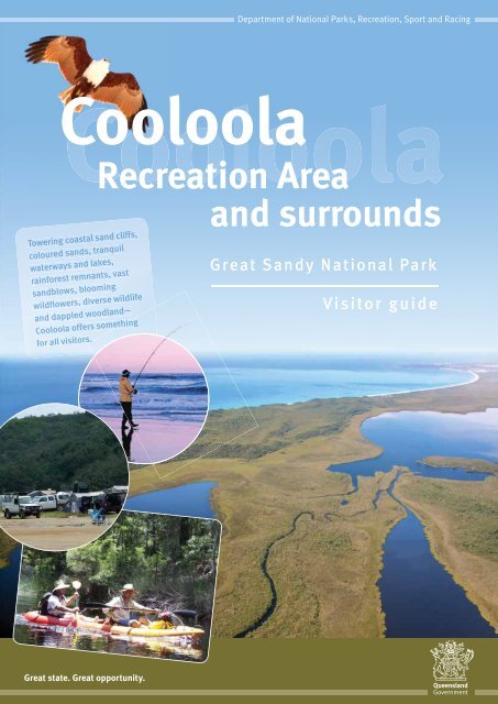
<strong>Cooloola</strong><br />
<strong>Recreation</strong> <strong>Area</strong><br />
Towering coastal sand cliffs,<br />
coloured sands, tranquil<br />
waterways and lakes,<br />
rainforest remnants, vast<br />
sandblows, blooming<br />
wildflowers, diverse wildlife<br />
and dappled woodland<br />
<strong>Cooloola</strong> <strong>of</strong>fers something<br />
for all <strong>visitor</strong>s.<br />
and surrounds<br />
Great Sandy <strong>National</strong> Park<br />
Visitor <strong>guide</strong><br />
Great state. Great opportunity.
<strong>Cooloola</strong>—a coastal<br />
wonderland with<br />
long sweeping<br />
landscapes.<br />
Photo: Robert<br />
Ashdown, Qld Govt.<br />
Welcome to<br />
<strong>Cooloola</strong> and Inskip Peninsula<br />
2<br />
Traditional Owners have a long and ongoing relationship with<br />
the area that falls under Queensland’s national parks and<br />
forests. In order to acknowledge the important connection<br />
with Aboriginal people, the Queensland Parks and Wildlife<br />
Service (QPWS) urges <strong>visitor</strong>s to treat the country through<br />
which they walk with respect and care.<br />
<strong>Cooloola</strong> is a refuge for plants and<br />
animals whose habitats have been<br />
reduced by rural, urban and coastal<br />
development. The area showcases<br />
spectacular sand dunes and the tranquil<br />
headwaters <strong>of</strong> the upper Noosa River with<br />
one <strong>of</strong> the most protected catchments<br />
left in Queensland.<br />
<strong>Cooloola</strong>’s fascinating sandmass, built<br />
up over the past 500 000 years, includes<br />
long beaches backed by high dunes.<br />
Its open heath plains are splashed with<br />
colourful wildflowers. <strong>Cooloola</strong> features<br />
mangroves, woodlands <strong>of</strong> banksias and<br />
scribbly gum, shady blackbutt forests,<br />
rainforests with towering trees, and<br />
tranquil lakes and waterways. A haven<br />
for birds, both sea and land, <strong>Cooloola</strong><br />
is a photographer’s delight <strong>of</strong>fering<br />
long landscapes and stunning sunsets—<br />
a perfect holiday destination for<br />
walking, camping, canoeing and<br />
four-wheel driving.<br />
The <strong>Cooloola</strong> <strong>Recreation</strong> <strong>Area</strong>, totalling<br />
61 750 ha, covers the existing 56 600 ha<br />
<strong>of</strong> the Great Sandy <strong>National</strong> Park, as well<br />
as various state and local governmentmanaged<br />
areas, such as roads, beaches,<br />
esplanades and other lands to the low<br />
water mark.<br />
More than a third <strong>of</strong> the Noosa River’s<br />
catchment area is national park.<br />
The Noosa River’s excellent water quality<br />
is largely due to this protected upper<br />
catchment. The Noosa River is around<br />
60km long and flows into the South<br />
Pacific Ocean at Laguna Bay,<br />
Noosa Heads.<br />
Shallow lakes in the river system are tidal<br />
and contain brackish and fresh water.<br />
The surrounding wetlands are a nursery<br />
for juvenile fish.<br />
Enjoying <strong>Cooloola</strong> means seeing some <strong>of</strong><br />
the best preserved coastal landscapes<br />
in Queensland. It’s a place worth visiting<br />
and looking after.<br />
Fire management is just one <strong>of</strong> the<br />
many major tasks <strong>of</strong> QPWS in <strong>Cooloola</strong>.<br />
Photo: Qld Govt.<br />
Management<br />
<strong>Department</strong> <strong>of</strong> <strong>National</strong> Parks,<br />
<strong>Recreation</strong>, Sport and Racing’s (NPRSR),<br />
Queensland Parks and Wildlife Service<br />
(QPWS) manages <strong>Cooloola</strong> as a protected<br />
area to conserve its natural, cultural and<br />
recreational values and resources for all<br />
to enjoy, now and in the future. Most <strong>of</strong><br />
the <strong>Cooloola</strong> section <strong>of</strong> the Great Sandy<br />
<strong>National</strong> Park is included in the <strong>Cooloola</strong><br />
<strong>Recreation</strong> <strong>Area</strong>. The area is protected<br />
under the <strong>Recreation</strong> <strong>Area</strong>s Management<br />
Act 2006 and the Nature Conservation<br />
Act 1992. The recreation area provides<br />
for the protection <strong>of</strong> the area and the<br />
management <strong>of</strong> activities right down to<br />
the low water mark.<br />
To the north <strong>of</strong> <strong>Cooloola</strong> lies the Inskip<br />
Peninsula <strong>Recreation</strong> <strong>Area</strong>, popular for<br />
camping and fishing and as a gateway to<br />
access the Fraser Island World Heritage<br />
<strong>Area</strong>, which is also a recreation area and<br />
is the other significant section <strong>of</strong> the<br />
Great Sandy <strong>National</strong> Park.<br />
The coastal waters <strong>of</strong> <strong>Cooloola</strong> north <strong>of</strong><br />
Double Island Point, including the Tin<br />
Can Inlet and the Great Sandy Strait,<br />
are protected under the Great Sandy<br />
Marine Park. Marine park zones and<br />
designated areas have been identified<br />
and implemented within the Great Sandy<br />
Marine Park specifically to protect the<br />
area’s features, wildlife and habitat.<br />
All <strong>of</strong> these areas are managed by QPWS.<br />
More information is available online at<br />
www.nprsr.qld.gov.au.
Access<br />
<strong>Cooloola</strong> lies between the coastal towns<br />
<strong>of</strong> Noosa Heads and Rainbow Beach.<br />
It is about 240 km or a 2–3 hour drive<br />
north from Brisbane. Conventional<br />
vehicle access is very limited within<br />
the recreation area. See map for<br />
more details.<br />
Beach and track conditions<br />
Always carry a recent version <strong>of</strong> the<br />
<strong>Cooloola</strong> Conditions Report, which shows<br />
track and beach conditions and any park<br />
alerts, closures or weather warnings.<br />
Pick one up from a QPWS information<br />
centre with a permit pack or download<br />
a copy online at www.nprsr.qld.gov.au<br />
before leaving home.<br />
Beach access<br />
Vehicle access to the beach is possible<br />
from Rainbow Beach or Tewantin<br />
(near Noosa).<br />
From Rainbow Beach, access the beach<br />
vehicle ramp at the end <strong>of</strong> Griffin<br />
Esplanade. Alternative beach access<br />
points are from Freshwater Road or the<br />
Kings Bore circuit track (<strong>of</strong>f Rainbow<br />
Beach Road).<br />
From Tewantin, catch the ferry at the end<br />
<strong>of</strong> Moorindil Street, across the Noosa<br />
River and drive to the beach access<br />
points at Noosa North Shore.<br />
<strong>Cooloola</strong> Way<br />
(high clearance 4WDs only)<br />
This council-maintained track is suitable<br />
for high clearance 4WDs only—it is <strong>of</strong>ten<br />
very rough and slippery when wet.<br />
It passes through the western catchment<br />
<strong>of</strong> the upper Noosa River. The track links<br />
Rainbow Beach Road with the Kin Kin–<br />
Wolvi Road. The Noosa River bridge may<br />
be impassable after wet weather.<br />
Seek local advice before travelling.<br />
For 2WD vehicles<br />
Conventional 2WD vehicles can reach<br />
Bymien picnic area from the Rainbow<br />
Beach Road. Turn <strong>of</strong>f 4 km south <strong>of</strong><br />
Rainbow Beach onto 3 km <strong>of</strong> unsealed<br />
road. Do not travel further as 2WDs or allwheel-drive<br />
vehicles are likely to get stuck.<br />
Only 4WD vehicles with high clearance<br />
can travel beyond Bymien to Teewah<br />
Beach. The road turns into a rough sandy<br />
track with some long stretches <strong>of</strong> deep<br />
loose sand.<br />
Inland tracks are not suitable<br />
for caravans.<br />
Camper trailers must have<br />
good clearance.<br />
Two-wheel-drive vehicles can reach<br />
Inskip Peninsula <strong>Recreation</strong> <strong>Area</strong> via<br />
Rainbow Beach along Clarkson Drive.<br />
The S.S. Dorrigo and M.V. Sarawak<br />
camping areas have 2WD access under<br />
normal conditions. At all other times and<br />
at all other camping areas, 4WD vehicles<br />
are needed.<br />
In the south, 2WD vehicles can reach<br />
Boreen Point and Elanda Point. Once over<br />
the Noosa River via ferry at Tewantin, there<br />
is sealed road access around the Noosa<br />
North Shore. Stay clear <strong>of</strong> beach access<br />
cuttings as these sand tracks are only<br />
suitable for 4WD vehicles. Please use the<br />
car parks provided nearby, if spending<br />
time on the beach.<br />
Boating<br />
Tour boats operate daily from Noosa<br />
and Tewantin. Canoes, kayaks and small<br />
power boats can be hired from private<br />
operators at Boreen Point and Elanda<br />
Point. Power boats can be launched from<br />
the boat ramp at Boreen Point.<br />
Canoes or kayaks can only be launched<br />
at Elanda Point (100 m south <strong>of</strong> the<br />
private camping area) and Harrys<br />
camping and day-use area.<br />
Lake Cootharaba forms the southern<br />
entrance to the upper Noosa River. It is<br />
a large, shallow lake, and can be rough<br />
to cross in strong winds. Plan to cross in<br />
the morning when conditions are likely<br />
to be calm. Stop for a break and short<br />
boardwalk at Kinaba, a small information<br />
centre on the edge <strong>of</strong> the lake. From<br />
Kinaba, explore the calm, more protected<br />
waters <strong>of</strong> Kin Kin Creek and the upper<br />
Noosa River.<br />
Photo: Qld Govt.<br />
Don’t let a trip turn into tragedy.<br />
Mudlo Rocks are just south <strong>of</strong><br />
the beach access ramp at Rainbow<br />
Beach. When exposed, these rocks are<br />
generally impassable at high tide, and<br />
<strong>of</strong>ten at low tide as well, depending on<br />
conditions. Only experienced drivers<br />
should attempt to cross. Use extreme<br />
caution at all times. Conditions change<br />
daily—always check first.<br />
Due to continual beach erosion <strong>of</strong> the sand cliffs between Rainbow<br />
Beach and the Leisha Track, and the exposure <strong>of</strong> Mudlo Rocks in<br />
front <strong>of</strong> Rainbow Beach, this section <strong>of</strong> beach may be impassable<br />
at low tide. Use Freshwater Road as an alternative route.<br />
Photo: Kerry Schultz<br />
3
Searys Creek—<br />
picnic in the<br />
bush at one <strong>of</strong> the<br />
smaller day-use<br />
areas in <strong>Cooloola</strong>.<br />
Photo: Rene Burgess,<br />
Qld Govt.<br />
On-park information and facilities<br />
QPWS information centres are the best<br />
source <strong>of</strong> information. <strong>Cooloola</strong> has two<br />
centres—Rainbow Beach and Tewantin—see<br />
map for details. Drop in before heading out<br />
to collect any updated conditions reports or<br />
to read more about the area.<br />
To help <strong>visitor</strong>s find their way through<br />
the park and to enrich their <strong>visitor</strong><br />
experience, QPWS provides a host <strong>of</strong><br />
orientation and interpretation signs in<br />
the main camping and day-use areas.<br />
Management, traffic, safety, warning and<br />
danger signs are in place to alert <strong>visitor</strong>s<br />
<strong>Cooloola</strong> day-use areas and information centres at a glance<br />
Location/Facilities Access Description<br />
to potential risks or management issues<br />
that help keep <strong>Cooloola</strong> beautiful and<br />
its <strong>visitor</strong>s safe. Please read and heed<br />
these signs.<br />
Day-use areas<br />
Pack a picnic and enjoy a short stay at<br />
one <strong>of</strong> <strong>Cooloola</strong>’s day-use areas.<br />
• Freshwater is just behind the<br />
foredunes <strong>of</strong> Teewah Beach.<br />
• Bymien is within subtropical<br />
rainforest <strong>of</strong>f the Freshwater Road.<br />
• Searys Creek is close to a creek-side e<br />
boardwalk <strong>of</strong>f the Rainbow<br />
Beach Road.<br />
• Fig Tree Point and Harry’s Hut are<br />
both on the upper Noosa River.<br />
Boardwalks keep <strong>visitor</strong>s’<br />
feet dry and protect<br />
the fragile creek<br />
side plants.<br />
Photo: Qld Govt.<br />
Photo: Qld Govt.<br />
Searys Creek day-use area 2WD Cool <strong>of</strong>f next to this clear freshwater creek, and watch for small fish and crustaceans<br />
from the boardwalk.<br />
Bymien day-use area<br />
2WD,<br />
walk<br />
Small picnic area set in rainforest. Wheelchair accessible toilet and table facilities<br />
available. Short walking track nearby (not suitable for wheelchairs).<br />
Freshwater day-use area<br />
4WD,<br />
walk<br />
Set behind the dunes on Teewah Beach, the Freshwater day-use area is a good spot<br />
for a picnic or barbecue. Stroll to the beach through coastal dune vegetation.<br />
Cold<br />
Boil before<br />
drinking<br />
Kinaba Information Centre<br />
(unstaffed)<br />
Walk,<br />
canoe/kayak,<br />
motorised vessel<br />
The Sir Thomas Hiley Information Centre (Kinaba) provides great views <strong>of</strong> Lake<br />
Cootharaba. Visit displays and a self-<strong>guide</strong>d boardwalk through the mangroves.<br />
From here, a narrow channel provides access to the upper Noosa River.<br />
Fig Tree Point day-use area<br />
Boil before<br />
drinking<br />
Walk,<br />
canoe/kayak,<br />
motorised vessel<br />
Follow the signs across Fig Tree Lake to Fig Tree Point camping and day-use area.<br />
Visit the Melaleuca circuit boardwalk through paperbark and cabbage palm wetland.<br />
Harrys day-use area<br />
Boil before<br />
drinking<br />
Walk,<br />
canoe/kayak,<br />
motorised vessel,<br />
4WD<br />
View the culturally listed timber-cutter’s hut known as ‘Harry’s Hut’ and enjoy lunch<br />
with river views. Goannas and brush turkeys frequent this area. Please do not feed<br />
or leave scraps for them or any other wildlife.<br />
4
Drives around <strong>Cooloola</strong><br />
Roads through the park allow <strong>visitor</strong>s to<br />
explore <strong>Cooloola</strong>’s magnificent natural<br />
features. Take time to plan trips and<br />
enjoy the area’s highlights. <strong>Cooloola</strong>’s<br />
sand tracks are only suitable for high<br />
clearance 4WDs. All-wheel-drive vehicles,<br />
or vehicles towing trailers, boats or<br />
caravans may have difficulty and are not<br />
recommended on inland tracks.<br />
Photo: Qld Govt.<br />
Photo: Adam Creed, Qld Govt.<br />
Domestic animals restricted<br />
Domestic animals are prohibited in<br />
the <strong>Cooloola</strong> <strong>Recreation</strong> <strong>Area</strong>,<br />
including dogs:<br />
• Travelling inside vehicles traversing<br />
through the recreation area;<br />
• On beaches north <strong>of</strong> the village <strong>of</strong><br />
Teewah to Middle Rock, including the<br />
intertidal zone (see map pp 10–11);<br />
• On all vehicle tracks (see map<br />
pp 10–11 and table below);<br />
• In all camping and day-use areas.<br />
A designated dog-friendly area<br />
in the beach intertidal zone is<br />
provided from 1 st cutting on Noosa North<br />
Shore to the northern edge <strong>of</strong> the village<br />
<strong>of</strong> Teewah, but dogs must be on a leash<br />
and under control at all times.<br />
<strong>Cooloola</strong>’s inland tracks are generally<br />
one lane. Use existing passing bays (pull<strong>of</strong>f<br />
areas) when encountering other traffic.<br />
Avoid driving over vegetation.<br />
Horses are permitted in the beach<br />
intertidal zone on Noosa North<br />
Shore—between the beach closure at<br />
the Noosa River estuary and Teewah<br />
township. Horses must not exceed<br />
walking pace between the 1 st and 3 rd<br />
cuttings. Horses are not permitted on<br />
the <strong>Cooloola</strong> Great Walk.<br />
<strong>Cooloola</strong> drives at a glance<br />
Drive<br />
Vehicle access<br />
permit required?<br />
Access Distance More details<br />
Teewah Beach Yes 4WD only 44 km Providing access to the Teewah Beach camping area<br />
(spanning 15 km), the Freshwater camping and day-use<br />
area and Double Island Point.<br />
<strong>Cooloola</strong> Way No 4WD 32 km Connecting Rainbow Beach Road and the Kin Kin–Wolvi<br />
Road, through <strong>Cooloola</strong>’s western catchment. This track<br />
contains a low area <strong>of</strong> wallum banksia that flowers<br />
prolifically in spring, with some taller forests on sand ridges.<br />
Freshwater Road<br />
Yes (only between<br />
Bymien Picnic<br />
<strong>Area</strong> and Teewah<br />
Beach)<br />
2WD Rainbow<br />
Beach Road to<br />
Bymien.<br />
4WD only<br />
Bymien to<br />
Teewah Beach<br />
19 km A delightful drive through <strong>Cooloola</strong>’s diverse plant<br />
communities. From Rainbow Beach Road, 2WD vehicles can<br />
drive 3 km to view rainforest around Bymien picnic area.<br />
The road winds on, suitable for 4WD only, through tall<br />
blackbutt forest, scribbly gum woodland and coastal<br />
banksia communities. Freshwater camping and day-use<br />
areas are 500 m inland from Teewah Beach.<br />
Kings Bore circuit track<br />
(locally known as<br />
Pettigrews Road, Kings<br />
Bore Road and the<br />
eastern and western<br />
firebreaks)<br />
Yes 4WD 18 km (1hr)<br />
40 km circuit<br />
(4–5 hrs)<br />
Take care!—remote, unsigned, rough sand tracks. Entry is<br />
<strong>of</strong>f Rainbow Beach Road. The final section—Kings Bore<br />
Road—is very steep and one way only to the beach. Study<br />
the map carefully. Be self-sufficient and carry enough<br />
drinking water, appropriate communication equipment and<br />
vehicle recovery gear. Read ‘Sand driving safety’ (pp 18–19).<br />
Harry’s Hut Road No 4WD 10 km<br />
(30 mins)<br />
Poverty Point Road No 4WD 6.3 km<br />
(20 mins)<br />
This track is prone to flooding, so take care when driving<br />
as there are generally washouts and large potholes.<br />
The track meanders through open scribbly gum woodlands<br />
and a pocket <strong>of</strong> hidden rainforest before ending at Harrys<br />
camping and day-use area on the bank <strong>of</strong> the upper<br />
Noosa River.<br />
Track winds through low-lying wallum wetlands and ends at<br />
a remote camping area on Tin Can Inlet. Expect some long<br />
stretches <strong>of</strong> deep loose sand with some sections becoming<br />
inundated after heavy rainfall.<br />
Photo: Robert Ashdown, Qld Govt.<br />
5
Photo: Robert Ashdown,<br />
Queensland Government<br />
Walking around<br />
<strong>Cooloola</strong><br />
Walking is a good way to<br />
experience <strong>Cooloola</strong>. Tracks<br />
range from short circuits to<br />
long hikes and lead to some<br />
<strong>of</strong> the park’s best features.<br />
Walking track classification<br />
Most <strong>of</strong> <strong>Cooloola</strong>’s walking tracks are<br />
class 4 walking tracks, except for some<br />
See ‘Walking safety’ on<br />
page 18 <strong>of</strong> this <strong>guide</strong>.<br />
Photo: Briony Masters, Qld Govt.<br />
boardwalk tracks (Searys Creek and<br />
Kinaba) and the shorter tracks, such as<br />
the class 3 Carlo Sandblow track (600 m).<br />
Take time to read the classification details<br />
before walking out into the park. Study the<br />
map in detail.<br />
Class 4 track<br />
Australian Standards<br />
• Distinct tracks with junctions<br />
signposted, rough track surfaces with<br />
exposed roots and rocks.<br />
• Variable in width, muddy sections and<br />
steep grades likely to be encountered.<br />
• May be extensively overgrown;<br />
hazards, such as fallen trees and<br />
vines, likely to be present.<br />
• Caution needed at creek crossings<br />
and naturally occurring lookouts.<br />
• Moderate fitness level with<br />
bushwalking experience and anklesupporting<br />
footwear required.<br />
• Moderate level <strong>of</strong> navigation skills<br />
recommended, involving self-reliance<br />
in first aid and coping with weather<br />
hazard situations.<br />
Track Distance/Time Description<br />
1 Teewah landing<br />
track<br />
4 km return<br />
1 hr 30 mins<br />
2 Kinaba track 12.2 km return<br />
4 hrs 30 mins<br />
3 Mangrove<br />
self-<strong>guide</strong>d walk<br />
4 Elanda circuit<br />
via Mill Point<br />
5 Elanda to<br />
Fig Tree Point<br />
6 Melaleuca circuit<br />
at Fig Tree Point<br />
500 m circuit<br />
20 mins<br />
5.1 km<br />
2 hrs<br />
10.6km one way<br />
3 hrs 30 mins<br />
500 m<br />
20 mins<br />
7 Boronia trail 1.8 km one way<br />
1 hr<br />
8 Fig Tree Point to<br />
Harrys camping<br />
and day-use area<br />
9 Harrys camping<br />
and day-use area<br />
to camp site 3<br />
10 Camp site 3<br />
to <strong>Cooloola</strong><br />
Sandpatch<br />
11 Harrys camping<br />
and day-use area<br />
to Wandi waterhole<br />
12 Wandi waterhole to<br />
Neebs waterhole<br />
13 Neebs waterhole to<br />
Mullens car park<br />
6.6 km one way<br />
2 hrs 30 mins<br />
12.8 km return<br />
4 hrs 30 mins<br />
12 km return<br />
4 hrs<br />
9.5 km one way<br />
3 hrs 30 mins<br />
13.1 km one way<br />
4 hrs 30 mins<br />
8.1 km one way<br />
2 hrs 30 mins<br />
Walk from Lake Cootharaba through coastal heath and woodland to Teewah Beach. A side track<br />
to Seawah Hill (4 km return to Teewah Landing track) <strong>of</strong>fers spectacular views from the river to<br />
the ocean and to Noosa Heads.<br />
Walk to Kinaba through paperbark and cabbage palm wetland.<br />
Follow the self-<strong>guide</strong>d walk along the boardwalk from Kinaba through the mangroves.<br />
Walk through allocasuarina and paperbark forests. Take a 400 m side track to Mill Point and<br />
follow the self-<strong>guide</strong>d historical walk to the site <strong>of</strong> a timber mill township that flourished from<br />
1862 to 1892.<br />
Walk through the Elanda Plains and open woodland to the remnant rainforests <strong>of</strong> Kin Kin Creek<br />
(4.7 km). Cross the footbridge and walk to Fig Tree Point, a further 5.9 km. Also see ‘Long-distance<br />
walking tracks’ in this section.<br />
Follow the boardwalk through paperbark and cabbage palm wetland.<br />
Branching <strong>of</strong>f the <strong>Cooloola</strong> Wilderness Trail (700 m from Kin Kin Creek footbridge)<br />
on the northern bank <strong>of</strong> Kin Kin Creek, walk through rainforest and woodland to<br />
Harry’s Hut Road.<br />
This track follows part <strong>of</strong> the <strong>Cooloola</strong> Wilderness Trail through some low lying areas <strong>of</strong> open<br />
and closed forests. Also see ‘Long-distance walking tracks’ in this section.<br />
Paddle across the river from Harry’s Hut and follow the walking track along the river to<br />
camp site 3.<br />
Walk through coastal heath along a low sandy ridge from camp site 3. The track ascends<br />
through blackbutt forest to the <strong>Cooloola</strong> Sandpatch for panoramic views over the ocean<br />
and national park.<br />
Walk next to the upper Noosa River then change course into the remote western river<br />
catchment system, ending at a camp site beside a naturally-dammed section <strong>of</strong> the<br />
Noosa River catchment. Also see ‘Long-distance walking tracks’ in this section.<br />
Walk through pockets <strong>of</strong> scribbly gum, melaleuca and wallum banksia woodlands before<br />
relaxing at a camp site beside a large waterhole. Beware <strong>of</strong> traffic when crossing the<br />
<strong>Cooloola</strong> Way. Also see ‘Long-distance walking tracks’ in this section.<br />
Continue walking through a mix <strong>of</strong> woodland and heath communities towards Mullens<br />
car park. Also see ‘Long-distance walking tracks’ in this section.<br />
6
Long-distance walking tracks<br />
Long distance walkers should walk<br />
in small groups and take a map<br />
and compass.<br />
<strong>Cooloola</strong> Wilderness Trail<br />
47.9 km, three to five days<br />
This track follows mostly level terrain and<br />
winds through heathland and rainforest.<br />
It connects East Mullen car park (<strong>of</strong>f<br />
Rainbow Beach Road) to Elanda Point.<br />
Camping is available at Neebs and<br />
Wandi waterholes, Fig Tree Point and<br />
Harrys camping areas. Bring gas or fuel<br />
stoves, as campfires are not permitted.<br />
Walkers need to be relatively fit; it can be<br />
strenuous in high summer temperatures.<br />
Low-lying areas are wet all year round,<br />
but never walk here after heavy rain;<br />
flooded creek crossings are too<br />
dangerous. It may be necessary to cancel<br />
walking at short notice. Be prepared to<br />
make alternative arrangements when<br />
tracks are closed. Check before leaving<br />
home. Search for <strong>Cooloola</strong> Conditions<br />
Report or park alerts online at<br />
www.nprsr.qld.gov.au.<br />
<strong>Cooloola</strong> Great Walk<br />
up to 102 km one way,<br />
five days<br />
Camping is limited. Bookings are essential<br />
to ensure a place in one <strong>of</strong> the four walkers’<br />
camps. Do not undertake the <strong>Cooloola</strong><br />
Great Walk without a topographic map,<br />
a compass, reliable communication and<br />
navigation gear.<br />
Photo: Briony Masters, Qld Govt.<br />
Photo: Robert Ashdown, Qld Govt.<br />
For more details search for <strong>Cooloola</strong><br />
Great Walk on www.nprsr.qld.gov.au.<br />
Please note: topographic map sale<br />
points are listed under the ‘Further<br />
information’ section.<br />
Track Distance/Time Description<br />
14 Rainbow Beach to<br />
Carlo Sandblow<br />
15 Rainbow Beach to<br />
Coloured sands<br />
3.8 km return<br />
1 hr 30 mins<br />
6 km return<br />
2 hrs<br />
16 Searys Creek 250 m return<br />
10 mins<br />
17 Dandathu circuit<br />
at Bymien<br />
18 Bymien to<br />
Poona Lake<br />
19 Freshwater<br />
camping area to<br />
Freshwater Lake<br />
20 Freshwater Lake<br />
circuit<br />
21 Freshwater Lake<br />
to Bymien<br />
22 Rainbow Beach<br />
to Bymien<br />
23 Teewah Beach<br />
to Double Island<br />
Point lighthouse<br />
24 Rainbow Beach<br />
to Double Island<br />
Point<br />
<strong>Cooloola</strong><br />
Wilderness Trail<br />
<strong>Cooloola</strong> Great Walk<br />
250 m return<br />
10 mins<br />
4.2 km return<br />
1 hr 30 mins<br />
2.4 km return<br />
50 mins<br />
4.7 km return<br />
2 hrs<br />
17 km return<br />
5 hrs<br />
15 km return<br />
5 hrs<br />
2.2 km return<br />
45 mins<br />
30 km return<br />
One full day<br />
47.9 km one way<br />
Three to five days<br />
Up to 102 km<br />
one way.<br />
Five days<br />
Leave from the QPWS information centre car park in Rainbow Beach and follow this track<br />
through woodland to a natural sandblow with extensive views east and west.<br />
Walk east along the beach from Rainbow Beach township to where spectacular eroded cliff<br />
lines expose coloured sands.<br />
Start at the roadside car park (<strong>of</strong>f Rainbow Beach Road) 7.5 km south <strong>of</strong> Rainbow Beach and<br />
follow the boardwalk to reach a stream that flows through wallum and low woodland.<br />
Enjoy an easy walk through rainforest.<br />
From Dandathu track, climb a rainforest-clad high dune before descending to Poona’s white<br />
sandy beach and tea-coloured waters <strong>of</strong> this perched lake.<br />
Walk through scribbly gum woodland and open forest to Freshwater Lake, flanked with reeds and<br />
twisted paperbarks. The lake is <strong>of</strong>ten dry.<br />
An easy walk through rainforest and open forest and woodland, along part <strong>of</strong> the <strong>Cooloola</strong><br />
Great Walk and around the lake.<br />
Pass through scribbly gums, blackbutt and rainforest, passing Poona Lake through carrol<br />
scrub Backhousia myrtifolia understorey.<br />
From Carlo Sandblow follow a section <strong>of</strong> the old telegraph line through undulating terrain <strong>of</strong><br />
woodland and rainforest to Bymien picnic area.<br />
Starting from the southern side <strong>of</strong> the headland, the walking track to the lighthouse is steep,<br />
but has fantastic views. Please do not enter the mowed grassed areas at the houses.<br />
An early start is recommended. From QPWS information centre in Rainbow Beach walk along<br />
a sandy bush track along the high dunes before crossing the Leisha Track to the Double Island<br />
Point toilet block. Continue along the northern beach to reach the historical Double Island<br />
Point lighthouse.<br />
This long-distance track <strong>of</strong>fers a wilderness experience with wildflowers, chattering birds, cool clear<br />
waterways and solitude. Best time to visit is wildflower season; late winter to early spring. This three<br />
to five day walk is a combination <strong>of</strong> tracks 5, 8, 11, 12 and 13 on the map. Also see ‘Long-distance<br />
walking tracks’ section.<br />
This five-day walk links the Noosa North Shore to Rainbow Beach via the high eastern dunes<br />
known as the <strong>Cooloola</strong> sandmass. The track winds through rainforest, tall eucalypt forest, dry<br />
coastal woodland and heath plains. Also see ‘Long-distance walking tracks’ in this section.<br />
Photo: Briony Masters, Qld Govt.<br />
7
Low-key camping<br />
and 180-degree<br />
views at the<br />
Brahminy walkers’<br />
camp along the<br />
<strong>Cooloola</strong> Great Walk.<br />
Photo: Robert<br />
Ashdown, Qld Govt.<br />
Camping<br />
<strong>Cooloola</strong> <strong>of</strong>fers camping in beautiful natural surroundings across<br />
a variety <strong>of</strong> locations from beach to riverside and walk-in to car<br />
camping, as well as large camping areas with facilities.<br />
Some areas are very popular,<br />
especially in school holidays and<br />
over long weekends. Expect crowds.<br />
Capacity is limited. Choose to visit<br />
in a quieter time <strong>of</strong> year or book<br />
early to avoid disappointment.<br />
See ‘Permits’ on the back page <strong>of</strong><br />
this <strong>guide</strong> for booking details.<br />
Photo: Adam Creed, EHP<br />
Group activity permits may be required<br />
for large organised group activities, such<br />
as weddings, school or scout outings<br />
or large gatherings. See ‘Group activity<br />
permits’ on the back page <strong>of</strong> this <strong>guide</strong>.<br />
Rangers may visit camp sites to check<br />
permits and to answer questions. Police<br />
patrol camping areas and beaches to<br />
help keep camping experiences safe.<br />
In any emergency call Triple Zero (000)<br />
or try 112 in no or low mobile<br />
reception area.<br />
Photo: Robert Ashdown, Qld Govt.<br />
Don’t risk a fine!<br />
• Camp only in designated camping<br />
areas. Penalties apply for camping<br />
in a restricted area.<br />
• Camping permits are required<br />
before setting up camp.<br />
• Vehicle access permits are required<br />
in some areas, marked on the map.<br />
• Domestic animals are not permitted<br />
inside or outside <strong>of</strong> cars in the<br />
<strong>Cooloola</strong> <strong>Recreation</strong> <strong>Area</strong>.<br />
• Campfires are only permitted at<br />
Poverty Point and Teewah Beach<br />
camping areas unless a fire<br />
prohibition is in place—more details<br />
under ‘Care for <strong>Cooloola</strong> and Inskip’<br />
(pp 16–17).<br />
• Generators are not permitted in<br />
<strong>Cooloola</strong> camping and day-use<br />
areas unless signposted.<br />
• The use <strong>of</strong> portable sand spears to<br />
collect sub-surface water from the<br />
foredune areas is not permitted.<br />
• Beach camping is not permitted<br />
outside <strong>of</strong> Teewah Beach camping<br />
area, including areas from Double<br />
Island Point west to Rainbow Beach.<br />
8<br />
Photo: Rene Burgess, Qld Govt.
<strong>Cooloola</strong> camping at a glance<br />
Location/Facilities Access Description<br />
Teewah Beach camping area<br />
Poverty Point camping area<br />
Freshwater camping area<br />
Hot<br />
Fig Tree Point camping area<br />
Harrys camping area<br />
Camp sites 1 and 2<br />
Camp site 3<br />
Camp sites 4-15<br />
Boil before<br />
drinking<br />
Boil before<br />
drinking<br />
Wandi & Neebs waterholes<br />
(<strong>Cooloola</strong> Wilderness Trail)<br />
Boil before<br />
drinking<br />
Boil before<br />
drinking<br />
4WD,<br />
walk<br />
4WD,<br />
boat<br />
4WD,<br />
walk<br />
Walk,<br />
canoe/kayak,<br />
motorised vessel<br />
Walk,<br />
canoe/kayak,<br />
motorised vessel,<br />
4WD<br />
Walk,<br />
canoe/kayak,<br />
motorised vessel<br />
Walk,<br />
canoe/kayak,<br />
motorised vessel<br />
Canoe/kayak,<br />
electric motors<br />
and non-motorised<br />
vessels only<br />
Walk<br />
This is a 15 km camping area between the Sunshine Coast Regional<br />
Council boundary and Little Freshwater Creek. Cold showers are<br />
available at Freshwater day-use area. Treat all water before drinking.<br />
Fresh water obtained from pools, creeks or from sub-surface supplies<br />
on Teewah Beach is not suitable for drinking, cooking, showering or<br />
swimming. Campfires permitted. Collection <strong>of</strong> firewood is prohibited,<br />
bring untreated mill <strong>of</strong>f-cuts as firewood. Do not litter. Bulk rubbish bins<br />
are provided in the camping area. Bring a portable toilet, rather than<br />
bush toileting in the dunes. A toilet waste disposal facility is located<br />
at Freshwater, opposite the day-use area. Generators are permitted<br />
between 7 am and 9 pm. Maximum stay: 30 days<br />
This undeveloped camping area overlooks the shallow, tidal waters <strong>of</strong> Tin Can<br />
Inlet. Turn-<strong>of</strong>f to Poverty Point is 13 km south <strong>of</strong> Rainbow Beach <strong>of</strong>f Rainbow<br />
Beach Road. The camping area is a further 6.3 km from the turn-<strong>of</strong>f on a 4WDonly<br />
track. Bring insect repellent to discourage mosquitoes and sandflies.<br />
Fires are permitted in QPWS-provided fire rings only, but bring untreated,<br />
mill <strong>of</strong>f-cuts as firewood. Generators are not permitted in the camping area.<br />
Maximum stay: 30 days<br />
Located 8 km south <strong>of</strong> Double Island Point along Teewah Beach, the<br />
camping area (59 sites) is set among scribbly gum woodland about<br />
500 m inland from the beach, <strong>of</strong>f Freshwater Road.<br />
Sites must be pre-booked at all times <strong>of</strong> the year. A group site is also<br />
available for large groups. Book through the QPWS <strong>of</strong>fice at Tewantin.<br />
Bring $1 coins for hot and cold showers. Bring fuel stoves for cooking.<br />
Free gas barbeques are provided in the nearby day-use area. Do not<br />
litter. Bulk rubbish bins are provided in the camping area.<br />
Maximum stay: 30 days<br />
On the northern fringe <strong>of</strong> Fig Tree Lake (upper Noosa River) set among<br />
open forests with some wet, closed forest types (melaleuca species and<br />
cabbage tree palms). Camp sites cater for multiple groups.<br />
Maximum stay: 21 days<br />
Enjoy camping on the western bank <strong>of</strong> the upper Noosa River set<br />
among fringes <strong>of</strong> open forest and woodland (melaleuca, allocasuarina,<br />
bloodwood and eucalypt species). There are vehicle camp sites and<br />
river camp sites for canoe or boat users. Maximum stay: 21 days<br />
These sites are on the eastern bank <strong>of</strong> the upper Noosa River north <strong>of</strong><br />
Harrys camping and day-use area. Set among fringes <strong>of</strong> open forest or<br />
woodland (melaleuca, allocasuarina, bloodwood and eucalypt species)<br />
bordering open heathland plains to the east. Maximum stay: 21 days<br />
Caters for larger groups with walking track access to the <strong>Cooloola</strong><br />
Sandpatch—a large well developed sandblow on the <strong>Cooloola</strong><br />
sandmass—<strong>of</strong>fering spectacular views over the Noosa river and lakes.<br />
Maximum stay: 21 days<br />
These remote camp sites cater for small groups wishing for a more<br />
remote camping experience. No facilities. Please take all rubbish and,<br />
if possible, toilet waste when leaving. Personal hygiene kits are<br />
available at bigger camping stores. Maximum stay: 21 days<br />
These two camping areas <strong>of</strong>fer reasonably flat camp sites among wallum<br />
and woodland, along the <strong>Cooloola</strong> Wilderness Trail. No facilities. Please<br />
take all rubbish and, if possible, toilet waste when leaving. Personal<br />
hygiene kits are available at bigger camping stores.<br />
Maximum stay: 21 days<br />
Inskip camping 2WD, 4WD See Inskip section (pp 14–15) <strong>of</strong> this <strong>guide</strong>.<br />
<strong>Cooloola</strong> Great Walk walkers’ camps<br />
Boil before<br />
drinking<br />
Walk Four walkers’ camps are provided along the <strong>Cooloola</strong> Great Walk.<br />
The topographic map is essential for planning and walking this 102 km<br />
long-distance track. See page 7 for more details.<br />
Maximum stay: one night<br />
Note: Camper numbers in the upper Noosa River are limited. This <strong>of</strong>fers <strong>visitor</strong>s a less crowded camping experience and helps to minimise<br />
impact on this fragile ecosystem. In contrast, Teewah Beach camping area caters for very large numbers. It is very full on weekends, school<br />
and public holidays. Bookings are essential.<br />
9
4WD only<br />
(Remote,<br />
unsigned tracks)<br />
Bathing reserve<br />
Beach access<br />
Griffin Esp<br />
Inskip Point 13 km<br />
Bullock Point 10 km<br />
Great Walkers are required to obtain a<br />
<strong>Cooloola</strong> Great Walk topographic map prior<br />
to undertaking this five-day trek. It contains<br />
a comprehensive walking <strong>guide</strong>, planning<br />
hints, safety tips, topographic map and<br />
track pr<strong>of</strong>iles.<br />
23<br />
Double Island Point<br />
Conservation Park<br />
(includes lighthouse)<br />
Freshwater camping<br />
and day-use area<br />
Teewah<br />
(no facilities)<br />
<strong>Recreation</strong> area<br />
boundary low<br />
water mark<br />
Dogs (on a<br />
leash and<br />
under control<br />
at all times) are<br />
permitted in the<br />
dog-friendly beach<br />
zone between 1st<br />
cutting and the<br />
northern edge <strong>of</strong><br />
the village <strong>of</strong> Teewah.<br />
Fraser Island<br />
World Heritage <strong>Area</strong><br />
Great Sandy <strong>National</strong> Park<br />
Tin<br />
Can<br />
Inlet<br />
Campfires are prohibited in <strong>Cooloola</strong>,<br />
except in the camping areas at Poverty<br />
Point, Teewah Beach and Inskip.<br />
No fires permitted anywhere when fire<br />
prohibition or fire bans are imposed.<br />
Camping is only permitted in designated<br />
camping areas and camp sites.<br />
Penalties apply.<br />
Leisha Track<br />
South<br />
Pacific<br />
Ocean<br />
Scale<br />
0<br />
2 4 6 8 km<br />
Dogs are not permitted in<br />
the <strong>Cooloola</strong> <strong>Recreation</strong><br />
<strong>Area</strong>, including in vehicles<br />
traversing the area.<br />
10<br />
Kirchner<br />
Ave<br />
Rainbow Beach Tourist<br />
Information Centre (Permit sales)<br />
Rainbow<br />
Beach<br />
Clarkson Dr<br />
Inskip Peninsula<br />
<strong>Recreation</strong> <strong>Area</strong><br />
Wide<br />
Bay Esp<br />
Bullock<br />
Point<br />
Camping<br />
service facility<br />
15<br />
Rainbow Beach Caravan<br />
Park (BP) (Permit sales)<br />
Coloured<br />
Sands<br />
Shell service station<br />
(Permit sales)<br />
Carlo Rd<br />
GREAT<br />
SANDY<br />
NP<br />
<strong>Cooloola</strong> Dr<br />
Double Island Dr<br />
24<br />
To boat<br />
ramp<br />
WIDE BAY<br />
14<br />
22<br />
Beach Rd<br />
Manta Ray <strong>of</strong>fice<br />
(Permit sales)<br />
Pacific Boulevard,<br />
Northern beach<br />
access road<br />
QPWS<br />
Office<br />
Rainbow Beach<br />
Carlo<br />
Point<br />
Carlo<br />
Sandblow<br />
(Permit sales)<br />
Rainbow<br />
Rainbow Beach (see inset)<br />
(Mudlo Rocks <strong>of</strong>ten impassible.<br />
Seek local advice)<br />
Carlo Road<br />
Carlo Sandblow<br />
Tin<br />
Can<br />
Bay<br />
WIDE BAY<br />
MILITARY RESERVE<br />
To Maryborough<br />
Middle Rocks<br />
(local name only)<br />
22<br />
24<br />
t er Rd<br />
Rainbow Beach Road<br />
Can Bay Road<br />
F reshwa<br />
17 18<br />
Searys Creek<br />
Tin<br />
Bymien<br />
picnic area<br />
Poona<br />
Lake<br />
4WD only from Bymien<br />
16<br />
Searys Creek<br />
day-use area<br />
Poverty<br />
Point<br />
21<br />
20<br />
Freshwater<br />
Lake<br />
<strong>Cooloola</strong> Creek<br />
4WD only<br />
<strong>Cooloola</strong><br />
Cove<br />
To Gympie<br />
Mullens<br />
car park<br />
19<br />
Freshwater<br />
Creek<br />
Carland Ck<br />
Rain bow Beach Road<br />
Little<br />
Freshwater<br />
Creek<br />
COOLOOLA<br />
RECREATION AREA<br />
Fr a nkis Gulch<br />
13<br />
River<br />
Noosa<br />
GREAT SANDY<br />
NATIONAL PARK<br />
Lake<br />
Cooloomera<br />
Teewah Creek<br />
Neebs<br />
Waterhole<br />
camping area<br />
River<br />
One way<br />
Kings Bore<br />
Road<br />
Camp 15<br />
<strong>Cooloola</strong> Way
Junction<br />
Road<br />
Moorindil<br />
Street<br />
12<br />
11<br />
Noosa North Shore<br />
Beach Campground<br />
Airstrip<br />
3rd cutting<br />
(vehicle access<br />
to beach,<br />
north only)<br />
Teewah Beach<br />
4WD only<br />
Noosa<br />
Wandi<br />
Waterhole<br />
Camp 13<br />
Camp 9<br />
Camp 8<br />
Camp 5<br />
Camp 4<br />
Camp 3<br />
Beach is<br />
trafficable<br />
at low tide<br />
for 4WD<br />
vehicles<br />
only<br />
Harrys camping<br />
and day-use area<br />
5<br />
4<br />
Lake<br />
8<br />
Como<br />
7 6<br />
Canoe<br />
launch<br />
area<br />
3<br />
9<br />
Elanda Point<br />
canoe hire<br />
(private lease<br />
camping area)<br />
Tewantin<br />
Camp 1<br />
Mill Point<br />
Lake<br />
<strong>Cooloola</strong><br />
(private<br />
propery)<br />
Airstrip<br />
Camp 2<br />
<strong>Cooloola</strong><br />
Sandpatch<br />
Teewah<br />
Landing<br />
1<br />
10<br />
Teewah Beach<br />
Mount Seawah<br />
Noosa<br />
Lake<br />
Cooroibah<br />
Great Sandy<br />
Information Centre<br />
(Permit sales)<br />
Noosa<br />
caravan park<br />
Noosa<br />
North<br />
Shore<br />
Noosaville<br />
1st cutting<br />
(vehicle access<br />
to beach, south<br />
only)<br />
<strong>Cooloola</strong> Way<br />
Noosa<br />
River<br />
Mouth<br />
Harry’s Hut Road<br />
4WD recommended<br />
See Noosa<br />
River section<br />
2<br />
Tewantin Noosa<br />
Heads<br />
Dr Pages Rd<br />
Kin Kin Creek<br />
Lake Flat Rd<br />
Lake<br />
Cootharaba<br />
Boreen Point<br />
Lake<br />
Cooroibah<br />
Kinaba<br />
Information<br />
Centre<br />
Teewah<br />
oad<br />
Kinmond Creek Road<br />
Cootharaba R<br />
McKinnon Drive (Tewantin−Boreen)<br />
Louis Bazzo R d<br />
Great Sandy<br />
Information Centre<br />
(Permit sales)<br />
Fig Tree<br />
Point<br />
Beach<br />
access<br />
cuttings<br />
1st cutting<br />
(beach access, south only)<br />
Kin Kin<br />
Cooroy<br />
Laguna<br />
Bay<br />
<strong>Recreation</strong> area<br />
boundary to low water<br />
mark VAPs required<br />
Legend<br />
<strong>National</strong> park<br />
Inskip Peninsula<br />
<strong>Recreation</strong> <strong>Area</strong><br />
Other land<br />
Water<br />
<strong>Cooloola</strong> <strong>Recreation</strong><br />
<strong>Area</strong> boundary<br />
Beach closed to<br />
vehicles<br />
Vehicle Access Permit<br />
(VAP) required<br />
Dog-friendly area<br />
On leash/under control<br />
Waterways<br />
Sealed road<br />
Unsealed road<br />
4WD track<br />
4WD track (VAP)<br />
Walking track<br />
Beach camping area<br />
<strong>Cooloola</strong> Wilderness<br />
Trail<br />
<strong>Cooloola</strong> Great!Walk<br />
Parking<br />
Information<br />
Ranger station<br />
Toilet<br />
Wheelchair access<br />
4WD access only<br />
Hiking track<br />
Viewpoint<br />
Lighthouse<br />
Picnic area<br />
Sheltered picnic<br />
area<br />
Dog on leash area<br />
Fire ring<br />
Camping<br />
4WD camping only<br />
Caravan park<br />
Showers<br />
Rubbish disposal<br />
1 24<br />
Portable toilet<br />
disposal<br />
Boat ramp<br />
Petrol<br />
Accommodation<br />
Restaurant<br />
Telephone<br />
Post <strong>of</strong>fice<br />
Vehicular ferry<br />
Drinking water<br />
Water—<br />
treat before drinking<br />
Camping prohibited<br />
4WD access<br />
prohibited<br />
Open fires<br />
prohibited<br />
Generators<br />
prohibited<br />
Domestic animals<br />
prohibited<br />
Walking tracks<br />
(see pages 6-7)<br />
To Wolvi<br />
Kin Kin Road<br />
Kin Kin Creek<br />
n Road<br />
Kin Ki<br />
11
The Narrows,<br />
Upper Noosa River.<br />
Photo: Lise Pedersen<br />
Explore the upper Noosa River<br />
Enjoy the dark tranquil waters <strong>of</strong> the upper Noosa River, with<br />
its excellent water quality largely due to this protected upper<br />
catchment. The river is around 60 km long and flows into the<br />
South Pacific Ocean at Laguna Bay, Noosa Heads.<br />
The northern fringe <strong>of</strong> Lake Cootharaba<br />
forms the southern entrance to the<br />
upper Noosa River. It is a large, shallow<br />
lake, <strong>of</strong>ten becoming choppy due to<br />
strong winds.<br />
Tour boats operate daily from Noosa<br />
and Tewantin. Canoes, kayaks and small<br />
boats can be hired from private operators<br />
2<br />
8<br />
Kin Kin Creek<br />
Lake Como<br />
(brackish)<br />
Warning!<br />
wreck site<br />
Walking tracks. For more information<br />
see the main map and pages 6 & 7.<br />
Pathway for<br />
canoes and boats<br />
at Boreen Point and Elanda Point. Power<br />
boats can be launched from the boat<br />
ramp at Boreen Point. See map for other<br />
canoe, kayak and boat launching areas.<br />
The shallow lakes in the river system<br />
are tidal and contain brackish and fresh<br />
water. Keep it clean! The surrounding<br />
wetlands are a nursery for juvenile fish.<br />
No landing zone<br />
Como<br />
Reach<br />
6<br />
Jetty<br />
The Narrows<br />
Fig Tree<br />
Lake<br />
Lake <strong>Cooloola</strong><br />
overflow<br />
Lake <strong>Cooloola</strong><br />
(fresh)<br />
Fig Tree Point camping<br />
and day-use area<br />
Boaties’ rules<br />
Go slow and look after the<br />
river banks.<br />
• Maximum six knots and definitely<br />
no wash. If your vessel creates<br />
wash at six knots, slow down!<br />
• Observe no-landing zone between<br />
Fig Tree Point and Harry’s Hut.<br />
• Motorised vessels are only<br />
permitted as far as camp site 3.<br />
• Electric motors and non-motorised<br />
vessels are permitted past camp<br />
site 3.<br />
• Maritime Safety Queensland<br />
regulations apply on Lake<br />
Cootharaba and the upper<br />
Noosa River.<br />
• Sail boats should lower their masts<br />
before entering the upper Noosa<br />
River due to overhanging branches.<br />
• Releasing effluent from boats<br />
is prohibited.<br />
• Consider others when tying up<br />
at jetties. Leave space for<br />
other canoes.<br />
Early morning mist rising<br />
to a pink dawn sky over<br />
the upper Noosa River.<br />
12<br />
Kinaba Sir Thomas Hiley<br />
Information Centre<br />
(not staffed)<br />
Jetty<br />
R<br />
Red & Green<br />
channel markers<br />
G<br />
3<br />
Kinaba<br />
Island<br />
Shallow channel<br />
Lake Cootharaba (salt)<br />
Speed limit <strong>of</strong><br />
6 knots and no<br />
wash applies<br />
from Kinaba<br />
Scale<br />
0<br />
1 km<br />
Photo: Robert Ashdown, Qld Govt.
Points <strong>of</strong> interest along the<br />
upper Noosa River<br />
Kinaba Information Centre<br />
Enjoy a break from the water and tie up at<br />
Kinaba. Information displays are available.<br />
Take a short walk through the forest that<br />
fringes Lake Cootharaba. Mosquitoes and<br />
midges are always present, as are the<br />
beautiful birds and unusual insect life<br />
along this boardwalk track.<br />
Kin Kin Creek<br />
Recommended for canoes and kayaks<br />
only. Beware <strong>of</strong> many submerged logs.<br />
Mangroves mingle with cotton trees<br />
along the creek banks for about<br />
3km upstream.<br />
Continue and explore the rainforest<br />
<strong>of</strong> Kin Kin scrub.<br />
Como Reach and the<br />
upper Noosa River Junction<br />
A 500 m long unnamed island in the<br />
mouth <strong>of</strong> the upper Noosa River can<br />
be circumnavigated by canoe or kayak.<br />
The eastern side <strong>of</strong> this island is not<br />
recommended for access by power boats,<br />
due to the many submerged logs.<br />
Lake Como<br />
The wreckage <strong>of</strong> an old timber barge lies<br />
on the eastern side <strong>of</strong> the lake entrance.<br />
Beware <strong>of</strong> protruding wreckage.<br />
Photo: Rob Cameron, Qld Govt.<br />
Photo: Harry Hines, Qld Govt.<br />
Kinaba—Sir Thomas Hiley<br />
Information Centre is a good<br />
resting spot for canoeists<br />
crossing Lake Cootharaba.<br />
An orchestra <strong>of</strong> frog calls<br />
may be heard among the<br />
reeds and sedges, including<br />
the Wallum rocketfrog<br />
Litoria freycinetti<br />
Harry’s Hut is a cultural<br />
site from previous timber<br />
cutting days.<br />
The Narrows<br />
This narrow, winding section <strong>of</strong> the river<br />
is renowned for its reflections. On calm,<br />
slightly overcast days the still dark waters<br />
mirror the paperbarks and banksias on<br />
the riverbank. Observe the no-landing<br />
zone here and keep <strong>of</strong>f the riverbanks.<br />
Lake <strong>Cooloola</strong><br />
This is an inaccessible freshwater lake,<br />
which has outflow only after heavy rain.<br />
Canoeing details<br />
From/To Distance Time<br />
Boreen Point to<br />
Kinaba<br />
Elanda to<br />
Kinaba<br />
Kinaba to<br />
Fig Tree<br />
Fig Tree to<br />
Harry’s Hut<br />
Photo: Robert Ashdown, Qld Govt.<br />
Harry’s Hut to<br />
camp site 1<br />
7 km 1 hr 30 mins<br />
4.5 km 1 hr<br />
2 km 20 mins<br />
5 km 1 hr<br />
3.5 km 35 mins<br />
Camp site 1 to 2 1.7 km 15 mins<br />
Camp site 2 to 3 2.5 km 30 mins<br />
Camp site 3 to 4 1 km 10 mins<br />
Camp site 4 to 5 1 km 10 mins<br />
Camp site 5 to 8 5 km 1 hr<br />
Camp site 8 to 9 1 km 10 mins<br />
Camp site 9 to 13 2 km 20 mins<br />
Camp site 13 to 15 3 km 30 mins<br />
Photo: Rob Cameron, Qld Govt.<br />
In late winter to early spring,<br />
view a myriad <strong>of</strong> shrubs abloom<br />
in a colourful floral display.<br />
Photo: Adam Creed, Qld Govt.<br />
13
Inskip is shared<br />
by thousands <strong>of</strong><br />
campers on most<br />
school and public<br />
holidays. Bookings<br />
are essential.<br />
Photo: Rene Burgess,<br />
Queensland Government<br />
Explore Inskip Peninsula<br />
<strong>Recreation</strong> <strong>Area</strong><br />
A narrow sandy finger <strong>of</strong> land built up by wind and waves, Inskip<br />
Peninsula forms a natural breakwater at the entrance to Tin Can<br />
Bay Inlet and Great Sandy Strait.<br />
Casuarina, cypress pine and other coastal trees and shrubs<br />
shade camping areas lined by open ocean beaches and sheltered<br />
estuary shores—all within 15 minutes drive to Rainbow Beach.<br />
near the day-use area car park leads to<br />
a sheltered shorebird-watching area in<br />
Pelican Bay.<br />
Semi-permanent sand depressions are<br />
known to develop on beaches at Inskip.<br />
Check the <strong>Cooloola</strong> Conditions Report for<br />
information and updates.<br />
The Inskip Peninsula <strong>Recreation</strong> <strong>Area</strong><br />
extends to the low water mark.<br />
The recreation area was declared in<br />
1996, enabling Queensland Parks and<br />
Wildlife Service to manage the increasing<br />
recreational use <strong>of</strong> this fragile area.<br />
The waters are rich in sea life and the<br />
area is a popular fishing spot, but<br />
please only take enough to satisfy<br />
immediate needs. Bag and size limits<br />
apply. See ‘Fishing’ in the ‘Care for<br />
<strong>Cooloola</strong> and Inskip’ section <strong>of</strong><br />
this <strong>guide</strong>.<br />
Dolphins, dugong and marine turtles<br />
may be sighted. A short walk (425 m one<br />
way, 900 m circuit) from the roundabout<br />
Access to Inskip<br />
From Gympie, take the Tin Can Bay–<br />
Rainbow Beach Road. A 4WD alternative<br />
is available from the south, driving along<br />
<strong>Cooloola</strong>’s beaches. Vehicle access<br />
permits (VAPs) are required before entry<br />
onto the beach at the Noosa North Shore.<br />
See map for details where VAPs are<br />
needed in <strong>Cooloola</strong> <strong>Recreation</strong> <strong>Area</strong>.<br />
To<br />
Fraser<br />
Island<br />
S<strong>of</strong>t<br />
sand<br />
Sandy<br />
track<br />
M.V. Sarawak<br />
camping area<br />
Navigation lights<br />
Dogs must be on leash and<br />
under control at all times.<br />
M.V. Beagle<br />
camping area<br />
Wide Bay Bar<br />
M.V. Natone<br />
camping area<br />
Inskip Point<br />
S.S. Dorrigo<br />
camping area<br />
On beaches always travel around low<br />
tide and check conditions beforehand,<br />
especially Mudlo Rocks near Rainbow<br />
Beach, which may be impassable. From<br />
Rainbow Beach, turn north into Clarkson<br />
Drive, reaching the Inskip Peninsula<br />
<strong>Recreation</strong> <strong>Area</strong> along 9.3 km <strong>of</strong> sealed<br />
road. At low tide, 4WD vehicles can<br />
access Inskip via the beach. Barge<br />
services carry 4WD vehicles between<br />
Inskip Point and Hook Point on Fraser<br />
Island World Heritage <strong>Area</strong>. Vehicle<br />
permits are needed prior to entry onto<br />
Fraser Island.<br />
Pelican Bay<br />
Photo: Rene Burgess, Qld Govt.<br />
Bullock Point<br />
Scale<br />
0<br />
500 m<br />
‘The Oaks’<br />
14<br />
To Rainbow Beach
Inskip Peninsula <strong>Recreation</strong> <strong>Area</strong> – camping at a glance<br />
Location/Facilities Vehicle access Description<br />
‘The Oaks’<br />
4WD only<br />
no beach access<br />
Open camping area behind the foredunes. Campers can walk to the surf beach or to the<br />
more sheltered Pelican Bay. No toilet facilities. Maximum stay: 30 days<br />
S.S. Dorrigo camping area<br />
M.V. Natone camping area<br />
M.V. Beagle camping area<br />
M.V. Sarawak camping area<br />
No beach access,<br />
2WD in good conditions,<br />
4WD recommended<br />
4WD only,<br />
road and beach access<br />
4WD only,<br />
road and beach access<br />
2WD (limited),<br />
4WD from beach<br />
Large grassy areas near the road are suitable for caravans. Some sandy beachfront camp<br />
sites are sheltered by the needle-branched allocasuarinas. Maximum stay: 30 days<br />
Sheltered sites available among coastal trees and shrubs. The steep, sandy entrance to<br />
Natone can be s<strong>of</strong>t and dry. Vehicles towing boats or camper trailers may have difficulty<br />
and are not recommended. Maximum stay: 30 days<br />
This a small relatively sheltered camping area suitable for smaller groups.<br />
Maximum stay: 30 days<br />
This popular camping area is suitable for larger groups. Take a stroll along the wide<br />
beach, but always be alert to traffic. Maximum stay: 30 days<br />
Camping at Inskip<br />
When setting up camp, use an existing or<br />
established site and camp within the tree<br />
line. Do not camp on the foredunes. There<br />
are no separately defined sites. Wind and<br />
water conditions generally become calmer<br />
as the peninsula curves westward towards<br />
Great Sandy Strait. Vehicle access to and<br />
from the beach is via signed tracks only.<br />
The names <strong>of</strong> four designated camping<br />
areas (see map) recall <strong>Cooloola</strong>’s<br />
shipping history.<br />
Camping areas at Inskip are popular<br />
all year round, but are <strong>of</strong>ten full at<br />
peak periods—school holidays, long<br />
weekends, Christmas, New Year<br />
and Easter. Buy your permits well<br />
in advance.<br />
Facilities at Inskip<br />
No water or shower facilities are<br />
provided on site. Bring clean water<br />
containers. Inskip camping and day-use<br />
areas are serviced by hybrid toilets<br />
(minimal water use) located in each<br />
camping area, excluding ‘The Oaks’.<br />
Do not empty contents <strong>of</strong> portable<br />
toilets in Inskip toilets. Rubbish bins are<br />
located near the road at each camping<br />
area exit and at ‘The Oaks’ entrance.<br />
Water and a portable toilet disposal point<br />
are located at the council service facility<br />
on Clarkson Drive in Rainbow Beach.<br />
Visitor <strong>guide</strong>lines for Inskip<br />
• Keep dogs on leashes and<br />
under control at all times.<br />
• Do not allow dogs to chase birds<br />
or other wildlife.<br />
• Wrap or bag droppings and place<br />
in bins.<br />
• Ensure dogs do not prevent rangers<br />
accessing camping permits.<br />
• Note: dogs are not permitted to enter<br />
the <strong>Cooloola</strong> <strong>Recreation</strong> <strong>Area</strong> (this<br />
includes dogs travelling in vehicles)<br />
see centre map for area boundaries.<br />
Refer to the ‘Care for <strong>Cooloola</strong><br />
and Inskip’ (pp 16–17) section<br />
<strong>of</strong> this <strong>guide</strong> for additional<br />
essential <strong>guide</strong>lines.<br />
Camper trailers or boat trailers cannot access<br />
every camping area. Don’t get stuck! Choose<br />
a suitable camping area for your vehicle type<br />
and trailer set-up.<br />
Photos: Rene Burgess, Qld Govt.<br />
15
Photo: Adam Creed,<br />
Qld Govt.<br />
Care for <strong>Cooloola</strong> and Inskip<br />
The following <strong>guide</strong>lines will help care for <strong>Cooloola</strong> and Inskip<br />
so these areas can be enjoyed now and in the future.<br />
Camping<br />
• Please use existing camp sites to<br />
reduce <strong>visitor</strong> impact.<br />
• Consider neighbours—keep noise to<br />
a minimum after 9 pm.<br />
• Keep groups small; large groups cause<br />
more environmental impact and can<br />
adversely affect the experience <strong>of</strong><br />
other <strong>visitor</strong>s.<br />
• Camping structures belonging to all<br />
people registered under a tag must<br />
be in the one place no more than<br />
3 m apart.<br />
• Reserving or roping <strong>of</strong>f areas is<br />
not permitted.<br />
• Where permitted, only use low decibel<br />
generators up to 2.0 Kva. Please turn<br />
generators <strong>of</strong>f after 9 pm.<br />
• Bring sand pegs and do not<br />
tie ropes to trees.<br />
• Maximum length <strong>of</strong> stay applies<br />
(see pp 9 and 14).<br />
Campfires<br />
• Use fuel stoves for cooking<br />
rather than campfires.<br />
• Campfires are only permitted at<br />
Poverty Point, Inskip Peninsula and<br />
Teewah Beach camping areas unless<br />
a fire prohibition is in place. Check<br />
before going.<br />
• Use a pre-existing campfire site and<br />
bring your own clean, untreated<br />
timber, such as mill <strong>of</strong>f-cuts.<br />
• It is an <strong>of</strong>fence to collect bush wood<br />
(including leaves and twigs) from a<br />
national park.<br />
• Chainsaws cannot be used.<br />
• Never leave a fire unattended and<br />
extinguish with water, not sand,<br />
before leaving camp.<br />
• Do not dispose <strong>of</strong> non-combustible or<br />
toxic materials (glass, cans, rubber,<br />
plastic) in a fire. Penalties apply.<br />
Rubbish<br />
• Reduce packaging before going to<br />
<strong>Cooloola</strong> or Inskip.<br />
• Bring products with lightweight,<br />
crushable packaging<br />
(e.g. aluminium cans).<br />
• Avoid bringing glass.<br />
• Take rubbish home.<br />
• When on a long stay, place rubbish<br />
in the bins, not the bush.<br />
• Reduce the bulk.<br />
Flatten where possible.<br />
• Do not burn or bury rubbish.<br />
• Keep rubbish in sealable containers<br />
until it can be placed in a bin.<br />
• Do not hang rubbish bags<br />
from trees or tents.<br />
• Bag disposable nappies and sanitary<br />
items and place in the bins provided.<br />
Please do not bury or put these items<br />
in toilets, as they do not decompose.<br />
Come in clean<br />
Clean all camping and personal gear<br />
before entering the park. Insects, weed<br />
seeds and soil pathogens can travel on<br />
boots and camping equipment.<br />
Keep forests and waterways<br />
free <strong>of</strong> pests<br />
Introduced pest fish and plants can<br />
kill native fish and make the river<br />
an unpleasant place to visit. They<br />
will reduce water quality and limit<br />
recreational opportunities.<br />
Leave no trace<br />
Leave flowers, ferns and all other<br />
plant material undamaged. What<br />
seems easy to pick may take years to<br />
replace. Coloured sands are slowly<br />
sculpted by natural erosion and are<br />
highly susceptible to damage.<br />
Carving into cliff faces or removing<br />
sands is unsightly and<br />
dangerous. Sand cliffs<br />
may collapse<br />
without warning.<br />
Photos: Robert Ashdown, Qld Govt.<br />
16
Stay on the tracks<br />
Walk on designated tracks and avoid<br />
getting lost. Shortcuts damage plants<br />
and cause erosion.<br />
Be aware! Pets are not welcome everywhere. It is an <strong>of</strong>fence to take<br />
domestic animals into the <strong>Cooloola</strong> <strong>Recreation</strong> <strong>Area</strong> and national park.<br />
Penalties apply. See the centre map for the location <strong>of</strong> the dog-friendly<br />
beach area (southern Teewah Beach), where dogs are permitted on a<br />
leash and under control at all times.<br />
When driving into beach camping areas,<br />
use established or formed tracks. It is<br />
illegal to drive on dunes, unless on a<br />
formed track. Do not park vehicles or<br />
set up camp on vegetated dunes.<br />
Penalties apply.<br />
Toileting<br />
If camping without toilet facilities, it’s<br />
best to bring a portable toilet. A disposal<br />
facility is located opposite the Freshwater<br />
day-use area and on Clarkson Drive,<br />
Rainbow Beach. Otherwise, bury all<br />
faecal matter and toilet paper in a hole at<br />
least 50 cm deep and at least 100 m from<br />
watercourses, tracks and camp sites.<br />
Bag tampons, sanitary pads, disposable<br />
nappies and cigarette butts to bin later,<br />
as they all have parts that do not<br />
readily decompose.<br />
Keep food secure<br />
Let native animals find their own food.<br />
Animals that are fed can become<br />
aggressive to humans. They become<br />
reliant on the food source, suffer<br />
from disease or overpopulate to the<br />
extent that they dominate an area and<br />
aggressively exclude other wildlife.<br />
Fishing<br />
Fishing is popular in the Noosa River,<br />
along Teewah Beach and at Inskip<br />
Peninsula. On the beach, all refuse from<br />
fish cleaning, including <strong>of</strong>fal, scales and<br />
unused bait, should be buried at least<br />
30 cm deep below the high tide line.<br />
Refuse from fish cleaning must be<br />
removed from the river.<br />
The southern boundary <strong>of</strong> the Great Sandy<br />
Marine Park starts at Double Island Point.<br />
Zones regulate permitted fishing activities<br />
for future generations to enjoy.<br />
Save the area’s native fish. Do not dump<br />
aquarium fish or exotic water weed into waterways<br />
and lakes. Don’t let weed seeds and fungus hitch<br />
a ride into <strong>Cooloola</strong>. Come in clean.<br />
Photo: John Esdaile, Qld Govt.<br />
• Unauthorised taking <strong>of</strong> fish and<br />
other animals is strictly prohibited<br />
in <strong>Cooloola</strong>’s creeks and streams,<br />
including Searys Creek.<br />
• Fishing is permitted in the<br />
upper Noosa River and from<br />
<strong>Cooloola</strong>’s beaches.<br />
• Bag limits and size restrictions<br />
apply to some fish species.<br />
For more information visit Fisheries<br />
Queensland, <strong>Department</strong> <strong>of</strong> Agriculture,<br />
Fisheries and Forestry www.fisheries.qld.<br />
gov.au for rules and <strong>guide</strong>lines.<br />
Get to know your marine park<br />
Some waters surrounding northern<br />
<strong>Cooloola</strong> are protected within the<br />
Great Sandy Marine Park.<br />
Activities within the Great Sandy Marine<br />
Park are managed under a specific zoning<br />
plan to ensure safe and sustainable<br />
use <strong>of</strong> the marine park. Activities in<br />
the marine park may require a permit,<br />
but everyone is required to adhere to<br />
the regulations <strong>of</strong> the particular zone<br />
or designated area they are in. It is the<br />
<strong>visitor</strong>’s responsibilty to know what<br />
these regulations are before entering<br />
the marine park.<br />
Visit www.nprsr.qld.gov.au for<br />
more information.<br />
Fishing is fun,<br />
but remember marine<br />
park regulations may apply.<br />
Photo: Nieta Lee<br />
Keep waterways healthy<br />
Do not use soap, sunscreen, toothpaste<br />
or detergent in lakes and waterways.<br />
Doing so will promote the growth<br />
<strong>of</strong> algae and affect the purity <strong>of</strong> the<br />
water. Do any washing well away from<br />
waterways. Scatter washing water 100 m<br />
from waterways. Reduce the amount <strong>of</strong><br />
detergent by bringing non-greasy foods.<br />
Do not redirect streams or create<br />
small dams in shallow beach outflows<br />
or soaks, as harmful bacteria may<br />
accumulate and these areas attract<br />
cane toads.<br />
Use only defined canoe landing sites.<br />
Sedges and reeds on the riverbank are<br />
fragile. Tie canoes or kayaks rather than<br />
dragging them ashore. Use the jetties<br />
provided and observe no-landing zones.<br />
Photo: Adam Creed, Qld Govt.<br />
17
Pedestrians <strong>of</strong>ten<br />
cannot hear<br />
approaching<br />
vehicles above the<br />
sound <strong>of</strong> surf and<br />
wind. Slow down<br />
when passing<br />
people, oncoming<br />
vehicles and<br />
wildlife.<br />
Photo: Robert<br />
Ashdown, Qld Govt.<br />
Staying safe<br />
Visitors to the area are responsible for<br />
staying safe. Generally, stay with children,<br />
watch out for vehicles on the beach and<br />
treat all water before drinking.<br />
Park closures and warnings<br />
Walking tracks, roads and camp sites will<br />
be closed for scheduled maintenance<br />
and during extreme weather events,<br />
such as wildfires and floods.<br />
Check the online <strong>Cooloola</strong> Conditions<br />
Report at www.nprsr.qld.gov.au for<br />
more information.<br />
Inform someone who cares<br />
Walkers! Ensure a current emergency plan<br />
is left with a reliable adult. Tell them <strong>of</strong> any<br />
last minute changes, as they, not rangers,<br />
will need to alert police if a walker’s return<br />
is overdue.<br />
Walking safety<br />
• Stay on formed walking tracks<br />
and do not shortcut.<br />
• Avoid walking after heavy rain.<br />
• Carry a first-aid kit and know<br />
how to use it.<br />
• Allow plenty <strong>of</strong> time to reach a<br />
destination well before dark.<br />
• Wear sturdy footwear, not thongs.<br />
• Dress to suit the weather forecast.<br />
• Use protection against the sun and<br />
insect bites.<br />
• Walk in groups. Never walk alone.<br />
• Avoid walking in the hottest part<br />
<strong>of</strong> the day.<br />
• Carry sufficient drinking water.<br />
• Look for and observe all signs.<br />
• Let someone know the chosen<br />
itinerary and expected return date.<br />
Canoe safety on the<br />
lakes and rivers<br />
• Stay clear <strong>of</strong> power boats; they have<br />
limited manoeuvrability. Paddle close<br />
to the riverbank.<br />
• Stay clear <strong>of</strong> channel markers to allow<br />
passage for power boats.<br />
• Ensure gear has waterpro<strong>of</strong> storage.<br />
• Plan to travel in the morning when<br />
conditions are likely to be calm.<br />
Strong winds <strong>of</strong>ten occurr in the<br />
afternoon, making the river and Lake<br />
Cootharaba rough to cross.<br />
• Take note <strong>of</strong> distances and travel<br />
times; plan trips accordingly.<br />
• Don’t paddle alone.<br />
• Use lifejackets (especially<br />
on children).<br />
• Be careful! Water bodies contain<br />
natural hazards—submerged logs,<br />
overhanging branches and<br />
shallow water.<br />
Sand slips are silent<br />
Exposed sand dunes and sand cliffs<br />
along Teewah and Rainbow Beach are<br />
unstable and can collapse without<br />
warning. Climbing on, sliding down or<br />
digging into them is dangerous and can<br />
lead to serious injury or death. Do not<br />
park close to dunes. Never allow children<br />
to play near or on sand dunes and<br />
sand cliffs.<br />
Water safety<br />
Swimming in lakes or the ocean is not<br />
recommended. People have suffered<br />
serious injuries and death in waterrelated<br />
accidents in <strong>Cooloola</strong> and Inskip.<br />
A patrolled swimming beach is located<br />
in front <strong>of</strong> Rainbow Beach township.<br />
Check signs for patrol times.<br />
• Always stay with children when<br />
near water.<br />
• Do not dive into water. Serious injuries<br />
have occurred.<br />
• Take care around rocks. Surf and swell<br />
can wash people away.<br />
• Swimming is not patrolled throughout<br />
the upper Noosa River system and is<br />
not recommended.<br />
• Sharks are common in the river system<br />
and ocean beaches.<br />
• Do not dam or swim in Teewah Beach<br />
creeks or soaks.<br />
• Do not dive or jump into rivers or<br />
lakes as submerged obstacles can<br />
be anywhere.<br />
• Beware <strong>of</strong> power boats travelling<br />
along the river. Canoeists! Stick to<br />
the edge <strong>of</strong> the river when power<br />
boats pass.<br />
Fish bright at night<br />
• If fishing at night, consider using high<br />
visibility vests and glow sticks to warn<br />
approaching vessels on the river, or<br />
vehicles on Teewah Beach.<br />
• Stick reflective tape on fishing gear<br />
and buckets.<br />
• Park vehicles on the upper part <strong>of</strong> the<br />
beach at 90 degrees to<br />
the beach, out <strong>of</strong> the<br />
traffic lanes.<br />
Photo: Adam Creed,<br />
Queensland Government<br />
18
Extreme<br />
weather events<br />
Take heed <strong>of</strong> weather forecasts. Some<br />
areas in <strong>Cooloola</strong> can become flooded<br />
or cut <strong>of</strong>f from main access points due<br />
to extreme weather events—cyclones,<br />
bushfires, tsunami. Check weather<br />
forecasts online at www.bom.gov.au.<br />
Bushfires<br />
Bushfires can pose a threat to walkers<br />
and remote campers. They can occur<br />
without warning, so be aware <strong>of</strong>, and<br />
prepare for the dangers. If there is a<br />
bushfire, follow the track to the nearest<br />
set down or pick up point, road, beach,<br />
lake or creek for refuge. Large logs, a<br />
ditch or burnt ground can also provide<br />
protection. Avoid areas <strong>of</strong> heavy fuel,<br />
such as deep thick bushland, and stay<br />
low to the ground where the air is coolest<br />
and contains the least smoke.<br />
In extreme conditions, the walking track<br />
and camping areas may be closed for<br />
safety reasons. Never enter closed areas.<br />
Rangers also carry out planned fuel<br />
reduction burning. Please observe all<br />
signs. Alert rangers or police <strong>of</strong> any<br />
fires as soon as possible.<br />
Tsunami, cyclones and extreme tides<br />
A tsunami is a large destructive sea<br />
wave (or series <strong>of</strong> waves), caused by<br />
underground earthquakes, landslides<br />
or volcanic action. The wave hits the<br />
entire beach as a ‘swell’ <strong>of</strong> water many<br />
metres deep. It quickly inundates areas<br />
hundreds <strong>of</strong> metres inland, spreading<br />
as far as one kilometre. It will retreat,<br />
sometimes gradually, pulling anything<br />
in its way back out to sea. A tsunami<br />
forms so quickly that first warnings<br />
may only provide minutes to move to<br />
higher ground.<br />
Tsunami, cyclones and<br />
extremely high tides may<br />
occur in coastal areas.<br />
Tune in to the local radio station for weather<br />
updates or tsunami warnings.<br />
Other information sites:<br />
Phone 1300 tsunami (1300 878 6264)<br />
or search online at:<br />
www.bom.gov.au/tsunami.<br />
On hearing a tsunami warning<br />
Act immediately! There may only be<br />
minutes to respond.<br />
People in the water, near the beach or<br />
estuaries, on jetties or in harbours may be<br />
in danger. Move further than one kilometre<br />
inland from the beach or to higher ground<br />
(at least 10 m above sea level). If in a<br />
vessel on a harbour, an estuary or shallow<br />
coastal waters, secure the vessel and<br />
return to shore. Vessels already at sea<br />
should stay <strong>of</strong>fshore in deep water.<br />
Sand driving safety<br />
Sand driving can be dangerous<br />
or cause serious damage to the<br />
environment unless great care is taken.<br />
The beach has hazards including<br />
washouts, particularly after heavy<br />
rain and rough seas. Wave action may<br />
expose dangerous rocks. Check beach<br />
conditions before setting out and know<br />
the tide times. Best beach driving is<br />
around low tide.<br />
<strong>Cooloola</strong>’s sand tracks are rough and<br />
are suitable for high clearance 4WD<br />
vehicles only. Beach access tracks<br />
are <strong>of</strong>ten s<strong>of</strong>t and dry. Drivers <strong>of</strong> allwheel-drive<br />
vehicles, vehicles with low<br />
clearance or vehicles towing trailers,<br />
boats or caravans may have serious<br />
difficulty and can become stuck,<br />
holding up traffic for hours.<br />
Safe driving is essential<br />
Do not drive under the influence <strong>of</strong><br />
alcohol or drugs. It is essential to<br />
be constantly alert when driving in<br />
<strong>Cooloola</strong>. Police patrol regularly. Speed<br />
checks and breath testing can happen<br />
at any time <strong>of</strong> day or night. If possible,<br />
avoid night driving. Help can be hours<br />
away and vehicles may be difficult<br />
to find.<br />
Engage 4WD<br />
Engage 4WD (and lock hubs if<br />
applicable) on inland tracks and s<strong>of</strong>t<br />
beach sand. Drivers may choose to<br />
reduce tyre pressure to maintain<br />
traction in deep, s<strong>of</strong>t sand. Keep within<br />
the manufacturer’s specifications. On<br />
tyres with reduced pressure, avoid<br />
sharp turns and sudden braking.<br />
Reinflate the tyres to specifications<br />
when driving on harder sand or<br />
sealed surfaces.<br />
During cyclones and floods<br />
Do not stay in flooded or tide-affected<br />
areas. Move to higher ground quickly.<br />
Beach driving conditions can deteriorate<br />
quickly during cyclones and river levels can<br />
rise quickly. Pack up and leave early!<br />
Safety is the<br />
<strong>visitor</strong>’s responsibility.<br />
Photo: Robert Ashdown, Qld Govt<br />
Obey all road rules<br />
The beach and all vehicle tracks are<br />
designated roads, and all road rules<br />
apply. Obey all speed limits and wear<br />
seatbelts at all times. Never carry<br />
passengers outside the vehicle cabin or<br />
in utility trays. All vehicles must be road<br />
registered and their drivers licensed.<br />
• 80 km/hr maximum speed on<br />
beaches or as signposted<br />
• 40 km/hr speed limit on all beaches<br />
adjacent to camping and day-use<br />
areas at Inskip<br />
• 50 km/hr speed limit on all beaches<br />
adjacent to camping area on<br />
Teewah Beach<br />
• 20 km/hr maximum in inland<br />
camping areas or as signposted.<br />
Travel around low tide<br />
Plan to drive around low tide and avoid<br />
driving the two hours either side <strong>of</strong> high<br />
tide. Always drive to suit the conditions<br />
because some areas are more affected<br />
by tidal activity and onshore winds.<br />
Don’t take stupid risks!<br />
Help can be hours away as rescues<br />
are complicated in remote areas.<br />
Stay alert and stay alive.<br />
Remember the big four when<br />
driving on the beach:<br />
1. All road rules apply<br />
on beaches and tracks.<br />
2. Watch out for kids.<br />
3. Don’t drink and drive.<br />
4. Don’t swerve suddenly—slow is safe.<br />
Rangers and police patrol beaches and<br />
camping areas at anytime.<br />
19
Permits<br />
Vehicle access permits (VAPs) are<br />
required before traversing most beaches<br />
and some inland vehicle tracks in the<br />
<strong>Cooloola</strong> <strong>Recreation</strong> <strong>Area</strong> (see centre map<br />
for locations). VAPs must be attached<br />
to the lower left side <strong>of</strong> the vehicle’s<br />
windscreen or a prominent position on<br />
the vehicle. VAPs are not required at<br />
Inskip. Camping permits are required<br />
prior to camping at all sites. Permits must<br />
be current and prominently displayed<br />
on tents.<br />
Visitors are responsible for renewing<br />
permits if expired. On-the-spot fines<br />
apply for camping or traversing the<br />
defined vehicle access permit areas<br />
without a valid permit.<br />
Permits—camping and<br />
vehicle access<br />
1. Book online at:<br />
www.qld.gov.au/camping.<br />
2. Book over the phone 13 QGOV<br />
(13 74 68) (24 hours seven days<br />
a week). Mobile phone charges<br />
may apply.<br />
3. Permits and further information can<br />
also be obtained from these permitissuing<br />
centres:<br />
• Great Sandy Information<br />
Centre (QPWS)<br />
240 Moorindil Street (PO Box 818)<br />
Tewantin QLD 4565<br />
Open 7 days, 8 am–4 pm<br />
(except Christmas Day)<br />
• QPWS information centre<br />
Rainbow Beach Road (PO Box 44)<br />
Rainbow Beach QLD 4581<br />
Open Mon–Fri, 8 am–4 pm<br />
(except public holidays)<br />
In an emergency call<br />
Triple Zero (000)<br />
If there is difficulty connecting to Triple Zero<br />
(000) from a mobile phone, try 112.<br />
• Stay with the injured person—keep them<br />
calm and protect them from the elements.<br />
Group activity permits<br />
Group activity permits are required<br />
for weddings and large, organised<br />
group activities. Check online at<br />
www.nprsr.qld.gov.au for more<br />
information. Maximum group sizes and<br />
other conditions apply depending<br />
on the proposed location and the type<br />
<strong>of</strong> activity you have planned.<br />
Further information<br />
Online www.nprsr.qld.gov.au.<br />
Phone 13 QGOV (13 74 68) for information<br />
regarding additional permit issuing agents<br />
and general enquiries. To report pollution<br />
incidents phone 1300 130 372.<br />
To report wildlife emergencies and<br />
marine strandings, phone RSPCA<br />
Queensland on 1300 ANIMAL<br />
(1300 264 625).<br />
Other contacts<br />
Police 131 444<br />
RACQ roadside assistance<br />
and vehicle recovery 13 11 11<br />
Below inset: The coastal banksia, Banksia<br />
integrifolia, is a common delight throughout<br />
<strong>Cooloola</strong>. Aboriginal people valued the flower for<br />
its sweet nectar, released when soaked in water.<br />
Front cover: Aerial view <strong>of</strong> Noosa River, vast lake<br />
systems and the sweeping coastline looking south<br />
towards Noosa. Photo: Above Photography.<br />
Brahminy Kite inset. Photo: Robert Ashdown, Qld Govt.<br />
Front cover inset (top): Fishing on Teewah Beach<br />
is a popular recreational pursuit. Photo: Qld Govt.<br />
Front cover inset (middle): A wide range <strong>of</strong> camping<br />
experiences are available, from beach camping to<br />
remote campsites. Photo: Qld Govt.<br />
Front cover inset (bottom): Canoeing on the<br />
upper Noosa River-a quiet, gentle pastime.<br />
Photo: Colin Lawton, Qld Govt.<br />
Back cover: View to Double Island Point from<br />
Carlo Sandblow. Photo: Adam Creed, Qld Govt.<br />
©State <strong>of</strong> Queensland 2013.<br />
<strong>Department</strong> <strong>of</strong> <strong>National</strong> Parks, <strong>Recreation</strong>, Sport and Racing<br />
Queensland Parks and Wildlife Service,<br />
BP1934 June 2013<br />
Printed on eco-friendly paper to save energy and resources.<br />
Photo: Robert Ashdown, Qld Govt.


