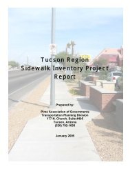
2012 Sidewalk Inventory Report - Pima Association of Governments
2012 Sidewalk Inventory Report - Pima Association of Governments
2012 Sidewalk Inventory Report - Pima Association of Governments

You also want an ePaper? Increase the reach of your titles
YUMPU automatically turns print PDFs into web optimized ePapers that Google loves.
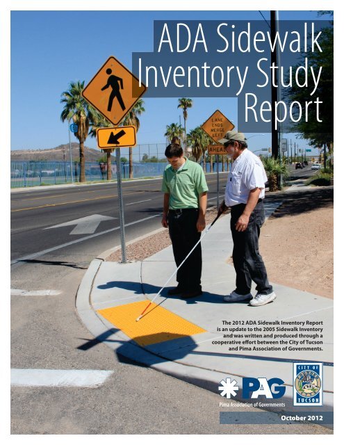
ADA <strong>Sidewalk</strong><br />
<strong>Inventory</strong> Study<br />
<strong>Report</strong><br />
The <strong>2012</strong> ADA <strong>Sidewalk</strong> <strong>Inventory</strong> <strong>Report</strong><br />
is an update to the 2005 <strong>Sidewalk</strong> <strong>Inventory</strong><br />
and was written and produced through a<br />
cooperative effort between the City <strong>of</strong> Tucson<br />
and <strong>Pima</strong> <strong>Association</strong> <strong>of</strong> <strong>Governments</strong>.<br />
October <strong>2012</strong>
ADA <strong>Sidewalk</strong> <strong>Inventory</strong> Study <strong>Report</strong><br />
October <strong>2012</strong><br />
PREPARED BY:<br />
City <strong>of</strong> Tucson<br />
Department <strong>of</strong> Transportation<br />
201 N Stone, 6th Floor<br />
Tucson, AZ 85701<br />
Phone: (520) 791-4371<br />
Fax: (520) 791-5526<br />
email: TDOTConcerns@tucsonaz.gov<br />
http://cms3.tucsonaz.gov/transportation/<br />
<strong>Pima</strong> <strong>Association</strong> <strong>of</strong> <strong>Governments</strong><br />
Transportation Planning Division<br />
177 N. Church Ave, Suite 405,<br />
Tucson, AZ 85701<br />
Phone: (520) 792-1093<br />
Fax: (520) 620-6981<br />
www.PAGregion.com
Table <strong>of</strong> Contents<br />
1. Study Purpose and Background ......................................................................................................................................................1<br />
2. Study Criteria ..........................................................................................................................................................................................2<br />
3. <strong>Inventory</strong> Process .................................................................................................................................................................................4<br />
4. Database and Mapping ......................................................................................................................................................................4<br />
5. Key <strong>Inventory</strong> Findings .......................................................................................................................................................................5<br />
6. Prioritizing Pedestrian Facility Improvements ...........................................................................................................................6<br />
7. Recommendations ...............................................................................................................................................................................7<br />
Unincorporated <strong>Pima</strong> County .................................................................................................................................................7<br />
Town <strong>of</strong> Marana ............................................................................................................................................................................8<br />
Town <strong>of</strong> Oro Valley .......................................................................................................................................................................9<br />
Town <strong>of</strong> Sahuarita ..................................................................................................................................................................... 10<br />
Pascua Yaqui Tribe .................................................................................................................................................................... 10<br />
Tohono O’odham Nation ........................................................................................................................................................ 10<br />
City <strong>of</strong> South Tucson ................................................................................................................................................................ 11<br />
City <strong>of</strong> Tucson ............................................................................................................................................................................. 11<br />
8. Next Steps ............................................................................................................................................................................................ 16<br />
Appendix A - Maps<br />
<strong>Pima</strong> County<br />
Appendix B - Database<br />
<strong>Sidewalk</strong> <strong>Inventory</strong> Database – Sample January <strong>2012</strong><br />
Town <strong>of</strong> Marana<br />
Town <strong>of</strong> Oro Valley<br />
Town <strong>of</strong> Sahuarita<br />
Pascua Yaqui Tribe<br />
Tohono O’odham Nation<br />
City <strong>of</strong> South Tucson<br />
City <strong>of</strong> Tucson
1. Study Purpose and Background<br />
Identifying gaps in the existing sidewalk network is<br />
crucial to ensuring that the sidewalks in the Tucson<br />
region meet the needs <strong>of</strong> all citizens. Filling in the<br />
gaps is the first step in making the network accessible<br />
for all users, especially for persons with disabilities.<br />
While sidewalk gaps represent the main barrier to<br />
accessibility, they are not the only barriers that will be<br />
addressed in this report.<br />
prioritizing improvements and funding. Identifying<br />
needs and resources for sidewalk improvements will<br />
aid jurisdictions as they meet the needs <strong>of</strong> all sidewalk<br />
users.<br />
Previous Studies<br />
In 2005, <strong>Pima</strong> <strong>Association</strong> <strong>of</strong> <strong>Governments</strong> (PAG)<br />
conducted an initial sidewalk inventory <strong>of</strong> all major<br />
roadway corridors in the Tucson region. The region<br />
“Pedestrian accessibility enhancements not only benefit people with disabilities, they benefit all<br />
pedestrians as well. Examples include curb ramp improvements that assist people pushing carts<br />
or strollers and placing the WALK push buttons in a place that is accessible and easily understandable<br />
for all intersection users.” Intersection Safety Issue Brief 11.pdf, Pedestrian Design for<br />
Accessibility Within the Public Right-<strong>of</strong>-Way, November 2009, Federal Highway Administration<br />
publication FHWA-SA-10-005.<br />
The U.S. Congress enacted major legislation that<br />
increased the focus on accessibility in transportation<br />
planning. These included the Section 504 <strong>of</strong> the<br />
Rehabilitation Act <strong>of</strong> 1973, the American with<br />
Disabilities Act <strong>of</strong> 1990, and the Intermodal Surface<br />
Transportation Efficiency Act <strong>of</strong> 1991. Throughout<br />
the decades,<br />
these mandates<br />
sharpened the<br />
focus on accessible<br />
pedestrian<br />
transportation<br />
facilities and<br />
highlighted the<br />
need to ensure<br />
people with<br />
disabilities were not<br />
excluded.<br />
Pedestrian facility<br />
improvements are<br />
funded by private<br />
development,<br />
local jurisdictions<br />
through<br />
local Capital<br />
Improvement Programs (CIP), State Highway User<br />
Revenue Funds (HURF), the Regional Transportation<br />
Authority (RTA), federally funded programs such<br />
as the Transportation Enhancement Program, and<br />
additional sources not listed, as found in <strong>Pima</strong><br />
<strong>Association</strong> <strong>of</strong> <strong>Governments</strong>’ regional Transportation<br />
Improvement Plan (TIP).<br />
Analyzing the design characteristics that promote<br />
accessibility will help jurisdictions meet basic<br />
standards for accessibility. It also aids the process <strong>of</strong><br />
includes the jurisdictions <strong>of</strong> unincorporated <strong>Pima</strong><br />
County, Town <strong>of</strong> Marana, Town <strong>of</strong> Oro Valley, Town <strong>of</strong><br />
Sahuarita, Pascua Yaqui Tribe, Tohono O’odham Nation<br />
San Xavier District, City <strong>of</strong> South Tucson and City <strong>of</strong><br />
Tucson. The focus <strong>of</strong> that study was to evaluate and<br />
understand the pedestrian infrastructure needs on<br />
a regional scale.<br />
The end result<br />
was a report, map<br />
and database that<br />
identified existing<br />
sidewalks, gaps<br />
in the pedestrian<br />
network and a<br />
recommended<br />
priority ranking<br />
system for<br />
improvements.<br />
Future inventories<br />
and studies were<br />
recommended<br />
to focus on an<br />
expanded area and<br />
with finer detail.<br />
In 2008, PAG<br />
awarded the City <strong>of</strong> Tucson Department <strong>of</strong><br />
Transportation (TDOT) funding to conduct a study<br />
titled ADA <strong>Sidewalk</strong> Accessibility to Bus Stops. The<br />
study was broken into two phases: phase one was the<br />
ADA bus stop accessibility study, and phase two was<br />
the ADA sidewalk inventory study. For a link to the<br />
ADA Bus Stop Accessibility Study <strong>Report</strong>, go to<br />
cms3.tucsonaz.gov/sites/default/files/transit/ada_<br />
bus_stop_accessibility_study_report.pdf.<br />
The ADA bus stop accessibility study evaluated each<br />
ADA SIDEWALK INVENTORY STUDY REPORT 1
us stop location on the Sun Tran fixed-route system<br />
throughout the Tucson region for ADA accessibility.<br />
This study focused on the pedestrian facilities for all<br />
major arterial and collector roadways throughout<br />
<strong>Pima</strong> County using current GIS technology and<br />
standards for pedestrian facilities and data<br />
collected on the ADA standards and route segment<br />
characteristics.<br />
The report <strong>of</strong> each study is written so that each<br />
may be used independently or in conjunction with<br />
one another as jurisdictions look at improving<br />
pedestrian safety and access to alternative modes<br />
<strong>of</strong> travel. While these studies do not include<br />
details at the local street level due to funding and<br />
scheduling constraints, they do update the 2005<br />
Tucson Region <strong>Sidewalk</strong> <strong>Inventory</strong> Project <strong>Report</strong> and<br />
recommend improvements at a finer scale. Whereas<br />
the 2005 sidewalk inventory report recommended<br />
improvements to broad lengths <strong>of</strong> roadway corridors,<br />
this study recommends improvements to pedestrian<br />
facilities in segments between two major street<br />
intersections.<br />
Current Study<br />
The database development and sidewalk inventory<br />
process began in May 2010 and ended in December<br />
2011. The inventory covers the entirety <strong>of</strong> <strong>Pima</strong><br />
County, including areas <strong>of</strong> entities that were not<br />
part <strong>of</strong> the original sidewalk inventory (Town <strong>of</strong> Ajo,<br />
Tohono O’odham Nation, Pascua Yaqui Tribe).<br />
The inventory focused specifically on the major<br />
roadway network, consisting <strong>of</strong> approximately<br />
2,435 directional miles <strong>of</strong> arterials and collectors, as<br />
identified in <strong>Pima</strong> County’s Major Street Plan and<br />
the City <strong>of</strong> Tucson’s Major Streets & Routes Plan. The<br />
roadway network was inventoried for sidewalks and<br />
accessible pedestrian routes regardless <strong>of</strong> any existing<br />
infrastructure. <strong>Sidewalk</strong>s were inventoried between<br />
major street intersection points, on both sides <strong>of</strong><br />
the street. For the purpose <strong>of</strong> this inventory, shareduse<br />
paths that parallel major roads were counted as<br />
“sidewalks,” such as the shared-use path surrounding<br />
Reid and Randolph parks.<br />
This study covers the pedestrian facilities for all major<br />
arterial and collector roadways. Using GIS technology,<br />
data was input for each segment regarding physical<br />
characteristics, accessibility criteria, existing barriers,<br />
planned improvements, transit routes for that<br />
segment, and any additional comments by the data<br />
collector. The criteria relating to accessibility included<br />
sidewalk width and alignment, the presence <strong>of</strong> curb<br />
ramps and the materials used. Where any barriers<br />
existed, the segment was deemed inaccessible.<br />
Using the inventory data, maps were produced that<br />
identified each segment based on whether it was<br />
complete and ADA accessible. Facilities that were<br />
deemed not ADA accessible were completed facilities<br />
containing barriers, partial facilities or no facilities at<br />
all.<br />
Potential Projects for Priority Pedestrian Facility<br />
Improvements<br />
Using the inventory maps and data, additional criteria<br />
were used to help prioritize potential projects for<br />
pedestrian facility improvements. These included<br />
proximity within one-quarter mile <strong>of</strong> the following:<br />
fixed-route transit service (which relates to the ADA<br />
Bus Stop Accessibility Study <strong>Report</strong>), commercial<br />
and public land uses, schools, parks and recreational<br />
facilities, and major medical centers. Jurisdictions<br />
may wish to incorporate pedestrian crash history<br />
and citizen requests for improvements, since these<br />
data were not included in this study’s list <strong>of</strong> potential<br />
projects. These projects are provided as a courtesy<br />
to help local <strong>of</strong>ficials prioritize segments to repair,<br />
replace or install new pedestrian facilities. The<br />
improvements are listed alphabetically so that no<br />
priority emphasis is implied on the order.<br />
The inventory maps and GIS data clearly show<br />
sidewalk gaps, and serve as tools for future project<br />
development and prioritization. These tools are<br />
available to the jurisdictions for sidewalk project<br />
planning and programming within the Tucson region.<br />
2. Study Criteria<br />
RESEARCH, SUMMARIZE AND DEVELOP CRITERIA<br />
FOR EVALUATING ACCESSIBLE PEDESTRIAN<br />
FACILLITIES BASED ON THE ADA STANDARDS<br />
AND THE U.S. ACCESS BOARD “BEST PRACTICES”<br />
GUIDELINES.<br />
For the purpose <strong>of</strong> this report, it was determined<br />
that the “best practices” would be followed as<br />
recommended in: the November 2005 Draft Public-<br />
Rights-<strong>of</strong>-Way Accessibility Guidelines (PROWAG);<br />
the U.S. Access-Board’s technical assistance; and the<br />
American with Disabilities Act Accessibility Guidelines<br />
(ADAAG) for sidewalks and pedestrian access routes.<br />
The Federal Highway Administration (FHWA) is the<br />
responsible agency for implementation <strong>of</strong> pedestrian<br />
access requirements under the Americans with<br />
Disabilities Act <strong>of</strong> 1990 (ADA).<br />
An update to the ADA was published in the<br />
Federal Register on September 15, 2010, allowing<br />
jurisdictions, public agencies, commercial facilities,<br />
2 ADA SIDEWALK INVENTORY STUDY REPORT
and entities that deal with the public, a grace period<br />
that both the 1991 and 2010 Standards could be<br />
used until March 15, <strong>2012</strong>. The Proposed Accessibility<br />
Guidelines<br />
for Pedestrian<br />
Facilities in the<br />
Public Right-<strong>of</strong>-<br />
Way was released<br />
July 26, 2011.<br />
Public comment<br />
was extended<br />
until February<br />
2, <strong>2012</strong>. When<br />
the rulemaking<br />
process is complete,<br />
the adopted<br />
guidelines will<br />
become mandatory.<br />
Providing for<br />
the needs <strong>of</strong> the<br />
disabled community in pedestrian facilities improves the<br />
infrastructure for everyone who uses them.<br />
Abridged Selection <strong>of</strong> Resources:<br />
Americans with Disabilities Act 1991 with revisions<br />
July 1, 1994<br />
http://www.ada.gov/reg3a.html#Anchor-<br />
Appendix-52467<br />
U.S. Department <strong>of</strong> Transportation; Federal Highway<br />
Administration Memorandum: Subject: ADAAG<br />
Detectable Warnings (Truncated Domes), Dated: May<br />
6, 2002 http://www.fhwa.dot.gov/environment/<br />
bikeped/dwm.htm<br />
U.S. Department <strong>of</strong> Transportation; Federal<br />
Highway Administration Memorandum: Subject:<br />
INFORMATION: Public Rights-<strong>of</strong>-Way Access Advisory,<br />
Dated: January 23, 2006 http://www.fhwa.dot.gov/<br />
environment/bikeped/prwaa.htm<br />
Public Rights <strong>of</strong> Way, 2005 Revised Draft Guidelines<br />
and current Proposed Accessibility Guidelines for<br />
Public Rights <strong>of</strong> Way (comment phase July 26, 2011<br />
– February 2, <strong>2012</strong>) http://www.access-board.gov/<br />
prowac/<br />
Pedestrian Facilities Evaluation Criteria:<br />
<br />
completed segment<br />
<br />
feet in clear width, does it have passing spaces that<br />
allow for continuous travel? Lack <strong>of</strong> passing zones<br />
on segments less than five feet are noted in the<br />
barrier section. The City <strong>of</strong> Tucson Development<br />
Standards used a four-foot minimum requirement<br />
when landscaping<br />
was present.<br />
This standard<br />
has since been<br />
updated to be a<br />
five-foot minimum<br />
requirement for all<br />
sidewalks, which<br />
eliminates the<br />
need to construct<br />
additional<br />
passing zones on<br />
newer sidewalks.<br />
Regardless <strong>of</strong><br />
which version <strong>of</strong><br />
the ADA that was<br />
used during time <strong>of</strong><br />
construction, pedestrian access routes (sidewalks)<br />
less than a clear five-foot width must have a five<br />
(5’) feet x five (5’) feet passing space at reasonable<br />
intervals not to exceed 200 feet. An intersection<br />
at perpendicular walkways or driveways would be<br />
acceptable as passing spaces. Due to the age <strong>of</strong><br />
construction on many sidewalks, four (4’) feet was<br />
used as a minimum width, even though the letter <strong>of</strong><br />
the law was a 36 (3’) inch width.<br />
<strong>Pima</strong> County Subdivision and Development Street<br />
(current) Standards for urban residential subdivisions<br />
require that “… All residential and major collectors<br />
must have … a sidewalk at least 5 feet wide”(4.1.2.2).<br />
Standards for commercial and industrial areas<br />
state that “ … Collector street sidewalks shall be a<br />
minimum <strong>of</strong> 5 feet in width … (7.1.2.2)”.<br />
<br />
firm, stable and slip-resistant. In all cases if surfaces<br />
or textures did not meet the ADA requirement <strong>of</strong><br />
firm, stable and slip resistant, the sidewalk segment<br />
was not marked as accessible, including sidewalks<br />
and pedestrian paths that consisted <strong>of</strong> broken or<br />
loose asphalt, unstabilized decomposed granite (dg),<br />
dirt, sand, or were covered with loose soil. Materials<br />
that do not comply would cause the segment to be<br />
identified as “partial” for sidewalk status.<br />
<br />
more curb-ramps are missing within the segment,<br />
and (2) Existing if all corners and alleyways have<br />
necessary curb-cuts and connectivity.<br />
ADA SIDEWALK INVENTORY STUDY REPORT 3
N N N EUCLID EUCLID EUCLID AV<br />
AV<br />
AV<br />
Detectable warnings at curb ramps were not<br />
counted. These devices were suspended from<br />
the U.S. Department<br />
<strong>of</strong> Transportation<br />
749<br />
requirements for the<br />
741<br />
ADA until July 26, 2001.<br />
New construction and<br />
alterations since July<br />
26, 2001, must use the<br />
approved truncated<br />
domes as acceptable<br />
detectable warnings.<br />
As new construction<br />
and alterations are<br />
completed on roadway<br />
projects, intersection<br />
corners are evaluated<br />
for replacement. City <strong>of</strong><br />
Tucson and <strong>Pima</strong> County<br />
staff have reconstructed<br />
and retr<strong>of</strong>itted most <strong>of</strong><br />
the earlier intersection corners to have acceptable<br />
ADA accessible detectable warnings throughout their<br />
jurisdictions.<br />
<br />
pedestrian facilities. Indications <strong>of</strong> slope and crossslope<br />
issues are based on slopes that were extreme<br />
enough to be visible without levels or other<br />
instruments. More precise measurements should<br />
be completed at the time <strong>of</strong> any reconstruction.<br />
Other barriers identified included permanent street<br />
signposts, fire hydrants, mailboxes and utility poles<br />
in the pedestrian access route.<br />
3. <strong>Inventory</strong> Process<br />
INVENTORY PEDESTRIAN FACILITIES ON BOTH<br />
SIDES OF MAJOR ARTERIAL AND COLLECTOR<br />
ROADWAYS.<br />
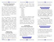
The inventory was conducted in a three-step process.<br />
1. Street segments were identified and evaluated<br />
for pedestrian facilities to include curb-ramps and<br />
sidewalks using a variety <strong>of</strong> digital tools and data,<br />
including current <strong>Pima</strong> County Orthographic GIS<br />
layers (2008 & 2010), Google Maps, and City <strong>of</strong><br />
Tucson Department <strong>of</strong> Transportation Map Guide<br />
current Virtual Ride Streets Layers (2009 & 2010).<br />
Orthographic images allow the user to view color<br />
images from a satellite bird’s eye view (figure 1).<br />
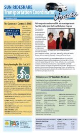
Virtual Ride and Google Maps Street View allow<br />
the user to view a horizontal view <strong>of</strong> most urban<br />
arterials using a series <strong>of</strong> photo images. By simply<br />
clicking a button, the viewer can drive a selected<br />
N N N EUCLID EUCLID EUCLID AV<br />
AV<br />
AV<br />
E SPEEDWAY BL<br />
E SPEEDWAY BL 801<br />
804<br />
812<br />
807<br />
E SPEEDWAY BL<br />
<br />
roadway at a set speed and scan the sidewalk area<br />
and other roadway features. This process was<br />
conducted for both sides<br />
<strong>of</strong> selected roadways.<br />
815<br />
2. Once an initial<br />
assessment <strong>of</strong> road<br />
segments was completed<br />
using digital tools, field<br />
surveys were conducted<br />
to verify existing data<br />
acquired from the Virtual<br />
Ride, Street View, and<br />
aerial images, unknown<br />
areas, roadways under<br />
construction, and<br />
the areas that had<br />
experienced recent<br />
development.<br />
3. <strong>Pima</strong> <strong>Association</strong> <strong>of</strong><br />
<strong>Governments</strong> (PAG) contacted each jurisdiction to<br />
confirm sidewalk data. The City <strong>of</strong> Tucson collected<br />
the sidewalk inventory data within its boundaries<br />
and the City <strong>of</strong> South Tucson.<br />
4. Database and Mapping<br />
DOCUMENT IN A GIS DATABASE THE BASELINE<br />
CHARACTERISTIC DATA IN SEGMENTS FROM<br />
MAJOR INTERSECTION TO MAJOR INTERSECTION,<br />
GAPS AND BARRIERS, AND COMPLETED<br />
IMPROVEMENTS SINCE THE 2005 INVENTORY.<br />
MAP AND RECORD SIDEWALK SEGMENTS OF<br />
PEDESTRIAN FACILITIES. IDENTIFY PEDESTRIAN<br />
INFRASTRUCTURE GAPS AND DEFICIENCIES.<br />
As the field surveys were completed, each sidewalk<br />
segment was recorded and mapped in a GIS-based<br />
program (ESRI ArcMap 10). There are over 3,700<br />
line-item sidewalk segments, which calculate to<br />
approximately 3,670 miles for both sides <strong>of</strong> the<br />
roadways inventoried. The database contains<br />
pertinent information on each sidewalk segment such<br />
as the street name, roadway classification (i.e. arterial,<br />
collector), segment location, jurisdictional control,<br />
sidewalk status, width, curb ramp status, accessibility,<br />
and any additional notes or comments (table 1).<br />
For the purposes <strong>of</strong> this inventory, sidewalks are<br />
considered concrete, brick, or asphalt-paved surfaces,<br />
clearly designated for pedestrian use. Hard-packed<br />
dirt, asphalt roadway shoulders, and/or bike lanes<br />
are not considered sidewalks (pedestrian facilities<br />
or access routes). <strong>Sidewalk</strong> segments were placed<br />
into four categories, which correspond directly to<br />
4 ADA SIDEWALK INVENTORY STUDY REPORT
the entire length <strong>of</strong> the segment are not present.<br />
In some places, sidewalk segments are 95 percent<br />
completed with or without curb ramps. In other<br />
places, sidewalk segments are only 5 percent<br />
completed or there is no sidewalk and only curb<br />
ramps. In all these cases, the segment is considered<br />
partial and, therefore, not accessible for persons<br />
with disabilities.<br />
the color-coded sidewalk categories shown on the<br />
inventory maps (Appendix A). Below is a description<br />
<strong>of</strong> each sidewalk category.<br />
No Infrastructure – Not Accessible: These<br />
segments have neither sidewalks nor curb ramps<br />
for the entire segment. Materials and barriers are<br />
still identified.<br />
Complete – Accessible: These segments contain<br />
complete accessible sidewalks, free <strong>of</strong> major gaps<br />
or barriers, minimum <strong>of</strong> four (4’) feet in width with<br />
necessary passing zones, and with curb ramps<br />
in appropriate locations. These segments are<br />
anticipated to be safe for use by persons <strong>of</strong> all<br />
abilities for the entire length <strong>of</strong> the segment.<br />
Complete with Barriers – Not Accessible: These<br />
segments have sidewalks, curb-ramps, and are at<br />
least four (4’) feet in width, but contain barriers.<br />
These barriers might include absence <strong>of</strong> passing<br />
areas on sidewalks less than 5’ in width, slopes that<br />
are too steep to be classified as accessible, and/<br />
or utility poles, street sign posts, landscaping, or<br />
drainage ways.<br />
Partial Infrastructure – Not Accessible: <strong>Sidewalk</strong><br />
segments and/or curb-ramps for only portions <strong>of</strong><br />
5. Key <strong>Inventory</strong> Findings<br />
<br />
in areas <strong>of</strong> the region that were developed prior<br />
to the 1980s. Government development codes<br />
and policies prior to that time did not require<br />
sidewalks on major roadway construction projects.<br />
Additionally, pedestrian travel (especially for the<br />
disabled) was not identified as a high priority in<br />
transportation planning at that time.<br />
<br />
the focus on sidewalks in transportation planning.<br />
Congress passed the American with Disabilities<br />
Act <strong>of</strong> 1990, which has affected alterations or new<br />
construction undertaken after July 26, 1991. The<br />
following year, Congress passed the Intermodal<br />
Surface Transportation Efficiency Act <strong>of</strong> 1991. These<br />
Acts sharpened the focus on pedestrian travel, and<br />
highlighted the need for ensuring that pedestrian<br />
facilities are accessible to people with disabilities.<br />
ADA SIDEWALK INVENTORY STUDY REPORT 5
Additional court cases clarified the necessity <strong>of</strong><br />
local agencies’ responsibilities for planning and<br />
constructing pedestrian facilities in the publicright-<strong>of</strong>-way<br />
to access all public services, as well as<br />
private commercial services.<br />
<br />
<strong>of</strong>ten been built as part <strong>of</strong> major roadway projects.<br />
However, in recent years, local, state and federal<br />
sources have funded sidewalk-specific projects.<br />
Additionally, the Regional Transportation Authority,<br />
approved by voters in 2006 to collect a half-cent<br />
sales tax, has funded the construction <strong>of</strong> 81.5<br />
miles <strong>of</strong> new sidewalks, with another 196 miles <strong>of</strong><br />
sidewalk under construction or in design.<br />
<br />
for several possible reasons:<br />
1) There has been minimal demand for sidewalks.<br />
2) There is minimal commercial development<br />
within walking distance.<br />
3) There are no schools or parks within walking<br />
distance.<br />
4) Residents have actively opposed sidewalks and<br />
other modern roadway features to retain the<br />
rural character <strong>of</strong> their area (e.g. historic Fort<br />
Lowell area).<br />
<br />
residential areas with four or more dwelling units<br />
per acre. This is very evident in the suburban<br />
communities <strong>of</strong> Marana, Oro Valley and Sahuarita,<br />
and the City <strong>of</strong> Tucson’s edge areas where most<br />
<strong>of</strong> the medium to high-density residential<br />
development has occurred in the last few years.<br />
6. Prioritizing Pedestrian Facility<br />
Improvements<br />
IDENTIFY POTENTIAL HIGH-USE PEDESTRIAN<br />
SEGMENTS BASED ON CRITERIA IDENTIFIED IN THE<br />
2005 INVENTORY.<br />
Once the inventory was completed, a list <strong>of</strong> suggested<br />
corridor improvement projects was created for<br />
each jurisdiction in order to prioritize sidewalk<br />
improvement efforts. The main intent <strong>of</strong> the list is to<br />
give jurisdictions an idea <strong>of</strong> which roadway corridors<br />
are in need <strong>of</strong> improvements based on a number <strong>of</strong><br />
supplementary criteria.<br />
The development <strong>of</strong> the priority list involved the<br />
input <strong>of</strong> local jurisdictional staff, pedestrian planners,<br />
members <strong>of</strong> the disabled community and others<br />
who have an interest in pedestrian facilities. Arterial<br />
and collectors that exhibit the following criteria were<br />
given higher precedence. The top criteria for the<br />
development <strong>of</strong> the priority sidewalk improvement<br />
lists are as follows:<br />
<br />
Fixed-route transit service encourages travel by<br />
pedestrians. Segments with bus stops attract a high<br />
volume <strong>of</strong> pedestrian activity. A number <strong>of</strong> ADA<br />
paratransit eligible riders also use the fixed-route<br />
stops.<br />
<br />
Local business, retail and other public services<br />
such as libraries, post <strong>of</strong>fices, and town halls are<br />
considered pedestrian trip destinations.<br />
<br />
Schools attract large volumes <strong>of</strong> pedestrians<br />
because students <strong>of</strong>ten live within walking distance<br />
and are too young to drive. The larger the school,<br />
the more students may walk to school.<br />
<br />
Parks and other recreational facilities attract<br />
pedestrians for health and fitness reasons. Also,<br />
parks attract many younger pedestrians. The larger<br />
the park, the more pedestrians may use nearby<br />
roadways.<br />
<br />
Hospitals attract many pedestrians, especially those<br />
who are service workers or have disabilities and<br />
are unable to drive themselves. Those who use<br />
hospitals for medical care and appointments need<br />
accessible sidewalks to ensure safe travel to the<br />
hospital. The larger the medical facility, the more<br />
6 ADA SIDEWALK INVENTORY STUDY REPORT
pedestrians may use nearby roadways.<br />
<br />
Segments and intersections with previous history<br />
<strong>of</strong> pedestrian related crashes need to be taken into<br />
consideration with regard to sidewalk and safe<br />
crossing prioritization. In addition, citizen requests<br />
identify areas that are in regular use and may<br />
benefit from prioritization. <strong>Sidewalk</strong>s are vital to<br />
the safety <strong>of</strong> pedestrians and motorists alike.<br />
7. Potential Improvements<br />
The following list <strong>of</strong> recommended priority<br />
pedestrian improvements is organized by<br />
jurisdiction. The list recommends segments based<br />
on need for improvements and the supplementary<br />
priority criteria. Local <strong>of</strong>ficials can use the list to<br />
prioritize which segments to repair, replace, or<br />
install new pedestrian facilities. Segments are<br />
identified by location and the type <strong>of</strong> treatment<br />
is recommended in italics. The factors for each<br />
segment are the supplementary priority criteria<br />
upon which the segment was selected. Finally, the<br />
list is organized alphabetically per jurisdiction so<br />
that no priority emphasis is implied on the order.<br />
<br />
The majority <strong>of</strong> unincorporated <strong>Pima</strong> County’s<br />
completed sidewalks and ADA ramps are located<br />
north <strong>of</strong> City <strong>of</strong> Tucson limits on major collectors and<br />
arterials such as Skyline Drive, Thornydale Road and<br />
River Road. Road segments that are south and west<br />
<strong>of</strong> the City <strong>of</strong> Tucson limits generally do not have<br />
sidewalks. As the northern portion <strong>of</strong> the Tucson<br />
Region has urbanized standards for commercial,<br />
industrial, and urban residential development has<br />
required sidewalks and other pedestrian facilities<br />
to be installed with new development. Much <strong>of</strong><br />
the County south and west <strong>of</strong> the City <strong>of</strong> Tucson<br />
has remained rural. However, pedestrian facilities<br />
continue to be built with new development, unless<br />
property owners have received Administrative<br />
approval <strong>of</strong> modifications to the standards per<br />
Chapter 9 “Administration <strong>of</strong> the Standards.”<br />
Potential projects:<br />
1. Campbell Avenue between Skyline Drive and Ina<br />
Road: <strong>Sidewalk</strong> improvements.<br />
Factors:<br />
<br />
<br />
<br />
<br />
2. Cloud Road between Sabino Canyon Road and<br />
Pantano Road: <strong>Sidewalk</strong> improvements, missing<br />
segments.<br />
Factors:<br />
<br />
<br />
<br />
3. Continental Road between La Cañada Drive<br />
and Abrego Drive (Green Valley): <strong>Sidewalk</strong><br />
improvements.<br />
Factors:<br />
<br />
<br />
<br />
4. Houghton Road between Sahuarita Road and<br />
Camino Del Toro: Install sidewalks.<br />
Factors:<br />
<br />
<br />
<br />
5. Mary Ann Cleveland between Houghton Road<br />
and Colossal Cave Road: Install sidewalks.<br />
Factors:<br />
<br />
<br />
<br />
<br />
6. Melpomene Way between Fort Lowell Road and<br />
Catalina Highway: Install sidewalks.<br />
Factors:<br />
<br />
<br />
<br />
<br />
7. North Ajo Well No. 1 Road between Rasmussen<br />
Road and East 1st Avenue (Ajo): Install sidewalks.<br />
Factors:<br />
<br />
<br />
<br />
ADA SIDEWALK INVENTORY STUDY REPORT 7
8. Orange Grove Road between 1st Avenue and<br />
Skyline Drive: <strong>Sidewalk</strong> improvements.<br />
Factors:<br />
<br />
<br />
<br />
<br />
9. Orange Grove Road between Thornydale Road<br />
and La Cholla Boulevard: Install sidewalks, fill<br />
gaps.<br />
Factors:<br />
<br />
<br />
<br />
<br />
<br />
<br />
10. Palo Verde Road between 36th Street and<br />
Irvington Road: <strong>Sidewalk</strong> Improvements.<br />
Factors:<br />
<br />
<br />
<br />
<br />
Kino<br />
<br />
<br />
11. Ruthrauff Road between I-10 and La Cholla<br />
Boulevard: <strong>Sidewalk</strong> Improvements.<br />
Factors:<br />
<br />
<br />
<br />
<br />
12. Sunrise Drive between Pontatoc Road and Swan<br />
Road: <strong>Sidewalk</strong> improvements.<br />
Factors:<br />
<br />
<br />
<br />
<br />
<br />
The majority <strong>of</strong> Marana’s completed sidewalks are<br />
located on the west side <strong>of</strong> I-10 on Silverbell Road,<br />
where commercial development is growing rapidly.<br />
However, a large portion <strong>of</strong> Marana’s land is used for<br />
farming and agriculture, which yields low levels <strong>of</strong><br />
completed sidewalks.<br />
Potential projects:<br />
1. Coachline (north <strong>of</strong> Twin Peaks Road), between<br />
Silverbell Road and Twin Peaks Road: Install<br />
sidewalks.<br />
Factors:<br />
<br />
<br />
<br />
2. Ina Road between Silverbell Road and Camino de<br />
la Tierra (or the Cañada del Oro Wash): <strong>Sidewalk</strong><br />
improvements: west <strong>of</strong> Thornydale has missing<br />
segments and gaps at commercial development.<br />
Factors:<br />
<br />
<br />
<br />
3. Lon Adams Road from Barnett Road to Grier Road:<br />
Install sidewalks.<br />
Factors:<br />
<br />
<br />
<br />
<br />
<br />
<br />
<br />
<br />
<br />
4. Sandario Road between I-10 and Moore Road:<br />
Install sidewalks.<br />
Factors:<br />
8 ADA SIDEWALK INVENTORY STUDY REPORT
5. Silverbell Road between Twin Peaks Road<br />
and Cortaro Road (west side only): <strong>Sidewalk</strong><br />
improvements: missing segments in residential<br />
area.<br />
Factors:<br />
<br />
<br />
<br />
<br />
<br />
<br />
<br />
<br />
<br />
2. Lambert Lane between La Cañada and First<br />
Avenue: Install sidewalks.<br />
Factors:<br />
<br />
<br />
<br />
3. Naranja Drive between Shannon Road and La<br />
Cholla Boulevard: Install sidewalks.<br />
Factors:<br />
<br />
<br />
4. Oracle Road between Ina Road and 1st Avenue:<br />
Install sidewalks.<br />
Factors:<br />
<br />
<br />
<br />
<br />
<br />
5. Rancho Vistoso between Moore Road and Oracle<br />
Boulevard: <strong>Sidewalk</strong> improvements from<br />
Moore Road to Sun City on east side, install<br />
sidewalks from Sun City Boulevard to Del Webb<br />
Boulevard.<br />
Factors:<br />
<br />
<br />
<br />
Town <strong>of</strong> Oro Valley<br />
The majority <strong>of</strong> Oro Valley’s completed sidewalks<br />
and ADA ramps are located in the northern region<br />
<strong>of</strong> the jurisdiction in areas <strong>of</strong> mixed residential and<br />
commercial use. Oro Valley’s main arterial, Oracle<br />
Road, lacks sidewalks and ADA ramps throughout its<br />
entire length. This roadway is Arizona State Route<br />
77 under the control <strong>of</strong> the Arizona Department <strong>of</strong><br />
Transportation (ADOT).<br />
6. Tangerine Road between Innovation Park and<br />
Monterra Vista Drive: Install sidewalks.<br />
Factors:<br />
<br />
<br />
<br />
<br />
Potential projects:<br />
1. Calle Concordia between Oracle Road and Calle<br />
Buena Vista: <strong>Sidewalk</strong> improvements.<br />
Factors:<br />
<br />
<br />
<br />
ADA SIDEWALK INVENTORY STUDY REPORT 9
Potential projects:<br />
1. Camino de Oeste between Los Reales Road and<br />
Calle Torim: Install sidewalks.<br />
Factors:<br />
<br />
<br />
Town <strong>of</strong> Sahuarita<br />
Sahuarita’s major collectors and arterials with<br />
completed sidewalks and ramps include La Cañada<br />
Drive, Rancho Sahuarita Boulevard, La Villita Road and<br />
Campbell Avenue.<br />
Potential projects:<br />
1. Duval Mine road sidewalk from I-19 to La Cañada<br />
Road: <strong>Sidewalk</strong> improvements.<br />
Factors:<br />
<br />
<br />
<br />
<br />
2. Sahuarita Road between Nogales Highway and<br />
I-10 (north side only): <strong>Sidewalk</strong> improvements.<br />
Factors:<br />
<br />
<br />
<br />
<br />
<br />
<br />
<br />
The Pascua Yaqui Tribe currently has no sidewalks<br />
or ADA ramps in any <strong>of</strong> its Major Street segments.<br />
However, the Tribe has included accessible sidewalks<br />
in their planned roadway corridors.<br />
2. Mark Road between Valencia Road and Los Reales<br />
Road: Install sidewalks.<br />
Factors:<br />
<br />
Schools<br />
<br />
<br />
<br />
3. Tetakusim Road between Camino de Oeste and<br />
Sorrel Lane: Install sidewalks.<br />
Factors:<br />
<br />
<br />
<br />
Tohono O’odham Nation<br />
The Tohono O’odham Nation currently has no<br />
sidewalks or ADA ramps in any <strong>of</strong> its Major Street<br />
segments. However, the Nation has accessible<br />
pedestrian projects in the planning process.<br />
Potential projects:<br />
1. Highway 86 between Old Rental Road and Indian<br />
Route 19: Install sidewalks.<br />
Factors:<br />
<br />
<br />
<br />
<br />
<br />
2. Main Road between the eastern terminus and<br />
Highway 86: Install sidewalks.<br />
10 ADA SIDEWALK INVENTORY STUDY REPORT
Factors:<br />
<br />
<br />
<br />
<br />
<br />
<br />
3. Mission Road between San Xavier Road and<br />
Valencia: Install sidewalks.<br />
Factors:<br />
<br />
<br />
2. Benson Highway (I-10 Frontage) between 4th<br />
Avenue & Benson Highway (curves under I-10 to<br />
City <strong>of</strong> Tucson Benson Highway (I-10 frontage)):<br />
Install sidewalks and curb ramps.<br />
<br />
based on future commercial / light industrial<br />
development.<br />
<br />
improvements/alterations to I-10 and the<br />
adjacent frontage roads.<br />
4. San Xavier Road between Mission Road and Los<br />
Reales: Install sidewalks.<br />
Factors:<br />
<br />
<br />
<br />
<br />
<br />
<br />
<br />
City <strong>of</strong> South Tucson<br />
The City <strong>of</strong> South Tucson has good pedestrian<br />
infrastructure with accessible sidewalks on the major<br />
streets. Administrative goals are to maintain and<br />
improve the accessibility <strong>of</strong> the pedestrian network<br />
with adjacent jurisdictions.<br />
Potential projects:<br />
1. 4th Avenue between 36th Street and Benson<br />
Highway (I-10 Frontage): Install sidewalks and<br />
curb ramps.<br />
Factors:<br />
<br />
<br />
<br />
<br />
<br />
development<br />
City <strong>of</strong> Tucson<br />
The City <strong>of</strong> Tucson has a mixture <strong>of</strong> pedestrian<br />
facilities depending on when development occurred,<br />
alterations to roadways due to widening projects,<br />
sidewalk improvement projects, and redevelopment.<br />
Many <strong>of</strong> the areas without any pedestrian access<br />
routes were annexed into the City after development<br />
occurred or has little to no currently existing<br />
development. The potential projects below are by no<br />
means complete lists <strong>of</strong> needs within the City due to<br />
the large size <strong>of</strong> the urban area.<br />
Potential projects (alphabetically with no priority<br />
emphasis on order):<br />
1. 1st Avenue between Grant Road and River<br />
Road: <strong>Sidewalk</strong> improvements, missing sidewalk<br />
sections and curb ramps. Barriers include street<br />
signs, utility poles, parking and passing zones.<br />
Factors:<br />
<br />
<br />
<br />
ADA SIDEWALK INVENTORY STUDY REPORT 11
2. 12th Avenue between 38th Street (City <strong>of</strong><br />
South Tucson) and Drexel Road: <strong>Sidewalk</strong><br />
improvements, missing sidewalk sections and<br />
curb ramps. Barriers include cross-slope and<br />
parking.<br />
Factors:<br />
<br />
<br />
<br />
<br />
<br />
<br />
<br />
<br />
3. 22nd Street between Alvernon Way and 4th<br />
Avenue: Install and improve <strong>Sidewalk</strong>s, missing<br />
sidewalk sections and curb ramps. Barriers<br />
include rail road tracks.<br />
Factors:<br />
<br />
<br />
<br />
<br />
<br />
<br />
<br />
<br />
<br />
<br />
<br />
<br />
4. 22nd Street between Wilmot Road and Alvernon<br />
Way: <strong>Sidewalk</strong> improvements, missing sidewalk<br />
sections and curb ramps. Barriers include<br />
passing zones, parking and utilities.<br />
Factors:<br />
<br />
<br />
<br />
<br />
<br />
<br />
5. 29th Street between Wilmot Road and Alvernon<br />
Way: sidewalk improvements, Partial sidewalks,<br />
curb-ramps, and barriers between Wilmot and<br />
Craycr<strong>of</strong>t. <strong>Sidewalk</strong>s with barriers between<br />
Craycr<strong>of</strong>t and Alvernon to include missing<br />
passing zones.<br />
Factors:<br />
<br />
<br />
<br />
<br />
<br />
<br />
<br />
<br />
<br />
6. 5th Street between Alvernon Way and Country<br />
Club Road: <strong>Sidewalk</strong> improvements, missing<br />
sidewalk sections. Barriers include utility poles<br />
and fire hydrants.<br />
Factors:<br />
<br />
<br />
<br />
<br />
<br />
7. 6th Ave between Prince Road and Grant Road:<br />
<strong>Sidewalk</strong> improvements, missing sidewalk<br />
sections and curb ramps. Barriers include utility<br />
poles and cross-slopes.<br />
Factors:<br />
<br />
<br />
<br />
<br />
<br />
<br />
<br />
<br />
<br />
8. 6th Street between Country Club Road and Cherry<br />
Avenue: Install and improve <strong>Sidewalk</strong>s, missing<br />
sidewalk sections and curb ramps. Barriers<br />
include passing zones.<br />
Factors:<br />
<br />
<br />
<br />
9. Ajo Way between Country Club Road and Mission<br />
Road: <strong>Sidewalk</strong> improvements, missing sidewalk<br />
sections and curb ramps. Barriers include rail<br />
road tracks, passing zones and connections<br />
between brick and concrete (greater than ¼”).<br />
Factors:<br />
<br />
12 ADA SIDEWALK INVENTORY STUDY REPORT
10. Alvernon Way between Drexel Road and Valencia<br />
Road: Install <strong>Sidewalk</strong>s, sidewalk improvements,<br />
missing sidewalk sections and curb ramps.<br />
Factors:<br />
<br />
<br />
<br />
<br />
11. Alvernon Way between <strong>Pima</strong> Road and Fort<br />
Lowell Road: <strong>Sidewalk</strong> improvements, eliminate<br />
barriers to passing – sidewalk to narrow for<br />
passing zones.<br />
Factors:<br />
<br />
<br />
12. Bilby Road between Country Club Road and 12th<br />
Avenue: Install and improve existing sidewalks,<br />
missing sidewalk sections and curb ramps.<br />
Factors:<br />
<br />
<br />
<br />
<br />
<br />
<br />
<br />
13. Broadway Boulevard between Wilmot Road and<br />
Swan Road: Install sidewalks, missing sidewalk<br />
sections and barriers to include utilities and<br />
cross-slope issues.<br />
Factors:<br />
<br />
<br />
<br />
<br />
<br />
<br />
<br />
<br />
14. Broadway Boulevard between Wilmot Road and<br />
Houghton Road: Install sidewalks and curb<br />
ramps, sidewalk improvements where existing.<br />
Partial sidewalks, curb-ramps, and barriers<br />
between Old Spanish Trail and Houghton.<br />
<strong>Sidewalk</strong>s with barriers between Wilmot & Old<br />
Spanish Trail.<br />
Factors:<br />
<br />
<br />
<br />
<br />
<br />
<br />
<br />
<br />
<br />
<br />
<br />
15. Campbell Avenue between Prince Road and Grant<br />
Road: <strong>Sidewalk</strong> improvements, missing sidewalk<br />
sections. Barriers include utility poles.<br />
Factors:<br />
<br />
<br />
<br />
<br />
<br />
<br />
16. Columbus Boulevard between 29th Street and<br />
Speedway Boulevard: <strong>Sidewalk</strong> improvements,<br />
missing sidewalk sections and curb ramps.<br />
Barriers include street signs and utility poles.<br />
Factors:<br />
<br />
<br />
<br />
<br />
<br />
<br />
<br />
<br />
17. Drexel Road between Country Club Road and<br />
12th Avenue: Install and improve <strong>Sidewalk</strong>s,<br />
missing sidewalk sections and curb ramps.<br />
Factors:<br />
<br />
<br />
<br />
<br />
<br />
<br />
<br />
ADA SIDEWALK INVENTORY STUDY REPORT 13
18. Elm Street between County Club Road and<br />
Campbell Avenue: <strong>Sidewalk</strong> improvements,<br />
missing sidewalk sections and curb ramps.<br />
Barriers include utility poles.<br />
Factors:<br />
<br />
<br />
<br />
<br />
<br />
<br />
College <strong>of</strong> Medicine<br />
19. Glenn between Alvernon and 6th Ave: <strong>Sidewalk</strong><br />
improvements, missing sidewalk sections.<br />
Barriers include street signs, utility poles and<br />
cross-slopes.<br />
Factors:<br />
<br />
<br />
<br />
<br />
<br />
<br />
<br />
<br />
20. Irvington Road between Park Avenue and 12th<br />
Avenue: <strong>Sidewalk</strong> improvements, missing<br />
sidewalk sections. Barriers include cross-slopes<br />
and rail road tracks.<br />
Factors:<br />
<br />
<br />
<br />
<br />
<br />
<br />
<br />
21. Kolb Road (eastside) between Broadway<br />
Boulevard and 22nd Street: Install curb ramps.<br />
Factors:<br />
<br />
<br />
<br />
<br />
22. Park Avenue between Speedway Boulevard and<br />
Fort Lowell Road: Install and improve <strong>Sidewalk</strong>s,<br />
missing sidewalk sections and curb ramps.<br />
Factors:<br />
<br />
<br />
<br />
<br />
<br />
<br />
<br />
<br />
23. <strong>Pima</strong> Road between Swan Road and Alvernon<br />
Way: Install <strong>Sidewalk</strong>s.<br />
Factors:<br />
<br />
<br />
<br />
<br />
24. <strong>Pima</strong> Road between Alvernon Way and County<br />
Club Road: <strong>Sidewalk</strong> improvements, missing<br />
sidewalk sections and curb ramps. Barriers<br />
include utility poles.<br />
Factors:<br />
<br />
<br />
<br />
25. Prince Road between Oracle Road and I-10:<br />
<strong>Sidewalk</strong> improvements, missing sidewalk<br />
sections. Barriers include rail road tracks,<br />
parking, utility poles, and street signs.<br />
Factors:<br />
<br />
<br />
<br />
<br />
<br />
<br />
26. Rosemont Boulevard between Broadway<br />
Boulevard and Grant Road: <strong>Sidewalk</strong><br />
improvements, missing sidewalk sections and<br />
curb ramps.<br />
Factors:<br />
<br />
<br />
<br />
<br />
27. Santa Clara Avenue between Drexel Road and<br />
Valencia Road: <strong>Sidewalk</strong> improvements, missing<br />
sidewalk sections.<br />
Factors:<br />
<br />
<br />
<br />
<br />
<br />
14 ADA SIDEWALK INVENTORY STUDY REPORT
28. Speedway Boulevard between Pantano Road &<br />
Kolb Road: <strong>Sidewalk</strong>s improvements, barriers<br />
due to slope/cross-slope issues.<br />
Factors:<br />
<br />
<br />
<br />
<br />
<br />
<br />
<br />
Wilmot are complete and accessible<br />
29. Speedway Boulevard between Wilmot Road and<br />
Alvernon Way: <strong>Sidewalk</strong> improvements, missing<br />
sidewalk sections and curb ramps. Barriers<br />
include limited right-<strong>of</strong>-way and street signs.<br />
Factors:<br />
<br />
<br />
<br />
<br />
<br />
<br />
<br />
<br />
30. St. Mary’s Road/Anklam Road between Silverbell<br />
Road and Players Club Drive: Install and improve<br />
sidewalks, missing sidewalk sections and curb<br />
ramps.<br />
Factors:<br />
<br />
<br />
<br />
<br />
<br />
<br />
<br />
<br />
31. Stone Avenue between Grant Road and Wetmore<br />
Road: <strong>Sidewalk</strong> improvements, missing sidewalk<br />
sections. Barriers include passing zones, utility<br />
poles and street signs.<br />
Factors:<br />
<br />
<br />
<br />
<br />
<br />
<br />
<br />
<br />
<br />
<br />
<br />
<br />
32. Swan Road between Broadway Boulevard and<br />
Speedway Boulevard: <strong>Sidewalk</strong> improvements,<br />
missing sidewalk sections and curb ramps.<br />
Factors:<br />
<br />
<br />
<br />
<br />
<br />
<br />
<br />
33. Tucson Boulevard between Eastland Street<br />
and Elm Street: Install and improve <strong>Sidewalk</strong>s,<br />
missing sidewalk sections and curb ramps.<br />
Barriers include utility poles, fire hydrant, and<br />
cross-slopes.<br />
Factors:<br />
<br />
<br />
<br />
<br />
<br />
<br />
<br />
<br />
34. Valencia Road between Alvernon Way and 12th<br />
Avenue: Install and improve <strong>Sidewalk</strong>s.<br />
Factors:<br />
<br />
<br />
<br />
<br />
<br />
<br />
ADA SIDEWALK INVENTORY STUDY REPORT 15
8. Next Steps<br />
This ADA <strong>Sidewalk</strong> <strong>Inventory</strong> Study <strong>Report</strong> is a tool<br />
that local jurisdictions can use to more easily identify<br />
and address areas that lack pedestrian infrastructure.<br />
Pedestrian travel increases the efficiency <strong>of</strong> the entire<br />
transportation network. Creating a safe environment<br />
for pedestrians promotes walking as a viable mode<br />
<strong>of</strong> transportation. With the help and cooperation <strong>of</strong><br />
local jurisdiction members, the goal <strong>of</strong> connectivity<br />
and safety on the region’s major streets and routes<br />
can be more fully addressed. While there are many<br />
future steps yet to be taken, this effort will serve as an<br />
essential step in reaching this goal.<br />
<br />
include local streets whenever possible.<br />
3. Develop and adopt a Complete Streets Policy.<br />
Coordinate with the Arizona Department<br />
<strong>of</strong> Transportation (ADOT) Pedestrian Safety<br />
Action Plan. Complete streets are designed to<br />
balance safety and convenience for everyone<br />
using the road. (Section 3).<br />
http://www.azdot.gov/mpd/systems_<br />
planning/PDF/PedSafety/2009_06_24ADOT_<br />
PSAP_Final.pdf<br />
<br />
<br />
safety for the entire transportation network.<br />
1. Develop an ADA Transition Plan for the publicright-<strong>of</strong><br />
way. This transition plan provides<br />
specific guidelines for public transportation<br />
facilities to be evaluated and constructed for<br />
ADA accessibillity on all roadway projects in<br />
a systematic order. One <strong>of</strong> the available tools<br />
is the American <strong>Association</strong> <strong>of</strong> State Highway<br />
and Transportation Officials’ (AASHTO), ADA<br />
Transition Plans: A Guide to Best Management<br />
Practices, National Cooperative Highway<br />
Research Program (NCHRP 20-7), May 2009, by<br />
Jacobs Engineering Group, Baltimore, Md. This<br />
document shares successful practices related<br />
specifically to the development and update <strong>of</strong><br />
State DOT ADA Transition Plans and also would<br />
be helpful to local jurisdictions.<br />
http://design.transportation.org/Documents/<br />
ADATransitionPlans<strong>Report</strong>,May2009.doc<br />
2. Develop a Pedestrian Safety Action Plan.<br />
Technical assistance is available through the<br />
Federal Highway Administration (FHWA) and<br />
the Arizona Department <strong>of</strong> Transportation<br />
(ADOT) with an Arizona specific supplement.<br />
Additionally, information about workshops in<br />
developing and designing for pedestrian safety<br />
also is available on the Pedestrian and Bicycle<br />
Information Center (PBIC) website at<br />
www.walkinginfo.org/training/pbic<br />
Spotlight on Safety article in the FHWA<br />
Publication Public Roads:<br />
http://www.fhwa.dot.gov/publications/<br />
publicroads/12janfeb/03.cfm<br />
16 ADA SIDEWALK INVENTORY STUDY REPORT
ADA <strong>Sidewalk</strong> <strong>Inventory</strong> Study <strong>Report</strong><br />
Appendix A- MAPS<br />
<strong>Pima</strong> County<br />
January <strong>2012</strong><br />
1
ADA <strong>Sidewalk</strong> <strong>Inventory</strong> Study <strong>Report</strong><br />
Tucson Region<br />
January <strong>2012</strong><br />
2
ADA <strong>Sidewalk</strong> <strong>Inventory</strong> Study <strong>Report</strong><br />
Town <strong>of</strong> Marana<br />
January <strong>2012</strong><br />
3
ADA <strong>Sidewalk</strong> <strong>Inventory</strong> Study <strong>Report</strong><br />
Town <strong>of</strong> Oro Valley<br />
January <strong>2012</strong><br />
4
ADA <strong>Sidewalk</strong> <strong>Inventory</strong> Study <strong>Report</strong><br />
Town <strong>of</strong> Sahuarita<br />
January <strong>2012</strong><br />
5
ADA <strong>Sidewalk</strong> <strong>Inventory</strong> Study <strong>Report</strong><br />
Pascua Yaqui Tribe<br />
January <strong>2012</strong><br />
6
ADA <strong>Sidewalk</strong> <strong>Inventory</strong> Study <strong>Report</strong><br />
Tohono O’odham Nation<br />
January <strong>2012</strong><br />
7
ADA <strong>Sidewalk</strong> <strong>Inventory</strong> Study <strong>Report</strong><br />
City <strong>of</strong> South Tucson<br />
January <strong>2012</strong><br />
8
ADA <strong>Sidewalk</strong> <strong>Inventory</strong> Study <strong>Report</strong><br />
City <strong>of</strong> Tucson<br />
January <strong>2012</strong><br />
9
ADA <strong>Sidewalk</strong> <strong>Inventory</strong> Study <strong>Report</strong><br />
Appendix B- Database<br />
<strong>Sidewalk</strong> <strong>Inventory</strong> Database Sample<br />
January <strong>2012</strong><br />
10