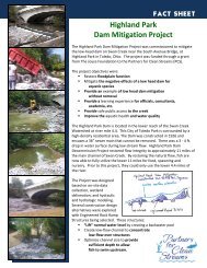
Highland Park Dam Mitigation Project Appendix C - Partners for ...
Highland Park Dam Mitigation Project Appendix C - Partners for ...
Highland Park Dam Mitigation Project Appendix C - Partners for ...

You also want an ePaper? Increase the reach of your titles
YUMPU automatically turns print PDFs into web optimized ePapers that Google loves.
3. Several pages of code were missing from the HEC-2 model hardcopy so assumptions were made to<br />
recreate this section. Missing from the hardcopy were cross-sections S, T, and U (as denoted in the<br />
FIS Swan Creek profile) which were within the <strong>Highland</strong> <strong>Park</strong> study area. A copy of the original code<br />
and the recreated code are included in Attachment A. Due to these missing cross-sections, the water<br />
surface elevation (WSE) <strong>for</strong> the cross-section upstream of the missing code was 0.32 feet higher than<br />
the original model <strong>for</strong> the 10-year flood event. This makes it difficult to use the recreated model as<br />
the basis <strong>for</strong> floodplain change comparison.<br />
4. Because of the missing code in the original model, we used existing cross-section data to create the<br />
base model to which we compared proposed changes to the floodplain. Eighteen new cross-sections<br />
through the project area were incorporated into the original model to create the base model. The new<br />
cross-sections were measured in the field in November 2007. A printout of the existing conditions<br />
base code is attached (Attachment B).<br />
Existing Conditions Low Flow Analysis<br />
5. A “low flow” event was simulated to match the water levels observed in the field. The low flow was<br />
confirmed to match the observed flow over the dam. To calibrate the model to observed water levels,<br />
only the <strong>Highland</strong> <strong>Park</strong> portion of the model was executed.<br />
Evaluation of Proposed Cross-Sections<br />
6. The proposed cross-sections, representing the rock dams and channel upstream of the dam, were<br />
incorporated into the model. A printout of the code with proposed cross-sections is attached<br />
(Attachment C).<br />
7. With the proposed cross-sections, the low flow event was simulated to predict the water level over the<br />
<strong>Highland</strong> <strong>Park</strong> <strong>Dam</strong> and the rock dams.<br />
8. Shear <strong>for</strong>ces and velocities of the flood events were analyzed using the HEC-2 model so that<br />
appropriate rock size could be determined <strong>for</strong> construction of the rock dams.<br />
9. With the proposed cross-sections, the 100-year flood event was simulated resulting in no change to<br />
the flood plain as compared to the base model results (existing conditions).<br />
Results<br />
Model Recreation<br />
As discussed previously, by un<strong>for</strong>tunate coincidence, the cross-sections <strong>for</strong> the project area were missing<br />
from the hard-copy printout of the original HEC-2 model, which includes the <strong>Highland</strong> <strong>Park</strong> Pedestrian<br />
Bridge and the South Bridge. There<strong>for</strong>e, the existing conditions model was used as the base model. For<br />
reference, a comparison of the model results are included in Table 1; Figure 1, Figure 2, and Figure 3<br />
show graphical comparisons of the model <strong>for</strong> the 10-year, 50-year, and 100-year flood events.<br />
10-year flood event = 5,900 cfs (from Lucas County, Ohio FIS, 2000)<br />
50-year flood event = 8,000 cfs (from Lucas County, Ohio FIS, 2000)<br />
100-year flood event = 9,000 cfs (from Lucas County, Ohio FIS, 2000)<br />
2