Complete report - Partners for Clean Streams
Complete report - Partners for Clean Streams
Complete report - Partners for Clean Streams

You also want an ePaper? Increase the reach of your titles
YUMPU automatically turns print PDFs into web optimized ePapers that Google loves.
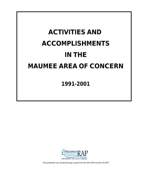
ACTIVITIES AND<br />
ACCOMPLISHMENTS<br />
IN THE<br />
MAUMEE AREA OF CONCERN<br />
1991-2001<br />
This publication was funded through a grant from the Ohio EPA and the US EPA
ACTIVITIES AND<br />
ACCOMPLISHMENTS<br />
IN THE<br />
MAUMEE AREA OF CONCERN<br />
1991-2001<br />
Released April 2002<br />
Published by the<br />
Maumee RAP<br />
In Conjunction with<br />
Hull & Associates, Inc.<br />
This publication was funded through a grant from the Ohio EPA and US EPA. The in<strong>for</strong>mation contained in this document is believed<br />
to be accurate. The Maumee RAP and its <strong>Partners</strong> disclaim liability <strong>for</strong> any omissions or errors. This <strong>report</strong> is available as an Adobe<br />
Acrobat (.pdf) file on the Maumee RAP website (www.maumeerap.org). Copies are also available by contacting the Maumee RAP<br />
Coordinator, Ohio EPA Northwest District Office, 347 N. Dunbridge Road, Bowling Green, Ohio 43402, (419)352-8461, or<br />
cherie.blair@epa.state.oh.us.
ACKNOWLEDGEMENTS<br />
Thanks to the hundreds of volunteers who have dedicated years<br />
to conducting the activities that have led to the<br />
many accomplishments highlighted in this document.<br />
Through this collaborative ef<strong>for</strong>t, these activities have<br />
led to improved water quality in our Area of Concern.
TABLE OF CONTENTS<br />
Preface Page 2<br />
Introduction Page 4<br />
Recommendations and Accomplishments<br />
Issue 1 Agriculture Runoff Page 8<br />
Issue 2 Landfills, Dumps and Brownfield Sites Page 12<br />
Issue 3 Wetlands and Open Space Preservation Page 14<br />
Issue 4 Urban Runoff Problem Page 16<br />
Issue 5 Increase Public Participation and Awareness Page 20<br />
Issue 6 Combined Sewer Overflows Page 26<br />
Issue 7 Acquisition of Fish and Wildlife Habitat Page 28<br />
Issue 8 Contaminated Stream Sediments Page 30<br />
Issue 9 Dredged Disposal Page 34<br />
Issue 10 Industrial Dischargers Page 36<br />
Issue 11 Wastewater Treatment Plants Page 38<br />
Issue 12 Package Plants Page 40<br />
Issue 13 Recreational Usage and Public Access Page 42<br />
Issue 14 Atmospheric Deposition Page 44<br />
Issue 15 Home Sewage Disposal Page 46<br />
Issue 16 Water Treatment Plant Sludge Page 48<br />
Issue 17 Control of Introduced Species Page 50<br />
Issue 18 Leaking Underground Storage Tanks Page 52<br />
Issue 19 Mosquito Control Page 54<br />
Issue 20 Comprehensive Fisheries Management Plan Page 56<br />
Issue 21 Comprehensive Wildlife Habitat Management Plan Page 58<br />
Issue 22 Coordinating Committee and Institutional Framework Page 60<br />
Issue 23 Long-Term Monitoring of the AOC Page 62<br />
Issue 24 401/404 Education Page 64<br />
Activity Descriptions<br />
Issue 1 Agriculture Runoff Page 68<br />
Issue 2 Landfills, Dumps and Brownfield Sites Page 80<br />
Issue 3 Wetlands and Open Space Preservation Page 138<br />
Issue 4 Urban Runoff Problem Page 144<br />
Issue 5 Increase Public Participation and Awareness Page 158<br />
Issue 6 Combined Sewer Overflows Page 178<br />
Issue 7 Acquisition of Fish and Wildlife Habitat Page 182<br />
Issue 8 Contaminated Stream Sediments Page 186<br />
Issue 9 Dredged Disposal Page 190<br />
Issue 10 Industrial Dischargers Page 194<br />
Issue 11 Wastewater Treatment Plants Page 198<br />
Issue 12 Package Plants Page 202<br />
Issue 13 Recreational Usage and Public Access Page 204<br />
Issue 14 Atmospheric Deposition Page 208<br />
Issue 15 Home Sewage Disposal Page 212<br />
Issue 16 Water Treatment Plant Sludge Page 214<br />
Issue 17 Control of Introduced Species Page 216<br />
Issue 18 Leaking Underground Storage Tanks Page 218<br />
Issue 19 Mosquito Control Page 220<br />
Issue 20 Comprehensive Fisheries Management Plan Page 222<br />
Issue 21 Comprehensive Wildlife Habitat Management Plan Page 224<br />
Issue 22 Coordinating Committee and Institutional Framework Page 226<br />
Issue 23 Long-Term Monitoring of the AOC Page 232<br />
Issue 24 401/404 Education Page 240<br />
Appendices<br />
Appendix A Index of Lead Organizations Page 244<br />
Appendix B Index of Acronyms Page 254
Activities and Accomplishments<br />
in the Maumee Area of Concern<br />
1<br />
Preface/Introduction
PREFACE<br />
Overview of the Maumee RAP<br />
The Maumee RAP is a partnership of citizens, government agencies, businesses and industries working<br />
to restore the health of our<br />
area’s streams. However,<br />
the Maumee RAP is more<br />
than just a local<br />
organization, it is founded<br />
on an international<br />
philosophy, process and<br />
program established more<br />
than 15 years ago.<br />
As a binational<br />
organization, the<br />
International Joint<br />
Commission recognizes<br />
that no single individual,<br />
organization or activity<br />
intentionally damaged the<br />
Great Lakes. So in 1985<br />
they designated the<br />
Maumee Area of Concern<br />
(AOC) as one of the 43 international “areas of concern” due to degraded water quality. The original<br />
philosophy <strong>for</strong> restoring these areas is still the same today, an ecosystem approach. This approach<br />
considers all pollution sources and their impacts on the whole environment.<br />
The process established by the International Joint Commission <strong>for</strong> cleaning up these “areas of concern”<br />
included the development of “remedial action plans”. Communities were encouraged to create<br />
comprehensive plans <strong>for</strong> water quality improvements. The Maumee RAP organization then <strong>for</strong>med in<br />
1987 as a community ef<strong>for</strong>t to restore our area’s waterways to “fishable and swimmable” conditions.<br />
The Maumee RAP Committee and its Action Groups (or sub-committees) involve a diverse crosssection<br />
of environmentally concerned businesses, industries, government agencies, non-profit<br />
organizations, educators, and citizens who are working together on activities to make a future <strong>for</strong> our<br />
area with clean rivers and streams. The Maumee RAP Committee makes the official decisions <strong>for</strong> the<br />
organization and provides general program oversight. The Maumee RAP Committee has eight action<br />
groups which are integral to the progress of the Maumee RAP. These action groups are further<br />
classified as Issue, Watershed, and Support Action Groups. The Issue Action Groups address specific<br />
issues that effect the Maumee AOC, such as open space and wetlands, agricultural and urban<br />
concerns, and dumps and landfills. Watershed Action Groups focus on a comprehensive watershed<br />
approach to cleaning up a specific watershed, such as Swan Creek and the Ottawa River. The Support<br />
Action Groups assist the other Maumee RAP action groups and the Maumee RAP Committee to more<br />
effectively accomplish their goals in manner consistent with Maumee RAP guidelines and objectives.<br />
These groups assist mostly with public outreach, education and finance issues.<br />
The partners involved in the Maumee RAP all share a common goal of taking the remedial action plan<br />
beyond words and a plan, and putting it into action <strong>for</strong> the benefit of all who live, work and play in our<br />
watersheds. More in<strong>for</strong>mation about the Maumee RAP, as well as in<strong>for</strong>mation on each action group,<br />
their activities and meeting times, are available at http://www.maumeerap.org or by contacting one of<br />
Activities and Accomplishments<br />
in the Maumee Area of Concern<br />
2<br />
Preface/Introduction
the many Maumee RAP partners in the Appendix of this document.<br />
Beneficial Use Impairments<br />
When the Maumee AOC was first designated, it was primarily due to issues associated with agricultural<br />
runoff. Upon further investigation, it was realized that the Maumee AOC had many more issues that<br />
needed to be addressed to allow <strong>for</strong> the restoration of our area to fishable and swimmable conditions.<br />
As part of the process to develop remedial action plans, the IJC established beneficial impairments to<br />
assist communities in defining their problems. The Maumee RAP has identified that 10 of the 14<br />
beneficial use impairments need to be addressed in the Maumee AOC:<br />
Beneficial Use Impairments<br />
! 1. Restrictions on fish and wildlife consumption<br />
! 2. Tainting of fish and wildlife flavor<br />
! 3. Degradation of fish and wildlife populations<br />
! 4. Fish tumors or other de<strong>for</strong>mities<br />
! 5. Bird or animal de<strong>for</strong>mities<br />
! 6. Degradation of benthos<br />
! 7. Restrictions on dredging activities<br />
! 8. Eutrophication or undesirable algae<br />
! 9. Restrictions on drinking water consumption, or taste and odor problems<br />
! 10. Beach closings<br />
! 11. Degradation of aesthetics<br />
! 12. Added cost to agriculture or industry<br />
! 13. Degradation of phytoplankton and zooplankton populations<br />
! 14. Loss of fish and wildlife habitat<br />
These environmental problems are caused by toxic substances, bacterial contamination, nutrient<br />
enrichment, and landfill leachate. Sources of these pollutants include urban storm water runoff,<br />
commercial and residential development, municipal and industrial discharges, combined sewer<br />
overflows, sanitary sewer overflows, wastewater treatment plant bypasses, hazardous waste disposal<br />
sites, and agricultural runoff. The Maumee RAP continues to advocate or sponsor programs and<br />
activities to address these issues, which are described in this Activities and Accomplishments in the<br />
Maumee Area of Concern <strong>report</strong>.<br />
Activities and Accomplishments<br />
in the Maumee Area of Concern<br />
3<br />
Preface/Introduction
INTRODUCTION<br />
Activities and Accomplishments in the Maumee Area of Concern is a status <strong>report</strong> on the various activities,<br />
programs, events, and policies that have taken place over the last 10 years or more throughout our AOC.<br />
This is not just a listing of Maumee RAP events, rather it is intended to serve as a summary of actions<br />
completed by everyone that lives, works or sets policy to improve water quality.<br />
The Maumee RAP published their original Recommendations Report in 1991; a culmination of three years of<br />
planning and research completed by a wide representation of stakeholders. The 1991 Recommendations<br />
Report has served as a “plan of action” <strong>for</strong> the Maumee RAP and its partners. This Activities &<br />
Accomplishments Report provides baseline in<strong>for</strong>mation <strong>for</strong> measuring what has been done and what still<br />
needs to be addressed. This <strong>report</strong> is the foundation <strong>for</strong> the Maumee RAP’s next Recommendations Report<br />
which will guide our region’s activities through the next decade and beyond.<br />
How to Use this Document<br />
As is evident by the volume of in<strong>for</strong>mation included in this <strong>report</strong>, significant ef<strong>for</strong>ts have taken place to<br />
address the water quality needs of the Maumee AOC. It should be noted that this document only summarizes<br />
activities and the organizations involved with these activities. Readers are encouraged to follow up with the<br />
respective contacts in the back of this <strong>report</strong> to obtain additional project details.<br />
This document is not intended to be read cover to cover. While that wouldn’t be discouraged, it is designed<br />
<strong>for</strong> use as a handy reference. The Recommendations & Accomplishments Table in the front half of this<br />
<strong>report</strong> cites each recommendation excerpted from the 1991 Recommendations Report (numbers in<br />
parenthesis following each recommendation refers to the location of the recommendation in the original<br />
<strong>report</strong>). Status on whether each recommendation has been implemented is divided into six phases:<br />
" = No Action - recommendation has not been implemented.<br />
# = Limited Action - minimal actions have/are taking place to implement recommendation.<br />
$ = Significant Action – actions have/are taking place to implement recommendation.<br />
% = Action <strong>Complete</strong> – recommendation has been implemented.<br />
& = Action Ongoing – recommendation is being implemented (oftentimes associated with<br />
an annual event).<br />
- = Not Applicable - policies and/or regulations have changed, there<strong>for</strong>e<br />
recommendations are no longer applicable.<br />
The table also includes columns to reference the title of the activity, the date it occurred, and a page number<br />
to find its Activity Description in the second section of the <strong>report</strong>. The Maumee RAP’s participation is also<br />
indicated through three levels of involvement:<br />
Lead<br />
The Maumee RAP is/was the lead organization or was part of a team of leading organizations<br />
to sponsor/coordinate the event or the program.<br />
Collaborator The Maumee RAP is/has assisted with the project, reviewed and commented on technical<br />
documents, provided financial assistance or another type of support to a lead organizer.<br />
None<br />
The Maumee RAP did not participate in this event, program or policy creation.<br />
Beneficial uses related to the recommended action are also indicated in the table. The numbers in the table<br />
Activities and Accomplishments<br />
in the Maumee Area of Concern<br />
4<br />
Preface/Introduction
eflect the number located to the left of the listed beneficial use in the Preface.<br />
If additional details are identified that could supplement the in<strong>for</strong>mation provided in this document, please<br />
<strong>for</strong>ward those corrections/additions to the Ohio EPA RAP Coordinator, Ohio EPA Northwest District Office,<br />
347 North Dunbridge Road, Bowling Green, Ohio 43402, (419) 352-8461.<br />
Activities and Accomplishments<br />
in the Maumee Area of Concern<br />
5<br />
Preface/Introduction
RECOMMENDATIONS<br />
AND<br />
ACCOMPLISHMENTS<br />
Activities and Accomplishments<br />
in the Maumee Area of Concern<br />
6<br />
Recommendations<br />
and Accomplishments
Activities and Accomplishments<br />
in the Maumee Area of Concern<br />
7<br />
Issue 1: Agriculture Runoff
Actions Suggested<br />
in the Maumee RAP<br />
Recommendations<br />
Report<br />
Discourage fall plowing and<br />
maintain cover on all exposed soil<br />
surfaces during critical erosion<br />
period (3.5.2.)<br />
Encourage farmers to adopt BMPs<br />
through local agricultural nonpoint<br />
source steering committees in<br />
counties throughout Maumee<br />
watershed (3.5.2.)<br />
ISSUE 1: AGRICULTURE RUNOFF<br />
Action<br />
&<br />
&<br />
Adopt Conservation Cover Crops<br />
Land Management Practices<br />
(3.5.2.)<br />
&<br />
Activity<br />
Maumee River Basin<br />
Sediment Reduction<br />
Project<br />
Conservation Tillage<br />
Equipment Buy-Down<br />
Program<br />
Toussaint River<br />
Improvement Incentive<br />
Program<br />
Maumee RAP<br />
Involvement<br />
Date<br />
Beneficial<br />
Use<br />
Affected<br />
See<br />
Page<br />
None 1992-1997 68<br />
Collaborator 1992 68<br />
Lead 1997-2003 6, 11<br />
68<br />
CRP None Ongoing 70<br />
Strip-Till Equipment<br />
Lease Program<br />
Residue Management<br />
& Erosion Control<br />
Demonstration Project<br />
Maumee River Basin<br />
Sediment Reduction<br />
Project<br />
Conservation Tillage<br />
Equipment Buy-Down<br />
Program<br />
Ohio Phosphorus<br />
Reduction Strategy<br />
Ohio Lake Erie Buffer<br />
Program<br />
Collaborator 1997-1998 70<br />
Collaborator 2001-2003<br />
Collaborator 1992-1997 68<br />
Collaborator 1992 68<br />
None 1992-1994 71<br />
Collaborator<br />
1998-<br />
Present<br />
CRP None Ongoing 70<br />
Ohio Coastal Nonpoint<br />
Source Pollution<br />
Control Plan<br />
CREP<br />
None 2000 72<br />
None<br />
2000 -<br />
Present<br />
EQIP None Ongoing<br />
6, 11<br />
CRP None Ongoing 70<br />
Pheasants Forever<br />
Plantings<br />
Ottawa County Native<br />
Grasses Seeder<br />
Wood County Native<br />
Grasses Seeder<br />
Strip-Till Equipment<br />
Lease Program<br />
None Ongoing 73<br />
None 1992-1993 74<br />
Collaborator 1997-1998 74<br />
6, 11<br />
Collaborator 1997-1998 70<br />
71<br />
71<br />
72<br />
78<br />
Residue Management<br />
& Erosion Control<br />
Demonstration Project<br />
Collaborator 2001-2003 71<br />
Toussaint River<br />
Improvement Incentive<br />
Program<br />
Lead 1997-2003<br />
68<br />
Activities and Accomplishments<br />
in the Maumee Area of Concern<br />
8<br />
Issue 1: Agriculture Runoff
Actions Suggested<br />
in the Maumee RAP<br />
Recommendations<br />
Report<br />
ISSUE 1: AGRICULTURE RUNOFF (continued)<br />
Action<br />
Activity<br />
Maumee RAP<br />
Involvement<br />
Date<br />
Adopt Conservation Cropping<br />
Sequence Land Management<br />
Practices (3.5.2.)<br />
& Certified Crop Advisor None 1995 -<br />
Present<br />
Beneficial<br />
Use<br />
Affected<br />
See<br />
Page<br />
6, 8, 11 74<br />
CRP None Ongoing 70<br />
Adopt Critical Area Planting<br />
Land Management Practices<br />
(3.5.2.) &<br />
Pheasants Forever<br />
Plantings<br />
Ottawa County Native<br />
Grasses Seeder<br />
Wood County Native<br />
Grasses Seeder<br />
Strip-Till Equipment<br />
Lease Program<br />
Residue Management<br />
& Erosion Control<br />
Demonstration Project<br />
Toussaint River<br />
Improvement Incentive<br />
Program<br />
None Ongoing 73<br />
None 1992-1993 74<br />
Collaborator 1997-1998 74<br />
6, 11<br />
Collaborator 1997-1998 70<br />
Collaborator 2001-2003 71<br />
Lead 1997-2003 68<br />
Adopt Field Windbreak<br />
Land Management Practices<br />
(3.5.2.)<br />
&<br />
CREP<br />
Northwest Ohio Field<br />
Windbreak Program<br />
None<br />
None<br />
2000 -<br />
Present<br />
1977 -<br />
Present<br />
CRP None Ongoing 70<br />
NatureWorks Swan<br />
Creek Watershed<br />
Project<br />
Collaborator<br />
1996 -<br />
1998<br />
6, 8, 11, 14<br />
CREP None 1997-2001 72<br />
72<br />
74<br />
75<br />
Ohio Lake Erie Buffer<br />
Program<br />
Collaborator<br />
1998-<br />
Present<br />
71<br />
CRP None Ongoing 70<br />
Adopt Filter Strips<br />
Land Management Practices<br />
(3.5.2.)<br />
&<br />
NatureWorks Swan<br />
Creek Watershed<br />
Project<br />
Collaborator<br />
1996 -<br />
1998<br />
CREP None 1997-2001 6, 8, 11 72<br />
Toussaint River<br />
Improvement Incentive<br />
Program<br />
Lead 1997-2003 68<br />
Ohio Lake Erie Buffer<br />
Program<br />
Collaborator<br />
1998-<br />
Present<br />
75<br />
71<br />
Activities and Accomplishments<br />
in the Maumee Area of Concern<br />
9<br />
Issue 1: Agriculture Runoff
Actions Suggested<br />
in the Maumee RAP<br />
Recommendations<br />
Report<br />
ISSUE 1: AGRICULTURE RUNOFF (continued)<br />
Action<br />
Adopt Nutrient Management<br />
Land Management Practices<br />
(3.5.2.)<br />
&<br />
Activity<br />
Manure Management<br />
Plans<br />
Maumee RAP<br />
Involvement<br />
Date<br />
Beneficial<br />
Use<br />
Affected<br />
See<br />
Page<br />
None Ongoing 75<br />
Soil Doctor None 1994 76<br />
Certified Crop Advisor None<br />
6, 8, 11<br />
1995 –<br />
Present<br />
74<br />
Hertzfeld Manure<br />
Composting Project<br />
None 1998<br />
CRP None Ongoing 70<br />
76<br />
Adopt Grassed Waterway<br />
Land Management Practices<br />
(3.5.2.) &<br />
Adopt Waste Management<br />
Systems Land Management<br />
Practices (3.5.2.)<br />
&<br />
Toussaint River<br />
Improvement Incentive<br />
Program<br />
Wood County Native<br />
Grasses Seeder<br />
Ottawa County Native<br />
Grasses Seeder<br />
CREP<br />
Manure Management<br />
Plans<br />
Certified Crop Advisor<br />
Hertzfeld Manure<br />
Composting Project<br />
Lead 1997-2003 68<br />
Collaborator 1997 6, 8, 11, 14<br />
74<br />
None 1997-1999 74<br />
None<br />
2000-<br />
Present<br />
None Ongoing 75<br />
None<br />
1995 -<br />
Present<br />
None 1998<br />
6, 8, 11<br />
72<br />
74<br />
76<br />
Adopt Stream Bank Protection<br />
Land Management Practices<br />
(3.5.2.)<br />
&<br />
Adopt Structural Erosion Control<br />
Land Management Practices<br />
NatureWorks Swan<br />
Creek Watershed<br />
Project<br />
Swan Creek<br />
Streambank<br />
Stabilization Project<br />
Toussaint River<br />
Streambank<br />
Stabilization Project<br />
None<br />
1996 -<br />
1998<br />
Collaborator 1996 6, 11, 14 76<br />
Lead 1998<br />
(3.5.2.) " - - - - -<br />
Encourage sustainable and<br />
organic agriculture (3.5.2.) &<br />
Encourage flexible government<br />
programs to allow variability in<br />
cropping (i.e. rotations) without<br />
penalty to farmer enrolled in<br />
programs (3.5.2.)<br />
Influential Farmer<br />
Meeting<br />
Lead 1995 6, 8, 11 77<br />
" - - - - -<br />
75<br />
68<br />
Activities and Accomplishments<br />
in the Maumee Area of Concern<br />
10<br />
Issue 1: Agriculture Runoff
Actions Suggested<br />
in the Maumee RAP<br />
Recommendations<br />
Report<br />
Disseminate In<strong>for</strong>mation to<br />
farmers/landowners on<br />
environmental issues, technical<br />
application and economic benefit<br />
(3.5.2.)<br />
ISSUE 1: AGRICULTURE RUNOFF (continued)<br />
Action<br />
&<br />
Activity<br />
Influential Farmer<br />
Meeting<br />
From Satellites to<br />
Earthworms Workshop<br />
Is Your Drinking Water<br />
Safe? Seminar<br />
Toussaint River<br />
Improvement Incentive<br />
Program<br />
Maumee RAP<br />
Involvement<br />
Date<br />
Beneficial<br />
Use<br />
Affected<br />
See<br />
Page<br />
Lead 1995 77<br />
Lead 1996 77<br />
Lead 1996 77<br />
6, 8, 11, 14<br />
Lead 1997-2003 68<br />
Certified Crop Advisor<br />
None<br />
1995 -<br />
Present<br />
74<br />
Agencies need to address public<br />
concerns on water quality using<br />
public media, scheduling seminars<br />
and conducting demonstrations<br />
(3.5.2.)<br />
&<br />
Influential Farmer<br />
Meeting<br />
From Satellites to<br />
Earthworms Workshop<br />
Is Your Drinking Water<br />
Safe? Seminar<br />
Lead 1995 77<br />
Lead 1996 6, 8, 11, 14<br />
77<br />
Lead 1996<br />
77<br />
Additional certification program<br />
should be developed <strong>for</strong><br />
commercial fertilizer dealers and<br />
applicators that apply fertilizer,<br />
herbicides and pesticides to<br />
cropland; should make<br />
recommendations based on<br />
soils test (3.5.2)<br />
%<br />
Certified<br />
Crop Advisor None<br />
1995 –<br />
Present<br />
6, 8, 11 74<br />
Wetland Reserve<br />
Program<br />
None<br />
1985-<br />
Preesent<br />
138<br />
Preserve and restore wetlands to<br />
aid in phosphorus removal from<br />
runoff (3.5.2) %<br />
Waterbank Program None 1992-1994 139<br />
Blue Creek Wetlands<br />
Demonstration Project<br />
CREP<br />
6, 8, 11<br />
Collaborator 1993 140<br />
None<br />
2000-<br />
Present<br />
72<br />
See Issue 3 - Wetlands Section <strong>for</strong> additional projects<br />
138<br />
Activities and Accomplishments<br />
in the Maumee Area of Concern<br />
11<br />
Issue 1: Agriculture Runoff
Actions Suggested<br />
in the Maumee RAP<br />
Recommendations<br />
Report<br />
ISSUE 2: LANDFILLS, DUMPS AND<br />
BROWNFIELD SITES<br />
Action<br />
Recommend that Ohio EPA<br />
require the necessary procedures<br />
to clean-up listed sites. (3.10.2, %<br />
4.10.2., 5.10.2., 6.10.2)<br />
Remedial Investigation/Feasibility<br />
Studies should be completed <strong>for</strong><br />
each site to fully elaborate the<br />
extent of work which will be<br />
necessary to remediate the sites -<br />
to best protect the public health<br />
and the environment. (3.10.2,<br />
4.10.2., 5.10.2., 6.10.2)<br />
Remedial Design/Remedial Action<br />
should then be prepared to spell<br />
out the exact details of the<br />
remedial actions to be<br />
implemented. <strong>Clean</strong>-up should -<br />
then proceed as expeditiously as<br />
possible. (3.10.2, 4.10.2., 5.10.2.,<br />
6.10.2)<br />
Recommend that the other sites<br />
that have been identified <strong>for</strong><br />
possible remediation be given<br />
priority <strong>for</strong> clean-up in accordance<br />
with the previously prescribed<br />
procedures <strong>for</strong> corrective action by<br />
Ohio EPA. (3.10.2, 4.10.2.,<br />
5.10.2., 6.10.2)<br />
Recommend that additional<br />
preliminary assessments be<br />
per<strong>for</strong>med <strong>for</strong> sites that have been<br />
identified but <strong>for</strong> which there is<br />
little or no in<strong>for</strong>mation concerning<br />
possible environmental effects.<br />
(3.10.2, 4.10.2., 5.10.2., 6.10.2)<br />
-<br />
&<br />
Activity<br />
Maumee RAP<br />
Involvement<br />
See Issue 2 - Landfills, Dumps and Uncontrolled<br />
Waste Sites Activity Descriptions<br />
RI/FS completed <strong>for</strong> some sites.<br />
See Activity Descriptions <strong>for</strong> more details.<br />
RD/RA completed <strong>for</strong> some sites.<br />
See Activity Descriptions <strong>for</strong> more details.<br />
Toledo<br />
Brownfields Group<br />
None<br />
Remediation has been conducted at some sites.<br />
See Activity Descriptions <strong>for</strong> more details.<br />
MAOC Project<br />
Maumee AOC<br />
Contaminated<br />
Sediment Project<br />
MAOC Project<br />
Extension<br />
Sediment Toxicity<br />
Survey<br />
Duck Creek<br />
Wetlands Sampling<br />
Project<br />
Toledo<br />
Brownfields Group<br />
Collaborator<br />
Collaborator<br />
Date<br />
1990s-<br />
Present<br />
1992-<br />
1998<br />
1994-<br />
1995<br />
Beneficial<br />
Use<br />
Affected<br />
See<br />
Page<br />
1, 3, 4, 6, 11 80<br />
1, 3, 4, 6, 11 80<br />
1, 3, 4, 6, 11 80<br />
1, 3, 4, 6, 11<br />
228<br />
80<br />
233<br />
234<br />
Collaborator 1998 234<br />
Collaborator 1998 235<br />
None 2001 235<br />
None<br />
1990s-<br />
Present<br />
1, 3, 4, 6, 11<br />
228<br />
Ohio EPA should be supportive of<br />
these voluntary clean-ups and/or<br />
interim actions in the AOC.<br />
Voluntary Action<br />
Program<br />
None<br />
1996 -<br />
Present<br />
(3.10.2, 4.10.2., 5.10.2., 6.10.2)<br />
& Numerous sites have had voluntary remedial activities<br />
occur. See Activity Descriptions <strong>for</strong> more details.<br />
1, 3, 4, 6, 11<br />
135<br />
80<br />
Activities and Accomplishments<br />
In the Maumee Area of Concern<br />
12<br />
Issue 2: Landfills, Dumps, and<br />
Brownfield Sites
Actions Suggested<br />
in the Maumee RAP<br />
Recommendations<br />
Report<br />
Recommend that the owners and<br />
responsible parties <strong>for</strong> the various<br />
sites listed in the Investigation<br />
Report and the high priority sites<br />
listed above initiate clean-up<br />
activities as soon as possible and<br />
at minimum take interim measures<br />
to prevent leachate from entering<br />
surface waters. (3.10.2, 4.10.2.,<br />
5.10.2., 6.10.2)<br />
ISSUE 2: LANDFILLS, DUMPS AND<br />
BROWNFIELD SITES (continued)<br />
Action<br />
&<br />
Activity<br />
Maumee RAP<br />
Involvement<br />
Date<br />
Assessment and remediation activities vary by site.<br />
See Activity Descriptions <strong>for</strong> more details.<br />
Beneficial<br />
Use<br />
Affected<br />
See<br />
Page<br />
1, 3, 4, 6, 11 80<br />
The Ottawa River should be<br />
addressed as a separate cleanup<br />
project with responsibility <strong>for</strong><br />
cleanup allocated to all of the<br />
contributing sources (5.10.2.)<br />
$<br />
MAOC Project<br />
Ottawa River<br />
Sediment Screening<br />
Survey<br />
Maumee AOC<br />
Contaminated<br />
Sediment Project<br />
MAOC Project<br />
Extension<br />
Sediment Toxicity<br />
Survey<br />
Ottawa River<br />
Geographic Initiative<br />
Ottawa River Hot Spot<br />
Delineation and Risk<br />
Assessment<br />
Collaborator<br />
Collaborator<br />
Collaborator<br />
1992-<br />
1998<br />
1994-<br />
1996<br />
1994-<br />
1995<br />
233<br />
234<br />
234<br />
1, 3, 4, 6, 11, 14<br />
Collaborator 1998 234<br />
Collaborator 1998 235<br />
Collaborator<br />
Collaborator<br />
ACTIVITIES NOT IN THE 1991 RAP RECOMMENDATIONS REPORT<br />
%<br />
%<br />
#<br />
$<br />
<strong>Clean</strong><br />
Dumps and Landfills<br />
Walking Tour<br />
Ottawa River<br />
Remediation Bus Tour<br />
Maumee AOC<br />
Uncontrolled Waste<br />
Site Database<br />
1999-<br />
2000<br />
2000-<br />
2001<br />
237<br />
186<br />
Lead 1996 1, 3, 4, 6, 11, 14 135<br />
Lead 1998 1, 3, 4, 6, 11, 14 136<br />
Collaborator 1999 1, 3, 4, 6, 11, 14 136<br />
Ohio Fund None<br />
2001 -<br />
2005<br />
1, 3, 4, 6, 7, 8,<br />
11, 14<br />
137<br />
Activities and Accomplishments<br />
In the Maumee Area of Concern<br />
13<br />
Issue 2: Landfills, Dumps, and<br />
Brownfield Sites
ISSUE 3: WETLANDS AND OPEN SPACE PRESERVATION<br />
Actions Suggested<br />
in the Maumee RAP<br />
Recommendations<br />
Report<br />
Action<br />
Activity<br />
Maumee RAP<br />
Involvement<br />
Date<br />
Beneficial<br />
Use<br />
Affected<br />
See<br />
Page<br />
See Issue 10 - Comprehensive Wildlife Habitat<br />
Management Plan Section <strong>for</strong> additional projects<br />
138<br />
Waterbank Program<br />
None<br />
1992-<br />
1994<br />
139<br />
Wetland Reserve<br />
Program<br />
None<br />
1985-<br />
Present<br />
138<br />
Wetlands currently owned and<br />
managed by governmental entities<br />
and the private sector should be<br />
preserved as natural habitats but<br />
should receive sufficient<br />
management action to maximize<br />
wildlife usage and native plant<br />
communities. (2.3.4.2)<br />
&<br />
Wildlife Habitat<br />
Incentives Program<br />
(WHIP)<br />
Manhattan Marsh<br />
Nature Preserve<br />
Blue Creek Wetlands<br />
Demonstration Project<br />
None<br />
Collaborator<br />
Collaborator<br />
1996-<br />
Present<br />
1990 –<br />
Present<br />
1993-<br />
1995<br />
3, 14<br />
138<br />
139<br />
140<br />
Metzger Marsh Wildlife<br />
Area Improvements<br />
None 1994 140<br />
Maumee Bay State<br />
Park Coastal Wetlands<br />
Restoration<br />
None<br />
1997-<br />
1998<br />
140<br />
Duck Creek Wetlands<br />
Restoration Project<br />
None<br />
Planned<br />
2002<br />
235<br />
Counties, cities and villages<br />
should adopt their own legislation<br />
following the federal definitions<br />
and guidelines as outlined in<br />
Section 404 of the <strong>Clean</strong> Water<br />
Act. (2.3.4.2)<br />
The loss of wetlands to real estate<br />
development activities should be<br />
discouraged by governmental<br />
agencies involved in the permit<br />
review process. (2.3.4.2)<br />
Should development activities<br />
adversely affect wetlands,<br />
mitigation projects should be<br />
required which actually replace<br />
lost acreage with high quality,<br />
man-made wetland areas.<br />
(2.3.4.2)<br />
Building on the National Wetlands<br />
Inventory Maps, USFWS, local<br />
governments should prepare a<br />
comprehensive plan and maps<br />
that identify wetlands and<br />
floodplains, followed by adoption<br />
of prohibition on development<br />
within identified areas. (2.3.4.2)<br />
" - - - - -<br />
&<br />
&<br />
US ACOE and New<br />
Ohio Isolated<br />
Wetlands Regulations<br />
US ACOE and New<br />
Ohio Isolated<br />
Wetlands Regulations<br />
Maumee River<br />
Watershed Wetlands<br />
Protection &<br />
Enhancement<br />
Planning Project<br />
$<br />
Remote Sensing<br />
Technology <strong>for</strong> Land<br />
Cover Analysis<br />
None 2001 14 141<br />
None 2001 14 141<br />
Collaborator<br />
Collaborator<br />
2000-<br />
2002<br />
2000 –<br />
Present<br />
3, 14<br />
141<br />
142<br />
Activities and Accomplishments<br />
in the Maumee Area of Concern<br />
14<br />
Issue 3: Wetlands and<br />
Open Space Preservation
ISSUE 3: WETLANDS AND OPEN SPACE PRESERVATION<br />
(continued)<br />
Actions Suggested<br />
in the Maumee RAP<br />
Recommendations<br />
Report<br />
The planning process must include<br />
a review of existing floodplain and<br />
zoning legislation, with maps being<br />
made available to the general<br />
public to monitor the disposition of<br />
these areas. (2.3.4.2)<br />
The comprehensive plan should be<br />
reviewed every five years, but the<br />
initial process should be open to a<br />
wide array of interested parties.<br />
(2.3.4.2)<br />
To be established at the state level,<br />
is the creation of a Coastal<br />
Wetlands Preservation Program<br />
and it should be supported with a<br />
special revenue Wetlands<br />
Preservation Fund in the State<br />
budget. (2.3.4.2)<br />
Action<br />
$<br />
Activity<br />
US ACOE and New<br />
Ohio Isolated<br />
Wetlands Regulations<br />
Maumee River<br />
Watershed Wetlands<br />
Protection &<br />
Enhancement<br />
Planning Project<br />
Maumee<br />
RAP<br />
Involvement<br />
Date<br />
Beneficial<br />
Use<br />
Affected<br />
See<br />
Page<br />
None 2001 141<br />
Collaborator<br />
2000-<br />
2002<br />
" - - - - -<br />
#<br />
ODNR Coastal<br />
Management Program<br />
Lake Erie Protection<br />
and Restoration Plan<br />
<strong>Clean</strong> Ohio Fund<br />
None<br />
1997-<br />
Present<br />
14<br />
141<br />
142<br />
None 2000<br />
3, 14<br />
171<br />
Identified coastal wetlands should<br />
be valued as prime agricultural land<br />
<strong>for</strong> tax purposes. (2.3.4.2)<br />
" - - - - -<br />
Educational programs need to be<br />
initiated by the RAP Coordinating<br />
Committee and by all governmental<br />
entities on the need <strong>for</strong> these<br />
programs (2.3.4.2)<br />
Maumee River<br />
Watershed Wetlands<br />
Protection &<br />
Enhancement<br />
$<br />
Planning Project<br />
Floodplain<br />
Management<br />
Workshop<br />
None<br />
Collaborator<br />
2001 -<br />
2005<br />
2000-<br />
2002<br />
Lead 1996<br />
ACTIVITIES NOT IN THE 1991 RAP RECOMMENDATIONS REPORT<br />
%<br />
Ottawa<br />
$<br />
$<br />
<strong>Clean</strong><br />
SWCD Private<br />
Lands Wetlands<br />
Restoration<br />
OSU Drainage<br />
Channel Restoration<br />
None<br />
None<br />
1992 -<br />
1994<br />
1999-<br />
Present<br />
Ohio Fund None<br />
2001 -<br />
2005<br />
3, 14<br />
137<br />
141<br />
142<br />
14 143<br />
14 143<br />
1, 3, 4, 6, 7, 8,<br />
11, 14<br />
137<br />
Activities and Accomplishments<br />
in the Maumee Area of Concern<br />
15<br />
Issue 3: Wetlands and<br />
Open Space Preservation
Actions Suggested<br />
in the Maumee RAP<br />
Recommendations<br />
Report<br />
ISSUE 4: URBAN RUNOFF PROBLEM<br />
Action<br />
Illicit connections to storm sewers<br />
need to be located and eliminated.<br />
(3.4.2.)<br />
&<br />
Recommend that a monitoring<br />
program be established to assist in<br />
locating these connections. (3.4.2.)<br />
$<br />
An effective en<strong>for</strong>cement program<br />
also needs to be established.<br />
(3.4.2.)<br />
#<br />
Cities must be aggressive about<br />
responding to all complaints of<br />
illegal dumping and liquid waste<br />
runoff and locating parties<br />
responsible <strong>for</strong> the illegal disposal<br />
of hazardous material in drainage<br />
systems. (3.4.2.)<br />
New industries and businesses<br />
should be required to submit<br />
disposal plans <strong>for</strong> water containing<br />
&<br />
Activity<br />
Maumee<br />
RAP<br />
Involvement<br />
Correction and Prevention<br />
Date<br />
Beneficial<br />
Use<br />
Affected<br />
See<br />
Page<br />
Health Department<br />
None Ongoing<br />
Regulations<br />
1, 3, 4, 6, 7, 8,<br />
144<br />
NPDES Phase I None 1990 9, 10, 11 144<br />
NPDES Phase II None 1999<br />
145<br />
In<strong>for</strong>mal Programming None Ongoing 145<br />
Annual Dry Weather<br />
Field Survey<br />
Swan Creek Stream<br />
Keepers Program<br />
Community Agent<br />
En<strong>for</strong>cement<br />
Spill Response<br />
Programs<br />
Wastewater Disposal<br />
Plans/Permits<br />
% City of Toledo<br />
wastes. (3.4.2.) Pretreatment Program<br />
Recommend that construction site<br />
runoff be regulated by new<br />
ordinances and followed up with<br />
adequate en<strong>for</strong>cement. (3.4.2.)<br />
&<br />
Construction permits should include<br />
storm water runoff standards <strong>for</strong><br />
quality and quantity. (3.4.2.)<br />
$<br />
None Ongoing<br />
1, 3, 4, 6, 7, 8,<br />
9, 10, 11<br />
145<br />
Lead<br />
1998-<br />
2000<br />
172<br />
None<br />
None<br />
Ongoing<br />
Ongoing<br />
1, 3, 4, 6, 7, 8,<br />
9, 10, 11<br />
1, 3, 4, 6, 7, 8,<br />
9, 11<br />
146<br />
146<br />
None Ongoing 146<br />
3, 4, 6, 8, 3, 6,<br />
1987- 10, 11<br />
None<br />
197<br />
Present<br />
NPDES Phase I None 1990 144<br />
NPDES Phase II None 1999 145<br />
City of Toledo<br />
Ordinance 139-95<br />
Regional Storm Water<br />
Standards<br />
3, 6, 11, 14<br />
None 1995 146<br />
Collaborator<br />
2000-<br />
2001<br />
Site Plan Reviews None Ongoing 146<br />
NPDES Phase I None 1990 144<br />
NPDES Phase II None 1999 3, 6, 10, 11, 14 145<br />
Regional Storm Water<br />
Standards<br />
Collaborator<br />
2000-<br />
2001<br />
156<br />
156<br />
Recommend tighter restrictions on<br />
development in floodplains be<br />
imposed based on watershed plans<br />
that identify land use development<br />
patterns and existing and potential<br />
drainage problems. (3.4.2.)<br />
%<br />
Floodplain and FEMA<br />
Regulations<br />
Regional Storm Water<br />
Standards<br />
Swan Creek<br />
Watershed Plan of<br />
Action<br />
None Ongoing 147<br />
Collaborator<br />
Lead<br />
2000-<br />
2001<br />
1998-<br />
2001<br />
3, 6, 10, 11,<br />
13, 14<br />
156<br />
171<br />
Activities and Accomplishments<br />
in the Maumee Area of Concern<br />
16<br />
Issue 4: Urban Runoff
ISSUE 4: URBAN RUNOFF PROBLEM (continued)<br />
Actions Suggested<br />
in the Maumee RAP<br />
Recommendations<br />
Report<br />
Community programs (i.e., motor oil<br />
recycling, disposal of hazardous<br />
household chemicals, rewards <strong>for</strong><br />
in<strong>for</strong>mation leading to the<br />
conviction of chronic polluters, etc.)<br />
need to be developed that<br />
discourage illegal and inappropriate<br />
dumping into the storm sewers and<br />
waterways. (3.4.2.)<br />
Public awareness campaigns,<br />
educational programs, and the<br />
media should be used to<br />
encourage volunteer ef<strong>for</strong>ts and put<br />
public pressure on business and<br />
industry. (3.4.2.)<br />
Action<br />
&<br />
&<br />
Activity<br />
Maumee<br />
RAP<br />
Involvement<br />
Date<br />
Beneficial<br />
Use<br />
Affected<br />
See<br />
Page<br />
NPDES Phase I None 1990 144<br />
NPDES Phase II None 1999 145<br />
BGSU Orphan<br />
Chemical Program<br />
Ottawa-Seneca-<br />
Sandusky Tire<br />
Collection Day<br />
Ottawa-Seneca-<br />
Sandusky Lead-Acid<br />
Battery Collection<br />
Lucas County Pitch<br />
Old Paint Day<br />
ODA Pesticide<br />
Collection Day<br />
Wood Co. Household<br />
Hazardous Collection<br />
Ottawa-Seneca-<br />
Sandusky Household<br />
Hazardous Waste<br />
Collection Days<br />
Lucas County<br />
Hazardous Waste<br />
Collection Program<br />
Mercury Collection and<br />
Reclamation Program<br />
Ohio’s Materials<br />
Exchange Project<br />
None<br />
None<br />
None<br />
None<br />
None<br />
None<br />
None<br />
None<br />
None<br />
None<br />
1991-<br />
Present<br />
1993-<br />
Present<br />
1994-<br />
Present<br />
1995-<br />
Present<br />
1996 –<br />
Present<br />
1997-<br />
Present<br />
1997-<br />
Present<br />
1998-<br />
Present<br />
1998-<br />
Present<br />
1998-<br />
Present<br />
1, 3, 4, 6, 7, 8,<br />
9, 11<br />
NPDES Phase I None 1990 144<br />
NPDES Phase II None 1999 145<br />
Public Officials Guide<br />
to Urban Storm Water Collaborator 1992 150<br />
Runoff<br />
Storm Water<br />
Workshop <strong>for</strong><br />
Municipal Officials<br />
Lead 1993 150<br />
Ottawa River-Swan<br />
Creek Construction<br />
Site Erosion Control<br />
Demonstration Project<br />
Erosion Control<br />
Workshop<br />
Storm Drain Stenciling<br />
Program<br />
Watershed-Based<br />
Storm Water<br />
Management<br />
Workshop<br />
Pollution Prevention in<br />
Northwest Ohio<br />
Seminar<br />
Inland Spills<br />
Conference<br />
Collaborator<br />
1993-<br />
1994<br />
147<br />
147<br />
147<br />
148<br />
148<br />
148<br />
148<br />
149<br />
149<br />
149<br />
150<br />
All<br />
Lead 1994 150<br />
Lead<br />
1994 –<br />
Present<br />
151<br />
Lead 1996 151<br />
Lead<br />
None<br />
1999-<br />
2001<br />
1997-<br />
Present<br />
151<br />
152<br />
Activities and Accomplishments<br />
in the Maumee Area of Concern<br />
17<br />
Issue 4: Urban Runoff
ISSUE 4: URBAN RUNOFF PROBLEM (continued)<br />
Actions Suggested<br />
in the Maumee RAP<br />
Recommendations<br />
Report<br />
Education programs should be<br />
initiated on the importance of<br />
keeping toxic pollutants from<br />
entering the urban storm water<br />
drainages. (3.4.2.)<br />
Action<br />
&<br />
Activity<br />
Maumee<br />
RAP<br />
Involvement<br />
Education Programs<br />
Student Watershed<br />
Watch<br />
Lead<br />
Date<br />
1989-<br />
Present<br />
Beneficial<br />
Use<br />
Affected<br />
See<br />
Page<br />
NPDES Phases I None 1990 144<br />
NPDES Phase II None 1999<br />
1, 3, 4, 6, 8, 9,<br />
145<br />
11<br />
Storm Drain Stenciling<br />
Program<br />
Package Plant<br />
Operation and<br />
Maintenance<br />
Workshop<br />
Lead<br />
1995-<br />
Present<br />
None 2001<br />
Educational Materials Collaborator Ongoing 152<br />
162<br />
151<br />
202<br />
State and local agencies should<br />
provide and circulate educational<br />
material designed to maximize<br />
voluntary ef<strong>for</strong>ts to keep toxins out<br />
of the drainage system. (3.4.2)<br />
&<br />
Ohio EPA Training and<br />
Workshops<br />
None Ongoing 153<br />
NPDES Phase I None 1990<br />
1, 3, 4, 6, 8, 9,<br />
11<br />
144<br />
NPDES Phase II None 1999 145<br />
The various pollution control<br />
agencies should increase their<br />
presence in promoting the proper<br />
management of toxins. (3.4.2.)<br />
&<br />
See Issue 5 – Public Participation and Awareness Section<br />
<strong>for</strong> additional projects<br />
Pollution Control Agencies<br />
Comprehensive<br />
Permitting Programs<br />
158<br />
None Ongoing 152<br />
NPDES Phase I None 1990 144<br />
NPDES Phase II None 1999<br />
1, 3, 4, 6, 8, 9,<br />
11<br />
145<br />
See Community Programs above and<br />
Issue 5 - Public Participation and Awareness Section<br />
158<br />
For additional projects<br />
NPDES Phase I None 1990 144<br />
Leaks and spills, resulting from<br />
NPDES Phase II None 1999 145<br />
both sloppy housekeeping and<br />
1, 3, 4, 6, 7, 8,<br />
intentional acts, should be & City of Toledo<br />
9, 11<br />
minimized. (3.4.2.) Environmental<br />
None Ongoing<br />
153<br />
Services Industrial<br />
Inspections<br />
Agencies should increase<br />
cooperative ef<strong>for</strong>ts to ensure that<br />
personnel are properly trained<br />
(particularly that all inspectors are<br />
trained to be observant <strong>for</strong><br />
improper toxic management during<br />
the course of their inspections.)<br />
(3.4.2.)<br />
$<br />
Ohio<br />
EPA Training and<br />
Workshops<br />
None<br />
Ongoing<br />
1, 3, 4, 6, 7, 8,<br />
9, 11<br />
153<br />
Activities and Accomplishments<br />
in the Maumee Area of Concern<br />
18<br />
Issue 4: Urban Runoff
ISSUE 4: URBAN RUNOFF PROBLEM (continued)<br />
Research<br />
Actions Suggested<br />
in the Maumee RAP<br />
Recommendations<br />
Report<br />
Local universities should be funded<br />
to examine the effectiveness of<br />
pilot programs designed to test<br />
control measures and resulting<br />
environmental impact. (3.4.2.)<br />
Research should be encouraged<br />
and funded by the US EPA and<br />
Ohio EPA to determine the<br />
effectiveness of specific control<br />
measures and the significance of<br />
urban runoff to the overall health of<br />
the receiving water. (3.4.2.)<br />
Action<br />
Activity<br />
Maumee<br />
RAP<br />
Involvement<br />
Date<br />
Beneficial<br />
Use<br />
Affected<br />
See<br />
Page<br />
" - - - - -<br />
$<br />
Ottawa River-Swan<br />
Creek Construction<br />
Site Erosion Control<br />
Demonstration Project<br />
Erosion Control<br />
Workshop<br />
Nonpoint Source<br />
Pollution Control <strong>for</strong><br />
Urban Storm Water at<br />
Wildwood Preserve<br />
Collaborator<br />
1993-<br />
1994<br />
150<br />
Lead 1994 150<br />
Collaborator<br />
1998-<br />
1999,<br />
2001<br />
All<br />
153<br />
Bowman Park Parking<br />
Lot BMP Installation<br />
Collaborator 2001<br />
ACTIVITIES NOT IN THE 1991 RAP RECOMMENDATIONS REPORT<br />
%<br />
&<br />
&<br />
Toledo Metropolitan<br />
Area Regional Storm<br />
Water Management<br />
Study<br />
Plan of Operation <strong>for</strong> a<br />
Regional Storm Water<br />
Management District in<br />
the Maumee River<br />
Watershed<br />
City of Toledo Storm<br />
Water Utility<br />
Collaborator<br />
Collaborator<br />
None<br />
1997-<br />
1999<br />
1999-<br />
2002<br />
2000 –<br />
Present<br />
1, 3, 4, 6, 7, 8,<br />
9<br />
1, 3, 4, 6, 7, 8,<br />
9<br />
1, 3, 4, 6, 7, 8,<br />
9<br />
153<br />
154<br />
155<br />
157<br />
Activities and Accomplishments<br />
in the Maumee Area of Concern<br />
19<br />
Issue 4: Urban Runoff
Actions Suggested<br />
in the Maumee RAP<br />
Recommendations<br />
Report<br />
ISSUE 5: INCREASE PUBLIC PARTICIPATION<br />
AND AWARENESS<br />
Action<br />
Increase the extent of media<br />
coverage, possibly with a series of<br />
newspaper articles on the AOC &<br />
(2.3.11.2)<br />
Put together mailing lists of<br />
individuals and organizations<br />
identified as potentially interested in &<br />
environmental projects (2.3.11.2)<br />
Prepare and promote multi-media<br />
presentations <strong>for</strong> schools, civic<br />
groups, conservation groups,<br />
hunters, businesses, churches, etc.<br />
These presentations should<br />
emphasize the purpose of the RAP,<br />
and surround it with emphasis on<br />
existing natural systems, their<br />
importance and intrinsic beauty<br />
(2.3.11.2)<br />
&<br />
Stress historical-type “ecology”<br />
approach, emphasizing<br />
involvement of target group in the<br />
system and the need <strong>for</strong> committed<br />
&<br />
“stakeholders” (2.3.11.2)<br />
Prepare and place semi-permanent<br />
displays (kiosk-style) at important<br />
&<br />
gathering places which feature<br />
Maumee<br />
ecological subsystems of the AOC,<br />
as well as future benefits of<br />
remedial actions (2.3.11.2)<br />
Involve the curiosity of the public by<br />
distributing stickers which might<br />
interest people who might miss %<br />
other approaches (2.3.11.2)<br />
Invite AOC residents to a series of<br />
public meetings where the RAP is<br />
discussed. (2.3.11.2)<br />
&<br />
Activity<br />
Maumee<br />
RAP<br />
Involvement<br />
Date<br />
Beneficial<br />
Use<br />
Affected<br />
See<br />
Page<br />
Support of Print Media Collaborator Ongoing 158<br />
River of Shame<br />
Documentary<br />
Collaborator 1996<br />
TMACOG Mail List Collaborator Ongoing All 158<br />
Maumee RAP<br />
Presentations<br />
Maumee RAP<br />
Watershed Videos<br />
Duck and Otter Creeks<br />
Stakeholders Summit<br />
Duck & Otter Creeks<br />
<strong>Partners</strong>hip<br />
All<br />
158<br />
Lead Ongoing 158<br />
Lead<br />
1991-<br />
1992<br />
All<br />
159<br />
Lead 1999 159<br />
All<br />
1999 –<br />
Collaborator<br />
230<br />
Present<br />
RAP Display Lead Ongoing All 159<br />
Maumee RAP<br />
Promotional Items<br />
Profiling the Ottawa<br />
River I-IV<br />
Swan Creek: A<br />
Stream with a Future<br />
Profiling Swan Creek;<br />
Swan Creek Days<br />
Lead<br />
Lead<br />
2001-<br />
Present<br />
1994-<br />
Present<br />
All 160<br />
160<br />
Lead 1997 160<br />
All<br />
Lead<br />
1998-<br />
2000<br />
1997-<br />
Eco-Vision<br />
Collaborator<br />
2000<br />
Acquire necessary equipment and<br />
a RAP boat to assist with<br />
education, monitoring and research % MAOC Project Collaborator 1992-<br />
1998<br />
ef<strong>for</strong>ts (2.3.11.2)<br />
All<br />
171<br />
160<br />
233<br />
Activities and Accomplishments<br />
in the Maumee Area of Concern<br />
20<br />
Issue 5: Increase Public<br />
Participation and Awareness
Actions Suggested<br />
in the Maumee RAP<br />
Recommendations<br />
Report<br />
ISSUE 5: INCREASE PUBLIC PARTICIPATION<br />
AND AWARENESS (continued)<br />
Action<br />
Activity<br />
Maumee<br />
RAP<br />
Involvement<br />
Date<br />
Beneficial<br />
Use<br />
Affected<br />
Small research grants to be<br />
LEPF Grants None Ongoing 161<br />
awarded to local university<br />
graduate students <strong>for</strong> research in<br />
Maumee AOC<br />
All<br />
&<br />
the AOC (2.3.11.2)<br />
Uncontrolled Waste Collaborator 1999<br />
136<br />
Site Database<br />
Present RAP “award certificates” to<br />
individuals, companies,<br />
organizations, etc. who have<br />
contributed in some positive way to<br />
the bettering of conditions in the<br />
AOC, production of research<br />
in<strong>for</strong>mation, etc. (2.3.11.2)<br />
Continue Swan Creek educational<br />
water quality testing program within<br />
area schools and initiate similar<br />
projects <strong>for</strong> the Ottawa River, Otter<br />
Creek, Duck Creek, Cedar Creek,<br />
Crane Creek, and Maumee River.<br />
Agricultural community should<br />
participate as well as other schools<br />
in the RAP area. (2.3.11.2)<br />
Establish within the old Toledo<br />
Edison Co. Steam Plant a<br />
downtown Toledo nature center<br />
and laboratory displaying the<br />
ecosystem approach (2.3.11.2)<br />
&<br />
&<br />
%<br />
Awards <strong>for</strong> Volunteers<br />
and Project Supporters<br />
Maumee RAP<br />
Annual Gathering<br />
Student Watershed<br />
Watch<br />
Swan Creek Stream<br />
Keepers Program<br />
See<br />
Page<br />
Lead Ongoing 161<br />
Lead<br />
Lead<br />
Lead<br />
2000-<br />
Present<br />
1989-<br />
Present<br />
1998-<br />
2000<br />
COSI opened in<br />
nearby facility. - - - -<br />
ACTIVITIES NOT IN THE 1991 RAP RECOMMENDATIONS REPORT<br />
&<br />
Maumee RAP<br />
Newsletters<br />
Lead<br />
1990-<br />
Present<br />
% Ottawa RiverView None 1992-<br />
1997<br />
&<br />
%<br />
Maumee<br />
&<br />
%<br />
Swan<br />
%<br />
%<br />
Walk <strong>for</strong> the World/<br />
March <strong>for</strong> the Parks<br />
RAP Dinner<br />
and Brainstorming<br />
Session<br />
Special Education<br />
Equipment<br />
Creek <strong>Clean</strong>up,<br />
Neighbors on the<br />
Creek<br />
Collaborator<br />
1993-<br />
Present<br />
All<br />
All<br />
161<br />
162<br />
172<br />
All 162<br />
All 234<br />
All 163<br />
Lead 1994 All 163<br />
Collaborator Ongoing All 163<br />
None<br />
1994-<br />
1998<br />
11,14 164<br />
Oak Openings Tour Lead 1995 3,14 164<br />
Maumee RAP<br />
Slogan Contest<br />
Lead 1995<br />
-<br />
164<br />
Activities and Accomplishments<br />
in the Maumee Area of Concern<br />
21<br />
Issue 5: Increase Public<br />
Participation and Awareness
ISSUE 5: INCREASE PUBLIC PARTICIPATION<br />
AND AWARENESS (continued)<br />
ACTIVITIES NOT IN THE 1991 RAP RECOMMENDATIONS REPORT<br />
Action<br />
%<br />
Maumee<br />
%<br />
(continued)<br />
Activity<br />
RAP Public<br />
Service<br />
Announcements<br />
Maumee<br />
RAP<br />
Involvement<br />
Date<br />
Beneficial<br />
Use<br />
Affected<br />
See<br />
Page<br />
Lead 1995 All 165<br />
Community<br />
<strong>Partners</strong>hip Initiative-<br />
Ottawa Research<br />
None 1995 All 165<br />
Project<br />
%<br />
Water Fest Lead 1995 All 165<br />
%<br />
&<br />
%<br />
%<br />
%<br />
Maumee RAP<br />
General Brochures<br />
Tree Plantings and<br />
Distribution<br />
Understanding<br />
Environmental Risks<br />
Workshop<br />
Maumee RAP<br />
Strategic Plan<br />
Maumee RAP Slide<br />
Show<br />
Lead<br />
1995,<br />
2001<br />
All 166<br />
Varies Ongoing 14 166<br />
Lead 1996 All 167<br />
Lead 1997 All 167<br />
Lead<br />
1997,<br />
2001<br />
All 167<br />
%<br />
H 2O Day Collaborator 1997 All 168<br />
%<br />
%<br />
&<br />
Maumee RAP<br />
Tenth Anniversary<br />
Celebration<br />
Lead 1997 All 168<br />
NPDES Site Tours Lead 1997 All 168<br />
Maumee RAP<br />
Web Sites<br />
Lead<br />
1997-<br />
Present<br />
& Sign Our <strong>Streams</strong> Collaborator 1997-<br />
Present<br />
&<br />
%<br />
%<br />
<strong>Clean</strong> Your <strong>Streams</strong><br />
Day 1-5<br />
Maumee RAP<br />
Finance Brochure<br />
Oak Openings<br />
Native Gardens<br />
Lead<br />
1997-<br />
Present<br />
All 168<br />
All 169<br />
All 169<br />
Lead 1998 All 169<br />
None<br />
1998-<br />
2001<br />
All 170<br />
Activities and Accomplishments<br />
in the Maumee Area of Concern<br />
22<br />
Issue 5: Increase Public<br />
Participation and Awareness
ISSUE 5: INCREASE PUBLIC PARTICIPATION<br />
AND AWARENESS (continued)<br />
ACTIVITIES NOT IN THE 1991 RAP RECOMMENDATIONS REPORT<br />
Action<br />
%<br />
%<br />
%<br />
%<br />
%<br />
Ohio’s<br />
%<br />
%<br />
%<br />
(continued)<br />
Activity<br />
State of the Lake<br />
Reports<br />
Swan Creek<br />
Watershed Plan of<br />
Action<br />
New Maumee<br />
RAP Logo<br />
Signage & Native<br />
Plantings along Swan<br />
Creek RiverWalk<br />
<strong>Partners</strong>hip <strong>for</strong><br />
Urban <strong>Streams</strong><br />
Paving Paradise<br />
Workshop<br />
Impact on Urban<br />
<strong>Streams</strong> through Land<br />
Use Practices<br />
Workshop<br />
Ottawa River<br />
Interpretive Trail<br />
Maumee<br />
RAP<br />
Involvement<br />
None<br />
Lead<br />
Date<br />
1994,<br />
1998<br />
1998-<br />
2001<br />
Beneficial<br />
Use<br />
Affected<br />
See<br />
Page<br />
All 170<br />
All 171<br />
Lead 1999<br />
-<br />
173<br />
Collaborator<br />
Collaborator<br />
1999-<br />
2001<br />
1999-<br />
2001<br />
All 174<br />
All 173<br />
Lead 1999 All 173<br />
Collaborator 1999 All 174<br />
Collaborator<br />
1999-<br />
2000<br />
%<br />
Practices that Protect<br />
Workshop<br />
& MAOC ArcView None 1998-<br />
Present<br />
%<br />
Oak Openings Natives<br />
Natural Garden Tour<br />
&<br />
$<br />
&<br />
Duck & Otter Creek<br />
<strong>Partners</strong>hip<br />
Watershed<br />
Coordinator<br />
Fate of a River:<br />
Revisited<br />
Documentary and<br />
Education Program<br />
Lower Maumee River<br />
Watershed<br />
Coordinator<br />
All 174<br />
Lead 2000 All 173<br />
All 234<br />
None 2000 3, 14 175<br />
Collaborator<br />
Lead<br />
Lead<br />
2000-<br />
2006<br />
2000-<br />
Present<br />
2001-<br />
2007<br />
& Tree and Fish Sales None Ongoing 1, 3, 4, 6, 8,<br />
11, 14<br />
&<br />
Toledo Area<br />
Metroparks Oak Tree<br />
Award<br />
All 230<br />
All 175<br />
All 226<br />
176<br />
None Ongoing All 176<br />
Activities and Accomplishments<br />
in the Maumee Area of Concern<br />
23<br />
Issue 5: Increase Public<br />
Participation and Awareness
ISSUE 5: INCREASE PUBLIC PARTICIPATION<br />
AND AWARENESS (continued)<br />
ACTIVITIES NOT IN THE 1991 RAP RECOMMENDATIONS REPORT<br />
&<br />
(continued)<br />
Lucas, Wood &<br />
Ottawa SWCD<br />
Education Specialist<br />
Ef<strong>for</strong>ts<br />
None Ongoing All 176<br />
Activities and Accomplishments<br />
in the Maumee Area of Concern<br />
24<br />
Issue 5: Increase Public<br />
Participation and Awareness
Activities and Accomplishments<br />
in the Maumee Area of Concern<br />
25<br />
Issue 5: Increase Public<br />
Participation and Awareness
Actions Suggested<br />
in the Maumee RAP<br />
Recommendations<br />
Report<br />
Maumee River – West. No action<br />
is recommended <strong>for</strong> Maumee River<br />
West CSO abatement except <strong>for</strong><br />
regulator 22. Regulator 22 is<br />
recommended <strong>for</strong> separation<br />
because it eliminates a river inflow<br />
problem. (3.2.1.2.)<br />
ISSUE 6: COMBINED SEWER OVERFLOWS<br />
Action<br />
%<br />
Activity<br />
City of Toledo<br />
Combined Sewer<br />
Overflow Abatement<br />
Maumee<br />
RAP<br />
Involvement<br />
None<br />
Date<br />
1976-<br />
1997<br />
Beneficial<br />
Use<br />
Affected<br />
See<br />
Page<br />
All 178<br />
Maumee River – West (Downtown).<br />
Recommend that the City continue<br />
to monitor its regulators and<br />
recommend corrective action<br />
should the monitoring data prove<br />
that substantial degradation is<br />
occurring to the water quality on the<br />
Maumee River. (3.2.1.2.)<br />
&<br />
Flow Characterization<br />
and Water Quality<br />
Study<br />
None 2001 All 180<br />
Swan Creek - Recommend that<br />
Toledo proceed with its plan <strong>for</strong> the<br />
CSO abatement projects as follows<br />
(4.2.1.2.):<br />
Phase 3 & 4 June 1991<br />
Phase 5 1993<br />
Phase 6 & 7 1994<br />
Phase 8 1995<br />
Ottawa River - Recommend that<br />
the Ottawa River be the next priority<br />
<strong>for</strong> CSO abatement when the<br />
scheduled Swan Creek work is<br />
finished. (5.2.1.2)<br />
Ottawa River – Recommend that<br />
the City of Toledo continue to<br />
monitor its regulators and<br />
recommend corrective action <strong>for</strong><br />
the Ottawa River CSOs. (5.2.1.2)<br />
%<br />
%<br />
&<br />
Combined Sewer<br />
Overflow Abatement<br />
Combined Sewer<br />
Overflow Abatement<br />
Point Place Flow<br />
Monitoring and<br />
Evaluation Study<br />
Point Place Sanitary<br />
Sewer System<br />
Evaluation Survey<br />
Combined Sewer<br />
Overflow Impact Study<br />
Sanitary Sewer<br />
Overflow Abatement<br />
Flow Characterization &<br />
Water Quality Study<br />
Combined Sewer<br />
Overflow Abatement<br />
Point Place Flow<br />
Monitoring and<br />
Evaluation Study<br />
Point Place Sanitary<br />
Sewer System<br />
Evaluation Survey<br />
Combined Sewer<br />
Overflow Impact Study<br />
Sanitary Sewer<br />
Overflow Abatement<br />
Flow Characterization &<br />
Water Quality Study<br />
None<br />
None<br />
1976-<br />
1997<br />
1976-<br />
1997<br />
All 178<br />
178<br />
None 1995 178<br />
None 1997 178<br />
All<br />
None 1997 179<br />
None<br />
1998-<br />
2001<br />
None 2001<br />
None<br />
1976-<br />
1997<br />
180<br />
180<br />
178<br />
None 1995 178<br />
None 1997 178<br />
All<br />
None 1997 179<br />
None<br />
1998-<br />
2001<br />
None 2001<br />
180<br />
180<br />
Activities and Accomplishments<br />
in the Maumee Area of Concern<br />
26<br />
Issue 6: Combined<br />
Sewer Overflows
ISSUE 6: COMBINED SEWER OVERFLOWS (continued)<br />
Actions Suggested<br />
in the Maumee RAP<br />
Recommendations<br />
Report<br />
Action<br />
A cost-effective analysis should be<br />
selected to provide the maximum<br />
benefit <strong>for</strong> the cost, or as required<br />
to meet water quality standards.<br />
&<br />
(5.2.1.2)<br />
Recommend that Ohio EPA review<br />
the recommended corrective action<br />
and comment on same (5.2.1.2)<br />
&<br />
Maumee River – Recommend that<br />
the City of Maumee follows their<br />
approved plan to eliminate the<br />
combined sewer regulators.<br />
(3.2.2.2.)<br />
Maumee River – Recommend that<br />
the City of Perrysburg follow their<br />
approved plan to provide<br />
elimination or abatement of CSOs.<br />
(3.2.3.2.)<br />
%<br />
$<br />
City<br />
Swan Creek - Recommend that the<br />
Village of Swanton move <strong>for</strong>ward to<br />
eliminate all CSOs (4.2.2.2.)<br />
$<br />
Activity<br />
Flow Characterization<br />
and Water Quality<br />
Study<br />
Flow Characterization<br />
and Water Quality<br />
Study<br />
City of Maumee<br />
City of Maumee CSO<br />
Abatement<br />
City of Perrysburg<br />
of Perrysburg<br />
CSO Abatement<br />
Village of Swanton<br />
Village of Swanton<br />
CSO Abatement<br />
Maumee<br />
RAP<br />
Involvement<br />
Date<br />
Beneficial<br />
Use<br />
Affected<br />
See<br />
Page<br />
None 2001 All 180<br />
None 2001 All 180<br />
None<br />
None<br />
None<br />
1988-<br />
1997<br />
1988-<br />
Present<br />
1991-<br />
Present<br />
All 180<br />
All 181<br />
All 181<br />
ACTIVITIES NOT IN THE 1991 RAP RECOMMENDATIONS REPORT<br />
%<br />
#<br />
Village<br />
City of Genoa<br />
CSO Abatement<br />
of Luckey<br />
CSO Abatement<br />
None<br />
None<br />
1991-<br />
2001<br />
1991-<br />
Present<br />
All 181<br />
All 181<br />
Activities and Accomplishments<br />
in the Maumee Area of Concern<br />
27<br />
Issue 6: Combined<br />
Sewer Overflows
ISSUE 7: ACQUISITION OF FISH AND WILDLIFE HABITATS<br />
Actions Suggested<br />
in the Maumee RAP<br />
Recommendations<br />
Report<br />
Action<br />
Public agencies should be<br />
encouraged to acquire fish and<br />
wildlife habitat lands within the AOC.<br />
(2.3.3.2)<br />
&<br />
Activity<br />
Toledo Metropark<br />
Land Acquisition<br />
Wood County Park<br />
District Land<br />
Acquisition<br />
Oak Openings Green<br />
Space Initiative<br />
Land Preservation and<br />
Land Acquisition Plan<br />
<strong>Clean</strong> Ohio Fund<br />
Manhattan Marsh<br />
Nature Preserve<br />
Maumee<br />
RAP<br />
Involvement<br />
None<br />
Date<br />
1991-<br />
2001<br />
Beneficial<br />
Use<br />
Affected<br />
See<br />
Page<br />
183<br />
None 1992 184<br />
None<br />
None<br />
None<br />
Collaborator<br />
2000-<br />
2001<br />
2000 -<br />
Present<br />
2001 -<br />
2005<br />
1990 –<br />
Present<br />
3, 11, 14<br />
182<br />
182<br />
137<br />
139<br />
Oak Openings Native<br />
Plant Project<br />
None<br />
1997-<br />
Present<br />
183<br />
Plans should be adopted to<br />
encourage the perpetuation of native<br />
species and to identify and restore<br />
areas to their historical states.<br />
(2.3.3.2)<br />
Inventories should be established<br />
and the ODNR Division of Natural<br />
Areas and Preserves Heritage<br />
Program could be accessed to<br />
encourage preservation and<br />
acquisition of key habitat areas.<br />
(2.3.3.2)<br />
&<br />
&<br />
Lands in the public trust at present<br />
should be managed to preserve<br />
&<br />
existing habitat and should follow<br />
management programs that<br />
encourage species conservation and<br />
diversity. (2.3.3.2)<br />
Management plans should set aside<br />
public lands as Natural Areas and<br />
should identify and monitor area &<br />
species. (2.3.3.2)<br />
Oak Openings Region<br />
Conservation Program<br />
Shallow Water<br />
Impoundments<br />
Land Manager<br />
Restoration Ef<strong>for</strong>ts<br />
Swan Creek<br />
Watershed Plan of<br />
Action<br />
Ohio Natural Heritage<br />
Database<br />
Oak Openings Green<br />
Space Initiative<br />
Land Preservation and<br />
Land Acquisition Plan<br />
Maumee River<br />
Watershed Wetlands<br />
Protection &<br />
Enhancement<br />
Planning Project<br />
Wildlife Management<br />
Plans<br />
Wildlife Management<br />
Plans<br />
1996-<br />
None<br />
182<br />
Present<br />
3, 11, 14<br />
None Ongoing 184<br />
None Ongoing 185<br />
Lead<br />
1998-<br />
2001<br />
171<br />
None Ongoing 184<br />
None<br />
None<br />
Collaborator<br />
2000-<br />
Present<br />
2000 -<br />
Present<br />
2000-<br />
2002<br />
3, 11, 14<br />
182<br />
182<br />
141<br />
None Ongoing 3, 11, 14 224<br />
None Ongoing 3, 11, 14 224<br />
Activities and Accomplishments<br />
in the Maumee Area of Concern<br />
28<br />
Issue 7: Acquisition of Fish<br />
and Wildlife Habitat
ISSUE 7: ACQUISITION OF FISH AND WILDLIFE HABITATS<br />
(continued)<br />
Actions Suggested<br />
in the Maumee RAP<br />
Recommendations<br />
Report<br />
Action<br />
Activity<br />
Maumee<br />
RAP<br />
Involvement<br />
Date<br />
Beneficial<br />
Use<br />
Affected<br />
See<br />
Page<br />
Identify sites within the AOC <strong>for</strong><br />
interception, filtering and discharge<br />
of stream flows using naturally<br />
occurring flora on a monitored site.<br />
(2.3.3.2)<br />
Increase natural buffer areas by<br />
concentrating public land acquisition<br />
in public trust in four distinct areas:<br />
Maumee River Floodplain<br />
-- add 2,000 acres<br />
Lake Erie Coastal Wetlands<br />
-- add 2,000 acres<br />
Swan Crk. Middle Reach Floodplain<br />
-- add 1,000 acres<br />
Western Lucas County Wet Prairies<br />
-- add 2,000 acres of wetlands and<br />
Oak Savannas. (2.3.3.2)<br />
Blue Creek Wetlands<br />
Demonstration Project<br />
$ Maumee River<br />
Watershed Wetlands<br />
Protection &<br />
Enhancement<br />
Planning Project<br />
$<br />
Collaborator 1993 140<br />
Collaborator<br />
See Land Preserved Table<br />
in the Activity Description Section<br />
2000-<br />
2002<br />
3, 11, 14<br />
141<br />
3, 11, 14 185<br />
Activities and Accomplishments<br />
in the Maumee Area of Concern<br />
29<br />
Issue 7: Acquisition of Fish<br />
and Wildlife Habitat
ISSUE 8: CONTAMINATED STREAM SEDIMENTS<br />
Actions Suggested<br />
in the Maumee RAP<br />
Recommendations<br />
Report<br />
Action<br />
Activity<br />
Maumee RAP<br />
Involvement<br />
Ohio EPA<br />
Recommendations<br />
Recommend that toxic discharges<br />
that contaminate sediments be<br />
See Other Sections: Issue 2 – Landfills,<br />
eliminated within the AOC. (3.6.2.)<br />
& Issue 4 - Urban Runoff, Issue 6 - Combined Sewer<br />
Overflows, Issue 10 - Industrial Discharges<br />
<strong>for</strong> additional projects<br />
Establish the proposed RAP<br />
monitoring program (See 2.3.8)<br />
which would address sediment<br />
toxicity within the AOC. (3.6.2.)<br />
Based on the monitoring results,<br />
further studies might be necessary to<br />
adequately characterize the affected<br />
area. (3.6.2.)<br />
&<br />
&<br />
The protocol of Thomas, R. L. should<br />
be used to determine the appropriate<br />
remedial actions <strong>for</strong> areas identified<br />
as having toxic sediments. These<br />
consist of three general approaches: &<br />
1. Leaving the sediment alone, 2.<br />
In-situ inactivation, 3. removal<br />
(3.6.2.)<br />
The monitoring program must<br />
oversee the monitoring results and<br />
make decisions about appropriate $<br />
remedial actions. (3.6.2.)<br />
MAOC Project<br />
Ottawa River<br />
Sediment Screening<br />
Survey<br />
Maumee AOC<br />
Contaminated<br />
Sediment Project<br />
MAOC Project<br />
Extension<br />
Sediment Toxicity<br />
Survey<br />
Duck & Otter Creeks<br />
Sediment Quality<br />
Assessment Report<br />
Duck Creek<br />
Wetlands Sampling<br />
Project<br />
Ottawa River Hot<br />
Spot Mapping<br />
Sediment Distribution<br />
of the Lower<br />
Maumee and Ottawa<br />
Rivers<br />
Ottawa River<br />
Geographic Initiative<br />
Ottawa River Hot<br />
Spot Delineation and<br />
Risk Assessment<br />
Ottawa River<br />
Demonstration<br />
Capping Project<br />
Ottawa River Hot<br />
Spot Delineation and<br />
Risk Assessment<br />
Ottawa River Hot<br />
Spot Delineation and<br />
Risk Assessment<br />
Date<br />
Beneficial<br />
Use<br />
Affected<br />
See<br />
Page<br />
None Ongoing 186<br />
Collaborator<br />
Collaborator<br />
Collaborator<br />
1992-<br />
1998<br />
1994-<br />
1996<br />
1994-<br />
1995<br />
1, 3, 4, 6, 7, 9,<br />
14<br />
80,<br />
144,<br />
178,<br />
194<br />
233<br />
234<br />
234<br />
1, 3, 4, 6, 7, 9,<br />
Collaborator 1998 14<br />
234<br />
Collaborator 1998 235<br />
Collaborator 1999 186<br />
None 2001<br />
235<br />
Collaborator 1997 186<br />
Collaborator<br />
Collaborator<br />
Collaborator<br />
None<br />
Collaborator<br />
Collaborator<br />
1998-<br />
2001<br />
1999-<br />
2001<br />
2000-<br />
2001<br />
1998 -<br />
2001<br />
2000-<br />
2001<br />
2000-<br />
2001<br />
1, 3, 4, 6, 7, 9,<br />
14<br />
1, 3, 4, 6, 7, 9,<br />
14<br />
1, 3, 4, 6, 7, 9,<br />
14<br />
193<br />
237<br />
186<br />
187<br />
186<br />
186<br />
Activities and Accomplishments<br />
in the Maumee Area of Concern<br />
30<br />
Issue 8: Contaminated<br />
Stream Sediments
ISSUE 8: CONTAMINATED STREAM SEDIMENTS (continued)<br />
Actions Suggested<br />
in the Maumee RAP<br />
Recommendations<br />
Report<br />
Ohio EPA should develop one<br />
computer database that includes all of<br />
the relevant in<strong>for</strong>mation on discharges<br />
of pollutants by watershed and be<br />
compatible with the US EPA computer<br />
database Permit Compliance System<br />
(3.6.2.)<br />
This database should include the<br />
following in<strong>for</strong>mation and should be<br />
accessible by any of these categories:<br />
name of discharger, NPDES permit<br />
number, receiving water body and river<br />
mile, compliance status, pollutants<br />
limited in current permit, Standard<br />
Industrial Classification Code, active or<br />
inactive discharger, outfalls in use,<br />
discharge monitoring <strong>report</strong> data,<br />
permit application data (including<br />
priority pollutant loading and<br />
concentration in<strong>for</strong>mation), permit<br />
status including expiration date, type of<br />
discharger (e.g. municipal or industrial),<br />
and discharge monitoring<br />
requirements. (3.6.2.)<br />
This database should be accessible at<br />
the Ohio EPA district offices and at the<br />
Action<br />
&<br />
&<br />
Activity<br />
Surface Water<br />
In<strong>for</strong>mation<br />
Management<br />
System (SWIMS)<br />
MAOC ArcView<br />
Surface Water<br />
In<strong>for</strong>mation<br />
Management<br />
System (SWIMS)<br />
MAOC ArcView<br />
Maumee<br />
RAP<br />
Involvement<br />
None<br />
None<br />
None<br />
None<br />
Date<br />
1998-<br />
Present<br />
1998-<br />
Present<br />
1999-<br />
Present<br />
1998-<br />
Present<br />
Beneficial<br />
Use<br />
Affected<br />
1, 3, 4, 6, 7, 9,<br />
14<br />
1, 3, 4, 6, 7, 9,<br />
14<br />
Central Office in Columbus. (3.6.2.)<br />
" - - - - -<br />
Recommend that WWTPs and<br />
industries, including industries that<br />
discharge to WWTPs, with the potential<br />
<strong>for</strong> discharging toxic materials be<br />
required to per<strong>for</strong>m whole-effluent<br />
toxicity testing following methods<br />
developed by the US EPA’s Complex<br />
Effluent Toxicity Testing Program.<br />
(3.6.2.)<br />
Methods and schedules <strong>for</strong> the<br />
elimination of the dischargers fund or<br />
per<strong>for</strong>m necessary studies to supply<br />
these data so that they are available at<br />
the time that the permit is derived.<br />
(3.6.2.)<br />
Recommend that Ohio EPA develop a<br />
process <strong>for</strong> determining whether<br />
discharged substances are at “levels of<br />
concern” and, there<strong>for</strong>e, need to be<br />
regulated. (3.6.2.)<br />
This process should include<br />
considerations <strong>for</strong> determining the<br />
impacts of loadings from several<br />
dischargers & the joint action/joint<br />
effects of combinations of<br />
contaminants. (3.6.2.)<br />
$<br />
Ohio EPA<br />
Recommendations<br />
None<br />
Ongoing<br />
1, 3, 4, 6, 7, 9,<br />
14<br />
See<br />
Page<br />
" - - - - -<br />
&<br />
$<br />
Ohio<br />
This process must consider also the<br />
impacts of discharged pollutants on<br />
Lake Erie (3.6.2.)<br />
$<br />
Ohio EPA<br />
Programs to<br />
Eliminate/Reduce<br />
Toxicants<br />
EPA Total<br />
Maximum Daily<br />
Load (TMDL)<br />
Program<br />
Ohio EPA Total<br />
Maximum Daily<br />
Load (TMDL)<br />
Program<br />
None<br />
None<br />
None<br />
Ongoing<br />
Ongoing<br />
Ongoing<br />
1, 3, 4, 6, 7, 9,<br />
14<br />
1, 3, 4, 6, 7, 9,<br />
14<br />
1, 3, 4, 6, 7, 9,<br />
14<br />
187<br />
234<br />
187<br />
234<br />
186<br />
222<br />
237<br />
237<br />
Activities and Accomplishments<br />
in the Maumee Area of Concern<br />
31<br />
Issue 8: Contaminated<br />
Stream Sediments
ISSUE 8: CONTAMINATED STREAM SEDIMENTS (continued)<br />
Actions Suggested<br />
in the Maumee RAP<br />
Recommendations<br />
Report<br />
During the water quality standard<br />
development process, Ohio EPA<br />
should use US EPA water quality<br />
criteria to identify problem pollutants<br />
and priorities <strong>for</strong> controlling discharges<br />
of these pollutants. (3.6.2.)<br />
Once Ohio EPA issues permits that<br />
include limits <strong>for</strong> toxic pollutants, the<br />
agency should immediately take<br />
en<strong>for</strong>cement action against dischargers<br />
who fail to meet all permit<br />
requirements. (3.6.2.)<br />
Action<br />
$<br />
Ohio<br />
&<br />
Activity<br />
EPA Total<br />
Maximum Daily<br />
Load (TMDL)<br />
Program<br />
Ohio EPA<br />
Recommendations<br />
Maumee<br />
RAP<br />
Involvement<br />
None<br />
None<br />
Date<br />
Ongoing<br />
Ongoing<br />
Beneficial<br />
Use<br />
Affected<br />
1, 3, 4, 6, 7, 9,<br />
14<br />
1, 3, 4, 6, 7, 9,<br />
14<br />
ACTIVITIES NOT IN THE 1991 RAP RECOMMENDATIONS REPORT<br />
%<br />
%<br />
Fraleigh<br />
Creek/Unnamed<br />
Tributary<br />
Remediation<br />
Ottawa River<br />
Demonstration<br />
Capping Project<br />
None 1998<br />
Collaborator<br />
1998-<br />
2001<br />
1, 3, 4, 6, 7, 9,<br />
14<br />
1, 3, 4, 6, 7, 9,<br />
14<br />
See<br />
Page<br />
237<br />
186<br />
188<br />
187<br />
Activities and Accomplishments<br />
in the Maumee Area of Concern<br />
32<br />
Issue 8: Contaminated<br />
Stream Sediments
Activities and Accomplishments<br />
in the Maumee Area of Concern<br />
33<br />
Issue 8: Contaminated<br />
Stream Sediments
Actions Suggested<br />
in the Maumee RAP<br />
Recommendations<br />
Report<br />
ISSUE 9: DREDGED DISPOSAL<br />
Action<br />
Recommend that disposal practices<br />
be in accordance with the<br />
&<br />
guidelines set down by the IJC and<br />
the mandates of the State of Ohio<br />
5-year plan (3.7.2.)<br />
Open-lake disposal of dredged<br />
sediment should be eliminated<br />
(3.7.2.)<br />
$<br />
Draft and implement an approved<br />
Long-Term Sediment Management<br />
Strategy (3.7.2.)<br />
&<br />
Continued ef<strong>for</strong>t must be spent in<br />
identifying other potential sites and<br />
uses <strong>for</strong> confining dredged<br />
sediments. (3.7.2.)<br />
Work closely with the Army Corps<br />
and the Waterways Research<br />
Station to perfect more efficient<br />
methods of dredging and disposal<br />
to help alleviate many of the current<br />
problems. (3.7.2.)<br />
&<br />
&<br />
Support the dredging of Swan<br />
Creek from mouth to dam at South<br />
Street. (4.7.2.)<br />
-<br />
A task <strong>for</strong>ce, similar to the Swan<br />
Creek Task Force associated with<br />
the administration of the City of<br />
Toledo, should be appointed to<br />
investigate the potential of dredging<br />
out the Ottawa River’s<br />
contaminated bottom sediments.<br />
(5.7.2)<br />
&<br />
Activity<br />
Long-Term Sediment<br />
Management<br />
Strategy &<br />
Committee<br />
401 Certification<br />
Restricts Quantity <strong>for</strong><br />
Open-Lake Disposal<br />
Toledo Harbor<br />
Planning Group<br />
& Strategy<br />
Long-Term Sediment<br />
Management<br />
Strategy &<br />
Committee<br />
Feasibility Study to<br />
Reuse Dredged<br />
Materials to<br />
Protect/Restore<br />
Woodtick Peninsula<br />
Production of Nu-Soil<br />
Long-Term Sediment<br />
Management<br />
Strategy &<br />
Committee<br />
Dredging of the<br />
Mouth of Swan Creek<br />
<strong>for</strong> Owens Corning<br />
World Headquarters<br />
ACOE Ottawa River<br />
Dredging Evaluation<br />
Report<br />
ACOE Final Limited<br />
Reevaluation Report<br />
Sediment Distribution<br />
of the Lower<br />
Maumee and Ottawa<br />
Rivers<br />
Ottawa River<br />
Remediation Team<br />
Ottawa River<br />
Remediation Team<br />
Dredging Analysis<br />
Ottawa River<br />
In<strong>for</strong>mational Brunch<br />
Limited Reevaluation<br />
Report Update<br />
Maumee RAP<br />
Involvement<br />
None<br />
None<br />
Date<br />
1995-<br />
Present<br />
1995-<br />
Present<br />
Beneficial<br />
Use<br />
Affected<br />
1, 3, 4, 6, 7, 9,<br />
10, 11, 14<br />
1, 3, 4, 6, 7, 9,<br />
10, 11, 14<br />
See<br />
Page<br />
190<br />
191<br />
Collaborator 1994 190<br />
None<br />
None<br />
None<br />
None<br />
1995-<br />
Present<br />
1996-<br />
1998<br />
1996 -<br />
Present<br />
1994-<br />
Present<br />
1, 3, 4, 6, 7, 9,<br />
10, 11, 14<br />
1, 3, 4, 6, 7, 9,<br />
10, 11, 14<br />
1, 3, 4, 6, 7, 9,<br />
10, 11, 14<br />
190<br />
191<br />
215<br />
190<br />
None 1997 11 192<br />
None<br />
1976-<br />
1977<br />
192<br />
None 1992 192<br />
Collaborator<br />
Collaborator<br />
1998-<br />
2001<br />
1998-<br />
Present<br />
193<br />
228<br />
Collaborator 2000 229<br />
Collaborator 2000 192<br />
None<br />
2001-<br />
Present<br />
1, 3, 4, 6, 7, 9,<br />
10, 11, 14<br />
193<br />
Activities and Accomplishments<br />
in the Maumee Area of Concern<br />
34<br />
Issue 9: Dredged Disposal
Actions Suggested<br />
in the Maumee RAP<br />
Recommendations<br />
Report<br />
Such investigation on the Ottawa<br />
River should be coordinated with<br />
section 5.0, Landfills and Dumps, as<br />
there are extensive dumpsites (Dura,<br />
North Cove, Tyler, Stickney, DuPont)<br />
leaching to the river( 5.7.2)<br />
ISSUE 9: DREDGED DISPOSAL (continued)<br />
Action<br />
&<br />
As a part of any final determination<br />
as to depth, core samples of the<br />
Ottawa River would need to be<br />
taken. (5.7.2)<br />
$<br />
The ownership of the creek bottom in<br />
the lower reach could be claimed by<br />
the States of Ohio and Michigan as<br />
this segment is controlled by the<br />
level of Lake Erie and can be<br />
considered part of Lake Erie.<br />
There<strong>for</strong>e, an action would of<br />
necessity include these two<br />
governmental entities. (5.7.2.)<br />
$<br />
Activity<br />
Ottawa River<br />
Remediation Team<br />
Ottawa River<br />
Delineation and Hot<br />
Spot/Risk<br />
Assessment<br />
ACOE Final Limited<br />
Reevaluation Report<br />
Sediment Distribution<br />
of the Lower<br />
Maumee and Ottawa<br />
Rivers<br />
Limited Reevaluation<br />
Report Update<br />
Ottawa River<br />
Remediation Team<br />
Maumee RAP<br />
Involvement<br />
Collaborator<br />
Collaborator<br />
Date<br />
1998-<br />
Present<br />
2000-<br />
2001<br />
Beneficial<br />
Use<br />
Affected<br />
1, 3, 4, 6, 7, 9,<br />
10, 11, 14<br />
See<br />
Page<br />
228<br />
186<br />
None 1992 192<br />
Collaborator<br />
None<br />
Collaborator<br />
1998-<br />
2001<br />
2001-<br />
Present<br />
2000<br />
1, 3, 4, 6, 7, 9,<br />
10, 11, 14<br />
1, 3, 4, 6, 7, 9,<br />
10, 11, 14<br />
ACTIVITIES NOT IN THE 1991 RAP RECOMMENDATIONS REPORT<br />
%<br />
$<br />
<strong>Clean</strong><br />
Valuing the<br />
Ottawa River<br />
Collaborator 1999<br />
Ohio Fund None<br />
2001 -<br />
2005<br />
1, 3, 4, 6, 7, 9,<br />
10, 11, 14<br />
1, 3, 4, 6, 7, 8,<br />
11, 14<br />
193<br />
193<br />
228<br />
207<br />
137<br />
Activities and Accomplishments<br />
in the Maumee Area of Concern<br />
35<br />
Issue 9: Dredged Disposal
Actions Suggested<br />
in the Maumee RAP<br />
Recommendations<br />
Report<br />
ISSUE 10: INDUSTRIAL DISCHARGERS<br />
Action<br />
Activity<br />
Maumee RAP<br />
Involvement<br />
Conrail-Emerald Avenue<br />
Date<br />
Beneficial<br />
Use<br />
Affected<br />
The Ohio EPA should initiate<br />
en<strong>for</strong>cement action (3.3.1.2.) - - - - - -<br />
It is recommended that an oil/water<br />
separator be installed to handle the oil<br />
from the sewers and it must have % Conrail-Emerald<br />
Avenue Discharge<br />
Treatment<br />
continuous maintenance (3.3.1.2.)<br />
The soil around the <strong>for</strong>mer diesel<br />
fueling area must be examined <strong>for</strong><br />
groundwater contamination as well as % Conrail-Emerald<br />
Avenue Discharge<br />
Treatment<br />
the ditch that received the oil (3.3.1.2.)<br />
Recommend methods, including<br />
capping and dewatering of the ponds<br />
be investigated to minimize creation of<br />
additional discharges from the ponds<br />
%<br />
(3.3.2.2.)<br />
Collection systems should be<br />
developed and installed to collect any<br />
remaining discharge (3.3.2.2.)<br />
%<br />
Recommend that the following options<br />
be considered: 1.) Construct a new<br />
sand filter bypass pipe. 2.) Construct a<br />
new pipe which would take water from<br />
the sand filter back-wash clarifier and<br />
reroute to the biological clarifier and<br />
belt press. 3.) Consider the addition of<br />
sand filter capacity. (3.3.3.2.)<br />
None<br />
None<br />
Pilkington (f.k.a. Libbey-Owens-Ford)<br />
%<br />
Recommend that Sun proceed on<br />
schedule with their newly designed<br />
wastewater treatment system (3.3.4.2.)<br />
%<br />
Recommend that the company submit<br />
an approved Spill Prevention, Control<br />
and Countermeasure (SPCC) plan<br />
outlining better management of storage<br />
facilities, use and disposal of waste oils<br />
and diesel fuel to address discharges<br />
into Cedar Creek. (6.3.1.2)<br />
Pilkington North<br />
America, Inc. Site<br />
Improvements<br />
Pilkington North<br />
America, Inc. Site<br />
Improvements<br />
BP Oil<br />
BP Oil Site<br />
Improvements<br />
None<br />
None<br />
None<br />
Sun Refining and Marketing Company<br />
Sun Oil Discharge<br />
Elimination<br />
Conrail – Stanley Yards<br />
Since<br />
1991<br />
Since<br />
1991<br />
1991 -<br />
Present<br />
1991-<br />
Present<br />
1973-<br />
2001<br />
None 1993<br />
1, 3, 4, 6, 9,<br />
10, 11, 14<br />
1, 3, 4, 6, 9,<br />
10, 11, 14<br />
1, 3, 4, 6, 9,<br />
10, 11, 14<br />
1, 3, 4, 6, 9,<br />
10, 11, 14<br />
1, 3, 4, 6, 9,<br />
10, 11, 14<br />
1, 3, 4, 6, 9,<br />
10, 11, 14<br />
See<br />
Page<br />
" - - - - -<br />
General Mills<br />
Recommend that Ohio EPA issue<br />
Findings and Orders or refer to the<br />
Attorney General <strong>for</strong> en<strong>for</strong>cement - - - - - -<br />
action. (5.3.1.2.)<br />
194<br />
194<br />
194<br />
194<br />
195<br />
196<br />
Activities and Accomplishments<br />
in the Maumee Area of Concern<br />
36<br />
Issue 10: Industrial Dischargers
ISSUE 10: INDUSTRIAL DISCHARGERS (continued)<br />
Actions Suggested<br />
in the Maumee RAP<br />
Recommendations<br />
Report<br />
Action<br />
General Mills should study the problem<br />
and follow Best Management Practices<br />
(BMPs) to reduce BOD in the roof<br />
storm water runoff problem. (5.3.1.2.)<br />
%<br />
If BMPs do not reduce BOD to permit<br />
levels then a pretreatment system must<br />
be installed or approval of the City of<br />
Toledo to accept the runoff into the<br />
sanitary sewer system. (5.3.1.2.)<br />
%<br />
Activity<br />
General Mills<br />
Storm Water<br />
Discharge<br />
Management<br />
General Mills<br />
Storm Water<br />
Discharge<br />
Management<br />
Maumee RAP<br />
Involvement<br />
Date<br />
None 1993<br />
None 1993<br />
Beneficial<br />
Use<br />
Affected<br />
1, 3, 4, 6, 9,<br />
10, 11, 14<br />
1, 3, 4, 6, 9,<br />
10, 11, 14<br />
ACTIVITIES NOT IN THE 1991 RAP RECOMMENDATIONS REPORT<br />
%<br />
%<br />
%<br />
%<br />
Cargill Leachate<br />
Treatment System<br />
City of Toledo<br />
Pretreatment<br />
Program<br />
City of Toledo<br />
Pollution<br />
Prevention<br />
Demonstration<br />
Project<br />
Perstorp Polyols<br />
Discharge<br />
Elimination<br />
None 1992<br />
None<br />
1987-<br />
Present<br />
None 1994<br />
None 1996<br />
1, 3, 4, 6, 9,<br />
10, 11, 14<br />
1, 3, 4, 6, 9,<br />
10, 11, 14<br />
1, 3, 4, 6, 9,<br />
10, 11, 14<br />
1, 3, 4, 6, 9,<br />
10, 11, 14<br />
See<br />
Page<br />
196<br />
196<br />
196<br />
197<br />
197<br />
197<br />
Activities and Accomplishments<br />
in the Maumee Area of Concern<br />
37<br />
Issue 10: Industrial Dischargers
Actions Suggested<br />
in the Maumee RAP<br />
Recommendations<br />
Report<br />
Examine the construction of an<br />
additional final clarifier as well as the<br />
reconditioning of existing final<br />
clarifiers from a maintenance<br />
perspective. (3.1.1.2)<br />
Pretreatment by industrial users,<br />
coupled with monitoring and<br />
en<strong>for</strong>cement, will make the treatment<br />
plant less susceptible to problems<br />
caused by industrial wastes. (3.1.1.2)<br />
ISSUE 11: WASTEWATER TREATMENT PLANTS<br />
City of Toledo<br />
Action<br />
&<br />
&<br />
Activity<br />
Toledo WWTP<br />
Improvements<br />
Toledo WWTP<br />
Improvements<br />
City of Toledo<br />
Pretreatment<br />
Program<br />
Toledo WWTP<br />
Improvements<br />
Need to lower the concentration of<br />
toxic organic compounds. (3.1.1.2) & City of Toledo<br />
Pretreatment<br />
Program<br />
Toledo WWTP<br />
Continue to pursue all options <strong>for</strong><br />
Improvements<br />
sludge management as well as to<br />
continue to optimize the digestion & Toledo WWTP<br />
and dewatering processes. (3.1.1.2) Residuals<br />
Management<br />
Facility’s secondary treatment needs<br />
to be upgraded to the 5.4 mgd.<br />
(3.1.2.2.)<br />
%<br />
Continue constructing the new sewer<br />
line along Bay Shore Road. (3.1.3.2.) %<br />
South Shore Park wastewater<br />
treatment plant needs to be<br />
abandoned and connected to the<br />
DuPont Road Plant on or be<strong>for</strong>e<br />
early 1991. (3.1.3.2.)<br />
Village of Harbor View tie into<br />
Oregon’s DuPont Road Plant and<br />
that the subdivisions of Case Farm<br />
Beach, East Harbor and Immergrun<br />
be sewered and tied into the DuPont<br />
Road plant. (3.1.3.2.)<br />
Examine expanding the plant from a<br />
hydraulic and solids handling<br />
perspective to continue to meet its<br />
NPDES permit requirements.<br />
(3.1.4.2.)<br />
%<br />
%<br />
%<br />
City of Perrysburg<br />
Perrysburg WWTP<br />
Improvements<br />
City of Oregon<br />
Oregon WWTP<br />
Improvements<br />
Oregon WWTP<br />
Improvements<br />
Harbor View/North<br />
Oregon Sewers<br />
Lucas County<br />
Maumee River<br />
WWTP<br />
Improvements<br />
Maumee RAP<br />
Involvement<br />
None<br />
None<br />
None<br />
None<br />
None<br />
None<br />
None<br />
None<br />
None<br />
None<br />
None<br />
None<br />
Date<br />
Since<br />
1991<br />
Since<br />
1991<br />
1987-<br />
Present<br />
Since<br />
1991<br />
1987-<br />
Present<br />
Since<br />
1991<br />
1987-<br />
Present<br />
1985-<br />
1992<br />
Since<br />
1991<br />
Since<br />
1991<br />
Since<br />
1991<br />
Since<br />
1991<br />
Beneficial<br />
Use<br />
Affected<br />
See<br />
Page<br />
All 198<br />
All<br />
All<br />
All<br />
198<br />
197<br />
198<br />
197<br />
198<br />
198<br />
All 198<br />
All 199<br />
All 199<br />
All 199<br />
All 199<br />
Activities and Accomplishments<br />
in the Maumee Area of Concern<br />
38<br />
Issue 11: Wastewater<br />
Treatment Plants
ISSUE 11: WASTEWATER TREATMENT PLANTS (continued)<br />
Actions Suggested<br />
in the Maumee RAP<br />
Recommendations<br />
Report<br />
Action<br />
The current sludge application contract<br />
provisions specifying immediate<br />
spreading and incorporation of all<br />
sludge removed from the plant site %<br />
continue to be strictly en<strong>for</strong>ced.<br />
(3.1.4.2.)<br />
Additional sludge storage space should<br />
be provided at the facility in the event<br />
that field sites remain unavailable <strong>for</strong> %<br />
long periods of time. (3.1.4.2.)<br />
Increased digester capacity must be<br />
considered to enable the facility to have<br />
sufficient time to achieve a 50% volatile<br />
solids reduction of its sludge in %<br />
anticipation of proposed federal sludge<br />
regs. (3.1.4.2.)<br />
Activity<br />
Maumee River<br />
WWTP<br />
Improvements<br />
Maumee River<br />
WWTP<br />
Improvements<br />
Maumee River<br />
WWTP<br />
Improvements<br />
Maumee RAP<br />
Involvement<br />
None<br />
None<br />
None<br />
Date<br />
Since<br />
1991<br />
Since<br />
1991<br />
Since<br />
1991<br />
Beneficial<br />
Use<br />
Affected<br />
See<br />
Page<br />
All 199<br />
All 199<br />
All 199<br />
ACTIVITIES NOT IN THE 1991 RAP RECOMMENDATIONS REPORT<br />
# Berkey<br />
Improvements<br />
%<br />
%<br />
#<br />
Swanton<br />
&<br />
#<br />
Reno<br />
Genoa WWTP<br />
Improvements<br />
Holland<br />
Improvement<br />
WWTP<br />
Improvement<br />
Updating the<br />
Areawide Water<br />
Quality<br />
Management Plan<br />
Beach/Bono/<br />
Howard Farms<br />
Sewers<br />
None<br />
None<br />
Since<br />
1991<br />
Since<br />
1991<br />
All 199<br />
All 199<br />
None 1990 All 200<br />
None<br />
Collaborator<br />
None<br />
1991-<br />
Present<br />
1998-<br />
Present<br />
2001-<br />
2003<br />
All 200<br />
All 200<br />
All 201<br />
Activities and Accomplishments<br />
in the Maumee Area of Concern<br />
39<br />
Issue 11: Wastewater<br />
Treatment Plants
Actions Suggested<br />
in the Maumee RAP<br />
Recommendations<br />
Report<br />
ISSUE 12: PACKAGE PLANTS<br />
Action<br />
Recommend that ef<strong>for</strong>ts continue to<br />
extend sanitary sewer service to area<br />
of high package plant concentration<br />
(3.8.2., 4.8.2, 5.8.2., 6.8.2.)<br />
&<br />
Activity<br />
Sanitary Sewer<br />
Extensions<br />
Maumee RAP<br />
Involvement<br />
None<br />
Date<br />
1991-<br />
2001<br />
Beneficial<br />
Use<br />
Affected<br />
2, 3, 6, 7, 9,<br />
10, 11, 13, 14<br />
See<br />
Page<br />
202<br />
Recommend that training of personnel<br />
to run these plants be mandatory<br />
Package Plant<br />
Operation and<br />
Maintenance<br />
Workshop<br />
(3.8.2., 4.8.2, 5.8.2., 6.8.2.)<br />
" Voluntary Training<br />
<strong>for</strong> On-Site<br />
Personnel<br />
Ohio EPA should issue “Package Plant<br />
Permits” to 1.Provide a way of tracking<br />
what package plants exist, and who<br />
owns and operates them. 2. Collect<br />
in<strong>for</strong>mation on changes at the site,<br />
which should require the capacity of the<br />
plant to be increased. 3. Require that<br />
someone be given the responsibility <strong>for</strong><br />
operating and maintaining the plant;<br />
and that person to participate in<br />
package plant O/M training. This #<br />
training need not be equal to a Class I<br />
Operator’s License. 4. Package plant<br />
permits should be simpler than NPDES<br />
Permits. 5. Flow records and other<br />
sampling data should be included in<br />
<strong>report</strong>ing, if it exists. Sample<br />
requirements should include a weekly<br />
30-minute jar settling test from the final<br />
clarifier. (3.8.2., 4.8.2, 5.8.2., 6.8.2.)<br />
Recommend that facility in<strong>for</strong>mation be<br />
updated each time a permit is renewed.<br />
(3.8.2., 4.8.2, 5.8.2., 6.8.2.)<br />
%<br />
Recommend that package plant<br />
training sessions be coordinated by<br />
Ohio EPA on the District level and<br />
participation must be mandatory <strong>for</strong><br />
permit renewal. (3.8.2., 4.8.2, 5.8.2.,<br />
6.8.2.)<br />
Recommend that Ohio EPA issue<br />
stricter requirements <strong>for</strong> operating<br />
package plants, and require licensing<br />
and training. (3.8.2., 4.8.2, 5.8.2.,<br />
6.8.2.)<br />
Ohio EPA<br />
Package Plant<br />
Permits<br />
Ohio EPA<br />
Package Plant<br />
Permits<br />
None 2001 202<br />
2, 3, 6, 7, 9,<br />
10, 11, 13, 14<br />
None<br />
None<br />
None<br />
Ongoing<br />
Ongoing<br />
Ongoing<br />
2, 3, 6, 7, 9,<br />
10, 11, 13, 14<br />
2, 3, 6, 7, 9,<br />
10, 11, 13, 14<br />
" - - - - -<br />
%<br />
Ohio EPA<br />
Package Plant<br />
Permits<br />
None<br />
Ongoing<br />
2, 3, 6, 7, 9,<br />
10, 11, 13, 14<br />
202<br />
202<br />
202<br />
202<br />
Activities and Accomplishments<br />
in the Maumee Area of Concern<br />
40<br />
Issue 12: Package Plants
Actions Suggested<br />
in the Maumee RAP<br />
Recommendations<br />
Report<br />
ISSUE 12: PACKAGE PLANTS (continued)<br />
Action<br />
Recommend the following revision to<br />
3709.085 of the Ohio Revised Code :<br />
Contract <strong>for</strong> en<strong>for</strong>cement services (B)<br />
(2) “The board of health of a city or<br />
general health district may enter into a<br />
contract with the EPA to conduct on<br />
behalf of the agency inspection or<br />
en<strong>for</strong>cement services, <strong>for</strong> the purposes<br />
of Chapter 6111 The Board of Health of<br />
a city or general health district may<br />
charge a fee established pursuant to<br />
section 3709.09 of the Revised Code to<br />
be paid by the holder of a permit under<br />
Chapter 6111 of the Revised Code or<br />
the owner of resident of any such<br />
dwelling located in a special sanitary<br />
district <strong>for</strong> inspections conducted by the<br />
board pursuant entered into under this<br />
division. , except that the board shall<br />
not charge a fee <strong>for</strong> those inspections<br />
conducted at any manufactured home<br />
park, recreational vehicle park,<br />
recreation camp, or combined park<br />
camp that is licensed under section<br />
3733.03 of the Revised Code.” The<br />
section of text marked out should be<br />
deleted from the Revised Code. (3.8.2.,<br />
6.8.2.)<br />
More frequent plant inspections by<br />
Ohio EPA and/or Health Departments<br />
are needed. (3.8.2., 4.8.2, 5.8.2., #<br />
6.8.2.)<br />
Permits to Install (PTIs) should be more<br />
restrictive to prevent leapfrog<br />
development. (3.8.2., 4.8.2, 5.8.2., &<br />
6.8.2.)<br />
In counties whose Health Departments<br />
have HB110 Contract, this in<strong>for</strong>mation<br />
$<br />
Package<br />
needs to be tracked by the Health<br />
Department and passed on to Ohio<br />
EPA (4.8.2.)<br />
Activity<br />
Maumee RAP<br />
Involvement<br />
Date<br />
Beneficial<br />
Use<br />
Affected<br />
See<br />
Page<br />
" - - - - -<br />
Package Plant<br />
Inspections<br />
Package Plant<br />
Permits to Install<br />
Plant<br />
Inspections<br />
None<br />
None<br />
None<br />
Ongoing<br />
Ongoing<br />
Ongoing<br />
2, 3, 6, 7, 9,<br />
10, 11, 13, 14<br />
2, 3, 6, 7, 9,<br />
10, 11, 13, 14<br />
2, 3, 6, 7, 9,<br />
10, 11, 13, 14<br />
203<br />
203<br />
203<br />
Activities and Accomplishments<br />
in the Maumee Area of Concern<br />
41<br />
Issue 12: Package Plants
ISSUE 13: RECREATIONAL USAGE AND PUBLIC ACCESS<br />
Actions Suggested<br />
in the Maumee RAP<br />
Recommendations<br />
Report<br />
Recommend that a new public launch<br />
ramp be considered at Toledo’s<br />
Riverfront North area (undeveloped<br />
acreage north of Riverside Park)<br />
which has sufficient land <strong>for</strong> parking.<br />
(2.3.9.2)<br />
Recommend that increased parking<br />
sites be considered in Perrysburg.<br />
Action<br />
Activity<br />
Maumee RAP<br />
Involvement<br />
Date<br />
Beneficial<br />
Use<br />
Affected<br />
See<br />
Page<br />
" - - - - -<br />
(2.3.9.2)<br />
" - - - - -<br />
ODNR. (2.3.9.2)<br />
" - - - - -<br />
Recommend that additional land be<br />
acquired at Ward’s Canal by the<br />
Public launch sites at Cooley Canal,<br />
Ross<strong>for</strong>d and Farnsworth Metropark<br />
are generally considered adequate<br />
but recommend that all sites be<br />
evaluated on a regular basis by the<br />
&<br />
agency administering the site.<br />
(2.3.9.2)<br />
Recommend that private marina<br />
development be encouraged but new<br />
facilities should not be sited in &<br />
wetlands. (2.3.9.2)<br />
Recommend that suitable areas <strong>for</strong><br />
marina development be identified.<br />
(2.3.9.2)<br />
&<br />
Recommend that all boat holding<br />
tanks be pumped out at marina<br />
pumpout facilities, and no bypass<br />
valves be permitted. (2.3.9.2)<br />
%<br />
Cooley Canal<br />
Improvements<br />
Ross<strong>for</strong>d<br />
Improvements<br />
Farnsworth<br />
Metropark<br />
Planned Marina<br />
District<br />
None 1998 204<br />
None<br />
None<br />
None<br />
Early<br />
1990s<br />
Mid-<br />
1990s<br />
2001-<br />
Present<br />
None<br />
204<br />
204<br />
None 205<br />
Toledo 20/20 None 2000 None 205<br />
Boat Sanitary<br />
Sewage Disposal<br />
Laws<br />
None<br />
1980 -<br />
Present<br />
2, 3, 6, 7, 9,<br />
10, 11, 13, 14<br />
ACTIVITIES NOT IN THE 1991 RAP RECOMMENDATIONS REPORT<br />
%<br />
Western<br />
&&<br />
%<br />
Valuing<br />
Lake Erie<br />
Recreation Area<br />
Mapping<br />
Swan Creek Tour<br />
Boat Landing<br />
Swan Creek<br />
RiverWalk<br />
the Ottawa<br />
River<br />
None<br />
None<br />
Collaborator<br />
206<br />
1997-<br />
Present -<br />
206<br />
1998-<br />
Present -<br />
207<br />
1998-<br />
Present -<br />
206<br />
Collaborator 1999<br />
-<br />
207<br />
Activities and Accomplishments<br />
in the Maumee Area of Concern<br />
42<br />
Issue 13: Recreational Usage<br />
and Public Access
Activities and Accomplishments<br />
in the Maumee Area of Concern<br />
43<br />
Issue 13: Recreational Usage<br />
and Public Access
Actions Suggested<br />
in the Maumee RAP<br />
Recommendations<br />
Report<br />
Recommend that the State of Ohio<br />
provide businesses with on-site<br />
technical assistance to reduce toxic<br />
chemical releases, serve as an<br />
in<strong>for</strong>mation clearinghouse on waste<br />
reduction, conduct educational<br />
programs on toxic chemical release<br />
reduction or elimination, thereby<br />
incorporation pollution prevention<br />
practices. (3.12.2)<br />
Recommend that State enabling<br />
legislation be enacted such as the<br />
“Tough on Toxics” bill, SB 234 and H.B.<br />
611, known as the Toxic Chemical<br />
Release Reduction Act, or similar<br />
legislation. (3.12.2)<br />
Recommend the establishment of a<br />
major program of fellowships <strong>for</strong><br />
engineering or industrial chemistry<br />
students, giving them training and field<br />
experience in conducting plant audits<br />
and assessing waste reduction project<br />
options, or establishment of courses <strong>for</strong><br />
mid-career engineers and chemists to<br />
introduce them to this new waste<br />
management strategy. (3.12.2)<br />
Recommend the creation of a new<br />
leadership entity within Ohio<br />
government that could use plant<br />
chemical use and discharge data to<br />
identify the greatest industrial waste<br />
reduction needs in the state, set<br />
priorities <strong>for</strong> the most effective<br />
expenditure of monies, and focus on<br />
technical assistance. (3.12.2)<br />
Recommend creating a state office with<br />
specific responsibility <strong>for</strong> waste<br />
reduction, separate from environmental<br />
offices dealing with regulatory<br />
functions, to deal with “pollution<br />
prevention pays” (3.12.2)<br />
Recommend that hazardous waste<br />
generating facilities <strong>for</strong> purposes of<br />
their own planning conduct periodic<br />
audits, develop plans and document<br />
their accomplishments in waste<br />
reduction. (3.12.2)<br />
ISSUE 14: ATMOSPHERIC DEPOSITION<br />
Action<br />
&<br />
&<br />
Activity<br />
Ohio EPA Office of<br />
Pollution<br />
Prevention<br />
Ohio Revised<br />
Code Sections<br />
3751.01-3751.03<br />
Maumee RAP<br />
Involvement<br />
None<br />
None<br />
Date<br />
1989-<br />
Present<br />
1988,<br />
1996-<br />
Present<br />
Beneficial<br />
Use<br />
Affected<br />
See<br />
Page<br />
1, 3, 4, 6, 14 208<br />
1, 3, 4, 6, 14 208<br />
" - - - - -<br />
%<br />
Ohio<br />
%<br />
Ohio<br />
&<br />
EPA Office of<br />
Pollution<br />
Prevention<br />
EPA Office of<br />
Pollution<br />
Prevention<br />
Regional Air<br />
Pollutant Inventory<br />
Development<br />
System (RAPIDS)<br />
None 1989 1, 3, 4, 6, 14 208<br />
None 1989 1, 3, 4, 6, 14 208<br />
None Ongoing 1, 3, 4, 6, 14 209<br />
Activities and Accomplishments<br />
in the Maumee Area of Concern<br />
44<br />
Issue 14: Atmospheric Deposition
ISSUE 14: ATMOSPHERIC DEPOSITION (continued)<br />
Actions Suggested<br />
in the Maumee RAP<br />
Recommendations<br />
Report<br />
The data base in Ohio, if it is to be<br />
useful <strong>for</strong> setting waste reduction goals<br />
and assessing progress, must contain<br />
in<strong>for</strong>mation covering at least two areas:<br />
1) the amount and movement of<br />
specific chemicals as well as facts on<br />
waste reduction technologies available<br />
to specific industries; and 2)data are<br />
also needed on the amount of<br />
individual chemicals entering plants,<br />
the amounts consumed in production<br />
and the amounts leaving in product.<br />
(3.12.2)<br />
Recommend that Permits-to-Install<br />
state estimated air emissions and<br />
computerized data base of this<br />
in<strong>for</strong>mation be established, so that new<br />
sources can be properly modeled in<br />
context with existing sources. This<br />
should be done on an airshed basis.<br />
(3.12.2)<br />
Ohio Technology Transfer Organization<br />
(OTTO) agents, as the official waste<br />
minimization in<strong>for</strong>mation system <strong>for</strong> the<br />
state, need an infusion of funds to<br />
enhance and extend their training if<br />
they are to continue current educational<br />
programs. (3.12.2)<br />
Action<br />
&<br />
$<br />
Toxic<br />
Activity<br />
Ohio EPA Office of<br />
Pollution<br />
Prevention<br />
Release<br />
Inventory<br />
Maumee RAP<br />
Involvement<br />
Date<br />
Beneficial<br />
Use<br />
Affected<br />
See<br />
Page<br />
None 1989 1, 3, 4, 6, 14 208<br />
None Ongoing 1, 3, 4, 6, 14 208<br />
" - - - - -<br />
ACTIVITIES NOT IN THE 1991 RAP RECOMMENDATIONS REPORT<br />
%<br />
%<br />
%<br />
The<br />
%<br />
Deposition of Air<br />
Pollutants to the<br />
Great Waters:<br />
Third Report to<br />
Congress<br />
Great Lakes<br />
Program<br />
Great Lakes<br />
Binational Toxics<br />
Strategy<br />
Integrated<br />
Atmospheric<br />
Deposition<br />
Network<br />
None 2000 1, 3, 4, 6, 14 208<br />
None 2000 1, 3, 4, 6, 14 209<br />
None<br />
None<br />
2000-<br />
2006<br />
2001-<br />
2003<br />
1, 3, 4, 6, 14 209<br />
1, 3, 4, 6, 14 209<br />
Activities and Accomplishments<br />
in the Maumee Area of Concern<br />
45<br />
Issue 14: Atmospheric Deposition
Actions Suggested<br />
in the Maumee RAP<br />
Recommendations<br />
Report<br />
ISSUE 15: HOME SEWAGE DISPOSAL<br />
Action<br />
Activity<br />
Maumee RAP<br />
Involvement<br />
Date<br />
Beneficial<br />
Use<br />
Affected<br />
Recommend that local health<br />
departments establish a renewable<br />
operation permit and routine inspection " - - - - -<br />
program. (3.9.2.)<br />
Such program should require a singlepage<br />
inspection and inventory sheet to<br />
be filed by septage haulers with<br />
" - - - - -<br />
computerization by the local health<br />
department <strong>for</strong> ease of record keeping.<br />
(3.9.2.)<br />
The complaint <strong>for</strong>ms should be<br />
redesigned to take advantage of the<br />
inventory opportunity that complaint " - - - - -<br />
inspections provide. (3.9.2.)<br />
Recommend that all <strong>for</strong>ms, drawings,<br />
and other records be reassessed to<br />
determine if additional data that may<br />
" - - - - -<br />
prove useful to future, long-term<br />
management ef<strong>for</strong>ts could be provided.<br />
Such re-design should include<br />
computerization capability. (3.9.2.)<br />
Recommend that the schedule of all<br />
fees be reevaluated annually to ensure<br />
that they accurately reflect the<br />
resources each activity involves and to<br />
account <strong>for</strong> inflationary factors. (3.9.2.)<br />
Recommend that an annual inspection<br />
of all on-site household wastewater<br />
disposal system including on-lot and<br />
off-lot systems be initiated with a yearly<br />
minimum charge of $25 (3.9.2.)<br />
See<br />
Page<br />
" - - - - -<br />
" - - - - -<br />
ACTIVITIES NOT IN THE 1991 RAP RECOMMENDATIONS REPORT<br />
&<br />
%<br />
%<br />
Western<br />
%<br />
&<br />
Maumee Bay<br />
Bacteria Task<br />
Force<br />
Tracing Diffuse<br />
Sources of Fecal<br />
Contamination<br />
Lake Erie<br />
Coastal Sanitary<br />
Survey<br />
Swan Creek<br />
Stream Keepers<br />
Program<br />
Protect Our<br />
Beaches Initiative<br />
Collaborator<br />
None<br />
None<br />
Lead<br />
None<br />
1996 -<br />
Present<br />
1997-<br />
1999<br />
1998-<br />
1999<br />
1998-<br />
2000<br />
2001-<br />
Present<br />
2, 3, 6, 7, 9,<br />
10, 11, 13, 14<br />
2, 3, 6, 7, 9,<br />
10, 11, 13, 14<br />
2, 3, 6, 7, 9,<br />
10, 11, 13, 14<br />
2, 3, 6, 7, 9,<br />
10, 11, 13, 14<br />
2, 3, 6, 7, 9,<br />
10, 11, 13, 14<br />
228<br />
212<br />
212<br />
172<br />
212<br />
Activities and Accomplishments<br />
in the Maumee Area of Concern<br />
46<br />
Issue 15: Home Sewage<br />
Disposal
Activities and Accomplishments<br />
in the Maumee Area of Concern<br />
47<br />
Issue 15: Home Sewage<br />
Disposal
ISSUE 16: WATER TREATMENT PLANT SLUDGE<br />
Actions Suggested<br />
in the Maumee RAP<br />
Recommendations<br />
Report<br />
Recommend that land application of<br />
spent lime is the preferred reuse<br />
alternative. (3.13.2)<br />
Action<br />
&<br />
Activity<br />
Ohio EPA<br />
Recommendations<br />
Land Apply Spent<br />
Lime<br />
Ohio EPA<br />
Recommendations<br />
Continued ef<strong>for</strong>ts to support land<br />
application are needed. (3.13.2) &<br />
Land Apply Spent<br />
Lime<br />
City of Toledo<br />
Spent Lime Reuse<br />
Maumee RAP<br />
Involvement<br />
Date<br />
Beneficial<br />
Use<br />
Affected<br />
See<br />
Page<br />
None Ongoing 3, 6, 14 214<br />
None Ongoing 214<br />
None<br />
Ongoing<br />
3, 6, 14<br />
214<br />
Activities and Accomplishments<br />
in the Maumee Area of Concern<br />
48<br />
Issue 16: Water Treatment<br />
Plant Sludge
Activities and Accomplishments<br />
in the Maumee Area of Concern<br />
49<br />
Issue 16: Water Treatment<br />
Plant Sludge
ISSUE 17: CONTROL OF INTRODUCED SPECIES<br />
Actions Suggested<br />
in the Maumee RAP<br />
Recommendations<br />
Report<br />
It is recommended that penalties be<br />
developed that would provide strong<br />
deterrents to the intentional and/or<br />
negligent release of exotic species.<br />
(2.3.5.2)<br />
Recommend that the federal Exotic<br />
Species Control Act be passed and<br />
supported with permanent regulations<br />
prohibiting <strong>for</strong>eign freshwater ballast<br />
discharges be implemented. (2.3.5.2)<br />
Action<br />
$<br />
National<br />
%<br />
Activity<br />
Invasive<br />
Species Act<br />
Nonindigenous<br />
Aquatic Nuisance<br />
Prevention and<br />
Control Act<br />
National Invasive<br />
Species Act<br />
Ballast Water<br />
Exchange Program<br />
Maumee<br />
RAP<br />
Involvement<br />
Date<br />
Beneficial<br />
Use<br />
Affected<br />
See<br />
Page<br />
None 1996 3 216<br />
None 1990 216<br />
3<br />
None 1996 216<br />
None<br />
1990s-<br />
Present<br />
Incentives should be developed that<br />
would promote increased levels of<br />
control on private wetlands. (2.3.5.2)<br />
" - - - - -<br />
ACTIVITIES NOT IN THE 1991 RAP RECOMMENDATIONS REPORT<br />
%<br />
ODNR Purple<br />
Loosestrife<br />
Removal Plan<br />
216<br />
None Ongoing 3, 14 224<br />
Activities and Accomplishments<br />
in the Maumee Area of Concern<br />
50<br />
Issue 17: Control of<br />
Introduced Species
Activities and Accomplishments<br />
in the Maumee Area of Concern<br />
51<br />
Issue 17: Control of<br />
Introduced Species
ISSUE 18: LEAKING UNDERGROUND STORAGE TANKS<br />
Actions Suggested<br />
in the Maumee RAP<br />
Recommendations<br />
Report<br />
Recommend that the Petroleum<br />
Underground Storage Tank Release<br />
Compensation Board and the Fire<br />
Marshal give priority to AOCs with<br />
respect to any owner of six or few USTs<br />
or system with respect to the Petroleum<br />
Underground Storage Tank Linked<br />
Deposit Program. (3.11.2.)<br />
Recommend that the Fire Marshal, by<br />
rule, designate AOCs as being<br />
sensitive <strong>for</strong> the protection of human<br />
health and the environment and adopt<br />
alternative rules regarding release<br />
containment and release detection<br />
methods <strong>for</strong> new and upgraded USTs<br />
in such areas. (3.11.2.)<br />
The rules governing USTs should<br />
incorporate the following measures in<br />
the Ohio regulations: 1.All new UST<br />
tanks and upgrades should include<br />
secondary containment and interstitial<br />
monitoring. 2. All new UST system<br />
piping and upgrades should be double<br />
walled. 3.All UST overfill prevention<br />
equipment should include a high level<br />
alarm that is triggered if the shut<br />
off/flow restricter fails. 4. Compliance<br />
with installation and upgrading<br />
requirements should be confirmed and<br />
approved by an on-site field inspection<br />
of the State Fire Marshal or a State Fire<br />
Marshal certified inspector (3.11.2.)<br />
In addition, the Fire Marshal in<br />
its authority to delegate by rule to<br />
certified fire safety inspectors of<br />
municipal corporations and township<br />
the inspections of USTs that sufficient<br />
funds are passed through from the<br />
State of Ohio to adequately conduct<br />
such inspection programs. (3.11.2.)<br />
Action<br />
Activity<br />
Maumee RAP<br />
Involvement<br />
Date<br />
Beneficial<br />
Use<br />
Affected<br />
See<br />
Page<br />
" - - - - -<br />
#<br />
Sensitive<br />
$<br />
BUSTR<br />
$<br />
City<br />
Area<br />
Designation<br />
Tank<br />
Registration<br />
Upgrading<br />
BUSTR Tank<br />
Registration<br />
Upgrading<br />
of Toledo UST<br />
Registration/<br />
Inspection and<br />
Remediation<br />
Funding Program<br />
None Ongoing 1, 3, 6, 11, 14 218<br />
None<br />
None<br />
None<br />
1998 -<br />
Present<br />
1998 –<br />
Present<br />
2001-<br />
Present<br />
1, 3, 6, 11, 14 218<br />
1, 3, 6, 11, 14<br />
218<br />
219<br />
Activities and Accomplishments<br />
in the Maumee Area of Concern<br />
52<br />
Issue 18: Leaking Underground<br />
Storage Tanks
Activities and Accomplishments<br />
in the Maumee Area of Concern<br />
53<br />
Issue 18: Leaking Underground<br />
Storage Tanks
Actions Suggested<br />
in the Maumee RAP<br />
Recommendations<br />
Report<br />
TASD should be invited to send<br />
representatives to any <strong>for</strong>ums,<br />
seminars, or other educational<br />
programs regarding wetland<br />
delineation and Sections 401 and 404<br />
of the <strong>Clean</strong> Water Act that may result<br />
from the RAP process. (2.3.7.2)<br />
TASD should routinely query the Corps<br />
of Engineers prior to dredging, draining<br />
and filling operations, and comply with<br />
the 404 regulations. (2.3.7.2)<br />
TASD may wish to reconsider the<br />
efficiency and size of the adulticide<br />
program and redirect funding in to the<br />
larvicide program, retaining the use of<br />
malathion <strong>for</strong> emergency situations.<br />
This work activity should be coordinate<br />
with the local health department.<br />
(2.3.7.2)<br />
TASD should be encouraged to seek<br />
input from environmental and fish and<br />
wildlife interests, and could perhaps be<br />
reflected in appointments to the<br />
Advisory Committee or through other<br />
arrangements with appropriate<br />
agencies or groups such as the Ohio<br />
Division of Wildlife, Toledo<br />
Environmental Services, Metroparks,<br />
Ohio EPA, and any interested<br />
environmental groups. (2.3.7.2)<br />
TASD should consider using a<br />
computer geographical in<strong>for</strong>mation<br />
system (GIS) to integrate mosquito and<br />
breeding site data available from<br />
District records with cartographic data<br />
<strong>for</strong> wetlands and other areas. (2.3.7.2)<br />
ISSUE 19: MOSQUITO CONTROL<br />
Action<br />
%<br />
&<br />
Activity<br />
TASD<br />
Representation at<br />
Conferences/<br />
Meetings<br />
TASD<br />
Maintenance<br />
Communication<br />
TASD Focus on<br />
Larvicide Program<br />
%<br />
Discontinued Use<br />
of Malathion<br />
$<br />
TASD<br />
#<br />
TASD<br />
Advisory<br />
Board & Annual<br />
Report<br />
Breeding<br />
Grounds Data<br />
Maumee RAP<br />
Involvement<br />
Date<br />
Beneficial<br />
Use<br />
Affected<br />
See<br />
Page<br />
None Ongoing 3 220<br />
None Ongoing 3 220<br />
None Ongoing 220<br />
None<br />
1995-<br />
Present<br />
3<br />
220<br />
None Ongoing 3 221<br />
None Ongoing 3 221<br />
Activities and Accomplishments<br />
in the Maumee Area of Concern<br />
54<br />
Issue 19: Mosquito Control
Activities and Accomplishments<br />
in the Maumee Area of Concern<br />
55<br />
Issue 19: Mosquito Control
Actions Suggested<br />
in the Maumee RAP<br />
Recommendations<br />
Report<br />
ISSUE 20: COMPREHENSIVE FISHERIES<br />
MANAGEMENT PLAN<br />
Action<br />
Reduce water quality problems caused<br />
by nonpoint source pollution related to<br />
agricultural practices including silt,<br />
nutrients (phosphates, nitrates, etc.),<br />
$<br />
herbicides and insecticides. (2.3.1.2)<br />
Close controls should be instituted<br />
regarding the use of herbicides and<br />
insecticides. (2.3.1.2)<br />
$<br />
Improved agricultural land management<br />
practices must occur throughout the<br />
Maumee River drainage basin. (2.3.1.2)<br />
$<br />
All toxicants if persistent (including<br />
acids, alkalines, heavy metals, oil,<br />
PCBs, etc.) must be eliminated from all<br />
Activity<br />
Maumee<br />
RAP<br />
Involvement<br />
Date<br />
Beneficial<br />
Use<br />
Affected<br />
See<br />
Page<br />
See Issue 1 - Agriculture Runoff <strong>for</strong> projects 3, 14 68<br />
Certified Crop<br />
Advisor<br />
None<br />
1995-<br />
Present<br />
3, 14 74<br />
See Issue 1 - Agriculture Runoff <strong>for</strong> projects 3, 14 68<br />
Ohio EPA Programs<br />
to Eliminate/Reduce<br />
Toxicants<br />
discharges. (2.3.1.2)<br />
$ See Issue 2 – Landfills and Issue 10 – Industrial<br />
Discharger <strong>for</strong> additional projects<br />
Municipal waste treatment systems<br />
must control or eliminate nutrients<br />
(phosphates, nitrates, ammonia) and<br />
toxicants placed in their systems by<br />
industrial operations. (2.3.1.2)<br />
$<br />
Municipal Waste<br />
Treatment of<br />
Nutrients and<br />
Toxicants <strong>for</strong> Control<br />
or Elimination<br />
See Issue 11 – Waste Water Treatment Plants<br />
<strong>for</strong> additional projects<br />
None Ongoing 222<br />
3, 14<br />
80, 194<br />
None Ongoing 222<br />
New toxic landfills must not be allowed<br />
to develop and existing toxic landfills<br />
must be removed (2.3.1.2)<br />
" - - - - -<br />
Aquatic habitats must be protected from<br />
extensive dredging and dredged<br />
material disposal caused by commercial<br />
shipping and recreational boating<br />
developments (2.3.1.2)<br />
$<br />
3, 14<br />
See Issue 9 - Dredged Disposal <strong>for</strong> projects 3, 14 190<br />
The conversion of aquatic habitats into<br />
confined dredge disposal areas and<br />
non-water related landfill developments<br />
must be eliminated. (2.3.1.2)<br />
" - - - - -<br />
Swan Creek<br />
Streambank<br />
Stabilization Project<br />
198<br />
Lead 1996 76<br />
Reasonable shore erosion protection<br />
practices should be continued only to<br />
maintain water area integrity. (2.3.1.2)<br />
$<br />
Toussaint River<br />
Streambank<br />
Stabilization Project<br />
NatureWorks Swan<br />
Creek Watershed<br />
Project<br />
Coastal<br />
Management<br />
Program<br />
Lead 1998 68<br />
None<br />
None<br />
1996-<br />
1998<br />
1997-<br />
Present<br />
3, 14<br />
75<br />
142<br />
Activities and Accomplishments<br />
in the Maumee Area of Concern<br />
56<br />
Issue 20: Comprehensive Fisheries<br />
Management Plan
Actions Suggested<br />
in the Maumee RAP<br />
Recommendations<br />
Report<br />
ISSUE 20: COMPREHENSIVE FISHERIES<br />
MANAGEMENT PLAN (continued)<br />
Action<br />
There must be fish and wildlife<br />
mitigation <strong>for</strong> any CDF construction.<br />
(2.3.1.2)<br />
%<br />
Native fish populations must be<br />
protected from the unwanted<br />
introduction of exotic or non-native<br />
fishes that could reduce native fishes<br />
and usurp their habitat. (2.3.1.2)<br />
$<br />
Federal laws must be passed to prohibit<br />
ocean-going vessels that contain fresh<br />
water ballast in the Great Lakes.<br />
(2.3.1.2)<br />
%<br />
Preserve all wetlands with special<br />
emphasis on estuarine wetlands which<br />
are extremely limited. (2.3.1.2)<br />
$<br />
Wetland development should be a<br />
required mitigation <strong>for</strong> land and water<br />
developments regulated by the US &<br />
Corps of Engineers. (2.3.1.2)<br />
Activity<br />
US ACOE and New<br />
Ohio Isolated<br />
Wetlands<br />
Regulations<br />
Maumee RAP<br />
Involvement<br />
See Issue 17 – Control of Introduced Species<br />
<strong>for</strong> projects<br />
Nonindigenous<br />
Aquatic Nuisance<br />
Prevention and<br />
Control Act<br />
National Invasive<br />
Species Act<br />
Ballast Water<br />
Exchange Program<br />
Date<br />
Beneficial<br />
Use<br />
Affected<br />
See<br />
Page<br />
None 2001 3, 14 141<br />
3, 14 216<br />
None 1990 216<br />
3, 14<br />
None 1996 216<br />
None<br />
1990s-<br />
Present<br />
See Issue 3 – Wetlands and Open Space Preservation<br />
<strong>for</strong> projects<br />
US ACOE and New<br />
Ohio Isolated<br />
Wetlands<br />
Regulations<br />
ODNR Dam<br />
Review<br />
The ODNR should undertake review of<br />
all dams in the Maumee Basin of Ohio,<br />
and breach all such structures not $ Dam Removal at<br />
currently in use. (2.3.1.2)<br />
Area governments should encourage<br />
applied research and land use practices<br />
to reduce turbidity to promote the<br />
development of a balanced wetland<br />
ecosystem (2.3.1.2)<br />
The education of the American public<br />
(including farmers, manufacturers,<br />
consumers, and government officials)<br />
will be necessary <strong>for</strong> habitat protection<br />
and enhancement to occur. (2.3.1.2)<br />
&<br />
&<br />
Camp Miakonda<br />
See Issue 1 - Agriculture Runoff and<br />
Issue 9 - Dredged Disposal <strong>for</strong> projects<br />
See Issue 5 – Increase Public Participation<br />
and Awareness <strong>for</strong> additional projects<br />
Quality of Life<br />
Survey<br />
216<br />
14 138<br />
None 2000 14 141<br />
None Ongoing 222<br />
None<br />
3, 14<br />
2000-<br />
Present<br />
222<br />
None 1995<br />
3, 14 68, 190<br />
3, 14<br />
158<br />
223<br />
Activities and Accomplishments<br />
in the Maumee Area of Concern<br />
57<br />
Issue 20: Comprehensive Fisheries<br />
Management Plan
ISSUE 21: COMPREHENSIVE WILDLIFE HABITAT<br />
MANAGEMENT PLAN<br />
Actions Suggested<br />
in the Maumee RAP<br />
Recommendations<br />
Report<br />
Action<br />
All ditches and intermittent streams<br />
should be maintained with at least one<br />
continuous row of trees on both banks.<br />
(2.3.2.2)<br />
$<br />
Backing of existing plans to introduce<br />
statewide wetlands habitat protection<br />
legislation. (2.3.2.2)<br />
$<br />
Utilization of a wetlands inventory to<br />
identify wetlands in the AOC. (2.3.2.2) $<br />
Incorporate fish and wildlife habitat<br />
education into public school systems<br />
through programs such as Project Wild,<br />
Aquatic Project Wild, and Learning<br />
Tree. (2.3.2.2)<br />
&<br />
Activity<br />
CREP<br />
Toussaint River<br />
Improvement<br />
Incentive Program<br />
<strong>Clean</strong> Ohio Fund<br />
US ACOE and<br />
New Ohio Isolated<br />
Wetlands<br />
Regulations<br />
Maumee River<br />
Watershed<br />
Wetlands<br />
Protection &<br />
Enhancement<br />
Planning Project<br />
Lucas, Wood and<br />
Ottawa SWCD<br />
Education<br />
Specialist Ef<strong>for</strong>ts<br />
Maumee RAP<br />
Involvement<br />
None<br />
Collaborator<br />
None<br />
Date<br />
2000 -<br />
Present<br />
1998-<br />
2002<br />
2001 -<br />
2005<br />
None 2001<br />
Collaborator<br />
2000-<br />
2002<br />
Beneficial<br />
Use<br />
Affected<br />
14<br />
3, 14<br />
See<br />
Page<br />
72<br />
68<br />
137<br />
141<br />
3, 14 141<br />
None Ongoing All 176<br />
Land acquisition of targeted fish and<br />
wildlife habitat tracts. (2.3.2.2) $<br />
See Issue 3 – Wetlands and Open Space Preservation<br />
and Issue 7 – Acquisition of Fish and Wildlife Habitat<br />
<strong>for</strong> projects<br />
14<br />
168,<br />
182<br />
Economic incentive <strong>for</strong> fish and wildlife<br />
habitat restoration and/or protection in<br />
the private sector. (2.3.2.2)<br />
$<br />
Ottawa SWCD<br />
Private Lands<br />
Wetlands<br />
Restoration<br />
Wildlife Habitat<br />
Incentives<br />
Program (WHIP)<br />
Toussaint River<br />
Improvement<br />
Incentive Program<br />
None<br />
1992-<br />
1994<br />
143<br />
14<br />
None Ongoing 138<br />
Green space zoning requirements to<br />
ensure adequate woodland habitat <strong>for</strong><br />
terrestrial wildlife communities.<br />
(2.3.2.2)<br />
" - - - - -<br />
Mitigation <strong>for</strong> all fish and wildlife habitat<br />
destruction by development. (2.3.2.2) #<br />
Encourage the US Corps of<br />
Engineers to accept and en<strong>for</strong>ce their<br />
responsibilities <strong>for</strong> wetland habitat #<br />
protection under Section 404. (2.3.2.2)<br />
US ACOE and<br />
New Ohio Isolated<br />
Wetlands<br />
Regulations<br />
US ACOE and<br />
New Ohio Isolated<br />
Wetlands<br />
Regulations<br />
Lead<br />
1997-<br />
2003<br />
None Ongoing 14 141<br />
None Ongoing 14 141<br />
68<br />
Activities and Accomplishments<br />
in the Maumee Area of Concern<br />
58<br />
Issue 21: Comprehensive Wildlife<br />
Habitat Management Plan
ISSUE 21: COMPREHENSIVE WILDLIFE HABITAT<br />
MANAGEMENT PLAN (continued)<br />
Actions Suggested<br />
in the Maumee RAP<br />
Recommendations<br />
Report<br />
Action<br />
Develop a purple loosestrife control<br />
plan and obtain cost sharing <strong>for</strong><br />
removal. (2.3.2.2)<br />
#<br />
Require ditch banks to be no less than<br />
a 3:1 slope to allow <strong>for</strong> vegetation<br />
establishment. (2.3.2.2)<br />
#<br />
Develop stringent guidelines and<br />
strong penalties concerning discharges<br />
of toxic materials into waterways. &<br />
(2.3.2.2)<br />
Develop a comprehensive plan utilizing<br />
both enclosed wetland management<br />
units and estuarine management $<br />
areas. (2.3.2.2)<br />
Support legislation that would restrict<br />
sea going vessels from emptying<br />
freshwater ballast in the Great Lakes to %<br />
eliminate introduced species.(2.3.2.2)<br />
Activity<br />
ODNR Purple<br />
Loosestrife<br />
Removal Plan<br />
OSU Extension<br />
Drainage Channel<br />
Restoration Project<br />
Ohio EPA<br />
Programs to<br />
Eliminate/Reduce<br />
Toxicants<br />
Maumee RAP<br />
Involvement<br />
Date<br />
Beneficial<br />
Use<br />
Affected<br />
See<br />
Page<br />
None Ongoing 3, 14 224<br />
None<br />
1999 -<br />
Present<br />
3, 14 224<br />
None Ongoing All 222<br />
See Issue 3 – Wetlands and Open Space Preservation<br />
<strong>for</strong> projects -<br />
138<br />
Nonindigenous<br />
Aquatic Nuisance<br />
Prevention and<br />
Control Act<br />
National Invasive<br />
Species Act<br />
None 1990 216<br />
None 1996<br />
Incorporate wildlife management plans<br />
Wildlife<br />
into existing and future parklands and<br />
Management<br />
None Ongoing 3, 11, 14 224<br />
natural areas. (2.3.2.2)<br />
&<br />
Plans<br />
Establish goals and guidelines <strong>for</strong><br />
establishing green space (humans per<br />
acre = # acres of green space). " - - - - -<br />
(2.3.2.2)<br />
Strictly en<strong>for</strong>ce and adhere to the<br />
federal Endangered Species Act.<br />
(2.3.2.2)<br />
& Endangered<br />
Species Act<br />
En<strong>for</strong>cement<br />
3, 14<br />
216<br />
None Ongoing 13 225<br />
Activities and Accomplishments<br />
in the Maumee Area of Concern<br />
59<br />
Issue 21: Comprehensive Wildlife<br />
Habitat Management Plan
ISSUE 22: COORDINATING COMMITTEE AND INSTITUTIONAL<br />
FRAMEWORK<br />
Actions Suggested<br />
in the Maumee RAP<br />
Recommendations<br />
Report<br />
A RAP Implementation Subcommittee<br />
of the TMACOG Areawide Water<br />
Planning Council (AWQPC) should be<br />
created with the existing AWQPC<br />
institutional framework (2.3.10.2)<br />
This subcommittee should be made up<br />
from representatives from the AWQPC,<br />
public interest groups, major<br />
stakeholders and the appropriate state<br />
agencies having water quality<br />
responsibilities (2.3.10.2)<br />
In addition, the AWQPC should<br />
incorporate the RAP recommendations<br />
into the TMACOG Areawide Water<br />
Quality Management Plan (AWQMP)<br />
(2.3.10.2)<br />
Action<br />
Activity<br />
Maumee RAP<br />
Committee<br />
% TMACOG<br />
Environmental<br />
Council<br />
%<br />
&<br />
TMACOG<br />
Environmental<br />
Council<br />
TMACOG<br />
Environmental<br />
Council<br />
Updating the<br />
Areawide Water<br />
Quality<br />
Management Plan<br />
Maumee RAP<br />
Involvement<br />
Lead<br />
Date<br />
1987 -<br />
Present<br />
Collaborator 1998<br />
Beneficial<br />
Use<br />
Affected<br />
All<br />
See<br />
Page<br />
226<br />
227<br />
Collaborator Ongoing All 227<br />
Collaborator Ongoing 227<br />
Collaborator<br />
1998-<br />
Present<br />
ACTIVITIES NOT IN THE 1991 RAP RECOMMENDATIONS REPORT<br />
&<br />
%<br />
Expansion<br />
&&<br />
%<br />
&<br />
&<br />
&<br />
&<br />
Lower Maumee<br />
River Watershed<br />
Coordinator<br />
of the<br />
AOC<br />
Toledo Brownfields<br />
Group<br />
Maumee Bay<br />
Bacteria Task<br />
Force<br />
Maumee RAP<br />
Relationship<br />
Coordination<br />
Ottawa River<br />
Remediation Team<br />
Northwest Ohio<br />
Pollution<br />
Prevention Team<br />
Duck and Otter<br />
Creeks<br />
<strong>Partners</strong>hip<br />
Duck and Otter<br />
Creeks Watershed<br />
Coordinator<br />
Lead<br />
2001 –<br />
2007<br />
All<br />
200<br />
All 226<br />
Lead 1993 All 226<br />
None<br />
Collaborator<br />
Lead<br />
Collaborator<br />
Collaborator<br />
Collaborator<br />
Collaborator<br />
Early<br />
1990s –<br />
Present<br />
1996 -<br />
Present<br />
1998-<br />
Present<br />
1998 –<br />
Present<br />
1998 –<br />
Present<br />
1999 –<br />
Present<br />
2000 –<br />
2006<br />
All 228<br />
All 228<br />
All 227<br />
All 228<br />
All 230<br />
All 230<br />
All 230<br />
Activities and Accomplishments<br />
in the Maumee Area of Concern<br />
60<br />
Issue 22: Coordinating Committee<br />
and Institutional Framework
ISSUE 22: COORDINATING COMMITTEE AND INSTITUTIONAL<br />
FRAMEWORK (continued)<br />
ACTIVITIES NOT IN THE 1991 RAP RECOMMENDATIONS REPORT<br />
(continued)<br />
Actions Suggested<br />
in the Maumee RAP<br />
Recommendations<br />
Report<br />
Action<br />
&<br />
Activity<br />
Maumee River<br />
Basin <strong>Partners</strong>hip<br />
of Local<br />
Governments<br />
Maumee RAP<br />
Involvement<br />
Collaborator<br />
Date<br />
2001-<br />
Present<br />
Beneficial<br />
Use<br />
Affected<br />
See<br />
Page<br />
All 231<br />
Activities and Accomplishments<br />
in the Maumee Area of Concern<br />
61<br />
Issue 22: Coordinating Committee<br />
and Institutional Framework
Actions Suggested<br />
in the Maumee RAP<br />
Recommendations<br />
Report<br />
The monitoring program should be<br />
conducted by a consortium of local<br />
water quality monitoring entities<br />
including the University of Toledo,<br />
TESD, and the US Army Corps of<br />
Engineers (ACOE), and involving Ohio<br />
EPA with oversight being provided by<br />
the RAP Implementation Committee.<br />
(2.3.8.2)<br />
Continuation of the TESD river and<br />
stream monitoring and the Corps of<br />
Engineers harbor sediment analyses<br />
and other data generated from NPDES<br />
dischargers and monitoring sites<br />
ISSUE 23: LONG-TERM MONITORING OF AOC<br />
Action<br />
&<br />
&<br />
Activity<br />
TESD Sampling<br />
Activities in the AOC<br />
Heidelberg College<br />
Monitoring<br />
MAOC Project<br />
Ottawa River<br />
Sediment Screening<br />
Survey<br />
Maumee AOC<br />
Contaminated<br />
Sediment Project<br />
MAOC Project<br />
Extension<br />
Sediment Toxicity<br />
Survey<br />
Status & Trends in<br />
Suspended<br />
Sediment in the<br />
Maumee River Basin<br />
Ottawa River<br />
Geographic Initiative<br />
Duck Creek<br />
Wetlands Sampling<br />
Project<br />
TESD Sampling<br />
Activities in the AOC<br />
Maumee<br />
RAP<br />
Involvement<br />
None<br />
None<br />
Collaborator<br />
Collaborator<br />
Collaborator<br />
Date<br />
1968-<br />
Present<br />
1970-<br />
Present<br />
1992-<br />
1998<br />
1994-<br />
1996<br />
1994-<br />
1995<br />
Beneficial<br />
Use<br />
Affected<br />
See<br />
Page<br />
232<br />
233<br />
233<br />
234<br />
234<br />
All<br />
Collaborator 1998 234<br />
Collaborator 1998 235<br />
None<br />
Collaborator<br />
1998-<br />
1999<br />
1999-<br />
2000<br />
None 2001<br />
None<br />
1968 -<br />
Present<br />
Acquisition of necessary equipment<br />
and a RAP boat to assist with<br />
education, monitoring and research % MAOC Project Collaborator 1992-<br />
1998<br />
ef<strong>for</strong>ts. (2.3.8.2)<br />
236<br />
237<br />
235<br />
All 232<br />
All 233<br />
Establishment of a monitoring buoy at<br />
the mouth of the Maumee River <strong>for</strong><br />
detection of spills and discharges.<br />
(2.3.8.2)<br />
" - - - - -<br />
Initiation of sediment and biological<br />
studies, focusing on determination of<br />
" - - - - -<br />
contaminant level, to be done at four<br />
year intervals at each TESD site and at<br />
several BWQR sites. (2.3.8.2)<br />
To have a relatively even workload<br />
each year, which could be useful <strong>for</strong> a<br />
long-term monitoring program, a<br />
specific group of sites could be studied<br />
each year with the objective of rotating<br />
back to the initial set of sites every fifth<br />
year. (2.3.8.2)<br />
"<br />
Ohio<br />
EPA Total<br />
Maximum Daily Load<br />
(TMDL) Program<br />
None<br />
Ongoing<br />
1, 3, 4, 6, 7, 9,<br />
14<br />
237<br />
Activities and Accomplishments<br />
in the Maumee Area of Concern<br />
62<br />
Issue 23: Long Term<br />
Monitoring of AOC
ISSUE 23: LONG-TERM MONITORING OF AOC (continued)<br />
Actions Suggested<br />
in the Maumee RAP<br />
Recommendations<br />
Report<br />
Action<br />
Activity<br />
TESD Sampling<br />
Activities in the AOC<br />
Maumee<br />
RAP<br />
Involvement<br />
None<br />
Date<br />
1968-<br />
Present<br />
Beneficial<br />
Use<br />
Affected<br />
See<br />
Page<br />
232<br />
Recommended study sites and<br />
schedules are as follows:<br />
Year 1: Maumee River (mile-0.9, 0.0,<br />
1.7, 4.5, 8.1, 13.4, 20.4), Otter Creek<br />
(4 BWQR sites), and Duck Creek (2<br />
BWQR sites)<br />
Year 2: Ottawa River (mile 1.6, 3.1,<br />
4.7, 6.0, 7.0, 8.9, 10.9, 14.1), Hill<br />
Ditch, Silver Creek, and Shantee<br />
Creeks<br />
Year 3: Swan Creek (mile 0.6, 1.3,<br />
2.6, 3.9, 5.0, 10.6), Heilman Ditch,<br />
Delaware Creek and Grassy Creek<br />
Year 4: Maumee Bay (10 Sites)<br />
$<br />
Heidelberg College<br />
Monitoring<br />
MAOC Project<br />
Status & Trends in<br />
Suspended<br />
Sediment in the<br />
Maumee River Basin<br />
Student Watershed<br />
Watch<br />
Swan Creek<br />
Stream Keepers<br />
Program<br />
None<br />
Collaborator<br />
None<br />
Collaborator<br />
Lead<br />
1970-<br />
Present<br />
1992-<br />
1998<br />
1998-<br />
1999<br />
1989-<br />
Present<br />
1998-<br />
2000<br />
All<br />
233<br />
233<br />
236<br />
162<br />
172<br />
Ohio EPA TMDL<br />
Program<br />
Collaborator<br />
1999-<br />
Present<br />
237<br />
Sampling would be most productively<br />
done during August or September and<br />
should be done at the same time of<br />
the year each year, <strong>for</strong> determining<br />
long-term trends<br />
&<br />
TESD Sampling<br />
Activities in the AOC<br />
Ohio EPA Sampling<br />
Activities in the AOC<br />
None Ongoing 232<br />
All<br />
None Ongoing<br />
238<br />
Activities and Accomplishments<br />
in the Maumee Area of Concern<br />
63<br />
Issue 23: Long Term<br />
Monitoring of AOC
Actions Suggested<br />
in the Maumee RAP<br />
Recommendations<br />
Report<br />
ISSUE 24: 404 AND 401 EDUCATION<br />
Action<br />
There is a need to in<strong>for</strong>m local<br />
governments and developers about the<br />
provisions of Sections 404 and 401 of<br />
the <strong>Clean</strong> Water Act. (2.3.6.2)<br />
#<br />
Activity<br />
Maumee RAP<br />
Involvement<br />
Date<br />
See Issue 3 - Wetlands and Open<br />
Space Preservation and Issue 5 –Increase Public<br />
Participation and Awareness <strong>for</strong> projects<br />
Beneficial<br />
Use<br />
Affected<br />
14<br />
See<br />
Page<br />
138,<br />
158<br />
Topics covered in <strong>for</strong>um(s) and/or<br />
seminar(s) in held in the Toledo area<br />
should include the new wetland<br />
delineation procedures, National<br />
Wetland Inventory (NWI) maps,<br />
functions and values of wetlands, and<br />
hydric soils. (2.3.6.2)<br />
The governments should also be made<br />
aware of their right to review and<br />
comment upon proposed permits and<br />
encouraged to monitor permit public<br />
notices in their<br />
jurisdictions. (2.3.6.2)<br />
Wetlands: A<br />
Valuable Resource?<br />
Farm-City Forum<br />
Project Tracking<br />
by Locals<br />
# Maumee River<br />
Watershed<br />
Wetlands Protection<br />
& Enhancement<br />
Planning Project<br />
#<br />
Project<br />
Tracking<br />
by Locals<br />
Collaborator 1993 240<br />
Collaborator Ongoing 240<br />
3,14<br />
Collaborator<br />
2000-<br />
2002<br />
141<br />
Collaborator Ongoing 14 240<br />
Activities and Accomplishments<br />
in the Maumee Area of Concern<br />
64<br />
Issue 24: 404 and 401 Education
Activities and Accomplishments<br />
in the Maumee Area of Concern<br />
65<br />
Issue 24: 404 and 401 Education
ACTIVITY<br />
DESCRIPTIONS<br />
Activities and Accomplishments<br />
in the Maumee Area of Concern<br />
66<br />
Activity Descriptions
Activities and Accomplishments<br />
in the Maumee Area of Concern<br />
67<br />
Activity Descriptions
Maumee River Basin Sediment Reduction Project<br />
1992 -1997<br />
Issue 1 - Agriculture Runoff<br />
Description: Financial incentives to reduce agriculture runoff were offered to landowners in over 25<br />
counties in Ohio, Michigan and Indiana through the NRCS and the ACOE. Each<br />
county had a committee which developed plans to reduce topsoil loss. Landowners<br />
could work with the county SWCD to create sediment reduction plans.<br />
Lead Organization:<br />
Collaborator(s):<br />
USDA NRCS<br />
Ohio EPA, county SWCDs, local farmers<br />
Conservation Tillage Equipment Buy-Down Program<br />
1992<br />
Description:<br />
Lead Organization:<br />
Collaborator(s):<br />
This program provided farmers with “buy down” money to be applied toward the<br />
purchase of conservation tillage equipment. Over 400 participants received money<br />
from this highly successful program, with farmers matching grant funds at a rate of<br />
about nine to one. This ef<strong>for</strong>t, combined with the Buffer Zone Initiative have reduced<br />
sediment flowing into the Maumee River by approximately 15% or slightly over<br />
100,000 cubic yards of material.<br />
Managed by USDA NRCS and Joint Advisory Board (with a member from each<br />
participating county), funded through an Ohio EPA 319 grant<br />
USDA NRCS, Maumee RAP, Ohio EPA, 17 county SWCDs, local farmers<br />
Toussaint River Improvement Incentive Program<br />
1997-2003<br />
Description:<br />
Financial incentives were made available to landowners to install filter strips, set aside<br />
floodplain land, and to practice conservation tillage. The goal of the program was to<br />
reduce sediment and nutrient loadings into the Toussaint River and Lake Erie.<br />
Toussaint River Improvement Incentive Program, Phase I (1997-2000)<br />
Incentives were available to landowners along the 36-mile mainstem of the Toussaint<br />
River. Landowners made a five-year commitment to maintaining these conservation<br />
practices.<br />
Phase I activities and events included the creation of two full-color booklets illustrating<br />
the success of the project, media/in<strong>for</strong>mation events and conservation buffer area<br />
signage. Water quality assessments of the river were made be<strong>for</strong>e practices were put<br />
into place and then again after they were established.<br />
Toussaint River Streambank Stabilization Project (a part of Phase I) (1998)<br />
As a part of the Phase I program, the Toussaint River Streambank Stabilization<br />
project was conducted on May 16, 1998. Volunteers stabilized a private landowner’s<br />
highly eroded streambank on the Toussaint River by anchoring recycled Christmas<br />
trees and planting shrubs to establish dense root systems.<br />
Activities and Accomplishments<br />
in the Maumee Area of Concern<br />
68<br />
Issue 1: Agriculture Runoff
Lead Organization:<br />
Collaborator(s):<br />
Maumee RAP Open Space and Wetlands Action Group, using<br />
equipment provided by the Ohio DNR Stream Team<br />
Lucas SWCD, Ottawa SWCD, N-Viro, TMACOG, Wood<br />
SWCD, Toledo Area Metroparks, Midwest Environmental<br />
Consultants, City of Toledo, Wood County Plan Commission,<br />
Ohio EPA, USDA NRCS, The Nature Conservancy, US Fish<br />
and Wildlife Service Ottawa National Wildlife Refuge, Ohio<br />
EPA<br />
Phase I was financed through a $275,000 Ohio EPA 319 Grant with local match of<br />
$208,000 through assistance from the Ohio DNR Division of Soil and Water<br />
Conservation and many other partners.<br />
Number of<br />
Contracts<br />
Buffer<br />
Strips<br />
(linear feet)<br />
Phase I Final Statistics<br />
Floodplains<br />
(acres)<br />
Conservation<br />
Tillage (acres)<br />
$ Amount<br />
Committed<br />
Ottawa County<br />
22 64,541 186.43 576.71 $122,050.50<br />
Sandusky County<br />
8 12,075 0 123.00 $11,057.00<br />
Wood County<br />
27 65,597 46.82 760.80 $77,427.00<br />
Tri-County County<br />
57 142,213 233.25 1460.51 $210,534.50<br />
Toussaint River/Packer Creek Improvement Incentive Program, Phase II (2000-2003)<br />
This financial incentives program is available to landowners to establish filter strips<br />
and set aside floodplain lands <strong>for</strong> all rivers, streams and ditches in the Toussaint River<br />
and Packer Creek watersheds. It is also available <strong>for</strong> acreage already enrolled in the<br />
CRP.<br />
Number of<br />
Contracts<br />
Phase II Interim Statistics-Wood County<br />
Buffer Floodplains Conservation<br />
Strips (acres) Tillage (acres)<br />
(linear feet)<br />
$ Amount<br />
Committed<br />
Filter Strips<br />
90 175,813 192.9 Pending $46,400<br />
Concentrated Flow Filter Strips<br />
15 21,195 23.3 Pending $16,450<br />
*Ottawa County Interim Statistics not yet available<br />
Phase II was financed through a $300,000 Ohio EPA 319 Grant with assistance from<br />
the Ohio DNR Division of Soil and Water Conservation and many other partners.<br />
The Wood County Commissioners provided a bonus incentive payment to encourage<br />
landowner sign ups.<br />
Lead Organization:<br />
(Phase I and II):<br />
Maumee RAP Agricultural Runoff Action Group, Toussaint River/Packer Creek<br />
Improvement Incentive Advisory Board<br />
Activities and Accomplishments<br />
in the Maumee Area of Concern<br />
69<br />
Issue 1: Agriculture Runoff
Collaborator(s):<br />
(Phase I and II)<br />
Maumee RAP Agriculture Runoff Action Group, Ohio EPA, USDA-NRCS,<br />
Wood SWCD, Ottawa SWCD, Sandusky SWCD, Lucas SWCD, Farm Bureau, Ohio<br />
DNR, Ohio State University Extension, Wood and Lucas County Pheasants Forever<br />
Chapter, Ottawa-Erie-Sandusky Pheasants Forever Chapter, TMACOG, University of<br />
Toledo, Wood County Engineers, Wood County Commissioners, Midwest<br />
Environmental Consultants, N-Viro International<br />
Conservation Reserve Program (CRP)<br />
Ongoing<br />
Description:<br />
Lead Organization:<br />
Collaborator(s):<br />
This volunteer-based program provides rental payments and cost-share assistance to<br />
establish long-term, resource conserving vegetative covers on eligible land. This<br />
eligible land consists of cropland planted in an agricultural commodity that has been<br />
owned or operated a minimum 12 months prior to the end of the sign-up period. The<br />
land must also meet one of the following conditions: it must be considered highly<br />
erodible land, or cropped wetland, it could be subject to scour erosion, located in a<br />
national or state CRP, or associated with non-cropped wetlands.<br />
Lucas: 50 acres Wood: 3,769 acres Ottawa: 3,141 acres<br />
SWCDs<br />
USDA-NRCS, FSA<br />
Strip-Till Equipment Rental Program<br />
1997-1999<br />
Description:<br />
The Wood SWCD leased a 12-row DMI Precision Air Caddy, tool bar and air unit<br />
strip-till equipment to landowners to promote the concept of strip-tilling to farmers to<br />
enhance yields and still allow <strong>for</strong> residue to be left on the field to control sediment and<br />
nutrient transport. This equipment was especially interesting to farmers who were<br />
experiencing corn yield reductions when planting into wheat stubble. This equipment<br />
was leased to the Wood SWCD <strong>for</strong> two years.<br />
Equipment was promoted at the Wood County Fair. Ninety people attended a field<br />
demonstration <strong>for</strong> the equipment.<br />
Lead Organization:<br />
Collaborator(s):<br />
Wood SWCD (funded by a grant from the Great Lakes Commission)<br />
Conservation Action Program (CAP), Wood County Con-Till Club, Sediment<br />
Reduction Committee, NRCS, Bowling Green FFA, Otsego FFA, Luckey Farmers,<br />
Inc., Mid-Wood, Ohio Agriculture Research and Development Center, Ohio EPA,<br />
OSU Extension, S&D Application, Maumee RAP, TMACOG<br />
Activities and Accomplishments<br />
in the Maumee Area of Concern<br />
70<br />
Issue 1: Agriculture Runoff
Residue Management & Erosion Control Demonstration Project<br />
2001-2003<br />
Description:<br />
Lead Organization:<br />
The Wood SWCD received a grant to purchase a Roller Harrow, a type of strip-till<br />
equipment, and to test the equipment in Northwest Ohio soils along a tillage test plot<br />
in Wood County. The grant also contained an educational portion to teach the<br />
producers of the area about this <strong>for</strong>m of crop tillage.<br />
Wood SWCD (funded by a grant from the Great Lakes Commission)<br />
Ohio Phosphorus Reduction Strategy<br />
1994<br />
Description:<br />
Lead Organization:<br />
Federal funding and local contributors helped local farmers to develop and implement<br />
methods of phosphorus reduction. Three counties have attained 100% of their<br />
phosphorus reduction goals while seven others have attained over 70% of the<br />
reduction goals.<br />
ODNR and USDA<br />
Ohio Lake Erie Buffer Program<br />
1998 – Present<br />
Description:<br />
The Ohio Lake Erie Buffer Program was initiated as an opportunity to go a step further<br />
in improving the health of the Lake Erie ecosystem. This program offers the<br />
opportunity <strong>for</strong> government and private agencies to cooperate and pool their<br />
resources, with the common objective to maximize enrollment of Ohio land into<br />
available conservation buffer programs. The goal of the program is to enroll 50,000<br />
acres of new conservation buffers into available conservation reserve programs by<br />
the end of 2005. The four options of the buffer program (filter strips, efficient farming,<br />
windbreaks, and wetlands) allow the farmers to customize the buffer program to their<br />
given area. The program consists of these strategic objectives to increase<br />
participation of the buffer program:<br />
- Market the agricultural, environmental and financial benefits of installing filter strips,<br />
<strong>for</strong>est buffers, windbreaks, and wetland restorations on Ohio farms<br />
- Develop long-term strategies to increase the potential of Ohio’s conservation buffers<br />
to be profitable and self-sustaining practices<br />
- Obtain additional field-level technical assistance<br />
- Launch a recognition program promoting awareness of conservation buffer<br />
accomplishments within the Lake Erie watershed<br />
- Encourage city, county, and regional groups to implement buffer projects in their<br />
respective jurisdictions<br />
- Seek out members of the agri-business community to promote the benefits of<br />
conservation buffer systems to their respective customers<br />
- Develop effective strategies to initiate the widespread use of urban conservation<br />
buffer practices throughout the Lake Erie basin<br />
- Provide administration, coordination, & assistance to ensure the Lake Erie Buffer<br />
Program monies are utilized in the most fiscally responsible & beneficial way<br />
- Demonstrate innovative conservation buffer practices available to Ohio farms and<br />
Activities and Accomplishments<br />
in the Maumee Area of Concern<br />
71<br />
Issue 1: Agriculture Runoff
create partnerships between public and private organizations<br />
- Monitor Ohio’s Lake Erie conservation buffer progress and assess benefits of<br />
widespread buffer installation throughout the Lake Erie watershed.<br />
Lead Organization:<br />
Collaborator(s):<br />
USDA-NRCS<br />
Ohio Lake Erie Commission; US ACOE; US Geological Survey; Pheasants Forever;<br />
Ohio DNR Divisions of Wildlife, Soil and Water Conservation, Natural Areas and<br />
Preserves; Ohio Corn Growers Association; Ohio State University Extension; Ohio<br />
EPA; ODA; OSU Sea Grant; Toledo-Lucas County Port Authority; Black River RAP;<br />
Maumee RAP; Cuyahoga RAP; Erie Basin Resource Conservation and Development;<br />
and Ohio Wetlands Foundation<br />
Ohio Coastal Nonpoint Pollution Control Program<br />
2000<br />
Description:<br />
Lead Organization:<br />
This plan addresses nonpoint pollution concerns throughout the Lake Erie basin. To<br />
alleviate nonpoint pollution, a method of source management is necessary. This<br />
program outlines recommendations to improve Lake Erie water quality, including:<br />
- Agricultural Sources - monitoring and targeting nonpoint pollution,<br />
developing incentive programs, initiating prevention ef<strong>for</strong>ts, developing<br />
abatement initiatives, and developing partnerships with industries.<br />
- Urban Areas<br />
- Marinas and Recreational<br />
- Hydromodification<br />
- Wetlands and Riparian Areas<br />
- Critical Coastal Areas and Impaired or Threatened Waters<br />
- Developing Sustainable Watershed Protection Programs<br />
- Water Quality Monitoring and Tracking Techniques<br />
Ohio DNR<br />
Ohio Lake Erie Conservation Reserve Enhancement Program (CREP)<br />
2000<br />
Description:<br />
Announced in April 2000 by Governor Bob Taft, the $201 million conservation<br />
partnership between the State of Ohio and the US Department of Agriculture will<br />
protect Lake Erie and 5,000 miles of Ohio streams by reducing soil erosion and runoff<br />
pollution in Lake Erie's Northwest Ohio watersheds. This federal and state program<br />
pays farmers and other landowners to plant or create filter strips, riparian buffers,<br />
wetlands, hardwood tress, wildlife habitat, and field windbreaks along tributary<br />
streams in 27 Northwest Ohio counties in the following major watersheds: Maumee<br />
River, Portage River, Sandusky River, Huron River, Vermilion River, Black River, and<br />
the Lake Erie direct drainage. The goal is to enroll 67,000 of the 600,000 eligible<br />
acres along watercourses and suitable sites in the western Lake Erie watershed. This<br />
state money helped leverage $20 million in Federal money to expand the Buffer Zone<br />
Program.<br />
Eligible producers receive a payment from USDA based on 175% of the base annual<br />
soil rental rate <strong>for</strong> riparian buffers, wetland restoration, hardwood tree planting, and<br />
field windbreaks. They receive 155% of the base annual soil rental rate payment <strong>for</strong><br />
Activities and Accomplishments<br />
in the Maumee Area of Concern<br />
72<br />
Issue 1: Agriculture Runoff
filter strips and wildlife habitat. If placed in contract extensions or 5 - 15 year<br />
agreements, Ohio DNR will pay bonus incentives per acre. In 2000, Ottawa County<br />
had 90 acres registered in this program. In 2000 –2001, Wood County had 525.3<br />
acres in CREP. Lucas County had four cooperators signed up, totaling between 50<br />
and 60 acres. From May 1 – December 31, 2000, the Ottawa River-Ten-Mile Creek<br />
watershed five cooperators had 12.9 acres registered in filter strips, wetlands and<br />
windbreaks in Fulton and Lucas counties. Total 2000 CREP figures:<br />
CREP STATISTICS<br />
Funds Acres<br />
Grand Total Encumbered State Bonus $1,659,179<br />
Grand Total Encumbered Acre 5,743.08<br />
Grand Total State Bonus Paid $179,010<br />
Grand Total Acres Enrolled 816.45<br />
Encumbered and Enrolled Funds and<br />
Acres Combined<br />
$1,838,189 6559.53<br />
Practice<br />
Encumbered<br />
(acres)<br />
Enrolled<br />
(acres)<br />
Total<br />
(acres)<br />
Hardwood Tree Planting 35.3 20.9 56.2<br />
Wildlife Habitat 50.7 0 50.7<br />
Field Windbreak 320.63 17.05 337.68<br />
Filter Strip 4043.35 749.8 4,793.15<br />
Riparian Buffer 538.9 0 538.9<br />
Wetland Restoration 731.7 28.7 760.4<br />
Total 5,743.08 816.45 6,559.53<br />
Lead Organization:<br />
Collaborator(s):<br />
US Department of Agriculture NRCS, Ohio DNR Division of Soil and Water<br />
Conservation<br />
FSA, local SWCDs, Ohio DNR Divisions of Forestry and Wildlife, Northwest Ohio<br />
Field Windbreak Program<br />
Pheasants Forever Seeding Program<br />
Ongoing<br />
Description:<br />
Lead Organization:<br />
Pheasants Forever Chapters assist SWCDs, USDA NRCS and FSA and landowners<br />
to plant native grassland habitat suitable <strong>for</strong> pheasants and other wildlife. They often<br />
assist with CRP and CREP plantings. They planted most of the 3,141 acres of Year<br />
2000 registered CRP land in Ottawa County.<br />
Ottawa-Erie-Sandusky Pheasants Forever Chapter, Lucas-Wood Pheasants Forever<br />
Chapter<br />
Activities and Accomplishments<br />
in the Maumee Area of Concern<br />
73<br />
Issue 1: Agriculture Runoff
Ottawa County Native Grasses Seeder<br />
1992-1993<br />
Description:<br />
Lead Organization:<br />
Collaborator(s):<br />
Each year two drills and two tractors are loaned from the Pheasants Forever planting<br />
program to seed areas of Ottawa County. Similar to the grasses seeder programs in<br />
Lucas and Wood Counties, a few thousand acres are planted each year with the help<br />
of CRP and CREP planters. Since the start of the program approximately ten years<br />
ago, there have been close to 100 participants who have planted over 3000 acres of<br />
prairie grasses.<br />
Ottawa County Soil and Water Conservation District<br />
Pheasants Forever program<br />
Wood County Native Grasses Seeder<br />
1997-1998<br />
Description:<br />
Lead Organization:<br />
Collaborator(s):<br />
A stubble drill was purchased through a grant from the Lake Erie Protection Fund to<br />
lend assistance to farmers in planting native grasses along the Toussaint River and<br />
other streams in Lucas and Wood counties. These plantings are intended to create a<br />
wildlife corridor in floodplains and filter strips, and will also help combat soil loss and<br />
reduce sediment load into area streams.<br />
Wood and Lucas County Pheasants Forever Chapter (partially funded through a grant<br />
from the LEPF).<br />
Wood SWCD, Ottawa-Erie-Sandusky Pheasants Forever Chapter<br />
Certified Crop Advisor Program<br />
1995-Present<br />
Description:<br />
Lead Organization:<br />
The Certified Crop Advisor Program is offered by the American Society of Agronomy.<br />
Through this voluntary program, professional certifications are issued to individuals<br />
who then advise producers in areas of nutrient management, soil and water<br />
management, integrated pest management, and crop management. It is an<br />
international program, but is overseen locally by a state board. There are 651<br />
certified crop advisors in Ohio and 13,313 internationally. The board monitors<br />
credentials and creates recommendations and standards <strong>for</strong> producers. The<br />
candidates are tested based on work experience and education and are required to<br />
maintain certification by taking part in 40 hours of continuing education every two<br />
years.<br />
American Society of Agronomy<br />
Northwest Ohio Field Windbreak Program<br />
1977 - Present<br />
Description: The Northwest Ohio Field Windbreak Program celebrated its 25th anniversary in 2001<br />
Activities and Accomplishments<br />
in the Maumee Area of Concern<br />
74<br />
Issue 1: Agriculture Runoff
y planting a record 104 miles of trees to protect farmland soil from erosion. A total of<br />
61 field windbreaks (rows of trees and other vegetation that slow wind velocities on<br />
farm fields to reduce soil erosion) were planted in nine northwestern Ohio counties --<br />
the largest such planting in the program's 25-year history.<br />
A total of 54,000 seedlings, including hardwood trees, conifers and shrubs, were<br />
planted in Allen, Defiance, Fulton, Henry, Paulding, Putnam, Van Wert, Williams and<br />
Wood counties.<br />
Since 1977, more than 700 row miles of windbreaks have been planted as part of the<br />
program, which is open to landowners in a total of 17 Ohio counties where soil erosion<br />
from wind is a special problem. Landowners participate in the program voluntarily,<br />
many have participated more recently because of the financial incentives provided by<br />
the Lake Erie CRP.<br />
An initial planting of the row field windbreaks is provided, along with herbicides and<br />
replanting the following season if needed due to weather conditions. This program<br />
has helped reduce soil erosion, protected crops from wind damage and enhanced<br />
wildlife habitat. Ottawa County has 15 miles of field windbreaks, Wood County has<br />
just under 31 miles of field windbreaks. Lucas County has added more than 5 miles<br />
of field windbreaks since 1995. (Windbreak statistics are <strong>for</strong> entire counties, not just<br />
the AOC.)<br />
Lead Organization:<br />
Collaborator(s):<br />
Ohio DNR Division of Forestry<br />
17 county Soil & Water Conservation Districts, the US Department of Agriculture<br />
Natural Resource Conservation Service and FSA, Pheasants Forever, and Ohio<br />
DNR's Divisions of Forestry, Soil & Water Conservation and Wildlife.<br />
NatureWorks Swan Creek Watershed Project<br />
1996 -1998<br />
Description:<br />
Sponsors:<br />
Collaborator(s):<br />
Landowners along Swan Creek were provided financial incentives to enhance<br />
wetlands, plant trees or grasses, or let the riparian area vegetation grow back<br />
naturally. Nonpoint source pollution was reduced by restoring and preserving riparian<br />
areas. A total of 26 landowners participated, placing 128 acres into 15 or 30-year<br />
easements. Bank stabilization projects were also completed through this project.<br />
Lucas SWCD, Fulton SWCD (funded in-part by an Ohio DNR NatureWorks grant)<br />
Landowners, BGSU<br />
Manure Management Plans<br />
Ongoing<br />
Description:<br />
Guidelines are provided to assist livestock operators to manage livestock waste<br />
through storage, stabilization, transportation, or application of animal waste to land.<br />
The plan describes systems to store, treat and transport manure, characteristics of<br />
manure and wastewater, amount and topography of land available <strong>for</strong> application,<br />
methods and items of land application, crop rotations, and the condition and nutrient<br />
status of the soil. This plan is required if the facility has 1,000 or more animal units or<br />
Activities and Accomplishments<br />
in the Maumee Area of Concern<br />
75<br />
Issue 1: Agriculture Runoff
if there is controlled direct discharge from the site. If the facility does not meet either<br />
of these requirements, the Livestock Waste Management Plan is suggested by the<br />
Ohio EPA rather than required.<br />
Lead Organization:<br />
Ohio EPA, USDA-NRCS<br />
Soil Doctor<br />
1994<br />
Description:<br />
Lead Organization:<br />
The Soil Doctor, an electronic device that measures soil components, was lent to<br />
Wood County farmers to customize fertilizer applications. The Soil Doctor ensured<br />
that the proper amount of fertilizer was spread on fields, saving money and reducing<br />
potential fertilizer runoff.<br />
Conservation Action Project (CAP); Wood SWCD<br />
Hertzfeld Poultry Manure Composting Project<br />
1998<br />
Description:<br />
Goals of this project include:<br />
- To determine the appropriate times to spread manure to decrease potential pollution<br />
in runoff.<br />
- To control excess manure produced (to address phosphorus restrictions).<br />
- To control both flies and odor.<br />
- To diversify the income of the Hertzfeld’s.<br />
A facility measuring 62’ by 400’ was constructed to finish the composting process.<br />
Using carbon sources, the manure from the poultry farm is treated and compost is<br />
<strong>for</strong>med. This was to provide an environmentally-friendly <strong>for</strong>m of manure disposal and<br />
to reduce the amount of farm runoff in the streams.<br />
Lead Organization:<br />
Collaborator(s):<br />
Wood SWCD<br />
Hertzfeld Poultry (funded by Ohio DNR NatureWorks Grant Program)<br />
Swan Creek Streambank Stabilization Project<br />
1996<br />
Description:<br />
Lead Organization:<br />
Volunteers, including students involved in the Maumee Bay Watershed Project (now<br />
Student Watershed Watch), helped stabilize a large bank along Swan Creek in the<br />
Swan Creek Metropark. With the advice and equipment provided by the Ohio DNR<br />
Stream Team, volunteers anchored recycled Christmas Trees, anchored mattings of<br />
dogwood and willow branches, and planted dogwood and willow stakes. This ef<strong>for</strong>t<br />
successfully stabilized the bank.<br />
Maumee RAP Open Space and Wetlands Action Group (funded through a Great<br />
Lakes Commission grant to ODNR Stream Team)<br />
Collaborator(s):<br />
Toledo Area Metroparks, Lucas SWCD, City of Toledo DNR, Maumee Bay<br />
Activities and Accomplishments<br />
in the Maumee Area of Concern<br />
76<br />
Issue 1: Agriculture Runoff
Watershed Project participants, Kroger, TMACOG<br />
Influential Farmer Meeting<br />
February 9, 1995<br />
Description:<br />
Lead Organization:<br />
Collaborator(s):<br />
Innovative farming practices in Northwest Ohio were highlighted during this ½-day<br />
workshop in Napoleon. Landowners presented their success stories, including the<br />
incorporation of livestock manure and city sludge into a no-till program, Soil Doctor<br />
technology to assist with nitrogen fertilizer applications, fertility and herbicide<br />
management programs, para-tilling after wheat and then no-tilling corn, and the use of<br />
no-till with additional crops added to the rotation. Approximately 50 landowners<br />
attended this event.<br />
Maumee RAP Agricultural Runoff Action Group, Conservation Action Project (CAP)<br />
Wood SWCD, Henry SWCD<br />
“From Satellites to Earthworms: Improving Farm Management” Workshop<br />
August 27, 1996<br />
Description:<br />
Lead Organization:<br />
Collaborator(s):<br />
Workshop to demonstrate new conservation practices that could provide top yields as<br />
well as improve current farming methods. Discussions included no-till management<br />
practices <strong>for</strong> corn, improved nutrient management systems, global positioning system<br />
technology, successful long-term no-till rotations, and multiple benefits of long-term<br />
no-till management to improve earthworm population and soil structure. More than<br />
100 landowners and interested citizens attended this meeting.<br />
Maumee RAP Agricultural Runoff Action Group and the Wood County Con-Till Club<br />
(funded in part through a small grant from the Ohio LEPF)<br />
Wood SWCD, NRCS, Ohio DNR, Bowling Green FFA, OSU Extension, LG Seeds,<br />
MidWood Inc., Luckey Farmers, CIBA Crop Protection, Ohio EPA, and TMACOG.<br />
“Is Your Drinking Water Safe: A Closer Look at Pesticides” Public Meeting<br />
February 29, 1996<br />
Description:<br />
Lead Organization:<br />
Collaborator(s):<br />
This seminar explored pesticides and herbicides in drinking water. Presentations<br />
were given by the Heidelberg College Water Quality Laboratory and the<br />
Environmental Working Group. Discussions on drinking water improvements took<br />
place between farmers, chemical companies, Ohio EPA, and water treatment plants.<br />
More than 80 people attended this meeting at the Edison Club in Maumee.<br />
Maumee RAP Agricultural Runoff Action Group<br />
Wood SWCD, Ohio EPA, TMACOG, N-Viro<br />
Environmental Quality Incentives Program (EQIP)<br />
Ongoing<br />
Activities and Accomplishments<br />
in the Maumee Area of Concern<br />
77<br />
Issue 1: Agriculture Runoff
Description:<br />
This program provides technical, educational and financial assistance to eligible<br />
farmers and ranchers to address soil, water and related natural resource concerns on<br />
their farmland in an environmentally beneficial and cost-effective manner.<br />
Acres Enrolled in EQIP in 2001:<br />
Lucas County None<br />
Wood County 152.5<br />
Ottawa County None<br />
Lead Organization:<br />
USDA, ODNR and SWCDs<br />
Activities and Accomplishments<br />
in the Maumee Area of Concern<br />
78<br />
Issue 1: Agriculture Runoff
Activities and Accomplishments<br />
in the Maumee Area of Concern<br />
79<br />
Issue 1: Agriculture Runoff
Duck Creek Watershed<br />
Issue 2 – Landfills, Dumps, and Brownfield Sites<br />
Buckeye Pipeline Company (3321 York Street, Oregon)<br />
Site History:<br />
The Buckeye Pipeline Company operates a petroleum products pipeline pumping<br />
station which transports commodities such as gasoline, No. 2 heating oil, kerosene,<br />
etc. In November of 1992, 63,000 gallons of unleaded premium gasoline was<br />
released and migrated into Otter Creek.<br />
Site Investigation (1996)<br />
The site was investigated as a part of the Ohio EPA Maumee Area of Concern Project<br />
Phase II Site Assessments in 1996. Soil samples showed elevated levels of benzene,<br />
toluene, ethyl benzene and zylenes, probably attributable to pipelines, and associated<br />
leakage, spills and activities at the site. Evidence doesn’t suggest migration from the<br />
site to Otter Creek. Benzene was also detected at elevated levels in the ground water<br />
below the site. This may be due to migration from onsite soils into the water table. It<br />
was recommended this site be further evaluated.<br />
Lead Organization:<br />
Ohio EPA (funded in part by a grant from US EPA)<br />
Consaul Street Dump (2510 Consaul St., Toledo)<br />
Site History:<br />
The Ohio Brick Company owned a portion of this site from 1913 to 1952 and used it<br />
<strong>for</strong> clay mining and brick manufacturing. This property was then sold to Kuhlman<br />
Builders Supply and Brick Company in 1952. The depression that remained from the<br />
mining operations was subsequently filled with waste materials. The Consaul Street<br />
Dump was operated from 1948 to 1966. The City of Toledo Streets Division operated<br />
it from 1958 to 1966. The site is alleged to have received sludge, solvents, acids, and<br />
other organic wastes. DDT was sprayed twice per week <strong>for</strong> pest and vector control<br />
and the waste was burned regularly. Two major underground pipelines traverse the<br />
property: a main City of Toledo high-pressure drinking water line and a Sun Oil<br />
petroleum products line.<br />
A trailer park development (Parkway Mobile Home Village) was built on the north side<br />
of the site in 1970 and still exists on the site. By 1971, this site was known to be<br />
leaching into Duck Creek. At that time an estimated 100,000 gallons/day were flowing<br />
into Duck Creek. A French Drain leachate collection system was installed in 1975.<br />
In 1988, the system overflowed and about 300,000 gallons/day entered Duck Creek.<br />
Since 1988 the City of Toledo has done numerous investigations at the site. As of<br />
1991 the system was discharging approximately 8,000 gallons/day into the sanitary<br />
sewer.<br />
Site Investigation (1982-1983)<br />
In 1982 the Ohio Department of Health began a human health study that was<br />
completed in 1983. On May 12, 1983 Ohio EPA and ODH issued a <strong>report</strong> stating that<br />
no human heath threat exists at the site.<br />
In 1983 leachate was <strong>report</strong>ed discharging into Duck Creek at approximately 3.5<br />
gallons per hour. Solvents and hydrocarbons were not detected in samples taken.<br />
80<br />
Activities and Accomplishments<br />
Issue 2: Landfills, Dumps and<br />
in the Maumee Area of Concern Brownfield Sites
(1984)<br />
In 1984, a sampling program was started by the City of Toledo to determine the<br />
leachate quality.<br />
(1987)<br />
In 1987 the Ohio EPA conducted a Preliminary Site Assessment. The shallowest<br />
aquifer was <strong>report</strong>ed to be measuring high levels of biochemical oxygen demand<br />
(BOD) and chemical oxygen demand (COD) and light hydrocarbons.<br />
(1988-present)<br />
Since 1988 the City of Toledo has done numerous investigations at the site. In<br />
addition to previous listings, heavy metals, cyclohexane, and contamination from<br />
domestic waste were noted.<br />
(1996)<br />
In 1996 the site was investigated as a part of the Ohio EPA Maumee Area of Concern<br />
Project Phase II Site Assessments. Analytical results from the soil samples showed<br />
elevated levels of contaminants in the soil and adjacent Duck Creek sediments. From<br />
the available data it was difficult to identify the origin of the contaminants in Duck<br />
Creek, there<strong>for</strong>e this site was recommended <strong>for</strong> further investigation.<br />
Remediation (1975)<br />
In 1975 the City of Toledo contracted to have a leachate collection system installed<br />
and connected to the Wheeling Street sanitary sewer system.<br />
(1991)<br />
Water began to surface at the dump in 1990, presumably from a leak in the City of<br />
Toledo’s high-pressure drinking water line. Holes in the line were found in 1991 and<br />
repaired. This water line will not be used when the city finishes the new line being<br />
constructed in 2001.<br />
(1992)<br />
In August 1992 the extreme southwest corner of the trailer park property was filled<br />
with clean hard fill and covered with two feet of soil material. The fill was placed in an<br />
area adjacent to the playground.<br />
Lead Organization:<br />
City of Toledo<br />
Gulf Oil Refinery and Terminal (2935 Front St., Toledo)<br />
(a.k.a. Chevron)<br />
Site History:<br />
This 228-acre site has a long history of industrial operations. Activities included a dry<br />
dock and iron foundry dating back to 1850. In 1888 the Paragon Refining Company<br />
began operating on the northwest part of this site producing gasoline, fuel oils,<br />
lubricating oils, and wax. Gulf bought the property from Paragon in 1939, modernized<br />
and expanded the refinery, and produced sulfur, propane, automobile fuels, jet fuel,<br />
home heating oil, # 6 oil, and asphalt stock. Portions of the property acquired by Gulf<br />
during this expansion had been used <strong>for</strong> the manufacture of lubricating oils, roofing<br />
and road materials and retail gasoline marketing. Gulf closed the refinery in 1981 and<br />
decommissioned the refinery process equipment in 1984. The following year Gulf and<br />
Chevron merged. Several remaining dilapidated buildings were razed in 1994.<br />
81<br />
Activities and Accomplishments<br />
Issue 2: Landfills, Dumps and<br />
in the Maumee Area of Concern Brownfield Sites
Leaded tank bottoms and asphalt waste were land farmed here. According to a <strong>for</strong>mer<br />
employee, acid waste, leaded tank bottoms (tetra ethyl lead), and miscellaneous<br />
unknown waste in drums were buried at the site. Concerns at this site are hazards<br />
from lead and caustic sludges and oily wastes. Dissolved petroleum hydrocarbons<br />
were occasionally found within the perched groundwater adjacent to areas of soil<br />
contamination. A small layer of creosote DNAPL (dense non-aqueous phase liquid)<br />
was located within a portion of the property previously used to manufacture roofing tar<br />
and asphalt. This site is now under the auspices of the Ohio EPA Voluntary Action<br />
Program (VAP).<br />
Site Investigation (1996)<br />
In 1996 this site was investigated as part of the Ohio EPA Maumee Area of Concern<br />
Project Phase II Site Assessments. It was decided that further investigation of this<br />
site was not required because cleanup is underway under the Ohio EPA VAP<br />
program.<br />
Lead Organization:<br />
Ohio EPA (funded in part by a grant from US EPA)<br />
Remediation (1995-2001)<br />
A substantial clean up ef<strong>for</strong>t is taking place on this site under the Ohio EPA VAP<br />
program. Activities to remedy various environmental impacts include removal, inplace<br />
stabilization, and containment. Specific activities conducted to date have<br />
included:<br />
• Removal of surface soils at various locations on the property that exceeded the<br />
applicable standards.<br />
• Closure of a 2-acre sludge pit.<br />
• Remediation of hydrocarbon-impacted soils within an active 3rd-party pipeline<br />
right-of-way and at the location of a <strong>for</strong>mer crude oil sampling station.<br />
• Removal of contaminated soils from around a <strong>for</strong>mer oil production well and from<br />
within the cavity of two large, <strong>for</strong>mer underground storage units.<br />
• Neutralization & stabilization of acid sludge in two buried disposal pits.<br />
• Stabilization of lead-containing backfill within two large, <strong>for</strong>mer underground<br />
storage units.<br />
• Stabilization of sediments in the <strong>for</strong>mer East and West Boilerhouse Ponds.<br />
• Installation of a 2500-lineal foot slurry wall along the Maumee Riverfront to contain<br />
hydrocarbon-impacted groundwater and phase-separated hydrocarbons.<br />
• Construction of a semi-passive system to treat groundwater collected upgradient<br />
of the slurry containment wall.<br />
Activities completed by August 2001, included remediation of the creosote DNAPL<br />
and associated soil impacts. Chevron received a Covenant-Not-to-Sue from Ohio<br />
EPA in December 1998 <strong>for</strong> the 13-acre York Street area of the property. Sale of this<br />
portion of the site closed in March 1999 and industrial redevelopment is complete.<br />
In cooperation with the City of Toledo, a No Further Action (NFA) Letter <strong>for</strong> the Front<br />
Street right-of-way adjacent to the Toledo Port Facility was submitted to Ohio EPA in<br />
March 2001. NFA Letters <strong>for</strong> the remainder of the property will be submitted to Ohio<br />
EPA upon completion of remedial activities. Several third parties interested in<br />
industrial redevelopment of the property have entered into confidentiality agreements<br />
with Chevron to assess the suitability of the site to their needs.<br />
Lead Organization:<br />
Chevron, City of Toledo<br />
82<br />
Activities and Accomplishments<br />
Issue 2: Landfills, Dumps and<br />
in the Maumee Area of Concern Brownfield Sites
Collaborator(s):<br />
Ohio EPA<br />
Millard Ave. Overpass (Millard Ave. between Front St. and Otter Creek Rd., Toledo and Oregon)<br />
Site History:<br />
The project area was used <strong>for</strong> widening, realignment and grade separation of Millard<br />
Ave. in order to bypass a railroad yard. The overpass built in 1997-1998 crosses over<br />
Otter and Duck Creeks. During this project two areas of concern were identified. The<br />
Duck Creek Fill area is located along both sides of Duck Creek in an area that was<br />
once a wetland bordering the creek. The time of filling and materials used are<br />
unknown, however, it is suspected that some <strong>for</strong>m of municipal and/or industrial waste<br />
may have been contained in the fill material. The Otter Creek Swamp area appears<br />
to be a natural wetland bordering Otter Creek. There is no evidence of<br />
manufacturing, dumping, or filling in this area and the primary concern here is<br />
contaminated leachate from surrounding landfills.<br />
Site Investigation (1992) (1993)<br />
In the early 1990s the cities of Toledo and Oregon hired Bennett & Williams, Inc to<br />
conduct environmental studies of the proposed right-of-way. Their findings and<br />
analytical results are available in various <strong>report</strong>s and are summarized in their final<br />
<strong>report</strong> “Environmental Assessment and Analysis of Response Alternatives” (August<br />
23,1992, Revised June 1993). Elevated concentrations of PAHs and TPH (total<br />
petroleum hydrocarbons) were found in some surficial soils in the Otter Creek<br />
Swamp. Forty-three CERCLA hazardous substances were detected in the Duck<br />
Creek fill soil samples at concentrations exceeding background, with many zones<br />
having elevated concentrations of PAHs, metal, and non-chlorinated VOCs. TPH in<br />
many samples greatly exceeded the 105 mg/kg –threshold value <strong>for</strong> the Ohio Bureau<br />
of Underground Storage Tank Regulation program. Benzene was elevated in two<br />
samples. Six CERCLA hazardous chemicals were found in ground water as well as<br />
fill.<br />
Lead Organization:<br />
City of Toledo, City of Oregon<br />
(1996)<br />
In 1996 this site was investigated as part of the Ohio EPA Maumee Area of Concern<br />
Project Phase II Site Assessments. No sampling was done because the overpass<br />
project was in progress and because Centerior Energy (Toledo Edison), the owners of<br />
the Duck Creek area that was proposed <strong>for</strong> sampling, refused access to the<br />
investigation team. The Phase II Site Assessment used the Bennett & Williams data.<br />
Based upon those findings it appears that both the Duck Creek Fill area and the Otter<br />
Creek Swamp may be posing a threat to the watershed and it was recommended that<br />
this site be referred <strong>for</strong> further investigation.<br />
Lead Organization:<br />
Ohio EPA (funded in part by a grant from US EPA)<br />
Norfolk & Southern Railway (2750 Front Street, Toledo)<br />
(a.k.a. Norfolk & Western, Ironville Yard)<br />
Site History:<br />
Located on the eastern edge of N&S property, north of the dead-end of Penoyer Rd.,<br />
this site is a Norfolk & Southern wastewater treatment works that was designed to<br />
capture and treat potentially contaminated waste/storm water from the Ironville<br />
83<br />
Activities and Accomplishments<br />
Issue 2: Landfills, Dumps and<br />
in the Maumee Area of Concern Brownfield Sites
ailroad yard prior to its release to the Duck Creek. It was constructed in the early<br />
1970s.<br />
Site Investigation (1996)<br />
The site was investigated as part of the Ohio EPA Maumee Area of Concern Project<br />
Phase II Site Assessments in 1996. The site was designated as no further remedial<br />
action planned.<br />
Lead Organization:<br />
Ohio EPA (funded in part by a grant from US EPA)<br />
Paine Street Landfill (Northwest corner of Paine Street and Consaul Street, Toledo)<br />
Site History:<br />
Local residents <strong>report</strong>ed to Ohio EPA that an old landfill existed at this site northwest<br />
of the intersection of Paine Street and Consaul Street. Hydraulic Pressed Brick Co.<br />
owned the site from 1909-1951. In an aerial photo taken in 1940 the site had been<br />
excavated (<strong>for</strong> clay to use in brick making). A trucking terminal was operating here<br />
from 1965-1992. George Gradel Co. now owns the site.<br />
Site Investigation (1996)<br />
The site was investigated as part of the Ohio EPA Maumee Area of Concern Project<br />
Phase II Site Assessments in 1996. Interviews with long time residents did not<br />
confirm that this site had been a landfill, there<strong>for</strong>e it was designated as no further<br />
remedial action planned.<br />
Lead Organization:<br />
Ohio EPA (funded in part by a grant from US EPA)<br />
Remediation (2000-2001)<br />
The City of Toledo has an utilities easement and is constructing a high-pressure water<br />
line through the property. During excavation in 2001, contractors encountered fill<br />
materials and high levels of cyanide in the groundwater. The excavated soils were<br />
disposed of at BFI and ground water was pumped, treated, and hauled away by<br />
Cousins Waste Control. Toledo intends to determine the source of the cyanide.<br />
Lead Organization:<br />
City of Toledo<br />
Phillips Petroleum (275 Millard Ave., Toledo)<br />
(a.k.a. Toledo Philblack Plant, River East Industrial Park)<br />
Site History:<br />
The Phillips Petroleum Plant operated on this 45 acre site from 1971 to 1981. It<br />
manufactured and housed carbon black that is pure carbon in the <strong>for</strong>m of soot.<br />
During the plant’s operations, four wastewater-settling ponds were used to hold<br />
cooling water. When the plant closed in 1981, residue was left in the ponds and they<br />
were backfilled with construction debris. In 1986 the property was sold to River East<br />
Industrial Park (Lorenzen, Inc.).<br />
Three spills occurred at the plant on December 1985, November 14, 1989 and<br />
November 29, 1990. On November 14, 1989 there was a spill from an abandoned city<br />
sewer broken by a contractor. It resulted in 60 gallons of water and oil discharging<br />
into the Maumee. On November 29, 1990 the BP pipeline that crosses this property<br />
broke and released lighter diesel fuel and decant oil that migrated to Duck Creek.<br />
Ohio EPA and the US Coast Guard monitored the cleanup.<br />
84<br />
Activities and Accomplishments<br />
Issue 2: Landfills, Dumps and<br />
in the Maumee Area of Concern Brownfield Sites
Site Investigation (1987)<br />
On November 23, 1987 Ohio EPA completed a potential hazardous waste site<br />
assessment of this site.<br />
(1996)<br />
In 1996 this site was investigated as part of the Ohio EPA Maumee Area of Concern<br />
Project Phase II Site Assessments. Sampling of on-site soils and sediments from<br />
Duck Creek showed elevated levels of SVOCs, however almost all SVOCs found<br />
were PAHs that may be associated with petroleum products from numerous oil<br />
refineries and/or sites in the area. The investigation team noted a thin oily seam at a<br />
depth of ten feet in the soils and a visible oily sheen in the trench ground water at<br />
each of the soil sample excavation sites. This site was recommended <strong>for</strong> further<br />
investigation.<br />
Lead Organization:<br />
Ohio EPA (funded in part by a grant from US EPA)<br />
Remediation (1986)<br />
In 1986 fill material, carbon and water were removed from the settling ponds that were<br />
then backfilled with native clay. Silt, carbon, carbon black and water were removed<br />
from the plant’s sewer system and the manholes and catch basins were cleaned and<br />
filled with cement. A bentonite clay slurry wall was constructed between the pond<br />
area and the east fence to contain the old residential sewer laterals in this area.<br />
Lead Organization:<br />
Phillips Petroleum<br />
Maumee River Watershed<br />
Bassett Street Warehouse (600 Bassett Street, Toledo)<br />
(a.k.a. Oldberg Manufacturing Company, Schachner Property, Maumee Refining, Greise Brothers)<br />
Site History:<br />
The Oldberg Manufacturing Company, located on this 3.8 acre site, was built in the<br />
1890s. Oldberg operated a “Bonderite Unit” which discharged milky colored soluble<br />
oils, chromium and phosphates into a sump which went into the sanitary sewer<br />
system. This property has had numerous owners and tenants over the years.<br />
Located at 600-1, Bassett St. Maumee Refining stored and treated waste oil which<br />
was then <strong>report</strong>edly resold to refineries and other businesses as raw material. At<br />
least 12 tanks were located on the property at one time. According to Ohio EPA, 6 of<br />
these tanks contained solvents. Maumee Refining was ordered to close in January<br />
1985 by the City of Toledo.<br />
The <strong>for</strong>mer owner (until December 1994) was convicted of operating a hazardous<br />
waste treatment, storage and disposal facility without a permit, falsifying manifest<br />
in<strong>for</strong>mation, lack of waste analysis, and lack of record keeping.<br />
In June 1993 most of the Oldberg Building burned to the ground. The current owner<br />
of the site is the City of Toledo.<br />
Site Investigation (1992)<br />
In January 1992 Midwest Environmental Consultants conducted a Preliminary<br />
Inspection of the property. This inspection noted 200 or more 55 gallon drums of<br />
85<br />
Activities and Accomplishments<br />
Issue 2: Landfills, Dumps and<br />
in the Maumee Area of Concern Brownfield Sites
waste which were stored in deteriorating containers on the site. These were believed<br />
to have contained urethane, plasticizers, organosol, plastisol, paints, tri-chrome blue<br />
and acid cleaner. Some of the drums were labeled as corrosive or flammable.<br />
(2000)<br />
In May 2000 Toledo Environmental Services of the City of Toledo conducted a Phase<br />
I Environmental Site Assessment .<br />
Remediation (1992)<br />
From June through August 1992 US EPA conducted the removal of approximately<br />
338 55-gallon drums (18,590 gallons) of unknown materials, 8745 gallons of paint<br />
related materials, 2695 gallons of flammable liquid and other substances from the<br />
Oldberg Building.<br />
Lead Organization:<br />
US EPA (contractor: I.T. Corporation)<br />
Florence Avenue Dump (Florence Ave., Toledo)<br />
Site History:<br />
This 20 acre dump site currently encompasses at least 10 parcels with 6 known<br />
owners. It received household waste of local residents from 1945 into the 1960s. A<br />
number of homes have been constructed on the waste. Local residents don’t recall<br />
dumping by industries or the City of Toledo.<br />
Site Investigation (1996)<br />
In 1996 the site was investigated as a part of the Ohio EPA Maumee Area of Concern<br />
Project Phase II Site Assessments. Several semi-volatile organic compounds, heavy<br />
metals, pesticides, and PCBs were all found at levels that exceeded three times the<br />
background levels. The presence of pesticide and metal contamination was<br />
confirmed in the drainage ditch adjacent to the site. This site was referred <strong>for</strong> further<br />
investigation.<br />
Lead Organization:<br />
Ohio EPA (funded in part by a grant from US EPA)<br />
Gulf Oil Refinery and Terminal (2935 Front St., Toledo) - see Duck Creek Watershed<br />
(a.k.a. Chevron)<br />
86<br />
Activities and Accomplishments<br />
Issue 2: Landfills, Dumps and<br />
in the Maumee Area of Concern Brownfield Sites
Inland Chemical (Ash Street, Toledo) – see Libbey Plant 27<br />
Koppers (2563 Front St., Toledo)<br />
(a.k.a. Toledo Coke)<br />
Site History: This site is 51 acres and has been used since 1914 <strong>for</strong> coking operations. About 195<br />
tons of naphthalene were produced every year and stored in a waste pile. The coal tar<br />
that was produced was reused in the coking process. In 1982 Koppers notified Ohio<br />
EPA of its intent to continue to generate hazardous waste. By 1986 US EPA and<br />
Ohio EPA determined a significant amount of coal and coke was accumulating at the<br />
site and required Koppers to either apply <strong>for</strong> a RCRA Part A or close the waste pile.<br />
In May 1987 Toledo Coke purchased the property. The current owner is Beazer East<br />
(subsidiary of the Hanson Company).<br />
Site Investigation (1987)<br />
In March 1987 an inspection of the site was conducted and 72 areas of concern were<br />
identified. A wastewater sample collected indicated concentrations of phenols,<br />
ammoniated substances, and cyanides were present in levels exceeding the<br />
pretreatment standards under the <strong>Clean</strong> Water Act. Additional contaminants have<br />
been found at the site such as benzene, toluene, phenol, and naphthalene.<br />
Lead Organization:<br />
Koppers (contractor: A.T. Kearney)<br />
(2001-Present)<br />
Hull & Associates, Inc. is currently preparing a VAP Phase II Property Assessment <strong>for</strong><br />
the site.<br />
Remediation (1997-Present)<br />
Significant voluntary remediation has been done on the site such as the demolition of<br />
structures and the removal of potentially contaminated materials, including tarry and<br />
petroleum products from within <strong>for</strong>mer vessels, vaults, and the structures.<br />
Lead Organization:<br />
Beazer East (contractor: Hull & Associates, Inc.)<br />
Libbey Plant 27 (940 Ash Street, Toledo)<br />
(a.k.a. Owens-Illinois, Inland Chemical)<br />
Site History:<br />
In the 1800s approximately 10,000 cubic ft. of furnace waste and other wastes were<br />
buried at this site. Arsenic and chromium are present in the soil. Ohio EPA<br />
investigated vinyl chloride in groundwater leaving the site and migrating into Detwiler<br />
ditch during construction of the Greenbelt Parkway. Officials at Libbey feel these<br />
problems may be related to Inland Chemical operations on this property that was<br />
purchased by Owens Illinois in the early 1970s. Libbey Glass, Inc. purchased this<br />
property from Owens Illinois in 1987. This plant is still operating.<br />
Remediation (1997)<br />
A hydraulic gradient containment system has been installed under Findings and Order<br />
from Ohio EPA-DSW. It consists of a pump and treat system that is permitted by Ohio<br />
EPA and a barrier wall to prevent down-gradient infiltration of the site.<br />
87<br />
Activities and Accomplishments<br />
Issue 2: Landfills, Dumps and<br />
in the Maumee Area of Concern Brownfield Sites
Lead Organization:<br />
Libbey Glass, Inc.<br />
Old Peanut Hill Dump (Oak Street, near Akron St., Oaklawn Dr., and Rich<strong>for</strong>d St., Toledo)<br />
Site History:<br />
The Old Peanut Hill Dump was used as a dump from the 1920s into the 1940s. In the<br />
1950s houses were built on the site. According to residents, the site was used <strong>for</strong><br />
disposal of household and commercial waste until the late 1940s when it was closed<br />
and backfilled.<br />
Site Investigation (1996)<br />
The site was investigated as part of the Ohio EPA Maumee Area of Concern Project<br />
Phase II Site Assessments in 1996. The site was designated as no further remedial<br />
action planned.<br />
Lead Organization:<br />
Ohio EPA (funded in part by a grant from USEPA)<br />
Phillips Petroleum (275 Millard Ave., Toledo) - See Duck Creek Watershed<br />
(a.k.a. Toledo Philblack Plant, River East Industrial Park)<br />
Plaskon (2829 Glendale Ave., Toledo)<br />
Site History:<br />
The <strong>for</strong>mer Plaskon facility manufactured plasticizers, resins, and various molding<br />
compounds between 1947 and 1990. Libbey-Owens Ford owned the property from<br />
1947 to 1953. Allied Chemical owned it from 1953 to 1979. Hillside Capital owned it<br />
from 1979 until 1984 and Rohm and Haas acquired the property in 1984. It was<br />
subsequently sold in 1996 to Allied-Signal (currently Honeywell). The numerous<br />
buildings on the site were demolished in 1991. Potential contaminants of concern<br />
include methylene chloride, acids, alcohols, xylenes, toluene, and oils. The primary<br />
contaminants of concern are methylene chloride and phthalates.<br />
Honeywell submitted documents to Ohio EPA detailing corrective actions that have<br />
occurred. This site is scheduled <strong>for</strong> retail development.<br />
Site Investigation (1986)<br />
In April 1986 Geraghty & Miller, Inc. did a Hydrogeologic Assessment of Plaskon<br />
Electronic Materials, Inc. <strong>for</strong> Plaskon. Fourteen monitoring wells were installed.<br />
Ground water flow in the shallow glacial till aquifer was found to be both downward<br />
and lateral toward surface streams. Three areas within the plant site were found to<br />
have ground water quality changes from past plant activities. The Focused Feasibility<br />
Study which was a part of this <strong>report</strong> recommended remediation involving<br />
containment of the NAPL that was on the property and collection of the NAPL floating<br />
on the ground water.<br />
(1998)<br />
In August 1998 a Phase II Field Investigation was conducted on the property <strong>for</strong> Allied<br />
Signal, Inc. by Parsons Engineering Science, Inc. to obtain additional in<strong>for</strong>mation on<br />
the presence and magnitude of chemicals of concern and to determine the extent of<br />
impacted groundwater and soils at this site.<br />
88<br />
Activities and Accomplishments<br />
Issue 2: Landfills, Dumps and<br />
in the Maumee Area of Concern Brownfield Sites
(2000)<br />
In January 2000, Parsons Engineering Science, Inc. prepared a Remediation System<br />
Closure Report on the <strong>for</strong>mer Plaskon facility <strong>for</strong> Honeywell, Inc.<br />
(2002)<br />
A Work Plan <strong>for</strong> Monitoring Well Installation (Following Site Redevelopment) was<br />
submitted by Parsons <strong>for</strong> Honeywell in January 2002.<br />
Remediation (1991-1999)<br />
The <strong>for</strong>mer owner/operator of the facility implemented a voluntary groundwater<br />
remediation system (i.e. pump and treat) in addition to the removal of product storage<br />
tanks. The contaminated water contained phthalate at a dischargeable concentration<br />
of 15 ppm or less. The collected groundwater was tested every two weeks be<strong>for</strong>e it<br />
was discharged into the sanitary sewer system. This groundwater remediation<br />
system was decommissioned in 1999.<br />
Lead Organization:<br />
Rohm and Haas, Allied Signal, Honeywell<br />
(2000)<br />
In January 2000 a remediation closure <strong>report</strong> was filed with Ohio EPA by Parsons<br />
Engineering Science, Inc. <strong>for</strong> Honeywell, Inc. This <strong>report</strong> summarized the results of<br />
the remediation that had taken place since 1991. This included the fact that more<br />
than 70,000 gallons of water were recovered from the Methylene Chloride Tank ,<br />
more than 400 gallons of liquid phthalate was recovered from the Plasiticizer Tank<br />
Area, and more than 1,200 pounds of dissolved phthalate was removed.<br />
Lead Organization:<br />
Honeywell<br />
South Avenue Dump (103 South St., Toledo)<br />
(a.k.a. South and Western Dump, Toledo Municipal Sanitary Landfill, S/W Dump)<br />
Site History:<br />
This is an 50-acre site active from 1950 to1957. It was found to contain demolition<br />
wastes and <strong>report</strong>edly contains municipal and industrial wastes with heavy metals and<br />
organics. An Ameritech (Ohio Bell) building is currently located on the <strong>for</strong>mer landfill<br />
site.<br />
Site Investigation (1975)<br />
A Potential Hazardous Waste Site Preliminary Assessment was conducted by<br />
US EPA. They found mixed municipal and industrial wastes contaminated with heavy<br />
metals, trace metals and organics.<br />
(1998)<br />
A soil exploration and environmental study was conducted by Bowser-Morner. It<br />
indicated that fill material extended 33-35 feet below grade. Ground water sampling<br />
was completed and low levels of lead were found.<br />
(1999)<br />
In 1999 CDL Engineering completed a Phase 1 Environmental Site Assessment.<br />
(2001)<br />
A Phase 1 Property Assessment was conducted by Hull & Associates, Inc. <strong>for</strong> the City<br />
of Toledo in 2001.<br />
89<br />
Activities and Accomplishments<br />
Issue 2: Landfills, Dumps and<br />
in the Maumee Area of Concern Brownfield Sites
Sun Oil Company (1819 Woodville Rd., Oregon) – See Otter Creek Watershed<br />
TAG Chemicals, Inc. (100 Edwin Dr., Toledo)<br />
Site History:<br />
Adjacent to a Norfolk and Southern rail line and located on a 8.6 acre site on the<br />
Maumee River in downtown Toledo just west of the I 75 crossing, TAG Chemicals is a<br />
distributor of chemical products. TAG Chemicals acquired the property from Norfolk<br />
and Southern Railways and is surrounded by railway property. Bulk chemicals are<br />
blended and packaged to meet customer requirements. Alcohol and Toluene waste<br />
(D001) is generated from draining product transfer lines. It routinely operates as a<br />
large or small quantity generator of hazardous waste and has had repeated,<br />
numerous violations of RCRA regulations. Runoff from the site is diverted to a<br />
basin/spill control impoundment which discharges to Toledo’s sanitary sewer. In 1983<br />
TAG Chemicals leased some above ground storage tanks to Maumee Refining <strong>for</strong> the<br />
storage of waste oil. When TAG Chemical realized that Maumee Refining was<br />
involved in illegal waste activities, they notified Ohio EPA and requested assistance.<br />
During Ohio EPA’s investigation of Maumee Refining, two tanks (#37 and #39) were<br />
sampled and were ignitable resulting in TAG being identified as a hazardous waste<br />
storage facility. TAG sold the oil left by Maumee Refining and closed<br />
(decontaminated) the two tanks.<br />
Site investigation (1989)<br />
A hazardous waste interim status inspection was conducted by Ohio EPA in August<br />
1989 to assess compliance with state and federal regulations applicable to a<br />
generator, and treatment, storage and disposal facility of hazardous waste. Violations<br />
were found.<br />
(1990)<br />
In August 1990 Ohio EPA (representing US EPA) conducted a RCRA inspection of<br />
the TAG to determine the RCRA compliance status of the facility and noted that land<br />
disposal requirements were being violated.<br />
(1991)<br />
In April 1991 US EPA conducted a Visual Site Inspection to determine whether or not<br />
releases of hazardous materials had occurred or were occurring.<br />
(2000)<br />
In March 2000 Ohio EPA visited TAG and found Tag to be receiving and storing<br />
hazardous waste.<br />
Remediation (1990)<br />
As a prerequisite <strong>for</strong> RCRA permit withdrawal, TAG Chemicals submitted a Closure<br />
Plan <strong>for</strong> the container storage area of the site. The plan called <strong>for</strong> the<br />
decontamination of Tanks # 37 and 39 by rinsing until contaminant levels did not<br />
exceed 1 mg/l but it did not sample the soil <strong>for</strong> contamination. The closure was<br />
completed and approved by Ohio EPA in 1990. In September 1990 TAG requested<br />
change of classification from generator and storer to just generator.<br />
90<br />
Activities and Accomplishments<br />
Issue 2: Landfills, Dumps and<br />
in the Maumee Area of Concern Brownfield Sites
Unitcast (1440 East Broadway, Toledo)<br />
Site History:<br />
Unitcast is a 25 acre property that was once used as a cast iron foundry. During its<br />
course of operation, the company operated a residual landfill <strong>for</strong> the disposal of<br />
foundry sand. The landfill was located on the western 6 acres of the property. Piles of<br />
soil of unknown origin, piles of spent foundry sand, and an abandoned underground<br />
storage tank (UST) were located on the site. In 1993 Unitcast filed <strong>for</strong> Chapter 11<br />
bankruptcy protection, and in 1995 Chapter 7 liquidation proceedings began. The<br />
company ceased disposal of foundry sand in 1995.<br />
A closure/post closure plan <strong>for</strong> the landfill was approved by Ohio EPA in 1995 and<br />
shortly thereafter Fisher Acquisition & Development Corporation took over the<br />
property. This closure has not been completed. En<strong>for</strong>cement actions against Fisher<br />
by the Ohio Attorney General’s Office are pending.<br />
A preliminary design has been created to convert portions of a railroad corridor that is<br />
adjacent to the property into a roadway. This road would connect many landlocked<br />
industrial properties in East Toledo. The successful development of this road is<br />
contingent upon the completion of the Unitcast property assessments and eventual<br />
redevelopment of this site.<br />
Site Investigation (1995)<br />
In June 1995 Ohio EPA Division of Hazardous Waste investigated a <strong>report</strong> of some<br />
abandoned chemical waste in the building on this site. They found approximately<br />
100+ drums that appeared to be oily material. Samples from the drums were taken<br />
and analytical results found that the materials were not hazardous.<br />
(1996)<br />
In August 1996 TolTest completed sampling of several sand, slag and foundry sand<br />
piles on this property. Samples were analyzed <strong>for</strong> RCRA metals and benzene,<br />
toluene, ethylbenzene and xylene. Several samples contained elevated lead and<br />
chromium. One sample <strong>report</strong>ed the highest levels <strong>for</strong> lead (315 mg/kg) and<br />
chromium (75.8 mg/kg).<br />
In October 1996, a follow up TCLP analysis was conducted on the sample that<br />
<strong>report</strong>ed high in August. It was found that TCLP metal concentrations were less than<br />
regulatory level and there<strong>for</strong>e not characteristically hazardous.<br />
Lead Organization:<br />
Erie Environmental (contractor: TolTest, Inc.)<br />
On September 21, 1996 Ohio EPA DERR responded to a request <strong>for</strong> technical<br />
assistance from the Toledo Fire Department regarding securing the site from the<br />
public. When walking through the building, approximately 200-300 drums of waste<br />
were discovered.<br />
On September 26, 1996 Ohio EPA determined that no additional material had been<br />
added to the site since the 1995 investigation. The <strong>for</strong>merly spread out drums had<br />
been consolidated and better quantified.<br />
(2001)<br />
Hull & Associates, Inc. conducted a Phase I Site Assessment of this property <strong>for</strong> the<br />
River East Economic Revitalization Corporation. RiverEast plans to purchase the<br />
property and seek a private developer or long-term tenant that will participate in the<br />
91<br />
Activities and Accomplishments<br />
Issue 2: Landfills, Dumps and<br />
in the Maumee Area of Concern Brownfield Sites
emediation and redevelopment of the property.<br />
Remediation (1997)<br />
The buildings on the site were demolished in 1997 by Fisher Acquisition &<br />
Development Corporation, however the concrete slabs and other likely underground<br />
structures (docks, pits, utility tunnels, sewer, etc.) still remain.<br />
Lead Organization:<br />
Fisher Acquisition & Development Corporation<br />
Ottawa River Watershed<br />
Cleveland Metals (2351 Hill Ave., Toledo)<br />
(a.k.a. New York Central Railroad, Fanner Manufacturing, HLR Enterprises)<br />
Site History:<br />
Prior to 1954 this property was owned by New York Central Railroad. It was<br />
purchased by the Cleveland Metal Abrasive Company (Fanner Manufacturing) in<br />
1954. They operated on the site until 1980. During this period of time molten steel<br />
was stored in a holding reservoir. This 8 acre site had a one acre impoundment <strong>for</strong><br />
the storage of waste generated from the manufacturing of metal steel abrasives. This<br />
impoundment discharged to Fleig Ditch through a storm sewer. HLR Enterprises has<br />
owned the property since 1982.<br />
Site Investigation (1993)<br />
This site was investigated as part of the Ohio EPA Maumee Area of Concern Project<br />
Phase I Site Assessments. Acetone was found in all samples near the <strong>for</strong>mer<br />
impoundment and Fleig Ditch. Phenanthrene, floranthrene, and pryene were found in<br />
all samples with the highest levels closest to the train tracks. Metals, particularly<br />
arsenic, cadmium, copper, magnesium, lead, and zinc were found with the highest<br />
concentration in Fleig Ditch upstream of the site. It is possible that chlorinated<br />
solvents were deposited in the impoundment, since dichloroethene was detected at<br />
two soil sample locations. Demolition debris prevented getting deeper samples which<br />
would have been beneficial <strong>for</strong> assessing the <strong>for</strong>mer impoundment. It was<br />
undetermined whether or not the source of the contamination was this site or the<br />
adjacent railroads. Since metals are rather immobile, this site did not appear to be<br />
impacting the Ottawa River and thus No Further Action was recommended.<br />
Lead Organization:<br />
Ohio EPA (funded in part by a grant from US EPA)<br />
Dura Avenue Landfill (Dura Ave., Toledo)<br />
Site History:<br />
The Dura Ave. Landfill is a 70-acre site bordered to the north and west by<br />
industrial/commercial property and to the south and east by Sibley Creek and the<br />
Ottawa River, respectively. The landfill was operated by the City of Toledo <strong>for</strong> 28<br />
years from December 1952 to June 1980. It accepted municipal waste throughout the<br />
years. Commercial and industrial wastes were accepted <strong>for</strong> 16 years from 1952 to<br />
1968. The landfill stopped accepting commercial waste in July 1968 after the<br />
passage of City of Toledo ordinance 554-68. The facility has a total estimated fill<br />
volume of 4.65 million cubic yards of waste, which may include 750,000 gallons of<br />
potentially hazardous liquid waste and 13,000 cubic yards of potentially non-liquid<br />
hazardous waste.<br />
92<br />
Activities and Accomplishments<br />
Issue 2: Landfills, Dumps and<br />
in the Maumee Area of Concern Brownfield Sites
Site Investigation (1989-1995)<br />
The Remedial Investigation/Feasibility Study <strong>report</strong> <strong>for</strong> the Dura Landfill was finished<br />
in October 1989. The Feasibility Study was revised in 1990 and 1992 and then<br />
completed in 1995. During site investigations groundwater, leachate and soil<br />
monitoring had shown PCBs, volatile and semi-volatile organic compounds and heavy<br />
metals.<br />
Lead Organization:<br />
Collaborator(s):<br />
City of Toledo<br />
Ohio EPA and numerous industrial and commercial PRPs<br />
Remediation (1993-1994)<br />
Since the Dura Landfill was believed to be a major source of PCB contamination in<br />
the Ottawa River and Lake Erie, a containment wall and a leachate collection and<br />
pretreatment system was constructed in 1993 –1994. This wall along the banks of the<br />
Ottawa River is 780 feet long and 40 feet high, with another 40 feet extending below<br />
ground level. The plan <strong>for</strong> the wall was finished in June 1993. Construction <strong>for</strong> the<br />
wall started in November 1993 and it was completed January 1994. This Interim<br />
Remedial Measure was completed June 1994 at a total of five million dollars. It has<br />
collected and treated an average of over 160,000 gallons of leachate per month <strong>for</strong> a<br />
total of over 8 million gallons as of October 2000.<br />
Lead Organization:<br />
Collaborator(s):<br />
City of Toledo (contractor: Cousins Waste Control)<br />
Ohio EPA, Ohio Attorney General’s Office, consulting firms<br />
(1999-2001)<br />
In the spring of 1999, final remedial activities began under a Consent Order agreed to<br />
by the City of Toledo, a group of industrial parties and Ohio EPA. A landfill cover<br />
system consisting of various layers of soil and geosynthetic materials was installed<br />
after grading and filling. The majority of the grading and filling materials came from<br />
the adjacent Royster property. (see – Royster Property <strong>for</strong> more details) This was<br />
completed in 2001 at a total cost of about 8.5 million dollars. Toledo financed the<br />
capital costs through a loan from the Ohio Water Pollution Control Loan Fund and<br />
PRP funds are to be placed in a dedicated fund to cover any remaining capital costs<br />
and 30 years of operation and maintenance.<br />
Lead Organization:<br />
Collaborator(s):<br />
City of Toledo<br />
Ohio EPA and numerous industrial and commercial PRPs<br />
Harrison Junk Yard (10259 ½ Dorr Street, Spencer Township)<br />
(a.k.a. Reneger)<br />
Site History<br />
This 2.9-acre site is an alleged illegal dump. The Lucas County Health Department<br />
referred this site to the Lucas County Prosecutor’s Office in 1995. Ownership<br />
changed in December 2001, however the new owner has been unable to secure a<br />
clear title because of pending legal action by the Prosecutor. Although waste has<br />
been removed, there are still concerns about waste that was buried there.<br />
Site Investigation (1994)<br />
Ohio EPA investigated this site because of allegations it was being used <strong>for</strong> illegal<br />
93<br />
Activities and Accomplishments<br />
Issue 2: Landfills, Dumps and<br />
in the Maumee Area of Concern Brownfield Sites
dumping. A strong chemical odor was detected, however no drums were seen. The<br />
site contained no vegetation. On a return trip Ohio EPA noted several sink holes and<br />
an oily sheen on the soil.<br />
(1995)<br />
The Lucas County Health Department investigated the site and noted new waste<br />
material and referred the case to the Prosecutor’s Office.<br />
Herbert E. Orr Company (3863 Lagrange Street, Toledo)<br />
(a.k.a. Devilbiss Manufacturing)<br />
Site History:<br />
This 8 acre site was originally occupied by Devilbiss Manufacturing which<br />
manufactured paint and material application equipment. It was purchased by Herbert<br />
E. Orr Company in 1985 and operated as an electrophoretic paint deposition facility,<br />
mainly processing metal stampings and <strong>for</strong>gings <strong>for</strong> the auto industry. Herbert E. Orr<br />
Company sold the property in 1993 to IBC, Inc. Precision Cut-off of Toledo now<br />
occupies the building.<br />
Site Investigation (1990)<br />
Ohio EPA investigated this site in 1990 and found gross lead contamination of the soil<br />
in a relatively small area.<br />
Lead Organization:<br />
Ohio EPA<br />
(1991)<br />
In August 1991 Cousins Environmental Services collected soil samples in preparation<br />
<strong>for</strong> the regulatory closure plan.<br />
Lead Organization:<br />
Herbert E. Orr Co.<br />
(1993)<br />
This site was investigated in 1993 as a part of the Ohio EPA Maumee Area of<br />
Concern Project Phase I Site Assessments and was recommended <strong>for</strong> no further<br />
action.<br />
Lead Organization:<br />
Ohio EPA (funded in part by a grant from US EPA)<br />
Remediation (1991-1992)<br />
Remediation included removal of a storage tank and 180 cubic yards of the<br />
surrounding contaminated soils.<br />
Lead Organization:<br />
Herbert E. Orr Co.<br />
Jeep/DaimlerChrysler (1000 Jeep Parkway, 4000 Stickney Ave., and 4400 Chrysler Drive)<br />
(a.k.a. Overland, American Motors Company, Chrysler Corporation)<br />
Site History:<br />
The automotive industry has been strongly tied to Toledo <strong>for</strong> nearly a century.<br />
Although the companies have changed, their commitment to Toledo has not. The<br />
original Parkway plant dates back to 1910 as a part of Willys-Overland. The plant<br />
became the Toledo Assembly Plant when Chrysler acquired the property from<br />
94<br />
Activities and Accomplishments<br />
Issue 2: Landfills, Dumps and<br />
in the Maumee Area of Concern Brownfield Sites
American Motors Company in 1987. The Jeep celebrated its 50 th anniversary in 1991<br />
and the Cherokee was discontinued in 2001.<br />
The Stickney Ave. plant was built in 1941. It was acquired from Autolite in 1964 <strong>for</strong><br />
use as a machining and engine plant. In 1981 it was converted <strong>for</strong> vehicle production<br />
of the Jeep Grand Wagoneer until the summer of 1991. Presently the Jeep Wrangler<br />
is built at the Parkway Plant and then trucked to the Stickney plant <strong>for</strong> finishing.<br />
Chrysler decided to expand the Stickney Ave. plant and reclaimed a adjacent<br />
brownfield site <strong>for</strong> the construction of a new assembly plant to build the Jeep Liberty, a<br />
new sport utility vehicle. Production of the new vehicle at the new assembly plant<br />
began April 2001. The $1.2 billion investment by DaimlerChrysler rein<strong>for</strong>ces their<br />
loyalty to Toledo and showcases the company's state-of-the-art Design <strong>for</strong><br />
Environment (DFE) standards. The objective of DFE is to minimize or eliminate,<br />
during the design stage, the anticipated waste generation and resource consumption<br />
of the facility.<br />
Prior to developing the 300-acre site the City of Toledo and DaimlerChrysler entered<br />
into an agreement, which included a "Brownfield Redevelopment" provision. As part<br />
of this agreement, the development site and the surrounding neighborhood were<br />
cleaned up as part of a $20 million remediation project. The results of this project will<br />
help preserve and enhance the Ottawa River wetlands <strong>for</strong> years to come.<br />
DaimlerChrysler as part of their Design <strong>for</strong> Environment initiatives, invested $4.5<br />
million in support of their environmental vision. The initiatives at the Toledo Stickney<br />
Ave. site included:<br />
• Double wall containment of tanks and pits<br />
• Secondary containment of chemical storage areas<br />
• Secondary containment of liquid bulk unloading stations<br />
• Automatic leak detection<br />
• Retention ponds designed to collect the "first five" minutes of storm<br />
water deposited on the site property<br />
• Parking lot residues are separated from the "first five" and sent to an<br />
on-site waste water treatment plant<br />
• Environmentally responsible building specifications<br />
All this and a new Jeep product built with environmentally preferred materials and<br />
fuel-efficient as well.<br />
Lead Organization:<br />
DaimlerChrysler, City of Toledo<br />
(contractor: Hull & Associates, Inc.)<br />
Joe E. Brown Park Landfill (Manhattan Blvd., west of Lagrange, Toledo)<br />
Site History:<br />
This site is located one-quarter mile south of I-75 and the Ottawa River in a residential<br />
area of Toledo. Historical in<strong>for</strong>mation on waste materials placed in this site is<br />
unavailable. Soil samples have indicated low level VOCs and SVOCs in the soil. The<br />
site is now a base ball complex.<br />
Site Investigation (1993)<br />
This site was investigated in August 1993 as a part of the Ohio EPA Maumee Area of<br />
Concern Project Phase I Site Investigations. No substantial basis to indicate any<br />
95<br />
Activities and Accomplishments<br />
Issue 2: Landfills, Dumps and<br />
in the Maumee Area of Concern Brownfield Sites
immediately threatening environmental conditions was found.<br />
Lead Organization:<br />
Ohio EPA (funded in part by a grant from US EPA)<br />
King Road Landfill (3535 King Rd., Sylvania Township)<br />
Site History:<br />
The King Road Landfill is a 104 acre site that was owned and operated by Lucas<br />
County and was used as the county solid waste disposal facility from 1954 to the mid<br />
1960s. Park Forest Development operated the site from the mid 1960s to 1969, when<br />
Lucas County again operated the facility until 1976. The landfill ceased operation in<br />
1976, however the property is still owned by Lucas County.<br />
This site accepted waste from several private industrial haulers. It <strong>report</strong>edly<br />
accepted lead, cadmium, chromium, and arsenic latent industrial waste. During the<br />
years that the landfill was operated by Park Forest Development (a private contractor<br />
<strong>for</strong> the county) waste disposal records are not available.<br />
A solid waste transfer station was in operation from May 1980 through July 1991. On<br />
the western portion of the property is a shallow 25-acre pond known as the Borrow Pit<br />
Pond. The central area of the site was seeded with grass and used <strong>for</strong> recreational<br />
purposes until October 1991. This site is now fenced and access is restricted.<br />
The landfill was determined to be poorly located and has contributed to local<br />
groundwater quality degradation. At one time it was estimated that the landfill was<br />
discharging up to 30,000 gallons of leachate per day. In the fall of 2001 Ohio EPA<br />
<strong>report</strong>ed that it was drafting recommendations <strong>for</strong> a preferred remedial plan.<br />
Site Investigation (1992-1995)<br />
Midwest Environmental Consultants were hired by Lucas County to per<strong>for</strong>m a<br />
Remedial Investigation/Feasibility Study of the landfill in 1992 and began fieldwork in<br />
April of 1993. The results of surface water monitoring, soil borings and confined<br />
aquifer background show that by limiting access to the property and limiting use of the<br />
confined and unconfined aquifers in the vicinity of the landfill, acceptable risk levels<br />
would be maintained. Surface water studies of Ten Mile Creek conclude that the<br />
landfill does not necessarily contribute pollutants, as the two parameters showing<br />
exceedances in Ten Mile Creek, cyanide and total recoverable iron, are in<br />
exceedance both upstream and downstream of the landfill. The contaminants (mainly<br />
ammonia) present in the Borrow Pit Pond are primarily limited to the direct vicinity of<br />
the leachate seeps. According to the studies per<strong>for</strong>med, the greatest threat to<br />
human health and the environment is an unconfined aquifer that is in contact with<br />
leachate.<br />
Lead Organization:<br />
Collaborator(s):<br />
Lucas County(contractor: Midwest Environmental Consultants)<br />
Ohio EPA<br />
(1993-1994)<br />
This site was investigated as part of the Ohio EPA Maumee Area of Concern Project<br />
Phase I Site Investigations and it was not recommended <strong>for</strong> further action because<br />
remediation under CERCLA was in progress.<br />
Remediation (1993-1994)<br />
96<br />
Activities and Accomplishments<br />
Issue 2: Landfills, Dumps and<br />
in the Maumee Area of Concern Brownfield Sites
An interim leachate collection system was installed which included catch basins and a<br />
pump station on the western side of the site to address leachate containing ammonia.<br />
A <strong>for</strong>ce-main interceptor sewer was also installed along the <strong>for</strong>mer Toledo, Angola<br />
and Western Railroad right-of-way to collect and transfer the landfill derived leachate<br />
to the Maumee River Wastewater Treatment Plant. The system began operation in<br />
June 1994.<br />
Lead Organization:<br />
Lucas County (contractor: Midwest Environment Consultants)<br />
Manhattan Dump (2020 Manhattan Blvd., Toledo)<br />
(a.k.a. Miracle Park, Manhattan Park)<br />
- see Treasure Island Landfill<br />
North American Car Corporation (3648 Hoffman Road, Toledo)<br />
Site History:<br />
This 15 acre property is located at the corner of Hoffman Road and Manhattan Blvd.<br />
It is a <strong>for</strong>mer rail yard, leased by the Chessie System Railroad Company to NACC.<br />
NACC used the property to service and clean their freight cars from December 1978<br />
until December 1984 at which time the company declared bankruptcy. In 1980 they<br />
filed a RCRA Part A Permit <strong>for</strong> Hazardous Waste generation. They withdrew the<br />
application in 1982 claiming to be a “protective filer” which did not meet filing<br />
requirements. Flash Realty, Inc. purchased the property in 1999.<br />
Site Investigation (1985)<br />
A hazardous waste preliminary assessment was completed by Ohio EPA <strong>for</strong> US EPA.<br />
The study determined that “site evaluation accomplished” status was designated.<br />
There<strong>for</strong>e, no further action was recommended <strong>for</strong> the site.<br />
(1993)<br />
A site investigation was conducted by PRC Environmental <strong>for</strong> US EPA and no further<br />
action was recommended.<br />
97<br />
Activities and Accomplishments<br />
Issue 2: Landfills, Dumps and<br />
in the Maumee Area of Concern Brownfield Sites
North Cove Landfill (Foot of Drexel Dr., I-75 and North Cove Blvd., Toledo)<br />
Site History:<br />
The <strong>for</strong>mer North Cove Landfill is located on property extending from the east end of<br />
Hillcrest Ave. near Willys Park eastward under Interstate 75 and from the Ottawa<br />
River to the Jeep plant parking lot. The owners of American Car Corporation<br />
operated it from 1941 to1970. Part of this site is the Willy’s Park Landfill, a large paint<br />
waste disposal area, adjacent to the Ottawa River. It was operated by Willy’s<br />
Overland-Jeep and later used as an automotive test track.<br />
Part of the area referred to as the South Cove Landfill (northeast of Beatty Park and<br />
Jermain Park and bounded on the north by the Ottawa River and the south by S. Cove<br />
Blvd.) is also considered part of this site <strong>for</strong> remediation purposes. Industrial residues,<br />
paint wastes, solvents and sludges and hydrocarbon vapors were discovered in 1979<br />
during installation of a sanitary sewer west of the site. The City of Toledo owns the<br />
parts of the landfill that are not part of the Interstate-75 system.<br />
Site Investigation (1993)<br />
This site was investigated as a part of the Ohio EPA Maumee Area of Concern<br />
Project Phase I Site Investigations and it was not recommended <strong>for</strong> further review<br />
because remediation was being negotiated.<br />
Lead Organization:<br />
Ohio EPA (funded in part by a grant from US EPA)<br />
(1995-1998)<br />
In 1995 DaimlerChrysler Corp., the City of Toledo, and the Ohio Department of<br />
Transportation began a cooperative ef<strong>for</strong>t to study the <strong>for</strong>mer North Cove Landfill.<br />
DaimlerChrysler, Toledo and ODOT submitted a Final Remedial Investigation Report<br />
to Ohio EPA in November 1997 and a Final Feasibility Study in January 1998. These<br />
included sampling the Ottawa River <strong>for</strong> VOCs, total organic carbon, metals, PCB's,<br />
and dissolved oxygen. Monitoring wells were installed.<br />
Remediation (1999-Present)<br />
In January 1999 the three parties agreed to work with Ohio EPA to develop a remedy<br />
<strong>for</strong> the North Cove Landfill. Negotiation of a Consent Order with Ohio EPA was<br />
occurring in late 2001. The remedy will prevent dermal contact by installation of<br />
additional soil cover on the part owned by the City of Toledo west of I-75 (<strong>for</strong>mer<br />
Willy’s test track), armoring of the banks of Bowen Ditch and the Ottawa River, and<br />
planting of trees on the Ottawa River slope to enhance evapotranspiration of ground<br />
water.<br />
In October 2001 Ohio EPA tentatively approved a decision document but planned<br />
reuse of the property (risk) is being negotiated, there<strong>for</strong>e the RD/RA is not finished.<br />
The plan calls <strong>for</strong> the reuse of the site as recreational. Construction of the remedy is<br />
expected to take place in 2002<br />
Lead Organization:<br />
Ohio EPA, DaimlerChrysler, ODOT, City of Toledo<br />
Northern Ohio Asphalt Paving Company (7950 Sylvania Avenue, Sylvania)<br />
Site History:<br />
This 24 acre site is located adjacent to Ten Mile Creek. In 1977 it was known to be<br />
98<br />
Activities and Accomplishments<br />
Issue 2: Landfills, Dumps and<br />
in the Maumee Area of Concern Brownfield Sites
leaching hydrocarbons into the creek. This facility historically extracted water from the<br />
creek and discharged 144,000 gpd to an unlined wastewater treatment settling pond<br />
that was approximately .25 acres. This property is owned by Miller Brothers Paving.<br />
Site Investigation (1994)<br />
This site was investigated as a part of the Ohio EPA Maumee Area of Concern<br />
Project Phase I Site Assessments. Laboratory analysis indicated the presence of<br />
significant polyaromatic hydrocarbon (PAHs) and metal contamination in surficial soils<br />
as well as in the sediments of the settling pond and adjacent ditch. It was<br />
recommended <strong>for</strong> “No Further Action”.<br />
Lead Organization:<br />
Ohio EPA (funded in part by a grant from US EPA)<br />
Remediation (1977)<br />
In June 1977 a self-contained, closed-loop leachate collection system was installed<br />
and settling pond outlet to the creek was eliminated. The settled water was pumped<br />
back into the plant <strong>for</strong> reuse.<br />
Lead Organization:<br />
Northern Ohio Asphalt Paving Co.<br />
Owens Illinois-Hilfinger (1800 N. Westwood Avenue, Toledo)<br />
Site History:<br />
This 10 acre site is approximately 1000 yards south of the Ottawa River. The Hilfinger<br />
Corporation (a subsidiary of LeHigh Valley Industries, Inc.) engaged in foundry<br />
operations, electroplating and metal finishing on this site until it was closed in 1970.<br />
Electroplating sludge and other foundry waste were disposed of on the site without<br />
proper containment. On-site soils were contaminated by heavy metals, chromium,<br />
arsenic, cadmium, nickel and zinc. In 1971, Owens Illinois, Inc. purchased the site<br />
and used the buildings <strong>for</strong> furniture and equipment storage. In 1983 all of the<br />
buildings were demolished by Owens Illinois except one which was used as a<br />
maintenance facility. Shortly thereafter, a greenish tint was noticed in the rain water<br />
runoff and snow on the site. Following remediation by Owens Illinois, the property<br />
was purchased by the University of Toledo in 1988. The site has been used as a<br />
parking lot since the 1988.<br />
Site Investigation (1984-1985)<br />
In January and May 1984, 72 soil samples were collected and analyzed by Jones and<br />
Henry Laboratories. High levels of arsenic, cadmium, nickel, and zinc were found.<br />
Samples were not analyzed <strong>for</strong> organic compounds, although an oily sheen appeared<br />
on several groundwater samples and an extremely strong odor of petroleum was<br />
evident during soil sampling.<br />
In September and November 1984, 250 additional surface and subsurface soil<br />
samples were taken by Jones and Henry and in December 1984 Fred C. Hart<br />
Associates was contracted to determine the concentration and distribution of<br />
chromium. The concentrations of total, hexavalent, and EP chromium were<br />
delineated both vertically and horizontally. The areas of highest concentration were<br />
the south-central and south-west portions of the property with concentrations up to<br />
14,000 ppm in the south-central area. A Site Characterization and Analysis of the<br />
Hilfinger Property was prepared by Hart in February 1985.<br />
Lead Organization:<br />
Owens Illinois (contractors: Jones and Henry Laboratories and<br />
99<br />
Activities and Accomplishments<br />
Issue 2: Landfills, Dumps and<br />
in the Maumee Area of Concern Brownfield Sites
Fred C. Hart Associates)<br />
(1985)<br />
In 1985 Ohio EPA did a Potential Hazardous Waste Site Preliminary Assessment and<br />
recommended that this site be designated medium priority <strong>for</strong> FIT/State activity.<br />
(1986)<br />
In December 1986 Fred C. Hart, Inc. recommended a remediation <strong>for</strong> this site to<br />
Owens Illinois.<br />
(1987)<br />
In June 1987 a Site Inspection Report was done by Ecology and Environment, Inc. <strong>for</strong><br />
US EPA. It noted that a two foot high dike surrounded the site and it appeared to be<br />
secure. It also noted that Owens Illinois was working with Ohio EPA to remedy the<br />
soil contamination.<br />
Lead Organization:<br />
US EPA (contractor: Ecology and Environment, Inc.)<br />
(1993)<br />
This site was investigated as a part of the Ohio EPA Maumee Area of Concern<br />
Project Phase I Site Investigations. Although there was significant groundwater and<br />
soil contamination on this site, it was not believed to be significantly contributing to<br />
poor water quality in the Ottawa River. There<strong>for</strong>e, no further remedial action was<br />
recommended.<br />
Lead Organization:<br />
Ohio EPA (funded in part by a grant from US EPA)<br />
Remediation (1987-1988)<br />
Owens Illinois conducted a remediation, with technical assistance from Ohio EPA, on<br />
this site. It consisted of relocating the chromium contaminated soils to the center of<br />
the property and capping them with two feet of compacted clay, a polyethylene liner,<br />
and sand. An asphalt parking lot was then installed on top of the remediation site.<br />
Four monitoring wells were installed around the perimeter of the parking lot and were<br />
to be monitored biannually <strong>for</strong> chromium.<br />
Lead Organization:<br />
Owens Illinois<br />
Owens Illinois-Tech Center (1700 N. Westwood, Toledo)<br />
Site History:<br />
This 12.5 acre site is approximately one-half mile from the Ottawa River. It was<br />
operated from 1932 to 1986 as a Research and Development Center <strong>for</strong> the glass<br />
manufacturing process. There were three buildings on the site. The largest of which<br />
was the South Technical Center. It was equipped with chemistry laboratories and a<br />
large glass furnace. In the 1940s glass coloring ink waste may have been buried in<br />
the basement. Waste refractory bricks contaminated with chromium and lead were<br />
also buried in the basement of this building.<br />
A second building, located near the South Technical Center, stored waste chemicals<br />
from research and development laboratories. Waste streams were not treated and<br />
were stored in barrels (60,000 pounds per year of spent solvents and 60,000 gallons<br />
per year of other organics)<br />
100<br />
Activities and Accomplishments<br />
Issue 2: Landfills, Dumps and<br />
in the Maumee Area of Concern Brownfield Sites
A parcel of radioactive material was buried at the northeast corner of the site in the<br />
late 1950s. A 100,000 gallon and 3 smaller above-ground, diked fuel oil tanks were<br />
located on the property. These were later replaced with underground storage tanks.<br />
In 1981 a RCRA Part A notification permit <strong>for</strong>m was filed <strong>for</strong> the South Technical<br />
Center, but was withdrawn in 1984.<br />
The University of Toledo purchased the property in April 1988. According to the sale<br />
agreement, Owens Illinois committed to pay <strong>for</strong> any environmental clean up or<br />
removal needed on the site <strong>for</strong> 10 years after the date of sale, provided they had<br />
caused the contamination. This site is a part of the Engineering complex at the<br />
University of Toledo.<br />
Site Investigation (1987)<br />
Ohio EPA conducted a Potential Hazardous Waste Preliminary Site Assessment. It<br />
concluded that because the South Technical Center had been removed and there<br />
were zero drinking water population targets, the site was recommend as a low priority<br />
site <strong>for</strong> additional investigations.<br />
(1991)<br />
Phase I and Phase II Environmental Assessments were completed in March and April<br />
1991 <strong>for</strong> the University of Toledo Foundation.<br />
(1992)<br />
In a <strong>report</strong> dated February 1992, ERM – Midwest Inc. <strong>for</strong> the University of Toledo<br />
conducted an investigation in the area of the proposed engineering building extension<br />
of the property. This <strong>report</strong> recommended that the most appropriate remediation<br />
method would be that any contaminated soils should be excavated and disposed of<br />
on-site as a solid waste, or as a hazardous waste.<br />
MES International conducted a Phase II Environmental Site Assessment <strong>for</strong> the<br />
University of Toledo Foundation that was released in April 1992. It concluded that soil<br />
within the boundary of the study does appear to be contaminated with BTEX and<br />
metals at least to a depth of 5.5 feet. There<strong>for</strong>e at least 4000 cubic yards of soil might<br />
require remediation to some degree.<br />
(1993)<br />
This site was investigated as a part of the Ohio EPA Maumee Area of Concern<br />
Project Phase I Site Investigations and it was recommended <strong>for</strong> no further action<br />
because it is no longer a threat.<br />
Lead Organization:<br />
Ohio EPA (funded in part by a grant from US EPA)<br />
Remediation (1970)<br />
The radioactive material was excavated and removed from the property in June 1970.<br />
(date unknown – after 1979)<br />
Waste water from the glass furnace cooling towers was discharged to the Ottawa<br />
River by storm sewers until the closure and removal of the furnace and cooling tower.<br />
(1992)<br />
The underground storage tanks were removed from the property in 1992.<br />
Lead Organization:<br />
Owens Illinois (contractor: Bowser-Morner)<br />
101<br />
Activities and Accomplishments<br />
Issue 2: Landfills, Dumps and<br />
in the Maumee Area of Concern Brownfield Sites
(1993)<br />
A building that contained buried waste refractory bricks contaminated with chromium<br />
and lead was demolished and the basement was filled in. The area was paved over.<br />
Lead Organization:<br />
Owens Illinois<br />
Perstorp Polyols (622 Matzinger Road, Toledo)<br />
(a.k.a. Pan American, Dupont E.I. DeNemours & Co., Inc.)<br />
Site History:<br />
This 36 acre facility, <strong>for</strong>merly the Dupont facility, is located on the Ottawa River. An<br />
old waste water lagoon, approximately 180’ by 75’ was located on the eastern portion<br />
of the property within 50 yards of the Ottawa River. It is now filled, but discharge to<br />
the river has been detected. It is believed that portions of the Dura Ave. Landfill<br />
extend on to this property. (see Issue 10 - Industrial Dischargers <strong>for</strong> more in<strong>for</strong>mation<br />
on this site.)<br />
Site Investigation (1993-1994)<br />
This site was investigated as a part of the Ohio EPA Maumee Area of Concern<br />
Project Phase I Site Investigations and <strong>for</strong>maldehyde was found in analysis of surficial<br />
soils. However, this was not considered a threat to the Ottawa River, and no further<br />
action has been planned.<br />
Lead Organization:<br />
Ohio EPA (funded in part by a grant from US EPA)<br />
Royster Property (4401 Creekside Ave., Toledo)<br />
(a.k.a. Stickney West Industrial Park)<br />
Site History:<br />
A fertilizer manufacturing facility operated on this site from the early 1900s until the<br />
early 1980s. It was used as a salvage yard in the 1980s and 1990s. This site has a 2<br />
acre wastewater retention pond which discharged to Sibley Creek and had significant<br />
environmental, health and safety issues, including thousands of tires and railroad ties,<br />
asbestos containing materials, abandoned drums, automobile engines, fuel tanks,<br />
discarded pallets, degraded wetlands, contaminated soils, and fertilizer and pesticide<br />
piles.<br />
Site Investigation (1993-1994)<br />
This site was investigated as a part of the Ohio EPA Maumee Area of Concern<br />
Project Phase I Site Investigations and laboratory analysis of samples indicated the<br />
presence of significant volatile organic compounds, semi-volatile organic compounds,<br />
polyaromatic hydrocarbon, metal contamination, and pesticides. This site was<br />
recommended <strong>for</strong> further action, however based on current voluntary clean up<br />
activities, Ohio EPA would not recommend additional investigations.<br />
Remediation (2000)<br />
In 2000, Hemisphere, Ltd. agreed to purchase and cleanup this property provided the<br />
City of Toledo agreed to purchase excavated soil needed <strong>for</strong> filling and grading the<br />
Dura Ave. Landfill <strong>for</strong> closure and would support the development of a construction<br />
and demolition debris (CDD) landfill. The majority of these activities are largely done,<br />
with completion planned in 2005. The CDD landfill has been licensed and is currently<br />
in operation. Once the CDD landfill is full, it will be capped and possibly developed<br />
into an industrial park hosting support facilities <strong>for</strong> the nearby DaimlerChrysler Jeep<br />
102<br />
Activities and Accomplishments<br />
Issue 2: Landfills, Dumps and<br />
in the Maumee Area of Concern Brownfield Sites
Plant.<br />
Lead Organization:<br />
Collaborator(s):<br />
Hemisphere, Ltd. (contractor: Hull & Associates, Inc.)<br />
City of Toledo, Ohio EPA, US EPA<br />
Scott Park (Hill Ave., Toledo)<br />
Site History:<br />
In<strong>for</strong>mation does not appear to exist with respect to the actual existence or operation<br />
of this suspected dump. The current status of the property is undetermined.<br />
Sheller-Globe/Armored Plastics (4510 Lint Ave. and 303 Dura Ave., Toledo)<br />
(a.k.a. City Auto Stamping, United Technologies Automotive Systems, Inc., Globe-Warnicke Industries, Inc)<br />
Site History:<br />
The site is divided into two sections according to their use. The smaller section is one<br />
parcel that is approximately 3 acres. It has not been used <strong>for</strong> manufacturing<br />
purposes. It contains two seasonal ponds surrounded by dikes. This parcel is<br />
located at 303 Dura Ave. The larger section is multiple parcels that are located at<br />
4510 Lint Ave. They total approximately 20 acres and are covered with buildings and<br />
parking lots. The two adjoining parcels are divided by a railroad track.<br />
City Auto Stamping, Inc. (CAS) started operations on the larger section in 1929. They<br />
per<strong>for</strong>ming heavy metal stamping, parts assembly, and/or electroplating of automobile<br />
components. Globe-Warnicke Co. merged into CAS in 1957 and the name changed<br />
to Globe-Warnicke Industries, Inc. Sheller Manufacturing merged into Globe-<br />
Warnicke Industries, Inc in 1966 to <strong>for</strong>m Sheller-Globe Corporation.<br />
A subsidiary of Sheller-Globe, Corp., Armored Plastics (AP), made fiberglass<br />
containers on the site from 1952 to 1969. Waste from Armored Plastics’ was dumped<br />
on the smaller parcel of property.<br />
In 1985, Sheller-Globe sold the larger section of the property to Hepheastus<br />
Operating and Stamping Inc. Hepheastus painted trucks and because of the waste<br />
generated from that process, they filed <strong>for</strong> RCRA interim status in 1985. This was<br />
converted to a permit a 90-day storage facility in 1986. This permit allowed them to<br />
store toluene-solvent blend in drums on-site. In February 1989 a RCRA Closure Plan<br />
was submitted to Ohio EPA. The plan was revised and resubmitted in August 1991.<br />
Ohio EPA approved this revised plan in May 1992. During a post-closure inspection<br />
in October 1993, it was determined that the plan had been satisfactorily implemented<br />
and this site was no longer to be considered a RCRA treatment, storage and disposal<br />
facility. In 1993 JYF Properties acquired this larger section of property from<br />
Hepheastus (which no longer exists).<br />
The smaller section of this property, which was not sold to Hepheastus in 1985, is still<br />
titled to Sheller-Globe/City Auto Stamping. United Technologies Automotive Systems,<br />
Inc. (as the liability successor to Sheller-Globe when it purchased the company in<br />
1989) has conducted site investigations and remediation on this smaller parcel of<br />
property.<br />
(NOTE: There are several other Sheller-Globe facilities in the Maumee AOC. This<br />
only addresses the Lint Ave. /Dura Ave. site)<br />
103<br />
Activities and Accomplishments<br />
Issue 2: Landfills, Dumps and<br />
in the Maumee Area of Concern Brownfield Sites
Site Investigation (1985)<br />
In June 1985 Ohio EPA per<strong>for</strong>med a RCRA Interim Status Inspection and identified a<br />
½ acre area in which assorted waste were disposed. Also noted were rusty, empty<br />
drums on the surface. A CERCLA notification of hazardous waste 103 (c ) was filed.<br />
Ohio EPA conducted a Preliminary Site Assessment <strong>for</strong> US EPA in September 1985.<br />
Sampling results indicated acids (corrosives), heavy metals (chromium), and solvents<br />
(toluene) in the soil.<br />
(1986)<br />
A Potential Hazardous Waste Site Preliminary Assessment was conducted by Ohio<br />
EPA in 1986. It recommended further investigation of the site.<br />
(1990)<br />
While conducting an environmental assessment of the smaller parcel, United<br />
Technologies personnel found 231 drums containing waste and a large contaminated<br />
pond.<br />
(1991)<br />
United Technologies had a Sampling Site Investigation conducted by Heritage<br />
Remediation/Engineering, Inc. According to the <strong>report</strong>, the contents of most of the<br />
drums were visible and included metal shavings, oily sludge/liquids, solid resins,<br />
powdery resins and oily sawdust. Most of the drums and related contamination were<br />
concentrated in an area between the ponds called the “drum berm area”. The drum<br />
contents, ground water, debris piles, and soils were sampled and analyzed. Low<br />
levels of PCBs, PAHs, and VOCs; and high levels of light hydrocarbons were<br />
detected.<br />
Lead Organization:<br />
United Technologies<br />
(contractor: Heritage Remediation/Engineering, Inc.)<br />
(1993)<br />
This site was investigated as a part of the Ohio EPA Maumee Area of Concern<br />
Project Phase I Site Assessments. Heavy metals, volatile organic compound (VOCs),<br />
and polynuclear aromatic hydrocarbons (PAHs) were found in surficial soils. Off-site<br />
migration of the contaminates is unlikely due to the lack of migration pathways.<br />
There<strong>for</strong>e, this site was recommended <strong>for</strong> no further action.<br />
Lead Organization:<br />
Ohio EPA (funded in part by a grant from US EPA)<br />
Remediation (1991-1992)<br />
United Technologies, Inc. voluntarily removed the drums and related contaminated<br />
soils near the pond area from December 1991 to January 1992. The drum contents<br />
with PCBs (near or above 50 ppm) and associated wastes were voluntarily removed<br />
in 1991. They were sent to a TSCA permitted landfill. The remainder of the drums<br />
and wastes were sent to a RCRA permitted landfill.<br />
Lead Organization:<br />
United Technologies Automotive Systems, Inc.<br />
(contractor: Heritage Environmental Corp.)<br />
South Cove Landfill (South Cove Blvd. near Beatty Park, Toledo)<br />
104<br />
Activities and Accomplishments<br />
Issue 2: Landfills, Dumps and<br />
in the Maumee Area of Concern Brownfield Sites
Site History:<br />
Northeast of Beatty Park and Jermain Park and bounded on the north by the Ottawa<br />
River and the south by S. Cove Blvd., this was a suspected paint waste disposal area<br />
<strong>for</strong> Willy’s Overland-Jeep, however there is little evidence to verify the existence of<br />
this site. (see - North Cove Landfill <strong>for</strong> more in<strong>for</strong>mation)<br />
Site Investigation (1992)<br />
This site was investigated as a part of the Ohio EPA Maumee Area of Concern<br />
Project Phase I Site Investigations and no further action was recommended.<br />
Lead Organization:<br />
Ohio EPA (funded in part by a grant from US EPA)<br />
Stickney Avenue Landfill (3900 Stickney Ave, Toledo)<br />
Site History:<br />
The Stickney Ave. Landfill is 55 acres. The Ottawa River is to the west and north with<br />
over 2500 feet of frontage. It was operated by the City of Toledo as a municipal,<br />
commercial and industrial waste landfill from 1958 to 1966. Waste was dumped into<br />
a <strong>for</strong>mer clay borrowing pit. Excessive soil erosion and leachate outbreaks existed<br />
along the entire landfill streambank perimeter. After the landfill stopped accepting<br />
waste is was covered with 0 to 3 feet of clay and was overgrown with vegetation.<br />
Prior to remediation the principle owners of Stickney were DaimlerChrysler (owning 33<br />
acres) and the City of Toledo (owning the remainder).<br />
Site Investigation (1984-1986)<br />
Sampling studies done in 1984 and 1986 by the Ohio EPA and the City of Toledo<br />
documented contaminant levels in the landfill soils and leachate high enough to<br />
warrant further action under the Superfund program.<br />
(1993)<br />
In February 1993, US EPA conducted a Removal Site Evaluation and found the<br />
contaminant levels did not meet the Removal Action Levels. There<strong>for</strong>e time-critical<br />
removal actions were deemed not necessary.<br />
In the spring of 1993 a Screening Site Inspection (SSI) by US EPA was done <strong>for</strong><br />
Stickney which documented the existence of as many as 40 leachate seeps along the<br />
river bank. Sampling of groundwater, leachate and soil substantiated the presence of<br />
many compounds at levels above background, including heptachlor, heavy metals<br />
and volatile and semi-volatile organic compounds.<br />
In June 1993 US EPA completed an ecological review of the available data on the<br />
Stickney Landfill and concluded that it contributed to the ecological risks of the Ottawa<br />
River and recommended steps be taken to stop the flow of leachate.<br />
In July 1993 the Ohio Department of Health (ODH) finished a Qualitative Health Risk<br />
Evaluation (QHRE) concluding that surface soils and leachate from Stickney<br />
contributed to the contamination of the river and wading poses an unacceptable risk to<br />
human health.<br />
(1993-1994)<br />
These sites were investigated as a part of the Ohio EPA Maumee Area of Concern<br />
Project Phase I site investigations and further investigation was recommended with<br />
the potential <strong>for</strong> remediation of the site.<br />
105<br />
Activities and Accomplishments<br />
Issue 2: Landfills, Dumps and<br />
in the Maumee Area of Concern Brownfield Sites
Lead Organization:<br />
Ohio EPA (funded in part by a grant from US EPA)<br />
(1995)<br />
August 1995 an Engineering Evaluation/Cost Analysis (EE/CA) was begun by certain<br />
PRPs <strong>for</strong> the Stickney Ave. Landfill and was approved by US EPA in September<br />
1995.<br />
Remediation (1998-Present)<br />
The US EPA selected the Stickney Avenue Landfill <strong>for</strong> remediation under the<br />
Superfund's Accelerated <strong>Clean</strong>up Model (SACM) program. An evaluation of possible<br />
remedies and their costs (EE/CA) was conducted by the PRPs. The EE/CA<br />
recommended capping the landfill with a multi-layer cover system to contain the<br />
wastes and leachate and to prevent future infiltration of rainwater, thereby allowing the<br />
landfill to dewater (drain existing leachate). The Stickney/Tyler Administrative Group<br />
(STAG), a group of 20 PRPs including the City of Toledo, under an agreement with<br />
US EPA, finished the design and began construction in 1997 and completed the 16-<br />
month capping project in 1998. In conjunction with this capping ef<strong>for</strong>t, a leachate<br />
extraction system was installed and the waste lagoons were capped on the XXKem<br />
property. (see XXKem <strong>for</strong> more in<strong>for</strong>mation) The Stickney Landfill is currently<br />
undergoing a 5-year per<strong>for</strong>mance-monitoring period. Following successful completion<br />
of site monitoring, it may be incorporated into developable lands <strong>for</strong> the Stickney West<br />
Industrial Park. (see Royster/SWIP <strong>for</strong> more in<strong>for</strong>mation) Total costs at the combined<br />
Stickney and Tyler Landfill sites was approximately $24 million.<br />
Lead Organization:<br />
Collaborator(s):<br />
US EPA, Stickney Tyler Administrative Group (STAG)<br />
including the City of Toledo (Toledo received loan through the<br />
Ohio Water Development Authority)<br />
Ohio EPA<br />
Textileather Corporation (3729 Twining, Toledo)<br />
(a.k.a. Gencorp Maunfacturing)<br />
Site History:<br />
Textileather is a 40-acre RCRA industrial facility where plastic coated fabrics, such as<br />
vinyl upholstery fabric (used <strong>for</strong> auto interiors and furniture covers) are currently being<br />
manufactured. GenCorp, Inc., the <strong>for</strong>mer owner, manufactured similar products.<br />
From 1967 to 1972 GenCorp used PCB -laden oil as an internal heat exchange fluid<br />
in its processes. The company was bought and operated by the employees from<br />
1990 to 1995. It was then sold to Canadian General Tower in 1996. Canadian<br />
General Tower still owns this site.<br />
Site Investigation (1993-1994)<br />
This site was investigated as a part of the Ohio EPA Maumee Area of Concern<br />
Project Phase I Site Investigations and was recommended <strong>for</strong> further investigation<br />
due to elevated levels of PCBs in the adjacent Unnamed Tributary and the storm<br />
sewer connecting the properties.<br />
Lead Organization:<br />
Ohio EPA (funded in part by a grant from US EPA)<br />
Remediation (1992-1994)<br />
106<br />
Activities and Accomplishments<br />
Issue 2: Landfills, Dumps and<br />
in the Maumee Area of Concern Brownfield Sites
Under a cooperative agreement with Ohio EPA, a remedial investigation and<br />
feasibility study was conducted by Gencorp. The resulting remedial action was a PCB<br />
remediation on the northwest corner of the Textileather property. 114 rail cars of<br />
contaminated sediment were excavated and transported off-site <strong>for</strong> disposal under<br />
TSCA (Toxic Substance Control Act) regulations. A storm sewer located between the<br />
facility and the nearby Unnamed Tributary was power washed to remove sediment<br />
containing PCBs. 123,000 gallons of wastewater were collected and treated. (see -<br />
Fraleigh Creek Remediation <strong>for</strong> additional in<strong>for</strong>mation on a related cleanup)<br />
Lead Organization:<br />
GenCorp, Inc.<br />
(1997)<br />
Four monitoring wells were installed on the northern edge of the property to track any<br />
contamination potentially migrating from the adjacent XXKem property. Some<br />
migration has been noted in these wells.<br />
Lead Organization:<br />
Canadian General Tower<br />
Toledo Tie Treatment Facility (Arco Industrial Park, S. Frenchmens Rd., Toledo)<br />
Site History:<br />
This site (21 acres) was part of a larger 50-acre railroad tie coal tar creosote facility<br />
where railroad ties were creosote treated, drip-dried, and stored. It had several above<br />
ground storage tanks (two 500,000 gallon, three 30,000 gallon, and four 150,000<br />
gallon creosote tanks and one 150,000 gallon zinc chloride tank) and lagoons<br />
containing hazardous substances. 5 to 10 acres were used <strong>for</strong> drying and storing<br />
creosote-treated railroad ties. It was owned by Federal Creosoting Co. from 1923<br />
until 1959 and from 1959 to 1962 by American Creosoting Corp. Kerr-McGee<br />
Chemical LLC is a successor to these creosoting companies. The City of Toledo<br />
acquired the site in 1962 and sold much of it to a developer, Arco Realty, in 1969 <strong>for</strong><br />
creation of an industrial park. It is now comprised of 6 individually owned lots (Arco<br />
Industrial Park). Williams Ditch, a tributary of the Ottawa River, runs adjacent to this<br />
site. US EPA is in negotiation with Kerr-McGee Chemical LLC on further remedial<br />
actions needed <strong>for</strong> this site.<br />
Site Investigation (1987)<br />
In 1987, Ohio EPA began testing and monitoring the adjacent Williams ditch. Ohio<br />
EPA analysis confirmed coal tar creosote-related chemicals in the soil, sediments and<br />
wastes.<br />
Lead Organization:<br />
Ohio EPA<br />
(1987-1988)<br />
In 1987 Bowser-Morner conducted a foundation soil exploration <strong>for</strong> Doral Steel (315<br />
Arco Dr.) and found chemical odors from depths of 4 to 9 feet. In 1988 they took<br />
samples from a soil boring and analysis demonstrated creosote contamination.<br />
(1989)<br />
In February 1989 an Environmental Site Assessment of LBA Custom Printing (207<br />
Arco Dr.) was done by Environmental Consultants Inc. In May 1989 ECI also did an<br />
Assessment of Cook United Warehouse Property (now National Super Service –3115<br />
Frenchmens Rd.)<br />
107<br />
Activities and Accomplishments<br />
Issue 2: Landfills, Dumps and<br />
in the Maumee Area of Concern Brownfield Sites
(1990)<br />
In April 1990 Midwest Environmental Consultants per<strong>for</strong>med an investigation and a<br />
Risk Assessment of 367 Arco Drive (lot 25). In October 1990 Geraghty and Miller,<br />
Inc. per<strong>for</strong>med an investigation of a soil pile at Spartan Chemical Co. (3243<br />
Frenchmens Rd.) which demonstrated PAH contamination.<br />
(1993)<br />
This site was investigated as a part of the Ohio EPA Maumee Area of Concern<br />
Project Phase I Site Investigations and laboratory analysis indicated the presence of<br />
significant volatile organic compound, polyaromatic hydrocarbon, pesticide and metal<br />
contamination in the surficial soils. PAH and metal contamination were also identified<br />
in soil from Williams Ditch and PAH and metal contamination were confirmed in the<br />
surface water of Williams Ditch. It was recommended <strong>for</strong> additional investigation and<br />
remediation.<br />
Lead Organization:<br />
Ohio EPA (funded in part by a grant from US EPA)<br />
Remediation (1997-1998)<br />
During storm events in late 1997, an unidentified oily material was observed on the<br />
surface waters of Williams Ditch and was believed to be leaking from the buried<br />
Toledo Tie lagoons. Emergency measures were taken in October 1997 to contain the<br />
materials and signs warning against human contact were installed. In January 1998,<br />
US EPA issued unilateral orders <strong>for</strong> a Time-Critical Removal Action to clean up the<br />
site. The contaminated sediment was removed and a barrier installed to minimize<br />
future creosote migration to Williams Ditch.<br />
Lead Organization:<br />
Collaborator(s):<br />
US EPA, Kerr-McGee Chemical LLC<br />
(contractor: Hull & Associates, Inc.)<br />
Ohio EPA<br />
108<br />
Activities and Accomplishments<br />
Issue 2: Landfills, Dumps and<br />
in the Maumee Area of Concern Brownfield Sites
Treasure Island Landfill (between New York and Counter Streets, south of Manhattan St.)<br />
(a.k.a. Miracle Park, Manhattan Park)<br />
Site History:<br />
This 150 acre triangle-shaped site is composed of three smaller landfills (Manhattan<br />
Dump, Treasure Island Landfill and Tuber Dump), which contain industrial and/or<br />
municipal wastes. Manhattan Dump was on the northern part of the site. Treasure<br />
Island Landfill was on the southern side. Tuber Dump was a privately owned illegal<br />
dump located at the southeast corner of the site. All three dumps were closed by<br />
1976. Chemical and underground fires occurred in the past, explained by the<br />
presence of magnesium. A 56” storm sewer separates Manhattan Dump and<br />
Treasure Island Landfill. A state prison and Hoops Basketball facility now exist on<br />
part of these properties.<br />
Site Investigation (1972) (1989)<br />
Inspections by Toledo Pollution Control in 1972 and Ohio EPA in 1989 both showed<br />
significant leachate associated with the site. The 1972 samples found the leachate to<br />
be black with a strong chemical odor.<br />
(1993)<br />
In January of 1993, sampling was conducted on behalf of US EPA to assess the<br />
potential health hazards of the site. Identified were semi-volatile organics, heavy<br />
metals and pesticides including chlordane and DDT.<br />
Lead Organization:<br />
US EPA<br />
Remediation (1997-Present)<br />
(1997-1998)<br />
The City of Toledo has done a VAP (voluntary cleanup) of the Treasure Island Landfill<br />
site (40 acres), in preparation <strong>for</strong> the construction of a state prison. The prison was<br />
constructed from 1997 to1998. A Covenant Not to Sue from the State of Ohio is<br />
pending. Ownership of the prison property will eventually be transferred to the Ohio<br />
Dept. of Corrections.<br />
Lead Organization:<br />
City of Toledo, Ohio Department of Correction<br />
(1998-1999)<br />
Waste <strong>for</strong>merly protruded from the northern Manhattan Dump area. It has been<br />
regraded <strong>for</strong> drainage (not an engineered cover) with soils from the new<br />
DaimlerChrysler Assembly Plant construction project and grassed. Waste was<br />
removed from existing wetlands and they were reengineered to enable then to<br />
function properly. In 2001 the City of Toledo contracted to have a Master Plan<br />
completed <strong>for</strong> the City of Toledo’s Miracle Park that is located at this site.<br />
Lead Organization:<br />
City of Toledo, DaimlerChrysler<br />
Tuber Dump (north of the intersection of Columbus and Ontario Streets) - see Treasure Island Landfill<br />
(a.k.a. Miracle Park, Manhattan Park)<br />
109<br />
Activities and Accomplishments<br />
Issue 2: Landfills, Dumps and<br />
in the Maumee Area of Concern Brownfield Sites
Tyler Street Landfill (east end of Tyler St. near Creekside Ave., Toledo)<br />
Site History:<br />
The 77 acre Tyler St. Landfill was operated by the City of Toledo from the early 1950s<br />
to 1968. The City of Toledo used the site to dispose of up to 2200 cubic yards of<br />
municipal waste daily. Private parties also disposed of approximately 400 cubic yards<br />
of industrial/commercial waste daily. Wastes such as grease, oil, sewage organic<br />
materials, solvents, heavy metals, corrosives, paint wastes, municipal garbage, street<br />
sweepings and more were disposed in this landfill.<br />
The Ottawa River was rerouted to its present location and the original channel was<br />
filled with waste as the Tyler St. Landfill. After the landfill stopped accepting waste<br />
and was covered, the western portion of the property was used by Creekside Auto<br />
Parts as an automobile junkyard which was covered by soil and demolition debris.<br />
During this operation the land was leveled, cutting off part of the cap and exposing<br />
waste. The east side of the landfill was vegetated with several small ponds/marshes<br />
due to differential settling of the landfill waste materials. Leachate was discharging<br />
from the landfill into the river in several places and the landfill had severely eroded<br />
along the riverbanks until remediation.<br />
Site Investigation (1984-1986)<br />
Sampling studies done in 1984 and 1986 by the Ohio EPA and the City of Toledo<br />
documented contaminant levels in the landfill soils and leachate high enough to<br />
warrant further action under the Superfund program.<br />
(1993-1995)<br />
In 1993 an Expanded Site Inspection (ESI) at Tyler by US EPA documented the<br />
existence of drainage pipes from within the landfill discharging directly into the<br />
riverbank and into the river. Samples of the leachate and soil showed elevated levels<br />
of heavy metals, volatile and semi-volatile organic compounds, and PCBs.<br />
In February 1993, US EPA conducted a Removal Site Evaluation and found the<br />
contaminant levels did not meet the Removal Action Levels. There<strong>for</strong>e time-critical<br />
removal actions were deemed not necessary.<br />
In June 1993 US EPA completed an ecological review of the available in<strong>for</strong>mation <strong>for</strong><br />
the site and concluded that the landfill is contributing to the ecological risks posed to<br />
the Ottawa River and measures to stop the flow should be taken.<br />
In July 1993 the Ohio Dept. of Health (ODH) completed a Qualitative Health Risk<br />
Evaluation (QHRE) concluding that Tyler contributes to the overall contamination of<br />
the Ottawa River and swimming and wading pose an unacceptable risk.<br />
(1993-1994)<br />
These sites were investigated as a part of the Ohio EPA Maumee Area of Concern<br />
Project Phase I site investigations and further investigation was recommended with<br />
the potential <strong>for</strong> remediation of the site.<br />
Lead Organization:<br />
Ohio EPA (funded in part by a grant from US EPA)<br />
(1994-1995)<br />
In August 1994 the Potentially Responsible Parties (PRPs) began work on an<br />
Engineering Evaluation/Cost Analysis (EE/CA) on Tyler that was completed and<br />
110<br />
Activities and Accomplishments<br />
Issue 2: Landfills, Dumps and<br />
in the Maumee Area of Concern Brownfield Sites
approved on September 14, 1995.<br />
Remediation (1998-Present)<br />
The US EPA selected the Tyler Street Landfill <strong>for</strong> remediation under the Superfund's<br />
Accelerated <strong>Clean</strong>up Model (SACM) program. An evaluation of possible remedies<br />
and their costs (EE/CA) was conducted by the PRPs. The EE/CA recommended<br />
capping the landfill with a multi-layer cover system to contain the wastes and leachate<br />
and to prevent future infiltration of rainwater, thereby allowing the landfill to dewater<br />
(drain existing leachate). The Stickney/Tyler Administrative Group (STAG), a group of<br />
20 PRPs including the City of Toledo, under an agreement with US EPA, finished the<br />
design and began construction in 1997 and completed the 16-month capping project<br />
in 1998. The Tyler Landfill is currently undergoing a 5-year per<strong>for</strong>mance-monitoring<br />
period. Following successful completion of site monitoring, the site may be<br />
incorporated into developable lands <strong>for</strong> the Stickney West Industrial Park. (see -<br />
Royster/SWIP <strong>for</strong> more in<strong>for</strong>mation) Total costs at the combined Stickney and Tyler<br />
Landfill sites was approximately $24 million.<br />
Lead Organization:<br />
Collaborator(s):<br />
US EPA, Stickney Tyler Administrative Group (STAG)<br />
including the City of Toledo (Toledo received loan through the<br />
Ohio Water Development Authority)<br />
Ohio EPA<br />
Willy’s Park Landfill (Drexel Dr., Toledo)<br />
(a.k.a. Willy-Jeep Test Track)<br />
Site History:<br />
Used as an automobile test track, this site was believed to be a paint waste disposal<br />
area operated by Willy’s Overland-Jeep. (see – North Cove Landfill <strong>for</strong> related<br />
in<strong>for</strong>mation)<br />
Site Investigation (1993-1994)<br />
This site was investigated as a part of the Ohio EPA Maumee Area of Concern<br />
Project Phase I Site Investigations and was recommended <strong>for</strong> no further action<br />
because the site is in the RI/FS review process.<br />
Lead Organization:<br />
Ohio EPA (funded in part by a grant from US EPA)<br />
XXKem Company (3903-3905 Stickney Ave., Toledo)<br />
(a.k.a. Incorporated Crafts, Robert Oberly)<br />
Site History:<br />
Several companies successively operated the XXKem site as an illegal hazardous<br />
waste treatment, storage, and disposal facility, involved in reclaiming and recycling<br />
chlorinated solvents, using distillation as a reclamation process. Waste disposal<br />
activities began on this 13 acre site in 1959 with the disposal of wastes related to the<br />
manufacture of printing ink (1959-1969) and in the early 1970s sewage sludge was<br />
deposited. Incorporated Crafts operated from 1974 to 1981. S.M. Allen operated<br />
here from 1981 to 1986 and XXKem/Lion Land Procurement purchased the site in<br />
1986.<br />
Sludges and waste oil from various industrial processes and possibly waste solvent<br />
washes from printing industries were dumped into an impoundment area in the back<br />
111<br />
Activities and Accomplishments<br />
Issue 2: Landfills, Dumps and<br />
in the Maumee Area of Concern Brownfield Sites
(west) 7 acres of the property. Blending and storage operations took place on the<br />
front (east) 6 acres. As much as 2.5 million gallons of waste may have been stored in<br />
this impoundment with no liner. A Consent Decree between the state of Ohio and<br />
Incorporated Crafts was signed in 1981 ordering the removal of all wastes and the<br />
drainage and removal of the lagoon from the facility. In March 1991 Ohio EPA ordered<br />
all operations to stop due to criminal negligence and illegal handling and storage of<br />
wastes without a proper permit. In 1993 the owner of XXKem was convicted and<br />
sentenced <strong>for</strong> violating several state laws governing the storage and treatment of<br />
hazardous waste.<br />
Site Investigation (date unknown)<br />
The Ohio Department of Health took oil and water samples from the lagoon and found<br />
significant concentrations of PCB’s in the oil.<br />
Lead Organization:<br />
Ohio Department of Health<br />
(1987)<br />
A Preliminary Assessment done in 1987 by Ohio EPA indicated the sludge from the<br />
lagoon and associated contaminated soil were not removed during the prior<br />
remediation.<br />
Lead Organization:<br />
Ohio EPA<br />
(1993)<br />
This site was investigated as part of the Ohio EPA Maumee Area of Concern Project<br />
Phase I Site Assessments and significant concentrations of contaminants were found.<br />
It was concluded that the risk to human health and the environment posed by surface<br />
waters adjacent to the site is high. There<strong>for</strong>e, it was recommend <strong>for</strong> further<br />
investigation.<br />
Lead Organization:<br />
Ohio EPA (funded in part by a grant from the US EPA)<br />
(1994)<br />
In 1994 US EPA conducted an Expanded Site Inspection (ESI) at XXKem and<br />
identified numerous surficial contaminants in the central lagoon area, including volatile<br />
organic compounds, semi-volatile organic compounds, and heavy metals.<br />
(1995)<br />
In September 1995 US EPA began a Supplemental ESI <strong>for</strong> XXKem to investigate the<br />
current environmental conditions in the lagoon and their possible impact on the<br />
proposed remediation of Stickney Landfill.<br />
In October and November of 1995 Ohio EPA collected groundwater and soil samples<br />
from the central portion of the site. The sample results revealed extremely elevated<br />
levels of VOCs, SVOCs, PCBs and metals.<br />
(1996)<br />
In March 1996 Ohio EPA completed a Supplemental Expanded Site Inspection since<br />
this site was to be capped as part of the Stickney Ave. Landfill remediation project.<br />
This <strong>report</strong> included an evaluation of ground water flow on the site indicating that<br />
contaminated ground water was expected to flow into the Ottawa River from the site.<br />
In May 1996 Ohio EPA observed red leachate and stained soils, with visible migration<br />
paths of the leachate toward the adjoining Conrail property. The leachate and surficial<br />
112<br />
Activities and Accomplishments<br />
Issue 2: Landfills, Dumps and<br />
in the Maumee Area of Concern Brownfield Sites
soils were sampled and found to include volatile and semi-volatile organic compounds<br />
as well as PCBs.<br />
Remediation (1983)<br />
PCB contaminated oil was removed by Inland Chemicals of Kentucky. Closure (filling<br />
lagoon with non-metallic auto fluff material and capping with clay, topsoil and seeding)<br />
was done in 1983.<br />
(1992-1993)<br />
In 1992-1993 an emergency removal action packaged and removed approximately<br />
1,200 drums and 5 above ground blending tanks under funding from CERCLA, on the<br />
eastern part of the site. Waste materials included spent solvents mixed with other<br />
wastes creating an incompatible storage situation.<br />
Lead Organization:<br />
Collaborator(s):<br />
US EPA<br />
Ohio EPA<br />
(1998-Present)<br />
In 1998, the western portion of the site was included in the remediation of the Stickney<br />
Landfill to help prevent leachate from leaving the XXKem site and entering the<br />
Stickney Landfill site. This design included grading and capping the western (rear)<br />
portion of the site consistent with the capping design <strong>for</strong> the landfill. A pump and treat<br />
groundwater remediation system was installed by the City of Toledo ($300,000) at this<br />
time and continues to be in operation. Safety-Kleen Envirosystems Company<br />
assumed the ongoing operations and maintenance of the system that as of December<br />
2000 removed 3000 gallons of leachate per week.<br />
Lead Organization:<br />
Collaborator(s):<br />
US EPA, City of Toledo<br />
Safety-Kleen Envirosystems Co.<br />
Otter Creek Watershed<br />
Bill’s Road Oil Services (3500 York St., Oregon)<br />
Site History:<br />
Bill’s Road Oil Services operated as an oil recycling facility <strong>for</strong> 9 years on this .25 acre<br />
site. It included 2 waste oil impoundments (lagoons) and five tanks which were used<br />
<strong>for</strong> storage. The impoundments were located in the southeast corner of the property.<br />
This property was acquired by Fondessy Enterprises, Inc. in 1982. Envirosafe<br />
Services of Ohio, Inc. (ESOI) took ownership of all the Fondessy Family properties<br />
located in this area in 1983. By 1984 the liquid from both lagoons was removed.<br />
Envirosafe did remediation of the site and they used the tanks on the south part of the<br />
property <strong>for</strong> vehicle storage/maintenance sheds.<br />
When Cell M of the Envirosafe hazardous waste disposal facility was initiated in 1992<br />
the Bill’s Road Oil area was used to stockpile and condition the clay <strong>for</strong> the cell liner.<br />
In June 1992 the Envirosafe Stabilization/Containment Building construction began on<br />
the <strong>for</strong>mer Bill’s Road Oil property. This area was excavated during construction and<br />
oil stained soils with traces of gray material were found. Ohio EPA required<br />
Envirosafe to conducted analytical studies of the soils and to prepare a sampling and<br />
analysis plan <strong>for</strong> clean up. This site is identified as a solid waste management unit<br />
113<br />
Activities and Accomplishments<br />
Issue 2: Landfills, Dumps and<br />
in the Maumee Area of Concern Brownfield Sites
and is subject to RCRA corrective action under RCRA rules by Ohio EPA if<br />
necessary. (see – Envirosafe <strong>for</strong> additional in<strong>for</strong>mation on this site)<br />
Site Investigation (1983)<br />
The Fred C. Hart Associates <strong>for</strong> Envirosafe conducted an Environmental and<br />
Engineering Assessment Report of July 1983 which indicated contaminated liquid in<br />
the two impoundments but noted the 5 tanks were empty. The slightly larger “west”<br />
lagoon held a total estimated volume of 345,000 gallons.<br />
Remediation (1987-1988)<br />
From 1987 to 1988 a clean up of the two lagoons, the storage tanks, and the adjacent<br />
areas was conducted by Envirosafe and two tanks were disassembled.<br />
(1992-1993)<br />
Prior to the construction of the Stabilization Building, Envirosafe identified<br />
contamination in the <strong>for</strong>mer Bill’s Road Oil area (1992). Plans <strong>for</strong> remediation were<br />
submitted to Ohio EPA and were approved in 1993. Excavation and cleanup of this<br />
area was completed in 1993 and petroleum contaminated soils (750 cubic yards) were<br />
disposed of in Cell M of the Envirosafe Facility and at the Michigan BFI Hagman Road<br />
Landfill.<br />
BP Oil Company- Toledo Refinery (4001 Cedar Point Road, Oregon)<br />
(a.k.a. Standard Oil)<br />
Site History:<br />
This site is a 515-acre refinery operation, located east of Otter Creek.<br />
(See Issue 10 - Industrial Dischargers <strong>for</strong> more in<strong>for</strong>mation on this site.)<br />
Remediation (1988)<br />
Sludge ponds were removed to eliminate any potential <strong>for</strong> migration of sludge<br />
contaminants.<br />
Lead Organization:<br />
BP Oil Company<br />
Buckeye Pipeline Company (3321 York Street, Oregon) - See Duck Creek Watershed<br />
Gulf Oil Refinery and Terminal (2935 Front St., Toledo) - See Duck Creek Watershed<br />
(a.k.a. Chevron)<br />
114<br />
Activities and Accomplishments<br />
Issue 2: Landfills, Dumps and<br />
in the Maumee Area of Concern Brownfield Sites
Commercial Oil (3600 Cedar Point Road, Oregon)<br />
Site History: Commercial Oil Services operated a waste oil recycling facility from 1969 to 1985.<br />
Hazardous materials including waste oils, sludges, and solvents were stored in<br />
lagoons, tanks, and containers at the site. The site was abandoned in 1985, as the<br />
owner had received a prison term <strong>for</strong> illegal hazardous waste disposal practices. In<br />
1986 the lagoons overflowed and 30,000 gallons were released.<br />
Remediation (1988-89)<br />
In an emergency removal action more than 1,200 drums of hazardous materials were<br />
removed.<br />
Lead Organization:<br />
Collaborator(s):<br />
US EPA<br />
Ohio EPA<br />
(1995-1999)<br />
The Commercial Oil Trust (a potentially responsible parties (PRP) group) funded a<br />
two-phased, $30 million, non-time critical removal action. In 1995, under the first<br />
phase of the clean up, approximately 30 above and below-ground storage tanks, a<br />
maintenance garage, and 65,000 gallons of waste oil and 23,000 gallons of<br />
contaminated water were removed. Additionally, Phase I included demolition of the<br />
boiler and process buildings, the loading rack, and a radio tower.<br />
Phase II began in 1997 and involved the treatment and discharge of water and<br />
leachate, construction of on-site Toxic Substances Control Act (TSCA) approved<br />
containment cells <strong>for</strong> PCB contaminated dewatered sludges and soils, stabilization of<br />
about 200,000 cubic yards of contaminated sludges and soils that were placed in<br />
landfill cells covered by a RCRA hazardous waste landfill cap, and finally placement of<br />
clean fill and regrading, seeding and fencing of landfill areas. Institutional controls<br />
and groundwater monitoring programs were established.<br />
In December 1999, USEPA conducted the final site inspection at the Commercial Oil<br />
Services site.<br />
Lead Organization:<br />
Commercial Oil Trust (PRP group), US EPA<br />
Envirosafe Services of Ohio, Inc. (876 Otter Creek Road, Oregon)<br />
(a.k.a. Fondessy Enterprises, Inc.)<br />
Site History:<br />
This 135-acre site is located on Otter Creek Road at York Road. The adjacent Johlin<br />
property is 33 acres and is also owned by Envirosafe. Previously operated as a<br />
landfill by Fondessy Enterprises, Inc., this site is now a licensed RCRA hazardous<br />
waste disposal facility. Envirosafe Services of Ohio, Inc. (ESOI) took ownership of all<br />
the Fondessy Family properties located in this area in 1983.<br />
Two drinking water supply lines from the City of Toledo (73 million gallons per day)<br />
traverse the site. Disposal Cells G, H, and I were used <strong>for</strong> hazardous waste disposal<br />
and Cell F accepted hazardous as well as municipal waste. These cells and the 3<br />
cells which accepted only municipal waste have all been closed. The only cell<br />
currently accepting hazardous waste at Envirosafe is Cell M, which is located south of<br />
115<br />
Activities and Accomplishments<br />
Issue 2: Landfills, Dumps and<br />
in the Maumee Area of Concern Brownfield Sites
York Road. This site is subject to RCRA closure rules and/or correction action under<br />
RCRA rules by Ohio EPA as necessary. (see - Bill’s Road Oil and Fondessy Landfill<br />
#1 <strong>for</strong> more in<strong>for</strong>mation)<br />
Site Investigation<br />
This site has been subject to many investigations by Envirosafe, the City of Oregon<br />
and Ohio EPA.<br />
Fondessy Landfill #1 (southwest corner of Otter Creek Road and Millard Ave. Overpass, Oregon)<br />
(a.k.a. Millard Ave. Landfill)<br />
Site History:<br />
This site is located in the triangle <strong>for</strong>med between the old Millard Ave., the new Millard<br />
Ave. Overpass and Otter Creek Road. This cell is one of three cells that were part of<br />
the landfill operated by Fondessy Enterprises, Inc. starting in 1954. Envirosafe<br />
Services of Ohio, Inc. (ESOI) took ownership of all the Fondessy Family properties<br />
located in this area in 1983.<br />
Cell #1 accepted solid waste from municipal sources as well as construction and<br />
demolition debris. The waste volume is estimated to be 224,600 cubic yards. It<br />
operated from 1976 to 1981 and is capped and unlined with no leachate collection<br />
system. Routine groundwater monitoring is done by the current owner Envirosafe of<br />
Northwest Ohio. The site is subject to RCRA corrective action by Ohio EPA under<br />
RCRA rules if necessary. (see – Envirosafe <strong>for</strong> more in<strong>for</strong>mation)<br />
Site Investigation (1983)<br />
In 1983 Fred C. Hart Associates conducted an investigation that included 2 test<br />
borings to depths of 31.5 and 51.5 feet below ground level. No leachate was found in<br />
one of the borings, although an oily fluid was detected in the second boring at 35 feet<br />
and below this depth was dry.<br />
Remediation (estimated 1981)<br />
Following the end of filling, this cell was capped with a soil cover ranging from 2 to 7<br />
feet.<br />
Gradel Landfill (1150 Otter Creek Road, Oregon)<br />
(a.k.a. Old Westover Landfill)<br />
Site History:<br />
This site accepted municipal, industrial and commercial waste from 1969-1975. After<br />
operations ended, Commercial Oil Services, Inc. purchased the site.<br />
Site Investigation (1987)<br />
Ohio EPA took samples in June 1987 and found leachate in a field north of what is<br />
now the Envirosafe Hazardous Waste Landfill. Further investigations are needed to<br />
determine if the contamination on this site is from the adjacent Envirosafe hazardous<br />
waste landfill.<br />
Lead Organization:<br />
Ohio EPA<br />
Libbey-Owens-Ford, Inc. (1769 East Broadway, Toledo)<br />
(a.k.a. Pilkington)<br />
116<br />
Activities and Accomplishments<br />
Issue 2: Landfills, Dumps and<br />
in the Maumee Area of Concern Brownfield Sites
Site History:<br />
At one time tributaries of Otter Creek entered this site at three locations and ran<br />
through concrete structures under several impoundments, which were used <strong>for</strong><br />
wastewater treatment. Chemicals of concern identified at this site were arsenic,<br />
phthalates, dienoctyl phthalate, and other unknown chemicals. In addition to the site<br />
improvements, Pilkington continues to monitor the site and to identify and implement<br />
improvements, as necessary, to meet environmental objectives. (see Issue 10 -<br />
Industrial Dischargers <strong>for</strong> more in<strong>for</strong>mation on this site.)<br />
Site Investigation (1992, 1997, 1998, 1999)<br />
Libbey-Owens-Ford did site investigations in 1992, 1997, 1998, and 1999.<br />
(1997-1998)<br />
Pilkington did a wastewater treatment study.<br />
Remediation (1985-1994)<br />
In 1985, 1986 and 1989 new clay caps were installed. In 1988 through 1994 an<br />
extensive wastewater collection system incorporating underdrains, well points,<br />
horizontal wells, and pump stations was installed. In 1988 through 1989 Otter Creek<br />
was rerouted around this site. The total cost <strong>for</strong> all the remediation and site<br />
investigations done by Libbey-Owens-Ford from 1985-1994 was $ 3.6 million dollars.<br />
Lead Organization:<br />
Libbey-Owens-Ford, Inc. (now Pilkington)<br />
Matlack Trucking (1728 Drouillard Road, Toledo)<br />
Site History:<br />
The concern on this abandoned site is solvent contaminated soils. Matlack Trucking<br />
is now bankrupt and estimated costs <strong>for</strong> cleaning up this site have been included as<br />
part of a potential claim by the State of Ohio against Matlack. The site has abandoned<br />
truck trailers labeled hazardous and there is a questionable soil pile on site. This site<br />
discharged during its operation to the Toledo sewer system from an above ground oil<br />
separator.<br />
Site Investigation (2001)<br />
In 2001 Ohio EPA did two site inspections to make estimates of possible clean up<br />
costs at the site.<br />
Millard Ave. Overpass (Millard Ave. between Front St. and Otter Creek Rd.) – see Duck Creek Watershed<br />
Sun Oil Company (1819 Woodville Rd., Oregon)<br />
Site History:<br />
The 400-acre Sun Oil Refinery has been in operation since the early 1900s. Their<br />
Toledo operations consist of the refinery proper, a tank farm and a marine loading<br />
facility (located 1 ½ miles from the refinery, on the Maumee River). It primarily<br />
processes light crude oil into gasoline but other products include propane, mineral<br />
spirits, kerosene, fuel oils, carbon black oil and asphalt. Sun Oil had a large number of<br />
violations of their NPDES (National Pollutant Discharge Elimination System) permit<br />
until a new wastewater treatment system was installed and process water discharge<br />
to Otter Creek was eliminated in 1993. Ohio EPA Emergency Response Records<br />
from 1978 to 1988 contained 34 <strong>report</strong>ed spills at this site. (See Issue 10 - Industrial<br />
117<br />
Activities and Accomplishments<br />
Issue 2: Landfills, Dumps and<br />
in the Maumee Area of Concern Brownfield Sites
Dischargers <strong>for</strong> more in<strong>for</strong>mation on this site.)<br />
Site Investigation (1982, 1986, 1987)<br />
Bioassays were done in 1982 and 1986. The 1986 bioassay demonstrated toxicity. In<br />
1987 Ohio EPA’s Division of Water Quality Monitoring and Assessment did screening<br />
bioassays of two grab samples and a composite sample from the Sun outfall #001 in<br />
conjunction with permit re-issuance. Samples, which all had a petroleum odor,<br />
demonstrated toxicity. Further testing of effluents to verify toxicity was recommended.<br />
(1991)<br />
In 1991 Ohio EPA Division of Ground Water reviewed <strong>report</strong>s prepared by<br />
Groundwater and Environmental Services, Inc. and concurred with the findings that oil<br />
product was found in eight of nine monitoring wells in the area of the <strong>for</strong>mer<br />
impoundment basin. The amounts ranged from 1.46 feet thick to 7.2 feet thick. Sun<br />
Oil is currently recovering this product from the ground water. It is pumped from the<br />
wells and routed through an oil/water separator and returned to the refining process.<br />
Lead Organization:<br />
Sun Oil, Ohio EPA<br />
(1995-1996)<br />
This site was investigated as a part of the Ohio EPA Maumee Area of Concern<br />
Project Phase II Site Assessments. Three areas of concern were identified -<br />
groundwater contamination beneath Lake Charles (the <strong>for</strong>mer wastewater<br />
impoundment), the leaded tank bottom disposal area, and contamination of Otter<br />
Creek at the Sun Oil outfalls (NPDES permit). Further remedial investigation was<br />
recommended.<br />
Lead Organization:<br />
Ohio EPA (funded in part by a grant from US EPA)<br />
Remediation (1990-1993)<br />
In 1993 Sun Oil completed construction of a new wastewater treatment facility which<br />
began discharging to the city of Toledo’s sewer system. It Included an additional air<br />
floatation unit, new equalization tanks and a new bio-treatment system. This<br />
eliminated the discharge of process wastewater to Otter Creek.<br />
Toledo Powdered Metals (1700 Landis Ave., Oregon)<br />
(a.k.a. Republic Steel Corp., Metal Deck, Inc., Epic Metals Corp., Co-Bar Corp.)<br />
Site History:<br />
In 1953 this 20-acre property was purchased by the Republic Steel Corp (a.k.a.<br />
Toledo Powdered Metals) and operated as a powdered metal fabricator until it was<br />
sold in 1968. The next owner, Metal Deck, Inc., operated on the site from 1968 to<br />
1976. Epic Metals Corp owned the property from 1976 until 1985. The current<br />
operator is Co-Bar Corporation, which straightens coiled steel rods into rolled steel.<br />
Site Investigation (1990, 1994, 1996)<br />
In 1990 Bowser-Morner conducted a Phase I Site Assessment to determine the<br />
current environmental conditions of the property. This study was updated in 1994.<br />
Their 1990 assessment identified 4 areas of concern at the site: 1) cooling lubricants<br />
waste, 2) waste drums, 3) underground storage tanks (USTs), and 4) trans<strong>for</strong>mers.<br />
In the 1994 update it was noted that the waste drums and USTs were removed and<br />
the trans<strong>for</strong>mers were drained and one was refilled with non-PCB fluids. Concern #1<br />
appeared not to have been addressed. The 1994 update concluded that there was no<br />
118<br />
Activities and Accomplishments<br />
Issue 2: Landfills, Dumps and<br />
in the Maumee Area of Concern Brownfield Sites
evidence of significant contamination at the site.<br />
Lead Organization:<br />
Co-Bar Corporation (contractor: Bowser-Morner)<br />
(1996)<br />
The site was investigated as part of the Ohio EPA Maumee Area of Concern Project<br />
Phase II Site Assessments in 1996. The site was designated as no further remedial<br />
action planned.<br />
Lead Organization:<br />
Ohio EPA (funded in part by a grant from US EPA)<br />
Remediation (1991-1993)<br />
Waste drums and underground storage tanks were removed. Trans<strong>for</strong>mers were<br />
drained and one was refilled with non-PCB fluids. (see Site Investigation above)<br />
Union Oil Company (1840 Otter Creek Rd., Oregon)<br />
(a.k.a. UNO-VEN Corp., UNOCA, Pure Oil Co.)<br />
Site History:<br />
The Pure Oil Company operated on this site from the 1930s to mid 1960s. The Pure<br />
property (about 110 acres) was purchased and leased from the Standard Oil Co. (now<br />
BP Oil Co.). Operations included refinery operations, storage and distribution. Tank<br />
bottom wastes were buried on site in the 40’s and 50’s. The refinery operations were<br />
sold to Standard Oil in 1967 and dismantled. BP acquired the refinery part of the<br />
property and conducted required corrective action on the refinery property as a result<br />
of the issuance of a RCRA permit to BP on Jan. 30, 1989. In 1989 the remaining 69<br />
acres were transferred from the Pure Oil Co. to UNO-VEN. Spills occurred in June of<br />
1994 (13,000 gallons from a ruptured pipeline, remediated without regulatory<br />
oversight) and in Feb. of 1994 (between 25 gallons and 120 barrels of gasoline from a<br />
tank). During a 1992 closure of two underground storage tanks, detectable levels of<br />
TPH concentrations and BTEX compounds were found. This site currently operates<br />
as a bulk storage and distribution terminal and has a NPDES permit <strong>for</strong> discharge to<br />
Driftmeyer Ditch.<br />
Site Investigation (1996)<br />
In 1996 this site was investigated as part of the Ohio EPA Maumee Area of Concern<br />
Project Phase II Site Assessments. This site was not recommended <strong>for</strong> further<br />
action.<br />
Lead Organization:<br />
Ohio EPA (funded in part by a grant from US EPA)<br />
Westover Corporation Sanitary Landfill (815 Otter Creek Road, Oregon)<br />
Site History:<br />
Owned by George Gradel Company, this 10-acre parcel of land is in a flood plain of<br />
Otter Creek. The Westover Corporation operated it as a landfill from 1972 until 1987.<br />
It contains municipal waste from residents of Oregon (40%), commercial waste (30%),<br />
industrial sludges, solvents, and paint waste from Dana, Manville, Sun Oil and BP<br />
(30%). Baghouse dust, chromium contaminated soil, polyurethane sawdust and<br />
barreled polyester resins were also taken. A <strong>report</strong> from the early 1970s indicated<br />
aluminum oxide was a major contaminant at the site. Analysis of the leachate<br />
per<strong>for</strong>med in 1990 showed high levels of ammonia, nitrogen, aluminum, lead and<br />
zinc. Solvents, pesticides and other organic pollutants were found.<br />
119<br />
Activities and Accomplishments<br />
Issue 2: Landfills, Dumps and<br />
in the Maumee Area of Concern Brownfield Sites
Site Investigation (1987)<br />
A Potential Hazardous Waste Site Preliminary Assessment was completed <strong>for</strong> this<br />
site by Ohio EPA on July 22, 1987. It recommended additional monitoring of the<br />
leachate and evaluation of the water quality of Otter Creek.<br />
(1994, 1995)<br />
Site reconnaissance visits were conducted by Ohio EPA in August 1994 and March<br />
1995. The 1994 visit revealed leachate seeps and waste erosion problems.<br />
(1996)<br />
In 1996 this site was investigated as a part of the Ohio EPA Maumee Area of Concern<br />
Project Phase II Site Investigations. Two site visits in 1996 confirmed leachate<br />
releases. Analysis of on-site soil samples, sediment samples from Otter Creek and<br />
water samples demonstrated contamination, which may be associated with the site. It<br />
was recommended that further investigation/evaluation be done to more accurately<br />
characterize its impact.<br />
Lead Organization:<br />
Ohio EPA (funded in part by a grant from US EPA)<br />
Remediation (1987)<br />
George Gradel Co. hired Hull & Associates, Inc. to close this site as ordered by Ohio<br />
EPA. Hull & Associates, Inc. identified methane as the primarily driver of leachate<br />
seeps in the perimeter dike. Methane venting controlled the methane concern. The<br />
cutoff of flow from a leaking City of Toledo drinking water line reduced the leachate<br />
seeps. The removal of recharge and capping of the landfill resulted in a significant<br />
drop in the leachate. A compacted clay cap, along with the leachate control system<br />
and methane venting, were designed and installed at the time of closure.<br />
Lead Organization:<br />
George Gradel Co. (contractor: Hull & Associates, Inc.)<br />
Swan Creek Watershed<br />
Allied Automotive Toledo Stamping (43 S. Fearing Blvd., Toledo)<br />
(a.k.a. Toledo Stamping and Manufacturing, Co.)<br />
Site History:<br />
This 2.66 acre site is located at the corner of Hill Ave. and Fearing Blvd. adjacent to<br />
the Conrail property and railroad tracks. Stamping activities have been in operation at<br />
this site since 1934. The plant produced engine rocker arms, disc brake shoes, trailer<br />
brake actuators and other heavy gauge stampings. Oils and solvents have been used<br />
in the manufacturing process. Waste oils and/or waste solvents were stored, spilled<br />
or disposed of at this site. The primary area of concern on this property is along the<br />
Conrail tracks where every month approximately three 55-gallon drums of waste oil<br />
were used to control weed growth from 1958 to 1978.<br />
Site Investigation (1985-1986)<br />
Initial site investigations were per<strong>for</strong>med by T.A. Gleason Associates in October and<br />
November 1985. Additional groundwater sampling and analysis was done in<br />
December 1985, February 1986 and March 1986. A site assessment was completed<br />
in 1986 by T.A. Gleason. Test borings, soil sampling, construction of monitoring<br />
wells, and hydraulic testing took place. Hydraulic testing indicated shallow ground<br />
water flowing laterally through sandy soil over a less permeable layer. It was<br />
120<br />
Activities and Accomplishments<br />
Issue 2: Landfills, Dumps and<br />
in the Maumee Area of Concern Brownfield Sites
expected to flow towards Swan Creek. Oil, grease, alkanes, alkylbenzenes, and trace<br />
levels of VOCs were detected in the upper 1.5 feet of soil along the Conrail tracks.<br />
Two underground fuel tanks were sampled. Further analysis in August 1986 indicated<br />
that soils in the rail siding area also had trace levels of heavy metals.<br />
Remediation (1987)<br />
A Soil Removal and Disposal Plan was submitted to Ohio EPA <strong>for</strong> this property.<br />
Lead Organization:<br />
Allied Automotive (contractor: T.A. Gleason Associates)<br />
(1988)<br />
A voluntary remediation was conducted on this site from April to July 1988. Railroad<br />
tracks and ties were removed and contaminated soil was excavated to a depth of 2 to<br />
2.5 feet along the rail siding were waste oil had been applied. Approximately 540<br />
cubic yards of soil were excavated and disposed of at Evergreen Landfill. The<br />
excavation was backfilled with clean sand and covered with topsoil.<br />
Lead Organization:<br />
Allied Automotive (contractor: T.A. Gleason Associates)<br />
American National Can Company (10444 Waterville-Swanton Road, Whitehouse)<br />
Site History:<br />
The American National Can Company manufactures two-piece aluminum and steel<br />
cans at the 48 acre site. The facility utilized a lagoon as a holding basin <strong>for</strong> effluent<br />
generated during the manufacturing process. The effluent was pretreated in the plant.<br />
The lagoon was used <strong>for</strong> a period of approximately one year (1974-1975) and<br />
permanently removed in 1992. The potential contaminant of concern appears to be<br />
metals. The current owner is American Can Packaging, Inc.<br />
Site Investigation (1997)<br />
The site was investigated as part of the Ohio EPA Maumee Area of Concern Project<br />
Phase III Site Assessments in 1997. The site was designated as no further remedial<br />
action planned.<br />
Lead Organization:<br />
Ohio EPA (funded in part by a grant from US EPA)<br />
Remediation (1989-1993)<br />
In 1989 the original pretreatment system was replaced with a single stage lime and<br />
settle wastewater treatment system. On July 10, 1992 Ohio EPA approved plans <strong>for</strong><br />
the closure of the lagoon and the closure was completed by May 1993. Cousins<br />
Waste Control removed the sludge, which was solidified with kiln dust and disposed at<br />
Evergreen Landfill.<br />
Lead Organization:<br />
American National Can Company<br />
(contractor: Cousins Waste Control)<br />
Angola Road Landfill (7717 Angola Road, Holland)<br />
Site History:<br />
The Angola Road Landfill was an active repository <strong>for</strong> wastes from the 1950s until the<br />
early 1960s. The landfill accepted typical household/municipal refuse. Most of the<br />
waste was deposited in the southeast corner of the site. Ohio EPA found lead in the<br />
leachate in 1982. A mobile home park has been constructed on this site.<br />
121<br />
Activities and Accomplishments<br />
Issue 2: Landfills, Dumps and<br />
in the Maumee Area of Concern Brownfield Sites
Site Investigation (1997)<br />
The site was investigated as part of the Ohio EPA Maumee Area of Concern Project<br />
Phase III Site Assessments in 1997. The mobile home park’s wastewater treatment<br />
package plant is in violation of its NPDES permit. Ohio EPA’s Division of Surface<br />
Water has initiated en<strong>for</strong>cement actions. The DERR Site Assessment of 1997<br />
recommends that the site be further investigated after the site is in compliance with<br />
the NPDES permit.<br />
Lead Organization:<br />
Ohio EPA (funded in part by a grant from US EPA)<br />
Arlington Ave. Dump (Arlington Ave., southwest of Detroit and South Ave., Toledo)<br />
Site History:<br />
In<strong>for</strong>mation does not appear to exist with respect to the actual existence or operation<br />
of this suspected dump. Lucas County Solid Waste District Inventory lists this as a<br />
closed dump.<br />
Bethel Lutheran Church (1853 South Ave., Toledo)<br />
Site History:<br />
Prior to the construction of the Bethel Lutheran Church in 1953, this site was part of<br />
the extensive dumping that occurred on Swan Creek throughout much of the<br />
downstream area in Toledo (downstream from Detroit Ave.). The dump accepted<br />
typical industrial and municipal refuse and demolition debris. This site and the<br />
surrounding neighborhood was often subject to flooding. In 1994 the US Army Corps<br />
of Engineers constructed a levee, floodwall and ponding area to control this flooding<br />
problem.<br />
Site Investigation (1993)<br />
The site was investigated in conjunction with a flood control project proposed by the<br />
US Army Corps of Engineers. Medical waste was suspected in the area of the flood<br />
control project, however no significant medical waste was found. The investigation<br />
did confirm the existence of household waste and construction debris.<br />
Lead Organization:<br />
US Army Corps of Engineers, City of Toledo, Ohio EPA<br />
(1997)<br />
The site was investigated as part of the Ohio EPA Maumee Area of Concern Project<br />
Phase III Site Assessments in 1997. The site was designated as no further remedial<br />
action planned.<br />
Lead Organization:<br />
Ohio EPA (funded in part by a grant from US EPA)<br />
Champion Spark Plug (900 Upton Ave., Toledo)<br />
(a.k.a. Cooper Automotive Company)<br />
Site History:<br />
Champion Spark Plug was an engineering facility where spark plugs <strong>for</strong> various<br />
engines were developed and tested. Contamination on the site was the result of<br />
historic leaks from underground storage tanks. The soil and groundwater was<br />
contaminated in 1986 by accidental releases of benzene, toluene, ethyl benzene,<br />
xylenes, and petroleum hydrocarbons and in 1987 by mineral spirits. The<br />
122<br />
Activities and Accomplishments<br />
Issue 2: Landfills, Dumps and<br />
in the Maumee Area of Concern Brownfield Sites
contaminant pathway was identified as ground water. In 1988 Champion <strong>report</strong>ed a<br />
suspected release of cutting oils from the southwest corner of the manufacturing<br />
building on Montrose Street. Free oil was found in a sewer that was exposed. When<br />
the oil was removed, it was replaced by oil flowing in from the gravel fill around the<br />
building. This site was sold in 1998 to Cooper Automotive Company. It is now owned<br />
by Industrial Recovery Capital Company of Ohio.<br />
Site Investigation (1989)<br />
Environmental Strategies Corporation was contracted by Champion Spark Plug to<br />
sample <strong>for</strong> petroleum hydrocarbons and develop a soil and groundwater remediation<br />
program.<br />
Lead Organization:<br />
Champion Spark Plug (contractor: ESC)<br />
Remediation (1987)<br />
Champion Spark Plug conducted a voluntary remediation on this property that<br />
included removal and decontamination of four underground fuel storage tanks,<br />
removal of contaminated soils, and disposal of underground storage tank contents.<br />
At least one monitoring well was installed. Ohio EPA provided oversight <strong>for</strong> the<br />
remediation, without an Administrative Order, until 1990. Following this removal it<br />
was discovered that soils with elevated gasoline, benzene and hydrocarbons were not<br />
all removed.<br />
(1988)<br />
Following the investigations of a suspected cutting oil release, a dewatering sump,<br />
and down grout collar around the down gradient sewer line was installed.<br />
(1989-1990)<br />
Two underground mineral spirit tanks and associated contaminated soils were<br />
removed.<br />
Lead Organization:<br />
Collaborator(s):<br />
Champion Spark Plug<br />
Ohio EPA<br />
123<br />
Activities and Accomplishments<br />
Issue 2: Landfills, Dumps and<br />
in the Maumee Area of Concern Brownfield Sites
Champion Street Dump (Swan Creek at Champion Street, Toledo)<br />
(a.k.a. Swan Creek at Champion Street Dump)<br />
Site History:<br />
Located northwest of the South Ave. and Champion St. intersection, the <strong>for</strong>mer Swan<br />
Creek at Champion Street Dump was operated, by the City of Toledo from 1945 until<br />
1950. The Dump accepted typical household/municipal refuse only.<br />
Site Investigation (1997)<br />
The site was investigated as part of the Ohio EPA Maumee Area of Concern Project<br />
Phase III Site Assessments in 1997. The site was designated as no further remedial<br />
action planned.<br />
Lead Organization:<br />
Ohio EPA (funded in part by a grant from US EPA)<br />
Chester Street Dump (Swan Creek at Chester Street, Toledo)<br />
Site History:<br />
This dump is <strong>report</strong>edly located where Chester St. dead ends at Swan Creek. The<br />
Chester Street Dump operated from approximately 1948 until 1955 and accepted<br />
typical household/municipal refuse and commercial waste only. Suspected<br />
contaminants of concern included organic constituents and metals.<br />
Site Investigation (1997)<br />
The site was investigated as part of the Ohio EPA Maumee Area of Concern Project<br />
Phase III Site Assessments in 1997. The site was designated as no further remedial<br />
action planned.<br />
Lead Organization:<br />
Ohio EPA (funded in part by a grant from US EPA)<br />
Columbia Gas (328 South Erie Street, Toledo)<br />
(a.k.a. Toledo Coal Gas Plant, Toledo Gas, Light, and Coke Company, Ohio Fuel Gas Co.)<br />
Site History:<br />
The <strong>for</strong>mer Toledo Gas, Light, and Coke Company was a manufacturing facility <strong>for</strong><br />
coal products from 1865 to 1947. The manufacturing processes ceased in 1947 when<br />
the Ohio Fuel Gas Co. purchased the property. They used it <strong>for</strong> offices and a garage<br />
from 1947 to 1964. In 1964 Columbia Gas Co. purchased the site. They presently<br />
have one building that is used as a garage.<br />
Site Investigation (1993)<br />
Seven soil borings were done to provide geotechnical in<strong>for</strong>mation in order to install an<br />
erosion barrier.<br />
(1995)<br />
Three additional soil borings were done in 1995 <strong>for</strong> more in<strong>for</strong>mation.<br />
During the replacement of two underground storage tanks in 1995, suspicious odors<br />
prompted testing. The tanks were tested and did not leak. Five soil borings were<br />
taken around the tanks. Concentrations of benzene, toluene, ethylbenzene, and total<br />
xylenes (BTEX) were present.<br />
(1996)<br />
124<br />
Activities and Accomplishments<br />
Issue 2: Landfills, Dumps and<br />
in the Maumee Area of Concern Brownfield Sites
In February 1996 a site assessment was done in response to a suspected release<br />
from a 10,000 gallon gasoline UST. In March 1996 more soil borings were done and<br />
the soil was analyzed <strong>for</strong> BTEX and TPH. Four borings were converted into<br />
monitoring wells and ground water was analyzed <strong>for</strong> BTEX. In June 1996 four<br />
additional borings were done to characterize the extent of the soil and groundwater<br />
contamination. On July 1, 1996 ground water analysis demonstrated the presence of<br />
a dense, non-aqueous phase liquid (DNAPL) in one well. The contractor attributed this<br />
to historical practices.<br />
Lead Organization:<br />
Columbia Gas (contractors - Geraghty & Miller, Inc., BEC)<br />
(1997)<br />
The site was investigated as part of the Ohio EPA Maumee Area of Concern Project<br />
Phase III Site Assessments in 1997. The site was recommended <strong>for</strong> additional<br />
investigative activities.<br />
Lead Organization:<br />
Ohio EPA (funded in part by a grant from US EPA)<br />
Remediation (date unknown)<br />
Columbia Gas has removed a UST, installed a steel barrier, and participated in the<br />
BUSTR removal program. Columbia Gas has <strong>report</strong>edly indicated their intent to enter<br />
the Voluntary Action Program (VAP).<br />
Lead Organization:<br />
Columbia Gas<br />
Detroit Lead Battery Recycler (5715 Angola Road, Toledo)<br />
Site History:<br />
This 2.67 acre site was originally a brass foundry operation from the 1960s until<br />
December 1980, when the facility was purchased by Detroit Lead Recyclers. It was<br />
then operated as a battery (primarily automotive) recycling facility. The potential<br />
contaminants of concern appear to be metals, particularly lead. The facility has been<br />
inactive since 1983. Another company has expressed interest in purchasing this<br />
property after the clean up was completed.<br />
Site Investigation (1996-1998)<br />
In November 1996 Nova Pb entered a Consent Order with US EPA to per<strong>for</strong>m an<br />
Engineering Evaluation/Cost Analysis (EE/CA) in preparation <strong>for</strong> final remediation.<br />
The EE/CA was completed in 1998.<br />
Lead Organization:<br />
Nova Pb, US EPA<br />
(1997)<br />
The site was investigated as part of the Ohio EPA Maumee Area of Concern Project<br />
Phase III Site Assessments in 1997. The site was designated as no further remedial<br />
action planned because the remediation was in progress.<br />
Lead Organization:<br />
Ohio EPA (funded in part by a grant from US EPA)<br />
Remediation (1994)<br />
A Time Critical Removal Action was conducted during the summer of 1994 by 13<br />
PRPs pursuant to a US EPA Consent Order. Several stockpiles of waste containing<br />
lead (117.21 tons) were transported off-site <strong>for</strong> treatment and disposal. Nearly 500<br />
125<br />
Activities and Accomplishments<br />
Issue 2: Landfills, Dumps and<br />
in the Maumee Area of Concern Brownfield Sites
tons of contaminated soil was excavated, treated and disposed off-site. The removal<br />
action also included construction of a berm to prevent off-site movement of surface<br />
water.<br />
(1996-2000)<br />
The site was remediated under an Administrative Order of Consent between the<br />
potentially responsible parties and US EPA using the SACM (Superfund Accelerated<br />
<strong>Clean</strong>up Model). An EE/CA was completed in 1998. On-site soils exceeding 1,540<br />
ppm of lead (industrial standard) were removed from the site and off-site soils,<br />
exceeding 400 ppm (residential standard), were removed from two locations. Site<br />
activities included delineation, excavation, staging, and treatment of lead-impacted<br />
soils. Following excavation the site was backfilled with soil and gravel. The<br />
remediation was completed in 2000 with a deed restriction on the future use of the<br />
property.<br />
Lead Organization:<br />
Collaborator(s):<br />
US EPA, PRPs<br />
Ohio EPA<br />
Frank<strong>for</strong>t Auto Parts (229 South Schwamberger Road, Holland)<br />
(a.k.a. Hudson Site)<br />
Site History:<br />
A 3.7 acre site, the <strong>for</strong>mer Frank<strong>for</strong>t Auto Parts was discovered because of a citizen<br />
complaint regarding abandoned and deteriorating drums. The operational history of<br />
the auto parts junkyard is unknown. Organic solvents were determined as the<br />
potential constituent of concern. Wiregrass Ditch serves as a conduit to take<br />
contamination off site.<br />
Site Investigation (1993)<br />
In December 1993 Ohio EPA investigated this site and found 55-gallon drums<br />
beneath a pile of deteriorating tires. Some of the drums had released their contents<br />
and two of the drums had a placard saying ”dispose of in an EPA approved TSD<br />
facility.”<br />
Lead Organization:<br />
Ohio EPA<br />
Remediation (1995)<br />
The <strong>for</strong>mer Frank<strong>for</strong>t Auto Parts site was the subject of US EPA removal action which<br />
began in April and concluded in November 1995. Approximately 150 55-gallon drums<br />
of various hazardous substances, etc., and contaminated surface soils were removed<br />
<strong>for</strong> appropriate disposal.<br />
Lead Organization:<br />
US EPA<br />
Griswold Landfill (10745 Old State Line Road, Swanton)<br />
Site History:<br />
The Griswold site was used as a disposal site <strong>for</strong> household wastes, appliances,<br />
construction debris, tires, drums of various solvents, etc. <strong>for</strong> an undetermined number<br />
of years. The potential contaminants of concern appear to be metals and organic<br />
solvents.<br />
126<br />
Activities and Accomplishments<br />
Issue 2: Landfills, Dumps and<br />
in the Maumee Area of Concern Brownfield Sites
Site Investigation (1993)<br />
Following a US EPA Removal Action, the Ohio EPA per<strong>for</strong>med a post removal Site<br />
Inspection Investigation in September 1993. It was determined that the site did not<br />
pose a significant threat to human health and the environment . There<strong>for</strong>e, no further<br />
action was recommended.<br />
Lead Organization:<br />
Ohio EPA<br />
Remediation (1991-1992)<br />
The <strong>for</strong>mer Griswold site was the subject of a US EPA removal action. Numerous<br />
drums of paint waste, etc. and piles of aluminum smelting (i.e. dross) were removed<br />
<strong>for</strong> appropriate disposal.<br />
Lead Organization:<br />
Collaborator(s):<br />
US EPA<br />
Ohio EPA<br />
Holland Village Dump (Northwest Corner of Front Street and Conrail Tracks)<br />
Site History:<br />
Minimal in<strong>for</strong>mation exists with respect to the operational history of the <strong>for</strong>mer Holland<br />
Village Dump. The Dump accepted typical household/municipal refuse until 1958. It<br />
is currently covered by concrete, stone, rock, slabs, and soils that were dumped there<br />
starting in the 1980s.<br />
Site Investigation (1997)<br />
The site was investigated as part of the Ohio EPA Maumee Area of Concern Project<br />
Phase III Site Assessments in 1997. The site was designated as no further remedial<br />
action planned.<br />
Lead Organization:<br />
Ohio EPA (funded in part by US EPA)<br />
International Mineral and Chemical (10401 Old State Line Road, Spencer Township)<br />
Site History:<br />
This 85 acre property is located on the corner of Old State Line Road and Eber Road.<br />
It was owned by International Mineral and Chemical (IMC) from 1946 to 1956. IMC<br />
allegedly excavated trenches and disposed of liquid waste and drums in the trenches.<br />
The waste was <strong>report</strong>edly from a division of IMC, Amino Products, located in<br />
Ross<strong>for</strong>d. Amino Products manufactured monosodium glutamate from sugar beet<br />
industry waste. Since then there have been several owners of this property. The<br />
current owner is Lucas County and it is within the Westwinds Industrial Park.<br />
Excavated trenches, 1100 feet in length, still remain on this site.<br />
Site Investigation (1992-1995)<br />
In 1992 Ohio EPA conducted interviews of residents near the IMC property. They<br />
also conducted sampling of residential wells and found several SVOCs and VOCs,<br />
including solvents and chlorinated organic compounds. Following these activities<br />
Ohio EPA sent a letter of inquiry to IMC Global, requesting specific in<strong>for</strong>mation about<br />
any disposal activities that may have occurred on this site. A response was received<br />
from both IMC Global’s legal counsel and the Mallinckrodt Group, Inc., stating they<br />
had no record of disposal on the property.<br />
127<br />
Activities and Accomplishments<br />
Issue 2: Landfills, Dumps and<br />
in the Maumee Area of Concern Brownfield Sites
Lead Organization:<br />
Ohio EPA<br />
(1996)<br />
In 1996 a Phase I Environmental Site Assessment was conducted on the IMC<br />
property by Bowser-Morner <strong>for</strong> the Lucas County Board of Commissioners. Based on<br />
historical in<strong>for</strong>mation, the <strong>report</strong> concluded that significant environmental<br />
contamination exists at this site.<br />
(2000)<br />
In October 2000 MEC conducted a Phase II Site Assessment <strong>for</strong> the Lucas County<br />
Board of Commissioners. They did not find any material that could be considered a<br />
characteristic hazardous waste, however surficial dumping had occurred and<br />
evidence of buried debris existed.<br />
Remediation (2001)<br />
Midwest Environmental Consultants managed voluntary waste removal activities on<br />
this site <strong>for</strong> Lucas County and issued a final <strong>report</strong> in April 2001. George Gradel Co.<br />
was contracted to remove waste and debris from this property and a second 10 acre<br />
property west of this site.<br />
Irwin Road Dump (809 South Irwin Road, Spencer Township)<br />
Site History:<br />
Minimal in<strong>for</strong>mation exists with respect to the operational history of the <strong>for</strong>mer Irwin<br />
Road Dump. The 5-acre dump was active as a township dump and accepted typical<br />
household/municipal and commercial refuse <strong>for</strong> a period of time in the late 1960s and<br />
early 1970s. It is now owned by 360 Communications.<br />
Site Investigation (1997)<br />
The site was investigated as part of the Ohio EPA Maumee Area of Concern Project<br />
Phase III Site Assessments in 1997. The site was designated as no further remedial<br />
action planned.<br />
Lead Organization:<br />
Ohio EPA (funded in part with a grant from US EPA)<br />
Jennison-Wright Corporation (2332 Broadway Avenue, Toledo - east of Toledo Zoo)<br />
Site History:<br />
The <strong>for</strong>mer Jennison-Wright facility operated as a creosote wood treatment facility<br />
manufacturing railroad ties until 1990. Potential contaminants of concern include<br />
polynuclear aromatic hydrocarbons, benzene, toluene, ethyl benzene and xylenes.<br />
Site Investigation (1995)<br />
In October 1995, Ohio EPA began working with the railroads regarding investigation<br />
of this property. The site was under Administrative Order of Consent between the<br />
potentially responsible parties and the State of Ohio to per<strong>for</strong>m a Remedial<br />
Investigation/Feasibility Study. The Feasibility Study indicates contaminant impact of<br />
soils and groundwater and recommends measures to address contamination.<br />
Lead Organization:<br />
Ohio EPA, Norfolk and Southern Railroad, Conrail, Penn<br />
Central<br />
Remediation (1994-Present)<br />
128<br />
Activities and Accomplishments<br />
Issue 2: Landfills, Dumps and<br />
in the Maumee Area of Concern Brownfield Sites
This site is under Administrative Order and the RI/FS has been approved. An Interim<br />
Remedial Action was per<strong>for</strong>med by PRPs as a condition of the Administrative Order.<br />
From October 1994 through April 1995, 39,500 tons of tar/creosote impacted soils,<br />
885 tons of sludge from tank bottoms, 129,118 gallons of wastewater collected from<br />
structures on the property, and 2100 tons of debris were removed from the site and<br />
disposed of in the appropriate facilities. 3350 tons of concrete were decontaminated,<br />
crushed and use as backfill in the soil excavation areas and 460 tons of steel were<br />
decontaminated and recycled. In the fall of 2001, the Preferred Plan <strong>for</strong> remediation<br />
was still under development by Ohio EPA. The completion of the final remedy is<br />
anticipated in 2003.<br />
Lead Organization:<br />
Ohio EPA, Norfolk and Western Railroad,<br />
Conrail (successor of liability <strong>for</strong> <strong>for</strong>mer Penn Central),<br />
American Premier Underwriters<br />
Louie Street Dump (Louie Street at Swan Creek, Toledo)<br />
Site History:<br />
The <strong>for</strong>mer Louie Street at Swan Creek Dump was a municipal dump operated by the<br />
City of Toledo between 1920 and 1955. The Dump accepted typical<br />
household/municipal refuse.<br />
Site Investigation (1997)<br />
The site was investigated as part of the Ohio EPA Maumee Area of Concern Project<br />
Phase III Site Assessments in 1997. The site was designated as no further remedial<br />
action planned.<br />
Lead Organization:<br />
Ohio EPA (funded in part by a grant from US EPA)<br />
NL Industries Bearings Division (715 Spencer Street, Toledo)<br />
(a.k.a. Bunting, Brass, and Bronze, Inc., Eagle-Picher Bearings Co.)<br />
Site History:<br />
This is a 10-acre site that was owned and operated by NL Industries as a brass<br />
foundry. NL Industries manufactured brass and bronze machine parts from 1916 to<br />
1980. During this time it was also known as the Bunting, Brass, and Bronze Company<br />
(Bunting is a subsidiary of NL Industries). Eagle-Picher Bearings Co. purchased the<br />
property in 1980 and manufactured bronze bearings and cast bars from 1981 to<br />
January 1985. Lead bearings were also manufactured. Chemicals of concern are<br />
solvents and heavy metals, possibly lead. There is a possibility that USTs may be<br />
present. Containers at the site may contain heavy metals. A fire occurred in 1993 and<br />
one building is almost completely destroyed.<br />
Site Investigation (1985)<br />
In September 1985 a Potential Hazardous Waste Preliminary Site Assessment was<br />
done by Ohio EPA <strong>for</strong> US EPA. This site was designated as a low priority <strong>for</strong><br />
investigations due to zero drinking water population targets, the closure of the<br />
manufacturing operations and the off-site disposal of wastes.<br />
Lead Organization:<br />
Ohio EPA, US EPA<br />
Ohio Air National Guard (at the Toledo Express Airport, Swanton)<br />
129<br />
Activities and Accomplishments<br />
Issue 2: Landfills, Dumps and<br />
in the Maumee Area of Concern Brownfield Sites
Site History:<br />
The Army Corps of Engineers has jurisdiction over this site, however Ohio EPA<br />
provides oversight to ensure compliance <strong>for</strong> them as per the Defense State<br />
Memorandum of Agreement . The site is subject to periodic ground water monitoring.<br />
Low level solvents in the soil are a contaminant of concern.<br />
Providence Township Dump (7349 and 7421 Manore Road, Providence Township)<br />
Site History: The Providence Township Dump <strong>report</strong>edly operated from the early 1960s until 1970<br />
as a privately owned dumpsite. The dump accepted typical household/municipal<br />
refuse but most of the wastes disposed were household appliances. Current use of<br />
the site is residential. It was closed in 1970 by order of the Lucas County Health<br />
Department.<br />
Site Investigation (1997)<br />
The site was investigated as part of the Ohio EPA Maumee Area of Concern Project<br />
Phase III Site Assessments in 1997. The site was designated as no further remedial<br />
action planned.<br />
Lead Organization:<br />
Ohio EPA (funded in part by a grant from US EPA)<br />
Providence Township Dump (Between Schadel Road and Hertzfeld Road, Providence Township)<br />
Site History:<br />
In<strong>for</strong>mation does not appear to exist with respect to the actual existence or operation<br />
of this suspected landfill.<br />
Spencer Township Dump (340 Eber Rd. - between Frank<strong>for</strong>t Rd. and the Tributary, Spencer Township)<br />
(a.k.a. Eber Road Dump)<br />
Site History:<br />
Spencer Township Dump was privately owned and located along the east side of Eber<br />
Road just south of Frank<strong>for</strong>t Road. It was opened in the early 1950s and closed in the<br />
late 1960s. Evidence of buried debris exist throughout the 10 acre lot. The dump<br />
allegedly accepted any kind of waste <strong>for</strong> the right price, including such items as paint<br />
waste. Interviews of residents suggested that paint, tar and unknown drums might<br />
have been buried here along with residential waste.<br />
Site Investigation (1993)<br />
This site was brought to the attention of Ohio EPA and it was investigated. Thirty<br />
drums were found above ground with evidence of additional buried drums. The<br />
drums containing unknown substances were sampled. The site was referred to US<br />
EPA.<br />
Lead Organization:<br />
Ohio EPA<br />
(1994)<br />
US EPA investigated the site and took samples from 3 drums. It was found that a<br />
Time Critical Removal was not necessary.<br />
Lead Organization:<br />
US EPA<br />
130<br />
Activities and Accomplishments<br />
Issue 2: Landfills, Dumps and<br />
in the Maumee Area of Concern Brownfield Sites
(1997)<br />
In 1997 the Spencer Township Dump was investigated as part of the Ohio EPA<br />
Maumee Area of Concern Project Phase III Site Assessments. Surface water and<br />
sediment samples from an unnamed tributary as well as soil samples were taken.<br />
Fifteen drums were found along with drums, tires, and other debris in a “lifeless” pond.<br />
This site was recommended <strong>for</strong> no further action.<br />
Lead Organization:<br />
Ohio EPA (funded in part by a grant from US EPA)<br />
Springfield-Monclova Township Dump (Reed Rd, Swanton)<br />
(a.k.a. Reed Road Landfill)<br />
Site History:<br />
Operated by Lucas County and located on Reed Road 1/2 mile west of Berkey-<br />
Southern Road (State Route 295), the <strong>for</strong>mer Springfield-Monclova Township Dump<br />
operated as a solid waste landfill between 1950 and 1970, when it was converted into<br />
a transfer station. It currently has dense vegetation with some trails <strong>for</strong> all terrain<br />
vehicles.<br />
Site Investigation (1997)<br />
The site was investigated as part of the Ohio EPA Maumee Area of Concern Project<br />
Phase III Site Assessments in 1997. The site was designated as no further remedial<br />
action planned.<br />
Lead Organization:<br />
Ohio EPA (funded in part by a grant from US EPA)<br />
Swan Creek Landfill (north side of Glendale Road near Reynolds Road, Toledo)<br />
Site History:<br />
In<strong>for</strong>mation does not appear to exist with respect to the existence or operation of this<br />
suspected landfill.<br />
Site Investigation (1997)<br />
The site was investigated as part of the Ohio EPA Maumee Area of Concern Project<br />
Phase III Site Assessments in 1997. The site was designated as no further remedial<br />
action planned.<br />
Lead Organization:<br />
Ohio EPA (funded in part by a grant from US EPA)<br />
131<br />
Activities and Accomplishments<br />
Issue 2: Landfills, Dumps and<br />
in the Maumee Area of Concern Brownfield Sites
Swanton Township Dump (on Manore Rd, North of Neapolis-Waterville Rd., Swanton Township)<br />
Site History:<br />
The Swanton Township Dump was a municipal dump operating from the mid 1950s<br />
until the late 1960s. The Dump accepted typical household/municipal refuse. The<br />
site is currently owned by the Township of Swanton and used <strong>for</strong> the storage of road<br />
maintenance supplies.<br />
Site Investigation (1997)<br />
The site was investigated as part of the Ohio EPA Maumee Area of Concern Project<br />
Phase III Site Assessments in 1997. The site was designated as no further remedial<br />
action planned.<br />
Lead Organization:<br />
Ohio EPA (funded in part by a grant from US EPA)<br />
Swanton Township Dump (North of Monclova Rd., East of Southern Rd., South of Route 295, and West of<br />
Spencer St., Swanton Township)<br />
Site History:<br />
In<strong>for</strong>mation does not appear to exist with respect to the actual existence or operation<br />
of this suspected landfill.<br />
Webstrand Corporation (525 Hamilton St., Toledo)<br />
Site History:<br />
The <strong>for</strong>mer Webstrand Corporation facility located at the corner of Hamilton St. and<br />
Collingwood Blvd. has been historically operated as an engineering and battery<br />
research facility, a manufacturer of automotive instruments, and a storage site <strong>for</strong><br />
finished can inventory. The potential contaminants of concern include organic<br />
solvents and metals.<br />
Site Investigation (1987)<br />
The site was evaluated as a Preliminary Assessment and determined to be a low<br />
priority <strong>for</strong> additional investigation.<br />
Lead Organization:<br />
Ohio EPA<br />
Western Ave. Dump (1401-1463 Western Ave., Toledo)<br />
a.k.a. Swan Creek at Western Ave. Dump<br />
Site History:<br />
The Western Ave. Dump operated until approximately 1930. The Dump accepted<br />
typical household/municipal refuse and commercial wastes. Potential contaminants<br />
of concern include organic constituents and metals. The area is now residential.<br />
Site Investigation (1997)<br />
The site was investigated as part of the Ohio EPA Maumee Area of<br />
Concern Phase III Site Assessments in 1997. The site was designated as no further<br />
remedial action planned.<br />
Lead Organization:<br />
Ohio EPA (funded in part by a grant from US EPA)<br />
132<br />
Activities and Accomplishments<br />
Issue 2: Landfills, Dumps and<br />
in the Maumee Area of Concern Brownfield Sites
Other Area Watersheds<br />
Dial Corporation (6120 N. Detroit Ave., Toledo)<br />
(Shantee Creek Watershed)<br />
Site History:<br />
This facility manufactured liquid detergents. After changing ownership several times,<br />
Dial Corporation purchased the property in 1985, then announced its closure in 1988.<br />
The area of concern is a wastewater retention pond which is equipped with an<br />
overflow drain. Low levels of grease and oils and high levels of PAHs were detected<br />
in the soil.<br />
Site Investigation (mid 1990s)<br />
In the mid-1990s US EPA did a Screening Site Investigation and recommended No<br />
Further Action.<br />
Remediation (early 1990s)<br />
In the early 1990s a voluntary remediation was conducted. The waste lagoons were<br />
removed and refilled with clean material.<br />
General Motors Corp. (1455 W. Alexis Rd., Toledo)<br />
(Silver & Shantee Creeks Watersheds)<br />
Site History:<br />
The General Motors PowerTrain Plant manufactures automatic transmissions <strong>for</strong><br />
automobiles.<br />
Site Investigation (1994)<br />
Ohio EPA conducted a Screening Site Investigation in 1994. Contaminants were<br />
found in the groundwater, surface soil, and sediment samples collected. However, it<br />
was concluded that no human or environmental populations were known to have been<br />
exposed to the contamination attributable to this site.<br />
Lead Organization:<br />
Ohio EPA<br />
Heist Corporation (3804 Cedar Point Road, Oregon)<br />
(a.k.a. Colander, C.H. Heist <strong>Clean</strong>ing Services)<br />
(Driftmeyer Ditch Watershed)<br />
Site History:<br />
Heist <strong>Clean</strong>ing Services began operations on this 6 acre site in 1971. Heist conducts<br />
cleaning operations off-site. No hazardous wastes were generated or stored by Heist<br />
<strong>Clean</strong>ing Service. Most of the site is owned by Colander Associates.<br />
The area of concern on this property is a sludge pit measuring one acre at the south<br />
end of the site. BP Oil was the <strong>for</strong>mer owner of the site and generated the waste<br />
(petroleum distillation residues) in the pit. Heist <strong>Clean</strong>ing Services later used the pit<br />
<strong>for</strong> non-hazardous debris disposal. Aerial photos demonstrate the existence of this pit<br />
as early as 1962. In 1983 oil seepage broke through the surface of the pit’s clay cap.<br />
Oil is the contaminant of concern <strong>for</strong> this site.<br />
Site Investigation (1981)<br />
Lucas County investigated the site and issued a Public Health Order requiring Heist to<br />
133<br />
Activities and Accomplishments<br />
Issue 2: Landfills, Dumps and<br />
in the Maumee Area of Concern Brownfield Sites
stop on-site debris dumping. Ohio EPA recommended that dirt or fly ash be used to<br />
fill the pit in 1981.<br />
(1983)<br />
Ohio EPA inspected the pit and observed a large oily sludge area remaining<br />
uncovered. Heist was instructed to properly close this area.<br />
(1985)<br />
A Preliminary Assessment by Ohio EPA recommended a low priority <strong>for</strong> US EPA Field<br />
Investigation Team (FIT) and a medium priority <strong>for</strong> an Ohio EPA inspection of the site.<br />
It also recommended leachate sampling in the pit, additional cover, and periodic<br />
monitoring <strong>for</strong> breakthrough.<br />
(1986)<br />
In July 1986 Ohio EPA did a RCRA hazardous waste inspection and confirmed that<br />
Heist <strong>Clean</strong>ing Services did not generate or transport waste to the site.<br />
(1990)<br />
In April 1990 Ecology & Environment, Inc. (contracted by US EPA) <strong>report</strong>ed to Ohio<br />
EPA that the Heist site presented a possible hazard to groundwater in the site area,<br />
but due to lacks of targets, Ecology & Environment recommended no further action.<br />
In October 1990 Heist contracted CTI Environmental Services, Inc. to determine the<br />
content of materials in the pit. Composite samples to 15 feet below surface contained<br />
components of petroleum products.<br />
Also in October 1990 D.F. Stazy & Associates per<strong>for</strong>med a geophysical survey to<br />
determine the depth and boundaries of the pit and to further characterize the contents.<br />
They found sludge materials to a depth of 15 feet.<br />
(1993)<br />
A Site Evaluation Report by PRC Environmental <strong>for</strong> US EPA concluded that no<br />
documented release to surface water has occurred.<br />
(1994)<br />
A Site Screening Investigation done by PRC Environmental <strong>for</strong> Ohio EPA concluded<br />
that the current potential <strong>for</strong> release to nearby ditches appears to be low because the<br />
<strong>for</strong>mer sludge pit is covered and no well-defined drainage routes from the pit to the<br />
surface water existed.<br />
Remediation (1981)<br />
In November 1981 Heist claimed that they covered the sludge pit according to Ohio<br />
EPA requirements.<br />
(1983)<br />
In response to Ohio EPA , Heist filled and capped the pit.<br />
134<br />
Activities and Accomplishments<br />
Issue 2: Landfills, Dumps and<br />
in the Maumee Area of Concern Brownfield Sites
Jerusalem Township Dump (11670 State Route 2, Jerusalem Township)<br />
(Ward Canal Watershed)<br />
Site History:<br />
This site is located east of Bono and was operated by Jerusalem Township as a<br />
municipal dump and was closed in the 1960s. Waste was disposed of on a ½ acre<br />
site near the southwest corner of the property. Waste depth was 12 to 15 feet. No<br />
industrial or commercial wastes were accepted. The site has been owned by the<br />
Tank Family since 1938, however the residence burned and it is now unoccupied.<br />
Site Investigation (1995-1996)<br />
This site was investigated as a part of the Ohio EPA Maumee Area of Concern<br />
Project Phase II Site Assessments and laboratory analysis of the samples indicated<br />
the presence of elevated VOC (2-butanone, replicate sample only) as well as PAH<br />
contamination (replicate sample only) in the soils of the drainage ditch adjacent to the<br />
site. This site was found to not pose an immediate and/or substantial threat to the<br />
environment. There<strong>for</strong>e, it was recommended <strong>for</strong> no further remedial action planned.<br />
Lead Organization:<br />
Ohio EPA (funded in part by a grant from US EPA)<br />
NL Industries/Doehler-Jarvis Farley/Farley Metals, Inc. (5400 N. Detroit Avenue, Toledo)<br />
(Silver & Shantee Creeks Watersheds)<br />
Site History:<br />
Located between Silver Creek and Shantee Creek, this site was an on-site storage<br />
facility <strong>for</strong> plating sludges and machine coolant.<br />
Site Investigation (1985)<br />
Ohio EPA per<strong>for</strong>med a Preliminary Site Assessment in 1985 and recommended this<br />
site be listed as a low priority <strong>for</strong> further remedial actions.<br />
Other Activities<br />
Dumps and Landfills Walking Tour<br />
June 1996<br />
Description:<br />
Lead Organization:<br />
Tour <strong>for</strong> local officials and RAP volunteers to view and hear presentations on XXKem,<br />
Stickney Ave. and Tyler St., Dura Ave. Landfill, and the Unnamed Tributary. This tour<br />
provided an update of the problems and cleanup activities needed in that area. A<br />
wide variety of people attended this in<strong>for</strong>mative event including elected officials and<br />
media personnel. Approximately 50 people attended the event.<br />
Maumee RAP Dumps and Landfills Action Group<br />
Ohio EPA’s Voluntary Action Program<br />
1996-Present<br />
Description:<br />
In June 1994, Governor Voinovich signed S.B. 221 into law, creating a program <strong>for</strong><br />
voluntary real estate reuse and cleanup. This program is now called the Voluntary<br />
Action Program or VAP. Rules allowing property owners, lenders, and developers to<br />
investigate and clean up contaminated properties became effective in December<br />
135<br />
Activities and Accomplishments<br />
Issue 2: Landfills, Dumps and<br />
in the Maumee Area of Concern Brownfield Sites
1996.<br />
Prior to the Voluntary Action Program, no one could undertake a cleanup project and<br />
be assured it would meet environmental standards without direct oversight from Ohio<br />
EPA. Because Ohio EPA had to focus on the worst sites first, others had to wait. This<br />
new program minimizes governmental red-tape and maximizes resources and<br />
expertise in the private sector. If someone wants to clean up a piece of property, it<br />
may be done voluntarily. If the clean up is done according to standards set <strong>for</strong>th by the<br />
Voluntary Action Program rules, the director of Ohio EPA will issue a covenant not to<br />
sue, which releases the owner from state civil liability.<br />
In the summer of 2001, US EPA and Ohio EPA signed a memorandum of agreement<br />
(MOA). US EPA will view the VAP through a two-track system. The first is the<br />
traditional VAP, whereby the volunteer will proceed through the existing program with<br />
no public involvement, yet the volunteer can still receive a “com<strong>for</strong>t letter” from US<br />
EPA. The second is the MOA track, where the volunteer will still follow the same VAP<br />
rules, however the volunteer will receive a letter of acknowledgement from US EPA<br />
that there will be no federal en<strong>for</strong>cement in the future <strong>for</strong> those identified areas of<br />
concern which were addressed under the VAP.<br />
Lead Organization:<br />
Collaborator(s):<br />
Ohio EPA – DERR<br />
US EPA<br />
Ottawa River Remediation Bus Tour<br />
1998<br />
Description:<br />
Lead Organization:<br />
A bus tour <strong>for</strong> local officials and RAP volunteers to view and hear presentations on the<br />
numerous cleanup activities completed or underway in the Ottawa River watershed<br />
including, Unnamed Tributary remediation, Textileather PCB remediation, Toledo Tie<br />
<strong>Clean</strong>up, Stickney and Tyler landfill capping, and the Dura Landfill leachate collection<br />
and treatment. This tour was to highlight the progress being made toward removing<br />
the contaminant sources in this watershed.<br />
Maumee RAP Dumps and Landfills Action Group<br />
Maumee AOC Uncontrolled Waste Site Database<br />
1999<br />
Description:<br />
Lead Organization:<br />
Collaborator(s):<br />
The University of Toledo worked with the Maumee RAP Dumps and Landfills Action<br />
Group to create a database of the uncontrolled waste sites (dumps, abandoned<br />
industrial sites, etc.) in the Maumee AOC. The database has all of the currently<br />
available in<strong>for</strong>mation, including site name, location, watershed, contaminants of<br />
concern, remediation and CERCLA actions and dates, and location of documents.<br />
This database will be used to create maps of the uncontrolled waste sites in the<br />
MAOC using GIS technology.<br />
University of Toledo (partially funded through a LEPF grant)<br />
Ohio EPA, Maumee RAP Dumps and Landfills Action Group<br />
136<br />
Activities and Accomplishments<br />
Issue 2: Landfills, Dumps and<br />
in the Maumee Area of Concern Brownfield Sites
<strong>Clean</strong> Ohio Fund<br />
2001–2005<br />
Description:<br />
Lead Organization:<br />
In November 2000 election, Ohioans approved a $400 million bond. Winning by a<br />
com<strong>for</strong>table margin, this Conservation and Revitalization Fund initiated by Governor<br />
Bob Taft will direct $200 million <strong>for</strong> preservation of green space and special farmland,<br />
bike trails and parks, and programs to clean up streams and polluted waterways. The<br />
other $200 million will be earmarked <strong>for</strong> brownfield redevelopment.<br />
Ohio Department of Agriculture – Office of Farmland Preservation, Ohio DNR,<br />
Ohio Public Works, Ohio Department of Development<br />
137<br />
Activities and Accomplishments<br />
Issue 2: Landfills, Dumps and<br />
in the Maumee Area of Concern Brownfield Sites
Wetland Reserve Program<br />
1985-Present<br />
Issue 3 - Wetlands and Open Space Preservation<br />
Description:<br />
The National Wetlands Reserve Program (WRP) began in 1985 as a voluntary<br />
program to restore and protect wetlands on private property. This program was<br />
initiated in Ohio in 1994. It is an opportunity <strong>for</strong> landowners to receive financial<br />
incentives to enhance wetlands in exchange <strong>for</strong> retiring marginal agricultural land.<br />
This program improves water quality by filtering sediments and chemicals, reduces<br />
flooding, recharges groundwater, and protects biological diversity. It also furnishes<br />
educational, scientific, recreational, and aesthetic benefits.<br />
Congress authorized WRP under the Food Security Act of 1985, as amended by the<br />
1990 and 1996 Farm Bills. USDA NRCS administers the program in consultation with<br />
the Farm Service Agency (FSA) and other Federal agencies. Funding <strong>for</strong> WRP<br />
comes from the Commodity Credit Corporation.<br />
Landowners who choose to participate in WRP may sell a conservation easement or<br />
enter into a cost-share restoration agreement with USDA to restore and protect<br />
wetlands. The landowner voluntarily limits future use of the land, yet retains private<br />
ownership. The landowner and NRCS develop a plan <strong>for</strong> the restoration and<br />
maintenance of the wetland.<br />
The program offers landowners three options: permanent easements, 30-year<br />
easements, and restoration cost-share agreements of a minimum 10-year duration.<br />
Acres Enrolled in WRP in 2001:<br />
Lucas County None<br />
Wood County 83.2<br />
Ottawa County 913.4<br />
Lead Organization:<br />
USDA -NRCS<br />
Wildlife Habitat Incentives Program (WHIP)<br />
1996-Present<br />
Description:<br />
This program provides financial incentives to develop habitat <strong>for</strong> fish and wildlife on<br />
private lands. Participants agree to implement a wildlife habitat development plan and<br />
USDA agrees to provide cost-share assistance <strong>for</strong> the implementation of wildlife<br />
habitat development practices.<br />
Acres Enrolled in WHIP in 2001:<br />
Lucas County None<br />
Wood Cunty None<br />
Ottawa County 40.3<br />
Lead Organization:<br />
Collaborator(s):<br />
USDA, ODNR and SWCDs<br />
Pheasants Forever<br />
138<br />
Activities and Accomplishments<br />
Issue 3: Wetlands and<br />
in the Maumee Area of Concern Open Space Preservation
Waterbank Program<br />
1992-1994<br />
Description:<br />
Lead Organization:<br />
Private landowners placed their wetlands and cropland buffer areas into 10-year<br />
easements to provide wildlife habitat. Approximately 50 landowners in Ottawa County<br />
participated, with 1,971 acres in easements. Lucas and Sandusky County<br />
cooperators were involved as well. Initially FSA managed the program and NRCS<br />
wrote the conservation plans, now NRCS manages all program facets.<br />
USDA-NRCS and FSA<br />
Manhattan Marsh Nature Preserve / Detwiler Wetlands<br />
1990-Present<br />
Description:<br />
The largest remaining estuarine wetland system in the City of Toledo is now mostly<br />
preserved as "Manhattan Marsh Nature Preserve". The complex consists of a 50-acre<br />
cattail marsh and pocket prairie fringed by woods and three smaller wetlands. All are<br />
connected by Detwiler Creek. Historically the estuary to Swan Creek, and part of<br />
Maumee Bay, the area was included in the 1990s designation of the Ohio Coastal<br />
Zone. Threats to the marsh were featured in a 1989 article by local outdoor writer<br />
Steve Pollick. This lead to the <strong>for</strong>mation of Citizens <strong>for</strong> Buckeye Basin Parks, Inc.<br />
(CBBP), a 501 (c)(3) nonprofit, to support preservation of the area.<br />
CBBP purchased the first acre in 1990 at the corner of Manhattan Boulevard and<br />
Suder Avenue. The parcel was sold <strong>for</strong> $2,000 by Marathon Oil, which discounted the<br />
price to support the preserve ef<strong>for</strong>t. Acquisition targeted the perimeter, initially, to<br />
control access to the wetlands interior and prevent illegal dumping and incompatible<br />
developments. In 1997, Canadian National Railroad sold 30 acres, also at a<br />
discounted price to support the preserve. Additional parcels were purchased at tax<br />
auction, and others donated outright. The current preserve holdings exceed 54 acres.<br />
A building at 720 Suder Avenue was purchased, along with the wetland behind it, <strong>for</strong><br />
eventual conversion into an environmental education center and preserve visitor<br />
center. Considerable additional funding is needed <strong>for</strong> this endeavor.<br />
In addition, volunteer clean up ef<strong>for</strong>ts since 1990 have removed over 180 tons of<br />
dumped debris from locations at the marsh and the surrounding area. Additional<br />
ef<strong>for</strong>ts are planned to remove the final dump area at the marsh.<br />
Future ef<strong>for</strong>ts planned include the potential acquisition of an adjacent brownfield site<br />
at 600 Bassett Street to convert to green space as part of the preserve. The land<br />
would serve as a buffer area to the marsh. A small pond could also be constructed.<br />
Lead Organization:<br />
Collaborator(s):<br />
Citizens <strong>for</strong> Buckeye Basin Parks, Inc.<br />
Grants from the Great Lakes Aquatic Habitat Fund, waiver of fees by City of Toledo<br />
with assistance of Council member Edna Brown, resolution of support from Toledo<br />
City Council, corporate support in the <strong>for</strong>m of discounted land sales, and private<br />
donations from Perstorp Polyols, N-Viro, ClearWater, Inc., and others.<br />
139<br />
Activities and Accomplishments<br />
Issue 3: Wetlands and<br />
in the Maumee Area of Concern Open Space Preservation
Blue Creek Wetlands Demonstration Project<br />
1993-1995<br />
Description:<br />
Lead Organization:<br />
Collaborator(s):<br />
The Blue Creek Wetlands were created to show the effectiveness of wetlands in<br />
removing agricultural pollutants, pesticides and sediments from storm water runoff<br />
while providing habitat enhancement. This 3-acre wetland was built at the Quarry<br />
Pond Farm, at that time owned by the City of Toledo at the <strong>for</strong>mer Work House Farm.<br />
The average depth of the wetland is 18-inches. The Blue Creek Management Team,<br />
a group of nine local government agencies and universities, developed and managed<br />
the wetlands. The property was officially dedicated in 1995. Several newsletters<br />
were written to keep partners updated on wetland construction and to <strong>report</strong> on<br />
research progress.<br />
Blue Creek Wetlands Management Team, coordinated by TMACOG (funded in part<br />
through a grant from US EPA-GLNPO)<br />
University of Toledo, Bowling Green State University (BGSU), Ohio EPA, Lucas<br />
SWCD, City of Toledo DNR, Toledo Area Metroparks, Lucas County Engineers, Ohio<br />
DNR<br />
Metzger Marsh Wildlife Area Restoration<br />
1994<br />
Description:<br />
The re-creation and preservation of the 900+ acre Metzger Marsh Wildlife Area was<br />
the state’s first restoration of a Lake Erie coastal marsh. A 7,700 foot dike was built to<br />
keep carp and other lake impacts out of the marsh to protect vegetation. Fish/water<br />
passages in the dike enable water and most fish to flow in and out of the marsh.<br />
Water levels were controlled <strong>for</strong> the first two years to allow the vegetation to flourish.<br />
This marsh was once protected by both a beach and lake-front dike. They were<br />
breached in the late 1950s. As late as the mid-1970s, cattails still covered about 40%<br />
of the land mass. By the time restoration ef<strong>for</strong>ts began in 1994, only 10% of the<br />
original wetland remained. Extensive research is being conducted by many<br />
organizations to evaluate the success of this restoration project.<br />
Lead Organization:<br />
Collaborator(s):<br />
Ohio DNR, US Fish and Wildlife Service (funded in part by a grant from the Great<br />
Lakes Protection Fund)<br />
Ducks Unlimited, many other organizations<br />
Maumee Bay State Park Coastal Wetlands Improvements<br />
1997-1998<br />
Description:<br />
Lead Organization:<br />
Ohio DNR’s Maumee Bay State Park restored a 20-acre area, involving the<br />
construction of a 3.5 acre pond as well as restoring native vegetation, controlling<br />
exotic species and monitoring changes in bird usage be<strong>for</strong>e and after management<br />
applications. Restoration of this wetland added to the existing block of wetlands along<br />
the south shore of Lake Erie in Northwest Ohio and provided a larger continuous<br />
block of wetlands to benefit many species.<br />
Ohio DNR<br />
140<br />
Activities and Accomplishments<br />
Issue 3: Wetlands and<br />
in the Maumee Area of Concern Open Space Preservation
Army Corps of Engineers and New Ohio Isolated Wetlands Regulations<br />
2001<br />
Description:<br />
The US Supreme Court issued a decision in January 2001 that rolled back federal<br />
regulatory authority over isolated wetland areas and identified this authority as<br />
belonging to the States. Ohio passed a new wetlands law in July 2001 (Sub. HB 231)<br />
that established the Ohio Isolated Wetlands Permitting program at Ohio EPA. Ohio<br />
EPA now has sole review authority <strong>for</strong> all proposed projects in isolated wetlands in<br />
Ohio. The new permitting program is designed to provide a streamlined review of<br />
proposed impacts and mitigation <strong>for</strong> isolated wetlands in Ohio.<br />
The law maintains the three-tier wetland categorization system established in rule in<br />
1998 and used under the emergency administrative rules that expired July 19, 2001,<br />
and lays out three levels of regulatory review in issuing permits. The different levels<br />
of review are based on the category and size of the isolated wetland that is subject to<br />
impact. Under these criteria, the Ohio EPA is required to act on a permit application<br />
within 30, 90 or 180 days, depending on the level of review.<br />
Maumee River Watershed Wetlands Protection and Enhancement Planning Project<br />
2000-2002<br />
Description:<br />
Lead Organization:<br />
Collaborator(s):<br />
This project is to identify potential high quality wetland sites that can be field checked<br />
and ranked into wetland quality indices. Areas adjacent to existing wetlands will also<br />
be evaluated through remote sensing <strong>for</strong> potential wetland mitigation sites. Wetland<br />
parcel data will be made available to local planning authorities, cities, townships and<br />
conservation agencies involved with wetland preservation and mitigation. A series of<br />
workshops and educational outreach programs will be implemented to increase<br />
awareness of wetland issues and values as well as highlight the GIS data availability.<br />
The ultimate goal is to protect existing wetlands and increase the number of wetland<br />
enhancement projects in the watershed. It is anticipated that this project will be<br />
complete in June 2002.<br />
Natural Areas Stewardship, Maumee RAP Open Space and Wetlands Action Group<br />
(funded in part by an Ohio EPA 319 grant)<br />
Ohio EPA, City of Toledo, Toledo Area Metroparks, Lucas SWCD, Lucas County<br />
Auditors Office, Lucas County Commissioners, Lucas County Plan Commission,<br />
University of Toledo Urban Affairs, Midwest Environmental Consultants, BGSU, Ohio<br />
DNR Scenic Rivers Program, Black Swamp Conservancy District, The Nature<br />
Conservancy – Oak Openings Project Office, US Fish and Wildlife Service, TMACOG<br />
Application of Remote Sensing Technology <strong>for</strong><br />
Land Cover Analysis and Identification of Wetlands in the Lower Maumee River Watershed<br />
September 2000 - Present<br />
Description:<br />
The University of Toledo is examining the ability and potential of using remote sensing<br />
imagery to map and classify existing wetlands and potential sites <strong>for</strong> wetland<br />
rehabilitation and mitigation within the Lower Maumee River watershed. This will<br />
assist the ef<strong>for</strong>ts of the Maumee River Watershed Wetlands Protection and<br />
141<br />
Activities and Accomplishments<br />
Issue 3: Wetlands and<br />
in the Maumee Area of Concern Open Space Preservation
Enhancement Planning Project by examining the most recent imagery instead of<br />
using the 1984 Ohio DNR wetland imagery mapping. This examination will also allow<br />
<strong>for</strong> the consideration of technical and planning implications <strong>for</strong> the use of this<br />
technology to contribute to land cover analysis <strong>for</strong> wetland identification and<br />
management.<br />
Lead Organization:<br />
University of Toledo Department of Geography and Planning (funded by a small<br />
research grant from the UT Urban Affairs Center)<br />
Ohio DNR Coastal Management Program<br />
May 1997-Present<br />
Description:<br />
Lead Organization:<br />
The Ohio Coastal Management Program, approved by the US Department of<br />
Commerce in May 1997, works to enhance, restore, develop, preserve, and protect<br />
the resources of the lakeshore of Lake Erie. The plan emphasizes six focus areas to<br />
be improved by the ODNR Coastal Management Zone Program: Water resources and<br />
watersheds, Coastal land use and development, Coastal habitat, wetlands, and<br />
natural areas, Coastal flooding and erosion, Recreational opportunities, and Fish and<br />
wildlife resources. The purpose of the program is to promote sustainability-the ability<br />
to meet the needs of the present without damaging the needs of future generations.<br />
Through this organization, the ODNR provides Coastal Management Assistance<br />
Grants to those local communities, educational facilities, and the like <strong>for</strong> the purpose<br />
of funding projects with a direct effect on the protection of Lake Erie coastal<br />
resources.<br />
Ohio DNR<br />
Floodplain Management Workshop<br />
December 10, 1996<br />
Description:<br />
Lead Organization:<br />
This workshop was to assist local officials with understanding the importance of<br />
floodplains, floodplain management concepts, and specific National Flood Insurance<br />
Program participation responsibilities. It was geared toward elected officials,<br />
township-zoning inspectors, county engineers, plan commissions, soil and water<br />
conservation districts, and municipal administrators. Approximately 23 people<br />
attended this ½ day workshop at the Oak Openings Metropark Lodge.<br />
Maumee RAP Open Space & Wetlands Action Group, Lucas County EMA, Ohio<br />
DNR, Lucas SWCD<br />
Ottawa SWCD Private Lands Wetlands Restoration<br />
1992-1994<br />
Description:<br />
Lead Organization:<br />
Ottawa SWCD provided cost-share funding <strong>for</strong> eight wetlands restoration projects on<br />
private lands in the Lake Erie Marsh focus area, adding more than 53 acres of new<br />
and restored wetlands to the region.<br />
Ottawa SWCD (funded in part by grants from the North American Waterfowl<br />
Management Plan and the National Fish and Wildlife Foundation through the North<br />
Central Wetlands Restoration Challenge)<br />
142<br />
Activities and Accomplishments<br />
Issue 3: Wetlands and<br />
in the Maumee Area of Concern Open Space Preservation
OSU Drainage Channel Restoration Project<br />
1999-Present<br />
Description:<br />
Lead Organization:<br />
Collaborator(s):<br />
The Ohio State University Department of Food, Agricultural, & Biological Engineering<br />
conducted a study in order to reduce flood peaks and increase flow during critical lowflow<br />
periods, decrease suspended solids and fluctuations in dissolved oxygen, restore<br />
pool and riffle habitats, create more microhabitats, niches and substrate diversities,<br />
and reduce substrate embeddedness. The project, in summary, studied the science<br />
of river engineering and stream restoration to determine more natural methods of<br />
regulating channel stability and flood control and to restore the natural ecological<br />
systems of stream flow. The first objective was to determine watershed sites <strong>for</strong><br />
evaluation. Secondly, the ecological benefits of each <strong>for</strong>m of channel drainage were<br />
analyzed using state clean water standards. Sediment transport, the potential <strong>for</strong><br />
flood peak, and the cost-benefit analysis of each <strong>for</strong>m of channeling were also<br />
analyzed. Finally, a method of implementation was developed. A website and a listserve<br />
were created as a method of obtaining in<strong>for</strong>mation regarding the project. This<br />
website can be found at www.ag.ohio-state.edu/~agwatmgt/.<br />
The Ohio State University (funded in part by a grant from the Great Lakes<br />
Protection Fund)<br />
USDA, US Geological Survey, ODNR, USGS, Heidelberg College, The University of<br />
Findlay<br />
143<br />
Activities and Accomplishments<br />
Issue 3: Wetlands and<br />
in the Maumee Area of Concern Open Space Preservation
Issue 4 - Urban Runoff<br />
Correction & Prevention<br />
Health Department Regulations<br />
Ongoing<br />
Description:<br />
Health Departments prohibit illicit connections and identify/investigate illicit<br />
connections during site visits.<br />
NPDES Phase I<br />
1990<br />
Description:<br />
NPDES MS4 Storm Water Permit<br />
US EPA promulgated NPDES Phase I regulations in 1990. Under these regulations all<br />
medium and large (over 100,000 population served by separate storm sewers) MS4s<br />
were required to obtain NPDES permit coverage <strong>for</strong> their storm water discharges.<br />
The City of Toledo was the only municipality in the Maumee AOC required to comply<br />
under Phase I. Toledo’s MS4 NPDES permit became effective on September 1, 1997.<br />
After the permit became effective Toledo was required to: update and exercise legal<br />
authority to control discharges to and from their storm sewers (within 6 mos.); prohibit<br />
non-storm water discharges (on-going); eliminate illicit connections and advise<br />
responsible party to contact OEPA (ongoing); inventory major MS4 outfalls (within 24<br />
mos); establish and/or modify dry weather screening methodology to detect presence<br />
of illicit connections (6 mos); educate City residents on storm water pollution and the<br />
use, storage, recycling, and disposal of household hazardous materials (on-going); to<br />
publicize the telephone number <strong>for</strong> public <strong>report</strong>ing of illicit connections and improper<br />
disposal into the MS4 (on-going); to cooperate with other entities in education <strong>for</strong><br />
construction site operators (on-going); to train city personnel on identification and<br />
<strong>report</strong>ing of illicit discharges and improper disposal activities (annually); to consider<br />
water quality impacts of flood control projects (within 12 months); submit an outline of<br />
plans <strong>for</strong> practicable and economically feasible retro-fits (within 36 mos.); to store deicing<br />
materials under cover or in a diked or contained manner; to conduct annual<br />
employee training on de-icing practices; to develop and implement pollution<br />
prevention techniques <strong>for</strong> pesticide use (within 8 mos.)<br />
General NPDES <strong>for</strong> Storm Water Associated with Construction Activity<br />
Starting in 1992 construction sites that are part of a larger total common plan of<br />
development or sale which will result in the disturbance of 5 or more acres are<br />
required to obtain coverage under Ohio EPA’s General NPDES permit <strong>for</strong> Storm<br />
Water Discharges Associated with Construction Activity. Projects owned/operated by<br />
a public entity with a service population under 100,000 were excluded from this<br />
requirement by the 1991 Transportation Act. The main focus of the General NPDES<br />
Construction Permit is sediment and erosion controls, but it also addresses other<br />
sources of storm water pollution associated with the active phase of construction.<br />
Approximately 568 permitted sites throughout Lucas (328), Ottawa (26), Wood (179),<br />
and Fulton (35) Counties are currently (October 2001) covered by this permit. Since<br />
1994, over 2200 inspections have been per<strong>for</strong>med by Ohio EPA Staff throughout the<br />
Northwest District. Toledo’s MS4 NPDES permit required the City to adopt sediment<br />
control criteria <strong>for</strong> sites that are 1- 5 acres (within 24 mos.), and cooperate with Ohio<br />
Activities and Accomplishments<br />
in the Maumee Area of Concern<br />
144<br />
Issue 4: Urban Runoff
EPA on sites of 5 acres or greater (on-going).<br />
Lead Organization:<br />
US EPA, Ohio EPA<br />
NPDES Phase II<br />
1999<br />
Description:<br />
NPDES MS4 Storm Water Permit<br />
US EPA promulgated NPDES Phase II in December 1999. By March 2003, regulated<br />
smaller communities with service populations under 100,000 will be required to obtain<br />
NPDES permit coverage. Their permits will require such items as: development and<br />
en<strong>for</strong>cement of a program which will detect and eliminate illicit discharges;<br />
development of MS4 maps and the establishment of ordinances and of en<strong>for</strong>cement<br />
procedures; produce public education materials that describe the impacts of storm<br />
water and actions to reduce pollution and must comply with state public notice<br />
requirements regarding the adoption of plans, policies, and ordinances. In addition,<br />
their permits will require the development of a program to address sediment and<br />
erosion control <strong>for</strong> all construction sites equal to or greater than 1 acre. The program<br />
must include an ordinance or other regulatory mechanism to require sediment and<br />
erosion controls and include the following components: pre-construction review of<br />
plans, procedures to receive/consider public comment, regular inspections during<br />
construction. The program must meet minimum standards set by Ohio EPA’s general<br />
NPDES construction permit.<br />
General NPDES <strong>for</strong> Storm Water Associated with Construction Activity<br />
By March 2003, small construction sites (between 1 and 5 acres) will be required to<br />
obtain NPDES permit coverage <strong>for</strong> their storm water discharges associated with<br />
construction activity. At that time, the exclusion provided to public entities with<br />
service populations under 100,000 will also end.<br />
Lead Organization:<br />
US EPA, Ohio EPA<br />
In<strong>for</strong>mal Programming<br />
Ongoing<br />
Description:<br />
Several communities have in<strong>for</strong>mal programs that are complaint driven or by simple<br />
observation (dry-weather discharges).<br />
Annual Dry Weather Field Survey<br />
Ongoing<br />
Description:<br />
Dry weather surveys are a part of the NPDES Storm Water permit requirements.<br />
Under Phase I the City of Toledo’s MS4 permit required them to establish and/or<br />
modify dry weather screening methodology to detect presence of illicit connections<br />
within 6 months of receiving the permit. Toledo is also required to conduct annual dry<br />
weather field screening of 20% (or 30 outfalls) of their major outfalls per year.<br />
Sampling parameters include: odor, color, turbidity, floatables, estimated flow, pH,<br />
phenols, chlorine, copper, and detergents.<br />
When Phase II is implemented in March 2003, regulated small communities will be<br />
Activities and Accomplishments<br />
in the Maumee Area of Concern<br />
145<br />
Issue 4: Urban Runoff
equired to obtain NPDES permit coverage. Their permits will also require the<br />
development and en<strong>for</strong>cement of a program which will detect and eliminate illicit<br />
discharges.<br />
Community Agent En<strong>for</strong>cement<br />
Ongoing<br />
Description:<br />
Community agents en<strong>for</strong>ce detected and identified illicit discharges. En<strong>for</strong>cement<br />
actions are primarily complaint driven. In Toledo this is done by the Division of<br />
Environmental Services.<br />
Spill Response Programs<br />
Ongoing<br />
Description:<br />
Municipalities and counties have spill response programs through fire departments,<br />
the EMA, or the Environmental Services Department (City of Toledo). Responses to<br />
illegal discharges are primarily complaint driven.<br />
Wastewater Disposal Plans/Permits<br />
Ongoing<br />
Description:<br />
Many times wastewater may require treatment and/or disposal, depending upon the<br />
operational processes of the facility. The treatment and disposal of leachate or<br />
wastewater may require permits, monitoring, or <strong>report</strong>ing. The installation of a<br />
wastewater disposal system requires an approved Permit To Install (PTI) (see OAC<br />
3745-31). Disposal to a sanitary sewer system may require an Indirect Discharge<br />
Permit from Ohio EPA. Similarly, discharges of wastewater to a surface water<br />
requires an NPDES permit. Discharges of wastewater into the ground may be<br />
required to obtain an underground injection well permit from Ohio EPA.<br />
City of Toledo Ordinance 139-95<br />
1995<br />
Description:<br />
The City of Toledo implemented an ordinance requiring BMPs <strong>for</strong> construction sites<br />
from 1-5 acres.<br />
Site Plan Reviews<br />
Ongoing<br />
Description:<br />
Counties and municipalities require site plan reviews, including reviews of storm water<br />
facilities, prior to plan approval.<br />
Floodplain and FEMA Regulations<br />
Ongoing<br />
Description:<br />
Local floodplain management agencies are tasked with en<strong>for</strong>cing FEMA regulations.<br />
Activities and Accomplishments<br />
in the Maumee Area of Concern<br />
146<br />
Issue 4: Urban Runoff
Several municipalities have floodplain ordinances/regulations in place. Since 1991,<br />
the City of Toledo has required compensatory cut/fill in floodplain regulations. (COT<br />
Ordinance 883-91)<br />
BGSU’s Orphan Chemical Program<br />
1991-Present<br />
Description:<br />
The intent of this program is to remove unwanted, but still useful chemicals from<br />
places where they are not being used to places where they will be. The program<br />
began as solely an in-house program <strong>for</strong> BGSU, and was only connected throughout<br />
the university. The program has now expanded to include other educational<br />
institutions and many small businesses. The available chemicals are compiled in a<br />
list by BGSU and free to those facilities who can provide a use <strong>for</strong> them. The program<br />
assisted in the exchange of 4130 pounds of solids and 1665 gallons of liquid<br />
chemicals since April 1994. This has saved these institutions and businesses<br />
approximately $400,000.<br />
To participate in the program, an orphan chemical inventory must be completed.<br />
Once a recipient is found, then the chemicals are transferred in compliance with<br />
federal and state regulations to the organization wanting the chemicals. The program<br />
has reached institutions in Ohio, Michigan, Indiana, Wisconsin, Georgia,<br />
Massachusetts, and New Jersey. Approximately 50 academic institutions have been<br />
involved in this program along with an additional 75 businesses and industries.<br />
Private individuals do not participate in this program.<br />
Lead Organization:<br />
Collaborator(s):<br />
BGSU<br />
NWOP2<br />
Ottawa-Seneca-Sandusky Tire Collection Day<br />
1993 – Present (annually)<br />
Description:<br />
Lead Organization:<br />
The Ottawa-Seneca-Sandusky Solid Waste District sponsors an annual tire collection<br />
day. County residents are invited to drop off up to 10 tires <strong>for</strong> 50 cents a piece. In<br />
2000, they collected 5,162 tires in Ottawa, Seneca and Sandusky counties.<br />
Ottawa-Seneca-Sandusky Solid Waste Management District<br />
Ottawa -Seneca-Sandusky Lead-Acid Battery Collection Program<br />
1994 – Present (annually)<br />
Description:<br />
The Ottawa-Seneca-Sandusky Solid Waste Management District sponsors a weeklong<br />
battery collection program near Earth Day annually. County residents are invited<br />
to drop off their used lead-acid batteries at three collection sites at no charge. In<br />
2000, they collected 3,330 batteries in Ottawa, Seneca and Sandusky counties.<br />
These batteries are given back to the manufacturers, where the materials are reused.<br />
Lead Organization: Ottawa-Seneca-Sandusky Solid Waste Management District, Crown Battery –<br />
(Manufacturer), Vita Plate Battery (Manufacturer)<br />
Activities and Accomplishments<br />
in the Maumee Area of Concern<br />
147<br />
Issue 4: Urban Runoff
Pitch Old Paint Day/Lucas County Household Hazardous Waste Collection Days<br />
1995-Present (annually)<br />
Description:<br />
Lead Organization:<br />
Collaborator(s):<br />
The Lucas County Solid Waste Management District sponsored annual household<br />
hazardous waste collection days. County residents were encouraged to drop off<br />
paint, pesticides, sealers, and other leftover products free of charge. In 1997, they<br />
collected 301,257pounds and in 1998 they collected 237,487 pounds of paint,<br />
aerosols, pesticides, and flammables.<br />
Lucas County Solid Waste Management District, Lucas County Board of County<br />
Commissioners<br />
Keep Toledo-Lucas County Beautiful and many private sponsors<br />
Pesticide Collection Day<br />
1996<br />
Description: The ODA collected any unwanted pesticides at a given location during June of 1996.<br />
The ODA required that the pesticides were registered in advance.<br />
Lead Organization:<br />
ODA, OSU Extension, local state and federal agencies and other associations<br />
Wood County Household Hazardous Collection<br />
1997-Present<br />
Description:<br />
Lead Organization:<br />
The Wood County Solid Waste Management District refers residents to organizations<br />
and private companies that collect specific household hazardous waste items,<br />
including batteries, antifreeze, chemicals, and motor oil.<br />
Wood County Solid Waste Management District<br />
Ottawa -Seneca-Sandusky Household Hazardous Waste Collection Days<br />
1997 – Present (biannually)<br />
Description:<br />
Lead Organization:<br />
The Ottawa-Seneca-Sandusky Solid Waste Management District sponsors annual<br />
spring and fall household hazardous waste collection days. County residents are<br />
invited to drop off paint, pesticides, sealers, and other leftover products free of charge.<br />
The District began paint collection in 1997 and in 1998 it was expanded to include<br />
other materials. In 2000, they collected 50,761 pounds in Ottawa County.<br />
Ottawa-Seneca-Sandusky Solid Waste Management District<br />
Lucas County Household Hazardous Waste Collection Program<br />
1998 – Present<br />
Description:<br />
The Lucas County Solid Waste Management District sponsors an ongoing household<br />
hazardous waste collection program where County residents can make appointments<br />
to drop off paint, pesticides, sealers, and other leftover products free of charge. The<br />
Activities and Accomplishments<br />
in the Maumee Area of Concern<br />
148<br />
Issue 4: Urban Runoff
contracts with private waste management companies who either properly dispose or<br />
<strong>for</strong>ward to companies that can re-blend or reuse these materials. In 1999, 119 Lucas<br />
County residents dropped off materials.<br />
Lead Organization:<br />
Lucas County Solid Waste Management District, Lucas County Board of County<br />
Commissioners<br />
Elemental Mercury Collection & Reclamation Program<br />
1998 - Present<br />
Description:<br />
Lead Organization:<br />
Collaborator(s):<br />
The Elemental Mercury Collection and Reclamation Program involves the collection of<br />
mercury from many sources, including thermometers, manometers, barometers,<br />
sphygmomanometers, mercury-containing heating thermostats, and mercury<br />
switches. Free mercury disposal is available to individuals, academic institutions,<br />
small businesses, industries, medical and dental facilities, emergency responders,<br />
and other entities. Since the program began in 1998, 2,100 pounds of mercury has<br />
been collected.<br />
BGSU<br />
Ohio EPA, Rader Environmental Services, Toledo Environmental Services, Wood<br />
County Emergency Management Agency, Wood County Health Department, NWOP2<br />
Ohio’s Material Exchange Project<br />
1998-Present<br />
Description:<br />
Lead Organization:<br />
Ohio’s Material Exchange is a program available to organizations, businesses, or<br />
agencies to assist with recycling or reuse of industrial resources. Ohio EPA assists in<br />
reducing the costs of buying new materials and the cost of disposal by managing and<br />
publicizing a database of materials available and materials needed by other<br />
companies. In the first year of this program, 2,600 tons of materials were <strong>report</strong>ed to<br />
be exchanged. This jumped to 40,861 tons in the second year of the program. The<br />
popularity of the program is growing annually, with 80,546 tons of products exchanged<br />
in the third year alone. This saved businesses over $3 million in disposal costs. The<br />
program reaches 12,000 organizations, businesses, and government agencies each<br />
month to offer a place in which they can exchange any left over product.<br />
Ohio EPA<br />
Public Officials Guide to Urban Storm Water Runoff<br />
1992<br />
Description:<br />
Lead Organization:<br />
This booklet was produced <strong>for</strong> local elected officials and their staff. It describes<br />
nonpoint source pollution and urban storm water runoff, highlighting the challenges<br />
faced by communities in the greater Toledo area. This booklet explains regulations,<br />
identifies public agencies involved with storm water, and introduces examples of<br />
BMPs.<br />
TMACOG (funded in part through a grant from the US EPA through the Ohio EPA)<br />
Activities and Accomplishments<br />
in the Maumee Area of Concern<br />
149<br />
Issue 4: Urban Runoff
Collaborator(s):<br />
Maumee RAP<br />
Storm Water Workshop <strong>for</strong> Municipal Officials Throughout the Maumee AOC<br />
November 1993<br />
Description:<br />
Lead Organization:<br />
Collaborator(s):<br />
This workshop was <strong>for</strong> local elected officials and their staff regarding nonpoint source<br />
pollution and urban storm water runoff, specifically describing the challenges faced by<br />
communities in the greater Toledo area. Topics included storm water regulations,<br />
introduced examples of BMPs, and discussed topics such as lawn chemicals, yard<br />
waste, household hazardous waste, and construction site runoff. This well-attended<br />
workshop also introduced the Maumee RAP to many local leaders and educated<br />
participants how they could be part of the RAP process.<br />
Maumee RAP Urban Runoff Action Group<br />
TMACOG (funded in part through a federal nonpoint source grant, <strong>Clean</strong> Water Act<br />
Section 104(b)(3))<br />
Ottawa River-Swan Creek Construction Site Erosion Control Demonstration Project<br />
1993-1994<br />
Description:<br />
Lead Organization:<br />
Collaborator(s):<br />
Offered cost sharing to developers and landowners willing to use BMPs.<br />
TMACOG, Lucas SWCD<br />
BGSU, Maumee RAP Urban Runoff Action Group<br />
Erosion Control Workshop<br />
1994<br />
Description:<br />
Lead Organization:<br />
Workshop held at the Quarry Pond Farm as part of the Ottawa River-Swan Creek<br />
Construction Site Erosion Control Demonstration Project. Approximately 30 people<br />
viewed sample erosion control mattings on the newly constructed Mosquito Creek<br />
diversion channel leading to the Blue Creek Wetlands. They also listened to project<br />
updates and participated in other erosion control discussions.<br />
Maumee RAP Urban Runoff Action Group, TMACOG<br />
Storm Drain Stenciling<br />
1995-Present<br />
Description:<br />
This is a volunteer program to paint a “Dump No Waste, Drains to Lake” message<br />
near storm drains. This educational program was established to educate citizens that<br />
these drains usually lead directly to the nearest stream, not to a wastewater treatment<br />
plant. It is hoped that these stencils discourage citizens from illegally dumping<br />
pollutants such as used oil, paint, turpentine, pet and yard waste, and cleaning<br />
solutions down the drain and, instead, to properly dispose of their waste. As of 2000,<br />
2,384 drains have been stenciled in eight communities using 32 volunteers groups. In<br />
2000, the City of Toledo approved the creation of a permanent “no dumping” message<br />
Activities and Accomplishments<br />
in the Maumee Area of Concern<br />
150<br />
Issue 4: Urban Runoff
incorporated in the casting of the curb inlets.<br />
Lead Organization:<br />
Collaborator(s):<br />
Lucas SWCD (A portion of the coordination funds are provided by the Ohio DNR-<br />
Division of Soil and Water Conservation’s Nonpoint Source Pollution Education<br />
program.)<br />
Wood SWCD, Ottawa SWCD, Maumee RAP Urban Runoff Action Group, Maumee<br />
RAP Public Outreach and Education Action Group, Ohio EPA, TMACOG, Toledo<br />
Sewer & Drainage Division, Toledo Division of Environmental Services, Public Utility<br />
Departments in the Cities of Sylvania, Maumee, Oregon, Perrysburg, Bowling Green,<br />
and Whitehouse.<br />
Watershed-Based Storm Water Management Workshop<br />
February 14, 1996<br />
Description:<br />
Lead Organization:<br />
A workshop to introduce storm water issues and regulations, especially targeting local<br />
municipalities. Discussed the need <strong>for</strong> regional approach to address storm water.<br />
There were approximately 45 attendees.<br />
Maumee RAP Urban Runoff Action Group<br />
Pollution Prevention in Northwest Ohio Seminar<br />
1999-2001 (annually)<br />
Description:<br />
Lead Organization:<br />
Annual seminar in Northwest Ohio <strong>for</strong> the general public to highlight available pollution<br />
prevention programs. Issues discussed include controlling household hazardous<br />
materials; pollution prevention assessment opportunities through Owens Community<br />
College, Ohio EPA, Rebuild Toledo, and the Lucas County-University of Toledo<br />
Waste Analyses and Minimization Program; web page; and BGSU’s Orphan<br />
Chemical and Mercury Reclamation Programs. The conference was held at Owens<br />
Community College in 1999, as a part of the 24 th annual Inland Spills Conference in<br />
2000, and at the University of Toledo on May 21, 2001. Upward of 100 people<br />
attended this event annually. In 2001 the theme was the availability of industry in<br />
regards to assisting with pollution prevention.<br />
Northwest Ohio Pollution Prevention Team, OEPA, City of Toledo Division of<br />
Environmental Services, BGSU, UT, Owens Community College, Maumee RAP<br />
(Funded through a grant from the LEPF in 1999)<br />
Inland Spills Conference<br />
1977-Present (annually)<br />
Description:<br />
The Inland Spills Conference is held annually by the Ohio EPA and the Spill Control<br />
Association of America. The conference rotates between four cities: Cincinnati,<br />
Toledo, Cleveland, and Columbus. The 2001 conference will be held on September<br />
24-26, 2001 outside of Cincinnati at Kings Island Resort and Conference Center. The<br />
conference will include sections concerning toxicology and health and safety,<br />
environmental crimes, regional hazardous materials teams, industry planning, legal<br />
issues, hazardous waste, transportation, and brownfield and greenfield<br />
redevelopment. In 2000 approximately 500-550 people attended this event.<br />
Activities and Accomplishments<br />
in the Maumee Area of Concern<br />
151<br />
Issue 4: Urban Runoff
Lead Organizations:<br />
Ohio EPA, Spill Control Association of America<br />
Education Programs<br />
Educational Materials<br />
Ongoing<br />
Description:<br />
Ohio EPA, Ohio DNR, County SWCDs and TMACOG circulate educational materials<br />
promoting water quality and the need to prevent toxins from entering the drainage<br />
system.<br />
Listed are some of the fact sheets that Ohio EPA has available in hard copy or their<br />
web site (www.epa.state.oh.us):<br />
Storm Water Phase I Fact Sheet (September 1995)<br />
Storm Water Pollution Prevention <strong>for</strong> the Home (May 2001)<br />
Storm Water Pollution Prevention Plan (SWP3) Checklist <strong>for</strong> Construction<br />
Sites (May 1995)<br />
Construction Site Inspection Checklist (2000)<br />
Municipal Storm Water Phase II (June 2001)<br />
In addition, Ohio EPA’s Office of Pollution Prevention keeps numerous fact sheets on<br />
various topics from marinas and automotive repair to different areas of the home.<br />
Also available is Rainwater and Land Development: Ohio's Standards <strong>for</strong> Storm<br />
Water Management, Land Development, and Urban Stream Protection (1996)<br />
prepared by Dan Mecklenburg, ODNR. This manual describes the design,<br />
maintenance, and operation of various BMPS to address runoff quality both during<br />
and after construction. Controls used to comply with Ohio EPA’s General NPDES<br />
Construction permit must meet the standards of this manual.<br />
Pollution Control Agencies<br />
Comprehensive Permitting Programs<br />
Ongoing<br />
Description:<br />
Ohio EPA has taken the lead in management of toxins through comprehensive<br />
permitting programs. The NPDES storm water program requires permits <strong>for</strong> storm<br />
water discharges from industrial facilities and urban communities.<br />
City of Toledo Environmental Services Industrial Inspections<br />
Ongoing<br />
Description:<br />
The City of Toledo Environmental Services conducts rotating industrial inspections,<br />
during which they look <strong>for</strong> good housekeeping and BMPs regarding storm water<br />
discharges.<br />
Ohio EPA Training and Workshops<br />
Ongoing<br />
Activities and Accomplishments<br />
in the Maumee Area of Concern<br />
152<br />
Issue 4: Urban Runoff
Description:<br />
Ohio EPA staff are available to provide public education and outreach on a variety of<br />
topics. This has been done on an ‘as requested’ basis. The following are an example<br />
of the type of presentations that have been conducted in the Maumee AOC:<br />
Sept. 1994 TMACOG seminar concerning urban runoff. Presentation<br />
about construction site impacts and proper BMPs.<br />
1995 - 1999 BGSU Construction Project Manager Class. Presentation on<br />
Phase I regulations, sediment and erosion water quality impacts, and<br />
relating management practices.<br />
Jan. 1996 American Society of Highway Engineers. Presentation on<br />
Phase I regulations and various design considerations to improve<br />
water quality from highways.<br />
Oct. 1998 Owen’s Community College Environmental Class. Presentation on<br />
sediment and erosion water quality impacts and relating management<br />
practices.<br />
Feb. 2001 Toledo DES. Presentation <strong>for</strong> City employees regarding Phase I and II<br />
construction regulations, sediment and erosion water quality impacts,<br />
and relating Best Management Practices (BMPs).<br />
April 2001 Two sessions <strong>for</strong> Toledo DES. One <strong>for</strong> City inspectors/drainage<br />
workers/engineers regarding Phase I and II construction regulations,<br />
sediment and erosion water quality impacts, related BMPs. One<br />
session <strong>for</strong> contractors regarding Phase I and II construction<br />
regulations, sediment and erosion water quality impacts, related<br />
BMPs. The City reviewed its rules and en<strong>for</strong>cement procedures.<br />
July 2001 Northwest Ohio Storm Water Conference by Advanced Drainage<br />
Systems. Regarding EPA Storm Water Phase II. ADS presented<br />
several Storm Water Design Tools and treatment structures.<br />
Nonpoint Source Pollution Control <strong>for</strong> Urban Storm Water at Wildwood Preserve Metropark<br />
1998-1999, 2001<br />
Description:<br />
Lead Organization:<br />
Collaborator(s):<br />
This BMP retrofit project included the retrofit of a common storm water outfall to<br />
restrict outflow allowing storm water to pond in the existing grass swales located in the<br />
center of the parking lots. It also included the stabilization of the ravine bank where<br />
the outfall discharges. Project benefits included slowing the flow rate to the outfall to<br />
reduce bank erosion and erosion along the ravine bottom. This allowed the storm<br />
volumes to pond in the grassy swales, providing settling time and allowing some of<br />
the storm water to infiltrate into the sandy soils and some to filter through the grass. A<br />
cleaner discharge resulted from this retrofit. The configuration of the orifice allows<br />
floatables, oils, and heavy solids to be trapped in the catch basin where they can be<br />
periodically vacuumed out. This project also reduced peak flow rates to the Ottawa<br />
River. In 2001, an educational/in<strong>for</strong>mational sign was posted at the site to in<strong>for</strong>m park<br />
users of the function and benefit of this BMP.<br />
Toledo Area Metroparks (funded in part by a grant from ODNR NatureWorks)<br />
Maumee RAP Urban Runoff Action Group<br />
Bowman Park Parking Lot BMP Installation<br />
2001<br />
Activities and Accomplishments<br />
in the Maumee Area of Concern<br />
153<br />
Issue 4: Urban Runoff
Description:<br />
Lead Organization:<br />
This project was implemented to improve the quality of storm water runoff from the<br />
new parking lot at Bowman Park in Toledo. Storm water runoff will pass through a<br />
planting bed and sand filter be<strong>for</strong>e entering the storm sewer system and being<br />
discharged into a nearest waterway. This method is known as bio-filtering. It is often<br />
used in confined urban sites and has been successful in removing many of the<br />
pollutants that can collect on parking lots, such as oil, grease, and metals that are left<br />
behind by cars.<br />
City of Toledo - Division of Parks, Recreation and Forestry, Maumee RAP Urban<br />
Runoff Action Group (funded in part by a SEP from Ohio DOT)<br />
Toledo Metropolitan Area Regional Storm Water Management Study<br />
1997-1999<br />
Description:<br />
Lead Organization:<br />
Collaborator(s):<br />
This study researched the extent of the storm water problems in the Maumee AOC.<br />
The study also determined alternatives <strong>for</strong> regional management activities and<br />
funding mechanisms. It concluded with initial recommendations to <strong>for</strong>m a regional<br />
storm water management district and outlined some possible ways to create this<br />
organization.<br />
TMACOG-Storm Water Utility Policy Board, Maumee RAP Urban Runoff Action<br />
Group (funded in part by a grant from the Lake Erie Protection Fund, with a local<br />
match from Lucas County and the City of Toledo)<br />
Local jurisdictions<br />
Needs Assessment Surveys<br />
This was a survey of many of the jurisdictions in the Maumee AOC and was used to<br />
gather in<strong>for</strong>mation regarding storm water problems. The infrastructures were rated<br />
from critical through excellent as were the condition of the storm sewers and the<br />
ditches. The survey documented storm water O&M functions, total operation and<br />
maintenance costs, capital improvements, revenue sources, system administration,<br />
and regulations in effect.<br />
Evaluation of Alternatives<br />
Alternative methods to storm water management were studied to determine possible<br />
methods of regional/watershed storm water management best <strong>for</strong> our area. Different<br />
organizational structures <strong>for</strong> storm water management were analyzed and legal<br />
opinions were obtained concerning implementation of a storm water utility.<br />
Regional Storm Water Management Activities<br />
Communities were surveyed in order to determine activities that were and should be<br />
addressed at a regional level. The activities were capital improvements, codes and<br />
en<strong>for</strong>cement, operation and maintenance, or planning and administration.<br />
Fiscal Analysis<br />
The annual revenue expected from a storm water user was calculated using a method<br />
called “equivalent residential unit” method. Using this method residential users would<br />
pay a flat rate and non-residential users would pay based upon the amount of<br />
impervious surface.<br />
Activities and Accomplishments<br />
in the Maumee Area of Concern<br />
154<br />
Issue 4: Urban Runoff
Plan of Operation <strong>for</strong> a Regional Stormwater Management District in the Maumee River Watershed<br />
1999-2002<br />
Description:<br />
Lead Organization:<br />
Collaborator(s):<br />
Derived from recommendations provided by the Toledo Metropolitan Area Regional<br />
Storm Water Management Study, this program is working to build a Storm Water<br />
Management District in the Maumee AOC. The creation of this District program would<br />
provide higher storm water quality in the area by working towards the improvement of<br />
the regional storm water management.<br />
Maumee River Regional Storm Water Coalition (MRRSWC) (funded in part by a grant<br />
from the LEPF)<br />
Maumee RAP Urban Runoff Action Group, TMACOG<br />
Creation of the Maumee River Regional Storm Water Coalition (MRRSWC)<br />
This voluntary organization provides a <strong>for</strong>um to discuss cooperatively addressing<br />
storm water management on a regional watershed level. The purpose of the Coalition<br />
is to develop a means to implement storm water management policies and<br />
procedures <strong>for</strong> the region.<br />
The Coalition is the outgrowth of the Storm Water Policy Board (see Toledo<br />
Metropolitan Area Regional Storm Water Management Study). This group <strong>for</strong>med to<br />
implement the recommendations of the TMACOG Regional Storm Water<br />
Management Study. It is a fee-based membership organization with these following<br />
functions:<br />
1. Development of regional storm water management guidelines<br />
2. Development of guidelines <strong>for</strong> conducting a regional storm water<br />
master plan.<br />
3. Development of a scope of services to be provided in a regional storm<br />
water management district.<br />
Plan of Operation <strong>for</strong> a Regional Storm Water District<br />
The Plan of Operation <strong>for</strong> the regional storm water management district enables local<br />
governments in the Maumee AOC to <strong>for</strong>m a regional District that will collaboratively<br />
develop mechanisms to reduce flood damage, improve water quality by reducing nonpoint<br />
source pollution from storm water runoff into the Maumee River, its tributaries,<br />
and Lake Erie, while raising public awareness as to the link between land use and<br />
water quality. The proposed District would be the first of its kind in the State of Ohio.<br />
Because the District will be developed under existing state law, the Plan could be<br />
replicated throughout the state.<br />
Regional Storm Water Management Standards<br />
MRRSWC developed model standards <strong>for</strong> the voluntary adoption and implementation<br />
by individual member communities. These standards consider storm water quality<br />
management and stream channel protection in addition to flood control. Included in<br />
this manual are sections on per<strong>for</strong>mance criteria <strong>for</strong> construction and per<strong>for</strong>mance<br />
standards <strong>for</strong> runoff and detention, buffer areas, natural wetlands protection, and<br />
floodplain/floodway protection. This manual will be proposed as a model <strong>for</strong> adoption<br />
by communities.<br />
The Management Standards were created with the following objectives:<br />
- Develop more uni<strong>for</strong>m approached to storm water management throughout<br />
Activities and Accomplishments<br />
in the Maumee Area of Concern<br />
155<br />
Issue 4: Urban Runoff
the region<br />
- Provide consistency <strong>for</strong> developers in the permitting process<br />
- Incorporate design standards that control both water quantity and quality<br />
- Encourage innovative practices that meet the criteria contained in the<br />
proposed rules<br />
- Place greater emphasis on the maintenance of facilities<br />
- Strengthen the protection of natural features<br />
- Promote more effective soil erosion and sedimentation control measures<br />
- Assist member communities in meeting NPDES Phase II requirements<br />
Phase II NPDES Compliance Strategy<br />
On December 8, 1999 US EPA adopted regulations that will require urbanized<br />
communities to obtain NPDES Phase II storm water permits. A compliance strategy<br />
that includes the development of activities and programs to address the six “minimum<br />
control measures” in the new regulations is being developed. Storm water<br />
management standards will be developed in conjunction with the compliance strategy.<br />
These standards will con<strong>for</strong>m to the Phase II NPDES permitting requirements, and<br />
will be encouraged <strong>for</strong> adoption by all the communities within the region.<br />
Storm Water Mapping<br />
Creation of a GIS database incorporating in<strong>for</strong>mation gathered on how certain publicly<br />
operated regional industries affect storm water runoff in the Maumee AOC. The<br />
database will demonstrate to the public the areas in which storm water facilities need<br />
improvement. The mapping of the pollutant sources will help to determine which<br />
BMPs would help industries best address water quality and quantity issues.<br />
Regional Storm Water Workshops (October 4 and December 6, 2000)<br />
MRRSWC held two free workshops to discuss storm water issues and upcoming Ohio<br />
EPA NPDES Phase II regulations.<br />
Community Presentations on Storm Water<br />
Community involvement in the development of a draft plan of operation is occurring in<br />
the <strong>for</strong>m of presentations and discussion sessions concerning the design of the plan<br />
of operation with local councils and boards. Numerous presentations have been<br />
given to involved communities including Lucas County Board of Commissioners,<br />
Wood County Board of Commissioners and the City of Toledo, to name a few. The<br />
public in<strong>for</strong>mation and education campaign about the impacts of storm water<br />
discharges on water bodies has improved public awareness of the issue and is<br />
changing behaviors related to storm water management.<br />
City of Toledo Storm Water Utility<br />
October 2000-Present<br />
Description:<br />
The City of Toledo commissioned a study in which six communities were surveyed<br />
concerning Storm Water utility rates, budgets, storm water management services,<br />
staffing, and public acceptance. The study found that the residences pay a flat rate<br />
<strong>for</strong> service, which is collected with the water/sanitary sewer bill, rather than a tax.<br />
Total budgets ran from $1.5 million to almost $24 million. The storm water<br />
management services maintained storm water infrastructure maintenance, capital<br />
improvements, design standards and regulations, water quality, and public education.<br />
The study led to the creation of a city-wide utility to assist with storm water<br />
Activities and Accomplishments<br />
in the Maumee Area of Concern<br />
156<br />
Issue 4: Urban Runoff
management needs. The Toledo Storm Water Utility will raise approximately $9<br />
million per year <strong>for</strong> storm water maintenance, capital improvements, environmental<br />
en<strong>for</strong>cement, and compliance with their NPDES Phase I Storm Water Permit.<br />
Lead Organization:<br />
Collaborator(s):<br />
City of Toledo<br />
TMACOG<br />
Activities and Accomplishments<br />
in the Maumee Area of Concern<br />
157<br />
Issue 4: Urban Runoff
Issue 5 - Increase Public Participation and Awareness<br />
Support of Print Media<br />
Ongoing<br />
Description:<br />
Lead Organization:<br />
Collaborator(s):<br />
The Maumee RAP has established positive relationships with local <strong>report</strong>ers and has<br />
received fair and accurate <strong>report</strong>ing regarding Maumee RAP issues, activities and<br />
events. In the early 1990s, The Blade ran a series of feature articles on the Ottawa<br />
River, and since then various RAP and RAP partner activities have been featured in<br />
articles.<br />
Local Reporters<br />
Maumee RAP, TMACOG, Ohio EPA<br />
River of Shame Documentary<br />
1996<br />
Description:<br />
Lead Organization:<br />
Collaborator(s):<br />
Television station CBS Channel 11 produced a one-hour documentary to explain<br />
Ottawa River water quality issues. This documentary highlighted the dumps,<br />
uncontrolled waste sites, contaminated sediments, navigational problems at the<br />
mouth, and problems associated with an accidental <strong>for</strong>maldehyde spill. Channel 11<br />
broadcast this documentary at 7:00 p.m. on a Saturday night, helping to educate the<br />
general public of water quality concerns.<br />
CBS Channel 11 - WTOL<br />
Maumee RAP Dumps and Landfills Action Group, Point Place Business Association<br />
TMACOG Mail List<br />
Ongoing<br />
Description:<br />
Lead Organization:<br />
Collaborator(s):<br />
TMACOG maintains a large database of volunteers, agencies, businesses and<br />
citizens interested in the Maumee RAP. There are more than 1500 people on this list.<br />
These people have received the Maumee RAP newsletter and other pertinent<br />
mailings.<br />
TMACOG<br />
Maumee RAP<br />
Maumee RAP Presentations<br />
Ongoing<br />
Description:<br />
Various staff and volunteers of the Maumee RAP have presented program and<br />
project details to many different audiences. From the local garden club or a university<br />
environmental or public policy class, to the directors of state agencies. Maumee RAP<br />
presentations have provided in-depth details on challenges and successes to improve<br />
water quality. While a total number of presentations is not available, an average of 5-<br />
Activities and Accomplishments<br />
in the Maumee Area of Concern<br />
158<br />
Issue 5: Increase Public<br />
Participation and Awareness
10 presentations are given annually.<br />
Lead Organization:<br />
Collaborator(s):<br />
Maumee RAP<br />
Maumee RAP Public Outreach and Education Action Group, Ohio EPA, TMACOG<br />
Maumee RAP Watershed Videos<br />
1991-1992<br />
Description:<br />
Lead Organization:<br />
Collaborator(s):<br />
The Maumee RAP created five watershed videos <strong>for</strong> distribution to the community,<br />
and especially to the students involved in the Maumee Bay Watershed Project (now<br />
known as the Student Watershed Watch). The videos introduced the history and<br />
geology as well as showed the issues impacting each of the watersheds. Copies of<br />
documentaries were given to each school involved in the testing program.<br />
Maumee RAP<br />
WTOL-TV Channel 11, TMACOG, University of Toledo, Toledo Area Metroparks, City<br />
of Toledo<br />
Duck and Otter Creeks Stakeholders Summit<br />
April 29, 1999<br />
Description:<br />
Lead Organization:<br />
Collaborator(s):<br />
The Dumps and Landfills Action Group and several other key stakeholders sponsored<br />
the Duck and Otter Creeks Stakeholder Summit inviting businesses, industries, and<br />
governmental agencies with a vested interest in Duck and Otter Creeks to participate.<br />
Following the Summit, the original stakeholders, along with the support of new<br />
partners, continued to gain momentum, support, and direction with each meeting. In<br />
October of 2000 the Duck and Otter Creeks <strong>Partners</strong>hip, Inc., a 501(c)3 non-profit<br />
group, was officially established.<br />
Maumee RAP Dumps and Landfills Action Group<br />
BP Amoco - Toledo Refinery, Pilkington, Ohio EPA, Perstorp Polyols, Philip Service<br />
Corporation, Sun Oil – Toledo Refinery, Toledo Division of Environmental Services,<br />
Toledo Division of Water Treatment, University of Toledo, US EPA<br />
Maumee RAP Displays<br />
Ongoing<br />
Description:<br />
Lead Organization:<br />
The Maumee RAP has set up displays at several events, including public meetings<br />
and seminars, county fairs, Earth day events, SWCD events, and the Toledo Zoo<br />
Conservation Carnival. The Ottawa River Action Group also purchased their own<br />
display and has set up at various events and public meetings.<br />
Maumee RAP<br />
Activities and Accomplishments<br />
in the Maumee Area of Concern<br />
159<br />
Issue 5: Increase Public<br />
Participation and Awareness
Maumee RAP Promotional Items<br />
2001<br />
Description:<br />
Lead Organization:<br />
The Maumee RAP purchased bags, post-its, key chains, stickers and magnets with<br />
the RAP logo and contact in<strong>for</strong>mation <strong>for</strong> distribution to volunteers to raise awareness.<br />
Maumee RAP Public Outreach and Education Action Group (funded by Ohio EPA)<br />
Profiling the Ottawa River I-IV<br />
1994, 1996, 1998, 2000 -Present (biennially)<br />
Description:<br />
Lead Organization:<br />
Collaborator(s):<br />
These evening programs are public discussions on the cleanup ef<strong>for</strong>ts and the current<br />
health of the Ottawa River to educate citizens on the recent and on-going activities<br />
related to the river. Traditionally 6-12 speakers present updates on their projects,<br />
including landfill capping/remediation, DaimlerChrysler Jeep Expansion Plant,<br />
Unnamed Tributary Remediation(Fraleigh Creek), combined and sanitary sewer<br />
overflow progress, etc. Booklets providing details of each presentation were made<br />
each year. Each session included more than 100 attendees, primarily interested<br />
citizens living near the river. Profiling I-IV booklets available. Profiling III & IV booklets<br />
available on the Maumee RAP web site (www.maumeerap.org)<br />
Maumee RAP Dumps and Landfills Action Group, Maumee RAP Ottawa River Action<br />
Group (funded in 1996 and 2000 through the Maumee RAP Ottawa River Action<br />
Group using en<strong>for</strong>cement fines and in 1998 by a grant from the LEPF)<br />
Toledo Environmental Services, Ohio EPA, TMACOG<br />
“Swan Creek: A Stream with a Future” Public Meeting<br />
September 1997<br />
Description:<br />
Lead Organization:<br />
Collaborator(s):<br />
This public meeting was held at the Erie Street Market in downtown Toledo to<br />
determine the future goals and actions to restore the health of the Swan Creek<br />
watershed. Approximately 100 landowners and representatives of business, industry,<br />
and organizations attended. Issues discussed include the habitat and health of the<br />
creek, agricultural practices and problems, flooding and erosion related to<br />
urbanization, CSOs, septic systems and package plants, creek modifications and<br />
impacts, RiverWalk, bank stabilization, log jam removal, storm water and flooding,<br />
water testing, clean ups, NatureWorks projects, and Oak Openings conservation.<br />
Maumee RAP Swan Creek Action Group<br />
TMACOG, Congresswoman Marcy Kaptur, Toledo Warehouse District, ClearWater,<br />
Inc., Owens Corning, Toledo DNR, Maumee RAP Ottawa River Action Group, Ohio<br />
EPA<br />
Eco-Vision<br />
1997 – 2000 (annually)<br />
Description:<br />
An annual environmental conference, this event gives government agencies and<br />
Activities and Accomplishments<br />
in the Maumee Area of Concern<br />
160<br />
Issue 5: Increase Public<br />
Participation and Awareness
NGOs the chance to discuss pressing environmental issues in this region.<br />
Lead Organization:<br />
TMACOG<br />
Awards <strong>for</strong> Volunteers and Project Supporters<br />
Ongoing<br />
Description:<br />
Lead Organization:<br />
The Maumee RAP has recognized industries, organizations and citizens <strong>for</strong> their<br />
outstanding contributions to RAP ef<strong>for</strong>ts at various events such as the Annual RAP<br />
Gathering and WaterFest. The Maumee RAP has presented framed Lake Erie<br />
charts, shirts, plaques, paper weights, certificates, and resolutions to recognize<br />
participation or contributions.<br />
Maumee RAP Committee<br />
Maumee RAP Annual Gathering<br />
2000-Present (annually)<br />
Description:<br />
Lead Organization:<br />
The Maumee RAP Annual Gatherings have provide the Maumee RAP Committee an<br />
opportunity to recognize the hard work and dedication of its volunteers. In 2000, the<br />
Maumee RAP hosted its first gathering at the Swan Creek Metropark. This included a<br />
walking tour of the streambank stabilization project conducted several years prior (see<br />
Swan Creek Streambank Stabilization Project) and to present Action Group Chairs<br />
with Maumee RAP shirts and a special thank you was presented to June Brown <strong>for</strong><br />
decades of committed to improving water quality. The 2001 gathering was held at the<br />
Erie Street Market and included a pontoon boat ride on the lower reach of Swan<br />
Creek.<br />
Maumee RAP Committee<br />
Lake Erie Protection Fund Grants<br />
1992 – Present (annually and quarterly)<br />
Description:<br />
The Ohio Lake Erie Commission distributes large research and implementation grants<br />
and small grants to address water quality issues throughout the Ohio Lake Erie basin.<br />
Many local university professors and students have completed research projects<br />
under this fund, along with the numerous watershed groups that have implemented<br />
public awareness workshops, trainings and planning projects.<br />
An example project includes research to link sources of fecal contamination with the<br />
bacteria problem at Maumee Bay State Park. It has also funded the implementation<br />
of many Maumee RAP programs. Some of these projects include the Toledo<br />
Metropolitan Area Stormwater Utility Study and the Swan Creek Plan of Action. Many<br />
other projects funded by the Lake Erie Protection Fund are listed throughout this<br />
<strong>report</strong>.<br />
Lead Organization:<br />
Ohio Lake Erie Commission<br />
Student Watershed Watch (f.k.a. Maumee Bay Watershed Project)<br />
Activities and Accomplishments<br />
in the Maumee Area of Concern<br />
161<br />
Issue 5: Increase Public<br />
Participation and Awareness
1989-Present<br />
Description:<br />
This is a junior high and high school water quality monitoring program initiated by Dr.<br />
Peter Fraleigh, a UT Biology professor. Schools adopt water quality testing sites to<br />
per<strong>for</strong>m sampling and analysis of physical, chemical and biological indicators of water<br />
quality. This project is modeled after project GREEN (Global Rivers Environmental<br />
Education Network).<br />
Tests per<strong>for</strong>med in this project provide a “snapshot” of the waterways. They include<br />
dissolved oxygen, fecal coli<strong>for</strong>m, pH, biochemical oxygen demand, water<br />
temperature, total phosphorous, nitrates, turbidity, total solids, and benthic<br />
invertebrate communities. Target audiences included students, their teachers, and<br />
school administrators. Students are taught the importance of environmental issues<br />
and the real life application of science. Secondary audiences were the families of<br />
participants and community leaders. This project raises public awareness and<br />
knowledge about water quality, shows the effects of land use practices, and illustrates<br />
the resources needed to achieve fishable and swimmable waters in the western Lake<br />
Erie Basin.<br />
Following water quality testing, students and teachers are encouraged to attend the<br />
Student Summit. This is an all day event to allow the students to present their<br />
findings to the community and the media, and to attend educational workshops<br />
focusing on local environmental issues.<br />
Throughout the years, this event has grown with over 10,000 students being involved<br />
as of 2000. Year 2000 statistics: 1,000 students involved in testing; 22 schools, 33<br />
sites.<br />
Lead Organization:<br />
Collaborator(s):<br />
TMACOG<br />
Year 2000: City of Toledo, Lucas County, Perstorp Polyols, Inc., Midwest<br />
Environmental Consultants, Inc., Hull & Associates, Inc., Home Depot, ClearWater,<br />
Inc., Lourdes College, Envirosafe, Churchill’s, Marco’s Pizza, WNWO-TV 24, and Star<br />
105 FM.<br />
Student Watershed Watch Public Service Announcements (1999-2000)<br />
Worked with WNWO TV 24 to produce a public service announcements to promote<br />
the Student Watershed Watch Program. The announcements aired at various times<br />
of the day <strong>for</strong> 3-4 weeks preceding the Student Summit.<br />
Lead Organization:<br />
TMACOG<br />
Collaborator(s): Lucas County, City of Toledo, WNWO TV 24<br />
Maumee RAP Newsletters<br />
1990-Present<br />
Description: The Maumee RAP has created and distributed 52 newsletter issues since 1990.<br />
Approximately 1,800 copies are mailed to interested citizens, hundreds of copies of<br />
each issue are distributed at events and are given to other organizations to distribute<br />
to their membership. Since 1998, copies of the newsletter have been included in<br />
every other issue of the TMACOG Big Picture newsletter, significantly increasing<br />
Activities and Accomplishments<br />
in the Maumee Area of Concern<br />
162<br />
Issue 5: Increase Public<br />
Participation and Awareness
Maumee RAP awareness among community leaders.<br />
Lead Organization:<br />
TMACOG, Ohio EPA, Maumee RAP Public Education and Outreach Action Group<br />
Walk <strong>for</strong> the World/March <strong>for</strong> Parks<br />
1993-Present (annually)<br />
Description:<br />
Lead Organization:<br />
Collaborator(s):<br />
This walk and gathering is a local celebration of Earth Day to increase public<br />
awareness of environmental issues. Citizens, organizations, businesses and schools<br />
participate annually to raise funds <strong>for</strong> environmental causes. For several years, 100%<br />
of the proceeds have been donated to the Maumee RAP. From 1993 –2000, the walk<br />
took place in Bowling Green. In 2001 it was held in Grand Rapids and along the<br />
Maumee River canal towpath.<br />
Nature Reserve<br />
Year 2000: Ohio EPA, Wood County Parks, Wood County Solid Waste Management<br />
District, Wind Beneath My Wings, Northwest Ohio Pollution Prevention, TMACOG,<br />
Environmental Technologies Commercialization Center, Wood County Animal Shelter<br />
Maumee RAP Buffet Dinner and Brainstorming Session<br />
January 1994<br />
Description:<br />
Lead Organization:<br />
The Maumee RAP held a large public meeting to get more people involved in setting<br />
priorities <strong>for</strong> the RAP and in planning grassroots activities <strong>for</strong> the coming year and<br />
beyond. The event brought about 75 people together to learn more about the specific<br />
problems faced in the Maumee AOC, ask questions, and generate ideas <strong>for</strong> activities<br />
in which individuals can get involved. Awards were presented to several individuals<br />
<strong>for</strong> outstanding achievements. The event was deemed a success and resulted in<br />
generating many new action group volunteers.<br />
Maumee RAP Committee<br />
Special Educational Equipment<br />
Ongoing<br />
Description:<br />
SWCDs and other educators often use interactive models and other “hands on”<br />
activities to better explain complex environmental issues. A few examples include:<br />
Stream Table (1994)<br />
A stream table was built by members of the Maumee RAP Agriculture Runoff Action<br />
Group to assist with nonpoint source runoff education. The table includes “beads” to<br />
demonstrate the <strong>for</strong>mation of gullies and natural water pathways, simulating<br />
agricultural fields without protective cover (i.e. without using conservation tillage<br />
practices). This tabletop display has been taken to several events to increase the<br />
public’s understanding of the benefits of incorporating BMPs to address agricultural<br />
and urban runoff.<br />
EnviroScapes<br />
Area Soil and Water Conservation Districts purchased these plastic interactive<br />
Activities and Accomplishments<br />
in the Maumee Area of Concern<br />
163<br />
Issue 5: Increase Public<br />
Participation and Awareness
models to demonstrate pollution sources and controls. Users can place “pollution”<br />
(usually different colors of kool-aid) on roadways, end of discharge pipes, on yards<br />
and farmfields, WWTPs, etc. Simulated rainfall demonstrates pollutant flow into<br />
waterways and lakes. Other models demonstrating wetlands, landfills, etc. have also<br />
been purchased.<br />
Swan Creek <strong>Clean</strong>up, Neighbors on the Creek<br />
1994-1998 (biannually)<br />
Description:<br />
Lead Organization:<br />
Collaborator(s):<br />
This was a clean up at 3-7 sites on the banks and floodplains of Swan Creek each<br />
spring and fall involving many volunteers.<br />
ClearWater, Inc. (some donations provided by Ohio DNR Adopt-A-Waterway program<br />
and the Ohio Lake Erie Commission’s Coastweeks Program)<br />
Maumee RAP Open Space Action Group, NIFTI, Okun Produce, Coast Guard<br />
Reserves, Food Town, Cub Foods, Marco’s Pizza, and many other agencies and<br />
companies.<br />
Oak Openings Tour<br />
May 30, 1995<br />
Description:<br />
Lead Organization:<br />
A tour <strong>for</strong> local elected officials and other decision makers to introduce them to the<br />
Oak Openings region, explain the significance of the area, discuss development<br />
pressures, and the need to manage this eco-region to provide the opportunity <strong>for</strong><br />
balanced, diverse, and responsible development in the area. Many similar tours,<br />
activities and events have been conducted <strong>for</strong> community leaders since then to<br />
continue to raise awareness of the importance of Oak Openings habitat preservation.<br />
The Nature Conservancy, Maumee RAP Open Space and Wetlands Action Group<br />
Maumee RAP Slogan Contest<br />
1995<br />
Description:<br />
Lead Organization:<br />
Contest involving citizens throughout the Maumee AOC to help come up with a catchy<br />
slogan <strong>for</strong> the Maumee RAP. The contest was advertised in the Maumee RAP<br />
newsletter and at Earth Day events. The Maumee RAP received 36 entries and the<br />
winner received two free nights at Maumee Bay State Park.<br />
Maumee RAP Public Outreach and Education Action Group<br />
Activities and Accomplishments<br />
in the Maumee Area of Concern<br />
164<br />
Issue 5: Increase Public<br />
Participation and Awareness
Maumee RAP Public Service Announcements<br />
1995<br />
Description:<br />
Lead Organization:<br />
Collaborator(s):<br />
The Maumee RAP created three public service announcements that were aired on<br />
local television and cable stations.<br />
Maumee RAP Committee<br />
Dr. Lawrence Jankowski, BGSU<br />
Community <strong>Partners</strong>hip Initiative – Ottawa River Research Project<br />
1995<br />
Description:<br />
Lead Organization:<br />
State Representative John Garcia, assisted by Tony Spada<strong>for</strong>a of Community<br />
<strong>Partners</strong>hip Initiative, organized a videotaped <strong>for</strong>um on Ottawa River pollution issues<br />
<strong>for</strong> State Representative William Schuck, Chairman of the State House Energy and<br />
Environment Committee. Mr. Spada<strong>for</strong>a spoke with more than 80 local, state and<br />
national environmental experts and advocates about Ottawa River pollution to develop<br />
a plan to in<strong>for</strong>m the public of pollution concerns to generate interest, concern and to<br />
gain the attention of government leaders. Fifty community roundtable<br />
discussions/videotape viewings were planned, though project funding was never<br />
received.<br />
Representative John Garcia, Community <strong>Partners</strong>hip Initiative<br />
Water Fest<br />
September 9, 1995<br />
Description:<br />
The Maumee RAP sponsored a half-day event at Promenade Park in Downtown<br />
Toledo to help raise awareness and public support. A tour, raft race, poster contest<br />
and public displays were part of the celebration. Significant media attention was<br />
received, including a live remote radio broadcast.<br />
Breakfast Tour of the Maumee River on the Sandpiper Canal Boat<br />
A one-hour cruise hosted by the Maumee RAP <strong>for</strong> its members and partners.<br />
Certificates and plaques were distributed to volunteers and sponsors to recognize<br />
their contributions to Maumee RAP ef<strong>for</strong>ts.<br />
Lead Organization:<br />
Maumee RAP<br />
<strong>Clean</strong> Bay Raft Race<br />
Nine teams participated by creating and racing a non-motorized raft and attempt to<br />
float it across the Maumee River in downtown Toledo (approximately ¼-mile). Local<br />
donations were received to assist with prizes <strong>for</strong> speed and creativity.<br />
Lead Organization:<br />
Collaborator(s):<br />
Maumee RAP<br />
CitiFest, US Coastguard, Ohio Lake Erie Commission’s<br />
Coastweeks Program, Ohio DNR Division of Watercraft,<br />
Activities and Accomplishments<br />
in the Maumee Area of Concern<br />
165<br />
Issue 5: Increase Public<br />
Participation and Awareness
Cargill Inc., Disalle Real Estate, General Mills, Owens<br />
Corning, Sun Oil Refinery, TRINOVA, Ken’s Flower Shop,<br />
Muer’s Seafood, Perstorp, Pier 75, Walmart, Pepsi Co., The<br />
Anderson’s, Collingwood Water, Nature Reserve, Toledo<br />
Edison, Burger King<br />
Maumee RAP General Brochure<br />
1995, 2001<br />
Description:<br />
Lead Organization:<br />
The Maumee RAP has created two brochures describing the RAP’s mission, agenda<br />
and programs. In 1995, 10,000 copies were created, and then distributed to the<br />
public at the Maumee RAP displays, public events, and in response to requests. A<br />
new brochure was completed in the March 2001 with 12,000 copies being printed.<br />
Maumee RAP Public Outreach Action Group (both were funded by Ohio EPA)<br />
Tree Plantings and Distribution<br />
Ongoing<br />
Description:<br />
Many different organized tree plantings have taken place throughout the Maumee<br />
Area of Concern to assist with soil stabilization and wildlife habitat improvements. A<br />
few of these organized plantings include:<br />
NIFTI Tree Plantings and Maumee RAP Distribution (1993-Present)<br />
The Neighborhood Improvement Foundation of Toledo, Inc. (NIFTI) receives a grant<br />
<strong>for</strong> more than 50,000 tree seedlings a year to distribute to the general public, schools<br />
around the area, and local businesses and organizations. The companies involved<br />
either donate money to purchase additional seedlings or coordinate seedling<br />
plantings. NIFTI is expanding distribution to parochial as well as public school children<br />
to further develop the program. The Maumee RAP has helped to distribute over 6100<br />
seedlings from 1997 to 2001 at various Earth Day events.<br />
Lead Organization:<br />
Collaborator(s):<br />
Neighborhood Improvement Foundation of Toledo, Inc.<br />
(NIFTI)<br />
Maumee RAP<br />
Monclova Township Earth Day Tree Planting (April 20, 1996)<br />
Volunteers planted nearly 400 trees behind the Monclova Township Hall along Swan<br />
Creek.<br />
Lead Organization:<br />
Collaborator(s):<br />
Maumee RAP Open Space and Wetlands Action Group<br />
(funded in part by a grant from ODNR NatureWorks)<br />
Monclova Township Trustees, Monclova Township Fire and<br />
Rescue, Ohio EPA, Lucas SWCD, TMACOG<br />
GM Powertrain Tree Planting (April 25, 1996)<br />
Employees at GM Powertrain planted trees near Silver Creek at the GM<br />
Powertrain/Local UAW Family Recreation Park following three work shifts.<br />
Approximately 25 people participated to help celebrate Earth Day and Arbor Day.<br />
Activities and Accomplishments<br />
in the Maumee Area of Concern<br />
166<br />
Issue 5: Increase Public<br />
Participation and Awareness
Lead Organization:<br />
Collaborator(s):<br />
Maumee RAP Open Space and Wetlands Action Group<br />
(funded in part by GM Powertrain)<br />
Ohio EPA, Lucas SWCD, TMACOG<br />
Understanding Environmental Risks Workshop<br />
October 31, 1996<br />
Description:<br />
Lead Organization:<br />
Ohio EPA convened a panel to explain how state and federal agencies complete risk<br />
assessments. Discussion items included an overview of the remedial response<br />
program, human health risk assessment process, ecological risk assessment<br />
components, and remedial alternatives to protect human health and the environment.<br />
Approximately 100 attended this half-day workshop at the Northwest District Office of<br />
Ohio EPA, including activists, educators and government employees.<br />
Ohio EPA NWDO Division of Remedial Response, Maumee RAP Dumps and<br />
Landfills Action Group<br />
Maumee RAP Strategic Plan<br />
1997<br />
Description:<br />
Lead Organization:<br />
In mid-1996, the members of the Maumee RAP considered their progress in respect<br />
to the activities outlined in the Maumee RAP Recommendations Report (1991). With<br />
the tenth anniversary of the Maumee RAP public meeting approaching, it was decided<br />
that a strategic plan should be developed to establish future goals, to guide future<br />
activities, and to make it easier to define the accomplishments of the organization. A<br />
Strategic Planning Design Team created a process and identified basic issues and<br />
concerns. A kickoff was held at Walbridge Park in February 1997 where members<br />
listed their accomplishments, frustrations, action group purposes, and short and longterm<br />
goals and actions. Following this event, action groups spent several months<br />
refining and expanding these goals and actions. The end product was a 16-page<br />
document outlining the Maumee RAP’s plans to assure common understanding and<br />
commitment toward the successful restoration of the Maumee AOC.<br />
Maumee RAP<br />
Maumee RAP Slide Show<br />
1997, 2001<br />
Description:<br />
Lead Organization:<br />
The Maumee RAP developed a slide presentation to be used by the Speakers’<br />
Bureau. This presentation included background in<strong>for</strong>mation on the Maumee River,<br />
AOC, current organization, priorities, issues associated with those priorities, projects,<br />
and challenges <strong>for</strong> the future. This presentation is now being updated in material and<br />
<strong>for</strong>mat.<br />
Maumee RAP<br />
Activities and Accomplishments<br />
in the Maumee Area of Concern<br />
167<br />
Issue 5: Increase Public<br />
Participation and Awareness
H 2 O Day<br />
May 10, 1997<br />
Description:<br />
Lead Organization:<br />
A one day event at Ottawa Park to in<strong>for</strong>m the public about their personal contribution<br />
to local water quality and to introduce organizations involved in water quality<br />
improvement ef<strong>for</strong>ts.<br />
Lucas SWCD<br />
Maumee RAP Tenth Anniversary Celebration<br />
November 13, 1997<br />
Description:<br />
Lead Organization:<br />
Collaborator(s):<br />
This celebration was held at the Owens Illinois Headquarters to salute the dedication,<br />
hard work and determination made by so many people involved in the Maumee RAP.<br />
Presentations were given by the Northwest District Chief of Ohio EPA, TMACOG<br />
Executive Director, Chair of the RAP, Ohio EPA’s Lake Erie Program Coordinator,<br />
President of Hull & Associates, Inc., and Project Director of the Toronto Waterfront<br />
Regeneration Trust. Toronto’s program was introduced to demonstrate their<br />
successes with similar projects faced by the Maumee RAP, including brownfield<br />
redevelopment, sediment remediation, trails <strong>for</strong> public access to the waters, and land<br />
use planning.<br />
Maumee RAP Committee<br />
Owens Illinois, Park Smart, White<strong>for</strong>d Greenhouse, Ohio EPA, TMACOG<br />
NPDES Site Tours<br />
1997-1998<br />
Description:<br />
Lead Organization:<br />
Members of the Maumee RAP Ottawa River Action Group and other interested RAP<br />
partners toured every location on Ottawa River with an Ohio EPA NPDES discharge<br />
permit to view outfalls, determine where they were located, and to see whether<br />
discharge areas were being maintained.<br />
Maumee RAP Ottawa River Action Group<br />
Maumee RAP Web Sites<br />
1997-Present<br />
Description:<br />
Maumee RAP in<strong>for</strong>mation is available on-line. Available in<strong>for</strong>mation includes<br />
documents and <strong>report</strong>s, meeting calendar, summary of issues the RAP is addressing,<br />
and contact in<strong>for</strong>mation.<br />
Sites<br />
On-line Status<br />
epa.gov/glnpo/aoc/maumee December 1997<br />
chagrin.epa.state.oh.us/programs/rap/maumee.html August 1998<br />
www.maumeerap.org April 2000<br />
Lead Organization:<br />
Ohio EPA (through the Maumee RAP Coordinator)<br />
Activities and Accomplishments<br />
in the Maumee Area of Concern<br />
168<br />
Issue 5: Increase Public<br />
Participation and Awareness
Collaborator(s):<br />
Maumee RAP Public Outreach and Education Action Group, TMACOG<br />
Sign Our <strong>Streams</strong><br />
1997-Present<br />
Description:<br />
Lead Organization:<br />
Collaborator(s):<br />
Signs are placed at primary stream crossings <strong>for</strong> Swan Creek, Ottawa River, Duck<br />
Creek, Grassy Creek, and Silver Creek. Sponsored by local families, organizations<br />
and companies, these signs are intended to increase public awareness of our local<br />
streams, and to foster more protection and stream stewardship. For a fee, signs are<br />
adopted with the sponsor’s name labeled on the sign. Fifty-two stream crossings are<br />
available <strong>for</strong> six-year adoption. Sign designs were chosen through an junior high and<br />
high school art contest involving the schools participating in the Student Watershed<br />
Watch.<br />
ClearWater, Inc.<br />
Maumee RAP, City of Toledo Sign Shop<br />
<strong>Clean</strong> Your <strong>Streams</strong> Day 1-5<br />
1997-Present (annually)<br />
Description:<br />
Lead Organization:<br />
Collaborator(s):<br />
As a part of the International Coastal <strong>Clean</strong>up and Ohio’s Coastweeks program,<br />
<strong>Clean</strong> Your <strong>Streams</strong> Day has occurred annually since 1997 to clean up local<br />
waterways. A focus has been on the streambanks in the Swan Creek and Ottawa<br />
River watersheds, primarily in the City of Toledo. The number of volunteers has<br />
grown each year, with 224 volunteers picking up 4600 pounds in 2001. Volunteers<br />
include Maumee RAP members, area schools, churches, businesses, clubs, and the<br />
general public.<br />
Maumee RAP Ottawa River and Swan Creek Action Group, Ohio EPA, Ohio Lake<br />
Erie Commission, TMACOG<br />
Year 2001: Perstorp Polyols, Inc., Toledo Division of Environmental Services, ORKA<br />
(Ottawa River Kleanup Association), Hull & Associates, Inc., Shankland’s Catering,<br />
City of Toledo, NIFTI<br />
Maumee RAP Finance Brochure<br />
1998-1999<br />
Description:<br />
Lead Organization:<br />
Brochure describing Maumee RAP programs in need of financial assistance, primarily<br />
geared toward potential contributors from the private sector.<br />
Maumee RAP Finance Action Group, Maumee RAP Public Outreach and Education<br />
Action Group (funded by the Ohio EPA)<br />
Oak Openings Native Gardens<br />
1998-2001<br />
Description:<br />
The Nature Conservancy assisted in the development of 3 Oak Opening Native Plant<br />
Activities and Accomplishments<br />
in the Maumee Area of Concern<br />
169<br />
Issue 5: Increase Public<br />
Participation and Awareness
Demonstration Gardens. These gardens were developed to show property owners in<br />
the Oak Openings Region how they can use these unique native species to landscape<br />
their own yards or parks. The gardens are located at the Kitty Todd Nature Preserve,<br />
Coop’s Corner and St. James Wood Park.<br />
Lead Organization:<br />
The Nature Conservancy<br />
Ohio’s State of the Lake Report<br />
1994, 1998<br />
State of the Lake Report (1994)<br />
The Ohio Lake Erie Commission published this document as a <strong>report</strong> on the condition<br />
of Lake Erie and to in<strong>for</strong>m the citizens of Ohio about the many positive programs<br />
underway to improve Ohio’s greatest natural resource~Lake Erie.<br />
Lead Organization:<br />
Ohio Lake Erie Commission<br />
State of the Lake Report: Lake Erie Quality Index (1998)<br />
Released in 1998, this <strong>report</strong> documents Lake Erie improvements since the late<br />
1960s based on ten areas of analysis. The Ohio Lake Erie Commission in<br />
conjunction with members of government agencies and organizations from across the<br />
state, developed quantitative measurements to determine the quality of each of the<br />
areas, rating them from poor to excellent. The issues of concern were water quality,<br />
pollution sources, habitat, biological resources, coastal recreation, boating, fishing,<br />
beaches, tourism, and shipping. By breaking each issue into subcategories, the<br />
Commission was able to better analyze the issues and to develop concrete ways to<br />
improve them. Fishing and Tourism were rated as the strongest areas, receiving the<br />
rating of ‘excellent’ and pollution sources, habitat, and shipping were rated as being in<br />
the most need of improvement, receiving only a ‘fair’ rating.<br />
Lead Organization:<br />
Collaborator(s):<br />
Ohio Lake Erie Commission<br />
Ohio EPA, Ohio DNR, ODA, Ohio Department of<br />
Development, Ohio Department of Health, ODOT, Great<br />
Lakes Sport Fishing, Heidelberg College, The Strategy Team,<br />
Centerior Energy, Greater Cleveland Boating Association,<br />
Greater Cleveland Growth Association, Kent State University,<br />
Ohio State University, Case Western Reserve University, The<br />
Lake Erie Circle Tour, Toledo-Lucas County Port Authority<br />
Activities and Accomplishments<br />
in the Maumee Area of Concern<br />
170<br />
Issue 5: Increase Public<br />
Participation and Awareness
Lake Erie Protection and Restoration Plan<br />
2000<br />
Description:<br />
The purpose of this plan is to construct and enact recommendations <strong>for</strong> the<br />
improvement of Lake Erie and its watershed. The goal is to create a balance between<br />
continued development of the Lake Erie region and the preservation of its natural<br />
areas. The plan recommended strategic objectives <strong>for</strong> the 10 issues the Ohio Lake<br />
Erie Commission focused on, including:<br />
- Water quality - Pollution Sources<br />
- Habitat - Biological<br />
- Coastal Recreation - Boating<br />
- Fishing - Beaches<br />
- Tourism - Shipping<br />
By improving each of these aspects of the Lake Erie watershed, it becomes more<br />
accessible to the public and preserved <strong>for</strong> the future.<br />
Lead Organization:<br />
Collaborator(s):<br />
Ohio Lake Erie Commission<br />
Ohio Department of Agriculture (ODA), Ohio Department of Health, Ohio DNR, Ohio<br />
Department of Development, Ohio Department of Transportation, Ohio EPA, The<br />
Ohio State University<br />
Swan Creek Watershed Plan of Action Project<br />
1997-2001<br />
Description:<br />
Lead Organization:<br />
The Swan Creek Watershed Plan of Action Project was to guide future restoration<br />
and preservation ef<strong>for</strong>ts on Swan Creek and its tributaries. The project included the<br />
development of a Watershed Plan of Action in addition to the establishing a bacterial<br />
monitoring program, conducting a floodplain study, and holding educational events <strong>for</strong><br />
watershed residents.<br />
Maumee RAP Swan Creek Action Group (funded in part through a grant from the<br />
Lake Erie Protection Fund)<br />
Swan Creek Watershed Plan of Action<br />
The Maumee RAP’s Swan Creek Action Group identified their priorities <strong>for</strong><br />
implementing Maumee RAP Recommendations, which include agriculture runoff,<br />
wetlands and floodplain preservation, and BMPs to control urban runoff and septic<br />
system pollution. This Plan described issues facing the watershed and identified<br />
actions necessary to fully restore the beneficial uses of the Swan Creek and its<br />
tributaries.<br />
Swan Creek Days<br />
This series of events provided an opportunity <strong>for</strong> concerned residents, property<br />
owners, and interested citizens to learn more about Swan Creek. It provided<br />
attendees an opportunity to speak with local experts, participate in nature walks,<br />
conduct water tests on streams, or sign up <strong>for</strong> several other Swan Creek<br />
improvement projects.<br />
1998 (May) Activities<br />
Rural Swan Creek Days, Oak Openings Preserve Metropark - presentation<br />
Activities and Accomplishments<br />
in the Maumee Area of Concern<br />
171<br />
Issue 5: Increase Public<br />
Participation and Awareness
and Q&A session to discuss logjams, erosion and septic system issues;<br />
guided interpretive nature walk; water testing; and children’s games.<br />
Suburban Swan Creek Days, Swan Creek Metropark - presentation and Q&A<br />
session to exchange in<strong>for</strong>mation on storm sewers, flooding, streambank<br />
stabilization, water quality and stream monitoring. Residents also participated<br />
in a guided nature walk and viewed the Maumee RAP’s streambank<br />
stabilization project.<br />
Urban Swan Creek Days, Oliver House/Maumee Bay Brewing Company -<br />
presentation and Q&A session to exchange in<strong>for</strong>mation on streambank<br />
stabilization, recommended vegetation <strong>for</strong> streambank plantings, and storm<br />
water management. Residents and business owners also participated in a<br />
walk along the Swan Creek RiverWalk.<br />
1999 (May) Activities<br />
Rural Swan Creek Days, Oak Openings Preserve Metropark – presentation<br />
and Q&A session to discuss storm water, flooding and septic system issues;<br />
guided interpretive nature walk; water testing; and children’s games.<br />
Urban Swan Creek Days, Highland Park Shelter House - presentation and<br />
Q&A session to exchange in<strong>for</strong>mation on storm water, floodplain/floodway<br />
stabilization concerns. Residents and business owners also participated in a<br />
guided nature walk.<br />
2000 (March) Activities<br />
Swan Creek Days 2000, Monclova Community Center - presentations by<br />
Nature’s Nursery on wildlife preservation and rehabilitation, Swan Creek<br />
Floodplain Study, Native Plant Species and children’s activities.<br />
Swan Creek StreamKeepers Water Quality Monitoring Program (1998-2000)<br />
This was a two-year study of possible biological contamination as a result of<br />
uncontrolled point and nonpoint discharges to Swan Creek and its tributaries in Fulton<br />
and Lucas counties. Water samples were collect and analyzed monthly from 33<br />
stations on Swan Creek and its tributaries. The results were distributed to local<br />
Health Departments and various other interested groups. This data will prove useful<br />
<strong>for</strong> trend analyses and <strong>for</strong> follow up recommendations.<br />
The objectives of this program were to raise awareness of regulators and the general<br />
community of current fecal levels in the watershed and to promote actions to<br />
decrease those levels. This data will assist health departments in narrowing their<br />
focus to potential problem areas.<br />
The results found that both fecal coli<strong>for</strong>m and E. coli colonies often exceeded Ohio<br />
EPA standards <strong>for</strong> human contact. Counts tended to be higher after significant rain<br />
events, and were very high during drought conditions in 1999. This data suggests that<br />
rain events saturate the leaching capacity in private treatment systems leading to<br />
failures and discharge, or possible “slug” effects from livestock operations. It also<br />
suggests that there are direct discharges of untreated sewage into streams. The<br />
conclusion was the need <strong>for</strong> further, comprehensive investigations by local health<br />
departments to identify sources of pollution and, with full support of the community, to<br />
affect remedial activities that will return Swan Creek to a safe condition.<br />
Activities and Accomplishments<br />
in the Maumee Area of Concern<br />
172<br />
Issue 5: Increase Public<br />
Participation and Awareness
Lead Organization:<br />
Collaborator(s):<br />
Maumee RAP Swan Creek Action Group, TMACOG,<br />
Medical College of Ohio. (funding <strong>for</strong> sampling year 2 was<br />
provided by a grant from ODNR under the OPUS project)<br />
Ohio EPA, Ohio Department of Health, Textileather, Lucas<br />
County Health Department, Fulton County Health Department,<br />
Community Volunteers<br />
New Maumee RAP Logo<br />
1999<br />
Description:<br />
Lead Organization:<br />
A new logo was designed incorporating significant feedback from the many Maumee<br />
RAP volunteers.<br />
Maumee RAP Public Outreach and Education Action Group<br />
Ohio’s <strong>Partners</strong>hip <strong>for</strong> Urban <strong>Streams</strong> (OPUS)<br />
1999-2001<br />
Description:<br />
Lead Organization:<br />
Collaborator(s):<br />
The Ohio DNR Division of Soil and Water Conservation developed this partnership<br />
program to assist watershed groups addressing urban nonpoint source pollution<br />
problems and to help them meet their established water quality improvement goals.<br />
Ohio DNR provided financial resources and technical assistance with workshops<br />
according to the needs determined by the local watersheds groups. The Maumee<br />
RAP Swan Creek Action Group was one of the urban watershed groups selected to<br />
participate in this program.<br />
Maumee RAP Swan Creek Action Group (funded by a grant from ODNR)<br />
ODNR, TMACOG, Lucas SWCD, Ohio EPA<br />
Assist with Student Watershed Watch (1999)<br />
Provided assistance in recruiting new schools in the Swan Creek watershed into the<br />
Student Watershed Watch program (see Student Watershed Watch <strong>for</strong> more detail)<br />
Swan Creek StreamKeepers Water Quality Monitoring Program (1999-2000)<br />
Assisted in funding this project <strong>for</strong> a second year (see Swan Creek Watershed Plan<br />
of Action <strong>for</strong> more details)<br />
“Practices that Protect” Workshop (August 2000)<br />
Workshop <strong>for</strong> the general public focusing on the effects of urbanization on streams<br />
and providing insight on how to protect the watershed under changing land use<br />
conditions.<br />
“Paving Paradise: Runoff, Flooding and You” Workshop (August 1999)<br />
Nationally known watershed planning expert Tom Schueler was the featured<br />
presenter discussing the impacts that impervious surfaces have on watershed<br />
protection. Local experts presented on storm water management in Northwest Ohio,<br />
storm water regulations, floodplain protection, and watershed protection strategies<br />
Lead Organization:<br />
Maumee RAP Swan Creek Action Group, TMACOG, Ohio<br />
Activities and Accomplishments<br />
in the Maumee Area of Concern<br />
173<br />
Issue 5: Increase Public<br />
Participation and Awareness
DNR<br />
Collaborator(s):<br />
Maumee RAP Urban Runoff Action Group, Toledo-Lucas<br />
County Plan Commissions, University of Toledo, BGSU,<br />
Wood SWCD, Lucas SWCD, Ohio EPA<br />
Signage & Native Plantings along the Swan Creek RiverWalk<br />
Educational signs were placed along the Swan Creek RiverWalk in Downtown Toledo.<br />
Signs highlighted native plantings and facts about the Swan Creek watershed. Plants<br />
native to the Swan Creek watershed were planted along the creek bank and walking<br />
trail. (see Swan Creek RiverWalk <strong>for</strong> more details)<br />
Lead Organization:<br />
Maumee RAP Swan Creek Action Group, Maumee RAP Open<br />
Space & Wetlands Action Group, City of Toledo DNR<br />
“Impact on Urban <strong>Streams</strong> through Land Use Practices” Workshop (Sept. 1999)<br />
Workshop targeting zoning commissions, developers, commercial realtors, and<br />
politicians to increase awareness of how local land use decisions affect water quality.<br />
The goal of this event was <strong>for</strong> increased communication and coordination by local<br />
officials with the Lucas SWCD.<br />
Lead Organization:<br />
Collaborator(s):<br />
USDA National Resources Conservation Service (NRCS)<br />
Maumee RAP Urban Runoff Action Group, Lucas SWCD,<br />
Toledo-Lucas County Plan Commissions, TMACOG, local<br />
realtors, Home Builders Association, Storm Water Policy<br />
Board, Lucas County Engineers Office, University of Toledo,<br />
BGSU, Owens Community College<br />
Ottawa River Interpretive Trail<br />
1999-2000<br />
Description:<br />
As a part of the permit requirements <strong>for</strong> the DaimlerChrysler Jeep Expansion Project,<br />
the City of Toledo agreed to construct an interpretive walkway along the Ottawa River<br />
adjacent to the City owned Hoffman Road Landfill. During the public comment period<br />
<strong>for</strong> the 401 permit, it was suggested that a local project be part of the mitigation plan.<br />
The idea <strong>for</strong> an interpretive trail along the Ottawa River was presented by the<br />
Maumee RAP, realizing it would provide a unique opportunity <strong>for</strong> both pedestrian and<br />
wheelchair traffic.<br />
The trailhead has an asphalt parking lot suitable <strong>for</strong> up to two buses. The 1500 foot<br />
trail follows a treeline along the Ottawa River and vegetated surface of the Hoffman<br />
Road Landfill. A fence separates the trail from the other areas of the landfill. The<br />
Maumee RAP assisted with developing the text <strong>for</strong> the educational signs along the<br />
walkway which discuss wetlands, the landfill, and in<strong>for</strong>mation about the Ottawa River<br />
watershed. The trail proceeds around a constructed wetland sedimentation basin and<br />
leads to a boardwalk where the grade near the Ottawa River steepens. There is also<br />
an overlook plat<strong>for</strong>m at the edge of the Ottawa River.<br />
Lead Organization:<br />
Collaborator(s):<br />
City of Toledo<br />
Maumee RAP Open Space and Wetlands Action Group, Maumee RAP Ottawa River<br />
Activities and Accomplishments<br />
in the Maumee Area of Concern<br />
174<br />
Issue 5: Increase Public<br />
Participation and Awareness
Action Group<br />
Oak Openings Natives Natural Garden Tours<br />
1999-2001<br />
Description:<br />
Lead Organization:<br />
Three 4 hour tours highlighted major areas of the Oak Openings region as preserved<br />
areas of importance. The tours went to a private natural areas where the visitors<br />
could observe traditional landscaping with native wildflowers and grasses. The tours<br />
have also included visits to 13,000-year-old sand dunes, oak savanna and wet<br />
prairies. The tours began with a slide presentation by The Nature Conservancy.<br />
The Nature Conservancy, Lucas Soil & Water Conservation District,<br />
Master Gardener Program<br />
“Fate of a River: Revisited” Documentary and Education Program<br />
2000-Present<br />
Description:<br />
In 1965, the Junior League of Toledo produced a film, Fate of a River: Apathy or<br />
Action, depicting foaming detergents, raw sewage, green and blue industrial<br />
discharges, gasping fish, and algae-laden streams in the Maumee River Watershed.<br />
This film helped citizens throughout Northwest Ohio recognize that their actions were<br />
negatively impacting local waterways and that they could take actions to reduce or<br />
eliminate this impact to restore the health of their waterways.<br />
In 2000, many organizations began to plan <strong>for</strong> an updated 30-minute documentary,<br />
Fate of a River: Revisited, to highlight the many water quality improvements over the<br />
last 35 years, and to demonstrate the need <strong>for</strong> continued actions to address new<br />
challenges. Particular attention would be paid to impacts associated with changes in<br />
land use and nonpoint sources as our population increases and shifts outside of the<br />
urban centers.<br />
Supplemental educational materials will be modified/created <strong>for</strong> elementary, junior<br />
high, high school and adults to further explain issues introduced in the film. Film and<br />
materials will be shared with the public through news releases, radio and television<br />
promotions, prime-time broadcasts, live web chats, video distribution to schools and<br />
organizations, integration of film and lessons in conservation educators’ curricula,<br />
educational fact sheet distribution, and special viewing sessions conducted by the<br />
project’s Speakers’ Bureau.<br />
Lead Organizations:<br />
Collaborator(s):<br />
ClearWater, Inc., Maumee RAP Public Education and Outreach Action Group, Ottawa<br />
River Coalition (Lima), Ohio EPA, Maumee Valley Corridor Association, TMACOG,<br />
Hull & Associates, Inc., Ohio DNR Scenic Rivers, Channel 30 WGTE Public<br />
Television (funded in part by a grant from the Environmental Education Fund)<br />
Carol Bentley and Georgia Welles (Junior League members that first produced Fate<br />
film), Maumee River Basin Commission, Maumee Watershed Conservancy District,<br />
Northwest Ohio Rivers Council, Northwest Ohio SWCDs, Ohio Lake Erie<br />
Commission, Premcor Lima Refinery, Sue Horvath, The Nature Conservancy, Wood<br />
County Park District<br />
Activities and Accomplishments<br />
in the Maumee Area of Concern<br />
175<br />
Issue 5: Increase Public<br />
Participation and Awareness
Tree and Fish Sales<br />
Ongoing (annually)<br />
Description:<br />
Lead Organizations:<br />
Lucas, Wood, and Ottawa counties all participate in annual tree and fish sales. They<br />
sell approximately thirteen different species of trees and shrubs, along with a native<br />
Prairie Mix (harvested from local prairies), a Wetland Habitat Packets, and a Wildlife<br />
Packets. Some of the popular fish species sold include, largemouth bass, blue gill,<br />
channel cat and yellow perch.<br />
Lucas, Wood and Ottawa SWCDs<br />
Toledo Area Metroparks Oak Tree Award<br />
Ongoing (annually)<br />
Description:<br />
Lead Organization:<br />
The Toledo Area Metroparks has established a community award known as the "Oak<br />
Tree Award" which recognizes businesses and individuals that help to support the<br />
environment and preserve habitat. Awards are presented annually to celebrate Earth<br />
Day.<br />
Toledo Area Metroparks<br />
Lucas, Wood and Ottawa SWCD Education Specialists’ Ef<strong>for</strong>ts<br />
Ongoing<br />
Project WET (Ongoing)<br />
This program is a curriculum and activity guide <strong>for</strong> kindergarten through twelfth<br />
grades. Its innovative, water-related activities incorporate a variety of learning<br />
<strong>for</strong>mats, and are effective at developing children’s understanding of their relationship<br />
to water as well as water’s chemical and physical properties, aquatic wildlife, quantity<br />
and quality issues, ecosystems, and management strategies. Project WET activities<br />
promote critical thinking and problem-solving skills and help provide young people<br />
with the knowledge and experience they will need to make prudent decisions<br />
regarding water resource use. Since 1995, there have been 9 Project WET<br />
workshops, training around 112 people in Lucas County. Wood County has held<br />
about 6 workshops with 15 people at each workshop.<br />
Lead Organization:<br />
Lucas SWCD, Wood SWCD<br />
Project Learning Tree (Ongoing)<br />
This program uses the <strong>for</strong>est as a “window on the world” to increase students’<br />
understanding of our complex environment; to stimulate critical and creative thinking;<br />
to develop the ability to make in<strong>for</strong>med decisions on environmental issues; and to<br />
instill the confidence and commitment to take responsible action on behalf of the<br />
environment. Its 96 activities explore the diversity of the natural world,<br />
interrelationships within it, interconnectedness between the environment and social<br />
and technological systems, and the patterns of change that occur in both the natural<br />
world and in human behavior. Approximately 85 people have been trained during 7<br />
different Learning Tree workshops in Lucas County since 1998. Wood County has<br />
held roughly 12 workshops estimating 15 people attending each.<br />
Activities and Accomplishments<br />
in the Maumee Area of Concern<br />
Lead Organization:<br />
Lucas SWCD, Wood SWCD<br />
176<br />
Issue 5: Increase Public<br />
Participation and Awareness
Project Wild (Ongoing)<br />
This program has a goal of assisting learners of any age in developing awareness,<br />
knowledge, skills, and commitment to result in in<strong>for</strong>med decisions, responsible<br />
behavior and constructive actions concerning wildlife and the environment upon which<br />
all life depends. SWCDs in the Maumee AOC have been active in facilitating<br />
workshops <strong>for</strong> all three “projects” since they were first introduced. They have trained<br />
and distributed materials to <strong>for</strong>mal and non-<strong>for</strong>mal educators through six-hour<br />
workshops.<br />
Lead Organization:<br />
Lucas SWCD, Wood SWCD<br />
Activities and Accomplishments<br />
in the Maumee Area of Concern<br />
177<br />
Issue 5: Increase Public<br />
Participation and Awareness
Issue 6 - Combined Sewer Overflows (CSOs)<br />
City of Toledo<br />
Combined Sewer Overflow Abatement<br />
1976-Present<br />
Description:<br />
The City of Toledo has spent nearly $51 million to abate the effects of CSOs on the<br />
Ottawa River. Most of this expenditure has been <strong>for</strong> the Ten Mile Creek Relief<br />
Interceptor constructed in 1982. Partial sewer separations have been completed in<br />
the Lagrange and Devilbiss areas.<br />
Nearly $31 million has been spent in the Swan Creek watershed to construct the<br />
Swan Creek North and South storage tunnels. Sewer separations have been<br />
completed in the Woodsdale, Lockwood, and Williams areas. Design <strong>for</strong> separation<br />
has been done in the Columbus area, but it has not been constructed.<br />
Other CSO abatement activities have taken place since the development of the<br />
Maumee RAP Recommendations Report (1991) include:<br />
- Updated CSO Facilities Plan (1995)<br />
- CSO Regulator Renovation (1995)<br />
- Partial separation of Devilbiss Area ( 1997)<br />
- Relocated tide gate on Lockwood regulator (1997)<br />
- CSO Impact Study (1997)<br />
Lead Organization:<br />
City of Toledo Department of Public Utilities<br />
Point Place Flow Monitoring and Evaluation Study<br />
1995<br />
Description:<br />
Lead Organization:<br />
This study divided the Point Place sanitary sewer overflows into small basins. The<br />
sewage flow from each basin was measured with flow meters and the rainfall was<br />
measured with rain gauges. The per<strong>for</strong>mance of the sanitary sewer in each basin<br />
was evaluated during each rainfall event. Fourteen of the 27 basins were identified<br />
with moderate to severe inflow and infiltration related to rainfall. The study<br />
recommended that the most severe sewer defects should be located with a sewer<br />
system evaluation survey and, if possible, eliminated in the 14 basins with moderate<br />
and severe rainfall related problems. In addition, the study recommended a pilot<br />
rehabilitation project to measure the effectiveness of rehabilitation in the Point Place<br />
sanitary sewer system.<br />
City of Toledo (contractor: Peterman Associates, Inc.)<br />
Point Place Sanitary Sewer System Evaluation Survey<br />
1997<br />
Description:<br />
The primary function of the Sewer System Evaluation Survey (SSES) was to evaluate<br />
the structural integrity and hydraulic capacity of the Point Place sanitary sewer<br />
system, to identify sources of inflow and infiltration, and recommend corrective<br />
measures to eliminate the sanitary sewer overflows from the three permanent relief<br />
pump stations. The objective of per<strong>for</strong>ming a SSES <strong>for</strong> the portions of the Point Place<br />
Activities and Accomplishments<br />
in the Maumee Area of Concern<br />
178<br />
Issue 6: Combined<br />
Sewer Overflows
area (as recommended in the Point Place Flow Monitoring and Evaluation Study<br />
(January 1995)) was to convert the preliminary diagnosis into firm conclusions as to<br />
the presence, location and magnitude of the inflow and infiltration. Systematic<br />
methods were used to locate defects in the manholes and sewers, sources of<br />
infiltration and inflow, and deficiencies in the sewer system, including smoke testing,<br />
manhole inspections, internal television inspection, flow isolations, and dye testing.<br />
Results of the survey confirmed the presence and location of several potential<br />
sources of inflow and infiltration in 16 basins, with moderate and severe infiltration and<br />
inflow related to rainfall. For each potential source located, an estimated volume of<br />
infiltration and inflow was attributed based on the condition of the source and the<br />
potential source was evaluated to determine whether the source could be reduced or<br />
eliminated. The cost of rehabilitation and removal was compared to the cost of relief<br />
or replacement sewers required <strong>for</strong> transport and treatment.<br />
Survey results located or identified the following: broken pipe, cracked pipe, offset<br />
joint, open joint, root intrusion, blockages, and connections with storm sewers.<br />
Recommended projects were divided into two phases. The projects recommended in<br />
Phase I will reduce some major deficiencies and significantly reduce the sanitary<br />
sewer overflows in the Point Place sanitary sewer system. Phase 1 projects include:<br />
- Manhattan Boulevard Pump Station<br />
- Eliminate Cross-Connections with Storm Sewers<br />
- <strong>Clean</strong> Sewers<br />
- Replace Deficient Sanitary Sewer<br />
After Phase I projects were completed, the system was to be evaluated as part of<br />
project certification. After project certification, Phase II projects will be reevaluated.<br />
Phase II projects will eliminate the remaining sewage sanitary overflows by<br />
transporting the excess sewage to an equalization basin or directly to the treatment<br />
plant if capacity is available. Phase II would occur between 2002-2006. Currently<br />
recommended Phase II projects include:<br />
- Eliminate 290 th Street Sanitary Relief Pump Station<br />
- Eliminate 145 th Street Pump Station<br />
- Rehabilitate the 129 th Street Lift Station<br />
- Construct relief sewers in Edgewater Drive<br />
- Construct an Equalization Basin at the wastewater treatment plant<br />
Lead Organization:<br />
City of Toledo<br />
Combined Sewer Overflow Impact Study<br />
1997<br />
Description:<br />
This Impact Study recommended the following projects to further abate Toledo’s CSO<br />
impacts to the Ottawa River:<br />
- Partial separation of Lagrange Area - scheduled <strong>for</strong> completion 2000.<br />
- Partial separation of Monroe South area (in 2002)<br />
- Ottawa River CSO storage/treatment facility (Phase 1 - Lockwood, Ayers,<br />
and Monroe – in 2002)<br />
- Ottawa River CSO storage/treatment facility (Phase 2 - Lagrange,<br />
Windermere and Devilbiss - in 2004)<br />
Activities and Accomplishments<br />
in the Maumee Area of Concern<br />
179<br />
Issue 6: Combined<br />
Sewer Overflows
The impact study determined that these projects would significantly improve dissolved<br />
oxygen, aesthetics, and bacteria levels in the Ottawa River. However, due to other<br />
influences such as contaminated sediment, upstream loads, and degraded habitat,<br />
water quality standards would mostly likely continue to be exceeded.<br />
Lead Organization:<br />
City of Toledo Department of Public Utilities<br />
Sanitary Sewer Overflow Abatement<br />
1998-2001<br />
Description:<br />
Lead Organization:<br />
The City of Toledo is under Findings and Orders from Ohio EPA to eliminate three<br />
SSOs (pump stations at 129 th and Edgewater, 145 th and Edgewater, and 290 th and<br />
Ottawa River Road). At the time of <strong>report</strong> preparation, Phase I of the<br />
recommendations in the 1997 <strong>report</strong> is completed. They include the construction of<br />
the Point Place Relief Pump Station in Detwiler Park at Manhattan Boulevard and<br />
Summit Street, sewer repairs to eliminate 32 cross-sections between storm and<br />
sanitary sewers, and cleaning and televising of all of the sewers in Point Place.<br />
City of Toledo Department of Public Utilities<br />
Flow Characterization and Water Quality Study<br />
2001<br />
Description:<br />
Lead Organization:<br />
The City of Toledo is currently completing this study in preparation of a Long Term<br />
Control Plan <strong>for</strong> EPA. This study included hydraulic modeling, stream sampling,<br />
macro-invertebrate testing, fish surveys, CSO sampling, WWTP bypass sampling,<br />
and the development of a computer model to assess the impact of CSOs on the<br />
Maumee River, the Ottawa River and Swan Creek. Early <strong>report</strong>s indicate that<br />
sediment oxygen demand may be a major factor in stream oxygen depletion.<br />
Pollutants of concern from CSOs appear to be dissolved oxygen, ammonia, fecal<br />
coli<strong>for</strong>m, mercury, cyanide, lead, copper, zinc and silver.<br />
City of Toledo Department of Public Utilities<br />
Other Areas<br />
City of Maumee CSO Abatement<br />
1988-1997<br />
Description: In four phases, Maumee separated its sewers and eliminated its CSOs by 1997.<br />
As of 2001 the entire City of Maumee has separate sewers except two small<br />
areas: Old Trail Road (approximately 12 houses) and Valley Drive (approximately 6<br />
houses).<br />
Lead Organization:<br />
City of Maumee<br />
City of Perrysburg CSO Abatement<br />
1988-Present<br />
Activities and Accomplishments<br />
in the Maumee Area of Concern<br />
180<br />
Issue 6: Combined<br />
Sewer Overflows
Description:<br />
Lead Organization:<br />
In the City of Perrysburg’s long term CSO plan they divided their CSO areas into<br />
districts to better assess the areas. As of 2001, Perrysburg has eliminated the CSOs<br />
in the eastern, or older section, of town. They will be starting on the western side in<br />
2002. A positive effect from the separations has been noted with less frequent and<br />
less intense overflows. Completion of their separation plan is expected in 2014.<br />
City of Perrysburg<br />
Village of Swanton CSO Abatement<br />
2001-Present<br />
Description:<br />
Lead Organization:<br />
Thirteen combined sewer overflows currently exist within the Village of Swanton’s<br />
collection system. Their 2001 NPDES permit contains a requirement <strong>for</strong> the Village of<br />
Swanton to develop and submit a long term control plan <strong>for</strong> their combined sewer<br />
system in 2004. The Village is also be required to submit a combined sewer system<br />
operational plan to minimize impacts of CSO discharges in 2002.<br />
Village of Swanton<br />
City of Genoa CSO Abatement<br />
1991-2001<br />
Description:<br />
Lead Organization:<br />
The City of Genoa completed separation of its sanitary sewer system in 2001. This<br />
eliminated all CSOs in that community<br />
City of Genoa<br />
Village of Luckey CSO Abatement<br />
1991-Present<br />
Description:<br />
Lead Organization:<br />
Luckey has prepared a CSO Long Term Control Plan that calls <strong>for</strong> sewer separation<br />
by construction of a new sanitary sewer system. The plan is to separate all sewers in<br />
one phase at an estimated cost of $3.5 million. The sewer separation project has<br />
been submitted and in 2000 was awaiting financial assistance from USDA/Rural<br />
Development. Ohio EPA has set 2002 as a target date <strong>for</strong> completion.<br />
Village of Luckey<br />
Activities and Accomplishments<br />
in the Maumee Area of Concern<br />
181<br />
Issue 6: Combined<br />
Sewer Overflows
Issue 7 - Acquisition of Fish and Wildlife Habitats<br />
Oak Openings Green Space Initiative<br />
2000 - Present<br />
Description:<br />
Sponsor:<br />
This is an inventory of significant Oak Openings habitat with priorities <strong>for</strong> future<br />
acquisition. This plan prioritizes preservation activities <strong>for</strong> more than 6,000 acres. It<br />
also includes areas designated <strong>for</strong> landowner participation through The Nature<br />
Conservancy’s Land Registry Program (see Oak Openings Region Conservation Area<br />
Program).<br />
The Nature Conservancy, Oak Openings Region Preservation Alliance, Natural Areas<br />
Stewardship, Inc., Conservation Alliance of Northwest Ohio, Black Swamp<br />
Conservancy, Metroparks of the Toledo Area, Ohio DNR (Divisions of Forestry and<br />
Natural Areas and Preserves)<br />
Land Preservation and Land Acquisition Plan<br />
2000 – Present<br />
Description:<br />
Lead Organization:<br />
Collaborator(s):<br />
The Conservation Alliance of Northwest Ohio was established in 2000 as a<br />
consortium of the many Northwest Ohio non-governmental conservation organizations<br />
dedicated to land conservation issues. One of the primary missions of this group is<br />
to create a regional preservation and land acquisition plan to support biological<br />
diversity. The group has mapped existing and permanently protected areas in Lucas,<br />
Wood and Ottawa counties. This includes land under government and private<br />
ownership, conservation easements, parks and preserves, state game areas and<br />
state <strong>for</strong>ests.<br />
Conservation Alliance of Northwest Ohio through Natural Areas Stewardship, Inc.<br />
Oak Openings Region Preservation Alliance, Maumee Valley Audubon Society,<br />
Toledo Naturalists Association, Black Swamp Bird Observatory, Black Swamp<br />
Conservancy, Sierra Club, ClearWater, Inc.<br />
Oak Openings Region Conservation Area Program<br />
(f.k.a. Oak Openings Land Registry Program)<br />
1996-Present<br />
Description:<br />
Lead Organization:<br />
Collaborator(s):<br />
The Oak Openings area hosts many rare plant species. These rare plants may be<br />
found in sandy areas, old fields and farms, thickets, woods, and wetlands. Through<br />
this Program, private landowners, businesses, churches or schools are encouraged to<br />
plant and/or protect valuable plantings on their property which will provide additional<br />
habitat and help to link the existing preserves. Signs are then posted on the property<br />
indicating enrollment in the program. This program has contributed to the protection<br />
of the 84,000 acres in the Oak Openings region. A total of 8,800 acres are currently<br />
protected, including: 620 acres in the Kitty Todd Preserve, 4,500 acres in Metroparks,<br />
a 3,100 acre state <strong>for</strong>est, and two state nature preserves of more than 380 acres.<br />
The Nature Conservancy<br />
Oak Openings Region Preservation Alliance; Landowners<br />
Activities and Accomplishments<br />
in the Maumee Area of Concern<br />
182<br />
Issue 7: Acquisition of Fish<br />
and Wildlife Habitat
Oak Openings Native Plant Project<br />
1997-Present<br />
Description:<br />
To promote the preservation of native vegetation in the Oak Openings Region, The<br />
Nature Conservancy initiated the development of this program. This project resulted in<br />
the creation of a line of genetically native prairie wildflowers and grasses, known as<br />
“Oak Openings Natives,” which are grown and marketed locally in the Toledo area.<br />
Citizens are encouraged to plant natives to help restore habitat in one of the<br />
Midwest’s rarest ecosystems. Most typical landscaping plants are not part of this<br />
original ecosystem and there<strong>for</strong>e contribute little to it and sometimes actually cause<br />
damage. In addition, a native landscape is basically a self-sustaining ecosystem<br />
requiring minimal attention and helps increase the biodiversity of the area by<br />
supporting the native insects, birds, butterflies and animals that depend upon these<br />
native plants.<br />
Lead Organization:<br />
Collaborator(s):<br />
The Nature Conservancy<br />
Toledo Area Metroparks; Toledo Zoo; US Fish and Wildlife; Ohio DNR; Lucas SWCD;<br />
The Andersons; Bostdorff’s Greenhouse Acres; Calico, Sage and Thyme; Coup’s<br />
Corner; Klotz’s Flower Farm; Oak Park Garden Center; Vintage Gardens<br />
Toledo Metropark Land Acquisition<br />
1991-2001<br />
Description:<br />
The Metroparks of the Toledo Area operates a system of parks that are maintained in<br />
a natural state <strong>for</strong> the enjoyment of the northwest Ohio public. In 1991 the park<br />
system owned 6,304 acres which were located in 9 separate parks scattered<br />
throughout Lucas County. By the end of 2001 the park system had acquired an<br />
additional 639 acres. This includes two new parks as well as a trail system. These<br />
acquisitions include land in the Oak Openings region, wetlands and floodplains,<br />
second growth <strong>for</strong>ests and trails that link parks and provide habitat corridors <strong>for</strong><br />
wildlife. The acquisitions have been both large and small with some purchased and<br />
some donated. Select sites include:<br />
• Fallen Timbers Battlefield Site - This is a 185 acre site which was scheduled <strong>for</strong><br />
development be<strong>for</strong>e it was acquired from the City of Toledo in 2001 by the<br />
Metroparks. Although it has significant historical importance, most of this land<br />
will be maintained in a natural state. It has fields which were farmed but will not<br />
be farmed in future years and it has woodlands which will continue to be wildlife<br />
habitat instead of commercial property.<br />
• Blue Creek Wetland Preserve - This is a 203 acre site, proposed <strong>for</strong><br />
development, but acquired from the City of Toledo by the Metroparks in 2000. It<br />
contains a small remnant of Oak Openings habitat and a wetland restoration<br />
which will be further developed by the Metroparks. Some of the land which was<br />
farmed prior to Metroparks ownership will now be used <strong>for</strong> native plant<br />
propagation in order to distribute native plants with local genotypes.<br />
• Siegert Lake/Side Cut Metropark expansion – This property was approximately a<br />
Activities and Accomplishments<br />
in the Maumee Area of Concern<br />
183<br />
Issue 7: Acquisition of Fish<br />
and Wildlife Habitat
200 acre addition to Side Cut Metropark. It lies within the Maumee River<br />
floodplain and includes Siegert Lake along River Rd. between I-475 and Jerome<br />
Rd. It also includes floodplain prairie and a globally significant area between the<br />
road and river on limestone pavement known as an "alvar" which is currently<br />
under study by Metroparks and Ohio DNR-Division of Natural Areas and<br />
Preserves.<br />
• Audubon Islands State Nature Preserve – This 170-acre preserve is located<br />
between Maumee and Perrysburg within the Maumee River. The complex is part<br />
of Side Cut Metropark also.<br />
• An additional 100+ acres have been acquired along the Maumee River at Otsego<br />
Rapids and preserves floodplain between the river and the Miami-Erie Canal. It is<br />
prime eagle and osprey habitat.<br />
Lead Organization:<br />
Toledo Area Metroparks<br />
Ohio Natural Heritage Database<br />
Ongoing<br />
Description:<br />
Lead Organization:<br />
ODNR established and maintains a statewide inventory to locate and evaluate natural<br />
areas, ecosystems, and endangered species habitat. They conduct on-site species<br />
inventories and establish site-specific databases. This in<strong>for</strong>mation is placed in the<br />
Ohio Natural Heritage database to provide historical occurrence in<strong>for</strong>mation on Ohio’s<br />
natural areas, ecosystems, and species.<br />
ODNR Division of Natural Areas and Preserves<br />
Wood County Park District Land Acquisition<br />
December 1992<br />
Description:<br />
Lead Organization:<br />
Collaborator(s):<br />
The Buttonwood-Berry C. Black Recreation Area is a 26-acre site along the Maumee<br />
River that is nationally recognized as a fishing “hot spot” and provides two-thirds of the<br />
annual walleye catch in the Maumee River.<br />
Wood County Park District<br />
Land and Water Conservation Fund grant, Wood County Plan Commission funds,<br />
donation from George and Betty Black<br />
Shallow Water Impoundments<br />
Ongoing<br />
Description:<br />
Lead Organization:<br />
Private landowners establish shallow water ponds <strong>for</strong> duck and wildlife habitat. By<br />
2000, six landowners in Ottawa County had operating impoundments working closely<br />
with NRCS and the Ohio DNR Division of Wildlife who have assisted with design and<br />
management plans.<br />
USDA NRCS, Ottawa SWCD, and Ohio DNR Division of Wildlife<br />
Activities and Accomplishments<br />
in the Maumee Area of Concern<br />
184<br />
Issue 7: Acquisition of Fish<br />
and Wildlife Habitat
Land Manager Restoration Ef<strong>for</strong>ts<br />
Ongoing<br />
Description:<br />
Lead Organizations:<br />
Many local, state and federal agencies and nonprofit organizations are actively<br />
acquiring additional properties to increase acreage preserved <strong>for</strong> wildlife habitat. In<br />
many cases, activities such as prescribed burnings, wetland restoration, vegetative<br />
plantings are implemented to improve habitat.<br />
US Fish and Wildlife Service, Ohio DNR, city and county parks, The Nature<br />
Conservancy, Black Swamp Conservancy, Natural Areas Stewardship, and many<br />
others.<br />
Land Preserved in the Maumee Area of Concern<br />
Owner Number of<br />
Acres<br />
Preserved<br />
Acres in Land<br />
Registry/<br />
Easements<br />
Acres in<br />
Oak<br />
Openings<br />
State of Ohio 6,392 - 3,480<br />
US Fish & Wildlife Service 8,901 - -<br />
Toledo Area Metroparks 7,000 5 4,500<br />
Wood County Park District 342 - -<br />
The Nature Conservancy 505 363 868<br />
Citizens <strong>for</strong> Buckeye Basin 54 - -<br />
Black Swamp Conservancy<br />
District<br />
- 725 -<br />
Activities and Accomplishments<br />
in the Maumee Area of Concern<br />
185<br />
Issue 7: Acquisition of Fish<br />
and Wildlife Habitat
Ohio EPA Recommendations<br />
Ongoing<br />
Issue 8 - Contaminated Stream Sediments<br />
Description:<br />
Lead Organization:<br />
The Ohio EPA has made multiple recommendations and has developed solutions to<br />
problems involving contaminated stream sediments. For example, the NPDES permit<br />
requires Whole Effluent Toxicity Testing <strong>for</strong> major dischargers. Others require testing<br />
<strong>for</strong> toxic organics but not Whole Effluent Toxicity Testing unless the WWTP show that<br />
the effluent toxicity is due to the industry. Also, the Ohio EPA requires a method of<br />
monitoring stream networks prior to NPDES permit renewal including discharger<br />
samples in the stream network. The results are shown in a Water Quality study. Due<br />
to the Water Quality Study, several dischargers are examined <strong>for</strong> quality to determine<br />
the quality of the overall stream system. This is also done in the TMDL process. The<br />
Ohio EPA uses the water quality criteria of the US EPA to control discharges and<br />
pollutants. Finally, the Ohio EPA en<strong>for</strong>ces permits limitations and penalizes those<br />
who do not comply.<br />
Ohio EPA<br />
Duck and Otter Creeks Sediment Quality Assessment Report<br />
1999<br />
Description:<br />
Lead Organization:<br />
McLaren/Hart completed an ecological evaluation of sediment chemistry data <strong>for</strong><br />
Duck and Otter Creeks. Ohio EPA Division of Emergency and Remedial Response<br />
and Division of Surface Water provided sediment data collected during multiple<br />
sampling events between 1992 and 1998. Analytical results were compiled <strong>for</strong> a total<br />
of 189 surface and subsurface samples from 121 sample locations. Analytical<br />
methods and the selection of chemicals <strong>for</strong> analysis differed among the various<br />
sampling programs.<br />
Sun Oil, BP-Amaco, Pilkington (contractor: ChemRisk – A Service of McLaren/Hart)<br />
Ottawa River Hot Spot Mapping<br />
1997<br />
Description:<br />
Members of the Maumee RAP Ottawa River Action Group, in particular Lee Pfouts,<br />
mapped the hot spots of the Ottawa River based on Ohio EPA's preliminary screening<br />
data from the Ottawa River sampling that was conducted as part of the MAOC project.<br />
This map was published in the Toledo Blade and served as a pre-cursor to the more<br />
<strong>for</strong>mal Ottawa River Hot Spot Delineation and Risk Assessment project (also<br />
described in this <strong>report</strong>). This map helped raise the public's awareness of local water<br />
and sediment quality issues and helped the Ottawa River Action Group identify<br />
potential contaminant sources.<br />
Ottawa River Hot Spot Delineation and Risk Assessment<br />
2000-2001<br />
Description:<br />
This study assessed the current risks posed by Ottawa River sediments and<br />
Activities and Accomplishments<br />
in the Maumee Area of Concern<br />
186<br />
Issue 8: Contaminated<br />
Stream Sediments
prioritized areas <strong>for</strong> remediation in the Ottawa River. Results of the assessment<br />
include:<br />
• Consolidated sediment, chemical and aquatic stream data from Ohio EPA.<br />
• Analysis of PCB data according to total PCB and congener specific toxicity and<br />
identify areas with elevated PCB concentrations.<br />
• Analysis of risks to human health based on river uses and potential pathways.<br />
• Analysis of risks to ecological receptors, including fish-eating birds and mammals.<br />
• Established risk-level baseline <strong>for</strong> the lower Ottawa River.<br />
• Recommendation <strong>for</strong> priority areas <strong>for</strong> riverbed remediation.<br />
Lead Organization:<br />
Collaborator(s):<br />
TMACOG, Ohio EPA (funded in part by a grant from GLNPO) (contractor: Limnotech)<br />
Maumee RAP, Ottawa River Remediation Team<br />
Surface Water In<strong>for</strong>mation Management Systems (SWIMS)<br />
1998-Present<br />
Description:<br />
Lead Organization:<br />
The Ohio EPA Division of Surface Water has developed a client-server based<br />
Surface Water In<strong>for</strong>mation Management System (SWIMS). The system is comprised<br />
of two components. The first component is the SWIMS Central System <strong>for</strong> use by<br />
Ohio EPA staff. This component provides automation of development and tracking of<br />
NPDES permits, monitoring of permit compliance, and preparation of en<strong>for</strong>cement<br />
actions. It is planned that this system will eventually incorporate DSW’s ambient<br />
chemical and biological databases. The second component is SWIMware. This is a<br />
software package that allows the regulated community to electronically submit various<br />
permit applications and <strong>report</strong>s to the Ohio EPA Division of Surface Water.<br />
Ohio EPA<br />
Ottawa River Demonstration Capping Project<br />
September 1999 – 2000<br />
Description:<br />
The City of Toledo began a long-term sediment capping demonstration project on the<br />
Ottawa River which involved field-scale testing of AquaBlok TM , a composite material<br />
consisting of clay minerals and aggregate. AquaBlok TM was applied through the water<br />
column to physically stabilize and isolate sediments contaminated with polychlorinated<br />
biphenyls (PCBs) in a stretch of the river adjacent to Fraleigh Creek. AquaBlok TM<br />
hydrates and <strong>for</strong>ms a cohesive, low permeability, erosion resistant barrier between<br />
sediments and the overlying aquatic ecosystem.<br />
Early field monitoring results indicate that the composite material was applied<br />
successfully and is isolating the PCB-contaminated sediments effectively. Continuing<br />
surveys conducted on the encapsulated areas following construction – and through<br />
seasonal freeze-thaw and periodic high-flow conditions – indicate that AquaBlok TM<br />
stabilized and isolated impacted sediments within this study area. During this<br />
monitoring period, significant sediment deposition on top of the AquaBlok TM cap was<br />
also observed along near-bank areas. Inspection of the encapsulated areas is<br />
periodically conducted. Macroinvertebrate colonization is also being monitored.<br />
Lead Organization:<br />
City of Toledo (funded in part by a grant from Lake Erie Protection Fund)<br />
Activities and Accomplishments<br />
in the Maumee Area of Concern<br />
187<br />
Issue 8: Contaminated<br />
Stream Sediments
Collaborator(s):<br />
Hull & Associates, Inc. (lead consultant <strong>for</strong> the City of Toledo), New Waste Concepts,<br />
Inc., engineering faculty from University of Toledo, and Kuhlman Corp.<br />
Fraleigh Creek Remediation (f.k.a. Unnamed Tributary Remediation)<br />
1998<br />
Description:<br />
Lead Organization:<br />
Fraleigh Creek (<strong>for</strong>merly known as the Unnamed Tributary to the Ottawa River) was a<br />
major source of PCB contamination to the Ottawa River and Lake Erie. It had<br />
documented cases of PCB spikes as high as 74,000 PPM, one of the highest in the<br />
State of Ohio. Through a collaborative ef<strong>for</strong>t in 1998 this site was remediated<br />
including the removal of 10,000 cubic yards of sediment with an estimated 56,000<br />
pounds of PCBs, the rerouting of 5 storm sewers, and the original channel being<br />
relocated. After remediation the site was regraded and deed restrictions were put in<br />
place <strong>for</strong> residual levels of contamination.<br />
US EPA, Ohio EPA, City of Toledo, Gencorp (funded in part by a grant from the<br />
GLNPO)<br />
Activities and Accomplishments<br />
in the Maumee Area of Concern<br />
188<br />
Issue 8: Contaminated<br />
Stream Sediments
Activities and Accomplishments<br />
in the Maumee Area of Concern<br />
189<br />
Issue 8: Contaminated<br />
Stream Sediments
Toledo Harbor Planning Group & Strategy<br />
1994<br />
Issue 9 – Dredged Disposal<br />
Description:<br />
The Toledo Harbor Planning Group established a 30-year plan to address the longterm<br />
sediment management <strong>for</strong> the Toledo Harbor. This plan of action addresses:<br />
- Elimination of open-lake dumping<br />
- Expansion of present confined disposal facilities<br />
- Reuse of confined sediments<br />
- Implementation of erosion-control measures in the Maumee watershed<br />
- Environmental restoration/shoreline protection<br />
- Actively managing sediment dewatering in CDFs<br />
This plan led to the creation of the Long-Term Sediment Management Strategy &<br />
Committee.<br />
Lead Organization:<br />
Collaborator(s):<br />
Toledo-Lucas County Port Authority<br />
ACOE, Ohio DNR, Ohio EPA, USDA NRCS, US Fish and Wildlife Service, Michigan<br />
DEQ, Maumee RAP, Hull & Associates, Inc.<br />
Long-Term Sediment Management Strategy & Committee<br />
1994-Present<br />
Description:<br />
The Long Term Sediment Management Study Committee is investigating and<br />
implementing various steps to address Maumee River dredge disposal. The<br />
committee has adopted a 3-prong approach to this issue: 1) soil erosion control, 2)<br />
recycling and reuse and 3) capacity expansion. A Phase IV Report was finalized in<br />
2001, which would maintain the existing programs and identify a preferred alternative<br />
<strong>for</strong> long-term capacity.<br />
Dredge Material Reuse<br />
The Toledo-Lucas County Port Authority (TLCPA), in cooperation with the ACOE, has<br />
investigated a variety of Recycling Programs to reuse material dredge from the<br />
Maumee River federal navigation channel. The Port Authority’s recycling/reuse ef<strong>for</strong>ts<br />
have been underway since 1986 and was expanded in 1999 to allow three companies<br />
to each use 33 acres at the Port’s confined disposal facility (CDF) (Facility #3) to<br />
demonstrate their recycling techniques. This one-year demonstration has been<br />
extended through June of 2001. Following the demonstration period it is hoped that<br />
successful demonstration programs can be expanded and additional material will be<br />
recycled providing additional capacity <strong>for</strong> future dredging.<br />
In addition to the Port Authority’s ef<strong>for</strong>ts, the ACOE has demonstrated the ability to<br />
recycle dredge material using various yard waste and compost materials. As the<br />
ACOE moves <strong>for</strong>ward with its demonstration program, land will be made available by<br />
the Port Authority to accommodate this demonstration.<br />
Capacity Expansion<br />
The final and most pressing issue to be addressed is that of capacity expansion. This<br />
ef<strong>for</strong>t is broken into two separate steps: 1) enhanced management of existing<br />
capacity and 2) construction of a new or expanded CDFs. Better management will<br />
Activities and Accomplishments<br />
in the Maumee Area of Concern<br />
190<br />
Issue 9: Dredged Disposal
provide the time necessary to identify and construct a new CDF.<br />
The enhanced management ef<strong>for</strong>t will involve trenching and other steps at existing<br />
confined disposal facilities to enhance the dewatering. Consequently, leading to<br />
greater consolidation of material within the existing CDFs. These steps should<br />
provide between three and five additional years of capacity at the existing CDFs.<br />
(Facility #3 and Island 18)<br />
In the meantime, further investigations will take place regarding potential vertical and<br />
horizontal expansion at Island 18 and potential new construction of a Woodtick<br />
Peninsula Barrier or some other alternative. Both programs will have to address<br />
numerous environmental concerns while providing a cost-effective location <strong>for</strong> the<br />
disposal of dredge material. According to the Phase IV Report, within two years the<br />
committee will identify the location of an expanded or new CDF. In the interim, the<br />
recycling and conservation tillage programs will continue.<br />
Lead Organization:<br />
Collaborator(s):<br />
Toledo-Lucas County Port Authority<br />
ACOE, Ohio DNR, Ohio EPA, USDA-NRCS, US F&WS, Michigan DEQ, Hull &<br />
Associates, Inc.<br />
401 Certification Restrict Quantity <strong>for</strong> Open-Lake Disposal<br />
1995 – Present<br />
Description:<br />
Lead Organization:<br />
The 401 Certification has restricted the volume of dredged material disposed by only<br />
allowing material dredged from Lake Mile 5 lakeward to be open lake disposed and all<br />
material upstream from Lake Mile 5 to be placed in the Confined Disposal Facility.<br />
Ohio EPA<br />
Feasibility Study to Reuse Dredged Materials to Protect/Restore Woodtick Peninsula<br />
1996-1998<br />
Description:<br />
The Toledo-Lucas County Port Authority has coordinated a study to evaluate the<br />
containment of sediments from the dredging of the federal navigation channel of the<br />
Maumee River. As part of the study, innovative engineering designs were evaluated<br />
as a means to contain sediments that would be dredged from the channel. An offshore<br />
CDF would be designated to serve as a barrier to provide shoreline protection<br />
and habitat preservation to a sensitive land<strong>for</strong>m, Woodtick Peninsula.<br />
An Environmental Impact Statement (EIS) was prepared, characterizing potential<br />
impacts to ecological site components of the conceptualized off-shore structure,<br />
including threatened and endangered species, cultural/historical resources occurring<br />
in nearby deepwater, wetland and upland environments.<br />
Lead Organization:<br />
Toledo-Lucas County Port Authority (contractor: Hull & Associates, Inc.)<br />
Dredging of the Mouth of Swan Creek <strong>for</strong> Owens Corning World Headquarters<br />
Spring 1997<br />
Description:<br />
Swan Creek was dredging at its confluence with the Maumee River (north of the<br />
Activities and Accomplishments<br />
in the Maumee Area of Concern<br />
191<br />
Issue 9: Dredged Disposal
Washington Street Bridge) to improve the flow and aesthetics of the channel in the<br />
vicinity of the development of Owens Corning Fiberglas ® Corporation’s World<br />
Headquarters.<br />
Lead Organization:<br />
Collaborator(s):<br />
Toledo-Lucas County Port Authority<br />
Owens Corning<br />
ACOE Ottawa River Dredging Evaluation Report<br />
1976-1977<br />
Description:<br />
Lead Organization:<br />
The Army Corps of Engineers completed a Phase I General Design Memorandum<br />
(GDM) in November 1976. Although the GDM <strong>report</strong>ed a benefit/cost ratio (BCR) of<br />
1.57 to 1, it recommended that pre-construction planning be terminated and the<br />
project be classified as inactive because of a lack of a local cooperator <strong>for</strong> the project.<br />
As stated in the GDM “…it is apparent that no governmental body empowered to<br />
cooperate legally and financially with the Federal government would be willing to meet<br />
the local cooperation requirements.” An Environmental Impact Statement (EIS) was<br />
filed in November 1977.<br />
US ACOE – Detroit District<br />
ACOE Final Limited Reevaluation Report<br />
1992<br />
Description:<br />
The Ottawa River Harbor dredging study was initiated through the United States<br />
House of Representatives and completed by the ACOE in 1992. This study was<br />
conducted because area residents had long desired a dredged channel in the Ottawa<br />
River to Lake Erie. This would relieve the siltation problem and provide an added<br />
measure of safety <strong>for</strong> entering the harbor when strong southwest winds lower the<br />
water levels. During periods of low lake levels and resulting shallow river depths,<br />
passage by all but the shallowest draft small boats is prohibited. Even during periods<br />
of higher lake levels, depths required <strong>for</strong> recreational boats often restrict the classes<br />
of pleasure craft able to safely navigate the river, due to the shoals and shallow<br />
depths in the river and bay channel.<br />
The study presented six optional activities with costs to complete. Because no local<br />
or state government agency provided a Letter of Intent to cost share this project and<br />
because there was not sufficient high priority outputs to justify federal interest, the<br />
federal government opted to choose the alternative “no action plan”.<br />
Lead Organization:<br />
ACOE – Buffalo District<br />
Ottawa River Dredging In<strong>for</strong>mational Brunch<br />
December 2000<br />
Description:<br />
A workshop to discuss issues associated with dredging the river <strong>for</strong> navigation and<br />
enhancement. It provided a background on the health of the river, current conditions,<br />
the economic benefit study, and the proposed dredging project and its costs. At this<br />
meeting, the City of Toledo announced that they are willing to be the local sponsor of<br />
Activities and Accomplishments<br />
in the Maumee Area of Concern<br />
192<br />
Issue 9: Dredged Disposal
the navigational dredging project and budgeted $200,000 in 2001 to begin the design<br />
phase. Approximately 50 people attended this session, including Ohio and Michigan<br />
legislators and several regulatory agencies.<br />
Lead Organization:<br />
Collaborator(s):<br />
Maumee RAP Ottawa River Action Group, Association of Ottawa River Boat Clubs,<br />
Outings Unlimited, Ottawa River Kleanup Association, Rep. Marcy Kaptur’s Office<br />
City of Toledo, Ohio EPA, Hull & Associates, Inc.<br />
Limited Reevaluation Report Update<br />
2001-Present<br />
Description:<br />
This <strong>report</strong> is an update of the ACOE Final Limited Reevaluation Report from 1992. In<br />
late 2000 the City of Toledo announced their willingness to be the local sponsor <strong>for</strong><br />
recreational/navigation dredging of the lower Ottawa River. Following that<br />
announcement the City of Toledo appropriated funds to the TLCPA and their<br />
contractor to conduct a <strong>report</strong> update. It is expected that the ACOE will accept this<br />
<strong>report</strong> in lieu of them conducting the update study.<br />
The Limited Reevaluation Report Update will include similar in<strong>for</strong>mation to the 1992<br />
<strong>report</strong> including a survey of area boaters and businesses, proposed channel locations,<br />
and a benefit/cost analysis. This update <strong>report</strong> is expected in early 2002.<br />
Lead Organization:<br />
Collaborator(s):<br />
City of Toledo, Toledo-Lucas County Port Authority (contractor: Hull & Associates)<br />
Ottawa River Remediation Team<br />
Sediment Distribution of the Lower Maumee and Ottawa Rivers<br />
1998-2001<br />
Description:<br />
Lead Organization:<br />
Collaborator(s):<br />
Ohio DNR Geological Survey characterized and mapped sediments on the bed of the<br />
Maumee and Ottawa Rivers using sidescan sonar and GIS technologies. Existing<br />
surface sediment and core data collected by Ohio EPA was integrated with sidescan<br />
data to generate GIS layers illustrating surface sediment distribution, and areas of<br />
active erosion or deposition. This in<strong>for</strong>mation will then be used by appropriate<br />
agencies to estimate the distribution and volume of contaminated sediments in the<br />
Maumee and Ottawa rivers and assess the potential stability (or instability) of those<br />
sediments over time.<br />
Ohio DNR Geological Survey – Lake Erie Section<br />
(funded in part through a grant from the Lake Erie Protection Fund)<br />
Ohio EPA Northwest District Office, Maumee RAP, TMACOG<br />
Activities and Accomplishments<br />
in the Maumee Area of Concern<br />
193<br />
Issue 9: Dredged Disposal
Issue 10 - Industrial Discharges<br />
Conrail - Emerald Yard Discharge Treatment<br />
Since 1991<br />
Description:<br />
Lead Organization:<br />
Conrail installed a treatment system to remove oil from their discharge and cleaned<br />
up a small ditch that lead to the Maumee River.<br />
Conrail<br />
Pilkington North America, Inc. Site Improvements<br />
1991-Present<br />
Description:<br />
East Toledo<br />
Pilkington North America, Inc., in cooperation with the Ohio EPA, has implemented<br />
numerous projects to meet environmental objectives at its East Toledo Site located at<br />
the northeast corner of Wales Road and East Broadway. The site consists of several<br />
hundred acres of land occupied by <strong>for</strong>mer industrial buildings and <strong>for</strong>mer process<br />
waste management areas. The projects have successfully improved the quality of<br />
storm water at the site, thus ensuring that site NPDES limits are met <strong>for</strong> water<br />
entering Otter Creek. The cost of environmental projects has exceeded $3.6 million to<br />
date. Projects have included:<br />
• Construction of new clayey soil covers over <strong>for</strong>mer waste management areas<br />
• Installation of an extensive wastewater collection system incorporating<br />
underdrains, well points, horizontal wells and pump stations<br />
• Wastewater treatment through the City of Toledo WWTP<br />
• Extensive surface water drainage improvements<br />
• Relocation of a branch of Otter Creek around the East Broadway site<br />
• Wastewater treatment study<br />
• Historical review of facility operations<br />
• Site investigations<br />
In addition to the site improvements, Pilkington continues to monitor the site and to<br />
identify and implement improvements, as necessary, to meet environmental<br />
objectives.<br />
Ross<strong>for</strong>d<br />
Pilkington North America, Inc., in cooperation with the Ohio EPA, has implemented<br />
numerous projects to meet environmental objectives at its Ross<strong>for</strong>d facility located<br />
along the east side of the Maumee River just south of I-75. The site consists of<br />
several hundred acres of land occupied by Pilkington’s active glass manufacturing<br />
facility, a <strong>for</strong>mer manufacturing facility, and <strong>for</strong>mer process waste management areas.<br />
The projects have successfully improved storm water quality and overall<br />
environmental conditions at the site. The cost of the environmental projects has<br />
exceeded $2.06 million. Projects have included:<br />
Activities and Accomplishments<br />
in the Maumee Area of Concern<br />
194<br />
Issue 10: Industrial Dischargers
• Review of site geologic in<strong>for</strong>mation<br />
• Installation of a underdrain collection system<br />
• Construction of new or improved clay soil covers<br />
• Improvements in surface water drainage<br />
• Rehabilitation of existing storm sewers<br />
• Assessment of riverbank stability and potential riverbank improvements<br />
• Historical review of facility operations<br />
• Assessment of sewer/wastewater system<br />
• Site investigation<br />
In addition to the site improvements, Pilkington continues to monitor the site and to<br />
identify and implement improvements, as necessary, to meet environmental<br />
objectives. (See Issue 2 – Dumps, Landfills and Brownfield Sites <strong>for</strong> more in<strong>for</strong>mation<br />
on this site.)<br />
Lead Organization:<br />
Pilkington North America, Inc.<br />
BP Oil Site Improvements<br />
1973-2001<br />
Description:<br />
Numerous projects to improve water quality have been implemented by BP Oil Co.<br />
from 1973 to 2001. The total cost of these improvements was over $50,000,000.<br />
(See Issue 2 – Dumps, Landfills and Brownfield Sites <strong>for</strong> more in<strong>for</strong>mation on this<br />
site.)<br />
• Storm water impoundments were developed to eliminate the bypassing of<br />
wastewater to the Maumee Bay. (1973-1982)<br />
• To reduce the impact of storm water, the storm water sewer was expanded and<br />
the storm water impoundment basin was enlarged. (1974-1977)<br />
• A wastewater solids belt press was installed to reduce the volume and toxicity of<br />
solids in wastewater and remove surface impoundments from service. (1988)<br />
• An oily sewer was installed to improve the collection of process and storm water<br />
flows and to direct it to the wastewater treatment facility. (1989)<br />
• Two 8MM gallon storm water impoundment tanks were constructed with a new<br />
delivery system to divert storm water and process water to an impoundment<br />
during heavy storm events to prevent the bypass of the WWTU (waste water<br />
treatment unit). (1993)<br />
• A pipeline oil/water separator was installed to reduce perched water on the soil<br />
and to separate oil/water <strong>for</strong> discharge to the WWTU. (1993)<br />
• Benzene NESHAP strippers and a dedicated benzene sewer system were<br />
installed to collect and strip benzene from wastewater prior to treatment at the<br />
WWTU. (1994)<br />
• The activated sludge treatment efficiency was improved by the addition of<br />
Activities and Accomplishments<br />
in the Maumee Area of Concern<br />
195<br />
Issue 10: Industrial Dischargers
Peroxide to the system. (1998)<br />
• New storm sewers were installed to decrease drainage to the Otter Creek area<br />
and direct water to the WWTU. The OTCW sewer was replaced and expanded to<br />
eliminate the bypassing of the OTCW system. (1999)<br />
• A new electrical substation, more aerators of higher HP, and new stainless steel<br />
floats were added to improve the reliability and aeration efficiency of the WWTU<br />
impoundments. (2000-2001)<br />
• The API separator box was modified and the crude oil desalter was upgraded to<br />
reduce oil and solids in wastewater. (2000)<br />
• The oil skimmers at the API separators were upgraded <strong>for</strong> improved oil skimming<br />
efficiency. The clarifier was rebuilt and the API cell services were improved.<br />
(2001)<br />
Lead Organization:<br />
BP Oil Company<br />
Sun Oil Discharge Elimination<br />
1993<br />
Description:<br />
Lead Organization:<br />
Sun Oil installed a pre-treatment facility and tapped into the Toledo sewer system<br />
eliminating effluent to the Otter Creek. (See Issue 2 – Dumps, Landfills and<br />
Brownfield Sites <strong>for</strong> more in<strong>for</strong>mation on this site.)<br />
Sun Oil Company<br />
General Mills Storm Water Discharge Management<br />
1993<br />
Description:<br />
Lead Organization:<br />
General Mills removed their contaminated roof discharge from a stream and<br />
connected it to the City of Toledo sanitary sewer system.<br />
General Mills<br />
Cargill Leachate Treatment System<br />
May 1992<br />
Description:<br />
Lead Organization:<br />
Cargill installed a treatment system to treat leachate from their site which was going<br />
into the Maumee River and directed the treated effluent to the City of Toledo sanitary<br />
sewer system.<br />
Cargill<br />
City of Toledo Pretreatment Program<br />
1987 - Present<br />
Description:<br />
The City of Toledo instituted their pretreatment program <strong>for</strong> their sanitary sewer<br />
Activities and Accomplishments<br />
in the Maumee Area of Concern<br />
196<br />
Issue 10: Industrial Dischargers
system in 1987. This program has decreased the amount of heavy metals and toxics<br />
introduced into the sewer system by 60%. This program has also allowed the<br />
treatment plant to come into compliance with its NPDES permit.<br />
Lead Organization:<br />
City of Toledo<br />
City of Toledo Pollution Prevention Demonstration Project<br />
1994<br />
Description:<br />
Lead Organization:<br />
Collaborator(s):<br />
A two-year project developed by the Ohio EPA and the City of Toledo intended to<br />
reduce pollution by targeting industrial discharges. The project measured industrial<br />
discharges into the Bay View Wastewater Treatment Plant be<strong>for</strong>e and after the study.<br />
The purpose is to determine the types of pollutants reduced, the toxic materials<br />
involved in the process, the cost of the treatment, and the methods of reducing the<br />
materials involved in treatment. The City of Toledo was chosen <strong>for</strong> this project<br />
because of concerns regarding CSOs, the location in the Maumee Area of Concern,<br />
and interest shown by the city in the project.<br />
City of Toledo, Ohio EPA (funded in part by a grant <strong>for</strong>m the OEEF)<br />
US EPA, industries involved in the project<br />
Perstorp Polyols Discharge Elimination<br />
1996<br />
Description:<br />
Lead Organization:<br />
The Perstorp Formaldehyde Plant was shutdown <strong>for</strong> a catalyst change and to connect<br />
the process to the newly constructed cooling tower, ceasing their discharge to waters<br />
of the state. The plant was placed back online and began using the cooling tower<br />
eight days later, complying with the Ohio EPA Director’s Findings and Orders to end<br />
discharge to waters of the state. (See Issue 2 – Dumps, Landfills and Brownfield Sites<br />
<strong>for</strong> more in<strong>for</strong>mation on this site.)<br />
Perstorp Polyols<br />
Activities and Accomplishments<br />
in the Maumee Area of Concern<br />
197<br />
Issue 10: Industrial Dischargers
City of Toledo WWTP Improvements<br />
1991-Present<br />
Issue 11 - Wastewater Treatment Plants<br />
Description:<br />
Containing an average capacity of 100 mgd, the Toledo Bay View WWTP treats much<br />
of the City of Toledo and all of part of six adjacent jurisdictions. The plant has treated<br />
an average daily flow of 73 mgd over the past decade, which is 11 mgd less that the<br />
previous decade. This reduction can be directly attributed to sewer system<br />
improvements and improved flow monitoring.<br />
Combined sewers function in older parts of the city including CSOs along the<br />
Maumee, Swan Creek and the Ottawa Rivers. Improvements to the area include an<br />
interceptor along the Tenmile Creek, Swan Creek CSO tunnels, and continuing sewer<br />
projects to reduce overflows. WWTP improvements have enabled the plant o meet<br />
its NPDES Permit requirements, improve solids handling capabilities, increase wet<br />
weather capacity, and decrease residual chlorine and ammonia in the plant’s effluent.<br />
The Toledo WWTP is primarily concerned with reducing the extra water through the<br />
system but the improvement projects will take upwards of $400 million and 20 years to<br />
finance, design and build.<br />
City of Toledo WWTP Residuals Management<br />
1989-Present<br />
Description:<br />
The City of Toledo currently contracts with N-Viro Soil to manage the City's WWTP<br />
residuals. N-Viro takes in 75% of the city's dewatered biosolids and has made close<br />
to 70,000 tons of N-Viro Soil in the past year (2000). 500,000 tons of product have<br />
been made since the start of the facility at N-Viro's Bayview Facility in Toledo since<br />
1989. The facility has also teamed up with the Kurtz Bros., a firm that manages the<br />
leaf collection in the area, to provide a new soil <strong>for</strong> distribution and sale.<br />
N-Viro provides waste management technologies, support services, bio-mineral<br />
treatment technologies, and produces biosolids. It collaborates with federal and state<br />
agencies and agriculture research organizations to study product safety and<br />
environmental contaminants.<br />
Lead Organization:<br />
N-Viro International Corporation under contract with the City of Toledo<br />
City of Perrysburg WWTP Improvements<br />
1985-1992<br />
Description:<br />
Lead Organization:<br />
From 1985 to1992 the City of Perrysburg upgraded their WWTP to 5.4 mgd, adding<br />
three aeration tanks, two final clarifiers, new chlorine contact tank, a new anaerobic<br />
digester and a second belt filter press.<br />
City of Perrysburg<br />
City of Oregon WWTP Improvements<br />
Activities and Accomplishments<br />
in the Maumee Area of Concern<br />
198<br />
Issue 11: Wastewater<br />
Treatment Plants
1991-Present<br />
Description:<br />
The Oregon DuPont Road wastewater plant is an 8 mgd activated sludge facility,<br />
designed to serve Oregon, Harbor View, Millbury, and the eastern half of Northwood.<br />
Its hydraulic capacity is 36 mgd. With an average flow of 5.41 mgd and peak flow of<br />
21 mgd in 2000, the plant is expected to have the capacity <strong>for</strong> future needs. In 1996<br />
the North Oregon and Harbor View areas tapped into the Oregon sewer system. The<br />
City of Oregon extended their sewer line along east Bay Shore Road and eliminated<br />
the South Shore Park WWTP.<br />
Harbor View/North Oregon Sewers<br />
1995<br />
Description:<br />
Lead Organization:<br />
Collaborator(s):<br />
Harbor View’s sewers, installed in 1979, were tapped into the Oregon sanitary sewer<br />
system. After 15 years of searching, four funding agencies worked together to<br />
finance a complete system <strong>for</strong> north Oregon and Harbor View to get their sewers<br />
connected. This project significantly reduced bacteria loading into the waterways, as<br />
250 residences and businesses were connected to the system. The total project cost<br />
was about $3.2 million<br />
City of Oregon<br />
Ohio Water Development Authority, Ohio Department of Development<br />
Maumee River WWTP Improvements<br />
1991-Present<br />
Description:<br />
The Maumee River WWTP is owned and operated by Lucas County. It has a<br />
capacity of 15 mgd that will need to be expanded to meet future needs. There have<br />
been major expansions since the mid 1970s including: sewer extensions, two<br />
municipal wastewater plant closings, and construction of Toledo Express Airport and<br />
McCord Road interceptors.<br />
Village of Berkey Improvements<br />
1991-Present<br />
Description: New water and sewers are being planned <strong>for</strong> the Village of Berkey at a cost of $1.7<br />
million <strong>for</strong> a 96-user system and $1.1 million <strong>for</strong> a 55-user system. Facility planning<br />
<strong>for</strong> this area has concluded that when sewers are built, they should tap into the Lucas<br />
County system. Ohio EPA is working with the village to identify options <strong>for</strong> wastewater<br />
disposal in lieu of the existing septic systems.<br />
City of Genoa WWTP Improvements<br />
1994-Present<br />
Description:<br />
The plant capacity <strong>for</strong> treatment was expanded from .28 to .60 mgd. Genoa’s<br />
expansion plan includes replacing the existing system with a biolac system rated at<br />
.90 mgd, however the existing lagoons could be utilized as tertiary treatment or flow<br />
equalization. Genoa and Ottawa County have jointly developed a plan <strong>for</strong> sewering<br />
Activities and Accomplishments<br />
in the Maumee Area of Concern<br />
199<br />
Issue 11: Wastewater<br />
Treatment Plants
the surrounding areas, including the problem areas in Clay Township and the Village<br />
of Clay Center. Several (Woodland Estates, rest areas at the Ohio Turnpike, Genoa<br />
High School, and Guardian Industries) have been eliminated.<br />
Village of Holland Improvements<br />
1991-Present<br />
Description:<br />
In 1990, new sanitary sewers were installed and tapped into the Maumee River<br />
WWTP.<br />
Village of Swanton WWTP Improvement<br />
1991-Present<br />
Description:<br />
Swanton has a .92 mgd WWTP and a combined sewer system with a 2.5-MG<br />
retention lagoon with chlorination. Two storm sewer projects in the early 1990s<br />
eliminated some of the combined sewers and extra flow to the WWTP. However, the<br />
average flow rate of 257 gpd, showing a serious storm water infiltration problem that<br />
causes the WWTP to process a large quantity of extraneous water.<br />
Updating the Areawide Water Quality Management Plan (a.k.a. “208" Plan)<br />
1998 - Present<br />
Description:<br />
TMACOG is designated under Section 208 of the <strong>Clean</strong> Water Act to serve as the<br />
Areawide Water Quality Management Planning Agency <strong>for</strong> Erie, Lucas, Ottawa,<br />
Sandusky, and Wood Counties & Bed<strong>for</strong>d, Erie & White<strong>for</strong>d Townships of Monroe<br />
County. The “208” Areawide Water Quality Management Plan is TMACOG’s main<br />
water quality policy document. It states plans of local governments to meet the<br />
requirements of the <strong>Clean</strong> Water Act. Among the issues it covers are wastewater<br />
treatment, agricultural runoff, urban runoff, and septic systems. The entire “208” plan<br />
has undergone a comprehensive update since 1998.<br />
The largest part of the 208 Plan covers public wastewater treatment. Proper sewage<br />
treatment is a vital municipal service. It protects the environment and public health,<br />
and it makes economic development possible. The 208 Plan identifies what areas<br />
each wastewater treatment plant should plan on serving over the next 20 years. It<br />
helps local governments plan future infrastructure improvements; it prevents<br />
duplication of service, and identifies priority areas <strong>for</strong> sewer service. Ohio EPA uses<br />
Facility Planning Areas (FPA) boundaries in approval of sewers and wastewater<br />
treatment plants. All 62 Facility Planning Areas have been adopted by the TMACOG<br />
Board of Trustees, however the final approval is Certification by the Governor. The<br />
current FPA boundaries are posted on the TMACOG’s website (www.tmacog.org).<br />
TMACOG and Ohio EPA will hold a public meeting <strong>for</strong> review and input in early 2002.<br />
Maintaining the 208 Plan does not stop with Certification, there<strong>for</strong>e it is anticipate that<br />
TMACOG will be updating it annually.<br />
Lead Organization:<br />
TMACOG<br />
Reno Beach/Bono/Howard Farms Sewers<br />
Activities and Accomplishments<br />
in the Maumee Area of Concern<br />
200<br />
Issue 11: Wastewater<br />
Treatment Plants
2001-2003<br />
Description:<br />
The Reno Beach/Bono/Howard Farms sewer project is scheduled <strong>for</strong> construction in<br />
three phases between 2001 and 2003 at a total cost of about $11 million. These<br />
unincorporated communities in eastern Jerusalem Township consist of about 500<br />
homes, of which about 400 will be sewered. This portion of the project will be built by<br />
Lucas County and will connect to the Oregon WWTP. The Oregon portion of this<br />
project will include gravity sanitary sewers along Seaman Road as far east as Wolf<br />
Creek, and will make sewers available on some side roads as well. This sewer line<br />
will eliminate four or five package plants and many septic systems.<br />
Activities and Accomplishments<br />
in the Maumee Area of Concern<br />
201<br />
Issue 11: Wastewater<br />
Treatment Plants
Issue 12 - Package Plants<br />
Sanitary Sewer Extensions<br />
1991-2001<br />
Description:<br />
Since 1991, a total of 59 package plants with a total capacity of 1,907,130 gpd have<br />
been eliminated, most to public sewers. Five new plants have been built, with a<br />
capacity of 31,800 gpd. Two existing plants have been replaced with new plants.<br />
Package Plant Operation and Maintenance Workshop<br />
May 22, 2001<br />
Description:<br />
TMACOG conducted a package plant operation and maintenance workshop <strong>for</strong><br />
operators of these small sewage facilities.<br />
Voluntary Training <strong>for</strong> On-site Package Plant Personnel<br />
Ongoing<br />
Description:<br />
En<strong>for</strong>cement to make sure package plants are running effectively has tightened.<br />
There are substantially fewer package plants, and more have NPDES permits, which<br />
require a Licensed Operator, but there is no requirement <strong>for</strong> training of on-site<br />
personnel.<br />
Ohio EPA Package Plant Permits<br />
Ongoing<br />
Description:<br />
Ohio EPA regulations require all discharges to have an NPDES Permit. In the past,<br />
Ohio EPA targeted package plants with discharges over 25,000 gpd <strong>for</strong> NPDES<br />
Permits. Since the early 1990s, Ohio EPA has been putting all package plants under<br />
permit but has not yet reached every plant. Package plants with known problems<br />
have been approached first to bring the plant into compliance.<br />
Since 1999, package plants under 25,000 gpd can be issued NPDES General<br />
Permits. These general permits require grab samples <strong>for</strong> total suspended solids,<br />
ammonia, CBOD 5 , fecal coli<strong>for</strong>m, color, odor, turbidity, dissolved oxygen and chlorine<br />
residual. The frequency of these tests depends on the plant size and no jar test is<br />
required, however it is recommended.<br />
If a package plant is over 25,000 gpd, then a NPDES Individual Permit is issued. The<br />
NPDES Individual Permit requires that the plant be supervised by a Class I Operator<br />
who is responsible <strong>for</strong> collecting and analyzing effluent samples, and completing<br />
Monthly Operating Reports. The frequency and parameters <strong>for</strong> sampling depends on<br />
the amount of discharge.<br />
TMACOG maintains a package plant inventory <strong>for</strong> Lucas, Wood, Ottawa, Sandusky,<br />
Erie, Seneca, Hancock, and Fulton counties in Ohio and Erie County in Michigan.<br />
Lead Organization:<br />
Ohio EPA<br />
Activities and Accomplishments<br />
in the Maumee Area of Concern<br />
202<br />
Issue 12: Package Plants
Package Plant Inspections<br />
Ongoing<br />
Description:<br />
Inspection practices vary from county to county both at Ohio EPA and Health<br />
Departments.<br />
Package Plant Permits to Install<br />
Ongoing<br />
Description:<br />
Ohio EPA traditionally does not encouraged the installation of new package plants<br />
and most counties advocate sewer extensions instead of package plants.<br />
Activities and Accomplishments<br />
in the Maumee Area of Concern<br />
203<br />
Issue 12: Package Plants
Issue 13 - Recreational Usage and Public Access<br />
Cooley Canal Master Plan and Facility Improvements<br />
1998-2000<br />
Description:<br />
In 1998, Lucas County received a grant from the Ohio Coastal Management Program<br />
to complete a master plan <strong>for</strong> the County's Cooley Canal property in Jerusalem<br />
Township. Poggemeyer prepared the master plan after meeting with county and<br />
township residents. Some of the ideas included developing camping areas, better<br />
lighting, paving of all parking areas, a new building <strong>for</strong> Sheriff's Harbor Patrol, and<br />
docks. The plan was adopted by the commissioners and a few of the<br />
recommendations have been implemented.<br />
Lucas County also received a grant from Ohio DNR's NatureWorks program in 1998.<br />
This grant was to be used to replace the launch ramps at the facility, along with<br />
paving the south side of the parking lot. The old ramps were very steep and many<br />
boaters lost their cars into the water because of the steep angle. New metal ramps<br />
were installed and, after some initial difficulties, the new ramps have proven to be very<br />
popular. Lucas County also resurfaced the access road to the canal.<br />
After several years of research and planning (dating back to the early 1970s) Lucas<br />
County, Ohio DNR and ACOE teamed up to make major navigational improvements<br />
to the Cooley Canal Harbor. Dedication <strong>for</strong> this project took place in the spring of<br />
2000. The project included dredging, new break walls and a straightening of the<br />
channel approach. The state, through a NatureWorks grant, covered a large portion<br />
of the local share.<br />
Additionally, because the project came in under estimate, the State and County<br />
redirected a portion of their match dollars to help pay <strong>for</strong> the dredging of the Cooley<br />
Canal channel, an important project because of the low lake levels.<br />
Lead Organization:<br />
Lucas County (funds provided by the US ACOE, Ohio DNR, Lucas County)<br />
Ross<strong>for</strong>d Maumee River Boat Access Facility Improvements<br />
Early 1990s, ongoing<br />
Description:<br />
Lead Organization:<br />
The City of Ross<strong>for</strong>d created approximately 25-30 new truck/trailer parking lots in the<br />
early 1990s to supplement their existing parking spaces <strong>for</strong> their boat access area.<br />
Since 1998, they have also installed steel floating docks on the north and east walls<br />
and have annually replaced new wood docks.<br />
City of Ross<strong>for</strong>d<br />
Farnsworth Metropark Boat Access Facility Improvements<br />
1987, 1990 – Present<br />
Description:<br />
The Toledo Area Metroparks built a new launch and floatable docks at the Maumee<br />
River access area. The Metroparks also redesigned the launch area, allowing more<br />
room <strong>for</strong> boat turnarounds and protection against the currents. The two floatable<br />
docks are handicapped accessible and serve as prime fishing areas. The Metroparks<br />
Activities and Accomplishments<br />
in the Maumee Area of Concern<br />
204<br />
Issue 13: Recreational Usage<br />
and Public Access
also added rip rap and plantings upstream of the access area as part of the ACOE<br />
installation permit.<br />
Lead Organization:<br />
Toledo Area Metroparks, Ohio DNR Division of Watercraft<br />
Planned Marina District<br />
2001-Present<br />
Description:<br />
Lead Organization:<br />
Collaborator(s):<br />
A private company (Continental Development Corporation) plans to redevelop this<br />
120-acre, 1-mile stretch of property into a residential/commercial/entertainment<br />
center. Plans are to improve and expand an existing marina, create a marina in a<br />
large slip <strong>for</strong>merly used to deliver coal to the power plant, develop a marine transport<br />
terminal, and develop transient mooring facilities <strong>for</strong> Great Lakes travelers. This<br />
development is planned to take place in East Toledo along the Maumee River. It will<br />
be developed on the largest brownfield site in the City of Toledo.<br />
Continental Development Corporation<br />
Toledo-Lucas County Port Authority, City of Toledo, Lucas County<br />
Toledo 20/20: A Comprehensive Plan<br />
2000<br />
Description<br />
Lead Organization:<br />
Collaborator(s):<br />
A committee of 24 members constructed this comprehensive plan as the goals <strong>for</strong> the<br />
City of Toledo’s growth and development. The intent of the plan is to <strong>for</strong>m<br />
recommendations <strong>for</strong> the future of the city, including the redevelopment of the city,<br />
new zoning, improvement of the funding of major public investments and the continual<br />
update of the plan through the steering committee. By determining what the city had<br />
and what the city needed, the committee, along with the Mayor and various<br />
consultants, designed 188 recommendations <strong>for</strong> the improvement of the city. Areas<br />
of concentration include those areas in which the committee was disappointed with,<br />
including public schools, a lack of youth programs, public transportation, urban sprawl,<br />
and an underutilized downtown area. The plan is designed to succeed when housing<br />
is developed in the city, employment opportunities increase, the downtown is<br />
developed, the population grows to almost 400,000 residents, Toledo has attractive<br />
streets and neighborhoods, and the Maumee River is the most popular area of<br />
recreation. Maumee River waterfront enhancements should provide more accessible<br />
greenspace areas in the city. Greenways are to be constructed along the river <strong>for</strong> the<br />
development of new footpaths or bike trails.<br />
Toledo City Plan Commission<br />
Mayor Carleton S. Finkbeiner, The Corradino Group, McKenna and Associates, Jones<br />
and Henry Engineers, The Center <strong>for</strong> Effective Government<br />
Boat Sanitary Sewage Disposal Laws<br />
1980 - Present<br />
Description:<br />
According to Ohio Revised Code 1547.33, except on the waters of Lake Erie, the<br />
Activities and Accomplishments<br />
in the Maumee Area of Concern<br />
205<br />
Issue 13: Recreational Usage<br />
and Public Access
Muskingum River, or the Ohio River, no person shall launch, moor, dock, use, or<br />
operate on any of the waters in this state any vessel that contains a sink, toilet, or<br />
sanitary system that is capable of discharging urine, fecal matter, contents of a<br />
chemical commode, kitchen wastes, laundry wastes, slop sink drainage, or other<br />
household wastes into the waters in this state. Such sink, toilet, or sanitary system<br />
shall be removed or sealed or made to drain into a tank or reservoir that can be<br />
carried or pumped ashore <strong>for</strong> disposal in a sewage treatment works approved by the<br />
director of environmental protection.<br />
When boating on Lake Erie, if a toilet is installed, it must be equipped with an<br />
operable Marine Sanitation Device (MSD) that is built and certified to meet Coast<br />
Guard standards. An MSD is a special kind of toilet <strong>for</strong> boats. Toilets that discharge<br />
raw sewage from a vessel are illegal in state as well as federal waters. Type III MSDs<br />
are certified to a no-discharge standard. This is the only type that is allowed on Ohio's<br />
waters. Holding tanks are probably the most common kind of Type III MSD found on<br />
recreational boats. Sewage is stored in the holding tank until it can be pumped out to<br />
a reception facility on shore. Reception facilities (sometimes called pump out stations)<br />
are required by Coast Guard regulations. Their availability at marinas or other<br />
locations is largely a function of local boater demand. Most cruising guides and<br />
boating almanacs list the availability of pump out stations. (OSU Sea Grants’ 1999<br />
inventory shows nine pumpout facilities in the Western Lake Erie Basin and six on our<br />
AOC: Harrison Marina, Pier 75, Ross<strong>for</strong>d Marina, Anchor Point, Meinke Marina West,<br />
and Fleitz Marina.) ODNR has a <strong>Clean</strong> Vessel Act grant program to assist with<br />
pumpout facility planning and construction costs.<br />
Lead Organization:<br />
US Coast Guard<br />
Western Lake Erie Recreation Area Mapping<br />
1997-Present<br />
Description:<br />
Lead Organization:<br />
This map/brochure was distributed throughout the Western Lake Erie basin identifying<br />
public access areas, marinas, attractions, and hotels/lodging as well as lists <strong>for</strong> fishing<br />
charters and events. This brochure is currently being updated.<br />
OSU Sea Grant (1997-1999 funded by marinas, convention & visitors bureaus, and<br />
other donations. 2001 update funded through Lake Erie Protection Fund grant.)<br />
Swan Creek RiverWalk<br />
1998-2001<br />
Description:<br />
Lead Organization:<br />
Collaborator(s):<br />
The City of Toledo is establishing walking paths along both banks of the Creek from<br />
Summit Street in front of the Owens Corning Headquarters to the Erie Street Market.<br />
A variety of plant materials were placed at both sites to help prevent bank erosion and<br />
to beautify the area.<br />
City of Toledo Parks, Recreation and Forestry<br />
Maumee RAP Swan Creek Action Group, Ohio DNR (See OPUS project <strong>for</strong> more<br />
in<strong>for</strong>mation on Maumee RAP contribution)<br />
Activities and Accomplishments<br />
in the Maumee Area of Concern<br />
206<br />
Issue 13: Recreational Usage<br />
and Public Access
Swan Creek Tour Boat Landing<br />
1998 - Present<br />
Description:<br />
Lead Organization:<br />
Collaborator(s):<br />
In 1998-1999, a boat landing at the Erie Street Market in downtown Toledo along the<br />
Swan Creek RiverWalk was constructed. This boat landing is used by the public <strong>for</strong><br />
access to the Creek <strong>for</strong> canoeing or other activities. This project also involved the<br />
purchase of a pontoon boat by the City to conduct educational tours on the Creek.<br />
City of Toledo DNR (funded in part through a grant from the Ohio DNR Coastal<br />
Management Program)<br />
Ohio DNR – Coastal Management Program<br />
Valuing the Ottawa River: The Economic Values and Impacts of Recreational Boating<br />
1999<br />
Description:<br />
This study was completed to provide the basis to build the necessary local financial<br />
support to make dredging of the Ottawa River possible. The study provides input <strong>for</strong><br />
justification and financial support <strong>for</strong> both navigational dredging and contaminated<br />
sediment dredging. Previous ACOE studies in 1976 and 1992 found that sufficient<br />
benefit/cost ratios existed to justify navigational dredging of the Ottawa River and<br />
channel to Lake Erie, but each project lacked a local financial sponsor to provide the<br />
cost share, causing the Corp’s deferment to dredge. Study findings included the<br />
estimated economic impact of Ottawa River boaters, direct impact of dredging to local<br />
business, and the mean economic benefit to boaters and businesses if the river were<br />
dredged. A few of the study findings include:<br />
'<br />
'<br />
'<br />
Boater activity contributed to over $14 million in total annual sales;<br />
Of $14 million, $8 million was considered “value added” income to labor,<br />
management and property; and<br />
Nearly $5 million of additional sales would be realized if a channel were<br />
dredged to provide safe access to the river’s businesses.<br />
Lead Organization:<br />
Collaborator(s):<br />
Ohio Sea Grant Extension, The Ohio State University, Maumee RAP Ottawa River<br />
Action Group (funded in part by a grant from the LEPF)<br />
West Marine, Associated Yacht Clubs, Point Place Business Association,<br />
Activities and Accomplishments<br />
in the Maumee Area of Concern<br />
207<br />
Issue 13: Recreational Usage<br />
and Public Access
Issue 14 - Atmospheric Deposition<br />
Ohio EPA Office of Pollution Prevention (OPP)<br />
1989-Present<br />
Description:<br />
Lead Organization:<br />
This branch of the Ohio EPA was created in 1989 to establish a method of preventing<br />
pollution rather than controlling it. The office works to increase methods of source<br />
reduction, recycling, treatment, and disposal of pollution. This office includes many<br />
programs in which they reduce the amount of pollutants released into the environment<br />
and there<strong>for</strong>e reducing the amount of pollution which is deposited by the atmosphere.<br />
The OPP works to control the amount of air emissions and creates programs to<br />
reduce atmospheric pollution.<br />
Ohio EPA<br />
Ohio Revised Code Sections 3751.01-3751.03<br />
1988, 1996-Present<br />
Description:<br />
Lead Organization:<br />
The State of Ohio enacted Ohio Revised Code Sections 3751.01-3751.03 regarding<br />
Toxic Chemical Release <strong>report</strong>ing.<br />
Ohio EPA<br />
Toxic Release Inventory (TRI)<br />
Ongoing<br />
Description:<br />
Lead Organization:<br />
The Toxic Release Inventory is a database that keeps track of any toxic releases into<br />
the environment. It began as a portion of the Emergency Planning and Community<br />
Right to Know Act of 1986 and is operated solely out of US EPA headquarters. The<br />
companies <strong>report</strong> releases of toxic chemicals into the air, water, and land with the<br />
intent to quantify toxic chemical pollution. The database is available to the public, but<br />
it is not recommended to depend only upon the TRI database because each industry<br />
or company conducts their own analysis and then provides <strong>report</strong>s and estimates to<br />
the US EPA.<br />
US EPA<br />
US EPA Programs<br />
Ongoing<br />
Deposition of Air Pollutants to the Great Waters: Third Report to Congress (2000)<br />
This US EPA <strong>report</strong> summarizes the programs enacted to reduce atmospheric<br />
deposition and the current knowledge regarding this environmental problem. Trends<br />
in emission and deposition in the area were tracked and the future of air pollutants to<br />
the Great Lakes was predicted based upon the past trends. The <strong>report</strong> summarizes<br />
the environmental progress, major programs and activities, and the advancements in<br />
science since the previous <strong>report</strong> and since the establishment of some of the<br />
programs.<br />
Activities and Accomplishments<br />
in the Maumee Area of Concern<br />
208<br />
Issue 14: Atmospheric Deposition
Great Lakes Program (GLP)<br />
Founded by the Great Lakes National Program Office (GLNPO) of the US EPA, the<br />
Great Lakes Program is made up of all the programs working to benefit the Great<br />
Lakes region. The Great Lakes Program consists of activities such as RAPs and<br />
Lakewide Area Management Plans. Along with these activities, the GLP helps to<br />
reduce toxic emissions through the Episodic Events/Great Lakes Experiment Study to<br />
work <strong>for</strong> the Lake Michigan Mass Balance Study with research on the air/water<br />
exchange of PCBs and PAHs.<br />
The Great Lakes Binational Toxics Strategy (2000-2006)<br />
This program is a collaborative ef<strong>for</strong>t between the United States and Canada to<br />
reduce or eliminate the toxic substances harmful to the Great Lakes region. The US<br />
EPA and Environment Canada (EC), along with other Governmental Departments, the<br />
Great Lakes states, the Province of Ontario, Tribes, and First Nations are working<br />
together to ensure the health and future of the Great Lakes system. The goal of the<br />
strategy is to involve all aspects of society, not just government, to create a healthy<br />
environment. This strategy <strong>for</strong>med due in part to the Great Lakes Water Quality<br />
Agreement, an agreement between the US and Canada based upon<br />
recommendations by the IJC. The two countries combined to <strong>for</strong>m recommendations<br />
and goals to clean up Lake Erie from unwanted toxins. The release of the toxics are<br />
measured and used to determine the effectiveness of a number of programs. The<br />
goal is to reduce both mercury use and release by 50% by the year 2006 and to<br />
reduce dioxins, furons, and PCBs even further. The current programs were<br />
compared with newer ideas to keep up to date the programming already in place.<br />
Programs such as the Voluntary Mercury Agreement with Northwest Indiana Steel<br />
Mills and the Michigan Mercury Pollution Prevention Task Force have been<br />
implemented to help reduce already present toxins and the addition of new toxins into<br />
the Great Lakes environment.<br />
Integrated Atmospheric Deposition Network (IADN)<br />
2001-2003<br />
Description:<br />
Lead Organization:<br />
The integrated atmospheric deposition network is a monitoring network in both the<br />
United States and Canada, used to assess atmospheric deposition on pollutants in<br />
the Great Lakes area. The network consists of three master stations and two satellite<br />
stations along the Great Lakes in Michigan, New York, Illinois, and Wisconsin. The<br />
stations track the presence of trace organics, trace metals, emerging contaminants,<br />
dioxins/furans, and mercury. The tentative collection dates run from November 1,<br />
2001 until October 31, 2003.<br />
US EPA-GLNPO<br />
Regional Air Pollutant Inventory Development System (RAPIDS)<br />
Ongoing<br />
Description:<br />
In order to determine the state of air quality in Ohio, the Ohio EPA Division of Air<br />
Pollution Control created an inventory as part of the regulatory program of air quality<br />
in Ohio. This emission inventory is a compilation of data describing emissions from<br />
different sources of air pollution such as a utility, refinery, automobile, or trains. With<br />
the in<strong>for</strong>mation, the Ohio EPA creates a system named Regional Air Pollutant<br />
Inventory Development System (RAPIDS), the state’s emission inventory system<br />
Activities and Accomplishments<br />
in the Maumee Area of Concern<br />
209<br />
Issue 14: Atmospheric Deposition
which both stores the facility criteria pollutant inventory and utilizes its unique function<br />
to generate facility toxic inventory files.<br />
Lead Organization:<br />
Ohio EPA Division of Air Pollution Control<br />
Activities and Accomplishments<br />
in the Maumee Area of Concern<br />
210<br />
Issue 14: Atmospheric Deposition
Activities and Accomplishments<br />
in the Maumee Area of Concern<br />
211<br />
Issue 14: Atmospheric Deposition
Issue 15 - Home Sewage Disposal<br />
Tracing Diffuse Sources of Fecal Contamination through<br />
Phenotypic and Genotypic Characterization of E. Coli Isolates<br />
1997-1999<br />
Description:<br />
Lead Organization:<br />
Collaborator(s):<br />
This study was conducted in the ditches and streams of the eastern portion of the<br />
Maumee AOC. This “fingerprinting” project was to link the sources of bacteria to the<br />
high bacterial contamination problems being found at Maumee Bay State Park<br />
beaches.<br />
University of Toledo (funded in part by a grant from the LEPF)<br />
Maumee Bay Bacteria Task Force<br />
Western Lake Erie Coastal Sanitary Survey<br />
1998-1999<br />
Description:<br />
Lead Organization:<br />
Collaborators:<br />
The Jerusalem Township, Curtice and Williston areas received a grant that:<br />
- Identified nearly 100 failed septic systems, about half of which were replace or<br />
repaired. Follow-up was planned <strong>for</strong> 30 others.<br />
- Documented a public health nuisance in the Curtice area.<br />
- Produced and distributed educational materials customized to Northwest Ohio<br />
soil types and regulations specifically to those who own septic systems.<br />
- Designed and built three desktop working models of septic systems to<br />
demonstrate to residents how their septic system works.<br />
The study concluded that sewers would be needed at least <strong>for</strong> Curtice. The goal is to<br />
have Curtice tapped into a sewer system by 2008.<br />
TMACOG (funded in part by a grant from Ohio Coastal Management Program)<br />
Lucas and Ottawa County Health Departments, Lucas SWCD<br />
“Protect Our Beaches” Initiative<br />
2001<br />
Description:<br />
Lead Organization:<br />
Collaborator(s):<br />
This initiative was <strong>for</strong>med to reduce the bacteria around Lake Erie and to provide a<br />
safe place <strong>for</strong> people to swim this summer. Many activities are part of this ef<strong>for</strong>t,<br />
including a study of the origin of the bacteria, a promise by the Ohio DNR to halt lake<br />
dredging, protection of the shore from gull fecal matter to reduce bacteria,<br />
improvement of the City of Toledo’s storm system, and the installment of new sanitary<br />
sewers around the region.<br />
City of Toledo<br />
Toledo Mayor Carleton S. Finkbeiner, Oregon Mayor James Haley, Director of the UT<br />
Lake Erie Center Stephen Goldman, Toledo-Lucas County Health Commissioner Dr.<br />
David Grossman, Ohio DNR, area counties<br />
Activities and Accomplishments<br />
in the Maumee Area of Concern<br />
212<br />
Issue 15: Home Sewage<br />
Disposal
Activities and Accomplishments<br />
in the Maumee Area of Concern<br />
213<br />
Issue 15: Home Sewage<br />
Disposal
Issue 16 - Water Treatment Plant Sludge<br />
Ohio EPA Recommendations Land Apply Spent Lime<br />
Ongoing<br />
Description:<br />
Ohio EPA recommends the preferred reuse alternative of land application of spent<br />
lime.<br />
City of Toledo Spent Lime Reuse<br />
Ongoing<br />
Description:<br />
Municipalities traditionally pay to dispose of the spent lime produced through the water<br />
treatment process. Instead, the City of Toledo contracts out with a company to<br />
excavate, transport and to find beneficial reuses <strong>for</strong> the spent lime. Approximately<br />
30,000 cubic yards of spent lime is excavated out of the City ‘s lagoons annually,<br />
approximately 40,000 wet tons of lime are transported from the water treatment plant<br />
annually. There are several ongoing reuse programs, the following summaries<br />
describe these programs:<br />
Cement Processing<br />
The City of Toledo sends approximately 10-20% of their spent lime sludge to a<br />
Dundee, Michigan cement manufacturer, Holnam Inc. Holnam Inc. mixes the lime<br />
into their Portland cement mixture rather than using virgin lime material from stone<br />
quarries.<br />
Lead Organization:<br />
Collaborator(s):<br />
S&L Fertilizer, contracted with the City of Toledo to find a<br />
beneficial reuse <strong>for</strong> the product<br />
City of Toledo, Holnam, Inc. (contractor), Ohio EPA, TLCPA<br />
Landfill Liner Barrier<br />
The City of Toledo sends approximately 10-20% of their spent lime sludge to BFI’s<br />
Vienna Junction Construction and Demolition Debris landfill <strong>for</strong> use in the landfill’s cell<br />
liner barrier.<br />
Lead Organization:<br />
Collaborator(s):<br />
S&L Fertilizer, contracted with the City of Toledo to find a<br />
beneficial reuse <strong>for</strong> the product<br />
City of Toledo, BFI-Vienna Junction<br />
Land Application<br />
The City of Toledo sends approximately 10-15% of their spent lime sludge to local<br />
agricultural fields where it is directly applied to the land to enrich the soil.<br />
Lead Organization:<br />
Collaborator(s):<br />
S&L Fertilizer, contracted with the City of Toledo to find a<br />
beneficial reuse <strong>for</strong> the product<br />
City of Toledo, Ohio EPA, TLCPA<br />
Production of “Tolcal”<br />
The City of Toledo sends approximately 30-40% of their spent lime sludge to a local<br />
Activities and Accomplishments<br />
in the Maumee Area of Concern<br />
214<br />
Issue 16: Water Treatment<br />
Plant Sludge
fertilizer manufacturer, S & L Fertilizer, who processes and markets “Tolcal.” This<br />
material is sent to fertilizer applicators who apply Tolcal on farm fields to enrich the<br />
soil.<br />
Lead Organization:<br />
Collaborator(s):<br />
S&L Fertilizer, contracted with the City of Toledo to find a<br />
beneficial reuse <strong>for</strong> the product<br />
City of Toledo, Ohio EPA, TLCPA<br />
Production of “Nu-Soil”<br />
The City of Toledo sends approximately 2% of their spent lime sludge and 10% of<br />
their wastewater treatment plant biosolids to a local fertilizer manufacturer, S & L<br />
Fertilizer. S&L Fertilizer processes this material with Maumee River shipping channel<br />
dredgings, creating “Nu-Soil.” This material is applied on farm fields. S&L entered<br />
into an agreement in 1996 with the TLCPA to start this recycling program at the Port’s<br />
general cargo facility. S&L now utilizes approximately 50 acres at the Port’s confined<br />
disposal facility to create this product.<br />
Lead Organization:<br />
Collaborator(s):<br />
S&L Fertilizer, contracted with the City of Toledo to find a<br />
beneficial reuse <strong>for</strong> the product<br />
City of Toledo, Ohio EPA, TLCPA, Army Corps of Engineers<br />
Activities and Accomplishments<br />
in the Maumee Area of Concern<br />
215<br />
Issue 16: Water Treatment<br />
Plant Sludge
Issue 17 - Control of Introduced Species<br />
Nonindigenous Aquatic Nuisance Prevention and Control Act<br />
National Invasive Species Act<br />
November 29, 1990 (passed), and subsequently amended by the National Invasive Species Act of 1996.<br />
Description:<br />
The purposes of the Nonindigenous Aquatic Nuisance Prevention and Control Act<br />
are:<br />
1. To prevent unintentional introduction and dispersal of nonindigenous species<br />
into waters of the United States through ballast water management and other<br />
requirements;<br />
2. To coordinate federally conducted, funded or authorized research, prevention<br />
control, in<strong>for</strong>mation dissemination and other activities regarding the zebra<br />
mussel and other aquatic nuisance species;<br />
3. To develop and carry out environmentally sound control methods to prevent,<br />
monitor and control unintentional introductions of nonindigenous species from<br />
pathways other than ballast water exchange;<br />
4. To understand and minimize economic and ecological impacts of<br />
nonindigenous aquatic nuisance species that become established, including<br />
the zebra mussel; and<br />
5. To establish a program of research and technology development and<br />
assistance to States in the management and removal of zebra mussels.<br />
Ballast Water Exchange Program<br />
1990s-Present<br />
Description:<br />
In the early 1990s, legislation was enacted calling <strong>for</strong> a voluntary ballast water<br />
exchange program <strong>for</strong> vessels entering the Great Lakes. This program was amended<br />
in 1996 when a mandatory Ballast Water Exchange Program was implemented <strong>for</strong> all<br />
vessels entering the Great Lakes. The US Coast Guard in coordination with the St.<br />
Lawrence Seaway Development Corporation has been responsible <strong>for</strong> monitoring<br />
compliance with these requirements.<br />
The mandatory ballast exchange calls <strong>for</strong> all vessels carrying ballast water to<br />
exchange their ballast at least 200 miles off shore. Failure to comply may require<br />
vessels to return to sea to exchange ballast or to treat the ballast water in such a<br />
manner to achieve the salinity level required to kill organisms within ballast tanks.<br />
While compliance has been good, new concern has been raised regarding vessels<br />
entering the systems not carrying ballast water. The concern involves the sediment<br />
and remaining water left in ballast tanks and the organisms which may be contained in<br />
that sediment. The US Coast Guard is currently investigating the potential threat<br />
posed by the remaining sediment and if a threat in fact exists.<br />
The state and provincial legislators have become increasingly concerned about<br />
aquatic nuisance species and have introduced legislation at the state and provincial<br />
Activities and Accomplishments<br />
in the Maumee Area of Concern<br />
216<br />
Issue 17: Control of<br />
Introduced Species
level. The council of Great Lake Governors opposes a state by state or province by<br />
province approach to this bi-national and even international issue. It is likely that the<br />
re-authorization of the aquatic nuisance species will provide greater federal guidance<br />
regarding this issue.<br />
Lead Organization:<br />
Toledo-Lucas County Port Authority has been participating/tracking this issue locally.<br />
Activities and Accomplishments<br />
in the Maumee Area of Concern<br />
217<br />
Issue 17: Control of<br />
Introduced Species
Issue 18 - Leaking Underground Storage Tanks<br />
State Fire Marshall UST Sensitive Area Designation<br />
Description:<br />
Per Section 3737.88 of the Ohio Revised Code, the State Fire Marshal has<br />
designated areas of the state as being sensitive <strong>for</strong> the protection of human health<br />
and the environment. The Maumee Area of Concern is not listed as a sensitive area,<br />
but the following areas within our AOC would be considered sensitive:<br />
• Areas located within 50 horizontal feet of a private water supply well or<br />
developed spring not located on the same site as the UST system.<br />
• The area located within one of the following and is not located on the same<br />
site as a UST system:<br />
- 100 horizontal feet of a water supply well designated by the Ohio EPA<br />
to be a public water supply and which has a net production rate of<br />
less than or equal to 10,000 gallons/day.<br />
- 200 horizontal feet of a water supply designated by the Ohio EPA to<br />
be a public water supply and which has a net production rate of<br />
greater than 10,000 gallons/day to less than 50,000 gallons/day.<br />
- 300 horizontal feet of a water supply designated by the Ohio EPA to<br />
be a public water supply and which has a net production rate of<br />
greater than 50,000 gallons/day.<br />
• The area is located within a half-circle shaped area 1,000 feet upstream of a<br />
public water supply surface water intake where the base line of the half circle<br />
is perpendicular to the stream at the intake and has a diameter of 2,000 feet,<br />
and where the midpoint of the base line is the intake, and where the radius of<br />
the half-circle is 1,000 feet, unless the owner or operator demonstrates to the<br />
bureau chief that the UST system is located or will be located in a surface<br />
water drainage area that is actually downstream of the intake.<br />
• The area is located within 200 horizontal feet of a lake or reservoir (lake must<br />
be at least 5 acres).<br />
• The area is located within 100 horizontal feet of a man-made underground<br />
structure, tunnel or cavity used primarily <strong>for</strong> pedestrian or vehicle traffic.<br />
Bureau of Underground Storage Tank Registration Upgrading<br />
1998<br />
Description:<br />
New regulations were issued by the Bureau of Underground Storage Tank<br />
Registration (BUSTR) in order to work toward better corrosion protection, spill<br />
prevention, and overfill prevention.<br />
Spill Protection Equipment<br />
The owner is responsible <strong>for</strong> protection against potential spills involving the equipment<br />
Overfill Prevention Equipment<br />
The tank must meet certain requirements in order to be certified and used, including<br />
either shutting off flow at 95% full or alerting an operator of a potential overfill.<br />
Piping Corrosion Upgrade<br />
Although fiberglass-rein<strong>for</strong>ced pipes need not have corrosion protection, metal piping<br />
must meet corrosion protection guidelines.<br />
Activities and Accomplishments<br />
in the Maumee Area of Concern<br />
218<br />
Issue 18: Leaking Underground<br />
Storage Tanks
Tank Corrosion Upgrade<br />
The protection <strong>for</strong> corrosion in an underground storage tank must include some <strong>for</strong>m<br />
of lining to prevent the body of the tank itself from corroding and cathodic protection.<br />
Tanks need to be registered within 30 days of service, although certain types of tanks<br />
are exempt from registration. Any tank with at minimum 10% of its volume below<br />
ground is considered an underground storage tank. Tanks require an annual fee to<br />
be inspected and registered. Permits are granted upon on-site inspection and are<br />
done by either BUSTR or a state certified underground storage tank inspector<br />
(CUSTI).<br />
Lead Organization:<br />
Bureau of Underground Storage Tank Registration (BUSTR)<br />
City of Toledo UST Registration<br />
2001-Present<br />
Description:<br />
Lead Organization:<br />
The City of Toledo now requires all underground storage tanks to be registered with<br />
the City, along with the state and federal guidelines. This program began to take<br />
action against orphan tanks around the area. The ordinance defines an orphan tank<br />
as one which has to be out of use <strong>for</strong> at least six months. Registration fees will be<br />
used to fund remediation of these orphan sites. Registration must have taken place<br />
be<strong>for</strong>e January 1, 2001 and January 1 of each subsequent year by the owner or<br />
operator. A fee of $100 each year is required <strong>for</strong> registered tanks due to the cost of<br />
inspection and monitoring. A Red Tagged UST is one that does not comply with<br />
December 22, 1998 guidelines. The Red Tagged UST should be removed or<br />
upgraded immediately. To date, 100 of the 150 recorded stations have registered<br />
and paid their fee. The City of Toledo has modeled this program after the successful<br />
City of Chicago program.<br />
City of Toledo Division of Environmental Services<br />
Activities and Accomplishments<br />
in the Maumee Area of Concern<br />
219<br />
Issue 18: Leaking Underground<br />
Storage Tanks
Issue 19 - Mosquito Control<br />
Toledo Area Sanitary District (TASD) Representation at Conferences/Meetings<br />
Ongoing<br />
Description:<br />
Lead Organization:<br />
TASD has a policy to have a representative attend any conferences or meetings<br />
concerning mosquito control-related topics.<br />
Toledo Area Sanitary District<br />
TASD Maintenance Communication<br />
Ongoing<br />
Description:<br />
Lead Organization:<br />
TASD contacts the Army Corps of Engineers and/or the Soil and Water Conservation<br />
Districts prior to any maintenance of existing drainage ditches. They also work closely<br />
with the Lucas County Drainage Engineer to determine maintenance sites. TASD<br />
does not create any new ditches and they do not remove soil from the site during<br />
maintenance.<br />
Toledo Area Sanitary District<br />
TASD Focus on Larvicide Program<br />
Ongoing<br />
Description:<br />
TASD has always attempted to emphasize larviciding versus adulticiding, because it<br />
is a more efficient method of mosquito control and it is more cost-effective. They do,<br />
however, continue to use adulticiding techniques to respond to the public’s<br />
complaints. (Also, no matter how effective the results of larviciding, adult mosquitoes<br />
still travel from adjacent counties that do not have mosquito control.)<br />
Annual Use of Insecticides<br />
<strong>for</strong> Adulticiding<br />
Year Gallons<br />
1993 1402<br />
1994 1942<br />
1995 2302<br />
1996 3048<br />
1997 2868<br />
1998 2773<br />
1999 1173<br />
2000 3595<br />
Lead Organization:<br />
Toledo Area Sanitary District<br />
Discontinued Use of Malathion<br />
1995<br />
Description:<br />
TASD attempts to use the most environmentally friendly products in mosquito control<br />
and has not used Malathion since 1995. They would not consider using it again<br />
Activities and Accomplishments<br />
in the Maumee Area of Concern<br />
220<br />
Issue 19: Mosquito Control
except in an emergency situation such as an outbreak of encephalitis.<br />
Lead Organization:<br />
Toledo Area Sanitary District<br />
TASD Advisory Board & Annual Report<br />
Ongoing<br />
Description:<br />
Lead Organization:<br />
TASD considers its Advisory Board to be diverse, however, they are open to new<br />
members who can bring expertise and energy to TASD. They send their annual<br />
<strong>report</strong> to more than 100 individuals and organizations throughout the county.<br />
Toledo Area Sanitary District<br />
TASD Breeding Grounds Data<br />
Ongoing<br />
Description:<br />
Lead Organization:<br />
TASD has developed topographical maps and continues to maintain them. These<br />
maps were originally developed from aerial photos. Due to new residential<br />
developments and construction however, the location of mosquito breeding sites can<br />
be a moving target. TASD feels that they have a very good idea of the major breeding<br />
sites in the county.<br />
Toledo Area Sanitary District<br />
Activities and Accomplishments<br />
in the Maumee Area of Concern<br />
221<br />
Issue 19: Mosquito Control
Issue 20 - Comprehensive Fisheries Management Plan<br />
Ohio EPA Programs to Eliminate/Reduce Toxicants<br />
Ongoing<br />
Description:<br />
Lead Organization:<br />
Ohio EPA issues NPDES permits to all dischargers to waters of the state. If<br />
parameters continue to be found in elevated levels in a discharge, that parameter will<br />
continue to be included in the permit with monitoring requirements. Some parameters<br />
have effluent limits established. In some cases, the water quality standards may not<br />
allow a parameter to be discharged at all.<br />
Ohio EPA Division of Surface Water<br />
Municipal Waste Treatment of Nutrients and Toxicants <strong>for</strong> Control or Elimination<br />
Ongoing<br />
Description:<br />
Lead Organization:<br />
Ohio EPA’s NPDES permits issued to municipalities contain stringent limits <strong>for</strong><br />
phosphorus, nitrates, ammonia, and metals.<br />
Ohio EPA Division of Surface Water<br />
ODNR Dam Review<br />
Ongoing<br />
Description:<br />
Lead Organization:<br />
ODNR monitors existing dam structures to ensure they are maintain and a safe<br />
structures. The Maumee River dams in Defiance and Napoleon will remain in place.<br />
Ohio DNR Division of Water – Dam Safety<br />
Dam Removal at Camp Miakonda<br />
2000-Present<br />
Description:<br />
Lead Organization:<br />
Collaborator(s):<br />
The US F&WS and the Erie Shores Council of the Boy Scouts of America have a<br />
project underway <strong>for</strong> the removal of the low head dam on the Ottawa River. It is<br />
approximately ¼ mile upstream of the Sylvania Ave. bridge in Sylvania Township. The<br />
dam borders Lake Sawyer at Camp Miakonda. The removal of the dam will restore<br />
this stretch of the river to a more natural setting and allow <strong>for</strong> fish movement in the<br />
river. Removal of the dam will also facilitate the Boy Scout’s ef<strong>for</strong>ts to improve the<br />
condition of Lake Sawyer and develop/restore area wetlands.<br />
Erie Shores Council of the Boy Scouts of America, US F&WS<br />
(funded in part by a grant from the US F&WS) and the Erie Shores Council.<br />
Hull & Associates, Inc.<br />
Quality of Life Survey<br />
1995<br />
Activities and Accomplishments<br />
in the Maumee Area of Concern<br />
222<br />
Issue 20: Comprehensive Fisheries<br />
Management Plan
Description:<br />
Lead Organization:<br />
Nearly 500 people responded to a survey requesting in<strong>for</strong>mation related to land use<br />
decisions, quality of life and its enhancement through preserved open spaces. Almost<br />
94% of respondents indicated that it is very important or fairly important to preserve<br />
undeveloped areas. It also said that community decision-makers are more likely to<br />
represent the private interests of investors than the public interest when determining<br />
use of land (approximately 75% - 25% split)<br />
University of Toledo Survey Research Institute<br />
Activities and Accomplishments<br />
in the Maumee Area of Concern<br />
223<br />
Issue 20: Comprehensive Fisheries<br />
Management Plan
Issue 21 - Comprehensive Wildlife Habitat Management Plan<br />
ODNR Purple Loosestrife Management Plan<br />
Ongoing<br />
Description:<br />
Lead Organization:<br />
Purple loosestrife, Lythrum alatum, is a non-indigenous species of the Great Lakes<br />
region that out-competes naturally occurring area species. Many wetlands are<br />
overtaken with purple loosestrife and do not have a balance of the typical area<br />
species. The Ohio DNR controls purple loosestrife by using mechanical, chemical,<br />
and biological methods. According to the Ohio DNR, small infestations of the plant<br />
can simply be removed by hand, if care is taken to remove the root system. Also,<br />
herbicides previously approved <strong>for</strong> wetland use can be used to eliminate small<br />
populations of purple loosestrife. In addition to already functioning methods of<br />
controlling the plant, certain insects (weevils and leaf-eating beetles) are currently<br />
being tested <strong>for</strong> effectiveness in controlling and limiting the populations of purple<br />
loosestrife.<br />
Ohio DNR<br />
OSU Extension Drainage Channel Restoration Project<br />
1999-Present<br />
Description:<br />
Lead Organization:<br />
Collaborator(s):<br />
The Ohio State University Department of Food, Agricultural & Biological Engineering<br />
is conducting a study to reduce flood peaks and increase flow during critical low-flow<br />
periods, decrease suspended solids and fluctuations in dissolved oxygen, restore pool<br />
and riffle habitats, create more microhabitats, niches and substrate diversities, and<br />
reduce substrate embeddedness. The project is focusing on the science of river<br />
engineering and stream restoration to determine more natural methods of regulating<br />
channel stability and flood control and to restore the natural ecological systems of<br />
stream flow. The first objective was to determine watershed sites <strong>for</strong> evaluation –<br />
they decided on the Portage River watershed, primarily in Wood County. Secondly,<br />
the ecological benefits of each <strong>for</strong>m of channel drainage were analyzed using state<br />
clean water standards. Sediment transport, the potential <strong>for</strong> flood peak, and the costbenefit<br />
analysis of each <strong>for</strong>m of channeling were also analyzed. Finally, a method of<br />
implementation was developed. A website and a list-serve were created as a method<br />
of obtaining in<strong>for</strong>mation regarding the project. This website can be found at<br />
www.ag.ohio-state.edu/~agwatmgt/ Though the study is not yet complete, the Wood<br />
County Engineers Office is using the knowledge gained to date on another Portage<br />
River site, if successful, these may become more standard practice throughout<br />
Northwest Ohio.<br />
OSU Extension, Wood County Engineers Office (funded in part by a grant from the<br />
Great Lakes Protection Fund)<br />
USDA, ODNR, USGS, Heidelberg College, COS-The University of Findlay<br />
Wildlife Management Plans<br />
Ongoing<br />
Description:<br />
The Toledo Area Metroparks are including wildlife management plans into master<br />
224<br />
Activities and Accomplishments<br />
Issue 21: Comprehensive Wildlife<br />
in the Maumee Area of Concern Habitat Management Plan
plans <strong>for</strong> each Metropark. Ohio DNR and US Fish & Wildlife also create and<br />
implement wildlife management plans.<br />
Lead Organization:<br />
Toledo Area Metroparks<br />
Endangered Species Act En<strong>for</strong>cement<br />
Ongoing<br />
Description:<br />
State and local wildlife officers are duly sworn peace officers of the State of Ohio and<br />
empowered to en<strong>for</strong>ce the Endangered Species Act. Should violations be detected,<br />
US Fish & Wildlife would be notified <strong>for</strong> en<strong>for</strong>cement as well as Ohio Division of<br />
Wildlife officers.<br />
225<br />
Activities and Accomplishments<br />
Issue 21: Comprehensive Wildlife<br />
in the Maumee Area of Concern Habitat Management Plan
Maumee RAP Committee<br />
1987- Present<br />
Issue 22 - Coordinating Committee and<br />
Institutional Framework<br />
Description:<br />
On October 1, 1987 the first public meeting to organize the Maumee RAP was held.<br />
A local committee was <strong>for</strong>med from this meeting known as the Maumee RAP<br />
Advisory Committee. In 1990 this committee completed the Stage 1 Investigation<br />
Report with approximately 100 people assisting with research and development. In<br />
1991, the Maumee RAP Advisory Committee completed their Recommendations<br />
Report, and re-<strong>for</strong>med as 25 member committee called the Maumee RAP<br />
Implementation Committee (MRIC). MRIC met as a full committee every other month<br />
and was responsible <strong>for</strong> overseeing the implementation activities of the organization<br />
and its subcommittees (action groups).<br />
In 1997, MRIC went through strategic planning and established two new action groups<br />
and a standing steering committee. The action groups are divided into three<br />
categories: Issue (Agricultural Runoff, Dumps & Landfills, Open Space & Wetlands,<br />
Urban Runoff), Watershed (Ottawa River, Swan Creek) and Support (Finance, Public<br />
Outreach & Education). The action groups conduct most of the activities of the<br />
organization and usually meet on a monthly basis. They <strong>report</strong> to the full committee<br />
their activities and plans at each full committee meeting. The Steering Committee<br />
consists of the MRIC chair, vice-chair and action group chairs. They meet every other<br />
month (opposite the full committee). In 1999, MRIC changed its name to the Maumee<br />
RAP Committee<br />
Since its creation the Maumee RAP organization has been tied to the local areawide<br />
planning organization, TMACOG. From 1987 to 1995 the Maumee RAP <strong>report</strong>ed to<br />
their Areawide Water Quality Planning Committee (AWQPC). In 1995, the AWQPC<br />
no longer served as an active committee of TMACOG, so the Maumee RAP began<br />
<strong>report</strong>ing directly to the TMACOG Board of Trustees. Since the TMACOG<br />
Environmental Council was established in 1998, the Maumee RAP has <strong>report</strong>ed to<br />
that council.<br />
Lower Maumee River Watershed Coordinator (2001 - 2007)<br />
TMACOG hired a full-time Watershed Coordinator through a six-year grant from Ohio<br />
DNR. The Watershed Coordinator is currently undertaking the development of<br />
workplans, the completion of this <strong>report</strong>, and will be assisting the Maumee RAP<br />
Committee in the development of a Maumee AOC Recommendations Report 2,<br />
Maumee RAP Strategic Plan and a Lower Maumee River Watershed Plan of Action.<br />
The Watershed Coordinator will also be involved in project development and<br />
implementation with Maumee RAP Action Groups.<br />
Lead Organization:<br />
TMACOG, Maumee RAP Committee<br />
(funded in part by a grant from Ohio DNR)<br />
Expansion of the AOC<br />
1993<br />
Description:<br />
The IJC and Ohio EPA both agreed with the Maumee RAP’s recommendation to<br />
226<br />
Activities and Accomplishments<br />
Issue 22: Coordinating Committee<br />
in the Maumee Area of Concern and Institutional Framework
include Turtle Creek, Packer Creek and the Toussaint River in the Maumee AOC.<br />
This action took place following the investigation <strong>report</strong>s <strong>for</strong> these watersheds, though<br />
the lack of data made it difficult to determine the extent to which specific beneficial<br />
uses were impaired. To quote the (<strong>for</strong>mer) Director of Ohio EPA, Donald<br />
Schregardus, from his letter dated November 10, 1993, “the instability of the Great<br />
Lakes bald eagle population provided sufficient justification <strong>for</strong> increasing<br />
environmental protection ef<strong>for</strong>ts in these direct tributaries. Continued monitoring of<br />
sensitive coastal areas will enable a more comprehensive assessment of the<br />
effectiveness of remedial actions taken in the AOC and is consistent with the<br />
ecosystem approach advocated by the RAPs.”<br />
Lead Organization:<br />
Maumee RAP, TMACOG<br />
Maumee RAP Relationship Coordination<br />
1998 - Present<br />
Description:<br />
Lead Organization:<br />
In 1998 the Maumee RAP Committee, TMACOG, and Ohio EPA agreed that there<br />
were differing view on the identity of the Maumee RAP and the nature of the structure<br />
under which it was functioning. A committee of eight people representing the three<br />
organizations met monthly to clarify the relationship of these organization with the goal<br />
of making the Maumee RAP more effect. A “Relationship Document” produced by<br />
this Committee clarified the relationship of the organization and established the<br />
independent identity of the Maumee RAP. It also established a chain of command<br />
and decision making process to be used. The members of this Committee agreed to<br />
meet only on an as needed basis.<br />
Maumee RAP, TMACOG, Ohio EPA<br />
TMACOG Environmental Council<br />
1998 - Present<br />
Description:<br />
The TMACOG Environmental Council oversees and manages the environmental<br />
planning functions of TMACOG. It recommends regional environmental policies<br />
through the Areawide Water Quality Management Plan <strong>for</strong> which it is responsible.<br />
The Environmental Council makes recommendations to the TMACOG Board of<br />
Trustees, which adopts final policy. Through these policies, the strategic, long-term<br />
Environmental Council goals of TMACOG are established, and the methods to<br />
achieve short-term tactical objectives are determined. The Environmental Council<br />
also establishes the administrative support necessary to achieve these goals and<br />
objectives.<br />
The Environmental Council has responsibility once assigned to TMACOG’s Areawide<br />
Water Quality Planning Council, though the approach is different, with a greater<br />
emphasis on comprehensive watershed planning rather than control of pollutants.<br />
The Council recommends action on the Areawide Water Quality Management Plan<br />
(AWQMP) to the TMACOG Board of Trustees. Chapters on public wastewater<br />
treatment have been adopted by the Board of Trustees, nonpoint source chapters are<br />
currently in draft <strong>for</strong>m, and additional chapters over the next several years are<br />
planned. Throughout, RAP recommendations will be included in drafts, and the RAP<br />
will be involved in their review. The Environmental Committee reserves a voting<br />
position <strong>for</strong> a Maumee RAP Committee representative.<br />
227<br />
Activities and Accomplishments<br />
Issue 22: Coordinating Committee<br />
in the Maumee Area of Concern and Institutional Framework
Toledo Brownfields Group<br />
Early 1990s-Present<br />
Description:<br />
The Toledo Brownfields Group began in the early 1990s as the Mayor’s<br />
Environmental Advisory Board. In 1998, the City of Toledo received a $200,000 US<br />
EPA grant to conduct environmental site assessments. With this grant, they have<br />
updated the Brownfield Site Inventory, solicited community input and involvement,<br />
highlighted marketable brownfield properties, and sought funding to sustain and<br />
promote brownfield redevelopment.<br />
The Toledo Brownfields Group has identified the City’s top sites <strong>for</strong> redevelopment,<br />
ranked <strong>for</strong> market value, public health, or neighborhood importance. Eighteen sites<br />
have been designated as high priority <strong>for</strong> redevelopment support. The first five are<br />
the sites the City plans to dedicate US EPA pilot assessment funds toward. The City<br />
and the Brownfields Group plan to monitor the progress of the remaining sites and, if<br />
requested, the Group will provide technical advice and investigate financing options<br />
<strong>for</strong> a prospective developer.<br />
Lead Organization:<br />
Collaborator(s):<br />
City of Toledo Division of Environmental Services<br />
City of Toledo Departments of Economic Development and Neighborhoods,<br />
community development corporations, environmental consulting companies, financial<br />
institutions, developers, and property owners.<br />
Maumee Bay Bacteria Task Force<br />
1997 - Present<br />
Description:<br />
Lead Organization:<br />
Collaborator(s):<br />
Due to high levels of E. coli bacteria at Maumee Bay State Park, the Maumee Bay<br />
Task Force was <strong>for</strong>med. Their goal was to determine the cause of the bacteria<br />
contamination and develop a solution. The task <strong>for</strong>ce has supported several grants<br />
by the University of Toledo to determine the source bacterial loadings. They have<br />
also encouraged other organization to assist in these ef<strong>for</strong>ts.<br />
Toledo-Lucas County Health Department<br />
TMACOG, University of Toledo, City of Toledo Division of Environmental Services,<br />
Ohio EPA, Ohio Department of Health, Ohio DNR, City of Oregon<br />
Ottawa River Remediation Team<br />
1998 - Present<br />
Description:<br />
The Ottawa River Remediation Team (ORR-Team) was <strong>for</strong>med in early 1998 at the<br />
request of the Maumee RAP Ottawa River Action Group. The ORR-Team is a<br />
partnership of environmental professionals, including federal, state, and local<br />
governmental agencies, working to expedite the restoration of the beneficial uses<br />
through strategic watershed planning and coordination <strong>for</strong> the Ottawa River and<br />
western Lake Erie community in order to remediate this highly contaminated stream.<br />
Through the collaborative ef<strong>for</strong>ts of the team, a task and timeline table has been<br />
228<br />
Activities and Accomplishments<br />
Issue 22: Coordinating Committee<br />
in the Maumee Area of Concern and Institutional Framework
created to identify many of the known activities that have and still need to occur to<br />
facilitate the restoration of the Ottawa River. By utilizing this table the ORR-Team has<br />
been able to coordinate the data collection and research activities being conducted by<br />
different agencies. It has also enabled the members to line up and secure grant<br />
projects, thus maximizing each funding source opportunity.<br />
The Ottawa River Remediation Team has developed goals to clarify what the team<br />
wants to accomplish. They are as follows:<br />
• Elimination of all major sources of contamination to the Ottawa River including<br />
point and nonpoint as well as chemical and bacterial.<br />
• Remediation/cleanup of all contaminated sediments in the Ottawa River as<br />
appropriate.<br />
• Dredge the lower Ottawa River <strong>for</strong> navigation/recreational use.<br />
• Restoration of the upland and aquatic ecosystem in the Ottawa River.<br />
• Identification of all funding sources and authorizations available to assist with<br />
implementing the goals of the Ottawa River Remediation Team and the Maumee<br />
RAP Ottawa River Action Group.<br />
• Identification of all stakeholders and partners available to assist with implementing<br />
the goals of Ottawa River Remediation Team.<br />
• Removal of the contact and consumption advisories on the Ottawa River.<br />
• Achieve full attainment of the Ohio EPA's Water Quality Standards.<br />
The ORR-Team has defined four basic concerns to be addressed: water quality,<br />
contaminate sources, sediment quality, and the upland and aquatic ecosystem. The<br />
team has identified tasks and subtasks <strong>for</strong> each of these four concerns. Some of the<br />
recent projects facilitated through the coordination of the ORR-Team include<br />
sediment sampling to fill data gaps, fish tissue sampling, identifying dredging and<br />
disposal options with stakeholders, hot spot delineation, and risk assessment.<br />
Ottawa River Remediation Team Dredging Analysis (2000)<br />
Members of the team have revised costs <strong>for</strong> dredging the Ottawa River, in the<br />
neighborhood of $1.7 million with an additional $700,000 from the ACOE. Assuming<br />
disposal could be accomplished at Grassy Island, the cost would be between $2.5 -<br />
$3 million. The cost <strong>for</strong> a new CDF would add approximately $7 million to the project.<br />
That results in a local cost of between $1.5 - $5 million, depending on disposal needs.<br />
The team is exploring other options. The proposed dredge would create a channel<br />
that is 80 feet wide and approximately five feet deep and would connect the Ottawa<br />
River to the Maumee River Shipping Channel.<br />
Lead Organization:<br />
Collaborator(s):<br />
TLCPA, ACOE, City of Toledo, Ohio EPA, Hull & Associates<br />
Maumee RAP Ottawa River Action Group, Association of<br />
Ottawa River Boat Clubs, Outings Unlimited, Ottawa River<br />
Kleanup Association, Congresswoman Marcy Kaptur’s Office<br />
Northwest Ohio Pollution Prevention Team<br />
1998 - Present<br />
Description:<br />
Established as a collaborative ef<strong>for</strong>t of various organizations to address such issues<br />
as general research on pollution prevention <strong>for</strong> homeowners, support and expansion<br />
of BGSU’s orphan chemical program, and increased public education of the concept<br />
229<br />
Activities and Accomplishments<br />
Issue 22: Coordinating Committee<br />
in the Maumee Area of Concern and Institutional Framework
of pollution prevention. They manage a website (www.nwop2.org) to serve as the<br />
resource <strong>for</strong> pollution prevention in<strong>for</strong>mation in Northwest Ohio. This group was<br />
briefly a subcommittee of the Maumee RAP Public Outreach and Education Action<br />
Group in 1998.<br />
Lead Organization:<br />
Collaborator(s):<br />
Ohio EPA NWDO<br />
Owens Community College, Toledo Division of Environmental Services, BGSU,<br />
University of Toledo, Maumee RAP, Toledo Zoo, COSI, Maumee Bay State Park,<br />
Toledo Area Metroparks, Lucas County Solid Waste Management District, Wood<br />
County Solid Waste Management District, Keep Toledo-Lucas County Beautiful,<br />
Lucas SWCD<br />
Duck and Otter Creeks <strong>Partners</strong>hip, Inc.<br />
1999 - Present<br />
Description:<br />
Members of the Maumee RAP Dumps and Landfills Action Group spearheaded an<br />
initiative in the Duck and Otter Creeks watersheds to bring together stakeholders in a<br />
voluntarily partnership to investigate and address environmental issues affecting<br />
these watersheds. (see – Duck and Otter Creeks Stakeholders Summit <strong>for</strong> more<br />
details)<br />
The Duck and Otter Creeks <strong>Partners</strong>hip, Inc. is a voluntary non-profit organization<br />
whose members include citizens, local businesses, industries, government agencies,<br />
institutions, and public organizations. Early charter-signing members include Susan<br />
Horvath, Sunoco, Inc., Envirosafe Services of Ohio, Pilkington North America, Inc.,<br />
BP Amoco Oil - Toledo Refinery, TMACOG, City of Toledo, Department of Public<br />
Utilities, Bowser-Morner, Inc., The Mannik & Smith Group, Inc., Natural Areas<br />
Stewardship, Inc., and the City of Oregon. In addition to these members, the<br />
<strong>Partners</strong>hip has a number of other active non-charter signing participants.<br />
The <strong>Partners</strong>hip is dedicated to the mission of better understanding the nature of the<br />
water, sediments, flood plains and adjacent wetlands of Duck and Otter Creeks <strong>for</strong> the<br />
purpose of promoting the protection of human health and biological integrity through<br />
voluntary non-regulatory actions.<br />
Duck and Otter Creeks <strong>Partners</strong>hip Watershed Coordinator (2000 - 2006)<br />
The <strong>Partners</strong>hip hired a full-time Watershed Coordinator through a six-year, $191,000<br />
grant from the Ohio DNR, with matching cash and in-kind commitments totaling over<br />
$151,000 <strong>for</strong> six years. The Watershed Coordinator will assist the <strong>Partners</strong>hip with<br />
watershed planning, organizational development, public outreach, and project<br />
development and implementation. The <strong>Partners</strong>hip has recently undertaken a limited<br />
strategic planning process to identify the key objectives it will focus on <strong>for</strong> the next<br />
several years and the types of activities or projects that could fulfill these objectives.<br />
Lead Organization:<br />
Collaborator(s):<br />
Duck and Otter Creeks <strong>Partners</strong>hip, Inc.<br />
(funded in part by a grant from Ohio DNR)<br />
Financial matches provided by City of Oregon, City of Toledo,<br />
Bowser-Morner, Inc., Envirosafe Services of Ohio, BP Amoco,<br />
Pilkington, Sunoco, Inc., among others. The University of<br />
Toledo Lake Erie Center is donating office space, computer,<br />
230<br />
Activities and Accomplishments<br />
Issue 22: Coordinating Committee<br />
in the Maumee Area of Concern and Institutional Framework
and other overhead expenses.<br />
Maumee River Basin <strong>Partners</strong>hip of Local Governments<br />
2001-Present<br />
Description:<br />
Lead Organization:<br />
Collaborator(s):<br />
The <strong>Partners</strong>hip was <strong>for</strong>med in early 2001 as a means of sharing in<strong>for</strong>mation across<br />
the jurisdictional and political boundaries of the many villages, cities, counties and<br />
states located in the Maumee River watershed. The priority issues were identified as<br />
Agricultural Runoff, Land Use and Urban Sprawl, Point and Nonpoint Source Runoff,<br />
Stream Designations, and Current Regulatory Issues. The organization is co-chaired<br />
by the City of Toledo and the City of Fort Wayne and meets every 4-6 weeks.<br />
City of Fort Wayne, City of Toledo<br />
Many municipalities; environmental organizations; local, regional, state and federal<br />
agencies; academia; businesses<br />
231<br />
Activities and Accomplishments<br />
Issue 22: Coordinating Committee<br />
in the Maumee Area of Concern and Institutional Framework
Issue 23 - Long-Term Monitoring of the AOC<br />
Toledo Division of Environmental Services Sampling Activities in the Maumee AOC<br />
1968-Present<br />
Description:<br />
Since 1968, Toledo Environmental Services has been monitoring water quality of the<br />
streams and rivers in and near the City of Toledo, Ohio, including areas of Lucas and<br />
Wood counties. The Toledo Division of Environmental Services does stream<br />
sampling from March through November. Due to CSO and SSO issues there may<br />
have been additional sampling per<strong>for</strong>med by Jones and Henry. The following is a list<br />
of sites and parameters tested.<br />
Sites Sampled<br />
Maumee River Maumee River Ottawa River Swan Creek<br />
(Boat Sites) (Shore Sites)<br />
C +O Dock. Maple St.<br />
Summit St. St. Clair<br />
Perrysburg<br />
TTRR Bridge Waterville Water Suder Hawley St.<br />
Plant<br />
MLK Bridge Otter Creek Stickney Ave Detroit Ave.<br />
Ross<strong>for</strong>d Marina Delaware Creek Lagrange St. Eastgate<br />
Berdan<br />
Monroe St.<br />
UT Bridge<br />
Sylvania<br />
Hill Ditch<br />
Silver Creek<br />
The parameters obtained were:<br />
Time<br />
Temp. (C)<br />
Cond. umhos/cm<br />
pH<br />
Solids/Floaties<br />
Chloride mg/L<br />
Nitrite-N mg/L<br />
Nitrate-N mg/L<br />
Ammonia mg/L<br />
Total P as PO4<br />
DO mg/L<br />
BOD-5day mg/L<br />
Turbidity NTU<br />
Total Solids mg/L<br />
Total Coli<strong>for</strong>m*<br />
E. Coli*<br />
Sus. Solids mg/L<br />
Sol Solids mg/L<br />
Hardness mg/L<br />
Dis. Tot. Cr. ug/L<br />
Diss. Cd ug/L<br />
Diss. Cu ug/L<br />
Diss. Zinc mg/L<br />
Diss. Ni ug/L<br />
Diss. Pb ug/L<br />
Diss. Fe mg/L<br />
Diss. Hg ug/L<br />
*Not on Maumee Boat Locations<br />
Activities and Accomplishments<br />
in the Maumee Area of Concern<br />
232<br />
Issue 23: Long Term<br />
Monitoring of the AOC
Heidelberg College Monitoring<br />
1970-Present<br />
Description:<br />
Lead Organization:<br />
Collaborator(s):<br />
Since the 1970s, Heidelberg College has measured the levels of sediment, nutrients,<br />
pesticides, and organic carbon in the waters of tributaries to Lake Erie, including the<br />
Maumee River. These findings were used to analyze the atrazine ecotoxicology,<br />
pesticide additions from the tributaries, and a study of nutrients in the tributaries. Also<br />
being studied are the coastal wetlands and their modification of nonpoint source<br />
pollution to Lake Erie. Funded in part by Ohio DNR, the Ohio Tributary Monitoring<br />
Program covers seven stations around the Lake Erie river basin and was initiated to<br />
reduce the effects of eutrophication in the area. Over the past 30 years,<br />
improvements have been seen in concentrations of sediment, phosphorus, and some<br />
<strong>for</strong>ms of nitrogen. The International Joint Commission (IJC), the Lake Erie LAMP<br />
program, the Lake Erie Agricultural Systems <strong>for</strong> Environmental Quality program,<br />
among others, use the in<strong>for</strong>mation gathered by Heidelberg College to help to<br />
determine the quality of Lake Erie.<br />
Heidelberg College<br />
Ohio DNR, USDA, USGS, Lake Erie LAMP<br />
Maumee Area of Concern (MAOC) Project<br />
1992-1998<br />
Description:<br />
The Maumee RAP Stage 1 Report (1990) reflected a concern <strong>for</strong> the lack of<br />
environmental quality data in the Maumee Area of Concern, as well as <strong>for</strong> the effects<br />
of unpermitted discharges to the Maumee AOC. The Maumee Area of Concern<br />
Project (MAOC) was a response to those concerns, and was designed to provide data<br />
on the baseline environmental conditions in the Maumee AOC. Two of the primary<br />
objectives of this Project were to assess the health of the lower Maumee River and<br />
the Maumee Bay ecosystems and to characterize uncontrolled sources affecting the<br />
Maumee AOC as identified in Maumee RAP documents.<br />
The MAOC Project was conducted in three phases:<br />
Phase 1 - The Ottawa River watershed was the focus, with sampling at several<br />
waste sites. Several other streams were also sampled, in addition to<br />
the Ottawa River. Samples were taken from several media, including<br />
water, sediment, and biota. (1993-1994)<br />
Phase 2 - This phase centered on the Otter Creek and Duck Creek watersheds, with<br />
several waste sites investigated, and water, sediment, and biota<br />
sampled from those creeks, as well as other streams in the AOC.<br />
(1995-1996)<br />
Phase 3 - Emphasis was on the Swan Creek watershed, with several waste sites<br />
investigated. Water and sediment sampling was conducted in Swan<br />
Creek, as well as other streams in the AOC; no biological sampling<br />
was conducted during Phase 3. (1997-1998)<br />
In addition to sampling analysis, this grant allowed <strong>for</strong> the purchase of the equipment<br />
necessary to conducted many of the sampling events that have occurred in the<br />
Maumee AOC including: a 19’ Boston Whaler (R/V Don Higgins), a 20’ Pontoon Boat<br />
(R/V Mud Dauber), a Suburban, vibrocore, and generator.<br />
Activities and Accomplishments<br />
in the Maumee Area of Concern<br />
233<br />
Issue 23: Long Term<br />
Monitoring of the AOC
MAOC Project Extension (1998)<br />
Based on available monies remaining in the grant, a second screening survey using<br />
sediment core samples was conducted in Otter Creek and Duck Creek, as well as<br />
additional sampling of sediment in the Ottawa River. Samples were analyzed using<br />
more conventional methods than the previous screening analysis.<br />
Lead Organization:<br />
Collaborator(s):<br />
Ohio EPA (funded in part through grant from US EPA)<br />
Maumee RAP<br />
MAOC ArcView (1998-Present)<br />
The MAOC Project GIS was a customized ArcView GIS incorporating in<strong>for</strong>mation<br />
collected during the MAOC Project and other sampling projects, including results of<br />
sampling events, project documents, photographs, and maps. Users are able to<br />
query a database to produce a variety of maps capable of exhibiting the results of<br />
several sampling events, allowing <strong>for</strong> the identification of hot spots and possible<br />
pollution sources in<strong>for</strong>mation.<br />
Lead Organization:<br />
Ohio EPA (contractor: AScI Corporation)<br />
Ottawa River Sediment Screening Survey<br />
1994-1996<br />
Description:<br />
Lead Organization:<br />
A comprehensive screening survey of surface and subsurface river sediments to<br />
evaluate the impacts of numerous uncontrolled waste sites primarily in the health<br />
advisory zone of the Ottawa River. The Survey was intended to identify contaminated<br />
hot spots. A cost effective screening level of analysis was utilized.<br />
Ohio EPA-DERR (funded in part by a grant from GLNPO)<br />
Ottawa RiverView (1995-1996)<br />
RiverView was developed as a user-friendly GIS-type system, that would be available<br />
on a CD-ROM, to provide technical in<strong>for</strong>mation, including maps, data, graphics,<br />
photographs, sampling data, and documents linked together in a relational database.<br />
Lead Organization:<br />
Collaborator(s):<br />
Ohio EPA-DERR (contractor: AScI Corp.)<br />
Maumee RAP<br />
Maumee AOC Contaminated Sediment Screening Project<br />
1995-1996<br />
Description:<br />
Lead Organization:<br />
A screening level sediment survey of Maumee Bay, lower Maumee River, Duck<br />
Creek, Otter Creek, Swan Creek, and Ottawa River. The project was intended to<br />
determine general contaminate distribution and to identify potential hot spots.<br />
Sediment vibrocore samples were collected from the GLNPO R/V Mudpuppy.<br />
Screening level analysis was conducted by AScI Corp.<br />
Ohio EPA-DSW (funded in part by a grant from GLNPO)<br />
(contractor: AScI Corp.)<br />
Activities and Accomplishments<br />
in the Maumee Area of Concern<br />
234<br />
Issue 23: Long Term<br />
Monitoring of the AOC
Collaborator(s):<br />
Maumee RAP<br />
Sediment Toxicity Survey (1998)<br />
This project was an extention of the 1995-1996 Maumee AOC Contaminated<br />
Sediment Screening Survey grant. Sediment toxicity testing was conducted on<br />
sediment samples collected from the lower segments of Duck Creek, Otter Creek,<br />
Swan Creek, Maumee River, Ottawa River, and Maumee Bay. Testing was<br />
conducted using Hyalella azteca as the test organism. Bioaccumulation testing was<br />
also conducted using Lumbriculus sp. Sample analyses was done by Ohio EPA<br />
Division of Environmental Services.<br />
Lead Organization:<br />
Collaborator(s):<br />
Ohio EPA Division of Surface Water<br />
Maumee RAP<br />
Duck Creek Wetlands Sampling Project<br />
June 2001<br />
Description:<br />
This sampling project was conducted as a precurser to the Duck Creek Wetlands<br />
Restoration Project (see below). Samples were collected along Duck Creek within the<br />
City of Toledo to determine if hazardous contaminants were present in these estuarial<br />
wetlands. It was a one day investigation that was conducted on June 27, 2001.<br />
Nine soil boring locations were selected within the wetland study area following the<br />
river's western riparian corridor. The cores ranged from 12 to 16 feet deep, where<br />
native or unimpacted soils were found. The soil lithology of each core was logged.<br />
One sample was collected from each bore hole <strong>for</strong> laboratory analysis through the<br />
Contract Lab Program (CLP) and analyzed <strong>for</strong> Target Compound List (TCL) organics,<br />
which included volatile organic compounds (VOCs), semi-volatile organic compounds<br />
(SVOCs), pesticides, and polychlorinated biphenyls (PCBs), and the Target Analyte<br />
List (TAL) metals and cyanide.<br />
Overall the contamination of the soils in this area were relatively low. Sample results<br />
were compared to the Ohio Voluntary Action Program (VAP) residential land use<br />
standards and the US EPA Region 9 Preliminary Remediation Goals (PRGs) <strong>for</strong><br />
residential soils. The samples contained concentrations exceeding the Ohio EPA<br />
VAP and US EPA PRG values <strong>for</strong> three semi-volatile compounds. PCBs were in<br />
exceedance of the PRG value of 0.22 ppm at two sample locations. Five metals<br />
exceeded the PRG value and two metals exceeded the VAP value.<br />
Lead Organization:<br />
Collaborator(s):<br />
Ohio EPA - DERR (funded in part by US EPA as a Target Brownfield Assessment)<br />
Duck and Otter Creeks <strong>Partners</strong>hip, Inc., Toledo-Lucas County Port Authority<br />
Duck Creek Wetlands Restoration Project (tentative start in 2002)<br />
This project is pending approval from US EPA and the Toledo City Council. However,<br />
they are expected to approve a consent agreement <strong>for</strong> a $1 million City of Toledo<br />
Supplemental Environmental Project (SEP). $500,000 of this fund will be used to<br />
fund the creation of wetlands along Duck Creek. The Toledo-Lucas County Port<br />
Authority and the City of Toledo are working closely with the Duck & Otter Creeks<br />
<strong>Partners</strong>hip. The TLCPA will oversee a paid consultant and contractor to complete<br />
environmental assessments, wetland design and construction of a 1-acre parcel near<br />
Activities and Accomplishments<br />
in the Maumee Area of Concern<br />
235<br />
Issue 23: Long Term<br />
Monitoring of the AOC
Duck Creek. This property was <strong>for</strong>merly an industrial facility which produced asphalt<br />
shingle. The SEP is also expected to fund aerial photographs and topographic<br />
mapping of Duck and Otter Creeks, analysis of potential properties <strong>for</strong> additional<br />
wetland creation, environmental studies, engineering design, wetland<br />
restoration/construction, and the creation of public access areas and overlooks.<br />
Lead Organization:<br />
Collaborator(s):<br />
City of Toledo, Toledo-Lucas County Port Authority (funded as<br />
a Supplemental Environmental Project to an US EPA<br />
en<strong>for</strong>cement case)<br />
Duck and Otter Creek <strong>Partners</strong>hip, Inc., City of Toledo<br />
Status and Trends in Suspended-Sediment Discharges,<br />
Soil Erosion, and Conservation Tillage in the Maumee River Basin<br />
1998-1999<br />
Description:<br />
As part of a national study of trends in surface and ground water quality, the US<br />
Geological Survey (USGS) completed a five-year, $6.7 million study of the western<br />
drainage basin of Lake Erie, including the Maumee AOC. The objective of this ef<strong>for</strong>t<br />
was to achieve a comprehensive understanding of the effects of nutrients and<br />
agricultural/industrial chemicals. This study will help promote prudent decisionmaking<br />
regarding restorative ef<strong>for</strong>ts in the Maumee AOC. The study compared the<br />
relationship between suspended-sediment discharges and conservation-tillage<br />
practices and looked at the total soil loss <strong>for</strong> the Maumee River basin in Ohio,<br />
Michigan, and Indiana. This study worked on the premise that soil erosion caused<br />
suspended-sediment discharges to the Maumee River and, in turn, suspendedsediments<br />
in Lake Erie. The major human and natural factors to suspended –<br />
sediment discharges are soil drainage, runoff potential, stream slope, and agricultural<br />
land use.<br />
The study concluded with the following in<strong>for</strong>mation:<br />
Tiffin/St. Joseph<br />
Rivers<br />
Auglaize/St.<br />
Mary’s Rivers<br />
Soil Quality Moderately/somewhat<br />
poorly drained<br />
Poorly/very poorly<br />
drained<br />
Runoff Potential Moderate High<br />
Basin Area 29.0% 48.7%<br />
Average-annual<br />
30.7% 53.5%<br />
streamflow<br />
Average annual<br />
suspended-sediment<br />
discharge<br />
9.31% 46.5%<br />
From 1993-1998, 55.4% of all crop fields along the Maumee River Basin used<br />
conservation methods of tilling. The increase in conservation tillage corresponds with<br />
a decrease in suspended-sediment discharge over time. The long term goal of the<br />
United States ACOE is to reduce sediment dredged from the Maumee River/Maumee<br />
Bay by 15%.<br />
Lead Organization:<br />
USGS, US ACOE, USDA-NRCS<br />
Activities and Accomplishments<br />
in the Maumee Area of Concern<br />
236<br />
Issue 23: Long Term<br />
Monitoring of the AOC
Ottawa River Geographic Initiative<br />
1999-2001<br />
Description:<br />
This project was conducted to continue the hot spot delineation and remedial options<br />
evaluation of the Ottawa River. Work per<strong>for</strong>med during this project addressed the<br />
chemical and biological data needs <strong>for</strong> a baseline ecological and human health risk<br />
assessment. (see - Ottawa River Hot Spot Delineation and Risk Assessment Project)<br />
A total of 19 sediment, 19 surface water, and 11 soil samples were collected between<br />
river miles 0.0 and 8.8 on June 26-27, 2000. They were analyzed <strong>for</strong> semi-volatile<br />
organic compounds (SVOCs), pesticides, and (PCBs), Target Analyte List (TAL)<br />
metals and cyanide were conducted by the US EPA Contract Laboratory Program<br />
(CLP). Sediment samples <strong>for</strong> total organic carbon and grain size were collected and<br />
sent to the Ohio EPA Division of Environmental Services <strong>for</strong> analysis. At the request<br />
of the Ohio Department of Health risk assessors, sediment samples <strong>for</strong> acid volatile<br />
sulfide and simulated extracted metals were collected and sent to Heidelberg College<br />
<strong>for</strong> analysis.<br />
Also as part of this investigation, Ohio EPA Division of Surface Water completed a<br />
biological integrity assessment of the Ottawa River. This involved the collection of<br />
fish tissue and macro invertebrates in seven sites between river miles 0.0 and 12.0.<br />
Lead Organization:<br />
Collaborator(s):<br />
Ohio EPA -DERR (fund in part by a grant from USEPA)<br />
TMACOG, ORR-Team<br />
Ohio EPA TMDL Program<br />
1999-Present<br />
Description:<br />
The US EPA Total Maximum Daily Load program started in 1999. The Ohio EPA is<br />
responsible <strong>for</strong> its implementation in Ohio. This program analyzes water quality by<br />
calculating the amount of pollutants needing to be reduced in order to meet water<br />
quality standards. The program intends to identify and restore polluted rivers,<br />
streams, lakes, and surface water bodies across the country in four steps. The<br />
program contains four phases that overlap over the course of the water body<br />
restoration:<br />
1. Assess water body health: biological, chemical, habitat<br />
2. Develop a restoration target and viable scenario<br />
3. Implement the solution: inside/outside the Ohio EPA<br />
4. Validate to monitor progress: de-list or re-list<br />
These four phases comprise a 12-step program which the Ohio EPA Division of<br />
Surface Water is using to improve Ohio’s waterways. Ohio EPA has a schedule to<br />
complete these TMDLs <strong>for</strong> each watershed, the lower Maumee River is tentatively<br />
scheduled <strong>for</strong> 2011.<br />
Lead Organization:<br />
US EPA, Ohio EPA Division of Surface Water<br />
Ohio EPA Sampling Activities in the AOC<br />
Ongoing<br />
Activities and Accomplishments<br />
in the Maumee Area of Concern<br />
237<br />
Issue 23: Long Term<br />
Monitoring of the AOC
Description:<br />
Ohio EPA has conducted a variety of studies (usually smaller than those specifically<br />
identified in this <strong>report</strong>) within the Maumee AOC. These studies include:<br />
• Biological and water quality study of the lower Maumee River mainstem<br />
• and major tributaries (1986)<br />
• Fish tissue, bottom sediment, and surface water quality in the Ottawa<br />
• River/Tenmile Creek (1991)<br />
• Biological, fish tissue and sediment study in the Ottawa River (Dura Ave.<br />
• Landfill) (1996)<br />
• Snapping Turtle tissue sampling (1997)<br />
• Fish Tissue Study of the Ottawa River (1999 & 2000)<br />
• Biological and fish tissue study of the Ottawa River (2001)<br />
Lead Organization:<br />
Ohio EPA<br />
Activities and Accomplishments<br />
in the Maumee Area of Concern<br />
238<br />
Issue 23: Long Term<br />
Monitoring of the AOC
Activities and Accomplishments<br />
in the Maumee Area of Concern<br />
239<br />
Issue 23: Long Term<br />
Monitoring of the AOC
Issue 24 – 401 and 404 Education<br />
Wetlands: A Valuable Resource? Current Perspectives Farm-City Forum<br />
1993<br />
Description:<br />
Lead Organization:<br />
Northwest Ohio Farm-City Council held a seminar focusing entirely on various<br />
wetland issues. Approximately 180 people attended this event.<br />
NW Ohio Farm-City Council<br />
Project Tracking by Locals<br />
Ongoing<br />
Description:<br />
Lead Organizations:<br />
Collaborator(s):<br />
Many organizations review and track specific wetlands and development<br />
projects. When appropriate, these organizations notify or prepare comments<br />
to regulatory personnel on their support or disapproval of projects. In some<br />
cases, these organizations suggest opportunities <strong>for</strong> incorporating on-site<br />
habitat protection or encourage development on an alternate site.<br />
Natural Areas Stewardship, OORPA, and The Nature Conservancy, Black<br />
Swamp Conservancy, others.<br />
Maumee RAP Open Space and Wetlands Action Group<br />
Activities and Accomplishments<br />
in the Maumee Area of Concern<br />
240<br />
Issue 24: 401 and 404 Education
Activities and Accomplishments<br />
in the Maumee Area of Concern<br />
241<br />
Issue 24: 401 and 404 Education
Appendices<br />
Activities and Accomplishments<br />
in the Maumee Area of Concern<br />
242<br />
Appendices
Activities and Accomplishments<br />
in the Maumee Area of Concern<br />
243<br />
Appendices
Appendix A – Index of Lead Organizations<br />
This organizational index provides in<strong>for</strong>mation regarding many of the lead organizations identified in this<br />
document. If an organization is not listed, one of the key collaborators on an activity or project should be.<br />
Government - Local<br />
City of Bowling Green Phone: (419)354-6204<br />
304 N. Church Street, Bowling Green, Ohio 43402 Fax: (419)352-1262<br />
City of Maumee Phone: (419)897-7100<br />
400 Conant Street, Maumee, Ohio 43537 Fax: (419)897-7104<br />
City of Oregon Phone: (419)698-7095<br />
5330 Seaman Road, Oregon, Ohio 43616-2633 Fax: (419)691-0241<br />
City of Perrysburg Phone: (419)872-8000<br />
201 W. Indiana Avenue, Perrysburg, Ohio 43551 Fax: (419)872-8019<br />
City of Ross<strong>for</strong>d Phone: (419)666-0210<br />
133 Osborn Street, Ross<strong>for</strong>d, Ohio 43460 Fax: (419)666-4279<br />
City of Sylvania Phone: (419)882-7102<br />
6730 Monroe Street, Sylvania, Ohio 43560 Fax: (419)885-8998<br />
City of Toledo<br />
Division of Environmental Services Phone: (419)936-3015<br />
348 South Erie Street, Toledo, Ohio 43602 Fax: (419)936-3959<br />
Division of Waste Water Treatment Phone: (419)729-3861<br />
Bay View Treatment Plant Fax: (419)936-2161<br />
3900 N. Summit Street, Toledo, Ohio 43611<br />
Division of Water Treatment Phone: (419)936-3021<br />
Collins Park Treatment Plant Fax: (419)936-3053<br />
600 Collins Park, Toledo, Ohio 43605<br />
Division of Water Distribution Phone: (419)936-2506<br />
401 South Erie Street, Toledo, Ohio 43602 Fax: (419)936-2828<br />
Lucas County Auditor’s Office Phone: (419)213-4394<br />
One Government Center, Suite 600, Toledo, Ohio 43604 Fax: (419)213-4417<br />
Lucas County Board of Commissioner Phone: (419)213-4500<br />
One Government Center, Suite 800, Toledo, Ohio 43604 Fax: (419)213-4299<br />
Lucas County Engineer’s Office Phone: (419)213-4540<br />
One Government Center, Suite 870, Toledo, Ohio 43604 Fax: (419)213-4598<br />
Lucas Soil and Water Conservation District Phone: (419)893-1966<br />
130-A W. Dudley Rd., Maumee, Ohio 43537 Fax: (419)893-3131<br />
Lucas County Solid Waste Management District Phone: (419)255-6477<br />
Activities and Accomplishments<br />
in the Maumee Area of Concern<br />
244<br />
Appendices
761 Berdan Ave., Toledo, Ohio 43610 Fax: (419)255-4687<br />
Ottawa County Board of Commissioners Phone: (419)734-6700<br />
315 Madison Street, Port Clinton, Ohio 43452 Fax: (419)734-6898<br />
Ottawa Soil and Water Conservation District Phone: (419)898-1595<br />
240 W. Lake Street, Unit B, Oak Harbor, Ohio 43449 Fax: (419)898-5189<br />
Wood County Board of Commissioners Phone: (419)354-9100<br />
One Courthouse Square, Bowling Green, Ohio 43402 Fax: (419)354-1522<br />
Wood Soil and Water Conservation District Phone: (419)352-5172<br />
1616 E. Wooster Street, Unit R1-R2, Box N, Fax: (419)354-7923<br />
Bowling Green, Ohio 43402<br />
Wood County Solid Waste Management District Phone: (419)354-9297<br />
639 S. Dunbridge Road, Bowling Green, Ohio 43402 Fax: (419)354-1620<br />
Wood County Park District Phone: (419)353-1897<br />
18729 N. Mercer Road, Bowling Green, Ohio 43402 Fax: (419)353-7765<br />
Wood County Plan Commission Phone: (419)354-9128<br />
One Courthouse Square, Bowling Green, Ohio 43402 Fax: (419)354-1522<br />
Village of Ottawa Hills Phone: (419)536-1111<br />
2125 Richards Road, Toledo, Ohio 43606 Fax: (419)535-3550<br />
Village of Swanton Phone: (419)826-9515<br />
219 Chestnut Street, Swanton, Ohio 43558 Fax: (419)825-1827<br />
Village of Waterville Phone: (419)878-8107<br />
25 N. Second Street, Waterville, Ohio 43566 Fax: (419)878-8044<br />
Village of Whitehouse Phone: (419)877-5383<br />
6655 Providence St., Whitehouse, Ohio 43571 Fax: (419)877-5635<br />
Monclova Township Phone: (419)865-7862<br />
Albon Road & Monclova Road, Monclova, Ohio 43542 Fax: (419)865-8481<br />
Government - Regional<br />
Ottawa-Seneca-Sandusky Solid Waste Management District Phone: (419)334-7222<br />
602 W. State Street, Fremont, Ohio 43420 Fax: (419)334-8626<br />
Toledo Area Metroparks Phone: (419)535-3050<br />
5100 W. Central Ave., Toledo, Ohio 43615 Fax: (419)535-3053<br />
Toledo Area Sanitary District Phone: (419)726-7891<br />
5015 Stickney Ave., Toledo, Ohio 43612 Fax: (419)726-7721<br />
Toledo-Lucas County Health Department Phone: (419)213-4100<br />
635 N. Erie Street, Toledo, Ohio 43624 Fax: (419)213-4141<br />
Activities and Accomplishments<br />
in the Maumee Area of Concern<br />
245<br />
Appendices
Toledo-Lucas County Plan Commission Phone: (419)245-1200<br />
One Government Center, Suite 1620, Toledo, Ohio 43604 Fax: (419)936-3730<br />
Toledo-Lucas County Port Authority Phone: (419)243-8251<br />
One Maritime Plaza, 7 th Floor, Toledo, Ohio 43402 Fax: (419)243-1835<br />
Toledo Metropolitan Area Council of Governments (TMACOG) Phone: (419)241-9155<br />
300 Central Union Plaza, Toledo, Ohio 43697 Fax: (419)241-9116<br />
Government - State<br />
Michigan Department of Environmental Quality<br />
Central Office Phone: (517)373-7917<br />
P.O. Box 30473, Lansing, Michigan 48909 Fax: (517)241-7401<br />
Jackson District Office Phone: (517)780-1556<br />
301 E. Louis B. Glick Highway, Jackson, MI 49201 Fax: (517)780-7855<br />
Michigan Department of Natural Resources<br />
Central Office Phone: (517)373-2329<br />
P.O. Box 30028, Lansing, Michigan 48909 Fax: (517)373-1547<br />
Southeastern Management Unit Phone: (734)953-0241<br />
38980 Seven Mile Road, Livonia, Michigan 48152 Fax: (734)953-1536<br />
Ohio Department of Natural Resources<br />
Central Office Phone: (614)265-6565<br />
Belcher Dr., Fountain Square, Columbus, Ohio 43224 Fax: (614)261-9601<br />
Northwest Ohio Office Phone: (419)424-5000<br />
952 Lima Ave., Box A, Findlay, Ohio Fax: (419)422-4875<br />
Ohio Department of Transportation<br />
Central Office Phone: (614)466-7170<br />
1980 W. Broad St., Columbus, Ohio 43223 Fax: (614)644-8662<br />
District 2 Office Phone: (419)353-8131<br />
317 East Poe Road, Bowling Green, Ohio 43402 Fax: (419)353-1468<br />
Ohio Environmental Protection Agency<br />
Central Office Phone: (614)644-3020<br />
Lazarus Government Center, 122 S. Front St., Fax: (614)644-2329<br />
Columbus, Ohio 43215<br />
Northwest District Office Phone: (419)352-8481<br />
347 N. Dunbridge Rd, Bowling Green, Ohio 43402 Fax: (419)352-8468<br />
Ohio Lake Erie Commission Phone: (419)245-2514<br />
One Maritime Plaza, 4 th Floor, Toledo, Ohio 43402 Fax: (419)245-2519<br />
Ohio Sea Grant<br />
Main Office Phone: (614)292-8949<br />
1314 Kinnear, Columbus, Ohio 43212-1194 Fax: (614)292-4364<br />
Activities and Accomplishments<br />
in the Maumee Area of Concern<br />
246<br />
Appendices
Toledo Office Phone: (419)213-4254<br />
One Government Center, Suite 550, Fax: (419)213-4241<br />
Toledo, Ohio 43604<br />
Port Clinton Office Phone: (419)635-1022<br />
Camp Perry, Building 3, Room 12, Fax: (419)635-1022<br />
Port Clinton, Ohio 43452<br />
OSU Extension<br />
Northwest District Office Phone: (419)422-6106<br />
952 Lima Ave., Box C, Findlay, Ohio 45840 Fax: (419)422-7595<br />
Lucas County Phone: (419)213-4254<br />
One Government Center, Suite 550, Toledo, Fax: (419)245-4241<br />
Ohio 43604<br />
Ottawa County Phone: (419)898-3631<br />
240 W. Lake St., Unit C, Oak Harbor, Ohio 43449 Fax: (419)898-3232<br />
Wood County Phone: (419)354-9050<br />
440 E. Poe Road, Suite A, Bowling Green, Fax: (419)352-7413<br />
Ohio Water Development Authority Phone: (614)466-5822<br />
88 E. Broad St., Suite 1300, Columbus, Ohio 43215 Fax: (614)644-9964<br />
Government - Federal<br />
US Department of Agriculture - Farm Services Agency<br />
Fulton and Western Lucas Counties Phone: (419)335-6061<br />
128 Depot Street, Wauseon, Ohio 43567 Fax: (419)335-0802<br />
Ottawa and Eastern Lucas Counties Phone: (419)898-2651<br />
240 W. Lake Street, Unit A, Oak Harbor, Ohio 43449 Fax: (419)898-0319<br />
Wood County Phone: (419)352-5171<br />
1616 E. Wooster Street, Unit R1-C, Box M, Fax: (419)354-7511<br />
Bowling Green, Ohio 43402<br />
US Department of Agriculture - Natural Resources Conservation Services<br />
(f.k.a. Soil Conservation Services)<br />
Headquarters Phone: (202)720-2791<br />
1400 Independence Ave., SW,<br />
Washington, D.C. 20250<br />
Ohio State Office Phone: (614)255-2472<br />
200 N. High St., Room 522, Columbus, Ohio 43215 Fax: (614)255-2548<br />
Ottawa County Field Office Phone: (419)898-6431<br />
240 W. Lake Street, Unit B, Oak Harbor, Ohio 43449 Fax: (419)898-5189<br />
Wood County Field Office Phone: (419)352-5172<br />
1616 E. Wooster Street, Unit R1-R2, Box N, Fax: (419)354-7923<br />
Activities and Accomplishments<br />
in the Maumee Area of Concern<br />
247<br />
Appendices
Bowling Green, Ohio 43402<br />
US Army Corps of Engineers<br />
Buffalo District Phone: (716)879-4200<br />
1776 Niagara Street, Buffalo, New York 14207 Fax: (716)879-4355<br />
Detroit District Phone: (313)226-7485<br />
477 Michigan Avenue, Detroit, Michigan 48226 Fax: (313)226-7095<br />
US Coast Guard -Toledo Marine Safety Office Phone: (419)418-6000<br />
420 Madison Ave., Toledo, Ohio 43604 Fax: (419)259-6374<br />
US Environmental Protection Agency<br />
Headquarters Phone: (202)260-2090<br />
Ariel Rios Bldg., 1200 Pennsylvania Ave., NW,<br />
Region 5 - Main Office Phone: (312)353-2000<br />
77 West Jackson Blvd., Chicago, Illinois 60604 Fax: (312)353-4135<br />
Region 5 - Cleveland Office Phone: (440)250-1700<br />
25089 Center Ridge Road, Westlake, Ohio 44145 Fax: (440)250-1750<br />
Great Lakes National Program Office Phone: (312)886-4040<br />
77 West Jackson Blvd., Chicago, Illinois 60604 Fax: (312)535-2018<br />
US Geological Survey<br />
National Center Phone: (703)648-4000<br />
12201 Sunrise Valley Dr., Reston, Virginia 20192 Fax: (703)648-6693<br />
Ohio Office – Water Resources Division Phone: (614)469-5553<br />
975 W. Third Ave., Columbus, Ohio 43212 Fax: (614)430-7777<br />
US Fish and Wildlife Service<br />
Headquarters Phone: (202)208-4718<br />
1849 C. Street, Washington, D.C. 20240 Fax: (202)208-6965<br />
Reynoldsburg Ecological Services Phone: (614)469-6923<br />
6950-H Americana Parkway, Reynoldsburg, Fax: (614)469-6919<br />
Ottawa National Wildlife Refuge Phone: (419)898-0014<br />
14000 West State Route 2, Oak Harbor, Ohio 43449 Fax: (419)898-7895<br />
Representative Marcy Kaptur<br />
Washington, D.C. Office Phone: (202)225-4146<br />
2104 Rayburn Building, Washington, D.C. 20515 Fax: (202)225-7711<br />
Toledo Office Phone: (419)259-7500<br />
420 Madison Ave., Toledo, Ohio 43604 Fax: (419)255-9623<br />
Government - International<br />
International Joint Commission Phone: (313)226-2170<br />
P.O. Box 32869, Detroit, Michigan 48232 Fax: (517)257-6740<br />
Activities and Accomplishments<br />
in the Maumee Area of Concern<br />
248<br />
Appendices
Business<br />
BP Oil Phone: (419)698-6200<br />
4001 Cedar Point Rd., P.O. Box 696, Toledo, Fax: (419)698-6361<br />
Ohio 43697-0696<br />
Bowser-Morner, Inc. Phone: (419)691-4800<br />
1419 Miami St., P.O. Box 838, Toledo, Ohio 43697-0838 Fax: (419)691-4805<br />
Cousins Waste Control - (see Philip Services Corporation)<br />
Finkbeiner, Pettis & Strout Phone: (419)473-1121<br />
600 Jefferson Ave., P.O. Box 1808, Toledo, Fax: (419)473-2108<br />
Ohio 43603-1808<br />
Hull & Associates, Inc. Phone: (419)385-2018<br />
3401 Glendale Ave., Suite 300, Toledo, Ohio 43614 Fax: (419)385-5487<br />
Jones & Henry Engineers Ltd. Phone: (419)473-9611<br />
2000 W. Central Ave., Toledo, Ohio 43606 Fax: (419)473-8924<br />
Libbey-Owens-Ford - (see Pilkington)<br />
Mannik & Smith Group Phone: (419)891-1800<br />
(f.k.a. Midwest Environmental Consultants and Mannik & Smith Engineers)<br />
1800 Indian Wood Circle, Maumee, Ohio 43537 Fax: (419)891-1595<br />
Midwest Environmental Consultants - (see Mannik & Smith Group)<br />
N-Viro International Phone: (419)535-7493<br />
3450 W. Central Ave., Suite 328, Toledo, Ohio 43606 Fax: (419)535-7008<br />
Perstorp Polyols, Inc. Phone: (419)729-5448<br />
600 Matzinger Rd., Toledo, Ohio 43612-2695 Fax: (419)729-3291<br />
Philip Services Corporation (f.k.a. Cousins Waste Control) Phone: (419)726-1500<br />
1701 E. Matzinger Road, Toledo, Ohio 43612 Fax: (419)729-8506<br />
Pilkington North America (f.k.a. Libbey-Owens-Ford) Phone: (419)247-3715<br />
811 Madison Ave., P.O. Box 799, Toledo, Ohio 43697-0799 Fax: (419)247-4932<br />
Sunoco MidAmerica Phone: (419)698-6493<br />
1819 Woodville Road, Oregon, Ohio 43616 Fax: (419)697-6423<br />
Textileather, Inc. Phone: (419)729-3731<br />
3729 Twining Street, P.O. Box 875, Toledo, Ohio 43697 Fax: (419)729-7530<br />
Organizations<br />
Black Swamp Conservancy Phone: (419)872-5263<br />
115 W. Front St., P.O. Box 332, Perrysburg, Fax: (419)872-8197<br />
ClearWater, Inc. Phone: (419)874-9435<br />
Activities and Accomplishments<br />
in the Maumee Area of Concern<br />
249<br />
Appendices
28985 White Road, Perrysburg, Ohio 43551 Fax: none<br />
Citizens <strong>for</strong> Buckeye Basin Parks, Inc. Phone: (419)726-2684<br />
1312 Paxton Street, Toledo, Ohio 43608 Fax: none<br />
Conservation Action Project (CAP) Phone: (419)592-9692<br />
75 Joliette Drive, Napoleon, Ohio 43545 Fax: (419)592-3189<br />
Duck and Otter Creeks <strong>Partners</strong>hip Phone: (419)530-8366<br />
UT Lake Erie Center, 6200 Bayshore Dr., Oregon, Fax: (419)530-8399<br />
Ohio 43618<br />
Ducks Unlimited - Great Lakes/Atlantic Regional Office Phone: (734)623-2000<br />
331 Metty Drive, Suite 4, Ann Arbor, Michigan 48103 Fax: (734)623-2035<br />
Farm Bureau – Lucas, Ottawa & Wood Counties Phone: (419)833-8015<br />
230 Main St., P.O. Box 130, Luckey, Ohio 43443 Fax: (419)833-4500<br />
Great Lakes Protection Fund Phone: (847)425-8150<br />
1560 Sherman Ave., Suite 880, Evanston, Illinois 60201 Fax: (847)424-9832<br />
Keep Toledo/Lucas County Beautiful Phone: (419)255-0635<br />
761 Berdan Ave., Toledo, Ohio 43610 Fax: (419)255-4687<br />
Lake Erie Protection Fund - (see Ohio Lake Erie Commission)<br />
Maumee Bay Bacteria Task Force - (see Toledo/Lucas County Health Department)<br />
Maumee RAP Phone: (419)241-9155<br />
P.O. Box 9508, 300 Central Union Plaza, Toledo, Fax: (419)241-9116<br />
Maumee River Regional Storm Water Coalition - (see TMACOG)<br />
Maumee Valley Heritage Corridor Phone: (419)874-5686<br />
510 E. Boundary, Perrysburg, Ohio 43551 Fax: (419)874-2989<br />
The Nature Conservancy<br />
Ohio Field Office Phone: (614)717-2770<br />
6375 Riverside Drive, Suite 50, Dublin, Ohio 43017 Fax: (614)717-2777<br />
Oak Openings Project Office Phone: (419)867-1521<br />
10420 Old State Line Rd., Swanton, Ohio 43558 Fax: (419)867-8049<br />
Natural Areas Stewardship Phone: (419)829-6226<br />
9525 Wolfinger Road, Holland, Ohio 43528 Fax: none<br />
Neighborhood Improvement Foundation of Toledo, Inc. (NIFTI) Phone: (419)244-5998<br />
1114 Washington Street, Toledo, Ohio 43624 Fax: (419)244-9229<br />
Northwest Ohio Pollution Prevention Team Phone: (419)352-8461<br />
347 N. Dunbridge Road, Bowling Green, Ohio 43402 Fax: (419)352-8468<br />
Oak Openings Region Preservation Alliance Phone: (419)385-4089<br />
Activities and Accomplishments<br />
in the Maumee Area of Concern<br />
250<br />
Appendices
P.O. Box 183, Holland, Ohio 43528 Fax: none<br />
Ohio Lake Erie Buffer Team - (see Ohio Lake Erie Commission)<br />
Pheasants Forever<br />
Lucas-Wood Chapter Phone: (419)669-4084<br />
12494 Weston Road, Weston, Ohio 43569 Fax: none<br />
Ottawa-Erie-Sandusky Chapter<br />
Phone: unknown<br />
24784 Bradner Road, Genoa, Ohio 43430 Fax: none<br />
Point Place Business Association Phone: (419)726-9571<br />
P.O. Box 5074, Toledo, Ohio 43611 Fax: (419)726-1956<br />
Academia<br />
University of Toledo Phone: (419)530-2072<br />
2801 W. Bancroft St., Toledo, Ohio 43606 Fax: (419)530-5840<br />
Bowling Green State University Phone: (419)372-2531<br />
Bowling Green State University, Bowling Green, Ohio 43403 Fax: (419)372-8548<br />
Heidelberg College Phone: (419)448-2000<br />
310 E. Market St., Tiffin, Ohio 44883 Fax: (419)448-2124<br />
Water Quality Laboratory Phone: (419)448-2240<br />
310 E. Market St., Tiffin, Ohio 44883 Fax: (419)448-2345<br />
Medical College of Ohio Phone: (419)383-3000<br />
3000 Arlington Ave., P.O. Box 10008, Toledo, Fax: (419)383-2800<br />
Ohio 43699-0008<br />
Ohio State University Phone: (614)469-5701<br />
2021 Coffey Road, Columbus, Ohio 43210 Fax: (614)292-7432<br />
Owens Community College Phone: (419)661-7000<br />
30335 Oregon Road, P.O. Box 10000, Toledo, Ohio 43699 Fax: (419)661-7664<br />
Lourdes College Phone: (419)885-3211<br />
6832 Convent Blvd. , Sylvania, Ohio 43560 Fax: (419)824-2512<br />
Toledo Public Schools Phone: (419)729-8200<br />
420 E. Manhattan Blvd., Toledo, Ohio 43608 Fax: (419)729-8392<br />
University of Findlay Phone: (800)548-0932<br />
1000 North Main, Findlay, Ohio 45840 Fax: (419)424-4822<br />
Activities and Accomplishments<br />
in the Maumee Area of Concern<br />
251<br />
Appendices
Activities and Accomplishments<br />
in the Maumee Area of Concern<br />
252<br />
Appendices
Appendix B – Index of Acronyms<br />
This acronym index provides in<strong>for</strong>mation regarding many of the abbreviations used throughout this document.<br />
If an acronym is not explained in an activity description then it should be referenced here.<br />
A<br />
ACOE<br />
AOC<br />
AWQPC<br />
B<br />
BGSU<br />
BMP<br />
BOD<br />
BUSTR<br />
BWQR<br />
C<br />
CAP<br />
CDD<br />
CDF<br />
CERCLA<br />
COSI<br />
COT<br />
CREP<br />
CRP<br />
CSO<br />
CUSTI<br />
D<br />
DNAPL<br />
DNR<br />
E<br />
EE/CA<br />
EIS<br />
EMA<br />
EPA<br />
ESA<br />
F<br />
FEMA<br />
FFA<br />
FSA<br />
G<br />
GIS<br />
GLC<br />
GLNPO<br />
GLPF<br />
GLWQA<br />
GM<br />
Army Corps of Engineers<br />
Area of Concern<br />
Area Water Quality Planning Council<br />
Bowling Green State University<br />
Best Management Practice<br />
Biological Oxygen Demand<br />
Bureau of Underground Storage Tank Regulation<br />
Conservation Action Project<br />
Construction and Demolition Debris (Landfill)<br />
Confined Disposal Facility<br />
Comprehensive Environmental Response, Compensation, and Liability Act<br />
Center of Science and Industry<br />
City of Toledo<br />
Conservation Reserve Enhancement Program<br />
Conservation Reserve Program<br />
Combined Sewer Overflow<br />
Certified Underground Storage Tank Inspector<br />
Dense Non-aqueous Phase Liquid<br />
Department of Natural Resources<br />
Engineering Evaluation/Cost Analysis<br />
Environmental Impact Statement<br />
Emergency Management Agency<br />
Environmental Protection Agency<br />
Environmental Site Assessment<br />
Federal Emergency Management Agency<br />
Future Farmers of America<br />
Farm Services Agency<br />
Geographical In<strong>for</strong>mation Systems<br />
Great Lakes Commission<br />
Great Lakes National Program Office<br />
Great Lakes Protection Fund<br />
Great Lakes Water Quality Agreement<br />
General Motors<br />
Activities and Accomplishments<br />
in the Maumee Area of Concern<br />
253<br />
Appendices
GREEN<br />
Global Rivers Environmental Education Network<br />
H<br />
I<br />
IJC<br />
International Joint Commission<br />
J<br />
K<br />
L<br />
LAMP<br />
LEPF<br />
M<br />
MAOC<br />
MCO<br />
MEC<br />
MGD<br />
MDEQ<br />
MDNR<br />
MRIC<br />
MRRSWC<br />
MS4<br />
N<br />
NGO<br />
NIFTI<br />
NOAA<br />
NPDES<br />
NRCS<br />
NWI<br />
O<br />
ODA<br />
ODNR<br />
ODOT<br />
OEEF<br />
O/M<br />
OORPA<br />
OPP<br />
OPUS<br />
ORKA<br />
ORR-Team<br />
OSU<br />
OTTO<br />
Lake Erie Management Plan<br />
Lake Erie Protection Fund<br />
Maumee Area of Concern<br />
Medical College of Ohio<br />
Midwest Environmental Consultants<br />
Million Gallons/Day<br />
Michigan Department of Environmental Quality<br />
Michigan Department of Natural Resources<br />
Maumee RAP Implementation Committee<br />
Maumee River Regional Storm Water Coalition<br />
Municipal Separate Storm Sewer System<br />
Non-governmental Organization<br />
Neighborhood Improvement Foundation of Toledo, Inc.<br />
National Oceanic and Atmospheric Administration<br />
National Pollutant Discharge Elimination System<br />
NRCS (f.k.a. USDA - Soil Conservation Service)<br />
National Wetlands Inventory<br />
Ohio Department of Agriculture<br />
Ohio Department of Natural Resources<br />
Ohio Department of Transportation<br />
Ohio Environmental Education Fund<br />
Operation/Maintenance<br />
Oak Openings Region Preservation Alliance<br />
Office of Pollution Prevention<br />
Ohio <strong>Partners</strong>hip <strong>for</strong> Urban <strong>Streams</strong><br />
Ottawa River Kleanup Association<br />
Ottawa River Remediation Team<br />
Ohio State University<br />
Ohio Technology Transfer Organization<br />
P<br />
Activities and Accomplishments<br />
in the Maumee Area of Concern<br />
254<br />
Appendices
PAH<br />
PCB<br />
PRP<br />
PTI<br />
Polyaromatic Hydrocarbons<br />
Polychlorinated Biphenyls<br />
Potentially Responsible Party<br />
Permits to Install<br />
Q<br />
R<br />
RAP<br />
RCRA<br />
RD/RA<br />
RI/FS<br />
Remedial Action Plan<br />
Resource Conservation & Recovery Act<br />
Remedial Design/Remedial Action<br />
Remedial Investigation/ Feasibility Study<br />
S<br />
SACM<br />
SCS<br />
SEP<br />
SSES<br />
SSI<br />
SSO<br />
SWCD<br />
T<br />
TASD<br />
TCLP<br />
TESD<br />
TLCPA<br />
TMACOG<br />
TMDL<br />
TPH<br />
TSCA<br />
U<br />
UAC<br />
UAW<br />
USDA<br />
US EPA<br />
US F&W<br />
USGS<br />
UST<br />
UT<br />
V<br />
VAP<br />
W<br />
WWTP<br />
Superfund Accelerated <strong>Clean</strong>up Model<br />
Soil Conservation Service (currently USDA-NRCS)<br />
Supplemental Environmental Project<br />
Sewer System Evaluation Survey<br />
Screening Site Investigation<br />
Sanitary Sewer Overflow<br />
Soil and Water Conservation District<br />
Toledo Area Sanitary District<br />
Toxicity Characteristic Leaching Procedure<br />
Toledo Environmental Services Division<br />
Toledo-Lucas County Port Authority<br />
Toledo Metropolitan Area Council of Governments<br />
Total Maximum Daily Load Limits<br />
Total Petroleum Hydrocarbons<br />
Toxic Substance Control Act<br />
Urban Affairs Center<br />
United Auto Workers<br />
United States Department of Agriculture<br />
United States Environmental Protection Agency<br />
United States Fish and Wildlife Service<br />
United States Geological Survey<br />
Underground Storage Tank<br />
University of Toledo<br />
Voluntary Action Program<br />
Waste Water Treatment Plant<br />
X<br />
Activities and Accomplishments<br />
in the Maumee Area of Concern<br />
255<br />
Appendices
Y<br />
Z<br />
Activities and Accomplishments<br />
in the Maumee Area of Concern<br />
256<br />
Appendices