creating environmental improvements through biodiversity
creating environmental improvements through biodiversity
creating environmental improvements through biodiversity

You also want an ePaper? Increase the reach of your titles
YUMPU automatically turns print PDFs into web optimized ePapers that Google loves.
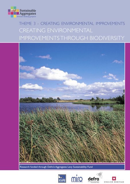
THEME 3 - CREATING ENVIRONMENTAL IMPROVEMENTS<br />
CREATING ENVIRONMENTAL<br />
IMPROVEMENTS THROUGH BIODIVERSITY<br />
Research funded <strong>through</strong> Defra’s Aggregates Levy Sustainability Fund
Sustainable Aggregates Creating Environmental Improvements <strong>through</strong> Biodiversity<br />
SUSTAINABLE AGGREGATES<br />
Sustainable Aggregates:<br />
Aggregate resources produced from sand and gravel deposits, crushed rock or dredged from the sea contribute to the<br />
economic and social well being of the UK. Their production and supply has <strong>environmental</strong> effects.<br />
The Aggregate Levy Sustainability Fund (ALSF) has provided funding to undertake work to minimise and mitigate these<br />
effects. This report is part of a portfolio of work that reviews ALSF and other work undertaken between 2002-2007 on<br />
‘promoting <strong>environmental</strong>ly-friendly extraction and transport’ of land-won aggregates to provide a state of knowledge<br />
account and to highlight the gaps in our understanding and practices.<br />
Written by: Alice Davies & Jacqueline Weir, RSPB<br />
Edited by: Abbie Drew, MIRO, Neil Roberts<br />
Designed by: Sadie Ferriday, MIRO<br />
This publication and references within it to any<br />
methodology, process, service, manufacturer, or company<br />
do not constitute its endorsement or recommendation<br />
by the Minerals Industry Research Organisation, English<br />
Heritage or The Department for Environment, Food and<br />
Rural Affairs<br />
2
CONTENTS<br />
Executive summary 5<br />
1. Introduction 7<br />
2. Approach to Review and Sources of Information 9<br />
Sustainable Aggregates Creating Environmental Improvements <strong>through</strong> Biodiversity<br />
3. Biodiversity and mineral sites 13<br />
3.1 Planning for the location of sites at both strategic and site-specific levels 13<br />
3.2 Managing sites during extraction (both non-operational and active areas) 14<br />
3.3 Restoration and design of sites 15<br />
3.4 Long-term management of sites – maintaining <strong>environmental</strong> <strong>improvements</strong> 22<br />
3.5 Working together 25<br />
3.6 Biodiversity and mineral sites – non-ALSF research in England 29<br />
3.7 Biodiversity and mineral sites – England in a global context 30<br />
4. Gaps in knowledge/ directions for future research 31<br />
5. Dissemination and impact of ALSF research 33<br />
6. Conclusions 35<br />
6.1 Main conclusions 35<br />
6.2 Planning for the location of sites 36<br />
6.3 Managing sites during extraction 36<br />
6.4 Restoration and design of sites 36<br />
6.5 Long-term management of sites 37<br />
6.6 Working together 37<br />
6.7 Non-ALSF research in England 38<br />
6.8 England in a global context 38<br />
6.9 Gaps in knowledge / future research 38<br />
6.10 Dissemination and impact of ALSF research 39<br />
References 41<br />
Annex 1 47<br />
Annex 2 95<br />
3
Sustainable Aggregates Creating Environmental Improvements <strong>through</strong> Biodiversity<br />
4
EXECUTIVE SUMMARY<br />
This report reviews the current state of knowledge gained about <strong>biodiversity</strong><br />
and minerals sites in England <strong>through</strong> Aggregates Levy Sustainability Fund (ALSF)<br />
funded research. This is placed in the context of wider, non-ALSF research, and<br />
in a global context <strong>through</strong> review of some major projects in other countries.<br />
Key issues identified in the report are:<br />
• The value of stakeholder engagement is a<br />
common feature of many of the projects – in<br />
many cases ALSF work has brought all types of<br />
stakeholders together for the first time<br />
• Early discussion between stakeholders on issues<br />
affecting <strong>biodiversity</strong> benefits all involved, and can<br />
lead to innovative ways of resolving issues<br />
• Centralised recording of monitoring data<br />
would be extremely useful, and allow improved<br />
dissemination of information and sharing of best<br />
practice<br />
• A number of useful handbooks and sources<br />
of information and guidance are available, named<br />
in the reviewed reports. More dissemination of<br />
innovative solutions and good practice will be also<br />
beneficial<br />
Sustainable Aggregates Creating Environmental Improvements <strong>through</strong> Biodiversity<br />
• Habitat creation on minerals sites should<br />
achieve high quality target habitats covering<br />
significant areas to provide worthwhile gains for<br />
<strong>biodiversity</strong><br />
• A fund to enable Mineral Planning Authorities<br />
to investigate which areas within their authorities<br />
should be priorities for <strong>creating</strong> which habitats on<br />
mineral sites, depending on their location, would be<br />
very useful<br />
• Perceived blocks to habitat creation as a<br />
minerals site end-use can often be overcome<br />
by early consideration in the planning process,<br />
although more research is also needed on<br />
particular blocks<br />
The following gaps in knowledge should be<br />
considered for future research:<br />
Integration of land uses or restoration types:<br />
• A tool for identifying the habitats appropriate<br />
on potential future minerals sites, would be<br />
extremely advantageous.<br />
• Landscape scale approaches to site restoration<br />
are highly beneficial for <strong>biodiversity</strong><br />
• Integration of habitat creation on minerals sites<br />
with flood storage capacity / flood management<br />
• Approaches to ‘best and most versatile’<br />
agricultural soils protection in the context of<br />
habitat creation and nature conservation end-uses<br />
• Co-ordinated monitoring of <strong>biodiversity</strong> on<br />
minerals sites, from pre-extraction to restoration,<br />
should be carried out in order to inform decisions<br />
• Guidance on public access design and potential<br />
disturbance to wildlife, for nature conservation<br />
end-uses<br />
5
Sustainable Aggregates Creating Environmental Improvements <strong>through</strong> Biodiversity<br />
• Incorporation of compatible uses into<br />
restorations for <strong>biodiversity</strong>, while achieving quality<br />
habitat creation as a main priority – e.g. natural<br />
water treatment systems<br />
Approaches to land management:<br />
• Mechanisms for the provision and informing of<br />
aftercare, especially in any interim period between<br />
mineral working and long-term management<br />
arrangements<br />
• Approaches to long term funding of restored<br />
minerals sites for a conservation end-use<br />
• Research into conservation management<br />
techniques that may reduce the intensity of long<br />
term management requirements<br />
• Approaches to <strong>biodiversity</strong> issues when multiple<br />
operators or multiple landowners are involved<br />
• Mechanisms for landscape-scale approaches to<br />
restoration and <strong>biodiversity</strong><br />
• Centralised recording of monitoring data, to<br />
improve evidence base and knowledge sharing<br />
Specific research issues:<br />
• Further bird strike research and modelling<br />
• Integration of research on different taxa on<br />
minerals sites, and co-ordination of advice relating<br />
to these<br />
• Integration of <strong>biodiversity</strong> research with<br />
geodiversity research (especially for invertebrates)<br />
• Integration of hydrological and ecological<br />
considerations in planning habitat creation schemes<br />
• More research on historical and palaeo<strong>environmental</strong><br />
settings of sites to help inform<br />
appropriate restorations<br />
• More research on restoration techniques for<br />
particular quarry areas – e.g. silt lagoon restoration<br />
• Research into habitat creation on landfill sites<br />
• Examination of the lessons learned from<br />
existing local initiatives to form best-practice<br />
guidelines<br />
• Use of <strong>biodiversity</strong> conservation to help<br />
encourage social and economic regeneration<br />
Monitoring:<br />
• Improved monitoring and data gathering on bird<br />
strike<br />
• Standardised monitoring of <strong>biodiversity</strong> on<br />
minerals sites, including pre-extraction <strong>biodiversity</strong><br />
• Research into the role of important wildlife<br />
habitats as carbon stores<br />
• Research into the impacts of quarrying activity<br />
(e.g. dust) on nearby existing habitats<br />
An effective central database and searchable<br />
website of ALSF reports would provide better<br />
opportunities for information dissemination, and<br />
cross-linking between different themes. Links<br />
between this and the After Minerals website<br />
(www.afterminerals.com) could increase further<br />
information sharing and dissemination.<br />
6
1 INTRODUCTION<br />
This sub-theme provides a review of the current state of knowledge gained<br />
about <strong>biodiversity</strong> and minerals sites in England <strong>through</strong> Aggregates Levy<br />
Sustainability Fund (ALSF) funded research. This knowledge is, as far as possible,<br />
placed in the context of wider, non-ALSF research. While a comprehensive<br />
review of non-ALSF work could not be attempted in the allocated time-scale,<br />
some influential reports were identified and reviewed. The state of knowledge<br />
and approach taken to <strong>biodiversity</strong> on minerals sites in England is also placed<br />
in a global context <strong>through</strong> review of some major projects in other countries.<br />
This sub-theme report reviews ALSF-funded research that has significance for <strong>biodiversity</strong> on minerals sites.<br />
A number of reports funded by ALSF have elements concerning <strong>biodiversity</strong>. There is therefore a significant<br />
amount of overlap between this sub-theme and the other theme subjects, geodiversity and restoration.<br />
Reports containing reference to more than one sub-theme were, in most cases, reviewed in terms of their<br />
<strong>biodiversity</strong> content alone. However it is impossible to separate the subject completely from these other<br />
sub-themes, particularly restoration. Each theme review should be viewed in the context of the other<br />
reports within the theme.<br />
Sustainable Aggregates Creating Environmental Improvements <strong>through</strong> Biodiversity<br />
A main aim of this review is to identify areas of research and gaps in knowledge that would be most relevant<br />
as subjects of further study. Further aims were to highlight good practice within planning and the minerals<br />
industry in relation to <strong>biodiversity</strong>, and to point out sources of information and guidance on this. Actions that<br />
may improve knowledge sharing and increase good practice were identified. In this context, an attempt was<br />
also made to assess the effectiveness of ALSF research dissemination, and some recommendations are made<br />
on how this could be enhanced.<br />
It is envisaged that this report will be of use to minerals planners, the minerals industry, statutory and nonstatutory<br />
conservation bodies, related disciplines such as hydrology and hydrogeology, interest groups and<br />
the academic community. It is important that these groups communicate and work together to increase<br />
understanding of the issues surrounding <strong>biodiversity</strong> and minerals sites, and to find effective solutions to the<br />
issues raised here.<br />
7
Sustainable Aggregates Creating Environmental Improvements <strong>through</strong> Biodiversity<br />
8
2 APPROACH TO REVIEW &<br />
SOURCES OF INFORMATION<br />
Aggregates Levy Sustainability Fund (ALSF) research<br />
ALSF projects relevant to <strong>biodiversity</strong> have been mostly administered by the Mineral Industry Research<br />
Organisation (MIRO) (<strong>through</strong> MIST - the Mineral Industry Sustainable Technology programme, or with CLG<br />
- Communities and Local Government) and by English Nature (now Natural England); with a small number<br />
of relevant projects managed by local authorities and English Heritage. The type of projects administered by<br />
the different bodies varies enormously, as does provision of information about the projects they fund. Table 1<br />
shows the ALSF funded research reviewed and provides the project codes and reference used with the text of<br />
this report.<br />
Projects funded by MIRO are usually research focused and produce reports which are made available for<br />
download <strong>through</strong> the two MIRO ALSF websites (www.mi-st.org.uk and www.dclgaggregatefund.co.uk).<br />
Projects funded by English Nature, and now Natural England, are often more practical in nature, such as<br />
building hides or boardwalks, and therefore rarely yield final reports. Where English Nature/ Natural England<br />
funded projects have yielded reports with a research element, they have been considered as part of this<br />
review. However, information about such projects is harder to obtain. A table summarising reviewed papers<br />
can be found in Annex 1.<br />
Sustainable Aggregates Creating Environmental Improvements <strong>through</strong> Biodiversity<br />
The dissemination of each project reviewed was also investigated, where possible by contacting project staff<br />
or report authors, and enquiring how the report was disseminated and its findings promoted. Combining<br />
information on dissemination with an assessment of the potential and actual impact of a report gives an<br />
indication of the influence of individual projects. This also allows opportunities to be identified for different or<br />
wider promotion.<br />
MIST Programme<br />
All projects at www.mi-st.org.uk were checked for relevance, and those with a <strong>biodiversity</strong> or ecological<br />
element were reviewed. Each report reviewed is summarised in Annex 2, and findings have been incorporated<br />
into the body of this report.<br />
Sustainable Land-Won and Marine Dredged Aggregate Minerals Programme<br />
All projects at www.dclgaggregatefund.co.uk were checked for relevance, and those with a <strong>biodiversity</strong> or<br />
ecological element were reviewed. Each report reviewed is summarised in Annex 2, and findings have been<br />
incorporated into the body of this report.<br />
English Nature/Natural England and Local Authority funded projects<br />
Projects administered by Natural England (English Nature) and Local Authorities are included in the<br />
Department for Environment, Food and Rural Affairs (DEFRA)’s project database at www.alsf.defra.gov.uk. A<br />
brief description of each project and the name and organisation of the applicant are provided for each project.<br />
The database was searched using relevant keywords such as ‘<strong>biodiversity</strong>’ and ‘wildlife’ to yield projects of<br />
9
Sustainable Aggregates Creating Environmental Improvements <strong>through</strong> Biodiversity<br />
Project<br />
Code<br />
Project Title<br />
2004/420 Ryland, Kate (Dolphin Ecological Surveys), additional text from Mike Edwards, Amanda Millar<br />
and John Mills. 2005. Extracting the Best for Wildlife – A Practical Handbook for Promoting<br />
Biodiversity on Minerals Sites in West Sussex. English Nature.<br />
MA/1/2/007<br />
MA/2/3/001<br />
MA/2/3/002<br />
MA/2/3/006<br />
MA/3/3/010<br />
Clayton, Jamie, Alan Thompson, Alex Harper, Marc Pinnell (Symonds Group), Chris Pointer, Susan<br />
Willard, David Roberts (RMC Aggregates (UK) Ltd.), Duncan Wardrop (Lafarge Aggregates Ltd.).<br />
2004. The Influence of Aggregate Quarrying in River Floodplains on Flood Risk and Biodiversity.<br />
Mineral Industry Sustainable Technology.<br />
Parker, Barney (Derbyshire FWAG), Chloe Palmer (FWAG Midlands Region), Jim Egan<br />
(Nottinghamshire FWAG). 2004. Maximising the habitat value of non-operational and restored<br />
land around minerals extraction sites. Mineral Industry Sustainable Technology.<br />
Allen, Christina (Geoplan Ltd.). 2004. Research into the design, management and restoration<br />
of quarry silt lagoons for <strong>environmental</strong> and landscape benefit. Mineral Industry Sustainable<br />
Technology.<br />
Portland Sculpture and Quarry Trust. 2004. Independent Quarry – A New Model for<br />
Regeneration – promoting innovative research & opportunities for community participation<br />
with collaboration between disciplines – in the planning, implementation and after use of a new<br />
landscape for the 21st century. Mineral Industry Sustainable Technology.<br />
Harris, David (ADAS Consulting Ltd.). 2004. Idle Valley Wide-Area Project Feasibility Study.<br />
Mineral Industry Sustainable Technology.<br />
MA/4/1/001 Steadman, EJ, FM McEvoy, KA Linley, PD Bell, EJ Bee, EL Bartlett, A Napier and J Forster. 2005.<br />
Environmental and Economic Information for Aggregates Provision. Mineral Industry Sustainable<br />
Technology.<br />
MA/4/2/020<br />
MA/4/2/022<br />
MA/5/2/005<br />
MA2/1/004<br />
No Project<br />
Code.<br />
PNUM 3453<br />
Stonex, Roland and Peter Beeden (FWAG). 2005. Mendip Hills Bat and Dormouse Project<br />
– Phase 1. Mineral Industry Sustainable Technology.<br />
Hobden, Ken and Alyn Jones (Somerset County Council) Chris Leake and Claire Cannon<br />
(Hafren Water). 2005. Effects of Quarry Water Discharges on Stream Flows in the Mendip Hills.<br />
Mineral Industry Sustainable Technology.<br />
Ellis, P., C. C. Leake (Hafren Water), M. Hammond (Wildlife Consultant), R. Smithyman, D. Barratt<br />
(Pleydell Smithyman), D. Sargent (Landscape Agency),L. Hutchinson (Freshwater Solutions). 2007.<br />
Water-based Quarry Restoration – Methodologies, Technologies and Approaches (draft version<br />
1). Mineral Industry Sustainable Technology.<br />
James, Emma, Orlando Venn, Paul Tomlinson. 2004. Techniques for Effective Strategic<br />
Environmental Assessment (SEA) for Local Aggregates Planning – Review of Predictive<br />
Techniques for the Aggregates Planning Sector. Mineral Industry Sustainable Technology.<br />
Worcestershire County Council Guidelines for the Creation of BAP Habitats at Mineral Sites in<br />
Worcestershire. English Nature<br />
Allen, P, WA Boismier, AG Brown, A Chapman and I Meadows (Northamptonshire Archaeology).<br />
2007. Synthetic Survey of the Environmental, Archaeological and Hydrological Record for the<br />
River Nene From its Source to Peterborough (Part 1 and 2). English Heritage.<br />
SAMP 1.015 Central Science Laboratories and The Royal Society for the Protection of Birds. 2004.<br />
Developing Policy and Best Practice in Relation to Restoration Following Minerals Extraction<br />
– Resolving Conflicts with Aviation. Sustainable Land-Won and Marine Dredged Aggregate<br />
Minerals Programme.<br />
SAMP 1.034<br />
SAMP 2.29<br />
SAMP 2.38<br />
Cripps, J. C., V. Roubos (Department of Civil and Structural Engineering, University of Sheffield)<br />
D. Hughes, M. Burton, H. Crowther, A .Nolan, C. Travis (Environmental Consultancy University<br />
of Sheffield) I. M. Nettleton, M. A. Czerewko, D. Tonks (Edge Consultants UK Ltd.) 2004.<br />
Reclamation Planning in Hard Rock Quarries: A Guide to Good Practice. Sustainable Land-Won<br />
and Marine Dredged Aggregate Minerals Programme.<br />
Hart, Justin, Alison Colyer, Andrew Robinson, Paul Cropper, Pawel Plonskier, Lisa Allen, Mark<br />
Brown, Richard Budgey, Mark Parnell, John Allan (Central Science Laboratory Bird Management<br />
Unit. 2007. Safeguarding Mineral Extraction Site Restorations Near Airports: Developing<br />
an Objective Birdstrike Risk Assessment Model for Hazardous Water Birds – An Aid for<br />
Environmental Assessment Policy. Sustainable Land-Won and Marine Dredged Aggregate<br />
Minerals Programme.<br />
Davies, A. M. (RSPB). 2006. Nature After Minerals: how mineral site restoration can benefit<br />
people and wildlife. Sustainable Land-Won and Marine Dredged Aggregate Minerals Programme.<br />
Reference in<br />
text<br />
Rylands et.al<br />
2005<br />
Clayton et.al.<br />
2004<br />
Parker et.al.<br />
2004<br />
Allen 2004<br />
Portland<br />
Sculpture and<br />
Quarry Trust.<br />
2004<br />
Harris 2004<br />
Steadman et.al.<br />
2005<br />
Stonex &<br />
Beedon 2005<br />
Hobden et.al.<br />
2005<br />
Ellis et.al. 2007<br />
James et.al. 2004<br />
Worcestershire<br />
County Council<br />
Allen et.al. 2007<br />
Walls & Brown<br />
2004<br />
Cripps et.al.<br />
2004<br />
Hart et.al. 2007<br />
Davies 2006<br />
10
SAMP 3B.8<br />
TAL0040<br />
Thompson, A.; Howarth, C.L.; Goodwin, A.; Buckley, C; and Harris, K. 2007.Good Practice<br />
Guidance on Controlling the Effects of Surface Mineral Working on the Water Environment.<br />
Capita Symonds. Sustainable Land-Won and Marine Dredged Aggregate Minerals Programme.<br />
Roberts, Jamie and David Buffin (Buglife). 2005. Bringing Aggregate Sites to Life: Feasibility Study<br />
Report. English Nature.<br />
Table 1: ALSF Projects reviewed and associated project code and reference.<br />
interest. These were recorded in a spreadsheet and the project descriptions assessed to establish those with a<br />
research element. Organisations behind selected projects were then contacted, and copies of the report were<br />
requested. The success of this approach was mixed. A summary table can be found in Annex 1. Each report<br />
reviewed is summarised in Annex 2, and findings have been incorporated into the body of this report.<br />
English Heritage funded projects<br />
A list of projects relevant to the theme was provided by English Heritage via MIRO. Projects relevant to the<br />
sub-theme were selected from the list, and English Heritage provided reports where these were available. Each<br />
report reviewed is summarised in Annex 2, and findings have been incorporated into the body of this report.<br />
Wider research: outside ALSF<br />
There is an increasing focus on <strong>biodiversity</strong> opportunities at mineral sites, and information on the subject is<br />
held by numerous bodies and rarely brought together. The range of potential sources of information is openended,<br />
in contrast to the pool of ALSF projects. Within the time constraints of this review, sources of further<br />
information have been prioritised in order to best set ALSF research in context.<br />
Thompson et.al.<br />
2007<br />
Roberts & Buffin<br />
2005<br />
Sustainable Aggregates Creating Environmental Improvements <strong>through</strong> Biodiversity<br />
Non-Governmental Organisations (NGOs)<br />
The Royal Society for the Protection of Birds (RSPB) has a history of <strong>creating</strong> nature reserves on postindustrial<br />
land, many of them mineral sites. This practical experience, combined with a focus on collating<br />
innovative solutions from other sources and generating best-practice advice, has placed the RSPB at the<br />
forefront of advising on habitat creation on mineral sites. Relevant literature produced by the RSPB has been<br />
reviewed, and staff expertise has been incorporated.<br />
The Wildlife Trusts are a network of local conservation bodies, all of which are members of the registered<br />
charity, The Royal Society of Wildlife Trusts. In many areas, local Wildlife Trusts have a high level of involvement<br />
with restoration of mineral sites, and considerable expertise in restoration techniques and long-term<br />
management. It has not been possible carry out an exhaustive review of relevant information held by The<br />
Wildlife Trusts within this review, but key projects have been investigated. Future reviews should further<br />
investigate The Wildlife Trusts as potential sources of considerable information on the subject.<br />
A number of special-interest wildlife NGOs have also researched the importance of mineral sites for<br />
<strong>biodiversity</strong>. Plantlife have investigated the importance of working and former quarries for key threatened<br />
species as part of their ‘Back from the Brink’ programme. Buglife have highlighted the importance of quarries<br />
for a range of invertebrates, and are producing best-practice guidelines for managing quarries as part of an<br />
ongoing ALSF-funded project. Butterfly Conservation has investigated the importance of mineral sites for<br />
butterflies that favour brownfield sites. The benefits of <strong>creating</strong> ponds on mineral sites, and opportunities for<br />
doing so, have been investigated by Pond Conservation. Engagement with all of these organisations and review<br />
of available literature has been incorporated into this review.<br />
The Post-Mining Alliance (PMA) aims to promote good practice in post-mining regeneration by becoming<br />
a centre of excellence and repository of knowledge on post-mining regeneration projects. They seek to<br />
investigate and promote best-practice examples of post-mining regeneration of landscape, <strong>biodiversity</strong>,<br />
11
Sustainable Aggregates Creating Environmental Improvements <strong>through</strong> Biodiversity<br />
economies and communities across the globe. Based at the Eden Project in St Austell, Cornwall, the PMA<br />
collates case studies and innovative solutions from mineral sites all over the world. Their case studies have<br />
been reviewed in order to set England in a global context.<br />
Local initiatives<br />
A number of local initiatives, on a range of spatial scales, exist across England with the common aim of<br />
encouraging a joined up approach to the restoration of mineral sites within a particular area. Considerable<br />
expertise often exists within these local initiatives, and the interactions and discussions they promote<br />
can often lead to innovative solutions to potential obstacles. Their approach can, in itself, instruct general<br />
understanding of best-practice, and has therefore been incorporated into this review. Amongst these initiatives<br />
are: The OnTrent Initiative, The Swale and Ure Washlands Project, The Cotswold Water Park Society and The<br />
Lower Windrush Valley Project.<br />
Statutory bodies<br />
The Environment Agency and Natural England are statutory consultees for the minerals planning process<br />
and have expertise relevant to this sub-theme. Both have online literature databases, which have been<br />
searched using keywords relevant to this sub-theme. Relevant reports have been reviewed and their findings<br />
incorporated into the body of this report.<br />
English Nature (now Natural England), formed a partnership with the Quarry Products Association (QPA) and<br />
Silica and Moulding Sands Association (SAMSA) in 1998, called the Minerals and Nature Conservation Forum.<br />
The Forum has commissioned several research reports relevant to this sub-theme, and also produced an<br />
introduction to minerals and nature conservation (EN, QPA and SAMSA, 1999). These have been reviewed and<br />
their findings incorporated into the body of this report.<br />
Academic institutions<br />
Universities and related institutions are a key source of research, and work relevant to this sub-theme.<br />
Published literature was searched using the online ‘Web of Science’ database using keywords relevant to this<br />
sub-theme. Six relevant papers were found, and their findings have been incorporated into the body of this<br />
report. The small numbers of papers found in the academic literature illustrates just how important ALSF has<br />
been in driving research in this important area.<br />
The Minerals Industry<br />
Individual companies record information on protected species and habitats as part of their regular monitoring<br />
and reporting at a site level. Many now have a structured approach to monitoring, protecting and enhancing<br />
<strong>biodiversity</strong> on their sites.<br />
On-site trials of vegetation establishment or other restoration techniques carried out by mineral companies<br />
or their consultants are a potential pool of invaluable information that is currently underused. It has not been<br />
possible to investigate such trial results within this review, but this is the focus of ongoing work for the RSPB<br />
and Natural England <strong>through</strong> the Nature After Minerals programme.<br />
The Quarry Products Association (QPA) now includes <strong>biodiversity</strong> in its ‘Sustainable Development Report’<br />
(2007). This includes indicators to monitor progress of QPA members in improving <strong>biodiversity</strong> <strong>through</strong> their<br />
work. These indicators are at a very early stage, and some are more useful than others, but they could present<br />
a useful source of information for future reviews.<br />
12
3 BIODIVERSITY & MINERAL<br />
SITES<br />
3.1 PLANNING FOR THE LOCATION OF SITES AT BOTH STRATEGIC AND<br />
SITE-SPECIFIC LEVELS<br />
Minimise damage<br />
Mineral sites can have substantial benefits for <strong>biodiversity</strong>. However, setting these potential gains against the<br />
vast historical loss of semi-natural habitats shows that there is no room for complacency when locating new<br />
sites: damage to existing <strong>biodiversity</strong> should always be avoided. Many of the reports reviewed recommend<br />
that the location of future extraction sites should be chosen so that damage to <strong>biodiversity</strong> and other<br />
<strong>environmental</strong> assets are minimised (e.g. Worcestershire County Council, Ryland et al., 2005). Damage to<br />
specific features such as wildlife habitat corridors should be avoided (Stonex & Beeden 2005). It is also<br />
important that less immediately obvious wildlife, such as invertebrates, plants and fungi, are considered at an<br />
early stage in the planning process and negative impact avoided (Roberts and Buffin 2005). Roberts and Buffin<br />
(2005) state that restoration practices promoted by the planning process are not currently benefiting and are<br />
often proving detrimental to invertebrate <strong>biodiversity</strong>.<br />
Sustainable Aggregates Creating Environmental Improvements <strong>through</strong> Biodiversity<br />
James et al. (2004) highlights the predictive Strategic Environmental Assessment (SEA) techniques that could<br />
be used at the level of Minerals Local Plans (or Minerals Development Frameworks) to limit negative impacts<br />
on <strong>biodiversity</strong>. Strategic Environmental Assessments should address potential damage to internationally<br />
and nationally designated sites, and effects on regional Biodiversity Action Plan (BAP) targets for habitats<br />
and species. The report contains useful background and information such as a description of Environmental<br />
Constraints Mapping, where nature conservation designations, landscape designations and ‘BAP areas’ are<br />
mapped against minerals resources. This is used to test whether sites in a development plan are allocated in<br />
the least sensitive locations possible. The British Geological Society (BGS) have produced an online tool that<br />
allows users to carry out this type of constraints mapping (Steadman et al., 2005). Initially covering only the<br />
East Midlands region, this was to be expanded to most of England, and could be a valuable tool for planners<br />
and industry producing Strategic Environmental Assessments and / or Environmental Appraisal of strategic<br />
plans.<br />
Maximise benefits for wildlife<br />
Sites should be located such that opportunities to enhance <strong>biodiversity</strong> are maximised. This may include<br />
ensuring habitat end-uses are agreed when extraction takes place close to existing habitat, in order to<br />
buffer and link remaining patches (Davies, 2006); or planning for larger sites or multiple sites together, in<br />
order to encourage a landscape-scale approach to restoration. However, while bigger sites may be better<br />
for producing valuable restorations, public opinion and multiple ownership may cause problems in approving<br />
large extraction sites (Hafren Water, 2007). When considering landscape scale projects, it is essential to<br />
consider the local area’s character and landscape designations (Allen, 2004, Worcestershire County Council).<br />
It would be valuable for the heritage sector to provide historic data on the area, where this exists, and engage<br />
13
Sustainable Aggregates Creating Environmental Improvements <strong>through</strong> Biodiversity<br />
with the restoration planning process for <strong>biodiversity</strong>. Habitats to be created must be locally achievable and<br />
appropriate, and early dialogue with statutory and non-statutory conservation organisations at the preapplication<br />
stage can help to establish this (Hafren Water, 2007). Hafren Water (2007) also highlights the need<br />
for understanding between ecologists and hydrologists, and restoration targets that are both hydrologically<br />
and ecologically meaningful.<br />
Roberts and Buffin (2005) highlights the lack of strategic overview of the role that individual aggregate sites<br />
can play in providing habitats for wildlife, and shows that habitat creation is currently delivered on a siteby-site<br />
basis. A number of the reports reviewed provide potential solutions to this problem. Ryland (2004)<br />
suggests that the ‘new’ (2006) Minerals Local Plan for West Sussex should consider a change in emphasis<br />
on site restoration schemes such that conservation end-use is given preference over agriculture wherever<br />
possible and appropriate; and sets targets for site BAPs for mineral sites in West Sussex, and their regular<br />
audit. This report provides an example of best practice for mineral planning authorities, in providing guidance<br />
to stakeholders on <strong>biodiversity</strong> considerations for all stages of operation, <strong>through</strong> a county level Mineral<br />
Sites Working Group. It calls for the principles enshrined in the West Sussex Mineral Sites BAP (Ryland,<br />
2004) to be incorporated into the revised Minerals Local Plan in 2006. Widespread implementation of these<br />
recommendations could significantly improve the quantity and quality of habitat restoration programmes<br />
across the UK. Worcestershire County Council recommends a focus on ‘ecological natural areas’ where<br />
aggregate extraction is concentrated in the county. The report describes a number of sites that will be<br />
turned to agriculture and / or landfill, but that could have made a considerable contribution to <strong>biodiversity</strong> in<br />
Worcestershire (including creation of rare habitats such as acid grassland or heathland).<br />
The importance of early monitoring<br />
Successful restoration schemes are dependent on sufficient early monitoring to establish baseline levels<br />
and understand factors such as existing <strong>biodiversity</strong> interest, hydrogeology and hydrology. Pre-planning<br />
baseline ecological assessments of all proposed mineral sites help does guide restoration programmes,<br />
future management and any mitigation (Clayton et al. 2004, Ryland, 2004). Monitoring of hydrogeology and<br />
hydrology ,and potential impacts both on-site and off-site, is essential in determining potential for habitat<br />
damage (Capita Symonds, in progress). With sufficient monitoring, many potential adverse impacts can<br />
be successfully mitigated against. For example, quarry discharge management was shown to limit impacts<br />
on the ecology of receiving watercourses within the Mendip Hills area (Hobden et al., 2005). Numerous<br />
organisations and individuals may hold useful baseline data, so a collaborative approach would yield greater<br />
information in many cases. For example, operators often hold long-term monitoring data that may be useful<br />
in managing local water courses (Hobden et al., 2005). The importance of early site-based monitoring is of<br />
particular importance in establishing any changes in risk of bird strike in air-safeguarding areas (Walls and<br />
Brown, 2004).<br />
3.2 MANAGING SITES DURING EXTRACTION (BOTH NON-<br />
OPERATIONAL AND ACTIVE AREAS)<br />
The value of a spatial and temporal approach to site management<br />
A number of reports discuss the value of quarries, as well as surrounding areas, over the quarry’s operational<br />
life cycle. Parker et al. (2004) looks at how best to maximise habitat opportunities on restored and nonoperational<br />
land. This illustrates the importance of taking both a temporal and a spatial approach to<br />
management of habitats on mineral sites - areas that have yet to be worked, those that will never be worked,<br />
14
and restored areas, can all be managed so that <strong>biodiversity</strong> benefits. In keeping with this, Hafren Water (2007)<br />
recommends an integrated approach to management of different land areas owned by minerals companies.<br />
Hobden et al. (2005) highlights the potential for mitigation and enhancement of the surrounding area, both<br />
during extraction and long term management, mainly <strong>through</strong> control over water levels and stream flow.<br />
Cripps et al. (2004) discusses temporary landscapes within the quarry and their potential ecological value; as<br />
well as their value as trial areas, and as sources of transplant stock for other areas. The report also discusses<br />
site zoning and phasing of restoration, especially to reduce secondary disturbance to created or re-colonised<br />
habitats. The potential <strong>biodiversity</strong> value of active sites and provision for this is also discussed in Ryland et al.<br />
(2005) – particularly by progressive restoration <strong>through</strong> phased working, and retention of valuable seminatural<br />
habitat where possible. Ryland (2004) suggests that restoration be considered an early stage so that<br />
original topsoil, seed etc. can be stored (for minimum possible time) for use in restoration.<br />
Accommodating species that use operational areas<br />
Many studies recommend that species which may use the active site are considered (e.g. Clayton et al., 2004,<br />
Ryland et al., 2005). Cripps et al. (2004) recommends a flexible approach to operations to accommodate<br />
early colonising wildlife, and states that areas proposed for habitat creation may require detailed survey to<br />
identify whether any notable species are already present. It also recommends that all schemes incorporate<br />
(or if necessary and feasible, translocate) existing features of conservation value. Ryland (2004) suggests<br />
that flexibility is maintained in restoration plans to allow for the unpredictability of biological systems (e.g.<br />
temporary use of a site by some species). Ryland (2004) also promotes sympathetic operational procedures<br />
and best practice management for bio- (and geo) diversity during the working and restoration phases and<br />
into the future. There is a large amount of legislation covering the species and habitats that might be affected<br />
by minerals working. Information and advice on this is collated at www.goodquarry.com.<br />
Sustainable Aggregates Creating Environmental Improvements <strong>through</strong> Biodiversity<br />
Guidance on managing sites with key vulnerable plant species is provided by Plantlife, <strong>through</strong> their species<br />
briefing sheets – such species include Perfoliate Pennycress (Thlaspi perfoliatum) and Flamingo Moss (Tortula<br />
cernua). Plantlife also work directly with quarry operators on key sites.<br />
Butterfly Conservation and Buglife are both working towards providing guidance for site managers on<br />
managing habitat features for invertebrates. Both organisations are striving to raise awareness of the<br />
importance of quarries for invertebrates.<br />
Many companies provide guidance to site managers on how to manage for species that are using active<br />
parts of the site. In many cases this is written into company Biodiversity Action Plans or other <strong>biodiversity</strong><br />
strategies. Stonex and Beeden (2005) highlights the need for some mineral sites to provide continued access<br />
to the working area for species such as bats, without posing a risk to public safety.<br />
3.3 RESTORATION AND DESIGN OF SITES<br />
While this section deals with the end-result that follows quarrying, it is essential that restoration and design<br />
of sites are considered at the earliest discussion stages. Many important technical issues such as hydrology,<br />
hydrogeology and geology that affect site design must be dealt with at the outset, and other requirements<br />
like public access, education and long-term funding need to be integrated from the earliest possible<br />
stages. The Restoration theme report covers the technical side of land-forming and quarry safety.<br />
15
Sustainable Aggregates Creating Environmental Improvements <strong>through</strong> Biodiversity<br />
This report, therefore, focuses on the benefits for <strong>biodiversity</strong> that can be achieved <strong>through</strong> mineral site<br />
restoration.<br />
Bate et al. (1998) was one of the earliest reports to highlight the potential for the minerals industry to<br />
contribute to UK Biodiversity Action Plan (BAP) targets. This pulled together sources of information and<br />
useful contacts for stakeholders. It made a series of recommendations, many of which are still relevant today,<br />
and some of which have since been put into practice. Recommendations included that Local Biodiversity<br />
Action Plan (LBAP) authors pay more attention to the potential role of the minerals industry in delivering<br />
towards BAP targets, and that the BAP and LBAP process should involve partnerships and communication<br />
within and between organisations and communities. Linking to LBAPs is still a key means of identifying local<br />
priorities. However LBAPs are variable and often lack a spatial dimension - this makes working closely with<br />
LBAP coordinators even more important.<br />
What is a habitat creation end-use?<br />
With nature conservation considered under the broader category of ‘amenity’ in central mineral planning<br />
guidance (Mineral Planning Guidance 7), restorations carried out under this heading are of variable quality<br />
and benefit for wildlife. In many cases, generic ‘nature conservation’ end-uses represent a missed opportunity<br />
Figure 1: Habitat on a restored minerals site<br />
16
Sustainable Aggregates Creating Environmental Improvements <strong>through</strong> Biodiversity<br />
Figure 2: Temporary netting to prevent grazing of establishing reeds<br />
to create more valuable BAP habitats (Davies, 2006). Many other interests and needs, such as public access,<br />
education, geodiversity and heritage, can be successfully integrated with high-quality habitat creation. In some<br />
cases, it may be possible for these to help fund the long-term management of the site. See later sections on<br />
long-term management and working together for more details.<br />
Information on best-practice techniques in establishing habitat<br />
A number of the reviewed reports provide information and guidance on habitat creation that will be of value<br />
to minerals planners and the minerals industry. Many also point to sources of more detailed information and<br />
advice. Access to and dissemination of such guidance, as well as detailed local information, is key to producing<br />
a valuable restoration.<br />
The Habitat Creation Handbook for the Minerals Industry (White and Gilbert, RSPB, 2003) presents bestpractice<br />
advice on <strong>creating</strong> priority UK BAP habitats on mineral sites, supported by case studies. This was the<br />
first work to pull together information from a range of sources and present it as digestible best-practice for<br />
planners and industry.<br />
The After Minerals website (www.afterminerals.com) has taken the advice from White and Gilbert (RSPB,<br />
2003) updated it with current best-practice where necessary, and made the advice freely accessible online.<br />
The ongoing Nature After Minerals programme will keep this advice continually up to date, and look for new<br />
ways to disseminate the information to end users – incorporating findings from many of the papers reviewed<br />
17
Sustainable Aggregates Creating Environmental Improvements <strong>through</strong> Biodiversity<br />
in this report would be a key stage in the process. The After Minerals website also identifies opportunities for<br />
habitat creation on existing active mineral sites.<br />
Clayton et al. (2004) makes recommendations on approaches to habitat creation and management on quarry<br />
sites, and on monitoring during and after extraction. The report also identifies a gap in ecological information<br />
on many quarry sites, and in recorded results of habitat creation. Monitoring the results of habitat creation is<br />
a crucial aspect of improving best-practice and planning appropriate management.<br />
Ryland et al. (2005) contains advice on restoration schemes including design, implementation, long-term<br />
management and monitoring. The West Sussex County Council handbook has a list of some suppliers for<br />
locally sourced plant material, nest boxes etc. Industry and planners would benefit from similar lists being<br />
available for other areas.<br />
Cripps et al. (2004) discusses the value of natural regeneration of hard rock quarries, depending on<br />
required timescales, site conditions etc. – that habitat creation techniques may be required to assist natural<br />
regeneration, but that valuable habitats can sometimes develop naturally. It states that ‘wherever possible,<br />
subject to other overriding reclamation objectives, natural colonisation will generally be considered the<br />
preferred and primary ecological reclamation technique’ – this is relevant particularly to hard rock quarries<br />
Figure 3: Profiled lake edges at a site restoration<br />
18
ut should not necessarily be applied to other types of quarry. The report also discusses hard rock quarries<br />
where natural colonisation is likely to be slow or unviable (e.g. due to harsh environment, lack of sources of<br />
colonisers), and habitat creation techniques where natural colonisation is not possible.<br />
Cripps et al. (2004) and White & Gilbert (2003) include tables of information sources (including NGOs,<br />
statutory conservation bodies, specialist local species groups), and types of information to gather (including<br />
habitats and species). These lists should be made widely available and kept up to date. Cripps et al. (2004)<br />
also discusses landfill sites, stating that ‘the consideration of nature conservation interests and the potential<br />
for wildlife enhancement <strong>through</strong> habitat creation at landfill sites is also the subject of guidance published by<br />
the Wildlife Trusts (Ecoscope 2000)’.<br />
Cripps et al. (2004) also gives pointers to guidance on vegetation establishment (seeding and planting) for<br />
habitat creation. It provides a summary of the main techniques for vegetation establishment, with a pointer<br />
to seek advice on the most appropriate methods for a particular site or scheme. It points to information on<br />
available vegetation establishment techniques and habitat design. The report also discusses the relationship<br />
of soil nutrients to habitat creation, and provides a table on soil fertility in some important habitats (this is<br />
also in the Habitat Creation handbook - White and Gilbert, 2003). In addition it contains tables of typical<br />
detailed site investigations, including vegetation/habitat surveys, faunal surveys, landscape and visual impact<br />
assessment and landscape character assessment; and it highlights the importance of carrying out on-site trials<br />
of establishing different vegetation types.<br />
Sustainable Aggregates Creating Environmental Improvements <strong>through</strong> Biodiversity<br />
Worcestershire County Council provides key information on creation of habitats at aggregate sites (with<br />
advice to seek skilled ecological guidance prior to <strong>creating</strong> them). Also discusses natural regeneration at<br />
minerals sites and local sourcing of seeds species for planting.<br />
Research into restoration techniques<br />
Hafren Water propose reviewing floating wetland restoration techniques, including ecological, hydrological<br />
and engineering issues. They are also assessing the ecological/ <strong>biodiversity</strong> value of floating wetlands. We await<br />
the results with interest.<br />
Allen (2004) contains a wealth of information that could provide useful advice and background for minerals<br />
planners and operators on restoration of silt lagoons, if disseminated widely. It should certainly act as a<br />
starting point for more research in this area. Reedbeds and woodland were amongst the most common<br />
end-uses of silt lagoons, and natural regeneration can be an effective tool here in many cases. However,<br />
some surprising habitats were also noted. The report explains that on-site management of silt lagoons<br />
will determine their final restoration, and notes that most planning applications had little detail on design,<br />
operation or restoration of silt lagoons (although in some cases details were a condition of planning<br />
permission or review).<br />
Site design<br />
Many site BAPs and restoration plans would benefit from being less ambitious in the numbers of habitats<br />
included, and more ambitious in terms of scale – i.e. incorporating larger areas of fewer habitat types.<br />
Hafren Water (2007) stresses the difference (and different value) between targeted habitat creation and<br />
the ‘parkland lake’ landscapes that often result from restorations; and highlights opportunities to create<br />
priority wildlife habitats. McColl-Grubb et al. (2004) states that there is a lack of clarity in the minerals<br />
19
Sustainable Aggregates Creating Environmental Improvements <strong>through</strong> Biodiversity<br />
industry on the best type of habitat restoration, and that restorations often contain a mixture of several<br />
habitat types designed by a landscape architect. It also highlights the need for a better understanding of<br />
sustainable restoration among planners. Walls (2004) points out that site design often does not include<br />
specific, measurable biological aims, that restorations are generally not classified into ecologically meaningful<br />
categories, and that BAP habitats should be considered in site design.<br />
Environmental site designations can provide a guide to locally appropriate reclamation aims. This is discussed<br />
by Cripps et al. (2004), which states that ‘local <strong>environmental</strong> designations should not be regarded simply as a<br />
constraint to reclamation and possible end uses, but should be seen as providing enhanced opportunities for<br />
successful restoration of a site to its local landscape and ecological context’. It also states that ‘they provide<br />
a ready guide to appropriate reclamation aims and objectives which are likely to be welcomed by planning<br />
authorities, statutory agencies and local <strong>environmental</strong> interest groups and communities’.<br />
At some sites it may be possible to put restoration plans into the context of past <strong>environmental</strong> attributes<br />
of an area. Hafren Water (2007) recommends that the regional and historic context of a site should be<br />
an important consideration in restoration design, and specifically describes the historical context of the<br />
Swale and Ure Washlands. Allen et al. (2007) reviewed extensive palaeo-<strong>environmental</strong> information to<br />
build a picture of the ecological landscape of the river Nene over time. It appeared that the predominant<br />
morphology of at least part of the area had been an anastomosing channel system with old, dissected,<br />
floodplain in between, and drier islands of gravel. Dry-land mixed deciduous woodland on surrounding<br />
slopes had largely been cleared by 1500 BC. While such detailed information may not be available for many<br />
sites, where available it can be valuable for producing an appropriate restoration plan that echoes historical<br />
landscapes.<br />
The need for scoping, as well as data gathering and expert consultations at different stages, is stressed by<br />
Cripps et al. (2004) - especially where a quarry falls within or close to <strong>environmental</strong>ly sensitive landscape<br />
and wildlife resources. The report emphasises the need for a staged approach to restoration planning, and<br />
that local landscape setting and <strong>biodiversity</strong> should be a primary consideration in reclamation aims and<br />
objectives. It recommends that phasing and monitoring are built into initial site designs.<br />
Hard rock quarries are specifically discussed by Cripps et al. (2004), which includes a table of habitat groups<br />
and species likely to be appropriate for reclamation at these sites. The report also presents worked examples<br />
of how reference to local and national BAPs can help target habitat creation, and actions that may be<br />
required to achieve particular objectives (including considerations such as using seed of local provenance).<br />
More research is needed on the site design of restorations in or near the air safeguarding zones that<br />
surround airfields. Some pioneering work has been done on this (e.g. Fisher et al., 2004, Robinson and Deppe,<br />
2004, Walls and Brown, 2004, Hart et al., 2007), but has been restricted by a lack of monitoring data on air<br />
strike and bird movements (Fisher et al., 2004). This may improve in future following the introduction of<br />
mandatory bird strike reporting in 2003 by the Civil Aviation Authority. Significant relationships (P
zones would appear inappropriate. Restorations in air safeguarding zones need to be assessed in terms of<br />
potential increases in the background risk of bird strike on a local, or site-by-site basis (e.g. Hart et al., 2007).<br />
Where public access and recreation are to be integrated with a nature conservation end-use, they should be<br />
worked into restoration plans at the earliest possible stage to minimise any disturbance to wildlife. Retrofitting<br />
public access into an existing scheme can cause considerable problems.<br />
Overcoming blocks<br />
The main perceived blocks acting at a national scale to prevent habitat creation on mineral sites are identified<br />
by Davies (2006). These include:<br />
• Lack of support from landowners<br />
• (Perceived) inadequate financial return from a conservation end-use<br />
• Difficulty in securing long-term conservation management of the site<br />
• Proximity to airfield (threat of bird strike)<br />
These perceived blocks need to be discussed and overcome at as early a stage in the restoration process as<br />
possible. Among the reports reviewed, bird strike was specifically addressed in a number of studies. Longterm<br />
management and funding issues are addressed in the next section.<br />
Sustainable Aggregates Creating Environmental Improvements <strong>through</strong> Biodiversity<br />
Aerodromes often occupy the flat land of river valleys, which is similar to many sand and gravel extraction<br />
sites (Walls, 2004). Aerodrome safeguarding should be taken into account at an early stage of planning<br />
restorations (Walls, 2004).<br />
Robinson & Deppe (2007) carried out GIS analysis of the characteristics of waterbodies on former mineral<br />
extraction sites and the numbers of waterfowl using them. These results could be used in the planning<br />
process to allow for mitigation – for example if geese are likely to be a bird strike hazard, potential<br />
restorations should avoid water bodies with a lengthy perimeter and islands (Robinson and Deppe, 2007).<br />
However local information and a site by site approach is needed (e.g. Hart et al., 2007).<br />
Both Walls and Brown (2004) and Hart et al. (2007) used radar to detect bird movements. The technique<br />
provides valuable data of use in informing the aerodrome safeguarding process (Walls and Brown, 2004). This<br />
may however be an expensive technique to adopt widely.<br />
While some generalisations can be made about bird strike risk, this does not negate the need for local<br />
information in addressing bird strike issues. Walls (2004) describes which species are considered to pose a<br />
more significant risk to aircraft – these are generally medium to large birds that form flocks. In Fisher et al.<br />
(2004), among struck birds that were allocated to species groups, gulls were the most common, with pigeons,<br />
passerines and hirundines / swifts making up most other strikes – other species were comparatively rare,<br />
although a large proportion of struck birds were not identified. However when planning a new restoration<br />
for least impact in bird strike risk, it is most useful to consider which species are locally most hazardous<br />
(Hart et al., 2007).<br />
Models were developed by Fisher et al. (2004) and Hart et al. (2007) in relation to bird strike. The models<br />
produced by Hart et al. (2007) were to assist in prediction of bird movements, to test the effects of various<br />
minerals site restoration designs on locally hazardous species, and to help assess possible levels of bird strike<br />
21
Sustainable Aggregates Creating Environmental Improvements <strong>through</strong> Biodiversity<br />
risk at potential restorations within the safeguarding zones of airports. The models can be used to interpret<br />
likely changes in bird strike risk in the context of the local bird population where they are applied, so that<br />
they can provide objective results to help inform the decision making process and improve safeguarding<br />
guidance. The models were not seen as predictors of bird strike risk, but rather as predictors of hazardous<br />
bird abundance and their likely movements. It was stated that in the absence of any prior knowledge of<br />
local bird movements the models’ predictions should be ‘ground-truthed’ by field surveys and compared to<br />
observed records. They should be used in specific local contexts, rather than as broad guidelines. Fisher et<br />
al. (2004) investigated relationships within air safeguarding zones, between: bird-aircraft strikes and land-uses,<br />
frequency of strikes and number of mineral extraction sites, frequency of strikes and area of landfill sites,<br />
frequency of strikes and wetland bird abundance, and the effects of proximity to airfields on any identified<br />
relationships. They stated that results of the study should be interpreted with caution, as the quantity and<br />
quality of available data was generally poor, and variability existed between sites in terms of bird management<br />
measures.<br />
Major conclusions of these studies were that:<br />
More, higher quality monitoring data is needed on bird strike, and<br />
Potential site restorations need to be considered (at an early stage) in relation to bird strike risk on a local /<br />
site by site basis.<br />
3.4 LONG-TERM MANAGEMENT OF SITES<br />
– MAINTAINING ENVIRONMENTAL IMPROVEMENTS<br />
Securing long-term management, and ensuring financial provision for this, are two of the main obstacles to<br />
successful habitat creation on mineral sites. Integrating long-term management into site management plans is<br />
necessary to address this issue. Long-term monitoring is also very useful, as it provides a vital feedback loop<br />
in ensuring that management is appropriate, and providing records of successful schemes.<br />
A distinction needs to be made between after-care and long-term management (Cripps et al., 2004). Aftercare<br />
is carried out immediately following quarry restoration or habitat creation, and may in some cases be<br />
provided by an operator, leading up to hand-over of a site for long-term management. After-care for habitats<br />
of high conservation value is likely to require a longer period than for agriculture (Cripps et al., 2004).<br />
However high quality after-care may help to reduce the cost of long-term management in some cases. Cripps<br />
et al (2004) provides a table of after-care requirements for some nature conservation after-uses.<br />
Approaches to Long-term Funding<br />
Understanding the costs of long-term management from an early stage is a critical factor in ensuring<br />
sufficient funds are provided. Hafren Water (2007) highlights the need to identify and cost long-term<br />
management requirements in restoration plans. Cripps et al. (2004) points out the benefits of involving local<br />
voluntary conservation groups at an early stage.<br />
Ryland (2004) suggests that further use should be made of existing mechanisms to secure long-term<br />
management of sites, such as section 106 agreements (planning obligations at the application stage). It also<br />
suggests that ‘official’ provision should be made for transferring management of restored sites to appropriate<br />
bodies (e.g. conservation bodies, local authorities). The report also calls for management agreements to be<br />
instigated beyond the first 5-year period on valuable sites.<br />
22
Commercial approaches can provide funds for long-term management of sites, particularly where<br />
they incorporate a variety of different enterprises. These can even utilise by-products of conservation<br />
management, such as willow for weaving, or wood for charcoal production. Understanding the local economy<br />
and markets is a key factor in the potential success of such schemes (Harris, 2004).<br />
Worcestershire County Council discusses the compatibility of nature conservation restoration with other<br />
end-uses. Conservation management of sites can potentially tap into a wide variety of other funding sources<br />
such as funds for local health and fitness schemes (Harris 2004). Allen (2004) identifies a potential use of<br />
restored silt lagoons as a nursery or plant source, which may contribute to financial sustainability.<br />
Pointers to sources of advice on long-term management requirements are provided by Cripps et al. (2004).<br />
Allen (2004) highlights the importance of long-term management in maintaining established interest on silt<br />
lagoons. The West Sussex County Council Handbook (Ryland et al., 2005) provides guidance on management<br />
of invasive plants.<br />
The Importance of Long-term Monitoring<br />
Monitoring is critical, and needs to feed back into site management. Cripps et al. (2004) states that the<br />
success of a reclamation scheme in meeting the stated landscape and ecological objectives should be<br />
assessed and modifications made where necessary. Many company <strong>biodiversity</strong> strategies do integrate<br />
monitoring. It is then vital that the information is recorded and fed back into management strategies.<br />
Monitoring data from different sites should be recorded more centrally and disseminated more widely, in<br />
order to inform management of other sites. Ryland (2004) recommends that a simple methodology for<br />
monitoring the progress of restoration schemes should be developed.<br />
Sustainable Aggregates Creating Environmental Improvements <strong>through</strong> Biodiversity<br />
In some cases monitoring on minerals sites may be complicated. Vegetation communities present on<br />
extraction sites are often not clearly defined by National Vegetation Classification, as they are often<br />
transitional between ‘open habitats’ and others such as mesotrophic grassland (Rodwell, 2000). This can<br />
complicate their management for nature conservation (Parker et al 2004). Such issues illustrate further the<br />
need for communication and data sharing among the minerals community.<br />
There is currently no comprehensive / standardised monitoring of mineral site restorations across the UK.<br />
This is pointed out by Walls (2004), which states that information is currently held at county council level and<br />
by interested conservation bodies and individual minerals operators, and that details on specific restorations<br />
are mostly within the non-scientific literature in a case study format. A national scheme to monitor<br />
<strong>biodiversity</strong> on minerals sites, and a centralised point of data storage, would be very beneficial.<br />
23
Sustainable Aggregates Creating Environmental Improvements <strong>through</strong> Biodiversity<br />
Case study – Idle Valley Wide Area Project<br />
Parties involved: Lead body: Nottinghamshire Wildlife Trust, Other Partners: MIRO MIST and English<br />
Nature ALSF funds, ADAS Consulting Ltd., Sheffield Hallam University, Smith Woolley, Tarmac,<br />
Nottinghamshire County Council, Bassetlaw District Council, North Nottinghamshire College<br />
Project aims: The Idle Valley Wide Area Project was set up following an economic feasibility study carried<br />
out by ADAS Consulting Ltd. and Smith Woolley, funded by ALSF <strong>through</strong> MIRO MIST. The project aims<br />
to secure the future of important local habitats, including a designated Site of Special Scientific Interest<br />
(SSSI), and demonstrate that <strong>biodiversity</strong> conservation can encourage economic and social regeneration.<br />
Land use and minerals extraction: The project area is in the River Idle floodplain. Gravel extraction<br />
commenced at two sites here in the 1940s, with both taken over by Tarmac in the 1960s.The project<br />
potentially concerns 800 hectares of land, comprising gravel pits and farmland.<br />
Biodiversity interest and vision: The area was once known for its seasonally wet grassland , large flocks<br />
of wildfowl and wader, and botanical interest. Farmland consisted of wet pastures. Large parts of the area<br />
are now designated as the Sutton and Lound Gravel Pits SSSI, mainly for their wetland bird assemblage.<br />
The invertebrate, mammal, reptile and amphibian interest of the area is also high. The project should help<br />
to re-establish linked wetland habitats in the river floodplain, help improve the sustainability of farmland<br />
management, and secure funding for long-term management of the SSSI.<br />
Approaches: Consideration was given to a visitor centre and related rural enterprises being set up at<br />
the SSSI site. Commercial use should make the site self-supporting, and may include utilising by-products<br />
of conservation management (e.g. willow from scrub clearance for weaving, reed for thatching). The<br />
economic feasibility study also suggested linking to health initiatives such as GP referral schemes and the<br />
British Trust for Conservation Volunteers’ ‘Green Gyms’ programme.<br />
Progress: A major development has been a partnership with North Nottinghamshire College. The college<br />
will create a base which will act as a gateway for visitors and a site from which to run rural-based<br />
courses. Commitment has been secured on over 400 hectares of land to be brought into the project and<br />
funding for works to implement many of the findings of the report is being sought. The remaining land is<br />
being returned to agricultural use via local farms.<br />
The future: It is envisaged that as well as providing financial security for long-term management of the<br />
site, the project will contribute to tourism and the local economy. It will improve local educational<br />
opportunities, provide health benefits, and may even help contribute to a local crime reduction targets.<br />
The role of ALSF: The ALSF-funded economic feasibility study was key to establishing the approach made<br />
to this project, in supporting establishment of visitor facilities and related enterprises – now with a focus<br />
on college facilities. A Project Officer was then employed with ALSF funding provided by English Nature<br />
(now Natural England). English Nature ALSF funding has allowed ongoing contact with local communities<br />
and stakeholders, management and survey work of the existing area, acquisition of land, production of<br />
outline budgets for ongoing work and production of a project vision document.<br />
24
3.5 WORKING TOGETHER<br />
The importance of stakeholders<br />
The value of stakeholder engagement is a common feature of many of the reviewed projects. Bringing<br />
all stakeholders together for discussion at an early stage is essential for successful minerals planning for<br />
<strong>biodiversity</strong>, both at a strategic (landscape) level and on individual sites. Considerable benefits can be gained<br />
from this, as seen in many of the successful ALSF projects. It ensures that outputs are as useful as possible for<br />
all involved. In many cases, ALSF work has brought all types of stakeholders together for the first time.<br />
Providing numerous datasets together in one platform, such as in Steadman et al. (2005), has the potential to<br />
act as a focus for stakeholder discussion about the location of sites in strategic planning. Parker et al (2004)<br />
engaged face to face with key stakeholders, and as a result noticed increased enthusiasm and conservation<br />
knowledge among local minerals operators, and awareness among local farmers and landowners.<br />
Successful integration of multiple end-uses<br />
Bringing together multiple end-uses on a site can, if managed and planned well, provide funding for long-term<br />
management. Harris (2004) showed how a visitor centre and associated businesses could provide sufficient<br />
funds to make a site in the Idle Valley self-sufficient after initial investment in set-up.<br />
Sustainable Aggregates Creating Environmental Improvements <strong>through</strong> Biodiversity<br />
Mineral sites restored for <strong>biodiversity</strong> [to open water – not clear if also true for reedbed, wet grassland],<br />
can have a flood alleviation benefit by providing flood storage (Clayton et al. 2004) Mineral sites restored for<br />
<strong>biodiversity</strong> and flood alleviation, and thereby meeting two important objectives on one site, are the focus of<br />
the SAND project in continental Europe.<br />
Part of successfully integrating end-use demands is providing contacts for areas of expertise such as<br />
geological conservation, archaeology, agricultural soils management etc. This was done in the West Sussex<br />
County Council handbook (Ryland et al., 2005), and should be extended to other areas.<br />
A number of combinations of end-uses are possible, if planned and integrated well so that habitat creation is<br />
not marginalised:<br />
• Cripps et al. (2004) points out the potential for educational or recreational facilities based on ecological,<br />
geological, archaeological and industrial resources, and that surveys are needed to inform this.<br />
• Portland Sculpture and Quarry Trust (2004) used extensive community and stakeholder engagement in<br />
designing a restoration plan for Independent Quarry that integrated art, heritage, landscape, environment<br />
and education. It focused on local species, low-nutrient substrates, natural regeneration and provision of<br />
micro habitats, with key invertebrates a main focus. It also placed emphasis on benefits for mental health and<br />
disadvantaged groups. However large scale habitat creation did not appear to be incorporated at the site.<br />
• Roberts and Buffin (2005) states that restoring sites for their invertebrate interest can provide<br />
communities with access to an important recreation and education resource. This Buglife project should<br />
work with industry to change public perceptions on this<br />
• Roberts and Buffin (2005) states that managing sites for geodiversity can benefit invertebrate population,<br />
25
Sustainable Aggregates Creating Environmental Improvements <strong>through</strong> Biodiversity<br />
and recommends that existing links between geological and biological site management should be<br />
strengthened.<br />
• Hafren Water (2007) discusses the potential for natural water treatment systems to be incorporated<br />
into end-uses, including reedbeds, using Slimbridge wildfowl collection as an example. It discusses ecological<br />
fish culture and ecological aquaculture as potential complementary uses to encouraging <strong>biodiversity</strong>. Further<br />
research in this area would be required.<br />
Figure 4: Public access at a restored minerals site<br />
Delivering landscape-scale benefits together<br />
Good relations with minerals operators and local communities can achieve ecological objectives ‘without<br />
the need for additional planning instruments or conditions’, according to Parker et al. (2004). In this project<br />
advice was given to quarry operators and adjoining landowners on how best to manage habitats on restored<br />
and non-operational land. Advice on potential sources of funding was also given, including the existing<br />
agri-environment schemes. Linking mineral sites with the surrounding landscape in this way is a first step in<br />
establishing landscape-scale benefits, and improving large areas (including on sites where <strong>biodiversity</strong> is not<br />
necessarily the main driver, e.g. farms). Approaches like this within local initiative areas could have big impacts<br />
(e.g. OnTrent).<br />
Stonex & Beeden (2005) provided land management advice to multiple landowners (farmers), linked to the<br />
conservation of charismatic species (dormice and bats) in the Mendip Hills. ‘Clusters’ of farms were entered<br />
into ELS to provide landscape scale bat and dormouse habitat. This provides an example of an approach to<br />
dealing with landscape scale conservation by focusing on target species, involving numerous stakeholders<br />
across a specified area which contains mineral sites.<br />
26
It is preferable to integrate conflicting end-use demands at a landscape-scale where possible – this is most<br />
likely to occur where joined-up thinking on land use is being promoted by local initiatives. At a smaller<br />
scale, positive integration of different end-uses may be possible <strong>through</strong> early consideration and discussion<br />
at the planning stage. Examples of different end-uses that can be successfully integrated on one site include<br />
geodiversity and habitat creation, or habitat creation and public access.<br />
A number of local initiatives currently work at a landscape scale, encouraging communication and<br />
coordination between numerous operators and landowners. These include: The OnTrent Initiative, The Swale<br />
and Ure Washlands Project, The Cotswold Water Park Society and The Lower Windrush Valley Project.<br />
Integrated water management among neighbouring quarries is recommended by Hobden et al. (2005). This<br />
has effects on long term management of wider areas. Quarry operators in the region studied held long-term<br />
monitoring data that may be useful in managing local water courses. Quarry water management may become<br />
more important in regulating stream flows as effects of climate change (e.g. flooding and drought) become<br />
more pronounced.<br />
Working together nationally<br />
Several blocks acting at a national scale to prevent habitat creation on mineral sites were identified by Davies<br />
(2006). Where possible and appropriate, these should be tackled at a national scale to ease local decision<br />
making.<br />
Sustainable Aggregates Creating Environmental Improvements <strong>through</strong> Biodiversity<br />
Clayton et al (2004) suggests a co-ordinated strategy across the industry to help achieve the best balance<br />
in addressing BAP targets. The report also recommends that a systematic methodology be developed to<br />
monitor <strong>biodiversity</strong> on quarrying sites (at all stages), and possibly that a national data collection scheme be<br />
implemented. Hobden et al. (2005) recommends the involvement of minerals operators, the Environment<br />
Agency and EN (NE) in contributing to pooling of <strong>environmental</strong> data.<br />
Many of the larger minerals companies in England have strategies for working to protect and maintain<br />
<strong>biodiversity</strong> on their sites (including Tarmac, Aggregate Industries and Lafarge). Roberts and Buffin (2005)<br />
recommends that existing projects on minerals and nature conservation need to be integrated, to prevent<br />
needless duplication of time, effort and resources. Any attempts to bring these initiatives together would<br />
clearly be welcomed by the industry. Ryland (2004) recommends that operators who are already advancing<br />
conservation interests be given full credit and support. It also recommends that effective partnerships are<br />
built between the minerals industry and conservation bodies at a county level (as well as nationally). It<br />
supports closer working practices between nature conservation bodies, mineral operators and the planning<br />
authorities.<br />
The new Nature After Minerals programme brings together a leading Non Governmental Organisation<br />
(RSPB) and key statutory body (Natural England), to facilitate delivery of high quality habitat on mineral<br />
sites. Expertise from other key organisations will also be integrated into the programme, making it a key<br />
programme working at a national scale.<br />
Discussion of technical issues with industry at a national level may yield solutions or serve to direct future<br />
research. Issues for discussion may include sterilisation of minerals in some cases to provide restoration<br />
material, leading to greater land requirement elsewhere - Hafren Water (2007) discusses techniques to<br />
27
Sustainable Aggregates Creating Environmental Improvements <strong>through</strong> Biodiversity<br />
minimise this. The potential to combine monitoring for different factors, such as ecology and hydrology, was<br />
investigated by (Thompson et. al. 2007, in progress). This could potentially minimise the regulatory burden<br />
associated with hydrological and hydrogeological monitoring. The approach may encourage an improvement<br />
for <strong>biodiversity</strong> in further standardising water quality monitoring. However in considering such issues if is<br />
vital to avoid over-simplifying procedures to accommodate different interests.<br />
Case study – Minerals Restoration Potential Project / Nature After Minerals<br />
Parties involved: RSPB, MIRO ALSF funds (Department of Communities and Local Government’s<br />
Sustainable Aggregate Minerals Programme - DCLG SAMP), Natural England ALSF funds<br />
Project aims: The Minerals Restoration Potential Project aimed to assess the potential contribution<br />
of active mineral sites in England to UK Biodiversity Action Plan habitat creation targets, compared<br />
with current restoration plans. It also aimed to assess potential barriers to conservation end-uses, and<br />
advocate means of overcoming these. Nature After Minerals – phase 2 of the project – aims to increase<br />
the proportion of habitat creation potential delivered, <strong>through</strong> facilitation and stakeholder engagement.<br />
Approaches: GIS modelling was used to assess the potential for habitat creation on current active<br />
minerals sites in England. A telephone and email survey was carried out of minerals planners, operating<br />
companies and nature conservation organisations, to determine the main perceived barriers to habitat<br />
creation on minerals sites. An advocacy report and an interactive website (www.afterminerals.com) were<br />
produced.<br />
Progress: The advocacy report and interactive website present the results of the project in an easily<br />
accessible form. The website at www.afterminerals.com allows users to investigate every active minerals<br />
site in England in terms of the habitat(s) that could be created there, and provides case studies and advice<br />
on <strong>creating</strong> appropriate habitats. The next stage of the project – Nature After Minerals - is now underway,<br />
to further engage stakeholders and address the perceived blocks to habitat creation that were identified.<br />
The future: A series of workshops are taking place <strong>through</strong> Nature After Minerals, one in each<br />
governmental region of England. These are bringing together planners, the minerals industry, statutory<br />
conservation bodies, non-governmental organisations and others, and highlighting opportunities for<br />
<strong>creating</strong> important wildlife habitat <strong>through</strong> minerals planning. They are concentrating in particular on the<br />
Minerals Development Frameworks (currently developing documents in minerals planning) and bringing<br />
together ideas from across the country on how these can incorporate planning for targeted habitat<br />
creation on minerals sites. The After Minerals website now includes a discussion forum which it is hoped<br />
will act as a focus for information sharing and communication among the minerals community.<br />
The role of ALSF: The original Minerals Restoration Potential Project, funded by ALSF <strong>through</strong> MIRO,<br />
allowed information to be gathered from all minerals sites and operators across England. The resulting<br />
website and discussion forum will increase communication and understanding on the role of minerals<br />
sites in contributing to <strong>biodiversity</strong>. The subsequent Nature After Minerals programme is also funded<br />
by ALSF, <strong>through</strong> Natural England. This is engaging stakeholders in practical discussions on minerals site<br />
restoration for bio- and geo- diversity, facilitating communication among the minerals community, and<br />
informing the minerals planning process on its potential contribution to habitat creation and nature<br />
conservation.<br />
28
3.6 BIODIVERSITY AND MINERAL SITES – NON-ALSF RESEARCH IN<br />
ENGLAND<br />
Four reports were identified, all from English Nature, that provide useful background to this review <strong>through</strong><br />
non-ALSF research into <strong>biodiversity</strong> on minerals sites.<br />
The earliest of these was an exercise in collation of case studies, of where the minerals extraction industry<br />
had adopted working practices or schemes that were deliberately beneficial to nature conservation<br />
(Tyldesley, 1995). Although no analysis was presented of the results, this was an early attempt to gather<br />
best practice information from <strong>through</strong>out the industry. A later production by the Minerals and Nature<br />
Conservation Forum (MNCF - which includes English Nature, the Quarry Products Association and the Silica<br />
and Moulding Sands Association), provides background information on BAP targets and <strong>biodiversity</strong> for the<br />
minerals industry, identifies basic good practice, and provides pointers to relevant sources of information<br />
(EN, QPA and SAMSA, 1999).<br />
A study was commissioned by QPA and SAMSA to follow on from the 1999 guidelines, to develop a<br />
methodology that would allow the minerals industry to assess the contribution its holdings are making<br />
to <strong>biodiversity</strong>. Outputs of this were: a simple process and mechanism to audit the existing or potential<br />
<strong>biodiversity</strong> of a company’s landholdings, and: some management guidelines for illustrative purposes<br />
(Horton, 2003). The resulting guidelines are a very useful resource for minerals industry staff and should<br />
help significantly towards raising ecological knowledge, and hopefully enthusiasm, and towards standardising<br />
approaches across the industry. However they are a starting point and do not negate the need for expert<br />
advice in identifying and dealing with particular habitats. The guidelines were to be trialled and refined in<br />
cooperation with the minerals industry.<br />
Sustainable Aggregates Creating Environmental Improvements <strong>through</strong> Biodiversity<br />
A study was also commissioned by English Nature on behalf of MNCF to assess the mineral industry’s<br />
contribution to and impacts on <strong>biodiversity</strong> (SLR Consulting, 2004). This involved GIS analysis of land cover,<br />
conservation designations, BAP priority habitat inventories and species data in relation to aggregate sites.<br />
The results were combined with a review of a number of restoration plans for consented workings and<br />
synthesised into a ‘balance sheet’ showing gains and losses to <strong>biodiversity</strong> over time, within two study areas.<br />
Results showed that both gains and losses to <strong>biodiversity</strong> have occurred, while in future <strong>biodiversity</strong> gains<br />
will occur due to aggregate site restoration. The report suggests that future losses to <strong>biodiversity</strong> can be<br />
minimised by:<br />
• Full consideration of <strong>biodiversity</strong> in the planning process<br />
• Retention and appropriate management of remaining semi-natural habitats within aggregate sites, and<br />
• Sensitive, conservation-led restoration of existing aggregate sites<br />
The method was seen as a starting point for the long-term monitoring of the <strong>biodiversity</strong> contribution made<br />
by the aggregates industry. The report states that ‘monitoring <strong>biodiversity</strong> will be a key factor in determining<br />
the long-term sustainability of the industry’. The main points made by the report are very much in keeping<br />
with the recommendations made in this review.<br />
29
Sustainable Aggregates Creating Environmental Improvements <strong>through</strong> Biodiversity<br />
3.7 BIODIVERSITY AND MINERAL SITES – ENGLAND IN A GLOBAL<br />
CONTEXT<br />
This review of work in other countries indicates that expertise in this area is relatively advanced in England,<br />
largely due to support from ALSF, but that there are concepts at work in other countries that we could learn<br />
from.<br />
Planning systems and stakeholder perspectives vary significantly across the globe, in relation to cultural and<br />
political diversity. However it is evident that the rights and wishes of local communities play an important<br />
part in steering quarry management rehabilitation <strong>through</strong>out. Local communities understand the importance<br />
of <strong>biodiversity</strong> in developing sustainable communities and published evidence points to positive engagement<br />
to effect restoration with significant <strong>biodiversity</strong> gain. This is happening both at the operational stage – as<br />
part of a planned approach to quarry management, and for legacy sites – redressing historic impact on<br />
landscape, wildlife and for example water quality.<br />
Trout Unlimited Abandoned Mine Land Initiative in the western USA has worked to address in particular<br />
the issue of contaminated water courses – along around 16,000 miles - to facilitate recolonisation by fish<br />
and wildlife and to remove threats to health in local communities. (TU Website) The programme includes<br />
empowerment and training in restoration techniques for local communities.<br />
Near Mombassa, Kenya, LeFarge have developed a nature park <strong>through</strong> restoration of 200 ha to date of<br />
the Bamburi limestone quarries – a further 700 ha are to be worked (Kahumbu and Baer unpubl). The<br />
restoration has prioritised the return of indigenous forest in an area – the Kenyan Coast – that has lost<br />
much of its natural vegetation. This has been achieved <strong>through</strong> innovative use of fast growing nurse trees to<br />
develop humus, which are then removed. The park has been colonised by a range of species of conservation<br />
concern. The nature park attracts over 100,000 visitors annually and is therefore a valuable source of<br />
employment locally.<br />
At Kodinar, in Gujarat, India, large scale limestone quarrying had left extensive areas of bare land with limited<br />
scope for natural revegetation, impoverished <strong>biodiversity</strong>, and no value to the local communities (Whitbread-<br />
Abrutat and Chaoji 2006). An early attempt to rapidly restore green cover using fast growing alien tree<br />
species failed to deliver for <strong>biodiversity</strong> or local benefits. A revised restoration was planned and is being<br />
implemented that incorporates water capture benefiting local communities and wetland wildlife, areas of<br />
horticulture and of fodder crops for feeding cattle in the dry season, and over 100 ha of native woodland.<br />
Elsewhere, particularly in the developing world, quarry rehabilitation is frequently focused on delivering<br />
benefits to the local community <strong>through</strong> economic returns from sustainable <strong>biodiversity</strong> management.<br />
Examples include fish and sea urchin farming in the Philippines, and conserving the endangered Sarus Crane<br />
and providing sustainable harvest of tall grassland in Vietnam (Holcim website)<br />
In Europe, where statutory planning control is often well developed, schemes have been approved even<br />
within the envelope of protected areas where they will ultimately add to the <strong>biodiversity</strong> of the area.<br />
In Belgium, a large sand quarry operates within the protected area of Michelse Heide (Sibelco website).<br />
Significant areas have already been restored to high quality heathland, and approval has been given for quarry<br />
expansion because these areas when restored will be included in the Nature Park. In a country with very low<br />
land cover of natural habitats this can be a positive measure in improving <strong>biodiversity</strong>.<br />
30
4 GAPS IN KNOWLEDGE /<br />
DIRECTIONS FOR FUTURE RESEARCH<br />
One key general principle that was apparent in many of the ALSF studies<br />
reviewed was that longer-term funding for longer-term projects will generate<br />
even better results in many cases. For example, a questionnaire response<br />
stated, in reference to Parker et al (2004), that “The short time span of the<br />
project meant that it closed just as farmers were starting to become engaged<br />
in the project. A longer time-span of say 3 years would enable further benefits<br />
to be realised.”<br />
Sustainable Aggregates Creating Environmental Improvements <strong>through</strong> Biodiversity<br />
Impacts of restoring for <strong>biodiversity</strong> on flood management<br />
The relationship between wetland creation on former mineral sites and flood management has not been well<br />
explored. Initial investigation into this issue suggests that the relationship is complex, and will vary depending<br />
on numerous factors (Clayton et al., 2004), but further research would enable a greater understanding of<br />
where and how the two outcomes can be aligned.<br />
Targeting habitat creation on future sites<br />
Different habitats will be appropriate and prioritised in different locations, and the most successful and<br />
beneficial restorations take account of their surroundings in this way. Understanding what habitats are<br />
appropriate in what locations at the earliest possible stages is key to strategic spatial planning of long-term<br />
landscapes, encourages discussion of potential blocks and facilitates best-practice site design. A tool to<br />
identify the habitats appropriate on potential future sites, depending on their location, would therefore be<br />
extremely advantageous. Historical and palaeo-<strong>environmental</strong> information can also be useful in this context.<br />
A fund to enable Mineral Planning Authorities (MPAs) to investigate which areas within their authorities<br />
should be priorities for <strong>creating</strong> which habitats on mineral sites, would be very useful. Targeting habitat enduses<br />
in this way would help rebuild fragmented landscapes of semi-natural habitats, deliver local BAP targets<br />
in a spatially appropriate way, ensure habitats were suitable for the locality and encourage cooperation. Few<br />
MPAs have the resources to collate the necessary data for this.<br />
Minimising risk of bird strike<br />
Better, more evidence-based guidance is needed by safeguarding authorities, developers, planners, restoration<br />
and land managers when considering the likely consequences of land use decisions within aerodrome<br />
safeguarding zones.<br />
More work is needed to understand the relationship between bird movements and land use (in particular<br />
new developments, such as minerals restorations), as a means of gauging the risk of bird-aircraft strikes<br />
occurring near aerodromes. Such work can inform minerals restoration design, helping meet both<br />
31
Sustainable Aggregates Creating Environmental Improvements <strong>through</strong> Biodiversity<br />
<strong>biodiversity</strong> and safety objectives. This is important given the high overlap between active sand and gravel<br />
workings and safeguarding zones in England.<br />
Integrating opportunities for delivering best potential on mineral sites<br />
As a temporary land-use, in a country with intense demands on land, successful integration of multiple<br />
requirements needs to be a key feature of restorations into the future. Preservation of best and most<br />
versatile agricultural soils was historically a block to extraction, but new and improved soil handling<br />
techniques means this may no longer be the case. As our understanding has advanced, in many cases it may<br />
be possible to retain high quality soil potential on sites without an agricultural end-use, for example where<br />
habitat creation is the desired outcome. Further investigation in this area would provide useful guidance.<br />
Many important wildlife habitats also have the potential to act as substantial carbon stores, though at<br />
present there is little information to support this. Research in this area could help establish further win-win<br />
outcomes on mineral sites. Finally, there is substantial evidence that providing natural greenspace for people<br />
can benefit both physical and mental health. High-quality habitat can be integrated with extensive public<br />
access, but this must be well designed. There is substantial research investigating the relationship between<br />
human disturbance and wildlife, but this has not yet been pulled into guidance on site design.<br />
Building self-sufficiency into habitat end-uses<br />
A perceived lack of financial return from conservation end-uses and the costs of long-term management<br />
are key factors preventing habitat creation as an end-use of mineral sites (Davies 2006). Whilst habitat<br />
management is essential for some habitats, many can be designed such that necessary intervention is minimal.<br />
Extensive grazing can be a key management tool, and has the potential to deliver a financial return rather<br />
than a cost. Innovative approaches to funding have been suggested by a number of the reviewed reports, and<br />
more work in this area should be a focus for future funding.<br />
Off-site impacts on existing habitat<br />
Potential impacts of quarrying activity off the site should be considered – for example, dust. Little research<br />
has been done into the impacts of basic or acidic materials being deposited on nearby habitats that may have<br />
specific nutrient requirements.<br />
Best-practice in working together on a landscape-scale<br />
Several local initiatives are encouraging landowners and operators to work together to deliver benefits<br />
on a landscape scale. Much could be learned from examining what has and has not worked <strong>through</strong> these<br />
initiatives and at what scale they are most effective. This information could then be made available as best<br />
practice guidance to others.<br />
Mineral site restorations must sit within their local landscape, and not all schemes successfully blend in to<br />
their surroundings. Retaining landscape character and giving the appearance of a natural system is important<br />
for local communities and people using the site as greenspace. Little guidance exists in <strong>creating</strong> habitat that<br />
sits well within a landscape context, and whilst excellent examples exist (e.g. Nosterfield Nature Reserve),<br />
available guidance would enable more sites to achieve this success.<br />
32
5 DISSEMINATION & IMPACT OF<br />
ALSF RESEARCH<br />
Many ALSF reports are difficult to obtain, and the lack of an effective central<br />
ALSF database means that opportunities for dissemination and cross-linking<br />
between different themes are limited. Collation of reports into a central,<br />
searchable website would be very beneficial.<br />
There is huge variation in the dissemination and promotion of ALSF reports by their authors. A standard<br />
means of dissemination (such as a website), or minimum requirement for dissemination of reports to<br />
relevant parties, would be of use.<br />
Sustainable Aggregates Creating Environmental Improvements <strong>through</strong> Biodiversity<br />
The impact of reports reviewed in this sub-theme was also variable. This is addressed for each report in the<br />
‘Impacts (Actual)’ and ‘Impacts (Potential)’ sections of the report summaries (Annex 2). In general, a high<br />
impact was achieved for <strong>biodiversity</strong> where :<br />
• Information or good practice from wider sources was collated and disseminated (e.g. Cripps et al. 2004,<br />
Davies, 2006)<br />
• A report itself provided an example of good practice and / or made recommendations for <strong>improvements</strong><br />
to the current situation (e.g. Ryland et al., 2005, Worcestershire County Council)<br />
• Novel means of addressing blocks to habitat creation / enhancement were provided (e.g. Harris, 2004)<br />
• Specific research issues were addressed (e.g. Fisher et al., 2004, Robinson et al., 2004, Walls, 2004, Walls<br />
and Brown, 2004)<br />
While some reports were well disseminated, the overall impact of all the reports would be further increased<br />
by wider dissemination and easier accessibility.<br />
The After Minerals website (www.afterminerals.com) provides a forum for all issues relating to <strong>biodiversity</strong><br />
and minerals site restoration. Links could be made between this and a central ALSF website, to further<br />
increase information accessibility and sharing of expertise.<br />
33
Sustainable Aggregates Creating Environmental Improvements <strong>through</strong> Biodiversity<br />
34
6 CONCLUSIONS<br />
A number of common themes were noted <strong>through</strong>out the reviewed reports,<br />
while several gaps in knowledge and issues for further research were<br />
identified. Some important issues are highlighted here and recommendations<br />
are made for co-ordination and communication of knowledge, including the<br />
future dissemination of ALSF-funded research.<br />
6.1 MAIN CONCLUSIONS:<br />
The value of stakeholder engagement is a common feature of many of the projects – in many cases ALSF<br />
work has brought all types of stakeholders together for the first time.<br />
Sustainable Aggregates Creating Environmental Improvements <strong>through</strong> Biodiversity<br />
Early discussion between stakeholders on issues affecting <strong>biodiversity</strong> benefits all involved, and can lead to<br />
innovative ways of resolving issues (including where minerals site restoration and determination of end-uses<br />
are involved.)<br />
Habitat creation on minerals sites should achieve high quality target habitats covering significant areas<br />
– restoration to ‘nature conservation’ as a smaller part of amenity end-use rarely provides worthwhile gains<br />
for <strong>biodiversity</strong>.<br />
A fund to enable Mineral Planning Authorities to investigate which areas within their authorities should be<br />
priorities for <strong>creating</strong> which habitats on mineral sites, depending on their location, would be very useful.<br />
A tool for identifying the habitats appropriate on potential future minerals sites would be extremely<br />
advantageous<br />
Landscape scale approaches to site restoration are highly beneficial for <strong>biodiversity</strong>.<br />
Co-ordinated monitoring of <strong>biodiversity</strong> on minerals sites, from pre-extraction to restoration, should be<br />
carried out in order to inform decisions.<br />
Centralised recording of monitoring data would be extremely useful, and allow improved dissemination of<br />
information and sharing of best practice.<br />
A number of useful handbooks and sources of information and guidance are named in the reviewed reports.<br />
These are highlighted within the body of this review.<br />
Perceived blocks to habitat creation as a minerals site end-use can often be overcome by early consideration<br />
in the planning process. Dissemination of innovative solutions and good practice will be also beneficial, and<br />
more research is needed on particular blocks - especially bird strike.<br />
35
Sustainable Aggregates Creating Environmental Improvements <strong>through</strong> Biodiversity<br />
6.2 PLANNING FOR THE LOCATION OF MINERALS SITES:<br />
Damage to existing <strong>biodiversity</strong> and <strong>environmental</strong> assets should be minimised <strong>through</strong> early consideration<br />
in the planning process. Strategic Environmental Assessment (SEA) techniques can limit negative impacts of<br />
minerals sites on <strong>biodiversity</strong>, by considering internationally and nationally designated sites, and Biodiversity<br />
Action Plan targets.<br />
Opportunities to enhance <strong>biodiversity</strong> at a site should be maximised. This should include early agreement of<br />
end-uses that will buffer and link existing habitats in an area.<br />
Habitats to be created must be locally achievable and appropriate, and be both hydrologically and ecologically<br />
meaningful. This can be achieved by early dialogue with statutory and non-statutory conservation bodies, and<br />
dialogue between disciplines.<br />
A strategic overview of habitat creation at a regional scale should be encouraged, <strong>through</strong> linking planning<br />
considerations (such as Minerals Local Plans) with BAP targets.<br />
Early and continued monitoring of <strong>biodiversity</strong> on all minerals sites will increase understanding of best<br />
practice and help to guide restoration programmes, future management and any necessary mitigation<br />
measures.<br />
6.3 MANAGING SITES DURING EXTRACTION:<br />
Quarries usually have some value for <strong>biodiversity</strong> during their operational lifespan. Areas surrounding<br />
quarries also usually have some wildlife value. A spatial and temporal approach to site management needs to<br />
be taken to accommodate these, while site management and restoration plans should ensure that existing<br />
semi-natural habitat and features of conservation value are retained.<br />
Baseline surveys of <strong>biodiversity</strong> already present should be carried out, and monitoring should continue<br />
<strong>through</strong>out working, restoration and long-term management.<br />
Progressive restoration <strong>through</strong> phased working will help provide for <strong>biodiversity</strong> that may use temporary<br />
landscapes and habitats. A flexible approach to operations can accommodate early colonising wildlife.<br />
Research into the impacts of quarrying activity on nearby existing habitats (e.g. dust) would be useful.<br />
6.4 RESTORATION AND DESIGN OF SITES:<br />
Restoration of a site needs to be considered at the earliest discussion stages. Discussions should involve<br />
partner organisations and local communities, and should consider BAP targets, local landscape and existing<br />
nearby habitat types. Any integration of other end-uses with habitat creation (e.g. public access) should be<br />
worked into restoration plans at an early stage to avoid any later conflict. Guidance on design of public<br />
access to help minimise disturbance to wildlife would be useful.<br />
36
Many site BAPs would benefit from incorporating fewer habitat types in restoration designs, and ensuring<br />
that larger areas of valuable habitat are created. Restoration plans should include measurable biological aims<br />
and ecologically meaningful designs.<br />
Information on habitat creation / restoration design should be disseminated more widely among planners and<br />
between disciplines (e.g. ecologists, geologists and hydrologists).<br />
Monitoring of <strong>biodiversity</strong> on planned, active and restored minerals sites should be standardised and<br />
recorded centrally.<br />
Further investigation would be useful into preservation of best and most versatile agricultural soils on sites<br />
with a nature conservation end-use, and the role of important wildlife habitats as carbon stores.<br />
Restorations in air safeguarding zones should be considered on a site-by-site basis, with relation to the most<br />
hazardous species locally. Site design and restoration in air safeguarding zones should be researched further<br />
in relation to bird strike risk.<br />
Sustainable Aggregates Creating Environmental Improvements <strong>through</strong> Biodiversity<br />
6.5 LONG-TERM MANAGEMENT OF SITES:<br />
Long-term management of sites and financial provision for this are key perceived blocks to habitat creation<br />
on minerals sites. Integration of long-term management into site management plans is key to addressing<br />
these issues.<br />
Existing mechanisms can be used to secure long-term management, including section 106 agreements and<br />
‘official’ provision for transfer of management. Long-term management agreements for valuable sites that run<br />
beyond a 5-year period can be very beneficial.<br />
A commercial approach to funding long-term conservation management can prove very useful, and can<br />
even integrate by-products of management into commercial schemes. High quality after-care of sites can<br />
sometimes help to reduce overall long-term management costs.<br />
Other end-uses can be integrated with nature conservation restoration if considered and planned early, but<br />
should not be detrimental to the quality of habitat provided.<br />
Long-term monitoring is important on restored sites, and should feed back into site management. Due to the<br />
specific characteristics of minerals sites, monitoring and management needs may be complicated. Therefore<br />
communication and data sharing among the minerals community is especially important.<br />
6.6 WORKING TOGETHER:<br />
The value of stakeholder engagement at an early stage is a common theme among many of the reviewed<br />
reports. In many cases ALSF funding has brought all types of stakeholders together for the first time.<br />
Integration of end-use demands can be a successful means of providing for long-term management. Part of<br />
successful integration is the sharing of expertise and provision of contacts among different disciplines.<br />
37
Sustainable Aggregates Creating Environmental Improvements <strong>through</strong> Biodiversity<br />
Local initiatives can deliver landscape-scale benefits for <strong>biodiversity</strong> by linking minerals sites with the<br />
surrounding landscape. Landscape-scale <strong>improvements</strong> for <strong>biodiversity</strong> can be brought about <strong>through</strong><br />
advice to landowners, and by good relationships between mineral operators, other stakeholders, and local<br />
communities. Conflicting end-use demands are best integrated at the landscape scale. Examination of the<br />
lessons learned from existing local initiatives (what has worked and what has not) to form best-practice<br />
guidelines may be useful.<br />
Blocks to habitat creation (identified by Davies, 2006) should be tackled at a national scale where possible<br />
and appropriate. This may include a co-ordinated strategy across the minerals industry to addressing<br />
BAP targets, centralised recording of data, co-operation of statutory and non-statutory bodies, and<br />
communication between organisations and disciplines. Discussion of technical issues with industry at a<br />
national level may yield solutions or serve to direct future research.<br />
6.7 NON-ALSF RESEARCH IN ENGLAND:<br />
Research commissioned by English Nature has provided appropriate background to this review. The reports<br />
identified have produced useful guidelines <strong>through</strong> cooperation with the minerals industry, that will help in<br />
achieving gains for <strong>biodiversity</strong> <strong>through</strong> site management and monitoring.<br />
6.8 ENGLAND IN A GLOBAL CONTEXT:<br />
Expertise and experience of <strong>biodiversity</strong> on minerals sites is relatively advanced in England, largely due to<br />
support from ALSF. However we should continue to look to the rest of the world for concepts from which<br />
we can learn.<br />
It is evident that the rights and wishes of local communities play an important role in steering quarry<br />
rehabilitation <strong>through</strong>out the world. Quarry rehabilitation is frequently focused on delivering local economic<br />
returns, and this can be <strong>through</strong> sustainable <strong>biodiversity</strong> management.<br />
6.9 GAPS IN KNOWLEDGE / DIRECTIONS FOR FUTURE RESEARCH:<br />
The following were identified as current gaps in knowledge and / or areas for future research:<br />
Integration of land uses or restoration types<br />
• Integration of habitat creation on minerals sites with flood storage capacity / flood management<br />
• Approaches to ‘best and most versatile’ agricultural soils protection in the context of habitat creation and<br />
nature conservation end-uses<br />
• Guidance on public access design and potential disturbance to wildlife, for nature conservation end-uses<br />
• Incorporation of compatible uses into restorations for <strong>biodiversity</strong>, while achieving quality habitat<br />
creation as a main priority – e.g. natural water treatment systems<br />
Approaches to land management<br />
• Mechanisms for the provision and informing of aftercare, especially in any interim period between mineral<br />
38
working and long-term management arrangements<br />
• Approaches to long term funding of restored minerals sites for a conservation end-use<br />
• Research into conservation management techniques that may reduce the intensity of long term<br />
management requirements<br />
• Approaches to <strong>biodiversity</strong> issues when multiple operators or multiple landowners are involved<br />
• Mechanisms for landscape-scale approaches to restoration and <strong>biodiversity</strong><br />
• Examination of the lessons learned from existing local initiatives to form best-practice guidelines<br />
• Use of <strong>biodiversity</strong> conservation to help encourage social and economic regeneration<br />
Monitoring<br />
• Improved monitoring and data gathering on bird strike<br />
• Standardised monitoring of <strong>biodiversity</strong> on minerals sites, including pre-extraction <strong>biodiversity</strong><br />
• Centralised recording of monitoring data, to improve evidence base and knowledge sharing<br />
Specific research issues<br />
• Further bird strike research and modelling<br />
• Integration of research on different taxa on minerals sites, and co-ordination of advice relating to these<br />
• Integration of <strong>biodiversity</strong> research with geodiversity research (especially for invertebrates)<br />
• Integration of hydrological and ecological considerations in planning habitat creation schemes<br />
• More research on historical and palaeo-<strong>environmental</strong> settings of sites to help inform appropriate<br />
restorations<br />
• More research on restoration techniques for particular quarry areas – e.g. silt lagoon restoration<br />
• Research into habitat creation on landfill sites<br />
• Research into the role of important wildlife habitats as carbon stores<br />
• Research into the impacts of quarrying activity on nearby existing habitats (e.g. dust)<br />
Sustainable Aggregates Creating Environmental Improvements <strong>through</strong> Biodiversity<br />
6.10 DISSEMINATION AND IMPACT OF ALSF RESEARCH:<br />
An effective central database<br />
and searchable website of ALSF<br />
reports would provide better<br />
opportunities for information<br />
dissemination, and cross-linking<br />
between different themes.<br />
Links between this and the<br />
After Minerals website (www.<br />
afterminerals.com) could increase<br />
further information sharing and<br />
dissemination.<br />
Figure 5: Otter at a restored minerals site.<br />
39
Sustainable Aggregates Creating Environmental Improvements <strong>through</strong> Biodiversity<br />
Allen, Christina (Geoplan Ltd.) Research into the design, management and restoration of quarry silt<br />
lagoons for <strong>environmental</strong> and landscape benefit (MIRO MIST, Geoplan Ltd.) 2004<br />
Allen, P, WA Boismier, AG Brown, A Chapman and I Meadows (Northamptonshire<br />
Archaeology) Synthetic Survey of the Environmental, Archaeological and Hydrological Record for the<br />
40
REFERENCES<br />
River Nene From its Source to Peterborough (Part 1 and 2) (EH, Northamptonshire Archaeology) 2007<br />
(draft)<br />
Allington, Ruth (GWP Consultants), David Jarvis (David Jarvis Associates Ltd.) et al. A<br />
Quarry Design Handbook – Final Report (incorporating a pre-publication draft of the Handbook) (DCLG,<br />
David Jarvis Associates, GWP Consultants) 2007<br />
Bate, Richard, Jennifer Bate (Green Balance), Christine Bradley, Hannah Peel, Janet<br />
Wilkinson (Applied Environmental Research Centre Ltd.) The Potential Contribution of<br />
the Mineral Extraction Industries to the UK Biodiversity Action Plan (English Nature, Quarry Products<br />
Association, Silica and Moulding Sands Association – English Nature Research Report no. 279) 1998<br />
Sustainable Aggregates Creating Environmental Improvements <strong>through</strong> Biodiversity<br />
Capita Symonds Cost Effective Multi-purpose Hydrogeological (or Water Environment) Monitoring for<br />
Aggregate Quarries (MIRO MIST Capita Symonds)<br />
Project Proposal MA/6/1/001<br />
Clayton, Jamie, Alan Thompson, Alex Harper, Marc Pinnell (Symonds Group), Chris<br />
Pointer, Susan Willard, David Roberts (RMC Aggregates (UK) Ltd.), Duncan Wardrop<br />
(Lafarge Aggregates Ltd.) The Influence of Aggregate Quarrying in River Floodplains on Flood Risk and<br />
Biodiversity (MIRO MIST, DEFRA) 2004<br />
Cripps, J. C., V. Roubos (Department of Civil and Structural Engineering, University<br />
of Sheffield) D. Hughes, M. Burton, H. Crowther, A .Nolan, C. Travis (Environmental<br />
Consultancy University of Sheffield) I. M. Nettleton, M. A. Czerewko, D. Tonks (Edge<br />
Consultants UK Ltd.) Reclamation Planning in Hard Rock Quarries: A Guide to Good Practice (MIRO<br />
SAMP, DCLG, University of Sheffield, Edge Consultants) 2004<br />
Davies, A. M. (RSPB) Nature After Minerals: how mineral site restoration can benefit people and wildlife<br />
(MIRO, RSPB) 2006<br />
Ellis, P., C. C. Leake (Hafren Water), M. Hammond (Wildlife Consultant),<br />
R. Smithyman, D. Barratt (Pleydell Smithyman), D. Sargent (Landscape Agency),L.<br />
Hutchinson (Freshwater Solutions) Water-based Quarry Restoration – Methodologies, Technologies<br />
and Approaches (draft version 1) (MIRO MIST, Hafren Water) 2007<br />
EN, QPA and SAMSA (English Nature, Quarry Products Association and Silica and<br />
Moulding Sands Association) Biodiversity and minerals – Extracting the benefits for wildlife. Entec UK<br />
Ltd. 1999<br />
41
Sustainable Aggregates Creating Environmental Improvements <strong>through</strong> Biodiversity<br />
Fisher, Ian, David G. Hoccom, Norman Ratcliffe, Rachel Roberts and Ken W. Smith<br />
(The Royal Society for the Protection of Birds) Developing Policy and Best Practice in Relation to<br />
Restoration Following Minerals Extraction – Resolving Conflicts with Aviation: Modelling Bird-Aircraft Strikes<br />
in Relation to Airfield Type and Surrounding Land Use (MIRO, ODPM, DCLG - CLS, RSPB) 2004<br />
Hafren Water Water-based Quarry Restoration – Opportunities for Sustainable Rural Regeneration and<br />
Nature Conservation (MIRO MIST, Hafren Water)<br />
Project proposal MA/6/2/013<br />
Harris, David (ADAS Consulting Ltd.) Idle Valley Wide-Area Project Feasibility Study (MIRO MIST,<br />
ADAS) 2004<br />
Hart, Justin, Alison Colyer, Andrew Robinson, Paul Cropper, Pawel Plonskier, Lisa<br />
Allen, Mark Brown, Richard Budgey, Mark Parnell, John Allan (Central Science<br />
Laboratory Bird Management Unit) Safeguarding Mineral Extraction Site Restorations Near<br />
Airports: Developing an Objective Birdstrike Risk Assessment Model for Hazardous Water Birds – An Aid for<br />
Environmental Assessment Policy (MIRO SAMP, DCLG, CSL) 2007<br />
Hobden, Ken and Alyn Jones (Somerset County Council) Chris Leake and Claire<br />
Cannon (Hafren Water) Effects of Quarry Water Discharges on Stream Flows in the Mendip Hills<br />
(MIRO MIST, Hafren Water) 2005<br />
Horton, Philip (Ecological Services) Developing guidelines for identifying Biodiversity Action Plan<br />
habitats in quarried: a feasibility study. English Nature Research Report number 504 (EN, QPA, SAMSA) 2003<br />
James, Emma, Orlando Venn, Paul Tomlinson Techniques for Effective Strategic Environmental<br />
Assessment (SEA) for Local Aggregates Planning – Review of Predictive Techniques for the Aggregates<br />
Planning Sector (MIRO MIST, Centre for Sustainability (C4S) at TRL) 2004<br />
Jarvis, D. (David Jarvis Associates Limited), Walton, G. (Professor Geoffrey Walton<br />
and Associates), Crawford, A. (Crawford’s Chartered Surveyors), Howard, T. (David<br />
Jarvis Associates Limited) and Short, A. (Crawford’s Chartered Surveyors) Quarries and<br />
Built Afteruses - The Planning and Design of Aggregate Quarries for Non-Agricultural Afteruse (Professor<br />
Geoffrey Walton & Associates, David Jarvis Associates, Crawford’s Chartered Surveyors) 2006<br />
Kahumbu and Baer (unpubl) Bamburi Quarry Rehabilitation Project. Bamburi, Mombasa, Kenya,<br />
1971-present<br />
McColl-Grubb, Vicky, Layla Baldachin and Colin Treleven. Improving Environmental Outcomes<br />
for the Minerals Industry and Statutory Environmental Bodies – A Review of Barriers and Opportunities.<br />
Final Report, section 3 (The Centre for Sustainability at TRL Limited, Unpublished Project Report) 2004<br />
North East Centre for Environmental Science & Industry, The Environment Practice<br />
Development of an Environmental Management System (EMS) - Guidance Manual & Toolkit for Aggregate<br />
Industry SMEs (or Environmental Management Guidance Manual for SME Aggregates Companies) Pre-<br />
42
publication copy (MIRO, NECESI, The Environment Practice) 2004<br />
Nottinghamshire Wildlife Trust Idle Valley Project Vision Document – Vision Statement<br />
(follow-up document from MIRO MIST ADAS report ‘Idle Valley Wide-Area Project Feasibility Study’ 2004)<br />
2004<br />
Parker, Barney (Derbyshire FWAG), Chloe Palmer (FWAG Midlands Region), Jim Egan<br />
(Nottinghamshire FWAG) Maximising the habitat value of non-operational and restored land around<br />
minerals extraction sites (MIRO MIST, FWAG) 2004<br />
Portland Sculpture and Quarry Trust Independent Quarry – A New Model for Regeneration<br />
– promoting innovative research & opportunities for community participation with collaboration between<br />
disciplines – in the planning, implementation and after use of a new landscape for the 21 st century (MIRO MIST,<br />
Portland Sculpture and Quarry Trust Ltd.) 2004<br />
Quarry Products Association, British Marine Aggregate Producers Association, British<br />
Geological Survey, Entec UK Ltd. Training and Information for Sustainable Aggregates Provision<br />
– Planning 4 Minerals: A Guide on Aggregates (MIRO, QPA, BMAPA, BGS, Entec UK Ltd.)<br />
Sustainable Aggregates Creating Environmental Improvements <strong>through</strong> Biodiversity<br />
Roberts, Jamie and David Buffin (Buglife) Bringing Aggregate Sites to Life: Feasibility Study Report<br />
(English Nature, Countryside Agency ALSF, Buglife) 2005<br />
Robinson, Andrew and Carola Deppe (Central Science Laboratory) Developing Policy and<br />
Best Practice in Relation to Restoration Following Minerals Extraction – Resolving Conflicts with Aviation:<br />
Analysis of Waterbody Characteristics and Bird Populations (MIRO, ODPM, DCLG - CLS, RSPB) 2004<br />
Ryland, Kate (Dolphin Ecological Surveys), additional text from Mike Edwards, Amanda<br />
Millar and John Mills Extracting the Best for Wildlife – A Practical Handbook for Promoting Biodiversity<br />
on Minerals Sites in West Sussex (West Sussex County Council, English Nature, Dolphin Ecological Surveys)<br />
2005<br />
Ryland, Kate (Dolphin Ecological Surveys) Editors: Graham Roberts and Don Baker<br />
(West Sussex County Council) West Sussex Mineral Sites – A Biodiversity Action Plan (MIRO MIST,<br />
West Sussex County Council (WSCC), West Sussex Mineral Sites Working Group) 2004<br />
SLR Consulting Measuring the minerals industry’s contribution to <strong>biodiversity</strong>. English Nature Research<br />
Report number 594 (EN, QPA, SAMSA) 2004<br />
Steadman, EJ, FM McEvoy, KA Linley, PD Bell, EJ Bee, EL Bartlett, A Napier and J<br />
Forster Environmental and Economic Information for Aggregates Provision (BGS, DEFRA, MIRO MIST) 2005<br />
Stonex, Roland and Peter Beeden Mendip Hills Bat and Dormouse Project –<br />
Phase 1 (MIRO MIST, EN, FWAG, The Wildlife Trusts, Somerset Wildlife Trust Wildlife Sites Project, Mendip<br />
Hills AONB, Mendip Strategic Partnership)<br />
2004 – 2005<br />
43
Sustainable Aggregates Creating Environmental Improvements <strong>through</strong> Biodiversity<br />
The Environment Practice, North East Centre for Environmental Science and Industry<br />
Pocket Guide to Environmental Legislation (England and Wales) for SME Aggregate Companies (final report<br />
and pocket guide) (MIRO, The Environment Practice, NECESI)<br />
Thompson, A., C. Howarth, A. Goodwin, C. Buckle, and K. Harris (Capita Symonds<br />
Limited) Recommendations for Draft Policy for Annex 3 to Minerals Policy Statement 2: Controlling and<br />
Mitigating the Environmental Effects of Minerals Extraction in England - The Water Environment (or A Guide<br />
to Minerals and the Environment) 2007<br />
Tyldesley, David (David Tyldesley and Associates) Good nature conservation practice in the<br />
minerals industry. English Nature Research Report number 160 1995<br />
Walls, Richard, Mark Brown, Andrew Robinson, Carola Deppe (Central Science<br />
Laboratory), Ian Fisher, David G. Hoccom, Norman Ratcliffe, Rachel Roberts and Ken<br />
W. Smith (The Royal Society for the Protection of Birds) Developing policy and Best Practice<br />
in Relation to Restoration Following Minerals Extraction – Resolving Conflicts with Aviation (MIRO, ODPM,<br />
DCLG - CLS, RSPB) 2004<br />
Walls, Richard (Central Science Laboratory) Developing Policy and Best Practice in Relation to<br />
Restoration Following Minerals Extraction – Resolving Conflicts with Aviation: Literature Review (MIRO,<br />
ODPM, DCLG - CLS, RSPB) 2004<br />
Walls, Richard and Mark Brown (Central Science Laboratory) Developing Policy and Best<br />
Practice in Relation to Restoration Following Minerals Extraction – Resolving Conflicts with Aviation: A<br />
Radar Study of Avian Movement at Cotswold Water Park – RAF Fairford, Gloucestershire (MIRO, ODPM,<br />
DCLG - CLS, RSPB) 2004<br />
White, G. J. and Gilbert, J. C. (eds) (The Royal Society for the Protection of Birds)<br />
Habitat creation handbook for the minerals industry (The RSPB, Sandy) 2003<br />
Whitbread-Abrutat, P. H. and Anirudh Chaoji Integrated Restoration of Gujarat Ambuja Cements<br />
Ltd. Limestone Quarries 2006<br />
Worcestershire County Council Guidelines for the Creation of BAP Habitats at Mineral Sites in<br />
Worcestershire (DEFRA, Worcestershire County Council)<br />
44
Websites<br />
Holcim website<br />
Kahumbu and Baer (unpubl) Bamburi Quarry Rehabilitation Project<br />
Sibelco website<br />
Trout Unlimited website<br />
PH Whitbread-Abrutat and Anirudh Chaoji 2006 Integrated Restoration of Gujarat Ambuja Cements Ltd.<br />
Limestone Quarries<br />
http://www.sandproject.nl/<br />
Annex 1<br />
Summaries of ALSF-funded papers<br />
Annex 2<br />
International case studies<br />
Case study 1: Trout Unlimited’s Abandoned Mine Land Initiative. Western United States, Multiple Project<br />
Sites, 2003-present.<br />
Sustainable Aggregates Creating Environmental Improvements <strong>through</strong> Biodiversity<br />
Case study 2: Integrated Restoration of Gujarat Ambuja Cements Lt Limestone Quarries. Kodinar,<br />
Gujarat, India, 2002 to present.<br />
Case study 3: Bamburi Quarry Rehabilitation Project. Bamburi, Mombasa, Kenya, 1971-present.<br />
45
Sustainable Aggregates Creating Environmental Improvements <strong>through</strong> Biodiversity<br />
46
ANNEX 1<br />
Summaries of ALSF-funded papers<br />
RESEARCH INTO THE DESIGN, MANAGEMENT AND RESTORATION OF<br />
QUARRY SILT LAGOONS FOR ENVIRONMENTAL AND LANDSCAPE<br />
BENEFIT (MIRO MIST, GEOPLAN LTD.)<br />
Christina Allen (Geoplan Ltd.) March 2004<br />
Project Type: Literature review, desktop study, site visits, case studies<br />
Sites: South Yorkshire, Nottinghamshire, Derbyshire and Leicestershire (plus one site in North Yorkshire)<br />
Project Aim:<br />
To ascertain the range of after-uses proposed for sand and gravel silt lagoons within a pilot study area. To<br />
assess designs, operational management and restoration techniques that have influences or are likely to<br />
influence, the after-use of silt lagoons. To discuss the principle elements involved in the design, management and<br />
restoration of silt lagoons to maximise their beneficial use<br />
Main Methods:<br />
Desktop study to establish range of restoration proposals for silt lagoons – recent planning applications,<br />
existing and dormant sites, recently restored and exhausted quarries – <strong>through</strong> planning applications and<br />
Reviews of Old Mineral Permissions (ROMPs)<br />
Sustainable Aggregates Creating Environmental Improvements <strong>through</strong> Biodiversity<br />
Output:<br />
Desktop study main findings:<br />
Management of silt lagoons on site will determine their final restoration<br />
Large number of silt lagoons (56 %) in the study area were to be restored to a conservation use, particularly<br />
on river terrace deposits and glacial deposits<br />
Fifty eight percent of silt lagoons with conservation after-use were to be restored by natural regeneration<br />
– this is considered easy, irrespective of restoration in rest of the quarry<br />
Thirty one percent of conservation restoration was to be reedbed – but unclear whether <strong>through</strong> silt<br />
management or natural regeneration<br />
One site was to become woodland – not included under ‘conservation’ in the report<br />
Most planning applications had little detail on design, operation or restoration of silt lagoons (but in some<br />
cases details were a condition of planning permission or review)<br />
Where silt lagoons were to be restored for conservation there was little data on how this was to be achieved<br />
Details on active management of silt were only contained in 5 planning applications<br />
Desktop study and site visits:<br />
A range of habitats were naturally regenerating on silt lagoons in the study area<br />
Critical factors in determining range of habitats in lagoon are: relationship of the silt and water levels (including<br />
47
Sustainable Aggregates Creating Environmental Improvements <strong>through</strong> Biodiversity<br />
water table, ground level, artificial control of water levels); size and shape of the lagoon, including planned<br />
features; also silt management (digging out, using pipelines or ditches etc. to determine deposition areas).<br />
Case studies:<br />
Habitats found within silt lagoon systems included open water, reedbeds, wet woodland, grassland, bare silt and<br />
woodland<br />
In two cases the proposed after-use of agriculture was changed to conservation (for at least one due to<br />
problems with drying out, capping and settling)<br />
Some problems encountered in restoration included a sand martin face dug from silt – became ‘overrun’ with<br />
rabbits, planting of common reed around lake edges (why?), and control of ragwort<br />
Potential was identified at one site for the lagoon to act as a local nursery, providing a source of Almond<br />
Willow and Common Reed<br />
A former lagoon area on one site (Nosterfield, N. Yorkshire) that was predicted to become willow carr has<br />
developed a flora similar to lowland calcareous grassland (UK BAP habitat) – possibly due to willow seedling<br />
damage by rabbits<br />
Impacts (Actual):<br />
Highlights the potential of silt lagoons for restoration to a conservation end-use<br />
Highlights a common lack of detail on design, management and restoration of silt lagoons in planning<br />
applications<br />
Highlights a large number of ‘restoration’ plans for silt lagoons relying entirely on natural regeneration– more<br />
management may be needed to maintain habitat conditions<br />
Points readers to other references, including ‘Gravel pit restoration for wildlife. A practical manual’, ‘Habitat<br />
creation handbook for the minerals industry’ (RSPB publications) and the UK BAP website<br />
Stresses the relationship between operational requirements (in the whole quarry context) and the desired<br />
restoration objectives for silt lagoons– adding weight to the need for consideration at an early stage<br />
Stresses the short- and long-term finance and management of restoration options<br />
Recommends that appropriate consultation is undertaken prior to designing lagoons specifically for reedbeds<br />
(or other habitat)<br />
Highlights the variety of habitats that could occur on silt lagoons<br />
Mentions some potential problems in restorations<br />
Identifies a potential use of restored silt lagoons (as a nursery/plant source) that may contribute to financial<br />
sustainability<br />
Highlights the need to consider the local area’s character and landscape designations (Natural Areas,<br />
Landscape Areas)<br />
Stresses the role of the minerals industry in contributing to <strong>biodiversity</strong> <strong>through</strong> restoration<br />
Mentions the EN (NE) – QPA – SMSA forum on nature conservation<br />
States that silt is ‘an ideal substrate for the natural regeneration of reedbeds’<br />
Impacts (Potential):<br />
The report could provide useful advice and background for minerals planners and operators on restoration of<br />
silt lagoons, if disseminated widely<br />
Dissemination:<br />
The report is in the form of a discussion document for ‘interested parties’ and ‘forms the first stage in<br />
developing future best practice guidance in the design, management and restoration of sand and gravel silt<br />
lagoons’. It forms part of an MSc dissertation at Sheffield Hallam University. It is not clear how widely it has<br />
been disseminated to date.<br />
48
SYNTHETIC SURVEY OF THE ENVIRONMENTAL, ARCHAEOLOGICAL<br />
AND HYDROLOGICAL RECORD FOR THE RIVER NENE<br />
FROM ITS SOURCE TO PETERBOROUGH (PART 1 AND 2) (EH,<br />
NORTHAMPTONSHIRE ARCHAEOLOGY)<br />
P Allen, WA Boismier, AG Brown, A Chapman and I Meadows (Northamptonshire Archaeology) 2007<br />
Project Type: Literature review, archaeological / palaeo-<strong>environmental</strong> survey<br />
Site: The Nene Valley from Northampton to Peterborough<br />
Project Aim: To provide a benchmark level of knowledge for future management of the archaeological<br />
resources in the Nene Valley. To enable better targeting of the mineral industries’ financial support of projects<br />
by identifying common trends and gaps in knowledge. To serve as a model for other river valleys. To provide a<br />
synthetic body of data against which new data can be assessed.<br />
Part 1 – To provide an overview of the Palaeolithic and Mesolithic periods as they are represented in the valley<br />
Part 2 – To conduct a full and thorough audit of published and unpublished reports on (palaeo-) <strong>environmental</strong><br />
findings in the area. To allow past <strong>environmental</strong> analyses of the area to be compared with contemporary and<br />
future analyses, relating to aggregate extraction and the Northamptonshire Local Minerals Plan. To identify<br />
common trends in (palaeo-) <strong>environmental</strong> data, and gaps in coverage. To place this in context with known<br />
data on settlement and artefacts, in order to identify trends in a spatial context.<br />
Main methods:<br />
Part 1 - Literature review (published and unpublished reports) of archaeological findings in the area for the<br />
Palaeolithic and Mesolithic periods<br />
Part 2 - Literature review (published and unpublished reports) of palaeo-<strong>environmental</strong> findings in the area<br />
Deposition of information in tailored databases<br />
GIS mapping of sites where <strong>environmental</strong> artefacts were found, on a period-by period basis, to identify quality<br />
of coverage and any geological or chronological gaps<br />
Production of period-by-period maps to identify trends and any information gaps on water table levels, and<br />
relate water table to land use patterns<br />
Stratigraphic study (sediment core analysis) in various areas of the Nene Valley to increase knowledge level<br />
Sustainable Aggregates Creating Environmental Improvements <strong>through</strong> Biodiversity<br />
Output:<br />
Part 1 –<br />
Description of a model for the past form and character of the River Nene:<br />
• The ancient river had an anastamosed (braided) form, probably with a network of shallow channels, some<br />
of which may have been only seasonally active<br />
• The river had a stable bed with banks raised by alluvial deposits – this process may have lead to the<br />
concentration of water in fewer but deeper channels<br />
• Water was probably not continuously present (locks and weirs were required even in post-medieval times<br />
to maintain water along its whole length) and the location of Roman towns at channel junctions may reflect<br />
this<br />
• There is a need for more absolute dating of channels for better reconstruction of the character of the<br />
river<br />
• Current water levels, which are maintained for navigation purposes, artificially raise the water table in the<br />
surrounding floodplain gravels, although not by a consistent amount along its length<br />
• Any strategy to maintain and manage effects of the water table to mitigate against the loss of<br />
49
Sustainable Aggregates Creating Environmental Improvements <strong>through</strong> Biodiversity<br />
archaeological and <strong>environmental</strong> levels needs more detailed information than currently available<br />
• The river is an artefact of large amounts of management and will continue to require management to<br />
remain an open watercourse<br />
• The full character of the river for much of its past is not entirely understood, so it is difficult to recognise<br />
its effects on local land use<br />
• The need for more absolutely dated evidence and maximum understanding of available data is apparent<br />
• The consequences of alterations in the channel need to be kept in mind<br />
Part 2 –<br />
Palaeo-<strong>environmental</strong> findings from literature include (for different areas within the valley):<br />
• That dry-land mixed deciduous woodland on surrounding slopes had largely been cleared by 1500 BC<br />
• That there was a subtle but significant clearance of floodplain woodland between 1200 BC and 1000 BC,<br />
and another around 650 BC<br />
• That the landscape then became largely open with pasture, arable cultivation and hedges<br />
• Hydrological features have included palaeochannels (former streams) as well as Iron Age ditches and<br />
Roman wells<br />
• Roman ditches in parts of the area appear to have been part of substantial Roman vineyard complexes<br />
• Alluvium-covered buildings are present in part of the area, indicating flooding in the late Saxon and<br />
medieval periods<br />
• A flood bank was constructed to protect a settlement in around 1100 AD<br />
• Late Saxon or medieval ridge-and-furrow cultivation of the floodplain was flooded in the medieval period<br />
• It appears that the predominant morphology of at least part of the area has been an anastomosing<br />
(braided) channel system – with old, dissected, floodplain in between<br />
• This pattern of floodplain evolution is not unusual in lowland Britain, and has been described as the ‘stable<br />
bed/aggrading banks model’, involving a reduction in the number of small channels to offset the increase in<br />
size of other channels when flow is concentrated there as the floodplain surface aggrades<br />
• In one area the dominant processes of change have been channel siltation and floodplain alleviation, but<br />
not significant channel bed aggredation: implications include a larger, shallower area of water and more water<br />
edge (of value for fish and wildfowl), although it was contained in a smaller area of active floodplain<br />
• Islands of gravel existed, which were drier than at present, and have probably always been isolated from<br />
the valley sides by river channels, with little or no seasonal flooding during the bronze age<br />
• Detail is presented on vegetation communities that existed at different stages of landscape history<br />
Nearly the entire valley floor has been removed by gravel extraction, in most cases down to Lias clay<br />
There is little palaeoecological knowledge of the (Raunds) area other than for the floodplain<br />
Research on the wider region (south east Midlands) suggests that around 5000 years ago it was covered by<br />
mixed deciduous forest dominated by lime and oak<br />
These and other detailed findings from the literature are presented from various areas of the Nene<br />
Valley and combined with results of further pollen analysis of archived samples, with the following overall<br />
conclusions:<br />
• The deciphered landscape patterns are in line with the general pattern of dense Roman settlement locally<br />
and a fully utilised floodplain and surrounding slopes<br />
• Pressure on the Nene Valley from aggregate extraction will now decrease as remaining resources are few<br />
• There has been some local protest to further large-scale extraction in the area in the new Minerals Local<br />
Plan for Northamptonshire (‘Save the Nene 2006’), and this will be subject to strict archaeological conditions<br />
• Parts of the valley are now a series of lakes<br />
50
• Archaeology in the area has produced a wealth of <strong>environmental</strong> data, which indicates that:<br />
• There were early partially cleared islands (partially cleared of woodland) as part of a ritual landscape<br />
• These were used and expanded in the Bronze Age<br />
• The floodplain and lower slopes were almost totally cleared in the Iron Age<br />
• An intensive arable-based landscape existed in the Iron Age, including farms, roads and fields<br />
• The Iron Age landscape was re-modelled in the Roman period, including creation of a vineyard<br />
• Intense land use continued in the post Roman-Saxon period, with modern boundaries and features<br />
emerging<br />
• There is probably no other valley in England where the landscape story is as well known as a result of<br />
aggregate extraction<br />
• Future extraction must facilitate further contextualisation and synthesis of <strong>environmental</strong> data on a site<br />
by site basis<br />
• This will be aided by the augmentation of the GIS system developed as part of this project and held by<br />
Northamptonshire County Council<br />
Impacts (Actual / Potential):<br />
While the study may be largely of archaeological interest, the history of the landscape that emerges from<br />
it provides a useful context against which to assess any minerals site restoration proposals. This is highly<br />
relevant as a large number of minerals sites exist in the valley, and the minerals resource there is now<br />
diminishing.<br />
While it may not be appropriate to restore to the ‘original’ forested landscape of pre-Bronze Age, features<br />
of the later, more modified landscape, such as hedgerows, may be relevant to restorations. Findings on the<br />
river’s original structure may likewise provide guidance on restoration techniques. The river was probably<br />
originally of a dynamic braided structure, with little continuous deep water, periodic flooding, some islands of<br />
drier gravel, and some shallow open water. Restoration to a similar structure would provide valuable habitat<br />
for a range of species, and be in keeping with the ‘natural’ state of the valley. While it would be impractical to<br />
restore the river entirely to this structure due to navigation needs, it may be possible to simulate it in some<br />
areas of the valley.<br />
Potential Expansion:<br />
Further archaeological study of the area is needed to fill in the gaps in knowledge identified in this<br />
project. As stated in the report, ‘future extraction must facilitate further contextualisation and synthesis<br />
of <strong>environmental</strong> data on a site by site basis. This will be aided by the augmentation of the GIS system<br />
developed as part of this project and held by Northamptonshire County Council.’<br />
Dissemination:<br />
Information on dissemination of this report could not be obtained.<br />
Sustainable Aggregates Creating Environmental Improvements <strong>through</strong> Biodiversity<br />
THE POTENTIAL CONTRIBUTION OF THE MINERAL EXTRACTION<br />
INDUSTRIES TO THE UK BIODIVERSITY ACTION PLAN (ENGLISH NATURE,<br />
QUARRY PRODUCTS ASSOCIATION, SILICA AND MOULDING SANDS<br />
ASSOCIATION – ENGLISH NATURE RESEARCH REPORT NO. 279)<br />
Richard Bate, Jennifer Bate (Green Balance), Christine Bradley, Hannah Peel, Janet Wilkinson (Applied<br />
Environmental Research Centre Ltd.) 1998<br />
Project Type: Guidance for the minerals industry and English Nature on Biodiversity Action Plans (BAPs)<br />
51
Sustainable Aggregates Creating Environmental Improvements <strong>through</strong> Biodiversity<br />
Site: England, including various case studies <strong>through</strong>out the country<br />
Project Aims:<br />
To explain the context and rationale for action on <strong>biodiversity</strong>, including BAPs<br />
To explore the potential relevance of the UK BAP to the minerals industry<br />
To present examples of best practice<br />
To propose targets and actions for the minerals industry and English Nature<br />
To provide a list of references and contacts on Biodiversity Action Plans<br />
To consider how efforts of the minerals industry to contribute to nature conservation may be guided or refocused<br />
by the target-led BAP approach to this<br />
Main Methods:<br />
Desk review of context, legislation, opportunities, monitoring methods and case studies, relating to minerals<br />
industry actions for <strong>biodiversity</strong><br />
Output:<br />
Report providing:<br />
Important background and guidance for the minerals industry on their potential contribution to BAP targets<br />
Information on specific habitats, species and EN programmes likely to be relevant to mineral workings<br />
Review of a sample of Local BAPs and their effects – more detailed LBAPs leading to identification of more<br />
specific actions and roles for different bodies<br />
Emphasis that the BAP and LBAP process should involve partnerships and communication within and<br />
between organisations and communities<br />
Review of development plans and development control relating to the industry’s contribution to UK BAP, and<br />
guidance on Environmental Assessment procedures (to include monitoring)<br />
Examples of good practice using case studies<br />
Information on practical actions that minerals companies can take at different stages of an operation<br />
(including auditing, land management techniques, monitoring and reviewing) to:<br />
• avoid damaging existing habitats<br />
• enhance or create habitats at a site<br />
Sets of recommended objectives and associated actions for the minerals industry, EN and other partners,<br />
including to:<br />
• provide a formal basis for promotion of <strong>biodiversity</strong> across the industry<br />
• promote understanding of the concept of <strong>biodiversity</strong>, and local and national initiatives, <strong>through</strong>out and<br />
beyond the industry<br />
• develop a strategic industry approach to championing species (and perhaps habitats) for which Action<br />
Plans have been prepared<br />
• carry out site / company <strong>biodiversity</strong> audits and act on the findings<br />
• become more involved with LBAPs, LEAPs and LA21 initiatives, and identify priorities for action<br />
Recommendation that more detailed advice is given to the minerals industry on the part they can play in<br />
heavily worked EN Natural Areas<br />
Recommendation that LBAP authors pay more attention to the potential role of the minerals industry<br />
References and contacts relevant to the report (contacts not included in our copy)<br />
Impacts (Actual):<br />
The report provides good background for the minerals industry on the opportunities and obligations it has<br />
in relation to <strong>biodiversity</strong>. It also lays out actions that should be taken by EN and other partners (e.g. local<br />
52
authorities, NGOs, local organisations).<br />
Impacts (Potential):<br />
The report could provide a baseline of expectation against which minerals companies, EN and other partners<br />
could assess their actions and contributions to <strong>biodiversity</strong> on minerals sites.<br />
Potential Expansion:<br />
The report was to form the basis for preparation of a practical manual for the industry, English Nature staff,<br />
local authorities and local communities<br />
Being an early publication on the issue of minerals extraction in relation to <strong>biodiversity</strong>, it is likely to need<br />
updating at some point<br />
Dissemination:<br />
Information on dissemination of this report could not be obtained.<br />
COST EFFECTIVE MULTI-PURPOSE HYDROGEOLOGICAL (OR WATER<br />
ENVIRONMENT) MONITORING FOR AGGREGATE QUARRIES (MIRO MIST<br />
CAPITA SYMONDS)<br />
– Project Proposal MA/6/1/001<br />
Sustainable Aggregates Creating Environmental Improvements <strong>through</strong> Biodiversity<br />
Project Type: Desk-based review, case studies, recommendations<br />
Site: Limited site visits<br />
Project Aim: To examine the merit of adopting a unified protocol for hydrological and hydrogeological<br />
monitoring, at least for sand and gravel sites, that would enable water quality to be monitored for ecological<br />
and archaeological conservation simultaneously<br />
Main Methods:<br />
Desk-based review of relevant previous research (published and unpublished), and policy requirements of<br />
DCLG, Environment Agency etc.<br />
Case study interviews and some limited site visits, to find out:<br />
• Which parameters have been monitored for different purposes<br />
• Usefulness of these findings<br />
• Extent to which different requirements were (or could have been) combined<br />
• Lessons that could be learned for future specification of monitoring requirements at similar sites<br />
Optional fieldwork to trial multi-purpose field monitoring<br />
Bringing this work together to develop recommendations, with particular attention on working adjacent to<br />
lowland fens, peat bogs and floodplains, as archaeological and ecological conservation objectives often share<br />
monitoring requirements here, although may require different water quality conditions<br />
Output:<br />
Concise peer-reviewed report containing recommendations on water quality monitoring for ecological and<br />
archaeological considerations (stating benefits or otherwise of a joint approach)<br />
Impacts (Potential):<br />
An integrated approach may potentially minimise the regulatory burden associated with hydrological<br />
and hydrogeological monitoring. Such an approach might represent an improvement for <strong>biodiversity</strong> in<br />
further standardising water quality monitoring – but may run the risk of over-simplifying procedures<br />
to accommodate different interests. Hopefully the project would itself highlight this drawback if it was<br />
encountered.<br />
53
Sustainable Aggregates Creating Environmental Improvements <strong>through</strong> Biodiversity<br />
Dissemination:<br />
Draft recommendations are to be discussed with project partners to ensure practicality, and a wider<br />
discussion workshop is to be held to obtain alternative views.<br />
The proposal implies that the end-report would be distributed to all stakeholders (including Environment<br />
Agency, Natural England, English Heritage, mineral operators etc.)<br />
THE INFLUENCE OF AGGREGATE QUARRYING IN RIVER FLOODPLAINS<br />
ON FLOOD RISK AND BIODIVERSITY (MIRO MIST, DEFRA)<br />
Jamie Clayton, Alan Thompson, Alex Harper, Marc Pinnell (Symonds Group), Chris Pointer, Susan Willard,<br />
David Roberts (RMC Aggregates (UK) Ltd.), Duncan Wardrop (Lafarge Aggregates Ltd.) 2004<br />
Project Type: Modelling, review and recommendations<br />
Site: River Uck floodplain (flood risk), various case study sites (<strong>biodiversity</strong>)<br />
Project Aim: To assess the influence of aggregate quarrying in river floodplains on flood risk and<br />
<strong>biodiversity</strong>, and identify ways to optimise beneficial effects<br />
Main methods:<br />
Flood risk –<br />
Identification of quarries at risk of flooding, and useful case studies<br />
Modelling effects of quarries on flood impact<br />
Biodiversity –<br />
Search for sites with ecological records before, during or after extraction<br />
Qualitative review, with case studies, of the influence of restoration techniques and management practices on<br />
distinct animal groups and habitat types<br />
Output (flood risk section):<br />
Models of quarry influences on flood events<br />
Illustration that active quarries can reduce flood severity by providing storage capacity<br />
Illustration that quarries restored to open water can reduce flood severity by providing some storage<br />
capacity<br />
Illustration that re-vegetation of land around a quarry can retard flow rates<br />
Output (<strong>biodiversity</strong> section):<br />
Review of habitat types that have been created on disused floodplain aggregate sites, including advice on<br />
features to consider in restoration proposals<br />
Review of habitat requirements for different taxa (mainly animal), with case studies on benefits for these of<br />
restoration<br />
Recommendations on approaches to habitat creation and management on quarry sites, and on monitoring<br />
during and after extraction<br />
Identification of a gap in ecological information on quarry sites, other than for those with known ecological<br />
value, and in recorded results of habitat creation<br />
Recommendation for pre-planning baseline ecological assessments of all proposed mineral sites, to help guide<br />
restoration programmes, future management and any mitigation<br />
Recommendation to consider effects on pre-extraction <strong>biodiversity</strong> at the planning stage<br />
Recommendation to consider species that may use the active site<br />
Suggestion for a co-ordinated strategy across the industry to help achieve the best balance in addressing BAP<br />
targets<br />
54
Recommendation that a systematic methodology be developed to monitor <strong>biodiversity</strong> on quarrying sites (at<br />
all stages), and possibly that a national data collection scheme be implemented<br />
Impacts (Actual):<br />
The report illustrates that restoration of natural habitats to quarry sites can have beneficial effects for flood<br />
management as well as for <strong>biodiversity</strong>.<br />
Impacts (Potential) / Potential Expansion:<br />
Recommendations are made for a more co-ordinated approach to restoration for <strong>biodiversity</strong> across<br />
the quarrying industry. Strong grounds are provided for this, highlighting the current paucity of ecological<br />
information on quarry sites. A more co-ordinated approach would facilitate reasoned implementation of<br />
future restorations, and an increased resource of ecological information could help to guide and support<br />
future restorations for <strong>biodiversity</strong>.<br />
Dissemination:<br />
Information on dissemination of this report could not be obtained.<br />
RECLAMATION PLANNING IN HARD ROCK QUARRIES: A GUIDE TO<br />
GOOD PRACTICE (MIRO SAMP, DCLG, UNIVERSITY OF SHEFFIELD, EDGE<br />
CONSULTANTS)<br />
J. C. Cripps, V. Roubos (Department of Civil and Structural Engineering, University of Sheffield) D. Hughes, M.<br />
Burton, H. Crowther, A .Nolan, C. Travis (Environmental Consultancy University of Sheffield) I. M. Nettleton,<br />
M. A. Czerewko, D. Tonks (Edge Consultants UK Ltd.)<br />
March 2004<br />
Sustainable Aggregates Creating Environmental Improvements <strong>through</strong> Biodiversity<br />
Project Type: Guidelines<br />
Site: Observations at 25 English hard rock quarries<br />
Project Aim: To provide guidance on an appropriate methodology for the planning of reclamation,<br />
including the formation of new landscape features, such as slopes and faces, and associated ecologies<br />
Main Methods: Literature search, site investigations, consultations (steering group and advisory<br />
correspondence group)<br />
Output:<br />
Guidance on restoration in hard rock quarries:<br />
Outline of relevant planning policies and legislation<br />
Outline of European and UK legislation on landscape and <strong>biodiversity</strong><br />
Flow diagram outlining the main stages normally required to plan and develop a restoration scheme,<br />
emphasising the need for a staged approach<br />
Stress on the need for scoping, plus data input and expert consultations at different stages, especially where a<br />
quarry falls within or close to <strong>environmental</strong>ly sensitive landscape and wildlife resources<br />
Tables of information sources (including NGOs, statutory conservation bodies, specialist local species<br />
groups), and types of information to gather (including habitats and species)<br />
Discussion of the value of natural regeneration of hard rock quarries, depending on required timescales, site<br />
conditions etc. – that habitat creation techniques may be required to assist natural regeneration, but that<br />
valuable habitats can sometimes develop naturally<br />
Discussion of landfill sites, including that ‘the consideration of nature conservation interests and the potential<br />
for wildlife enhancement <strong>through</strong> habitat creation at landfill sites is also the subject of guidance published by<br />
55
Sustainable Aggregates Creating Environmental Improvements <strong>through</strong> Biodiversity<br />
the Wildlife Trusts (Ecoscope 2000)’<br />
Statement that vegetation establishment will depend on soil resources, and these are limited in most hard<br />
rock quarries – soil or soil-forming materials can be imported, but in recent quarries the original soils are<br />
often stored<br />
Guidance on setting aims and objectives for quarry reclamations, including for scarce species and BAP target<br />
habitat<br />
Discussion of <strong>environmental</strong> site designations, including their benefits in providing a guide to locally<br />
appropriate reclamation aims<br />
Statement that local landscape setting and <strong>biodiversity</strong> should be a primary consideration in reclamation aims<br />
and objectives<br />
Examples of possible ecological reclamation targets for hard rock quarries<br />
Statement that areas proposed for habitat creation may require detailed survey to identify whether any<br />
notable species are already present<br />
Pointers to guidance on Environmental Assessment<br />
Discussion of Environmental Impact Assessment and survey requirements including ecological assessment<br />
Tables of typical detailed site investigations, including vegetation/habitat surveys, faunal surveys, landscape and<br />
visual impact assessment and landscape character assessment<br />
Points out the potential for educational or recreational facilities based on ecological, geological,<br />
archaeological and industrial resources, and the survey needed for this<br />
Points out that more detailed surveys may be needed for selected species e.g. protected species such as<br />
great crested newt<br />
Discussion of outline proposals, review, feasibility assessments and final proposals for reclamations<br />
Discussion of stability issues, restoration blasting and various design techniques<br />
Definition of semi-natural habitats<br />
Discussion of how quarry reclamation can contribute to nature conservation, including BAP targets and<br />
semi-natural habitat creation<br />
Statement that ‘wherever possible, subject to other overriding reclamation objectives, natural colonisation<br />
will generally be considered the preferred and primary ecological reclamation technique’ – this is relevant<br />
particularly to hard rock quarries but should not necessarily be applied to other types of quarry<br />
Discussion of hard rock quarries where natural colonisation is likely to be slow or unviable (e.g. due to harsh<br />
environment, lack of sources of colonisers)<br />
Discussion of habitat creation techniques where natural colonisation is not possible<br />
Table of ecological design considerations<br />
Table of habitat groups and species interests likely to be appropriate for reclamation in hard rock quarries<br />
Worked example of how reference to local and national BAPs can help target habitat creation and actions<br />
that may be required to achieve particular objectives, including using seed of local provenance etc.<br />
Describes and illustrates the relationship of pH and drainage across habitat types (after White and Gilbert,<br />
2003 – RSPB publication)<br />
Pointers to guidance on vegetation establishment (seeding and planting) for habitat creation<br />
Summary of main techniques for vegetation establishment, with pointer to seek advice on the most<br />
appropriate methods for a particular site or scheme<br />
Pointer to information on available vegetation establishment techniques and habitat design<br />
Discussion of carrying out field trials on site<br />
Discussion of temporary landscapes within the quarry and their potential ecological value, value as trial areas,<br />
and value as sources of transplant stock for other areas<br />
56
Recommendation to adopt a flexible approach to operations, to accommodate early colonising wildlife<br />
Recommendation for all schemes to incorporate (or if necessary and feasible, translocate) existing features<br />
of conservation value<br />
Pointer to guidance on habitat translocation<br />
Discussion of the need for a soil management strategy, pointers to information on this<br />
Discussion of the relationship of soil nutrients to habitat creation, table on soil fertility in some important<br />
habitats<br />
Further discussion of soil and soil forming materials<br />
Discussion of site zoning and phasing of restoration, especially to reduce secondary disturbance to created<br />
or re-colonised habitats<br />
Recommendation of early planning of reclamation options and proposals for phasing<br />
Recommendation and guidelines for reclamation action plans for sites, plus mapped plans, and plans for<br />
review and monitoring<br />
Statement that the success of a reclamation scheme in meeting the stated landscape and ecological objectives<br />
should be assessed and modifications made where necessary<br />
Suggestion that operations should be reviewed annually, with a major review every five years (before a 15<br />
year review)<br />
Discussion of after-care and long term management – pointing out the difference between these terms, and<br />
that after-care for habitats of high conservation value is likely to require a longer period than for agriculture<br />
Table of after-care requirements for some nature conservation after-uses<br />
Discussion of long-term management to maintain and enhance conservation value of sites<br />
Pointers to sources of information on management for different habitats and species – including Countryside<br />
Commission, Nature Conservancy Council and RSPB publications (and others). Some of these may be dated<br />
(e.g. NCC publication from 1988). Most recent publication is 2003 (RSPB)<br />
Statement that proposals for long-term management should be prepared at the outset, in the form of a site<br />
management plan<br />
Discussion of nature conservation considerations for long-term management, including benefits of involving<br />
local voluntary conservation groups at an early stage<br />
Discussion on the importance of monitoring – to provide site-specific information and increase knowledge<br />
of good practice within the industry<br />
Statement that monitoring will be an essential tool for assessing reclamation success, is an essential part of<br />
long-term management, and will inform the need for any changes in management practice<br />
Statement that procedures for monitoring and data recorded should be fully specified, as it is likely that<br />
different personnel will carry out monitoring at different stages<br />
Statement that effective ecological monitoring is crucial to allow successes and failures to be identified and<br />
techniques improved<br />
Statement that ecological monitoring will also assist in identifying areas for subsequent aftercare or<br />
management<br />
Table of considerations for ecological monitoring programmes – including: monitoring objectives, methods,<br />
data analysis and evaluation, baseline data collection, frequency and timing, duration of monitoring, and safe<br />
access for data collection<br />
Pointers to more information on monitoring and evaluation in Ecological census techniques: A handbook<br />
(Sutherland, 1996)<br />
Recommendation that the results of design and monitoring (successful or not) should be published, to inform<br />
others attempting similar work (with example of Tunstead and Hope quarries in Derbyshire, where results<br />
Sustainable Aggregates Creating Environmental Improvements <strong>through</strong> Biodiversity<br />
57
Sustainable Aggregates Creating Environmental Improvements <strong>through</strong> Biodiversity<br />
were published)<br />
Statement that it is essential to keep monitoring records in a central location where they can be easily<br />
accessed (e.g. within a company archive), as well as by site personnel and the mineral planning authority<br />
Statement that the minimum period of 5 years aftercare for restored mineral sites is generally too short for<br />
hard rock sites where end uses consist of soft landform and ecology implementation<br />
Statement that for appropriate on-going management of hard rock reclamation sites, records of all the<br />
appropriate and pertinent site information are required within the site Handover File, so that prospective<br />
site owners are fully aware of the land ownership, assets (including ecological) and any liabilities associated<br />
with the site<br />
Impact (Actual):<br />
The report points out numerous useful considerations in restoration of hard rock quarries, including<br />
for habitat creation and <strong>biodiversity</strong>. It points to sources of information on habitat creation (and other<br />
considerations). Although some of these are somewhat dated, this probably reflects the availability of such<br />
materials in general. It also points to information on the related field of landfill restoration. The report is a<br />
useful guide and reference source on a specific type of quarry restoration.<br />
Impacts (Potential):<br />
The report could improve knowledge within the industry and provide guidance to both industry and<br />
planners, helping to co-ordinate thinking on hard rock quarry restoration for <strong>biodiversity</strong>. This would rely on<br />
its wide dissemination within these fields.<br />
Potential Expansion:<br />
The main guidance and references provided within the report could potentially be condensed to provide<br />
accessible guidelines as a starting point in planning hard rock quarry reclamations.<br />
Dissemination:<br />
No information on dissemination of this project was obtained.<br />
NATURE AFTER MINERALS: HOW MINERAL SITE RESTORATION CAN<br />
BENEFIT PEOPLE AND WILDLIFE (MIRO, DCLG SAMP, RSPB)<br />
A. M. Davies November 2006 (plus MIRO questionnaire: title stated as ‘Understanding the habitat restoration<br />
potential of mineral sites in England’)<br />
Project Type: Advocacy report - assessment of current situation, GIS model results, case studies<br />
Site: All active minerals sites across England<br />
Project Aim: To summarise the current situation in England and assess potential contribution of active<br />
minerals sites to UK BAP habitat creation targets. To assess potential barriers to conservation end-uses.<br />
Key audiences (MIRO questionnaire): Minerals planners, Estates managers (or equivalent) in larger<br />
mineral companies, individuals in NGOs with an interest in <strong>biodiversity</strong> of mineral sites, local authority<br />
ecologists in Mineral Planning Authorities<br />
Key words (MIRO questionnaire):<br />
Habitat, UK BAP, wildlife, <strong>biodiversity</strong>, RSPB, potential, contribution, after, minerals, nature<br />
Main Methods (Minerals Restoration Potential Project):<br />
GIS modelling of potential habitat on current active minerals sites in England<br />
Telephone survey of mineral planners, operating companies and nature conservation organisations<br />
Creation of interactive website (to follow on from advocacy report)<br />
58
Output: The advocacy report presents the main output from the MIRO-funded RSPB ‘Minerals Restoration<br />
Potential Project’:<br />
• Summary of the benefits of and opportunities for habitat creation on minerals sites<br />
• Summary of the UK BAP process and its implications for minerals sites in a planning policy context<br />
• Description of the RSPB’s vision for minerals planning and habitat creation<br />
• GIS model results showing all active minerals sites in England and their potential to support specific UK<br />
BAP priority habitats<br />
• Assessment of current end-use plans and the present failure to fulfil this potential<br />
• Identification of current perceived blocks to habitat creation on minerals sites, including:<br />
- Lack of landowner support<br />
- Inadequate financial return from a conservation end-use (the report points out that in many cases<br />
habitat creation can be less costly than other end-uses, and has a number of wider benefits including<br />
contributing to UK BAP targets)<br />
- Difficulty in securing long-term conservation management of the site (the report points out a number<br />
of options that are available to address this, including landfill tax credits scheme and ALSF)<br />
- Proximity to airfield - threat of bird strike (the report points out that creation of appropriate habitats<br />
can avoid adding to background bird strike risk, and recommends a case-by-case risk assessment based<br />
approach)<br />
• Recommendations addressing barriers to habitat creation as an end-use:<br />
- That guidance is needed on securing funding for long-term management, <strong>through</strong> local planning policies<br />
and a revised Mineral Planning Statement on reclamation of sites<br />
- That support for habitat creation end-uses is needed in regional and local planning policies and site<br />
allocations<br />
- That the planning policy document Minerals planning guidance 7: Reclamation of mineral workings<br />
must be reviewed by the Department for Communities and Local Government in the next 2 years, with<br />
full stakeholder engagement<br />
- That a risk-assessment approach be taken by safeguarding authorities and Mineral Planning Authorities<br />
to the potential problem of bird-strike<br />
• Example case studies of successful habitat creation on minerals sites<br />
• Pointers to the related interactive ‘After Minerals’ website, which was to be launched in February 2007<br />
and aimed at mineral planners, operating companies and nature conservation organisations.<br />
MIRO questionnaire - projected benefits:<br />
• New statistics showing the potential contribution mineral sites could make to UK BAP habitat creation<br />
targets in England<br />
• A survey investigating factors preventing habitat creation from being a more common end-use<br />
• An advocacy report presenting these results and explaining the benefits of habitat creation for wildlife<br />
and local communities<br />
• An interactive website allowing users to investigate every active mineral site in England, see the habitat(s)<br />
that could be created there and advice on <strong>creating</strong> that habitat, as well as case studies of real-life examples<br />
Sustainable Aggregates Creating Environmental Improvements <strong>through</strong> Biodiversity<br />
Impacts (Actual):<br />
The report provides a comprehensive assessment of minerals sites in England and points out their potential<br />
contribution to UK BAP targets for habitat creation. In conjunction with the After Minerals website (now<br />
operational) it provides guidance and advice to the minerals industry on habitat creation end-uses. It also<br />
makes several constructive recommendations to address current barriers to habitat creation, based on close<br />
interaction with the minerals industry.<br />
59
Sustainable Aggregates Creating Environmental Improvements <strong>through</strong> Biodiversity<br />
(MIRO questionnaire: success measured by numbers visiting the website, numbers of copies of report in<br />
circulation, reference to the project by stakeholders and in relevant media)<br />
Impacts (Potential):<br />
Wide availability of the document and use of the website by the minerals industry should increase awareness<br />
of the potential for habitat creation on minerals sites, as well as providing a practical starting point for those<br />
unused to the process. Word of mouth within the industry and use of the website as an interactive forum<br />
could help to instigate a cultural shift towards consideration of conservation end-uses.<br />
MIRO questionnaire: no unrealised benefits<br />
Potential Expansion:<br />
The GIS model may be expanded to consider the end-uses of potential minerals sites that are not yet active,<br />
as most currently active sites will already have an agreed end-use.<br />
The Minerals Restoration Potential Project is being followed up by the Nature After Minerals Project, which<br />
will review relevant literature and organise a series of workshops aimed at minerals planners.<br />
(MIRO questionnaire: If sufficient time had been available, a tool to allow the investigation of potential<br />
end-uses for future mineral sites would be beneficial. Numerous stakeholders requested this, but time and<br />
resource constraints prevented its production.<br />
MIRO questionnaire: if funding was available would – deliver the tool described above; use results of the<br />
project to advocate benefits of habitat creation as an end-use to mineral planners - doing this <strong>through</strong><br />
NE ALSF funding this year. Numerous other opportunities follow on from the project, on which work has<br />
already begun. Overall aim of the work is to facilitate and support more and higher-quality habitat creation<br />
on mineral sites.)<br />
Dissemination:<br />
The interactive website provides a good means of information dissemination. The Nature After Minerals<br />
project will provide a focus for interaction with minerals planners and dissemination of advice. The Nature<br />
After Minerals advocacy report has been distributed to planning authorities.<br />
WATER-BASED QUARRY RESTORATION – METHODOLOGIES,<br />
TECHNOLOGIES AND APPROACHES (MIRO MIST, HAFREN WATER)<br />
P. Ellis, C. C. Leake (Hafren Water), M. Hammond (Wildlife Consultant),<br />
R. Smithyman, D. Barratt (Pleydell Smithyman), D. Sargent (Landscape Agency),<br />
L. Hutchinson (Freshwater Solutions). March 2007 (draft version 1)<br />
Project Type: Technical background and advice. Case studies<br />
Site: Seven sites within North Yorkshire, in the Swale and Ure Washlands and the Yorkshire Dales<br />
Project Aim:<br />
To provide practical and multi-disciplinary guidance on technical issues associated with the water<br />
environment to aid in the design of future water-based restoration schemes. To inform the planning process<br />
such that restoration schemes could be tailored to address local issues such as low flows, scarce water<br />
resources, flooding, landscape setting and ecological diversity.<br />
Main Methods:<br />
Review of methodology and approaches used for water-based restoration, <strong>through</strong> published literature and<br />
discussions with interested parties<br />
Case studies of sites in different settings – input from experts in each related field<br />
Steering group of partner members set up to monitor progress and provide input<br />
60
Output:<br />
Provides a review considering: hydrogeology, hydrology, ecology, engineering and operations, landscape issues,<br />
UK legislation, assessment criteria for prioritising water-based restoration objectives, and determination of<br />
physical and practical constraints on restoration schemes<br />
Recommends an integrated approach to management of different land areas owned by minerals companies<br />
Presents information on the key eco-hydrological requirements of potential target habitats for water-based<br />
restoration<br />
Highlights the potential for creation of wetland habitats including: aquatic habitats, river corridor habitats,<br />
wet woodland, reedbed, fens and mires, wet grassland (includes summaries of wet grassland communities and<br />
detail on species-rich flood meadow eco-hydrological requirements)<br />
Stresses the difference (and different value) between targeted habitat creation and the ‘parkland lake’<br />
landscapes that often result from restorations<br />
Provides pointers to sources of guidance on habitat creation, including:<br />
• The RSPB afterminerals.com website<br />
• The RSPB Habitat Creation Handbook for the Minerals Industry<br />
• The RSPB’s Reedbed Management for Commercial and Wildlife Interests<br />
• The English Nature/Wildlife Trusts’ Lowland Grassland Management Handbook<br />
• The Ponds Conservation Trust’s The Pond Book<br />
• The Scottish Environmental Protection Agency’s guidance on good practice in the management and<br />
creation of small waterbodies in Scotland<br />
• Information on wet woodland, fens and mires (mostly eco-hydrological)<br />
• Pointers to the Flora Local and local project strategies<br />
Summarises some eco-hydrological aspects of habitat creation – including the need for hydrological<br />
assessment of sites at a very local scale<br />
Highlights the need for understanding between ecologists and hydrologists, and restoration targets that are<br />
both hydrologically and ecologically meaningful<br />
Highlights the need to identify and cost long-term management requirements in restoration plans<br />
Highlights the need for created habitats to be locally achievable and appropriate Recommends dialogue<br />
on restoration with statutory and non-statutory conservation organisations at the pre-application stage<br />
– directs readers to www.afterminerals.com<br />
Names Nosterfield Nature Reserve (North Yorkshire) as a wildlife-rich restoration<br />
Mentions the need to consider bird strike issues in restoration schemes<br />
Describes some species supported by water-based mineral site restorations in England<br />
Specifically considers the Swale and Ure Washlands Mineral Site After-use Strategy and its recognition of the<br />
potential for restoration to wetland habitats other than lakes<br />
Recommends that the regional and historic context of a site should be an important consideration in<br />
restoration design<br />
Outlines the regional context of water-based quarry restoration in North Yorkshire in relation to the<br />
potential for wetland habitat re-creation<br />
Specifically describes the historical context of the Swale and Ure Washlands<br />
Outlines the strategic context for wetland restoration on minerals sites (planning guidance, UK BAP, legal<br />
obligations)<br />
Gives an example of Local BAP targets relevant to water-based quarry restoration<br />
Describes <strong>biodiversity</strong> priorities for water-based quarry restoration in North Yorkshire<br />
Discusses raft-forming vegetation and its potential application at quarry sites<br />
Sustainable Aggregates Creating Environmental Improvements <strong>through</strong> Biodiversity<br />
61
Sustainable Aggregates Creating Environmental Improvements <strong>through</strong> Biodiversity<br />
Discusses the potential for natural water treatment systems to be incorporated into end-uses, including<br />
reedbeds – Slimbridge wildfowl collection as an example<br />
Discusses constructed wetlands in the context of water treatment and habitat creation<br />
Discusses ecological fish culture and ecological aquaculture as complementary uses to encouraging<br />
<strong>biodiversity</strong><br />
Presents examples of ‘eco-parks’ where natural water treatment, water supply, habitat development and<br />
recreation facilities are combined<br />
Provides guidance on site-specific constraints, strategic issues and decision making on various issues, including<br />
‘ecology’<br />
Discusses income and costs associated with habitat creation<br />
Mentions sterilisation of minerals in some cases to provide restoration material, leading to greater land<br />
requirement elsewhere - discusses techniques to minimise this<br />
Gives worked examples and advice on hypothetical restorations<br />
Points out that bigger sites are generally better for producing valuable restorations (but that public opinion<br />
and multiple ownership may cause problems in approving large extraction sites)<br />
Recommends further work on floating islands and eco-developments, and supports an innovative approach<br />
to restoration<br />
Lists references and useful websites<br />
Impacts (Actual):<br />
The report describes a broad spectrum of issues for consideration in designing water-based quarry<br />
restorations, and may help to encourage experts in different fields to work together. It points to a number of<br />
sources for further guidance on specific habitats, which would be useful to various readers. It also describes<br />
some innovative approaches to restoration, which may be more or less effective but provide an interesting<br />
basis for further discussion.<br />
Impacts (Potential):<br />
The report could help to raise awareness of <strong>biodiversity</strong> issues among experts from other fields - particularly<br />
hydrology (and vice versa), especially if dissemination was specifically targeted to those audiences.<br />
Potential Expansion:<br />
Further study could be carried out on some of the approaches the report describes. A proposal has been<br />
submitted to the MIRO MIST programme to do this. It will focus on the viability of floating wetlands for the<br />
restoration of wet mineral workings, and opportunities for sustainable rural regeneration <strong>through</strong> waterbased<br />
quarry restoration.<br />
Dissemination:<br />
‘Priority was given to the dissemination of information <strong>through</strong> a specifically constructed website (www.<br />
quarry-restoration.com) and presentations to the Steering Group Committee’.<br />
62
DEVELOPING POLICY AND BEST PRACTICE IN RELATION TO<br />
RESTORATION FOLLOWING MINERALS EXTRACTION – RESOLVING<br />
CONFLICTS WITH AVIATION (MIRO, ODPM, DCLG - CSL, RSPB)<br />
Modelling Bird-Aircraft Strikes in Relation to Airfield Type and Surrounding Land Use<br />
Ian Fisher, David G. Hoccom, Norman Ratcliffe, Rachel Roberts and Ken W. Smith (The Royal Society for the<br />
Protection of Birds)<br />
March 2004<br />
Project Type: modelling study<br />
Site: England and Wales<br />
Project Aim:<br />
To investigate the relationships that may exist between bird-aircraft strikes and land use within safeguarding<br />
zones<br />
To investigate relationships between the frequency of bird-aircraft strikes and number of mineral extraction<br />
sites within safeguarding zones<br />
To investigate relationships between the frequency of bird-aircraft strikes and area of landfill sites within<br />
safeguarding zones<br />
To investigate relationships between the frequency of bird-aircraft strikes and wetland bird abundance within<br />
safeguarding zones<br />
To determine what effect proximity to airfield has on any identified relationships<br />
Main Methods:<br />
Airfields coded, air traffic and bird strikes summed for each over a certain time period<br />
Land use cover assessed in distance bands around each airfield<br />
Average numbers of waterbirds counted during WeBS surveys calculated for each distance band<br />
Numbers of minerals sites calculated within each distance band (but missing values meant sample size was<br />
inadequate for analysis)<br />
Analysis to investigate relationships with particular groups of birds – especially gulls (considered a main air<br />
strike threat)<br />
Likelihood of an aircraft striking a bird analysed using a generalised linear model<br />
Separate models fitted for each distance and to assess changes in the influence of land use cover with<br />
increasing distance from airfields<br />
Separate analyses conducted for some datasets as data was not uniform<br />
Sustainable Aggregates Creating Environmental Improvements <strong>through</strong> Biodiversity<br />
Output:<br />
States that the following factors significantly affected strike rates:<br />
• whether airfields present were civil or military<br />
• percentage cover of marine and open water within 5km of the airfield<br />
• area of wet meadows within 5km of the airfield, but not within other distance bands<br />
States that the following factors did not significantly affect strike rates:<br />
• average number of waterbirds counted during WeBS surveys<br />
• total area of landfill sites<br />
States that of the struck birds allocated to species groups, gulls were most common, with pigeons, passerines<br />
and hirundines/swifts making up most other strikes – other species comparatively rare<br />
States that gull strikes only increased with percentage cover of marine habitats within the 5-10km distance<br />
63
Sustainable Aggregates Creating Environmental Improvements <strong>through</strong> Biodiversity<br />
band from the airfield<br />
States that the results need to be interpreted with caution, as the model fits were generally poor, as was the<br />
quality of available data, and variability existed between sites in terms of bird management measures<br />
States that a large proportion of struck birds were not identified, and this may have biased data as some<br />
groups of birds may be more likely unidentified than others<br />
Discusses many of the results with caution due to data quality and quantity<br />
States that the positive relationship between bird strikes and area of intertidal / marine habitat makes the<br />
most intuitive sense<br />
States that any conclusions drawn must be broad<br />
States that the spatial relationship of bird attracting features, such as landfills or large water bodies, is the<br />
most important factor for further investigation<br />
States that the lack of evidence for decisions affecting the area of particular land uses many kilometres from<br />
an airfield influencing strike risk, means that a blanket objection by safeguarding authorities to bird attracting<br />
developments in the outer reaches of safeguarding zones would appear inappropriate<br />
Impacts (Actual):<br />
The study shows a useful approach to assessing bird strike risk in relation to land use, but was compromised<br />
by a lack of good data. It therefore highlights the need for more complete and robust data in order to analyse<br />
this issue.<br />
Impacts (Potential):<br />
If the need for more robust data highlighted in this study is noted, a major function of the study itself could<br />
be to improve the amount and quality of data collected relating to bird strike at airfields. This would require<br />
wide dissemination, if not of the actual study then of the message it supports. The Civil Aviation Authority<br />
introduced mandatory strike reporting in late 2003, which may help towards this goal, although the amount<br />
of detail the reports are to include is not stated in this report.<br />
Potential Expansion:<br />
As stated in the report’s discussion, the methods followed here merit further application, and a re-working<br />
of the analysis using enhanced data and taking into account potentially confounding variables, would have<br />
value. Inclusion of enhanced data of bird-aircraft strikes in particular, coupled with a measure of the effort<br />
expended on bird management measures, should enable the model to be re-run with greater confidence<br />
of identifying relationships. It would seem sensible to ensure that accurate reporting is accomplished, in<br />
the short term for larger birds (gulls and wildfowl) at least. Additionally a more sophisticated approach to<br />
modelling bird movements in relation to land use could be envisaged, building on the work of CSL using<br />
radar technology. An accurate picture of effort expended on bird management measures at a sample of<br />
airfields could also be developed.<br />
Dissemination:<br />
This report was disseminated as part of a larger study by CSL and RSPB (‘Developing policy and best<br />
practice in relation to restoration following minerals extraction – resolving conflicts with aviation’), which<br />
will inform policy and best practice guidance.<br />
64
WATER-BASED QUARRY RESTORATION – OPPORTUNITIES FOR<br />
SUSTAINABLE RURAL REGENERATION AND NATURE CONSERVATION<br />
(MIRO MIST, HAFREN WATER)<br />
Project proposal MA/6/2/013<br />
Project Type: Review and feasibility assessment<br />
Site: Hatfield Moor (part of the Humberhead Peatlands National Nature Reserve) as trial site for floating<br />
vegetation<br />
Scorton Quarry (North Yorkshire) as hypothetical site for rural regeneration<br />
Project Aim: To develop ideas for innovative restoration identified in previous MIST report (Water-based<br />
Quarry Restoration – Methodologies, Technologies and Approaches. MIRO MIST, Hafren Water, March 2007)<br />
– floating wetlands and sustainable energy production<br />
Main Methods: Review, limited field trials, cost benefit analysis, engineering requirement assessments,<br />
input from relevant fields, steering group<br />
Output:<br />
Floating wetlands:<br />
Review of ecological / <strong>biodiversity</strong> value of floating wetlands<br />
Review of natural formation and possible applications of floating wetlands<br />
Review of current floating wetland restoration techniques, including ecological, hydrological and engineering<br />
issues<br />
Feasibility study on using floating wetlands in restoration of wet mineral workings<br />
Development of strategy to encourage natural raft-forming processes<br />
Assessment of practical constraints<br />
Results of preliminary field trials<br />
Sustainable energy production:<br />
Review of applications and requirements of relevant technologies<br />
Review of current designs and existing schemes<br />
Feasibility study of using sustainable energy production and water supply and treatment to support quarry<br />
after-use schemes – focus on heat pump technology, micro hydroelectricity, natural water treatment and<br />
supply<br />
Examination of potential <strong>environmental</strong> and economic benefits and comparison with existing energy supply<br />
types<br />
Assessment of the potential for resource utilisation at a site to provide local income - overview of quarrybased<br />
energy supply in relation to leisure and tourism<br />
Design and costing of an example site to assess different potential end uses<br />
Sustainable Aggregates Creating Environmental Improvements <strong>through</strong> Biodiversity<br />
Impacts (Actual):<br />
The study is still at the proposal stage as far as we are aware<br />
Impacts (Potential):<br />
The study will assist knowledge transfer and dialogue on the investigated topics. It will describe practical<br />
considerations, and should facilitate future decision-making on quarry site restoration. It will highlight an<br />
area of restoration for <strong>biodiversity</strong> that has received little attention to date. Hopefully a balanced view<br />
of the potential for this technique will be achieved, putting it into context among other habitat creation<br />
considerations.<br />
65
Sustainable Aggregates Creating Environmental Improvements <strong>through</strong> Biodiversity<br />
Potential Expansion:<br />
Expansion of field trials for raft-forming vegetation<br />
Possible future implementation of recommendations at certain sites<br />
Dissemination:<br />
The results will be disseminated <strong>through</strong> steering group meetings and the MIST-MIRO and quarry-restoration<br />
websites. It is proposed that a peer-reviewed technical report will be produced on methodologies and<br />
approaches – presumably this will be published and disseminated to relevant audiences.<br />
IDLE VALLEY WIDE-AREA PROJECT FEASIBILITY STUDY (MIRO MIST, ADAS)<br />
David Harris (ADAS Consulting Ltd.) March 2004<br />
Project Type: Economic Assessment as part of a feasibility study<br />
Site: Sutton and Lound Gravel Pits SSSI and wider land holding (owned by Tarmac), Idle Valley, North<br />
Nottinghamshire<br />
Project Aim: To enable practical decisions to be made on the future of the SSSI and the wider land<br />
holding which would enable the cost of management of the SSSI to be provided from a profitable range of<br />
enterprises<br />
Main Methods:<br />
Review of initial ADAS feasibility study and suggested enterprises for the site<br />
Review of relevant local health and fitness schemes and related funding<br />
Market research in the target area to assess financial feasibility of a visitor centre and related businesses<br />
Output:<br />
Report on feasibility of a visitor centre and related businesses at the site – generally positive if a local and<br />
commercial focus is adopted, although funding would be required in the set-up stages<br />
Impacts (Actual):<br />
Successful implementation of the project would provide significant educational, economic and health benefits<br />
to the local community, and provide financially for long-term management of the SSSI and surrounding area.<br />
Impacts (Potential):<br />
Provides a model for long-term management of large restored mineral extraction sites (in this case based<br />
around a SSSI), where commercial use makes the site self-supporting.<br />
Provides useful examples of direct income from natural products which would normally result from<br />
conservation management of the site: Willow from scrub clearance for basket-making, hurdle making and<br />
charcoal making; reed from rotational reed clearance for thatching.<br />
Dissemination:<br />
Information was disseminated to stakeholders by means of the feasibility study report.<br />
Instigation of the project would disseminate information on the value of natural habitat restoration on<br />
mineral sites to a large public audience.<br />
66
SAFEGUARDING MINERAL EXTRACTION SITE RESTORATIONS<br />
NEAR AIRPORTS: DEVELOPING AN OBJECTIVE BIRDSTRIKE RISK<br />
ASSESSMENT MODEL FOR HAZARDOUS WATER BIRDS – AN AID FOR<br />
ENVIRONMENTAL ASSESSMENT POLICY (MIRO SAMP, DCLG, CSL)<br />
(Justin Hart, Alison Colyer, Andrew Robinson, Paul Cropper, Pawel Plonskier, Lisa Allen, Mark Brown, Richard<br />
Budgey, Mark Parnell, John Allan (Central Science Laboratory Bird Management Unit)<br />
September 2007<br />
Project Type: Bird counts, radio telemetry, radar detection of birds, site assessment / measurement,<br />
mathematical modelling<br />
Site: Birds counted and parameters measured at 256 restoration sites in north, midlands and south of<br />
England. Additional data from 97 of these sites. Morphological features from 26 restoration sites in upper<br />
Thames Valley used as predictors of radar tracked bird movements<br />
Project Aim: To define a series of mathematical procedures that can be used by the minerals industry and<br />
safeguarding authorities to predict likely abundances and movements of hazardous birds at new restorations.<br />
To identify a series of models that could be used predictively and then determine their utility for safeguarding<br />
purposes.<br />
Main Methods:<br />
Fieldwork:<br />
Bird counts at restoration sites, of species considered most hazardous to aircraft<br />
Measuring physical parameters of restored sites – area of open water, perimeter length, sinuosity, region,<br />
presence of islands, number of islands, number of adjacent pits (in clusters of gravel extraction sites),<br />
morphology of adjacent pits<br />
Measuring additional parameters at 97 of these restorations – habitat diversity (number of habitat types at<br />
each site, defined using Phase 1 Habitat Survey methods); area of islands; reed abundance; presence of short<br />
grass, fish stock and rafts; water chemistry; site usage and public access<br />
Radio telemetry – of wigeon, Canada geese and mallard (with conventional radio tags rather than satellite<br />
tracking)<br />
Radar:<br />
Use of CSL’s bird detection radar to track bird echoes, (as used in earlier CSL report - Walls and Brown,<br />
2004), and data saved to Microsoft Access database. Tracks plotted using ArcGIS 9.1 (ESRI 1999) to facilitate<br />
analysis of bird flight lines<br />
Range Analysis:<br />
Radio tracking data analysed for eight wigeon using minimum convex polygon analysis – sufficient data<br />
obtained to do this for only these birds<br />
Mathematical modelling:<br />
Use of two subsets of collected data on site features to model the bird counts: GIS derived features for all<br />
256 sites; and data from the first subset plus additional parameters, for the 97 sites where additional data was<br />
collected<br />
Use of measured parameters as explanatory variables in linear mixed effect regression models that described:<br />
abundances of all water birds; specific abundance of dabbling duck, diving duck, diving species, grazing species,<br />
piscivores, geese and gulls; and abundance of mallard and tufted duck; in non-breeding and breeding seasons<br />
Multi-modal inference, and estimation of how well each model fitted with the data, to use in selecting the<br />
models that could best be used as predictive tools<br />
Sustainable Aggregates Creating Environmental Improvements <strong>through</strong> Biodiversity<br />
67
Sustainable Aggregates Creating Environmental Improvements <strong>through</strong> Biodiversity<br />
Use of explanatory variables to derive general linear mixed models that could be used to predict probabilities<br />
of geese and gulls occurring at a new restoration (in breeding and non-breeding seasons)<br />
Linear regression models derived using morphological features from 26 restorations in the upper Thames<br />
Valley as predictors of bird movement data<br />
Output:<br />
Two subsets of mathematical models to assist in prediction of bird movements, and in assessing possible<br />
levels of bird strike risk at potential minerals site restorations within the safeguarding zones of airports<br />
Examples for each model, using inferred data, to demonstrate how to use them<br />
Explanation on how to calculate the models’ error so that results can be expressed within 95 % confidence<br />
intervals<br />
Selection of model as predictive tool for likely bird movements, comprising the area of open water as the<br />
only explanatory variable (best fitted the data)<br />
Statement that factors other than those considered may better explain variation in the data, for example<br />
nearby food sources for geese and gulls, feeding of mallards at recreational sites, and age or depth of<br />
restorations<br />
Statement that the models better explained variation in diving duck species abundance than dabbling duck,<br />
and that this may relate to the profiles of different restorations<br />
Statement that much of the unexplained variation in the data will concern the differences between different<br />
species<br />
Statement that in the absences of any prior knowledge of local bird movements the models’ predictions<br />
should be ‘ground-truthed’ by field surveys and compared to observed records<br />
Recommendations that:<br />
• When planning a new restoration for least impact in bird strike risk, it is most useful to consider which<br />
species are locally most hazardous, then use the developed models to test the effects of various restoration<br />
designs on these species<br />
• The models are not seen as predictors of bird strike risk, but as predictors of hazardous bird abundance<br />
and their likely movements<br />
• The models be used to interpret likely changes in bird strike risk in the context of the local bird<br />
population where they are applied, so that they can provide objective results to help inform the decision<br />
making process and improve safeguarding guidance – i.e. that they should be used in specific local contexts,<br />
not as broad guidelines<br />
• Predictions of bird abundance or probability of occurrence for new restorations be based on a<br />
comparison of results obtained from both Subset 1 and Subset 2 models where sufficient data is available,<br />
and the highest values predicted by either model be used to assist guidance in safeguarding issues<br />
Impacts (Actual):<br />
The models produced provide useful guidance for safeguarding authorities on likely changes to local bird<br />
strike risk, in relation to potential minerals extraction site restorations. They will be of use in planning for the<br />
location of minerals sites, and guiding design of minerals sites in safeguarding areas.<br />
Impacts (Potential):<br />
The models could have a wide impact on planning of minerals extraction site restorations, in terms of<br />
both location and design. They may help to provide solutions to conflict between air safety obligations and<br />
<strong>biodiversity</strong> targets, by guiding design of minerals restoration sites that will minimise local risk to aircraft. In<br />
some cases they may help to determine which minerals sites in an area are the best (lowest air strike risk)<br />
68
candidates for restoration for <strong>biodiversity</strong> – although a number of other factors need to be considered here<br />
alongside air strike.<br />
Potential Expansion:<br />
The report states that implementation of the models could be made much easier by providing users with an<br />
‘expert system’ consisting of spreadsheets that contain inbuilt macros. This would allow data to be inputted<br />
into the models and results obtained without individuals going <strong>through</strong> the full mathematical process<br />
themselves. Such a system would greatly increase potential usage by the relevant safeguarding authorities,<br />
planners or minerals industry staff.<br />
The report states that more data are needed to better understand how far away from an airport a particular<br />
restoration can be before it ceases to have an impact on bird strike risk. It states that further work would be<br />
beneficial on distances that water birds undertake between feeding and roosting sites, including how much<br />
this varies within and between species; and on what factors affect the frequency of these movements. Work<br />
on these issues could improve guidance on mitigation measures and the ability to objectively assess risk.<br />
The report is directly related to a previous study on bird strike risk (CSL and RSPB, 2004). In that report it<br />
was stated that the Civil Aviation Authority had introduced mandatory bird strike reporting in late 2003, and<br />
that modelling using this data in future would provide a useful approach to assessing bird strike risk. Such<br />
data could potentially be incorporated into or used alongside the models provided here, to provide further<br />
support to guidance on the issue.<br />
The project used only model parameters that could be quantified at the planning stage, and did not discuss<br />
the ecological relationships between site features and bird abundances that were implied. Further modelling<br />
using more features, and discussion of the implied ecological relationships, could provide a basis for further<br />
study. However this report fulfils its aim of producing a tool to inform guidance, and did not aim to be a<br />
detailed study of ecological mechanisms.<br />
Dissemination:<br />
No information on dissemination of this report was obtained.<br />
Sustainable Aggregates Creating Environmental Improvements <strong>through</strong> Biodiversity<br />
EFFECTS OF QUARRY WATER DISCHARGES ON STREAM FLOWS IN THE<br />
MENDIP HILLS (MIRO MIST, HAFREN WATER)<br />
Ken Hobden and Alyn Jones (Somerset County Council) Chris Leake and Claire Cannon (Hafren Water)<br />
September 2005<br />
Project Type: Literature review and field studies<br />
Site: Project area approximately that of the Somerset Minerals Local Plan. Much of area is an Area of<br />
Outstanding Natural Beauty<br />
Project Aim: To determine the temporal variations of water discharge from each quarry (5 quarry<br />
complexes in the area) to allow the cumulative effects on the receiving watercourses to be determined, in<br />
terms of stream flow and water quality, using ecological indicators and some existing chemical quality data<br />
Main Methods:<br />
Collection and summary of baseline data for the project area<br />
Literature review on the ecological effects of quarry discharges<br />
Review of quarrying effects on watercourse discharge and flow characteristics, and water quality (from<br />
individual quarries, Environment Agency etc.)<br />
Comparison of watercourse characteristics upstream and downstream from quarry discharges to determine<br />
effects of quarrying on the hydrological system (although numerous external factors need to be considered)<br />
69
Sustainable Aggregates Creating Environmental Improvements <strong>through</strong> Biodiversity<br />
Comparison of ecological characteristics upstream and downstream of quarry discharges, focussing on aquatic<br />
invertebrate fauna<br />
Comparison of ecological results with Environment Agency biological monitoring data<br />
Output:<br />
Conclusion that quarry discharge does not have a great influence on ecology of receiving watercourses within<br />
the project area<br />
No evidence of negative effects, but some seasonal streams caused to flow all year<br />
Identified various methods of water and discharge management between different quarries (e.g. trigger levels,<br />
control flow stations, slow start-up pumping) – stated that these have mitigated potentially adverse effects<br />
Impacts (Actual):<br />
The study provides an assessment of the effects on ecology and other systems, which will largely be useful<br />
in the specific study area but which may also apply to other areas with similar hydrogeology. Integrated<br />
water management among neighbouring quarries is recommended – this may have effects on the long-term<br />
management of the wider area. It also provides an assessment of water management techniques, which may be<br />
applicable to wider areas.<br />
Impacts (Potential):<br />
Quarry water management may become more important in regulating stream flows as effects of climate<br />
change (e.g. flooding and drought) become more pronounced. Quarry operators in the region hold long-term<br />
monitoring data that may be useful in assessing management of local watercourses<br />
The Water Framework Directive (WFD) stipulates the achievement of ‘good ecological status’ (and ‘good<br />
chemical status’) by 2015 – this will be relevant to quarrying operations in the context of this report<br />
The report highlights the potential for mitigation / enhancement of the surrounding area during extraction and<br />
long term management, mainly <strong>through</strong> control over water levels and stream flow<br />
Potential Expansion:<br />
Methods and considerations in the study could be applied to other geographical areas<br />
Dissemination:<br />
The report states that opinions of stakeholders should be sought for incorporation into an integrated<br />
catchment-wide water management policy (in accordance with WFD).<br />
It recommends involvement of minerals operators, the Environment Agency and EN (NE) for the same<br />
purpose, and to contribute to pooling of <strong>environmental</strong> data.<br />
TECHNIQUES FOR EFFECTIVE STRATEGIC ENVIRONMENTAL<br />
ASSESSMENT (SEA) FOR LOCAL AGGREGATES PLANNING – REVIEW OF<br />
PREDICTIVE TECHNIQUES FOR THE AGGREGATES PLANNING SECTOR<br />
(MIRO MIST, Centre for Sustainability (C4S at TRL) Emma James, Orlando Venn, Paul Tomlinson, March 2004<br />
Project Type: Review of techniques, recommendations on future development<br />
Site: N/A<br />
Project Aim: To review the predictive SEA techniques that could be used at the level of Minerals Local<br />
Plans and make recommendations on factors that may need consideration to widen their use.<br />
Main Methods: Review<br />
70
Output:<br />
Description of SEA, and differences between this and EIA<br />
Guidance, sources of information and references on SEA, case studies<br />
Biodiversity related:<br />
• Table of SEA topic coverage and baseline data sources. Included damage to internationally and nationally<br />
designated sites, and effects on regional BAP targets for habitats and species<br />
• Description of Environmental Capital Evaluation - summary of the Bovey Basin Ball Clay Strategy as<br />
example: Area was divided into character areas on basis of land use; <strong>environmental</strong> feature maps produced for<br />
each area; and services provided by each feature assessed (included different habitat types and <strong>biodiversity</strong>).<br />
Policy and management notes were produced for each site.<br />
• Assessment of usefulness of ‘Environmental and Quality of Life Capital’ approach to minerals planning<br />
– most useful at land allocation assessment stage or for Area Action Plans – data collection at detailed spatial<br />
level. Relatively untested at level of a Strategic Minerals Plan<br />
• Description of several other approaches such as ‘Sustainability Threshold Assessment’ and ‘Environmental<br />
Capacity’, where <strong>biodiversity</strong> is considered against other <strong>environmental</strong> factors. Different approaches evaluated<br />
• Description of Environmental Constraints Mapping, where nature conservation designations, landscape<br />
designations and ‘BAP areas’ are (and other constrains) are mapped against minerals resources. This is used to<br />
test whether sites in a development plan are developed in the least sensitive locations possible<br />
• Description of Site Assessments within SEA. These help to assess the ‘footprint’ of all (potential) minerals<br />
sites in one area, to determine the overall effects on local <strong>biodiversity</strong><br />
• Section on linking SEA to EIA<br />
• Discussion that SEA and minerals planning in the UK is at a very early stage. Techniques described are<br />
largely taken from other sectors / purposes. Highlights the need for MPAs to test which techniques are most /<br />
least feasible<br />
Sustainable Aggregates Creating Environmental Improvements <strong>through</strong> Biodiversity<br />
Impacts (Actual):<br />
The report describes different potential techniques for SEA, to be considered by the minerals industry.<br />
Biodiversity considerations are included. Biodiversity is considered alongside numerous other <strong>environmental</strong>,<br />
heritage and social factors.<br />
The report highlights a need for SEA training and awareness-raising on related issues among minerals planners.<br />
It also highlights the need for these techniques to be tested.<br />
Impacts (Potential):<br />
The report has potential to be widely considered by the minerals industry in the infancy of the SEA processes.<br />
We did not have information on how has this progressed since 2004.<br />
Dissemination:<br />
The report was publicised among all MPAs via a leaflet and free electronic document copies. The leaflet<br />
was also to be distributed at events organised by the Centre for Sustainability and the report publicised to<br />
delegates at the Sep 2003 SEA and minerals planning workshop. Other SEA workshops had been and would<br />
be held. It was also to be publicised on the Centre for Sustainability’s SEA Information website www.sea-info.<br />
net<br />
Articles were to be produced for publication in journals for <strong>environmental</strong> assessment and minerals planning<br />
audiences.<br />
The Centre for Sustainability was to investigate possible publication of the report on ODPM or DEFRA<br />
websites; setting up SEA subgroups within planning and <strong>environmental</strong> professional bodies; awareness raising<br />
events; training courses; and setting up regional SEA workshops.<br />
71
Sustainable Aggregates Creating Environmental Improvements <strong>through</strong> Biodiversity<br />
The report suggests that the SEA website could be used to gather information on any testing of the<br />
techniques by MPAs.<br />
It states that data relating to SEA should be more widely available in a useful format and further tested for<br />
suitability to the techniques.<br />
IMPROVING ENVIRONMENTAL OUTCOMES FOR THE MINERALS<br />
INDUSTRY AND STATUTORY ENVIRONMENTAL BODIES – A REVIEW OF<br />
BARRIERS AND OPPORTUNITIES.<br />
FINAL REPORT, SECTION 3 (THE CENTRE FOR SUSTAINABILITY AT TRL<br />
LIMITED, UNPUBLISHED PROJECT REPORT)<br />
Vicky McColl-Grubb, Layla Baldachin and Colin Treleven. March 2004<br />
Project Type:<br />
Collation of opinions from the minerals industry and statutory bodies<br />
Site: TRL headquarters<br />
Project Aim:<br />
To examine problems and opportunities facing both minerals industry and statutory bodies in improving<br />
<strong>environmental</strong> and operational outcomes<br />
Main Methods:<br />
Workshop for members of the minerals industry, minerals planners from local authorities, and English Nature<br />
(comments also sought from English Heritage and the Environment Agency)<br />
Output:<br />
Description of roles of different statutory bodies<br />
Tables describing issues highlighted by the minerals industry and statutory bodies:<br />
Planning stage -<br />
Barriers highlighted by minerals industry:<br />
• Lack of experienced staff at statutory bodies due to a high staff turnover<br />
• English Heritage’s blanket approach to archaeological investigations<br />
• Statutory bodies being too prescriptive with policy. Linked to inexperienced staff<br />
Barrier highlighted by statutory bodies:<br />
• Lack of clarity in minerals industry on best type of habitat restoration. Often a mixture of several habitat<br />
types designed by a landscape architect<br />
Opportunity highlighted by all:<br />
• Environment Agency’s new standard response to planning applications as part of new Planning Bill. This is<br />
likely to be used for smaller applications and allow more time to be spent on minerals applications<br />
Extraction stage -<br />
Barriers highlighted by minerals industry:<br />
• Prolonged waiting for consents posing a business risk<br />
• Extreme caution by statutory bodies. Linked again to inexperienced staff<br />
Restoration stage -<br />
Opportunity highlighted by the statutory bodies:<br />
• Need for better understanding of sustainable restoration among planners – EN provide educational<br />
72
information and starting to undertake seminars<br />
Long term aftercare -<br />
• Barrier highlighted by minerals industry:<br />
• Response from Countryside Agency on aftercare of sites is inconsistent across regions, some regions<br />
saying they do not have resources to get involved<br />
Table discussing effectiveness of mechanisms <strong>through</strong> which statutory bodies and minerals industry interact.<br />
Summary of the main themes highlighted in the tables. Main focus on problems at the planning stage and<br />
difficulties implementing monitoring – fewer problems during restoration due to better statutory body<br />
communication. Highlighted the need for specific guidance from statutory bodies and good practice<br />
examples (ALSF-funded restoration case studies?); flexibility by statutory bodies rather than a prescriptive<br />
approach; better co-ordination between the industry and statutory bodies; and consistency across and within<br />
organisations.<br />
Impacts (Actual):<br />
The workshop brought together representatives from government and industry in a useful discussion.<br />
Concerns of the industry were highlighted, and provisions made by statutory bodies (guidance etc.) were<br />
brought to attention. Impacts may have been greater if the other invited statutory bodies had attended.<br />
Impacts (Potential):<br />
The workshop could help to increase understanding between the industry and statutory bodies.<br />
Potential Expansion:<br />
Similar workshops could be arranged in different regions and on specific topics to facilitate communication<br />
between the different sectors.<br />
Dissemination:<br />
Results of the workshop were summarised in the document, providing interesting pointers for all<br />
stakeholders. It was presumably distributed to all delegates, but was an ‘unpublished project report’. It may be<br />
useful to incorporate some of the main points into more widely distributed material.<br />
The workshop included an assessment of different forms of information dissemination between the industry<br />
and statutory bodies, highlighting the advantages of: case studies, leafleting, web based information and<br />
training; and both advantages and disadvantages of forums, current guidance information, and current position<br />
statements.<br />
Sustainable Aggregates Creating Environmental Improvements <strong>through</strong> Biodiversity<br />
IDLE VALLEY PROJECT VISION DOCUMENT – VISION STATEMENT<br />
(NOTTINGHAMSHIRE WILDLIFE TRUST – FOLLOW-UP DOCUMENT<br />
FROM MIRO MIST ADAS REPORT ‘IDLE VALLEY WIDE-AREA PROJECT<br />
FEASIBILITY STUDY’ 2004)<br />
September 2004<br />
Project Type: Summary, project update<br />
Site: The central Idle Valley, Nottinghamshire<br />
Project Aim: To secure the exceptional range of habitats in the area in perpetuity, <strong>through</strong> a partnership<br />
project involving public and private sector interests linked <strong>through</strong> the Trust’s charitable activities. To<br />
demonstrate that conservation and enhancement of <strong>biodiversity</strong> can be central to economic and social<br />
regeneration. To demonstrate the advantages of this type of sustainable development and serve as a model<br />
73
Sustainable Aggregates Creating Environmental Improvements <strong>through</strong> Biodiversity<br />
that others can follow.<br />
Output:<br />
Description of the area, its history and <strong>biodiversity</strong> interest<br />
Description of the project and partnership (Nottinghamshire Wildlife Trust, Tarmac Central Ltd., North Notts<br />
College, Bassetlaw District Council and Nottinghamshire County Council)<br />
Description of Sutton and Lound Gravel Pits SSSI (gravel pit complex), current restoration proposals, and<br />
associated species and habitats<br />
Outline of the surrounding land and priorities for habitat creation – the most important being land adjacent to<br />
the SSSI to buffer it and reduce edge effects<br />
Summaries of the previous studies on the site (see MIRO MIST ADAS report) –<br />
a feasibility study on a project in the Idle Valle to make social, economic and <strong>environmental</strong> gains (June 2003);<br />
and an economic feasibility study of such a project, to include a visitor centre (March 2004)<br />
Statement that since completion of the economic feasibility study, the potential has arisen for partnership with<br />
North Nottinghamshire College leading to involvement of their Department of Rural Education<br />
Statement that Nottinghamshire Wildlife Trust is keen to acquire the Lound SSSI site and adjacent parts of<br />
Tarmac holdings, and that the wider partnership is the best realistic option to address the financial implications<br />
Statement that the option to acquire portions of the wider land area within the Tarmac land-holding to<br />
generate support funds offers a unique solution to this problem whilst promoting Regional strategies and<br />
maximising benefits to people and to wildlife<br />
Description of the local area and its need for social regeneration<br />
Discussion of the advantages to inclusion of North Nottinghamshire College (NNC) in the partnership,<br />
including –<br />
• giving NNC access to a single local base with extensive training opportunities on site (its activities are<br />
currently spread <strong>through</strong>out the District in different locations based on a range of sub-contracts)<br />
• similar <strong>environmental</strong> priorities -NNC is committed to <strong>environmental</strong>ly sustainable building<br />
Discussion of further educational benefits to the region, including significant training opportunities <strong>through</strong> the<br />
Intermediate Labour Market and Environmental Task Force<br />
Statement that real and sustainable jobs would result from micro-business and social enterprise development<br />
around the area<br />
Statement that the project will equip people with transferable skills to employ at nearby developments, such<br />
as Finningley Airport<br />
Discussion of the health benefits of the project (see MIRO MIST ADAS report)<br />
Brief discussion of the project’s potential to help reduce crime rates, including contributing to projects<br />
sought by Youth Offending Team officers and offering young people a chance to learn the basics of<br />
conservation and other countryside activities<br />
Brief discussion of the potential for a Local Food Network, providing:<br />
• opportunities to become involved in allotment and market garden produce, encompassing all aspects of<br />
running a business, including formal qualifications<br />
• helping communities, farmers and businesses to produce more low-cost, healthy food, to create a more<br />
socially inclusive and sustainable local food economy, and to create a regional centre of expertise and<br />
support for food enterprises<br />
Discussion of other economic benefits of the project, including incorporated sustainable rural enterprises<br />
(see MIRO MIST ADAS report for specific examples), tourism and a visitor centre, which would help fund<br />
management of the SSSI<br />
Statement of the need for access to business support and mentoring, and the intention to liaise with relevant<br />
74
organisations and funding bodies on this<br />
Statement that tourism will be promoted as part of a wider regional tourism resource<br />
Discussion of a visitor centre and statement that it would be constructed after a widely publicised<br />
architectural competition<br />
Description of current proposals for a linked facility with North Notts College, with many shared facilities<br />
including the car park and a café/restaurant area<br />
Statement that buildings will be of sustainable design and heated with locally-sourced energy (wood chip or<br />
geothermal)<br />
Statement that development is expected over five years with the phased acquisition of areas and<br />
development of facilities, which will link with the withdrawal of Tarmac from many areas of the site, and more<br />
conservation focused management of areas within and outside the SSSI boundaries<br />
Statement that conditions for this type of project may well be present in most areas of the UK, providing<br />
similar opportunities to maximise social and economic benefit <strong>through</strong> <strong>environmental</strong> conservation.<br />
Table of notable species recorded at the site<br />
Impacts (Actual):<br />
The document mainly summarises previous reports on the project, but adds some detail on logistical aspects<br />
and an updated (Sep 04) state of affairs. It is a useful report for wide circulation as it outlines important<br />
aspects of the project without entering into great detail. In itself it does not include a research aspect.<br />
Impacts (Potential):<br />
The report could help to gain support for the project and raise interest among local businesses and<br />
communities, if disseminated appropriately.<br />
Potential Expansion:<br />
The Idle Valley Project has great potential for expansion, and should provide a good example of nature<br />
conservation assisting local regeneration – and vice versa. A series of bulletins such as this could provide up<br />
to date information to local communities and help to maintain a high local profile for the project. This role<br />
may be filled to some extent already, but on a less detailed or technical scale, by the ‘Idle Valley newsletter’.<br />
Dissemination:<br />
While it was not clear how widely this report was disseminated, a newsletter was produced for wide<br />
circulation.<br />
Sustainable Aggregates Creating Environmental Improvements <strong>through</strong> Biodiversity<br />
MAXIMISING THE HABITAT VALUE OF NON-OPERATIONAL AND<br />
RESTORED LAND AROUND MINERALS EXTRACTION SITES (MIRO MIST,<br />
FWAG)<br />
Barney Parker (Derbyshire FWAG), Chloe Palmer (FWAG Midlands Region), Jim Egan (Nottinghamshire<br />
FWAG). March 2004<br />
(Main responses to a MIRO questionnaire included)<br />
Project Type: Pilot, including ecological survey<br />
Site: East Midlands – Hope Shale &Limestone Quarry, Whitwell Quarry<br />
Project Aim:<br />
To evaluate the scope to use non-operational and restored land around (within the boundaries of) mineral<br />
extraction sites as a means of mitigating for ecological and other impacts<br />
(MIRO questionnaire: To highlight how the value of this land can be maximised <strong>through</strong> appropriate on-going<br />
management, enhancement and habitat creation)<br />
75
Sustainable Aggregates Creating Environmental Improvements <strong>through</strong> Biodiversity<br />
Key audiences (MIRO questionnaire):<br />
Mineral planners, farmers, farming and conservation organisations, mineral operators<br />
Key words (MIRO questionnaire):<br />
FWAG, MIRO, Leeds University, Whitwell Quarry, Hope Cement Works, LaFarge<br />
Main methods:<br />
Desktop research on value of minerals extraction sites to nature conservation<br />
Demarcation of land boundaries and ownership around 2 key quarry sites<br />
Phase 2 surveys of operational land within and around the sites<br />
Categorisation of land and suitability for habitat creation / enhancement<br />
Drafting of land management plans and work programmes with landowners and managers<br />
Dissemination of relevant information (e.g. on grants) to farmers bordering the quarries<br />
Work with farmers and landowners (including questionnaire) around quarry sites to gauge awareness of and<br />
interest in local quarrying, and interest in working more closely with quarry operators<br />
Investigation of and advice on financial aspects of land management plans, potential grants, and further<br />
funding to extend the pilot project<br />
Evaluation of pilot project success in terms of land area and habitats affected, improved awareness/knowledge<br />
of LaFarge staff and local landowners, and agri-environment scheme uptake<br />
Output:<br />
Phase 2 habitat survey results for land within and around the quarry sites<br />
Land management plans and work programmes for land around each quarry<br />
Identification of, and management recommendations for important local habitats<br />
Clarification to minerals operators of best management techniques for certain habitats<br />
Advice for landowners and quarry operators on funding<br />
Impacts (Actual):<br />
Increased enthusiasm and conservation knowledge among local minerals operators<br />
Raised awareness among local farmers and landowners<br />
Application to Countryside Stewardship Scheme by one farmer<br />
Funding from quarry operators<br />
The project demonstrates that good relations with minerals operators and local communities can achieve<br />
ecological objectives ‘without the need for additional planning instruments or conditions’<br />
(MIRO questionnaire: success measured by ongoing work around the two quarries selected for the project,<br />
similar engagement with quarry operators, <strong>improvements</strong> in habitat around the site. No gaps in project<br />
identified in questionnaire.)<br />
Impacts (Potential):<br />
Further increase in local awareness <strong>through</strong> word of mouth<br />
Further applications by local farmers to agri-environment schemes<br />
The project provides an example for other schemes that may target agricultural land surrounding quarries<br />
Problems Identified by Study:<br />
Vegetation communities present on extraction sites are often not clearly defined by National Vegetation<br />
Classification – often transitional between ‘open habitats’ and others such as mesotrophic grassland (Rodwell,<br />
2000). This can complicate their management for nature conservation.<br />
Landowner reactions were difficult to gauge due to the change in agri-environment schemes. This should<br />
have settled down more now that ELS and HLS schemes are running.<br />
76
Potential Expansion:<br />
Co-operation with the ‘On Trent’ initiative in the Trent Valley to build a structured programme of habitat<br />
enhancement and creation in the area<br />
Expansion into areas in the Peak District and Peak Fringe<br />
Adaptation of the project to other regions of England<br />
The report highlights opportunities to extend targeting of mineral extraction areas in ‘future’ agrienvironment<br />
schemes such as HLS<br />
(MIRO questionnaire: The short time span of the project meant that it closed just as farmers were starting<br />
to become engaged in the project. A longer time-span of say 3 years would enable further benefits to be<br />
realised.<br />
MIRO questionnaire: if funding was available would - extend the project to other sites, especially as more ELS<br />
funding available that could engage more landowners; include mineral planning departments in the work to<br />
enable them to incorporate findings into future restoration and planning conditions.)<br />
Dissemination:<br />
Information in this project was disseminated locally via personal contact with quarry operators, farmers and<br />
landowners. Farmers received relevant literature from the project and direct advice on funding applications.<br />
The final report was distributed to funders (MIRO), project partners (LaFarge - Hope Cement Works and<br />
Whitwell Quarry), and the University of Leeds.<br />
Sustainable Aggregates Creating Environmental Improvements <strong>through</strong> Biodiversity<br />
INDEPENDENT QUARRY – A NEW MODEL FOR REGENERATION<br />
– PROMOTING INNOVATIVE RESEARCH & OPPORTUNITIES FOR<br />
COMMUNITY PARTICIPATION WITH COLLABORATION BETWEEN<br />
DISCIPLINES – IN THE PLANNING, IMPLEMENTATION AND AFTER USE OF<br />
A NEW LANDSCAPE FOR THE 21 ST CENTURY (MIRO MIST, PORTLAND<br />
SCULPTURE AND QUARRY TRUST LTD.)<br />
Portland Sculpture and Quarry Trust 2004<br />
Project Type: Integrated art, heritage, landscape, environment and education project<br />
Site: Independent Quarry, Isle of Portland, Dorset<br />
Project Aim: To develop an active programme of professional research and knowledge exchange, utilising<br />
varied approaches and perspectives towards innovative design – involving community participation in the<br />
creative development of new landforms and features. To initiate research and innovation in site-specific<br />
design for long-term preservation, conservation and interpretation of geological features within the quarry<br />
environment.<br />
Main Methods:<br />
Workshops on landform, potential after-use, and education/interpretation for the site<br />
Environment / <strong>biodiversity</strong>:<br />
‘Walks and talks’ programme for Carlton Road Day Centre (CRDC) local community group and MIND<br />
Meanwhile Wildlife Garden (MIND MWG), London, led by local naturalist<br />
Design workshop with landscape architects from Kingston University<br />
Seed collection and propagation led by local naturalists, with CRDC and MIND MWG, for selective reseeding<br />
and planting<br />
Landforming to include undulations and south facing slopes, using thin nitrogen-poor substrates and a high<br />
77
Sustainable Aggregates Creating Environmental Improvements <strong>through</strong> Biodiversity<br />
proportion of quarry fines<br />
Water collection ponds and installations for water ‘harvesting’ to be used<br />
Wind deflection and points of shelter to be provided<br />
Some exposed stone left, different microclimates encouraged<br />
Ecological survey of Independent Quarry carried out by local naturalist (including field survey and literature<br />
search)<br />
Output:<br />
Main focus on artistic, heritage and educational features<br />
Design and maintenance of a natural regeneration and pond area as part of local community work, emphasis<br />
on benefits for mental health and disadvantaged groups<br />
Area for natural regeneration covering approximately 3000 square metres<br />
Selective re-seeding and planting to assist re-colonisation of indigenous species<br />
South facing slopes and nitrogen-poor substrates to encourage plants that support rare butterfly species of<br />
Portland (e.g. kidney vetch, gentian and viper’s bugloss attracting silver-studded blue)<br />
Wind deflection, shelter points and exposed areas to provide different microclimates<br />
Water to provide habitat<br />
Lists of species found/expected at the site<br />
Impacts (Actual):<br />
This is an interesting example of an integrated regeneration project in a quarried landscape – although the<br />
huge extent of quarrying in a small area is probably unique.<br />
It is a good example of integrating a number of interests into quarry regeneration, with a large amount<br />
of community involvement. However <strong>biodiversity</strong> conservation and habitat creation form a relatively<br />
minor aspect of the work, so a large contribution to BAP target habitat creation is unlikely. Measures for<br />
<strong>biodiversity</strong> are somewhat scattered among other considerations within the report (plus one appendix).<br />
Impacts (Potential):<br />
The history and current state of Portland Island probably make the project undertaken here unique and<br />
less applicable to other sites. However it could act as a source of ideas for integration of <strong>biodiversity</strong><br />
considerations into other restoration schemes.<br />
Dissemination:<br />
Video and digital documentation of the work; Independent Quarry website; exhibitions; presentations,<br />
conferences and seminars; press coverage.<br />
BRINGING AGGREGATE SITES TO LIFE: FEASIBILITY STUDY REPORT<br />
(ENGLISH NATURE, COUNTRYSIDE AGENCY ALSF, BUGLIFE)<br />
Jamie Roberts and David Buffin (Buglife). December 2005<br />
Project Type: Literature review, consultation exercise and feasibility study<br />
Site: A number of potential case study sites identified for inclusion in the project<br />
Project Aim: To explore the feasibility of producing a best practice guide on restoring and managing<br />
aggregate extraction sites for their invertebrate populations. To examine current levels of knowledge,<br />
identifying resultant gaps and obstacles.<br />
Main Methods: Questionnaires and phone interviews with stakeholders in the management and<br />
78
estoration of aggregate sites. Steering group.<br />
Output:<br />
Reviews literature in the public domain on invertebrate <strong>biodiversity</strong> and found little available. Highlighted one<br />
informative article written by Roger Key (2002)<br />
Points to www.goodquarry.com and www.mineralbap.com as the main relevant web resources, but states<br />
that they contain few mentions of invertebrates<br />
Describes key habitat features known to be beneficial to invertebrates<br />
Key findings:<br />
• That existing knowledge among stakeholders of invertebrate <strong>biodiversity</strong> on aggregate sites is limited,<br />
with 85% of those questioned having no specific understanding of how to restore and/or manage sites for<br />
their invertebrates<br />
• That 100% of respondents identified a need for production and dissemination of broad, sound site<br />
restoration and management principles, to highlight easy steps to realising the potential of aggregate sites for<br />
invertebrate <strong>biodiversity</strong><br />
• That there is no strategic overview of the role that individual aggregate sites can play in providing habitats<br />
for wildlife; and that habitat creation is currently delivered on a site-by-site basis<br />
• That few in the industry are aware of the potential cost effectiveness of restoring sites for invertebrates<br />
• That restoration practices promoted by the planning process are not currently benefiting – and are often<br />
proving detrimental to – invertebrate <strong>biodiversity</strong><br />
• That restoring sites for their invertebrate interest can provide communities with access to an important<br />
recreation and education resource<br />
• That public awareness of the role of aggregate habitats in supporting wildlife, and of the importance of<br />
invertebrate conservation, is low<br />
• That there are a number of perceived obstacles to altering agreed mineral restoration plans, even where<br />
these are likely to provide increased benefit to wildlife<br />
• That schemes often do not consider invertebrates at an early stage – or at all<br />
• That the planning process is focused on UK BAP priority habitats, and that these rarely cater for<br />
invertebrate populations that depend on extraction site micro-habitats<br />
• That existing projects on minerals and nature conservation need to be integrated to prevent duplication<br />
• That managing sites for geodiversity can benefit invertebrate populations<br />
Key Recommendations:<br />
• Knowledge and information needs to be collated, made available and widely disseminated in a best<br />
practice guide<br />
• Best practice should be presented in an easy-to-use and comprehensible format, and<br />
should focus on broad, sound principles for delivering invertebrate <strong>biodiversity</strong><br />
• This should be supported by more detailed information on key species, habitats and restoration<br />
techniques on the project website<br />
• There is a need for case studies that demonstrate good practice in managing and restoring habitats for<br />
invertebrates<br />
• Likely cost benefits of restoring sites for invertebrates need to be more firmly established<br />
• More invertebrate surveys need to be carried out on aggregate sites to improve the existing level of<br />
knowledge on key species and habitats<br />
• The project should work with industry to change public perceptions<br />
• A key message should be that invertebrate conservation is not only important for <strong>biodiversity</strong> and<br />
Sustainable Aggregates Creating Environmental Improvements <strong>through</strong> Biodiversity<br />
79
Sustainable Aggregates Creating Environmental Improvements <strong>through</strong> Biodiversity<br />
ecological functions, but also for people<br />
• The project needs a public outreach element, and enhancing public access to sites should be a priority<br />
• The project needs to engage with children<br />
• There needs to be a more strategic overview of the creation of aggregate habitats in the wider landscape,<br />
to identify their potential contribution to nature conservation<br />
• Less money should be spent on inappropriate restoration schemes, and more on public access and longterm<br />
restoration management<br />
• The importance of aggregate sites for invertebrate conservation needs to be advocated to planners, the<br />
aggregates industry and other key decision-makers<br />
• The public benefits of restoring sites for their invertebrate interest – such as access, recreation and<br />
education – need to be widely communicated<br />
• The mineral planning process needs to be reviewed to identify how it can provide greater benefit to<br />
invertebrate <strong>biodiversity</strong><br />
• Invertebrates need to be considered at an early stage in site restoration planning, and schemes should not<br />
be finalised without any consideration of the likely impacts upon invertebrate populations<br />
• The benefits of invertebrate habitat creation – economic, <strong>environmental</strong> and social – need to be emphasised<br />
more during the planning process<br />
• Any perceived obstacles to altering already agreed Mineral Restoration Plans need to be addressed<br />
• The planning process should widen its focus beyond re<strong>creating</strong> UK Biodiversity Action Plan (UK BAP)<br />
priority habitats<br />
• Existing projects on minerals and nature conservation need to be integrated, to prevent needless duplication<br />
of time, effort and resources. Any attempts to bring these initiatives together would clearly be welcomed by the<br />
industry<br />
• Existing links between geological and biological site management should be strengthened<br />
Key products:<br />
• Plan to produce a best practice guide to minerals site restoration for invertebrates<br />
• Draft strategy for dissemination of best practice<br />
• Costed programme of survey work required to support this<br />
• Costed plan and schedule for production of a best practice guide<br />
Impacts (Actual):<br />
The project outlines the need for and provides a costed approach to producing a best practice guide to<br />
minerals site restoration for invertebrates. This should lead to the production of such a guide becoming a reality.<br />
Impacts (Potential):<br />
Once produced, the best practice guide should increase and disseminate knowledge on invertebrate issues, and<br />
raise awareness among the minerals industry and other stakeholders. The project should also raise awareness<br />
among the public, including children, about the potential value of minerals sites, and act as an advocacy tool<br />
both for the industry and for conservation. Gaps in knowledge and further issues that need to be addressed are<br />
likely to be identified <strong>through</strong> the project.<br />
Potential Expansion:<br />
Recommendations made by the report were to be incorporated into development of a ‘Bringing Aggregates<br />
Sites to Life’ project.<br />
Dissemination:<br />
Plans for dissemination of the best practice guide are laid out in the report. It is planned to have a nominal<br />
charge for copies, but that copies could be subsidised <strong>through</strong> industry support or advertising. The guide will be<br />
80
free of charge to key stakeholders. Marketing will be carried out <strong>through</strong> a mailing list to the target audience,<br />
and adverts will be taken out in industry, local government and planning publications. Further promotion will be<br />
achieved <strong>through</strong> a one page leaflet and a press pack. Additional copies will be available to the public and others<br />
<strong>through</strong> Buglife.<br />
A feedback process will help to ensure that the intended users of the Guide have the opportunity to comment<br />
on a draft. There will also be an opportunity for end users to provide constructive feedback on the Guide once<br />
it has been published.<br />
DEVELOPING POLICY AND BEST PRACTICE IN RELATION TO<br />
RESTORATION FOLLOWING MINERALS EXTRACTION – RESOLVING<br />
CONFLICTS WITH AVIATION<br />
(MIRO, ODPM, DCLG - CSL, RSPB)<br />
Analysis of Waterbody Characteristics and Bird Populations Andrew Robinson, Carola Deppe<br />
(Central Science Laboratory)<br />
March 2004<br />
Sustainable Aggregates Creating Environmental Improvements <strong>through</strong> Biodiversity<br />
Project Type: GIS analysis<br />
Site: numerous sites <strong>through</strong>out Great Britain<br />
Project Aim:<br />
To attempt to discover if relationships (identified on some sites in the previous two reports) could be found<br />
between the physical and botanical characteristics of lakes and the numbers of waterfowl using them, in a<br />
larger sample of former mineral extraction sites<br />
To attempt to discover key morphological characteristics of water bodies that could be used to predict bird<br />
numbers<br />
Main Methods:<br />
Analysis of simple relationships between water body size and shape (on former mineral extraction sites), and<br />
types of bird using the habitat<br />
Data on mineral extraction sites from British Geological Survey (BGS) combined onto a map with counts<br />
from the Wetland Bird Survey (WeBS), using ArcView GIS<br />
WeBS data divided and dealt with in two separate databases - summer and winter<br />
Digital mapping of individual lakes to assemble data on lake area, perimeter length, and number of islands<br />
Correlation of lake characteristics with total numbers of waterfowl, and total numbers of different waterfowl<br />
guilds (swans, geese, dabbling duck, diving duck, sawbills), to assess determining factors<br />
Principle components analysis used to further test results<br />
Regression analysis of likely total number of waterfowl to be found on a given pit<br />
Main Methods:<br />
Analysis of simple relationships between water body size and shape (on former mineral extraction sites), and<br />
types of bird using the habitat<br />
Data on mineral extraction sites from British Geological Survey (BGS) combined onto a map with counts<br />
from the Wetland Bird Survey (WeBS), using ArcView GIS<br />
WeBS data divided and dealt with in two separate databases - summer and winter<br />
Digital mapping of individual lakes to assemble data on lake area, perimeter length, and number of islands<br />
Correlation of lake characteristics with total numbers of waterfowl, and total numbers of different waterfowl<br />
81
Sustainable Aggregates Creating Environmental Improvements <strong>through</strong> Biodiversity<br />
guilds (swans, geese, dabbling duck, diving duck, sawbills), to assess determining factors<br />
Principle components analysis used to further test results<br />
Regression analysis of likely total number of waterfowl to be found on a given pit<br />
Output:<br />
States that highly significant relationships (P
EXTRACTING THE BEST FOR WILDLIFE – A PRACTICAL HANDBOOK<br />
FOR PROMOTING BIODIVERSITY ON MINERALS SITES IN WEST SUSSEX<br />
(WEST SUSSEX COUNTY COUNCIL, ENGLISH NATURE, DOLPHIN<br />
ECOLOGICAL SURVEYS)<br />
Kate Ryland (Dolphin Ecological Surveys), additional text from Mike Edwards, Amanda Millar and John Mills<br />
2005<br />
Project Type: Summary guidelines to help promote <strong>biodiversity</strong> on minerals sites<br />
Site: Minerals sites in West Sussex<br />
Project Aim: To help mineral site managers, landscapers, planners and operative staff look after wildlife on<br />
their sites, avoid breaches of the law and make the most of the <strong>biodiversity</strong> opportunities that mineral sites<br />
present, without unduly compromising working operations.<br />
Output:<br />
Guidelines for the minerals industry on <strong>biodiversity</strong> and habitat creation (some advice on geological and<br />
archaeological conservation), though not intended as a substitute for specialist ecological advice<br />
• Information on preliminary planning, preparation of site BAPs, and where to find specialist advice and<br />
assistance<br />
• Information on potential <strong>biodiversity</strong> value of active sites and provision for this – particularly by<br />
progressive restoration <strong>through</strong> phased working, and retention of valuable semi-natural habitat where<br />
possible<br />
• Advice on restoration schemes including design, implementation, long-term management and monitoring<br />
• A brief summary of restoration techniques and principles<br />
• A summary of the main habitats relevant to minerals sites, and associated wildlife<br />
• A summary of the main legislation affecting wildlife and habitats on minerals sites<br />
• Summary of site protection designations and relevance to West Sussex minerals sites<br />
• Advice on invasive plants<br />
• Pointers to specialist advice, relevant organisations, websites and useful references<br />
• List of some suppliers for locally sourced plant material, nest boxes etc.<br />
• Information on geological exposures, their legal status, geological surveys and monitoring<br />
• Where to get advice on geology both nationally and in West Sussex<br />
• Advice on archaeological assessments and mitigation, including local and statutory considerations, with<br />
pointers to resources and relevant contacts<br />
• Advice on archaeological investigation that will not conflict with ecological interest<br />
Impacts (Actual):<br />
The handbook provides a very good outline of the issues facing the minerals industry in relation to<br />
<strong>biodiversity</strong>, and explains the good potential for habitat creation on minerals sites in West Sussex. It provides<br />
a starting point on which minerals planners and operators can base approaches and decisions, and directs<br />
them to appropriate sources of more detailed information.<br />
Impacts (Potential) / Potential Expansion:<br />
The handbook would be applicable to other areas of the country and could be used in other administrative<br />
regions, with adaptations for local geology and ecology.<br />
Dissemination:<br />
A high number of downloads have been recorded for ‘Extracting the Best for Wildlife’ on the West Sussex<br />
County Council website.<br />
Sustainable Aggregates Creating Environmental Improvements <strong>through</strong> Biodiversity<br />
83
Sustainable Aggregates Creating Environmental Improvements <strong>through</strong> Biodiversity<br />
WEST SUSSEX MINERAL SITES – A BIODIVERSITY ACTION PLAN (MIRO<br />
MIST, WEST SUSSEX COUNTY COUNCIL (WSCC), WEST SUSSEX<br />
MINERAL SITES WORKING GROUP)<br />
Kate Ryland (Dolphin Ecological Surveys)<br />
Editors: Graham Roberts and Don Baker (West Sussex County Council). March 2004<br />
Project Type: Review of current situation, Biodiversity Action Plan<br />
Site: Mineral sites in West Sussex, including proposed sites, active sites, sites under restoration, and restored<br />
sites with <strong>biodiversity</strong> / geodiversity interest<br />
Project Aim: To guide the conservation, enhancement and management of <strong>biodiversity</strong> and geodiversity<br />
on the full range of terrestrial mineral extraction sites in West Sussex<br />
Output:<br />
Review:<br />
Provision of information on funding availability and links to other information sources on good <strong>environmental</strong><br />
practice in the industry (e.g. www.goodquarry.com)<br />
Recommendations to improve on current situation, as follows:<br />
Planning/pre-planning stage –<br />
• That the ‘new’ (2006) MLP should consider a change in emphasis on site restoration schemes such that<br />
conservation end-use is given preference over agriculture wherever possible and appropriate (was this<br />
achieved?)<br />
• That feasibility studies on various habitat creation options be carried out for proposed minerals sites to<br />
assist decision-making<br />
• That restoration be considered an early stage so that original topsoil, seed etc. can be stored (for<br />
minimum possible time) for use in restoration<br />
• That further use should be made of existing mechanisms to secure long-term management of sites, e.g.<br />
section 106 agreements<br />
• That at least one demonstration site in the county be selected to promote consideration of the<br />
educational, amenity and recreation potential of restored mineral sites at the planning stage<br />
Extraction stage –<br />
• That flexibility is maintained in restoration plans to allow for the unpredictability of biological systems<br />
(e.g. temporary use of a site by some species)<br />
Restoration stage –<br />
• That a strategic review be undertaken of all existing restoration schemes in the county, in context of the<br />
Sussex BAP, including using the Review of Old Mineral Permissions (ROMP) mechanism, Environment Act<br />
1995<br />
• That operators already advancing conservation interests be given full credit and support<br />
Long term –<br />
• That provision should be made for transferring management of restored sites to appropriate bodies (e.g.<br />
conservation bodies, local authority)<br />
• That effective partnerships are built between minerals industry and conservation bodies at a county level<br />
(as well as national)<br />
Survey and monitoring -<br />
• That research on habitat creation techniques on mineral sites be promoted and disseminated wherever<br />
possible<br />
84
• That a simple methodology for monitoring progress of restoration schemes be developed (would be<br />
difficult to standardise across sites)<br />
• That survey and monitoring of mineral sites in the county be carried out, following on from a preliminary<br />
<strong>biodiversity</strong> audit in 2001 (Dolphin Ecological Surveys 2001)<br />
BAP:<br />
A set of key objectives and targets for West Sussex, and further recommendations<br />
Objectives:<br />
• Optimise opportunities for <strong>biodiversity</strong> on minerals sites within the relevant strategic frameworks<br />
• Ensure there is sufficient biological (and other) survey information from minerals sites on which to base<br />
decisions<br />
• Promote sympathetic operational procedures and best practice management for bio- (and geo) diversity<br />
during working and restoration phases and into the future<br />
• Support closer working practices between nature conservation bodies, mineral operators and the<br />
planning authority<br />
• Improve public perception of the minerals industry and its potential contribution to (geo- and)<br />
<strong>biodiversity</strong><br />
• Integrate (geo- and) <strong>biodiversity</strong> objectives with other restoration objectives e.g. recreation<br />
Targets:<br />
• Audit and survey (for <strong>biodiversity</strong>, geodiversity and archaeology) 50 % of all proposed, active and restored<br />
mineral sites by 2009. 100 % by 2014. Establish rolling programme of audit as new sites are identified<br />
• Site BAPs prepared for at least 50 % of sites by 2009. 100 % by 2014. Work on actions within BAPs to<br />
begin immediately<br />
• Principles enshrined in the West Sussex Mineral Sites BAP to be incorporated into the revised Minerals<br />
Local Plan in 2006<br />
Further recommendations:<br />
• That restoration schemes be assessed by the MPA against a series of County nature conservation<br />
priorities set by the working group<br />
• That opportunities to enhance management of former mineral workings should be investigated even<br />
where no longer owned by mineral operators<br />
• That proposals for landfill in restored sites should be weighed against <strong>biodiversity</strong> and geodiversity value<br />
Sustainable Aggregates Creating Environmental Improvements <strong>through</strong> Biodiversity<br />
Impacts (Actual):<br />
Having a detailed BAP for West Sussex provides a very good basis for encouragement of best practice in<br />
conservation on mineral extraction sites in the county.<br />
Impacts (Potential):<br />
The report provides an example of best practice for mineral planning authorities, in providing guidance to<br />
stakeholders on <strong>biodiversity</strong> considerations for all stages of operation, <strong>through</strong> a county level Mineral Sites<br />
Working Group. Widespread implementation of its recommendations could significantly improve the quantity<br />
and quality of habitat restoration programmes across the UK. Some recommendations tie closely with other<br />
MIRO-funded research, in particular the need for ecological data gathering at minerals sites before and<br />
after restoration (The Influence of Aggregate Quarrying in River Floodplains on Flood Risk and Biodiversity,<br />
Clayton et al.), and if implemented would provide a much improved base of knowledge to guide habitat<br />
restoration on minerals sites.<br />
If implemented, recommendations relating to policy and legislation would have a high impact. Specifically<br />
these include:<br />
85
Sustainable Aggregates Creating Environmental Improvements <strong>through</strong> Biodiversity<br />
• Incorporating strong links with the BAP into the MLP review<br />
• Instigating management agreements beyond the first 5 year period on valuable sites<br />
• Ensuring that an appropriate ecological assessment is carried out as part of any development<br />
Potential Expansion:<br />
Means of expanding the influence of the BAP within West Sussex, as detailed in the report, include<br />
developing a County <strong>environmental</strong> awards scheme for mineral sites, and setting up a demonstration site<br />
and educational centre to promote good practice. County scale BAPs for minerals sites could potentially be<br />
adopted by other MPAs, and provide a more coherent framework for <strong>biodiversity</strong> considerations in minerals<br />
planning and operations across the UK.<br />
Dissemination:<br />
The BAP includes numerous targets for dissemination of information, including:<br />
• Providing advice to stakeholders<br />
• Producing and distributing fact sheets and best practice guidelines to site managers<br />
• Bringing together case studies to disseminate locally via the working group and nationally via the MIRO<br />
website<br />
• Reporting and publicising results of research and monitoring<br />
• Establishing a communication network to facilitate information exchange<br />
• Reporting on activities of the working group to mineral operators<br />
• Contributing to consultation on all relevant planning applications<br />
• Ensuring land owners and managers are aware of available funding<br />
• Distributing a standard reporting form to site managers, to be filed with the Working Group<br />
• Storing data in an accessible database (by liaising with Sussex Biodiversity Records Centre)<br />
The suggested demonstration site and educational centre would raise awareness both within the industry<br />
and among the public. Meetings between mineral operators, site managers and conservation bodies should<br />
help to disseminate information as well as to promote closer working practices.<br />
The Working Group produced a follow-up Practical Handbook for Promoting Biodiversity on Minerals Sites<br />
in West Sussex (title ‘Extracting the Best for Wildlife’) in 2005. This provides useful and succinct guidelines<br />
based on the BAP.<br />
Dissemination of the BAP, and potentially ‘Extracting the Best for Wildlife’ to other MPAs would be useful.<br />
So far the BAP has been distributed to:<br />
• WSCC councillors<br />
• WSCC planning staff<br />
• District Council Planning Officers and <strong>environmental</strong> staff<br />
• Relevant planning officers in the South East (incl. those with an ecological remit)<br />
• All people listed in the Sussex Biodiversity Partnership (SxBP) database<br />
• West Sussex libraries<br />
• Extraction companies operating in the South East (incl. Aggregate Industries UK Ltd., Quarry Products<br />
Association and MIRO)<br />
• Statutory agencies (SEEDA, NE, EA local and national offices)<br />
• NGOs (RSPB, SWT, BTCV, Sussex Ornithological Trust, other Wildlife Trusts)<br />
• Ecological consultants<br />
• Booth Museum<br />
• A few other <strong>biodiversity</strong> partnerships on request e.g. Tayside, Cotswolds<br />
• A few schools and students who requested hard copies<br />
The WSCC website continues to record large numbers of downloads particularly for its sister document<br />
(Extracting the Best for Wildlife - Ryland, 2005) which acts as a handbook for <strong>biodiversity</strong> gain on mineral<br />
86
sites. Downloads have been recorded from the mineral industry, planning officers, and <strong>environmental</strong> officers<br />
in France.<br />
Distribution formats:<br />
• Web download – WSCC website, SxBP website, GoodQuarry.com (Leicester University)<br />
- CD (100)<br />
• Hard copy (700 as 350 in WSCC format and 350 in SxBP format all bar a few were circulated directly to<br />
the above groups)<br />
Media:<br />
• Local radio interview<br />
• Press release<br />
• Articles in SxBP newsletter<br />
• Article/report for MIRO publications<br />
• Members Information Service (WSCC councillors)<br />
• Publicised <strong>through</strong> Association of Local Government Ecologists<br />
ENVIRONMENTAL AND ECONOMIC INFORMATION FOR AGGREGATES<br />
PROVISION (BGS, DEFRA, MIRO MIST)<br />
EJ Steadman, FM McEvoy, KA Linley, PD Bell, EJ Bee, EL Bartlett, A Napier and J Forster. 2005<br />
Sustainable Aggregates Creating Environmental Improvements <strong>through</strong> Biodiversity<br />
Project Type: Compilation of datasets into GIS<br />
Site: East Midlands<br />
Project Aim: To provide an interactive ‘tool’ or information system for the minerals industry, land-use<br />
planners and other stakeholders to use when considering options for future aggregate provision<br />
Main Methods:<br />
Compiling data on <strong>environmental</strong>, economic and social factors into one data set.<br />
Phase 1 (previous project)– developing <strong>environmental</strong> sensitivity maps for use in SEA<br />
Phase 2- making this available online, along with data on aggregate resources and technical specifications<br />
Output:<br />
An online GIS to access the East Midlands Region <strong>environmental</strong> sensitivity map (from previous project)<br />
Desktop GIS version of the data<br />
Aggregate end-use suitability maps for the East Midlands (actual use of minerals)<br />
Stakeholder consultation exercise and dissemination seminars<br />
Impacts (Potential):<br />
The mapped locations of minerals in relation to <strong>environmental</strong>ly sensitive areas may help in the pre-planning/<br />
planning stages of considering restoration for <strong>biodiversity</strong><br />
Potential expansion:<br />
Environmental sensitivity mapping was to be carried out for the whole of England by BGS, and made<br />
available online by region - new datasets could be added to this layer as they became available. A minerals<br />
GIS for England was to be completed by December 2005. Research into end-use suitability maps was to be<br />
continued by BGS under its Minerals programme.<br />
Dissemination:<br />
Informal meetings, telephone discussions and formal seminars were held with stakeholders to provide<br />
87
Sustainable Aggregates Creating Environmental Improvements <strong>through</strong> Biodiversity<br />
feedback on the <strong>environmental</strong>ly sensitivity mapping technique and end-use suitability maps. Seminars<br />
included round table presentations and demonstrations of the online and desktop GIS versions of the data.<br />
An <strong>environmental</strong> consultant and a minerals planning consultant carried out a critical review of the<br />
<strong>environmental</strong> sensitivity information.<br />
MENDIP HILLS BAT AND DORMOUSE PROJECT – PHASE 1 (MIRO MIST,<br />
EN, FWAG, THE WILDLIFE TRUSTS, SOMERSET WILDLIFE TRUST WILDLIFE<br />
SITES PROJECT, MENDIP HILLS AONB, MENDIP STRATEGIC PARTNERSHIP)<br />
Roland Stonex and Peter Beeden October 2004 – October 2005<br />
Project Type: Mainly advisory<br />
Site: Mendip Hills area, focussing on areas of known importance to bats and dormice<br />
Project Aim: Conservation of local populations of endangered bat species and dormouse<br />
Main Methods:<br />
Advisory site visits to farms<br />
Provision of follow-up information for farmers, landowners and land managers<br />
Assistance to farmers, land owners and land managers with entry into grant schemes<br />
Community awareness events<br />
Output:<br />
Raised awareness among local landowners and communities<br />
‘Clusters’ of farms entered into ELS to provide landscape scale bat and dormouse habitat<br />
Completion of 4 HLS applications and preparations for 3 more, for grassland, scrub, heathland and woodland<br />
management<br />
Identification of a project requiring a small capital grant, to erect a grill across a cave entrance used by GHBs<br />
Links formed with related initiatives and organisations<br />
Impacts (Actual):<br />
The report provides an example of application of the Environmental Stewardship Scheme (ESS) to farms in<br />
the vicinity of minerals sites, being written at the beginning of the scheme’s national implementation<br />
It provides an example of an approach to dealing with landscape scale conservation by involving numerous<br />
stakeholders across a specified area, which contains mineral sites<br />
It provides an example of landscape scale <strong>environmental</strong> <strong>improvements</strong> being advocated using charismatic<br />
UK Biodiversity Action Plan target species<br />
It highlights the need for some mineral sites to provide continued access to the working area for species<br />
such as bats, without posing a risk to public safety<br />
It highlights the potential effects of quarrying on traditional habitat corridors used by some species (in this<br />
case bats and dormice)<br />
Impacts (Potential):<br />
The report may help to provide guidance for similar projects on approaches to funding<br />
Potential Expansion:<br />
The project secured ALSF funding to continue work until March 2007, both in the core area and expanding<br />
into Mells and North Somerset. A report was written on the 2006-2007 stage of the project, but we do<br />
not yet have a copy of this. It was considered likely the project would extend into other important bat<br />
and dormouse areas beyond the EN greater horseshoe bat (GHB) radio tracking area. It was also to be<br />
88
extended to work more with quarry operators, including a promotional event in late 2005 – early 2006.<br />
It was suggested that radio tracking of GHBs be carried out specifically around quarries to get up to date<br />
information on foraging and roosting sites, and an event for bat and dormice fieldworkers was to be arranged<br />
in spring 2006.<br />
Dissemination:<br />
The project consisted largely of disseminating information on the target species, good habitat management<br />
practices and available grant schemes.<br />
It disseminated results of a previous local study on habitat use by GHBs.<br />
There was press coverage of project community events, but not of the report’s release.<br />
The report was distributed to funders: MIRO/MIST, Somerset County Council SALSF (also connected<br />
with Quarry Producers Forum), Mendip District Council, English Nature, Somerset Wildlife Trust’s Bat and<br />
Mammal Groups, Mendip AONB Team and possibly BNES Council.<br />
DEVELOPING POLICY AND BEST PRACTICE IN RELATION TO<br />
RESTORATION FOLLOWING MINERALS EXTRACTION – RESOLVING<br />
CONFLICTS WITH AVIATION (MIRO, ODPM, DCLG - CSL, RSPB)<br />
Literature Review Richard Walls (Central Science Laboratory)<br />
March 2004<br />
Sustainable Aggregates Creating Environmental Improvements <strong>through</strong> Biodiversity<br />
Project Type: Literature review<br />
Site: Various case studies<br />
Project Aim:<br />
To identify types of minerals restorations leading to the presence of hazardous bird species<br />
To help identify suitable restoration strategies for sites close to airports for both <strong>biodiversity</strong> conservation<br />
and flight safety<br />
To develop policy and best practice in relation to the restoration of sites following minerals extraction and<br />
resolve possible conflicts with aviation during the ‘safeguarding process’<br />
Main Methods:<br />
Review of published information and ‘grey’ literature on minerals extraction restorations and wildlife, using<br />
Biosis Previews 2003, Web of Science, Google and the Dialog host, and by contacting county council planning<br />
offices<br />
Evaluation of current state of knowledge<br />
GIS analysis of wetland characteristics, bird populations and bird movement data (bird movements detected<br />
by radar in the Cotswold Water Complex)<br />
Output:<br />
Points out that there is currently no comprehensive / standardised monitoring of mineral site restorations<br />
across the UK – information currently held at county council level and by interested conservation bodies and<br />
individual minerals operators<br />
Points out that scientific literature contains papers on waterfowl populations and wetland habitat use but few<br />
specifically for minerals sites<br />
Points out that county council records alone hold a highly variable amount of relevant information in many<br />
forms (paper and electronic)<br />
Points to best practice guides produced by the RSPB, Wildfowl and Wetlands Trust (WWT) and Game<br />
Conservancy Council (GCC)<br />
89
Sustainable Aggregates Creating Environmental Improvements <strong>through</strong> Biodiversity<br />
Points out that site design often does not include specific, measurable biological aims<br />
States that a study on development of a site, looking at initial aims, would provide valuable information on<br />
the effectiveness of advice given in best practice guides<br />
Points out that the available guides are well researched and useful, but do not address ‘aerodrome<br />
safeguarding’ as a planning consideration<br />
States that aerodrome safeguarding should be taken into account at an early stage<br />
States that after-use of minerals sites has been increasingly considered with awareness of BAPs being raised<br />
in the UK by statutory and other conservation bodies<br />
States which species are considered to pose a more significant risk to aircraft – generally medium to large<br />
birds that form flocks<br />
Summarises each reference reviewed<br />
Lists key sources of technical information<br />
Points out that aerodromes often occupy the flat land of river valleys, which is similar to many sand and<br />
gravel extraction sites<br />
States that details on specific restorations are mostly within the non-scientific literature in a case study<br />
format<br />
Points out that restorations are generally not classified into ecologically meaningful categories, and that BAP<br />
habitats should be considered<br />
Summarises UK BAP targets for habitat creation<br />
States that ‘the UK BAP targets for habitat creation therefore favour woodland, heathland and grassland over<br />
wetland creation where possible’ and that ‘there is not even a target amount of wetland habitat specified’<br />
– clearly this refers to standing open water rather than wetland - it goes on to state that guidance is left<br />
open on amounts of standing open water created<br />
States that water bodies of varying size are the main wetland type found in the UK<br />
States that the study deals with some of the most interesting and simple relationships of bird populations<br />
with water bodies, and that more detailed study is needed<br />
Lists some important factors influencing waterfowl use of water bodies from the scientific literature,<br />
including: history, management, age, size, basin shape, water source, water quality, stability, depth, ratio of<br />
open water to vegetated areas, shore line slope and contour, ratio of shore length to open water, plant<br />
species diversity, nearest neighbouring water body, recreational disturbance, fish stocks, islands, pH, bed<br />
characteristics, soils<br />
States that there is limited long-term monitoring of bird populations on minerals sites<br />
Identifies the following gaps in knowledge:<br />
• Bird abundance and species diversity in relation to different mineral site restorations<br />
• Movements of different bird species on and between water bodies or within larger water body<br />
complexes – addressed in the associated bird movement study<br />
• Details of waterfowl and gull movements in this context, in a range of seasons and weather conditions,<br />
over a 24 hour cycle and at relevant scales<br />
Provides list of references<br />
Impacts (Actual):<br />
The study brought together information from a variety of sources, which will be useful as a reference for<br />
future work. It identified a knowledge gap on the relationships of bird populations with different types of<br />
water bodies, which the next stages of the study went on to address<br />
Impacts (Potential):<br />
90
The review could be used to inform future studies, and as a source of references and case studies for<br />
developing guidelines on the habitat creation / bird strike issue<br />
Potential Expansion:<br />
The literature review could be updated, as there are likely to be further references and case studies now<br />
available on the topic<br />
Dissemination:<br />
This report was disseminated as part of a larger study by CSL and RSPB (‘Developing policy and best<br />
practice in relation to restoration following minerals extraction – resolving conflicts with aviation’), which<br />
will inform policy and best practice guidance.<br />
DEVELOPING POLICY AND BEST PRACTICE IN RELATION TO<br />
RESTORATION FOLLOWING MINERALS EXTRACTION – RESOLVING<br />
CONFLICTS WITH AVIATION (MIRO, ODPM, DCLG - CSL, RSPB)<br />
A Radar Study of Avian Movement at Cotswold Water Park – RAF Fairford,<br />
Gloucestershire Richard Walls and Mark Brown (Central Science Laboratory)<br />
March 2004<br />
Sustainable Aggregates Creating Environmental Improvements <strong>through</strong> Biodiversity<br />
Project Type: radar bird movement study<br />
Site: Cotswold Water Park and RAF Fairford, Gloucestershire<br />
Project Aim: To better understand the behaviour and spatial extent of bird movements around a wetland<br />
environment during both day and night<br />
Main Methods:<br />
Use of the Central Science Laboratory bird detection radar unit, sited on the airfield of RAF Fairford,<br />
Gloucestershire<br />
Use of two antenna types – one ‘S-band’ in the horizontal plane and one ‘X-band’ in the vertical plane<br />
Recording of all radar target echoes and permanent clutter features around the location, and filtering of<br />
these by bird tracking algorithms within a network of PCs<br />
Scripting of filtered data to a database (continuously around the clock)<br />
Recording of radar parameters for each target echo<br />
Unique identification of targets for tracking in successive scans<br />
GPS referencing of targets to allow future analysis of trends in bird movement with reference to specific<br />
habitat features<br />
Ground truthing by an ornithologist to allow comparison of simultaneous bird identification<br />
Preliminary non-statistical analysis of most obvious movement patterns, concentrating on dawn and dusk<br />
periods<br />
Output:<br />
Shows identity of birds in flight at least to species groups (e.g. gull, duck)<br />
Observes that freezing of some areas of water concentrated waterfowl and gull activity in un-frozen areas<br />
Impacts (Actual):<br />
This was a pioneering piece of work applying radar technology to the study of bird movements, to address<br />
the issue of bird strike. While it may be an expensive approach to use widely, it was effective in this area,<br />
91
Sustainable Aggregates Creating Environmental Improvements <strong>through</strong> Biodiversity<br />
which has large areas of open water near to an RAF base. The preliminary results show that the technique is<br />
effective in detecting patterns in bird movements in relation to geographical (habitat) features.<br />
Impacts (Potential):<br />
Further analysis of these results may reveal useful relationships of bird movements with geographical features.<br />
This could be considered in the future design of minerals site restorations where bird strike is likely to be an<br />
issue, and in development of guidelines on the matter.<br />
Potential Expansion:<br />
The report states that additional analysis is needed to create a larger and more robust dataset from which to<br />
analyse bird behaviour<br />
It states that movements should be studied <strong>through</strong>out a year or over a number of years to allow for<br />
seasonal variations<br />
The technique could be applied more widely to study bird movements at other relevant sites, where funding<br />
is available. The report states that this would be advantageous as it would allow the findings to be applied to<br />
a wider range of situations across the UK.<br />
Dissemination:<br />
This report forms part of a larger study by CSL and RSPB (‘Developing policy and best practice in relation<br />
to restoration following minerals extraction – resolving conflicts with aviation’), which will inform policy and<br />
best practice guidance.<br />
GUIDELINES FOR THE CREATION OF BAP HABITATS AT MINERAL SITES<br />
IN WORCESTERSHIRE (DEFRA, WORCESTERSHIRE COUNTY COUNCIL)<br />
Project Type: Review, case studies, guidelines<br />
Site: Mineral sites in Worcestershire<br />
Project Aim: To assess the merits of future restoration plans in Worcestershire. To provide a source<br />
of reference for future restoration plans. To shortlist habitats that are most appropriate for given sites. To<br />
facilitate the industry’s role and commitment to achieving nature conservation objectives.<br />
Main Methods: Combination of best practice, assessment of a selection of past and present extraction<br />
sites in Worcestershire<br />
Output:<br />
Description of the Worcestershire BAP<br />
Discussion of restoration and aftercare of minerals sites, and the need to consider long-term management<br />
Discussion of the compatibility of nature conservation restoration with other end-uses<br />
Description of BAP habitats in the Worcestershire context<br />
Provision of key information on creation of these habitats at aggregate sites (with advice to seek skilled<br />
ecological guidance prior to <strong>creating</strong> them)<br />
Provision of references and further reading on these topics<br />
Discussion of natural regeneration at minerals sites and local sourcing of seeds species for planting<br />
Mention of vulnerable habitats close to proposed mineral sites that may be affected by extraction<br />
Mention of the habitats created during extraction processes<br />
Mentions landscape scale considerations and linking / expanding existing habitat fragments<br />
Explanation of NVC communities and description of those occurring in the county – tables showing<br />
considerations for each<br />
Description of ‘ecological natural areas’ where aggregate extraction is concentrated in the county (plus<br />
92
eminder to consider more local <strong>environmental</strong> variations)<br />
Descriptions of specific aggregate sites to provide further reference for the creation of habitats in a<br />
particular area<br />
Description of a number of sites that will be turned to agriculture and/or landfill, but that could have made a<br />
considerable contribution to <strong>biodiversity</strong> in Worcestershire (including creation of rare habitats such as acid<br />
grassland or heathland)<br />
Impacts (Actual):<br />
The report assessed extraction areas (including current sites) in Worcestershire, with reference to the<br />
ecological character of different areas and BAP habitats within the county that are appropriate for creation.<br />
This is a valuable tool for planning restorations on a landscape scale, and a good source of information on a<br />
more local scale.<br />
Impacts (Potential):<br />
If widely used, the document could have a very beneficial impact on mineral site restoration plans in<br />
Worcestershire.<br />
Potential Expansion:<br />
The approach taken here provides a good example that could be adopted by other Minerals Planning<br />
Authorities.<br />
Dissemination:<br />
The document states: ‘It is anticipated that the information and examples of these sites … will be useful<br />
as a means of reference for future restoration plans’. It is assumed that the report was presented to<br />
Worcestershire County Council, but it is unclear where it was distributed to from there.<br />
Sustainable Aggregates Creating Environmental Improvements <strong>through</strong> Biodiversity<br />
93
Sustainable Aggregates Creating Environmental Improvements <strong>through</strong> Biodiversity<br />
International Case Studies<br />
94
ANNEX 2<br />
TROUT UNLIMITED’S ABANDONED MINE LAND INITIATIVE<br />
Location: Western United States, Multiple Project Sites<br />
Time-scale: 2003 – present<br />
Summary<br />
Mining has played an important role in driving the exploration and settlement of the American West,<br />
providing significant employment opportunities and fuelling the national economy. However, this rapid<br />
economic expansion has left the region with a legacy of more than 500,000 abandoned mines and 16,000<br />
miles of affected streams, many of which are situated on public lands. Often laced with toxic metals and<br />
sediments, abandoned mine drainage degrades drinking water, diminishes aquatic habitat and robs rivers of<br />
their ability to support fish and wildlife. For communities in the mountain headwaters, this has meant higher<br />
costs for treating drinking water, public health woes and lost jobs. Trout Unlimited believes that mining<br />
communities, having given so much for so long, deserve better.<br />
Trout Unlimited’s mission is to conserve, protect and restore North America’s trout and salmon fisheries<br />
and their watersheds. It accomplishes this on local, state and national levels with an extensive and dedicated<br />
volunteer network. The Abandoned Mine Land Initiative seeks to reclaim a legacy of pollution generated by<br />
abandoned mines and contribute to the future of clean and healthy watersheds in the region.<br />
To date Trout Unlimited’s activities to deal with the legacy of abandoned mines have focused on raising public<br />
awareness, building alliances, cultivating knowledge and initiating on-the-ground projects.<br />
Description<br />
Abandoned mines represent one of the most significant and least-understood problems for people, fish and<br />
water quality in the western United States. Trout Unlimited’s initiative identifies opportunities for restoration<br />
and conservation using volunteers across several different affected watersheds. Mining for hardrock mineral<br />
resources across the region left a legacy of pollution, with significant impacts on water quality and wildlife.<br />
The main source of this is acid mine drainage and heavy metals contamination. These cause discoloration,<br />
sterilize streams of aquatic life and pose significant human health risks downstream. In many cases, native<br />
trout species, aquatic insects and native vegetation have been decimated. Trout Unlimited’s concerns are<br />
also for the wider community, however, as acid mine drainage and heavy metals can seep into groundwater,<br />
potentially affecting human health <strong>through</strong> adjacent wells.<br />
This volunteer-led local community conservation effort was harnessed to help restore several different<br />
watersheds that have been affected by abandoned mine land pollution. This type of restoration works, as<br />
evidenced by Trout Unlimited’s growing body of projects that illustrate the wide range of cost, size and<br />
difficulty of various abandoned mine cleanups <strong>through</strong>out the basic stages of restoration.<br />
By increasing people’s familiarization with the issues and incorporating options for public participation locally,<br />
the legacy of abandoned mine land pollution can be successfully transformed into healthy, productive and<br />
diverse watersheds for the benefit and use of future generations.<br />
Building on the basic understanding of the problems and the challenges to be overcome, Trout Unlimited<br />
Sustainable Aggregates Creating Environmental Improvements <strong>through</strong> Biodiversity<br />
95
Sustainable Aggregates Creating Environmental Improvements <strong>through</strong> Biodiversity<br />
inventoried its skills and resources to develop a plan for restoring abandoned mine lands. Its scope of work<br />
for this initiative has four major elements:<br />
• Training and organizing grassroots activists to work on local restoration projects<br />
• Producing the Citizen’s Guide to Abandoned Mine Restoration<br />
• Partnering with other like-minded organizations to raise public awareness about the abandoned mine<br />
issue and to fund projects<br />
• Implementing demonstration projects of on-the-ground restoration work<br />
Problems Associated with Abandoned Mine Lands<br />
The problems associated with abandoned mines extend from safety hazards associated with open pits to<br />
collapsing shafts and air quality problems for ‘underground explorers’. Land surface disturbances resulting in<br />
subsidence, erosion and sedimentation also follow from mineral extraction. Soil and air pathways may be major<br />
public health issues as well. Trout Unlimited has focused on water issues as they relate to cold-water fisheries,<br />
while always being mindful of the other hazards of abandoned mines.<br />
• Water Quality Problems<br />
Water accumulating in underground and surface mines tends to become acidic if pyrite (fool’s gold) is present.<br />
This acid water in turn dissolves or leaches metals from the wall rock and from mining wastes. Chemicals used<br />
to process the metals, such as cyanide, mercury and sulphuric acid, may also end up in the water. Pollution<br />
from mining results from mine drainage, runoff from mining operations and their wastes. Another form of<br />
water problem relates to the physical nature of the water, such as increases or decreases in water flows,<br />
stream channel modifications or temperature changes.<br />
• Mercury<br />
Mercury has been used historically by miners to recover gold from ore, soil or sediments as mercury amalgam.<br />
Runoff from abandoned gold mines has been identified as a potential source of mercury contamination in<br />
rivers and lakes. Metallic mercury released into the environment is converted in contaminated water bodies<br />
to a more toxic organic methyl form of mercury by micro-organisms. Methylation by freshwater bacteria<br />
increases its bioavailability and toxicity. Methyl mercury is absorbed by algae and invertebrates and then by<br />
predators further up the food chain until contaminated fish are eaten by people who become exposed to<br />
mercury at levels that can be toxic.<br />
• Air Pollution and Erosion<br />
Erosion occurs when the earth’s surface is worn away by water or wind. Abandoned mine lands are<br />
susceptible to erosion because of the many waste rock piles, roads and other unvegetated areas. Asbestos,<br />
arsenic, lead and other minerals exposed in mine tailings and waste piles can be carried by wind or disturbed<br />
by off-road vehicles, posing a great risk to the respiratory health of nearby residents. In addition, sediment or<br />
soil particles washed into a stream can remobilize metals, fill pools, destroy stream channels and increase the<br />
risk of flooding.<br />
• Threats to Fish and Wildlife<br />
Metals in water or soil can be directly toxic to plants and wildlife. Indirectly, contaminated soils and water<br />
can reduce the chances for long-term survival of fish and wildlife and stunt their growth. Some metals, such<br />
as mercury or cadmium, collect in plant or fish tissues and can be passed on to humans and other animals<br />
<strong>through</strong> the food chain. Metal precipitates can also collect on fish gills, harming their respiratory function,<br />
smothering fish spawning beds and limiting reproductive capabilities, as well as blocking the sun from reaching<br />
underwater vegetation. These problems lead to a loss of natural habitat for wildlife by eliminating sources of<br />
food, clean water and natural shelter.<br />
Roles and Responsibilities<br />
Trout Unlimited is America’s leading cold-water fisheries conservation organization, with 130,000 members<br />
96
in 450 chapters. Partnership is integral to Trout Unlimited’s approach to restoring abandoned mines and<br />
raising public awareness.<br />
Each project is unique. So, too, are the partners, their roles and the site-specific conditions. In some<br />
cases Trout Unlimited is the leader, providing management, funding and staff to implement a project. In<br />
other instances, Trout Unlimited’s role is supportive in nature, providing sampling and vegetation-planting<br />
volunteers.<br />
Most important to any project is funding. In many situations Trout Unlimited provides the forum for various<br />
partners and funders to get together. Despite the fact that there is no specific dedicated US national<br />
programme for cleaning up abandoned mines, several government programmes at the federal, state and local<br />
levels can be used for restoration, research, community outreach and education.<br />
Finding like-minded organizations is the key to forming partnerships for cleanup. A watershed is a good<br />
geographic basis for integrating different landownership and land-use patterns. This approach partners<br />
conservationists with land management agencies as an integral part of the restoration process.<br />
Technical assistance reflecting the current state of knowledge can be obtained <strong>through</strong> many partners. State<br />
abandoned mine programmes and federal land managers have on-the-ground expertise possibly in the same<br />
watershed with similar <strong>environmental</strong> conditions. Scientific organizations also provide a wealth of information<br />
for the potential project proponent.<br />
Since the initiative’s inception, other non-governmental groups and volunteers have been used to speed up<br />
and expand the scope of the restoration process. Trout Unlimited has encouraged local communities to be<br />
actively involved in working on smaller, non-Superfund abandoned mine sites within watersheds that contain<br />
or are immediately adjacent to Superfund sites. Action on abandoned mine sites across a range of watersheds<br />
by local communities and grassroots conservationists helps to reinforce the work being carried out on<br />
Superfund sites.<br />
Specific volunteer activities at restoration sites include sampling and monitoring water, re-vegetating,<br />
planting grasses, moving rocks and conducting channel surveys. Capacity-building techniques are used to help<br />
volunteers work with the U.S. Forest Service and other agencies.<br />
Important project mechanisms in dealing with abandoned mines are volunteer-led conservation, familiarizing<br />
people with the issues at stake and maximizing the options for public participation in restoration. Community<br />
involvement has helped bring increased public attention to the issues. Lessons, information and recent<br />
research gathered from project sites within Trout Unlimited’s initiative are being used to support and inform<br />
new laws and policies, including federal funding programmes to help protect taxpayers from cleanup costs.<br />
Sustainable Aggregates Creating Environmental Improvements <strong>through</strong> Biodiversity<br />
DIVERSE PARTNERSHIPS FOR RESTORATION: AMERICAN FORK CANYON,<br />
UTAH<br />
The Place: The American Fork Watershed in Utah has opportunities for conservation and recreation for<br />
the local community. The watershed lies close to the major population centres of Provo and Salt Lake City,<br />
and 1.2 million people visit it for outdoor recreation. The watershed also provides a critical habitat for native<br />
Bonneville cutthroat trout.<br />
The Problem: Although active mining operations ceased many years ago at the American Fork site,<br />
abandoned mines on both federal and private lands still threaten fish and wildlife and human health.<br />
The Partners: The goal of reclaiming the affected lands and surrounding watershed will be driven by<br />
a diverse partnership that includes private landowners, local land users, mining and related industries,<br />
conservation organizations, local/state/federal agencies and Trout Unlimited chapters – all of whom are<br />
dedicated to working together to restore one of Utah’s most popular recreational areas. Trout Unlimited<br />
97
Sustainable Aggregates Creating Environmental Improvements <strong>through</strong> Biodiversity<br />
is well on its way towards establishing the American Fork Canyon as one of the leading examples of<br />
collaborative abandoned mine land restoration success on a watershed scale. Working with the US Forest<br />
Service, the Environmental Protection Agency (EPA) and Snowbird Ski and Summer Resort, a lasting<br />
framework for extending a unique and positive restoration legacy will be ready to serve communities and<br />
watersheds <strong>through</strong>out the West.<br />
Trout Unlimited has taken the initiative to begin mine reclamation on private lands with this demonstration<br />
project. Snowbird Ski and Summer Resort acquired mineral-patented lands with abandoned mines in<br />
American Fork Canyon in the 1960s, before concerns over mine contamination impacts on human health and<br />
natural resources were as prevalent. Trout Unlimited approached the resort with a proposal to participate in<br />
the restoration of selected mines in order to reduce impacts to the North Fork of American Fork River and<br />
the fishery it supports. Concerns over potential liability have long discouraged voluntary cleanup efforts.<br />
US Trout Unlimited and EPA Region 8 are working on an administrative order to clarify the responsibilities<br />
and minimize potential liabilities as the cleanup moves ahead. This administrative order will be the first<br />
agreement to limit the liability of a so-called ‘Good Samaritan’ to restore an abandoned mine. This will be<br />
used as a national model for cooperative conservation efforts. Improvements to fisheries and water quality<br />
will follow in 10 miles of stream in the American Fork Canyon that traverse the Unita National Forest and<br />
Timpanogos Cave National Monument.<br />
The Price: Mine wastes containing elevated levels of heavy metals will be removed from the abandoned<br />
Pacific mine, Blue Rock mine, Scotchman No. 2 mine and the Pacific mill. They will be safely encapsulated in a<br />
permanent repository to be constructed at Pacific mine on Snowbird’s property. This contaminated material<br />
will be lined and capped to prevent moisture from entering the waste and leaching heavy metals from the<br />
mining wastes. The estimated total cost for completion of the remediation activities at American Fork is<br />
approximately $120,000-150,000.<br />
Local Community Participation<br />
Two key approaches used by Trout Unlimited to ensure local community participation are the<br />
implementation of grassroots training and the production of a citizen’s guide to abandoned mine restoration.<br />
Grassroots Training, Organizing and Identifying Local Restoration Opportunities for Communities<br />
The grassroots training projects were able to encourage volunteer efforts by:<br />
• Developing a knowledge base on the problems within their area of interest<br />
• Providing training on the process of project development and implementation to instil confidence<br />
• Providing technical assistance and guidance during the project<br />
The training programme teaches volunteers to implement effective strategies and tactics to restore<br />
abandoned mine lands. The training also provide volunteers with information to advocate for policy reform<br />
while integrating organizational development principles. Working with volunteer leaders in the field, Trout<br />
Unlimited staff have developed meaningful, content-rich materials and presentations that help make the<br />
complex issue of abandoned mine land restoration clear for the layperson. The ultimate goal for these<br />
programmes is to arm Trout Unlimited members, local citizens, organizational partners and others with<br />
information and partnership opportunities so that they may become agents of change and be actively<br />
engaged in advocating for permanent and stable funding for cleaning up abandoned mines. Each of these<br />
programmes will be implemented relative to specific, on-the-ground abandoned mine restoration projects<br />
selected <strong>through</strong> partnerships with agencies or other appropriate local entities.<br />
98
The training programmes cover the following topics:<br />
• Identifying, planning and implementing restoration activities<br />
• Grassroots advocacy<br />
• Collaborative fundraising<br />
• Media, outreach and communication<br />
• Partnership building<br />
• Volunteer recruitment activities<br />
Once a workshop has been completed, volunteer participants have the tools necessary to become active<br />
in an abandoned mine land restoration project and become effective and knowledgeable issue advocates.<br />
Participants are also introduced to the appropriate agency staff to ensure meaningful post-workshop followup.<br />
GRASSROOTS TRAINING PROJECT: EUSTACHE - NINEMILE CREEK,<br />
MONTANA<br />
One of the first grassroots workshops was held in Montana. Participants were introduced to seven concepts<br />
to guide their volunteer involvement in the Eustache restoration project. By avoiding technical and regulatory<br />
information, the workshop enabled a collaboration-focused, positive approach to evaluating, planning,<br />
implementing and monitoring abandoned hardrock mine restoration projects. It became clear that to be<br />
successful, workshops must incorporate a relevant and tangible local project in order to facilitate desired<br />
follow-<strong>through</strong> action and provide for meaningful participant involvement. Future training site selection will<br />
be determined by watershed priority, current and planned partner agency investment, short-term success<br />
potential, current and potential strength of local Trout Unlimited organization and additional partnership<br />
potential.<br />
Sustainable Aggregates Creating Environmental Improvements <strong>through</strong> Biodiversity<br />
The Place: Eustache Creek is a headwater tributary of Ninemile Creek in Missoula County, Montana. It<br />
is one of the most important production areas for native cutthroat trout in the Ninemile Creek watershed,<br />
which flows into the Clark Fork River 25 miles west of Missoula, Montana. Eustache Creek is also one of<br />
the only places in the Ninemile Creek watershed where bull trout, a federally threatened species, have been<br />
recently documented. Ninemile Creek is listed as Water Quality Limited under section 303(d) of the Clean<br />
Water Act.<br />
The Problem: Eustache Creek has been subjected to sporadic placer mining activity since 1875. This<br />
mining eliminated much of the natural channel structure (e.g., pools and riffles). Piles of dredged material,<br />
approximately 10–15 feet in height, occupy much of the valley bottom and impede the function of the<br />
floodplain. Ponds left by dredging also add sediment to the creek and disrupt the natural stream flow,<br />
which causes water to stagnate and water temperatures to increase – a severe impediment to native fish<br />
reproduction.<br />
The Partners: The Westslope Chapter of Trout Unlimited and the Lolo National Forest have entered<br />
a partnership agreement to restore a one-mile section of the creek to create habitat for native fish and<br />
improve water quality for the community downstream. Other partners in the project include the Ninemile<br />
Watershed Group, Friends of the Ninemile, and Montana Trout.<br />
The Price: Over three years the projected cost for the Eustache Creek project would be $56,950. Estimates<br />
include the permitting and contract work, riparian stock collection and stream reconstruction of the<br />
Eustache Creek mine site.<br />
99
Sustainable Aggregates Creating Environmental Improvements <strong>through</strong> Biodiversity<br />
Primary Points: On June 4, 2005, Trout Unlimited launched the training portion of the project <strong>through</strong><br />
an Abandoned Mine Restoration Workshop at the Ninemile Ranger Station. Twenty-nine volunteers from<br />
the local community and Missoula attended to learn about the impacts of abandoned mines, restoration<br />
techniques, fundraising and outreach and communications. Throughout the summer of 2005, the volunteers<br />
worked with Forest Service staff to complete fisheries assessments, stream channel surveys and other field<br />
surveys needed to design the final restoration plan.<br />
Producing, Distributing and Using a Citizen’s Guide to Abandoned Mine Restoration<br />
The Citizen’s Guide to Abandoned Mine Restoration has evolved into a multi-component outreach and<br />
organizing vehicle that helps Trout Unlimited chapters and other interested parties learn the fundamentals<br />
of abandoned mine restoration. The first component is a hardcopy outreach booklet that will provide<br />
information, guidance and support for grassroots involvement on abandoned mines issued in a user-friendly<br />
format with non-technical language. By profiling members of watershed groups who have successfully<br />
identified and dealt with abandoned mine problems in their communities, the booklet will provide positive<br />
examples and motivation for Trout Unlimited chapters and other western watershed groups.<br />
Using case studies as examples, the booklet will introduce five basic principles of community organizing that<br />
are based on lessons learned from our experiences with organizing Trout Unlimited volunteer groups and<br />
delivering grassroots trainings. These principles, or concepts, include:<br />
• Get the Facts<br />
• Find a Starting Point<br />
• Get Organized<br />
• Develop a Plan<br />
• Find the Funding<br />
• Breaking Ground – Implementation<br />
• Document Success<br />
The booklet is not intended to be a technical manual or an exhaustive list of possible resources. The goal<br />
is to provide grassroots volunteers with enough information and guidance to help them get started. It is<br />
Trout Unlimited’s belief that many potential volunteers hesitate to get involved because they lack practical<br />
experience or technical expertise. By giving these would-be volunteers positive examples and instruction, the<br />
citizen’s guide shows them how they can use their skills to make a difference.<br />
As part of the new design, the booklet will drive volunteers to Trout Unlimited’s online guide to abandoned<br />
mine restoration, which will contain Web-based resources with more detailed and technical information. The<br />
Web site will provide a more practical approach than a stand-alone document, whose relevance is limited<br />
by shelf life. Reinforced by the grassroots training programme, the Citizen’s Guide to Abandoned Mine<br />
Restoration will be an extremely effective method of identifying, educating and organizing community groups<br />
to help accomplish the mission of abandoned mine reclamation.<br />
PUTTING THE CITIZEN’S GUIDE INTO PRACTICE: GOLDEN MILE, CLEAR<br />
CREEK, COLORADO<br />
Following the process in the Citizen’s Guide, West Denver Trout Unlimited developed a plan to restore a<br />
segment of lower Clear Creek. Recent water quality studies, fish counts and macro-invertebrate studies<br />
suggest that this stream can be turned into an excellent urban fishery if habitat could be improved. The<br />
group’s goals are to develop a trout fishery in this portion of Clear Creek that complements the City of<br />
Golden’s kayak park and Jefferson County’s open-space plans to create a diverse recreational area.<br />
100
The Place: Clear Creek begins high in the Rocky Mountains, near the Loveland Basin in Colorado. Melting<br />
winter snows descend from heights in excess of 14,000 feet above sea level to Denver and, ultimately, the<br />
Gulf of Mexico. Clear Creek is like many headwater streams in the Western United States, where 40% of the<br />
waters do not meet water quality standards due to metals pollution. For millennia this stream provided a<br />
robust habitat for fish, including Colorado’s signature fish, the Greenback Cutthroat Trout.<br />
The Problem: Beginning in the mid-nineteenth century, mining for precious metals, including placer<br />
mining, contaminated the stream with toxic metals that ultimately led to the area around Idaho Springs and<br />
Blackhawk, Colorado, being declared a Superfund site under the Comprehensive Environmental Response,<br />
Compensation, and Liability Act. The area of specific interest is near the town of Golden called The Golden<br />
Mile, which has been affected by sedimentation, channelization, bank erosion, and the chemical effects of<br />
mining. Consequently, this segment lacks the diversity in depth, cover, bottom and edge strata, plant life and<br />
sinuosity necessary to support a substantial fishery.<br />
The Partners: For several years the West Denver Chapter of Trout Unlimited has been an active<br />
participant in a number of community-based initiatives dealing with impacts to Clear Creek, the Upper Clear<br />
Creek Watershed Association and the Clear Creek Foundation. Partners in the Clear Creek Watershed<br />
effort include all local communities; major industries, including the Henderson Mine, Loveland Ski Area<br />
and Coors Brewing Company; county governments; state agencies, including the Water Quality Control<br />
Division, the Division of Minerals and Geology, the Department of Transportation, the Division of Wildlife,<br />
the Department of Local Affairs and the Colorado School of Mines; and federal agencies, including EPA, U.S.<br />
Forest Service, U.S. Geological Survey, U.S. Fish and Wildlife Service, the Army Corps of Engineers and the<br />
Bureau of Land Management<br />
The Price: The total estimated cost for the stream restorations is $204,273, with funds from the Fishing<br />
is Fun grant programme accounting for $74,000. Industry donation is estimated at $26,000, while cash<br />
donations total $72,515 from the City of Golden, West Denver Chapter of Trout Unlimited and privatesector<br />
donors. In-kind volunteer time equates to $31,750.<br />
Primary Points: This project was initiated by a local chapter with technical assistance from the staff of Trout<br />
Unlimited. The roles of the partners have included funding, political support, focus and direction. This is just<br />
the first step in a long-term effort to restore the entire watershed in cooperation with various stakeholders.<br />
Sustainable Aggregates Creating Environmental Improvements <strong>through</strong> Biodiversity<br />
Resources Available<br />
Trout Unlimited has pulled together different kinds of financial and in-kind support for each project within<br />
the initiative <strong>through</strong> partnership with a wide range of sectors and organizations. Each project uses a<br />
combination of different resources from different partners that includes private landowners, local land users,<br />
mining and related industries, conservation organizations, local/state/federal agencies and Trout Unlimited<br />
chapters.<br />
In 2004, Trout Unlimited members volunteered approximately 425,000 hours on local projects across the<br />
country.<br />
Legislative/Policy Framework<br />
Limiting liability for groups doing abandoned mine cleanup is critical in securing their involvement in<br />
expanding cleanup operations from public to private lands. Federal legislation is a major barrier to abandoned<br />
mine restoration in this region. Organizations wanting to get involved can be discouraged by laws that would<br />
hold them responsible should they accidentally cause more pollution in their cleanup efforts. Under federal<br />
law, anyone who takes over a polluted site must assume the financial and legal burden of cleaning up the<br />
entire problem. Liability for potential harm caused by disturbing mine tailings is considered to be a major<br />
limiting factor for managing multi-stakeholder partnerships. Legislation is needed that would limit the liability<br />
101
Sustainable Aggregates Creating Environmental Improvements <strong>through</strong> Biodiversity<br />
of those trying to restore polluted sites.<br />
The U.S. Forest Service, the Bureau of Land Management, EPA and Trout Unlimited have partnered to bypass<br />
the legal limitations and enable a wider programme of cleanup of affected waterways. On federal lands, the<br />
government can shoulder liability, enabling contractors and non-governmental organizations to do the work.<br />
On private lands, Trout Unlimited and EPA are trying to negotiate further liability shields to protect the<br />
conservation group if it cleans up old mines on private lands without clear owners. This could be important<br />
in expanding the restoration work in the region, as developing liability shields could encourage further<br />
private cleanups. But the best mechanism would be legislation at a congressional level, which still needs to be<br />
addressed to make additional partnerships possible.<br />
Technical Innovation<br />
Some sites in the region offered unique challenges due to the nature of the waste material, high altitudes,<br />
extremely limited access, steep terrain and cost limitations. Trout Unlimited has used technical assistance<br />
from many organizations, most recently EPA, to test cutting-edge technologies without fear of repercussions.<br />
Each mine site is different, often requiring a suite of approaches to deal with issues and site-specific<br />
conditions. Some abandoned mine cleanup tactics (especially those directed at controlling soil erosion and<br />
sediment loss) use simple, low-tech ideas such as surface topography restoration, stream channel restoration<br />
and habitat restoration. Other approaches are very complex and expensive, necessitating engineering designs<br />
and extensive planning. Also the methods will vary widely in difficulty, cost and issues related to liability.<br />
Abandoned mine cleanup can be classified into three categories: restoration, reclamation and remediation.<br />
Restoration typically means putting the site back to its natural condition as much as possible. Reclamation<br />
usually involves a series of steps to address sediment control, such as regrading and revegetation.<br />
Remediation is often used by regulatory agencies to describe the work at a mine site to reduce risks<br />
resulting from chemical or physical hazards. Remediation can also involve either passive or active treatment<br />
(although passive treatment is somewhat of a misnomer in that all treatment requires operation and<br />
maintenance).<br />
COMBINED TECHNICAL AND PARTNERSHIP APPROACH: ANIMAS RIVER<br />
WATERSHED, COLORADO<br />
The Place: The Upper Animas Watershed is located in the San Juan Mountains of southwestern Colorado<br />
within the Colorado mineral belt. Over the past 150 years the upper portion of the watershed near<br />
Silverton was heavily mined for gold, silver and lead. With more than 2,000 abandoned mines and no current<br />
mining industry, this community is one of the poorest in Colorado. Its only form of economic development<br />
is tourism. The most significant aspect of this project is not just the complexity of the problem but the<br />
commitment of the community to get things done.<br />
The Problem: From its source tributaries in and around Silverton, Colorado, to its confluence with<br />
the San Juan River, the Animas River is tainted with heavy metals and acid load. The river contains traces<br />
of aluminium, cadmium, iron, copper, magnesium, lead and zinc, among others. Some of the load can be<br />
attributed to natural leaching of the mineralized bedrock. Abandoned mine sites (mine adit drainages, waste<br />
rock piles, tailings piles and stream deposited wastes) are the most significant threat to the river’s quality,<br />
based on extensive water monitoring. Iron and manganese are due primarily to natural mineralization,<br />
whereas copper, lead, zinc and cadmium resulted primarily from human impacts exposing new mineralized<br />
surfaces to dissolution.<br />
The Partners: The Animas River Stakeholders Group was formed to galvanize restoration efforts. In<br />
102
addition, the U.S Department of the Interior piloted its Abandoned Minelands Initiative in the Animas Basin,<br />
which provided a wide range of scientific expertise to help local land managers meet the challenges of<br />
abandoned mine land pollution. The Interior Department and the Animas River Stakeholder Group have<br />
come together to develop a watershed-based approach to provide the information necessary to achieve<br />
pollution cleanup. Community involvement, including activities by Trout Unlimited volunteers, has helped<br />
speed up the cleanup process, brought increased public attention to the issues involved, assisted with<br />
fundraising and improved the quality of the Animas River for future generations.<br />
The Price: $13,067,776.<br />
Long-term viability<br />
Issues considered to be critical to the success of dealing with the legacy of abandoned mines are innovative<br />
technologies, sufficient financial support, effective legal mechanisms and partnerships.<br />
Trout Unlimited believes that mining laws need to be amended to enable the creation of a specific fund to<br />
address abandoned mine sites. No single dedicated funding source is available to communities or state and<br />
federal agencies to tackle the human health and <strong>environmental</strong> problems of abandoned mines. In many cases<br />
funding requirements could only be met by matching disparate sources.<br />
Future funding for abandoned coal and metal mines in the United States remains tenuous. In the past the<br />
federal coal regulatory agency, the Office of Surface Mining, collected a severance tax on coal; the Abandoned<br />
Mine Land fund is implemented <strong>through</strong> the Surface Mining Control and Reclamation Act. Under this<br />
programme, coal operators pay 35 cents per ton of surface-mined coal and 15 cents per ton of undergroundmined<br />
coal. This fee has been set to expire several times within the past couple of years but has been<br />
extended. A State can also use some of this money to deal with abandoned metal mines with high-priority<br />
public health or safety hazards.<br />
Another source of funding the ‘worst of the worst’ abandoned mines has been the national Superfund<br />
programme, officially called the Comprehensive Environmental Response, Compensation, and Liability Act.<br />
Funding of this programme by a tax on industrial polluters has lapsed and recently has only been funded by<br />
the general taxpayers.<br />
Trout Unlimited also brings private donations and volunteers to the table. One clear concern of private<br />
citizens is a need to see direct results for the time and money expended. Reclamation of mining sites may<br />
actually make problems worse initially before the system reaches equilibrium.<br />
Sustainable Aggregates Creating Environmental Improvements <strong>through</strong> Biodiversity<br />
Follow-up information<br />
Carol Russell<br />
Boulder, CO<br />
(703) 284—9423x13<br />
crussell@tu.org<br />
Trout Unlimited Web site<br />
www.tu.org<br />
103
Sustainable Aggregates Creating Environmental Improvements <strong>through</strong> Biodiversity<br />
INTEGRATED RESTORATION OF GUJARAT AMBUJA CEMENTS LTD.<br />
LIMESTONE QUARRIES<br />
Authors: PH Whitbread-Abrutat (1) and Anirudh Chaoji (2)<br />
1, Post-Mining Alliance, UK (pabrutat@edenproject.com)<br />
2, Pugmarks Ecologix, India (achaoji@hotmail.com)<br />
Location: Kodinar, Gujarat, India<br />
Time-scale: 2002 to present<br />
Case study date: July 2006<br />
Summary:<br />
Large-scale open-cast limestone mining in Gujarat Province in north-west India has left a denuded landscape<br />
with no <strong>biodiversity</strong> value that is of little use to surrounding communities. Natural recolonization is very<br />
slow owing to the compacted substrate and the harsh climate. The Gujarat Ambuja Cements Ltd. limestone<br />
quarry restoration project exemplifies an integrated approach to landscape restoration that uses the<br />
new post-mining landscape as a resource to improve local <strong>biodiversity</strong>, while providing communities with<br />
enhanced and sustainable livelihoods and offering the extraction company a viable exit strategy.<br />
Previous restoration schemes were of limited success <strong>environmental</strong>ly and socio-economically, so a new<br />
approach was developed by Pugmarks Ecologix (a local ecological consultancy) working in partnership with<br />
the extraction company and the local community. Relations between the company and the community were<br />
initially poor but have been transformed by the success of the restoration work. The project used the large<br />
voids formed<br />
by mining to create bird-friendly habitats, to provide areas for cultivating fodder for cattle and to act as<br />
rainwater storage for agriculture and horticultural plantations. The project exemplifies how community<br />
participation, leadership, vision and commitment are key to successful <strong>environmental</strong> restoration for<br />
improving <strong>biodiversity</strong> and providing local economic opportunities. It also illustrates the limitations of mine<br />
closure legislation in India regarding post-extraction habitat restoration and indicates what is possible when<br />
creative thinking produces results beyond statutory compliance.<br />
Description:<br />
Limestone quarrying creates vast expanses of devastated land that appears to be <strong>environmental</strong>ly, socially and<br />
economically worthless. Compared with other types of mines, however, reclamation of this land is relatively<br />
straightforward from a physico-chemical and ecological perspective – often the limiting factors are finance,<br />
commitment and creative thinking.<br />
The Gujarat Ambuja Cements quarries of north-west India are of major regional economic importance. The<br />
company’s current approach to restoration, in collaboration with external expertise and the local community,<br />
has converted the previously useless post-mining landscape into a valuable water resource, thus transforming<br />
the agricultural production of the local communities and markedly enhancing local <strong>biodiversity</strong>. Key to the<br />
process has been the involvement of the local community, whose trust in the company has been turned<br />
around as a result of the restoration process, plus the leadership of the managing director of the company<br />
and the vision and expertise of a local consultant, Anirudh Chaoji (2).<br />
The primary sources of livelihood in this rural area of relatively prosperous, small villages are agriculture<br />
and limestone extraction. The typical non-mining landscape consists of agricultural land with interspersed<br />
Acacia scrub and woodlands. Since 1986, limestone has been extracted from four areas around Kodinar.<br />
Approximately 25,000 tonnes of limestone are extracted daily using open-cast benching methods. The near-<br />
104
surface limestone deposits are overlain by fertile black cotton soils and underlain by an impermeable marl<br />
bed, which in turn overlays permeable volcanic sands. The voids remaining after extraction, with their marl<br />
beds, are capable of storing significant quantities of water.<br />
The monsoon climate provides annual rainfall of 900 millimetres with distinct wet and dry seasons, the latter<br />
causing severe summer droughts. Agriculture is severely constrained by the harsh climate in the summer,<br />
which historically limits agricultural productivity. Farmers have also been adversely affected by the loss of<br />
their farming land due to limestone extraction. Conversely, limestone extraction ceases every year during the<br />
monsoon rains.<br />
Previous restoration attempts<br />
The company is obligated to restore its mined areas according to the Government of India’s Ministry of<br />
Environment and Forests policy, which requires the landscape to be restored to a form resembling the preexisting<br />
ecosystem. Post-mining soil conditions precluded this, however, so a system of monocultural exotic<br />
tree plantations consisting of, predominantly, Glyricidia maculata, Cassia siamea and Peltophorum ferrugineum<br />
were planted by the company to bring the areas under a rapid, green tree cover.<br />
Trees were planted in a regimented grid system, 7.5 metres apart. If a plant perished, the inter-plant distance<br />
grew to over 15 metres. Following the planting five to eight years ago, investigations of these ‘restored’ areas<br />
show a very poor recovery of <strong>biodiversity</strong>, indicating that the goal of restoring habitat resembling the original<br />
ecosystem was unlikely to be achieved. The main goal of the original restoration was to bring the completed<br />
mining areas under a quick green cover, with very little consideration of <strong>biodiversity</strong> or livelihoods. These<br />
sparse, species-poor plantations were of little <strong>environmental</strong> or economic benefit.<br />
Relations between the community and the company were badly affected by the original loss of agricultural<br />
land to the company and the subsequent exclusion of cattle from the restored areas, which were now of<br />
little use for grazing anyway. Invariably cattle strayed into the plantation areas and damaged them, increasing<br />
friction between company and community.<br />
Sustainable Aggregates Creating Environmental Improvements <strong>through</strong> Biodiversity<br />
The New Restoration Process<br />
The initiative for a new approach to restoration came from the managing director of Gujarat Ambuja<br />
Cements, Narottam Sekhsaria. He was also responsible for the old restoration programme, which had been<br />
delivered with good intentions and in good faith but in the absence of restoration guidelines. As a keen birdwatcher,<br />
Sekhsaria was eager to create a bird-rich habitat from the closed limestone workings. This initiated<br />
the wholesale rethinking of the restoration process, leading to a successful pilot project.<br />
The new approach for restoration was developed by Anirudh Chaoji of Pugmarks Ecologix, a local ecological<br />
consultancy, working in partnership with the company and local communities. The goal was to return these<br />
mined lands ‘back to nature and to the community’.<br />
The main challenges they faced can be summarized as:<br />
• Restoring the mined lands to promote <strong>biodiversity</strong><br />
• Improving the agricultural livelihoods of the local community<br />
• Building trust between company and community<br />
• Developing a viable exit strategy for the company<br />
A new process for restoring the limestone quarries began in April 2002. It used opportunities in the postmining<br />
landscape while recognizing the inherent limitations posed by such sites. In particular, the restoration<br />
aim was changed to converting closed extraction areas to sustainable habitats that would resemble those of<br />
local ecosystems (but not necessarily replicate the original ecosystem), while simultaneously developing local<br />
economic opportunities.<br />
105
Sustainable Aggregates Creating Environmental Improvements <strong>through</strong> Biodiversity<br />
The new approach used the large voids formed by open cast mining to store rainwater, which could then be<br />
used for create bird-friendly, <strong>biodiversity</strong>-rich habitats and agricultural and horticultural plots, including the<br />
growth of year-round fodder for cattle. There were no specific technical guidelines available nor previous<br />
examples to follow. Thus the entire restoration process had to be developed from first principles and tested<br />
empirically – ‘learning by doing’. This included determining how to reduce the pH of the alkaline soils and<br />
waters, establishing sustainable ecological systems in the water bodies and developing viable crop areas on<br />
previously infertile land.<br />
Planning<br />
The first step in the restoration process was determining base-line information, including<br />
studies of:<br />
• Local flora and fauna – particularly animal food plants<br />
• Local land-use patterns<br />
• Potential activities that would benefit from an improved water supply<br />
• Physico-chemical substrate conditions in the excavated areas<br />
These investigations resulted in a restoration plan for each area of excavation. During the planning phase,<br />
other considerations included: the proximity of the local community, agricultural land and scrub forest. In<br />
areas where excavation was still under way, the restoration plan influenced the form of the final landscape<br />
with respect to slope angles and the creation of low-lying areas for water bodies.<br />
The initial phase of restoration planning lasted nine months. A pragmatic approach was taken, focusing on<br />
what was feasible in the area and what was of interest to the company and neighbouring communities. The<br />
planning process remains ongoing as new areas become available for restoration and restored areas are<br />
completed.<br />
The viable restoration options were identified as <strong>creating</strong>:<br />
• Biodiversity-friendly water bodies that could also support local agriculture<br />
• Fodder plots for local livestock – predominantly cattle<br />
• Plots for the revival of agricultural practices<br />
• Habitats similar to nearby natural woodlands<br />
• Horticultural and medicinal plantations.<br />
Plantations and Woodlands<br />
The first restoration activity was to improve the tree habitats to provide a continuous canopy cover to<br />
reduce soil erosion, to increase <strong>biodiversity</strong> and to encourage the establishment of ecological functions, such<br />
as decomposition and food chains. Trees were selected based on their provenance (native), their nitrogenfixing<br />
ability (legumes) and their ability to attract seed-dispersing birds (to further augment <strong>biodiversity</strong>).<br />
Ficus spp. (figs) in particular were promoted as key species. A wide variety of shrub and herbaceous species<br />
was also selected.<br />
Plants were provided by local nurseries and by the company’s horticultural department. Tree saplings<br />
were planted at random at 2.4-metre intervals to ensure the creation of a continuous canopy. Also, a high<br />
diversity of native species was selected: in 2003–4, more than 30,000 plants belonging to 96 species were<br />
planted. Currently, over 100 hectares are planted to trees, concentrated mainly around Vadnagar and in a<br />
demonstration ‘Eco-Park’. Biodiversity and ecological function were further encouraged by re-spreading the<br />
original soil to 15 centimetres depth between the saplings to facilitate the development of local herbaceous<br />
vegetation and an insect fauna from the soil. Plant species in the <strong>biodiversity</strong> plantations were chosen<br />
according to their role in enhancing <strong>biodiversity</strong> in the local environment, while the agricultural, horticultural<br />
106
and medicinal plots were planted from the point of view of direct human benefit.<br />
Water Bodies<br />
A key aspect of the mine restoration scheme has been the creation of rain-water reservoirs in the voids<br />
remaining after limestone extraction. The impermeable marl layer ensures that water captured during the<br />
wet monsoon season is retained for long periods – extending over 12 months – guaranteeing an ongoing<br />
supply for the ecosystem and for economic activities during the prolonged drought. This water is used<br />
extensively by local<br />
villagers to irrigate agricultural land up to a distance of one kilometre from the quarries. Production figures<br />
are currently being collected.<br />
The return of aquatic <strong>biodiversity</strong> was aided by the planting of native aquatic and semi-aquatic plants and the<br />
inoculation with water and sediments from local water bodies. Ecological processes such as the development<br />
of sustainable food chains and decomposition were further encouraged by the introduction of cow dung.<br />
The new lakes have become havens for resident and migratory birds. A water bird observation programme<br />
over the past year has shown the continuous presence of kingfishers, waterfowl, migratory ducks and osprey,<br />
indicating the existence of viable food chains. These birds did not visit the water bodies prior to restoration<br />
other than for a casual drink.<br />
Together, the increasing <strong>biodiversity</strong> and the development of food chains and ecological processes have<br />
significantly reduced the water’s alkalinity from pH 10.6 to around pH 8.5. The water is now certified as<br />
potable.<br />
Sustainable Aggregates Creating Environmental Improvements <strong>through</strong> Biodiversity<br />
Fodder and Agricultural Plots<br />
Traditionally, the long, hot, dry summers have made the provision of sufficient fodder for cattle a problem for<br />
local communities. Cattle regularly invaded the old plantation areas, affecting the already minimal success of<br />
the restored sites, so the fodder plots were the first crop areas to be started. The main wet fodder crop is<br />
lucern grass, with jowar (sorghum) – used to make flour for local bread (chapatis) – maize, and bajra being<br />
grown for dry fodder.<br />
Following limestone extraction and the removal of waste rock, the floor of the pit was levelled. Stored soil<br />
from active parts of the operation was then spread over the floor of the pit to 30 centimetres depth in<br />
most cases, increasing to as much as 90 centimetres over depressions, followed by levelling to create areas<br />
for growing crops. Local cattle owners were encouraged to become involved in growing fodder on the<br />
restored lands. The assured water supply allowed significant <strong>improvements</strong> in wet and dry fodder availability.<br />
This new system of fodder cropping, irrigation and protection, harvesting and distribution is managed by the<br />
community via the gram panchayat – the elected representative body for each village. Now there are far<br />
fewer stray cattle, ensuring better results in the plantation areas and better relations between company and<br />
community. Currently, there are approximately 500 head of cattle and buffalo in these areas, with 12 hectares<br />
of closed workings restored to fodder and agriculture.<br />
Sound agricultural management of the fodder areas, such as crop rotation and the use of nitrogen-fixing<br />
legumes, have improved soil fertility, enabling agricultural diversification to more demanding crops such as<br />
wheat, groundnuts and barley. The assured water supply and year-round fodder and agricultural production<br />
have increased productivity by almost 300%. Such promising results have inspired more farmers to participate<br />
beyond the original 20 families.<br />
Horticultural Plots<br />
In addition to fodder and agricultural crops, many restored areas have also been brought under fruit<br />
plantations. The success of these plantations has been important in encouraging local people to plant fruit<br />
107
Sustainable Aggregates Creating Environmental Improvements <strong>through</strong> Biodiversity<br />
trees on their own land as well. In suitable areas of the restored quarries, inter-cropped fruit trees have been<br />
planted to eventually provide a regular income for local farmers. These areas include 10 hectares of mango,<br />
coconut, sapota and guava in Vadnagar; 3 hectares of coconut and guava in Solaj; 0.5 hectares of mango,<br />
coconut and sapota in Rampara; and 2 hectares of guava and mango in Sugala. The commercial return on<br />
these crops to date has been limited, as the gestation period to fruit-bearing age is typically seven to eight<br />
years after planting. The first significant crops are expected around 2010. Areas at Vadnagar Mines covering<br />
1.4 hectares have also been developed by the company’s horticultural department into a demonstration plot<br />
for growing medicinal plants. This is not yet intended as a commercial operation.<br />
Roles and Responsibilities<br />
Although the project does not have a formal steering body, it has been ably led by Anirudh Chaoji of<br />
Pugmarks Ecologix, whose main role is project planning and design. Working very closely with Gujarat<br />
Ambuja Cements Ltd (which has responsibility for implementation and oversight) and the Ambuja Cement<br />
Foundation (a charitable trust based at Kodinar that disseminates funds from the company and the<br />
government to local community projects), a process of ‘community engagement by example’ was developed.<br />
Local Community Participation<br />
Quarrying activities began in 1986, yet only recently did substantive community engagement in the<br />
restoration process begin. Prior to this, the company involved the community by providing direct<br />
employment and the use of local services. The pre-existing lack of trust between community and company<br />
necessitated a gradual process of engagement. The first step was to increase summer fodder availability, thus<br />
providing an opportunity for working with the local community and gaining people’s trust.<br />
Communities were initially engaged <strong>through</strong> their gram panchayats. The first step in the trust-building process<br />
involved highlighting the benefits of protecting fodder plots and then harvesting the fodder for off-site feeding<br />
instead of direct grazing of these areas, providing fodder even in the dry summer months. This immediately<br />
created confidence in the restoration system. The local community became increasingly engaged as fodder<br />
production rose. Today the community sows, maintains, protects, harvests and distributes all the fodder<br />
grown on the restored mines. Simultaneously, areas around the restored water bodies were opened up for<br />
other crops. This ‘engagement by example’ proved key to unlocking a new relationship between company<br />
and community. Now they have a vested interest in the restoration process. Indeed, people from the local<br />
community have been given the plantation plots for care and maintenance on a monthly retainer basis.<br />
Resources<br />
Although the total cost of the restoration work has not been calculated, the restoration work is funded<br />
totally by the company, which also provides substantial in-kind support. As part of the latter, all the officers<br />
and staff of Gujarat Ambuja Cements participate in the restoration process and in other waste management<br />
and resource conservation initiatives being implemented by Pugmarks Ecologix. The Managing Director’s<br />
personal interest in the restoration process and in <strong>creating</strong> a bird-friendly habitat has ensured no challenge<br />
to raising the necessary funding for the restoration work. Currently, this level of commitment also extends to<br />
funding ongoing activities and monitoring.<br />
Pugmarks Ecologix volunteers – from Pune, the home town of Anirudh Chaoji – provide specialist field<br />
knowledge for surveying the local flora and fauna. This was particularly important in generating the baseline<br />
data for the restoration programme. Their assistance is requested whenever academic investigations are<br />
required. The volunteers have gained valuable experience in conducting ecological surveys and from being<br />
involved in a good practice model of business and ecology in partnership. The availability of volunteers has<br />
occasionally been a problem, however.<br />
108
Long-Term Viability<br />
The company possesses limestone reserves at Kodinar for the next 50 years at least. The process of<br />
restoration will be ongoing as well. Within two years the company had adopted this new restoration strategy<br />
and now implements it as a continuous process and an integral part of company policy. It is extending the<br />
new restoration process to three operations in other parts of the country, in particular in Rajasthan. Generic<br />
restoration guidelines are being produced, although their detailed implementation will be site-specific.<br />
Long-term viability is also enhanced by ongoing training of the company’s staff from the horticulture, mines<br />
and environment departments who are involved in the implementation of the restoration processes. This<br />
training is done in-house and on-site by the company. Most of this is based on experiential learning.<br />
A long-term monitoring and evaluation process has just begun, paid for by the company. The new plantations<br />
are two years old, and the process of evaluating the natural regeneration of the vegetation and its associated<br />
invertebrate life has begun. The water bodies were designed successfully as bird habitats. The water birds<br />
and waders attracted to them now act as key indicators of ecosystem health. The results indicate that local<br />
<strong>biodiversity</strong> on these sites is improving, even in the short period since restoration began. Such results allow<br />
the evaluation of the various restoration techniques used from both <strong>environmental</strong> and socio-economic<br />
perspectives, so that it becomes possible to determine which ones are potentially applicable to other<br />
areas. Ongoing monitoring will also identify unsuccessful techniques, thus highlighting the need for their<br />
modification in future<br />
restoration schemes.<br />
Sustainable Aggregates Creating Environmental Improvements <strong>through</strong> Biodiversity<br />
Lessons Learnt<br />
This project illustrates the limitations of mine closure legislation in India regarding post-extraction habitat<br />
restoration. Simply planting trees does not restore sustainable landscapes; the prerequisite is to establish<br />
viable habitats and sustainable ecological processes. The project exemplifies what is possible when creative<br />
thinking produces results beyond statutory compliance and takes community issues into account.<br />
The current project developed from the leadership and original vision of Narottam Sekhsaria. It has been so<br />
successful that similar approaches are being considered for other mining sites requiring restoration. The host<br />
company must be committed to the process, as restoration is slow and involves ongoing commitments.<br />
The restoration process could not have been implemented without the active participation of the local<br />
community. Initial distrust between company and community was reversed by the critical involvement of a<br />
neutral body – Pugmarks Ecologix – engaging with company and community leaders and proving by example<br />
the potential benefits of the new restoration process. Ongoing community involvement has been encouraged<br />
by offering local people the contract for maintenance of the plantation areas and the management of the<br />
agricultural and horticultural plots. Another key to success has been developing restoration processes<br />
according to local<br />
conditions and the demands of the local community – in this case, a year-round water<br />
supply and the provision of grazing.<br />
Many of the processes implemented were developed specifically for the local situation; ‘one size fits all’<br />
strategies are unlikely to succeed. Anirudh Chaoji of Pugmarks Ecologix was personally inspired by the<br />
restoration of Bamburi limestone quarry near Mombasa, Kenya – the subject of another Post-Mining Alliance<br />
case study.<br />
Summary secrets of success<br />
• Providing a key <strong>environmental</strong> resource – water – for <strong>environmental</strong> and<br />
economic gain<br />
• Engaging the community <strong>through</strong> the example of successful restoration<br />
• Having a neutral body build trust between the company and the community<br />
109
Sustainable Aggregates Creating Environmental Improvements <strong>through</strong> Biodiversity<br />
• Having high-level leadership and vision in the company/ host organization<br />
• Involving the local community early in planning and developing the<br />
restoration scheme<br />
• Ensuring long-term company commitment, as building <strong>biodiversity</strong> and<br />
livelihoods is slow and involves ongoing commitments<br />
Acknowledgements<br />
Dr. Anirudh Chaoji, Pugmarks Ecologix<br />
Narottam Sekhsaria, Managing Director, Gujarat Ambuja Cements Ltd.<br />
Pulkit Sekhsaria, Director, Gujarat Ambuja Cements Ltd.<br />
H.S. Patel, Joint President, Gujarat Ambuja Cements Ltd.<br />
Mr. Parik, General Manager, Mines, Gujarat Ambuja Cements Ltd.<br />
Mr. Pawar, Senior Manager, Horticulture, Gujarat Ambuja Cements Ltd.<br />
Mr. Mori of the Ambuja Cement Foundation<br />
Staff of Ambuja Cements Ltd. Horticulture, Environment and Mines departments<br />
Rahul Marathe, Lecturer in Zoology, Sinhagad College of Science<br />
Vivek Gaur Broome, Botanist<br />
Gram Panchayats of all the villages around the mining areas<br />
Follow-up Information<br />
Anirudh Chaoji, Director, Pugmarks Ecologix<br />
Tel: 09822056736<br />
E-mail: achaoji@hotmail.com or pugmarks@vsnl.net<br />
Web: www.pugmarksecologix.com<br />
BAMBURI QUARRY REHABILITATION PROJECT<br />
Location: Bamburi, Mombasa, Kenya<br />
Time-scale: 1971- present<br />
Summary<br />
The Bamburi quarry rehabilitation project demonstrates that the restoration of industrial wastelands is not<br />
only possible but also economically worthwhile. Restoring natural capital has enabled a diverse end use for<br />
the quarries that supports a range of ecological and economic activities.<br />
Over 30 years a variety of economic activities associated with the rehabilitation process have been tried and<br />
tested on the Bamburi site. Forestry ecosystems were developed for their long-term economic benefits, and<br />
aquaculture and game farm activities were developed to generate more immediate economic returns.<br />
Current rehabilitation techniques follow many of the principles developed during earlier rehabilitation<br />
attempts to develop forest ecosystems, in particular the use of Casuarina trees to kick-start ecological<br />
recovery. But economic activities on the site continue to be refined. At present the rehabilitated quarries are<br />
being developed to generate revenues <strong>through</strong> ecotourism, recreation, education and business.<br />
Rehabilitation activities on the site are currently focused on natural vegetation restoration and ecotourism,<br />
which are seen as key commercial businesses. One of the most advanced rehabilitated areas, Haller Park,<br />
attracts over 100,000 visitors a year.<br />
110
In addition to providing economic benefits, this project has demonstrated the value of the rehabilitation<br />
process in enhancing local <strong>biodiversity</strong> conservation by establishing forest habitats for rare and endangered<br />
species of animals and plants, such as Afelzia quanzensis and Combretum schumanii. This has proved to be<br />
an important contribution to the area because, except for a few relict habitats, much of the original coastal<br />
rainforest disappeared from the Kenyan coast hundreds of years ago.<br />
In fact, many of the region’s endemic species are under threat from habitat destruction and climate change.<br />
Restoration efforts aim to restore elements of Kenyan tropical forest unique to the East African coast.<br />
Although the conditions in the quarries are not representative of typical forest environments, the presence<br />
of a high water table allows for accelerated forest recovery. The restoration of the quarries using species<br />
indigenous to the coastal forests has helped to create safe habitats for a suite of rare species.<br />
The Bamburi reclamation project has reduced the impact of mining operations in the area. Since its inception,<br />
the reclamation of the Bamburi quarries has involved the planting of more than 2.5 million trees – <strong>creating</strong> a<br />
landscape of diverse <strong>biodiversity</strong> – and explored a range of economic opportunities, adding significant value<br />
to what might otherwise have been a wasteland.<br />
This project has demonstrated working examples of sustainable mining legacies that can benefit local people<br />
in the long term by opening up opportunities for innovative farming techniques, ecological management and<br />
tourism.<br />
Sustainable Aggregates Creating Environmental Improvements <strong>through</strong> Biodiversity<br />
Description<br />
In the 1950s the development of the Bamburi Portland cement industry 8 kilometres north of Mombasa,<br />
Kenya, contributed to the area’s infrastructure and economic growth. However, the quarrying of limestone<br />
for the cement-making process left a legacy of arid wastelands only 50 centimetres above the water table.<br />
In 1959 Dr Rene Haller was employed as an agriculturalist and landscape gardener to run the Bamburi<br />
Cement garden department, the main tasks of which were to plant trees and shrubs to hide the cement<br />
factory and to grow food for the employees on the reserve land. The garden department proved to be<br />
extremely successful and experimented with a variety food production systems, including establishing poultry<br />
units, red maasii sheep flocks and organic farming.<br />
In 1971, Haller extended the landscaping activities by experimenting with reclamation approaches to<br />
rehabilitate the quarries mined by the cement factory. Haller retired in 2000 but continues to be involved<br />
with the site in an advisory capacity <strong>through</strong> the Baobab Trust and as a board member of Lafarge ecosystems.<br />
Rehabilitation Process<br />
The original rehabilitation programme consisted of a forestry programme to develop a versatile forest<br />
ecosystem that would provide economic returns over the long term. However, over time the project<br />
diversified to include aquatic ecosystems, an aquaculture programme to return profits in the short term,<br />
game farming, nature trails and a wildlife park. All these systems evolved over time in a process of trial and<br />
error to find the best approach.<br />
The forest system developed <strong>through</strong> a long process of trial and observation and <strong>through</strong> a combination<br />
of natural succession and plantations. It was gradually developed using a limited number of colonizing<br />
species that could cope with the harsh ecological conditions. The Casuarina tree, in particular, emerged as<br />
an essential component of the rehabilitation process. A combination of planting and self-seeding gave rise<br />
to a pioneer forest system, with Casuarinas acting as nurse species encouraging the further colonization<br />
of the area by other species. Over time the gradual displacement of pioneer species provided ecological<br />
opportunities for a second generation of more diverse forest species.<br />
As the forest was intended to be both ecologically and economically sustainable, natural re-colonization<br />
processes were not allowed to progress unchecked. If left to colonize naturally, the forest would have<br />
111
Sustainable Aggregates Creating Environmental Improvements <strong>through</strong> Biodiversity<br />
been dominated by Azadirachta indica (neem) and Ficus species. To ensure that it contained a range<br />
of economically important plants, other secondary species were intentionally introduced. Indigenous<br />
timber species such as Milicia excelsa and Alfzelia quanzensis used in the furniture and building industries,<br />
and indigenous carving wood species such as Dalbergia melanoxylon and Combretum schumanii were<br />
incorporated into the developing forest structure.<br />
A range of tree, herb and bush species were introduced to further diversify and add conservation value<br />
to the developing forest ecosystem. These included some of the region’s most endangered plants, Bauhinia<br />
mombassae, Euphorbia wakefieldii and Gigasiphon macrosiphon. In addition, the forest now contains over<br />
320 indigenous tree and bush species and more than 80 species of herbs, climbers and epiphytes.<br />
Animals have also played an integral part in the rehabilitation process. Birds, primates and bats have an<br />
important role in distributing seeds around the site helping to shape the forest structure. Other animals have<br />
also been attracted to the area, which in turn all exert their own influence on the ecosystem as it develops.<br />
Some species such as giraffes and waterbuck were deliberately introduced to make use of untapped food<br />
niches, to manipulate plant biomass and to accelerate nutrient turnover. The project also adopted a range of<br />
animal orphans, mainly large mammals (hippos, buffalo, zebra) that had been rescued by other organizations.<br />
Grass and bush areas were also created to support agriculture and animal husbandry. Some of these areas<br />
developed naturally with the arrival of wind-blown seeds. Dominant pioneer species in these environments<br />
were Tamarix nilotica and Pluchea disocoridis. Grass species were deliberately introduced and allowed to<br />
expand into grasslands. Eland antelopes made use of the bushland vegetation in the reserve land, which could<br />
not be used by conventional domestic livestock due to poor fodder composition and tsetse fly infestation.<br />
These animals had multiple livestock properties (meat and hides), and their domestication formed the basis<br />
of the Baobab Farm game herds that gave the system an additional economic return.<br />
Groundwater observations were crucial to the rehabilitation of the Bamburi quarries. The development of<br />
aquatic ecosystems was closely aligned with the groundwater properties of the site. Groundwater quarry<br />
ponds were originally created to support fish farming, but this proved impractical. However, the ponds also<br />
attracted a wide variety of birds and insects, so these were managed in order to continue to support the<br />
<strong>biodiversity</strong> aspects of the project.<br />
The fish farm activities progressed from the groundwater ponds to specially designed concrete tanks to<br />
improve the economic returns. A separate integrated aquaculture system with a combination of crocodile<br />
and tilapia fish cultures, rice fields, Nile cabbage (Pistia stratiotes) ponds and banana plantations was<br />
developed to maximize the use of available water and nutrients. The integrated system proved to be<br />
extremely productive, yielding 100 kilograms of tilapia per cubic metre of tank space.<br />
As rehabilitation continued, people travelling on the Mombasa-Malandi road next to the quarry sites were<br />
intrigued by the growing forest ecosystems and by the introduction of wildlife species such as hippos. A basic<br />
infrastructure was created to form the Bamburi Quarry Nature Trail (later renamed Haller Park). This offered<br />
an opportunity for further economic returns <strong>through</strong> ecotourism. Wildlife has become a major attraction in<br />
Haller Park, which offers guided tours, lectures, films and a restaurant and bar, as well as the nature and cycle<br />
trails. The park represents an important educational showcase and contributes to <strong>environmental</strong> literacy in<br />
the local area.<br />
With the expanding activities in the rehabilitated quarries, Bamburi incorporated the reserve land and quarry<br />
rehabilitation activities into a fully owned subsidiary, Baobab Farm. Between its incorporation in 1978 and<br />
2002, the company grew to a staff of 500 people.<br />
Recent Changes<br />
Bamburi Cement Ltd. was founded in 1951 by Felix Mandl - a director of Cementia Holdings A.G. Zurich.<br />
112
Cementia later went into partnership with Blue Circle PLC (UK). In 1989, Lafarge, the world’s largest building<br />
materials group, acquired Cementia and thus became an equal shareholder with Blue Circle. Lafarge bought<br />
Blue Circle in 2001 to become the largest building materials company in the world and Bamburi Cement<br />
Limited’s principal shareholder.<br />
In 2001, a company assessment concluded that many of the diverse farming activities were not economically<br />
sustainable due to rising costs of production. The original rehabilitation company Baobab Farm was<br />
restructured and some farm activities were outsourced, while others were transferred to the Baobab Trust<br />
and all were moved off site. One of the fish farm was maintained for educational and training demonstration<br />
and some crocodiles remain for their ecological functions in the water system and as a visitor attraction.<br />
The subsidiary company Baobab Farm was renamed Lafarge Eco Systems in 2004. This firm has set new<br />
objectives for the site to further develop capacity building for rehabilitation in order to transfer expertise to<br />
other Lafarge quarries in East Africa. Lafarge Eco Systems is concentrating on the ecological rehabilitation of<br />
quarries as one of its core activities.<br />
Lafarge Eco Systems currently employs 100 people full-time to manage and maintain the rehabilitation<br />
process as well as the different economic, <strong>environmental</strong> and social activities. The company hires seasonal<br />
labour and indirectly creates jobs by outsourcing key services, including landscape and plantation<br />
maintenance, seedling production, catering and sanitation.<br />
The rehabilitated parks are important landmarks in Kenya and attract over 100,000 visitors a year.<br />
Ecotourism now provides a major economic return for the rehabilitated sites.<br />
Sustainable Aggregates Creating Environmental Improvements <strong>through</strong> Biodiversity<br />
Current Rehabilitation Work<br />
Today Bamburi operates six quarries in Mombasa, three of which are next to the cement factory and three<br />
of which are 5–30 kilometres away. Five are limestone quarries and one is shale. Rehabilitation is ongoing in<br />
all six quarries.<br />
With the six operating quarries, the cement plant is projected to be in operation until 2050. The total<br />
quarry area is 900 hectares, and so far 200 hectares have been rehabilitated or are under rehabilitation.<br />
Rehabilitation activities are integrated with quarry operations, so that bare, open quarry areas are always<br />
minimal.<br />
Current rehabilitation techniques follow the same principles that were developed in the early years, in<br />
particular the use of Casuarinas to kick-start ecological recovery. The objective is to rehabilitate all the<br />
exhausted quarries to create diverse indigenous coastal habitats including wetlands, forests and grasslands.<br />
The older restored sites display a rich <strong>biodiversity</strong> of trees, lakes, water canals and wildlife, providing a unique<br />
contrast with the barren areas currently being quarried.<br />
The reclaimed north quarry areas have been developed as the Bamburi Forest Trails. These provide<br />
educational and recreational opportunities for walkers, joggers and cyclists. One of the trails features a<br />
butterfly-breeding house as an additional attraction for visitors. Fuelwood and timber sales, cycle rentals<br />
and catering facilities all provide additional economic returns. Future developments include a series of<br />
waterways interlinking lakes, ponds and wetlands and the further diversification of the forest with indigenous<br />
trees. Eventually each quarry is expected to stand alone as an economically self-sustaining unit <strong>through</strong><br />
multipurpose activities.<br />
Roles and Responsibilities<br />
The Bamburi Cement Company started production in 1954 and has grown to become the largest<br />
manufacturing export earner in Kenya. Today, Lafarge is the largest shareholder of the Bamburi Cement<br />
Company. Lafarge’s rehabilitation programmes in East Africa are all managed by Lafarge Eco Systems.<br />
113
Sustainable Aggregates Creating Environmental Improvements <strong>through</strong> Biodiversity<br />
Lafarge now manages Haller Park and ongoing rehabilitation at the Bamburi quarries. The company was<br />
responsible for planning the quarry rehabilitation from inception and for undertaking baseline <strong>biodiversity</strong><br />
surveys, consultations with stakeholders, business plan development for final use, implementation of<br />
rehabilitation and ecosystem development and the ecological monitoring in all of Lafarge’s East African<br />
quarries.<br />
The Baobab Trust is a charitable organization committed to working with local communities to develop<br />
innovative <strong>environmental</strong> and wildlife conservation practices. The trust was set up in 1991 by Robert<br />
Brenneisen, the managing director of Bamburi Cement at the time, and Dr Rene Haller. The Trust builds on<br />
Haller’s experience of developing sustainable ecosystems in difficult environments and transfers sustainability<br />
approaches to the wider community <strong>through</strong> education, training and community initiatives.<br />
The Baobab Trust carries out non-commercial activities in <strong>environmental</strong> education and supports community<br />
projects based on sustainable agriculture and wildlife conservation by providing educational and financial<br />
resources. It is financed by Bamburi Cement and is also the main beneficiary of funds raised by the UK-based<br />
charity the Haller Foundation, created to promote the principles of Dr Rene Haller more broadly.<br />
The Baobab Trust supports a range of community enterprises, including the Motopanga organic training and<br />
demonstration farm now run by Haller, using expertise gained from the Bamburi project and returning it<br />
to the community. The farm runs three-day field school training programmes for local farmers. Training and<br />
support are also available for local communities to develop micro-enterprises.<br />
Local Community Participation<br />
The local community benefits from the quarry rehabilitation process <strong>through</strong> a range of activities supported<br />
by Lafarge Eco Systems and the Baobab Trust.<br />
Community involvement occurs at a number of different levels. A green schools project trains students in<br />
tree planting and nurturing. Rewards for success include rainwater harvesting systems and concrete water<br />
tanks for schools.<br />
Training opportunities at Bamburi or inspired by the site allow local communities to learn more about tree<br />
planting, aquaculture, ecotourism and <strong>environmental</strong> education. World Environment Day on 5 June each year<br />
is celebrated as a Community Open Day, which attracts 600 members of the local community and schools to<br />
visit the parks and plant trees.<br />
Neighbouring communities can obtain forest products, including medicinal plants, fuelwood, timber and forest<br />
fruit from the restored quarries and reserve lands.<br />
The rehabilitation project has helped provide social returns <strong>through</strong> job creation and skills reassignment.<br />
With modernization and automation there was a need to create alternative jobs. Training staff in businesses<br />
that were then able to sell services back to Bamburi has helped to facilitate career changes for Bamburi staff.<br />
Training has been provided in forestry practices and other related jobs to support the rehabilitation sector.<br />
Community groups and former staff have been taught how to raise seedlings that can be sold for planting in<br />
the quarries.<br />
Resources Available<br />
The cost of the Bamburi rehabilitation project is approximately Ksh 8 million ($1.2 million) per year; the<br />
main funding sources are Lafarge Eco Systems, revenues generated <strong>through</strong> ecotourism and rents from<br />
facilities. In restoring the quarries, the company aims to break even financially.<br />
In addition, social returns from the site include improved <strong>environmental</strong> literacy in Kenya, increased social<br />
and political goodwill and more training opportunities for biologists, tour guides and scientists. The company<br />
encourages volunteers, but Kenya does not have a strong volunteer culture.<br />
114
The opening of restored quarries for ecotourism and recreation has had an impact on the local economy,<br />
which now derives the majority of its income from tourism rather than mining. This creates economic<br />
opportunities for hotels, travel companies and related tourism industries. In the future, consulting services<br />
are also anticipated to generate revenues that can be used to further promote the project.<br />
The cement company makes annual accruals for basic rehabilitation but not for ecosystem maintenance and<br />
other additional functions. The financial viability of the business is therefore a real concern, especially as the<br />
tourism sector can be unreliable. Threats of terrorism and political upheaval can threaten tourism businesses,<br />
but depression of the local economy also affects the buying power of local visitors.<br />
Legislative/Policy Framework<br />
When the project was initiated in 1971 there was no legislation in place to enforce the reclamation of<br />
industrial wastelands. As its business continued to expand, however, the cement company felt obliged to<br />
address the growing wastelands.<br />
A new Environmental Management & Coordination Act (EMCA) was passed in 1999, and all companies must<br />
now comply with annual Environmental Audits or Environmental Impact Assessments for new projects. In<br />
2005, the implementation agency of the EMCA, the National Environmental Management Authority (NEMA),<br />
required all quarries to be rehabilitated or face penalties; no guidelines for this have been published, however.<br />
Though the Act provides for it, the government has not implemented incentives for meeting or exceeding<br />
the legal <strong>environmental</strong> requirements. A major challenge is that <strong>environmental</strong> legislation is still in its infancy<br />
and as yet is not well communicated. NEMA is perceived as a weak institution, and further regulations,<br />
benchmarks and tax incentives are needed to support rehabilitation.<br />
By documenting the rehabilitation processes and methodologies at Bamburi and developing the site as an<br />
information resource centre, Lafarge Eco Systems hopes to inform and contribute to the policy debate on<br />
post-mining regeneration in Kenya.<br />
Sustainable Aggregates Creating Environmental Improvements <strong>through</strong> Biodiversity<br />
Technical Innovation<br />
This rehabilitation project has developed innovative technologies <strong>through</strong> careful observation and<br />
enhancement of natural beneficial processes. Where possible, the project has used ‘soft technologies’ that<br />
harness solutions inspired by nature, such as recycling systems to deal with waste products.<br />
Mycorrhiza were used to improve the growth of the Casuarinas in the rehabilitation of the quarry by<br />
inoculating the soil with a mixture of roots and soil from Casuarinas growing in the wild.<br />
Millipedes were recognized as being particularly valuable in converting Casuarina and Conocarpus leaf litter<br />
with high tannin levels to humus, speeding up the process of soil development. Millipedes were collected in<br />
the coastal bush areas and introduced to the forest to enhance the process of soil development.<br />
The water of the fish and crocodile farm is recycled as part of the production system. Only water lost<br />
<strong>through</strong> seepage and evaporation is replaced by groundwater. A system of rice paddies and Nile cabbage<br />
ponds prevents accumulation of metabolic waste products to toxic levels <strong>through</strong> nutrient recycling.<br />
The addition of crocodiles to the aquaculture system allowed the waste from both the fish farm and game<br />
farm to be converted into a valuable commodity in the form of crocodile meat and skins. Crocodiles were<br />
able to digest bones and release dissolved phosphate, which balances the nutrient supply for the plants<br />
making up the wetland system, ideally complementing the nitrogen supply from fish wastes with dissolved<br />
phosphate.<br />
Game farming systems were successful <strong>through</strong> the careful selection of species well suited to the local<br />
conditions, such as eland antelope and fringe-eared oryx. These animals affect the system <strong>through</strong> browsing<br />
and grazing, redistributing nutrients and accelerating nutrient turnover.<br />
115
Sustainable Aggregates Creating Environmental Improvements <strong>through</strong> Biodiversity<br />
Incorporating rice fields into the aquaculture system proved an effective way of dealing with nutrient-rich<br />
wastewater from the fish and crocodile farms. The nutrient-rich sediment enables the production of 24 tons<br />
of rice per hectare per year. Catfish from the settlement ponds are allowed to enter the rice fields at night<br />
and disturb the mud around the plants, aerating the root systems, boosting plant growth and improving the<br />
harvest.<br />
Excess plant growth taken from Nile cabbage ponds was used as compost.<br />
The banana plantation was designed to make use of a groundwater system that was related to tidal<br />
movements every 12.5 hours, the salinity of which was shown to increase gradually with depth. Holes of<br />
120 centimetres diameter were excavated to a depth of the average ‘high water’ table. These holes were<br />
backfilled with humus and manure and planted with banana suckers. Every 12.5 hours, rising groundwater<br />
reaches the humus layer and fresh water rises by capillary action to the root system of the banana plants.<br />
This approach allowed bananas to be grown in the dry season without irrigation. (The banana plantation was<br />
discontinued in 2001, when labour costs exceeded revenues; the site is now being used as a trial plantation<br />
for indigenous timber trees and a quarantine enclosure for antelopes.)<br />
The original fish ponds were not as successful as first hoped. Most have been turned into ornamental lakes<br />
that now contribute to the overall diversity of the system. After a further process of trial and error, a selfcleansing<br />
round tank system was developed to farm tilapia. This system was eventually developed into a<br />
functioning fish farm with a production potential of 30-35 tonnes per year.<br />
At its core, this project incorporated both scientific and cultural approaches. The cultural values of the<br />
local Miji–Kenda people (coastal people of Kenya), which recognize the importance of understanding the<br />
relationship between humans and nature, played a part in determining the ethos of the project. In this way<br />
the project was able to develop technical reclamation approaches that built on in-depth local knowledge of<br />
the interactions between different species.<br />
Long-term Viability<br />
The quarry rehabilitation was originally conceived as a project that would be economically viable. Its purpose<br />
was to find alternative incomes for the secondary landscape following mining activity. The project embodied<br />
both ecological and economic principles from the outset to ensure long-term economic viability and the<br />
creation of opportunities to develop and expand.<br />
A viability assessment by Lafarge in 2001 of the Bamburi rehabilitation activities advised that the diversified<br />
activities on the site should be streamlined to focus primarily on quarry rehabilitation. It was decided that<br />
some of the farming activities distracted from the core purpose of the company and that some of the<br />
intensive production systems in aquaculture compromised the ecological integrity of the operations in the<br />
rehabilitated quarry.<br />
Challenges to long-term viability of specific farming aspects of the site<br />
In 1997 the effects of El Niño included months of waterlogging and complete breakdown of the biofiltration<br />
system of the rice paddies. By 2004 the effects of this on toxic levels of nutrient loading were observed in<br />
water quality. Fish production declined and the unit began to suffer large financial losses. The commercial<br />
production of fish was discontinued in 2005 to allow the ecosystem to recover, and the fish farm was<br />
developed as an educational unit. The biofiltration system will be restored in 2006.<br />
Crocodile farming expanded dramatically in the 1990s due to its profitability but was a management<br />
distraction and the source of unmanageable nutrient loads in the ecosystem. It was discontinued in 2002 and<br />
the business moved off-site. A small population of crocodiles is maintained for services to the ecosystem.<br />
Game meat was a good source of revenue until the government banned all game cropping.<br />
The rice paddies were discontinued in the late 1990s, when salinity rose in the water system due to<br />
116
intensification of the aquaculture activities.<br />
Today Lafarge Eco Systems is focusing on quarry rehabilitation, ecosystem management and provision<br />
of rehabilitation services to other Lafarge companies in Africa. Methodologies and approaches to the<br />
rehabilitation process are continually reviewed and adapted to refine and improve the opportunities<br />
generated by the project. The results are recorded to monitor the project’s progress.<br />
The company aims to help ensure long-term viability by:<br />
Developing local capability <strong>through</strong> training and recruiting East African graduates<br />
Creating opportunities for research collaboration and formalizing rehabilitation practices, such as developing<br />
master plans for all quarries and documenting all procedures for rehabilitation and ecosystems management<br />
Developing systems to monitor and improve rehabilitation methods<br />
Managing rehabilitation knowledge effectively; the company hopes to develop a knowledge centre (Eco-<br />
Centre) at Bamburi that will house all the institutional documents and act as a base for research and training<br />
Communications and Promotion<br />
The Bamburi showcase is considered to be the most important means of communication. The site represents<br />
an important educational resource. Information about the project is communicated <strong>through</strong> the Web site<br />
www.lafargeecosystems.com and <strong>through</strong> in-house and scientific publications.<br />
Funding for communications is provided in part <strong>through</strong> the parent company but is also generated in-house<br />
<strong>through</strong> ecotourism and sale of ecosystem products (such as timber).<br />
The Haller Foundation has produced a short film about the work being carried out by Rene Haller and the<br />
Baobab Trust. Further information about their work is communicated <strong>through</strong> their Web sites.<br />
Sustainable Aggregates Creating Environmental Improvements <strong>through</strong> Biodiversity<br />
Lessons Learnt<br />
Bamburi is the only place in Kenya that demonstrates a broad knowledge and expertise about quarry<br />
rehabilitation and ecosystem development and management over a significant period of time, and as such it is<br />
a unique resource.<br />
Today the baseline conditions in all new quarries are assessed before quarrying starts to identify clear<br />
and measurable targets and objectives. As rehabilitation at Bamburi continues, the lessons learnt are being<br />
documented, and it is hoped the knowledge transfer will continue <strong>through</strong> publications about the Bamburi<br />
experience.<br />
In 2000 Lafarge created a generic quarry rehabilitation policy to guide the rehabilitation process at all its<br />
quarries. The company has also set up a database system to centralize best practices, showcase rehabilitation<br />
work and provide contact information for expertise.<br />
Many of the project’s most successful aspects have been based on the observation of natural systems.<br />
The experimental nature of much of the early rehabilitation work led to a range of innovations. Although<br />
not all of the sites’ rehabilitation innovations have continued, many have helped to develop sustainable<br />
<strong>environmental</strong> management approaches and micro-enterprise models that have been adapted for use by the<br />
local community. The Baobab Trust is helping to transfer the lessons learnt from the rehabilitation process<br />
and is stimulating the development of sustainable farming practices and micro-businesses alongside the<br />
Bamburi rehabilitation.<br />
Effective knowledge transfer is considered to be one of the main challenges to the further success of the<br />
Bamburi restoration process. The long-term sustainability of Lafarge Eco Systems and its role in extending<br />
its work to other Lafarge quarries will depend on the ability to manage and transfer knowledge and build<br />
capacity, especially since many of the quarries are far apart. Much of the information concerning restoration<br />
processes, policies, legislation and wildlife management is currently held as grey literature.<br />
117
Sustainable Aggregates Creating Environmental Improvements <strong>through</strong> Biodiversity<br />
Follow-up Information<br />
Contacts<br />
Lafarge Ecosystems<br />
Paula Kahumbu, General Manager<br />
Paula.kahumbu@bamaburi.lafarge.com<br />
Sabine Baer, Rehabilitation Manager<br />
Sabine.Baer@bamburi.lafarge.com<br />
Lafarge Eco Systems<br />
P.O. Box 81995 Mombasa,<br />
Kenya<br />
The Haller Foundation<br />
Louise Piper, Director Haller Foundation<br />
Hallerfoundation@aol.com<br />
The Haller Foundation<br />
7 Hungershall Park<br />
Tunbridge Wells<br />
Kent<br />
TN4 8NE<br />
www.thehallerfoundation.com<br />
The Baobab Trust<br />
Dr Rene Haller, Director<br />
baobab.trust@bamburi.lafarge.com<br />
www.thebaobabtrust.com<br />
Information Sources<br />
Personal comments from:<br />
Paula Kahumbu, Lafarge Eco Systems<br />
Sabine Baer, Lafarge Eco Systems<br />
Rene Haller, Baobab Trust<br />
Louise Piper, Haller Foundation<br />
Ian Davies, Haller Foundation<br />
References<br />
Haller R.D and Baer S. (1995). From Wasteland To Paradise. Germany, Hans H. Koschany: 1-118<br />
Baer S. and Groom. C. Industry and Nature, Haller Park. Mombasa-Kenya. Mombasa, Bamburi Cement Ltd:<br />
1-34<br />
Web Sites<br />
www.thehallerfoundation.com<br />
www.thebaobabtrust.com<br />
www.bamburicement.com<br />
www.lafargeecosystems.com<br />
118
119<br />
Sustainable Aggregates Creating Environmental Improvements <strong>through</strong> Biodiversity