creating environmental improvements through biodiversity
creating environmental improvements through biodiversity
creating environmental improvements through biodiversity

You also want an ePaper? Increase the reach of your titles
YUMPU automatically turns print PDFs into web optimized ePapers that Google loves.
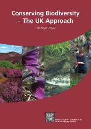
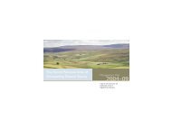
Sustainable Aggregates Creating Environmental Improvements <strong>through</strong> Biodiversity<br />
archaeological and <strong>environmental</strong> levels needs more detailed information than currently available<br />
• The river is an artefact of large amounts of management and will continue to require management to<br />
remain an open watercourse<br />
• The full character of the river for much of its past is not entirely understood, so it is difficult to recognise<br />
its effects on local land use<br />
• The need for more absolutely dated evidence and maximum understanding of available data is apparent<br />
• The consequences of alterations in the channel need to be kept in mind<br />
Part 2 –<br />
Palaeo-<strong>environmental</strong> findings from literature include (for different areas within the valley):<br />
• That dry-land mixed deciduous woodland on surrounding slopes had largely been cleared by 1500 BC<br />
• That there was a subtle but significant clearance of floodplain woodland between 1200 BC and 1000 BC,<br />
and another around 650 BC<br />
• That the landscape then became largely open with pasture, arable cultivation and hedges<br />
• Hydrological features have included palaeochannels (former streams) as well as Iron Age ditches and<br />
Roman wells<br />
• Roman ditches in parts of the area appear to have been part of substantial Roman vineyard complexes<br />
• Alluvium-covered buildings are present in part of the area, indicating flooding in the late Saxon and<br />
medieval periods<br />
• A flood bank was constructed to protect a settlement in around 1100 AD<br />
• Late Saxon or medieval ridge-and-furrow cultivation of the floodplain was flooded in the medieval period<br />
• It appears that the predominant morphology of at least part of the area has been an anastomosing<br />
(braided) channel system – with old, dissected, floodplain in between<br />
• This pattern of floodplain evolution is not unusual in lowland Britain, and has been described as the ‘stable<br />
bed/aggrading banks model’, involving a reduction in the number of small channels to offset the increase in<br />
size of other channels when flow is concentrated there as the floodplain surface aggrades<br />
• In one area the dominant processes of change have been channel siltation and floodplain alleviation, but<br />
not significant channel bed aggredation: implications include a larger, shallower area of water and more water<br />
edge (of value for fish and wildfowl), although it was contained in a smaller area of active floodplain<br />
• Islands of gravel existed, which were drier than at present, and have probably always been isolated from<br />
the valley sides by river channels, with little or no seasonal flooding during the bronze age<br />
• Detail is presented on vegetation communities that existed at different stages of landscape history<br />
Nearly the entire valley floor has been removed by gravel extraction, in most cases down to Lias clay<br />
There is little palaeoecological knowledge of the (Raunds) area other than for the floodplain<br />
Research on the wider region (south east Midlands) suggests that around 5000 years ago it was covered by<br />
mixed deciduous forest dominated by lime and oak<br />
These and other detailed findings from the literature are presented from various areas of the Nene<br />
Valley and combined with results of further pollen analysis of archived samples, with the following overall<br />
conclusions:<br />
• The deciphered landscape patterns are in line with the general pattern of dense Roman settlement locally<br />
and a fully utilised floodplain and surrounding slopes<br />
• Pressure on the Nene Valley from aggregate extraction will now decrease as remaining resources are few<br />
• There has been some local protest to further large-scale extraction in the area in the new Minerals Local<br />
Plan for Northamptonshire (‘Save the Nene 2006’), and this will be subject to strict archaeological conditions<br />
• Parts of the valley are now a series of lakes<br />
50