creating environmental improvements through biodiversity
creating environmental improvements through biodiversity
creating environmental improvements through biodiversity

Create successful ePaper yourself
Turn your PDF publications into a flip-book with our unique Google optimized e-Paper software.
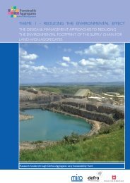
SAFEGUARDING MINERAL EXTRACTION SITE RESTORATIONS<br />
NEAR AIRPORTS: DEVELOPING AN OBJECTIVE BIRDSTRIKE RISK<br />
ASSESSMENT MODEL FOR HAZARDOUS WATER BIRDS – AN AID FOR<br />
ENVIRONMENTAL ASSESSMENT POLICY (MIRO SAMP, DCLG, CSL)<br />
(Justin Hart, Alison Colyer, Andrew Robinson, Paul Cropper, Pawel Plonskier, Lisa Allen, Mark Brown, Richard<br />
Budgey, Mark Parnell, John Allan (Central Science Laboratory Bird Management Unit)<br />
September 2007<br />
Project Type: Bird counts, radio telemetry, radar detection of birds, site assessment / measurement,<br />
mathematical modelling<br />
Site: Birds counted and parameters measured at 256 restoration sites in north, midlands and south of<br />
England. Additional data from 97 of these sites. Morphological features from 26 restoration sites in upper<br />
Thames Valley used as predictors of radar tracked bird movements<br />
Project Aim: To define a series of mathematical procedures that can be used by the minerals industry and<br />
safeguarding authorities to predict likely abundances and movements of hazardous birds at new restorations.<br />
To identify a series of models that could be used predictively and then determine their utility for safeguarding<br />
purposes.<br />
Main Methods:<br />
Fieldwork:<br />
Bird counts at restoration sites, of species considered most hazardous to aircraft<br />
Measuring physical parameters of restored sites – area of open water, perimeter length, sinuosity, region,<br />
presence of islands, number of islands, number of adjacent pits (in clusters of gravel extraction sites),<br />
morphology of adjacent pits<br />
Measuring additional parameters at 97 of these restorations – habitat diversity (number of habitat types at<br />
each site, defined using Phase 1 Habitat Survey methods); area of islands; reed abundance; presence of short<br />
grass, fish stock and rafts; water chemistry; site usage and public access<br />
Radio telemetry – of wigeon, Canada geese and mallard (with conventional radio tags rather than satellite<br />
tracking)<br />
Radar:<br />
Use of CSL’s bird detection radar to track bird echoes, (as used in earlier CSL report - Walls and Brown,<br />
2004), and data saved to Microsoft Access database. Tracks plotted using ArcGIS 9.1 (ESRI 1999) to facilitate<br />
analysis of bird flight lines<br />
Range Analysis:<br />
Radio tracking data analysed for eight wigeon using minimum convex polygon analysis – sufficient data<br />
obtained to do this for only these birds<br />
Mathematical modelling:<br />
Use of two subsets of collected data on site features to model the bird counts: GIS derived features for all<br />
256 sites; and data from the first subset plus additional parameters, for the 97 sites where additional data was<br />
collected<br />
Use of measured parameters as explanatory variables in linear mixed effect regression models that described:<br />
abundances of all water birds; specific abundance of dabbling duck, diving duck, diving species, grazing species,<br />
piscivores, geese and gulls; and abundance of mallard and tufted duck; in non-breeding and breeding seasons<br />
Multi-modal inference, and estimation of how well each model fitted with the data, to use in selecting the<br />
models that could best be used as predictive tools<br />
Sustainable Aggregates Creating Environmental Improvements <strong>through</strong> Biodiversity<br />
67