Paleosismoloji ve Arkeosismoloji Palaeoseismology and ...
Paleosismoloji ve Arkeosismoloji Palaeoseismology and ...
Paleosismoloji ve Arkeosismoloji Palaeoseismology and ...

Create successful ePaper yourself
Turn your PDF publications into a flip-book with our unique Google optimized e-Paper software.
62 nd Geological Kurultai of Turkey, 13−17 April 2009, MTA–Ankara, Türkiye<br />
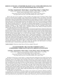
<strong>Palaeoseismology</strong> of Karadere Segment (Between Akyazı-Gölyaka)<br />
on the Western Part of the North Anatolian Fault<br />
Aynur Dikbaş 1 , H. Serdar Akyüz 2 , Pınar Gutsuz 1 , Cengiz Zabcı 2 ,<br />
Taylan Sancar 1 & Volkan Karabacak 3<br />
1 İstanbul Teknik Üni<strong>ve</strong>rsitesi, Avrasya Yer Bilimleri Enstitüsü, Maslak,<br />
TR−34469 İstanbul, Türkiye (E-mail: adikbas@itu.edu.tr)<br />
2 İstanbul Teknik Üni<strong>ve</strong>rsitesi, Maden Fakültesi, Jeoloji Mühendisliği Bölümü,<br />
Maslak, TR−34469 İstanbul, Türkiye<br />
3 Eskişehir Osmangazi Üni<strong>ve</strong>rsitesi, Jeoloji Mühendisliği Bölümü, Meşelik,<br />
TR−26480 Eskişehir, Türkiye<br />
6 Işık Üni<strong>ve</strong>rsitesi, Fen-Edebiyat Fakültesi, Fizik Bölümü, Şile, TR−34980 İstanbul, Türkiye<br />
Karadere segment is the easternmost segment that ruptured on 17 August 1999 İzmit earthquake. The<br />
segment trends N60−70°E between towns Akyazı (Adapazarı) <strong>and</strong> Gölyaka (Düzce) with a length of<br />
approximately 25 km. The maximum right-lateral displacement on the segment is measured as 1.55 m<br />
on a offset road during the August 1999 earthquake. The ruptured segments of the earthquake mainly<br />
trend along a plain morphology whether the Karadere segment cuts a mountainous area, that it<br />
pre<strong>ve</strong>nts important morphological <strong>and</strong> geological data. Morphological data re<strong>ve</strong>als a 10 km. of<br />
cumulati<strong>ve</strong> right-lateral displacement on Karadere segment. The segment has an importance in being<br />
an area where North Anatolian Fault splits into two branches, <strong>and</strong> it is different from the other seismic<br />
segments in means of the fewer amounts of slip <strong>and</strong> different strike. Two trench locations were chosen<br />
in the mid-part of Karadere segment in order to determine the past earthquakes. The analysis of<br />
structural <strong>and</strong> stratigraphical relations in the trenches re<strong>ve</strong>aled 5 past earthquakes except 1999<br />
earthquake. Correlating the date of e<strong>ve</strong>nt horizons in the trenches with each other <strong>and</strong> with historical<br />
earthquakes, it is determined that 358, 554 <strong>and</strong> 1419 earthquakes may ha<strong>ve</strong> ruptured the segment. Two<br />
past earthquakes, which could not be correlated directly with historical earthquakes, one on the second<br />
half of the first milennium, <strong>and</strong> the other around year 1000 are also determined in the trenches.<br />
Key Words: NAF, earthquake, 17 August 1999, palaeoseismology, Karadere segment<br />
1017