Paleosismoloji ve Arkeosismoloji Palaeoseismology and ...
Paleosismoloji ve Arkeosismoloji Palaeoseismology and ...
Paleosismoloji ve Arkeosismoloji Palaeoseismology and ...

Create successful ePaper yourself
Turn your PDF publications into a flip-book with our unique Google optimized e-Paper software.
62 nd Geological Kurultai of Turkey, 13−17 April 2009, MTA–Ankara, Türkiye<br />
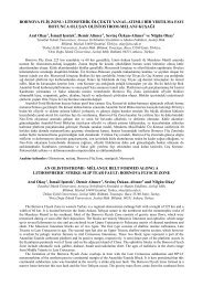
Palaeoseismological Evidence For Holocene Activity on the Manisa Fault Zone:<br />
Preliminary Results for Seismic Risk in Manisa District, Western Anatolia<br />
Çağlar Özkaymak 1 , Hasan Sözbilir 1 , Bora Uzel 1 , H. Serdar Akyüz 2 & Irka Hajdas 3<br />
1 Dokuz Eylül Üni<strong>ve</strong>rsitesi, Jeoloji Mühendisliği Bölümü, Tınaztepe Yerleşkesi,<br />
Buca, TR−35160 İzmir, Türkiye (E-mail: caglar.ozkaymak@deu.edu.tr)<br />
2 İstanbul Teknik Üni<strong>ve</strong>rsitesi, Jeoloji Mühendisliği Bölümü, Maslak, TR−34469 İstanbul, Türkiye<br />
3<br />
Laboratory for Ion Beam Physics, Radiocarbon Dating, ETH 208093 Zurich, Switzerl<strong>and</strong><br />
Manisa Fault Zone (MFZ) is an acti<strong>ve</strong> structural discontinuity that is geomorphologically expressed as<br />
a trace of north-facing Quaternary fault scarps bounding the southern margin of the Manisa basin<br />
which is continuation of the Gediz Graben. We note that the present-day fault trace is o<strong>ve</strong>r 50 km long<br />
from Manisa city in the northwest to the Turgutlu town in the southeast. The MFZ consists of two<br />
major sections: (i) eastern section that strikes NW–SE direction in the south <strong>and</strong> bends into an<br />
approximately E–W direction around Manisa to the northwest, (ii) an approximately 10-km-long<br />
western section that strikes WNW–ESE direction from Manisa city in the east to Akgedik town in the<br />
west. According to the historical records, many earthquakes destroyed the vicinity of Manisa city<br />
which is located in front of the MFZ. In this study, we present the geologic, geomorphologic, <strong>and</strong><br />
palaeoseismologic evidences indicating Holocene activity on the western section of the fault zone.<br />
We identify that the MFZ, at its western end, consists of three fault segments which are en échelon<br />
arranged in left step; the fault segments show evidence for linkage <strong>and</strong> breaching at the relay ramps.<br />
One of them is named as the Manastir Fault. In front of this fault, two Holocene colluvial fans, older<br />
of which is uncorformity bounded, are cut <strong>and</strong> displaced by the syntethic faults. Eight paleosoil<br />
horizons which ha<strong>ve</strong> been found within the older colluvial fans are dated by radiocarbon technique.<br />
Two trenches were excavated on the basinward syntethic fault segment. Palaeoseismologic data show<br />
that the syntethic fault segments correspond to the surface ruptures of the historical earthquakes. As a<br />
result of detailed stratigraphic, sedimentologic <strong>and</strong> structural observations on the trench walls, some<br />
evidences for at least three earthquakes are recorded which are supported by radiocarbon dating.<br />
Besides this, an archaic aqueduct that were used to transport water from Emlakdere town, located on<br />
the hanging wall of the Manastir Fault, to the basin is cut <strong>and</strong> displaced by the syntethic fault<br />
segments. It is known that this archaic architecture was in use after 11. century by the Ottomans. On<br />
the basis of the mentioned data, fault segments which are belong to the western part of the Manisa<br />
Fault Zone has been acti<strong>ve</strong> since Holocene time as step-like structural geometries.<br />
Key Words: west Anatolia, Manisa fault zone, acti<strong>ve</strong> tectonics, paleoseismology, C14 dating, seismic<br />
risk<br />
997