Kelowna's Urban Forest: - City of Kelowna
Kelowna's Urban Forest: - City of Kelowna
Kelowna's Urban Forest: - City of Kelowna

You also want an ePaper? Increase the reach of your titles
YUMPU automatically turns print PDFs into web optimized ePapers that Google loves.
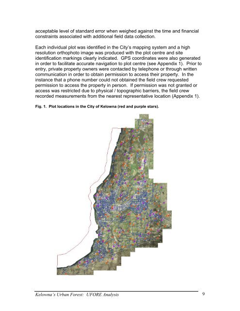
acceptable level <strong>of</strong> standard error when weighed against the time and financial<br />
constraints associated with additional field data collection.<br />
Each individual plot was identified in the <strong>City</strong>’s mapping system and a high<br />
resolution orthophoto image was produced with the plot centre and site<br />
identification markings clearly indicated. GPS coordinates were also generated<br />
in order to facilitate accurate navigation to plot centre (see Appendix 1). Prior to<br />
entry, private property owners were contacted by telephone or through written<br />
communication in order to obtain permission to access their property. In the<br />
instance that a phone number could not obtained the field crew requested<br />
permission to access the property in person. If permission was not granted or<br />
access was restricted due to physical / topographic barriers, the field crew<br />
recorded measurements from the nearest representative location (Appendix 1).<br />
Fig. 1. Plot locations in the <strong>City</strong> <strong>of</strong> <strong>Kelowna</strong> (red and purple stars).<br />
<strong>Kelowna</strong>’s <strong>Urban</strong> <strong>Forest</strong>: UFORE Analysis 9