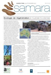
MT MABU, MOZAMBIQUE: - Royal Botanic Gardens, Kew
MT MABU, MOZAMBIQUE: - Royal Botanic Gardens, Kew
MT MABU, MOZAMBIQUE: - Royal Botanic Gardens, Kew

You also want an ePaper? Increase the reach of your titles
YUMPU automatically turns print PDFs into web optimized ePapers that Google loves.
Biodiversity of Mt Mabu, Mozambique, page 12<br />
7 km away, is summarised in Kassam et al. (1981). These data are for only 16 years and<br />
probably date from the mid-1960s.<br />
Mean annual rainfall is given as 2119.1 mm, ranging from a monthly mean of 34.2 mm in<br />
September to 362.3 mm in January. The main rainfall months are November to April (1793.1<br />
mm over 6 months or 84.6% of annual total), while the four months from December to March<br />
have a mean of 1410.9 mm (66.6% of total). Over the 16 years recorded the wettest months<br />
were March (mean 381.1 mm) and January (mean 362.3 mm).<br />
Mean annual temperature was 23.7 o C, ranging from 21.0 in July to 25.5 o C in October. The<br />
mean maximum of 32.9 o C was in October with a mean minimum of 14.9 o C in July. Unlike<br />
the situation on Mt Namuli (Timberlake et al. 2009), the occurrence of frost is likely to be<br />
rare. Evapotranspiration (Penman) was 1252.6 mm/year ranging from 63.7 mm in June to<br />
142.5 in October. During the cooler winter months potential evapotranspiration is roughly<br />
equivalent to rainfall, but in October it is more than three times monthly rainfall.<br />
According to Reddy (1984) in his overview of Mozambique's climate, rainfall in the area<br />
should be around 1500 mm/year (surprisingly less than shown by actual rainfall records) with<br />
a low variation of only 20%. The winter rainfall index (30) indicates that some winter<br />
cropping is possible. In a national context the Cha Madal area is a relatively high rainfall area<br />
similar to Mt Namuli (zone 1‒2a, moderately cool; national climatic resources inventory,<br />
Voortman & Spiers 1982), with the possibility of two rainfed growing periods in 10% of<br />
years, perhaps with a 300 day growing period each year.<br />
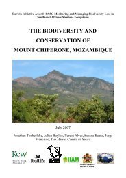
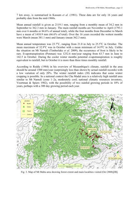
Fig. 3. Map of Mt Mabu area showing forest extent and main localities visited (Oct 2008)[JB].