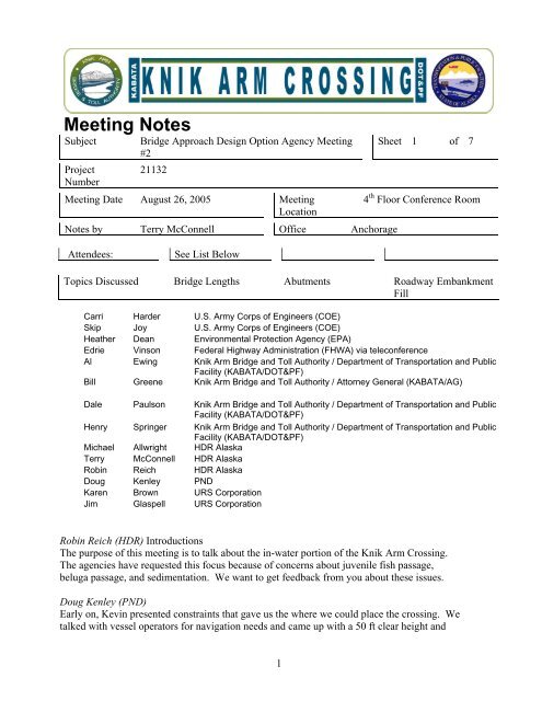
Meeting Notes - Knik Arm Bridge and Toll Authority
Meeting Notes - Knik Arm Bridge and Toll Authority
Meeting Notes - Knik Arm Bridge and Toll Authority

Create successful ePaper yourself
Turn your PDF publications into a flip-book with our unique Google optimized e-Paper software.
<strong>Meeting</strong> <strong>Notes</strong><br />
Subject<br />
Project<br />
Number<br />
<strong>Bridge</strong> Approach Design Option Agency <strong>Meeting</strong><br />
#2<br />
21132<br />
<strong>Meeting</strong> Date August 26, 2005 <strong>Meeting</strong><br />
Location<br />
<strong>Notes</strong> by Terry McConnell Office Anchorage<br />
Sheet 1 of 7<br />
4 th Floor Conference Room<br />
Attendees:<br />
See List Below<br />
Topics Discussed <strong>Bridge</strong> Lengths Abutments Roadway Embankment<br />
Fill<br />
Carri Harder U.S. <strong>Arm</strong>y Corps of Engineers (COE)<br />
Skip Joy U.S. <strong>Arm</strong>y Corps of Engineers (COE)<br />
Heather Dean Environmental Protection Agency (EPA)<br />
Edrie Vinson Federal Highway Administration (FHWA) via teleconference<br />
Al Ewing <strong>Knik</strong> <strong>Arm</strong> <strong>Bridge</strong> <strong>and</strong> <strong>Toll</strong> <strong>Authority</strong> / Department of Transportation <strong>and</strong> Public<br />
Facility (KABATA/DOT&PF)<br />
Bill Greene <strong>Knik</strong> <strong>Arm</strong> <strong>Bridge</strong> <strong>and</strong> <strong>Toll</strong> <strong>Authority</strong> / Attorney General (KABATA/AG)<br />
Dale Paulson <strong>Knik</strong> <strong>Arm</strong> <strong>Bridge</strong> <strong>and</strong> <strong>Toll</strong> <strong>Authority</strong> / Department of Transportation <strong>and</strong> Public<br />
Facility (KABATA/DOT&PF)<br />
Henry Springer <strong>Knik</strong> <strong>Arm</strong> <strong>Bridge</strong> <strong>and</strong> <strong>Toll</strong> <strong>Authority</strong> / Department of Transportation <strong>and</strong> Public<br />
Facility (KABATA/DOT&PF)<br />
Michael Allwright HDR Alaska<br />
Terry McConnell HDR Alaska<br />
Robin Reich HDR Alaska<br />
Doug Kenley PND<br />
Karen Brown URS Corporation<br />
Jim Glaspell URS Corporation<br />
Robin Reich (HDR) Introductions<br />
The purpose of this meeting is to talk about the in-water portion of the <strong>Knik</strong> <strong>Arm</strong> Crossing.<br />
The agencies have requested this focus because of concerns about juvenile fish passage,<br />
beluga passage, <strong>and</strong> sedimentation. We want to get feedback from you about these issues.<br />
Doug Kenley (PND)<br />
Early on, Kevin presented constraints that gave us the where we could place the crossing. We<br />
talked with vessel operators for navigation needs <strong>and</strong> came up with a 50 ft clear height <strong>and</strong><br />
1
<strong>Meeting</strong> <strong>Notes</strong><br />
approximately 200-250 ft opening between pilings. We have looked at several lengths. The<br />
west side of the bluff is 70-80 ft high <strong>and</strong> would need fill to approach. The <strong>Knik</strong> <strong>Arm</strong> channel<br />
is approximately 12,500 ft wide. We have looked at a 7,000 ft perpendicular bridge with fill<br />
on both sides. The skewed option would shorten the road length below the bluff <strong>and</strong> benefit<br />
the beluga concerns. Port MacKenzie has been a good example for us. It is filled in at<br />
approximately 2.1 slope over time.<br />
The 7,000 ft option has a footprint of about 56 acres with a sediment accumulation of about<br />
400 acres. The cost of the bridge would be approximately $140 million. The approaches<br />
would cost approximately $65 million. The total cost would be $205 million.<br />
The 10,000 ft option has a footprint of about 33 acres with a sediment accumulation of around<br />
160 acres. The cost of the bridge would be approximately $200 million with the approaches<br />
costing approximately $35 million. The total cost would be about $235 million.<br />
The 12,500 ft option has a footprint of about 12 acres with an expected sediment<br />
accumulation of around 7 acres. The cost of the bridge would be approximately $250 million,<br />
<strong>and</strong> the approaches would be approximately $15 million. The total cost would be $265<br />
million.<br />
Robin Reich (HDR)<br />
One of the major reasons to look into the skewed alignment is because NOAA Fisheries<br />
indicated belugas gather near Six Mile Creek. We have looked at the pros <strong>and</strong> cons of each<br />
bridge alignment. Pros for perpendicular include navigation ease. Cons could include<br />
hydrologic impacts. Pros for skewed include a shorter approach <strong>and</strong> the greater distance from<br />
Six Mile Creek. Cons for skewed include navigation impacts <strong>and</strong> proximity to submarine<br />
trench. We have not decided which to bring forward.<br />
Skip Joy (COE)<br />
If you assume the distance between two banks at Cairn Point caused the submarine trench,<br />
could the bridge have an impact of increasing trench?<br />
Doug Kenley (PND)<br />
The hydrologists are doing the modeling now.<br />
Skip Joy (COE)<br />
That question must be answered.<br />
Robin Reich (HDR)<br />
Agencies want us to look at a fully pile supported bridge without embankments. That option<br />
will be carried forward. We will also consider cost concerns. The 12,500 ft maintains fish<br />
<strong>and</strong> beluga passage, but we are also concerned about the amount of time it would take to<br />
2
<strong>Meeting</strong> <strong>Notes</strong><br />
build. The more pilings that must be drilled, the more noise that could have beluga impacts.<br />
Another option that came up is including an embankment on only one side. The fisheries<br />
report will also help determine which side is more important for fish passage.<br />
Heather Dean (EPA)<br />
We are concerned about sedimentation impacting other important wetl<strong>and</strong>s in <strong>Knik</strong> <strong>Arm</strong> <strong>and</strong><br />
erosion.<br />
Robin Reich (HDR)<br />
The hydrology work will address that. Heather, are you concerned with wetl<strong>and</strong>s like those at<br />
the mouth of Eagle River?<br />
Heather Dean (EPA)<br />
Anywhere in the realm of influence up or down <strong>Knik</strong> <strong>Arm</strong>.<br />
Skip Joy (COE)<br />
We are interested in the secondary impacts to those wetl<strong>and</strong>s too.<br />
Jim Glaspell (URS)<br />
There is a side observation about this. From aerial photos going back 50 years, we see Six<br />
Mile Creek perpendicular to the bank. From May 18, 2005 until now, we see the channel<br />
flowing parallel to the bluff. At extremely low tide it seems to have a bump, <strong>and</strong> even heavy<br />
flows have not changed it back. It has cut a 4-6 ft channel on the tide l<strong>and</strong>s.<br />
Robin Reich (HDR)<br />
When we look at fish around Port MacKenzie dock, we saw a fair amount of juvenile salmon.<br />
We caught fewer around the face than on the two sides. Phil Brna (USFWS) mentioned the<br />
fish may not be able to get around the dock. That leads us to the abutment topic. We want to<br />
address concerns so we design to make it easier for fish to get around.<br />
Doug Kenley (PND)<br />
We have 4 options for the end of the embankments of the abutments<br />
(See h<strong>and</strong>out “<strong>Knik</strong> <strong>Arm</strong> <strong>Bridge</strong> Abutment Options.”)<br />
Option 1 is similar to the 2.1 slope design with sheetpile at the Port of Anchorage. It doesn’t<br />
need a lot of fill with armor. The footprint is about 5 acres at a cost of $9 million.<br />
Another option is a 2.1 slope with the armor extending around the abutment. It increases the<br />
footprint to 10 acres at a cost of $8 million. It has fill out 190 ft from the top of the slope.<br />
Another option has a 10.1 slope with a footprint of 44 acres <strong>and</strong> a cost of $44 million with fill<br />
700 ft out from top of slope<br />
3
<strong>Meeting</strong> <strong>Notes</strong><br />
Another option is a bench approach with a footprint of 28 acres <strong>and</strong> a cost of $16 million with<br />
fill out 450 ft from top of slope.<br />
Robin Reich (HDR)<br />
Regarding biology, we wanted to find out how fast the current would move around these<br />
embankments. We wanted to determine whether it would inhibit juvenile salmon?<br />
Michael Allwright (HDR)<br />
The st<strong>and</strong>ard is one body length per second. Therefore, a 3 inch fish has a sustainable speed<br />
of 3 inches per second.<br />
Robin Reich (HDR)<br />
Regarding the bench option, we looked at tide charts to determine when during the tide the<br />
bench is covered with water a substantial period of time. We determined that the bench<br />
should be placed at 15 ft because this depth would be wet for a longer period of time.<br />
Michael Allwright (HDR)<br />
When the water is at that 15 ft level it is moving at its fastest.<br />
Skip Joy (COE)<br />
Would this design help to reduce scour?<br />
Doug Kenley (PND)<br />
Jack Colonel (hydrologist for this project) said very little of the flow is on the sides of the<br />
channel. Most of the water flow is moving in the middle of the channel.<br />
Skip Joy (COE)<br />
And you’re only decreasing it the flow at the lowest water.<br />
Robin Reich (HDR)<br />
The boundary area (the area next no the abutment where the water slows down) doesn’t<br />
change based on slope. What does change the boundary area is the amount of friction along<br />
the abutment. The more roughness (bigger armor rock), the bigger the boundary area. The<br />
higher the friction, the lower the velocity. When we were talking about this in the prior<br />
agency meeting, NOAA Fisheries <strong>and</strong> ADNR OHMP (Mark Somerville) were aware of this.<br />
Jim Glaspell (URS)<br />
At 2:1 there is less disturbance <strong>and</strong> fill. NOAA Fisheries appeared to be was satisfied with<br />
2:1 slope at the last meeting.<br />
4
<strong>Meeting</strong> <strong>Notes</strong><br />
Robin Reich (HDR)<br />
We haven’t made a decision yet on abutment type. We are looking for feedback.<br />
Doug Kenley (PND)<br />
The 10:1 abutment slope would decrease the navigation space. It may still be adequate.<br />
Heather Dean (EPA)<br />
Did you look at the option of combining options 1 <strong>and</strong> 4, having sheet pile with a 2:1 slope?<br />
Michael Allwright (HDR)<br />
The primary reason to have sheet pile is to reduce the length of the slope. Also, the sheet pile<br />
would not slow down the current.<br />
Robin Reich (HDR)<br />
One of the alternatives to get into Anchorage is the below the bluff roadway. It would have<br />
gravel fill along the bluff with armor rock on the waterside of the alignment. Doug will<br />
explain the design options for the below the bluff alignment.<br />
Doug Kenley (PND)<br />
One option would be to have a 4-lane roadway with a 2.1 side slope. This alternative would<br />
have a footprint of about 32 acres at a cost of $19 million. Roadway fill would extend 175 ft<br />
from the bluff into the tidel<strong>and</strong>s.<br />
Another option would be a 4-lane roadway with a 10.1 side slope with a footprint of about 92<br />
acres at a cost of $73 million. Fill would go out 575 ft from the bluff to the tidel<strong>and</strong>s.<br />
Another option would be a 4-lane roadway with a 10:2 benched slope. This option would<br />
have a footprint of about 55 acres <strong>and</strong> cost $35 million. Fill would extend out 300 ft into the<br />
tidel<strong>and</strong>s. In Puget Sound the benched option is used to re-create salt marsh habitat which<br />
does not occur in this area of <strong>Knik</strong> <strong>Arm</strong>.<br />
Michael Allwright (HDR)<br />
In British Columbia spur dikes have been used to replace salt marsh. They have a 30%<br />
increase in net habitat.<br />
Robin Reich (HDR)<br />
In that example project we looked at, the area between spur dikes grew into green lush<br />
marshes. They had a different purpose. Here they could be like a lot of little barriers for the<br />
fish movement.<br />
Skip Joy (COE)<br />
The spur dike option doesn’t look good to me.<br />
5
<strong>Meeting</strong> <strong>Notes</strong><br />
Doug Kenley (PND)<br />
Anther option is to have an elevated structure all the way along the roadway. There is little<br />
tidel<strong>and</strong> footprint. This option would cost of $160 million. It is eight times more expensive<br />
than the 2.1 slope option.<br />
Skip Joy (COE)<br />
If it access is through the military base, then none of these options are pertinent.<br />
Robin Reich (HDR)<br />
This is true however, the below the bluff alignment will be one of the alternatives in the Draft<br />
EIS. Do you have input now? You can also call or email us.<br />
Skip Joy (COE)<br />
I think you could drop the spur dike option.<br />
Heather Dean (EPA)<br />
I agree.<br />
Skip Joy (COE)<br />
The Corps would like the longest bridge possible.<br />
Heather Dean (EPA)<br />
The decision on embankments <strong>and</strong> abutments should be based on fisheries <strong>and</strong> beluga studies.<br />
Skip Joy (COE)<br />
Modeling <strong>and</strong> velocity is going to play into the decision. Friction is an important factor.<br />
Financially, less fill is better, but we like to see the smallest footprint too. Current velocities<br />
have impacts.<br />
Robin Reich (HDR)<br />
We heard the smallest footprint is desirable from USFWS, NOAA Fisheries, <strong>and</strong> ADNR<br />
OHMP. I believe they also preferred the 2.1 roadway sideslope.<br />
Skip Joy (COE)<br />
That’s my first leaning as well, as long as it doesn’t create high velocities. I really don’t see<br />
that happening here.<br />
Heather Dean (EPA)<br />
I would defer to the (agencies concerned with) fisheries on determining the best design.<br />
6
<strong>Meeting</strong> <strong>Notes</strong><br />
Robin Reich (HDR)<br />
We will get a memo to you explaining the options, pros <strong>and</strong> cons <strong>and</strong> costs.<br />
Edrie Vinson (FHWA)<br />
Please get a copy to USCG too.<br />
<strong>Meeting</strong> Adjourned<br />
7