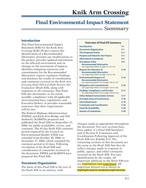
FEIS Summary - Knik Arm Bridge and Toll Authority
FEIS Summary - Knik Arm Bridge and Toll Authority
FEIS Summary - Knik Arm Bridge and Toll Authority

You also want an ePaper? Increase the reach of your titles
YUMPU automatically turns print PDFs into web optimized ePapers that Google loves.
<strong>Knik</strong> <strong>Arm</strong> Crossing<br />
Final Environmental Impact Statement<br />
<strong>Summary</strong><br />
Introduction<br />
This Final Environmental Impact<br />
Statement (EIS) for the <strong>Knik</strong> <strong>Arm</strong><br />
Crossing (KAC) Project reports the<br />
identification of a Recommended<br />
Alternative, presents any modifications to<br />
the project, provides updated information<br />
on the affected environment <strong>and</strong> on<br />
changes in the assessment of impacts,<br />
identifies mitigation measures <strong>and</strong><br />
commitments for the Recommended<br />
Alternative, reports regulatory findings,<br />
<strong>and</strong> discloses the results of coordination<br />
<strong>and</strong> comments received on the <strong>Knik</strong> <strong>Arm</strong><br />
Crossing Draft EIS <strong>and</strong> Draft Section 4(f)<br />
Evaluation (Draft EIS), along with<br />
responses to all comments. This Final<br />
EIS also documents, to the extent<br />
possible, compliance with all applicable<br />
environmental laws, regulations, <strong>and</strong><br />
Executive Orders, or provides reasonable<br />
assurance that their requirements<br />
will be met.<br />
The Federal Highway Administration<br />
(FHWA) <strong>and</strong> <strong>Knik</strong> <strong>Arm</strong> <strong>Bridge</strong> <strong>and</strong> <strong>Toll</strong><br />
<strong>Authority</strong> (KABATA) prepared <strong>and</strong><br />
published the Draft EIS on September 15,<br />
2006, for public availability, review, <strong>and</strong><br />
comment. The 45-day Draft EIS comment<br />
period required by the Council on<br />
Environmental Quality (CEQ) was<br />
extended from October 30, 2006, to<br />
November 17, 2006, which extended the<br />
comment period to 63 days. Following<br />
circulation of the Draft EIS <strong>and</strong><br />
consideration of comments received on<br />
the document, FHWA <strong>and</strong> KABATA have<br />
prepared this Final EIS.<br />
Document Organization<br />
The basis of this Final EIS is the text of<br />
the Draft EIS in its entirety, with<br />
Overview of Final EIS <strong>Summary</strong><br />
Introduction S-1<br />
Document Organization S-1<br />
The Proposed Action S-4<br />
Purpose <strong>and</strong> Need for the Project S-4<br />
Alternatives Considered S-4<br />
Decription of the S-8<br />
Recommended Alternative<br />
(see supporting exhibits on pages S-21 to S-31)<br />
Reasons for Selection of S-10<br />
Recommended Alternative<br />
(see supporting exhibits on pages S-32 to S-35)<br />
Environmental Impacts of S-16<br />
Recommended Alternative<br />
(see supporting Exhibit S-23 on pages S-36 to S-52)<br />
Mitigation <strong>and</strong> Commitments S-16<br />
(see supporting Exhibit S-24 on pages S-53 to S-59)<br />
Findings, Compliance, <strong>and</strong> Permits S-17<br />
(see supporting Exhibit S-25 on pages S-60 to S-64)<br />
Other Related Government Actions S-17<br />
Principal Areas of Controversy S-18<br />
Unresolved Issues S-18<br />
Comments <strong>and</strong> Coordination S-18<br />
Final EIS Availability S-20<br />
Statute of Limitations S-20<br />
changes made as appropriate throughout<br />
the document. Two new sections have<br />
been added: 1) a Final EIS <strong>Summary</strong><br />
<strong>and</strong> 2) Section 8: Comments <strong>and</strong><br />
Coordination Following Approval of the<br />
Draft EIS (see Exhibit S-1). The<br />
remaining sections of this document are<br />
the same as the Draft EIS, but they do<br />
reflect changes made in response to<br />
public, agency, <strong>and</strong> tribal comments<br />
received on the Draft EIS. For easy<br />
identification by the reader, all<br />
important additions to the Draft EIS text<br />
are highlighted <strong>and</strong> underlined. All<br />
important deleted text is shown in<br />
highlight <strong>and</strong> in strikethrough format.<br />
S-1
<strong>Knik</strong> <strong>Arm</strong> Crossing Final EIS<br />
<strong>Summary</strong><br />
Exhibit S‐1. Final EIS Document Organization<br />
Section <strong>and</strong> topics covered<br />
Final EIS <strong>Summary</strong>. This summary provides an<br />
update on the project since the publication <strong>and</strong><br />
release of the Draft EIS. It reviews the proposed<br />
action; identifies the reasonable alternatives<br />
considered in the Draft EIS; identifies, describes, <strong>and</strong><br />
provides reasons for selecting the Recommended<br />
Alternative; identifies the environmental impacts of<br />
<strong>and</strong> mitigation <strong>and</strong> commitments for the<br />
Recommended Alternative; reports regulatory<br />
findings <strong>and</strong> compliance with laws <strong>and</strong> executive<br />
orders; discloses areas of controversy <strong>and</strong> unresolved<br />
issues; <strong>and</strong> reports other governmental actions <strong>and</strong><br />
permits needed.<br />
Draft EIS Executive <strong>Summary</strong>. This section<br />
provides a summary of the Draft EIS. It explains the<br />
purpose of an EIS; provides an overview of the<br />
proposed action; identifies related actions <strong>and</strong><br />
projects by local, state, <strong>and</strong> federal agencies in the<br />
area; summarizes the alternatives development <strong>and</strong><br />
screening process, including the reasonable<br />
alternatives evaluated in detail in the Draft EIS;<br />
discusses the preferred alternative; summarizes the<br />
beneficial <strong>and</strong> adverse impacts of the reasonable<br />
alternatives; identifies preliminary mitigation <strong>and</strong><br />
preliminary commitments for addressing project<br />
impacts; discusses areas of controversy <strong>and</strong><br />
unresolved issues; <strong>and</strong> identifies related federal<br />
actions necessary.<br />
Section 1: Purpose <strong>and</strong> Need. This section<br />
discusses the proposed action <strong>and</strong> the<br />
transportation problem that it addresses.<br />
Section 2: Alternatives. This section discusses in<br />
detail the project’s logical termini <strong>and</strong> study area; the<br />
range of alternatives developed <strong>and</strong> evaluated; the<br />
reasonable alternatives fully evaluated in the Draft<br />
EIS; the general design features <strong>and</strong> estimated costs<br />
<strong>and</strong> impacts of reasonable alternatives; <strong>and</strong><br />
components of the preferred alternative.<br />
Section 3: Affected Environment. This section<br />
presents an inventory of economic, environmental,<br />
<strong>and</strong> cultural resources in the Project Area.<br />
New or revised section<br />
This is an entirely new section, one that was not<br />
published in the Draft EIS. For readability, this addition is<br />
not displayed in highlighted text.<br />
This section remains unchanged.<br />
Some additions <strong>and</strong> revisions have been made for clarity.<br />
Additional information has been added regarding l<strong>and</strong><br />
<strong>and</strong> housing values.<br />
Revisions have been made to the “<strong>Summary</strong> of Impacts”<br />
table further refining or clarifying impacts on the natural<br />
environment as well as on Section 106 <strong>and</strong> Section 4(f)<br />
properties.<br />
Text has been added to provide more detail regarding<br />
additional planning documents that influence the<br />
project.<br />
Information on existing facilities in the Project Area has<br />
been modified or added. The section on essential fish<br />
habitat (EFH) includes additional information on fish<br />
habitat preference from the EFH Assessment technical<br />
report.<br />
Regarding the Cook Inlet beluga whale, additional<br />
information has been added on its regulatory status,<br />
population estimates <strong>and</strong> trends, habitat, <strong>and</strong> diet.<br />
(Continued on next page)<br />
S-2
Exhibit S‐1. Final EIS Document Organization (continued)<br />
Section <strong>and</strong> topics covered<br />
Section 4: Environmental Consequences. This<br />
section presents the environmental consequences of<br />
the No-Action <strong>and</strong> reasonable alternatives, including<br />
preliminary measures to avoid, minimize, or mitigate<br />
impacts.<br />
<strong>Knik</strong> <strong>Arm</strong> Crossing Final EIS<br />
<strong>Summary</strong><br />
New or revised section<br />
Text has been added to clarify project compatibility with<br />
existing l<strong>and</strong> use plans <strong>and</strong> policies.<br />
Updates to tables reporting traffic impacts have been<br />
slightly modified.<br />
Other principal changes include additional information<br />
on hydrology, anadromous fish use of <strong>Knik</strong> <strong>Arm</strong> <strong>and</strong><br />
impacts associated with anadromous fish, <strong>and</strong> the status<br />
of the beluga whale.<br />
Additional mitigation measures have also been included.<br />
Additions/modifications regarding mitigation <strong>and</strong><br />
commitments are also in Exhibit S‐24 in the Final EIS<br />
<strong>Summary</strong>.<br />
Section 5: List of Preparers<br />
Section 6: Draft EIS Distribution<br />
Section 7: Comments <strong>and</strong> Coordination [Scoping].<br />
This section presents a summary of the scoping<br />
activities with agencies, tribes, <strong>and</strong> the public, <strong>and</strong><br />
scoping comments. It also includes information on<br />
Draft EIS comment opportunities.<br />
Section 8: Comments <strong>and</strong> Coordination Following<br />
Approval of the Draft EIS for Public<br />
Availability. This section provides an overview of<br />
notification <strong>and</strong> coordination (meetings <strong>and</strong><br />
correspondence) with agencies, tribes, <strong>and</strong> the public<br />
following the release of the Draft EIS. Comments<br />
received on the Draft EIS—<strong>and</strong> responses to those<br />
comments—are also included in this section.<br />
Additional appendixes support this new section.<br />
Final Section 4(f) Evaluation. Attached to the<br />
Final EIS is a final report on the effects of the action<br />
on those resources afforded protection under<br />
provisions of Section 4(f) of the Department of<br />
Transportation Act of 1966 (as amended), 23 United<br />
States Code (U.S.C.) § 138.<br />
Appendix F: Preliminary Alaska Coastal<br />
Management Program Consistency<br />
Appendix G: Notices of Availability of Draft EIS<br />
<strong>and</strong> Notices of Public Hearing<br />
Appendix H: Public Hearing Material<br />
Appendix I: Public Hearing Transcripts<br />
Appendix J: Records of Other Meetings Held <strong>and</strong><br />
Conclusionary Documents/Correspondence<br />
Appendix K: Draft EIS Comment Database Reports<br />
Appendix L: Comments Submitted on Draft EIS<br />
Appendix M: Wetl<strong>and</strong>s <strong>and</strong> Floodplains Findings<br />
Updates have been made to the “List of Preparers” table.<br />
Additions have been made to the Draft EIS distribution<br />
list.<br />
This section remains largely unchanged.<br />
This is an entirely new section, one that was not<br />
published in the Draft EIS. For readability, this addition is<br />
not displayed in highlighted text.<br />
Additions <strong>and</strong> revisions have been made to the Draft<br />
Section 4(f) Evaluation, primarily related to identification<br />
of the overall least net harm alternative selection <strong>and</strong><br />
mitigation.<br />
Supporting material not published in the Draft EIS has<br />
been added in a series of appendixes.<br />
S-3
<strong>Knik</strong> <strong>Arm</strong> Crossing Final EIS<br />
<strong>Summary</strong><br />
The Proposed Action<br />
As explained in detail in Section 1.0 of<br />
the EIS, the KAC Project will construct a<br />
new means of improved access between<br />
the Municipality of Anchorage<br />
(Anchorage) <strong>and</strong> the Matanuska-Susitna<br />
Borough (Mat Su) through an efficient<br />
<strong>and</strong> financially feasible crossing of <strong>Knik</strong><br />
<strong>Arm</strong>, including adequate connections to<br />
the committed roadway network. Exhibit<br />
S-2, on page S-5, shows the vicinity of<br />
the KAC Project <strong>and</strong> the location of<br />
various features pertinent to preparation<br />
of the Draft EIS. The project’s<br />
environmental <strong>and</strong> engineering analyses<br />
have been a joint effort of KABATA <strong>and</strong><br />
FHWA.<br />
KABATA, the project sponsor, was<br />
established in 2003 by the Alaska<br />
Legislature as a public corporation <strong>and</strong><br />
an instrumentality of the State of Alaska<br />
within the Alaska Department of<br />
Transportation <strong>and</strong> Public Facilities<br />
(ADOT&PF). The specific purpose of<br />
KABATA is “. . . to develop, stimulate,<br />
<strong>and</strong> advance the economic welfare of the<br />
state <strong>and</strong> further the development of<br />
public transportation systems in the<br />
vicinity of the Upper Cook Inlet with<br />
construction of a bridge to span <strong>Knik</strong><br />
<strong>Arm</strong> <strong>and</strong> connect the Municipality of<br />
Anchorage <strong>and</strong> the Matanuska-Susitna<br />
Borough” (Alaska Statutes 19.75 [AS<br />
19.75]). The Alaska State Legislature<br />
authorized KABATA to undertake the<br />
permitting, design, financing, <strong>and</strong><br />
construction <strong>and</strong> then to own, operate,<br />
<strong>and</strong> maintain the Crossing as a toll road.<br />
FHWA is the lead federal agency<br />
overseeing the development of the <strong>Knik</strong><br />
<strong>Arm</strong> Crossing EIS <strong>and</strong> Section 4(f)<br />
Evaluation.<br />
Purpose <strong>and</strong> Need for the Project<br />
The purpose <strong>and</strong> need for the project,<br />
discussed at length in Section 1.3 of the<br />
EIS, is to further the development of<br />
transportation systems in the Upper<br />
Cook Inlet region by providing improved<br />
vehicular access <strong>and</strong> surface<br />
transportation connectivity between<br />
Anchorage <strong>and</strong> the Mat-Su through the<br />
Port MacKenzie District, with a<br />
financially feasible 1 <strong>and</strong> efficient 2<br />
crossing to meet the needs for:<br />
1. Improved regional transportation<br />
infrastructure to meet existing <strong>and</strong><br />
projected population growth <strong>and</strong><br />
locally adopted economic development,<br />
l<strong>and</strong> use, <strong>and</strong> transportation<br />
plans, <strong>and</strong> as directed by the Alaska<br />
State Legislature in AS § 19.75<br />
2. Regional transportation connectivity<br />
for the movement of people <strong>and</strong> the<br />
movement of freight <strong>and</strong> goods to;<br />
from; <strong>and</strong> between Anchorage, the<br />
Mat-Su, <strong>and</strong> Interior Alaska<br />
3. Safety <strong>and</strong> transportation system<br />
redundancy for alternative travel<br />
routing <strong>and</strong> access between regional<br />
airports; ports; hospitals; <strong>and</strong> fire,<br />
police, <strong>and</strong> disaster relief services for<br />
emergency response <strong>and</strong> evacuation<br />
Alternatives Considered<br />
As Section 2 of the EIS discusses, a wide<br />
range of possible alternatives (reflecting<br />
multiple transportation modes, crossing<br />
methods, <strong>and</strong> corridors) was considered<br />
during the EIS process. Section 2 provides<br />
an overview of the alternatives<br />
development <strong>and</strong> screening process <strong>and</strong><br />
the results of that process: the reasonable<br />
alternatives carried forward for<br />
detailed analysis in the Draft EIS.<br />
1<br />
Financial feasibility is based on the ability to<br />
finance a total estimated project cost not to<br />
exceed $600 million for initial construction costs<br />
of the facility, Phase 1, <strong>and</strong> does not include<br />
ultimate build-out capacity that would be funded<br />
through toll-backed financing.<br />
2<br />
Efficient means a measure of traffic operating<br />
conditions that occurs when such factors as travel<br />
dem<strong>and</strong>, effects on connecting transportation<br />
networks, facility length, travel time, <strong>and</strong> operating<br />
speed are collectively considered.<br />
S-4
<strong>Knik</strong> <strong>Arm</strong> Crossing Final EIS<br />
<strong>Summary</strong><br />
Exhibit S‐2. Vicinity of the KAC Project.<br />
S-5
<strong>Knik</strong> <strong>Arm</strong> Crossing Final EIS<br />
<strong>Summary</strong><br />
The alternatives evaluated in the Draft<br />
EIS were:<br />
• No-Action Alternative<br />
• Point MacKenzie Road – Degan<br />
Alternative (with the Southern Alignment,<br />
8,200-foot <strong>and</strong> 14,000-foot<br />
bridge lengths, cut-<strong>and</strong>-cover tunnel<br />
under Degan Street)<br />
• Point MacKenzie Road – Erickson<br />
Alternative (with the Southern Alignment,<br />
8,200-foot <strong>and</strong> 14,000-foot<br />
bridge lengths, cut-<strong>and</strong>-cover tunnel<br />
under Erickson Street)<br />
• Northern Access – Degan Alternative<br />
(with the Southern Alignment, 8,200-<br />
foot <strong>and</strong> 14,000-foot bridge lengths,<br />
cut-<strong>and</strong>-cover tunnel under Degan<br />
Street)<br />
• Northern Access – Erickson Alternative<br />
(with the Southern Alignment,<br />
8,200-foot <strong>and</strong> 14,000-foot bridge<br />
lengths, cut-<strong>and</strong>-cover tunnel under<br />
Erickson Street)<br />
As the list above indicates, the build<br />
alternatives evaluated in detail in the<br />
Draft EIS did not constitute entirely<br />
separate routes or unique designs;<br />
instead, they were unique combinations<br />
of components (<strong>and</strong> their common<br />
elements) that offered obvious<br />
advantages in terms of overcoming<br />
geographic, socioeconomic, physical,<br />
environmental, <strong>and</strong> financial constraints<br />
while minimizing common impacts. (See<br />
Section 2 of the EIS for details on the<br />
identification of reasonable alternatives.)<br />
Exhibit S-3, on page S-7, shows the build<br />
alternatives evaluated in the Draft EIS in<br />
terms of their major, shared components<br />
<strong>and</strong> their variations. There are three<br />
different sections associated with the<br />
build alternatives: the Mat-Su side, the<br />
Crossing, <strong>and</strong> the Anchorage side.<br />
Shared components for the build<br />
alternatives on the Mat-Su side or the<br />
Mat-Su Approach Alternatives include a<br />
9.5-mile alignment of Point MacKenzie<br />
Road from the northern terminus of the<br />
KAC Project (the intersection of Point<br />
MacKenzie <strong>and</strong> Burma Roads) to the Port<br />
MacKenzie District boundary. Shared<br />
components for the Crossing section,<br />
which accounts for all proposed in-water<br />
construction work within <strong>Knik</strong> <strong>Arm</strong>,<br />
include the same bridge crossing<br />
alignment (identified as the Southern<br />
Alignment) from the Mat-Su bluff to an<br />
Anchorage-side l<strong>and</strong>ing at the future<br />
expansion limits of the Port of Anchorage<br />
(POA). Shared components for the build<br />
alternatives on the Anchorage side or<br />
Anchorage Approach Alternatives include<br />
a short Below-the-Bluff roadway segment<br />
to the east of the POA; a cut-<strong>and</strong>-cover<br />
tunnel through Government Hill under<br />
either Degan Street or Erickson Street;<br />
<strong>and</strong> a connection to the A Street-C Street<br />
(A C) Couplet (Phase 1) <strong>and</strong> the Ingra-<br />
Gambell Couplet (Phase 2) when traffic<br />
volumes would warrant its completion.<br />
The variations among the alternatives<br />
(also depicted in Exhibit S-3) include the<br />
road routing of the Mat-Su Approach<br />
from the Port MacKenzie District<br />
boundary to the Mat-Su bluff associated<br />
with either the Point MacKenzie Road<br />
Alternative or the Northern Access<br />
Alternative; the Crossing with bridge<br />
lengths of either 8,200 feet or 14,000 feet;<br />
<strong>and</strong> the road routing of the Anchorage<br />
Approach Alternatives, with a cut-<strong>and</strong>cover<br />
tunnel under either Degan Street<br />
(Degan Alternative) or Erickson Street<br />
(Erickson Alternative), with associated<br />
variations that would affect the<br />
connection to Loop Road <strong>and</strong> local routes<br />
in Government Hill. See a more detailed<br />
comparison of these alternatives in<br />
“Reasons for Selection of Recommended<br />
Alternative,” below.<br />
Phased Construction<br />
Under any alternative, the KAC Project<br />
would be constructed over time to<br />
provide needed capacity as traffic<br />
S-6
<strong>Knik</strong> <strong>Arm</strong> Crossing Final EIS<br />
<strong>Summary</strong><br />
Exhibit S‐3. Build alternatives evaluated in the Draft EIS begin at the intersection of Point MacKenzie Road<br />
<strong>and</strong> Burma Road <strong>and</strong> end in Downtown Anchorage. Components common to all alternatives are noted by<br />
the labeled call-out boxes. Variations among alternatives are noted by the variously colored lines.<br />
volumes grow. The EIS fully discloses<br />
the environmental impacts anticipated<br />
to result during the 20-year design life of<br />
the project (through 2030) <strong>and</strong> describes<br />
the anticipated timing of project<br />
elements in two phases. These phases<br />
include an initial minimum two-lane<br />
Crossing (8,200-foot bridge structure<br />
<strong>and</strong> connecting roadway sections on<br />
gravel fill) <strong>and</strong> a connection to the A-C<br />
Couplet in Phase 1 (anticipated in 2010).<br />
By the design year 2030, traffic modeling<br />
indicates the need to exp<strong>and</strong> the bridge<br />
Crossing <strong>and</strong> Mat-Su <strong>and</strong> Anchorage<br />
Approach Alternatives to four lanes <strong>and</strong><br />
to connect to the Ingra-Gambell Couplet<br />
facility in Phase 2.<br />
Phase 1 construction will include<br />
improvements to existing roadways <strong>and</strong><br />
development of the Mat-Su Approach<br />
Alternative; construction of the Crossing<br />
(8,200-foot bridge structure <strong>and</strong><br />
S-7
<strong>Knik</strong> <strong>Arm</strong> Crossing Final EIS<br />
<strong>Summary</strong><br />
connecting roadway sections on gravel<br />
fill) ; construction of the Anchorage<br />
Approach Alternative, a road below the<br />
bluff, around Cairn Point, <strong>and</strong> east of<br />
the Port of Anchorage (POA); <strong>and</strong><br />
construction of a cut-<strong>and</strong>-cover tunnel<br />
under Government Hill. A toll plaza <strong>and</strong><br />
lanes will also be included in the initial<br />
construction. The southeast end of the<br />
project in Phase 1 would connect to the<br />
A-C Couplet by way of Loop Road.<br />
Phase 2 construction would include full<br />
build-out to four lanes in the Mat-Su,<br />
expansion of the Crossing to four lanes,<br />
<strong>and</strong> extension of the project to the Ingra-<br />
Gambell Couplet by way of a bridge<br />
structure (the Ingra-Gambell Viaduct)<br />
across the Ship Creek rail yard.<br />
The timing of the need for elements<br />
described in Phase 2 is based on the best<br />
available traffic modeling <strong>and</strong> economic<br />
information available at this time. As an<br />
example, traffic studies have shown that<br />
the A-C Couplet currently has capacity<br />
available for additional traffic until<br />
about 2023. When traffic increases to the<br />
point that additional capacity would be<br />
required, Phase 2 would be constructed.<br />
It should be noted that if traffic grows<br />
faster than anticipated, elements<br />
described for Phase 2 could be<br />
constructed earlier <strong>and</strong> conversely, if<br />
traffic grows slower than anticipated,<br />
the need for additional capacity could<br />
occur later than currently anticipated.<br />
Moreover, based on constructability or<br />
project economics, certain elements<br />
from Phase 2 (e.g. initial four-lane<br />
construction of portions of the roadway<br />
or bridge or full construction of the<br />
tunnel under Government Hill) could<br />
occur as part of Phase 1.<br />
Description of the Recommended<br />
Alternative<br />
The FHWA identified the following<br />
alternative as the Preferred Alternative<br />
in the Draft EIS:<br />
• Northern Access – Degan Alternative<br />
or Erickson Alternative (with the<br />
Southern Alignment, 8,200-foot<br />
bridge length, <strong>and</strong> cut-<strong>and</strong>-cover<br />
tunnel under Degan Street or Erickson<br />
Street)<br />
The FHWA has identified the following<br />
alternative as the Recommended<br />
Alternative in the Final EIS:<br />
• Northern Access – Erickson Alternative<br />
(with the Southern Alignment,<br />
8,200-foot bridge length, <strong>and</strong> cut<strong>and</strong>-cover<br />
tunnel under Erickson<br />
Street)<br />
The Recommended Alternative for the<br />
KAC Project is a roadway <strong>and</strong> bridge<br />
crossing of <strong>Knik</strong> <strong>Arm</strong>, with roadway<br />
connections between Mat-Su <strong>and</strong><br />
Anchorage. The Recommended<br />
Alternative is displayed, from the Mat-Su<br />
to Anchorage, in the series of maps in<br />
Exhibits S-4 to S-14, beginning on page<br />
S-21. Exhibit S-4 provides a key to the<br />
location of each exhibit in this series.<br />
The following subsections describe the<br />
Recommended Alternative in more detail<br />
according to 1) its three geographical<br />
sections (Mat Su approach, Crossing,<br />
<strong>and</strong> Anchorage approach) <strong>and</strong> 2) its two<br />
phases of construction.<br />
Mat‐Su Approach<br />
The Draft EIS identified the Northern<br />
Access Alternative as the preferred Mat-<br />
Su Approach Alternative, <strong>and</strong> it is<br />
retained as the Recommended<br />
Alternative. As noted in Exhibits S-5 to<br />
S-8, the roadway will begin at the<br />
intersection of Point MacKenzie Road<br />
<strong>and</strong> Burma Road <strong>and</strong> follow the existing<br />
road alignment south about 9.5 miles<br />
until it reaches the boundary of the Port<br />
S-8
<strong>Knik</strong> <strong>Arm</strong> Crossing Final EIS<br />
<strong>Summary</strong><br />
MacKenzie District (see southern edge of<br />
map in Exhibit S-7), where an<br />
intersection will be constructed to allow<br />
controlled access to the port. At the<br />
western end of the Port MacKenzie<br />
District, the roadway will diverge from<br />
the existing Point MacKenzie Road <strong>and</strong><br />
traverse the upl<strong>and</strong>s north of Lake<br />
Lorraine, heading in a southerly direction<br />
to the bluff line, <strong>and</strong> then ending on the<br />
eastern side of the Port MacKenzie<br />
District in an area approximately 7,200<br />
feet north of Port MacKenzie Dock <strong>and</strong><br />
1,500 feet south of Anderson Dock. Before<br />
reaching the shoreline, a toll plaza <strong>and</strong><br />
intersection would be constructed to<br />
control access to <strong>and</strong> from Port<br />
MacKenzie.<br />
The existing Port MacKenzie Road on the<br />
Mat-Su side currently provides one travel<br />
lane in each direction. The Mat-Su<br />
Borough is scheduled to upgrade the<br />
existing Point MacKenzie Road in 2008<br />
independent of the KAC Project. Phase 1<br />
construction will include required<br />
roadway improvements <strong>and</strong> development<br />
of the new alignment connection to the<br />
bridge approach. Phase 2 construction<br />
would upgrade the Northern Access to a<br />
four-lane divided highway (providing two<br />
travel lanes in each direction) <strong>and</strong> will<br />
include frontage roads <strong>and</strong> a pedestrian<br />
pathway. The road right-of-way (ROW)<br />
will be designated “controlled access,”<br />
meaning that intersecting roads or<br />
driveways will be permitted only at<br />
limited points. ROW for Phase 2<br />
construction would be purchased during<br />
Phase 1. This route will cross 28 l<strong>and</strong><br />
parcels, but will involve no residential or<br />
business acquisitions.<br />
Crossing<br />
The Draft EIS identified the Southern<br />
Alignment 8,200-foot <strong>Bridge</strong> Alternative as<br />
the preferred crossing alternative, <strong>and</strong> it is<br />
retained as the Recommended Alternative<br />
for crossing <strong>Knik</strong> <strong>Arm</strong>. As noted in<br />
Exhibit S-9 <strong>and</strong> S-10, to cross <strong>Knik</strong> <strong>Arm</strong>,<br />
the Recommended Alternative will begin<br />
at the shoreline on the Mat-Su side of <strong>Knik</strong><br />
<strong>Arm</strong> between the Port MacKenzie Dock<br />
<strong>and</strong> Anderson Dock <strong>and</strong> reach the<br />
shoreline on the Anchorage side<br />
approximately 1 mile north of Cairn Point.<br />
The roadway will follow the Anchorage<br />
shoreline <strong>and</strong> western perimeter of<br />
Elmendorf Air Force Base (Elmendorf) at<br />
the bottom of the bluff to south of Cairn<br />
Point. Construction of this roadway<br />
section will include placement of as<br />
much as 2 miles of armor protected<br />
intertidal fill.<br />
The bridge will be pier-supported, with<br />
approach embankments. On opening day,<br />
the bridge will have a minimum of one<br />
lane in each direction. When travel<br />
dem<strong>and</strong> would warrant, Phase 2<br />
construction would exp<strong>and</strong> the bridge to<br />
include two lanes in each direction along<br />
with a multiuse pathway.<br />
Anchorage Approach<br />
With information obtained from the Draft<br />
EIS review process, FHWA identified the<br />
Erickson Alternative as the Recommended<br />
Alternative for the Anchorage approach<br />
(Exhibits S-10 to S-14).<br />
From the vicinity of Cairn Point, the<br />
Anchorage approach will continue south,<br />
closely following the natural curvature of<br />
the shoreline. In the vicinity of the Cherry<br />
Hill bluff, the roadway will climb slightly<br />
on an area of fill supported by retaining<br />
walls at the base of the bluff to provide<br />
grade separation for security <strong>and</strong><br />
operational purposes between the roadway<br />
<strong>and</strong> the edge of the POA property. From<br />
this point, the roadway will follow the<br />
alignment of Erickson Street to connect to<br />
the A-C Couplet (Phase 1) <strong>and</strong> then, when<br />
warranted by traffic volumes, to a new<br />
Ingra-Gambell Viaduct in Phase 2.<br />
Because the roadway will run close to<br />
sensitive areas, it will be isolated from<br />
military <strong>and</strong> POA operations by security<br />
fencing. All access to Elmendorf or Fort<br />
S-9
<strong>Knik</strong> <strong>Arm</strong> Crossing Final EIS<br />
<strong>Summary</strong><br />
Richardson from the roadway will be<br />
controlled access. The roadway will<br />
include construction of an intersection to<br />
allow northern access to the POA.<br />
Exhibits S-10 through S-14 show the ROW<br />
to be acquired, the locations <strong>and</strong> types of<br />
structures that will be the subject of<br />
relocation decisions, <strong>and</strong> the entities that<br />
will have the option of being acquired<br />
(with compensation) or of being<br />
temporarily relocated during construction.<br />
Right-of-way acquisitions for Phase 2 are<br />
not scheduled until future development of<br />
the Anchorage Approach, however,<br />
advance ROW acquisition <strong>and</strong> relocation<br />
may be made available during Phase 1 for<br />
hardship cases, protective purchases, or<br />
property owners requesting advanced<br />
acquisition. In Phase 1, the cut-<strong>and</strong>-cover<br />
tunnel will be a minimum of two lanes<br />
wide (Exhibits S-11 <strong>and</strong> S-12). Roadway on<br />
<strong>and</strong> off-ramps will be constructed north<br />
<strong>and</strong> south of Government Hill. Traffic will<br />
flow freely between East Loop Road <strong>and</strong><br />
the roadway (i.e., no traffic signal will be<br />
required).<br />
In Phase 2, the cut-<strong>and</strong>-cover tunnel to be<br />
constructed along the Erickson Street<br />
alignment during Phase 1 would be<br />
exp<strong>and</strong>ed to the east (Exhibits S-13 <strong>and</strong><br />
S-14) to accommodate an additional four<br />
lanes of traffic for the increased traffic<br />
volume <strong>and</strong> to facilitate connection with<br />
the Ingra-Gambell Viaduct. The first two<br />
lanes would continue to provide free-flow<br />
traffic through the tunnel to <strong>and</strong> from<br />
East Loop Road. The additional four lanes<br />
would provide free-flow traffic through<br />
the tunnel to <strong>and</strong> from the Ingra-Gambell<br />
Viaduct. On- <strong>and</strong> off-ramps would be<br />
exp<strong>and</strong>ed north of Government Hill. No<br />
direct access would be available between<br />
Government Hill <strong>and</strong> the Ingra-Gambell<br />
Couplet.<br />
Note that the Phase 1 design calls for a<br />
sidewalk along the west side of the<br />
roadway from the cut-<strong>and</strong>-cover tunnel<br />
south to the existing A C Viaduct. In Phase<br />
2, that sidewalk would be connected to a<br />
multiuse path which will be constructed<br />
on the west side of the roadway, <strong>and</strong> which<br />
would extend north over the cut-<strong>and</strong>-cover<br />
tunnel, to the bridge, <strong>and</strong> along the<br />
roadway on the Mat-Su side. No sidewalk<br />
or path is planned as part of the Ingra-<br />
Gambell Viaduct in Phase 2.<br />
Reasons for Selection of<br />
Recommended Alternative<br />
The EIS provides a detailed discussion<br />
of each reasonable alternative’s direct,<br />
indirect, cumulative, <strong>and</strong> construction<br />
impact on the natural <strong>and</strong> human<br />
environment. The discussion that follows<br />
presents distinguishing characteristics<br />
of the reasonable alternatives <strong>and</strong><br />
reasons for the selection of the<br />
Recommended Alternative. This<br />
information is presented tabularly <strong>and</strong><br />
graphically in Exhibits S-15 through<br />
S-18, beginning on page S-32.<br />
Mat-Su Alternatives<br />
Comparison of Impacts<br />
The EIS evaluated two Mat-Su approach<br />
alternatives: the Point MacKenzie Road<br />
Alternative <strong>and</strong> the Northern Access<br />
Alternative (see Exhibit S-15). Wetl<strong>and</strong>s<br />
impacts, ROW impacts, <strong>and</strong> construction<br />
costs are similar across both<br />
alternatives, as summarized in the “Key<br />
Costs <strong>and</strong> Impacts” table included on the<br />
exhibit. Of the 92,580 acres of wetl<strong>and</strong>s<br />
in the Mat-Su Borough, only 0.004<br />
percent would be affected by the project.<br />
Both alternatives were located to avoid<br />
wetl<strong>and</strong>s <strong>and</strong> minimize impacts to<br />
wetl<strong>and</strong>s when avoidance was not<br />
possible. Because of the undeveloped<br />
nature of this area, no residential or<br />
business acquisitions or relocations<br />
would be required under either Mat-Su<br />
side alternative.<br />
S-10
<strong>Knik</strong> <strong>Arm</strong> Crossing Final EIS<br />
<strong>Summary</strong><br />
FHWA identified the Northern Access<br />
Alternative as the Preferred Alternative<br />
in the Draft EIS for the alternative’s<br />
consistency with Mat-Su Borough <strong>and</strong><br />
Port MacKenzie planning objectives<br />
(wetl<strong>and</strong> impacts, ROW impacts, <strong>and</strong><br />
construction costs are similar under<br />
both the Point MacKenzie Road<br />
Alternative <strong>and</strong> Northern Access<br />
Alternative). The Northern Access<br />
Alternative will remove through-traffic<br />
from Port MacKenzie operations, will be<br />
more conducive to Port MacKenzie<br />
development, <strong>and</strong> is favored by Mat-Su<br />
Borough <strong>and</strong> Port MacKenzie officials.<br />
Identification of Recommended<br />
Alternative<br />
No adverse comments were received<br />
during the Draft EIS comment <strong>and</strong><br />
review period regarding the<br />
identification of the Northern Access<br />
Alternative as the Preferred Alternative.<br />
The Northern Access Alternative has<br />
been identified as the Recommended<br />
Alternative for the reasons noted in the<br />
“Comparison of Impacts” section, above.<br />
Crossing<br />
Comparison of Impacts<br />
Two bridge crossing lengths were<br />
evaluated for the Southern Alignment<br />
Crossing of <strong>Knik</strong> <strong>Arm</strong>: a 14,000-foot, 3<br />
pier-supported bridge spanning the<br />
entire width of the arm, <strong>and</strong> an<br />
8,200‐foot, pier-supported bridge with<br />
armored, 4 gravel-fill roadway sections<br />
3<br />
The 14,000-foot bridge length was found to not be<br />
financially feasible <strong>and</strong> did not meet stated<br />
purpose <strong>and</strong> need criteria. This alternative was,<br />
however, carried forward solely for comparative<br />
evaluation based on requests from environmental<br />
resource <strong>and</strong> permitting agencies.<br />
4<br />
<strong>Arm</strong>or rock (3–5 feet in diameter) will be placed on<br />
the slopes of the gravel-fill roadway sections to<br />
prevent undercutting <strong>and</strong> erosion resulting from<br />
tidal currents, storm surges, wave run-up, <strong>and</strong> ice<br />
floes.<br />
completing the Crossing. 5 Either bridge<br />
length (see Exhibit S-16) could cross the<br />
intertidal zone perpendicular to the<br />
shoreline <strong>and</strong> connect to either Mat-Su<br />
side alternative.<br />
In the EIS, the Study Team considers the<br />
project’s impact to hydrologic <strong>and</strong><br />
sedimentation processes of <strong>Knik</strong> <strong>Arm</strong>.<br />
Through alteration of natural tide-driven<br />
flows in their immediate vicinity, both<br />
bridge crossings studied are capable of<br />
disturbing hydrologic <strong>and</strong> sedimentation<br />
processes. Neither bridge alternative,<br />
however, is expected to affect tidal flows<br />
or naturally occurring sedimentation in<br />
the vicinity of the POA.<br />
As the table on Exhibit S-16 shows,<br />
construction costs, construction time<br />
<strong>and</strong> methods, the use of <strong>and</strong> impact<br />
from more fill versus the driving of more<br />
piers, <strong>and</strong> impacts to essential fish<br />
habitat <strong>and</strong> to beluga whales, are key<br />
impact categories evaluated in the EIS.<br />
While the 8,200-foot <strong>Bridge</strong> Alternative<br />
will have a lower construction cost <strong>and</strong><br />
will be easier to construct, it will also be<br />
associated with more marine fill placed<br />
in essential fish habitat (including<br />
subtidal waters, estuarine shores, <strong>and</strong><br />
mudflats). More fill, however, means<br />
fewer piers to be driven. The 8,200-foot<br />
<strong>Bridge</strong> Alternative will require only<br />
about half the number of piers as would<br />
the 14,000-foot <strong>Bridge</strong> Alternative. Fewer<br />
piers also means a shorter duration of<br />
pile-driving noise, a key consideration<br />
5<br />
An intermediate single-embankment option was<br />
also considered, consisting of a 1,400-foot, gravelfill<br />
portion of the bridge crossing on the west side of<br />
<strong>Knik</strong> <strong>Arm</strong> with a 12,500-foot pier-supported bridge<br />
linking to the eastern shoreline. This option was not<br />
carried forward for further evaluation because of<br />
high operation <strong>and</strong> maintenance costs <strong>and</strong> because<br />
its estimated cost-to-impact ratio suggests that it<br />
would likely achieve only a marginal cost savings as<br />
compared with the 14,000-foot bridge alternative<br />
<strong>and</strong> would do so without reducing environmental<br />
impacts below an intermediate level. For more<br />
information please refer to KABATA’s Crossing<br />
Options Technical Report (2005d in the Draft EIS).<br />
S-11
<strong>Knik</strong> <strong>Arm</strong> Crossing Final EIS<br />
<strong>Summary</strong><br />
regarding this alternative’s potential to<br />
adversely affect beluga whales.<br />
FHWA identified the 8,200-foot-long<br />
pier-supported bridge as the Preferred<br />
Alternative in the Draft EIS because, in<br />
addition to its constructibility (lower<br />
construction costs, shorter construction<br />
time), a shorter bridge will have fewer<br />
piers, resulting in less construction noise<br />
<strong>and</strong> shorter in-water construction time.<br />
Less noise <strong>and</strong> shorter construction time<br />
mean less potential to disrupt beluga<br />
whale behavior <strong>and</strong> movement patterns.<br />
As discussed above, this bridge<br />
alternative is not expected to affect tidal<br />
flows or naturally occurring<br />
sedimentation in the vicinity of the POA.<br />
Identification of Recommended<br />
Alternative<br />
FHWA identified the 8,200-foot-long<br />
<strong>Bridge</strong> Alternative as the Recommended<br />
Alternative for the reasons noted in the<br />
“Comparison of Impacts” section, above.<br />
Based on agency comments on the Draft<br />
EIS <strong>and</strong> results from additional<br />
hydrodynamic modeling, close agency<br />
coordination will continue during the<br />
design <strong>and</strong> permitting stages.<br />
Anchorage<br />
Description of Anchorage Alternatives<br />
The Draft EIS evaluated two Anchorage<br />
approach alternatives: Degan Alternative<br />
<strong>and</strong> Erickson Alternative. As Exhibits<br />
S-17 <strong>and</strong> S-18 depict, the logical termini<br />
for both alternatives is the intersection of<br />
the A-C Couplet with 3rd Avenue during<br />
Phase 1 (opening day) <strong>and</strong> the<br />
intersection of the Ingra-Gambell Couplet<br />
with 3rd Avenue during Phase 2. For<br />
either alternative, construction of Phase 2<br />
would occur as traffic volumes warrant.<br />
Exhibit S‐19. Transportation Features <strong>and</strong> Traffic Flow Characteristics<br />
Degan Alternative<br />
Erickson Alternative<br />
(Recommended Alternative)<br />
Phase 1<br />
Includes a 790-foot-long, four-lane, cut-<strong>and</strong>-cover<br />
tunnel under Degan Street, connecting to East Loop<br />
Road with an at-grade signalized intersection south of<br />
the existing intersection with Hollywood Drive.<br />
Motorists use East Loop Road to drive to the<br />
A-C Couplet.<br />
Traffic from the KAC bridge has access to Government<br />
Hill through the at-grade signalized intersection with<br />
East Loop Road south of the existing Hollywood Drive<br />
intersection.<br />
The alternative, up to the intersection, has a design<br />
speed of 50 mph.<br />
Controlled-access ROW varies along the alignment as<br />
necessary. Intersections <strong>and</strong> ramps vary from 125 to<br />
1,000 feet.<br />
Includes a 790-foot-long, two-lane, two-way, cut-<strong>and</strong>cover<br />
tunnel under Erickson Street, connecting to the<br />
A-C Couplet by way of East Loop Road. Ramping would<br />
be provided to allow access to the Government Hill<br />
neighborhood.<br />
East Loop Road is modified for the south tunnel<br />
approach. To maintain free-flow traffic, two on/off<br />
ramps are constructed between East Loop Road <strong>and</strong><br />
Government Hill.<br />
Traffic from the KAC bridge has access to Government<br />
Hill through two on-off-ramps constructed on the<br />
north side of the two-lane, two-way, cut-<strong>and</strong>-cover<br />
tunnel.<br />
The design speed is 70 mph, transitioning to 50 mph<br />
north of Government Hill prior to the tunnel.<br />
Controlled-access ROW varies along the alignment.<br />
Intersections <strong>and</strong> ramps vary from 125 feet to 600 feet.<br />
(continued on next page)<br />
S-12
<strong>Knik</strong> <strong>Arm</strong> Crossing Final EIS<br />
<strong>Summary</strong><br />
Exhibit S‐19. Transportation Features <strong>and</strong> Traffic Flow Characteristics (continued)<br />
Degan Alternative<br />
Erickson Alternative<br />
(Recommended Alternative)<br />
Phase 2<br />
Phase 2 modifies Phase 1 construction to allow a<br />
connection to a viaduct traversing the Ship Creek<br />
industrial area to tie into the future Glenn-Seward<br />
Highway-to-Highway Connection (proposed by the<br />
Municipality of Anchorage in its 2025 LRTP) at the<br />
Ingra-Gambell Couplet <strong>and</strong> 3rd Avenue (EIS<br />
Figure 2.35).<br />
The signalized intersection constructed in Phase 1 is<br />
removed <strong>and</strong> East Loop Road is elevated to cross over<br />
the Degan Alignment to facilitate free-flow traffic from<br />
the proposed KAC bridge to the Ingra-Gambell Couplet.<br />
Government Hill <strong>and</strong> A-C Couplet through-traffic has<br />
access to or from the KAC bridge by way of ramps on<br />
the north side of the tunnel.<br />
Mat Su <strong>and</strong> A-C Couplet through-traffic uses Government<br />
Hill surface streets <strong>and</strong> a signalized intersection at Loop<br />
Road <strong>and</strong> Hollywood Drive to continue down East Loop<br />
Road <strong>and</strong> gain access to the A-C Couplet.<br />
Traffic traveling north from the Ingra-Gambell Couplet<br />
uses ramps to gain access to Government Hill.<br />
Phase 2 necessitates an additional tunnel with four<br />
more lanes. The tunnel expansion (two additional<br />
parallel tunnels with six total lanes needed for Phase 2)<br />
then connects to the proposed viaduct that traverses<br />
the Ship Creek industrial area <strong>and</strong> ties into the future<br />
Glenn-Seward Highway-to-Highway Connection<br />
(proposed by the Municipality of Anchorage in its<br />
2025 LRTP) at the Ingra-Gambell Couplet intersection<br />
with 3rd Avenue.<br />
Some alignment modifications of the initial<br />
construction <strong>and</strong> additional ramp construction are<br />
necessary to allow free-flow of traffic to the termini at<br />
the A-C <strong>and</strong> Ingra-Gambell Couplets.<br />
Government Hill traffic gains access to or from the<br />
KAC bridge by way of ramps on the north side of the<br />
tunnel. A-C Couplet through-traffic has access to the<br />
KAC bridge through the two-lane, two-way, cut–<strong>and</strong>cover<br />
tunnel, bypassing Government Hill.<br />
Mat Su <strong>and</strong> A-C Couplet through-traffic uses the<br />
free-flow condition, two-lane, two-way tunnel through<br />
Government Hill to gain access to the A-C Couplet.<br />
Traffic heading north from the Ingra-Gambell Couplet<br />
does not have direct access to Government Hill.<br />
Northbound Government Hill traffic needs to travel<br />
west to the A-C Couplet <strong>and</strong> then use ramps from the<br />
A-C Couplet to gain access to Government Hill.<br />
The existing lanes of the southbound East Loop Road<br />
at Hollywood intersection are not changed from what<br />
presently exist—two lanes, with the left lane having a<br />
left turn or through-movement <strong>and</strong> the right lane<br />
allowing a right turn onto Erickson Street or a throughmovement.<br />
The alternatives’ locations were selected<br />
because their topographic <strong>and</strong> site<br />
conditions would be conducive to<br />
constructing a cut-<strong>and</strong>-cover tunnel less<br />
than 800 feet long (a controlling design<br />
feature). A cut-<strong>and</strong>-cover tunnel is<br />
proposed to minimize impacts to the<br />
Government Hill community.<br />
The Draft EIS did not identify either<br />
Anchorage approach alternative as<br />
preferred, <strong>and</strong>, during the Draft EIS<br />
review phase, FHWA requested comment<br />
on the Anchorage approach alternatives<br />
to assist the agency in selecting an<br />
alternative.<br />
Comparison of Traffic Characteristics<br />
Exhibit S-19, on pages S-12 through<br />
S-13, describes the alternatives in more<br />
detail by comparing the key features <strong>and</strong><br />
S-13
<strong>Knik</strong> <strong>Arm</strong> Crossing Final EIS<br />
<strong>Summary</strong><br />
Exhibit S‐20. Degan Alternative: Advantages <strong>and</strong> Disadvantages<br />
Degan Alternative<br />
Advantages<br />
Originally designed to traverse Government Hill at its narrowest section, thereby minimizing impacts to<br />
Government Hill.<br />
• During the Draft EIS process <strong>and</strong> discussions with the Alaska Railroad Corporation (ARRC), it was identified<br />
that the viaduct across the Ship Creek rail yard (Phase 2 alignment) needed to be rerouted so that pier locations<br />
would not adversely affect rail operations. As a result, the advantages of this alternative were diminished. With<br />
the Degan alignment shifted to the east, additional impacts to residences <strong>and</strong> Sunset Park resulted.<br />
Furthermore, the revised Degan Alternative required roadway geometrics that were less desirable than the<br />
Erickson Alternative.<br />
Disadvantages<br />
• Access through Government Hill would require a stop <strong>and</strong> a turn at the intersection of East Loop Road,<br />
adversely affecting the neighborhood with additional surface traffic <strong>and</strong> opportunities for vehicle-pedestrian<br />
conflicts.<br />
• The signalized intersection at East Loop Road <strong>and</strong> Degan Street is located on a curve <strong>and</strong> a hill, making stopping<br />
difficult.<br />
• This alternative would require 400 feet more ROW than the Erickson Alternative at its widest point.<br />
• Geometrics to connect to the Ingra-Gambell Couplet are more circuitous.<br />
• This alternative would take 65 percent of Harvard Park, 59 percent of Sunset Park, <strong>and</strong> would adversely affect<br />
the Anchorage Square & Round Dance Club.<br />
Exhibit S‐21. Erickson Alternative: Advantages <strong>and</strong> Disadvantages<br />
Erickson Alternative<br />
(Recommended Alternative)<br />
Advantages<br />
• The Erickson Alternative allows free-flow of traffic through a cut-<strong>and</strong> cover tunnel, avoiding local streets.<br />
• This alternative reduces ROW requirements by 400 feet (compared with the Degan Alternative) for ramps north<br />
of Government Hill.<br />
• The geometrics of the Erickson Street alignment connecting to the Ingra-Gambell Couplet are more direct.<br />
• Government Hill would have improved access to downtown <strong>and</strong> to the Mat-Su through use of both north <strong>and</strong><br />
south ramps.<br />
Disadvantages<br />
• Phase 2 expansion would require new tunnels, causing a second period of construction impacts to Government<br />
Hill residents.<br />
• Construction management <strong>and</strong> traffic control would be challenging because construction activities would<br />
disrupt the main route through Government Hill <strong>and</strong> to the military bases.<br />
• The Erickson Alternative would adversely affect the Government Hill Urban Renewal Historic District, including<br />
three contributing structures, <strong>and</strong> would take 2 percent of Harvard Park <strong>and</strong> 31 percent of Sunset Park.<br />
• The cost for Phase 1 would be $6.4 million more than that for the Degan Alternative <strong>and</strong> the cost for Phase 2<br />
would be $16.4 million more than that of the Degan Alternative.<br />
flow of traffic under each alternative.<br />
Exhibit S-18, on page S-35, also<br />
facilitates underst<strong>and</strong>ing of the two<br />
alternatives’ relative traffic flows.<br />
Comparison of Impacts<br />
As Exhibit S-17, on page S-34, shows (<strong>and</strong><br />
the EIS discusses in detail), both<br />
Anchorage approach alternatives are<br />
associated with impacts to residential,<br />
commercial, <strong>and</strong> industrial l<strong>and</strong>; <strong>and</strong><br />
Section 4(f) properties (Harvard <strong>and</strong><br />
S-14
Exhibit S‐22. Reasons for Preferring Degan or Erickson in Public Comments<br />
Support for/Advantages of . . .<br />
• No specific comment received.<br />
Support for/Advantages of . . .<br />
• Erickson offers the better choice—fewer impacts on<br />
neighborhoods <strong>and</strong> better use of space.<br />
• Erickson is preferred over Degan because it does not<br />
require a “stop <strong>and</strong> turn” as Degan does.<br />
• The Erickson cut-<strong>and</strong>-cover tunnel is more logical<br />
than the Degan cut-<strong>and</strong>-cover tunnel.<br />
• Of the two proposed alternatives, the Erickson route<br />
is less disruptive to the Government Hill<br />
neighborhood.<br />
Public Comment on Degan Alternative<br />
Public Comment on Erickson Alternative<br />
(Recommended Alternative)<br />
<strong>Knik</strong> <strong>Arm</strong> Crossing Final EIS<br />
<strong>Summary</strong><br />
Opposition to/Disadvantages of . . .<br />
A Degan Alternative would:<br />
• Eliminate the Anchorage Square & Round Dance Club.<br />
• Adversely affect people’s homes.<br />
• Result in safety issues from locating a traffic signal at<br />
the bottom of one of the steepest, iciest, <strong>and</strong> most<br />
accident-prone hills in Anchorage.<br />
• Under Phase 2, cause Sunset Park to lose the majority<br />
of its recreational attributes.<br />
• Involve a very large ROW take.<br />
• Introduce new traffic patterns on Government Hill<br />
that would adversely affect all properties, including<br />
historic properties, located there.<br />
Opposition to/Disadvantages of . . .<br />
An Erickson Alternative would:<br />
• Remove an existing playground <strong>and</strong> picnic shelter in<br />
Sunset Park, as well as a sledding area.<br />
• Adversely affect the suburban feel, design, <strong>and</strong><br />
setting of the historic district.<br />
• Adversely affect people’s homes.<br />
• Cut Sunset Park in half.<br />
• Under Phase 2, isolate the remaining central core of<br />
Sunset Park from the Government Hill community.<br />
• Emerge from the tunnel in the immediate vicinity of<br />
the historic district.<br />
Sunset Parks <strong>and</strong> historic properties); <strong>and</strong><br />
historic properties. Exhibits S-20 <strong>and</strong> S-21,<br />
on page S-14, further compare these<br />
impacts in terms of each alternative’s<br />
advantages <strong>and</strong> disadvantages.<br />
Comparison of Public Comment<br />
During the Draft EIS review phase,<br />
FHWA requested comment on the<br />
Anchorage approach alternatives to<br />
assist the agency in selecting an<br />
alternative. Public comments received<br />
included opposition to both alternatives,<br />
but some also provided specific<br />
comments on each alternative. Agency<br />
comments did not specifically address a<br />
preference related to Anchorage-side<br />
alternatives. See Section 8 of the EIS for<br />
public, agency, <strong>and</strong> tribal comments <strong>and</strong><br />
response summaries.<br />
Exhibit S-22, above, provides a summary<br />
of reasons provided by the public for<br />
preferring one alternative over another.<br />
Identification of Recommended<br />
Alternative<br />
To identify the Recommended<br />
Alternative, FHWA considered all of the<br />
factors discussed above: transportation<br />
features <strong>and</strong> traffic flow characteristics;<br />
impacts to residential, commercial,<br />
industrial, <strong>and</strong> Section 4(f) properties;<br />
cost; <strong>and</strong> comments received from the<br />
public, agencies, <strong>and</strong> tribes during the<br />
Draft EIS review period.<br />
S-15
<strong>Knik</strong> <strong>Arm</strong> Crossing Final EIS<br />
<strong>Summary</strong><br />
FHWA identified the Recommended<br />
Alternative in Anchorage as a cut-<strong>and</strong>cover<br />
tunnel through Government Hill<br />
beneath Erickson Street to connect with<br />
the A-C Couplet <strong>and</strong>, when traffic<br />
volumes warrant, with the Ingra-<br />
Gambell Couplet <strong>and</strong> the Highway-to-<br />
Highway Project. FHWA identified the<br />
Erickson Alternative as its recommended<br />
Anchorage approach alternative because<br />
it had the least net harm to Section 4(f)<br />
properties <strong>and</strong>, on balance, it was<br />
superior in terms of minimizing<br />
environmental, stakeholder, <strong>and</strong><br />
community impacts.<br />
Environmental Impacts of<br />
Recommended Alternative<br />
Exhibit S-23, beginning on page S-36,<br />
displays a summary of the<br />
environmental impacts anticipated to be<br />
associated with the construction <strong>and</strong><br />
operation of the Recommended<br />
Alternative. It includes socioeconomic<br />
impacts, as well as physical <strong>and</strong> natural<br />
impacts. The exhibit is structured to<br />
address impacts both by resource or<br />
issue <strong>and</strong> by geographic area: the<br />
Northern Access Alternative portion of<br />
the Recommended Alternative (Mat Su<br />
side), the Crossing (8,200-foot bridge <strong>and</strong><br />
connecting roadway sections on gravel<br />
fill) within <strong>Knik</strong> <strong>Arm</strong>, <strong>and</strong> the Erickson<br />
Alternative (Anchorage side). The impact<br />
types <strong>and</strong> other terms defining impacts<br />
are described below.<br />
Direct impacts are those that occur as a<br />
direct, immediate, <strong>and</strong> local result of a<br />
project. They may be either permanent<br />
or temporary. If permanent, a direct<br />
impact is continuing as a result of the<br />
existence <strong>and</strong> operation of a project.<br />
Such impacts from a transportation<br />
project could include permanent<br />
conversion of l<strong>and</strong> <strong>and</strong> wildlife habitat to<br />
the transportation use, noise <strong>and</strong> air<br />
pollutants from vehicles, degradation of<br />
the visual environment by construction<br />
of a roadway, <strong>and</strong> the benefit of an<br />
improved travel corridor that is safe <strong>and</strong><br />
convenient.<br />
Construction impacts are a subset of<br />
direct impacts, those that are temporary,<br />
<strong>and</strong> that result from project construction<br />
activities. Typically such impacts include<br />
temporary disturbance of l<strong>and</strong> <strong>and</strong><br />
wildlife habitat, noise <strong>and</strong> air pollutants<br />
from operation of construction<br />
machinery <strong>and</strong> vehicles, traffic detours<br />
<strong>and</strong> congestion, degradation of the visual<br />
environment by large construction<br />
equipment, <strong>and</strong> the economic benefits of<br />
additional jobs in the construction<br />
sector.<br />
Indirect impacts are those effects related<br />
to the project that are reasonably<br />
foreseeable, but occur later in time than<br />
do direct impacts. For example, the<br />
construction of a road in an undeveloped<br />
area might have indirect impacts such as<br />
l<strong>and</strong> development made possible by<br />
roadway access.<br />
Cumulative impacts are those that<br />
“result from the incremental<br />
consequences of an action when added<br />
to other past <strong>and</strong> reasonably foreseeable<br />
future actions.” The future actions are<br />
projects for which planning has<br />
progressed <strong>and</strong> implementation is<br />
reasonably foreseeable.<br />
Mitigation <strong>and</strong> Commitments<br />
Exhibit S-24, beginning on page S-53,<br />
summarizes the planned mitigation<br />
measures to be undertaken to address<br />
impacts associated with the<br />
construction <strong>and</strong> operation of the<br />
Recommended Alternative. It is<br />
structured by resource or issue. The<br />
majority of KABATA <strong>and</strong> FHWA<br />
responses to agency comments involved<br />
mitigation measures or commitments.<br />
Exhibit S-24 presents the mitigation<br />
measures <strong>and</strong> commitments for the<br />
Recommended Alternative.<br />
S-16
Findings, Compliance, <strong>and</strong> Permits<br />
Exhibit S-25, on page S-61, captures, in<br />
one table, the relevant Executive Orders,<br />
federal legislation, federal regulations,<br />
<strong>and</strong> state <strong>and</strong> local laws <strong>and</strong> regulations<br />
that apply to the permitting,<br />
construction, <strong>and</strong> operation of the KAC<br />
Project.<br />
Other Related Government Actions<br />
Several major actions of local, state, <strong>and</strong><br />
federal agencies in the Upper Cook Inlet<br />
region are being undertaken<br />
independently of the KAC Project <strong>and</strong><br />
could affect the same areas <strong>and</strong><br />
resources. These actions are described in<br />
various plans <strong>and</strong> studies. The actions<br />
related to the project <strong>and</strong> the specific<br />
contents of applicable planning<br />
documents are briefly described below.<br />
Port MacKenzie Development<br />
Mat Su Borough began planning to build<br />
a deep-water dock facility in the Point<br />
MacKenzie area in the late 1970s. This<br />
project was intended to facilitate<br />
economic development in the borough<br />
<strong>and</strong> provide an alternative to<br />
transporting materials by way of the<br />
highway or rail systems from Anchorage.<br />
An area of about 9,000 acres has been<br />
designated as the Port MacKenzie<br />
District (Port District). The barge dock<br />
was completed in 2000, the deep-draft<br />
dock was completed in 2005, <strong>and</strong> port<br />
offices <strong>and</strong> a ferry terminal are planned.<br />
The key studies for these actions are<br />
Point MacKenzie Area Which Merits<br />
Special Attention Plan (Mat Su Borough<br />
[MSB] 1993a in the EIS) <strong>and</strong> Point<br />
MacKenzie Port Master Plan (MSB 1987<br />
in the EIS).<br />
Port of Anchorage Expansion<br />
The 129-acre POA is the major gateway<br />
for Alaska waterborne commerce <strong>and</strong><br />
plays a vital role in the regional<br />
economy. A planned Marine Terminal<br />
<strong>Knik</strong> <strong>Arm</strong> Crossing Final EIS<br />
<strong>Summary</strong><br />
Redevelopment project is expected to<br />
increase POA capacity, efficiency, <strong>and</strong><br />
security. The existing <strong>and</strong> future uses of<br />
the POA through 2020 are examined in<br />
the Regional Port of Anchorage Master<br />
Plan (POA 1999a in the EIS).<br />
Future L<strong>and</strong> Use for Communities<br />
<strong>and</strong> the Region<br />
Several plans for the Upper Cook Inlet<br />
Region describe existing constraints<br />
<strong>and</strong> objectives for l<strong>and</strong> use <strong>and</strong><br />
transportation. The primary planning<br />
documents that focus on the needs of<br />
<strong>and</strong> actions in the Project Area are:<br />
• Matanuska-Susitna Borough-Wide<br />
Comprehensive Plan (MSB 1970 in the<br />
EIS)<br />
• Matanuska-Susitna Borough: Core<br />
Area Comprehensive Plan, Draft<br />
(MSB 2003a in the EIS)<br />
• Matanuska-Susitna Borough Economic<br />
Development Plan (MSB 2002<br />
in the EIS)<br />
• Anchorage 2020: Anchorage Bowl<br />
Comprehensive Plan (MOA 2001a in<br />
the EIS)<br />
• Freight Mobility Study (MOA 2001b in<br />
the EIS)<br />
• Anchorage Long-Range Transportation<br />
Plan (LRTP) (MOA 2005a in the EIS)<br />
Proposed Ferry Service for <strong>Knik</strong> <strong>Arm</strong><br />
The Mat-Su Borough is developing a<br />
ferry link between Port MacKenzie <strong>and</strong><br />
the POA. The Cook Inlet Ferry (formerly<br />
known as the <strong>Knik</strong> <strong>Arm</strong> Ferry) is<br />
expected to begin operation in 2008,<br />
accommodating foot passengers, tractortrailers,<br />
<strong>and</strong> automobiles. Planned<br />
improvements include parking facilities<br />
<strong>and</strong> ferry l<strong>and</strong>ings on both sides of <strong>Knik</strong><br />
<strong>Arm</strong> <strong>and</strong> a terminal building at Port<br />
MacKenzie.<br />
Planning studies that document the<br />
transportation need for a ferry crossing<br />
are the <strong>Knik</strong> <strong>Arm</strong> Ferry Environmental<br />
S-17
<strong>Knik</strong> <strong>Arm</strong> Crossing Final EIS<br />
<strong>Summary</strong><br />
Assessment (MSB 2003b in the EIS), the<br />
Cook Inlet Ferry Dem<strong>and</strong> Analysis (MSB<br />
2005a in the EIS), <strong>and</strong> the <strong>Knik</strong> <strong>Arm</strong> Ferry<br />
System Feasibility Study (MSB 2005b in<br />
the EIS).<br />
Connecting Transportation<br />
Improvement Projects<br />
In addition to the infrastructure projects<br />
identified above, several roadway projects<br />
planned for the Project Area will provide<br />
upgrades to facilities that are integral to<br />
the KAC project. These key proposed<br />
transportation improvements are Point<br />
MacKenzie Road, Burma Road, <strong>and</strong><br />
<strong>Knik</strong>-Goose Bay Road for the Mat-Su, <strong>and</strong><br />
the Glenn-Seward Highway-to-Highway<br />
Connection <strong>and</strong> Ingra-Gambell Extension<br />
to Whitney Road, for Anchorage.<br />
Principal Areas of Controversy<br />
The principal areas of controversy, based<br />
on comments received on the Draft EIS<br />
<strong>and</strong> Draft Section 4(f) Evaluation,<br />
generally focused on the following eight<br />
issues:<br />
• alternatives analysis<br />
• beluga impacts<br />
• bridge length<br />
• funding <strong>and</strong> cost<br />
• Government Hill <strong>and</strong> Downtown<br />
impacts<br />
• hydrology <strong>and</strong> sedimentation in<br />
<strong>Knik</strong> <strong>Arm</strong><br />
• indirect <strong>and</strong> cumulative impacts in<br />
the Mat-Su<br />
• transportation connections <strong>and</strong><br />
logical termini<br />
See Section 8 for more detail on<br />
comments received <strong>and</strong> responses to<br />
those comments.<br />
Unresolved Issues<br />
The unresolved issues are as follows:<br />
Historic Properties Municipality of<br />
Anchorage – A draft Memor<strong>and</strong>um of<br />
Agreement (MOA) to mitigate adverse<br />
effects to historic properties, pursuant to<br />
Section 106 of the National Historic<br />
Preservation Act, has been developed<br />
with the State Historic Preservation<br />
Office (SHPO) <strong>and</strong> the Advisory Council<br />
on Historic Preservation (ACHP). The<br />
draft MOA is being disseminated to all<br />
consulting parties with this Final EIS<br />
(see Appendix J). Comments received<br />
from consulting parties during this<br />
review will be considered as the Section<br />
106 process is concluded.<br />
Park Impacts – FHWA has presented<br />
mitigation measures to the Municipality<br />
of Anchorage (letter dated May 04, 2007)<br />
for impacts to Harvard <strong>and</strong> Sunset Parks<br />
on Government Hill. Additional<br />
coordination will be conducted with the<br />
Municipality of Anchorage during the<br />
design phase to further detail mitigation<br />
plans.<br />
Comments <strong>and</strong> Coordination:<br />
Draft EIS Public Availability <strong>and</strong><br />
Review<br />
An essential element of the NEPA process<br />
is agency, tribal, <strong>and</strong> public participation.<br />
During the review period for the<br />
<strong>Knik</strong> <strong>Arm</strong> Crossing Draft Environmental<br />
Impact Statement (EIS) <strong>and</strong> Draft Section<br />
4(f) Evaluation, the document was published,<br />
made available for review, <strong>and</strong><br />
comments were solicited. Comments<br />
received ranged from simple statements<br />
of support or opposition to complex<br />
technical discussions of project alternatives,<br />
study methods, determination <strong>and</strong><br />
characterization of impacts, <strong>and</strong> recommendations<br />
for mitigation measures.<br />
FHWA used these comments in its<br />
decision-making process to help determine<br />
the Recommended Alternative <strong>and</strong><br />
assist in the development of mitigation<br />
measures.<br />
S-18
<strong>Knik</strong> <strong>Arm</strong> Crossing Final EIS<br />
<strong>Summary</strong><br />
The public availability <strong>and</strong> review process<br />
for the <strong>Knik</strong> <strong>Arm</strong> Crossing Draft EIS<br />
<strong>and</strong> Draft Section 4(f) Evaluation helped<br />
to ensure that agencies, tribes, <strong>and</strong> the<br />
public had an opportunity to comment<br />
on the proposed action <strong>and</strong> environmental<br />
impact assessment. The process<br />
included the following key elements:<br />
• Notifications were prepared to announce<br />
the release of the Draft EIS<br />
<strong>and</strong> Draft 4(f) Evaluation, establish a<br />
comment/review period, advertise<br />
public hearing <strong>and</strong> open house<br />
events, announce the limited English<br />
proficiency program, <strong>and</strong> invite<br />
comment.<br />
• Copies of the Draft EIS <strong>and</strong> Draft<br />
Section 4(f) Evaluation <strong>and</strong> all supporting<br />
technical reports were available<br />
free of charge on a compact disk<br />
(CD) for electronic viewing. The<br />
document was also made available<br />
for viewing on the project Web site,<br />
.<br />
• Paper copies of the Draft EIS <strong>and</strong><br />
Draft Section 4(f) Evaluation were<br />
made available for viewing at the<br />
following public libraries:<br />
Mat‐Su – Big Lake Library, Palmer<br />
Public Library, Wasilla Public<br />
Library, <strong>and</strong> Willow Public Library<br />
Anchorage – Alaska Resources<br />
Library <strong>and</strong> Public Information<br />
Services (ARLIS), Muldoon Public<br />
Library, Samson-Dimond Public<br />
Library, University of Alaska<br />
Anchorage Consortium Library,<br />
<strong>and</strong> Z.J. Loussac Public Library<br />
Paper copies were also available for a<br />
fee of $200 (KABATA paid one-half of<br />
the $400 printing cost). A paper copy<br />
was able to be provided within<br />
10 days of processing the request.<br />
• Two public hearing <strong>and</strong> open house<br />
events, one each in Anchorage (October<br />
16, 2006) <strong>and</strong> the Mat-Su (October<br />
18, 2006) were held.<br />
• One-on-one agency meetings were<br />
held with FHWA <strong>and</strong> KABATA.<br />
• Written <strong>and</strong> oral comments <strong>and</strong> oral<br />
testimony provided by agencies,<br />
tribes, <strong>and</strong> the public were collected<br />
<strong>and</strong> reviewed, <strong>and</strong> responses to those<br />
comments were prepared.<br />
The 45‐day Draft EIS <strong>and</strong> Draft<br />
Section 4(f) Evaluation comment<br />
period required by CEQ began on<br />
September 15, 2006, <strong>and</strong> was extended<br />
from October 30, 2006, to November 17,<br />
2006—a total comment period of 63<br />
days. The extension was based on<br />
requests from agencies <strong>and</strong> the public.<br />
FHWA <strong>and</strong> KABATA received comments<br />
as noted below from federal <strong>and</strong> state<br />
agencies, local governments, tribes, <strong>and</strong><br />
the public, including nongovernmental<br />
organizations (NGOs).<br />
The following federal agencies provided<br />
written comments: the U.S.<br />
Environmental Protection Agency<br />
(USEPA); USACE; the U.S. Department<br />
of the Interior (USDOI) National Park<br />
Service (NPS), Fish <strong>and</strong> Wildlife Service<br />
(USFWS), Bureau of L<strong>and</strong> Management<br />
(BLM), <strong>and</strong> Geologic Service (USGS);<br />
NOAA Fisheries; <strong>and</strong> the Marine<br />
Mammal Commission.<br />
• Five out of the ten Cooperating<br />
Agencies provided written comments,<br />
including USACE, NOAA Fisheries,<br />
BLM, the Mat-Su Borough, <strong>and</strong> the<br />
Municipality of Anchorage.<br />
• State of Alaska comments were<br />
received from the Alaska Railroad<br />
Corporation <strong>and</strong> the Alaska Department<br />
of Natural Resources (ADNR),<br />
which provided consolidated comments<br />
for State of Alaska resource<br />
agencies, including the Office of<br />
Project Management <strong>and</strong> Permitting<br />
(OPMP), the Office of Habitat Management<br />
<strong>and</strong> Permitting (OHMP), the<br />
Department of Fish <strong>and</strong> Game<br />
(ADF&G), the Division of Mining,<br />
S-19
<strong>Knik</strong> <strong>Arm</strong> Crossing Final EIS<br />
<strong>Summary</strong><br />
L<strong>and</strong> <strong>and</strong> Water (DMLW), SHPO, <strong>and</strong><br />
the Department of Environmental<br />
Conservation (ADEC).<br />
• Written comments were received<br />
from two local governments, the<br />
Mat-Su Borough <strong>and</strong> the Municipality<br />
of Anchorage (including the POA).<br />
• Both of the affected tribes, <strong>Knik</strong><br />
Tribal Council <strong>and</strong> Native Village of<br />
Eklutna, provided written comments.<br />
• Public comments received included<br />
263 separate individual or NGO<br />
written comments or oral testimony.<br />
• Comment letters, emails, or testimony<br />
often contained more than one<br />
comment or issue.<br />
All comments received have been<br />
documented <strong>and</strong> responded to in this<br />
Final EIS <strong>and</strong> are discussed in Section 8<br />
<strong>and</strong> referenced appendixes.<br />
Final EIS Availability<br />
The entire Final EIS <strong>and</strong> Final Section 4(f)<br />
Evaluation is available free of charge on<br />
CD for viewing electronically. The<br />
document can also be viewed on the<br />
project Web site, . Bound versions of the document<br />
are available for public review at these<br />
locations:<br />
Mat-Su<br />
Palmer Public Library<br />
Wasilla Public Library<br />
Willow Public Library<br />
Big Lake Public Library<br />
Betty Fauber at <strong>Knik</strong> <strong>Arm</strong> <strong>Bridge</strong> <strong>and</strong><br />
<strong>Toll</strong> <strong>Authority</strong><br />
550 West 7th Avenue, Suite 1850,<br />
Anchorage, Alaska 99501<br />
telephone: (907) 269‐6698<br />
e‐mail: dot.knik.bridge@alaska.gov<br />
Statute of Limitations<br />
In accordance with the Safe,<br />
Accountable, Flexible, Efficient<br />
Transportation Equity Act: A Legacy for<br />
Users (SAFETEA-LU), a federal agency<br />
may publish a notice in the Federal<br />
Register, pursuant to 23 USC § 139(l),<br />
indicating that one or more federal<br />
agencies have taken final action on<br />
permits, licenses, or approvals for a<br />
transportation project. If such notice is<br />
published, claims seeking judicial review<br />
of those federal agency actions will be<br />
barred unless such claims are filed<br />
within 180 days after the date of<br />
publication of the notice, or within such<br />
shorter time period as is specified in the<br />
federal laws pursuant to which judicial<br />
review of the federal agency action is<br />
allowed. If no notice is published, then<br />
the periods of time that otherwise are<br />
provided by the federal laws governing<br />
such claims will apply.<br />
Anchorage<br />
Alaska Resources Library <strong>and</strong> Public<br />
Information Services (ARLIS)<br />
Muldoon Public Library<br />
Samson-Dimond Public Library<br />
University of Alaska Anchorage<br />
Consortium Library<br />
Z. J. Loussac Public Library<br />
For information on obtaining a CD or<br />
bound version of the Final EIS, contact<br />
S-20
<strong>Knik</strong> <strong>Arm</strong> Crossing Final EIS<br />
<strong>Summary</strong><br />
LOCATOR MAP<br />
# Map index number<br />
Map extent<br />
Military l<strong>and</strong><br />
Port MacKenzie District<br />
Point MacKenzie Agricultural Area<br />
Park or refuge<br />
Miles 4<br />
0 0.5 1 2<br />
U P P E R<br />
C O O K I N L E T<br />
M A T - S U<br />
B O R O U G H<br />
BURMA RD.<br />
1<br />
2<br />
3<br />
4<br />
8<br />
7<br />
PT. MACKENZIE RD.<br />
K N I K<br />
A R M<br />
5<br />
6<br />
KNIK-GOOSE<br />
BAY RD.<br />
GL EN N<br />
HWY.<br />
Exhibit S-4 Recommended Alternative — Map key<br />
SEWARD<br />
A N C H O R A G E<br />
HWY.<br />
Exhibit S-4 Recommended Alternative – Map key<br />
S-21
<strong>Knik</strong> <strong>Arm</strong> Crossing Final EIS<br />
<strong>Summary</strong><br />
AYRSHIRE RD.<br />
E N S T A R G a s l i n e<br />
PT. MACKENZIE RD.<br />
! ! ! ! ! ! ! ! ! ! ! ! ! ! ! ! ! ! ! ! ! ! ! ! ! ! ! ! ! ! ! ! ! ! ! !<br />
MAP 1<br />
Phase 1 road<br />
Phase 2 road<br />
Right-of-Way (ROW)<br />
Parcel boundary<br />
Gas line<br />
! ! Power line<br />
0 250 500 1,000<br />
Imagery Source: Mat-Su Borough. June 2004.<br />
Feet<br />
1 inch = 1,000 feet<br />
or<br />
1:12,000<br />
Path<br />
Port MacKenzie District<br />
Goose Bay State Game Refuge<br />
Point MacKenzie<br />
Agricultural Area<br />
3<br />
N<br />
E<br />
W<br />
S<br />
PROJECT PHASES<br />
PHASE 1<br />
#<br />
#<br />
PHASE 2<br />
#<br />
#<br />
#<br />
#<br />
#<br />
#<br />
#<br />
#<br />
ROW<br />
PATH<br />
FR ON TA GE<br />
M<br />
A<br />
I<br />
N<br />
L<br />
I<br />
N<br />
E<br />
FR ON TA GE<br />
ROW<br />
LOCATOR MAP<br />
4<br />
3<br />
2<br />
1<br />
M AT - S U<br />
BO R O U G H<br />
4<br />
7<br />
8<br />
KN I K<br />
5<br />
AR M<br />
6<br />
AN C H O R A G E<br />
PT. MACKENZIE RD<br />
G O O S E B A Y<br />
S T A T E G A M E R E F U G E<br />
! ! ! ! ! ! ! ! ! ! ! ! ! ! !<br />
P O I N T M A C K E N Z I E<br />
A G R I C U L T U R A L A R E A<br />
Exhibit S-5 Recommended Alternative — Map 1, Mat-Su Side<br />
G O O S E B A Y<br />
S T A T E G A M E R E F U<br />
! ! ! ! ! ! ! ! ! ! ! !<br />
Exhibit S-5 Recommended Alternative – Map 1, Mat-Su Side<br />
S-22
<strong>Knik</strong> <strong>Arm</strong> Crossing Final EIS<br />
<strong>Summary</strong><br />
! ! ! ! ! ! !<br />
G O O S E B A Y<br />
S T A T E G A M E R E F U G E<br />
! ! ! ! ! ! ! ! ! ! ! ! ! ! ! ! ! !<br />
MAP 2<br />
Phase 1 road<br />
Phase 2 road<br />
Right-of-Way (ROW)<br />
Parcel boundary<br />
Gas line<br />
! ! Power line<br />
0 250 500 1,000<br />
Imagery Source: Mat-Su Borough. June 2004.<br />
Feet<br />
HOLSTEIN AVE<br />
1 inch = 1,000 feet<br />
or<br />
1:12,000<br />
Path<br />
Port MacKenzie District<br />
Goose Bay State Game Refuge<br />
Point MacKenzie<br />
Agricultural Area<br />
3<br />
N<br />
E<br />
W<br />
! ! ! ! ! ! ! ! !<br />
S<br />
PROJECT PHASES<br />
PHASE 1<br />
#<br />
#<br />
PHASE 2<br />
#<br />
#<br />
#<br />
#<br />
#<br />
#<br />
#<br />
#<br />
W. ASLOP RD.<br />
! ! ! ! ! ! ! ! ! ! ! ! ! ! ! ! !<br />
ROW<br />
PATH<br />
FR ON TA GE<br />
M<br />
A<br />
I<br />
N<br />
L<br />
I<br />
N<br />
E<br />
FR ON TA GE<br />
ROW<br />
LOCATOR MAP<br />
4<br />
3<br />
2<br />
1<br />
M AT - S U<br />
BO R O U G H<br />
4<br />
7<br />
8<br />
KN I K<br />
5<br />
AR M<br />
6<br />
AN C H O R A G E<br />
! ! ! ! !<br />
P O I N T M A C K E N Z I E<br />
A G R I C U L T U R A L A R E A<br />
! ! ! ! ! ! ! ! ! ! ! ! ! ! ! ! ! ! ! ! ! ! ! ! !<br />
PT. MACKENZIE RD.<br />
Exhibit S-6 Recommended Alternative — Map 2, Mat-Su Side<br />
Exhibit S-6 Recommended Alternative – Map 2, Mat-Su Side<br />
S-23
!<br />
<strong>Knik</strong> <strong>Arm</strong> Crossing Final EIS<br />
<strong>Summary</strong><br />
! ! ! ! ! ! !<br />
! ! ! ! !<br />
Lost<br />
Lake<br />
! ! ! ! ! ! ! ! ! ! ! ! ! ! ! ! ! ! ! ! ! ! ! ! ! ! ! ! ! ! ! ! ! ! ! ! ! ! ! ! !<br />
MAP 3<br />
Phase 1 road<br />
Phase 2 road<br />
P O I N T M A C K E N Z I E<br />
A G R I C U L T U R A L A R E A<br />
Right-of-Way (ROW)<br />
Parcel boundary<br />
Gas line<br />
! ! Power line<br />
Path<br />
Port MacKenzie District<br />
PT. MACKENZIE RD.<br />
Goose Bay State Game Refuge<br />
Point MacKenzie<br />
Agricultural Area<br />
E<br />
PROJECT PHASES<br />
PHASE 1<br />
#<br />
#<br />
PHASE 2<br />
#<br />
#<br />
#<br />
#<br />
#<br />
#<br />
ROW<br />
PATH<br />
FR ON TA GE<br />
M<br />
A<br />
I<br />
N<br />
L<br />
I<br />
N<br />
E<br />
LOCATOR MAP<br />
3<br />
2<br />
1<br />
M AT - S U<br />
BO R O U G H<br />
4<br />
Twin Isl<strong>and</strong><br />
Lake<br />
! ! ! ! ! ! ! ! !<br />
KN I K<br />
5<br />
AR M<br />
! ! ! ! ! ! ! !<br />
PT. MACKENZE RD.<br />
! ! ! ! ! !<br />
! ! ! ! ! ! ! ! ! ! ! ! ! !<br />
P O R T M A C K E N Z I E D I S T R I C T<br />
Exhibit S-7 Recommended Alternative — Map 3, Mat-Su Side<br />
3<br />
0 250 500 1,000<br />
Imagery Source: Mat-Su Borough. June 2004.<br />
Feet<br />
1 inch = 1,000 feet<br />
or<br />
1:12,000<br />
N<br />
W<br />
#<br />
#<br />
FR ON TA GE<br />
ROW<br />
4<br />
7<br />
8<br />
6<br />
AN C H O R A G E<br />
S<br />
Exhibit S-7 Recommended Alternative – Map 3, Mat-Su Side<br />
S-24
!<br />
! ! ! ! ! ! ! ! ! ! !<br />
<strong>Knik</strong> <strong>Arm</strong> Crossing Final EIS<br />
<strong>Summary</strong><br />
! ! ! ! ! ! ! !<br />
! ! ! ! ! ! ! ! ! ! ! ! ! ! ! ! ! !<br />
MA P 4<br />
Right-of-Way (ROW)<br />
Phase 1 road<br />
Phase 2 road<br />
Parcel boundary<br />
Gas line<br />
! ! Power line<br />
0 250 500 1,000<br />
Imagery Source: Mat-Su Borough. June 2004.<br />
Feet<br />
MAP 3<br />
1 inch = 1,000 feet<br />
or<br />
1:12,000<br />
Path<br />
! ! ! ! ! ! ! ! !<br />
! ! ! ! ! !<br />
PT. MACKE NZIE RD.<br />
Port MacKenzie District<br />
N3<br />
E<br />
W<br />
S<br />
! ! ! ! ! ! ! ! ! ! ! ! ! ! !<br />
PROJECT PHASES<br />
PH A SE 1<br />
#<br />
#<br />
#<br />
#<br />
PO I N T M A C K E N Z I E<br />
T R A I L H E A D<br />
PH A SE 2<br />
#<br />
#<br />
#<br />
#<br />
#<br />
#<br />
ROW<br />
PATH<br />
FRONTAGE<br />
M<br />
A<br />
I<br />
N<br />
L<br />
I<br />
N<br />
E<br />
FRONTAGE<br />
ROW<br />
P O R T M A C K E N Z I E D I S T R I C T<br />
LOCATOR MA P<br />
4<br />
3<br />
2<br />
1<br />
M A T - S U<br />
B O R O U G H<br />
4<br />
! ! ! ! ! ! ! ! ! ! ! !<br />
7<br />
8<br />
K N I K<br />
5<br />
A R M<br />
6<br />
A N C H O R A G E<br />
! ! ! !<br />
Lake<br />
Lorraine<br />
! ! ! ! ! ! ! ! ! ! ! ! ! ! ! ! ! !<br />
GR AVE L<br />
EXTR A C T I ON / S TOR A G E<br />
! ! ! ! ! ! ! ! !<br />
TO L L<br />
PL AZA<br />
! ! ! ! !<br />
Exhibit S-8 Recommended Alternative – Map 4, Mat-Su Side<br />
! ! ! ! ! ! ! ! ! ! ! !<br />
Exhibit S-8 Recommended Alternative — Map 4, Mat-Su Side<br />
S-25
<strong>Knik</strong> <strong>Arm</strong> Crossing Final EIS<br />
<strong>Summary</strong><br />
MAP 5<br />
PROJECT PHASES<br />
LOCATOR MAP<br />
! ! ! ! ! ! ! ! ! ! ! ! ! ! !<br />
! ! ! ! ! ! ! ! ! !<br />
MAT-SU<br />
SIDE<br />
! ! ! !<br />
! ! ! ! ! ! ! ! ! ! ! ! !<br />
#<br />
#<br />
P o r t M a c K e n z i e<br />
D o c k<br />
Frontage roads to tie<br />
into future Mat-Su<br />
development plan<br />
THE<br />
CROSSING<br />
Right-of-Way (ROW)<br />
Phase 1 road<br />
Phase 2 road<br />
Parcel boundary<br />
! ! Power line<br />
0 250 500 1,000<br />
Imagery Source: Mat-Su Borough. June 2004.<br />
Feet<br />
K N I K A R M<br />
MAP 3<br />
1 inch = 1,000 feet<br />
or<br />
1:12,000<br />
Path<br />
Fill<br />
Port MacKenzie District<br />
W3<br />
N<br />
S<br />
E<br />
PHASE 1<br />
#<br />
#<br />
PHASE 2<br />
#<br />
#<br />
#<br />
#<br />
#<br />
#<br />
#<br />
#<br />
ROW<br />
PATH<br />
FRONTAGE<br />
M<br />
A<br />
I<br />
N<br />
L<br />
I<br />
N<br />
E<br />
FRONTAGE<br />
ROW<br />
4<br />
3<br />
2<br />
1<br />
M A T - S U<br />
B O R O U G H<br />
4<br />
7<br />
8<br />
K N I K<br />
5<br />
A R M<br />
A N C H O R A G E<br />
C i r c u l a r l y D i s p o s e d<br />
A n t e n n a A r r a y<br />
6<br />
Exhibit S-9 Recommended Alternative — Map 5, The Crossing<br />
Exhibit S-9 Recommended Alternative – Map 5, The Crossing<br />
S-26
<strong>Knik</strong> <strong>Arm</strong> Crossing Final EIS<br />
<strong>Summary</strong><br />
MAP 6<br />
CAIRN POINT<br />
THE CROSSING<br />
Phase 1 road<br />
Phase 2 road<br />
Right-of-Way (ROW)<br />
Path<br />
Port of Anchorage expansion<br />
Parcel boundary<br />
0 250 500 1,000<br />
Imagery Source: Mat-Su Borough. June 2004.<br />
Feet<br />
1 inch = 1,000 feet<br />
or<br />
1:12,000<br />
#<br />
N3<br />
E<br />
W<br />
#<br />
S<br />
ANCHORAGE SIDE<br />
PROJECT PHASES<br />
PHASE 1<br />
#<br />
#<br />
#<br />
#<br />
P O R T O F A N C H O R A G E E X PA N S I O N<br />
PHASE 2<br />
#<br />
#<br />
#<br />
#<br />
ROW<br />
PATH<br />
M<br />
A<br />
I<br />
N<br />
L<br />
I<br />
N<br />
E<br />
ROW<br />
See detailed maps of<br />
Erickson Alternative<br />
(maps 7 <strong>and</strong> 8).<br />
LOCATOR MAP<br />
4<br />
3<br />
2<br />
1<br />
4<br />
M A T - S U<br />
B O R O U G H<br />
7<br />
8<br />
K N I K<br />
5<br />
A R M<br />
6<br />
A N C H O R A G E<br />
Exhibit S-10 Recommended Alternative — Map 6, Anchorage Side<br />
Exhibit S-10 Recommended Alternative – Map 6, Anchorage Side<br />
S-27
EAST BLUFF DR<br />
1ST AVE<br />
2ND AVE<br />
<strong>Knik</strong> <strong>Arm</strong> Crossing Final EIS<br />
<strong>Summary</strong><br />
MAP 7-P1<br />
Right-of-Way acquisitions<br />
Temporary relocation<br />
(Adversely affected entities have the<br />
option to be acquired or temporarily<br />
relocated, <strong>and</strong> will be compensated.)<br />
Permanent acquisition/relocation<br />
Relocation type<br />
Business structure<br />
Industrial structure<br />
Church structure<br />
Residential structure<br />
!( B<br />
!( I<br />
!( C<br />
!( R<br />
WXR Recreational (nonprofit) structure<br />
K N I K A R M<br />
ERICKSON ALTERNATIVE: PHASE 1<br />
PRELIMINARY DESIGN<br />
Road<br />
Right-of-Way<br />
Parcel boundary<br />
Cut/Fill (terrain dependent)<br />
Cut-<strong>and</strong>-cover tunnel<br />
Sidewalk<br />
Park<br />
Greenbelt<br />
ARNOLD DR<br />
P O R T O F A N C H O R A G E<br />
TIDEWATER RD<br />
3<br />
0 300 600<br />
150 450 Feet<br />
N<br />
E<br />
W<br />
E L M E N D O R F<br />
Government Hill<br />
Elementary School<br />
playground<br />
A I R F O R C E B A S E<br />
TERMINAL RD<br />
GULL AVE<br />
S<br />
ARNOLD DR<br />
School<br />
playground<br />
ARCTIC WARRIOR DR<br />
SEE MAP 8-P1<br />
BILBO ST<br />
R<br />
B<br />
B<br />
ER ICK SON ST<br />
Suzan Nightengale<br />
McKay Memorial<br />
Park<br />
BIRCH ST<br />
R<br />
EAST BLUFF DR<br />
èéëíì<br />
B<br />
B<br />
DEGAN ST<br />
CUNNINGHAM ST<br />
B<br />
Harvard<br />
Park<br />
Al Miller<br />
Memorial<br />
Park<br />
Sunset<br />
Park<br />
G O V E R N M E N T H I L L<br />
WEST BLUFF DR<br />
ELM ST<br />
DOGWOOD ST<br />
HOLLYWOOD DR<br />
MANOR AVE<br />
COOK AVE<br />
OCEAN DOCK RD<br />
ASH PL<br />
HARVARD AVE<br />
CEDAR ST<br />
VINE AVE<br />
BOYD ST<br />
ANDERSON ST<br />
BROWN ST<br />
HARVARD AVE<br />
Alderwood<br />
Park<br />
Government Hill Greenbelt<br />
COLWELL ST<br />
DELANEY ST<br />
Browns<br />
EAS T L OOP RD<br />
Point Park<br />
A L A S K A<br />
R A I L R O A D<br />
WHITNEY RD<br />
S h i p<br />
C r e k<br />
NORTH C ST<br />
INGRA ST<br />
GAMBELL ST<br />
CORDOVA ST<br />
Exhibit S-11 Recommended Alternative – Map 7-P1, Anchorage Side in Phase 1<br />
SHIP CREEK AVE<br />
1ST AVE<br />
1ST AVE<br />
EAGLE ST<br />
3RD AVE<br />
3RD AVE<br />
BARROW ST<br />
A ST<br />
C ST<br />
Exhibit S-11 Recommended Alternative — Map 7-P1, Anchorage Side in Phase 1<br />
S-28
<strong>Knik</strong> <strong>Arm</strong> Crossing Final EIS<br />
<strong>Summary</strong><br />
School<br />
MAP 8-P1<br />
playground<br />
Right-of-Way acquisitions<br />
Temporary relocation<br />
(Adversely affected entities have the<br />
option to be acquired or temporarily<br />
relocated, <strong>and</strong> will be compensated.)<br />
Permanent acquisition/relocation<br />
Relocation type<br />
Business structure<br />
!( B<br />
!( I<br />
!( C<br />
!( R<br />
WXR<br />
Industrial structure<br />
Church structure<br />
Residential structure<br />
Recreational (nonprofit)<br />
structure<br />
ERICKSON ALTERNATIVE: PHASE 1 INSET<br />
PRELIMINARY DESIGN<br />
Road<br />
Right-of-Way<br />
Parcel boundary<br />
Cut/Fill (terrain dependent)<br />
Cut-<strong>and</strong>-cover tunnel<br />
Sidewalk<br />
Park<br />
Greenbelt<br />
3<br />
N<br />
0 50 10 0 Fee t<br />
E<br />
W<br />
S<br />
BILBO ST<br />
R<br />
B<br />
B<br />
ERICKSON ST<br />
BIRCH ST<br />
R<br />
èéëíì<br />
DEGAN ST<br />
B<br />
B<br />
HOLLYWOOD DR<br />
B<br />
MANOR AVE<br />
ASH PL<br />
HARVARD AVE<br />
VINE AVE<br />
H a r v a r d<br />
P a r k<br />
S u n s e t<br />
P a r k<br />
G o v e r n m e n t H i l l G r e e n b e l t<br />
Exhibit S-12 Recommended Alternative — Map 8-P1, Anchorage Side in Phase 1<br />
(enlarged)<br />
Exhibit S-12 Map 8-P1, Anchorage Side in Phase 1 (enlarged)<br />
S-29
K N I K A R M<br />
EAST BLUFF DR<br />
1ST AVE<br />
2ND AVE<br />
<strong>Knik</strong> <strong>Arm</strong> Crossing Final EIS<br />
<strong>Summary</strong><br />
MAP 7-P2<br />
Right-of-Way acquisitions<br />
Temporary relocation<br />
(Adversely affected entities<br />
have the option to be acquired<br />
or temporarily relocated, <strong>and</strong><br />
Permanent acquisition/relocation<br />
Permanent acquisition/relocation<br />
Relocation type<br />
Business structure<br />
Industrial structure<br />
Church structure<br />
Residential structure<br />
!( B<br />
!( I<br />
!( C<br />
!( R<br />
WXR<br />
Recreational (nonprofit) structure<br />
ERICKSON ALTERNATIVE: PHASE 2<br />
PRELIMINARY DESIGN<br />
Road<br />
Right-of-Way<br />
Parcel boundary<br />
Cut/Fill (terrain dependent)<br />
Cut-<strong>and</strong>-cover tunnel<br />
Path<br />
Park<br />
Greenbelt<br />
ARNOLD DR<br />
P O R T O F A N C H O R A G E<br />
TIDEWATER RD<br />
3<br />
N<br />
0 300 600<br />
150 450 Feet<br />
E<br />
W<br />
S<br />
E L M E N D O R F<br />
A I R F O R C E B A S E<br />
TERMINAL RD<br />
GULL AVE<br />
ARNOLD DR<br />
Government Hill<br />
Elementary School<br />
playground<br />
School<br />
playground<br />
ARCTIC WARRIOR DR<br />
SEE MAP 8-P2<br />
BILBO ST<br />
R<br />
B<br />
B<br />
ER ICK SON ST<br />
Suzan Nightengale<br />
McKay Memorial<br />
Park<br />
R<br />
EAST BLUFF DR<br />
ASH PL<br />
BIRCH ST<br />
èéëíì<br />
DEGAN ST<br />
MANOR AVE<br />
B<br />
B<br />
B<br />
R R R R<br />
R<br />
Harvard<br />
Park<br />
G O V E R N M E N T H I L L<br />
WEST BLUFF DR<br />
ELM ST<br />
DOGWOOD ST<br />
HOLLYWOOD DR<br />
CUNNINGHAM ST<br />
COOK AVE<br />
OCEAN DOCK RD<br />
R<br />
CEDAR ST<br />
HARVARD AVE<br />
VINE AVE<br />
BOYD ST<br />
ANDERSON ST<br />
Al Miller<br />
Memorial<br />
Park<br />
Sunset<br />
Park<br />
BROWN ST<br />
Alderwood<br />
DELANY ST<br />
Park<br />
Government Hill<br />
Greenbelt<br />
R<br />
R<br />
COLWELL ST<br />
Government Hill Greenbelt<br />
Browns<br />
Point Park<br />
RI I<br />
A L A S K A R A I L R O A D<br />
EAST L OOP RD<br />
I<br />
WHITNEY RD<br />
S h i p<br />
C r e e k<br />
I<br />
I<br />
NORTH C ST<br />
I<br />
SHIP CREEK AVE<br />
1ST AVE<br />
1ST AVE<br />
EAGLE ST<br />
3RD AVE<br />
3RD AVE<br />
INGRA ST<br />
GAMBELL ST<br />
CORDOVA ST<br />
BARROW ST<br />
A ST<br />
C ST<br />
Exhibit S-13 Recommended Alternative — Map 7-P2, Anchorage Side in Phase 2<br />
Exhibit S-13 Map 7-P2, Anchorage Side in Phase 2<br />
S-30
<strong>Knik</strong> <strong>Arm</strong> Crossing Final EIS<br />
<strong>Summary</strong><br />
MAP 8-P2<br />
Right-of-Way acquisitions<br />
Temporary relocation<br />
Permanent acquisition/relocation<br />
Relocation type<br />
Business structure<br />
!( B<br />
!( I<br />
!( C<br />
!( R<br />
WXR<br />
(Adversely affected entities have the<br />
option to be acquired or temporarily<br />
relocated, <strong>and</strong> will be compensated.)<br />
School<br />
Industrial structure<br />
playground<br />
Church structure<br />
Residential structure<br />
Recreational (nonprofit) structure<br />
ERICKSON ALTERNATIVE: PHASE 2 INSET<br />
PRELIMINARY DESIGN<br />
Road<br />
Right-of-Way<br />
Parcel boundary<br />
Cut/Fill (terrain dependent)<br />
Cut-<strong>and</strong>-cover tunnel<br />
Path<br />
Park<br />
Greenbelt<br />
3<br />
N<br />
0 50 10 0 Fee t<br />
E<br />
W<br />
S<br />
BILBO ST<br />
R<br />
BIRCH ST<br />
ASH PL<br />
B<br />
B<br />
ERICKSON ST<br />
B<br />
R<br />
DEGAN ST<br />
MANOR AVE<br />
èéëíì<br />
HOLLYWOOD DR<br />
B<br />
B<br />
R<br />
R<br />
CUNNINGHAM ST<br />
R<br />
R<br />
H a r v a r d<br />
P a r k<br />
HARVARD AVE<br />
R<br />
VINE AVE<br />
S u n s e t<br />
P a r k<br />
Exhibit S-14 Map 8-P2, Anchorage Side in Phase 2 (enlarged)<br />
R<br />
R<br />
Exhibit S-14 Recommended Alternative — Map 8 P2, Anchorage Side in Phase 2<br />
(enlarged)<br />
A L A S<br />
K<br />
S-31
<strong>Knik</strong> <strong>Arm</strong> Crossing Final EIS<br />
<strong>Summary</strong><br />
The preliminary design includes plans for<br />
potential future expansion (Phase 2) when<br />
traffic volumes would warrant its completion.<br />
In the Mat-Su, the project’s controlled-access<br />
right-of-way 1 would be large enough to exp<strong>and</strong><br />
to two lanes in each direction, including<br />
accommodations for a pathway.<br />
Proposed right-of-way (Phase: 1 <strong>and</strong> 2), typically 400 to 450 feet wide<br />
Future expansion (Phase 2) Proposed Mat-Su roadway (Phase 1)<br />
Future expansion (Phase 2)<br />
1<br />
a designation that allows intersecting roads or driveways at<br />
only limited points to promote safety <strong>and</strong> travel efficiency<br />
Future pathway<br />
Future two-way<br />
frontage road<br />
Future divided<br />
roadway expansion<br />
Future two-way<br />
frontage road<br />
Point MacKenzie Road Alternative<br />
Sources: Imagery from SMB June 2004<br />
MSB GIS, HDR Inc.<br />
0 0.5 1 Mile<br />
Key Costs <strong>and</strong> Impacts for Mat-Su Approach Alternatives<br />
Costs<br />
Construction<br />
Design, engineering, <strong>and</strong> construction<br />
administration<br />
Contingency<br />
Total (by phase)<br />
(Note that Phase 2 would include<br />
future build-out of project.)<br />
Point MacKenzie Road<br />
Alternative<br />
Phase 1: $33.7M<br />
Phase 2: 31.2M<br />
Phase 1: 4.9M<br />
Phase 2: 4.5M<br />
Phase 1: 7.0M<br />
Phase 2: 11.3M<br />
Phase 1: 45.6M<br />
Phase 2: 47.0M<br />
Northern Access Alternative<br />
(Recommended Alternative)<br />
Phase 1: $34.2M<br />
Phase 2: 28.7M<br />
Phase 1: 5.0M<br />
Phase 2: 4.2M<br />
Phase 1: 7.2M<br />
Phase 2: 10.3M<br />
Phase 1: 46.4M<br />
Phase 2: 43.2M<br />
Controlled-Access Right-of-way (ROW): A designation that allows intersecting roads or driveways at only<br />
limited points to promote safety <strong>and</strong> travel efficiency.<br />
ROW costs $0.8M $0.6M<br />
Affected l<strong>and</strong> parcels 30 28<br />
ROW acquisitions/relocations<br />
Section 4(f) Recreational Properties<br />
Businesses: 0<br />
Residences: 0<br />
Businesses: 0<br />
Residences: 0<br />
Point MacKenzie Recreational Trailhead 0.55 acre of trailhead used 0 acres of trailhead used<br />
Wetl<strong>and</strong>s<br />
Forested 14.2 acres 9.7 acres<br />
Sedge <strong>and</strong> grass 17.3 acres 15.5 acres<br />
Scrub/shrub 5.9 acres 3.3 acres<br />
Total 37.4 acres 28.5 acres<br />
Northern Access Alternative<br />
Sources: Imagery from SMB June 2004<br />
MSB GIS, HDR Inc.<br />
0 0.5 1 Mile<br />
Exhibit S-15 Mat-Su Side Alternatives<br />
Because many impacts are relatively equal, FHWA prefers the Northern Access Alternative for<br />
its consistency with Mat-Su Borough <strong>and</strong> Port MacKenzie planning efforts.<br />
As part of the Recommended Alternative, the Northern Access Alternative:<br />
• will remove through-traffic from Port MacKenzie<br />
• will be more conducive to Port MacKenzie expansion plans<br />
Exhibit S-15. Mat-Su Side Alternatives<br />
S-32
The preliminary design includes plans for potential future expansion (Phase 2) when<br />
traffic volumes would warrant its completion. For the crossing, two more lanes of<br />
bridge decking could be added, without having to install additional piers.<br />
This section rendering gives an idea of what the bridge might<br />
look like. Final bridge design has yet to be determined. Future expansion (Phase 2)<br />
<strong>Knik</strong> <strong>Arm</strong> Crossing Final EIS<br />
<strong>Summary</strong><br />
Proposed crossing (Phase 1)<br />
Mat‐Su side<br />
Mat-Su<br />
~8,200 feet<br />
50 foot clearance 250 feet<br />
Anchorage side<br />
Anchorage<br />
Navigation channel<br />
Add two lanes <strong>and</strong> pathway<br />
for future expansion<br />
14,000-foot <strong>Bridge</strong> Alternative 1<br />
2<br />
Key Costs <strong>and</strong> Impacts for <strong>Bridge</strong> Alternatives<br />
8,200-foot <strong>Bridge</strong> Alternative<br />
North<br />
North<br />
Sources: Imagery from SMB June 2004<br />
MSB GIS, HDR Inc.<br />
Anchorage side<br />
0 0.25 0.5 Mile<br />
14,000-foot bridge<br />
approach 1<br />
Costs<br />
Construction<br />
Design, engineering, <strong>and</strong><br />
construction administration<br />
Contingency<br />
Total (by phase)<br />
(Note that Phase 2 includes future<br />
build-out of project through 2030)<br />
In-Water Construction Methods<br />
14,000-foot <strong>Bridge</strong> Alternative 1<br />
Phase 1: $478.8M<br />
Phase 2: 174.3M<br />
Phase 1: 69.4M<br />
Phase 2: 25.3M<br />
Phase 1: 93.2M<br />
Phase 2: 63.1M<br />
Phase 1: 641.4M<br />
Phase 2: 262.7M<br />
Barges <strong>and</strong> temporary<br />
construction trestles in mud flats<br />
(would require fill)<br />
8,200-foot <strong>Bridge</strong> Alternative<br />
(Recommended Alternative)<br />
Barges only<br />
Phase 1: $319.3M<br />
Phase 2: 85.9M<br />
Phase 1: 46.3M<br />
Phase 2: 12.5M<br />
Phase 1: 61.2M<br />
Phase 2: 31.1M<br />
Phase 1: 426.8M<br />
Phase 2: 129.5M<br />
Construction Time 3 construction seasons 2 construction seasons<br />
Number of Piers 66–76 piers 33 piers<br />
Marine Fill ~ 45 acres total ~ 90 acres total<br />
Beluga Whale<br />
(Pile driving is a key concern<br />
because pile-driving noise will<br />
adversely affect belugas most.)<br />
Essential Fish Habitat<br />
Estimated Sedimentation<br />
(silt accumulation over time around<br />
bridge approaches)<br />
• 440–508 hours pile-driving<br />
noise<br />
• Less fill in habitat<br />
• Subtidal waters ~ 0 acres filled<br />
• Estuarine shores <strong>and</strong> mud flats:<br />
~ 45 acres would be filled<br />
• 220 hours pile-driving noise<br />
• More fill in habitat<br />
• Subtidal waters ~ 8 acres filled<br />
• Estuarine shores <strong>and</strong> mud<br />
flats: ~ 82 acres would be filled<br />
20 acres around abutments 260 acres around abutments<br />
North<br />
North<br />
Sources: Imagery from SMB June 2004<br />
MSB GIS, HDR Inc.<br />
0 0.25 0.5 Mile<br />
Anchorage side<br />
8,200-foot bridge<br />
approach<br />
Exhibit S-16 The Crossing Alternatives<br />
<strong>Knik</strong> <strong>Arm</strong><br />
The 8,200-foot <strong>Bridge</strong> is part of the Recommended Alternative because:<br />
• installation of fewer piers will reduce in-water noise <strong>and</strong> other construction<br />
impacts on species inhabiting <strong>Knik</strong> <strong>Arm</strong> waters within the Project Area<br />
• shorter construction time (two construction seasons will be required)<br />
• construction cost ($426.8M total will be reasonable)<br />
<strong>Knik</strong> <strong>Arm</strong><br />
1<br />
The 14,000-foot <strong>Bridge</strong> Alternative was found to not be financially feasible <strong>and</strong> did not meet stated purpose <strong>and</strong> need criteria; however, this alternative was carried forward solely for comparative evaluation based on requests from environmental<br />
resource <strong>and</strong> permitting agencies.<br />
2<br />
Only one or the other bridge approach alternative would be constructed—i.e., the portion of the “Y” corresponding to each respective approach alternative.<br />
Exhibit S-16 The Crossing Alternatives<br />
S-33
<strong>Summary</strong><br />
Degan Street Alternative<br />
Key Costs <strong>and</strong> Impacts for Anchorage Approach Alternatives<br />
Erickson Street Alternative<br />
North<br />
0 0.5 1 Mile<br />
Costs<br />
Construction<br />
Design, engineering, <strong>and</strong> construction administration<br />
Contingency<br />
Total (by phase)<br />
(Note that Phase 2 would include<br />
future build-out of project through 2030)<br />
Degan Alternative<br />
Phase 1: $38.9M<br />
Phase 2: 144.7M<br />
Phase 1: 5.6M<br />
Phase 2: 21.0M<br />
Phase 1: 12.2M<br />
Phase 2: 52.3M<br />
Phase 1: 56.7M<br />
Phase 2: 218.0M<br />
Erickson Alternative<br />
Phase 1: $43.5M<br />
Phase 2: 155.3M<br />
Phase 1: 6.3M<br />
Phase 2: 22.5M<br />
Phase 1: 13.3M<br />
Phase 2: 56.6M<br />
Phase 1: 63.1M<br />
Phase 2: 234.4M<br />
Controlled-Access Right-of-way (ROW): A designation that allows intersecting roads or driveways at only limited points to promote safety<br />
<strong>and</strong> travel efficiency.<br />
ROW costs $18.0M $11.5M<br />
Affected l<strong>and</strong> parcels 42 40<br />
Permanent ROW acquisitions (relocations)<br />
(The number of acquisitions may be less than the number of<br />
relocations because a single building acquired may mean multiple<br />
families/businesses are relocated)<br />
Temporary ROW impacts<br />
(Adversely affected entities have the option of being acquired or<br />
temporarily relocated, with compensation)<br />
8 residences (14 families)<br />
2 businesses (2 businesses)<br />
2 nonprofits (2 organizations)<br />
5 industrial buildings<br />
(6 businesses)<br />
2 residences (3 families)<br />
1 nonprofit (1 business)<br />
9 residences (16 families)<br />
4 businesses (4 businesses)<br />
5 industrial buildings<br />
(6 businesses)<br />
1 business (1 business)<br />
Total potential relocations 28 (Phases 1 <strong>and</strong> 2) 27 (Phases 1 <strong>and</strong> 2)<br />
Hazardous waste/Contaminated sites<br />
Historic properties<br />
Section 4(f) Recreational Properties<br />
Harvard Park<br />
Sunset Park<br />
Wetl<strong>and</strong>s<br />
3 high-risk sites<br />
4 medium-risk sites<br />
3 low-risk sites<br />
Adversely affects Anchorage<br />
Square & Round Dance Club<br />
65% of park used<br />
3.0 acres of ROW acquired<br />
1.65 acres remaining<br />
59% of park used<br />
3.21 acres of ROW acquired<br />
2.24 acres remaining<br />
3 high-risk sites<br />
4 medium-risk sites<br />
3 low-risk sites<br />
Adversely affects Government<br />
Hill Urban Renewal<br />
Historic District including 3<br />
contributing structures<br />
2% of park used<br />
0.10 acre of ROW acquired<br />
4.55 acres remaining<br />
31% of park used<br />
1.70 acres of ROW acquired<br />
3.75 acres remaining<br />
Forested 1.6 acres 1.3 acres<br />
Sedge <strong>and</strong> grass 1.1 acres 2.2 acres<br />
Scrub/shrub 7.9 acres 7.6 acres<br />
Total 10.6 acres 11.1 acres<br />
North<br />
0 0.5 1 Mile<br />
Exhibit S-17 Anchorage Side Alternatives<br />
Exhibit S-17 Anchorage Side Alternatives<br />
S-34
<strong>Summary</strong><br />
Initial Construction (Phase 1) Potential Future Expansion (Phase 2)<br />
to BRIDGE<br />
to BRIDGE<br />
to BRIDGE<br />
Degan Cut-<strong>and</strong>-Cover Tunnel<br />
• Includes a four-lane, cut-<strong>and</strong>-cover tunnel.<br />
• Access to/from the facility would require a stop<br />
<strong>and</strong> a turn.<br />
• A traffic signal would control the intersection with<br />
East Loop Road.<br />
EAST LOOP ROAD<br />
Erickson Cut-<strong>and</strong>-Cover Tunnel<br />
• Would include a two-lane, cut-<strong>and</strong>-cover tunnel.<br />
• On/off ramps constructed north <strong>and</strong> south of<br />
Government Hill.<br />
• Traffic would flow freely between East Loop Road<br />
<strong>and</strong> the facility (no traffic signal required).<br />
The preliminary design includes plans for potential future expansion (Phase 2) when traffic volumes would<br />
warrant its completion. In Anchorage, exp<strong>and</strong>ing the project would mean adding a connection to the<br />
Ingra‐Gambell Couplet <strong>and</strong> the future Highway-to-Highway Project with the Glenn <strong>and</strong> Seward Highways.<br />
These potential future expansions are noted above.<br />
EAST LOOP ROAD<br />
Degan Cut-<strong>and</strong>-Cover Tunnel<br />
to INGRA -<br />
GAMBELL<br />
• Signal intersection at East Loop Road would be replaced with a grade<br />
separation, allowing traffic to flow freely (no stops) through the tunnel<br />
<strong>and</strong> to/from the Ingra‐Gambell Couplet.<br />
• No direct access would be available between Government Hill <strong>and</strong> the<br />
Ingra‐Gambell Couplet.<br />
• Traffic to/from East Loop Road would gain access to the facility by way<br />
of Erickson Street <strong>and</strong> ramps north of Government Hill.<br />
EAST LOOP ROAD<br />
Erickson Cut-<strong>and</strong>-Cover Tunnel<br />
to INGRA -<br />
GAMBELL<br />
• Would exp<strong>and</strong> to a six-lane, cut-<strong>and</strong>-cover tunnel.<br />
• A wider tunnel would allow main line traffic to flow freely through the tunnel<br />
to/from the Ingra‐Gambell Couplet, as well as ramp traffic to flow freely<br />
through the tunnel to/from East Loop Road.<br />
• On/off ramps would be exp<strong>and</strong>ed north of Government Hill.<br />
• No direct access would be available between Government Hill <strong>and</strong> the<br />
Ingra‐Gambell Couplet.<br />
Exhibit S-18 Anchorage Side Alternatives – Traffic flow<br />
Exhibit S-18 Anchorage Side Alternatives – Traffic flow<br />
S-35
<strong>Knik</strong> <strong>Arm</strong> Crossing Final EIS<br />
<strong>Summary</strong><br />
Exhibit S-23 Environmental Impacts Associated with Construction <strong>and</strong> Operation of the Recommended Alternative<br />
Impact category<br />
L<strong>and</strong> Use Impacts<br />
L<strong>and</strong> Use <strong>and</strong> Ownership Changes<br />
Direct impacts<br />
Construction impacts<br />
Indirect impacts<br />
Cumulative impacts<br />
Consistency with L<strong>and</strong> Use Plans <strong>and</strong> Policies<br />
Direct impacts<br />
Construction impacts<br />
Indirect impacts<br />
Cumulative impacts<br />
Farml<strong>and</strong> Impacts<br />
Direct impacts<br />
Construction impacts<br />
Indirect impacts<br />
Cumulative impacts<br />
a<br />
N/A = not applicable<br />
Northern Access Alternative<br />
(Mat-Su Side)<br />
Right-of-way (ROW) Acquisition of Structures 0 structures<br />
Affected L<strong>and</strong> Parcels 28<br />
ROW Costs $0.6M<br />
Recommended Alternative<br />
Southern Alignment Crossing with 8,200-Foot <strong>Bridge</strong> <strong>and</strong> Connecting<br />
Roadways on Gravel Fill<br />
(The Crossing)<br />
Some tidel<strong>and</strong> properties converted to transportation use.<br />
The existing l<strong>and</strong> use of some parcels could be changed temporarily to stage construction equipment <strong>and</strong> supplies.<br />
Increased dem<strong>and</strong> for residential l<strong>and</strong> uses; increased dem<strong>and</strong> for<br />
transportation, commercial, <strong>and</strong> industrial l<strong>and</strong> uses.<br />
Improved access provided by <strong>Knik</strong> <strong>Arm</strong> Crossing (KAC) Project will<br />
contribute to an increase in dem<strong>and</strong> for port-related development.<br />
Erickson Alternative<br />
(Anchorage Side)<br />
ROW Acquisition of Structures 18 structures<br />
• 9 residential (16 families)<br />
• 4 commercial (4 businesses)<br />
• 5 industrial (6 businesses)<br />
Affected L<strong>and</strong> Parcels 40<br />
ROW Costs $11.5M<br />
Less aggressive dem<strong>and</strong> for residential l<strong>and</strong> uses; increased dem<strong>and</strong> for<br />
transportation, commercial, <strong>and</strong> industrial l<strong>and</strong> uses.<br />
Cumulative impacts in the Mat-Su would result in increases in developed l<strong>and</strong>. About 25% of developable l<strong>and</strong> would be developed by 2030.Of the approximate 158,000 acres of<br />
developable l<strong>and</strong> in the Mat-Su modeled area, including approximately 10,000 acres already developed, cumulative l<strong>and</strong> impacts total approximately 40,000 acres.<br />
The project is consistent with Mat-Su Borough plans including the 2005 Mat-Su Borough-Wide<br />
Comprehensive Plan. The <strong>Knik</strong> <strong>Arm</strong> Crossing project was evaluated by the Mat-Su Borough as part of their<br />
LRTP, which was adopted in 2007. Various economic development plans <strong>and</strong> resolutions of support of the<br />
project by the Mat-Su Borough Assembly are also in place.<br />
ROW acquisition from parcels located in the Point MacKenzie Agricultural<br />
Area.<br />
None.<br />
N/A a<br />
N/A<br />
In compliance with 23 U.S.C. § 134 Metropolitan Planning, an amendment<br />
for the inclusion of the KAC Project into the Long-Range Transportation Plan<br />
(LRTP) through Anchorage Metropolitan Area Transportation Solutions<br />
(AMATS) was approved by the AMATS Policy Committee on April 12, 2007.<br />
An Air Quality Conformity determination was also approved by the AMATS<br />
Policy Committee on the same date. Full details of the amendment <strong>and</strong> air<br />
quality conformity processes may be found in the L<strong>and</strong> Use <strong>and</strong><br />
Transportation Forecast Technical Report addendum.<br />
In compliance with 23 U.S.C. § 134(h) Transportation Improvement<br />
Program, the Municipality’s Transportation Improvement Program<br />
amendment <strong>and</strong> accompanying Air Quality Conformity determination were<br />
approved by the AMATS Policy Committee on June 27, 2007.<br />
The recommended alternative <strong>and</strong> other development in the Mat-Su Borough would create conditions suitable for the lifting of agricultural covenants in the Point MacKenzie Agricultural<br />
Area, leading to subdivision for residential <strong>and</strong> commercial uses.<br />
(continued on next page)<br />
Exhibit S-23 Environmental Impacts Associated with Construction <strong>and</strong> Operation<br />
S-36
<strong>Knik</strong> <strong>Arm</strong> Crossing Final EIS<br />
<strong>Summary</strong><br />
Exhibit S-23 Environmental Impacts Associated with Construction <strong>and</strong> Operation of the Recommended Alternative (continued)<br />
Impact category<br />
Impacts on the Social Environment<br />
Northern Access Alternative<br />
(Mat-Su Side)<br />
Neighborhoods, Community Cohesion, <strong>and</strong> Environmental Justice Impacts<br />
Direct impacts<br />
Construction impacts<br />
Indirect impacts<br />
Cumulative impacts<br />
Transportation Impacts<br />
Direct impacts<br />
Construction impacts<br />
Neighborhoods <strong>and</strong> Community Cohesion<br />
Southwest Mat-Su population will benefit from shorter, more convenient<br />
access to Anchorage.<br />
Because of changes in the sense of solitude some residents will likely relocate<br />
out of the Project Area.<br />
Development of new neighborhoods with year-round residents will create<br />
new social networks.<br />
Environmental Justice<br />
No disproportionately high <strong>and</strong> adverse effects on minority <strong>and</strong> low income<br />
populations were found.<br />
Could have temporary, short term delays during construction activities to<br />
those traveling to Port MacKenzie <strong>and</strong> adjacent properties.<br />
Recommended Alternative<br />
Southern Alignment Crossing with 8,200-Foot <strong>Bridge</strong> <strong>and</strong> Connecting<br />
Roadways on Gravel Fill<br />
(The Crossing)<br />
Neighborhoods <strong>and</strong> Community Cohesion<br />
Increase in residential <strong>and</strong> commercial development in Southwest Mat-Su will change the rural character. Past trends will continue in Anchorage.<br />
Environmental Justice<br />
No disproportionately high <strong>and</strong> adverse effects on minority <strong>and</strong> low income populations were found.<br />
The project has been designed in cooperation with the Mat-Su Borough to<br />
maintain accessibility to port l<strong>and</strong>s <strong>and</strong> sized with sufficient capacity to<br />
meet both short- <strong>and</strong> long term traffic dem<strong>and</strong>s.<br />
Construction of a multiuse pathway adjacent to the KAC vehicle route could increase access for pedestrians <strong>and</strong> bicyclists between Anchorage <strong>and</strong> the Mat-Su.<br />
Direct impacts on transit operations <strong>and</strong> users will be limited; access will, however, be improved for transit users between Anchorage <strong>and</strong> the Mat-Su.<br />
The Recommended Alternative will have no direct impacts on air transportation or air transportation facilities.<br />
Increase in truck traffic <strong>and</strong> interruption of vehicular travel on Point<br />
MacKenzie Road.<br />
The delivery of construction materials would increase marine traffic.<br />
N/A<br />
N/A<br />
None<br />
None<br />
Erickson Alternative<br />
(Anchorage Side)<br />
Neighborhoods <strong>and</strong> Community Cohesion<br />
Relocation of homes <strong>and</strong> businesses would cause:<br />
• disruption to social networks in the Government Hill neighborhood<br />
• changes in traffic patterns <strong>and</strong> accessibility<br />
Environmental Justice<br />
No disproportionately high <strong>and</strong> adverse effects on minority <strong>and</strong> low income<br />
populations were found.<br />
Vehicular <strong>and</strong> pedestrian travel, including movement between Loop Road<br />
<strong>and</strong> local roads in Government Hill <strong>and</strong> between the east <strong>and</strong> west sides of<br />
Erickson <strong>and</strong> Degan Streets will be interrupted.<br />
Noise effects such as that produced by pile-driving equipment <strong>and</strong> effects<br />
on the visual environment during the construction phase will be temporary.<br />
The project has been designed to integrate into the existing <strong>and</strong> planned<br />
roadway network to minimize any traffic congestion or traffic impacts.<br />
The Recommended Alternative will affect the rail yard in locations where<br />
piers are proposed for construction in Phase 2.<br />
Vehicle, pedestrian, <strong>and</strong> bicycle movements, will be interrupted at times,<br />
particularly between Loop Road <strong>and</strong> local roads in Government Hill,<br />
between the east <strong>and</strong> west sides of Erickson <strong>and</strong> Degan Streets in the<br />
Government Hill neighborhood, <strong>and</strong> between surface streets in Government<br />
Hill <strong>and</strong> the A-C Viaduct.<br />
(continued on next page)<br />
Exhibit S-23 Environmental Impacts Associated with Construction <strong>and</strong> Operation<br />
S-37
<strong>Knik</strong> <strong>Arm</strong> Crossing Final EIS<br />
<strong>Summary</strong><br />
Exhibit S-23 Environmental Impacts Associated with Construction <strong>and</strong> Operation of the Recommended Alternative (continued)<br />
Impact category<br />
Indirect impacts<br />
Cumulative impacts<br />
Northern Access Alternative<br />
(Mat-Su Side)<br />
VMT b <strong>and</strong> VHT c will increase in Mat-Su compared with the No Build.<br />
A shift in population will cause an increase in traffic on some roads in the<br />
Mat-Su <strong>and</strong> a decrease on others between Palmer <strong>and</strong> Wasilla.<br />
Impacts on Community Facilities, Public Services, <strong>and</strong> Fiscal Conditions<br />
Direct impacts<br />
Construction impacts<br />
Indirect impacts<br />
Cumulative impacts<br />
Impacts on Population <strong>and</strong> Social Groups<br />
Direct impacts<br />
Construction impacts<br />
Indirect impacts<br />
Cumulative impacts<br />
Subsistence Impacts<br />
Direct impacts<br />
b<br />
VMT (million vehicle miles traveled)<br />
c<br />
VHT (million vehicle hours traveled)<br />
Recommended Alternative<br />
Southern Alignment Crossing with 8,200-Foot <strong>Bridge</strong> <strong>and</strong> Connecting<br />
Roadways on Gravel Fill<br />
(The Crossing)<br />
The Recommended Alternative has been designed to be compatible with a future rail alignment crossing <strong>Knik</strong> <strong>Arm</strong>.<br />
No indirect impacts on air transportation will occur.<br />
Increased opportunity for transit operations between Anchorage <strong>and</strong> the Mat Su.<br />
The depth of <strong>Knik</strong> <strong>Arm</strong> currently limits the development or expansion of commercial marine operations north of the project <strong>and</strong> the project will have minimal effect on future<br />
development or expansion.<br />
None<br />
Erickson Alternative<br />
(Anchorage Side)<br />
VMT <strong>and</strong> VHT will decrease in Anchorage compared with the No Build.<br />
Improved access to Southwest <strong>and</strong> West Mat-Su will increase residential, commercial, <strong>and</strong> industrial development <strong>and</strong> supporting infrastructure. More truck freight traffic <strong>and</strong> more<br />
recreation-related traffic will follow.<br />
Increased traffic volumes <strong>and</strong> VMT will cause increased pressure to widen <strong>and</strong> pave roadways in West Mat-Su.<br />
Pressure for construction of a spur railroad line from Wasilla <strong>and</strong>/or the Parks Highway to Port MacKenzie to serve freight <strong>and</strong> commuters may increase.<br />
Short-term impacts include staging of construction materials, preconstruction facilities, <strong>and</strong> mobilization areas. These short-term preconstruction activities will have beneficial financial<br />
effects from revenues.<br />
L<strong>and</strong> purchases for the project will reduce the taxable value of the property <strong>and</strong> future tax revenues associated with the l<strong>and</strong>.<br />
L<strong>and</strong> lease revenues of the Alaska Railroad Corporation (ARRC) will be reduced for l<strong>and</strong> that will be taken.<br />
Growth in the Mat-Su will pose fiscal challenges to the Borough.<br />
Additional residential growth in the Mat-Su area will result in increased expenses for education <strong>and</strong> other public services.<br />
Increase in population will increase dem<strong>and</strong> for public services of the Borough <strong>and</strong> the cities of Wasilla, Palmer, <strong>and</strong> Houston. Transportation linkages <strong>and</strong> utility connections will follow<br />
areas of growth.<br />
Population growth in Anchorage can be accommodated by existing <strong>and</strong> planned capacity of public services <strong>and</strong> facilities.<br />
As a result of the loss of business, residential, <strong>and</strong> other property within the ROW on Government Hill, a small loss of population from the Government Hill neighborhood could occur.<br />
The influx of construction workers will generate temporary effects on populations in the region.<br />
Regional population growth will be similar to the case without the KAC Project; there will, however, be impacts on spatial allocation of population across the region.<br />
Operation of the KAC Project <strong>and</strong> its associated traffic will result in some<br />
long-term displacement of hunting activities along the road corridors.<br />
Operation of the KAC Project <strong>and</strong> its associated traffic will affect moose,<br />
primarily by increases in mortality through vehicle collisions.<br />
N/A<br />
None None .<br />
(continued on next page)<br />
Exhibit S-23 Environmental Impacts Associated with Construction <strong>and</strong> Operation<br />
S-38
<strong>Knik</strong> <strong>Arm</strong> Crossing Final EIS<br />
<strong>Summary</strong><br />
Exhibit S-23 Environmental Impacts Associated with Construction <strong>and</strong> Operation of the Recommended Alternative (continued)<br />
Impact category<br />
Construction impacts<br />
Indirect impacts<br />
Cumulative impacts<br />
Impacts on Utilities<br />
Direct impacts<br />
Construction impacts<br />
Indirect impacts<br />
Cumulative impacts<br />
Relocation Impacts<br />
Direct impacts<br />
Construction impacts<br />
Indirect impacts<br />
Cumulative impacts<br />
Joint Development Impacts<br />
Direct impacts<br />
Construction impacts<br />
Indirect impacts<br />
Cumulative impacts<br />
Northern Access Alternative<br />
(Mat-Su Side)<br />
Construction activities will displace moose (short-term) <strong>and</strong> traditional<br />
moose hunting activities in the immediate vicinity.<br />
Recommended Alternative<br />
Southern Alignment Crossing with 8,200-Foot <strong>Bridge</strong> <strong>and</strong> Connecting<br />
Roadways on Gravel Fill<br />
(The Crossing)<br />
Short-term localized direct effects on both adult <strong>and</strong> juvenile salmon during<br />
construction could alter fish movement patterns.<br />
Short-term construction activities in marine <strong>and</strong> nearshore environments<br />
could affect beluga behavior, movement patterns, <strong>and</strong> foraging success<br />
through noise disturbance as well as through effects on their prey.<br />
Fish <strong>and</strong> wildlife populations used for traditional harvest will experience some minor adverse effects from development projects.<br />
Development on west side of <strong>Knik</strong> <strong>Arm</strong> could make it more difficult for <strong>Knik</strong> <strong>Arm</strong> Dena’ina to gain access to their hunting grounds <strong>and</strong> educational fishery.<br />
Several surface <strong>and</strong> subsurface utilities, including water, sewer, gas, electric utilities, communications, <strong>and</strong> fuel lines will require relocation prior to construction.<br />
Erickson Alternative<br />
(Anchorage Side)<br />
Indirect <strong>and</strong> cumulative dem<strong>and</strong> on utilities will result in a more dispersed, regional development pattern; larger total infrastructure commitment; <strong>and</strong> greater gas, electric, water <strong>and</strong> sewer,<br />
<strong>and</strong> communication needs.<br />
The new bridge will provide an option for utility companies to lease space beneath the bridge decking for hanging pipes or cables for passage over <strong>Knik</strong> <strong>Arm</strong> to connect the Mat-Su <strong>and</strong><br />
Anchorage.<br />
ROW Acquisition of Structures 0 structures<br />
Affected L<strong>and</strong> Parcels 28<br />
ROW Costs $0.6M<br />
None<br />
N/A<br />
N/A<br />
None<br />
ROW Acquisition of Structures 18 structures<br />
• 9 residential (16 families)<br />
• 4 commercial (4 businesses)<br />
• 5 industrial (6 businesses)<br />
Affected L<strong>and</strong> Parcels 40<br />
ROW Costs $11.5M<br />
Temporary Relocation<br />
• 1 business<br />
Indirect <strong>and</strong> cumulative impacts will be negligible. Property acquisitions <strong>and</strong> relocations will effectively reduce the housing supply in Anchorage to a relatively small degree <strong>and</strong> may be<br />
offset by new housing opportunities in the Mat-Su.<br />
None<br />
(continued on next page)<br />
Exhibit S-23 Environmental Impacts Associated with Construction <strong>and</strong> Operation<br />
S-39
<strong>Knik</strong> <strong>Arm</strong> Crossing Final EIS<br />
<strong>Summary</strong><br />
Exhibit S-23 Environmental Impacts Associated with Construction <strong>and</strong> Operation of the Recommended Alternative (continued)<br />
Impact category<br />
Economic Impacts<br />
Impacts on Employment<br />
Direct impacts<br />
Construction impacts<br />
Indirect impacts<br />
Cumulative impacts<br />
Impacts on Economic Sectors<br />
Direct impacts<br />
Construction impacts<br />
Indirect impacts<br />
Cumulative impacts<br />
Impacts on the Physical Environment<br />
Air Quality Impacts<br />
Direct impacts<br />
Northern Access Alternative<br />
(Mat-Su Side)<br />
Recommended Alternative<br />
Southern Alignment Crossing with 8,200-Foot <strong>Bridge</strong> <strong>and</strong> Connecting<br />
Roadways on Gravel Fill<br />
(The Crossing)<br />
Project-related design <strong>and</strong> engineering activity ($30M to $37.5M) will occur before construction. This will mean 300 to 400 part- <strong>and</strong> full-time jobs, over a two-year period prior to<br />
construction, primarily in the architectural <strong>and</strong> engineering sectors. Labor income from such activities will range from $19M to $24M.<br />
60 part- <strong>and</strong> full-time jobs will be supported during the project’s operational phase, with a labor income of $2.7M.<br />
Erickson Alternative<br />
(Anchorage Side)<br />
Dislocation impacts (four businesses <strong>and</strong> seven industrial properties) <strong>and</strong><br />
possible loss of employment will be focused on the Government Hill<br />
neighborhood.<br />
Temporary <strong>and</strong> short-term interruptions of business activity will occur.<br />
Anticipated level of construction-related spending in region will be $220M to $280M.<br />
4,400 to 6,200 part-<strong>and</strong> full-time construction jobs will be needed over 24 months or 2,200 to 3,100 jobs per year. Total income for construction jobs will be $309M to $328M. Workers for<br />
the 1,700 to 3,100 jobs per year will be nonlocal hires.<br />
About 150–200 indirect jobs will be generated in the regional economy during design <strong>and</strong> engineering stages of the KAC Project, with a labor income of $5.3 to $7.1M.<br />
During construction, 2,160–3,080 indirect jobs, with a labor income of $67.1 to $94.2M, will occur.<br />
In the operation phase, about 50 indirect jobs will be generated, with a labor income of $2M.<br />
An increasing share (about 2%, or 6,700 jobs, compared with a projected 2030 level without the project) of retail <strong>and</strong> services employment growth in the region will be allocated to the<br />
Mat-Su.<br />
The KAC project will create economic efficiencies for locations in the Mat-Su of warehousing, transportation services, industrial l<strong>and</strong> uses, <strong>and</strong> accommodations of residential population<br />
growth.<br />
Operation of the project will add about $8M in operation <strong>and</strong> maintenance activities <strong>and</strong> repair sector as well as state <strong>and</strong> local government sectors.<br />
Construction spending is expected to create an increase in economic activity $210 to $285 million in the local construction sector during the construction phase of the project.<br />
Multiplier effects of project spending in the regional economy will be expected in the construction, engineering <strong>and</strong> architectural, <strong>and</strong> state <strong>and</strong> local government sectors, These will<br />
further propagate into the retail, professional <strong>and</strong> business services, <strong>and</strong> personal services sectors.<br />
Purchase of construction materials (e.g., structural steel) from out-of-state will involve an indirect economic benefit for local wholesale, water, air, <strong>and</strong> truck transportation sectors.<br />
Nonlocal hires during construction are expected to spend $55M in the local retail <strong>and</strong> personal services sectors.<br />
New gravel extraction sites could be opened in the southwest Mat-Su <strong>and</strong> offer new transportation <strong>and</strong> marketing opportunities such as direct truck delivery of gravel from quarries to the<br />
north end of Anchorage.<br />
A modest shift in basic sector activity, limited to warehousing <strong>and</strong> other businesses that require large tracts of l<strong>and</strong>, could occur from Anchorage to Point MacKenzie.<br />
Paving of unpaved roads in the Mat-Su Borough is expected to reduce fugitive dust emissions.<br />
Expected to reduce vehicle miles traveled in the existing carbon monoxide (CO) maintenance area; therefore, the KAC Project will maintain compliance with the NAAQS for CO in<br />
Anchorage.<br />
No exceedances of the National Ambient Air Quality St<strong>and</strong>ards (NAAQS) are expected.<br />
(continued on next page)<br />
Exhibit S-23 Environmental Impacts Associated with Construction <strong>and</strong> Operation<br />
S-40
<strong>Knik</strong> <strong>Arm</strong> Crossing Final EIS<br />
<strong>Summary</strong><br />
Exhibit S-23 Environmental Impacts Associated with Construction <strong>and</strong> Operation of the Recommended Alternative (continued)<br />
Impact category<br />
Construction impacts<br />
Indirect impacts<br />
Impacts on Noise Levels<br />
Direct impacts<br />
Construction impacts<br />
Indirect impacts<br />
Cumulative impacts<br />
Geology/Soils/Seismic Impacts<br />
Direct impacts<br />
Construction impacts<br />
Indirect impacts<br />
Cumulative impacts<br />
Northern Access Alternative<br />
(Mat-Su Side)<br />
Recommended Alternative<br />
Southern Alignment Crossing with 8,200-Foot <strong>Bridge</strong> <strong>and</strong> Connecting<br />
Roadways on Gravel Fill<br />
(The Crossing)<br />
A direct effect from earthmoving activities <strong>and</strong> construction equipment traveling over unpaved areas will be the release of particulate matter into the immediate environment.<br />
Construction equipment engine exhaust effects will occur, such as gaseous pollutants, <strong>and</strong> will include sulfur dioxide, nitrogen oxides, CO, <strong>and</strong> volatile organic compounds.<br />
Erickson Alternative<br />
(Anchorage Side)<br />
The air quality evaluation conducted for the project accounts for the cumulative air quality impacts of the project together with other projects of regional significance. The project <strong>and</strong><br />
other projects of regional significance would not cause any exceedances of the National Ambient Air Quality St<strong>and</strong>ards (NAAQS).<br />
There will be a 6- to 7-dBA increase over existing noise levels at noise<br />
sensitive receptors; however, the project will not approach or exceed noise<br />
abatement criteria.<br />
There will be short-term noise impacts.<br />
Impacts Relating to Hazardous Materials <strong>and</strong> Contaminated Sites<br />
Direct impacts<br />
Construction impacts<br />
Indirect impacts<br />
Cumulative impacts<br />
Impacts on Energy Resources<br />
Direct impacts<br />
Construction impacts<br />
Indirect impacts<br />
Cumulative impacts<br />
Impacts on Ground Water<br />
Direct impacts<br />
Conversion of undeveloped l<strong>and</strong> to residential, retail, educational,<br />
commercial, industrial, etc., uses will increase background noise levels <strong>and</strong><br />
create sensitive receptors where they currently do not exist.<br />
Seismic risk will be minimized by adherence to Alaska-specific <strong>and</strong> national design codes.<br />
No known contaminated sites. There is a possibility of encountering<br />
unexploded ordnance (UXO).<br />
None<br />
There will be short-term noise impacts <strong>and</strong> strong pulses of underwater<br />
sound due to pile-driving.<br />
Negligible impacts<br />
The Below-the-Bluff Roadway will have potential impacts on 3 low-risk<br />
hazardous materials sites.<br />
The eastern bridge abutment may affect known ordnance <strong>and</strong> explosives<br />
(OE) from the Former Susitna Gunner Range (FSGR).<br />
Short-term impacts will result from fuel consumption during construction <strong>and</strong> embedded energy in construction materials.<br />
None<br />
Negligible impacts<br />
There will be a 2- to 5-dBA increase over existing noise levels at noise<br />
sensitive receptors; however, the project will not approach or exceed noise<br />
abatement criteria.<br />
There will be short-term noise impacts.<br />
3 high-risk sites<br />
4 medium-risk sites<br />
3 low-risk sites<br />
The KAC Project <strong>and</strong> reasonably foreseeable future actions will result in a more dispersed regional development pattern <strong>and</strong> greater total fuel consumption than would occur without the<br />
project.<br />
None<br />
(continued on next page)<br />
Exhibit S-23 Environmental Impacts Associated with Construction <strong>and</strong> Operation<br />
S-41
<strong>Knik</strong> <strong>Arm</strong> Crossing Final EIS<br />
<strong>Summary</strong><br />
Exhibit S-23 Environmental Impacts Associated with Construction <strong>and</strong> Operation of the Recommended Alternative (continued)<br />
Impact category<br />
Construction impacts<br />
Indirect impacts<br />
Cumulative impacts<br />
Impacts on the Cultural Environment<br />
Impacts on Archaeology <strong>and</strong> Historic Preservation<br />
Direct impacts<br />
Construction impacts<br />
Indirect impacts<br />
Cumulative impacts<br />
Impacts on Recreational Resources, Parks, <strong>and</strong> Wildlife Refuges<br />
Direct impacts<br />
Construction impacts<br />
Northern Access Alternative<br />
(Mat-Su Side)<br />
Recommended Alternative<br />
Southern Alignment Crossing with 8,200-Foot <strong>Bridge</strong> <strong>and</strong> Connecting<br />
Roadways on Gravel Fill<br />
(The Crossing)<br />
Erickson Alternative<br />
(Anchorage Side)<br />
Temporary increases in nonpoint <strong>and</strong> point source contamination could occur during construction as a result of improper storage or spills of hazardous materials within aquifer recharge<br />
areas.<br />
Increased residential <strong>and</strong> business development may adversely affect the<br />
area including:<br />
• aquifers through both point source <strong>and</strong> nonpoint source<br />
• street maintenance practices such as oiling roads for dust control<br />
affecting nearby shallow groundwater resources<br />
• increased vulnerability to bacteria, viruses, nitrates, <strong>and</strong> nitrites in areas<br />
with shallow ground water<br />
• bacteria <strong>and</strong> nutrients from livestock or pet wastes<br />
• sediment from mining or construction<br />
• fertilizers from agricultural <strong>and</strong> new residential areas<br />
N/A<br />
A deceleration in development growth will likely reduce water use within<br />
the Anchorage Bowl <strong>and</strong> reduce the rate of increase of drawdown of<br />
Anchorage-area aquifers.<br />
The KAC Project, along with reasonably foreseeable future actions in the Mat-Su Borough, will add to the general decline in ground water quality. Wastewater generation <strong>and</strong> residential<br />
water consumption will approximately triple existing rates by 2030. The prevalence of community or municipal stations will be critical for ground water resources.<br />
None<br />
Indirect <strong>and</strong> cumulative impacts will occur due to shifts in growth <strong>and</strong> development.<br />
None<br />
None<br />
None<br />
None<br />
None<br />
Direct impacts on the Government Hill Urban Renewal Historic District<br />
could include visual <strong>and</strong> audible elements as part of Phase 1 <strong>and</strong> 2. Noise<br />
impacts will not exceed FHWA abatement criteria.<br />
Three contributing properties in the Government Hill Urban Renewal<br />
Historic District will be adversely effected as part of Phase 2 due to<br />
acquisition.<br />
Harvard Park<br />
The KAC Project would result in:<br />
2% of park used<br />
0.10 acre of ROW acquired<br />
4.55 acres remaining<br />
Sunset Park<br />
The KAC Project would result in:<br />
31% of park used<br />
1.70 acres of ROW acquired<br />
3.75 acres remaining<br />
Harvard <strong>and</strong> Sunset Parks<br />
Parks may be temporarily unavailable to the public during construction.<br />
(continued on next page)<br />
Exhibit S-23 Environmental Impacts Associated with Construction <strong>and</strong> Operation<br />
S-42
<strong>Knik</strong> <strong>Arm</strong> Crossing Final EIS<br />
<strong>Summary</strong><br />
Exhibit S-23 Environmental Impacts Associated with Construction <strong>and</strong> Operation of the Recommended Alternative (continued)<br />
Impact category<br />
Indirect impacts<br />
Cumulative impacts<br />
Impacts on the Visual Environment<br />
Direct impacts<br />
Construction impacts<br />
Indirect impacts<br />
Cumulative impacts<br />
Impacts on the Section 4(f) Environment<br />
Direct impacts<br />
Northern Access Alternative<br />
(Mat-Su Side)<br />
Recommended Alternative<br />
Southern Alignment Crossing with 8,200-Foot <strong>Bridge</strong> <strong>and</strong> Connecting<br />
Roadways on Gravel Fill<br />
(The Crossing)<br />
Increased utilization of recreational resources due to shifts in growth <strong>and</strong> development, <strong>and</strong> ease of access.<br />
Recreational use of other Government Hill neighborhood parks will increase because of Sunset Park’s becoming less available.<br />
The proposed project would include several key components that would impose changes to the existing visual environment:<br />
• an upgraded <strong>and</strong> widened Point MacKenzie Road that would connect to an embankment roadway section on the west side of <strong>Knik</strong> <strong>Arm</strong><br />
• a piling-supported bridge crossing of <strong>Knik</strong> <strong>Arm</strong><br />
• a fill embankment placed in <strong>Knik</strong> <strong>Arm</strong> at the east <strong>and</strong> west approaches of the Southern Alignment alternative over <strong>Knik</strong> <strong>Arm</strong><br />
• a cut/fill section connecting the crossing approach to Government Hill<br />
• a cut-<strong>and</strong>-cover tunnel structure under a portion of Government Hill<br />
• the approaches <strong>and</strong> bridge crossing of Ship Creek connecting the Government Hill neighborhood to Ingra <strong>and</strong> Gambell Streets<br />
Construction will be expected to cause visual quality impacts due to construction equipment <strong>and</strong> materials <strong>and</strong> roadway cuts.<br />
Some currently undeveloped space will be developed <strong>and</strong> vegetation will be removed.<br />
Light pollution from new population growth will occur.<br />
Viewsheds will be altered in minor ways because of already ongoing urban/commercial development.<br />
<strong>Bridge</strong> crossing opens the area to visual experiences previously unavailable.<br />
None<br />
None<br />
Erickson Alternative<br />
(Anchorage Side)<br />
Section 4(f) Recreational Properties<br />
The KAC Project would result in:<br />
Harvard Park: 2% of park used<br />
0.10 acres of ROW acquired<br />
4.55 acres remaining<br />
Sunset Park: 31% of park used<br />
1.70 acres of ROW acquired<br />
3.75 acres remaining<br />
Section 4(f) Historic Properties<br />
Will adversely affect three contributing buildings in the Government Hill<br />
Urban Renewal District due to acquisition.<br />
Construction impacts None None Harvard <strong>and</strong> Sunset Parks may be temporarily unavailable to the public.<br />
Indirect impacts<br />
Cumulative impacts<br />
None<br />
None<br />
Increased use in other Government Hill neighborhood parks because of<br />
Sunset Park’s unavailability.<br />
Implementation of reasonably foreseeable future actions, such as the Highway-to-Highway connection, expansion/development of Port MacKenzie, upgrading roads in Southwest Mat Su,<br />
<strong>and</strong> the Mat-Su Access Project (Little Susitna River Crossing) could improve access to Section 4(f) resources (including connecting recreational trails) <strong>and</strong> influence use.<br />
(continued on next page)<br />
Exhibit S-23 Environmental Impacts Associated with Construction <strong>and</strong> Operation<br />
S-43
<strong>Knik</strong> <strong>Arm</strong> Crossing Final EIS<br />
<strong>Summary</strong><br />
Exhibit S-23 Environmental Impacts Associated with Construction <strong>and</strong> Operation of the Recommended Alternative (continued)<br />
Impact category<br />
Impacts on the Natural Environment<br />
Impacts on Surface Water Resources<br />
Direct impacts<br />
Construction impacts<br />
Indirect impacts<br />
Cumulative impacts<br />
Impacts on Wetl<strong>and</strong>s<br />
Direct impacts<br />
Northern Access Alternative<br />
(Mat-Su Side)<br />
None<br />
Water Bodies <strong>and</strong> Water Quality<br />
Two unnamed lakes north of Lake Lorraine may be adversely affected due to<br />
stormwater runoff.<br />
Increased sediment runoff.<br />
Temporary increases in suspended solids, turbidity, <strong>and</strong> pollutants from<br />
construction equipment.<br />
Water Bodies <strong>and</strong> Water Quality<br />
Increased development near water bodies will result in encroachment on<br />
riparian areas, additional runoff, increased nutrient loading, fecal coliform<br />
contamination, increases in hydrocarbons, <strong>and</strong> increases in the extent of the<br />
area’s impervious surfaces.<br />
Fill in wetl<strong>and</strong>s would result in loss of the following wetl<strong>and</strong> types:<br />
Forested:<br />
9.7 acres<br />
Sedge <strong>and</strong> grass: 15.5 acres<br />
Scrub/shrub:<br />
3.3 acres<br />
Total:<br />
28.5 acres<br />
Recommended Alternative<br />
Southern Alignment Crossing with 8,200-Foot <strong>Bridge</strong> <strong>and</strong> Connecting<br />
Roadways on Gravel Fill<br />
(The Crossing)<br />
Fill in estuarine shores <strong>and</strong> mud flats: 82 acres<br />
Fill in subtidal waters:<br />
8 acres<br />
Placement of 33 piers<br />
Hydrology<br />
Impacts mostly related to erosion <strong>and</strong> accretion of sediment (total area of<br />
sediment accumulation will be approximately 60 acres on the west <strong>and</strong> 200<br />
acres on the east side of <strong>Knik</strong> <strong>Arm</strong>):<br />
• minimal tidal-phase lags<br />
• impedance of flow (delay in high tide of less than 1 minute)<br />
• lag in ebb tide (delay in low tide of less than 6 minutes)<br />
• mid-channel current speeds will increase approximately 0.5 foot per<br />
second<br />
• central portion of channel’s average depth could increase 1–2 feet<br />
• constriction scour could increase to 5–6 feet next to abutments<br />
Water Quality<br />
There will be few direct impacts to water quality from the 8,200-foot bridge.<br />
Due to fast currents <strong>and</strong> assimilative capacity of <strong>Knik</strong> <strong>Arm</strong>, the impacts of<br />
stormwater runoff will be negligible.<br />
Water Bodies <strong>and</strong> Water Quality<br />
Increased sediment runoff<br />
Temporary increases in suspended solids, turbidity, <strong>and</strong> pollutants from construction equipment.<br />
Water Quality<br />
Increased development <strong>and</strong> access could adversely affect water quality by<br />
wastewater outfalls, additional nonpoint stormwater outfalls, <strong>and</strong> marine<br />
vessel or watercraft fuel spills.<br />
Fill in estuarine shores <strong>and</strong> mud flats: 82 acres<br />
Fill in subtidal waters:<br />
8 acres<br />
Placement of 33 piers<br />
Erickson Alternative<br />
(Anchorage Side)<br />
Water Bodies <strong>and</strong> Water Quality<br />
Installation of culverts <strong>and</strong> the placement of fill will directly affect numerous<br />
drainages along the bluff north of the POA <strong>and</strong> Cherry Hill Ditch.<br />
Ship Creek will be crossed during Phase 2; neither phase, however, will<br />
adversely affect the creek.<br />
Water Bodies <strong>and</strong> Water Quality<br />
Increase in traffic will cause an increase in pollutant contributions.<br />
Increases of nonpoint sources of pollution from reasonably foreseeable<br />
future actions in the vicinity of the POA.<br />
Fill in wetl<strong>and</strong>s would result in loss of the following wetl<strong>and</strong> types:<br />
Forested:<br />
1.3 acres<br />
Sedge <strong>and</strong> grass: 2.2 acres<br />
Scrub/shrub:<br />
7.6 acres<br />
Total:<br />
11.1 acres<br />
(continued on next page)<br />
Exhibit S-23 Environmental Impacts Associated with Construction <strong>and</strong> Operation<br />
S-44
<strong>Knik</strong> <strong>Arm</strong> Crossing Final EIS<br />
<strong>Summary</strong><br />
Exhibit S-23 Environmental Impacts Associated with Construction <strong>and</strong> Operation of the Recommended Alternative (continued)<br />
Impact category<br />
Construction impacts<br />
Indirect impacts<br />
Cumulative impacts<br />
Impacts on Floodplains<br />
Direct impacts<br />
Construction impacts<br />
Indirect impacts<br />
Cumulative impacts<br />
Impacts on Wild <strong>and</strong> Scenic Rivers<br />
Direct impacts<br />
Construction impacts<br />
Indirect impacts<br />
Cumulative impacts<br />
Impacts on Coastal Barriers<br />
Direct impacts<br />
Construction impacts<br />
Indirect impacts<br />
Cumulative impacts<br />
Northern Access Alternative<br />
(Mat-Su Side)<br />
Four acres of forested, scrub/shrub, <strong>and</strong> sedge or grass wetl<strong>and</strong>s will be affected.<br />
Soil will be disturbed, deposition of sediments <strong>and</strong> other pollutants will increase,<br />
<strong>and</strong> vegetation will be permanently altered by such disturbance.<br />
Wildlife use of the areas of vegetation disturbance will be temporarily adversely<br />
affected.<br />
Recommended Alternative<br />
Southern Alignment Crossing with 8,200-Foot <strong>Bridge</strong> <strong>and</strong> Connecting<br />
Roadways on Gravel Fill<br />
(The Crossing)<br />
Additional wetl<strong>and</strong> area eliminated by 2030 due to development in the Mat-Su, relative to loss under the No-Action Alternative:<br />
Forested:<br />
70 acres<br />
Sedge <strong>and</strong> grass: 260 acres<br />
Scrub/shrub:<br />
120 acres<br />
Total:<br />
450 acres<br />
None<br />
Erickson Alternative<br />
(Anchorage Side)<br />
Two acres of forested, scrub/shrub, <strong>and</strong> sedge or grass wetl<strong>and</strong>s will be affected.<br />
Soil will be disturbed, deposition of sediments <strong>and</strong> other pollutants will increase,<br />
<strong>and</strong> vegetation will be permanently altered by such disturbance.<br />
Wildlife use of the areas of vegetation disturbance will be temporarily displaced.<br />
The total cumulative reduction of 819.6 acres includes 808.5 acres (0.9% reduction) in total Mat-Su Project Area wetl<strong>and</strong>s which would not alter Mat-Su regional wetl<strong>and</strong> functions <strong>and</strong><br />
values.<br />
None<br />
Stream crossings by roads caused by indirect growth will have the potential<br />
to adversely affect floodplains unless unrestricted flow will be maintained.<br />
Development pressure in the Mat-Su Borough would be more aggressive,<br />
increasing the cumulative impact potential of residential <strong>and</strong> commercial<br />
development on marginal floodplain areas.<br />
There are no designated Wild <strong>and</strong> Scenic Rivers located within the Project Area.<br />
A 0.3 inch decrease in the extreme high-tide level north of the bridge could<br />
occur during extreme high-tide events.<br />
None<br />
As identified under the Coastal Barriers Resource Act, there are no coastal barriers in the Project Area.<br />
N/A<br />
None<br />
Development pressure in the Anchorage Bowl would be less aggressive,<br />
alleviating the cumulative impact potential of residential <strong>and</strong> commercial<br />
development on marginal floodplain areas.<br />
(continued on next page)<br />
Exhibit S-23 Environmental Impacts Associated with Construction <strong>and</strong> Operation<br />
S-45
<strong>Knik</strong> <strong>Arm</strong> Crossing Final EIS<br />
<strong>Summary</strong><br />
Exhibit S-23 Environmental Impacts Associated with Construction <strong>and</strong> Operation of the Recommended Alternative (continued)<br />
Impact category<br />
Impacts on Coastal Zone<br />
Direct impacts<br />
Construction impacts<br />
Indirect impacts<br />
Cumulative impacts<br />
Impacts on Habitats<br />
Direct impacts<br />
Marine Habitat<br />
None<br />
Freshwater Habitat<br />
None<br />
Northern Access Alternative<br />
(Mat-Su Side)<br />
Recommended Alternative<br />
Southern Alignment Crossing with 8,200-Foot <strong>Bridge</strong> <strong>and</strong> Connecting<br />
Roadways on Gravel Fill<br />
(The Crossing)<br />
KAC Project will include construction in Alaska’s coastal zone <strong>and</strong> will be consistent with the Alaska Coastal Management Program<br />
<strong>and</strong> both the Anchorage <strong>and</strong> Mat-Su Borough Coastal Management Plans (CMPs).<br />
Development in the Mat-Su Borough will occur in the coastal zone <strong>and</strong> will be regulated by the Mat-Su Borough CMP.<br />
Terrestrial Habitat<br />
The project would result in loss of the following terrestrial habitat types:<br />
Needleleaf forest:<br />
1 acres<br />
Broadleaf forest:<br />
36 acres<br />
Mixed needleleaf/broadleaf forest: 398 acres<br />
Tall shrub:<br />
14 acres<br />
Dry herb:<br />
36 acres<br />
Developed:<br />
133 acres<br />
Total upl<strong>and</strong> impacts:<br />
618 acres<br />
Marine Habitat<br />
Placement of bridge piers <strong>and</strong> placement of fill <strong>and</strong> armor rock:<br />
Fill in estuarine shores <strong>and</strong> mud flats: 82 acres<br />
Fill in subtidal waters:<br />
8 acres<br />
Placement of 33 piers<br />
Roadway will adversely affect upper intertidal habitat functions by altering<br />
ground water discharge (eliminating freshwater seeps located along the<br />
bottom of the coastal bluff), eliminating limited wildlife habitat, <strong>and</strong><br />
deterring wildlife from using the coastal area as a movement corridor.<br />
The placement of fill for the abutments will result in permanent loss of<br />
subtidal habitat, but will not result in trophic-level effects since this is not a<br />
highly productive habitat.<br />
Freshwater Habitat<br />
N/A<br />
Terrestrial Habitat<br />
Construction of the Below the Bluff Roadway north of the future POA<br />
expansion will result in loss of intertidal habitat used as a terrestrial mammal<br />
movement corridor along <strong>Knik</strong> <strong>Arm</strong>.<br />
Marine Habitat<br />
None<br />
Erickson Alternative<br />
(Anchorage Side)<br />
Freshwater Habitat<br />
Installation of culverts <strong>and</strong> the placement of fill will directly affect numerous<br />
drainages along the bluff north of the POA <strong>and</strong> Cherry Hill Ditch.<br />
Terrestrial Habitat<br />
The project would result in loss of the following terrestrial habitat types:<br />
Broadleaf forest:<br />
17 acres<br />
Dry herb:<br />
5 acres<br />
Developed:<br />
13 acres<br />
Total upl<strong>and</strong> impacts:<br />
35 acres<br />
(continued on next page)<br />
Exhibit S-23 Environmental Impacts Associated with Construction <strong>and</strong> Operation<br />
S-46
<strong>Knik</strong> <strong>Arm</strong> Crossing Final EIS<br />
<strong>Summary</strong><br />
Exhibit S-23 Environmental Impacts Associated with Construction <strong>and</strong> Operation of the Recommended Alternative (continued)<br />
Impact category<br />
Construction impacts<br />
Indirect impacts<br />
Cumulative Impacts<br />
Marine Habitat<br />
None<br />
Freshwater Habitat<br />
None<br />
Northern Access Alternative<br />
(Mat-Su Side)<br />
Terrestrial Habitat<br />
Temporary habitat impacts attributable to equipment working outside the<br />
project footprint. Some habitat regrowth would be expected. Habitat<br />
functions, including support for wildlife, would be temporarily or<br />
permanently lost.<br />
Marine Habitat<br />
N/A<br />
Freshwater Habitat<br />
Increased development near water bodies will result in encroachment on<br />
riparian areas, additional runoff, increased nutrient loading, fecal coliform<br />
contamination, increases in hydrocarbons, <strong>and</strong> increased extent of<br />
impervious surfaces.<br />
Reductions in water quantity <strong>and</strong> quality will occur.<br />
Terrestrial Habitat<br />
The difference between the No-Action <strong>and</strong> the KAC Project will result in<br />
permanent loss of approximately 14,650 acres of natural upl<strong>and</strong> habitats due<br />
to indirect growth:<br />
Needleleaf forest:<br />
1,385 acres<br />
Broadleaf forest:<br />
9,810 acres<br />
Mixed needleleaf/broadleaf forest: 2,500 acres<br />
Tall <strong>and</strong> low shrub:<br />
335 acres<br />
Dwarf shrub <strong>and</strong> related communities: 5 acres<br />
Dry or moist herb:<br />
80 acres<br />
Wet herb:<br />
65 acres<br />
Agriculture:<br />
470 acres<br />
Total:<br />
14,650 acres<br />
KAC Project will contribute to the general decline in quantity <strong>and</strong> quality of<br />
terrestrial habitat.<br />
Recommended Alternative<br />
Southern Alignment Crossing with 8,200-Foot <strong>Bridge</strong> <strong>and</strong> Connecting<br />
Roadways on Gravel Fill<br />
(The Crossing)<br />
Marine Habitat<br />
Staging area: gravel-filled pad on west side of <strong>Knik</strong> <strong>Arm</strong> will result in the loss<br />
of approximately 3 acres of marine habitat.<br />
Because of movement <strong>and</strong> placement of sediment <strong>and</strong> rock in shoreline<br />
areas, turbidity will increase.<br />
Freshwater Habitat<br />
N/A<br />
Terrestrial Habitat<br />
None<br />
Marine Habitat<br />
The KAC Project will result in total fillet formation (sediment accumulation)<br />
of 260 acres on both sides of the approaches.<br />
Increased marine use as a result of growth in shipping traffic at Port<br />
MacKenzie will adversely affect intertidal <strong>and</strong> subtidal habitat.<br />
Freshwater Habitat<br />
N/A<br />
Terrestrial Habitat<br />
None<br />
Marine Habitat<br />
None<br />
Erickson Alternative<br />
(Anchorage Side)<br />
Freshwater Habitat<br />
Increased sediment runoff<br />
Temporary increases in suspended solids, turbidity, <strong>and</strong> pollutants from<br />
construction equipment.<br />
Terrestrial Habitat<br />
Temporary habitat impacts attributable to equipment working outside the<br />
project footprint. Some habitat regrowth would be expected. Habitat<br />
functions, including support for wildlife, would be temporarily or<br />
permanently lost.<br />
Marine Habitat<br />
N/A<br />
Freshwater Habitat<br />
Increased development near water bodies will result in encroachment on<br />
riparian areas, additional runoff, increased nutrient loading, fecal coliform<br />
contamination, increases in hydrocarbons, <strong>and</strong> increased extent of<br />
impervious surfaces.<br />
Reductions in water quantity <strong>and</strong> quality will occur.<br />
Terrestrial Habitat<br />
Wildlife displaced may have the opportunity to occupy nearby undeveloped<br />
areas, depending on carrying capacity of these areas.<br />
(continued on next page)<br />
Exhibit S-23 Environmental Impacts Associated with Construction <strong>and</strong> Operation<br />
S-47
<strong>Knik</strong> <strong>Arm</strong> Crossing Final EIS<br />
<strong>Summary</strong><br />
Exhibit S-23 Environmental Impacts Associated with Construction <strong>and</strong> Operation of the Recommended Alternative (continued)<br />
Impact category<br />
Impacts on Wildlife<br />
Direct impacts<br />
Marine Invertebrates<br />
N/A<br />
Fish <strong>and</strong> Essential Fish Habitat<br />
N/A<br />
Anadromous Fish<br />
N/A<br />
Marine Fish<br />
N/A<br />
Freshwater Fish<br />
None<br />
Northern Access Alternative<br />
(Mat-Su Side)<br />
Freshwater Birds<br />
There will be a loss of wetl<strong>and</strong> habitat <strong>and</strong> habitat quality that may lead to<br />
changes in the local abundance <strong>and</strong> distribution of bird species, but will not<br />
likely lead to long term adverse effects on any populations of freshwater<br />
birds.<br />
Terrestrial Birds<br />
There will be a loss of habitat, food sources, cover, breeding grounds, <strong>and</strong><br />
roosting sites.<br />
Marine Birds<br />
N/A<br />
Recommended Alternative<br />
Southern Alignment Crossing with 8,200-Foot <strong>Bridge</strong> <strong>and</strong> Connecting<br />
Roadways on Gravel Fill<br />
(The Crossing)<br />
Marine Invertebrates<br />
Negligible impacts.<br />
Fish <strong>and</strong> Essential Fish Habitat<br />
EFH will be lost due to fill:<br />
Subtidal waters:<br />
~8 acres<br />
Estuarine shores <strong>and</strong> mud flats:<br />
~82 acres<br />
33 piers will be placed; tidal channel portion of Sixmile Creek within <strong>Knik</strong><br />
<strong>Arm</strong> will be altered.<br />
Anadromous Fish<br />
Intertidal mud flats <strong>and</strong> subtidal areas will be filled.<br />
Placement of bridge approaches will adversely affect the movement, feeding,<br />
<strong>and</strong> growing of adult <strong>and</strong> juvenile salmon by creating a movement barrier of<br />
high-current speeds.<br />
Fill will also displace fish <strong>and</strong> permanently eliminate foraging habitat<br />
Marine Fish<br />
Intertidal mud flats <strong>and</strong> subtidal areas will be filled.<br />
Placement of bridge approaches will adversely affect the movement, feeding,<br />
<strong>and</strong> growing of marine fish by creating a movement barrier of high-current<br />
speeds.<br />
Fill will also displace fish <strong>and</strong> permanently eliminate a small fraction of<br />
benthic habitat in <strong>Knik</strong> <strong>Arm</strong> caused by the 90 acres of infill <strong>and</strong> 33 piers.<br />
Freshwater Fish<br />
N/A<br />
Freshwater Birds<br />
N/A<br />
Terrestrial Birds<br />
N/A<br />
Marine Birds<br />
Loss of habitat from the placement of piers <strong>and</strong> from the placement of fill.<br />
Disturbance from vehicular traffic.<br />
Direct mortality from collisions with vehicles or structures.<br />
Loss of intertidal feeding habitat which could change foraging patterns of<br />
the bald eagles in the area.<br />
Marine Invertebrates<br />
N/A<br />
Fish <strong>and</strong> Essential Fish Habitat<br />
None<br />
Erickson Alternative<br />
(Anchorage Side)<br />
Anadromous Fish<br />
Some contaminants, such as automotive fluids <strong>and</strong> metals from vehicle<br />
brake dust, could reach drainage pathways to Ship Creek (an anadromous<br />
fish stream) <strong>and</strong> <strong>Knik</strong> <strong>Arm</strong>.<br />
Marine Fish<br />
N/A<br />
Freshwater Fish<br />
None<br />
Freshwater Birds<br />
None<br />
Terrestrial Birds<br />
Loss of food sources, cover, breeding grounds, <strong>and</strong> roosting sites.<br />
Small loss of common upl<strong>and</strong> vegetation types east of the POA.<br />
Marine Birds<br />
N/A<br />
Exhibit S-23 Environmental Impacts Associated with Construction <strong>and</strong> Operation<br />
(continued on next page)<br />
S-48
<strong>Knik</strong> <strong>Arm</strong> Crossing Final EIS<br />
<strong>Summary</strong><br />
Exhibit S-23 Environmental Impacts Associated with Construction <strong>and</strong> Operation of the Recommended Alternative (continued)<br />
Impact category<br />
Direct impacts (continued)<br />
Construction impacts<br />
Northern Access Alternative<br />
(Mat-Su Side)<br />
Harbor Seals, Steller Sea Lion, Harbor Porpoise, Killer Whale<br />
N/A<br />
Beluga Whales<br />
N/A<br />
Terrestrial Mammals<br />
A large increase in wildlife (mainly moose)-vehicle accidents could result in<br />
traffic increases on Port MacKenzie Road since Point MacKenzie Road lies<br />
between areas highly utilized by mammal species.<br />
During Phase 2, fencing <strong>and</strong> the 4-lane roadway would create a physical<br />
barrier to terrestrial mammal movement <strong>and</strong> could result in reduced access<br />
to habitat, fragmented habitat, <strong>and</strong> subdivided animal populations.<br />
Marine Invertebrates<br />
N/A<br />
Fish <strong>and</strong> Essential Fish Habitat<br />
None<br />
Anadromous Fish<br />
None<br />
Marine Fish<br />
N/A<br />
Recommended Alternative<br />
Southern Alignment Crossing with 8,200-Foot <strong>Bridge</strong> <strong>and</strong> Connecting<br />
Roadways on Gravel Fill<br />
(The Crossing)<br />
Harbor Seals, Steller Sea Lion, Harbor Porpoise, Killer Whale<br />
None<br />
Beluga Whales<br />
<strong>Bridge</strong> approaches extending into <strong>Knik</strong> <strong>Arm</strong> could create barriers for beluga<br />
whale transit <strong>and</strong> could change their movement patterns. Placement of the<br />
bridge piers could affect whale movement by creating in-water obstacles.<br />
Terrestrial Mammals<br />
N/A<br />
Marine Invertebrates<br />
Negligible impacts.<br />
Fish <strong>and</strong> Essential Fish Habitat<br />
See impacts on anadromous fish, below<br />
Anadromous Fish<br />
The 2-year construction period may adversely affect anadromous fish<br />
(salmon) resulting in depressed annual returns.<br />
Filling in nearshore habitats could kill, injure, or isolate fish.<br />
Noise from pile driving would produce underwater noise <strong>and</strong> vibrations that<br />
might displace or harm anadromous fish. Juvenile pink, chum, <strong>and</strong> sockeye<br />
salmon would be the most vulnerable; however, the percentages of fish<br />
exposed would be well within the annual variations in adult salmon returns<br />
for <strong>Knik</strong> <strong>Arm</strong> drainages.<br />
Underwater noise <strong>and</strong> vibrations will risk displacing or harming small or<br />
juvenile fish.<br />
No adverse impacts from pile driving are expected for adult salmon.<br />
Construction activity might lead to excessive energy expenditure <strong>and</strong><br />
increased stress on rearing fry <strong>and</strong> smolt.<br />
Marine Fish<br />
Underwater noise <strong>and</strong> disturbance of substrate will cause adverse effects.<br />
Sound pressure from pile driving might displace or harm marine fish.<br />
Mortality of some fish is expected during pile driving.<br />
Erickson Alternative<br />
(Anchorage Side)<br />
Harbor Seals, Steller Sea Lion, Harbor Porpoise, Killer Whale<br />
N/A<br />
Beluga Whales<br />
N/A<br />
Terrestrial Mammals<br />
Habitat of marginal quality to terrestrial mammals associated with the<br />
Government Hill greenbelt wooded areas will be lost.<br />
Marine Invertebrates<br />
N/A<br />
Fish <strong>and</strong> Essential Fish Habitat<br />
None<br />
Anadromous Fish<br />
Equipment movement <strong>and</strong> noise will cause temporary impacts to both up<strong>and</strong><br />
down-stream migration of Pacific salmon.<br />
Turbidity increases could occur in Ship Creek due to construction of the<br />
clearspan bridge (short-term) in Phase 2; Ingra-Gambell Viaduct.<br />
Marine Fish<br />
N/A<br />
(continued on next page)<br />
Exhibit S-23 Environmental Impacts Associated with Construction <strong>and</strong> Operation<br />
S-49
<strong>Knik</strong> <strong>Arm</strong> Crossing Final EIS<br />
<strong>Summary</strong><br />
Exhibit S-23 Environmental Impacts Associated with Construction <strong>and</strong> Operation of the Recommended Alternative (continued)<br />
Impact category<br />
Construction impacts (continued)<br />
Indirect impacts<br />
Freshwater Fish<br />
Negligible impacts<br />
Freshwater Birds<br />
Negligible impacts<br />
Northern Access Alternative<br />
(Mat-Su Side)<br />
Terrestrial Birds<br />
Breeding birds will be displaced.<br />
Clearing of vegetation <strong>and</strong> nest ab<strong>and</strong>onment will result in mortality to eggs<br />
<strong>and</strong> nestlings of breeding birds.<br />
Marine Birds<br />
N/A<br />
Harbor Seals, Steller Sea Lion, Harbor Porpoise, Killer Whale<br />
N/A<br />
Beluga Whales<br />
N/A<br />
Terrestrial Mammals<br />
There will be temporary or permanent displacement of mammals due to<br />
increased noise levels during construction.<br />
Mortality could result from construction activities.<br />
Recommended Alternative<br />
Southern Alignment Crossing with 8,200-Foot <strong>Bridge</strong> <strong>and</strong> Connecting<br />
Roadways on Gravel Fill<br />
(The Crossing)<br />
Freshwater Fish<br />
N/A<br />
Freshwater Birds<br />
N/A<br />
Terrestrial Birds<br />
N/A<br />
Marine Birds<br />
Construction activities, such as pile driving, placement of fill, <strong>and</strong> marine<br />
vessel traffic related to the project, may result in short-term displacement of<br />
marine birds in both open water <strong>and</strong> on tidal flats.<br />
Visual <strong>and</strong> auditory disturbances from construction <strong>and</strong> operations could<br />
affect the bald eagle nesting near Cairn Point.<br />
Harbor Seals, Steller Sea Lion, Harbor Porpoise, Killer Whale<br />
None<br />
Beluga Whales<br />
Adverse effects of construction activities could include avoidance, changes<br />
in resting or feeding cycles, displacement from habitat, alertness, masking of<br />
sounds <strong>and</strong> changes in vocal behavior, changes in swimming or diving<br />
behavior, altered direction of movement, <strong>and</strong> physical injury.<br />
Terrestrial Mammals<br />
N/A<br />
Erickson Alternative<br />
(Anchorage Side)<br />
Freshwater Fish<br />
Equipment movement <strong>and</strong> noise will cause temporary impacts to both up<strong>and</strong><br />
down-stream migration of Pacific salmon.<br />
Turbidity increases could occur in Ship Creek due to construction of the<br />
clearspan bridge (short-term) in Phase 2; Ingra-Gambell Viaduct.<br />
Freshwater Birds<br />
None<br />
Terrestrial Birds<br />
Breeding birds will be displaced.<br />
Clearing of vegetation <strong>and</strong> nest ab<strong>and</strong>onment will result in mortality to eggs<br />
<strong>and</strong> nestlings of breeding birds.<br />
Marine Birds<br />
N/A<br />
Harbor Seals, Steller Sea Lion, Harbor Porpoise, Killer Whale<br />
N/A<br />
Beluga Whales<br />
N/A<br />
Marine Invertebrates<br />
Fillets (sediment accumulation) on either side of nearshore fills projecting from the shoreline could provide habitat for enhanced production of organic matter <strong>and</strong> invertebrates.<br />
Fish <strong>and</strong> Essential Fish Habitat<br />
See section on anadromous fish below.<br />
Anadromous Fish<br />
Future construction <strong>and</strong> development activities could result in filling of EFH,<br />
increased water turbidity, <strong>and</strong> localized disturbance of aquatic habitat.<br />
Increase in the Mat-Su population could increase recreational activities in<br />
fish streams increasing the risk of direct disturbance to adult <strong>and</strong> juvenile<br />
salmon, pollutant spills, <strong>and</strong> boat wake impacts on shorelines.<br />
Anadromous Fish<br />
Fillets (sediment accumulation) along bridge approaches may result in less<br />
deep-water habitat. Fillets may provide more habitat <strong>and</strong> create more<br />
primary productivity due to a greater abundance of food sources.<br />
Increased port vessel traffic will increase the effects on fish through the<br />
release of toxic chemicals.<br />
Terrestrial Mammals<br />
Increased noise levels may result in temporary or permanent displacement<br />
of mammals.<br />
Anadromous Fish<br />
None<br />
Exhibit S-23 Environmental Impacts Associated with Construction <strong>and</strong> Operation<br />
(continued on next page)<br />
S-50
<strong>Knik</strong> <strong>Arm</strong> Crossing Final EIS<br />
<strong>Summary</strong><br />
Exhibit S-23 Environmental Impacts Associated with Construction <strong>and</strong> Operation of the Recommended Alternative (continued)<br />
Impact category<br />
Indirect impacts (continued)<br />
Cumulative impacts<br />
Northern Access Alternative<br />
(Mat-Su Side)<br />
Recommended Alternative<br />
Southern Alignment Crossing with 8,200-Foot <strong>Bridge</strong> <strong>and</strong> Connecting<br />
Roadways on Gravel Fill<br />
(The Crossing)<br />
Erickson Alternative<br />
(Anchorage Side)<br />
Marine Fish<br />
Fillets (sediment accumulation) creation would replace rearing <strong>and</strong> foraging habitats impacting long-term effects on some fish species (such as saffron cod <strong>and</strong> longfin smelt) that depend<br />
on the middle- to upper intertidal <strong>and</strong> subtidal zones for rearing.<br />
Freshwater Fish<br />
Impacts would be the same as those described above for anadromous fish.<br />
Increase in Mat-Su population will decrease the pressure on sport fisheries in the Anchorage area.<br />
Freshwater <strong>and</strong> Terrestrial Birds<br />
Resident bird populations could be fragmented into smaller subpopulations, causing increased demographic fluctuation, inbreeding, <strong>and</strong> loss of genetic variability. In addition, habitat<br />
fragmentation could lead to an increase in predation at the perimeter of habitat patches.<br />
Marine Birds<br />
Loss of nesting <strong>and</strong> perching habitat of bald eagles due to development.<br />
Intertidal foraging areas for bald eagles could be adversely affected.<br />
Harbor Seals, Steller Sea Lion, Harbor Porpoise, Killer Whale<br />
None<br />
Beluga Whales<br />
Increased boat <strong>and</strong> personal watercraft use due to increase in population could increase accidental or intentional harassment of marine mammals.<br />
Additional marine vessel traffic could cause accidental fuel spills <strong>and</strong> increased noise from operations.<br />
Terrestrial Mammals<br />
27,543 acres of moose habitat in the Mat-Su could be affected by development.<br />
Large increase in wildlife-vehicle accidents could result from traffic increases on the Point MacKenzie <strong>and</strong> <strong>Knik</strong> Goose Bay Roads.<br />
Enhanced access in the Mat-Su, combined with an increase in the number of hunters, will result in a decrease in game populations.<br />
Habitat will be lost in the Mat-Su because of habitat fragmentation <strong>and</strong> reduced effectiveness.<br />
Increase in wildlife-human conflicts will result in some wildlife mortality incidents.<br />
Reduced development pressure on the remaining tracts of wildlife habitat in Anchorage.<br />
Marine Invertebrates<br />
Negligible impact<br />
Fish <strong>and</strong> Essential Fish Habitat<br />
Negligible adverse cumulative impacts.<br />
Resuspension <strong>and</strong> redisposition of sediments disturbed by human activity<br />
Freshwater Birds<br />
Negligible adverse cumulative impacts; could cause a decline in local abundance of a given species<br />
Terrestrial Birds<br />
Negligible adverse cumulative impacts; could cause a decline in local abundance of a given species<br />
Marine Birds<br />
Negligible cumulative effects on population of marine bird species in the project area<br />
(continued on next page)<br />
Exhibit S-23 Environmental Impacts Associated with Construction <strong>and</strong> Operation<br />
S-51
<strong>Knik</strong> <strong>Arm</strong> Crossing Final EIS<br />
<strong>Summary</strong><br />
Exhibit S-23 Environmental Impacts Associated with Construction <strong>and</strong> Operation of the Recommended Alternative (continued)<br />
Impact category<br />
Impacts on Threatened or Endangered Species<br />
Direct impacts<br />
Construction impacts<br />
Indirect impacts<br />
Cumulative impacts<br />
Northern Access Alternative<br />
(Mat-Su Side)<br />
Marine Mammals<br />
There could be an adverse cumulative effect on the Cook Inlet population of beluga whales.<br />
Recommended Alternative<br />
Southern Alignment Crossing with 8,200-Foot <strong>Bridge</strong> <strong>and</strong> Connecting<br />
Roadways on Gravel Fill<br />
(The Crossing)<br />
Erickson Alternative<br />
(Anchorage Side)<br />
Terrestrial Mammals<br />
KAC Project <strong>and</strong> cumulative effects of reasonably foreseeable future actions will contribute to decline in terrestrial mammal habitat quantity <strong>and</strong> quality <strong>and</strong> lead to changes in the local<br />
abundance <strong>and</strong> distribution of mammal species. Increased mortality from vehicle collision, barriers to movement between habitats, <strong>and</strong> increased hunting pressure could lead to local<br />
population decline <strong>and</strong> changes in game management plans for moose, brown bear, <strong>and</strong> small animals.<br />
In accordance with the Endangered Species Act (ESA) <strong>and</strong> with concurrence from both USFWS <strong>and</strong> NOAA Fisheries, there are no species listed as threatened or endangered in the Project<br />
Area. On April 20, 2007, NOAA Fisheries listed the Cook Inlet beluga whale as a proposed endangered species under the ESA. Depending on the status of the Cook Inlet beluga whale,<br />
Conference or Consultation, as appropriate, with NOAA Fisheries may occur.<br />
None<br />
Exhibit S-23 Environmental Impacts Associated with Construction <strong>and</strong> Operation<br />
S-52
<strong>Knik</strong> <strong>Arm</strong> Crossing Final EIS<br />
<strong>Summary</strong><br />
Exhibit S-24. Mitigation Measures <strong>and</strong> Commitments for the Recommended Alternative<br />
EIS<br />
section<br />
4.1 L<strong>and</strong> Use Impacts<br />
Environmental Conseq uences<br />
section title<br />
Mitigation Measures <strong>and</strong> Commitments<br />
4.1.1 L<strong>and</strong> Use <strong>and</strong> Ownership Changes<br />
4.1.2<br />
Consistency with L<strong>and</strong> Use Plans <strong>and</strong><br />
Policies<br />
To mitigate indirect <strong>and</strong> cumulative impacts, FHWA <strong>and</strong> KABATA have agreed to help fund a new staff position in the Mat-Su Borough for up to $100,000 per year for 2 years. This position will help develop a<br />
consolidated permitting process (“one-stop shopping”) <strong>and</strong> facilitate appropriate l<strong>and</strong> use, development, <strong>and</strong> environmental planning efforts in the Borough associated with projected economics <strong>and</strong> population<br />
growth. In addition, FHWA <strong>and</strong> KABATA will help fund up to $70,000 to be used by the Mat-Su Borough for other priority work identified by the Mat Su Borough <strong>and</strong> other agencies to facilitate orderly l<strong>and</strong> use<br />
planning <strong>and</strong> economic development.<br />
4.1.3 Farml<strong>and</strong> Impacts None<br />
4.2 Impacts on the Social Environment<br />
4.2.1.<br />
4.2.2<br />
4.2.2.1 Vehicles<br />
Neighborhoods, Community Cohesion, <strong>and</strong><br />
Environmental Justice Impacts<br />
Transportation, Travel Patterns,<br />
Accessibility, <strong>and</strong> Highway <strong>and</strong> Traffic Safety<br />
Impacts<br />
None<br />
FHWA proposes mitigation measures to address the impacts of implementation of a build alternative through Government Hill. During design, Context Sensitive Solutions measures will be evaluated to reduce or<br />
mitigate impacts to Government Hill.<br />
A cut-<strong>and</strong>-cover tunnel will be designed <strong>and</strong> built to place all through-traffic below the Government Hill neighborhood.<br />
Best management practices (BMPs) will be undertaken to minimize fugitive light emissions <strong>and</strong> noise pollution during construction.<br />
During construction, safe access to school will be maintained for neighborhood children.<br />
Architectural details, including vegetation, lighting, <strong>and</strong> signs, will be designed to maintain the appearance of the neighborhood.<br />
Adversely affected <strong>and</strong> appropriately qualified property owners will be assured of fair compensation, as provided by the Uniform Relocation Assistance <strong>and</strong> Real Property Acquisition Act of 1970, as amended, <strong>and</strong><br />
the Alaska Relocation Assistance <strong>and</strong> Real Property Acquisition Practices, Alaska Statutes (AS) 34.60.010 et seq.<br />
See 4.2.2.1 through 4.2.2.6 below.<br />
A Traffic Management Plan (TMP) that outlines specific alternatives for routing construction traffic to minimize the temporary effects of traffic on congested routes <strong>and</strong> intersections will be developed prior to<br />
construction. The TMP will:<br />
• Be designed to minimize construction-related motorist delays, queuing, <strong>and</strong> accidents through effective application of traditional traffic h<strong>and</strong>ling practices <strong>and</strong> through innovative approaches.<br />
• Aim to relieve congestion <strong>and</strong> maintain traffic flow on detour routes <strong>and</strong> surrounding roadways.<br />
• Evaluate traffic mitigation strategies for the duration of construction, address lane closure requirements, <strong>and</strong> provide information to motorists <strong>and</strong> other members of the public.<br />
• Implement traffic management strategies that will include a public awareness campaign, traffic systems <strong>and</strong> signs, <strong>and</strong> traffic support <strong>and</strong> safety elements.<br />
• Require that neighborhood <strong>and</strong> business owner meetings be held to discuss traffic routing options to help minimize <strong>and</strong> avoid construction-related traffic effects.<br />
KABATA will continue to coordinate with the Alaska Department of Transportation <strong>and</strong> Public Facilities (ADOT&PF) Central Region <strong>and</strong> local governments during future project stages to schedule roadway<br />
improvements <strong>and</strong> connections as part of system-wide improvements to the National Highway System (NHS) in direct association with the KAC Project.<br />
4.2.2.2 Marine Mitigation measures for construction impacts related to navigation <strong>and</strong> safety will be developed as part of the USCG permitting process <strong>and</strong> coordinated with the Port of Anchorage <strong>and</strong> Port MacKenzie.<br />
4.2.2.3 Rail<br />
Mitigation measures for construction impacts to the Alaska Railroad Corporation (ARRC) operations will be developed in cooperation with ARRC prior to construction. Mitigation measures will be incorporated<br />
into the construction contract specifications.<br />
A preliminary bridge design has been proposed across the Ship Creek rail yard as part of the proposed connection to the Ingra-Gambell Couplet in Phase 2. KABATA would continue to coordinate with ARRC<br />
during future project phases to avoid <strong>and</strong> minimize adverse impacts to ARRC/Ship Creek Industrial Area facilities <strong>and</strong> operations.<br />
Exhibit S-24 Mitigation Measures <strong>and</strong> Committments<br />
4.2.2.4 Air Transportation<br />
Mitigation measures for construction impacts to Elmendorf will be developed prior to construction <strong>and</strong> will be incorporated into the construction contract specifications.<br />
Construction operations in the vicinity of Elmendorf will conform to FAA regulations <strong>and</strong> advisory circulars <strong>and</strong> will be coordinated with Elmendorf. Notices to air traffic controllers <strong>and</strong> proper lighting <strong>and</strong> marking of<br />
construction equipment will be used to minimize risk to aircraft.<br />
Lighting on the KAC Project in the vicinity of Elmendorf will conform to Federal Aviation Administration (FAA) regulations <strong>and</strong> advisory circulars <strong>and</strong> will be coordinated with Elmendorf officials during the project<br />
design stage to ensure compatibility of lighting systems with aircraft operations.<br />
4.2.2.5 Transit During construction, safe pedestrian routes through the construction zone to transit stops will be provided.<br />
(continued on next page)<br />
S-53
<strong>Knik</strong> <strong>Arm</strong> Crossing Final EIS<br />
<strong>Summary</strong><br />
Exhibit S-24. Mitigation Measures <strong>and</strong> Commitments for the Recommended Alternative (continued)<br />
EIS<br />
section<br />
Environmental Conseq uences<br />
section title<br />
Mitigation Measures <strong>and</strong> Commitments<br />
4.2.2.6 Pedestrian <strong>and</strong> bicyclists KABATA will continue to coordinate with the ADOT&PF Central Region, the Mat Su, Anchorage, <strong>and</strong> AMATS for future pedestrian <strong>and</strong> bicycle facility improvements <strong>and</strong> connections.<br />
4.2.3<br />
Impacts on Community Facilities, Public<br />
Services, <strong>and</strong> Fiscal Conditions<br />
None<br />
4.2.4 Impacts on Population <strong>and</strong> Social Groups<br />
Adversely affected <strong>and</strong> appropriately qualified property owners will be assured of fair compensation, as provided by the Federal Uniform Relocation Assistance <strong>and</strong> Real Property Acquisition Act of 1970, as<br />
amended, <strong>and</strong> the Alaska Relocation Assistance <strong>and</strong> Real Property Acquisition Practices, Alaska Statutes (AS) 34.60.010 et seq.<br />
4.2.5 Subsistence Impacts See Section 4.8.8.2.2 Essential Fish Habitat (<strong>and</strong> Anadromous Fish) Marine Fish<br />
4.2.6<br />
4.2.6.1<br />
4.2.6.2<br />
4.2.6.3<br />
4.2.6.4<br />
4.2.6.5<br />
4.2.6.6<br />
Impacts on Utilities<br />
4.2.7 Relocation Impacts<br />
4.3 Joint Development Impacts<br />
Joint Development Impacts<br />
4.4 Economic Impacts<br />
Relocation of utilities will be conducted in cooperation with Anchorage, the Mat-Su Borough, AWWU, ENSTAR, CEA, MEA, ML&P, major communications service providers, POA, <strong>and</strong> Elmendorf.<br />
Owners of property proposed for acquisition will be eligible for payments provided under the Federal Uniform Relocation Assistance <strong>and</strong> Real Property Acquisition Act of 1970, as amended, <strong>and</strong> the Alaska<br />
Relocation Assistance <strong>and</strong> Real Property Acquisition Practices, Alaska Statutes (AS) 34.60.010 et seq. Individuals, families, <strong>and</strong> businesses displaced by the KAC Project will be eligible for relocation advisory services<br />
<strong>and</strong> payments. Under this law, property owners will be paid the fair market value of real property acquired for rights-of-way (ROW) or easements. Property affected by the KAC Project will be appraised by an<br />
independent appraiser to determine fair market value. Owners will be offered compensation accordingly.<br />
4.4.1 Employment None<br />
4.4.2 Economic Sectors None<br />
4.5 Impacts on Physical Environment<br />
4.5.1 Air Quality Impacts<br />
4.5.2 Impacts on Noise Levels<br />
4.5.3 Geology/Soils/Seismic Impacts<br />
4.5.4<br />
Impacts Relating to Hazardous Materials<br />
<strong>and</strong> Contaminated Sites<br />
None<br />
Construction boundaries will be clearly marked to limit disturbance areas. To control fugitive dust emissions, the construction contractor shall implement BMPs such as watering disturbed soils <strong>and</strong> reseeding <strong>and</strong><br />
revegetating as soon as possible after completion of the particular slope or segment.<br />
The construction contractor shall adhere to local noise ordinances. If required, a permit will be obtained if Anchorage construction operations occur between the hours of 10 P.M. <strong>and</strong> 6 A.M. The Mat-Su Borough<br />
does not restrict hours of operation for construction projects.<br />
Seismic risk will be minimized by adherence to Alaska-specific <strong>and</strong> national design codes.<br />
Detailed geotechnical investigations will continue during the design stage.<br />
Avoidance of contaminated sites on Elmendorf is incorporated into the KAC Project design by moving the roadway out onto the beach.<br />
Unexploded ordnances (UXO) will present a risk to construction crews. To mitigate this risk <strong>and</strong> to ensure worker safety, KABATA will retain UXO clearance personnel to clear the construction corridor of UXO<br />
prior to intrusive work in the area. A Preliminary Site Investigation (PSI) in the form of a UXO clearance assessment, management plan, <strong>and</strong> coordination with USACE prior to ROW acquisition or construction will<br />
occur.<br />
KABATA will complete a UXO construction contingency management plan. The plan will describe procedures for dealing with any UXO encountered during construction activities.<br />
Known contaminated sites will be further evaluated during the design phase of the project as Phase II site assessments.<br />
Hazardous materials used during project construction will be stored <strong>and</strong> h<strong>and</strong>led according to state <strong>and</strong> federal regulations. The contractor will follow Sections 641 (Hazardous Material Control Plan [HMCP]<br />
Requirements) <strong>and</strong> (Spill Prevention, Control <strong>and</strong> Countermeasure [SPCC] Plan Requirements) in St<strong>and</strong>ard Specifications for Highway Construction (ADOT&PF 2004b). These formal submittals (when approved by<br />
the State Engineer) 1) specify the contractor’s detailed responsibilities for preventing pollution stemming from the use, containment, cleanup, <strong>and</strong> disposal of hazardous material, including petroleum products<br />
generated by construction activities <strong>and</strong> equipment; <strong>and</strong> 2) detail the contractor’s planned use of oil spill prevention <strong>and</strong> control measures.<br />
Exhibit S-24 Mitigation Measures <strong>and</strong> Committments<br />
(continued on next page)<br />
S-54
<strong>Knik</strong> <strong>Arm</strong> Crossing Final EIS<br />
<strong>Summary</strong><br />
Exhibit S-24. Mitigation Measures <strong>and</strong> Commitments for the Recommended Alternative (continued)<br />
EIS<br />
section<br />
Environmental Conseq uences<br />
section title<br />
Mitigation Measures <strong>and</strong> Commitments<br />
4.5.5 Impacts on Energy Resources None<br />
4.5.6 Ground Water See Section 4.8.1 Water Bodies (lakes, streams, ponds) <strong>and</strong> Water Quality below.<br />
4.6 Impacts on the Cultural Environment<br />
4.6.1<br />
4.6.2<br />
Impacts on Archaeology <strong>and</strong> Historic<br />
Preservation<br />
Impacts on Recreational Resources, Parks,<br />
<strong>and</strong> Wildlife Refuges<br />
4.7 Impacts on Section 4(f) Resources<br />
4.7 Impacts on Section 4(f) Resources<br />
A draft Memor<strong>and</strong>um of Agreement (MOA) to mitigate adverse effects on historic properties, pursuant to Section 106 of the National Historic Preservation Act, has been developed with the State Historic<br />
Preservation Office (SHPO) <strong>and</strong> the Advisory Council on Historic Preservation (ACHP). The draft MOA will be disseminated to all consulting parties with this Final EIS (see Appendix J). Comments received from<br />
consulting parties during this review will be considered as the Section 106 process is concluded.<br />
FHWA <strong>and</strong> KABATA are committed to working with the <strong>Knik</strong> Tribal Council <strong>and</strong> Native Village of Eklutna to acquire l<strong>and</strong> for a replacement fish camp site in an effort to recognize the importance of Tak’at.<br />
Once access has been granted, a qualified archaeologist meeting Secretary of Interior St<strong>and</strong>ards subject to II.B, shall conduct a cultural resource survey of l<strong>and</strong>s within Elmendorf AFB identified as falling under the<br />
area of potential effects (APE) for the project. These surveys will be conducted in consultation with the Native Village of Eklutna <strong>and</strong> the <strong>Knik</strong> Tribal Council to ensure thorough identification <strong>and</strong> documentation of<br />
any additional potential historic properties within the APE on Elmendorf AFB l<strong>and</strong>s.<br />
FHWA has provided alternative measures to the Municipality of Anchorage to mitigate impacts to Sunset <strong>and</strong> Harvard Parks [refer to 4.7 for details].<br />
A draft Memor<strong>and</strong>um of Agreement (MOA) to mitigate adverse effects on historic properties, pursuant to Section 106 of the National Historic Preservation Act, has been developed with the State Historic<br />
Preservation Office (SHPO) <strong>and</strong> the Advisory Council on Historic Preservation (ACHP). The draft MOA will be disseminated to all consulting parties with this Final EIS (see Appendix J). Comments received from<br />
consulting parties during this review will be considered as the Section 106 process is concluded.<br />
FHWA has selected the Erickson Alternative as its Recommended Alternative in part because it has the least-net-harm to park <strong>and</strong> recreation resources. FHWA has provided to the Municipality of Anchorage all<br />
possible planning to minimize harm to the Section 4(f) properties including:<br />
• Refinements to the remaining Sunset Park l<strong>and</strong>s after right-of-way is acquired; the disturbed l<strong>and</strong> would be recontoured for park uses.<br />
• Cunningham Park Expansion.<br />
In addition, subject to consultation with the Municipality during the project’s final design, KABATA will work with the Municipality to investigate the potential of vacating the far northern end of the<br />
Cunningham Street right-of-way <strong>and</strong> adding the vacated l<strong>and</strong> to Cunningham Park, which is currently too small to be of practical use. The vacated portion of Cunningham Street would be a segment<br />
approximately 80 feet long between East Cook Avenue <strong>and</strong> West Bluff Drive. This would add 0.13 acre to the existing Cunningham Park (0.05 acre), for a total of 0.18 acre. Although this is technically smaller<br />
than the 1-acre minimum guideline for “mini parks” in Anchorage, it would be large enough for development of a minor park (e.g., overlook bench <strong>and</strong> small play area) <strong>and</strong> is much larger than the existing<br />
Cunningham Park.<br />
• Tunnel “lid” park amenities<br />
• Greenbelt trail construction<br />
• Payment for the loss of Sunset Park to the Municipality of Anchorage<br />
Impacts to three properties determined to be contributing elements of the Government Hill Urban Renewal Historic District would will be mitigated per the requirements of a Memor<strong>and</strong>um of Agreement<br />
between FHWA, SHPO, the Advisory Council on Historic Preservation (ACHP), <strong>and</strong> KABATA created under procedures of Section 106 of the National Historic Preservation Act (see draft MOA in Appendix E). A<br />
draft agreement has been circulated <strong>and</strong> is the subject of continuing consultation. It is the final Memor<strong>and</strong>um of Agreement that will govern mitigation efforts. Key elements of the draft MOA, subject to review by<br />
Consulting Parties <strong>and</strong> final agreement by the Signatories, include the following:<br />
• Architectural Documentation: KABATA will complete architectural documentation of the affected historic buildings <strong>and</strong> prepare site plans following Historic American Buildings Survey/Historic American<br />
Engineering Record (HABS/HAER) st<strong>and</strong>ards.<br />
• Historic Preservation Fund. Prior to moving into the final design activities, KABATA will provide funds as seed money to establish an Historic Preservation Fund to be administered by SHPO. This funding would<br />
be made available through the Certified Local Government (CLG) Program for the Municipality of Anchorage for historic preservation activities that promote public awareness of Alaska heritage <strong>and</strong> of the<br />
neighborhood characteristics <strong>and</strong> values that were identified through the Historic Preservation Plan previously initiated <strong>and</strong> funded by this project in 2006.<br />
• Historic Properties Relocation. Prior to those construction actions that could disturb the Government Hill Urban Renewal Historic District, KABATA will investigate the structural integrity <strong>and</strong> the availability<br />
of suitable l<strong>and</strong> to make recommendations on the feasibility of moving any adversely affected historic properties.<br />
• Character Defining Features: SHPO has identified the existing system of straight roads <strong>and</strong> sidewalks as important character defining features (CDFs) of the Government Hill Urban Renewal Historic District<br />
<strong>and</strong> has requested that the project incorporate compatible road <strong>and</strong> sidewalk design features to minimize the adverse effect on the neighborhood. KABATA will provide “Plans-in-H<strong>and</strong>” review design plans<br />
incorporating these features to the extent practicable to SHPO for review <strong>and</strong> comment <strong>and</strong> will respond to comments received during the review period.<br />
• Other: KABATA will construct a cut-<strong>and</strong>-cover tunnel under Government Hill, <strong>and</strong> has paid $71,000 through SHPO to the Municipality, <strong>and</strong> $71,000 through SHPO to the Mat-Su Borough for historic<br />
preservation fund planning <strong>and</strong> development.<br />
Exhibit S-24 Mitigation Measures <strong>and</strong> Committments<br />
(continued on next page)<br />
S-55
<strong>Knik</strong> <strong>Arm</strong> Crossing Final EIS<br />
<strong>Summary</strong><br />
Exhibit S-24. Mitigation Measures <strong>and</strong> Commitments for the Recommended Alternative (continued)<br />
EIS<br />
section<br />
Environmental Conseq uences<br />
section title<br />
4.8 Impacts on the Natural Environment<br />
Mitigation Measures <strong>and</strong> Commitments<br />
4.8.1 Impacts on Surface Water Resources<br />
Water Bodies (lakes, streams, ponds) <strong>and</strong><br />
Water Quality<br />
KABATA or its contractors will develop an Erosion <strong>and</strong> Sediment Control Plan (ESCP) to meet Alaska Department of Environmental Conservation (ADEC) <strong>and</strong> USEPA requirements of the Clean Water Act. The<br />
ESCP will be prepared by a registered engineer <strong>and</strong> included in the contract plan set.<br />
• The ESCP will become the basis of the USEPA Notice of Intent <strong>and</strong> the contractor’s SWPPP, which will be implemented during project construction to minimize soil disturbance.<br />
• The ESCP will direct contractors to reduce construction impacts, particularly those impacts that would result in destabilization of adjacent slopes <strong>and</strong> in possible siltation.<br />
The following mitigation measures will be undertaken to limit sediment disturbance from construction activities:<br />
• BMP erosion <strong>and</strong> sediment control measures, such as furrow ditches, check dams, <strong>and</strong> detention basins, will be used, as appropriate.<br />
• To protect critical areas around freshwater bodies <strong>and</strong> wetl<strong>and</strong>s sites from potential exposure to sediment plumes, appropriate BMPs will be employed that allow passage of water but capture sediment.<br />
• Erosion will be reduced during <strong>and</strong> after construction by seeding cut <strong>and</strong> fill slopes as soon as practically possible with both fast-growing annual species (to establish a root mass) <strong>and</strong> with native species (for<br />
long-term growth <strong>and</strong> soil stabilization).<br />
The contractor shall comply with USEPA’s General Permit for Stormwater Discharges from Construction Activities, including preparing <strong>and</strong> implementing a detailed SWPPP. The SWPPP will be prepared by a<br />
registered engineer to direct the contractors’ efforts to minimize construction impacts on water quality <strong>and</strong> it would be implemented <strong>and</strong> adjusted during project construction. The plan will describe BMPs<br />
developed in accordance with ADOT&PF’s Alaska Storm Water Pollution Prevention Plan Guide <strong>and</strong> USEPA’s Stormwater Management for Construction Activities: Developing Pollution <strong>and</strong> Prevention Plans <strong>and</strong><br />
Best Management Practices.<br />
Impacts to water quality will also be minimized through the use of BMPs that minimize erosion, temporary water quality impacts from construction activities, <strong>and</strong> the introduction of suspended sediment <strong>and</strong><br />
siltation.<br />
BMPs that will be employed include:<br />
• Coarse rock rubble to stabilize toes of slopes at ponds <strong>and</strong> stream crossings to prevent the erosion of fine-grained material into adjacent waters <strong>and</strong> wetl<strong>and</strong>s.<br />
• Roadside swales designed to detain surface water to allow sediment-laden water to clear before being discharged to adjacent wetl<strong>and</strong>s <strong>and</strong> waters.<br />
Construction-related BMPs that will be employed include:<br />
• Clearly demarcating clearing limits prior to construction to ensure impacts are confined within the project footprint near water bodies <strong>and</strong> wetl<strong>and</strong>s <strong>and</strong> within 20 feet of the footprint in other areas.<br />
• Performing regular visual inspections of all slopes to monitor for slope erosion.<br />
• Locating all fueling, <strong>and</strong> equipment-servicing operations at least 100 feet away from all streams <strong>and</strong> wetl<strong>and</strong>s.<br />
• Having spill-response equipment readily available <strong>and</strong> ensuring that construction personnel are trained in spill response to contain accidental leaks of oil or fuel from construction equipment.<br />
All roads will be designed to maintain existing surface water courses <strong>and</strong> will incorporate grass-lined ditches <strong>and</strong> swales. In areas where curb-<strong>and</strong>-gutter storm drains would be required, enclosed collection systems<br />
will be incorporated to minimize the effects of runoff. Alterations to surface drainage <strong>and</strong> hydrology that could adversely affect nearby water bodies will be avoided or minimized through incorporation of<br />
appropriately designed, sized, <strong>and</strong> placed culverts under the roadway.<br />
KABATA will hold meetings with the construction contractor <strong>and</strong> agencies to ensure implementation of mitigation commitments.<br />
The drainage design of the road through Government Hill will incorporate all feasible measures to detain water on site or in other designated areas <strong>and</strong> to avoid direct routing of stormwater to creeks.<br />
The KAC project will incorporate a clear-span structure to cross Ship Creek.<br />
All required permits <strong>and</strong> agency approvals will be obtained prior to construction, <strong>and</strong> any permit stipulations will be incorporated into the construction contract specifications. All applicable state <strong>and</strong> federal<br />
permit conditions will be adhered to throughout the construction stage.<br />
Marine Hydrology<br />
In 2007, KABATA conducted supplemental field studies, reconfigured the hydrologic model, <strong>and</strong> gathered additional information on <strong>Knik</strong> <strong>Arm</strong> marine hydrology. This information was submitted to the USACE.<br />
KABATA will continue to coordinate with the USACE during the design <strong>and</strong> permitting phase of the project.<br />
Exhibit S-24 Mitigation Measures <strong>and</strong> Committments<br />
(continued on next page)<br />
S-56
<strong>Knik</strong> <strong>Arm</strong> Crossing Final EIS<br />
<strong>Summary</strong><br />
Exhibit S-24. Mitigation Measures <strong>and</strong> Commitments for the Recommended Alternative (continued)<br />
EIS<br />
section<br />
Environmental Conseq uences<br />
section title<br />
Mitigation Measures <strong>and</strong> Commitments<br />
4.8.2 Impacts on Wetl<strong>and</strong>s In compliance with Section 404 of the Clean Water Act, the following actions will be taken to avoid <strong>and</strong> minimize potential impacts to wetl<strong>and</strong>s in the project corridor:<br />
1. Design the project to avoid impacts<br />
The preliminary design of the KAC Project largely avoids impacts to wetl<strong>and</strong>s by:<br />
Incorporating the existing road prism of the Port MacKenzie Road section of the Northern Access Alternative.<br />
Locating the northernmost wetl<strong>and</strong> crossing at the wetl<strong>and</strong>’s narrowest point.<br />
2. Incorporate measures to minimize adverse impacts<br />
Minimization of adverse impacts will be achieved by:<br />
Using properly sized <strong>and</strong> designed culverts in appropriate locations to maintain natural flow patterns for surface water to ensure that timing <strong>and</strong> inflows to adjacent wetl<strong>and</strong>s <strong>and</strong> waters will be retained.<br />
3. Restore sites that must be temporarily affected by the project<br />
To protect hydrologic <strong>and</strong> water quality functions that will be temporarily disturbed but not destroyed by implementation of the KAC Project, affected wetl<strong>and</strong> areas will be recontoured <strong>and</strong> revegetated with<br />
plant species indigenous to the Cook Inlet area.<br />
4. Compensate for unavoidable impacts through preservation, restoration, or creation of wetl<strong>and</strong>s<br />
In areas where wetl<strong>and</strong>s will be filled or fragmented <strong>and</strong> functions lost, the Anchorage Debit/Credit Methodology will be used to determine the appropriate level of compensation needed to offset the wetl<strong>and</strong> loss.<br />
As design progresses, KABATA will work with USACE to determine the area of wetl<strong>and</strong>s adversely affected, the appropriate relative ecological value (REV) of affected wetl<strong>and</strong>s, <strong>and</strong> compensation to be provided to<br />
the Great L<strong>and</strong> Trust or appropriate organizations.<br />
All required permits <strong>and</strong> agency approvals will be obtained prior to construction, <strong>and</strong> any permit stipulations will be incorporated into the contract specifications.<br />
4.8.3 Impacts on Floodplains None<br />
4.8.4 Impacts on Wild <strong>and</strong> Scenic Rivers None<br />
4.8.5 Impacts on Coastal Barriers None<br />
4.8.6 Impacts on the Coastal Zone<br />
4.8.7 Impacts on Habitats<br />
KAC Project will include construction in Alaska’s coastal zone <strong>and</strong> will be consistent with the Alaska Coastal Management Program <strong>and</strong> both the Anchorage <strong>and</strong> Mat Su Borough Coastal Management Plans<br />
(CMPs).<br />
Conditions of the Alaska Department of Natural Resources (ADNR) Consistency Determination will be adhered to throughout the project.<br />
4.8.7.1 Marine Habitat See mitigation measures listed in this table under Essential Fish Habitat.<br />
4.8.7.2 Freshwater Habitat See mitigation measures listed in this table under Water Bodies (lakes, streams, ponds) <strong>and</strong> Water Quality.<br />
4.8.7.3 Terrestrial Habitats<br />
To protect the integrity of the natural plant communities <strong>and</strong> to prevent the introduction of invasive species, the following BMPs will be incorporated into construction activities:<br />
• Minimize the removal or disturbance of roadside vegetation during construction.<br />
• Minimize contact with roadside sources of weed seed that could be transported to other areas.<br />
• Use only certified weed-free straw <strong>and</strong> mulch or weed-free fiber roll barriers or sediment logs as part of the BMPs employed for erosion control.<br />
• When conducting project-related revegetation, use only plant species native to Southcentral Alaska, except that noninvasive annual grasses may be used to provide initial soil cover; only seed meeting certified<br />
st<strong>and</strong>ards pursuant to 11 Alaska Administrative Code (AAC) 34.075 will be used.<br />
• Final project design will seek to minimize direct impacts on vegetation by defining narrow clearing limits (except in areas of known high-moose traffic) <strong>and</strong> using already-disturbed areas when possible.<br />
Exhibit S-24 Mitigation Measures <strong>and</strong> Committments<br />
4.8.8 Impacts on Wildlife<br />
4.8.8.1 Marine Invertebrates None<br />
(continued on next page)<br />
S-57
<strong>Knik</strong> <strong>Arm</strong> Crossing Final EIS<br />
<strong>Summary</strong><br />
Exhibit S-24. Mitigation Measures <strong>and</strong> Commitments for the Recommended Alternative (continued)<br />
EIS<br />
section<br />
4.8.8.2.<br />
Environmental Conseq uences<br />
section title<br />
Fish <strong>and</strong> Essential Fish Habitat<br />
Anadromous Fish<br />
Marine Fish<br />
Freshwater Fish<br />
4.8.8.3 Birds<br />
Freshwater birds<br />
Terrestrial birds<br />
Marine Birds<br />
Shore birds<br />
Bald eagles<br />
Other marine bird species<br />
Mitigation Measures <strong>and</strong> Commitments<br />
Based on extensive agency consultation, FHWA <strong>and</strong> KABATA will employ the following conservation <strong>and</strong> mitigation measures to avoid, minimize, or mitigate adverse impacts to essential fish habitat (EFH):<br />
• To reduce the risk of directly covering fish during the months of April through August <strong>and</strong> to minimize the amount of fill lost to tidal erosion, initial fill for intertidal roadway <strong>and</strong> bridge approach construction<br />
activities will be placed when the construction area is dewatered. Intertidal construction techniques that help minimize fish entrapment <strong>and</strong> loss of fill to tidal erosion will be employed.<br />
• Any in-water filling in the subtidal areas during the months of April through August will be accomplished during the 3 hours on either side of low tide—when volumes <strong>and</strong> currents would be lowest—to reduce<br />
the risk of directly covering fish <strong>and</strong> to minimize the amount of loss of fill due to erosion. To the extent practicable, filling in the subtidal areas will be accomplished during the months of September through<br />
March, when juvenile <strong>and</strong> adult salmon will be less likely to be present.<br />
• Pile driving would be conducted, to the greatest extent practicable, during the December to mid-August time period.<br />
• Between August 15 <strong>and</strong> November 15, pile driving in subtidal waters will not be conducted 1.5 hours before or after low tide.<br />
• A “soft start” technique will be used at the beginning of each pile-driving installation to allow anadromous fish in the area to leave before impact pile driving reaches full energy.<br />
• BMPs, developed in accordance with ADOT&PF’s Alaska Storm Water Pollution Prevention Plan Guide (ADOT&PF 2004 in the EIS) <strong>and</strong> USEPA’s Stormwater Management for Construction Activities: Developing<br />
Pollution <strong>and</strong> Prevention Plans <strong>and</strong> Best Management Practices (USEPA 1992 in the EIS) will be employed to minimize the introduction of suspended sediment <strong>and</strong> silt to <strong>Knik</strong> <strong>Arm</strong>.<br />
• To minimize <strong>and</strong> prevent spills or leaks of hazardous materials during construction, st<strong>and</strong>ard spill-prevention measures will be implemented in accordance with the contractor’s approved “Spill Prevention,<br />
Control <strong>and</strong> Countermeasures Plan.”<br />
• All construction fueling <strong>and</strong> servicing operations will be kept a minimum of 100 feet from wetl<strong>and</strong>s, freshwater bodies, <strong>and</strong> <strong>Knik</strong> <strong>Arm</strong>.<br />
• Contaminant-free embankment <strong>and</strong> surface materials will be used in construction.<br />
• The use of BMPs that minimize dust, erosion, <strong>and</strong> sediment runoff will mitigate any temporary, adverse, water-quality construction-related impacts to freshwater EFH. The contractor shall be responsible for<br />
developing a SWPPP to meet ADEC <strong>and</strong> USEPA requirements under the Clean Water Act.<br />
• While the Anchorage Debit/Credit Methodology does not apply to tidal flats within <strong>Knik</strong> <strong>Arm</strong>, this general approach would be used to determine the appropriate level of compensation needed to offset<br />
intertidal EFH loss. KABATA would work with USACE to determine the area of tidal flats adversely affected, the appropriate relative ecological value (REV), <strong>and</strong> the compensation to be provided to Great L<strong>and</strong><br />
Trust or other appropriate organizations.<br />
• To avoid <strong>and</strong> minimize area-wide indirect <strong>and</strong> cumulative impacts to anadromous streams, FHWA <strong>and</strong> KABATA have agreed to help fund a new staff position in the Mat-Su Borough for up to $100,000 per year<br />
for 2 years. This position will help develop a consolidated permitting process (“one-stop shopping”) <strong>and</strong> facilitate appropriate l<strong>and</strong> use, development, <strong>and</strong> environmental planning efforts in the Borough<br />
associated with projected economics <strong>and</strong> population growth. In addition, FHWA <strong>and</strong> KABATA will help fund up to $70,000 to be used by the Mat-Su Borough for other priority work identified by the Mat Su<br />
Borough <strong>and</strong> other agencies to facilitate orderly l<strong>and</strong> use planning <strong>and</strong> economic development.<br />
• KABATA is committed to following the evolution of sound attenuation technologies <strong>and</strong> will evaluate the suitability of future technologies for applicability during the construction stage of the project.<br />
Sixmile Creek<br />
To avoid impacts to anadromous fish in the tidal portion of Sixmile Creek, filling of the intertidal portion of Sixmile Creek will be restricted to lower tidal stages when fish would be less likely to be present. To avoid<br />
entrapping fish, temporary diversions will be designed so that the flow of the water body will not be impeded.<br />
Ship Creek<br />
Construction runoff would be intercepted to prevent direct discharge to Ship Creek, <strong>and</strong> the drainage system of the completed Anchorage approach would be designed to prevent direct discharge of stormwater<br />
runoff to the creek.<br />
Eagles<br />
To minimize the impact on bald eagles nesting near Cairn Point, detailed mitigation measures will be developed during the design <strong>and</strong> permitting phase of the project to ensure compliance with the Bald <strong>and</strong><br />
Golden Eagle Protection Act. Mitigation measures for construction of the project will be incorporated into the construction contract specifications <strong>and</strong> any mitigation measures for operation of the project, if<br />
applicable, will be implemented as required. The following conservation measures, some of which are based on the National Bald Eagle Management Guidelines (USFWS 2007) are currently proposed to avoid,<br />
minimize, <strong>and</strong> mitigate impacts to bald eagles. These are general measures that will be modified to specifically address details of the Recommended Alternative through further coordination with USFWS during<br />
design <strong>and</strong> permitting:<br />
• Prior to construction, a survey will be conducted to reassess the activity of the nests in the Study Area <strong>and</strong> to determine whether other nests have been constructed in the Study Area.<br />
• Construction activities adjacent to the single known nest near Cairn Point will occur, to the greatest extent practicable, only during October through February, when eagles would not be nesting.<br />
• If determined necessary, FHWA, KABATA <strong>and</strong> USFWS will assess the risk for tree blow-down with the single known nest tree <strong>and</strong> adjacent trees.<br />
• FHWA <strong>and</strong> KABATA will work with USFWS to develop a detailed nest monitoring plan to detect disturbance from construction <strong>and</strong> pile-driving activities.<br />
• Nest monitors will be formally educated in the biological sciences <strong>and</strong> experienced in recognizing bald eagle behavioral patterns <strong>and</strong> any changes to those patterns; these monitors will have the ability to record<br />
such data in a scientific manner.<br />
• If obvious disturbance is observed, construction will cease until a further evaluation can be conducted to determine appropriate <strong>and</strong> necessary measures.<br />
Migratory birds<br />
Clearing of vegetation on l<strong>and</strong>s for project-related development will occur before or after the nesting season (from May 1 to July 15 in Southcentral Alaska) to meet the requirements of the Migratory Bird Treaty<br />
Act (MBTA).<br />
Exhibit S-24 Mitigation Measures <strong>and</strong> Committments<br />
(continued on next page)<br />
S-58
<strong>Knik</strong> <strong>Arm</strong> Crossing Final EIS<br />
<strong>Summary</strong><br />
Exhibit S-24. Mitigation Measures <strong>and</strong> Commitments for the Recommended Alternative (continued)<br />
EIS<br />
section<br />
Environmental Conseq uences<br />
section title<br />
Mitigation Measures <strong>and</strong> Commitments<br />
4.8.8.4 Marine Mammals (belugas) Construction of this project will comply with the Marine Mammal Protection Act (MMPA), adhere to applicable laws <strong>and</strong> regulations, <strong>and</strong> follow specific permitting stipulations prescribed by NOAA Fisheries.<br />
Coordination with NOAA Fisheries has been ongoing during KAC project development. The following conservation measures will be incorporated to avoid, minimize, <strong>and</strong> mitigate impacts to marine mammals.<br />
These are general measures that will be modified to specifically address details of the Recommended Alternative through further coordination with resource agencies during the permitting <strong>and</strong> design stages of the<br />
project:<br />
• Impact pile driving will be conducted, to the greatest extent practicable, during the December through mid-August time period, when beluga whale numbers in <strong>Knik</strong> <strong>Arm</strong> are generally low.<br />
• During the fall, when beluga whales are present in the <strong>Arm</strong> in greater numbers (August 15 to November 15), impact pile driving in subtidal waters will not be conducted 1.5 hours before or after low tide, when<br />
whales are most likely to be in or near the construction area.<br />
• A “soft start” technique will be used at the beginning of each piling installation to allow any marine mammal that may be in the area to leave before impact piling reaches full energy.<br />
• Initially the marine mammal safety zones will be defined based on measurements made by the Project Team at the nearby Port MacKenzie dock reconstruction—with allowance for differences in pile size <strong>and</strong><br />
pile-driver energy.<br />
• Sound generated by the pile driver will be measured <strong>and</strong> used to refine the radii of the safety zones for the marine mammals.<br />
• The safety zone around the pile-driving activity will be monitored for the presence of marine mammals before, during, <strong>and</strong> after pile-driving activity. The safety zone will be monitored for 30 minutes prior to<br />
initiating the soft start for pile driving.<br />
• If the safety radius is obscured by fog or poor lighting conditions, pile driving will not be initiated until the entire safety radius is visible.<br />
• No boat launch ramp facility will be constructed in association with the KAC Project. No direct access to tidel<strong>and</strong>s will be provided.<br />
• If marine mammals are present in the safety zone (as confirmed by the monitors), the start of pile driving will be delayed until the animals leave the area.<br />
• If marine mammals enter the safety zone during pile driving, pile driving will cease until the animals leave the area (as confirmed by the monitors).<br />
• Two experienced marine mammal observers will be positioned at sites appropriate for monitoring whales <strong>and</strong> seals within <strong>and</strong> approaching the safety zone <strong>and</strong> the larger area where marine mammals might be<br />
disturbed by pile-driving operations.<br />
• Two trained boat-based marine mammal observers will survey <strong>Knik</strong> <strong>Arm</strong> <strong>and</strong> adjacent areas by boat once per week during pile driving to inform construction <strong>and</strong> shore-based observation personnel of whale<br />
group locations <strong>and</strong> the whale group’s exposure to the risk of approaching <strong>and</strong>/or entering the safety zone.<br />
• KABATA will develop <strong>and</strong> implement a <strong>Bridge</strong> Construction Monitoring <strong>and</strong> Reporting Plan.<br />
• KABATA is committed to following the evolution of sound attenuation technologies <strong>and</strong> will evaluate the suitability of future technologies for applicability during the construction stage of the project.<br />
4.8.8.5 Terrestrial Wildlife/Mammals<br />
4.8.9<br />
Impacts on Threatened or Endangered<br />
Species<br />
4.9 Cumulative Effects<br />
KABATA <strong>and</strong> FHWA may enter Conference or Consultation, as appropriate, with NOAA Fisheries depending on status of the Cook Inlet beluga whale.<br />
KABATA will coordinate all activities with local authorities (Anchorage <strong>and</strong> the Borough), communities (Anchorage <strong>and</strong> residents in the Point MacKenzie area), <strong>and</strong> subsistence users. A Plan of Cooperation will be<br />
developed between KABATA <strong>and</strong> the subsistence users in the region. This will ensure that construction <strong>and</strong> operational activities will not interfere with the hunting of beluga whales <strong>and</strong> harbor seals <strong>and</strong> will ensure<br />
that all activities are conducted safely.<br />
KABATA has committed $50,000 for additional study of moose in the Mat-Su project area (Point MacKenzie study area). Results from the moose study will be considered to determine what mitigation measures<br />
would be needed to avoid <strong>and</strong> minimize moose moose-vehicle accidents on Point MacKenzie Road. Measures might include:<br />
• identification of locations where appropriate warning signs could be erected<br />
• identification of areas where more extensive roadside clearing would improve lines-of-sight<br />
• the installation of lights to illuminate moose migration corridors<br />
In accordance with the Endangered Species Act (ESA) <strong>and</strong> concurrence from both USFWS <strong>and</strong> NOAA Fisheries, there are no species listed as threatened or endangered in the Project Area. On April 20, 2007, NOAA<br />
Fisheries listed the Cook Inlet beluga whale as a proposed endangered species under the ESA. Depending on the status of the Cook Inlet beluga whale, KABATA <strong>and</strong> FHWA may enter Conference or Consultation,<br />
as appropriate, with NOAA Fisheries.<br />
To mitigate indirect <strong>and</strong> cumulative impacts, FHWA <strong>and</strong> KABATA have agreed to help fund a new staff position in the Mat-Su Borough for up to $100,000 per year for 2 years. This position will help develop a<br />
consolidated permitting process (“one-stop shopping”) <strong>and</strong> facilitate appropriate l<strong>and</strong> use, development, <strong>and</strong> environmental planning efforts in the Borough associated with projected economics <strong>and</strong> population<br />
growth. In addition, FHWA <strong>and</strong> KABATA will help fund up to $70,000 to be used by the Mat-Su Borough for other priority work identified by the Mat Su Borough <strong>and</strong> other agencies to facilitate orderly l<strong>and</strong> use<br />
planning <strong>and</strong> economic development<br />
Exhibit S-24 Mitigation Measures <strong>and</strong> Committments<br />
S-59
<strong>Knik</strong> <strong>Arm</strong> Crossing Final EIS<br />
<strong>Summary</strong><br />
Exhibit S‐25. Findings, Compliance, <strong>and</strong> Permits<br />
Relevant Executive Orders,<br />
Legislation, <strong>and</strong> Regulations<br />
NEPA<br />
National Environmental Policy Act<br />
(NEPA) of 1969, Public Law 91 190, 42<br />
United States Code (U.S.C.) §§ 4321 et seq.<br />
Council on Environmental Quality (CEQ),<br />
40 Code of Federal Regulation (C.F.R.)<br />
Parts 1500-1508<br />
Federal Highway Administration (FHWA)<br />
23 C.F.R. Part 771<br />
L<strong>and</strong> Use<br />
Mineral Leasing Act of 1920, as amended,<br />
43 C.F.R. Chapter II, Subchapter C<br />
Federal L<strong>and</strong> Policy <strong>and</strong> Management Act<br />
(FLPMA) of 1976, as amended, 43 C.F.R.<br />
Groups 2700 through 2900<br />
Permit to Cross Alaska Railroad<br />
Corporation (ARRC)-Owned L<strong>and</strong>, AS<br />
42.40.285(d)<br />
Tidel<strong>and</strong> Easement, Best Interest Finding,<br />
Alaska Statutes (AS) § 38.05.850<br />
Submerged L<strong>and</strong> Act, 43 U.S.C. §§1301-<br />
1315<br />
Right-of-way, Anchorage Municipal Code<br />
(AMC) 24.30<br />
Port MacKenzie District Use Permit,<br />
Matanuska Susitna (Mat-Su) Borough<br />
Chapter 17.23<br />
Construction within a Public Easement or<br />
Right-of-Way, AS 35.30, Mat-Su Borough<br />
Chapter 17.61<br />
Acknowledgement of Existing L<strong>and</strong> Use<br />
Regulations, Mat-Su Borough Chapter 17.01<br />
Agency Description EIS Findings/Compliance Permits Required<br />
U.S. Department of<br />
Transportation<br />
(USDOT)<br />
FHWA<br />
U.S. Department of the<br />
Interior Bureau of L<strong>and</strong><br />
Management (BLM)<br />
ARRC (Independent,<br />
public corporation <strong>and</strong><br />
instrument of the State<br />
within the Department<br />
of Commerce,<br />
Community <strong>and</strong><br />
Economic<br />
Development)<br />
Alaska Department of<br />
Natural Resources<br />
(ADNR), Division of<br />
Mining, L<strong>and</strong> <strong>and</strong> Water<br />
(DMLW)<br />
Municipality of<br />
Anchorage (MOA)<br />
Mat‐Su Borough<br />
NEPA is a national m<strong>and</strong>ate for the protection of the environment, requires full<br />
consideration of reasonable project alternatives that potentially minimize adverse<br />
impacts on the human <strong>and</strong> natural environment, <strong>and</strong> provides public disclosure of<br />
the environmental impacts associated with federal actions.<br />
Environmental documents must be prepared in accordance with CEQ regulations<br />
<strong>and</strong> FHWA regulations <strong>and</strong> guidelines for implementing NEPA.<br />
The Federal L<strong>and</strong> Policy <strong>and</strong> Management Act (FLPMA) of 1976, as amended will<br />
require transfer of an interest in l<strong>and</strong>, the nature of which is to be determined, for<br />
right-of-way across some BLM l<strong>and</strong>s for which compensation has not yet been<br />
determined by BLM.<br />
To the extent that the Mineral Leasing Act of 1920 applies, the Project will<br />
conform to its requirements.<br />
Permits to cross ARRC-owned l<strong>and</strong>, including Government Hill greenbelt, <strong>and</strong><br />
Harvard Park are required; permit to place viaduct piers within the ARRC rail yard<br />
are also required.<br />
Tidel<strong>and</strong> <strong>and</strong> submerged l<strong>and</strong> easements authorize use of State l<strong>and</strong> for<br />
commercial <strong>and</strong> noncommercial purposes.<br />
A permit to fill <strong>and</strong> grade in a Municipality of Anchorage-platted ROW or public<br />
easement may be required.<br />
Public easement <strong>and</strong> rights-of-way (ROW) are required for construction. For<br />
projects occurring within the Port MacKenzie District, a use permit may be<br />
required, together with a voluntary Acknowledgement of Existing L<strong>and</strong> Use<br />
regulations.<br />
The project complies with NEPA, CEQ regulations, <strong>and</strong> FHWA regulations <strong>and</strong><br />
guidelines.<br />
Consultation <strong>and</strong> coordination of impacts related to the BLM-owned l<strong>and</strong> on<br />
Elmendorf Air Force Base was conducted with the BLM <strong>and</strong> the U.S. Air Force in<br />
accordance with the Mineral Leasing Act <strong>and</strong> FLPMA. Further coordination will<br />
occur during the permitting <strong>and</strong> design phase.<br />
Consultation <strong>and</strong> coordination of impacts related to ARRC-owned l<strong>and</strong> was<br />
conducted with ARRC <strong>and</strong> the Municipality of Anchorage in accordance with<br />
permitting requirements.<br />
Coordination of impacts related to easements on tidel<strong>and</strong>s <strong>and</strong> submerged l<strong>and</strong><br />
was conducted with the ADNR, DMLW in accordance with the l<strong>and</strong> management<br />
requirements.<br />
Consultation <strong>and</strong> coordination of impacts related to ROW acquisition was<br />
conducted with Municipality of Anchorage.<br />
Coordination of impacts related to l<strong>and</strong> use <strong>and</strong> ROW acquisition was conducted<br />
with the Mat-Su Borough.<br />
None<br />
None<br />
ARRC Crossing Permit<br />
None<br />
MOA ROW Permit<br />
Port MacKenzie District<br />
Use Permit<br />
Exhibit S-25 Findings, Compliance, <strong>and</strong> Permits<br />
(continued on next page)<br />
S-60
<strong>Knik</strong> <strong>Arm</strong> Crossing Final EIS<br />
<strong>Summary</strong><br />
Exhibit S‐25. Findings, Compliance, <strong>and</strong> Permits (continued)<br />
Relevant Executive Orders,<br />
Legislation, <strong>and</strong> Regulations<br />
Social Environment<br />
Executive Order (E.O.) 12898, Federal<br />
Actions to Address Environmental Justice<br />
in Minority Populations <strong>and</strong> Low-Income<br />
Populations<br />
Title VI of the Civil Rights Act of 1964,<br />
42 U.S.C. §§ 2000d et seq.<br />
Clean Air Act (CAA), as amended,<br />
42 U.S.C. 7506(c), 40 C.F.R Part 93<br />
Transportation Air Quality Conformity,<br />
42 U.S.C. 7506(c), 40 C.F.R. Part 93, 23<br />
U.S.C. § 134 (23 C.F.R. 450)<br />
Long-Range Transportation Plan,<br />
23 U.S.C. § 134 (23 C.F.R. 450)<br />
Transportation Improvement Program,<br />
23 U.S.C. § 134 (23 C.F.R. 450)<br />
Federal Uniform Relocation Assistance<br />
<strong>and</strong> Real Property Acquisitions Policy Act<br />
of 1970, as amended, 42 U.S.C. §§4601 et<br />
seq.<br />
Alaska Relocation Assistance <strong>and</strong> Real<br />
Property Acquisition Practices, AS<br />
34.60.010 et seq.<br />
Cultural Environment<br />
E.O. 11593, Protection <strong>and</strong> Enhancement<br />
of the Cultural Environment<br />
National Historic Preservation Act<br />
(NHPA), Section 106, 16 U.S.C. § 470<br />
FHWA<br />
Agency Description EIS Findings/Compliance Permits Required<br />
Alaska Department of<br />
Transportation <strong>and</strong><br />
Public Facilities<br />
(ADOT&PF)<br />
USEPA<br />
FHWA, USDOT<br />
FHWA, USDOT<br />
FHWA, USDOT<br />
FHWA<br />
ADOT&PF<br />
FHWA<br />
ADNR, Office of History<br />
<strong>and</strong> Archeology, State<br />
Historic Preservation<br />
Office (SHPO)<br />
E.O. 12898 m<strong>and</strong>ates that each federal agency shall make achieving environmental<br />
justice part of its mission by identifying <strong>and</strong> addressing disproportionately high<br />
<strong>and</strong> adverse human health <strong>and</strong> environmental effects of its programs, policies, <strong>and</strong><br />
activities on minority <strong>and</strong> low-income populations.<br />
Title VI prohibits discrimination on the basis of race, color, <strong>and</strong> national origin in<br />
programs <strong>and</strong> activities receiving federal financial assistance.<br />
USEPA regulates airborne pollutants from project construction activities <strong>and</strong><br />
project operation.<br />
The project must have an approved Air Quality Conformity determination in<br />
carbon monoxide maintenance areas.<br />
The project must be included in Municipality of Anchorage’s Long-Range<br />
Transportation Plan (LRTP).<br />
The project must be included in Municipality of Anchorage’s Transportation<br />
Improvement Program (TIP).<br />
Requires agencies that must use private property to acquire it at fair market value<br />
<strong>and</strong> assist in any necessary relocation of residents or businesses.<br />
E.O. 11593 specifies that federal agencies provide leadership in preserving <strong>and</strong><br />
maintaining the historic <strong>and</strong> cultural environment of the nation, directing policy<br />
for maintenance <strong>and</strong> preservation of federally owned sites <strong>and</strong> encouraging the<br />
preservation of nonfederally owned sites.<br />
Section 106 of the NHPA requires that federal agencies take into account impacts<br />
to historic properties (i.e., archaeological, cultural, <strong>and</strong> historic sites listed in or<br />
eligible for inclusion in the National Register of Historic Places) <strong>and</strong> afford an<br />
opportunity for the SHPO, the Advisory Council on Historic Preservation as<br />
appropriate, <strong>and</strong> consulting parties an opportunity to review <strong>and</strong> consult on<br />
identification <strong>and</strong> evaluation of historic properties potentially affected by<br />
federally funded or federally permitted projects.<br />
Implementation of <strong>Knik</strong> <strong>Arm</strong> Crossing (KAC) Project would not have a<br />
disproportionately adverse effect on minority or low-income populations.<br />
Coordination of impacts related to air quality was conducted with Alaska<br />
Department of Environmental Conservation (ADEC) <strong>and</strong> the MOA in accordance<br />
with the CAA.<br />
The LRTP amendment with the inclusion of the KAC project <strong>and</strong> air quality<br />
conformity was approved by the Anchorage Metropolitan Area Transportation<br />
Solutions (AMATS) Policy Committee on April 12, 2007.<br />
The Municipality’s Transportation Improvement Program amendment <strong>and</strong><br />
accompanying Air Quality Conformity determination was approved by the<br />
AMATS Policy Committee on June 27, 2007.<br />
All property owners, without discrimination, will be compensated for their loss of<br />
property at fair market value, <strong>and</strong> all displaced persons will be moved at no<br />
expense. Relocations will be conducted in accordance with the Uniform<br />
Relocation Assistance <strong>and</strong> Real Property Acquisition Policies Act of 1970 <strong>and</strong> the<br />
Alaska Relocation Assistance <strong>and</strong> Real Property Acquisition Practice, as amended,<br />
<strong>and</strong> relocation assistance will be made available to all businesses <strong>and</strong> residential<br />
property owners affected by the project.<br />
Consultation with the Government Hill Community Council, Anchorage Historic<br />
Properties, the <strong>Knik</strong> Tribe, the Native Village of Eklutna, <strong>and</strong> the Alaska Office of<br />
History <strong>and</strong> Archaeology was conducted for the project to identify <strong>and</strong> evaluate<br />
potential effects to historic properties. A Memor<strong>and</strong>um of Agreement to address<br />
adverse effects in accordance with Section 106 of NHPA is being finalized.<br />
None<br />
None<br />
None<br />
None<br />
Exhibit S-25 Findings, Compliance, <strong>and</strong> Permits<br />
Alaska Historic Preservation Act (AHPA),<br />
AS 41.35.010-.240<br />
Advisory Council on<br />
Historic Preservation<br />
(ACHP)<br />
The AHPA contains a similar provision to that specified under Section 106,<br />
m<strong>and</strong>ating an assessment of potential impacts to historic properties by projects<br />
under State funding or involvement.<br />
(continued on next page)<br />
S-61
<strong>Knik</strong> <strong>Arm</strong> Crossing Final EIS<br />
<strong>Summary</strong><br />
Exhibit S‐25. Findings, Compliance, <strong>and</strong> Permits (continued)<br />
Relevant Executive Orders,<br />
Legislation, <strong>and</strong> Regulations<br />
E.O. 13166, Improving Access to Services<br />
for Persons with Limited English<br />
Proficiency (LEP)<br />
E.O. 13175, Consultation <strong>and</strong><br />
Coordination with Tribal Governments<br />
Section 4(f) Resources<br />
Department of Transportation Act of 1966<br />
(as amended), Section 4(f), 49 U.S.C. § 303,<br />
23 U.S.C. § 138, 23 C.F.R. § 771.135<br />
Natural Environment<br />
E.O. 11990, Protection of Wetl<strong>and</strong>s<br />
Rivers <strong>and</strong> Harbors Act, Section 10, 33<br />
U.S.C. § 403<br />
Clean Water Act (CWA), § 404, 33 U.S.C. §<br />
1344<br />
CWA, Section 401, 33 U.S.C. § 1341<br />
FHWA<br />
FHWA<br />
FHWA<br />
FHWA<br />
USEPA<br />
18 Alaska Administrative Code (AAC) 15 ADEC<br />
Rivers <strong>and</strong> Harbors Act, Section 9, 33<br />
U.S.C. § 403<br />
General <strong>Bridge</strong> Act of 1946<br />
E.O. 11988, Floodplain Management<br />
Flood Hazard Permit, AMC 21.60<br />
Agency Description EIS Findings/Compliance Permits Required<br />
U.S. <strong>Arm</strong>y Corps of<br />
Engineers (USACE)<br />
U.S. Coast Guard<br />
(USCG)<br />
FHWA<br />
MOA<br />
E.O. 13166 m<strong>and</strong>ates improving access to federally conducted <strong>and</strong> federally<br />
assisted programs <strong>and</strong> activities for persons who, as a result of national origin, are<br />
limited in their English proficiency.<br />
E.O. 13175 establishes regular <strong>and</strong> meaningful consultation <strong>and</strong> collaboration with<br />
tribal officials in the development of federal policies with tribal implications to<br />
strengthen the U.S. government-to-government relationships <strong>and</strong> to reduce the<br />
imposition of unfunded m<strong>and</strong>ates.<br />
The intent of the Section 4(f) statute <strong>and</strong> the policy of USDOT are to avoid the<br />
use of significant public parks, recreation areas, wildlife <strong>and</strong> waterfowl refuges, <strong>and</strong><br />
historic sites eligible for the National Register as part of a project unless there is no<br />
feasible <strong>and</strong> prudent alternative to the use of such l<strong>and</strong>.<br />
E.O. 11990 m<strong>and</strong>ates minimizing the destruction, loss, or degradation of wetl<strong>and</strong>s<br />
to preserve <strong>and</strong> enhance the natural <strong>and</strong> beneficial values of wetl<strong>and</strong>s.<br />
Section 10 prevents unauthorized obstruction or alteration of navigable waters of<br />
the United States.<br />
Section 404 authorizes the Department of the <strong>Arm</strong>y to issue permits for the<br />
discharge of dredged or fill material into wetl<strong>and</strong>s <strong>and</strong> waters of the United States<br />
at specified disposal sites.<br />
Section 401 gives State authority (18 AAC 15) to grant, deny, or condition<br />
certification of CWA Section 404 permits <strong>and</strong> Rivers <strong>and</strong> Harbors Act Section 9<br />
<strong>and</strong> 10 permits.<br />
USCG has jurisdiction over bridges <strong>and</strong> structures crossing navigable waters of the<br />
United States, including location, clearances of bridges, bridge permits,<br />
construction activities, navigation lights, <strong>and</strong> signals.<br />
E.O. 11988 prevents federal agencies from contributing to adverse impacts<br />
associated with occupancy <strong>and</strong> modification of floodplains <strong>and</strong> the direct <strong>and</strong><br />
indirect support of floodplain development.<br />
Jurisdiction for floodplain management lies with the local government authority<br />
(MOA) where the development action occurs within a regulated floodway.<br />
The KAC EIS public involvement process was conducted in compliance with E.O.<br />
13166. Posters in seven languages were used to announce public hearings <strong>and</strong> to<br />
invite comments. A toll-free number was used to provide call-back information in<br />
seven languages for more information on the project. Interpreters were available<br />
for public hearings.<br />
In accordance with E.O. 13175, consultation <strong>and</strong> coordination with the <strong>Knik</strong> Tribe<br />
<strong>and</strong> the Native Village of Eklutna was conducted during the project planning <strong>and</strong><br />
the NEPA process.<br />
Analysis in the Final Section 4(f) Evaluation found there is no prudent <strong>and</strong> feasible<br />
alternative to use of Sunset <strong>and</strong> Harvard Parks <strong>and</strong> historic sites. Mitigation<br />
measures described in the Section 4(f) Evaluation <strong>and</strong> in Sections 3.7 <strong>and</strong> 4.7 of<br />
the Final EIS include all possible planning to minimize harm to the Section 4(f)<br />
properties. Coordination with the Municipality of Anchorage will continue during<br />
the design stage. A Memor<strong>and</strong>um of Agreement is being finalized with the ACHP<br />
<strong>and</strong> SHPO for impacts to historic properties.<br />
There is no practicable alternative to construction in wetl<strong>and</strong>s, <strong>and</strong> the<br />
Recommended Alternative includes all practicable measures to minimize harm to<br />
wetl<strong>and</strong>s <strong>and</strong> waters of the United States that may result from the project, in<br />
accordance with E.O. 11990.<br />
A detailed Wetl<strong>and</strong>s Finding is located in Appendix M of the Final EIS.<br />
Coordination of impacts related to the bridge structure was conducted with USCG in<br />
accordance with Rivers <strong>and</strong> Harbors Act Section 9 <strong>and</strong> the General <strong>Bridge</strong> Act. <strong>Bridge</strong><br />
vertical <strong>and</strong> horizontal navigation span clearances above mean higher high water have<br />
been identified, <strong>and</strong> further coordination will occur during permitting <strong>and</strong> design.<br />
No floodplains mapped by the Federal Emergency Management Agency (FEMA)<br />
will be affected by the project. As stated in the Final EIS, the project will be<br />
designed to FHWA st<strong>and</strong>ards regarding flood elevations. The finding is that no<br />
FEMA floodplains will be affected. This satisfies the need for a floodplain finding<br />
under Executive Order 11988, Floodplain Management.<br />
A detailed Floodplains Finding is located in Appendix M of the Final EIS.<br />
None<br />
None<br />
None<br />
USEPA NPDES General Permit<br />
for stormwater discharge<br />
during construction<br />
USACE - Department of <strong>Arm</strong>y<br />
Sections 10 <strong>and</strong> 404 permits<br />
for structures placed within<br />
navigable waters of the United<br />
States <strong>and</strong> for discharge of fill<br />
in wetl<strong>and</strong>s, respectively<br />
ADEC - Section 401 Certificate<br />
of Reasonable Assurance –<br />
Water Quality Certification<br />
USCG Section 9 <strong>Bridge</strong> Permit<br />
MOA Flood Hazard Permit<br />
Exhibit S-25 Findings, Compliance, <strong>and</strong> Permits<br />
(continued on next page)<br />
S-62
<strong>Knik</strong> <strong>Arm</strong> Crossing Final EIS<br />
<strong>Summary</strong><br />
Exhibit S‐25. Findings, Compliance, <strong>and</strong> Permits (continued)<br />
Relevant Executive Orders,<br />
Legislation, <strong>and</strong> Regulations<br />
Coastal Zone Management Act (CZMA),<br />
16 U.S.C. §§ 1451 et seq.<br />
Alaska Coastal Zone Management Act,<br />
AS 46.40, AS 44.19;<br />
11 AAC 110,112, 114;<br />
6 AAC 80.900; statewide st<strong>and</strong>ards 11<br />
AAC 112.200-.990.<br />
E.O. 13112, Invasive Species<br />
Noxious Weeds Management 11 AAC 34<br />
Magnuson-Stevens Fishery Conservation<br />
<strong>and</strong> Management Act/Sustainable<br />
Fisheries Act, 16 U.S.C. §§ 1801 et seq.<br />
Alaska Fishway Act, AS 41.14.840<br />
Anadromous Fish Act, AS 41.14.870<br />
Fish <strong>and</strong> Wildlife Coordination Act,<br />
16 U.S.C. §§ 661-666c<br />
E.O. 13186, Responsibilities of Federal<br />
Agencies to Protect Migratory Birds<br />
Migratory Bird Treaty Act (MBTA),<br />
16 U.S.C. §§ 703-12<br />
Bald <strong>and</strong> Golden Eagle Protection Act,<br />
16 U.S.C. §§ 668-668d, as amended<br />
Marine Mammal Protection Act,<br />
16 U.S.C. §§ 1631 et seq.<br />
Incidental Harassment Authorization,<br />
16 U.S.C. §§ 1371, 1374<br />
Agency Description EIS Findings/Compliance Permits Required<br />
ADNR, Office of Project<br />
Management <strong>and</strong><br />
Permitting (OPMP)<br />
MOA<br />
Mat-Su Borough<br />
FHWA<br />
ADNR, Division of<br />
Agriculture<br />
National Oceanic <strong>and</strong><br />
Atmospheric<br />
Administration (NOAA)<br />
Fisheries<br />
ADNR, Office of<br />
Habitat Management<br />
<strong>and</strong> Permitting (OHMP)<br />
NOAA Fisheries<br />
USFWS<br />
OHMP<br />
ADF&G<br />
FHWA,<br />
U.S. Fish <strong>and</strong> Wildlife<br />
Service (USFWS)<br />
USFWS<br />
NOAA Fisheries<br />
USFWS<br />
Federal consistency with the CZMA requires that federal actions that are likely to<br />
affect any l<strong>and</strong> or water in the coastal zone must be consistent with the State’s<br />
coastal management program, as approved by the Office of Coastal Resource<br />
Management (OCRM).<br />
The State requires addressing effects on coastal uses or resources that are the<br />
result of federal actions. Permissible l<strong>and</strong> <strong>and</strong> water uses within the coastal zone<br />
are identified in the statewide st<strong>and</strong>ards of the Alaska Coastal Management<br />
Program (ACMP) <strong>and</strong> the approved district coastal management plans.<br />
Construction within the coastal zone is subject to consistency review under both<br />
the Municipality of Anchorage <strong>and</strong> Mat-Su Borough Coastal Management Plans.<br />
E.O. 13112 directs federal agencies to prevent the introduction of invasive species;<br />
provide for their control; <strong>and</strong> minimize the economic, ecological, <strong>and</strong> human<br />
health impacts that invasive species cause.<br />
Under E.O. 13112, an invasive species is “an alien species whose introduction does<br />
or is likely to cause economic or environmental harm or harm to human health.”<br />
The Noxious Weed Management regulations were developed to prevent the<br />
importation <strong>and</strong> spread of pests, diseases, or toxic substances that are injurious to<br />
the public interest, <strong>and</strong> to protect the agriculture industry. The State of Alaska has<br />
identified <strong>and</strong> regulates 31 plant species as noxious weeds (11 AAC 34.020) or as<br />
being weed seed incidentally found in agricultural seed (11 AAC 34.030).<br />
The Magnuson-Stevens Act establishes national st<strong>and</strong>ards for fisheries<br />
conservation <strong>and</strong> management. Federal agencies must consult with NOAA<br />
Fisheries <strong>and</strong> assess the effects of their actions on essential fish habitat (EFH). EFH<br />
is defined in the Magnuson-Stevens Act as “those waters <strong>and</strong> substrate necessary<br />
to fish for spawning, breeding, feeding, or growth to maturity.”<br />
To satisfy the conditions of the Alaska Fishway <strong>and</strong> Anadromous Fish Acts, the<br />
project must notify <strong>and</strong> obtain authorization <strong>and</strong> approval for all activities within<br />
or across streams used by resident <strong>and</strong> anadromous fish.<br />
The act requires federal agencies to consult with wildlife agencies regarding<br />
project effects on fish <strong>and</strong> wildlife.<br />
E.O. 13186 directs executive departments <strong>and</strong> agencies to take certain actions that<br />
shall promote the conservation of migratory bird populations.<br />
MBTA prohibits taking of migratory birds unless specifically exempted or<br />
authorized; taking can include loss of habitat.<br />
The act provides protection of the bald eagle <strong>and</strong> golden eagle by prohibiting—<br />
except under specified conditions—the taking, possession, <strong>and</strong> commerce of such<br />
birds.<br />
The legislation requires regulation of the take of any marine mammal species in<br />
U. S. waters. Take includes harassment, attempt to harass, or annoyance that has<br />
potential to injure or disrupt behavior patterns.<br />
Coordination of impacts related to the coastal zone was conducted with OPMP,<br />
MOA, <strong>and</strong> the Mat-Su Borough in accordance with the Coastal Zone Management<br />
Act <strong>and</strong> the Alaska Coastal Zone Management Act. Based on the information<br />
contained in the Final EIS, technical reports, <strong>and</strong> Appendix F, FHWA finds the<br />
project to be consistent to the maximum extent practicable at this stage of<br />
project development. According to consultation with OPMP, a more detailed<br />
analysis is not required until submittal of the actual permit applications.<br />
The Natural Resource Conservation Service was contacted for information<br />
regarding invasive species in the Project Area. Further coordination with ADNR<br />
Division of Agriculture, l<strong>and</strong>owners, <strong>and</strong> ADOT&PF will occur during design <strong>and</strong><br />
construction to prevent the introduction or spread of invasive species in<br />
accordance with E.O. 13112 <strong>and</strong> Noxious Weed Management.<br />
In accordance with the Magnuson-Stevens Fishery Conservation <strong>and</strong> Management<br />
Act, coordination of impacts related to EFH was conducted with NOAA Fisheries.<br />
Coordination of impacts related to the fish habitat was conducted with NOAA<br />
Fisheries, USFWS, OHMP, <strong>and</strong> Alaska Department of Fish <strong>and</strong> Game (ADF&G) in<br />
accordance with the Alaska Fishway Act <strong>and</strong> Anadromous Fish Act. Further<br />
coordination will occur during permitting <strong>and</strong> design.<br />
Coordination of impacts related to fish <strong>and</strong> wildlife was conducted with federal<br />
(NOAA Fisheries, USFWS) <strong>and</strong> state (OHMP <strong>and</strong> ADF&G) resource <strong>and</strong> regulatory<br />
agencies in accordance with Fish <strong>and</strong> Wildlife Coordination Act, 16 U.S.C. §<br />
661-666c. Further coordination will occur during permitting <strong>and</strong> design.<br />
Coordination of impacts related to birds <strong>and</strong> vegetation clearing was conducted<br />
with USFWS in accordance with E.O. 13186. Clearing of vegetation on l<strong>and</strong>s for<br />
project-related development will adhere to USFWS-recommended timing<br />
guidelines to protect migratory birds <strong>and</strong> comply with the MBTA.<br />
Coordination of impacts related to bald <strong>and</strong> golden eagles was conducted with<br />
USFWS to comply with the Bald <strong>and</strong> Golden Eagle Protection Act. Mitigation<br />
measures have been developed <strong>and</strong> will be further coordinated prior to<br />
construction. Protection stipulations will be incorporated into the construction<br />
contract specifications.<br />
In accordance with the Marine Mammal Protection Act, coordination of impacts<br />
related to marine mammals including beluga whales was conducted with NOAA<br />
Fisheries. Further coordination will occur during permitting <strong>and</strong> design. A NOAA<br />
Fisheries Letter of Authorization (LOA) to allow the conditional taking of marine<br />
mammals (Cook Inlet beluga whales) has been submitted for the project.<br />
ADNR, OPMP Coastal Zone<br />
Consistency Determination<br />
None<br />
OHMP Fish Habitat Permit<br />
None<br />
None<br />
None<br />
NOAA Fisheries Letter of<br />
Authorization<br />
(continued on next page)<br />
S-63<br />
Findings, Compliance, <strong>and</strong> Permits
<strong>Knik</strong> <strong>Arm</strong> Crossing Final EIS<br />
<strong>Summary</strong><br />
Relevant Executive Orders,<br />
Legislation, <strong>and</strong> Regulations<br />
Endangered Species Act (ESA), Section<br />
7(a)(2), 16 U.S.C. §§ 1531-44<br />
Agency Description EIS Findings/Compliance Permits Required<br />
NOAA Fisheries<br />
USFWS<br />
Federal agencies that permit, license, fund, or otherwise authorize activities must<br />
ensure that their actions will not jeopardize the continued existence of any listed<br />
species. An ESA consultation is required.<br />
In accordance with Section 7 of the ESA, consultation <strong>and</strong> coordination of<br />
impacts related to threatened or endangered species was conducted with USFWS<br />
<strong>and</strong> NOAA Fisheries. Concurrence was received from both USFWS <strong>and</strong> NOAA<br />
Fisheries that no species listed as threatened or endangered occur in the Project<br />
Area. On April 20, 2007, NOAA Fisheries listed the Cook Inlet beluga whale as a<br />
proposed endangered species under the ESA. Depending on the status of the<br />
Cook Inlet beluga whale, KABATA <strong>and</strong> FHWA may enter Conference or<br />
Consultation, as appropriate, with NOAA Fisheries.<br />
None<br />
Exhibit S-25 Findings, Compliance, <strong>and</strong> Permits<br />
S-64