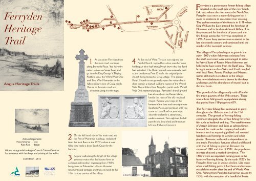
Ferryden Heritage Trail - Angus Council
Ferryden Heritage Trail - Angus Council
Ferryden Heritage Trail - Angus Council

You also want an ePaper? Increase the reach of your titles
YUMPU automatically turns print PDFs into web optimized ePapers that Google loves.
<strong>Ferryden</strong><br />
<strong>Heritage</strong><br />
<strong>Trail</strong><br />
5<br />
10<br />
6<br />
11<br />
7<br />
8<br />
18<br />
9<br />
12<br />
14 15<br />
16<br />
19<br />
17<br />
13<br />
20<br />
4<br />
3<br />
2<br />
1<br />
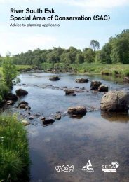
<strong>Ferryden</strong> is a picturesque former fishing village<br />
situated on the south side of the river South<br />
Esk, near where the river meets the North Sea.<br />
<strong>Ferryden</strong> was once a major fishing port but it<br />
owes its existence to an ancient river crossing.<br />
The earliest mention of the ferry is in 1178 when<br />
King William the Lion granted the ferryboat of<br />
Montrose and its lands to Arbroath Abbey. The<br />
ferry operated for hundreds of years until the<br />
first bridge across the river was completed in<br />
1795. A new ferry service was re-started in the<br />
late nineteenth century and continued until the<br />
middle of the twentieth century.<br />
<strong>Angus</strong> <strong>Heritage</strong> <strong>Trail</strong>s<br />
Acknowledgements:<br />
Fiona Scharlau - text<br />
Kate Reid - design<br />
We are very grateful to <strong>Angus</strong> <strong>Council</strong>, Cultural Services<br />
for assistance with the design and printing of this leaflet.<br />
2nd Edition - 2012<br />
<strong>Ferryden</strong> and Craig<br />
Community <strong>Council</strong><br />
2<br />
1<br />
As you enter <strong>Ferryden</strong> from<br />
the main road, continue<br />
along Burnside Place. You have the<br />
option to turn up Craig Road and<br />
go into the King George V Playing<br />
Fields to view the World War One<br />
and Two War Memorials to the<br />
fallen military men of Craig parish.<br />
Return to the main road and<br />
continue along it to the right.<br />
On the left hand side of the main road are<br />
the Port of Montrose buildings, reclaimed<br />
from the Inch Burn in the 1970’s when it was<br />
filled in to make a deep South Quay for the<br />
harbour.<br />
3<br />
As you walk along the length of the village<br />
you may notice that the houses form an<br />
architectural timeline, regressing from 1960’s<br />
bungalows to Edwardian villas to Victorian<br />
tenements and cottages and then onwards to the<br />
18th century portion of the village.<br />
4<br />
At the end of West Terrace, turn right to the<br />
Parish Church, topped by a dove weather vane<br />
holding an olive leaf letting Noah know that the flood<br />
had subsided. The Parish Church was originally built<br />
as the breakaway Free Church, the original parish<br />
church being located at Craig village. The present<br />
Parish Church is not generally open for visitors but it<br />
does contain a triptych with the names of the World<br />
War Two soldiers from <strong>Ferryden</strong> parish and a World<br />
War One memorial plaque. <strong>Ferryden</strong>’s burial ground<br />
has always been on Rossie Island,<br />
beside the ruins of the old medieval<br />
chapel. Retrace your steps to the<br />
bottom of the lane and turn right onto<br />
Southesk Place and continue until you<br />
come to Usan Road on your right,<br />
once the outlet for a stream now<br />
under a culvert. Turn right up the hill<br />
past the old boat shed and then turn<br />
left into Hillview Crescent.<br />
Church St. West Terrace<br />
The village of <strong>Ferryden</strong> began to grow in the<br />
early 1700’s when fishermen colonists from<br />
the north east coast were encouraged to settle<br />
by Patrick Scott of Rossie. Many fishermen are<br />
believed to have come from the Banff area. They<br />
brought names such as West and Coull coupled<br />
with local Perts, Patons, Findlays and Mearns,<br />
names still much in evidence in the village.<br />
The new inhabitants were drawn by the deep<br />
anchorage and the abundance of mussel bait in<br />
the tidal basin.<br />
The growth of the village really took off in the<br />
first three quarters of the 19th century. There<br />
was a three fold growth in population during<br />
that period from 190 people to 679.<br />
The <strong>Ferryden</strong> fishing fleet continued to grow<br />
throughout the 18th and much of the 19th<br />
centuries. The growth of herring fishing<br />
continued alongside that of line fishing for white<br />
fish such as haddock and ling. The establishment<br />
of Joseph Johnston and Sons as salmon fishers<br />
boosted the trade as the company had wider<br />
interests such as exporting pickled cod, smoked<br />
haddocks and herrings to London and other<br />
places. However, with such a dependence on<br />
one trade, <strong>Ferryden</strong>’s fortunes ebbed and flowed<br />
with that of fishing in general. Between the<br />
census of 1881 and that of 1901, the population<br />
increase showed a marked slowdown. The<br />
1880’s were an important turning point in the<br />
history of herring fishing. By the early 1920’s the<br />
<strong>Ferryden</strong> fleet was in serious decline. Like many<br />
other small fishing ports, it had been unable to reestablish<br />
its market after the end of World War<br />
One. Fishing from <strong>Ferryden</strong> had all but ceased by<br />
1930, with the exception of a handful of boats.
5<br />
On this corner,<br />
directly in front<br />
of you, is <strong>Ferryden</strong>’s<br />
former primary school<br />
and its school house,<br />
nestling behind it.<br />
Continue along<br />
Hillview Crescent on<br />
the left hand side and<br />
follow the path to the<br />
stairs and turn right.<br />
These take you onto<br />
Rossie Terrace, leading<br />
up from the car park at<br />
Rossie Square. Rossie<br />
Square is named after<br />
the former estate of<br />
which the village<br />
was part. Turn right<br />
here and proceed<br />
up the hill. You are<br />
on the high road,<br />
Scurdieness Lighthouse<br />
leading ultimately to<br />
Scurdieness lighthouse<br />
and the mouth of the river. From here you can enjoy<br />
superb views over the harbour to the Basin beyond.<br />
6<br />
At a gap in the road on your right, a signpost<br />
indicates the location of the small United Free<br />
Church. Back on Rossie Terrace, continue along the<br />
road as it becomes Beacon Terrace.<br />
7<br />
On the right there is a small fragment of a<br />
building. This is all that remains of the old<br />
Infant School, founded in 1835 by the local laird’s<br />
daughter for village children up to the age of 5. It<br />
was Scotland’s first nursery school and still in use<br />
until the 1960s.<br />
The ferry and <strong>Ferryden</strong> from the Montrose shore c1905<br />
8<br />
On the wall is a plaque of the <strong>Ferryden</strong><br />
Fishwives by Montrose artist William Lamb,<br />
who drew many of his models from the <strong>Ferryden</strong><br />
fishing community. The remnant of the old infant<br />
school has now been topped by a new weather<br />
vane featuring a salmon. Continue along Beacon<br />
Terrace, past the colourful<br />
houses, until you are out<br />
of the village and on the<br />
lighthouse road. This road is<br />
not suitable for cars.<br />
9<br />
A little way along the<br />
path is a picnic table,<br />
affording superb views of the<br />
estuary, out to sea and inland<br />
over the harbour. Seals, birds<br />
and occasionally dolphins<br />
can be seen from here.<br />
10<br />
You can carry on down<br />
this road to Scurdieness<br />
lighthouse, designed by Robert<br />
Stevenson, first lit in 1 March<br />
1870, and then onto the deserted<br />
fishing village of Usan. This walk<br />
would take over an hour and<br />
requires you to wear appropriate<br />
footwear. Alternatively, go as far<br />
as the lighthouse and explore the<br />
rock pools.<br />
11<br />
The gable ends of <strong>Ferryden</strong><br />
Along the way you will<br />
note pill boxes from<br />
World War Two home defence<br />
schemes and the lime washed<br />
pillars that were early navigation<br />
beacons.<br />
12<br />
Continue back towards the village and on<br />
your right, just past some black huts, there is<br />
staircase that descends towards Victoria Square. Use<br />
this to reach River Street, fronting the beach.<br />
13<br />
At the junction<br />
of River Street<br />
and Victoria Square<br />
you will notice some<br />
outbuildings, a few of<br />
the last survivors of<br />
<strong>Ferryden</strong>’s huts, wash<br />
houses and bark boilers.<br />
14<br />
Turn left and<br />
walk along King<br />
Street. The houses here<br />
sit with their gable ends<br />
to the sea. All of their<br />
former inhabitants were<br />
fishermen or connected<br />
to the sea. These houses are believed to be<br />
the original houses of the 18th century north<br />
east fishermen immigrants, and are amongst<br />
the oldest in the village.<br />
15<br />
Just before King Street turns a<br />
corner and becomes William Street,<br />
one house on the left still has the housing for<br />
the village barometer, so vital for predicting<br />
the weather.<br />
16<br />
River Street<br />
William Street itself is an attractive<br />
street, where a number of houses<br />
have retained the outside stairs, which<br />
allowed access to the upper flats. At the end<br />
of William Street is Rossie Square, part of<br />
which was demolished to create a car park.<br />
17<br />
As you reach the junction with Brownlow<br />
Place, you pass a gap between the Post<br />
Office and the row of old sheds.<br />
18<br />
Along Brownlow Place is the Esk Hotel,<br />
<strong>Ferryden</strong>’s oldest surviving drinking<br />
establishment. At one time the village had a problem<br />
with the over consumption of alcohol until the<br />
Reverend Brewster inspired a Temperance fervour<br />
in the villagers.<br />
19<br />
Opposite the Church Hall is the Memorial<br />
Garden and Picture Board, opened in April<br />
2001 and landscaped to provide a pleasant outlook<br />
over the river and harbour.<br />
20<br />
This was the site where the ferryboat<br />
landed. Mill workers used to take the<br />
ferry four times a day as many of them came home<br />
for their dinner. From here you can see the pier,<br />
with the 1795 pier clearly still visible below the<br />
bus shelter. This area was once full of the fishing<br />
vessels. We have come full circle and our tour of this<br />
charming village concludes here.<br />
“Menim” George West and<br />
his wife “Meg Nicoll” baiting<br />
the line. George was coxswain<br />
of the lifeboat at one time.