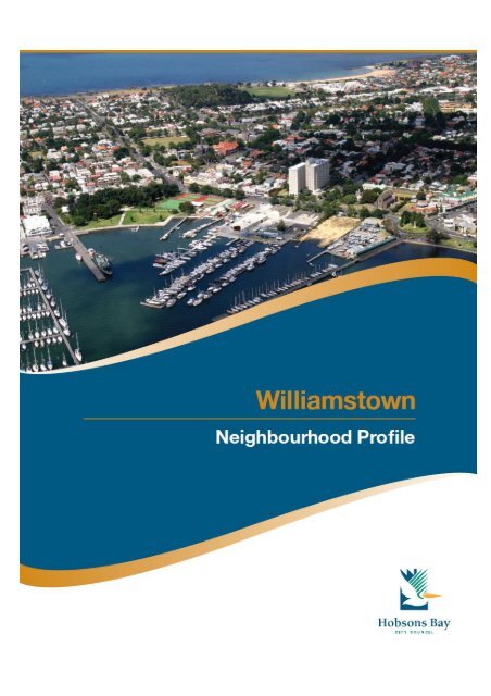
Williamstown Profile - History & Development - Hobsons Bay
Williamstown Profile - History & Development - Hobsons Bay
Williamstown Profile - History & Development - Hobsons Bay

You also want an ePaper? Increase the reach of your titles
YUMPU automatically turns print PDFs into web optimized ePapers that Google loves.
Published by <strong>Hobsons</strong> <strong>Bay</strong> City Council<br />
October 2009
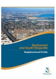
<strong>Williamstown</strong> Neighbourhood<br />
Past, Current and Future <strong>Development</strong><br />
<strong>Williamstown</strong> Neighbourhood <strong>Profile</strong> 5
A. Introduction<br />
The <strong>Williamstown</strong> neighbourhood begins at Yarra Street, to the north, and is bordered by Port<br />
Phillip <strong>Bay</strong> along the southern and eastern boundaries. To the west, the boundary is formed by<br />
the railway line, on the north side of Ferguson Street, which then links to <strong>Bay</strong>view Street via<br />
Kororoit Creek Road. (NB: <strong>Williamstown</strong> neighbourhood, as referred to in this profile, differs<br />
from the suburb of <strong>Williamstown</strong>; it does not include the area commonly called the Rifle<br />
Range.)<br />
The <strong>Williamstown</strong> neighbourhood is predominantly residential and has some small pockets of<br />
light industrial areas. Large parts of the neighbourhood are covered by heritage controls and<br />
the neighbourhood has many examples of significant buildings from the 1800s. Along the<br />
coastline, which is a dominant feature of the <strong>Williamstown</strong> neighbourhood, is a long ribbon of<br />
coast, edged with expanses of open space. Shipping construction and boating activities are<br />
important features and the area’s maritime history remains clearly evident.<br />
The <strong>Williamstown</strong> Botanic Gardens are located just east of the swimming beach, and are one<br />
of the earliest botanic gardens to be established in Victoria. The area has a public hospital,<br />
three primary schools and a senior secondary college. A public library is also located here and<br />
transport options include a train service to central Melbourne and several bus services to<br />
neighbouring suburbs and beyond.<br />
B. <strong>History</strong> & <strong>Development</strong><br />
Aboriginal <strong>History</strong><br />
Before European settlement two large Aboriginal groups had access to the areas surrounding<br />
Port Phillip <strong>Bay</strong>; the Bunerong and the Woiworung. They formed a part of the Kulin nation.<br />
Within these groups were sub-groups or clans, made up of 10-30 families. They were hunters<br />
and gathers; some moved camp according to the availability of food while others settled in one<br />
location if they had access to reliable food sources.<br />
There were two clans who identified with the <strong>Williamstown</strong> and Footscray area. One was<br />
the Yalukit-willam, who lived along a 5 kilometre wide strip at the top of Port Phillip <strong>Bay</strong>,<br />
which included <strong>Williamstown</strong> and Footscray. The Yalukit-willam was part of the Bunerong<br />
tribe. The other was the Marin-balluk who lived in the area between the Kororoit Creek and<br />
the Maribyrnong River and to the north of Sunbury and belonged to the Woiworung. 1<br />
The Yalukit-willam referred to the <strong>Williamstown</strong> area as "koort-boork-boork", meaning "clump of<br />
she-oaks".<br />
The area around Point Gellibrand was a major food gathering site for the Yalukit-willam<br />
as the mangroves located there are important fish and bird breeding grounds. While a<br />
shortage of freshwater meant that the area was unsuitable as a camp, Indigenous<br />
people of Victoria frequently used the area. 2<br />
References to Indigenous occupation are found in records from post European settlement.<br />
In 1856, a <strong>Williamstown</strong> man spoke of corroborees being held around a big tree at the foot<br />
of Thompson Street, and in 1919 a woman aged in her 80s had childhood memories of<br />
corroborees near the Town Hall site. Stone tools, animal bones and shellfish mounds were<br />
recorded at several sites near <strong>Williamstown</strong>; however vandalism has removed any<br />
remaining evidence. 3<br />
<strong>Williamstown</strong> Neighbourhood <strong>Profile</strong> 6
European Settlement<br />
European settlement around <strong>Williamstown</strong> commenced in the 1830s. Point Gellibrand was<br />
the site of the first permanent European settlement in the Port Phillip district. It is listed on<br />
the National Estate as a site of cultural heritage and landscape significance. 4<br />
<strong>Williamstown</strong> was originally named Port Harwood by John Batman in 1835 but soon after<br />
was renamed <strong>Williamstown</strong>, after King William IV who was the reining monarch.<br />
<strong>Williamstown</strong> was proclaimed a town in 1886 and a city in 1919. 5<br />
Initially, <strong>Williamstown</strong> was the major port for Melbourne. The first pier was constructed in<br />
1838 and was used to ferry passengers across to Melbourne. The pier was rebuilt several<br />
times: it later became known as Gem Pier and is still standing. 6 However, it wasn’t until the<br />
1850s that activity around the port began in earnest, as prospectors passed through the<br />
area on their way to the gold fields. By 1856, hotels, shops, residences, banks and<br />
churches had been built. The Naval Dock Yards were also established in the 1850s and<br />
Fort Gellibrand was developed between 1860 and 1890. 7<br />
To meet the demand for ships’ ballast, quarries were opened up along the Maribyrnong<br />
River and the <strong>Williamstown</strong> coastline. The bluestone blocks that were used for the ballast<br />
were later re-used in local buildings and paving. 8<br />
Convict labour was used to build much of the early<br />
infrastructure in <strong>Williamstown</strong>. Prisoners worked on<br />
several projects at Point Gellibrand, including the<br />
battery, the powder magazine, the Tide Gauge<br />
House (now relocated in Commonwealth Reserve)<br />
and a tidal wall at Gellibrand Point. In 1848, the Time<br />
Ball Tower was erected. It was initially used as a<br />
lighthouse (see photo) and then as a timing signal to<br />
passing vessels which enabled them to set their<br />
chronometers (clocks). 9<br />
After the 1850s prisoners worked on land reclamation<br />
and road building around the Alfred Graving Dock<br />
and between Osborne Street and the battery.<br />
Other early industries to be established in<br />
<strong>Williamstown</strong> included woollen mills and<br />
associated industries. One of these was the<br />
Alfred Woollen Mill in Osborne St. The<br />
mill began operating in 1878 and was still in use<br />
in the 1930s, although its ownership had<br />
changed. 10<br />
Photo source:<br />
www.lighthouse.net.au/lights/VIC/<strong>Williamstown</strong>/<strong>Williamstown</strong><br />
%20Lighthouse.htm#<strong>History</strong><br />
<strong>Williamstown</strong> Neighbourhood <strong>Profile</strong> 7
<strong>Williamstown</strong>’s Botanic Gardens were one<br />
of the earliest to be established in Victoria.<br />
The gardens were designed by Edward La<br />
Trobe and some elements of the original<br />
1860 plan are still evident. Changes in the<br />
early part of the twentieth century saw the<br />
addition of an ornamental lake, palm<br />
avenue (see photo) and new gates at the<br />
north-east corner.<br />
Towards the end of the nineteenth century, <strong>Williamstown</strong> was being promoted as a health<br />
resort and the beach area adjacent to the Botanic Gardens was particularly popular. The<br />
<strong>Williamstown</strong> Baths were built in 1888, at the current site of the kiosk, and hot sea baths were<br />
added in 1902 (later destroyed by a storm in 1934). In the early 1900s, the promenade and<br />
bluestone wall were built along the foreshore. The dressing pavilion (now a restaurant), and life<br />
saving clubrooms were added in the 1930s.<br />
Shipbuilding was also at the forefront of activity in <strong>Williamstown</strong>.<br />
In the early 1900s, activity around the port area continued with the Commonwealth<br />
Government commissioning a number of ships to replace those lost during WW I.<br />
Having sold the dockyards to the Melbourne Harbour Trust in the 1920s, the<br />
Commonwealth then bought them back in order to meet the shipbuilding requirements<br />
as a result of WW II. 11<br />
More recent developments<br />
<strong>Williamstown</strong>’s maritime connections are still apparent<br />
today, including the naval dockyards which are<br />
located at the eastern tip of the neighbourhood. Until<br />
1986, the dockyards were under the control of the<br />
Commonwealth government but have since had<br />
several owners and<br />
are now owned by BAE. The dockyards play an<br />
important strategic role as a military shipbuilder and<br />
are one of the city’s largest employers. Apart from the<br />
dockyards, boating activity, particularly around Nelson<br />
Place, is oriented towards recreational boating and<br />
associated industries.<br />
<strong>Williamstown</strong>’s history is evident in its heritage buildings and streetscapes although some of<br />
that history has been lost, as buildings were demolished to make way for new development. In<br />
the 1950s, the historic Langhorne bluestone wool store in Nelson Place was demolished by the<br />
former Housing Commission of Victoria. The Nelson Heights high rise flats were constructed<br />
on the site in the late 1960s to ease the chronic housing shortage in Melbourne. A second<br />
housing block (Floyd Lodge) was also developed in Hanmer Street.<br />
<strong>Williamstown</strong> Neighbourhood <strong>Profile</strong> 8
Until the opening of the West Gate Bridge in 1978, <strong>Williamstown</strong> was relatively undiscovered<br />
except to local residents and those who lived in the west. The construction of the new bridge<br />
meant that <strong>Williamstown</strong> was much more accessible by road, providing a direct link to central<br />
Melbourne. In turn, <strong>Williamstown</strong>’s close proximity to the City, expanses of coastline and<br />
historical buildings made it attractive to new residents and visitors. 12<br />
Today, the <strong>Williamstown</strong> neighbourhood is a popular destination for people visiting its beaches<br />
and cafes. Many houses and buildings have been restored and residents and visitors can take<br />
advantage of the broad range of cultural activities that are on offer.<br />
C. The Current Environment<br />
Land uses<br />
The land use in the <strong>Williamstown</strong> neighbourhood is predominantly residential, with an<br />
extensive coastal strip of open space along the eastern and southern boundaries.<br />
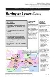
<strong>Williamstown</strong> has two main commercial areas (B1Z on the map below). The larger of the two is<br />
located close to the Ferguson Street and Douglas Parade junction and is the core retail centre<br />
of the <strong>Williamstown</strong> shopping centre. The second runs along Nelson Parade, opposite<br />
Commonwealth Reserve and is a major tourist precinct within the area.<br />
Heading further south along Nelson Parade, there are several areas which are zoned for<br />
industrial uses, although much of this the land is currently unused.<br />
Scattered throughout the neighbourhood are a number of public open space zones (PPRZ).<br />
Most of these are smaller spaces, although as mentioned earlier, there are large tracts of open<br />
space extending along much of the coastal boundary.<br />
There are also a number of areas designated for public use (PUZ) and these are used for<br />
education purposes and the local hospital.<br />
Other land uses are generally confined to port activity (SUZ5 on the map) or are controlled by<br />
the Port of Melbourne Planning Scheme (POMP). The Department of Sustainability and<br />
Environment (DSE) is the Responsible Authority in both instances. There is also a small parcel<br />
of Commonwealth owned land (CA). It falls under the jurisdiction of the Federal Government<br />
and therefore any development or use is outside the planning controls of the <strong>Hobsons</strong> <strong>Bay</strong> City<br />
Council.<br />
<strong>Williamstown</strong> Neighbourhood <strong>Profile</strong> 9
Land use zones<br />
Public Land<br />
Business<br />
PPRZ Public Park Recreation Zone B1Z Business 1 Zone<br />
PUZ2 Public Use Zone Education Industrial<br />
PUZ3 Public Use Zone Health & Community IN1Z Industrial 1 Zone<br />
PUZ4 Public Use Zone Transport IN3Z Industrial 3 Zone<br />
PUZ6 Public Use Zone Local Government Special Purpose<br />
RDZ1 Road Zone Category SUZ5 Special Use Zone 5<br />
Residential<br />
Commonwealth Land<br />
CA Commonwealth land not controlled by<br />
R1Z Residential 1 Zone<br />
the <strong>Hobsons</strong> <strong>Bay</strong> Planning Scheme.<br />
R2Z Residential 2 Zone Port of Melbourne<br />
POMPS Port of Melbourne land not controlled by<br />
the <strong>Hobsons</strong> <strong>Bay</strong> Planning Scheme<br />
<strong>Williamstown</strong> Neighbourhood <strong>Profile</strong> 10
Natural features and parks<br />
<strong>Williamstown</strong>’s major natural feature is its coastline. Just offshore, at the north-east corner of<br />
the neighbourhood, are the lower end of the Spit and the mouth of Greenwich <strong>Bay</strong>.<br />
Moving south, the coastline continues to the Point Gellibrand Coastal Heritage Park at the<br />
eastern tip. Parks Victoria and <strong>Hobsons</strong> <strong>Bay</strong> City Council are working together to develop this<br />
park, which forms part of the Altona Coastal Parklands. Revegetation has begun around<br />
Shelley Beach. The area was once covered by coastal saltbush but until recently was<br />
extremely degraded as a result of previous uses. Local community groups are working with<br />
Parks Victoria to re-establish indigenous plants and grasses.<br />
Shelley Beach is also the location of a ‘lava bubble’ which resulted from volcanic activity in the<br />
area. As lava flowed to the shoreline, gases in the lava built up and created a large bubble<br />
three metres in diameter. 13<br />
Residential development<br />
Residential development in the <strong>Williamstown</strong><br />
neighbourhood is an eclectic mix of housing<br />
types and streetscapes. In most streets,<br />
there are examples of heritage housing and<br />
in some cases, the heritage significance of<br />
the streetscape is predominantly intact. In<br />
other streets, heritage housing sits alongside<br />
more recent development. A blanket heritage<br />
overlay applies to the neighbourhood.<br />
There is also a wide variation in the size of<br />
housing lots, ranging from expansive blocks<br />
with large houses and gardens to smaller lots just wide enough to accommodate a single<br />
fronted cottage. Similarly, the character of the streets is very diverse. In some parts, the streets<br />
are wide with bluestone kerbing and large street trees while in other areas the streets are much<br />
narrower and the housing is set close to the footpath.<br />
Along with increased housing densities<br />
in the residential areas, a number of<br />
commercial and industrial sites have<br />
been converted to apartment living.<br />
The former Nelson Bros. Funeral<br />
Parlour in Douglas Parade (see photo)<br />
is an example of this changed use, with<br />
retail on the street level and apartments<br />
above.<br />
<strong>Williamstown</strong> Neighbourhood <strong>Profile</strong> 11
Community library, centres and halls<br />
The <strong>Williamstown</strong> library is located in Ferguson Street and is open to borrowers from:<br />
Monday to Thursday 10 am - 8 pm<br />
Friday 10 am - 6 pm<br />
Saturday 10 am - 1 pm<br />
Sunday 2 pm - 5 pm.<br />
Preliminary concept plans for the upgrade of the <strong>Williamstown</strong> library have been developed.<br />
(Further information about the redevelopment is provided under ‘What’s Ahead’ at the end of<br />
this section of the profile.)<br />
<strong>Williamstown</strong> has a range of halls and centres, some of which have function spaces available<br />
hire. The <strong>Williamstown</strong> Community and Education Centre is based in Joan Kirner House in<br />
Thompson Street. The building is owned by the State Government and is leased to the<br />
<strong>Hobsons</strong> <strong>Bay</strong> City Council. The centre is managed by a community board of management. The<br />
centre offers a diverse range of educational, cultural and recreational activities and has rooms<br />
for hire to the public. Classes on offer include: adult education and personal development<br />
courses; and art and craft classes for adults and children. A number of community groups are<br />
also based at the centre.<br />
The former offices of the <strong>Hobsons</strong> <strong>Bay</strong> City Council in Ferguson Street include the Town Hall<br />
which has space for 1,100 people, together with the Supper Room, Chamber and meeting<br />
rooms, all of which can be hired.<br />
<strong>Williamstown</strong> Neighbourhood <strong>Profile</strong> 12
Children’s services<br />
There is one maternal and child health centre operating from Monday to Friday in the<br />
<strong>Williamstown</strong> neighbourhood. The service is available to all families within the municipality with<br />
newborn babies through to young children. A wide range of information, advice and support<br />
about children's, women's and family health issues is provided. The service is co-located with<br />
the Robina Scott Kindergarten, opposite the Town Hall precinct in Ferguson Street.<br />
<strong>Williamstown</strong> Neighbourhood <strong>Profile</strong> 13
The Robina Scott Kindergarten offers programs for four year olds and is a Council owned<br />
facility that is operated by a Committee of Management. Willie Kids also runs a 4 year old<br />
kinder program from a childcare centre in Power Street and is privately owned and operated. In<br />
addition, the <strong>Williamstown</strong> Community and Education Centre, in Thompson Street, runs a<br />
kindergarten for three year olds.<br />
There are two child care centres in the neighbourhood. The <strong>Williamstown</strong> Child Care Co-op is<br />
a Council owned and community managed centre which is based in Cecil Street. ABC<br />
Childcare is a privately owned centre located in Power Street. Occasional Care is available at<br />
the <strong>Williamstown</strong> Community and Education Centre in Thompson Street.<br />
<strong>Williamstown</strong> Neighbourhood <strong>Profile</strong> 14
Schools<br />
There are three primary schools in <strong>Williamstown</strong>: two are government schools and one is a<br />
Catholic school. <strong>Williamstown</strong> Primary School and Saint Mary’s Catholic school are on<br />
adjacent sites in Cecil Street. To the north, on Melbourne Road, is <strong>Williamstown</strong> North Primary<br />
School.<br />
In addition, the area has one secondary college, <strong>Williamstown</strong> High School (Pascoe Campus),<br />
which is a senior campus for Years 10-12 students. Students in Years 7-9 attend the <strong>Bay</strong>view<br />
campus, located just outside the <strong>Williamstown</strong> neighbourhood, in the <strong>Williamstown</strong> North<br />
neighbourhood.<br />
<strong>Williamstown</strong> Neighbourhood <strong>Profile</strong> 15
Recreational facilities and open space<br />
The <strong>Williamstown</strong> neighbourhood has a range of open space, varying from a small number of<br />
local parks located throughout the neighbourhood to the ribbon of open space and parkland<br />
that wraps the coastline.<br />
The junction of Yarra Street and The Strand, at the north east corner of the neighbourhood,<br />
marks the commencement of a series of linked reserves. These extend down to Ferguson<br />
Street, where in nearby Commonwealth Reserve there are a number of tennis courts. A shared<br />
trail passes along the coast and extends south, before reaching Point Gellibrand Heritage<br />
Park.<br />
Point Gellibrand is the southern most point in <strong>Williamstown</strong> and is the location of the<br />
<strong>Williamstown</strong> Cricket Ground. The ground is used for both cricket and football. Tennis courts<br />
are also located nearby. (Details of the planned upgrade of facilities at the ground are outlined<br />
in ‘What’s Ahead’ at the end of this section of the profile.)<br />
Past this point, adjacent to The Esplanade, is another band of open space which includes<br />
<strong>Williamstown</strong> Beach. Near The Esplanade are the <strong>Williamstown</strong> Botanic Gardens, mentioned<br />
earlier. Adjacent to the gardens is Fearon Reserve. The reserve has two ovals used for football<br />
and cricket, together with cricket nets and clubrooms. Also located here are a lacrosse field,<br />
clubrooms and a synthetic box lacrosse court.<br />
At nearby Hatt Reserve and also at Robertson Reserve, there are junior cricket grounds with<br />
synthetic wickets.<br />
Dennis Reserve, just off Ferguson Street in Melbourne Road, caters for tennis and bowling.<br />
The Reserve has two synthetic tennis courts and three bowling greens.<br />
There are two croquet lawns and clubrooms in Victoria Street, adjacent to Gray Reserve.<br />
<strong>Williamstown</strong> Neighbourhood <strong>Profile</strong> 16
<strong>Williamstown</strong> Neighbourhood <strong>Profile</strong> 17
Cultural Activities<br />
The <strong>Williamstown</strong> neighbourhood offers a diverse range of cultural activities and events<br />
throughout the year.<br />
• The <strong>Williamstown</strong> Festival, now in its 30 th year, is a community festival that is held in<br />
March.<br />
• The <strong>Williamstown</strong> Literary Festival is a writing event with a special focus on the west.<br />
• The Sounds of Summer is held on a number of weekends and offers free music in<br />
Commonwealth Reserve.<br />
• Shakespeare in the <strong>Williamstown</strong> Botanical Gardens is held across several weekends each<br />
November.<br />
• Tall Ships celebrates <strong>Williamstown</strong>’s maritime heritage and activities are held around<br />
Australia Day. The Enterprize, a replica of the ship that brought the first settlers to<br />
Melbourne in 1835, is permanently based in <strong>Williamstown</strong>.<br />
There are a number of venues available for arts<br />
activities in <strong>Williamstown</strong> including:<br />
• <strong>Williamstown</strong> Town Hall in Ferguson Street<br />
• <strong>Williamstown</strong> Mechanics Institute in Electra<br />
Street (see photo)<br />
• <strong>Williamstown</strong> Little Theatre in Albert Street<br />
• The Commonwealth Reserve Rotunda<br />
Cultural Groups are also active in <strong>Williamstown</strong>,<br />
and some have been operating for several<br />
decades. They include:<br />
• The <strong>Williamstown</strong><br />
- Historical Society<br />
- Film Society<br />
- Musical Theatre Company<br />
• Little Theatre<br />
• Willin Wimmin (women’s community choir)<br />
• Way Out West (music sessions)<br />
Retail Centres<br />
<strong>Williamstown</strong> is one of three major activity centres in <strong>Hobsons</strong> <strong>Bay</strong>. A large retail and<br />
commercial precinct extends along Douglas Parade and Ferguson Street. The centre offers an<br />
extensive mix of services including a major supermarket, five banks, together with a range of<br />
fresh food shops, cafes, home wares, clothing and speciality stores.<br />
Nelson Place, opposite the <strong>Hobsons</strong> <strong>Bay</strong> waterfront, is a smaller precinct which caters for both<br />
locals and visitors to the area. It has a range of cafes, bars, bookstores and specialty shops.<br />
Medical Centres<br />
The <strong>Williamstown</strong> Hospital is Victoria's oldest suburban hospital. It opened in 1894 and is<br />
located in Railway Crescent. The hospital has 86 beds and provides emergency, acute medical<br />
and surgical, aged care and rehabilitation services.<br />
<strong>Williamstown</strong> Neighbourhood <strong>Profile</strong> 18
There are three medical centres operating in the <strong>Williamstown</strong> neighbourhood.<br />
The Clinic <strong>Williamstown</strong><br />
107 Ferguson Street<br />
<strong>Williamstown</strong> Medical Centre<br />
76 Stevedore Street<br />
<strong>Williamstown</strong> General Practitioners Group<br />
Suite 2/81 Ferguson Street<br />
Dentists<br />
There are five dental surgeries located in <strong>Williamstown</strong>.<br />
Dr David Chua,<br />
Dr Leslie Tu<br />
87 Douglas Parade<br />
Dr David W Bladen,<br />
43 Douglas Parade<br />
Dr Shane Vereker<br />
Dr Brendan Parker<br />
Dr Vincent Tran,<br />
35 Douglas Parade<br />
Dr Roland Goldberg,<br />
72 Electra Street<br />
Dr Kar Mun Chan,<br />
Kiddies Dental Care<br />
65 Electra Street<br />
(Saturday only)<br />
Pharmacies<br />
There are three pharmacies in the neighbourhood. All are located in the main retail centre<br />
along Douglas Parade and Ferguson Street.<br />
National Pharmacies<br />
81 Ferguson St<br />
Parade Pharmacy<br />
44 Douglas Pde<br />
<strong>Williamstown</strong> Village Pharmacy<br />
35 Ferguson St<br />
Local newspapers and E-news<br />
The Leader<br />
The Star<br />
The <strong>Williamstown</strong> Advertiser<br />
<strong>Williamstown</strong>Online.net (community e-news)<br />
<strong>Williamstown</strong> Neighbourhood <strong>Profile</strong> 19
Public transport<br />
The <strong>Williamstown</strong> neighbourhood is<br />
serviced by both rail and bus services.<br />
The train line connects to central<br />
Melbourne, with stops at <strong>Williamstown</strong><br />
North, <strong>Williamstown</strong> Beach and<br />
terminating at the <strong>Williamstown</strong> station.<br />
Rail passengers travelling to the City, or<br />
to Werribee and Geelong, change<br />
trains at Newport station.<br />
Three bus routes pass through the<br />
neighbourhood. The 417 bus route to<br />
Laverton departs from the corner of<br />
Ferguson Street and The Strand, and<br />
then runs to Altona before arriving at<br />
Aircraft Station in Railway Avenue.<br />
The 471 bus route links <strong>Williamstown</strong><br />
and Sunshine. The route commences<br />
at the corner of Victoria Street and The<br />
Esplanade, runs via Newport and<br />
Altona North and terminates at the<br />
Sunshine Railway Station.<br />
The 472 bus service operates between <strong>Williamstown</strong> and Moonee Ponds. The route<br />
commences at the corner of Victoria Street and The Esplanade, passes through Footscray and<br />
Ascot Vale and ends at the Moonee Ponds Bus Terminal.<br />
D. What’s ahead for <strong>Williamstown</strong><br />
Library and Town Hall<br />
The <strong>Williamstown</strong> Town Hall is a<br />
landmark building in the heart of<br />
<strong>Williamstown</strong> and renovations will<br />
commence in 2009. Stage 1 will include<br />
the refurbishment and restoration of the<br />
roof structure over the municipal offices<br />
facing Ferguson Street, to be completed<br />
in 2009. Stage 2 will involve the full<br />
restoration of the facade and internal<br />
spaces. Stages 3 and 4 will focus on the<br />
refurbishment and restoration of the<br />
Grand Hall.<br />
The preliminary concept plans for the redevelopment of the <strong>Williamstown</strong> Library have been<br />
prepared. The plans include more space for collections and supporting technology. In addition,<br />
new technologies will be installed to help simplify borrowing and book management processes.<br />
The proposed design also includes a café and improved linkages between the library and the<br />
Town Hall precinct. Timelines for commencement of these works are still to be confirmed.<br />
<strong>Williamstown</strong> Neighbourhood <strong>Profile</strong> 20
Nelson Place beautification and the Heritage Verandah Project<br />
The Nelson Place verandah project<br />
began approximately five to six years<br />
ago. To date, 10 verandahs have<br />
been reinstated, based on the original<br />
designs. Two more verandahs will<br />
commence soon, marking the<br />
halfway point of this project.<br />
Other work that is scheduled for<br />
Nelson Place, between Parker and<br />
Thompson Streets, is the widening of<br />
footpaths to improve the appearance<br />
and pedestrian movement in the<br />
precinct.<br />
The <strong>Williamstown</strong> foreshore<br />
Revegetation work along the foreshore from Point Gellibrand to <strong>Williamstown</strong> Beach is<br />
scheduled for 2009/10. Along with plantings of native vegetation to prevent erosion of the<br />
foreshore, the work will involve a new pathway. Park furniture will be installed along foreshore<br />
areas adjacent to The Strand and The Esplanade and the renewal of several playgrounds<br />
along the Strand is also planned.<br />
Future works will see the repair and replacement of the revetment which runs along the Strand,<br />
extending north to Greenwich <strong>Bay</strong>. The revetment is a bluestone bank that separates the land<br />
from the sea, helps to prevent erosion and provides safe access to and from land.<br />
In the coming 12 months (2008/09), a new public toilet facility will be built by the Council at the<br />
western end of <strong>Williamstown</strong> Beach; Parks Victoria also has plans to build toilets at the Point<br />
Gellibrand Coastal Heritage Park.<br />
<strong>Williamstown</strong> Botanic Gardens<br />
Rejuvenation of the <strong>Williamstown</strong> Botanic<br />
Gardens has commenced (in accordance with<br />
Conservation Management Plan Guidelines)<br />
and includes: the completed restoration of the<br />
historic cast-iron gates at the main entrance<br />
and the marble statue; design and planting<br />
beneath the Palm Walk; the commissioning of<br />
new gates at two entrances in Osborne and<br />
Giffard Streets; and the ongoing rejuvenation of<br />
garden beds.<br />
The celebrations for the Garden’s 150th<br />
birthday began in 2006 and will run until 2010. Design for Giffard Street Gates<br />
The celebrations are held in November and<br />
mark the gazetting of land for the Botanic Garden and the four years of design and laying out<br />
that occurred prior to the official opening on 2nd January 1860.<br />
<strong>Williamstown</strong> Neighbourhood <strong>Profile</strong> 21
Sporting Facilities<br />
Work is planned to redevelop the <strong>Williamstown</strong> Cricket Ground pavilion. <strong>Hobsons</strong> <strong>Bay</strong> City<br />
Council, together with the State Government and the Australian Football League, will provide<br />
funding to improve facilities for both spectators and players. A new function space will be<br />
available for the public to hire.<br />
A program to upgrade tennis court surfaces and install court lighting in <strong>Williamstown</strong> is<br />
progressing.<br />
Transport and traffic<br />
Works are planned at the intersection of The Esplanade and Victoria Street, near Gloucester<br />
Reserve. These will include an upgrade of the car park and changes to the intersection. In<br />
addition, measures will be undertaken to improve the safety of pedestrians and cyclists using<br />
the <strong>Hobsons</strong> <strong>Bay</strong> Coastal Trail, particularly at the interface with motor vehicles.<br />
Work has commenced on the <strong>Williamstown</strong> Activity Centre Parking Strategy and Key Initiatives<br />
Report. The final report will guide changes to parking in <strong>Williamstown</strong>.<br />
<strong>Williamstown</strong> Neighbourhood <strong>Profile</strong> 22
References<br />
1 <strong>Hobsons</strong> <strong>Bay</strong> City Council website,<br />
http://libraries.hobsonsbay.vic.gov.au/Page/page.asp?Page_Id=246&h=0#BM364<br />
2 Parks Victoria website, http://www.parkweb.vic.gov.au/resources05/05_1068.pdf<br />
3<br />
<strong>Hobsons</strong> <strong>Bay</strong> City Council website,<br />
http://www.hobsonsbay.vic.gov.au/libraries/Page/page.asp?Page_Id=246&h=0#BM371<br />
4<br />
Point Gellibrand Coastal Heritage Park Master Plan, revised 2003, <strong>Hobsons</strong> <strong>Bay</strong> City Council<br />
& Parks Victoria.<br />
5 <strong>Hobsons</strong> <strong>Bay</strong> Planning Scheme 21.07-1<br />
http://www.psdocs.dpcd.vic.gov.au/public/<strong>Hobsons</strong>%20<strong>Bay</strong>/21_mss07_hbay.doc<br />
6<br />
Meredith Gould Architects P/L, 1998, <strong>Williamstown</strong> Workshop and Slipways: Former Port of<br />
Melbourne Authority Site, heritage review, Parks Victoria.<br />
7<br />
http://www.hobsonsbay.vic.gov.au/page/page.asp?page_id=197#BM348<br />
8 Vines G, 1993, Work in the West, No 1, Melbourne’s Living Museum of the West<br />
Incorporated, Maribyrnong Vic<br />
9 <strong>Hobsons</strong> <strong>Bay</strong> Planning Scheme, op. cit.<br />
10<br />
Vines G, op. cit<br />
11 Meredith Gould Architects P/L, op. cit.<br />
12 <strong>Hobsons</strong> <strong>Bay</strong> Heritage Study: Thematic Environmental <strong>History</strong> (2003)<br />
www.hobsons.vic.gov.au/Files/Volume_1b_Thematic_Environmental_<strong>History</strong>.pdf<br />
13<br />
Parks Victoria http://www.parkweb.vic.gov.au/resources05/05_1068.pdf<br />
<strong>Williamstown</strong> Neighbourhood <strong>Profile</strong> 23