
Create successful ePaper yourself
Turn your PDF publications into a flip-book with our unique Google optimized e-Paper software.
I came to Wertz’s covered bridge at the Berks County<br />
Heritage Center, which tells the story of transportation’s<br />
key role in Berks County’s history, specifically<br />
wagon manufacturing and the canal system. It’s an<br />
interpretive complex featuring the Gruber Wagon<br />
Works and C. Howard Heister Canal Center. The area<br />
consists of an old farmstead dotted with several buildings,<br />
and it also includes Melcher’s Grist Mill.<br />
During construction of the lake, the Army Corps of<br />
Engineers preserved the Gruber Wagon Works. Built<br />
in 1882, it produced hundreds of wagons before it<br />
closed in the 1950s. The massive building was located<br />
at Mt. Pleasant within the project’s flood pool boundary<br />
and had to be either removed or demolished.<br />
They separated it into four sections and moved it to<br />
a new site five miles away to serve as the focal point<br />
of the Heritage Center. They give tours of the Gruber<br />
Wagon Works and C. Howard Heister Canal Center<br />
May through October. The Country Store and Snack<br />
Bar occupied an old barn with an old barge nearby.<br />
Next, I came upon Gring’s Mill Recreation Area,<br />
which features an old concrete bridge with a dam<br />
on one side and sluiceways, originally built to funnel<br />
water to power the mill. Stone buildings stood on the<br />
other side of the creek on a hill at a bend. I stopped<br />
for lunch on a bench at the Veterans Outreach<br />
Center, another park nearby, and watched as flocks of<br />
Canada geese and mallards made a ruckus.<br />
The trail stretches about five miles, making for an easy<br />
ten-mile out-and-back trip. An interstate-looking highway<br />
appeared near the end, and planes buzzed overhead as<br />
they came into Reading airport nearby, both signs indicating<br />
history had given way to modern civilization.<br />
With the easy part under my belt, I next took a transitional<br />
step to the grueling lake trail by trying Skinners<br />
Loops on the south side of the lake. It consists of a<br />
10-mile figure-eight arrangement with two loops, one<br />
extending out a long peninsula and the other partially<br />
along the main trail. Starting at the end of Lake<br />
Road, I wheeled along the trail as it followed a knoll<br />
overlooking the lake and made its way down to the<br />
water. It consists of some doubletrack but mostly singletrack,<br />
all smooth dirt with roots and rocks thrown<br />
in to test your front suspension.<br />
Rolling hills with occasional short steep sections were<br />
the rule. Some sections of trail went through corn<br />
fields, affording views of surrounding ridges, hills, and<br />
the lake, while sections near the lake knifed through<br />
woods. It made for a nice introduction to the lake<br />
trail and gave me a peek at the daunting journey that<br />
lay ahead the next day.<br />
Because the lake area has no lodging accommodations,<br />
I drove into Reading that night in search of a<br />
hotel room and found one at a Comfort Inn at the<br />
intersection of Fifth Street and Route 12. A Ramada<br />
and EconoLodge stood nearby, and franchise hotels<br />
can be found along Route 12 in the northwest quadrant<br />
of Reading. Closer to the lake, along Route 183,<br />
hotels await near the airport, including Airport Lodge<br />
& Suites and Holiday Inn Express, and several restaurants<br />
are located between there and the lake.<br />
After a good night’s rest and the complimentary<br />
breakfast at the Comfort Inn, I was fortified for a trip<br />
around the lake on the trail. I parked at the visitor’s<br />
center, which has information on the lake, including<br />
maps and brochures, along with an overlook in the<br />
back and bathrooms. While this is most convenient,<br />
the trail can be accessed via numerous other trailheads,<br />
as it is well marked with brown posts with white<br />
directional arrows and mile indicators. Several other<br />
bikers prepared for the journey as I did.<br />
From the visitor’s center around the southern side of<br />
the lake to the bridge in Bernville measures 18 miles,<br />
and from there around the northern side back to the<br />
visitors center 12 miles. I planned to ride clockwise<br />
around the lake so I could conquer the steep parts first.<br />
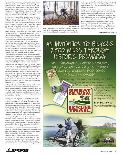
Blue Marsh Lake<br />
With a few new cohorts, I pedaled through the stilling<br />
basin at the base of the dam. Some parts of the trail<br />
were dirt road through corn and winter wheat fields,<br />
while other sections followed old asphalt roads going<br />
to the lake. Many people were hiking, biking, or walking<br />
their dogs, and a few equestrians maneuvered<br />
their horses on the trail.<br />
Along the south side, the trail earns its reputation<br />
among serious stumpjumpers with its many ups and<br />
downs and unforgiving steep sections. More than<br />
one cyclist jumped off their bike and walked up here.<br />
Many switchbacks add to the challenge, and the trail<br />
often turns sharply as you head up or down a hill.<br />
Several wooden bridges, sans rails and only about<br />
three feet wide, cross small creeks flowing into the<br />
lake, and some throw a sharp turn or hill just before<br />
them, so you have to steer accurately. With its many<br />
obstacles, dips, bridges, turns, and other pop-quiz<br />
YIN continued on p.10<br />
<strong>September</strong> <strong>2008</strong><br />
9