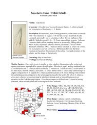
Discovery Report - Ohio Department of Natural Resources
Discovery Report - Ohio Department of Natural Resources
Discovery Report - Ohio Department of Natural Resources

You also want an ePaper? Increase the reach of your titles
YUMPU automatically turns print PDFs into web optimized ePapers that Google loves.
i. Data that can be used for Flood Risk Products<br />
Topographic and Imagery Data<br />
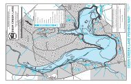
As shown on the Final <strong>Discovery</strong> Map, LiDAR elevation data and digital<br />
orthophotography is available for the project area provided by the <strong>Ohio</strong> Geographically<br />
Referenced Information Program (OGRIP), as part <strong>of</strong> the <strong>Ohio</strong> Statewide Imagery<br />
Program (OSIP). The goal <strong>of</strong> OSIP I was to develop and maintain a seamless statewide<br />
base map. OSIP is an initiative partnered by several State Agencies (i.e. ODOT, ODNR)<br />
through OGRIP. Data from this project forms the foundation <strong>of</strong> the statewide base map,<br />
and was developed primarily to support multi-use applications, including homeland<br />
security, emergency management, economic development, and the business <strong>of</strong><br />
government. The digital orthophotography consists <strong>of</strong> MrSID Images produced at 1-foot<br />
pixel resolution at a 30:1 compression ratio. The LiDAR elevation data consists <strong>of</strong> Digital<br />
Elevation Model (DEM) raster tiles acquired to meet +/- 1-foot vertical accuracy. This is<br />
suitable for rectification <strong>of</strong> digital orthophotography and for the creation <strong>of</strong> 2- and 5-foot<br />
contours (with the addition <strong>of</strong> 3D compiled breaklines). OSIP products within the<br />
Cuyahoga Watershed were collected during leaf-<strong>of</strong>f conditions between 2006 and 2008. In<br />
February 2011, <strong>Ohio</strong> initiated a continuation <strong>of</strong> the OSIP program. OSIP II imagery will<br />
be acquired beginning in spring 2011 and continuing through 2014. For OSIP II county<br />
specific acquisition information as <strong>of</strong> May 9, 2011, see Appendix H.<br />
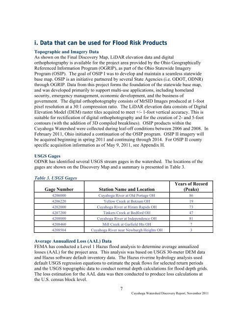
USGS Gages<br />
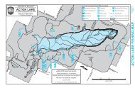
ODNR has identified several USGS stream gages in the watershed. The locations <strong>of</strong> the<br />
gages are shown on the <strong>Discovery</strong> Map and a summary is presented in Table 3.<br />
Table 3. USGS Gages<br />
Gage Number<br />
Station Name and Location<br />
Years <strong>of</strong> Record<br />
(Peaks)<br />
4206000 Cuyahoga River at Old Portage OH 86<br />
4206220 Yellow Creek at Botzum OH 19<br />
4202000 Cuyahoga River at Hiram Rapids OH 73<br />
4207200 Tinkers Creek at Bedford OH 47<br />
4208000 Cuyahoga River at Independence OH 81<br />
4208460 Mill Creek at Garfield Hts OH 7<br />
4208504 Cuyahoga River near Newburgh Heights OH 3<br />
Average Annualized Loss (AAL) Data<br />
FEMA has conducted a Level 1 Hazus flood analysis to determine average annualized<br />
losses (AAL) for the project area. This analysis was based on USGS 30-meter DEM data<br />
and Hazus s<strong>of</strong>tware default inventory data. The Hazus riverine hydrology analysis used<br />
default USGS regression equations to estimate the peak flows for selected return periods<br />
and the USGS topographic data to conduct normal depth calculations for flood depth grids.<br />
The loss estimation for the AAL data was then conducted to produce loss calculations at<br />
the U.S. census block level.<br />
7<br />
Cuyahoga Watershed <strong>Discovery</strong> <strong>Report</strong>, November 2011