Discovery Report - Ohio Department of Natural Resources
Discovery Report - Ohio Department of Natural Resources
Discovery Report - Ohio Department of Natural Resources

Create successful ePaper yourself
Turn your PDF publications into a flip-book with our unique Google optimized e-Paper software.
online resources, Federal and State sources, and interviews with cooperating communities.<br />
The collected data was used to evaluate both previous and current flooding concerns, while<br />
determining the vital areas requiring mapping needs. Section IV, Data Analysis, provides<br />
a more in-depth look at the collected data.<br />
The third phase was to hold watershed-wide <strong>Discovery</strong> Meetings and facilitate discussion<br />
and data analysis <strong>of</strong> study needs, mitigation project needs, desired compliance support, and<br />
local flood risk awareness efforts. Two (2) watershed-wide <strong>Discovery</strong> Meetings were held<br />
on July 5, 2011 in Cleveland Heights and Hudson, <strong>Ohio</strong>. The discussion was stimulated<br />
using the <strong>Discovery</strong> Geodatabase display <strong>of</strong> relevant data. Attendees, including all affected<br />
communities and selected other stakeholders, cooperatively identified possible solutions<br />
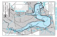
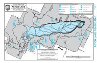
for the Areas <strong>of</strong> Concern shown on the <strong>Discovery</strong> Meeting Map. Solutions included<br />
recommendations <strong>of</strong> floodplain studies, mitigation projects, compliance issues, and ideas<br />
on how to improve the local flood risk communication programs.<br />
Copies <strong>of</strong> the <strong>Discovery</strong> Meeting Presentations, sign in sheets, handouts, meeting notes<br />
and meeting feedback forms are presented in Appendices, C, D, E and F, respectively.<br />
The fourth phase <strong>of</strong> the <strong>Discovery</strong> effort involved an analysis <strong>of</strong> the data and information<br />
collected and discussed at the meeting, and recommendations as to the future relationship<br />
and activities between FEMA and the watershed communities. The Final <strong>Discovery</strong> Map,<br />
presented in Appendix G, indicates desired study areas and mitigation project locations,<br />
and the <strong>Discovery</strong> <strong>Report</strong> documents the results <strong>of</strong> data collection and conversation. If a<br />
Risk MAP project is to be initiated in this watershed, <strong>Discovery</strong> will be concluded with the<br />
finalization <strong>of</strong> a project scope and signed Project Charters, which indicate that all affected<br />
stakeholders agree to the terms <strong>of</strong> a funded project, including communication and data<br />
responsibilities.<br />
III.<br />
Data Analysis<br />
<strong>Discovery</strong> data collection entailed a massive collection <strong>of</strong> tabular and spatial data for all<br />
stakeholder communities from Federal, State and Local sources. A list <strong>of</strong> the data<br />
collected, the deliverable or product in which the data are included, and the source <strong>of</strong> the<br />
data is presented in Table 2. In addition, Data Analysis is divided between two sections:<br />
one section listing the data that can be used for Risk MAP products (regulatory and<br />
non-regulatory) and, one section listing the other data and information that helped the<br />
Project Team to form a more holistic understanding <strong>of</strong> this watershed.<br />
5<br />
Cuyahoga Watershed <strong>Discovery</strong> <strong>Report</strong>, November 2011