Discovery Report - Ohio Department of Natural Resources
Discovery Report - Ohio Department of Natural Resources
Discovery Report - Ohio Department of Natural Resources

You also want an ePaper? Increase the reach of your titles
YUMPU automatically turns print PDFs into web optimized ePapers that Google loves.
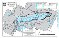
The AAL data is symbolized on the <strong>Discovery</strong> Map as varying levels <strong>of</strong> risk. During the<br />
<strong>Discovery</strong> meeting, the Level 1 analysis results will be validated by stakeholders to<br />
identify potential sites for Refined Analyses.<br />
ii. Other Data and Information<br />
Mitigation Plans/Status<br />
Hazard Mitigation Plans (HMPs) are prepared to assist communities to reduce their risk to<br />
natural hazard events. The plans are used to develop strategies for risk reduction and to<br />
serve as a guide for all mitigation activities in the given county or community. The<br />
available HMPs obtained and reviewed for this <strong>Discovery</strong> Project are presented in Table 4.<br />
Table 4. Hazard Mitigation Plan Status<br />
County/Community<br />
Hazus<br />
Hazard<br />
Mitigation<br />
Plan<br />
Issue<br />
Date<br />
Expiration<br />
Date<br />
Cuyahoga County N Y 1/21/2007 1/21/2012<br />
Geauga County N Y* 12/22/2005 12/22/2010<br />
Medina County N Y* 8/25/2006 8/25/2011<br />
Portage County N Y 8/6/2007 8/6/2012<br />
Stark County N Y* 6/23/2006 6/23/2011<br />
Summit County N Y 4/9/2007 4/9/2012<br />
*Hazard Mitigation plan is expired.<br />
Critical facilities are the facilities that can impact the delivery <strong>of</strong> vital services, cause<br />
greater damages to other sectors <strong>of</strong> a community, or put special populations at risk. The<br />
assessment <strong>of</strong> the flood risk posed to critical facilities within the watershed is an important<br />
aspect <strong>of</strong> the HMPs. Critical facilities that are located within the 1-percent-annual-chance<br />
floodplain were quantified and identified as at-risk structures. The exact number <strong>of</strong> critical<br />
facilities that are considered at-risk is not quantifiable due to the limited detail presented in<br />
the HMPs. The number <strong>of</strong> critical facilities estimated to be within the 1-percent-annualchance<br />
floodplain was determined by overlaying Hazard Maps included in the HMP’s with<br />
the latest flood hazard data. However, the risk <strong>of</strong> flood damage is limited by the detail and<br />
accuracy <strong>of</strong> the most recent flood map.<br />
A repetitive loss structure is a term associated with the National Flood Insurance Program<br />
(NFIP). For Flood Mitigation Assistance (FMA) program purposes, a repetitive loss<br />
structure is one that is covered by a flood insurance contract under the NFIP, that has<br />
suffered flood damage on two or more occasions over a 10-year period, ending on the date<br />
when a second claim is made, in which the cost to repair the flood damage, on average,<br />
equals or exceeds 25% <strong>of</strong> the market-value <strong>of</strong> the structure at the time <strong>of</strong> each flood loss<br />
event. In terms <strong>of</strong> the Community Rating System (CRS) <strong>of</strong> the NFIP, a repetitive loss<br />
property is any property, which the NFIP has paid two or more flood claims <strong>of</strong> $1,000 or<br />
more, in any given 10-year period since 1978. A repetitive loss structure is important to the<br />
NFIP, since structures that flood frequently put a strain on the flood insurance fund. It<br />
8<br />
Cuyahoga Watershed <strong>Discovery</strong> <strong>Report</strong>, November 2011