California's Central Coast Marine Protected Areas - California Sea ...
California's Central Coast Marine Protected Areas - California Sea ...
California's Central Coast Marine Protected Areas - California Sea ...

You also want an ePaper? Increase the reach of your titles
YUMPU automatically turns print PDFs into web optimized ePapers that Google loves.
Socioeconomic Baseline Data Collection,<br />
Resource-Use Mapping & Rapid Social Assessment<br />
R/MPA-5 June 2007-May 2008<br />
John S. Petterson, Impact Assessment, Inc.<br />
Edward W. Glazier, Impact Assessment, Inc.<br />
Summary<br />
In this project, anthropologists compiled a socioeconomic baseline for<br />
evaluating the effects of the central coast marine protected areas (MPAs)<br />
on the fishing industry and non-consumptive users, including divers,<br />
kayakers and surfers, among others. Although a wide range of information<br />
was collected, the project focused on documenting how fishermen have<br />
used coastal resources in the past and how they are currently using them.<br />
The data have been used to create a series of GIS maps showing the spatial<br />
distribution of fishing effort for various fisheries over time. This “human<br />
use” baseline will help managers assess the effects of MPAs on the fishing<br />
industry, while meeting the state’s conservation goals.<br />
Objectives<br />
The specific objectives of the project were to:<br />
1. characterize motives and adaptive strategies of “persistent” fishermen;<br />
2. document long-term trends in how fishermen and others have used<br />
coastal resources and how they used them immediately prior to and<br />
following the creation of the MPAs;<br />
3. distinguish pre-MPA trends in fishing from those correlated with<br />
MPA designation (due to factors such as rising fuel costs and existing<br />
Rockfish Conservation <strong>Areas</strong>).<br />
“You cannot manage fish. We<br />
manage users. In our view, a<br />
human-use baseline is vital for<br />
all initial and future management<br />
purposes.”<br />
John S. Petterson, Impact Assessment, Inc.<br />
Methods<br />
The first step of the project was to amass data, drawing from a variety of<br />
sources, including landings and license data from the <strong>California</strong> Department of Fish and Game, demographic data from the<br />
Census Bureau, and vessel data from the <strong>California</strong> Department of Motor Vehicles. Researchers used this information to groundtruth,<br />
guide and complement the core of the project: conducting several hundred ethnographic-style interviews to document<br />
stakeholders’ responses to and perceptions about the MPAs. The scientists employed “social networking methods” and “rapid<br />
social assessments” to compile a short list of<br />
those most knowledgeable of their respective<br />
fields, as identified by their peers. Researchers<br />
then interviewed this cadre of experts, often<br />
multiple times. In the end, 146 representatives<br />
of the commercial fishing industry were interviewed,<br />
68 in the recreational sector and 72 in<br />
the public/non-governmental sector. As mentioned,<br />
the focus was on documenting historical and<br />
current-use patterns on the water.<br />
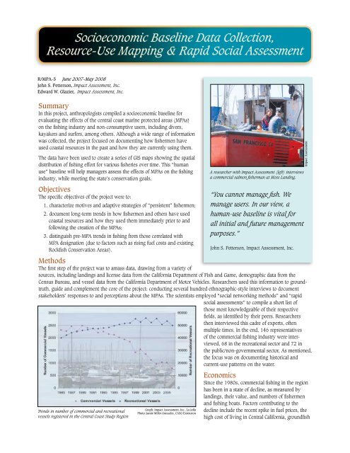
Trends in number of commercial and recreational<br />
vessels registered in the <strong>Central</strong> <strong>Coast</strong> Study Region<br />
Graph: Impact Assessment, Inc., La Jolla<br />
Photo: Jamie Miller Gonzalez, CASG Extension<br />
A researcher with Impact Assessment (left) interviews<br />
a commercial salmon fisherman at Moss Landing.<br />
Economics<br />
Since the 1980s, commercial fishing in the region<br />
has been in a state of decline, as measured by<br />
landings, their value, and numbers of fishermen<br />
and fishing boats. Factors contributing to the<br />
decline include the recent spike in fuel prices, the<br />
high cost of living in <strong>Central</strong> <strong>California</strong>, groundfish<br />
Impact Assessment