California's Central Coast Marine Protected Areas - California Sea ...
California's Central Coast Marine Protected Areas - California Sea ...
California's Central Coast Marine Protected Areas - California Sea ...

You also want an ePaper? Increase the reach of your titles
YUMPU automatically turns print PDFs into web optimized ePapers that Google loves.
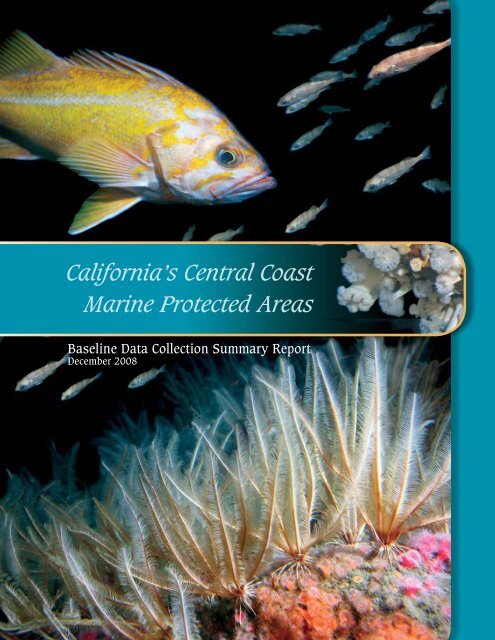
<strong>California</strong>’s <strong>Central</strong> <strong>Coast</strong><br />
<strong>Marine</strong> <strong>Protected</strong> <strong>Areas</strong><br />
Baseline Data Collection Summary Report<br />
December 2008
!(<br />
!(<br />
!(<br />
!(<br />
!<br />
!(<br />
!(<br />
!(<br />
!(<br />
!(<br />
!(<br />
!(<br />
!(<br />
!(<br />
!(<br />
Pigeon Point<br />
Año Nuevo<br />
SMCA<br />
Greyhound Rock<br />
SMCA<br />
Natural Bridges<br />
SMR<br />
Soquel Canyon<br />
SMCA<br />
Portuguese Ledge<br />
SMCA<br />
Carmel<br />
Pinnacles<br />
SMR<br />
Asilomar<br />
SMR<br />
Pt. Lobos<br />
SMCA<br />
SANTA CRUZ<br />
COUNTY<br />
Santa Cruz<br />
!<br />
Monterey<br />
Pt. Lobos<br />
SMR<br />
SANTA CLARA<br />
COUNTY<br />
Elkhorn Slough<br />
SMCA<br />
Carmel Bay<br />
SMCA<br />
Elkhorn Slough<br />
SMR<br />
Moro Cojo<br />
Slough<br />
SMR<br />
Lovers Point<br />
SMR<br />
Pacific Grove<br />
<strong>Marine</strong> Gardens<br />
SMCA<br />
!<br />
SAN BENITO<br />
COUNTY<br />
Edward F. Ricketts<br />
SMCA<br />
Soledad<br />
<strong>Central</strong> <strong>California</strong> <strong>Marine</strong> <strong>Protected</strong> <strong>Areas</strong><br />
As Adopted by the Fish and Game Commission,<br />
April 13, 2007<br />
<strong>Marine</strong> Life Protection Act Initiative<br />
<strong>Central</strong> <strong>Coast</strong> Study Region<br />
SMCA<br />
SMP<br />
SMR<br />
SMRMA<br />
°<br />
0 15 30<br />
Miles<br />
Point Sur<br />
Point Sur<br />
SMCA<br />
Big Creek<br />
SMCA<br />
Lopez Point<br />
Point Sur<br />
SMR<br />
MONTEREY<br />
COUNTY<br />
Big Creek<br />
SMR<br />
King City<br />
!<br />
Piedras Blancas<br />
SMCA<br />
Point Piedras<br />
Blancas<br />
Cambria<br />
SMCA<br />
Piedras Blancas<br />
SMR<br />
Point Estero<br />
Morro Bay<br />
SMRMA<br />
Point<br />
Buchon<br />
Point Buchon<br />
SMCA<br />
Paso Robles<br />
White Rock<br />
(Cambria)<br />
SMCA<br />
!<br />
Morro Bay<br />
! Morro Bay<br />
SMR<br />
San Luis Obispo<br />
!<br />
!<br />
SAN LUIS OBISPO<br />
COUNTY<br />
Point Buchon<br />
SMR<br />
Pismo Beach<br />
<strong>Central</strong> <strong>Coast</strong><br />
Study Region<br />
Point Sal<br />
Purisima Point<br />
Vandenberg<br />
SMR<br />
!<br />
Guadalupe<br />
!<br />
Lompoc<br />
SANTA BARBARA<br />
COUNTY<br />
Point Arguello<br />
Point Conception<br />
4/19/2007<br />
SMCA = state marine conservation area SMP = state marine park<br />
SMR = state marine reserve SMRMA = state marine recreational management area
<strong>Central</strong> <strong>Coast</strong> <strong>Marine</strong> <strong>Protected</strong> <strong>Areas</strong><br />
Baseline Data Collection Projects<br />
This report summarizes the 2007-08 <strong>Central</strong> <strong>Coast</strong> <strong>Marine</strong> <strong>Protected</strong> <strong>Areas</strong> Baseline Data Collection Projects,<br />
which were a collaborative effort between <strong>California</strong>’s State <strong>Coast</strong>al Conservancy, Ocean Protection<br />
Council, <strong>California</strong> Department of Fish and Game (CDFG), and the <strong>California</strong> <strong>Sea</strong> Grant College Program.<br />
The central coast marine protected areas (MPAs) were designated April 13, 2007 by the <strong>California</strong> Fish and<br />
Game Commission under the state’s <strong>Marine</strong> Life Protection Act (MLPA) of 1999 and took effect Sept. 21, 2007.<br />
This new network effectively launched <strong>California</strong>’s MLPA Program, which was designed to better conserve<br />
marine resources for their long-term sustainable use while enhancing outdoor recreation and ocean research<br />
opportunities along the coast.<br />
The <strong>Central</strong> <strong>Coast</strong> Study Region (CCSR) was the first of five statewide study regions to complete the MLPA<br />
planning and implementation process and extends from Pigeon Point in San Mateo County, southward to Point<br />
Conception in Santa Barbara County (see map).<br />
As mandated by the MLPA, the CCSR process (2004-2007) examined all existing MPAs within the CCSR and<br />
created a suite of new MPAs along the central coast that will be part of a statewide network of MPAs once<br />
MLPA implementation is completed. The series of 29 marine protected areas represent approximately 204<br />
square miles (or approximately 18%) of state waters in the study region.<br />
The central coast MPAs include:<br />
· 15 State <strong>Marine</strong> Conservation <strong>Areas</strong> (SMCA), which limit recreational and commercial fishing.<br />
· 13 “no-take” State <strong>Marine</strong> Reserves (SMR); a total of 85-square miles and;<br />
· 1 State <strong>Marine</strong> Recreational Managed Area (SMRMA), Morro Bay State <strong>Marine</strong> Recreational<br />
Management Area, where recreational fishing is limited or restricted.<br />
The five baseline characterization studies administered by <strong>California</strong> <strong>Sea</strong> Grant were conducted from June<br />
2007-May 2008. The data collected will provide a baseline against which to measure future changes in living<br />
marine resource abundance and diversity. The data will be maintained in a database to be created by the<br />
MPA Monitoring Enterprise. These five projects are summarized in the following pages:<br />
R/MPA-1 Surveys of Shallow-Water Rocky Reef Communities<br />
Mark Carr, UCSC, 831.459.3958, carr@biology.ucsc.edu<br />
R/MPA-2 Baseline Data Collection for Rocky Intertidal <strong>Marine</strong> <strong>Protected</strong> <strong>Areas</strong> in the <strong>Central</strong> <strong>Coast</strong><br />
Peter T. Raimondi, UCSC, 831.459.5674, raimondi@biology.ucsc.edu<br />
R/MPA-3 Baseline Surveys of Deep-Water Demersal Communities in and near <strong>Central</strong> <strong>Coast</strong> MPAs<br />
Richard M. Starr, CSGEP/MLML, 831.771.4442, starr@mlml.calstate.edu<br />
Mary M. Yoklavich, NOAA/SWFSC, 831.420.3940, mary.yoklavich@noaa.gov<br />
R/MPA-4 Collaborative Surveys of Nearshore Fishes in and Around <strong>Central</strong> <strong>Coast</strong> MPAs<br />
Dean E. Wendt, CPSLO, 805.756.2988, dwendt@calpoly.edu<br />
Richard M. Starr, CSGEP/MLML, 831.771.4442, starr@mlml.calstate.edu<br />
R/MPA-5 Socioeconomic Baseline Data Collection, Resource-Use Mapping and Rapid<br />
Social Assessment<br />
John S. Petterson, IA, 858.459.0142, iaia.san.rr.com<br />
Edward W. Glazier, IA, 858.459.0142, iaia.san.rr.com<br />
Front cover photos: Widow rockfish, Tom Laidig; Canary rockfish, Rick Starr; Feather stars and strawberry anemones, Brian Tissot; metridium, Tom Laidig<br />
Back cover photo: Crinoid, Brian Tissot
Surveys of Shallow-Water<br />
Rocky Reef Communities<br />
R/MPA-1 June 2007-May 2008<br />
Mark Carr, UC Santa Cruz<br />
Summary<br />
In this project, scientists quantified fish, benthic invertebrate and<br />
macro algal assemblages in kelp forests of the central coast marine<br />
protected areas (MPAs) and associated reference sites. The survey<br />
design and sampling protocols were modeled after the large-scale,<br />
long-term monitoring program developed by the Partnership for<br />
Interdisciplinary Studies of <strong>Coast</strong>al Oceans (PISCO) and incorporated<br />
into the Cooperative Research and Assessment of Nearshore<br />
Ecosystems (CRANE) program. As in the CRANE program, the project<br />
used divers to count fishes, invertebrates and algae. The baseline<br />
data collected during this project will make it possible to monitor the<br />
effects of the MPAs on kelp forest ecosystems, including commercially<br />
and recreationally harvested species.<br />
“No one has ever mobilized such a massive survey to characterize<br />
kelp forest ecosystems throughout <strong>Central</strong> <strong>California</strong>,” says the<br />
project’s leader Mark Carr, a professor in the Department of Ecology<br />
and Evolutionary Biology at UC Santa Cruz. “The sheer amount of<br />
detailed data collected for this project is what is truly impressive.”<br />
Sites Surveyed<br />
Divers surveyed kelp forest habitat between depths of 5 meters (m)<br />
and 20 m at 14 MPAs, including Asilomar State <strong>Marine</strong> Reserve (SMR);<br />
Big Creek SMR; Cambria State <strong>Marine</strong> Conservation Area (SMCA);<br />
Carmel Bay SMCA; Carmel Pinnacles SMR; Edward F. Ricketts SMCA;<br />
Lovers Point SMR; Natural Bridges SMR; Pacific Grove <strong>Marine</strong> Gardens<br />
SMCA; Point Sur SMR; Point Lobos SMR; Point Buchon SMR and White<br />
Rock SMCA. As with the other monitoring projects, a reference site for<br />
each MPA was also surveyed.<br />
Close-up of a giant kelp<br />
blade and snail<br />
“No one has ever mobilized such<br />
a massive survey to characterize<br />
kelp forest ecosystems throughout<br />
<strong>Central</strong> <strong>California</strong>. The sheer<br />
amount of detailed data collected<br />
for this project is what is truly<br />
impressive.”<br />
Steve Lonhart, NOAA SIMoN<br />
Mark Carr, Department of Ecology and<br />
Evolutionary Biology at UC Santa Cruz<br />
PISCO divers return to the R/V FULMAR after a<br />
survey at Plaskett Rock.<br />
Steve Lonhart, NOAA SIMoN<br />
Method<br />
Each MPA and its reference site were surveyed once<br />
between June and October 2007.<br />
For each survey, divers swam multiple 30-meter-long<br />
transects at multiple depths, identified all conspicuous<br />
fishes and noted their sizes (in training workshops they<br />
were taught how to do this). They also sampled the<br />
species composition and percent bottom cover of macro<br />
invertebrates and macro algae along multiple transects.<br />
Rock type and vertical relief was also recorded at select<br />
sites. Water temperatures were measured throughout the<br />
study, too.<br />
It is worth noting that these are the same methods being<br />
used in MPAs in the Santa Barbara Channel.
PISCO divers at a kelp bed at Weston Cove in<br />
the Point Lobos State <strong>Marine</strong> Reserve<br />
Steve Lonhart, NOAA SIMoN<br />
pristine ecosystem that we are only now starting to<br />
explore in depth.”<br />
2. Kelp canopy cover cannot be used reliably to infer<br />
bottom habitat, community structure or otherwise<br />
characterize a site. “We have seen too many cases<br />
where kelp cover is not a good surrogate,” Lonhart<br />
says. “You might see a thick kelp bed at the surface<br />
but the site has relatively few fishes, low invertebrate<br />
cover and few algal species. Similarly, a site with little<br />
kelp cover could have an incredibly rich invertebrate<br />
community and lots of fish.”<br />
Conclusions<br />
This project has led to the collection of a huge amount of<br />
statistically rigorous data on kelp forest fishes, algae and<br />
invertebrates. The data establish the beginnings of a<br />
monitoring program for detecting the effects of the central<br />
coast MPAs on kelp forest ecology. Because of this project,<br />
scientists can now compare kelp forests at the start of the<br />
MPA process. The data may also prove useful in tracking<br />
and modeling ecosystem-level responses to fishing and<br />
climate change.<br />
For detailed information about the survey method visit:<br />
http://www.piscoweb.org/research/community/subtidal/<br />
protocols.<br />
Data Overview<br />
A total of 29 trained divers spent more than 1,200 hours<br />
surveying about 7,520 acres of shallow kelp forest habitat.<br />
They counted (and sized) about 39,000 fish, representing<br />
56 taxa; 71,000 macro invertebrates, representing 41 taxa<br />
and 67,000 canopy-forming kelps, representing nine taxa.<br />
Cooperating Organizations<br />
NOAA’s Monterey Bay National <strong>Marine</strong> Sanctuary<br />
Partnership for Interdisciplinary Studies of <strong>Coast</strong>al<br />
Oceans (PISCO)<br />
Institute for <strong>Marine</strong> Sciences at UC Santa Cruz<br />
Kenneth S. Norris Rancho Marino Reserve of the UC<br />
Natural Reserve System<br />
From the raw data, scientists will be able to compute<br />
site-specific estimates of fish densities, species richness,<br />
relative fish abundances and fish size distributions, as well<br />
as relative densities and percent bottom cover of macro<br />
invertebrates and algae.<br />
Key Observations<br />
1. Kelp forest communities in <strong>Central</strong> <strong>California</strong> are not<br />
uniform, says Steve Lonhart, a biologist and diver at<br />
the Monterey Bay National <strong>Marine</strong> Sanctuary, who<br />
participated in the project. Geology explains some of<br />
the differences. In kelp forests growing on large vertical<br />
pinnacles, rich invertebrate communities dominate the<br />
bottom. In contrast, sandy channels mixed with carsized<br />
boulders and low outcrops create numerous<br />
microhabitats. These prevent dominance by either<br />
invertebrates or macro algae.<br />
Big Sur, for example, provides habitat for several rarely<br />
seen species in Monterey Bay. “Diving along the Big<br />
Sur coast is an entirely different experience,” Lonhart<br />
says. “There is a greater sense of adventure, in part<br />
because of the logistics of diving in such a remote location,<br />
but also because Big Sur represents a relatively<br />
A china rockfish (Sebastes nebulosus) emerges<br />
from a crevice.<br />
Contact:<br />
Mark H. Carr<br />
UC Santa Cruz<br />
Long <strong>Marine</strong> Laboratory<br />
831.459.3958<br />
carr@biology.ucsc.edu<br />
Steve Lonhart, NOAA SIMoN
Baseline Data Collection for<br />
Rocky Intertidal MPAs in the <strong>Central</strong> <strong>Coast</strong><br />
R/MPA-2 June 2007-May 2008<br />
Peter Raimondi, UC Santa Cruz<br />
Summary<br />
In this project, scientists surveyed rocky intertidal areas (tide pools)<br />
within the central coast marine protected areas (MPAs) and associated<br />
reference sites.<br />
They coordinated their sampling with the two largest rocky intertidal<br />
monitoring programs in the state—Partnership for Interdisciplinary<br />
Studies of <strong>Coast</strong>al Oceans (PISCO) and Multi-Agency Rocky Intertidal<br />
Network (MARINe). The main goal was to document community<br />
structure of target assemblages (e.g., mussels, barnacles and surfgrass),<br />
as well as to quantify abundances and sizes of key species<br />
(e.g., abalone, owl limpets and seastars). They also recorded<br />
biodiversity hotspots and species-habitat associations. With this<br />
baseline data, scientists may be able to detect changes in intertidal<br />
areas associated with the MPAs.<br />
“There is a great need to capture the diversity of sites and to map<br />
it in 3D,” says the project’s leader, professor Peter Ramondi of the<br />
Department of Ecology and Evolutionary Biology at UC Santa Cruz.<br />
“The intertidal is where most people interact with the shoreline,” he<br />
says. “These areas are very sensitive to trampling, collecting, development<br />
and agricultural and urban runoff.”<br />
Mila Zinkova, Wikipedia<br />
Tide pool in Santa Cruz<br />
“The intertidal is where most<br />
people interact with the shoreline.<br />
It is very sensitive to trampling,<br />
collecting, development and<br />
agricultural and urban runoff.”<br />
Pete Raimondi, Department of Ecology and<br />
Evolutionary Biology at UC Santa Cruz<br />
Scientists carefully avoided stepping on fragile organisms as<br />
they counted species.<br />
UC Santa Cruz<br />
Sites Surveyed<br />
Scientists surveyed all 12 of the MPAs with rocky intertidal<br />
ledges and benches, as well as associated reference<br />
sites. Their study did not include cobble and boulder<br />
beaches.<br />
Method<br />
As mentioned in the summary, scientists employed two<br />
standardized field methods for documenting intertidal<br />
ecology: MARINe techniques for describing community<br />
structure and PISCO ones for characterizing biodiversity.<br />
All fieldwork was conducted shore-side, on foot, during<br />
low tide. Scientists either laid out grids with meter<br />
tape or used survey equipment to mark off measured<br />
rectangles within which all species and their sizes were<br />
counted.
Site 1: Simple topography<br />
Species richness = 77<br />
Turf Weed<br />
<strong>Sea</strong>grass<br />
Coralline Algae<br />
Irridescent <strong>Sea</strong>weed<br />
Mussels<br />
Tide Pool<br />
Offshore<br />
Site 2: Complex topography<br />
Species richness = 97<br />
not being harvested,”<br />
he says.<br />
Mussels are important to<br />
intertidal ecology because<br />
so many other species<br />
live within and on top of<br />
them, while owl limpets<br />
are crucial because<br />
they maintain territories,<br />
thereby preventing other<br />
species from dominating<br />
all areas. Raimondi calls<br />
both “foundation<br />
species.”<br />
Ecological Zones<br />
In terms of conceptualizing the ecology of the rocky intertidal,<br />
Raimondi divides the <strong>Central</strong> <strong>Coast</strong> Study Region into<br />
three distinct zones: one from Point Conception to Cayucos,<br />
another from Cayucos to Monterey, and the last from Santa<br />
Cruz to Pigeon Point.<br />
Point Conception to Cayucos<br />
The conspicuous absence of black abalone, historically the<br />
region’s most abundant herbivore, defines the southernmost<br />
zone, Raimondi says. “Black abalone have crashed<br />
and are verging on extinction in their southern range,”<br />
he says, largely because of the abalone wasting disease<br />
known as withering syndrome.<br />
The loss of abalone has had profound consequences for<br />
community structure and diversity. “For the most part, in<br />
places without black abalone, there is an overgrowth of<br />
sessile invertebrates (sponges and tunicates), barnacles<br />
and algae,” he says.<br />
Cayucos to Monterey<br />
While the absence of black abalone defines the southern<br />
zone, the reappearance of these mollusks defines<br />
the middle one, as Cayucos marks the northern limit of<br />
the withering syndrome epidemics that wiped out black<br />
abalone populations to the south.“We see large populations<br />
of black abalone beginning at about Cayucos,” Raimondi<br />
says. “The problem is you have a lot of poaching.”<br />
Big Sur’s igneous and metamorphic geology, and its inaccessibility,<br />
also distinguish this region.<br />
“We see more owl limpets, mussels and black abalone, and<br />
they are much bigger (older) in Big Sur because they are<br />
Inshore<br />
Scientists created 3-D models of the topography and species diversity that will be useful<br />
in monitoring changes over time.<br />
Pete Raimondi, UC Santa Cruz<br />
Santa Cruz to<br />
Pigeon Point<br />
To a large extent, sand and<br />
its scouring action over<br />
rocky habitat shape the<br />
biogeography of this zone.<br />
Sand covers much of the<br />
coastline from Monterey<br />
to Santa Cruz, Raimondi<br />
explains. In northern Santa Cruz, the geology changes and<br />
sedimentary rocks dominate. Visitors see this manifested in<br />
the region’s many pocket beaches and partially sand-covered<br />
rocky ledges.<br />
“This is a very dynamic zone because of the seasonal sand<br />
scour and build up,” Raimondi says. Summer swells can<br />
pile up 3 meters of sand onto beaches in a couple days. One<br />
winter swell can take it all away.Only some species (notably<br />
algae) can tolerate this level of sand scour and disturbance.<br />
“The region is its own little biologically distinct community,”<br />
Raimondi says.<br />
Conclusions<br />
In this project, scientists identified outstanding characteristics<br />
and differences among the sites surveyed, located<br />
hotspots of biodiversity, and showed that MPAs protect<br />
parts of all these important areas. They also identified three<br />
biogeographical zones within the central coast that they<br />
expect will respond uniquely to the MPAs. Much of the Big<br />
Sur coast, for example, has been a de facto reserve and<br />
so may not change much in the future. In other areas, the<br />
creation of the MPAs might actually lead to more human<br />
visitors to the coast. This may exacerbate ecological degradation<br />
from trampling, litter and poaching and create a need<br />
for more monitoring and public education about the fragile<br />
nature of many coastal resources..<br />
Contact:<br />
Pete Raimondi<br />
UC Santa Cruz<br />
831.459.5674<br />
raimondi@biology.ucsc.edu
Baseline Surveys of Deep-Water Demersal<br />
Communities in and near <strong>Central</strong> <strong>Coast</strong> MPAs<br />
R/MPA-3 June 2007-May 2008<br />
Richard M. Starr, <strong>California</strong> <strong>Sea</strong> Grant Extension Program<br />
Mary M. Yoklavich, NOAA’s Southwest Fisheries Science Center<br />
Summary<br />
In this project, scientists surveyed the fishes and macro invertebrates<br />
of deep, rocky banks and outcrops, underwater pinnacles, submarine<br />
canyons, cobble fields and mud flats of eight of the new central coast<br />
marine protected areas (MPAs) and their associated reference sites.<br />
Because these surprisingly colorful demersal habitats are beyond the<br />
reach of divers and ROVs, scientists conducted their baseline study<br />
from the submersible Delta.<br />
All observed fish were identified and measured (using paired lasers).<br />
Scientists also videotaped each dive and later analyzed the images to<br />
characterize all structure-forming invertebrates and benthic habitats.<br />
A full-color, 21-page report summarizes the habitats, fishes and<br />
invertebrates seen in each survey area (see www.csgc.ucsd.edu/<br />
BOOKSTORE/comp_publications.html). Its bar graphs, pie charts and<br />
tables meaningfully distill for readers the huge wealth of data in an<br />
easily digestible format. This page summarizes some of what was<br />
seen during the dives.<br />
Survey Sites<br />
The eight MPAs surveyed were Soquel Canyon State <strong>Marine</strong> Conservation<br />
Area (SMCA); Portuguese Ledge SMCA; Point Lobos State <strong>Marine</strong><br />
Reserve (SMR) and SMCA; Point Sur SMR and SMCA, and Big Creek<br />
SMCA and SMR. For each of these sites, researchers also surveyed an<br />
appropriate reference site.<br />
Method<br />
Scientists directed the Delta’s pilot to follow standard protocols for<br />
submersible surveys vetted in peer-reviewed literature. The basic idea<br />
was to divide each dive into a series of 10-minute-long transects in a<br />
pre-determined habitat, selected from multi-beam sonar benthic maps and<br />
15 years of submersible data. High-relief rocky habitat was surveyed in<br />
“As ecosystem-based manage-<br />
ment becomes more important,<br />
we will need to know more about<br />
species that are not fished. Using<br />
the submersible, we are able to<br />
identify species you cannot see<br />
any other way.”<br />
Rick Starr, <strong>California</strong> <strong>Sea</strong> Grant Extension<br />
Program<br />
three depth ranges: 30 meters (m) to 100 m; 100 m to 200 m, and 200 m to 300 m. Low-relief, soft-bottomed habitat, about<br />
which relatively little is known, was also described. Fish densities and relative fish abundances were calculated for each of the<br />
three depth ranges. Pie charts in the final report also depict relative abundances of common benthic macro invertebrates.<br />
Cowcod<br />
Rick Starr<br />
Delta off the coast of Point Sur<br />
Rick Starr<br />
Data Overview<br />
In 2007, Delta completed 337 transects, covering about 164,000 square m<br />
of seafloor habitat. On these, scientists observed about 66,000 fishes from<br />
110 taxa, as well as 158,000 aggregating and 14,000 structure-forming<br />
invertebrates from 70 taxa. Biological hotspots of deep-water corals and<br />
fragile structure-forming invertebrates were also located.<br />
Soquel Canyon SMCA<br />
The MPA protects complex submarine canyon habitat and an amazing<br />
diversity of fish life. In addition, several species of management concern,<br />
including bocaccio, cowcod and yelloweye rockfish, were observed in
elatively high numbers. Scientists also noted the presence<br />
of the deep-sea coral Lophelia here. “We are just learning<br />
about deep sea corals,” says the project’s leader Rick Starr, a<br />
<strong>California</strong> <strong>Sea</strong> Grant marine advisor based at Moss Landing<br />
<strong>Marine</strong> Laboratories. “Most are really old, more than a<br />
hundred years old. A lot have been affected by trawling.<br />
We should know more about them. In the world of the<br />
ocean, corals are important.”<br />
Portuguese Ledge SMCA<br />
Scientists observed a high diversity of fish species (68<br />
taxa) but a comparatively low density of commercially<br />
fished species. “There is something about this area that<br />
makes it very productive,” Starr says. “It has been fished<br />
for over 100 years. But there are still a lot of fish here.”<br />
Flag rockfish<br />
Rick Starr<br />
Point Lobos SMR and SMCA<br />
What is most impressive about this area is the incredible<br />
variety of invertebrates. Scientists identified, for example,<br />
10 seastar species. “We don’t really know why there are<br />
so many invertebrates,” Starr says. “But the geology and<br />
geography of the area is pretty unique. There is a lot of<br />
granite rock and you are next to the Carmel submarine<br />
canyon. The high relief and high energy probably helps.”<br />
The shallows have also been protected from exploitation<br />
since 1973.<br />
In the Conservation Area, scientists noted the predominance<br />
of dwarf rockfishes, which are less than 10-inches<br />
long and are not commercially harvested.<br />
“The prevailing hypothesis is that the bigger fish have been<br />
fished out,” Starr says. “The fish that would normally eat<br />
the little guys are gone.” Hence, the abundance of dwarf<br />
rockfishes not just at Point Lobos but at other survey sites.<br />
Point Sur SMR and SMCA<br />
Point Sur itself is a high-energy center of intense upwelling<br />
in the lea of a headland. Nearshore habitats are characterized<br />
by lots of rocky ridges and high-relief rock-sand and<br />
rock-cobble reefs. A persistent upwelling plume courses<br />
through deeper habitats. In the marine reserve, the area’s<br />
high-energy, high-relief habitat creates a haven for invertebrates,<br />
including bat seastars (41 percent), red gorgonian<br />
corals and hydrocorals (30 percent) and nipple sponges<br />
(26 percent). In the Conservation Area, fish density was<br />
high (about 65 fish per 100 square m) and about half of the<br />
observed fish were young-of-the-year rockfishes. At depths<br />
between 100 m and 200 m, pygmy, greenspotted and rosethorn<br />
rockfishes and poachers were abundant.<br />
Big Creek SMR and SMCA<br />
The marine reserve expands protection of the existing, small<br />
Big Creek Ecological Reserve established in 1990 at the<br />
southern end of Big Sur. Its shallow habitats include sandy<br />
beach, rocky intertidal, surfgrass, kelp beds, pinnacles, rock<br />
outcrops and soft sediments. Low-relief sand and mud<br />
comprised about half of the habitat. Scientists observed<br />
70 fish taxa in the marine reserve, reflecting the area’s<br />
impressive diversity of habitats. Blue rockfish (12.7 fish<br />
per 100 square m), blackeye gobies and young-of-the-year<br />
rockfishes were particularly abundant at depths less than<br />
100 m. In the Conservation Area, scientists observed 31 fish<br />
taxa, including a particularly rich abundance of flatfishes<br />
than at the other sites, reflecting the expanses of softbottom<br />
habitat in this survey area.<br />
Conclusion<br />
More than 75 percent of the state’s central coast seafloor<br />
habitat lies at depths greater than 30 m. The data collected<br />
during this project contribute substantially to depicting a<br />
snapshot of marine life in what are among the region’s most<br />
prevalent marine habitats.<br />
“As ecosystem-based management becomes more important,<br />
we will need to know more about species that are not<br />
fished,” Starr says. “Using the submersible, we are able to<br />
identify species you cannot see any other way.”<br />
Cooperating Organizations<br />
NOAA Fisheries Southwest Fisheries Science Center<br />
<strong>California</strong> Department of Fish and Game<br />
Moss Landing <strong>Marine</strong> Laboratories<br />
Washington State University at Vancouver<br />
Contact:<br />
Rick Starr<br />
<strong>California</strong> <strong>Sea</strong> Grant <strong>Marine</strong> Advisor<br />
Moss Landing <strong>Marine</strong> Laboratories<br />
831.771.4442<br />
starr@mlml.calstate.edu<br />
Fish-eating seastars on catshark eggs<br />
Rick Starr
Collaborative Surveys of Nearshore Fishes<br />
in and Around <strong>Central</strong> <strong>Coast</strong> MPAs<br />
R/MPA-4 June 2007-May 2008<br />
Dean E. Wendt, Cal Poly San Luis Obispo<br />
Richard M. Starr, <strong>California</strong> <strong>Sea</strong> Grant Extension Program<br />
Summary<br />
In this project, researchers and the local fishing community jointly<br />
developed statistically rigorous protocols for using volunteer anglers<br />
to collect fisheries management data. The test-bed for this citizen<br />
science/collaborative fisheries project was to collect baseline data for<br />
three of the new central coast marine protected areas (MPAs) and<br />
their associated reference sites. The project hinged on the volunteer<br />
participation of 174 experienced recreational anglers who caught<br />
and released fish in the survey sites for set periods of time and with<br />
standardized gear.<br />
With this high level of community support, scientists were able to<br />
identify, measure, tag and release almost 8,000 fish in a three-month<br />
period. From a scientific perspective, the species caught, their sizes<br />
and relative abundances provide an immediate snapshot of the<br />
region’s bottom fishes in 2007. This snapshot or baseline can be<br />
used to track future ecological changes associated with the MPAs.<br />
The huge number of tagged fish now swimming in the region also<br />
have the potential to add substantially to what is known about<br />
local fish populations, growth rates and home range sizes of key<br />
species. Such information would be a boon to federal and state stock<br />
assessments. From a public relations and educational standpoint,<br />
the researchers leading the project strongly believe that stakeholder<br />
collaboration in the MPA monitoring project enhanced local support<br />
for the state’s bold conservation plan. The value of this, they say,<br />
cannot be over-stressed.<br />
Researcher Noëlle Yochum of<br />
Moss Landing holds a seastar.<br />
“One of the unique aspects of<br />
this project is that fishermen were<br />
encouraged to contribute to the<br />
science. We used fishermen’s<br />
expertise to improve our sampling<br />
strategy.”<br />
Dean Wendt, Cali Poly San Luis Obispo<br />
Tom Mattusch<br />
A tagged black and yellow rockfish<br />
Noëlle Yochum<br />
Sites Surveyed<br />
Año Nuevo, Point Lobos and Point Buchon marine reserves and<br />
corresponding reference sites were surveyed.<br />
Method<br />
Five chartered party boats took anglers fishing at randomly selected<br />
areas within the survey sites. Fishing techniques were standardized<br />
throughout to enable scientific analysis of the angler data: All anglers,<br />
for example, fished with the same kinds of hooks. Baits, jigs and lures<br />
were also standardized. Although consistency was paramount in the<br />
data collection phase of the project, the fishing community provided<br />
valuable insight in designing and selecting the gear used. To reduce<br />
pressure-induced injuries in caught fishes, fishing was limited to waters<br />
shallower than 40 meters.<br />
Each commercial passenger fishing vessel (known colloquially as a party boat) carried between nine and 15 anglers, four or<br />
five scientists, two deck hands and the captain. Anglers caught fish; scientists measured, identified, tagged and released them.<br />
With the exception of Año Nuevo, each of the six sites was sampled two days a month for three months: August, September<br />
and October 2007. The precise fishing areas within the survey site were selected at random. The boat captain, however, could<br />
position the vessel within the sampling cell so as to maximize fishing opportunity. Anglers were directed to fish for 45 minutes<br />
in the cell. Four cells were fished during a day at sea.
Maturity<br />
Most of the fish caught were immature based on lengths at<br />
50 percent maturity.<br />
A recreation vessel chartered for the study<br />
Noëlle Yochum<br />
“One of the unique aspects of this project is that fishermen<br />
were encouraged to contribute to the science,” says marine<br />
biology professor Dean Wendt of Cal Poly San Luis Obispo.<br />
“We used fishermen’s expertise to improve our sampling<br />
strategy.”<br />
“We tried to blend scientists’ expertise in designing rigorous<br />
experimental designs with fishermen’s expertise and<br />
intimate knowledge of the sea,” Starr said. “We want to<br />
be statistically rigorous but not ignorant of the information<br />
that is out there from fishermen.”<br />
Data Overview<br />
During the 34 completed fishing trips, anglers caught about<br />
7,928 fishes, representing 27 species. Scientists were able<br />
to tag and release most of these. About 2 percent of fish<br />
died during capture.<br />
Common Species<br />
Across all six survey sites, the three most common species<br />
were: blue rockfish (38 percent of the total); gopher rockfish<br />
(27 percent); and black rockfish (11 percent).<br />
The most common species at Point Buchon was the gopher<br />
rockfish, at Año Nuevo, the black rockfish and at Point<br />
Lobos, blue rockfish. This reflects habitat differences at<br />
those locations.<br />
Catch Rates<br />
Across all sites, the highest catch rates (more than double<br />
any other site) occurred within the old portion of the Point<br />
Lobos marine reserve in which fishing has been prohibited<br />
since 1973.<br />
Fish Size<br />
In general, fish sizes fell within historic lengths documented<br />
by the 1987-98 Department of Fish and Game<br />
observer study. Some differences, however, are worth<br />
noting.<br />
In all three reserves, olive rockfishes were smaller than the<br />
lower end of their historic length range. In both Año Nuevo<br />
and Point Buchon, copper rockfish were on the small size<br />
of the historic range; vermilion rockfish were small in Año<br />
Nuevo, too. It should be noted that in the old part of the<br />
Point Lobos reserve, fishes were on average longer than<br />
those in the new part of the reserve and the reference site.<br />
Conclusions<br />
This project has been valuable in validating the utility of<br />
hook-and-line surveys to detect meaningful differences in<br />
catch rates, fish sizes and relative fish abundances at different<br />
sites. If the sampling design developed for this project<br />
is repeated over time, scientists say that they will be able<br />
to quantify the effects of the MPAs on fish populations and<br />
sizes, and hence on sexual maturity and spawning biomass.<br />
The hook-and-line data would be particularly useful in<br />
gaining information on cryptic species such as the gopher<br />
rockfish, which are easily missed by diver-based, visual<br />
surveys.<br />
Since the completion of this project, researchers have developed<br />
a similar collaborative fishing project with nearshore<br />
commercial trap fishermen. “We’ve designed these studies<br />
so that they can be transported easily to Southern and<br />
Northern <strong>California</strong>,” Wendt says. “We envision using collaborative<br />
fishing data not only for MPA monitoring but also<br />
for state and federal stock assessments.”<br />
Vermilion rockfish caught, tagged and released by a<br />
volunteer angler<br />
Participating Fishing Vessels<br />
Fiesta, Morro Bay<br />
Caroline, Monterey Bay<br />
Huli Cat, Half Moon Bay<br />
Patriot, Avila Beach<br />
Pacific Horizon, Avila Beach<br />
Cooperating Organizations<br />
Cal Poly San Luis Obispo<br />
<strong>California</strong> <strong>Sea</strong> Grant Extension Program<br />
Moss Landing <strong>Marine</strong> Laboratories<br />
<strong>California</strong> Department of Fish and Game<br />
San Luis Obispo Science and Ecosystem Alliance (SLOSEA)<br />
Contact:<br />
Dean Wendt<br />
Cal Poly San Luis Obispo<br />
805.756.2988<br />
dwendt@calpoly.edu<br />
Noëlle Yochum
Socioeconomic Baseline Data Collection,<br />
Resource-Use Mapping & Rapid Social Assessment<br />
R/MPA-5 June 2007-May 2008<br />
John S. Petterson, Impact Assessment, Inc.<br />
Edward W. Glazier, Impact Assessment, Inc.<br />
Summary<br />
In this project, anthropologists compiled a socioeconomic baseline for<br />
evaluating the effects of the central coast marine protected areas (MPAs)<br />
on the fishing industry and non-consumptive users, including divers,<br />
kayakers and surfers, among others. Although a wide range of information<br />
was collected, the project focused on documenting how fishermen have<br />
used coastal resources in the past and how they are currently using them.<br />
The data have been used to create a series of GIS maps showing the spatial<br />
distribution of fishing effort for various fisheries over time. This “human<br />
use” baseline will help managers assess the effects of MPAs on the fishing<br />
industry, while meeting the state’s conservation goals.<br />
Objectives<br />
The specific objectives of the project were to:<br />
1. characterize motives and adaptive strategies of “persistent” fishermen;<br />
2. document long-term trends in how fishermen and others have used<br />
coastal resources and how they used them immediately prior to and<br />
following the creation of the MPAs;<br />
3. distinguish pre-MPA trends in fishing from those correlated with<br />
MPA designation (due to factors such as rising fuel costs and existing<br />
Rockfish Conservation <strong>Areas</strong>).<br />
“You cannot manage fish. We<br />
manage users. In our view, a<br />
human-use baseline is vital for<br />
all initial and future management<br />
purposes.”<br />
John S. Petterson, Impact Assessment, Inc.<br />
Methods<br />
The first step of the project was to amass data, drawing from a variety of<br />
sources, including landings and license data from the <strong>California</strong> Department of Fish and Game, demographic data from the<br />
Census Bureau, and vessel data from the <strong>California</strong> Department of Motor Vehicles. Researchers used this information to groundtruth,<br />
guide and complement the core of the project: conducting several hundred ethnographic-style interviews to document<br />
stakeholders’ responses to and perceptions about the MPAs. The scientists employed “social networking methods” and “rapid<br />
social assessments” to compile a short list of<br />
those most knowledgeable of their respective<br />
fields, as identified by their peers. Researchers<br />
then interviewed this cadre of experts, often<br />
multiple times. In the end, 146 representatives<br />
of the commercial fishing industry were interviewed,<br />
68 in the recreational sector and 72 in<br />
the public/non-governmental sector. As mentioned,<br />
the focus was on documenting historical and<br />
current-use patterns on the water.<br />
Trends in number of commercial and recreational<br />
vessels registered in the <strong>Central</strong> <strong>Coast</strong> Study Region<br />
Graph: Impact Assessment, Inc., La Jolla<br />
Photo: Jamie Miller Gonzalez, CASG Extension<br />
A researcher with Impact Assessment (left) interviews<br />
a commercial salmon fisherman at Moss Landing.<br />
Economics<br />
Since the 1980s, commercial fishing in the region<br />
has been in a state of decline, as measured by<br />
landings, their value, and numbers of fishermen<br />
and fishing boats. Factors contributing to the<br />
decline include the recent spike in fuel prices, the<br />
high cost of living in <strong>Central</strong> <strong>California</strong>, groundfish<br />
Impact Assessment
collapses and the ensuing<br />
Rockfish Conservation <strong>Areas</strong>,<br />
loss of fishing-related infrastructure,<br />
salmon collapses and low<br />
squid landings.<br />
In contrast, coastal tourism has<br />
become hugely important to<br />
local economies in the last two<br />
decades, generating more than<br />
$175 million in sales tax revenues<br />
and employing more than<br />
66,060 in San Mateo, Santa Cruz,<br />
Monterey and San Luis Obispo<br />
counties in 2005, alone.<br />
Because kayaking, surfing,<br />
sightseeing, boating, diving and<br />
underwater photography are<br />
all activities that attract tourist<br />
dollars to the coast, the MPAs<br />
will likely enhance these activities<br />
and benefit the future economy<br />
of the <strong>Central</strong> <strong>Coast</strong> Study Region<br />
(CCSR).<br />
Commercial Fishing<br />
According to fishermen, the main<br />
short-term impact of the MPAs<br />
is that they have fewer places to<br />
fish. Besides fishing in different<br />
areas, fishermen are also pursuing<br />
new fisheries and participating<br />
in experimental fishing permits,<br />
Petterson says. Ongoing monitoring<br />
is needed to assess the<br />
long-term impacts of the MPAs<br />
on fishing activities.<br />
Rockfish<br />
Commercial Landings<br />
Reported to Block<br />
2004-2007<br />
2007<br />
2006<br />
Unit 1000 Lbs<br />
2004<br />
2005<br />
Source: Calif Dept of Fish & Game<br />
Numbers rounded to 1000<br />
Note: During these four years ~52%<br />
of rockfish commercially landed in<br />
<strong>California</strong> were reported to block<br />
Non-Consumptive Uses & Rec Fishing<br />
Glazier says that many non-consumptive users are<br />
unaware of the regulatory changes in the area, largely<br />
because non-extractive activities are not affected by the<br />
MPA designations, with some minor exceptions. However,<br />
others are aware of the MPAs and are positive about their<br />
creation. For example, divers and other non-consumptive<br />
users have reported favorably on the removal of spear<br />
fishers and hook-and-line anglers from their recreation<br />
areas, due to concerns about being speared or hooked.<br />
Dive shops and charter boat operators also believe their<br />
businesses will likely benefit from MPAs, says Ed Glazier,<br />
an environmental anthropologist with Impact Assessment<br />
and co-leader on the project.<br />
Anglers, in contrast, had mixed reaction to the MPAs.<br />
In general, they were favorable about MPAs that excluded<br />
commercial but not recreational fishing and were negative<br />
about MPAs in which recreational takes were also<br />
prohibited.<br />
Conclusion<br />
The data collected show that the new economy of the<br />
CCSR is largely driven by tourism. Because tourism-related<br />
industries such as kayaking, diving, sightseeing and surfing<br />
will likely benefit from the MPAs, their creation may be<br />
an economic plus for coastal communities. In contrast, the<br />
fishing industry has been in a protracted state of decline and<br />
consolidation regionally in the last two decades. The relative<br />
contribution of MPAs to historical commercial fishing trends<br />
will take time to determine.<br />
Contact:<br />
John S. Petterson<br />
Impact Assessment, Inc.<br />
858.459.0142<br />
iaia@san.rr.com<br />
Impact Assessment, Inc., La Jolla
For further information:<br />
<strong>California</strong> Department of Fish and Game<br />
<strong>Marine</strong> Life Protection Act Initiative<br />
http://www.dfg.ca.gov/mlpa/<br />
<strong>Central</strong> <strong>Coast</strong> Study Region<br />
http://www.dfg.ca.gov/mlpa/phase1.asp<br />
Publication No. T-068<br />
Published December 2008 by<br />
<strong>California</strong> <strong>Sea</strong> Grant College Program<br />
University of <strong>California</strong>, San Diego<br />
9500 Gilman Drive, Dept. 0232<br />
La Jolla, CA 92093-0232<br />
858.534.4440<br />
www.csgc.ucsd.edu