07 Vauxhall Square, item 6. PDF 626 KB - Lambeth Council
07 Vauxhall Square, item 6. PDF 626 KB - Lambeth Council
07 Vauxhall Square, item 6. PDF 626 KB - Lambeth Council

You also want an ePaper? Increase the reach of your titles
YUMPU automatically turns print PDFs into web optimized ePapers that Google loves.
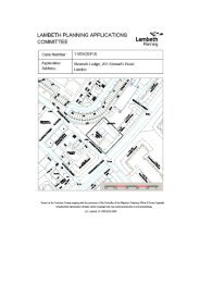
Site address<br />
Ward<br />
Proposal<br />
Application type<br />
Application Reference<br />
Land Bounded By Wandsworth Road To The West, Parry<br />
Street To The North And Bondway And Railway Line To<br />
The East, London SW8<br />
Oval<br />
Demolition of existing buildings (except for the listed<br />
buildings on the site) to provide a mixed use scheme<br />
comprising nine blocks ranging between 3, 6, 9, 10, 11,<br />
21, 30, 48 and 50 storeys, which includes 520 dwellings<br />
(57,244sqm Gross Internal Area (GIA)) , 22,732sqm of<br />
new office floor space (B1), 3119sqm GIA of A1-A5 retail,<br />
278 bedroom hotel and 123 suite hotel (C1), 50 bedroom<br />
replacement homeless hostel (sui generis), 359 student<br />
rooms, 3,777sqm new multi-screen cinema (D2),<br />
1,317sqm GIA Gym (D2), 67sqm Community Building<br />
associated basement car parking and servicing; new<br />
public square and children's play area and associated<br />
public realm improvements.<br />
Full Planning Permission<br />
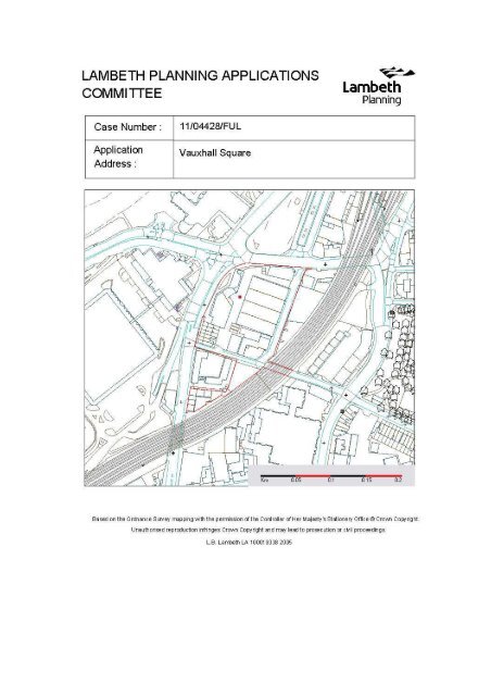
11/04428/FUL<br />
Validation date 14.12.2012<br />
Case officer details<br />
Applicant<br />
Agent<br />
Name: Gavin Chinniah<br />
Tel: 020 7926 1257<br />
Email: gchinniah@lambeth.gov.uk<br />
<strong>Vauxhall</strong> Cross Limited<br />
GL Hearn<br />
Considerations/constraints<br />
Approved plans<br />
Document Title<br />
1APP and Certificates<br />
Application Drawings – list of<br />
drawings enclosed with this<br />
letter<br />
Planning Statement<br />
Design and Access Statement<br />
Management Strategy<br />
Employment and Delivery Plan<br />
Affordable Housing Position<br />
Statement<br />
Energy Statement<br />
Consultant<br />
GL Hearn<br />
Allies and Morrison<br />
GL Hearn<br />
Allies and Morrison<br />
GL Hearn, with CLS<br />
Holdings and Thames<br />
Reach<br />
CLS Holdings<br />
GL Hearn<br />
Hoare Lea
Amenity and Play Space<br />
Strategy<br />
Regeneration Statement<br />
Sustainability Statement<br />
Daylight and Sunlight<br />
Assessment<br />
Consultation Statement<br />
Affordable Housing Statement<br />
Townscape and Visual Impact<br />
Assessment<br />
• Transport Assessment<br />
and Travel Plan<br />
• Environmental Statement:<br />
• Traffic and Transport -<br />
PFA Consulting<br />
• Noise and Vibration -<br />
Hoare Lea<br />
• Air Quality - Waterman<br />
EED Ltd<br />
• Wind Microclimate –<br />
Building Research<br />
Establishment<br />
• Daylighting, Sunlighting,<br />
Overshadowing and Solar<br />
Glare– Gordon Ingram<br />
Associates<br />
• Cultural Heritage –<br />
Wessex Archaeology<br />
• Ground Conditions and<br />
Contamination –<br />
Waterman<br />
• Nature Conservation -<br />
The Ecology Consultancy<br />
• Surface Water Drainage -<br />
Waterman<br />
• Electromagnetic<br />
Conditions - Building<br />
Research Establishment<br />
• Socio Economic Effects –<br />
GL Hearn<br />
• Waste Strategy –<br />
Waterman<br />
GL Hearn<br />
GL Hearn<br />
Waterman<br />
Gordon Ingram<br />
Associates<br />
GL Hearn<br />
GL Hearn<br />
Miller Hare and<br />
Tavernor<br />
Consultancy<br />
• PFA<br />
• Various<br />
• 661_00_<strong>07</strong>_001 rev. 01 Site Location Plan (existing<br />
site buildings) 1:1250 @A3<br />
• 661_00_<strong>07</strong>_010 rev. 01 Site Plan –<br />
Existing/Demolitions 1:500<br />
• 661_00_<strong>07</strong>_020 rev. 01 Site Elevations – Existing<br />
1:250
• 661_00_<strong>07</strong>_030 rev. 01 Retained Terrace Plans –<br />
Existing 1:100<br />
• 661_00_<strong>07</strong>_031 rev. 01 Retained Terrace<br />
Elevations/Sections – Existing 1:100<br />
• 661_00_<strong>07</strong>_080 rev. 01 Ground Plan as Proposed -<br />
Existing context 1:1250<br />
• 661_00_<strong>07</strong>_081 rev. 01 Ground Plan as Proposed -<br />
Evolving context 1:1250<br />
• 661_00_<strong>07</strong>_097 rev. 01 Site Wide Basement Level<br />
-3 1:250<br />
• 661_00_<strong>07</strong>_098 rev. 01 Site Wide Basement Level<br />
-2 1:250<br />
• 661_00_<strong>07</strong>_099 rev. 01 Site Wide Basement Level<br />
-1 1:250<br />
• 661_00_<strong>07</strong>_100 rev. 01 Site Wide Ground Plan<br />
1:250<br />
• 661_00_<strong>07</strong>_101 rev. 01 Site Wide Mezzanine Level<br />
Plan 1:250<br />
• 661_00_<strong>07</strong>_102 rev. 01 Site Wide First Floor Plan<br />
1:250<br />
• 661_00_<strong>07</strong>_103 rev. 01 Site Wide Mid Rise Plan<br />
1:250<br />
• 661_00_<strong>07</strong>_104 rev. 01 Site Wide High Rise Plan<br />
1:250<br />
• 661_00_<strong>07</strong>_105 rev. 01 Site Wide Roof Plan 1:250<br />
• 661_00_<strong>07</strong>_106 rev. 01 Site Wide Ground Plan -<br />
Evolving context 1:250<br />
• 661_00_<strong>07</strong>_110 rev. 01 <strong>Vauxhall</strong> <strong>Square</strong> North<br />
Plans 1:250<br />
• 661_00_<strong>07</strong>_120 rev. 01 <strong>Vauxhall</strong> <strong>Square</strong> West<br />
Plans 1 1:250<br />
• 661_00_<strong>07</strong>_121 rev. 01 <strong>Vauxhall</strong> <strong>Square</strong> West<br />
Plans 2 1:250<br />
• 661_00_<strong>07</strong>_122 rev. 01 <strong>Vauxhall</strong> <strong>Square</strong> West<br />
Plans 3 1:250<br />
• 661_00_<strong>07</strong>_130 rev. 01 <strong>Vauxhall</strong> <strong>Square</strong> South<br />
Plans 1:250<br />
• 661_00_<strong>07</strong>_140 rev. 01 <strong>Vauxhall</strong> <strong>Square</strong> East<br />
Plans 1 1:250<br />
• 661_00_<strong>07</strong>_141 rev. 01 <strong>Vauxhall</strong> <strong>Square</strong> East<br />
Plans 2 1:250<br />
• 661_00_<strong>07</strong>_150 rev. 01 Miles Street South Plans<br />
1:250<br />
• 661_00_<strong>07</strong>_170 rev. 01 Wendle Court Plans 1:250<br />
• 661_00_<strong>07</strong>_180 rev. 01 Retained Terrace Plans 1<br />
1:100<br />
• 661_00_<strong>07</strong>_181 rev. 01 Retained Terrace Plans 2<br />
1:100<br />
• 661_00_<strong>07</strong>_201 rev. 01 Site Elevation/Section as<br />
proposed 1 1:250
• 661_00_<strong>07</strong>_202 rev. 01 Site Elevation/Section as<br />
proposed 2 1:250<br />
• 661_00_<strong>07</strong>_203 rev. 01 Site Elevation/Section as<br />
proposed 3 1:250<br />
• 661_00_<strong>07</strong>_204 rev. 01 Site Elevation/Section as<br />
proposed 4 1:250<br />
• 661_00_<strong>07</strong>_206 rev. 01 Site Elevation/Section as<br />
proposed 6 1:250<br />
• 661_00_<strong>07</strong>_2<strong>07</strong> rev. 01 Site Elevation/Section as<br />
proposed 7 1:250<br />
• 661_00_<strong>07</strong>_208 rev. 01 Site Elevation/Section as<br />
proposed 8 1:250<br />
• 661_00_<strong>07</strong>_209 rev. 01 Site Elevation/Section as<br />
proposed 9 1:250<br />
• 661_00_<strong>07</strong>_210 rev. 01 Site Elevation/Section as<br />
proposed 10 1:250<br />
• 661_00_<strong>07</strong>_211 rev. 01 Site Elevation/Section as<br />
proposed 11 1:250<br />
• 661_00_<strong>07</strong>_212 rev. 01 Site Elevation/Section as<br />
proposed 12 1:250<br />
• 661_00_<strong>07</strong>_213 rev. 01 Site Elevation/Section as<br />
proposed 13 1:250<br />
• 661_00_<strong>07</strong>_214 rev. 01 Site Elevation/Section as<br />
proposed 14 1:250<br />
• 661_00_<strong>07</strong>_215 rev. 01 Site Elevation/Section as<br />
proposed 15 1:250<br />
• 661_00_<strong>07</strong>_216 rev. 01 Site Elevation/Section as<br />
proposed 16 1:250<br />
• 661_00_<strong>07</strong>_217 rev. 01 Site Elevation/Section as<br />
proposed 17 1:250<br />
• 661_00_<strong>07</strong>_511 rev. 01 <strong>Vauxhall</strong> <strong>Square</strong> North Bay<br />
Study 1 1:50<br />
• 661_00_<strong>07</strong>_512 rev. 01 <strong>Vauxhall</strong> <strong>Square</strong> North Bay<br />
Study 2 1:50<br />
• 661_00_<strong>07</strong>_521 rev. 01 <strong>Vauxhall</strong> <strong>Square</strong> West Bay<br />
Study 1 1:50<br />
• 661_00_<strong>07</strong>_522 rev. 01 <strong>Vauxhall</strong> <strong>Square</strong> West Bay<br />
Study 2 1:50<br />
• 661_00_<strong>07</strong>_523 rev. 01 <strong>Vauxhall</strong> <strong>Square</strong> West Bay<br />
Study 3 1:50<br />
• 661_00_<strong>07</strong>_531 rev. 01 <strong>Vauxhall</strong> <strong>Square</strong> South Bay<br />
Study 1 1:50<br />
• 661_00_<strong>07</strong>_532 rev. 01 <strong>Vauxhall</strong> <strong>Square</strong> South Bay<br />
Study 2 1:50<br />
• 661_00_<strong>07</strong>_541 rev. 01 <strong>Vauxhall</strong> <strong>Square</strong> East Hotel<br />
Bay Study 1 1:50<br />
• 661_00_<strong>07</strong>_542 rev. 01 <strong>Vauxhall</strong> <strong>Square</strong> East Hotel<br />
Bay Study 2 1:50<br />
• 661_00_<strong>07</strong>_543 rev. 01 <strong>Vauxhall</strong> <strong>Square</strong> East Hotel<br />
Bay Study 3 1:50
• 661_00_<strong>07</strong>_544 rev. 01 <strong>Vauxhall</strong> <strong>Square</strong> East<br />
Office Bay Study 1 1:50<br />
• 661_00_<strong>07</strong>_545 rev. 01 <strong>Vauxhall</strong> <strong>Square</strong> East<br />
Office Bay Study 2 1:50<br />
• 661_00_<strong>07</strong>_546 rev. 01 <strong>Vauxhall</strong> <strong>Square</strong> East<br />
Office Bay Study 3 1:50<br />
• 661_00_<strong>07</strong>_561 rev. 01 Miles Street South Bay<br />
Study 1 1:50<br />
• 661_00_<strong>07</strong>_562 rev. 01 Miles Street South Bay<br />
Study 2 1:50<br />
• 661_00_<strong>07</strong>_571 rev. 01 Wendle Court Bay Study 1<br />
1:50<br />
• 661_00_<strong>07</strong>_572 rev. 01 Wendle Court Bay Study 2<br />
1:50<br />
• 661_00_<strong>07</strong>_581 rev. 01 Retained Terrace<br />
Elevations 1 1:50<br />
• 661_00_<strong>07</strong>_582 rev. 01 Retained Terrace<br />
Elevations 2 1:50<br />
• 661_00_<strong>07</strong>_583 rev. 01 Retained Terrace<br />
Elevations 3 1:50<br />
• 00 - Shared Basement/Site Wide drawings<br />
• 01 - <strong>Vauxhall</strong> <strong>Square</strong> North (this is the north tower)<br />
• 02 - <strong>Vauxhall</strong> <strong>Square</strong> West (this is the west office<br />
building)<br />
• 03 - <strong>Vauxhall</strong> <strong>Square</strong> South (this is the south tower)<br />
• 04 - <strong>Vauxhall</strong> <strong>Square</strong> East (this is the hotel and the<br />
east office building)<br />
• 06 - Miles Street South (this is the south student<br />
building)<br />
• <strong>07</strong> - Wendle Court<br />
• 08 - Retained Terrace and adjacent pavilions<br />
• C674/3<br />
Recommendation(s)<br />
Grant planning permission subject to conditions, Section<br />
106 Agreement and Stage 2 Referral to the Mayor.<br />
Report Review<br />
Department(s) or Organisation(s)<br />
Date<br />
consulted<br />
Date<br />
response<br />
received<br />
Comments<br />
summarised<br />
in paragraph<br />
Governance & Democracy (legal) 30.11.2012 03.12.2012 Changes have<br />
been made in<br />
report.
Consultation<br />
Department(s) or Organisation(s)<br />
Consulted?<br />
(y/n)<br />
Date<br />
response<br />
received<br />
Comments<br />
summarised<br />
in report?<br />
(y/n)<br />
Internal<br />
<strong>Lambeth</strong> Arts Y N<br />
<strong>Lambeth</strong> Building Control Y N<br />
<strong>Lambeth</strong> Crime Prevention Unit Y 1<strong>6.</strong>11.2012 Y<br />
<strong>Lambeth</strong> Regulatory Services<br />
Y<br />
N<br />
Entertainment<br />
<strong>Lambeth</strong> Regulatory Services Noise Y 30.11.2012 Y<br />
Pollution<br />
Early Years Development Childcare Y N<br />
<strong>Lambeth</strong> Housing Y 30.11.2012 Y<br />
<strong>Lambeth</strong> Implementation Team Y 2<strong>6.</strong>11.2012<br />
and<br />
27.11.2012<br />
Y<br />
<strong>Lambeth</strong> Parks and Open Spaces Y N<br />
<strong>Lambeth</strong> Conservation and Design Y <strong>07</strong>.11.2012 Y<br />
<strong>Lambeth</strong> Planning Policy Y 30.01.2012 Y<br />
<strong>Lambeth</strong> Sewers Group Y N<br />
<strong>Lambeth</strong> Streetcare Y 2<strong>6.</strong>11.2012 to<br />
04.12.2012<br />
<strong>Lambeth</strong> Transport and Highways Y 28.03.2012<br />
and<br />
04.12.2012<br />
<strong>Lambeth</strong> Arboricultural Officer Y 25.09.2012 Y<br />
<strong>Lambeth</strong> Urban Design Y <strong>07</strong>.12.2012 Y<br />
External Y N<br />
Bus Priority and Traffic Unit Y N<br />
London Transport Buses Y N<br />
Transport for London Land Use Y<br />
N<br />
Planning Team<br />
Transport for London (TfL) Road Y 04.12.2012 Y<br />
Network Development<br />
London Underground Infrastructure Y<br />
N<br />
Protection<br />
Commission for Architecture and the Y 03.12.2012<br />
Built Environment (CABE)<br />
Cinema and Theatre Association Y N<br />
Design for London Y N<br />
English Heritage Y 01.12.2012 Y<br />
English Heritage – Archaeology Y 0<strong>6.</strong>02.2012 Y<br />
Natural England Y 31.10.2012 Y<br />
Greater London Authority (GLA) Y 15.12.2012 Y<br />
For advice on how to make further written submissions or to register to speak on this <strong>item</strong>,<br />
please contact Governance & Democracy by emailing democracy@lambeth.gov.uk or<br />
telephoning 020 7926 2170. Information is also available on the <strong>Lambeth</strong> website<br />
www.lambeth.gov.uk/democracy<br />
Y<br />
Y
and<br />
30.11.2012<br />
Street Management Area Manager Y<br />
N<br />
South<br />
Bus Priority and Traffic Unit Y N<br />
Network Rail Y N<br />
Development Control Department Y<br />
N<br />
Thames Water<br />
City of Westminster Y 25.01.2012 Y<br />
London Borough of Wandsworth Y 15.11.2012 Y<br />
L.F.C.D Authority Y N<br />
Environment Agency Y 01.11.2012 Y<br />
Kennington Association Y N<br />
Regents Bridge Gardens Ltd Y N<br />
<strong>Vauxhall</strong> Neighbourhood Housing Y<br />
N<br />
Forum<br />
The <strong>Vauxhall</strong> Society Y N<br />
Ashmole Estate Tenants Association Y N<br />
Albert <strong>Square</strong> Residents Association Y N<br />
Ashmole Tenants Association Y N<br />
Cambridge and Talbot House Y<br />
N<br />
Association<br />
Clapham Society Y N<br />
Cleaver <strong>Square</strong> Residents Association Y N<br />
Dorset Road Community Project Y N<br />
Friends of the Oval Y N<br />
Friends of <strong>Vauxhall</strong> Park Y 1<strong>6.</strong>11.2012 Y<br />
Fentiman Road, Richborne Terrace Y<br />
N<br />
and Dorset Road R/A<br />
Harleyford Court Tenants Association Y N<br />
Kennington Cross Neighbourhood Y<br />
N<br />
Association<br />
Hanover Gardens Association Y N<br />
Hanover Gardens Residents Y<br />
N<br />
Association<br />
Heart of Kennington Residents Y<br />
N<br />
Association<br />
Harleyford Road Action Group Y N<br />
I.M.P.A.C.T. Y N<br />
Kennington Cross Neighbourhood Y<br />
N<br />
Association<br />
Kilner House Residents Association Y N<br />
Mursell Estate Group Y N<br />
Central Stockwell Street Residents and Y<br />
N<br />
Tenants Association<br />
Crimsworth Thorparch Residents Y<br />
N<br />
Association<br />
Hemans Estate Tenants and Residents Y N<br />
For advice on how to make further written submissions or to register to speak on this <strong>item</strong>,<br />
please contact Governance & Democracy by emailing democracy@lambeth.gov.uk or<br />
telephoning 020 7926 2170. Information is also available on the <strong>Lambeth</strong> website<br />
www.lambeth.gov.uk/democracy
Association<br />
Mursell Estate Tenants and Residents Y<br />
N<br />
Association<br />
Stockwell Partnership Y N<br />
Stockwell Park Residents Association Y N<br />
Studley Estate Tenants and Residents<br />
Association<br />
Y<br />
N<br />
Background Documents<br />
Case File (this can be accessed via the Planning Advice Desk, Telephone 020 7926<br />
1180)<br />
For advice on how to make further written submissions or to register to speak on this <strong>item</strong>,<br />
please contact Governance & Democracy by emailing democracy@lambeth.gov.uk or<br />
telephoning 020 7926 2170. Information is also available on the <strong>Lambeth</strong> website<br />
www.lambeth.gov.uk/democracy
Executive Summary<br />
This application relates to the creation of a mixed use development which would<br />
comprise of 520 residential flats, offices, retail uses, hotel, student accommodation,<br />
homeless hostel, multi-screen cinema and community building. The development would<br />
also be subject to public realm works, which would be associated with the scheme and<br />
the wider <strong>Vauxhall</strong> Nine Elms Battersea (VNEB) area. The vision for the <strong>Vauxhall</strong><br />
<strong>Square</strong> development is to establish the site as a truly mixed-use development which<br />
forms an integrated part of the wider regeneration of the area.<br />
The scheme is proposed alongside the wider regenerative objectives for the <strong>Vauxhall</strong><br />
area as laid out within the councils SPD, currently out for consultation. The<br />
development has been developed in accordance with the wider GLA <strong>Vauxhall</strong> Nine<br />
Elms Battersea Opportunity Area Framework (VENBOAPF). The designation of the<br />
development should be intensified and mixed use developments promoted. The<br />
development is situated within the Central Activities Zone as designated within the<br />
London Plan, and as such is required to bring forward a mixed use development that<br />
seeks to enable a high quality design development, provide capacity for an increase in<br />
housing, employment floorspace and other associated uses highlighted within the first<br />
paragraph.<br />
The report sets out the planning issues in turn, alongside the representations received<br />
and justification of the planning merits of the proposals which when considered in the<br />
round enable officers to recommend the application for approval subject to conditions<br />
and completion of a Section 106 Agreement.<br />
One of the principle issues, is the design of the two towers and the impact this may<br />
have on, heritage assets and impact on views, for which English heritage raises<br />
concern. A key consideration therefore for the <strong>Council</strong> is whether the development<br />
gives rise to material harm when judged against those matters, which is the view of<br />
English Heritage. If that said were to arise, could other planning considerations,<br />
particularly public benefits of the scheme outweigh that consideration. It is the view of<br />
officers that the proposal does not give rise to the harm set out by English Heritage, and<br />
in this instance no objection is raised by officers. CABE has commented on the towers<br />
and have stated that the towers would be simple and elegant within the London skyline.<br />
Due to the designation of the opportunity area high residential and non-residential<br />
densities should be promoted. The development provides a significant uplift in housing<br />
units totalling 520 residential units, of which 110 units would be affordable. The<br />
application has been subject to a viability report which has been independently<br />
assessed by the BNP Paribas on behalf of the authority to arrive at a point where a<br />
minimum level of affordable housing would be provided. Whilst originally submitted to<br />
provide only 15% affordable housing, the scheme now proposes to deliver a minimum<br />
of 21.2% affordable housing, which would be in the form of affordable rent and shared<br />
ownership. In addition, a review mechanism of the gross development value generated<br />
by the entire development at the one third of the way through private residential sales.<br />
If achieved and projected sales values exceed the level required to render the scheme<br />
economically viable, 50% of the surplus will be used to provide a commuted sum
payment in lieu of additional affordable housing. This commuted sum payment will be<br />
capped at £12,740,000, which has been calculated to equate to the shortfall in<br />
affordable housing provision against the policy requirement of 40% of units.<br />
The proposed Linear Park, which runs through the VNEB area, will establish new<br />
connections and routes between <strong>Vauxhall</strong> and Battersea, in which <strong>Vauxhall</strong> <strong>Square</strong><br />
plays an essential part. The new urban square would provide a series of spaces and to<br />
provide a focus for retail uses and other amenities forming an integral part of the<br />
regenerating <strong>Vauxhall</strong> town centre. A series of new and improved connections and play<br />
space tie through Miles Street establishing and improving connections with the wider<br />
existing community and <strong>Vauxhall</strong> Park to the east.<br />
The scheme is delivering a range of regeneration outcomes which are fully in accord<br />
with policy expectations. The scheme has been largely supported subject to matters of<br />
detail by the GLA in its stage 1 response and is delivering a range of public realm<br />
benefits which accord with the long term strategy to deliver improvements to the wider<br />
<strong>Vauxhall</strong> area.<br />
Certain impacts will arise from the development, but will be fully addressed in the<br />
imposition of conditions and a substantive list of terms to a S106 agreement securing<br />
the delivery of the wider benefits proposed.<br />
Overall, officers recommend the proposal for approval.
1 Summary of Main Issues<br />
1.1 The main issues involved in this application are:<br />
• Whether the development is in accordance with the Development Plan and<br />
the GLA’s adopted <strong>Vauxhall</strong> Nine Elms Battersea (VNEB) Opportunity Area<br />
Planning Framework;<br />
• The principle of a mixed used development on the site, comprising offices,<br />
housing, retail, hotel, hostel, student accommodation and associated<br />
community uses;<br />
• The provision of affordable housing associated with the development;<br />
• The acceptability of the proposed space standards for the residential units<br />
together with private amenity space;<br />
• The public realm improvements associated with the scheme and their<br />
integration with the wider VNEB area;<br />
• The potential regeneration benefits the proposal provides within the VNEB<br />
area;<br />
• The acceptability of tall buildings on the site;<br />
• The impact the proposed design, massing, scale and bulk would have on<br />
the visual amenity of the area;<br />
• The impact the development would have on the adjoining conservation<br />
areas;<br />
• The impact the development would have on the setting of the listed<br />
buildings;<br />
• The impact the development would have in terms of residential amenity<br />
such as daylight, sunlight, sense of enclosure and privacy;<br />
• The environmental impact the proposed development would have;<br />
• The acceptability of the highway proposals;<br />
• The proposed connection of the development to the surrounding VNEB<br />
area;<br />
• The acceptability of the development in terms of sustainability and carbon<br />
emissions from the proposed scheme and<br />
• The level of Section 106 Contributions and Development Infrastructure<br />
Funding Study (DIFS) with the scheme.<br />
2 Site Description<br />
2.1 The application site comprises 1.85 hectares of land made up of 3 key areas,<br />
which are all physically linked alongside the mainline railway – the Cap Gemini<br />
area, the Miles Street car park and the Wendle Court area. Parry Street lies to<br />
the north of the site, Bondway to the east and Wandsworth Road provides the<br />
western boundary. Miles Street, which links the Fentiman Road area to<br />
Wandsworth Road and the river.<br />
2.2 The site is located within <strong>Vauxhall</strong>, on the south bank of the River Thames, and<br />
within the London Borough of <strong>Lambeth</strong>. <strong>Vauxhall</strong> is bounded by Oval to the<br />
south, Battersea to the west, and <strong>Lambeth</strong> to the east. Pimlico is to the north<br />
west of the site on the opposite side of the River Thames.
2.3 The larger part of the site is referred to by the applicant as being the Cap<br />
Gemini area, which is approximately 1.23 hectares and is bounded by<br />
Wandsworth Road, Parry Street, Bondway and Miles Street. The current<br />
building is occupied by various uses which include offices, warehouse buildings,<br />
a homeless shelter (Graham House, operated by Thames Reach) and a terrace<br />
(1) of listed and unlisted building (3) in residential use (these would remain)<br />
which are three-storeys in height. The existing hostel on the site is four-storeys<br />
in height, and the CLS office block in the south eastern corner is three-storeys in<br />
height. The tallest building on the site at five-storeys, is the Cap Gemini office<br />
building which is located along the north-western edge of the site.<br />
2.4 Wendle Court which forms part of the application site is a modern three-storey<br />
terraced office building on a site approximately 0.14 hectares. It is bounded by<br />
Wandsworth Road to the west, where the site gains access from the southeast.<br />
This site adjoins a two-storey Cable and Wireless site which doesn’t form part of<br />
the application. Opposite the site along Bondway is sited 69-71 Bondway, a late<br />
Victorian building providing self-storage facilities (Use Class B8).<br />
2.5 On the opposite site of Wandsworth Road, is the New Covent Garden Market<br />
Flower Market site, which is earmarked for a major redevelopment. An outline<br />
planning application for a mixed use redevelopment of this site was approved by<br />
the London Borough of Wandsworth in June 2012. Adjacent to the Covent<br />
Garden Market Flower Market site is the 23 storey Market Towers building, a<br />
largely vacant office building dating from the early 1970’s. The site has also<br />
been granted planning approval, for the erection of two towers at 58 and 43<br />
storeys in height.<br />
2.6 To the north of the site lies the <strong>Vauxhall</strong> Cross Gyratory system, which is a<br />
strategically important road system serving south west and central London.<br />
Within the central area of the gyratory is a vacant portion of land which has<br />
recently been granted planning permission at appeal for a mixed use<br />
development consisting of two residential towers. To the northwest of the site<br />
on the other side of Wandsworth Road is the Grade II Listed Brunswick House.<br />
2.7 The application site falls within opportunity area known as <strong>Vauxhall</strong> Nine Elms<br />
Battersea (VNEB), which spans from <strong>Lambeth</strong> Bridge to Battersea Power<br />
Station. It also forms part of the Central Activities Zone (CAZ) in central<br />
London. The whole site is highly accessible and benefits from a Public<br />
Transport Accessibility Level (PTAL) of 6a, which is very good. The site does<br />
not fall within a Conservation Area.<br />
3 Planning History<br />
3.1 There is no current planning history on the site<br />
4 Proposal<br />
4.1 The current planning application is for the demolition of existing buildings<br />
(except for the listed buildings on the site) to provide a mixed use scheme<br />
comprising nine blocks ranging between 3, 6, 9, 10, 11, 21, 30, 48 and 50<br />
storeys, which includes 520 dwellings (57,244sqm Gross Internal Area (GIA)) ,
22,732sqm of new office floor space (B1), 3119sqm GIA of A1-A5 retail, 278<br />
bedroom hotel and 123 suite hotel (C1), 50 bedroom replacement homeless<br />
hostel (sui generis), 359 student rooms, 3,777sqm new multi-screen cinema<br />
(D2), 1,317sqm GIA Gym (D2), 67sqm Community Building associated<br />
basement car parking and servicing; new public square and children's play area<br />
and associated public realm improvements.<br />
4.2 The application proposes to demolish all the buildings on the site except the six<br />
terrace buildings which front onto Wandsworth Road.<br />
4.3 The North and South Towers:<br />
The <strong>Vauxhall</strong> <strong>Square</strong> North building would be 48 storeys plus roof terrace<br />
(168m). The ground floor proposes entrances to the residential units on the<br />
upper floors and provides retail uses. The residential uses occupy floors 8-48,<br />
which would be a mix of private (119 units) and shared ownership units (16).<br />
4.4 The <strong>Vauxhall</strong> <strong>Square</strong> South building would be 50 storeys (168m). The ground<br />
floor proposes retail uses and a residential entrance. Floors 1-9 would<br />
accommodate a suite hotel which would comprise 123 suites. The residential<br />
use would be situated on floors 10-50. Both towers would measure 168m.<br />
4.5 In each tower, a double height intermediate podium level space has been<br />
included as a shared amenity for the residents. The use of this area has not<br />
been confirmed by the applicant, however, they have stated that this area could<br />
potentially be used for a soft play games area for young children, residents club<br />
gym, games room and community event/ meeting spaces. This area is situated<br />
on floors eight and nine in <strong>Vauxhall</strong> <strong>Square</strong> North and opens out onto a large<br />
shared residential roof garden space located across the roof of the office<br />
building. Within <strong>Vauxhall</strong> <strong>Square</strong> South the shared amenity space is situated on<br />
floors ten and eleven.<br />
4.6 <strong>Vauxhall</strong> <strong>Square</strong> North and South buildings are the tallest elements of the<br />
development. The two towers are articulated by horizontal bands of<br />
reconstituted stone at floor levels. These bands project by 400mm from the<br />
face of the tower. Between each band a series of reconstituted stone fins<br />
provide the vertical emphasis. The fins are 110mm thick and 250mm deep and<br />
sit forward of the glass layer set behind. Behind the stone layer, a glass surface<br />
would be installed. There would be subdivisions with opening windows and the<br />
glass panels would be either clear or opaque. At the top of each glass panel a<br />
small band of metal louvres provide ventilation to the interior of the flats.<br />
4.7 Each of the towers would have a connection to adjoining buildings. The North<br />
tower would adjoin the west office building and the South tower would adjoin the<br />
east office building.<br />
4.8 <strong>Vauxhall</strong> <strong>Square</strong> East:<br />
<strong>Vauxhall</strong> <strong>Square</strong> East building would be erected to 11-storeys in height. This<br />
building is formed of two buildings, <strong>Vauxhall</strong> <strong>Square</strong> East Hotel to the north and<br />
<strong>Vauxhall</strong> <strong>Square</strong> East Office to the south. <strong>Vauxhall</strong> <strong>Square</strong> East as a pair of
uildings forms the eastern edge of <strong>Vauxhall</strong> <strong>Square</strong> and new west elevation to<br />
Bondway.<br />
4.9 The <strong>Vauxhall</strong> <strong>Square</strong> East office provides office accommodation enables access<br />
to the cinema along with the shared service yard from Bondway. Access to<br />
these facilities off Bondway keeps the centre of the site free of traffic.<br />
4.10 The hotel accommodation proposes a mid-market 3 to 4 star hotel with a total of<br />
278 bedrooms laid out over the ground floor, mezzanine plus 9 upper storeys.<br />
At least 10% of these rooms would be wheelchair accessible and six rooms are<br />
envisaged as larger family/ suite rooms. The floor area of the hotel would be<br />
approximately 13,624sqm GIA.<br />
4.11 The entrance to the office is from the covered passage between the hotel and<br />
office. The office café is accessible from the office entrance lobby and provides<br />
an active frontage to Bondway. The service yard and cinema entrance occupy<br />
most of the ground floor of the office building.<br />
4.12 The cinema, located at the south end of <strong>Vauxhall</strong> <strong>Square</strong> East addresses<br />
<strong>Vauxhall</strong> <strong>Square</strong> and is visible on approach from the <strong>Vauxhall</strong> Transport<br />
Interchange. The proposed cinema would have a total of four screens,<br />
extending some 3,777sqm, including a ground floor level entrance onto <strong>Vauxhall</strong><br />
<strong>Square</strong>.<br />
4.13 The proposed building would be constructed from brick and reconstituted stone.<br />
This would be complimented by transparent glass with metal hidden frames,<br />
slotted metal panels, metal louvres and shading devices.<br />
4.14 <strong>Vauxhall</strong> <strong>Square</strong> West:<br />
This building would be erected 9 storeys, which would provide a mixture of retail<br />
facilities on the ground and mezzanine floor levels, with the remaining seven<br />
floors used as office accommodation (Use Class B1). The building forms the<br />
west side of the development, that turns the corner from Parry Street into<br />
Wandsworth Road. The office accommodation can be split up into a maximum<br />
of three tenancies. This building would provide a total of 12,850sqm GIA.<br />
Access to the offices would be through a central lift lobby accommodating four<br />
passenger lifts, toilets and riser space.<br />
4.15 The application proposes two three-storey ‘bookend’ pavilion buildings, which<br />
would be positioned off Wandsworth Road, which would create an entrance into<br />
the development and also reinforcing a strong pedestrian route through the site<br />
and delivering activity to <strong>Vauxhall</strong> <strong>Square</strong>. The ‘bookend’ building would<br />
integrate the listed terrace into the scheme layout. Active frontages would be<br />
proposed within these buildings.<br />
4.16 The elevations of the office building would be composed of white reconstituted<br />
stone panels with horizontal bands which would match the existing appearance<br />
of the two towers. Between the stone frame there would be glazing and<br />
aluminium fins projecting forwards in each three metre bay.
4.17 A three-storey linear building to the south of <strong>Vauxhall</strong> <strong>Square</strong> West is proposed<br />
creating an active frontage to its south elevation. A twelve metre wide<br />
pedestrian ‘street’ would be formed, creating an approach into <strong>Vauxhall</strong> <strong>Square</strong>.<br />
4.18 The proposed roofscape of the <strong>Vauxhall</strong> <strong>Square</strong> West building would provide a<br />
large communal garden accessible from <strong>Vauxhall</strong> <strong>Square</strong> North for residents<br />
use. There would also be smaller roof terraces overlooking the square,<br />
accessible from the office areas at floors 1, 2, 3, 4, 5, 6 and 7. The communal<br />
space would provide a multi-functional amenity space within a sheltering, green<br />
envelop of hedges, trees and herbaceous borders.<br />
4.19 Miles Street South:<br />
This building would be erected to a total height of 29-storeys. This building<br />
would provide 359 student rooms, plus shared lobby/ lounges and service<br />
spaces. This area would equate to a total area of 11, 960sqm GIA. Entrance to<br />
the building would be along Miles Street.<br />
4.20 This building would be constructed from simple palette of robust materials,<br />
predominately brick and reconstituted stone. There would be the installation of<br />
transparent/ opaque glass back layers with metal hidden frames, slotted metal<br />
panels and metal louvres.<br />
4.21 The proposed roof terrace, would comprise of both hard and soft materials to<br />
provide a multi-functional amenity space.<br />
4.22 Wendle Court:<br />
Wendle Court forms the southern building of the <strong>Vauxhall</strong> <strong>Square</strong> development.<br />
It is located adjacent to Wandsworth Road, to the south of the Cable and<br />
Wireless site and has a railway viaduct curving around the east/ south. This<br />
building would be part 10, part 21 storeys in height. This building would<br />
comprise of an affordable housing block and hostel accommodation.<br />
4.23 The affordable housing block would be to an overall height of 21-storeys. This<br />
would provide a total of 94 residential flats which would be a mixture of<br />
affordable rent units and shared ownership.<br />
4.24 The proposed hostel block which would be 10-sotreys in height would provide a<br />
total of 40 bedrooms. This building would replace Graham House which is<br />
currently situated on the site. Some of the bedrooms would be provided with<br />
en-suite facilities.<br />
4.25 Both uses would have their own separate access points, neither would be<br />
mixed. This would provide clear separation of the uses. The affordable housing<br />
block would be accessed from Wandsworth Road with the hostel<br />
accommodation accessed from the New Lane. Cycle storage and disabled<br />
parking would be provided.<br />
4.26 The two cladding materials for Wendle Court are based on adopting the same
language as other parts of the <strong>Vauxhall</strong> <strong>Square</strong> proposals. The elevation of the<br />
taller affordable housing block would be formed of reconstituted stone.<br />
Although the two uses are differentiated by the elevational treatment the whole<br />
building itself is integrated by the consistent window modules and the horizontal<br />
reconstituted stone elements.<br />
4.27 Winter gardens for each residential unit provide private amenity space and are<br />
predominately located on the corners. Roof terraces are provided at the two<br />
upper levels to provide shared amenity space for residents.<br />
4.28 Listed Terrace and Pavilion:<br />
The existing six terrace houses, fronting on Wandsworth Road, would be<br />
retained. Towards the rear of these buildings there would be children’s<br />
playspace and adjacent to this there would be single-storey community pavilion,<br />
with the entrance frontage onto Miles Street.<br />
4.29 Landscaping:<br />
The proposed development provides a multi-functional central square, which<br />
would be designed to cater for a number of uses. This would provide the focal<br />
point to the development and provides a link to the Linear Park. <strong>Vauxhall</strong><br />
<strong>Square</strong> comprises of two large triangular grassed areas which would provide<br />
areas of outdoor amenity space, these areas have been designated as zones by<br />
the applicant for “relaxing, meeting, playing and potentially performance and<br />
entertainment”.<br />
4.30 The function of the area would provide an integral part of the public realm offer<br />
associated with the application. However, the design and access statement has<br />
stated that this area would also promote directional movement throughout the<br />
site and attract individual to the proposed uses associated with the application.<br />
The proposed uses within the square would be cafes, restaurants, offices,<br />
shops, cinema and hotel. There would be public realm furniture which would<br />
involve the installation of benches and planting of grassed areas, which would<br />
provide breakout areas, during the “morning, lunchtime, and afternoon”.<br />
4.31 The surface materials would be varied within the square. The majority of the<br />
hardstanding would be paved with brick strips. There would be a diverse<br />
planting strategy for the area, which would involve the planting of trees, amenity<br />
grass areas and mixed planting beds.<br />
4.32 There would be the planting of eleven replacement trees proposed along<br />
Wandsworth Road and on the corner of Wandsworth Road and Parry Street.<br />
The tree species would be London Plane. Along Bondway there would be<br />
further twelve trees, which would breakup the façade of the two proposed<br />
buildings. The proposed trees used here would be Fastigiate Hornbeams. A<br />
green wall would be proposed along Bondway on the east ‘open’ elevation of<br />
the hotel building adjacent to the basement vehicle ramp at ground floor level.<br />
4.33 Miles Street and Miles Street <strong>Square</strong> would be a mixture of granite setts along<br />
the shared surface area of Miles Street with paving orientation to be directional
with the road. Planting within Miles Street would be a mixture of trees and<br />
raised planting beds.<br />
4.34 The proposed New Lane which would be located to the southern part of the site,<br />
would have granite setts installed, reflecting the appearance of the railway<br />
arches. Due to the use of the area there would be limited planting.<br />
4.35 Children Playspace<br />
The play area would provide facilities for children ages 0-4 and 5-11 with<br />
suitable seating within the space for parents to overlook the play area. The play<br />
area would be defined by a 1.2m balustrade railing. The 0-4 age would be<br />
separated from the 5-11 age group.<br />
4.36 The 0-4 play space situated at the <strong>Vauxhall</strong> <strong>Square</strong> West play area would have<br />
formal play area facility which would involve the installation of pergolas and<br />
climbing frames. For the 5-11 age group, the facility provides a water/mist<br />
fountain in the southern part of the square. The proposed sloped retaining walls<br />
and angled benches would provide raised plinths to walk along and climb over<br />
as well as the large areas of grass which offer areas of grass for informal<br />
activities such as playing football.<br />
4.37 Transport:<br />
A total of 204 parking spaces are proposed in total with 131 spaces allocated for<br />
the residential dwellings and the remaining 73 spaces for the commercial uses.<br />
The applicant is proposing to fund and include the installation of 2 on-street car<br />
club bays on Miles Street as part of the wider public realm works. A total of<br />
1058 cycle spaces are provided within the site for residents and users of the<br />
commercial spaces with additional cycle parking to be provided around the site<br />
within the public realm to cater for visitors to the site.<br />
4.38 Access to parking and servicing of the development would be mainly from<br />
Bondway.<br />
5 Consultations and Responses<br />
5.1 The applicant has submitted a ‘Consultation Statement’ produced by GL Hearn.<br />
The report outlines the approach taken to consult different consultees and<br />
stakeholders within the local area.<br />
5.2 Consultation initially started in January 2011 where 2604 consultation letters<br />
were sent out to local neighbours, numerous site notices were posted in the<br />
local area and the application was advertised in the local press. However, the<br />
application was amended and the applicant submitted further drawings and<br />
supporting documentation. Further site notices and a press advert were posted<br />
in relation to the scheme and a further 2604 letters were sent out to residents in<br />
the local area.<br />
Internal consultation
5.3 <strong>Lambeth</strong> Arts: No representations received.<br />
5.4 <strong>Lambeth</strong> Building Control: No representations received.<br />
5.5 <strong>Lambeth</strong> Crime Prevention Unit: Comments received raising no objection,<br />
subject to conditions being imposed in relation to the proposed development.<br />
5.6 <strong>Lambeth</strong> Regulatory Services Entertainment: No representations received.<br />
5.7 <strong>Lambeth</strong> Regulatory Services Noise Pollution: Comments received raising no<br />
objection subject to condition being imposed.<br />
5.8 Early Years Development Childcare: No representations received.<br />
5.9 <strong>Lambeth</strong> Housing: Comments received raising no objection<br />
5.10 <strong>Lambeth</strong> Implementation Team: Comments received raising no objection<br />
5.11 <strong>Lambeth</strong> Parks and Open Spaces: No representations received.<br />
5.12 <strong>Lambeth</strong> Conservation and Design: Comments received raising no objection<br />
subject to conditions being imposed.<br />
5.13 <strong>Lambeth</strong> Planning Policy: Comments received raising no objection.<br />
5.15 <strong>Lambeth</strong> Sewers Group: No representations received.<br />
5.16 <strong>Lambeth</strong> Streetcare: Comments received raising no objection subject to<br />
conditions being imposed.<br />
5.17 <strong>Lambeth</strong> Transport and Highways: Comments received raising no objection<br />
subject to conditions being imposed.<br />
5.18 <strong>Lambeth</strong> Arboricultural Officer: Comments received raising no objection subject<br />
to conditions being imposed.<br />
5.19 <strong>Lambeth</strong> Urban Design: Comments received raising no objection subject to<br />
conditions being imposed.<br />
External Consultation<br />
5.20 Bus Priority and Traffic Unit: No representations received.<br />
5.21 London Transport Buses: No representations received.<br />
5.22 Transport for London Land Use Planning Team: No representations received.<br />
5.23 Transport for London (TfL) Road Network Development: Comments received<br />
raising no objections subject to conditions being imposed and contributions<br />
secured via the Section 106 Agreement.
5.24 London Underground Infrastructure Protection: No representations received.<br />
5.25 Commission for Architecture and the Built Environment (CABE): Comments<br />
received stating the following:<br />
• We welcome the removal of Miles Street North from the scheme and the<br />
relocation of the children’s playspace to the rear of the listed terrace.<br />
However, we think the relocation of <strong>Vauxhall</strong> <strong>Square</strong> South and <strong>Vauxhall</strong><br />
<strong>Square</strong> East alongside the increase in height of Miles Street South further<br />
compromises how functional and comfortable the Miles Street public space<br />
will be and we question to what extent this space will be used.<br />
• We welcome the enlargement of the <strong>Vauxhall</strong> <strong>Square</strong> and the desire to<br />
introduce more greenery into the landscape design.<br />
• The landscape approach for the whole scheme should facilitate a<br />
comfortable pedestrian environment to encourage people to linger and<br />
include playable space for children’s and amenity space for teenagers.<br />
• The local planning authority should be assured that the scale of the<br />
development does not compromise the environmental quality of these<br />
space by being windswept and overshadowed.<br />
• The introduction of two three-storey ‘bookend’ buildings to frame the<br />
entrance into the development off Wandsworth Road will help make this<br />
entrance noticeable gateway, assisting the aspiration to create a strong<br />
pedestrian route through the site and deliver activity into <strong>Vauxhall</strong> <strong>Square</strong>.<br />
• The ‘bookend’ buildings better integrate the listed terrace into the scheme<br />
layout.<br />
• The new pedestrian link is welcomed between Bondway and <strong>Vauxhall</strong><br />
<strong>Square</strong> and the introduction of an office entrance off Bondway. However,<br />
we are concerned about the dominance of servicing and vehicular access<br />
along this street and think the development could contribute more to<br />
improve its character.<br />
• The re-alignment of <strong>Vauxhall</strong> <strong>Square</strong> North and <strong>Vauxhall</strong> <strong>Square</strong> South has<br />
strengthened the visual connection between the pedestrian covered<br />
passages at the base of these two buildings.<br />
• We like the elegance of the two tall buildings, their materiality and<br />
proportions and the tracery form of the elevation.<br />
5.26 Cinema and Theatre Association: No representations received.<br />
5.27 Design for London: No representations received.<br />
5.28 English Heritage: Comments received raising concern that the proposals harm<br />
the setting of the Grade I Listed Royal Festival Hall, Grade II* listed Batersea<br />
Power Station, and the Grade I listed registered landscape of Trafalgar <strong>Square</strong><br />
and as such believe that there is clear and convincing justification for this harm.<br />
On this basis the scheme cannot be supported, which has much to admire in<br />
terms of its urban design, relationship to the listed terrace and materiality of the<br />
medium-rise buildings which reference the industrial heritage of the area. The<br />
proposed development should be redesigned so they conform with the<br />
guidelines on building heights set out in the VNEBOA Planning Framework.
5.29 English Heritage – Archaeology: Comments received raising no objection,<br />
subject to a desk top archaeology assessment as part of the development.<br />
5.30 Natural England: Comments received raising no objection to the proposed<br />
amended scheme.<br />
5.31 Greater London Authority (GLA): Comments received requesting further<br />
clarifications in relation to the scheme, discussion are ongoing with the<br />
applicant, however, officers are generally in support of the application.<br />
5.32 Street Management Area Manager South: No representations received.<br />
5.33 Bus Priority and Traffic Unit: No representations received.<br />
5.34 Network Rail: No representations received.<br />
5.35 Development Control Department Thames Water: No representations received.<br />
5.36 City of Westminster: Acknowledgement from the City of Westminster and have<br />
requested that officers update the <strong>Council</strong>.<br />
5.37 London Borough of Wandsworth: Observations received<br />
1. The <strong>Council</strong> would like to emphasise the importance of this development's<br />
strategic role within the <strong>Vauxhall</strong>/Nine Elms/Battersea Opportunity Area and the<br />
positive partnership of the Strategy Board to achieve the strategic aims. In this<br />
respect the <strong>Council</strong> would emphasise the importance of the need to seek<br />
maximum viable tariff rates relative to the affordable housing level proposed.<br />
2. The <strong>Council</strong> would wish to see a labour clause included in any S106<br />
Agreement to accord with the Strategy Boards proposed Employment pact.<br />
3. The <strong>Council</strong> is keen that the visual impact of the tall buildings are fully<br />
analysed and assessed against the backdrop of approved and emerging<br />
schemes in the area.<br />
4. The <strong>Council</strong> would like to see further consideration of the width of the W<br />
entrance to the open space, and for the public square to be contextually<br />
reviewed given the significant soft landscaping, generous spaces and openness<br />
emerging in the Linear Park to the SW, and the lack of any obvious contribution<br />
to humanising the <strong>Vauxhall</strong> Gyratory.<br />
5.38 L.F.C.D Authority: No representations received.<br />
5.39 Environment Agency: Comments received raising no objection subject to<br />
conditions being imposed.<br />
5.40 Kennington Association: No representations received.<br />
5.41 Regents Bridge Gardens Ltd: No representations received.
5.42 <strong>Vauxhall</strong> Neighbourhood Housing Forum: No representations received.<br />
5.43 The <strong>Vauxhall</strong> Society: No representations received.<br />
5.44 Ashmole Estate Tenants Association: No representations received.<br />
5.45 Albert <strong>Square</strong> Residents Association: No representations received.<br />
5.46 Ashmole Tenants Association: No representations received.<br />
5.47 Cambridge and Talbot House Association: No representations received.<br />
5.48 Clapham Society: No representations received.<br />
5.49 Cleaver <strong>Square</strong> Residents Association: No representations received.<br />
5.50 Dorset Road Community Project: No representations received.<br />
5.51 Friends of the Oval: No representations received.<br />
5.52 Friends of <strong>Vauxhall</strong> Park: Objection received in relation to the application:<br />
Local views and height of buildings<br />
The proposal includes two towers of excessive height 168m compared to<br />
planning guidance of 150m. This would have been bad enough as originally<br />
planned but following a meeting that took place on the 21st June between<br />
various people including the <strong>Lambeth</strong> Planning Officers but excluded all local<br />
amenity groups including ourselves, they agreed to make changes. Why weren't<br />
the local community consulted as the plans developed on 21 June? Issues like<br />
the views and scale of the buildings, are extremely pertinent to the local<br />
community, so why is consideration to more distant places like Battersea, being<br />
given precedence over the local considerations and why wasn't sufficient weight<br />
given in the full analysis to the visual impact on the Park.<br />
The South Tower has been moved closer to the Park, the play area further away<br />
from the park reducing the natural linkage, they have done away with one part<br />
of student accommodation but instead created a much larger building the other<br />
side of Miles Street (known as Miles Street South) to accommodate students -<br />
this building described as mid-rise is still over 99m and higher than Keybridge<br />
House and closer so the visual effect will be a wall much as proposed (and<br />
defeated) at Bondway. (P50 is a misleading photo - need comparisons looking<br />
other way through park).<br />
Quality of open space and in particular play space<br />
Then there is the quality of open space being offered. CLS is to be commended<br />
for the details they give on planting schemes and clearly have put in a lot of<br />
thought. However, the changes have reduced the play area for 0-11 year olds<br />
to just 318m2 (on a development of approximately 150,000 m2); and there is no<br />
provision for older children on site. Instead there is reliance for some offset by
using the as yet non-existent Linear Park which is intended as a pedestrian and<br />
cycle friendly corridor through VNEB not a public park for leisure. In addition,<br />
how can they rely on facilities within this park which are not as yet guaranteed?<br />
Although the revised designs expand the central square, the play area has been<br />
moved and is now a caged enclosure which given the layout will hardly (if ever)<br />
get sunlight as it is situated in the south western corner - see shadow diags<br />
p112 and 113 + p116 where sketch diagram shows that cafes will need to be<br />
based at the far north eastern tip of the diamond shaped <strong>Vauxhall</strong> <strong>Square</strong> to<br />
have usable outside space for morning coffee/lunch/afternoon tea ie. furthest<br />
from the play area.<br />
There is intended to be opportunities for informal play around the square on<br />
lawns but these lawns are raised and so I am doubtful that parents would leave<br />
kids to run around at risk of falling off what is shown in the sketches as at least<br />
waist level height and sloped. Certainly no good for football/cricket game. The<br />
other open space - Miles Street <strong>Square</strong> - has also been reduced in size and<br />
consists of hard standing with 14 trees mainly cherry and some hornbeam,<br />
granite raised planting beds and cycle rack - also unlikely to receive any sunlight<br />
given location. The risks to children of suffering ricketts will be increased if this<br />
development goes through as scheduled.<br />
Future management<br />
Also plans for open space including festivals and ice rinks etc. How will this be<br />
managed? Will existing Oval residents, many from deprived communities be<br />
able to afford the 'events'?<br />
Overcrowding<br />
We already have a hotel at Kylun, a hotel adjacent to the Station (a travelodge)<br />
and the Comfort Inn along South <strong>Lambeth</strong> - this development will add two more<br />
hotels - one a suite hotel. We know of , and welcome, users from the Comfort<br />
Inn but all these hotels produce a demand on Park facilities.<br />
Setting aside the quality of the space for genuine leisure and the overshadowing<br />
preventing exposure for kids to some sunlight, there is ever increasing pressure<br />
likely to fall on <strong>Vauxhall</strong> Park. We already have Downing (at 30-60 South<br />
<strong>Lambeth</strong> Road 500 units in a tower 3m shorter) this will add another 359 student<br />
units. The proposals do provide balconies and shared spaces for hotel guests,<br />
students and the flats but is not the same as public realm and open space. I still<br />
don't have an answer from you as requested about plot ratios but looking at the<br />
spatial figures provided it but looks like s maximum of 4.5% shared amenity<br />
space (7000 m2 or so against overall size of development). I realise that this<br />
figure excludes winter gardens etc which are usually taken into account when<br />
talking about plot ratio.<br />
Likelihood of increased anti-social behaviour<br />
The bid talks about designing out crime yet the local environment is going to be<br />
degraded for the sake of students who come from and study outside the
orough. How is the policing of this young population going to be organised?<br />
The combination of lots of new bars and students seems like a problem in the<br />
making which hasn't been addressed. The Park has already been subject to<br />
some anti social behaviour coming out of the night clubs and it is natural chill<br />
out zone. What plans are there to address this problem? Where is the local<br />
community planning in all of this? At every stage, everyone else apart from the<br />
local community is being planned for.<br />
Lack of affordable housing<br />
Although CLS have done some good things, they seem, along with all the other<br />
developers, to be flouting all guidance. An example of this is the ratio of<br />
affordable housing. Admittedly things like their ratio of affordable housing are<br />
better than others (at 22%) but it's still pretty shocking that 18% below the<br />
desired <strong>Council</strong> policy is considered good. We know from the other planning<br />
applications which have gone through that there is already a deficit in what has<br />
been allowed so at what point is the 40% going to be achieved.<br />
The chosen location for the move of the homeless hostel within this<br />
development putting vulnerable people slapped against the railway line must be<br />
questioned on ethical grounds. The proposals now before planning are<br />
significantly detrimental to our park - a legacy of Octavia Hill, Henry Fawcett and<br />
the Kyrle Society. With a few alterations to the design (reducing the height of the<br />
main towers in line with planning guidance and in particular a redesign of Miles<br />
Street South), with a reconsideration of the play space and a more meaningful<br />
contribution from the developer to the long term impacts on <strong>Vauxhall</strong> Park we<br />
would probably have accepted the proposals.<br />
5.53 Fentiman Road, Richborne Terrace and Dorset Road R/A: No representations<br />
received.<br />
5.54 Harleyford Court Tenants Association: No representations received.<br />
5.55 Kennington Cross Neighbourhood Association: No representations received.<br />
5.56 Hanover Gardens Association: No representations received.<br />
5.57 Hanover Gardens Residents Association: No representations received.<br />
5.58 Heart of Kennington Residents Association: No representations received.<br />
5.59 Harleyford Road Action Group: No representations received.<br />
5.60 I.M.P.A.C.T.: No representations received.<br />
5.61 Kennington Cross Neighbourhood Association: No representations received.<br />
5.62 Kilner House Residents Association: No representations received.<br />
5.63 Mursell Estate Group: No representations received.
5.64 Central Stockwell Street Residents and Tenants Association: No<br />
representations received.<br />
5.65 Crimsworth Thorparch Residents Association: No representations received.<br />
5.66 Hemans Estate Tenants and Residents Association: No representations<br />
received.<br />
5.67 Mursell Estate Tenants and Residents Association: No representations<br />
received.<br />
5.68 Stockwell Partnership: No representations received.<br />
5.69 Stockwell Park Residents Association: No representations received.<br />
5.70 Studley Estate Tenants and Residents Association: No representations<br />
received.<br />
No. of Letters No. of Objections No. in support Comments<br />
sent<br />
2604 32 5 0<br />
Objections:<br />
<strong>Council</strong>’s Response:<br />
Loss of daylight and sunlight<br />
to the terrace properties<br />
along Wandsworth Road<br />
Given the scale of the<br />
development, the proposed<br />
development would impact<br />
on the vibrations, both during<br />
the building works and on the<br />
long-term structure.<br />
The applicant has submitted a daylight and sunlight<br />
report by GIA, which has been independently assessed<br />
by Right to Light Consulting. They have concluded in<br />
their report that there would be significant impact to the<br />
terrace situated at 101 to 111 Wandsworth Road,<br />
however, these properties are dual aspect and the<br />
windows to the living rooms face away from the<br />
development and therefore will not be affected. Other<br />
existing and proposed neighbouring properties would<br />
also experience a noticeable impact, although to much<br />
lesser degree. The BRE guide states that in an area<br />
with modern high rise buildings, a higher degree of<br />
obstruction may be unavoidable if new developments<br />
are to match the height and proportions of existing<br />
buildings. Right to Light are of the opinion in this<br />
regard the <strong>Vauxhall</strong> <strong>Square</strong> scheme would not conflict<br />
with the principles set out in the BRE guide.<br />
The applicant has stated within section 8 of the<br />
Environment Statement that the impact of the<br />
development during both demolition and construction<br />
stage would be negligible subject to appropriate<br />
measures being taken during this part of the<br />
development. Officers have also imposed conditions
on the application, which would limit such impact to<br />
adjoining neighbours. <strong>Lambeth</strong> Noise and Pollution<br />
team have assessed the submitted information and<br />
raise no objection to the methodology being proposed.<br />
The noise levels associated<br />
with the development would<br />
cause disturbance to<br />
residents of the listed terrace<br />
The proposed development<br />
appears visually dull – the<br />
towers at <strong>Vauxhall</strong> <strong>Square</strong><br />
North and South in particular.<br />
Uniform square blocks from<br />
bottom to top, poor colour<br />
palette and nothing to attract<br />
the eye.<br />
The current development is<br />
just Basingstoke. The design<br />
is dull and boring<br />
The area needs a good<br />
secondary school and a<br />
community hub.<br />
Multiplexes don’t have the<br />
same appeal, more facilities<br />
for a covered market – NOT<br />
another Paternoster <strong>Square</strong><br />
– more shops, more trees,<br />
more streams and fountains<br />
for children to paddle in.<br />
The area is already noisy, the<br />
proposed development would<br />
worsen the current situation.<br />
Conditions have been imposed to limit the proposed<br />
impact the demolition and construction stage would<br />
have on the adjoining terrace buildings.<br />
The application has been subject to extensive preapplication<br />
discussions and as officers its is considered<br />
that the application being proposed would be an<br />
acceptable form of development in terms of its overall<br />
massing, bulk and design. Furthermore, the proposed<br />
scheme would improve the visual interest of the area<br />
together with the VNEB area as a whole. In this<br />
instance no objection is raised.<br />
The application would be securing Section 106<br />
contributions as part of the development and as such<br />
these monies would be used to improve or provide<br />
further primary and secondary educational places<br />
within the local area. In this instance the development<br />
would mitigate against this.<br />
The proposed scheme would be a mixed used<br />
development and the extent of development and uses<br />
which could be achieved are limited. However, officers<br />
consider that the uses being provided as part of the<br />
development would improve the overall basis as the<br />
<strong>Vauxhall</strong> <strong>Square</strong> being the ‘heart’ of a shopping retail<br />
town. Furthermore, the development would be<br />
providing extensive community facilities as part of the<br />
development. In this instance no objection is raised.<br />
The development site forms part of an opportunity area<br />
within the VNEB area, which allows high-density<br />
development to be provided on such sites. Although<br />
there would be an increase in use in the local area, it is<br />
envisaged that these uses would not worsen the<br />
current situation and given that the site is an
opportunity area within <strong>Vauxhall</strong>, such development<br />
would be acceptable.<br />
The tall buildings would ruin<br />
the skyline and take away the<br />
sunlight and daylight.<br />
Scale and height of the<br />
building. Damage to the<br />
conservation area and<br />
designated heritage assets.<br />
The proposed parking levels.<br />
The development should be<br />
car free.<br />
The student accommodation<br />
would add to an<br />
overconcentration already<br />
being proposed in the area.<br />
The existing environment is<br />
terrible and the proposed<br />
development should pay for<br />
improvements outside the<br />
site.<br />
The proposed development<br />
would impact on the quality<br />
of open space and in<br />
particular play space.<br />
The height of the towers<br />
would impact on local views.<br />
The height of the towers are<br />
The proposed site is designated as an area for tall<br />
buildings which forms a policy basis within the VNEB<br />
OAPF. In this regard the proposed two towers would<br />
be acceptable. Furthermore, the application has been<br />
independently assessed by Right to Light consulting<br />
and it considers that the application would comply with<br />
the guidance set out within the BRE Daylight and<br />
Sunlight document.<br />
The applicant has received extensive pre-application<br />
advice in relation to the proposed development.<br />
Officers endorse the proposed scale and height of<br />
building being proposed and as such the development<br />
would not impact on conservation areas nor would they<br />
damage designated heritage assets.<br />
The proposed level of parking has been assessed both<br />
by <strong>Lambeth</strong> Transport and TfL. Both consultees raise<br />
no objection to the level of parking being proposed and<br />
as a result would be policy compliant for this scale of<br />
development.<br />
The proposed development would provide extensive<br />
mitigation measure in the form of Section 106<br />
contributions and DIFS. In this regard, officers<br />
consider that these contributions would mitigate against<br />
such impact from occurring and worsening the current<br />
situation.<br />
The proposed development would provide extensive<br />
mitigation measures in the form of Section 106<br />
contributions and payment DIFS. In this regard,<br />
officers consider that these contributions would mitigate<br />
against such impact from occurring and worsening the<br />
current situation.<br />
The proposed development would be a sufficient<br />
amount of open space in excess of local and London<br />
Plan policy standards. Furthermore, the amount of<br />
children playspace would be policy requirement. The<br />
applicant has stated that a contribution would be made<br />
towards playspace being provided within <strong>Vauxhall</strong> Park<br />
for children aged over 12 years. In this instance<br />
officers raise no objection.<br />
VNEB OAPF states that tall buildings should be in the<br />
region of 150m in height which would form part of an<br />
emerging cluster at <strong>Vauxhall</strong>. Key principles include the
excessive in terms of the<br />
planning guidance of 150m.<br />
There has been a lack of<br />
consultation on the proposed<br />
development.<br />
Overcrowding of the local<br />
area. Is there going to be a<br />
contribution towards <strong>Vauxhall</strong><br />
Park by CLS Holdings due to<br />
the increase of users to the<br />
local area.<br />
Likelihood of increased antisocial<br />
behaviour.<br />
Lack of affordable housing as<br />
part of the development.<br />
support of an emerging tall buildings cluster at <strong>Vauxhall</strong><br />
within the Central Activities Zone. The proposed two<br />
towers would be 168m in height. Regard has been<br />
given to the potential impact the development would<br />
have to the local area together with strategic views.<br />
Officers have assessed the development against other<br />
schemes which have been approved in the local area<br />
such as market towers (199m) and the St George<br />
Wharf Tower (180m). The proposed development<br />
would be below these heights and would have less of<br />
an impact in the local area and strategic views.<br />
Furthermore, given this officers consider that although<br />
the height of the towers would exceed the guidance,<br />
the potential impact would be limited and as such not<br />
objection is raised.<br />
The applicant has undertaken extensive consultation in<br />
relation to the proposed application. Furthermore,<br />
<strong>Lambeth</strong> Planning have carried out further extensive<br />
consultation on the proposed development when the<br />
application was initially submitted and amended<br />
through sending out letters, posting site notice and<br />
advertising the application in the local press. In this<br />
instance no objection is raised.<br />
The applicant would be contributing as part of the DIFS<br />
tariff for the local area and in this instance a<br />
contribution would be secured for <strong>Vauxhall</strong> Park.<br />
The application has been through extensive preapplication<br />
discussions with the <strong>Lambeth</strong> Crime<br />
Prevention team and officers consider that sufficient<br />
measures have been outlined to mitigate against antisocial<br />
behaviour from occurring. Furthermore,<br />
conditions would be imposed to mitigate against this.<br />
The proposed development would provide a minimum<br />
amount of 20% affordable housing which would be in<br />
the form of affordable rent and shared ownership.<br />
Given the added benefits the proposed development<br />
brings, this would be the most viable percentage of<br />
affordable housing the development could bring on a<br />
site which has so many constraints in delivering a<br />
scheme of this nature. A review mechanism of the<br />
affordable housing has been secured as part of the<br />
development.
The proposed location of the<br />
hostel adjacent to the railway<br />
line should be questioned on<br />
ethical grounds.<br />
Gross overdevelopment of<br />
the site.<br />
Traffic generation in the area<br />
Destroying existing offices<br />
and industry<br />
Layout and density of the<br />
buildings on the site<br />
Effect of the proposed<br />
development on the listed<br />
buildings and conservation<br />
areas.<br />
The proposed development<br />
would not create jobs in the<br />
local area. The uses being<br />
The proposed location of the hostel accommodation as<br />
outlined within the application would be an improvement<br />
to the current environment the building is currently<br />
located in. Officer fully support and endorse the new<br />
location of the hostel and as such no objection is raised.<br />
Given that the development site is an opportunity area,<br />
the proposed development is considered to be<br />
acceptable in the current form.<br />
Officers acknowledge that there would be an increase in<br />
traffic generation as part of the development. However,<br />
these elements have been assessed by both <strong>Lambeth</strong><br />
Transport and TfL, raising no objection to the<br />
development.<br />
The proposed development would provide socioeconomic<br />
benefits through the introduction of the uses<br />
as part of the development. The scheme would provide<br />
significant uplift in uses which would benefit the local<br />
<strong>Vauxhall</strong> area together with the VNEB area.<br />
Furthermore, given that the area is a opportunity area,<br />
highlighted in the VNEB OAPF, officers fully support<br />
the development as the scheme would improve the<br />
current offices and industry in the area.<br />
Given that the development site is an opportunity area,<br />
the proposed development is considered to be<br />
acceptable in the current form.<br />
Officers have assessed the setting of the adjoining<br />
listed buildings on Wandsworth Road and it is<br />
considered that the development would be significantly<br />
changed by this redevelopment. This is inevitable given<br />
that <strong>Vauxhall</strong> is identified as suitable for tall buildings.<br />
The new development would be in stark contrast to the<br />
listed buildings but officers do not consider the impact to<br />
be harmful. The introduction of the ‘book end’ building<br />
means that the listed terrace would read much more as<br />
part of the scheme as a whole. The applicant has<br />
assessed the scheme within the townscape view impact<br />
assessment for the development and in the rounds the<br />
development would have a low impact of the setting of<br />
conservation area and therefore there is no adverse<br />
impact. In this instance the proposed scheme would<br />
comply with policy 47 of the Saved Unitary<br />
Development and policy S9 of the Core Strategy.<br />
The proposed development would provide a significant<br />
uplift in jobs as part of the office accommodation. The<br />
application would also create extensive amount of retail
proposed are menial and on<br />
this basis the creation of jobs<br />
would be minimal.<br />
The towers would<br />
overshadow <strong>Vauxhall</strong> Park.<br />
The cinema would close due<br />
to there being a lack in<br />
demand.<br />
The proposed retail would be<br />
bland and corporate.<br />
Environmental concerns,<br />
causing there to be a<br />
shortage of water.<br />
The proposed development<br />
would give rise wind<br />
problems in the area, caused<br />
by the development.<br />
accommodation on the ground floor.<br />
The daylight and sunlight report produced by GIA<br />
states that there would be minimal impact to <strong>Vauxhall</strong><br />
Park. This has been independently assessed by Right<br />
to Light Consulting, who agree with the submitted<br />
figures.<br />
This is not a planning consideration.<br />
This is not a planning consideration.<br />
A condition has been imposed to mitigate against such<br />
impact.<br />
The applicant has submitted an Environmental<br />
Statement which has been produced by GL Hearn. The<br />
Wind Microclimate chapter has been produced by the<br />
Building Research Establishment (BRE). A detailed<br />
assessment of the wind conditions has been<br />
undertaken, and concluded that the proposed<br />
development will provide an environment that will be<br />
suitable for Strolling and Business walking at all<br />
locations throughout the year. The report states that the<br />
measurements of the wind microclimate around the<br />
<strong>Vauxhall</strong> <strong>Square</strong> site show that all locations around the<br />
proposed development and in the immediate<br />
surrounding area would be suitable for both business<br />
walking, strolling in every season and also for the whole<br />
year.<br />
There would be overlooking<br />
of the development to the<br />
The proposed south tower would be situated between<br />
15m to 25.5m as the tower splays away from the rear<br />
listed terrace.<br />
elevation of these buildings. Floors 1-9 would<br />
accommodate a suite hotel which would comprise 123<br />
suites. The residential use would be situated on floors<br />
10-50 accommodating 210 residential units. Officers<br />
consider that there would be sufficient separation<br />
distance of this tower from the residential terrace<br />
properties on Wandsworth Road and given that the<br />
tower would be angled, there would be not direct<br />
overlooking between these building<br />
.<br />
Loss of aspect This not a planning consideration. Officers do not<br />
consider that the scheme would result in a undue sense
of enclosure.<br />
Increased heavy traffic and<br />
safety hazard<br />
Officers acknowledge that there would be an increase<br />
in traffic generation as part of the development.<br />
However, these elements have been assessed by both<br />
<strong>Lambeth</strong> Transport and TfL, raising no objection to the<br />
development.<br />
6 Planning Policy Considerations<br />
<strong>6.</strong>1 On 27th March 2012, the Government published the National Planning Policy<br />
Framework (NPPF). This document had the immediate effect of replacing<br />
various documents including, amongst other documents, PPS1, PPS3, PPS4,<br />
PPS5, PPS12, PPG13, PPG17 and Circular 05/2005: Planning Obligations.<br />
<strong>6.</strong>2 The NPPF sets out the Government’s planning policies for England and how<br />
these are expected to be applied. It reinforces the Development Plan led system<br />
and does not change the statutory status of the development plan as the<br />
starting point for decision making. The NPPF states that the National Planning<br />
Policy Framework must be taken into account in the preparation of local and<br />
neighbourhood plans, and is a material consideration in planning decisions.<br />
Moreover, it sets out that in assessing and determining development proposals,<br />
local planning authorities should apply the presumption in favour of sustainable<br />
development.<br />
<strong>6.</strong>3 The applicant’s planning consultants have submitted a statement confirming<br />
how this application meets the aspirations of the NPPF.<br />
The London Plan 2011<br />
<strong>6.</strong>4 The London Plan was published in July 2011 and replaces the previous<br />
versions which were adopted in February 2004 and updated in February 2008.<br />
The London Plan is the Mayor’s development strategy for Greater London and<br />
provides strategic planning guidance for development and use of land and<br />
buildings within the London region.<br />
<strong>6.</strong>5 The London Plan is the overall strategic plan for London, and it sets out a fully<br />
integrated economic, environmental, transport and social framework for the<br />
development of the capital over the next 20-25 years. It forms part of the<br />
development plan for Greater London. All Borough plan policies are required to<br />
be in general conformity with the London Plan policies<br />
<strong>6.</strong>6 The key policies of the plan considered relevant in this case are:<br />
Policy 1.1<br />
Policy 2.9<br />
Policy 2.10<br />
Policy 2.11<br />
Policy 2.12<br />
Policy 2.13<br />
Delivering the strategic vision and objectives for London<br />
Inner London<br />
Central Activities Zone – strategic priorities<br />
Central Activities Zone – strategic functions<br />
Central Activities Zone – predominantly local activities<br />
Opportunity areas and intensification areas
Policy 3.1<br />
Policy 3.2<br />
Policy 3.8<br />
Policy 3.16<br />
Policy 4.1<br />
Policy 4.2<br />
Policy 4.3<br />
Policy 4.7<br />
Policy 4.8<br />
Policy 4.12<br />
Policy 5.1<br />
Policy 5.2<br />
Policy 5.3<br />
Policy 5.5<br />
Policy 5.6<br />
Policy 5.7<br />
Policy 5.8<br />
Policy 5.9<br />
Policy 5.10<br />
Policy 5.11<br />
Policy 5.12<br />
Policy 5.13<br />
Policy 5.14<br />
Policy 5.15<br />
Policy 5.16<br />
Policy 5.21<br />
Policy <strong>6.</strong>1<br />
Policy <strong>6.</strong>2<br />
Policy <strong>6.</strong>3<br />
Policy <strong>6.</strong>4<br />
Policy <strong>6.</strong>5<br />
Policy <strong>6.</strong>7<br />
Policy <strong>6.</strong>9<br />
Policy <strong>6.</strong>10<br />
Policy <strong>6.</strong>11<br />
Policy <strong>6.</strong>12<br />
Policy <strong>6.</strong>13<br />
Policy 7.1<br />
Policy 7.2<br />
Policy 7.3<br />
Policy 7.4<br />
Policy 7.5<br />
Policy 7.6<br />
Policy 7.7<br />
Policy 7.8<br />
Policy 7.10<br />
Policy 7.11<br />
Policy 7.12<br />
Policy 7.14<br />
Ensuring equal life chances for all<br />
Improving health and addressing health inequalities<br />
Housing choice<br />
Protection and enhancement of social infrastructure<br />
Developing London’s economy<br />
Offices<br />
Mixed use development and offices<br />
Retail and town centre development<br />
Supporting a successful and diverse retail sector<br />
Improving opportunities for all<br />
Climate change mitigation<br />
Minimising carbon dioxide emissions<br />
Sustainable design and construction<br />
Decentralised energy networks<br />
Decentralised energy in development proposals<br />
Renewable energy<br />
Innovative energy technologies<br />
Overheating and cooling<br />
Urban greening<br />
Green roofs and development site environs<br />
Flood risk management<br />
Sustainable drainage<br />
Water quality and wastewater infrastructure<br />
Water use and supplies<br />
Waste self-sufficiency<br />
Contaminated land<br />
Strategic approach<br />
Providing public transport capacity and safeguarding land for<br />
transport<br />
Assessing effects of development on transport capacity<br />
Enhancing London’s transport connectivity<br />
Funding Crossrail and other strategically important transport<br />
infrastructure<br />
Better streets and surface transport<br />
Cycling<br />
Walking<br />
Smoothing traffic flow and tackling congestion<br />
Road network capacity<br />
Parking<br />
Building London’s neighbourhoods and communities<br />
An inclusive environment<br />
Designing out crime<br />
Local character<br />
Public realm<br />
Architecture<br />
Location and design of tall and large buildings<br />
Heritage assets and archaeology<br />
World Heritage Sites<br />
London View Management Framework<br />
Implementing the London View Management Framework<br />
Improving air quality
Policy 7.15<br />
Policy 7.18<br />
Policy 7.19<br />
Policy 7.29<br />
Policy 8.2<br />
Policy 8.3<br />
Reducing noise and enhancing soundscapes<br />
Protecting local open space and addressing local deficiency<br />
Biodiversity and access to nature<br />
The River Thames<br />
Planning obligations<br />
Community Infrastructure Levy<br />
<strong>6.</strong>7 <strong>Lambeth</strong>’s Local Development Framework Core Strategy. The Core Strategy<br />
was adopted by the council on 19 January 2011.<br />
The following policies are considered to be of relevance to the assessment of<br />
this application:<br />
Policy S1 – Delivering the Vision and Objectives<br />
Policy S2 – Housing<br />
Policy S3 – Economic Development<br />
Policy S4 – Transport<br />
Policy S5 – Open Space<br />
Policy S6 – Flood Risk<br />
Policy S7 – Sustainable Design and Construction<br />
Policy S8 – Sustainable Waste Management<br />
Policy S9 – Quality of the Built Environment<br />
Policy S10 – Planning Obligations<br />
Policy PN2 – <strong>Vauxhall</strong><br />
<strong>6.</strong>8 London Borough of <strong>Lambeth</strong> Unitary Development Plan (20<strong>07</strong>): ‘Policies saved<br />
beyond 5 August 2010 and not superseded by the LDF Core Strategy January<br />
2011’<br />
Policy 7<br />
Policy 9<br />
Policy 14<br />
Policy 19<br />
Policy 21<br />
Policy 23<br />
Policy 26<br />
Policy 29<br />
Policy 30<br />
Policy 31<br />
Policy 32<br />
Policy 33<br />
Policy 35<br />
Policy 37<br />
Policy 38<br />
Policy 39<br />
Policy 40<br />
Policy 41<br />
Policy 43<br />
Policy 45<br />
Policy 47<br />
Protection of Residential Amenity;<br />
Transport Impact;<br />
Parking and Traffic Restraint;<br />
Active Frontage Uses;<br />
Location and Loss of Offices<br />
Protection and Location of Other Employment Uses;<br />
Community Facilities;<br />
The Evening and Late Night Economy, Food and Drink and<br />
Amusement Centre Uses;<br />
Arts and Culture;<br />
Streets, Character and Layout;<br />
Community Safety/Designing Out Crime;<br />
Building Scale and Design;<br />
Sustainable Design and Construction;<br />
Shopfronts and Advertisements;<br />
Design in Existing Residential/Mixed Use Areas;<br />
Streetscape, Landscape and Public Realm Design;<br />
Tall Buildings;<br />
Views;<br />
The River Thames Policy Area – Urban Design;<br />
Listed Buildings;<br />
Conservation Areas;
Policy 50<br />
Open Space and Sports Facilities;<br />
<strong>6.</strong>9 Regional Guidance:<br />
• London Plan Housing SPG<br />
• London Plan Providing for Children and Young People’s Play and Informal<br />
Recreation<br />
• London Plan World Heritage Sites SPG<br />
• London Plan London View Management Framework (LVMF) SPG<br />
• London Plan Sustainable Design and Construction SPG<br />
• London Plan Mayoral Community Infrastructure Levy (CIL) SPG<br />
• London Plan Cross-Rail SPG<br />
• London Plan Planning and Access for Disabled People: a good practice<br />
guide (ODPM)<br />
• London Plan the Mayors Ambient Noise Strategy<br />
• London Waterloo Opportunity Planning Framework (OAPF)<br />
• British Research Establishment (BRE) Handbook Site Layout Planning for<br />
Daylight and Sunlight 2011: A Guide to Good Practice.<br />
<strong>6.</strong>10 <strong>Vauxhall</strong> Nine Elms Battersea Opportunity Area Policy Framework<br />
(VNEBOAPF):<br />
In March 2012, the Mayor adopted a planning framework for the <strong>Vauxhall</strong> Nine<br />
Elms Battersea Opportunity Area (VNEB). It is Supplementary Planning<br />
Guidance to the London Plan. The framework has been produced in<br />
collaboration with <strong>Lambeth</strong> and Wandsworth <strong>Council</strong>s, as well as TfL and<br />
English Heritage.<br />
The framework sets out an ambition for around 16,000 new homes and a range<br />
of 20,000 - 25,000 jobs. It contains proposals for an extension to the Northern<br />
Line from Kennington to Battersea via Nine Elms; a new linear park connecting<br />
<strong>Vauxhall</strong> to Battersea Power Station; a tall buildings strategy which supports an<br />
emerging cluster at <strong>Vauxhall</strong> within the parameters of the London Views<br />
Management Framework. It promotes the creation of a Combined Cooling and<br />
Heat Power network. Additionally, a Development Infrastructure Funding Study<br />
has been undertaken which informed the advancement of a Section106 tariff to<br />
fund the full range of infrastructure required to support new development in the<br />
Opportunity Area.<br />
Various proposals already have planning permission or are in the planning<br />
process. A Strategy Board, comprising representatives from the GLA, <strong>Lambeth</strong><br />
and Wandsworth <strong>Council</strong>s and other stakeholders, has been established to<br />
guide development in the area.<br />
<strong>6.</strong>11 Local Guidance:<br />
The council has adopted the following Supplementary Planning Documents,<br />
which are relevant:<br />
• SPD: Safer Built Environments
• SPD: Sustainable Design and Construction<br />
• SPD: S106 Planning Obligations<br />
• SPD: Housing Development and House Conversions<br />
• Draft <strong>Vauxhall</strong> SPD<br />
7 Land Use and Principle of Change of Use<br />
7.1 As stated above, the VNEB OAPF sets out an ambition for around 16,000 new<br />
homes and a range of 20,000 - 25,0000 jobs. It also contains proposals for an<br />
extension to the Northern Line from Kennington to Battersea via Nine Elms and<br />
amongst other issues supports a tall buildings strategy with an emerging cluster<br />
at <strong>Vauxhall</strong> (within the parameters of the London Views Management<br />
Framework). The <strong>Council</strong>’s draft <strong>Vauxhall</strong> SPD identifies the site as being within<br />
the South East Regeneration Arc within which are key opportunity sites that<br />
could be brought forward to secure further intensification on the Wandsworth<br />
Road. Redevelopment of such sites should be a mixed use development<br />
providing residential and retail uses whilst protecting existing employment<br />
floorspace.<br />
7.2 Core Strategy Policy PN2 <strong>Vauxhall</strong> states that the council will “support mixed<br />
use development at <strong>Vauxhall</strong> for employment use, housing, retail, hotel, student<br />
accommodation, leisure, entertainment and other commercial and community<br />
uses in line with its Central Activities Zone designation and as part of the wider<br />
London Plan <strong>Vauxhall</strong>/Nine Elms/Battersea Opportunity Area, to develop a<br />
distinct heart, recognisable sense of place and definite identity with distinct<br />
quarters to achieve a sustainable and vibrant urban area and to fulfil its role as a<br />
coherent centre, as well as linking with and benefiting adjoining areas and their<br />
communities. Overall, development will be supported to provide at least 3,500<br />
new homes and 8,000 jobs in the <strong>Vauxhall</strong> area and appropriate community and<br />
public transport infrastructure improvements will be sought.”<br />
Section (a) of the policy seeks active ground floor frontages in development<br />
throughout the <strong>Vauxhall</strong> area and promotes a focus of new retail uses around<br />
the transport interchange to create a district centre.<br />
Section (f) specifically relates to the <strong>Vauxhall</strong> Heart area, in which this site is<br />
located, and supports “opportunities for the development of a cluster of high<br />
quality tall buildings for a mix of uses including residential, retail, business, other<br />
commercial and community uses at <strong>Vauxhall</strong> Heart which could extend into<br />
Wandsworth, focused on the transport interchange at <strong>Vauxhall</strong> Cross with<br />
connections to the Nine Elms area and residential hinterland and new<br />
pedestrian linkages through the railway viaduct”.<br />
7.3 The London Plan 2011 Policy 2.10 sets out the strategic priorities for the CAZ.<br />
It states that the Mayor, boroughs and strategic partners should “enhance and<br />
promote the unique international, national and London-wide roles of the CAZ,<br />
supporting the distinct offer of the Zone based on a rich mix of local as well as<br />
strategic uses and forming the globally iconic core of one of the world’s most<br />
attractive and competitive business locations”. Further detail is included in this<br />
policy and in policies 2.11 and 2.12. Policy 2.13 sets out the approach to<br />
Opportunity Areas. Overall the mix of uses proposed is considered acceptable.
7.4 Retail<br />
7.5 The application proposes approximately 3119sqm of retail space. The<br />
proposed uses would be use classes A1 to A5. It is recognised that the<br />
emerging policy position is to provide a new district centre at the ‘Heart of<br />
<strong>Vauxhall</strong>’ (Principle 2, draft <strong>Vauxhall</strong> SPD), which will encourage a range of<br />
retail units, and for consideration to be given to ‘meanwhile uses’ to reduce<br />
ground floor vacancies. The draft <strong>Vauxhall</strong> SPD supports and builds on the<br />
principle of the creation of a district centre and new ‘high street’ for <strong>Vauxhall</strong>.<br />
Overall, officers welcome the contribution the proposal would make to the<br />
creation of a new district centre. However, concern has been raised regarding<br />
the future pedestrian flows along Wandsworth Road. It was thought that this<br />
might be limited which could cause some of the retail units to remain vacant,<br />
and there should be a strategy for ‘meanwhile’ uses within the retail units on<br />
site.<br />
7.5 It should be noted that the scheme would not be completed for a further five<br />
years, during which time the urban environment around <strong>Vauxhall</strong> would<br />
significantly change, especially when taking account of recent planning<br />
permissions for the Island Site and Market Towers. Therefore, officers are of the<br />
view that Wandsworth Road would be significantly different and would form a<br />
vibrant urban street in the future, particularly when the new US Embassy is<br />
completed which alone will increase pedestrian flows by an anticipated 1,000+<br />
people per day. In addition, the other development sites in the area such as One<br />
Nine Elms and the new Sainsbury’s store would also draw pedestrian<br />
movement along Wandsworth Road. Therefore, it is highly unlikely that the<br />
proposed retail units would remain vacant, however as the <strong>Council</strong>’s strategy for<br />
meanwhile uses evolves the applicant has stated that they are satisfied to<br />
collaborate on this issue to ensure that these units remain occupied and<br />
contributing to the creation of a vibrant district centre.<br />
7.6 The thrust of policy is clearly supportive of the development of a new district<br />
centre at <strong>Vauxhall</strong>. The town centre components of the application proposals<br />
would provide the level of local services expected, primarily catering for the<br />
needs of local residents and workers but also filling a strategic gap in the<br />
hierarchy of centres as new CAZ frontage within a district centre. The town<br />
centre uses are integrated into a mixed-use scheme at lower storeys to provide<br />
active frontage around a new public square. In this regard, the proposals fulfil<br />
the objectives of the London Plan, the Core Strategy and the VNEBOAPF, as<br />
well as the revised draft <strong>Vauxhall</strong> SPD.<br />
7.7 Core Strategy Policy S3 (d) supports the vitality and viability of <strong>Lambeth</strong>’s<br />
hierarchy of major, district and local centres, including the London Plan<br />
Opportunity Areas, for retail, service, leisure, recreation and other appropriate<br />
uses. The proposed retail and leisure uses are welcomed in this context as they<br />
would provide active ground floor uses and services for the existing and future<br />
communities of <strong>Vauxhall</strong>, helping to contribute to the creation of a destination<br />
and sense of place.<br />
7.8 Offices
7.9 The existing site currently provides a total of 680 jobs. The application proposes<br />
a total floorspace of 22, 732sqm B1 office accommodation which would be<br />
situated within <strong>Vauxhall</strong> <strong>Square</strong> West and <strong>Vauxhall</strong> <strong>Square</strong> East. The proposed<br />
use would create a total of 1610 jobs.<br />
7.10 Core Strategy Policy S3 (f) supports the location of, and investment in, major<br />
office developments (over 1,000 m2) in the CAZ and London Plan Opportunity<br />
Areas.<br />
7.11 Saved UDP Policy 23 supports the implementation of Core Strategy policy. It<br />
safeguards floorspace in B class use outside of Key Industrial and Business<br />
Areas but allows, in section (b) (iii), that “exceptionally, where a scheme has<br />
substantial other planning benefits and where development of part of a site is<br />
compensated by, for example, increasing the amount of employment on the<br />
remainder and/or providing modern small business units. The scheme should<br />
include the maximum feasible proportion of employment floorspace.”<br />
7.12 The development would provide a significant quantity of purpose built, new B1<br />
office accommodation in place of outdated office and light industrial space. The<br />
overall level of employment (number of jobs) made available in the new B1<br />
floorspace would be higher than that in the existing accommodation. Other<br />
uses on the site (retail, leisure, hotel) would also generate employment. Given<br />
the wider mix of uses proposed in this scheme and their potential contribution to<br />
the regeneration of <strong>Vauxhall</strong>, there is no policy concern in relation to the<br />
proposed B1 office floorspace. The provision of new office accommodation as<br />
part of a mixed use scheme is supported.<br />
7.13 The applicant has provided assurances that the development would support a<br />
total of 78 apprentices (starts/existing/completion) in line with the National Skills<br />
Academy for Construction Benchmark. This equates to 7.8% of the average<br />
annual operatives on-site. Furthermore, the applicant has agreed to provide a<br />
payment of £75,000 towards local training in construction.<br />
7.14 The applicant agrees to develop a jobs and training strategy with officers as the<br />
<strong>Council</strong> develop their “<strong>Lambeth</strong> Working” strategy. As a minimum the jobs and<br />
training strategy proposes:<br />
- a single contact for all training and employment opportunities<br />
- all job opportunities to be advertised with the local <strong>Lambeth</strong> Job Centre Plus<br />
as least 96 hours prior to general release<br />
- confirmation that the applicant would work with the council to maximise<br />
business, employment and training opportunities for local people and<br />
businesses<br />
- a reporting regime to monitor the success of the jobs and training strategy.<br />
Officers fully support the proposed training and apprenticeship opportunities the<br />
development would bring as part of the development. Furthermore, officers<br />
welcome the significant in jobs the office would bring to the local area, which<br />
would improve the socio-economic opportunities to local businesses in <strong>Vauxhall</strong>.<br />
This is fully supported and provides a regenerative benefit of the scheme.
7.15 Affordable Housing:<br />
7.16 The London Plan Policy 3.12 requires borough councils to seek maximum<br />
reasonable amount of affordable housing when negotiating on individual private<br />
residential and mixed-use schemes. Policy S2, part c, at least 50% of housing<br />
should be affordable where public subsidy is available or 40% without public<br />
subsidy, subject to housing priorities. Policy 16 of the UDP sets out that a<br />
range of unit sizes of affordable housing should be provided, having regard to<br />
local circumstances, site characteristics and the aims of the borough’s annual<br />
housing strategy. It goes on to set out the presumption that affordable housing<br />
should be provided on site. Policies further state that there should be a tenure<br />
mix of 70% socially rented units and 30% intermediate.<br />
7.17 Policy 3.12 of the London Plan urges local authorities to take account of<br />
economic viability when estimating the appropriate amount of affordable<br />
housing provision. This is also supported by <strong>Lambeth</strong>’s Core Strategy Policy S2<br />
(c) where relevant, to independently validate evidence of viability. The proposal<br />
originally incorporated 94 affordable housing units equating to 15 %. This was<br />
below the 40% affordable housing requirement sought under policy S2 of the<br />
<strong>Council</strong>’s Core Strategy. Through negotiations this was increased to 21.2%.<br />
Further justification of the quantum of residential floorspace was sought to<br />
demonstrate that the maximum viable amount was being provided. The<br />
applicant submitted a viability report produced by GL Hearn on the amended<br />
proposal. This document has been independently assessed by BNP Paribas.<br />
7.18 BNP Paribas concluded that the proposed development would ascertain an<br />
overall profit of 5.435% on cost or 5.04% on Gross Development Value (GDV).<br />
Therefore the development is currently in deficit and substantial market<br />
improvement would be required to allow any surplus to be generated. As such<br />
the proposed development is unable to provide any additional affordable<br />
housing above the 21.2% being proposed by the applicant.<br />
7.19 The original submitted scheme proposed 94 affordable housing units equating<br />
to 15%. After extensive negotiations with the applicant this has been increased<br />
to 110 units. The guaranteed on-site affordable housing element of the scheme<br />
therefore now comprises 21.2% by unit number with a tenure split of 58%/ 42%<br />
for affordable rent/ shared ownership by unit. Although the proposed quantum<br />
falls below the policy requirement of 40%, regard should be given to the viability<br />
of the scheme, which has been independently verified. In this regard the<br />
proposed quantum of affordable units is supported by officers.<br />
7.20 The proposed mix of the affordable units are outlined in the table below:<br />
Unit Total Percentage<br />
mix<br />
1bed 26 24%<br />
2bed 50 45%<br />
3bed 34 31%<br />
Total 110 100%<br />
The application proposes some of the shared ownership units within the
proposed North Tower (located at floors ten and eleven), which would have a<br />
mix of 16x1 bed units and within Wendle Court (six remaining floors). The<br />
affordability range of these units would be £64,300 (or £77,200 for 3 bed+<br />
units). <strong>Lambeth</strong> Housing have assessed the affordability levels and they<br />
consider this to be acceptable and they acknowledge due to the high build cost<br />
of the development, these levels of earnings are to be expected. Furthermore,<br />
development is in accordance with the GLA’s affordability level. The remaining<br />
units would be provided within the proposed Wendle Court block.<br />
7.21 The first fourteen floors of the new block would be for affordable rent tenure,<br />
The affordable housing block at Wendle Court would have a single core, with<br />
three lifts servicing all floors. This would equate to a total of 94 affordable rent<br />
units. The proposed mix would be 10x1 bed units, 50x2 bed units and 34x3 bed<br />
units. The proposed mix of units would provide a sufficient level of family<br />
accommodation, catering for different housing needs within the borough.<br />
Officers welcome the proposed mix of units. The submitted planning statement<br />
states that access restriction to the shared ownership floors to leaseholders and<br />
their visitors are possible. This has been assessed by both by officers and<br />
registered providers and this approach is considered to be acceptable.<br />
7.22 The proposed size of the units would all comply with the standards set out within<br />
the SPD for Housing Development and House Conversions. The proposed<br />
units would have there own outdoor amenity space which would be in the form<br />
of winter gardens which would be 5sqm, which is considered to be acceptable<br />
given that the overall amount of shared amenity would comply with <strong>Council</strong><br />
standards. All the units would comply with Lifetime Homes and 10% of the units<br />
would be wheelchair accessible. All the residential flats would have a minimum<br />
floor to ceiling height of at least 2.3m.<br />
7.23 The applicant has submitted a daylight and sunlight report which has been<br />
independently assessed by Right to Light Consulting. Some of the rooms in the<br />
affordable housing block and hostel do fall short of the ADF recommendations.<br />
This represents a fairly small proportion of the rooms in the scheme as a whole<br />
which may be an unavoidable consequence of the design. Equally, it may be<br />
possible to improve internal daylight levels with relatively minor changes to the<br />
design – such as increasing window sizes or adjustments to the room layouts.<br />
Officers are supporting appropriate conditions.<br />
7.24 The applicant has agreed to a viability review mechanism as part of the Section<br />
106 Agreement which would consider market changes. This may enable further<br />
contributions to be secured to enable further affordable housing to be provided.<br />
7.25 Hostel Accommodation and Relationship with Wendle Court<br />
7.26 Core Strategy Policy S2 (f) provides strategic support for specific types of<br />
accommodation such as student, hostel and other forms of specialist housing.<br />
The site currently accommodates a 50 bedroom hostel as part of the<br />
development. The proposal retains a 40 bedroom hostel as part of the<br />
application which would be erected adjacently to the affordable housing block.<br />
The scheme will be re-providing the hostel on site, which is recognised as an<br />
important facility within this area, and the <strong>Lambeth</strong> Commissioning team and
hostel provider have confirmed that this facility is required to be provided within<br />
this location. Furthermore, officers support the re-provision of the hostel on the<br />
site.<br />
7.27 The applicant have liaised with officers, undertaken extensive advice in the<br />
relationship the proposed hostel and potential impact it may have upon the<br />
affordable housing block. The proposed ground floor layout of the hostel being<br />
proposed would improve surveillance of the hostel entrance whilst maintaining<br />
separation between the two uses. In summary, the hostel entrance has been<br />
relocated to the southern end of the building, and with Thames Reach’s input,<br />
the ground floor layout has been re-worked to move the residential entrance to<br />
the north west corner on Wandsworth Road to provide clear separation between<br />
the two uses. The hostel is entered on the south west corner under cover of the<br />
6m high building overhang, with 24 hour manned front of house office spaces<br />
providing clear observation and management of the entrance area. Hostel<br />
residents then have access through to a shared lounge area in the centre of the<br />
plan, with access to a walled outside garden space. A further back office and<br />
medical room provide treatment facilities/close observation of any incoming<br />
vulnerable new residents. Lift and staircase access is provided to the upper<br />
levels from the lounge<br />
7.28 The residential entrance has a front door in the top left corner of the building<br />
from Wandsworth Road. This provides a clear and transparent street address<br />
and entrance lobby for the building for visitors/deliveries as well as residents.<br />
The lane to the north of the building would now become a gated landscaped<br />
residents passage/garden area providing contained access to disabled parking,<br />
bicycles and bins for the residents and a further door directly into the residential<br />
lobby. It is now envisaged that this area would be gated at all times and for the<br />
benefit of the residents. This approach is supported by officers.<br />
7.29 The proposals also show 'New Lane' as being managed through the use of<br />
gates at the Miles Street and Wandsworth Road ends but, as the area becomes<br />
regenerated, it is the intention that it would be possible to open this route during<br />
the day time for cyclists and pedestrians linking and extending Bondway through<br />
to Wandsworth Road along the viaduct. The applicant has also discussed the<br />
ongoing management of the hostel at length with Thames Reach, and the wider<br />
area, and it has been confirmed that the revised layout would significantly<br />
improve their ability to manage the facility and provide a better environment for<br />
rehabilitating residents. It should be noted that Thames Reach are the hostel<br />
provider and they have written to the applicant on the 8 th December fully<br />
supporting the scheme and the ongoing management of the new hostel. Officers<br />
are satisfied with this approach and conditions have been imposed to facilitate<br />
the joint working of the uses along this part of Wandsworth Road. A condition<br />
has been imposed restricting future change of uses of the premises.<br />
7.30 Private Residential Units<br />
7.31 The proposal provides a total of 410 private residential units which would be<br />
housed in the North and South towers of the development. The proposed mix of<br />
units are outlined in the table below:
Unit Total Percentage mix<br />
Studio 24 6%<br />
1bed 16 4%<br />
1person<br />
1bed 154 37%<br />
2person<br />
2bed 160 39%<br />
3bed 56 14%<br />
Total 410 100%<br />
7.32 Following concern from the GLA in regard to the number of studio units within<br />
the development the applicant has reduced the overall number to 6%. This is<br />
considered to be acceptable. Having assessed the unit sizes of the<br />
development against the SPD for Housing Development and House<br />
Conversions, the scheme would comply with the space standards set out within<br />
this document. In relation to wheelchair accessibility the development would<br />
comply with minimum 10% provision in accordance with the Lifetime Homes<br />
Standard. A condition has been imposed to this effect.<br />
7.33 All the rooms would receive natural ventilation. The outdoor amenity space<br />
would be provided in the form of winter gardens. The overall areas for the<br />
winter gardens would be 5sqm minimum, this is depending on the requisite size<br />
of the residential units. It should be noted that the studio flats would not have<br />
their own outdoor amenity as this is not a requirement in the London Plan<br />
standard and furthermore the communal amenity space would compensate for<br />
this. This would also satisfy the space standards for outdoor amenity space<br />
within the SPD for Housing Development and House Conversions. All the<br />
residential flats would have minimum floor to ceiling height of at least 2.3m. The<br />
applicant has submitted a daylight and sunlight report which has been<br />
independently assessed by Right to Light Consulting. The analysis of the<br />
results concluded that the results would be acceptable in terms of daylight and<br />
sunlight levels of the residential units. Overall, a high standard of residential<br />
accommodation is envisaged.<br />
7.34 Hotel<br />
7.35 Core Strategy Policy S3(f) supports the location of large hotels and apart-hotels<br />
in the CAZ and the London Plan Opportunity Area. London Plan Policy 4.5<br />
requires planning decisions to ensure that 10% percent of hotel bedrooms are<br />
wheelchair accessible.<br />
7.36 The scheme proposes a mid-range 278 bedroom hotel. At this stage in the<br />
process an end operator has not been secured for this hotel. It is anticipated<br />
that a number of operators would be targeted. Once planning permission has<br />
been obtained a hotel operator would be selected. In addition to this hotel, a<br />
further 123 room Suite Hotel would be provided within <strong>Vauxhall</strong> <strong>Square</strong> South,<br />
on floors 1-9. The suite hotel would provide more up-market accommodation for<br />
longer term visits catering for anticipated demand from the new commercial<br />
occupiers, and the American Embassy.
7.37 Officers consider that both the hotel and suite-hotels to be acceptable in land<br />
use grounds. In order to ensure that the suite hotel is not being used as a<br />
permanent residence, the Section 106 Agreement will ensure that occupation of<br />
individual suites do not exceed 90 days or less. This will also prevent the suite<br />
hotel from being converted to residential use without the granting of a separate<br />
planning permission by the <strong>Council</strong>. A condition has been imposed requesting<br />
that 10% of the hotel use is accessible by wheelchair uses and that a<br />
accessibility management is plan is submitted.<br />
7.38 Student Accommodation<br />
7.39 Core Strategy Policy S2 (f) provide strategic support for specific types of<br />
accommodation such as student, hostel and other forms of specialist housing.<br />
7.40 The application proposes 359 rooms in total. There are no room size or amenity<br />
space standards currently in place for student accommodation. The typical<br />
bedroom sizes for this development would be 18.26sqm of net internal area<br />
(including a built in storage cupboard and en-suite bathroom). The larger<br />
premium rooms would be 21.84sqm and the fully accessible bedroom suites<br />
would measure 34.86sqm. In addition to communal lounges and kitchens<br />
included in each of the cluster arrangements, the building would also provide<br />
larger communal areas such as shared IT and study suites, large open lounges<br />
and game rooms and fully accessible external terraces.<br />
7.41 There are no policy requirements or guidelines for the provision of amenity<br />
space for student accommodation. However, the overall scheme would provide<br />
extensive public realm, which would create suitable spaces for local students to<br />
enjoy outdoor space.<br />
7.42 London Plan Policy 3.8 states that planning decisions should ensure that<br />
strategic and local requirements for student housing meeting a demonstrable<br />
need are addressed, without compromising capacity for conventional homes.<br />
Paragraph 3.53 adds that student accommodation should be secured by<br />
planning agreement or condition relating to the use of land or its occupation by<br />
members of specified educational institutions. If accommodation is not robustly<br />
secured for students, it will normally be subject to the requirements for<br />
affordable housing policy.<br />
7.43 The proposed student rooms are supported in principle on the basis that this is<br />
an appropriate location for student accommodation, identified in the Core<br />
Strategy Policy PN2 and with excellent public transport accessibility. The<br />
student accommodation is proposed as part of a mixed use scheme that would<br />
also provide a considerable net increase in conventional housing supply.<br />
7.44 The Section 106 would include a clause securing the use in perpetuity meeting<br />
a key planning policy requirement, which removes the requirement for an<br />
affordable housing provision under the requirements of the London Plan Policy.<br />
7.45 Community Uses/ Cinema:
London Plan policy 4.6 supports the enhancement of arts, culture, sport and<br />
entertainment provision with the aim of indentifying, managing and co-ordinating<br />
strategic and more local clusters of evening and night time entertainment<br />
activities to:<br />
• Address need;<br />
• Provide public transport, policing;<br />
• Environmental services and<br />
• Seek to enhance the economic contribution and community role of arts,<br />
cultural, professional sporting and entertainment facilities.<br />
7.46 Policy 26 of the Saved Unitary Development Plan states that the provision of<br />
community facilities would be supported and promoted, including in location with<br />
good access to public transport accessibility.<br />
7.47 The application proposes a new cinema which would be accessible and<br />
affordable to the general public. The applicant has stated that the proposed<br />
cinema would be operated similar to the Brixton Ritzy rather than a mainstream<br />
multiplex branded cinema. Furthermore, they state that the cinema would<br />
provide an important contribution to the overall mix of uses in the scheme,<br />
helping to support the night time economy and restaurant and retail uses, as<br />
well as making significant contribution to the creation of the new District Centre.<br />
7.48 The applicant has stated within the planning statement that the cinema would<br />
not be operated by a ‘major’ multiplex operator. However discussions are<br />
currently underway with a number of prospect operators. Officers welcome the<br />
provision of the cinema within the current location as this would provide a facility<br />
which would benefit the wider <strong>Vauxhall</strong> area. In this instance no objection is<br />
raised.<br />
7.49 The scheme proposes community uses within the development. Within each of<br />
the proposed new residential towers a double-height space occupying one<br />
whole floor would be provided to residents. The applicant has stated that these<br />
areas could be used a mix facilities such as residents club, soft play area,<br />
games room and community event/ meeting spaces depending on the<br />
requirement of residents. Further community space would be provided along<br />
Miles Street adjacent to the proposed pavilion.<br />
7.50 Amenity and Playspace<br />
7.51 The applicant has submitted an Amenity and Play Space Strategy which has<br />
been prepared by GL Hearn on behalf of <strong>Vauxhall</strong> <strong>Square</strong> limited.<br />
7.52 Policy S5 (Open Space) states that the <strong>Council</strong> will meet requirements for open<br />
space by:<br />
(a) Protecting and maintaining existing open spaces and their function.<br />
(b) Increase in the quantity of open space which will be sought, where<br />
possible, through major development sites and other opportunities.<br />
(c) Improving quality of and access to existing open space, where<br />
appropriate in major development sites and other opportunities.
7.53 Policy 50 of the Saved UDP seeks to protect open spaces in the borough.<br />
Policy 50(c) states that the creation of new open spaces, urban “greening”<br />
initiatives and the linking and improvement of open spaces will be supported,<br />
especially in areas deficient in these features.<br />
7.54 <strong>Vauxhall</strong> <strong>Square</strong> North<br />
In the residential towers, the majority of the units would have an enclosed<br />
private balcony with a minimum 5sqm in accordance with <strong>Lambeth</strong>’s design<br />
guidance. There are four penthouses in each tower which have a total of<br />
235sqm of private roof terrace. There would be multi-functional community<br />
rooms within <strong>Vauxhall</strong> <strong>Square</strong> North (326sqm) and <strong>Vauxhall</strong> <strong>Square</strong> South<br />
(450sqm), that would provide meeting spaces for residents to use. Where the<br />
units do not have immediate private amenity space, this has been balanced with<br />
the maximum 10sqm of shared amenity space for these units. These are<br />
provided within the shared community rooms/ amenity space.<br />
7.55 From assessing the Amenity and Play Space Strategy, <strong>Vauxhall</strong> <strong>Square</strong> North<br />
would be mostly policy compliant, in that the total private amenity space<br />
provided in <strong>Vauxhall</strong> <strong>Square</strong> North is 1,244sqm against a policy requirement<br />
1,253sqm. The slight shortfall has occurred due to there being no requirement<br />
within the London Design Guidance to provide private amenity space for the<br />
studio units. Officers acknowledge this and consider the scheme to be<br />
compliant in the spirit of the policy.<br />
7.56 <strong>Vauxhall</strong> <strong>Square</strong> South<br />
A total of 211 units would be created within this tower. Again a total area of<br />
235sqm would be created for the four penthouse apartments which would be<br />
situated at the upper levels. This tower would provide private amenity space for<br />
all the units (accept studios) within this tower, equating to 1227sqm, this is<br />
against a policy requirement of 1237sqm. The slight shortfall here is due to no<br />
amenity space being provided for the studio flats. Once again where the slight<br />
shortfall has occurred, there would be a shared amenity area equating to<br />
450sqm, which would be accessible to all users within the south tower.<br />
7.57 Wendle Court<br />
Wendle Court provides housing units and a 40 bedroom replacement hostel<br />
within the <strong>Vauxhall</strong> <strong>Square</strong> scheme. Wendle Court would both meet and<br />
exceed the private amenity space requirement set out by <strong>Lambeth</strong> and the GLA.<br />
Overall, there has been an extra 102sqm of private amenity space provided in<br />
Wendle Court. It should be noted here that both the two and three bed units<br />
exceed the private amenity space requirements.<br />
7.58 Residents in Wendle Court would have access to a number of semi-private<br />
shared spaces. This would include 330sqm roof terrace and 33sqm enclosed<br />
amenity space that can be used by all residents. A further area of amenity<br />
space would be provided at the 5 th floor level which would equate to 218sqm,<br />
which would provide formal play space for children aged 0-4 years living within
Wendle Court.<br />
7.59 Overall amenity provision<br />
In total the <strong>Vauxhall</strong> <strong>Square</strong> development would prove 6,991sqm of publicly<br />
accessible open space. In the centre of the development the new public square<br />
would be 4,190sqm. This central square would provide a large high quality,<br />
safe and accessible area of public realm within <strong>Vauxhall</strong> and has been carefully<br />
designed to fit within the wider public realm strategy, and provide flexibility to<br />
compatible and complimentary to any public realm options. It should be noted<br />
here as the site falls within the VNEBOA, one of the key features of the<br />
opportunity area would be a new Linear Park, a green link that will run from<br />
Battersea Park to <strong>Lambeth</strong> Palace. The scheme proposal in terms of the<br />
central square would offer a natural gateway between the Linear Park into<br />
<strong>Vauxhall</strong> strengthening the public realm and amenity space in the area.<br />
7.60 The <strong>Council</strong>s SPD Guidance requires the scheme to provide 10sqm per unit of<br />
private and shared amenity space plus 50sqm for the scheme as a whole. The<br />
scheme should therefore provide 5,250sqm of private and shared amenity<br />
space. The proposal includes 3,234sqm of private amenity space in the form of<br />
winter gardens and roof terraces. Therefore, there is shortfall of 2,016sqm<br />
against the policy requirement. However, the scheme provides a considerable<br />
amount of public space all of which would be accessible by occupiers of the<br />
development in the addition to the general public. At the centre of the<br />
development the new <strong>Vauxhall</strong> <strong>Square</strong> would provide 4,190sqm of public space.<br />
This together with the other public spaces within the development are<br />
considered to provide a significant amenity for future residents of the scheme<br />
and as such the shortfall against the <strong>Council</strong>s standard for private and<br />
communal amenity space, is considered to be acceptable. In this respect no<br />
objection is raised by officers in relation to the proposed development.<br />
7.61 Public Realm<br />
There has been some concern relating to the environmental quality of the<br />
square, especially whether it would be ‘windswept’ or adversely affected by<br />
shadows from the surrounding buildings, which would reduce the likelihood that<br />
people would linger in this space.<br />
7.62 A number of shadow diagrams have been created to show the areas which<br />
utilise the natural sunlight. The assessment highlighted the western space of the<br />
square which would receive morning sun and provide a vibrant breakfast area,<br />
with the northern half of the square creating a perfect lunchtime space whilst the<br />
sun continues around the southern tower to provide a warm west facing area in<br />
the evenings where the café of the hotel is located. This has been used to<br />
delineate the area of informal recreation such as the grass areas and the more<br />
formal wall edges for seating.<br />
7.63 The landscaping strategy includes a comprehensive planting strategy, including<br />
trees and planting beds. The trees and planters would offer protection from wind<br />
for pedestrians wishing to stop within the square. Final details of the planting<br />
strategy for the public realm would be determined by condition.
7.64 The likely shadowing on the amenity space provided within the development<br />
has been assessed in detail. Overall, there would be an element of<br />
overshadowing throughout much of the day in springtime, which will reduce<br />
during the summer months when the sun is directly overhead. However, during<br />
the winter when the sun is at its lowest, some transient overshadowing would be<br />
experienced across the proposed amenity areas throughout the day. Given the<br />
location of the scheme, and the high density of development, there would<br />
always be an element of overshadowing, and the design of the scheme is such<br />
to reduce the impact as much as possible, however this cannot be completely<br />
avoided.<br />
7.65 The landscaping strategy and detailed design will seek to provide the highest<br />
quality public realm possible in order to meet expectations of future users, and<br />
this should compensate the concern with future overshadowing through creating<br />
a useable space throughout the year.<br />
7.66 In summary, it is considered that the overall effect of the transient<br />
overshadowing to the amenity areas within the propose development would be<br />
considered minor to moderate adverse.<br />
7.67 Children Play Space<br />
7.68 The applicant has submitted a ‘Playspace report’ dated May 2012, produced by<br />
GL Hearn. Policy 3.6 of the London Plan sets out the requirement for new<br />
housing developments to include provision of children’s playspace and informal<br />
recreation. Provision should be based on the number of children living in the<br />
new development and should be appropriate for the age profile of the<br />
population. The GLA SPG “Providing for Children and Young People’s Play and<br />
Informal Recreation” states that the minimum benchmark for new residential<br />
developments should be 10sqm per child. The playspace needs to be suitable<br />
for various age groups of children and young people.<br />
7.69 There are number of formal play spaces that have been provided throughout the<br />
scheme. The break down of this has been set out below:<br />
Age group<br />
Policy<br />
requirement<br />
Provision<br />
0-4 yrs 505sqm 218sqm roof terrace at Wendle<br />
Court<br />
81sqm roof terrace at <strong>Vauxhall</strong><br />
<strong>Square</strong> West<br />
403sqm dedicated playspace<br />
and pavilion adjacent to the<br />
listed terrace<br />
5–11 yrs 578sqm 197sqm within the dedicated<br />
playspace adjacent to the listed
terrace<br />
Public space with high quality<br />
‘playability’ value for incidental<br />
children’s play and recreation<br />
over 12 years<br />
old<br />
Contribution towards <strong>Vauxhall</strong><br />
Park<br />
Public space with high quality<br />
‘playability’ value for incidental<br />
children’s play and recreation<br />
7.70 The provision of play space will be provided in line with the recent report as<br />
produced by the Mayor of London in February 2012, titled ‘Shaping<br />
Neighbourhoods: Children and Young People’s Play and Informal Recreation’<br />
Draft SPD. The report recognises the value of public spaces for ‘playability’<br />
value, and therefore seeks for play spaces to be designed so they are<br />
multifunctional and offer a range of leisure and recreation opportunities of users<br />
of all ages, as well as being playable (SPD Implementation Point 5).<br />
7.71 <strong>Vauxhall</strong> <strong>Square</strong> has been designed to provide a space that would be<br />
multifunctional, and provide undefined play opportunities for children, whilst<br />
catering for the needs of older uses. These facilities include:<br />
• The water/mist fountain in the southern part of the square which would<br />
offer play throughout the year<br />
• The proposed sloped retaining walls and angled benches would provide<br />
raised plinths to walk along and climb over<br />
• Large areas of grass would offer areas for informal recreation and small<br />
scale sports activities such as kick-around football<br />
7.72 This means a total of 1,697sqm of formal play space against the policy<br />
requirement of 1,514sqm would be provided as part of the development. The<br />
provision being proposed would greatly improve deficiency of play space within<br />
the local area. In particular the development provides much needed play space<br />
for children aged 0-4 years. In this instance no objection is raised to the<br />
provision of children play space being proposed.<br />
8 Conservation and Design<br />
8.1 Tall Buildings – <strong>Vauxhall</strong> <strong>Square</strong> North and South Towers<br />
8.2 Policy 40 of the Saved Unitary Development Plan states that tall buildings<br />
should be of the highest architectural and constructional quality; it should<br />
enhance the skyline through profile and use of materials; be constructed to the<br />
standard quality, design and vision of the original architect. Policy 7.11 of the<br />
London Plan sets out additional requirement for tall and large-scale buildings<br />
which are defined as buildings that are significantly taller than their surroundings
and/ or have a significant impact on the skyline and are larger than the threshold<br />
sizes set for the referral of planning applications to the Mayor. Policies 7.10 and<br />
7.11, which set out the Mayor’s approach to protecting the character of strategic<br />
landmarks as well as London’s wider character, are also important<br />
considerations. Further the VNEB OAPF states that tall buildings in this location<br />
should be in the region of 150m in height and form part of an emerging cluster<br />
at <strong>Vauxhall</strong>. Key principles include the support of an emerging tall buildings<br />
cluster at <strong>Vauxhall</strong> with the Central Activities Zone, no harm to the setting of the<br />
Westminster WHS in river prospects defined with the London View Management<br />
Framework (LVMF) SPD, separate identity on the skyline building up to 150m<br />
and full integration with the public realm strategy.<br />
8.3 NPPF attaches great importance to the design of the built environment and<br />
should contribute positively to making places better for people.<br />
8.4 The proposed height of the towers have been assessed in relation to the views<br />
from the London Viewing Management Framework (LVMF) locations, local<br />
conservation areas and additional views within the WHS site.<br />
8.5 The development proposes two towers which would be 168m in height. This<br />
would exceed the guidance set out in the VNEB OAPF. English Heritage have<br />
raised concerns regarding the proposed height of the towers, which rise above<br />
the guideline of 150m in the VNEB OAPF. Therefore, English Heritage<br />
requested that further modelling of the two towers should be provided in order to<br />
assess the impact on the heritage assets.<br />
8.6 It was outlined by English Heritage in their consultation response that they have<br />
concerns about the visibility of the tops of the two residential towers in views of<br />
Battersea Power Station from Battersea Park, views of the Royal Festival Hall<br />
from Waterloo Bridge and views outwards from Trafalgar <strong>Square</strong>.<br />
8.7 The applicant has responded to these comments by providing new verified<br />
views and a kinetic animation of the view from Waterloo Bridge of the revised<br />
scheme, providing additional justification for retaining the height of the two<br />
principle towers in line with the submitted scheme. They argue that the<br />
proposed heights are considered to have an elegant skyline presence and<br />
would relate positively to the emerging form of the tall buildings cluster at<br />
<strong>Vauxhall</strong>, which would be a visibly distant part of the setting of these designated<br />
heritage assets.<br />
8.8 The concerns of English Heritage are noted with regard to the height of the<br />
towers and the visibility of their tops in distance views. There is clearly merit in<br />
their approach as a lowering in height in line with the OAPF would remove the<br />
towers from some of these views. However, the applicant has long been aware<br />
of the English Heritage position and does not accept that any harm is caused in<br />
these views; the applicant has thus chosen not to amend the scheme in spite of<br />
English Heritage’s consistent stance on this from the outset. The OAPF height<br />
guidance is based on careful analysis and has been chosen as suitable in<br />
relation to strategic / distance views. However, the impact of any increase in<br />
height needs to be carefully considered. The very modest presence of the<br />
towers, in quite distance views would in officers view have a very modest minor
impact. A balanced view has to be taken between such minor impacts and the<br />
public benefits offered by the scheme.<br />
8.9 The principle of the retained height at 168m and the lack of impact on key views<br />
was agreed with officers. The applicant has justified, whilst the height of the<br />
towers meant that they could be seen in the views identified by English<br />
Heritage, they did not have a negative impact on any heritage assets as defined<br />
by the NPPF. Officers support this view. It should be noted that the proposed<br />
towers would be below the 180m of the St George Tower, together with recently<br />
approved schemes within the VNEB area such as Market Towers (199m). In<br />
this respect officers raise no objection to the proposed height of the towers.<br />
8.10 English Heritage and CABE have published ‘Guidance on Tall Buildings’<br />
providing criteria’s by which tall buildings should be considered and assessed.<br />
These are considered as follows:<br />
• Relation to context: the proposed development would form part of the<br />
wider OAPF cluster, which is appropriate in this location. The applicant<br />
design team have taken into account of the emerging developments in<br />
the vicinity as well as directing liaising with the design teams for the<br />
immediately adjacent sites.<br />
• The effect on the historic environment: the setting of the adjoining listed<br />
buildings on Wandsworth Road would be significantly changed by this<br />
redevelopment. This is inevitable given that <strong>Vauxhall</strong> is identified as<br />
suitable for tall buildings. The new development would be in stark<br />
contrast to the listed buildings but officers do not consider the impact to<br />
be harmful. The introduction of the ‘book end’ building means that the<br />
listed terrace would appear much more as part of the scheme as a whole.<br />
• The effect on the World Heritage Site: the applicant has assessed the<br />
scheme against protected views and the potential impact the<br />
development may have. English Heritage have raised concern that the<br />
scheme would not impact on the World Heritage Site from Parliament<br />
<strong>Square</strong>, but concerns have been raised in relation to the impact the<br />
development would have to the local heritage assets from the South<br />
Bank. However, officers consider that the scheme would have minor<br />
impact and these should be outweighed by the regenerative benefits the<br />
scheme would bring to the local area.<br />
• The relationship to transport infrastructure: The development would have<br />
a good relationship with the existing transport infrastructure and in turn<br />
would greatly enhance the existing transport system.<br />
• The architectural quality of building: the proposed scheme would provide<br />
a high-level of quality buildings on the site which has been supported by<br />
design officers through pre-application stage and through to the<br />
assessment of the scheme.<br />
• The sustainable design and construction: The scheme would comply with<br />
the requirements set out within the Code for Sustainable Homes.
• The credibility of the design: Allies and Morrison are a reputable<br />
architectural firm bringing high-quality design within the built environment.<br />
• The contribution of public space and facilities: The development would<br />
provide a mix use development, facilitating a whole array of uses within<br />
the development. Furthermore, the development provides an extensive<br />
amount of public open space.<br />
• The effect on the local environment: the applicant has undertaken an<br />
extensive environmental impact assessment of the local area. This has<br />
addressed any impact the development may have in the local area.<br />
• The contribution to permeability: the development would improve<br />
connectivity both locally and also the wider area.<br />
• Provision of a well-designed environment: internal and external public<br />
realm design would be provided to a high standard.<br />
CABE are in full support of the two towers and state that “we like the simplicity<br />
and elegance of the tall buildings”. This is endorsed by design officers.<br />
8.11 <strong>Vauxhall</strong> <strong>Square</strong> North and South buildings are the tallest elements of the<br />
development. The two towers are articulated by horizontal bands of<br />
reconstituted stone at floor levels. These bands project by 400mm from the<br />
face of the tower. Between each band a series of reconstituted stone fins<br />
provide the vertical emphasis. The fins are 110mm thick and 250mm deep and<br />
sit forward of the glass layer set behind. Behind the stone layer, a glass surface<br />
would be installed. There would be subdivisions with opening windows and the<br />
glass panels would be either clear or opaque. At the top of each glass panel a<br />
small band of metal louvres provide ventilation to the interior of the flats.<br />
Officers consider that the proposed materials would be acceptable and would<br />
not detract from the visual amenity of the local area. A series of conditions have<br />
been imposed which secure a high-standard of materials.<br />
8.12 In summary the towers would exceed the guidance height which is in the region<br />
of 150m, but this would be lower than the 180m St George Wharf Tower which<br />
identified as the pinnacle of the cluster in the OAPF. Furthermore, given that<br />
the towers would have limited impact in terms of the overall skyline and heritage<br />
assets, the proposed heights of the towers would be acceptable. As such the<br />
development would comply with policy 40 of the Saved UDP along with policies<br />
S9 and PN2 of the Core Strategy.<br />
8.13 Impact on Protected Views<br />
8.14 London Plan Policy 7.10 ‘World Heritage Sites’ states that “Development should<br />
not cause adverse impacts on World Heritage Sites or their setting (including<br />
any buffer zone). In particular, it should not compromise a viewer’s ability to<br />
appreciate it Outstanding Universal Value, integrity, authenticity or significance”.<br />
In accordance with the Mayor’s London Heritage Sites – Guidance of Settings<br />
SPG (2012), the applicant has demonstrated a clear understanding of the
Outstanding Universal Value (OUV) of Westminster World Heritage Site,<br />
assessed the contribution made by the World Heritage Site’s setting to its OUV,<br />
and assessed the proposal’s impact on the World Heritage Site’s and its OUV.<br />
Policy S9 of the Core Strategy states that the <strong>Council</strong> will improve and maintain<br />
the quality of the built environment by interalia, ‘Protecting Strategic Views,<br />
including those that affect the outstanding universal value and setting of the<br />
Westminster World Heritage Site.<br />
8.15 The application site is not situated within the Viewing Corridor or Background<br />
Consultation Area of any protected Vistas designated in the LVMF SPG.<br />
However, given the height of the proposed development, the scheme would be<br />
visible in a number of River Prospects and London Panoramas designated in<br />
the LVMF SPG. The applicant has submitted a townscape view impact<br />
assessment for the proposed development.<br />
8.16 The report concludes that the significance of the impact of the proposal on all of<br />
the protected view range from neutral to moderate. This has been assessed by<br />
officers and as mentioned previously, where the proposed scheme may<br />
potentially impact this should be assessed in the rounds against the<br />
regenerative benefits the scheme would bring to both the <strong>Vauxhall</strong> and VNEB<br />
area.<br />
8.17 Impact on surrounding Conservation Areas<br />
8.18 The proposed development is not located within a conservation area. Policy 47<br />
(a) Protection – development proposals in a conservation should preserve or<br />
enhance the character and appearance of the conservation area. (g) Setting<br />
and Views – development outside conservation areas should not harm the<br />
setting of the area or harm views into or from the area.<br />
8.19 The application site is not located in a conservation area, but there are a<br />
number of conservation areas within the wider area such as <strong>Vauxhall</strong>, <strong>Vauxhall</strong><br />
Gardens and Albert Embankment. The applicant has assessed the scheme<br />
within the townscape view impact assessment for the development and in the<br />
rounds the development would have a low impact of the setting of the<br />
conservation areas and therefore there is no adverse impact. In this instance<br />
the proposed scheme would comply with policy 47 of the Saved Unitary<br />
Development Plan and policy S9 of the Core Strategy.<br />
8.20 <strong>Vauxhall</strong> <strong>Square</strong> East:<br />
<strong>Vauxhall</strong> <strong>Square</strong> East building would be erected to 11-storey in height. This<br />
building is formed of two buildings, <strong>Vauxhall</strong> <strong>Square</strong> East Hotel to the north and<br />
<strong>Vauxhall</strong> <strong>Square</strong> East Office to the south.<br />
8.21 This part of the development provides an urban edge to the development along<br />
Bondway. A tall pedestrian route is formed between the buildings at ground<br />
level, connecting <strong>Vauxhall</strong> <strong>Square</strong> to Miles Street <strong>Square</strong>.<br />
8.22 The proposed building would be constructed predominately from brick and<br />
reconstituted stone, which would be similar to the existing materials found on
the Bondway Warehouse and railway viaduct to the east. This would be<br />
complimented by transparent glass with metal hidden frames, slotted metal<br />
panels, metal louvers and shading devices.<br />
8.23 The elevations of the hotel building are broken down into a double storey,<br />
reducing the scale of the elevation. This is emphasised by the horizontal white<br />
reconstituted stone bands that are a constant theme throughout all the buildings<br />
in the scheme.<br />
8.24 There are two roof types proposed as part of this building. Firstly, there are<br />
hotel rooms on the east and south-west facades that would look over green<br />
roofs, however, these are not accessible to hotel guests. Secondly, there are<br />
brown roofs proposed which are similarly non-accessible to the public.<br />
8.25 At roof level the proposed application would provide a roof terrace which would<br />
be fully landscaped with the soft and hard furnishings where appropriate.<br />
Officers have assessed the submitted information and are satisfied with the<br />
proposed materials and planting to be used. Furthermore, conditions would be<br />
imposed requesting further information in relation to this.<br />
8.26 Officers raised no objection to the overall bulk, scale, massing along with the<br />
detailed design of the building. The proposed building would be a vast<br />
improvement to what is currently existing and would improve the visual amenity<br />
of Bondway, together with the public realm works to be carried out by the<br />
applicant, the proposed building would provide extensive regenerative benefits<br />
along this section of the scheme. Conditions have been imposed in relation to<br />
the materials and detailed design of the building.<br />
8.27 <strong>Vauxhall</strong> <strong>Square</strong> West:<br />
This building would be erected 9 storeys, which would provide a mixture of retail<br />
facilities on the ground and mezzanine floor levels, with the remaining seven<br />
floors used as office accommodation (Use Class B1). The application proposes<br />
two three-storey ‘bookend’ pavilion buildings, which would be positioned off<br />
Wandsworth Road, which would create an entrance into the development and<br />
also reinforcing a strong pedestrian route through the site and delivering activity<br />
to <strong>Vauxhall</strong> <strong>Square</strong>.<br />
8.28 The elevations of the office building would be composed of white reconstituted<br />
stone panels with horizontal bands which would match the existing appearance<br />
of the two towers. Between the stone frames there would be glazing and<br />
aluminium fins projecting forwards in each three metre bays.<br />
8.29 Officers previously raised objection to the steep step-down the appearance at<br />
pre-application stage the development would have with the existing terrace<br />
buildings along Wandsworth Road. The applicant has addressed this part of the<br />
development by increasing the distance of the building from the boundary of the<br />
terrace building. This has allowed a wider passage way to be created and has<br />
also allowed the introduction of a three-storey building along the boundary of the<br />
terrace building. This building acts as a buffer and softens the potential impact<br />
of the office building from these terrace buildings. This has improved the overall
situation and as such officers raise no objection.<br />
8.30 The overall appearance of the building would provide a potential large frontage<br />
along Wandsworth Road and would replace the current tired and dilapidated<br />
Cap Gemini building which is visually intrusive. This is welcomed by officers<br />
and as a result would provide much needed regenerative benefits within this<br />
building such as modern office accommodation facilitating, the creation of jobs<br />
along with retail uses at the ground floor level element of the building. In this<br />
instance no objection is raised to the proposed building. Conditions have been<br />
imposed in relation to this building.<br />
8.31 The proposed introduction of two three-storey building along this section of the<br />
development would create an active frontage and a twelve metre wide<br />
pedestrian ‘street’ would be formed, creating an approach into <strong>Vauxhall</strong> <strong>Square</strong><br />
from Wandsworth Road, framed on the south side by a similar three-storey<br />
building to the north of the retained terrace that delineates the space.<br />
8.32 The roofscape of this building would provide a large communal garden<br />
accessible from <strong>Vauxhall</strong> North for residents use. There would also be smaller<br />
roof terraces overlooking the square, accessible from the office areas at floors<br />
1, 2, 3, 4, 5, 6 and 7. The communal space would provide a multi-functional<br />
amenity space within a sheltering, green envelop of hedges, trees and<br />
herbaceous borders. Officers raise no objection to the proposed landscaping of<br />
these areas.<br />
8.33 Miles Street South:<br />
This building would be erected to a total height of 29-storeys. This would<br />
provide 359 student rooms, plus shared lobby/ lounges and service spaces.<br />
Entrance to the building would be along Miles Street. The initial application<br />
which was submitted proposed a second student accommodation block, Miles<br />
Street North, which has now been deleted. As a result the omission of this<br />
student accommodation building, four-storeys of student bedrooms have been<br />
added to Miles Street South. The overall massing of this building has been<br />
assessed by design officers, where no objection has been raised.<br />
8.34 This building would be constructed from simple palette of robust materials,<br />
predominately brick and reconstituted stone. There would be the installation of<br />
transparent/ opaque glass back layers with metal hidden frames, slotted metal<br />
panels and metal louvres. This building would provide a roof terrace, which<br />
would comprise of both hard and soft materials to provide a multi-functional<br />
amenity space.<br />
8.35 This building would be the third tallest building within the development. The<br />
building is freestanding and follows the contours of the angle road structure of<br />
Miles Street and the New Lane. The elevations are broken down into storey<br />
height repetitive bay modules, emphasised by the horizontal white constituted<br />
stone bands that are a constant theme throughout the buildings in the scheme.<br />
The student bedrooms are contained behind deep-set windows with slotted<br />
ventilation panels with hinged opening shutters and projecting metal rails. The<br />
corners of the buildings plan on the southeast side are rounded providing a
softening to the building forms, whilst providing more ‘robust’ brick corners<br />
adjacent to the Victorian railway viaduct. Officers support the overall design,<br />
appearance, massing and bulk of the building within this location.<br />
8.36 This application proposes a terrace area, accessible by students. This area<br />
would be fully landscaped with soft and hard furnishings. No objection is raised<br />
by officers.<br />
8.37 Wendle Court<br />
Wendle Court forms the southern building of the <strong>Vauxhall</strong> <strong>Square</strong> development.<br />
It is located adjacent to Wandsworth Road, to the south of the Cable and<br />
Wireless site and has a railway viaduct curving around the east/ south. This<br />
building would be part 10, part 21 storeys in height. This building would<br />
comprise of an affordable housing block and hostel accommodation.<br />
8.38 Both uses would have their own separate access points, neither would be<br />
mixed. This would provide clear separation of the uses. The affordable housing<br />
block would be accessed from Wandsworth Road with the hostel<br />
accommodation accessed from the New Lane. Cycle storage and disabled<br />
parking would be provided.<br />
8.39 The two cladding materials for Wendle Court are based on adopting the same<br />
language as other parts of the <strong>Vauxhall</strong> <strong>Square</strong> proposals. The elevation of the<br />
taller affordable housing block would be formed of reconstituted stone.<br />
Although the two uses are differentiated by the elevational treatment the whole<br />
building itself is integrated by the consistent window modules and the horizontal<br />
reconstituted stone elements. Winter gardens for each residential unit provide<br />
private amenity space and are predominately located on the corners. Roof<br />
terraces are provided at two upper levels to provide shared amenity space for<br />
residents.<br />
8.40 Officers raise no objection to the proposed scale, bulk, massing and height of<br />
development being proposed in this instance no objection is raised.<br />
8.41 Impact of the development on retained terraced buildings<br />
8.42 A new 3 storey linear building has been introduced to the north gable of the<br />
listed terrace, creating an active frontage to its north elevation. A 12metre wide<br />
pedestrian ‘street’ is formed, creating the approach into <strong>Vauxhall</strong> <strong>Square</strong> from<br />
Wandsworth Road, framed on the north side by a similar 3 storey building that<br />
delineates the space.<br />
8.43 These revisions are made in response to comments received from English<br />
Heritage. Their letter recommended modification of the southern elevation of the<br />
office block and deeper ‘step backs’ to improve its relationship with the Grade II<br />
listed terrace buildings. The new building adjacent to the terrace would form an<br />
additional step back and help assimilate the new development into the existing<br />
streetscape.<br />
8.44 The massing of <strong>Vauxhall</strong> <strong>Square</strong> West is adjusted in response to these and
steps up from this northern building with a series of landscaped, south facing<br />
terraces. The affect is to fully integrate the retained terrace into the new<br />
enhanced streetscape, whilst producing a new animated pedestrian route linking<br />
<strong>Vauxhall</strong> <strong>Square</strong> to the new Nine Elms Park across Wandsworth Road.<br />
8.45 The ‘steps’ at its southern end would relate positively to the materials of the new<br />
gateway buildings into the <strong>Square</strong> and the brick masonry walls and punched<br />
windows of the historic terrace and its scale, and would enhance its setting.<br />
8.46 The towers are well spaced in this view and two elevations of each tower would<br />
be visible. The building would be well modelled by sunlight and shade, and the<br />
horizontal bands of reconstituted stone at each floor would project slightly from<br />
the face of each tower providing them with a distinctive slender silhouette.<br />
8.47 Officers have assessed the setting of the adjoining listed buildings on<br />
Wandsworth Road and it is considered that the development would be<br />
significantly changed by this redevelopment. This is inevitable given that<br />
<strong>Vauxhall</strong> is identified as suitable for tall buildings. The new development would<br />
be in stark contrast to the listed buildings but officers do not consider the impact<br />
to be harmful. The introduction of the ‘book end’ building means that the listed<br />
terrace would read much more as part of the scheme as a whole. This is<br />
supported by English Heritage.<br />
8.48 Cumulative Impact of the Development<br />
8.49 In line with the objectives of the London Plan, the current proposals seek to<br />
maximise the development density of the site due to the ideal proximity of the<br />
transport interchange at <strong>Vauxhall</strong> while balancing the public realm opportunities<br />
and needs of the Linear park and <strong>Vauxhall</strong>, and taking into consideration the<br />
impact on local and wider townscape views.The massing, height and locations<br />
of the tall building elements on the site have been developed over a period of<br />
many months, co-ordinated in conjunction with the emerging proposals for many<br />
adjacent sites to provide a coordinated massing concept for the <strong>Vauxhall</strong><br />
Cluster.<br />
8.50 As the cluster has evolved, and the design of the scheme has evolved alongside<br />
this, officers consider that the proposed height of two towers at 168 metres<br />
provides an appropriate addition to the cluster. They remain lower than the St<br />
George Tower, but also lower than the One Nine Elms scheme. Although the<br />
One Nine Elms proposal is part short, part taller (two towers being proposed)<br />
than the St George Tower, the heights of the two towers as part of <strong>Vauxhall</strong><br />
<strong>Square</strong> should sit lower than the shoulder of the St George Tower. The <strong>Vauxhall</strong><br />
cluster form now illustrated in the cumulative views in the Townscape,<br />
Conservation and Visual Impact Assessment (TCVIA) document illustrates a<br />
mix of building forms with a range of heights creating an interesting and varied<br />
skyline from different perspective view points. The two <strong>Vauxhall</strong> <strong>Square</strong> Towers<br />
are straight forward square plan forms yet very slender in their vertical<br />
proportion. They add positively to the emerging cluster and provide a marker for<br />
the new major public square proposed for <strong>Vauxhall</strong> town centre.<br />
8.51 A <strong>Vauxhall</strong> cluster workshop facilitated by CABE and attended by London
Borough of Wandsworth, the London Borough of <strong>Lambeth</strong>, the Greater London<br />
Authority and Transport of London, and all the developers, architects and<br />
consultants in VNEB. This provided a forum for all stakeholders to debate the<br />
development of the <strong>Vauxhall</strong> Cluster and its impact on London. The workshop<br />
focussed primarily on the challenges and solutions for the public realm and the<br />
heights of the proposed buildings. This forum allowed the massing to be<br />
considered as a co-ordinated composition, as well as the importance of through<br />
routes and the importance of creating variety in the characteristics of the spaces<br />
in the adjoining schemes. The workshop also opened up dialogue between the<br />
client’s design teams which has continued since the Cluster Workshop and has<br />
been very helpful for the on-going design development of all the related<br />
schemes.<br />
8.52 Landscaping:<br />
<strong>Vauxhall</strong> ‘<strong>Square</strong>’<br />
The proposed development provides a multi-functional central square, which<br />
would be designed to cater for a number of uses. This would provide the focal<br />
point to the development and provides a link to the Linear Park. <strong>Vauxhall</strong><br />
<strong>Square</strong> comprises of two large triangular grassed areas which provide areas of<br />
outdoor amenity space, these areas have been designated as zones by the<br />
applicant for “relaxing, meeting, playing and potentially performance and<br />
entertainment”.<br />
8.53 The function of the area would provide an integral part of the public realm offer<br />
associated with the application. However, the design and access statement<br />
states that this area would also promote directional movement throughout the<br />
site and attract individuals to the proposed uses associated with the application.<br />
The proposed uses within the square would be cafes, restaurants, offices,<br />
shops, cinema and hotel. There would be public realm furniture which would<br />
involve the installation of benches and planting of grassed areas, which would<br />
provide breakout areas, during the “morning, lunchtime, and afternoon”.<br />
8.54 The surface materials would be varied within the square. The majority of the<br />
hardstanding would be paved with brick strips. There would be a diverse<br />
planting strategy for the area, which would involve the planting of trees, amenity<br />
grass areas and mixed planting beds. Officers support the proposed public<br />
realm space within the central area of the development. The applicant has<br />
stated within the design and access statement that the central square would be<br />
used as a market place and performance area throughout the year.<br />
8.55 Wandsworth Road and Parry Street<br />
There would be the planting of eleven replacement trees proposed along<br />
Wandsworth Road and on the corner of Wandsworth Road and Parry Street.<br />
The tree species would be London Plane. Along Bondway there would be<br />
further twelve trees, which would breakup the façade of the two proposed<br />
buildings. The proposed trees used here would be Fastigiate Hornbeams. A<br />
green wall would be proposed along Bondway on the east ‘open’ elevation of<br />
the hotel building adjacent to the basement vehicle ramp at ground floor level.
8.56 Miles Street and Miles Street <strong>Square</strong> would be a mixture of granite setts along<br />
the shared surface area of Miles Street with paving orientation to be directional<br />
with the road. Planting within Miles Street would be a mixture of trees and<br />
raised planting beds. The use of this area would be predominately directional<br />
with both vehicular and pedestrian movements. The intention is that the<br />
footway would draw people into <strong>Vauxhall</strong> <strong>Square</strong> and south towards Linear<br />
Park.<br />
8.57 The surface material of the footway would be York stone or granite flags.<br />
Conditions would be imposed to secure the highest and robust quality of<br />
materials along this section of road. This is supported by officers.<br />
8.58 Bondway<br />
Bondway is currently an existing road. This road would be used to provide<br />
servicing and access arrangements for the proposed development. The<br />
applicant has stated within the design and access statement that there would be<br />
twelve street trees planted as apart of the improvements to this area. A shared<br />
surface would be provided as part of the development. The applicant has stated<br />
that bitmac carriageway would be retained with raised kerbs to delineate the<br />
road from the footway. The footway would be sandstone flags which would<br />
have a visual relationship with the materials used within the square and would<br />
link with the surface material for Miles Street adjacent to Bondway. Officers<br />
raise no objection to the public realm improvements being sought here by the<br />
applicant.<br />
8.59 Miles Street<br />
The purpose of Miles Street and Miles Street <strong>Square</strong> would provide a pedestrian<br />
focussed space which accommodates vehicular traffic. The main active<br />
frontage within this area would be cafes/ restaurants, which look over Miles<br />
Street <strong>Square</strong> towards Miles Street Arch. The surface would be a mixture of<br />
granite setts along the shared surface areas of Miles Street. The square would<br />
comprise of sandstone paving which would demarcate the directional movement<br />
of pedestrians coming to and from <strong>Vauxhall</strong> <strong>Square</strong>.<br />
8.60 There would be planting of fourteen trees within the square and these would be<br />
Cherry trees and Fastigiate Hornbeams. This mix would provide different forms<br />
of leaf cover with seasonal interest mixed amongst raised bed of grasses and<br />
perennials. The majority of the trees would be planted at ground level.<br />
8.61 New Lane<br />
The proposed New Lane which would be located to the southern part of the site,<br />
would have granite setts installed, reflecting the appearance of the railway<br />
arches. Due to the use of the area there would be limited planting in this area.<br />
8.62 Due to the width of the lane, there is limited space to provide planting of trees.<br />
Introduction of planting within this location would enclose the area. The location<br />
of the southern building set back from Wandsworth Road would allow for three
trees to be planted along this road.<br />
Fastigiate trees.<br />
These trees are proposed as being<br />
8.63 In general officers welcome the proposed New Lane. However, part of the land<br />
is not in the ownership of the applicant (towards the western end of site) and<br />
design officer have requested that an adequate strategy is imposed to facilitate<br />
permeability. This part of site is owned by Network Rail. Officers have<br />
requested that the strategy is in partnership with Network Rail. Discussions are<br />
ongoing. The strategy would provide solutions which might include the moving<br />
of the gates (and or the management of when they are opened) depending of<br />
the number of arches occupied, the nature of the new uses and whether the<br />
through-route can be delivered. Consideration also needs to be given to the<br />
managed access of students to this area so they can use the bike store. Given<br />
the location of the student foyer desk it may be that the 24hr security manning<br />
the desk may be able to ‘buzz’ students through the gate as and when they<br />
need access to the bike store.<br />
8.64 Children’s Playspace<br />
The play area within the square is connected to a community facility adjoining<br />
the backs of the Wandsworth Road properties. The play area would provide<br />
facilities for children 0-4 and 5-11 with suitable seating within the space for<br />
parents to overlook the play area. The play area would be defined by a 1.2m<br />
balustrade railing where it adjoins the square with two entrance points. The 0-4<br />
year old area would be separated from the 5-11 year old facilities to allow<br />
younger children to play at ease.<br />
8.65 The <strong>Vauxhall</strong> <strong>Square</strong> west play area would have formal play facilities as<br />
interesting features around the perimeter of the play space such as a pergola<br />
with climbers offering shade and a curved planting area which would be planted<br />
with species.<br />
8.66 Officers support the proposed location and type of facilities being provided as<br />
part of the development and in this instance no objection is raised.<br />
8.67 In summary the overall bulk, scale, massing and design of the building would<br />
provide extensive regenerative benefits which would provide improvements to<br />
the visual amenity of the area. The extent of the buildings on the site would be<br />
of the highest architectural quality and would a be vast improvement on the<br />
current backdrop. The proposed public realm improvements are extensive,<br />
which would provide adequate amenity space for future occupiers of the<br />
development and the general public. Furthermore, the public realm<br />
improvements provides linkages to the Linear Park which would provide<br />
connections with the wider VNEB area.<br />
8.68 Pedestrian Routes<br />
8.69 The proposed application would provide unrestricted north-south public use,<br />
primary circulation routes across the site. The routes would be in a form of the<br />
public square, which would be step free and only accessible for the general<br />
public. Bondway and Miles <strong>Square</strong> would be designed as a shared surface with
outes through for vehicles. The traffic is expected to be low, and a priority<br />
would be given to pedestrians. This would be achieved through this area being<br />
surfaced at a single level.<br />
8.70 The application forms a ‘New Lane’ where there would three gates installed<br />
along the edges of Miles Street South, the railway viaduct and Wendle Court.<br />
This area would be closed off during night and opened at dusk by management<br />
staff, allowing provision and maintenance of safe pedestrian and cycle routes<br />
through this part of the site. This is supported by officers. A condition has been<br />
imposed relating to the strategy to be used to facilitate this type of management<br />
of the area.<br />
8.71 The public spaces connected within the site would provide clear visual links<br />
from Parry Street, Wandsworth Road, Bondway and Miles <strong>Square</strong>. There would<br />
be legible layout and safe pedestrian zones, without traffic and with step-free<br />
circulation routes. Furthermore the applicant has stated within the design and<br />
access statement that the development would provide tactile signs and audible<br />
information, which would facilitate permeability and accessibility throughout the<br />
site. This is supported by officers.<br />
8.72 In summary the proposed buildings being proposed as part of this mixed use<br />
development would provide significant regenerative benefits, improving the<br />
visual amenity of the area, improved connectivity and permeability to adjoining<br />
sites and the Linear Park. Furthermore, this development would provide a<br />
better linkage to the wider VNEB area. However, even though the scheme may<br />
give rise harm to heritage assets along the South Bank from far reaching views,<br />
this harm should be outweighed against such wider regenerative benefits which<br />
is being proposed here. In this instance no objection is raised.<br />
8.73 Conclusion<br />
The scheme essentially comprises a series of buildings which would have an<br />
impact on the overall visual appearance of the area. The key consideration is<br />
whether this impact is harmful when considered against policy considerations.<br />
The interpretation of this impact varies between parties but the key<br />
consideration for the <strong>Council</strong> is to determine if the scheme gives rise to material<br />
harm. When all aspects of the design of the building are considered in totality it<br />
is not considered that the scheme gives rise to harm as set out by English<br />
Heritage. If it were the view that harm was caused it is considered that the<br />
interdependent public benefits to be delivered are significant to outweigh any<br />
such consideration.<br />
9 Residential Amenity<br />
9.1 Daylight and Sunlight<br />
The applicant has submitted a daylight and sunlight study for the proposed<br />
development which has been prepared by GIA. This report has been<br />
independently assessed by Right to Light Consulting on behalf of the <strong>Council</strong>.<br />
9.2 The BRE guide contains two tests which measure diffuse daylight to existing
neighbouring properties:<br />
• Test 1 Vertical Sky Component (VSC): the percentage of the sky visible<br />
from the centre of a window is known as the Vertical Sky Component.<br />
Diffuse daylight may be adversely affected if after a development the<br />
Vertical Sky Component is both less than 27% and less than 0.8 times its<br />
former value.<br />
• Test 2 Daylight Distribution (No Sky Line): the BRE guide states that<br />
where room layouts are known, the impact on the daylighting distribution<br />
can be found by plotting the, ‘no sky line’ in each of the main rooms. The<br />
no-sky line is a line which separates areas of the working plane that can<br />
and cannot have a direct view of the sky. Daylight may be adversely<br />
affected if after the development the area of the working plane in a room<br />
which can receive direct skylight is reduced to less than 0.8 times its<br />
former value.<br />
9.3 The BRE sunlight tests should be applied to all main living rooms and<br />
conservatories which have a window which faces within 90 degrees of due<br />
south. The guide states that kitchens and bedrooms are less important,<br />
although care should be taken not to block too much sunlight.<br />
9.4 The BRE guide states that sunlight availability may be adversely affected if the<br />
centre<br />
of the window:<br />
• receives less than 25% of annual probable sunlight hours, or less than<br />
5% of<br />
• annual probable sunlight hours between 21 September and 21 March<br />
and receives less than 0.8 times its former sunlight hours during either<br />
period and<br />
• has a reduction in sunlight received over the whole year greater than 4%<br />
of annual probable sunlight hours.<br />
9.5 GIA assessed a total of 41 windows within six properties along 101-111<br />
Wandsworth Road. A total of eleven windows would retain at least 27% VSC or<br />
at least 80% of their baseline VSC value, and therefore satisfy the BRE.<br />
9.6 Of the thirty rooms which breach the guidance, 16 serve bathrooms or<br />
circulation space and therefore, are not material for consideration in accordance<br />
with BRE Guidance. There are fourteen rooms (seven bedrooms and seven<br />
kitchens) which breach BRE Guidance. The retained VSC levels for these<br />
fourteen range from 8.16% to 12.73%. In terms of NSL the retained area within<br />
each of these rooms, which receive direct skylight range between 37.41% and<br />
78.70%. These properties are located to the west of the proposed<br />
development, and the windows are restricted by their close proximity to the<br />
South Tower, Pavilion and West Office blocks.<br />
9.7 In relation to sunlight GIA have assessed a total of 47 windows within the six<br />
properties at 101-111 Wandsworth Road. A total of forty windows would not<br />
comply with BRE recommended levels of sunlight. This reflects the orientation
of the building relative to the scale of the proposed development. Therefore, it<br />
is considered by the applicant that the sunlight impact is in accordance with the<br />
flexible application of Guidelines, which is appropriate for this type of dense<br />
urban location.<br />
9.8 Right to Light Consulting have concluded that the results show that a number of<br />
neighbouring properties fall short of the recommended VSC and/or NSL tests.<br />
Some windows also fall short of the BRE direct sunlight hours<br />
recommendations. This confirms that there would be a noticeable impact on<br />
daylight and sunlight as a result of the proposed development. The most<br />
significant impact would be on 101 to 111 Wandsworth Road although officers<br />
understand from GIA’s report that the properties are dual aspect and the<br />
windows to the living rooms face away from the development and would<br />
therefore not be affected.<br />
9.9 The BRE guide states that in an area with modern high rise buildings, a higher<br />
degree of obstruction may be unavoidable if new developments are to match the<br />
height and proportions of existing buildings. Officers are of the opinion that this<br />
principle applies to the <strong>Vauxhall</strong> <strong>Square</strong> scheme given the existing and planned<br />
high rise buildings in the area and that the proposed development does not<br />
conflict with the principles set out in the BRE guide.<br />
9.10 In summary, there are some breaches of the BRE Guidance. However these<br />
are modest within the context of the scale of development and the scheme<br />
design has sought to minimise that effect where possible. The designation of<br />
the site and wider area as detailed in the VNEB OAPF means that the scale of<br />
buildings in the entire area is expected to materially change in the immediate<br />
future. Within this context, applying and interpreting guidance requires some<br />
sensitive and sensible interpretation of guidance, methodology and resultant<br />
data. In this instance and within that context, it is felt that whilst there are<br />
breaches of daylight and sunlight guidance that these are not extreme or<br />
unreasonable.<br />
9.11 Cumulative Impact of the Development<br />
9.12 <strong>Vauxhall</strong> Cross Proposal<br />
A total of 214 windows were assessed as part of this development, 200 (93%)<br />
comprise windows that retain at least 27% VSC or at least 80% of their baseline<br />
VSC value, and therefore satisfy the BRE Guidance. This leaves 14 rooms, of<br />
which 13 rooms are believed to be bedrooms and one living/ kitchen/ dining<br />
room, where both the VSC and NSL criteria are breached. The retained VSC<br />
levels for the fourteen rooms range between 18.11% and 2<strong>6.</strong>57% which would<br />
be considered good for city centre context. This has been verified by Right to<br />
Light Consulting and they agree with this reasoning. In this instance the<br />
development would have a minor adverse.<br />
9.13 St George Wharf<br />
The applicant has assessed a total of 177 rooms of which 176 (99%) comprise<br />
windows that meet the BRE Guidelines for VSC and NSL. Only one room would
each the guidelines and has an existing VSC level of 4.75% which is well<br />
below the 27% recommended. In this instance the development would have a<br />
minor adverse impact. This is considered to be acceptable by Right to Light<br />
Consulting.<br />
9.14 Market Towers<br />
A total of 357 rooms were assessed as part of the development, 333 rooms<br />
(93%) meet BRE Guidelines for VSC and NSL. The remaining 24 rooms which<br />
are believed to accommodate living/ kitchen/ dining rooms, breach both VSC<br />
and NSL criteria. The retained level of VSC range from 18.31% to 25.94%,<br />
which is considered to be acceptable within an urban city location. This has<br />
been assessed independently by Right to Light Consulting, who agree with this<br />
assessment.<br />
9.15 Overshadowing of Gardens and Open Space<br />
The availability of sunlight should be checked for all open spaces where sunlight<br />
is required. This would normally include:<br />
• Gardens, usually the main back garden of a house<br />
• Parks and playing fields<br />
• Children’s playgrounds<br />
• Outdoor swimming pools and paddling pools<br />
• Sitting out areas, such as those between non-domestic buildings and in<br />
public squares<br />
9.16 The BRE guide recommends that at least 50% of the area of each amenity<br />
space listed above should receive at least two hours of sunlight on 21st March.<br />
If as a result of new development an existing garden or amenity area does not<br />
meet the above, and the area which can receive two hours of sun on 21st March<br />
is less than 0.8 times its former value, then the loss of light is likely to be<br />
noticeable.<br />
9.17 GIA have applied the BRE Overshadowing to Gardens and Open Spaces test to<br />
the neighbouring gardens at 101 to 111 Wandsworth Road. The amenity areas<br />
at the front of the properties surpass the minimum BRE recommendations. The<br />
rear amenity areas fall slightly short of the recommendations although the<br />
losses are small in absolute terms. The non-compliance with the BRE<br />
recommendations is largely due to the fact the rear amenity areas are small and<br />
therefore the boundary walls already limit sunlight availability at ground level.<br />
9.18 GIA have also applied the overshadowing test to the proposed amenity areas<br />
within the <strong>Vauxhall</strong> <strong>Square</strong> development itself. The results show that the<br />
proposed development would provide a combination of well sunlit and shady<br />
amenity areas. GIA have also prepared a transient overshadowing assessment<br />
and officers confirm that this is representative of the levels of overshadowing<br />
that would occur as a result of the proposed development.<br />
9.19 Solar Glare
Solar Glare assessments have been undertaken from eight locations<br />
surrounding the site. These assessments highlight all possible instances of<br />
solar glare off all glazed elements within the design and so present a worst-case<br />
scenario. It should be noted that, whilst the assessments would show from<br />
where on the building’s facades the instances of glare could occur, it is not<br />
possible to quantify the intensity of the possible impact. Wherever the potential<br />
for reflected solar glare is identified it should be assumed that its intensity is<br />
sufficient to cause nuisance, the significance of this nuisance is ascertained<br />
through investigating its proximity to the driver’s line of sight.<br />
9.20 The assessments have shown that all instances of glare are only visible at<br />
angles greater than 5 degrees of the driver’s line of sight. At these angles, the<br />
effects can be considered minor as they could be easily mitigated through the<br />
utilisation of sun visors. In addition to this, the only instances of glare occurring<br />
within 10 degrees, could occur for only a very short period of time due to the<br />
detailed façade design breaking up the instances. Overall officers consider the<br />
scheme to be acceptable in terms of Solar Glare.<br />
9.21 Privacy – Overlooking<br />
The nearest residential block situated to the proposed development would be<br />
the terrace properties situated at 101-109 Wandsworth Road. The proposed<br />
south tower would be situated between 15m to 25.5m away to the east as the<br />
tower splays away from the rear elevation of these buildings. Floors 1-9 would<br />
accommodate a suite hotel which would comprise 123 suites. The residential<br />
use would be situated on floors 10-50 accommodating 210 residential units.<br />
Officers consider that there would be sufficient separation distance of this tower<br />
from the residential terrace properties on Wandsworth Road and given that the<br />
tower would be angled, there would be noo direct overlooking between these<br />
buildings.<br />
9.22 The proposed <strong>Vauxhall</strong> <strong>Square</strong> West building would have a series of stepped<br />
down terraces which would gradually decrease in height towards the terrace<br />
buildings. This building would be erected approximately 19.5m from the lowest<br />
part of the building increasing to about 30m at the taller element of the building<br />
as the building staggers away. Each level would have a roof terrace, which<br />
would be accessible by users of the proposed office accommodation. There<br />
would be no direct overlooking of these buildings from the proposed office<br />
accommodation and given that the use of the building would not be used in 24<br />
hour operation as residential units and only used during business hours, officers<br />
raise no objection. Furthermore, there would be sufficient separation distance<br />
of the building from these existing terrace buildings.<br />
9.23 Overlooking within the proposed development<br />
The two towers have been angled with one another which would prevent<br />
overlooking between the two buildings. There would not be any overlooking<br />
from the uses on the lower floors within the development. In relation to Wendle<br />
Court, the proposed hostel accommodation would not overlook the affordable<br />
housing element as this building would be taller. In this instance no objection is<br />
raised.
9.24 The application proposes a series of roof terrace areas which would serve as<br />
outdoor shared amenity space. Officers have assessed the proposed location<br />
of these terraces on the buildings and it is considered that these terraces would<br />
not give rise to overlooking within the development.<br />
9.25 Wind<br />
The applicant has submitted an Environmental Statement which has been<br />
produced by GL Hearn. The Wind Microclimate chapter has been produced by<br />
the Building Research Establishment (BRE). A detailed assessment of the wind<br />
conditions has been undertaken, and concluded that the proposed development<br />
would provide an environment that would be suitable for strolling and business<br />
walking at all locations throughout the year.<br />
9.26 The report states that the measurements of the wind microclimate around the<br />
<strong>Vauxhall</strong> <strong>Square</strong> site show that all locations around the proposed development<br />
and in the immediate surrounding area would be suitable for both business<br />
walking, strolling in every season and also for the whole year.<br />
9.27 Through careful design, there are only two locations where the conditions are<br />
not suitable for long-term sitting or entrances throughout the year, and six<br />
locations which become unsuitable for these activities during the winter months.<br />
Of these eight locations, around half are in areas which would not be used for<br />
long-term sitting or entrances, so no mitigation is likely to be required at these<br />
locations. The propose landscaping is expected to provide adequate mitigation<br />
at the remaining locations and so no further mitigation is expected to be<br />
required.<br />
9.28 There are four areas around the site where the lower distress criterion of 15 m/s<br />
is exceeded. At most of these locations are relatively minor and limited to<br />
particular months, but at these locations at the north-west corner of the site and<br />
the south-west corner of the site they are exceeded for the year as a whole.<br />
However, the proposed planting scheme would be designed to ensure that wind<br />
conditions that are acceptable for the intended pedestrian activities.<br />
9.29 Flood Risk<br />
This part of the Environmental Statement, Surface Water Drainage, was<br />
produced by Waterman Energy, Environment and Design (Water EED).<br />
Policy S6 of the Core Strategy states that the <strong>Council</strong> will work with the<br />
Environment Agency in order to manage and mitigate flood risk. The<br />
Environment Agency have been consulted in relation to the proposed<br />
development and they have raised no objection to the proposed development.<br />
However, they have requested conditions relating to drainage flood risk<br />
assessment, details relating to contamination, remediation strategy and ground<br />
water storage. These have been attached to the report.<br />
9.30 Noise and Vibration<br />
This section has been assessed by Hoare Lea Acoustics. The current noise
levels in the area are deemed as major adverse. The applicant has stated that<br />
both the internal and external fabrics of the building would be designed to<br />
achieve a high-standard of development which would limit the impact of the<br />
scheme on the proposed buildings and adjoining neighbours in the area.<br />
<strong>Lambeth</strong> Noise and Pollution team have been consulted, no objection has been<br />
raised in principle to the submitted Environmental Statement, however, they<br />
raised queries in relation to the proposed impact the demolition and construction<br />
of the development would have upon the terraced properties along Wandsworth<br />
Road and they have advised that conditions should be imposed to protect the<br />
amenity of these residents. Conditions have been attached to this effect.<br />
9.31 Air Quality<br />
London Plan Policy 7.14 requires developments to minimise increased exposure<br />
to poor air quality. It requires developments to be at least ‘air quality neutral’<br />
and not lead to further deterioration of existing poor quality in areas designated<br />
as air quality management areas. This has been prepared by Waterman<br />
Energy, Environment and Design (Waterman EED). The proposed development<br />
during the demolition and construction stage would have a negligible impact on<br />
the surrounding area. Furthermore, the completed scheme would have a<br />
negligible to minor adverse effect. Officers have assessed the submitted<br />
document and no objection is raised.<br />
9.32 Crime Prevention<br />
The application submission documents set out that the design recognises the<br />
principles of ‘Secured by Design’ through the provision of well-defined routes,<br />
spaces and entrances and the provision of a variety of uses and activities that<br />
provide passive and active surveillance. In addition, the documents set out that<br />
the applicant would maintain a full site management plan for the ongoing safety<br />
and management of the site. This would include lighting, CCTV and gates to<br />
secure sensitive areas.<br />
9.33 Specifically, the public realm areas have been carefully designed to prevent<br />
anti-social activities. The edges of the benches and walls would be suitably<br />
designed at detail stage to discourage anti-social use of the features,<br />
particularly skateboarding. The edges would incorporate studs or grouted ridges<br />
to ensure that this type of negative activity does not detract from the positive<br />
environment that would be created by the other informal play opportunities such<br />
as the water feature. The walls and seating will incorporate features which do<br />
not allow sleeping areas and would also have anti-graffiti coating so that any<br />
superficial damage can be more easily redeemed.<br />
9.34 The outdoor café and restaurant seating has been positioned around the<br />
perimeter of the square to avoid the main thoroughfare and potential for theft of<br />
handbags etc. The café is also positioned to allow natural surveillance across<br />
both <strong>Vauxhall</strong> <strong>Square</strong> and Miles Street <strong>Square</strong> to deter negative use of the<br />
spaces.<br />
9.35 The external lighting throughout the development would be provided to meet<br />
BS5489 standard, and would provide a minimum uniformity level of 25% and a<br />
minimum colour rendition of 60. This standard would be achieved through a
condition on the planning permission. The amended scheme includes proposed<br />
covered walkways, which might raise the potential for criminal activity, and<br />
therefore the area, as well as the wider public realm, would be fully managed 24<br />
hours a day by <strong>Vauxhall</strong> <strong>Square</strong> Estate Management (VSEM). This would<br />
include managing any issues arising from noise, anti-social behaviour and low<br />
level crime.<br />
9.36 In addition, following concerns raised by LB <strong>Lambeth</strong>, A&M have introduced<br />
three pairs of gates to the New Lane proposed along the edges of Miles Street<br />
South, the railway viaduct and Wendle Court. Whilst the wider area is<br />
regenerating, these gates can be closed after dusk and re-opened in the<br />
mornings by estates management staff, allowing the provision and maintenance<br />
of safe pedestrian and cycle routes through this part of the site.<br />
9.37 The Design and Access Statement, and Draft <strong>Vauxhall</strong> <strong>Square</strong> Management<br />
Plan provides detail on the management of the scheme which would meet<br />
secure by design principles, and reduce crime opportunities, including, amongst<br />
a number of initiatives:<br />
• Controlling entrances, exists and hours of businesses to ensure personal<br />
security for occupiers at all times<br />
• 24hr uniformed security staff will roam the site<br />
• Work with key groups, including metropolitan police, <strong>Vauxhall</strong> One BID, and<br />
<strong>Lambeth</strong> Street Population team<br />
• Provide a point of contact for all queries during development, and ensure<br />
that demolition and construction contractors sign-up to the Considerate<br />
Construction Scheme<br />
There would be building specific management plans, to deal issues relating to<br />
different uses, and the outline strategy is provided within the Management<br />
Strategy. This has been assessed by officers and it is considered that the<br />
proposed strategy being proposed is supported.<br />
9.38 In summary the proposed bulk, design and massing being proposed would not<br />
cause there to be an adverse impact in terms of residential amenity in the local<br />
area and as such officers raise no objection to the scheme on these grounds.<br />
9.39 Conclusion<br />
It is considered that all of the potential impacts on residential amenity have been<br />
fully addressed and either are not considered to be a matter of concern or have<br />
been fully mitigated through the detail of the scheme or the proposed conditions.<br />
10 Traffic and Parking<br />
10.1 Policy S4 of the Core Strategy aims to achieve and contribute towards<br />
sustainable pattern of development within the borough; seeking improvement for<br />
better connectivity, quality and capacity in public transport; working in<br />
partnership with TfL, Network Rail and other public transport providers and<br />
supporting the plans and programmes for improvements to public transport<br />
infrastructure and services in the borough, including the transport hubs at
<strong>Vauxhall</strong>; requiring developments to comply with the maximum car parking<br />
standards in the London Plan and reflect the public transport accessibility of the<br />
development and to include provision for cycle parking, motor-cycle parking in<br />
appropriate location and car clubs wherever possible; promoting walking and<br />
cycling, including through improvements to existing provision in and around<br />
development for cycling, cycle parking, public realm and transport and highway<br />
infrastructure.<br />
10.2 Policy <strong>6.</strong>1 of the London plan aims to encourage patterns and nodes of<br />
development that reduce the need to travel, especially by car; seeking to<br />
improve the capacity and accessibility of public transport, walking and cycling,<br />
particularly in areas of greatest demand; supporting development that generates<br />
high levels of trips at locations with high public accessibility; improving<br />
interchange between different forms of transport, particularly around major rail<br />
and Underground stations, especially where this will enhance connectivity in<br />
outer London.<br />
10.3 The site covers a large area and fronts on to several roads and neighbouring<br />
sites. Parry Street (A202) runs across the northern boundary of the site,<br />
Wandsworth Road to the west and Bondway runs along the majority of the<br />
eastern boundary; Miles Street bisects the site with a continuation of the<br />
development southwards following the viaduct to its junction with Wandsworth<br />
Road. The northern section of Wandsworth Road and Parry Street, which forms<br />
part of the <strong>Vauxhall</strong> Gyratory system, are part of the TLRN and therefore under<br />
the control of TfL. Reflecting its proximity to <strong>Vauxhall</strong> transport interchange the<br />
site is extremely well served by public transport with bus, rail and underground<br />
services all within a short walking distance and this is reflected by the 6a – 6b<br />
PTAL values across the site.<br />
10.4 The applicant has identified this site as a gateway or link between <strong>Vauxhall</strong> and<br />
the proposed Linear Park and the other VNEB developments beyond. With this<br />
in mind the applicant has attempted to design the layout of the site to facilitate<br />
significant pedestrian movements through it and the layout of the buildings and<br />
the resultant pedestrian routes through them tie-in with both proposed and<br />
existing pedestrian crossing facilities on Parry Street and Wandsworth Road<br />
respectively. The proposed “<strong>Vauxhall</strong> <strong>Square</strong>” provides a suitably wide<br />
pedestrian route through the site that would cater for the increased pedestrian<br />
flows generated by the VNEB developments, however, as it is proposed to hold<br />
public events within this space it is important that zones for seating or<br />
performance and walking are defined and maintained to ensure that sufficient<br />
width is retained for pedestrian movement at all times.<br />
10.5 Previously the site layout resulted in pinch points around the exterior of the site<br />
but this has been largely addressed with an acceptable footway width retained<br />
around most of the perimeter and not all pedestrians would want to walk through<br />
the <strong>Vauxhall</strong> <strong>Square</strong> it is important that this is retained.<br />
10.6 The proposed extension of Bondway southwards from Miles Street to link in with<br />
Wandsworth Road would provide a useful new pedestrian link called New Lane<br />
which would improve connectivity between this site and the surrounding area<br />
and at the same time also provide a new walking route to <strong>Vauxhall</strong> Cross from
other proposed developments on Wandsworth Road such as the Sainsbury’s,<br />
Banham’s and NCGM developments. It is also proposed that New Lane would<br />
provide controlled vehicular access for the Blue Badge parking allocated to<br />
Wendle Court as well as servicing. The applicant states within the Planning<br />
Summary dated October 2012 in paragraph <strong>6.</strong>36 that New Lane would be gated<br />
at both ends but, as the area becomes regenerated, it is the intention that it<br />
would be possible to open this route during the day time for cyclists and<br />
pedestrians.<br />
10.7 Trip Generation<br />
The Transport Assessment (TA) submitted with the application sets both the<br />
existing number of trips for the site and also through the selection of appropriate<br />
sites from the TRAVL database predicts the number of trips likely to be<br />
generated by the proposed development. A full breakdown of the predicted<br />
number of trips generated throughout the day by use and mode are contained<br />
within the TA but the headline figures are set out in the table below which shows<br />
the increase in the number of trips by mode during the AM and PM peaks<br />
compared to the existing situation and it is considered that these figures are<br />
robust:<br />
Mode<br />
AM Peak Hour<br />
(08:00 – 09:00)<br />
PM Peak Hour<br />
(18:00 – 19:00)<br />
Walk only 153 318<br />
Walk inc<br />
PT<br />
1005 1272<br />
Cycle 32 47<br />
Bus 183 205<br />
Rail 323 284<br />
Tube 347 465<br />
Vehicle 131 145<br />
It is however important to note that the trip generation figures only represent a<br />
portion of the number of people who would actually pass through the site on a<br />
daily basis considering the intention to funnel pedestrians coming and going<br />
from the other proposed developments on Nine Elms Lane and beyond through<br />
the site. This being the case it would be incorrect to base any analysis on the<br />
need for or design of pedestrian crossing facilities serving the development on<br />
these figures. The development is opening up desire lines through the site and<br />
therefore as part of the development they must be catered for in all respects and<br />
the mitigation measures put forward by the applicant would be assessed on that<br />
basis.<br />
10.8 Vehicular Access<br />
Two vehicle accesses into the site would be provided from Bondway with one<br />
serving the basement car park and the other serving a surface level service<br />
yard. Previous iterations of the scheme had these accesses very close to each<br />
other which had the potential for them to appear and in some respects operate<br />
as one very wide access (circa 45m) and consequently have a negative impact<br />
on both the visual appearance of the street frontage and also the safe operation
of the highway. This issue has been addressed in the current proposals with the<br />
accesses moved further apart with the basement access at the northern end of<br />
Bondway and the surface service yard access towards the southern end which<br />
has benefits in terms of both highway operation and safety.<br />
10.9 The applicant has responded to officers and TfL’s proposals for traffic flow on<br />
Miles Street and Bondway to be reversed and has undertaken further swept<br />
paths which demonstrate that the proposed basement ramp is workable with<br />
traffic flow on Bondway operating in either direction. However, the applicant has<br />
confirmed that the proposed service yard, also accessed from Bondway, does<br />
not work if traffic flow is reversed to operate south – north. The applicant has<br />
therefore proposed an alternative arrangement to reversing traffic flow whereby<br />
a short stretch of Miles Street from its junction with Wandsworth Road to the<br />
existing access for the Cable & Wireless site would operate as a one-way<br />
eastbound bus only lane.<br />
10.10 The remainder of Miles Street and the whole of Bondway would however<br />
operate as a two-way road with a turning facility constructed to allow vehicles to<br />
enter and exit from Parry Street. No details of the proposed turning facility have<br />
been provided and officers are concerned over whether this would in fact be<br />
feasible given that this would need to cater for large vehicles including coaches<br />
and refuse vehicles and also over the potential conflict with the aspiration to<br />
create a shared surface on this section of highway. Officers are not satisfied that<br />
these proposals are workable. Officers suggested an alternative arrangement to<br />
the applicant which involved the northern section of Bondway operating as twoway<br />
and Miles Street operating as one-way eastbound but initial discussions<br />
indicate that they would have concerns over this arrangement. A condition has<br />
been imposed requesting future traffic modelling to mitigate against any future<br />
impact this would have in the likelihood that proposed flow of traffic did change<br />
following the adoption of the <strong>Vauxhall</strong> SPD.<br />
10.11 Impact on Highway Network<br />
The site is within an area which is currently subject to significant debate and<br />
assessment in terms of the long term aspirations for the surrounding highway<br />
network and public realm. These works are ongoing with no firm conclusions<br />
currently drawn and it is therefore crucial that this scheme does not prejudice<br />
any of the options currently being considered. The applicant has undertaken<br />
TRANSYT modelling which has been checked and validated by TfL; this work<br />
indicates that the impact of the scheme on the gyratory would be minimal but<br />
that there could potentially be a significant impact on Wandsworth Road.<br />
As mentioned above one option that is being explored relates to the potential<br />
changes to the <strong>Vauxhall</strong> Bus Station to create a more traditional High Street<br />
lined with bus stops rather than the current island bus station. To facilitate this it<br />
would be necessary for certain bus routes to travel north along Miles Street<br />
requiring the direction of traffic flow to be reversed and the applicant will need to<br />
work with TfL and <strong>Lambeth</strong> to explore what alterations may be needed to permit<br />
this option. A condition has been imposed requesting a more effective<br />
measure and route, if this is required in the future.
10.12 Car Parking<br />
<strong>Lambeth</strong> Transport would support a Car Free development in this location<br />
bearing in mind its proximity to public transport services and the <strong>Council</strong>’s<br />
aspiration to reduce traffic flows and reduce vehicle dominance on the adjacent<br />
gyratory.<br />
10.13 A total of 204 parking spaces are proposed in total with 131 spaces allocated for<br />
the residential dwellings and the remaining 73 spaces for the commercial uses.<br />
That equates to a ratio of 0.25 for the residential use which is lower than initially<br />
proposed. Officers are willing to accept this level of parking on the basis that it is<br />
considered to be in accordance with London Plan standards.<br />
10.14 In terms of the student accommodation and the various commercial uses the<br />
majority of the proposed parking for these uses is to be allocated for Blue Badge<br />
holders or to be used as part of the operation of the business; for clarity general<br />
staff parking is not considered as operational and instead would relate to the<br />
short term parking of maintenance vehicles or similar. To ensure that the<br />
allocation of the car parking spaces is retained in the approved format for the life<br />
of the development a suitable condition or obligation within the S106 should be<br />
used to address this with the ongoing management of all parking detailed within<br />
a Car Parking Management Plan.<br />
10.15 The applicant has undertaken to meet relevant London Plan standards on the<br />
provision of active and passive Electric Vehicle Charging Points within the<br />
development and this should be secured by condition, potentially as part of the<br />
Car Park Management Plan. A total of 25 motorcycle spaces are also proposed<br />
within the basement car park and this is acceptable and should be included<br />
within the Car Parking Management Plan. In order to limit the impact to onstreet<br />
parking levels and to promote sustainable transport modes the entire<br />
development would be excluded from obtaining parking permits, Residential and<br />
Business, via an obligation in the S106 Agreement.<br />
10.16 Car Club<br />
The applicant is proposing to fund the installation of two on-street car club bays<br />
on Miles Street as part of the wider public realm works. The applicant should be<br />
required to provide residents with free membership to an appropriate Car Club<br />
for a minimum of two years. This would be secured through the Section 106<br />
Agreement.<br />
10.17 Cycling and Cycle Parking<br />
The scheme should improve cycling routes and linkages where possible. The<br />
changes to Miles Street and in particular New Lane are welcomed in this<br />
respect but the final proposals will need to ensure that an appropriate balance<br />
between cyclists and pedestrians are achieved within these spaces.<br />
10.18 A total of 1058 cycle spaces are provided within the site for residents and users<br />
of the commercial spaces with additional cycle parking being provided around
the site within the public realm to cater for visitors to the site. This would be<br />
policy compliant in terms of the London Plan. Details have been be secured by<br />
condition to ensure that the provision is indeed acceptable with details of the<br />
specification of the storage and what access controls are in place.<br />
10.19 A TfL Cycle Hire facility would need to be provided as part of the development<br />
and an area of footway is to be safeguarded on Wandsworth Road to<br />
accommodate this. TfL have requested a sum of money to be paid by the<br />
applicant, which would facilitate this provision. This has been agreed and would<br />
secured via the Section 106 Agreement.<br />
10.20 Public Transport<br />
The submitted Transport Assessment assesses the likely demand generated for<br />
local public transport services. TfL have confirmed that the proposed<br />
development would generate a significant demand across all public transport<br />
modes and the development is therefore required to make appropriate financial<br />
contribution towards access and capacity commensurate with the scale of the<br />
development. Officers support this view and financial contributions should be<br />
secured through the relevant means.<br />
10.21 Public Realm<br />
An integral part of the scheme is the creation of a large element of new public<br />
space within the centre of the site currently to be known as ‘<strong>Vauxhall</strong> <strong>Square</strong>’.<br />
Further to this the applicant is proposing to reconstruct the relevant section of<br />
Bondway and Miles Street to create a shared surface, deliver improvements to<br />
the Miles Street railway tunnel and to create a new pedestrian route continuing<br />
southwards from Bondway to link in with Wandsworth Road to be known as<br />
‘New Lane’. In terms of Miles Street it is required that the full length of Miles<br />
Street from its junction with Wandsworth Road through to South <strong>Lambeth</strong> Road<br />
is included in scope of works and not just the length from Wandsworth Road<br />
through to the viaduct.<br />
10.22 Overall it is recognised that, subject to agreement on materials and<br />
specifications, this scheme could offer the significant improvements to the public<br />
realm needed in this area to accommodate both the demands of this scheme<br />
and also the numerous other major developments proposed within the VNEB<br />
area. The scheme also proposes a new formal pedestrian crossing on<br />
Wandsworth Road linking this site to the Linear Park and this is shown on the<br />
proposed plans on a diagonal angle so as to best meet expected desire lines<br />
and alterations are also proposed to the existing formal crossing on Parry Street<br />
from the site to the bus station. The design and location of the proposed<br />
pedestrian crossings, particularly from Wandsworth Road one, are critical to the<br />
acceptability of this scheme and would need to be agreed prior to in-principle<br />
with TfL prior to consent being granted.<br />
10.23 Servicing & Coach Parking<br />
A range of servicing options is proposed to cater for the various uses contained<br />
on the site with large delivery vehicles accommodated off-street within a
dedicated service yard. Swept paths have been submitted to demonstrate that a<br />
range of vehicle sizes can enter and exit the site in a forward gear but in line<br />
with the comments above in relation to the basement car park access these<br />
should be reviewed. A Servicing Management Plan will be needed to ensure<br />
that all elements of deliveries and servicing are appropriately managed.<br />
10.24 An on-street 15m bay is proposed on the eastern side of Miles Street that would<br />
accommodate coaches for drop-offs and pick-ups. The applicant has also<br />
suggested that when necessary a coach could be parked overnight within the<br />
service yard and whilst this is supported in principle the management of this<br />
would need to be picked up in both the Servicing Management Plan and the Car<br />
Parking Management Plan.<br />
10.25 Travel Plan<br />
Given the scale of the development it is critical that all uses within the site are<br />
covered by an appropriate Travel Plan (TP). The applicant has already<br />
submitted a Framework Travel Plan for the site as a whole and this would form<br />
a good basis for future detailed Travel Plans as the development comes forward<br />
and individual occupiers are identified with all TPs in accordance with TfL’s<br />
relevant guidance ‘A New Way to Plan’. The delivery of the TPs as well as the<br />
standard £1000 monitoring fee should be secured through the Section 106<br />
Agreement.<br />
10.26 Construction Management Plan<br />
A full Construction Management Plan should be submitted for approval prior to<br />
implementation and strictly adhered to thereafter in order to minimise any<br />
disruption to the surrounding highway.<br />
10.27 Transport for London (TfL)<br />
TfL originally raised objection to the proposed crossing spanning across<br />
Wandsworth Road. However, since then, the applicant has amended the<br />
proposed crossing so that it is staggered, allowing traffic to be easily<br />
accommodated along this stretch of Wandsworth Road. In relation to the<br />
gyratory, as the study emerges, the design in the location needs to be quite<br />
dynamic to respond to the possibility with one option of routing buses up<br />
Bondway. This form of direction would be secured by the Section 278<br />
Agreement.<br />
10.28 TfL welcomes the applicant’s proposals to upgrade the crossing from the bus<br />
station across Parry Street to the site. Whilst this may be delivered by the<br />
developers via the Section 278 Agreement a similar level of flexibility in the<br />
wording is needed akin to the Wandsworth Road layout due to the dynamic<br />
nature of the gyratory work. This would be secured via the Section 278<br />
Agreement.<br />
10.29 In summary the proposed scheme would facilitate a significant improvement to<br />
<strong>Vauxhall</strong> and the VNEB area. This would be achieved through extensive public<br />
realm works associated with the scheme and the works being delivered
internally within the development, through the introduction of the public square.<br />
The development would also provide extensive public contributions associated<br />
with the scheme. In this instance officers raise no objection to the transportation<br />
and accessibility mitigation measures being proposed as part of the <strong>Vauxhall</strong><br />
<strong>Square</strong> development.<br />
10.30 Conclusion<br />
The scheme is considered to be policy compliant when considered against the<br />
key transportation policies. The scheme will be contributing to the wider<br />
regeneration and strategic infrastructure improvements required around<br />
<strong>Vauxhall</strong> and the wider VNEB area.<br />
11 Sustainability and Renewable Technology<br />
11.1 Policies 5.1 and 5.2 of the London Plan sets out a minimum target reduction for<br />
carbon dioxide emissions in buildings up until 2013 of 25% over the Target<br />
Emission Rates outlined in the national Building Regulations. Developments<br />
should follow the following energy hierarchy:<br />
1 Be lean: use less energy;<br />
2 Be clean: supply energy efficiently;<br />
3 Be green: use renewable energy<br />
11.2 Policy S7 of the Core Strategy ensures that future development, including<br />
construction of the public realm, highways and other physical infrastructure,<br />
achieves the highest standards of sustainable design. The policy further states<br />
that major developments should achieve a reduction in carbon dioxide<br />
emissions in line with London Plan targets through energy efficient design,<br />
decentralised heat, cooling and power systems and on-site renewable energy<br />
generation and requiring all other development to achieve maximum feasible<br />
reduction in carbon dioxide emissions through these measures.<br />
11.3 The applicant has submitted two documents referring to a ‘Energy Statement’<br />
produced by Hoare Lea Consulting Engineers and a ‘Sustainability Statement’<br />
produced by Waterman Energy, Environment and Design Limited.<br />
11.4 CLS intends to undertake Code for Sustainable Homes (Code) and BREEAM<br />
assessments for the development. CLS is seeking to achieve Code ‘Level 4’ for<br />
the residential dwellings and BREEAM ‘Excellent’ ratings for the non-domestic<br />
and multi-residential elements of the development. BREEAM and Code Preassessments<br />
have been undertaken by Hoare Lea as the basis for developing a<br />
strategy for achieving the target ratings.<br />
11.5 A range of passive and active energy efficiency measures are to be employed<br />
within the development, which are set out in the Energy report, as submitted in<br />
support of the application, and the following technologies have been appraised<br />
as potential low and zero carbon (LZC) systems for use on the project and have<br />
been deemed suitable:<br />
• Gas-fired combined heat and power (CHP)<br />
• Ground source heat pumps (GSHP)
• Photovoltaic (PV) modules for electricity generation<br />
11.6 The energy statement concludes the regulated carbon dioxide emissions<br />
reduction would be 28% on average lower than the Part L compliant<br />
development. This is supported by officers. The proposed reduction in carbon<br />
emissions have been secured within the Section 106 Agreement. Furthermore,<br />
the details of the renewable technologies have been secured via a condition.<br />
12 Refuse and Recycling<br />
12.1 Policy S8 of the Core Strategy states the <strong>Council</strong> will contribute to the<br />
sustainable management of waste in <strong>Lambeth</strong>.<br />
12.2 The applicant has submitted a waste strategy produced by GL Hearn. The<br />
development proposes seven buildings with different planned uses. The most<br />
commonly used waste containers for the storage of general waste would be<br />
1100litre Eurobins. These would be stored on site in the basement or service<br />
areas between scheduled collections. Typical Eurobin dimensions are 1360mm<br />
wide x 1050mm deep and 1350mm high, requiring a minimum floor area of<br />
1.4sqm.<br />
12.3 The development would be installed with compactors, which would be installed<br />
to a number of buildings. The total number of bins being proposed in the<br />
strategy for waste when non-compacted is 467, when compacted this equates<br />
to 94, this is a significant reduction. This is supported by officers. Conditions<br />
have been imposed requesting further details in relation to the waste strategy<br />
being proposed as part of the application.<br />
13 S106, CIL, Impact Upon Local Infrastructure, and Benefits for the Wider<br />
Community<br />
13.1 The Community Infrastructure Levy Regulations 2010 explicitly set out that<br />
planning permission should only be granted subject to completion of a planning<br />
obligation where the obligation meets all of the following tests. A planning<br />
obligation should be: (i) necessary to make the development acceptable in<br />
planning terms; (ii) directly related to the development; and (iii) fairly and<br />
reasonably related in scale and kind to the development.<br />
13.2 Policy S10 of the Core Strategy sets out the circumstances in which planning<br />
obligations will be expected from developers. In particular it sets out that<br />
planning obligations will be sought to mitigate the direct impact of<br />
development, secure its implementation, control phasing where necessary, and<br />
to secure and contribute to the delivery of infrastructure made necessary by<br />
the development - subject to the particular circumstances of the development<br />
in question and the nature and extent of impact and needs created.<br />
13.3 With specific regard to <strong>Vauxhall</strong>, Policy PN2 of the Core Strategy sets out that<br />
the council will ensure that development is linked with the wider area and that it<br />
secures benefits for the wider community through contributions to necessary<br />
social and physical infrastructure needs arising from development in particular<br />
for public transport, education and other community facilities and securing
employment and training opportunities to address issues of worklessness in<br />
the borough and the setting up of a local project bank in order to mitigate the<br />
impacts of development.<br />
13.4 The <strong>Council</strong>’s adopted SPD on planning obligations sets out the general<br />
circumstances across the borough where monies towards community<br />
infrastructure would be expected and a framework for calculating amounts that<br />
would likely be sought.<br />
13.5 More recently, the GLA published the VNEB Development Infrastructure<br />
Funding Study (DIFS) (October 2010) which investigates the infrastructure<br />
required to support the delivery of the expected development within the OAPF.<br />
The DIFS proposes a tariff based system for the collection and pooling of<br />
monies towards the various infrastructure requirements.<br />
13.6 At Cabinet in January 2012, the <strong>Council</strong> resolved to adopt the DIFS tariff for the<br />
purposes of negotiating Section 106 contributions within the <strong>Vauxhall</strong> area of<br />
the VNEB OA. This decision has been subsequently included in the draft<br />
<strong>Vauxhall</strong> Supplementary Planning Document. The approach adopted translates<br />
the various identified costs of infrastructure (Northern Line Extension; other<br />
transport; education; health; open space; community and other facilities) into a<br />
planning tariff charge expressed in the form of contributions per square metre<br />
and per residential unit (£ per sq. metre) to be applied to residential; office;<br />
mixed use retail; retail and hotel and other floor space. Two sets of residential<br />
tariffs were proposed relating to higher values along the riverside (Zone A) and<br />
lower values inland (Zone B). The level of the tariff is based on modelling the<br />
overall envelop of financial viability for the various new land uses predicted in<br />
the VNEB OA, with for the case of residential provision a variation, of what is<br />
viable in relation to the level of affordable housing. For Zone B, which is<br />
applicable to the <strong>Vauxhall</strong> <strong>Square</strong> scheme, this was modelled at £15,000 for<br />
40% affordable provisions, and £20,000 for 15% affordable provision.<br />
13.7 The application of the DIFS for the purposes of securing planning obligations<br />
towards the delivery of necessary infrastructure was formally ratified by the<br />
Mayor on the adoption of the VNEB OAPF in March 2012.<br />
13.8 Using the DIFS tariff adopted by the council, the development would be<br />
expected to provide a significant contribution of which the VNEB Strategy<br />
Board would then allocate to identified projects in the VNEB area. This is<br />
based on the net floorspace increase for B1 office, retail, student<br />
accommodation, and hotel provision within the scheme, and a charge on<br />
residential units based on the application of a sliding scale of a tariff charge,<br />
based on the provision of affordable housing at approximately 21.2% requiring<br />
a £19,000 contribution per residential unit.<br />
13.9 On 1 st April 2012, the Mayor’s Community Infrastructure Levy (CIL) came into<br />
effect across London to secure funding for Crossrail. The application<br />
development would be subject to a CIL charge, based on £35 per sq m on all<br />
new net floorspace based on Gross Internal Area. This floorspace figure<br />
applies to the retail, B1 office, residential, basement, and plant areas. At the<br />
time of writing further information and clarification is awaited from CLS
Holdings on these floorspace figures.<br />
13.10 In the context of the overall level of viability of charges on development being<br />
set by the VNEB Tariff,, and the London Mayor’s CIL having priority as adopted<br />
CIL, the VNEB DIFS tariff is required to be adjusted to accommodate the<br />
application of the London Mayor’s CIL, This means that the actual VNEB Tariff<br />
will be adjusted to a lower figure.<br />
13.11 The application is being recommended for approval on the basis of the<br />
following package of s.106 planning obligations, which are considered to<br />
satisfy the s106 tests set out in the Community Infrastructure Levy<br />
Regulations.<br />
13.12 S106 Heads of Terms<br />
In line with identified VNEB Tariff requirement an overall tariff charge of up to<br />
£12,610,730 will form a baseline financial contribution. This is subject to<br />
adjustment based on<br />
(a) the deduction of the Mayoral CIL from the tariff due, at approximately<br />
£4,043,000.<br />
(b) the off setting of some of the works to Miles Street (which qualify for<br />
30% contribution from the Tariff as a Strategic Link improvement as set<br />
out Development Infrastructure Funding Study), which equates to<br />
£273,000<br />
(c) A contribution shall be made to a sum of £200,000 towards <strong>Vauxhall</strong><br />
Park.<br />
The total VNEB tariff sum payable to the <strong>Council</strong> is therefore calculated to<br />
£8,294,730<br />
13.13 Affordable Housing<br />
• A minimum of 21.2% of the proposed housing would be affordable and<br />
this would be split between affordable rent and intermediate units.<br />
• The proposed split between affordable rent and shared ownership would<br />
be 58%/ 42%.<br />
• A review mechanism will be triggered one third of the way through<br />
private residential sales. If achieved and projected sales values exceed<br />
the level required to render the scheme economically viable, 50% of the<br />
surplus will be used to provide a commuted sum payment in lieu of<br />
additional affordable housing. This commuted sum payment will be<br />
capped at £12,740,000, which has been calculated to equate to the<br />
shortfall in affordable housing provision against the policy requirement<br />
of 40% of units.<br />
• The delivery of the affordable housing (Wendle Court) shall commence<br />
no later than the completion of the sale of the 135 th private residential
unit.<br />
13.13 Additional S 106 contributions will be sought for <strong>item</strong>s included within the<br />
adopted S 106 planning applications SPD, which have not been addressed in<br />
the VNEB Development Infrastructure Study:<br />
13.14 Employment and Training<br />
• General Employment & Training £120,000<br />
• Local training in Construction £75,000<br />
• A S106 Monitoring and Fee payment of £200,000<br />
• A single contact for all training and employment opportunities<br />
• All job opportunities to be advised to the local <strong>Lambeth</strong> JobCentre Plus<br />
as least 96 hours prior to general release<br />
• Confirmation that the applicant will work with the council to maximise<br />
business, employment and training opportunities for local people and<br />
businesses<br />
• A reporting regime to monitor the success of the jobs and training<br />
strategy.<br />
13.15 Transport and Highways<br />
Furthermore, in relation to direct site mitigation in terms of public realm and<br />
transport the following requirements will be met as planning obligations<br />
• Permit Free for all dwellings<br />
• Car Club membership and spaces<br />
• Travel Plan<br />
• £7,500 should be secured towards the provision of a Legible London sign<br />
• £195,000 should be secured towards the provision of a 32 space Cycle<br />
Hire station. In addition a licence should be agreed between TfL and the<br />
applicant to allow the cycle hire station to be operated and maintained 24<br />
hours a day by TfL. This should come at no cost to TfL.<br />
• Public realm improvements on Bondway costed at £490,000. The<br />
applicant would undertake these works directly but the cost will still need<br />
to be identified in the S10<strong>6.</strong><br />
• Public Realm improvements to Miles Street costed at £790,000. The<br />
applicant would undertake these works directly but the cost will still need
to be identified in the S10<strong>6.</strong> As noted above an allowance of £273,000<br />
(or 30% of total cost) has been deducted from the VNEB tariff<br />
contribution in accordance to the approach set in the Development<br />
Infrastructure Funding Study.<br />
13.16 Open space, Public Art, Play space and Biodiversity<br />
• Site hoarding strategy<br />
• Public art strategy for the site<br />
• Estate management plan to be submitted to contain details of:<br />
a. Hours of unrestricted public access through site,<br />
b. cleaning and maintenance plan<br />
• security management plan<br />
13.17 Energy and Sustainability<br />
• All residential units to achieve a minimum of Code for Sustainable<br />
Homes level 4.<br />
• Office development to achieve BREEAM Office Standards 2008<br />
Excellent credit rating<br />
At least 25% reduction in Carbon Dioxide emissions through the use of<br />
renewable energy sources, decentralised energy and energy efficiency<br />
measures. A proportion of reduction in Carbon dioxide emissions through the<br />
use of on-site renewable energy sources.<br />
13.18 Student Accommodation<br />
The student housing will need to be secured in perpetuity as such, so as to<br />
forego the otherwise expected requirement to provide affordable housing.<br />
13.19 Hotel Accommodation<br />
The proposed hotel suites situated in the south tower shall not be used by the<br />
same occupier for more than 90 consecutive days.<br />
13.20 Community Rooms<br />
The proposed community room situated within the pavilion building situated on<br />
Miles Street shall be retained in perpetuity throughout the duration of the use of<br />
the development and should be provided on an affordable rent and managed in<br />
accordance with a management plan to b submitted and agreed.<br />
13.21 <strong>Vauxhall</strong> Community Chest<br />
The principle of the Community Chest has been set out within the <strong>Vauxhall</strong> SPD
which has been subject to consultation. The details of the level of the<br />
contributions required are subject to further work. The applicant has agreed that<br />
in principle each occupier of both private residential and student units shall<br />
make payment towards the <strong>Vauxhall</strong> Community Chest<br />
13.22 Hostel Accommodation<br />
A security management plans for the proposed hostel accommodation shall be<br />
submitted to the <strong>Council</strong> prior to the occupation of this building.<br />
13.23 Accessibility<br />
14 Conclusion<br />
• All residential units to be built to Lifetime Home Standards<br />
• At least 10% of units provided shall be constructed to wheelchair<br />
accessible standards.<br />
• At least 10% of the hotel accommodation shall be wheelchair accessible.<br />
• At least 10% of the student accommodation shall be wheelchair<br />
accessible<br />
14.1 The proposed development would provide an extensive range of uses as part of<br />
this mixed use development which is considered to be acceptable. This would<br />
facilitate a significant uplift in employment floorspace which would create jobs<br />
and training apprenticeships during the construction phase of the development.<br />
Furthermore, this would provide economic activity to local businesses after the<br />
construction and legacy phase of the development, creating further jobs in both<br />
the <strong>Vauxhall</strong> and VNEB area. The proposed retail offer would provide further<br />
jobs and socio economic benefits and vibrancy to the <strong>Vauxhall</strong> Heart.<br />
14.2 There would be a significant uplift in housing as part of the development which<br />
would also provide affordable units in the form of both affordable rent and<br />
intermediate ownership. This would add to the housing targets in the borough<br />
and provide a varied mix of residential units to cater for different residential<br />
types and requirements.<br />
14.3 The proposed public realm benefits associated with the scheme would be<br />
extensive in the form of private, shared and public amenity spaces. This<br />
development would facilitate the linkages, accessibility and permeability with the<br />
wider Linear Park throughout the VNEB area. The public square would also<br />
allow this area to be used for various public uses, bringing further activity and<br />
vibrancy to this area of <strong>Vauxhall</strong>. Furthermore, the proposed public realm works<br />
would facilitate linkages through the site and the wider area.<br />
14.4 The two towers would be in accordance with the strategy for the VNEB area and<br />
the buildings cluster. Even though that the proposed heights of the towers may<br />
give rise to minor impacts to heritage assets, it is considered that the<br />
development provides extensive regenerative benefits and on this basis the<br />
development would be acceptable.<br />
14.5 The overall height, scale, bulk and design of the remaining buildings would
provide further regenerative benefits on the site and the wider VNEB area and<br />
on this basis the proposed development would be acceptable.<br />
14.6 Regard has been given to residential amenity of adjoining neighbours to the<br />
development. It has been assessed that there would be potential impact to the<br />
terrace properties, however, given that the development ins an area where highrise<br />
development is acceptable in principle and considering the regenerative<br />
benefits the development would bring, the proposal would be acceptable.<br />
14.7 The applicant has designed a scheme which would be compatible with future<br />
changes of the gyratory. This has been considered and officers welcome this.<br />
Furthermore, the proposed scheme would have limited impact on the efficiency<br />
and safety of the current transport network system.<br />
14.8 The proposed development would provide a range of renewable technologies<br />
which would be used within the development to reduce associated of carbon<br />
emissions as part of the scheme. In this instance the technologies proposed<br />
would exceed the both local and London Plan policies and as result the building<br />
would be acceptable in this respect.<br />
14.9 The proposed development would provide extensive measures which would be<br />
installed as part of the development to enable effective recycling and refuse<br />
collection facilities for both the commercial and residential uses.<br />
14.10 The proposed Section 106 Contributions would ensure benefits for the wider<br />
community to social and physical infrastructure needs arising from the<br />
development particular for public transport, education and other community<br />
facilities and securing employment and training opportunities to address issues<br />
of worklessness in the borough.<br />
15 Recommendation<br />
15.1 Grant conditional planning permission subject to a Section106 Agreement and<br />
Stage 2 Referral to the GLA<br />
16 Summary of Reasons<br />
1<strong>6.</strong>1 In deciding to grant planning permission, the <strong>Council</strong> has had regard to the<br />
relevant policies of the Development Plan and all other relevant material<br />
considerations. Having weighed the merits of the proposal in the context of<br />
these issues, it is considered that planning permission should be granted<br />
subject to the conditions listed below. In reaching this decision the following<br />
policies were relevant:<br />
1<strong>6.</strong>2 Core Strategy Policies S1,S2, S3, S4, S5, S6, S7,S8, S9, S10 and PN2; Saved<br />
UDP Policies 7,9,14, 19, 21, 23, 26, 29, 30, 31, 32, 33, 35, 37, 38, 39, 40, 41,<br />
43, 45, 47 and 50.<br />
17 Recommended Conditions<br />
1. The development to which this permission relates must be begun not later
than the expiration of five years beginning from the date of this decision notice.<br />
Reason: To comply with Section 91(1) (a) of the Town and Country Planning Act<br />
1990.<br />
2. The development hereby permitted shall be carried out in accordance with<br />
the approved plans listed in this decision notice, other than where those details<br />
are altered pursuant to the requirements of the conditions of this planning<br />
permission.<br />
Reason: Otherwise than as set out in the decision and conditions, it is<br />
necessary that the development be carried out in accordance with the approved<br />
plans for the avoidance of doubt and in the interests of proper planning.<br />
3.Prior to the commencement of works for a relevant part of the development<br />
(with the exception of demolition and site investigation works) to submit for<br />
written approval by the local planning authority a construction sequencing plan<br />
for the relevant parts and the pavilion buildings”.<br />
Reason: To ensure that the development sequencing and provision of detailed<br />
design information occurs in a satisfactory order.<br />
Environmental Mitigation<br />
4. Before any demolition commences for a relevant part of the development full<br />
details of the proposed demolition methodology, in the form of a Method of<br />
Demolition Statement, shall be submitted to and approved in writing by the local<br />
planning authority for the relevant parts. The Method of Demolition Statement<br />
shall include details regarding: consultation with neighbours regarding the timing<br />
and coordination of works; the notification of neighbours with regard to specific<br />
works; advance notification of road closures; details regarding parking,<br />
deliveries, and storage; details regarding dust mitigation; details of measures to<br />
prevent the deposit of mud and debris on the public highway; and other<br />
measures to mitigate the impact of demolition upon the amenity of the area and<br />
the function and safety of the highway network. Demolition shall not begin until<br />
provision has been made to accommodate all site operatives', visitors' and<br />
vehicles loading, off-loading, parking and turning within the site or otherwise<br />
during the demolition period in accordance with the approved details. The<br />
details of the approved Method of Demolition Statement must be implemented<br />
and complied with for the duration of the demolition process.<br />
Reason: To minimise danger and inconvenience to highway users. (Policy 9 of<br />
the Saved Unitary Development Plan and Policy S4 of the Core Strategy)<br />
5. Before any relevant part of the development commences (other than<br />
demolition and site investigation works) full details of the proposed construction<br />
methodology, in the form of a Method of Construction Statement, shall be<br />
submitted to and approved in writing by the local planning authority for that<br />
relevant part The Method of Construction Statement shall include details<br />
regarding: consultation with neighbours regarding the timing and coordination of<br />
works; the notification of neighbours with regard to specific works; advance<br />
notification of road closures; details regarding parking, deliveries, and storage;
details regarding dust mitigation; details of measures to prevent the deposit of<br />
mud and debris on the public highway; and other measures to mitigate the<br />
impact of construction upon the amenity of the area and the function and safety<br />
of the highway network. The development shall not begin until provision has<br />
been made to accommodate all site operatives', visitors' and construction<br />
vehicles loading, off-loading, parking and turning within the site or otherwise<br />
during the construction period in accordance with the approved details. The<br />
details of the approved Method of Construction Statement must be implemented<br />
and complied with for the duration of the construction process.<br />
Reason: Reason: To minimise danger and inconvenience to highway users.<br />
(Policy 9 of the Saved Unitary Development Plan and Policy S4 of the Core<br />
Strategy)<br />
Design<br />
<strong>6.</strong> Notwithstanding the details shown on the drawings hereby approved, full<br />
particulars of the following shall be submitted to and approved by the Local<br />
Planning Authority in writing prior to commencement of the relevant parts of the<br />
development above ground (other than demolition) unless otherwise agreed in<br />
writing by the Local Planning Authority. The development shall not be carried<br />
out otherwise than in accordance with the details thus approved.<br />
a. A sample board for all external materials;<br />
b. Façade design and detailing at a sufficient scale to include details of the<br />
precast concrete, reveal depth, glass, solar glare mitigation, mullion,<br />
transom and their supporting structure, opening windows (or equivalent), the<br />
integration of the façade cleaning rails and any external louvres, illustrating<br />
the different conditions over the building;<br />
c. Details of building soffits;<br />
d. Full ground and first floor detailed elevations of the buildings and retail<br />
pavilion including details of entrance doors, canopies, fire escapes and<br />
service doors;<br />
e. Details of basement ventilation strategy.<br />
f. Details of louvers, PV panels, façade cleaning equipment, plant and<br />
machinery and other excrescences at roof level<br />
Reason: To ensure that the external appearance of the building is satisfactory<br />
and does not detract from the character and visual amenity of the area along<br />
with setting of the adjoining conservation and listed buildings in accordance with<br />
policies 31, 33, 40, 45 and 47 of the Saved Unitary Development Plan along<br />
with policy S9 of the Core Strategy.<br />
7. A detailed signage/advertisement strategy shall be submitted to and<br />
approved in writing by the Local Planning Authority prior to commencement of<br />
all works above ground. All signage/advertisement to be affixed to the building<br />
to be in accordance with the approved strategy unless otherwise agreed in<br />
writing by the Local Planning Authority.
Reason: To ensure that the appearance of the development is satisfactory and<br />
does not detract from the character and visual amenity of the area (Policies 33<br />
and 37 of the Saved Unitary Development Plan and Policy S9 of the Core<br />
Strategy).<br />
8. Prior to the commencement of any relevant works, full details of a lighting<br />
strategy for any lighting to be affixed to the building shall be submitted to and<br />
approved in writing by the local planning authority. The approved lighting shall<br />
be installed before the relevant part of the development is first occupied, or in<br />
accordance with an agreed implementation strategy, and retained thereafter for<br />
the duration of the development in accordance with the approved details.<br />
Reason: To ensure that satisfactory attention is given to detailed design, to<br />
security and community safety and to providing acceptable living environments<br />
for future residents of the development (Policy 7, 32 and 33 of <strong>Lambeth</strong>’s<br />
Unitary Development Plan and Policies S2, S9 and PN2 of <strong>Lambeth</strong>’s Core<br />
Strategy).<br />
9. No plumbing or pipes, other than rainwater pipes, shall be fixed to the<br />
external faces of buildings.<br />
Reason: To ensure an appropriate standard of design (Policy 33 <strong>Lambeth</strong>’s<br />
Unitary Development Plan and Policy S9 and PN2 of <strong>Lambeth</strong>’s Core Strategy).<br />
10. A landscaping scheme, including hard and soft landscaping, street furniture<br />
and lighting, illustrated on detailed drawings shall be submitted to and approved<br />
by the Local Planning Authority, in writing, prior to completion to shell and core<br />
for the relevant parts of the development. Soft landscaping details to include the<br />
planting of trees and shrubs showing species, type of stock, numbers of trees<br />
and shrubs to be included and showing areas to be grass seeded or turfed,<br />
planter profiles; all hard landscaping including all ground surfaces, seating,<br />
lighting of all external public areas, refuse disposal points, designated smoking<br />
areas, secure and covered cycle stands, bus stands and other structures,<br />
railway/basement ventilation, vehicle crossovers/access points, any ramps or<br />
stairs plus wheel chair access together with finished ground levels and site wide<br />
topographical levels; all landscaping in accordance with the scheme, when<br />
approved, shall be carried out in accordance with a timescale to be agreed in<br />
writing with the Local Planning Authority, and shall be maintained to the<br />
satisfaction of the Local Planning Authority for a period of ten years, such<br />
maintenance to include the replacement of any plants/trees that die, or are<br />
severely damaged, seriously diseased, or removed, upkeep of ground surfaces<br />
and hard landscaping features as well as cleaning schedule to include removal<br />
of graffiti/chewing gum.<br />
Reason: To provide a high environmental standard in the interest of the site and<br />
wider area (Policies 31, 33, 39 of the Saved Unitary Development Plan and<br />
Policy S9 of the Core Strategy).<br />
Residential Amenity<br />
11. Prior to commencement of building works above ground, full details of sound
insulation for the residential units which shall show how the building has been<br />
designed to meet the following standards, shall be submitted to and approved in<br />
writing by the local planning authority:<br />
a) for living rooms, 35 dB(A) LAeq 16 hour between <strong>07</strong>00 and 2300 hours;<br />
b for bedrooms, 30 dB(A) LAeq 8 hour between 2300 and <strong>07</strong>00 hours; and<br />
c) 45 dB(A) max for any individual noise event (measured with F time<br />
weighting) between 2300 and <strong>07</strong>00 hrs<br />
The development shall be carried out in accordance with the approved details.<br />
Reason: To ensure that no nuisance or disturbance is caused to the detriment<br />
of the amenities of future occupiers (Policy S2 of <strong>Lambeth</strong>’s Core Strategy).<br />
12. There shall be no amplified sound, speech or music used in connection with<br />
the commercial premises hereby approved which is audible above background<br />
noise levels when measured outside the nearest residential property other than<br />
when ‘events’ are taking place in the public square provided such events have<br />
been pre-approved by the Local Planning Authority. .<br />
Reason: To safeguard the amenities of future residential occupiers and the<br />
surrounding area (Policies 7 and 29 of <strong>Lambeth</strong>’s Unitary Development Plan<br />
and Policy S2 of <strong>Lambeth</strong>’s Core Strategy).<br />
13. Prior to commencement of all works above ground, a strategy for the<br />
location of building services shall be submitted to and approved in writing by the<br />
Local Planning Authority.<br />
Reason: To ensure that no nuisance or disturbance is caused to the detriment<br />
of the amenities of future residential occupiers or of the area generally (Policy 7<br />
and 29 of <strong>Lambeth</strong>’s Unitary Development Plan and Policy S2 and PN2 of<br />
<strong>Lambeth</strong>’s Core Strategy).<br />
14. Prior to commencement of relevant works, full details of internal and<br />
external plant equipment and trunking, including building services plant,<br />
ventilation and filtration equipment and commercial kitchen exhaust ducting /<br />
ventilation to terminate at roof level, shall be submitted to and approved in<br />
writing by the local planning authority. All flues, ducting and other equipment<br />
shall be installed in accordance with the approved details prior to the use<br />
commencing on site and shall thereafter be maintained in accordance with the<br />
manufacturers’ instructions.<br />
Reason: To ensure that no nuisance or disturbance is caused to the detriment<br />
of the amenities of future residential occupiers or of the area generally (Policy 7<br />
and 29 of <strong>Lambeth</strong>’s Unitary Development Plan and Policy S2 and PN2 of<br />
<strong>Lambeth</strong>’s Core Strategy).<br />
15. Noise from any mechanical equipment or building services plant shall not<br />
exceed the background noise level when measured outside the window of the<br />
nearest noise sensitive or residential premises, when measured as a L90 dB(A)<br />
1 hour.
Reason: To protect the amenities of future residential occupiers and the<br />
surrounding area (Policies 7 and 29 of <strong>Lambeth</strong>’s Unitary Development Plan<br />
and Policy S2 of <strong>Lambeth</strong>’s Core strategy).<br />
1<strong>6.</strong> Notwithstanding, the approved plans, details of the floor layout and<br />
elevations of Wendle Court shall be submitted to the Local Planning Authority.<br />
The development shall thereafter be constructed in accordance with the<br />
approved plans.<br />
Reason: To maximise the maximum amount of daylight and sunlight into<br />
Wendle Court in accordance with policy 33 of the Saved Unitary Development<br />
Plan.<br />
Public Safety<br />
17. Prior to occupation of all works above ground, a crime prevention strategy<br />
shall be submitted to and approved in writing by the Local Planning Authority in<br />
consultation with the Police. The strategy shall demonstrate how the<br />
development meets 'Secured by Design' standards and shall include full<br />
detailed specifications of the following:<br />
1.) Secured by Design physical protection measures to be incorporated in both<br />
the commercial and residential units.<br />
2.) The internal walls separating the commercial units incorporate a steel mesh<br />
layer to prevent easy access via the neighbouring property.<br />
3.) External & Courtyard communal lighting be to BS 5489<br />
4.) Full audio-visual access control measures are incorporated where<br />
necessary<br />
5.) Monitored Alarm facilities should be provided to the commercial units.<br />
<strong>6.</strong>) CCTV is recommended at the entrance and around the exterior of the site<br />
7.) Plant rooms to be lockable with robust security rated doors<br />
8.) Bin stores to be lockable<br />
9.) Cycle stores to be lockable<br />
10.) Security rated doors and windows for each unit<br />
11.) Good lighting to achieve a minimum of 0.25 uniformity<br />
Reason: To ensure that satisfactory attention is given to security and<br />
community safety (Policy 32 of the Saved Unitary Development Plan).<br />
18. Prior to use of the development commencing an Evacuation Plan for safe<br />
access from the basement levels of the development to an upper level and a<br />
detailed flood warning system is submitted to and approved in writing by the<br />
local planning authority. The development shall be operated in accordance with<br />
the plan thereafter.<br />
Reason: To reduce the risk to people using the basement levels in case of<br />
flooding due to breach or overtopping of the Thames tidal flood defences (Policy<br />
S6 of <strong>Lambeth</strong>’s Core Strategy).
19. Prior to the commence of the development of above ground works of<br />
Wendle court or Miles Street South, a strategy shall be submitted to the Local<br />
Planning Authority in relation to the use, function and management of the<br />
proposed New Lane within the development. This shall be in consultation with<br />
Network Rail. The development shall be operated in accordance with the plan<br />
thereafter.<br />
Reason: To ensure that satisfactory attention is given to security and<br />
community safety (Policy 32 of the Saved Unitary Development Plan).<br />
20.Prior to first occupation of the development (excluding Wendle Court and<br />
Miles Street South) details of the events strategy outlining the use and<br />
functionality of the public ‘square’ shall be submitted to the Local Planning<br />
Authority. The development shall be operated in accordance with the plan<br />
thereafter.<br />
Reason: To ensure that satisfactory attention is given to security and<br />
community safety (Policy 32 of the Saved Unitary Development Plan).<br />
Highways, Access and Parking<br />
21. A Delivery and Servicing Management Plan shall be submitted to and<br />
approved in writing by the local planning authority prior to use of the relevant<br />
part of the development commencing. The Plan shall require that no deliveries<br />
for the B1 or A1-A5 uses hereby approved shall be taken to, or dispatched from,<br />
the site before <strong>07</strong>00, unless otherwise agreed in writing by the Local Planning<br />
Authority. The measures approved in the Plan shall be implemented prior to the<br />
relevant uses commencing and shall be so maintained for the duration of the<br />
relevant uses.<br />
Reason: To ensure that the delivery arrangements to the building as a whole<br />
are appropriate (Policies 9 and 33 of <strong>Lambeth</strong>’s Unitary Development Plan and<br />
Policies S2 and S4 of <strong>Lambeth</strong>’s Core Strategy).<br />
22. Prior to commencement of a relevant part of the development above ground<br />
(other than demolition) full details outlining the scheme parking for the office and<br />
residential accommodation, garaging, manoeuvring, and the loading and<br />
unloading of vehicles shall be submitted to and approved in writing by the local<br />
planning authority and be laid out in accordance with the approved details prior<br />
to the occupation of the development hereby permitted and that area shall not<br />
thereafter be used for any other purpose, or obstructed in any way.<br />
Reason: To enable vehicles to draw off, park and turn clear of the highway to<br />
minimise danger, obstruction and inconvenience to users of the adjoining<br />
highway (Policies 9 and 14 of <strong>Lambeth</strong>’s Unitary Development Plan and Policy<br />
S4 of <strong>Lambeth</strong>’s Core Strategy).<br />
23. No part of the relevant building hereby permitted shall be occupied or used<br />
until the relevant provision for cycle parking shown on the application drawings<br />
has been implemented in full and the cycle parking shall thereafter be retained
solely for its designated use.<br />
Reason: To ensure adequate cycle parking is available on site and to promote<br />
sustainable modes of transport. (Policies 9 and 14 of <strong>Lambeth</strong>’s Unitary<br />
Development Plan and Policy S4 of <strong>Lambeth</strong>’s Core Strategy).<br />
24. No doors or gates shall be erected in a way that enables them to be opened<br />
over or across the adjoining footways, carriageways and rights of way.<br />
Reason: In the interests of public safety and to prevent obstruction of the public<br />
highway. (Policies 9 and 14 of <strong>Lambeth</strong>’s Unitary Development Plan and Policy<br />
S4 of <strong>Lambeth</strong>’s Core Strategy).<br />
25. At least 4 of the vehicular parking spaces shall be provided with electrical<br />
charging points for electric vehicles.<br />
Reason: To encourage the uptake of electric vehicles in accordance with<br />
London Plan Policy <strong>6.</strong>13.<br />
Water, Drainage and Waste<br />
2<strong>6.</strong> No development above ground (other than demolition) shall commence on<br />
site until such time as impact studies pertaining to the existing water supply<br />
infrastructure have been submitted to and approved in writing by the local<br />
planning authority. The studies should determine the magnitude of any new<br />
additional capacity required in the system, a suitable connection point and<br />
measures for overcoming impact on the water supply infrastructure. The<br />
development shall be implemented in accordance with details approved in<br />
writing by the local planning authority.<br />
Reason: To ensure that the water supply infrastructure has sufficient capacity to<br />
cope with additional demand generated by the development (Policies S2 and<br />
PN2 of <strong>Lambeth</strong>’s Core Strategy).<br />
27. Development shall not commence above ground (other than demolition) until<br />
a drainage strategy, detailing any on and/ or off-site drainage works, has been<br />
submitted to and approved in writing by the local planning authority. The<br />
development shall thereafter be constructed in accordance with the approved<br />
details.<br />
Reason: To ensure that sufficient capacity is made available to cope with the<br />
new development; and in order to avoid adverse environmental impact upon the<br />
community (Policy S6 of <strong>Lambeth</strong>’s Core Strategy).<br />
28. The development hereby permitted shall only be operated in accordance<br />
with a Waste Management Strategy for the relevant part of the development to<br />
be submitted and approved in writing by the local planning authority prior to the<br />
use of the relevant part of the development commencing.<br />
Reason: To ensure that adequate provision is made for the storage of refuse
and the provision of recycling facilities on the site and in the interests of the<br />
amenities of the area. (Policies 9 and 33 of <strong>Lambeth</strong>’s Unitary Development<br />
Plan and Policies S8 and S9 of <strong>Lambeth</strong>’s Core Strategy).<br />
29. The development permitted by this planning permission shall only be carried<br />
out in accordance with the approved Flood Risk Assessment (FRA) by<br />
Waterman Transport and Development Ltd (dated April 2012) and the following<br />
mitigation measures detailed within the FRA:<br />
• Provision of on site surface water runoff attenuation of 495 cubic meters<br />
• Finished floor levels are set no lower than 4.11m above Ordnance Datum<br />
(AOD)<br />
The mitigation measures shall be fully implemented prior to occupation and<br />
subsequently in accordance with the timing/phasing arrangements embodied<br />
within the scheme, or within any other period as may subsequently be agreed,<br />
in writing, by the Local Planning Authority.<br />
Reasons: To prevent flooding by ensuring the satisfactory storage of/disposal of<br />
surface water from the site; to reduce the risk of flooding to the proposed<br />
development and future occupants. To ensure that sufficient capacity is made<br />
available to cope with the new development; and in order to avoid adverse<br />
environmental impact upon the community (Policy S6 of <strong>Lambeth</strong>’s Core<br />
Strategy).<br />
30. Prior to the commencement of development of the relevant part of the<br />
development approved by this planning permission (or such other date or stage<br />
in development as may be agreed in writing with the Local Planning Authority),<br />
the following components of a scheme to deal with the risks associated with<br />
contamination of the site shall each be submitted to and approved, in writing, by<br />
the Local Planning Authority:<br />
1. A desktop study, site investigation scheme and intrusive investigation,<br />
based on the above report, to provide information for a detailed<br />
assessment of the risk to all receptors that may be affected, including<br />
those off site. The desk study will identify all previous site uses, potential<br />
contaminants associated with those uses, a conceptual model of the site<br />
indicating sources, pathways and receptors and any potentially<br />
unacceptable risks arising from contamination at the site. The site<br />
investigation scheme will provide information for an assessment of the<br />
risk to all receptors that may be affected, including those off site. The risk<br />
assessment will assess the degree and nature of any contamination on<br />
site and to assess the risks posed by any contamination to human health,<br />
controlled waters and the wider environment;<br />
2. The results of the site investigation and detailed risk assessment referred<br />
to in (1) and, based on these, an options appraisal and remediation<br />
strategy giving full details of the remediation measures required and how<br />
they are to be undertaken;<br />
3. A verification plan providing details of the data that will be collected in<br />
order to demonstrate that the works set out in the remediation strategy in<br />
(2) are complete and identifying any requirements for longer-term
monitoring of pollutant linkages, maintenance and arrangements for<br />
contingency action<br />
Any changes to these components require the express consent of the Local<br />
Planning Authority and such consent is not to be unreasonably withheld . The<br />
scheme shall be implemented as approved and any required remediation works<br />
completed prior to the commencement of development (other than demolition).<br />
Reason: For the protection of Controlled Waters. The site is located over a<br />
Secondary Aquifer and it is understood that the site may be affected by historic<br />
contamination from past activities and current conditions. To ensure that<br />
sufficient capacity is made available to cope with the new development; and in<br />
order to avoid adverse environmental impact upon the community. To remove<br />
the risk of contaminated land in the interests of the safety of residents and<br />
visitors (Policy 7.13 of the London Plan and Policy S6 of <strong>Lambeth</strong>’s Core<br />
Strategy).<br />
31. If, during development, contamination not previously identified is found to be<br />
present at the site then no further development (unless otherwise agreed in<br />
writing with the Local Planning Authority) shall be carried out on the relevant<br />
part of the site until the developer has submitted, and obtained written approval<br />
from the Local Planning Authority for, a remediation strategy detailing how this<br />
unsuspected contamination shall be dealt with. The remediation strategy shall<br />
be implemented as approved and reported to the satisfaction of the Local<br />
Planning Authority.<br />
Reason: Given the history of the site, there is a potential for unexpected<br />
contamination to be identified during ground works, particularly during basement<br />
ground works. We should be consulted should any significant contamination be<br />
identified that could present an unacceptable risk to Controlled Waters. To<br />
ensure that sufficient capacity is made available to cope with the new<br />
development; and in order to avoid adverse environmental impact upon the<br />
community (Policy S6 of <strong>Lambeth</strong>’s Core Strategy).<br />
32. Prior to occupation of the development, a verification report demonstrating<br />
completion of the works set out in the approved remediation strategy and the<br />
effectiveness of the remediation shall be submitted to and approved, in writing,<br />
by the Local Planning Authority. The report shall include results of sampling<br />
and monitoring carried out in accordance with the approved verification plan to<br />
demonstrate that the site remediation criteria have been met. It shall also<br />
include any plan (a ‘long-term monitoring and maintenance plan’) for longerterm<br />
monitoring of pollutant linkages, maintenance and arrangements for<br />
contingency action, as identified in the verification plan, if appropriate, and for<br />
the reporting of this to the Local Planning Authority. Any long-term monitoring<br />
and maintenance plan shall be implemented as approved.<br />
Reason: Should remediation be deemed necessary, the applicant should<br />
demonstrate that any remedial measures have been undertaken as agreed and<br />
the environmental risks have been satisfactorily managed so that the site is<br />
deemed suitable for use. To ensure that sufficient capacity is made available to<br />
cope with the new development; and in order to avoid adverse environmental
impact upon the community (Policy S6 of <strong>Lambeth</strong>’s Core Strategy).<br />
33. Piling or any other foundation designs using penetrative methods shall not<br />
be permitted on relevant parts of the site other than with the express written<br />
consent of the Local Planning Authority in consultation with the Environment<br />
Agency, which may be given for those parts of the site where it has been<br />
demonstrated that there is no resultant unacceptable risk to groundwater. The<br />
development shall be carried out in accordance with the approved details.<br />
Reason: The developer should be aware of the potential risks associated with<br />
the use of piling where contamination is an issue. Piling or other penetrative<br />
methods of foundation design on contaminated sites can potentially result in<br />
unacceptable risks to underlying groundwaters. We recommend that where soil<br />
contamination is present, a risk assessment is carried out in accordance with<br />
our guidance 'Piling into Contaminated Sites'. We will not permit piling activities<br />
on parts of a site where an unacceptable risk is posed to Controlled Waters. To<br />
ensure that sufficient capacity is made available to cope with the new<br />
development; and in order to avoid adverse environmental impact upon the<br />
community (Policy S6 of <strong>Lambeth</strong>’s Core Strategy).<br />
34. Whilst the principles and installation of sustainable drainage schemes are to<br />
be encouraged, no infiltration of surface water drainage into the ground is<br />
permitted other than with the express written consent of the Local Planning<br />
Authority, which may be given for those parts of the site where it has been<br />
demonstrated that there is no resultant unacceptable risk to Controlled Waters.<br />
The development shall be carried out in accordance with the approval details.<br />
Reason: Infiltrating water has the potential to cause remobilisation of<br />
contaminants present in shallow soil/made ground which could ultimately cause<br />
pollution of groundwater. To ensure that sufficient capacity is made available to<br />
cope with the new development; and in order to avoid adverse environmental<br />
impact upon the community (Policy S6 of <strong>Lambeth</strong>’s Core Strategy).<br />
Heritage<br />
35. No development of the relevant part (other than demolition) shall take place<br />
until the developer has secured the implementation of a programme of<br />
archaeological work in accordance with a written scheme for investigation which<br />
has been submitted to and approved in writing by the local planning authority.<br />
The archaeological works shall be carried out by a suitably qualified<br />
investigating body acceptable to the local planning authority.<br />
Reason: To allow adequate archaeological investigation before any<br />
archaeological remains may (Policy 47 of the Saved Unitary Development Plan<br />
and Policy S9 of the Core Strategy).<br />
Informatives<br />
1. This decision letter does not convey an approval or consent which may be<br />
required under any enactment, by-law, order or regulation, other than Section<br />
57 of the Town and Country Planning Act 1990.
2. Your attention is drawn to the provisions of the Building Regulations, and<br />
related legislation, which must be complied with to the satisfaction of the<br />
<strong>Council</strong>'s Building Control Officer.<br />
3. Your attention is drawn to the need to comply with the requirements of the<br />
Control of Pollution Act 1974 concerning construction site noise and in this<br />
respect you are advised to contact the <strong>Council</strong>'s Environmental Health Division.<br />
4. You are advised of the necessity to consult the <strong>Council</strong>'s Street Care team<br />
within the Public Protection Division with regard to the provision of refuse<br />
storage and collection facilities.<br />
5. As soon as building work starts on the development, you must contact the<br />
Street Naming and Numbering Officer if you need to do the following<br />
- name a new street<br />
- name a new or existing building<br />
- apply new street numbers to a new or existing building<br />
This will ensure that any changes are agreed with <strong>Lambeth</strong> <strong>Council</strong> before use,<br />
in accordance with the London Buildings Acts (Amendment) Act 1939 and the<br />
Local Government Act 1985. Although it is not essential, we also advise you to<br />
contact the Street Naming and Numbering Officer before applying new names<br />
or numbers to internal flats or units. Contact details are listed below.<br />
Street Naming and Numbering Officer<br />
e-mail: streetnn@lambeth.gov.uk<br />
telephone: 020 7926 2283<br />
fax: 020 7926 9104<br />
<strong>6.</strong> In response to achieving secure by design standards the applicant is advised<br />
to contact: Pc Ann Burroughs, <strong>Lambeth</strong> Partnership CPDA, London Borough of<br />
<strong>Lambeth</strong>, Community Safety Unit, 205 Stockwell Road, Brixton. SW9 9SL.<br />
Phone: 020 7926 2840 and email: Aburroughs@lambeth.gov.uk<br />
7. You are advised that Thames Water will aim to provide customers with a<br />
minimum pressure of 10m head (approx 1 bar) and flow rate of 9litres/minute at<br />
the point where it leaves Thames Water pipes. The developer should take<br />
account of this minimum pressure in the design of the proposed development<br />
8. The applicant is advised to contact London Underground Infrastructure<br />
Protection in advance of preparation of final design and associated method<br />
statements, in particular with regard to: demolition; excavation; construction<br />
methods; security; boundary treatment; safety barriers; landscaping and lighting.<br />
__________________________