Part 1 - Land Information New Zealand
Part 1 - Land Information New Zealand
Part 1 - Land Information New Zealand
You also want an ePaper? Increase the reach of your titles
YUMPU automatically turns print PDFs into web optimized ePapers that Google loves.
RELEASED UNDER THE OFFICIAL INFORMATION ACT<br />
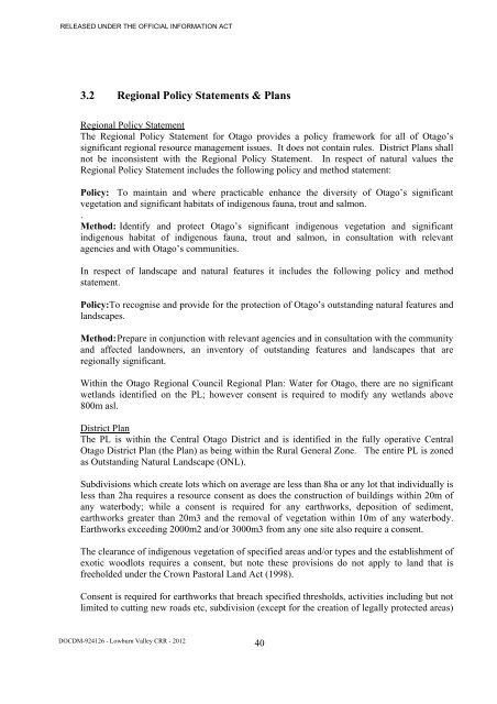
3.2 Regional Policy Statements & Plans<br />
Regional Policy Statement<br />
The Regional Policy Statement for Otago provides a policy framework for all of Otago’s<br />
significant regional resource management issues. It does not contain rules. District Plans shall<br />
not be inconsistent with the Regional Policy Statement. In respect of natural values the<br />
Regional Policy Statement includes the following policy and method statement:<br />
Policy: To maintain and where practicable enhance the diversity of Otago’s significant<br />
vegetation and significant habitats of indigenous fauna, trout and salmon.<br />
.<br />
Method: Identify and protect Otago’s significant indigenous vegetation and significant<br />
indigenous habitat of indigenous fauna, trout and salmon, in consultation with relevant<br />
agencies and with Otago’s communities.<br />
In respect of landscape and natural features it includes the following policy and method<br />
statement.<br />
Policy:To recognise and provide for the protection of Otago’s outstanding natural features and<br />
landscapes.<br />
Method: Prepare in conjunction with relevant agencies and in consultation with the community<br />
and affected landowners, an inventory of outstanding features and landscapes that are<br />
regionally significant.<br />
Within the Otago Regional Council Regional Plan: Water for Otago, there are no significant<br />
wetlands identified on the PL; however consent is required to modify any wetlands above<br />
800m asl.<br />
District Plan<br />
The PL is within the Central Otago District and is identified in the fully operative Central<br />
Otago District Plan (the Plan) as being within the Rural General Zone. The entire PL is zoned<br />
as Outstanding Natural <strong>Land</strong>scape (ONL).<br />
Subdivisions which create lots which on average are less than 8ha or any lot that individually is<br />
less than 2ha requires a resource consent as does the construction of buildings within 20m of<br />
any waterbody; while a consent is required for any earthworks, deposition of sediment,<br />
earthworks greater than 20m3 and the removal of vegetation within 10m of any waterbody.<br />
Earthworks exceeding 2000m2 and/or 3000m3 from any one site also require a consent.<br />
The clearance of indigenous vegetation of specified areas and/or types and the establishment of<br />
exotic woodlots requires a consent, but note these provisions do not apply to land that is<br />
freeholded under the Crown Pastoral <strong>Land</strong> Act (1998).<br />
Consent is required for earthworks that breach specified thresholds, activities including but not<br />
limited to cutting new roads etc, subdivision (except for the creation of legally protected areas)<br />
DOCDM-924126 - Lowburn Valley CRR - 2012<br />
40


