A Guide To Paddling in the Big South Fork - National Park Service
A Guide To Paddling in the Big South Fork - National Park Service
A Guide To Paddling in the Big South Fork - National Park Service

You also want an ePaper? Increase the reach of your titles
YUMPU automatically turns print PDFs into web optimized ePapers that Google loves.
<strong>National</strong> <strong>Park</strong> <strong>Service</strong><br />
U.S. Department of <strong>the</strong> Interior<br />
<strong>Big</strong> <strong>South</strong> <strong>Fork</strong> <strong>National</strong> River and Recreation Area<br />
Oneida, Tennessee<br />
A <strong>Guide</strong> <strong>To</strong> <strong>Paddl<strong>in</strong>g</strong> <strong>in</strong> <strong>the</strong> <strong>Big</strong> <strong>South</strong> <strong>Fork</strong>
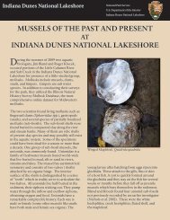
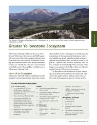
<strong>Paddl<strong>in</strong>g</strong> <strong>the</strong> <strong>Big</strong> <strong>South</strong> <strong>Fork</strong><br />
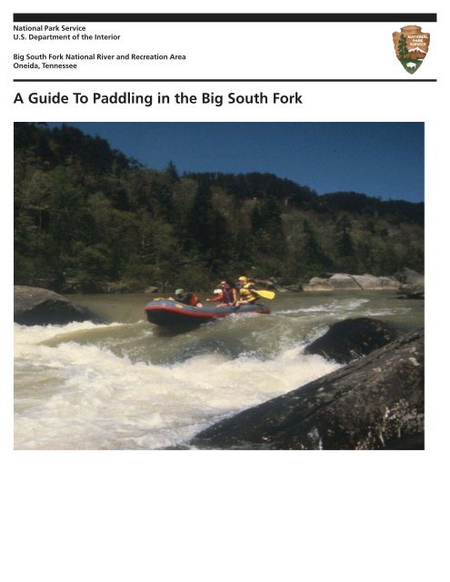
Float<strong>in</strong>g <strong>the</strong> streams of <strong>the</strong> <strong>Big</strong> <strong>South</strong> <strong>Fork</strong> will give you<br />
entry to a land that time and events have visited,<br />
impacted and left. Although you can still see <strong>the</strong><br />
results of previous agricultural, m<strong>in</strong><strong>in</strong>g and logg<strong>in</strong>g<br />
practices, <strong>the</strong> land today has a quality of wildness with<br />
limited access and sparse development. At no time is<br />
this more apparent than when float<strong>in</strong>g <strong>the</strong> streams or<br />
camp<strong>in</strong>g on a river bank as <strong>the</strong> sun s<strong>in</strong>ks beh<strong>in</strong>d <strong>the</strong><br />
gorge rim.<br />
Where <strong>the</strong> stream flows slow and smooth, you are able<br />
to look closely at <strong>the</strong> banks and cliffs. Where <strong>the</strong><br />
stream speeds up and twists and drops between and<br />
around boulders and over ledges, you become one<br />
with your paddle. Rapids that you thought you would<br />
shoot through <strong>in</strong> seconds seem to take m<strong>in</strong>utes as you<br />
lunge and thrust your way to calmer waters. Then <strong>the</strong><br />
adventure ends abruptly and <strong>the</strong> pace aga<strong>in</strong> changes.
River Difficulity<br />
The follow<strong>in</strong>g rapid classifications were provided by <strong>the</strong> American Whitewter Affiliation.<br />
Rapids on a river generally fit <strong>in</strong>to one of <strong>the</strong> follow<strong>in</strong>g classifications, but if <strong>the</strong> water temperature<br />
is below 50 degrees Fahrenheit or if <strong>the</strong> trip is an extended one <strong>in</strong>to a wilderness area, <strong>the</strong><br />
river should be considered one class more difficult than normal.<br />
CLASS I<br />
Mov<strong>in</strong>g water with a few riffles and small<br />
waves. Few or no obstructions.<br />
CLASS II<br />
Easy rapids with waves up to 3 feet and wide,<br />
clear channels that are obvious without<br />
scout<strong>in</strong>g. Some maneuver<strong>in</strong>g is required.<br />
CLASS III<br />
Rapids with high, irregular waves often<br />
capable of swamp<strong>in</strong>g an open canoe. Narrow<br />
passages that often require complex maneuver<strong>in</strong>g.<br />
May require scout<strong>in</strong>g from shore.<br />
CLASS V<br />
Extremely difficult, long, and very violent rapids<br />
with highly congested routes, which should always<br />
be scouted from shore. Rescue conditions are<br />
difficult, and <strong>the</strong>re is significant hazard to life <strong>in</strong> <strong>the</strong><br />
event of a mishap. Ability to Eskimo roll is essential<br />
for boaters <strong>in</strong> kayaks and decked canoes.<br />
CLASS VI<br />
Difficulties of Class V carried to <strong>the</strong> extreme navigability.<br />
Nearly impossible and very dangerous. For<br />
teams of experts only, after close study has been<br />
made and all precautions have been taken.<br />
CLASS IV<br />
Long, difficult rapids with constricted passages<br />
that often require precise maneuver<strong>in</strong>g<br />
<strong>in</strong> very turbulent waters. Scout<strong>in</strong>g from shore<br />
is necessary, and conditions make rescue<br />
difficult. Generally not possible for open<br />
canoes. Boaters <strong>in</strong> covered canoes and<br />
kayaks should have <strong>the</strong> ability to Eskimo roll.
River Levels<br />
The follow<strong>in</strong>g are descriptions at various water levels of <strong>the</strong> Clear <strong>Fork</strong> and <strong>Big</strong> <strong>South</strong> <strong>Fork</strong> Rivers from Brewster<br />
Bridge (Highway 52) to Lea<strong>the</strong>rwood Ford Bridge (State Route 297). Gauge read<strong>in</strong>gs are from <strong>the</strong> Lea<strong>the</strong>rwood Ford<br />
gauge. These descriptions were provided by four whitewater clubs <strong>in</strong> 1989 and are generalized statements about<br />
conditions that may be experienced while runn<strong>in</strong>g <strong>the</strong> gorge.<br />
These descriptions are meant as an aid to help you use your own judgement <strong>in</strong> decid<strong>in</strong>g if you should run this section<br />
of <strong>the</strong> river. Because of changes <strong>in</strong> <strong>the</strong> river over time, <strong>the</strong>se descriptions may not be accurate. Use <strong>the</strong>m as a guide,<br />
but scout each rapid before you try it.<br />
500 (CFS):<br />
This level is considered very low. The rapids, especially<br />
on Clear <strong>Fork</strong>, are extremely technical. Broach<strong>in</strong>g on<br />
rocks due to <strong>the</strong> tight passages is likely. Bottom<strong>in</strong>g out <strong>in</strong><br />
<strong>the</strong> vertical drops is common. Rapids, especially <strong>in</strong> <strong>the</strong><br />
ma<strong>in</strong> gorge, are steep and rocky. P<strong>in</strong>n<strong>in</strong>g is possible.<br />
River classification: Class III with one or two Class IV’s.<br />
1000 CFS:<br />
This level is considered optimum for open canoes.<br />
Rapids rema<strong>in</strong> technical and rocky. Several drops are<br />
still very vertical. Waves grow to 2-4 feet <strong>in</strong> height <strong>in</strong><br />
places. Canoe swamp<strong>in</strong>g is possible. River classification:<br />
Class III with a few Class IV’s.<br />
1800 CFS:<br />
Clear <strong>Fork</strong> becomes much less technical and sports<br />
several Class III rapids. The ma<strong>in</strong> gorge beg<strong>in</strong>s to have<br />
big water at this level, with several waves topp<strong>in</strong>g out at<br />
4-5 feet. Vertical drops still exist at Double Falls,<br />
Wash<strong>in</strong>g Mach<strong>in</strong>e, and The Ell (The <strong>Big</strong> Three), as well<br />
as two drops <strong>in</strong> <strong>the</strong> canyon. The <strong>Big</strong> Three section is<br />
solid Class IV. Rescue between drops becomes problematic<br />
at this level, and some rapids, e.g., Krekels<br />
(Honey Creek Rapid), are cont<strong>in</strong>uous for over 1/4 mile.<br />
River classification: Class III-IV.<br />
2500 CFS:<br />
The river ma<strong>in</strong>ta<strong>in</strong>s a similar character at this level,<br />
with waves reach<strong>in</strong>g 6 feet <strong>in</strong> heights. Some holes<br />
become very tenacious at this level, particularly those<br />
at The Ell, Rion’s Eddy, and <strong>the</strong> Canyon. Overall<br />
difficulty is Class III - IV with several strong Class IV’s.<br />
3500 CFS:<br />
Clear <strong>Fork</strong> rapids become nearly cont<strong>in</strong>uous at this<br />
level. Water <strong>in</strong> <strong>the</strong> Little Three rapids is powerful, with<br />
reactionary waves beg<strong>in</strong>n<strong>in</strong>g to form <strong>in</strong> <strong>the</strong> 6 foot<br />
range. The ma<strong>in</strong> gorge is Class IV and very powerful.<br />
Waves <strong>in</strong> <strong>the</strong> 6 foot range are common, with several<br />
waves up to 8 feet. Swirly water and whirlpools beg<strong>in</strong><br />
form<strong>in</strong>g at <strong>the</strong> bottoms of rapids at this level. Rescue<br />
becomes very difficult because of <strong>the</strong> swiftness of <strong>the</strong><br />
water, and <strong>the</strong> length and difficulty of <strong>the</strong> rapids.
River Levels<br />
5000 CFS:<br />
At this level, <strong>the</strong> river changes character. Waves <strong>in</strong> <strong>the</strong><br />
6-8 foot category are common, with a few atta<strong>in</strong><strong>in</strong>g 10<br />
feet <strong>in</strong> height. Some eddies are very unstable, and<br />
waves beg<strong>in</strong> to pulse. Diagonal reactionary waves are<br />
common <strong>in</strong> <strong>the</strong> gorge and make upright boat<strong>in</strong>g cont<strong>in</strong>uously<br />
difficult. Equipment is frequently lost if not<br />
retrieved expeditiously. River classification: Class IV.<br />
10,000 CFS:<br />
Clear <strong>Fork</strong> has roll<strong>in</strong>g 4-5 foot waves for much of its<br />
length. The Little Three is a solid Class IV plus with<br />
large reactionary waves for 1/2 mile. The ma<strong>in</strong> gorge<br />
resembles <strong>the</strong> New River Gorge at medium water<br />
levels. Waves are huge, especially <strong>in</strong> <strong>the</strong> <strong>Big</strong> Three and<br />
<strong>the</strong> canyon sections. The canyon is very dangerous at<br />
this level because it is cont<strong>in</strong>uous for 1-1/2 miles with<br />
only a few eddies. The waves <strong>in</strong> <strong>the</strong> ma<strong>in</strong> current<br />
average 7 - 8 feet. The water is up <strong>in</strong> <strong>the</strong> brush and<br />
trees <strong>in</strong> places, thus mak<strong>in</strong>g rescue extremely difficult<br />
and broaches a possibility. Several giant holes appear<br />
which can be extremely dangerous, e.g., Krekels<br />
(Honey Creek Rapid). Above 10,000 CFS <strong>the</strong>re is a<br />
river wide hole between <strong>the</strong> EL and <strong>the</strong> Honey Creek<br />
Rapids, caution is advised. River classification: Class<br />
IV - V.<br />
20,000 CFS:<br />
The river has a similar character to levels around<br />
10,000 CFS. Holes become bigger and meaner. Waves<br />
beg<strong>in</strong> to explode irregularly. River debris (logs and<br />
trees) become a factor. Most rapids <strong>in</strong> <strong>the</strong> gorge are<br />
over 1/4 mile long. Swims are likely to be life-threaten<strong>in</strong>g<br />
to <strong>the</strong> swimmer and <strong>the</strong> rescuer. Rescue of equipment<br />
is almost too difficult. This level is considered<br />
high flood, and much of <strong>the</strong> gorge is Class V. Walkouts<br />
are common at this level. Overnight stays may be<br />
<strong>the</strong> result. River classification: Class V.<br />
40,000 CFS:<br />
The Little Three has 8 - 9 foot waves. The <strong>Big</strong> Three is<br />
a mile-long Class V with cont<strong>in</strong>uous 10 - 15 foot erratic<br />
(reactionary) waves term<strong>in</strong>at<strong>in</strong>g <strong>in</strong> a river-wide hole at<br />
Honey Creek Rapid. The Canyon is a 1-1/2 mile CON-<br />
TINUOUS series of 12 - 15 foot reactionary wave tra<strong>in</strong>s<br />
with several offset holes, one of which is 2/3 of <strong>the</strong> river<br />
wide and probably a keeper. Float<strong>in</strong>g river debris is<br />
very problematic. Walk-outs are very likely. River<br />
classification: Class V plus.
Run Descriptions<br />
Peters Bridge to Brewster Bridge<br />
Distance<br />
6 Miles<br />
Difficulty<br />
I-II<br />
Average Drop 7<br />
Use Season<br />
W-Sp<br />
Lea<strong>the</strong>rwood Gage 800-5000 cfs<br />
When <strong>the</strong>re is enough water, this section makes a very<br />
nice half-day trip. The valley walls are close toge<strong>the</strong>r<br />
and quite steep as <strong>the</strong> Clear <strong>Fork</strong> beg<strong>in</strong>s to cut <strong>in</strong>to <strong>the</strong><br />
Cumberland Plateau. Laurel thickets are common <strong>in</strong><br />
this heavily wooded valley. The river is characterized<br />
by long pools and short, quick, easy drops.<br />
Burnt Mill Bridge to Lea<strong>the</strong>rwood Ford<br />
Distance<br />
11 Miles<br />
Difficulty<br />
III-IV<br />
Average Drop 20<br />
Use Season<br />
F-W-Sp<br />
Lea<strong>the</strong>rwood Gage 800-5000 cfs<br />
This is <strong>the</strong> run usually made by paddlers wish<strong>in</strong>g to float<br />
<strong>the</strong> gorge. The trip beg<strong>in</strong>s deceptively easily, but<br />
quickly develops <strong>in</strong>to serious, powerful whitewater<br />
which is challeng<strong>in</strong>g to even expert and advanced<br />
paddlers. Emergency access exists at <strong>the</strong> O&W trestle,<br />
P<strong>in</strong>e Creek and by a steep footpath at <strong>the</strong> Honey Creek<br />
Pocket Wilderness. Numerous sheer, massive sandstone<br />
cliffs are visible on <strong>the</strong> run. The scenic values of<br />
<strong>the</strong> gorge are of <strong>the</strong> highest order.<br />
Brewster Bridge to Burnt Mill Bridge<br />
Distance<br />
10.5 Miles<br />
Difficulty<br />
II-III<br />
Average Drop 12<br />
Use Season<br />
F-W-Sp<br />
Lea<strong>the</strong>rwood Gage 800-4000 cfs<br />
This is a very beautiful section featur<strong>in</strong>g numerous<br />
boulders <strong>in</strong> <strong>the</strong> streambed, precipitous bluffs, and<br />
moderate rapids. The only named rapid is Decapitation<br />
Rock, formed where <strong>the</strong> stream goes under an undercut<br />
rock.Though not particularly dangerous, it is ra<strong>the</strong>r<br />
strik<strong>in</strong>g and requires some maneuver<strong>in</strong>g skill to negotiate.<br />
White Oak Bridge to Burnt Mill Bridge<br />
Distance<br />
11 Miles<br />
Difficulty<br />
II<br />
Average Drop 13<br />
Use Season<br />
W-Sp<br />
Lea<strong>the</strong>rwood Gage 1000-3500 cfs<br />
White Oak Creek is a scenic 5.5 mile run past numerous<br />
rockhouses and bluffs as it heads for <strong>the</strong> Clear <strong>Fork</strong><br />
River. The last half-mile of Whiteoak Creek has some<br />
nice Class II rapids. The 5.5 miles of Clear <strong>Fork</strong> river to<br />
<strong>the</strong> takeout are likewise beautiful and have no major<br />
rapids.<br />
Please note <strong>the</strong>se are only suggested levels and are very subjective be<strong>in</strong>g geared toward kayaks and canoes. At lower<br />
levels <strong>the</strong> degree of difficulty rises due to <strong>the</strong> technical nature of many rapids. At higher levels <strong>the</strong> difficulty can rise<br />
considerably due to <strong>the</strong> volume and speed of <strong>the</strong> water flow<strong>in</strong>g through <strong>the</strong> rapids.
Run Descriptions<br />
New River Bridge to Lea<strong>the</strong>rwood Ford<br />
Distance<br />
15.5 Miles<br />
Difficulty<br />
I-IV<br />
Average Drop 14<br />
Use Season<br />
F-W-Sp<br />
Lea<strong>the</strong>rwood Gage 500-5000 cfs<br />
New River, for its first six miles is a placid stream, <strong>the</strong><br />
drop <strong>in</strong> <strong>the</strong> last two miles picks up considerably and<br />
some Class II-III ledges appear. The last 7.5 miles are<br />
run on <strong>the</strong> <strong>Big</strong> <strong>South</strong> <strong>Fork</strong> River which conta<strong>in</strong>s several<br />
Class III-IV drops. The trip will require a long day of<br />
paddl<strong>in</strong>g.<br />
Lea<strong>the</strong>rwood Ford Bridge to Station Camp or Blue<br />
Heron M<strong>in</strong>e<br />
Distance 8 or 27 Miles<br />
Difficulty I-II (Angle Falls<br />
& Devils Jump IV)<br />
Average Drop 5<br />
Use Season F-W-Sp-Early Summer<br />
Lea<strong>the</strong>rwood Gage 400-2500 cfs<br />
The stretch from Lea<strong>the</strong>rwood to <strong>the</strong> Blue Heron<br />
M<strong>in</strong>e is a two day run comb<strong>in</strong><strong>in</strong>g moderate paddl<strong>in</strong>g<br />
difficulty with spectacular scenery. Angel Falls is two<br />
miles below Lea<strong>the</strong>rwood Ford and should be portaged<br />
on river right at any level. Devils Jump is located<br />
just above <strong>the</strong> take-out and should be portaged on<br />
river left. The portages are not signed, be sure you are<br />
familiar with <strong>the</strong> landmarks which are associated with<br />
<strong>the</strong> approach to each rapids.<br />
Zenith M<strong>in</strong>e to Lea<strong>the</strong>rwood Ford Bridge<br />
Distance<br />
8.5 Miles<br />
Difficulty<br />
II<br />
Average Drop 22<br />
Use Season<br />
W-Sp<br />
Lea<strong>the</strong>rwood Gage 2500-5000 cfs<br />
North White Oak Creek <strong>in</strong> an enjoyable seven mile run<br />
of moderate difficulty down a 400 foot, strik<strong>in</strong>gly<br />
beautiful gorge. Boulders of assorted shapes and sizes<br />
are strewn along <strong>the</strong> way. Rapids are short and may be<br />
ra<strong>the</strong>r tricky, so good maneuver<strong>in</strong>g ability is necessary.<br />
Blue Heron M<strong>in</strong>e to Yamacraw Bridge or Alum<br />
Ford<br />
Distance<br />
4.8 or 12.2 Miles<br />
Difficulty I-II<br />
Average Drop 5<br />
Use Season<br />
F-Sp-Summer<br />
Lea<strong>the</strong>rwood Gage 400-2500 cfs<br />
The run from Blue Heron to Yamacraw is a popular<br />
canoe trip throughout <strong>the</strong> paddl<strong>in</strong>g season. In <strong>the</strong> fall<br />
<strong>the</strong> colors make this an exceptionally beautiful trip.<br />
The 7.8 mile trip from Yamacraw to Alum Ford is<br />
generally a flat water trip through late summer when<br />
<strong>the</strong> lake level drops enough to give <strong>the</strong> water some<br />
flow. Motorized boats may be encountered on this<br />
section of river.<br />
Please note <strong>the</strong>se are only suggested levels and are very subjective be<strong>in</strong>g geared toward kayaks and canoes. At lower<br />
levels <strong>the</strong> degree of difficulty rises due to <strong>the</strong> technical nature of many rapids. At higher levels <strong>the</strong> difficulty can rise<br />
considerably due to <strong>the</strong> volume and speed of <strong>the</strong> water flow<strong>in</strong>g through <strong>the</strong> rapids.
River Access<br />
BLUE HERON/MINE 18:<br />
The Blue Heron site may be reached by tak<strong>in</strong>g Kentucky<br />
Route 742 west from Revelo, Kentucky. Com<strong>in</strong>g<br />
from <strong>the</strong> north or south, take U.S. Highway 27 to<br />
Highway 92, turn left and follow Route 92 through<br />
Stearns to 1651, follow 1651 east to Revelo and turn<br />
right onto Highway 742. Blue Heron is located 9.5<br />
miles down Kentucky Route 742.<br />
YAMACRAW:<br />
Yamacraw Bridge is on Kentucky Highway 92 north of<br />
Stearns, Kentucky, or 92 south from Monticello, (KY<br />
side of <strong>Park</strong>)Kentucky.<br />
ALUM FORD:<br />
Alum Ford area may be reached by tak<strong>in</strong>g Kentucky<br />
Route 700 west from U.S. 27 at Marshes Sid<strong>in</strong>g. (KY<br />
side of <strong>Park</strong>) Follow Kentucky Route 700 approximately<br />
5 miles to <strong>the</strong> ford.<br />
WORLEY:<br />
Take Highway 92, 1.8 miles west from Stearns, Kentucky<br />
to Highway 791. Take Highway 791 for (KY side<br />
of <strong>Park</strong>) approximately 1.4 miles. The road to Worley<br />
is a gravel road that drops off sharply to <strong>the</strong> right.<br />
Cont<strong>in</strong>ue down this road approximately 0.9 miles to<br />
Worley. The road to Worley is often <strong>in</strong> poor condition<br />
and may not be suitable for some 2 wheel drive vehicles.<br />
Caution is advised.<br />
NEW RIVER BRIDGE:<br />
From Bandy Creek Road, turn east (left) onto Route<br />
297. Drive 12 miles to Oneida and U.S. 27. Turn (south<br />
end of <strong>Park</strong>) south (right) onto Route 27 and drive 10<br />
miles to New River Bridge. River access immediately<br />
south of <strong>the</strong> bridge.<br />
WHITE OAK CREEK:<br />
From Bandy Creek Road, turn east (left) onto Route<br />
297 and cont<strong>in</strong>ue to Oneida and U.S. 27 south. (south<br />
end of <strong>Park</strong>)Follow Route 27 south to Route 52 <strong>in</strong><br />
Elg<strong>in</strong>. Turn right onto Route 52 east and drive toward<br />
Rugby approximately 5 miles to White Oak Creek<br />
Bridge.<br />
BURNT MILL BRIDGE:<br />
Cont<strong>in</strong>ue as for New River Bridge. Aftercross<strong>in</strong>g<br />
bridge at New River drive 0.5 milesfar<strong>the</strong>r on Route<br />
(south end of <strong>Park</strong>)27 southto Mounta<strong>in</strong> View Road on<br />
<strong>the</strong> right. Drive2.0 miles to Mounta<strong>in</strong> View and turn<br />
right atShoemaker’s store, <strong>the</strong>n left on Black<br />
CreekRoad at Mounta<strong>in</strong> View Baptist Church.Follow<br />
Black Creek Road 2.3 miles to Cross-roads Community.<br />
At Crossroads turn rightonto Burnt Mill Ford Road<br />
(gravel road).Cont<strong>in</strong>ue .5 miles to fork <strong>in</strong> road. Take<br />
left fork and cont<strong>in</strong>ue .5 miles to Burnt Mill Bridge.
River Access<br />
BREWSTER BRIDGE:<br />
Follow above directions for White Oak Bridge. After<br />
cross<strong>in</strong>g bridge cont<strong>in</strong>ue east on Route 52 through<br />
(south end of <strong>Park</strong>) Rugby to Brewster Bridge on <strong>the</strong><br />
Clear <strong>Fork</strong> River.<br />
PETER’S BRIDGE:<br />
The Peter’s Ford Road leaves Highway 52 at Pleasant<br />
View Church of <strong>the</strong> Nazarene 3 miles east of Allardt<br />
(south end of <strong>Park</strong>)and 8 miles east of Jamestown,<br />
Tennessee. It can also be reached via Rugby by <strong>the</strong><br />
above directions for Brewster Bridge. After cross<strong>in</strong>g<br />
<strong>the</strong> bridge, cont<strong>in</strong>ue west on Route 52 for approximately<br />
7 more miles to <strong>the</strong> church on <strong>the</strong> left.<br />
STATION CAMP:<br />
From Bandy Creek Road turn (left) east onto Route<br />
297 for approximately 8.5 miles to junction of 297 (TNmiddle<br />
section) and Station Camp Road. Turn left<br />
onto Station Camp Road at Terry & Terry Store and<br />
drive 8.1 miles to river.<br />
From Highway 27 <strong>in</strong> Oneida take TN Route 297 west<br />
six miles to <strong>the</strong> Terry & Terry Store. Cont<strong>in</strong>ue straight<br />
onto Station Camp Road at Terry & Terry Store and<br />
drive 8.1 miles to river.<br />
(Approximately4 miles of this road is gravel and becomes<br />
steep before reach<strong>in</strong>g river).<br />
ZENITH:<br />
Take Highway 52 east for 5.5 miles to Mt. Helen Road.<br />
Turn left onto Mt. Helen and drive 4.9 miles to fork <strong>in</strong><br />
<strong>the</strong> road at Garrett’s Grocery. Take <strong>the</strong> paved road to<br />
<strong>the</strong> left and drive .2 miles to Zenith Road to <strong>the</strong> left.<br />
LEATHERWOOD FORD:<br />
From Bandy Creek Road turn (left) east onto Route<br />
297, drive 1 mile to Lea<strong>the</strong>rwood Ford.<br />
From Highway 27 <strong>in</strong> Oneida take TN Route 297 west<br />
ten miles to Lea<strong>the</strong>rwood Ford<br />
(TN middle section).
River Safety<br />
Proper plann<strong>in</strong>g and common sense can keep an enjoyable river trip from turn<strong>in</strong>g <strong>in</strong>to a dangerous<br />
and possibly life-threaten<strong>in</strong>g experience. The follow<strong>in</strong>g safety tips are provided by <strong>the</strong><br />
American Red Cross, read <strong>the</strong>m carefully and practice safe river paddl<strong>in</strong>g techniques.<br />
Travel <strong>in</strong> groups of at least three boats while on <strong>the</strong><br />
river. Keep <strong>the</strong> boat beh<strong>in</strong>d you <strong>in</strong> sight. Secure all<br />
equipment <strong>in</strong> your boat.<br />
Be sure you know your put-<strong>in</strong> po<strong>in</strong>t and especially<br />
your take-out po<strong>in</strong>t.<br />
Avoid flow-through hazards (stra<strong>in</strong>ers). Even <strong>in</strong> slow<br />
water, <strong>the</strong>se can trap you and be <strong>the</strong> cause of a fatality.<br />
Avoid hydraulics - you can get trapped. Swim down to<br />
get out.<br />
Capsized? Stay at <strong>the</strong> upstream end of <strong>the</strong> canoe.<br />
Don’t take chances sav<strong>in</strong>g equipment. Leave <strong>the</strong> boat<br />
and swim if do<strong>in</strong>g so will improve your safety, especially<br />
<strong>in</strong> cold water or very rough water. Keep your<br />
toes up and your feet toge<strong>the</strong>r, po<strong>in</strong>ted downstream.<br />
Never try to stand up <strong>in</strong> fast water unless it is too<br />
shallow for swimm<strong>in</strong>g.<br />
When strik<strong>in</strong>g an obstruction sideways is <strong>in</strong>evitable,<br />
lean <strong>the</strong> canoe downstream but don’t get caught<br />
between <strong>the</strong> canoe and <strong>the</strong> obstruction. With <strong>the</strong><br />
upstream gunwale up, <strong>the</strong> canoe will be easier to<br />
remove from <strong>the</strong> rock. If <strong>the</strong> upstream gunwale is<br />
down, with <strong>the</strong> water mov<strong>in</strong>g at 5 mph, a 16-foot canoe<br />
would have hydraulic force of 2,240 pounds exerted<br />
upon it. The canoe could be severely damaged.<br />
When you approach obstructions, set your course well<br />
<strong>in</strong> advance. Know how to approach. If <strong>in</strong> doubt, scout<br />
from shore.<br />
When o<strong>the</strong>r streams jo<strong>in</strong> <strong>the</strong> ma<strong>in</strong> stream, <strong>the</strong>re can be<br />
strong crosscurrents, sandbars, debris, etc.<br />
Remember that river current is usually faster on <strong>the</strong><br />
outside of a bend. It also spirals (folds under) down to<br />
<strong>the</strong> bottom.<br />
Be aware that upstream V’s <strong>in</strong>dicate rocks. Downstream<br />
V’s with haystacks <strong>in</strong>dicate gaps between rocks.<br />
Th<strong>in</strong>k ahead. Set your course well <strong>in</strong> advance. Know<br />
your approach. Use a back stroke <strong>in</strong> stand<strong>in</strong>g waves.<br />
Set stern toward desired shore.<br />
If you go swimm<strong>in</strong>g while on a paddl<strong>in</strong>g trip, remember<br />
to always wear your PFD, even <strong>in</strong> calm water.<br />
Emergency access to and from <strong>the</strong> river may be accomplished<br />
by us<strong>in</strong>g trails at <strong>the</strong> Confluence, Honey Creek,<br />
No Bus<strong>in</strong>ess, Williams Creek and Bear Creek or by<br />
road at P<strong>in</strong>e Creek, <strong>the</strong> O&W Bridge, Lea<strong>the</strong>rwood<br />
Ford, Station Camp.
Emergency Information<br />
The <strong>Big</strong> <strong>South</strong> <strong>Fork</strong> of <strong>the</strong> Cumberland River and its<br />
ma<strong>in</strong> tributaries, <strong>the</strong> Clear <strong>Fork</strong>, North White Oak and<br />
New River offer a variety of whitewater paddl<strong>in</strong>g<br />
experiences. Some stretches are ideal for beg<strong>in</strong>ners,<br />
while o<strong>the</strong>r sections should be attempted only by<br />
highly skilled paddlers. Some streams can be floated<br />
dur<strong>in</strong>g any season of <strong>the</strong> year while o<strong>the</strong>rs have enough<br />
water for boat<strong>in</strong>g only dur<strong>in</strong>g seasons with sufficient<br />
ra<strong>in</strong>fall.<br />
Float<strong>in</strong>g can be a dangerous sport <strong>in</strong> certa<strong>in</strong> stretches<br />
of <strong>the</strong> streams <strong>in</strong> <strong>Big</strong> <strong>South</strong> <strong>Fork</strong> <strong>National</strong> River and<br />
Recreation Area and at times of ris<strong>in</strong>g water. The river<br />
is a dynamic system which changes constantly. Expect<br />
<strong>the</strong> unexpected. Conditions change quickly.<br />
This guide is <strong>in</strong>tended to help you plan a safe and<br />
enjoyable adventure paddl<strong>in</strong>g <strong>in</strong> <strong>Big</strong> <strong>South</strong> <strong>Fork</strong> <strong>National</strong><br />
River and Recreation Area. <strong>Paddl<strong>in</strong>g</strong> guides for<br />
both Tennessee and Kentucky may be purchased at <strong>the</strong><br />
Bandy Creek and Blue Heron Book Stores. These<br />
publications provide additional <strong>in</strong>formation on paddl<strong>in</strong>g<br />
<strong>in</strong> <strong>Big</strong> <strong>South</strong> <strong>Fork</strong> <strong>National</strong> River and Recreation<br />
Area.<br />
Additional <strong>in</strong>formation such as current river conditions,<br />
flow rates and available commercial outfitters<br />
may be obta<strong>in</strong>ed by call<strong>in</strong>g <strong>the</strong> Bandy Creek Visitor<br />
Center at (423) 286-7275 dur<strong>in</strong>g normal hours of operation.<br />
Be prepared for self-rescue. Sections of <strong>the</strong> river are<br />
very remote and help from o<strong>the</strong>rs could take several<br />
hours. Do not over estimate your skill level.<br />
Beg<strong>in</strong>ner: A person without knowledge of basic<br />
strokes and maneuvers.<br />
Novice: A person with knowledge of basic strokes and<br />
maneuvers such as eddy turns, peel offs, and ferries.<br />
Intermediate: A person able to execute all basic<br />
maneuvers and strokes confidently <strong>in</strong> cont<strong>in</strong>uous Class<br />
III water.<br />
Advanced: Takes Class III <strong>in</strong> stride and seeks challenge<br />
<strong>in</strong> Class IV. Can maneuver <strong>in</strong> Class IV rapids.<br />
In <strong>the</strong> event of an emergency park<br />
rangers may be contacted dur<strong>in</strong>g <strong>the</strong><br />
day by call<strong>in</strong>g <strong>the</strong> Bandy Creek Visitor<br />
Center at (423) 286-7275 or after hours<br />
by call<strong>in</strong>g any County Sheriff Office.<br />
Telephones are located at <strong>the</strong> Lea<strong>the</strong>rwood<br />
Ford river access and <strong>the</strong> Blue<br />
Heron M<strong>in</strong><strong>in</strong>g Community.