GeoFrame 2012 SP 2 Release Notes - Ocean - Schlumberger
GeoFrame 2012 SP 2 Release Notes - Ocean - Schlumberger
GeoFrame 2012 SP 2 Release Notes - Ocean - Schlumberger

You also want an ePaper? Increase the reach of your titles
YUMPU automatically turns print PDFs into web optimized ePapers that Google loves.
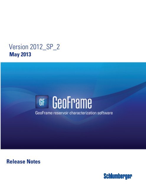
Version <strong>2012</strong>_<strong>SP</strong>_2<br />
May 2013<br />
<strong>Release</strong> <strong>Notes</strong><br />
1
Proprietary Notice<br />
Proprietary Notice<br />
ToC<br />
© 2013 <strong>Schlumberger</strong><br />
All rights reserved. No part of this manual may be reproduced, stored in a retrieval<br />
system, or translated in any form or by any means, electronic or mechanical,<br />
including photocopying and recording, without the prior written permission of<br />
<strong>Schlumberger</strong>.<br />
Use of this product is governed by the License Agreement. <strong>Schlumberger</strong> makes no<br />
warranties, express, implied, or statutory, with respect to the product described herein<br />
and disclaims without limitation any warranties of merchantability or fitness for a<br />
particular purpose.<br />
Index<br />
Copyright and Trademark Information<br />
ADN, ASAP, AutoPix, Basemap, Basemap Plus, BorDip, BorView, Charisma,<br />
Charisma Mapping, CMR, Component Property Editor, Computation Manager, CPS-<br />
3, DataManager, ELANPlus, Framework 3D, GeoCube, GeoFeature Map,<br />
<strong>GeoFrame</strong>, GeoViz, GeoViz Explore, IES, IESX, IMain, IMAP, InDepth, Log<br />
Property Mapping, LPM, Main23D, Main2D, Main3D, MapEdit, MapPlot, MAXIS,<br />
ModelBuilder, MultiWell ResSum, NODAL, PetroStat, PetroView, PetroView Plus,<br />
PrePlus, Residual Processing, ResSum, SCOPE, SEIS2D, SEIS2DV, SEIS3D,<br />
Seis3DV, SeisAn, SeisTie, StrucView, SurfaceSlice, WellComposite, WellEdit,<br />
WellPix, WellSketch, and Zodiac are trademarks of <strong>Schlumberger</strong>.<br />
c-tree, c-tree Plus and FairCom are trademarks of FairCom Corporation.<br />
DipFan is a joined mark of <strong>Schlumberger</strong> and AGIP.<br />
FLEXlm is a registered trademark of GLOBEtrotter Software, Inc.<br />
Linux is a registered trademark of Linus Torvalds<br />
Red Hat is a registered trademark of Red Hat, Inc.<br />
Acrobat and Acrobat Reader are registered trademarks of Adobe Systems<br />
Incorporated.<br />
OpenSpirit is a trademark of OpenSpirit Corporation.<br />
Oracle and SQL*Plus are registered trademarks of Oracle Corporation.<br />
OSF/Motif is a registered trademark of Open Software Foundation.<br />
PCI Express TM is a trademark of PCMCIA in the United States and/or other<br />
countries.<br />
Silicon Graphics, IRIX, GL, OpenGL, and Open Inventor are trademarks or<br />
registered trademarks of Silicon Graphics, Inc.<br />
Sun, Sun Microsystems, Java, Solaris, and NFS are trademarks or registered<br />
trademarks of Sun Microsystems, Inc.<br />
UNIX is a trademark of The Open Group.<br />
2
Copyright and Trademark Information<br />
ZEH PLOT and ZEHPRINT are registered trademarks of ZEH Graphic Systems,<br />
Inc.<br />
GSLIB: Geostatistical Software Library and User’s Guide, Copyright (C) 1992,<br />
Stanford Center for Reservoir Forecasting.<br />
3
Table of Contents<br />
Table of Contents<br />
Copyright and Trademark Information<br />
ToC<br />
Proprietary Notice . . . . . . . . . . . . . . . . . . . . . . . . . . . . . . . . . . . . . . . . . . 2<br />
Copyright and Trademark Information . . . . . . . . . . . . . . . . . . . . . . . . . . 2<br />
Index<br />
Table of Contents<br />
Introduction to <strong>GeoFrame</strong> <strong>2012</strong>_<strong>SP</strong>_2<br />
New Additions to <strong>GeoFrame</strong> . . . . . . . . . . . . . . . . . . . . . . . . . . . . . . . . . . 7<br />
Operating Environment . . . . . . . . . . . . . . . . . . . . . . . . . . . . . . . . . . . . . . 8<br />
Service Packs and Hot Fixes . . . . . . . . . . . . . . . . . . . . . . . . . . . . . . . . . . 8<br />
Graphics Card . . . . . . . . . . . . . . . . . . . . . . . . . . . . . . . . . . . . . . . . . . . . . . 8<br />
Hardcopy . . . . . . . . . . . . . . . . . . . . . . . . . . . . . . . . . . . . . . . . . . . . . . . . . . 8<br />
Help System . . . . . . . . . . . . . . . . . . . . . . . . . . . . . . . . . . . . . . . . . . . . . . . 8<br />
Movies . . . . . . . . . . . . . . . . . . . . . . . . . . . . . . . . . . . . . . . . . . . . . . . . . . . . 9<br />
Data Management<br />
Borehole Set Data Manager . . . . . . . . . . . . . . . . . . . . . . . . . . . . . . . . . 11<br />
Data Managers . . . . . . . . . . . . . . . . . . . . . . . . . . . . . . . . . . . . . . . . . . . . 12<br />
Data Save . . . . . . . . . . . . . . . . . . . . . . . . . . . . . . . . . . . . . . . . . . . . . . . . 12<br />
General ASCII Loader (GAL) . . . . . . . . . . . . . . . . . . . . . . . . . . . . . . . . . 13<br />
Oracle . . . . . . . . . . . . . . . . . . . . . . . . . . . . . . . . . . . . . . . . . . . . . . . . . . . 13<br />
Project Manager . . . . . . . . . . . . . . . . . . . . . . . . . . . . . . . . . . . . . . . . . . . 13<br />
SNAPR . . . . . . . . . . . . . . . . . . . . . . . . . . . . . . . . . . . . . . . . . . . . . . . . . . 13<br />
Surface Sets Data Manager . . . . . . . . . . . . . . . . . . . . . . . . . . . . . . . . . . 14<br />
Utilities . . . . . . . . . . . . . . . . . . . . . . . . . . . . . . . . . . . . . . . . . . . . . . . . . . 14<br />
Wells and Boreholes Data Manager . . . . . . . . . . . . . . . . . . . . . . . . . . . 14<br />
Seismic<br />
Basemap . . . . . . . . . . . . . . . . . . . . . . . . . . . . . . . . . . . . . . . . . . . . . . . . . 15<br />
Charisma IMain . . . . . . . . . . . . . . . . . . . . . . . . . . . . . . . . . . . . . . . . . . . 23<br />
Charisma SEGY Scan . . . . . . . . . . . . . . . . . . . . . . . . . . . . . . . . . . . . . . 24<br />
Charisma SEGY 2D Load . . . . . . . . . . . . . . . . . . . . . . . . . . . . . . . . . . . 25<br />
4
Copyright and Trademark Information<br />
Table of Contents<br />
Charisma SEGY Out . . . . . . . . . . . . . . . . . . . . . . . . . . . . . . . . . . . . . . . . 25<br />
Charisma Utilities . . . . . . . . . . . . . . . . . . . . . . . . . . . . . . . . . . . . . . . . . . 25<br />
Charisma VelLoad . . . . . . . . . . . . . . . . . . . . . . . . . . . . . . . . . . . . . . . . . . 25<br />
EZ Seismic Loader . . . . . . . . . . . . . . . . . . . . . . . . . . . . . . . . . . . . . . . . . 26<br />
GeoViz . . . . . . . . . . . . . . . . . . . . . . . . . . . . . . . . . . . . . . . . . . . . . . . . . . . 31<br />
IESX Database . . . . . . . . . . . . . . . . . . . . . . . . . . . . . . . . . . . . . . . . . . . . . 35<br />
IESX Data Manager . . . . . . . . . . . . . . . . . . . . . . . . . . . . . . . . . . . . . . . . . 35<br />
IESX_Util . . . . . . . . . . . . . . . . . . . . . . . . . . . . . . . . . . . . . . . . . . . . . . . . . 36<br />
InDepth . . . . . . . . . . . . . . . . . . . . . . . . . . . . . . . . . . . . . . . . . . . . . . . . . . . 37<br />
SEGY Editor . . . . . . . . . . . . . . . . . . . . . . . . . . . . . . . . . . . . . . . . . . . . . . . 42<br />
Seis%DV . . . . . . . . . . . . . . . . . . . . . . . . . . . . . . . . . . . . . . . . . . . . . . . . . . 42<br />
Synthetics . . . . . . . . . . . . . . . . . . . . . . . . . . . . . . . . . . . . . . . . . . . . . . . . 44<br />
Modeling<br />
CPS-3 . . . . . . . . . . . . . . . . . . . . . . . . . . . . . . . . . . . . . . . . . . . . . . . . . . . . 45<br />
GeoPetro<br />
BorStress . . . . . . . . . . . . . . . . . . . . . . . . . . . . . . . . . . . . . . . . . . . . . . . . . 47<br />
Cross Section . . . . . . . . . . . . . . . . . . . . . . . . . . . . . . . . . . . . . . . . . . . . . 47<br />
GeoPlot . . . . . . . . . . . . . . . . . . . . . . . . . . . . . . . . . . . . . . . . . . . . . . . . . . 48<br />
Litho ToolKit . . . . . . . . . . . . . . . . . . . . . . . . . . . . . . . . . . . . . . . . . . . . . . 49<br />
Log Property Mapping (LPM) . . . . . . . . . . . . . . . . . . . . . . . . . . . . . . . . . 49<br />
PetroStat . . . . . . . . . . . . . . . . . . . . . . . . . . . . . . . . . . . . . . . . . . . . . . . . . 49<br />
ResSum . . . . . . . . . . . . . . . . . . . . . . . . . . . . . . . . . . . . . . . . . . . . . . . . . . 49<br />
Template . . . . . . . . . . . . . . . . . . . . . . . . . . . . . . . . . . . . . . . . . . . . . . . . . . 50<br />
WellPix . . . . . . . . . . . . . . . . . . . . . . . . . . . . . . . . . . . . . . . . . . . . . . . . . . . 50<br />
<strong>GeoFrame</strong> Data Connectors/Bedrock<br />
Bedrock . . . . . . . . . . . . . . . . . . . . . . . . . . . . . . . . . . . . . . . . . . . . . . . . . . 51<br />
<strong>GeoFrame</strong> Data Connectors - File Based . . . . . . . . . . . . . . . . . . . . . . . 52<br />
<strong>GeoFrame</strong> Connector for Petrel Studio Find<br />
5
Table of Contents<br />
Copyright and Trademark Information<br />
ToC<br />
Index<br />
6
ToC<br />
Index<br />
apter 1 Chapter 1<br />
Introduction to <strong>GeoFrame</strong> <strong>2012</strong>_<strong>SP</strong>_2<br />
<strong>GeoFrame</strong> <strong>2012</strong>_<strong>SP</strong>_2 provides new tools, features, performance, and quality<br />
improvements to enhance your daily geology and geophysics workflows.<br />
New Additions to <strong>GeoFrame</strong><br />
Several new features and enhancements have been implemented, and are highlighted<br />
by the following:<br />
• EZ Seismic Loader has been enhanced to load Charisma 2D and 3D seismic<br />
data. 3D can be loaded as ZGY or native row file format.<br />
• EZ Seismic Loader has been enhanced to load IESX 3D seismic data as ZGY<br />
or native vvol format.<br />
• Basemap crossplot selection posting now receives events from applications<br />
such as Seis%DV, GeoPlot, and LPM with new dialog boxes to control<br />
posting.<br />
• Basemap Planimeters & Volumetrics has been enhanced with access to the<br />
Polygon Selector tool, multiple volumetric parameter settings, and an<br />
Azimuth tool.<br />
• Various InDepth enhancements to Velocity Edit.<br />
• Geology Office Cross Section able to slip/slide Borehole Templates vertically<br />
for correlation as is done in WellPix<br />
• GeoViz scatter set posting improvements.<br />
• Seis%DV synthetics posting priority<br />
7
Introduction to <strong>GeoFrame</strong> <strong>2012</strong>_<strong>SP</strong>_2<br />
Operating Environment<br />
• Mathematical operations for Borehole Set Data Manager and Surface Set<br />
Data Manager.<br />
• Petrostat workflow - rapid reservoir property computation<br />
• GeoViz log gridding for horizontal wells workflow<br />
• Cross Section and Template marker overposting controls<br />
• Basemap GIS export - new items - more attributes on Boreholes, Fault<br />
Boundaries, Gathers data (polygon or point)<br />
• Delete icon added to Basemap Post Surface Data dialog (Grids, Scatter Sets,<br />
Contours)<br />
ToC<br />
Index<br />
Operating Environment<br />
Service Packs and Hot Fixes<br />
Graphics Card<br />
Hardcopy<br />
Help System<br />
Service Pack <strong>GeoFrame</strong> <strong>2012</strong>_<strong>SP</strong>_1 must be loaded prior to installing <strong>GeoFrame</strong><br />
<strong>2012</strong>_<strong>SP</strong>_2. This Service Pack includes Hot Fixes <strong>GeoFrame</strong> <strong>2012</strong>_HF_4 through<br />
<strong>GeoFrame</strong> <strong>2012</strong>_HF_11. There are no other dependencies on any current<br />
<strong>GeoFrame</strong> <strong>2012</strong> Service Pack or Hot Fix.<br />
<strong>GeoFrame</strong> <strong>2012</strong>_<strong>SP</strong>_2 has been tested, and is supported, with NVIDIA Kepler 4000<br />
and 2000 graphics on HP Z820, HP Z620, HP Z800, HP Z600, Dell T7600, and Dell<br />
T7500.<br />
<strong>GeoFrame</strong> <strong>2012</strong>_<strong>SP</strong>_2 was tested with JustPlot 4.3.02 and JustCGM 5.0.05 for 64-<br />
bit and 32-bit versions. These products provide servers for Solaris and Linux. No<br />
patches are known to be required.<br />
Several additional <strong>GeoFrame</strong> online documents have been rewritten and included in<br />
<strong>GeoFrame</strong> <strong>2012</strong>_<strong>SP</strong>_2. They are:<br />
• Charisma Utilities<br />
• CPS-3 Model Editor<br />
• IESX Command Line Seismic Loaders<br />
• IESX Data Manager<br />
8
Movies<br />
• IESX SurfaceSlice<br />
• IESX User Applications<br />
• SeisClass Explore<br />
• DIPLOG to DLIS Converter<br />
• SGA Workflow Charisma<br />
Introduction to <strong>GeoFrame</strong> <strong>2012</strong>_<strong>SP</strong>_2<br />
Movies<br />
Several movies have been embedded into these release notes. These movies can only<br />
be viewed on Windows systems. The release notes are in PDF format and can be<br />
copied from the baseline to a Windows system. To locate the release notes:<br />
1. Open a <strong>GeoFrame</strong> xterm.<br />
2. Type the following in the xterm: cd $sp1/gf_userguides.<br />
3. Locate the gf_<strong>2012</strong>_irn_servpack_sp_2.pdf file.<br />
4. Copy the file to an area where a Windows system can access it.<br />
Open the file on a Windows system, and then click the movie links.<br />
Note: To stop a movie that is playing, press Esc.<br />
9
Introduction to <strong>GeoFrame</strong> <strong>2012</strong>_<strong>SP</strong>_2<br />
Movies<br />
ToC<br />
Index<br />
10
ToC<br />
Index<br />
Chapter 2<br />
Data Management<br />
Borehole Set Data Manager<br />
New Features<br />
• You can now perform mathematical operations on existing borehole sets to<br />
create a new borehole set, or edit an existing borehole set. This option is<br />
available when creating or editing a List Type borehole set. Click the<br />
Combine Borehole Sets icon in the Create Borehole Set or Edit<br />
Borehole Set dialog box to open the new Borehole Sets Operations Dialog<br />
dialog box. It contains the following mathematical operations that can be used<br />
with existing borehole sets to create or edit an existing borehole set:<br />
- Blank - Adds the selected borehole set to the Operations list without a<br />
mathematical operation. If additional borehole sets are added to the<br />
Operations list with this field set to blank, the AND operation will be<br />
added to it automatically.<br />
- NOT - Removes the boreholes in the selected borehole set. For example,<br />
BS1 NOT BS2 would include the boreholes in BS1 but not BS2.<br />
- AND - Retains the boreholes that are common to the selected borehole<br />
sets. For example, BS1 AND BS2 would include the boreholes that are in<br />
both BS1 and BS2.<br />
- OR - Keeps the boreholes in the selected borehole sets. For example, BS1<br />
OR BS2 would include the boreholes that are in either BS1 or BS2.<br />
See the online documentation for further details and examples on this new<br />
option.<br />
11
Data Management<br />
Data Managers<br />
• A Find option has been added for List Type borehole sets to the Available<br />
Boreholes section of the Create Borehole Set and Edit Borehole Set dialog<br />
boxes.<br />
ToC<br />
Index<br />
Figure 1<br />
Borehole Set Operations Dialog dialog box<br />
Enhancement<br />
• ITC has been added to the Create Borehole Set dialog box and Edit<br />
Borehole Set dialog box so you can easily send and receive borehole events.<br />
Data Managers<br />
Major Issue Addressed<br />
Data Save<br />
• The down arrow key now works again to go from one row to next row in the<br />
same column for the data managers that have associated spreadsheets, for<br />
example, Marker Data Manager.<br />
Major Issue Addressed<br />
• Data Save no longer abnormally exits when computing the depth range of<br />
depth matched OBMI images.<br />
12
General ASCII Loader (GAL)<br />
General ASCII Loader (GAL)<br />
Data Management<br />
Oracle<br />
Major Issues Addressed<br />
• The Generic ASCII Loader no longer abnormally exits when loading LAS<br />
files that contain the Drillers_Total_Depth property.<br />
• GAL now uses the user-supplied Input coordinate system when loading<br />
AZIM, DEVI, and MD to an existing borehole. Prior to this fix, this was<br />
causing incorrect results if the borehole was in a different coordinate system<br />
than the incoming deviation data. This fix corrects the AZIM values of the<br />
incoming data from the user-supplied coordinate system to the Borehole<br />
coordinate system before loading.<br />
Major Issue Addressed<br />
• The catalog import process no longer hangs when using an Oracle 10 server if<br />
client system has not been rebooted for a long time (more than 200 days). The<br />
correct libclntsh.so.10.1 has been released in <strong>GeoFrame</strong> <strong>2012</strong>_<strong>SP</strong>_2.<br />
Project Manager<br />
SNAPR<br />
Enhancement<br />
• The splash screen that is displayed when entering <strong>GeoFrame</strong> has been<br />
updated.<br />
Major Issue Addressed<br />
• Proman no longer issues an error message: "Invalid Remote Host" when it<br />
cannot resolve a fully qualified host name from /etc/resolv.conf. The fully<br />
qualified name requirement has been removed.<br />
Major Issues Addressed<br />
• SNAPR no longer fails to make a snapshot when there are a large number of<br />
DSLs defined in the Catalog.<br />
• A SNAPR clone is now set to run multi-user and bulk services locally, even if<br />
the original project was set to run those services remotely.<br />
13
Data Management<br />
Surface Sets Data Manager<br />
• When using dynamic listener registration, SNAPR now updates the listener<br />
host name in the clone initialization parameters to match the local server name<br />
where the clone is being created.<br />
Surface Sets Data Manager<br />
ToC<br />
Index<br />
Utilities<br />
Enhancements<br />
• Query-based surface sets can now be created. An option list next to Create<br />
that contains Query Type and List Type has been added to the Project<br />
Surface Set Data Manager dialog box. A query-based surface set is dynamic,<br />
as it is based on queries, and will update automatically with surfaces that are<br />
created or loaded that fulfill the query parameters.<br />
• You can now perform mathematical operations on existing surface sets to<br />
create a new surface set or edit an existing surface set. This option is available<br />
when creating or editing a List Type surface set. See parameter details above<br />
in the new features section of Borehole Sets Data Manager.<br />
• A Find option has been added for List Type surface sets to the Available<br />
Surfaces section of the Create Surface Set and Edit Surface Set dialog<br />
boxes.<br />
• ITC has been added to the Create Surface Set dialog box and Edit Surface<br />
Set dialog box so you can easily send and receive surface events.<br />
Major Issue Addressed<br />
• When using the command-line utility, swap_datum, the Geodetic coordinate<br />
system name was not being updated to match the new value for Datum. This<br />
was causing confusion for users. This fix changes the Name to match the new<br />
datum value.<br />
Wells and Boreholes Data Manager<br />
Major Issue Addressed<br />
• Borehole XY locations are no longer lost after loading/selecting a new<br />
deviation survey, due to the bottom depth of the well deviation being shorter<br />
than the old bottom depth entered in the Borehole Editor. The fix also<br />
changes the Bottom Location information to display the Deviation Bottom<br />
Location, and adds the MD field. These changes where made to clear up the<br />
confusion of what is being displayed by the fields.<br />
14
ToC<br />
Index<br />
Chapter 3<br />
Seismic<br />
Basemap<br />
New Features<br />
• A new Post > Seismic Highlights option allows you to control Seis%DV<br />
crossplot selections and their symbol type and size on the Basemap canvas.<br />
Seis%DV has a crossplot capability, and can send selected points to post in<br />
Basemap. Different classes from a selected seismic line (2D, 3D inline, 3D<br />
crossline, 3D traverse, 3D slice, and 3D sub volumes) can be crossplotted. Two<br />
grids from a seismic horizon can also be crossplotted, as long as grid library<br />
and domain are the same.<br />
The crossplot events are automatically posted as long as the corresponding<br />
ITC receive toggle is on (default is ON), along with color, name, and type of<br />
current selection.<br />
Note: No posting order is available for different selections of points. The<br />
points are posted in the order of selection, first to last, with the last selection<br />
being posted on top.<br />
The Seismic Highlights dialog box consists of two tabs, Contents and<br />
Appearance, that control the posting of the crossplot selections. The Contents<br />
tab is used to toggle ON/OFF the selections to highlight, and gives you<br />
information on the point count, color, name, and type of the selections. The<br />
Appearance tab allows you to choose the symbol type from a palette of 17<br />
choices and a size from an option menu of 5.<br />
15
Seismic<br />
Basemap<br />
ToC<br />
Index<br />
Figure 2<br />
Seismic Highlights dialog box<br />
• The new Interval Highlights option is used to control the posting and<br />
appearance of crossplot data sent from log curves from single and multiple<br />
boreholes and grids.<br />
Each interval highlight is posted in the same way that zones are posted. The<br />
Interval Highlights dialog box shows each interval with a post toggle, color,<br />
borehole name and minimum/maximum depth range. Several list tools are<br />
provided, so that posting order can be controlled, with intervals at the top of<br />
the list being drawn on top. Graphical display of intervals will, by default,<br />
show all intervals in each selection.<br />
Intervals are merged based upon the Z separation between the end of one<br />
segment and the start of the next segment. Filtering, which is independent of<br />
the map’s units, keeps segments whose Z gap is greater than 50 feet. Filtering<br />
is also done for the map projection of the interval. A gap of more than 5 feet is<br />
required to keep separate. A vertical borehole will always end up as a single<br />
interval in Basemap.<br />
Note: For log curve crossposting, boreholes must be posted to populate the<br />
Interval Highlights dialog box.<br />
Note: The color the crossplot points will be posted in Basemap corresponds to<br />
the colors assigned to that selection in Crossplot. The colors cannot be<br />
changed here, but can be changed in the Crossplot Selection Editor.<br />
16
Basemap<br />
Seismic<br />
Figure 3<br />
Content tab of the Interval Highlights dialog box<br />
The Appearance tab controls the posting of the selected crossplotted values.<br />
You can select how the values are posted, their symbol type, size, line width,<br />
and whether to display tick marks at the intervals ends.<br />
Post As controls the way the intervals are posted on the borehole.<br />
- Symbol at interval top - Displays the selected symbol at the top of the<br />
interval.<br />
- Line along borehole - Displays a line along the borehole for the interval.<br />
- Join end points by straight line - Displays a straight line from the first<br />
point in the interval to the last point in the interval, for the interval.<br />
17
Seismic<br />
Basemap<br />
ToC<br />
Index<br />
Figure 4<br />
Appearance tab of the Interval Highlights dialog box<br />
18
Basemap<br />
Basemap Crossplot Interaction Enhancements Movie<br />
Seismic<br />
Movie Removed<br />
Note: Movies can only be viewed on Windows systems.<br />
• Several new features and enhancements have been added to Tools ><br />
Planimeter & Volumetrics. These include:<br />
- A new Polygon Selection section has been added that allows you to<br />
choose between two modes, Polyline or Polygon. Polygon mode is<br />
typically used to generate volumetric information, and now uses the<br />
Polygon Selector tool in Basemap that allows you to create and save<br />
new polygons or use existing polygons for your areal selections (see<br />
Figure 5 below). Polyline mode allows you to construct a polyline to<br />
measure length and azimuth values (see Figure 6 below).<br />
- Azimuth information has been added to the Results section of the dialog<br />
box. The azimuth information is reported as both Grid North and True<br />
North. As a polyline is drawn on the canvas, the azimuth is reported<br />
interactively in their respective text boxes as the segment(s) are drawn.<br />
When drawing polygons, the azimuth is reported for each segment of the<br />
polygon as it is being drawn.<br />
- You can now generate multiple values for the volumetric parameters. For<br />
example, for a fluid contact, you can enter an initial depth value, the value<br />
increment, and an end value. These values can be entered for any of the<br />
volumetric parameters.<br />
- Volumetric results can now be sent to an Excel-style spreadsheet.<br />
19
Seismic<br />
Basemap<br />
ToC<br />
Index<br />
Figure 5<br />
Enhanced Planimeter & Volumetrics dialog box<br />
20
Basemap<br />
Seismic<br />
Figure 6<br />
Planimeter & Volumetrics dialog box with Polyline mode selected<br />
Basemap Planimeter& Volumetrics Enhancements Movie<br />
Movie Removed<br />
Note: Movies can only be viewed on Windows systems.<br />
Enhancements<br />
• Borehole names can now be posted next to their velocity location symbol. A<br />
new option, Label Wells, has been added to the Post > Velocity Locations<br />
dialog box, that gives you eight position choices around the velocity location<br />
21
Seismic<br />
Basemap<br />
to post the name, and also allows a No Label value to have no name posting.<br />
The default is no labeling and only functions when Well Locations is toggled<br />
ON.<br />
• Maps can now be saved without having to close all the open dialog boxes that<br />
are associated with Basemap. A message displays, prompting you to confirm<br />
the save.<br />
• Deletion capabilities have been added to various Post dialog boxes to enable<br />
you to quickly delete data from your <strong>GeoFrame</strong> project. The deletion<br />
icon has been added to the following dialog boxes:<br />
- Post Surface Data - Allows you to delete grids, scatter sets, and contours.<br />
Only Non-model related grids can be deleted, while model grids, Model<br />
Filter - Interpreted In, Fault Framework, Structural Framework, and<br />
Domain Conversion grids cannot be deleted. There are no restrictions on<br />
contour deletion and all scatter sets, with the exception of those belonging<br />
to Domain Conversion models, can be deleted.<br />
- Post Area of Interest<br />
- Post Inclusive Data Boundaries<br />
- Post Clipping Surface Boundaries - All clipping surface boundaries can<br />
be deleted, except for those belonging to a Framework model.<br />
• You can now set the default for posting scatter set data to annotate values by<br />
editing the BasemapEnvVars.txt file and supplying the line entry:<br />
BMAP_ANNOTATE_SCATTER. An example workflow would be for you to see<br />
scatter data annotated by value specifically when sending scatter data to<br />
Basemap from InDepth. You still have full control over the display through<br />
the dialog box, but by entering BMAP_ANNOTATE_SCATTER, the default<br />
setting will change to annotate.<br />
• Fault boundaries can now be exported as GIS shapefiles. A new option, Fault<br />
Boundaries, has been added to the Input Data Selections section of the Data<br />
> Save <strong>GeoFrame</strong> Data as GIS dialog box.<br />
• Borehole well symbol number for the top and bottom of the borehole has been<br />
added when exporting to GIS shapefiles.<br />
• Borehole TD has been added for the deviation survey and bottom of the<br />
borehole to the shapefiles when exporting GIS. An MD channel is required for<br />
the deviation survey to TD value on export.<br />
• The Run in Background option in Export to Petrel has been replaced by the<br />
Run option menu with settings of Background, Immediate, and Write File<br />
Only. The default option remains to run in background and Immediate is now<br />
the option to run in foreground on the current map. The last option, Write File<br />
Only, is a new option that allows subsequent manual execution of<br />
bmap_petrel_batch, which is coming in a future release, using the<br />
ToC<br />
Index<br />
22
Charisma IMain<br />
Seismic<br />
generated OutSummary.xml file as a command line argument. The<br />
ORACLE_USERID environment variable must be set prior to running the<br />
command line option.<br />
Major Issues Addressed<br />
• Indexing a project using Petrel > Index Project for Petrel no longer fails if<br />
the project contains a fault cut with one point.<br />
• There is no longer an issue indexing a project using Petrel > Index Project<br />
for Petrel if the project is started from a desktop icon. Prior to this fix, you<br />
would receive an "Error:ORA-01005: null password given; logon denied”<br />
message in the log window.<br />
• Performance has been improved when running the 3D Survey Live Trace<br />
Outline option of the Data > Save Data as GIS option on decimated seismic<br />
data.<br />
• There is no longer an issue auto posting scatter sets and grids via ITC to<br />
Basemap.<br />
• Basemap volumetric calculations are no longer incorrect when the top and the<br />
bottom surfaces used in the volumetric calculation were created using different<br />
grid binsets.<br />
• Saving data as GIS no longer abnormally exits after running exports for an<br />
extended period of time. The issue appeared to occur when choosing an<br />
external path and not referencing it in the project. The abnormal exit occurred<br />
when trying to write to the data source a second time.<br />
• Performance for posting seismic gather locations on Basemap has been<br />
improved.<br />
• Basemap no longer abnormally exits and now properly handles NULL<br />
coordinate systems when using WKT data or shapefiles.<br />
Charisma IMain<br />
Enhancements<br />
• Select Active Fault has been added to Functions > Fault Interpretation to<br />
aid interpreting faults by quickly enabling you to switch between active faults<br />
by selecting the option, moving the cursor to the fault to make it active on the<br />
screen, and clicking MB1. An icon and hotkey C have been enabled to run<br />
the same function.<br />
• Performance has been enhanced for 2D velocity locations when displaying,<br />
unselecting, and zooming/unzooming in IMain-Basemap.<br />
23
Seismic<br />
Charisma SEGY Scan<br />
• Seismic versions can now be locked for 2D and 3D composite displays. A new<br />
option, Apply to selected composite only, has been added to the Seismic<br />
Versions dialog box. When this button is toggled ON, only the part of the<br />
section where you have clicked MB1 will display the new version, the other<br />
sections will retain the original version. When the option is toggled OFF, the<br />
behavior remains as before.<br />
• Multiple velocity locations, both active and passive, can now be selected in<br />
IMain-Basemap without having to make single MB1 clicks by using MB1<br />
click and drag.<br />
Major Issues Addressed<br />
• IMain no longer abnormally exits when restarting sessions with velocity field<br />
crosslines<br />
• In some cases, IMain would not display at least two decimal places for<br />
seismic readouts. This has been corrected to always show at least two decimal<br />
places, depending on the type of seismic displayed.<br />
• An issue with color manipulation with OTF (On-The-Fly) cubes in certain<br />
circumstances has been corrected. When IMain uses OTF cubes, only the<br />
inline is real. Crossline and slice sections are extracted from the inline volume.<br />
However, the color manipulation functionality permits changing the min/max<br />
for OTF crosslines and OTF slices. When this was done, prior to this fix, the<br />
display could become inconsistent. Some information was taken from the OTF<br />
cubes, but the real data samples were taken from the inline volume (and scaled<br />
accordingly). To make data consistent and avoid corrupting the data access, the<br />
color manipulation functionality now synchronizes the OTF cubes with the real<br />
cube. If an inline is modified, OTF slice and crossline cubes are now updated<br />
to the same min/max. If an OTF slice or crossline is modified, the inline and<br />
crossline or slice is updated. The behavior for non-OTF cubes has not been<br />
changed. Their behavior remains the same.<br />
• Posting unique color fill for GIS polygons in IMain now works correctly for<br />
polygons that contain features of the type “MultiPolygon”.<br />
ToC<br />
Index<br />
Charisma SEGY Scan<br />
Major Issue Addressed<br />
• In some cases, SEGY Scan would abnormally exit when scanning SEGY Rev<br />
1 files. This has been corrected.<br />
24
Charisma SEGY 2D Load<br />
Charisma SEGY 2D Load<br />
Seismic<br />
Enhancements<br />
• A Coordinate Scale option has been added to the Line Parameters dialog<br />
box that allows you to manually enter a coordinate scalar. This can be useful<br />
for example, if trace header words 71/72 (for the X/Y scalar) have not been<br />
filled out properly.<br />
• The path and the filename of the SEGY file loaded is now added to the seismic<br />
history.<br />
• The survey lists are now sorted alphanumerically (ABCabc) in SEGY Scan,<br />
SEGY Scale, and SEGY 2D Load.<br />
Charisma SEGY Out<br />
Major Issue Addressed<br />
• Multiple 2D lines can now be output to a single SEGY output file when some<br />
of the 2D lines being exported were corrupted, for example the CDP<br />
information of the sublines was missing. SEGY Out now handles these<br />
corrupted sub-lines better.<br />
Charisma Utilities<br />
Enhancement<br />
• Option 21 connect sections to versions using property_code has been added<br />
to the Charisma Utilities to allow you to connect orphan seismic sections and<br />
cubes to a user-defined version name.<br />
Charisma VelLoad<br />
Major Issues Addressed<br />
• There is no longer an issue when loading ASCII file velocity data using a userdefined<br />
loading format. The row in the file contains the line number but no<br />
shotpoint number. Prior to this fix, only the values for the first shotpoint in the<br />
file would be loaded.<br />
• Using an “&” as a field separator is no longer ignored when creating and using<br />
a user-defined loading format.<br />
25
Seismic<br />
EZ Seismic Loader<br />
EZ Seismic Loader<br />
ToC<br />
New Features<br />
• The EZ Seismic Loader has been enhanced beyond loading IESX 2D seismic<br />
to being able to load the following:<br />
- Charisma 2D seismic (see Figure 8 below for an example dialog box).<br />
- Charisma 3D seismic<br />
- IESX 3D seismic<br />
3D seismic data can be loaded directly as ZGY, and is automatically registered<br />
for use in <strong>GeoFrame</strong> or into the native formats of Charisma (row files) and<br />
IESX (.vvol files).<br />
The loaders are spreadsheet loaders and allow you to quickly load 2D seismic<br />
and navigation and 3D seismic into your <strong>GeoFrame</strong> project. The spreadsheet<br />
format allows you to visually inspect parameters for each 2D line or 3D survey<br />
prior to loading. The loaders use many of the same parameters and options as<br />
the current Charisma and IESX loaders, so experienced loaders should have<br />
no difficulty transitioning to the new EZ Seismic Loaders. Novice loaders will<br />
also benefit from the new loaders as, the workflow to load seismic is easier.<br />
The spreadsheet input, along with their associated parameter settings, can be<br />
retained in saved sessions, and then opened and reused at a later date.<br />
All four loaders can be accessed from the EZ Seismic Loader entry on the<br />
Seismic Catalog. The IESX 3D EZ Loader can also be accessed from IESX<br />
Data Manager > Seismic > EZLoader 3D. To access the loaders, start the EZ<br />
Seismic Loader from the Seismic Catalog to open the EZ Seismic Loader<br />
dialog box (see Figure 7 below). To determine how the loader will open by<br />
default, in Charisma or IESX, the license file(s) are scanned for Charisma<br />
IMain licenses. If any are found, the loader will open by default to the<br />
Charisma loaders. The default startup can be changed by setting one of the<br />
following Options parameters:<br />
- Set project type - Temporarily (for this run) change the project type to<br />
IESX or Charisma.<br />
- Set default project type - Change the default project type on startup to<br />
IESX or Charisma, so each time you access the loader it will open with<br />
that selection until this option is changed.<br />
Index<br />
26
EZ Seismic Loader<br />
Seismic<br />
Figure 7<br />
EZ Seismic Loader startup dialog box<br />
Please refer to the Charisma/IESX 2D/3D EZ Seismic Loader online help for<br />
detailed information and workflows on the new loaders.<br />
Figure 8<br />
Charisma EZ Seismic Loader 2D dialog box<br />
27
Seismic<br />
Charisma 2D EZ Seismic Loader Movie<br />
EZ Seismic Loader<br />
ToC<br />
Index<br />
Movie Removed<br />
IESX 3D EZ Seismic Loader Movie<br />
Movie Removed<br />
Note: Movies can only be viewed on Windows systems.<br />
28
EZ Seismic Loader<br />
Enhancements<br />
Seismic<br />
• A shotpoint previewer has been added to IESX EZ Seismic Loader 2D. This<br />
new option replaces the Shotpoint increment parameter on the spreadsheet<br />
with Shotpoint Preview, and allows you to review your shotpoint selection<br />
prior to loading a line. Click MB1 in the Shotpoint Preview cell in the<br />
spreadsheet to open the Shotpoint Preview dialog box to report SEG-Y File<br />
Shotpoints, Fixed Shotpoints, and Variable Shotpoints after a 2D line has<br />
been scanned. When you calculate a shotpoint expression, and/or a <strong>SP</strong>/CDP<br />
relationship, these will be reported too. Toggle ON the shotpoint loading<br />
method you want using MB1 after reviewing the shotpoints in the spreadsheet.<br />
By default, the method of loading selected will be that which was selected<br />
from the new Shotpoint Type spreadsheet option that lists the four shotpoint<br />
loading options.<br />
Figure 9<br />
New IESX EZ Seismic Loader 2D Shotpoint Preview dialog box<br />
• The current layout, parameter selections, and order in the spreadsheet, can<br />
now be saved as the default to be opened each time the loader is started by<br />
selecting Options > Save Current Layout As Default.<br />
29
Seismic<br />
EZ Seismic Loader<br />
• You can now add/remove SEGY file extensions that will be acceptable for file<br />
selection. When selecting SEGY files to load, only files containing the defined<br />
extensions are considered for loading. The current default extensions are .segy,<br />
.seg, .sgy, and *dat*.<br />
ToC<br />
Index<br />
Figure 10<br />
SEGY File Extension dialog box<br />
• Longer file names can now be used for the 2D IESX EZ Seismic Loader. The<br />
file name can now contain the entire class name, and up to 96 characters for<br />
the survey name. Prior to this fix, you could only have up to 5 characters for<br />
the survey/line name and 5 characters for the class name.<br />
Major Issues Addressed<br />
• The number of samples in the 2D seismic line is now exported correctly when<br />
the EZ Loader spreadsheet is saved as an Excel spreadsheet. Prior to this fix,<br />
the number of samples would export as 0.<br />
• Loading to an existing 2D velocity class no longer appends an extra -VT to the<br />
class name.<br />
• There is no longer an issue when scanning for shotpoints using byte location<br />
17 for 2D as only integer values when readouts are created using IBM floating<br />
as the format type. This was only a scanning problem and did not affect the<br />
actual data loading.<br />
30
GeoViz<br />
GeoViz<br />
Seismic<br />
New Features<br />
• A Misc tab has been added to the Well Data > Display > Logs Well Log<br />
Display Parameters dialog box to allow you to clip log displays based on<br />
markers, and to create scatter sets based on the log curve values. The<br />
parameters in the Log Range Clipping section include:<br />
- Top/Bottom - Lists all the markers (source name of the marker is in<br />
parenthesis) that are currently selected for posting. Select the top and<br />
bottom marker to clip the range of the 2D and 3D log displays.<br />
Note: When selecting a marker be sure to pick the marker with the source<br />
that you want as it is given first priority for selection for all the<br />
highlighted boreholes. If a marker is not found with that source name, the<br />
first marker of the same name in the list for that borehole will be used.<br />
- Match Source - Toggle ON to only use markers that have the same<br />
source name as the name selected for the top and bottom markers. If you<br />
have markers in wells that have a different source, they will not be used<br />
for log clipping. When toggled ON, it affects both the top and bottom<br />
selection, but the source values are independent of each other. When<br />
toggled OFF, the behavior is as mentioned above.<br />
31
Seismic<br />
GeoViz<br />
ToC<br />
Index<br />
Figure 11<br />
Misc tab in the Well Log Display Parameters dialog box<br />
The parameters in the Scatter Set section include:<br />
- Curve - Select the displayed curves from which you want to create the<br />
scatter set. The choices are Left Curve (default), Right Curve, or 3D<br />
Curve.<br />
- Cutoff - Allows you to set the limits on the log values you want included<br />
in the scatter set. The limits can be greater (>) or less (
GeoViz<br />
Seismic<br />
- # Boreholes - Gives a count of the number of boreholes that are being<br />
used in the scatter set generation after you click Apply.<br />
- # Points - Gives a count of the number of scatter set points that have been<br />
calculated after you click Apply.<br />
- QC Grid - Toggle ON and click Apply to display the grid on the GeoViz<br />
canvas of the log properties for quality control purposes.<br />
- Save/Save Z - Click Save to save the scatter set data as a property with<br />
the log curve name and its group properties under the horizon name<br />
Log_Horizon, for example, Log_Horizon~VSH_10Max. Select Save Z to<br />
save the scatter set data TVDSS values for each data point as a depth<br />
property. The naming convention is similar to the above, except the name<br />
has a Z extension, for example, Log_Horizon~VSH_10Max_Z.<br />
Figure 12<br />
Example of scatter set usage and horizontal wells<br />
33
Seismic<br />
GeoViz Log Curve Properties Movie<br />
GeoViz<br />
ToC<br />
Index<br />
Movie Removed<br />
Note: Movies can only be viewed on Windows systems.<br />
Enhancements<br />
• The View Scatter set dialog box has been enhanced to include the following<br />
new parameters:<br />
- Shape - Allows you to display the scatter points as points (Point), spheres<br />
(Sphere), up arrows (Up), down arrows (Down), or diamonds<br />
(Diamond).<br />
- Property Coloring - Toggle ON to use the color spectrum to color code<br />
the scatter sets property. Toggle OFF to use a single color for the scatter<br />
set points.<br />
- Modify Color Spectrum - Toggle ON to open the Modify Spectrum<br />
dialog box to manipulate (compress, slide, or rotate) the existing color<br />
spectrum, or select a different spectrum.<br />
• Marker loading performance has been improved.<br />
Major Issues Addressed<br />
• Fault surfaces can now be clipped to interpretation and set to restricted. Prior<br />
to this fix, if you turned restrict ON, the clipped interpretation would be turned<br />
off.<br />
34
IESX Database<br />
Seismic<br />
• The default ambient light in the Material Tool has been corrected when in the<br />
drape mode. This issue occurred when the head light was added and the default<br />
surface ambient light was changed from white to match diffuse. This caused a<br />
strange looking tint when applying a color drape (which was only changing the<br />
diffuse). Now the color drape operation changes both values.<br />
• Posting Multiple Trajectories using a cylinder display with a vertical<br />
exaggeration specified no longer causes the cylinders to look deformed. The<br />
more a cylinder became more horizontal, the more deformed it would appear.<br />
• There is no longer an issue with ZGY coordinates being incorrect when<br />
reading many lines in certain cases. There is also no longer a problem<br />
accessing data correctly when skipping lines. This was only an issue in<br />
Charisma GeoViz.<br />
IESX Database<br />
Major Issues Addressed<br />
• Every time a grid file is opened for read, there was an unnecessary lock<br />
request made. If many users were accessing grids at the same time in<br />
Seis%DV, this caused preformance issues, since there was a 1 second wait<br />
between each attempt to get a lock.<br />
• Unnecessary pm superserver locks were being acquired for cursor movement<br />
when performing class readouts in Seis%DV that could have had an impact on<br />
performance. This fix modifies the readouts in Seis%DV to avoid calls to the<br />
lock server when reading out amplitudes and class names.<br />
• There was a rare circumstance when opening a saved session where grids<br />
could not be posted due to a file limit that had been reached that has been<br />
fixed. This was caused by a very large number of slice volumes in the project,<br />
and how these files would remain needlessly open after the session was<br />
opened.<br />
IESX Data Manager<br />
IESX Data Manager Seismic<br />
Major Issues Addressed<br />
• Multiple classes can now be loaded to the same 2D seismic line when using<br />
the Fixed mode for the shotpoint increment.<br />
• There is no longer an issue with loading 2D seismic gathers when the<br />
ensemble number is derived from CDP relation instead of being accessed from<br />
the trace header.<br />
35
Seismic<br />
IESX_Util<br />
• There is no longer an issue when exporting SEGY seismic using SEGY<br />
export with the shotpoint scalar values in bytes 201 through 204 alternating<br />
between -1000 and -10000.<br />
• The Bypass Integrity check location has been corrected in the seismic loader,<br />
that had caused mis-padding and data deletion where there were mid-survey<br />
gaps.<br />
• In IESX Data Manager > Seismic > Report, if a Report type other than<br />
Seismic data report is selected, the selection no longer gets reset to Seismic<br />
data report when you make another line selection (2D) or class selection.<br />
• There is no longer an issue with the Z range when creating a slice volume<br />
when the TFS/DFS of the slice volume is not a multiple of the sample rate.<br />
Note: Any existing slice volumes where the sample is different than the<br />
vertical volume, and the TFS/DFS is not a multiple of the slice sample rate<br />
must be deleted and re-generated<br />
• There is no longer an issue of locking up the Slice volume generation dialog<br />
box when attempting to generate slices immediately after loading the seismic<br />
volume.<br />
• Some users were unable to see the flattening parameters in the Volume<br />
Flattening dialog box in Seismic > Flattening unless they resized the dialog<br />
box. This has been corrected.<br />
IESX Data Manager Interpretation<br />
Enhancement<br />
• Horizons and faults can now be exported from Interpretation > Export using<br />
user-defined formats with segment IDs that are greater than 999. The<br />
maximum segment ID is now only limited by the number of columns defined<br />
in the user-defined format.<br />
Note: The pre-defined formats have not changed, and the segment ID<br />
maximum remains 999.<br />
ToC<br />
Index<br />
IESX_Util<br />
Enhancement<br />
• An additional check has been added in the IESX_Key_Map entries options 80<br />
and 81 for invalid mis-matched To_Entity_Id and To_Entity_Table elements in<br />
the table. Basically, it verifies the To_Entity_Id exists in the To_Entity_Table it<br />
references, otherwise, the item is flagged as bad and reported in the case of<br />
option 80, or deleted in the case of option 81.<br />
36
InDepth<br />
InDepth<br />
Seismic<br />
Enhancements<br />
• You can now select multiple active locations in Velocity Edit. The ability to<br />
send and receive these multiple locations has been added to all velocity<br />
location posting applications, such as IMain Basemap and Basemap.<br />
• You now have the ability to combine all of the samples from multiple active<br />
curves together to fit a linear regression line through. The fitted line can then<br />
be manually edited and saved for a group of wells, if you desire. This would<br />
allow, for example, a bulk assign of a Vo K function for a group of wells.<br />
Single fitting can be accomplished by either selecting a single active location<br />
or opening the Velocity Function Fitting dialog box and using the Selected<br />
(No Active Grouping) Velocity Locations Selection option. The options<br />
Active, Active and Passive, and All combine all active samples together.<br />
• Velocity Edit now opens using two frames whenever a linear velocity layer is<br />
the initial layer selected. One frame displays a Time versus Depth graph and<br />
the other frame displays an Interval Velocity versus Depth graph. These two<br />
frames provide a better quality control of the linear velocity data.<br />
• The VelocityEdit Display dialog box in Velocity Edit has been completely<br />
updated. The selected active and passive locations are individually listed in the<br />
Locations section where you can change their posting priorities. You can also<br />
change the posting properties of a group of velocity locations, or set them on<br />
an individual basis. The following describes some of the new features<br />
available in the enhanced dialog box:<br />
- Locations - Lists each active and passive location selected with its Status<br />
(Active or Passive), whether the location has been clipped to fall within<br />
the range of the active layer, and its color.<br />
- Display Attributes - Allows you to update the display settings of the<br />
selected locations on an individual or highlighted group basis. The<br />
options are:<br />
• Clip To Active Layer - Allows you to clip one or more selected velocity<br />
locations to the layer that is currently active.<br />
• Color - Allows you to change the color of the selected velocity locations<br />
from the default value to another color from a 65-color palette.<br />
• Line Style - Allows you to change the line style of the velocity curve of<br />
the selected velocity locations to a solid, dotted, or dashed line from an<br />
option list. You can also choose not to have a line displayed.<br />
• Line Width - Allows you to change the width of the velocity curve displayed,<br />
of the selected velocity locations, to one of five thicknesses.<br />
• Symbol - Six symbol types are available to post the knee points of your<br />
velocity curve of the selected velocity locations. You can also choose<br />
not to post a symbol. The default is No Symbol.<br />
37
Seismic<br />
InDepth<br />
• Symbol Size - Allows you to change the size of the symbol displayed<br />
from the selected velocity locations to one of three sizes.<br />
Display Attributes can be locked ( ) to allow you to retain existing<br />
display settings for attributes and not have them altered when you make<br />
changes to other display attributes that are not currently locked. When<br />
attributes are locked, the display parameter selections are disabled.<br />
ToC<br />
Index<br />
Figure 13<br />
Enhanced VelocityEdit Display dialog box<br />
• Multiple velocity locations, both active and passive, can now be selected in the<br />
Velocity Edit > Select Velocity Locations dialog box without having to make<br />
single MB1 clicks by using MB1 click-and-drag.<br />
• Performance has been enhanced when sending/receiving velocity locations<br />
between InDepth and Basemap, and InDepth and IMain Basemap.<br />
38
InDepth<br />
Velocity Edit Enhancements Movie<br />
Seismic<br />
Movie Removed<br />
Note: Movies can only be viewed on Windows systems.<br />
• A new option, Assign to Current Model any Grid in Project, has been<br />
added to the Surface Data Selector when using Assign to replace or assign<br />
grids to the model. This option allows you to select any grid in the project to<br />
assign to different layers.<br />
An existing workflow was to create the initial InDepth model with its time<br />
and depth grids, then copy and modify the grids in an external app such as<br />
CPS-3. These newly saved grids could not be selected in InDepth because<br />
they were never created by InDepth. To allow you to select these grids, the<br />
Assign to Current Model any Grid in Project new context target was created<br />
to list all grids in the project to choose from. This context target is available for<br />
all cells where an assignment can be made.<br />
Note: It does not perform any validation checks upon assignment. This option<br />
is recommended for use by experienced InDepth users, so as not to select a<br />
grid with incorrect units or domain attribute.<br />
• All fitting methods for the linear velocity function type are now allowed to use<br />
the V0 Datum control. The V0 Datum is assigned to the Origin attribute of a<br />
V_0 scatter set or the data boundary set attribute of a spatial constant. The V0<br />
Datum V_0 pair define a point where the fitting line of the velocity function<br />
must pass through.<br />
39
Seismic<br />
InDepth<br />
• You can now set the default for posting scatter set data to annotate values by<br />
editing the BasemapEnvVars.txt file and supplying the line entry:<br />
BMAP_ANNOTATE_SCATTER. An example workflow would be for you to see<br />
scatter data annotated by value, specifically when sending scatter data to<br />
Basemap from InDepth. You still have full control over the display through<br />
the dialog box, but by entering BMAP_ANNOTATE_SCATTER, the default<br />
setting will become to annotate.<br />
• The Preferred toggle in the Selected Borehole Velocity Logs section of the<br />
Velocity Set Manager dialog box now has popup bubble help included to<br />
explain what its use is.<br />
• The Filter Data in Table dialog box accessed from a Filter Data in Table<br />
icon in the Available Borehole Velocity Logs section of the Velocity Set<br />
Manager now has a Close button.<br />
• The Selected function name located on the Velocity Function Fitting dialog<br />
box in Velocity Edit has been changed to Selected (No Active grouping) to<br />
better indicate to you that this option will not group the active locations during<br />
the fitting calculation. The three other dialog boxes that use this same toggle<br />
(Model Intersection Computation, Velocity Consistency Check, and<br />
Velocity Function Error) have the label set to Selected, since they do not<br />
group locations for the calculations that they perform.<br />
• The borehole name used to calculate the error estimation has been included in<br />
the coefficient and error estimation text fields near the bottom of the Velocity<br />
Edit window. A frame around these fields and the title of the frame contains<br />
the borehole that is used. The highest priority active borehole in the display is<br />
used as the selected frame's active borehole.<br />
• The Activity_Parameters.TXT file used in InDepth Edit Task Parameter<br />
Details was modified to set the range of depth values to 10-100 m and the time<br />
values to 4-20 ms. The minimum values cannot be altered in the Task<br />
Parameter Details dialog box, but the maximum values can. No projects<br />
should exist that use a minimum resolution below the current values because<br />
these values have existed since the UDVE logic was first implemented. The<br />
maximum limit can be changed because it was not clear as to what users chose<br />
as a maximum value in their projects. The current default limits should cover<br />
95% of all cases.<br />
A new feature added to the interface is the snapping to whole numbers. Now<br />
you cannot select fractional resolution values. In practice, you should be<br />
selecting whole numbers. This was added for convenience.<br />
Note: If your model already contains a DEPTH_RESOLUTION or<br />
TIME_RESOLUTION parameter that exceeds the maximum range specified in<br />
the Activity_Parameters.TXT file, the scales will adjust to show the model's<br />
current resolution as the maximum value. The parameter must be deleted to<br />
show the actual new defaults.<br />
ToC<br />
Index<br />
40
InDepth<br />
Major Issues Addressed<br />
Seismic<br />
• The interval velocity and average velocity function types now clip the output<br />
velocity grid to the limits that the you specify in the Limits > Velocity<br />
Function Constraints dialog box. The clipping occurs for the gridding tasks<br />
only. It will be applied for every gridding technique except Constant. If you<br />
enter a constant value, it is assumed that you want this specific value to be<br />
used, regardless of the input data or limits. For all other gridding techniques,<br />
(Convergent, Radial Basis, C1 Triangulation) the clipping will occur.<br />
• The limits for the UDVE velocity layers defined in InDepth no longer have an<br />
issue of occasionally getting randomly set to 0.<br />
• In some cases prior to <strong>GeoFrame</strong> <strong>2012</strong>, there were possible inconsistencies in<br />
unit conversions for InDepth models that used a UDVE. Now any model that<br />
uses a UDVE that is time stamped prior to <strong>GeoFrame</strong> <strong>2012</strong> will open a<br />
warning message informing you of possible inconsistencies in unit conversions<br />
so you can manually correct the UDVE for a ms>s conversion or a s>ms<br />
conversion.<br />
You will be asked to open the UDVE editor, inspect the equation for proper<br />
unit conversions, and then resave the function. This process will write a<br />
parameter in the database, indicating that you have inspected the UDVE. The<br />
warning message for this model/layer pair will then no longer be displayed.<br />
• The Seismic Reference Datum (SRD) now changes correctly after you set the<br />
starting velocity in a linear function to be a surface rather than the SRD.<br />
However, after the calculations were run, the option was updated to be the<br />
correct starting velocity and not the SRD. This was a minor issue, but could<br />
have confused you if you paid close attention to the information in the boxes<br />
while setting up InDepth.<br />
• The VelocityEdit Domain dialog box in Velocity Edit contains Set Display to<br />
set the axis and line type to a predefined format depending on the velocity<br />
function for the active layer. Selecting Set Display now changes the display<br />
and does not wait until a velocity location curve is added to the display. Set<br />
Display now modifies the axis immediately, even if no velocity location is<br />
present in the display.<br />
• The Velocity Edit dialog boxes now respond to any shared checkshot express<br />
interest events. The Select Velocity Locations dialog box, the VelocityEdit<br />
Display dialog box, and the main Velocity Edit plot window have all been<br />
modified to respond to changes made to a shared checkshot. These changes<br />
include reassignment, modification, or removal. The borehole name used for<br />
the velocity location is now also monitored so that the Select Velocity<br />
Location dialog box will show the correct name of the location if you change<br />
the borehole name.<br />
41
Seismic<br />
SEGY Editor<br />
• There was an issue using SRD as the V_0 intercept that has been corrected.<br />
Now, the depth value at the intersection of the velocity trace with the datum<br />
grid is used to calculate the V_0 at that depth value. The linear velocity<br />
equation is displayed differently when using a datum other than SRD. It now<br />
shows the equation as V_0_Datum + k( Z - Z_Datum). This equation is<br />
equivalent to V_0 + kZ when Z_Datum is equal to 0.<br />
You can now change the datum grid in the Task Parameters Details dialog<br />
box in InDepth, and Velocity Edit will automatically recalculate the correct<br />
coefficients.<br />
The graphical editing functionality also no longer reverts back to an intercept<br />
at 0, and now uses the user-supplied datum for the intercept.<br />
ToC<br />
Index<br />
SEGY Editor<br />
Major Issue Addressed<br />
Seis%DV<br />
• Selected traces from files that are larger than 2 GB can now be previewed in<br />
the SEGY viewer. Prior to this fix, you would receive a information message<br />
stating that the trace count is too large for this version.<br />
New Features<br />
• Synthetic posting has been enhanced to allow you to select multiple SREF<br />
names for posting. The Available Synthetics section in the Synthetics tab of<br />
the Borehole Appearance Management dialog box has been updated to allow<br />
you to select multiple names to post. If more than one SREF for the selected<br />
names is found for a borehole, the latest time stamped SREF is used for<br />
posting. This may be overridden by the Preferred option. Two new options<br />
were added to enhance the posting of synthetics:<br />
- Preferred - Toggle ON to use the SREF contained in the Preferred Log<br />
Collection, regardless of any other setting made.<br />
- Latest - Toggle ON to post the latest SREF curve available for the<br />
borehole, unless overridden by the Preferred option.<br />
On screen synthetic log selection has also been added. You can double-click a<br />
posted synthetic to bring up the Select log curve for borehole dialog box<br />
where you can select a different synthetic to post on a borehole basis. This new<br />
selection is temporary for the current display only, unless you add the synthetic<br />
to the Preferred Log Collection and turn ON Preferred in the Borehole<br />
Appearance Management dialog box.<br />
42
Seis%DV<br />
Bubble help has been added to readout the current synthetic and borehole<br />
name.<br />
Seismic<br />
• Several Seis%DV dialog boxes have been converted from modal to modeless<br />
dialog boxes to enhance usability. This means that you can leave the modeless<br />
dialog box open and perform other actions without having to close the dialog<br />
box. The following options have had their dialog boxes updated:<br />
- Define > Display spec<br />
- Define > Annotation<br />
- Define > Borehole Appearance<br />
- User > Preferences<br />
Seis%DV Synthetic Posting Enhancement Movie<br />
Movie Removed<br />
Note: Movies can only be viewed on Windows systems.<br />
Enhancements<br />
• The maximum end time/depth value has been increased from 50,000 to<br />
100,000 in the Seismic Line Selection dialog box.<br />
• You can now use CTRL-SHIFT-MB2 to perform real time scrolling on the<br />
Seis%DV canvas. Prior to this enhancement, you were limited to using<br />
CTRL-SHIFT-MB1.<br />
43
Seismic<br />
Synthetics<br />
Note: When using CTRL-SHIFT-MB2, you must keep the CTRL and SHIFT<br />
keys depressed. This is not required when using CTRL-SHIFT-MB1.<br />
• Additional icons have been added to the icon bar. The number of icons<br />
available has been increased from 26 to 40.<br />
• Performance has been improved when crossplotting 2D and 3D seismic data.<br />
A limit of 2,000,000 samples has also been put in place for 2D and 3D seismic.<br />
Major Issues Addressed<br />
• There are no longer issues with incidence angle posting on depth gathers<br />
displays. The trace offset annotation posting and readout has also been<br />
changed. The values are now displayed in the user preferences scale (English /<br />
Metric) if the trace offset units in the volume header are some flavor of length,<br />
otherwise, the values are displayed as stored in the trace headers.<br />
• Crossplotting seismic traverses now functions correctly. Prior to this fix, the<br />
trace limits of the traverses were being incorrectly clipped.<br />
• One-line help has been improved for the Foldout icons.<br />
ToC<br />
Index<br />
Synthetics<br />
Enhancement<br />
• Different Sonic and other log curves can now be selected in the Sonic/Density/<br />
Shear Selection dialog box without first having to remove the previously<br />
selected ones from the Selected Curves list.<br />
Major Issues Addressed<br />
• There is no longer an issue when performing wavelet extraction using the<br />
closest 2D line option. This only occurred for 2D lines that have some missing<br />
XY locations.<br />
• There is no longer an issue creating AVO synthetics when using the anti-alias<br />
method.<br />
• There is no longer an issue creating AVO synthetics using time-variant<br />
wavelets.<br />
• There was an issue when trying to remove CrossPlot highlights on a Log<br />
panel. This has been corrected.<br />
44
ToC<br />
Index<br />
Chapter 4<br />
Modeling<br />
CPS-3<br />
Major Issues Addressed<br />
• Under certain circumstances, when running Operations > Grid > Tie Grid to<br />
Data CPS-3 would hang and you would have to restart CPS-3. This issue has<br />
been corrected.<br />
• There is no longer an issue with posting the data range value labels on the<br />
Color-shading Palette when posting scatter set data as bubble maps. Prior to<br />
this fix, the labels would not post.<br />
45
Modeling<br />
CPS-3<br />
ToC<br />
Index<br />
46
ToC<br />
Index<br />
Chapter 5<br />
GeoPetro<br />
BorStress<br />
Major Issue Addressed<br />
• The Stress Regime Indicator can now be displayed again.<br />
Cross Section<br />
Enhancement<br />
• Interactive slip-sliding of boreholes along vertical hinges for easier correlation<br />
is now available. Vertical shifting on any Template in a Cross Section can<br />
now be done by placing the mouse cursor along the right border of the<br />
Template. The cursor changes from the arrow pointer to a hand cursor for<br />
this operation, and then you simply drag the template to the desired location<br />
using MB1. All vertical moves can be reverted to their original depths and<br />
TVDSS and TWOTIM structural settings restored by selecting MB3 > Depth<br />
Reset.<br />
47
GeoPetro<br />
Cross Section Slip/Slide Movie<br />
GeoPlot<br />
ToC<br />
Index<br />
Movie Removed<br />
Note: Movies can only be viewed on Windows systems.<br />
GeoPlot<br />
Major Issues Addressed<br />
• It is no longer too easy to accidentally enter Transient mode in Cross Section.<br />
Prior to this fix, if you moved the borehole header area even one pixel (perhaps<br />
by a jittery double click), Cross Section would go into Transient mode. The<br />
negative side effect of this was that all of the interwell correlations were<br />
removed and your only recourse was to close and reopen the Cross Section.<br />
• In some cases, there was an issue with the Depth Display Units of a cross<br />
section not displaying in the correct Project units. They would display using<br />
the default (Feet) regardless of whether the Project units were in meters or<br />
manually selecting Meters. This has been corrected.<br />
Major Issue Addressed<br />
• All 90 symbols are now active from the Symbols section of the CrossPlot tab<br />
in the Display Attributes Editor dialog box. Prior to this fix, only the first<br />
three symbols were available for selection.<br />
48
Litho ToolKit<br />
Litho ToolKit<br />
GeoPetro<br />
Major Issue Addressed<br />
• The borehole list now remembers your previous selection so you do not have<br />
to redo the selection process when you add boreholes to the borehole list for<br />
either the Data Selection or Classifications tabs. This had been an issue when,<br />
for example, you forgot a borehole or wanted to change the list, so you clicked<br />
Select again and the original selections were removed.<br />
Log Property Mapping (LPM)<br />
Major Issue Addressed<br />
PetroStat<br />
• LPM now sees manually entered and loaded zone properties. What is meant<br />
by seeing the zone property data, is that those properties manually added in the<br />
Zone Data Manager to the property version are now seen in the Properties<br />
Selector under Data Analysis, even if the property version was built, but not<br />
populated with ResSum.<br />
Enhancement<br />
ResSum<br />
• Summation capability has been added to PetroStat. The summation output is<br />
scatter sets, and processing intervals can be specified using a channel or a<br />
layer. The scatter data position (X, Y, Z) for each borehole is determined as the<br />
True Vertical Depth Subsea (TVDSS) midpoint of the layer. The summation<br />
calculation is always in Measured Depth (MD), regardless of whether the well<br />
is deviated.<br />
Major Issues Addressed<br />
• There was a ResSum Computation problem where no Litho thickness was<br />
calculated if the summation model had a zero thickness zone. This was solved<br />
by extending the litho thickness test for zero thickness zones.<br />
• There is no longer an abnormal exit when launching a Transient Template if<br />
ResSum zones do not have layer.<br />
49
GeoPetro<br />
Template<br />
Template<br />
ToC<br />
Enhancement<br />
• Markers can be displayed on the left side of the Template. When markers are<br />
displayed on the left side, no over-posting of marker names will occur.<br />
Index<br />
WellPix<br />
Major Issues Addressed<br />
• The scaling of the <strong>SP</strong> log in is now retained in saved sessions. Prior to this fix,<br />
if you opened a saved session that contained an <strong>SP</strong> log, the scale settings<br />
would revert to the minimum/maximum of the <strong>SP</strong> log.<br />
• You no longer have to exit WellPix to open a saved session to receive the<br />
correct log scale values. Prior to this fix, for example, if you had a session that<br />
contained GR logs scaled from 0-150, then changed the scale in one track for<br />
the GR logs to 0-100, and reopened the original saved session, all the GR logs<br />
would have a 0-100 scale rather than the 0-150 scale.<br />
50
ToC<br />
Index<br />
Chapter 6<br />
<strong>GeoFrame</strong> Data Connectors/Bedrock<br />
Bedrock<br />
Major Issues Addressed<br />
• Checkshots that do not have a TVD channel can now be transferred to Petrel.<br />
• There is no longer an issue transferring wells to Petrel when their surface<br />
locations are in a Geodetic projection system (latitude/longitude). The project’s<br />
Display Coordinate System is now used for the transfer. Prior to this fix, a<br />
“cms_DatumShiftError” error was returned during the transfer, or the<br />
transferred wells were cork screwed.<br />
• Grids that are generated with an origin that is not one of the corner points of<br />
the seismic survey are no longer offset from the survey, and now display in the<br />
correct location.<br />
• Structural grids created from non-seismic grid libraries can be loaded again to<br />
Petrel via Bedrock. This was a problem in <strong>GeoFrame</strong> <strong>2012</strong>_<strong>SP</strong>_1.<br />
• Petrel no longer hangs when seismic is selected for transfer, and no directory<br />
paths exist in the Bedrock profile.<br />
• There is no longer an exception error given in Petrel when trying to transfer in<br />
an empty <strong>GeoFrame</strong> interpretation model.<br />
51
<strong>GeoFrame</strong> Data Connectors/Bedrock<br />
<strong>GeoFrame</strong> Data Connectors - File Based<br />
Major Issue Addressed<br />
<strong>GeoFrame</strong> Data Connectors - File Based<br />
• Duplicate boreholes are no longer exported to Petrel when they are posted in<br />
multiple borehole sets in Basemap. This issue occurred when using the filebased<br />
transfer method.<br />
ToC<br />
Index<br />
52
ToC<br />
Index<br />
Chapter 7<br />
<strong>GeoFrame</strong> Connector for Petrel Studio<br />
Find<br />
<strong>GeoFrame</strong> Connector for Petrel Studio Find<br />
Major Issues Addressed<br />
• There is no longer an issue when loading depth seismic data. Prior to this fix,<br />
the seismic data would load in the time, rather than the depth domain.<br />
• The Petrel (process) progress bar no longer stalls at a non-100% value even<br />
though Studio load has completed.<br />
• Under some conditions, a connection could not be made to Oracle servers. The<br />
failure to connect was that the <strong>GeoFrame</strong> Studio Indexer in DEM (Data<br />
Environment Manager) connects with SERVICE_NAME= and<br />
SERVER=DEDICATED. The Studio Indexer for <strong>GeoFrame</strong> was modified so<br />
that SERVER=DEDICATED is removed, and if there is a failure to connect<br />
using SERVICE_NAME=, then SID= is tried instead.<br />
53