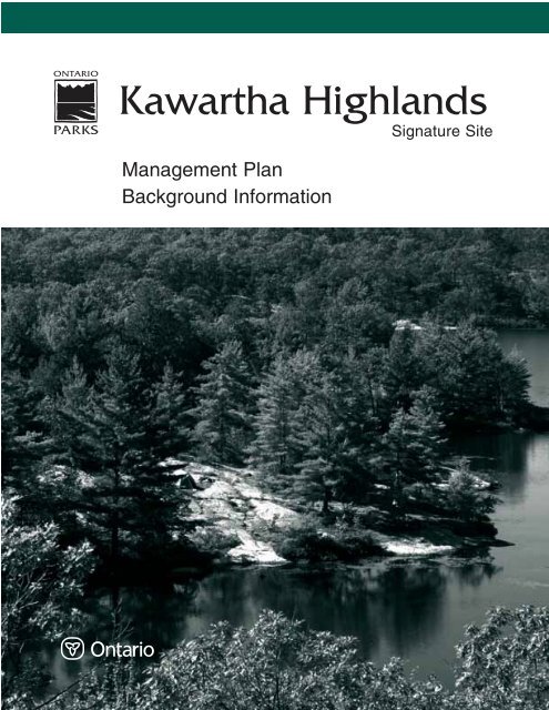
Kawartha Highlands - Ontario Parks
Kawartha Highlands - Ontario Parks
Kawartha Highlands - Ontario Parks

Create successful ePaper yourself
Turn your PDF publications into a flip-book with our unique Google optimized e-Paper software.
<strong>Kawartha</strong> <strong>Highlands</strong><br />
Signature Site<br />
Management Plan<br />
Background Information
Copies of this publication may be obtained at no charge on-line at:<br />
http://www.ontarioparks.com/english/kawa.html<br />
or from Ministry of Natural Resources offices in Bancroft, Minden and Peterborough.<br />
Cette publication hautement spécialisée <strong>Kawartha</strong> <strong>Highlands</strong> Signature Site Park Background Information<br />
n'est disponible qu'en anglais en vertu du Règlement 411/97, qui en exempte l'application de<br />
la Loi sur les services en français. Pour obtenir de l'aide en français, veuillez communiquer avec<br />
Carolyn Bonta, ministère des Richesses naturelles au (613) 545-4021 ou par courrier électronique :<br />
carolyn.bonta@mnr.gov.on.ca<br />
Un résumé de cette publication est disponible sur l’Internet, à l’adresse<br />
suivante: http://www.ontarioparks.com/french/kawa.html<br />
<strong>Kawartha</strong> <strong>Highlands</strong> Signature Site Park<br />
P.O. Box 500<br />
106 Monck Street<br />
Bancroft, ON K0L 1C0<br />
Telephone: 613-332-3940 x 216<br />
© 2005, Queen’s Printer for <strong>Ontario</strong><br />
Printed in <strong>Ontario</strong>, Canada<br />
51977<br />
(5 k P.R., 05 11 15)<br />
ISBN 0-7794-9039-8 (Print)<br />
Printed on recycled paper
Approval Statement<br />
I am pleased to approve the <strong>Kawartha</strong> <strong>Highlands</strong> Signature Site Park Background Information<br />
document as part of the first stage of the management planning process for the park. This document<br />
contains information about the park’s natural, cultural and recreational features. Preliminary<br />
identification of topics to be addressed during this park management planning process are<br />
summarized and, following public review of this Background Information document, a Management<br />
Options document will be prepared for the next stage of the planning process.<br />
I encourage all interested parties to participate in the preparation of the <strong>Kawartha</strong> <strong>Highlands</strong><br />
Signature Site Park Management Plan.<br />
John Immerseel<br />
Zone Manager, Southeastern Zone<br />
<strong>Ontario</strong> <strong>Parks</strong><br />
September 22, 2005<br />
<strong>Kawartha</strong> <strong>Highlands</strong> Signature Site Park<br />
1
Table of Contents<br />
<strong>Kawartha</strong> <strong>Highlands</strong> Signature Site Vision Statement . . . . . . . . . . . . . . . . . . . . . . . . . . . . 7<br />
1.0 Introduction . . . . . . . . . . . . . . . . . . . . . . . . . . . . . . . . . . . . . . . . . . . . . . . . . . . . . . . 9<br />
1.1 Planning History . . . . . . . . . . . . . . . . . . . . . . . . . . . . . . . . . . . . . . . . . . . . . . . 9<br />
1.2 Planning Team and Schedule . . . . . . . . . . . . . . . . . . . . . . . . . . . . . . . . . . . . 12<br />
2.0 Planning Area. . . . . . . . . . . . . . . . . . . . . . . . . . . . . . . . . . . . . . . . . . . . . . . . . . . . . 13<br />
2.1 Regional Setting. . . . . . . . . . . . . . . . . . . . . . . . . . . . . . . . . . . . . . . . . . . . . . . 13<br />
2.2 Access . . . . . . . . . . . . . . . . . . . . . . . . . . . . . . . . . . . . . . . . . . . . . . . . . . . . . . . 14<br />
2.3 Land Tenure and Development . . . . . . . . . . . . . . . . . . . . . . . . . . . . . . . . . . 17<br />
2.3.1 Patented Lands . . . . . . . . . . . . . . . . . . . . . . . . . . . . . . . . . . . . . . . . . . 17<br />
2.3.2 Pre-existing <strong>Kawartha</strong> <strong>Highlands</strong> Provincial Park. . . . . . . . . . . . . . . . 18<br />
2.3.3 Mining Claims and Leases (Forest Reserves) . . . . . . . . . . . . . . . . . . . . 19<br />
2.3.4 Aggregate Permits and Licences . . . . . . . . . . . . . . . . . . . . . . . . . . . . . . 20<br />
2.3.5 Recreation Camps . . . . . . . . . . . . . . . . . . . . . . . . . . . . . . . . . . . . . . . . 20<br />
2.3.6 Trap Cabins. . . . . . . . . . . . . . . . . . . . . . . . . . . . . . . . . . . . . . . . . . . . . 20<br />
2.3.7 Outpost Camps . . . . . . . . . . . . . . . . . . . . . . . . . . . . . . . . . . . . . . . . . . 21<br />
2.3.8 Other Permits and Licences . . . . . . . . . . . . . . . . . . . . . . . . . . . . . . . . . 21<br />
2.3.9 Municipal Landfill Sites and Transfer Stations . . . . . . . . . . . . . . . . . . 21<br />
3.0 Purpose of the Park . . . . . . . . . . . . . . . . . . . . . . . . . . . . . . . . . . . . . . . . . . . . . . . 22<br />
4.0 Natural Resources . . . . . . . . . . . . . . . . . . . . . . . . . . . . . . . . . . . . . . . . . . . . . . . . . 23<br />
4.1 Ecological Integrity . . . . . . . . . . . . . . . . . . . . . . . . . . . . . . . . . . . . . . . . . . . . 23<br />
4.2 Significant Features . . . . . . . . . . . . . . . . . . . . . . . . . . . . . . . . . . . . . . . . . . . . 26<br />
4.3 Climate . . . . . . . . . . . . . . . . . . . . . . . . . . . . . . . . . . . . . . . . . . . . . . . . . . . . . . 33<br />
4.3.1 Climate Change . . . . . . . . . . . . . . . . . . . . . . . . . . . . . . . . . . . . . . . . . 37<br />
4.4 Watersheds . . . . . . . . . . . . . . . . . . . . . . . . . . . . . . . . . . . . . . . . . . . . . . . . . . . 37<br />
4.5 Earth Sciences . . . . . . . . . . . . . . . . . . . . . . . . . . . . . . . . . . . . . . . . . . . . . . . . 39<br />
4.5.1 Geology . . . . . . . . . . . . . . . . . . . . . . . . . . . . . . . . . . . . . . . . . . . . . . . . 39<br />
4.5.2 Soils . . . . . . . . . . . . . . . . . . . . . . . . . . . . . . . . . . . . . . . . . . . . . . . . . . 41<br />
4.5.3 Land Types . . . . . . . . . . . . . . . . . . . . . . . . . . . . . . . . . . . . . . . . . . . . . 41<br />
4.6 Life Sciences. . . . . . . . . . . . . . . . . . . . . . . . . . . . . . . . . . . . . . . . . . . . . . . . . . 42<br />
4.6.1 Regional Significance . . . . . . . . . . . . . . . . . . . . . . . . . . . . . . . . . . . . . . 42<br />
4.6.2 Flora . . . . . . . . . . . . . . . . . . . . . . . . . . . . . . . . . . . . . . . . . . . . . . . . . . 44<br />
4.6.3 Fauna . . . . . . . . . . . . . . . . . . . . . . . . . . . . . . . . . . . . . . . . . . . . . . . . . 45<br />
<strong>Kawartha</strong> <strong>Highlands</strong> Signature Site Park<br />
3
5.0 Cultural Resources . . . . . . . . . . . . . . . . . . . . . . . . . . . . . . . . . . . . . . . . . . . . . . . . . . . . 57<br />
5.1 Defining Cultural Heritage . . . . . . . . . . . . . . . . . . . . . . . . . . . . . . . . . . . . . . . . . 57<br />
5.2 History . . . . . . . . . . . . . . . . . . . . . . . . . . . . . . . . . . . . . . . . . . . . . . . . . . . . . . . . . 58<br />
5.3 Inventory of Cultural Resources . . . . . . . . . . . . . . . . . . . . . . . . . . . . . . . . . . . . . 63<br />
5.3.1 Registered Archaeological Resources. . . . . . . . . . . . . . . . . . . . . . . . . . . . . . . 63<br />
5.3.2 Unregistered Pre-Contact Archaeological Resources . . . . . . . . . . . . . . . . . . . 63<br />
5.3.3 Post-Contact Archaeological/Built Heritage Resources . . . . . . . . . . . . . . . . . 63<br />
5.4 Threats to Cultural Resources . . . . . . . . . . . . . . . . . . . . . . . . . . . . . . . . . . . . . . . 64<br />
<strong>Kawartha</strong> <strong>Highlands</strong> Signature Site Park<br />
6.0 Recreational Resources . . . . . . . . . . . . . . . . . . . . . . . . . . . . . . . . . . . . . . . . . . . . . . . . 65<br />
6.1 Water Bodies. . . . . . . . . . . . . . . . . . . . . . . . . . . . . . . . . . . . . . . . . . . . . . . . . . . . . 65<br />
6.2 Trails or Routes. . . . . . . . . . . . . . . . . . . . . . . . . . . . . . . . . . . . . . . . . . . . . . . . . . . 66<br />
6.3 Sport Fish . . . . . . . . . . . . . . . . . . . . . . . . . . . . . . . . . . . . . . . . . . . . . . . . . . . . . . . 66<br />
6.4 Wildlife . . . . . . . . . . . . . . . . . . . . . . . . . . . . . . . . . . . . . . . . . . . . . . . . . . . . . . . . . 67<br />
6.5 Exposed Bedrock. . . . . . . . . . . . . . . . . . . . . . . . . . . . . . . . . . . . . . . . . . . . . . . . . . 67<br />
6.6 Shoreline Features . . . . . . . . . . . . . . . . . . . . . . . . . . . . . . . . . . . . . . . . . . . . . . . . 68<br />
6.7 Vegetation Features . . . . . . . . . . . . . . . . . . . . . . . . . . . . . . . . . . . . . . . . . . . . . . . 68<br />
6.8 Topographic Pattern . . . . . . . . . . . . . . . . . . . . . . . . . . . . . . . . . . . . . . . . . . . . . . . 68<br />
7.0 Resource Use. . . . . . . . . . . . . . . . . . . . . . . . . . . . . . . . . . . . . . . . . . . . . . . . . . . . . . . . . 69<br />
7.1 Recreational Activities . . . . . . . . . . . . . . . . . . . . . . . . . . . . . . . . . . . . . . . . . . . . . 69<br />
7.1.1 Cottaging . . . . . . . . . . . . . . . . . . . . . . . . . . . . . . . . . . . . . . . . . . . . . . . . . 69<br />
7.1.2 Backcountry Canoeing . . . . . . . . . . . . . . . . . . . . . . . . . . . . . . . . . . . . . . . . 70<br />
7.1.3 Hunting . . . . . . . . . . . . . . . . . . . . . . . . . . . . . . . . . . . . . . . . . . . . . . . . . . 73<br />
7.1.4 Angling . . . . . . . . . . . . . . . . . . . . . . . . . . . . . . . . . . . . . . . . . . . . . . . . . . . 73<br />
7.1.5 Recreational Boating, Hiking, Kayaking and Other Activities. . . . . . . . . . . 74<br />
7.1.6 Snow Sports. . . . . . . . . . . . . . . . . . . . . . . . . . . . . . . . . . . . . . . . . . . . . . . . 75<br />
7.1.7 Nature Appreciation . . . . . . . . . . . . . . . . . . . . . . . . . . . . . . . . . . . . . . . . . 76<br />
7.1.8 Other . . . . . . . . . . . . . . . . . . . . . . . . . . . . . . . . . . . . . . . . . . . . . . . . . . . . 76<br />
7.2 Commercial Activities. . . . . . . . . . . . . . . . . . . . . . . . . . . . . . . . . . . . . . . . . . . . . . 77<br />
7.2.1 Trapping . . . . . . . . . . . . . . . . . . . . . . . . . . . . . . . . . . . . . . . . . . . . . . . . . . 77<br />
7.2.2 Baitfish Licences. . . . . . . . . . . . . . . . . . . . . . . . . . . . . . . . . . . . . . . . . . . . . 77<br />
7.2.3 Bear Management Areas . . . . . . . . . . . . . . . . . . . . . . . . . . . . . . . . . . . . . . 79<br />
7.2.4 Commercial Outpost Camps . . . . . . . . . . . . . . . . . . . . . . . . . . . . . . . . . . . . 79<br />
7.2.5 Guiding. . . . . . . . . . . . . . . . . . . . . . . . . . . . . . . . . . . . . . . . . . . . . . . . . . . 79<br />
4
8.0 Social and Economic Context /Market Analysis . . . . . . . . . . . . . . . . . . . . . . . . . . . 82<br />
8.1 Population and Demography . . . . . . . . . . . . . . . . . . . . . . . . . . . . . . . . . . . . . . . . 82<br />
8.2 Regional Economy . . . . . . . . . . . . . . . . . . . . . . . . . . . . . . . . . . . . . . . . . . . . . . . . 84<br />
8.3 Tourism in Peterborough and the <strong>Kawartha</strong>s . . . . . . . . . . . . . . . . . . . . . . . . . . . 84<br />
8.4 Profile of Marinas and Lodges Immediately Adjacent to KHSSP . . . . . . . . . . . 86<br />
8.5 Recreational Use Survey and Economic Benefit . . . . . . . . . . . . . . . . . . . . . . . . . 87<br />
9.0 Management Considerations . . . . . . . . . . . . . . . . . . . . . . . . . . . . . . . . . . . . . . . . . . . 88<br />
9.1 Natural and Cultural Resource Protection . . . . . . . . . . . . . . . . . . . . . . . . . . . . . 89<br />
9.2 Resource Use. . . . . . . . . . . . . . . . . . . . . . . . . . . . . . . . . . . . . . . . . . . . . . . . . . . . . 90<br />
9.3 Recreational Use . . . . . . . . . . . . . . . . . . . . . . . . . . . . . . . . . . . . . . . . . . . . . . . . . . 92<br />
9.4 Access and Infrastructure . . . . . . . . . . . . . . . . . . . . . . . . . . . . . . . . . . . . . . . . . . . 94<br />
10.0 References . . . . . . . . . . . . . . . . . . . . . . . . . . . . . . . . . . . . . . . . . . . . . . . . . . . . . . . . . . 100<br />
List of Figures<br />
Figure 1: Regional Setting . . . . . . . . . . . . . . . . . . . . . . . . . . . . . . . . . . . . . . . . . . . . . . . . . 105<br />
Figure 2: Access. . . . . . . . . . . . . . . . . . . . . . . . . . . . . . . . . . . . . . . . . . . . . . . . . . . . . . . . . . 106<br />
Figure 3: Land Tenure . . . . . . . . . . . . . . . . . . . . . . . . . . . . . . . . . . . . . . . . . . . . . . . . . . . . 107<br />
Figure 4: Significant Areas . . . . . . . . . . . . . . . . . . . . . . . . . . . . . . . . . . . . . . . . . . . . . . . . . 108<br />
Figure 5: Watersheds . . . . . . . . . . . . . . . . . . . . . . . . . . . . . . . . . . . . . . . . . . . . . . . . . . . . . 109<br />
Figure 6: Land and Soil Types . . . . . . . . . . . . . . . . . . . . . . . . . . . . . . . . . . . . . . . . . . . . . . 110<br />
Figure 7: Sport Fish . . . . . . . . . . . . . . . . . . . . . . . . . . . . . . . . . . . . . . . . . . . . . . . . . . . . . . 111<br />
Figure 8: Registered Trap Line Areas . . . . . . . . . . . . . . . . . . . . . . . . . . . . . . . . . . . . . . . . . 78<br />
Figure 9: Bait Harvest Areas . . . . . . . . . . . . . . . . . . . . . . . . . . . . . . . . . . . . . . . . . . . . . . . . 80<br />
Figure 10: Bear Management Areas. . . . . . . . . . . . . . . . . . . . . . . . . . . . . . . . . . . . . . . . . . . . 81<br />
List of Tables<br />
<strong>Kawartha</strong> <strong>Highlands</strong> Signature Site Park<br />
Table 1: Access Points. . . . . . . . . . . . . . . . . . . . . . . . . . . . . . . . . . . . . . . . . . . . . . . . . . . . . 15<br />
Table 2: Cottage Properties by Lake . . . . . . . . . . . . . . . . . . . . . . . . . . . . . . . . . . . . . . . . . 18<br />
Table 3: Climate Normals for Bancroft Weather Station . . . . . . . . . . . . . . . . . . . . . . . . . 34<br />
Table 4: Climate Normals for Minden Weather Station. . . . . . . . . . . . . . . . . . . . . . . . . . 35<br />
Table 5: Climate Normals for Peterborough Weather Station. . . . . . . . . . . . . . . . . . . . . 36<br />
Table 6: Fish Stocking History. . . . . . . . . . . . . . . . . . . . . . . . . . . . . . . . . . . . . . . . . . . . . . 53<br />
Table 7: Population (1851-2001) . . . . . . . . . . . . . . . . . . . . . . . . . . . . . . . . . . . . . . . . . . . . 62<br />
Table 8: Recreational User Numbers. . . . . . . . . . . . . . . . . . . . . . . . . . . . . . . . . . . . . . . . . 69<br />
Table 9: Canoer Days by Access Point. . . . . . . . . . . . . . . . . . . . . . . . . . . . . . . . . . . . . . . . 71<br />
Table 10: Regional Employed Labour Force Summary . . . . . . . . . . . . . . . . . . . . . . . . . . . 84<br />
5
<strong>Kawartha</strong> <strong>Highlands</strong> Signature Site Park<br />
Vision Statement<br />
Our vision for the <strong>Kawartha</strong> <strong>Highlands</strong> Signature Site is that of a legacy<br />
of protection and stewardship, ensuring that the semi-wilderness<br />
characteristics are preserved.<br />
The protection of the ecological integrity of the area is of paramount<br />
importance. Long-term protection of both natural and cultural heritage<br />
values is required for the preservation of this unique area. Careful<br />
management is required to protect the environmentally sensitive aspects of<br />
the area, and to maintain it for the benefit of future generations.<br />
Traditional activities, including cottaging, will continue to be integral<br />
components of the area, and diverse low-density recreational opportunities<br />
will continue to be available.<br />
Continued public involvement in the planning and management of this<br />
area is essential. Management of the area will respect the existing private<br />
lands and tenure within the park.<br />
<strong>Kawartha</strong> <strong>Highlands</strong> Signature Site Park<br />
from the <strong>Kawartha</strong> <strong>Highlands</strong> Signature Site Charter (OMNR 2003)<br />
7
1.0 INTRODUCTION<br />
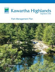
Characteristic topography of the <strong>Kawartha</strong> <strong>Highlands</strong><br />
The <strong>Kawartha</strong> <strong>Highlands</strong> Signature Site is the<br />
most southern of the nine Signature Sites that<br />
were identified in the July 1999 <strong>Ontario</strong>’s Living<br />
Legacy Land Use Strategy. Located 50 km north<br />
of Peterborough, the site contains a range of<br />
natural and recreational values, and related<br />
management issues. Situated along the southern<br />
edge of the Canadian Shield, this relatively<br />
undeveloped area encompasses 37,587 ha and<br />
features a rugged rolling landscape of small lakes,<br />
wetlands, forests and rocky barrens. The<br />
<strong>Kawartha</strong> <strong>Highlands</strong> Signature Site is now the<br />
largest park in <strong>Ontario</strong> south of Algonquin<br />
Provincial Park.<br />
The purpose of this document is to provide<br />
the pertinent background information for all who<br />
will be involved in the management planning<br />
process for the <strong>Kawartha</strong> <strong>Highlands</strong> Signature<br />
Site Park (referenced throughout this document<br />
as “<strong>Kawartha</strong> <strong>Highlands</strong>”). Over the past several<br />
years, much new information has been gathered<br />
to support management planning. Excerpts from<br />
these studies will be presented directly, so as to<br />
provide the best information available for park<br />
management planning. The public and aboriginal<br />
communities are encouraged to provide any<br />
further information that will assist us in building<br />
on this information base.<br />
1.1 Planning History<br />
The natural and recreational values of the<br />
<strong>Kawartha</strong> <strong>Highlands</strong> area have been recognized<br />
for decades; however, the decision to formally<br />
protect this area originated with the provincial<br />
“Lands for Life” Crown land use planning<br />
exercise which took place from 1997 to 1999.<br />
Three citizens’ Round Tables, established in the<br />
Boreal West, Boreal East and Great Lakes-St.<br />
Lawrence planning regions, undertook extensive<br />
consultations starting in June 1997 and<br />
provided recommendations to the Ministry<br />
of Natural Resources (MNR) in July 1998.<br />
The <strong>Kawartha</strong> <strong>Highlands</strong> is in the Great Lakes-<br />
St. Lawrence planning region.<br />
<strong>Kawartha</strong> <strong>Highlands</strong> Signature Site Park<br />
9
<strong>Kawartha</strong> <strong>Highlands</strong> Signature Site Park<br />
During Lands for Life, the Great Lakes-St.<br />
Lawrence Round Table considered and presented<br />
several land use planning options for new<br />
protected areas. In the <strong>Kawartha</strong> <strong>Highlands</strong> area,<br />
their recommended option included the<br />
opportunity to protect two key natural areas:<br />
• the Bottle Creek Area of Natural and<br />
Scientific Interest (ANSI), and<br />
• the Long Lake Barrens ANSI.<br />
They also recommended that a much larger area<br />
surrounding these two protected areas be an<br />
Enhanced Management Area – a new land use<br />
category that was established to provide more<br />
detailed land use direction for Crown lands in<br />
areas with special features or values.<br />
On the local front, the Burleigh Anstruther<br />
Chandos Cottagers Association (now the North<br />
<strong>Kawartha</strong> Lakes Association) learned of this<br />
consultation process and approached the<br />
municipality (now the Township of North<br />
<strong>Kawartha</strong>, where two-thirds of the Signature Site<br />
lies) to take the lead and help organize other<br />
interested stakeholders. The municipality agreed<br />
to coordinate public meetings and the Township<br />
of Galway-Cavendish and Harvey (where onethird<br />
of the protected area lies) participated as a<br />
stakeholder. By the summer of 1998, this group<br />
had prepared input for the Lands for Life<br />
process reflecting the consensus of a diversity of<br />
local stakeholders.<br />
Following the scheduled Round Table public<br />
meetings, a contingency meeting was arranged so<br />
the stakeholders could present submissions,<br />
which included the proposal of protecting a<br />
much larger area than was contained in any of<br />
the Round Table options. Unfortunately, the<br />
submissions were received late in the process<br />
when the Round Table was finalizing its<br />
recommendations for MNR; these submissions<br />
were provided to MNR as additional input.<br />
In July 1999, following the public review of<br />
the Round Table’s draft recommendations and<br />
after a review process involving key provincial<br />
resource industry and environmental stakeholder<br />
groups, the government released <strong>Ontario</strong>’s<br />
Living Legacy Land Use Strategy (LUS). The<br />
LUS identified 378 new protected areas,<br />
including nine very special “Featured Areas” –<br />
now known as Signature Sites. Each of the<br />
featured areas represented significant natural<br />
heritage and recreational landscapes and values –<br />
each requiring special and unique approaches to<br />
planning and management.<br />
The LUS set out the government’s intention<br />
to establish the <strong>Kawartha</strong> <strong>Highlands</strong> Signature<br />
Site as the largest protected area south of<br />
Algonquin Provincial Park. The additional input<br />
provided by the local stakeholders had been<br />
accepted by the government and incorporated<br />
into the Strategy. The local stakeholders’ support<br />
for protecting the natural and recreational values<br />
of the <strong>Kawartha</strong> <strong>Highlands</strong> area was a key factor<br />
in this site being elevated to Signature Site<br />
status.<br />
As previous stakeholder submissions<br />
regarding the <strong>Kawartha</strong> <strong>Highlands</strong> did not show<br />
consensus on the appropriate protection<br />
designation for the area, the government made<br />
the decision to determine this through the<br />
continued involvement of local stakeholders.<br />
In July 2000 a Local Stakeholder Committee<br />
(LSC) was established to make recommendations<br />
to the Minister of Natural Resources on<br />
guidelines for land use, the appropriate<br />
protection designation (i.e., regulation of the<br />
area as a provincial park, a conservation reserve<br />
or some combination of these), and possible<br />
boundary refinements. The 12 member<br />
Committee was made up of a diversity of<br />
individuals who represented the variety of<br />
interests associated with the <strong>Kawartha</strong><br />
<strong>Highlands</strong>. Prior to making their<br />
recommendations in November 2001, the LSC<br />
offered substantial opportunities for public<br />
10
involvement and consultation. Details of the<br />
LSC undertakings and recommendations can be<br />
found on the <strong>Kawartha</strong> <strong>Highlands</strong> Signature<br />
Site Park website (http://www.ontarioparks.com/<br />
english/kawa.html).<br />
With unanimous consensus, the Committee<br />
recommended that the area be protected as a<br />
provincial park and stressed that it needed to be<br />
actively managed as an “operating” park. The<br />
LSC also recommended that planned activities be<br />
enshrined in special legislation to alleviate<br />
concerns of some stakeholders that traditional<br />
activities would be discontinued. In total, the LSC<br />
made 47 recommendations: 1 with several subrecommendations<br />
related to designation, 25<br />
related to permitted activities, 13 related to<br />
boundary refinements and 8 related to future<br />
stewardship of the <strong>Kawartha</strong> <strong>Highlands</strong> (Local<br />
Stakeholder Committee, 2001).<br />
In December 2002, based on some concerns<br />
expressed by the public, the Minister of Natural<br />
Resources introduced the Recreation Reserve Act<br />
(Bill 239) for First Reading. Bill 239 was intended<br />
to provide a new protected area designation and<br />
was to be applied to the <strong>Kawartha</strong> <strong>Highlands</strong><br />
Signature Site. This provided greater assurances<br />
for traditional users of the area and allowed for a<br />
diverse range of recreational activities to occur. In<br />
March 2003, the Legislature was prorogued and<br />
this Bill ceased to exist. The proposed Recreation<br />
Reserve Act evoked strong opinions from key<br />
stakeholders. Many groups and individuals<br />
supported the Bill because of its protection for<br />
traditional activities, while many others viewed<br />
this proposal as much too weak on the protection<br />
of natural heritage values. It was clear from the<br />
public comments received in response to the<br />
Environmental Registry website posting for the<br />
Recreation Reserve Act and the debate that<br />
continued after the comment period ended, that<br />
further discussion was required to find a broadly<br />
acceptable solution for the <strong>Kawartha</strong> <strong>Highlands</strong>.<br />
On March 18, 2003, the local MPP for<br />
Haliburton on behalf of the government<br />
undertook a focussed discussion with groups that<br />
represented a broad range of perspectives in order<br />
to reach a general agreement for the future of this<br />
site (Local Stakeholder Committee, <strong>Ontario</strong><br />
Federation of Anglers and Hunters, Partnership<br />
for Public Lands and Stakeholder Groups of the<br />
<strong>Kawartha</strong> <strong>Highlands</strong>). The results of the<br />
discussions were documented in a Charter,<br />
outlining a broad framework for the management<br />
of the area and the proposed text for legislation<br />
related specifically to the <strong>Kawartha</strong> <strong>Highlands</strong>.<br />
The <strong>Kawartha</strong> <strong>Highlands</strong> Signature Site Park<br />
Act, 2003 (KHSSP Act) establishes the primacy of<br />
protecting the ecological integrity of the park,<br />
protects traditional non-industrial activities,<br />
provides private property assurances and<br />
establishes a Management Advisory Board that<br />
will have a substantial role in management<br />
planning and implementation. This Act is based<br />
substantially on the recommendations provided to<br />
the Minister from the Local Stakeholder<br />
Committee, with further inclusions to address<br />
other stakeholder concerns.<br />
The <strong>Kawartha</strong> <strong>Highlands</strong> Signature Site<br />
Charter, 2003 (the Charter) (OMNR, 2003)<br />
established the intent of the Ministry of Natural<br />
Resources (MNR) to manage this area as an<br />
operating natural environment class provincial<br />
park. The <strong>Kawartha</strong> <strong>Highlands</strong> Signature Site<br />
Park will be managed under the provisions of the<br />
KHSSP Act. The KHSSP Act outlines site-specific<br />
policy and operational direction for the <strong>Kawartha</strong><br />
<strong>Highlands</strong> and incorporates the provisions of the<br />
Provincial <strong>Parks</strong> Act. Where the KHSSP Act is<br />
silent, the Provincial <strong>Parks</strong> Act will apply.<br />
<strong>Kawartha</strong> <strong>Highlands</strong> Signature Site Park<br />
11
<strong>Kawartha</strong> <strong>Highlands</strong> Signature Site Park<br />
Key components of sound planning for the<br />
future of this park are continued public input,<br />
stakeholder involvement and Aboriginal<br />
community participation. The management<br />
planning process is designed to encourage and<br />
incorporate input, review and comment from a<br />
wide cross-section of people such as Aboriginal<br />
community representatives, adjacent private<br />
landowners, environmentalists, business and<br />
industry representatives and recreational users. A<br />
Management Advisory Board (MAB), established<br />
in August 2003 under Section 5 of the KHSSP<br />
Act, will provide on-going planning and<br />
management advice to the Minister of Natural<br />
Resources as a key component of the MNR’s<br />
commitment to ongoing public involvement.<br />
1.2 Planning Team and Schedule<br />
Preparation of the <strong>Kawartha</strong> <strong>Highlands</strong><br />
Signature Site Park Management Plan is the<br />
responsibility of a multi-disciplinary team<br />
consisting of MNR staff from <strong>Ontario</strong> <strong>Parks</strong> and<br />
Bancroft District, as well as the <strong>Kawartha</strong><br />
<strong>Highlands</strong> Signature Site Park Management<br />
Advisory Board. As required, advice or support<br />
will be encouraged and/or sought from the<br />
general public, Aboriginal communities,<br />
stakeholder groups, non-government<br />
organizations and academic experts. The roles<br />
and responsibilities for the team have been<br />
outlined in the Terms of Reference document<br />
(http://www.ontarioparks. com/english/kawa.html ).<br />
The Signature Site Park management<br />
planning process will follow the <strong>Ontario</strong><br />
Provincial Park Management Planning Manual<br />
(1994) and will be adapted specifically for the<br />
<strong>Kawartha</strong> <strong>Highlands</strong> to ensure that the planning<br />
process meets the expectations of the<br />
stakeholders involved to date (a “made in<br />
<strong>Kawartha</strong>s” process). This initiative will build on<br />
existing resource management direction found in<br />
the KHSSP Act and Charter. The major steps in<br />
the management planning process and their<br />
tentative completion dates, along with the<br />
consultation components, are outlined in the<br />
Terms of Reference document. The process is<br />
intended to guide the project to the completion<br />
of an approved park management plan for<br />
<strong>Kawartha</strong> <strong>Highlands</strong>. The planning schedule<br />
reflects the significant interest in all <strong>Kawartha</strong><br />
<strong>Highlands</strong> consultations to date and resulted<br />
extending the timeframe requirements for<br />
receiving comments during the review stages for<br />
both the management options document and the<br />
preliminary park management plan.<br />
12
2.0 PLANNING AREA<br />
In 1999, the Ministry of Natural Resources<br />
commissioned a “<strong>Kawartha</strong> <strong>Highlands</strong> Background<br />
Information Report” (van der Meer, 2000). This<br />
report was prepared for the use of the Local<br />
Stakeholder Committee, presenting information that<br />
was pertinent for developing recommendations for the<br />
area. Since the time of the report preparation, much<br />
new information has been gathered and information in<br />
this Background Information document represents the<br />
most current information available. Excerpts from the<br />
original report have been adapted for this report where<br />
information remained the same or required only minor<br />
modifications. This section contains adaptations from<br />
the original report.<br />
2.1 Regional Setting (refer to Figure 1)<br />
The <strong>Kawartha</strong> <strong>Highlands</strong> straddles the four<br />
geographic townships of Cavendish, Harvey,<br />
Burleigh and Anstruther, in the north half of<br />
Peterborough County. Northern Peterborough<br />
County has a mixed landscape of forested areas,<br />
bedrock hills and lakes where little agricultural<br />
capability exists.<br />
The broad region around the <strong>Kawartha</strong><br />
<strong>Highlands</strong> (northern portions of Peterborough<br />
County, City of <strong>Kawartha</strong> Lakes, Hastings<br />
County, and Haliburton County) is the southern<br />
edge of the Canadian Shield. The typical<br />
landscape of this area is one of rugged wooded<br />
hills and valleys, and many lakes and wetlands.<br />
Regional topography varies from slightly broken<br />
rolling land to steep cliffs and deep valleys. Soils<br />
are generally shallow, with areas where bare<br />
bedrock shows through.<br />
Southern Peterborough County is<br />
predominantly rolling farmland. The abrupt<br />
change from south to north occurs at the edge of<br />
the Canadian Shield. The <strong>Kawartha</strong> Lakes, part<br />
of the Trent-Severn Waterway, provide a physical<br />
separation between the two distinctly different<br />
sections of the County.<br />
The City of Peterborough is the nearest<br />
major regional centre to the <strong>Kawartha</strong> <strong>Highlands</strong>.<br />
Less than 50 km from the south boundary of the<br />
park, it is a centre of manufacturing, education<br />
(Trent University, Sir Sandford Fleming College),<br />
and government offices. It is the service and<br />
market area for a large surrounding agricultural<br />
region.<br />
The Town of Lindsay, also on the Trent-<br />
Severn waterway, is the next largest community<br />
close to the <strong>Kawartha</strong> <strong>Highlands</strong> (53 km via<br />
County Road 36). Lindsay has a strong base of<br />
small industry and manufacturing companies.<br />
Minden to the northwest, Haliburton to the<br />
north, Bancroft to the northeast, Lakefield and<br />
Bridgenorth to the south and Bobcaygeon to the<br />
southwest all possess year-round services and<br />
facilities, and are located between 30 and 60 km<br />
from the boundary of the <strong>Kawartha</strong> <strong>Highlands</strong>.<br />
Immediately adjacent to the <strong>Kawartha</strong><br />
<strong>Highlands</strong> are the communities and hamlets of<br />
Buckhorn, Burleigh Falls, Big Cedar, Woodview,<br />
Haultain, Apsley, Gooderham and Catchacoma.<br />
These are located on Highways and County<br />
Roads, once early settlement or colonization<br />
roads, and are remnants of what was once a<br />
thriving part of the lumber or mining industries.<br />
Many of these communities have changed<br />
substantially in the last century and have become<br />
service centres for local tourism and cottaging.<br />
The close proximity of this site to the Greater<br />
Toronto Area (just over 200 km from downtown<br />
Toronto to the centre of the <strong>Kawartha</strong> <strong>Highlands</strong><br />
on Anstruther Lake Road) makes the area readily<br />
accessible to the largest population centre in<br />
Canada.<br />
<strong>Kawartha</strong> <strong>Highlands</strong> Signature Site Park<br />
13
<strong>Kawartha</strong> <strong>Highlands</strong> Signature Site Park<br />
2.2 Access (refer to Figures 1 & 2)<br />
A network of provincial highways and county<br />
roads provide convenient access to the area.<br />
Most visitors to the area coming from the<br />
south use Highways 401, 115/35, and 28 as the<br />
primary route to the southeast corner of the area<br />
(Burleigh Falls) and then reach their specific<br />
destination in the park via Highway 28 on the<br />
east, County Road 36 on the south, and County<br />
Road 507 on the west. There is no major road<br />
across the northern boundary of the area, but<br />
Highway 118 and County Road 503 form a link<br />
from the northeast at Paudash (just south of<br />
Bancroft), through Tory Hill, to the northwest at<br />
Gooderham. A network of roads provides<br />
adequate access to the area from most directions.<br />
The largest airport providing access to the<br />
Region is located near Peterborough,<br />
approximately 50 km away. Lindsay also has an<br />
airport and there are small community or private<br />
airfields in the area, near Bancroft and<br />
Haliburton, as well as some plane access to lakes<br />
adjacent to and within the <strong>Kawartha</strong> <strong>Highlands</strong>.<br />
The Trent–Severn Waterway passes through<br />
the <strong>Kawartha</strong> Lakes just south of the <strong>Kawartha</strong><br />
<strong>Highlands</strong>. It is used primarily for cottageoriginating<br />
recreation traffic, but also by boaters<br />
travelling through the system. There is no<br />
navigable water connection from the <strong>Kawartha</strong><br />
Lakes and the Trent–Severn system to the<br />
<strong>Kawartha</strong> <strong>Highlands</strong>, other than tough upstream<br />
canoe routes on the Mississagua River and Eels<br />
Creek, nor is there navigable access from the<br />
north.<br />
A number of roads, most of which began as<br />
cottage roads, reach into the <strong>Kawartha</strong><br />
<strong>Highlands</strong> providing vehicle access to groups of<br />
cottages that were formerly accessible only by<br />
water.<br />
Access from the west<br />
Pencil Lake, on the northwest corner of the<br />
<strong>Kawartha</strong> <strong>Highlands</strong>, has road access to its north<br />
end via the Pencil Lake Road from County Road<br />
507. The approximately 1.2 km stretch to the<br />
boat launching area is maintained year round.<br />
Beyond that, the road provides seasonal access<br />
for cottagers. Further on, the Pencil Lake Road<br />
becomes the Pencil Lake Forest Access Road,<br />
which is not suitable for normal passenger<br />
vehicles but does provide a west/east connection<br />
just north of the <strong>Kawartha</strong> <strong>Highlands</strong>. On the<br />
east it joins the municipally maintained West<br />
Eels Lake Road and Eels Lake Road, connecting<br />
to Highway 28.<br />
Beaver Lake Road extends eastward for 10 km<br />
from County Road 507, travelling between<br />
Catchacoma Lake and Mississagua Lake, and<br />
crossing the narrows between these lakes. It then<br />
heads between Beaver Lake and Gold Lake (with<br />
seasonal spur roads providing additional cottage<br />
access) and then curves around to the north side<br />
of Beaver Lake. This section is municipally<br />
maintained as a year round road. An additional<br />
1.5 km of seasonal road (North McGinnis Lake<br />
Road) continues to the east side of Catchacoma<br />
Lake.<br />
Anstruther Marina provides cottagers with access to<br />
Anstruther Lake.<br />
14
The Gold Lake Road exits from the Beaver<br />
Lake Road about 5.5 km from County Road 507,<br />
and provides seasonal cottage access to Gold Lake<br />
(2 km, with spur roads) and the west arm of<br />
Anstruther Lake (2.5 km).<br />
The Mississagua Lake Road is a year round<br />
road (about 1.5 km, with seasonal spurs) which<br />
exits the Beaver Lake Road about 2 km from<br />
County Road 507 to provide access to the<br />
properties on the north side of Mississagua Lake.<br />
At the south end of Mississagua Lake, the<br />
Mississagua Dam Road provides access to the<br />
control dam at the outflow of the lake as well as a<br />
boat launching area, and to properties along the<br />
south side of the lake. This road is municipally<br />
maintained year round for about 2.5 km. Just<br />
0.8 km from County Road 507, a spur road<br />
crosses the Mississagua River, and provides the<br />
Table 1: Access Points (Formal and Informal)<br />
Access Point<br />
Access Point #1<br />
Access Point #2<br />
Military Bridge<br />
Mississagua River<br />
Access Point #3<br />
Mississagua Lake Dam<br />
Access Point #4<br />
Trapper’s Inn<br />
[Note: Trapper’s Inn no longer exists; property has since<br />
been subdivided for private residences.]<br />
Access Point #5<br />
West Bay Road<br />
Access Point #6<br />
Little Gull Marina<br />
Access Point #7<br />
Catchacoma Narrows<br />
Access Point #8<br />
Gold Lake Narrows<br />
Access Point #9<br />
Bottle & Sucker Lakes<br />
Access Point #10<br />
Baldwin Bay Marina<br />
Access Point #11<br />
Pencil Lake Boat Launch<br />
Access Point #12<br />
Tuckers Road<br />
Access Point #13<br />
Loon Call Lake<br />
Access Point #14<br />
Wolf Lake<br />
Access Point #15<br />
The Landing Marina<br />
[Note: The “Landing” is no longer a marina or access point but the<br />
site of a condominium development.]<br />
Mississagua and Gold Lake cottagers’ with access<br />
to the southeast side of Mississagua Lake and the<br />
south side of Gold Lake.<br />
Access from the south<br />
Below the south boundary of the <strong>Kawartha</strong><br />
<strong>Highlands</strong>, roads provide access from Highway 28<br />
to Coon Lake and Big Cedar Lake, where there is<br />
access to canoe routes located in the Burleigh<br />
township portion of the area. These roads do not<br />
extend into the <strong>Kawartha</strong> <strong>Highlands</strong>.<br />
Access from the east<br />
Long Lake Road provides access from Highway<br />
28 to the east end of Long Lake. From here,<br />
cottage access is primarily by water travel. This<br />
municipal road is approximately 2 km long.<br />
Access Point<br />
Access Point #16<br />
Access Point #17<br />
Access Point #18<br />
Access Point #19<br />
Access Point #20<br />
Access Point #21<br />
Access Point #22<br />
Access Point #23<br />
Anstruther Lake Public Access<br />
Anstruther Marina<br />
Long Lake Lodge<br />
MTO/Eels Creek Access<br />
Coon Lake<br />
Deer Bay Creek<br />
Highway 36, Lower Buckhorn,<br />
Mississagua River<br />
Catchacoma Trailer Park and<br />
Marina<br />
<strong>Kawartha</strong> <strong>Highlands</strong> Signature Site Park<br />
15
<strong>Kawartha</strong> <strong>Highlands</strong> Signature Site Park<br />
Historical Note<br />
“Mississagua”<br />
The name that applies to the Lake in the<br />
geographic township of Cavendish, and the<br />
River in the geographic township of Harvey<br />
is spelled differently in several sources.<br />
Since the area was first surveyed, there<br />
appear to be several candidate spellings that<br />
have been used, including “Massasagua<br />
(Lake), Missisauga (Lake & River),<br />
Mississauga (Lake & River), Mississaga<br />
(River), Mississaugua (Lake & River) and<br />
Mussissaga (Lake).<br />
According to the Provincial<br />
Geo-referencing Unit, Office of the<br />
Surveyor General, <strong>Ontario</strong>, the proper<br />
name for both the lake and the river –<br />
Mississagua – was formalized on March 31,<br />
1924, by the Geographic Board of Canada,<br />
apparently because this was the version used<br />
on the majority of the government and<br />
other formal documents of the time.<br />
(van der Meer, 2000)<br />
Further north on Highway 28, just south of<br />
Apsley, the year round 9 km Anstruther Lake<br />
Road provides access to a marina, water access<br />
points on Anstruther Lake, Loon Call Lake and<br />
Wolf Lake, as well as to several seasonal roads<br />
providing additional cottage access to Wolf Lake,<br />
Loon Call Lake and the south side of Anstruther<br />
Lake. Access to other parts of Anstruther Lake as<br />
well as Rathbun Lake is by water travel.<br />
Several old roads and trails penetrate the<br />
<strong>Kawartha</strong> <strong>Highlands</strong>. Most are not identified on<br />
maps, and may originate from early logging<br />
activity or from historic access to hunt camps or<br />
fishing lakes. While several of the recreation<br />
camps located within the area once relied on<br />
water or foot travel for access, most now have<br />
some sort of trail access suitable for four-wheel<br />
drive vehicles or all terrain vehicles (ATVs). The<br />
use of ATVs has been increasing significantly in<br />
the last decade. Not only do they provide easier<br />
access to remote properties, but they increase<br />
potential access to Crown land adjacent to these<br />
properties.<br />
Public access points to water were generally<br />
provided on lakes where cottage lots were sold, as<br />
many cottages were water access only. Cottage<br />
roads were frequently developed afterwards, as a<br />
local effort. Several of these marine accesses,<br />
formally called Public Access Points, exist in or<br />
provide traditional entry to the <strong>Kawartha</strong><br />
<strong>Highlands</strong> (Table 1, Figure 2). In addition to<br />
cottage access, they allow general use of lakes by<br />
boaters and anglers, provide access to remote<br />
properties, and allow entry to canoe routes within<br />
the area. Most were initially under the<br />
management of the Ministry of Natural<br />
Resources, but now some are municipally<br />
maintained, or are managed in agreement with a<br />
local marina, lodge or Cottager’s Association.<br />
16
Cottages speckle the shores of Anstruther Lake.<br />
2.3 Land Tenure and Development<br />
(refer to Figure 3)<br />
2.3.1 Patented Land<br />
The low agricultural potential of the rocky lands<br />
of the eastern half of the geographic township of<br />
Harvey, and all of the geographic townships of<br />
Cavendish, Anstruther and Burleigh, as well as the<br />
lack of penetration of these areas by settlement<br />
roads, ensured that most of the contained land<br />
was not taken up for settlement, and thus is still in<br />
public ownership. Generally, the “settled” lands in<br />
these townships are clustered along the <strong>Kawartha</strong><br />
Lakes and County Road 36 (originally known as<br />
the Oregon Trail), along County Road 507<br />
(originally known as the Buckhorn or<br />
Government Road) and along Highway 28<br />
(originally known as the Burleigh Road). Most of<br />
these lands were patented in the last half of the<br />
nineteenth century.<br />
The next wave of settlement came in the<br />
mid-twentieth century, when the <strong>Ontario</strong><br />
Government began making land on the larger<br />
lakes within these townships available as cottage<br />
lots. Significant cottage communities developed<br />
on Catchacoma, Mississagua, Gold, Beaver,<br />
Anstruther, Wolf, Loon Call, Long and Loucks<br />
lakes.<br />
It is very possible that this pattern of cottage<br />
development would have continued to spread to<br />
the smaller lakes in these townships such as<br />
Serpentine, Copper, Buzzard and Cox, if not for<br />
the 1959 designation of areas of Anstruther,<br />
Burleigh and Harvey townships as wilderness<br />
areas.<br />
<strong>Kawartha</strong> <strong>Highlands</strong> Signature Site Park<br />
17
<strong>Kawartha</strong> <strong>Highlands</strong> Signature Site Park<br />
Historical Note<br />
Excerpts from a News Release,<br />
January 19, 1959<br />
“Lands and Forests Minister, J.W. Spooner,<br />
has announced the permanent reservation of<br />
seven large areas of Crown Land in the<br />
Lindsay Forest District. These lands,<br />
located in Haliburton, Victoria and<br />
Peterborough counties will be set aside as<br />
wilderness areas and are dedicated to forest<br />
and wildlife conservation and public<br />
recreation…”<br />
“As the need arises, some of this public<br />
land will be made accessible by road and will<br />
be developed as provincial parks with<br />
camping, picnicking and bathing facilities<br />
being provided. The proximity of the lands<br />
to the large Southern <strong>Ontario</strong> centres as well<br />
as their natural beauty make them<br />
particularly desirable for this purpose.”<br />
The Minister included the following general<br />
areas of reservation:<br />
• A large area of land in Harvey and<br />
Burleigh Townships lying generally<br />
between Buckhorn Road and Highway<br />
No. 28.<br />
• An area in Anstruther Township<br />
containing Bottle, Sucker, Rathbun,<br />
Copper and Serpentine Lakes”, and later<br />
(1969) as Recreation Reserves, under the<br />
Public Lands Act. The recreation<br />
reserves became part of their<br />
surrounding management areas in the<br />
1993 District Land Use Guidelines.<br />
(van der Meer, 2000)<br />
Table 2 identifies the approximate number of<br />
properties on the various lakes within or adjacent<br />
to the <strong>Kawartha</strong> <strong>Highlands</strong>.<br />
Table 2: Cottage Properties by Lake<br />
(W = within KHSSP; A = adjacent to KHSSP)<br />
Lake Approximate # Lake Approximate #<br />
of Properties<br />
of Properties<br />
Anstruther (W) 220 Long (W) 30<br />
Beaver (A) 250 Loon Call (W) 95<br />
Big Cedar (A) 110 Loucks (W) 30<br />
Bottle (W) 4 Mississagua<br />
River (W) 50<br />
Buzzard (W) 3 Mississagua (A) 400<br />
Catchacoma (A) 600 Pencil (A) 45<br />
Coon (A) 50 Rathbun (W) 35<br />
Cox (W) 1 Wolf (W) 60<br />
Total Within 528 Total Adjacent 1455<br />
2.3.2 Pre-existing <strong>Kawartha</strong> <strong>Highlands</strong><br />
Provincial Park<br />
A portion of the <strong>Kawartha</strong> <strong>Highlands</strong> already<br />
existed as a provincial park prior to the<br />
regulation of the <strong>Kawartha</strong> <strong>Highlands</strong> Signature<br />
Site Park. This pre-existing park has been<br />
incorporated into the new park boundaries. The<br />
pre-existing <strong>Kawartha</strong> <strong>Highlands</strong> Provincial Park<br />
was a Natural Environment Class and was<br />
considered “non-operating” as funding was not<br />
allocated for active management. This area of<br />
1861 ha surrounding Bottle and Sucker lakes was<br />
put into regulation under the Provincial <strong>Parks</strong><br />
Act in 1989, having been a Park Reserve since<br />
1979. Its potential as a Provincial Park was first<br />
mentioned in a news release from Lands and<br />
Forests Minister, J.W. Spooner, in 1959, with the<br />
concept that it would accommodate camping,<br />
picnicking and bathing facilities.<br />
18
Aerial view of pre-existing <strong>Kawartha</strong> <strong>Highlands</strong> Provincial Park featuring Bottle and Sucker Lakes.<br />
A development plan was prepared in 1967,<br />
and construction of the park entry road began in<br />
the winter of 1968 through “Winter Works”<br />
funding. A combination of factors, including lack<br />
of continuing Winter Works funding and a<br />
reconsideration of the appropriateness of the<br />
development plan to the area, resulted in the<br />
development for the proposed park being<br />
discontinued.<br />
Although they were not planned, developed<br />
or authorized by the Ministry of Natural<br />
Resources, there are trails within the pre-existing<br />
provincial park that are used for access. One is a<br />
walking trail providing access to the Bottle Creek<br />
Dam. Another is a portage/ATV/4x4 trail from<br />
the Beaver Lake Road on the north side of Beaver<br />
Lake to the south side of Bottle Lake. A longer<br />
trail provides access (ATV, pedestrian) into the<br />
core of the Provincial Park. It runs more or less<br />
parallel with the 1968 cut road allowance, which<br />
has since grown over.<br />
The 17 campsites on Bottle and Sucker lakes<br />
receive extensive use by campers who gain access<br />
by canoe or by the trails noted above.<br />
2.3.3 Mining Claims and Leases (Forest<br />
Reserves)<br />
At the onset of land use planning for the<br />
<strong>Kawartha</strong> <strong>Highlands</strong> Signature Site in July 2000,<br />
several areas within the proposed boundaries of<br />
the site identified for protection had some existing<br />
mining claims and/or leases under the Mining Act.<br />
These areas were given the land use designation<br />
of “Forest Reserve” as they were identified for<br />
inclusion into the <strong>Kawartha</strong> <strong>Highlands</strong> but a more<br />
detailed examination determined that these areas<br />
had existing mining claims and/or leases. The<br />
Forest Reserve designation indicated the intention<br />
of incorporating these areas into the larger<br />
protected area if the claims or leases were<br />
retired through normal processes. Until that<br />
time, areas with mining lands would not form<br />
part of the regulated protected area. Policies for<br />
the management of Forest Reserves prohibit<br />
other commercial resource extraction activities<br />
(e.g., forestry, hydroelectric power development<br />
and peat extraction).<br />
<strong>Kawartha</strong> <strong>Highlands</strong> Signature Site Park<br />
19
<strong>Kawartha</strong> <strong>Highlands</strong> Signature Site Park<br />
Over the course of the past land use<br />
planning process for the <strong>Kawartha</strong> <strong>Highlands</strong>,<br />
which ultimately determined that the area should<br />
become a provincial park, several of the existing<br />
mining claims and leases were retired through<br />
normal processes. Originally there were<br />
approximately 1500 ha of land identified as<br />
Forest Reserve. By 2004, over 1000 ha of this<br />
total Forest Reserve area was incorporated into<br />
the proposed regulated park due to the lapse of<br />
mining lands.<br />
Currently, only one Forest Reserve area<br />
(approximately 150 ha) remains associated with<br />
the <strong>Kawartha</strong> <strong>Highlands</strong> and is the location of an<br />
active aggregate permit which is described in the<br />
next section.<br />
2.3.4 Aggregate Permits and Licences<br />
Aggregate permits and licences are issued<br />
through an assessment and consultative process<br />
by the MNR for aggregate operations on Crown<br />
land and private land respectively. In the case of<br />
the <strong>Kawartha</strong> <strong>Highlands</strong>, one aggregate permit<br />
in the south west of the site is excluded from the<br />
park and has a Forest Reserve designation. The<br />
current product of this permit is dimensional<br />
building stone.<br />
Several other aggregate operations are<br />
adjacent to the boundaries of the <strong>Kawartha</strong><br />
<strong>Highlands</strong>, both on private and Crown land. On<br />
the Township of North <strong>Kawartha</strong> side, there are<br />
three sand and gravel permits, all within the<br />
geographic township of Anstruther. On the<br />
Galway-Cavendish and Harvey side, many more<br />
operations are active adjacent to the <strong>Kawartha</strong><br />
<strong>Highlands</strong> boundaries. Nine aggregate permits<br />
and four licences are distributed along County<br />
Roads 36 and 507, and a variety of aggregate is<br />
being extracted, including dimensional building<br />
stone, granite, sand and gravel.<br />
2.3.5 Recreation Camps<br />
A number of Land Use Permits have been issued<br />
for recreation camps throughout this area.<br />
Originally these were one-acre (now 0.5 ha) lots,<br />
issued for a period of one year for the purpose of<br />
erecting and operating hunt camps. Hunt camps<br />
were generally considered to be rustic facilities,<br />
and, as much as possible, were located to evenly<br />
distribute hunting pressure. Over the years,<br />
especially with increased accessibility through the<br />
use of snow machines, four-wheel drive vehicles<br />
and ATVs, many of these camps received increased<br />
use beyond the hunting season and have now<br />
become known as “recreation camps”. The<br />
authority for most of these recreation camps was<br />
originally issued between 1941 and 1969, and they<br />
have been renewed on an annual basis to date.<br />
There are currently 57 recreation camps<br />
within the <strong>Kawartha</strong> <strong>Highlands</strong> and 13<br />
immediately adjacent to the boundary of the park.<br />
Approximately 70 per cent of the recreation camps<br />
in and adjacent to the <strong>Kawartha</strong> <strong>Highlands</strong> are<br />
registered to individuals or trustees with addresses<br />
within 60 km of their camp. This suggests that the<br />
<strong>Kawartha</strong> <strong>Highlands</strong> is an important recreational<br />
area locally.<br />
2.3.6 Trap Cabins<br />
Trapline buildings may be required by licensed<br />
trappers to provide shelter for accommodation<br />
and safety purposes, and for efficient trapline<br />
management. Under the Public Lands Act, the<br />
“Free Use Policy” provides that buildings used<br />
by a licensed trapper in accordance with this<br />
20
policy do not require land use occupational<br />
authority. Trapline buildings may consist of a<br />
cabin, an ancillary building for skinning and/or<br />
storage and a privy. These cabins are limited in<br />
size to 400 square feet and the ancillary building<br />
is limited to 200 square feet. Present day fur<br />
management practices often require year round<br />
use of trapline buildings for management of<br />
nuisance animals, and building and equipment<br />
repairs. The Ministry has provided for year round<br />
use of the approved trapline buildings, for<br />
legitimate trapline management purposes.<br />
There are currently 15 trap cabins in the<br />
<strong>Kawartha</strong> <strong>Highlands</strong> and one secondary trap cabin.<br />
A few of these trap cabins are in derelict condition<br />
and are currently not being used for trapline<br />
management.<br />
2.3.7 Outpost Camps<br />
Commercial outpost camps, under the authority<br />
of Land Use Permits, allow commercial operators<br />
to fly clients to specified lakes for consumptive<br />
and non-consumptive purposes. Within the<br />
<strong>Kawartha</strong> <strong>Highlands</strong>, each location has a dock and<br />
cabin for overnight accommodation.<br />
There are four commercial outpost camps<br />
within the <strong>Kawartha</strong> <strong>Highlands</strong>. These are located<br />
on Fair Lake (S. Wilcox, Haliburton), Elm Lake<br />
and Pilot Lake (Haliburton <strong>Highlands</strong> Air Service)<br />
in Burleigh Township, and Bear Lake<br />
(R. Tapson, Peterborough) in Anstruther Township.<br />
2.3.8 Other Permits and Licences<br />
Most of the commercial marinas and some of the<br />
cottages on the lakes in or adjacent to the<br />
<strong>Kawartha</strong> <strong>Highlands</strong> have some form of tenure,<br />
usually a Land Use Permit or a Licence of<br />
Occupation, for facilities such as docks, parking lots<br />
and storage buildings, where these facilities are<br />
located on adjacent public land. Individual roads or<br />
lanes to lakefront properties are also occasionally<br />
authorized through these same forms of tenure.<br />
Electrical transmission lines and telephone<br />
lines are located around and under several of the<br />
lakes that have private lands on them, and these<br />
usually receive their authority to occupy public<br />
land through land use permits.<br />
2.3.9 Municipal Landfill Sites and Transfer<br />
Stations<br />
There are a number of municipal landfill and<br />
waste transfer sites adjacent to the boundaries of<br />
the <strong>Kawartha</strong> <strong>Highlands</strong>.<br />
The Township of North <strong>Kawartha</strong> operates the<br />
Haultain Transfer Station (adjacent to Highway 28)<br />
and the Anstruther Landfill Site (off of the<br />
Anstruther Lake Road) which are relatively close to<br />
the boundaries of the <strong>Kawartha</strong> <strong>Highlands</strong>. The<br />
Anstruther Landfill Site was closed in 2005 and<br />
became a transfer station.<br />
The Township of Galway-Cavendish and<br />
Harvey operates two landfill sites in close proximity<br />
to the <strong>Kawartha</strong> <strong>Highlands</strong>. The Buckhorn<br />
Landfill Site is just north of County Road 36, a few<br />
kilometres from Buckhorn. The Cavendish Landfill<br />
Site is off of County Road 507, just south of the<br />
Cavendish Community Centre.<br />
<strong>Kawartha</strong> <strong>Highlands</strong> Signature Site Park<br />
21
3.0 PURPOSES of THE PARK<br />
Section 2 of the KHSSP Act legally defines the<br />
purposes of the Act and this section is included<br />
below. The management plan to be developed<br />
must incorporate these purposes to ensure that<br />
the legal obligations under this Act are met.<br />
2. The purposes of this Act are to ensure,<br />
<strong>Kawartha</strong> <strong>Highlands</strong> Signature Site Park<br />
(a) that the protection of the ecological integrity<br />
of the <strong>Kawartha</strong> <strong>Highlands</strong> Signature Site<br />
Park is recognized as the overriding priority<br />
in the management and administration<br />
of the Park, so as to preserve, protect and<br />
enhance the natural composition and<br />
abundance of native species, biological<br />
communities and ecological processes<br />
in the Park;<br />
(b) that the policies governing the Park,<br />
including its management, will protect<br />
the Park’s natural and cultural values,<br />
maintain its traditional uses and provide<br />
the opportunity for recreational activities<br />
that are compatible with the natural heritage<br />
values and semi-wilderness character<br />
of the Park;<br />
(c)<br />
that the Park will be managed so as to permit<br />
continued access to and enjoyment of private<br />
property and of Crown land that is subject to a<br />
land use permit, licence of occupation or lease<br />
under the Public Lands Act where that private<br />
property or Crown land is surrounded by Park<br />
lands or abuts Park lands; and<br />
(d) that decisions with respect to the development and<br />
any major revision of the management plan for<br />
the Park are made with prior public consultation.<br />
This picture showcases the need to protect the natural<br />
and cultural values for which the park was created.<br />
22
4.0 NATURAL RESOURCES<br />
A characteristic lake on rock barrens.<br />
4.1 Ecological Integrity<br />
NOTE: At the time of writing of this <strong>Kawartha</strong><br />
<strong>Highlands</strong> Signature Site Park Background<br />
Information document, the following information<br />
regarding ecological integrity was current but it is<br />
subject to change.<br />
The government has introduced new<br />
legislation for the permanent protection of<br />
provincial parks and conservation reserves. The<br />
new Provincial <strong>Parks</strong> and Conservation Reserves Act<br />
received first reading on October 25, 2005.<br />
The following are excerpts from the draft<br />
legislation that deal with ecological integrity:<br />
Planning and management principles<br />
3. The following principles shall guide all aspects of<br />
the planning and management of <strong>Ontario</strong>'s system<br />
of provincial parks and conservation reserves:<br />
1. Maintenance of ecological integrity shall be<br />
the first priority and the restoration of<br />
ecological integrity shall be considered.<br />
2. Opportunities for consultation shall be<br />
provided.<br />
Ecological integrity<br />
(2) Ecological integrity refers to a condition in<br />
which biotic and abiotic components of<br />
ecosystems and the composition and abundance<br />
of native species and biological communities<br />
are characteristic of their natural regions and<br />
rates of change and ecosystem processes are<br />
unimpeded.<br />
Same<br />
(3) For the purpose of subsection (2), ecological<br />
integrity includes, but is not limited to,<br />
(a) healthy and viable populations of native<br />
species, including species at risk, and<br />
maintenance of the habitat on which<br />
the species depend; and<br />
(b) levels of air and water quality<br />
consistent with protection of<br />
biodiversity and recreational<br />
enjoyment.<br />
<strong>Kawartha</strong> <strong>Highlands</strong> Signature Site Park<br />
23
<strong>Kawartha</strong> <strong>Highlands</strong> Signature Site Park<br />
Beavers help to support ecosystem functions<br />
through wetland creation.<br />
24
To meet the requirement of Section 2(a) of<br />
the KHSSP Act (see Section 3 of this report) to<br />
ensure that ecological integrity remains the<br />
overriding priority in the protection of this area<br />
there must be a common understanding of what<br />
is meant by the term ecological integrity.<br />
Expanding on the above definition can help<br />
advance understanding of the term ecological<br />
integrity.<br />
“Composition and abundance of native<br />
species and biological communities” can be<br />
thought of as the number of different species<br />
(biodiversity), and also population numbers of<br />
any one species. Composition further includes<br />
the associations of native species and the habitats<br />
required for their survival; this comprises a<br />
“biological community” and is also referred to as<br />
the “structure” of an ecosystem. Included in<br />
the composition of these habitats are abiotic<br />
(non-living) components such as mineral soil,<br />
water and air. It is important to include these<br />
non-living components because they are equally<br />
as important to ecosystem function as plants and<br />
animals.<br />
“Rates of change and supporting<br />
processes” reflect the fact that ecosystems are<br />
dynamic and are continually changing in<br />
composition, structure and function. Many of the<br />
processes involved in supporting ecosystem<br />
change are often traditionally thought of as<br />
negative influences. However, wildfire, flooding,<br />
drought, and other so-called natural disasters are<br />
often beneficial in creating habitat and ecological<br />
niches required by rare plants and animals. The<br />
functional processes just mentioned have allowed<br />
the species and biological communities of the<br />
<strong>Kawartha</strong> <strong>Highlands</strong> to evolve into their present<br />
state. Other processes that support natural rates<br />
of change in ecosystems include nutrient cycling,<br />
photosynthesis, and the hydrologic cycle.<br />
Ecological Note<br />
Ecosystem Composition, Structure<br />
and Function<br />
Ecosystems can be described according<br />
to their composition, structure and<br />
function.<br />
• Composition means species of<br />
organisms and non-living<br />
components such as mineral soil, air<br />
and water.<br />
• Structure means the way in which<br />
composition is arranged in a<br />
biological community and the types<br />
of habitat present in the ecosystem.<br />
• Function describes processes that<br />
ecosystems perform such as<br />
photosynthesis, hydrologic cycling,<br />
succession, and nutrient cycling.<br />
“In plain language, ecosystems have<br />
integrity when they have their native<br />
components intact, including: abiotic<br />
components (the physical elements, e.g. water,<br />
rocks), biodiversity (the composition and<br />
abundance of species and communities in an<br />
ecosystem, e.g. tundra, rainforest and grasslands<br />
represent landscape diversity; black bears, brook<br />
trout and black spruce represent species<br />
diversity) and ecosystem processes (the engines<br />
that make an ecosystem work, e.g. fire,<br />
flooding, predation).”<br />
(<strong>Parks</strong> Canada Agency, 2000)<br />
<strong>Kawartha</strong> <strong>Highlands</strong> Signature Site Park<br />
25
4.2 Significant Features (refer to Figure 4)<br />
<strong>Kawartha</strong> <strong>Highlands</strong> Signature Site Park<br />
Among the many biological communities of the<br />
<strong>Kawartha</strong> <strong>Highlands</strong> there are features which<br />
stand out as areas of high ecological significance.<br />
These features effectively portray the natural<br />
heritage valued by park stakeholders and must be<br />
protected as ecologically and culturally essential<br />
elements of the <strong>Kawartha</strong> <strong>Highlands</strong>. The<br />
Vision statement for this park speaks to the<br />
importance of preserving the semi-wilderness<br />
characteristics and preserving both natural and<br />
cultural heritage values.<br />
In 2000, the Natural Heritage Information<br />
Centre of the Ministry of Natural Resources<br />
undertook a one year study entitled, “Reconnaissance<br />
Life Science Inventory of the <strong>Kawartha</strong> <strong>Highlands</strong><br />
Signature Site” (Jalava et al., 2001). Section 4.2 is a<br />
direct excerpt from this report, except where noted<br />
(Limestone Plain/Alvar).<br />
Wilderness Qualities<br />
In its purest form, wilderness is vast and<br />
primeval. It includes pristine landscapes and<br />
waterscapes, native plants and animals and clean<br />
water and air. It is a place where nature functions<br />
freely, unencumbered by industrial and<br />
agricultural activities. Wilderness is a place of<br />
natural wonder, a place of scientific and<br />
educational discovery and a place of solitude that<br />
has nurtured the evolution of the human body<br />
and spirit (Davidson et al., 2000). Wilderness is a<br />
place where visitors minimize their impact on the<br />
landscapes and waterscapes with low impact<br />
camping and travel by non-mechanized means.<br />
<strong>Ontario</strong> <strong>Parks</strong> minimum size standard for<br />
wilderness parks is 50,000 ha (optimum 100,000<br />
ha), and for Wilderness Zones is 2,000 ha (the<br />
optimum is 50,000 ha) (OMNR, 1992).<br />
Black Spruce Bog exhibiting wilderness qualities.<br />
It was noted during an October 2000<br />
helicopter survey of the <strong>Kawartha</strong> <strong>Highlands</strong> that<br />
much of the northern portion of the study area<br />
appeared to have undergone very little recent<br />
disturbance. The only significant recent human<br />
impacts observed in this area were a few widely<br />
scattered hunt camps, two major snowmobile<br />
trails and two old roads, which are also used by<br />
all-terrain (ATV) and off-road vehicles (ORVs).<br />
Some of the treed bog and fen communities<br />
appeared to be of exemplary quality.<br />
Based on numerous field visits during 2000,<br />
it was also noted that much of the pre-existing<br />
<strong>Kawartha</strong> <strong>Highlands</strong> Provincial Park, which is<br />
immediately to the south of the area just<br />
described, is relatively undisturbed. The preexisting<br />
provincial park is dissected by two access<br />
roads that are used by ATVs and ORVs, and<br />
there is a small cluster of cottages on patent land<br />
on the western side of Bottle Lake. Aside from<br />
these disturbance factors, the combination of the<br />
existing <strong>Kawartha</strong> <strong>Highlands</strong> Provincial Park and<br />
the extensive natural landscape to the north<br />
forms what could be considered a relatively<br />
intact “wilderness area”. Much of the southcentral<br />
and south-eastern portions of the<br />
Signature Site also have wilderness qualities.<br />
26
Rock barrens with woody debris provide habitat for rare species such as the Five-lined Skink.<br />
Large wilderness areas, such as the northern<br />
portion of the <strong>Kawartha</strong> <strong>Highlands</strong>, may provide<br />
refuge for species that are particularly vulnerable<br />
to human disturbance or which deliberately avoid<br />
areas with human activity.<br />
Rock Barrens<br />
One of the outstanding features of the <strong>Kawartha</strong><br />
<strong>Highlands</strong> is its representation of open gneissic<br />
rock barrens. These rock barrens occur<br />
throughout the study area, but are most extensive<br />
in the south-eastern quadrant of the site and<br />
immediately north of Long Lake, an area<br />
identified as a provincially significant Area of<br />
Natural and Scientific Interest (ANSI) primarily<br />
for its representation of rock barrens (Brunton,<br />
1990). The rock barrens support populations of<br />
the provincially rare Five-lined Skink and, at least<br />
formerly, the Prairie Warbler. Other species of<br />
note on the barrens include the provincially rare<br />
Secund Rush, as well as breeding Whip-poor-will,<br />
Common Nighthawk and the Dark-eyed Junco,<br />
which is near the southern limit of its breeding<br />
range. Because of the extremely shallow to<br />
nonexistent soils, rock barren vegetation is<br />
particularly susceptible to disturbance by vehicles<br />
and trampling.<br />
Mature Forests<br />
The <strong>Kawartha</strong> <strong>Highlands</strong> supports a number of<br />
forest stands of exemplary quality, and many<br />
stands that have undergone little recent<br />
disturbance. High-quality forests include:<br />
1. An old-growth Eastern White Pine-dominated<br />
forest to the southwest of the Tuckers Road<br />
access point that probably has qualities of the<br />
forests that dominated the study area prior to a<br />
period of intensive logging during the past<br />
century (other relatively mature pine forests<br />
were found to be scattered throughout the study<br />
area during the October 2000 helicopter survey);<br />
2. Eastern Hemlock-dominated forests north of<br />
the western portion of Anstruther Lake, along<br />
the slopes on both sides of Bottle Creek,<br />
throughout the Bottle Creek ANSI, and in a<br />
few other locations;<br />
3. Sugar Maple-dominated forests on the<br />
limestone plain at the south-western end of<br />
the site, the former forest reserve along<br />
Anstruther Lake Road, and a few other sites;<br />
and<br />
4. Red Oak-dominated forests at the extreme<br />
north-eastern end of the site. The<br />
provincially rare Cerulean Warbler is<br />
usually associated with mature deciduous<br />
forests south of, and along the Precambrian<br />
– Paleozoic contact line in <strong>Ontario</strong>.<br />
<strong>Kawartha</strong> <strong>Highlands</strong> Signature Site Park<br />
27
Ecological Note<br />
Long Lake Barrens Area of Natural and<br />
Scientific Interest (ANSI)<br />
(From Life Science Inventory Check Sheet –<br />
Brunton, 1990)<br />
<strong>Kawartha</strong> <strong>Highlands</strong> Signature Site Park<br />
A complex of wetlands and dry granitebased<br />
rock barrens with the scrubby growth<br />
and young coniferous and deciduous forest<br />
dominates the landscape. Bedrock control of<br />
the topography is extreme, with severely<br />
disrupted drainage and extensive ridges of<br />
bare rock, steep slopes and small cliffs.<br />
Peatlands rimmed with acidic bog mat<br />
margins and closed bog mat heaths are<br />
common across the site. Such typical bog<br />
and acid-shore species as Bog Aster,<br />
Northern St. John’s Wort, and Three-way<br />
Sedge are common, with sundew species,<br />
Leather Leaf and Sweet Gale. Water willow<br />
is common along quiet lake shores and is<br />
approaching the northern limit of its range<br />
here. Upland barrens are characterized by<br />
juniper and blueberries, with Bracken Fern,<br />
Poverty Grass and Wavy Hair-grass being<br />
typical of such warmer drier sites in the<br />
southern Shield of <strong>Ontario</strong>. This complex<br />
of northern peatlands in a rugged landscape<br />
of Georgian Bay influenced bedrock barrens<br />
is unique in Site District 5E-11 and shows<br />
strong affinities with the Georgian Bay<br />
shoreline.<br />
The site provides excellent and<br />
common representation for granite<br />
lakeshore cliffs and rock slopes, bare rock<br />
ridge vegetation, young, open, very dry Red<br />
Oak – Red Pine forest as well as a variety of<br />
acidic bog mat features more typical of areas<br />
to the north. The Georgian Bay influence<br />
on the site is dramatic and is expressed<br />
uniquely here within Site District 5E-11.<br />
Mature hemlock forest<br />
The regionally significant Marten is associated<br />
with mature, relatively undisturbed forests of the<br />
Precambrian Shield, particularly where there is a<br />
strong component of pine. Some species<br />
associated with large tracts of natural landscape,<br />
such as Moose, Barred Owl and the vulnerable<br />
Red-shouldered Hawk, also show a preference<br />
for mature, relatively undisturbed forests.<br />
28
Limestone Plain/Alvar<br />
“Alvars are naturally open areas of thin soil over<br />
flat limestone or marble rock with trees absent or<br />
at least not forming a continuous canopy. It is<br />
estimated that at least three-quarters of the total<br />
area of alvars in the Great Lakes region are in<br />
<strong>Ontario</strong>. Most of the communities found within<br />
alvar landscapes are considered rare in <strong>Ontario</strong><br />
and throughout their ranges; and over 100 rare,<br />
threatened and endangered plant and animal<br />
species are largely confined to the alvars. Alvars<br />
also contain many disjunct species with southern,<br />
western and northern affinities, as well as<br />
endemic taxa.” (Brownell and Riley, 2000)<br />
New information concerning the <strong>Kawartha</strong><br />
<strong>Highlands</strong> alvar has arisen since the “Reconnaisance<br />
Life Science Inventory of the <strong>Kawartha</strong> <strong>Highlands</strong><br />
Signature Site” (Jalava, et al., 2001) was written.<br />
The location of this alvar is on the boundary of<br />
ecodistricts 5E-11 and 6E-9, so detailed examination<br />
of geological formations was required in order to<br />
determine in which ecodistrict it resided. It was<br />
determined that this alvar is actually located within<br />
ecodistrict 5E-11, and not 6E-9 as previously thought.<br />
This conclusion has arisen from further recent<br />
examination (Crins and Bakowsky, 2004), thus the<br />
text from the original report has now been replaced<br />
with this new information.<br />
Limestone plain occupies a relatively small<br />
area of Crown land partly within the southwestern<br />
end of the <strong>Kawartha</strong> <strong>Highlands</strong>, with the<br />
northern section in an aggregate permit area. It<br />
sustains the best known example of alvar<br />
vegetation between the Carden Plain and the<br />
Madoc area, as well as some of the most<br />
floristically rich forest stands in the <strong>Kawartha</strong><br />
<strong>Highlands</strong>. The alvar community is provincially<br />
significant in the ecodistrict context and it is also<br />
considered a globally rare vegetation community<br />
type (Reschke et al., 1999).<br />
Most of the <strong>Kawartha</strong> <strong>Highlands</strong> alvar<br />
consists of alvar woodland, which is dominated by<br />
trees (White Pine, White Elm, White Cedar,<br />
Sugar Maple), shrubs such as Common Juniper,<br />
and a graminoid herbaceous layer (Pennsylvania<br />
Sedge, Poverty Grass). There are a few open<br />
sections of alvar grassland, dominated by Poverty<br />
Grass and scattered Common Juniper, particularly<br />
near the south end.<br />
The alvar vegetation located approximately<br />
500 m north of Flynn’s Corners, to the east of<br />
County Road 507, consists largely of extensive<br />
alvar grassland dominated by poverty grass. In<br />
some sections, there are scattered Common<br />
Juniper. Alvar woodland is also present,<br />
consisting of scattered White Oak, White Elm<br />
and White Cedar, and a herbaceous layer<br />
dominated by Poverty Grass.<br />
<strong>Kawartha</strong> <strong>Highlands</strong> Signature Site Park<br />
29
<strong>Kawartha</strong> <strong>Highlands</strong> Signature Site Park<br />
Ecological Note<br />
Bottle Creek Area of Natural and<br />
Scientific Interest (ANSI)<br />
(From Life Science Inventory Check<br />
Sheet – Brunton, 1990)<br />
A moderately broken bedrock-controlled<br />
landscape of thin soil over granite bedrock<br />
characterized by young to medium aged<br />
deciduous and coniferous upland forests is<br />
dominant. Hemlock and sugar maple<br />
dominate the forest vegetation, with hemlock<br />
being unusually well represented in the<br />
southwest of the site. Along the shore of<br />
Bottle Creek a dry forest of red oak, white<br />
pine and red maple grows in thin to almost<br />
absent soil with white birch and white spruce.<br />
The lake shore is abrupt, largely as a result of<br />
the fixed-height weir that maintains a high<br />
water level. The shore vegetation is diverse<br />
and growing on substrate varying from bare<br />
bedrock to silty sand.<br />
The site condition along much of the<br />
north shore of the creek is warmer than<br />
normal.<br />
The creek-side vegetation is exceptional,<br />
representing a complex of Atlantic Coastal<br />
disjunct species such as Meadow Beauty,<br />
Purple Bladderwort, Bog Muhly, as well as<br />
other uncommon eastern and southern species<br />
such as Flat-branched Groundpine, Fern-leaf<br />
Pondweed, Creeping Bladderwort, Primroseleaved<br />
Violet, Canada St. John’s Wort, and<br />
Brown-fruited Rush. This is likely the richest<br />
complex of such a disjunct flora in <strong>Ontario</strong><br />
outside of Muskoka–Parry Sound.<br />
The Meadow Beauty is rare in <strong>Ontario</strong>.<br />
Purple Bladderwort, Bog Muhly and Canada<br />
St. John’s Wort are uncommon in the<br />
province and are characteristic elements of<br />
the Atlantic Coastal Plain floral element<br />
found locally in the southern Canadian<br />
Shield area.<br />
While both sites have a similar flora, the<br />
major or dominant vegetation types occurring at<br />
each site are different. The <strong>Kawartha</strong> <strong>Highlands</strong><br />
Alvar site represents alvar woodland, while the<br />
Flynn’s Corners site is chiefly alvar<br />
grassland. Since these two sites are the only<br />
alvars in ecodistrict 5E-11 for which<br />
representative values are known, and since they<br />
differ in their predominant representative values,<br />
both are considered provincially<br />
significant. Both vegetation types are<br />
unrepresented within the protected area system<br />
in ecodistrict 5E-11.<br />
The <strong>Kawartha</strong> <strong>Highlands</strong> alvar appears to be<br />
in excellent condition throughout. There is<br />
evidence of past fire, and this is the ecological<br />
factor maintaining alvar on this dry site.<br />
The limestone woodlands on Crown Land<br />
adjacent to the alvar are much richer in terms of<br />
nutrients than the gneissic bedrock and granitic<br />
till-derived soils that dominate the study area.<br />
Consequently, the species diversity is much<br />
higher on these limestone-derived soils. Within<br />
The global distribution of alvar communities is<br />
restricted to the Baltic Islands and around the Great<br />
Lakes region.<br />
30
Aerial view of Crane Lake Bog.<br />
the study area, a number of vascular plant species<br />
were found only in the limestone woodlands.<br />
These include the endangered Butternut and the<br />
regionally rare Walking Fern.<br />
Bog and Fen Communities<br />
The <strong>Kawartha</strong> <strong>Highlands</strong> contains some<br />
outstanding examples of bog and fen communities.<br />
A variety of these communities was documented<br />
during on-site fieldwork, and several additional<br />
ones were observed in the northern portion of the<br />
study area during the October 2000 helicopter<br />
survey. Of particular note is the Crane Lake Bog<br />
Complex, now incorporated into the park. The<br />
bogs and fens of the <strong>Kawartha</strong> <strong>Highlands</strong> sustain<br />
such provincially rare taxa as Billings’ Threeseeded<br />
Sedge, Marsh St. John’s-wort, and a variety<br />
of orchids including the provincially rare Whitefringed<br />
Orchid. A number of species at the<br />
southern edges of their ranges in <strong>Ontario</strong> occur in<br />
the bog and fen communities, including Bog<br />
Fritillary (a butterfly), Spruce Grouse, Olive-sided<br />
Flycatcher and Lincoln’s Sparrow.<br />
Atlantic coatal plain species can be found on shorelines<br />
of lakes with fluctuating water levels.<br />
Atlantic Coastal Plain Communities<br />
Marsh communities dominated by disjunct<br />
Atlantic Coastal Plain flora develop on peaty,<br />
sandy or gravelly shorelines of lakes and rivers<br />
that typically experience fluctuating water levels<br />
(Reznicek, 1994). It is believed that fluctuating<br />
water levels are very important in the continued<br />
maintenance of this vegetation. Where water<br />
levels do not fluctuate greatly, shrubs usually<br />
become established along the water’s edge.<br />
However, in areas with fluctuating water levels,<br />
Atlantic Coastal Plain species survive in the<br />
seedbank along nearshore areas. During periods<br />
of low water levels, these sites become exposed,<br />
allowing the coastal plain species to germinate,<br />
thrive and set seed. In this way, they have<br />
managed to persist in this area for over 10,000<br />
years (Keddy and Reznicek, 1982).<br />
In <strong>Kawartha</strong> <strong>Highlands</strong>, the best-developed<br />
Atlantic Coastal Plain marshes occur along the<br />
shoreline of Bottle Creek and on the upper<br />
portion of the Deer Bay Creek watershed that<br />
includes Loucks, Long, Buzzard, Vixen, Stoplog<br />
and Shark lakes. These species occur in other<br />
<strong>Kawartha</strong> <strong>Highlands</strong> Signature Site Park<br />
31
<strong>Kawartha</strong> <strong>Highlands</strong> Signature Site Park<br />
Ecological Note<br />
Species At Risk<br />
Any plant or animal threatened by or<br />
vulnerable to, extinction is a species at<br />
risk.<br />
In Canada, there are five categories<br />
of risk that are assigned by the national<br />
Committee on the Status of Endangered<br />
Wildlife in Canada (COSEWIC). The<br />
Committee on the Status of Species at<br />
Risk in <strong>Ontario</strong> (COSSARO) reviews<br />
status reports and assesses the level of<br />
risk for each species in <strong>Ontario</strong>. The<br />
work of COSSARO integrates with and<br />
complements the work of COSEWIC.<br />
The status designations include:<br />
Extinct – any species that no longer exists<br />
anywhere<br />
Extirpated – any native species that no<br />
longer exists in the wild in <strong>Ontario</strong>,<br />
but still exists elsewhere in the wild<br />
Endangered – any native species that is at<br />
risk of becoming extinct in all or<br />
most of <strong>Ontario</strong><br />
Threatened – any native species that is at<br />
risk of becoming endangered in<br />
<strong>Ontario</strong><br />
Special Concern (Vulnerable) – any native<br />
species that is sensitive to human<br />
activities or natural events<br />
scattered locations in the study area where<br />
suitable habitat exists, such as the vicinity of<br />
Serpentine Lake. The exposed shores of these<br />
waterbodies consist of peat, as well as coarse sand,<br />
cobbles and occasional boulders. A number of the<br />
Atlantic Coastal Plain species are provincially<br />
rare. These include Bayonet Rush, Carey’s<br />
Smartweed, Snail-seed Pondweed, Virginia<br />
Meadow-beauty, Twin-scaped Bladderwort and<br />
Yellow-eyed Grass.<br />
Concentrations of Species-at-Risk<br />
There are several areas where concentrations<br />
of species-at-risk exist within the <strong>Kawartha</strong><br />
<strong>Highlands</strong>, and all known significant concentrations<br />
are associated with the six features described above.<br />
Although the mapped occurrences of rare species<br />
correspond closely, of course, with the field<br />
observation points, certain areas within the<br />
<strong>Kawartha</strong> <strong>Highlands</strong> clearly have higher<br />
concentrations of species-at-risk than do others.<br />
Of particular importance are the shorelines that<br />
support Atlantic Coastal Plain flora and the alvar<br />
community.<br />
Information from:<br />
http://www.ontarioparks.com/saro-list.pdf<br />
The Five-lined Skink, a species sensitive to human<br />
activities, in its natural habitat.<br />
32
4.3 Climate<br />
<strong>Kawartha</strong> <strong>Highlands</strong> is situated at the southern<br />
edge of the Algonquin Park climate region (a.k.a.<br />
the Haliburton Slopes – West section of the<br />
Central <strong>Ontario</strong> recreation climatic region) (van<br />
der Meer 2000). It is located immediately north of<br />
the Simcoe and <strong>Kawartha</strong> Lakes climate region<br />
(a.k.a. the Southern <strong>Ontario</strong> recreation climatic<br />
region) (ibid.). Prevailing winds and weather<br />
systems generally move from west to east across<br />
the region, with a normal year-round pattern of<br />
cool to cold, dry Arctic high-pressure systems<br />
alternating with warm, humid low-pressure<br />
systems originating in the south (ibid.).<br />
Precipitation is associated both with warm fronts<br />
of advancing low-pressure systems, as well as with<br />
cold fronts that usher in the high pressure<br />
systems.<br />
Winter on a frozen wetland in the <strong>Kawartha</strong>s.<br />
Growing seasons are relatively short<br />
compared to regions further south because of the<br />
inland location of the <strong>Kawartha</strong> <strong>Highlands</strong>.<br />
Localized higher precipitation occurs as a result of<br />
the influence of Lake Huron and Georgian Bay to<br />
the west. At 250 m above sea level, the southern<br />
portion of the <strong>Kawartha</strong> <strong>Highlands</strong> has the lowest<br />
elevation of the Haliburton Slopes – West portion<br />
of the Central <strong>Ontario</strong> recreation climatic region.<br />
The <strong>Kawartha</strong> <strong>Highlands</strong> slope upward to the<br />
north and east (eventually to 600 m on the<br />
Algonquin Dome), which further contributes to<br />
increased precipitation in the study area (ibid.).<br />
The <strong>Kawartha</strong> <strong>Highlands</strong> falls between at<br />
least three Environment Canada weather<br />
stations having sufficient data from which to<br />
draw averages, namely, Bancroft to the<br />
northeast, Minden to the northwest, and<br />
Peterborough – Trent University to the south.<br />
Climate data for these stations are presented in<br />
Tables 3-5 respectively.<br />
<strong>Kawartha</strong> <strong>Highlands</strong> Signature Site Park<br />
33
Table 3: Climate Normals for Bancroft Weather Station<br />
BANCROFT, <strong>Ontario</strong>; 45°03-N 77°51-W/O; 327m; 1882 to 1985; Copyright © 1998, Environment Canada. All rights reserved.<br />
Jan Feb Mar Apr May Jun Jul Aug Sep Oct Nov Dec Year<br />
Temperature<br />
Daily Maximum (°C) -5.2 -3.1 3.0 10.3 17.9 22.5 25.1 23.5 19.3 12.8 4.8 -2.5 10.7<br />
Daily Minimum (°C) -16.5 -15.9 -8.6 -2.0 4.0 9.4 12.2 11.2 7.1 1.3 -3.5 -11.9 -1.1<br />
Daily Mean (°C) -10.7 -9.5 -2.7 4.1 11.0 16.0 18.7 17.4 13.2 7.2 0.7 -7.1 4.8<br />
Extreme Maximum (°C) 11.7 12.2 24.4 30.0 33.3 35.0 37.8 36.1 33.9 27.8 23.9 16.0<br />
Extreme Minimum (°C) -43.9 -42.2 -38.3 -23.3 -10.0 -5.0 0.0 -1.7 -6.7 -16.7 -26.7 -41.1<br />
<strong>Kawartha</strong> <strong>Highlands</strong> Signature Site Park<br />
Degree-Days<br />
Above 18 °C 0.0 0.0 0.0 0.0 5.6 21.6 53.4 32.5 9.9 0.2 0.0 N N<br />
Below 18 °C 892.9 777.1 645.0 416.4 224.6 82.1 29.7 53.6 155.2 336.3 520.7 N N<br />
Above 5 °C 0.1 0.1 5.1 43.9 189.3 329.6 426.7 381.9 245.2 97.6 15.2 N N<br />
Below 0 °C 339.1 273.6 123.5 17.4 0.1 0.0 0.0 0.0 0.0 2.8 49.5 N N<br />
Precipitation<br />
Rainfall (mm) 12.5 17.1 37.6 53.7 80.9 89.8 73.8 86.2 90.6 75.4 63.9 27.9 709.5<br />
Snowfall (cm) 47.8 36.0 28.2 9.8 0.8 0.0 0.0 0.0 0.0 2.9 20.0 49.1 194.6<br />
Precipitation (mm) 60.9 53.1 65.8 63.5 81.7 89.8 73.8 86.2 90.6 78.3 83.8 77.4 905.1<br />
Extreme Daily Rainfall (mm) 58.2 54.6 49.0 39.6 70.3 61.6 76.2 83.1 83.2 60.2 67.3 52.8<br />
Extreme Daily Snowfall (cm) 38.1 36.8 33.0 30.5 15.2 0.0 0.0 0.0 0.0 15.2 25.4 43.2<br />
Extreme Daily Pcpn. (mm) 65.8 54.6 61.5 43.2 70.3 61.6 76.2 83.1 83.2 60.2 67.3 52.8<br />
Days with<br />
Maximum Temperature > 0°C 7 8 21 29 31 30 31 31 30 31 24 N N<br />
Measurable Rainfall 2 2 6 9 11 12 11 11 11 12 9 3 99<br />
Measurable Snowfall 10 8 6 2 * 0 0 0 0 * 4 9 39<br />
Measurable Precipitation 11 9 11 10 11 12 11 11 11 12 12 12 134<br />
34
Table 4: Climate Normals for Minden Weather Station<br />
MINDEN, <strong>Ontario</strong>; 44°56-N 78°43-W/O; 274m; 1883 to 1990; © 1998, Environment Canada. All rights reserved.<br />
Jan Feb Mar Apr May Jun Jul Aug Sep Oct Nov Dec Year<br />
Temperature<br />
Daily Maximum (°C) -4.9 -3.1 2.8 10.9 18.4 23.0 25.6 24.1 19.5 12.9 4.9 -2.3 11.0<br />
Daily Minimum (°C) -16.4 -15.9 -9.6 -2.0 3.9 8.8 11.4 10.6 6.8 1.4 -3.2 -11.8 -1.3<br />
Daily Mean (°C) -10.6 -9.4 -3.3 4.5 11.1 15.9 18.5 17.4 13.2 7.2 0.9 -7.0 4.9<br />
Extreme Maximum (°C) 10.6 13.0 21.5 29.5 32.2 33.9 35.0 35.0 32.2 27.8 23.3 17.0<br />
Extreme Minimum (°C) -41.1 -39.4 -36.5 -24.4 -10.0 -3.9 -0.6 -3.3 -9.4 -13.9 -27.2 -40.0<br />
Degree-Days<br />
Above 18 °C 0.0 0.0 0.0 0.1 5.3 21.0 50.2 35.8 9.2 0.1 0.0 0.0 122<br />
Below 18 °C 886.3 776.4 663.0 403.4 220.3 84.5 34.0 51.9 155.5 336.4 514.2 777.9 4904<br />
Above 5 °C 0.1 0.1 5.7 54.3 193.2 326.6 419.2 386.9 244.5 97.3 18.3 1.4 1748<br />
Below 0 °C 331.9 273.3 140.8 15.6 0.1 0.0 0.0 0.0 0.0 2.9 48.7 231.1 1045<br />
Precipitation<br />
Rainfall (mm) 19.3 18.7 37.3 57.6 86.2 87.1 80.1 85.0 94.8 85.0 74.2 35.5 761.0<br />
Snowfall (cm) 62.8 46.7 31.9 10.6 1.0 0.0 0.0 0.0 0.0 2.5 24.5 65.9 246.0<br />
Precipitation (mm) 82.5 65.4 69.3 68.3 87.0 87.1 80.1 85.0 94.8 87.5 99.6 101.5 1008.1<br />
Extreme Daily Rainfall (mm) 25.4 45.0 43.4 41.9 55.9 93.7 99.8 71.6 57.2 55.1 39.6 41.9<br />
Extreme Daily Snowfall (cm) 29.2 30.5 33.0 22.9 6.4 0.0 0.0 0.0 0.0 17.0 30.0 27.9<br />
Extreme Daily Pcpn. (mm) 29.6 48.0 51.0 41.9 55.9 93.7 99.8 71.6 57.2 55.1 39.6 41.9<br />
Month-end Snow Cover (cm) 42 50 26 0 0 0 0 0 0 0 9 26<br />
Days with<br />
Maximum Temperature > 0°C 7 8 20 29 31 30 31 31 30 31 24 11 283<br />
Measurable Rainfall 3 2 5 9 11 11 9 11 11 12 9 4 98<br />
Measurable Snowfall 12 9 6 2 * 0 0 0 0 * 5 12 47<br />
Measurable Precipitation 14 10 11 11 11 11 9 11 11 12 13 15 139<br />
<strong>Kawartha</strong> <strong>Highlands</strong> Signature Site Park<br />
35
Table 5: Climate Normals for Peterborough Weather Station<br />
PETERBOROUGH TRENT U, <strong>Ontario</strong>; 44°22-N 78°18-W/O; 198m; 1968 to/à 1990; © 1998, Environment Canada. All rights reserved.<br />
Jan Feb Mar Apr May Jun Jul Aug Sep Oct Nov Dec Year<br />
Temperature<br />
Daily Maximum (°C) -4.1 -2.6 3.0 11.5 18.4 23.0 26.4 25.0 20.0 13.0 5.8 -1.2 11.5<br />
Daily Minimum (°C) -13.4 -12.1 -6.5 0.7 6.8 11.3 14.3 13.3 9.1 3.0 -1.5 -9.5 1.3<br />
Daily Mean (°C) -8.7 -7.3 -1.7 6.1 12.6 17.2 20.4 19.2 14.6 8.1 2.2 -5.2 6.4<br />
Extreme Maximum (°C) 11.5 12.0 23.3 30.5 32.5 34.5 36.5 35.5 32.2 28.3 21.1 18.5<br />
Extreme Minimum (°C) -35.0 -33.0 -29.0 -15.6 -3.5 0.0 5.0 2.0 -3.5 -8.9 -17.2 -33.0<br />
<strong>Kawartha</strong> <strong>Highlands</strong> Signature Site Park<br />
Degree-Days<br />
Above 18 °C 0.0 0.0 0.0 1.1 7.9 31.4 84.3 62.0 14.0 0.3 0.0 0.0 201<br />
Below 18 °C 830.1 717.2 613.0 358.3 174.6 56.7 11.9 24.8 119.7 309.2 475.6 723.0 4414<br />
Above 5 °C 0.2 0.3 10.7 78.7 237.4 364.8 475.4 440.1 284.4 113.2 25.1 2.1 2032<br />
Below 0 °C 277.3 216.3 103.6 8.7 0.0 0.0 0.0 0.0 0.0 0.9 29.2 180.5 816<br />
Precipitation<br />
Rainfall (mm) 16.6 22.1 42.8 58.0 72.8 75.1 73.9 82.2 71.6 65.7 66.2 33.2 680.4<br />
Snowfall (cm) 37.8 32.1 26.0 6.9 0.6 0.0 0.0 0.0 0.0 2.7 16.9 47.7 170.7<br />
Precipitation (mm) 53.4 53.1 69.0 64.8 73.5 75.1 73.9 82.2 71.6 68.4 82.8 81.4 849.4<br />
Extreme Daily Rainfall (mm) 25.4 46.1 51.1 36.8 33.3 55.0 67.8 50.5 43.0 39.8 33.8 36.6<br />
Extreme Daily Snowfall (cm) 22.8 23.1 35.2 24.1 4.3 0.0 0.0 0.0 0.0 14.5 25.7 33.0<br />
Extreme Daily Pcpn. (mm) 45.0 46.1 62.4 36.8 33.3 55.0 67.8 50.5 43.0 39.8 35.0 51.3<br />
Days with<br />
Maximum Temperature > 0°C 10 10 21 29 31 30 31 31 30 31 26 14 294<br />
Measurable Rainfall 3 3 7 10 13 12 10 12 12 14 12 5 114<br />
Measurable Snowfall 13 9 6 2 * 0 0 0 0 * 5 11 47<br />
Measurable Precipitation 15 12 12 12 13 12 10 12 12 15 15 15 154<br />
36
4.3.1 Climate Change<br />
The Sun’s influence on Earth’s climate is always<br />
changing because of fluctuating levels of solar<br />
radiation (energy pulses) and shifts in Earth’s orbit. As<br />
such, climate change is a natural and constant event.<br />
But during the last two centuries of industrial<br />
revolution, additional sources of energy have been<br />
introduced to the ecosphere (Earth’s largest<br />
ecosystem) by people.<br />
People have added carbon dioxide, methane,<br />
nitrous oxide, and other greenhouse gases to the<br />
atmosphere by extracting and burning fossil fuels such<br />
as coal, oil, and natural gas. In addition, the drainage<br />
of wetlands and the conversion of forests and<br />
grasslands to other uses have contributed to the<br />
release of greenhouse gases to the atmosphere as<br />
carbon stored in these ecosystems is released during<br />
decomposition. For example, atmospheric carbon<br />
dioxide has increased 30 per cent since pre-industrial<br />
times, and these additional greenhouse gas molecules<br />
have trapped new heat and accelerated the rate of<br />
global warming.<br />
With global warming, the additional heat energy<br />
in the system will increase variability in temperature,<br />
precipitation (rain, snow, and ice), and wind patterns.<br />
For example, as the amount of heat energy trapped in<br />
the lower atmosphere by greenhouse gases increases,<br />
it is likely that the frequency and size of extreme<br />
events such as wind storms, heavy rains, and ice<br />
storms will increase.<br />
Natural and human-caused global warming is<br />
increasing at an unprecedented rate around the world.<br />
In <strong>Ontario</strong>, mean annual temperatures have increased<br />
by 0.5 o C in the last hundred years and could increase<br />
another 2-5 o C in the next 50-75 years. Although<br />
temperature increases likely will be greater in winter<br />
than in summer, and in the north than in the south,<br />
there will be significant changes to all seasons in every<br />
ecosystem throughout <strong>Ontario</strong>.<br />
In <strong>Ontario</strong>, the increased annual average<br />
temperature will shorten winter and the duration of<br />
lake ice cover. This will impact skiing, snowmobiling,<br />
and ice fishing activities. These longer periods of<br />
warmer weather may extend opportunities to pursue<br />
outdoor activities such as camping, canoeing, and<br />
swimming.<br />
As global warming continues, the summer seasons<br />
may yield an increase in the frequency of heavy<br />
rainstorms, more years when there are large forest<br />
fires, and more dangerously hot days. For example,<br />
climate models suggest that the average number of hot<br />
days (above 30 o C) in London, <strong>Ontario</strong> will increase<br />
from about 15 days in 2004 to 30 days by 2050 and to<br />
50 days by 2080. This change has significant health<br />
implications to people who are exposed to the heat.<br />
<strong>Ontario</strong>’s changing climate will significantly affect<br />
wildlife. For example, the Virginia Opossum now<br />
survives in habitats hundreds of kilometres north of its<br />
traditional range. Resident birds such as the Northern<br />
Cardinal and Black-Capped Chickadee may breed<br />
earlier and raise more broods each summer. As lake<br />
and river waters warm, cool water and cold water fish<br />
species will likely disappear. In some rivers and lakes,<br />
there will be a significant increase in the distribution<br />
and abundance of warm water fish species. The future<br />
distribution of forests likely will change as tree species<br />
respond to warmer temperatures and altered<br />
precipitation and wildfire patterns.<br />
4.4 Watersheds (refer to Figure 5)<br />
The <strong>Kawartha</strong> <strong>Highlands</strong> is comprised of two main<br />
watersheds which feed Mississagua River and Deer<br />
Bay Creek. The area drained by the Mississagua<br />
River can be further subdivided by a line running<br />
north – south through the centre of the northern<br />
half of the park. The Watershed Map (Figure 5)<br />
shows that Anstruther Lake drains an area equally as<br />
large as that draining into Bottle Lake. These two<br />
areas then combine to form a larger watershed<br />
<strong>Kawartha</strong> <strong>Highlands</strong> Signature Site Park<br />
37
<strong>Kawartha</strong> <strong>Highlands</strong> Signature Site Park<br />
Rapids at low water on Mississagua River.<br />
flowing into Mississagua River. The Deer Bay<br />
Creek watershed comprises a large portion of the<br />
south eastern quarter of the park from Long<br />
Lake and east to Cox Lake and south to the<br />
boundary.<br />
The <strong>Kawartha</strong> <strong>Highlands</strong> is a headwaters<br />
area for Deer Bay Creek and the Mississagua<br />
River. The numerous wetlands in this area<br />
provide water retention and filtration services<br />
ensuring moderated river flows and providing<br />
exceptional water quality. These clearly defined<br />
watersheds provide unique opportunities for<br />
scientific study and are convenient indicators of<br />
ecological integrity. Watershed studies such as<br />
those conducted at Trent University are well<br />
served by having these watersheds protected as<br />
a park.<br />
The Provincial Water Quality Monitoring<br />
Network run by the Ministry of the<br />
Environment (MOE), and the <strong>Ontario</strong> Benthic<br />
Biomonitoring Network also of the MOE, are<br />
participating in a partnership with the <strong>Kawartha</strong><br />
<strong>Highlands</strong> staff to monitor the water quality and<br />
benthic organisms of the Mississagua watershed<br />
at the outlet of Stoney Creek on the north end of<br />
Bottle Lake, and at Anstruther Lake Dam outlet.<br />
The monitoring location on Bottle Lake will be<br />
used as a reference site because of its exceptional<br />
water quality. The Anstruther Lake site can then<br />
be measured against the reference site to<br />
determine the extent of water quality impacts.<br />
There are several water level control<br />
structures located on water bodies within the<br />
<strong>Kawartha</strong> <strong>Highlands</strong> and these are described in<br />
Section 5.3.<br />
38
4.5 Earth Sciences<br />
Section 4.5 presents excerpts from the “Reconnaissance<br />
Life Science Inventory of the <strong>Kawartha</strong> <strong>Highlands</strong><br />
Signature Site” (Jalava et al., 2001).<br />
4.5.1 Geology<br />
The <strong>Kawartha</strong> <strong>Highlands</strong> lies in an area for which<br />
the bedrock geology has been mapped in detail.<br />
This interest in bedrock mapping was spurred by<br />
the discovery of uranium and other radioactive<br />
minerals in the Bancroft area to the northeast in the<br />
mid-1950s. Many of the maps show the location of<br />
mineral showings, and the location of mineral<br />
exploration test pits and drill holes. Many of these<br />
unsuccessful exploration attempts occurred within<br />
the boundaries of the <strong>Kawartha</strong> <strong>Highlands</strong>.<br />
Bedrock Geology<br />
The rocks underlying <strong>Kawartha</strong> <strong>Highlands</strong> lie<br />
within the Grenville (Structural) Province, one of<br />
the major subdivisions of the Canadian<br />
Precambrian Shield. The strongly folded and<br />
contorted rocks of the Grenville Province are<br />
hypothesized to represent the deep-seated roots of<br />
mountains built during the collision between two<br />
continental masses that culminated over 1100<br />
million years ago (Easton, 1992).<br />
The Grenville Province is subdivided into<br />
many units, based on differences in rock type<br />
(lithology), geologic history, structural history,<br />
metamorphic grade (degree of modification) and<br />
age (Easton, 1992). The <strong>Kawartha</strong> <strong>Highlands</strong> lies<br />
within the Central Metasedimentary Belt, an<br />
accumulation of volcanic rocks, metasedimentary<br />
rocks and marbles. The belt is further subdivided<br />
into a number of terranes, based on the same<br />
criteria. The site occurs within the Harvey-<br />
Cardiff Arch of the Elzevir Terrane, a unit<br />
consisting of deformed metavolcanic rocks,<br />
carbonate metasedimentary rocks and a distinctive<br />
suite of intermediate intrusive rocks.<br />
The northern portion of the <strong>Kawartha</strong><br />
<strong>Highlands</strong> is underlain by a dome of gneissic and<br />
migmatitic intrusive rocks known as the Anstruther<br />
Mantled Basement Gneissic Complex (Bright,<br />
1980). The southern portion of the site is<br />
underlain by another dome of banded migmatite<br />
and gneiss known as the Burleigh Gneiss Complex<br />
(Morton, 1983). These domes represent the oldest<br />
rocks in the region and form the basement on<br />
which subsequent sedimentary and volcanic rocks<br />
were emplaced. These cover rocks occur today<br />
largely as migmatites and gneisses belonging to<br />
the Grenville Supergroup suite of rocks. They are<br />
very strongly folded and form distinctive curving<br />
landform patterns on the landscape. These<br />
patterns have been enhanced through glacial and<br />
sub-aerial erosion, and are highly visible because<br />
of the excellent bedrock exposure.<br />
The significance of the cover rocks in the area<br />
is that they host post-tectonic pegmatite and<br />
pegmatitic granite dikes and sills, which in turn<br />
are host to uranium and other radioactive<br />
minerals. Economic concentrations of these<br />
minerals are known from the Bancroft area to the<br />
northeast of the <strong>Kawartha</strong> <strong>Highlands</strong>. The dikes<br />
and sills have been the object of exploration<br />
activity since the middle of the last century,<br />
including many localities within the study area.<br />
Economic grades of uranium have not been<br />
discovered to date in the immediate area of the<br />
<strong>Kawartha</strong> <strong>Highlands</strong>.<br />
Middle Ordovician limestone and minor shale<br />
of the Gull River Formation (Carson, 1980) occur<br />
in the extreme south-western portion of the<br />
<strong>Kawartha</strong> <strong>Highlands</strong>, although bedrock exposure<br />
is poor. Black chert nodules and abundant fossil<br />
corals characterize the upper horizons of the<br />
unit. The limestone is part of a Paleozoic<br />
outlier, an erosional remnant of the southern<br />
<strong>Ontario</strong> Paleozoic plain to the south. The<br />
north-facing edges of the outlier exhibit very<br />
strong and distinctive sculpting; the result of<br />
erosion by powerful, sediment-laden sheetfloods<br />
<strong>Kawartha</strong> <strong>Highlands</strong> Signature Site Park<br />
39
Bare rock ridges,<br />
representative surficial<br />
geology of the <strong>Kawartha</strong><br />
<strong>Highlands</strong><br />
<strong>Kawartha</strong> <strong>Highlands</strong> Signature Site Park<br />
beneath glacial ice near the close of glaciation in<br />
the region. Fluting and streamlining of landforms<br />
also occur on the upper surfaces of the outliers,<br />
the result of the same erosional process.<br />
Surficial Geology<br />
The area covered by the <strong>Kawartha</strong> <strong>Highlands</strong> is<br />
described by Chapman (1975) as consisting of<br />
two physiographic units which aptly describe its<br />
surficial expression: “bare rock ridges and<br />
shallow till” and “shallow till and rock ridges”.<br />
Bright (1980) estimates that over 60% of the<br />
region in which the site is located consists of<br />
exposed (bare) bedrock.<br />
The surficial geology of the <strong>Kawartha</strong><br />
<strong>Highlands</strong> is dominated by a discontinuous<br />
mantle of stony sandy till, the composition of<br />
which reflects the local Precambrian bedrock.<br />
This type of bedrock-drift complex is common<br />
throughout the Shield. In the southern portion<br />
of the site, there is virtually no sediment cover,<br />
whereas in the northern portion of the study<br />
area, sediment cover is more continuous. Besides<br />
the stony till on bedrock surfaces, this sediment<br />
consists largely of kettled sand and gravel<br />
deposits in river valleys and other bedrock<br />
lineaments. These valley-fill sediments represent<br />
minor deposition of ice-contact outwash at a<br />
time when the ice front was in the immediate<br />
vicinity of the <strong>Kawartha</strong> <strong>Highlands</strong>.<br />
Economic Geology<br />
With the exception of some base metal (gold)<br />
prospecting at the turn of the 19th century, there<br />
was little interest in mineral exploration in the<br />
region until the mid-1950s. A boom in<br />
exploration for uranium and other radioactive<br />
minerals occurred at that time in the region due<br />
to the discovery of uranium-bearing pegmatite<br />
dikes in the Bancroft area (Morton, 1983).<br />
Occurrences of uranium proved to be<br />
uneconomical at that time, and interest waned<br />
until the mid-1970s, when known occurrences<br />
were re-evaluated through advanced exploration<br />
techniques, including pits, trenches and diamond<br />
drill holes. In the area of the <strong>Kawartha</strong><br />
<strong>Highlands</strong>, uranium occurs predominantly<br />
associated with post-tectonic pegmatite and<br />
pegmatitic granite dikes within the<br />
metasediments (gneisses and migmatites)<br />
surrounding the two gneissic domes.<br />
Economically viable concentrations of these<br />
minerals have yet to be found in the region.<br />
40
The site provides excellent representation of<br />
the wide range of rock types and units present in<br />
the Harvey-Cardiff Arch Domain, one of the three<br />
subdivisions of the Elzevir Terrane. Because of the<br />
superb exposure and pristine condition of the area,<br />
this representation is considered to be provincially<br />
significant. Representation is made of elements of<br />
the Grenville Province basement rocks, and rocks of<br />
the Grenville Supergroup, within the environmental<br />
theme known as: Helikian Grenvillian Island Arcs,<br />
Sedimentary Basins and Continental Drift<br />
Environment (Davidson, 1981).<br />
Representation of elements of the surficial<br />
geology in the <strong>Kawartha</strong> <strong>Highlands</strong> Signature Site<br />
is locally significant. Bedrock-drift complexes are<br />
common to the region, and are well represented<br />
in other protected areas.<br />
4.5.2 Soils (refer to Figure 6)<br />
The soils of the <strong>Kawartha</strong> <strong>Highlands</strong> area are<br />
composed primarily of materials left behind by<br />
glaciers, with ice-scoured, bare rocklands<br />
predominate in much of the area. It is likely that<br />
intensive logging during the late nineteenth and<br />
early twentieth centuries has caused significant<br />
soil erosion. Also, extensive wildfires swept<br />
through the area in the early part of the twentieth<br />
century, burning away much of the shallow organic<br />
soils occurring on bedrock outcrops. As a result,<br />
both soil quality and quantity have been reduced –<br />
very recently on the geological calendar.<br />
According to the Soil Survey of Peterborough<br />
County mapping, most of the north-eastern,<br />
south-eastern and south-western portions of the<br />
<strong>Kawartha</strong> <strong>Highlands</strong> are rocklands (or rock<br />
outcrops), which may have pockets of shallow<br />
sandy till or organic deposits, but are primarily<br />
exposed bedrock and excessively drained. A zone<br />
of excessively- to well-drained Monteagle sandy<br />
loam extends from the east-central portion of the<br />
study area near Apsley to the eastern shores of<br />
Mississagua Lake, and through much of the<br />
north-central portion of the <strong>Kawartha</strong> <strong>Highlands</strong><br />
to the north-western limit. Another area of<br />
Monteagle sandy loam occurs in the south-central<br />
portion of the area, between Crane and Cherry<br />
lakes, extending south onto the limestone plain<br />
north of Highway 36. The vast majority of the<br />
study area is composed of combinations of<br />
rockland and Monteagle sandy loam soil types<br />
(Gillespie and Acton, 1981).<br />
Minor areas of Wendigo sandy loams occur<br />
north of Pencil Lake, north of Bottle Lake and<br />
along the south shore of Anstruther Lake, and in<br />
narrow strips from the east end of Long Lake<br />
south to Big Cedar Lake, and along the northern<br />
portion of Mississagua River. Pockets of Tweed<br />
sandy loam, derived from marble bedrock, are<br />
found northeast of Pencil Lake and along the<br />
extreme north-eastern boundary of the area.<br />
Wemyss loamy sand soils, which are imperfectly<br />
drained, occur between Sucker Creek and<br />
Anstruther Lake. Farmington loams and Dummer<br />
sandy loams, both of them well drained, are<br />
associated with the limestone plain at the southern<br />
edge of the area (Gillespie and Acton, 1981).<br />
Organic mucks and peat deposits are found in<br />
the seasonal and permanent wetlands that occur<br />
throughout the <strong>Kawartha</strong> <strong>Highlands</strong>.<br />
4.5.3 Land Types (refer to Figure 6)<br />
The following description of Land Types is adapted<br />
from van der Meer (2000):<br />
The <strong>Ontario</strong> Land Inventory has defined<br />
three broad “Land Types” in or near the study<br />
area, reflecting the parent materials of the soil<br />
categories described above. The Henvey Land<br />
Type is predominantly exposed igneous or<br />
metamorphic bedrock, described as low base<br />
granite, granite 12 gneiss or syenite. It coincides<br />
with the extensive rockland and Monteagle<br />
sandy loam soil areas, occupying most of<br />
Anstruther, Burleigh and Harvey townships.<br />
The Sherborne Land Type, a very low base<br />
loamy sand to silty sand, usually with high stone<br />
content, is derived from granite, granite gneiss<br />
or syenite bedrock. It is generally ice laid<br />
(occasionally water laid) till in the form of<br />
ground moraine. These very shallow (
<strong>Kawartha</strong> <strong>Highlands</strong> Signature Site Park<br />
stretching from the east side of Mississagua and<br />
Catchacoma lakes eastward to include Gold,<br />
Beaver, Bottle and Sucker lakes, to the northwest<br />
shore of Anstruther Lake. The Sherborne Land<br />
Type coincides with a complex of Monteagle<br />
sandy loams, and Wemyss, Wendigo and<br />
Chandos loamy sands.<br />
The Limerick Land Type is found on both<br />
sides of the study area, from Mississagua Lake<br />
north along County Road 507, and from Burleigh<br />
Falls along Highway 28, as well as around Eels<br />
Lake in the northeast. This loamy sand to sandy<br />
loam land type usually has high stone and boulder<br />
content derived from low base to calcareous<br />
bedrock. It is usually ice laid till, occurring as<br />
ground moraine or drumlin. In the study area it<br />
coincides with the Wendigo and Chandos loamy<br />
sand and Tweed sandy loam soils.<br />
4.6 Life Sciences<br />
Section 4.6 presents excerpts directly from the<br />
“Reconnaissance Life Science Inventory of the<br />
<strong>Kawartha</strong> <strong>Highlands</strong> Signature Site” (Jalava et al.,<br />
2001) except where noted (Fish Section). This<br />
inventory did not examine fish species or other<br />
components of aquatic ecosystems.<br />
4.6.1 Regional Significance<br />
One of the most significant features of the<br />
<strong>Kawartha</strong> <strong>Highlands</strong> is its location with respect<br />
to the transition between two major ecological<br />
regions and two climatic regions (Figure 4).<br />
The <strong>Kawartha</strong> <strong>Highlands</strong> straddles the contact<br />
between the southern edge of <strong>Ontario</strong>’s most<br />
dominant landform, the Precambrian (Canadian)<br />
Shield, and the northern edge of the Paleozoic<br />
limestone bedrock that underlies most of<br />
southern <strong>Ontario</strong>. This section of the contact<br />
line stretches from the Port Severn area on<br />
Georgian Bay to the Frontenac Axis near<br />
Kingston. There is also Paleozoic-Precambrian<br />
contact in the Manitoulin (La Cloche) area and<br />
east of the Frontenac Axis in Leeds & Grenville.<br />
The contact line is one of the most<br />
important zones of biological diversity in<br />
<strong>Ontario</strong>, recognized for its high species diversity<br />
in breeding birds (Cadman et al., 1987), and<br />
reptiles and amphibians (Oldham and Weller,<br />
2000). Many species reach or approach their<br />
northern or southern range limits in this<br />
transitional area. Northern species include plants<br />
such as Jack Pine, Trailing Clubmoss, Spinyspored<br />
Quillwort, Three-toothed Cinquefoil, as<br />
well as animals, including a variety of<br />
invertebrates, Two-lined Salamander, Blackbacked<br />
Woodpecker, Olive-sided Flycatcher,<br />
Gray Jay, Swainson’s Thrush, Moose, Marten<br />
and Red-backed Vole. Examples of southern<br />
species at or near their northern limits include<br />
many vascular plants, such as Walking Fern,<br />
Clearweed, Butternut, Poison Sumac, Plantainleaved<br />
Sedge, Zig-zag Goldenrod, Sharp-leaved<br />
Goldenrod, and animals such as Western Chorus<br />
Frog, Five-lined Skink, Yellow-billed Cuckoo,<br />
Yellow-throated Vireo, Cerulean Warbler,<br />
Eastern Towhee and Long-tailed Weasel.<br />
Another key natural heritage value of the<br />
<strong>Kawartha</strong> <strong>Highlands</strong> is its relatively intact<br />
natural landscape, with connectivity to major<br />
protected areas to the north (Algonquin<br />
Provincial Park), the east (Petroglyphs Provincial<br />
Park and the Peterborough Crown Game<br />
Preserve) and the west (the Queen Elizabeth II<br />
Wildlands Provincial Park). Species with large<br />
home ranges, such as wolf, moose and bear,<br />
require such intact landscapes to maintain viable<br />
populations. These species, and a number of<br />
others including Cougar, formerly occurred<br />
south of the Canadian Shield in <strong>Ontario</strong>, but<br />
most were extirpated as the forests of this region<br />
were cleared.<br />
42
A busy <strong>Kawartha</strong> <strong>Highlands</strong> beaver.<br />
The <strong>Kawartha</strong> <strong>Highlands</strong> study area occurs<br />
primarily in the “Georgian Bay Fringe”<br />
physiographic region (Chapman, 1975), an area of<br />
very shallow soils and extensive bare rock knobs<br />
and ridges. The widespread open rock barrens<br />
support a distinctive assemblage of plant<br />
communities characteristic of the Paleozoic-<br />
Precambrian transition, comprised of constituent<br />
species often with boreal affinities, as well as<br />
southern species, many with adaptations to xeric<br />
or dry conditions. Red Oak, Eastern White Pine<br />
and, more locally, Jack Pine are the most<br />
prominent tree species on rock ridges, while<br />
lichens, mosses, grasses and forbs predominate on<br />
open rock outcrops. The barrens provide nesting<br />
habitat for species such as Common Nighthawk<br />
and Whip-poor-will, and until at least the late<br />
1980s the <strong>Kawartha</strong> <strong>Highlands</strong> supported a small<br />
population of Prairie Warbler – a provincially<br />
uncommon species with most of its <strong>Ontario</strong><br />
population concentrated along the south-eastern<br />
Georgian Bay coast. The Five-lined Skink,<br />
<strong>Ontario</strong>’s only lizard and designated as “Special<br />
Concern”, is widespread on the open rock barrens<br />
along the Paleozoic-Precambrian contact in<br />
southern <strong>Ontario</strong>, and was found to be relatively<br />
common in the <strong>Kawartha</strong> <strong>Highlands</strong> during the<br />
present study. The provincially rare Secund Rush<br />
is also found on these open rock barrens.<br />
Another characteristic feature of the Canadian<br />
Shield is its abundance of lakes, streams, treed<br />
swamps, thicket swamps, bogs and fens. Beavers<br />
play a fundamental role in the dynamics of these<br />
wetlands through their ‘management’ of water<br />
flow. Their dams help to form and expand ponds,<br />
marshes and swamps, and regulate the water levels<br />
of many of the lakes. Many species are dependent<br />
on these wetlands for all or parts of their life<br />
cycles. Such fauna include the many fish and<br />
amphibian species of the region, Beaver, River<br />
Otter, Mink, a variety of waterfowl and marsh<br />
birds, such as Great Blue Heron, Wood Duck,<br />
Hooded Merganser and the regionally rare<br />
Ringnecked Duck. Peatland species in the<br />
<strong>Kawartha</strong> <strong>Highlands</strong> include the provincially rare<br />
Marsh St. John’s-wort, White-fringed Orchid and<br />
Billings’ Three-seeded Sedge.<br />
Some of the shorelines of lakes, streams and<br />
channels in the <strong>Kawartha</strong> <strong>Highlands</strong> support<br />
communities of aquatic and shoreline plants with<br />
affinities to the Atlantic Coastal Plain. The<br />
primary North American range of these species is<br />
the coastal plain of the eastern United States and<br />
Canada. Disjunct populations occur in the Great<br />
Lakes basin and isolated locales elsewhere in<br />
eastern Canada. In <strong>Ontario</strong>, these species are<br />
usually found on gently sloping sandy or peaty<br />
shores of softwater lakes that have naturally<br />
fluctuating water levels. They are believed to<br />
have moved inland from the Atlantic coast<br />
following glacial retreat. The eastern Georgian<br />
Bay region supports the greatest concentrations<br />
of these plants in <strong>Ontario</strong>, and the <strong>Kawartha</strong><br />
<strong>Highlands</strong> supports some significant examples<br />
of this vegetation type. During the present<br />
study, Atlantic Coastal Plain species were found<br />
<strong>Kawartha</strong> <strong>Highlands</strong> Signature Site Park<br />
43
globally rare vegetation type (Reschke et al.,<br />
1999; Brownell and Riley, 2000). Alvars<br />
frequently support species more often associated<br />
with prairie habitats, such as Hairy Beardtongue,<br />
Narrow-leaved New Jersey Tea, New Jersey Tea,<br />
and Wood Lily. The provincially rare Sharpleaved<br />
Goldenrod and Secund Rush were<br />
discovered at the <strong>Kawartha</strong> <strong>Highlands</strong> alvar<br />
during this study.<br />
4.6.2 Flora<br />
<strong>Kawartha</strong> <strong>Highlands</strong> Signature Site Park<br />
Wood Lily<br />
in patches of sand or peaty sand on bedrock<br />
shorelines, or less frequently, in bedrock crevices,<br />
fens and in shallow bays and streams. This flora<br />
includes such provincially rare species as Virginia<br />
Meadow-beauty, Bayonet Rush, Carey’s<br />
Smartweed, Snail-seed Pondweed, Twin-scaped<br />
Bladderwort and Carolina Yellow-eyed-grass.<br />
The limestone plain supports rich deciduous<br />
and mixed forests having species requiring<br />
calcium-rich habitats, such as Walking Fern. The<br />
deciduous forests also support Butternut<br />
(designated as “Endangered”), a tree species that<br />
is experiencing precipitous decline throughout its<br />
range in North America due to a fungus,<br />
Sirococcus clavigignenti-juglandacearum, which has<br />
most likely been introduced from outside of<br />
North America. Butternut is scarce to nonexistent<br />
elsewhere in the <strong>Kawartha</strong> <strong>Highlands</strong>.<br />
The limestone plain also sustains what is<br />
probably the best example of alvar habitat in<br />
Peterborough County. Alvar is a vegetation<br />
association that develops on flat limestone or<br />
marble bedrock pavements where shallow soils<br />
and extreme environmental conditions (such as<br />
alternating flood and drought conditions)<br />
prohibit extensive tree growth. Alvars are a<br />
The vegetation of the <strong>Kawartha</strong> <strong>Highlands</strong> is<br />
largely intact and continuous, dissected in<br />
relatively few places by roads, snowmobile trails<br />
and small clearings. The predominant vegetative<br />
cover is upland forest, especially mixed<br />
deciduous-coniferous forests, in the northern and<br />
south-western sections. Deciduous forests are<br />
most widespread in the western half of the<br />
<strong>Kawartha</strong> <strong>Highlands</strong>, while smaller areas of<br />
coniferous forest occur scattered throughout the<br />
northern and south-western sections. The southeastern<br />
section is dominated by sparsely<br />
vegetated exposed bedrock supporting treed and<br />
open rock barrens. Open lakes and wetlands<br />
occur throughout the site, and are connected by<br />
both fast and slow-moving streams and rivers;<br />
although in some instances isolated wetlands do<br />
also occur. The wetlands tend to be narrow<br />
linear features, developed in basins between<br />
bedrock ridges, or along stream valleys and<br />
floodplains. Both deciduous and coniferous<br />
swamps are found here, although they are not<br />
extensive cover types. Both are largely absent from<br />
the south-eastern portion of the site. Bogs and fens<br />
occur throughout the study area, within both the<br />
forested and open rock barren landscapes. Aquatic<br />
vegetation also occurs throughout the area, along<br />
streams and lakeshores, and pond margins.<br />
Significant flora is described in further detail<br />
throughout Section 4.2.<br />
44
A Slaty Skimmer, one<br />
of the dragonfly species<br />
observed within the<br />
park.<br />
Lush wetland flora<br />
4.6.3. Fauna<br />
Dragonflies and Damselflies (Odonata)<br />
Seventy-four species of Odonata (26 damselflies<br />
and 48 dragonflies) are known to have been<br />
recorded from <strong>Kawartha</strong> <strong>Highlands</strong> or from<br />
within 3 km of the boundary, representing 45 per<br />
cent and 77 per cent of the species known to<br />
occur in <strong>Ontario</strong> and Peterborough County<br />
respectively (Catling and Brownell, 2000; Jones,<br />
1999b). The <strong>Kawartha</strong> <strong>Highlands</strong> Odonata<br />
checklist has been compiled from 746 dragonfly<br />
and damselfly records. Of the records, 486 were<br />
field observations made during 2000 fieldwork.<br />
The remaining 260 records were obtained from<br />
the Atlas of <strong>Ontario</strong> Odonata database (OOD,<br />
2001).<br />
Dragonflies and damselflies occupy a variety<br />
of aquatic habitats and emerge as adults at various<br />
times throughout the spring and summer seasons,<br />
depending on the species. During 2000 fieldwork,<br />
an attempt was made to visit as many habitats as<br />
possible throughout the summer.<br />
No Odonata species are officially designated<br />
as species at risk by the Committee on the Status<br />
of Endangered Wildlife in Canada (COSEWIC)<br />
or by the <strong>Ontario</strong> Ministry of Natural Resources<br />
(COSEWIC, 2000). There are, however, records<br />
for 14 provincially rare species (five of which are<br />
also considered regionally rare) and an additional<br />
four regionally rare species from the <strong>Kawartha</strong><br />
<strong>Highlands</strong>.<br />
The <strong>Kawartha</strong> <strong>Highlands</strong> is at or near the<br />
southern range limits in <strong>Ontario</strong> for some species<br />
(e.g., Lake Darner, Beaverpond Clubtail, Delicate<br />
Emerald) and near the northern range limit for<br />
several others (e.g., Elegant Spreadwing,<br />
Skimming Bluet, Horned Clubtail). The great<br />
diversity of aquatic habitat types (e.g., beaver<br />
ponds, lakes, rivers, streams, bogs, fens) and the<br />
relatively pristine conditions of most of these<br />
provide excellent habitat for insects that spend<br />
part or all of their life cycles in water. Beaver<br />
ponds and lakes provide suitable habitat for a<br />
variety of common species as well as the<br />
provincially rare Beaverpond Clubtail, at the<br />
southern edge of its limited range in <strong>Ontario</strong>.<br />
The many small ponds that are nestled among<br />
<strong>Kawartha</strong> <strong>Highlands</strong> Signature Site Park<br />
45
<strong>Kawartha</strong> <strong>Highlands</strong> Signature Site Park<br />
46<br />
the rock barrens are also excellent habitat for<br />
many common species and for the Horned and<br />
Lilypad Clubtails, both provincially rare. Bogs,<br />
such as the Crane Lake bog complex, are home<br />
to the Delicate Emerald, at the southern edge of<br />
its range here. Kettle type bogs, such as the<br />
Beaver Lake Bog and Tamarack Lake, harbour<br />
the Amber-winged Spreadwing and the<br />
Sphagnum Sprite, both of which are provincially<br />
rare. The tiny Elfin Skimmer, North America’s<br />
smallest dragonfly, also a provincially rare<br />
species, is widespread in the <strong>Kawartha</strong><br />
<strong>Highlands</strong>, and appears to use not only bogs and<br />
fens, but the pools located on rock barrens as<br />
habitat. The clear, cool, sediment and relatively<br />
pollution-free waters of the lakes and rivers in<br />
the <strong>Kawartha</strong> <strong>Highlands</strong> result in not only a rich<br />
diversity of Odonata, but also a great abundance.<br />
Butterflies (Lepidoptera)<br />
A total of 65 butterfly species is known to have<br />
been recorded from <strong>Kawartha</strong> <strong>Highlands</strong> or from<br />
within 3 km of the boundary. The <strong>Kawartha</strong><br />
<strong>Highlands</strong> butterfly checklist has been compiled<br />
from nearly 300 butterfly records.<br />
With the exception of the Monarch, which is<br />
designated as a species of Special Concern by the<br />
Committee on the Status of Endangered Wildlife<br />
in Canada (COSEWIC) (Brodribb et al., 2001),<br />
no species are officially designated as species at<br />
risk by COSEWIC nor by the <strong>Ontario</strong> Ministry<br />
of Natural Resources. There are, however,<br />
records for two provincially rare and three<br />
regionally rare species from the <strong>Kawartha</strong><br />
<strong>Highlands</strong>.<br />
Butterfly – Aphrodite Fritillary<br />
The <strong>Kawartha</strong> <strong>Highlands</strong> is at or near the<br />
southern range limits in <strong>Ontario</strong> for some species<br />
(e.g., Bog Fritillary, Chryxus Arctic) and near the<br />
northern range limit for several others (e.g.,<br />
Silverspotted Skipper, Broad-winged Skipper,<br />
Black Swallowtail). The diversity of habitat types<br />
(e.g., forests, sedge meadows, bogs, fens, rock<br />
barrens) and larval foodplants provide excellent<br />
habitat for a variety of butterflies. Wet sedge<br />
meadows provide suitable habitat for the<br />
provincially rare Mulberry Wing, and for the<br />
regionally rare Dion Skipper. The open and<br />
semi-open rock barrens provide habitat for the<br />
provincially rare Olympia Marble. In addition,<br />
the Tawny Crescent, a highly local species in<br />
<strong>Ontario</strong> once considered to be provincially rare,<br />
is common in the rock barrens of the <strong>Kawartha</strong><br />
<strong>Highlands</strong>. The Bog Fritillary, a regionally rare<br />
species, is at the southern-most part of its range<br />
in North America in the <strong>Kawartha</strong> <strong>Highlands</strong>.<br />
An additional 19 species of butterflies are<br />
expected to occur in the <strong>Kawartha</strong> <strong>Highlands</strong><br />
based on records nearby. Four of these species<br />
are provincially rare (Pepper and Salt Skipper,<br />
West Virginia White, Grey Hairstreak and Early<br />
Hairstreak).
Amphibians and Reptiles<br />
Twenty-nine species of amphibians and reptiles<br />
are known from <strong>Kawartha</strong> <strong>Highlands</strong> or from<br />
within 3 km of the boundary. During fieldwork<br />
conducted in 2000 a total of 24 species was<br />
recorded; the presence of an additional 5 species<br />
has been documented by earlier fieldwork.<br />
The <strong>Kawartha</strong> <strong>Highlands</strong> supports a relatively<br />
high diversity of amphibians and reptiles. The<br />
southern edge of the Canadian Shield is at or near<br />
the northern limit in inland southern <strong>Ontario</strong><br />
(i.e., away from Georgian Bay) for several species<br />
(e.g., Western Chorus Frog and Five-lined Skink).<br />
This area is also near the southern range limits of<br />
some species (e.g., Two-lined Salamander and<br />
Mink Frog). The high proportion of aquatic and<br />
wetland habitat in <strong>Kawartha</strong> <strong>Highlands</strong> also makes<br />
it attractive to many amphibians and reptiles.<br />
Three reptile species occurring in <strong>Kawartha</strong><br />
<strong>Highlands</strong> that are provincially rare and tracked<br />
by the Natural Heritage Information Centre are<br />
the Blanding’s Turtle, Five-lined Skink and<br />
Eastern Hog-nosed Snake. Two of these species,<br />
the Five-lined Skink and Eastern Hog-nosed<br />
Snake, have official designations of Special<br />
Concern by the <strong>Ontario</strong> Ministry of Natural<br />
Resources and COSEWIC (Brodribb et al., 2001).<br />
The Blanding’s Turtle, while not yet officially<br />
designated at risk in <strong>Ontario</strong> by MNR or<br />
COSEWIC, is considered provincially rare by the<br />
NHIC.<br />
Status Update<br />
Blanding’s Turtle and Eastern Hog-nosed<br />
Snake<br />
Species at risk designations are assessed each<br />
year and are constantly changing in response<br />
to threats faced by species at risk. Habitat<br />
change, climate fluctuations, and other<br />
anthropogenic (“man-made”) factors can<br />
influence the survival of a species.<br />
In 2004 the Blanding’s Turtle and the<br />
Eastern Hog-nosed Snake have both been<br />
upgraded to threatened status by the<br />
Committee on the Status of Species at Risk<br />
in <strong>Ontario</strong> (COSSARO).<br />
Blanding’s Turtle is a species of conservation<br />
concern throughout much of its range, and has<br />
recently been recommended for Threatened<br />
status in <strong>Ontario</strong> (Standing, 2000). One<br />
amphibian (Two-lined Salamander) and one<br />
reptile (Musk Turtle) are rare in Peterborough<br />
County (here defined as known from fewer than<br />
10 county records according to Oldham and<br />
Sorrill (1999)). These two species are also<br />
discussed in greater detail below. Four species are<br />
considered rare in <strong>Kawartha</strong> <strong>Highlands</strong> (Redspotted<br />
Newt, Yellow-spotted Salamander, Fourtoed<br />
Salamander and Pickerel Frog). Species<br />
considered rare in <strong>Kawartha</strong> <strong>Highlands</strong> are<br />
generally known from 10 or fewer records from<br />
the study area.<br />
<strong>Kawartha</strong> <strong>Highlands</strong> Signature Site Park<br />
Grey Tree Frog<br />
47
<strong>Kawartha</strong> <strong>Highlands</strong> Signature Site Park<br />
An additional four amphibian and reptile<br />
species are known from Peterborough County<br />
(Oldham and Sorrill, 1999) and might eventually<br />
be found in <strong>Kawartha</strong> <strong>Highlands</strong>. There are<br />
three Peterborough County reports of<br />
Mudpuppy (Oldham and Sorrill, 1999), which is<br />
an entirely aquatic salamander that inhabits<br />
permanent waterbodies. The Common Map<br />
Turtle is known from several large waterbodies<br />
in the county, as nearby as Stony Lake, and<br />
might occur in some of the larger lakes in<br />
<strong>Kawartha</strong> <strong>Highlands</strong>. There are two county<br />
records for the Spotted Turtle (Oldham and<br />
Sorrill, 1999) which has been designated as a<br />
species of “Special Concern” by <strong>Ontario</strong>. Further<br />
fieldwork in <strong>Kawartha</strong> <strong>Highlands</strong> may reveal the<br />
presence of this small and secretive species. The<br />
Northern Brown Snake is known from six<br />
scattered Peterborough County records<br />
(5 reported in Oldham and Sorrill (1999) plus an<br />
additional 1999 record), and could easily occur in<br />
<strong>Kawartha</strong> <strong>Highlands</strong>.<br />
Birds<br />
A total of 176 bird species has been recorded<br />
from <strong>Kawartha</strong> <strong>Highlands</strong> or from within 3 km<br />
of the boundary. Eighty-nine species are<br />
confirmed, 32 are probable and 25 are possible<br />
breeders, totalling 146 species showing evidence<br />
of breeding (51 per cent of the provincial<br />
breeding bird list). The <strong>Kawartha</strong> <strong>Highlands</strong> bird<br />
checklist has been compiled from 2378 bird<br />
records. Of the records, 2159 were field<br />
observations made during 2000 fieldwork<br />
(representing 120 species). The remaining<br />
records were gleaned from the literature (Burke,<br />
1999; Cadman et al., 1987; Sadler, 1983) or were<br />
gathered from naturalists who have been visiting<br />
the area throughout the past 35 years (Baker,<br />
pers. comm.; Burke, 2000; Helleiner, 2000; Bell,<br />
2000; Geale, 2000; Hobbs, 2000).<br />
Great Blue Heron, a common visitor of the<br />
<strong>Kawartha</strong> <strong>Highlands</strong><br />
The <strong>Kawartha</strong> <strong>Highlands</strong> is near the<br />
southern range limits in <strong>Ontario</strong> of some species<br />
of birds (e.g., Black-backed Woodpecker, Gray<br />
Jay, Swainson’s Thrush) and near the northern<br />
range limit for others (e.g., Eastern Towhee).<br />
The diversity of habitat types (mixed forests,<br />
bogs, fens and rock barrens) provides a great<br />
variety of breeding habitat for birds. The high<br />
proportion of aquatic and wetland habitat makes<br />
it an attractive area for species such as Common<br />
Loon, Wood Duck, Hooded Merganser and<br />
Ring-necked Duck. Several Great Blue Heron<br />
rookeries are found within <strong>Kawartha</strong> <strong>Highlands</strong>.<br />
The mature deciduous and mixed forests support<br />
nesting Red-shouldered and Broad-winged<br />
Hawks, Barred Owls and Pileated Woodpeckers,<br />
species that are often associated with larger<br />
natural areas with more extensive forest interior<br />
(see discussion in Larson et al., 1999). Numerous<br />
species of warblers also breed in these forests,<br />
including, potentially, the provincially rare<br />
48
Cerulean Warbler. The open and semi-open rock<br />
barrens provide native habitat for a number of<br />
species commonly associated with agricultural<br />
fields such as Brown Thrasher, Eastern Towhee<br />
and Field Sparrow. In addition, these rock barrens<br />
are important breeding sites for Common<br />
Nighthawk, Whip-poor-will, Dark-eyed Junco<br />
and, at least in the past, Prairie Warbler.<br />
Mammals<br />
Thirty-seven species of mammals are known from<br />
<strong>Kawartha</strong> <strong>Highlands</strong> or from within 3 km of the<br />
boundary, representing 53 per cent of <strong>Ontario</strong>’s<br />
total mammal list (excluding non-native and<br />
marine mammals).<br />
The <strong>Kawartha</strong> <strong>Highlands</strong> is near the southern<br />
range limits in <strong>Ontario</strong> of some species of<br />
mammals (e.g., Southern Red-backed Vole,<br />
Marten and Moose) and near the northern range<br />
limit for at least one (Long-tailed Weasel). The<br />
high proportion of aquatic and wetland habitat in<br />
<strong>Kawartha</strong> <strong>Highlands</strong> also makes it attractive to<br />
species such as Beaver, Mink, and River Otter.<br />
Because of the large size of the <strong>Kawartha</strong><br />
<strong>Highlands</strong>, especially when combined with the<br />
adjacent Peterborough Crown Game Preserve,<br />
the area is able to support populations of species<br />
which require a relatively large home range<br />
A Brown Bat finds shelter in a protective rock crevice<br />
in the <strong>Kawartha</strong> <strong>Highlands</strong>.<br />
and/or large portions of contiguous habitat. Such<br />
species include Black Bear, Marten, and Moose.<br />
There are currently no provincially rare<br />
mammal species known to exist in the <strong>Kawartha</strong><br />
<strong>Highlands</strong>. Two species (Silver-haired Bat and<br />
Marten) are rare in Peterborough County.<br />
Because of recent DNA analyses of the wild<br />
canids (wolves and coyotes) found in northeastern<br />
North America (particularly those found<br />
in <strong>Ontario</strong>), the taxonomy of this group is under<br />
question (Wilson et al., 2000). Proposed<br />
taxonomic changes within this group will almost<br />
certainly have bearings on the conservation of<br />
these animals across their range. As a result, the<br />
canids present in <strong>Kawartha</strong> <strong>Highlands</strong> are<br />
discussed in detail below.<br />
An additional 9 mammal species are known<br />
from Peterborough County (Line, 1999) and<br />
might eventually be found in <strong>Kawartha</strong><br />
<strong>Highlands</strong>. These are: Water Shrew, Pygmy<br />
Shrew, Northern Long-eared Bat, Eastern<br />
Pipistrelle, Big Brown Bat, Eastern Cottontail,<br />
Grey Squirrel, Southern Flying Squirrel and<br />
Southern Bog Lemming.<br />
Of these expected species, the Southern<br />
Flying Squirrel is designated “Special Concern”<br />
by <strong>Ontario</strong> and the COSEWIC. In <strong>Ontario</strong>, this<br />
species is most common in the Carolinian Forest<br />
Zone, but it has been recorded as far north as<br />
Parry Sound District and Renfrew County. A<br />
specific search (involving live trapping) for this<br />
species in areas of <strong>Kawartha</strong> <strong>Highlands</strong> with<br />
mature hardwood forest, such as in the preexisting<br />
provincial park, may reveal its presence.<br />
There are another three species not recorded<br />
from Peterborough County but that are known<br />
from locations surrounding the county. All<br />
three are bats (Small-footed Bat, Red Bat, and<br />
Hoary Bat) and are therefore notoriously<br />
difficult to detect. All of these species could<br />
eventually be recorded in the <strong>Kawartha</strong><br />
<strong>Highlands</strong>.<br />
<strong>Kawartha</strong> <strong>Highlands</strong> Signature Site Park<br />
49
<strong>Kawartha</strong> <strong>Highlands</strong> Signature Site Park<br />
Wild Canid – Wolf/Coyote (Canis sp.): During<br />
2000 fieldwork, tracks of wild canids were seen<br />
on at least five occasions. Tracks were recorded<br />
on 8 June northwest of the Tuckers Road access,<br />
on 12 and 16 June near East Stony Creek, on 20<br />
June near the Mississagua River, and on 16 June<br />
east of Pencil Lake. In addition, howling canids<br />
(sounding like wolves) have been heard on<br />
several occasions during canoe trips in the<br />
<strong>Kawartha</strong> <strong>Highlands</strong> (particularly in the vicinity<br />
of Cox Lake) extending back approximately 10<br />
years (Ben-Oliel, 2000). Local trappers have<br />
been trapping canids in the area for many years.<br />
Recent DNA analyses indicate that the wolf<br />
found in eastern Canada (Canis lupus lycaon) is<br />
taxonomically separate from the wolves at the<br />
species level in the remainder of Canada, and<br />
shows a closer affinity to the endangered Red Wolf<br />
(Canis rufus) of the southern United States (Wilson<br />
et al., 2000). In fact, the genetics indicate that the<br />
eastern Canadian wolf is much more closely<br />
related to the Coyote (Canis latrans) than it is to<br />
wolves in the remainder of Canada. DNA analyses<br />
of wolves along the southern edge of the<br />
Precambrian Shield (such as the <strong>Kawartha</strong><br />
<strong>Highlands</strong>) indicate that the wild canids in that<br />
area appear to be wolf/coyote hybrids (de Almeida,<br />
2000).<br />
Rather than being considered a subspecies of<br />
the Gray Wolf (Canis lupus), it has been proposed<br />
that the eastern Canadian wolf be designated a<br />
separate species (Canis lycaon) (Wilson et al.,<br />
2000). Such a taxonomic distinction, if accepted,<br />
has serious conservation implications. Under the<br />
proposed taxonomy, <strong>Ontario</strong> will be responsible<br />
for a significant portion of the global range of<br />
this “new” species. The conservation status of<br />
the eastern Canadian wolf is currently under<br />
review both by the COSEWIC and by the<br />
Ministry of Natural Resources.<br />
Whether the canids in the <strong>Kawartha</strong><br />
<strong>Highlands</strong> represent wolves or wolf/coyote<br />
hybrids is an interesting taxonomic problem.<br />
Ecologically, however, they represent top-level<br />
carnivores, regardless of what they are<br />
Status Update<br />
Eastern Wolf – Canis lycaon.<br />
Since the publication of the Life Sciences<br />
Inventory for the <strong>Kawartha</strong> <strong>Highlands</strong>,<br />
changes have been made to the taxonomy<br />
and status of the Eastern Wolf.<br />
DNA examination performed by the<br />
Natural Resources DNA and Forensics<br />
Profiling Centre at Trent University, has<br />
determined that the wolves found in<br />
Algonquin Park and regions to the south are<br />
a distinct species from Canis lupis. These<br />
Eastern Wolves (Canis lycaon) are more<br />
closely related to the red wolf (Canis rufus)<br />
found in the south.<br />
The Committee on the Status of<br />
Endangered Wildlife in Canada (COSEWIC)<br />
designated the Eastern Grey Wolf to be of<br />
special concern in May of 2001. The<br />
designation was reached after the committee<br />
found insufficient information regarding<br />
range of the species and because of<br />
hybridization with Coyotes. Habitat change<br />
and harvesting were other factors leading to<br />
the decision.<br />
Provincial designations are made by The<br />
Committee on the Status of Species at Risk in<br />
<strong>Ontario</strong> (COSSARO). COSSARO has also<br />
designated Canis lycaon of special concern.<br />
This was decided in September of 2004.<br />
Eastern Wolf conservation objectives<br />
have led to the banning of coyote and wolf<br />
harvesting in Algonquin Park and in all<br />
townships immediately adjacent to<br />
Algonquin Park. The high degree of<br />
hybridization between coyote and eastern<br />
wolf warrants further study into the<br />
taxonomic status of wolves in the <strong>Kawartha</strong><br />
<strong>Highlands</strong>.<br />
50
taxonomically, and as such are a vital part of the<br />
ecosystem. The <strong>Kawartha</strong> <strong>Highlands</strong>, along with<br />
the Peterborough Crown Game Preserve to the<br />
east, represents a relatively large piece of<br />
contiguous habitat and is therefore an important<br />
core area for these animals.<br />
Elk: Elk have been re-introduced to the Bancroft<br />
District and may eventually be recorded in the<br />
<strong>Kawartha</strong> <strong>Highlands</strong>. An ongoing monitoring<br />
program currently tracks the movement of the Elk<br />
and will become an important partnership should<br />
Elk inhabit the <strong>Kawartha</strong> <strong>Highlands</strong>. At this time<br />
Elk are not believed to interact negatively with<br />
other native ungulates or to exert damaging<br />
pressure on native floras. Further information will<br />
be available as studies continue on the<br />
re-introduction program.<br />
Fish (refer to Figure 7):The Precambrian Granite<br />
underlying most of the park lacks the extensive<br />
carbonate material found in the limestone plains<br />
to the south. Therefore, lakes found on the shield<br />
are slightly acidic and have less buffering capacity<br />
than lakes located on limestone plains. The large<br />
lakes in the area are oligotrophic (nutrient poor)<br />
clear water lakes that support species of sportfish<br />
such as Lake Trout, Largemouth Bass,<br />
Smallmouth Bass, Walleye, and Brook Trout.<br />
Some of the lakes in the area have been stocked<br />
with Splake. Eutrophic (nutrient rich) lakes can<br />
be found throughout the <strong>Kawartha</strong> <strong>Highlands</strong> in<br />
locations determined by topography, and are often<br />
influenced largely by beaver activity. These<br />
eutrophic lakes are characterized by shoreline bog<br />
wetlands and species of fish such as Largemouth<br />
and Smallmouth Bass, Walleye, Brook Trout,<br />
Muskellunge, and Northern Pike.<br />
The tradition of fishing has occurred for<br />
generations in the <strong>Kawartha</strong> <strong>Highlands</strong>. Naturally<br />
reproducing Lake Trout populations are managed<br />
by controlling the harvest at sustainable levels.<br />
This is maintained by the implementation of<br />
seasons and/or slot limits. To protect the breeding<br />
adult Lake Trout, slot size limits are used. Lakes<br />
Angling in the <strong>Kawartha</strong>s is a generations<br />
old tradition.<br />
that have trout populations supported by stocking<br />
are classified as “Put-Grow-and-Take” fisheries.<br />
These lakes are stocked to take the pressure off<br />
naturally reproducing trout lakes.<br />
Table 6 documents the history of fish stocking<br />
for lakes in the <strong>Kawartha</strong> <strong>Highlands</strong> area. MNR<br />
fish stocking is guided by the following<br />
management principles:<br />
• Fish stocking programs are based on sound<br />
management practices and the most current<br />
science and information,<br />
• Use of artificially-reared fish should not be<br />
used as an alternative to the protection/<br />
restoration of habitat or the regulation of<br />
harvest,<br />
• Fish stocking must be conducted in an<br />
ecologically responsible manner,<br />
• There is a biological limit to the number of<br />
fish a water body can produce and/or<br />
support. Stocking beyond this natural limit<br />
will not make a significant contribution to<br />
angler harvest but could destabilize the fish<br />
communities, and<br />
<strong>Kawartha</strong> <strong>Highlands</strong> Signature Site Park<br />
51
<strong>Kawartha</strong> <strong>Highlands</strong> Signature Site Park<br />
52<br />
Mississagua River<br />
• Biological diversity of native fauna should be<br />
maintained and regulatory tools should be<br />
used to prevent the introduction of<br />
undesirable fish species.<br />
Walleye have been introduced to Copper<br />
Lake, although this was not an authorized<br />
introduction. They have since made their way<br />
downstream into Rathbun and Anstruther lakes,<br />
where they have established self-sustaining<br />
populations. Further downstream migration is<br />
anticipated, with potential for competition with<br />
naturally reproducing lake trout populations.<br />
Many factors influence the fish populations<br />
in the <strong>Kawartha</strong> <strong>Highlands</strong>. Ministry of Natural<br />
Resources <strong>Ontario</strong> Sportfishing Regulations are<br />
intended to protect the sustainability of natural<br />
fish populations by controlling angling pressure.<br />
Indirect influences on <strong>Kawartha</strong> <strong>Highlands</strong> fish<br />
populations take the form of acid rain, climate<br />
change, as well as introduced exotic and invasive<br />
species. Continued monitoring is required to<br />
promptly identify the occurrence and impacts of<br />
these factors so that appropriate management<br />
actions can be taken.<br />
Historic zooplankton information is available<br />
for Turtle Lake in Burleigh Township, with a<br />
total of 67 taxa (groups of species) recorded for<br />
the survey period between1981-1983. Further<br />
inventory and monitoring of zooplankton and<br />
benthic organisms (flora and fauna of the water<br />
bottom) in other lakes representative of the area<br />
will be required to gain a better understanding of<br />
the aquatic ecosystems of the <strong>Kawartha</strong><br />
<strong>Highlands</strong>. There are many opportunities for<br />
future research on aquatic ecosystems within the<br />
<strong>Kawartha</strong> <strong>Highlands</strong>.<br />
A partnership with the OMOE has been<br />
developed that allows for timely identification of<br />
changes in water quality. The Provincial Water<br />
Quality Monitoring Network (PWQMN) can help<br />
in early detection of water quality changes that<br />
could affect fish populations. Another component<br />
of the partnership involves the <strong>Ontario</strong> Benthic<br />
Biomonitoring Network (OBBN) in the annual<br />
assessment of benthic organisms to determine<br />
species abundance and richness. This assessment<br />
can help detect adverse changes at the base of<br />
aquatic food webs, and can be used as indicators of<br />
overall watershed health. Locations for these<br />
monitoring sites are at the Stoney Creek outlet on<br />
Bottle Lake and at Anstruther Dam at the outlet of<br />
Anstruther Lake.
Table 6: Fish Stocking History<br />
Brook Trout – BT; Large Mouth Bass – LM; Lake Trout – LT; Small Mouth Bass – SM; Rainbow Trout – RT; Muskellunge – M; Splake – S<br />
Year and Number of Fish Stocked<br />
Waterbody<br />
Species<br />
Stocked<br />
2000-2005<br />
1990-1999<br />
1980-1989<br />
1970-1979<br />
1960-1969<br />
1950-1959<br />
1940-1949<br />
1930-1939<br />
1920-1929<br />
Shark L<br />
Splake (S)<br />
2003-2400<br />
2002-2500<br />
1999-2400<br />
1998-2400<br />
1996-2200<br />
1992-2300<br />
1991-2400<br />
1990-1200<br />
McGee L<br />
Triangle L<br />
Poplar L<br />
Cox L<br />
Lake Trout<br />
(LT)<br />
Lake Trout<br />
(LT)<br />
Splake<br />
(S)<br />
Lake Trout<br />
(LT)<br />
2003-800<br />
2001-800<br />
2003-400<br />
2001-400<br />
2003-2100<br />
2001-2100<br />
2003-850<br />
2001-850<br />
1999-800<br />
1997-800<br />
1995-800<br />
1993-700<br />
1991-400<br />
1990-400<br />
1999-400<br />
1997-400<br />
1995-400<br />
1993-700<br />
1991-400<br />
1990-400<br />
1999-2100<br />
1997-2100<br />
1993-2100<br />
1999-850<br />
1997-850<br />
1995-850<br />
1993-1150<br />
1991-1000<br />
1985-400<br />
1981-400<br />
1987-400<br />
1985-400<br />
1981-460<br />
1988-850<br />
1977-800<br />
1971-1000<br />
1970-750<br />
1977-450<br />
1972-1000<br />
1972-1000<br />
1969-900<br />
1968-1000<br />
1965-1320<br />
(BT)<br />
1961-600<br />
(BT)<br />
1960-2000<br />
(BT)<br />
1968-1250<br />
1964-600<br />
(BT)<br />
1968-1000<br />
1966-1200<br />
1955-1200<br />
(S)<br />
1954-500<br />
(S)<br />
1949-6000<br />
(SM)<br />
1948-1000<br />
(SM)<br />
1939-5000<br />
(SM)<br />
<strong>Kawartha</strong> <strong>Highlands</strong> Signature Site Park<br />
Loon Call L<br />
Splake<br />
(S)<br />
2003-1100<br />
2001-1100<br />
1999-1100<br />
1997-1100<br />
1992-4600<br />
1990-3100<br />
1988-4000<br />
1986-3500<br />
1984-2830<br />
1983-600<br />
(LT)<br />
1981-600<br />
(LT)<br />
1977-600<br />
(LT)<br />
1974-1000<br />
(LT)<br />
1973-1600<br />
(LT)<br />
1971-1500<br />
(LT)<br />
1970-1500<br />
(LT)<br />
1969-1350<br />
(LT)<br />
1968-2000<br />
(LT)<br />
1967-1000<br />
(LT)<br />
1966-1200<br />
(LT)<br />
Continued on page 54.<br />
53
Fish Stocking History<br />
Table 6 continued.<br />
Brook Trout – BT; Large Mouth Bass – LM; Lake Trout – LT; Small Mouth Bass – SM; Rainbow Trout – RT; Muskellunge – M; Splake – S<br />
Year and Number of Fish Stocked<br />
Waterbody<br />
Species<br />
Stocked<br />
2000-2005<br />
1990-1999<br />
1980-1989<br />
1970-1979<br />
1960-1969<br />
1950-1959 1940-1949 1930-1939<br />
1920-1929<br />
Rathbun L<br />
Lake Trout<br />
(LT)<br />
2004-1100<br />
2003-1100<br />
2001-1100<br />
2000-1100<br />
1999-1100<br />
1997-100<br />
1996-1100<br />
1995-1100<br />
1993-1100<br />
1992-1100<br />
1991-1100<br />
1990-1100<br />
1988-1100<br />
1987-1100<br />
1985-2200<br />
1983-2300<br />
1981-2300<br />
1977-2300<br />
1974-2000<br />
1973-3200<br />
1970-1500<br />
1969-1350<br />
1967-2000<br />
1966-1200<br />
1965-1600<br />
1963-500<br />
1962-500<br />
1961-500<br />
<strong>Kawartha</strong> <strong>Highlands</strong> Signature Site Park<br />
North<br />
Rathbun L<br />
Nixon L<br />
Lake #71<br />
Little<br />
Anstruther L<br />
Splake<br />
(S)<br />
Splake<br />
(S)<br />
Brook Trout<br />
(BT)<br />
Lake Trout<br />
(LT)<br />
2003-2400<br />
2001-2400<br />
2003-500<br />
2001-500<br />
2004-400<br />
2002-400<br />
2000-400<br />
2004-400<br />
2003-400<br />
2001-400<br />
2000-400<br />
1999-2400<br />
1997-2400<br />
1995-2400<br />
1993-2400<br />
1991-2300<br />
1999-500<br />
1997-500<br />
1995-500<br />
1998-400<br />
1996-400<br />
1990-400<br />
1999-400<br />
1998-400<br />
1997-400<br />
1995-400<br />
1993-400<br />
1991-400<br />
1990-400<br />
1988-700<br />
1986-500<br />
1984-500<br />
1983-500<br />
1982-500<br />
1980-500<br />
1987-400<br />
1985-500<br />
1981-500<br />
1973-3200<br />
(BT)<br />
1978-500<br />
1974-400<br />
1972-400<br />
1971-200<br />
1970-400<br />
1977-500<br />
1975-400<br />
1974-500<br />
1973-600<br />
1971-1000<br />
1969-1800<br />
1968-1800<br />
1967-750<br />
(RT)<br />
1965-750<br />
(RT)<br />
1964-650<br />
(RT)<br />
Stethan L<br />
Brook Trout<br />
(BT)<br />
2004-800<br />
2002-800<br />
2000-800<br />
1998-800<br />
1996-800<br />
1992-1000<br />
1990-800<br />
1988-800<br />
1986-850<br />
1984-900<br />
1982-900<br />
1980-950<br />
1978-950<br />
1976-500<br />
1975-500<br />
1974-1000<br />
1973-750<br />
1972-600<br />
1971-400<br />
1970-800<br />
1969-350<br />
1967-1000<br />
1968-500<br />
1964-450<br />
54
Historically Stocked Lakes<br />
Table 6 continued.<br />
Waterbody<br />
Serpentine L<br />
Copper L<br />
Species<br />
Stocked<br />
LM Bass<br />
LM Bass<br />
Year and Number of Fish Stocked<br />
2000-2005 1990-1999 1980-1989 1970-1979 1960-1969 1950-1959 1940-1949 1930-1939 1920-1929<br />
1968-117<br />
1967-76<br />
1968-118<br />
1967-76<br />
Anstruther L<br />
Sucker L<br />
1993-400<br />
(RT)<br />
1991-400<br />
(RT)<br />
1990-1200<br />
(LT)<br />
1989-5000<br />
(LT)<br />
1987-3300<br />
(LT)<br />
1986-3300<br />
(LT)<br />
1985-2000<br />
(LT)<br />
1983-2000<br />
(LT)<br />
1981-<br />
10,000 (LT)<br />
1980-5000<br />
(LT)<br />
1989-2300<br />
(LT)<br />
1987-1200<br />
(LT)<br />
1985-1400<br />
(LT)<br />
1981-2850<br />
(LT)<br />
1977-<br />
10,000 (LT)<br />
1975-4500<br />
(LT)<br />
1971-2500<br />
(LT)<br />
1975-2000<br />
(LT)<br />
1972-2000<br />
(LT)<br />
1969-2250<br />
(LT)<br />
1968-3500<br />
(LT)<br />
1967-3000<br />
(LT)<br />
1966-2100<br />
(LT)<br />
1964-1100<br />
(LT)<br />
1963-2000<br />
(LT)<br />
1962-2000<br />
(LT)<br />
1961-1000<br />
(LT)<br />
1967-1955<br />
(BT)<br />
1967-5700<br />
(RT)<br />
1966-1200<br />
(BT)<br />
1956-1250<br />
(BT)<br />
1959-3500<br />
(BT)<br />
1957-3500<br />
(BT)<br />
1956-4500<br />
(BT)<br />
1955-3000<br />
(BT)<br />
1954-1000<br />
(BT)<br />
1953-1000<br />
(BT)<br />
1952-1000<br />
(BT)<br />
1949-5000 (SM)<br />
1948-2000 (LT)<br />
1947-1000 (LT)<br />
1946-4250 (LT)<br />
1946-400 (SM)<br />
1945-5000 (LT)<br />
1945-100 (SM)<br />
1944-500 (BT)<br />
1944-4500 (LT)<br />
1944-150 (SM)<br />
1943-2000 (LT)<br />
1942-10,000<br />
(LT)<br />
1942-500 (SM)<br />
1941-10,000<br />
(LT)<br />
1941-500<br />
(SM)<br />
1940-30,000 (LT)<br />
1940-1800<br />
(SM)<br />
1939-<br />
30,000<br />
(LT)<br />
1937-<br />
25,000<br />
(BT)<br />
1932-<br />
30,000<br />
(BT)<br />
1931-<br />
25,000<br />
(BT)<br />
1929-1000<br />
(BT)<br />
<strong>Kawartha</strong> <strong>Highlands</strong> Signature Site Park<br />
Continued on page 56<br />
55
Historically Stocked Lakes<br />
Table 6 continued.<br />
Year and Number of Fish Stocked<br />
Waterbody<br />
Species<br />
Stocked<br />
2000-2005 1990-1999 1980-1989 1970-1979 1960-1969 1950-1959 1940-1949 1930-1939 1920-1929<br />
<strong>Kawartha</strong> <strong>Highlands</strong> Signature Site Park<br />
Wolf L<br />
Muskellunge<br />
– M<br />
1987-<br />
20,000 (M)<br />
1986-<br />
40,000 (M)<br />
1985-<br />
40,000 (M)<br />
1984-<br />
40,000 (M)<br />
1983-<br />
40,000 (M)<br />
1982-<br />
40,000 (M)<br />
1980-<br />
40,000 (M)<br />
1979-<br />
40,000 (M)<br />
1978-<br />
40,000 (M)<br />
1977-<br />
40,000 (M)<br />
1976-<br />
40,000 (M)<br />
1975-<br />
40,000 (M)<br />
1974-<br />
40,000 (M)<br />
1972-<br />
50,000 (M)<br />
1971-<br />
15,000 (M)<br />
1970-<br />
30,000 (M)<br />
1969-<br />
40,000 (M)<br />
1968-<br />
30,000 (M)<br />
56
5.0 CULTURAL RESOURCES<br />
5.1 Defining Cultural Heritage<br />
(from: A Class Environmental Assessment for<br />
Provincial <strong>Parks</strong> and Conservation Reserves,<br />
Appendix 1)<br />
Cultural Heritage Resource: Any resource or<br />
feature of archaeological, historical, cultural, or<br />
traditional use significance. This may include<br />
archaeological resources, built heritage or cultural<br />
heritage landscapes. Heritage resources and<br />
features are usually identified by federal or<br />
provincial agencies, municipalities, municipal<br />
heritage committees or other equivalent local<br />
heritage groups, and local and regional band<br />
councils. Some heritage resources and features<br />
are legally “designated”, and can be found in<br />
official sources. Some may only be inventoried or<br />
listed, either officially, or by interested<br />
stakeholders. Others have never been identified,<br />
although this does not necessarily diminish their<br />
cultural significance.<br />
• Archaeological Resource: means the remains<br />
of any building, structure, activity, place or<br />
cultural feature, which because of the passage<br />
of time is on or below the surface of the land<br />
or water. Significant archaeological resources<br />
are those which have been identified and<br />
evaluated and determined to be significant to<br />
the understanding of the history of a people<br />
or place. The identification and evaluation of<br />
this resource is based upon an archaeological<br />
assessment.<br />
• Area of Archaeological Potential: an area<br />
with medium or high potential for the<br />
discovery of archaeological resources.<br />
The potential is based on the presence of a<br />
wide range of geographic and historical<br />
features, which influenced past settlement.<br />
Archaeological potential is confirmed through<br />
archaeological assessment, and refers to the<br />
probability, based on a wide range of<br />
information sources, that a significant<br />
archaeological site will occur.<br />
• Identified Archaeological Site: a registered,<br />
designated or identified (existing evidence)<br />
site that is contained within the MNR-<br />
NRVIS values information data base and/or is<br />
a locally identified site that is deemed to be a<br />
cultural heritage resource. A registered<br />
archaeological site is identified on a Ministry<br />
of Culture site registration form with an<br />
assigned Borden Number.<br />
• Traditional Use Site: a geographically defined<br />
area supporting current or past human use as<br />
a gathering area, spiritual site, place of<br />
worship or cemetery.<br />
• Built Heritage Resource: one or more<br />
buildings, structures, monuments,<br />
installations, or remains associated with<br />
architectural cultural, social, political,<br />
economic or military history.<br />
• Cultural Heritage Landscape: a geographic<br />
area of heritage significance, which has been<br />
modified by human activities. Such an area<br />
is valued by a community and is of<br />
significance to the understanding of the<br />
history of a people or place.<br />
<strong>Kawartha</strong> <strong>Highlands</strong> Signature Site Park<br />
57
<strong>Kawartha</strong> <strong>Highlands</strong> Signature Site Park<br />
5.2 History<br />
[this section adapted from van der Meer, 2000]<br />
Very little archaeological survey work has been<br />
done in and around the <strong>Kawartha</strong> <strong>Highlands</strong>,<br />
and so there is little direct evidence of aboriginal<br />
use and occupation of the area. However, an<br />
understanding of pre- and post-contact<br />
aboriginal activities in Southern <strong>Ontario</strong> and<br />
archaeological evidence in the region clearly<br />
suggest that this area would have been used by<br />
aboriginal people, perhaps not continuously, but<br />
repeatedly over a long period of time. After the<br />
retreat of glacial ice from Southern <strong>Ontario</strong><br />
about 11,000 years ago, when the environment<br />
would have been sub-arctic tundra, the first<br />
people in evidence through archaeological sites<br />
are known as Palaeo-Indians (11,000-7000<br />
Before Present (BP)). These hunters of big game,<br />
such as caribou, are known only by evidence<br />
from their campsites on the shorelines of postglacial<br />
Lake Algonquin. With changing<br />
conditions, (namely the further retreat of<br />
glaciers, and the moderating of the Southern<br />
<strong>Ontario</strong> climate) the Palaeo-Indian cultures<br />
transformed into the archaic cultures<br />
(7000-3000 BP).<br />
There are two distinct archaic cultures that<br />
developed in <strong>Ontario</strong>:<br />
• the Shield Archaic in Northern <strong>Ontario</strong>,<br />
hunters and fishers, whose evidence along<br />
waterways suggest they had water craft, most<br />
likely the birch bark canoe; and<br />
• the Laurentian Archaic in Southern <strong>Ontario</strong><br />
who hunted and gathered a wide range of<br />
foodstuffs. Evidence from Laurentian sites<br />
suggests that these people were active<br />
traders, with a wide trade network that<br />
included their northern neighbours.<br />
It is probable that the Shield Archaic<br />
cultures gave rise to the Algonkian speaking<br />
peoples, and the Laurentian Archaic to those<br />
speaking the Iroquoian languages.<br />
The arrival of pottery in archaeological sites<br />
results in the identification of the Woodland<br />
Period (3000 BP to European contact). For<br />
convenience archaeologists divide this into the<br />
Initial and Terminal Woodland Periods.<br />
The Initial Woodland Period (3000-1000<br />
BP) is represented by 5 separate cultures in<br />
<strong>Ontario</strong>. The Laurel culture occupied Northern<br />
<strong>Ontario</strong>. In Southern <strong>Ontario</strong> the Point<br />
Peninsula culture occupied the area from<br />
Georgian Bay and Lake Simcoe easterly through<br />
Quebec and New York. The Saugeen culture<br />
occupied the area from Lake Huron to Lake<br />
Simcoe, and the Princess Point culture occupied<br />
lands north of Lake Erie. Evidence of the<br />
Meadowbrook culture is limited, and suggests<br />
they existed primarily outside of <strong>Ontario</strong>.<br />
The Point Peninsula people are the ones<br />
most likely to have been found around the<br />
<strong>Kawartha</strong> <strong>Highlands</strong>. A number of archaeological<br />
investigations have identified campsites and<br />
burial grounds of the Point Peninsula people,<br />
and this evidence suggests they were groups of<br />
hunters and gatherers who seasonally occupied<br />
sites associated with the ebb and flow of their<br />
food sources. Their burial practices evolved with<br />
the influence of the Hopewell culture from the<br />
south; this is best represented at the Serpent<br />
Mound site at Rice Lake, south of Peterborough.<br />
The Terminal Woodland Period (1000 BP to<br />
European contact) is represented in <strong>Ontario</strong> by<br />
two major cultural groups. In Northern <strong>Ontario</strong><br />
the Algonkian speaking groups who became the<br />
Cree, Ojibwa and Algonquin, and in Southern<br />
<strong>Ontario</strong>, the <strong>Ontario</strong> Iroquois became the<br />
Huron, Petun and Neutral.<br />
58
A wealth of archaeological information in<br />
Southern <strong>Ontario</strong> shows that the <strong>Ontario</strong> Iroquois<br />
began practising agriculture based on corn, but<br />
supplemented by hunting and fishing. They began<br />
to utilize palisaded villages, and lived in larger<br />
groups in long houses. By the time of European<br />
contact their agriculture included corn, beans,<br />
squash, sunflowers and tobacco, and they were<br />
represented in <strong>Ontario</strong> by the Neutral, Huron<br />
and Petun.<br />
The focus on agriculture meant that the poor<br />
and shallow soils of the southern Canadian Shield<br />
probably held less interest for the <strong>Ontario</strong><br />
Iroquois than they did when hunting and<br />
gathering was the main focus of their<br />
predecessors’ lifestyle. It is likely that Algonkian<br />
speaking people extended southerly as far as the<br />
Shield does. Primarily hunters and gatherers,<br />
living in small nomadic groups, the Algonkians<br />
have left behind less archaeological evidence than<br />
the <strong>Ontario</strong> Iroquois.<br />
European contact with the “new world”<br />
either came at a time when the various Iroquoian<br />
groups were warring amongst themselves, or<br />
perhaps, competition for trade initiated this<br />
conflict (Colden, 1747). Whichever was the case,<br />
in the mid-1600s a confederation of Five Nation<br />
Iroquois from the south displaced the native<br />
peoples of Southern <strong>Ontario</strong> (including the<br />
various <strong>Ontario</strong> Iroquoian groups and the<br />
Algonkians of the south shield and Ottawa Valley)<br />
and exercised control over the region as a hunting<br />
territory. A population of Iroquois occupied the<br />
shores of Lake <strong>Ontario</strong> inland to Rice Lake.<br />
These people likely abandoned their interests in<br />
the area by 1700, when the Mississauga, an<br />
Algonkian speaking group from the northwest,<br />
occupied the area. Mainly hunters, fishers and<br />
gatherers, they lived nomadically, not establishing<br />
large villages as the agricultural Iroquois had.<br />
This somewhat conjectural background shows<br />
that there is a possibility that the <strong>Kawartha</strong><br />
<strong>Highlands</strong> and its immediately surrounding<br />
region was used by a succession of cultures,<br />
primarily for activities associated with hunting and<br />
gathering, as well as travel. These activities do not<br />
leave as much archaeological evidence as large<br />
villages but they are still apt to be found through<br />
systematic surveys. According to Chris Andersen<br />
(2000), Regional Archaeologist for the Ministry of<br />
Citizenship and Culture:<br />
“The kinds of activities that were certainly<br />
conducted but would have left the least evidence,<br />
would be the things like the actual food harvesting<br />
activities such as hunting, fishing, and gathering<br />
(nuts, berries, other foods), though the foodprocessing<br />
activities associated with these tasks<br />
would leave evidence in the ground. Similarly,<br />
portaging as an activity leaves little trace, but the<br />
portage routes themselves commonly have landing<br />
sites and campsites associated with them at either<br />
end. Canoe building was almost certainly practised<br />
but, again, would have left little easily recoverable<br />
evidence. The tools used in that activity might,<br />
however, be found in campsites. Religious activities<br />
might not be well reflected in the archaeological<br />
record, though there may very well be other<br />
pictographic sites (like the Peterborough<br />
Petroglyphs) located within the park, and so on...”<br />
The only two confirmed archaeological sites<br />
within the <strong>Kawartha</strong> <strong>Highlands</strong> are at the north<br />
end of Bottle Lake (section 5.4.1), although there<br />
are several known sites in the surrounding region.<br />
The entire area has high archaeological<br />
potential; there may be several sites that have<br />
not yet been found, because there has been no<br />
systematic study completed to date.<br />
<strong>Kawartha</strong> <strong>Highlands</strong> Signature Site Park<br />
59
<strong>Kawartha</strong> <strong>Highlands</strong> Signature Site Park<br />
The first European contact in the region<br />
around the <strong>Kawartha</strong> <strong>Highlands</strong> is believed to<br />
have occurred when Samuel de Champlain and<br />
his soldiers accompanied a Huron war party<br />
along the lakes that now comprise the Trent –<br />
Severn Canal system. Very little other European<br />
activity is recorded in the area throughout the<br />
seventeenth and eighteenth centuries. The major<br />
fur trade routes, during this period, bypassed the<br />
area on the north along the Ottawa – Mattawa –<br />
French Rivers, or on the south along the Great<br />
Lake shoreline routes.<br />
Pioneer settlement started in Upper Canada<br />
around the turn of the nineteenth century, and it<br />
concentrated along the water routes. Settlement<br />
on lands along the Lake <strong>Ontario</strong> shoreline was<br />
followed by a period of settlement in the south<br />
half of Peterborough County starting in 1818. In<br />
order to allow this settlement to occur a series of<br />
treaties with the Mississauga and Chippewa<br />
peoples occurred, including the Rice Lake Treaty<br />
or Treaty 20 in 1818. Settlement followed the<br />
Otonabee River, and centred on what is now<br />
Peterborough and the eleven townships south of<br />
the <strong>Kawartha</strong> Lakes. Very little settlement<br />
occurred north of the <strong>Kawartha</strong> Lakes until<br />
townships were surveyed in the mid century, and<br />
colonization roads were developed to encourage<br />
a northerly movement of settlers.<br />
Lumbering for square timber preceded<br />
settlement into the northern townships. The<br />
Trent Valley square timber industry ran from<br />
about 1820 to 1880. From about 1840 to 1880 it<br />
was utilizing material from north of the<br />
<strong>Kawartha</strong> Lakes. There was also a sawn lumber<br />
industry going on in the area, starting about<br />
1840. While the squared timbers generally went<br />
to Great Britain and Europe, the market for<br />
sawn lumber was both local and in the United<br />
States. Several mills were built in the region to<br />
produce sawn lumber (Poole, 1867). They<br />
include one at Buckhorn (1830, saw and grist<br />
mill), one on the Mississagua River (Scott’s Mill,<br />
1858), and a second mill in Buckhorn (1878)<br />
which are probably the closest to the <strong>Kawartha</strong><br />
<strong>Highlands</strong>. As logs were transported by water as<br />
much as possible, many lakes, rivers and creeks<br />
had “improvements” made to them to improve<br />
water levels and flows. Remnants of old loggers’<br />
dams can still be found within the <strong>Kawartha</strong><br />
<strong>Highlands</strong> on Rathbun Lake, and between<br />
Cherry and Stoplog lakes, and most rapids on<br />
the Mississagua River indicate some evidence of<br />
damming, chutes, or channelization.<br />
In efforts to encourage the spread of<br />
settlement northward, the Buckhorn, or<br />
Government Road, was developed north through<br />
Harvey and Cavendish townships, with<br />
construction starting in 1866. It was a tortuous<br />
route, over the rock and around the wetlands of<br />
Cavendish, and very little good farm land lay<br />
along its route. On the other side of the<br />
<strong>Kawartha</strong> <strong>Highlands</strong>, the Burleigh Road had<br />
begun in 1860, and was then reconstructed in<br />
1865 because it deteriorated so quickly. The first<br />
few miles of this road also had to contend with<br />
the rocky ridges and numerous wetlands, but<br />
then it joined the Eels Creek valley, where<br />
construction was easier, and the land somewhat<br />
more promising for settlement. Around 1880,<br />
these two roads, and the communities of<br />
Buckhorn and Burleigh Falls were joined by the<br />
“Oregon Trail”, another road over rock and<br />
around water. Until then, connection between<br />
the two communities was by water, or along<br />
logging “tote” roads (Brunger, 1992).<br />
60
Remnants of milling operations can be found<br />
throughout the <strong>Kawartha</strong> <strong>Highlands</strong>.<br />
Following the construction of these roads, the<br />
population of the northern townships increased,<br />
but only until the turn of the century, when it<br />
began to decline again (Table 7).<br />
Although the farmland of the northern<br />
townships was not good, a symbiotic relationship<br />
with the lumber industry gave lumbering the<br />
seasonal labour it needed, (many farmers and their<br />
horses were hired for lumbering) and the farmers<br />
an outlet for their farm produce. When the<br />
lumber industry came down from its peak, around<br />
the turn of the century, these rural properties<br />
could no longer support their families. Hence,<br />
partially, the general decline in population after<br />
1900.<br />
During the last couple of decades of the<br />
1800s and into the 1900s, tourism became<br />
important on the <strong>Kawartha</strong> Lakes. Resort hotels,<br />
private cottages and farm holidays provided<br />
accommodation for mostly American tourists.<br />
These were primarily fishing vacationers, and<br />
much of the orientation was towards the larger<br />
<strong>Kawartha</strong> Lakes. However, the interior lakes were<br />
also destinations for guided fishing trips, and<br />
some of the trails that can still be found in the<br />
<strong>Kawartha</strong> <strong>Highlands</strong> were cart trails for fishing<br />
expeditions to such areas as Turtle (Bellamy,<br />
1984), Elm and McGee lakes in Burleigh<br />
Township.<br />
After the Second World War, with the<br />
opening up of some of the “back-country” lakes<br />
for cottage lots, cottaging became important to<br />
this area. Large cottage communities have<br />
developed on the group of lakes accessible from<br />
County Road 507 (Catchacoma, Mississagua,<br />
Gold, Beaver, and Pencil), on Coon, Big Cedar<br />
and Beaver lakes at the south end of Burleigh<br />
Township, and on Anstruther, Wolf and Loon<br />
Call lakes accessible from Highway 28 near<br />
Apsley. Long and Loucks lakes in Burleigh<br />
Township are also cottage lakes, although they<br />
don’t have the numbers or the density of shoreline<br />
properties that the others do.<br />
In 1819, a military canal system was<br />
proposed, that would link the Ottawa River and<br />
the Rideau Canal through Lake <strong>Ontario</strong> to<br />
Georgian Bay. It was slow getting started, and<br />
proceeded in fits and starts throughout the<br />
nineteenth century. Some of the earliest works<br />
were on the <strong>Kawartha</strong> Lakes sections, and by<br />
1887 water traffic could move from Lakefield to<br />
Coboconk and Port Perry. By 1904 the<br />
Peterborough lift lock was complete, by 1907 the<br />
Kirkfield lift lock and the canal to Lake Simcoe<br />
was complete, and by 1918 the system was<br />
complete from Washago to Lake <strong>Ontario</strong>.<br />
Addition of a marine railway on the Severn River<br />
section completed the whole Georgian Bay to<br />
Lake <strong>Ontario</strong> canal system by 1920. It never<br />
experienced the military use for which it was<br />
intended, and commercial traffic never<br />
materialized to any extent after it was complete.<br />
However, it did become a significant<br />
recreational waterway, for both travelling<br />
visitors and the cottage communities that<br />
developed around the lakes and rivers of the<br />
system.<br />
<strong>Kawartha</strong> <strong>Highlands</strong> Signature Site Park<br />
61
The Trent-Severn Canal System has no<br />
navigable water link providing for recreational<br />
boating to the <strong>Kawartha</strong> <strong>Highlands</strong>, but it does<br />
have an impact on the <strong>Kawartha</strong> <strong>Highlands</strong>. As<br />
a means of providing an adequate water supply,<br />
about 70 lakes in the northern part of<br />
Peterborough and Haliburton Counties were<br />
acquired as reservoirs by the Federal<br />
Government in 1906. A system of dams was<br />
installed by 1915 as a means of regulating<br />
inflows, thereby maintaining the levels of<br />
navigation lakes, and water flow in the<br />
Otonabee and Trent Rivers. A series of stone<br />
dams found on Stoney Creek were part of this<br />
system of regulating water levels and still<br />
remain under Federal ownership. A dam at the<br />
outlet of Bottle Creek is maintained by the<br />
Ministry of Natural Resources, but managed by<br />
agreement for the Trent-Severn Waterway, and<br />
the Mississagua Lake Dam is owned and<br />
operated by the Trent-Severn Waterway.<br />
Anstruther Lake Dam is also used to control<br />
water levels in the Trent-Severn and is operated<br />
by the Trent- Severn Waterway.<br />
<strong>Kawartha</strong> <strong>Highlands</strong> Signature Site Park<br />
Table 7: Population (1851-2001)<br />
Census Year/ Harvey Burleigh-Anstruther Galway-Cavendish<br />
Township<br />
1851 50 no data no data<br />
1861 No data no data 430<br />
1871 670 720 520<br />
1881 1110 1380 790<br />
1891 1160 1520 no data<br />
1901 1200 690 no data<br />
1911 1035 640 340<br />
1921 935 460 430<br />
1931 940 530 400<br />
1941 930 570 420<br />
1951 950 750 360<br />
1961 890 980 270<br />
1971 1080 1000 250<br />
1981 2200 1070 400<br />
1991 3150 1330 730<br />
2001 3708 1517 664<br />
62
5.3 Inventory of Cultural Resources<br />
In 2002, Archaeological Services Inc. (ASI) was<br />
contracted by the Ministry of Natural Resources to<br />
conduct an assessment of cultural heritage resources<br />
within the <strong>Kawartha</strong> <strong>Highlands</strong> and produced a report<br />
entitled “<strong>Kawartha</strong> <strong>Highlands</strong> Signature Site<br />
Cultural Heritage Assessment/Reconnaissance<br />
(Archeological Services Inc., 2003). The following are<br />
excerpts directly from this report.<br />
5.3.1 Registered Archaeological Resources<br />
Only two registered sites are known within the<br />
proposed boundaries of the <strong>Kawartha</strong> <strong>Highlands</strong><br />
as currently defined. The Bottle Beach site is<br />
located on the shore of Bottle Lake. Material<br />
collected from the surface of the site by Tom<br />
Ballantine, of the Huronia <strong>Highlands</strong> Museum,<br />
includes a scraper fragment, a ground stone celt<br />
preform and lithic debitage. Ballantine noted that<br />
the site has been damaged by fluctuating water<br />
levels, although he suggested that there was<br />
potential for the presence of additional deposits<br />
on the terrace above the beach (OASD Site<br />
Record Form, 1996). An October 2002 visit to the<br />
site carried out during this study, revealed<br />
additional impacts to the site area as a result of<br />
camping activities, mainly in the form of heavy<br />
pedestrian traffic and subsequent erosion.<br />
The Levis site is also located on the shore of<br />
Bottle Lake. Ballantine collected a waterworn<br />
worked slate fragment, probably a knife, a chert<br />
scraper, and some chert debitage from the site.<br />
Similar disturbances related to camping were<br />
observed at the site in October 2002. It must be<br />
noted that the general paucity of archaeological<br />
sites in the study area is directly related to the lack<br />
of detailed archaeological survey in the area, as<br />
opposed to being a result of any lack of<br />
inhabitation or land use, either before or after<br />
European settlement.<br />
5.3.2 Unregistered Pre-Contact Archaeological<br />
Resources<br />
One unregistered site is represented by the<br />
recovery of a core fragment of Balsam Lake chert<br />
and a utilized or retouched shatter fragment of<br />
Trent Valley chert recovered from a locale on the<br />
north side of the narrows between Mississagua<br />
Lake and Gold Lake (Ballantine, 2002).<br />
5.3.3 Post-Contact Archaeological/Built<br />
Heritage Resources<br />
The assembly of site location data for cultural<br />
resources (excluding pre-contact archaeological<br />
sites) was carried out through consulting archival<br />
sources, published histories and knowledgeable<br />
informants, the latter during the course of a<br />
helicopter flight over the study area on December<br />
5, 2002. This has provided a preliminary<br />
inventory of built heritage features that exist<br />
within the <strong>Kawartha</strong> <strong>Highlands</strong> and provides an<br />
indication of the types of post-contact activities<br />
that are represented by physical and often visible<br />
remains within the <strong>Kawartha</strong> <strong>Highlands</strong>.<br />
Lumbering was the most significant activity<br />
within the study area, a factor that is reflected in<br />
the inventory [Inventory includes logging camps,<br />
depots, rock dams and mills, log flumes and a<br />
quarantine camp for loggers afflicted with<br />
tuberculosis]. A total of 20 abandoned mine and<br />
quarry sites have been inventoried as well, based<br />
on information provided by the <strong>Ontario</strong> Ministry<br />
of Northern Development and Mines. The latter,<br />
however, may not include the remnants of any<br />
poorly documented nineteenth century mining<br />
activities that may have occurred in the<br />
<strong>Kawartha</strong> <strong>Highlands</strong> region, as they comprise<br />
only those sites registered under the Mining Act<br />
or the Aggregate Resources Act.<br />
<strong>Kawartha</strong> <strong>Highlands</strong> Signature Site Park<br />
63
<strong>Kawartha</strong> <strong>Highlands</strong> Signature Site Park<br />
5.4 Threats to Cultural Resources<br />
As noted previously, cultural heritage resources<br />
are generally scarce, fragile, and non-renewable.<br />
Two major elements of the environment pose<br />
threats to these resources:<br />
• natural forces may result in numerous<br />
deleterious effects to heritage resources: the<br />
flooding and washout of archaeological sites<br />
by watercourses; snow loadings on the roofs<br />
of abandoned built heritage features result in<br />
their collapse; and fire’s effects on the<br />
landscape erase or substantially alter<br />
important places or settings; and<br />
• human activity may also result in adverse<br />
effects: looting, while not only illegal, disrupts<br />
important archaeological sites; vandalism<br />
destroys built features; over-visitation by<br />
tourists or site seers may lead to the<br />
degradation or attrition of a valued feature;<br />
and imprudent planning is capable of directing<br />
development to inappropriate landscapes or<br />
settings. Human development activity beyond<br />
the limits of the <strong>Kawartha</strong> <strong>Highlands</strong> and over<br />
which OMNR has no direct control (e.g., the<br />
operations of the Trent-Severn waterway) may<br />
result in adverse impacts as well.<br />
Specifically, each type of heritage resource<br />
possesses distinctive attributes. What may be an<br />
appropriate management strategy for one type of<br />
resource may be wholly inadequate for another:<br />
• archaeological sites are susceptible to<br />
degradation or attrition through human or<br />
natural forces including aggregate extraction,<br />
road construction, changing water levels,<br />
forestry activity, continued occupation (e.g.,<br />
the use and maintenance of modern camp<br />
sites where these and archaeological sites<br />
coincide), and any other activity that involves<br />
disturbances of soil and bedrock.<br />
• traditional use sites and areas may be<br />
susceptible to natural landscape changes<br />
(e.g., fluviology, fires, etc.) and ecological<br />
successions may well account for loss or<br />
degradation of these features. Areas may be<br />
susceptible to degradation or attrition<br />
through human forces including aggregate<br />
extraction, road construction, altering water<br />
levels, forestry activities, cottaging and any<br />
activity that involves the introduction of<br />
non-native uses and non-native<br />
development.<br />
• built heritage remains may be susceptible<br />
to destruction (i.e., demolition) or attrition<br />
(i.e., lack of maintenance), as well as any<br />
activity that involves disruption of a<br />
building’s setting or context.<br />
• cultural landscapes may be susceptible to<br />
degradation or attrition through human or<br />
natural forces, chiefly through inappropriate<br />
changes to the landscape, unacceptable site<br />
development and the loss of component<br />
features.<br />
64
6.0 RECREATIONAL RESOURCES<br />
Rathbun Lake, part of the<br />
Serpentine Lake canoe route.<br />
The capability of the <strong>Kawartha</strong> <strong>Highlands</strong> to attract<br />
visitors to the area based on its recreational features<br />
is very high. People can experience numerous<br />
activities all in the same location including, but not<br />
limited to, backpacking, nature appreciation,<br />
canoeing, fishing, boating, hunting, snowmobiling<br />
and skiing. The scenic attractiveness of the<br />
<strong>Kawartha</strong> <strong>Highlands</strong> enables one to easily forget<br />
that it is located in Southern <strong>Ontario</strong>. The scenery<br />
is often compared to Georgian Bay, with the<br />
associated rock outcroppings, cliffs, and shoals. The<br />
convenience of being very close to major city<br />
centres such as Peterborough, Toronto, and<br />
Kingston adds to the attraction for visitors. The<br />
area offers a semi-wilderness experience and is<br />
home to a variety of flora and fauna.<br />
6.1 Water Bodies<br />
The <strong>Kawartha</strong> <strong>Highlands</strong> hosts many lakes,<br />
rivers, streams, and wetlands that provide ideal<br />
opportunities for activities such as wildlife viewing,<br />
hunting, and fishing. The area also provides<br />
boating opportunities, with canoe routes that<br />
have many campsites for day-use or overnight<br />
stays. In the winter season, water bodies are often<br />
used for snowmobile travel throughout the area.<br />
The many water bodies in the <strong>Kawartha</strong><br />
<strong>Highlands</strong> and the ease of access to them plays<br />
a major role in the type of recreational activities<br />
that attract visitors to the area.<br />
<strong>Kawartha</strong> <strong>Highlands</strong> Signature Site Park<br />
65
6.2 Trails or Routes<br />
<strong>Kawartha</strong> <strong>Highlands</strong> Signature Site Park<br />
The <strong>Kawartha</strong> <strong>Highlands</strong> has a network of<br />
unofficial walking and hiking trails, ATV and<br />
snowmobile trails, as well as several established<br />
canoe routes and portages. There exists the<br />
potential for developing multi-use trails, where<br />
compatible activities can be undertaken.<br />
There are several well-used canoe routes in<br />
and around the <strong>Kawartha</strong> <strong>Highlands</strong>. Campsites<br />
which are marked and outfitted with a privy can<br />
be found along these routes and the portages are<br />
generally well marked. The park offers flat-water<br />
and white-water opportunities for both novice<br />
and advanced canoeists. Numerous lakes can be<br />
accessed by means of a portage, which makes the<br />
<strong>Kawartha</strong> <strong>Highlands</strong> a desirable location for<br />
those interested in routes offering solitude and<br />
adventure.<br />
The multitude of trails in the <strong>Kawartha</strong><br />
<strong>Highlands</strong> and the diversity of the landscapes<br />
provide excellent opportunities for various<br />
recreational activities in all seasons. There is the<br />
potential to have single use trails in specific<br />
locations as well as multi-use trails for<br />
compatible activities. There is great potential for<br />
interpretive trails, offering educational<br />
opportunities for school groups and nature<br />
enthusiasts.<br />
Destined for the frying pan.<br />
6.3 Sport Fish (refer to Figure 7)<br />
Both cold and warm water sport fishing<br />
opportunities are found throughout the<br />
<strong>Kawartha</strong> <strong>Highlands</strong>. Cottage residents and<br />
visitors alike can enjoy fishing from shore, or<br />
launching a boat on one of the many water<br />
bodies. Lake Trout, Smallmouth Bass, and<br />
Largemouth Bass are the predominant sport fish<br />
located in many of the lakes in the area.<br />
Year round opportunities for angling exist,<br />
as many of the lakes are accessible by<br />
snowmobile in the winter. Ice fishing does occur<br />
in the winter months but is controlled by<br />
numerous slot limit regulations. Many lakes are<br />
accessible by motorboat, with rentals available at<br />
the marinas or lodges located within and<br />
adjacent to the <strong>Kawartha</strong> <strong>Highlands</strong>.<br />
Backcountry fishing occurs mainly from canoes<br />
but also from the water access cottages that have<br />
motorboats located at their properties. Many of<br />
the rivers and streams scattered throughout the<br />
area offer opportunities for fly fishing.<br />
66
6.4 Wildlife<br />
Portage trail between Sucker Lake and<br />
Bottle Lake<br />
As previously mentioned, there is a high diversity<br />
of insects, fish, amphibians, reptiles, birds, and<br />
mammals in the <strong>Kawartha</strong> <strong>Highlands</strong>, several of<br />
them species at risk. This high species diversity is<br />
attributed to the <strong>Kawartha</strong> <strong>Highlands</strong> being in the<br />
contact zone between the Canadian Shield and<br />
the limestone plains to the south. The numerous<br />
species that can be found in this area provide<br />
significant opportunities for wildlife viewing and<br />
environmental education. For the hunter, there is<br />
a variety of small and large game mammals.<br />
Fox Snake<br />
6.5 Exposed Bedrock<br />
The <strong>Kawartha</strong> <strong>Highlands</strong> encompasses a large<br />
expanse of land with many unique features. One<br />
of these features is that the area is located in the<br />
transition zone where the St. Lawrence<br />
Lowlands meets the Canadian Shield. In this<br />
transition zone one will find exposed granitic<br />
bedrock that is consistent with the surrounding<br />
landscape. Rockland occupies most of the<br />
<strong>Kawartha</strong> <strong>Highlands</strong> and provides a rugged<br />
landscape for the many recreational activities<br />
undertaken in the area.<br />
<strong>Kawartha</strong> <strong>Highlands</strong> Signature Site Park<br />
67
6.6 Shoreline Features<br />
6.8 Topographic Pattern<br />
<strong>Kawartha</strong> <strong>Highlands</strong> Signature Site Park<br />
Those participating in water activities can<br />
experience scenic views in areas where there are<br />
steep ridges as well as areas where the shoreline<br />
is gently rolling. The many points, inlets, and<br />
shoals along the shore and varying topography<br />
offer great opportunities for fishermen, provide<br />
canoeists with a scenic paddle along the shore,<br />
and offer excellent sites for camping and<br />
picnicking. The shoreline is dotted with wetlands<br />
and waterfalls that provide excellent viewing and<br />
photo opportunities. There are also many islands<br />
of various sizes and vegetation types scattered<br />
throughout the many lakes of the area.<br />
6.7 Vegetation Features<br />
There are several key areas of interest for the<br />
recreational enthusiast in and around the<br />
<strong>Kawartha</strong> <strong>Highlands</strong>. The many wetlands,<br />
mature forests, limestone plain and bedrock<br />
outcroppings provide the essential habitat for<br />
provincially significant species and communities.<br />
These features provide viewing pleasure and<br />
learning opportunities for any visitor or<br />
researcher using the <strong>Kawartha</strong> <strong>Highlands</strong>.<br />
Provincially significant areas contain the best<br />
examples of “landform and vegetation features of<br />
each site district and possess sufficient ecological<br />
integrity, buffering capacity and size that<br />
protection appears to be a viable management<br />
strategy” (Brunton 1990). There is endless<br />
potential to use these areas to educate people on<br />
their significance and the importance of<br />
protection. The significant species, many bog<br />
and fen communities and large tracts of mature<br />
forests are features of the <strong>Kawartha</strong> <strong>Highlands</strong><br />
that provide for many educational and<br />
recreational opportunities.<br />
The <strong>Kawartha</strong> <strong>Highlands</strong> shares a similar<br />
topographic pattern to that of the surrounding<br />
landscape but warrants recognition as a<br />
recreational feature as it offers users a unique<br />
experience. The vast amount of exposed bedrock,<br />
rocky ridges and wetlands gives the feel of being<br />
in a remote location in Northern <strong>Ontario</strong>. The<br />
elevation changes dramatically throughout the<br />
site, offering a challenge to those seeking an<br />
advanced hiking experience, and provides an<br />
excellent backdrop for boating and canoeing<br />
activity.<br />
68
7.0 RESOURCE USE<br />
In 2000, the Province commissioned a three-year study<br />
entitled, “Study of the Economic and Social Benefits of<br />
the Nine <strong>Ontario</strong> Living Legacy Signature Sites”<br />
(Engel Consulting Group et.al., 2004). Sections<br />
7.1 – 7.1.5 present excerpts directly from “Year Three<br />
Component: <strong>Kawartha</strong> <strong>Highlands</strong> Signature Site Case<br />
Study” which included recreational surveys undertaken<br />
in 2003 for the <strong>Kawartha</strong> <strong>Highlands</strong>. It should be<br />
noted that this survey focussed on the May-October<br />
recreational users, thus similar statistics on winter<br />
activities are not currently available.<br />
7.1 Recreational Activities<br />
The major recreational activities within the<br />
<strong>Kawartha</strong> <strong>Highlands</strong> from both a use and<br />
economic impact perspective are cottaging,<br />
canoeing, large-game hunting and angling. Other<br />
uses such as recreational boating, hiking, Crown<br />
land camping, picnicking, ATV use, etc. are<br />
generally secondary activities to the first four<br />
activities and occur to lesser extent.<br />
Detailed user statistics on each of these<br />
recreational groups are provided in Table 8 and<br />
were based on a major primary and secondary<br />
research effort conducted in 2003. This included<br />
seventy-two full days of sampling at the various<br />
access points throughout the <strong>Kawartha</strong> <strong>Highlands</strong>.<br />
Please note that these user groups are defined<br />
as the “primary activity” in which users engage in.<br />
For example, the total number of angling days is<br />
an estimate of the number of user days generated<br />
by users who are visiting the <strong>Kawartha</strong> <strong>Highlands</strong><br />
for the primary purpose of angling. If their<br />
primary use is cottaging or recreational canoeing<br />
and angling is secondary, the user days are<br />
allocated to the former activities.<br />
Table 8: Recreational User Numbers<br />
User Group<br />
User Days<br />
Cottagers (based on 509 cottages defined 183,240<br />
as in or adjacent to the KHSSP)<br />
Canoers 18,380<br />
Large Game Hunters 3,171<br />
Anglers 2,433<br />
Others 1,721<br />
Recreational Boaters 253<br />
Hikers 152<br />
Kayakers 82<br />
7.1.1 Cottaging<br />
Peterborough and the <strong>Kawartha</strong>s are one of<br />
<strong>Ontario</strong>’s major cottaging regions. In contrast to<br />
the large cottaging lakes in the lower <strong>Kawartha</strong>s,<br />
the <strong>Kawartha</strong> <strong>Highlands</strong> are characterized by<br />
medium and smaller sized lakes. Significant<br />
cottaging communities have developed on<br />
Catchacoma, Mississagua, Gold and Beaver lakes,<br />
accessible from the west (County Road 507) and<br />
on Anstruther, Wolf, Loon, Call, Long and<br />
Loucks lakes accessible from the east (Highway<br />
28). Lakes such as Catchacoma, Mississagua and<br />
Anstruther while large in comparison to other<br />
lakes in the <strong>Kawartha</strong> <strong>Highlands</strong> are much smaller<br />
than major lakes such as Buckhorn in the lower<br />
<strong>Kawartha</strong>s or the large lakes in Muskoka. It<br />
should be noted that the <strong>Kawartha</strong> <strong>Highlands</strong><br />
Signature Site Park Act does not alter an<br />
individual’s right to use his or her own property.<br />
Close to 2000 cottages are located in,<br />
adjacent to or on lakes that touch the<br />
boundaries of the <strong>Kawartha</strong> <strong>Highlands</strong>. A total<br />
of 509 cottages were defined as being located<br />
within or adjacent to the <strong>Kawartha</strong> <strong>Highlands</strong><br />
and for the purposes of this study formed the<br />
“cottager population associated with the<br />
<strong>Kawartha</strong> <strong>Highlands</strong>”.<br />
<strong>Kawartha</strong> <strong>Highlands</strong> Signature Site Park<br />
69
<strong>Kawartha</strong> <strong>Highlands</strong> Signature Site Park<br />
Many of the cottaging areas within the<br />
<strong>Kawartha</strong> <strong>Highlands</strong> were originally water-access<br />
only. These water-access cottages supported the<br />
development of many small marinas in the area.<br />
However, over the last few decades more and<br />
more cottages have become road accessible<br />
(Plug, 2003). It has also been suggested that the<br />
proliferation of roads has led to an increased<br />
investment in upgrading and winterizing of<br />
cottages. The proliferation of cottage roads has<br />
also resulted in the closure of a few of the small<br />
marinas and a change in the business of the<br />
remaining ones (Plug, 2003; Pilion, 2003).<br />
Cottaging is a major economic driver of the<br />
local economy. In the Townships of North<br />
<strong>Kawartha</strong> and Galway-Cavendish and Harvey,<br />
which wholly enclose the <strong>Kawartha</strong> <strong>Highlands</strong>,<br />
there are a total of 6,257 seasonal households.<br />
This contrasts to only 3,007 permanent and farm<br />
households (Greater Peterborough Area<br />
Economic Development Corporation, 2003).<br />
The cottaging industry is a major economic<br />
stimulus to local retail, all types of construction<br />
and repair industries, services to cottagers,<br />
marinas and a variety of other economic activities<br />
(Basciano, 2003; Sherk, 2003; Griffith, 2003).<br />
This type of economic impact is not unique to<br />
the <strong>Kawartha</strong> <strong>Highlands</strong>, but is typical of most of<br />
<strong>Ontario</strong>’s cottaging regions.<br />
One of the marina operators noted that most<br />
cottages will have a minimum of one motorized<br />
watercraft and many have two or three. This<br />
generates considerable business for the local<br />
marinas.<br />
Based on survey results from 167 cottager<br />
and hunt camp surveys, cottagers took an average<br />
of 15.3 trips to the <strong>Kawartha</strong> <strong>Highlands</strong> in 2003.<br />
Based on an average length of stay of 8.3 days,<br />
this results in approximately 120 days per year<br />
spent at the cottage. While this number appears<br />
to be high, from 2001 to 2003 the total number<br />
of trips to private cottage or camp varied only<br />
slightly from 13.9 to 15.3 and the average length<br />
of stay only varied between 8.3 and 8.4. While<br />
we are uncertain, it is possible that the high total<br />
number of user days may be partially attributable<br />
to some year round cottage living and/or<br />
extended spring-summer-fall stays by an early<br />
retiree population. As presented in Table 5, it is<br />
estimated that there were approximately 183,000<br />
cottaging user days in the <strong>Kawartha</strong> <strong>Highlands</strong> in<br />
2003 (average of 4.3 persons/cottage group).<br />
7.1.2 Backcountry Canoeing<br />
The lakes within the <strong>Kawartha</strong> <strong>Highlands</strong> have<br />
become a major backcountry canoeing area in<br />
Central <strong>Ontario</strong> and at least two canoe<br />
guidebooks (Callan, 1993; Viuhko, 1995) have<br />
documented the network of canoe routes and<br />
campsites that are now wholly within the<br />
<strong>Kawartha</strong> <strong>Highlands</strong>. The close proximity of the<br />
<strong>Kawartha</strong> <strong>Highlands</strong> to the large population<br />
centres of Southern <strong>Ontario</strong> makes the region a<br />
convenient destination area for canoeists.<br />
Based on visitor surveying and extrapolation<br />
of the data, Table 9 depicts the level of canoe day<br />
use through various access points. It is estimated<br />
that there were approximately 18,380 canoer<br />
days in 2003. As noted in this Table, the use is<br />
distributed throughout the <strong>Kawartha</strong> <strong>Highlands</strong><br />
from over 20 access points.<br />
The most significant access points include<br />
Long Lake Lodge, the pre-existing <strong>Kawartha</strong><br />
<strong>Highlands</strong> Provincial Park, Wolf Lake Access,<br />
Anstruther Marina, Catchacoma Narrows,<br />
Anstruther Public Launch, Gold Lake Narrows<br />
and the Mississagua Lake Dam Access.<br />
Not surprisingly, these access points are the<br />
focal point for the majority of the use within the<br />
<strong>Kawartha</strong> <strong>Highlands</strong> because they are the most<br />
convenient and well-known points for entry into<br />
the different canoe route systems within the area.<br />
Long Lake Lodge provides convenient access to<br />
the Long, Loucks, Cox, Buzzard, Vixen and<br />
Sawlog lake systems. The access point to the preexisting<br />
<strong>Kawartha</strong> <strong>Highlands</strong> Provincial Park<br />
provides access to Bottle and Sucker lakes.<br />
70
Table 9: Canoer Days by Access Point<br />
Access Point<br />
Canoer Days<br />
Access Point #1 – Military Bridge 18<br />
Access Point #2 – Mississagua River 36<br />
Access Point #3 – Mississagua Lake Dam 734<br />
Access Point #4 – Trapper’s Inn 100<br />
[Note: Trapper’s Inn no longer exists; property has since been subdivided for private residences.]<br />
Access Point #5 – West Bay Road 165<br />
Access Point #6 – Little Gull Marina 120<br />
Access Point #7 – Catchacoma Narrows 1016<br />
Access Point #8 – Gold Lake Narrows 741<br />
Access Point #9 – Bottle & Sucker Lakes 2380<br />
Access Point #10 – Baldwin Bay Marina 258<br />
Access Point #11 – Pencil Lake Boat Launch 59<br />
Access Point #12 – Tuckers Road 0<br />
Access Point #13 – Loon Call Lake 79<br />
Access Point #14 – Wolf Lake 2191<br />
Access Point #15 – The Landing Marina 168<br />
[Note: The “Landing” is no longer a marina or access point but the site of a<br />
condominium development.]<br />
Access Point #16 – Anstruther Lake Public Access 933<br />
Access Point #17 – Anstruther Marina 1440<br />
Access Point #18 – Long Lake Lodge (2000-2002 data) 6207<br />
Access Point #19 – MTO/Eels Creek Access 0<br />
Access Point #20 – Coon Lake 340<br />
Access Point #21 – Deer Bay Creek 0<br />
Access Point #22 – Highway 36, Lower Buckhorn, Mississagua River 142<br />
Access Point #23 - Catchacoma Trailer Park and Marina 378<br />
<strong>Kawartha</strong> <strong>Highlands</strong> Signature Site Park<br />
Identified Access Points: Sub-Total 17505<br />
All Other Unidentified Access Points (5% estimate of total) 875<br />
Total 18380<br />
71
<strong>Kawartha</strong> <strong>Highlands</strong> Signature Site Park<br />
Anstruther Marina and the Anstruther Public<br />
Launch provide access to the more underutilized<br />
lakes such as Rathbun, Copper and Serpentine.<br />
Catchacoma and Gold Lake Narrows provide<br />
access to Cox but also to the more distant Turtle,<br />
Cherry and Stoplog lakes. Finally, Mississagua<br />
Lake Dam is the primary access point for canoers<br />
on the Mississagua River.<br />
Results from the 2003 survey demonstrated<br />
that canoers spent an average of 2.37 days per<br />
trip in the <strong>Kawartha</strong> <strong>Highlands</strong>. The survey and<br />
anecdotal evidence suggest that canoeists within<br />
the <strong>Kawartha</strong> <strong>Highlands</strong> are almost exclusively<br />
destination canoeists, meaning they are paddling<br />
in and setting up camp at one site and returning<br />
via the same access point. It appears very few<br />
canoeists engage in circuit routes. This type of<br />
use is indicative of canoeists staying for a shorter<br />
trip and also concerned about the<br />
competitiveness for sites during peak times.<br />
A background study of the area (van der<br />
Meer, 2000) indicated that there were fewer than<br />
100 campsites on these routes within the<br />
<strong>Kawartha</strong> <strong>Highlands</strong>. However, the number of<br />
campsites identified in one of the canoe<br />
guidebooks was 151 (Viukho, 1995). Anecdotal<br />
evidence from access point managers and users of<br />
the area would indicate that during peak times,<br />
many canoeists use more marginal campsites,<br />
which have not been identified by the MNR as<br />
recognized sites. This is particularly the case on<br />
the handful of lakes where the bulk of use is<br />
occurring – Wolf, Crab, Bottle, Long, Buzzard<br />
and Cox lakes.<br />
The background study stated that “it appears<br />
that the canoe routes are used close to capacity<br />
in the peak summer season and there is room for<br />
growth in the spring and fall shoulder seasons.”<br />
(van der Meer, 2000). The user statistics for 2003<br />
would confirm that the use is heavily<br />
concentrated in the two peak summer months,<br />
but it should be reiterated that use seems to be<br />
most heavily concentrated on the lakes that are<br />
closest to access points. In contrast to parks such<br />
as Killarney, which require significant portaging,<br />
the <strong>Kawartha</strong> <strong>Highlands</strong> experience may be<br />
providing opportunities for older populations,<br />
those who perhaps pack more gear and those<br />
who are less interested in the athletic challenges<br />
associated with backcountry canoeing.<br />
Demand for <strong>Kawartha</strong> <strong>Highlands</strong> Canoeing<br />
Experience<br />
For comparison purposes, we decided to<br />
compare the 18,380 canoer days in the <strong>Kawartha</strong><br />
<strong>Highlands</strong> with canoer statistics from two<br />
operating provincial parks – Killarney and<br />
Algonquin. In the <strong>Kawartha</strong> <strong>Highlands</strong> we have<br />
identified 18,380 canoer days within a protected<br />
area of approximately 36,000 ha. This also does<br />
not include any canoeing associated with<br />
cottagers (where this would be defined as a<br />
secondary activity). This calculates out to 0.51<br />
canoer days/ha.<br />
Data from the 2002-2003 <strong>Ontario</strong> <strong>Parks</strong><br />
Provincial Database reported that Killarney had<br />
36,969 canoer days on 48,500 ha or 0.76<br />
canoers/ha/year. Data from our analysis of park<br />
trends completed in Year 1 of the project is that<br />
in 2000 Algonquin had 269,510 interior nights.<br />
With an area of 772,300 ha, this represents a<br />
density of 0.35 interior nights/ha/year (please<br />
note a day calculation would moderately increase<br />
the density calculation).<br />
While these types of comparisons can be<br />
misleading since large portions of these<br />
protected areas may not be viable for canoeing<br />
(i.e. no lakes or interconnected lakes), it does<br />
indicate that the canoeing pressure is already<br />
significant and comparable to arguably the two<br />
most important parks in the Province providing<br />
interior camping opportunities close to the<br />
Greater Toronto Area.<br />
72
There are several reasons to expect that<br />
demand for backcountry canoeing opportunities<br />
will only increase in the <strong>Kawartha</strong> <strong>Highlands</strong>.<br />
• The use of the area has developed without the<br />
publicity of an operating provincial park<br />
associated with the area - there is every<br />
reason to expect demand to increase as the<br />
park becomes better known.<br />
• Positive population growth of Southern<br />
<strong>Ontario</strong>.<br />
• There are a limited number of substitute sites<br />
in Central <strong>Ontario</strong> that can offer a similar<br />
semi-remote canoe experience to that found<br />
in <strong>Kawartha</strong> <strong>Highlands</strong>. The list of substitute<br />
sites includes most importantly Algonquin<br />
Provincial Park, Frontenac Provincial Park,<br />
Queen Elizabeth II Wildlands Provincial<br />
Park, Frost Centre Lands and the Haliburton<br />
Forest Reserve. Both quantitative and<br />
anecdotal evidence suggests that these areas<br />
are also in demand.<br />
It should be noted that the development of an<br />
interior user management system for the<br />
<strong>Kawartha</strong> <strong>Highlands</strong> will not only ensure<br />
protection of the resource and visitor safety issues,<br />
but will also have economic implications for users,<br />
local businesses and the area economy.<br />
7.1.3 Hunting<br />
Hunting is a historic use within the <strong>Kawartha</strong><br />
<strong>Highlands</strong> and will be permitted to continue,<br />
subject to regulations under the Fish and Wildlife<br />
Conservation Act. Hunting in the <strong>Kawartha</strong><br />
<strong>Highlands</strong> consists of a major deer and moose<br />
hunt, a limited bear hunt that is marketed towards<br />
Americans and small game hunting, which is<br />
considered incidental to moose and deer hunting.<br />
A total of 57 hunt camps have been identified<br />
within the <strong>Kawartha</strong> <strong>Highlands</strong>. Based on the<br />
interviews we determined that there are<br />
approximately 409 hunters from hunt camps using<br />
the <strong>Kawartha</strong> <strong>Highlands</strong> in 2003 and representing<br />
approximately 3,020 hunter days. Almost all of the<br />
hunting within the <strong>Kawartha</strong> <strong>Highlands</strong> is<br />
associated with the hunt camps although, based<br />
on discussions with local hunters, it is estimated<br />
that itinerant hunters account for approximately<br />
5 per cent of the hunting pressure or 151 hunter<br />
days. In total this represented 3,171 hunting days.<br />
While hunting is the primary focus of the<br />
recreation camps, they are also used for other<br />
recreational uses such as angling and<br />
snowmobiling. The average number of hunters<br />
associated with each camp is approximately eight.<br />
Hunting has been identified as a permitted<br />
activity with the <strong>Kawartha</strong> <strong>Highlands</strong> and will be<br />
managed. As the focus of most of the hunting<br />
activity is deer and moose season (in contrast to<br />
bear and small game) which is after Thanksgiving,<br />
there is less potential for conflicts with other uses<br />
such as canoeing and cottaging. In fact, these<br />
activities have co-existed historically.<br />
7.1.4 Angling<br />
Angling is also a significant activity with the<br />
<strong>Kawartha</strong> <strong>Highlands</strong>. Based on our field surveying<br />
it is estimated that there were approximately<br />
1,947 anglers’ days through the 23 identified<br />
access points. Based on interviews with local<br />
anglers, marina operators and first-hand evidence<br />
it was also recognized that anglers were using a<br />
number of tertiary or less well known access<br />
points. Therefore, it is estimated that 25 per cent<br />
of the recorded angler days would be coming<br />
through these access points. In total, this<br />
accounted for 2,434 angler days.<br />
Interviews indicated that most of the anglers<br />
are day-use anglers and that a large percentage<br />
of the overall use is driven by local anglers who<br />
make multiple trips into the <strong>Kawartha</strong><br />
<strong>Highlands</strong> over the course of the year. Some of<br />
the marina operators noted that the angling<br />
quality is not as good as it use to be and there<br />
are fewer anglers coming to the area. As well,<br />
many of the lakes within the <strong>Kawartha</strong><br />
<strong>Highlands</strong> are small and are difficult to access<br />
unless one has the knowledge of and equipment<br />
to travel on the many informal trails throughout<br />
the area.<br />
73<br />
<strong>Kawartha</strong> <strong>Highlands</strong> Signature Site Park
<strong>Kawartha</strong> <strong>Highlands</strong> Signature Site Park<br />
A happy angler<br />
7.1.5 Recreational Boating, Hiking, Kayaking<br />
and Other Activities<br />
The <strong>Kawartha</strong> <strong>Highlands</strong> does provide<br />
opportunities for activities such as recreational<br />
boating, hiking, kayaking, and other activities<br />
(picnicking, Crown land camping), but these uses<br />
are small in proportion to cottaging, canoeing,<br />
hunting and angling. A 2003 visitor survey<br />
indicated the following user-days associated with<br />
each of these activities.<br />
The low number of user days associated with<br />
these activities is not surprising. The <strong>Kawartha</strong><br />
<strong>Highlands</strong> are characterized by relatively small<br />
lakes that make kayaking and recreational<br />
boating (non-cottager) limited activities. There<br />
are no formal hiking trails so the only individuals<br />
who will engage in this activity are people who<br />
are familiar with the area.<br />
The “other” user category is more complex<br />
and requires further explanation. The “other”<br />
category was created to capture all other<br />
recreational use observed within the <strong>Kawartha</strong><br />
<strong>Highlands</strong>. These other uses include some<br />
extremely rare activities, such as scuba diving or<br />
picnicking/swimming at access points for<br />
example. However, the bulk of the 1,434 user<br />
days were associated with cottage visitors, Crown<br />
land camping at access points and ATV use. The<br />
cottager visitor population consists of people<br />
visiting friends with cottages and using public<br />
access points for parking and access. Crown land<br />
camping and ATV use were largely associated<br />
with some of the tertiary access points in the<br />
<strong>Kawartha</strong> <strong>Highlands</strong>. Observed records and<br />
extrapolations projected that there were 642 user<br />
days associated with the Military Bridge access<br />
point and 328 at Tuckers Road. These two access<br />
points are rarely used by other users indicating<br />
that many of the users within the <strong>Kawartha</strong><br />
<strong>Highlands</strong> are self-segregating.<br />
• Recreational Boating – 198;<br />
• Kayaking – 82;<br />
• Hiking – 76; and,<br />
• Other – 1,434.<br />
A visitor enjoys the beauty of the<br />
<strong>Kawartha</strong> <strong>Highlands</strong> from a kayak.<br />
It should be noted that the user days for<br />
recreational boating, kayaking and hiking are<br />
based on a relatively small number of recorded<br />
observations, but they are reflective of over 70<br />
days of field sampling.<br />
74
7.1.6 Snow Sports<br />
There are a few winter sports currently taking<br />
place inside the <strong>Kawartha</strong> <strong>Highlands</strong> including<br />
snowmobiling, ice fishing, skiing and<br />
snowshoeing. There is potential to increase winter<br />
use of the <strong>Kawartha</strong> <strong>Highlands</strong> by providing<br />
additional opportunities for winter camping.<br />
Currently local snowmobile clubs as well as<br />
local residents are using the <strong>Kawartha</strong> <strong>Highlands</strong><br />
for snowmobiling. Snowmobile clubs that have<br />
<strong>Ontario</strong> Federation of Snowmobile Club (OFSC)<br />
trails within the <strong>Kawartha</strong> <strong>Highlands</strong> include the<br />
Paudash Trail Blazers and the Buckhorn and<br />
District Snowmobile Club. All members must<br />
have an OFSC trail permit to use OFSC trails.<br />
Snowmobiles are used by many for winter access<br />
to seasonal properties as well as accessing the<br />
<strong>Kawartha</strong> <strong>Highlands</strong> for the winter fishing<br />
opportunities.<br />
The Gerry McQuigge Memorial Trail which<br />
runs southeast from a snowmobile trail located<br />
north of the <strong>Kawartha</strong> <strong>Highlands</strong> boundary<br />
towards Hwy 28 north of Apsley is operated by<br />
the Paudash Trail Blazers (Figure 2). The<br />
Buckhorn and District Snowmobile Club operates<br />
the remaining trails in the <strong>Kawartha</strong> <strong>Highlands</strong><br />
including the Turtle Lake Trail which is 24 km<br />
and runs from Buckhorn to Cold Lake, through<br />
Harvey Township. The Apsley Trail is 23 km and<br />
runs from Cold Lake to Apsley. The Frank<br />
Hemming Trail is approximately 21 km and runs<br />
north from Buckhorn, then crosses the Mississagua<br />
River to Hwy 507. This trail continues across the<br />
Hwy as the Picard Trail. The Rathburn Trail is 9<br />
km and runs from Hwy 507, just north of<br />
Catchacoma Lake past Pencil Lake to a junction<br />
with another trail outside the park boundary (van<br />
der Meer 2000). The many trails that are used in<br />
the summer months are used by snowmobiles in<br />
the winter.<br />
There are currently no maintained crosscountry<br />
ski trails within the park, although many<br />
people participate in this activity by breaking trail<br />
or following snowmobile trails. Similarly,<br />
snowshoeing is also an activity that is not<br />
organized, but many practice this activity within<br />
the site.<br />
Dogsledding has occurred within the<br />
<strong>Kawartha</strong> <strong>Highlands</strong>, but to a limited degree.<br />
Winter camping opportunities could be<br />
increased. If cross-county ski trails were to be<br />
developed and other trails maintained for winter<br />
use then the possibilities of offering winter<br />
camping would increase. Looped ski trails and<br />
hiking trails could be developed and proper<br />
signage/designated campsites posted along the<br />
routes to increase the level of winter camping use.<br />
Setting up of cabins or yurts along the routes is<br />
another possibility that should be investigated.<br />
When developing cross-country skiing plans,<br />
this effort should be coordinated with the<br />
<strong>Kawartha</strong> Nordic Ski Club (located near<br />
Haultain on Hwy 28), to create a<br />
complementary, not a conflicting, set of<br />
experiences.<br />
<strong>Kawartha</strong> <strong>Highlands</strong> Signature Site Park<br />
75
<strong>Kawartha</strong> <strong>Highlands</strong> Signature Site Park<br />
7.1.7 Nature Appreciation<br />
Solitude, relaxation, and contemplation are easily<br />
found anywhere in the <strong>Kawartha</strong> <strong>Highlands</strong>.<br />
Those that own property within the proposed<br />
boundary and other visitors to the area have<br />
experienced this quality of life. While difficult to<br />
definitively measure, the pleasure derived from<br />
this recreational activity may potentially be one<br />
of the most widespread.<br />
Bird watching opportunities are endless, as<br />
the transition zone is home to species that are at<br />
their southern home range and species that are at<br />
their northern home range. The existence of<br />
different habitat types within the <strong>Kawartha</strong><br />
<strong>Highlands</strong> means that the habitat requirements<br />
for numerous species of birds are met. There are<br />
opportunities to provide guided bird watching<br />
tours for those individuals looking to expand<br />
their knowledge of the bird species in this area.<br />
Educational programs could be developed to<br />
teach visitors about the natural and cultural<br />
resources of the <strong>Kawartha</strong> <strong>Highlands</strong>. The dark<br />
night skies are excellent for stargazing and offer<br />
another opportunity for learning.<br />
There are many informal opportunities for<br />
participating in photography, drawing, painting,<br />
and nature study in the <strong>Kawartha</strong> <strong>Highlands</strong>. All<br />
seasons provide magnificent views for visitors to<br />
experience.<br />
7.1.8 Other<br />
Picture perfect<br />
Other activities not previously mentioned, but<br />
known to occur within the <strong>Kawartha</strong> <strong>Highlands</strong><br />
based on previous public consultations, include<br />
sailing, horseback riding, llama trekking,<br />
waterskiing, personal water craft use, rock<br />
climbing, mountain biking and orienteering. It is<br />
believed that these activities occur to a lesser<br />
extent within the entire <strong>Kawartha</strong> <strong>Highlands</strong><br />
than the activities previously mentioned.<br />
7.2<br />
76
7.2 Commercial Activities<br />
7.2.1 Trapping<br />
Registered traplines were introduced in <strong>Ontario</strong><br />
in 1950 as a means of better controlling trapper<br />
activities and harvest effort. Under the Fish and<br />
Wildlife Conservation Act, the MNR has the<br />
authority to establish license types and to impose<br />
written conditions upon the license. Among these<br />
conditions may be limits to the species and<br />
maximum/minimum numbers for each species to<br />
be harvested. Trappers must renew their licenses<br />
on an annual basis otherwise the license may be<br />
revoked. Trappers must also submit a Mandatory<br />
Season-end Harvest Report, documenting the<br />
year’s harvest. Vacant traplines are assigned to new<br />
trappers based on qualifications and experience of<br />
the interested trappers.<br />
Within the <strong>Kawartha</strong> <strong>Highlands</strong>, portions of<br />
24 registered trapline areas exist (Figure 8).<br />
Breathtaking sunsets provide solitude and<br />
opportunities for relaxation and contemplation.<br />
7.2.2 Baitfish Licenses<br />
The baitfish resource in much of the province is<br />
allocated to harvesters through the exclusive use<br />
block system (one harvester per bait harvest area)<br />
with block sizes generally much larger in the<br />
north than in the south. There are exceptions to<br />
the block system, mostly in southern <strong>Ontario</strong><br />
where the resource is allocated to multiple users<br />
harvesting the same area. The authority for the<br />
Baitfish Licence is under the Fish and Wildlife<br />
Conservation Act. All bait harvesters must report<br />
annually on their bait harvest for that year. A<br />
vacant bait harvest area may be reallocated by the<br />
MNR based on an assessment of the applicants<br />
interested in the area.<br />
There are portions of 14 bait harvest areas<br />
within the <strong>Kawartha</strong> <strong>Highlands</strong> (Figure 9).<br />
<strong>Kawartha</strong> <strong>Highlands</strong> Signature Site Park<br />
77
7.2.3 Bear Management Areas<br />
7.2.5 Guiding<br />
Bear Management Areas (BMA) were established<br />
to provide outfitters with tenure over a particular<br />
land base for authorization to provide bear<br />
guiding or baiting services to non-resident bear<br />
hunters, and are established under the Fish and<br />
Wildlife Conservation Act. Licences must be<br />
renewed on an annual basis with fees paid prior to<br />
performing any bear hunting services to clients.<br />
Mandatory reporting is a requirement of the<br />
licensee. The MNR may revoke a licence if<br />
compliance to the above requirements is not met.<br />
The MNR may reallocate the BMA based on an<br />
assessment of the applicants.<br />
Portions of six Bear Management Areas are<br />
associated with the <strong>Kawartha</strong> <strong>Highlands</strong><br />
(Figure 10).<br />
7.2.4 Commercial Outpost Camps<br />
Under the Public Lands Act, MNR has made<br />
outpost camp sites available for a variety of<br />
consumptive and/or non-consumptive purposes in<br />
accordance with principles of sustainable use, land<br />
use plans and normal disposition processes. The<br />
goal has been to provide access to sustainable<br />
opportunities for commercial tourism<br />
development. The Land Use Permit issued<br />
generally authorizes 0.5 ha of land associated with<br />
this use and can include a water lot for docking<br />
purposes. Buildings must comply with standards<br />
of the tourism industry, health unit and the<br />
<strong>Ontario</strong> Building Code.<br />
There are three commercial outfitters<br />
operating a total of four outpost camps in the<br />
<strong>Kawartha</strong> <strong>Highlands</strong> (Figure 3).<br />
The MNR does not require any licencing of<br />
persons who provide guiding services for resident<br />
hunters, or for guiding fishing trips, canoe trips,<br />
ecotourism or other endeavours. Previous public<br />
input on the <strong>Kawartha</strong> <strong>Highlands</strong> has brought to<br />
light that some of these activities do occur here,<br />
including guiding services for resident bear<br />
hunters, canoe trips, and llama trekking. Other<br />
guiding services may be occurring in this area as<br />
well.<br />
<strong>Kawartha</strong> <strong>Highlands</strong> Signature Site Park<br />
79
8.0 SOCIAL AND ECONOMIC CONTEXT / MARKET ANALYSIS<br />
<strong>Kawartha</strong> <strong>Highlands</strong> Signature Site Park<br />
82<br />
In 2000, the Province commissioned a three-year<br />
study entitled, “Study of the Economic and Social<br />
Benefits of the Nine <strong>Ontario</strong> Living Legacy<br />
Signature Sites” (Engel Consulting Group et.al.,<br />
2004). This section provides excerpts directly from<br />
“Year Three Component: <strong>Kawartha</strong> <strong>Highlands</strong><br />
Signature Site Case Study” of the economic and<br />
demographic trend analysis, the recreational survey<br />
and the estimation of recreational value associated<br />
with the <strong>Kawartha</strong> <strong>Highlands</strong>. As part of the study<br />
of social and economic benefits of the Living Legacy<br />
signature sites, the Great Lakes Heritage Coast was<br />
divided into three Regions to facilitate demographic<br />
analysis.<br />
The two southerly signature site regions,<br />
<strong>Kawartha</strong> <strong>Highlands</strong> and Great Lakes Heritage<br />
Coast Georgian Bay Region, differ significantly<br />
in economic and demographic trends from the<br />
other nine more northern regions. These are:<br />
Woodland Caribou, St. Raphael, Nipigon Basin,<br />
Nagagamisis, Spanish River Valley, Algoma<br />
Headwaters, Killarney, Great Lakes Heritage<br />
Coast Lake Superior Region and Great Lakes<br />
Heritage Coast North Shore & Manitoulin<br />
Island and are characterized by stagnant<br />
population growth or a small population loss. In<br />
contrast, the <strong>Kawartha</strong> <strong>Highlands</strong> and Georgian<br />
Bay Region of the Great Lakes Heritage Coast<br />
are characterized by population growth rates<br />
which typify the Provincial population growth<br />
rates.<br />
The northerly signature site regions are<br />
characterized by a narrow economic base that is<br />
dependent on resource-based industries and the<br />
government services sector. The resource<br />
industries include the forest products, mining and<br />
tourism industries. The tourism industry, in and<br />
around the signature sites, is strongly associated<br />
with the natural resource base and includes remote<br />
fishing and hunting and highway-based tourism.<br />
Most other economic sectors in Northern <strong>Ontario</strong>,<br />
such as wholesale and retail trade, transportation,<br />
construction and business services industries, are<br />
largely dependent on the resource industries and<br />
the energy and agricultural industries. Public<br />
sector employment and spending across all three<br />
tiers of government was found to often provide<br />
equal or higher levels of employment and income<br />
than the forest products or mining industries in<br />
many communities.<br />
In contrast to the nine northerly signature site<br />
regions, the <strong>Kawartha</strong> <strong>Highlands</strong> and the Great<br />
Lakes Heritage Coast Georgian Bay regions have<br />
very little economic dependency on resource<br />
extractive industries. Both regions rely heavily on<br />
the tourism industry and government services and<br />
the <strong>Kawartha</strong> <strong>Highlands</strong> region also has a<br />
manufacturing base. In many respects, the<br />
differing economic characteristics between the<br />
nine northerly signature site regions and the two<br />
southerly regions are a function of geography.<br />
The nine northerly signature site regions and, in<br />
general, all of <strong>Ontario</strong> north of the French River,<br />
remains highly dependent on natural resources.<br />
South of the French River, areas such as the<br />
<strong>Kawartha</strong> <strong>Highlands</strong> and Great Lakes Heritage<br />
Coast Georgian Bay Region are linked to, and<br />
dependent on, the Southern <strong>Ontario</strong> economy –<br />
whether it is for tourism, recreation and/or<br />
proximity to other manufacturing areas and<br />
consumer markets.<br />
8.1 Population and Demography<br />
One of the aspects of this project has been to<br />
compare the different Signature Site regions<br />
across the Province in terms of broad economic<br />
and social trends. Out of the nine signature sites,<br />
the <strong>Kawartha</strong> <strong>Highlands</strong> Signature Site region is<br />
the only one that has experienced significant<br />
population growth. This region’s population<br />
grew from roughly 70,000 people in 1981 to<br />
almost 85,000 people in 1996. In contrast, the<br />
other Signature Sites are located in Central or<br />
Northern <strong>Ontario</strong> which have generally been<br />
experiencing consistent population declines over<br />
the last two decades.
The population of the Peterborough County<br />
and City continued to show positive growth<br />
during the 1996 to 2001 period with the<br />
population growing 2.0 per cent from 123,448 to<br />
125,856. The Township of North <strong>Kawartha</strong><br />
mirrored the region’s population growth<br />
increasing from 2,104 to 2,144 a 1.9 per cent<br />
change. In contrast, the Township of Galway-<br />
Cavendish-Harvey experienced a –0.6 decline<br />
going from 4,400 to 4,372 (Greater Peterborough<br />
Economic Development Corporation, 2003).<br />
Both of the two local townships are large<br />
(North <strong>Kawartha</strong> – 765 square km and Galway-<br />
Cavendish-Harvey – 848 square km) and relatively<br />
sparsely populated. The Township of North<br />
<strong>Kawartha</strong> in 2001 had a population density per<br />
square kilometre of 2.8 while Galway-Cavendish-<br />
Harvey had one of 5.2 (Statistics Canada, 2003).<br />
The total aboriginal population in the region,<br />
while less than areas of Northern <strong>Ontario</strong>, is still<br />
significant. In 1996 the Census identified a total<br />
aboriginal population of 1,965 individuals. The<br />
Curve Lake First Nation Reserve is a large<br />
community with a total registered population of<br />
1,679, with 717 living on the Reserve (Indian and<br />
Northern Affairs Canada, 2002).<br />
In terms of mobility status, this region’s<br />
characteristics are more similar to the province<br />
than to the other signature site regions. In<br />
<strong>Ontario</strong> during the 1991 to 1996 period 56 per<br />
cent of the population identified themselves as<br />
non-movers and 42 per cent as movers. In this<br />
region it was approximately 57 per cent nonmovers<br />
to 43 per cent movers. In the 1986-1991<br />
period movers represented slightly over half of the<br />
population.<br />
The proportion of migrants in relation to<br />
total movers in this region is larger than in the<br />
other signature site regions. Of the 32,945 movers<br />
in the 1991–1996 period, 14,280 were migrants to<br />
the region. In the period of 1986-1991 the<br />
number of migrants outnumbered the number of<br />
non-migrants.<br />
The two key demographic trends in this<br />
region: positive population growth and significant<br />
migration from outside of the region are more<br />
characteristic of provincial trends than trends<br />
associated with the other more northern signature<br />
sites. It is likely that a variety of social and<br />
economic factors contribute to these trends.<br />
These include: a diversified economy that<br />
continually provides economic opportunities;<br />
migration of mature people to the region who are<br />
converting cottages to homes and purchasing<br />
retirement properties; and, a desire on the part of<br />
young people not to leave the region.<br />
The populations of the two local townships<br />
are older in comparison to the <strong>Ontario</strong> average.<br />
The median age of the population in North<br />
<strong>Kawartha</strong> is 47.6 and in Galway-Cavendish-<br />
Harvey it is 50.5, in contrast to 37.2 in <strong>Ontario</strong> as<br />
a whole (Statistics Canada, 2003). A variety of<br />
labour force indicators continue to show the<br />
“elderliness” of the population. The participation<br />
rate in the economy is 51.7 per cent and 52.4 per<br />
cent in the two Townships in contrast to 67.3 per<br />
cent in <strong>Ontario</strong>. This is despite the fact that the<br />
unemployment rate in the two townships were 5.9<br />
per cent and 6.8 per cent both roughly<br />
comparable to the 6.1 per cent in <strong>Ontario</strong>.<br />
Furthermore, earnings as a total percentage of<br />
income were only 59.5 per cent and 58.7 per cent<br />
in contrast to the provincial average of 78.7 per<br />
cent. Meanwhile government transfer money<br />
represented 21.1 per cent and 18 per cent in<br />
contrast to 9.8 per cent and other income was<br />
19.5 per cent and 23.3 per cent in contrast to<br />
11.5 per cent. The income composition figures<br />
indicate that this is an older population than the<br />
provincial average with an increased reliance on<br />
government and private pensions and personal<br />
investments (Statistics Canada, 2003). All the<br />
demographic trends demonstrate the “maturity”<br />
of the local population, whether it is “aging<br />
boomers” early retiring to cottages or the<br />
population merely aging in place. Most likely,<br />
both of these are occurring.<br />
<strong>Kawartha</strong> <strong>Highlands</strong> Signature Site Park<br />
83
<strong>Kawartha</strong> <strong>Highlands</strong> Signature Site Park<br />
8.2 Regional Economy<br />
The total labour force in this region has<br />
increased from 34,640 in 1986 to 38,695 in 1991<br />
and then dropped back to 36,805 in 1996. The<br />
drop in the labour force in 1996 is likely to have<br />
been associated with the more difficult economic<br />
times in the mid 1990s when unemployment in<br />
this region peaked at 11.6 per cent.<br />
The 1996 Employed Labour Force<br />
Summary by Industry Classifications (Engel<br />
Consulting Group, 2002) in Table 10<br />
summarizes the employed labour force in 1996<br />
by major sectors.<br />
What distinguishes the <strong>Kawartha</strong> <strong>Highlands</strong><br />
Signature Site region from the other signature<br />
site regions is the relatively lower importance of<br />
the resource-based industries. Only 350 people<br />
were employed in resource-based industries in<br />
this region in 1996 and 240 of these were<br />
associated with agriculture. The next largest subsector<br />
in the resource-based industries was 20 in<br />
the sawmill sector. Only 20 logging industry jobs<br />
were identified, indicating that the logging<br />
industry may be only a part-time occupation for<br />
some individuals.<br />
Resource-based industries (e.g., mining,<br />
forest products) other than agriculture are of<br />
minimal significance to the regional economy.<br />
The 2001 labour force statistics continued to<br />
show that agriculture and other primary resource<br />
industries were fairly insignificant in the local<br />
economy. Only 50 of the 910 individuals in the<br />
experienced labour force were in agriculture and<br />
other resource industries in North <strong>Kawartha</strong> and<br />
100 out of 1,950 in Galway-Cavendish & Harvey<br />
(Statistics Canada, 2003). Given the<br />
insignificance of the resource industries as an<br />
employer in 1996, it is likely that the<br />
establishment of the <strong>Kawartha</strong> <strong>Highlands</strong><br />
Signature Site had negligible impact on either<br />
the resource based industries or the regional<br />
economy.<br />
Table 10: Regional Employed Labour<br />
Force Summary<br />
Employed Labour Force Sector<br />
Employed<br />
Labour Force<br />
Government Service Industries 6,165<br />
Manufacturing Industries 4,955<br />
Other Health, Social & Education Service Industries 3,885<br />
Tourism, Accommodation & Hospitality Industries 3,565<br />
Retail Trade Industries 3,465<br />
Business & Other Professional Service Industries 2,875<br />
Construction & Repair Industries 2,145<br />
Transportation, Storage, Communication 1,975<br />
& Other Utility Industries<br />
Wholesale Trade Industries 1,560<br />
Personal & Household Service Industries 1,015<br />
Resource-Based Industries 350<br />
Total 31,955<br />
Tourism is the most dominant industry that<br />
is reliant upon the region’s natural resource base<br />
(except for the agricultural lands in the south of<br />
Peterborough County). Cottaging, camping,<br />
resort use, recreational boating and angling are<br />
likely all significant economic activities in the<br />
region and in particular in the small communities<br />
and all these recreational activities are dependent<br />
on the natural resource base of this region.<br />
8.3 Tourism in Peterborough and the<br />
<strong>Kawartha</strong>s<br />
Given the significance of tourism in the local and<br />
regional economies and the economic<br />
importance of capitalizing on the tourism<br />
opportunities provided by the <strong>Kawartha</strong><br />
<strong>Highlands</strong>, we have paid special attention to the<br />
characteristics and challenges associated with the<br />
existing tourism industry.<br />
84
Research commissioned by the Greater<br />
Peterborough Economic Development<br />
Corporation has demonstrated that tourism is a<br />
major industry in Peterborough County attracting<br />
1,951,000 person visits in 2001, with just over half<br />
the visits being same-day trips. Not surprisingly,<br />
almost all the same day visits were by <strong>Ontario</strong><br />
residents and about 90 per cent of overnight<br />
tourists (754,000) also being <strong>Ontario</strong> residents<br />
(Research Resolutions Inc., 2003). It is estimated<br />
that these visitors spent approximately $165<br />
million with approximately $39 million by same<br />
day tourists and the balance by overnight visitors.<br />
It was estimated that this expenditure pattern<br />
resulted in 2,390 direct jobs in the region and<br />
1,130 indirect and induced (Research Resolutions<br />
Inc., 2003). Not surprisingly, 40 per cent of the<br />
overnight trips are from residents of the Toronto<br />
Census Metropolitan Area.<br />
Two interesting issues raised in the Research<br />
Resolutions study and which are relevant to the<br />
future use of the <strong>Kawartha</strong> <strong>Highlands</strong> are: (i) the<br />
increasing market share of older tourists; and (ii) a<br />
growing proportion of <strong>Ontario</strong>’s population will<br />
be increasingly urbanized and foreign<br />
born/ethnically diverse. While the Research<br />
Resolutions study indicated that special education<br />
programs may be required to generate interest in<br />
the outdoor experiences, which are the<br />
cornerstone of the region’s tourism product, the<br />
<strong>Kawartha</strong> <strong>Highlands</strong> with its small lakes,<br />
comparatively fewer and shorter portages and<br />
closer proximity to the Greater Toronto Area,<br />
may be better positioned to capitalize on these<br />
market trends than parks such as Algonquin. The<br />
Research Resolutions study also noted that in<br />
special tabulation from the TAMS survey<br />
(Tourism Attitudinal Motivational Study),<br />
residents of Toronto born outside Canada have<br />
about half the participation rate in outdoor<br />
activities as do Canadian born Toronto residents.<br />
While that may not be surprising, the outdoor<br />
experience offered by <strong>Ontario</strong> <strong>Parks</strong> and places<br />
like <strong>Kawartha</strong> <strong>Highlands</strong> will need to consider the<br />
background of these new Canadians.<br />
Tourism is in many respects the only potential<br />
growth industry for these two local townships<br />
[Galway, Cavendish & Harvey and North<br />
<strong>Kawartha</strong>] (Basciano, 2003; Sherk, 2003). The<br />
resource industries in the area have already been<br />
experiencing decline for many years and provide<br />
only supplemental income to many households.<br />
The area is also likely to be of minimal interest<br />
for manufacturing or office related uses as these<br />
types of businesses will be more likely to locate in<br />
and near urban and suburban centres such as<br />
Peterborough. However, it should also be noted<br />
that residents of these communities are likely to<br />
continue to travel to Peterborough for<br />
employment.<br />
As the Research Resolutions Study pointed<br />
out the tourism product of Peterborough and the<br />
<strong>Kawartha</strong>s is strongly oriented to the outdoor<br />
market, this is even more the case of the two<br />
<strong>Kawartha</strong> <strong>Highlands</strong> townships and in fact these<br />
townships can provide the more “wilderness”<br />
experience associated with the area. Staff at the<br />
Greater Peterborough Economic Development<br />
Corporation noted that they are hoping to<br />
capitalize on the experiential tourist market of<br />
individuals in the 45-55 year old age bracket who<br />
want to re-connect with nature (Basciano, 2003;<br />
Sherk, 2003).<br />
While tourism may seem like a narrow<br />
industry it drives a wide variety of other sectors in<br />
the local economy including retail, restaurants,<br />
personal and household services, construction and<br />
trades, recreational services, marinas and more<br />
general administrative businesses. While the<br />
tourist season is still heavily concentrated in the<br />
summer and to a lesser extent the shoulder<br />
seasons, the north <strong>Kawartha</strong>s are located in<br />
close enough proximity to attract more winter<br />
use. More winter use whether it be in cottages<br />
or in resorts would also help to address<br />
seasonality employment issues in the region.<br />
<strong>Kawartha</strong> <strong>Highlands</strong> Signature Site Park<br />
85
<strong>Kawartha</strong> <strong>Highlands</strong> Signature Site Park<br />
There are some obvious business<br />
opportunities resulting from the park in<br />
enterprises such as canoe and equipment rentals,<br />
water-taxi services, parking and basic retail sales.<br />
There could be more value-added opportunities<br />
in guiding and full scale outfitting for older and<br />
new canoer markets. In turn, providing more<br />
value-added opportunities may stimulate the<br />
need for more accommodation services. As well<br />
it has been suggested that craft related industries<br />
(canoe building) thematically related to the area<br />
could be developed (Basciano, 2003; Sherk,<br />
2003).<br />
8.4 Profile of Marinas and Lodges<br />
Immediately Adjacent to the KHSSP<br />
Interviews were held with the area businesses<br />
that are most directly impacted by the<br />
designation of the <strong>Kawartha</strong> <strong>Highlands</strong>. This<br />
included interviews with Long Lake Lodge,<br />
Baldwin Bay Marina, Catchacoma Trailer Park<br />
and Marina, Anstruther Marina and Little Gull<br />
Marina. An interview was also held with a<br />
representative of The Landing Marina, but it<br />
should be noted that the marina is being closed<br />
to allow sufficient area for a condominium<br />
development. All these business owners have a<br />
major economic stake in the region and can be<br />
positively or negatively impacted by decisions<br />
associated with the establishment of the Park. It<br />
should be noted that the focus of these<br />
businesses has shifted over the years and they<br />
have become increasingly specialized. The<br />
marinas were initially constructed and managed<br />
to service the cottagers in the area, which were<br />
largely all water-access cottages. Over the last 20<br />
to 30 years, as more lots have been purchased,<br />
cottagers have jointly developed roads giving<br />
them vehicle access and lessening the need for<br />
the marinas. A number of the marina operators<br />
noted that the total number of cottagers on the<br />
lakes was too small to support all the marinas, so<br />
the total number has been reduced and many of<br />
them have branched off into more specialty<br />
services (e.g., Baldwin Bay Marina actively sells<br />
boats throughout <strong>Ontario</strong>).<br />
Baldwin Bay Marina is located on the north<br />
end of Catchacoma Lake. Its principal business<br />
activities include: boat and motor sales; boat and<br />
motor repairs and storage; dock construction,<br />
retail sales and boat/canoe rentals. The business<br />
employs four full time people and three full-time<br />
seasonal (Plug, 2003).<br />
Little Gull Marina’s primary business is<br />
serving cottagers with boating needs. The<br />
Marina provides for storage of up to 600 boats<br />
and actively repairs boats and motors and has slip<br />
space for 51 water-based cottages. Food and<br />
supply sales and rentals are a small portion of the<br />
overall business. Little Gull was built in the<br />
1960s. Little Gull employs approximately six<br />
people year round, four students in the summer<br />
and occasional staff for spring boat cleaning. The<br />
major expenditure is labour with other large<br />
expenses being taxes and insurance (Carroll,<br />
2003).<br />
Catchacoma Trailer Park and Marina is<br />
located on the Beaver Lake Road less than a<br />
kilometre from Highway 507. The main focus of<br />
this business is a seasonal trailer park, a large<br />
restaurant and grocery store and partial marina<br />
service (dockage and gas). The Trailer Park was<br />
built in 1973. Catchacoma Trailer Park employs<br />
two people full-time year round and up to 15 in<br />
the summer and half dozen during a good<br />
snowmobile season. Similar to the other<br />
businesses, the largest cost is labour (Krije,<br />
2003).<br />
With the closure in 2003 of the Landing<br />
Marina, the Anstruther Marina is now the only<br />
marina on Anstruther Lake. This marina<br />
provides seasonal docking and storage, canoe and<br />
boat rental, docking and storage, sales and<br />
service on Polaris ATVs and snowmobiles,<br />
marine maintenance and service, barge service,<br />
86
gas sales and a snack bar. Four individuals are<br />
employed full-time along with summer help<br />
(Friedrich, 2003).<br />
Long Lake Lodge is located at the eastern<br />
end of Long Lake and is probably the optimal<br />
launching point for canoe trips into the southern<br />
lakes of the <strong>Kawartha</strong> <strong>Highlands</strong>. Long<br />
Lake Lodge operates a seasonal trailer site,<br />
cottage rentals, parking, significant canoe rentals,<br />
boat docking, launching and storage; and some<br />
basic retail sales. The operation employs two fulltime<br />
individuals, some contracting operations and<br />
occasional summer workers. Long Lake Lodge<br />
has excellent parking and launch facilities for<br />
canoeists. Ninety-five per cent of their use is from<br />
cottagers and very little from anglers.<br />
One of the benefits the marinas and Long<br />
Lake Lodge offer to canoeists is secure parking<br />
for their vehicles. The marinas and lodges will be<br />
in many respects “on the front lines” in servicing<br />
visitors to the <strong>Kawartha</strong> <strong>Highlands</strong>. It is<br />
recommended that MNR identify ways in which<br />
these businesses can serve as welcome areas for<br />
visitors. This may include considering how these<br />
businesses could provide orientation, education<br />
and interpretive functions.<br />
Regardless of the economic benefit of the<br />
park to these local businesses, all the business<br />
owners were primarily concerned that the Park<br />
leads to improved management of the resources<br />
and improved safety conditions. Many of them are<br />
concerned by the present volume of visitors to the<br />
area and their existing impact on the resource and<br />
major safety issues such as road safety. Most of the<br />
business owners indicated a desire to see<br />
designated campsites, improved parking areas,<br />
enforcement and overall management of the<br />
interior (e.g., quotas, garbage).<br />
One of the local business owners commented<br />
that designating the area as a park was an<br />
important benefit in him acquiring the marina and<br />
all the local businesses indicated an interest in<br />
seeing what new business opportunities could<br />
result from the park, particularly in the area of<br />
canoe rentals, water taxi use, guiding, parking,<br />
sundry sales, etc. These local business owners are<br />
also aware that future decisions on the visitor<br />
management system and access points will be<br />
significant factors in how they can benefit from it.<br />
8.5 Recreational Use Survey and Economic<br />
Benefit<br />
The <strong>Kawartha</strong> <strong>Highlands</strong> was already a major<br />
natural recreational playground for tens of<br />
thousands of individuals prior to the area being<br />
designated a provincial park. Results from the<br />
2003 visitor survey indicated that the one-way<br />
travel distance to the <strong>Kawartha</strong> <strong>Highlands</strong> for<br />
respondents was approximately 186 km. The<br />
<strong>Kawartha</strong> <strong>Highlands</strong> lies just over a two-hour<br />
drive from most parts of the Greater Toronto<br />
Area and the resource base will continue to feel<br />
the pressure of the fastest growing region in<br />
<strong>Ontario</strong> together with an increasingly limited<br />
supply of semi-wilderness opportunities within<br />
reasonable proximity of Southern <strong>Ontario</strong>.<br />
The user statistics generated through this<br />
project indicate that by far the greatest economic<br />
benefits and likewise the greatest pressure on the<br />
resource will come from cottagers. The estimated<br />
number of cottager days (defined as those in or<br />
adjacent to the site – slightly over 500) is<br />
approximately 183,000 user days or ten times the<br />
canoer user day number of approximately 18,000.<br />
In turn the next largest user groups are hunters<br />
and fishermen at approximately 3,000 and 2,500.<br />
The local communities have already become<br />
“cottager economies”, as investment in these<br />
properties continues this will only continue.<br />
The populations of the local communities have<br />
already adapted their skills to serving a tourist<br />
market and can build on this capacity to further<br />
increase the benefits as more economic<br />
opportunities are presented.<br />
<strong>Kawartha</strong> <strong>Highlands</strong> Signature Site Park<br />
87
<strong>Kawartha</strong> <strong>Highlands</strong> Signature Site Park<br />
As described throughout the case study, the<br />
number of canoers in the <strong>Kawartha</strong> <strong>Highlands</strong><br />
already rivals similar densities in established<br />
wilderness and natural environment parks such as<br />
Algonquin and Killarney. At the same time,<br />
results from the visitor survey indicated that<br />
there is an extremely high tolerance for<br />
encountering other users within the <strong>Kawartha</strong><br />
<strong>Highlands</strong>. While many canoeists may not see<br />
this congestion as an ideal wilderness<br />
environment, it does demonstrate that the<br />
<strong>Kawartha</strong> <strong>Highlands</strong> provides enough of a<br />
wilderness experience to meet other canoeists<br />
needs.<br />
In this respect, <strong>Ontario</strong> <strong>Parks</strong> and MNR may<br />
want to plan and manage the <strong>Kawartha</strong><br />
<strong>Highlands</strong> with different objectives than how<br />
parks such as Quetico, Killarney or other<br />
wilderness parks have been planned. The<br />
<strong>Kawartha</strong> <strong>Highlands</strong> could meet the demand of<br />
increasing numbers of Southern <strong>Ontario</strong><br />
residents who may be seeking a more modest or<br />
“introductory” wilderness experience – fewer<br />
portages, reserved campsites, shorter paddles,<br />
smaller lakes. New, urbanized and older<br />
Ontarians, as well as young families, often lack<br />
the experience and physical skills to undertake<br />
arduous wilderness trips but may be inclined to<br />
seek a quasi-wilderness experience more fitting<br />
their skills. This population is also likely to<br />
require more rental, guiding and/or purchase<br />
other local goods and services – creating more<br />
economic opportunities for local businesses.<br />
The establishment of the <strong>Kawartha</strong> <strong>Highlands</strong><br />
Signature Site Park provides a legal, planning<br />
and management opportunity to create objectives<br />
and strategies that could lead to enhancing the<br />
positive economic and social benefits of the area<br />
while ensuring the protection of the resource.<br />
9.0 MANAGEMENT<br />
CONSIDERATIONS<br />
Sucker Lake<br />
The KHSSP Act and Charter have determined<br />
certain direction for the park, and the<br />
management planning process will build on<br />
existing direction contained within these<br />
documents. For ease of understanding, the<br />
direction we currently have for the park will be<br />
described by topic and some of the areas which<br />
need to be clarified during management planning<br />
will be identified separately. It should be noted<br />
that management planning topics are not<br />
restricted to those noted below. The following<br />
charts summarize the direction from the<br />
legislation and Charter. For full text and further<br />
detail, please refer to the Charter document<br />
(OMNR, 2003), which contains the legislation.<br />
88
9.1 Natural And Cultural Resource Protection<br />
Resource Management<br />
The management plan will need to be developed<br />
to ensure that the purposes for the <strong>Kawartha</strong><br />
<strong>Highlands</strong> Signature Site Park as set out in the<br />
KHSSP Act (see table below) are considered and<br />
incorporated into management direction<br />
prescribed for the park. A component of this will<br />
be to provide ongoing monitoring programs to<br />
test the success of the management direction and<br />
to identify areas where the ecological integrity of<br />
the park is being compromised so that corrective<br />
action can be taken.<br />
<strong>Kawartha</strong> <strong>Highlands</strong> Signature Site Park Act and<br />
Charter direction:<br />
Management Planning to address:<br />
The purposes of the Act are to ensure:<br />
a) that the protection of the ecological integrity of the<br />
<strong>Kawartha</strong> <strong>Highlands</strong> Signature Site Park is recognized as<br />
the overriding priority in the management and<br />
administration of the park, so as to preserve, protect and<br />
enhance the natural composition and abundance of native<br />
species, biological communities and ecological processes<br />
in the park;<br />
b) that the policies governing the park, including its<br />
management, will protect the park’s natural and cultural<br />
values, maintain its traditional uses and provide the<br />
opportunity for recreational activities that are compatible<br />
with the natural heritage values and semi-wilderness<br />
character of the park;<br />
c) that the park will be managed so as to permit continued<br />
access to and enjoyment of private property and of Crown<br />
land that is subject to a land use permit, licence of<br />
occupation or lease under the Public Lands Act where that<br />
private property or Crown land is surrounded by park<br />
lands or abuts park lands; and<br />
d) that decisions with respect to the development and any<br />
major revisions of the management plan for the park are<br />
made with prior public consultation.<br />
(KHSSP Act, Section 2)<br />
• Zoning of park for appropriate activities.<br />
• The direction provided in the purpose and resource<br />
management sections of the KHSSP Act (Section 2<br />
and 8).<br />
• An outline of a long term monitoring program to<br />
assess the success of protecting the ecological<br />
integrity of the park.<br />
<strong>Kawartha</strong> <strong>Highlands</strong> Signature Site Park<br />
The park’s natural resources shall be managed so as to protect<br />
the park’s ecological integrity and reflected in the management<br />
plan and any document approved by the Minister relating to the<br />
management of natural resources in the park, including a<br />
recovery plan for species at risk (KHSSP Act, Section 8).<br />
89
Future Land Acquisitions or Additions<br />
From time to time, private land holdings within<br />
and adjacent to the KHSSP may be made<br />
available for sale. To date, several properties<br />
available for purchase have been identified to the<br />
park office and it is important that criteria are<br />
developed to evaluate these properties and the<br />
contribution of their addition to the park’s<br />
biodiversity and/or ecological integrity. As well,<br />
certain Crown land adjacent to the boundary<br />
may be of value to include in the park, for<br />
example the old growth pine forest stands in<br />
Anstruther Township which were previously<br />
identified as forest reserves (mining tenure).<br />
<strong>Kawartha</strong> <strong>Highlands</strong> Signature Site Park Act and<br />
Charter direction:<br />
Management Planning to address:<br />
<strong>Kawartha</strong> <strong>Highlands</strong> Signature Site Park<br />
No land will be expropriated for the purpose of increasing<br />
the area of the park (KHSSP Act, Section 4).<br />
9.2 Resource Use<br />
Enhanced Tenure for Recreation Camps and<br />
Outpost Camps<br />
There are 57 recreation camps currently within<br />
the park and three commercial outfitters. The<br />
policies established in <strong>Ontario</strong>’s Living Legacy<br />
<strong>Kawartha</strong> <strong>Highlands</strong> Signature Site Park Act and<br />
Charter direction:<br />
• Identification and prioritization of available land<br />
holdings (both private and Crown) that would<br />
contribute to the ecological integrity and/or<br />
biodiversity of the park.<br />
Land Use Strategy apply to this park, and the<br />
management plan will determine enhanced<br />
tenure opportunities for existing camps.<br />
Management Planning to address:<br />
Existing authorized seasonal recreation camps are eligible<br />
for enhanced tenure but not purchase of land. Existing<br />
tourism facilities may be eligible for enhanced tenure, and<br />
decisions will be made in management planning<br />
(Charter, page 7).<br />
• Enhanced tenure.<br />
• Procedures to deal with lapsed permits.<br />
• Procedures regarding camp size, additions, etc.<br />
90
Trapping<br />
To provide greater certainty to traditional users of<br />
the area, the KHSSP Act confirmed that trapping<br />
would continue in the park. This was the existing<br />
policy for establishing new protected areas,<br />
however, inclusion in the legislation provided a<br />
higher degree of certainty for those involved in<br />
this activity.<br />
<strong>Kawartha</strong> <strong>Highlands</strong> Signature Site Park Act and<br />
Charter direction:<br />
Management Planning to address:<br />
Trapping will continue in the park<br />
(KHSSP Act, Section 11 (1)).<br />
Trapping licences may continue to be issued for trapline<br />
areas that fall partly or wholly within the Park<br />
(Charter, page 12)<br />
• Protocols for the appropriate use of trapping cabins.<br />
• Decommissioning of abandoned cabins.<br />
Fuelwood Permits<br />
Fuelwood cutting is generally not permitted in<br />
provincial parks, but an exception was made in<br />
new OLL parks, like the KHSSP, where an<br />
authorized fuelwood cutting permit has been<br />
continuously maintained prior to the approval of<br />
the OLL LUS (July 1999) and where the property<br />
does not have road access. Such permits may be<br />
renewed on an interim basis but, where possible,<br />
alternative fuelwood areas outside of the park<br />
should be sought. The future status of permits<br />
will be determined on a case-by-case basis as part<br />
of a management planning process. The Charter<br />
has gone slightly further with this exception.<br />
<strong>Kawartha</strong> <strong>Highlands</strong> Signature Site Park<br />
<strong>Kawartha</strong> <strong>Highlands</strong> Signature Site Park Act and<br />
Charter direction:<br />
Management Planning to address:<br />
Existing fuelwood permits may be renewed. Water access<br />
properties are eligible to apply for new fuelwood permits<br />
(Charter, page 7).<br />
• Process for reviewing and approving<br />
new fuelwood permits.<br />
91
9.3 Recreational Use<br />
Backcountry Camping<br />
There are currently over 100 camp sites in the<br />
interior of the <strong>Kawartha</strong> <strong>Highlands</strong> that are<br />
presently used by visitors. The future of these<br />
sites will be decided through management<br />
planning. Decisions about maintaining,<br />
relocating, closing or adding to current sites will<br />
be made based on ecological considerations,<br />
carrying capacity, recreational demand and<br />
maintenance costs. Park staff are in the process<br />
of evaluating all sites and, in the interim, closing<br />
sites that pose ecological or health and safety<br />
concerns. Backcountry campsites will require<br />
upgrading to Provincial Park standards,<br />
including the construction of tent pads, fire<br />
rings, relocation of some privies, signage and<br />
permit holders. If backpacking trails are<br />
constructed in the park, new interior campsites<br />
on lakes not on canoe routes should be<br />
considered, in order to both reduce conflict<br />
between user groups, as well as to reduce the<br />
intensity of use on any given lake.<br />
<strong>Kawartha</strong> <strong>Highlands</strong> Signature Site Park<br />
<strong>Kawartha</strong> <strong>Highlands</strong> Signature Site Park Act and<br />
Charter direction:<br />
Low density backcountry sites (Charter, page 10). • Upgrade and maintenance of sites to minimum<br />
backcountry park standards.<br />
• Closure, relocation or addition of sites.<br />
• Reservation system for campers.<br />
• Possible can and bottle ban for interior park use.<br />
Hunting<br />
To provide greater certainty to traditional users of<br />
the area, the KHSSP Act confirmed that hunting<br />
would continue in the park. This was the existing<br />
policy for establishing new protected areas,<br />
Management Planning to address:<br />
however, inclusion in the legislation provided a<br />
higher degree of certainty for those involved in<br />
this activity.<br />
<strong>Kawartha</strong> <strong>Highlands</strong> Signature Site Park Act and<br />
Charter direction:<br />
Management Planning to address:<br />
Hunting will continue in the park<br />
(KHSSP Act, Section 11 (1)).<br />
• Areas where no hunting will be allowed for safety<br />
considerations.<br />
• Possible time of year restrictions on hunting activities.<br />
• Sighting of firearms and target practice in park.<br />
92
Fishing<br />
To provide greater certainty to traditional users of<br />
the area, the KHSSP Act confirmed that fishing<br />
would continue in the park. This was the existing<br />
policy for establishing new protected areas,<br />
however, inclusion in the legislation provided a<br />
higher degree of certainty for those involved in<br />
this activity.<br />
<strong>Kawartha</strong> <strong>Highlands</strong> Signature Site Park Act and<br />
Charter direction:<br />
Management Planning to address:<br />
Sport fishing will continue in the park<br />
(KHSSP Act, Section 11 (1)).<br />
• Use of live baitfish.<br />
Recreational Trail System<br />
The previous public consultation on the<br />
<strong>Kawartha</strong> <strong>Highlands</strong> identified many different<br />
activities which are currently happening within<br />
the park. Not all of the activities currently<br />
existing in the area are compatible with each<br />
<strong>Kawartha</strong> <strong>Highlands</strong> Signature Site Park Act and<br />
Charter direction:<br />
The management plan will provide for the traditional uses<br />
that occur within the area and will also respond to the Local<br />
Stakeholder Committee recommendations that were not<br />
specifically dealt with in the Charter (Charter, page 10).<br />
other. There is a need to confirm the activities<br />
which are considered acceptable and to look at<br />
multi-use trails that could be used by compatible<br />
recreational activities.<br />
Management Planning to address:<br />
• Confirmation that the following recreational activities<br />
currently undertaken in the KHSSP are appropriate<br />
activities in the area: cross country skiing, dog<br />
sledding, hiking, horseback riding, llama trekking,<br />
mountain biking and snowshoeing.<br />
• Development of a multi-user trail system to<br />
accommodate permitted activities.<br />
<strong>Kawartha</strong> <strong>Highlands</strong> Signature Site Park<br />
93
9.4 Access and Infrastructure<br />
Visitor Management/Customer Service<br />
The need for new facilities in the Park must be<br />
assessed and decisions made on type, location<br />
and operation. Facilities that may be considered<br />
include: a Park administrative office,<br />
maintenance compound, visitor centre, public<br />
washroom facilities, day use facilities, hiking<br />
trails, interior facilities (campsites), etc. Parking<br />
areas will also need to be addressed as significant<br />
concern has been raised regarding both conflicts<br />
between park visitors and landowners or tenure<br />
holders, who use public launching and parking<br />
facilities to access their properties, as well as<br />
health and safety concerns caused by insufficient<br />
parking leading to inappropriate parking by<br />
visitors.<br />
<strong>Kawartha</strong> <strong>Highlands</strong> Signature Site Park Act and<br />
Charter direction:<br />
Management Planning to address:<br />
<strong>Kawartha</strong> <strong>Highlands</strong> Signature Site Park<br />
No new facility that is intended to be used by the public<br />
shall be constructed within 100 metres of private<br />
property (KHSSP Act, Section 9).<br />
Access – Roads and Trails<br />
Several authorized access roads have been built<br />
to cottage or lake front property over Crown<br />
land in this area in the past. There are<br />
numerous trails throughout the park, none of<br />
which have been formally recognized through a<br />
public planning process. A road and trail<br />
inventory will be completed within one year of<br />
proclamation of the KHSSP Act. The<br />
Management Advisory Board will review and<br />
provide advice to the Minister on the appropriate<br />
trails and roads to become part of an approved<br />
system. Park staff have been undertaking the<br />
digital mapping of these routes so that they can<br />
be reviewed to determine which of these roads<br />
and trails should be authorized for continued<br />
motor vehicle use. Access to private property<br />
• Need for and location of a park infrastructure, such as:<br />
administrative office, maintenance compound,<br />
possible visitor centre, parking areas, access points,<br />
public washrooms and day use facilities.<br />
• Permitting system and fee structure for all activities in<br />
the park.<br />
and tenure land has been ensured through the<br />
KHSSP Act and must be accommodated in the<br />
approved road and trail system (i.e. current<br />
cottage access roads will be authorized). The<br />
review will consider the ecological impacts of<br />
established roads and trails, and safety<br />
considerations. The potential for two new public<br />
access roads has been provided for in the<br />
legislation and the provisions of the Provincial<br />
<strong>Parks</strong> and Conservation Reserves Class<br />
Environmental Assessment will be followed.<br />
This assessment will consider route options to<br />
minimize the degree of intrusion in the park as<br />
well as impacts on ecological integrity and strive<br />
to maximize appropriate access for park visitors.<br />
Project alternatives shall include construction of<br />
both roads, one road or no roads.<br />
94
<strong>Kawartha</strong> <strong>Highlands</strong> Signature Site Park Act and<br />
Charter direction:<br />
Management Planning to address:<br />
No new access roads are allowed<br />
(KHSSP Act, Section 10 (1)).<br />
Exception: Two new roads to provide public access to the<br />
park may be constructed (one on west side, one on east<br />
side) if exact location is approved by the Minister and<br />
construction begins within 30 months of proclamation of<br />
the Act (KHSSP Act, Section 10 (2)). In approving these<br />
road locations, the Minister must take into consideration<br />
public concerns and ensure the degree of intrusion on the<br />
park and impacts on ecological integrity are minimized<br />
(KHSSP Act, Section 10 (3)).<br />
• Preferred option(s) for the two potential public access<br />
roads. A Class Environmental Assessment will be<br />
completed concurrent to management planning with<br />
results being incorporated into the management<br />
planning documents.<br />
• An approved road and trail system for the park.<br />
Exception: A new road (or trail) may be constructed in the<br />
park if it is solely for park management purposes (KHSSP<br />
Act, Section 10 (4) & (8)).<br />
No new trails for all-terrain vehicles or motorized snow<br />
vehicles shall be constructed in the park (KHSSP Act,<br />
Section 10 (6)).<br />
“pre-existing road or trail” means (KHSSP Act, Section 1),<br />
(a) during the 12-month period that begins on the day<br />
section 13 comes into force, any road or trail that was<br />
constructed and in use on and before March 29, 1999,<br />
and<br />
(b) after the end of the 12-month period described in<br />
clause (a), a road or trail referred to in clause (a) that<br />
has been approved by the Minister as a pre-existing<br />
road or trail for the purposes of this Act and is shown<br />
as such on a map that is included in the management<br />
plan or available at the Ministry.<br />
<strong>Kawartha</strong> <strong>Highlands</strong> Signature Site Park<br />
95
Access Rights for Property Owners, Tenure<br />
Holders, Staff and Guests<br />
As a result of the Charter discussions, a number<br />
of assurances have been provided in the KHSSP<br />
Act to property owners and tenure holders<br />
regarding their rights to access the properties.<br />
These have been listed here and management<br />
planning will need to address how to best<br />
implement this right of access.<br />
<strong>Kawartha</strong> <strong>Highlands</strong> Signature Site Park Act and<br />
Charter direction:<br />
Management Planning to address:<br />
<strong>Kawartha</strong> <strong>Highlands</strong> Signature Site Park<br />
May, without charge, enter the park and operate a<br />
motorized vehicle or motorized snow vehicle in the park for<br />
the purposes of access to property (private or tenured) if<br />
the normal means of gaining access was through the park,<br />
and for hunting purposes (KHSSP Act, Section 13 (2)).<br />
Operation of motorized vehicles only on the approved road<br />
and trail system (KHSSP Act, Section 13 (3)). Must obtain<br />
a vehicle permit (no charge) for use of motorized vehicles<br />
in park (KHSSP Act, Section 13 (7)).<br />
Need to have a valid trail permit for use of any OFSC<br />
snowmobile trails (KHSSP Act, Section 13 (4)).<br />
May go ice-fishing without charge (KHSSP Act, Section 13<br />
(5)) with appropriate fishing licence documentation.<br />
May land an aircraft without charge to access the property<br />
but still requires a permit authorizing the landing for a<br />
particular area (KHSSP Act, Section 13 (6)).<br />
The superintendent may limit the number of vehicle permits<br />
to be issued without charge at one time to guests of<br />
property owners or tenure holders (KHSSP Act, Section 13<br />
(8)).<br />
• Permit system (free) for property owners, tenure<br />
holders, staff and guests.<br />
96
Motor Vehicle Use<br />
Usually a topic of management planning, many<br />
specific aspects of motor vehicle use were<br />
established in legislation. Ongoing monitoring<br />
will be required to ensure that the ecological<br />
integrity of the park is not being detrimentally<br />
impacted by the direction that is currently in<br />
place. In general, motor vehicles can be used for<br />
access to property and tenured land or hunting<br />
purposes, but not for recreational purposes.<br />
There are further instructions in the legislation<br />
that these vehicles must be used on the approved<br />
road and trail system, once established. It is<br />
important to note, that off trail use of motor<br />
vehicles is not permitted for the general public<br />
(including retrieval of game). Exceptions to the<br />
off trail use are made for trappers and baitfish<br />
licence holders to access their licence areas for<br />
that specified purpose.<br />
<strong>Kawartha</strong> <strong>Highlands</strong> Signature Site Park Act and<br />
Charter direction:<br />
Management Planning to address:<br />
A person may operate a motorized vehicle or motorized<br />
snow vehicle in the park on the authorized road and trail<br />
system for one of the following purposes:<br />
• for hunting purposes<br />
• to access a park facility (on the most direct route from<br />
park entrance)<br />
(KHSSP Act, Section 15 (2) & (3)).<br />
Motor vehicles, except all terrain vehicles, cannot be<br />
operated on the approved trail system (KHSSP Act, Section<br />
15 (4)).<br />
A person may operate a motorized snow vehicle on the<br />
approved road and trail system (KHSSP Act, Section 15<br />
(5)).<br />
A person may operate a motorized snow vehicle on a body<br />
of water in the park that is covered with ice in order to<br />
engage in ice fishing (KHSSP Act, Section 15 (6)).<br />
• Motor vehicle permitting system and fee structures.<br />
<strong>Kawartha</strong> <strong>Highlands</strong> Signature Site Park<br />
A person who holds a valid OFSC trail permit for a trail<br />
operated or maintained by the <strong>Ontario</strong> Federation of<br />
Snowmobile Clubs may, without charge, travel through the<br />
park without charge (KHSSP Act, Section 15 (7)).<br />
A person may operate a motor vehicle or motorized snow<br />
vehicle anywhere in the park for purposes of park<br />
management activities or emergency services (KHSSP Act,<br />
Section 15 (8)).<br />
97
Motorboat Use<br />
During previous public consultation on the<br />
future of the <strong>Kawartha</strong> <strong>Highlands</strong>, many people<br />
supported a “no motor” restriction on lakes<br />
beyond the cottage lakes (interior lakes). On<br />
lakes completely surrounded by park land,<br />
<strong>Ontario</strong> <strong>Parks</strong> can restrict motor use. On lakes<br />
where any private property exists, the restriction<br />
of motor use or horsepower size through<br />
regulation is a federal responsibility. Generally,<br />
restrictions on cottage lakes would need to be<br />
pursued by the cottage association through their<br />
municipality. Previously identified problems<br />
associated with boat caches throughout the area<br />
will also need to be addressed.<br />
<strong>Kawartha</strong> <strong>Highlands</strong> Signature Site Park Act and<br />
Charter direction:<br />
Management Planning to address:<br />
<strong>Kawartha</strong> <strong>Highlands</strong> Signature Site Park<br />
Regulating the use of motorboats (including waterskiing)<br />
and personal water craft on lakes where there are private<br />
properties is federal jurisdiction. For restrictions on<br />
these waterbodies, the Management Advisory Board will<br />
assist local municipalities or individual cottage<br />
associations to examine (where appropriate) alternative<br />
approaches. <strong>Ontario</strong> <strong>Parks</strong> does not intend to apply for<br />
any federal restrictions on boating on lakes where there<br />
is private property (Charter, page 10).<br />
Aircraft Landing<br />
Permits will be required for the landing of aircraft<br />
within the park. Management planning will address<br />
the specific details of implementation, such as<br />
• Motor boat controls, including possible horsepower<br />
limits, on lakes that are entirely surrounded by park<br />
land.<br />
• Direction on boat caching (when can this be<br />
considered acceptable) and associated permits<br />
required.<br />
establishing a permit system and determining<br />
authorized lakes for aircraft landing.<br />
<strong>Kawartha</strong> <strong>Highlands</strong> Signature Site Park Act and<br />
Charter direction:<br />
Management Planning to address:<br />
No person shall land an aircraft in the park unless they<br />
have paid a fee, hold a valid aircraft landing authorization<br />
and are landing in an area identified for that purpose<br />
(KHSSP Act, Section 16 (a)).<br />
• Permit system.<br />
• Lakes to be accessible to aircraft.<br />
Exception to the fee requirement only (still require<br />
appropriate authorization) is provided for private<br />
property owners or land tenure holders and their guests<br />
to gain access to these lands only<br />
(KHSSP Act, Section 13 (6)).<br />
Aircraft may be used for park management purposes or<br />
emergency services (KHSSP Act, Section 16 (b)).<br />
98
Private Hydro or Phone Line Installation<br />
Concern raised during the previous consultations<br />
included the ability of those property owners that<br />
are entirely surrounded by the park or immediately<br />
adjacent to the park to be able to have hydro and<br />
telephone service in the future if it was not<br />
already available. Both of these utilities<br />
might require that lines or cables are installed on<br />
the park land adjacent to the properties. The<br />
Charter has provided assurances for these<br />
particular landowners.<br />
<strong>Kawartha</strong> <strong>Highlands</strong> Signature Site Park Act and<br />
Charter direction:<br />
Management Planning to address:<br />
The installation of power or telephone lines across park<br />
lands to provide service to patented properties can also be<br />
authorized, subject to ensuring that the lines are<br />
constructed with minimal possible impact. Where possible,<br />
marine cables should be used to minimize the impact.<br />
(Charter, page 7).<br />
• Protocol for reviewing applications for minimal<br />
possible impact and approval of installations.<br />
<strong>Kawartha</strong> <strong>Highlands</strong> Signature Site Park<br />
99
10.0 REFERENCES<br />
<strong>Kawartha</strong> <strong>Highlands</strong> Signature Site Park<br />
Andersen, C. 2000. Personal communication.<br />
Regional Archaeologist, Ministry of<br />
Citizenship, Culture and Recreation.<br />
Archaeological Services Inc.. 2003. <strong>Kawartha</strong><br />
<strong>Highlands</strong> Signature Site Cultural Heritage<br />
Assessment/Reconnaissance. Unpublished<br />
Report prepared for OMNR. 117 pp.<br />
Baker, K. 1999. Personal communication.<br />
Unpublished list of bird records for the<br />
<strong>Kawartha</strong> <strong>Highlands</strong> area.<br />
Ballantine, T. 2002. Personal communication.<br />
Archaelologist, Huronia <strong>Highlands</strong> Museum.<br />
Basciano, P. 2003. Personal communication.<br />
Manager, Peterborough & <strong>Kawartha</strong>s<br />
Tourism, Member <strong>Kawartha</strong> <strong>Highlands</strong><br />
Local Stakeholder Committee.<br />
Bell, D. 2000. Personal communication.<br />
Unpublished field observations for the<br />
<strong>Kawartha</strong> <strong>Highlands</strong> area.<br />
Bellamy, K. 1984. A Historical Summary of Turtle<br />
Lake. OMNR, Haliburton Hastings Fisheries<br />
Assessment Unit, Bancroft. 19 pp.<br />
Ben-Oliel, R. 2000. Personal communication.<br />
OMNR, Natural Heritage Information<br />
Centre, Peterborough.<br />
Bright, E.G. 1980. Eels Lake Area, Southern<br />
<strong>Ontario</strong>. <strong>Ontario</strong> Geological Survey,<br />
Preliminary Map P.2205, Geological Series,<br />
scale 1:63,360.<br />
Brodribb, K.E., M.J. Oldham, A.E. Zammit and<br />
D.A. Sutherland. 2001. COSEWIC and MNR<br />
Designated Species at Risk in <strong>Ontario</strong>. OMNR,<br />
Natural Heritage Information Centre,<br />
Peterborough, <strong>Ontario</strong>. 9 pp. + 6<br />
appendices.<br />
Brownell, V.R., and J.L. Riley. 2000. The Alvars of<br />
<strong>Ontario</strong>, Significant Alvar Natural Areas in the<br />
<strong>Ontario</strong> Great Lakes Region. Federation of<br />
<strong>Ontario</strong> Naturalists, Don Mills, <strong>Ontario</strong>.<br />
269 pp.<br />
Brunger, A.G. [editor]. 1992. Harvey Township:<br />
An Illustrated History. Greater Harvey<br />
Historical Society.<br />
Brunton, D.F. 1990. Life Science Areas of Natural<br />
and Scientific Interest in Site District 5-11: a<br />
review and assessment of significant natural<br />
areas in Site District 5-11. <strong>Parks</strong> and<br />
Recreation Areas Section, OMNR, Eastern<br />
Region, Kemptville. 164 pp.<br />
Burke, P.S. 2000. Personal communication.<br />
Peterborough Field Naturalists.<br />
Burke, P.S. 1999. 1998 Summary of Peterborough<br />
County Birds. In P.S. Burke, C.D. Jones, J.M.<br />
Line, M.J. Oldham, and P.J. Sorrill. 1998<br />
Peterborough County Natural History<br />
Summary. Peterborough Field Naturalists,<br />
Natural Heritage Information Centre, and<br />
Trent University, Peterborough, <strong>Ontario</strong>.<br />
219 pp.<br />
Cadman, M.D., P.F.J. Eagles and F..M. Helleiner<br />
[editors]. 1987. Atlas of the Breeding Birds of<br />
<strong>Ontario</strong>. University of Waterloo Press,<br />
Waterloo. 617 pp.<br />
Callan, K. 1993. Cottage Country Canoe Routes.<br />
Boston Mills Press. 96 pp.<br />
Canadian Heritage, <strong>Parks</strong> Canada, 1998. State of<br />
the <strong>Parks</strong> 1997 Report. Minister of Public<br />
Works and Government Services Canada.<br />
Ottawa, 193 pp.<br />
Carroll, R. 2003. Personal communication. Owner,<br />
Little Gull Marina.<br />
100
Carson, D.M. 1980. Paleozoic Geology of the<br />
Burleigh Falls – Peterborough Area, District of<br />
Southern <strong>Ontario</strong>. <strong>Ontario</strong> Geological Survey,<br />
Preliminary Map P.2337, Geological Series,<br />
scale 1: 50,000.<br />
Catling, P.M., and V.R. Brownell. 2000.<br />
Damselflies and Dragonflies (Odonata) of<br />
<strong>Ontario</strong>: Resource Guide and Annotated List.<br />
ProResources, Metcalfe, <strong>Ontario</strong>. 200 pp.<br />
Chapman, L.J., OMNR Geological Branch 1975.<br />
Physiography of the Georgian Bay Ottawa Valley<br />
area of Southern <strong>Ontario</strong>: Geoscience Report 128.<br />
33 pp + maps.<br />
Chapman, L.J., and D.F. Putnam. 1984. The<br />
Physiography of Southern <strong>Ontario</strong>: Special<br />
Volume 2. <strong>Ontario</strong> Research Foundation, <strong>Ontario</strong><br />
Geological Survey, OMNR, Queen’s Park,<br />
<strong>Ontario</strong>. 270 pp + map.<br />
Colden, C. 1747. The History of the Five Indian<br />
Nations of Canada.<br />
COSEWIC. 2000. Canadian Species at Risk,<br />
November 2000. Committee on the Status of<br />
Endangered Wildlife in Canada. 24 pp.<br />
Crins, W.J. and W.D. Bakowsky. 2004. <strong>Kawartha</strong><br />
<strong>Highlands</strong> Alvar – Significance. OMNR<br />
Unpublished Report. 2 pp.<br />
Davidson, R.J. 1981. A Framework for the<br />
Conservation of <strong>Ontario</strong>’s Earth Science Features.<br />
OMNR, <strong>Parks</strong> and Recreational Areas<br />
Branch, Open File Earth Science Report<br />
8101. 262 pp.<br />
Davidson, R.J., P.A. Gray, S. Boyd, and G.S.<br />
Cordiner. 2000. State-of-the-Wilderness<br />
Reporting in <strong>Ontario</strong>: Models, Tools and<br />
Techniques. Pages 111-119 In S.F. McCool,<br />
D.N. Cole, W.T. Borrie, and J. O’Loughlin,<br />
Compilers. Wilderness Science in a Time of<br />
Change Conference – Volume 2: Wilderness<br />
Within the Context of Larger Systems, May<br />
23-27, 1999, RMRS-P-15-VOL-2, Rocky<br />
Mountain Research Station, USDA Forest<br />
Service, Ogden, Utah.<br />
De Almeida, M. 2000. Personal communication.<br />
OMNR, Wildlife Section, Peterborough.<br />
Easton, R. M. 1992. The Grenville Province and the<br />
Proterozoic History of Central and Southern<br />
<strong>Ontario</strong>: Chapter 19 In Geology of <strong>Ontario</strong>;<br />
<strong>Ontario</strong> Geological Survey, Special Volume 4,<br />
Part 2: 715-906.<br />
Engel Consulting Group. 2002. <strong>Kawartha</strong><br />
<strong>Highlands</strong> Signature Site: 1996 Employed<br />
Labour Force by Industry Divisions. Adapted<br />
from Statistics Canada Special Tabulation.<br />
Engel Consulting Group (P. Shantz), K. Rollins,<br />
L. Johnson and W. Wistowsky. 2004. Study of<br />
the Economic and Social Benefits of the Nine<br />
<strong>Ontario</strong> Living Legacy Signature Sites (Year<br />
Three: <strong>Kawartha</strong> <strong>Highlands</strong> Signature Site Case<br />
Study). Unpublished Report prepared for<br />
OMNR.<br />
Friedrich, R. 2003. Personal communication. Owner,<br />
Anstruther Marina Inc.<br />
Geale, J. 2000. Personal communication.<br />
Unpublished list of bird records for the<br />
<strong>Kawartha</strong> <strong>Highlands</strong> area.<br />
<strong>Kawartha</strong> <strong>Highlands</strong> Signature Site Park<br />
101
Gillespie, J.E., and C.J. Acton. 1981. Soils of<br />
Peterborough County. Agriculture Canada<br />
Research Branch, <strong>Ontario</strong> Ministry of<br />
Agriculture and Food, Department of Land<br />
Resource Science, University of Guelph.<br />
<strong>Ontario</strong> Institute of Pedology, Publication<br />
81-1. Land Resource Research Institute<br />
Contribution No. 12. 60 pp. + 2 maps.<br />
Jones, C.D. 1999. Dragonflies and Damselflies<br />
(Odonata) of Peterborough County. Chapter 5.<br />
In P.S. Burke, C.D. Jones, J.M. Line, M.J.<br />
Oldham, and P.J. Sorrill. 1998 Peterborough<br />
County Natural History Summary.<br />
Peterborough Field Naturalists, Natural<br />
Heritage Information Centre, and Trent<br />
University, Peterborough, <strong>Ontario</strong>. 219 pp.<br />
Greater Peterborough Area Economic<br />
Development Corporation. 2003. Greater<br />
Peterborough Community Profile.<br />
Keddy, P.A., and Reznicek, A.A. 1982. The role of<br />
seed banks in the persistence of <strong>Ontario</strong>’s coastal<br />
plain flora. Amer. J. Bot. 69: 13-22.<br />
<strong>Kawartha</strong> <strong>Highlands</strong> Signature Site Park<br />
Griffith, J. 2003. Personal communication. KHSS<br />
Local Stakeholder Committee member,<br />
KHSS Management Advisory Board<br />
Member, former Deputy Reeve Township of<br />
North <strong>Kawartha</strong>.<br />
Helleiner, F.M. 2000. Personal communication.<br />
Unpublished list of bird records for the<br />
<strong>Kawartha</strong> <strong>Highlands</strong> area with comments.<br />
Hobbs, W. 2000. Personal communication.<br />
Unpublished list of bird records for the<br />
<strong>Kawartha</strong> <strong>Highlands</strong> area.<br />
Indian and Northern Affairs Canada. 2002.<br />
Curve Lake First Nation Community Profile.<br />
Jalava, J.V., R.A. Ben-Oliel, C.D. Jones, M.J.<br />
Oldham, W.D. Bakowsky and D.A.<br />
Sutherland. 2001. Reconnaissance Life Science<br />
Inventory of the <strong>Kawartha</strong> <strong>Highlands</strong> Signature<br />
Site (including <strong>Kawartha</strong> <strong>Highlands</strong> Provincial<br />
Park). OMNR, Natural Heritage<br />
Information Centre and Southcentral<br />
Region. Peterborough, <strong>Ontario</strong>. 148 pp. + 3<br />
maps.<br />
Krije, D. 2003. Personal communication. Owner,<br />
Catchacoma Trailer Park and Marina.<br />
Larson, B.M., J.L. Riley, E.A. Snell and<br />
H. Godschalk. 1999. The Woodland Heritage<br />
of Southern <strong>Ontario</strong>: A Study of Ecological<br />
Change, Distribution and Significance.<br />
Federation of <strong>Ontario</strong> Naturalists, Don<br />
Mills, <strong>Ontario</strong>. 292 pp.<br />
Line, J. 1999. 1998 Summary of Peterborough<br />
County Mammals. Chapter 2. In P.S. Burke,<br />
C.D. Jones, J.M. Line, M.J. Oldham, and P.J.<br />
Sorrill. 1998 Peterborough County Natural<br />
History Summary. Peterborough Field<br />
Naturalists, Natural Heritage Information<br />
Centre, and Trent University, Peterborough,<br />
<strong>Ontario</strong>. 219 pp.<br />
Local Stakeholder Committee. 2001. <strong>Kawartha</strong><br />
<strong>Highlands</strong> Signature Site Recommendations<br />
Report. Queen’s Printer, <strong>Ontario</strong>. 48 pp.<br />
Meinig, D.W. 1979. Symbolic landscapes: Some<br />
Idealizations of American Communities. The<br />
interpretation of ordinary landscapes (pp.<br />
164-192). Oxford and New York: Oxford<br />
University Press.<br />
102
Ministry of Culture and Communications. 1990.<br />
<strong>Ontario</strong> Heritage Policy Review: The Strategy for<br />
Conserving <strong>Ontario</strong>’s Heritage: The Report of the<br />
<strong>Ontario</strong> Heritage Policy Review, Toronto. pp.<br />
18-19.<br />
<strong>Ontario</strong> Odonata Database (OOD). 2001.<br />
Database of <strong>Ontario</strong> Odonata records on file at the<br />
Natural Heritage Information Centre, <strong>Ontario</strong><br />
Ministry of Natural Resources, Peterborough,<br />
<strong>Ontario</strong>.<br />
Morton, R.L. 1983. Geology of Harvey Township,<br />
Peterborough County, <strong>Ontario</strong>. Geological<br />
Survey, Report 230, 50 pp.<br />
<strong>Ontario</strong> Archaeological Sites Database (OASD)<br />
Site Record Form 1996. BeGn-1.<br />
Oldham, M.J., and W.F. Weller. 2000. <strong>Ontario</strong><br />
Herpetofaunal Atlas. OMNR, Natural<br />
Heritage Information Centre.<br />
(http://www.mnr.gov.on.ca/MNR/nhic/herps/ohs.<br />
html) (updated 15-01-2001).<br />
Oldham, M.J., and P.J. Sorrill. 1999. Amphibians<br />
and Reptiles of Peterborough County. Chapter 3.<br />
In 1998 Peterborough County Natural History<br />
Summary. P.S. Burke, C.D. Jones, J.M. Line,<br />
M.J. Oldham, and P.J. Sorrill. Peterborough<br />
Field Naturalists, Natural Heritage<br />
Information Centre, and Trent University,<br />
Peterborough, <strong>Ontario</strong>.<br />
<strong>Ontario</strong> Ministry of Natural Resources (OMNR).<br />
1992. Timber Management Guidelines for the<br />
Protection of Cultural Heritage Resources.<br />
<strong>Ontario</strong> Ministry of Natural Resources and<br />
Ministry of Culture and Communications,<br />
Toronto. 16 pp.<br />
<strong>Parks</strong> Canada Agency. 2000. “Unimpaired for<br />
Future Generations” Protecting Ecological<br />
Integrity with Canada’s National <strong>Parks</strong>. Vol. I “A<br />
Call to Action.” Vol. II “Setting a New Direction<br />
for Canada’s National <strong>Parks</strong>.” Report of the<br />
Panel on the Ecological Integrity of Canada’s<br />
National <strong>Parks</strong>. Ottawa, ON.<br />
Pilion. 2003. Personal communications.<br />
Plug, B. 2003. Personal communication. Owner,<br />
Baldwin Bay Marina.<br />
Poole, T.W. 1867. The early settlement of<br />
Peterborough County. (1967 facsimile of the<br />
1941 reprint of the 1st ed.) Peterborough<br />
Printing Company. Peterborough.<br />
Reschke, C., R. Reid, J. Jones, T. Feeney and H.<br />
Potter. 1999. Conserving Great Lakes Alvars.<br />
The Nature Conservancy, Great Lakes<br />
Program, Chicago. 230 pp.<br />
Research Resolutions & Consulting Inc. 2003. An<br />
Overview of Tourism in Peterborough and the<br />
<strong>Kawartha</strong>s. Presented to the Greater<br />
Peterborough Area Economic Development<br />
Corporation.<br />
<strong>Kawartha</strong> <strong>Highlands</strong> Signature Site Park<br />
<strong>Ontario</strong> Ministry of Natural Resources (OMNR).<br />
1992. <strong>Ontario</strong> Provincial <strong>Parks</strong>: Planning and<br />
Management Policies.<br />
Reznicek, A.A. 1985. Triadenum virginicum (L.)<br />
Raf. (Marsh St. John’s-wort) in <strong>Ontario</strong>. Plant<br />
Press 3(4):124-125.<br />
<strong>Ontario</strong> Ministry of Natural Resources (OMNR).<br />
2003. <strong>Kawartha</strong> <strong>Highlands</strong> Signature Site<br />
Charter. Queen’s Printer. 18 pp.<br />
Sadler, D. 1983. Our Heritage of Birds:<br />
Peterborough County in the <strong>Kawartha</strong>s.<br />
Orchid Press, Peterborough. 190 pp.<br />
Sherk, L. 2003. Personal communication. Greater<br />
Peterborough Economic Development<br />
Corporation.<br />
103
Standing, K.L. 2000. The Status Report for<br />
Blanding’s Turtle in <strong>Ontario</strong>. Draft report<br />
dated 6 October 2000. OMNR,<br />
Peterborough. 36 pp.<br />
Statistics Canada. 2003. Community Profile 2001 –<br />
North <strong>Kawartha</strong> Township.<br />
Statistics Canada. 2003. Community Profile 2001 –<br />
Township of Galway-Cavendish-Harvey.<br />
van der Meer, J. 2000. <strong>Kawartha</strong> <strong>Highlands</strong><br />
Background Information Report. Unpublished<br />
draft prepared for the OMNR. 73 pp.<br />
<strong>Kawartha</strong> <strong>Highlands</strong> Signature Site Park<br />
Viuhko, P. 1995. Canoeing the Wolf Range. A<br />
Guide to Canoe Camping in the North Woods of<br />
Peterborough County. Hegemonikon<br />
Mustikka: Lindsay. #pp.<br />
Wilson, P.J., S. Grewal, I.D. Lawford, J.N.M.<br />
Heal, A.G. Granacki, D. Pennock, J.B.<br />
Theberge, M.T. Theberge, D.R. Voigt,<br />
W. Waddell, R.E. Chambers, P.C. Paquet,<br />
G. Goulet, D. Cluff and B.N. White. 2000.<br />
DNA profiles of the eastern Canadian wolf and<br />
the red wolf provide evidence for a common<br />
evolutionary history independent of the grey wolf.<br />
Canadian Journal of Zoology 78: 2156-2166.<br />
Brownell, Vivian R. and Riley, John L. 2000. The<br />
Alvars of <strong>Ontario</strong> Significant Alvar Natural<br />
Areas in the <strong>Ontario</strong> Great Lakes Region.<br />
Federation of <strong>Ontario</strong> Naturalists, Don<br />
Mills. 269 pp.<br />
104
Printed on recycled paper<br />
This publication is paid for by<br />
the Government of <strong>Ontario</strong>.<br />
51977<br />
(5 k P.R., 05 11 15)<br />
ISBN 0-7794-9039-8 (Print)