hnd - Governing Council
hnd - Governing Council
hnd - Governing Council

You also want an ePaper? Increase the reach of your titles
YUMPU automatically turns print PDFs into web optimized ePapers that Google loves.
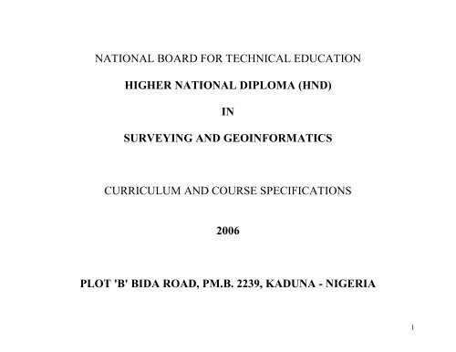
NATIONAL BOARD FOR TECHNICAL EDUCATION<br />
HIGHER NATIONAL DIPLOMA (HND)<br />
IN<br />
SURVEYING AND GEOINFORMATICS<br />
CURRICULUM AND COURSE SPECIFICATIONS<br />
2006<br />
PLOT 'B' BIDA ROAD, PM.B. 2239, KADUNA - NIGERIA<br />
1
1.0 CERTIFICATE AND TITLE OF THE PROGRAMME:<br />
The Certificate to be awarded and the programme title shall read: "NATIONAL DIPLOMA (ND) IN SURVEYING AND GEO-<br />
INFORMATICS" and "HIGHER NATIONAL DIPLOMA (HND) SURVEYING AND GEO-INFORMATICS" respectively. A transcript<br />
showing all the courses taken and grades obtained shall be issued together with the certificate.<br />
2.0 GOALS AND OBJECTIVES:<br />
2.1 National Diploma Programmes:<br />
The National Diploma Programme in Surveying and Geo-Informatics is aimed at producing diplomates that can demonstrate sound<br />
understanding of the methods and instruments used in Geo-Informatics. On the completion of this programme, the diplomate should be able<br />
to:<br />
1. Interpret spatial measurements from various sources;<br />
2. Operate Geo-Informatics instruments;<br />
3. Carry out cadastral survey to define boundaries of land;<br />
4. Apply the basic principles of surveying and method in Geo-Informatics;<br />
5. Interpret imageries;<br />
6. Compile maps at various scales from imageries; and<br />
7. Carry out cartographic processes for presentation of Geo-Informatics.<br />
2.2 Higher National Diploma Programme:<br />
The Higher National Diploma Programme in Surveying and Geo-Informatics is aimed at producing diplomates with a good mastery of the<br />
methods and instrumentation used in Geo-Informatics. On completion of this programme, the student should be able to:<br />
(i)<br />
(ii)<br />
(iii)<br />
(iv)<br />
(v)<br />
(vi)<br />
Operate various Geo-Informatics equipment;<br />
Use land administration procedures in various cadastral system<br />
Carry out engineering surveys for physical developments such as roads, railways, dams, pipelines, large industrial sites,<br />
utilities, etc.<br />
Carry out geodetic and topographical surveys for controlling all survey works and for geo-informatics production;<br />
To acquire spatial data using photogrammetric and remote-sensing techniques.<br />
Carry out Cartographic process for Geo-Information production;<br />
2
(vii)<br />
(viii)<br />
(ix)<br />
(x)<br />
Carry out hydrographic survey;<br />
Apply the basic principles of management in solving, at appropriate level, management and supervisory problems related<br />
to Geo-Informatics environment.<br />
Apply geo-information technology in environmental mapping, monitoring and protection; and<br />
Manipulate a geographic information system for geo-information production.<br />
3.0 ENTRY REQUIREMENTS:<br />
3.1 National Diploma Programme:<br />
Applicants with the following qualifications may be considered for admission into the National Diploma Programme by direct entry:<br />
(i)<br />
(ii)<br />
SSCE or its equivalents with credit passes in Mathematics and Physics and any other two subjects from the following: Statistics,<br />
Further Mathematics, Chemistry, Technical Drawing, Basic Surveying, Geography, Economics, Biology/Agricultural Science and at<br />
least a pass in English Language at not more than two sittings.<br />
Four credit passes in relevant subjects as stated in (i) above obtained at the final examination of an NBTE recognised preliminary<br />
ND Programme offered in Polytechnic or similar post-secondary technical institution.<br />
OR<br />
(iii) NTC in Building Trades in relevant subjects as stated in (i) above<br />
3.2 Higher National Diploma Programme:<br />
Applicants with all the following qualifications may be considered for admission in the Higher National Diploma Programme by direct entry:<br />
(i)<br />
(ii)<br />
(iii)<br />
The entry requirements or the National Diploma Programme in 3.1 above.<br />
National Diploma in Surveying and Geo-Informatics with a minimum of lower credit pass; and<br />
A minimum of one year Post-National Diploma cognate work experience in the field of Surveying and Geo-Informatics.<br />
3
4.0 CURRICULUM:<br />
4.1 The curriculum of all ND and HND programmes consists of four components<br />
These are:<br />
(i)<br />
(ii)<br />
(iii)<br />
(iv)<br />
General Studies/Education<br />
Foundation Courses<br />
Professional Courses<br />
Supervised Industrial Work Experience Scheme (SIWES)<br />
4.2 The General Education component shall include courses in Art and Humanities English Language, Communication, History.<br />
These are compulsory. Mathematics and Science (for non-science based programmes) Social Studies - Citizenship (the Nigerian<br />
Constitution) Political Science, Sociology, Philosophy, Geography, Entrepreneurship, Philosophy of Science and Sociology are compulsory.<br />
The General Education component shall account for not more than 15% of total contact hours for the programmes<br />
4.3 Physical and Health Education (one semester credit only).<br />
4.4 Foundation Courses include courses in Economics, Mathematics, Pure Sciences technical drawing, descriptive geometry, statistics, etc.<br />
The number of hours will vary with the programme and may account for about 10 - 15% of the total contact hours.<br />
4.5 Professional Courses are courses which give the student the theory and practical skills he needs to practice his field of calling at the<br />
technician/technologist level. These may account for between 60 - 70% of the contact hours depending on programme.<br />
4.6 Supervised Industrial Work Experience Scheme (SIWES) shall be taken during the long vacation following the end of the second<br />
semester of the first year. See details<br />
5.0 CURRICULUM STRUCTURE:<br />
5.1 ND Programme:<br />
The structure of the ND programme consists of four semesters of classroom, laboratory and workshop activities in the college - and a<br />
semester (3-4 months) of supervised industrial work experience scheme (SIWES). Each semester shall be of 17 weeks duration made up<br />
4
as follows: 15 contact weeks<br />
and registration. SIWES shall<br />
of teaching, i.e. lecture, recitation, and practical exercises, etc.; and 2 weeks for tests, quizzes, examinations<br />
take place at the end of the second semester of the first year.<br />
5.2 HND Programme:<br />
The structure of the programme is similar to that of the ND save that the SIWES at the end of the first year is not compulsory.<br />
6.0 ACCREDITATION:<br />
Each programme offered either at the ND or HND level shall be accredited by the NBTE before the diplomates can be awarded either of the<br />
diploma certificates. Details about the process of accreditating a programme for the award of the ND or HND are available from the<br />
Executive Secretary, Programme Department, National Board for Technical Education, Plot B, Bida Road, P.M.B. 2239, Kaduna,<br />
Nigeria.<br />
7.0 CONDITIONS FOR THE AWARD OF THE ND/HND:<br />
Institutions offering accredited programmes will award the National Diploma to candidates who successfully completed the programme after<br />
passing prescribed coursework, examinations, diploma project and the supervised industrial work experience. Such candidates should have<br />
completed a minimum of between 72 - 80 semester credit units depending on the programme.<br />
8.0 GUIDANCE NOTES FOR TEACHERS TEACHING THE PROGRAMME:<br />
8.1 The new curriculum is drawn in unit courses. This is in keeping with the provisions of the National Policy on Education which stress the<br />
need to introduce the semester credit units which will enable a student who so wish to transfer the units already completed in an institution of<br />
similar standard from which he is transferring.<br />
8.2 Undesigning the units, the principle of the modular system by product has been adopted; thus making each of the professional modules,<br />
when completed provides the student with technician operative skills, which can be used for employment our poses.<br />
8.3 As the success of the credit unit system depends on the articulation of programmes between the institutions and industry, the curriculum<br />
content has been written in behavioural objectives, so that it is clear to all, the expected performance of the student who successfully<br />
completed some of the courses or the diplomates of the programme. There is a slight departure in the presentation of the performance based<br />
curriculum which requires the conditions under which the performance expected to be carried out and the criteria for the acceptable levels<br />
of performance.<br />
5
It is a deliberate attempt to further involve the staff of the department teaching the programme to write their own curriculum stating the<br />
conditions existing in their institution under which the performance can take place and to follow that with the criteria for determining an<br />
acceptable level of performance. Departmental submission on the final curriculum may be vetted by the Academic Board of the institution.<br />
Our aim is to continue to see to it that a solid internal evaluation system exists in each institution for ensuring minimum standard and quality<br />
of education in the programmes offered throughout the polytechnic system.<br />
8.4 The teaching of the theory and practical work should, as much as possible, be integrated. Practical exercises, especially those in professional<br />
courses and laboratory work should not be taught in isolation from the theory. For each courses, there should be a balance of theory to<br />
practice in the ratio of 50:50 or 60:40 or the reverse.<br />
9.0 GUIDELINES ON SIWES PROGRAMME:<br />
For the smooth operation of the SIWES the following guidelines shall apply:<br />
9.1 Responsibility for Placement of Students<br />
(a)<br />
(b)<br />
Institutions offering the ND programme shall arrange to place the students in industry. By April 30th of each year, six copies of the<br />
master list showing where each student has been placed shall be submitted to the Executive Secretary, NBTE which shall, in turn,<br />
authenticate the list and forward it to the Industrial Training Fund, Jos.<br />
The Placement Officer discuss and agree with industry on the following:<br />
(i)<br />
(ii)<br />
(iii)<br />
A task inventory of what the students should be expected to experience during the period of attachment. It may be wise to<br />
adopt the one already approved for each field.<br />
The industry-based supervisor of the students during the period, likewise the institution based supervisor.<br />
The evaluation of the student during the period. It should be noted that the final grading of the student during the period<br />
of attachment should be weighted more on the evaluation by his industry-based supervisor.<br />
6
9.2 Evaluation of Students During the SIWES<br />
In the evaluation of the student, congnisance should be taken of the following items:<br />
(a)<br />
(b)<br />
(c)<br />
(d)<br />
(e)<br />
(f)<br />
Punctuality<br />
Attendance<br />
General Attitude to Work<br />
Respect for Authority<br />
Interest in the field/technical area<br />
Technical competence as a potential technician in his field.<br />
9.3 Grading of SIWES<br />
To ensure uniformity of grading scales, the institution should ensure that<br />
all Polytechnics is adopted.<br />
the uniform grading of students' work which has been agreed to by<br />
9.4 The Institution Based Supervisor<br />
The Institution-based supervisor should initial the log book during each visit. This will enable him to check and determine to what extent the<br />
objectives of the scheme are being met and to assist students having any problems regarding the specific assignments given to them by their<br />
industry-based supervisor.<br />
9.5 Frequency of Visit<br />
Institution should ensure that students placed on attachment are visited within one month of their placement. Other visits shall be arranged so<br />
that:<br />
(1) There is another visit six weeks after the first visit, and<br />
(2) A final visit in the last month of the attachment.<br />
7
9.6 Stipend for Students in SIWES<br />
The rate of stipend payable shall be determined from time to time by the Federal Government after due consultation with the Federal Ministry<br />
of Education, the Industrial Training Fund and the NBTE'<br />
9.7 SIWES As a Component of the Curriculum<br />
The completion of SIWES is important in the final determination of whether the student is successful in the programme or not. Failure in the<br />
SIWES is an indication that the student has not shown sufficient interest in the field or has no potential to become a skilled technician in his<br />
field. The SIWES should be graded on a fail or pass basis. Where a student has satisfied all other requirements but failed SIWES, he may<br />
only be allowed to repeat another four months SIWES at his own expense.<br />
National Board for Technical Education,<br />
Kaduna.<br />
8
HIGHER NATIONAL DIPLOMA IN SURVEYING AND GEO-INFORMATICS<br />
YEAR ONE:<br />
Semester One<br />
Code No Course L T P CU CH Pre-requisite<br />
SUG 301 Cadasral Surveying IV 1 0 2 3 3<br />
SUG 303 Survey Instrument 1 0 2 3 3<br />
SUG 305 Geodetic Surveying I 2 0 2 4 4<br />
SUG 307 Topographical Surveying 1 0 2 3 3<br />
SUG 309<br />
Physics III (Electro-Magnetism;<br />
Terrestrial and Planimetry<br />
Physics)<br />
2 0 2 4 4<br />
MTH 311 Mathematics I 2 0 0 2 2<br />
GIT 301 Element of Photogrammetry 2 0 2 4 4<br />
GNS 302 Communication Skills III 2 0 0 2 2<br />
SUG 311 Fundamentals of Computer 2 0 3 5 5<br />
Total 15 0 15 30 30<br />
9
Semester Two<br />
Code No Course L T P CU CH Pre-requisite<br />
SUG 302 Astronomy III 1 0 3 4 4 SUG<br />
SUG 304 Engineering Surveying 2 0 3 5 5 SUG<br />
SUG 306 Geodetic Surveying II 2 0 2 4 4 SUG<br />
SUG 308 Adjustment Computation I 2 0 2 4 4 -<br />
SUG 310<br />
Physics IV (Physical Optics;<br />
Atomic & Nuclear Physics)<br />
2 0 2 4 4 SUG<br />
MTH 312 Mathematics II 2 0 0 2 2 MTH 111<br />
SUG 312 Computer Applications 1 0 2 3 3 SUG 311<br />
GIT 304 Principles of Geoinformatics 1 0 2 3 3 -<br />
Total 13 0 16 29 29<br />
10
YEAR TWO:<br />
Semester One.<br />
Code No Course L T P CU CH Pre-requisite<br />
SUG 401 Cadastral Surveying V 2 0 0 2 2<br />
SUG 403 Hydrographic Surveying 1 0 2 2 3<br />
SUG 405 Adjustment Computation II 2 0 2 4 4<br />
GIT 401<br />
Analytical & Digital<br />
Photogrammetry<br />
2 0 3 5 5<br />
GIT 403 Digital Mapping 2 0 3 5 5<br />
GIT 405 Automated Suyveying 2 0 3 5 5<br />
GIT 407<br />
GIT<br />
GNS<br />
Geographic Information System<br />
Tools<br />
2 0 3 5 5<br />
Total 13 0 16 29 29<br />
11
Semester Two<br />
Code No Course L T P CU CH Pre-requisite<br />
SUG 402 Management in Surveying 2 0 0 2 2<br />
GIT 402 Digital Cartography 2 0 3 5 5<br />
SUG 404<br />
Elements of Environmental<br />
Studies<br />
2 0 3 5 5<br />
SUG 406 French for beginners 2 0 0 2 2<br />
GNS 320<br />
GNS 321<br />
Outline History of Africa<br />
International Relations &<br />
Elements of Nigerian Law<br />
SUG 214 Final Projects 0 2 6 4 8<br />
2<br />
2<br />
Total 12 2 12 26 26<br />
0<br />
0<br />
0<br />
0<br />
2<br />
2<br />
2<br />
2<br />
12
CADASTRAL AND GEODETIC SURVEYING COURSES<br />
(SUG 301, 401, 307, AND 308)<br />
13
CADASTRAL SURVEYING IV<br />
PROGRAMME: HIGHER NATIONAL DIPLOMA (ND) SURVEYING AND GEOINFORMATICS<br />
COURSE: Cadastral Surveying IV COURSE CODE: SUG 301 CONTACT HOURS: 60 Hours<br />
Course Specification: Theoretical Contents Practical Content<br />
General Objective: 1.0 Understand the Principle and regulations General Objective:<br />
governing the demarcation and survey of<br />
boundaries.<br />
WEEK Specific Learning Objective Teachers Activities Learning<br />
Resources<br />
Specific Learning Objective Teachers Activities Learning<br />
Resources<br />
Demarcation and Surveys of<br />
Boundaries.<br />
1.1 Carry out the<br />
demarcation of<br />
cadastral boundary in<br />
accordance with the<br />
regulations.<br />
1.2 Explain the principle<br />
governing the creation<br />
of boundaries of each<br />
property.<br />
1.3 Set out boundaries to<br />
any given<br />
specifications, e.g.<br />
contiguous boundaries.<br />
1.4 Carry out the survey of<br />
the boundary, using<br />
Geoinformatics<br />
methods.<br />
1.1 Set out boundaries to<br />
any give specifications<br />
e.g. contiguous<br />
boundaries.<br />
1.2 Carryout the survey of<br />
the boundary using<br />
Geoinformatics<br />
methods.<br />
1.3 Use computational<br />
means to detect errors in<br />
observation or<br />
computation of traverse.<br />
1.4 Carryout actual field<br />
measurements to<br />
confirm the detected<br />
observational errors.<br />
1.5 Carryout surveys of<br />
judgments boundary.<br />
1.6 Calculate scale fees for<br />
clients.<br />
14
General Objective: 2.0 Know how to detect gross errors in traverse.<br />
WEEK Specific Learning Objective Teachers Activities Learning<br />
Resources<br />
Error detection in Traverses.<br />
General Objective:<br />
Specific Learning Objective Teachers Activities Learning<br />
Resources<br />
2.1 Detect gross traverse<br />
errors due to<br />
misplacement of DN<br />
and DE.<br />
2.2 Detect gross traverse<br />
errors due to<br />
transposition of DN and<br />
DE.<br />
2.3 Detect gross traverse<br />
errors resulting from<br />
use of a wrong distance.<br />
2.4 Detect gross traverse<br />
errors resulting from<br />
use of an erroneous<br />
bearing.<br />
2.5 Detect gross field<br />
observation error in one<br />
distance measurement.<br />
2.6 Detect gross field<br />
observation error in an<br />
angular measurement.<br />
2.7 Carry out actual field<br />
measurements to<br />
confirm<br />
the detected errors.<br />
15
General Objective: 3.0 Know the procedure to be followed in dispute<br />
surveys.<br />
WEEK Specific Learning Objective Teachers Activities Learning<br />
Resources<br />
Land Dispute Surveys.<br />
3.1 Explain the legal<br />
implications in land<br />
dispute surveys.<br />
3.2 Explain the various<br />
requirements of dispute<br />
surveys as regards<br />
assembly and<br />
examination of<br />
representatives of<br />
disputing parties;<br />
impartiality of the<br />
surveyor and security.<br />
3.3 Carry out surveys of<br />
disputed boundaries.<br />
3.4 Carry out surveys of<br />
judgments boundary.<br />
General Objective: 4 .0 Understand the process of Registration of and<br />
professional conduct of surveyors.<br />
WEEK Specific Learning Objective Teachers Activities Learning<br />
Resources<br />
Professional Conduct of<br />
Surveyors.<br />
General Objective:<br />
Specific Learning Objective Teachers Activities Learning<br />
Resources<br />
General Objective:<br />
Specific Learning Objective Teachers Activities Learning<br />
Resources<br />
4.1 Define the various legal<br />
terms.<br />
4.2 Explain the roles of the<br />
16
surveyors' council and<br />
the its committees.<br />
4.3 Explain the surveyors'<br />
qualifications.<br />
4.4 Calculate scale of fees<br />
for clients.<br />
4.5 Explain the roles and<br />
duties of the surveyors.<br />
4.6 Explain the survey coordination<br />
act and its<br />
amendments.<br />
17
CADASTRAL SURVEYING V<br />
PROGRAMME: HIGHER NATIONAL DIPLOMA (ND) SURVEYING AND GEOINFORMATICS<br />
COURSE: Cadastral Surveying V COURSE CODE: SUG 401 CONTACT HOURS: 60 Hours<br />
Course Specification: Theoretical Contents Practical Content<br />
General Objective: 1.0 Understand the Nigeria Land Tenure systems.<br />
General Objective:<br />
WEEK Specific Learning Objective Teachers Activities Learning<br />
Resources<br />
Nigeria Land Tenure Systems.<br />
Specific Learning Objective Teachers Activities Learning<br />
Resources<br />
Nil<br />
1.1 Trace the historical<br />
background to the<br />
various land tenure laws<br />
of Nigeria.<br />
1.2 Interpret the laws and<br />
regulations governing<br />
land tenure.<br />
1.3 Define the basic terms<br />
used in connection with<br />
land tenure.<br />
1.4 Interpret the land use<br />
decree, 1978.<br />
General Objective: 2.0 Know the various land registration systems.<br />
WEEK Specific Learning Objective Teachers Activities Learning<br />
Resources<br />
Land Registration Systems.<br />
General Objective:<br />
Specific Learning Objective Teachers Activities Learning<br />
Resources<br />
2.1 Trace the historical<br />
background to the land<br />
18
egistration systems in<br />
Nigeria.<br />
2.2 List the various types of<br />
registration systems in<br />
common use worldwide.<br />
2.3 Outline the mode of<br />
operation of each of the<br />
registration systems<br />
conveyance, deeds, title.<br />
2.4 Describe in detail the<br />
Torrents title<br />
registration system as<br />
applicable in various<br />
parts of the world.<br />
2.5 Compare the various<br />
registration systems in<br />
common use.<br />
2.6 Explain the functions of<br />
the land registries.<br />
General Objective: 3.0 Understand the methods of land<br />
administration in Nigeria.<br />
WEEK Specific Learning Objective Teachers Activities Learning<br />
Resources<br />
Land Administration in<br />
Nigeria.<br />
General Objective:<br />
Specific Learning Objective Teachers Activities Learning<br />
Resources<br />
3.1 Trace the historical<br />
background to the land<br />
administration laws of<br />
Nigeria.<br />
3.2 Explain the procedure<br />
19
to be adopted for the<br />
acquisition of land for<br />
public, private and other<br />
purposes.<br />
3.3 Explain the role of site<br />
boards.<br />
3.4 Determine the amount<br />
and form of<br />
compensation payable<br />
in the event of loss of<br />
right.<br />
3.5 Define terms used in<br />
connection with land<br />
administration e.g.<br />
statutory right of<br />
occupancy, customary<br />
right of occupancy,<br />
way-leaves and vested<br />
lands.<br />
3.6 Explain how the control<br />
of settlements and<br />
protection of venerated<br />
areas is effected.<br />
General Objective: 4.0 Know the modes of keeping survey records by<br />
the survey organization.<br />
WEEK Specific Learning Objective Teachers Activities Learning<br />
Resources<br />
Modes of Keeping Survey<br />
Records.<br />
General Objective:<br />
Specific Learning Objective Teachers Activities Learning<br />
Resources<br />
4.1 Explain the numbering<br />
systems of cadastral<br />
20
eacons.<br />
4.2 Distinguish between the<br />
methods of keeping coordinate<br />
lists for<br />
property beacons and<br />
corner beacons.<br />
4.3 Keep co-ordinate<br />
registers.<br />
4.4 Define the role of<br />
intelligence charts.<br />
4.5 Explain the mode of<br />
preservation of<br />
intelligence charts.<br />
4.6 Prepare and keep<br />
beacon descriptions.<br />
4.7 Explain the mode of<br />
preserving beacon<br />
description records.<br />
4.8 Interpret the content of<br />
the survey file.<br />
4.9 Explain the mode of<br />
keeping survey files.<br />
General Objective: 5.0 Know how to interpret the Town Planning<br />
Law as it affects the surveyor.<br />
WEEK Specific Learning Objective Teachers Activities Learning<br />
Resources<br />
Urban and Regional Law<br />
General Objective:<br />
Specific Learning Objective Teachers Activities Learning<br />
Resources<br />
5.1 Trace the historical<br />
background to the<br />
Nigerian, Urban and<br />
Regional Planning Law.<br />
21
5.2 Define the basic terms<br />
used in planning law.<br />
5.3 Explain the role of the<br />
planning authority.<br />
5.4 Outline those aspects of<br />
the planning law which<br />
affect the surveyor e.g.<br />
planning proposals,<br />
clearance and approval,<br />
building-line, and master<br />
plans.<br />
22
GEODETIC SURVEYING I<br />
PROGRAMME: HIGHER NATIONAL DIPLOMA (ND) SURVEYING AND GEOINFORMATICS<br />
COURSE: Geodetic Surveying I COURSE CODE: SUG 307 CONTACT HOURS: 60 Hours<br />
Course Specification: Theoretical Contents Practical Content<br />
General Objective: 1.0 Understand the characteristics of and<br />
General Objective:<br />
relationships between the three geodetic<br />
surfaces and the basis of geodetic computation.<br />
WEEK Specific Learning Objective Teachers Activities Learning<br />
Resources<br />
Specific Learning Objective Teachers Activities Learning<br />
Resources<br />
Geodetic Computation<br />
1.1 Carryout first-order<br />
geodetic leveling.<br />
1.1 Identify the three basic<br />
geodetic surfaces - the<br />
earth's surface, the<br />
geoid and the reference<br />
ellipsoid.<br />
1.2 Carryout the<br />
determination of heights<br />
of intersected and<br />
resected points from<br />
vertical angles.<br />
1.2 Describe the main<br />
characteristics of the<br />
three surfaces and their<br />
relationships to each<br />
other.<br />
1.3 Explain what is meant<br />
by deviation of the<br />
`vertical'.<br />
1.4 Illustrate the basis of<br />
geodetic computation -<br />
computation on the<br />
ellipsoid and on<br />
projections of the<br />
spheroid.<br />
23
General Objective: 2.0 Know the need for a geodetic framework and<br />
the various forms it can take and the orders<br />
of precision.<br />
WEEK Specific Learning Objective Teachers Activities Learning<br />
Resources<br />
Geodetic Framework.<br />
General Objective:<br />
Specific Learning Objective Teachers Activities Learning<br />
Resources<br />
2.1 State the objects of a<br />
geodetic framework.<br />
2.2 Explain the<br />
classification of<br />
geodetic framework<br />
surveys into different<br />
orders of accuracy.<br />
2.3 Outline the respective<br />
accuracy criteria.<br />
2.4 Describe the several<br />
forms which the<br />
geodetic framework<br />
may take.<br />
2.5 Explain their relative<br />
utility and merits.<br />
2.6 Explain the system of<br />
classification and<br />
enumeration of geodetic<br />
framework surveys<br />
adopted in Nigeria.<br />
2.7 Describe the general<br />
layout of the Nigeria<br />
national geodetic<br />
framework.<br />
2.8 Outline its historical<br />
evolution.<br />
24
General Objective: 3.0 Understand the objects and underlying<br />
principles of geodetic height measurement.<br />
WEEK Specific Learning Objective Teachers Activities Learning<br />
Resources<br />
Geodetic Height Measurement<br />
3.1 State the objects of<br />
height measurement in<br />
geodesy.<br />
3.2 Identify various types of<br />
height systemsdynamic,<br />
orthometric<br />
and normal height<br />
systems.<br />
3.3 Distinguish between<br />
geoidal heights and<br />
ellispsoidal heights.<br />
3.4 Compare the different<br />
methods of determining<br />
geodetic heights by<br />
spirit/electronic<br />
levelling, theodolite<br />
vertical angels, from<br />
satellite observations,<br />
by hydrostatic levelling.<br />
General Objective: Understand the principles and practice of geodetic<br />
levelling (spirit/electronic levelling).<br />
WEEK Specific Learning Objective Teachers Activities Learning<br />
Resources<br />
Geodetic Levelling<br />
General Objective:<br />
Specific Learning Objective Teachers Activities Learning<br />
Resources<br />
General Objective:<br />
Specific Learning Objective Teachers Activities Learning<br />
Resources<br />
4.1 Distinguish between the<br />
different classes of<br />
25
geodetic levelling.<br />
4.2 Enumerate their<br />
respective accuracy<br />
criteria.<br />
4.3 Explain the principles<br />
involved in laying out a<br />
geodetic levelling<br />
network - use of tidal<br />
stations, density of net,<br />
factors affecting<br />
location of level lines<br />
(accessibility), stability,<br />
preservation, utility of<br />
benchmarks).<br />
4.4 Describe the various<br />
sources of systematic<br />
errors in geodetic<br />
levelling.<br />
4.5 Evaluate the methods<br />
adopted to minimize<br />
their effect.<br />
4.6 Describe the methods of<br />
single and double<br />
levelling.<br />
4.7 Identify their relative<br />
merits.<br />
4.8 Justify the Federal<br />
Survey procedure of<br />
first order geodetic<br />
levelling.<br />
4.9 Explain how to effect<br />
`river-crossings' by<br />
spirit levelling.<br />
26
4.10 Carryout first order<br />
geodetic levelling.<br />
General Objective: 5.0 Understand the principles and practice of<br />
Geodetic heights from theodolite vertical<br />
angles.<br />
WEEK Specific Learning Objective Teachers Activities Learning<br />
Geodetic Heights from<br />
Theodolite Angle.<br />
Resources<br />
General Objective:<br />
Specific Learning Objective Teachers Activities Learning<br />
Resources<br />
5.1 Demonstrate the<br />
mathematical basis of<br />
determining the<br />
difference in geodetic<br />
height between two<br />
stations from reciprocal<br />
vertical angles.<br />
5.2 Evaluate for the effects<br />
of refraction on vertical<br />
angles.<br />
5.3 Correct for the effects<br />
of refraction on vertical<br />
angles.<br />
5.4 Evaluate the effects of<br />
diurnal changes in<br />
refraction on vertical<br />
angles.<br />
5.5 Identify optimal times<br />
of observation for<br />
vertical angles.<br />
5.6 Describe the observing<br />
procedure.<br />
27
5.7 Carry out the<br />
determination of heights<br />
of intersected and<br />
resected points from<br />
vertical angles.<br />
5.8 Explain how to effect<br />
'river crossings' of<br />
geodetic levels using<br />
theodolite vertical<br />
angles.<br />
28
GEODETIC SURVEYING II<br />
PROGRAMME: HIGHER NATIONAL DIPLOMA (ND) SURVEYING AND GEOINFORMATICS<br />
COURSE: Geodetic Surveying II COURSE CODE: SUG 308 CONTACT HOURS: 60 Hours<br />
Course Specification: Theoretical Contents Practical Content<br />
General Objective: 1.0 Understand the principles of laying out General Objective:<br />
secondary triangulation and how to<br />
reconnoitre, design and beacon a secondary<br />
triangulation network.<br />
WEEK Specific Learning Objective Teachers Activities Learning Specific Learning Objective Teachers Activities Learning<br />
Secondary Triangulation<br />
1.1 Describe the principles<br />
of design of secondary<br />
triangulation types and<br />
strengths of figures;<br />
lengths of lines;<br />
connections to primary<br />
control; scale and<br />
azimuth control; use of<br />
intersected, resected,<br />
and eccentric points; use<br />
of towers and tall<br />
buildings.<br />
1.2 Carry out the<br />
reconnaissance and final<br />
design of a secondary<br />
triangulation network.<br />
1.3 Emplace secondary<br />
triangulation beacons in<br />
different types of<br />
ground.<br />
Resources<br />
1.1 Carryout the<br />
reconnaissance and final<br />
design of a secondary<br />
triangulation network.<br />
1.2 Emplace, number,<br />
describe and preserve<br />
secondary triangulation<br />
beacons.<br />
1.3 Observe secondary<br />
traverses with particular<br />
reference to:<br />
a. Connections to primary<br />
control.<br />
b. Observation of<br />
horizontal angles.<br />
c. Measurement of<br />
distances using EDM.<br />
d. Azimuth control.<br />
e. Heighting by:<br />
(i) vertical angles<br />
(ii) vertical angles<br />
Resources<br />
29
1.4 Number beacons in 1.3<br />
above.<br />
1.5 Describe beacons in 1.3<br />
above.<br />
1.6 Preserve beacons in 1.3<br />
above.<br />
1.7 Describe the different<br />
types of opaque and<br />
luminous signals<br />
suitable for secondary<br />
triangulation and how to<br />
erect and use them.<br />
1.4 Layout of typical<br />
township control<br />
networks based:-<br />
(i) purely on traverse.<br />
(ii) triangulation-cumtraverse.<br />
1.5 Re-establish township<br />
beacons which have<br />
been disturbed or<br />
destroyed.<br />
1.6 Compute NTM or UTM<br />
coordinates of:<br />
(i) Secondary<br />
triangulation<br />
(ii) Secondary traverse<br />
(iii) Township control<br />
networks.<br />
1.7 Determine the heights of<br />
primary traverse station<br />
by:<br />
(i) Spirit and digital<br />
leveling<br />
(ii) Vertical angles<br />
(trigonometric height)<br />
(iii) Total station<br />
(iv) GPS<br />
1.8 Carryout trilateration<br />
using:<br />
(i) Total station, and<br />
(ii) EDM<br />
30
General Objective: 2.0 Know the accuracy criteria and how to<br />
observe secondary triangulation.<br />
WEEK Specific Learning Objective Teachers Activities Learning<br />
Resources<br />
Accuracy Criteria<br />
General Objective:<br />
Specific Learning Objective Teachers Activities Learning<br />
Resources<br />
2.1 State the accuracy<br />
requirements for<br />
horizontal angles in<br />
secondary triangulation.<br />
2.2 Describe the different<br />
systems of observing<br />
horizontal angles<br />
method of rounds,<br />
method of directions,<br />
method of angles,<br />
Schreiber's method,<br />
broken rounds.<br />
2.3 State the requirements<br />
regarding the numbers<br />
of pointing, sets,<br />
measures and zeros<br />
when<br />
observing horizontal<br />
angles.<br />
2.4 Identify the optimal<br />
observing conditions<br />
and time of day for<br />
observing horizontal and<br />
vertical angles.<br />
2.5 Verify the positions of<br />
primary stations to<br />
31
which connection is<br />
being made.<br />
2.6 Observe resected,<br />
intersected and eccentric<br />
stations.<br />
General Objective: 2.0 Know the accuracy criteria for secondary<br />
traverses and how to carryout reconnaissance<br />
beacon and observe them.<br />
WEEK Specific Learning Objective Teachers Activities Learning<br />
Accuracy for Secondary<br />
Traverses<br />
Resources<br />
General Objective:<br />
Specific Learning Objective Teachers Activities Learning<br />
Resources<br />
3.1 State the accuracy<br />
criteria for secondary<br />
(EDM) traverses with<br />
special reference to<br />
Federal Survey<br />
specifications.<br />
3.2 Identify the factors<br />
influencing the location<br />
of secondary traverses<br />
and the siting of their<br />
permanent stations.<br />
3.3 Observe secondary<br />
traverses, with particular<br />
reference to (a)<br />
connections to primary<br />
control (b) observation<br />
of horizontal angles (c)<br />
measurement of traverse<br />
distances using EDM (d)<br />
32
azimuth control (e)<br />
heighting by (i)<br />
spirit/electronic levelling<br />
(ii) vertical angles.<br />
General Objective: 4.0 Know how to design and<br />
survey township control networks.<br />
WEEK Specific Learning Objective Teachers Activities Learning<br />
Resources<br />
Township Control Networks<br />
General Objective:<br />
Specific Learning Objective Teachers Activities Learning<br />
Resources<br />
4.1 State the objects of<br />
township control<br />
surveys and their<br />
influence on the layout<br />
of the control network.<br />
4.2 Layout typical township<br />
control networks based<br />
purely on traverse.<br />
4.3 Layout typical<br />
triangulation-cumtraverse<br />
township<br />
networks.<br />
4.4 Identify the relative<br />
merits of traverse and<br />
triangulation for<br />
township control.<br />
4.5 State the factors<br />
affecting the siting of<br />
township control<br />
stations.<br />
4.6 Describe the types of<br />
beacons and the system<br />
of enumeration used for<br />
33
township control.<br />
4.7 Connect surveys to the<br />
national framework.<br />
4.8 Describe the methods of<br />
making such<br />
Connections.<br />
4.9 Justify the accuracy<br />
criteria for township<br />
control surveys.<br />
4.10 Describe the observing<br />
procedures for (a)<br />
township traverses (b)<br />
township triangulation<br />
(c) heighting by (i)<br />
spirit/electronic levelling<br />
(ii) vertical angles.<br />
4.11 Describe the<br />
(obsolescent) systems of<br />
`township co-ordinates'.<br />
4.12 Explain the current<br />
methods of converting<br />
(old) township coordinates<br />
to UTM coordinates.<br />
4.13 List the various records<br />
to be maintained in<br />
respect of township<br />
control systems.<br />
4.14 Describe the steps taken<br />
to preserve township<br />
control beacons.<br />
4.15 Re-establish township<br />
beacons which have<br />
34
een disturbed or<br />
destroyed.<br />
General Objective: 5.0 Understand the mathematical basis of survey<br />
Projections with particular reference to<br />
the transverse mercator projection.<br />
WEEK Specific Learning Objective Teachers Activities Learning<br />
5.1 Explain the basic<br />
principles of plane<br />
projections of the<br />
sphere-scale factor,<br />
orthomorphism,<br />
convergence, arc-to-chord<br />
corrections.<br />
5.2 Describe the<br />
distinguishing features of<br />
the Transverse Mercator<br />
projections and use of the<br />
formulae for converting<br />
geographical co-ordinates<br />
to grip and vice-versa,<br />
point scale factor, line<br />
scale factor and (t-T)<br />
corrections.<br />
5.3 Describe the UTM<br />
system.<br />
Resources<br />
General Objective:<br />
Specific Learning Objective Teachers Activities Learning<br />
Resources<br />
General Objective: 6.0 Understand the basis of computing surveys in<br />
UTM co-ordinates.<br />
WEEK Specific Learning Objective Teachers Activities Learning<br />
Resources<br />
General Objective:<br />
Specific Learning Objective Teachers Activities Learning<br />
Resources<br />
35
Computing Surveys in UTM<br />
Co-ordinates<br />
6.1 Compute convergence<br />
using the basic<br />
formulae.<br />
6.2 Obtain UTM bearings.<br />
6.3 Compute (t-T)<br />
corrections using the<br />
basic formulae and<br />
tabulated parameters for<br />
the Clarks 1880<br />
spheroid.<br />
6.4 Deduce plane grid<br />
angles from observed<br />
angles.<br />
6.5 Convert geographical<br />
coordinates to UTM coordinates<br />
and vice-versa<br />
using the basic formulae<br />
and tabulated<br />
parameters for the<br />
Clarke 1880 spheroid.<br />
6.6 Compute scale<br />
corrections for long<br />
lines using the formulae<br />
for line scale factor and<br />
tabulated point scale<br />
factors.<br />
6.7 Justify the stage-bystage<br />
procedure for<br />
computation in UTM<br />
co-ordinates of<br />
(a) secondary<br />
36
triangulation<br />
(b) secondary traverse<br />
(c) township control<br />
networks.<br />
General Objective: 7 .0 Know how to lay out primary triangulation<br />
and its accuracy criteria and special<br />
requirements.<br />
WEEK Specific Learning Objective Teachers Activities Learning<br />
Lay Out Primary<br />
Triangulation<br />
Resources<br />
General Objective:<br />
Specific Learning Objective Teachers Activities Learning<br />
Resources<br />
7.1 Compare the two main<br />
types of triangulation<br />
network-continuous net<br />
and chains.<br />
7.2 State the different types<br />
of triangulation figures<br />
and criteria for wellconditioned<br />
figures.<br />
7.3 Determine the factors<br />
affecting the lengths and<br />
locations of primary<br />
triangulation lines and<br />
the siting of primary<br />
stations.<br />
7.4 Describe the types of<br />
beacons and signals<br />
used in primary<br />
triangulation.<br />
7.5 Explain the need for<br />
37
towers in primary<br />
triangulation and the<br />
main types used.<br />
7.6 Enumerate the<br />
requirements as to the<br />
accuracy and spacing of<br />
measurements to control<br />
the scale of new primary<br />
triangulation scheme.<br />
7.7 Explain the need for<br />
Laplace stations in<br />
primary triangulation<br />
and their accuracy and<br />
spacing requirements.<br />
7.8 Specify the accuracy<br />
criteria for horizontal<br />
angles in primary<br />
triangulation.<br />
7.9 Describe the<br />
refinements in<br />
instrumentation and<br />
observing procedures<br />
needed.<br />
7.10 Undertake the field<br />
checks used to verify the<br />
reliability of horizontal<br />
angle-preliminary<br />
station, figural and<br />
Laplace azimuth<br />
closures.<br />
General Objective: 8.0 Know the factors governing the location of<br />
primary traverses and their accuracy criteria<br />
and special requirements.<br />
General Objective:<br />
38
WEEK Specific Learning Objective Teachers Activities Learning<br />
Resources<br />
Location of Primary<br />
Traverses<br />
Specific Learning Objective Teachers Activities Learning<br />
Resources<br />
8.1 Analyse the impact of<br />
modern instruments on<br />
the nature and location<br />
of primary traverses and<br />
their importance in the<br />
primary framework.<br />
8.2 Determine the factors<br />
affecting the length and<br />
location of primary<br />
traverse legs, the siting<br />
of permanent stations<br />
and the use of observing<br />
towers.<br />
8.3 Specify the accuracy<br />
criteria for traverse<br />
distance measurements.<br />
8.4 Analyse the<br />
requirements for<br />
accuracy and spacing of<br />
Laplace azimuths.<br />
8.5 Specify the accuracy<br />
criteria (including<br />
allowable misclosures<br />
between azimuth) for<br />
horizontal angles and<br />
the refinements in<br />
instrumentation and<br />
observing procedure<br />
39
needed.<br />
8.6 Undertake the field<br />
checks used to test the<br />
reliability of horizontal<br />
angles.<br />
8.7 Enumerate the Federal<br />
Surveys specifications<br />
for primary traverse with<br />
particular reference to:<br />
length of traverse legs;<br />
beaconing, enumeration,<br />
description and<br />
preservation of<br />
permanent<br />
stations; use of towers;<br />
types of signals;<br />
horizontal angles; azimuth<br />
control; traverse<br />
distances; heighting.<br />
8.8 Describe the methods<br />
used to determine the<br />
heights of primary<br />
traverse stations by<br />
spirit/electronic levelling<br />
(i) vertical angles<br />
(ii) total station,<br />
(iii) GPS.<br />
General Objective: 9.0 Know how to lay out and observe<br />
trilateration.<br />
WEEK Specific Learning Objective Teachers Activities Learning<br />
Resources<br />
General Objective:<br />
Specific Learning Objective Teachers Activities Learning<br />
Resources<br />
40
Lay Out and Observe<br />
Trilateration<br />
9.1 Describe the type of<br />
network best suited to<br />
trilateration.<br />
9.2 Compare the strength of<br />
a trilateration net with<br />
that of a triangulation or<br />
traverse net.<br />
9.3 Describe the field<br />
procedure for observing<br />
trilateration.<br />
9.4 Carry out trilateration<br />
using total station or<br />
EDM.<br />
General Objective: 10.0 Understand the mathematical basis of<br />
computation on the spheroid.<br />
WEEK Specific Learning Objective Teachers Activities Learning<br />
Resources<br />
Computation on the Ellipse<br />
General Objective:<br />
Specific Learning Objective Teachers Activities Learning<br />
Resources<br />
10.1 Justify the use of the<br />
ellipse as the reference<br />
surface for geodetic<br />
computation.<br />
10.2 Explain the terms:<br />
meridian ellipse, semimajor<br />
axis, semi-minor<br />
axis, eccentricity,<br />
flattening.<br />
10.3 List the ellipsoid in<br />
41
current use together with<br />
their principal<br />
parameters.<br />
10.4 Define geodetic and<br />
astronomical latitude,<br />
longitude and azimuth.<br />
10.5 Distinguish between<br />
geodetic and<br />
astronomical latitude,<br />
longitude and azimuth.<br />
10.6 Deduce the Laplace<br />
azimuth equation.<br />
10.7 Explain its significance.<br />
10.8 Show that the area of the<br />
meridian ellipse is Pab.<br />
10.9 Deduce expressions for<br />
the values of the radii of<br />
curvature of the<br />
ellipsoid (i) in the plane<br />
of the meridian ellipse<br />
(ii) at right angles to this<br />
plane.<br />
10.10 Deduce an expression<br />
for the radius of<br />
curvature of the<br />
ellipsoid at a given point<br />
on the ellipsoid.<br />
10.11 Deduce an expression<br />
for the radius of<br />
curvature of the<br />
ellipsoid at any azimuth<br />
(Euler's theorem).<br />
10.12 Deduce expressions for<br />
42
distances along a<br />
meridian and along a<br />
parallel.<br />
10.13 Deduce the expressions<br />
for the lengths of the<br />
normal section and the<br />
geodetic on the<br />
spheroid.<br />
10.14 Deduce Legendre's<br />
theorem relating the<br />
angles of a spherical<br />
triangle to those of a<br />
plane triangle having the<br />
same sides.<br />
10.15 Deduce Delby's heorem<br />
giving the convergence<br />
of the meridians<br />
between the ends of a<br />
line.<br />
10.16 Evaluate the corrections<br />
needed to reduce<br />
observed angles to<br />
ellipsoid angles.<br />
10.17 Deduce the expressions<br />
for convergence,<br />
difference longitude and<br />
difference latitude which<br />
together constitute the<br />
Gauss Mid-Latitude<br />
(Topographical)<br />
Formula.<br />
10.18 Explain the form and<br />
utility of other formulae<br />
for geodetic position and<br />
43
everse azimuth.<br />
10.19 Explain the form and<br />
utility of various<br />
formulae for the `reverse<br />
computation' (mutual<br />
distance and azimuth for<br />
two points of known<br />
geodetic positions) e.g.<br />
the Topographical<br />
formula, the USC and<br />
GS formula.<br />
General Objective: 11.0 Know the basis of computing primary<br />
triangulation, traverse and trilateration on the<br />
spheroid.<br />
WEEK Specific Learning Objective Teachers Activities Learning<br />
Computation of Primary<br />
Triangulation, Traverse and<br />
Trilateration:<br />
Resources<br />
General Objective:<br />
Specific Learning Objective Teachers Activities Learning<br />
Resources<br />
11.1 Solve the spheroidal<br />
triangle using<br />
Legendre's theorem<br />
when one side and three<br />
angles are known.<br />
11.2 Compute geodetic<br />
positions for successive<br />
traverse stations or<br />
through a `route' in a<br />
traingulation or<br />
trilateration net using the<br />
Mid-Latitude formula<br />
44
with Laplace-adjusted<br />
spheroidal angles.<br />
11.3 Compute mutual<br />
distance and azimuth of<br />
successive stations using<br />
one of the `reverse'<br />
formula e.g. the<br />
topographical formulae.<br />
General Objective: 12.0 Know the relative merits of<br />
triangulation, traverse and trilateration for<br />
primary framework purposes.<br />
WEEK Specific Learning Objective Teachers Activities Learning<br />
Relative merits of<br />
triangulation, traverse and<br />
trilateration.<br />
Resources<br />
General Objective:<br />
Specific Learning Objective Teachers Activities Learning<br />
Resources<br />
12.1 Analyse the feasibility<br />
of triangulation and<br />
traverse in different<br />
types of terrain and<br />
ground cover.<br />
12.2 Compare the results in<br />
12.1 above.<br />
12.3 Compare the<br />
organisational, logistic<br />
and equipping<br />
requirements of primary<br />
triangulation, traverse<br />
and trilateration.<br />
12.4 Compare the accuracy,<br />
45
accessibility and utility<br />
of primary control<br />
established by<br />
triangulation, traverse<br />
and trilateration<br />
respectively.<br />
12.5 Assess the relative<br />
importance of<br />
triangulation, traverse<br />
and trilateration in<br />
modern framework<br />
surveys in various<br />
countries.<br />
46
ENGINEERING AND TOPOGRAPHICAL SURVEYING<br />
(SUG 306 AND 309)<br />
ENGINEERING SURVEYING<br />
PROGRAMME: HIGHER NATIONAL DIPLOMA (ND) SURVEYING AND GEOINFORMATICS<br />
COURSE: Engineering Surveying COURSE CODE: SUG 306 CONTACT HOURS: 45 Hours<br />
Course Specification: Theoretical Contents Practical Content<br />
General Objective: 1.0 Understand the principles of setting out General Objective:<br />
compound and reverse curves.<br />
WEEK Specific Learning Objective Teachers Activities Learning<br />
Resources<br />
Specific Learning Objective Teachers Activities Learning<br />
Resources<br />
Setting out of Compound and<br />
1.1 Set out reverse curves.<br />
47
Reverse Curves<br />
1.1 Describe the<br />
characteristics of<br />
compound curves<br />
consisting of two or<br />
more circular curves.<br />
1.2 Explain the use of<br />
formulae to compute<br />
setting out data.<br />
1.3 Compute data needed to<br />
set out reverse curves.<br />
1.4 Set out reverse curves<br />
using 1.3 above.<br />
1.2 Set out composite i.e.<br />
curves consisting of<br />
circular and transition<br />
curves.<br />
1.3 Design a vertical curve<br />
and set out data given<br />
length of curve,<br />
gradients of the<br />
interesting slopes and<br />
the reduced level of at<br />
least one known point.<br />
1.4 In site surveys, set out<br />
specified levels from<br />
control levels and<br />
establish a permanent<br />
survey control system on<br />
completion of the major<br />
construction.<br />
1.5 Use relevant<br />
Geoinformatics<br />
instruments for:-<br />
(i) Route selection<br />
(ii) As-built surveys etc.<br />
1.6 Transfer azimuth and<br />
height from surface<br />
underground and viceversa.<br />
1.7 Survey mine passages<br />
using traverse methods.<br />
1.8 Use any of the survey<br />
methods to monitor<br />
horizontal deformations.<br />
1.9 Use precise leveling in<br />
measuring vertical<br />
48
deformations.<br />
1.10 Establish micro-geodetic<br />
control systems e.g.<br />
tunnel surveys of precise<br />
large structures (radio<br />
telescopes, particle<br />
accelerators, large ships,<br />
etc.).<br />
General Objective: 2.0 Know the principles and methods of setting out<br />
transition curves.<br />
WEEK Specific Learning Objective Teachers Activities Learning<br />
Resources<br />
Transition Curves<br />
General Objective:<br />
Specific Learning Objective Teachers Activities Learning<br />
Resources<br />
2.1 Explain how the need<br />
for transition curves<br />
arises.<br />
2.2 Describe the geometric<br />
characteristics of<br />
transition curves.<br />
2.3 Explain the use of<br />
formulae to compute<br />
setting-out data.<br />
2.4 Set out composite<br />
curves i.e. curves<br />
consisting of circular<br />
and transition curves.<br />
2.5 Calculate chainage from<br />
the initial point to the<br />
end of a route<br />
consisting of various<br />
types of curves.<br />
49
General Objective: 3.0 Understand the principles of design and<br />
setting out of vertical curves.<br />
WEEK Specific Learning Objective Teachers Activities Learning<br />
Resources<br />
Vertical Curves<br />
3.1 Explain the purposes of<br />
vertical curves.<br />
3.2 List the types of curves<br />
used.<br />
3.3 Identify the principal<br />
factors governing the<br />
length of vertical curves<br />
3.4 State the properties of<br />
the parabola as the<br />
curve normally adopted<br />
for vertical curves.<br />
3.5 Derive formulae for<br />
computing data for a<br />
vertical curve.<br />
3.6 Describe methods of<br />
setting out vertical<br />
curves.<br />
3.7 Design a vertical curve<br />
and set out data given<br />
length of the curve,<br />
gradients of the<br />
intersecting slopes and<br />
the reduced level of at<br />
least one known point<br />
General Objective: 4.0 Know the principles and methods of<br />
construction site surveys.<br />
General Objective:<br />
Specific Learning Objective Teachers Activities Learning<br />
Resources<br />
General Objective:<br />
50
WEEK Specific Learning Objective Teachers Activities Learning<br />
Resources<br />
Site Surveys<br />
Specific Learning Objective Teachers Activities Learning<br />
Resources<br />
4.1 Establish rectangular<br />
grid control for<br />
construction site<br />
surveys.<br />
4.2 Describe other forms of<br />
control suitable for<br />
construction site<br />
surveys.<br />
4.3 Explain suitable selfchecking<br />
setting out<br />
methods for large<br />
construction sites with<br />
many large structures.<br />
4.4 Set out specified levels<br />
from control levels.<br />
4.5 Establish a permanent<br />
survey control system<br />
on completion of the<br />
major construction.<br />
4.6 Explain how to<br />
overcome specific<br />
setting out problems<br />
due to impediments,<br />
destruction of control<br />
beacons, water<br />
obstacles, etc.<br />
General Objective: 5.0 Understand the application of modern<br />
instrumentation and techniques in engineering<br />
General Objective:<br />
51
surveys.<br />
WEEK Specific Learning Objective Teachers Activities Learning<br />
Resources<br />
Engineering Surveys<br />
Specific Learning Objective Teachers Activities Learning<br />
Resources<br />
5.1 Use modern survey<br />
instruments in setting<br />
out and surveying route<br />
and structures.<br />
5.2 Carry out the<br />
application of<br />
photogrammetry in<br />
route selection,<br />
earthwork calculations,<br />
measurement of<br />
deformations of<br />
structures, as - built<br />
surveys, etc.<br />
5.3 Explain the uses and<br />
advantages of digital<br />
ground models in route<br />
surveys.<br />
5.4 Carry out some<br />
applications of microcomputers<br />
in<br />
engineering surveys e.g.<br />
in curve design and<br />
setting out, computing<br />
setting out data for large<br />
structures, creation of<br />
digital terrain models<br />
etc.<br />
52
General Objective: 6.0 Understand the principles and methods of<br />
mining surveys.<br />
WEEK Specific Learning Objective Teachers Activities Learning<br />
Resources<br />
Principles and Methods of<br />
Mining Surveys<br />
General Objective:<br />
Specific Learning Objective Teachers Activities Learning<br />
Resources<br />
6.1 Explain the essential<br />
differences between<br />
surface and<br />
underground surveys.<br />
6.2 Explain the technique of<br />
transferring bearings<br />
and coordinates from a<br />
surface baseline to an<br />
underground base line.<br />
6.3 Use gyro-theodolite in<br />
mining surveys.<br />
6.4 Describe the methods of<br />
transferring height from<br />
the surface to<br />
underground.<br />
6.5 Survey mine passages<br />
using traverse methods.<br />
General Objective: 7.0 Understand the methods of surveying<br />
underground installations such as pipelines,<br />
cables, conduits, channels, etc.<br />
WEEK Specific Learning Objective Teachers Activities Learning<br />
Resources<br />
Underground Installations<br />
General Objective:<br />
Specific Learning Objective Teachers Activities Learning<br />
Resources<br />
7.1 Explain the need for<br />
53
surveying underground<br />
installations.<br />
7.2 Describe the methods of<br />
locating underground<br />
installations e.g. by<br />
using detector<br />
instruments.<br />
7.3 Describe the method of<br />
surveying underground<br />
installations applying<br />
normal surface methods<br />
e.g. traversing with<br />
radiation and offsets.<br />
General Objective: 8.0 Understand the principles of measurement of<br />
deformations and small movements with<br />
particular reference to monitoring the<br />
movements of dams.<br />
WEEK Specific Learning Objective Teachers Activities Learning<br />
Measurement of deformations<br />
and Small Movements<br />
Resources<br />
General Objective:<br />
Specific Learning Objective Teachers Activities Learning<br />
Resources<br />
8.1 Explain the differences<br />
between deformations<br />
54
and small movements<br />
of structure.<br />
8.2 Explain why<br />
measurement of<br />
deformations should be<br />
carried out e.g. monitor<br />
the deformation of<br />
dams.<br />
8.3 Describe methods to be<br />
adopted in establishing<br />
control for<br />
measurement of<br />
deformations.<br />
8.4 Describe survey<br />
methods for monitoring<br />
horizontal<br />
deformations.<br />
8.5 Use precise levelling in<br />
measuring vertical<br />
deformations.<br />
8.6 Describe the application<br />
of photogrammetry in<br />
the measurement of<br />
deformations.<br />
General Objective: 9.0 Understand the principles and methods of<br />
engineering geodesy.<br />
WEEK Specific Learning Objective Teachers Activities Learning<br />
Resources<br />
Engineering Geodesy<br />
General Objective:<br />
Specific Learning Objective Teachers Activities Learning<br />
Resources<br />
55
9.1 Explain the scope of<br />
engineering geodesy<br />
(precise engineering<br />
surveys).<br />
9.2 Identify the<br />
distinguishing features<br />
of engineering geodesy<br />
- geodetic accuracy but<br />
limited extent, precise<br />
centering, use of<br />
precision instruments.<br />
9.3 Specify the accuracy<br />
requirements of<br />
engineering geodesy<br />
and the instrumentation<br />
and observational<br />
procedures to achieve<br />
them.<br />
9.4 Describe special<br />
computational methods<br />
used in precise<br />
engineering surveys.<br />
9.5 Outline typical<br />
procedures for<br />
establishing microgeodetic<br />
control<br />
systems e.g. for tunnel<br />
surveys, surveys of<br />
precise large structures<br />
(radio telescopes,<br />
particle accelerators,<br />
large ships, etc) and<br />
subsequent setting-out<br />
procedures<br />
56
TOPOGRAPHICAL SURVEYING<br />
PROGRAMME: HIGHER NATIONAL DIPLOMA (ND) SURVEYING AND GEOINFORMATICS<br />
COURSE: Topographical Surveying COURSE CODE: SUG 309 CONTACT HOURS: 45 Hours<br />
Course Specification: Theoretical Contents Practical Content<br />
General Objective: 1.0 Know further methods of making contour General Objective:<br />
surveys using digital equipment.<br />
WEEK Specific Learning Objective Teachers Activities Learning Specific Learning Objective Teachers Activities Learning<br />
Digital Tachometry.<br />
Resources<br />
1.1 Carryout topographical<br />
surveys at various scales<br />
Resources<br />
57
1.1 Explain the use of<br />
reduction tacheometers<br />
for contour surveys.<br />
1.2 Carry out contour<br />
surveys using digital<br />
tacheometers.<br />
1.3 Explain the scope of<br />
Digital tacheometry.<br />
1.4 Carry out topographical<br />
surveys at various<br />
scales using<br />
tacheometers.<br />
General Objective: 2.0 Know the methods of heighting by altimetry.<br />
WEEK Specific Learning Objective Teachers Activities Learning<br />
Resources<br />
Heighting by Altimetry<br />
using digital<br />
tachometers.<br />
1.2 Fix photo-points suitable<br />
for medium and smallscale<br />
mapping e.g. using<br />
EDM rays, theodolite<br />
resection, altimetric<br />
heights, trigonometric<br />
heights and GPS.<br />
1.3 Use Geoinformatics<br />
equipment map revision.<br />
1.4 Carryout DTM exercise<br />
using available DTM<br />
software.<br />
General Objective:<br />
Specific Learning Objective Teachers Activities Learning<br />
Resources<br />
2.1 Explain the need for<br />
heighting by altimetry.<br />
2.2 Outline the general<br />
principles of economy<br />
of this method.<br />
2.3 Explain the methods of<br />
heighting by altimetry<br />
single based, double<br />
base, multiple base, leap<br />
frog, etc.<br />
2.4 List the corrections to<br />
be applied to barometric<br />
observations in all the<br />
58
methods of altimetry.<br />
2.5 Carry out barometric<br />
observations for<br />
meteorological factor.<br />
2.6 Reduce barometric<br />
observations for<br />
meteorological factors.<br />
2.7 Explain the application<br />
of aneroid barometric<br />
heights in small-scale<br />
surveys and as height<br />
control in air mapping.<br />
2.8 State the accuracy<br />
attainable in all the<br />
methods of barometric<br />
heighting.<br />
General Objective: 3.0 Know the methods of photo-pointing for<br />
medium and small scale mapping.<br />
WEEK Specific Learning Objective Teachers Activities Learning<br />
Resources<br />
Photo-Pointing<br />
General Objective:<br />
Specific Learning Objective Teachers Activities Learning<br />
Resources<br />
3.1 Identify examples of<br />
appropriate photopoints<br />
for medium and<br />
small-scale mapping.<br />
59
3.2 Describe the photopoints.<br />
3.3 Fix photo-points<br />
suitable for medium and<br />
small-scale mapping<br />
e.g. using EDM rays,<br />
theodolite resection,<br />
altimetric heights,<br />
trigonometric heights,<br />
and GPS.<br />
General Objective: 4.0 Know the methods of map revision by ground<br />
methods.<br />
WEEK Specific Learning Objective Teachers Activities Learning<br />
Resources<br />
Map Revision by Ground<br />
Methods.<br />
General Objective:<br />
Specific Learning Objective Teachers Activities Learning<br />
Resources<br />
4.1 Evaluate the need for<br />
map revision.<br />
4.2 Explain ground<br />
methods of revising<br />
township mapping, e.g.<br />
using plane tabling,<br />
chain survey methods,<br />
compass rays, etc.<br />
4.3 Explain ground<br />
methods for revising<br />
medium and small scale<br />
mapping using compass<br />
traverse, stadia traverse<br />
with compass<br />
theodolite, EDM<br />
60
tacheometry, etc.<br />
General Objective: 5.0 Know the methods of map revision from air<br />
photographs.<br />
WEEK Specific Learning Objective Teachers Activities Learning<br />
Resources<br />
Map Revision from Air<br />
Photographs<br />
General Objective:<br />
Specific Learning Objective Teachers Activities Learning<br />
Resources<br />
5.1 Explain how to use the<br />
sketch master for map<br />
revision.<br />
5.2 Explain the process of<br />
revising maps using<br />
Geoinformatics<br />
equipment.<br />
5.3 Use Geoinformatics<br />
equipment for map<br />
revision.<br />
5.4 Describe methods of<br />
map revision using with<br />
proportional dividers.<br />
61
HYDROGRAPHIC SURVEYING AND ASTRONOMY<br />
(SUG 403 AND 303)<br />
HYDROGRAPHIC SURVEYING<br />
PROGRAMME: HIGHER NATIONAL DIPLOMA (ND) SURVEYING AND GEOINFORMATICS<br />
COURSE: Hydrographic Surveying COURSE CODE: SUG 403 CONTACT HOURS: 45 Hours<br />
Course Specification: Theoretical Contents Practical Content<br />
General Objective: 1.0 Understand the basic problem and need for General Objective:<br />
hydrographic surveys.<br />
WEEK Specific Learning Objective Teachers Activities Learning<br />
Resources<br />
Specific Learning Objective Teachers Activities Learning<br />
Resources<br />
62
Need for Hydrographic<br />
Surveys<br />
1.1 State the basic problems<br />
in surveying the land<br />
hidden under water.<br />
1.2 Explain the essence of<br />
hydrographic surveying.<br />
1.3 Explain the various<br />
phases of work<br />
involved in a typical<br />
hydrographical<br />
operation.<br />
General Objective: 2.0 Know the various methods of<br />
establishing horizontal control for water<br />
bodies.<br />
WEEK Specific Learning Objective Teachers Activities Learning<br />
Horizontal Control for Water<br />
Bodies<br />
Resources<br />
1.1 Use the echo-sounder in<br />
depth measurement.<br />
1.2 Operate automatic<br />
recorders.<br />
1.3 Use cableways in<br />
current measurement.<br />
1.4 Monitor the rate of<br />
sedimentation of a<br />
reservoir.<br />
General Objective:<br />
Specific Learning Objective Teachers Activities Learning<br />
Resources<br />
2.1 Describe methods of<br />
establishing control for<br />
water bodies by<br />
traversing, triangulation<br />
and trilateration.<br />
2.2 Explain methods of<br />
computation,<br />
adjustment and plotting<br />
of the control<br />
framework in UTM coordinates.<br />
63
General Objective: 3.0 Know the various methods of fixing plan<br />
positions afloat.<br />
WEEK Specific Learning Objective Teachers Activities Learning<br />
Resources<br />
Fixing Plain Positions Afloat<br />
General Objective:<br />
Specific Learning Objective Teachers Activities Learning<br />
Resources<br />
3.1 Describe, with diagram,<br />
the plotting of fixes<br />
observed with sextant.<br />
3.2 Compute the three-point<br />
problem<br />
given the angles<br />
observed with<br />
sextant.<br />
3.3 Explain the method of<br />
fixing with theodolites<br />
set up ashore.<br />
3.4 Describe with diagram<br />
the method for<br />
obtaining distance by<br />
angle of depression<br />
below a sea horizon.<br />
3.5 Describe the formulae<br />
for 3.4 above.<br />
3.6 Explain the method of<br />
fixing by tautwire.<br />
3.7 Describe the method of<br />
fixing with distance<br />
lines.<br />
3.8 Describe the fixing<br />
procedure by radar.<br />
3.9 Draw the hyperbolic<br />
64
curves, indicating the<br />
fixings by lambda.<br />
3.10 Construct the constant<br />
angle lattices.<br />
3.11 Describe the satellite-fix<br />
systems with the aid of<br />
a diagram.<br />
3.12 Use acoustic beacons.<br />
3.13 Describe the effects of<br />
sky noise on electronic<br />
fixing.<br />
General Objective: 4.0 Know the various methods of measuring depths.<br />
WEEK Specific Learning Objective Teachers Activities Learning<br />
Resources<br />
Depth Measurements<br />
General Objective:<br />
Specific Learning Objective Teachers Activities Learning<br />
Resources<br />
4.1 Describe the methods of<br />
depth measurement by<br />
using the leadline and<br />
sounding pole.<br />
4.2 Use the echo-sounder in<br />
depths measurement.<br />
4.3 Describe different types<br />
of echo-sounders.<br />
4.4 Describe how to<br />
calibrate echo-sounders.<br />
4.5 List the accuracies<br />
attainable with various<br />
methods of depth<br />
measurements.<br />
4.6 List causes of false<br />
65
echoes and how they<br />
can be avoided.<br />
4.7 Explain the methods of<br />
sweeping and diving to<br />
supplement soundings<br />
to detect pinnacle<br />
obstructions dangerous<br />
to navigation.<br />
General Objective: 5.0 Understand the tidal phenomenon and<br />
determination of mean sea level.<br />
WEEK Specific Learning Objective Teachers Activities Learning<br />
Resources<br />
Tidal Phenomenon and Mean<br />
Sea Level.<br />
General Objective:<br />
Specific Learning Objective Teachers Activities Learning<br />
Resources<br />
5.1 Describe the relevance<br />
of tide to hydrographic<br />
surveying.<br />
5.2 Prove mathematically<br />
that the tide generated<br />
by the forces of moon<br />
and sun varies inversely<br />
as the cube of the<br />
distance from the earth.<br />
5.3 Draw suitable diagrams<br />
to elaborate the<br />
equilibrium theory of<br />
the tide.<br />
5.4 Construct tide curves<br />
graphically by suitably<br />
combining some pure<br />
trigonometrical curves.<br />
66
5.5 Show how fourier series<br />
is adopted for the<br />
analysis and prediction<br />
of tides.<br />
5.6 Extract necessary<br />
information from tide<br />
tables.<br />
5.7 Compare the suitability<br />
of tide poles and<br />
automatic tide guages.<br />
5.8 Explain the methods of<br />
determination of means<br />
sea level from<br />
continuous tidal<br />
observation for a<br />
number of years, say 19<br />
years.<br />
General Objective: 6.0 Know the methods of staff guage measurements.<br />
WEEK Specific Learning Objective Teachers Activities Learning<br />
Resources<br />
Staff Guage Measurements<br />
General Objective:<br />
Specific Learning Objective Teachers Activities Learning<br />
Resources<br />
6.1 Describe the uses of<br />
staff guage.<br />
67
6.2 Explain the necessity of<br />
multiple staff guages.<br />
6.3 Operate automatic<br />
recorders.<br />
6.4 Explain the reduction of<br />
water level to either<br />
land levelling datum<br />
(M.S.L.) or tidal datum.<br />
General Objective: 7.0 Know how to measure currents and flow rates.<br />
WEEK Specific Learning Objective Teachers Activities Learning<br />
Resources<br />
Currents and Flow Rates<br />
General Objective:<br />
Specific Learning Objective Teachers Activities Learning<br />
Resources<br />
7.1 Describe the working<br />
principle of the current<br />
meter.<br />
7.2 Explain the necessity of<br />
a rating curve.<br />
7.3 Use a cableway in<br />
current measurements.<br />
7.4 Describe other methods<br />
of flow measurements.<br />
7.5 Mention factors<br />
affecting discharge<br />
measurements.<br />
General Objective: 8.0 Know the various applications of hydrography.<br />
WEEK Specific Learning Objective Teachers Activities Learning<br />
Resources<br />
General Objective:<br />
Specific Learning Objective Teachers Activities Learning<br />
Resources<br />
68
Application of Hydrography<br />
8.1 Explain the use of<br />
hydrography in<br />
estimating the capacity<br />
of lakes and reservoirs.<br />
8.2 Describe how it can be<br />
applied to monitor the<br />
rate of sedimentation of<br />
a reservoir.<br />
8.3 Explain its uses in<br />
shipping industry,<br />
petroleum-gas<br />
explorations, port<br />
management, fishing,<br />
water supply, irrigation,<br />
river channel<br />
improvement,<br />
hydropower dams, etc.<br />
FIELD ASTRONOMY III<br />
PROGRAMME: HIGHER NATIONAL DIPLOMA (ND) SURVEYING AND GEOINFORMATICS<br />
COURSE: Field Astronomy III COURSE CODE: SUG 303 CONTACT HOURS: 75 Hours<br />
Course Specification: Theoretical Contents Practical Content<br />
General Objective: 1.0 Understand methods of timing observations General Objective:<br />
with stop-watch and chronometer.<br />
WEEK Specific Learning Objective Teachers Activities Learning Specific Learning Objective Teachers Activities Learning<br />
69
Timing with Stop-Watch and<br />
Chronometer<br />
1.1 Describe the method of<br />
timing observations<br />
with stop-watch and<br />
chronometer.<br />
1.2 Compare the<br />
chronometer with radio<br />
time-signals using a<br />
stop-watch.<br />
1.3 Convert UTC values<br />
(from the time-signal)<br />
to UT values using<br />
bulletin values of DUT.<br />
Resources<br />
1.1 Determine the azimuth<br />
of a line by hour-angle<br />
method of E-W stars<br />
near elongation.<br />
1.2 Determine the latitude of<br />
a station by circummeridian<br />
altitude of<br />
N & S stars.<br />
1.3 Determine latitude and<br />
longitude of a station by<br />
timed altitudes of<br />
quadrantal starts (Astrofix).<br />
Resources<br />
General Objective: 2.0 Understand the basis of determination of<br />
azimuth by hour-angle of E-W stars near<br />
elongation.<br />
WEEK Specific Learning Objective Teachers Activities Learning<br />
Determination of Azimuth by<br />
Hour-Angle of E-W Stars near<br />
Elongation<br />
Resources<br />
General Objective:<br />
Specific Learning Objective Teachers Activities Learning<br />
Resources<br />
70
2.1 State the cot formula for<br />
A in terms of latitude,<br />
declination and hourangle.<br />
2.2 Deduce the full-circle<br />
value of A from the<br />
value of cot A.<br />
2.3 Prove that the error in A<br />
caused by an error in<br />
altitude is given by;<br />
SA=SinA. tanh Sf for<br />
hour angle observations<br />
and show that the effect<br />
of an error in latitude is<br />
minimised by meaning<br />
E-W observations<br />
paired for latitude.<br />
2.4 Establish the optimum<br />
range of altitude<br />
appropriate to the hourangle<br />
method.<br />
2.5 Evaluate the effect on A<br />
of an error in UT and<br />
hence establish the need<br />
for accurate timing and<br />
correcting for DUT.<br />
2.6 Select E-W stars near<br />
elongation using the<br />
formula for elongation<br />
azimuths and at suitable<br />
altitudes for hour-angle<br />
observations.<br />
71
General Objective: 3.0 Know how to observe and compute azimuth by<br />
hour-angle of E-W stars.<br />
WEEK Specific Learning Objective Teachers Activities Learning<br />
Resources<br />
Observation and Computation<br />
Of Azimuth<br />
General Objective:<br />
Specific Learning Objective Teachers Activities Learning<br />
Resources<br />
3.1 Select an E-W star at<br />
approximately 15'/30'<br />
altitude.<br />
3.2 Observe a preliminary<br />
round.<br />
3.3 Identify the star in the<br />
field.<br />
3.4 Take at least 4 rounds<br />
of observations to each<br />
identified E-W star<br />
pairing for altitude.<br />
3.5 Process field<br />
observation.<br />
3.6 Verify that the means of<br />
E-W azimuths pairs fall<br />
within a range of 10".<br />
3.7 Convert the final true<br />
bearing to MTM or<br />
UTM bearing.<br />
General Objective: 4.0 Understand how to use the polynomial<br />
coefficients for the sun contained in the star<br />
almanac.<br />
WEEK Specific Learning Objective Teachers Activities Learning<br />
Resources<br />
General Objective:<br />
Specific Learning Objective Teachers Activities Learning<br />
Resources<br />
72
The use of Polynomial<br />
Coefficients<br />
4.1 Explain how to<br />
compute the<br />
interpolating factor x<br />
from the UT<br />
observation.<br />
4.2 Compute O declination<br />
and E from the<br />
polynomial using the<br />
tabulated monthly<br />
coefficients.<br />
4.3 Write and use a<br />
computer program for<br />
computing O<br />
declination and E using<br />
the polynomial<br />
coefficients.<br />
General Objective: 5.0 Understand the basis of the determination of<br />
latitude by circum-meridian altitudes of North<br />
and South Stars.<br />
WEEK Specific Learning Objective Teachers Activities Learning<br />
Resources<br />
Latitude by Circum-Meridian<br />
Altitudes<br />
General Objective:<br />
Specific Learning Objective Teachers Activities Learning<br />
Resources<br />
5.1 State the basic formula<br />
73
for latitude in terms of<br />
the N and S Meridian<br />
altitudes and N and S<br />
declinations.<br />
5.2 Explain how an<br />
accurate latitude can be<br />
obtained from<br />
observations to N and S<br />
stars taken on one face<br />
only.<br />
5.3 Explain the basic<br />
concept of the method<br />
i.e. to use a series of<br />
circum-meridian<br />
observations to obtain a<br />
refined value of<br />
meridian altitude.<br />
5.4 Prove the formula for<br />
the reduction of circummeridian<br />
altitudes to<br />
meridian altitude.<br />
5.5 Demonstrate that the<br />
timing of circummeridian<br />
altitudes to 1<br />
sec suffices to give<br />
meridian altitude values<br />
accurate to 1"<br />
5.6 Justify a suitable<br />
observing procedure for<br />
the N-S pair - all<br />
observations on FL: UT<br />
to 1 sec; vertical angles<br />
to 1", observations say,<br />
5 minutes before and 5<br />
74
minutes after transit<br />
(say, 10 observations<br />
before 10 after transit);<br />
pressure and<br />
temperature readings.<br />
5.7 compute the UT of<br />
transit of any given star<br />
to an accuracy of 0.1<br />
sec in UT by first<br />
computing the R.A.<br />
corresponding to transit<br />
at a given (precise) UT<br />
e.g. 18 h 00 m 00.0 s<br />
5.8 Convert a series of<br />
timed circum-meridian<br />
altitudes to meridian<br />
altitudes using the<br />
factors A and M<br />
tabulated in the star<br />
almanac.<br />
General Objective: 6.0 Know how to prepare a programme for circummeridian<br />
observations to pairs of N-S stars.<br />
WEEK Specific Learning Objective Teachers Activities Learning<br />
Resources<br />
Programme for Circum-<br />
Meridian Observations<br />
General Objective:<br />
Specific Learning Objective Teachers Activities Learning<br />
Resources<br />
6.1 Compute the ranges of<br />
R.A. and declination for<br />
75
N and S stars to transit<br />
at a given station on a<br />
given date within the<br />
optimal range of<br />
altitude and observing<br />
period i.e. between<br />
altitude 30 o and 45 o<br />
approximately and<br />
within the chosen<br />
period.<br />
6.2 Make a tabulation of N<br />
and S star almanac stars<br />
transiting within the<br />
optimal altitude range<br />
and time period under<br />
the following headings:<br />
star No; magnitude;<br />
R.A.; declination; UT of<br />
transit (nearest minute):<br />
transit altitude (nearest<br />
degree).<br />
6.3 Select from the<br />
tabulations pairs of N<br />
and S stars balanced for<br />
altitude with suitable<br />
times of transit to allow<br />
observation of each star<br />
for 5 minutes before<br />
and 5 minutes after<br />
transit.<br />
6.4 Compute for each<br />
selected N-S pair the<br />
UT of transit accurate to<br />
1 sec and the meridian<br />
76
altitude accurate to 1'.<br />
General Objective: 7.0 Know how to make the observations and<br />
computations needed to determine latitude by<br />
circum-meridian altitudes of N-S stars<br />
WEEK Specific Learning Objective Teachers Activities Learning<br />
7.1 Orient the theodolite<br />
horizontal circle on true<br />
north e.g. using known<br />
bearing and picking up<br />
the first star of a N-S<br />
pair some 10 minutes<br />
before transit using the<br />
tabulated altitude to<br />
locate the star.<br />
.2 Make about 10<br />
observations before<br />
transit and 10 after<br />
transit, all on FL - time<br />
to 1 sec. altitude to 1",<br />
occasional barometer<br />
and thermometer<br />
readings.<br />
7.3 Reduce the vertical<br />
circle reading.<br />
7.4 Apply the correction to<br />
the circum-meridian<br />
altitude to obtain<br />
separate values of<br />
meridian altitude.<br />
7.5 Correct the mean<br />
meridian altitude for<br />
Resources<br />
General Objective:<br />
Specific Learning Objective Teachers Activities Learning<br />
Resources<br />
77
efraction as precisely<br />
as possible rejecting any<br />
anomalous members of<br />
the separate values<br />
before taking the mean.<br />
7.6 Compute latitude from<br />
the basic formula using<br />
the N and S meridian<br />
altitude obtained as<br />
described and the N and<br />
S declinations extracted<br />
from the star almanac as<br />
precisely as possible (or<br />
from the apparent<br />
places of fundamental<br />
stars,<br />
if available).<br />
General Objective: 8.0 Understand the basis of the determination of<br />
longitude by ex-meridian altitudes of east and<br />
west stars.<br />
WEEK Specific Learning Objective Teachers Activities Learning<br />
Resources<br />
Determination of Longitude<br />
General Objective:<br />
Specific Learning Objective Teachers Activities Learning<br />
Resources<br />
8.1 Prove the basic<br />
formulae:<br />
78
cost = sinh. Secf secd -<br />
tafnf. tand<br />
l = t+RA - (UT+R)<br />
8.2 Prove that the effect on<br />
the value of longitude<br />
of an error in h is a<br />
minimum when the star<br />
is on the prime vertical.<br />
8.3 Show that an error in<br />
longitude caused by an<br />
error in h has opposite<br />
signs for E and W stars<br />
and hence that<br />
refraction errors tend to<br />
cancel from the mean of<br />
balanced E-W<br />
observations taken<br />
within a short time of<br />
each other.<br />
8.4 Evaluate the required<br />
accuracy in h to get t<br />
(and hence longitude)<br />
accurate to 0.1 sec in<br />
Nigerian latitude at<br />
various displacements<br />
from the prime vertical.<br />
8.5 Prove that the effect on<br />
the value of the<br />
longitude of an error in<br />
assumed latitude is a<br />
minimum when the star<br />
is on the prime vertical.<br />
8.6 Compute the allowable<br />
79
error in f to get t (and<br />
therefore longitude)<br />
accurate to O.1 sec, for<br />
various displacements<br />
from the prime vertical.<br />
8.7 Show that the effect of<br />
an error in f will not<br />
generally cancel from<br />
the mean of E and W<br />
observations and<br />
therefore that a good<br />
value of f is needed.<br />
General Objective: 9.0 Know how to select pairs of E-W stars for<br />
longitude determination.<br />
WEEK Specific Learning Objective Teachers Activities Learning<br />
Resources<br />
Selection of Pairs of E-W<br />
Stars<br />
General Objective:<br />
Specific Learning Objective Teachers Activities Learning<br />
Resources<br />
9.1 Show that on the prime<br />
vertical: sind =<br />
sinf.sinh and hence<br />
how to compute the<br />
range of declination for<br />
stars to cross the prime<br />
vertical within the<br />
altitude range 20 o - 45 o .<br />
9.2 Show that on the prime<br />
vertical: cost = cotd<br />
tand and hence how to<br />
compute values of t for<br />
stars crossing the prime<br />
80
vertical at the extremes<br />
of the declination range<br />
and, using these values<br />
of t, how to deduce<br />
ranges of RA for prime<br />
vertical observations for<br />
the chosen period.<br />
9.3 Use the computed<br />
ranges of declination<br />
and RA to select<br />
suitable E-W pairs.<br />
General Objective: 10.0 Know how to make the observations and<br />
computations needed to determine longitude<br />
from timed altitudes of E-W stars.<br />
WEEK Specific Learning Objective Teachers Activities Learning<br />
Observations and<br />
Computation of Longitude<br />
Resources<br />
General Objective:<br />
Specific Learning Objective Teachers Activities Learning<br />
Resources<br />
10.1 Orient the horizontal<br />
circle on a known<br />
bearing using the<br />
predicted values of<br />
azimuth and altitude to<br />
pick up first star of a<br />
pair.<br />
10.2 Observe a preliminary<br />
round<br />
10.3 Identify the star by<br />
programmed calculator<br />
(not needed if<br />
following a definite star<br />
81
programme).<br />
10.4 Make observations of E<br />
and W stars - at least 4<br />
FL then 4 FR precise<br />
vertical angles timed to<br />
O.1 sec. UT: pressure<br />
and temperature<br />
readings.<br />
10.5 Compute longitude for<br />
each star from mean<br />
altitude and mean UT of<br />
observation.<br />
10.6 Take mean of E and W<br />
values to obtain the<br />
final longitude.<br />
General Objective: 11.0 Understand the basis of the<br />
simultaneous determination of latitude and<br />
longitude by timed altitudes of quardrantal<br />
stars (astro-fix).<br />
WEEK Specific Learning Objective Teachers Activities Learning<br />
Simultaneous Determination<br />
of Latitude and Longitude<br />
Resources<br />
General Objective:<br />
Specific Learning Objective Teachers Activities Learning<br />
Resources<br />
82
11.1 Draw a diagram<br />
showing the<br />
relationship between the<br />
zenith distances to a star<br />
from an assumed zenith<br />
and from the actual<br />
(observed) zenith and<br />
the increments in<br />
latitude and longitude<br />
from the assumed to the<br />
actual zenith.<br />
11.2 Derive the equation<br />
relating the increments<br />
in latitude and longitude<br />
to the difference<br />
between the<br />
observed(ho) and<br />
calculated(hc) altitudes:<br />
CosA.x+ sinA.y = ho -<br />
hc where x = df,y =dl<br />
cos f;<br />
11.3 Explain the need for an<br />
additional (unknown)<br />
term E, to allow for a<br />
systematic error in<br />
observed altitudes e.g.<br />
collimation error due to<br />
taking observations on<br />
one face only, so that<br />
the equation becomes:<br />
x.cosA+y sinA+E = h o -<br />
h c.<br />
11.4 Define `Quadrantal star'<br />
83
11.5 Explain (i) how, by<br />
observing a pair of<br />
balanced stars in<br />
diagonally opposite<br />
quadrants in succession,<br />
the term E is eliminated<br />
when subtracting one<br />
equation from the other,<br />
leaving an equation in<br />
two unknowns x and y.<br />
Therefore by taking<br />
observations to four<br />
quadrantal stars<br />
diagonally balanced for<br />
altitude, diagonallyopposite<br />
stars in<br />
succession (to minimise<br />
changes in refraction<br />
error) two such<br />
equations are obtained<br />
from which x and y can<br />
be obtained. (ii) how the<br />
use of quadrantal stars<br />
ensures large rise to<br />
strong values of the<br />
coefficients in the two<br />
final equations giving<br />
rise to strong values of<br />
x and y.<br />
11.6 Prove the formulae used<br />
to obtain h c :<br />
t = UT + R + l - RA<br />
sinh c = sind.sinf+cosd<br />
84
cosf.cost<br />
and the formulae used<br />
to compute sinA and<br />
cosA; sinA = -<br />
coso.sint.sech; cosA =<br />
cos(sin-1 (sinA).<br />
General Objective: 12.0 Know how to make the observations and<br />
computations to determine latitude and<br />
longitude by timed altitudes of quadrantal<br />
stars.<br />
WEEK Specific Learning Objective Teachers Activities Learning<br />
Observations and<br />
Computations of Latitude and<br />
Longitude<br />
Resources<br />
General Objective:<br />
Specific Learning Objective Teachers Activities Learning<br />
Resources<br />
12.1 Select a pair of<br />
quadrantal stars in<br />
diagonally opposite<br />
quadrants balanced for<br />
altitude and in the<br />
altitude range 35 o - 45 o .<br />
12.2 Make a preliminary<br />
round of observation<br />
into each star.<br />
12.3 Identify with a<br />
programmed calculator<br />
to ensure both stars are<br />
in the stars almanac.<br />
12.4 Take a set of precise<br />
85
vertical circle readings<br />
to each star, all on FL<br />
and timed to 0.1 sec.<br />
12.5 Read barometer and<br />
thermometer (say, sets<br />
of 5 readings per star).<br />
12.6 Repeat these<br />
observations in 12.4 and<br />
12.5 a pair of identified<br />
stars in the other two<br />
quadrants (balanced for<br />
altitude).<br />
12.7 Compute the mean<br />
vertical angle.<br />
12.8 Correct for refraction to<br />
obtain the mean altitude<br />
of each star to the<br />
nearest 1".<br />
12.9 Compute the mean<br />
chronometer time.<br />
12.10 Convert to UTC using a<br />
recent radio time -<br />
signal comparison<br />
12.11 Convert to UT by<br />
applying DUT.<br />
12.12 Compute t,hc.sinA and<br />
cosA for each star and<br />
then (h o - h c ) for each<br />
star to the nearest 1"<br />
using good assumed<br />
values of latitude and<br />
longitude.<br />
12.13 Write down the<br />
86
equations<br />
corresponding to<br />
quadrants 1,2,3,4.<br />
12.14 Obtain the two equations<br />
in x and y, only, by<br />
taking (1 minus 3)<br />
and (2 minus 4).<br />
12.15 Solve the equations to<br />
obtain x and y.<br />
12.16 Compute df and dl.<br />
12.17 Apply the differentials to<br />
the assumed values to<br />
obtain the final latitude<br />
and longitude.<br />
12.18 Write computer programs<br />
for the main<br />
computations for the<br />
determination of<br />
(i) latitude from circummeridian<br />
altitudes of<br />
N-S Stars<br />
(ii) longitude from timed<br />
altitudes E-W stars<br />
(iii) latitude and<br />
longitude by timed<br />
altitudes of<br />
quadrantal stars,<br />
using the following<br />
guidelines: Write out<br />
all formulae<br />
involved in form<br />
adapted to calculator<br />
programming;<br />
87
specify all quantities to be<br />
stored and their store<br />
addresses distinguishing<br />
between invariants, variable<br />
(observed) quantities,<br />
evaluated and stored during<br />
the running of the program;<br />
when capacity is limited, a<br />
given store may be used for a<br />
second variable quantity<br />
once the first variable has<br />
been utilised.<br />
88
MATHEMATICS AND PHYSICS COURSES<br />
(MTH, 312, SUG 311 and SUG 312)<br />
MATHEMATICS FOR SURVEYORS<br />
PROGRAMME: HIGHER NATIONAL DIPLOMA (ND) SURVEYING AND GEOINFORMATICS<br />
COURSE: Mathematics for Surveyors COURSE CODE: MTH 312 CONTACT HOURS: 15 Hours<br />
Course Specification: Theoretical Contents Practical Content<br />
General Objective: 1.0 Understand further concepts in spherical General Objective:<br />
trigonometry.<br />
89
WEEK Specific Learning Objective Teachers Activities Learning<br />
Resources<br />
Spherical Trigonometry<br />
1.1 Derive the expression<br />
for the area of spherical<br />
triangle A=E r 2 where E<br />
= spherical excess<br />
1.2 Explain the concept of<br />
polar triangle.<br />
1.3 Relate the angles of the<br />
polar triangle to those of<br />
the spherical triangle to<br />
which it is polar.<br />
1.4 Derive formulae for the<br />
solution of right-angle<br />
triangles.<br />
1.5 Explain Napier's rules.<br />
1.6 Prove formulae<br />
connecting half-angles<br />
and half-sides.<br />
1.7 Prove Delambre's<br />
analogies.<br />
1.8 Use the various results<br />
in spherical<br />
trigonometry to solve<br />
problems in field<br />
astronomy and geodesy<br />
General Objective: 2.0 Know the use of 3-dimensional cartesian<br />
coordinates.<br />
WEEK Specific Learning Objective Teachers Activities Learning<br />
Resources<br />
3-Dimensional Cartesian<br />
Specific Learning Objective Teachers Activities Learning<br />
Resources<br />
General Objective:<br />
Specific Learning Objective Teachers Activities Learning<br />
Resources<br />
90
coordinates<br />
2.1 Define right-handed<br />
orthogonal axes OX,<br />
OY, OZ.<br />
2.2 Derive an expression<br />
for the length of the line<br />
joining (X 1 , Y 1 , Z 1 ) and<br />
(X 2 , Y 2 , X 2 )<br />
2.3 Define the direction<br />
cosines (l,m,n,) of a<br />
straight line.<br />
2.4 Prove that l 2 +m 2 +n 2 = 1<br />
2.5 Prove that the equation<br />
of the plane making<br />
intercepts a,b,c, on the<br />
axis is k/a+y/b+z/c = 1<br />
2.6 Prove the perpendicular<br />
form of the equation of<br />
a plane lx + my + nz = p<br />
2.7 Prove that the equation<br />
of the straight line<br />
through (x 1 ,Y 1 ,z 1 )<br />
having direction cosines<br />
l,m,n, is given by: (Xx<br />
1 /l = (y-y 1 )/m = (zz<br />
1 )/n.<br />
2.8 Prove that the equation<br />
of the straight line<br />
through (x 1 ,Y 1 ,z 1 ) and<br />
(x 2 ,y 2 ,z 2 ) is: (x-x 1 )/(x 1 -<br />
x 2 ) = (y-y 1 )/(Y 1 - Y 2 ) =<br />
(z-z 1 )/(z 1 -x 2 )<br />
91
2.9 Prove that the angle a<br />
between two straight<br />
lines is given by: cos a<br />
= I 1. I 2 + m 1 m 2<br />
+n 1 n 2<br />
Where I 1 ,m 1 ,n 1 and<br />
l 2 ,m 2 ,n 2 are the direction<br />
cosines of the two lines.<br />
2.10 Explain the<br />
relationships between<br />
cartesian coordinates in<br />
3-dimensions and<br />
conventional geodetic<br />
coordinates (latitude,<br />
longitude and height<br />
above spheroid) when<br />
the cartesian axes are<br />
suitably chosen in<br />
relation to the spheroid.<br />
General Objective: 3.0 Understand angular motion and its<br />
application to gyroscopic measurements of<br />
bearing.<br />
WEEK Specific Learning Objective Teachers Activities Learning<br />
Resources<br />
Gyroscopic Measurements of<br />
General Objective:<br />
Specific Learning Objective Teachers Activities Learning<br />
Resources<br />
92
Bearing<br />
3.1 Explain the resolution<br />
of angular velocity into<br />
components.<br />
3.2 Resolve components of<br />
the earth's angular<br />
velocity at a given<br />
latitude about the<br />
horizontal line in the<br />
plane of the meridian<br />
and about the vertical.<br />
3.3 Resolve the components<br />
of earth's angular<br />
velocity acting on a<br />
gyroscope along the<br />
three axis; gyroscope<br />
axis being in the<br />
horizontal plane at a<br />
given latitude<br />
3.4 Work out the equation<br />
for damped harmonic<br />
motion of the<br />
oscillations of a<br />
horizontallyconstrained<br />
gyroscope<br />
about the meridian.<br />
TERRESTRIAL AND PLANETARY PHYSICS<br />
PROGRAMME: HIGHER NATIONAL DIPLOMA (ND) SURVEYING AND GEOINFORMATICS<br />
COURSE: Terrestrial and planetary Physics COURSE CODE: SUG 311 CONTACT HOURS: 60 Hours<br />
Course Specification: Theoretical Contents Practical Content<br />
General Objective: 1.0 Understand simple harmonic motion and other General Objective:<br />
93
modes of oscillation.<br />
WEEK Specific Learning Objective Teachers Activities Learning<br />
Resources<br />
Simple Harmonic Motion and<br />
Other Modes of<br />
Oscillation<br />
Specific Learning Objective Teachers Activities Learning<br />
Resources<br />
1.1 Describe simple<br />
harmonic motion.<br />
1.2 Show experimentally<br />
that for simple<br />
harmonic motion the<br />
acceleration is - w 2 y<br />
where y is the<br />
displacement from the<br />
centre and w is the<br />
equivalent angular<br />
velocity in the circle.<br />
1.3 Show experimentally<br />
and mathematically that<br />
the period of the simple<br />
harmonic motion is<br />
given by T = 2 and the<br />
frequency by f = 1<br />
hertz.<br />
1.4 Distinguish between<br />
free and damped<br />
oscillations<br />
experimentally and<br />
otherwise.<br />
1.5 Explain with the aid of<br />
an experiment the<br />
interchange between<br />
94
potential energy and<br />
kinetic energy in simple<br />
harmonic motion.<br />
1.6 Explain the meaning of<br />
'phase' of vibration.<br />
1.7 Identify the mechanical<br />
and electrical modes of<br />
oscillation as means of<br />
wave propagation.<br />
1.8 Explain the<br />
phenomenon of<br />
resonance.<br />
1.9 Derive wave length,<br />
frequency and phase of<br />
wave-motion.<br />
1.10 Explain the<br />
mathematical relation<br />
between wave length,<br />
frequency and velocity<br />
of waves.<br />
1.11 Explain the Doppler<br />
effect.<br />
General Objective: 2.0 Understand atmospheric pressure and altimetry<br />
WEEK Specific Learning Objective Teachers Activities Learning<br />
Resources<br />
Atmospheric Pressure and<br />
General Objective:<br />
Specific Learning Objective Teachers Activities Learning<br />
Resources<br />
95
Altimetry<br />
2.1 Define (a) isothermal<br />
atmosphere (b) lapserate.<br />
2.2 Derive (a) isothermal<br />
formula<br />
(b) lapse-rate formula<br />
for variation of pressure<br />
with height.<br />
2.3 Use the isothermal and<br />
lapse-rate formulae in<br />
altimetry.<br />
2.4 Explain how air<br />
temperature and<br />
humidity affect<br />
atmospheric pressure.<br />
2.5 Explain the principle of<br />
the psychrometer.<br />
2.6 Use the psychrometer<br />
accordingly.<br />
2.7 Describe the modern<br />
standard (Fortin-type)<br />
barometer.<br />
2.8 Describe the working<br />
principles of the aneroid<br />
barometer.<br />
2.9 Distinguish between<br />
'direct reading' and<br />
'indirect reading' of<br />
aneroid barometer.<br />
2.10 Describe the essential<br />
96
features of the<br />
surveying aneroid used<br />
in precise altimetry.<br />
2.11 Determine the altitude<br />
of various given heights<br />
using the surveying<br />
aneroid.<br />
General Objective: 3.0 Understand atmospheric refraction.<br />
WEEK Specific Learning Objective Teachers Activities Learning<br />
Resources<br />
Atmospheric Refraction<br />
General Objective:<br />
Specific Learning Objective Teachers Activities Learning<br />
Resources<br />
3.1 Define atmospheric<br />
refraction<br />
3.2 Explain how refractive<br />
index varies with height<br />
3.3 Derive a formula for<br />
'celestial refraction' by<br />
considering refraction at<br />
successive layers of the<br />
atmosphere.<br />
3.4 Describe the curvature<br />
of a horizontal ray of<br />
light in an atmosphere<br />
in which dn/dh is a<br />
constant.<br />
3.5 Derive the formulae for<br />
vertical refraction for:<br />
(i) horizontal rays<br />
(ii) inclined rays<br />
3.6 Evaluate refraction in<br />
97
given cases.<br />
General Objective: 4.0 Understand Kepler's Laws of planetary motion.<br />
WEEK Specific Learning Objective Teachers Activities Learning<br />
Resources<br />
Kepler's Laws of Planetary<br />
Motion<br />
General Objective:<br />
Specific Learning Objective Teachers Activities Learning<br />
Resources<br />
4.1 Define planet<br />
4.2 Describe the various<br />
planets in our solar<br />
system.<br />
4.3 Classify the planets in<br />
our solar system in their<br />
two basic groupings, i.e.<br />
terrestrial and jovian<br />
planets.<br />
4.4 Define satellites.<br />
4.5 Explain Kepler's laws<br />
of planetary motion<br />
4.6 Describe the methods of<br />
verifying Kepler's laws.<br />
4.7 Show that Kepler's third<br />
law is consistent with<br />
the inverse square law<br />
for the force of gravity.<br />
4.8 Deduce Bode's law<br />
from Kepler's third law<br />
4.9 Describe Newton's<br />
deductions from<br />
Kepler's laws.<br />
98
General Objective: 5.0 Understand Newton's Law of Gravitation.<br />
WEEK Specific Learning Objective Teachers Activities Learning<br />
Resources<br />
Newton's Law of Gravitation<br />
General Objective:<br />
Specific Learning Objective Teachers Activities Learning<br />
Resources<br />
5.1 Define gravitation<br />
5.2 Describe the<br />
gravitational attraction<br />
on the earth's surface.<br />
5.3 Explain the Newton's<br />
law of universal<br />
gravitation.<br />
5.4 Show that the<br />
gravitational force F<br />
exerted between two<br />
particles with masses<br />
m 1 and m 2 separated by<br />
a distance d is given by<br />
equation F = G m 1<br />
m 2 /d 2 where G is called<br />
the constant of<br />
gravitation.<br />
5.5 Explain that bodies<br />
having spherically<br />
symmetrical distribution<br />
of mass attract each<br />
other as if all their mass<br />
were concentrated at<br />
their respective centre.<br />
5.6 Prove that an object<br />
moving with velocity v<br />
99
in a circle of radius r<br />
has an acceleration of<br />
v 2 /r towards the centre.<br />
5.7 Show that the force<br />
exerted by the earth on<br />
a small mass m near the<br />
earth's surface is given<br />
by F = GE M/R 2 and the<br />
acceleration of gravity<br />
on the earth's surface is<br />
given by g = GE/R 2<br />
where E is the mass of<br />
the earth and R the<br />
spherically symmetrical<br />
radius.<br />
5.8 Explain how the<br />
gravitational constant,<br />
G, is determined.<br />
5.9 Show that Galileo's<br />
experiment confirms<br />
that G is a constant.<br />
General Objective: 6.0 Understand planetary motions.<br />
WEEK Specific Learning Objective Teachers Activities Learning<br />
Resources<br />
Planetary Motion<br />
General Objective:<br />
Specific Learning Objective Teachers Activities Learning<br />
Resources<br />
100
6.1 Explain the planetary<br />
configurations.<br />
6.2 Explain what is meant<br />
by 'inferior conjunction'<br />
and 'superior<br />
conjunction'.<br />
6.3 State the elements of<br />
planetary orbits for the<br />
various planets e.g.<br />
symbol, mean distance,<br />
sidereal period of<br />
revolution, synodic<br />
period, mean velocity,<br />
eccentricity, inclination,<br />
etc.<br />
6.4 Illustrate the<br />
relationship between the<br />
apparent motion of a<br />
planet in relation to the<br />
orbital motion of the<br />
earth.<br />
6.5 Deduce the true orbital<br />
motion of the planet in<br />
6.4 above from the<br />
apparent motion of the<br />
planet in relation to the<br />
orbital motion of the<br />
earth.<br />
6.6 Describe the elliptic<br />
motion of the various<br />
planets both<br />
geometrically and<br />
analytically.<br />
101
6.7 Illustrate the seven<br />
orbital elements.<br />
6.8 Explain how to<br />
determine the orbital<br />
elements in 6.6. above.<br />
6.9 State the physical<br />
elements of the various<br />
planets, e.g. equatorial<br />
radius, ellipticity<br />
volume, mass, density,<br />
escape velocity, rotation<br />
period, inclination of<br />
axis, etc.<br />
6.10 Illustrate the<br />
relationship between the<br />
mass of a planet, the<br />
mean distance of its<br />
satellite's orbit and its<br />
period of revolution.<br />
6.11 Define perturbation in<br />
relation to planetary<br />
motion.<br />
6.12 Explain the relationship<br />
between the mass of a<br />
planet and the<br />
perturbations it causes<br />
in the motions of other<br />
planets, comets and<br />
space probes.<br />
6.13 Show that the surface<br />
gravity of a planet,<br />
g=m/r 2 and its mean<br />
102
density relative to the<br />
earth, P=m/r 3 where m<br />
is the mass and r the<br />
radius of the planet<br />
respectively.<br />
6.14 Define a projectile.<br />
6.15 Show that the escape<br />
velocity V 1 that permits<br />
a projectile to leave the<br />
planet on a parabolic<br />
orbit is represented by<br />
Ö1= (2Gm/r) 1/2<br />
6.16 Describe the motion of<br />
a ballistic missile under<br />
gravity both<br />
geometrically and<br />
analytically.<br />
6.16 Describe the four<br />
methods of determining<br />
the period of rotation of<br />
a planet along its axis.<br />
General Objective: 7.0 Understand Satellite motions.<br />
WEEK Specific Learning Objective Teachers Activities Learning<br />
Resources<br />
Satellite Motions<br />
General Objective:<br />
Specific Learning Objective Teachers Activities Learning<br />
Resources<br />
103
7.1 Describe satellite in<br />
relevance to astronomy.<br />
7.2 State the early history of<br />
the satellites.<br />
7.3 Describe the satellites<br />
distribution to the<br />
various planets in our<br />
solar system.<br />
7.4 Explain the nature of<br />
these satellites.<br />
7.5 Describe the motions of<br />
these satellites.<br />
7.6 Illustrate the surface<br />
gravity of most of these<br />
satellites geometrically<br />
and analytically.<br />
7.7 Relate the surface<br />
gravity of some of these<br />
satellites to their<br />
atmospheric density.<br />
7.8 State the atmospheric<br />
composition and depth<br />
as well as surface<br />
temperature of some of<br />
these satellites.<br />
7.9 Illustrate the<br />
perturbations that exist<br />
between the various<br />
planets and their<br />
attendant satellites.<br />
7.10 Describe an artificial<br />
satellite.<br />
7.11 Explain the uses of<br />
104
artificial satellites, i.e.<br />
space probe,<br />
meteorological<br />
investigation,<br />
communication, earth<br />
resources survey,<br />
geodetic survey,<br />
pollution detection,<br />
military surveillance,<br />
space research,<br />
navigation, nuclear test<br />
research, etc.<br />
7.12 Enumerate the<br />
differences between a<br />
celestial satellite and an<br />
artificial satellite.<br />
7.13 Explain the<br />
fundamental rules of<br />
satellite motion.<br />
7.14 Describe the movement<br />
of an artificial satellite<br />
from its launching pad<br />
to its orbit.<br />
7.15 Illustrate the nature of a<br />
satellite's orbit.<br />
7.16 Compute the velocity<br />
required to launch an<br />
artificial satellite into a<br />
circular orbit.<br />
7.17 Show that further<br />
increment in this<br />
circular velocity will<br />
send the satellite into<br />
105
elliptical, parabolic and<br />
hyperbolic orbit<br />
respectively.<br />
7.18 Prove that the<br />
relationship between<br />
circular velocity and<br />
escape velocity is<br />
expressed by V escape = 2<br />
1/2 V circular .<br />
7.19 Derive the formula for<br />
the velocity of the<br />
satellite in its orbit and<br />
the area swept out by<br />
radius vector in unit<br />
time.<br />
7.20 Explain geo-stationary<br />
satellites.<br />
7.21 Outline how satellites<br />
are used for terrestrial<br />
position fixing<br />
7.22 Calculate the radius of<br />
the circular geostationary<br />
orbit of an<br />
artificial satellite.<br />
7.23 Explain the<br />
phenomenon of<br />
'weightlessness'<br />
7.24 Solve simple problems<br />
in orbital and ballistic<br />
motion.<br />
General Objective: 8.0 Know the structure, composition, and physical<br />
and chemical properties of the planets of the<br />
General Objective:<br />
106
solar system and their atmosphere and<br />
immediate cosmic environment.<br />
WEEK Specific Learning Objective Teachers Activities Learning<br />
Resources<br />
Planetary Physics<br />
Specific Learning Objective Teachers Activities Learning<br />
Resources<br />
8.1 Explain the historical<br />
and the scientific<br />
postulations about the<br />
origin of the condensed<br />
celestial bodies namely:<br />
planets, planet-like<br />
companions, and white<br />
dwarf stars.<br />
8.2 State the characteristics<br />
of stellar bodies<br />
8.3 Describe the<br />
characteristics of stars<br />
and planetlike<br />
companion bodies.<br />
8.4 Show that the planets<br />
are not stellar bodies.<br />
8.5 Explain why certain<br />
planets are called<br />
terrestrial planets and<br />
others called jovian<br />
planets enumerating<br />
their physical<br />
characteristics.<br />
8.6 Relate the differences in<br />
the two classes of<br />
planets to their<br />
evolutionary history.<br />
107
8.7 Explain how the<br />
characteristics of<br />
planetary interiors are<br />
deduced.<br />
8.8 Illustrate the planetary<br />
interiors of the various<br />
planets in our solar<br />
system stating their<br />
chemical composition.<br />
8.9 Explain how physical<br />
and chemical properties<br />
of planetary surfaces are<br />
determined.<br />
8.10 State the physical and<br />
chemical properties of<br />
the various planetary<br />
surfaces.<br />
8.11 State the surface<br />
temperatures of the<br />
various planets.<br />
8.12 Explain the relationship<br />
between planetary<br />
surface temperature and<br />
their rotations.<br />
8.13 Describe how the<br />
surface temperatures of<br />
the various planets are<br />
measured.<br />
8.14 Show that these planets<br />
have an internal heat<br />
source.<br />
8.15 Describe the three main<br />
108
components of the<br />
electromagnetic<br />
radiation that emanate<br />
from a planet namely:<br />
(a) Planetary<br />
brightness<br />
(b) Thermal<br />
(c)<br />
radiation<br />
Non-Thermal<br />
radio emission<br />
8.16 Explain the relationship<br />
between atmospheric<br />
gravity and surface<br />
temperatures.<br />
8.17 State the principal<br />
constituents of the<br />
atmosphere of the<br />
various planets.<br />
8.18 Describe how to<br />
investigate the nature<br />
and constituents of the<br />
various planetary<br />
atmospheres.<br />
8.19 Prove that atmospheric<br />
motions are driven by<br />
temperature gradients.<br />
8.20 State the effect of<br />
atmospheric motions on<br />
reducing the<br />
temperature differences<br />
along a planetary<br />
surface.<br />
109
8.21 Explain how the solar<br />
radiation that gets to a<br />
planetary surface is<br />
affected by the planets<br />
atmospheric density and<br />
depth.<br />
8.22 Explain the relationship<br />
between the<br />
constituents of the<br />
various planetary<br />
atmospheres and their<br />
climatic conditions.<br />
8.23 Describe how the<br />
atmospheres of the<br />
terrestrial planets have<br />
modified their surface<br />
structure and rearranged<br />
the distribution of their<br />
surface materials.<br />
8.24 Show that the existence<br />
and duration of an<br />
atmosphere depends on<br />
the escape rate of its<br />
components.<br />
8.25 Prove that for a<br />
molecule escaping from<br />
a planetary atmosphere,<br />
V t = (3KT/u) 1/2<br />
provided V e = 5Vt<br />
where V e is escape<br />
velocity V t is thermal<br />
velocity, T is<br />
temperature in absolute<br />
degree, u is molecular<br />
110
mass, and K is<br />
Boltzmann constant.<br />
8.26 Illustrate the magnetic<br />
field and radiowave<br />
emmission of the<br />
various planets.<br />
8.27 Describe how they have<br />
been deduced.<br />
General Objective: 9.0 Understand the phenomenon of terrestrial tides.<br />
WEEK Specific Learning Objective Teachers Activities Learning<br />
Resources<br />
Terrestrial Tides<br />
General Objective:<br />
Specific Learning Objective Teachers Activities Learning<br />
Resources<br />
9.1 Define terrestrial tides<br />
9.2 Explain the relationship<br />
that exist between<br />
perturbations which<br />
exist between the<br />
various celestial bodies<br />
and the tidal<br />
movements on the<br />
planetary surfaces.<br />
9.3 Show that the tide<br />
generating forces on the<br />
earth arise mainly from<br />
the gravitational action<br />
of the sun and the<br />
moon.<br />
9.4 Illustrate the stresses<br />
that these tidal forces<br />
generate in all parts of<br />
111
the earth including the<br />
solid earth, ocean and<br />
atmosphere.<br />
9.5 Relate these earth's<br />
rotation to the<br />
alternating character of<br />
the periodicities of these<br />
tidal movements.<br />
9.6 Relate these tidal<br />
movements to air<br />
movement and ocean<br />
currents.<br />
9.7 Relate the difficulty in<br />
tidal prediction to the<br />
complicated shape of<br />
the ocean basins.<br />
9.8 Describe the harmonic<br />
methods for<br />
determining tidal<br />
frequencies.<br />
9.9 Explain the convolution<br />
method of tidal analysis<br />
and prediction.<br />
9.10 Show that the<br />
magnitude of the lunar<br />
attraction on the earth's<br />
surface is proportional<br />
to the inverse square of<br />
the distance between the<br />
Moon's centre and the<br />
particle.<br />
9.11 Show that the tidegenerating<br />
force is<br />
proportional to the mass<br />
112
of the disturbing body<br />
(Moon) and to the<br />
inverse cube of its<br />
distance.<br />
Prove that the tidegenerating<br />
force,<br />
9.12 F = 3/2 CYMr 2 (1/3 <br />
cos 2 8) where<br />
C 3 where 8 is the<br />
zenith distance of the<br />
moon, r is distance<br />
from the earths centre,<br />
C is the distance<br />
between the centres of<br />
earth and moon, r is the<br />
gravitational constant<br />
and M is the mass of<br />
the Moon.<br />
9.13 Show that elevation on<br />
Earth's surface due to<br />
tidal effects is given by<br />
B= -4/g + const where<br />
4/g is 9 evaluated at the<br />
earth's surface and g is<br />
the acceleration of the<br />
Earth's gravity.<br />
9.14 Explain the harmonic<br />
development of<br />
the tide.<br />
9.15 Show that the<br />
equilibrium tide,<br />
B = 3/4 (q) Ma 2 /gc 3<br />
[(3sin 2 D-1) (cos 2 - 1/3)<br />
113
+ Sin 2 D Sin 2 O Cos (µ +<br />
) +Cos 2 D Sin 2 OCos 2<br />
(µ + )<br />
where O is co-latitude<br />
and f is east longitude<br />
of a point on the Earth's<br />
surface, D the<br />
declination, and is west<br />
hour angle recorded<br />
from Greenwich of the<br />
moon.<br />
9.16 Explain the nature of<br />
and the differences<br />
between long-tide,<br />
diurnal tide, and semidiurnal<br />
tide.<br />
9.17 Prove that the<br />
equilibrium tide is a<br />
summation of long-tide,<br />
diurnal tide, semidiurnal<br />
tide.<br />
9.18 Prove that the<br />
equilibrium tide vary<br />
harmonically with time.<br />
9.19 Illustrate the effect of<br />
the ellipticity and other<br />
irregularities of the<br />
lunar orbit on tidal<br />
waves.<br />
9.20 Show that the solar tide<br />
is developed the same<br />
114
way as the lunar tide.<br />
9.21 Prove that the<br />
equilibrium tide at any<br />
place is the sum of both<br />
the solar and lunar tide.<br />
9.22 Explain the reasons for<br />
the deviations between<br />
the tides in the ocean<br />
and equilibrium tide.<br />
9.23 Show that ocean tides<br />
are sinusoidal.<br />
9.24 Explain how the<br />
amplitude, wavelength,<br />
frequency and range of<br />
ocean waves are<br />
determined.<br />
9.25 Explain the use of<br />
corange and cotidal<br />
charts and how they are<br />
made.<br />
9.26 Explain how the<br />
principle of statics can<br />
be used to describe the<br />
bodily tide of the solid<br />
earth in contrast to tides<br />
in the oceans and<br />
atmosphere.<br />
9.27 Relate the above<br />
principle of statics of<br />
periodic changes in<br />
gravity<br />
experimentally.<br />
115
9.28 Relate oscillatory<br />
variation in atmospheric<br />
pressure at any place to<br />
atmospheric tidal<br />
changes experimentally.<br />
9.29 Illustrate how to predict<br />
luni-solar tide.<br />
9.30 Explain what is meant<br />
by tidal friction.<br />
9.31 State the consequences<br />
of tidal friction.<br />
PHYSICAL OPTICS, ATOMIC AND NUCLEAR PHYSICS<br />
PROGRAMME: HIGHER NATIONAL DIPLOMA (ND) SURVEYING AND GEOINFORMATICS<br />
COURSE: Physical Optics, Atomic and Nuclear Physics COURSE CODE: SUG 312 CONTACT HOURS: 75 Hours<br />
Course Specification: Theoretical Contents Practical Content<br />
General Objective: 1.0 Understand the nature of waves.<br />
General Objective:<br />
116
WEEK Specific Learning Objective Teachers Activities Learning<br />
Resources<br />
Light Waves<br />
Specific Learning Objective Teachers Activities Learning<br />
Resources<br />
1.1 Explain what is meant<br />
by wave motion.<br />
1.2 Explain the importance<br />
of side-wave in physical<br />
optics.<br />
1.3 Write equation of wave<br />
motion.<br />
1.4 Write down the solution<br />
of wave equation.<br />
1.5 Explain the terms:<br />
(i)<br />
(ii)<br />
1.6 Define<br />
(i)<br />
phase<br />
phase<br />
difference.<br />
phase velocity<br />
or wave<br />
velocity<br />
intensity<br />
(ii)<br />
(iii) amplitude<br />
1.7 Explain when it is<br />
appropriate to think of<br />
light as consisting of<br />
waves and when as<br />
consisting of rays.<br />
1.8 Calculate the velocity,<br />
frequency and<br />
amplitudes of waves<br />
using<br />
117
V = fl<br />
where V = Velocity<br />
f = Frequency<br />
l= Wavelength<br />
1.9 Describe properties of<br />
waves<br />
such<br />
as:<br />
(i) reflection<br />
(ii) refraction<br />
(iii) diffraction<br />
(iv) polarization<br />
1.10 Explain wave packets<br />
1.11 Determine the velocity<br />
of light by various<br />
methods<br />
(i) Romer's<br />
(ii) Fizeau's<br />
(iii) Michelson's<br />
General Objective: 2.0 Understand the principle of superposition of<br />
waves.<br />
WEEK Specific Learning Objective Teachers Activities Learning<br />
Resources<br />
Superposition of Waves<br />
General Objective:<br />
Specific Learning Objective Teachers Activities Learning<br />
Resources<br />
2.1 Add simple sinusoidal<br />
waves<br />
2.2 Explain the<br />
superposition of many<br />
waves with Random<br />
phases.<br />
2.3 Describe complex<br />
waves<br />
118
2.4 Explain the use of<br />
Fourier Analysis in<br />
resolving complex wave<br />
patterns into simple<br />
components.<br />
2.5 Explain group velocity.<br />
General Objective: 3.0 Understand the interference phenomenon of<br />
waves.<br />
WEEK Specific Learning Objective Teachers Activities Learning<br />
Resources<br />
Interference of Two Beams of<br />
Light<br />
General Objective:<br />
Specific Learning Objective Teachers Activities Learning<br />
Resources<br />
3.1 State Huygen's<br />
Principle<br />
3.2 Explain coherent<br />
sources<br />
3.3 Explain the principles<br />
of Young's slit<br />
experiment.<br />
3.4 Measure wavelength of<br />
light using Young's<br />
double slits.<br />
3.5 Describe intensity<br />
distribution in fringes<br />
system.<br />
3.6 Explain the principle of<br />
Fresnel's Biprism.<br />
3.7 Differentiate between<br />
functions of Loyd's<br />
mirror and Fresnel's<br />
mirror.<br />
119
3.8 Describe Michelson's<br />
interferometer.<br />
3.9 Differentiate between<br />
circular fringes and<br />
localized fringes<br />
3.10 Describe white light<br />
fringes.<br />
3.11 Explain visibility of<br />
fringes.<br />
3.12 Describe the<br />
measurement of lenths<br />
using interferometer.<br />
3.13 Explain the working of<br />
layman and green<br />
interferometer.<br />
3.14 Explain the<br />
determination of index<br />
of refraction using<br />
interferometer.<br />
3.15 Determine the<br />
wavelength of light if<br />
given the width of the<br />
fringe on the screen<br />
when a plane light falls<br />
on Fresnel's mirrors<br />
with an angle between<br />
them.<br />
3.16 Explain why in<br />
Michelson's<br />
interferometer using<br />
yellow sodium line<br />
composed of two<br />
wavelengths, the<br />
120
interference pattern<br />
varnished periodically<br />
when there is a<br />
translational<br />
displacement of one of<br />
the mirrors.<br />
3.17 Describe reflection<br />
from a place-parallel<br />
film<br />
3.18 Identify fringes of equal<br />
inclination.<br />
3.19 Explain interference in<br />
transmitted light.<br />
3.20 Explain fringes of equal<br />
thickness<br />
3.21 Explain Newton's rings<br />
3.22 Derive an expression<br />
for intensity function<br />
3.23 Describe chromatic<br />
resolving power<br />
3.24 Compare wave lengths<br />
using interferometer.<br />
3.25 Explain channeled<br />
spectra (interference<br />
filter).<br />
General Objective: 4.0 Understand diffraction of waves.<br />
WEEK Specific Learning Objective Teachers Activities Learning<br />
Resources<br />
Fraunhofer Diffraction<br />
General Objective:<br />
Specific Learning Objective Teachers Activities Learning<br />
Resources<br />
121
4.1 Explain the term<br />
diffraction<br />
4.2 Explain the relationship<br />
between Fresnel and<br />
Fraunhofer diffraction.<br />
4.3 Explain diffraction by a<br />
single slit.<br />
4.4 Explain chromatic<br />
resolving power of a<br />
prism.<br />
4.5 Explain resolving<br />
power of telescope.<br />
4.6 Explain brightness and<br />
illumination of star<br />
images.<br />
4.7 Calculate resolving<br />
power of microscope.<br />
4.8 Explain phase constrast.<br />
4.9 Write equation for the<br />
intensity.<br />
4.10 Explain the difference<br />
between single- slit and<br />
double-slit patterns.<br />
4.11 Differentiate between<br />
interference and<br />
diffraction.<br />
4.12 Explain position of the<br />
maxima and minima<br />
(missing orders)<br />
4.13 Explain effect of finite<br />
of source slit.<br />
4.14 Explain the effect of<br />
122
increasing the numbers<br />
of slits.<br />
4.15 Describe intensity<br />
distribution from an<br />
ideal grating.<br />
4.16 Explain principal<br />
maxima<br />
4.17 Differentiate between<br />
minima and secondary<br />
minima.<br />
4.18 Explain formation of<br />
spectra by a grating.<br />
4.19 Determine<br />
experimentally wave<br />
length of light with<br />
grating.<br />
General Objective: 5.0 Understand scattering and absorption of light.<br />
WEEK Specific Learning Objective Teachers Activities Learning<br />
Resources<br />
Absorption and Scattering<br />
General Objective:<br />
Specific Learning Objective Teachers Activities Learning<br />
Resources<br />
5.1 Differentiate between<br />
absorption and<br />
scattering.<br />
5.2 Explain absorption by<br />
solids and liquids.<br />
5.3 Describe absorption by<br />
gases.<br />
5.4 Explain selective<br />
reflection (Residual<br />
123
way).<br />
5.5 Explain the relationship<br />
between absorption and<br />
reflection.<br />
5.6 Describe scattering by<br />
small angle.<br />
5.7 Explain theory of<br />
scattering.<br />
5.8 Explain molecular<br />
scattering (blue colour<br />
of sky).<br />
5.9 Explain the terms<br />
scattering index and<br />
refractive index.<br />
General Objective: 6.0 Understand dispersion of light waves.<br />
WEEK Specific Learning Objective Teachers Activities Learning<br />
Resources<br />
Dispersion<br />
General Objective:<br />
Specific Learning Objective Teachers Activities Learning<br />
Resources<br />
6.1 Explain the effects of<br />
absorption on<br />
dispersion.<br />
6.2 Explain dispersion<br />
curve of a substance.<br />
6.3 Derive the<br />
electromagnetic<br />
equations for<br />
transparent media.<br />
6.4 Explain theory of<br />
dispersion.<br />
124
6.5 Describe the nature of<br />
vibrating particles, and<br />
fractional forces.<br />
General Objective: 7.0 Understand Polarization by reflection.<br />
WEEK Specific Learning Objective Teachers Activities Learning<br />
Resources<br />
Polarization of Light<br />
General Objective:<br />
Specific Learning Objective Teachers Activities Learning<br />
Resources<br />
7.1 Explain polarization by<br />
reflection<br />
7.2 Explain polarization<br />
angle and Brewster's<br />
law.<br />
7.3 Explain polarization by<br />
a pile of plates.<br />
7.4 Define law of Malus.<br />
7.5 Explain polarization by<br />
dichromatic crystals.<br />
7.6 Explain double<br />
refraction<br />
7.7 Describe refraction by<br />
calcite prism.<br />
7.8 Explain polarization by<br />
scattering.<br />
7.9 Calculate: (a) the<br />
reflection coefficients<br />
(b) the degree of<br />
polarization of the<br />
reflected light using<br />
Fresnel equations when<br />
natural light falls at<br />
125
Brewster angle on the<br />
surface of glass.<br />
7.10 Construct, using<br />
Huygen's principle,<br />
wavefronts and the<br />
propagation directions<br />
of ordinary and extra<br />
ordinary rays in a<br />
positive uniaxial crystal<br />
whose optical axis: (a)<br />
is perpendicular to the<br />
incidence plane and<br />
parallel to the surface of<br />
the crystal. (b) lies in<br />
the incidence plane and<br />
parallel to the surface of<br />
the crystal.<br />
126
PHOTOGRAMMETRY AND REMOTE SENSING COURSES<br />
(GIT 301 AND 403)<br />
PHOTOGRAMMETRY AND REMOTE SENSING<br />
PROGRAMME: HIGHER NATIONAL DIPLOMA (ND) SURVEYING AND GEOINFORMATICS<br />
COURSE: Photogrammetry and Remote Sensing COURSE CODE: GIT 301 CONTACT HOURS: 75 Hours<br />
127
Course Specification: Theoretical Contents Practical Content<br />
General Objective: 1.0 Understand the non-geometrical<br />
General Objective:<br />
characteristics of aerial photograph as applied<br />
to image interpretation.<br />
WEEK Specific Learning Objective Teachers Activities Learning<br />
Resources<br />
Specific Learning Objective<br />
Non-Geometrical<br />
Characteristics of<br />
Photography<br />
1.1 Describe the seven main<br />
characteristics of photo/<br />
imagery that are<br />
recognised and utilised in<br />
interpretation e.g. tone,<br />
shadow, texture and other<br />
relevant ones.<br />
1.2 Explain the application of<br />
the seven main<br />
characteristics of photo/<br />
imagery to interpretation.<br />
1.3 Comment on the efficacy<br />
of the method.<br />
1.1 Compute scale of<br />
vertical photograph over<br />
a flat terrain.<br />
1.2 Compute scale of<br />
vertical photograph over<br />
variable terrain at<br />
different points.<br />
1.3 Compute average scale<br />
of vertical photograph<br />
over variable terrain.<br />
1.4 Compute ground<br />
coordinates of a point on<br />
a vertical photograph.<br />
1.5 Compute relief<br />
displacement.<br />
1.6 Compute flying height of<br />
a photo.<br />
1.7 Carryout photo<br />
interpretation with<br />
pocket and mirror<br />
stereoscope and parallax<br />
bar.<br />
1.8 Determine parallax using<br />
stereoscope and parallax<br />
bar.<br />
1.9 Compute elevation using<br />
parallax differences.<br />
Teachers<br />
Activities<br />
Learning<br />
Resources<br />
128
General Objective: 2.0 Understand the procedure of photo-<br />
Interpretation.<br />
WEEK Specific Learning Objective Teachers Activities Learning<br />
Resources<br />
System of Photo-<br />
Interpretation<br />
1.10 Carryout inner, relative<br />
and absolute orientations<br />
on a compete model.<br />
1.11 Carry out aerial<br />
triangulation adjustment.<br />
1.12 Carryout compilation of<br />
part of a map sheet using<br />
available stereoplotter.<br />
General Objective:<br />
Specific Learning Objective<br />
Teachers<br />
Activities<br />
Learning<br />
Resources<br />
2.1 Identify the three main<br />
phases of photointerpretation<br />
e.g. general<br />
examination,<br />
identification and<br />
classification.<br />
2.2 Explain each of the<br />
phases.<br />
2.3 Point out the deciding<br />
factors for the choice of<br />
suitable interpretation<br />
method.<br />
2.4 Describe the basic<br />
equipment for photointerpretation.<br />
2.5 Relate the significance of<br />
the three phases to<br />
effective photo-<br />
129
interpretation.<br />
General Objective: 3.0 Recognise interpretation as a separate phase in<br />
photogrammetric mapping.<br />
WEEK Specific Learning Objective Teachers Activities Learning<br />
Resources<br />
The Place of Interpretation in<br />
Photogrammetric Mapping<br />
General Objective:<br />
Specific Learning Objective<br />
Teachers<br />
Activities<br />
Learning<br />
Resources<br />
3.1 Explain the terms<br />
topography and<br />
topographic map.<br />
3.2 Distinguish between<br />
natural and cultural<br />
features.<br />
3.3 Explain the main<br />
objectives of photointerpretation<br />
in relation<br />
to photogrammetric<br />
mapping.<br />
3.4 Explain the method and<br />
application of preannotation<br />
of data to be<br />
mapped.<br />
3.5 Compare pre-annotation<br />
method with direct<br />
interpretation efforts of<br />
130
the operator as regards<br />
photogrammetric<br />
mapping.<br />
3.6 State the consequences of<br />
a chosen map scale on<br />
interpretation generally.<br />
General Objective: 4.0 Apply knowledge of various landforms in<br />
interpretation of their photo imageries.<br />
WEEK Specific Learning Objective Teachers Activities Learning<br />
Resources<br />
Landforms & Interpretation<br />
of their Photos/Imageries<br />
4.1 Enumerate the points for<br />
consideration during<br />
geomorphological study<br />
of an area.<br />
4.2 Explain the terms initial<br />
landforms, sequential<br />
landforms, relief,<br />
structure, erosion,<br />
transportation, deposition<br />
and agents of erosion.<br />
4.3 Explain the cycle of<br />
erosion.<br />
4.4 Describe the activities of<br />
the agents of erosion.<br />
4.5 Explain the impact of<br />
fore-knowledge of the<br />
mapping area on easy<br />
interpretation work.<br />
4.6 Interpret features like<br />
hills, steep slopes, cliffs,<br />
General Objective:<br />
Specific Learning Objective<br />
Teachers<br />
Activities<br />
Learning<br />
Resources<br />
131
ock tops, desert features,<br />
glacial features, coastal<br />
features, lake, drainage<br />
patterns and man-made<br />
features.<br />
General Objective: 5.0 Recognise application of photo-interpretation<br />
to other discipline<br />
WEEK Specific Learning Objective Teachers Activities Learning<br />
Photo-Interpretation and<br />
Other Disciplines<br />
Resources<br />
General Objective:<br />
Specific Learning Objective<br />
Teachers<br />
Activities<br />
Learning<br />
Resources<br />
5.1 Give examples of<br />
professions that utilise.<br />
5.2 Explain the significance<br />
of photo-interpretation to<br />
these disciplines.<br />
5.3 Differentiate between the<br />
basic requirements of<br />
each discipline for use of<br />
aerial photo.<br />
5.4 Outline the magnitude of<br />
success achievable<br />
through this system by<br />
each professional<br />
discipline.<br />
General Objective: 6.0 Understand the principles and rationale of<br />
remote sensing.<br />
WEEK Specific Learning Objective Teachers Activities Learning<br />
Resources<br />
Principle and Rationale of<br />
Remote Sensing<br />
General Objective:<br />
Specific Learning Objective<br />
Teachers<br />
Activities<br />
Learning<br />
Resources<br />
132
6.1 Describe briefly the<br />
impact of digital<br />
computer and pattern<br />
recognition on remote<br />
sensing technology.<br />
6.2 Give examples of three<br />
major kinds of variation<br />
in conveying remote<br />
sensing information.<br />
6.3 Give reasons why data<br />
values from the same<br />
class are not identical but<br />
tend to cluster or group<br />
themselves around some<br />
mean value.<br />
6.4 Illustrate what happens<br />
when data from two<br />
spectral bands in<br />
multivariate space are<br />
presented.<br />
6.5 Sketch a block diagram<br />
of a remote sensing<br />
system explaining each<br />
component.<br />
General Objective: 7.0 Understand radiation and instrumentation in<br />
remote sensing e.g. EMR, solar radiation (SR).<br />
General Objective:<br />
WEEK Specific Learning Objective Teachers Activities Learning<br />
Resources<br />
Radiation and<br />
Instrumentation in Remote<br />
Specific Learning Objective<br />
Teachers<br />
Activities<br />
Learning<br />
Resources<br />
133
Sensing<br />
7.1 Define EMR, Solar<br />
radiation (SR) and<br />
radiance.<br />
7.2 Identify the units used for<br />
measuring lightphotometric<br />
units; unit<br />
used to measure<br />
radiation-radio metric<br />
units.<br />
7.3 State the wave-length<br />
ranges for: the<br />
(i) application of the<br />
spectrum<br />
(ii) the visible region<br />
(iii) the near-infrared<br />
regions.<br />
(iv) the reflective<br />
portion of the<br />
(iv)<br />
spectrum<br />
the emissive<br />
portion of the<br />
spectrum.<br />
7.4 Give a physical<br />
interpretation of a black<br />
body.<br />
7.5 Name the chief<br />
mechanisms by which<br />
the atmosphere interacts<br />
with EMR indicating<br />
what happens to the<br />
incident energy in each<br />
case.<br />
134
7.6 Define "atmospheric<br />
window"<br />
7.7 Describe how a radiationsensing<br />
instrument could<br />
detect an object of known<br />
temperature T t in the<br />
presence of background<br />
radiation having an<br />
equivalent temperature<br />
Tb.<br />
7.8 Sketch thin-lens optical<br />
stop, speed of lens, field<br />
of view and thin lens<br />
formula.<br />
7.9 State the relative<br />
advantages and<br />
disadvantages of<br />
multispectral scanners<br />
(MSS) and electron<br />
images.<br />
7.10 Explain the contrast<br />
between characteristics<br />
of spectral data systems<br />
and image forming<br />
systems.<br />
7.11 Draw the data flow block<br />
diagram for a remote<br />
sensing data collection<br />
mission.<br />
7.12 State the design<br />
parameters of the four<br />
scanner systems available<br />
giving plausible reasons<br />
135
to account for the design<br />
differences:<br />
i. the M-7 air borne<br />
scanner.<br />
ii.<br />
the Landstat multispectral<br />
scanner<br />
iii. the skylab/spacelab<br />
iv. the thematic mapper scanner.<br />
General Objective: 8.0 Understand the fundamentals of pattern<br />
recognition in remote sensing.<br />
WEEK Specific Learning Objective Teachers Activities Learning<br />
Resources<br />
Fundamental of Pattern<br />
Recognition in Remote<br />
Sensing<br />
General Objective:<br />
Specific Learning Objective<br />
Teachers<br />
Activities<br />
Learning<br />
Resources<br />
8.1 Define the term pattern<br />
with regards to designing<br />
machine for pattern<br />
recognition.<br />
8.2 Define training pattern in<br />
terms of the role training<br />
patterns play in classifier<br />
design.<br />
8.3 Sketch a block diagram<br />
or model of a pattern<br />
recognition system<br />
briefly describing the<br />
function of each block in<br />
remote sensing.<br />
8.4 List three reasons why a<br />
statistical approach is<br />
136
appropriate in applying<br />
pattern recognition for<br />
remote sensing data<br />
analysis.<br />
8.5 Explain how the pattern<br />
recognition system can<br />
be made to detect many<br />
of the points in the area<br />
to be classified which<br />
actually are not<br />
represented by any of the<br />
training classes.<br />
8.6 Distinguish between<br />
parametric and nonparametric<br />
statistical<br />
pattern recognition<br />
techniques and give at<br />
least one advantage and<br />
disadvantage of each.<br />
8.7 Differentiate between<br />
temporal and spatial<br />
pattern recognition.<br />
8.8 Explain the terms used in<br />
the maximum-likelihood<br />
decision rule relating the<br />
statistical expressions to<br />
physical phenomena<br />
which can be observed in<br />
remote sensing.<br />
8.9 Give reasons why it is<br />
desirable to be able to<br />
estimate the probability<br />
of error of a classifier.<br />
137
8.10 Describe three ways of<br />
estimating the probability<br />
of error of a classifier,<br />
giving the advantages<br />
and disadvantages of<br />
each.<br />
General Objective: 9.0 Understand the techniques of remote sensing<br />
from space.<br />
WEEK Specific Learning Objective Teachers Activities Learning<br />
Resources<br />
Remote Sensing from Space<br />
General Objective:<br />
Specific Learning Objective<br />
Teachers<br />
Activities<br />
Learning<br />
Resources<br />
9.1 Explain briefly the aim of<br />
remote sensing from<br />
space.<br />
9.2 Identify the equipment<br />
commonly used for this<br />
purpose e.g. Landsat<br />
satellites, solar satellite,<br />
and seasat satellite.<br />
9.3 Describe the<br />
characteristics of these<br />
satellites.<br />
9.4 Explain the use of<br />
Landsat imagery in<br />
interpretation of<br />
vegetation and land-use<br />
mapping.<br />
9.5 Explain the use of SLAR<br />
in interpretation and<br />
mapping of land-forms.<br />
138
9.6 Explain the working<br />
principles of Landsat<br />
satellite with special<br />
regards to data reception,<br />
processing and<br />
distribution.<br />
9.7 Explain the application<br />
of Landsat image<br />
interpretation to the<br />
fields of agriculture,<br />
botany, cartography,<br />
civil engineering,<br />
environmental<br />
monitoring, forestry,<br />
geography, geology,<br />
geophysics, and other<br />
relevant areas.<br />
9.8 Explain the computer<br />
aided systems of<br />
classifying Landsat data.<br />
9.9 Define the function of<br />
seasat satellite and space<br />
shuttle.<br />
9.10 Explain the areas of<br />
application of the<br />
imageries obtained from<br />
seasat and space shuttle.<br />
General Objective: 10.0 Understand Passive microwave systems in<br />
remote sensing.<br />
WEEK Specific Learning Objective Teachers Activities Learning<br />
Resources<br />
Passive Microwave System in<br />
General Objective:<br />
Specific Learning Objective<br />
Teachers<br />
Activities<br />
Learning<br />
Resources<br />
139
Remote Sensing<br />
10.1 Identify the elements of<br />
passive microwave<br />
sensing.<br />
10.2 Differentiate between<br />
active and passive<br />
microwave sensors.<br />
10.3 List the components of a<br />
passive microwave<br />
sensor.<br />
10.4 Show diagramatically the<br />
components of a passive<br />
microwave signal.<br />
10.5 Describe microwave<br />
radiometer with diagrams<br />
10.6 Explain the applications<br />
of passive microwave<br />
sensing.<br />
General Objective: 11.0 Know the differences between terrestrial and<br />
aerial photography.<br />
WEEK Specific Learning Objective Teachers Activities Learning<br />
Terrestrial and Aerial<br />
Photography<br />
Resources<br />
General Objective:<br />
Specific Learning Objective<br />
Teachers<br />
Activities<br />
Learning<br />
Resources<br />
11.1 Explain the term<br />
horizontal photography<br />
11.2 Explain the configuration<br />
of terrestrial photography<br />
11.3 Design ground control<br />
points in terrestrial<br />
photography.<br />
11.4 Show the difference<br />
140
etween metric and nonmetric<br />
cameras.<br />
11.5 Distinguish between<br />
terrestrial and aerial<br />
photography.<br />
General Objective: 12.0 Know the methods of data reduction in<br />
terrestrial photogrammetry.<br />
WEEK Specific Learning Objective Teachers Activities Learning<br />
Resources<br />
Terrestrial Photogrammetry<br />
General Objective:<br />
Specific Learning Objective<br />
Teachers<br />
Activities<br />
Learning<br />
Resources<br />
12.1 Explain the analogue and<br />
analytical methods of<br />
evaluating terrestrial<br />
photogrammetry.<br />
12.2 Enumerate the instruments<br />
used for analogue and<br />
analytical terrestrial<br />
photogrammetry.<br />
12.3 Carry out terrestrial<br />
photogrammetry.<br />
12.4 Distinguish between the<br />
approximate and rigorous<br />
methods of analytical<br />
terrestrial<br />
photogrammetry<br />
12.5 State the mathematical<br />
methods for both<br />
approximate and rigorous<br />
methods.<br />
12.6 Illustrate the data<br />
141
eduction and processing<br />
of a rigorous solution in<br />
analytical terrestrial<br />
photogrammetry using a<br />
flow diagram.<br />
General Objective: 13.0 Understand the engineering applications of<br />
terrestrial and aerial photogrammetry.<br />
WEEK Specific Learning Objective Teachers Activities Learning<br />
Resources<br />
Engineering Application of<br />
Terrestrial and Aerial<br />
Photogrammetry<br />
13.1 Explain the terrestrial<br />
photogrammetric<br />
application in:<br />
(a) deformations and<br />
small<br />
movements in<br />
buildings.<br />
(b) dimensional<br />
control of bridge<br />
under static and<br />
dynamic loads.<br />
(c) Investigation of<br />
damaged parts of<br />
roads<br />
(d) area and volume<br />
computations of<br />
earth works.<br />
13.2 Use terrestrial<br />
photogrammetry to<br />
perform (a) to (d) in 13.1<br />
General Objective:<br />
Specific Learning Objective<br />
Teachers<br />
Activities<br />
Learning<br />
Resources<br />
142
above.<br />
13.3 Explain the aerial<br />
photogrammetric<br />
applications in:<br />
(a) route selection<br />
(b) route design<br />
(c)<br />
(d)<br />
profiling<br />
earthwork<br />
computations<br />
13.4 Use aerial<br />
photogrammetry to<br />
perform (a) to (d) in 13.3<br />
above.<br />
General Objective: 14.0 Know the differences between independent<br />
model triangulation (IMT) and analytical<br />
triangulation.<br />
WEEK Specific Learning Objective Teachers Activities Learning<br />
Resources<br />
General Objective:<br />
Specific Learning Objective<br />
Teachers<br />
Activities<br />
Learning<br />
Resources<br />
Independent Model<br />
Triangulation (IMT) and<br />
Analytical Triangulation<br />
14.1 Describe the main<br />
features of independent<br />
model triangulation<br />
(IMT)<br />
14.2 Explain the different<br />
phases involved in IMT,<br />
e.g.<br />
(i) preparation<br />
(ii) initial settings of<br />
143
the instrument<br />
(iii) inner orientation<br />
(iv) relative<br />
orientation<br />
(v) setting of<br />
counters and<br />
height scale<br />
(vi) observation of<br />
points<br />
(vii) computations.<br />
14.3 Explain the computation<br />
processes in IMT.<br />
14.4 Describe the different<br />
phases in analytical<br />
triangulation.<br />
14.5 Explain the computation<br />
process in analytical<br />
triangulation<br />
14.6 Describe the<br />
instrumentation for the<br />
two methods, i.e. stereoplotters,<br />
mono and<br />
stereo-comparators.<br />
14.7 Give their advantages<br />
and disadvantages.<br />
General Objective: 15.0 Know the general methods of adjustment of<br />
aerial triangulation.<br />
WEEK Specific Learning Objective Teachers Activities Learning<br />
Resources<br />
Adjustment of Aerial<br />
Triangulation<br />
General Objective:<br />
Specific Learning Objective<br />
Teachers<br />
Activities<br />
Learning<br />
Resources<br />
144
15.1 Recognise the errors in<br />
aerial triangulation and<br />
their propagation<br />
15.2 Differentiate between<br />
graphical and polynomial<br />
methods.<br />
15.3 Describe the graphical<br />
adjustment method as<br />
applied to aerial<br />
triangulation for x, y, z,<br />
separately.<br />
15.4 Describe the theory of<br />
adjustment by<br />
polynomials.<br />
15.5 Apply 15.4 to aerial<br />
triangulation.<br />
15.6 Explain the principles of<br />
least squares adjustment.<br />
15.7 Describe its application<br />
to aerial triangulation.<br />
15.8 State the difference<br />
between strips, model<br />
and bundle adjustment of<br />
a block.<br />
General Objective: 16.0 Know the requirements of control for strips<br />
and blocks.<br />
WEEK Specific Learning Objective Teachers Activities Learning<br />
Resources<br />
Control for Strips and Blocks<br />
General Objective:<br />
Specific Learning Objective<br />
Teachers<br />
Activities<br />
Learning<br />
Resources<br />
16.1 Explain the term<br />
145
'buildings distance' and<br />
its importance.<br />
16.2 Show the classical<br />
pattern of ground control<br />
for a given strip on a<br />
diagram.<br />
16.3 Show the optimum<br />
distribution of control for<br />
a given strip.<br />
16.4 State the effect of close<br />
planimetric control along<br />
the perimeter of a block<br />
consisting of several<br />
strips.<br />
16.5 Differentiate between the<br />
requirement of a<br />
planimetric and vertical<br />
control for a block.<br />
16.6 Specify the requirements<br />
of control for a given<br />
block of aerial<br />
photographs.<br />
16.7 Analyse the accuracy<br />
tests for strip, IMT, and<br />
bundle adjustment..<br />
General Objective: 17.0 Understand the principles of rectification and<br />
the uses of rectified photographs.<br />
WEEK Specific Learning Objective Teachers Activities Learning<br />
Resources<br />
Principles of Rectification<br />
General Objective:<br />
Specific Learning Objective<br />
Teachers<br />
Activities<br />
Learning<br />
Resources<br />
17.1 Outline methods of<br />
producing rectified<br />
146
photographs, i.e.<br />
geometric condition in a<br />
rectifier, empirical<br />
rectification of flat<br />
terrain, a fine<br />
rectification.<br />
17.2 Compare rectified airphotographs<br />
and maps.<br />
17.3 State the uses of rectified<br />
photographs.<br />
General Objective: 18.0 Understand the principles and uses of orthophotos.<br />
WEEK Specific Learning Objective Teachers Activities Learning<br />
Resources<br />
Ortho-photos & DTM<br />
General Objective:<br />
Specific Learning Objective<br />
Teachers<br />
Activities<br />
Learning<br />
Resources<br />
18.1 Outline methods of<br />
producing orthophotos,<br />
i.e. partial rectification;<br />
rectification by zones,<br />
facets, interpolation,<br />
differential rectification.<br />
18.2 Outline methods of<br />
producing contoured<br />
orthophoto maps.<br />
18.3 Compare orthophoto<br />
maps and conventional<br />
maps (line maps).<br />
18.4 Explain the uses of<br />
orthophotos and<br />
orthophoto maps.<br />
18.5 Outline the principles of<br />
147
digital terrain model.<br />
18.6 Apply digital terrain<br />
model in geoinformatics.<br />
ANALYTICAL AND DIGITAL PHOTOGRAMMETRY<br />
PROGRAMME: HIGHER NATIONAL DIPLOMA (ND) SURVEYING AND GEOINFORMATICS<br />
COURSE: Analytical and Digital Photogrammetry COURSE CODE: GIT 403 CONTACT HOURS:<br />
Course Specification: Theoretical Contents Practical Content<br />
General Objective: 1.0 Know the historical development of analytical General Objective:<br />
and Digital Photogrammetry.<br />
WEEK Specific Learning Objective Teachers Activities Learning<br />
Resources<br />
Historical Development<br />
1.1 Describe the properties<br />
of perspective images.<br />
1.2 Mention the application<br />
of vectors in single and<br />
double resection in<br />
space and in<br />
formulation of relative<br />
and absolute<br />
orientation.<br />
1.3 Trace the development<br />
in Europe and USA.<br />
Specific Learning Objective Teachers Activities Learning<br />
Resources<br />
148
1.4 Explain the role of<br />
electronic computer in<br />
Analytical<br />
Photogrammetry (A.P).<br />
1.5 List the special fields of<br />
application of A.P.<br />
General Objective: 2.0 Know the principles of analytical Digital<br />
Photogrammetry<br />
WEEK Specific Learning Objective Teachers Activities Learning<br />
Resources<br />
Principles of Analytical Digital<br />
Photogrammetry<br />
General Objective:<br />
Specific Learning Objective Teachers Activities Learning<br />
Resources<br />
2.1 Define analytical<br />
photogrammetry.<br />
2.2 Show the mathematical<br />
concept valued for all<br />
applications of<br />
analytical<br />
photogrammetry.<br />
2.3 Give examples of<br />
departure from basic<br />
system.<br />
2.4 Justify the need for<br />
analytical<br />
photogrammetry.<br />
General Objective: 3.0 Understand the fundamental co-ordinate<br />
General Objective:<br />
149
system employed in analytical and Digital<br />
Photogrammetry.<br />
WEEK Specific Learning Objective Teachers Activities Learning<br />
Resources<br />
Fundamental Co-ordinates<br />
System<br />
Specific Learning Objective Teachers Activities Learning<br />
Resources<br />
3.1 Describe with the help<br />
of a diagram the<br />
photographic coordinate<br />
system.<br />
3.2 Illustrate with diagrams<br />
different coordinate<br />
systems in object space,<br />
e.g. geocentric<br />
coordinate system, local<br />
space coordinate<br />
system, plane<br />
coordinate system.<br />
3.3 Decide which<br />
coordinate system suits<br />
a given job in object<br />
space.<br />
General Objective: 4.0 Know the other co-ordinate systems used.<br />
WEEK Specific Learning Objective Teachers Activities Learning<br />
Resources<br />
Other Coordinate System<br />
General Objective:<br />
Specific Learning Objective Teachers Activities Learning<br />
Resources<br />
4.1 Sketch with diagrams<br />
the model coordinate<br />
system.<br />
150
4.2 Sketch with diagram the<br />
strip coordinate system.<br />
General Objective: 5.0 Know the instrumentation for analytical<br />
Digital photogrammetry.<br />
WEEK Specific Learning Objective Teachers Activities Learning<br />
Resources<br />
Instrumentation for Analytical<br />
Photogrammetry<br />
General Objective:<br />
Specific Learning Objective Teachers Activities Learning<br />
Resources<br />
5.1 Explain the purpose of<br />
instrumentation.<br />
5.2 List the types of<br />
instruments used in<br />
different phases of<br />
work.<br />
5.3 Describe the<br />
characteristics of<br />
different mono and<br />
stereo-comparators and<br />
point transfer and<br />
marking devices.<br />
5.4 Apply the operating<br />
principles of analytical<br />
plotters.<br />
151
General Objective: 6.0 Understand various corrections to be applied<br />
to measured photo co-ordinates.<br />
WEEK Specific Learning Objective Teachers Activities Learning<br />
Resources<br />
Corrections to Measured<br />
Photo Coordinates<br />
General Objective:<br />
Specific Learning Objective Teachers Activities Learning<br />
Resources<br />
6.1 Enumerate these<br />
correction e.g.<br />
identification,<br />
observation and<br />
recording errors,<br />
comparator errors, lens<br />
distortion, non-flatness<br />
of film, film<br />
deformation.<br />
6.2 Explain each of them<br />
with mathematical<br />
formulae as applicable.<br />
6.3 State why and which of<br />
these corrections are not<br />
applied in case of<br />
modern aerial cameras.<br />
General Objective: 7.0 Know the corrections applied to co-ordinates in<br />
object space.<br />
WEEK Specific Learning Objective Teachers Activities Learning<br />
Resources<br />
Corrections to Object Space<br />
Coordinates.<br />
General Objective:<br />
Specific Learning Objective Teachers Activities Learning<br />
Resources<br />
7.1 List the corrections e.g.<br />
atmospheric refraction,<br />
152
earth's curvature, etc.<br />
7.2 Explain each with the<br />
help of diagrams.<br />
7.3 State in which system<br />
of coordinates earth<br />
curvature correction is<br />
not required.<br />
General Objective: 8.0 Understand the basic mathematics involved in<br />
analytical Digital Photogrammetry.<br />
WEEK Specific Learning Objective Teachers Activities Learning<br />
Resources<br />
Basic Mathematics in<br />
Analytical Photogrammetry.<br />
General Objective:<br />
Specific Learning Objective Teachers Activities Learning<br />
Resources<br />
8.1 Set up the<br />
transformation<br />
equations for linear<br />
conformal<br />
transformation in two<br />
dimensional space.<br />
8.2 Differentiate between<br />
linear conformal and<br />
affine transformation in<br />
two dimensional space.<br />
8.3 Explain the three<br />
dimensional similarity<br />
coordinate<br />
transformation.<br />
8.4 List the properties of an<br />
orthogonal matric.<br />
153
8.5 Construct a three<br />
dimensional rotation<br />
orthogonal matrix.<br />
8.6 Linearise the three<br />
dimensional similarity<br />
transformation<br />
equations.<br />
8.7 Derive the least square<br />
solutions for<br />
transformation<br />
parameters in different<br />
types of<br />
transformations.<br />
8.8 Write down the<br />
computational<br />
procedures for different<br />
transformations.<br />
General Objective: 9.0 Understand the different mathematical<br />
equations.<br />
WEEK Specific Learning Objective Teachers Activities Learning<br />
Resources<br />
Mathematical Equations.<br />
General Objective:<br />
Specific Learning Objective Teachers Activities Learning<br />
Resources<br />
9.1 State the collinearity<br />
and co-planarity<br />
conditions.<br />
9.2 Develop the collinearity<br />
and co-planarity<br />
condition equation.<br />
9.3 Linearise these<br />
condition equations.<br />
9.4 Explain their<br />
154
applications, advantages<br />
and disadvantages.<br />
9.5 Define the scale<br />
restraint condition.<br />
9.6 Explain its application.<br />
General Objective: 10. Know the basic steps to analytical triangulation.<br />
WEEK Specific Learning Objective Teachers Activities Learning<br />
Resources<br />
Basic steps in Analytical<br />
Triangulation.<br />
General Objective:<br />
Specific Learning Objective Teachers Activities Learning<br />
Resources<br />
10.1 Enumerate the basic<br />
steps e.g. inner, relative<br />
and absolute<br />
orientation, strip and<br />
block formation.<br />
10.2 Describe how each step<br />
is performed in<br />
analytical and analogue<br />
instruments.<br />
10.3 Compare the analogue<br />
and analytical methods<br />
of transforming the<br />
information from the<br />
photographs into metric<br />
information about<br />
objects.<br />
155
10.4 Determine three criteria<br />
used by Schut for<br />
classifications.<br />
10.5 List the existing<br />
systems under these<br />
criteria.<br />
General Objective: 11.0 Understand the analytical orientation<br />
procedures.<br />
WEEK Specific Learning Objective Teachers Activities Learning<br />
Resources<br />
Analytical Orientation<br />
Procedures.<br />
General Objective:<br />
Specific Learning Objective Teachers Activities Learning<br />
Resources<br />
11.1 Describe the<br />
relationship between<br />
photo coordinates and<br />
comparator co-ordinate<br />
mono and stereo.<br />
11.2 Define analytical<br />
orientation procedures.<br />
11.3 Explain the purpose of<br />
inner orientation.<br />
11.4 List the requirement of<br />
information about the<br />
camera parameters for<br />
inner orientation.<br />
11.5 Explain the purpose and<br />
method of digital<br />
relative orientation.<br />
156
11.6 Develop the<br />
mathematical model<br />
based on co-planarity<br />
condition.<br />
11.7 Describe the method of<br />
computing model coordinates<br />
after relative<br />
orientation parameters<br />
have been determined.<br />
11.8 Explain the purpose and<br />
method of digital<br />
absolute orientation.<br />
11.9 Describe the iterative<br />
solution.<br />
11.10 Specify the requirement<br />
of ground control for<br />
absolute orientation.<br />
11.11 Explain how initial<br />
values for the<br />
parameters are obtained.<br />
General Objective: 12.0 Understand strip formation from independent<br />
models.<br />
WEEK Specific Learning Objective Teachers Activities Learning<br />
Resources<br />
Independent Model Strip<br />
Formation.<br />
General Objective:<br />
Specific Learning Objective Teachers Activities Learning<br />
Resources<br />
12.1 Specify the<br />
requirements for strip<br />
formation.<br />
12.2 Differentiate between<br />
157
the two cases:<br />
[a] models are<br />
independently<br />
observed on<br />
stero-plotters;<br />
[b] models are<br />
digitally<br />
constructed.<br />
12.3 Write down the<br />
computations involved<br />
in proper sequence for<br />
both cases.<br />
General Objective: 13.0 Know how to evaluate the different<br />
methods of adjustment<br />
WEEK Specific Learning Objective Teachers Activities Learning<br />
Resources<br />
Methods of Adjustment.<br />
General Objective:<br />
Specific Learning Objective Teachers Activities Learning<br />
Resources<br />
13.1 List the different<br />
methods.<br />
13.2 Describe the procedures<br />
of sequential<br />
adjustment.<br />
13.3 Describe the standard<br />
procedure of block<br />
adjustment by<br />
independent models.<br />
13.4 Explain the<br />
"planimetry-height<br />
iteration" method.<br />
158
13.5 Give the advantages of<br />
this "planimetry-height<br />
iteration" method.<br />
13.6 State the application of<br />
independent model<br />
block adjustment.<br />
13.7 Apply the extensions of<br />
the standard procedure<br />
of independent models<br />
to block adjustment.<br />
13.8 State the procedure of<br />
simultaneous or bundle<br />
adjustment.<br />
13.9 Derive the basic<br />
condition equations<br />
forming the basis of<br />
simultaneous<br />
adjustment method.<br />
13.10 Evaluate the three<br />
methods of adjustment.<br />
General Objective: 14.0 Know how to analyse the theoretical<br />
accuracy of analytical triangulation.<br />
WEEK Specific Learning Objective Teachers Activities Learning<br />
Resources<br />
Accuracy of Analytical<br />
Triangulation.<br />
General Objective:<br />
Specific Learning Objective Teachers Activities Learning<br />
Resources<br />
14.1 State optimum bridging<br />
distance for a strip<br />
under given conditions.<br />
14.2 Recognise the error<br />
propagation for a block.<br />
159
14.3 Differentiate between<br />
the ground control<br />
configuration for<br />
planimetry and height.<br />
14.4 Compare the results of<br />
investigations for<br />
independent models and<br />
bundle adjustments.<br />
14.5 Explain the usefulness<br />
of the accuracy of<br />
results.<br />
14.6 Analyse the theoretical<br />
accuracy of analytical<br />
triangulation.<br />
General Objective: 15.0 Understand the basis of digital<br />
photogrammetry.<br />
WEEK Specific Learning Objective Teachers Activities Learning<br />
Resources<br />
15.1 Name the basic element<br />
of digital<br />
photogrammetry.<br />
15.2 Define digital<br />
photogrammetry.<br />
15.3 State the use and<br />
advantages of digital<br />
photogrammetry.<br />
15.4 Describe the operation<br />
of a digital<br />
photogrammetry work<br />
station (DPW).<br />
General Objective:<br />
Specific Learning Objective Teachers Activities Learning<br />
Resources<br />
160
MANAGEMENT COURSES AND PROJECT<br />
(SUG 406 AND 408)<br />
161
MANAGEMENT IN SURVEYING<br />
PROGRAMME: HIGHER NATIONAL DIPLOMA (ND) SURVEYING AND GEOINFORMATICS<br />
COURSE: Management in Surveying COURSE CODE: SUG 406 CONTACT HOURS: 15 Hours<br />
Course Specification: Theoretical Contents Practical Content<br />
General Objective: 1.0 Understand the basic functions of Management. General Objective:<br />
WEEK Specific Learning Objective Teachers Activities Learning<br />
Resources<br />
Functions of Management<br />
Specific Learning Objective Teachers Activities Learning<br />
Resources<br />
1.1 Describe the nature of<br />
business management.<br />
1.2 Formulate corporate<br />
plan.<br />
1.3 Analyse the structure of<br />
an organisation.<br />
1.4 Formulate appropriate<br />
leadership and<br />
motivational strategies.<br />
1.5 Design appropriate<br />
managerial control<br />
162
systems.<br />
General Objective: 2.0 Know the general principles of organisation in<br />
relation to technical establishments.<br />
WEEK Specific Learning Objective Teachers Activities Learning<br />
Resources<br />
Principles of Organisation<br />
General Objective:<br />
Specific Learning Objective Teachers Activities Learning<br />
Resources<br />
2.1 Analyse the manpower<br />
requirements of a<br />
survey establishment.<br />
2.2 Explain the general<br />
principles underlying<br />
record keeping.<br />
2.3 Explain the technical<br />
services required for<br />
field survey teams.<br />
2.4 Explain the general<br />
principles of technical<br />
report writing.<br />
2.5 Write a technical report.<br />
2.6 Appraise the nature of<br />
the survey industry in<br />
Nigeria.<br />
General Objective: 3.0 Understand the fundamentals of store control.<br />
WEEK Specific Learning Objective Teachers Activities Learning<br />
Resources<br />
Store Control<br />
General Objective:<br />
Specific Learning Objective Teachers Activities Learning<br />
Resources<br />
3.1 Explain the general<br />
principles of store<br />
163
control.<br />
3.2 Explain the basic store<br />
procedures.<br />
3.3 Explain the general<br />
principles of<br />
purchasing.<br />
General Objective: 4.0 Know the basic principles of costing and<br />
estimating of survey work.<br />
WEEK Specific Learning Objective Teachers Activities Learning<br />
Resources<br />
Costing and Estimating<br />
General Objective:<br />
Specific Learning Objective Teachers Activities Learning<br />
Resources<br />
4.1 Analyse current costs<br />
and overheads.<br />
4.2 Evaluate client's<br />
requirements.<br />
4.3 Estimate survey work<br />
including survey field<br />
work, photogrammetry,<br />
drawings and<br />
reproduction.<br />
4.4 Explain the basic<br />
principles of bookkeeping<br />
and budgeting<br />
procedures.<br />
4.5 Prepare a budget for<br />
survey industry.<br />
General Objective: 5.0 Understand the policies and procedures that<br />
General Objective:<br />
164
take account of the human factors in<br />
employment.<br />
WEEK Specific Learning Objective Teachers Activities Learning<br />
Resources<br />
Human Factor in<br />
Employment<br />
Specific Learning Objective Teachers Activities Learning<br />
Resources<br />
5.1 Explain the general<br />
nature of personnel<br />
management.<br />
5.2 Analyse the basis of<br />
employee selection.<br />
5.3 Analyse various safety,<br />
welfare and health<br />
provisions.<br />
5.4 Analyse the factors<br />
influencing wages and<br />
salaries administration.<br />
5.5 Analyse the various<br />
training methods.<br />
5.6 Explain labour turnover<br />
and absenteeism.<br />
General Objective: 6.0 Know the basic legal frame work relating to<br />
commerce and industry.<br />
WEEK Specific Learning Objective Teachers Activities Learning<br />
Resources<br />
Legal Framework<br />
6.1 Explain the law of<br />
contract, company law<br />
and law of tort.<br />
6.2 Analyse the concept of<br />
contract.<br />
General Objective:<br />
Specific Learning Objective Teachers Activities Learning<br />
Resources<br />
165
6.3 Evaluate the contract of<br />
service and contract for<br />
services.<br />
6.4 State liabilities of<br />
parties (i.e. employers<br />
and employees).<br />
6.5 Explain the importance<br />
of welfare and<br />
compensation of<br />
workers in law.<br />
6.6 Analyse the law relating<br />
to copyright.<br />
6.7 Explain professional<br />
liability and indemnity.<br />
General Objective: 7.0 Know the place of Personnel Department in an<br />
organisation and the use of organisational chart.<br />
WEEK Specific Learning Objective Teachers Activities Learning<br />
Resources<br />
Personnel Department<br />
General Objective:<br />
Specific Learning Objective Teachers Activities Learning<br />
Resources<br />
7.1 Explain the place of the<br />
personnel department in<br />
an organisation.<br />
7.2 Explain the functions of<br />
each section of the<br />
personnel department.<br />
7.3 Explain the uses of<br />
organisation charts.<br />
7.4 Draw organisation<br />
charts for various types<br />
of surveying and<br />
mapping orgaanisations.<br />
166
PROJECT<br />
PROGRAMME: HIGHER NATIONAL DIPLOMA (ND) SURVEYING AND GEOINFORMATICS<br />
COURSE: Project COURSE CODE: SUG 408 CONTACT HOURS: 150 Hours<br />
Course Specification: Theoretical Contents Practical Content<br />
General Objective: 1.0 Articulate an aspect of Survey and<br />
General Objective:<br />
Geoinformatics that is of interest.<br />
WEEK Specific Learning Objective Teachers Activities Learning<br />
Resources<br />
Choice of Project Topic<br />
1.1 Choose a project topic<br />
of interest for study.<br />
1.2 Determine the project<br />
goal.<br />
1.3 Prepare a proposal on<br />
how the project will be<br />
carried out.<br />
1.4 State the kinds of data<br />
and equipment required<br />
for the project and how<br />
they can be gotten.<br />
1.5 Project the cost<br />
Specific Learning Objective Teachers Activities Learning<br />
Resources<br />
167
implication of carrying<br />
out the project.<br />
General Objective: 2.0 Know how to procure, analyse and document<br />
data.<br />
WEEK Specific Learning Objective Teachers Activities Learning<br />
Resources<br />
Data Collection and analysis<br />
2.1 Collect necessary data<br />
relating to the chosen<br />
project.<br />
2.2 Collate the information<br />
gotten in 2.1 above in<br />
accordance to standard<br />
survey procedures and<br />
regulations.<br />
2.3 Analyse the collated<br />
information.<br />
2.4 Synthesise the analysed<br />
information to ascertain<br />
if the intended goal is<br />
being achieved.<br />
2.5 Compile the<br />
information in 2.4<br />
above.<br />
General Objective: 3.0 Know how to present compiled data.<br />
WEEK Specific Learning Objective Teachers Activities Learning<br />
Resources<br />
Geoinformation Presentation<br />
General Objective:<br />
Specific Learning Objective Teachers Activities Learning<br />
Resources<br />
General Objective:<br />
Specific Learning Objective Teachers Activities Learning<br />
Resources<br />
3.1 Present Geoinformation<br />
168
with hard and or soft<br />
copy.<br />
General Objective: 4.0 Know how to produce a standard report on the<br />
project explaining the theoretical and practical<br />
processes gone through.<br />
WEEK Specific Learning Objective Teachers Activities Learning<br />
Resources<br />
Project Report<br />
General Objective:<br />
Specific Learning Objective Teachers Activities Learning<br />
Resources<br />
4.1 Prepare a report<br />
containing all the data<br />
collected and analysed,<br />
the data compiled on<br />
which basis the<br />
Geoinformation<br />
were produced and<br />
detailed analysis of all<br />
the processes gone<br />
through in achieving the<br />
project goal, giving<br />
images, tables, figures,<br />
and illustrations as<br />
necessary.<br />
4.2 Submit typed and<br />
bound report along with<br />
169
the original of data<br />
collected, process and<br />
presented were necessary.<br />
ADJUSTMENT COMPUTATIONS AND SURVEY INSTRUMENTS<br />
(SUG 305, 310 AND 405)<br />
170
ADJUSTMENT COMPUTATIONS I<br />
PROGRAMME: HIGHER NATIONAL DIPLOMA (ND) SURVEYING AND GEOINFORMATICS<br />
COURSE: Adjustment Computations I COURSE CODE: SUG 310 CONTACT HOURS: 90 Hours<br />
Course Specification: Theoretical Contents Practical Content<br />
General Objective: 1.0 Understand the basic concepts in the<br />
General Objective:<br />
theory of errors.<br />
WEEK Specific Learning Objective Teachers Activities Learning<br />
Resources<br />
Theory of Errors<br />
1.1 Describe the general<br />
nature of errors.<br />
1.2 Explain the normal law<br />
of errors and its<br />
properties.<br />
1.3 Explain normal,<br />
average and probable<br />
errors.<br />
1.4 Explain the importance<br />
of confidence levels.<br />
1.5 Illustrate the uses of<br />
standard deviation as<br />
Specific Learning Objective Teachers Activities Learning<br />
Resources<br />
171
providing the basis for<br />
rejection of<br />
observations.<br />
General Objective: 2.0 Understand the principle of least squares.<br />
WEEK Specific Learning Objective Teachers Activities Learning<br />
Resources<br />
Principles of Least Squares<br />
General Objective:<br />
Specific Learning Objective Teachers Activities Learning<br />
Resources<br />
2.1 State the principal<br />
purpose of adjustment.<br />
2.2 Describe the concept of<br />
adjustment.<br />
2.3 Define the principle of<br />
least squares.<br />
2.4 Relate the theory of<br />
errors to the principle of<br />
least squares.<br />
2.5 Illustrate graphically the<br />
principle of least<br />
squares.<br />
2.6 Give a statistical<br />
illustration of the<br />
principle of least<br />
squares.<br />
2.7 Solve simple numerical<br />
172
problems applying the<br />
principle of least<br />
squares.<br />
2.8 State the major<br />
techniques for least<br />
squares.<br />
2.9 Compare the<br />
advantages and<br />
disadvantages of a least<br />
squares solution.<br />
General Objective: 3.0 Understand the basis of the<br />
adjustment of surveys by least squares using<br />
observations and condition equations.<br />
WEEK Specific Learning Objective Teachers Activities Learning<br />
Resources<br />
Adjustment of Surveys by<br />
Least Squares<br />
General Objective:<br />
Specific Learning Objective Teachers Activities Learning<br />
Resources<br />
3.1 Explain the differences<br />
between observation<br />
and condition equations.<br />
3.2 Define independent<br />
equations.<br />
3.3 Enumerate the various<br />
terms used to identify<br />
the method of indirect<br />
observations and direct<br />
observations.<br />
3.4 Write down the general<br />
observations equation.<br />
3.5 Indicate the dimension<br />
of matrices involved.<br />
3.6 Derive the normal<br />
173
equations from the<br />
observation equations<br />
and condition equations<br />
in least squares<br />
adjustments in metric<br />
notation.<br />
3.7 Derive the observation<br />
equation for distances,<br />
bearings and angles.<br />
3.8 Apply weight to<br />
observation equation.<br />
3.9 Define internal and<br />
external consistency in<br />
geodetic control<br />
networks.<br />
3.10 Differentiate between<br />
angle and side<br />
conditions.<br />
3.11 State the formulae for<br />
determining the number<br />
of conditions in<br />
different geodetic<br />
networks.<br />
3.12 Form condition<br />
equations for different<br />
simple network, e.g.<br />
brased qualdrilateral.<br />
General Objective: 4.0 Understand the use of normal equations in<br />
parametric adjustments.<br />
WEEK Specific Learning Objective Teachers Activities Learning<br />
Resources<br />
General Objective:<br />
Specific Learning Objective Teachers Activities Learning<br />
Resources<br />
174
Parametric Adjustments<br />
4.1 Differentiate between<br />
linear and non-linear<br />
equations.<br />
4.2 Show how to linearise a<br />
non-linear equation.<br />
4.3 Form normal equations<br />
for calculation of<br />
corrections to be<br />
applied to approximate<br />
quantities.<br />
4.4 State the properties of<br />
normal equations.<br />
4.5 Write down the normal<br />
equations using the<br />
Gaussian algorithms.<br />
4.5 Solve the normal<br />
equations.<br />
4.6 Use the final corrections<br />
and the adjusted values<br />
to calculate the residual<br />
Vector.<br />
4.7 Use the residual vector<br />
and the degree of<br />
freedom (redundancy)<br />
to calculate posterior<br />
variance factor.<br />
4.8 Form the equation to<br />
compute the variancecovariance<br />
matric<br />
4.9 Use the varianceconvariance<br />
matric to<br />
175
compute the accuracies<br />
associated with<br />
individual parameters.<br />
General Objective: 5.0 Know the procedure for adjusting secondary<br />
triangulation by least squares.<br />
WEEK Specific Learning Objective Teachers Activities Learning<br />
Resources<br />
Adjustment of Secondary<br />
Triangulation<br />
General Objective:<br />
Specific Learning Objective Teachers Activities Learning<br />
Resources<br />
5.1 Determine the number<br />
of conditional equations<br />
in the network.<br />
5.2 Deduce angle equations<br />
and side equations.<br />
5.3 Carry out check on the<br />
formation of the<br />
condition equations<br />
(figural, centra, side)<br />
and observation<br />
equations.<br />
General Objective: 6.0 Know how to carry out the computation and<br />
least squares adjustment of secondary traverse.<br />
WEEK Specific Learning Objective Teachers Activities Learning<br />
Resources<br />
General Objective:<br />
Specific Learning Objective Teachers Activities Learning<br />
Resources<br />
176
Secondary Traverse<br />
6.1 Explain how to<br />
determine the number<br />
of condition equations<br />
in a traverse<br />
6.2 Explain how to form<br />
condition equations<br />
(angular/direction and<br />
two coordinates<br />
equations)<br />
6.3 Form normal equations<br />
from the observation<br />
equations.<br />
6.4 Solve normal equations<br />
using any known<br />
method e.g.<br />
triangulation, causidal<br />
siedel, jacobi,<br />
elimination.<br />
6.5 Compute corrections to<br />
bearings and lengths to<br />
obtain adjusted<br />
coordinates.<br />
6.6 Compute corrections to<br />
coordinates.<br />
6.7 Adjust accordingly.<br />
6.8 Compute the standard<br />
error of final adjusted<br />
values.<br />
General Objective: 7.0 Know how to reduce geodetic levels and adjust<br />
levels nets by least squares.<br />
General Objective:<br />
177
WEEK Specific Learning Objective Teachers Activities Learning<br />
Resources<br />
Geodetic Levels Reduction<br />
and Adjustment<br />
Specific Learning Objective Teachers Activities Learning<br />
Resources<br />
7.1 Explain the<br />
computational<br />
principles of adjusting<br />
geodetic level net with<br />
consideration or<br />
orthometric and<br />
dynamic heights<br />
corrections.<br />
7.2 Carry out all necessary<br />
corrections to level<br />
lines.<br />
7.3 Determine the number<br />
of condition equations<br />
in level network<br />
7.4 Form condition<br />
equations for a level<br />
network.<br />
7.5 Compute the weights<br />
for all level lines in the<br />
network<br />
7.6 Form normal equations<br />
from the condition<br />
equations.<br />
7.7 Solve the normal<br />
equations to arrive at<br />
the corrections to be<br />
applied to each line.<br />
7.8 Compute the final<br />
height for each station<br />
178
in the network.<br />
7.9 Assess the accuracy of<br />
determined values.<br />
ADJUSTMENT COMPUTATIONS II<br />
PROGRAMME: HIGHER NATIONAL DIPLOMA (ND) SURVEYING AND GEOINFORMATICS<br />
COURSE: Adjustment Computations II COURSE CODE: SUG 405 CONTACT HOURS: 90 Hours<br />
Course Specification: Theoretical Contents Practical Content<br />
General Objective: 1.0 Know the full capabilities of programmable General Objective:<br />
calculations.<br />
WEEK Specific Learning Objective Teachers Activities Learning<br />
Resources<br />
Programmable Calculators<br />
1.1 Describe the use of<br />
stack operation for<br />
storage of input in<br />
calculators.<br />
1.2 State the direct and<br />
indirect storage and<br />
retrieval method.<br />
1.3 Use subroutines, tests<br />
and return functions.<br />
1.4 Write programmes to<br />
solve survey problems.<br />
1.5 Write instructions to use<br />
Specific Learning Objective Teachers Activities Learning<br />
Resources<br />
179
calculator programs.<br />
General Objective: 2.0 Know how to improve the understanding of<br />
survey adjustments by least squares.<br />
WEEK Specific Learning Objective Teachers Activities Learning<br />
Resources<br />
Adjustment by Least Squares<br />
General Objective:<br />
Specific Learning Objective Teachers Activities Learning<br />
Resources<br />
2.1 Adjust triangulation<br />
with measured angles.<br />
2.2 Adjust triangulation<br />
with measured<br />
directions.<br />
2.3 Adjust triangulation in<br />
phases<br />
2.4 Adjust level network<br />
2.5 Outline the adjustment<br />
of a trilateration<br />
network.<br />
2.6 Outline the adjustment<br />
of a triangulation<br />
network.<br />
2.7 Evaluate the accuracies<br />
of determined quantities<br />
from the variablecovariance<br />
matrix.<br />
General Objective: 3.0 Understands the procedure of adjusting<br />
traingulation-cum-traverse network by least<br />
squares.<br />
WEEK Specific Learning Objective Teachers Activities Learning<br />
Resources<br />
Triangulation-Cum-Traverse<br />
General Objective:<br />
Specific Learning Objective Teachers Activities Learning<br />
Resources<br />
180
Network<br />
3.1 Reduce the observed<br />
data<br />
3.2 Carry out the station<br />
adjustment.<br />
3.3 Form the normal<br />
equations from<br />
condition equations.<br />
3.4 Form the normal<br />
equations from<br />
observation equations.<br />
3.5 Solve the normal<br />
equations.<br />
3.6 Assess the accuracies of<br />
computed values.<br />
General Objective: 4.0 Know how to compute and adjust large<br />
network.<br />
WEEK Specific Learning Objective Teachers Activities Learning<br />
Resources<br />
Large Network Adjustment<br />
General Objective:<br />
Specific Learning Objective Teachers Activities Learning<br />
Resources<br />
4.1 Apply correction to the<br />
measured quantities in<br />
primary traverse,<br />
triangulation and<br />
triangulation<br />
4.2 Explain the principles<br />
of computing by<br />
variation of co-ordinate.<br />
4.3 Compute approximate<br />
181
parameters.<br />
4.4 Form observation or<br />
condition equation<br />
using computer<br />
program.<br />
4.5 Form normal equation.<br />
4.6 Solve the normal<br />
equation.<br />
4.7 Adjust the network.<br />
4.8 Form the residual<br />
vector.<br />
4.9 Form variance covariance<br />
matrix.<br />
4.10 Carry out error analysis.<br />
182
SURVEY INSTRUMENTS II<br />
PROGRAMME: HIGHER NATIONAL DIPLOMA (ND) SURVEYING AND GEOINFORMATICS<br />
COURSE: Survey Instruments II COURSE CODE: SUG 305 CONTACT HOURS: 45 Hours<br />
Course Specification: Theoretical Contents Practical Content<br />
General Objective: 1.0 Understand the working principles,<br />
General Objective:<br />
construction, adjustment and use of the precise<br />
levels and auxiliary equipment.<br />
WEEK Specific Learning Objective Teachers Activities Learning Specific Learning Objective Teachers Activities Learning<br />
Precise and Digital levels<br />
1.1 Explain the working<br />
principles of the<br />
parallel-plate<br />
micrometer.<br />
1.2 Describe in detail the<br />
salient features of<br />
precise levels e.g. Zeiss<br />
N.1/Wild N3.<br />
1.3 Adjust the precise level.<br />
1.4 Explain the special<br />
features of a reversible<br />
Resources<br />
1.1 Carryout adjustment of<br />
the precise level.<br />
1.2 Carryout adjustment of<br />
precise theodolite like<br />
Wil T3.<br />
1.3 Carryout calibration of<br />
EDM.<br />
1.4 Carryout measurement<br />
using EDM instruments.<br />
1.5 Illustrate the calibration<br />
and use of the echosounder.<br />
Resources<br />
183
level.<br />
1.5 Explain the working<br />
principles of the<br />
automatic level and<br />
digital level.<br />
1.6 Evaluate the advantages<br />
of an digital level as<br />
compared with ordinary<br />
levels.<br />
1.7 Describe the auxilliary<br />
equipment used in<br />
precise levelling.<br />
General Objective: 2.0 Know how to distinguish between ordinary<br />
theodolites and geodetic theodolites.<br />
WEEK Specific Learning Objective Teachers Activities Learning<br />
Resources<br />
Geodetic Theodolites<br />
General Objective:<br />
Specific Learning Objective Teachers Activities Learning<br />
Resources<br />
2.1 Explain the graduation<br />
of the horizontal and<br />
vertical circles of the<br />
geodetic theodolite e.g.<br />
Wild T3.<br />
2.2 Explain how the<br />
micrometer readings of<br />
the circles are taken and<br />
angles deduced in the<br />
Wild T3 theodolite.<br />
2.3 Carry out the<br />
adjustment of the Wild<br />
184
T3 theodolite.<br />
2.4 Outline the<br />
distinguishing features<br />
of the T3 theodolite as<br />
compared with T2<br />
theodolite.<br />
General Objective: 3.0 Understand the principles, adjustments and<br />
observational procedure of the astronomical<br />
theodolite.<br />
WEEK Specific Learning Objective Teachers Activities Learning<br />
Resources<br />
Astronomical Theodolite<br />
General Objective:<br />
Specific Learning Objective Teachers Activities Learning<br />
Resources<br />
3.1 Explain the principles<br />
of the broken telescope<br />
design.<br />
3.2 Explain the working<br />
principles of the<br />
astronomical theodolite<br />
e.g. Wild T4 Kern<br />
DKM3.<br />
3.3 Describe in detail,<br />
specific features of the<br />
instrument e.g. the<br />
reticule system of fixed<br />
and movable plates,<br />
eye-piece micrometer,<br />
striding level, Horrebow<br />
level.<br />
185
3.4 Set up an astronomical<br />
theodolite.<br />
3.5 Describe the<br />
adjustments required in<br />
the instrument.<br />
3.6 Carry out observations<br />
with the instrument.<br />
General Objective: 4.0 Understand the principles and classification of<br />
EDM instruments.<br />
WEEK Specific Learning Objective Teachers Activities Learning<br />
Resources<br />
Electromagnetic Distance<br />
Measurer<br />
General Objective:<br />
Specific Learning Objective Teachers Activities Learning<br />
Resources<br />
4.1 Give an account of the<br />
historical background of<br />
EDM instruments.<br />
4.2 Explain the<br />
classification of EDM<br />
instrument into MDM,<br />
EODM.<br />
4.3 Explain the basic<br />
physical principles of<br />
EDM carrier<br />
signals/signal/modulatio<br />
n (AM/FM)<br />
polarisation/demodulati<br />
on.<br />
4.4 Explain the working of<br />
signal radiators and<br />
186
eceivers.<br />
4.5 Explain the processes of<br />
signal reflection and<br />
amplification.<br />
4.7 Explain the principle of<br />
phase comparison.<br />
4.7 Explain the measuring<br />
principles of various<br />
types of instruments.<br />
4.8 Calibrate EDM.<br />
4.9 Carry out measurements<br />
using EDM<br />
instruments.<br />
4.10 Evaluate the advantages<br />
of Ga As as the light<br />
source in short<br />
distances.<br />
General Objective: 5.0 Understand the special features of the<br />
Mekometer.<br />
WEEK Specific Learning Objective Teachers Activities Learning<br />
Resources<br />
Mekometer<br />
General Objective:<br />
Specific Learning Objective Teachers Activities Learning<br />
Resources<br />
5.1 Identify the principal<br />
distinguishing features<br />
of the mekometer.<br />
5.2 Describe the<br />
modulation system<br />
(polarisation).<br />
5.3 Describe the phase<br />
measure procedure.<br />
5.4 Explain the optical<br />
187
principle.<br />
5.5 Describe the<br />
measurement<br />
procedure.<br />
5.6 Enumerate the<br />
advantages of the<br />
mekometer.<br />
General Objective: 6.0 Understand the working principles of the<br />
prismatic astrolabe.<br />
WEEK Specific Learning Objective Teachers Activities Learning<br />
Resources<br />
Prismatic Astrolabe<br />
General Objective:<br />
Specific Learning Objective Teachers Activities Learning<br />
Resources<br />
6.1 Explain the principle of<br />
the prismatic astrolabe<br />
(45 0 ).<br />
6.2 Describe the instrument,<br />
identifying its different<br />
parts.<br />
6.3 Explain the function of<br />
the attachments<br />
deflecting prisms,<br />
duplicating prism.<br />
General Objective: 7.0 Understand the working principles,<br />
adjustments and use of a sextant.<br />
WEEK Specific Learning Objective Teachers Activities Learning<br />
Resources<br />
Sextant<br />
General Objective:<br />
Specific Learning Objective Teachers Activities Learning<br />
Resources<br />
188
7.1 Explain the basic<br />
optical principle of the<br />
sextant.<br />
7.2 Describe the<br />
construction and parts<br />
of a sextant.<br />
7.3 Explain the use of true<br />
and artificial horizons.<br />
General Objective: 8.0 Understand the working principles, and<br />
uses of the Echo-sounder.<br />
WEEK Specific Learning Objective Teachers Activities Learning<br />
Resources<br />
Echo-Sounder<br />
General Objective:<br />
Specific Learning Objective Teachers Activities Learning<br />
Resources<br />
8.1 Explain the<br />
fundamental principles<br />
of the echo-sounder.<br />
8.2 Distinguish between<br />
sonic and supersonic<br />
(ultrasonic) systems.<br />
8.3 Illustrate the calibration<br />
and use of the<br />
instrument.<br />
General Objective: 9.0 Understand the working principles,<br />
construction and operation of the Gyrotheodolite.<br />
WEEK Specific Learning Objective Teachers Activities Learning<br />
Resources<br />
Gyro-Theodolite<br />
General Objective:<br />
Specific Learning Objective Teachers Activities Learning<br />
Resources<br />
189
9.1 Give an account of the<br />
historical background of<br />
the application of<br />
gyroscopes to<br />
surveying.<br />
9 .2 Explain gyroscopic<br />
inertia and procession.<br />
9.3 Describe the working<br />
principles of a<br />
gyroscope.<br />
9.4 Explain the working<br />
principle of the gyrotheodolite.<br />
9.5 Explain the operation of<br />
a gyro-theodolite i.e.<br />
method of setting up,<br />
running up, reasing and<br />
controlling the<br />
amplitude.<br />
9.6 Describe the measuring<br />
operation (index with<br />
moving gyromesh and<br />
auxiliary scale), transit<br />
method.<br />
9.7 Explain the attainable<br />
accuracy of different<br />
models.<br />
9.8 Observe procedures of<br />
different models.<br />
General Objective: 10.0 Understand the principles involved and<br />
equipment used in position-fixing by satellite.<br />
General Objective:<br />
190
WEEK Specific Learning Objective Teachers Activities Learning<br />
Resources<br />
Position Fixing by Satellite<br />
Specific Learning Objective Teachers Activities Learning<br />
Resources<br />
10.1 Give an account of<br />
the<br />
historical background of<br />
position-fixing by<br />
satellite.<br />
10.2 Explain the Doppler<br />
shift of frequency and<br />
its use in position-fixing<br />
by means of satellite<br />
systems.<br />
10.3 Describe the global<br />
positioning system.<br />
10.4 Describe typical<br />
position-fixing<br />
equipment e.g.<br />
Magnavox MX 2502,<br />
the wild WM101, for<br />
recording and<br />
computing satellite data<br />
and display of 3 -<br />
dimensional fix results.<br />
10.5 Explain the positionfixing<br />
technique, with<br />
special reference to:<br />
i] satellite signals:<br />
191
ii]<br />
stable<br />
frequencies for<br />
Doppler<br />
measurements,<br />
timing signal,<br />
predicted<br />
orbital<br />
parameters.<br />
the Doppler<br />
measurementminimum<br />
observations<br />
required for a<br />
fix.<br />
General Objective: 11.0 Understand the use of lasers in<br />
surveying.<br />
WEEK Specific Learning Objective Teachers Activities Learning<br />
Resources<br />
Lasers<br />
General Objective:<br />
Specific Learning Objective Teachers Activities Learning<br />
Resources<br />
11.1 Explain the historical<br />
background of the<br />
development of the<br />
laser.<br />
11.2 Describe the special<br />
qualities of the laser<br />
beam i.e. intensity of<br />
power, small<br />
divergence, coherence<br />
and monochromatic.<br />
11.3 State the principles of<br />
precision alignment by<br />
192
laser and its advantages<br />
over the traditional<br />
method.<br />
11.4 Describe current<br />
examples of laser<br />
theodolite and levels.<br />
11.5 Explain the basic<br />
methods of distance<br />
measurement by laser.<br />
11.6 Enumerate the safety<br />
regulation for laser<br />
instruments.<br />
General Objective: 12.0 Understand the general characteristics,<br />
construction and operation of laser EDM<br />
equipment e.g. Geodimeter 8.<br />
WEEK Specific Learning Objective Teachers Activities Learning<br />
Resources<br />
Laser EDM Equipment<br />
General Objective:<br />
Specific Learning Objective Teachers Activities Learning<br />
Resources<br />
12.1 Describe the general<br />
features of laser EDM<br />
instruments with<br />
particular reference to<br />
the range, accuracy,<br />
time required for<br />
observations, power<br />
consumption, etc.<br />
12.2 Explain the use of laser<br />
beam in the geodimeter<br />
8 and the function of the<br />
beam expander,<br />
cylindrical lens and the<br />
193
optical filter in this<br />
connection.<br />
12.3 Describe the<br />
construction of the<br />
geodimeter in detail:-<br />
i] built-in power<br />
unit;<br />
ii] optical unit -<br />
laser,<br />
modulation<br />
system,<br />
transmission<br />
optics, receiver<br />
unit, photoelectrical<br />
and<br />
phasecomparison<br />
unit;<br />
iii]<br />
iv]<br />
electronic unitsub-units,<br />
high<br />
voltage<br />
transmitter,<br />
reference<br />
oscillator,<br />
mixer,<br />
amplifier/detect<br />
or; and<br />
control unit.<br />
General Objective: 13.0 Understand the working principles of<br />
electronic theodolites and total stations.<br />
WEEK Specific Learning Objective Teachers Activities Learning<br />
Resources<br />
General Objective:<br />
Specific Learning Objective Teachers Activities Learning<br />
Resources<br />
194
Electronic Theodolites and<br />
Total Station<br />
13.1 Describe the working<br />
principles of the<br />
electronic theodolite.<br />
13.2 Give a detailed<br />
description of a current<br />
model of electronic<br />
theodolite.<br />
13.3 Explain the significance<br />
of the term total station.<br />
13.4 Describe the working<br />
principles and<br />
capability of current<br />
models of total stations.<br />
13.5 Explain feature coding<br />
data logging and data<br />
transfer.<br />
13.6 Use electronic<br />
theodolite to survey a<br />
given parcel of land.<br />
General Objective: 14.0 Understand the basic working principles of<br />
inertial surveying equipment.<br />
WEEK Specific Learning Objective Teachers Activities Learning<br />
Resources<br />
Principles of Inertial<br />
Surveying<br />
General Objective:<br />
Specific Learning Objective Teachers Activities Learning<br />
Resources<br />
14.1 Explain the basic<br />
principles upon which<br />
195
inertial surveying<br />
depends.<br />
14.2 Outline the working<br />
principles and<br />
performance of a<br />
typical model inertial<br />
surveying equipment.<br />
COMPUTER COURSES<br />
(SUG 315 AND 316)<br />
196
FUNDAMENTALS OF COMPUTER<br />
PROGRAMME: HIGHER NATIONAL DIPLOMA (ND) SURVEYING AND GEOINFORMATICS<br />
COURSE: Fundamentals of Computer COURSE CODE: SUG 315 CONTACT HOURS: 30 Hours<br />
Course Specification: Theoretical Contents Practical Content<br />
General Objective: 1.0 Know the definitions of computer, bit and byte.<br />
General Objective:<br />
WEEK Specific Learning Objective Teachers Activities Learning<br />
Resources<br />
1.1 Define computer.<br />
1.2 Define bit and bytes.<br />
General Objective: 2.0 Know the history of Computer.<br />
WEEK Specific Learning Objective Teachers Activities Learning<br />
Resources<br />
2.1 Describe 1st generation<br />
computers.<br />
2.2 Describe 2nd generation<br />
computer.<br />
2.3 Describe 3rd generation<br />
computer.<br />
Specific Learning Objective Teachers Activities Learning<br />
Resources<br />
General Objective:<br />
Specific Learning Objective Teachers Activities Learning<br />
Resources<br />
197
General Objective: 3.0 Know types of computers.<br />
WEEK Specific Learning Objective Teachers Activities Learning<br />
Resources<br />
3.1 Describe micro/Desktop<br />
3.2 Describe mainframe<br />
computer<br />
3.3 Programmable<br />
calculatory<br />
General Objective: 4.0 Know the structure of computer.<br />
WEEK Specific Learning Objective Teachers Activities Learning<br />
Resources<br />
4.1 Describe ALG<br />
4.2 Describe CPU<br />
4.3 Describe Memories<br />
4.4 Explain MS-DOS<br />
Commands and winds<br />
General Objective: 5.0 Know the application software.<br />
WEEK Specific Learning Objective Teachers Activities Learning<br />
Resources<br />
5.1 Explain word<br />
processing<br />
5.2 Describe spread sheet<br />
5.3 List statistical lications<br />
General Objective: 6.0 Know Networking.<br />
WEEK Specific Learning Objective Teachers Activities Learning<br />
Resources<br />
General Objective:<br />
Specific Learning Objective Teachers Activities Learning<br />
Resources<br />
General Objective:<br />
Specific Learning Objective Teachers Activities Learning<br />
Resources<br />
General Objective:<br />
Specific Learning Objective Teachers Activities Learning<br />
Resources<br />
General Objective:<br />
Specific Learning Objective Teachers Activities Learning<br />
Resources<br />
198
6.1 Explain LAN<br />
6.2 Explain WAN<br />
COMPUTER APPLICATIONS<br />
PROGRAMME: HIGHER NATIONAL DIPLOMA (ND) SURVEYING AND GEOINFORMATICS<br />
COURSE: Computer Applications COURSE CODE: SUG 316 CONTACT HOURS: 45 Hours<br />
Course Specification: Theoretical Contents Practical Content<br />
General Objective: 1.0 Know BASIC, Fortran, and other<br />
General Objective:<br />
Programming Languages.<br />
WEEK Specific Learning Objective Teachers Activities Learning<br />
Resources<br />
1.1 Review Trigonometric<br />
function<br />
1.2 Review Arithmetic<br />
functions<br />
1.3 Review Relational<br />
expressions<br />
1.4 Review Logical<br />
operators<br />
1.5 Review constants and<br />
variables.<br />
1.6 Explain random file<br />
access<br />
Specific Learning Objective Teachers Activities Learning<br />
Resources<br />
General Objective: 2.0 Know dBASE<br />
General Objective:<br />
199
WEEK Specific Learning Objective Teachers Activities Learning<br />
Resources<br />
2.1 Explain control center<br />
2.2 Explain Indexing<br />
2.3 Explain Sorting<br />
2.4 Structured query<br />
language<br />
2.5 Dot prompt<br />
2.6 State commands.<br />
2.7 State Set Commands<br />
2.8 State function<br />
2.9 State system variables<br />
General Objective: 3.0 Know programme writing for survey<br />
computation.<br />
WEEK Specific Learning Objective Teachers Activities Learning<br />
Resources<br />
3.1 Write programme for<br />
bearing computation<br />
3.2 Write Programme for<br />
Area computation<br />
3.3 Write programme for<br />
Traverse Computation<br />
3.4 Write programme for<br />
geodetic<br />
3.5 Write programme for<br />
transfer nation<br />
3.6 Write programme<br />
deviation and standard<br />
3.7 Write programme for<br />
tachometry<br />
3.8 Write programme for<br />
Specific Learning Objective Teachers Activities Learning<br />
Resources<br />
General Objective:<br />
Specific Learning Objective Teachers Activities Learning<br />
Resources<br />
200
matrix multiplication<br />
inversion<br />
3.9 Write programme for<br />
solving linear equations.<br />
ELEMENTS OF ENVIRONMENTAL STUDIES<br />
PROGRAMME: HIGHER NATIONAL DIPLOMA (ND) SURVEYING AND GEOINFORMATICS<br />
COURSE: Elements of Environmental Studies COURSE CODE: GIT 412 CONTACT HOURS: 30 Hours<br />
Course Specification: Theoretical Contents Practical Content<br />
General Objective: 1.0 Understand the characteristics of population General Objective:<br />
dynamics and impact on the environment.<br />
WEEK Specific Learning Objective Teachers Activities Learning<br />
Resources<br />
Specific Objectives<br />
1.1 Define population<br />
1.2 Explain the relationship<br />
between biotic<br />
potential, environmental<br />
resistance, population<br />
growth and population<br />
density.<br />
1.3 Explain the processes of<br />
evolution, natural<br />
selection and<br />
differential<br />
Specific Learning Objective Teachers Activities Learning<br />
Resources<br />
201
eproduction.<br />
1.4 Discuss factors<br />
affecting population<br />
size.<br />
1.5 Discuss growth rate,<br />
rate of change, birth<br />
rate, death rate of<br />
population.<br />
1.6 Discuss survivorship<br />
courses, fertility rate<br />
and its importance.<br />
1.7 Discuss age pyramids<br />
and their significance.<br />
1.8 Discuss health hazards<br />
of population pressures.<br />
1.9 Explain the impact of<br />
low population density<br />
growth rate on the<br />
environment.<br />
General Objective: 2.0 Understand the fundamental ecological<br />
concepts and climatic changes.<br />
WEEK Specific Learning Objective Teachers Activities Learning<br />
Resources<br />
Ecological Concepts<br />
General Objective:<br />
Specific Learning Objective Teachers Activities Learning<br />
Resources<br />
2.1 Define ecology.<br />
2.2 Explain the following<br />
terms: human ecology,<br />
bio diversity, cycle,<br />
community, energy,<br />
ecological niche,<br />
ecosystem, biosphere,<br />
202
iotic and abiotic<br />
environmental.<br />
2.3 Define system, open<br />
systems and cybernetic<br />
system.<br />
2.4 Identify the relationship<br />
between systems subsystems<br />
and supersystems.<br />
2.5 Explain in what respect<br />
are all biological<br />
systems are both open<br />
and cybernetic systems.<br />
2.6 Define weather, climate<br />
and its elements.<br />
2.7 Discuss the science and<br />
development of<br />
climatology.<br />
2.8 Explain climate change,<br />
climate system and<br />
satellite casting.<br />
2.9 Discuss climate change<br />
on the environment.<br />
2.10 Discuss the impacts of<br />
climatic changes on<br />
agriculture, industry,<br />
human health and other<br />
aspects of human<br />
endeavours (e.g. water<br />
bodies, vegetation, soil,<br />
land forms etc.).<br />
203
General Objective: 3.0 Understand the basic principles of resources<br />
management .<br />
WEEK Specific Learning Objective Teachers Activities Learning<br />
Resources<br />
Principles of Resources<br />
Management<br />
General Objective:<br />
Specific Learning Objective Teachers Activities Learning<br />
Resources<br />
3.1 Define a resource.<br />
3.2 Explain wild-life<br />
resources management.<br />
3.3 Explain the<br />
management of energy<br />
resources.<br />
3.4 Discuss water resources<br />
management.<br />
3.5 Discuss the<br />
management of mineral<br />
resources.<br />
3.6 Define environmental<br />
impact assessment.<br />
3.7 Discuss the use of data<br />
in environmental impact<br />
assessment.<br />
3.8 Discuss the contents of<br />
environmental impact<br />
assessment.<br />
3.9 Explain the methods of<br />
assessing the<br />
environment.<br />
3.10 Discuss hydrological<br />
resources management.<br />
General Objective: 4.0 Understand the basic principles of Geographical<br />
General Objective:<br />
204
Information System and its application in<br />
Environmental Monitoring and Protection.<br />
WEEK Specific Learning Objective Teachers Activities Learning<br />
Resources<br />
Geographical Information<br />
System in Monitoring and<br />
Protection<br />
4.1 Define Geographical<br />
Information System<br />
(GIS).<br />
4.2 Define environmental<br />
monitoring<br />
4.3 Discuss the basic<br />
principles of<br />
Geographical<br />
Information System.<br />
4.4 Discuss the application<br />
of information<br />
technology in<br />
environmental<br />
monitoring<br />
4.5 Discuss the basic<br />
elements of<br />
environmental<br />
monitoring.<br />
4.6 Explain the use of GIS<br />
in environmental<br />
monitoring and<br />
protection.<br />
Specific Learning Objective Teachers Activities Learning<br />
Resources<br />
205
BASIC PRINCIPLES OF GEOINFORMATICS<br />
PROGRAMME: HIGHER NATIONAL DIPLOMA (ND) SURVEYING AND GEOINFORMATICS<br />
COURSE: Basic Principles of Geoinformatics COURSE CODE: GIT 304 CONTACT HOURS: 30 Hours<br />
Course Specification: Theoretical Contents Practical Content<br />
General Objective: 1.0 Know the historical development of GIS. General Objective:<br />
WEEK Specific Learning Objective Teachers Activities Learning<br />
Resources<br />
1.1 Describe the evolution<br />
of GIS<br />
start from computer<br />
anoted mapp -DMS -<br />
GIS<br />
1.2 Explain the additional<br />
functions added from<br />
one phase to the other<br />
e.g. DMS + DBMS <br />
GIS<br />
General Objective: 2.0 Know the components of GIS.<br />
Specific Learning Objective Teachers Activities Learning<br />
Resources<br />
General Objective:<br />
206
WEEK Specific Learning Objective Teachers Activities Learning<br />
Resources<br />
2.1 List the components of<br />
a GIS<br />
2.2 Describe the<br />
relationship using the<br />
components<br />
Specific Learning Objective Teachers Activities Learning<br />
Resources<br />
General Objective: 3.0 Know the applications.<br />
WEEK Specific Learning Objective Teachers Activities Learning<br />
Resources<br />
3.1 List the main<br />
application of GISs.<br />
3.2 Describe the benefits of<br />
GIS in each application.<br />
General Objective: 4.0 Understand the nature of spartial object.<br />
WEEK Specific Learning Objective Teachers Activities Learning<br />
Resources<br />
4.1 Explain the component<br />
of spartial object.<br />
4.2 Explain the acquisition<br />
of each component.<br />
4.3 Describe the storage of<br />
each component in the<br />
database.<br />
General Objective: 5.0 Know the components of a Database.<br />
General Objective:<br />
Specific Learning Objective Teachers Activities Learning<br />
Resources<br />
General Objective:<br />
Specific Learning Objective Teachers Activities Learning<br />
Resources<br />
General Objective:<br />
207
WEEK Specific Learning Objective Teachers Activities Learning<br />
Resources<br />
5.1 List the components of<br />
a database.<br />
5.2 Describe the use of each<br />
component.<br />
5.3 Describe the<br />
relationship among the<br />
components.<br />
General Objective: 6.0 Understand the arrangement of date in the<br />
database.<br />
WEEK Specific Learning Objective Teachers Activities Learning<br />
Resources<br />
6.1 Describe data layer.<br />
6.2 Explain justification for<br />
storing data in layers.<br />
6.3 Explain concept of data<br />
integration.<br />
6.4 Compare data layer<br />
approach with data<br />
integration approach.<br />
General Objective: 7.0 Know the subsytems of a GIS.<br />
WEEK Specific Learning Objective Teachers Activities Learning<br />
Resources<br />
7.1 List the subsystems of a<br />
GIS.<br />
7.2 Describe the function of<br />
each subsystem.<br />
Specific Learning Objective Teachers Activities Learning<br />
Resources<br />
General Objective:<br />
Specific Learning Objective Teachers Activities Learning<br />
Resources<br />
General Objective:<br />
Specific Learning Objective Teachers Activities Learning<br />
Resources<br />
208
General Objective: 8.0 Understand Land information system.<br />
General Objective:<br />
WEEK Specific Learning Objective Teachers Activities Learning<br />
Resources<br />
Specific Learning Objective Teachers Activities Learning<br />
Resources<br />
8.1 Identify components of<br />
a Land information<br />
system.<br />
8.2 Differentiate between<br />
LIS and GIS<br />
8.3 Describe application of<br />
LIS.<br />
DIGITAL MAPPING AND CARTOGRAPHY<br />
PROGRAMME: HIGHER NATIONAL DIPLOMA (ND) SURVEYING AND GEOINFORMATICS<br />
COURSE: Digital Mapping and Cartography COURSE CODE: GIT 405 CONTACT HOURS: 60 Hours<br />
Course Specification: Theoretical Contents Practical Content<br />
General Objective: 1.0 Know the digital mapping system. General Objective:<br />
WEEK Specific Learning Objective Teachers Activities Learning<br />
Resources<br />
1.1 Define digital mapping<br />
system.<br />
1.2 Explain the components<br />
of digital mapping<br />
system.<br />
1.3 List digital mapping<br />
input & output devices.<br />
Specific Learning Objective Teachers Activities Learning<br />
Resources<br />
1.1 Carryout exercises with<br />
a digital mapping<br />
software e.g.<br />
KORK,Desktop<br />
Mapping System.<br />
1.2 Create a topographic<br />
database with any GIS<br />
software.<br />
General Objective: 2.0 Understand digital mapping software.<br />
General Objective:<br />
WEEK Specific Learning Objective Teachers Activities Learning Specific Learning Objective Teachers Activities Learning<br />
209
2.1 List digital mapping<br />
software.<br />
2.2 Explain the capabilities<br />
of digital mapping<br />
software.<br />
2.3 Carry out exercise with<br />
digital software.<br />
Resources<br />
Resources<br />
General Objective: 3.0 Understand the development of digital mapping<br />
data base.<br />
WEEK Specific Learning Objective Teachers Activities Learning<br />
Resources<br />
3.1 Create digital mapping<br />
data base.<br />
3.2 Develop digital<br />
topography<br />
Database.<br />
3.3 Carryout exercise on<br />
digital mapping system.<br />
General Objective: 4.0 Know the digital cartographic system.<br />
WEEK Specific Learning Objective Teachers Activities Learning<br />
Resources<br />
4.1 Define digital<br />
cartographical system.<br />
4.2 Explain the component<br />
of digital cartography<br />
system<br />
4.3 List digital cartographic<br />
General Objective:<br />
Specific Learning Objective Teachers Activities Learning<br />
Resources<br />
General Objective:<br />
Specific Learning Objective Teachers Activities Learning<br />
Resources<br />
210
input and output devices<br />
General Objective: 5.0 Know digital cartographic software.<br />
WEEK Specific Learning Objective Teachers Activities Learning<br />
Resources<br />
5.1 List digital cartographic<br />
software<br />
5.2 Explain the capability<br />
of digital cartographic<br />
software<br />
5.3 Carryout exercise with<br />
digital cartographic<br />
software<br />
General Objective: 6.0 Understand the production of maps.<br />
WEEK Specific Learning Objective Teachers Activities Learning<br />
Resources<br />
6.1 Describe the procedure<br />
for the production of<br />
maps & charts<br />
6.2 Produce maps and<br />
charts at various scales<br />
& forms.<br />
6.3 Explain the production<br />
of auto photo maps and<br />
mosaks.<br />
6.4 Explain the production<br />
of image map.<br />
General Objective: 7.0 Know the production of digital terrain model.<br />
General Objective:<br />
Specific Learning Objective Teachers Activities Learning<br />
Resources<br />
General Objective:<br />
Specific Learning Objective Teachers Activities Learning<br />
Resources<br />
General Objective:<br />
211
WEEK Specific Learning Objective Teachers Activities Learning<br />
Resources<br />
7.1 Describe the component<br />
of DTM<br />
7.2 Carryout exercises on<br />
various DTM.<br />
Specific Learning Objective Teachers Activities Learning<br />
Resources<br />
212