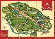
Phoenix Park Conservation Management Plan
Phoenix Park Conservation Management Plan
Phoenix Park Conservation Management Plan

Create successful ePaper yourself
Turn your PDF publications into a flip-book with our unique Google optimized e-Paper software.
History and Description<br />
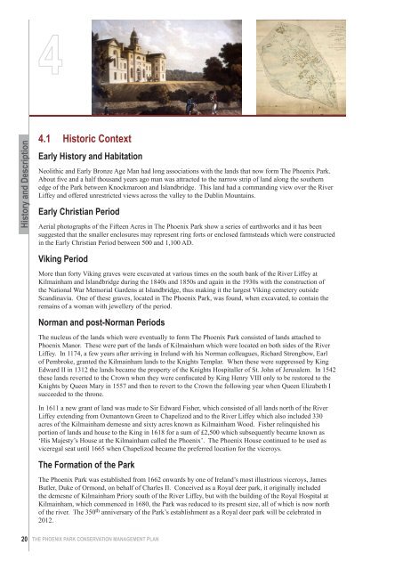
4.1 Historic Context<br />
Early History and Habitation<br />
Neolithic and Early Bronze Age Man had long associations with the lands that now form The <strong>Phoenix</strong> <strong>Park</strong>.<br />
About five and a half thousand years ago man was attracted to the narrow strip of land along the southern<br />
edge of the <strong>Park</strong> between Knockmaroon and Islandbridge. This land had a commanding view over the River<br />
Liffey and offered unrestricted views across the valley to the Dublin Mountains.<br />
Early Christian Period<br />
Aerial photographs of the Fifteen Acres in The <strong>Phoenix</strong> <strong>Park</strong> show a series of earthworks and it has been<br />
suggested that the smaller enclosures may represent ring forts or enclosed farmsteads which were constructed<br />
in the Early Christian Period between 500 and 1,100 AD.<br />
Viking Period<br />
More than forty Viking graves were excavated at various times on the south bank of the River Liffey at<br />
Kilmainham and Islandbridge during the 1840s and 1850s and again in the 1930s with the construction of<br />
the National War Memorial Gardens at Islandbridge, thus making it the largest Viking cemetery outside<br />
Scandinavia. One of these graves, located in The <strong>Phoenix</strong> <strong>Park</strong>, was found, when excavated, to contain the<br />
remains of a woman with jewellery of the period.<br />
Norman and post-Norman Periods<br />
The nucleus of the lands which were eventually to form The <strong>Phoenix</strong> <strong>Park</strong> consisted of lands attached to<br />
<strong>Phoenix</strong> Manor. These were part of the lands of Kilmainham which were located on both sides of the River<br />
Liffey. In 1174, a few years after arriving in Ireland with his Norman colleagues, Richard Strongbow, Earl<br />
of Pembroke, granted the Kilmainham lands to the Knights Templar. When these were suppressed by King<br />
Edward II in 1312 the lands became the property of the Knights Hospitaller of St. John of Jerusalem. In 1542<br />
these lands reverted to the Crown when they were confiscated by King Henry VIII only to be restored to the<br />
Knights by Queen Mary in 1557 and then to revert to the Crown the following year when Queen Elizabeth I<br />
succeeded to the throne.<br />
In 1611 a new grant of land was made to Sir Edward Fisher, which consisted of all lands north of the River<br />
Liffey extending from Oxmantown Green to Chapelizod and to the River Liffey which also included 330<br />
acres of the Kilmainham demesne and sixty acres known as Kilmainham Wood. Fisher relinquished his<br />
portion of lands and house to the King in 1618 for a sum of £2,500 which subsequently became known as<br />
‘His Majesty’s House at the Kilmainham called the <strong>Phoenix</strong>’. The <strong>Phoenix</strong> House continued to be used as<br />
viceregal seat until 1665 when Chapelizod became the preferred location for the viceroys.<br />
The Formation of the <strong>Park</strong><br />
The <strong>Phoenix</strong> <strong>Park</strong> was established from 1662 onwards by one of Ireland’s most illustrious viceroys, James<br />
Butler, Duke of Ormond, on behalf of Charles II. Conceived as a Royal deer park, it originally included<br />
the demesne of Kilmainham Priory south of the River Liffey, but with the building of the Royal Hospital at<br />
Kilmainham, which commenced in 1680, the <strong>Park</strong> was reduced to its present size, all of which is now north<br />
of the river. The 350 th anniversary of the <strong>Park</strong>’s establishment as a Royal deer park will be celebrated in<br />
2012.<br />
20 THE PHOENIX PARK CONSERVATION MANAGEMENT PLAN