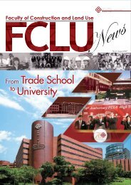
NO.7 ⢠DECEMBER 2008 - The Hong Kong Polytechnic University
NO.7 ⢠DECEMBER 2008 - The Hong Kong Polytechnic University
NO.7 ⢠DECEMBER 2008 - The Hong Kong Polytechnic University

You also want an ePaper? Increase the reach of your titles
YUMPU automatically turns print PDFs into web optimized ePapers that Google loves.
Awards and Achievements<br />
學 者 學 生 成 績 斐 然<br />
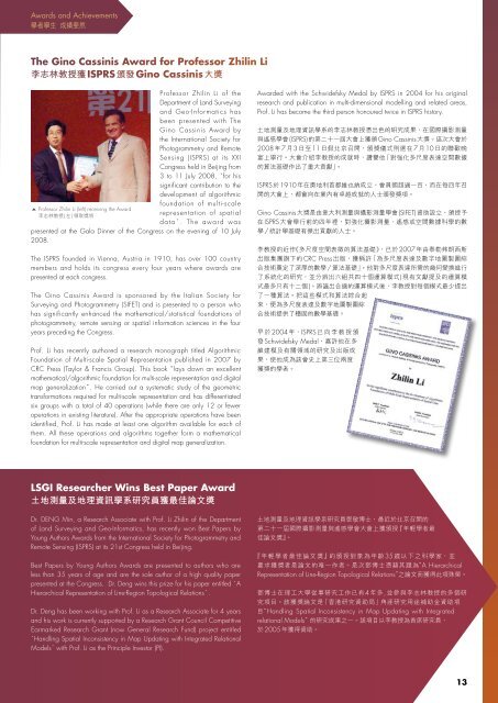
<strong>The</strong> Gino Cassinis Award for Professor Zhilin Li<br />
李 志 林 教 授 獲 ISPRS 頒 發 Gino Cassinis 大 獎<br />
Professor Zhilin Li of the<br />
Department of Land Surveying<br />
and Geo-Informatics has<br />
been presented with <strong>The</strong><br />
Gino Cassinis Award by<br />
the International Society for<br />
Photogrammetry and Remote<br />
Sensing (ISPRS) at its XXI<br />
Congress held in Beijing from<br />
3 to 11 July <strong>2008</strong>, for his<br />
significant contribution to the<br />
development of algorithmic<br />
foundation of multi-scale<br />
representation of spatial<br />
d a t a . T h e a w a r d w a s<br />
presented at the Gala Dinner of the Congress on the evening of 10 July<br />
<strong>2008</strong>.<br />
<strong>The</strong> ISPRS founded in Vienna, Austria in 1910, has over 100 country<br />
members and holds its congress every four years where awards are<br />
presented at each congress.<br />
<strong>The</strong> Gino Cassinis Award is sponsored by the Italian Society for<br />
Surveying and Photogrammetry (SIFET) and is presented to a person who<br />
has significantly enhanced the mathematical/statistical foundations of<br />
photogrammetry, remote sensing or spatial information sciences in the four<br />
years preceding the Congress.<br />
Prof. Li has recently authored a research monograph titled Algorithmic<br />
Foundation of Multi-scale Spatial Representation published in 2007 by<br />
CRC Press (Taylor & Francis Group). This book lays down an excellent<br />
mathematical/algorithmic foundation for multi-scale representation and digital<br />
map generalization. He carried out a systematic study of the geometric<br />
transformations required for multi-scale representation and has differentiated<br />
six groups with a total of 40 operations (while there are only 12 or fewer<br />
operations in existing literature). After the appropriate operations have been<br />
identified, Prof. Li has made at least one algorithm available for each of<br />
them. All these operations and algorithms together form a mathematical<br />
foundation for multi-scale representation and digital map generalization.<br />
Awarded with the Schwidefsky Medal by ISPRS in 2004 for his original<br />
research and publication in multi-dimensional modelling and related areas,<br />
Prof. Li has become the third person honoured twice in ISPRS history.<br />
<br />
(ISPRS)Gino Cassinis<br />
<strong>2008</strong>7311710<br />
<br />
<br />
ISPRS1910<br />
<br />
Gino Cassinis (SIFET)<br />
ISPRS<br />
/<br />
2007<br />
CRC Press <br />
/<br />
(<br />
)<br />
<br />
<br />
<br />
2004ISPRS <br />
Schwidefsky Medal<br />
<br />
<br />
<br />
LSGI Researcher Wins Best Paper Award<br />
土 地 測 量 及 地 理 資 訊 學 系 研 究 員 獲 最 佳 論 文 獎<br />
Dr. DENG Min, a Research Associate with Prof. Li Zhilin of the Department<br />
of Land Surveying and Geo-Informatics, has recently won Best Papers by<br />
Young Authors Awards from the International Society for Photogrammetry and<br />
Remote Sensing (ISPRS) at its 21st Congress held in Beijing.<br />
Best Papers by Young Authors Awards are presented to authors who are<br />
less than 35 years of age and are the sole author of a high quality paper<br />
presented at the Congress. Dr. Deng wins this prize for his paper entitled A<br />
Hierarchical Representation of Line-Region Topological Relations.<br />
Dr. Deng has been working with Prof. Li as a Research Associate for 4 years<br />
and his work is currently supported by a Research Grant Council Competitive<br />
Earmarked Research Grant (now General Research Fund) project entitled<br />
Handling Spatial Inconsistency in Map Updating with Integrated Relational<br />
Modelswith Prof. Li as the Principle Investor (PI).<br />
<br />
<br />
<br />
35<br />
A Hierarchical<br />
Representation of Line-Region Topological Relations<br />
4,<br />
<br />
Handling Spatial Inconsistency in Map Updating with Integrated<br />
relational Models<br />
2005<br />
13