Wellington Fault
Wellington Fault
Wellington Fault

You also want an ePaper? Increase the reach of your titles
YUMPU automatically turns print PDFs into web optimized ePapers that Google loves.
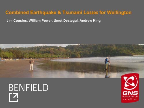
Combined Earthquake & Tsunami Lo$$e$ for <strong>Wellington</strong><br />
Jim Cousins, William Power, Umut Destegul, Andrew King
Question from the Prime Minister (in 2005):<br />
… what about NZ ?<br />
30,000<br />
25,000<br />
National Total Total<br />
Tsunami<br />
Tsunami<br />
Cost ($m)<br />
20,000<br />
Cost ($b)<br />
15,000<br />
10,000<br />
5,000 5<br />
0<br />
Earthquake<br />
Earthquake<br />
0 500 1000 1500 2000 2500<br />
Return Period (years)<br />
BENFIELD<br />
GNS Science
Question from Benfield (in 2006):<br />
…. do we need to rethink our old favourite PML<br />
for New Zealand – the <strong>Wellington</strong> <strong>Fault</strong><br />
Earthquake ?<br />
(c. $10-15 b event)<br />
BENFIELD<br />
GNS Science
… most costly sources – earthquake shaking alone<br />
Source<br />
Loss ($ billion)<br />
<strong>Wellington</strong> <strong>Fault</strong> (magnitude 7.5) 12 ± 5<br />
Wairarapa <strong>Fault</strong> (8.2) 8 ± 5<br />
Ohariu <strong>Fault</strong> (7.5) 6 ± 4<br />
Subduction Zone (8+ ?) 5+ (?)<br />
Pukerua-Shepherds Gully <strong>Fault</strong> (7.5) 5 ± 2<br />
Napier 1931 <strong>Fault</strong> (7.8) 4 ± 2<br />
BENFIELD<br />
GNS Science
… add tsunami to<br />
the scenarios<br />
• <strong>Wellington</strong> <strong>Fault</strong><br />
• Wairarapa <strong>Fault</strong><br />
• BooBoo <strong>Fault</strong><br />
• Plate interface<br />
• Landslides<br />
Note: Booboo <strong>Fault</strong> was<br />
embellished a bit !<br />
BENFIELD<br />
GNS Science
… assets at<br />
risk<br />
Porirua<br />
Kapiti Coast<br />
Petone<br />
Lower Hutt<br />
… elevation<br />
& bathymetry<br />
Eastbourne<br />
<strong>Wellington</strong><br />
CBD<br />
Evans<br />
Bay<br />
Seatoun<br />
Lyall Bay<br />
Island Bay<br />
Owhiro Bay<br />
BENFIELD<br />
GNS Science
Rock ledge, seaside cliffs<br />
Low-lying, flat<br />
BENFIELD<br />
GNS Science
<strong>Wellington</strong> – CBD – waterfront<br />
BENFIELD<br />
GNS Science
<strong>Wellington</strong> – expensive stuff<br />
BENFIELD<br />
GNS Science
Assets Model<br />
• 160,000 residential<br />
20,000 non-residential<br />
• data sources<br />
… councils (footprints, earthquake-risk buildings)<br />
…QV property<br />
individual for 12,000 large (300 m 2 ) properties<br />
aggregated by meshblock for all of NZ<br />
… site visits & personal knowledge<br />
• composite model<br />
… footprint, property, meshblock aggregate<br />
BENFIELD<br />
GNS Science
Fragility Model<br />
BENFIELD<br />
GNS Science
1.0<br />
Mean Damage Ratio - Tsunami<br />
0.8<br />
0.6<br />
0.4<br />
0.2<br />
0.0<br />
Timber 1-storey small (100 sqm)<br />
Timber 1-storey large (400 sqm)<br />
Concrete 1-storey large (400 sqm)<br />
0 1 2 3 4 5<br />
Water Depth (m above floor)<br />
BENFIELD<br />
GNS Science
Uncertainty in fragility function<br />
1.0<br />
Tsunami Damage Ratio<br />
0.8<br />
0.6<br />
0.4<br />
0.2<br />
0.0<br />
High Fragility<br />
Standard Fragility<br />
Low Fragility<br />
Timber, 1 storey, small<br />
0 1 2 3 4 5<br />
Water Depth (m above floor)<br />
BENFIELD<br />
GNS Science
Inundation Modelling – ANUGA<br />
• Developed by scientists at Geoscience Australia and ANU<br />
• Solves non-linear shallow water equations, and models wetting-drying<br />
of land<br />
• Finite element method allows modelling to take place on an<br />
unstructured mesh<br />
– Arbitrary boundary shapes<br />
– Various boundary conditions available<br />
– Variable triangle density<br />
– One unstructured mesh - no need for nested grids – easy to<br />
incorporate co-seismic uplift<br />
• Python scripting permits great flexibility<br />
• Open source software – quick feedback<br />
BENFIELD<br />
GNS Science
<strong>Wellington</strong> <strong>Fault</strong> - vertical deformation in metres<br />
BENFIELD<br />
GNS Science
Wairarapa <strong>Fault</strong> Vertical deformation in metres<br />
BENFIELD<br />
GNS Science
1855<br />
reconstruction<br />
BENFIELD<br />
GNS Science
Subduction zone<br />
• Variation of near surface rupture<br />
– Termination at ‘seismic front’<br />
– Splay fault rupture<br />
– Rupture to trench<br />
• Return time<br />
– 400 to 1200 years<br />
• Southern termination<br />
– Limit of GPS confirmed locking<br />
~ Cape Palliser<br />
– Extending into Cook Strait<br />
Distribution of slip rate deficit on the Hikurangi subduction<br />
interface, estimated from ~12 years of campaign Global<br />
Positioning System (GPS) site velocities (Wallace et al., 2004).<br />
BENFIELD<br />
GNS Science
Subduction-interface rupture extending into<br />
Cook Strait<br />
• 1200 year return time<br />
• Rupture to seabed on<br />
interface<br />
• 12-18m slip in this region<br />
• Mw 8.9<br />
BENFIELD<br />
GNS Science
Subduction into Cook Strait model<br />
BENFIELD<br />
GNS Science
Estimated Losses<br />
Tsunami Source<br />
Shaking Loss Tsunami Loss<br />
($m) (%) ($m) (%)<br />
<strong>Wellington</strong>, mag. 7.5 (base case) 13,700 18 41 0.05<br />
Wairarapa, mag. 8.2 9,200 12 14 0.02<br />
BooBoo (embellished), mag. 7.4 800 1 1 0<br />
Subdn to Cook, mag. 8.9, 1200 y RI 6,100 8 2,300 3<br />
Subdn to Cook, mag. 8.9, 1200 y RI Worst-case tsunami 3,500 4.5<br />
Subdn to Cook, mag. 8.9, 1200 y RI Best-case tsunami 1,200 1.5<br />
• fragility function high / low<br />
• floor height 0 / 1 m above ground<br />
• prior quake damage increases / does not increase tsunami fragility<br />
BENFIELD<br />
GNS Science
Porirua<br />
Kapiti Coast<br />
Petone<br />
Lower Hutt<br />
Scenario:<br />
• Subduction<br />
to Cook<br />
• Mag. 8.9<br />
• 1200 yr<br />
recurrence<br />
interval<br />
Eastbourne<br />
<strong>Wellington</strong><br />
CBD<br />
Evans<br />
Bay<br />
Seatoun<br />
Lyall Bay<br />
Owhiro Bay<br />
Island Bay<br />
750 million<br />
500<br />
100<br />
50<br />
BENFIELD<br />
GNS Science
Main Findings<br />
• tsunami does not add significantly to New Zealand’s most<br />
costly earthquake<br />
• or to the second most costly<br />
• Porirua and Kapiti experience very little tsunami damage in<br />
the scenarios considered here<br />
• a very large subduction zone earthquake is the worst local<br />
tsunami source<br />
• losses from the most costly earthquake, magnitude 7.5<br />
<strong>Wellington</strong> <strong>Fault</strong>, are greater than the combined losses from<br />
the worst tsunami-causing earthquake<br />
• tsunami from very large South American earthquakes might<br />
be able to cause higher losses<br />
• we haven’t looked at casualties<br />
BENFIELD<br />
GNS Science