Wellington Fault
Wellington Fault
Wellington Fault
Create successful ePaper yourself
Turn your PDF publications into a flip-book with our unique Google optimized e-Paper software.
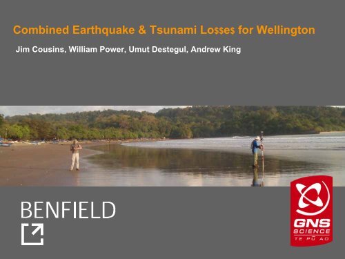
Combined Earthquake & Tsunami Lo$$e$ for <strong>Wellington</strong><br />
Jim Cousins, William Power, Umut Destegul, Andrew King
Question from the Prime Minister (in 2005):<br />
… what about NZ ?<br />
30,000<br />
25,000<br />
National Total Total<br />
Tsunami<br />
Tsunami<br />
Cost ($m)<br />
20,000<br />
Cost ($b)<br />
15,000<br />
10,000<br />
5,000 5<br />
0<br />
Earthquake<br />
Earthquake<br />
0 500 1000 1500 2000 2500<br />
Return Period (years)<br />
BENFIELD<br />
GNS Science
Question from Benfield (in 2006):<br />
…. do we need to rethink our old favourite PML<br />
for New Zealand – the <strong>Wellington</strong> <strong>Fault</strong><br />
Earthquake ?<br />
(c. $10-15 b event)<br />
BENFIELD<br />
GNS Science
… most costly sources – earthquake shaking alone<br />
Source<br />
Loss ($ billion)<br />
<strong>Wellington</strong> <strong>Fault</strong> (magnitude 7.5) 12 ± 5<br />
Wairarapa <strong>Fault</strong> (8.2) 8 ± 5<br />
Ohariu <strong>Fault</strong> (7.5) 6 ± 4<br />
Subduction Zone (8+ ?) 5+ (?)<br />
Pukerua-Shepherds Gully <strong>Fault</strong> (7.5) 5 ± 2<br />
Napier 1931 <strong>Fault</strong> (7.8) 4 ± 2<br />
BENFIELD<br />
GNS Science
… add tsunami to<br />
the scenarios<br />
• <strong>Wellington</strong> <strong>Fault</strong><br />
• Wairarapa <strong>Fault</strong><br />
• BooBoo <strong>Fault</strong><br />
• Plate interface<br />
• Landslides<br />
Note: Booboo <strong>Fault</strong> was<br />
embellished a bit !<br />
BENFIELD<br />
GNS Science
… assets at<br />
risk<br />
Porirua<br />
Kapiti Coast<br />
Petone<br />
Lower Hutt<br />
… elevation<br />
& bathymetry<br />
Eastbourne<br />
<strong>Wellington</strong><br />
CBD<br />
Evans<br />
Bay<br />
Seatoun<br />
Lyall Bay<br />
Island Bay<br />
Owhiro Bay<br />
BENFIELD<br />
GNS Science
Rock ledge, seaside cliffs<br />
Low-lying, flat<br />
BENFIELD<br />
GNS Science
<strong>Wellington</strong> – CBD – waterfront<br />
BENFIELD<br />
GNS Science
<strong>Wellington</strong> – expensive stuff<br />
BENFIELD<br />
GNS Science
Assets Model<br />
• 160,000 residential<br />
20,000 non-residential<br />
• data sources<br />
… councils (footprints, earthquake-risk buildings)<br />
…QV property<br />
individual for 12,000 large (300 m 2 ) properties<br />
aggregated by meshblock for all of NZ<br />
… site visits & personal knowledge<br />
• composite model<br />
… footprint, property, meshblock aggregate<br />
BENFIELD<br />
GNS Science
Fragility Model<br />
BENFIELD<br />
GNS Science
1.0<br />
Mean Damage Ratio - Tsunami<br />
0.8<br />
0.6<br />
0.4<br />
0.2<br />
0.0<br />
Timber 1-storey small (100 sqm)<br />
Timber 1-storey large (400 sqm)<br />
Concrete 1-storey large (400 sqm)<br />
0 1 2 3 4 5<br />
Water Depth (m above floor)<br />
BENFIELD<br />
GNS Science
Uncertainty in fragility function<br />
1.0<br />
Tsunami Damage Ratio<br />
0.8<br />
0.6<br />
0.4<br />
0.2<br />
0.0<br />
High Fragility<br />
Standard Fragility<br />
Low Fragility<br />
Timber, 1 storey, small<br />
0 1 2 3 4 5<br />
Water Depth (m above floor)<br />
BENFIELD<br />
GNS Science
Inundation Modelling – ANUGA<br />
• Developed by scientists at Geoscience Australia and ANU<br />
• Solves non-linear shallow water equations, and models wetting-drying<br />
of land<br />
• Finite element method allows modelling to take place on an<br />
unstructured mesh<br />
– Arbitrary boundary shapes<br />
– Various boundary conditions available<br />
– Variable triangle density<br />
– One unstructured mesh - no need for nested grids – easy to<br />
incorporate co-seismic uplift<br />
• Python scripting permits great flexibility<br />
• Open source software – quick feedback<br />
BENFIELD<br />
GNS Science
<strong>Wellington</strong> <strong>Fault</strong> - vertical deformation in metres<br />
BENFIELD<br />
GNS Science
Wairarapa <strong>Fault</strong> Vertical deformation in metres<br />
BENFIELD<br />
GNS Science
1855<br />
reconstruction<br />
BENFIELD<br />
GNS Science
Subduction zone<br />
• Variation of near surface rupture<br />
– Termination at ‘seismic front’<br />
– Splay fault rupture<br />
– Rupture to trench<br />
• Return time<br />
– 400 to 1200 years<br />
• Southern termination<br />
– Limit of GPS confirmed locking<br />
~ Cape Palliser<br />
– Extending into Cook Strait<br />
Distribution of slip rate deficit on the Hikurangi subduction<br />
interface, estimated from ~12 years of campaign Global<br />
Positioning System (GPS) site velocities (Wallace et al., 2004).<br />
BENFIELD<br />
GNS Science
Subduction-interface rupture extending into<br />
Cook Strait<br />
• 1200 year return time<br />
• Rupture to seabed on<br />
interface<br />
• 12-18m slip in this region<br />
• Mw 8.9<br />
BENFIELD<br />
GNS Science
Subduction into Cook Strait model<br />
BENFIELD<br />
GNS Science
Estimated Losses<br />
Tsunami Source<br />
Shaking Loss Tsunami Loss<br />
($m) (%) ($m) (%)<br />
<strong>Wellington</strong>, mag. 7.5 (base case) 13,700 18 41 0.05<br />
Wairarapa, mag. 8.2 9,200 12 14 0.02<br />
BooBoo (embellished), mag. 7.4 800 1 1 0<br />
Subdn to Cook, mag. 8.9, 1200 y RI 6,100 8 2,300 3<br />
Subdn to Cook, mag. 8.9, 1200 y RI Worst-case tsunami 3,500 4.5<br />
Subdn to Cook, mag. 8.9, 1200 y RI Best-case tsunami 1,200 1.5<br />
• fragility function high / low<br />
• floor height 0 / 1 m above ground<br />
• prior quake damage increases / does not increase tsunami fragility<br />
BENFIELD<br />
GNS Science
Porirua<br />
Kapiti Coast<br />
Petone<br />
Lower Hutt<br />
Scenario:<br />
• Subduction<br />
to Cook<br />
• Mag. 8.9<br />
• 1200 yr<br />
recurrence<br />
interval<br />
Eastbourne<br />
<strong>Wellington</strong><br />
CBD<br />
Evans<br />
Bay<br />
Seatoun<br />
Lyall Bay<br />
Owhiro Bay<br />
Island Bay<br />
750 million<br />
500<br />
100<br />
50<br />
BENFIELD<br />
GNS Science
Main Findings<br />
• tsunami does not add significantly to New Zealand’s most<br />
costly earthquake<br />
• or to the second most costly<br />
• Porirua and Kapiti experience very little tsunami damage in<br />
the scenarios considered here<br />
• a very large subduction zone earthquake is the worst local<br />
tsunami source<br />
• losses from the most costly earthquake, magnitude 7.5<br />
<strong>Wellington</strong> <strong>Fault</strong>, are greater than the combined losses from<br />
the worst tsunami-causing earthquake<br />
• tsunami from very large South American earthquakes might<br />
be able to cause higher losses<br />
• we haven’t looked at casualties<br />
BENFIELD<br />
GNS Science


