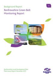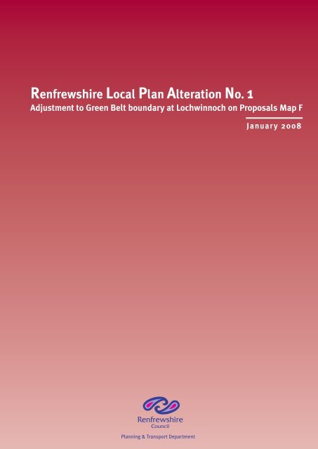
Renfrewshire Local Plan Alteration No. 1 - Renfrewshire Council
Renfrewshire Local Plan Alteration No. 1 - Renfrewshire Council
Renfrewshire Local Plan Alteration No. 1 - Renfrewshire Council

You also want an ePaper? Increase the reach of your titles
YUMPU automatically turns print PDFs into web optimized ePapers that Google loves.
<strong>No</strong>vember 2007<br />
<strong>Renfrewshire</strong> <strong>Local</strong> <strong>Plan</strong><br />
<strong>Alteration</strong> <strong>No</strong>. 1<br />
<strong>Renfrewshire</strong> <strong>Local</strong> <strong>Plan</strong> <strong>Alteration</strong> <strong>No</strong>. 1<br />
Adjustment to Green Belt boundary at Lochwinnoch on Proposals Map F<br />
Januar y 2008<br />
<strong>Plan</strong>ning & Transport Department
Introduction<br />
<strong>No</strong>vember 2007<br />
<strong>Renfrewshire</strong> <strong>Local</strong> <strong>Plan</strong><br />
<strong>Alteration</strong> <strong>No</strong>. 1<br />
The purpose of the <strong>Alteration</strong> is to correct a cartographic error on the Proposals Map F<br />
of the <strong>Renfrewshire</strong> <strong>Local</strong> <strong>Plan</strong>. The <strong>Alteration</strong> affects only a small area of land on the<br />
eastern edge of Lochwinnoch, extending to approx. 0.57ha., and the <strong>Alteration</strong> clarifies<br />
that this area, shown on the attached <strong>Alteration</strong> Map 1, lies within the Green Belt, and<br />
is affected by Green Belt Policy GB1 in the <strong>Local</strong> <strong>Plan</strong>.<br />
Background to <strong>Alteration</strong><br />
An area of land at Gates Road, Lochwinnoch, identified on the accompanying <strong>Alteration</strong><br />
Map 1, had been included in the Green Belt designation in the Renfrew District <strong>Local</strong><br />
<strong>Plan</strong>. In the process of reviewing and replacing that <strong>Plan</strong> with the <strong>Renfrewshire</strong> <strong>Local</strong><br />
<strong>Plan</strong>, a review of the boundary of the Green Belt was carried out in 1999 / 2000. This<br />
review resulted in a number of minor changes to the Green Belt boundary which were<br />
incorporated into the Consultative Draft <strong>Renfrewshire</strong> <strong>Local</strong> <strong>Plan</strong>, which was the subject<br />
of a public consultation exercise over the period 12 September to 24 October, 2001.<br />
The list of proposed modifications which had grown out of the review of the Green Belt<br />
boundary did not include any change to the boundary at Gates Road, Lochwinnoch,<br />
reflecting the fact that the <strong>Council</strong> did not intend to alter the boundary of the Green Belt<br />
at this location. The finalised version of the <strong>Local</strong> <strong>Plan</strong> was subsequently the subject<br />
of a public consultation exercise during the period 25 September 2002 to 5 <strong>No</strong>vember,<br />
2002; and ultimately, the <strong>Local</strong> <strong>Plan</strong> was adopted by the <strong>Council</strong> on 7 March, 2006,<br />
following a Public <strong>Local</strong> Inquiry into objections in 2003/04.<br />
Development proposals for a large part of the site brought to the <strong>Council</strong>’s attention the<br />
fact that the Proposals Map for the adopted <strong>Renfrewshire</strong> <strong>Local</strong> <strong>Plan</strong> indicates the site<br />
lying outwith the Green Belt, and covered instead by policy POL H1, General Residential<br />
Policy. Investigations show that this unintended change to the Green Belt boundary<br />
had been made to the Consultative Draft version of the <strong>Local</strong> <strong>Plan</strong> as a result of a<br />
cartographic error, and this altered boundary progressed unnoticed and unchallenged<br />
through the next stage, the finalised version of the <strong>Local</strong> <strong>Plan</strong>, to the adopted version.<br />
The <strong>Alteration</strong> is considered necessary to achieve absolute clarity as to the development<br />
plan policy coverage applying to this area of land.<br />
<strong>Alteration</strong> to Proposals Map<br />
An area of land at Gates Road, Lochwinnoch, extending to 0.57 ha. and bounded,<br />
generally, by Gates Road on the north-west; Lochlip Road on the south-west; and<br />
the Paisley to Kilbirnie cycle route on the south-east, is the subject of the change<br />
to Proposals Map F. Map F shows the land lying in an un-coloured area of the Map<br />
indicating, erroneously, that <strong>Local</strong> <strong>Plan</strong> policy H1 applies. To correct this cartographic
error, the <strong>Alteration</strong> adjusts the Green Belt boundary to include this land within the<br />
‘green’ area of the Map, indicating that Green Belt policy GB1 applies, and that General<br />
Residential Policy H1 does not apply. The accompanying <strong>Alteration</strong> Map 1 shows the<br />
location of the site which is subject of the <strong>Alteration</strong>, and <strong>Alteration</strong> Map 2 shows the<br />
corrected policy allocation for this land. The <strong>Alteration</strong> does not involve any change<br />
to existing policies in the <strong>Renfrewshire</strong> <strong>Local</strong> <strong>Plan</strong>, nor does it introduce any new<br />
policy(ies) to the <strong>Local</strong> <strong>Plan</strong>.<br />
<strong>No</strong>vember 2007<br />
<strong>Renfrewshire</strong> <strong>Local</strong> <strong>Plan</strong><br />
<strong>Alteration</strong> <strong>No</strong>. 1<br />
Justification<br />
The adjustment to the <strong>Renfrewshire</strong> <strong>Local</strong> <strong>Plan</strong> Proposals Map F accurately reflects<br />
the intentions of the <strong>Council</strong> in applying land use policies in the development plan to<br />
the land at Gates Road, Lochwinnoch.<br />
The land at Gates Road was included in the Green Belt in the Renfrew District <strong>Local</strong><br />
<strong>Plan</strong>, which was replaced by the <strong>Renfrewshire</strong> <strong>Local</strong> <strong>Plan</strong>. In the course of reviewing<br />
the boundaries of the Green Belt no changes to the boundary were identified as<br />
necessary at Gates Road, Lochwinnoch.<br />
The change to the Green Belt boundary on the <strong>Renfrewshire</strong> <strong>Local</strong> <strong>Plan</strong> Proposals Map<br />
F at this location from that shown on the previous Renfrew District <strong>Local</strong> <strong>Plan</strong> occurred<br />
as the result of a cartographic error. The error results in a lack of clarity in the <strong>Local</strong><br />
<strong>Plan</strong> as to the <strong>Council</strong>’s position in respect of the development plan policy to be<br />
applied to this site. The <strong>Alteration</strong> clarifies this issue by correcting the cartographic<br />
error.
<strong>Renfrewshire</strong> <strong>No</strong>vember <strong>Local</strong> 2007 <strong>Plan</strong><br />
<strong>Alteration</strong> <strong>No</strong>. 1<br />
<strong>Renfrewshire</strong> <strong>Local</strong> <strong>Plan</strong> <strong>Alteration</strong> <strong>No</strong>.1:<br />
Adjustment to Green Belt Boundary at Lochwinnoch<br />
On Proposals Map F<br />
ALTERATION MAP 1<br />
Land at Gates Road<br />
to be included in 'Green'<br />
area on Proposals Map F<br />
Legend<br />
Policy GB1 - Green Belt<br />
<strong>Renfrewshire</strong> <strong>Council</strong><br />
This map is reproduced from Ordnance Survey material with the permission of Ordnance Survey on behalf of the Controller of Her Majesty's<br />
-<br />
Stationery Office © Crown Copyright. Unauthorised reproduction infringes Crown copyright and may lead to prosecution or civil proceedings.<br />
<strong>Renfrewshire</strong> <strong>Council</strong> 100023417 2007<br />
Department: <strong>Plan</strong>ning and Transport<br />
Printed by: C Pollock Print date: 13/12/07 Scale - 1:11,000
<strong>Renfrewshire</strong> <strong>No</strong>vember <strong>Local</strong> 2007<strong>Plan</strong><br />
<strong>Alteration</strong> <strong>No</strong>. 1<br />
<strong>Renfrewshire</strong> <strong>Local</strong> <strong>Plan</strong> <strong>Alteration</strong> <strong>No</strong>.1:<br />
Adjustment to Green Belt Boundary at Lochwinnoch<br />
On Proposals Map F<br />
ALTERATION MAP 2<br />
Legend<br />
<strong>Renfrewshire</strong> <strong>Council</strong><br />
Policy GB1 - Green Belt<br />
PROPOSALS MAP F, LOCHWINNOCH INSET,<br />
AS CORRECTED BY THE ALTERATION<br />
This map is reproduced from Ordnance Survey material with the permission of Ordnance Survey on behalf of the Controller of Her Majesty's<br />
-<br />
Stationery Office © Crown Copyright. Unauthorised reproduction infringes Crown copyright and may lead to prosecution or civil proceedings.<br />
<strong>Renfrewshire</strong> <strong>Council</strong> 100023417 2007<br />
Department: <strong>Plan</strong>ning and Transport<br />
Printed by: C Pollock Print date: 18/12/07 Scale - 1:11,000
<strong>Renfrewshire</strong> <strong>Local</strong> <strong>Plan</strong> <strong>Alteration</strong> <strong>No</strong>. 1<br />
Adjustment to Green Belt boundary at Lochwinnoch on Proposals Map F<br />
<strong>No</strong>vember 2007<br />
<strong>Renfrewshire</strong> <strong>Local</strong> <strong>Plan</strong><br />
<strong>Alteration</strong> <strong>No</strong>. 1<br />
For further details contact:<br />
Dept. of <strong>Plan</strong>ning & Transport, <strong>Renfrewshire</strong> <strong>Council</strong>,<br />
<strong>Renfrewshire</strong> House, Cotton Street, Paisley, PA1 1LL<br />
Tel; 0141 842 5811 Fax. 0141 842 5040<br />
e-mail. pt@renfrewshire.gov.uk