Dike Master Plan - Phase 1 - City of Richmond
Dike Master Plan - Phase 1 - City of Richmond
Dike Master Plan - Phase 1 - City of Richmond

You also want an ePaper? Increase the reach of your titles
YUMPU automatically turns print PDFs into web optimized ePapers that Google loves.
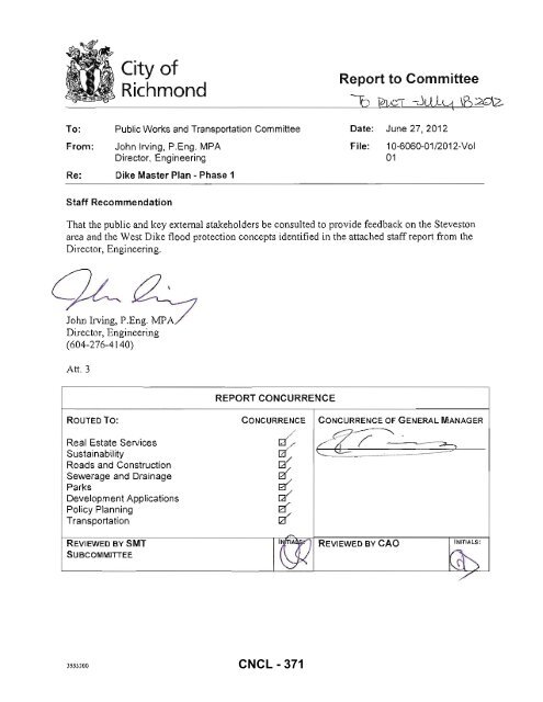
To:<br />
From:<br />
<strong>City</strong> <strong>of</strong><br />
<strong>Richmond</strong><br />
Public Works and Transportation Committee<br />
John Irving, P.Eng . MPA<br />
Director, Engineering<br />
Re: <strong>Dike</strong> <strong>Master</strong> <strong>Plan</strong> - <strong>Phase</strong> 1<br />
Report to Committee<br />
:l'2 ¥1&'T -JiJ,lq IB:.?G12-<br />
Date: June 27, 2012<br />
File:<br />
10-6060-01/2012-Vol<br />
01<br />
Staff Recommendation<br />
That the public and key external stakeholders be consulted to provide feedback on the Steveston<br />
area and the West <strong>Dike</strong> flood protection concepts identified in the attached staff report from the<br />
Director, Engineering.<br />
John Irving, P.Eng. MP<br />
Director, Engineering<br />
(604-276-4140)<br />
Art. 3<br />
REPORT CONCURRENCE<br />
ROUTED To:<br />
Real Estate Services<br />
Sustainability<br />
Roads and Construction<br />
Sewerage and Drainage<br />
Parks<br />
Development Applications<br />
Policy <strong>Plan</strong>ning<br />
Transportation<br />
CONCURRENCE<br />
/<br />
~<br />
~<br />
~<br />
::<br />
CONCURRENCE OF GENERAL MANAGER<br />
4Z?~<br />
REVIEWED BY SMT<br />
SUBCOMMITTEE<br />
't'''y REVIEWED BY CAD<br />
INITIALS;<br />
l\!X ~<br />
/'<br />
3553300<br />
CNCL - 371
June 27, 2012 - 2 -<br />
Origin<br />
Staff Report<br />
The 2008 - 2031 <strong>Richmond</strong> Flood Protection Strategy identified the need to "Prepare and<br />
implement a comprehensive dike improvement program". On June 13,2011 Council approved<br />
that $200,000 <strong>of</strong> surplus from the 2010 operating budget be used to initiate a <strong>Dike</strong> <strong>Master</strong> <strong>Plan</strong>.<br />
This budget is being used to fund <strong>Phase</strong> 1 <strong>of</strong> the mastcr plan, which is primarily focused on<br />
identifyi ng a long term flood protection improvement plan for the Steveston and southern West<br />
<strong>Dike</strong> area.<br />
The purpose <strong>of</strong> this staff report is to present preliminary concepts for flood protection works "18t<br />
will be required to address long-term sea levc\ rise and future flood risks.<br />
Analysis<br />
<strong>Richmond</strong> has grown into a large thriving <strong>City</strong> with considerable assets to protect. Directed by<br />
the 2008 - 2031 <strong>Richmond</strong> Flood Protection Strategy, the Drainage and Diking Utility was<br />
created to fund the construction, operation and maintenance <strong>of</strong> <strong>City</strong> dikcs, drainage pump<br />
stations and drainage conveyance systems that protect the <strong>City</strong> against floods. The Drainage,<br />
<strong>Dike</strong> and Sanitary System Bylaw No 7551 and Watercourse Protection and Crossing Bylaw No.<br />
8441 regulate drainage activities to minimise the risk <strong>of</strong> flooding inside <strong>of</strong> the <strong>City</strong>'s dike. The<br />
Flood Plain Designation and Protection Bylaw No. 8204 prevents development from encroaching<br />
onto dikes and requires that allncw finished floor areas susceptible to flood damage be above the<br />
flood plain construction level.<br />
The <strong>Dike</strong> <strong>Master</strong> <strong>Plan</strong> is intended to be a comprehensive guide to upgrade flood protection<br />
infrastructure to:<br />
• Adequately protect <strong>Richmond</strong> from both ocean stonn surges and Fraser River freshet<br />
events,<br />
• Adapt to sea level rise,<br />
• Meet appropriate seismic and other design standards,<br />
• Follow the five strategic directions <strong>of</strong> the <strong>City</strong>'s 2009 Waterfront Strategy, and<br />
• Prioritize dike improvement phasing to effi ciently use resources.<br />
Sea and river dikes form the backbone <strong>of</strong> <strong>Richmond</strong>'s flood protection infrastructure. As a Local<br />
Diking Authority the <strong>City</strong> <strong>of</strong> Riclunond manages the integrity <strong>of</strong> 49 km <strong>of</strong> dike on Lulu and Sea<br />
Islands. Tn the medium to long tenn, dike crest elevations will need to be raised to mitigate sea<br />
level rise caused by climate change.<br />
<strong>Richmond</strong>'s dikes are located in <strong>City</strong> right-<strong>of</strong>-ways, <strong>City</strong> owned land, Federal/Provincial Land<br />
and private land. Land ownership and land use issues create a number <strong>of</strong> challenges that the <strong>City</strong><br />
must address as dike crest elevations are raised. Creating a long-term dike master plan for the<br />
Steveston area has been identified as a priority. The Steveston dike impacts many things, for<br />
example, existing roads and buildings, heritage structures, harbour funct ionality and Steveston<br />
Village's unique character. Development is also hindered without a long-term master plan.<br />
Actual implementation <strong>of</strong> any approved master plan would occur over many decades as the<br />
identified sea level risk wi ll largely materialize beyond the 50-year timeline.<br />
CNCL - 372
June 27, 20 12 - 3 -<br />
The <strong>City</strong> has engaged DeicanJDI-IV as the lead consultant to complete <strong>Phase</strong> 1 <strong>of</strong> the <strong>Dike</strong><br />
<strong>Master</strong> <strong>Plan</strong>. Tasked with identifying traditional and creative flood protection solutions that have<br />
minimal impact, Delean has identified two primary dike alignments between Garry Point Park<br />
and London Farm: I) raising the dikes in their current or similar alignment, or 2) using Steveston<br />
(Shady) Island to form a new dike stmcturc. These alignments are illustrated in Attacbment 1<br />
and are explained below.<br />
Primary Alignment 1: Rai se dikes in their current alignment or a close parallel ali gnment on<br />
Lulu Island<br />
Raising dikes in their current location presents a number <strong>of</strong> challenges that include limited space,<br />
utility conflict, development conflict and construction scheduling. Leaving dikes in their existing<br />
ali gnment also excludes a number <strong>of</strong>propel1ies from current and future fl ood protection.<br />
Attacbment I shows the dike di vided into a number <strong>of</strong> reach boundaries (sections). Within each<br />
reach the dike's current ali gnment as well as some proposed alternative ali gnment options arc<br />
shown.<br />
Attachment 2 presents a series <strong>of</strong> dike ali gnment options w ithin each reach boundary. Options<br />
vary with location and seismic design considerations. For reasons relating mainly to land<br />
ownership, land use and heritage preservation, dike alignment options are presented that exclude<br />
some <strong>City</strong>, Provincial and Federal property from fl ood protection. Should these alternatives be<br />
chosen and property is left outside <strong>of</strong> the <strong>City</strong>'s main dike the property owners could use a<br />
number <strong>of</strong> strategies to prevent local flood danlage that include changing property and building<br />
usage, raising building elevations, raising ground elevations or constructing private flood wa ll s.<br />
Moving the dike closer to the water's edge presents challenges and would significantly change<br />
the look and feel <strong>of</strong> the existing harbour and potentially di srupt sensitive shoreline ecology. In<br />
some areas sheet pile walls with backfilled dike material will likely be required to create a<br />
seismically stable dike that is capable <strong>of</strong> meeting today's dike crest planning elevation (4.7 m<br />
geodetic is used in this study) and those required further into the futlITe.<br />
Primary Alignment 2: Raise a dike on Steveston Island and install gate structures to enclose the<br />
harbour<br />
This al ignment uses a similar layout to the Steveston Community Fishing Harbour Long Term<br />
Development <strong>Plan</strong> that is proposed under the <strong>City</strong>'S Waterfront Strategy Implementation <strong>Plan</strong>.<br />
However, while the Community Fishing Harbour <strong>Plan</strong> is envisaged to have two clear openings at<br />
each end <strong>of</strong> the Harbour's channel, this alternative would use gates or other structures that would<br />
close the channel during combined high tides and storm surge events. Assuming that water<br />
quality can be maintained, another option is to completely close the channel at its east end. The<br />
implications <strong>of</strong> full enclosure on dredging needs has not yet been anaJysed. Similarly, the<br />
ecological impacts on existing wetlands located within and east o f the harbour and authorization<br />
from Federal Agencies in relation to ecological, First Nations, and/or fisheries values have not<br />
yet been evaluated.<br />
Primary Ali gnment 2 (Attachment 3) shows that the proposed dike would begin somewhere<br />
west <strong>of</strong>71h Avenue where a new structure would be built heading South into the Steveston<br />
Harbour that would intersect the west end <strong>of</strong> Steveston Island. At this point, Stcveston Island<br />
would be modified along its entire length to form a dike. Additional structures or embankments<br />
would then be needed to enclose the Harbour approximately 250 m east <strong>of</strong> No.2 Road. At its<br />
CNCL - 373
June 27, 2012 - 4 -<br />
west end, a gate structure would be built to close <strong>of</strong>f the Harbour during peri ods <strong>of</strong> combined<br />
storm surge and high tide. A pump station may also be required to ensure stable water elevations<br />
during closure periods. Attachment 3 shows renderings that have previously been presented to<br />
Council <strong>of</strong> the Steveston Community Fishing Harbour Long Term Development Concept. The<br />
renderi ng has been modified to show the compatibility <strong>of</strong> the dike development concept with the<br />
Integrated Flood Protection Strategy.<br />
Option Comparison<br />
In preparation for stakeholder discussions, Table J makes a preliminary comparison <strong>of</strong> the pros<br />
and cons <strong>of</strong> Primary Alignment 1 versus Primary Alignment 2.<br />
The two primary alignments are not exclusive <strong>of</strong> each other. Elements <strong>of</strong> each could be used<br />
over time to provide a co mplete fl ood protection package.<br />
Table 1. T he pros and cons <strong>of</strong> Primary Alignment 1 versus Primary Alignment 2<br />
Primary Alie:nment I Lulu Island Primary Ali rnment 2 Sieves ion Island<br />
Topic Pros I Cons Pros I Cons<br />
Cost<br />
Neutra l - initial cost estimates are similar for both options<br />
Property and <strong>City</strong> owns land and Existing structures Steveston Island is Government<br />
Land Usc right <strong>of</strong> ways for must be vacant <strong>of</strong> jurisdiction issues<br />
some options accommodated development with land use<br />
Construction Can build in pieces High community Low community Must be built as one<br />
and use temporary disruption disnlption project to be effective<br />
infrastructure for<br />
effective flood<br />
protectio n<br />
Adaptabilit)' to Will disturb the Relatively easy to<br />
FutUre Raising community if raised raise in the future<br />
in the future<br />
Environmental<br />
Needs further assessment<br />
Geotechnical Ground Minimises ground<br />
Implications improvement may improvement<br />
impact existing impacts to existing<br />
build ings and buildings and<br />
in frastructure infrastructure<br />
Commu nity High impact on Minimises the<br />
impact existing village impact on village<br />
character & heritage character and<br />
assets<br />
heritage assets.<br />
Aligns with the<br />
Steveston Harbour<br />
Authority Concept<br />
0pcl'atioll and Design resembles The replacement Maintenance can be A harbour gate<br />
Maintenance existing or cost <strong>of</strong> sheet pile achieved w ith lillIe requires new O&M<br />
traditional sections is high. impact to the local procedures with<br />
infrastructure for Maintenance may community additional short and<br />
relatively simple impact the local long tenn costs<br />
O&M<br />
community<br />
Roadway Disruption likely for No disruption<br />
Disruptions<br />
some options<br />
CNCL - 374
June 27, 2012 - 5 -<br />
Sturgeon Bank. Roberts Bank and River Training Structures<br />
The existing river training structures (rock groynes and timber pilings) at the Fraser River's<br />
mouth and the extensive Sturgeon Bank mud fl ats protect <strong>Richmond</strong>'s West <strong>Dike</strong> and the<br />
Steveston arca from large waves that develop in the Georgia Strait. As sea levels rise water<br />
washing over these areas will become deeper and the current level <strong>of</strong> wave protection will be<br />
reduced.<br />
Sediment deposition and erosion on Sturgeon Bank occurs due to a multitude <strong>of</strong> factors that<br />
changed significantly through the 19 th Century. Tidal drift, river dredging and river training<br />
structures all impact sedimentation in the Fraser Ri ver Delta. It is unclear how current<br />
sedimentation patterns will effect Sturgeon Bank's ability to mitigate wave action, however, any<br />
net erosion is anticipated to exacerbate the loss <strong>of</strong> wave protection caused by rising sea levels.<br />
The maintenance and enhancement <strong>of</strong> river training structures is anticipated to help protect<br />
<strong>Richmond</strong> from waves and wi ll also benefit shipping and local harbour activities. As is now<br />
being practiced around the world, beach nourishment (the addition <strong>of</strong> sand and sediment to a<br />
"beach") may be used to grow mud flat and sand banks to restore (e.g. New Orleans, Louisiana)<br />
or enhance (e.g. ocean beaches, The Netherlands) wave protection. Although its effectiveness in<br />
the Fraser River Delta is not yet understood, the careful planning <strong>of</strong> beach nourishments may<br />
mitigate wave action from the Georgia Strait and benefit the natural envirolUnent (Steveston<br />
Island is partially manmade which over the last 50 to 100 years has changed from a low lying<br />
sand bank into its current make up <strong>of</strong> trees, plants and intertidal beaches that support an<br />
abundance <strong>of</strong> wildlife). Sturgeon Banks arc currently designated as Provincially protected for<br />
their hi gh well and ecological value and migratory bird habitat.<br />
Reach 8, Options B and C (Attachment 2) indicate how elevating Sturgeon Bank or creating a<br />
chain <strong>of</strong> islands along it (similar to Steveston Island) could reduce current and future wave action<br />
on the west dike that would minimise future dike crest elevation upgrades.<br />
Next Steps<br />
Staff plan to gain feedback from key stakeholders and the public. Key stakeholders include:<br />
• Steveston Harbour Authority<br />
• Small Craft Harbours<br />
• Port Metro Vancouver<br />
• Department <strong>of</strong> Fisheries and Oceans<br />
• Be Inspector <strong>of</strong> <strong>Dike</strong>s<br />
• Gulf <strong>of</strong> Georgia Cannery Society / Parks Canada<br />
• Britannia Heritage Shipyard Socicty<br />
• Heritage Advisory Committee<br />
• Advisory Committee on the Environment CNCL - 375
June 27, 2012 - 6 -<br />
The key stakeholder group will be engaged through ongoing meetings and communications.<br />
Public consultation would include two public open houses held before the end <strong>of</strong> September.<br />
Financial Impact<br />
None.<br />
Conclusion<br />
Consistent with the <strong>City</strong>' s 2008 - 203 1 <strong>Richmond</strong> Flood Protection Strategy, <strong>Phase</strong> I <strong>of</strong> a <strong>Dike</strong><br />
<strong>Master</strong> <strong>Plan</strong> is being prepared. Two primary dike al ignments in the Steveston arca as well as<br />
wave mitigation strategies for the southern West <strong>Dike</strong> area have been prepared for key<br />
stakeholder consultation. Staff plan to engage stakeholders so that they may provide input into<br />
dClcmlining a preferred fu ture dike alignment in the Stevcston area.<br />
Lloyd ie, P.Eng.<br />
Mana er, Engineering <strong>Plan</strong>ning<br />
(604-276-4075)<br />
/(5pt<br />
Andy Bell, P.Eng., M.Eng.<br />
Project Engineer, Engineering <strong>Plan</strong>ning<br />
(604-247-4656)<br />
LB: lb<br />
CNCL - 376
1<br />
Attachment I<br />
I<br />
I<br />
I .<br />
d<br />
I I<br />
E<br />
§<br />
\<br />
; f 8<br />
~<br />
CNCL - 377<br />
0<br />
§<br />
0
Attachment 2<br />
Future Design<br />
Stonn Surge &<br />
Waves<br />
'"<br />
~<br />
•. 0<br />
I"<br />
~ 4.0<br />
~<br />
z<br />
~ 0.0<br />
'"<br />
~<br />
-2.0<br />
LEGEND<br />
Current Design<br />
Stonn Surge &<br />
Waves<br />
, ,<br />
0 10<br />
CURRENT DIKE ALIGNMENT<br />
PR IMARY ALIGNMENT 1 • LULU ISLAND ALIGNME NTS<br />
PRIMARY ALI GNMENT 2 · STEVESTON ISLAND<br />
REACH BOUNDARIES<br />
FEDERAUPROVINCIAL OWNED LAND<br />
CITY OWNED LAND<br />
,<br />
20 30<br />
----<br />
I + + + + +1<br />
EB3763 July 201 2<br />
CNCL - 378<br />
Future<br />
expandabillty<br />
I<br />
earth <strong>Dike</strong><br />
~ Denstry ground for<br />
.elsmlc stabtlfty<br />
40 50<br />
Flood Protection<br />
Improvement Alternatives<br />
Reach 1: London/Princess<br />
Option A
Current Oeslgn<br />
Storm Surge &<br />
8.0 Waves<br />
Future<br />
expandability<br />
a 0.0<br />
;;;<br />
~ -2.0<br />
LEGEND:<br />
,<br />
CURRENT DIKE ALIGNMENT<br />
.Iope facti for •• Ianle ."blilly. WllYe<br />
dissipation & to raise riparian wetland. In<br />
paee with sea level rise<br />
" '"<br />
PRIMARY ALIGNMENT 1 - LULU ISLAND ALIGNMENTS<br />
PRIMARY ALIGNMENT 2 - STEVESTON ISLAND<br />
REACH BOUNDARIES<br />
FEDERAUPROVINCIAL OVv'NED LAND<br />
CITY OVv'NED LAND<br />
30<br />
----<br />
I + + + + +1<br />
t t t + +<br />
'"<br />
Flood Protection<br />
Improvement Alternatives<br />
Reach 1: London/Princess<br />
Option B<br />
EB3763 July 2012<br />
CNCL - 379
8.0<br />
~ 4.0<br />
~ 0.0<br />
"'<br />
g -40<br />
~<br />
al -8.0<br />
Future Design<br />
Storm Surge &<br />
Waves<br />
Current Oaslgn<br />
Storm Surge &<br />
waves<br />
Sheet Pile /<br />
/ /<br />
Future<br />
expandability<br />
~~~~a----~----~--" ~" "'~" ~~ __ '<br />
++-__ Dent.tfy ground for .... mlc<br />
stability<br />
~<br />
Ll 1<br />
.Je , -<br />
~<br />
I'-~-<br />
L~~---y<br />
'-----~<br />
OL---L--"'~0 --"---~20C--L~~3~O~"---~40C--L--~50=--"L--"60O--"---=70C--L--~80<br />
II i<br />
__<br />
LEGEND:<br />
CURRENT DIKE ALIGNMENT<br />
PRIMARY ALIGNMENT 1 - LULU ISLAND ALIGNMENTS<br />
PRIMARY ALIGNMENT 2 - STEVESTON ISLAND<br />
REACH BOUNDARIES<br />
FEDERAUPROVINCIAL OWNED LAND<br />
CITY OWNED LAND<br />
----<br />
-----<br />
I + + + + +1<br />
+ t t t t<br />
Flood Protection<br />
Improvement Alternatives<br />
Reach 2: Paramount<br />
Option A<br />
EB3763 July 2012<br />
CNCL - 380
Current Future Design<br />
De&lgn Stonn Stonn Surge &<br />
I:: u-:~,.~,:,·:·:-:,:··:· :··:·-:-:··:·:(~. ~Fut " "~U~<br />
'd..<br />
'_b_lli_t'J_l<br />
il 0"0 "------,<br />
" 0<br />
~ .,"<br />
.... -8.0<br />
___ Density ground for<br />
seismic stability<br />
o L---L--~'-0--~--~ro---L--~3~0~~~~40~-"---50~--L--"60C--"---"70c--L--~80<br />
"<br />
LEGEND:<br />
CURRENT DIKE ALIGNMENT<br />
PRIMARY ALIGNMENT 1 • LULU ISLAND ALIGNMENTS<br />
PRIMARY ALIGNMENT 2 - STEVESTON ISLAND<br />
REACH BOUNDARIES<br />
FEDERAUPROVINCIAL OWNED LAND<br />
CITY OWNED LAND<br />
----<br />
-------<br />
I + + + + +1<br />
+ * * t t<br />
Flood Protection<br />
Improvement Alternatives<br />
Reach 2: Paramount<br />
Option B<br />
EB3763 July 2012<br />
CNCL - 381
8.0<br />
Current Design<br />
Stonn Surge &<br />
Waves<br />
Future Design<br />
Stonn Surge &<br />
aves Future Standard<br />
expandabllIty Setback Earth<br />
I<br />
! <strong>Dike</strong> r<br />
l(..<br />
r _________ nh<br />
./'<br />
__<br />
-<br />
-4.0<br />
·8.0 ~~~-~~-~---I ~~~-~~-~~-~~-~-c-:-<br />
o 10 20 L,--J<br />
Existing Setback<br />
<strong>Dike</strong> In Port land<br />
100 110 ,20 130 140<br />
I<br />
New <strong>Dike</strong> ROW<br />
LEGEND:<br />
CURRENT DIKE ALIGNMENT<br />
PR IMARY ALIGNMENT 1 • LULU ISLAND ALIGNMENTS<br />
PRIMARY ALIGNMENT 2 - STEVESTON ISLAND<br />
REACH BOUNDARIES<br />
FEDERAUPROVINCIAL OWNED LAND<br />
CITY OWNED LAND<br />
----<br />
-----<br />
Flood Protection<br />
Improvement Alternatives<br />
Reach 2: Paramount<br />
Option C<br />
EB3763 July 2012<br />
CNCL - 382
•<br />
),0000 !<br />
Cu"ent Design<br />
Future Design<br />
Stonn Surge &<br />
~<br />
Future expandabilily<br />
Storm Surge &<br />
:l<br />
Waves<br />
Waves<br />
_ 80 \<br />
~ 4.0<br />
10<br />
~ 0.0<br />
z<br />
0 -4.0<br />
~<br />
~ -8 .0<br />
w<br />
LEGEND:<br />
0 10 30<br />
I<br />
New <strong>Dike</strong> ROW<br />
CURRENT DIKE ALIGNMENT<br />
PRIMARY ALIGNMENT 1 - LULU ISLAND ALIGNMENTS<br />
PRIMARY ALIGNMENT 2 - STEVESTON ISLAND<br />
REACH BOUNDARIES<br />
FEDERAUPROVINCIAL OWNED LAND<br />
CITY OV\ft"lED LAND<br />
Ie<<br />
1 i'<br />
r ['---'I<br />
[<br />
I<br />
100 11 0 120 130 140<br />
+ ± + + *<br />
I<br />
----<br />
-----<br />
t + + + + +1<br />
EB3763 July 2012<br />
CNCL - 383<br />
J<br />
.. .. ..<br />
II J - "<br />
Flood Protection<br />
Improvement Alternatives<br />
Reach 2: Paramount<br />
Option D
Future Design<br />
Stonn Surge &<br />
Waves<br />
Raise or<br />
Floodpro<strong>of</strong><br />
Structures<br />
Cumtnt Design Outside <strong>of</strong> <strong>Dike</strong><br />
Storm Surge & \<br />
Wave.<br />
Raise Of'<br />
Floodpro<strong>of</strong><br />
Structures<br />
Outside <strong>of</strong> <strong>Dike</strong><br />
Earth Fill <strong>Dike</strong><br />
Wide, Flat and<br />
Setback<br />
For Stability<br />
Future<br />
expandabllity<br />
. "<br />
"<br />
"<br />
&0 >0<br />
'"<br />
I<br />
Existing <strong>Dike</strong> ROW<br />
LEGEND:<br />
CURRENT DIKE ALIGNMENT<br />
PRIMARY ALIGNMENT 1 - LULU ISLAND ALIGNMENTS<br />
PRIMARY ALIGNMENT 2 - STEVESTON ISLAND<br />
REACH BOUNDARIES<br />
FEDERAUPROVINCIAL OWNED LAND<br />
CITY OVVNED LAND<br />
----<br />
-----<br />
Flood Protection<br />
Improvement Alternatives<br />
Reach 3: Britannia<br />
Option A<br />
EB3763 July 2012<br />
CNCL - 384
RAISE BUILDINGS<br />
o<br />
\:4000 ! "<br />
,,~<br />
!<br />
Current<br />
D.slgn Storm<br />
Surge &<br />
Wavelli<br />
Rals. or Floodpro<strong>of</strong><br />
Future Design Structures Outside <strong>of</strong><br />
Storm Surge & <strong>Dike</strong><br />
Waves<br />
"oe'<br />
Pile<br />
Future<br />
expand.bUlty<br />
LEGEND:<br />
CURRENT DIKE ALIGNMENT<br />
PRIMARY ALIGNMENT 1 - LULU ISLAND ALIGNMENTS<br />
PRIMARY ALIGNMENT 2 - STEVESTON ISLAND<br />
REACH BOUNDARIES<br />
FEDERAUPROVINCIAL OWNED LAND<br />
CITY OVJNED LAND<br />
----<br />
-----<br />
Flood Protection<br />
Improvement Alternatives<br />
Reach 3: Britannia<br />
Option B<br />
EB3763 July 2012<br />
CNCL - 385
• ...... ......<br />
...... ---.. ...... ~t;::~<br />
Future Design Current<br />
Storm Surge Design<br />
& Waves Storm<br />
Surge &<br />
Wave.<br />
8.0<br />
i 4 .0<br />
_ 0,0<br />
Earth Fill with<br />
densificatlon<br />
!<br />
Future<br />
expandabUlty<br />
....... .1 . '.<br />
~ ·'.0<br />
~ -8.0<br />
o<br />
10<br />
20 '0 50<br />
I<br />
New <strong>Dike</strong> ROW<br />
70 80 9Q<br />
LEGEND:<br />
CURRENT DIKE ALIGNMENT<br />
PRIMARY ALIGNMENT 1 - LULU ISLAND ALIGNMENTS - - - -<br />
PRIMARY ALIGNMENT 2 - STEVESTON ISLAND<br />
REACH BOUNDARIES - - - - -<br />
FEDERAUPRQVINCIAL OWNED LAND<br />
CITY OWNED LAND<br />
I + + + + +1<br />
t + * * t<br />
Flood Protection<br />
Improvement Alternatives<br />
Reach 4: Be Packers<br />
EB3763 July 2012<br />
CNCL - 386
iii<br />
.. 4.0<br />
~<br />
A ••<br />
5<br />
•<br />
o<br />
Future Deslg"<br />
Stonn Surge &<br />
W ......<br />
Cumnl De.llln<br />
Stonn Surge &<br />
Wav ••<br />
Signifi.::.n!<br />
wawolln<br />
Harbour<br />
Railing. waterpro<strong>of</strong>ing, and/or<br />
ero.lon protection by property<br />
owne .... .t their rhlk<br />
Future<br />
elqMnilon<br />
, III<br />
LEGEND:<br />
CURRENT DIKE AliGNMENT<br />
PRIMARY ALIGNMENT 1 • LULU ISLAND ALIGNMENTS<br />
PRIMARY ALIGNMENT 2 - STEVESTON ISLAND<br />
REACH BOUNDARIES<br />
FEDERAUPROVINCIAL OWNED LAND<br />
CITY OVIfNED LAND<br />
----<br />
t ... ... ... ... "'I * t + t +<br />
Flood Protection<br />
Improvement Alternatives<br />
Reach 5: Steveston Village<br />
Option A<br />
EB3763 July 2012<br />
CNCL - 387
' :4000 ~. t. iiii..l"~""5iiiii;;;"~ !<br />
1 i::<br />
,<br />
~<br />
•••<br />
~<br />
. -LO<br />
oJ _a. Q<br />
FutUAI OHlg"<br />
Storm Surge<br />
" W.V1tS<br />
No Impl'Cl'Mme""to ,~_~<br />
1.land (Albion dike. Of S. Jetty)<br />
•<br />
I<br />
'"<br />
SlgnlfiCllnl<br />
w.v •• ln<br />
Harbour<br />
I<br />
.....<br />
N .. Dlk,ROW<br />
Deonslfled fill "<br />
....;:hOl'1l<br />
'"<br />
---<br />
--<br />
<strong>Dike</strong> backed by ...<br />
'"<br />
aM,<br />
tlglll. seismically<br />
atllblllzed foundatlonl<br />
with r.dtIwlopmant<br />
LEGEND:<br />
CURRENT DIKE ALIGNMENT<br />
----<br />
PRIMARY ALIGNMENT 1 • LULU ISLAND ALIGNMENTS<br />
PRIMARY ALIGNMENT 2 - STEVESTON ISLAND ______<br />
REACH BOUNDARIES<br />
FEDERAUPROVINCIAL OWNED LAND<br />
CITY OWNED LAND<br />
t + + + + +1<br />
± * + + +<br />
Flood Protection<br />
Improvement Alternatives<br />
Reach 5: Steveston Village<br />
Option B<br />
EB3763 July 2012<br />
CNCL - 388
Current Design<br />
Future Design StormSurge&<br />
~t:;~s :~or\ ..•<br />
jW,.'.'." .._<br />
F<br />
uture<br />
.......... , expandabUlly<br />
u> 4.0<br />
100 r-j[.-. ......__ , --...-.<br />
z<br />
i 4 0<br />
W -6.0<br />
~""";..:::.. Shoo< Pile<br />
1:4000<br />
1 1<br />
~, ~<br />
Il'; F: " In-"'<br />
11 J " I "<br />
- .. -<br />
~~~~~~j~~~~~~~~~~-----<br />
o w<br />
180 , 200 220 1<br />
'60<br />
I<br />
I<br />
'''''<br />
New <strong>Dike</strong> ROW<br />
Existing <strong>Dike</strong> ROW<br />
I<br />
LEGEND:<br />
CURRENT DIKE ALIGNMENT<br />
PRIMARY ALIGNMENT 1 - LULU ISLAND ALIGNMENTS - - - -<br />
PRIMARY ALIGNMENT 2 - STEVESTON ISLAND<br />
REACH BOUNDARIES - - - --<br />
FEDERAUPROVINCIAL OWNED LAND<br />
CITY OWNED LAND<br />
Flood Protection<br />
Improvement Alternatives<br />
Reach 6: Gulf <strong>of</strong> Georgia<br />
EB3763 July 2012<br />
CNCL - 389
CUrrent<br />
Design Storm<br />
Surge &<br />
Waves<br />
8'<br />
i 4.0<br />
~ 0 .0<br />
z<br />
~ -4.0<br />
~<br />
-8.0<br />
Future Design<br />
Storm Surge &<br />
Waves<br />
Setback <strong>Dike</strong> Leaves<br />
Park Space Vulnerabkt<br />
10 Occasional<br />
Inundation in the Long<br />
T.~<br />
Earth Fill <strong>Dike</strong><br />
Wide Flat and<br />
Setback<br />
Future<br />
~l~'~~i'~OO'blll~<br />
r---'"<br />
... '"<br />
,<br />
10<br />
JO<br />
50 60<br />
80 60<br />
LEGEND:<br />
CURRENT DIKE ALIGNMENT<br />
PRIMARY ALIGNMENT 1 - LULU ISLAND ALIGNMENTS - - - _<br />
PRIMARY ALIGNMENT 2 - STEVESTON ISLAND<br />
REACH BOUNDARIES - - - - -<br />
FEDERAUPROVINCIAL OWNED LAND<br />
CITY OWNED LAND<br />
I + '" '" '" "'I<br />
± * * t t<br />
I<br />
EB3763 July 2012<br />
CNCL - 390<br />
Flood Protection<br />
Improvement Alternatives<br />
Reach 7: Garry Point
+ +<br />
+ • •<br />
.. .. .. +<br />
t .. .. ..<br />
ftt.+ •••<br />
fttttttt<br />
+tt .. ,. .. +<br />
.++i-+++t •<br />
" •• ++t ....<br />
+++++t++<br />
ft+tft ...<br />
.. .. .. .. .. .. .. +<br />
t .. .. .. .. .. .. +<br />
t .. .. .. .. .. .. +<br />
t .. .. .. .. .. .. ..<br />
.. .. .. .. .. .. .. +<br />
tt+t.+++<br />
.. .. .. .. .. .. .. ..<br />
..<br />
•<br />
..<br />
•<br />
..<br />
•<br />
+<br />
• • •<br />
• • •<br />
• • •<br />
•<br />
.. .. .. +<br />
t .. .. .. +<br />
.. .. .. ... t .. .. +- +<br />
tt+.t.<br />
t .... .......... +<br />
tt fttt+.<br />
•<br />
•<br />
.. .. .. .. .. .. .. .. t<br />
tt ++++++++<br />
•<br />
•<br />
.. .... .............. + • .. +<br />
tt +t++ ....... +<br />
to. ++++++++++<br />
++ ft ......... ++.<br />
++ •• +t++.+.+.<br />
.... • t ... tt.+++.<br />
..... + .. +t+ ......<br />
+ +t++++".++t ..<br />
++ +++++++++++<br />
.. ftft.+ ... ++.<br />
++ .ft+t+.+ ++<br />
• • •<br />
Future Design<br />
Storm Surge &<br />
Waves<br />
Current<br />
Design Storm<br />
Surge &<br />
Waves<br />
Toe Berm for<br />
Wave<br />
Dissipation<br />
Future<br />
expandablllty<br />
8.0<br />
4.0<br />
0.0<br />
-4.0<br />
-8.0<br />
/Wlde, Flat<br />
- / _ Earth <strong>Dike</strong><br />
-----<br />
• o.ntllIy ground for<br />
--- seismic stability<br />
o 10 20 30 40 50 60 70 60<br />
LEGEND:<br />
CURRENT DIKE ALIGNMENT<br />
PRIMARY ALIGNMENT 1 - LULU ISLAND ALIGNMENTS<br />
PRIMARY ALIGNMENT 2 - STEVESTON ISLAND<br />
REACH BOUNDARIES<br />
FEDERAUPROVINCIAL OWNED LAND<br />
CITY OWNED LAND<br />
----<br />
I + + + + +1<br />
t ± * * t<br />
Flood Protection<br />
Improvement Alternatives<br />
Reach 8: West <strong>Dike</strong><br />
Option A<br />
EB3763 July 2012<br />
CNCL - 391
.-+- ~ .<br />
~<br />
.. .. ........ .. .. ..<br />
+ +<br />
• ++++++<br />
.. .. .. .. .. .. ..<br />
+<br />
+<br />
+<br />
+<br />
+<br />
+ +<br />
+ +<br />
+ •<br />
+ '<br />
•<br />
• ++++++ •<br />
• •<br />
+<br />
+ •<br />
+ •<br />
.. .. .. oj- ..<br />
•<br />
• •<br />
• + + +<br />
+ +<br />
• • • •<br />
• •<br />
+ •<br />
+ + •<br />
+ •<br />
• • + • • +<br />
.. .. .. .. .. •<br />
•<br />
•<br />
+<br />
+ +++++++ • • +<br />
• •<br />
+<br />
.. .. .. .. .. .. .. .. •<br />
+++++++ • •<br />
•<br />
+<br />
.. .. .. .. .. .. .. . • •<br />
.. .. .. .. .. .. .. .. •<br />
+<br />
++++++++ • +<br />
+++++ ++ ..<br />
_--J-'--'- ••• • J..~ .~I<br />
•<br />
+ + +<br />
+++++ ++<br />
++++++++<br />
.. .. .. .. .. .. .. .. .. ..<br />
++ ++++++++<br />
.. .. ~ ...<br />
.. .. .. .. .. .. .. .. .. .. ..<br />
... .. ... .. .. .. ..<br />
.. .. .. .. .. .. .. .. .. .. ..<br />
++++++++++++<br />
++++++++++++<br />
++++++++++ +<br />
.+ •• + •• + •••<br />
• ....... + ......<br />
++++++++++<br />
+++++++++++<br />
++++++++'t+<br />
•<br />
•<br />
.............. ... .. t- .................. " .... +~.L~-+~I1-"":<br />
+++++++++<br />
LEGEND:<br />
8.0<br />
_ 4.0<br />
I<br />
0.0<br />
~ -4.0<br />
;,<br />
~ ".0<br />
CURRENT DIKE ALIGNMENT<br />
a<br />
Future<br />
Design Stonn<br />
Surge &<br />
Waves<br />
Natural or Enhanced<br />
Sedimentation & Rise In<br />
Sturgeon Banks Coinciding<br />
with SLR<br />
Stonn Surge &<br />
Waves<br />
PRIMARY ALIGNMENT 1 - LULU ISLAND ALIGNMENTS<br />
PRIMARY ALIGNMENT 2 • STEVESTON ISLAND<br />
REACH BOUNDARIES<br />
FEDERAUPROVINCIAL OWNED LAND<br />
CITY OWNED LAND<br />
Toe Berm<br />
for Wave<br />
Dissipation<br />
_ /<br />
Future<br />
expandability<br />
/W1de,Flat<br />
Earth <strong>Dike</strong><br />
---<br />
10 20 30 40 50 60<br />
----<br />
I + + + + +1<br />
1* * * * *<br />
EB3763 July 2012<br />
CNCL - 392<br />
Raise where<br />
compatible with<br />
redevelopment<br />
70 80<br />
Flood Protection<br />
Improvement Alternatives<br />
Reach 8: West <strong>Dike</strong><br />
Option B
+++++++<br />
.. '!:...-t ... .. •<br />
~ + .... +<br />
............ ",".IIi,.,- .. +<br />
++++ ... +++<br />
.. +<br />
.. .. .. .. .. .. .. +<br />
.. .. .. .. .. .. ..<br />
.. .. .. .. .. .. .. +<br />
.. .<br />
.. .. .. .. ..<br />
++++++++<br />
+++++ .....<br />
-"-'---"--.. ... ... Jt<br />
• •<br />
+++++++++<br />
I··· ++++++++++++++<br />
.. ····· ..<br />
1+ .......................... +<br />
.. .. f .. .. .. .. .. .. .. .. .. .. .. +<br />
+++++++++++++++<br />
.. .. ~.. ........ ~ .. .. .. .. +<br />
.. .. .. .. .. .. .. .. .. .. .. .. +<br />
.. .. .. .. .._.tI" .. ...tt.... J .... +<br />
"f<br />
++++++<br />
+++++++++++<br />
++ ++++.++++++<br />
++ +++++++++++<br />
.. ++++++++++++<br />
~~:"; ~;~,,,; .. ...... .. +<br />
+++ ~ ++<br />
•·:'If<br />
........................ + J __ -l---i f--J~<br />
.. +++++++++++!<br />
.. +++++++++++,<br />
• • •<br />
BARRIER ISLANDS,<br />
BREAKWATER<br />
Future Design Current<br />
Storm Surge & Design<br />
Waves Stonn Surge Future<br />
&<br />
expandability<br />
8,0<br />
in 4.0<br />
'"<br />
til<br />
;;t 0.0<br />
z<br />
0<br />
-4.0<br />
"<br />
~<br />
~<br />
~<br />
~<br />
·8.0<br />
f<br />
/<br />
Wlde,Flat<br />
Earth <strong>Dike</strong><br />
~~~:i -- -~~~---,<br />
Breakwaters<br />
Density ground for<br />
··-- oelamlc otabUIty<br />
o 10 20 130 140 150 160 170<br />
180<br />
LEGEND:<br />
CURRENT DIKE ALIGNMENT<br />
PRIMARY ALIGNMENT 1 • LULU ISLAND ALIGNMENTS<br />
PRIMARY ALIGNMENT 2 - STEVESTON ISLAND<br />
REACH BOUNDARIES<br />
FEDERAUPROVINCIAL OWNED LAND<br />
CITY OVVNED LAND<br />
----<br />
-----<br />
I + + + + +1<br />
* * * t t<br />
Flood Protection<br />
Improvement Alternatives<br />
Reach 8: West <strong>Dike</strong><br />
Option C<br />
EB3763 July 2012<br />
CNCL - 393
Attachment 3<br />
CONSTRUCT A<br />
FLOODGATE<br />
CONSTRUCT A<br />
FORMAL DIKE<br />
CONSTRUCT A<br />
FLOODGATE<br />
!if 4.0<br />
;::<br />
i<br />
6 0.0<br />
4 .0<br />
_ .a.0<br />
Future Dellgn<br />
Storm Surge<br />
&Wav • •<br />
o "<br />
Current<br />
Design<br />
S1o~<br />
Surge &<br />
Waves<br />
FloodGate<br />
Structure and<br />
Pump Station<br />
within <strong>Dike</strong><br />
r-f';hf .../<br />
'.,"'.<br />
....<br />
'. "<br />
Full wndard<br />
Earth Dlk.<br />
E~~~liPump<br />
Clos. prior Improve and ral •• with<br />
to Storm<br />
ra-development<br />
.urge and rl ____---'-1____---,<br />
-<br />
'. '.<br />
'." ".....<br />
... " . '.\<br />
-Denlity founcUtJon<br />
" II II II II I<br />
;, ~O ~ \r;~,,~·-~,-"'~-~""-~~,.,-:-~~""-~~""-~--c,,::- o ~-~'"'.,---~<br />
:~mond<br />
<strong>City</strong> <strong>of</strong> <strong>Richmond</strong> <strong>Dike</strong> <strong>Master</strong> <strong>Plan</strong><br />
Primary Alignment 2 - Steveston Island<br />
EB3763 June 2012<br />
CNCL - 394
'-<br />
'<br />
-.,..'<br />
;'..<br />
,!<br />
!<br />
•<br />
I<br />
I<br />
I<br />
I<br />
j'<br />
I 1>0.<br />
I<br />
j<br />
..<br />
<strong>City</strong> <strong>of</strong> <strong>Richmond</strong> <strong>Dike</strong> <strong>Master</strong> <strong>Plan</strong><br />
Steveston Community Fishing Harbour Longterm<br />
Development Concept with Integrated Flood Protection<br />
i<br />
!<br />
!<br />
~ct;mo nd<br />
I<br />
EB3763 June 2012<br />
~----------------------------------------~<br />
CNCL - 395