Town of Richmond Hill Draft New Official Plan - Chapter 5
Town of Richmond Hill Draft New Official Plan - Chapter 5
Town of Richmond Hill Draft New Official Plan - Chapter 5

Create successful ePaper yourself
Turn your PDF publications into a flip-book with our unique Google optimized e-Paper software.
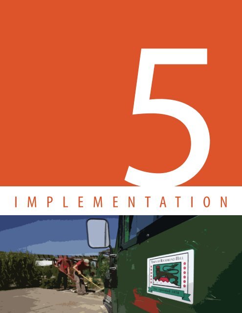
5<br />
I M P L E M E N T A T I O N
1<br />
2<br />
IMPLEMENTATION<br />
5. IMPLEMENTATION<br />
This <strong>Chapter</strong> outlines and describes the tools that the <strong>Town</strong> may use to implement<br />
the policies <strong>of</strong> this <strong>Plan</strong>. <strong>Plan</strong>ning tools, including Zoning By-laws, plans <strong>of</strong><br />
subdivision, and site plan control, along with more specialized planning tools and<br />
mechanisms such as Bonusing By-laws, Holding By-laws, Temporary Use By-laws<br />
and Community Improvement <strong>Plan</strong>s will assist the <strong>Town</strong> in achieving the vision<br />
and principles outlined in this <strong>Plan</strong>. Policies for non-conforming uses, required<br />
studies, complete application submission requirements, notice procedures and<br />
the monitoring <strong>of</strong> this <strong>Plan</strong> are also set out in this <strong>Chapter</strong>.<br />
3<br />
4<br />
5<br />
6<br />
7<br />
5.1 SECONDARY PLANS<br />
It is the policy <strong>of</strong> Council that:<br />
1. Secondary <strong>Plan</strong>s shall be adopted as amendments to this <strong>Plan</strong> and may be<br />
produced and consolidated under Part II <strong>of</strong> this <strong>Plan</strong> once they have been<br />
adopted and approved.<br />
2. Secondary <strong>Plan</strong>s may be prepared for the areas <strong>of</strong> the Urban Structure<br />
identified on Schedule A1 (Urban Structure) <strong>of</strong> this <strong>Plan</strong>.<br />
3. Secondary <strong>Plan</strong>s shall be prepared for the following areas <strong>of</strong> the <strong>Town</strong> as<br />
shown on Schedule A10 (Secondary <strong>Plan</strong> Areas) <strong>of</strong> this <strong>Plan</strong>:<br />
a. <strong>Richmond</strong> <strong>Hill</strong> Centre;<br />
b. Downtown Local Centre;<br />
c. Oak Ridges Local Centre;<br />
d. Yonge Street and 16th Avenue Key Development Area;<br />
e. Yonge Street and Bernard Avenue Key Development Area; and<br />
f. North Leslie Area.<br />
4. <strong>New</strong> Secondary <strong>Plan</strong>s shall include, at a minimum, information and policies<br />
respecting the following:<br />
a. The specific location and boundaries <strong>of</strong> the Secondary <strong>Plan</strong> area;<br />
b. The basis for establishing the objectives and policies in the Secondary<br />
<strong>Plan</strong>;<br />
c. Detailed objectives to be achieved in the Secondary <strong>Plan</strong> area;<br />
d. The proposed development concept for the Secondary <strong>Plan</strong> area;<br />
e. The overall capacity for development in the area, including population<br />
and employment projections;<br />
f. The opportunities and constraints posed by unique features or<br />
characteristics;<br />
g. Land use policies for development, including policies to ensure<br />
compatibility with existing and planned adjacent land uses;<br />
h. Policies for minimum and maximum density for development blocks;<br />
i. Policies for the location <strong>of</strong> public parks and urban open spaces;<br />
RICHMOND HILL OFFICIAL PLAN 5-1<br />
DRAFT MAY 6, 2010
IMPLEMENTATION<br />
j. Policies for the location <strong>of</strong> community uses;<br />
k. Urban design objectives, guidelines or parameters including<br />
streetscape, gateways, urban open space and public realm<br />
improvements;<br />
l. The boundaries <strong>of</strong> the Greenway System including key natural heritage<br />
features, key hydrological features and their functions, and natural<br />
linkages between these features in accordance with any relevant<br />
MESPs or Natural Heritage Evaluations prepared in accordance with<br />
Section 5.23 and Section 5.24 <strong>of</strong> this <strong>Plan</strong>.<br />
m. The location, role and requirements <strong>of</strong> street, transit, pedestrian and<br />
cycling facilities in accordance with the <strong>Town</strong>’s Transportation Master<br />
<strong>Plan</strong> and Pedestrian and Cycling Master <strong>Plan</strong>, as amended from time<br />
to time, and any Transportation Studies prepared in accordance with<br />
Section 5.26 <strong>of</strong> this <strong>Plan</strong>;<br />
n. Policies related to Transportation Demand Management and parking<br />
including policies for the provision <strong>of</strong> cash-in-lieu <strong>of</strong> parking and<br />
structured or underground parking facilities;<br />
o. Necessary investments required for the Secondary <strong>Plan</strong> area, including<br />
requirements for transportation, infrastructure and municipal water<br />
and sewage services;<br />
p. Investigate the feasibility <strong>of</strong> incorporating a district heating or cooling<br />
system;<br />
q. The timing and phasing <strong>of</strong> build-out within the Secondary <strong>Plan</strong> area;<br />
and<br />
r. A strategy to implement the affordable housing policies <strong>of</strong> this <strong>Plan</strong>.<br />
5. The <strong>Richmond</strong> <strong>Hill</strong> Centre Secondary <strong>Plan</strong> will provide a framework to<br />
guide development and the integration <strong>of</strong> public rapid transit in the<br />
<strong>Richmond</strong> <strong>Hill</strong> Centre. The Secondary <strong>Plan</strong> shall be based on the policies<br />
<strong>of</strong> this <strong>Plan</strong> and the <strong>Richmond</strong> <strong>Hill</strong> Regional Centre Design and Land Use<br />
Study Final Recommendations Report, February 2010 which has been<br />
endorsed by Council. In addition to the Secondary <strong>Plan</strong> requirements<br />
outlined in Section 5.1.4 <strong>of</strong> this <strong>Plan</strong>, the <strong>Richmond</strong> <strong>Hill</strong> Centre Secondary<br />
<strong>Plan</strong> shall include policies respecting the following:<br />
a. Policies for the phasing <strong>of</strong> development;<br />
b. The implementation <strong>of</strong> a long term 1:1 ratio <strong>of</strong> people and jobs to<br />
achieve a balance <strong>of</strong> population and employment uses;<br />
c. The establishment <strong>of</strong> neighbourhood character areas in accordance<br />
with the <strong>Richmond</strong> <strong>Hill</strong> Regional Centre Design and Land Use Study<br />
Final Recommendations Report, February 2010 which has been<br />
endorsed by Council. The character areas shall evolve as a collection<br />
<strong>of</strong> neighbourhood character areas that make up the <strong>Richmond</strong> <strong>Hill</strong><br />
Centre and its identity;<br />
d. Development that is connected by a fine grain street network, sidewalks<br />
and urban open space system to provide safe and direct pedestrian<br />
1<br />
2<br />
3<br />
4<br />
5<br />
6<br />
7<br />
DRAFT MAY 6, 2010<br />
5-2<br />
RICHMOND HILL OFFICIAL PLAN
IMPLEMENTATION<br />
1<br />
2<br />
3<br />
4<br />
5<br />
6<br />
7<br />
access to public streets and to the integrated transit hub;<br />
e. Coordination and collaboration between the Province, Metrolinx,<br />
CN Rail, York Region, adjacent local area municipalities, landowners,<br />
transit providers and other agencies in the planning for the Urban<br />
Growth Centre and the integrated transit hub;<br />
f. Policies to implement transit and auto modal split objectives as set out<br />
in the Secondary <strong>Plan</strong>; and<br />
g. Policies to implement connections between the <strong>Richmond</strong> <strong>Hill</strong> Centre<br />
and the Langstaff Gateway portions <strong>of</strong> the Urban Growth Centre.<br />
6. In addition to the Secondary <strong>Plan</strong> requirements outlined in Section 5.1.4<br />
<strong>of</strong> this <strong>Plan</strong>, Secondary <strong>Plan</strong>s for Local Centres shall include policies<br />
respecting the following:<br />
a. Providing for a wide range <strong>of</strong> residential, commercial and community<br />
uses, including retail, <strong>of</strong>fice, mixed-use and human services;<br />
b. Urban design requirements that are consistent with the policies <strong>of</strong> this<br />
<strong>Plan</strong> and any detailed studies undertaken for the Local Centre area;<br />
c. Connections to contribute to the vitality <strong>of</strong> the surrounding area;<br />
d. Focal points for community activity and civic pride;<br />
e. Pedestrian and cycling systems, and urban open spaces, including<br />
parks;<br />
f. The size and context for development that is appropriate in relation to<br />
the surrounding neighbourhood and corridors;<br />
g. Employment targets that contribute to live/work opportunities;<br />
h. Pedestrian movement, transit use and access; and<br />
i. Cultural heritage resources within historic areas through urban design<br />
standards which reflect local heritage, character and streetscape<br />
attributes.<br />
7. In addition to the Secondary <strong>Plan</strong> requirements outlined in Section 5.1.4<br />
and 5.1.6 <strong>of</strong> this <strong>Plan</strong>, the Downtown Local Centre Secondary <strong>Plan</strong> shall<br />
include policies respecting the following:<br />
a. Policies that are in accordance with the Downtown Design and Land<br />
Use Strategy, Final Recommendations Report, May 2009 which has<br />
been approved by Council; and<br />
b. Options for the creation <strong>of</strong> a linked system <strong>of</strong> courtyards through a block<br />
planning exercise generally within the existing and planned parking<br />
areas located at the rear <strong>of</strong> buildings fronting onto Yonge Street.<br />
8. In addition to the Secondary <strong>Plan</strong> requirements outlined in Section 5.1.4<br />
and 5.1.6 <strong>of</strong> this <strong>Plan</strong>, the Oak Ridges Local Centre Secondary <strong>Plan</strong> shall<br />
include policies respecting the following:<br />
a. Opportunities for the establishment <strong>of</strong> a gateway focal point around<br />
the intersection <strong>of</strong> Yonge Street and King Road. The gateway focal point<br />
should serve as an identifiable landscape-oriented square or park that<br />
RICHMOND HILL OFFICIAL PLAN 5-3<br />
DRAFT MAY 6, 2010
IMPLEMENTATION<br />
celebrates the identity and character <strong>of</strong> the Oak Ridges community<br />
and functions as a gateway to the Local Centre;<br />
b. Options for the creation <strong>of</strong> a grand landscaped boulevard within the<br />
Yonge Street right-<strong>of</strong>-way through a block planning exercise;<br />
c. Opportunities for partnerships to undertake a demonstration project<br />
to act as a catalyst for the creation <strong>of</strong> or extension <strong>of</strong> pedestrianoriented<br />
mews, courtyards, squares, or other pedestrian amenities and<br />
urban open space connections; and<br />
d. Direction to establish a coordinated palette <strong>of</strong> unique paving, lighting,<br />
planting, and signage for use within the grand landscaped boulevard.<br />
9. In addition to the Secondary <strong>Plan</strong> requirements outlined in Section 5.1.4<br />
<strong>of</strong> this <strong>Plan</strong>, Secondary <strong>Plan</strong>s for Key Development Areas shall include<br />
policies respecting the following:<br />
a. Policies to provide for a range <strong>of</strong> public parks and urban open spaces<br />
that allow for passive and active recreational opportunities; and<br />
b. The incorporation <strong>of</strong> public art, culture and heritage.<br />
10. An implementing Zoning By-law shall be prepared concurrently for new<br />
Secondary <strong>Plan</strong>s and for areas subject to existing Secondary <strong>Plan</strong> areas<br />
that do not currently have an implementing Zoning By-law.<br />
1<br />
2<br />
3<br />
4<br />
5.2 TERTIARY PLANS/CONCEPT PLANS<br />
It is the policy <strong>of</strong> Council that:<br />
1. To guide the overall pattern <strong>of</strong> development within an area in accordance<br />
with the policies <strong>of</strong> this <strong>Plan</strong>, and prior to Council’s approval <strong>of</strong> a<br />
development application the following may be required:<br />
a. A Tertiary <strong>Plan</strong> prepared by the <strong>Town</strong> and approved by Council; or<br />
b. A Concept <strong>Plan</strong> prepared by a proponent <strong>of</strong> a development application<br />
and approved by Council.<br />
2. Applications for development shall be consistent with a Tertiary <strong>Plan</strong> or<br />
Concept <strong>Plan</strong> approved by Council and in accordance with the policies <strong>of</strong><br />
this <strong>Plan</strong>.<br />
5<br />
6<br />
3. Tertiary <strong>Plan</strong>s or Concept <strong>Plan</strong>s may be prepared for areas <strong>of</strong> the Urban<br />
Structure identified on Schedule A1 (Urban Structure) <strong>of</strong> this <strong>Plan</strong>.<br />
4. Tertiary <strong>Plan</strong>s or Concept <strong>Plan</strong>s shall include, but not be limited to, the<br />
following:<br />
a. The specific location and boundaries <strong>of</strong> the Tertiary <strong>Plan</strong> or Concept<br />
<strong>Plan</strong> area, to the satisfaction <strong>of</strong> the <strong>Town</strong>;<br />
b. A description <strong>of</strong> the vision for the area including the overall urban<br />
7<br />
DRAFT MAY 6, 2010<br />
5-4<br />
RICHMOND HILL OFFICIAL PLAN
IMPLEMENTATION<br />
1<br />
2<br />
3<br />
4<br />
5<br />
form, character, connections and relationships to abutting lands and<br />
the area <strong>of</strong> the larger urban structure;<br />
c. The proposed development concept for the Tertiary <strong>Plan</strong> or Concept<br />
<strong>Plan</strong> area which shall include, but not be limited to:<br />
i. Layout and connections <strong>of</strong> proposed transportation infrastructure<br />
with existing transportation infrastructure in the area.<br />
Transportation infrastructure may include but shall not be limited<br />
to arterial, collector or local streets, public transit routes and<br />
stations, sidewalks, cycling and walking trails;<br />
ii.<br />
iii.<br />
iv.<br />
Layout <strong>of</strong> proposed development blocks, land use, built form and<br />
parking areas or structures;<br />
The location <strong>of</strong> proposed parks, urban open spaces, and stormwater<br />
management works;<br />
The boundaries <strong>of</strong> the Greenway System including key natural<br />
heritage features, key hydrological features and their functions,<br />
and natural linkages between these features in accordance with<br />
any relevant MESPs or Natural Heritage Evaluations prepared in<br />
accordance with Section 5.23 and 5.24 <strong>of</strong> this <strong>Plan</strong>;<br />
v. The contribution <strong>of</strong> the proposed development concept to the<br />
character <strong>of</strong> the larger area including designation or area-specific<br />
design elements, including view corridors, in accordance with<br />
<strong>Chapter</strong> 4 (Land Use) <strong>of</strong> this <strong>Plan</strong>; and<br />
vi.<br />
Demonstration <strong>of</strong> how cultural heritage resources are integrated,<br />
where applicable.<br />
d. Urban Design Reports or Briefs, at the request <strong>of</strong> the <strong>Town</strong>, which shall<br />
be prepared in accordance with Section 5.27 <strong>of</strong> this <strong>Plan</strong>;<br />
e. Necessary infrastructure requirements; and<br />
f. Phasing and staging policies, where necessary to comply with the<br />
requirements <strong>of</strong> this <strong>Plan</strong>.<br />
5.3 COMPLETE APPLICATION SUBMISSION REQUIREMENTS<br />
6<br />
7<br />
It is the policy <strong>of</strong> Council that:<br />
1. Any or all <strong>of</strong> the information outlined in Section 5.3 may be requested<br />
from applicants who propose to submit applications for development, in<br />
order to ensure that:<br />
a. All relevant and required information pertaining to a development<br />
application is available at the time <strong>of</strong> submission to enable Council<br />
and its delegated authorities to make informed decisions within the<br />
time periods prescribed by the <strong>Plan</strong>ning Act; and<br />
b. The public and other interested stakeholders have access to all relevant<br />
information at an early stage in the planning process.<br />
RICHMOND HILL OFFICIAL PLAN 5-5<br />
DRAFT MAY 6, 2010
IMPLEMENTATION<br />
2. Development applications that are submitted to the <strong>Town</strong> without the<br />
required studies, reports, plans or other required information shall be<br />
considered as incomplete.<br />
3. The number and scope <strong>of</strong> the information including studies, reports,<br />
statements and drawings to be required for the submission <strong>of</strong> a complete<br />
application shall be in keeping with the scope and complexity <strong>of</strong> the<br />
application(s).<br />
4. During the course <strong>of</strong> the review process for any development application<br />
which is subject to “complete application” requirements under the <strong>Plan</strong>ning<br />
Act and which has been deemed to be a complete application, additional<br />
reports, studies and drawings may be required in order to address specific<br />
issues and to better enable Council and its delegated authorities to make<br />
informed decisions in the best interests <strong>of</strong> the proposed development and<br />
the broader public interest.<br />
1<br />
2<br />
3<br />
Information Requirements<br />
5. Council or its delegated authorities may require reports, studies and<br />
drawings as part <strong>of</strong> a complete application submission. The reports, studies<br />
and drawings are intended to provide additional information pertaining<br />
to lands that are the subject <strong>of</strong> a development application and the adjacent<br />
areas in order to assist Council and its delegated authorities to evaluate a<br />
development application.<br />
6. The specific scope <strong>of</strong> the reports and studies to be submitted as part <strong>of</strong><br />
a development application will be identified at a pre-application meeting<br />
required in accordance with Section 5.4 <strong>of</strong> this <strong>Plan</strong>.<br />
7. The following broad categories <strong>of</strong> reports and studies are the type <strong>of</strong><br />
studies that may be identified at the pre-application meeting as being<br />
required to be submitted with a development application:<br />
Environment/Natural Heritage (Natural Heritage Evaluations)<br />
a. The submission <strong>of</strong> reports, studies and drawings related to<br />
Environment/Natural Heritage including key natural heritage features,<br />
key hydrological features and their functions, and the Greenway System<br />
shall identify and assess the environmental and natural features<br />
related to the subject lands, including surface and subsurface features,<br />
and to ensure that any adverse impacts resulting from a proposed<br />
development and/or change in land use on an identified key natural<br />
heritage feature, key hydrological feature, or the Greenway System are<br />
mitigated to an acceptable level.<br />
4<br />
5<br />
6<br />
7<br />
The required reports, studies and drawings shall identify and describe (in<br />
terms <strong>of</strong> character, quality and ecological function) the environmental<br />
DRAFT MAY 6, 2010<br />
5-6<br />
RICHMOND HILL OFFICIAL PLAN
IMPLEMENTATION<br />
1<br />
2<br />
3<br />
4<br />
5<br />
6<br />
7<br />
and natural heritage features which may be affected by the proposed<br />
development and/or change in land use; define the boundaries <strong>of</strong><br />
the environmental areas on the site with zones <strong>of</strong> influence, buffers<br />
and ecological restoration areas identified; describe the relationship<br />
between the environmental features to the proposed development<br />
and/or land use change; demonstrate if, how and where development<br />
can proceed without negative impacts on the environmental features;<br />
and comply with any Provincial requirements for impact studies as<br />
set out in Provincial Policy Statements or Guidelines, such as the Oak<br />
Ridges Moraine Conservation <strong>Plan</strong>, the Greenbelt <strong>Plan</strong>, and the Rouge<br />
North Management <strong>Plan</strong>.<br />
The reports, studies and drawings associated with Environment/<br />
Natural Heritage that may be required for a complete application<br />
may include but shall not be limited to: a Natural Heritage Evaluation,<br />
Tree Inventory and Preservation <strong>Plan</strong>, Floodplain and Erosion Hazard<br />
Study, Geotechnical/Slope Stability Study, Geotechnical Structural<br />
Report, Edge Management <strong>Plan</strong>, Landscaping/Site Rehabilitation<br />
<strong>Plan</strong>, Hydrogeological Study, Open Space Master <strong>Plan</strong>, Water Balance<br />
Analysis, Watercourse Erosion Analysis, Stormwater Management<br />
Study or an Environmental Site Assessment.<br />
Cultural Heritage Resources and Archaeological Resources<br />
b. Cultural heritage resources or archaeological resources may include<br />
buildings, structures, sites or landscapes that, either individually or<br />
as part <strong>of</strong> a whole, are <strong>of</strong> historical, architectural, archaeological, or<br />
scenic value. The submission <strong>of</strong> reports, studies and drawings related<br />
to cultural heritage resources or archaeological resources that may be<br />
required for a complete application may include but shall not be<br />
limited to: a Cultural Heritage Impact Assessment, Phase I & Phase II<br />
Archaeological Assessment, Cultural Heritage Conservation <strong>Plan</strong> and<br />
Structural Engineering Report. Council or its delegated authorities<br />
may also require a peer review <strong>of</strong> the reports and/or studies submitted<br />
by an applicant.<br />
Transportation<br />
c. The submission <strong>of</strong> reports, studies and drawings related to the<br />
transportation system shall demonstrate that any changes to the<br />
transportation system resulting from a proposed development and/<br />
or changes in land use can be accommodated by the transportation<br />
system and shall ensure that any adverse impacts on the surrounding<br />
land uses are sufficiently mitigated.<br />
The required reports, studies and drawings are to ensure that a<br />
proposed development and/or change in land use do not have a<br />
RICHMOND HILL OFFICIAL PLAN 5-7<br />
DRAFT MAY 6, 2010
IMPLEMENTATION<br />
negative impact on the transportation system or its surrounding<br />
land uses. Where new transportation infrastructure is proposed or an<br />
expansion to the existing transportation infrastructure is necessary to<br />
accommodate a proposed development and/or change in land use,<br />
the transportation reports, studies and drawings shall demonstrate<br />
to an acceptable level that the improved transportation infrastructure<br />
will be adequate to accommodate all modes <strong>of</strong> transportation in an<br />
efficient manner with minimal adverse impacts on surrounding uses.<br />
The submission <strong>of</strong> reports, studies and drawings related to the<br />
transportation system that may be required for a complete application<br />
may include but shall not be limited to a Transportation Study, Traffic<br />
Impact Study, Parking Utilization Study, Travel Demand Management<br />
Strategy, Site Servicing <strong>Plan</strong>, Site Grading <strong>Plan</strong>, street widening and<br />
other rights-<strong>of</strong>-way requirements.<br />
Servicing and Infrastructure<br />
d. The submission <strong>of</strong> reports, studies and drawings related to servicing<br />
and infrastructure matters shall ensure that a proposed development<br />
or change in land use can be supported by adequate municipal water,<br />
sanitary sewer, and stormwater management works.<br />
The required reports, studies and drawings shall demonstrate that<br />
the existing servicing infrastructure is sufficient to accommodate the<br />
proposed development and/or change in land use or that the lands<br />
can be reasonably serviced by the extension <strong>of</strong> existing infrastructure.<br />
Where new infrastructure is required and/or expansion <strong>of</strong> the<br />
existing infrastructure is necessary, the servicing and infrastructure<br />
reports, studies and drawings shall demonstrate that the improved<br />
infrastructure will be adequate to accommodate the proposed<br />
development or change in land use as well as any anticipated users <strong>of</strong><br />
the infrastructure.<br />
The submission <strong>of</strong> reports, studies and drawings related to servicing<br />
and infrastructure matters that may be required for a complete<br />
application may include but shall not be limited to a Site Servicing <strong>Plan</strong>,<br />
Site Grading <strong>Plan</strong>, Stormwater Management <strong>Plan</strong>, a plan identifying<br />
Low Impact Development Techniques, Lighting and Utility <strong>Plan</strong>, Safety<br />
Impact Studies and construction details. Additional information<br />
and analysis on existing upstream and downstream services may be<br />
required to address existing service constraints or service constraints<br />
that may occur as a result <strong>of</strong> the proposed development or change in<br />
land use.<br />
Financial/Market Impacts<br />
e. The submission <strong>of</strong> reports and studies related to financial/market<br />
impact matters shall demonstrate that a proposed development and/<br />
1<br />
2<br />
3<br />
4<br />
5<br />
6<br />
7<br />
DRAFT MAY 6, 2010<br />
5-8<br />
RICHMOND HILL OFFICIAL PLAN
IMPLEMENTATION<br />
1<br />
2<br />
3<br />
4<br />
5<br />
6<br />
7<br />
or change in land use does not have an unreasonable or unanticipated<br />
financial impact on the <strong>Town</strong>.<br />
The required reports, studies and drawings shall identify the short<br />
term and long term costs to the <strong>Town</strong> for the provision <strong>of</strong> municipal<br />
infrastructure and services required to support a proposed development<br />
and/or change in land use and an estimate <strong>of</strong> anticipated revenues<br />
arising from a proposed development and/or change in land use.<br />
The submission <strong>of</strong> reports and studies related to financial/market<br />
impact matters that may be required for a complete application may<br />
include but shall not be limited to a Retail Market Study, Commercial<br />
Needs Study, Economic Impact Study, Infrastructure Cost Assessment,<br />
Long Term Maintenance Cost Assessment, and Development Charges<br />
By-law review.<br />
Development Impacts<br />
f. The submission <strong>of</strong> reports, studies and drawings related to<br />
development impact matters shall demonstrate that the residents<br />
or users <strong>of</strong> a proposed development and/or change in land use are<br />
buffered from nuisances related to noise, dust, odour and vibration,<br />
and the potential for public costs or risk to future residents or users<br />
resulting from the proposed development and/or change in land use.<br />
The required reports, studies and drawings shall identify all <strong>of</strong> the<br />
potential nuisance issues and natural or human-made hazards<br />
which may impact the proposed development and/or change in land<br />
use and/or adjacent land uses, identify the buffer areas between<br />
the nuisance issues and natural or human-made hazards and the<br />
proposed development and/or change in land use and adjacent land<br />
uses, and identify any other appropriate mitigation measures that may<br />
be employed.<br />
The submission <strong>of</strong> reports and studies related to development impact<br />
matters that may be required for a complete application may include<br />
but shall not be limited to a Noise Impact Study, Wind Study, Vibration<br />
Study, Odour Impacts, Urban Design Reports or Briefs, Visual Impacts,<br />
Sun/Shadow Study, Phase I & II Environmental Site Assessment and<br />
Geotechnical Structural Report.<br />
<strong>Plan</strong>ning Matters<br />
g. The submission <strong>of</strong> reports and studies related to Provincial, Regional or<br />
local planning matters shall ensure that a proposed development and/<br />
or change in land use is consistent with Regional and local policies<br />
and the Provincial Policy Statements or <strong>Plan</strong>s, such as the Oak Ridges<br />
Moraine Conservation <strong>Plan</strong>, the Greenbelt <strong>Plan</strong>, Watershed <strong>Plan</strong>s and<br />
the Rouge North Management <strong>Plan</strong>. Where applicable, the reports<br />
RICHMOND HILL OFFICIAL PLAN 5-9<br />
DRAFT MAY 6, 2010
IMPLEMENTATION<br />
and studies must also address consistency with policy guidelines that<br />
have been approved by Council.<br />
The submission <strong>of</strong> reports and studies related to planning matters that<br />
may be required for a complete application may include but shall not<br />
be limited to a <strong>Plan</strong>ning Justification Report, Tertiary <strong>Plan</strong> or Concept<br />
<strong>Plan</strong> and Conformity Statements which address matters <strong>of</strong> Provincial<br />
interest as expressed in Provincial Policy Statements or a Provincial<br />
<strong>Plan</strong> or as identified above.<br />
8. The foregoing list <strong>of</strong> studies is not intended to preclude Council and its<br />
delegated approval authorities from requiring such additional reports,<br />
studies, plans or drawings as may be identified during the development<br />
review process if such additional documentation is deemed necessary and<br />
relevant to the decision making process.<br />
9. In addition to the prescribed information required by the <strong>Plan</strong>ning Act<br />
or applicable Regulations and the information outlined in Section 5.3 <strong>of</strong><br />
this <strong>Plan</strong>, the <strong>Town</strong> may require additional information and materials to<br />
assist in understanding, evaluating and making recommendations on the<br />
development application, and to ensure that sufficient information in an<br />
appropriate format can be made available to the commenting agencies<br />
and the public, and to Council and its delegated approval authorities.<br />
10. All information may be required to be submitted in both an electronic<br />
format and hard copy so that it may be more easily made available for<br />
review.<br />
5.4 PRE-APPLICATION MEETING<br />
1<br />
2<br />
3<br />
4<br />
5<br />
It is the policy <strong>of</strong> Council that:<br />
1. Prior to the submission <strong>of</strong> any development application for <strong>Official</strong> <strong>Plan</strong><br />
amendment, Zoning By-law amendment, draft plans <strong>of</strong> subdivision, draft<br />
plans <strong>of</strong> condominium, site plan approval and consent, applicants shall<br />
attend a pre-application meeting with the <strong>Town</strong>’s <strong>Plan</strong>ning and Regulatory<br />
Services Department. The pre-application meeting is intended to scope<br />
the issues associated with a specific development proposal and/or change<br />
in land use. The requirements for additional reports, studies and drawings<br />
beyond the prescribed information required under Sections 22(4), 34(10.1),<br />
51(17) and 53(2) <strong>of</strong> the <strong>Plan</strong>ning Act that will constitute the requirements<br />
for a complete application will be determined at the mandatory preapplication<br />
meeting.<br />
6<br />
7<br />
2. Development applications submitted to the <strong>Town</strong> prior to a pre-application<br />
meeting with the <strong>Town</strong>’s <strong>Plan</strong>ning and Regulatory Services Department<br />
shall be considered incomplete.<br />
DRAFT MAY 6, 2010<br />
5-10<br />
RICHMOND HILL OFFICIAL PLAN
1<br />
2<br />
3<br />
4<br />
5<br />
6<br />
7<br />
IMPLEMENTATION<br />
5.5 BONUSING (BONUSING BY-LAWS)<br />
It is the policy <strong>of</strong> Council that:<br />
1. In accordance with Section 37 <strong>of</strong> the <strong>Plan</strong>ning Act, Council may, in a By-law<br />
passed under Section 34, permit increases in the height and/or density<br />
<strong>of</strong> a development, where such development provides community benefits<br />
above and beyond what would otherwise be required and provided that:<br />
a. The development constitutes good planning;<br />
b. The community benefits to be provided bear a reasonable planning<br />
relationship with the proposed development; and<br />
c. The proposed development can be supported by existing or planned<br />
infrastructure or minor upgrades thereto.<br />
2. A By-law passed in accordance with Section 37 <strong>of</strong> the <strong>Plan</strong>ning Act may<br />
be enacted only for the purpose <strong>of</strong> securing community benefits above<br />
and beyond what would otherwise be required under the <strong>Plan</strong>ning Act and<br />
Development Charges Act.<br />
3. Notwithstanding the generality <strong>of</strong> the foregoing, the intent <strong>of</strong> Council in<br />
passing such a By-law shall be to obtain community benefits including,<br />
but not limited to the following:<br />
a. The provision <strong>of</strong> additional on-site open space or public facilities such<br />
as day nurseries, community centres, and/or recreational facilities;<br />
b. The provision <strong>of</strong> affordable or special needs housing including housing<br />
for senior citizens;<br />
c. Enhanced connections between neighbourhoods, the Greenway<br />
System as well as local improvements to transit facilities;<br />
d. Additional street improvements or servicing improvements;<br />
e. The provision <strong>of</strong> public parking facilities;<br />
f. Public art;<br />
g. Substantial contribution to the tree canopy;<br />
h. Streetscape improvements on the public boulevard not abutting the<br />
site;<br />
i. Non-pr<strong>of</strong>it cultural facilities; and<br />
j. Other local improvements to the satisfaction <strong>of</strong> the <strong>Town</strong>.<br />
4. Community benefits will be capital facilities and/or cash contributions<br />
towards specific capital facilities, and shall be be secured in return for an<br />
increase in the height and/or density <strong>of</strong> development, and will be selected<br />
based on local needs, the nature <strong>of</strong> the development and any guidelines or<br />
relevant plans adopted by Council and the policies <strong>of</strong> this <strong>Plan</strong>. Priority will<br />
be given to on-site or local facilities.<br />
5. Where a proponent <strong>of</strong> development elects to provide community benefits<br />
RICHMOND HILL OFFICIAL PLAN 5-11<br />
DRAFT MAY 6, 2010
IMPLEMENTATION<br />
in return for an increase in the height and/or density <strong>of</strong> the proposed<br />
development, the <strong>Town</strong> shall require the owner to enter into one or more<br />
agreements with the <strong>Town</strong> dealing with the facilities, services or matters.<br />
Any agreement entered into by the owner will be registered against the<br />
land to which it applies and the <strong>Town</strong> is entitled to enforce its provisions<br />
against the owner, and subject to the provisions <strong>of</strong> the Registry Act and<br />
the Land Titles Act, any person who has an interest in the land or who<br />
subsequently acquires an interest in the land.<br />
6. Increases in height and/or density authorized in accordance with Section<br />
37 <strong>of</strong> the <strong>Plan</strong>ning Act will be implemented by site specific By-laws passed<br />
under Section 34 <strong>of</strong> the <strong>Plan</strong>ning Act. Such By-laws will contain the<br />
standards <strong>of</strong> the zoning category applicable to the site if the bonus is not<br />
awarded, as well as the standards that would apply if the bonus is awarded.<br />
The By-law will also specify the community benefits that are required to be<br />
provided before the bonus standards are in effect.<br />
1<br />
2<br />
3<br />
5.6 ZONING BY-LAWS<br />
It is the policy <strong>of</strong> Council that:<br />
1. A Zoning By-law shall be used to implement the policies <strong>of</strong> this <strong>Plan</strong> by<br />
regulating the use <strong>of</strong> land, location <strong>of</strong> buildings or structures in accordance<br />
with the provisions <strong>of</strong> the <strong>Plan</strong>ning Act and may be more restrictive than<br />
this <strong>Plan</strong>, where appropriate. It is not intended that the full range <strong>of</strong> uses<br />
or densities permitted by this <strong>Plan</strong> will be permitted by the Zoning By-law<br />
in all locations.<br />
2. The <strong>Town</strong> shall prepare a new comprehensive Zoning By-law no later than<br />
3 years after the adoption <strong>of</strong> this <strong>Plan</strong>, in accordance with Section 26 <strong>of</strong> the<br />
<strong>Plan</strong>ning Act.<br />
3. The new comprehensive Zoning By-law shall establish the following,<br />
where necessary:<br />
a. Land use zones that will permit the types <strong>of</strong> uses provided for in this<br />
<strong>Plan</strong>;<br />
b. Development standards appropriate to each type <strong>of</strong> use;<br />
c. Illustrations, drawings or other visuals to assist in communicating or<br />
exemplifying the development standards established;<br />
d. Any other standards needed to implement this <strong>Plan</strong>.<br />
4<br />
5<br />
6<br />
7<br />
DRAFT MAY 6, 2010<br />
5-12<br />
RICHMOND HILL OFFICIAL PLAN
1<br />
2<br />
3<br />
4<br />
5<br />
6<br />
7<br />
IMPLEMENTATION<br />
5.7 HOLDING PROVISION BY-LAWS<br />
It is the policy <strong>of</strong> Council that:<br />
1. The <strong>Town</strong> may, in a Zoning By-Law passed under Section 36 <strong>of</strong> the <strong>Plan</strong>ning<br />
Act, affix a holding symbol “H” in conjunction with any zoning category<br />
to specify the future use <strong>of</strong> lands, buildings, or structures once specified<br />
development requirements have been satisfied and the holding symbol is<br />
removed by amendment to the Zoning By-law.<br />
2. A Holding By-law passed under Section 36 <strong>of</strong> the <strong>Plan</strong>ning Act may be used<br />
in order to implement this <strong>Plan</strong> for one or more <strong>of</strong> the following purposes:<br />
a. To ensure that certain conditions, studies or requirements related to a<br />
proposed zoning change are met;<br />
b. To achieve orderly phasing or staging <strong>of</strong> development, in accordance<br />
with municipal, Regional and Provincial policies;<br />
c. To ensure that adequate transportation and servicing infrastructure<br />
and community services and facilities are, or will be, available in<br />
accordance with municipal standards;<br />
d. To adopt measures to mitigate negative impacts resulting from the<br />
proximity <strong>of</strong> lands to transportation and utility corridors, incompatible<br />
land uses or any other source <strong>of</strong> nuisance or hazard to public health<br />
and welfare;<br />
e. To satisfy the policies <strong>of</strong> this <strong>Plan</strong> related to heritage conservation, Site<br />
<strong>Plan</strong> control, potentially contaminated sites, protection <strong>of</strong> the natural<br />
environment and the Greenway System, community improvement,<br />
and any other planning matters determined to be relevant to the<br />
development <strong>of</strong> the lands;<br />
f. To achieve the exchange <strong>of</strong> community benefits set out in the Bonusing<br />
By-law policies <strong>of</strong> this <strong>Plan</strong>; and<br />
g. To ensure the execution <strong>of</strong> legal agreements, approval <strong>of</strong> plans <strong>of</strong><br />
subdivision and approval <strong>of</strong> necessary studies by the appropriate<br />
authority in order to satisfy any <strong>of</strong> the criteria set out above.<br />
3. Where a Holding By-law has been enacted to ensure allocation <strong>of</strong> municipal<br />
water and/or sanitary services, the Holding By-law may provide that:<br />
a. No building or structure shall be erected on the site, unless permitted<br />
by Council or its delegate;<br />
b. The owner shall not construct or locate a sales pavilion, centre or<br />
<strong>of</strong>fice which <strong>of</strong>fer to sell, agree to sell or otherwise market land by a<br />
description based on an unregistered plan <strong>of</strong> subdivision or plan <strong>of</strong><br />
condominium; and<br />
c. The owner may not pre-service the lands for the purpose <strong>of</strong> providing<br />
municipal services for an unregistered plan <strong>of</strong> subdivision or plan <strong>of</strong><br />
condominium.<br />
RICHMOND HILL OFFICIAL PLAN 5-13<br />
DRAFT MAY 6, 2010
IMPLEMENTATION<br />
4. Holding By-laws legally in effect at the time <strong>of</strong> adoption <strong>of</strong> this <strong>Plan</strong> are<br />
deemed to conform with the <strong>Plan</strong>.<br />
1<br />
5.8 CONDITIONAL ZONING BY-LAWS<br />
It is the policy <strong>of</strong> Council that:<br />
1. When regulations have been promulgated by the Province to authorize<br />
the use <strong>of</strong> Conditional Zoning By-laws under Section 34 <strong>of</strong> the <strong>Plan</strong>ning<br />
Act, and subject to compliance with those regulatory requirements, the<br />
<strong>Town</strong> may, in a Zoning By-law passed under Section 34 permit the use <strong>of</strong><br />
land or the erection, location or use <strong>of</strong> buildings or structures subject to<br />
compliance with such conditions as may be prescribed under the Zoning<br />
By-law with respect to use, erection or location.<br />
2<br />
3<br />
5.9 INTERIM CONTROL BY-LAWS<br />
It is the policy <strong>of</strong> Council that:<br />
1. Where Council has, by By-law or resolution, directed that a review or study<br />
be undertaken in respect <strong>of</strong> land use planning policies in the <strong>Town</strong>, or in<br />
any defined area or site, Council may pass an Interim Control By-law in<br />
accordance with the requirements <strong>of</strong> Section 38 <strong>of</strong> the <strong>Plan</strong>ning Act in<br />
order to restrict the use <strong>of</strong> lands, buildings or structures for or except for<br />
such purposes as may be specified in the By-law pending completion <strong>of</strong><br />
the review or study. It is the intent <strong>of</strong> Council that the scope <strong>of</strong> the Bylaw<br />
be no broader than necessary to fulfill the objectives and planning<br />
rationale <strong>of</strong> the review or study, provided that Council may amend a Bylaw<br />
subsequent to its enactment so as to increase the area covered by<br />
the By-law if deemed appropriate to fulfill the objectives and planning<br />
rationale <strong>of</strong> the review or study.<br />
5.10 TEMPORARY USE BY-LAWS<br />
It is the policy <strong>of</strong> Council that:<br />
1. The <strong>Town</strong> may, in a Zoning By-law passed under Section 39 <strong>of</strong> the <strong>Plan</strong>ning<br />
Act, authorize the temporary use <strong>of</strong> land, buildings or structures for any<br />
purpose as set out therein, and notwithstanding that such purpose may<br />
be otherwise prohibited by the Zoning By-law.<br />
2. Prior to enacting a Temporary Use By-law, the <strong>Town</strong> shall be satisfied that<br />
the proposed temporary use:<br />
a. Is in conformity with the general intent <strong>of</strong> the policies <strong>of</strong> this <strong>Plan</strong> and<br />
4<br />
5<br />
6<br />
7<br />
DRAFT MAY 6, 2010<br />
5-14<br />
RICHMOND HILL OFFICIAL PLAN
IMPLEMENTATION<br />
1<br />
2<br />
3<br />
maintains the long term viability <strong>of</strong> the lands for the uses permitted in<br />
this <strong>Plan</strong>;<br />
b. Is compatible with adjacent land uses, or incorporates site mitigation<br />
measures to ensure compatibility;<br />
c. Is suitable for the site in terms <strong>of</strong> site layout, building design,<br />
accessibility, provision <strong>of</strong> landscaping, screening and buffering and<br />
available services such as water and sewage disposal;<br />
d. Does not adversely impact the natural environment or the Greenway<br />
System;<br />
e. Does not adversely impact traffic, transportation or parking facilities<br />
in the area; and<br />
f. Is temporary in nature, appropriate only for a limited time span, which<br />
shall not exceed a period <strong>of</strong> three (3) years from the passing <strong>of</strong> the<br />
by-law unless approved by By-law extension that is subject to the<br />
policies <strong>of</strong> this <strong>Plan</strong>, and can be terminated when the authorizing Bylaw<br />
expires.<br />
3. No new buildings or expansions to buildings, except for temporary or moveable<br />
structures, shall be permitted on lands subject to a Temporary Use By-law.<br />
4<br />
5.11 COMMITTEE OF ADJUSTMENT<br />
It is the policy <strong>of</strong> Council that:<br />
5<br />
6<br />
7<br />
1. The <strong>Town</strong> shall constitute and appoint a Committee <strong>of</strong> Adjustment for the<br />
<strong>Town</strong> in accordance with the requirements <strong>of</strong> Section 44 <strong>of</strong> the <strong>Plan</strong>ning<br />
Act, comprised <strong>of</strong> such persons, not less than three, as Council considers<br />
advisable.<br />
2. The Committee <strong>of</strong> Adjustment shall be authorized to consider and<br />
approve applications for minor variances to any Zoning By-law enacted<br />
under Sections 34 or 38 <strong>of</strong> the <strong>Plan</strong>ning Act, as well as other approvals<br />
authorized under subsection 45(2) <strong>of</strong> the <strong>Plan</strong>ning Act, in accordance with<br />
the requirements <strong>of</strong> Section 45 and any other relevant requirements <strong>of</strong><br />
the <strong>Plan</strong>ning Act. Without limiting the generality <strong>of</strong> the foregoing, the<br />
Committee <strong>of</strong> Adjustment shall authorize minor variances only where it<br />
is satisfied that, individually and cumulatively, the proposed variance is<br />
minor both qualitatively and quantitatively; desirable in relation to the<br />
appropriate development or use <strong>of</strong> the land, building or structure and in<br />
relation to the surrounding lands; and that the general intent and purpose<br />
<strong>of</strong> the By-law and <strong>of</strong> this <strong>Plan</strong> are maintained.<br />
3. The Committee <strong>of</strong> Adjustment shall also be authorized to consider and<br />
approve applications for Consent under Section 53 <strong>of</strong> the <strong>Plan</strong>ning Act and<br />
applications for a Validation Certificate under Section 57 <strong>of</strong> the <strong>Plan</strong>ning<br />
RICHMOND HILL OFFICIAL PLAN 5-15<br />
DRAFT MAY 6, 2010
IMPLEMENTATION<br />
Act, subject to compliance with the requirements <strong>of</strong> those sections and<br />
provided that they maintain the intent and purpose <strong>of</strong> this <strong>Plan</strong> and any<br />
applicable Zoning By-law, and any other relevant requirements under the<br />
<strong>Plan</strong>ning Act.<br />
1<br />
5.12 CONSENTS<br />
It is the policy <strong>of</strong> Council that:<br />
1. Consents in accordance with Section 53 <strong>of</strong> the <strong>Plan</strong>ning Act, may be<br />
permitted for the creation <strong>of</strong> a new lot, boundary adjustments, rights-<strong>of</strong>way,<br />
easements, long term leases, and the conveyance <strong>of</strong> additional lands<br />
to an abutting lot, provided that a lot which is undersized in relation to<br />
other lots within the general area shall not be created.<br />
2. Applications for Consent to create new lots within the settlement area shall<br />
be granted only where:<br />
a. A plan <strong>of</strong> subdivision is not necessary;<br />
b. The lot(s) can be adequately serviced by water, wastewater, and storm<br />
drainage facilities;<br />
c. No extension, improvement or assumption <strong>of</strong> municipal services,<br />
public streets, or new street allowances is required;<br />
d. The lot(s) will have frontage onto a public street and access will not<br />
result in a traffic hazard;<br />
e. The lot(s) will not restrict the ultimate development <strong>of</strong> adjacent lands;<br />
f. The size and shape <strong>of</strong> the lot(s) complies with the requirements <strong>of</strong> the<br />
Zoning By-law, is appropriate to the use proposed and is compatible<br />
with adjacent lots;<br />
g. The lot(s) is not located in a Special Policy Area; and<br />
h. The consent conforms to all relevant policies <strong>of</strong> this <strong>Plan</strong>.<br />
3. Applications for Consent respecting lands within the Hamlet <strong>of</strong> Gormley<br />
Rural Settlement Area may only be granted for the purposes <strong>of</strong> minor infill<br />
as appropriate for this type <strong>of</strong> lot creation, subject to the provisions <strong>of</strong><br />
Section 32 <strong>of</strong> the Oak Ridges Moraine Conservation <strong>Plan</strong> and the following:<br />
a. No extension or improvement or assumption <strong>of</strong> a public street or<br />
new street allowance is required by the <strong>Town</strong>;<br />
b. The lot will have frontage on a publicly assumed and maintained<br />
street;<br />
c. An approved source <strong>of</strong> water supply and an acceptable method <strong>of</strong><br />
sewage disposal is available; and<br />
d. No amendment to this <strong>Plan</strong> will be required.<br />
2<br />
3<br />
4<br />
5<br />
6<br />
7<br />
DRAFT MAY 6, 2010<br />
5-16<br />
RICHMOND HILL OFFICIAL PLAN
1<br />
2<br />
3<br />
4<br />
5<br />
6<br />
7<br />
IMPLEMENTATION<br />
5.13 LEGAL NON-CONFORMING USES<br />
It is the policy <strong>of</strong> Council that:<br />
1. The use <strong>of</strong> lands, buildings or structures which do not comply with the<br />
Zoning By-law but which were in lawful existence prior to the approval <strong>of</strong><br />
the Zoning By-law, and which continue to be used for such a purpose, shall<br />
be recognized as legal non-conforming uses. If such legal non-conforming<br />
uses cease, then the rights derived from such uses shall terminate.<br />
2. It is the intention and expectation that legal non-conforming uses, buildings<br />
or structures shall eventually cease and be replaced by uses, buildings or<br />
structures that conform with the intent <strong>of</strong> this <strong>Plan</strong> and comply with the<br />
Zoning By-law. In special circumstances, however, it may be appropriate to<br />
consider the extension or enlargement <strong>of</strong> non-conforming uses.<br />
3. The Committee <strong>of</strong> Adjustment may permit the extension or enlargement<br />
<strong>of</strong> lands, buildings or structures used for any purpose prohibited by the<br />
Zoning By-law provided that:<br />
a. It is not possible to relocate such a use to a place where it will comply<br />
with the Zoning By-law;<br />
b. Such land, building or structure continues to be used in the same<br />
manner and for the same purpose as it was used on the day that the<br />
Zoning By-law was enacted;<br />
c. The proposed extension or enlargement does not unduly aggravate<br />
the situation created by the existence <strong>of</strong> the use;<br />
d. The abutting uses are afforded reasonable protection by the provision<br />
<strong>of</strong> appropriate buffering and setbacks;<br />
e. Adequate parking and loading facilities are provided; and<br />
f. The proposed extension or enlargement is in appropriate proportion<br />
to the size <strong>of</strong> the non-conforming use.<br />
4. Where the extension or enlargement <strong>of</strong> any land, building or structure<br />
used for any purpose prohibited by the Zoning By-law is permitted by an<br />
appropriate amending By-law or Committee <strong>of</strong> Adjustment application<br />
subject to the requirements <strong>of</strong> policy 5.13.3(a) through (f) <strong>of</strong> this <strong>Plan</strong>, such<br />
approval may also be subject to site plan control conditions applicable to<br />
the lands, building or structure.<br />
5. Council may acquire any land, building or structure, used or erected for<br />
a purpose that does not comply with the Zoning By-law and any vacant<br />
land having a frontage or depth less than the minimum prescribed in the<br />
Zoning By-law, for the erection <strong>of</strong> a building or structure or may exchange<br />
any such land or other land within the <strong>Town</strong> as Council deems appropriate<br />
to implement the intent <strong>of</strong> this <strong>Plan</strong>.<br />
RICHMOND HILL OFFICIAL PLAN 5-17<br />
DRAFT MAY 6, 2010
5.14 SITE PLAN CONTROL<br />
It is the policy <strong>of</strong> Council that:<br />
IMPLEMENTATION<br />
1<br />
1. The entire <strong>Plan</strong> area shall be subject to site plan control and designated as<br />
a site plan control area in accordance with Section 41 <strong>of</strong> the <strong>Plan</strong>ning Act.<br />
2. Council shall, by way <strong>of</strong> a Site <strong>Plan</strong> Control By-law passed under Section<br />
41 <strong>of</strong> the <strong>Plan</strong>ning Act, identify specific areas and/or types <strong>of</strong> development<br />
subject to site plan control. In such a By-law, Council may also deem<br />
certain types <strong>of</strong> development exempt from site plan control as Council<br />
deems appropriate.<br />
3. Unless an exemption or further restriction is provided under policy 5.14.2<br />
<strong>of</strong> this <strong>Plan</strong>, site plan approval shall be required for all <strong>of</strong> the following:<br />
a. All forms <strong>of</strong> residential development, except single detached dwellings<br />
and semi-detached dwellings;<br />
b. Mixed-use, commercial, major <strong>of</strong>fice, <strong>of</strong>fice, major retail, retail, major<br />
recreational use, employment and community use development;<br />
c. Commercial outdoor patios, sales trailers/pavilions, temporary tents<br />
and structures;<br />
d. Additions and/or alterations to development listed in (a)-(c)<br />
e. Development on properties subject to minor variances or other<br />
approvals under the <strong>Plan</strong>ning Act where the approval <strong>of</strong> a site plan is a<br />
condition <strong>of</strong> such approval; and<br />
f. Grading issues related to infill development and major recreational uses.<br />
5.15 PLANS OF SUBDIVISION, PLANS OF CONDOMINIUM,<br />
PART LOT CONTROL AND DEEMING BY-LAWS<br />
It is the policy <strong>of</strong> Council that:<br />
2<br />
3<br />
4<br />
5<br />
1. The entire <strong>Plan</strong> area shall be subject to subdivision control and part lot<br />
control, pursuant to Sections 50 and 51 <strong>of</strong> the <strong>Plan</strong>ning Act.<br />
2. Development in the settlement area shall generally take place in accordance<br />
with comprehensively designed plans <strong>of</strong> subdivision.<br />
3. In considering a draft plan <strong>of</strong> subdivision or condominium, the <strong>Town</strong> shall<br />
have regard for:<br />
a. Whether the proposed draft plan meets all <strong>of</strong> the requirements <strong>of</strong> the<br />
<strong>Plan</strong>ning Act;<br />
b. Whether the draft plan conforms with Provincial guidelines, policies<br />
and legislation;<br />
c. Whether the proposed draft plan conforms to the policies <strong>of</strong> this <strong>Plan</strong>;<br />
6<br />
7<br />
DRAFT MAY 6, 2010<br />
5-18<br />
RICHMOND HILL OFFICIAL PLAN
IMPLEMENTATION<br />
1<br />
2<br />
3<br />
4<br />
5<br />
and<br />
d. Whether the proposed plan can be provided with adequate services<br />
and facilities as required by this <strong>Plan</strong>.<br />
4. The provisions <strong>of</strong> Sections 50 and 51 <strong>of</strong> the <strong>Plan</strong>ning Act relating to<br />
subdivision control, including subdivision agreements, shall be used by<br />
the <strong>Town</strong> to ensure that development is consistent with the policies <strong>of</strong> this<br />
<strong>Plan</strong>, and that a high standard <strong>of</strong> site layout and design is maintained in all<br />
development.<br />
5. The <strong>Town</strong> may, as a condition <strong>of</strong> draft plan <strong>of</strong> subdivision or draft plan <strong>of</strong><br />
condominium approval pursuant to the <strong>Plan</strong>ning Act, require the owner<br />
<strong>of</strong> land to enter into one or more agreements which may be registered<br />
against the title <strong>of</strong> the subject lands.<br />
6. Subdivision agreements shall ensure that the provision <strong>of</strong> funds, services,<br />
facilities, and other matters are to the satisfaction <strong>of</strong> the <strong>Town</strong>, York<br />
Region and other relevant agencies. The applicant shall be required to<br />
post appropriate securities with the <strong>Town</strong> to ensure the conditions <strong>of</strong> the<br />
subdivision agreement are fulfilled.<br />
7. The <strong>Town</strong> may, in a By-law passed under Section 50 <strong>of</strong> the <strong>Plan</strong>ning Act,<br />
exempt all or parts <strong>of</strong> a registered plan <strong>of</strong> subdivision from part lot control<br />
to permit the conveyance <strong>of</strong> portions <strong>of</strong> lots or blocks. By-laws to exempt<br />
lands from part lot control shall be limited to a period <strong>of</strong> not more than 3<br />
years.<br />
8. The <strong>Town</strong> may, in a By-law passed under Section 50 <strong>of</strong> the <strong>Plan</strong>ning Act,<br />
designate any plan <strong>of</strong> subdivision, or part there<strong>of</strong>, that has been registered<br />
for eight years or more, not to be a registered plan <strong>of</strong> subdivision.<br />
5.16 DEVELOPMENT PERMITS<br />
6<br />
7<br />
It is the policy <strong>of</strong> Council that:<br />
1. The <strong>Town</strong> may, in a By-law passed under Section 70.2 <strong>of</strong> the <strong>Plan</strong>ning Act,<br />
pass a By-law to establish a development permit system for one or more<br />
Development Permit Areas within the <strong>Plan</strong> area.<br />
2. Prior to passing a By-law to establish a Development Permit Area, the<br />
<strong>Official</strong> <strong>Plan</strong> shall be amended to:<br />
a. Identify the area as a proposed Development Permit Area;<br />
b. Set out the scope <strong>of</strong> the authority that may be delegated and any<br />
limitations on the delegation, if Council intends to delegate any<br />
authority under the Development Permit By-law; and<br />
RICHMOND HILL OFFICIAL PLAN 5-19<br />
DRAFT MAY 6, 2010
IMPLEMENTATION<br />
c. identify for each proposed Development Permit Area:<br />
i. A statement <strong>of</strong> the <strong>Town</strong>’s goals, objectives and policies in<br />
proposing a Development Permit System for the area;<br />
ii.<br />
The types <strong>of</strong> criteria that may be included in the Development<br />
Permit By-law for determining whether any class <strong>of</strong> development<br />
or any use <strong>of</strong> land may be permitted by development permit; and<br />
iii. The types <strong>of</strong> conditions that may be included in the Development<br />
Permit By-law.<br />
3. A Development Permit By-law shall:<br />
a. Contain a description <strong>of</strong> the area to which the By-law applies, which<br />
shall be within the boundaries <strong>of</strong> an area identified in this <strong>Plan</strong> as a<br />
proposed Development Permit Area;<br />
b. Set out and define the permitted uses <strong>of</strong> land;<br />
c. Set out a list <strong>of</strong> minimum and maximum standards for development;<br />
d. Set out any internal review procedures regarding decisions made on a<br />
development permit application;<br />
e. Set out the manner in which notices shall be given <strong>of</strong> decisions on<br />
development permit applications;<br />
f. Provide that a development permit may be amended as described in<br />
the By-law;<br />
g. Provide that an agreement between the landowner and the <strong>Town</strong> may<br />
be amended as described in the By-law;<br />
h. Provide that pre-existing agreements between the landowner and the<br />
<strong>Town</strong> may be amended in the same manner as described in the By-law;<br />
i. Outline conditions, if Council wishes to impose conditions, in making<br />
decisions on a development permit application;<br />
j. Set out the scope <strong>of</strong> the authority that is delegated and any limitations<br />
on the delegation if Council is delegating any authority under the Bylaw;<br />
and<br />
k. State that the placement <strong>of</strong> a portable classroom on a school site <strong>of</strong> a<br />
district school board is exempt from the requirement for a development<br />
permit if the school site was legally in existence on January 1, 2007.<br />
1<br />
2<br />
3<br />
4<br />
5<br />
6<br />
5.17 COMMUNITY IMPROVEMENT PLANNING<br />
It is the policy <strong>of</strong> Council that:<br />
1. The <strong>Town</strong> may, in a By-law passed under Section 28 <strong>of</strong> the <strong>Plan</strong>ning Act,<br />
designate a Community Improvement Area for a portion or all <strong>of</strong> the <strong>Plan</strong><br />
area, as long as the area satisfies one or more <strong>of</strong> the following criteria:<br />
a. There is a known or potential environmental contamination which<br />
requires remediation;<br />
7<br />
DRAFT MAY 6, 2010<br />
5-20<br />
RICHMOND HILL OFFICIAL PLAN
IMPLEMENTATION<br />
1<br />
2<br />
3<br />
4<br />
5<br />
b. There are heritage buildings, structures or elements with architectural<br />
significance requiring maintenance and repair;<br />
c. There is an inadequate mix <strong>of</strong> housing including affordable housing;<br />
d. There are deficiencies in the physical infrastructure such as water,<br />
sanitary sewers, streets, sidewalks, walkways, curbs, streetlights or<br />
utilities;<br />
e. There are deficiencies in community services such as open spaces,<br />
parks, indoor or outdoor recreation facilities and social facilities;<br />
f. There is a significant presence <strong>of</strong> incompatible land uses;<br />
g. There are underutilized and vacant properties or buildings that have<br />
the potential for infill or development;<br />
h. There is a significant need for aesthetic improvements on public or<br />
private land;<br />
i. There is need for streetscape improvements and improvements to the<br />
appearance <strong>of</strong> building facades;<br />
j. There is a high level <strong>of</strong> traffic congestion and inadequate circulation;<br />
k. There is a lack <strong>of</strong> parking alternatives;<br />
l. There is the potential for benefiting from a Business Improvement<br />
Area program;<br />
m. There are indications <strong>of</strong> economic decline, such as heightened levels<br />
<strong>of</strong> commercial and business vacancies;<br />
n. There is a need for greater energy efficiency in buildings; and<br />
o. Such other criteria as may be deemed appropriate by the <strong>Town</strong>.<br />
2. The <strong>Town</strong> shall endeavour to create a Community Improvement <strong>Plan</strong><br />
for every designated Community Improvement Area. The Community<br />
Improvement <strong>Plan</strong> will identify and outline specific required improvements<br />
and implementation methods for each Community Improvement Area.<br />
3. Minor boundary adjustments to any new or existing Community<br />
Improvement Areas may be made without an amendment to this <strong>Plan</strong>.<br />
6<br />
7<br />
4. Members <strong>of</strong> the community will be encouraged to participate in<br />
the preparation <strong>of</strong> Community Improvement <strong>Plan</strong>s through public<br />
consultation, including public meetings and other appropriate public<br />
consultation methods.<br />
5. When the <strong>Town</strong> is satisfied that the goals <strong>of</strong> the Community Improvement<br />
<strong>Plan</strong> and associated Community Improvement Areas have been attained,<br />
Council may, by By-law, dissolve the Community Improvement Area.<br />
6. Development within Community Improvement Areas shall conform to<br />
the policies <strong>of</strong> this <strong>Plan</strong> and any relevant Provincial or Regional plans or<br />
regulations.<br />
RICHMOND HILL OFFICIAL PLAN 5-21<br />
DRAFT MAY 6, 2010
5.18 MAINTENANCE AND OCCUPANCY STANDARDS<br />
It is the policy <strong>of</strong> Council that:<br />
IMPLEMENTATION<br />
1<br />
1. The <strong>Town</strong> may enact a Property Standards By-law in accordance with the<br />
Municipal Act.<br />
2. The Property Standards By-law, which designates the entire <strong>Town</strong> as an<br />
area subject to maintenance and occupancy control, shall be enforced on<br />
a priority basis.<br />
2<br />
3. The <strong>Town</strong> shall prohibit owners or occupants from occupying or utilizing a<br />
property that is not compliant with the Property Standards By-law.<br />
4. In accordance with the Building Code Act, the <strong>Town</strong> may, at the expense<br />
<strong>of</strong> the owners or occupants <strong>of</strong> private lands, elect to demolish or repair<br />
buildings, structures, or lands that are not compliant with the Property<br />
Standards By-law without compensation to the owners or occupants.<br />
5.19 DEMOLITION CONTROL<br />
It is the policy <strong>of</strong> Council that:<br />
3<br />
4<br />
1. The <strong>Town</strong> may, in a By-law passed under Section 33 <strong>of</strong> the <strong>Plan</strong>ning Act,<br />
designate the <strong>Town</strong> as an area <strong>of</strong> Demolition Control.<br />
2. The Demolition Control By-law, which designates the entire <strong>Town</strong> as an<br />
area <strong>of</strong> demolition control, shall be enforced on a priority basis.<br />
3. The Demolition Control By-law shall be used as a tool to:<br />
a. Preserve and enhance the character <strong>of</strong> an area;<br />
b. Protect designated cultural heritage buildings or structures;<br />
c. Maintain affordable housing; and<br />
d. Preserve other buildings, structures, or features within the <strong>Town</strong> as<br />
deemed appropriate by Council.<br />
4. Applications to demolish designated cultural heritage buildings or<br />
structures shall only be considered in accordance with the provisions <strong>of</strong><br />
the Ontario Heritage Act and the written consent <strong>of</strong> Council.<br />
5<br />
6<br />
7<br />
DRAFT MAY 6, 2010<br />
5-22<br />
RICHMOND HILL OFFICIAL PLAN
1<br />
2<br />
3<br />
IMPLEMENTATION<br />
5.20 NOTICE PROCEDURES<br />
It is the policy <strong>of</strong> Council that:<br />
1. One <strong>of</strong> the objectives <strong>of</strong> “building a new kind <strong>of</strong> urban” is transparency and<br />
participation with the public. In recognition <strong>of</strong> the “People <strong>Plan</strong> <strong>Richmond</strong><br />
<strong>Hill</strong>” consultation approach to develop this <strong>Plan</strong>, the <strong>Town</strong> shall encourage<br />
the involvement <strong>of</strong> residents, businesses, stakeholders and other levels <strong>of</strong><br />
government in the planning process.<br />
2. The <strong>Town</strong> shall actively facilitate public participation in the planning<br />
process as part <strong>of</strong> any review <strong>of</strong> this <strong>Plan</strong> or in preparation <strong>of</strong> Secondary<br />
<strong>Plan</strong>s. Public participation programs shall be designed to increase public<br />
knowledge <strong>of</strong> the planning process and to provide an opportunity to<br />
participate to those who wish to exercise their right to do so.<br />
3. In order to adequately inform the public about the policies contained in<br />
this <strong>Plan</strong>, this <strong>Plan</strong> shall be reproduced and made accessible to the public<br />
both in hard copy and digital formats.<br />
4<br />
5<br />
6<br />
4. The <strong>Town</strong> shall prepare a yearly consolidation <strong>of</strong> the <strong>Plan</strong>.<br />
5. Where a notice <strong>of</strong> a public meeting or a notice <strong>of</strong> a development application<br />
is required, notice shall be given in accordance with the applicable<br />
requirements <strong>of</strong> the <strong>Plan</strong>ning Act, and may exceed those requirements.<br />
6. The <strong>Town</strong> shall use a variety <strong>of</strong> communication methods to seek public<br />
consultation, participation and input on planning matters. Depending on<br />
the planning matters in question and in accordance with the requirements<br />
<strong>of</strong> the <strong>Plan</strong>ning Act, the <strong>Town</strong> shall choose the most appropriate method <strong>of</strong><br />
communication, which may include, among other methods:<br />
a. Direct mail outs;<br />
b. <strong>New</strong>spaper notice;<br />
c. Surveys, electronic or mail out;<br />
d. Public information open houses;<br />
e. Public meetings;<br />
f. <strong>Town</strong> website postings;<br />
g. Charettes; and<br />
h. Workshops.<br />
7<br />
5.21 ALTERNATIVE NOTICE PROCEDURES<br />
It is the policy <strong>of</strong> Council that:<br />
1. The <strong>Town</strong> may forgo the notice procedures outlined in Section 5.20 <strong>of</strong> this<br />
RICHMOND HILL OFFICIAL PLAN 5-23<br />
DRAFT MAY 6, 2010
IMPLEMENTATION<br />
<strong>Plan</strong> if the proposed amendments will not affect the policies and intent<br />
<strong>of</strong> this <strong>Plan</strong>, the Zoning By-law, or a Community Improvement <strong>Plan</strong>, with<br />
respect to the following matters:<br />
a. Deleting obsolete references and provisions;<br />
b. Altering the number and arrangement <strong>of</strong> provisions <strong>of</strong> the <strong>Plan</strong>;<br />
c. Correcting clerical and grammatical errors;<br />
d. Changing format, presentation, wording or reference errors;<br />
e. Consolidating the <strong>Plan</strong> or Zoning By-law to incorporate approved<br />
amendments;<br />
f. Changing reference to legislation where legislative changes have<br />
resulted; or<br />
g. Altering language or punctuation to obtain a uniform mode <strong>of</strong><br />
expression.<br />
1<br />
2<br />
3<br />
5.22 MONITORING<br />
It is the policy <strong>of</strong> Council that:<br />
1. The <strong>Town</strong> shall regularly monitor key indicators in order to:<br />
a. Assess the effectiveness and relevance <strong>of</strong> this <strong>Plan</strong>’s policies;<br />
b. Ensure that changes in the social, economic, environmental,<br />
transportation, technological and demographic conditions are<br />
reflected in this <strong>Plan</strong>; and<br />
c. Evaluate or reveal new emerging priorities and initiatives.<br />
2. This <strong>Plan</strong> shall undergo a municipal comprehensive review every 5 years to<br />
ensure the continued relevance <strong>of</strong> the principles and policies <strong>of</strong> the <strong>Plan</strong>.<br />
This review shall determine if:<br />
a. The principles and policies <strong>of</strong> this <strong>Plan</strong> remain valid in view <strong>of</strong> changing<br />
circumstances; and<br />
b. The policies <strong>of</strong> this <strong>Plan</strong> are adequate to achieve the vision and<br />
principles <strong>of</strong> this <strong>Plan</strong>.<br />
3. The <strong>Town</strong> shall develop, in co-operation with York Region, common<br />
measuring and reporting tools to monitor progress towards targets<br />
established in this <strong>Plan</strong>, including:<br />
a. A minimum <strong>of</strong> 40% <strong>of</strong> all residential development will occur within the<br />
built boundary as defined by the Province’s built boundary in Places<br />
to Grow: Growth <strong>Plan</strong> for the Greater Golden Horseshoe by 2015 and<br />
each year thereafter;<br />
b. An average minimum density <strong>of</strong> 50 residents and jobs per hectare in<br />
the developable area within the designated greenfield areas;<br />
c. A minimum 25% <strong>of</strong> new housing units across the Region to be<br />
4<br />
5<br />
6<br />
7<br />
DRAFT MAY 6, 2010<br />
5-24<br />
RICHMOND HILL OFFICIAL PLAN
IMPLEMENTATION<br />
1<br />
2<br />
affordable;<br />
d. A minimum density <strong>of</strong> 2.5 FSI per development block in the Key<br />
Development Areas;<br />
e. A minimum density <strong>of</strong> 3.5 FSI per development block at, and adjacent<br />
to, the <strong>Richmond</strong> <strong>Hill</strong> Centre Stations on the Yonge Subway Extension;<br />
f. Energy and water efficiency standards and other sustainable design<br />
policies in this <strong>Plan</strong>; and<br />
g. A minimum tree cover <strong>of</strong> 25% across the <strong>Town</strong>.<br />
4. The <strong>Town</strong> will work with York Region and the Conservation Authority in<br />
the development <strong>of</strong> common measuring and reporting tools to monitor<br />
progress towards targets established in the Watershed <strong>Plan</strong>s.<br />
3<br />
5.23 MASTER ENVIRONMENTAL SERVICING PLANS<br />
It is the policy <strong>of</strong> Council that:<br />
4<br />
5<br />
6<br />
7<br />
1. Master Environmental Servicing <strong>Plan</strong>s (MESPs) shall be prepared based on<br />
a Council approved Terms <strong>of</strong> Reference in consultation with York Region,<br />
the Conservation Authority and the Province, as required.<br />
2. MESPs shall be prepared on the basis <strong>of</strong> subwatersheds and shall have<br />
regard for all aspects <strong>of</strong> the subwatershed water resources regime including<br />
surface and subsurface water and natural features and their functions.<br />
3. The boundaries <strong>of</strong> the MESP shall be determined to the satisfaction <strong>of</strong> the<br />
<strong>Town</strong>.<br />
4. An MESP shall provide inventory and mapping, evaluation and analysis,<br />
mitigation and policy requirements, as outlined in a Terms <strong>of</strong> Reference<br />
approved by Council, including but not limited to the following:<br />
a. A comprehensive hydrological, hydrogeological and geotechnical<br />
analysis which addresses groundwater recharge and discharge, aquifer<br />
vulnerability, and water budget;<br />
b. A Master Servicing <strong>Plan</strong> that includes:<br />
i. The identification <strong>of</strong> existing infrastructure and network<br />
descriptions and inventory;<br />
ii. Future land use and servicing implications and analysis;<br />
iii. Proposed infrastructure recommendations and implications;<br />
iv. Stormwater Management <strong>Plan</strong>;<br />
v. Water Distribution <strong>Plan</strong>; and<br />
vi. Sanitary Sewer System <strong>Plan</strong>; and<br />
vii. Recommended low impact development techniques which shall be<br />
required for development applications in the area covered by the<br />
MESP to protect and enhance the natural and built environment;<br />
RICHMOND HILL OFFICIAL PLAN 5-25<br />
DRAFT MAY 6, 2010
IMPLEMENTATION<br />
c. A Transportation Study that includes:<br />
i. A preferred transportation network plan and analysis;<br />
ii. Demand forecasting;<br />
iii. Public transit routing and improvements;<br />
iv. Pedestrian and cycling strategies;<br />
v. Traffic assignment and intersection volume analysis; and<br />
vi. Impact analysis and mitigation measures;<br />
d. A Noise and Vibration Analysis in accordance with Section 3.1.9.7 <strong>of</strong><br />
this <strong>Plan</strong>;<br />
e. Natural Heritage Evaluations in accordance with Section 5.24 <strong>of</strong> this<br />
<strong>Plan</strong>;<br />
f. Cultural heritage resources and archaeological resources inventory and<br />
analysis;<br />
g. A demonstration plan <strong>of</strong> the Greenway System that includes the urban<br />
open space system;<br />
h. A recommended concept plan which demonstrates the findings <strong>of</strong><br />
the MESP and incorporates the land use and design concepts for the<br />
Secondary <strong>Plan</strong> area in accordance with the policies <strong>of</strong> this <strong>Plan</strong>; and<br />
i. Such other matters as may be determined by the <strong>Town</strong> from time to<br />
time.<br />
5.24 NATURAL HERITAGE EVALUATIONS<br />
1<br />
2<br />
3<br />
4<br />
It is the policy <strong>of</strong> Council that:<br />
1. Natural Heritage Evaluations shall include but not be limited to, the<br />
following:<br />
a. A plan drawn to scale identifying the precise boundaries <strong>of</strong> the<br />
Greenway System including key natural heritage features or key<br />
hydrological features and the required minimum vegetation protection<br />
zones, and any required natural linkages between these features.<br />
Inventories and studies required to identify natural features shall be<br />
undertaken in the appropriate season to determine breeding status,<br />
where applicable, and will require at least spring and summer surveys<br />
to identify flora. Studies undertaken as part <strong>of</strong> an MESP may be used<br />
to fulfill this requirement, with updates as appropriate;<br />
b. A description <strong>of</strong> the terrain/topography, flora and fauna which exist on<br />
the site, soil type and depth, and surface water movement patterns.<br />
The description shall also identify the significance <strong>of</strong> natural features at<br />
a Provincial and Regional level with reference to standard information<br />
sources from the Province and the Conservation Authority;<br />
c. A description <strong>of</strong> the proposed development including conceptual<br />
servicing and stormwater management works;<br />
d. An assessment and identification <strong>of</strong> potential impacts associated<br />
with the proposed development on natural features including: erosion<br />
5<br />
6<br />
7<br />
DRAFT MAY 6, 2010<br />
5-26<br />
RICHMOND HILL OFFICIAL PLAN
IMPLEMENTATION<br />
1<br />
2<br />
3<br />
4<br />
5<br />
6<br />
7<br />
and sediment control, lot grading, stormwater management works<br />
and servicing. This assessment may also recommend as a condition<br />
<strong>of</strong> draft plan approval that plans related to tree preservation, edge<br />
management, habitat management and ecological restoration be<br />
completed, where applicable;<br />
e. Identification <strong>of</strong> the interdependencies between and relationship <strong>of</strong><br />
the Greenway System boundaries and the water resources regime;<br />
f. Confirmation from a qualified pr<strong>of</strong>essional that the proposed water<br />
management scheme for both surface and groundwater resources<br />
does not negatively impact on the Greenway System including key<br />
natural heritage features or key hydrological features and their functions;<br />
g. Where applicable, a conformity statement from a qualified pr<strong>of</strong>essional<br />
demonstrating that the proposed development meets the requirements<br />
<strong>of</strong> the York Region <strong>Official</strong> <strong>Plan</strong>, the Oak Ridges Moraine Conservation<br />
<strong>Plan</strong>, the Greenbelt <strong>Plan</strong> and the Provincial Policy Statement;<br />
h. A demonstration <strong>of</strong> how and where the proposed development can<br />
proceed without adversely impacting the Greenway System including<br />
key natural heritage features or key hydrological features and their<br />
functions. This demonstration shall also confirm how the proposed<br />
development complies with all relevant MESPs prepared for the<br />
larger area or for the site and shall identify required restoration and<br />
enhancement measures, where necessary;<br />
i. An evaluation <strong>of</strong> the cumulative effects that the proposed development<br />
(in light <strong>of</strong> other known projects or activities in the area) may have<br />
following restoration and enhancement measures on the key natural<br />
heritage feature or key hydrological feature and ecological functions<br />
identified in the area;<br />
j. A pr<strong>of</strong>essional opinion on the significance <strong>of</strong> the cumulative effects<br />
identified in (i) above in regards to any potential impacts these<br />
effects may have on key natural heritage features or key hydrological<br />
features and their functions in the context <strong>of</strong> the feature’s significance<br />
evaluation or the general significance rating <strong>of</strong> the larger Greenway<br />
System;<br />
k. Preparation <strong>of</strong> an Environmental Management <strong>Plan</strong> to demonstrate<br />
how the Greenway System including key natural heritage features or key<br />
hydrological features and their functions will be protected, enhanced<br />
and managed over the long term and how cumulative effects will<br />
be mitigated both during and after construction. The Environmental<br />
Management <strong>Plan</strong> shall also outline the parties responsible for<br />
assessing and reporting on the Management <strong>Plan</strong>, including funding<br />
sources;<br />
l. Confirmation <strong>of</strong> the precise location <strong>of</strong> the outer boundaries <strong>of</strong> the<br />
key natural heritage features and key hydrological features and their<br />
functions;<br />
m. Identification <strong>of</strong> the nature and sensitivity <strong>of</strong> the key natural heritage<br />
features and key hydrological features and their functions and potential<br />
RICHMOND HILL OFFICIAL PLAN 5-27<br />
DRAFT MAY 6, 2010
IMPLEMENTATION<br />
sensitivities that may be affected by the proposed development or site<br />
alteration;<br />
n. Identification <strong>of</strong> the minimum vegetation protection zone required in<br />
addition to those outlined in the policies <strong>of</strong> this <strong>Plan</strong>;<br />
o. Identification <strong>of</strong> the planning, design, siting, construction and<br />
management practices that will be implemented to ensure the<br />
key natural heritage features and key hydrological features and their<br />
functions will not be negatively impacted and that disruption is<br />
minimized to adjacent Natural Core and Natural Linkage areas;<br />
p. Identification <strong>of</strong> appropriate means to integrate these key natural<br />
heritage features and key hydrological features and their functions in<br />
the proposed design to ensure the benefits that these features or<br />
functions provide to the community are maintained at all times and<br />
where possible enhanced, over the long term; and<br />
q. Identification <strong>of</strong> appropriate means to incorporate ecological<br />
restoration areas in the proposed design.<br />
2. Scoped Natural Heritage Evaluations to assess the potential impacts<br />
<strong>of</strong> smaller development proposals, such as single lot severances where<br />
impacts may be minor, may be permitted as deemed appropriate by the<br />
<strong>Town</strong>.<br />
5.25 HYDROGEOLOGICAL STUDIES<br />
1<br />
2<br />
3<br />
4<br />
It is the policy <strong>of</strong> Council that:<br />
1. Hydrogeological Studies shall include but not be limited to the following:<br />
a. Characterize the groundwater system (i.e. stratigraphy, aquifer zones,<br />
groundwater flow, vertical hydraulic gradients, etc.);<br />
b. Characterize shallow soils hydraulic conductivity and infiltration<br />
potential;<br />
c. Characterize sensitivity to contamination;<br />
d. Define recharge or discharge conditions;<br />
e. Identify groundwater and surface water interactions (i.e. cold water<br />
fisheries, wetlands, lakes fed by groundwater);<br />
f. Define the influence boundaries;<br />
g. Assess impacts <strong>of</strong> proposed site development with water balance<br />
analysis (i.e. pre- and post-development scenarios);<br />
h. Evaluate mitigation options and provide recommendations for<br />
preferred mitigation options;<br />
i. Identify any measures needed to support development and protect the<br />
groundwater system; and<br />
j. Provide any other additional information identified by the <strong>Town</strong> or<br />
other governmental agencies through the development approval<br />
process.<br />
5<br />
6<br />
7<br />
DRAFT MAY 6, 2010<br />
5-28<br />
RICHMOND HILL OFFICIAL PLAN
1<br />
2<br />
3<br />
4<br />
5<br />
6<br />
7<br />
IMPLEMENTATION<br />
5.26 TRANSPORTATION STUDIES<br />
It is the policy <strong>of</strong> Council that:<br />
1. Transportation Studies shall include but not be limited to the following:<br />
a. Identify the required street, parking, transit, pedestrian, and cycling<br />
facilities necessary to support the proposed development, referencing<br />
the required timing or staging <strong>of</strong> improvements or facilities. It will also<br />
identify and address potential impacts on the local neighbourhood<br />
that would occur as a consequence <strong>of</strong> these required improvements<br />
or facilities;<br />
b. Identify and assess the impacts <strong>of</strong> the proposed development on current<br />
travel patterns as well as any impacts on the current transportation<br />
system and planned improvements;<br />
c. Identify the method and means by which parking will be accommodated<br />
in the development addressing parking requirements and utilization;<br />
d. Determine the method and means by which the development has<br />
access to public transit and can provide connections to and support<br />
for public transit;<br />
e. Utilize the policies <strong>of</strong> this <strong>Plan</strong> as well as any applicable <strong>Town</strong><br />
design guidelines and practices when developing recommended<br />
modifications to transportation infrastructure;<br />
f. Assess the impact <strong>of</strong> traffic generated by the development on the<br />
capacity <strong>of</strong> adjacent and nearby streets, accounting for the anticipated<br />
growth in levels <strong>of</strong> background traffic;<br />
g. Identify opportunities for goods movement and Transportation<br />
Demand Management options, strategies and programs that can be<br />
incorporated; and<br />
h. Take into account both the influence <strong>of</strong> anticipated future development<br />
in the surrounding area, as well as any planned infrastructure<br />
modifications such as future streets and street widenings.<br />
2. Scoped transportation studies may be permitted as deemed appropriate<br />
by the <strong>Town</strong>.<br />
3. Concurrent with the need to undertake a Transportation Study, there may<br />
be a requirement to undertake a Noise Study as outlined in Section 3.1.9.7<br />
<strong>of</strong> this <strong>Plan</strong>.<br />
5.27 URBAN DESIGN REPORTS AND BRIEFS<br />
It is the policy <strong>of</strong> Council that:<br />
1. Urban Design Reports or Briefs required by the policies <strong>of</strong> this <strong>Plan</strong> shall<br />
RICHMOND HILL OFFICIAL PLAN 5-29<br />
DRAFT MAY 6, 2010
IMPLEMENTATION<br />
include but not be limited to the following:<br />
a. The specific location and boundaries <strong>of</strong> the site or block subject to the<br />
Urban Design Report or Brief;<br />
b. A description and plan <strong>of</strong> the physical vision for the site or block<br />
including the overall spatial pattern, strengths, character, opportunities,<br />
connections, and relationships between the site or block to abutting<br />
lands and the larger urban structure;<br />
c. Site <strong>Plan</strong>ning/Urban Design guidelines which the proponent has used<br />
to guide the development vision <strong>of</strong> the site or block. These guidelines<br />
shall include but not be limited to the following:<br />
i. Siting and building setbacks;<br />
ii.<br />
Street façade or built form treatments and allowable projections<br />
(such as corner treatments, termination <strong>of</strong> street treatments,<br />
articulation <strong>of</strong> the façade, entrance feature treatments, windows,<br />
signage blocks, ro<strong>of</strong> forms, balconies, porches, variety <strong>of</strong> building<br />
forms and adaptive heritage reuse treatments);<br />
iii. Built form treatments adjacent to landmarks, the Greenway<br />
System, including the Parks and Urban Open Space System, and<br />
other focal points;<br />
iv. Heritage structure design guidelines for the conservation,<br />
restoration or adaptive reuse <strong>of</strong> cultural heritage resources on the<br />
site or block as applicable;<br />
v. Parking and service area design, including garage placement,<br />
driveway/access design, circulation and directional signage, where<br />
applicable;<br />
vi. Pedestrian and cycling connections within and external to the site<br />
or block;<br />
vii. Design strategies to protect and enhance significant views, where<br />
applicable;<br />
viii. <strong>New</strong> public views to be created; and<br />
ix. Additional area-specific design measures to satisfy the policies <strong>of</strong><br />
this <strong>Plan</strong>.<br />
d. Greenway System (including Parks and Urban Open Space System)<br />
guidelines which the proponent has used to guide the development<br />
vision <strong>of</strong> the site or block. These guidelines shall include, but not be<br />
limited to the following:<br />
i. Design guidelines for protecting, enhancing, and restoring the<br />
natural features and natural linkages <strong>of</strong> the Greenway System<br />
(such as naturalization, replanting or restoration works, habitat<br />
enhancement works), where applicable;<br />
ii. Park design guidelines, where applicable;<br />
iii. Stormwater management works guidelines in accordance with the<br />
<strong>Town</strong>’s Stormwater Management Landscaping Design Criteria and<br />
Implementation Guidelines, where applicable;<br />
iv. Streetscape treatments including but not limited to design and<br />
1<br />
2<br />
3<br />
4<br />
5<br />
6<br />
7<br />
DRAFT MAY 6, 2010<br />
5-30<br />
RICHMOND HILL OFFICIAL PLAN
IMPLEMENTATION<br />
1<br />
2<br />
types <strong>of</strong> street trees, street lighting, street furniture, fencing,<br />
utilities, bicycle facilities, signage, and community mailboxes; and<br />
v. Community facilities guidelines, where applicable.<br />
e. Sustainable design guidelines which the proponent has used to guide the<br />
development vision <strong>of</strong> the site or block. These guidelines shall include but<br />
not be limited to the following:<br />
i. A description, including images and plans where appropriate, <strong>of</strong><br />
the sustainable design measures that will be incorporated in the<br />
development in accordance with the policies <strong>of</strong> this <strong>Plan</strong>.<br />
5.28 CULTURAL HERITAGE IMPACT ASSESSMENTS AND<br />
CONSERVATION PLANS<br />
3<br />
4<br />
5<br />
6<br />
7<br />
It is the policy <strong>of</strong> Council that:<br />
1. Cultural Heritage Impact Assessments shall generally contain but not be<br />
limited to the following:<br />
a. Historical research, photo records, site analysis and evaluation;<br />
b. Identification and significance <strong>of</strong> heritage attributes associated with<br />
cultural heritage resources;<br />
c. Description <strong>of</strong> the proposed development or site alteration;<br />
d. Measurement <strong>of</strong> development or site alteration impacts;<br />
e. Consideration <strong>of</strong> alternatives, mitigation and conservation methods;<br />
f. Implementation and monitoring; and<br />
g. Summary statement and conservation recommendations.<br />
2. Cultural Heritage Conservation <strong>Plan</strong>s shall generally contain but not be<br />
limited to the following:<br />
a. Identification <strong>of</strong> the conservation principles appropriate for the type<br />
<strong>of</strong> cultural heritage resource being conserved;<br />
b. Analysis <strong>of</strong> the cultural heritage resource including documentation<br />
<strong>of</strong> the resource, description <strong>of</strong> the cultural heritage value or interest,<br />
assessment <strong>of</strong> resource conditions and deficiencies and discussion <strong>of</strong><br />
historical, current and proposed uses;<br />
c. Recommendations for conservation measures and interventions,<br />
short or long-term maintenance programs, implementation, and the<br />
qualifications for persons responsible for the conservation work;<br />
d. A schedule for conservation work, inspection, maintenance, costing,<br />
and phases <strong>of</strong> rehabilitation or restoration work; and<br />
e. Monitoring <strong>of</strong> the cultural heritage resource and the preparation <strong>of</strong> a<br />
long term reporting structure.<br />
RICHMOND HILL OFFICIAL PLAN 5-31<br />
DRAFT MAY 6, 2010
![Canada Day Program [PDF] - Town of Richmond Hill](https://img.yumpu.com/25764872/1/167x260/canada-day-program-pdf-town-of-richmond-hill.jpg?quality=85)


![Ward 4 Profile [PDF] - Town of Richmond Hill](https://img.yumpu.com/25764780/1/190x245/ward-4-profile-pdf-town-of-richmond-hill.jpg?quality=85)


![Statistics Fact Sheet - Fall 2009 [PDF] - Town of Richmond Hill](https://img.yumpu.com/25764746/1/190x146/statistics-fact-sheet-fall-2009-pdf-town-of-richmond-hill.jpg?quality=85)