Gwandalan State Significant Site Listing - Rio Tinto Coal Australia
Gwandalan State Significant Site Listing - Rio Tinto Coal Australia
Gwandalan State Significant Site Listing - Rio Tinto Coal Australia

Create successful ePaper yourself
Turn your PDF publications into a flip-book with our unique Google optimized e-Paper software.
REQUEST FOR LISTING – SCHEDULE 3 SEPP MAJOR DEVELOPMENT<br />
• The recommended land uses and development controls that should be included in Schedule 3.<br />
• Those parts of the site which should be subject to Part 4 of the EP&A Act with the relevant council<br />
as the consent authority.<br />
• Appropriate arrangements (if relevant) for the management of land for open space purposes.<br />
1.1.1 Context<br />
<strong>Coal</strong> & Allied have been operating in the Hunter Valley for more than 150 years, with the earliest coal<br />
mining operations located in East Maitland dating back to 1844. Numerous mergers, expansions and<br />
acquisitions since then have led to <strong>Coal</strong> & Allied becoming a regionally significant mining company.<br />
Since 2004, <strong>Coal</strong> & Allied has been majority owned and managed by <strong>Rio</strong> <strong>Tinto</strong> <strong>Coal</strong> <strong>Australia</strong> (RTCA).<br />
<strong>Coal</strong> & Allied today is one of the major coal producers in the Hunter Valley, employing around 1,500<br />
people across three operations. With annual coal production of around 30 million tonnes, <strong>Coal</strong> & Allied<br />
continues to evolve as it strives to achieve a vision of being a safe and highly successful business<br />
valued by customers, employees, shareholders and the community.<br />
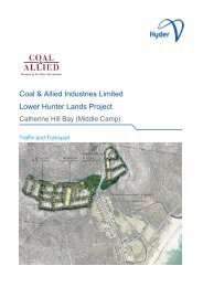
<strong>Coal</strong> & Allied has seven separate holdings in the Lower Hunter totalling approximately 4,078 hectares.<br />
Three are located in the southern area comprising Catherine Hill Bay (Middle Camp), Nords Wharf and<br />
<strong>Gwandalan</strong>. Four are located in the northern area comprising Black Hill, Tank Paddock, Stockrington<br />
and Minmi (including land north and south of Link Road). The landholdings are located in four local<br />
government areas of Lake Macquarie, Wyong, Newcastle and Cessnock.<br />
The southern lands will provide 935 dwellings to the existing communities of <strong>Gwandalan</strong>, Catherine Hill<br />
Bay (Middle Camp), and Nords Wharf. This additional population will contribute economic and social<br />
support to Swansea and Lake Munmorah as town centres. The main transportation corridor to the<br />
southern lands is the Pacific Highway.<br />
<strong>Gwandalan</strong> adjoins Munmorah <strong>State</strong> Conservation Area and Chain Valley Bay. <strong>Gwandalan</strong> is on the<br />
western side of Crangan Bay; Lake Macquarie and Nords Wharf is on the eastern side. Catherine Hill<br />
Bay (Middle Camp) and Nords Wharf are located between Wallarah National Park and Munmorah <strong>State</strong><br />
Conservation Area. Catherine Hill Bay (Middle Camp) is located on the east coast halfway between<br />
Swansea Heads and the Budgewoi Peninsula.<br />
The northern lands are located approximately 20 kilometres west of Newcastle and are almost halfway<br />
between Newcastle and Cessnock. The Minmi land adjoins the existing Minmi township and is close to<br />
the emerging Glendale Town Centre and the Glendale/Cardiff renewal corridor identified in the Lower<br />
Hunter Regional Strategy. These lands are close to the F3 Freeway and Newcastle Link Road<br />
transportation corridors. The Minmi lands are adjacent to the Blue Gum Hills Regional Park and<br />
Hexham Swamp.<br />
Black Hill is located at the intersection of the F3 Freeway and John Renshaw Drive. Tank Paddock and<br />
Stockrington are located east and west of F3 Freeway and fall within the Watagan-Stockton<br />
conservation corridors identified in the Lower Hunter Regional Strategy (LHRS) and Lower Hunter<br />
Regional Conservation Plan (LHRCP).<br />
1.1.2 Regional Planning Context<br />
<strong>Gwandalan</strong> must be considered in the broader strategic and geographic context, rather than just the<br />
council area or region it falls within, in order to achieve the <strong>State</strong> Government objective of securing<br />
emerging major conservation corridors. The <strong>Gwandalan</strong> site is included in both the Lower Hunter<br />
Regional Strategy (LHRS) and the Central Coast Regional Strategy (CCRS). Although the site falls<br />
within the boundaries of the Central Coast region and is included in the CCRS, the site has also been<br />
identified by the NSW <strong>State</strong> Government (NSWG) as an important land holding for achieving the<br />
objectives of the LHRS and the LHRCP.<br />
Page 2<br />
<strong>Gwandalan</strong> SSS <strong>Listing</strong>_November 2010