Gwandalan State Significant Site Listing - Rio Tinto Coal Australia
Gwandalan State Significant Site Listing - Rio Tinto Coal Australia
Gwandalan State Significant Site Listing - Rio Tinto Coal Australia

Create successful ePaper yourself
Turn your PDF publications into a flip-book with our unique Google optimized e-Paper software.
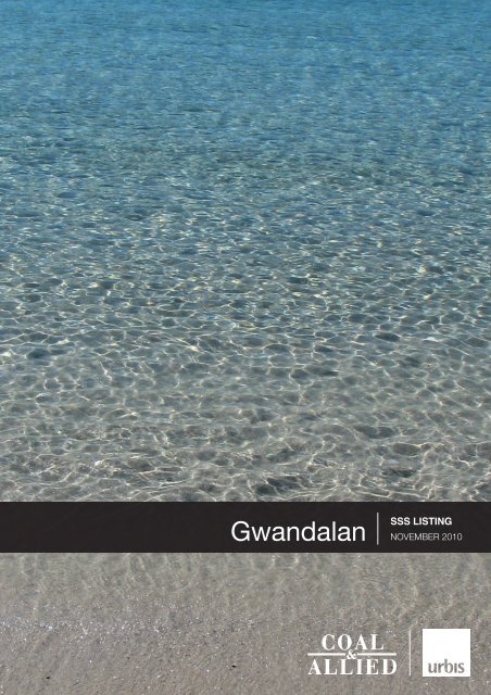
<strong>Gwandalan</strong><br />
SSS LISTING<br />
november 2010
URBIS STAFF RESPONSIBLE FOR THIS REPORT WERE:<br />
Director<br />
Tim Blythe<br />
Associate Director Tom Goode<br />
Senior Consultant Jacqueline Parker<br />
Job Code<br />
SA1976F<br />
Report Number <strong>Gwandalan</strong> SSS <strong>Listing</strong>_November 2010<br />
Copyright © Urbis Pty Ltd<br />
ABN 50 105 256 228<br />
All Rights Reserved. No material may be reproduced without prior permission.<br />
While we have tried to ensure the accuracy of the information in this publication,<br />
the Publisher accepts no responsibility or liability for any errors, omissions or<br />
resultant consequences including any loss or damage arising from reliance in<br />
information in this publication.<br />
URBIS<br />
<strong>Australia</strong> Asia Middle East<br />
www.urbis.com.au
TABLE OF CONTENTS<br />
Executive Summary ..................................................................................................................................i<br />
1 Request for <strong>Listing</strong> – Schedule 3 SEPP Major Development ......................................................1<br />
1.1 Background .............................................................................................................................1<br />
1.1.1 Context ....................................................................................................................................2<br />
1.1.2 Regional Planning Context......................................................................................................2<br />
1.1.3 Voluntary Planning Agreement................................................................................................4<br />
1.2 The <strong>Gwandalan</strong> <strong>Site</strong> ................................................................................................................4<br />
2 <strong>State</strong> and Regional Planning Significance ....................................................................................7<br />
2.1 Criteria (a) of the SSS Guidelines ...........................................................................................7<br />
2.2 Criteria (b) of the SSS Guidelines ...........................................................................................8<br />
2.3 Criteria (d) of the SSS Guidelines ...........................................................................................8<br />
3 The Suitability of the <strong>Site</strong> ..............................................................................................................11<br />
3.1 Environmental........................................................................................................................11<br />
3.1.1 Regional Context ...................................................................................................................11<br />
3.1.2 Local Perspective ..................................................................................................................11<br />
3.2 Social.....................................................................................................................................13<br />
3.3 Economic...............................................................................................................................14<br />
3.4 Ecologically Sustainable Development .................................................................................14<br />
3.4.1 <strong>Rio</strong> <strong>Tinto</strong> <strong>Coal</strong> <strong>Australia</strong> sustainability commitment ..............................................................14<br />
3.4.2 Sustainability Framework for <strong>Gwandalan</strong>..............................................................................15<br />
3.5 <strong>State</strong> or Regional Policies .....................................................................................................19<br />
3.5.1 Central Coast Regional Strategy...........................................................................................19<br />
3.5.2 Lower Hunter Regional Strategy ...........................................................................................20<br />
3.5.3 Lower Hunter Regional Conservation Plan ...........................................................................21<br />
3.6 NSW Coastal Policy 1997 .....................................................................................................22<br />
3.7 <strong>State</strong> Environmental Planning Policy 71 – Coastal Protection (SEPP 71)............................23<br />
3.8 NSW Sea Level Rise Policy <strong>State</strong>ment.................................................................................23<br />
4 Implications for Local & Regional Land Use, Infrastructure, Social Infrastructure, Service<br />
Delivery and Natural Resource Planning.....................................................................................25<br />
4.1 Local and Regional Land Use Implications ...........................................................................25<br />
4.2 Infrastructure and Service Delivery .......................................................................................25<br />
4.3 Natural Resource Planning ...................................................................................................26<br />
5 Developer Contributions ...............................................................................................................27<br />
5.1 <strong>Coal</strong> & Allied $5 million Allocation .........................................................................................27<br />
6 Local and Regional Economic Impacts .......................................................................................29<br />
7 <strong>State</strong> Government’s Regional Strategies Desired Residential Outcomes ...............................31<br />
7.1 Central Coast Regional Strategy...........................................................................................31<br />
7.2 Lower Hunter Regional Strategy ...........................................................................................32<br />
8 Recommended Land Uses and Development Controls .............................................................33<br />
8.1 Recommended Zonings for the <strong>Site</strong>......................................................................................33<br />
8.2 Heritage and Archaeology Issues (Including Aboriginal) and their Impact on Zoning<br />
Boundaries ............................................................................................................................33<br />
<strong>Gwandalan</strong> SSS <strong>Listing</strong>_November 2010
TABLE OF CONTENTS<br />
8.3 Riparian Corridor and Floodplain Management Issues and their Impact on Zoning<br />
Boundaries ............................................................................................................................34<br />
8.3.1 Drainage and Stormwater Management ...............................................................................34<br />
8.3.2 Flooding and Climate Change...............................................................................................34<br />
8.4 Development Controls for the <strong>Site</strong> that should be Included in Schedule 3 ...........................35<br />
9 Those Parts of the <strong>Site</strong> which should be Subject to Part 4 of the EP&A Act with Wyong<br />
Consent Authority ..........................................................................................................................37<br />
10 Appropriate Arrangements for the Management of Land for Open Space Purposes.............39<br />
10.1 <strong>State</strong>ment of Commitments...................................................................................................39<br />
10.2 The <strong>Coal</strong> & Allied $5million Allocation...................................................................................40<br />
11 SEPP Major Development – Clause 2, 7 and 8 ............................................................................41<br />
12 Conclusion ......................................................................................................................................43<br />
Appendix A<br />
Letter from the Minister...........................................................................................45<br />
Appendix B Proposed <strong>Listing</strong> in SEPP Major Development – Schedule 3 .............................47<br />
FIGURES:<br />
Figure 1 – Regional Context: <strong>Coal</strong> & Allied Land Holdings in the Lower Hunter and Central Coast.................. 3<br />
Figure 2 – Map of Local Context: <strong>Gwandalan</strong>.................................................................................................... 5<br />
Figure 3 – Excerpt from the Lower Hunter Regional Conservation Plan showing proposed New Conservation<br />
Reserves ...................................................................................................................................... 22<br />
TABLES:<br />
Table 1 – Sustainability Criteria and Relevant Outcomes................................................................................ 15<br />
Table 2 – Proposed Approval Process ............................................................................................................ 37<br />
<strong>Gwandalan</strong> SSS <strong>Listing</strong>_November 2010
EXECUTIVE SUMMARY<br />
Executive Summary<br />
This report has been prepared in support of an application for listing and rezoning of the <strong>Coal</strong> & Allied<br />
Industries Limited (<strong>Coal</strong> & Allied) owned <strong>Gwandalan</strong> site as a ‘<strong>State</strong> <strong>Significant</strong> <strong>Site</strong>’ (SSS) in Schedule<br />
3 of <strong>State</strong> Environmental Planning Policy (Major Development) 2005 (Major Development SEPP) to<br />
facilitate residential development that is not permissible under the existing planning provisions. It has<br />
been prepared on behalf of <strong>Coal</strong> & Allied, the owner of the <strong>Gwandalan</strong> site. A draft Schedule 3 listing is<br />
attached.<br />
The report details the basis upon which the SSS listing is proposed and includes consideration of:<br />
• The Department of Planning’s (DoP’s) ‘Guideline for <strong>State</strong> <strong>Significant</strong> <strong>Site</strong>s under the ‘Major<br />
Development SEPP’.<br />
• The matters listed in the Minister for Planning’s correspondence dated 19th August 2010.<br />
• Clauses 2, 7 and 8 of the Major Development SEPP.<br />
A Concept Plan has separately but concurrently been prepared for the <strong>Gwandalan</strong> site and lodged with<br />
Department of Planning (DoP). This report should be read in conjunction with the Environmental<br />
Assessment that supports the Concept Plan.<br />
In parallel, a draft Voluntary Planning Agreement (VPA) has been prepared between <strong>Coal</strong> & Allied and<br />
the New South Wales Government (NSWG) in accordance with s.93F of the Environmental Planning<br />
and Assessment Act, 1979 (EP&A Act). Under the draft VPA, <strong>Coal</strong> & Allied proposes to develop<br />
62.24ha of <strong>Gwandalan</strong> for residential development with a maximum yield of 623 dwelling lots. The<br />
balance of the <strong>Gwandalan</strong> site (205.75ha or 77%) is proposed to be dedicated to the NSWG for<br />
conservation purposes. Other <strong>Coal</strong> & Allied owned sites in the Lower Hunter and Central Coast Region<br />
are subject to similar but separate Part 3A applications to the Department of Planning (DoP). Overall,<br />
<strong>Coal</strong> & Allied propose to dedicate approximately 3,260ha of <strong>Coal</strong> & Allied land to the NSWG to provide<br />
and enhance important conservation corridors identified in the Lower Hunter Regional Strategy (LHRS),<br />
Lower Hunter Regional Conservation Plan (LHRCP) and the Central Coast Regional Strategy (CCRS).<br />
The <strong>Coal</strong> & Allied owned land at <strong>Gwandalan</strong> that is proposed to be dedicated for conservation will play<br />
a significant role in securing in perpetual public ownership the east-west conservation corridors that link<br />
with the long sought-after Wallarah Peninsula conservation corridor. The east-west corridor will help<br />
preserve a significant natural break between the Lower Hunter and the Central Coast.<br />
The proposed land dedication is a positive conservation step that will protect an important array of<br />
vegetation communities, flora and fauna species, and natural landscape assets, including threatened<br />
species and endangered ecological communities in the conservation lands. The environmental gain<br />
from the environmental land offset package is a once in a generation opportunity that will provide an<br />
enduring legacy for the community and future generations.<br />
The protection and management of vegetation corridors is a key focus of the Lower Hunter Regional<br />
Strategy (LHRS) and the companion Lower Hunter Regional Conservation Plan (LHRCP). The<br />
<strong>Gwandalan</strong> site has been recognised for its <strong>State</strong> and regional significance based on its inclusion in the<br />
LHRS for both proposed residential development and conservation, with the conservation land to be<br />
dedicated to the NSWG to complete important conservation corridors included in the LHRCP.<br />
The <strong>Gwandalan</strong> site is considered to meet the criteria for a <strong>State</strong> <strong>Significant</strong> <strong>Site</strong> set out in the<br />
Department of Planning’s (DoP’s) ‘Guideline - <strong>State</strong> <strong>Significant</strong> <strong>Site</strong>s’ both as an individual parcel and<br />
as an integral part of the overall <strong>Coal</strong> & Allied environmental land offset package that will achieve key<br />
regional conservation outcomes through substantial land dedication..<br />
Furthermore, the proposal both as an individual parcel (623 proposed dwelling lots) and as an integral<br />
part of the <strong>Coal</strong> & Allied land package (935 lots) will help achieve the LHRS dwelling targets to cater for<br />
the predicted population growth for the region until 2031.<br />
<strong>Gwandalan</strong> SSS <strong>Listing</strong>_November 2010<br />
Page i
EXECUTIVE SUMMARY<br />
Page ii<br />
<strong>Gwandalan</strong> SSS <strong>Listing</strong>_November 2010
REQUEST FOR LISTING – SCHEDULE 3 SEPP MAJOR DEVELOPMENT<br />
1 Request for <strong>Listing</strong> – Schedule 3 SEPP Major<br />
Development<br />
This report has been prepared in support of an application for listing of the <strong>Coal</strong> & Allied owned<br />
<strong>Gwandalan</strong> site as a ‘<strong>State</strong> <strong>Significant</strong> <strong>Site</strong>’ (SSS) in Schedule 3 of <strong>State</strong> Environmental Planning Policy<br />
(Major Development) 2005. It has been prepared on behalf of <strong>Coal</strong> & Allied. A draft Schedule 3 listing is<br />
attached at Appendix B.<br />
The report details the basis upon which the SSS listing is proposed and includes consideration of:<br />
• The Department of Planning’s (DoP’s) ‘Guideline for <strong>State</strong> <strong>Significant</strong> <strong>Site</strong>s under the Major<br />
Development SEPP’.<br />
• The matters listed in the Minister for Planning’s correspondence dated 19th August 2010.<br />
• Clauses 2, 7 and 8 of SEPP Major Development.<br />
It is proposed that the SSS listings/rezoning for the site delineate zones and associated development<br />
controls as well as establish the future approval/consent authority regimes. The proposed SSS listing<br />
for the site proposes which areas are to be developed and which areas are to be conserved and the<br />
future planning controls that will apply.<br />
A new planning regime is required to rezone the sites to upgrade the permissible land uses and to<br />
enable the proposed development of the site for residential and conservation uses.<br />
It is proposed that the Schedule 3 amendment to the Major Development SEPP introduce a new<br />
statutory planning framework for the <strong>Gwandalan</strong> site that includes:<br />
• Aims and objectives for each site.<br />
• Zoning and permissible uses.<br />
• Key development controls.<br />
• The future consent/approval regime.<br />
1.1 Background<br />
In response to a request from <strong>Coal</strong> & Allied, on 15 June 2010, the Minister for Planning determined that<br />
the proposed <strong>Gwandalan</strong> project constitutes a ‘Major Project’, and authorised the submission of a<br />
‘Concept Plan’ under Part 3A of the EP&A Act. The Minister also determined to consider listing the site<br />
under Schedule 3 of the SEPP by letter dated 19th August 2010 (included at Appendix A), subject to<br />
consideration of various matters. These matters have formed the basis of this submission, and each<br />
major heading herein is a reference to one of the matters raised in the Minister’s letter, being:<br />
• The <strong>State</strong> or regional planning significance of the site (having regard to the Guideline for SSS’s<br />
under the Major Development SEPP).<br />
• The suitability of the site for any proposed land use taking into consideration environmental, social<br />
or economic factors, the principles of ecologically sustainable development and any <strong>State</strong> or<br />
regional planning strategy.<br />
• The implications of any proposed land use for local and regional land use, infrastructure, service<br />
delivery and natural resource planning.<br />
• The means by which developer contributions should be secured in respect of the site.<br />
• The local and regional economic impacts of the proposed development.<br />
• The likelihood of the proposed rezoning for residential purposes achieving the desired outcomes of<br />
the <strong>State</strong> Government’s regional strategies.<br />
<strong>Gwandalan</strong> SSS <strong>Listing</strong>_November 2010<br />
Page 1
REQUEST FOR LISTING – SCHEDULE 3 SEPP MAJOR DEVELOPMENT<br />
• The recommended land uses and development controls that should be included in Schedule 3.<br />
• Those parts of the site which should be subject to Part 4 of the EP&A Act with the relevant council<br />
as the consent authority.<br />
• Appropriate arrangements (if relevant) for the management of land for open space purposes.<br />
1.1.1 Context<br />
<strong>Coal</strong> & Allied have been operating in the Hunter Valley for more than 150 years, with the earliest coal<br />
mining operations located in East Maitland dating back to 1844. Numerous mergers, expansions and<br />
acquisitions since then have led to <strong>Coal</strong> & Allied becoming a regionally significant mining company.<br />
Since 2004, <strong>Coal</strong> & Allied has been majority owned and managed by <strong>Rio</strong> <strong>Tinto</strong> <strong>Coal</strong> <strong>Australia</strong> (RTCA).<br />
<strong>Coal</strong> & Allied today is one of the major coal producers in the Hunter Valley, employing around 1,500<br />
people across three operations. With annual coal production of around 30 million tonnes, <strong>Coal</strong> & Allied<br />
continues to evolve as it strives to achieve a vision of being a safe and highly successful business<br />
valued by customers, employees, shareholders and the community.<br />
<strong>Coal</strong> & Allied has seven separate holdings in the Lower Hunter totalling approximately 4,078 hectares.<br />
Three are located in the southern area comprising Catherine Hill Bay (Middle Camp), Nords Wharf and<br />
<strong>Gwandalan</strong>. Four are located in the northern area comprising Black Hill, Tank Paddock, Stockrington<br />
and Minmi (including land north and south of Link Road). The landholdings are located in four local<br />
government areas of Lake Macquarie, Wyong, Newcastle and Cessnock.<br />
The southern lands will provide 935 dwellings to the existing communities of <strong>Gwandalan</strong>, Catherine Hill<br />
Bay (Middle Camp), and Nords Wharf. This additional population will contribute economic and social<br />
support to Swansea and Lake Munmorah as town centres. The main transportation corridor to the<br />
southern lands is the Pacific Highway.<br />
<strong>Gwandalan</strong> adjoins Munmorah <strong>State</strong> Conservation Area and Chain Valley Bay. <strong>Gwandalan</strong> is on the<br />
western side of Crangan Bay; Lake Macquarie and Nords Wharf is on the eastern side. Catherine Hill<br />
Bay (Middle Camp) and Nords Wharf are located between Wallarah National Park and Munmorah <strong>State</strong><br />
Conservation Area. Catherine Hill Bay (Middle Camp) is located on the east coast halfway between<br />
Swansea Heads and the Budgewoi Peninsula.<br />
The northern lands are located approximately 20 kilometres west of Newcastle and are almost halfway<br />
between Newcastle and Cessnock. The Minmi land adjoins the existing Minmi township and is close to<br />
the emerging Glendale Town Centre and the Glendale/Cardiff renewal corridor identified in the Lower<br />
Hunter Regional Strategy. These lands are close to the F3 Freeway and Newcastle Link Road<br />
transportation corridors. The Minmi lands are adjacent to the Blue Gum Hills Regional Park and<br />
Hexham Swamp.<br />
Black Hill is located at the intersection of the F3 Freeway and John Renshaw Drive. Tank Paddock and<br />
Stockrington are located east and west of F3 Freeway and fall within the Watagan-Stockton<br />
conservation corridors identified in the Lower Hunter Regional Strategy (LHRS) and Lower Hunter<br />
Regional Conservation Plan (LHRCP).<br />
1.1.2 Regional Planning Context<br />
<strong>Gwandalan</strong> must be considered in the broader strategic and geographic context, rather than just the<br />
council area or region it falls within, in order to achieve the <strong>State</strong> Government objective of securing<br />
emerging major conservation corridors. The <strong>Gwandalan</strong> site is included in both the Lower Hunter<br />
Regional Strategy (LHRS) and the Central Coast Regional Strategy (CCRS). Although the site falls<br />
within the boundaries of the Central Coast region and is included in the CCRS, the site has also been<br />
identified by the NSW <strong>State</strong> Government (NSWG) as an important land holding for achieving the<br />
objectives of the LHRS and the LHRCP.<br />
Page 2<br />
<strong>Gwandalan</strong> SSS <strong>Listing</strong>_November 2010
REQUEST FOR LISTING – SCHEDULE 3 SEPP MAJOR DEVELOPMENT<br />
The <strong>Gwandalan</strong> site has been recognised for its regional significance to the Central Coast Region and<br />
Lower Hunter Region and is consistent with the LHRS, CCRS and LHRCP for proposed urban<br />
development and proposed conservation land dedications.<br />
The proposed development of 62.24ha of land at <strong>Gwandalan</strong> and proposed dedication of 205.75ha of<br />
land at <strong>Gwandalan</strong> is crucial in securing major conservation corridors identified in the CCRS and LHRS.<br />
The proposed conservation land dedication at <strong>Gwandalan</strong> provides a significant contribution to<br />
providing a green inter-regional buffer between the Central Coast and Lower Hunter.<br />
Figure 1 – Regional Context: <strong>Coal</strong> & Allied Land Holdings in the Lower Hunter and Central Coast<br />
<strong>Gwandalan</strong> SSS <strong>Listing</strong>_November 2010<br />
Page 3
REQUEST FOR LISTING – SCHEDULE 3 SEPP MAJOR DEVELOPMENT<br />
1.1.3 Voluntary Planning Agreement<br />
It is proposed to dedicate land for conservation purposes as part of the Major Development Application<br />
via a Voluntary Planning Agreement (VPA) between <strong>Coal</strong> & Allied and the NSWG in accordance with<br />
s.93F of the Environmental Planning & Assessment Act, 1979 (EP&A Act).<br />
The Draft Voluntary Planning Agreement (VPA) will set out the contributions towards <strong>State</strong><br />
infrastructure.<br />
A Draft <strong>State</strong>ment of Commitments will be prepared to support the Concept Plan and associated<br />
Environmental Assessment.<br />
1.2 The <strong>Gwandalan</strong> <strong>Site</strong><br />
The <strong>Gwandalan</strong> site is located at the southern end of the <strong>Gwandalan</strong> Township, which is situated on the<br />
western shore of Crangan Bay at the southern end of Lake Macquarie. The existing township of<br />
<strong>Gwandalan</strong> is characterised by traditional detached housing lots.<br />
<strong>Gwandalan</strong> contains an estimated population of 2,940 people. <strong>Gwandalan</strong> is within convenient<br />
proximity by vehicle to the Pacific Highway (4km) and the F3 Motorway (20km) which is the major<br />
transportation corridor to Newcastle, Sydney and the North Coast. Swansea is the closest town centre,<br />
19 kilometres north east of the site, providing shopping and business services. Morisset is 26<br />
kilometres to the south west and is identified as an emerging major regional centre which provides a<br />
wider array of employment, business, higher order retailing, professional services and other subregional<br />
functions.<br />
The <strong>Gwandalan</strong> site is owned by <strong>Gwandalan</strong> Land Pty Ltd, a wholly owned subsidiary of <strong>Coal</strong> & Allied<br />
Industries Ltd (<strong>Coal</strong> & Allied) and the land is contained in two land holdings legally described as Lot 2<br />
DP 1043151 and Lot 57 DP 755266.<br />
The <strong>Gwandalan</strong> site is approximately 268 ha in area, and includes all the land owned by <strong>Coal</strong> & Allied<br />
located to the south of the existing <strong>Gwandalan</strong> settlement, east and west of Kanangra Drive.<br />
The land is located in the Wyong Council Local Government Area (LGA). The site is affected by<br />
multiple zonings pursuant to the Wyong Local Environmental Plan 1991, including.<br />
• 5(a) Special Uses Power Station – approximately 60% of the site.<br />
• 7(a) Conservation – approximately 2% of the site.<br />
• 7(b) Scenic Protection – approximately 30% of the site.<br />
• 7(g) Wetlands Management – approximately 8% of the site.<br />
Access to <strong>Gwandalan</strong> is from Kanangra Drive via the Pacific Highway. A ‘paper road’ adjoins the site’s<br />
northern boundary (a paper road is a road which is unbuilt but has been dedicated and included on the<br />
title).<br />
The <strong>Gwandalan</strong> site is characterised by a moderate to relatively flat topography with the exception of<br />
small steep areas at the eastern part of the site along the foreshore and in the southern part of the site<br />
associated with Strangers Gully.<br />
There is one existing watercourse, Strangers Gully, within the <strong>Gwandalan</strong> site with a number of smaller<br />
gullies that convey stormwater through to Lake Macquarie.<br />
The land identified for conservation has regional ecological value that provides substantial areas of<br />
contiguous vegetation with surrounding reserves/forests, and can make a significant contribution to<br />
securing in perpetuity a natural green break between the Lower Hunter and Central Coast regions.<br />
The land identified for development is located in areas which are less physically constrained and<br />
adjoins the existing township at <strong>Gwandalan</strong>.<br />
Page 4<br />
<strong>Gwandalan</strong> SSS <strong>Listing</strong>_November 2010
REQUEST FOR LISTING – SCHEDULE 3 SEPP MAJOR DEVELOPMENT<br />
Figure 2 – Map of Local Context: <strong>Gwandalan</strong><br />
<strong>Gwandalan</strong> SSS <strong>Listing</strong>_November 2010<br />
Page 5
REQUEST FOR LISTING – SCHEDULE 3 SEPP MAJOR DEVELOPMENT<br />
Page 6<br />
<strong>Gwandalan</strong> SSS <strong>Listing</strong>_November 2010
STATE AND REGIONAL PLANNING SIGNIFICANCE<br />
2 <strong>State</strong> and Regional Planning Significance<br />
The Department of Planning’s (DoP’s) ‘Guideline for <strong>State</strong> <strong>Significant</strong> <strong>Site</strong>s under the Major<br />
Development SEPP’, provides that when considering whether a site can be categorised as being of<br />
<strong>State</strong> significance, the Minister will consider whether the site meets one or more of the following criteria:<br />
(a) be of regional or state importance because it is in an identified strategic location (in a <strong>State</strong> or<br />
regional strategy), its importance to a particular industry sector, or its employment, infrastructure,<br />
service delivery or redevelopment significance in achieving government policy objectives; or<br />
(b) be of regional or state environmental conservation or natural resource importance in achieving <strong>State</strong><br />
or regional objectives. For example protecting sensitive wetlands or coastal areas; or<br />
(c) be of regional or state importance in terms of amenity, cultural, heritage, or historical significance in<br />
achieving <strong>State</strong> or regional objectives. For example sensitive redevelopment of heritage precincts; or<br />
(d) need alternative planning or consent arrangements where:<br />
(i) added transparency is required because of potential conflicting interests.<br />
(ii) more than one local council is likely to be affected.<br />
It is considered that of the proposal for <strong>Gwandalan</strong> directly meets criteria (a), (b) and (d).<br />
2.1 Criteria (a) of the SSS Guidelines<br />
Criteria (a) of the SSS Guidelines states that a site can be categorised as being of <strong>State</strong> significance if<br />
the Minister considers it to be of regional or <strong>State</strong> importance because it is in an identified strategic<br />
location (in a <strong>State</strong> or regional strategy), its importance to a particular industry sector, or its<br />
employment, infrastructure, service delivery or redevelopment significance in achieving government<br />
policy objectives.<br />
The <strong>Coal</strong> & Allied owned <strong>Gwandalan</strong> site has been recognised for its <strong>State</strong> and Regional significance<br />
based on its inclusion in the LHRS for urban development and conservation.<br />
<strong>Coal</strong> & Allied propose to develop 62.24ha of <strong>Gwandalan</strong> for residential development with a maximum<br />
dwelling yield of 623 dwellings. The balance of the <strong>Gwandalan</strong> site (205.75ha or 77%) is proposed to be<br />
dedicated to the NSWG for conservation purposes. The conservation land proposed to be dedicated to<br />
the NSWG will provide for and enhance vitally important conservation corridors identified in the LHRS<br />
and LHRCP, most notably the east – west conservation corridors that link with the long sought-after<br />
Wallarah Peninsula conservation corridor.<br />
The future 935 dwellings across the three sites (including the 623 dwellings at <strong>Gwandalan</strong>) will help<br />
achieve the state government’s objective to cater for the predicted population growth for the Region by<br />
2031.<br />
The 205.75ha of the <strong>Gwandalan</strong> site that is proposed to be dedicated for conservation provides<br />
substantial areas of contiguous vegetation, some of which has state ecological value. The proposed<br />
dedication of land to NSWG will also ensure that substantial land will be protected from inappropriate<br />
development by locking away this land as ‘conservation land’ in public ownership and perpetuity.<br />
A total of 848.93 ha of land is proposed to be dedicated to the NSWG for conservation purposes across<br />
the three <strong>Coal</strong> & Allied sites of <strong>Gwandalan</strong>, Catherine Hill Bay (Middle Camp) and Nords Wharf. The<br />
proposed dedication of land to the NSWG for conservation purposes will significantly contribute to<br />
ensuring that a natural green break between the Central Coast and the Lower Hunter is retained in<br />
perpetuity. This is quite clearly of significant regional and <strong>State</strong> importance.<br />
The proposal for <strong>Gwandalan</strong> is considered to meet the criteria for a <strong>State</strong> <strong>Significant</strong> <strong>Site</strong> both as an<br />
individual parcel and as an integral part of the overall <strong>Coal</strong> & Allied environmental land package that will<br />
achieve substantial conservation outcomes through proposed land dedication as set out in the LHRS<br />
and LHRCP.<br />
<strong>Gwandalan</strong> SSS <strong>Listing</strong>_November 2010<br />
Page 7
STATE AND REGIONAL PLANNING SIGNIFICANCE<br />
Furthermore, the proposed 623 dwellings at <strong>Gwandalan</strong> will help achieve the <strong>State</strong> Government’s<br />
objective to cater for the predicted population growth for the Region to 2031.<br />
In our opinion, the proposal for the <strong>Gwandalan</strong> site satisfies criteria (a) of the SSS Guidelines.<br />
2.2 Criteria (b) of the SSS Guidelines<br />
Criteria (b) of the SSS Draft Guidelines states that a site can be categorised as being of state<br />
significance if the Minister considers the site to be of regional or state environmental conservation or<br />
natural resource importance in achieving <strong>State</strong> or regional objectives.<br />
As stated, the expansion, management and protection of conservation corridors is a key focus of the<br />
LHRS and the companion LHRCP. Two major conservation corridors have been identified running<br />
through the Lower Hunter Region, namely the Watagan to Stockton Corridor and the Wallarah<br />
Peninsula Corridor. These are extensive corridors of land with high environmental value which will be<br />
managed for conservation purposes. The corridors align with existing public reserves, some of which<br />
will be expanded.<br />
<strong>Coal</strong> & Allied is proposing to dedicate 205.75ha of the <strong>Gwandalan</strong> site to the NSWG as ‘conservation<br />
land’. This land provides a significant contribution to the creation of the east-west conservation corridors<br />
contiguous with Lake Macquarie <strong>State</strong> Recreation Area and Munmorah <strong>State</strong> Forest. This will help<br />
achieve a natural break between the Lower Hunter and Central Coast regions.<br />
<strong>Coal</strong> & Allied is also proposing to dedicate 116.6ha of the Nords Wharf site and 526.58ha of Catherine<br />
Hill Bay (Middle Camp) to the NSWG as ‘conservation land’ as part of separate Part 3A applications.<br />
The proposed <strong>Coal</strong> & Allied land dedications of 848.93ha will help protect the Wallarah Peninsula<br />
Corridor and provide a natural break between the Central Coast and the Lower Hunter.<br />
The 205.75ha of <strong>Gwandalan</strong> that is proposed to be dedicated for conservation provides substantial<br />
areas of contiguous vegetation, some of which has state ecological value. The substantial dedication of<br />
land to NSWG will also ensure that substantial and significant land parcels will be protected from<br />
development by locking away this land as ‘conservation land’ in public ownership and perpetuity. The<br />
environmental gain from the proposed environmental land offset package is a once in a generation<br />
opportunity that will provide an enduring legacy for the community. The proposed dedication of<br />
205.75ha of the <strong>Gwandalan</strong> site for conservation to the NSWG by <strong>Coal</strong> & Allied is clearly of state and<br />
regional significance.<br />
Importantly the <strong>Gwandalan</strong> site will also result in the protection of:<br />
• Sensitive lake foreshore areas by limiting development along the lake foreshore.<br />
• Ecologically endangered communities.<br />
• Riparian zones and waterways.<br />
• Sensitive wetlands.<br />
In our opinion, the proposal for the <strong>Gwandalan</strong> site clearly satisfies criteria (b) of the SSS Guidelines.<br />
2.3 Criteria (d) of the SSS Guidelines<br />
Criteria (d) of the SSS Guidelines states that a site can be categorised as being of <strong>State</strong> significance if<br />
the Minister considers that the site needs alternative planning or consent arrangements where:<br />
• Added transparency is required because of potential conflicting interests.<br />
• More than one local council is likely to be affected.<br />
Page 8<br />
<strong>Gwandalan</strong> SSS <strong>Listing</strong>_November 2010
STATE AND REGIONAL PLANNING SIGNIFICANCE<br />
Alternative planning consent arrangements are necessary because the <strong>Gwandalan</strong> land forms an<br />
important part of an overall environmental land offset package for the Lower Hunter by <strong>Coal</strong> & Allied<br />
which includes seven <strong>Coal</strong> & Allied owned sites in the Lower Hunter and Central Coast and spans four<br />
local government areas (Wyong, Newcastle, Lake Macquarie and Cessnock Councils). This creates<br />
complications given the likely differing views of the respective Councils as to how and whether or not<br />
the proposals for each site should proceed. Separate consent arrangements are unlikely to enable an<br />
appropriate conservation and land use framework to be achieved in an effective and efficient manner.<br />
All of the <strong>Coal</strong> & Allied sites, including <strong>Gwandalan</strong>, need to be considered in a regional context rather<br />
than a council-by-council basis to allow for the coordinated protection of priority areas of biodiversity.<br />
This will result in a more targeted conservation action, rather than an ad hoc approach to the sites.<br />
It is therefore important that <strong>Gwandalan</strong> be considered in a coordinated manner by the NSWG to help<br />
achieve permanent preservation of the east-west linkages to the Wallarah Peninsula conservation<br />
corridor. Given the overall environmental land offset package proposed for the Lower Hunter by <strong>Coal</strong> &<br />
Allied spans four local government areas, the environmental gains to the community would not be<br />
achieved if each site was separately considered by the individual Council.<br />
In our opinion, the proposal for the <strong>Gwandalan</strong> site clearly satisfies criteria (d) of the SSS Guidelines.<br />
In summary, the proposal for the <strong>Gwandalan</strong> site clearly meets the criteria of the SSS Guidelines as<br />
outlined above. The listing of the <strong>Gwandalan</strong> site on Schedule 3 of the Major Development SEPP will<br />
facilitate the orderly use, development and conservation of regionally important sites of environmental<br />
and social significance to the <strong>State</strong>.<br />
<strong>Gwandalan</strong> SSS <strong>Listing</strong>_November 2010<br />
Page 9
STATE AND REGIONAL PLANNING SIGNIFICANCE<br />
Page 10<br />
<strong>Gwandalan</strong> SSS <strong>Listing</strong>_November 2010
THE SUITABILITY OF THE SITE<br />
3 The Suitability of the <strong>Site</strong><br />
Detailed considerations of the environmental, social and economic benefits arising from the residential<br />
development permitted in the proposed SSS listing are included in the accompanying Concept Plan,<br />
rather than the proposed SSS listing. The Environmental Assessment accompanying the Concept Plan<br />
demonstrates that the proposed residential development arising from the proposed SSS listing can be<br />
accommodated without unreasonable environmental, social or economic impacts. Notwithstanding this,<br />
the environmental, social and economic factors arising from the proposed rezoning and the principles of<br />
Ecologically Sustainable Development (ESD) are addressed below.<br />
3.1 Environmental<br />
3.1.1 Regional Context<br />
<strong>Gwandalan</strong> is positioned within the Wyong Council Area, and is located approximately 90km north of<br />
Sydney and 30km south of Newcastle.<br />
The <strong>Gwandalan</strong> site is located adjacent to the southern end of the <strong>Gwandalan</strong> Township, which is<br />
situated on the western shore of Crangan Bay at the southern end of Lake Macquarie. The existing<br />
township of <strong>Gwandalan</strong> is characterised by traditional detached housing lots.<br />
Situated between Lake Macquarie and Lake Munmorah <strong>State</strong> Conservation Areas, <strong>Gwandalan</strong> forms<br />
part of an east – west conservation corridor that links with the Wallarah Peninsula Corridor and provides<br />
a natural break between the Central Coast and the Lower Hunter. The <strong>Coal</strong> & Allied owned land at<br />
<strong>Gwandalan</strong> that is proposed to be dedicated for conservation will play a significant role in securing in<br />
perpetual public ownership the east west conservation corridors that will help preserve a significant<br />
natural break between the Lower Hunter from the Central Coast.<br />
The Central Coast and Lower Hunter Region’s vegetation is of bio-geographic significance as it<br />
supports a transition between the northern and southern flora and fauna communities of the Region.<br />
The CCRS, LHRS and LHCRP recognise the importance of large vegetation areas being linked via<br />
habitat corridors. Major conservation corridors have been identified running through the Region,<br />
including relevantly to the <strong>Gwandalan</strong> site, the east – west conservation corridor between Lake<br />
Macquarie <strong>State</strong> Conservation Area and Lake Munmorah <strong>State</strong> Conservation Area. This is an extensive<br />
corridor of land which will be managed for conservation purposes. The east – west corridor aligns with<br />
existing public reserves, which will be expanded as a result of the proposed <strong>Gwandalan</strong> land dedication<br />
together with the other land dedications that are proposed and/or which have occurred for the region.<br />
This will help to provide a natural break between the Central Coast and the Lower Hunter.<br />
The proposed land dedication is a positive conservation step that will protect an important array of<br />
vegetation communities, flora and fauna species, and natural landscape assets, including threatened<br />
species and endangered ecological communities in the conservation lands. The environmental gain<br />
from the proposed conservation land dedication is a once in a generation opportunity that will provide<br />
an enduring legacy for the community and future generations.<br />
3.1.2 Local Perspective<br />
The Ecological Assessment Report for <strong>Gwandalan</strong> prepared by RPS (Formerly RPS Harper Somers<br />
O’Sullivan Pty Ltd) (RPS) submitted with the Concept Plan demonstrates that the proposed residential<br />
development has been situated within areas of lesser ecological significance and in instances where<br />
significant native vegetation may be affected, suitable actions are proposed to minimise potentially<br />
deleterious impacts. To achieve this, a considerable amount of investigation has been undertaken to<br />
determine the location of the developable area to ensure that ecological impacts are minimised.<br />
The field and desktop studies have recorded the following parameters of ecological significance within<br />
both the proposed conservation lands and the proposed development estate:<br />
• Native vegetation commensurate with those listed as EEC’s.<br />
<strong>Gwandalan</strong> SSS <strong>Listing</strong>_November 2010<br />
Page 11
THE SUITABILITY OF THE SITE<br />
• Threatened flora species recorded within and adjacent to the proposed development.<br />
• Threatened fauna species recorded within and adjacent to the proposed development.<br />
• Habitat for threatened flora and fauna species known from within and adjacent to the proposed<br />
development.<br />
• Other areas containing native vegetation with varying degrees of modification/degradation.<br />
A series of recommendations are outlined in the Ecological Assessment Reports, to assist the reduction<br />
of potential impacts associated with the proposal.<br />
Given that measures have been taken to avoid ecological impacts and that where native vegetation<br />
may be affected efforts have been made to avoid particularly sensitive areas where practical, it is<br />
considered unlikely that any significant impacts would occur upon threatened species, communities or<br />
populations. This position is reinforced through the issue on 23rd March 2010 of a Controlled Action<br />
Approval by the Federal Minister for the Environment, which assessed that any likely impact on listed<br />
threatened species or listed threatened ecological communities could be controlled by the approved<br />
conditions for all of the Southern Estates.<br />
Notwithstanding the significant conservation land offsets that are a key aspect of the site’s<br />
development, a key principle adopted in preparing the structure plan for the site is to minimise the<br />
ecological impacts within the development area. Further detailed ecological assessments undertaken<br />
during the preparation of the Concept Plan have revealed an area containing Endangered Ecological<br />
Community (EEC) known as Strangers Gully and an area containing Angophora inopina is located<br />
adjacent to the site’s developable area. Given its ecological significance this land is proposed to be set<br />
aside for conservation and dedicated to NSW Government.<br />
A range of measures have been taken to avoid ecological impacts. Where native vegetation may be<br />
affected, efforts have been made in the design of the structure plan to avoid particularly sensitive areas<br />
such as Strangers Gully, the area of Angophora inopina, the lake foreshore and riparian corridors. As a<br />
result it is considered unlikely that any significant impacts would occur upon threatened species<br />
communities or populations. A series of recommendations have been outlined in the Ecological<br />
Assessment report, to aid in the reduction of potential impacts associated with the proposal. These<br />
recommendations have generally been translated into the <strong>State</strong>ment of Commitments or the Urban<br />
Design Guidelines.<br />
Despite the loss of flora and habitat for fauna within the developable area of the site, conservation<br />
outcomes will also be achieved within the proposed <strong>Gwandalan</strong> development area by best practice<br />
approaches to urban design and use of landscaping. Such approaches and techniques include:<br />
• Retaining vegetation along Kanangra Drive to reinforce the existing local bushland context and<br />
conserve an area along the north west edge of the site containing Angophora inopina (Charmhaven<br />
Apple), a valued native flora community.<br />
• A water sensitive urban design strategy for the <strong>Gwandalan</strong> site has been provided in the<br />
Environmental Assessment of the Concept Plan.<br />
• Incorporating the foreshore into proposed conservation lands, thus protecting natural attributes of<br />
the site and lake as well as areas of high aboriginal cultural significance along the foreshore that<br />
contains middens.<br />
• Maintaining the visual aesthetics of the site from the lake.<br />
• Protection of sensitive lake foreshore areas by ensuring that the proposed development does not<br />
contribute to lake edge erosion and diminished water quality by inappropriate development on the<br />
terrestrial/aquatic interface.<br />
Notwithstanding the ecological outcomes on the development site, the level of preservation afforded by<br />
the proposed conservation lands and dedication to the NSWG provides a more than adequate offset<br />
outcome.<br />
Page 12<br />
<strong>Gwandalan</strong> SSS <strong>Listing</strong>_November 2010
THE SUITABILITY OF THE SITE<br />
Furthermore, in accordance with the DGEARs issued on 19 August 2010 for the <strong>Gwandalan</strong> Concept<br />
Plan, the Environmental Assessment that supports the Concept Plan for <strong>Gwandalan</strong> addresses the<br />
following environmental issues:<br />
• Urban design and built form.<br />
• Coastal Foreshore and Public Access.<br />
• Biodiversity impact.<br />
• Transport and Accessibility.<br />
• Mining Activities.<br />
• Heritage.<br />
• Water quality.<br />
• Flooding.<br />
• Visual.<br />
• Bushfire.<br />
• Impact on Crown Land.<br />
• Infrastructure and utilities.<br />
• Ecologically Sustainable Development.<br />
• <strong>Site</strong> Preparation Works.<br />
• Subdivision.<br />
• Future Public Land.<br />
3.2 Social<br />
The land identified for future residential development is considered to be an appropriate extension of<br />
the existing township of <strong>Gwandalan</strong>. The site is in close proximity to an existing range of services and<br />
facilities at <strong>Gwandalan</strong> including:<br />
• Retail facilities include: a small supermarket, newsagent, Post Office, chemist, fruit and vegetable<br />
store, real estate agent, baker and liquor store, doctor’s surgery, dentist, hairdresser and specialty<br />
shops. An independent service station is located at the corner of Kanangra Drive and Orana Road.<br />
• Education and childcare facilities include a primary school and two preschools.<br />
• Recreational facilities include:<br />
−<br />
−<br />
−<br />
Community facilities including a community hall, a sport and recreation centre at Point<br />
Wolstoncroft, a bowling club, the Tunkuwallin sports complex which straddles <strong>Gwandalan</strong> and<br />
Summerland Point (and includes an indoor basketball court, horse and social club and<br />
skateboard ramp).<br />
Four tennis courts, a skateboard ramp, three boat ramps, three parks/reserves, baths (on the<br />
lake), and a heritage walk.<br />
A library service operates from the small but well-used <strong>Gwandalan</strong> Hall in the form of a<br />
volunteer deposit station.<br />
A Social Impact Assessment has been prepared to support the Concept Plan for the site. This report<br />
summarises local social infrastructure, community consultation and assesses the likely consequences<br />
of the development.<br />
<strong>Gwandalan</strong> SSS <strong>Listing</strong>_November 2010<br />
Page 13
THE SUITABILITY OF THE SITE<br />
The degree of social impact by the additional population from the proposed development on services or<br />
social infrastructure is considered to be positive. Where necessary, a range of contributions will be<br />
made to facilitate the augmentation of key infrastructure in order to accommodate the future<br />
population’s needs.<br />
A Draft <strong>State</strong>ment of Commitments is included with the Concept Plan submitted for the site. This details<br />
the various monetary contributions, additional studies, applications and works the proponent commits to<br />
undertake in association with the project. This may involve the implementation of various VPAs<br />
between <strong>Coal</strong> & Allied and the <strong>State</strong> and local government prior to final approval of a construction<br />
certificate for subdivision.<br />
In addition, <strong>Coal</strong> & Allied has allocated an amount of $5 million for initiatives associated with the<br />
delivery of social infrastructure to support the existing and future communities at <strong>Gwandalan</strong>, Nords<br />
Wharf, and Catherine Hill Bay (Middle Camp). The $5 million allocation is directed at initiatives that<br />
would not ordinarily be provided as part of the development of a new residential estate and accordingly,<br />
are considered to be ‘over and above’ what is reasonably necessary to satisfy <strong>State</strong> and Local<br />
Government approval requirements.<br />
The $5 million allocation may be used for sustainability initiatives for future residents, additional<br />
infrastructure to support existing and future residents, educational and or community programs.<br />
The final list of initiatives for <strong>Gwandalan</strong> is incorporated into the Concept Plan proposal for the<br />
<strong>Gwandalan</strong> site and is subject to on-going consultation and final approval by the <strong>Coal</strong> & Allied Board.<br />
3.3 Economic<br />
An Economic Impact Assessment has been prepared by Sphere to support the Concept Plan for the<br />
site and is discussed further in Section 6. The report concludes that the proposed development of<br />
<strong>Gwandalan</strong> will result in a net direct benefit to the economy in terms of capital investment, direct and<br />
indirect job and flow on economic effects.<br />
It is therefore deemed that the site is suitable for development in terms of its economic impact.<br />
3.4 Ecologically Sustainable Development<br />
3.4.1 <strong>Rio</strong> <strong>Tinto</strong> <strong>Coal</strong> <strong>Australia</strong> sustainability commitment<br />
<strong>Rio</strong> <strong>Tinto</strong> <strong>Coal</strong> <strong>Australia</strong> is committed to sustainable development. The three principles of <strong>Rio</strong> <strong>Tinto</strong> <strong>Coal</strong><br />
<strong>Australia</strong>’s approach are:<br />
Social wellbeing<br />
• Protect human health and safety.<br />
• Stakeholder engagement and transparency.<br />
• Communities.<br />
• Education.<br />
Environmental stewardship<br />
• Resource stewardship.<br />
• Pollution prevention.<br />
• Product stewardship.<br />
Page 14<br />
<strong>Gwandalan</strong> SSS <strong>Listing</strong>_November 2010
THE SUITABILITY OF THE SITE<br />
Economic prosperity<br />
• Shareholder return.<br />
• Economic contribution.<br />
• Customer focus.<br />
It is with these core values established that <strong>Rio</strong> <strong>Tinto</strong> <strong>Coal</strong> <strong>Australia</strong> and <strong>Coal</strong> & Allied approach the<br />
development and conservation of its Lower Hunter surplus lands.<br />
3.4.2 Sustainability Framework for <strong>Gwandalan</strong><br />
The proposed residential development of 62.24ha and dedication of 205.765ha of land at <strong>Gwandalan</strong><br />
for conservation purposes provides the opportunity to create new and expanded communities for the<br />
Lower Hunter region and in doing so, implement key objectives and outcomes of the LHRS and LHRCP<br />
associated with accommodating sustainable population and employment growth and environmental<br />
outcomes.<br />
<strong>Gwandalan</strong> is identified in the LHRS and LHRCP for proposed urban development and conservation. It<br />
is important to note that the LHRS clearly states that the sustainability criteria in the LHRS will not apply<br />
to proposals for development in the areas identified as green corridors on the strategy map. This<br />
applies to the land at <strong>Gwandalan</strong> that is proposed to be dedicated to the NSWG for conservation<br />
purposes. Notwithstanding that the <strong>Gwandalan</strong> site has been identified for urban and conservation<br />
purposes, an assessment against each of the sustainability criteria listed in Appendix 1 of the LHRS<br />
has been undertaken for <strong>Gwandalan</strong> to illustrate its suitability for future residential purposes. The<br />
assessment in the following Table shows that the subject land comprehensively satisfies the<br />
sustainability criteria.<br />
Table 1 – Sustainability Criteria and Relevant Outcomes<br />
Sustainability Criteria<br />
Lower Hunter Regional Strategy<br />
Relevant Outcome for Development<br />
Infrastructure Provision<br />
• Mechanisms in place to ensure utilities,<br />
transport, open space and communication<br />
are provided in a timely and efficient way.<br />
A detailed assessment of the proposed development of<br />
<strong>Gwandalan</strong> against all relevant regional strategies, sub<br />
regional strategies, <strong>State</strong> Infrastructure Strategy is provided<br />
in the Environmental Assessment for the site Concept Plan.<br />
The Concept Plan commits to the funding and delivery of all<br />
on-site infrastructure and services including the following<br />
specific infrastructure prior to or in conjunction with the initial<br />
stages of the development such that the following<br />
infrastructure is available when lots are subdivided:<br />
• Electricity services.<br />
• Provision of a trunk water main to the site.<br />
• Sewer connection to existing system.<br />
• Provision of a copper telephone service.<br />
The Concept Plan will ensure that sufficient land is provided<br />
within new road reserves for utilities and land proposed to be<br />
dedicated to NSWG will be at no cost to NSWG.<br />
The Concept Plan also commits to:<br />
• The upgrade of the intersection of the Pacific Highway and<br />
Kanangra Drive.<br />
• Open space and the foreshore protection area will be<br />
established in the initial stages of the development.<br />
Contributions will be made to improve local and regional<br />
infrastructure. This may involve the implementation of various<br />
<strong>Gwandalan</strong> SSS <strong>Listing</strong>_November 2010<br />
Page 15
THE SUITABILITY OF THE SITE<br />
Sustainability Criteria<br />
Relevant Outcome for Development<br />
‘developer agreements’ between <strong>Coal</strong> & Allied and the<br />
Department of Planning prior to final approval of a<br />
construction certificate for subdivision.<br />
Access<br />
• Accessible transport options for efficient and<br />
sustainable travel between homes, jobs,<br />
services and recreation to be existing or<br />
provided.<br />
Housing Diversity<br />
• Provide a range of housing choices to<br />
ensure a broad population can be housed.<br />
Employment Lands<br />
• Provide regional/local employment<br />
opportunities to support the Lower Hunter’s<br />
expanding role in the wider regional and<br />
NSW economies.<br />
Safe access to the site is available along Kanangra Drive via<br />
the Pacific Highway.<br />
Pedestrian/cycle access will be incorporated within the<br />
development.<br />
In terms of public transport<br />
• A bus service operates from <strong>Gwandalan</strong>, with services to<br />
Swansea then on to Charlestown or Lake Haven nine<br />
times each way per week day, five on Saturdays and two<br />
on Sunday.<br />
• Wyee is the nearest railway station, located 17 kilometres<br />
to the west of the site, for trains to Sydney, Newcastle and<br />
Gosford.<br />
The size of the proposed development sites, together with<br />
their proximity to the current bus route 99 is such that there<br />
could be no strong case made for the introduction of any<br />
additional or new route. Industry experience and advice<br />
received from NSW Ministry of Transport suggests that a<br />
catchment area population base of 10,000 is required in order<br />
to deliver a bus service that operates on a regular basis<br />
throughout the week.<br />
The Concept Plan and the proposed zoning allows for a<br />
range of uses including shoptop housing, neighbourhood<br />
shops, cafes and restaurants which will be conveniently<br />
accessible to future residents.<br />
Opportunity exists to provide housing diversity in response to<br />
current evolving demographic needs.<br />
A variety of lot sizes and housing forms are proposed<br />
including:<br />
• Seniors housing.<br />
• Shop-top housing.<br />
• Detached housing.<br />
• Attached housing.<br />
• Integrated housing.<br />
• The rezoning is for Low Density Residential and<br />
Environmental Protection purposes. The Low Density<br />
Residential zoning allows for shoptop housing, and<br />
neighbourhood shops which will provide local employment<br />
opportunities. The Concept Plan dedicates appropriate<br />
locations for these uses.<br />
• The development will offer construction related<br />
employment for 16 years with direct and indirect benefits.<br />
• Post construction service industry employment and<br />
opportunities will be created by the increased population<br />
demands from the greater critical mass resulting from the<br />
development as well as employment in the proposed retail,<br />
commercial and retirement facilities.<br />
Page 16<br />
<strong>Gwandalan</strong> SSS <strong>Listing</strong>_November 2010
THE SUITABILITY OF THE SITE<br />
Sustainability Criteria<br />
Avoidance of Risk<br />
• Land use conflicts, and risk to human health<br />
and life, avoided.<br />
Natural Resources<br />
• Natural resource limits not exceeded.<br />
• Environmental footprint minimized and<br />
managed.<br />
Relevant Outcome for Development<br />
• The development involves no land use conflicts with the<br />
adjacent and existing community areas.<br />
• The Concept Plan protects sensitive lake foreshore areas<br />
by ensuring that the development does not contribute to<br />
lake edge erosion by providing an appropriate setback of<br />
100m to the lake foreshore.<br />
• Overall it is submitted that the proposed development is<br />
suitable for existing and future predicted climate and<br />
flooding conditions.<br />
• There is generally no evidence of previous or incipient<br />
deep seated slope instability observed over the site. The<br />
site is generally considered to have a low to moderate risk<br />
of slope instability with respect to the natural topography.<br />
In the event that significant cuts or fills are proposed for<br />
the future development of the site, further geotechnical<br />
investigation to specifically assess the risk of slope<br />
instability due to cuts and fills, should be undertaken. Such<br />
risks are generally managed by limiting batter slopes,<br />
drainage measures or suitably designed support.<br />
• A significant proportion of the site constitutes Bushfire<br />
Prone Land. A Bushfire Threat Assessment has been<br />
undertaken by RPS to accompany the Concept Plan. This<br />
report provides recommendations that have been<br />
incorporated into the concept plan design to meet relevant<br />
legislative requirements in terms of APZs, roads, fire<br />
fighting capability and future dwelling design.<br />
• Construction safety will be paramount with workplace<br />
safety to be managed closely in accordance with <strong>Coal</strong> &<br />
Allied’s stringent safety requirements as for all workplaces<br />
under its stewardship.<br />
• None of the land is zoned for agricultural purposes.<br />
• Review of Mine Subsidence Board (MSB) maps for the<br />
area indicate that the site is underlain by coal mine<br />
workings in two seams, the Wallarah and the Great<br />
Northern. The Wallarah workings underlie most of the site,<br />
with the Great Northern workings only encroaching on the<br />
south-east corner of the site.<br />
• Investigations to date indicate that parts of the site will be<br />
restricted to single storey brick veneer construction. Other<br />
parts of the site are capable of accommodating two storey<br />
development. These areas are indicated on the map<br />
contained in the Concept Plan. These potential restrictions<br />
will be subject to further detailed geotechnical<br />
investigations.<br />
• There is proposed future mining at the site, which may<br />
affect the standard guidelines outlined above. Restrictions<br />
on development due to future mining are normally provided<br />
by the Development Application and Rezoning Liaison<br />
Committee (DARZL) and a formal application to the MSB<br />
is required for consideration by DARZL. It is noted that the<br />
development proposed in the Concept Plan will enable the<br />
reasonable recovery of coal using partial extraction<br />
methods.<br />
• The environmental footprint will be designed to maximise<br />
the water management and quality thereof.<br />
• Future development will reduce Greenhouse Gas<br />
<strong>Gwandalan</strong> SSS <strong>Listing</strong>_November 2010<br />
Page 17
THE SUITABILITY OF THE SITE<br />
Sustainability Criteria<br />
Environmental Protection<br />
• Protect and enhance biodiversity, air quality,<br />
heritage and waterway health.<br />
Quality and Equity in Services<br />
• Quality health, education, legal, recreational,<br />
cultural and community development and<br />
other Government services are accessible.<br />
Relevant Outcome for Development<br />
emissions to at least BASIX compliance.<br />
As discussed above it has been concluded that the proposed<br />
rezoning and development for residential purposes should not<br />
significantly impact upon threatened or regional significant<br />
flora and fauna, ecological communities or populations. In<br />
fact, <strong>Coal</strong> & Allied conservation dedications provide outcomes<br />
that contribute to meeting the environmental protection goals<br />
outlined in the sustainability criteria of the LHRS and LHRCP,<br />
including:<br />
• Maintains/improves areas of regionally significant<br />
biodiversity.<br />
• Maintains environmental areas for air and water quality.<br />
• Protects areas of Aboriginal cultural heritage value and<br />
historical heritage value.<br />
• Proposed transfer of conservation land to public<br />
ownership.<br />
• Conserve in perpetuity key strategic parcels of land that<br />
complete long sought-after regional biodiversity<br />
conservation corridors.<br />
• Provide large intact areas of conserved habitat that will<br />
function as regional biodiversity gene pools.<br />
• Protect an important array of vegetation communities, flora<br />
and fauna species, and natural landscape assets,<br />
including threatened species and Endangered Ecological<br />
Communities.<br />
• The transfer of the <strong>Coal</strong> & Allied owned land for<br />
conservation will play a significant role in realising the<br />
objectives of the LHRS and the LHRCP, which clearly<br />
identifies these lands as conservation priorities and<br />
acknowledges the contribution the transfers provide to<br />
achieving successful implementation of the two plans.<br />
• Water sensitive urban design features will be incorporated<br />
into the proposed development to ensure that appropriate<br />
hydrological and water cycle management. Stringent<br />
conditions will also form part of all building activity to<br />
protect the waterway from pollution.<br />
• Stormwater and sewer infrastructure will be designed to<br />
capture pollutants from the development and treat them in<br />
accordance with relevant <strong>Australia</strong>n Standards and state<br />
and local government guidelines before discharge to the<br />
receiving environment.<br />
The land at <strong>Gwandalan</strong> identified under the LHRS for<br />
residential development adjoins the existing township at<br />
<strong>Gwandalan</strong>. The proposal is considered to be an appropriate<br />
extension of the existing township at <strong>Gwandalan</strong> and is in<br />
proximity to an existing range of services and facilities within<br />
<strong>Gwandalan</strong>, including shops, health care, schools, sporting<br />
and recreation facilities, and childcare.<br />
In addition, contributions will be made to improve local and<br />
regional infrastructure.<br />
Page 18<br />
<strong>Gwandalan</strong> SSS <strong>Listing</strong>_November 2010
THE SUITABILITY OF THE SITE<br />
In addition, the 1997 NSW Coastal Policy (discussed further in Section 3.6, below) is based on four<br />
principles of ESD contained in the Intergenerational Agreement on the Environment (IGAE) signed in<br />
1992. These principles are addressed in the proposed rezoning as follows:<br />
• The environmental gain from the proposed dedication of 205.75ha of land at <strong>Gwandalan</strong> for<br />
conservation purposes is a once in a generation opportunity that will provide an enduring legacy for<br />
the community and future generations. This is entirely in accordance with the principles of inter<br />
generational equity.<br />
• The 205.75ha of <strong>Coal</strong> & Allied land that is proposed to be dedicated for conservation will play a<br />
significant role in securing in perpetual public ownership long sought-after conservation corridors<br />
which will provide a green inter-regional buffer separating the Lower Hunter from the Central Coast.<br />
The proposed land dedication is a positive conservation step. The protection of an important array<br />
of vegetation communities, flora and fauna species, and natural landscape assets, including<br />
threatened species and EEC’s in the conservation lands is in accordance with the principles of<br />
conservation of biological diversity and ecological integrity.<br />
• There are no significant environmental threats arising from the proposed development as adequate<br />
management and mitigation measures can be implemented. Adequate APZs are proposed to<br />
protect from bushfire risk. Overall it is submitted that the proposed development is suitable for<br />
existing and future predicted climate and flooding conditions. Any potential contamination risks can<br />
be addressed through the development assessment process. As discussed, the risk of loss of<br />
biodiversity is offset by the level of preservation afforded by the proposed dedication of<br />
conservation lands which provides a more than adequate offset outcome. It is crucial to note that<br />
77% land dedication for conservation purposes is well in excess of traditional conservation<br />
outcomes from development offset processes. This is in accordance with the precautionary<br />
principles.<br />
• The developer will pay for the establishment of infrastructure and environmental management<br />
measures on the part of the site proposed to be rezoned for residential purposes. This is in<br />
accordance with the polluter pays principles.<br />
Furthermore, in accordance with the DGEARs issued on 19 August 2010 for <strong>Gwandalan</strong>, the<br />
Environmental Assessment that supports the Concept Plan for <strong>Gwandalan</strong> addresses the following<br />
sustainability issues:<br />
• How the development will commit to ESD principles in design, construction and ongoing operation<br />
phases.<br />
• That the development is capable of achieving the requirements of BASIX.<br />
• An Energy & Water Savings Action Plan have been prepared in accordance with the requirements<br />
of the DWE and the Guidelines for Energy Savings Action Plans, DEUS 2005.<br />
3.5 <strong>State</strong> or Regional Policies<br />
A detailed assessment of the proposed development of <strong>Gwandalan</strong> against all relevant Environmental<br />
Planning Instruments is provided in Environmental Assessment for the site Concept Plan.<br />
3.5.1 Central Coast Regional Strategy<br />
The Central Coast Regional Strategy (CCRS) is the Government’s blueprint for sustainable growth in<br />
the Central Coast region to 2031. Its overarching purpose is to ensure that adequate provision is made<br />
to sustainably accommodate the projected housing, employment and environmental needs of the<br />
Region’s population over the next 25 years. It is the principal document upon which Environmental<br />
Planning Instruments and major land use and development decisions in the Central Coast should be<br />
based.<br />
The NSWG released the final CCRS in June 2008. The CCRS identifies the <strong>Coal</strong> & Allied owned land<br />
for proposed development and conservation.<br />
<strong>Gwandalan</strong> SSS <strong>Listing</strong>_November 2010<br />
Page 19
THE SUITABILITY OF THE SITE<br />
The strategy emphasises the need to plan and deliver sufficient residential, business and employment<br />
land to meet future population growth expectations. Key details of the strategy include:<br />
• Ensure that sufficient employment lands are available to cater for 45,000 new jobs.<br />
• Plan for an additional 100,000 residents and 56,000 new dwellings.<br />
• Establish important green corridors, to protect and enhance the Region’s strong environmental and<br />
biodiversity assets.<br />
The proposed development and conservation of the <strong>Coal</strong> & Allied owned <strong>Gwandalan</strong> land in the<br />
manner proposed by the Concept Plan is entirely consistent with the CCRS as follows:<br />
• It will facilitate the achievement of the key aims of the strategy by contributing to future housing<br />
provision and land conservation.<br />
• The proposed dedication of conservation lands to the NSWG will help ensure the green buffer<br />
between the Lower Hunter and Central Coast Regions will be preserved in perpetuity. This will also<br />
protect and enhance the region’s environmental and biodiversity assets and conserve land with<br />
significant ecological value.<br />
• Provision of housing will respond to changing occupancy rates in the Central Coast region.<br />
• Provision of a range of housing forms will respond to the key demographic drivers of a shrinking<br />
household size and aging population.<br />
• It will focus new development adjacent to existing urban areas, whilst protecting important<br />
environmental assets.<br />
• It will strengthen the viability of existing services and facilities in <strong>Gwandalan</strong> and Summerland Point.<br />
• It will ensure quality urban design and amenity that is sensitive to the lakeside location.<br />
• It will protect aboriginal heritage values along the foreshore area.<br />
3.5.2 Lower Hunter Regional Strategy<br />
The Lower Hunter Regional Strategy (LHRS) is the key planning policy to guide the growth in the Lower<br />
Hunter to 2031 by identifying future development areas, principal land use types, settlement patterns<br />
and conservation outcomes. It is the principal document upon which Environmental Planning<br />
Instruments and major land use and development decisions in the Lower Hunter should be based.<br />
The NSWG released the final LHRS on 17 October 2006. It is understood that Cabinet re-endorsed it in<br />
December 2009. The LHRS plans for population growth of 160,000 people by the year 2031.<br />
Although the site is located in the Central Coast, the LHRS identifies the <strong>Gwandalan</strong> site for proposed<br />
urban development and proposed conservation land dedications. The proposal is entirely consistent<br />
with the LHRS.<br />
The <strong>Gwandalan</strong> site is one of the four <strong>Coal</strong> & Allied sites in the southern and northern lands proposed<br />
for residential development which will assist in achieving the forecast growth in the Lower Hunter.<br />
Whilst geographically separate they will make a significant contribution to the overall growth of the<br />
Lower Hunter region.<br />
The securing, protection and management of conservation corridors is a key focus of both the LHRS<br />
and the companion Lower Hunter Regional Conservation Plan. The proposed development of 62.24ha<br />
of land at <strong>Gwandalan</strong> and proposed conservation land dedication of 205.75ha of land at <strong>Gwandalan</strong> is<br />
crucial in achieving the <strong>State</strong> Government’s objective of securing major conservation corridors identified<br />
in the LHRS. The proposed development of the <strong>Gwandalan</strong> site and proposed land dedication is an<br />
integral element of the LHRS.<br />
Page 20<br />
<strong>Gwandalan</strong> SSS <strong>Listing</strong>_November 2010
THE SUITABILITY OF THE SITE<br />
3.5.3 Lower Hunter Regional Conservation Plan<br />
The NSWG released the Lower Hunter Regional Conservation Plan (LHRCP) in December 2009. The<br />
plan is a key and complimentary component of the LHRS and establishes the key principles and actions<br />
proposed to achieve the biodiversity and conservation outcomes that have been outlined in the LHRS.<br />
The LHRCP is focused on the next 25 years and seeks to establish a framework to guide conservation<br />
efforts in the Lower Hunter. While the objectives of the LHRCP focus solely on biodiversity values, it<br />
acknowledges that, in some instances, the application of sound planning principles will result in<br />
unavoidable biodiversity impacts. It notes that whilst the LHRS proposed development footprint to<br />
maximise use of already cleared or degraded land, there will be losses of biodiversity values as the<br />
LHRS is implemented, including areas of high conservation value vegetation.<br />
Future proposed developments in the Lower Hunter will be assessed against the LHRCP. Impacts to<br />
biodiversity, including threatened species, should be first avoided or mitigated. Where appropriate, the<br />
Government will consider offsetting future development by entering into planning agreements with the<br />
developer. Under these agreements the developer is required to dedicate free of cost land that has<br />
been identified as having conservation value. Where appropriate, such land could be incorporated into<br />
the reserve system. Offsets will be developed in accordance with government policy and guidelines.<br />
Priority for offsets will be in areas that make the most significant conservation contribution in the Lower<br />
Hunter. Such freehold land will contribute to the creation of the three priority corridors within:<br />
• The South Wallarah Peninsula.<br />
• The Watagan Ranges to Port Stephens.<br />
• Werakata National Park.<br />
Relative to the LHRCP, the proposal for <strong>Coal</strong> & Allied’s <strong>Gwandalan</strong> site is significant due to:<br />
• The site is located within the area identified in the LHRCP as a green conservation corridor. The<br />
South Wallarah and Munmorah Peninsula area is currently affected by fragmented land ownership<br />
and therefore the proposed dedication of 205.75ha of conservation land at <strong>Gwandalan</strong> will make a<br />
significant contribution to achieving a key objective of the LHRCP which is securing major<br />
conservation corridors.<br />
• The proposed residential development of <strong>Gwandalan</strong> on 62.24ha of land will be more than offset<br />
through the proposed dedication of 205.75ha of conservation land.<br />
• The proposed dedication will make a significant contribution to achieving key biodiversity objectives<br />
contained in the LHRCP including expanding and strengthening the value of key corridor linkages<br />
and the valued natural green buffer between the Lower Hunter and Central Coast regions.<br />
The detailed studies by RPS and contained in the Ecological Assessment Report included in the<br />
Concept Plan Environmental Assessment report have confirmed that measures have been taken to<br />
avoid any development in particularly sensitive areas where practical (such as the ecologically<br />
significant Strangers Gully, including an occurrence of the highly restricted vegetation community -<br />
Coastal Wet Sand Cyperoid Heath, and the Angophora inopina). Overall it is considered that the<br />
proposal will provide positive ecological outcomes across the entire <strong>Gwandalan</strong> site.<br />
<strong>Gwandalan</strong> SSS <strong>Listing</strong>_November 2010<br />
Page 21
THE SUITABILITY OF THE SITE<br />
Figure 3 – Excerpt from the Lower Hunter Regional Conservation Plan showing proposed New Conservation Reserves<br />
3.6 NSW Coastal Policy 1997<br />
The NSW Coastal Policy aims to guide the future management and planning of the coastal zone. The<br />
coastal zone is identified under the Coastal Protection Act 1979 and includes the land subject to the<br />
proposed Concept Plan. The relevant considerations of the Policy are addressed in the Concept Plan<br />
Environmental Assessment. These considerations relate to the range of objectives which underpin the<br />
long term goals of the Policy.<br />
The NSW Coastal Policy 1997 is based on four principles of ESD contained in the Intergenerational<br />
Agreement on the Environment (IGAE) signed in 1992. These principles have been addressed above.<br />
<strong>Gwandalan</strong> is generally characterised by a traditional low density settlement pattern predominately<br />
containing detached housing.<br />
Public access along the Lake Macquarie foreshore is currently provided for the majority of the existing<br />
village of <strong>Gwandalan</strong>.<br />
Importantly, public foreshore access is proposed along the lake foreshore as part of the development<br />
proposal and conservation land dedications. This is entirely in accordance with the key actions of the<br />
NSW Coastal Policy to acquire and reserve coastal land with high conservation values for public<br />
purposes. Furthermore, the 205.75ha of <strong>Coal</strong> & Allied land proposed to be dedicated for conservation<br />
is entirely in accordance with the key actions of the NSW Coastal Policy to increase the opportunities<br />
for public access to coastal foreshore areas.<br />
In addition, the Concept Plan protects sensitive lake foreshore areas by ensuring that the development<br />
does not contribute to lake edge erosion by providing an appropriate average setback of 100m to the<br />
lake foreshore. This setback also protects Aboriginal cultural heritage which is a key principle<br />
underlying the NSW Coastal Policy.<br />
Page 22<br />
<strong>Gwandalan</strong> SSS <strong>Listing</strong>_November 2010
THE SUITABILITY OF THE SITE<br />
Public access is proposed along the lake foreshore as part of the proposed development and<br />
conservation lands dedication which will be subject to DECCW approval. This is entirely in accordance<br />
with the key actions of the NSW Coastal Policy to increase opportunities for public access to coastal<br />
foreshore areas. Given that currently there is no public access or public owned land along the Lake<br />
Macquarie foreshore south of Summerland Road, the proposed dedication of foreshore land to the<br />
NSWG will be of significant public benefit.<br />
3.7 <strong>State</strong> Environmental Planning Policy 71 – Coastal Protection<br />
(SEPP 71)<br />
The site is subject to the provisions of <strong>State</strong> Environmental Planning Policy 71 – Coastal Protection<br />
(SEPP 71) as the site is situated within the Coastal Zone identified under the Coastal Protection Act<br />
1979. SEPP 71 was established to ensure that development in the NSW coastal zone is appropriate<br />
and suitably located. The SEPP also aims to ensure a consistent and strategic approach to coastal<br />
planning management.<br />
The matters for consideration in determining a proposed development or the preparation of a draft LEP<br />
are identified under Clauses 8 and 14 – 16 of the SEPP. These considerations are addressed at<br />
Section 5 of the Concept Plan Environmental Assessment. In summary, the proposal will relevantly to<br />
the site:<br />
• Provide additional public access to and along the foreshore, linking to the public foreshore access<br />
to the north of the site.<br />
• Incorporate water sensitive urban design features into the development to ensure that there is no<br />
increased export of stormwater, pollutants and sediments. Stringent conditions will also form part of<br />
all building activity to protect the waterway from pollution.<br />
• Conserve in perpetuity key strategic parcels of land that complete long sought-after regional<br />
biodiversity conservation corridors.<br />
• Protect sensitive lake foreshore areas by ensuring that the development does not contribute to lake<br />
edge erosion and diminished water quality by inappropriate development on the terrestrial/aquatic<br />
interface.<br />
• Incorporate the foreshore into the conservation lands proposed to be dedicated to the NSWG, thus<br />
protecting natural attributes of the site, the visual aesthetics of the site from the lake as well as<br />
areas of high aboriginal cultural significance along the foreshore that contains middens.<br />
• In lieu of monetary contribution for open space, the Owner will provide a cycle way and pedestrian<br />
path within the foreshore area, subject to Minister for the Environment and Climate Change<br />
approval. The Owner will also undertake foreshore embellishment works, subject to Minister for the<br />
Environment and Climate Change approval.<br />
3.8 NSW Sea Level Rise Policy <strong>State</strong>ment<br />
The Department of Planning released the final NSW Coastal Planning Guideline: Adapting to Sea Level<br />
Rise in August 2010. The Guideline adopts the sea level rise planning benchmarks in the NSW Sea<br />
Level Rise Policy <strong>State</strong>ment to assist the planning for future development proposals for all coastal<br />
areas of NSW.<br />
The term ‘coastal areas’ is used broadly to include the coastline, beaches, coastal lakes, estuaries, as<br />
well as the tidal reaches of coastal rivers. It also includes other low-lying land surrounding these areas<br />
that may be subject to coastal processes in the future as a consequence of sea level rise.<br />
The Guideline adopts the following six coastal planning principles for sea level rise adaptation:<br />
• Assess and evaluate coastal risks taking into account the NSW sea level rise planning benchmarks.<br />
<strong>Gwandalan</strong> SSS <strong>Listing</strong>_November 2010<br />
Page 23
THE SUITABILITY OF THE SITE<br />
• Advise the public of coastal risks to ensure that informed land use planning and development<br />
decision-making can occur.<br />
• Avoid intensifying land use in coastal risk areas through appropriate strategic and land-use<br />
planning.<br />
• Consider options to reduce land use intensity in coastal risk areas where feasible.<br />
• Minimise the exposure to coastal risks from proposed development in coastal areas.<br />
• Implement appropriate management responses and adaptation strategies, with consideration for<br />
the environmental, social and economic impacts of each option.<br />
The NSW Sea Level Rise Policy <strong>State</strong>ment specifies sea level planning benchmarks for the NSW<br />
coastline. These benchmarks are an increase above 1990 mean sea levels of 40 centimetres by 2050<br />
and 90 centimetres by 2100 and have been considered in the preparation of the Concept Plan for Nords<br />
Wharf.<br />
Page 24<br />
<strong>Gwandalan</strong> SSS <strong>Listing</strong>_November 2010
IMPLICATIONS FOR LOCAL & REGIONAL LAND USE, INFRASTRUCTURE, SOCIAL<br />
INFRASTRUCTURE, SERVICE DELIVERY AND NATURAL RESOURCE PLANNING<br />
4 Implications for Local & Regional Land Use,<br />
Infrastructure, Social Infrastructure, Service Delivery<br />
and Natural Resource Planning<br />
The implications (including the cumulative impacts) of any proposed land use for local and regional land<br />
use, infrastructure, social infrastructure, service delivery and natural resource planning are considered<br />
below in detail.<br />
4.1 Local and Regional Land Use Implications<br />
As recognised in the relevant Regional Strategies, the site is of significance to the region and indeed<br />
the <strong>State</strong> in terms of the provision of residential and environmental land provision.<br />
Additional associated development will provide additional residential land in accordance with the<br />
specific recommendations of the Regional Strategy, as well as provide the most significant conservation<br />
contribution in the Lower Hunter. Such freehold land will contribute to the creation of the three priority<br />
corridors within:<br />
• The South Wallarah Peninsula.<br />
• The Watagan Ranges to Port Stephens.<br />
• Werakata National Park.<br />
It is important to note that the total Concept Plan is a long term direction for the lands and will take<br />
some time to implement, with lots being incrementally released to the market over time. This will allow<br />
the established market to gradually absorb the impact of the additional land supply.<br />
It is important to note that the Concept Plans are as a result of extensive constraints and capacity<br />
mapping and seek additional urban development to lands that have the capacity, do not result in any<br />
undue environmental impact and are primarily extensions to existing urban areas.<br />
4.2 Infrastructure and Service Delivery<br />
The existing infrastructure at <strong>Gwandalan</strong> includes:<br />
• Drainage – There is one existing watercourse, Strangers Gully, within the <strong>Gwandalan</strong> site with a<br />
number of smaller gullies that convey stormwater through to Lake Macquarie.<br />
• Water – the water main in Kanangra Drive has sufficient capacity to service the proposed<br />
development.<br />
• Sewer – Summerland Point Sewer Treatment Plant (STP) has the capacity to accommodate the<br />
proposed development with no need for additional augmentation works. However, preliminary<br />
analysis has identified that because of the topography of the site, pumping stations and associated<br />
rising mains may need to be constructed by the developer to drain the site to the STP.<br />
• Energy – preliminary analysis has identified that the source of electricity supply for the site will be<br />
the existing substation at Lake Munmorah or a new zone substation to be constructed<br />
• Telecommunications – Telstra standard telephony service is available to existing developed areas<br />
and is able to be augmented to the site.<br />
• Transport – access into the area is primarily from the Pacific Highway arterial and Kanangra Drive.<br />
• Social infrastructure – The site is in close proximity to an existing range of services and facilities at<br />
<strong>Gwandalan</strong> including:<br />
<strong>Gwandalan</strong> SSS <strong>Listing</strong>_November 2010<br />
Page 25
IMPLICATIONS FOR LOCAL & REGIONAL LAND USE, INFRASTRUCTURE,<br />
SOCIAL INFRASTRUCTURE, SERVICE DELIVERY AND NATURAL<br />
−<br />
−<br />
−<br />
Retail facilities include: a small supermarket, newsagent, Post Office, chemist, fruit and<br />
vegetable store, real estate agent, baker and liquor store, doctor’s surgery, dentist, hairdresser<br />
and specialty shops. An independent service station is located at the corner of Kanangra Drive<br />
and Orana Road.<br />
Education and childcare facilities include a primary school and two preschools.<br />
Recreational and Community facilities including: Community facilities including a community<br />
hall, a sport and recreation centre at Point Wolstoncroft, a bowling club, the Tunkuwallin sports<br />
complex which straddles <strong>Gwandalan</strong> and Summerland Point (and includes an indoor basketball<br />
court, horse and social club and skateboard ramp). Four tennis courts, a skateboard ramp<br />
three boat ramps, three parks/reserves, baths (on the lake), and a heritage walk. A library<br />
service operates from <strong>Gwandalan</strong> Hall in the form of a volunteer deposit station.<br />
The proposed development at <strong>Gwandalan</strong> can be accommodated within the existing infrastructure<br />
capacity and planned augmentation financed by the proponents noting that:<br />
• the proposed development can be serviced from the existing electrical reticulation within the suburb<br />
of <strong>Gwandalan</strong> to the north of the development site.<br />
• Initial discussions with Telstra indicate that there are no major servicing constraints.<br />
• Gas mains are unlikely to be feasible for this area given the long distance to existing supplies.<br />
• In addition, contributions will be made (via monetary contribution or works in kind) to improve local<br />
and regional infrastructure as part of the proposed development of the site. A Draft <strong>State</strong>ment of<br />
Commitments is included in the Concept Plan Environmental Assessment submitted for the site,<br />
which details the various contributions, and works the proponent commits to undertake in<br />
association with the project.<br />
4.3 Natural Resource Planning<br />
None of the subject land is zoned for agricultural purposes.<br />
Review of Mine Subsidence Board (MSB) maps for the area indicate that the site is underlain by coal<br />
mine workings in two seams, the Wallarah and the Great Northern. The Wallarah workings underlie<br />
most of the site, with the Great Northern workings only encroaching on the south-east corner of the site.<br />
Investigations to date indicate that parts of the site will be restricted to single storey brick veneer<br />
construction. Other parts of the site are capable of accommodating two story developments. These<br />
areas are mapped and contained in the Preliminary Contamination Geotechnical and Mine Subsidence<br />
Assessment Report accompanying the Concept Plan Environmental Assessment report. These<br />
potential restrictions will be subject to further detailed geotechnical investigations.<br />
It is noted that much of the areas in the north of the site where aged care facilities are proposed will be<br />
restricted to single storey development. The guidelines are intended for residential type structures and<br />
if a building with a large footprint is proposed, it is likely the building will need to be heavily articulated or<br />
split into several separate structures.<br />
There is proposed future mining at the site which may affect the standard guidelines outlined above.<br />
Restrictions on development due to future mining are normally provided by the DARZL Committee and<br />
a formal application to the MSB is required for consideration by DARZL. This can be dealt with through<br />
the normal development assessment process. Appropriate development on the site will therefore not<br />
compromise any future extraction under the site.<br />
The relevant considerations of the NSW Coastal Policy 1997 are addressed in the Concept Plan<br />
Environmental Assessment. Coastal hazards have been avoided and adequate APZs are proposed<br />
within the development site to protect from bushfire risk. Overall, the proposed development is suitable<br />
for the existing and future predicted climate and flooding conditions. Any potential contamination risks<br />
can be addressed through the development assessment process.<br />
Page 26<br />
<strong>Gwandalan</strong> SSS <strong>Listing</strong>_November 2010
DEVELOPER CONTRIBUTIONS<br />
5 Developer Contributions<br />
The Draft <strong>State</strong>ment of Commitments included in the Concept Plan Environmental Assessment details<br />
the various contributions, additional studies, applications and works the proponent commits to<br />
undertake in association with the project. The mechanics of how and when these commitments will be<br />
confirmed and delivered will be subject to ongoing consultation. This may involve the implementation of<br />
various ‘developer agreements’ between <strong>Coal</strong> & Allied and the Department of Planning and Wyong<br />
Shire Council prior to final approval of a construction certificate for Stage 1 subdivision.<br />
The Draft <strong>State</strong>ment of Commitments includes ‘business as usual’ commitments that are expected to be<br />
delivered as part of the development of the site and basically standards that will have to be met to<br />
achieve approval.<br />
The costs associated with the Draft <strong>State</strong>ment of Commitments will include the following:<br />
• General terms that the project will adhere to.<br />
• Contributions made by the proponent.<br />
• Measures to mitigate any environmental impacts.<br />
• Measure to monitor the environmental performance of the project.<br />
5.1 <strong>Coal</strong> & Allied $5 million Allocation<br />
In addition, <strong>Coal</strong> & Allied has allocated an amount of $5 million for initiatives associated with the<br />
delivery of social infrastructure to support the existing and future communities at <strong>Gwandalan</strong>, Nords<br />
Wharf, and Catherine Hill Bay (Middle Camp). The $5 million allocation is directed at initiatives that<br />
would not ordinarily be provided as part of the development of a new residential estate and accordingly,<br />
the initiatives identified are those that are considered ‘over and above’ what is reasonably necessary to<br />
satisfy <strong>State</strong> and Local Government approval requirements.<br />
The $5 million allocation may be used for sustainability initiatives for future residents, additional<br />
infrastructure to support existing and future residents, educational and or community programs. In<br />
summary for <strong>Gwandalan</strong>, the final list of initiatives relates to:<br />
• Employment generation.<br />
• Boat ramp facilities / wharf.<br />
• Sustainability.<br />
• Aboriginal community.<br />
• Walkways external to the Development Area.<br />
The full description of each particular initiative is included in the Concept Plan. The final list of initiatives<br />
to be implemented for the <strong>Gwandalan</strong> site is subject to on-going consultation and final approval by the<br />
<strong>Coal</strong> & Allied Board.<br />
<strong>Gwandalan</strong> SSS <strong>Listing</strong>_November 2010<br />
Page 27
DEVELOPER CONTRIBUTIONS<br />
Page 28<br />
<strong>Gwandalan</strong> SSS <strong>Listing</strong>_November 2010
LOCAL AND REGIONAL ECONOMIC IMPACTS<br />
6 Local and Regional Economic Impacts<br />
An Economic Impact Assessment has been prepared by Sphere to support the Concept Plan for the<br />
site. This report concludes that the proposed development of <strong>Gwandalan</strong> will result in the following<br />
economic impacts:<br />
• Injection of an estimated $228 million of new, capital investment into the economy from expenditure<br />
on housing, infrastructure services both internal and external to the site including road, energy<br />
services, water, sewer and communication works.<br />
• Create an estimated 842 direct, full time equivalent jobs of which up to 420 will be in the Hunter and<br />
will extend over an 18 year period to 2027.<br />
• Support a further 2150 jobs (1070 local) from the multiplied employment stimulus among<br />
construction related industries resulting from the primary expenditure.<br />
• Provide additional flow-on economic effects of around $336 million from expenditure by recipients of<br />
the primary income.<br />
• Create a project that demonstrates a net, direct benefit to the economy from a forecast BCR of 1.0<br />
using NSW Treasury methodology.<br />
<strong>Gwandalan</strong> SSS <strong>Listing</strong>_November 2010<br />
Page 29
LOCAL AND REGIONAL ECONOMIC IMPACTS<br />
Page 30<br />
<strong>Gwandalan</strong> SSS <strong>Listing</strong>_November 2010
STATE GOVERNMENT’S REGIONAL STRATEGIES DESIRED RESIDENTIAL<br />
OUTCOMES<br />
7 <strong>State</strong> Government’s Regional Strategies Desired<br />
Residential Outcomes<br />
A detailed assessment of the proposed development of <strong>Gwandalan</strong> against the desired residential<br />
outcomes of the Regional Strategies is provided in the Environmental Assessment for the site Concept<br />
Plan.<br />
7.1 Central Coast Regional Strategy<br />
The Central Coast Regional Strategy (CCRS) is the Government’s blueprint for sustainable growth in<br />
the Central Coast region to 2031. Its overarching purpose is to ensure that adequate provision is made<br />
to sustainably accommodate the projected housing, employment and environmental needs of the<br />
Region’s population over the next 25 years. It is the principal document upon which Environmental<br />
Planning Instruments and major land use and development decisions in the Central Coast should be<br />
based.<br />
The NSWG released the final CCRS in June 2008. The CCRS identifies the <strong>Coal</strong> & Allied owned land<br />
for proposed development and conservation. The strategy emphasises the need to plan and deliver<br />
sufficient residential, business and employment land to meet future population growth expectations.<br />
The Strategy notes that future additional residential development is planned for Nords Wharf,<br />
<strong>Gwandalan</strong> and parts of Catherine Hill Bay, which are in and to the north of the Central Coast Region.<br />
The land is located within the North Wyong Shire Structure Plan, which the plan notes will have regard<br />
to development proposals at <strong>Gwandalan</strong> where there may be opportunities for expansion that would<br />
assist in attracting a higher level of facilities and services for that locality. The Strategy notes that<br />
Wyong will accommodate all of the Region’s greenfield development with an additional 16,000 new<br />
dwellings.<br />
The proposed development and conservation of the <strong>Coal</strong> & Allied owned <strong>Gwandalan</strong> land in the<br />
manner proposed by the Concept Plan is entirely consistent with the CCRS as follows:<br />
• It will facilitate the achievement of the key aims of the strategy by contributing to future housing<br />
provision and land conservation.<br />
• The proposed dedication of conservation lands to the NSWG will help ensure the green buffer<br />
between the Lower Hunter and Central Coast Regions will be preserved in perpetuity. This will also<br />
protect and enhance the region’s environmental and biodiversity assets and conserve land with<br />
significant ecological value.<br />
• Provision of housing will respond to changing occupancy rates in the Central Coast region.<br />
• Provision of a range of housing forms will respond to the key demographic drivers of a shrinking<br />
household size and aging population.<br />
• It will focus new development adjacent to existing urban areas, whilst protecting important<br />
environmental assets.<br />
• It will strengthen the viability of existing services and facilities in <strong>Gwandalan</strong> and Summerland Point.<br />
• It will ensure quality urban design and amenity that is sensitive to the lakeside location.<br />
• It will protect aboriginal heritage values along the foreshore area.<br />
<strong>Gwandalan</strong> SSS <strong>Listing</strong>_November 2010<br />
Page 31
STATE GOVERNMENT’S REGIONAL STRATEGIES DESIRED RESIDENTIAL<br />
OUTCOMES<br />
7.2 Lower Hunter Regional Strategy<br />
As discussed in Section 3.5, The Lower Hunter Regional Strategy (LHRS) is the key planning policy to<br />
guide the growth in the Lower Hunter to 2031 by identifying future development areas, principal land<br />
use types, settlement patterns and conservation outcomes. It is the principal document upon which<br />
Environmental Planning Instruments and major land use and development decisions should be based.<br />
Although the site is located in the Central Coast, the LHRS identifies the <strong>Gwandalan</strong> site for proposed<br />
urban development and proposed conservation land dedications. The LHRS identifies the <strong>Gwandalan</strong><br />
site for proposed urban development and proposed conservation land dedications. The proposal is<br />
entirely consistent with the LHRS.<br />
The <strong>Gwandalan</strong> site is one of the four <strong>Coal</strong> & Allied sites in the southern and northern lands proposed<br />
for residential development which will assist in achieving the forecast growth in the Lower Hunter.<br />
Whilst geographically separate they will make a significant contribution to the overall growth of the<br />
Lower Hunter region.<br />
The Strategy notes that the Lower Hunter currently has approximately 205,000 dwellings, with a<br />
requirement for an additional 115,000 dwellings to house the Region’s population over the next 25<br />
years.<br />
The Strategy identifies a principal challenge for the Region of refocussing current housing trends to<br />
facilitate greater opportunities for housing to be provided within the existing urban areas to better use of<br />
existing infrastructure, reduced travel by placing people, jobs and services closer together and reducing<br />
the pressure to find large scale new greenfield sites for development. The <strong>Coal</strong> & Allied proposal is an<br />
extension to the existing developed area at <strong>Gwandalan</strong> and therefore meets the objectives of the<br />
Strategy.<br />
Allied to this, the Strategy provides 60% of new dwellings in new release areas, located to ensure that<br />
new housing has access to major centres and employment lands and minimises impacts on regionally<br />
significant agricultural lands and biodiversity corridors. Additionally, where additional infrastructure is<br />
required to cater for the demand generated by the development, contribution to the costs associated<br />
with the provision of this infrastructure will be necessary. Again, the <strong>Coal</strong> & Allied proposal meets these<br />
criteria.<br />
The Strategy identifies individual ‘release areas’ generally with an area of greater than 50 hectares.<br />
<strong>Site</strong>s less than 50 hectares may be developed if consistent with the principles of the Strategy and if they<br />
are identified within an endorsed local strategy.<br />
Other release sites, not currently identified in the Strategy, may be considered if it can demonstrated<br />
that the proposal satisfies the Sustainability Criteria (Appendix 1). However, these opportunities for<br />
settlement expansion will not apply to development that is proposed to be located within the identified<br />
green corridors. The <strong>Gwandalan</strong> site has been identified for urban and conservation purposes, with an<br />
assessment against each of the sustainability criteria (listed in Appendix 1 of the LHRS) undertaken for<br />
<strong>Gwandalan</strong> to illustrate its suitability for future residential purposes in Table 1 shows that the subject<br />
land comprehensively satisfies the sustainability criteria.<br />
The Strategy identifies and action to identify and rezone sufficient land and development capacity to<br />
provide for an additional 69,000 dwellings in new release areas. This proposal will aid the obtainment<br />
of this action through the provision of an additional 623 lots as an extension to the existing development<br />
at <strong>Gwandalan</strong>.<br />
Page 32<br />
<strong>Gwandalan</strong> SSS <strong>Listing</strong>_November 2010
RECOMMENDED LAND USES AND DEVELOPMENT CONTROLS<br />
8 Recommended Land Uses and Development<br />
Controls<br />
8.1 Recommended Zonings for the <strong>Site</strong><br />
With regard to the proposed land use zones, the proposed zones have been based upon the<br />
Department’s recently gazetted Standard Instrument - Principal Local Environmental Plan. The<br />
following zones are proposed:<br />
• R2 - Low Density Residential Zone to apply to all developable areas, including an “additional<br />
Permitted Land Uses” map for attached dwellings and multi dwelling housing.<br />
• E1 - National Parks and Nature Reserves to apply to all land to be dedicated to NSWG for<br />
conservation.<br />
• <strong>State</strong> Environmental Planning Policy 2008 Exempt and Complying Development for future<br />
development (SEPP 2008) is to be adopted for this site. The legal drafting of the SSS statutory<br />
instruments will need to include a clause that enables the adoption of the SEPP 2008, as currently<br />
the SEPP includes certain exclusions such as a bushfire prone land and land affected by acid<br />
sulphate soils.<br />
The draft Schedule 3 listing and zoning plan is included in Appendix B.<br />
8.2 Heritage and Archaeology Issues (Including Aboriginal) and their<br />
Impact on Zoning Boundaries<br />
A detailed Heritage Impact Assessment (HIA) undertaken by ERM accompanies the Concept Plan<br />
Environmental Assessment. The HIS includes a detailed history and assessment of the heritage<br />
significance of the site.<br />
The HIA has determined that the site does not have any inherent European historic heritage value nor<br />
does it contain items of historical heritage. The proposed development will not impact on any known<br />
historical heritage items.<br />
However, the HIA has determined that the proposed development at <strong>Gwandalan</strong> has the potential to<br />
impact on the Aboriginal heritage values of the foreshore area. The HIA and Draft <strong>State</strong>ment of<br />
Commitments that accompanies the Concept Plan Environmental Assessment details the mitigation<br />
measures the proponent commits to undertake in association with the project. The HIA has determined<br />
that subject to the mitigation measures outlined in the HIA being implemented by <strong>Coal</strong> & Allied, the<br />
potential impacts will be avoided and minimised to an acceptable level.<br />
In addition, the proposed zoning boundaries reflect the environmental sensitivities of the site. It is<br />
proposed that the foreshore area be dedicated to the NSWG and will be zoned “E1 - National Parks and<br />
Nature Reserves”. The proposed zoning means that the majority of the Aboriginal midden at<br />
<strong>Gwandalan</strong> will be conserved in perpetuity. Further, the effect of the E1 zone is that it will protect future<br />
development which also contributes to the protection of Aboriginal sites along and adjacent to the coast<br />
in the local area.<br />
In summary, all elements identified as being of ‘high’ aboriginal heritage significance are to be generally<br />
retained and protected.<br />
<strong>Gwandalan</strong> SSS <strong>Listing</strong>_November 2010<br />
Page 33
RECOMMENDED LAND USES AND DEVELOPMENT CONTROLS<br />
8.3 Riparian Corridor and Floodplain Management Issues and their<br />
Impact on Zoning Boundaries<br />
A Hydrology/Stormwater Management Assessment Report has been prepared by GHD and<br />
accompanies the Concept Plan Environmental Assessment report.<br />
8.3.1 Drainage and Stormwater Management<br />
A WSUD strategy for management of stormwater quality and quantity has been developed for the<br />
<strong>Gwandalan</strong> site that nominates:<br />
• Foreshore and riparian setbacks to provide the best outcome for treatment of stormwater control of<br />
erosion and protection of the water quality in Crangan Bay.<br />
• Vegetated infiltration swales provided along the identified main overland flow routes and roadside<br />
green areas.<br />
• Two precinct scale detention/ bio-retention systems are proposed at the low point of the site, before<br />
discharge to the conservation area draining to Crangan Bay.<br />
• Gross pollutant traps will be provided upstream of precinct scale basins to remove coarse sediment<br />
and gross pollutants prior to discharging into basins and open areas.<br />
• On-lot detention will be provided in addition to the precinct scale basins.<br />
• Provision of rainwater tanks for individual lots will be maximised.<br />
• Construction phase water quality impacts will be managed through the implementation of a Soil and<br />
Water Management Plan detailing stormwater management strategies in accordance with relevant<br />
best practice guidelines.<br />
To test the effectiveness of the WSUD strategy, numerical modelling was used for the proposed WSUD<br />
strategy and it was determined that this system had the ability to satisfy the requirements of Wyong<br />
Council and the NSW Floodplain Development Manual for management of stormwater quantity, quality<br />
and flooding at the <strong>Gwandalan</strong> site.<br />
The results of the numerical modelling have shown that the proposed WSUD strategy together with the<br />
flood plain management would adequately satisfy the requirements of the WSC guidelines (DCP 1), the<br />
WSC Floodplain Management Policy and the NSW Floodplain Development Manual for management of<br />
stormwater quantity, quality and flooding at the <strong>Gwandalan</strong> site.<br />
8.3.2 Flooding and Climate Change<br />
Flooding at <strong>Gwandalan</strong> <strong>Site</strong> is primarily on account of Lake Macquarie, flooding in Strangers Gully and<br />
overland flow conveyance. Development and land-use in flood prone areas should be in accordance<br />
with WSC DCP 67, the NSW Floodplain Development Manual and the NSW Coastal Planning<br />
Guideline: Adapting to Sea Level Rise. In assessing the flood risk, consideration needs to be given to<br />
the full range of risks to people and property, for a full range of flood events up to and including the<br />
PMF. Interim development guidelines specify, amongst others:<br />
• Habitable floor levels should either be at or above the Flood Planning Level (500 mm above the<br />
100-year ARI event flood level) or be flood proofed to this level, making additional provision for<br />
potential subsidence.<br />
• In flood storage and flood way areas, development must not lead to a significant increase in flood<br />
levels, flood damages, flood behaviour or flood hazard at the site or elsewhere. Provision of<br />
adequate and acceptable compensating works to offset must be provided.<br />
• In high flood hazard areas, effective evacuation procedures must be provided.<br />
Page 34<br />
<strong>Gwandalan</strong> SSS <strong>Listing</strong>_November 2010
RECOMMENDED LAND USES AND DEVELOPMENT CONTROLS<br />
• All dwellings would be located above the 100-year ARI flood level associated with Lake Macquarie,<br />
local overland flow paths and stormwater management facilities across the site. From the<br />
nominated 100-year lake water level and applying the LMCC requirement for the floor level of<br />
dwellings to be 500mm above this level, the nominated flood planning level for the <strong>Gwandalan</strong><br />
estate at the foreshore of Lake Macquarie is 1.88m AHD.<br />
Under future climate conditions, considering the long-term predictions to 2100 and allowing for wave<br />
run-up and 0.5m freeboard, 8 foreshore lots would be affected in a 100-year ARI event. This is an<br />
extreme scenario given the long planning period (ie, life span of dwelling is estimated to be 50 years).<br />
In addition, for these 8 lots, not the entire lot is affected and the rear portion of the lots located at higher<br />
levels would still be usable. For the extreme PMF climate change scenario, allowing for wave run up, 16<br />
lots would be flood affected. The NSW Sea Level Rise Policy <strong>State</strong>ment has been considered, which<br />
specifies sea level planning benchmarks to increase above 1990 mean sea levels of 40 centimetres by<br />
2050 and 90 centimetres by 2100 and have been considered in the preparation of the Concept Plan for<br />
Nords Wharf.<br />
In terms of an evacuation strategy the most ‘at risk’ area of the site is located adjacent to Lake<br />
Macquarie. The strategy and operation of an evacuation plan must be pre-planned during design stages<br />
however it is considered that the site has sufficient space and locations to assemble during flood events<br />
and the road layout provides a number of routes for evacuation.<br />
In summary the proposed zoning boundaries reflect the environmental sensitivities of the site and the<br />
Concept Plan delivers a development that is suitable for existing and predicted climate conditions.<br />
8.4 Development Controls for the <strong>Site</strong> that should be Included in<br />
Schedule 3<br />
With regard to the proposed land use zones, as stated the proposed zones have been based upon the<br />
Department’s Standard Instrument - Principal Local Environmental Plan. Attached dwellings and multi<br />
unit housing is proposed on the site as “Additional Permitted Uses” (refer to Additional Permitted uses<br />
Map in Appendix B) to allow for a greater diversity of housing types on the site than that envisaged by<br />
the standard R2 – Low Density Residential zone. Development Controls relating to land use are<br />
included in the proposed Schedule 3 listing.<br />
A range of Urban Design Guidelines set out in the Concept Plan will ensure that future development of<br />
<strong>Gwandalan</strong> is consistent with, and sympathetic to, local attributes and the requirements of the NSW<br />
Coastal Design Guidelines. The Urban Design Guidelines establish scale and built form guidelines for<br />
the future development of the <strong>Gwandalan</strong> site.<br />
The SSS listing provides for the adoption of the <strong>State</strong> Environmental Planning Policy (Exempt and<br />
Complying Development Codes) 2008 (Exempt and Complying SEPP). The legal drafting of the SSS<br />
Schedule 3 statutory instrument will need to include a clause that enables the adoption of the Exempt<br />
and Complying SEPP, which includes certain exclusions such as bushfire prone land and land affected<br />
by acid sulphate soils to allow exempt and complying development to proceed on the site.<br />
<strong>Gwandalan</strong> SSS <strong>Listing</strong>_November 2010<br />
Page 35
RECOMMENDED LAND USES AND DEVELOPMENT CONTROLS<br />
Page 36<br />
<strong>Gwandalan</strong> SSS <strong>Listing</strong>_November 2010
THOSE PARTS OF THE SITE WHICH SHOULD BE SUBJECT TO PART 4 OF THE EP&A<br />
ACT WITH WYONG CONSENT AUTHORITY<br />
9 Those Parts of the <strong>Site</strong> which should be Subject to<br />
Part 4 of the EP&A Act with Wyong Consent<br />
Authority<br />
The Minister for Planning has already agreed that the development proposal for the site is of <strong>State</strong> or<br />
regional environmental planning significance and that Part 3A of the Act applies. On 15th July 2010,<br />
the Minister declared the project to be a ‘Major Project’, for which he is the consent authority under Part<br />
3A of the Act. No change is proposed to this regime. It is proposed that the Minister is the consent<br />
authority for the Concept Plan. All other development proposed for the site is to be subject to Parts 4 or<br />
5 of the Act, as applicable, for which Wyong Council or the Joint Regional Planning Panel is generally<br />
the consent authority (depending on threshold).<br />
The Minister for Planning is the consent authority for any modifications to the Concept Plan.<br />
The proposed approval process for future development is set out below.<br />
Table 2 – Proposed Approval Process<br />
Future Development Process Consent Authority<br />
Residential development and other<br />
permissible development in the<br />
subdivision<br />
Major Project Application (Concept<br />
Plan/Project Application)<br />
• Part 3A if the development<br />
meets state significant or<br />
development criteria<br />
Local Development<br />
• Part 4 Complying development<br />
Local Development<br />
• Part 4 Development consent – if<br />
the development does not meet<br />
the provisions of the <strong>State</strong><br />
Environmental Planning Policy<br />
(Exempt and Complying Codes)<br />
2008<br />
Minister for Planning / Planning<br />
Assessment Commission<br />
• Accredited Certifier<br />
• Wyong Shire Council or Joint<br />
Regional Planning Panel<br />
depending on threshold<br />
For future stages of the project assessed under the provisions of Part 4, the following is to occur:<br />
• Determination of any future development application should be generally consistent with the terms<br />
of approval of the Concept Plan and the associated <strong>State</strong>ment of Commitments.<br />
• The future stages of the project are not to be considered as Integrated Development.<br />
<strong>Gwandalan</strong> SSS <strong>Listing</strong>_November 2010<br />
Page 37
THOSE PARTS OF THE SITE WHICH SHOULD BE SUBJECT TO PART 4 OF<br />
THE EP&A ACT WITH WYONG CONSENT AUTHORITY<br />
Page 38<br />
<strong>Gwandalan</strong> SSS <strong>Listing</strong>_November 2010
APPROPRIATE ARRANGEMENTS FOR THE MANAGEMENT OF LAND FOR OPEN<br />
SPACE PURPOSES<br />
10 Appropriate Arrangements for the Management of<br />
Land for Open Space Purposes<br />
The management of land for open space purposes relates to the land to be dedicated to Council as<br />
parks and open space.<br />
10.1 <strong>State</strong>ment of Commitments<br />
The <strong>State</strong>ment of Commitments submitted with the Concept Plan Environmental Assessment identifies<br />
that the transfer of identified land will occur on issue of the Subdivision Certificate and the Concept Plan<br />
approval. The transfer of the conservation lands to NSW Government will be in accordance with the<br />
terms of the VPA. Land dedications to WSC will generally be in accordance with the SoC’s.<br />
The conservation land is to be transferred to the NSWG and other land to Wyong Council all in<br />
accordance with the Transfer Plan prepared by Monteath Powys and submitted with the EA.<br />
• The transfer of land to the <strong>State</strong> Government will be undertaken in accordance with the Transfer<br />
Plan of the “Proposed Subdivision of Lot 2 DP 1043151 and Portion 57 DP 7552266 Kanangra<br />
Road, <strong>Gwandalan</strong>”, Sheet 1 Rev C by Monteath & Powys Pty Ltd The conservation lands identified<br />
in the Concept Plan to be dedicated to DECCW will be subject to a future agreement between <strong>Coal</strong><br />
& Allied and DECCW as to the ongoing management requirements of the dedicated conservation<br />
land, the details of which will be included in the VPA under s93F of the Act.<br />
Parks, reserves, roads and infrastructure created through each future Project Application subdivision<br />
will be developed and then dedicated to Wyong Shire Council after the completion of all stages of the<br />
development. All of the following open space areas are included as contributions against Section 94<br />
requirements for Open Space:<br />
• Buffer land along Kanangra Drive transferred to Wyong Shire Council with management of the<br />
Angophora inopina at the northern end subject to a letter between <strong>Coal</strong> & Allied and WSC.<br />
• The riparian corridor on the south boundary of the Seniors Living area will be transferred to Wyong<br />
Shire Council as open space two years from the commencement of Stage 2 or following the sale of<br />
all lots fronting the riparian corridor, whichever the later.<br />
• The Bushland park and Public recreation Park will be dedicated to Wyong Shire Council when all<br />
lots in the stage in which the said park is located are sold or two years from the commencement of<br />
the related stage of subdivision whichever the later.<br />
Areas to be dedicated as public roads will be constructed and embellished in accordance with the<br />
Urban Design Guidelines included in the Concept Plan EA. All road reserves to be constructed will be<br />
dedicated to Council at no cost to Council.<br />
In terms of Asset Protection Zone (APZ) areas, all APZs are located in proposed road reserves or<br />
alternatively in private lots. A Bushfire Management Plan will be prepared with the construction<br />
certificate for each stage and certified by a suitably qualified consultant as complying with the<br />
requirements of the document Planning for Bushfire Protection Guidelines 2006 and any requirements<br />
of the NSW Rural Fire Service.<br />
In terms of environmental management, <strong>Coal</strong> & Allied will prepare a <strong>State</strong>ment of Interim Management<br />
Intent (SIMI) prior to commencement of works for the protection of transferred conservation lands to<br />
DECCW. The SIMI will relate to the interface (maximum width of 100m) between the development<br />
areas and the conservation lands as identified in the plan prepared by RPS. <strong>Coal</strong> & Allied commit to:<br />
• The cost of preparing the SIMI.<br />
• The actions arising from the SIMI for a specified period of 5 years or when all lots developed<br />
whichever the later commencing from the date the SIMI takes effect or until all the lots are sold.<br />
<strong>Gwandalan</strong> SSS <strong>Listing</strong>_November 2010<br />
Page 39
APPROPRIATE ARRANGEMENTS FOR THE MANAGEMENT OF LAND FOR<br />
OPEN SPACE PURPOSES<br />
• Easements are to be provided for utility services that encroach onto private land or the offset lands.<br />
Land to be dedicated to relevant authorities where required.<br />
10.2 The <strong>Coal</strong> & Allied $5million Allocation<br />
It should be noted that <strong>Coal</strong> & Allied have allocated $1,400,000 from the Southern Estates $5Mill<br />
Allocation for walking tracks for public access in conservation land external to the development areas of<br />
all three estates. This is all subject to approval by DECCW.<br />
$500,000 of this is identified for <strong>Gwandalan</strong> for the provision for walking paths proposed by the<br />
community external to <strong>Coal</strong> & Allied land (along the foreshore) along the development area lake<br />
frontage to the park/boat ramp to the north of the site subject to application to DECCW.<br />
Page 40<br />
<strong>Gwandalan</strong> SSS <strong>Listing</strong>_November 2010
SEPP MAJOR DEVELOPMENT – CLAUSE 2, 7 AND 8<br />
11 SEPP Major Development – Clause 2, 7 and 8<br />
With regard to SEPP Major Development itself, the aims of the SEPP stated at Clause 2 are:<br />
(a) to identify development to which the development assessment and approval process under Part 3A<br />
of the Act applies,<br />
(b) to identify any such development that is a critical infrastructure project for the purposes of Part 3A of<br />
the Act,<br />
(c) to facilitate the development, redevelopment or protection of important urban, coastal and regional<br />
sites of economic, environmental or social significance to the <strong>State</strong> so as to facilitate the orderly use,<br />
development or conservation of those <strong>State</strong> significant sites for the benefit of the <strong>State</strong><br />
(d) to facilitate service delivery outcomes for a range of public services and to provide for the<br />
development of major sites for a public purpose or redevelopment of major sites no longer appropriate<br />
or suitable for public purposes,<br />
(e) to rationalise and clarify the provisions making the Minister the approval authority for development<br />
and sites of <strong>State</strong> significance, and to keep those provisions under review so that the approval process<br />
is devolved to councils when <strong>State</strong> planning objectives have been achieved.<br />
In respect to these matters, regardless of whether the project is listed under Schedule 3, the proposal<br />
for <strong>Gwandalan</strong> is a Major Development to which Part 3A of the EP&A Act applies pursuant to clause<br />
75B(1) of the Act.<br />
Under section 75B(1)(b) of the EP&A Act development may be declared by a Ministerial Order to be a<br />
project to which Part 3A applies. This is on the basis that the proposal is essential to ensure the delivery<br />
of environmental gain. In particular, the proposed dedication of 205.75ha (77%) of the <strong>Coal</strong> & Allied<br />
<strong>Gwandalan</strong> site to the NSWG as ‘conservation lands’ provides a significant and important contribution<br />
to the vitally important conservation corridors between Lake Macquarie and the Pacific Ocean coastline<br />
and close the gap between Wallarah National Park and the Munmorah <strong>State</strong> Conservation Area as<br />
identified in the LHRS and the companion LHRCP. It will also enable NSWG to develop a coordinated<br />
framework to ensure that the overall <strong>Coal</strong> & Allied conservation dedications of 3,260ha in the Lower<br />
Hunter and Central Coast can be achieved in a timely, effective and efficient manner.<br />
As discussed, at Section 2 <strong>Gwandalan</strong> clearly meets the criteria as being of <strong>State</strong> and regional planning<br />
significance as set out in the SSS Guidelines, both as an individual parcel and as an integral part of the<br />
overall <strong>Coal</strong> & Allied land package that will achieve substantial conservation outcomes through<br />
proposed land dedications to NSWG via a series of VPAs in accordance with s.93F of the EP&A Act. In<br />
summary, the listing of the <strong>Gwandalan</strong> site on Schedule 3 of the Major Development SEPP will facilitate<br />
the orderly use, development and conservation of a regionally important site of environmental and<br />
social significance to the <strong>State</strong>.<br />
The project has recently been declared by the Minister to be a Major Project.<br />
A Schedule 3 listing will provide clarity as to which future applications will be determined by<br />
Council/JRPP and which will be determined by the Minister for Planning.<br />
Clause 8 of the Major Development SEPP provides that the Minister may initiate an investigation into<br />
whether development on a particular site should be declared to be a project to which Part 3A of the Act<br />
applies, and the appropriate development controls for the site. It also requires that any such study is to<br />
assess:<br />
(a) the <strong>State</strong> or regional planning significance of the site, and<br />
(b) the suitability of the site for any proposed land use taking into consideration environmental, social<br />
and economic factors, the principles of ecologically sustainable development and any <strong>State</strong> or regional<br />
planning strategy, and<br />
<strong>Gwandalan</strong> SSS <strong>Listing</strong>_November 2010<br />
Page 41
SEPP MAJOR DEVELOPMENT – CLAUSE 2, 7 AND 8<br />
(c) the implications of any proposed land use for local and regional land use, infrastructure, service<br />
delivery and natural resource planning, and<br />
(d) any other matters required by the Director-General.<br />
These matters were incorporated into the request by the Minister to the Director-General, and have<br />
been addressed above. However, we note that Clause 8 is explicit that it does not preclude an<br />
amendment of Schedule 3 without compliance with this clause.<br />
In view of the above consideration of the matters that the Minister has requested the Director General to<br />
consider, in our opinion listing of the site on Schedule 3 of the Major Development SEPP will facilitate<br />
the orderly use, development and conservation of a regionally important site of environmental and<br />
social significance to the state.<br />
Page 42<br />
<strong>Gwandalan</strong> SSS <strong>Listing</strong>_November 2010
CONCLUSION<br />
12 Conclusion<br />
The <strong>Gwandalan</strong> proposal will achieve substantial conservation outcomes through the proposed<br />
dedication of 205.75ha of <strong>Coal</strong> & Allied land for conservation to the NSWG via a VPA.<br />
The proposed development area of <strong>Gwandalan</strong> (62.24 ha), to deliver 623 dwellings, represents 23% of<br />
the total <strong>Coal</strong> & Allied owned land at <strong>Gwandalan</strong>. The balance of the remaining site area (205.75 ha or<br />
77%) is being dedicated for inclusion in identified and important conservation corridors. This is a<br />
significant contribution by <strong>Coal</strong> & Allied and a unique opportunity for the Government to secure valuable<br />
conservation corridor links in public ownership for future generations. Importantly, this site makes up<br />
part of a broader dedication of <strong>Coal</strong> & Allied land to the NSWG of 848.93 ha for conservation purposes.<br />
The site is considered to meet the criteria for a <strong>State</strong> <strong>Significant</strong> <strong>Site</strong> both as an individual parcel and as<br />
an integral part of the overall <strong>Coal</strong> & Allied land package that will achieve substantial conservation<br />
outcomes through proposed land dedication to the NSWG via a series of VPAs in accordance with<br />
s.93F of the EP&A Act.<br />
The site also meets the <strong>State</strong> <strong>Significant</strong> criteria in the following ways:<br />
• The site is of regional importance in achieving conservation outcomes identified in the LHRCP<br />
through the proposed dedication of 205.75 ha of conservation land to include as a significant part of<br />
the conservation corridor, which provides a natural break between the Central Coast and the Lower<br />
Hunter. This environmental gain is a once in a generation opportunity that will provide an enduring<br />
legacy for the community.<br />
• Alternative planning consent arrangements are necessary because the <strong>Gwandalan</strong> land also forms<br />
an important part of an environmental land offset package for the Lower Hunter by <strong>Coal</strong> & Allied<br />
which spans four local government areas. Four separate consent arrangements are unlikely to<br />
enable an appropriate conservation and land use framework to be achieved in a timely, effective<br />
and efficient manner. It is therefore important that <strong>Gwandalan</strong> be considered in a coordinated<br />
manner by the NSWG to help achieve permanent preservation of the east-west linkages to the<br />
Wallarah Peninsula conservation corridor.<br />
• The site is instrumental in achieving <strong>State</strong> and regional objectives for environmental conservation.<br />
In addition to the land dedication to the NSWG, the proposal will realise the protection of:<br />
−<br />
−<br />
−<br />
−<br />
−<br />
Sensitive lake foreshore areas by limiting development along the lake foreshore.<br />
Ecologically endangered communities.<br />
Areas of aboriginal cultural significance.<br />
Riparian zones and waterways.<br />
Sensitive wetlands.<br />
• The site will provide housing to help achieve the Lower Hunter Regional Strategy & the Central<br />
Coast Regional Strategy dwelling targets to cater for the predicted population growth for the Region<br />
to 2031.<br />
In summary, the listing of the site on Schedule 3 of Major Development SEPP will facilitate the orderly<br />
use, development and conservation of a regionally important site of environmental and social<br />
significance to the <strong>State</strong>. We therefore request that the Minister include the attached listing of the site in<br />
Schedule 3 of the Major Development SEPP.<br />
<strong>Gwandalan</strong> SSS <strong>Listing</strong>_November 2010<br />
Page 43
CONCLUSION<br />
Page 44<br />
<strong>Gwandalan</strong> SSS <strong>Listing</strong>_November 2010
APPENDICES<br />
Appendix A<br />
Letter from the Minister<br />
<strong>Gwandalan</strong> SSS <strong>Listing</strong>_November 2010<br />
Page 45
APPENDICES<br />
Page 46<br />
<strong>Gwandalan</strong> SSS <strong>Listing</strong>_November 2010
APPENDICES<br />
Appendix B<br />
Proposed <strong>Listing</strong> in SEPP Major<br />
Development – Schedule 3<br />
<strong>Gwandalan</strong> SSS <strong>Listing</strong>_November 2010<br />
Page 47
APPENDICES<br />
Proposed <strong>Listing</strong> in SEPP Major Development – Schedule 3<br />
Part ### <strong>Gwandalan</strong> <strong>Site</strong><br />
Division 1 Preliminary<br />
1. Land to which Part applies<br />
This Part applies to the land identified on the Land Zoning Map to this Part, referred to in this Schedule<br />
as the <strong>Gwandalan</strong> site.<br />
2. Definitions<br />
1. A word or expression used in this Part has the same meaning as it has in the standard instrument<br />
prescribed by the Standard Instrument (Principal Local Environmental Plan) unless it is otherwise<br />
defined in this part.<br />
2. In this part Land Zoning Map means the map marked “<strong>State</strong> Environmental Planning Policy (Major<br />
Development) 2005 (Amendment No, ) – <strong>Gwandalan</strong> – Land Zoning Map.<br />
Division 2 Permitted or prohibited development<br />
3. Zoning of land to which part applies<br />
For the purposes of this Part, land is within the zones shown on the Land Zoning Map.<br />
4. Zone objectives and land use Table<br />
Zone objectives and land use table<br />
(1) The Table at the end of this Division specifies for each zone:<br />
• the objectives for development, and<br />
• development that may be carried out without consent, and<br />
• development that may be carried out only with consent, and<br />
• development that is prohibited.<br />
(2) The consent authority must have regard to the objectives for development in a zone when<br />
determining a development application in respect of land within the zone.<br />
Land Use Table and Objectives<br />
For the purposes of this part, land within the <strong>Gwandalan</strong> site is zoned:<br />
a) R2 – Low Density Residential Zone<br />
b) E1 – National Parks and Nature Reserves<br />
Zone R2<br />
Low Density Residential<br />
1 Objectives of Zone<br />
• To provide for the housing needs of the community within a low density environment.<br />
• To enable other land uses that provide facilities or services to meet the day to day needs of<br />
residents.<br />
• To encourage development that does not impact on the scenic, aesthetic and cultural heritage<br />
qualities of the built and natural environment on the Wallarah Peninsula.<br />
Page 48<br />
<strong>Gwandalan</strong> SSS <strong>Listing</strong>_November 2010
APPENDICES<br />
• To encourage development that responds and is sympathetic to the surrounding built and natural<br />
environmental setting.<br />
2 Permitted without consent<br />
Bed and breakfast accommodation; bushfire protection requirements; earthworks; electricity generating<br />
works; public utility undertakings; drainage; environmental protection works; flood mitigation works;<br />
home occupation; roads; sewerage system; telecommunication facilities; water supply system.<br />
3 Permitted with consent<br />
Business Identification Sign; Child care centres; Community facilities; Dwelling houses; Environmental<br />
Facilities; Filming; Group homes; Health consulting rooms; Home based child care; Home business;<br />
Neighbourhood shops; Recreation areas; Recreation facilities (outdoor); Retail premises; Roads; Semidetached<br />
dwellings; Signage.<br />
4 Prohibited<br />
Except as otherwise provided by this Policy, development is prohibited within the R2 Low Density<br />
Residential Zone unless it is permitted by items 2 and 3.<br />
Zone E1<br />
National Parks and Nature Reserves<br />
1 Objectives of Zone<br />
• To enable the management and appropriate use of land that is reserved under the National Parks<br />
and Wildlife Act 1974 or that is acquired under Part 11 of that Act.<br />
• To enable uses authorised under the National Parks and Wildlife Act 1974.<br />
• To identify land that is to be reserved under the National Parks and Wildlife Act 1974 and to protect<br />
the environmental significance of that land.<br />
2 Permitted without consent<br />
• Uses authorised under the National Parks and Wildlife Act 1974.<br />
3 Permitted with consent<br />
• Nil<br />
4 Prohibited<br />
Any development not specified in item 2 or 3.<br />
5. Additional Permitted uses<br />
Despite any other provision of this Policy, the following development may be carried out with<br />
development consent:<br />
Attached dwellings; multi dwelling housing, shop top housing and seniors housing – on R2 zoned land<br />
edged heavy black and identified as “Attached dwellings”, “Multi dwelling housing”, “shop top housing”<br />
or “seniors housing” on the Additional Permitted Uses Map.<br />
Division 3 Exempt and Complying Development<br />
Development on land within the <strong>Gwandalan</strong> site that satisfies the requirements for exempt development<br />
or complying development specified in <strong>State</strong> Environmental Planning Policy (Exempt and Complying<br />
Development Codes) 2008 is exempt development or complying development as per the provisions of<br />
the <strong>State</strong> Environmental Planning Policy (Exempt and Complying Development Codes) 2008.<br />
Development within the <strong>Gwandalan</strong> site for the purposes of short term holiday or tourist rental of<br />
dwelling houses is exempt development.<br />
<strong>Gwandalan</strong> SSS <strong>Listing</strong>_November 2010<br />
Page 49
APPENDICES<br />
6. Public Utility Undertakings excepted<br />
Development for the purpose of a public utility undertaking that is carried out on land within the<br />
<strong>Gwandalan</strong> site does not require development consent.<br />
Note. As a consequence of the removal of the requirement for development consent under Part 4 of the<br />
Act, development for the purposes of public utility undertakings is subject to the environmental<br />
assessment and approval requirements of Part 5 of the Act or, if it is applicable, Part 3A of the Act.<br />
7. Subdivision<br />
(1) Land to which this Plan applies may be subdivided, but only with consent.<br />
(2) However, consent is not required for a subdivision for the purpose only of any one or more of the<br />
following:<br />
(a) widening a public road,<br />
(b) a minor realignment of boundaries that does not create:<br />
(i) additional lots or the opportunity for additional dwellings, or<br />
(ii) lots that are smaller than the minimum size as illustrated in the layout of the <strong>Gwandalan</strong><br />
Concept Plan Design Guidelines, Drawing B2.1 in relation to the land concerned.<br />
(c) a consolidation of lots that does not create additional lots or the opportunity for additional dwellings,<br />
(d) rectifying an encroachment on a lot,<br />
(e) creating a public reserve,<br />
(f) excising from a lot that is, or is intended to be, used for public purposes, including drainage<br />
purposes, rural fire brigade or other emergency service purposes or public toilets.<br />
The size of any lot resulting from any such subdivision of land is not to be less than 300 square metres.<br />
Subdivision of any land into a lot less than 300 square metres is only permissible if:<br />
• The land is 1.000 square metres or more and the subdivision is integrated with dwelling<br />
development<br />
• In relation to shoptop housing lots, it relates to the subdivision of a dwelling from the shop.<br />
8. Underground mining and natural gas exploration<br />
(1) Development for the purpose of underground mining or natural gas exploration may be carried out,<br />
with development consent, on any land within the <strong>Gwandalan</strong> site land zoned R2.<br />
(2) in this case, underground mining means partial extraction mining carried out beneath the earth’s<br />
surface, limited to first workings, such that not more than 50% of the coal seam is extracted, but does<br />
not include open cut mining, longwall mining, top caving, sub-level caving and auger mining and<br />
associated activities involving shafts and access pits.<br />
9. Relationship with other environmental planning instruments<br />
The only environmental planning instruments that apply, according to their terms, to or in respect of<br />
development within the <strong>Gwandalan</strong> site are as follows:<br />
(a) in the case of development that is a project to which Part 3A of the Act applies—this Policy and all<br />
other <strong>State</strong> Environmental Planning Policies otherwise applicable to the land, except <strong>State</strong><br />
Environmental Planning Policy No 1—Development Standards,<br />
(b) in the case of all other development—all environmental planning instruments otherwise applicable to<br />
the land, except <strong>State</strong> Environmental Planning Policy No 1—Development Standards, but only to the<br />
extent that those instruments are not inconsistent with this Policy.<br />
Page 50<br />
<strong>Gwandalan</strong> SSS <strong>Listing</strong>_November 2010
APPENDICES<br />
10. Subsequent Applications<br />
The proposed approvals process for future development is set out below.<br />
Future Development Process Consent Authority<br />
Residential Development and other<br />
permissible development in the<br />
subdivision<br />
• Major Project Application<br />
• Part 3A if the development<br />
meets state significant or<br />
development criteria or CIV<br />
thresholds<br />
Local Development<br />
• Part 4 Complying development<br />
Local Development<br />
• Part 4 Development consent – if<br />
the development does not meet<br />
the provisions of the <strong>State</strong><br />
Environmental Planning Policy<br />
(Exempt and Complying<br />
Development Codes) 2008<br />
Minister for Planning / PAC<br />
• Accredited Certifier<br />
• Wyong Council or Joint Regional<br />
Planning Panel depending on<br />
threshold<br />
The Minister for Planning is the consent authority to consider any modifications to the concept and<br />
project approval.<br />
For future states of the project assessed under the provisions of Part 4, the following is to occur:<br />
• Determination of any future development application should be generally consistent with the terms<br />
of approval of the Concept Plan and the associated <strong>State</strong>ment of Commitments.<br />
• The future states of the project are not to be considered as integrated development.<br />
11. Definitions<br />
The dictionary in Schedule 1, in the Standard Instrument (Principal Local Environmental Plan) defines<br />
words and expressions for the purpose of controls affecting the land covered by the Concept Plan.<br />
<strong>Gwandalan</strong> SSS <strong>Listing</strong>_November 2010<br />
Page 51
E1<br />
E1<br />
E1<br />
E1<br />
E1<br />
KEY<br />
E1 NATIONAL PARKS AND NATURE RESERVES<br />
E1 EASEMENTS<br />
R2 LOW DENSITY RESIDENTIAL<br />
PROPOSED ZONES GWANDALAN<br />
0 200 400 600 800 1000m<br />
SEPP (MAJOR DEVELOPMENT) 2005<br />
AMENDMENT NO. 06061_UD_0389_E 18-10-10
<strong>Coal</strong> and Allied<br />
Southern Estate<br />
Addtional Permitted Uses Map<br />
APU 004<br />
Subject Land<br />
Additional Permitted Uses<br />
3<br />
CODE<br />
1 Attached Dwelling<br />
& Multi Dwelling Housing<br />
2 Shop-top Housing<br />
3 Seniors Housing<br />
3<br />
2<br />
1<br />
1<br />
2<br />
0 10 20 30 40 50m<br />
Scale 1:10,000 at A3<br />
06061_UD03024_B<br />
13/10/10
<strong>Coal</strong> and Allied<br />
Southern Estate<br />
Height of Building Map<br />
HOB 004<br />
Height Map (m):<br />
Subject Land<br />
6.5<br />
9<br />
0 10 20 30 40 50m<br />
Scale 1:10,000 at A3<br />
06061_UD03020_A<br />
12/02/2009
xoffice locationsx<br />
Sydney<br />
Level 21, 321 Kent Street<br />
Sydney, NSW 2000<br />
Tel: +612 8233 9900<br />
Fax: +612 8233 9966<br />
Brisbane<br />
Level 12, 120 Edward Street<br />
Brisbane, QLD 4000<br />
Tel: +617 3007 3800<br />
Fax: +617 3007 3811<br />
Dubai<br />
Level 4, Attareen Building,<br />
Saaha Offices, Old Town Island<br />
Downtown Burj Dubai, UAE<br />
Tel: +971 4 4200212<br />
Fax: +971 4 4200209<br />
Melbourne<br />
Level 12, 120 Collins Street<br />
Melbourne, VIC 3000<br />
Tel: +613 8663 4888<br />
Fax: +613 8663 4999<br />
Perth<br />
Ground Floor, 53 Ord Street<br />
West Perth, WA 6005<br />
Tel: +618 9346 0500<br />
Fax: +618 9321 7790<br />
<strong>Australia</strong> • Asia • Middle East<br />
www.urbis.com.au<br />
info@urbis.com.au