Space technology for the marine mammal research and ...
Space technology for the marine mammal research and ...
Space technology for the marine mammal research and ...

You also want an ePaper? Increase the reach of your titles
YUMPU automatically turns print PDFs into web optimized ePapers that Google loves.
<strong>Space</strong> <strong>technology</strong><br />
<strong>for</strong> <strong>the</strong> <strong>marine</strong> <strong>mammal</strong> <strong>research</strong><br />
<strong>and</strong> conservation in <strong>the</strong> Arctic
A. Boltunov, N. Evtushenko, A. Knijnikov, M. Puhova, V. Semenova<br />
<strong>Space</strong> <strong>technology</strong><br />
<strong>for</strong> <strong>the</strong> <strong>marine</strong> <strong>mammal</strong> <strong>research</strong><br />
<strong>and</strong> conservation in <strong>the</strong> Arctic<br />
Results of <strong>the</strong> pilot project<br />
to develop methods of finding walruses<br />
on satellite images<br />
Moscow<br />
2012
<strong>Space</strong> <strong>technology</strong> <strong>for</strong> <strong>the</strong> <strong>marine</strong> <strong>mammal</strong> <strong>research</strong> <strong>and</strong> conservation in <strong>the</strong> Arctic. Results of <strong>the</strong> pilot project<br />
to develop methods of finding walruses on satellite images / A. Boltunov, N. Evtushenko, A. Knijnikov, M. Puhova,<br />
V. Semenova. — Murmansk, WWF-Russia, 2012. — 12 pp.<br />
With support of WWF-Russia <strong>and</strong> Council on Marine Mammals Research <strong>and</strong> development center<br />
ScanEx carried out a project to perfect decoding of satellite images of walrus locations in <strong>the</strong> south-east<br />
Barents. The quality of acquired images let define locations of animal groups as well as count approximate<br />
number. Lack of knowledge of Atlantic walrus is a serious obstacle <strong>for</strong> measure development to reduce<br />
negative impact on animals from developing oil <strong>and</strong> gas extraction.<br />
The given brochure is intended <strong>for</strong> specialists, teachers <strong>and</strong> university students.<br />
When fully or partly quoting this report, reference to WWF is necessary.<br />
Use of photographs from this report is not permitted without written permission from WWF-Russia.<br />
© Text 2012 WWF-Russia. All rights reserved<br />
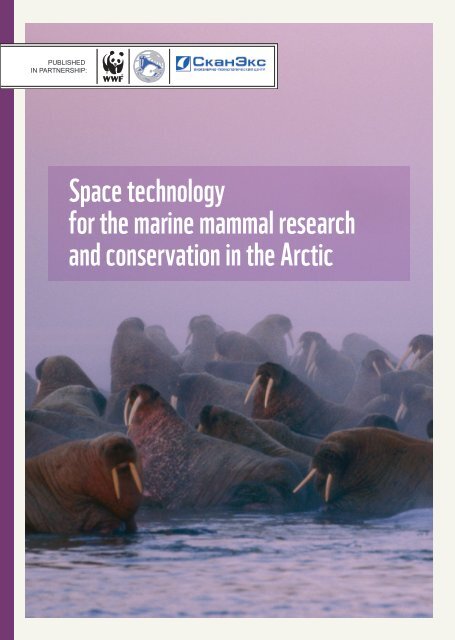
Cover photo: © Norbert Rosing / National Geographic Stock / WWF-Canada<br />
Distribution is free.<br />
CONTENT<br />
Introduction<br />
Choosing <strong>the</strong> region <strong>and</strong> period<br />
<strong>for</strong> <strong>the</strong> observation<br />
The technical characteristics<br />
of <strong>the</strong> system’s survey<br />
Results of <strong>the</strong> satellite monitoring<br />
of walrus shoreline rookeries<br />
The first conclusions of using orbital survey<br />
to monitor shoreline walrus rookeries<br />
Conclusion<br />
Appendix<br />
3<br />
4<br />
5<br />
5<br />
10<br />
11<br />
12
Introduction<br />
Yearly <strong>the</strong> world’s supply of hydrocarbons on l<strong>and</strong> continues<br />
to run low, <strong>and</strong> to that end during <strong>the</strong> last decade<br />
growing activity of shelf deposit absorption has been<br />
observed.<br />
Today in Russia <strong>the</strong> amount of shelf oil extracting isn’t<br />
as high as in o<strong>the</strong>r countries, however experts <strong>for</strong>ecast its prominent growth in <strong>the</strong><br />
upcoming decades. It’s already growing in <strong>the</strong> Caspian, Baltic <strong>and</strong> Okhotsk Seas. In<br />
2011 oil extracting began in <strong>the</strong> Arctic Sea, <strong>and</strong> in <strong>the</strong> Pechora Sea an oil plat<strong>for</strong>m<br />
“fault line” was installed.<br />
All shelf projects bring a definite ecological risk connected to <strong>the</strong> possibility of an oil<br />
spill in an icy area <strong>and</strong> threatening key inhabited locations of rare animals.<br />
Intensive commercial absorption of <strong>the</strong> south-eastern parts of <strong>the</strong> Barents Sea (Picture<br />
1), which consists of installing extracting plat<strong>for</strong>ms, growth of shipping <strong>and</strong><br />
development of coastal infrastructures, has a high impact on <strong>the</strong> ecosystem of <strong>the</strong><br />
region <strong>and</strong> especially on <strong>the</strong> walrus, which is one of <strong>the</strong> most fragile of <strong>the</strong> nor<strong>the</strong>rn<br />
components.<br />
Inhabited in <strong>the</strong> touched region is a few of an Atlantic subspecies of walruses, which<br />
in <strong>the</strong> Endangered Species List of <strong>the</strong> Russian Fed., <strong>and</strong> <strong>the</strong>y are possibly mostly<br />
str<strong>and</strong>ed from its main population <strong>the</strong> “sou<strong>the</strong>rn” group.<br />
Pic.1<br />
Oil <strong>and</strong> Gas development<br />
in <strong>the</strong> Barents Sea sector<br />
of <strong>the</strong> Polar Region<br />
In order to produce means <strong>for</strong> <strong>the</strong>se animals’ preservation, it’s necessary to complete<br />
a modern scientific <strong>research</strong> on <strong>the</strong>ir biology <strong>and</strong> ecology.<br />
One of <strong>the</strong> methods <strong>for</strong> such a <strong>research</strong> is through satellite observation.In June of<br />
2011, through <strong>the</strong> iniative <strong>and</strong> support of <strong>the</strong> Engineering-Technological Center<br />
<strong>Space</strong> <strong>technology</strong> <strong>for</strong> <strong>the</strong> <strong>marine</strong> <strong>mammal</strong> <strong>research</strong> <strong>and</strong> conservation in <strong>the</strong> Arctic | 3
“Scanex” (ITC “Scanex”), <strong>the</strong> World Wide Wildlife Fund (WWF) <strong>and</strong> <strong>the</strong> Marine<br />
Mammals Council (MMC), a project was launched <strong>for</strong> <strong>the</strong> production of methods<br />
to locate <strong>the</strong> walruses <strong>and</strong> <strong>the</strong>ir coastal rookeries in <strong>the</strong> south-eastern parts of <strong>the</strong><br />
Barents Sea.<br />
In this brochure a description of <strong>the</strong> stated methods <strong>and</strong> its first summation results<br />
are given.<br />
Choosing <strong>the</strong> region<br />
<strong>and</strong> period<br />
<strong>for</strong> <strong>the</strong> observation<br />
shoreline in a walrus’s life.<br />
Regardless that <strong>the</strong> walrus is a sea <strong>mammal</strong>, <strong>the</strong>y still<br />
cannot constantly reside in water. They must have<br />
a plat<strong>for</strong>m <strong>for</strong> rest <strong>and</strong> breeding. Sea ice is used as such<br />
a plat<strong>for</strong>m, <strong>and</strong> in <strong>the</strong> period of its absence in <strong>the</strong> inhabited<br />
regions (July- December) isl<strong>and</strong>s <strong>and</strong> continent<br />
shorelines are used. However ice is <strong>the</strong> preferred option<br />
<strong>for</strong> a walrus. It is far safer, but due to <strong>the</strong> global climate<br />
changes <strong>the</strong> duration of ice in <strong>the</strong> <strong>research</strong>ed areas has<br />
been reduced, which increases <strong>the</strong> importance of <strong>the</strong><br />
Within <strong>the</strong> frames of <strong>the</strong> expert advisory groups <strong>for</strong> <strong>the</strong> study <strong>and</strong> preservation walruses<br />
in <strong>the</strong> south-eastern Barents Sea <strong>and</strong> <strong>the</strong> adjoining water zones, functioning<br />
by <strong>the</strong> initiative of <strong>the</strong> WWF Russia <strong>and</strong> <strong>the</strong> SMM from <strong>the</strong> 20 th of May 2009,<br />
<strong>the</strong> major regions <strong>for</strong> <strong>the</strong> walrus’s shoreline rookeries were singled out to <strong>the</strong> isl<strong>and</strong>s<br />
of Kolguev, Dolgy, Matveyeva <strong>and</strong> Vaigach. From May to September of 2011operative<br />
orbital monitoring of walrus shoreline rookeries were conducted in <strong>the</strong> singled out<br />
regions (Pic.2).<br />
Pic.2<br />
The regions<br />
<strong>for</strong> <strong>the</strong> operative<br />
orbital monitoring<br />
of walrus rookeries<br />
© IMAGESAT, ITC “SCANEX”<br />
4 | <strong>Space</strong> <strong>technology</strong> <strong>for</strong> <strong>the</strong> <strong>marine</strong> <strong>mammal</strong> <strong>research</strong> <strong>and</strong> conservation in <strong>the</strong> Arctic
The technical<br />
characteristics<br />
of <strong>the</strong> system’s<br />
survey<br />
The survey was done by an independent commercial<br />
company ETC “Scanex”, providing a complex of possibilities<br />
from receiving to <strong>the</strong>matic processing of images<br />
of earth from space.<br />
In <strong>the</strong> process of surveying <strong>the</strong> rookeries, <strong>the</strong> satellite<br />
EROS B (Earth Resources Observation System)<br />
was used <strong>for</strong> its high maneuverability <strong>and</strong> its ability<br />
to quickly reprogram <strong>the</strong> target of survey.<br />
Today it is <strong>the</strong> only program of extra-high (0.7 m)<br />
authorized, providing <strong>the</strong> possibility to receive data<br />
directly on paper in <strong>the</strong> territory of Russia on a real time basis.<br />
The size of <strong>the</strong> scene (<strong>the</strong> territory, shown on <strong>the</strong> satellite in one shot) consists<br />
of 7x7 km.<br />
The possibility to repeat <strong>the</strong> shooting is every 3 to 4 days.<br />
Results<br />
of <strong>the</strong> satellite<br />
monitoring of walrus<br />
shoreline rookeries<br />
Results of <strong>the</strong> Matveyeva Isl<strong>and</strong> survey<br />
The possibilities of <strong>the</strong> satellite allowed us to shoot <strong>the</strong><br />
entire territory of Matveyeva Is., which is a part of <strong>the</strong><br />
state nature reserve “Nentsy”.<br />
An assembly of walruses was found on <strong>the</strong> south-eastern<br />
shore of <strong>the</strong> isl<strong>and</strong> (Pic.3). For <strong>the</strong> certification of<br />
<strong>the</strong> fact of this animal being located in this shot, from<br />
<strong>the</strong> amount of pixels <strong>the</strong>ir size was difined to be 2.5 m.<br />
There was also a comparison to <strong>the</strong> archive shot (Pic.4),<br />
upon which similar objects were not found. This proves<br />
<strong>the</strong> presence of animals <strong>and</strong> not static objects.<br />
The detailed authorized satellite survey <strong>and</strong> <strong>the</strong> shot’s low angle of slope not only allowed<br />
us to see <strong>the</strong> animals but also to count <strong>the</strong>ir numbers (Chart 1).<br />
The shots of Matveyeva Is. were repeated three times. On all three shots (Pic. 5,6,7,)<br />
animal assemblies were noticed. At <strong>the</strong> same time, to fully value <strong>the</strong> numbers only one<br />
picture was used (Pic.5), ano<strong>the</strong>r allowed only approximate numbers (Pic. 7) <strong>and</strong> due<br />
to poor quality <strong>the</strong> numbers of <strong>the</strong> last shot were impossible to define (Pic.6).<br />
Chart.1<br />
Date of Survey Region of Survey<br />
Number<br />
of Animals Found<br />
Quality of Photograph<br />
04.07.2010 (archive) Matveyeva Is. None high *1<br />
28.07.2011 Matveyeva Is. around 200 high *1<br />
28.08.2011 Matveyeva Is. Impossible to estimate low *3<br />
(high angle shot)<br />
04.09.2011 Matveyeva Is. from 100 to 200 medium *2<br />
(high angle shot)<br />
* Approximate quality of shots in <strong>the</strong> Appendix (p. 12)<br />
<strong>Space</strong> <strong>technology</strong> <strong>for</strong> <strong>the</strong> <strong>marine</strong> <strong>mammal</strong> <strong>research</strong> <strong>and</strong> conservation in <strong>the</strong> Arctic | 5
Pic. 3<br />
EROS B, 28.08.2011,<br />
0.7 m/pixels,<br />
Imagesat Int.,<br />
SCANEX, 2011<br />
© IMAGESAT, ITC “SCANEX”<br />
Pic.4<br />
GeoEye, 04.07.2010,<br />
0.7 м/pixels,<br />
Imagesat Int.,<br />
SCANEX, 2010<br />
Pic.5<br />
EROS B, 28.07.2011,<br />
0. 7 m/pixels,<br />
Imagesat Int.,<br />
SCANEX, 2011<br />
© IMAGESAT, ITC “SCANEX” © IMAGESAT, ITC “SCANEX”<br />
6 | <strong>Space</strong> <strong>technology</strong> <strong>for</strong> <strong>the</strong> <strong>marine</strong> <strong>mammal</strong> <strong>research</strong> <strong>and</strong> conservation in <strong>the</strong> Arctic
Pic.6<br />
EROS B, 28.08.2011,<br />
0.7 m/pixels,<br />
Imagesat Int.,<br />
SCANEX, 2011<br />
Pic.7<br />
EROS B, 04.09.2011,<br />
0.7 m/pixels,<br />
Imagesat Int.,<br />
SCANEX, 2011<br />
© IMAGESAT, ITC “SCANEX” © IMAGESAT, ITC “SCANEX”<br />
<strong>Space</strong> <strong>technology</strong> <strong>for</strong> <strong>the</strong> <strong>marine</strong> <strong>mammal</strong> <strong>research</strong> <strong>and</strong> conservation in <strong>the</strong> Arctic | 7
Results of <strong>the</strong> Vaigach Is. survey<br />
The orbital survey of Vaigach Is. was conducted on <strong>the</strong> sou<strong>the</strong>rn coast of <strong>the</strong> peninsula<br />
Lyamchin (Pic.8). A walrus shore rookery was found on <strong>the</strong> western Cape of Lyamchin<br />
Nose.<br />
The quality of <strong>the</strong> shot allowed us to estimate that at <strong>the</strong> moment of <strong>the</strong> shot <strong>the</strong>ir assembly<br />
consisted of around 400 animal units (see Chart.2).<br />
Chart.2<br />
Date of Survey<br />
Region of Survey<br />
28.08.2011 Vaigach Is., Cape<br />
of Lyamchin Nose<br />
04.09.2001 Vaigach Is., Cape<br />
of Lyamchin Nose<br />
* Approximate quality of shots in <strong>the</strong> Appendix (p. 12)<br />
Number<br />
of Animals Found<br />
Quality of Photograph<br />
Impossible to estimate low *3<br />
(cloudy shot)<br />
around 400 high *1<br />
Due to <strong>the</strong> results of <strong>the</strong> survey of walruses we were able to confirm <strong>the</strong> ground<br />
photographs, which were done months earlier in <strong>the</strong> process of <strong>the</strong> scientific-touristic<br />
expedition. On July 14 th in <strong>the</strong> same place (<strong>the</strong> western Cape of Lyamchin Nose) members<br />
of <strong>the</strong> expedition photographed (Pic.9) rookeries of walruses <strong>and</strong> numbered <strong>the</strong>m<br />
to be approximately 150 animals.<br />
The satellite shots along with <strong>the</strong> o<strong>the</strong>r photographs done became <strong>the</strong> first facts that<br />
confirmed <strong>the</strong> <strong>for</strong>ming of shoreline walrus rookeries on Vaigach Is., which singles out<br />
its importance <strong>for</strong> <strong>the</strong> grouping of <strong>the</strong> Atlantic walrus in <strong>the</strong> summer-autumn period.<br />
Pic. 8<br />
EROS B, 04.09.2011,<br />
0.7 m/pixels,<br />
Imagesat Int.,<br />
SCANEX, 2011<br />
© IMAGESAT, ITC “SCANEX”<br />
© IMAGESAT, ITC “SCANEX”<br />
8 | <strong>Space</strong> <strong>technology</strong> <strong>for</strong> <strong>the</strong> <strong>marine</strong> <strong>mammal</strong> <strong>research</strong> <strong>and</strong> conservation in <strong>the</strong> Arctic
Pic.9<br />
Walrus rookery<br />
on Vaigach Is.,<br />
Cape of Lyamchin Nose<br />
14.07.2011<br />
© WWF-RUSSIA / VICTOR MASLOV<br />
Results of <strong>the</strong> Kolguey Is., Dolgy Is. <strong>and</strong> Golets Is. surveys<br />
Chart.3<br />
Date of Survey Region of Survey<br />
Number<br />
of Animals Found<br />
Quality of Photograph<br />
30.05.2011 Kolguey Is.<br />
None high *1<br />
sou<strong>the</strong>rn region<br />
10.06.2011 Kolguey Is.<br />
sou<strong>the</strong>rn region<br />
None low *3<br />
(very cloudy)<br />
08.07.2011 Kolguey Is.<br />
None high *1<br />
Western<br />
Flat Trolley<br />
20.07.2011 Kolguey Is.<br />
Western<br />
None medium *2<br />
(partly cloudy)<br />
Flat Trolley<br />
07.08.2011 Dolgy Is., Golets Is. None high *1<br />
05.09.2011 Dolgy Is., Golets Is. None medium *2<br />
(high angle shot)<br />
* Approximate quality of shots in <strong>the</strong> Appendix (p. 12)<br />
The orbital survey was conducted on <strong>the</strong> sou<strong>the</strong>rn shore of Kolguey Is., <strong>the</strong> nor<strong>the</strong>rn<br />
ends of Dolgy Is. <strong>and</strong> Golets Is. Walruses were not found in <strong>the</strong>se regions.<br />
On <strong>the</strong> isl<strong>and</strong>s of Dolgy, Golets <strong>and</strong> Kolguey an experimental stereo-survey was<br />
conducted. It consisted of receiving two shots of exactly <strong>the</strong> same regions divided<br />
by a short period of time (several minutes). This principle could allow us to define<br />
moving objects (such as animals) from <strong>the</strong> unmovable (such as plants, ice, rocks<br />
<strong>and</strong> etc.).<br />
Periodical results of <strong>the</strong> south-eastern Barents Sea orbital survey<br />
Chart.4<br />
Period of Number Cloudy Shots Stereo<br />
Region of survey<br />
survey of shots shots of animal Shots<br />
Kolguey Is. 13.05-20.07 9 1 0 1<br />
Matveyeva Is. 28.07-04.09 3 0 3 0<br />
Dolgy Is. And 30.07-05.09 5 2 0 2<br />
Golets Is.<br />
Vaigach Is. 28.08-04.09 2 1 1 0<br />
Total: 13.05-05.09 19 4 4 3<br />
<strong>Space</strong> <strong>technology</strong> <strong>for</strong> <strong>the</strong> <strong>marine</strong> <strong>mammal</strong> <strong>research</strong> <strong>and</strong> conservation in <strong>the</strong> Arctic | 9
The first conclusions<br />
of using orbital<br />
survey to monitor<br />
shoreline walrus<br />
rookeries<br />
From <strong>the</strong> results of <strong>the</strong> conducted<br />
work, a conclusion of using orbital<br />
survey to monitor shoreline walrus<br />
rookeries in <strong>the</strong> south-eastern<br />
Barents sea can be made.<br />
The advantages of this method<br />
• It allows <strong>the</strong> receiving of operative<br />
in<strong>for</strong>mation on <strong>the</strong> location <strong>and</strong><br />
placement of walrus rookeries <strong>and</strong><br />
with a high quality shot give <strong>the</strong><br />
approximate number of animals in<br />
an assembly.<br />
• Relative low cost shots that allow<br />
monitoring <strong>the</strong> dynamic of <strong>the</strong><br />
animals’ numbers in arduous<br />
rookeries.<br />
Ограничения метода<br />
• The possibility of high quality shots<br />
are only clear cloudless wea<strong>the</strong>r.<br />
• The quality of <strong>the</strong> shot also depends<br />
on <strong>the</strong> angle of <strong>the</strong> shot.<br />
• To receive higher au<strong>the</strong>nticity to<br />
identify <strong>the</strong> objects it’s preferable to<br />
use stereo photography <strong>and</strong>/or air,<br />
ground <strong>research</strong>.<br />
• Using <strong>the</strong> given method could be<br />
a helpful element in field ground<br />
<strong>research</strong> <strong>and</strong> in air reports.<br />
10 | <strong>Space</strong> <strong>technology</strong> <strong>for</strong> <strong>the</strong> <strong>marine</strong> <strong>mammal</strong> <strong>research</strong> <strong>and</strong> conservation in <strong>the</strong> Arctic
Conclusion<br />
Orbital<br />
survey was <strong>for</strong> <strong>the</strong> first time used to find walrus<br />
assemblies <strong>and</strong> evaluate <strong>the</strong>ir numbers during <strong>the</strong> important<br />
summer-autumn period.<br />
Success from monitoring <strong>the</strong> walruses through orbital<br />
survey alongside ground <strong>research</strong> will allow environment-orientated<br />
<strong>and</strong> scientific organizations to operatively<br />
receive basic in<strong>for</strong>mation on <strong>the</strong> placement <strong>and</strong> numbers of walruses in <strong>the</strong><br />
regions that are difficult to monitor through o<strong>the</strong>r ways, <strong>and</strong> also this will help to take<br />
adequate measures <strong>for</strong> <strong>the</strong> preservation of <strong>the</strong> stated group of walruses under <strong>the</strong> conditions<br />
of <strong>the</strong> “boom” of economic development in those regions.<br />
Thus using <strong>the</strong> high authorized data is a perspective method to <strong>research</strong> this species<br />
of sea <strong>mammal</strong>.<br />
With reference to <strong>the</strong> success of <strong>the</strong> first pilot project to develop methods <strong>for</strong> <strong>the</strong><br />
locating of walruses in orbital shots, <strong>and</strong> <strong>the</strong> locations most likely used <strong>for</strong> shoreline<br />
rookeries, <strong>the</strong> WWF Russia is planning to exp<strong>and</strong> <strong>the</strong> region of monitoring walrus<br />
rookeries <strong>and</strong> receive shots of <strong>the</strong> Barents, Kara, Laptev <strong>and</strong> East-Siberian seas.<br />
© PAUL NICKLEN / NATIONAL GEOGRAPHIC STOCK / WWF-CANADA<br />
<strong>Space</strong> <strong>technology</strong> <strong>for</strong> <strong>the</strong> <strong>marine</strong> <strong>mammal</strong> <strong>research</strong> <strong>and</strong> conservation in <strong>the</strong> Arctic | 11
Appendix<br />
* 1<br />
Examples of <strong>the</strong> photograph’s quality<br />
HIGH QUALITY<br />
* 2<br />
Accurate shot (it’s possible to count<br />
<strong>the</strong> walruses)<br />
MEDIUM QUALITY<br />
* 3<br />
Partly cloudy shot<br />
LOW QUALITY<br />
High angle shot (it’s more difficult<br />
to count <strong>the</strong> walruses)<br />
Highly cloudy shot<br />
Very high angle shot (it’s possible to see<br />
<strong>the</strong> presence of walruses yet imposible<br />
to count)<br />
12 | <strong>Space</strong> <strong>technology</strong> <strong>for</strong> <strong>the</strong> <strong>marine</strong> <strong>mammal</strong> <strong>research</strong> <strong>and</strong> conservation in <strong>the</strong> Arctic