Guide to Traffic Impact Study - City of Scotts Valley
Guide to Traffic Impact Study - City of Scotts Valley
Guide to Traffic Impact Study - City of Scotts Valley

You also want an ePaper? Increase the reach of your titles
YUMPU automatically turns print PDFs into web optimized ePapers that Google loves.
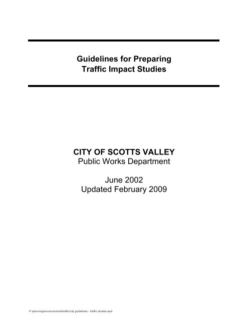
<strong>Guide</strong>lines for Preparing<br />
<strong>Traffic</strong> <strong>Impact</strong> Studies<br />
CITY OF SCOTTS VALLEY<br />
Public Works Department<br />
June 2002<br />
Updated February 2009<br />
P:\planning\environmental\traffic\city guidelines - traffic studies.wpd
TABLE OF CONTENTS<br />
Contents<br />
Page Number<br />
I. INTRODUCTION 1<br />
II. WHEN A TRAFFIC IMPACT STUDY IS NEEDED 1<br />
A. Trip Generation Thresholds 2<br />
B. Exceptions 2<br />
C. Updating An Existing <strong>Traffic</strong> <strong>Impact</strong> <strong>Study</strong> 2<br />
III. SCOPE OF TRAFFIC IMPACT STUDY 3<br />
A. Boundaries <strong>of</strong> the traffic <strong>Impact</strong> <strong>Study</strong> 3<br />
B. <strong>Traffic</strong> Analysis Scenarios 3<br />
IV. TRAFFIC DATA 4<br />
A. Trip Generation 4<br />
B. <strong>Traffic</strong> Counts 5<br />
C. Peak Hours 5<br />
D. Travel Forecasting (Transportation Modeling) 6<br />
V. TRAFFIC IMPACT ANALYSIS METHODOLOGIES 6<br />
A. Signalized Intersections 6<br />
B. Unsignalized Intersections 6<br />
C. Transit Capacity 6<br />
D. Pedestrians 6<br />
E. Bicycles 6<br />
F. <strong>City</strong> Criteria/Warrants 6<br />
G. Channelization 6<br />
VI. MITIGATION MEASURES 7<br />
Appendix “A” Minimum Contents <strong>of</strong> <strong>Traffic</strong> <strong>Impact</strong> <strong>Study</strong> 8<br />
Appendix “B” Measures <strong>of</strong> Effectiveness by Facility Type 9<br />
P:\planning\environmental\traffic\city guidelines - traffic studies.wpd
I. INTRODUCTION<br />
The <strong>City</strong> <strong>of</strong> <strong>Scotts</strong> <strong>Valley</strong> (<strong>City</strong>) desires <strong>to</strong> provide a safe and efficient<br />
transportation system for the citizens <strong>of</strong> <strong>Scotts</strong> <strong>Valley</strong> pursuant <strong>to</strong> various<br />
Sections <strong>of</strong> the California Streets and Highway Code. This is done in partnership<br />
with regional agencies through procedures established by the California<br />
Environmental Quality Act (CEQA) and other land use planning processes. The<br />
intent <strong>of</strong> this guide is <strong>to</strong> provide a starting point and a consistent basis in which<br />
<strong>City</strong> evaluates traffic impacts <strong>to</strong> street facilities. The applicability <strong>of</strong> this guide for<br />
streets and roads is at the discretion <strong>of</strong> <strong>City</strong>.<br />
1<br />
<strong>City</strong> reviews development projects , and land use change proposals for their<br />
potential impact <strong>to</strong> street facilities. The primary objectives <strong>of</strong> this guide are <strong>to</strong><br />
provide:<br />
Guidance in determining if and when a traffic impact study (TIS) is needed;<br />
Consistency and uniformity in the identification <strong>of</strong> traffic impacts generated by<br />
local land use proposals;<br />
Consistency and equity in the identification <strong>of</strong> traffic impacts generated by<br />
local land use proposals;<br />
Developers and their consultants with the information necessary <strong>to</strong> make<br />
informed decisions regarding the existing and proposed transportation<br />
infrastructure (see Appendix A, Minimum Contents <strong>of</strong> a TIS);<br />
TIS requirements early in the planning phase <strong>of</strong> a project (i.e., initial study,<br />
notice <strong>of</strong> preparation, or earlier) <strong>to</strong> eliminate potential delays later;<br />
A quality TIS by agreeing <strong>to</strong> the assumptions, data requirements, study<br />
scenarios, and analysis methodologies in advance <strong>of</strong> beginning the study;<br />
and,<br />
Early coordination during the planning phases <strong>of</strong> a project <strong>to</strong> reduce the time<br />
and cost <strong>of</strong> preparing TIS.<br />
II.<br />
WHEN A TRAFFIC IMPACT STUDY IS NEEDED<br />
The level <strong>of</strong> service (LOS) for operating street facilities is based upon measures<br />
2<br />
<strong>of</strong> effectiveness (MOEs). These MOEs (see Appendix B) describe the measures<br />
best suited for analyzing street facilities (i.e. signalized intersections, etc.). <strong>City</strong><br />
endeavors <strong>to</strong> maintain a target LOS at the transition between LOS “C” and LOS<br />
“D” (see Appendix “B”) on street facilities. However, the <strong>City</strong> acknowledges that<br />
this may not always be feasible and recommends that the lead agency consult<br />
_____________________<br />
1 “ Project” refers <strong>to</strong> activities directly undertaken by developers, financed by developers, or requiring a permit or<br />
other approval from government as defined in Section 21065 <strong>of</strong> the Public Resources Code and Section 15378<br />
<strong>of</strong> the California Code <strong>of</strong> Regulations.<br />
2 “Level <strong>of</strong> Service” as defined in the latest edition <strong>of</strong> the Highway Capacity Manual, Special Report 209,<br />
Transportation Research Board, National Research Council.<br />
P:\planning\environmental\traffic\city guidelines - traffic studies.wpd<br />
1
with the <strong>City</strong> <strong>to</strong> determine the appropriate target LOS. If an existing street facility<br />
is operating at less than the appropriate target LOS, the existing MOE should be<br />
maintained.<br />
A. Trip General Thresholds<br />
The following criterion is a starting point in determining when a TIS is<br />
needed, if a project:<br />
1. Generates over 50 peak hour trips assigned <strong>to</strong> a street facility.<br />
2. Generates 20 <strong>to</strong> 50 peak hour trips assigned <strong>to</strong> a street facility -<br />
and, affected street facilities are experiencing noticeable delay or<br />
approaching unstable traffic flow conditions (LOS “C” or “D”).<br />
3. Generates 1 <strong>to</strong> 49 peak hour trips assigned <strong>to</strong> a street facility - the<br />
following are examples that may require a full TIS or some less<br />
3<br />
analysis :<br />
a. Affected street facilities experiencing significant delay;<br />
(unstable or forced traffic flow conditions LOS “E” or “F”).<br />
b. The potential risk for a traffic incident is significantly<br />
increased (i.e., congestion related collisions, non-standard<br />
sight distance considerations, increase in traffic conflict<br />
points, etc.). Check existing conditions.<br />
c. Change in local circulation networks that impact a street<br />
facility (i.e., direct access <strong>to</strong> street facility, a non-standard<br />
highway geometric design, etc.).<br />
Note: A traffic study may be as simple as providing a traffic count <strong>to</strong> as<br />
complex as a microscopic simulations. The appropriate level <strong>of</strong><br />
study is determined by staff considering the particulars <strong>of</strong> a project,<br />
the prevailing highway conditions, and the forecasted traffic.<br />
B. Exceptions<br />
Exceptions require consultation between <strong>City</strong> and those preparing the<br />
TIS. When a project’s traffic impact <strong>to</strong> a street facility can clearly be<br />
anticipated without a study and all the parties involved (<strong>City</strong> & developer)<br />
are able <strong>to</strong> negotiate appropriate mitigation, a TIS may not be necessary.<br />
C. Updating An Existing <strong>Traffic</strong> <strong>Impact</strong> <strong>Study</strong><br />
A TIS requires updating when the amount or character <strong>of</strong> traffic is<br />
significantly different from an earlier study. Generally, a TIS requires<br />
updating every two years. A TIS may require updating sooner in rapidly<br />
________________________<br />
3 A “lesser analysis” may include obtaining traffic counts, preparing signal warrants, or a focused TIS, etc.<br />
P:\planning\environmental\traffic\city guidelines - traffic studies.wpd<br />
2
developing areas and not as <strong>of</strong>ten in slower developing areas. In these<br />
cases, consultation with the <strong>City</strong> is strongly recommended.<br />
III.<br />
SCOPE OF TRAFFIC IMPACT STUDY<br />
Consultation between the <strong>City</strong> and those preparing the TIS is recommended<br />
before starting work on the study <strong>to</strong> establish the appropriate scope. At a<br />
minimum, the TIS should include the following:<br />
A. Boundaries <strong>of</strong> the <strong>Traffic</strong> <strong>Impact</strong> <strong>Study</strong><br />
All street facilities impacted in accordance with the criteria in Section II<br />
should be studied. <strong>Traffic</strong> impacts <strong>to</strong> local streets and roads can impact<br />
intersections with street facilities. In these cases, the TIS should include<br />
an analysis <strong>of</strong> adjacent facilities, upstream and downstream <strong>of</strong> the<br />
intersection (i.e. driveways and intersections) with the street.<br />
B. <strong>Traffic</strong> Analysis Scenarios<br />
<strong>City</strong> is interested in the effects <strong>of</strong> general plan updates and amendments,<br />
as well as the effects <strong>of</strong> specific project entitlements (i.e., site plans,<br />
conditional use permits, subdivisions, rezoning, etc.) that have the<br />
potential <strong>to</strong> impact a street facility. The complexity or magnitude <strong>of</strong> the<br />
impacts <strong>of</strong> a project will normally dictate the scenarios necessary <strong>to</strong><br />
analyze the project. Consultation between the <strong>City</strong> and those preparing<br />
the TIS is recommended <strong>to</strong> determine the appropriate scenarios for the<br />
analysis. The following scenarios should be addressed in the TIS when<br />
appropriate:<br />
1. When only a general plan amendment or update is being sought,<br />
the following scenarios are required:<br />
a. Existing Conditions - Current year traffic volumes and peak<br />
hour LOS analysis <strong>of</strong> effected street facilities.<br />
4<br />
b. Proposed Project Only with Select link Analysis - Trip<br />
generation and assignment for build-out <strong>of</strong> general plan.<br />
c. General Plan Build-out Only - Trip assignment and peak<br />
hour LOS analysis. Include current land uses and other<br />
pending general plan amendments. Note: Build-out<br />
includes categories A through E in the Planning<br />
Department “Cumulative Trip Generation” list. Use the<br />
most current list from the Planning Department.<br />
d. General Plan Build-out Plus Proposed Project - Trip<br />
assignment and peak hour LOS analysis. Include proposed<br />
project and other pending general plan amendments.<br />
Note: Please contact the Planning Department at (831) 440-5630 if there<br />
is any question whether a future or existing planning permit<br />
application requires or involves a general plan amendment.<br />
______________________<br />
4 "Select link” analysis represents a project only traffic model run, where the project’s trips are distributed and<br />
assigned along the highway network. This procedure isolates the specific impact on the street network.<br />
P:\planning\environmental\traffic\city guidelines - traffic studies.wpd<br />
3
2. When a general plan amendment is not proposed and a proposed<br />
project is seeking specific entitlements (i.e., site plans, conditional<br />
use permits, subdivision, rezoning, etc.) the following scenarios<br />
must be analyzed in the TIS:<br />
a. Existing Conditions - Current year traffic volumes and peak<br />
hour LOS analysis <strong>of</strong> effected street facilities.<br />
b. Proposed Project Only - Trip generation, distribution, and<br />
assignment in the year the project is anticipated <strong>to</strong> complete<br />
construction.<br />
c. Cumulative Conditions (Existing Conditions Plus Other<br />
Approved and Pending Projects Without Proposed Project) -<br />
Trip assignment and peak hour LOS analysis in the year the<br />
project is anticipated <strong>to</strong> complete construction. Note:<br />
Cumulative includes categories A, B and C in the<br />
Planning Department “Cumulative Trip Generation” list.<br />
Use the most current list from the Planning Department.<br />
d. Cumulative Conditions Plus Proposed Project (Existing<br />
Conditions Plus Other Approved Pending Projects Plus<br />
Proposed Project) - Trip assignment and peak hour LOS<br />
analysis in the year the project is anticipated <strong>to</strong> complete<br />
construction.<br />
e. Cumulative Conditions Plus Proposed Phases (Interim<br />
Years) - Trip assignment and peak hour LOS analysis in the<br />
years the project phases are anticipated <strong>to</strong> complete<br />
construction.<br />
3. In cases where the circulation element <strong>of</strong> the general plan is not<br />
consistent with the land use element or the general plan is<br />
outdated and not representative <strong>of</strong> current or future forecasted<br />
conditions, all scenarios from Sections III.B.1. and .2 should be<br />
utilized with the exception <strong>of</strong> duplicating item 2.a.<br />
IV.<br />
TRAFFIC DATA<br />
Prior <strong>to</strong> any fieldwork, consultation between the <strong>City</strong> and those preparing the<br />
TIS, is recommended <strong>to</strong> reach consensus on the data and assumptions<br />
necessary for the study. The following elements are a starting point.<br />
A. Trip Generation<br />
The latest edition <strong>of</strong> the Institute <strong>of</strong> Transportation Engineers’ (ITE) Trip<br />
Generation report should be used for trip generation forecasts. Local trip<br />
generation rates are also acceptable if appropriate validation is provided<br />
<strong>to</strong> support them.<br />
1. Trip Generation Rates - When the land use has a limited number <strong>of</strong><br />
studies <strong>to</strong> support the trip generation rates or when the Coefficient<br />
2<br />
<strong>of</strong> Determination (R ) is below 0.75, consultation between the lead<br />
agency, <strong>City</strong> and those preparing the TIS is recommended.<br />
P:\planning\environmental\traffic\city guidelines - traffic studies.wpd<br />
4
5<br />
2. Pass-by Trips - Pass-by trips are only considered for retail oriented<br />
development. Reductions greater that 15% require consultation<br />
and acceptance by <strong>City</strong>. The justification for exceeding a 15%<br />
reduction should be discussed in the TIS.<br />
6<br />
3. Captured Trips - Captured trip reductions greater than 5% requires<br />
consultation and acceptance by <strong>City</strong>. The justification for<br />
exceeding a 5% reduction should be discussed in the TIS.<br />
4. Transportation Demand Management (TDM) - Consultation<br />
between the lead agency and <strong>City</strong> is essential before applying trip<br />
reduction for TDM strategies.<br />
Note:<br />
Reasonable reductions <strong>to</strong> trip generation rates are considered<br />
when adjacent street volumes are sufficient (at least 5000 ADT) <strong>to</strong><br />
support reductions for the land use.<br />
B. <strong>Traffic</strong> Counts<br />
Prior <strong>to</strong> field traffic counts, consultation between the <strong>City</strong> and those<br />
preparing the TIS is recommended <strong>to</strong> determine the level <strong>of</strong> detail (e.g.,<br />
location, signal timing, travel speeds, turning movements, etc.) required at<br />
each traffic count site. All street facilities within the boundaries <strong>of</strong> the TIS<br />
should be considered. Common rules for counting vehicular traffic include<br />
but are not limited <strong>to</strong>:<br />
1. Vehicle counts should be conducted on Tuesday, Wednesdays, or<br />
Thursdays during weeks not containing a holiday and conducted in<br />
favorable weather conditions.<br />
2. Vehicle counts should be conducted during the appropriate peak<br />
hours (see peak hour discussion below).<br />
3. Seasonal and weekend variations in traffic should also be<br />
considered where appropriate (i.e., school sessions, recreational<br />
routes, <strong>to</strong>urist attractions, harvest season, etc.).<br />
C. Peak Hours<br />
To eliminate unnecessary analysis, consultation between the lead agency,<br />
<strong>City</strong>, and those preparing the TIS is recommended during the early<br />
planning stages <strong>of</strong> a project. In general, the TIS should include a morning<br />
(a.m.) and an evening (p.m.) peak hour analyses. Other peak hours (e.g.<br />
11:30 a.m. <strong>to</strong> 1:30 p.m., weekend, holidays, etc.) may also be required <strong>to</strong><br />
determine the significance <strong>of</strong> the traffic impacts generated by a project.<br />
______________________<br />
5 "Pass-by” trips are made as intermediate s<strong>to</strong>ps between an origin and a primary trip destination (i.e., home <strong>to</strong><br />
work, home <strong>to</strong> shopping, etc.).<br />
6 "Captured Trips” are trips that do not enter or leave the driveways <strong>of</strong> a project’s boundary within a mixed-used<br />
development.<br />
P:\planning\environmental\traffic\city guidelines - traffic studies.wpd<br />
5
D. Travel Forecasting (Transportation Modeling)<br />
The local or regional traffic model should reflect the mot current land use<br />
and planned improvements (i.e. where programming or funding is<br />
secured). When a general plan build-out model is not available, the<br />
closest forecast model year <strong>to</strong> build-out should be used. If a traffic model<br />
is not available, his<strong>to</strong>rical growth rates and current trends can be used <strong>to</strong><br />
project future traffic volumes.<br />
The TIS should clearly describe any changes made in the model <strong>to</strong><br />
accommodate the analysis <strong>of</strong> a proposed project.<br />
V. TRAFFIC IMPACT ANALYSIS METHODOLOGIES<br />
Typically, the traffic analysis methodologies for the facility types indicated below<br />
are used by <strong>City</strong> and will be accepted without prior consultation. When a street<br />
has saturated flows, the use <strong>of</strong> a micro-simulation model is encouraged for the<br />
analysis. Other analysis methods may be accepted, however, consultation<br />
between the <strong>City</strong> and those preparing the TIS is recommended <strong>to</strong> agree on the<br />
information necessary for the analysis.<br />
7<br />
A. Signalized Intesections - HCM* Chapter 9, Highway Capacity S<strong>of</strong>tware**,<br />
TM<br />
operational analysis, TRAFFIX **, Synchro**, see footnote 7<br />
B. Unsignalized Intersection - HCM* Chapter 10, operational analysis, <strong>City</strong><br />
<strong>Traffic</strong> Manual for signal warrants if a signal is being considered<br />
C. Transit Capacity - HCM* Chapter 12, operational analysis<br />
D. Pedestrians - HCM* Chapter 13<br />
E. Bicycles - HCM* Chapters 14, use operational analysis when applying<br />
Chapter 9 and 10 HCM methods <strong>to</strong> bicycle analysis<br />
F. <strong>City</strong> Criteria/Warrants - <strong>City</strong> <strong>Traffic</strong> Manual (s<strong>to</strong>p signs, traffic signals,<br />
freeway lighting, conventional highway lighting, school crossings)<br />
G. Channelization - <strong>City</strong> guidelines for Reconstruction <strong>of</strong> Intersections,<br />
August 1985, Ichiro Fuku<strong>to</strong>me<br />
* The most current edition <strong>of</strong> the Highway Capacity Manual, Special Report<br />
209, Transportation Research Board, National Research Council, should<br />
be used.<br />
** Note: <strong>City</strong> does not <strong>of</strong>ficially advocate the use <strong>of</strong> any special s<strong>of</strong>tware;<br />
however, consistency with the HCM is advocated in most, but not all,<br />
cases. The <strong>City</strong> local development review units utilize the s<strong>of</strong>tware<br />
mentioned above. If different s<strong>of</strong>tware or analytical techniques are used<br />
for the TIS, then consultation between the <strong>City</strong> and those preparing the<br />
TIS is recommended. Results that are significantly different than those<br />
produced with the analytical techniques above should be challenged.<br />
___________________<br />
7 The procedures in the Highway Capacity Manual “do not explicitly address operations <strong>of</strong> closely spaced<br />
signalized intersections. Under such conditions, several unique characteristics must be considered, including<br />
spill-back potential from the downstream intersection <strong>to</strong> the upstream intersection, effects <strong>of</strong> downstream<br />
queues on upstream saturation flow rate, and unusual pla<strong>to</strong>on dispersion or compression between intersections.<br />
An example <strong>of</strong> such closely spaced operations is signalized ramp terminals at urban interchanges. Queue<br />
interactions between closely spaced intersections may seriously dis<strong>to</strong>rt the procedures in “the HCM.” Scope <strong>of</strong><br />
Manual, page 1-2, Highway Capacity Manual, Special Report 209, updated December 1997.<br />
P:\planning\environmental\traffic\city guidelines - traffic studies.wpd<br />
6
VI.<br />
MITIGATION MEASURES<br />
The TIS should provide the nexus [Nollan v. California Coastal Commission,<br />
1987, 483 U.S. 825 (108 S. Ct.314)] between a project and the traffic impacts <strong>to</strong><br />
street facilities. The TIS should also establish the rough proportionality [Dolan v.<br />
<strong>City</strong> <strong>of</strong> Tigard, 1994, 512 U.S. 374 (114 S. Ct. 2309] between the mitigation<br />
measures and the traffic impacts. One method for establishing the rough<br />
proportionality or a project proponent’s equitable responsibility for a project’s<br />
impacts is provided in Appendix “B.” Consultation between the lead agency,<br />
<strong>City</strong>, and those preparing the TIS is recommended <strong>to</strong> reach consensus on the<br />
mitigation measures and who will be responsible.<br />
Mitigation measures must be included in the traffic impact analysis. This<br />
determines if a project’s impacts can be eliminated or reduced <strong>to</strong> a level <strong>of</strong><br />
insignificance. Eliminating or reducing impacts <strong>to</strong> a level <strong>of</strong> insignificance is the<br />
standard pursuant <strong>to</strong> CEQA and the National Environmental Policy Act (NEPA).<br />
The <strong>City</strong> is responsible for administering the CEQA review process and has the<br />
principal authority for approving a local development proposal or land use<br />
change. <strong>City</strong>, as a responsible, is responsible for reviewing the TIS for errors<br />
and omissions that pertain <strong>to</strong> street facilities. The authority vested in the lead<br />
agency <strong>to</strong> administer the CEQA process does not take precedence over other<br />
authorities in law.<br />
If the mitigation measures require work in the street right-<strong>of</strong>-way, an<br />
encroachment permit from <strong>City</strong> will be required. This work will also be subject <strong>to</strong><br />
<strong>City</strong> standards and specifications. Consultation between the <strong>City</strong> and those<br />
preparing the TIS early in the planning process is strongly recommended <strong>to</strong><br />
expedite the review <strong>of</strong> local development proposals and <strong>to</strong> reduce conflicts and<br />
misunderstandings in both the <strong>City</strong> CEQA review process as well as the <strong>City</strong><br />
encroachment permit process.<br />
P:\planning\environmental\traffic\city guidelines - traffic studies.wpd<br />
7
APPENDIX A<br />
Minimum Contents<br />
<strong>of</strong> a <strong>Traffic</strong> <strong>Impact</strong> <strong>Study</strong><br />
I. EXECUTIVE SUMMARY<br />
II.<br />
TABLE OF CONTENTS<br />
A. List <strong>of</strong> Figures (Maps)<br />
B. List <strong>of</strong> Tables<br />
III.<br />
INTRODUCTION<br />
A. Description <strong>of</strong> the proposed project<br />
B. Location <strong>of</strong> project<br />
C. Site plan including all access <strong>to</strong> streets (site plan, map)<br />
D. Circulation network including all access <strong>to</strong> streets (vicinity map)<br />
E. Land use and zoning<br />
F. Phasing plan including proposed dates <strong>of</strong> project (phase) completion<br />
G. Project sponsor and contact person(s)<br />
H. References <strong>to</strong> other traffic impact studies<br />
IV.<br />
TRAFFIC ANALYSIS<br />
A. Clearly stated assumptions<br />
B. Existing and projected traffic volumes (including turning movements), facility<br />
geometry (including s<strong>to</strong>rage lengths), and traffic controls (including signal<br />
phasing and multi-signal progression where appropriate) (figure)<br />
C. Project trip generation including references (table)<br />
D. Project generated trip distribution and assignment (figure)<br />
E. LOS and warrant analyses - existing conditions, cumulative conditions, and<br />
full build <strong>of</strong> general plan conditions with and without project<br />
V. CONCLUSIONS AND RECOMMENDATIONS<br />
A. LOS and appropriate MOE quantities <strong>of</strong> impacted facilities with and without<br />
mitigation measures.<br />
B. Mitigation phasing plan including dates <strong>of</strong> proposed mitigation measures<br />
C. Define responsibilities for implementing mitigation measures<br />
D. Cost estimates for mitigation measures and financing plan<br />
VI.<br />
APPENDICES<br />
A. Description <strong>of</strong> how traffic was collected<br />
B. Description <strong>of</strong> methodologies and assumptions used in analyses<br />
C. Worksheets used in analyses (i.e., signal warrant, LOS, traffic count<br />
information, etc.)<br />
P:\planning\environmental\traffic\city guidelines - traffic studies.wpd<br />
8
APPENDIX B<br />
Measures <strong>of</strong> Effectiveness<br />
by Facility Type<br />
TYPE OF FACILITY<br />
Two-lane Roadways<br />
Signalized Intersections<br />
Unsignalized Intersections<br />
Arterials<br />
MEASURE OF EFFECTIVENESS<br />
Time Delay (percent)<br />
Average Control Delay (sec/veh)<br />
Average Control Delay (sec/veh)<br />
Average Travel Speed (mph)<br />
Transit<br />
Pedestrian<br />
Load Fac<strong>to</strong>r<br />
(pers/seat,veh/hr, people/hr)<br />
Space (sq.ft./ped)<br />
Measures <strong>of</strong> effectiveness for level <strong>of</strong> service definitions located in Table 1-2,<br />
Chapter 1, <strong>of</strong> the 1997 Highway Capacity Manual, Special Report 209,<br />
Transportation Research Board, National Research Council.<br />
Transition between LOS “C” and LOS “D” Criteria<br />
(Reference 1997 Highway Capacity Manual)<br />
Signalized Intersections<br />
LOS<br />
Control Delay Per Vehicle (Sec)<br />
A 10<br />
B 20<br />
C 35<br />
D 55<br />
E 80<br />
F >80<br />
Double line represents the transition between LOS “C” and LOS “D”<br />
P:\planning\environmental\traffic\city guidelines - traffic studies.wpd<br />
9