Operational Collision Risk Assessment of ... - SpaceOps 2012
Operational Collision Risk Assessment of ... - SpaceOps 2012
Operational Collision Risk Assessment of ... - SpaceOps 2012

You also want an ePaper? Increase the reach of your titles
YUMPU automatically turns print PDFs into web optimized ePapers that Google loves.
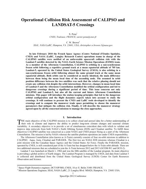
<strong>Operational</strong> <strong>Collision</strong> <strong>Risk</strong> <strong>Assessment</strong> <strong>of</strong> CALIPSO and<br />
LANDSAT-5 Crossings<br />
X. Pena 1<br />
CNES, Toulouse, FRANCE, xavier.pena@cnes.fr<br />
C. W. Brown 2<br />
SSAI., NASA LaRC, Hampton, VA 23681, USA, christopher.w.brown-1@nasa.gov<br />
In late February 2010 the French Space Agency (Centre National d’Etudes Spatiales,<br />
CNES) and NASA (LaRC, Langley Research Center) operations teams in charge <strong>of</strong> the<br />
CALIPSO satellite were notified <strong>of</strong> an unfavorable spacecraft collision risk with the<br />
Landsat-5 satellite detected by the NASA Earth Science Mission Operations (ESMO) team.<br />
As a member <strong>of</strong> the Afternoon Constellation, CALIPSO is orbiting in a sun-synchronous<br />
frozen orbit following a repetitive ground track at a mean equatorial altitude <strong>of</strong> 705 km.<br />
Landsat-5, operated by the United States Geological Survey (USGS), is also orbiting in a<br />
sun-synchronous frozen orbit following almost the same ground track at the same mean<br />
equatorial altitude. Both orbits can be considered as nearly identical, the main difference<br />
between them being the mean local time <strong>of</strong> the ascending node. The assumed in orbit<br />
position difference between the two satellites was such that the relative phasing should not<br />
create any collision risk despite the orbit intersections. However, changes in mean local time<br />
<strong>of</strong> Landsat-5 and the Afternoon Constellation modified the orbital configuration and led to<br />
dangerous crossings during a significant period <strong>of</strong> time. This issue concerns not only<br />
CALIPSO and Landsat-5, but also all the current and future Afternoon Constellation<br />
missions. This paper will introduce the station keeping principles that led to the dangerous<br />
orbital configuration and the flight dynamics aspects taken into account to study the<br />
crossings. It will continue to present the CNES and LaRC tools developed to identify the<br />
crossings and to compute the maneuver trade space permitting to choose the maneuver<br />
parameters that mitigate the collision risk. Finally, it will describe the maneuver strategy<br />
agreed upon by all the concerned missions to manage the close approaches.<br />
I. Introduction<br />
HE main objective <strong>of</strong> the CALIPSO mission is to collect cloud and aerosol data for a better understanding <strong>of</strong><br />
T their role in climate and improve the ability to predict long-term climate changes and seasonal climate<br />
variability. A secondary objective is to provide a set <strong>of</strong> simultaneous coincident data with which to validate and<br />
improve data retrievals from both NASA’s Earth Orbiting System (EOS) and Cloudsat satellite. To fulfill these<br />
objectives CALIPSO satellite was conceived as a joint NASA and CNES project flying as a part <strong>of</strong> the Afternoon<br />
Constellation. The mission is led by NASA whereas the satellite platform operations are under CNES responsibility.<br />
The Afternoon Constellation (also known as A-Train) currently consists <strong>of</strong> four on-orbit missions in addition to<br />
CALIPSO: Aqua, Aura, Cloudsat and PARASOL. The first two are NASA EOS missions whereas Cloudsat is a<br />
joint mission with the Canadian Space Agency and the United States Air Force. Finally the PARASOL mission,<br />
operated by CNES, is still considered part <strong>of</strong> the A-Train but has dropped below the A-Train orbit altitude. There are<br />
two additional missions that are scheduled to join the A-Train between <strong>2012</strong> and 2013 (GCOM-W1 and OCO-2).<br />
Landsat 5 was launched on March 1, 1984 and was the fifth satellite <strong>of</strong> the Landsat program. Its main objective<br />
is providing a global archive <strong>of</strong> Earth images. The Landsat Program is managed by USGS, and data from Landsat 5<br />
is collected and distributed from the United States Geological Survey (USGS) Center for Earth Resources<br />
Observation and Science.<br />
1 Space Flight Dynamics engineer, DCT/OP/MO, CNES, 18 av E. Belin 31401 FRANCE.<br />
2 Mission Operations Engineer, SSAI, NASA LaRC, 21 Langley Blvd MS420, Hampton, VA 23681 USA.<br />
1<br />
<strong>SpaceOps</strong> <strong>2012</strong> Conference
To carry out their missions, the Afternoon constellation and Landsat-5 have to orbit at a mean equatorial altitude<br />
<strong>of</strong> 705 km following a repetitive ground track. The discriminatory parameter <strong>of</strong> the orbits is the right ascension <strong>of</strong><br />
the ascending node (RAAN) also known as the Mean Local Time (MLT). Consequently both orbits have two points<br />
in common: the nodes<br />
corresponding to the orbit<br />
intersections. These intersections<br />
make a collision event possible if<br />
the satellites arrive simultaneously.<br />
The initial orbit parameters (MLT<br />
and relative phasing) were chosen to<br />
ensure that no collision risk was<br />
possible between Landsat-5 and the<br />
Afternoon Constellation. However,<br />
these parameters evolved throughout<br />
the operational lifetime due to<br />
modifications in the mission<br />
requirements leading to a dangerous<br />
situation for the satellites’ safety.<br />
Handling this new configuration<br />
needed an international cooperation<br />
and coordination involving several<br />
teams from different countries. This<br />
paper describes the station keeping<br />
principles that led to the dangerous<br />
Figure 1. Afternoon constellation (Credits NASA). The CloudSat spacecraft<br />
experienced an anomaly which led it to temporary exit the A-Train Orbit.<br />
Cloudsat return operations to the A-Train orbit are in progress.<br />
configuration and the flight dynamics concepts which permitted the characterization <strong>of</strong> the close approaches. The<br />
s<strong>of</strong>tware tools developed by the flight dynamics teams from CNES and LaRC and the final long term strategy<br />
agreed to minimize the collision risk without interrupting the mission will also be discussed.<br />
II. Nominal station keeping<br />
Landsat 5 and the Afternoon Constellation missions fly in 705 km, 98.2 degree, frozen, sun-synchronous, polar<br />
orbits which permit Earth observations under nearly identical lighting conditions every 16 days. The one exception<br />
is PARASOL, which lowered its orbit by 3.9 km in late 2009 due to insufficient fuel to maintain its location in the<br />
constellation, so it no longer maintains the same orbital relationship with the other Afternoon Constellation<br />
satellites.<br />
Figure 2 illustrates the Afternoon Constellation spacecrafts’ relative phasing (α). Aqua satellite follows a path<br />
along the World Reference System-2 (WRS-2) grid with a Mean Local Time <strong>of</strong> the Ascending Node (MLTAN)<br />
between 13:30 and 13:45 in a 43 seconds control box. CALIPSO flies in another 43 seconds control box placed 30<br />
seconds behind the Aqua one. CloudSat was in the front <strong>of</strong> CALIPSO spacecraft by 17.5±2.5 seconds until an<br />
anomaly occurred in 2011 which led it to leave the A-Train orbit (Fig. 2 shows the Cloudsat position before the<br />
anomaly which corresponds to the position it occupied when managing the CALIPSO and Landsat-5 passings).<br />
Figure 2. Afternoon Constellation spacecrafts relative phasing.<br />
The Landsat-5 satellite maintained an initial Mean Local Time <strong>of</strong> the Descending Node (MLTDN) near 9h45<br />
following a path along the WRS-2 grid (as explained later, the Landsat-5 MLTDN was moved to 10h00 causing the<br />
dangerous passings). In its nominal configuration Landsat-5 crossed the orbital intersection near the poles prior to<br />
the crossing by any Afternoon Constellation satellite. All the spacecrafts could co-exist without any interaction as<br />
2<br />
<strong>SpaceOps</strong> <strong>2012</strong> Conference
they were all following a repetitive ground track with a MLT that guaranteed the correct phasing to avoid a collision<br />
in the orbit intersection. Table 1 summarizes the station keeping parameters values.<br />
Table 1. Afternoon Constellation and Landsat-5 station keeping parameters.<br />
Altitude<br />
Inclination<br />
Orbit Type<br />
MLT at the<br />
ascending node<br />
Ground-track<br />
Reference<br />
Ground-track<br />
Error<br />
Aqua CALIPSO CloudSat Aura GCOM-W1 OCO-2 Landsat-5<br />
13:30 – 13:45<br />
WRS-2<br />
9 minutes later<br />
than Aqua<br />
215 km East <strong>of</strong><br />
Aqua WRS-2<br />
± 10 km ± 10 km<br />
12.2s ± 0.4s<br />
earlier than<br />
CALIPSO<br />
N/A<br />
± 1 km wrt the<br />
CALIPSO lidar<br />
ground-track<br />
705 km<br />
98.2 degrees<br />
Sun-synchronous and frozen<br />
8 minutes later<br />
than Aqua<br />
One WRS-2<br />
path + 25.4 km<br />
West <strong>of</strong> Aqua<br />
79.5-259.5<br />
seconds earlier<br />
than Aqua<br />
180.5-360.5<br />
seconds<br />
earlier than<br />
Aqua<br />
9:30 – 10:00<br />
(Descending<br />
node)<br />
WRS-2 WRS-2 WRS-2<br />
± 10 km ± 20 km ± 20 km ± 10 km<br />
To achieve these station keeping requirements (ground track error, relative phasing and MLT) the spacecrafts<br />
perform various maneuvers. The ground track error and the phasing difference are primarily maintained by<br />
performing Drag Make-Up maneuvers (DMU) to compensate the atmospheric drag. These raising maneuvers<br />
increase the orbital period and make the spacecraft drift along its ground track and within its control box. The<br />
parabola represented in each control box <strong>of</strong> Fig. 2 symbolizes the effect <strong>of</strong> a DMU and the atmospheric drag on the<br />
spacecraft. After performing a DMU the semi-major axis is higher than the nominal (perfectly phased) one and the<br />
spacecraft drifts back in its control box. Under the effect <strong>of</strong> the atmospheric drag, the semi-major axis decreases<br />
reversing the drift forward until another DMU is needed.<br />
To keep the MLT steady, a sun-synchronous orbit needs a given inclination in order to guarantee that the line <strong>of</strong><br />
nodes rotates at the same angular velocity as the meridian plane containing the Sun. Perturbations, like the Sun, the<br />
Moon and the Earth potential, modify the nominal inclination forcing the MLT to drift. Inclination maneuvers shall<br />
then be performed to maintain the MLT requirements.<br />
III. The dangerous configuration<br />
For a given ground track path the MLT and the relative phasing are coupled 1 . Allowing the MLT to drift, while<br />
maintaining the same ground track path, implies that the relative phasing will drift as well. An example <strong>of</strong> this<br />
relationship is represented in Fig. 3. Y-axis (∆α) represents the difference between the mean relative phasing and the<br />
nominal one. The x-axis (∆MLT) represents the<br />
difference between the current MLT and the<br />
nominal one. The green dotted line represents the<br />
combination <strong>of</strong> ∆α and ∆MLT corresponding to a<br />
0 ground-track error (GTE) and the orange dotted<br />
lines represent the combination <strong>of</strong> ∆α and ∆MLT<br />
leading to the maximum permitted GTE. The blue<br />
trajectory represents the satellite evolution<br />
performing DMUs to keep the GTE between the<br />
required boundaries without performing<br />
inclination maneuvers. As we can see in this<br />
figure, moving the MLT to a new value will force<br />
a new relative phasing in order to keep a groundtrack<br />
error within the mission requirements.<br />
In 2002, USGS initiated a series <strong>of</strong> inclination<br />
maneuvers in order to increase Landsat 5’s MLT<br />
from 9:45 a.m. to 10:00 a.m. Consequently, in<br />
order to maintain its ground track, Landsat-5<br />
gradually decreased the relative phasing with<br />
Figure 3. Example <strong>of</strong> relationship between relative<br />
phasing and MLT drift<br />
3<br />
<strong>SpaceOps</strong> <strong>2012</strong> Conference
espect to the Afternoon constellation. Eventually, Landsat-5 went from crossing through the orbit intersections<br />
several hundred seconds before the A-train satellites to crossing at almost the same time and then crossing well after<br />
the A-train. It is when Landsat-5 goes from crossing the intersection prior to an A-train satellite to crossing it after<br />
that A-train satellite (or vice versa) that there is potential for a high risk <strong>of</strong> collision. While every orbit has 2<br />
crossings (northern and southern nodes) <strong>of</strong> the orbital intersection, the transitions from satellites exchanging the<br />
order in which they cross the nodal intersections are referred to as passings.<br />
IV. Close approaches characterization<br />
As mentioned earlier, when the relative phasing between Landsat-5 and The Afternoon Constellation is such that<br />
the satellites reach the orbits crossing points at the same time, there is a high risk <strong>of</strong> collision generated by close<br />
approaches repeated at a frequency <strong>of</strong> twice an orbit (one at the North and the other at the South hemisphere).<br />
Because the orbits are so similar, the phasing change between an orbit and the following one can be less than the<br />
along track uncertainty. Therefore, the risk can be high for several consecutive crossings through an orbit<br />
intersection. CNES characterizes a close approach event by computing its probability <strong>of</strong> collision 2 . It can be<br />
demonstrated 3 that, in case <strong>of</strong> consecutive close approaches, the classical method to compute the probability <strong>of</strong><br />
collision used at CNES may not be applicable. Consequently we had to find new elements to identify and<br />
characterize these close approaches.<br />
The first element is the radial separation at orbits crossing points. Analyzing both Afternoon Constellation and<br />
Landsat 5 orbits we can see that the Landsat-5 frozen orbit has a much larger libration than that <strong>of</strong> the Afternoon<br />
Constellation. The Landsat 5 perigee and apogee (and thus its eccentricity) and its argument <strong>of</strong> perigee each oscillate<br />
over a wider range than those for the Afternoon Constellation satellites. Consequently, the radial separation at the<br />
orbits crossing point raises and falls following a well known cycle <strong>of</strong> 118 days. The eccentricity requirement <strong>of</strong> the<br />
Afternoon Constellation is 0.0012 +/- 0.0004 deg. However, in practice, eccentricity deviation is less than 0.0001<br />
degrees. Actual Landsat-5 eccentricity deviation is around 0.0003 degrees which produces radial separation with<br />
respect the Afternoon constellation orbits to oscillate between +/- 2km. Figure 4 shows a simplified analytical<br />
computation <strong>of</strong> the radial separation at CALIPSO and Landsat-5 orbits crossing points.<br />
Figure 4. Analytical computation <strong>of</strong> the radial separation at orbits crossing points between CALIPSO and<br />
LANDSAT-5.<br />
The second element permitting the characterization <strong>of</strong> the close approaches is the crossing time difference, i.e.,<br />
the period <strong>of</strong> time between the passage <strong>of</strong> one <strong>of</strong> the satellites through the orbits crossing point and the passage <strong>of</strong><br />
the other.<br />
By computing the dates when the crossing time difference is close to 0 we can identify the passings. The radial<br />
separation at the orbit’s crossing points is then the criteria used to define whether a given passing event is a<br />
dangerous conjunction. Then these dangerous conjunctions can be mitigated by maintaining the orbit so a passing<br />
does not occur during a period <strong>of</strong> low radial separation.<br />
V. Developed S<strong>of</strong>tware Tools<br />
To handle the CALIPSO and Landsat-5 crossings two dedicated tools were developed. The first one computes<br />
the crossing time difference and the radial separation at orbits crossing points in order to identify the passing<br />
4<br />
<strong>SpaceOps</strong> <strong>2012</strong> Conference
periods. The second was used to compute the maneuver trade space allowing a shift <strong>of</strong> a dangerous passing period to<br />
other favorable dates.<br />
A. Computation <strong>of</strong> the crossing time difference and the radial separation<br />
The two spacecrafts will reach the orbit crossing point at the same time for a given difference in the in-orbit<br />
position ∆α critical . Assuming that orbits are not coplanar, the direction from the center <strong>of</strong> the Earth and the orbits<br />
crossing point is defined by the vector c r perpendicular to the kinetic momentums <strong>of</strong> both orbits n r 1<br />
and n r 2<br />
.<br />
r r<br />
r n1<br />
∧ n2<br />
c = r r<br />
n1<br />
∧ n2<br />
(1)<br />
Letting ∆Ω be the difference in RAAN <strong>of</strong> the orbits and<br />
Nodes, it can be proven 4 that:<br />
i<br />
r<br />
( AN i.<br />
c)<br />
α = arccos α ∈[ 0;π<br />
]<br />
i<br />
r<br />
( AN i.<br />
c)<br />
α = − arccos α ∈[ 0;π<br />
]<br />
i<br />
i<br />
AN i the unitary position vector <strong>of</strong> these Ascending<br />
if<br />
if<br />
∆Ω ∈ [ 0;π [<br />
∆Ω ∈[ − π;0[<br />
∆α<br />
critical<br />
= α 2<br />
− α 1<br />
(3)<br />
(2)<br />
Where α i is the in-orbit position <strong>of</strong> the crossing point <strong>of</strong> each spacecraft. With Eqs. (1), (2) and (3) we can<br />
compute the crossing point position.<br />
The s<strong>of</strong>tware implements two computation modes: the long-term mode and the accurate mode (for short-term<br />
analysis).<br />
1. Long-term mode<br />
The radial separation (∆R) is computed in mean parameters using Eqs. (4) and (5) :<br />
∆R<br />
= r 2<br />
− r 1<br />
(4)<br />
ai<br />
⋅ (1 − ei<br />
)<br />
ri<br />
=<br />
(1 + e ⋅ cos( α − ω )<br />
i<br />
Where:<br />
r i is the distance between the center <strong>of</strong> the Earth and the intersection <strong>of</strong> the vector c r with the corresponding<br />
orbit i.<br />
a i is the mean semi-major axis <strong>of</strong> the orbit i<br />
e i is the mean eccentricity <strong>of</strong> the orbit i<br />
ω i is the mean argument <strong>of</strong> perigee <strong>of</strong> the orbit i<br />
i<br />
2<br />
i<br />
(5)<br />
The crossing time difference (CTD) is computed as follows:<br />
Where:<br />
∆α − ∆α<br />
CTD =<br />
critical<br />
µ<br />
3<br />
a<br />
5<br />
<strong>SpaceOps</strong> <strong>2012</strong> Conference<br />
(6)
∆α is the actual difference in the in-orbit position <strong>of</strong> both spacecrafts<br />
µ is the Earth standard gravitational constant<br />
In the long-term mode the radial separation and the crossing time difference are computed with a given time<br />
step, typically 12 hours. Thus, the accurate passing dates throughout the crossing points cannot be identified but it<br />
permits long term computations (two years) to be performed in a few seconds. Figure 5 shows an example <strong>of</strong> the<br />
results <strong>of</strong> the April 2010 passing, the first one detected (see section VI).<br />
Figure 5. Crossing time difference and the radial separation computed with the<br />
long-term mode.<br />
2. Accurate mode<br />
In this mode the s<strong>of</strong>tware identifies the first satellite to pass through the orbits intersection point (α 1 ) and it<br />
computes the distance between the center <strong>of</strong> the Earth and the satellite at the passing instant (r 1 ). Then, again for the<br />
other satellite, it computes the time (CTD) taken to reach its orbit intersection point (α 2 ) and computes its distance to<br />
∆ R = r 2<br />
− r<br />
the center <strong>of</strong> the Earth (r 2 ). The radial separation is then<br />
1<br />
. In this mode all the computations are made<br />
in osculating parameters and passing dates and times are estimated with a precision better than 0.001 seconds. The<br />
radial separation is as accurate as the ephemeris used for the computations. The computation time for one month<br />
analysis is approximately 1 minute.<br />
B. Computation <strong>of</strong> the maneuver trade space for the passing shifting<br />
The purpose <strong>of</strong> the maneuver trade space is to help determine maneuver plans to shift a passing event to a larger<br />
radial separation while reducing the number <strong>of</strong> simulations runs. The objective is to represent a given passing event<br />
by simple analytical equations in order to evaluate the effects <strong>of</strong> a maneuver on the passing dates and on the radial<br />
separation.<br />
If there are no scheduled maneuvers on the study period, the crossing time difference (CTD) as a function <strong>of</strong><br />
time can be adjusted by a parabolic function using the least squares method<br />
2<br />
CTD = at + bt + c<br />
Where:<br />
t is the time from the initial passing date<br />
a, b & c are the coefficients determined with the least squares method<br />
(8)<br />
The effect <strong>of</strong> a maneuver (∆V) on the crossing time difference can be represented by a linear function <strong>of</strong> time :<br />
6<br />
<strong>SpaceOps</strong> <strong>2012</strong> Conference
CTD<br />
Man<br />
⎧0<br />
⎪<br />
= ⎨<br />
3∆V<br />
⋅<br />
⎪<br />
⎩<br />
a<br />
⋅ ( t − t<br />
man<br />
)<br />
if t<br />
<<br />
t<br />
if t ≥ t<br />
man<br />
man<br />
µ (9)<br />
Where:<br />
t is the time from the initial passing date<br />
t man is the number <strong>of</strong> days between the initial passing and the maneuver execution (t man < 0)<br />
∆V is the velocity change due to the maneuver<br />
Then, we can compute the number <strong>of</strong> days shifted by a ∆V maneuver (t shift ) by solving Eq. (10). Doing this for<br />
different values <strong>of</strong> ∆V, we can find out the maneuver trade space in terms <strong>of</strong> days shifted.<br />
at<br />
a<br />
⋅ ( t<br />
µ<br />
2<br />
shift<br />
+ btshift<br />
+ c + 3∆V<br />
⋅<br />
shift<br />
− tman<br />
) = 0<br />
As we can see in Fig 5 the radial separation as a function <strong>of</strong> the time can be adjusted by a sinusoidal function:<br />
∆R<br />
= ∆R<br />
Max<br />
π<br />
⋅ cos( ⋅ ( t − ∆t<br />
T<br />
Where:<br />
t is the time from the initial passing date<br />
∆t c is the number <strong>of</strong> days between the passing and the date <strong>of</strong> the maximum radial separation.<br />
∆R Max is the maximum radial separation<br />
T is the radial separation period<br />
Assuming that the semi-major axis change induced by the ∆V is negligible with respect to the maximum radial<br />
separation, the corresponding radial separation <strong>of</strong> the shifted passing can be estimated using Eq. (7) replacing t with<br />
t shift . For a given crossing, the developed tool automatically estimates all the parameters <strong>of</strong> the equations above and<br />
computes the maneuver trade space in terms <strong>of</strong> days the passing is shifted and the radial separation obtained. For<br />
example, Fig. 6 shows the values <strong>of</strong> the parameters <strong>of</strong> the April 2010 passing.<br />
c<br />
))<br />
(10)<br />
(7)<br />
7<br />
<strong>SpaceOps</strong> <strong>2012</strong> Conference
Figure 6. Passing parameters <strong>of</strong> April 2010.<br />
Figure 7 shows the resulting maneuver trade space. The user can obtain the maneuver set <strong>of</strong> parameters (∆V and<br />
number <strong>of</strong> days before the initial passing date to execute the maneuver) that permit obtaining a desired radial<br />
separation.<br />
Figure 7. Maneuver Trade Space <strong>of</strong> the April 2010 passing.<br />
8<br />
<strong>SpaceOps</strong> <strong>2012</strong> Conference
To validate the s<strong>of</strong>tware we generated six CALIPSO ephemeris containing maneuvers <strong>of</strong> different sizes and<br />
execution dates. We compared the actual shifted passing dates and radial separation with those estimated by the tool.<br />
The results are shown in Table 2.<br />
Table 2. Maneuver Trade Space estimation accuracy.<br />
As we can see, the new passing date is estimated with an error smaller than 0.3 days and the radial separation<br />
error is less than 150 meters, even for maneuvers performed up to 40 days before the initial passing date.<br />
VI. CALIPSO and Landsat-5 agreed strategy to mitigate the collision risks<br />
The passing <strong>of</strong> the satellites was first discovered in February 2010. Landsat 5 was crossing through the orbit<br />
intersections in the space after Cloudsat and before CALIPSO. Additionally, it was learned that in the next several<br />
weeks it would pass behind CALIPSO. Further analyses revealed that 2 other Landsat-5 passages had already<br />
occurred. A backward-moving passage (from in front <strong>of</strong> the A-train to behind it) had occurred in late 2004while a<br />
second, forward-moving passage (from behind the A-train to in front <strong>of</strong> it) had occurred in 2008. The third passage<br />
(backward-moving) was underway (Figure 5). This passage was managed by computing the radial separation during<br />
the passing period. As shown in Fig. 4, the nominal passing date was such that the radial separation was large<br />
enough to guarantee the satellites safety. No special mitigation actions were needed. However, both CALIPSO and<br />
Landsat-5 rescheduled their planned DMUs to move the passing date forward in order to obtain the maximal<br />
possible radial separation <strong>of</strong> 2 kilometers.<br />
A fourth passage <strong>of</strong> Landsat-5 (forward-moving) was expected to take place in 2011 involving all the Afternoon<br />
Constellation missions. A Red Team, with members <strong>of</strong> Landsat-5 and the A-Train missions, was formed to analyze<br />
the crossing situation and determine the best courses <strong>of</strong> action to minimize risks while continuing to provide the<br />
most science return from all the satellites. It was agreed that all transits with A-Train missions should be managed to<br />
an acceptable probability <strong>of</strong> collision (P c ) less than 10 -5 . Internal analysis showed that the acceptable P c would be<br />
obtained when the radial separations at the orbital crossing points are 400 meters or greater. The DMU maneuvers<br />
had to be coordinated between Landsat-5 and the concerned A-Train mission to ensure that the passing times would<br />
occur when the radial separations were safe.<br />
Analysis performed on January 2011 showed that, with properly designed and coordinated Landsat 5 and<br />
CALIPSO maneuvers, a passing window <strong>of</strong> acceptable radial separations (i.e., greater than 400 meters) would occur<br />
from mid-August to late September. The maneuver strategy, designed to permit Landsat-5 to pass CALIPSO during<br />
this safe window, was as follows :<br />
- Prior to the mid-August passing, CALIPSO should ensure that the passing would not occur before the passing<br />
window opened. Additionally, it should maintain a 10 second separation at the orbital intersections. To accomplish<br />
that, it positioned itself in the second quarter <strong>of</strong> its control box. Since this was a forward-moving passing, Landsat-5<br />
would be entering from the back <strong>of</strong> CALIPSO’s control box. Landsat-5 was expected to enter the CALIPSO control<br />
box weeks before the actual passing. Positioning itself in the 2 nd quarter delayed the passing while also giving the<br />
mission the ability to perform an additional maneuver to retard the passing with less chance <strong>of</strong> going out <strong>of</strong> the box.<br />
It could also delay a planned maneuver and still have margin before going out <strong>of</strong> the front <strong>of</strong> its control box.<br />
- The Landsat 5 maneuvers were designed to keep the spacecraft within a restricted portion <strong>of</strong> its control box so<br />
that CALIPSO had a relatively stable reference to use in planning its maneuvers. Landsat-5 maintained itself within<br />
a 5 second control box. This was a relatively small slice compared to CALIPSO’s 43 second control box.<br />
- As the mid-August 2011 passing window opening approached, CALIPSO planned its DMU maneuvers in such<br />
a way that it would be in front <strong>of</strong> Landsat 5 at both the northern and southern orbits crossing points when the passing<br />
9<br />
<strong>SpaceOps</strong> <strong>2012</strong> Conference
window opened and behind Landsat 5 at both crossing points when the passing window closes in late-September.<br />
While in the passing window, as Landsat-5 approached the 3 rd quarter <strong>of</strong> the CALIPSO control box, CALIPSO<br />
planned and performed a DMU maneuver targeting the back <strong>of</strong> its control box (Figure 8). This maneuver allowed<br />
the crossing to occur at the time <strong>of</strong> maximum radial separation between the 2 spacecraft. An increase in solar<br />
activity beginning in late-August 2011 kept CALIPSO from fully realizing the back <strong>of</strong> its control box. However, the<br />
maneuver proved sufficient enough to achieve a safe passing. When the safe passing window closed in late-<br />
September, the spacecraft were crossing the orbital intersections over 10 seconds apart. CALIPSO would maintain<br />
this safe phasing separation until Landsat-5 exited the front in early-October 2011.<br />
Figure 8. CALIPSO/LANDSAT-5 passing relative to CALIPSO control box<br />
Figure 9 shows the January prediction and the final actual passing. The red zones represent the periods where<br />
radial separation is less than 400 meters. As we can see, the analyses performed in January predicted the passing to<br />
occur just before the window opening with a radial separation smaller than 400 meters. Thanks to the coordination<br />
and cooperation <strong>of</strong> the Landsat-5 and CALIPSO teams, DMUs performed from January to August permitted the<br />
shift <strong>of</strong> this initial passing date to the September 3 rd and 5 th with a larger radial separation (approximately 1.5 km).<br />
.<br />
10<br />
<strong>SpaceOps</strong> <strong>2012</strong> Conference
Figure 9. January 2011 prediction and final CALIPSO/LANDSAT-5 passing.<br />
VII. Conclusion<br />
The management <strong>of</strong> the Afternoon constellation and Landsat-5 crossings is an innovative example <strong>of</strong> collision<br />
risk assessment in constellation flying. Thanks to an international cooperation and coordination, Landsat and<br />
Afternoon Constellation teams ensured the safety and continuation <strong>of</strong> their missions. The activities carried out<br />
demonstrated the importance <strong>of</strong> the communication in order to handle the close approaches by agreeing upon a<br />
common maneuver strategy.<br />
The flight dynamics aspects considered to study the crossings, as well as the developed tools, can be used to<br />
manage other cases <strong>of</strong> repetitive conjunctions with long and short term analyses. CNES applied these principles for<br />
long-term analyses when decommissioning ESSAIM 5 and HELIOS-1A satellites in order to ensure that the final<br />
orbits were not generating dangerous fly-bys with operational satellites.<br />
LEO satellites are <strong>of</strong>ten required to have a repeated Earth coverage but the number <strong>of</strong> phased orbits are limited.<br />
Consequently, there are some altitudes, such as the CALIPSO one, where we can find a high concentration <strong>of</strong><br />
operational spacecrafts which are all performing station keeping maneuvers. Changing the initial station keeping<br />
requirements <strong>of</strong> a satellite can create a dangerous configuration with respect to the other spacecrafts orbiting at the<br />
same altitude. Before changing its requirements, missions in phased orbits, should analyze the risks associated to the<br />
alteration <strong>of</strong> one <strong>of</strong> their orbital parameters, especially those related to the orbit plane. A collision in one <strong>of</strong> the Earth<br />
observation altitudes would be catastrophic, not only for the involved satellites, but also for the satellites orbiting in<br />
the same altitude.<br />
Appendix A<br />
Acronym List<br />
CALIPSO<br />
CNES<br />
CTD<br />
DMU<br />
Cloud Aerosol Lidar and Infrared Pathfinder Satellite Observations<br />
Centre National d’Etudes Spatiales<br />
Crossing Time Difference<br />
Drag Make-Up Maneuver<br />
11<br />
<strong>SpaceOps</strong> <strong>2012</strong> Conference
EOS<br />
ESMO<br />
GTE<br />
LEO<br />
MLT<br />
MLTAN<br />
MLTDN<br />
PARASOL<br />
RAAN<br />
USGS<br />
WRS-2<br />
CALIPSO<br />
CNES<br />
CTD<br />
DMU<br />
EOS<br />
ESMO<br />
GTE<br />
LEO<br />
MLT<br />
MLTAN<br />
MLTDN<br />
PARASOL<br />
RAAN<br />
SSAI<br />
USGS<br />
WRS-2<br />
Earth Orbiting System<br />
Earth Science Mission Operations<br />
Ground-Track Error<br />
Low Earth Orbit<br />
Mean Local Time<br />
Mean Local Time <strong>of</strong> the Ascending Node<br />
Mean Local Time <strong>of</strong> the Descending Node<br />
Polarisation et Anisotropie des Reflectances au sommet de l’Atmosphère, couplées avec un<br />
Satellite d’Observation emportant un Lidar<br />
Right Ascension <strong>of</strong> the Ascending Node<br />
United States Geological Survey<br />
World Reference System-2<br />
Cloud Aerosol Lidar and Infrared Pathfinder Satellite Observations<br />
Centre National d’Etudes Spatiales<br />
Crossing Time Difference<br />
Drag Make-Up Maneuver<br />
Earth Orbiting System<br />
Earth Science Mission Operations<br />
Ground-Track Error<br />
Low Earth Orbit<br />
Mean Local Time<br />
Mean Local Time <strong>of</strong> the Ascending Node<br />
Mean Local Time <strong>of</strong> the Descending Node<br />
Polarisation et Anisotropie des Reflectances au sommet de l’Atmosphère, couplées avec un<br />
Satellite d’Observation emportant un Lidar<br />
Right Ascension <strong>of</strong> the Ascending Node<br />
Science Systems and Applications, Inc.<br />
United States Geological Survey<br />
World Reference System-2<br />
Acknowledgments<br />
The success on managing these dangerous crossings was possible thanks to the implication and cooperation <strong>of</strong><br />
several teams <strong>of</strong> the A-Train and Landsat-5 missions. What is described in this paper is just a very little part <strong>of</strong> the<br />
entire work made by all the persons involved and it would not have been possible to write it without them. The<br />
authors would like to thank all <strong>of</strong> them : Angelita Kelly, Dave Macdonnell, Charles Trepte, Steven Covington,<br />
Donald Keenan, Sang Lee, William Guit, David Tracewell, Joshua A. Levi, Eric Palmer, Mark Vincent, Mark<br />
Garcia, Warren Case, Adam Loverro, Carolus Verhappen and Patricia Lucker.<br />
Xavier Pena would like to say a special thank you to the persons who made his participation to this activity<br />
possible : Thérèse Barroso, Denis Perriot, Nadège Queruel, Christophe Marechal, Christophe Ferrier, Annabelle<br />
Krauss and Remi Canton.<br />
References<br />
1 Carrou J. P., Spaceflight Dynamics Part I, 1 rst ed., Cepadues Editions, Toulouse, 1995.<br />
2 Pena, X., “CNES <strong>Operational</strong> Activities in <strong>Collision</strong> Avoidance for LEO Satellites,” IAF, Berlin, 2010.<br />
3 Garmier R., Dolado, J.C., Pena X., Legendre P., Revelin B., “<strong>Collision</strong> <strong>Risk</strong> <strong>Assessment</strong> for Multiple Encounters”, European<br />
Space Surveillance Conference, 2011.<br />
4 Flamenbaum D., “Calcul de l’écart de PSO critique entre deux orbites quasi-circulaires”, Toulouse (unpublished)<br />
5 Fremeaux C., Pena X., Fourcade J., “Essaim Cluster Disposal : Orbit Management”, <strong>SpaceOps</strong>, Stockholm, <strong>2012</strong><br />
(unpublished)<br />
12<br />
<strong>SpaceOps</strong> <strong>2012</strong> Conference