Forest Park School Travel Plan - Active Transportation Policy
Forest Park School Travel Plan - Active Transportation Policy
Forest Park School Travel Plan - Active Transportation Policy

You also want an ePaper? Increase the reach of your titles
YUMPU automatically turns print PDFs into web optimized ePapers that Google loves.
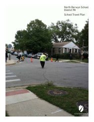
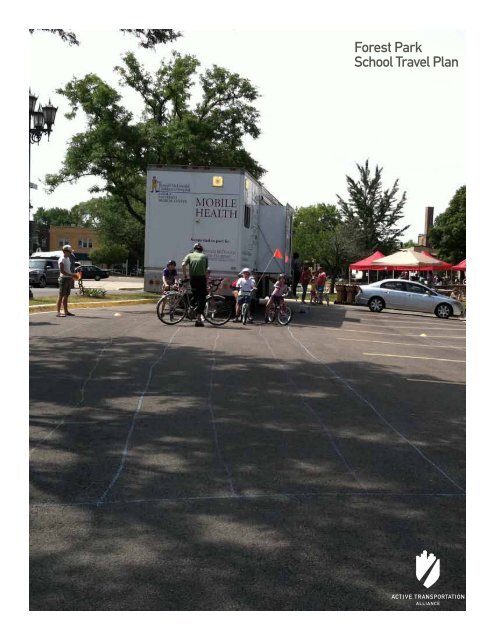
<strong>Forest</strong> <strong>Park</strong><br />
<strong>School</strong> <strong>Travel</strong> <strong>Plan</strong>
<strong>Forest</strong> <strong>Park</strong><br />
<strong>School</strong> <strong>Travel</strong> <strong>Plan</strong><br />
Presented by <strong>Active</strong> <strong>Transportation</strong> Alliance December 2011
Acknowledgements<br />
This plan was developed by a committee of key stakeholders and residents. It represents the combined vision for creating safer<br />
routes to school. Thank you to the Steering Committee members for donating their time to this project:<br />
Heather Ash, Parent<br />
Elizabeth Axtell, <strong>Forest</strong> <strong>Park</strong> Chamber of Commerce<br />
Ed Brophy, <strong>Forest</strong> <strong>Park</strong> <strong>School</strong> District 91<br />
Anthony Calderone, Mayor, Village of <strong>Forest</strong> <strong>Park</strong><br />
Lou Cavallo, <strong>Forest</strong> <strong>Park</strong> <strong>School</strong> District 91<br />
Christopher Chin, <strong>Forest</strong> <strong>Park</strong> Police Department<br />
Heather Cianciolo, Resident<br />
Sally Cody, Village of <strong>Forest</strong> <strong>Park</strong><br />
Karen Dylewski, Howard Mohr Community Center<br />
Mary Flannagan, Resident<br />
Timothy Gillian, Village of <strong>Forest</strong> <strong>Park</strong><br />
Doug Gotham, Christopher Burke Engineering<br />
Chris Harris, Village of <strong>Forest</strong> <strong>Park</strong><br />
John Hosty, Village of <strong>Forest</strong> <strong>Park</strong><br />
TJ Januopoulos, <strong>Forest</strong> <strong>Park</strong> Fire Department<br />
Tom Mannix, Village of <strong>Forest</strong> <strong>Park</strong><br />
John McNett, Oak <strong>Park</strong> Cycle Club<br />
Bill Milnamow, <strong>Forest</strong> <strong>Park</strong> <strong>School</strong> District 91<br />
Vanessa Moritz, Village of <strong>Forest</strong> <strong>Park</strong><br />
Denise Murray, Village of <strong>Forest</strong> <strong>Park</strong><br />
Mike O’Connor, <strong>Forest</strong> <strong>Park</strong> Police Department<br />
Letitia Olmsted, Village of <strong>Forest</strong> <strong>Park</strong><br />
Erin Parchert, <strong>Park</strong> District of <strong>Forest</strong> <strong>Park</strong><br />
Ray Paulin, <strong>Forest</strong> <strong>Park</strong> <strong>School</strong><br />
Drew Peterson, Resident<br />
Melinda Holmes Peterson, Resident<br />
Jessica Rinks, <strong>Forest</strong> <strong>Park</strong> Community Garden<br />
Jamie Stauder, <strong>Forest</strong> <strong>Park</strong> <strong>School</strong> District 91<br />
Gina Thomas, <strong>Forest</strong> <strong>Park</strong> Community Garden<br />
Rebecca Vnuk, Resident<br />
Michelle Woehrle, Resident<br />
About the Consultants<br />
The mission of <strong>Active</strong> <strong>Transportation</strong> Alliance is to make<br />
bicycling, walking, and public transit so safe, convenient, and<br />
fun that we will achieve a significant shift from environmentally<br />
harmful, sedentary travel to clean, active travel. We advocate<br />
for transportation that encourages and promotes safety,<br />
physical activity, health, recreation, social interaction, equity,<br />
environmental stewardship, and resource conservation.<br />
We are both Chicagoland’s voice for better biking, walking,<br />
and transit and a premier consultancy. Our staff includes<br />
planning, policy, and education experts who developed many<br />
of the best practice programs and policies included in this plan.<br />
By partnering with us on this project, you not only get the best<br />
plan possible, you also support our mission to improve active<br />
transportation throughout the Chicagoland region.<br />
The <strong>Active</strong> <strong>Transportation</strong> Alliance Project Team:<br />
Heather Schady – Safe Routes to <strong>School</strong> Manager<br />
Brett Mohr – GIS <strong>Plan</strong>ner<br />
Ruth Myers – Suburban Coordinator<br />
About Communities Putting Prevention to Work<br />
The <strong>Forest</strong> <strong>Park</strong> <strong>School</strong> <strong>Travel</strong> <strong>Plan</strong> was made possible through<br />
funding from the Department of Health and Human Services:<br />
Communities Putting Prevention to Work (CPPW) grant. CPPW<br />
is a joint project between the Cook County Department of Public<br />
Health and the Public Health Institute of Metropolitan Chicago.<br />
<strong>Forest</strong> PARK <strong>School</strong> <strong>Travel</strong> <strong>Plan</strong>
Contents<br />
Acknowledgements<br />
Executive Summary 4<br />
1 Introduction 6<br />
1.1 Community Overview and Vision 7<br />
1.2 Goals 8<br />
1.3 <strong>School</strong> <strong>Travel</strong> <strong>Plan</strong> Process 8<br />
1.4 Timeframe 9<br />
2 Existing Conditions 10<br />
2.1 Student <strong>Travel</strong> Environment 13<br />
2.2 <strong>School</strong> Arrival and Dismissal Process 14<br />
2.3 Existing Roadway Conditions 14<br />
2.4 Walkways and Crossings 16<br />
2.5 Bike Infrastructure 18<br />
2.6 Road User Behavior 18<br />
2.7 Personal Safety Concerns 19<br />
2.8 <strong>School</strong> Policies 19<br />
3 Recommendations 20<br />
3.1 Education 21<br />
3.2 Encouragement 22<br />
3.3 Enforcement 23<br />
3.4 Engineering 25<br />
3.5 Evaluation 28<br />
4 Implementation and Oversight 29<br />
4.1 Implementation 30<br />
4.2 Oversight 30<br />
5 Appendices 32<br />
5.1 Appendix A: Bike Rack Siting Report 33<br />
5.2 Appendix B: Education Resources 45<br />
5.3 Appendix C: PBIS Matrix 46<br />
5.4 Appendix D: International Walk to <strong>School</strong> Day Resolution 47<br />
5.5 Appendix E: Preferred Walking Route Maps 48<br />
5.6 Appendix F: Evaluation Tools 53<br />
Executive Summary<br />
3
Executive Summary<br />
<strong>Forest</strong> PARK <strong>School</strong> <strong>Travel</strong> <strong>Plan</strong>
Executive Summary<br />
Safe Routes to <strong>School</strong> (SRTS) is an international movement that enables and encourages students to safely walk and bike to and from<br />
school. Recognizing that safety—or the perception of safety—is dependent on a variety of factors, Safe Routes to <strong>School</strong> programs take<br />
a holistic approach to addressing the barriers to walking and bicycling to school. SRTS seeks to both improve walking and bicycling<br />
infrastructure (sidewalks, crosswalks, bike facilities, etc.) as well as change social norms and behaviors around student transportation<br />
(increased awareness, better road user knowledge, increased popularity of walking and biking, etc.)<br />
The Village of <strong>Forest</strong> <strong>Park</strong> and <strong>Forest</strong> <strong>Park</strong> <strong>School</strong> District 91 partnered with <strong>Active</strong> <strong>Transportation</strong> Alliance to create a school travel<br />
plan centered on “the Five E’s” of Safe Routes to <strong>School</strong>: education, encouragement, enforcement, engineering, and evaluation. The<br />
school travel plan acts as a road map designed to analyze the social and physical barriers to walking and bicycling to school in <strong>Forest</strong><br />
<strong>Park</strong> and provide recommendations to make walking and bicycling to school the safe, healthy, and convenient choice.<br />
The recommendations addressed in this plan are divided into the Five E’s of SRTS. When applied in the right combination, these<br />
strategies have been shown to increase rates of walking and bicycling to school, decrease vehicle traffic on and around the school<br />
campus, and improve safety along the route to school.<br />
Recommendations included in this plan for each of the Five E's are as follows:<br />
Education<br />
• Adopt school bicycle and pedestrian curricula.<br />
• Create public educational tools on school zone safety.<br />
• Hold annual summer bike rodeos.<br />
• Educate parents on a Positive Behavioral Interventions and<br />
Supports (PBIS) matrix.<br />
Enforcement<br />
• Continue targeted enforcement events, focused on issues at<br />
schools.<br />
• Increase crossing guards on Village streets.<br />
• Hold trainings for police and crossing guards.<br />
• Distribute preferred walking route maps to parents.<br />
Encouragement<br />
• Celebrate International Walk to <strong>School</strong> Day.<br />
• Create a "Caught Being Good" Program.<br />
Engineering<br />
• Install directional signage and on-street bike facilities along<br />
school routes.<br />
• Install new bike racks at schools.<br />
• Create safer routes along Circle Avenue, Roosevelt Road,<br />
and Des Plaines Avenue.<br />
Evaluation<br />
• Disseminate annual Parent Surveys.<br />
• Conduct annual Student <strong>Travel</strong> Tallies.<br />
Executive Summary<br />
5
Introduction<br />
1.1 Community Overview 7<br />
1.2 Goals 8<br />
1.3 <strong>School</strong> <strong>Travel</strong> <strong>Plan</strong> Process 8<br />
1.4 Timeframe 9<br />
1<br />
6<br />
<strong>Forest</strong> PARK <strong>School</strong> <strong>Travel</strong> <strong>Plan</strong>
1.1 Community Overview and Vision<br />
<strong>Forest</strong> <strong>Park</strong> is a community that works together to maintain the<br />
health, safety, and well-being for all residents.<br />
Despite being located just 10 miles west of the City of Chicago,<br />
the Village of <strong>Forest</strong> <strong>Park</strong> has a traditional, small-town feel.<br />
Tree-lined streets connect neighborhoods to parks, schools, and<br />
businesses, a historic main street is centered in the heart of the<br />
community, and residents are always willing to lend a hand.<br />
Consistent with the historic nature of the community, <strong>Forest</strong><br />
<strong>Park</strong> schools are centered in the neighborhoods they serve. No<br />
student lives further than a mile from their school, and most live<br />
much closer.<br />
The Village of <strong>Forest</strong> <strong>Park</strong> has many assets when it comes<br />
to walkability. All of its schools are neighborhood schools,<br />
supported by a near-complete network of sidewalks, and<br />
recent traffic calming strategies have helped to slow traffic at<br />
intersections along school routes. Yet, more can be done to<br />
improve safety and conditions for students travelling to school<br />
in <strong>Forest</strong> <strong>Park</strong>. For example, narrow sidewalks and high vehicle<br />
speeds along the Circle Avenue Bridge make it hazardous for<br />
students going school. Unsafe driver behavior during school<br />
arrival and dismissal time makes parents question whether it is<br />
truly safe for their kids to walk or bike to school. Lack of adult<br />
presence on school routes is another cause for concern.<br />
The connection between home, community, and school is a<br />
critical component of <strong>Forest</strong> <strong>Park</strong> <strong>School</strong> District 91’s mission.<br />
With that in mind, this plan was developed by a steering<br />
committee made up of diverse representatives from community<br />
agencies and organizations.<br />
The steering committee was tasked with developing a common<br />
vision and identifying shared goals to increase the number of<br />
walking and biking trips, improving walking and bicycling<br />
conditions, and reducing the number of vehicle trips. The <strong>Forest</strong><br />
<strong>Park</strong> <strong>School</strong> <strong>Travel</strong> <strong>Plan</strong> aims to strategically address barriers to<br />
walking and bicycling to school to ensure that students can enjoy<br />
safe, healthy, and physically active transportation as a means of<br />
travel to school.<br />
The shared vision of the steering committee is as follows:<br />
Form community and school partnerships that aim to foster good life<br />
habits, improve student health, and create a safe environment for all<br />
students in <strong>Forest</strong> <strong>Park</strong>.<br />
Members of the <strong>Forest</strong> <strong>Park</strong> <strong>School</strong> <strong>Travel</strong> <strong>Plan</strong> steering committee and others participate in a community bike ride.<br />
Introduction<br />
7
1.2 Goals<br />
1.3 <strong>School</strong> <strong>Travel</strong> <strong>Plan</strong> Process<br />
The <strong>Forest</strong> <strong>Park</strong> <strong>School</strong> <strong>Travel</strong> <strong>Plan</strong> provides practical solutions<br />
to increase safety for students and their families when walking<br />
and biking to school. The recommendations will help strengthen<br />
partnerships between the Village, Police Department, <strong>School</strong><br />
District, parents, and other community partners to ensure that<br />
student health and safety is addressed.<br />
The following goals were identified by the <strong>Forest</strong> <strong>Park</strong> <strong>School</strong><br />
<strong>Travel</strong> <strong>Plan</strong> steering committee:<br />
• Improve unsafe or insufficient crossings and walkways on<br />
school routes.<br />
• Increase student health through active forms of<br />
transportation.<br />
• Reduce speeding and reckless driving near schools.<br />
• Address community concerns regarding student safety.<br />
The strategies recommended in this plan aim to address these<br />
goals through a comprehensive approach.<br />
The recommendations made in the <strong>Forest</strong> <strong>Park</strong> <strong>School</strong> <strong>Travel</strong><br />
<strong>Plan</strong> are based on input from parents, residents, school district<br />
staff, and municipal staff. The consultant team and the steering<br />
committee engaged in the following community engagement<br />
activities:<br />
• <strong>Forest</strong> <strong>Park</strong> <strong>School</strong> District 91 surveyed students in May<br />
2011 about their mode of travel to and from school.<br />
• Community members attended an <strong>Active</strong> <strong>Transportation</strong><br />
<strong>Plan</strong> Open House on June 28, 2011. <strong>School</strong>-specific<br />
recommendations were incorporated into this plan.<br />
• Community members and parents attended a Safe Routes to<br />
<strong>School</strong>/PBIS Workshop on September 28, 2011. Participants<br />
were asked to identify the barriers and solutions to walking<br />
and biking to school through a polling activity.<br />
• Consultants conducted field reviews of school walk zones.<br />
• Consultants gathered other information, including crash<br />
data, traffic speeds, and crime and public safety statistics.<br />
Students vote on education, encouragement, and enforcement strategies during the <strong>Forest</strong> <strong>Park</strong> <strong>Active</strong> <strong>Transportation</strong> <strong>Plan</strong> Open House.<br />
8<br />
<strong>Forest</strong> PARK <strong>School</strong> <strong>Travel</strong> <strong>Plan</strong>
1.4 Timeframe<br />
The recommendations in this plan are divided into three<br />
categories: near-term, mid-term, and long-term. These categories<br />
should help the Village and the District coordinate efforts with<br />
staffing plans and work plans.<br />
1.4.1 Near-Term Priorities<br />
Education, Encouragement, and Enforcement: Near-term projects<br />
should be completed in less than two years. These projects<br />
involve little to no start-up costs or long-term organization. Many<br />
education and encouragement initiatives are proposed for nearterm<br />
implementation to build support for later projects.<br />
Engineering: Near-term recommendations are generally school<br />
routes and intersections that are currently walkable and bikeable<br />
but may be aided by some low-cost improvements, such as<br />
signage, pavement markings, or bike racks.<br />
Bike rodeos and other special events can be achieved in a short period of time<br />
with minimal cost.<br />
1.4.2 Mid-Term Priorities<br />
Education, Encouragement, and Enforcement: Mid-term means<br />
completion is expected in three to five years. Some projects<br />
will require preliminary work in the near term. These projects<br />
may have initial start-up costs and require coordination with<br />
community organizations. Mid-term projects generally involve<br />
more planning.<br />
Engineering: Mid-term recommendations are projects on school<br />
routes where current conditions could be easily improved,<br />
with a moderate construction budget. Examples are sidewalk<br />
completion and traffic calming measures.<br />
1.4.3 Long-Term Priorities<br />
Education, Encouragement, and Enforcement: These projects,<br />
expected to begin implementation after five years, frequently<br />
depend on the completion of earlier projects and local support.<br />
Engineering: Long-term recommendations are often complicated<br />
by jurisdictional issues. These recommendations may have other<br />
feasibility issues, such as high average daily traffic (ADT) or<br />
restricted road width or right-of-way.<br />
Sidewalk gaps and other infrastructure projects are considered long-term<br />
projects.<br />
EXISTING CONDITIONS<br />
9
Existing Conditions<br />
2.1 Student <strong>Travel</strong> Environment 13<br />
2.2 <strong>School</strong> Arrival and Dismissal Process 14<br />
2.3 Existing Roadway Conditions 14<br />
2.4 Walkways and Crossings 16<br />
2.5 Bike Infrastructure 18<br />
2.6 Road User Behavior 18<br />
2.7 Personal Safety Concerns 19<br />
2.8 <strong>School</strong> Policies 19<br />
2<br />
10<br />
<strong>Forest</strong> PARK <strong>School</strong> <strong>Travel</strong> <strong>Plan</strong>
2 Existing Conditions<br />
Each morning and afternoon during the school year, hundreds<br />
of vehicles, pedestrians, cyclists and buses converge on school<br />
property in a 15- to 30-minute window. In Cook County, nearly<br />
15% of morning traffic is created by trips to school. The amount<br />
of traffic and congestion at a school during arrival and dismissal<br />
time greatly impacts parents’ perception of safety. <strong>School</strong>s with<br />
more congestion are perceived to be less safe, which causes more<br />
parents to drive, creating less safe conditions.<br />
The <strong>Forest</strong> <strong>Park</strong> <strong>School</strong> <strong>Travel</strong> <strong>Plan</strong> addresses the needs of<br />
students and families of <strong>Forest</strong> <strong>Park</strong> <strong>School</strong> District 91. The<br />
following schools are included in the plan:<br />
Betsy Ross Elementary <strong>School</strong><br />
Field-Stevenson Elementary <strong>School</strong><br />
• Betsy Ross Elementary <strong>School</strong><br />
• Field-Stevenson Elementary <strong>School</strong><br />
• <strong>Forest</strong> <strong>Park</strong> Middle <strong>School</strong><br />
• Garfield Elementary <strong>School</strong><br />
• Grant-White Elementary <strong>School</strong><br />
A map of <strong>Forest</strong> <strong>Park</strong> schools is included on page 12.<br />
<strong>Forest</strong> <strong>Park</strong> Middle <strong>School</strong><br />
Garfield Elementary <strong>School</strong><br />
Grant-White Elementary <strong>School</strong><br />
EXISTING CONDITIONS<br />
11
2 Existing Conditions<br />
12<br />
<strong>Forest</strong> PARK <strong>School</strong> <strong>Travel</strong> <strong>Plan</strong>
2.1 Student <strong>Travel</strong> Environment<br />
<strong>Forest</strong> <strong>Park</strong> <strong>School</strong> District 91 surveyed <strong>Forest</strong> <strong>Park</strong> Middle <strong>School</strong> students in the spring of 2011 about modes of transportation to<br />
school. Three-hundred-eleven students responded to the survey. The following is a summary of the data collected:<br />
The majority of respondents walk to and from school during the warmer months. After-school clubs and sports appear to have no<br />
impact on the way that students travel to school. There is a dip in the number of students who walk to school during the winter<br />
months, though the percentage of students who walk is still significantly higher than the national average — greater than 40%. <strong>Forest</strong><br />
<strong>Park</strong> <strong>School</strong> District 91 provides a winter bus for students, though it did not significantly reduce the number of student walkers.<br />
Instead, it appears that most students who stop walking to school in the winter months are driven by their parents.<br />
EXISTING CONDITIONS<br />
13
2.2 <strong>School</strong> Arrival and Dismissal Procedures 2.3 Existing Roadway Conditions<br />
Each school in <strong>Forest</strong> <strong>Park</strong> <strong>School</strong> District 91 is equipped with<br />
crossing guards, a designated school bus drop-off area, and a<br />
vehicle drop-off area. Since no District 91 school has a parking<br />
lot, conflicts between vehicles and walkers are not an issue on<br />
school grounds. However, traffic congestion at intersections<br />
surrounding schools creates complications and safety issues.<br />
<strong>Forest</strong> <strong>Park</strong> schools are challenged by a lack of space for vehicle<br />
drop-off, which can be viewed as an opoprtunity to encourage<br />
more walking and biking trips to school.<br />
The consultants inventoried existing traffic signals, crosswalks,<br />
and signage in the Village of <strong>Forest</strong> <strong>Park</strong>. The existing<br />
engineering conditions are detailed in the Existing Conditions<br />
map on the following page.<br />
Traffic re-routing helps ease congestion in <strong>Forest</strong> <strong>Park</strong>.<br />
14<br />
<strong>Forest</strong> PARK <strong>School</strong> <strong>Travel</strong> <strong>Plan</strong>
CENTRAL AVE<br />
LINDEN ST<br />
LATHROP AVE<br />
S MAPLE AVE<br />
FRANKLIN AVE<br />
PARK AVE<br />
WASHINGTON BLVD<br />
CIRCLE AVE<br />
HARLEM AVE<br />
GALE AVE<br />
VINE ST<br />
MADISON ST<br />
MONROE ST<br />
ELGIN AVE<br />
WILCOX ST<br />
ADAMS ST<br />
ROOSEVELT RD<br />
JACKSON BLVD<br />
HARRISON ST<br />
20<br />
BELOIT AVE<br />
THOMAS AVE<br />
S MAPLE AVE<br />
ELGIN AVE<br />
HARVARD ST<br />
HANNAH AVE<br />
TROOST AVE<br />
DUNLOP AVE<br />
MARENGO AVE<br />
ELGIN AVE<br />
FILLMORE ST<br />
15TH ST<br />
16TH ST<br />
2.3 Existing Roadway Conditions<br />
!!<br />
!<br />
! ! !! ! !<br />
!<br />
!<br />
! !<br />
! ! !! ! ! !<br />
! !<br />
! !<br />
! !<br />
!<br />
! !<br />
! ! ! !<br />
!<br />
! ! ! ! !! ! ! ! ! ! !! ! ! ! ! ! !<br />
! !<br />
!<br />
! ! ! ! ! ! ! !!<br />
!<br />
!<br />
! ! ! ! ! ! !<br />
! !! ! ! ! !!<br />
! ! ! !<br />
!<br />
!<br />
! ! ! ! !! !! !! !<br />
!! ! ! !<br />
! ! !<br />
! !! ! !! !!<br />
!! ! ! ! !! ! ! ! ! !!<br />
! !<br />
!<br />
! ! ! !! ! ! ! ! !! ! !<br />
! ! ! ! ! ! ! ! ! ! !<br />
! ! !!! !<br />
HAWTHORNE AVE<br />
FRANKLIN ST<br />
DIXON ST<br />
RANDOLPH ST<br />
ASHLAND AVE<br />
WASHINGTON ST<br />
WARREN ST<br />
LEHM ER ST<br />
VAN B UREN S T<br />
21B<br />
CHICAGO-KANSAS CITY EXPY<br />
LEXINGTON ST<br />
YORK ST<br />
POLK ST<br />
13TH ST<br />
14TH ST<br />
!<br />
!<br />
!<br />
! !! !! !<br />
DES PLAINES AVE<br />
! ! !<br />
!<br />
HANNAH AVE<br />
GREENSBURG RD<br />
S 1ST AVE<br />
MAYBROOK DR<br />
1ST AVE<br />
LEGION ST<br />
WILCOX ST<br />
<strong>Forest</strong> <strong>Park</strong><br />
Existing Crossing<br />
Conditions<br />
! Ladder Crosswalk<br />
! Signal<br />
! Standard Only<br />
! Stop Sign Only<br />
! Stop Sign, International Crosswalk<br />
! Stop Sign, Standard Crosswalk<br />
0 700 1,400 2,800 4,200 5,600<br />
Feet<br />
Prepared By: <strong>Active</strong> <strong>Transportation</strong> Alliance 7/14/2011<br />
All data on this map is for planning purposes only.<br />
EXISTING CONDITIONS<br />
15
2.4 Walkways and Crossings<br />
Traffic crashes within two-miles of schools<br />
The Village of <strong>Forest</strong> <strong>Park</strong> had several of pedestrian and bicycle<br />
crashes between 2006 and 2009. Pedestrian crashes were<br />
primarily concentrated along corridors - Harlem Avenue, Circle<br />
Avenue, Des Plaines Avenue, Roosevelt Road, Madison Street,<br />
and Randolph Street. The reported pedestrian crashes most<br />
often occurred at intersections.<br />
Bicycle crashes were more sporadic over the same period. Des<br />
Plaines Avenue, Harlem Avenue, and Roosevelt Road had the<br />
highest crash rates. Circle Avenue had several possible crashes,<br />
as did neighborhood streets, such as Filmore Street, Washington<br />
Street, and Brown Avenue. The majority of bike crashes on the<br />
arterial streets occurred at intersections, whereas the crashes on<br />
residential streets often occurred mid-block.<br />
While the crash rates in <strong>Forest</strong> <strong>Park</strong> are on par with<br />
communities of similar size and density, they still represent a<br />
barrier to active forms of transportation to school. Therefore,<br />
improvements to intersections and roadways with higher crash<br />
rates are a focus of this plan.<br />
Bump-outs adjacent to Garfield Elementary help to calm traffic.<br />
Crossing streets is difficult or dangerous<br />
The Village of <strong>Forest</strong> <strong>Park</strong> has installed bump-outs on several<br />
roadways, including Harvard Street, Madison Street, and<br />
Franklin Street. The new bump-outs have helped to reduce<br />
crossing distance for pedestrians and increase their ability to see<br />
drivers and drivers’ ability to see pedestrians. Yet, education is<br />
needed to help residents better understand the role that bumpouts<br />
play in traffic safety, particularly along school routes.<br />
Intersections along Roosevelt Road, Des Plaines Avenue, Circle<br />
Avenue, Madison Street, and Randolph Street are of critical<br />
concern. Each of these roadways has a history of crashes.<br />
Residents who participated in the school travel planning process<br />
reported them as hazards to students walking to and from<br />
school. This plan recommends that students who must cross<br />
these streets use crossings with crossing guards.<br />
Drivers often do not obey traffic laws.<br />
16<br />
<strong>Forest</strong> PARK <strong>School</strong> <strong>Travel</strong> <strong>Plan</strong>
2.4 Walkways and Crossings (continued)<br />
EXISTING CONDITIONS<br />
17
2.5 Bike Infrastructure 2.6 Road User Behavior<br />
No safe place to ride a bike to school<br />
Currently, only middle school students are allowed to bike to<br />
school in <strong>Forest</strong> <strong>Park</strong> <strong>School</strong> District 91. While the Village has<br />
an extensive network of sidewalks, it currently lacks on-street<br />
bike facilities. The Village of <strong>Forest</strong> <strong>Park</strong> will be working to<br />
install more on-street facilities in compliance with its new<br />
Complete Streets policy and its <strong>Active</strong> <strong>Transportation</strong> <strong>Plan</strong>.<br />
Dangerous driving and/or speeding on streets<br />
Members of the steering committee, school principals, and<br />
members of the public who attended the Safe Routes to <strong>School</strong><br />
Workshop identified several common and unsafe behaviors<br />
that occur on trips to and from school, including: drivers failing<br />
to stop for pedestrians in crosswalks and when exiting alleys,<br />
drivers using cell phones in school zones, parents double-parking<br />
to drop off students, students darting out from parked cars<br />
into traffic to cross the street, and drivers failing to stop for<br />
school bus stop signs. Each of these behaviors creates an unsafe<br />
environment and dissuades parents from allowing their children<br />
to walk and bike to school. The recommendations contained in<br />
the strategies section of this plan focus on educating all users of<br />
the road about laws that impact pedestrian and bike safety and<br />
working with local law enforcement to target unsafe behaviors<br />
when needed.<br />
Drop-off or pick-up process is unsafe<br />
Providing on-street bike facilities increases safety and awareness of cyclists<br />
and can encourage more cyclists to ride on Village streets.<br />
All schools experience some level of chaos during morning<br />
drop-off and afternoon pick-up. <strong>Forest</strong> <strong>Park</strong> schools are no<br />
exception. The schools are particularly challenged due to high<br />
traffic volumes and limited space dedicated for vehicle drop-offs.<br />
Parent education about drop-off and pickup procedures and the<br />
benefits to walking and biking to school can help create a safer<br />
environment.<br />
Texting while driving is one of many safety concerns that was reported by<br />
parents and participants in the <strong>School</strong> <strong>Travel</strong> <strong>Plan</strong> process.<br />
18<br />
<strong>Forest</strong> PARK <strong>School</strong> <strong>Travel</strong> <strong>Plan</strong>
2.7 Personal Safety Concerns 2.8 <strong>School</strong> Policies<br />
Parents reported concerns about the safety of students along<br />
the route to school. Of particular concern was a lack of trusted<br />
adult presence. The recommendations included in the <strong>Forest</strong><br />
<strong>Park</strong> <strong>School</strong> <strong>Travel</strong> <strong>Plan</strong> aim to ensure that parents' concerns<br />
are addressed by creating opportunities for more community<br />
surveillance of student walking environments (i.e. "eyes are on<br />
the street").<br />
Bike ban<br />
Currently, <strong>Forest</strong> <strong>Park</strong> <strong>School</strong> District 91 does not allow<br />
kindergarten through 5 th grade students to bike to school. The<br />
district is considering lifting the bike ban for students in grades 3<br />
through 5. By doing so, the district would remove a barrier and<br />
enable more students to choose physically active forms of travel<br />
to school.<br />
<strong>School</strong> lacks bike parking<br />
If the bike ban for students in grades 3 through 5, <strong>Forest</strong> <strong>Park</strong><br />
<strong>School</strong> District 91 will need to install bike racks at schools to<br />
accommodate increased demand. In the spring of 2011, the<br />
Village of <strong>Forest</strong> <strong>Park</strong> worked with the consultant team to help<br />
identify bike parking needs for all <strong>Forest</strong> <strong>Park</strong> schools. The Bike<br />
Rack Siting Report is attached in Appendix A.<br />
Providing secure and convenient bike parking at schools can help encourage more trips by bike.<br />
EXISTING CONDITIONS<br />
19
Recommendations<br />
3.1 Education 21<br />
3.2 Encouragement 22<br />
3.3 Enforcement 23<br />
3.4 Engineering 25<br />
3.5 Evaluation 28<br />
3<br />
20<br />
<strong>Forest</strong> PARK <strong>School</strong> <strong>Travel</strong> <strong>Plan</strong>
3.1 Education<br />
In order to meet <strong>Forest</strong> <strong>Park</strong>’s goals identified in Section 1.2,<br />
each recommendation is designed to mitigate the physical and<br />
social barriers identified by the community and the consultants.<br />
The steering committee and community members who<br />
participated in the development of this plan have prioritized the<br />
following strategies for each of the Five E’s of SRTS.<br />
Education efforts are critical to creating a safe environment<br />
for student walkers and cyclists. Education efforts should be<br />
focused on all users of the road during school time—including<br />
motorists, bus drivers, walkers, and cyclists. All road users need<br />
to understand their rights and responsibilities to ensure the<br />
safety of others. Parents will benefit both from education on safe<br />
driving practices and on ways to participate in walk- or bike-toschool<br />
initiatives; students will benefit from bike and pedestrian<br />
safety training; and the community as a whole will benefit from<br />
exposure to and awareness of Safe Routes to <strong>School</strong>.<br />
The following strategies are recommended based on the barriers<br />
that were identified by the consultants and steering committee:<br />
3.1.1 Create or Adopt Educational Materials<br />
Priority: Near-term<br />
The Village, Police Department, <strong>Park</strong> District, and <strong>School</strong><br />
District have supported several bike safety initiatives over the<br />
years, but neither have been coordinated nor institutionalized.<br />
In order to prioritize Safe Routes to <strong>School</strong> and ensure that<br />
students are equipped with the knowledge to safely travel to and<br />
from school, as well as within the community during non-school<br />
hours, this plan recommends that Village agencies and <strong>Forest</strong><br />
<strong>Park</strong> <strong>School</strong> District 91 coordinate efforts around bike and<br />
pedestrian safety education. Education efforts for students could<br />
take shape in the following ways:<br />
• <strong>Forest</strong> <strong>Park</strong> <strong>School</strong> District 91 could adopt or create a bicycle<br />
and pedestrian curriculum that are provided to all students<br />
each year.<br />
• The <strong>Park</strong> District of <strong>Forest</strong> <strong>Park</strong> could continue to hold an<br />
annual bike rodeo on Bike Safety Day or in conjunction with<br />
its youth summer activities.<br />
• The Village of <strong>Forest</strong> <strong>Park</strong> could use community events to<br />
promote bike and pedestrian safety in school zones and<br />
provide educational messages for children, parents, and<br />
drivers.<br />
Any efforts that are undertaken by Village agencies should be<br />
coordinated to ensure broader participation and involvement.<br />
A listing of additional educational resources can be found in<br />
Appendix B.<br />
<strong>Forest</strong> <strong>Park</strong> Police Officers lead a community bike rodeo.<br />
Safe Routes to <strong>School</strong> educational information can be handed out at community<br />
events.<br />
RECOMMENDATIONS<br />
21
3.1 Education (continued) 3.2 Encouragement<br />
3.1.2 Educate Parents on the Safe Routes to <strong>School</strong><br />
PBIS Matrix<br />
Priority: Near-term<br />
<strong>Forest</strong> <strong>Park</strong> <strong>School</strong> District 91 is encouraging the use of PBIS at<br />
home, at school, and within the community. The <strong>School</strong> District<br />
created a PBIS matrix for walking to school, which includes<br />
positive behaviors for ensuring that students make enough time<br />
each morning to walk to school. The <strong>School</strong> District should<br />
continue to host workshops to ensure that parents, use, and<br />
embrace this model. See Appendix C for a PBIS matrix.<br />
Encouragement strategies are fun events and activities designed<br />
to get students, their families, and the broader community to test<br />
out and celebrate walking and biking to school. Encouragement<br />
programs are often low-cost or no-cost and are a great way for a<br />
community to start implementing a comprehensive Safe Routes<br />
to <strong>School</strong> program.<br />
Many communities find success in working with PTAs to<br />
organize Walking <strong>School</strong> Buses or Bike Trains, which are<br />
adult-supervised walking or biking groups that travel along a<br />
pre-determined route and make pre-determined stops. Regular<br />
events such as these can help establish long-term change and<br />
remind parents and children how fun it is to walk and bike to<br />
school. Providing incentives and holding competitions amongst<br />
classrooms or buildings can help increase support for Walk to<br />
<strong>School</strong> Day programs.<br />
3.2.1 Host International Walk to <strong>School</strong> Day<br />
Priority: Near-Term<br />
<strong>Forest</strong> <strong>Park</strong> <strong>School</strong> District 91 should join the hundreds of<br />
communities in Illinois each year and celebrate International<br />
Walk to <strong>School</strong> Day each year. International Walk to <strong>School</strong><br />
Day is a worldwide celebration of the simple act of walking and<br />
biking to school. Walking safety information and preferred<br />
walking route maps should be distributed to parents and<br />
students prior to the event. The Village of <strong>Forest</strong> <strong>Park</strong> should<br />
adopt an International Walk to <strong>School</strong> Day resolution to support<br />
the celebration. Appendix D includes a draft International Walk<br />
to <strong>School</strong> Day resolution.<br />
District 91 PBIS values are on display at Garfield Elementary <strong>School</strong>.<br />
International Walk to<br />
<strong>School</strong> Day celebrations<br />
encourage families to<br />
choose active forms of<br />
transportation for the trip<br />
to school.<br />
22<br />
<strong>Forest</strong> PARK <strong>School</strong> <strong>Travel</strong> <strong>Plan</strong>
3.2 Encouragement (continued)<br />
3.3 Enforcement<br />
3.2.2 Create a Regular Schedule for Walk to <strong>School</strong><br />
Day Events<br />
Priority: Mid-term<br />
Following a successful Walk and Bike to <strong>School</strong> Day event, many<br />
schools find success in choosing to hold a regular walking and<br />
biking event on a selected day of the week or month. Several<br />
students reported that they are driven during the winter months.<br />
By holding special Winter Walk to <strong>School</strong> Days, parents may<br />
"warm up" to the idea of allowing their children to walk to school<br />
in cold weather. The district should partner with PTOs to help<br />
organize and support a regular Walk to <strong>School</strong> Day schedule.<br />
Students could also be encouraged to organize walking clubs<br />
that follow school routes.<br />
3.2.3 Distribute Preferred Walking Route Maps to<br />
Parents at the Beginning of the <strong>School</strong> Year<br />
Priority: Near-term<br />
The consultant team developed a Preferred Walking Route<br />
Map for the district. Maps for each of the schools in the district<br />
are included in Appendix E. The maps can be distributed to<br />
parents to help identify walking routes for walking school buses<br />
or other events. The District and Village of <strong>Forest</strong> <strong>Park</strong> could<br />
also partner to seek funding for printing and distribution of the<br />
maps. As changes are made to infrastructure in the community,<br />
the Village and District should work together to ensure that the<br />
routes are up to date and safe for student walkers.<br />
Law enforcement is an important component in any Safe<br />
Routes to <strong>School</strong> initiative, but enforcement need not be limited<br />
to the role of the local police department. Parents, students,<br />
and community volunteers can work together with police<br />
departments to ensure that safe walking, biking, and driving<br />
practices are demonstrated at district schools each day.<br />
The following recommendations should be implemented by the<br />
Village of <strong>Forest</strong> <strong>Park</strong>:<br />
3.3.1 Start a Crossing Guard Training Program<br />
Priority: Near-term<br />
The presence of crossing guards is often cited by parents as the<br />
most important factor in their decision to allow their children<br />
to walk or bike to school. These public servants are crucial to<br />
any robust SRTS program to help students navigate difficult<br />
intersections and street crossings. This plan recommends<br />
providing high-quality training to all crossing guards on an<br />
annual basis. Crossing guards should also be provided with highvisibility<br />
uniforms and hand-held signs.<br />
3.2.4 Develop a “Caught Being Good" Program<br />
Priority: Near-term<br />
Student pedestrians and cyclists who are following the rules<br />
of the road could be rewarded for practicing safe skills. Even<br />
a small reward will significantly increase good behavior and<br />
encourage more people to engage in safe cycling. To encourage<br />
safe behavior, the <strong>Forest</strong> <strong>Park</strong> Police Department can issue<br />
“tickets”— to student cyclists “caught” following the rules of<br />
the road. These good behavior citations can be issued for any<br />
number of biking or walking actions including wearing a helmet,<br />
stopping at stop signs and red lights, and crossing the street at a<br />
permitted location.<br />
Crossing guard at Oak <strong>Park</strong> Avenue.<br />
RECOMMENDATIONS<br />
23
3.3 Enforcement (continued)<br />
3.3.2 Increase Adult Presence on <strong>School</strong> Routes<br />
Priority: Mid-term<br />
Stakeholders noted that lack of adult presence along school<br />
routes is a barrier to encouraging students to walk to school. ,<br />
This plan recommends that the Village of <strong>Forest</strong> <strong>Park</strong> and <strong>Forest</strong><br />
<strong>Park</strong> <strong>School</strong> District 91 explore opportunities for increasing<br />
adult presence at key intersections, including: Roosevelt Road<br />
and Circle Avenue, Franklin Street and Circle Avenue, and<br />
Jackson Boulevard and Des Plaines Avenue. The following<br />
strategies could be implemented to increase adult presence:<br />
In addition, special consideration should be given to new<br />
and existing laws that impact bicycle and pedestrian safety,<br />
particularly in school zones.<br />
These laws include:<br />
• Must stop for pedestrians in crosswalks<br />
• Handheld device ban in school zones<br />
• <strong>School</strong> zone fines<br />
• Train adult volunteers to watch school routes during<br />
morning arrival and afternoon dismissal times.<br />
• Work with Neighborhood Watch groups to increase<br />
monitoring during school arrival and dismissal times.<br />
• Increase the number of crossing guards on Village streets.<br />
3.3.3 Provide Training for Police<br />
Priority: Near-term<br />
Police in Illinois are required to participate in annual<br />
professional development opportunities. The <strong>Forest</strong> <strong>Park</strong> Police<br />
Department should ensure that all officers engaged in traffic<br />
safety enforcement receive introductory training on bicycle and<br />
pedestrian safety, followed by semi-annual refresher sessions.<br />
Information can be provided in live sessions, online, or by video.<br />
Trainings should include information about Safe Routes to<br />
<strong>School</strong>. The officers should receive practical training focused on:<br />
• Rules of the road for bicyclists and pedestrians<br />
• Illegal motorist behaviors that endanger bicyclists and<br />
pedestrians<br />
Traffic detail at First Avenue and Roosevelt Road.<br />
• Most dangerous types of bicycling behaviors<br />
• Most common causes of bicycle and pedestrian crashes<br />
• Importance of reporting bicycle and pedestrian crashes<br />
• Importance of investigating serious bicycle and pedestrian<br />
crash sites<br />
• Best ways to prevent bicycle theft<br />
• Best practices for policing by bicycle<br />
• <strong>Transportation</strong>, health, and environmental benefits of<br />
bicycling<br />
24<br />
<strong>Forest</strong> PARK <strong>School</strong> <strong>Travel</strong> <strong>Plan</strong>
3.3 Enforcement (continued)<br />
3.4 Engineering<br />
3.3.4 Create Targeted Enforcement Efforts<br />
Priority: Near-term<br />
No police department can aggressively enforce all laws in<br />
all locations at all times. The <strong>Forest</strong> <strong>Park</strong> Police Department<br />
can continue to use existing crash data to identify the most<br />
dangerous locations and target enforcement at those sites.<br />
Stings focused on reckless behavior by motorists have proven<br />
particularly successful in other communities. The Police<br />
Department should continue to hold targeted enforcement<br />
events for crosswalk violations as well as other types of<br />
infractions, such as speeding in school zones. The Village of<br />
<strong>Forest</strong> <strong>Park</strong> should review these efforts on an annual basis to<br />
ensure appropriate allocation of enforcement resources.<br />
Having safe and accessible walking and bicycling infrastructure<br />
is a prerequisite for any SRTS effort. Infrastructure<br />
improvements can be made to calm traffic and create safer<br />
conditions for student pedestrians and cyclists. Although many<br />
of the recommended changes will be implemented in the long<br />
term, many low-cost and easily implemented solutions such as<br />
repainting crosswalks or patching sidewalks can be done right<br />
away. The Village of <strong>Forest</strong> <strong>Park</strong> should prioritize the following<br />
areas for infrastructure updates:<br />
3.4.1 Construct, Repair, and Replace Sidewalks<br />
Priority: Long-term<br />
Circle Avenue<br />
Circle Avenue is one of two main north-south school routes.<br />
Its narrow sidewalks, present one of the biggest challenges<br />
to ensuring that students have a safe route to school. Several<br />
options may be available. First, the Village may be ale to work<br />
with IDOT to construct a cantilevered bridge on the west side<br />
of the Circle Avenue Bridge over I-290. A cantilevered bridge<br />
can provide a separated facility for cyclists and pedestrians,<br />
eliminating the need for bridge reconstruction or reducing<br />
vehicle lanes. Additional analysis is needed to determine if this<br />
recommendation is feasible.<br />
<strong>Forest</strong> <strong>Park</strong> cell phone enforcement campaign.<br />
An alternative recommendation for the Circle Avenue Bridge<br />
include, is to widen the sidewalk on the east side, remove the<br />
sidewalk on the west side, and stripe bike lanes along the length<br />
of the bridge. Finally, the Village and IDOT may be able to<br />
partner to re-construct the bridge to include at minimum 6-footwide<br />
sidewalks and two 5-foot-wide bike lanes.<br />
<strong>Forest</strong> <strong>Park</strong> cell phone enforcement campaign.<br />
Narrow sidewalks on Circle Avenue are a barrier to safety.<br />
RECOMMENDATIONS<br />
25
3.4 Engineering (continued)<br />
3.4.2 Create On-Street Bike Facilities<br />
Bike facilities were not a focus of the <strong>Forest</strong> <strong>Park</strong> <strong>School</strong> District<br />
91 <strong>School</strong> <strong>Travel</strong> <strong>Plan</strong> as the Village is also currently engaged<br />
in creating an <strong>Active</strong> <strong>Transportation</strong> <strong>Plan</strong>. The bike corridors<br />
recommended in the <strong>Active</strong> <strong>Transportation</strong> <strong>Plan</strong> will also<br />
support safer bike trips to school for middle school students in<br />
<strong>Forest</strong> <strong>Park</strong>.<br />
Bike lanes are recommended for Des Plaines Avenue.<br />
Shared lane markings are recommended for narrower streets, such as<br />
Harrison Street.<br />
Directional bike route signage will be located on residential streets, such as<br />
Lathrop Avenue.<br />
26<br />
<strong>Forest</strong> PARK <strong>School</strong> <strong>Travel</strong> <strong>Plan</strong>
3.4 Engineering (continued)<br />
3.4.3 Install Street Crossing Improvements<br />
Priority: Mid-term<br />
Update crosswalks as needed<br />
Decorative crosswalks<br />
are appropriate for use<br />
on residential streets.<br />
Pursuant to the Village’s Complete Streets policy, crosswalks<br />
along school routes should be restriped in conjunction with<br />
roadway projects. All crosswalks along school routes should<br />
be either upgraded to be highly visible per 2009 Manual for<br />
Uniform Traffic Control Devices (MUTCD), or should be<br />
upgraded to reflect the existing character of the surrounding<br />
neighborhood.<br />
Install "Must Stop for Pedestrian" signage<br />
"Must stop for pedestrian" signage should be added to<br />
intersections where crossing guards are positioned. Other key<br />
intersections along school routes that could be signed include:<br />
• Circle Avenue and Roosevelt Road<br />
• Circle Avenue and Lehmer Street<br />
• Des Plaines Avenue and Jackson Boulevard<br />
Highly reflective crosswalks<br />
are appropriate<br />
near schools and on<br />
roads with high pedestrian<br />
volumes.<br />
Install pedestrian countdown timers on school routes<br />
All signalized crossings along school routes should be upgraded<br />
to countdown pedestrian signals. These signals show pedestrians<br />
how much time they have to cross the street and prevent<br />
pedestrians from running across the street when there is not<br />
enough time.<br />
3.4.4 Make Existing Walkways Accessible to Students<br />
with Disabilities<br />
Priority: Long-term<br />
Pedestrian countdown<br />
timers give pedestrians<br />
more information<br />
about when to cross a<br />
street.<br />
Crossings along school routes should be prioritized for<br />
reconstruction to facilitate safe crossings for students with<br />
disabilities. Americans with Disabilities Act guidelines strongly<br />
recommend two curb ramps at every corner. Providing two<br />
ramps ensures that pedestrians enter the roadway within the<br />
crosswalk, and provides better guidance to visually impaired<br />
pedestrians. Curb ramps must be perpendicular to the curb.<br />
ADA guidelines also require use of truncated dome warning<br />
strips at the bottom of every curb ramp. These domes provide<br />
a tactile warning to visually impaired pedestrians who would<br />
otherwise be given warning by the presence of a curb. They also<br />
must be a contrasting color.<br />
RECOMMENDATIONS<br />
27
3.4 Engineering (continued)<br />
3.5 Evaluation<br />
3.4.5 Install Bike <strong>Park</strong>ing Near <strong>School</strong>s<br />
Priority: Near-term<br />
Install bike parking at all 3-5 and 6-8 schools to improve access<br />
for cyclists. Bike parking should be placed in highly visible<br />
locations near building entrances. Use wave-shaped bike racks<br />
for more security and durability. Wherever possible, racks<br />
should be installed on concrete pads. See Appendix A for<br />
specific recommendations.<br />
Regular evaluation of SRTS programs helps communities keep<br />
track of progress and assess whether or not the strategies being<br />
implemented are working. <strong>Forest</strong> <strong>Park</strong> <strong>School</strong> District 91 should<br />
conduct student travel tallies each school year during the fall and<br />
spring and survey parents at least once a year to gauge changes<br />
in attitudes and opinions towards walking and biking to school.<br />
Free travel tally sheets and parent surveys are available through<br />
the National Center for Safe Routes to <strong>School</strong>. The center also<br />
provides free analysis of data collected by school districts. Both<br />
evaluation tools are included in Appendix F.<br />
3.4.6 Install Traffic Calming and Speed Reduction<br />
Measures<br />
Priority: Long-term<br />
Tighten turning radii on Randolph Street at Circle<br />
Avenue<br />
Wide curb radii at the intersection of Randolph Street and<br />
Circle Avenue allow turning vehicles to move more quickly<br />
than desirable in a school crossing. The turning radii can be<br />
tightened to force vehicles to turn more slowly.<br />
Tightening the curb radius can help reduce the speed of turning vehicles.<br />
28<br />
<strong>Forest</strong> PARK <strong>School</strong> <strong>Travel</strong> <strong>Plan</strong>
Implementation and Oversight<br />
4.1 Implementation 30<br />
4.2 Oversight 30<br />
4
4.1 Implementation 4.2 Oversight<br />
Throughout the <strong>Forest</strong> <strong>Park</strong> <strong>School</strong> <strong>Travel</strong> <strong>Plan</strong>, the consultant<br />
has listed implementation strategies and parties responsible for<br />
each recommendation. The plan outlines strategies that will be<br />
implemented over several years. Effective implementation of the<br />
<strong>Forest</strong> <strong>Park</strong> <strong>School</strong> <strong>Travel</strong> <strong>Plan</strong> requires successful partnership,<br />
oversight, and ownership by parents, the <strong>School</strong> District, the<br />
Village, and the community at large. The recommendations<br />
may also require partnerships with the Illinois Department of<br />
<strong>Transportation</strong> and the Cook County Highway Department.<br />
The Safe Routes to <strong>School</strong> steering committee should continue<br />
to meet on a regular basis to ensure that the goals and strategies<br />
recommended in the <strong>Forest</strong> <strong>Park</strong> <strong>School</strong> <strong>Travel</strong> <strong>Plan</strong> are being<br />
implemented. The <strong>Forest</strong> <strong>Park</strong> <strong>School</strong> <strong>Travel</strong> <strong>Plan</strong> should be<br />
updated at least once every five years to ensure that goals are<br />
being met and strategies are effectively contributing to the<br />
overall goals of the <strong>School</strong> District and community.<br />
30<br />
<strong>Forest</strong> PARK <strong>School</strong> <strong>Travel</strong> <strong>Plan</strong>
4.1 Implementation (continued)<br />
4.1 Implementation Matrix<br />
Below is an implementation matrix for the Village of <strong>Forest</strong> <strong>Park</strong> and <strong>Forest</strong> <strong>Park</strong> <strong>School</strong> District 91. Included is a comprehensive list<br />
of recommended strategies, and a timeline for prioritization and completion.<br />
Strategy Task Who Is Responsible? Timeline Funding Recommendations<br />
Education<br />
Create or Adopt Educational<br />
Materials<br />
<strong>Forest</strong> <strong>Park</strong> <strong>School</strong> District<br />
91<br />
Village of <strong>Forest</strong> <strong>Park</strong><br />
Near-term<br />
National Center for Safe Routes to <strong>School</strong><br />
Mini Grant Program<br />
Education<br />
Educate Parents on the Safe<br />
Routes to <strong>School</strong> PBIS Matrix<br />
<strong>Forest</strong> <strong>Park</strong> <strong>School</strong> District<br />
91<br />
Near-term No funding necessary<br />
Encouragement<br />
International Walk to <strong>School</strong> Day<br />
<strong>Forest</strong> <strong>Park</strong> <strong>School</strong> District<br />
91<br />
Near-term<br />
No funding necessary<br />
Encouragement<br />
Weekly or Monthly Walk to <strong>School</strong><br />
Day Events<br />
<strong>Forest</strong> <strong>Park</strong> <strong>School</strong> District<br />
91 and PTA<br />
Mid-term<br />
PTA fundraiser<br />
Encouragement<br />
Distribute Preferred Walking<br />
Route Maps to Parents<br />
<strong>Forest</strong> <strong>Park</strong> <strong>School</strong> District<br />
91<br />
Near-term<br />
No funding necessary<br />
Encouragement<br />
Develop "Caught Being Good"<br />
Program<br />
<strong>Forest</strong> <strong>Park</strong> Police<br />
Department<br />
Near-term<br />
Donations from local businesses<br />
Enforcement<br />
Provide Training for Police &<br />
Crossing Guards<br />
<strong>Forest</strong> <strong>Park</strong> Police<br />
Department<br />
Near-term<br />
402 Safety Grants<br />
Enforcement<br />
Increase the Number of Crossing<br />
Guards<br />
<strong>Forest</strong> <strong>Park</strong> <strong>School</strong> District<br />
91<br />
Mid-term<br />
Local funding source<br />
Enforcement<br />
Create Targeted Enforcement<br />
Efforts<br />
<strong>Forest</strong> <strong>Park</strong> Police<br />
Department<br />
Near-term<br />
402 Safety Grants<br />
Engineering<br />
Feasibility Study for Sidewalk<br />
Reconstruction on Circle Avenue Village of <strong>Forest</strong> <strong>Park</strong> Long-term Illinois Department of <strong>Transportation</strong> and<br />
Village of <strong>Forest</strong> <strong>Park</strong><br />
Engineering<br />
Install New Signage Village of <strong>Forest</strong> <strong>Park</strong> Near-term<br />
Communities Putting Prevention to Work<br />
Grant<br />
Engineering<br />
Make Existing Walkways<br />
Accessible to Students with<br />
Disabilities<br />
Village of <strong>Forest</strong> <strong>Park</strong><br />
Long-term<br />
Done in conjunction with other roadway<br />
reconstruction projects<br />
Engineering<br />
Install Street Crossing<br />
Improvements<br />
Village of <strong>Forest</strong> <strong>Park</strong> Mid-term Federal Safe Routes to <strong>School</strong> Grant<br />
Engineering<br />
Create On-Street Bike Facilities<br />
Village of <strong>Forest</strong> <strong>Park</strong><br />
Mid- to<br />
Long-term<br />
Federal Safe Routes to <strong>School</strong> Grant<br />
Congestion Mitigation<br />
Air Quality Grant<br />
<strong>Transportation</strong> Enhancements Grant<br />
Engineering<br />
Install Bike <strong>Park</strong>ing Village of <strong>Forest</strong> <strong>Park</strong> Near-term<br />
Communities Putting Prevention to Work<br />
Grant<br />
Engineering<br />
Install Traffic Calming and Speed<br />
Reduction Measures<br />
Village of <strong>Forest</strong> <strong>Park</strong> Long-term In conjunction with other roadway projects<br />
Implementation and oversight<br />
31
Appendices<br />
5.1 Appendix A: Bike Rack Siting Report 33<br />
5.2 Appendix B: Education Resources 45<br />
5.3 Appendix C: PBIS Matrix 46<br />
5.4 Appendix D: International Walk to <strong>School</strong> Day Resolution 47<br />
5.5 Appendix E: Preferred Walking Route Maps 48<br />
5.6 Appendix F: Evaluation Tools 53<br />
5<br />
32<br />
<strong>Forest</strong> PARK <strong>School</strong> <strong>Travel</strong> <strong>Plan</strong>
5.1 Appendix A: Bike Rack Siting Report<br />
appendices<br />
33
5.1 Appendix A: Bike Rack Siting Report (continued)<br />
34<br />
<strong>Forest</strong> PARK <strong>School</strong> <strong>Travel</strong> <strong>Plan</strong>
5.1 Appendix A: Bike Rack Siting Report (continued)<br />
appendices<br />
35
5.1 Appendix A: Bike Rack Siting Report (continued)<br />
36<br />
<strong>Forest</strong> PARK <strong>School</strong> <strong>Travel</strong> <strong>Plan</strong>
5.1 Appendix A: Bike Rack Siting Report (continued)<br />
appendices<br />
37
5.1 Appendix A: Bike Rack Siting Report (continued)<br />
38<br />
<strong>Forest</strong> PARK <strong>School</strong> <strong>Travel</strong> <strong>Plan</strong>
5.1 Appendix A: Bike Rack Siting Report (continued)<br />
appendices<br />
39
5.1 Appendix A: Bike Rack Siting Report (continued)<br />
40<br />
<strong>Forest</strong> PARK <strong>School</strong> <strong>Travel</strong> <strong>Plan</strong>
5.1 Appendix A: Bike Rack Siting Report (continued)<br />
appendices<br />
41
5.1 Appendix A: Bike Rack Siting Report (continued)<br />
42<br />
<strong>Forest</strong> PARK <strong>School</strong> <strong>Travel</strong> <strong>Plan</strong>
5.1 Appendix A: Bike Rack Siting Report (continued)<br />
appendices<br />
43
5.1 Appendix A: Bike Rack Siting Report (continued)<br />
44<br />
<strong>Forest</strong> PARK <strong>School</strong> <strong>Travel</strong> <strong>Plan</strong>
5.2 Appendix B: Education Resources<br />
Education Resources<br />
Contact <strong>Active</strong> <strong>Transportation</strong> Alliance for trainings and<br />
teacher resources. <strong>Active</strong> <strong>Transportation</strong> Alliance offers<br />
curricula and instruction for multiple grade levels and courses,<br />
as well as walking and bicycling safety skills trainings.<br />
Visit http://www.activetrans.org/education for more information.<br />
The League of Illinois Bicyclists offers downloadable bike<br />
safety sheets for Grades K-3 and Grades 3-7 focused on safe<br />
riding skills. The single-page format can easily be reprinted in<br />
newsletters, copied for bike rodeos, etc.<br />
Visit http://www.bikelib.org/safety-education/kids/bike-safetysheet/<br />
to download or learn more.<br />
Metra’s Operation Lifesaver Train Safety Awareness Program<br />
provides free safety trainings for students from Pre-K to high<br />
school.<br />
Visit http://metrarail.com/content/metra/en/home/utility_<br />
landing/riding_metra/rail_safety_security/school_safety.html for<br />
details.<br />
National Resources<br />
The Safe Routes to <strong>School</strong> National Center offers a listing of<br />
educational resources searchable by state. To view, visit:<br />
http://www.saferoutesinfo.org/program-tools/access-classroomresources<br />
Visit the Safe Routes to <strong>School</strong> National Partnership for a<br />
downloadable “Bicycle and Pedestrian Curricula Guide.” View<br />
the guide for a full inventory of bicycle and pedestrian curricula<br />
and several best practices and case studies. Available for<br />
download at:<br />
http://www.saferoutespartnership.org/mediacenter/publications<br />
The National Highway Traffic Safety Administration<br />
published a free and comprehensive K-5 pedestrian<br />
safety curriculum available at http://www.nhtsa.gov/<br />
ChildPedestrianSafetyCurriculum.<br />
appendices<br />
45
5.3 Appendix C: PBIS Matrix<br />
Bicycling<br />
Walking<br />
Be Respectful<br />
Wait for your crossing signal<br />
Walk your bike across the street<br />
Follow Crossing Guard's Directions<br />
Wait for your crossing signal<br />
Follow Crossing Guard’s Directions<br />
Be Responsible<br />
Know your Route<br />
Check your air, brakes and tires<br />
Check your surroundings<br />
Obey traffic<br />
Look for cars<br />
Know your Route<br />
Look to the left and right, then left again before<br />
crossing the street<br />
Know your crossing signals<br />
Walk inside crosswalk<br />
Be Safe<br />
Wear a helmet that fits<br />
Keep hands on handlebars<br />
Ride on Right side of road<br />
Walk on the sidewalk<br />
Walk on leftside facing oncoming traffic<br />
Walk across the street<br />
Cross at the corner<br />
46<br />
<strong>Forest</strong> PARK <strong>School</strong> <strong>Travel</strong> <strong>Plan</strong>
5.4 Appendix D: International Walk to <strong>School</strong> Day Resolution<br />
Sample International Walk to <strong>School</strong> Day Resolution<br />
Whereas, the Safe Routes to <strong>School</strong> National Partnership, the<br />
Safe Routes to <strong>School</strong> National Center, the Illinois Department<br />
of <strong>Transportation</strong>, the <strong>Active</strong> <strong>Transportation</strong> Alliance, the<br />
Illinois Safe Routes to <strong>School</strong> Network, and schools across the<br />
State of Illinois are working together to promote Walk to <strong>School</strong><br />
Day in Illinois; and,<br />
Whereas, the health and safety of our children is of highest<br />
concern to the citizens of Illinois; and,<br />
Whereas, a lack of physical activity plays a leading role in<br />
rising rates of obesity, diabetes and other health problems among<br />
children and being able to walk or bicycle to school offers an<br />
opportunity to build activity into daily routine; and,<br />
Whereas, driving students to school by private vehicle<br />
contributes to traffic congestion and air pollution, creating over<br />
25% of community traffic at the beginning and end of each<br />
school day; and,<br />
Whereas, an important role for parents and caregivers is to<br />
teach children about pedestrian safety and become aware of the<br />
difficulties and dangers that children face on their trip to school<br />
each day and the health and environmental risks related to<br />
physical inactivity and air pollution; and,<br />
Whereas, community members and leaders should make a<br />
plan to make immediate changes to enable Illinois' children to<br />
safely walk and bicycle in our communities and develop a list of<br />
suggestions for improvements that can be done over time; and,<br />
Whereas, children, parents and community leaders around<br />
the world are joining together to walk to school and evaluate<br />
walking and bicycling conditions in their communities; and,<br />
Whereas, Walk and Bicycle to <strong>School</strong> Month in October and<br />
Walk and Bicycle to <strong>School</strong> Week the first week in October have<br />
proven to be helpful in encouraging children to safely walk and<br />
bicycle to school and in creating and promoting local Safe Route<br />
to <strong>School</strong>s programs across the United States and throughout the<br />
world:<br />
Therefore, Be It Resolved that, [INSERT MUNICIPALITY<br />
NAME], proclaims the month of October [YEAR] as Walk and<br />
Bicycle to <strong>School</strong> Month [AND/OR] proclaim October [DATE,<br />
YEAR], "International Walk to <strong>School</strong> Day." The [INSERT<br />
MUNICIPALITY NAME] urges all students, parents, teachers,<br />
administrators, schools and school districts to participate in<br />
these events, and encourage everyone to consider the safety and<br />
health of children this month and every month.<br />
appendices<br />
47
HARVARD ST<br />
CIRCLE AVE<br />
HANNAH AVE<br />
HARLEM AVE<br />
ROOSEVELT RD<br />
HARRISON ST<br />
ELGIN AVE<br />
MARENGO AVE<br />
BELOIT AVE<br />
S MAPLE AVE<br />
DUNLOP AVE<br />
LATHROP AVE<br />
FERDINAND AVE<br />
LEXINGTON ST<br />
TROOST AVE<br />
THOMAS AVE<br />
FILLMORE ST<br />
YUBA ST<br />
15TH ST<br />
5.5 Appendix E: Preferred Walking Route Maps<br />
<strong>Forest</strong> <strong>Park</strong><br />
Betsy Ross<br />
<strong>School</strong> <strong>Travel</strong> <strong>Plan</strong><br />
Secondary Route<br />
# North<br />
!( Crossing Guards<br />
St. Bernardine<br />
South<br />
#<br />
Betsy Ross<br />
West<br />
#<br />
n<br />
n<br />
Main Route<br />
East<br />
#<br />
!(<br />
!(<br />
21B<br />
21B<br />
CHICAGO-KANSAS CITY EXPY<br />
!(<br />
n<br />
# #<br />
# #<br />
# #<br />
!(<br />
# # # #<br />
# # # #<br />
# #<br />
13TH ST<br />
#<br />
#<br />
MAPLE AVE<br />
!(<br />
#<br />
#<br />
#<br />
#<br />
#<br />
#<br />
#<br />
n<br />
#<br />
14TH ST<br />
#<br />
#<br />
# #<br />
16TH ST<br />
HANNAH AVE<br />
!(<br />
!(<br />
# # # #<br />
#<br />
YORK ST<br />
#<br />
#<br />
#<br />
POLK ST<br />
Betsy Ross <strong>School</strong> District Boundary<br />
0 390 780 1,560 2,340 3,120<br />
Feet<br />
Prepared By: <strong>Active</strong> <strong>Transportation</strong> Alliance 11/29/2011<br />
Data Source: <strong>Active</strong> <strong>Transportation</strong> Alliance, Village of <strong>Forest</strong> <strong>Park</strong> & Navteq<br />
#<br />
# #<br />
#<br />
# #<br />
#<br />
#<br />
# #<br />
#<br />
#<br />
#<br />
21A<br />
DES PLAINES AVE<br />
48<br />
<strong>Forest</strong> PARK <strong>School</strong> <strong>Travel</strong> <strong>Plan</strong>
HARVARD ST<br />
CIRCLE AVE<br />
HANNAH AVE<br />
ELGIN AVE<br />
HARLEM AVE<br />
ROOSEVELT RD<br />
HARRISON ST<br />
MARENGO AVE<br />
BELOIT AVE<br />
S MAPLE AVE<br />
DUNLOP AVE<br />
LATHROP AVE<br />
FERDINAND AVE<br />
LEXINGTON ST<br />
TROOST AVE<br />
MAPLE AVE<br />
THOMAS AVE<br />
FILLMORE ST<br />
YUBA ST<br />
15TH ST<br />
5.5 Appendix E: Preferred Walking Route Maps<br />
<strong>Forest</strong> <strong>Park</strong><br />
Field Stevenson<br />
<strong>School</strong> <strong>Travel</strong> <strong>Plan</strong><br />
Secondary Route<br />
# North<br />
!( Crossing Guards<br />
St. Bernardine<br />
South<br />
#<br />
Field Stevenson<br />
n<br />
n<br />
West<br />
#<br />
Main Route<br />
!(<br />
!(<br />
!(<br />
21B<br />
21B<br />
CHICAGO-KANSAS CITY EXPY<br />
n<br />
n<br />
#<br />
#<br />
#<br />
#<br />
#<br />
#<br />
#<br />
#<br />
#<br />
# #<br />
# #<br />
# #<br />
#<br />
#<br />
# # # # # # #<br />
#<br />
#<br />
#<br />
#<br />
#<br />
#<br />
#<br />
# #<br />
#<br />
#<br />
#<br />
#<br />
#<br />
#<br />
#<br />
!(<br />
!(<br />
# # # #<br />
# # #<br />
#<br />
#<br />
#<br />
#<br />
#<br />
#<br />
#<br />
#<br />
#<br />
#<br />
# #<br />
# # #<br />
!(<br />
# #<br />
#<br />
# # #<br />
# # #<br />
# # #<br />
#<br />
# #<br />
#<br />
#<br />
!(<br />
YORK ST<br />
POLK ST<br />
13TH ST<br />
14TH ST<br />
#<br />
#<br />
# #<br />
16TH ST<br />
East<br />
#<br />
Field Stevenson <strong>School</strong> District Boundary<br />
0 385 770 1,540 2,310 3,080<br />
Feet<br />
Prepared By: <strong>Active</strong> <strong>Transportation</strong> Alliance<br />
Data Source: <strong>Active</strong> <strong>Transportation</strong> Alliance, Village of <strong>Forest</strong> <strong>Park</strong> & Navteq<br />
HANNAH AVE<br />
21A<br />
DES PLAINES AVE<br />
appendices<br />
49
S MAPLE AVE<br />
FRANKLIN AVE<br />
LATHROP AVE<br />
MADISON ST<br />
ADAMS ST<br />
HARLEM AVE<br />
S MAPLE AVE<br />
HANNAH AVE<br />
KEYSTONE AVE<br />
THATCHER AVE<br />
PARK AVE<br />
GALE AVE<br />
ROOSEVELT RD<br />
RANDOLPH ST<br />
VINE ST<br />
HARVARD ST<br />
SOUTH BLVD<br />
LINDEN ST<br />
JACKSON BLVD<br />
THOMAS AVE<br />
WISCONSIN AVE<br />
MARENGO AVE<br />
BURKHARDT CT<br />
MONROE ST<br />
ELGIN AVE<br />
WILCOX ST<br />
HARRISON ST<br />
20<br />
BELOIT AVE<br />
WENONAH AVE<br />
TROOST AVE<br />
FILLMORE ST<br />
MARENGO AVE<br />
WISCONSIN AVE<br />
WENONAH AVE<br />
ELGIN AVE<br />
15TH ST<br />
5.5 Appendix E: Preferred Walking Route Maps<br />
<strong>Forest</strong> <strong>Park</strong><br />
<strong>Forest</strong> <strong>Park</strong> Middle <strong>School</strong><br />
<strong>School</strong> <strong>Travel</strong> <strong>Plan</strong><br />
Secondary Route<br />
# North<br />
!( Crossing Guards<br />
<strong>Forest</strong> <strong>Park</strong> Middle <strong>School</strong><br />
South<br />
#<br />
St. Johns<br />
West<br />
#<br />
St. Bernardine<br />
East<br />
#<br />
n<br />
n<br />
n<br />
Main Route<br />
<strong>Forest</strong> <strong>Park</strong> Middle <strong>School</strong> District Boundary<br />
0 650 1,300 2,600 3,900 5,200<br />
Feet<br />
Presented By: <strong>Active</strong> <strong>Transportation</strong> Alliance<br />
Data Source: <strong>Active</strong> <strong>Transportation</strong> Alliance, Village of <strong>Forest</strong> <strong>Park</strong> & Navteq<br />
S MARION ST<br />
FRANKLIN ST<br />
#<br />
# # #<br />
#<br />
# # #<br />
# #<br />
# #<br />
!(<br />
#<br />
!( !(<br />
#<br />
#<br />
#<br />
#<br />
#<br />
#<br />
# #<br />
# #<br />
# #<br />
DIXON ST<br />
#<br />
n<br />
n<br />
##<br />
#<br />
# #<br />
# #<br />
ASHLAND AVE<br />
#<br />
#<br />
!( !(<br />
# # # # # #<br />
#<br />
# #<br />
# #<br />
!(<br />
# # # # #<br />
!(<br />
# #<br />
#<br />
#<br />
# # # #<br />
# # # #<br />
#<br />
LEHM ER ST<br />
T<br />
VAN B UREN S<br />
# #<br />
# ##<br />
#<br />
#<br />
21B<br />
CHICAGO-KANSAS CITY EXPY<br />
GARFIELD ST<br />
!(<br />
!(<br />
!(<br />
n<br />
# #<br />
# #<br />
# #<br />
#<br />
#<br />
YORK ST<br />
LINCOLN CT<br />
CHESTNUT LN<br />
WISCONSIN AVE<br />
ELGIN AVE ELGIN AVE<br />
LEXINGTON ST<br />
LEXINGTON ST<br />
#<br />
#<br />
#<br />
#<br />
#<br />
#<br />
# #<br />
# #<br />
# #<br />
POLK ST<br />
# #<br />
# #<br />
# #<br />
# #<br />
# #<br />
13TH ST<br />
#<br />
14TH ST<br />
#<br />
CIRCLE AVE<br />
#<br />
#<br />
#<br />
MAPLE AVE<br />
# #<br />
#<br />
16TH ST<br />
ADAMS ST<br />
21B<br />
HANNAH AVE<br />
DES PLAINES AVE<br />
CHICAGO-KANSAS CITY EXPY<br />
FOREST AVE<br />
MAYBROOK DR<br />
50<br />
<strong>Forest</strong> PARK <strong>School</strong> <strong>Travel</strong> <strong>Plan</strong>
HAWTHORNE AVE<br />
CIRCLE AVE<br />
FRANKLIN AVE<br />
BELVIDERE AVE<br />
HARLEM AVE<br />
LATHROP AVE<br />
ELGIN AVE<br />
ASHLAND AVE<br />
MARENGO AVE<br />
VINE ST<br />
MADISON ST<br />
MONROE ST<br />
HANNAH AVE<br />
ELGIN AVE<br />
ADAMS ST<br />
BELOIT AVE<br />
WILCOX ST<br />
WASHINGTON ST<br />
BURKHARDT CT<br />
MARENGO AVE<br />
THOMAS AVE<br />
5.5 Appendix E: Preferred Walking Route Maps<br />
<strong>Forest</strong> <strong>Park</strong><br />
Garfield Elementary<br />
<strong>School</strong> <strong>Travel</strong> <strong>Plan</strong><br />
Secondary Route<br />
# North<br />
!( Crossing Guards<br />
Garfield Elementary<br />
South<br />
#<br />
St. Johns<br />
West<br />
n<br />
n<br />
#<br />
Main Route<br />
East<br />
#<br />
Garfield <strong>School</strong> District Boundary<br />
0 310 620 1,240 1,860 2,480<br />
Feet<br />
Presented By: <strong>Active</strong> <strong>Transportation</strong> Alliance<br />
Data Source: <strong>Active</strong> <strong>Transportation</strong> Alliance, Village of <strong>Forest</strong> <strong>Park</strong> & Navteq<br />
#<br />
FRANKLIN ST<br />
#<br />
#<br />
#<br />
#<br />
#<br />
#<br />
#<br />
# #<br />
# #<br />
#<br />
#<br />
BROWN AVE<br />
LINDEN ST<br />
#<br />
#<br />
#<br />
# # #<br />
#<br />
DIXON ST<br />
#<br />
# #<br />
#<br />
#<br />
#<br />
#<br />
#<br />
# #<br />
#<br />
#<br />
#<br />
#<br />
#<br />
#<br />
#<br />
#<br />
#<br />
#<br />
# #<br />
#<br />
#<br />
# #<br />
#<br />
#<br />
#<br />
#<br />
#<br />
#<br />
#<br />
#<br />
#<br />
#<br />
# #<br />
# #<br />
#<br />
# #<br />
#<br />
#<br />
# #<br />
#<br />
!(<br />
!( !(<br />
RANDOLPH ST<br />
n<br />
n<br />
!( !(<br />
# # # # # # #<br />
!(<br />
FERDINAND AVE ROCKFORD AVE<br />
WASHINGTON BLVD<br />
LINCOLN CT<br />
BERGMAN CT<br />
WASHINGTON ST<br />
WARREN ST<br />
JACKSON BLVD<br />
DES PLAINES AVE<br />
#<br />
GROVE LN<br />
ELGIN AVE<br />
VAN BUREN ST<br />
LEHMER ST<br />
#<br />
#<br />
#<br />
#<br />
#<br />
#<br />
#<br />
21B<br />
CHICAGO-KANSAS CITY EXPY<br />
CHICAGO-KANSAS CITY EXPY<br />
!(<br />
EXISTING CONDITIONS<br />
51
HAWTHORNE AVE<br />
CENTRAL AVE<br />
CIRCLE AVE<br />
FRANKLIN AVE<br />
BELVIDERE AVE<br />
LATHROP AVE<br />
ELGIN AVE<br />
ASHLAND AVE<br />
MARENGO AVE<br />
VINE ST<br />
MADISON ST<br />
HARLEM AVE<br />
MONROE ST<br />
HANNAH AVE<br />
ELGIN AVE<br />
ADAMS ST<br />
BELOIT AVE<br />
WILCOX ST<br />
WASHINGTON ST<br />
BURKHARDT CT<br />
MARENGO AVE<br />
THOMAS AVE<br />
5.5 Appendix E: Preferred Walking Route Maps<br />
<strong>Forest</strong> <strong>Park</strong><br />
Grant White Elementary<br />
<strong>School</strong> <strong>Travel</strong> <strong>Plan</strong><br />
Secondary Route<br />
# North<br />
!( Crossing Guards<br />
Grant White<br />
South<br />
#<br />
St. Johns<br />
n<br />
n<br />
West<br />
#<br />
Main Route<br />
East<br />
#<br />
Grant White <strong>School</strong> District Boundary<br />
0 310 620 1,240 1,860 2,480<br />
Feet<br />
Presented By; <strong>Active</strong> <strong>Transportation</strong> Alliance<br />
Data Source: <strong>Active</strong> <strong>Transportation</strong> Alliance, Village of <strong>Forest</strong> <strong>Park</strong> & Navteq<br />
#<br />
#<br />
#<br />
#<br />
#<br />
#<br />
#<br />
#<br />
#<br />
#<br />
#<br />
#<br />
FRANKLIN ST<br />
# #<br />
BROWN AVE<br />
# #<br />
#<br />
DIXON ST<br />
#<br />
#<br />
# #<br />
!(<br />
n<br />
#<br />
#<br />
#<br />
!( !(<br />
#<br />
RANDOLPH ST<br />
LINCOLN CT<br />
#<br />
#<br />
!(<br />
# # #<br />
n<br />
# #<br />
BERGMAN CT<br />
WASHINGTON ST<br />
#<br />
# #<br />
!(<br />
# #<br />
WARREN ST<br />
#<br />
#<br />
#<br />
#<br />
#<br />
# #<br />
#<br />
#<br />
#<br />
#<br />
#<br />
#<br />
#<br />
#<br />
#<br />
# # # #<br />
#<br />
!(<br />
# #<br />
#<br />
FERDINAND AVE ROCKFORD AVE<br />
JACKSON BLVD<br />
#<br />
#<br />
#<br />
#<br />
21B<br />
!(<br />
# # # #<br />
#<br />
#<br />
#<br />
#<br />
# # #<br />
DES PLAINES AVE<br />
ELGIN AVE<br />
LEHMER ST<br />
CHICAGO-KANSAS CITY EXPY<br />
CHICAGO-KANSAS CITY EXPY<br />
LINDEN ST<br />
WASHINGTON BLVD<br />
GROVE LN<br />
VAN BUREN ST<br />
52<br />
<strong>Forest</strong> PARK <strong>School</strong> <strong>Travel</strong> <strong>Plan</strong>
5.6 Appendix F: Evaluation Tools<br />
Evaluation Resources<br />
The Safe Routes to <strong>School</strong> National Center provides free<br />
analysis of Parent Surveys and Student <strong>Travel</strong> Tallies to school<br />
districts participating in Safe Routes to <strong>School</strong> Programs.<br />
Data collection forms are available by using the following URL:<br />
http://www.saferoutesinfo.org/data-central/data-collection-forms<br />
Data is submitted and stored using this link:<br />
http://www.saferoutesdata.org/<br />
appendices<br />
53
5.6 Appendix F: Evaluation Tools<br />
54<br />
<strong>Forest</strong> PARK <strong>School</strong> <strong>Travel</strong> <strong>Plan</strong>
5.6 Appendix F: Evaluation Tools<br />
appendices<br />
55
5.6 Appendix F: Evaluation Tools<br />
56<br />
<strong>Forest</strong> PARK <strong>School</strong> <strong>Travel</strong> <strong>Plan</strong>
9 West Hubbard Street<br />
Suite 402<br />
Chicago, IL 60654-6545<br />
t 312.427.3325<br />
f 312.427.4907<br />
info@activetrans.org<br />
www.activetrans.org